Proposal: Bennett Pass Historic Backroad

bennettpassbackroad00

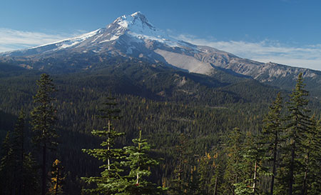
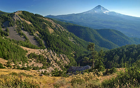
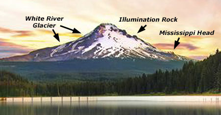
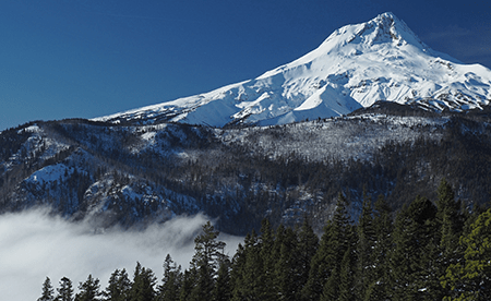
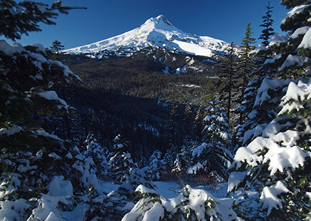
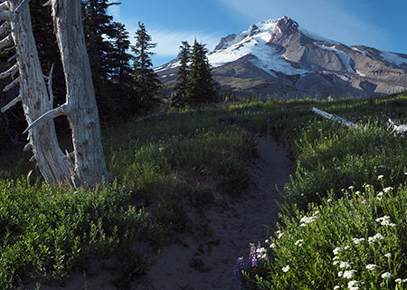
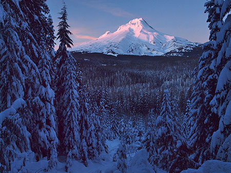
Mount Hood from Historic Bennett Pass Road

One of the many misconceptions about our national parks is that visiting means contending with the masses along crowded paved roads, with the only chance for solitude limited to trails that are beyond the abilities of many visitors, including the elderly, those with limited mobility or young families.

But the truth is that our national parks also feature some of the most stunning primitive backroads for those looking for a more accessible way to get off the beaten track.

One of the most spectacular is the Titus Canyon Road in Death Valley National Park, and the concept behind Titus Canyon has stuck in my mind since I first visited the park in the early 1980s.

One-Way Concept

bennettpassbackroad01

Titus Canyon: Yogi Bear does not drive here!

Titus Canyon Road begins east of Death Valley, at the near-ghost town of Rhyolite, climbs over 5,000 foot Red Pass, then begins a spiraling descent of nearly a vertical mile as it enters the increasingly narrow gorge of Titus Canyon. When the road finally emerges near sea level, from the east wall of Death Valley, the floor of Titus Canyon has shrunk to a point that two cars would not be able to pass.

bennettpassbackroad02

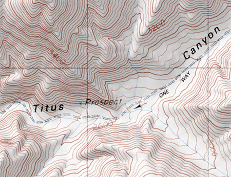
One-way trip to heaven… in Death Valley

This is where the genius of Titus Canyon Road comes in. The Park Service has designated this a one-way road, with traffic allowed only in the direction of Death Valley.

The physical constraint at the lower end of Titus Canyon is the determining factor, to be sure, but the broader effect is that one-way traffic provides a remarkably relaxing experience in which visitors can focus on the scenery, not dodging oncoming traffic. The one-way design also negates driving through clouds of dust from oncoming vehicles, a notable benefit on primitive roads.

bennettpassbackroad03

Titus Canyon narrows (and my 1980s Honda Civic, back in the day)

So, how does this relate to Mount Hood? Part of the Mount Hood National Park Campaign concept calls for repurposing some of the thousands of miles of failing, obsolete logging roads in the Mount Hood National Forest into scenic backroads or trails for hiking or biking.

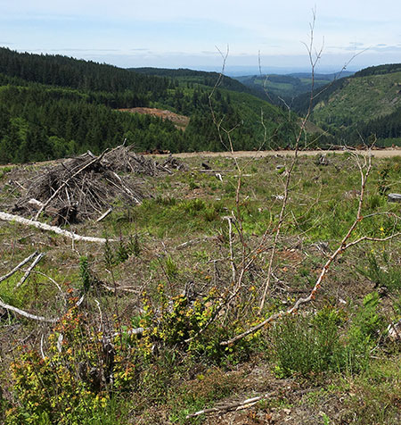
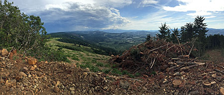
Most of these roads were constructed during the industrial logging heyday from the 1950s through the late 1980s, and were solely designed around clear cuts, not a concern for the respecting landscape or taking in the scenery.

But a few of these roads date back to an earlier era, when the first few roads connected major destinations in the new Mount Hood National Forest in the 1920s and early 1930s. These roads were often built without machinery, and subsequently follow the contours of the land in a way that roads from the industrial logging era rarely do.

Historic Bennett Pass Road

bennettpassbackroad04

Views into the remote Badger Creek Wilderness abound along historic Bennett Pass Road

One such historic forest road connects High Prairie and Lookout Mountain, located 8 miles due east of Mount Hood, to Bennett Pass, on the southeast shoulder of the mountain. For travelers of the Mount Hood Loop Highway, the old route follows the high ridges that form the wall of the East Fork Hood River valley, as you descend from Bennett Pass toward Hood River.

Today, the historic Bennett Pass Road is a bumpy, often grinding minefield to navigate. It’s hard to imagine that it was the main forest route when it was built, but it still passes some of the finest scenery in the area along the way, and has the potential to be an exceptional scenic backroad.

bennettpassbackroad05

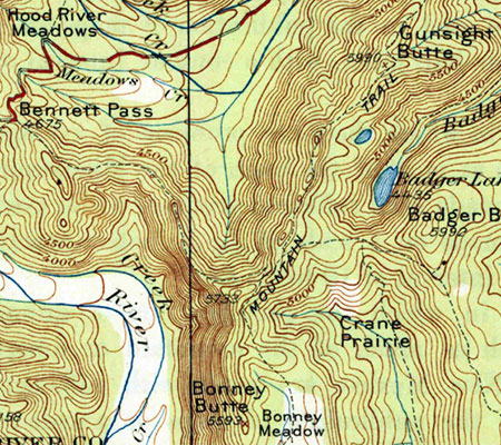
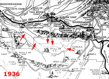
1920s map when the future Bennett Pass Road was still just a “mountain trail”

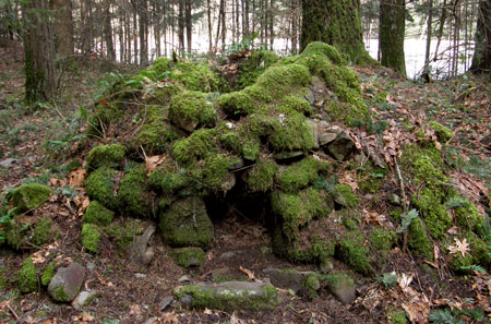
When it was built in the early 1930s, the historic road followed the route of an early forest trail along the ridge that connects Bennett Pass to a Forest Service guard station that once stood at High Prairie (if you know where to look, you can still find the ruins). The road was built by the Civilian Conservation Corps (CCC) in the early 1930s by crews based in Camp Friend, located to the east of Lookout Mountain, and just south of the town of Dufur. The Camp Friend crews also built several lookouts in the area and the historic road to Flag Point.

Today, the historic Bennett Pass Road serves as the western boundary for the Badger Creek Wilderness and the northern boundary for the White River Unit of the Mount Hood National Recreation area. This easy proximity to both of these protected areas brings a string of fine trail opportunities along the route for exploring nearby viewpoints, lakes and meadows on foot.

bennettpassbackroad06

Boulder Creek Valley and Echo Point in the White River Unit of the Mount Hood National Recreation Area from the historic Bennett Pass Road

The northern section of the historic Bennett Pass Road, from High Prairie to Dufur Mill Road, was bypassed and decommissioned in the late 1980s when the newer, gravel-surfaced road to High Prairie was constructed. For the purpose of the Bennett Pass Historic Backroad concept, this newer section is included in the proposal, with the Dufur Mill Road junction serving as the starting point for the backroad tour and Bennett Pass as the end point.

How would it be different?

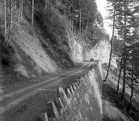
How would the Bennett Pass Historic Backroad differ from what is on the ground today? First, it would be one-way from High Prairie to Bennett Pass, the historic section of the original road that still survives. Like Titus Canyon, this portion of Bennett Pass Road has a few spots where passing an oncoming vehicle would by physically impossible – notably below Lookout Mountain and along a notorious stretch etched into a cliff known as the Terrible Traverse.

bennettpassbackroad07

Leaving the Terrible Traverse en route to Bennett Pass

But like Titus Canyon, the purpose of the one-way tour is mainly to allow for a greater sense of remoteness and ability to truly appreciate the rugged scenery along the way.

Second, the concept of a scenic backroad also includes ADA-compliant picnic and restroom facilities along the way to ensure that all visitors can enjoy the tour. As our population ages and our society becomes more socially inclusive of those with limited mobility, providing accessible alternatives for exploring our public lands has become a critical, largely unmet need.

Some of these facilities are already in place at existing trailheads and could be made accessible with modest improvements. Other spots along the route would need these basic improvements.

bennettpassbackroad08

Enjoying Mt. Jefferson and views into the Badger Creek Wilderness at 10 mph along the historic Bennett Pass Road

Finally, a 10-mph speed limit would ensure that the proposed Bennett Pass Historic Backroad tour remains focused on users looking for a relaxing, scenic way to enjoy the area. This means that OHV users accustomed to traveling at greater speeds would need to find other places to make noise and disturb other forest visitors — and besides, the Forest Service has set aside areas for OHVs elsewhere in the forest.

bennettpassbackroad09

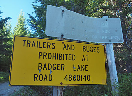
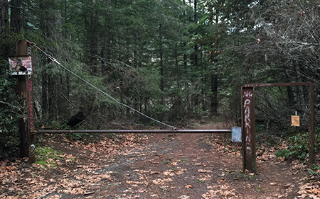
The faded (and assassinated) top sign warns passenger vehicles from venturing onto the historic Bennett Pass Road

Today, it’s hard to get much beyond 5-mph in many sections of the Bennett Pass Road due to a profound lack of maintenance, so a light upgrade to the surface and periodic maintenance is part of the concept. In the 1980s, I navigated Titus Canyon Road in a Honda Civic, and there’s no reason why a better maintained Bennett Pass Road couldn’t accommodate passenger cars traveling at 10 mph. That’s part of being inclusive, after all.

Signage is deficient or completely absent along much of the route today, so the backroad concept also calls for improved directional signage and occasional interpretive signage along the tour, as well. Interpretive signage could be as simple as mileposts that link to a downloadable PDF or podcast describing the rich natural and cultural history of the area.

The Bennett Pass Historic Backroad Tour

The full tour covers just over 14 miles, but at 10-mph with a few stops along the way, the Bennett Pass Historic Backroad tour would take the average family two or three hours to complete. Add an hour on each end to reach the tour from Portland, and this would make an exceptional choice for urban visitors looking for a new way to explore Mount Hood country.

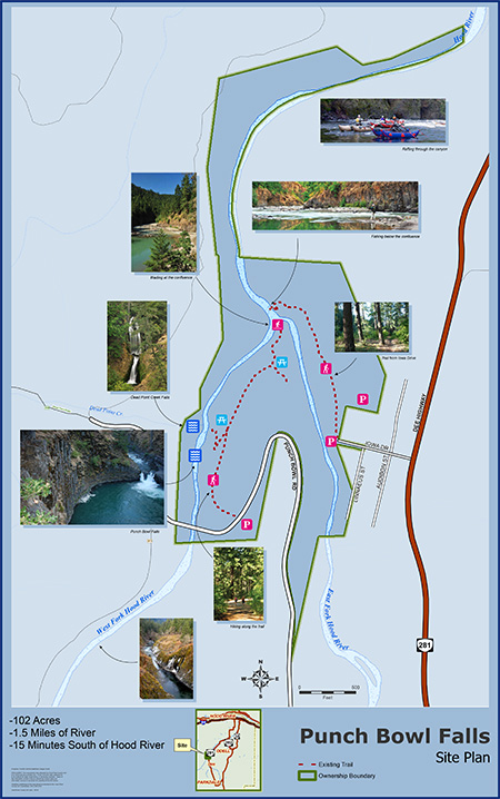
Here’s a tiny map of the concept:

bennettpassbackroad10

But by all means, please click here for a very large version of the map to see the details that make up this proposal.

Tour Description

0.0 to 2.8 mi. – Dufur Mill Road to Sunrise Rocks – The tour starts at gravel Lookout Mountain Road (Road 4410) where it begins on paved Dufur Mill Road (Highway 44), north of Lookout Mountain. This is the section of the route built in the 1980s to bypass a (now abandoned) portion of the historic road.

After climbing through forest and passing pretty Horkelia Meadow, this segment ends at the mostly unknown Sunrise Rocks, a fine, currently undeveloped picnic spot with a commanding view of Mount Hood, across the East Fork Hood River valley.

bennettpassbackroad11

The sprawling Mount Hood view from semi-secret Sunrise Rocks

The Bennett Pass Historic Backroad concept (see map) also calls for a new trail in the area, from the Little John winter recreation area to Sunrise Rocks, providing another way to enjoy this overlook for hikers looking for a challenge and a year-round purpose for the Little John trailhead.

bennettpassbackroad12

Sunrise Rocks from the Little John trailhead and parking area… someday a trail from here?

2.8 to 4.9 mi. – Sunrise Rocks to High Prairie – after taking in the view at Sunrise Rocks, the route continues for another 2 miles along the newer road section to High Prairie, a major destination for hikers and equestrians. Families looking for a picnic or short hike can explore the sprawling meadows here, or take the longer 5-mile loop to the airy summit of Lookout Mountain, where the view stretches up and down the Cascades and into the high desert country of Eastern Oregon.

bennettpassbackroad13

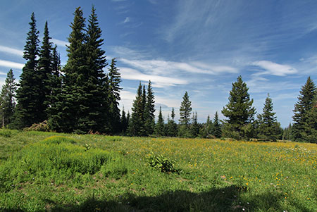
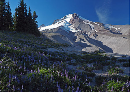
Acres of subalpine wildflowers and a maze of family-friendly trails await at High Prairie

4.9 to 7.2 mi. – High Prairie to Gunsight Ridge – two-way travel ends at High Prairie in the historic backroad concept, and from this point forward the tour would be one-way toward Bennett Pass along the surviving, original section of the historic Bennett Pass Road. The segment of original road from High Prairie to Gunsight Ridge is the most breathtaking on the tour, with huge views of Mount Hood and exposed sections where drivers will be gripping the wheel — and taking in the views.

bennettpassbackroad14

Sweeping Mount Hood views abound where the historic Bennett Pass Road skirts Lookout Mountain

Several scenic pullouts are located along this section, as well as a major trailhead at Gumjuwac Saddle, with trails heading in five directions! Hiking options from the saddle include longer trips to Badger Lake and Lookout Mountain, or the nearby Gumjuwac Overlook, just 0.8 miles from the saddle.

bennettpassbackroad15

Mount Hood after an early autumn snow from the Gumjuwac Overlook

The proposed Gunsight Ridge picnic area would be located at a large pullout above pretty Jean Lake, with access to the Gunsight Trail. Jean Lake can be visited via a family-friendly 0.6 mile trail that descends to the lake.

bennettpassbackroad16

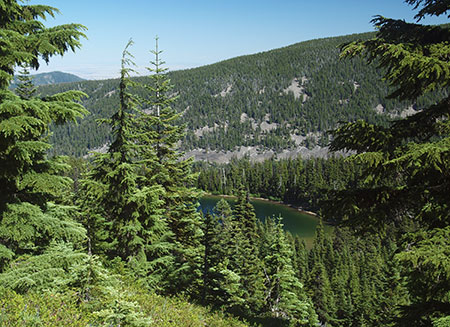
Pretty Jean Lake is a short forest hike from the historic Bennett Pass Road

7.2 to 9.0 mi. – Gunsight Ridge to Camp Windy – the short drive from Gunsight Ridge to Camp Windy is just below the ridge crest, with frequent views into the Badger Creek Wilderness, and later, into the White River unit of the Mount Hood National Recreation Area.

bennettpassbackroad17

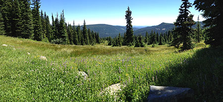
Expansive meadows at Camp Windy roll down the slopes of Gunsight Ridge

Modest picnic facilities and a vintage toilet already exist at Camp Windy, a lovely mountainside meadow, but new facilities would be needed as part of the scenic backroad concept. A short spur road here provides access to the Badger Saddle trailhead, and the 3.5-mile round trip hike to Badger Lake.

bennettpassbackroad18

Mount Hood from the Gunsight Ridge Trail

9.0 to 10.1 mi. – Camp Windy to Bonney Junction – From Camp Windy, the historic road continues to a 3-way junction with Bonney Meadows Road (Road 4891). The historic backroad concept calls for the Bonney Meadows route to function as a 2-way facility, allowing access to the Bennett Pass Historic Backroad at its midpoint, and for Bennett Pass visitors to make side trips to Bonney Meadows and Bonney Butte, just off the Bennett Pass tour.

bennettpassbackroad19

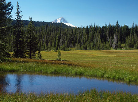
Peaceful Bonney Meadows with Mount Hood peeking over the ridge

Bonney Meadows already has a rustic campground perfect for picnics and exploring the nearby meadows. Families looking for something more challenging can make the 4.5 mile round-trip hike to exceptionally scenic Boulder Lake, or try a shorter hike to Bonney Butte, known for its raptor surveys. Bonney Meadows also has several developed campsites, so families could opt to camp here, midway through the tour.

bennettpassbackroad20

Lovely Boulder Lake

10.1 to 12.4 mi. – Bonney Junction to Newton Clark Overlook – from Bonney Junction, the historic Bennett Pass Road turns abruptly north and descends briefly before arriving at a catwalk section of road carved into the crest of the ridge. Here, the tour passes the Terrible Traverse, marked by an extraordinary rock gateway cut by the early road builders. This is the Titus Canyon equivalent for the Bennett Pass Road, as there is no room for passing (or error) along this section!

bennettpassbackroad21

The dramatic gates to the Terrible Traverse

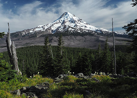
Just beyond the traverse, the road drops to a saddle with an excellent view of Mount Hood at the proposed Newton Clark overlook and picnic site.

bennettpassbackroad22

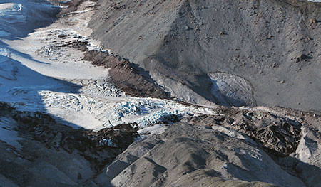
The Newton Clark Glacier and its enormous moraine from the proposed Newton Clark overlook

This spot is also one of several backcountry lodge locations proposed in the Mount Hood National Park Campaign to allow for Euro-style chalet-to-chalet trekking. These modest lodges would be rustic and quiet, along the lines of Cloud Cap Inn, and open year-round to also serve Nordic skiers and snowshoers.

bennettpassbackroad23

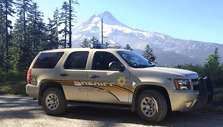
It turns out the Hood River County Sheriff digs the Newton Clark overlook, too (Courtesy Hood River Co.)

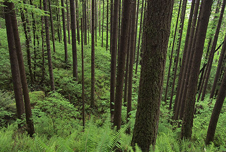
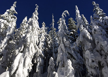
12.4 to 14.2 mi. – Newton Clark Overlook to Bennett Pass – from Newton Clark Overlook, the remainder of the route continues along the ridge top through handsome stands of noble fir to the large trailhead and parking area at Bennett Pass, ending the tour.

What would it take?

While some of the proposals featured in this blog are notably ambitions, this one is pretty simple, and could be accomplished in the near-term. The Forest Service would need to do some grading, add some gravel in some sections and step up maintenance of the historic Bennett Pass Road. Picnic and toilet facilities would need to be added in a few spots and new signage to help visitors navigate and appreciate the tour would be needed.

bennettpassbackroad24

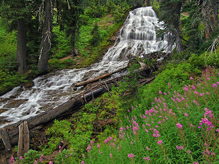
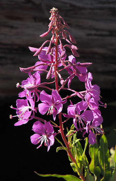
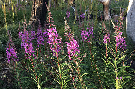
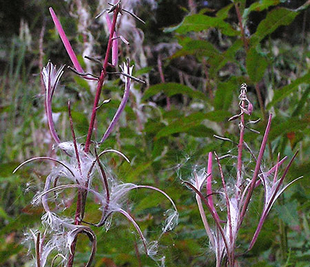
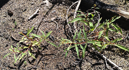
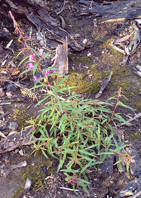
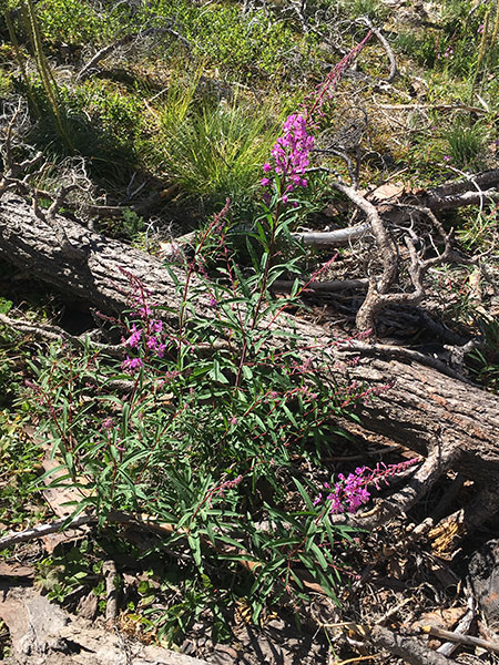
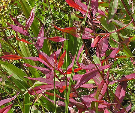
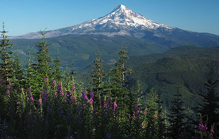
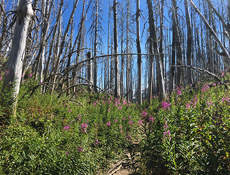
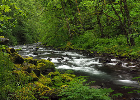
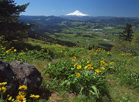
Wildflowers line the historic Bennett Pass Road in summer

Establishing a one-way route would be a taller order for the Forest Service, but there are already a few limited one-way routes along forest roads, so the idea is not without precedent. One obvious exception to a one-way rule is for emergency access, of course, but other visitors would probably appreciate the peace of mind in knowing they won’t meet another vehicle at the blind curve midway along the Terrible Traverse!

How to visit?

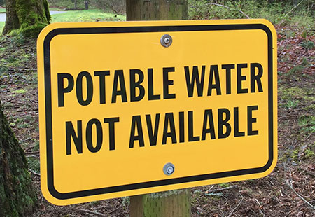
The good news is that you can visit the proposed Bennett Pass Historic Backroad today with a few considerations in mind:

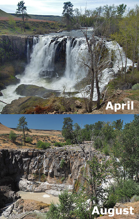
  1. The road is generally only open in summer, from mid-June through early October. The best time to visit is in July, when wildflowers are blooming throughout the tour, and the worst time is after heavy rain, when a few muddy sections might just swallow your vehicle.
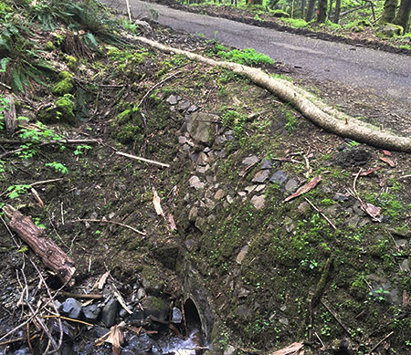
  1. Parts of the historic portion of the road are very, very rough. Until a Bennett Pass Historic Backroad brings some surface improvements and periodic maintenance to this old route, plan on a slow, sometimes jarring ride that will test your nerves, tires and suspension. High clearance vehicles with AWD or 4WD, only!
bennettpassbackroad25

This collage of scraped rocks on Bennett Pass Road is mute testimony to the folly of taking a passenger vehicle there – don’t try it!

  1. The roads are poorly signed, so you’ll need a forest map. I recommend the National Geographic map for Mount Hood National Forest in their Trails Illustrated series. Never trust a GPS device or smart phone to navigate forest roads!
bennettpassbackroad26

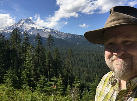
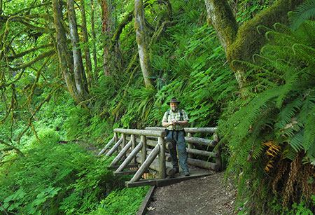
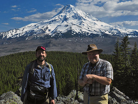
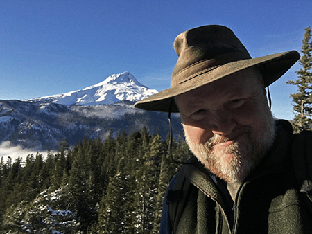
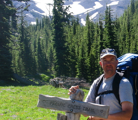
The author hanging out on the historic Bennett Pass Road

With these precautions in mind, the old Bennett Pass Road is fun to explore and always un-crowded.

Take it slow and enjoy the ride!

Warren Falls: A Postscript (Part 2 of 2)

hcrh_review01a

The first part of this article focused on the missed opportunity to restore Warren Falls as part of construction of the most recent phase of the Historic Columbia River Highway (HCRH) State Trail. This article takes a look at this newly completed section of trail.

_________________

hcrh_review01b

Congressman Peter DeFazio at the grand opening of the new HCRH segment in October (ODOT)

In October, the Oregon Department of Transportation (ODOT) opened the latest section of the HCRH State Trail, a segment stretching from the trailhead at the Starvation Creek wayside west to Lindsey Creek. A portion of this newest section follows the original highway grade where it passes Cabin Creek Falls, but most of the route is a completely new trail – or more accurately, a paved multi-purpose path open to both hikers and cyclists.


hcrh_review01c

The newly revamped Starvation Creek Trailhead

The new HCRH trail segment begins in a small plaza constructed at the south edge of the Starvation Creek wayside. Early plans called for a complete reconstruction of the parking area, but budget constraints intervened, and most of the work here is along the margins of the existing parking lot. The trailhead plaza features some to-be-installed interpretive signs in the shade of a group of bigleaf maple trees, a pleasant meeting spot for hikers or cyclists.

Missing from the revamped trailhead is the original Forest Service trailhead sign that once pointed to Warren Falls (below). It’s unclear if this sign will be reinstalled, but given that Warren Falls, itself, was not “reinstalled” as part of this project, the chances are probably slim.

hcrh_review01d

This sign has gone missing!

The sign actually referred to what is now called Hole-in-the-Wall Falls, where Warren Creek emerges from the diversion tunnel built by ODOT in 1939. The unintended reference to the original falls made for an inspiring Forest Service gaffe for advocates of restoring Warren Falls!

The first few yards of the new trail generally follows the existing route along the Starvation Creek wayside freeway exit ramp. It’s still a noisy, harsh walk through this area, but ODOT has dressed up this section with a sturdy cobble wall and new paving.

hcrh_review01e

Cobble retaining wall near Starvation Creek

The trail concrete barricades along this section that protect the trail from freeway traffic also feature the same decorative steel fencing found elsewhere on the HCRH State Trail, giving a bit more sense of separation from speeding vehicles. The new trail is also slightly elevated here, reducing the noise impacts somewhat from the old trail that was mostly at the ramp grade.

hcrh_review01f

Decorative steel fencing near Starvation Creek

Soon, the new trail drops to the only original section of Columbia River Highway on this restored section of trail, where the old road passed in front of Cabin Creek Falls. An elegant but confusing signpost has been added at the junction with the Starvation Ridge Cutoff trail, pointing to Gorge Trail 400, which currently does not exist in this section of the Gorge.

I didn’t hear back from ODOT as to whether a trail renumbering is in the works that would extend the Gorge Trail to Starvation Creek, but it may be that the Forest Service is planning to stitch together a extension of the Gorge Trail from pieces of the Starvation Ridge and Defiance Trails. That would be a welcome development!

hcrh_review02a

Trail 400..? Is a trail re-numbering in the works?

The location of the new sign almost suggests that the infamous Starvation Cutoff trail – one of the steepest in the Gorge – would be renumbered as the Starvation Ridge trail, with the bypassed section of the current Starvation Ridge trail becoming Trail 400.

Confused..? So are many hikers who visit the area with its already confusing trail network. So, keep your fingers crossed that the Forest Service is rethinking trail numbers and signage in conjunction with the new HCRH trail.

For now, the actual Starvation Cutoff Trail has not changed, though HCRH workers added a nice set of steps at the start of this very steep route.

hcrh_review02b

New steps at the otherwise humble Starvation Cutoff trailhead

The old pavement in this original highway section was resurfaced with new asphalt as part of the project, but otherwise the route here is much as it was when the highway opened in 1916, including a roadside view of Cabin Creek Falls. However, ODOT missed an opportunity to organize the hordes of visitors who now scramble to the falls along a cobweb of boot paths.

Formalizing a single spur with a properly constructed trail (below) would be a great project for a non-profit like [link]Trailkeepers of Oregon (TKO)[/link] in conjunction with Oregon Parks and Recreation (OPRD), who now manage the trail and adjacent park lands.

hcrh_review02c

Cabin Creek could use a formal path to the falls… and a new sign

[click here for a large version]

Cabin Creek Falls is popular with families (where kids can safely play in the basalt-rimmed splash pool) and photographers (who love this delicate, mossy falls). For many casual visitors, this is already the turn-around point on their walk from the trailhead, with Cabin Creek being the highlight of their experience, so a spur trail would be a nice addition to allow visitors to get off the pavement and explore a soft trail.

hcrh_review02d

Cabin Creek Falls up close

ODOT also cleaned out the large, stone culvert (below) where Cabin Creek flows under the HCRH State Trail. This display of original dry masonry was mostly buried in debris and undergrowth until the trail project was constructed, so the restoration provides a nice look at the craftsmanship of the original highway.

hcrh_review02e

Original dry masonry culvert survives at Cabin Creek

As the new trail route reaches the west end of the original highway section, ODOT thoughtfully place a small memorial (below) in the paving – a nice historic reference to the original highway.

hcrh_review03a

HCRH plaque marks the original highway route near Cabin Creek Falls

As the new route leaves the beautiful, forested section of original highway at Cabin Creek, it suddenly follows the freeway for about 200 yards due to steep slopes along the Gorge wall. This jarringly noisy section could use some replanting to at least create a visual buffer from freeway traffic.

hcrh_review03b

Noisy, barren stretch of the new trail west of Cabin Creek

Soon, the new HCRH route thankfully curves back into the forest on a surprisingly massive structured fill. This structure was required to maintain the modest trail grade as the route climbs from the freeway shoulder to a slight rise near Warren Creek.

This section is bordered with stained wood guardrails, a new design that departs from the vintage-style white guardrails in other sections of the restored highway, but provides a nice aesthetic that will also be easier to maintain.

hcrh_review03c

This large, structured fill west of Cabin Creek was required to maintain the trail grade for bicycles

This following view shows the same spot in July, at the height of construction, and before the fill was completed:

hcrh_review03d

Structured fill near Cabin Creek during construction last July

ODOT was careful to document cultural resources along the route when designing the new trail, including a set of stone ovens built by the original highway masons who camped here during highway construction in the early 1900s. The historic ovens are better protected than before by the raised trail design and guardrails (below), though still fully visible for those who know what they’re looking for.

hcrh_review03e

The historic stone ovens can be seen from the elevated trail section west of Cabin Creek… if you know where to look

One disappointing detail along this section of trail is a long gabion basket wall (below), apparently constructed to catch loose debris from an adjacent slope. The steel cages holding this wall together will hopefully be covered in moss and ferns in time, but for now it’s an eyesore on an otherwise handsome section of the trail.

hcrh_review03f

Would Sam Lancaster have approved of a wire mesh gabion wall..?

Another sore thumb in this forest section is a rusty mesh fence (below) along the freeway right-of-way that should have at least been painted, if not completely replaced as part of the project. Maybe ODOT still has plans to replace this eyesore?

hcrh_review03g

Nope, Sam Lancaster wouldn’t go for this…

As the new section of the HCRH State Trail approaches Warren Creek, it enters a significant cut section to maintain its gentle grade. Thankfully, a huge anthill along this section was spared, one of the interesting curiosities along the former soft trail that used to pass through this forest.

hcrh_review03h

Hydro-seeded cut slope and the big anthill near Warren Creek

This following view is from July, when construction was still underway and the ant colony was no doubt thankful for the protective fence:

hcrh_review03i

The giant anthill lives!

The view below was taken during the construction looks east at the cut section along the new trail. Because the rustic forest trail that once passed through this area was completely destroyed by the new HCRH trail, the reconfigured landscape will be a shock for hikers who hiked the trail in the past. Though hydro-seeded with grass, this section could benefit from some re-vegetation efforts to further speed up healing.

hcrh_review03j

The cut grade near Warren Creek under construction in July

Beyond the cut section, the new route crosses the original channel of Warren Creek, and for those with a sharp eye, a pair of cobble foundations for early homesteads that once lined the creek. Here, the trail reaches a half-circle bench where an all-access side trail curves up to the viewpoint of Hole-in-the-Wall Falls (more on that later in this article).

hcrh_review04a

Half-circle bench serves as the jump-off point to the Hole-in-the-Wall viewpoint

It’s unclear if interpretive signs will be added to this area, but at one time the story of how Warren Creek was diverted in 1939 was planned for the spot where the new trail crosses the old, dry creek bed.

Another new trail sign is also located at the all-access spur trail to Hole-in-the-Wall Falls, as this is also the route to the Starvation Ridge and Defiance Trails. This sign also includes a mysterious reference to Gorge Trail 400, further suggesting that a re-numbering of trails in the area is in the works. A large, multi-trunked bigleaf maple was also spared at this junction.

hcrh_review04b

Bigleaf maple spared… and another mystery reference to Trail 400..?

The following view is looking from the new HCRH State Trail toward the Hole-in-the-Wall spur trail, showing the proximity to Warren Falls. The green hydro-seeded area in the photo is where the construction staging area for the project, underscoring the missed opportunity to restore Warren Falls as part of the project – it was just a few yards beyond the staging area.

hcrh_review04c

So very close: Warren Falls from the main construction staging area

hcrh_review04d

Staging area during construction in July – the last time we’ll see heavy equipment this close to Warren Falls for generations?

The humble elderberry (below) in the middle of the staging area was spared by ODOT, a nice consideration in a project that did impact a lot of trees. Hopefully, there are plans to expand native plantings here, as this area was covered with invasive Himalayan blackberries for decades before the trail project and will surely revert to invasive species without a deliberate restoration effort.

hcrh_review04e

This apparently well-connected elderberry dodged the ODOT bulldozers!

Moving west, the new HCRH State Trail segment passes through another forested section where the trail rises on fill necessary to bring it to grade with a handsome new bridge over Warren Creek (visible in the distance in the view, below). This is an especially attractive section of trail.

hcrh_review05a

Looking west along the attractive new trail section approaching the Warren Creek Bridge

For some reason, many of the trees that were cut for this new section of trail were left piled along the base of the fill (below). The fill slope has been hydro-seeded, so it seems unlikely that the more work is planned to remove or repurpose the log piles, so apparently the were left in this manner on purpose?

hcrh_review05b

Piled logs along the elevated grade approaching Warren Creek Bridge

Looking back to the construction period last summer, you can also see the good work ODOT did to cut back English ivy that was rampant in this area. While ivy was left intact on the forest floor, it was cleared from dozens of trees in this section of the trail.

hcrh_review05c

Invasive English ivy was trimmed from dozens of trees near Warren Creek

The highlight of the new HCRH trail segment is where the route crosses Warren Creek. Here, a handsome new bridge faithfully echoes the design ethic of Samuel Lancaster, but is probably more elaborate than the original bridge constructed at Warren Creek in 1916. Lancaster’s bridge was destroyed when the first version of the modern highway was built in 1950.

hcrh_review05d

The handsome new Warren Creek Bridge is the jewel of the new trail segment

Though no visual record exists, the original Warren Creek Bridge was modest in length, at just 18 feet, and likely resembled the surviving bridge at Gorton Creek to the west, or possibly the original bridge at Viento Creek to the east (shown below).

hcrh_review05e

The original Warren Creek Bridge probably followed one of these designs

The design of the original Warren Creek Bridge inadvertently helped lead the Highway Department to bypass Warren Falls, as stream debris was clogging the bridge opening. The 1941 project files also describe the original bridge being “replaced in a different location” as part of the diversion project, so there may have been two version of the original bridge over Warren Creek before the modern highway was constructed in the 1950s.

hcrh_review05f

Warren Creek Bridge under construction in July

hcrh_review05g

Pavement texture samplers being tested for the project

hcrh_review05h

Looking west across the new Warren Creek Bridge

hcrh_review05i

Railing detail and the view downstream from Warren Creek Bridge

Construction of the new HCRH bridge over Warren Creek was an involved undertaking, with the surprisingly wide span leaving plenty of room for a (someday) restored Warren Falls to move 70+ years of accumulated rock and woody debris down the stream channel.

hcrh_review05j

Built to last, with plenty of room for Warren Creek to once again move rock and log debris down its channel… someday…

There’s nothing natural about Warren Creek in this area, as it looks (and is) more like a drainage ditch. This is because original streambed is now a dry ravine several hundred yards to the east, and the current streambed is where the Highway Department moved the creek decades ago, when the modern highway was first built in the 1950s.

hcrh_review05k

Ditch-like, man-made channel of Warren Creek as viewed from the new bridge

As described in the first part of this article, the someday restoration of Warren Falls will once again allow rocks and woody debris to migrate into the lower channel, eventually transforming the “ditch” into a healthy stream (below) that can fully support endangered salmon and steelhead.

hcrh_review05l

What a healthy Warren Creek might look like from the bridge, someday…

[click here for a larger version]

While ODOT missed the larger opportunity to help this stream restoration along when it declined to restore Warren Falls, the agency also missed the easy opportunity to simply add a few boulders and logs to the section of Warren Creek near the bridge when heavy equipment was in the area. That’s too bad, but perhaps the OPRD will someday enhance this stream section as part of managing the new trail.

hcrh_review06a

Looking west from near the Warren Creek Bridge to the Lancaster Falls viewpoint

From Warren Creek, the new trail follows another fill section to a mostly obstructed viewpoint of Lancaster Falls on Wonder Creek from a small seating area. This viewpoint (below) could use some light pruning to reveal the falls, and perhaps something that’s still in the works by OPRD.

hcrh_review06b

Lancaster Falls viewpoint

One oddity about Wonder Creek is that it mostly disappears into ground before reaching the culvert that carries Warren Creek under I-84 and to the Columbia River. This is partly due to the modest flow from spring-fed Wonder Creek, but also because the slopes below the falls are mostly composed of unconsolidated talus covered with a thin layer of soil and vegetation. So, most of the time the stream is simply absorbed into the water table below the falls.

Yet, in high runoff periods, the new state trail will accommodate the flow with extensive drainage features designed to carry Wonder Creek under the fill section and to the Warren Creek freeway culvert.

hcrh_review06c

Trail construction near the Lancaster Falls viewpoint in July

hcrh_review06d

Lancaster Falls viewpoint under construction in July

Another oddity of Lancaster Falls is its illusive nature. Though thousands of hikers each year view the modest, 20-foot lower tier of the falls where it spills across the Defiance Trail, few know of it’s full extent – and perhaps wonder why Samuel Lancaster wasn’t honored with a more spectacular landmark.

This is the view (below) of Lancaster Falls that most hikers see today, and this this is also the portion of the falls that can be glimpsed through the trees from the new HCRH trail viewpoint:

hcrh_review06e

Lancaster Falls as most know it, along the Defiance Trail

But viewed from across the Columbia River, along Washington’s Highway 14, Lancaster Falls takes on a completely different scale. This view shows the lower 20-foot tier that most know as “Lancaster Falls” completely dwarfed by the towering 300-foot extent of the falls:

hcrh_review06f

The full extent of Lancaster Falls as viewed from the Washington side of the Columbia

While it’s possible to scramble to the base of the main tier of Lancaster Falls, the slopes are unstable and already being impacted by off-trail visitors, so it’s probably best that only a most portion of the falls is (somewhat) visible from the new HCRH route. Hopefully, interpretive signage is in the works for the viewpoint that tells the story of Samuel Lancaster..?

hcrh_review06g

1920s view of the HCRH from Lindsey Creek looking toward Wind Mountain

From the Lancaster Falls viewpoint, the new trail heads west to a section where it once again follows the shoulder of I-84 to Lindsey Creek and the end of new construction. ODOT is working the next trail segment, which will connect from Lindsey Creek to the Wyeth Campground, crossing the base of famously unstable Shellrock Mountain along the way.

Hole-in-the-Wall Falls Spur Trail

hcrh_review07a

Original concept for the Hole-in-the-Wall Falls viewpoint

One of the design highlights of the new HCRH trail section is a short all-access spur tail to an overlook of Hole-in-the-Wall Falls, the man-made outflow tunnel that continues to drain Warren Falls of its water. The completed overlook has been scaled back from its original design (shown above), and now features one of the signature circular seating areas, complete with a picnic table (below).

hcrh_review07b

Hole-in-the-Wall Falls viewpoint

A small plaque at the viewpoint identifies Hole-in-the-Wall Falls, which until now has not been an officially recognized name or has appeared on any official maps. A nice nod to the origin if the “falls” is the byline “Created 1939”. Hopefully, there will be future interpretive displays here, as the story of Warren Falls would be a great addition to this overlook.

hcrh_review07c

Hole-in-the-Wall Falls viewpoint

hcrh_review07d

Hole-in-the-Wall Falls plaque

hcrh_review07e

Hole-in-the-Wall Falls viewpoint under construction in July

The Starvation Ridge Trail picks up from the south side of the Hole-in-the-Wall Falls overlook, heading across a footbridge over Warren Creek.

A closer look near the footbridge (below) reveals a surprising disappointment: the stump of a streamside Douglas fir cut improve the view of the falls. It’s too bad that the tree wasn’t simply limbed to provide a view, as it was one of the few larger trees stabilizing the banks of Warren Creek.

hcrh_review07f

Hole-in-the-Wall Falls bridge… and stump?

hcrh_review07g

Unfortunate remains of the offending Douglas fir along Warren Creek

While it’s disappointing to think about the opportunities missed at Warren Falls, the Hole-in-the-Wall Falls overlook and beautiful new Warren Creek Bridge, are still a big a step in the right direction toward someday moving Warren Creek from neglected afterthought to a valued resource that deserves to be restored. ODOT deserves major kudos for their thoughtful work on this section of trail!

“Love what they’ve done with the place…”

hcrh_review08a

Heavy construction of the new “trail” in July looked more like a road to many hikers

Last summer I encountered another hiker while surveying the progress of the new HCRH trail in the Warren Creek area. He was making his way to the Defiance Trail, and when he saw me taking photos, shouted angrily “Love what they’ve done with the place!”

I’ve heard this reaction to the State Trail from many hikers over the years, as avid hikers are often aghast at what they see as more of a “road” than trail. The scope of construction impacts on the natural landscape of the Columbia River Gorge National Scenic Area (CRGNSA) and the millions in public funds being spent on the project rankles hikers who don’t see themselves actually using the trail.

Many hikers are also mystified as to how this project can received tens of million in funding while other, heavily overused Gorge trails are falling apart for lack of adequate funding.

hcrh_review08b

Extensive cut and fill necessary to maintain trail grade meant a wide construction swath

These reactions are understandable, if misguided. The restoration of the surviving HCRH and the future trail segments that will soon complete the original route from Troutdale to The Dalles is an epic effort of ambition and vision in an era when both are rare quantities.

When the route is completed, it will become a world-class cycling attraction, and it is already drawing visitors from around the world. Guided bicycle tours have become a thriving business in the Gorge because of ODOT’s commitment to bringing the HCRH State Trail vision to reality, and businesses in Gorge towns are already seeing the benefits.

Other projects to promote the trail are also in the works. ODOT’s Gorge Hubs project is a new partnership with six cities in the Gorge to provide traveler information for trail users and boost the local economy. The Friends of the Gorge have launched the Gorge Towns to Trails project, a complementary effort to the HCRH State Trail to connect Gorge communities to public lands via trails.

hcrh_review08c

Tourism in the Gorge is as old as the historic highway, itself. This is the Lindsey Creek Inn that once stood where the newly completed HCRH State Trail approaches Lindsey Creek

Plenty of local visitors will continue to use the HCRH State Trail as the project nears completion over the next few years, but the real benefit for Gorge communities is from visitors coming from outside the region. Unlike local visitors, tourists coming from elsewhere will book hotel rooms, purchase meals and take home locally-made products and art from the Gorge to memorialize their trip. These visitors make a much larger contribution to the Gorge economy than a local visitor who might stop by a brewpub on the way back from a day trip.

hcrh_review08d

Gorge sunset from near Starvation Creek along the newly completed HCRH State Trail

A 2011 National Park Service study of tourism dollars shows outside visitors spending anywhere from 7 to 12 times the amount that local visitors spend on a visit to a given park, bringing hundreds of millions to local economies at many parks. There’s no reason why the Gorge can’t better manage the our already heavy demand from local visitors to the Gorge to allow for more outside visitors drawn by the HCRH State Trail to spend their dollars here.

The bigger picture is that anyone opposed to seeing casinos or bottled water plants in the Gorge should be part of supporting a tourism economy that builds on the scenery. Yes, tourism impacts must be managed to protect the Gorge for future generations, but the health of the Gorge economy is the essential ingredient to providing these protections over the long term.

The HCRH State Trail is part of that formula, and it deserves enthusiastic support from anyone who loves the Gorge. If you own a bicycle (or pair of walking shoes), give it a try — and then recommend it as an exciting new vacation destination to distant friends and family!

Warren Falls: A Postscript (Part 1 of 2)

warrenfallspostscript01

Warren Falls lives! Well, on a few days each year, after heavy rainfall…

The campaign to restore Warren Falls in the Columbia River Gorge is over, at least for now.

The Oregon Department of Transportation (ODOT) is putting the final touches on the latest section of the Historic Columbia River Highway (HCRH) State Trail, from Starvation Creek to Lindsey Creek (more on that in part two of this article), and undoing their diversion tunnel at Warren Falls was not part of the deal.

While Warren Creek now has an especially handsome bridge on the new state trail, the dry cliffs of beautiful Warren Falls (below) will continue to be a ghostly testament to the arrogance and carelessness of our modern age – except on those rare stormy days each winter when the falls briefly reappears (above).

warrenfallspostscript02

Warren Falls as it exists most of the time… for now…

Restoring the falls would have been the perfect companion to the HCRH State Trail project, itself an epic restoration project. Samuel Lancaster would surely have approved, too. It was a once in a century opportunity to do the work while heavy equipment was right in front of the falls. But if fighting City Hall is an uphill battle, then the castle walls at ODOT are still more foreboding.

The agency isn’t a monolith. There was encouragement and support from sympathetic professionals at ODOT along the way, albeit plenty of opposition from others. In the end, the agency formerly known only as the Oregon Highway Department revealed its roots, reluctant to step beyond its narrow right-of-way.

And yet the Historic Highway State Trail project, itself, is a bold step forward from simply building highways, and one the agency has been truly committed to. Thus, I’m hopeful about ODOT’s future, and the new state trail has much for us to be proud of.

warrenfallspostscript03

So very close… but not this time…

[click here for a larger view]

Perhaps most disappointing is ODOT’s lack of ownership and sense of responsibility for a stream diversion project that today would be considered a crime against nature. Even when Warren Creek was diverted and the falls destroyed in 1939, it was jarringly at odds with the vision and reverence for the landscape of Samuel Lancaster’s Columbia River Highway, and should have sent up red flags for the Highway Department.

Still more astonishing was learning during the course of this project that none other than Conde McCullough – engineering deity to many as the designer of Oregon’s most treasured highway bridges of the 1920s and 30s – signed off on the diversion project while serving as chief engineer!

Worse, we also learned along the way that it was completely illegal to destroy the falls, even back in 1939, as revealed in this article on the blog.  Oregon wasn’t a very big place back then, so it’s hard to believe the law protecting the falls went unnoticed at the time… but the truth on that point will likely never be known.

warrenfallspostscript04

Warren Falls flows briefly in 2015

Perhaps the greatest irony in the Warren Falls saga is that the original diversion project was designed to protect one the bridges on Sam Lancaster’s famous new road – by destroying one of the more spectacular waterfalls along the route. Lancaster died in March 1941, so it’s doubtful that he was even aware of the project as it moved forward in 1939. Let’s hope so, anyway.

Today, the crumbling diversion dam and tunnel are still listed as “assets” by ODOT, but are really just orphans, and now all but forgotten by the agency for the foreseeable future. Short of Oregon Parks and Recreation (OPRD) taking on the decommissioning as part of some sort of larger Warren Creek restoration project, the most likely outcome is continued deterioration of the diversion structure until nature finally reclaims it.

So, the campaign to restore Warren Falls is over… or is it?

Postscript… and premonition?

After years of attending meetings, writing letters, giving tours to all manner of advocates and officials and even a segment on OPB’s “Oregon Field Guide”, there weren’t many stones left to turn in coaxing ODOT to bring Warren Falls back to its original glory. On the surface, there’s very little to show for the effort.

But is that really true? It depends on how you define victory.

warrenfallspostscript05

OPB crew at Warren Falls in 2012

Yes, in the immediate future ODOT will continue to treat Warren Creek like a glorified storm culvert, and the former Warren Falls will continue to be a depository for “trash” (what the original engineers called the rock and woody debris we now know are essential to a stream health) separated from the creek’s flow. That’s a shame, and a missed opportunity for the agency to show that it has evolved from its “Highway Department” past.

warrenfallspostscript06

OPB crew above Warren Falls in 2012

But over the past five years, tens of thousands of people have learned the story of Warren Falls thanks to the OPB coverage, thousands more have viewed the WyEast Blog stories here and on the Restore Warren Falls Facebook page, and hundreds have visited the falls site, with more making the side trip each year to pay homage to what once was – and will be, again.

Until they see the silent cliffs where Warren Falls once flowed, most of these visitors have no idea that today’s Hole-in-the-Wall Falls is simply a man-made attraction that came at the cost of destroying Warren Falls. Armed with the history of Warren Falls, few who visit can view it as anything less than an environmental tragedy.

So, despite losing this round, Warren Falls has a lot of new friends, and a lot of people who love the Gorge have gained a better understanding of the lasting cost of “progress” and the chore of undoing our handiwork, even in places we seek to protect most.

Which brings me to…

(Not so) Secrets of the Monkey Wrench Gang…

Oh, how I wish I could share all of the schemes for liberating Warren Falls that have come my way over the past five years! They range from temporary performance art to more permanent alterations that would probably be illegal… if any governing entities were actually concerned about the fate of Warren Falls.

Still more surprising is the range of Monkey-Wrench-Gang-wannabes who proposed taking the restoration of Warren Falls into their own hands: you’ll just have to use your imagination, but some were rather prominent folks who left me speechless with their audacious plans.

So, I’ll share a few highlights, with the strict caveat from the WyEast Blog Legal Department:

NONE OF THESE ACTIVITIES APPEARS TO BE LEGAL, at least not without prior permission from the OPRD or ODOT (and good luck with that, by the way), and therefore the following DOES NOT CONDONE OR ENDORSE these ideas in any way!

Whew. Okay, well one of the most popular schemes is to roll plastic tarps over the giant “trash rack” that forms the screen over the Warren diversion tunnel. This would allow the pristine waters of Warren Creek to ride a plastic liner above the tunnel and over the natural falls. Sort of a giant slippery-slide, but with a real surprise at the end!

warrenfallspostscript07

The massive “trash rack” that turned Warren Falls dry in 1939

Someday (on my deathbed, or possibly at the dedication of a restored Warren Falls?) I may reveal an especially prominent individual who personally pitched a version of the slippery slide to me – truly, one of the more unexpected twists in this five-year saga!

Most versions of the slippery slide focused on getting a really good look at what an unaltered Warren Falls looked like via a temporary restoration. But Warren Creek gets pretty wild and wooly in winter, so this would likely be a very brief restoration.

There’s also the question of what would happen to the tarps, once swept away, as there is a lot of potential for adding more man-made junk to an already defaced stream (assuming the tarps didn’t get hung up on the cliffs or left hanging form the outflow to Hole-in-the-Wall Falls).

warrenfallspostscript08

OPB’s Michael Bendixen filming the “trash rack” above the brink of Warren Falls in 2012

Others suggested (WyEast Blog Legal Department repeat notice: not condoning this!) speeding up the “weathering” process that has already begun to expose and compromise the steel beams that form the “trash rack” at the top of the falls.

It turns out that in just the ten years since I’ve been advocating to restore the falls, this part of the diversion has shown noticeable deterioration, and seems to be speeding up. It turns out the top of the “trash rack” is the weakest point in the design, and is steadily unraveling. So, I’m not sure Mother Nature needs much help at this point, despite the enthusiastic volunteers out there.

warrenfallspostscript09

OPB’s Michael Bendixen on top of the “trash rack” that rests on a cobble dam that is gradually eroding away

These photos show the vulnerability of the steel “trash rack” beams where the mortar that once fully embedded them above the diversion tunnel has been significantly compromised since 1939 by the relentless flow Warren Creek:

warrenfallspostscript10

A closer look at the lip of the “trash rack” showing the masonry cap on the cobble dam

warrenfallspostscript11

The masonry cap has worn thin where it anchors the top of the “trash rack” and a small garden flourishes where debris has clogged the giant grate

warrenfallspostscript12

Creative types see an opportunity to speed up the demise of the “trash rack” where these steel beams are almost freed from the concrete cap by weathering

The motive for speeding up the release of the beams varies among schemes and schemers.

One version is to allow enough stream material to pass under the protective “trash rack” to plug up the surprisingly narrow diversion tunnel leading to Hole-in-the-Wall Falls. Which is just 60” in diameter. This is probably what Mother Nature has in mind, though it may take awhile.

Another angle on speeding up the weathering at the top of the steel beams is to allow larger debris (logs, large rocks) to wedge between the beams, thus acting as levers to literally tear it apart with hydraulic pressure during high stream flow. To a large extent, this is already happening, as at least half the rack is plugged with smaller cobbles that are twisting and bending the steel beams with the effects of freeze and thaw during the winter months.

warrenfallspostscript13

Vince Patton from Oregon Field Guide inspecting the access vault on the west end of the “trash rack”

At least one Warren Falls fan spotted the open vault above the west end of the diversion structure and suggested diverting the creek into this hole (WyEast Blog Legal Department reprise: this is not an endorsement! Plus, you might fall into a tunnel that spit out as a man-made waterfall!), where it could move debris large enough to plug the bypass tunnel. I’m not positive, but I think solid basalt prevents this from happening – either through creative monkey-wrenching or courtesy Mother Nature. But I was impressed at the attention to detail from those who love Warren Falls!

As much as I enjoyed hearing these inspired pitches for a DIY restoration of Warren Falls, one of the reasons I advocated for removing the “trash rack” structure and filling the bypass tunnel in an orderly way was to avoid having a bunch of steel debris entombed at the lip of this beautiful falls. I’d still much prefer a thoughtful decommissioning of the diversion over a disorganized mess – whether triggered by humans or nature.

We owe it to future generations to do this right. And who knows, we may still get the chance!

What the Future Holds: Warren’s Cousins

Short of an unforeseen intervention, the restoration of Warren Falls by forces of nature will take awhile. But it turns out that Warren Falls has some similarly trod-upon cousins in the area who have suffered flagrant abuse, then been abandoned to recover on their own.

The good news: in all cases, nature is winning… albeit, very slowly.

warrenfallspostscript14

White River Falls needlessly goes dry each summer, thanks to a derelict Pacific Power diversion that sends the river around the falls (visible dropping in on the right).

A spectacular example is White River Falls, located in a state park by that name on the east side of Mount Hood. The falls is just upstream from the confluence of the White River with the Deschutes River.

More than a century ago, the Wasco Milling Company diverted much of the falls to a giant pipeline that fed a powerhouse downstream. Energy from the powerhouse was transmitted to The Dalles. Wasco Milling later sold the plant to Pacific Power, and it was finally shut down in 1960, when the land was transferred to the state of Oregon.

Pacific Power left quite a mess behind. The abandoned power plant, numerous pipelines and the diversion dam all still survive on state park land today. During high runoff in winter and spring the diversion channel is overwhelmed, and the former glory of White River Falls is on display. But by late summer, the entire flow is still diverted into the bypass channel, tumbling around the falls where the diversion pipe once existed.

warrenfallspostscript15

The derelict diversion channel at White River Falls

In this way, the situation at White River is not unlike present-day Hole-in-the-Wall Falls burping out of the Warren Falls bypass tunnel where it once connected to a flume that carried the creek over the old highway and to the Columbia River.

And like Warren Falls, the bypass channel “falls” at White River is a sad, ugly duckling compared to the magnificent original falls. But while there is no plan to formally decommission the diversion at White River Falls, the approach to the diversion dam is increasingly clogged with silt and debris, and should eventually fail, finally closing the chapter on the Wasco Milling Company era.

A few years ago, I reported on a now-scrapped scheme by Wasco County officials to reboot the White River generating plant, proving once again the wise words of John Muir: “Nothing dollarable is safe.” Even in an Oregon state park, it turns out.

A closer cousin to Warren Falls is popular Bridal Veil Falls, located at the far west end of the Columbia Gorge. Though few of the thousands of visitors who hike to the base of Bridal Veil Falls each year can even imagine what this spot looked like just a few decades ago, it was one of the most heavily degraded areas in the Gorge.

warrenfallspostscript16

The lower tier of famous Bridal Veil Falls was altered for mill operations! Who knew?

The mill town of Bridal Veil was once located just 100 yards below the falls, though the town is now nothing more than concrete foundations and rusted cables covered in moss and undergrowth. In this eastward view (below) from the early 1900s, today’s Bridal Veil exit from I-84 to Multnomah Falls would be located near the buildings at the far end of the mill town.

warrenfallspostscript17

The mill town of Bridal Veil in the early 1900s

The pile of rough-cut timber in the foreground marks the terminus of log flumes that fed the Bridal Veil mill. At least three timber flumes carried logs and rough lumber to the mill from the slopes of Larch Mountain. One flume closely followed Bridal Veil Creek with the kind of roller coaster ride theme park “log rides” have tried to replicate ever since.

In the scene below (from about 1900) the audacious scale of the flume is evident as it courses down the canyon, about a mile above Bridal Veil Falls, and just below Middle Bridal Veil Falls. The area had already been heavily logged by this time and the stream was viewed as nothing more than a steady water source and convenient path for moving old-growth timber to the mill.

warrenfallspostscript18

The main flume followed a ravaged Bridal Veil canyon to the mill

This view (below) of the converging flumes coming into the mill site conceals Bridal Veil Falls, which is located directly beneath the flumes. Today’s trail to the falls would have travelled under all three flumes where they converge in this scene.

warrenfallspostscript19

Flumes over Bridal Veil Falls (the falls is located directly below the flumes)

Bridal Veil Falls not only had a trio of log flumes passing overhead, the falls itself was also modified by the mill, presumably to carry water to the mill (though this is just my own speculation – I’d love to hear from mill historians who know more about this!)

The photo below shows the falls in the late 1800s, just before the lower tier had been raised about 15 feet, creating a pool below the upper tier and allowing for a diversion structure (?) to presumably carry a piped portion of the creek to the nearby mill.

During periods of low water today, you can still see parts of the diversion structure at Bridal Veil Falls poking from the water (below).

warrenfallspostscript21

Lower tier of Bridal Veil Falls as it exists today

Here are detailed views of the diversion structure that raised the lower tier of Bridal Veil Falls to what we see today:

warrenfallspostscript22

A closer look at what seems to be a cobble dam that raised the height of the lower tier of Bridal Veil Falls…

warrenfallspostscript23

…and a still closer look…

This rare view from the early 1900s shows the diversion structure already in ruins or perhaps under construction? In either case, its purpose only lasted a short period, and in this way the falls is a kindred spirit to Warren Falls, where the short-lived diversion functioned for barely a decade before becoming obsolete and abandoned.

warrenfallspostscript24

The cobble dam shortly after construction… or perhaps after it was abandoned?

Today, there are still a lot of concrete and steel reminders of the mill town, though they’re often hidden in plain sight, under layers of rust, moss and ferns. For example, this view (below) of the stream below Bridal Veil Falls reveals a “boulder” that is actually a concrete footing and an intake pipe for one of the mill ponds.

warrenfallspostscript25

Mill relics hiding under moss at Bridal Veil Falls

Other large waterfalls on Bridal Veil Creek were impacted by the mill operation, but have recovered dramatically in the decades since the mill finally closed in the 1960s. Here are then-and-now photos of Middle and Upper Bridal Veil Falls:

warrenfallspostscript26

[click here for a larger version]

warrenfallspostscript27

[click here for a larger version]

In more recent years, stolen automobiles have periodically been pushed from the cliffs along historic Palmer Mill Road into Bridal Veil canyon. Some of these dumped vehicles have been pulled from the canyon, but others are too difficult to reach, and are slowly fading into the forest.

While they have undoubtedly released engine fluids into the creek and have plastic parts that will last for decades, nature and Bridal Veil Creek are nonetheless making short work of the rest of these vehicles.

warrenfallspostscript28

Moss and ferns consuming a dumped Hyundai Santa Fe just above Upper Bridal Veil Falls (photo courtesy Jamen Lee)

Unlike Warren Falls, the waterfalls on Bridal Veil Creek were never completely diverted from their natural streambed, yet the overall impact of logging and milling at Bridal Veil had a much larger impact on the larger watershed than anything Warren Creek endured. The fact that Mother Nature has consumed most of what wasn’t salvaged when the flumes were pulled from Bridal Veil canyon in the mid-1900s is an inspiration for the ongoing recovery of Warren Falls.

In time, all traces of our impact on the environment really can heal – provided we allow it to happen. Responsibly cleaning up after ourselves would be a more noble path, of course, but at least nature seems to forgive us in time… so far.

Warren Falls Lives!

warrenfallspostscript29

False alarm! Horsetail does look a lot like Warren Falls, though…

A few weeks ago, the local waterfall hunting community had a brief moment of excitement when a vintage 1918 film seemed to include a rare view of Warren Falls! But after looking more closely at the images, it turned out to be Horsetail Falls in very low flow. So, the hunt for a photograph of Warren Falls before the 1939 diversion project continues.

But the similarity was real, so the following is a rough guess of what we might see – and perhaps, sooner than we think: Warren Falls flowing again, returning its amazing amphitheater to mossy green, as the diversion structure continues to crumble into history.

warrenfallspostscript30

For waterfall devotees, this is Horsetail Falls superimposed on Warren’s dry cliff with the reversed base of Dry Creek Falls providing the foreground.

[click here for a large version]

Of course, we already know what a small amount of flow over Warren Falls looks like during high runoff events, as shown in previous photos in this article. What we don’t know is what the full force of Warren Creek might look like coming over this 120-foot escarpment, and especially what it might do with 77 years of accumulated stream debris piled at the base of the natural falls.

We have a pretty good idea, though, based on recent dam removals around the Pacific Northwest. It turns out that streams are surprisingly quick to redistribute accumulated debris and restore themselves to their natural stream state, as we’ve seen with dam removals on the Hood, Little Sandy and White Salmon rivers.

Today, Warren Creek below falls has been reduced to ditch, radically moved by ODOT from its former channel in the 1950s and devoid of the rocks and woody debris essential to a healthy stream since 1939, thanks to the “trash rack”.

warrenfallspostscript31

Add some rocks and logs to lower Warren Creek and it might look like this someday

[click here for a large version]

When Warren Falls returns, the huge pile of stream debris will begin to move downstream, and the debris-starved lower section of Warren Creek will develop the pools and eddies necessary for salmon and steelhead to spawn, as imagined above.

The good news is that the new HCRH State Trail passes high and wide over Warren Creek, ensuring that the creek can evolve back to a natural state in the future without a redux of the 1930s highway impacts that led to the diversion of Warren Falls.

When will Warren Falls return? Not just now… but perhaps sooner than we think.

Meanwhile, we wait… and watch.

_____________________

(Part two of this article will focus on a review of the newly completed Historic Columbia River Highway State Trail segment from Starvation Creek to Wonder Creek, and passing Warren Falls)

_____________________

 To revisit the complete history of the Restore Warren Falls project, here are earlier WyEast blog articles on the subject:

 An Overdue Warren Falls Update (and a bombshell!)

“Warren Falls Lives… Again?”

Warren Falls Solutions

“Warren Falls, we’re ready for your closeup…”

 Warren Falls Mystery… Solved!

Restoring Warren Creek Falls

_____________________

Warren Falls on Oregon Field Guide

_____________________

Restore Warren Falls on Facebook!


Fireweed: a rose by any other name..?

Fireweed01

Fireweed frames Umbrella Falls on the East Fork Hood River

Somewhere in the long history of botanical naming slander was committed, as the common name “Fireweed” was given to one of the most beautiful and useful plants found in our forests – and around the world. Thus, the noble Fireweed (Chamerion angustifolium) comes to be associated with notoriously invasive plants like Horseweed, Bindweed, Chickweed, Tumbleweed and Pigweed!

But Fireweed is anything but a weed, at least by the most common definitions:

weed  (wēd) noun

A plant considered undesirable, unattractive, or troublesome, especially one that grows where it is not wanted and often grows or spreads fast or takes the place of desired plants.

To the contrary, Fireweed is a widespread native in northern latitudes, growing from sea level to timberline in a remarkable range of habitats. The common name is half-right, as Fireweed is among the first and most prolific plants to return to burned areas, performing an essential role in stabilizing soil and providing shade for other flora to gradually return. Fireweed is equally at home in moist meadows, forest margins and wherever the ground has been disturbed by human or natural activity.

Fireweed02

Fireweed has carpeted the 2011 Dollar Fire on the north slopes of Mount Hood

The string of fires over the past decade on the east and north slopes of Mount Hood have brought a sea of brilliant Fireweed blossoms to the mountain each summer. Fireweed spreads readily by seed, but are hardy perennials, so they provide years of soil stabilization once established in burned forests or disturbed areas.

Fireweed blossoms are spectacular: their spikes can grow as tall as six feet, though typically they are 3-4 feet in height. Their flowering plumes can have 50 or more blossoms, opening first at the base of the spike and progressing through their long blooming season, typically from June to September.

Fireweed03

Fireweed flower spike

Each Fireweed blossom has four petals that alternate with four narrow sepals, surrounding white stamen and a pistil that splits in fourths.

Depending on your eyes, the blossoms are anything from hot pink to bright fuchsia. The flower stems are often bright crimson, as well, adding to the striking appearance of these plants during their bloom season.

Fireweed04

Fireweed flower spike

The leaves on Fireweed long, narrow strips, radiating from the stem like steps on a ladder. Their leaves give the Fireweed its Latin name of “angustifolium” (meaning narrow-leaved). A close look at the leaves reveals an unusual feature: circular veins looping back to the leaf stem instead of terminating at the edges like most plants.

Given their adaptability to the wide range of habitats we have in Oregon, it’s not surprising that Fireweed is found across much of North America, as well as northern Europe:

Fireweed05

Fireweed is especially common in the boreal snow forests of Alaska and Canada, where the provincial flag of the Yukon Territory incorporates the Fireweed blossom:

Fireweed06

While Fireweed has an important ecological role as a pioneer species in burned areas, it was also collected by native peoples in the Northwest for a variety of human uses. Its leaves were brewed to make tea, and nutrient-rich spring shoots were collected as edible greens. Even the fluffy silk from its seed pods were used for weaving.

Today, Fireweed honey and other products from its nectar are still made where the flower is in abundance in places like Alaska, Canada and Northern Europe.

Fireweed Life Cycle

Fireweed07

Young Fireweed patch in a recently burned area

Fireweed is a perennial species with the spirit of an annual. While it springs to life from hardy roots and stems each spring, Fireweed grows as easily from its abundant seeds as any annual species, and thus its ability to quickly colonize burned or disturbed areas.

Young plants often produce one large flower spike and a couple of small spikes from auxiliary buds along the main stem. The young Fireweed shown in the photo above are typical, with young plants growing in a dense patch, each producing one main flower spike.

As Fireweed plants continue to grow over successive seasons, they form multiple branches, each with one or more large flower spike. In this way, a single mature plant is eventually capable of producing dozens of spikes. The image below shows a larger, mature Fireweed with several large flower clusters growing from the main plant.

Fireweed08

Mature Fireweed with multiple stems

Just as the blossoms of Fireweed open progressively beginning from the base of the flower spikes toward, older blossoms soon produce elongated pink seed capsules (below) even as the tip of the flower spike is still producing blossoms.

Within each capsule, seeds are attached to a fluff of silk that acts as a tiny parachute to carry them far and wide when the capsule splits open. This is the secret to the Fireweed’s remarkable ability to colonize.

A single Fireweed plant can produce 300 to 400 seeds per capsule and as many as 80,000 seeds per plant that will float as far as the wind will take them. Seeds can persist in the soil for years and survive fire, further helping the plant function as a pioneer species in burned areas.

Fireweed09

Fireweed seed capsules opening to reveal silk seed parachutes (USDA)

Fireweed seedlings quickly grow to form their first flower spike and produce seeds by their second year, while also establishing rhizomes that allow mature plants to spread and form clumps.

The first seedlings in a burn often take root where fire debris provides protection and mulch, with new plants quickly filling in the gaps in the first years after a fire. First year Fireweed seedlings look like this:

Fireweed10

First year Fireweed seedlings

This two-year old seedling is coming into its prime in a still scorched area of the Dollar Fire burn, along the Vista Ridge trail:

Fireweed11

Second-year Fireweed with a main flower spike and several auxiliary spikes

This more mature Fireweed plant has begun to spread its rhizomes and form a clump as it sends up multiple flower spikes in a protected spot by a fallen tree:

Fireweed12

Mature Fireweed

Adding to their colorful display, Fireweed leaves often turn to blazing shades of red and crimson in autumn, another showy feature of this remarkable plant:

Fireweed13

Fireweed foliage in autumn shades of red (USDA)

At higher elevations, the perennial stems of Fireweed are flattened by winter snowpack, but can survive the winter cold to produce broader clumps when new growth emerges in the next growing season.

What’s in a name?

With all of its beauty, versatility and ecological function, why isn’t the Fireweed more celebrated – outside of the Yukon Territory, that is?

Oh, be some other name! What’s in a name? That which we call a rose by any other name would smell as sweet…”

(Juliet Capulet, upon seeing her first Fireweed..?)

 One reason might be its humble name, so one option would be to revert to the British name of “Rosebay Willowherb”, a common name with origins in its herbal use dating to the late 1500s.

Fireweed14

Fireweed frames Mount Hood from Waucoma Ridge

But in the spirit of bucking norms and traditions, how another option that could be a more complimentary, modern version of it’s weedy current name? Like Fireroot? Or Fireflower? How about Fireleaf? Nope… doesn’t quite work.

How about… Firestar! Hmm… this minor adjustment would honor its essential role in stabilizing burned forests, but with a positive spin – after all, it is a “star” in this role! What do you think?

Yes, it would be a really big lift. A quick web search reveals an aerospace company, energy crystals, software brand, sci-fi novel, rolling fire doors and… a mutant Marvel Comics superheroine! If all of the above are anything like the Yukon Territory, they’d be honored to share their corporate namesake with a beautiful wildflower, right?

Where to see Fire…. star!

Fireweed15

Fireweed crowds the Vista Ridge trail as it passes through the Dollar Fire burn

I’m not really sure how to go about establishing a new common name for a flower, but since many have multiple common names, it must be possible. So, why not try?

In that spirit, here are a couple of trails where you can enjoy magnificent displays of Firestar on the slopes of Mount Hood from mid-July into September:

Elk Cove Trail: this moderately steep trail travels through the heart of the 2011 Dollar Fire, passing near the origin of the fire just below the Coe Overlook and lots of Firestar. The overlook makes a good stopping point for those looking for a shorter hike, though Elk Cove is always a lovely place to spend an afternoon.

Vista Ridge to Eden Park & Cairn Basin: this moderately graded trail hikes through the western expanse of the 2011 Dollar Fire, passing fields of Firestar along the way before looping through idyllic Eden Park and Cairn Basin. Be prepared for a couple crossings of Ladd Creek, a glacial stream that fluctuates with summer melt on hot afternoons.

Enjoy!

“Princess of the Pacific Northwest”

BackpackerMagazine00

The “Princess of the Pacific Northwest” in her regal summer robes (Mount Hood from Elk Cove)

A friend alerted me last week to some unexpected publicity for the Mount Hood National Park Campaign: a mention in Backpacker Magazine’s special National Parks issue! If you’ve followed the blog for awhile, this isn’t the first time the park idea for Mount Hood has made the national media – Sunset Magazine suggested included the mountain in a similar piece a few years ago, as covered in this blog article.

I should confess to not reading this magazine much, as it as always seemed a bit fluffy and gear-obsessed. But while I’ll excerpt the Mount Hood mention here, it’s definitely worth picking up a copy of the National Park issue (August 2016 issue, on newsstands now).

BackpackerMagazine01

Backpacker’s special National Parks issue on newsstands now (August 2016)

There are surprisingly thorough articles in this issue of Backpacker on the state of our National Parks, covering everything from the worrisome lack of diversity among parks visitors to the impacts that we are all seeing as our public lands grow increasingly popular. There’s even a piece on Interior Secretary Sally Jewell’s 21st Century Conservation Service Corps, a new effort to reboot the spirit and scope of FDR’s Civilian Conservation Corps in our time.

The Mount Hood National Park mention comes way back on page 102 of the magazine. Four future parks are profiled as “top contenders” for joining the park system, including our own Mount Hood (and Columbia River Gorge), Driftless Rivers in the upper Midwest, Upper Bald River in Tennessee and Maine Woods, where National Monument status seems closer than ever after years of determined effort.

BackpackerMagazine02

Mount Hood at the top of the list! The “Princess of the Pacific Northwest”

But Mount Hood gets the lead and photo (Mirror Lake) in the piece, along with the wonderful tagline “Princess of the Pacific Northwest”. Mount Hood has sometimes been called the “Queen of the Cascades” over the years in a nod to “King” Rainier (often called the “Monarch of the Cascades”), but “princess” works well, too!

The article suggests the Eagle Creek trail as the best pick for exploring for new visitors. It’s also a good choice for underscoring the connection between Mount Hood and the Gorge, with the Mount Hood Loop the new national park together.

BackpackerMagazine03

Sure, you can read about Mount Hood here, but this issue of Backpacker is worth picking up, with several good articles on our National Parks

But what would the best pick for an alpine hike have been? Most likely the short, popular trail to Mirror Lake or maybe something near Timberline Lodge, as the south side does seem to be the default for national media coverage. But local hikers would also look to McNeil Point, Elk Cove, Cooper Spur or Gnarl Ridge as the finest Mount Hood trail experiences.

And as much as Mount Hood is (deceivingly) serene and lovely in the photo from Trillium Lake, I would have picked one of the more rugged sides for the article, like the towering west face from Lolo Pass…

BackpackerMagazine04

“Princess of the Pacific Northwest” in her elegant winter robes (Lolo Pass)

…or the rugged north face from the Eliot Glacier moraine…

BackpackerMagazine05

“Princess of the Pacific Northwest” showing her wild side (Eliot Glacier)

…or even something lesser-known, like Badlands Basin on the east side, in Mount Hood’s ran shadow…

BackpackerMagazine06

“Princess of the Pacific Northwest” from the less-traveled east side (Badland Basin)

…but those images can wait until Backpacker Magazine profiles Mount Hood as the NEWEST national park in the system, one that finally protects the Princess of the Pacific Northwest” for all time!

____________

In other media mentions, the Oregonian ran this “what if” piece on national parks that didn’t happen a couple weeks ago. It includes an interesting (if incomplete) history of the idea for Mount Hood, but oddly it makes no mention of the Gorge, which came very close to national park status when the Gorge Act was coming together in the 1980s.

Unfinished business, to be sure… but an idea whose time will come!

‘Tis a lesson you should heed

Try, try, try again

If at first you don’t succeed

Try, try, try again

-Thomas H. Palmer and Frederick Maryat (1847)

____________

Meet the (Northwest) Maples!

MeetMaples01

The author hanging out with a few Bigleaf Maple giants

Fair or not, we’re not really known for our native maple trees here in the Pacific Northwest. And while we can’t compete with the fall color spectacle of New England’s sprawling maple forests, our trio of native maples have (arguably) a lot more personality!

For example, our massive Bigleaf Maple is the largest maple species in the world, dwarfing anything found in New England forests in scale and grandeur. Likewise, the diminutive Vine Maple is prized as an ornamental for its graceful beauty and dependable fall color. Lesser known is our Douglas Maple, a close cousin of the Vine Maple, but with a personality all its own.

MeetMaples02

Comparison of the three Northwest maple species

This article is brief introduction to our native maples, and tips for identifying them on the trail next time you’re out exploring our Mount Hood and the Columbia River Gorge.

Bigleaf Maple (Acer macroplyllum)

MeetMaples03

Bigleaf Maple grove forming a green awning over Tanner Creek

Bigleaf Maple can grow to 100 feet tall and 50 feet wide, towering over most other broadleaf trees in Northwest forests. These are high-octane maples: young trees can grow 5-6 feet per year, and stumps from cut or fallen trees typically sprout dozens of new shoots that often grow to become impressive, multi-stemmed trees.

MeetMaples04

Bigleaf Maple

As their name suggests, Bigleaf Maple have leaves that can grow to as much as 12” across, and are commonly up to 8” wide. If you have young kids, you’ve undoubtedly brought them home by the handful as souvenirs, as their sheer size is irresistible to young hikers.

In spring, Bigleaf Maple are covered with clusters of yellow-green blossoms that mature to become fuzzy “samaras”, the familiar winged seeds that float through the air when they ripen, like tiny helicopters. In fall, their leaves turn to bright yellow and light orange, depending on exposure. Their bark is rough and becomes deeply furrowed with age.

MeetMaples05

Bigleaf Maple in autumn

Bigleaf Maple like moist soils with good drainage, so you’ll find them along canyon floors and lower-elevation mountain slopes from the Cascades west to the Pacific. However, you can sometimes spot them in the arid eastern end of the Columbia Gorge, growing along the shady north side of cliffs or in slot canyons protected from the harsh desert climate.

In their preferred west side rainforests, mature Bigleaf Maple are usually draped with a thick layer of moss, which in turn creates the perfect habitat for Licorice Fern (Polypodium glycyrrhiza), a species that gets its name from the licorice-flavored rhizomes it uses to ramble over rocks and up mossy tree trunks.

MeetMaples06

Moss-draped Bigleaf Maple with Licorice Fern

Bigleaf Maple aren’t commonly planted as urban trees, in part because of their ultimate size and huge root systems can overwhelm a small garden and lift patios and sidewalks. But you can find them in many urban parks where they have more room to spread out. Though their main commercial value comes as firewood, woodworkers also value burled wood from mature maples.

MeetMaples07

The author (with his better half) circa 1993 with the world’s largest Bigleaf Maple. This giant stood near Jewell Oregon until it fell to a storm in March 2011

The largest Bigleaf Maple in the world stood near the elk refuge at Jewell, Oregon until just a few years ago. This massive tree was estimated to be 200 years old with a trunk measured at 12 feet in diameter! A Pacific storm in March 2011 toppled this gnarled patriarch. Another giant in Marion County has since assumed the title of largest in the world.

Vine Maple (Acer circinatum)

MeetMaples08

Vine Maple sprawling in front of Ponytail Falls

Vine Maple is easy to love. These graceful little trees are as tough as they are adaptable, happily growing as a sprawling “vine” in the shade of deep forests and as a dense, stocky shrub in full sun. In Cascade rainforest environments, Vine Maple can dominate the understory, forming an impressive thicket for off-trail explorers to navigate.

MeetMaples09

Vine Maple

These little trees rarely exceed 20 feet in height, and usually form multiple sprawling trunks as they mature. Their leaves are small – just 2-4” in diameter, with 5-9 lobes (most often 7 lobes).

MeetMaples10

Vine Maple in autumn

In fall, forest-dwelling Vine Maple take on a bright yellow color, while those growing in full sun take on dazzling shades of crimson and orange.

Like their Bigleaf cousins, Vine Maple reproduce with winged samaras, though in their deep forest habitat, they usually spread by simply sprawling and rooting where their contorted stems touch the ground. Their bark is bright green in shade and tan or yellow-green in full sun.

MeetMaples11

Vine Maple samaras

Vine Maple have roughly the same range in the Pacific Northwest as Bigleaf Maple, favoring moist mountain canyons and slopes. This puts Vine Maple square in the path of industrial logging, but if there is a tree that can cope with the timber industry, this is it.

Vine Maple not only survive clear cutting operations, they often survive the destructive mass herbicide treatments still used by the timber industry to destroy all native vegetation prior to planting a monoculture conifer seedlings on logged-off land.

MeetMaples12

Though Weyerhauser Inc. did its corporate best to kill anything that survived their logging operations in this clearcut with the practice of post-logging herbicide treatments, this Vine Maple is cheerfully pushing up a thicket of new shoots from the base of its poisoned trunk

MeetMaples13

A closer view of this tough Vine Maple reveals new shoots sprouting from a limb burned and cracked by heavy application of post-logging industrial herbicides

Vine Maple are a perfect native species for urban gardens in the Pacific Northwest, thriving on neglect and adaptable to sun or shade. As a result, they are readily available in commercial nurseries, but you can also collect them from most public lands for non-commercial use with a permit. The best time to dig is early spring, before buds break, so it pays to learn how to identify them by their stems before you dig.

Douglas Maple (Acer glabrum)

MeetMaples14

Douglas Maple

The least known of the Northwest maples, the Douglas Maple (sometimes called the Rocky Mountain Maple) is quite similar to the Vine Maple. While the two share the same range from the Cascades west to the Pacific, Douglas Maple is more likely to inhabit drier sites on mountain slopes and talus margins. Its range also extends to the Blue Mountains and Northern Rockies.

Douglas Maple are more upright in form than Vine Maple, growing to 20 feet in a spreading vase shape. Their leaves are small, just 2-5” wide with 3 lobes, and noticeably serrated compared to Vine Maple. These are key features in distinguishing the two, as these species often grow right next to each other in their native habitat. Douglas Maple bark is also like Vine Maple, light green becoming tan as trees age.

MeetMaples15

Three lobes, serrated (or “serrate”) leaf edges and bright red stems help distinguish Douglas Maple from its cousin, the Vine Maple

Like its maple cousins, the Douglas Maple also reproduces with winged samaras. In fall, their leaves take on brilliant shades of yellow, red and orange that rival Vine Maple for showiness.

MeetMaples16

Douglas Maple in autumn

Though uncommon as a urban tree, Douglas Maple are just as adaptable as Vine Maple to city gardens. Because they are rarely found in commercial nurseries, collecting them from public lands with a permit is the best option.

Where to See Them?

MeetMaples17

Winter is a great time to see Bigleaf Maple, when bare branches reveal their gnarled, moss-blanketed form. This winter scene is along Tanner Creek in the Columbia Gorge.

You can see magnificent Bigleaf Maple stands in the Columbia Gorge along most of the popular streamside trails, though some of the best can be found along the Latourell Falls loop trail and the popular Eagle Creek trail. The loop trail at Silver Creek State Park near Silverton is also famous for its Bigleaf Maple stands and impressive shows of fall color.

MeetMaples18

Vine Maple thrive in the understory of tall conifer stands like this in the Columbia River Gorge

Vine Maple can be seen on most any trail in the Gorge or on Mount Hood, but for fall color, it’s hard to beat the view of Mount Hood from the Lost Lake loop trail, framed with brilliant Vine Maple. The Ramona Falls loop on the west side of Mount Hood has beautiful stream scenes frames by Vine Maple.

Though its range extends to the Pacific, Douglas Maple is most prominent on the east slopes of the Cascades, including most trails in the eastern Columbia Gorge from Starvation Creek to Mosier. The Tamanawas Falls trail at the eastern foot of Mount Hood has especially abundant stands, with excellent fall color shows in early October.

MeetMaples19

Bigleaf Maple in autumn along McCord Creek in the Columbia River Gorge.

For a trifecta hike that includes all three of our native maple species along a single trail, try the Elowah Falls hike, where magnificent Bigleaf Maple line McCord Creek, Vine Maple fill the understory under tall conifer stands and Douglas Maple grow from the rocky slopes high above Elowah Falls.

All of these hikes can be found in the Oregon Hikers Field Guide. Enjoy!

WyEast Roundup!

Lots going on as we enter 2016 in WyEast country, so this article is a bit of a roundup, beginning with yet another commemorative nod from our federal government in the form of…

Columbia River Gorge Priority Mail Express Stamp!

WyEastRoundup01Stamp01

On December 30, 2015 the U.S. Postal Service released another stamp celebrating the Columbia River Gorge, joining the 1992 USPS postcard of the same, classic scene of Crown Point as viewed from Chanticleer Point (Women’s Forum Park).

WyEastRoundup01Stamp02

While the 1992 commemorative card was an affordable $0.19, the new Gorge stamp is a hefty $22.95, making for a steep addition to stamp collections! This new Priority Mail Express stamp is available in panes of 10 (for a mere $229.50!), and in the words of the Postal Service, the new stamp “celebrates the grandeur of the Columbia River Gorge” with the following:

Approximately 80 miles long and up to 4,000 ft. deep, the gorge runs along the Columbia River to form part of the border between Oregon and Washington. The stamp art captures the beauty of the Columbia River as it winds its way through the steep cliffs of the Cascade Mountain Range. The historic Vista House sitting atop Crown Point and overlooking the river 725 ft. below shimmers in the golden light of the setting sun.

Illustrator Dan Cosgrove of Chicago worked under the direction of Phil Jordan of Falls Church, VA, to create the stamp image.

The artists captured a faithful rendering of the scene, but I can’t help but wonder why a local illustrator wasn’t selected? After all, the Portland region is home to so many, including Paul A. Lanquist (PAL), the creative force behind dozens of “new retro” posters of Pacific Northwest scenes, like this view of Vista House:

Courtesy: Discover the Northwest

Courtesy: Discover the Northwest

So, save your money on that spendy USPS stamp and consider supporting a Northwest artist, instead. You can find Paul Lanquist’s posters at Discover the Northwest and many other outlets.

Still Creek Trails

As part of a recent series of articles on the Mirror Lake backcountry and Wind Creek Basin, I proposed the following concept for eventually expanding trails in this pocket wilderness:

WyEastRoundup02StillCreek01

(click here for large map)

After posting these articles, I happened to be researching the area for a related topic and was surprised to find many of my “proposed” trails on early maps. I’m going to chalk that up as “imitation being the sincerest form of flattery” as I’m sure I’ve studied these maps before, and must have noticed these earlier trails! Or so it would seem?

Nonetheless, it was a pleasant (re)surprise to discover that we once had a hefty trail network here, as it helps make the case for bringing more trails in this area to reality someday. Past is prologue! And who knows, maybe some of these old treads still survive?

WyEastRoundup02StillCreek02

(click here for large map)

A closer look at the 1937 forest map (above, marked with red arrows) reveals a rim trail that followed the north side of Still Creek valley from Camp Creek to – what’s that? – a trail between Still Creek and Mirror Lake!

These old trails show up on a more “official” 1939 forest map (below), with added detail showing the connector to Still Creek continuing south to (what still exists today as) the Eureka Peak trail. This explains what has always been an odd trail fragment at Eureka Peak and raises the intriguing question of whether the segment north of Still Creek to Wind Lake and beyond still exists?

WyEastRoundup02StillCreek03

(click here for large map)

These old routes persist on forest maps dating into the late 1940s, when the commercial logging assault on our forests began wiping out hundreds of miles of old trails (below).

WyEastRoundup02StillCreek04

(click here for large map)

But Mirror Lake, the Wind Creek Basin and Still Creek valley were still recovering from the catastrophic Sherar Burn when the logging bonanza took off in the mid-1900s, and were mostly spared from clear cutting and logging roads. That not only gave today’s pocket wilderness, but it also bodes well for traces of these old trails to still survive – and someday be rediscovered and restored, perhaps?

Eliot Crossing Update

Lots of news on the Eliot Crossing proposal, first described in this WyEast Blog article from 2014. As reported earlier, the Forest Service is moving a trail project forward this year that will finally restore the missing section of the Timberline Trail at the Eliot Branch crossing.

The following map originally appeared in this blog, but later became a Trailkeepers of Oregon (TKO) map for the purpose of the Eliot Crossing project, and now is being shared with the Forest Service, as well:

WyEastRoundup03EliotCrossing

(click here for large map)

In January, Claire Pitner, Forest Service project manager for the new trail at the Hood River Ranger District, sent this good news to local non-profits involved in the project:

“I wanted to let you know that the environmental analysis for the Eliot Reroute was signed yesterday. Furthermore, earlier this week we received word that the Regional Office is providing funding to complete the project. Much of the work will be done using a contractor with volunteer assistance as well.

“We are working on finalizing the contract package in hopes of having a contractor long before we are able to access and do work at the site. I’m looking forward to working with TrailKeepers to get some good work done this summer!”

By early February, the local media picked up on the story with (surprise!) mentions of the WyEast Blog in The Oregonian and Willamette Week – a nice plug for the blog and the Eliot Crossing project!

In early March, the TKO board will be meeting with the Forest Service and several other non-profit organizations to begin planning volunteer activities related to the project. It should be a fun, family-friendly opportunity for volunteers to be part of the project, and I’ll post updates on the project as more details become available.

LG TV Mystery Mountain Ad

I’ll end the roundup on a whimsical note, courtesy LG, the electronics giant. I spotted the following print ad over the holidays and something about it looked too familiar – as it should have. This is our very own Trillium Lake…

Do not attempt to adjust your television…

Do not attempt to adjust your television…

…except it isn’t, unless you’re looking in the rear-view mirror of your kayak (or canoe). A closer look at the mountain (below) shows all the major features of WyEast reversed, with a misplaced White River glacier flowing down the southwest slope of the mountain (imagine the mayhem in Rhododendron!), and poor Illumination Rock and Mississippi Head rudely moved to the east side of the mountain:

This looks vaguely familiar…

This looks vaguely familiar…

But the really goofy part of this ad is the appearance of what seems to be an Italian (Burano?) or perhaps Icelandic fishing village teleported to the Oregon Cascades:

Preview of a future Forest Service concession..?

Preview of a future Forest Service concession..?

As always, it’s good to see our mountain (and Gorge) making regular appearances in print media from around the world, even if the graphic artists can’t resist making a few improvements. Even with the artistic tinkering, these ads underscore the world-class nature of these amazing places… and their national park-worthiness, of course!

2016 Campaign Calendar!

00aCalendarCoverGumjuwac

Each year since 2004, I’ve produced an annual “Mount Hood National Park Campaign Scenic Calendar”. It’s mostly for fun and to showcase the mountain (and Gorge) in a way that helps move beyond the too-often heard “it’s too [fill in the defeatist excuse] to become a national park.”

Wrong! In fact, the spectacular scenery, dramatic human history and sheer diversity of ecosystems in such a compact space make it a perfect candidate! Thus, the “idea campaign”, now entering its 12th year.

Each scenic calendar does put a modest $4 into keeping the campaign website and this blog up and running, but the main reason for picking one up is to simply enjoy looking at our someday national park through every month of the year. They sell for $29.95 over on my new campaign store:

Mount Hood National Park Campaign Store

If you’ve purchased a campaign calendar before, you’ll note that I’ve moved from CafePress to Zazzle for printing. This is in part due to CafePress dropping large format calendars from their offerings. But in truth, I’ve had mixed experiences with the company in recent years, and have heard the same from others who purchased calendars there. So, it was time to bail.

By contrast, Zazzle seems to provide a much better customer experience and the print quality is exceptional – especially compared to CafePress. I’ve been impressed, and I think you’ll be pleased, too!

Now, bear with me as I indulge in my annual reflections from the past year as illustrated by photos from the 2016 calendar…

The Cover Shot

00bCalendarCoverGumjuwac

Mount Hood and valley fog from Gumjuwac Overlook

The view on the cover of the 2016 calendar is from a favorite viewpoint that is surprisingly unknown and never crowded. It’s along the Gumjuwac Trail, and the combination of a steady climb and not much information on maps or guidebooks to indicate a viewpoint seems to have kept this spot out of the mainstream… for now!

The cover shot came on one of those bright blue mountain days when the East Fork Hood River valley was blanketed in dense, freezing fog, thanks to a classic temperature inversion.

00cCalendarCoverGumjuwac

Silver thaw on vine maple along the Gumjuwac Trail

The temperature at the trailhead along the East Fork that November day was a foggy 28 degrees. The first part of the climb along the Gumjuwac Trail was through a wonderland of glazed trees before breaking out of the fog about 1,500 feet above the trailhead. There, the temperature was suddenly in the 40s and allowed for a relatively balmy lunch in the sun!

The Monthly Images

For the January image in the 2016 calendar, I chose a photo taken along the historic Bennett Pass Road (below) after the first big snowfall of the 2014-15 winter season. As it turned out, it was also the last big snowfall! We soon entered a long year of drought in the Pacific Northwest that left the Cascades with the lightest snow pack in years.

01CalendarBennettPass

January features Mount Hood from Bennett Pass Road

The February image of the north face of Mount Hood (below) was taken from a mostly bare Old Vista Ridge Trail in mid-May, with a fresh coast of spring snow at the upper elevations of the mountain that belied the ongoing drought. The trail would normally have 5-10 feet of snow on the ground at that time of year, but the drought of 2015 was already well underway, and many mountain trails were eerily snow-free by early June.

02CalendarNorthFace

February features a close-up of the north face of Mount Hood

For March, I chose a close-up photo of Wahclella Falls (below) on Tanner Creek taken in early May. This has become one of the most popular trails in the Gorge, and remains my favorite, as well. In 2015, I hiked this lovely trail a total of seven times, spanning the four seasons.

On this particular trip, an impromptu, full-blown Bohemian wedding unfolded on the rocks above the falls while I was shooting this image – complete with baskets of rose petals and various acoustic instruments wafting (somewhat in tune) above the roar the falls. It was undoubtedly an unforgettable wedding for the lucky couple, and just another quirky Gorge experience for hikers passing through..!

03aCalendarWahclellaFalls

March features Wahclella Falls on Tanner Creek

The Wahclella Falls photo required a bit more commitment than simply showing up with a tripod. The falls are well-guarded with huge, truck-sized boulders, so to capture this image I packed creek waders and eased out to about mid-thigh in very “refreshing” water to get a clear view of the falls. After 20 minutes in the stream, it took awhile for the circulation to return to my legs…

03bCalendarWahclellaFalls

Thawing my legs after some quality time in the middle of Tanner Creek

This year I started a new guided hike series for the Friends of the Gorge focuses on waterfall photography for beginners. Tanner Creek is the perfect trail for this, with world-class scenery along a short, safe loop trail.

Though the main goal for most hikers at Tanner Creek is Wahclella Falls, the lower creek is especially good for learning the camera basics of long exposures and filters. The April scene (below) was captured during one of these guided hikes.

04aCalendarTannerCreek

April features a sylvan scene along lower Tanner Creek

While poking around the boulders along Tanner Creek for a good photo that day, I nearly stepped on a pair of garter snakes (below) sunning themselves in the filtered sunlight. I assume this to be a mother and offspring, but will defer to the herpetologists on that point!

04bCalendarTannerCreek

Garter snakes on the banks of Tanner Creek

For the May image, I selected a perennial favorite of a lot of photographers, Triple Falls on Oneonta Creek (below). This is one of those spots that just calls out “national park!” It’s a completely unique waterfall that perfectly captures the elements that make Gorge scenes like this unmistakable: bright, crystal clear streams tumbling over sculpted black basalt, framed by velvet blankets of moss and ferns and shaded by the lush foliage of the Cascade rainforest. It’s no wonder the Gorge waterfalls have become iconic, drawing admirers from around the world.

05aCalendarTripleFalls

May features Triple Falls on Oneonta Creek

The trail to Triple Falls was briefly closed on a couple of occasions in 2015 thanks to a large landslide that occurred just below Middle Oneonta Falls, about a half mile below Triple Falls. On the way down from my trip to Triple Falls, I ran into Bruce Dungey (below), a U.S. Forest Service trail crew legend who has worked for the agency for 38 years and in the Gorge since 1992. He had been fine-tuning a temporary route his crew had built through the landslide.

05bCalendarTripleFalls

Forest Service trail crew legend Bruce Dungey working on the big slide that briefly closed the Oneonta Trail last year

We chatted as he was packing up his gear and hiked back to the trailhead together. Bruce quietly lamented the collapse of funding for trail crews in the Gorge over the time he has worked here. As recently as the 1990s, three crew leaders (including him) each led a crew of five working on Gorge trails. Today, there are a total of three trail workers remaining for the entire scenic area.

During the same period, Bruce has seen trail use explode, and he and his remaining crew are struggling just to keep up with the sheer numbers of hikers. Making things worse are bizarre new “sports” like trail bombing, where hikers intentionally cut across switchbacks for the fun of it, in a race to get to the bottom.

Bruce will soon be retiring, taking an immense amount of knowledge of the Gorge trails with him. My conversation with him was yet another reminder that we all need to work together to rearrange our priorities, and move recreation funding to the top of the priority list at our federal agencies.

06aCalendarOwlPoint

June features Owl Point on the Old Vista Ridge Trail

The June image is another from Owl Point (above), a beautiful rocky perch along the Old Vista Ridge Trail. The trail here was almost lost to neglect after being dropped from Forest Service maintenance in the 1970s, but since 2007, this old gem has been gradually restored by a small army of anonymous volunteers.

Today, the old trail looks better than ever, keeping alive one of the earliest routes built on the mountain. Hikers have noticed: the summit register at Owl Point recorded more than 60 entries in 2015, including visitors from as far away as Japan and Europe, and Owl Point is now featured in several hiking guides.

The Owl Point hike took special meaning for me this year, as I was able to take an old friend and college roommate (below) there for a one-day reunion. We couldn’t have had a more idyllic day. It’s no secret that trails are the perfect place for reconnecting with old friends!

06bCalendarOwlPoint

Old friends and mountain trails are a perfect combination!

For July, I selected one of my few wildflower scenes from 2015 (below), captured along the Timberline Trail near Timberline Lodge.

07aCalendarTimberlineTrailHood

July features the Timberline Trail near Timberline Lodge

The early wildflower bloom caught many hikers by surprise, with places like Elk Cove and Paradise Park peaking a full month early from their typical August bloom time. I was among them, and completely missed the bloom at Elk Cove for the first time in over a decade.

The following side-by-side shows Elk Cove still blooming in late August in 2012 and completely gone to seed by August 4 in 2015:

07bElkCovePortraitComparison

The August image in the new calendar is also from the Timberline Trail, this time in a sloping lupine meadow captured in early July on the brink of White River Canyon (below).

08aCalendarWhiteRiverRim

August features lupine meadows on the slopes of White River Canyon

The vastness of the White River Canyon is always an awesome thing to see, and despite the retreat of the White River Glacier, its rugged terminus is still an impressive sight, too. It’s hard to know just how far the glacier will recede with climate change upon us, but it’s fair to say that the lower extent in this photo from last summer (below) may be gone in just a few years, leaving a few moraines behind to mark its former extent.

08bCalendarWhiteRiverRim

White River Glacier is receding in a warming climate…

For September, I chose a photo of the relatively new log bridge on the Trail 400 (The Gorge Trail) over Gorton Creek (below). This handsome footbridge replaced a nearly identical version that had decayed enough to become unstable a few years ago. But the new bridge has quickly weathered to appear as if it has been here for decades, making this is one of the more photogenic spots in the Gorge. It’s rarely busy here, so also a favorite escape of mine on otherwise crowded weekends in the Gorge.

09aCalendarGortonCreekBridge

September features the Gorge 400 Trail bridge over Gorton Creek

When approaching the Gorton Creek area, this sign (below) at the entrance of the Wyeth Campground always seems odd – after all, most campgrounds in the Gorge have piped water systems from nearby springs.

09bCalendarGortonCreekBridge

Surprising sign at the Wyeth Campground…

But the story behind the water problems at Wyeth unfolds as you approach Emerald Falls, the unofficial name for the photogenic lower cascade on Gorton Creek. A 1930s-era diversion dam and pipe system at the falls has gradually been falling apart, with various jury-rigged efforts to keep the system functioning over the years.

When I visited Gorton Creek this year, the latest fix consisting of a riprap of logs (below) had been placed beneath a new section of water line leading to the campground. It’s unclear if this fix will actually restore potable water at Wyeth, but there’s apparently a renewed effort by the Forest Service to do so.

09cCalendarGortonCreekBridge

The fragile, exposed waterworks below Emerald Falls

Fall colors were surprisingly good this year, despite the devastating drought that saw many deciduous trees dropping their leaves in mid-August. By late October, however, many Gorge trails were lighting up with the familiar bright yellow displays we expect from our resident maples, including Elowah Falls (below).

10CalendarElowahPano

October features Elowah Falls

The Elowah Falls photo is actually a 3-image, blended panorama from a long-forgotten overlook that was bypassed when the modern trails were built in the McCord Creek area. It still provides one of the finest views of the falls, but only if you know where to find the old trail!

11aCalendarMirrorLakeWaterfowl

November features tunra swans at Mirror Lake, below Crown Point

For November, I selected an image from “the other” Mirror Lake described in this blog article. While I was able to capture some fall colors and even a group of tundra swans flying through the scene, my main goal in visiting this spot was to replicate an 1870s image of this same spot (below), as captured on glass slides by pioneering photographer Frank Haynes.

11bCalendarMirrorLakeWaterfowl

Echo Bay Comparison (1880s – 2015)

Click here for a larger image

I didn’t quite nail it, in part because I didn’t want to spook the abundant waterfowl resting here, and also because I was running out of dry land to walk on. But it was fun to trace the footsteps of an early photographer. Next time, I’ll try getting a bit closer to the exact spot where Frank Haynes stood by visiting outside of the migratory season for swans, geese and ducks.

For December, I picked a somewhat unconventional (for me) image of a group of mountain hemlock, noble fir and Alaska cedar near Barlow Pass after the first (and only) heavy snowfall, below.

12aCalendarSnowyBarlowPass

December features a winter wonderland near Barlow Pass

But my real goal on that early snowshoe trip last winter was a different photo, the view of Mount Hood from the Buzzard Point overlook (below) along the historic loop highway. In the end, I thought I’d break from tradition and use a more intimate scene for the calendar – hopefully, you will agree, and apologies if you prefer the alpenglow scene!

12bCalendarSnowyBarlowPass

Later that evening near Barlow Pass

The new calendar format offered by Zazzle also gives me the back cover of the calendar to design, and that’s a major enhancement over CafePress. I thought long and hard about what to put on the back, and ended up doing a wildflower collage (below), since close-up images of flora never make it into my calendars.

13CalendarBackCover

The back cover features nine of my favorite wildflower images

For the curious, the flora were taken at the following locations, starting in the upper left and working across:

Top Row:

  • Vine maple near Clear lake
  • Clackamas White Iris near Pup Creek Falls
  • Fairy Slipper (or Calypso) orchid near Cabin Creek

Middle Row:

  • Tiger lily along the Horsetail Creek trail
  • Columbine near the base of Elowah Falls
  • Paintbrush along the summit of Hood River Mountain

Bottom Row:

  • Chocolate lily in the hanging meadows above Warren Creek
  • Gentian along McGee Creek
  • Maidenhair fern near Upper McCord Creek Falls

That’s it for this year’s calendar! Looking ahead toward 2016, I hope to keep up my current pace of WyEast articles as I focus more of my efforts as a volunteer for Trailkeepers of Oregon, among other pursuits. And spend time on the trail, of course!

14CalendarHappyNewYear

“You know, this would make a GREAT national park!”

As always, thanks for reading this blog, and especially for the kind comments you’ve sent over the years. I’ve never felt better about Mount Hood and the Gorge someday getting the recognition (and Park Service stewardship) they deserve! That’s largely because of a passionate new generation of Millennials who are questioning the tactics and somewhat stale vision of the conservation movement’s old guard.

While it’s true that we oldsters have savvy and insight borne of experience, it’s also true that fighting too many battles can leave activists tired and resigned. So, bring on the new blood with their refreshing idealism and optimism! We are about to hand them the keys to the movement, and I very much like where they want to take us.

Happy trails to you in 2016!

Tom Kloster | Wy’East Blog

WyEast Roundup: the good, the bad and the ugly!

Mount Hood from Hood River Mountain in 2014

Mount Hood from Hood River Mountain in 2014

Lots of activity on Mount Hood this spring, so this roundup is a mash-up of three updates: one good, one bad and one just plain ugly. We’ll start with the latter, and get that part over with!

The Ugly: Hood River Mountain Logged!

Anywhere else, this would be a national park or preserve… here, just another clearcut (same spot as the opening photo)

Anywhere else, this would be a national park or preserve… here, just another clearcut (same spot as the opening photo)

Last winter the SDS Lumber Co. of Bingen, Washington quietly put the word out to the hiking community that the beloved Hood River Mountain trail would be closed this year for a logging operation. Not included in the announcement was the fact that the trail would actually be destroyed in the process, never to reopen.

It was their right, of course, and as the company SDS Lumber has been more generous than most timber companies in allowing hikers and cyclists to visits its forest holdings. The company had been planning this for a while, sending requests to hiking websites as long as two years ago to pull trip guides describing the Hood River Mountain trail.

Before-and-after views of the savaged summit area

Before-and-after views of the savaged summit area

(Click here for a larger view)

But the logging operation that began this spring turned out to be worse than anyone who loved Hood River Mountain could have imagined. Not only was the old trail to the summit completely destroyed, SDS pushed a 25-foot deep pile of gravel and debris over the actual summit of the mountain, burying the gorgeous meadows and boulder garden where countless hikers used to take in the stunning views.

Then-and-now views toward Hood River from the summit

Then-and-now views toward Hood River from the summit

(Click here for a larger view)

The destruction of the summit area wasn’t out of malice, though arguably, there’s a certain amount of malicious disregard for the environment required to treat any piece of land with this degree of brutal disregard, no matter who owns it. But in fact, the bulldozers flattened the summit simply so it could serve as the log yarding area for logs cut from a large clearcut encompassing the entire north slope of Hood River Mountain.

Then-and-now view north toward Mount Adams from the summit

Then-and-now view north toward Mount Adams from the summit

(Click here for a larger view)

As tragic as this turn of events is for local hikers, it’s also a useful reminder that scenic gems like Hood River Mountain belong in the hands of the public, not timber companies whose sole master is the corporate bottom line. According to one local activist, SDS Lumber declined an offer from a national land trust for the property a few years ago, so that option seems to be out of the question — or is it?

Ironically, the recent logging might open the door for another offer from a land trust, now that the lucrative timber has been logged. Another possibility could be a land swap of less prominent Hood River County or Forest Service lands for this site. A swap offer could also be timely, now that the land has less immediate value to the timber industry for the standing board feet it represents.

Panorama of the "new" summit piled on top of Hood River Mountain

Panorama of the “new” summit piled on top of Hood River Mountain

It’s tempting to judge SDS Lumber for the destruction of Hood River Mountain — and for those keeping track, SDS was also involved in the notorious clearcut that marred the south wall of the Columbia River Gorge two years ago, above Koberg State Park.

But the function of a corporation is to make money, after all, and cutting trees at maximum profit is how STS does it. That said, clearcutting is discredited practice and scientifically indefensible. So is spraying the clear-cut with massive quantities of herbicides after logging to block any sort of natural recovery process and allow for a monoculture Douglas fir plantation to replace what was so recently a biologically diverse forest.

Panoramic view of the new clearcut from the "new" summit

Panoramic view of the new clearcut from the “new” summit

If SDS allows the new clearcut on Hood River Mountain to recover naturally in the coming years, with no herbicides, it will show itself to be better than most timber corporations. Most notable in the latter practice is Weyerhauser, which has picked up the baton in the continued deforestation (and conversion to monoculture plantations) of the nearby West Fork Hood River valley that began when the private lands there were still owned by Longview Fibre.

We’ll know next spring, when the clearcut will either be green with recovering understory species (and over time, young conifers) — or brown and completely dead following an herbicide treatment. Let’s hope SDS allows nature to be part of the recovery, now that the trees have been cut.

The Bad: U.S. 26 Widening…

What the slope across from Mirror Lake looks like now

What the slope across from Mirror Lake looks like now

If you haven’t driven the Laurel Hill section of U.S. 26 lately, you’re in for a shock. As described in a series of articles in this blog, ODOT is in the processing of widening this stretch of highway to “improve safety”. Translation: they are adding passing lanes to allow skiers to “safely” speed just a little faster down the mountain on busy winter weekends.

As its main “safety” feature, ODOT is also adding a center median barrier from the base of Laurel Hill all the way to Government Camp to prevent head-on collisions (though these are exceptionally rare, according to ODOT’s own data) as part of the $37 million widening project. ODOT’s own safetly consultants suggested that simply lowering and enforcing speeds during the few snowy evenings on weekends when their data show crashes happening could have accomplished the same goal for less, and with much less impact on the mountain, but widening the highway was always the goal.

The tradeoff for installing freeway-style median barricades will be more difficult access to the Mirror Lake and Laurel Hill trailheads, with those approaching from Government Camp forced to drive to the bottom of Laurel Hill, complete a U-turn, then drive several miles back up the hill to park at the trailhead.

ODOT is still cutting away the north side of Laurel Hill near the historic Chute

ODOT is still cutting away the north side of Laurel Hill near the historic Chute

To fit all of these “improvements” in, ODOT is carving away massive chunks of Laurel Hill, from the Mirror Lake trailhead all the way down to the “map curve” — the corner with a pullout near the bottom of Laurel Hill where Mount Hood first comes into view. These scars along a route designated as a “scenic byway” by ODOT will take generations to heal, if ever.

To highway engineers, the $37 million price tag for this project might not seem a lot (just a quarter of what was spent to design a bridge that will never be built over the Columbia River, for example!). But just think what $37 million might have bought at Laurel Hill: how about a parkway design that would have managed the ski traffic by calming it, not speeding it up, while also respecting all those who seek a calm and scenic driving experience as explore Mount Hood?

Or better yet, how about restoring the extensive abandoned segments of the old loop highway, just as ODOT has been doing in the Columbia River Gorge, to provide a world-class way for bikes and hikers to travel through the area?

Nope. These alternative projects will have to wait for another day — and new mindset at ODOT.

The rock wall opposite the popular pullout at the "map curve" is being massively cut back, supposedly to prevent loose rocks from landing on the highway… and to widen the road, of course

The rock wall opposite the popular pullout at the “map curve” is being massively cut back, supposedly to prevent loose rocks from landing on the highway… and to widen the road, of course

Most of the destruction thus far is according to plan, though the quality of the concrete medians is still an open question: ODOT promised “architectural” medians that would attempt to complement the scenic nature of the highway, but has since been backing away from that commitment. Generic Jersey barricades (like those found on urban freeways) are more likely, and would be strangely appropriate, given the overall travesty of this project. Anything better would just be lipstick on a pig, after all.

A post-mortem of the widening project will be posted in this blog upon completion next year. For background, here is a previous articles on the U.S. 26 widening project: Highway 26: Last Chance to weigh in! (scroll to the bottom of the linked article for additional links to articles about the highway project).

The Good: Mountain Goats!

The lone WyEast goat on Yocum Ridge skedaddles (Photo courtesy William Imholt)

The lone WyEast goat on Yocum Ridge skedaddles (Photo courtesy William Imholt)

Thankfully, not all of the news on Mount Hood is ugly or even bad! Consider that local hiker Bill Imholt not only spotted a mountain goat on Yocum Ridge a few weeks ago, he also captured a photo of it! The above photo shows the

Bill then contacted the Oregon Department of Fish and Wildlife (ODFW), who speculate that the goat (a male) migrated to Mount Hood from a group of goats introduced to the east side of Mount Jefferson in 2010. That’s amazing, when you consider the 50-mile journey would mostly be through forest and crosses several paved roads along the way!

In this 2011 blog article, I proposed reintroducing goats[/link] to Mount Hood based upon the relatively large areas of wilderness now protected on the mountain. So, while the ODFW has no plans to bring more goats to the mountain at this time, it’s heartening to know the goats may have their own plans to come back to Mount Hood! Nature bats last!

…and a teaser… watch for more good news to come!

Finally, a chance to save Punchbowl Falls!

Mount Hood rises in the distance above Punchbowl Falls

Mount Hood rises in the distance above Punchbowl Falls

After nearly 150 years in private ownership, a spectacular basalt gorge along the West Fork Hood River might finally be preserved as a new park. The second of two community meetings on the proposal is rapidly approaching, and is well worth attending if you’re interested in the future of this magnificent place:

Punchbowl Falls Community Workshop
Tuesday, February 10th – 6-7:30 pm
Hood River County Offices
601 State Street, Hood River

If you can’t make the meeting, the county has also set up an online comment forum: click here to complete the survey

About the Proposal

The centerpiece of this exciting proposal is Punchbowl Falls, a cousin to the more famous Punch Bowl Falls on Eagle Creek, in the Columbia Gorge. Both are textbook examples of a “punch bowl” waterfall, pouring into huge, circular bowls carved over the millennia by the upwelling action of the plunging waterfalls. While the more famous Punch Bowl Falls is taller, the Punchbowl Falls on the West Fork is far more powerful, and has carved a much larger amphitheater.

But first, a word about names, as much confusion exists between these waterfall cousins: the lesser-known “Punchbowl” on the West Fork is spelled as one word, while the more famous “Punch Bowl” falls on Eagle Creek uses two words. It’s subtle difference, but important, as these are the official USGS names for the waterfalls, as shown on the maps below:

PunchBowl01

The story of how Punchbowl Falls may finally be preserved for the public began in 2006, when the Western Rivers Conservancy acquired a 20-acre parcel containing the falls from West Fork from Longview Fiber (this is a company that has been aggressively clear-cutting its vast holdings in the upper West Fork watershed over the past decade at an alarming and reckless pace in recent years, so the risk to Punchbowl Falls was real).

The surrounding 82 acres that make up the balance of the Western Rivers property were purchased from Pacificorp in 2010, in tandem with the utility removing its Powerdale Dam, a few miles downstream on the main branch of the Hood River. This purchase includes the beautiful and rugged confluence of the East and West Forks of the Hood River, a powerful spot that remains surprisingly wild and pristine, given the long human presence in this area.

This acquisition marks the beginning of an ambitious effort by the Western Rivers Conservancy to acquire and restore thousands of acres of unprotected West Fork watershed that have been ravaged by relentless logging over the past 130 years, and the eventual restoration of native salmon runs to this beautiful canyon.

Peering into the huge amphitheater at Punchbowl Falls

Peering into the huge amphitheater at Punchbowl Falls

The removal of the dam and consolidation of private land in the spectacular Punchbowl Falls area are huge developments toward the long-term restoration of the Hood River riparian system.

But much work lies ahead, and the most immediate question is whether Hood River County can secure the funds to purchase the 102 acre Punchbowl Falls site from Western Rivers Conservancy for $578,000 — an asking price that is about half the value of the property.

To reach this goal, Hood River County is an application for an Oregon Parks and Recreation (OPRD) grant for purchase of this Punchbowl site. An unsuccessful application was submitted, but failed to win OPRD funding, so in this round the Hood River Valley Residents Committee (HRVRC), a local land-use advocacy group, is sponsoring community outreach activities to help broaden support for the county park proposal.

Early 1900s postcard view of salmon jumping Punchbowl Falls

Early 1900s postcard view of salmon jumping Punchbowl Falls

The area has a long history of recreation as a popular swimming and fishing, which explains why the HRVRC events thus far have had a very strong response: 60 people attended the first community workshop in January, and more than 400 responses have been submitted to the comment website.

Should Hood River County fail to secure state funding for purchase of the site in the near future, the Western River Conservancy is likely to eventually sell the property to another private conservation group, putting future public access in question. While the site has never been more protected from private development, continued public access is now very much at stake.

Early 1900s swimmers cross the falls on a giant old-growth log; note the log bridge in the background where the modern high bridge is now located (Hood River History Museum)

Early 1900s swimmers cross the falls on a giant old-growth log; note the log bridge in the background where the modern high bridge is now located (Hood River History Museum)

It’s apparently common for small communities like Hood River County to win funding on a second try from OPRD for projects like this, so your feedback and support is important in helping make the case to the State of Oregon that Punchbowl Falls and the Hood River confluence deserve to be both protected and forever open to the public as a park.

Please take the time to complete the survey if you can’t make the final county meeting in February: Punchbowl Falls Park Survey

Here’s a map of the proposal from the Hood River County website to familiarize you with the area:

PunchBowl05

Click here for a larger PDF version of the map.

A Virtual Tour of the Site

If you haven’t been to Punchbowl Falls, here’s a brief virtual tour. The visit starts at this unassuming steel gate at a large parking turnout, just before Punchbowl Road crosses a high bridge over the West Fork:

The gate at the Punchbowl Falls trailhead

The gate at the Punchbowl Falls trailhead

A short walk down a rustic service road leads to a maze of informal side paths veering off to the left, toward the imposing rim of the West Fork gorge.

The main attraction here is the massive basalt amphitheater carved by Punchbowl Falls. The walls of the canyon provide some of the best displays of columnar basalt jointing found anywhere in the region. How large is the amphitheater? The scale is hard to appreciate from photos, but Portland’s Memorial Coliseum would fit inside, with headroom to spare!

Looking into the Punchbowl from the east

Looking into the Punchbowl from the east

The curving concrete structure to the right of the falls is a fish ladder constructed in 1957 to improve fish passage (though early photos clearly show fish climbing the falls). A closer look at the fish ladder reveals a dilapidated wooden staircase attached to the basalt columns on the far wall of the canyon. The stairs appear to have been added at the time the fish ladder was constructed:

A rickety staircase descends the west wall of the canyon to the fish ladder

A rickety staircase descends the west wall of the canyon to the fish ladder

An even closer look shows the staircase to be in a serious state of disrepair, and a potentially dangerous hazard to the many swimmers who flock to the Punchbowl in summer:

That last step to the fish ladder is a doozy..!

That last step to the fish ladder is a doozy..!

This is an example of the kind of feedback to include when you comment on the park proposal — for example, simply removing the stairs, and perhaps removing or modifying the fish ladder (below) could help it blend these features with the natural surroundings and make the area safer for visitors.

Downstream view of the fish ladder…

Downstream view of the fish ladder…

….and the upstream view

….and the upstream view

A look downstream from above Punchbowl Falls reveals another waterfall cascading into the gorge from the west. This is the falls on Dead Point Creek, which flows from the high slopes of Mt. Defiance into the Hood River:

Downstream view from above the Punchbowl to Dead Point Falls

Downstream view from above the Punchbowl to Dead Point Falls

The structures above Dead Point Falls are part of a fish hatchery built by the State of Oregon in 1920. The state sold the hatchery at some point in the past, and it is now owned by Troutlodge, a private company that grows and markets fish eggs from several hatcheries in the western states. The hatchery has also been on the market over the past year, but (unfortunately) is not part of the park proposal at this time. Perhaps this could be a second phase of a county park purchase?

Walking downstream along the canyon rim, Dead Point Falls comes into full view. The falls and the canyon wall below the hatchery are fully within the lands owned by the Western Rivers Conservancy, and part of the park proposal:

Dead Point Falls

Dead Point Falls

A closer look at the Dead Point Falls shows a second tier spilling in from the right side. This is the outflow from the hatchery ponds, located behind the buildings that can be seen from the canyon rim, and makes for a unique waterfall:

Dead Point Falls

Dead Point Falls

One of the buildings in the 1920 fish hatchery complex on Dead Point Creek

One of the buildings in the 1920 fish hatchery complex on Dead Point Creek

After visiting a series of waterfall viewpoints along the canyon rim, the network of boot paths curves back to the primitive service road, which descends gently toward the confluence of the West and East Forks of the Hood River — about 1/2 mile downstream from the trailhead.

The confluence is a remarkable place where two powerful rivers collide, creating an enormous gravel bar that makes for a fine lunch spot for taking in the scene. The West Fork enters the confluence at a leisurely pace, emerging from a deep pool between basalt buttresses. The East Fork (shown below) makes a more raucous entrance, roaring around a sharp bend in a series of steep rapids as it tumbles toward the West Fork.

The confluence of the East and West Forks

The confluence of the East and West Forks

The confluence area is fully contained within the Western Rivers Conservancy property, and would be part of a future park. The conservancy holdings include the west (far) wall of the canyon for another mile downstream from this spot, and about the first half-mile of the east wall of the canyon beyond the East Fork is included.

After returning to the trailhead parking area, it’s worth taking a few minutes to walk down Punchbowl Road to the dizzying concrete bridge that spans the upper gorge. There’s plenty of room to safely walk on the bridge, but the side walls are low enough that you’ll want to keep an eye on young kids and pets on a leash.

The dizzying view into Punchbowl Gorge from the bridge

The dizzying view into Punchbowl Gorge from the bridge

From the bridge vantage point, the West Fork corkscrews through a narrow gorge carved into spectacular basalt formations. The gorge area surrounding the bridge is also within the Western Rivers Conservancy holdings, and part of the park proposal.

The proposed park site also has trail access in the Winans community, located on the east side of the East Fork, where Iowa Street joins the Dee Highway, north of the Dee junction. This trail is much less traveled than those in the Punchbowl Falls area, and mainly used for fishing access to the area below the confluence.

How to find Punchbowl Falls?

If you would like to visit the area after reading this virtual tour, simply follow the Dee Highway from Hood River to the old mill town of Dee, forking to the right and following signs to Lost Lake. Immediately after crossing the East Fork in Dee, head right at a sprawling 3-way intersection, then go straight at another 3-way junction, onto Punchbowl Road. Watch for a large parking area on the right after a short distance, just before the road crosses the high bridge over the Punchbowl gorge.

Breakfast with Paul Gerald

PaulGerald01

If you’re a hiker, you’ve probably seen (or own) one of Paul Gerald’s guides: 60 Hikes within 60 Miles of Portland, Day Hikes & Sections: Oregon PCT and The Best Tent Camping in Oregon. If you’re a breakfast adventurer, then you’ve surely seen (or own) his instant classic Breakfast in Bridgetown, now in its second edition.

Paul is in the process of publishing new editions of his Breakfast in Bridgetown and 60 Hikes books, and this time he’s trying something a bit different: instead of the usual publishing house, he’s trying out a crowdfunding campaign.

Why does this matter to WyEast Blog readers? Well, partly because it’s important to support local authors who write about our favorite places with a level of knowledge and attention to detail that only we locals can really appreciate. But more importantly, crowdfunding has the potential to unlock a lot more in the way of local publishing, so it’s something that hopeless field guide junkies (like the author!) and casual hikers should get behind in a big way.

You can learn more about Paul’s campaign from this short video — and please consider supporting the campaign before it ends on April 4!

…more about the campaign at the end of this article. First, let’s meet Paul Gerald!

About Paul Gerald

Paul is a freelance writer, author, and publisher. He’s written for The Oregonian and Willamette Week while in Oregon, and for the Memphis Flyer before he migrated to the Great Northwest.

Paul has written hiking and camping guidebooks for Menasha Ridge Press and the Wilderness Press, and with his Breakfast in Bridgetown book, entered the world of self-publishing (also known as “the future of publishing!”) as the owner et al of Bacon and Eggs Press, an assumed business name of Second Cup Productions LLC.

Paul also leads hikes for the Mazamas (including trips to Italy!) and works for Embark Adventures when he’s not researching trails for his own guides. He has also been a supporter of the Portland Hikers community from the very beginning. In Paul’s words, his goal as an author is to “go to interesting places, do interesting things, meet interesting people, and then tell the story.”

The following is a recent WyEast Blog interview with Paul Gerald about his dual passions of hiking and eating breakfast:
___________________

WyEast: Hello Paul! You’ve authored guidebooks to hiking trails and breakfast spots – do you generally start off a hiking day with a big breakfast?

Paul Gerald: Not generally a big one, but if I’m hiking I’ll at least scramble up some eggs at home, get a muffin and coffee on the way, then bring a banana for a little trailhead ritual. After that it’s all about bars and a nice sandwich, then Kettle chips for after. I’m something of a creature of habit. Oh, and I’m carrying about 20 extra pounds these days.

WyEast: Doesn’t that sort of slow you down on the trail?

Paul Gerald: It does, which is part of the reason I don’t do it often. But there is something really nice and Portland-y to go have a nice brunch in town, then drive out to the hills and walk it off. It’s also nice to not have to carry food on the hike. And to really do the Full Portland, I’ll stop at Edgefield on the way back and get a burger and basket of fries. Did I mention the extra 20 pounds?

WyEast: Tell us about your new restaurant guide: does the geography “Bridgetown” cover some of the small burgs that are along the way to favorite trailheads?

Paul Gerald: Breakfast in Bridgetown is what I call “the definitive guide to Portland’s favorite meal.” It’s not a book of reviews and ratings, but rather a series of sketches telling you what a place is like, what they serve, who eats there, and maybe a few funny stories thrown in for your entertainment. I’m not a food critic, I’m a travel writer at heart.

The new (third) edition will cover 120 restaurants, 17 food carts, 11 downtown hotels, and – yes – a lot of places out-of-town.

It also has helpful lists like outdoor seating, early morning and late night breakfasts, vegan/vegetarian options, and this time a whole section on gluten-free breakfasts.

WyEast: What are a couple of your favorites, say, for a hike in the Gorge or up on Mount Hood?

Paul Gerald: I love (and describe in the book) the Otis Cafe (for Cascade Head), Joe’s Donuts and the Huckleberry Inn (for Mount Hood), Camp 18 (for Saddle Mountain), and Skamania Lodge (for the Gorge). I should say, though, that the best way to approach Camp 18 and Skamania would be to hit the buffet after your hike.

Paul exploring the PCT in the Three Sisters Wilderness

Paul exploring the PCT in the Mount Jefferson Wilderness

WyEast: Okay, I’ll definitely try that! So, tell us about your new edition of “60 Hikes….” – what are some new hikes that we can look forward to?

Paul Gerald: The biggest change, other than just getting things up to date, is that the maps and elevation profiles have been upgraded. They have more detail, more helpful information, and they just look better. There is also now a really helpful chart in the beginning of the book, showing which hikes are good for kids, backpacking, seeing waterfalls, wheelchair access, swimming (that’s a new category), great views, the best time to go, etc. It replaces the lists in the front of the current edition, and adds more info, as well.

As for new hikes, I am bringing back two old favorites, both of which had to miss a couple editions because of access issues. One is the Salmonberry River, where you walk down the abandoned railroad through a beautiful Coast Range canyon. They are looking at this as a “rail to trail” project, and I hope to get people out there to see it in its “wild” condition.

I’m also bringing back one of my all-time favorites, which I call South Fork Toutle River. Some folks call it the Sheep Canyon hike, but it’s a section of the Loowit Trail on the west side of Mount Saint Helens. You start in a huge mudslide, walk through ancient forest, then climb into alpine splendor and wind up on the very edge of the 1980 blast zone.

I’m also adding the Cape Horn Trail (I was waiting for all the trails to get worked out) and bringing back the Willamette River Greenway in the middle of Portland.

Mostly, though, it’s about expanding and improving the book. For example, now that the trails in the Coyote Wall and Catherine Creek areas and getting sorted out and signed, I am offering a lot more detail there. I just try to keep making the book better and better.

WyEast: You probably have to focus on covering new trails as a field guide author – but are there any trails that you just go back to over and over because they’re your favorites?

Paul Gerald: Absolutely, and in fact, in the Foreword to the book I describe my personal hiking calendar. For me, “favorite” is all about the time of year. In a nutshell, it’s Eagle Creek in March, eastern Gorge flower hikes in April (especially the “big loop” from Coyote to Catherine and back), Dog Mountain in May, Salmon River and Saddle Mountain in June, all the Hood stuff in July/August (McNeil, Vista Ridge, Timberline), then the old-growth forests in fall, especially Opal Creek and Trapper Creek.

WyEast: What’s the most overlooked gem in your guide? And why is that, exactly?

Paul Gerald: I think I’d have to say Ape Canyon here. Every time I lead that hike for the Mazamas or some friends, people are just blown away. It’s a paved access road, gentle grade, amazing forest and views, fascinating geology, and it winds up at the foot of Mount Saint Helens on this incredible moon-like plateau of rocks and flowers and open space. And all of this in about 11 miles without a steep hill in it!

WyEast: I’ll end with a tough question to put you on the spot: in recent years, hikers have noticed little blue bags of dog poop along hiking trails, apparently left by hikers (hopefully) for picking up on their return trip, but often forgotten and left to annoy other hikers. What’s your stance on bagging dog poop out in the forest? Isn’t it okay to simply kick your dog’s offerings off the trail, especially given the number of plastic bags left behind?

Paul Gerald: Well, even though I suspect this is a “loaded” question, I’ll tell you what I’ve done when I took dogs hiking (I don’t have one myself): I kick it off the trail! My theory is that millions of animals poop in the woods, so why not a dog? Maybe there’s something about dog poop that isn’t good for the environment, and I always make sure to kick it in an area where people aren’t going to picnic or whatever, but that’s my policy.

I’m okay with the bag option, but only if people actually pick them up on the way out. Maybe somebody could start a business making bio-degradable poop bags?

WyEast: So, have you ever carried out someone else’s dog’s poop…? In a bag, of course!

Paul Gerald: I have not. Maybe I will now — if it’s close to the trailhead, of course!
__________________________

You can find more information on Paul’s crowdfunding campaign here – and remember, the campaign ends on Friday, April 4!

Breakfast in Bridgetown Campaign

And you can find his previously published books at local bookstores or online at Paul’s website: PaulGerald.com

Thanks for the great guides, Paul!

The Farmer and his Dell

Hand-colored photo from the 1920s showing the west approach to Shepperd's Dell

Hand-colored photo from the 1920s showing the west approach to Shepperd’s Dell

For nearly a century, countless travelers on the Historic Columbia River Highway have admired the idyllic scene that unfolds at Shepperd’s Dell, one that has also appeared on dozens of postcards and calendars over the decades.

George Shepperd's sole memorial in the Columbia Gorge is this small plaque on the Shepperd's Dell bridge

George Shepperd’s sole memorial in the Columbia Gorge is this small plaque on the Shepperd’s Dell bridge

Yet, beyond the fanciful name and a small bronze plaque at the east end of the highway bridge, few know the story behind the man who gave this land to the public to be enjoyed in perpetuity. Who was George Shepperd? This article is about the modest farmer who gave us his “dell”.

Threading the Needle

George Shepperd’s story is interwoven with the brilliant vision of a true icon in our regional history, Samuel Lancaster, the chief engineer and designer of the Historic Columbia River Highway. Had Sam Lancaster not attempted to frame sweeping views and hidden natural features at every turn with his epic road design, Shepperd’s Dell might have remained a mostly hidden secret.

Lancaster saw his new highway as something to be experienced, not simply the shortest path through the Gorge:

“…as Consulting Engineer in fixing the location and directing the construction of the Columbia River Highway… I studied the landscape with much care and became acquainted with its formation and its geology. I was profoundly impressed by its majestic beauty and marveled at the creative power of God, who made it all… [I] want [visitors] to enjoy the Highway, which men built as a frame to the beautiful picture which God created.”

-Samuel C. Lancaster (1916)

With this grand vision, Lancaster saw a special opportunity to showcase nature at Shepperd’s Dell. When approaching from Crown Point, the old highway rounds a blind corner cut into sheer cliffs, high above the Columbia when the graceful, arched bridge spanning Shepperd’s Dell suddenly comes into view.

Sam Lancaster and other dignitaries are pictured here at Shepperd's Dell on the opening day of the Columbia River Highway in 1916

Sam Lancaster and other dignitaries are pictured here at Shepperd’s Dell on the opening day of the Columbia River Highway in 1916

Tall basalt domes rise above the bridge, and from mid-span, visitors are treated with a view into the shady, fern-draped “dell” holding Young Creek. A graceful, 8-tiered waterfall leaps a total of 220 feet through a twisting gorge, much of it hidden from view in the mossy recesses of the dell.

In his inspired design for Shepperd’s Dell, Sam Lancaster’s threaded the needle by spanning the narrow canyon at the midpoint of the falls. By any other highway engineer of the time, this would have been a travesty, but Lancaster’s gracefully arched bridge and careful attention to detail achieves the opposite: he transformed this little grotto into one of those rare examples where man and nature meld in idyllic harmony. This artful balance is the enduring lure of Shepperd’s Dell to this day, making it a favorite stop along the old highway.

Samuel Lancaster's iconic bridge at Shepperd's Dell as it appears today

Samuel Lancaster’s iconic bridge at Shepperd’s Dell as it appears today

Sam Lancaster said this of his design for Shepperd’s Dell:

“The white arch of concrete bridges a chasm 150 feet in width and 140 feet in depth. The roadway is cut out of solid rock [and] a sparkling waterfall leaps from beetling cliffs and speaks of George Shepperd’s love for the beautiful, and the good that men can do.”

-Samuel Lancaster (1916)

Complementing the highway is a rustic footpath leading from the bridge to a viewpoint at the edge of the falls. The footpath is cut into the vertical walls of the dell and framed with Lancaster’s signature arched walls. From the falls viewpoint, the vista sweeps from a close-up of the cascades on Young Creek to the graceful arch of the highway bridge, soaring above the canyon. This is understandably among the most treasured scenes in the Columbia Gorge.

1920s postcard view of Shepperd's Dell showing the Bishop's Cap in the distance.

1920s postcard view of Shepperd’s Dell showing the Bishop’s Cap in the distance.

Samuel Lancaster created this scene as we experience it today, but only because George Shepperd made it possible by showing Lancaster his secret waterfall, and offering to donate his land to the highway project so that others might enjoy his dell in perpetuity.

Who was George Shepperd?

When Sam Lancaster was building his touring road through the Columbia Gorge, a number of well-to-do land owners with vast holdings in the area generously donated both right-of-way and some of the adjacent lands that hold the string of magnificent waterfalls and scenic overlooks that we enjoy today. Until the highway idea was conceived in the early 1900s, the Gorge was mostly valued for its raw resources, with several salmon canneries and lumber mills along the river and the forests heavily logged. The idea of a parkway was new, and part of the surging interest in creating national parks and expanding outdoor recreation across the country.0

Middle tier of the falls at Shepperd's Dell as viewed from the highway bridge

Middle tier of the falls at Shepperd’s Dell as viewed from the highway bridge

George Shepperd was equally generous with his donation, but he wasn’t a timber baron or salmon cannery tycoon. Instead, Shepperd was a transplanted Canadian farmer who had moved his family here after a short stay Iowa in the 1880s. Samuel Lancaster wrote this of Shepperd:

“The tract of eleven acres at this point, given by George Shepperd for a public park, is unexcelled. God made this beauty spot and gave it to a man with a great heart. Men of wealth and high position have done big things for the Columbia River Highway which will live in history; but George Shepperd, the man of small means, did his part full well.”

-Samuel Lancaster (1916)

George Shepperd, his wife Matilda and their sons William and Stuart moved from Goderich Township, Ontario (roughly halfway between Toronto and Detroit) to a farm in Audobon County, Iowa in 1880, where the couple gave birth to two more sons, George Jr. and John.

George Shepperd's extensive holdings in the early 1900s were mostly hills and ravines (shown in yellow), with the donated Shepperd's Dell parcel shown in green. Much of Shepperd's remaining land has since been brought into public ownership

George Shepperd’s extensive holdings in the early 1900s were mostly hills and ravines (shown in yellow), with the donated Shepperd’s Dell parcel shown in green. Much of Shepperd’s remaining land has since been brought into public ownership

In 1889, the Shepperds moved again, this time to Oregon where they settled in the Columbia River Gorge on a 160-acre land claim along Young Creek, just west of the mill town of Bridal Veil. Their fifth child, a daughter named Myra, was born just a year after they arrived, in November 1890. Upon settling in Oregon, George Shepperd supported his family by farming, dairying and working at the nearby Bridal Veil Lumber Mill.

At this point in history, the George Shepperd story becomes complicated: in May 1895, George and Matilda divorced, and in January 1896, George married Martha “Mattie” Maria Cody Williams, who had also recently divorced. Mattie apparently met George when the Shepperd and Williams families had traveled west to Oregon together in 1889. The “Cody” in Mattie’s lineage was indeed William F. “Buffalo Bill” Cody, a first cousin.

The view today from Shepperd's Dell toward Crown Point includes some of George Shepperd's former pasture lands, now in public ownership and managed for wildlife.

The view today from Shepperd’s Dell toward Crown Point includes some of George Shepperd’s former pasture lands, now in public ownership and managed for wildlife.

George Shepperd was 47 years old when he married 37 year-old Mattie in 1896, and while the first years of their new marriage seemed to have been blissful, the next 35 years of his life were a rollercoaster of tragedies and triumphs.

The tragedy began in 1901 when his eldest son, William J. Shepperd, boarded a train to Portland to pick up supplies for the business he and his brother George Jr. had in Hood River. William reportedly waved to friends and family from the rear platform as he passed through Bridal Veil and the Shepperd farm, then was never seen again.

Local news accounts speculated that William had been “Shanghied” while in Portland and taken aboard a foreign cargo ship. Ten years later, William’s surviving wife Osie and son Raymond also disappeared after living with the Shepperds and members of Osie’s family in Portland for several years. They were never heard from again by George Shepperd.

The Bridal Veil Historic Cemetery is tucked among the trees near the Angels Rest trailhead

The Bridal Veil Historic Cemetery is tucked among the trees near the Angels Rest trailhead

More tragedy ensued in 1903, when George Shepperd lost his beloved Mattie, just seven years after the two had married. There is no record of why she died, though some accounts describe her as “crippled” in those years. She was only 44 years old.

If the impressive memorial he erected for Mattie at the Bridal Veil cemetery is any indication, George was profoundly heartbroken. He never married again. The melancholy epitaph at the base of her grave marker reads:

“One by one earth’s ties are broken, as we see our love decay, and the hope so fondly cherished brighten but to pass away.”

The infant grave of Elizabeth Dutro is also located within the otherwise empty Shepperd family plot, next to Mattie’s grave and dated October 15, 1903 – seven months after Mattie was buried. Baby Dutro seems to be Mattie’s granddaughter by Bertha Delma Williams Dutro, her daughter from her first marriage. Bertha Dutro lived until 1963, and had two more daughters. She is buried at the Idlewildle Cemetery in Hood River.

Mattie Shepperd's grave marker at the Bridal Veil Cemetery

Mattie Shepperd’s grave marker at the Bridal Veil Cemetery

Mattie Shepperd, "wife of George Shepperd"

Mattie Shepperd, “wife of George Shepperd”

The tiny Bridal Veil Cemetery is still maintained and open to the public, though a bit hard to locate: an obscure gravel driveway drops off the north shoulder of the I-84 access road at Bridal Veil, just below the Historic Columbia River Highway. A number of early settlers from the area are buried in this lonely window into the past.

Baby Dutro was laid to rest a few feet away and nine months after Mattie Shepperd

Baby Dutro was laid to rest a few feet away and nine months after Mattie Shepperd

Over the next few years, George Shepperd must have met Samuel Lancaster as the engineer began his surveys of a possible highway route through the Gorge. Travel in the Gorge at that time was mostly by train, and the Shepperd farm was one of the many stops along the route. No record of their meeting exists, but George was described as an early supporter of the highway, and this is surely the time when he realized that he could be part of Lancaster’s grand vision.

Some accounts suggest that the sudden loss of Mattie was also part of George Shepperd’s motivation to leave a lasting legacy with a land donation, but there is no record of this. Instead, it was simply the beauty of Shepperd’s Dell that seemed to motivate him.

Newspaper accounts also show that Shepperd had many opportunities to sell his property for substantial profit, as the new highway was quickly dotted with roadhouses and gift shops aimed at the new stream of tourists. The Oregonian later reported: “ever since the highway was constructed, Mr. Shepperd has received offers to purchase the tract, but has refused them, having in mind an intention to dedicate the property to the use of the public.”

Early 1930s postcard view of Shepperd's Dell.

Early 1930s postcard view of Shepperd’s Dell.

In March 1914, George Shepperd’s land donation along Young Creek was announced as part of the construction of the Columbia River Highway. But by late 1915, Shepperd was involved in a legal dispute with a neighboring landowner who attempted to take claim to the land he had donated – the land that is now Shepperd’s Dell. By 1916, George Shepperd was counter-suing on grounds of fraud to clear the title – one that stemmed from a loan that one of Shepperd’s sons had taken years earlier. The Oregonian reported the events with the headline “Good Deed Spoiled” as a nod to Shepperd’s noble intentions:

“A few years ago, the elder Mr. Shepperd, owner of an 80-acre piece of land above the Columbia River, deeded 10 acres, including the famous Shepperd’s Dell, to the City of Portland as a public playground. The Columbia River Highway was being built and it was apparent to Mr. Shepperd that this attractive place would be a valuable possession to the city. While he was a comparatively poor man, he determined, instead of selling the property for a small fortune that he could have received for it, give it free of cost to the public.”

(The Oregonian, March 16, 1916)

Thankfully, Shepperd prevailed in the legal dispute. At that point in the dramatic early history of the new highway, the Shepperd’s Dell section of the road had already been constructed, but who knows what might have been built there had the land slipped away from public ownership?

In November 1915, George Shepperd was fighting a second legal battle, joining the City of Portland in a lawsuit against the Bridal Veil Lumber Co., and their plan to divert Young Creek away from Shepperd’s Dell and into a generating facility to provide power for their mill. The City and Shepperd prevailed in this suit, as well.

This is the only known photo of George Shepperd. It appeared in the Oregon Journal in 1915.

This is the only known photo of George Shepperd. It appeared in the Oregon Journal in 1915.

George Shepperd’s personal roller coaster continued on June 8, 1916, when he found himself seated among the most honored guests at the spectacular dedication of the Columbia River Highway at Crown Point. Shepperd was recognized in the formal program along with historical luminaries like Sam Hill, Samuel Lancaster, Julius Meier, Simon Benson and John B. Yeon. The ceremony was kicked off audaciously by President Woodrow Wilson unfurling an American Flag remotely by pressing a telegraph button in the White House, surely a highlight for a modest farmer from Canada.

Though surrounded by millionaires and elite scions of Portland’s old money at the grand opening, Shepperd stood apart from his honored peers that day: John B. Yeon, who had been appointed roadmaster in the campaign for the Columbia River Highway project, summed it up best:

Mr. Shepperd’s donation is worthy of the highest praise, especially in view of the fact that he [is] not a wealthy man. He has made a sacrifice for the public good that ought to make some of our rich men ashamed of themselves.

John B. Yeon, Oregon Journal, April 23, 1915

Close-up view of the vehicle carrying Sam Lancaster as he passed Shepperd's Dell during the grand opening of the Columbia River Highway in June 1916.

Close-up view of the vehicle carrying Sam Lancaster as he passed Shepperd’s Dell during the grand opening of the Columbia River Highway in June 1916.

In an earlier 1915 front-page feature previewing the new highway (still under construction), the Oregonian described Shepperd’s Dell this way:

“One of the wonder spots on the Columbia Highway, in the daintiness and sublimity combined with its scenery is Shepperd’s Dell, which was donated to the highway as a public park by George Shepperd, because he loved the spot and because he wanted it preserved forever for the enjoyment of people who come along the highway.

Mr. Shepperd is not a rich man and his donation is one of the most noteworthy in the history of the highway. At Shepperd’s Dell is one of the finest bridges on the highway and a trail has been built leading down from the highway to the dell and back to the beautiful little waterfall and springs in the gorge. The view back from the trail, looking through the arch made by the concrete span, is one of the most beautiful on the highway.”

(Sunday Oregonian, August 29, 1915)

George Shepperd’s Final Years

This home on NE Stanton Street in Portland is where George Shepperd lived out the final years of his life.

This home on NE Stanton Street in Portland is where George Shepperd lived out the final years of his life.

In 1917, sixteen years after his eldest son William had vanished and six years after William’s wife Osie had disappeared with his grandson Raymond, George Shepperd sought foreclosure on 120 acres of land he had given to the young couple shortly before William disappeared in 1901. The title was cleared by April 1919, and Shepperd promptly donated the land, including a four-room farmhouse, to the local YMCA. The YMCA reported that the house and property would be converted into a model boys camp and lodge:

“A party of boys will visit the place today to clear off sufficient land for a baseball diamond and athletic field and to commence the work of remodeling the lodge. The camp will be used by the boys this summer for short camping trips, covering a period of only a few days, and is especially intended for use of those boys who are unable to devote the time required to make the trip to the regular summer camp at Spirit Lake.”

(The Oregonian, April 4, 1919)

By 1920s, George Shepperd had finally retired from his farm at Shepperd’s Dell, having survived his second wife Mattie and a remarkable series of peaks and valleys in his life. He moved to Portland, and lived there until passing away at his residence on NE Stanton Street in July 1930.

George Shepperd's modest grave marker at Riverview Cemetery.

George Shepperd’s modest grave marker at Riverview Cemetery.

Shepperd left an estate of about $8,000 to his remaining sons and daughter, primarily property in the Shepperd’s Dell area. But he hadn’t forgotten his missing grandson Raymond, and left him a token “five dollars in cash”, (about $70 today) presumably in hopes that the execution of his estate might somehow reconnect Raymond with the Shepperd family.

George Shepperd is interred at Portland’s Riverview Cemetery, along with many other important figures from the early period in Portland’s history. His understated gravesite is surprisingly distant from where his wife Mattie is buried in the Bridal Veil cemetery, and we can only guess as to why his surviving children didn’t bury him there.

George Shepperd Jr. in an early 1940s news account, on the right.

George Shepperd Jr. in an early 1940s news account, on the right.

George’s children produced nineteen grandchildren, and the Shepperd family name lives on throughout the Pacific Northwest.

His second-oldest son Stuart lived until 1952, when the Oregonian reported that an “elderly man” had collapsed on a sidewalk in downtown Portland, apparently from a heart attack. At the time of his death, Stuart Shepperd was residing in Latourell, near the family homestead in the Columbia Gorge. His surviving brother George G. was still living in Bridal Veil at the family homestead at that time.

George G. Shepperd and his wife Emma left the Shepperd farm in 1953 or 1954 and George G. lived until 1961. George G Shepperd’s son George “Junior” went on to become a prominent officer for the Oregon Bank, and died in 1975. The youngest of George Shepperd’s four boys, John, died in 1959. Myra Shepperd, George’s only daughter and the only one of his children born in Oregon, lived until 1975.

The bridge at Shepperd's Dell in the 1940s, complete with a white highway sign from that era.

The bridge at Shepperd’s Dell in the 1940s, complete with a white highway sign from that era.

The original 10-acre Shepperd’s Dell park was transferred from the City of Portland to the Oregon State Park system in September 1940. The state made a series of additional purchases to expand the park over the next several decades, bringing the total size of today’s park to more than 500 acres.

Today, Shepperd’s Dell State Park encompasses Bridal Veil Falls, Coopey Falls and the west slope of Angels Rest, to the east, in addition to its namesake waterfall grotto.

George Shepperd’s legacy… and ours?

Shepperd's Dell lights up with fall colors each autumn.

Shepperd’s Dell lights up with fall colors each autumn.

Imagine the Columbia River Highway without Shepperd’s Dell, and you can truly appreciate the magnitude of George Shepperd’s generosity and vision. There’s an important lesson from his legacy: bringing land into public ownership is complicated, expensive and often messy, and thus requires great determination.

Flash forward to our times, and consider the hundreds of private holdings that still remain in the Columbia River Gorge. Then imagine the “good that men can do” (in Samuel Lancaster’s words) — what if just a few of these parcels were donated to the public in perpetuity in our time?

This unusual hand-colored photo from the 1920s is from the Bishops Cap, looking west toward the bridge at Shepperd's Dell. Though the trees have grown, much of the rest of this scene is preserved today.

This unusual hand-colored photo from the 1920s is from the Bishops Cap, looking west toward the bridge at Shepperd’s Dell. Though the trees have grown, much of the rest of this scene is preserved today.

Hopefully, the spirit of George Shepperd’s humble generosity will live on in the hearts of those fortunate few who still hold private property in the Gorge, but we’re also fortunate to have several non-profit organizations with land trusts to help the transition along:

The Friends of the Columbia River Gorge have become the most active in recent years in securing critical private holdings in the Gorge. Without Friends of the Gorge, we would not have secured lands at Cape Horn, Mosier Plateau of the Lyle Cherry Orchard, for example, among more than a dozen sites acquired by the Friends.

The Trust for Public Land serves as a critical go-between in helping secure private lands for eventual public purchase. Without the Trust, we would not have secured nearly 17,000 acres in the Gorge through more than sixty separate transactions over the past 30 years.

The Nature Conservancy continues to acquire endangered ecosystems, and their extensive holdings at Rowena Plateau and McCall Point also serve as some of the most visited recreation trails in the Gorge.

The Columbia Land Trust is another important player in securing private lands in the Gorge, as well as the rest of the lower Columbia River. Their focus is on riparian sites and securing critical habitat.

Very few of us will ever find ourselves in the position of George Shepperd, with a waterfall or craggy viewpoint to give to the public, but we can be part of that enlightened tradition in a smaller way. Please consider supporting these organizations in their efforts to expand our public lands in the Gorge!
________________

His Heirs
The Oregon Journal • July 23, 1930

ShepperdsDell22

GEORGE SHEPPERD was a poor man but he gave all that he had. Without intending it he made for him a memorial that will for all time identify his name with unselfish public service.

He owned a few rocky acres in the Gorge of the Columbia. It was land from which a living could be wrested only by dint of much toil. But through it ran a small stream that at last leaped and laughed and spiraled its way down through the great basaltic cliff that was the wall of the gorge. The course of the cataract led to Shepperd’s Dell.

It was for many years George Shepperd’s habit to go on Sunday afternoon with the children and sit beneath a tree and look down upon the exquisitely fashioned spot. The harsh outlines of the rock, cast up aeons ago by volcanic fires, were softened and carved into fantastic and beautiful forms by the streamlet. Maidenhair fern clung precariously to the cliff. Flowers bloomed under the shadow of the tall and somber firs.

When the Columbia River Highway was built George Shepperd gave Shepperd’s Dell to the people as their beauty spot forever. At other points along the highway “No Trespass” signs appeared where property was privately owned. George Shepperd left a welcome.

One wonders if there will be a bright Sunday afternoon when the spirit of this humble man will be allowed to return and brood over Shepperd’s Dell and share in the pleasure of the many who revel there. Having little, he gave all, and it became much.

(Postscript: after his death the Oregon Journal published this tribute to George Shepperd. We are all still “his heirs”. I would someday like to see these words cast in bronze and tucked into a shady corner of his Dell so that a bit of his story might be known the many who visit this spot)
________________

Acknowledgements: as you might have guessed from the length, this was among the more challenging articles to research for this blog, as very little is written about George Shepperd. An especially big big thank-you goes to Scott Daniels, reference librarian at the Oregon Historical Society, who helped me locate the only known biography of George Shepperd.

The obscure Shepperd biography was written in 1997 by Muriel Thompson, a great-great niece of George Shepperd. Thompson traveled to Oregon to conduct some of her in-depth research, including court records from the various legal actions Shepperd was party to and digging into Oregon Journal archives at a time when news searches meant poring over microfiche archives. It’s an invaluable account of George Shepperd’s life and legacy.

The stairs leading into Shepperd's Dell from the bridge as they appeared in the 1940s - the signpost no longer exists, though the rest of the scene is largely unchanged.

The stairs leading into Shepperd’s Dell from the bridge as they appeared in the 1940s – the signpost no longer exists, though the rest of the scene is largely unchanged.

Thompson’s biography did not have the benefit of today’s internet research tools, and through a variety of these sources, I was able to piece together a fuller picture of George Shepperd’s complex life than was possible in 1997, especially details about his two marriages and additional historic news accounts about his land donation and the construction of the Columbia River Highway.

There is still plenty of mystery surrounding this important player in the history of the Columbia Gorge: did any structures from George Shepperd’s farm survive? Why did his children bury him at Riverview Cemetery instead of Bridal Veil, by his beloved Mattie? What became of his grandson Raymond, by his vanished eldest son William? As always, I welcome any new or corrected information, and especially contact with any of his descendents. One of the unexpected joys in writing this blog is the opportunity to connect directly with grandchildren and great-grandchildren of important people in our regional history!

Stone Walls of the Columbia River Highway

Lancaster's familiar arched walls line the approach to the Eagle Creek bridge

Lancaster’s familiar arched walls line the approach to the Eagle Creek bridge

Of all the engineering treasures created by Samuel Lancaster in building the (now Historic) Columbia River Highway, perhaps most iconic are the rustic stone walls that line the old road. Their graceful arches and elegant caps are a beautiful, familiar presence that has become inseparable from the surrounding natural landscape.

The walls are as functional as they are handsome: foremost, they serve as guardrails, designed to keep 1916 Ford Model T drivers on the spectacular new touring road with its perilous cliffs and winding route. But Lancaster also used them to frame the sweeping Gorge views and blend the new roadway into its rugged natural surroundings.

The intricate details sketched in the HAER record for the Historic Columbia River Highway continue to guide restoration of the old road today

The intricate details sketched in the HAER record for the Historic Columbia River Highway continue to guide restoration of the old road today

This article examines Lancaster’s stone walls in more detail. The drawings included in the article are from the Historic American Engineering Record (HAER) program, established in 1969 by the National Park Service to document historic sites and structures.

In 1995, the HAER program worked with Robert Hadlow, historian at the Oregon Department of Transportation (ODOT), to produce 27 pages of detailed drawings illustrating Samuel Lancaster’s amazing Columbia River Highway. This historical record continues to guide the restoration of the old highway to this day, as it transforms to become the Historic Columbia River Highway State Trail. The sketches in this article are the result of this work, and now reside in the Library of Congress.

Three Basic Designs

There are three major guardrail designs found along the old highway: the familiar arched stone walls with concrete cap, a lighter concrete arch found on several viaducts and bridges and the standard Oregon Highway Department wood fences of the era — painted white, and found throughout the old highway, but especially east of Hood River.

The standard arched railing found throughout the Gorge

The standard arched railing found throughout the Gorge

The lighter concrete arch and rail design found on viaducts and bridges

The lighter concrete arch and rail design found on viaducts and bridges

ODOT has been restoring wood guardrails along the old highway throughout the Gorge since the 1990s

ODOT has been restoring wood guardrails along the old highway throughout the Gorge since the 1990s

A fourth design is something less than a railing: along several sections of the road, Lancaster used vertical basalt blocks to form an irregular low wall (or tall curb?). These primarily function to mark the edge of the roadway, as even a Model T could easily jump these barriers. This design (pictured below) is found in several sections of the old road in the western Gorge.

Basalt blocks serve as a tall curb on several sections of highway to mark the edge of the roadway

Basalt blocks serve as a tall curb on several sections of highway to mark the edge of the roadway

Capped arch design on the East Multnomah viaduct (Beacon Rock in the background)

Capped arch design on the East Multnomah viaduct (Beacon Rock in the background)

Standard capped arches under construction at the Eagle Creek Bridge in 1915

Standard capped arches under construction at the Eagle Creek Bridge in 1915

Lancaster took advantage of the terrain to frame pullouts and viewpoints with his iconic stone walls

Lancaster took advantage of the terrain to frame pullouts and viewpoints with his iconic stone walls

The capped arch design was carried into some of the major pullouts and hiking trails along the old highway, including Women’s Forum Park, Crown Point, Sheperd’s Dell, Wahkeena Falls and Multnomah Falls. More recently, capped arch walls have been added to the refurbished waysides at Latourell Falls and Mitchell Point.

New capped arch walls at Wahkeena Falls in 1917

New capped arch walls at Wahkeena Falls in 1917

The original capped arch walls at Wahkeena (shown new in the previous photo) has survived the elements -- and a major rockfall in the late 1960s

The original capped arch walls at Wahkeena (shown new in the previous photo) has survived the elements — and a major rockfall in the late 1960s

This box culvert near Shepperd's Dell was built in the 1990s using the capped arch design

This box culvert near Shepperd’s Dell was built in the 1990s using the capped arch design

New capped arch walls were added to the Latourell Falls wayside in 2013, with a twist: painted iron bars now keep toy poodles and small children from crawling under them!

New capped arch walls were added to the Latourell Falls wayside in 2013, with a twist: painted iron bars now keep toy poodles and small children from crawling under them!

In the 25 years since restoration of the old highway began in earnest, a handful of exceptionally skilled, local stonemasons are responsible for the many new or restored walls that now grace the Historic Columbia River Highway. Their work is as much art as construction, and their old-world skills are rare in this day and age.

The remainder of this article looks at how these beautiful walls are constructed.

Built by Artisans

GorgeStoneWalls16

The capped arch walls along the old highway are a labor-intensive effort, with individual basalt blocks split and trimmed to fit and mortar on site. Many of the stone workers working on the original highway were Italian immigrants whose skills and masonry secrets were passed down from generations of stonemasons.

Not much is known about these early laborers, though research by ODOT historians suggest that a series of cobble ovens near Warren Creek were built by Italian workers. These ovens may have used them to bake fresh bread by crews camped along the old highway during its construction.

You can find the stone ovens today along the Starvation Ridge Trail, just off modern-day I-84. Plans for extending the Historic Columbia River Highway State Trail in this area have been carefully designed to preserve these historic features.

Italian stonemasons likely built the cobble ovens that survive near Warren Creek

Italian stonemasons likely built the cobble ovens that survive near Warren Creek

Building the stone walls began with cutting blocks of basalt to size using drills to create a break line, then a combination of “feathers” and wedges to split the basalt to custom shapes (Figure 1).

GorgeStoneWalls18

The walls are assembled atop a concrete footing that maintains the linear path of the wall. A close look at the capped arch walls shows two runs of cut stone. The first run consists of slightly tapered basalt blocks set over an arched form constructed of wood planks called an “arch buck” (Figures 2 and 3).

GorgeStoneWalls19

Plank forms also frame the outer face of the stone walls – these are shown as “slip form walls” in Figures 2 and 3. These forms are built up as stones are set in the wall, with wood spacers used to ensure the slip form maintains a uniform width for the masonry wall.

GorgeStoneWalls20

A second run of stone facing consists of irregular basalt pieces used to fill the spaces in the wall between the arch stones. After the stone for each section of wall has been set with a mortar grout, the space between the outer stone facing is filled with concrete (Figure 4). Once the concrete fill has set, the wood forms are removed in this initial phase of stone wall construction.

GorgeStoneWalls21

In the second phase of wall construction, the concrete cap is added The cap clearly has a decorative function, but it is also designed to protect the integrity of the wall below by shielding the interior of the stonework from the elements.

Cap construction begins with another wood form built slightly wider than the wall, itself, to provide a protective overhang. Galvanized wire is suspended inside the form, where concrete will be poured around it for reinforcement. Once the form is in place, concrete is poured into the cap form, leaving a flat concrete top (Figure 5).

GorgeStoneWalls22

In the final step, the wood form for the concrete cap is removed, and a slightly arched mortar finished is formed on top of the flat concrete cap. A curved wood “screed” is used to trim the sand mortar to the rounded top that we recognize on the caps today (Figure 6).

As always, Lancaster gave us a pleasing finish with his design, but the rounded top is also functional, discouraging water and debris from collecting on top of the walls.

GorgeStoneWalls23

Creating the iconic stone walls is slow work. But in Lancaster’s day, labor was plentiful and cheap, and he employed dozens of workers to inch their way along the new highway, building the stone walls section by section.

Today’s restored and rebuilt walls are constructed in much the same way as they were a century ago, as described in this recent article on the Sahalie Falls Bridge. While they are painstaking to build, Samuel Lancaster’s walls have survived the elements, with miles of walls in excellent condition after a century of harsh Columbia Gorge weather — a real testament to their quality and design.

More to come..!

Recently completed stonework and traditional wood guardrails at the refurbished Mitchell Point Overlook

Recently completed stonework and traditional wood guardrails at the refurbished Mitchell Point Overlook

For those who love the stonework details of the Historic Columbia River Highway, the past 30 years have been a renaissance. Since the mid-1980s, ODOT and Oregon State Parks and Recreation have partnered to restore or rebuild basalt stonework throughout the Gorge as the Historic Columbia River Highway State Trail takes shape.

The good news is that more restoration and reconstruction is on the way. ODOT will soon extend the state trail west of Starvation Creek, including special stonework details at Cabin Creek, Warren Creek and Lindsey Creek.

Stonemasons on the recently completed Eagle Creek Bridge in 1915

Stonemasons on the recently completed Eagle Creek Bridge in 1915

Plans call for completing the state trail in the next few years, linking all of the remaining sections of the Historic Columbia River Highway from Troutdale to The Dalles. While the spectacular Gorge scenery is the main attraction along this emerging, world-class route, the stunning design of the road itself is what makes the journey so memorable.

What would Samuel Lancaster think of the renewed interest in his vision for the Columbia River Highway? Certainly, he would be thrilled to see his dream of scenic parkway being rediscovered. But given his attention to craftsmanship and blending with the Gorge environment, he would be especially pleased with the careful attention today’s designers are paying to the rustic details — including those iconic stone walls!

Restoring Warren Creek Falls

Early 1900s map of Warren Creek, before the falls was diverted

Until the 1930s, Warren Creek was much like it’s neighbors to the east and west in the Columbia River Gorge, plunging in a spectacular waterfall as it reached the final wall of cliffs lining the river. For millennia, the stream had slowly carved a huge amphitheater in sheer basalt, thundering into a deep splash pool at the base of the cliffs, before rushing to the Columbia.

The railroads crossed Warren Creek in the late 1800s, and by the 1920s, Samuel Lancaster’s iconic Historic Columbia River Highway had been constructed, and passed the stream near the falls. Sometime in the late 1930s, the Oregon Highway Department determined that Warren Creek posed a risk to the highway grade, and made the improbable decision to re-route the falls through a tunnel, depositing the stream a few hundred yards to the west.

Man-made Hole-in-the-Wall Falls flows from a tunnel

The legacy of this bizarre project is man-made waterfall now known as Hole-in-the-Wall Falls, for the fact that Warren Creek continues to burst out of the diversion tunnel blasted in the 1930s. The true falls are still “upstream”, so to speak — the streambed of Warren Creek above the man-made diversion is now dry, though it looks to have flowed yesterday.

At the head of the dry streambed, the former Warren Creek Falls also looks as if it flowed recently, even though the diversion has been in place for more than 70 years. A bright green ribbon of moss and ferns traces the graceful chute where a horsetail-shaped falls once roared down the cliffs. A huge mound of debris has since accumulated at the base of the falls, perhaps from occasional overflows of the weir above the falls that normally directs the stream flow to the diversion tunnel.

The dramatic basalt amphitheater of Warren Creek Falls

Someday, a natural storm or geologic event will surely block the tunnel, or destroy the weir, and Warren Creek Falls will once again flow through its magnificent grotto. But why wait? What better statement of our dedication to healing the misguided scars of the human past than to bring back this lovely waterfall?

The benefits would be many. First, the natural setting of the falls is unique and spectacular, and would become an instant destination for hikers and waterfall lovers. Though there are hundreds of waterfalls pouring over basalt cliffs in the Gorge, the basalt columns at Warren Creek Falls are especially dramatic. Restoring the falls would also add back several hundred yards of salmon and steelhead habitat, since Warren Creek flows directly from the falls site to the Columbia.

Approaching Warren Creek Falls from the dry streambed

The project could also serve a preventive purpose, since the long-term impact of introducing water to the bypass tunnel may be undermining the stability of the huge cliff face that it passes behind. Already, there are signs of spalling rock on the cliffs near the tunnel, suggesting that the diversion is having an impact on the structural integrity of the cliff. Decommissioning the tunnel could at least arrest this impact.

A section of the long-dry streambed that looks to have flowed yesterday

As fanciful as this project seems to be in a time of tight public budgets, there happens to be a once-in-a-generation opportunity to link the restoration project to a nearby transportation improvement. According to tentative plans for the Historic Columbia River Highway (HCRC) project, the segment of old highway that passes in front of the falls will soon be restored and reopened as a bikeway and pedestrian path, similar to other sections that have been restored over the past two decades.

There is perfect symmetry to linking the waterfall restoration to the reopening of the highway, since it was the highway that led to the demise of the falls. This symbolism is important as a statement of healing and environmental justice. Therefore the project planning should include not only the planners, scientists, architects and engineers needed to design the effort, but also Native Americans representing the countless generations of native peoples who likely visited this spot over the millennia, and perhaps considered it to be of spiritual significance.

The HCRH plan is the key for restoring Warren Creek Falls

How would this work?

How would restoration of Warren Creek Falls work? The first task would be to prepare the dry stream bed for the return of an energetic, flowing stream. Warren Creek is fed year-round by snowmelt from the high slopes of Mount Defiance, and the dry streambed provides a perfect opportunity to engineer an ideal salmon and steelhead habit.

Next, the crowded thicket of young Douglas fir that has colonized the spray slope of the splash pool, near the falls, would need to be thinned and prepared to grow into a healthy stand, perhaps someday framing the falls.

There is also a fair amount of English ivy in the area (dating back to the roadhouses and homesteads that once dotted the old highway) that must be pulled, and this would make for an ideal volunteer project. Likewise, groups like Trailkeepers of Oregon could design and build the short footpath needed to take visitors from the old highway to the base of the newly restored falls.

Finally, the stream diversion at the top of the falls would need to be dismantled. Blocking the diversion tunnel is straightforward – the tunnel is only about five feet in diameter, and could be filled with natural stone or a manufactured plug. The weir at the top would also be removed, allowing the stream to flow into its natural course, and over the falls.

Upon completion of the project, Warren Creek Falls might look something like this:

(click here for a larger view)

What would become of the man-made Hole-in-the-Wall Falls? It would be reduced to a mossy spot on the cliffs, much like Warren Creek Falls is today. But interpretive signage along the adjacent trails could simply point to this curiosity as a symbol of humanity’s hubris, and an earlier time when engineers moved inconvenient waterfalls simply because they could.

This should be an easy project to accomplish, but unlike those bold days of the 1930s, when an engineer could simply decide to move a waterfall, modern times call for more planning and preparation. The HCRH project provides the perfect venue for accomplishing the planning and for funding the project.

However, it will require ODOT to be creative, and involve other state and federal agencies that can help with the project details. But with some ingenuity and dedication, it is quite possible that the falls could be flowing again by 2014, the centennial celebration of Samuel Lancaster’s spectacular road. It’s hard to imagine a better tribute to Lancaster’s original vision than to restore a falls that he specifically had in mind when he designed this section of his elegant highway.

Visiting the falls

It’s fun and interesting to visit the dry Warren Creek Falls. Simply follow I—84 to the Starvation Creek State Park exit, park at the rest area, then follow the trail signs pointing west to the Starvation Ridge Trail. The route briefly follows noisy I-84, then ducks into the trees, following the moss-covered surface of the old highway past Cabin Creek Falls, a tall, wispy cascade framed by house-sized boulders.

A short distance beyond Cabin Creek, the route becomes a forest trail, soon arriving at the bridge over Warren Creek at the half-mile mark, at the base of Hole-in-the-Wall Falls. Look to the left before crossing the bridge, and you will see the dry former stream bed of Warren Creek coming around a bend. Simply follow the old stream bed for 200 yards to the massive, hauntingly quiet amphitheater of the former falls. Look closely, and you’ll see markings on the cliff that date back to the construction work on the bypass tunnel that passes behind this cliff.

Cliff markings at Warren Creek Falls dating to the construction of the diversion tunnel

You can extend your hike another half mile to Lancaster Falls by continuing over the bridge, then uphill to a T-junction: go right for a short distance to reach the bottom tier of this very tall falls, named for Thomas Lancaster. For still more hiking, you can retrace your steps to the T-junction, then continue about one-half mile east and uphill on the Starvation Ridge Trail to Warren Creek. You’ll pass scenic cliffs and viewpoints along the way, and the bridge-less trail crossing at Warren Creek makes for a pleasant lunch spot.