Proposal: Historic Mount Hood Loop Highway State Trail (Part 2 of 2)

Yellow paint still marks the old centerline of an abandoned section of the historic Mount Hood Loop highway, nearly covered with more than 60 years of moss and ferns.

Part 1 of this article introduced the idea of restoring the surviving sections of the old Mount Hood Loop Highway to become part of a world-class cycle tour along this historic route. Part 2 focuses on these surviving historic sections of the old road, from Zigzag on the west side of the mountain to the Sherwood Campground on the east side, and how to bring this vision to reality.

________________

THE CONCEPT

In the near-century since the original Mount Hood Loop was completed in early 1920s, the old route has gradually been replaced with straighter, faster “modern” highways. In areas outside Mount Hood National Forest, the bypassed sections of the old road are mostly still in use, often serving as local roads. But inside the national forest, from Zigzag to Sherwood Campground, long sections of the old road were simply abandoned, left to revert to nature when new, modern roads were built in the 1950s and 60s. Some bypassed sections are still in use, though mostly forgotten.

This is 1930s-era map (below) shows the original alignment of the Mount Hood Loop highway in red and the approximate location of the modern highway alignments of US 26 and OR 35 superimposed in black:

[click here for a large version of this map]

The concept of reconnecting these forgotten sections of historic road is straightforward, building on the example of the Historic Columbia River Highway (HCRH) in the Columbia Gorge. As in the Gorge, places where modern highways on Mount Hood simply abandoned or bypassed the old route, the surviving segments of the old road would be the historic building blocks for creating a new “state trail”, which is simply a paved bicycle and pedestrian path closed to automobiles. 

Sections where the historic route was completely destroyed by modern highways would be reconnected with new trail, like we see in the Gorge, or with protected shoulder lanes on quiet sections of the modern highway in a couple areas.

This map shows the overall concept for restoring the route as the Historic Mount Hood Loop State Trail:

[click here for the 11×17″ JPG version]

[click here for the 11×17″ PDF version]

Segments shown in blue on the concept map are where bypassed sections of the old highway still survive and segments shown in red are where new trails would connect the surviving historic segments. All of the new trail sections are proposed to follow existing forest roads to minimize costs and impacts on the forest. 

The concept map also shows several trailheads along the route where visitors would not only use to access the trail, but would also have trail information and toilets. These trailheads already exist in most cases, with several functioning as winter SnoParks that could be used year-round as part of the new trail concept.

Six Forest Service campgrounds (Tollgate, Camp Creek, Still Creek, Trillium Lake, Robinhood and Sherwood) already exist along the proposed route and two long-forgotten campgrounds (Twin Bridges and Hood River Meadows) are still intact and could easily be reopened as bikepacking-only destinations.

EXPLORING THE ROUTE

The next part of this article explores the scenic and historic highlights of the historic highway in three sections, from Rhododendron on the west side of the mountain to the Sherwood Campground and East Fork Hood River on the east side.

West Section – Rhododendron to Government Camp

The historic bridge over the Little Zigzag River survives, marking the beginning of a gracefully, winding ascent of Laurel Hill along the old loop highway

Beginning at the tiny mountain community of Zigzag, it’s possible to follow a couple bypassed segments of the old loop highway, notably along Faubion Road, but most of this section would follow a new, protected path on US 26 to Rhododendron, where the off-high trail concept begins. 

Part 1 of this article outlined the economic benefits of cycle touring, and by anchoring the west end of the new trail in Rhododendron, this small community would benefit from tourism in a way that speeding winter ski traffic simply doesn’t offer. The gateway trailhead would be located at the east end of Rhododendron, connecting to the Tollgate Campground, the first camping opportunity along the proposed route

The Barlow Road Tollgate near Rhododendron in the 1880s

From Tollgate, the new route would follow the Pioneer Bridle Trail for the next two miles to the Kiwanis Camp Road junction, on US 26. This is a lightly used section of the Pioneer Bridle Trail, which was built by the Civilian Conservation Corps from Tollgate to Government Camp in the 1930s. This part of the corridor follows the relatively flat valley floor of the Zigzag River, so there is plenty of room for a new trail to run parallel to the Pioneer Bridle Trail, as another option.

Pioneer Bridle Trail east of Tollgate

Once at the Kiwanis Camp Road junction, the new route would share this quiet forest road for the next next couple miles. Kiwanis Camp Road is actually a renamed, surviving section of the old highway and still provides access to the Paradise Park and Hidden Lake trails into the Mount Hood Wilderness. 

The Zigzag River passing through the old Twin Bridges campground site

Along the way, this section of old highway passes the site of the long-abandoned Twin Bridges campground, where a surviving bridge also forms the trailhead for the Paradise Park Trail. This shady old campground is quite beautiful, with the rushing Zigzag River passing through it. It could easily be reopened as a bikepacking-only camping spot along the tour.

Little Zigzag Falls

This operating section of old highway soon ends at the Little Zigzag River and the short spur trail to pretty Little Zigzag Falls. The enormous turnaround here once served as a rock quarry for the original loop highway, and has plenty of room serve as trailhead for the new state trail

From here, the old road begins an ascent of Laurel Hill, one of the most scenic and fascinating sections of the old highway. Large boulders now block the old highway at the historic bridge that crosses the Little Zigzag River, and from there, an abandoned section of the old road begins the traverse of Laurel Hill.

Abandoned historic highway section near the Little Zigzag crossing

This abandoned section of historic road crosses the upper portion of the Pioneer Bridle Trail where an unusual horse tunnel was constructed under the old highway as part of creating the Bridle Trail. It’s hard to imagine enough highway traffic in the 1930s to warrant this structure, but perhaps the trail builders were concerned about speeding Model As surprising visitors crossing the road on horseback? Whatever the reason, the stone bridge/tunnel structure is one of the many surviving gems hidden along the old highway corridor.

Pioneer Bridle Trail tunnel under an abandoned section of the historic loop highway

From the Pioneer Bridle tunnel overcrossing, the old road soon dead-ends at a tall embankment, where modern US 26 cuts across the historic route. The spot where the modern highway was built was once one of the most photographed waysides along the old highway, appearing in dozens of postcards and travel brochures. It was the first good view of the mountain from the old highway as it ascended from the floor of the Zigzag Valley to Government Camp (below).

While much of the old road has survived, the modern alignment of US 26 cut through this spot on the old loop, creating one of two gaps on Laurel Hill that will require significant structures to reconnect

Although almost all of the old highway survives where it climbs the Laurel Hill grade, this spot marks one of the two major gaps along the way that would require a significant new structure to reconnect the route. A second gap occurs at the crest of Laurel Hill, to the east, where the modern highway cuts deeply through the mountain. This map shows the surviving, abandoned sections of the historic highway along the Laurel Hill grade and upper and lower gaps that must be bridged:

[click here for a large version of this map]

On the ground, the lower Laurel Hill gap looks like this:

The lower Laurel Hill gap is at a well-known spot where a history marker points toward a short trail to one of the Barlow Road “chutes” that white migrants on the Oregon Trail endured in their final push to the Willamette Valley. 

ODOT has made this section of highway much faster and more freeway-like in recent years in the name of “safety”, but in the process made it impossible for hikers to cross the highway from the Pioneer Bridge Trail to visit the Barlow Road chute. A freeway-style median now blocks anyone from simply walking across the highway and cyclone fences have been added to the north side to make sure hikers get the message.

Given this reality, both of the Laurel Hill gaps would be great candidates for major new crossings, along the lines of work ODOT has done in the Gorge to reconnect the HCRH. This viaduct (below) was recently built by ODOT at Summit Creek, on the east side of Shellrock Mountain, where the modern I-84 alignment similarly took a bite out of an inclined section of the old highway, leaving a 40-foot drop-off where the old road once contoured downhill. This sort of solution could work at the lower Laurel Hill gap, too.

This new bicycle and pedestrian viaduct reconnects surviving segments of the original highway near Summit Creek along the Historic Columbia River Highway State Trail.

Beyond the Laurel Hill history marker on the south side of the modern US 26, a set of 1950s stone steps (below) leads occasional visitors up to the next section of abandoned Mount Hood Loop highway, where the old route continues its steady climb of Laurel Hill.

Stone steps leading from US 26 to the Barlow Road “chute” on Laurel Hill

This section of the abandoned route is in remarkably good shape, despite more than 60 years of no maintenance, whatsoever. It also briefly serves as the trail to a viewpoint of the Barlow Road chute — a footpath to the top of the chute resumes on the opposite side of the old highway, about 100 yards from the stone steps.

Abandoned section of the loop highway near the Barlow Road chute

When the historic highway was built in the 1920s, the Barlow Road was still clearly visible and only a few decades old. Despite the care they used elsewhere to build the scenic new road in concert with the landscape, there was no care given to preserving the old Barlow Road. Thus, the historic highway cut directly across the chute, permanently removing a piece of Oregon history. 

Today, the footpath to the top of the chute still gives a good sense of just how daunting this part of the journey was (below). This short spur trail, and others like it along the surviving sections of the old highway, would be integrated into the restored Mount Hood Loop route, providing side attractions for cyclists and hikers to explore along the way.
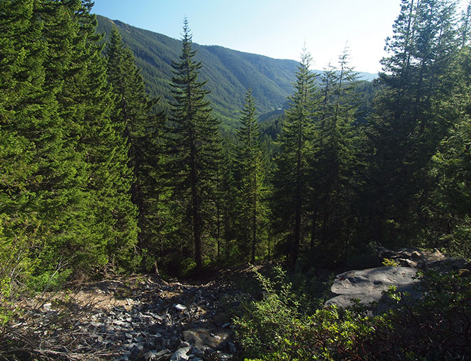
Looking down the Barlow Road chute from the interpretive trail

Beyond the Barlow chute, the old highway enters a very lush section of forest, where foot traffic from explorers continues to keep a section of old pavement bare (below). Scratch the surface, and even under this much understory, the old highway continues to be in very good condition and could easily be restored in the same way old sections of highway in the Gorge have been brought back to life as a trail.

Abandoned section of the old loop highway near Yocum Falls

Some of the foot traffic along the abandoned Laurel Hill section of the old loop road is headed toward a little-known user path that drops steeply down to Yocum Falls, on Camp Creek. This is a lovely spot that deserves a proper trail someday, and would make an excellent family destination, much as the Little Zigzag Falls trail is today.

Yocum Falls is mostly forgotten since the construction of the modern highway, but remains as beautiful as when it was featured on postcards in the 1920s

Yocum Falls was once well known, as the full extent of this multi-tiered cascade could be seen from along the old highway. As this old postcard from the 1920s shows (below), Camp Creek also served as a fire break for the Sherar Burn, which encompassed much of the area south of today’s US 26 in the early 1900s. You can see burned forest on the south (right) side in this photo and surviving forest on the north (left) side:

Yocum Falls in a 1920s postcard view from the original Mount Hood Loop Highway

The fire also created this temporary view of the falls in the early 1900s, but the forest has since recovered and obscured the view. Today, the short hike down to the falls on the user path is required for a front-row view of Yocum Falls.

Beyond the falls, the abandoned highway makes a pronounced switchback and begins a traverse toward the crest of Laurel Hill. Here, the vegetation becomes more open, and road surface more visible (below).

Abandoned section of the old highway as it approaches the crest of Laurel Hill

Soon this abandoned section of old road makes another turn, this time onto the crest of Laurel Hill. When the historic highway was built, this stretch was still recovering from the Sherar Burn, and the summit was dense with rhododendron and beargrass that put on an annual flower show each June. This was perhaps the most iconic stop along the old route, appearing on countless postcards, calendars and print ads (below).

1940s tourism ad featuring the (then) famous view of Mount Hood from Laurel Hill

Today, most of this section has reforested, but there are still views of the mountain and opportunities for new viewpoints that could match what those Model A drivers experienced in the early days of touring on Mount Hood.

Soon, this abandoned section of old road on Laurel Hill reaches the upper gap, where ODOT has recently made the yawning cut through the crest of the hill even wider. This schematic is a view of the cut looking north (toward the mountain), with the stubs of the historic highway shown: 

If there is any good news here, it is that the modern highway cut is perpendicular to the old loop highway, making it possible to directly connect the surviving sections of the old road with a new bridge. This view (below) is from the eastern stub of the old route, where it suddenly arrives at the modern highway cut. The stub on west side of the cut is plainly visible across US 26:

This panoramic view (below) from the same spot gives a better sense of the gap and the opportunity to bride the upper Laurel Hill gap as part of restoring the old route as a trail. A bonus of bridging the upper gap would be an exceptional view of Mount Hood, which fills the northern skyline from here.

The upper gap is about 250 feet across and 40 feet deep, so are there any local examples of a bridge that could span this? One historic example is the old Moffett Creek Bridge on the HCRH, pictured below while it was being constructed in 1916. This bridge measures about 200 feet in length with a single arch.

Moffett Creek Bridge construction along the Columbia River Highway in 1916

The City of Portland recently broke ground on the new Earl Blumenauer Bridge, a bicycle and pedestrian crossing over Sullivan’s Gulch (and I-84) in Portland. This very modern design (below) might not be the best look for restoring a historic route on Mount Hood, but at 475 feet in length, this $13.7 million structure does give a sense of what it would take to span the upper gap at Laurel Hill. 

The City of Portland recently broke ground for this new bicycle and pedestrian bridge over Sullivan’s Gulch, linking the Lloyd District to Portland’s Central Eastside (City of Portland)

That sounds like a big price tag, but consider that ODOT recently spent three times that amountsimply to add a lane and build a concrete median on the Laurel Hill section of US 26. It’s more about priorities and a vision for restoring the old road than available highway funding. More about that in a moment.

Moving east from the upper Laurel Hill gap, the abandoned section of the old highway continues (below) toward Government Camp, eventually reaching the Glacier View trailhead, where the surviving old highway now serves as the access road to this popular, but cramped, SnoPark.

Abandoned section of the loop highway near Government Camp

Sadly, the Forest Service recently destroyed a portion of the abandoned loop highway just west of the Glacier View trailhead, leaving heaps of senselessly plowed-up pavement behind. While destroying this section of historic road was frustrating (and possibly illegal), it can still be restored fairly easily. But this regrettable episode was another reminder of the vulnerability of the old highway without a plan to preserve and restore it.

Piles of paving line a short section of the abandoned loop highway near Government Camp where the Forest Service recently destroyed the road surface with no consideration of its historic value — a senseless reminder of the vulnerability of this precious route

From the Glacier View trailhead, the old road become an operating roadway once again, curving south to another junction with US 26, across from the new Mirror Lake trailhead, where a major new recreation site completed in 2018. This trailhead provides parking, restrooms and interpretive displays for visitors to the popular Mirror Lake trail, and is immediately adjacent to the Mount Hood Ski Bowl resort and lodge.

Plans call for a new bicycle and pedestrian bridge over US 26 at the Mirror Lake trailhead, spanning one of the critical gaps necessary to reconnect the old highway route

Crossing the US 26 at this junction is a sketchy, scary experience, especially on foot or a bicycle. Fortunately, the 2014 Mount Hood Multimodal Plan, adopted jointly by the Forest Service and ODOT, calls for a major bicycle and pedestrian bridge here to allow for safe crossing by hikers, cyclists, skiers and snowshoers, so a plan is already in place to resolve this obstacle.

Middle Section – Government Camp to Barlow Pass

Mount Hood mirrored in one of the ponds at Multorpor Fen (State of Oregon)

From the Mirror Lake trailhead, the old highway loops through today’s parking lot at the Mount Hood Ski Bowl resort, then crosses US 26 again to loop through the mountain village of Government Camp. These graceful curves in the old route were bisected when the modern US 26 was built in the 1950s, leaving them intact as local access roads. However, because the Government Camp section of the old road serves as the village main street, the concept for a Mount Hood Loop Highway State Trail parallels the south edge of US 26 along a proposed new trail section, and avoids two crossings of the modern highway in the process. 

However, a more interesting (but complicated) option in this area is possible along the south edge of the Multorpor Fen, an intricate network of ponds, bogs and meadows sandwiched between the east and west Mount Hood Ski Bowl resort units. The remarkable view in the photo above shows one of the ponds along this alternate route, far enough from the modern highway to make traffic noise a distant hum. However, this route would also require crossing a section of private land at Ski Bowl East. The mountain views and buffer from the highway make this an option worth considering, nonetheless.

Both options are shown on the concept map at the top of this article, and either route through the Government Camp area leads to the northern foot of Multorpor Mountain, where the concept for the state trail is to repurpose a combination of existing and abandoned forest roads as new trail to historic Summit Meadow and popular Trillium Lake, where the second and third campgrounds along the proposed trail are located.

Historic Summit Meadow, a crucial resting spot for white Oregon Trail migrants in the 1840s along the old Barlow Road
Mount Hood from Trillium Lake

From Trillium Lake, the new trail would follow existing forest roads toward Red Top Meadow, to the east, then follow a new route for about a mile to the continuation of the historic loop highway, just east of the US 26/OR 35 junction. Here, a surviving section of the old road is maintained and remains open to the public, passing the mysterious Pioneer Woman’s Grave site as it climbs toward Barlow Pass. 

Surviving section of the old loop highway near Barlow Pass that is still open for use
This massive, carved history marker once stood at the Pioneer Woman’s Grave along the old loop highway, near Barlow Pass
The badly neglected Pioneer Woman’s Grave site today

When the original highway was completed in the 1920s, a viewpoint along this section of the road was called “Buzzard Point” and inspired postcards and calendar photos in its day. Few call this spot Buzzard Point anymore, but the view survives, along with a rustic roadside fountain built of native stone and still carrying spring water to the passing public. In winter, this section of the old road is also popular with skiers and snowshoers.

This 1920s view from Buzzard Point was well-known in the heyday of the old loop highway
This surviving stone water fountain near Buzzard Point is still flowing nearly a century after it was built!

This section of the old route continues another mile or so to the large SnoPark at Barlow Pass, another important trailhead that serves both the loop highway corridor and the Pacific Crest Trail.

East Section – Barlow Pass to Sherwood Campground

Barlow Road history sign at the Barlow Pass trailhead, where the Pacific Crest Trail crosses the historic loop highway

From Barlow Pass, the trail concept calls for a protected bikeway on the shoulder of OR 35, where it crosses the White River and climbs to Bennett Pass. It would be possible for the trail to take a different route along this section, but the traffic volumes and speed on OR 35 are much less intimidating than those on US 26, especially from spring through fall, when ski resort traffic all but disappears. There is also plenty of room to add protected bike lanes along this section of OR 35, including on the new bridge over the White River that was completed just a few years ago.

The Mount Hood Loop trail concept would follow this section of OR 35 as a protected bikeway from Barlow Pass to the White River and Bennett Pass
The White River crossing has always been a popular stop along the Mount Hood Loop Highway. In the early days, motorists could stop here to picnic and pick up souvenirs at “White River Park”
The White River is a notoriously wild glacial stream that has a long history of washing out the loop highway bridges — this was the first bridge to span the river as it appeared in the 1920s
This is a 1930s version of the White River Bridge, one still constructed of logs and planks
Franklin and Eleanor Roosevelt stopped at the White River crossing in 1937 on their famous tour of the Mount Hood Loop Highway and dedication of Timberline Lodge

Upon reaching Bennett Pass, the proposed route would once again follow an especially scenic section of bypassed historic highway, with views of waterfalls, alpine meadows and the mountain towering above.

Mount Hood from the original Mount Hood Loop Highway at Bennett Pass in the 1930s
1950s view of the Mount Hood Loop Highway at Bennett Pass before the modern highway was constructed

Of the many scenes along the old road that were postcard favorites, the view of the Sahalie Falls Bridge, stone fountain and falls in the background was among the most popular. The bridge was the largest structure on the original loop highway, and a scenic highlight (you can read more about the history of the bridge in this 2013 blog article “Restoring the Sahalie Falls Bridge”)

The graceful Sahalie Falls bridge is the architectural highlight of the old loop highway, and was restored in 2013
The Sahalie Falls Bridge under construction in the 1920s
Popular postcard view of the Sahalie Falls Bridge and stone fountain from the 1920s

Today, the bridge is once again in excellent condition, having been restored by the Federal Highway Administration in 2013. For years, the bridge had been closed to automobiles because of its state of disrepair, but today it stands as perhaps the most significant historic highway feature along the old road.

From Sahalie Falls, the historic road curves east through subalpine forests before arriving at Hood River Meadows, among the largest on Mount Hood and another spot that was featured in countless postcards and advertisements during the heyday of the old road. 

1920s view of the old loop highway at Hood River Meadows. This nearly forgotten section of the old highway still operates today.

The long-abandoned Hood River Meadows campground also survives here, along the east side of the meadows, and is still in excellent condition. This site could be reopened as a second bikepacking-only camping spot along the proposed trail. 

1940s tourism ad featuring Mount Hood from the loop highway at Hood River Meadows

Next, the historic road curves toward OR 35 where it also serves as the resort access road for the Hood River Meadows ski complex. From the spot where the old road meets OR 35, there are a couple more abandoned road sections along the north edge of OR 35 that could be reconnected as part of the Loop Highway trail concept, but this is the last of the surviving sections of the old road on this part of the mountain.

From here, the trail concept would connect a series of old forest roads on a gradual descent of the East Fork Hood River valley, toward Sherwood Campground, located along the East Fork, and completing the Mount Hood Loop Highway State Trail.

East Fork Hood River near Sherwood Campground in winter

Sherwood Campground is a very old, still operating campground that includes another stone fountain from the old highway, located near the campground entrance. The campground is also a jumping off point for the popular trail to Tamanawas Falls. Nearby Little John SnoPark would serve as the main eastern trailhead for the new trail, with a short connecting route the main trail. 

Historic stone fountain from the original loop Highway at Sherwood Campground
Tamanawas Falls, just off the loop highway near Sherwood Campground

Sherwood Campground would form the eastern terminus of the historic section of the proposed Loop Highway State Trail. From here the larger Mount Hood scenic loop route would follow OR 35 through the narrowing canyon of the East Fork to the wide expanse of the upper Hood River Valley. 

This narrow section of the loop highway is where a safe, protected bikeway will need to thread the needle between cliffs and the East Fork Hood River

The canyon section along the East Fork is a crux segment for the loop route, with the modern highway wedged between the river and a wall of steep cliffs and talus slopes. Engineers designing a safe bikeway through this section of road could take some inspiration from the Shellrock Mountain in the Gorge, where the HCRH State Trail threads a similar corridor between I-84 and the talus slopes of Shellrock Mountain. This crux section along the East Fork is about a mile long.

WHERE TO START?

Touring the upper Hood River Valley in the 1950s

What would it take for this concept to become a reality? A crucial first step would be a feasibility study inspired by the HCRH State Trail, with an emphasis on the potential this example offers for restoring and reconnecting historic sections of the old Mount Hood Loop Highway on Mount Hood. 

Rock crusher along the original loop highway during its construction in the 1920s

An obvious sponsor for this work would be the Oregon Department of Transportation, working in partnership with the U.S. Forest Service. These agencies have worked together to bring the Historic Columbia River Highway State Trail to reality and have both the experience and capacity to repeat this success story on Mount Hood. The following outline could be a starting point for their work:

Mount Hood Loop Highway State Trail Feasibility Study 

Purpose Statement

Restore and reconnect surviving sections of the historic Mount Hood Loop Highway from Rhododendron to Sherwood Campground as a paved state trail the combines shared right-of-way and non-motorized trail experiences.

Feasibility Study Objectives

  • Identify new, paved trail segments needed on public land to complete the loop using existing forest road alignments whenever possible.
  • Identify surviving historic resources and new interpretive opportunities along the trail.
  • Identify multimodal trailhead portals at the trail termini and at major destinations along the trail, including Rhododendron and Government Camp.
  • Identify bike-and-hike opportunities that build on soft-trail access from a new, paved state trail.
  • Coordinate and correlate route and design options and opportunities with the 2014 Mount Hood Multimodal Transportation Planand the Mount Hood Scenic Byway Interpretive Plan and Design Guidelines.
  • Identify an alternate bicycle route for the Mount Hood Scenic Byway from Sandy to Rhododendron that does not follow the US 26 shoulder.
  • Identify design solutions for designing a protected shoulder bikeway in the crux section of OR 35 in the East Fork canyon.
  • Engage public and private stakeholders and the general public in developing the feasibility study.

But what would it really take..?

Railing and sidewalk repairs underway to the historic Sahalie Falls Bridge in 2013

While ODOT has directly managed construction of the HCRH State Trail in the Gorge, a lesser-known federal agency has been taking the lead in recent, similar projects on Mount Hood. A little-known division of the Federal Highway Administration known as Federal Lands Highway is gaining a growing reputation for innovative, sustainable designs in recent projects on our federal public lands. 

On Mount Hood, Federal Lands Highway oversaw the restoration of the Sahalie Falls Bridge in 2013, a long-overdue project that rescued this priceless structure from the brink of oblivion. Like any highway agency, they excelled at the roadway element of the project, like restoring the bridge and related structure. Other opportunities were missed, however, including improving the adjacent parking areas and providing interpretive amenities for visitors. 

Forms for new railing caps on the Sahalie Falls Bridge in 2013
Federal Lands Highway rebuilt the footing for the historic water fountain at Sahalie Falls as part of the bridge restoration project
The newly restored Sahalie Falls Bridge and fountain in 2014

Federal Lands Highway also completed a major reconstruction of OR 35 at Newton Creek in 2012. This project was in response to massive flooding of this surprisingly powerful glacial stream in 2006. Their work here shows some of the negatives of a highway agency taking the lead, with a very large footprint on the land and a big visual impact with over-the-top, freeway-style “safety” features that are old-school by today’s design practices.

The mega-culvert project built by Federal Lands Highway at Newton Creek in 2012

In 2012, Federal Lands Highway also completed (yet another!) bridge replacement over the White River, which was also damaged in the 2006 floods. The massive new bridge is similarly over-the-top to their work at Newton Creek, but Federal Lands Highway deserves credit for rustic design features that blend the structure with the surroundings, including native stone facing on the bridge abutments.

Western Federal Lands completed the new White River Bridge in 2012

The most promising recent work on Mount Hood by Federal Lands Highway is the completion of the new Mirror Lake Trailhead in 2018. This project involved a significant planning effort in a complex location with multiple design alternatives. Their work here involved the public, too, something their earlier work at White River, Sahalie Falls and Newton Creek neglected.

The new Mirror Lake Trailhead was completed in a partnership of Federal Lands Highway, the Forest Service and ODOT in 2018

The final result at Mirror Lake is an overall success, despite the controversy of moving the trailhead to begin with. The new trailhead is now a prototype of what other trailheads along a restored Mount Hood Loop Highway State Trailcould (and should) look like, complete with restrooms, interpretive signs, bicycle parking and accessibility for people using mobility devices.

New shoulder swales along US 26 were part of the Mirror Lake trailhead project, helping to protect water quality of Camp Creek from highway runoff
The new Mirror Lake Trailhead plaza includes restrooms, interpretive signage, bike parking and seating for visitors

Beyond the hardscape features at the new trailhead, Federal Lands Highways worked with the Forest Service to replant areas along a new paved section of trail. This work provides another useful template for how the two federal agencies could work together with ODOT in a larger restoration of the old Loop Highway as a new trail.

Though it looks a little rough, this area along the new, paved section of the Mirror Lake Trail was landscaped with native materials as part of the new trailhead project
Landscape restoration at the new trailhead included woody forest debris, native understory starts and hydro-seeding to protect newly planted areas from erosion

One of the compelling reason for Federal Lands Highway to take a leading role in a Loop Highway trail project is the unfortunate fact that ODOT has ceded the right-of-way for several of the abandoned sections of the old road to the Forest Service. This would make it difficult for ODOT to use state funds to restore these sections without a federal transportation partner like Federal Lands Highway helping to navigate these jurisdictional hurdles. 

However, governance hurdles like this existed in the Gorge, too, and state and federal partners simply worked together to resolve them, provided they had a clear mandate to work toward.

Getting behind the idea… and creating a mandate

The original Mount Hood Loop Highway in the Hood River Valley in the 1930s

Bringing this trail concept to reality will take more than a feasibility study, of course — and even that small step will take some political lifting by local officials, cycling advocates, the local tourism community and even our congressional delegation. While the money is clearly there for ODOT to begin this work, it would only happen with enough political support to begin the work.

The good news is that Oregon’s congressional delegation is increasingly interested in outdoor recreation and our tourism economy, especially when where a coalition of advocates and local officials share a common vision. With the HCRH State Trail in the Gorge nearing completion after more than 30 years of dedicated effort by advocates and ODOT, it’s a good time to consider completing the old loop as the next logical step in restoring a part of our legacy.

The idea of loop around Mount Hood began as soon as the Columbia River Highway was completed in 1915. This article in The Oregon described the first documented trip around the mountain using a patchwork of roads that existed before the Mount Hood Loop was constructed in the 1920s (large PDF versions of this article can be viewed at the links, below)

1915 Article – Page 1 (PDF)

1915 Article – Page 2 (PDF)

Rumor has it that new legislation is in the works to ramp up protection and improve recreation opportunities for Mount Hood and the Gorge. Including theMount Hood Loop Highway State Trail concept in new legislation would be an excellent catalyst for moving this idea from dream to reality. 

But could this really happen in today’s fraught political environment in Washington D.C.? Don’t rule it out: President Reagan was notorious for his hostility toward public lands, and yet he infamously “held his nose” and signed the Columbia River Gorge legislation into law in 1986, including the mandate to devise a plan to restore surviving sections of the HCRH as a trail. 

So, could this happen in the era of Trump for Mount Hood? Stay tuned…

2019 Campaign Calendar!

00CoverWhaleCreek

Calendar cover for 2019 featuring Whale Creek

[Click here for a large image]

‘Tis the season for top ten lists and year-end retrospectives, so in that spirit my annual Mount Hood National Park Campaign Calendar is pretty good snapshot of 12 favorite spots of mine across WyEast country this year. Since 2004, I’ve created an annual calendar dedicated to the campaign, each with a fresh set of photos. If you’d like a 2019 calendar, there’s info at the bottom of the article and ALL proceeds will once again go to Trailkeepers of Oregon (TKO).

________________

The annual campaign calendar has been a great motivator for exploring new terrain and improving my photography skills over the years. Each year the calendar project also renews my conviction that Mount Hood and the Gorge are uniquely special places, and deserve better care.

This article is a short tour of the 12 spots that made it into the 2019 calendar, with a few stories behind the photos and reflection on these increasingly fragile landscapes.

Starting with the cover image (at the top of the article), the calendar begins at lovely Whale Creek, a tributary of the Clackamas River that is also featured in the March image, so more about that spot in a moment.

Next up, the January image (below) captures the awesome west face of Mount Hood, where the Sandy Headwall towers 3,000 feet above the Sandy Glacier. This snowy view was captured from near Lolo Pass last winter.

01aLoloPassEastHood

January features the awesome Sandy Headwall

[Click here for a large image]

Not included in the close-up view are the bare slopes of Barrett Spur (below) and other alpine ramparts of Mount Hood that still didn’t have their winter snowpack in early February, when these photos were taken. While it’s not uncommon to have a late snowpack in the Cascades, these events are becoming more common as global warming unfolds in our own backyard.

01bLoloPassEastBarrettSpur

Low snow on Barrett Spur in February tells the story of our changing climate

For February, I chose a close-up perspective of the ice “pillows” that form at the base of Tamanawas Falls (below) in winter. This has become a very popular winter destination in recent years, thanks in large part to social media! (…ahem…)

02aTamanawasFallsDetail

February features Tamanawas Falls

[Click here for a large image]

Tamanawas is Chinook jargon for “guiding spirit”, and is one version among a couple variations in spelling. More challenging is the pronunciation, and with the advent of social media, all manner of spoken variations are being used. For some reason, an especially popular spoken version that doesn’t even correlate to the actual spelling is “tah-ma-WAHN-us”.

It turns out the most accepted pronunciation is “ta-MAH-na-wahs”. I’ve been saying a slight variation of “ta-MAN-a-wahs” for most of my life, so I’ll need to work on that!

02bTamanawasFalls

Cold Spring Creek and Tamanawas Falls in winter

As mentioned earlier, the March calendar image is from Whale Creek (below), located in the heart of the Clackamas River canyon. The creek is hidden in plain sight, flowing through the Indian Henry Campground and next to the east trailhead of the Clackamas River Trail. This area features some of the finest rainforest in WyEast country.

03aWhaleCreekBigCedars

March features a rainforest scene along Whale Creek

[Click here for a large image]

Whale Creek was just one of many places in the Clackamas and Molalla River watersheds that I found myself exploring this year while much of the Oregon portion of the Columbia River Gorge was closed by the Eagle Creek fire. I visited the lower reaches of Whale Creek after seeing stunning photos of a string of waterfalls on the upper reaches of the creek, and quickly fell in love with this pretty stream. Watch for a future article on a trail concept I’ve been working on for Whale Creek with TKO and some area waterfall explorers.

03bWhaleCreekScene

Whale Creek in the Clackamas River canyon

Sadly, the Clackamas River corridor has a bad reputation, thanks to a history of lawless behavior (the recent Pit Fire was started by illegal target shooting, for example) and a long history of Forest Service management that viewed the area more like a tree farm than a forest — and the two go hand in hand, by the way.

Yet, hidden in the now-recovering rainforests of the Clackamas are dozens of spectacular waterfalls, towering basalt walls and rugged vistas that rival the Columbia River Gorge in beauty. There are also a lot of big trees that somehow dodged the logging heyday of past decades.

03cWhaleCreekSnow

Whale Creek in winter

The Clackamas River corridor holds great promise for future recreation alternative to places like the Gorge, and the proven cure for lawless behavior is lawful recreation. I’m optimistic that we’ll make that transition here, and begin valuing places like Whale Creek for the intrinsic value of its forests, not just the saw logs it can produce.

04aWhiteRiverFalls

April features White River Falls State Park

[Click here for a large image]

For the April calendar image, I selected a photo of White River Falls, both for the contrast in WyEast country ecosystems it displays and because this little state park could use some love and expanded boundaries. I posted an article with just such a proposal a few years ago, you can find it over here.

04bWhiteRiverUpperFalls

White River Falls with unprotected desert country beyond

The May calendar image features a sweeping view of the Upper Hood River Valley (below) from little known, seldom-noticed Middle Mountain. Its name tells the story, as forested Middle Mountain divides the upper and lower portions of the Hood River Valley. I learned of this spot about ten years ago from a local photographer and have gone back pretty much every year since.

05aMiddleMountainHood

May features the Upper Hood River Valley as viewed from Middle Mountain

[Click here for a large image]

Zooming in a bit to this idyllic landscape reveals a seemingly timeless farm scene that is easy to take for granted. And yet, these farms were at great peril just a few years ago, when voters passed the deceptive Measure 37 in 2004. The law was pitched as a way for landowners to “seek compensation” for land use regulation, but in truth was just another end-run around Oregon’s protections for farm and forestlands.

Voters later passed Measure 49, in 2007, blunting the impact of the earlier measure, but only after hundreds of urban-scale developments were approved in rural areas across Oregon (including a pair of giant, illuminated billboards along the Mount Hood Highway that still remain today). It was a reminder that while our farms may look timeless, we can never take them for granted. They will always need our support and protection if we want places like this to exist for future generations.

05bUpperValleyFarmDetail

Timeless farm scene below Middle Mountain

Much of Middle Mountain is owned by the public, where county-owned forest lands continue to be (mis)managed as a cash register by Hood River County (the county likes to refer to these land as their “tree farm”). Local residents no doubt enjoy their modest tax rates, as a result, but I’m hoping the rapidly changing demographics in Hood River will bring a different mindset to how the thousands of acres of county forests that ring the Hood River Valley are managed.

05cMiddleMountainLogTruckSign

Logging is still king on Middle Mountain…

One immediate concern on Middle Mountain is the manner of logging. Large clear cuts, like those scarring the slopes of Middle Mountain, are an unsustainable practice, with proven harmful impacts to forest health, water quality and salmon and steelhead populations. Clear cuts are also the cheapest, easiest way to bring haul logs out of the forest. That bottom line might be unavoidable for private forests, but as a public agency, Hood River County should at least adopt a selective harvest policy that leaves standing trees in logged areas.

05dMiddleMountainLogTruck

…keeping Hood River County coffers full…

The county should also reject the reckless use of herbicides sprayed on logged over lands. This is a practice the private industry uses to shortcut the natural forest recovery and speed up the next harvest. The idea is to destroy the recovering forest understory in a logged area so that plantation seedlings might grow a little faster.

05eMiddleMountainTimberSaleBoundary

The forest on the left is next to go…

I’m not certain the county uses this practice on public lands, but it seems to be the case. Consider this notice posted a few days ago on their website:

“Recreation trails are sometimes temporarily closed during additional forest management operations. Operations such as the burning of slash, herbicide application, and the planting of seedlings, will necessitate trail closures. Trails are re-opened once operations are complete.”

This certainly sounds like the private industry practice…

05fMiddleMountainTimberSaleBoundarySign

…might as well add “for now” to the last line on this boundary marker, unfortunately.

Of course, the county could show real leadership and simply ban this practice on private lands in Hood River County, as well. That is, if water quality, wildlife, salmon and steelhead habitat, long-term forest health and tourism are a county priority over the fastest route to clear cutting more logs. My sense is that voters in Hood River County are increasingly focused on these broader concerns, even if the county leadership isn’t there yet.

06aShotgunFallsPortrait

June features Shotgun Falls in the Molalla River canyon

[Click here for a large image]

For the June calendar image, I selected another lesser-known spot, graceful Shotgun Falls (above) in the Molalla River canyon. This pretty, off-trail waterfall has been on my list for some time, and the Gorge closure inspired me to finally make this trip last spring for a much-needed waterfall fix.

06bShotgunFallsBase

Shotgun Falls

Shotgun Falls is a classic “Oregon” waterfall, cascading over a tall, mossy basalt cliff. The falls is a short creek walk from the Molalla River Road, but protected by a 20-foot barrier falls just downstream that requires a slippery scramble to navigate. It’s an increasingly popular off-trail trip, and the streambed is starting to show the wear and tear, making this a great candidate for a proper trail that families with young kids and hikers looking for an easy waterfall trip could enjoy. More to come on this idea..!

06cShotgunFallsSlopeDamage

Time for a real trail, here…

Sometimes a random moment burns a place and time in the forest into your memory. One such moment occurred on my trip to Shotgun Falls when my pack suddenly tipped while shooting photos from high above the falls. To my horror, it went bounding into the canyon, finally stopping just short of Shotgun Creek, about 60 feet below. Thankfully, my camera gear was safely zipped inside and I didn’t even end up with a soggy pack — the difference between a fond memory and forgettable one!

06dShotgunFallsTomsDroppedPack

Takes a licking, keeps on zipping!

The July calendar image features a picture-perfect wildflower scene along Cove Creek (below), located at the base of Barrett Spur in Elk Cove. This idyllic spot is kept open by a deep, lingering snowpack in spring and regular winter avalanches that shear off trees, allowing the alpine meadows to thrive.

07aCoveCreakBarrettSpur

July features Cove Creek and Barrett Spur

[Click here for a large image]

Looking downstream along Cove Creek (below), 99 Ridge can be seen in the distance, covered with ghost trees killed by the 2012 Dollar Lake Fire. The fire reached the margins of Elk Cove, but passed over most of the forests here.

07boveCreekAdams99Ridge

The Dollar Lake Burn swept over 99 Ridge, in the background in this view of Cove Creek

On this trip to Elk Cove, I met a pair of hikers carrying their exhausted pup down the trail. When I chatted briefly with them, I was reminded that hikers are really nice people: they didn’t even know each other. The man carrying the dog had run into the woman as she struggled to carry her dog back to the trailhead. He offered to carry the poor pup the rest of the way!

07cVistaRidgeHikersCarryingDog

Hikers are nice people! (…see text…)

For the August calendar image, I selected a familiar view of Mount Hood from high on the shoulder of Cooper Spur (below). The Eliot Glacier dominates the view here, even as it recedes from global warming. As the glacier recedes, the exposed canyon floor once covered by ice has rapidly eroded, which in turn has  begun to destabilize the moraines that flank the canyon.

08aHoodEliotGlacierPortrait

August features the mighty Eliot Glacier

[Click here for a large image]

I experienced the hazards of the destabilized moraines firsthand when I stopped along the South Eliot Moraine that day and set my pack on a 4-foot long boulder that seemed to be the perfect trailside bench. Before I could park myself on the “bench”, it suddenly gave way, careening end-over-end into the Eliot Branch canyon, kicking off dozens of other rocks and an impressive dust storm along the way!

08bEliotMoraineDustCloud

The south Eliot Moraine continues to crumble…

Thankfully, there were no hikers below — and I was also relieved that I’d snapped up my pack before the boulder disappeared over the edge! Clearly, my pack has nine lives… though I’m not sure how many remain…

08cEliotMoraineBoulderRollEliotBranch

Seeing the boulder finally land among the jumbled rocks 300 feet below was powerful reminder of the scale of this place, as the 4-foot “bench” rock was dwarfed by dozens of larger boulders scattered below the moraine.

08dEliotMoraineBoulderRoll

A 4-foot boulder becomes a pebble among the debris rolling into the Eliot Branch canyon

The September calendar image captures fall colors along Still Creek, on Mount Hood’s southwest side. This photo was taken on a visit to a recent Forest Service project designed to restore salmon and steelhead habitat on Still Creek.

09aAutumnForestStillCreek

September features a grove of Red Alder along Still Creek wrapped in brilliant Vine Maple foliage

[Click here for a large image]

The project site was a badly overused “dispersed” campsite that had become an eyesore over the years. To rehabilitate the site, the Forest Service excavated a large trench to block vehicle access to the streamside campsite, reinforced the barrier with a row of boulders. So far, these barriers seems to be working, as there were no signs of continued camping or off-road vehicle use in the area.

09bStillCreekRestoration

Forest Service stream restoration work on Still Creek

At the heart of the restoration project, several very large logs with root wads attached (below) were hauled into the stream to create the natural “woody debris” habitat that our native salmon and steelhead rely upon. The logs and roots create deep pools and places for small fish to hide from predation as they mature to adulthood.

09cStillCreekRestoration

Bringing back logs and root wads that create prime fish habitat

There’s something primeval about uprooted trees lying across the creek. This is what most of our streams looked like before the settlement era, when forests were logged, streams were tamed and few big trees were left to become “woody debris”. The panorama below shows the full extend of this Forest Service restoration project.

09dStillCreekRestoration

Panoramic view of the restoration site

[Click here for a large image]

On a select few days each fall, the first high elevation snow of the season is followed by a few days of bright, clear weather — and with any luck, all of this coincides with fall colors. Such was the case in the calendar image I selected for October (below), with Mount Hood framed by flaming Vine Maple, as viewed from the Lolo Pass area.

10aHoodLoloPassRoadFallMaples

October features an early snow on Mount Hood, framed by Vine Maples

[Click here for a large image]

Whenever I shoot this scene, an image of a scalloped-edge vintage postcard is in my mind. Thanks to many postcards from the 1940s, 50s and 60s that captured this side of the mountain in autumn, the scene is iconic. This card (below) from the 1950s is typical of the era, and was captured just around the corner from where I shot the 2019 calendar image.

10bLoloPassPostcard

Timeless inspiration, with fancy scalloped edges!

For the November calendar image, I selected a rainforest scene from along the Molalla River (below), where bare winter trees reveal the contorted, mossy limbs of Bigleaf and Vine Maple.

11aMolallaRiverRainforestMossyGlen

November features a pristine rainforest scene along the Molalla River

[Click here for a large image]

While the above certainly scene looks pristine, it’s really not. One of my favorite photographic themes is to capture “pristine” scenery in places that are not — but could be, if managed with an eye toward restoration. Such was the case with the previous photo from Lolo Pass, where transmission towers were literally buzzing overhead, and with the Molalla River, where a road culvert dumped the little stream in the photo from a 4-foot galvanized pipe.

11bMolallaRiverMile8CreekCulvert

…which turns out to not be all that pristine..!

Beauty can be found everywhere, and the path to restoration in even the most impacted areas in WyEast country begins when we see places not just for what they once were, but for what they could be, again.

The December calendar image is a freezing fog scene from the east slopes of Mount Defiance (below). This stunning phenomenon occurs a few times each winter when temperature inversions blanket the eastern Columbia River Gorge with dense fog and frigid temperatures. The effect is magical, though traveling the roads in these conditions can be treacherous!

12aBinnsHillFrostForest

December features a crystal wonderland from freezing fog on the slopes of Mount Defiance

[Click here for a large image]

The frosting of ice coating the forest in these scenes is called “soft rime”, and is made up of feathery, fragile crystals that can be brushed off like a fine powder. Soft rime forms when super-cooled vapor in fog accumulates directly on tree surfaces in delicate, elaborate crystals. Hard rime is defined as ice forming from freezing fog that first condenses to water droplets, then freezes on surfaces, creating a clear, hardened ice layer.

12bKingsleyFrostForest

Freezing fog on Mount Defiance

Soft rime accumulations can be quite impressive in the Gorge, depending on how long the fog event lasts. These scenes were captured after five days of freezing fog and represent about the maximum amount of ice that can accumulate before crystals break off under their own weight.

12cKingsleyFrostForest

Freezing fog on Mount Defiance

This photo (below) is a close-up of soft rime accumulations on a Golden Chinkapin growing on the slopes of Mount Defiance. These crystals as much as three inches long.

12dFrostedChinkapin

Soft rime ice crystals

The scene below shows an odd transition from bare road (and car) to frosted forest that looks like a photoshop creation. In this spot the rime had coated the trees and understory, but not the gravel road in the foreground, creating the strange two-tone scene. This photo is also a bit of a farewell, as my venerable trail car of the past many years years is featured. This old friend was retired to quiet a life in the city just a few months after this photo was taken, at the ripe old age of 13 years and 212,000 miles!

12eKingsleyFrostForestToyota

Farewell to an old friend…

The back page of the 2019 calendar features nine wildflower images from the past year. If you’ve followed articles on the blog, you’ll recognize a several photos featured in stories on Horkelia Meadow and Punchbowl Falls.

From top left and reading across, these flowers are Hackelia micrantha (Horkelia Meadow), Chocolate Lily (Punchbowl Falls Park), Oregon Iris (Shellburg Falls), Buckwheat (Horkelia Meadow), Calypso Orchid (Punchbowl Falls Park), Oregon Grape (Molalla River), Horkelia fusca (Horkelia Meadow), Collomia grandiflora (Clackamas River) and Skyrocket Gilia (Horkelia Meadow).

13BackCover2019

A year in wildflowers!

[Click here for a large image]

So, that’s it for the 2019 campaign calendar! I’ve already started colleting images for next year’s calendar and I’m looking forward to yet another year of exploring all corners of America’s next national park. Maybe I’ll even see you out on the trail!

14ShotgunFallsTom

Old goat that wandered up a creek…

In the meantime, you can order the 2019 calendar over at Zazzle. They’re beautifully printed, oversized designs with functional writing space — they’re working calendars and make great gifts! The calendars sell for $29.95, but Zazzle regularly offers deep discounts, so it’s worth watching for sales. This year, all proceeds from calendars will go to Trailkeepers of Oregon (TKO).

You can order a 2019 campaign calendar here

Thanks for reading this far, and I hope you’re able to get out and explore Mount Hood and the Gorge over the holidays!

_______________

Tom Kloster  •  December 2019

2017 Campaign Calendar!

mhnp_calendar01

[click here for a large image]

Each year since the Mount Hood National Park Campaign began in 2004, I’ve published a wall calendar to celebrate the many reasons why Mount Hood and the Columbia River Gorge should be our next national park. You can pick up a calendar here:

 2017 Mount Hood National Park Campaign Calendar

The calendar sales help cover some of the costs of keeping the campaign website and WyEast blog up and running. More importantly, they ensure that I continue to explore new places in the gorge and on the mountain, as each calendar consists exclusively of photos I’ve taken in the previous year. In this article, I’ll provide some of the stories behind the photos in the new Mount Hood National Park Campaign Calendar.

 The Calendar

Beginning in 2016, I’ve published the calendar at Zazzle, where the quality of printing and binding is much better than my former printer. The excellent print quality shows in the front cover (above), a view of the northwest face of Mount Hood from Cathedral Ridge where the color accuracy does justice to the vibrant cliffs on this side of the mountain.

An added bonus with Zazzle is the ability to include a full-color spread on the back of the calendar. As with the 2016 calendar, I’ve used this space to show off some of the flora I’ve photographed over the past year – and this year, I added berries and a butterfly to the mix, too:

mhnp_calendar02

[click here for a large image]

The monthly layout remains the same as last year, with a classic design that serves nicely as a working calendar for kitchens or offices:

 mhnp_calendar03

The finished calendar hangs 14 inches wide by 22 inches tall, with a white wire binding.

 The Images

The following is a rundown of the 12 images inside the calendar by month, with a link to a large version of each image, too. This year, I’ve posted especially large versions to allow for a closer look at these scenes (in a new window), and you can see them by clicking the link beneath each preview image.

The 2017 calendar begins with a chilly Tamanawas Falls for the January image. This impressive waterfall is located on Cold Spring Creek on Mount Hood’s east slope:

mhnp_calendar04

Tamanawas Falls in winter clothes

 [click here for a large image]

This popularity of this trail in winter has ballooned in recent years, from almost no visitors just a decade ago to traffic jams on winter weekends today.

The scenery explains the popularity. While the trail is lovely in the snow-free seasons, it’s downright magical after the first heavy snows in winter. The scene below is typical of the many breathtaking vistas along the hike during the snow season.

mhnp_calendar05

Cold Spring Creek gets just a little bit colder

It’s still possible to have the place to yourself, however. Go on a weekday, and you’re likely to find just a few hikers and snowshoers on the trail. Thus far, no Snow Park pass is required here – though that will surely come if the weekend crowds continue!

For February, I picked an image of Mount Hood’s steep north face, featuring the icefalls of the Coe and Ladd glaciers:

mhnp_calendar06

Mount Hood’s mighty north face from Owl Point

[click here for a large image]

This view is unique to the extent that it was taken from the Old Vista Ridge trail to Owl Point – a route that was reopened in 2007 by volunteers and provides a perspective of the mountain rarely seen by most visitors.

 For March, I selected an image of Upper Butte Creek Falls:

mhnp_calendar07

Lovely Upper Butte Creek Falls in spring

[click here for a large image]

This is on the margins of Mount Hood country, but deserves better protections than the Oregon Department of Forestry (ODF) can ever provide, given their constitutional obligation to log state forests to provide state revenue.

While ODF has done a very good job with the short trails that reach the waterfalls of Butte Creek, the bulk of the watershed is still heavily managed for timber harvests. Who knows, someday maybe it will be part of a Mount Hood National Park? It’s certainly worthy.

On this particular trip last spring, I returned to the trailhead to find these notes on my windshield:

mhnp_calendar08

Our future is in good hands!

Not much damage to the car, and the note more than made up for it! I did contact Jesse, and ended up speaking to his dad. I thanked him for being an excellent parent. With dads (and moms) like this, our future is in good hands!

For April, I picked this scene from Rowena Crest at the height of the Balsamroot and Lupine bloom season:

mhnp_calendar09

Rowena Crest in April splendor

[click here for a large image]

Just me and a few hundred other photographers up there to enjoy the wildflowers on that busy, sunny Sunday afternoon! Look closely, and you can see a freight train heading west on the Union Pacific tracks in the distance, lending scale to the enormity of the Gorge.

For the May image, I chose the classic scene of Punch Bowl Falls along the popular Eagle Creek Trail in the Gorge:

mhnp_calendar10

Punch Bowl Falls in spring

 [click here for a large image]

The spring rains faded quickly this year, resulting in much lower flows along Eagle Creek by the time spring greenery was emerging, making it less chilly to wade out to the view of the falls. To the right of the falls you can also see the latest downfall to land in front of the falls. To my eye, this adds to the scene, so I see it as a plus.

This isn’t the first big tree to drop into the Punch Bowl in recent years. In the mid-2000s, another large tree fell directly in front of the falls, much to the frustration of photographers:

mhnp_calendar11

Punch Bowl Falls in 2006 with an earlier fallen tree in front of the falls

 That earlier tree was flushed out a few years ago, only to be replaced by the current, somewhat less obtrusive downfall a couple of years ago. Here’s a wider view showing this most recent addition, including the giant root ball:

mhnp_calendar13

Gravity at work once again at Punch Bowl Falls

This pattern will continue as it has for millennia, as other large Douglas fir trees are leaning badly along the rim of the Punch Bowl. They eventually will drop into the bowl, too, frustrating future generations of photographers!

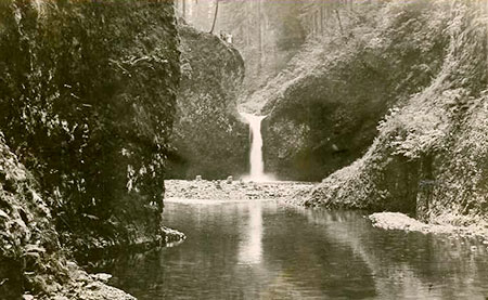
 The Punch Bowl, itself, changes over time. This early view from the 1920s shows a lot more debris inside the bowl compared to recent decades, possibly from erosion that followed an early 1900s forest fire in the Eagle Creek canyon:

mhnp_calendar12

Punch Bowl Falls in the 1920s

Look closely and you can see flapper-era hikers on the rim of the bowl and several rock stacks left by visitors on the gravel bar – some things never change!

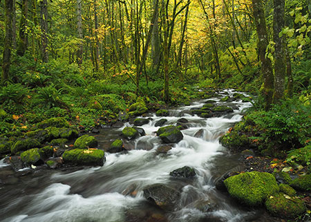
The June image in the new calendar is the opposite of Punch Bowl Falls. While thousands visit Eagle Creek each year, the remote spot pictured below is rarely visited by anyone, despite being less than a mile from Wahtum Lake and the headwaters of Eagle Creek. This view is from a rugged, unnamed peak along Waucoma Ridge, looking toward another unnamed butte and snowy Mount Adams, in the distance:

mhnp_calendar14

A place of ancient significance, yet lost in our modern time

[click here for a large image]

For the purpose of keeping track of unnamed places, I’ve called the talus-covered butte in the photo “Pika Butte”, in honor of its numerous Pika residents. The peak from which the photo is taken is an extension of Blowdown Ridge, a much-abused, heavily logged and mostly forgotten beauty spot that deserves to be restored and placed under the care of the National Park Service.

The view of “Pika Butte” was taken while exploring several off-trail rock knobs and outcrops along Blowdown Ridge, but what made this spot really special was stumbling acxross a cluster of Indian pits (sometimes called vision quest pits). One pit is visible in the lower left corner of the wide view (above) and you can see three in this close-up view from the same spot:

mhnp_calendar15

If only these stones could tell us the story behind the mystery!

Nobody really knows why ancient people in the region made these pits, but it’s always a powerful experience to find them, and imagine the lives of indigenous peoples unfolding in the shadow of Mount Hood. These pits had a clear view of the Hood River Valley, with the Columbia River and Mount Adams in the distance. Indian pits often feature a sweeping mountain or river view, adding to the theory that they were built with a spiritual purpose.

For July, another photo from Owl Point along the Old Vista Ridge trail. This wide view shows some of the beargrass in bloom on the slopes of Owl Point on a sunny afternoon in July:

mhnp_calendar16

Mount Hood fills the skyline from Owl Point

[click here for a large image]

Since this historic trail was adopted by volunteers in 2007, it has become increasingly popular with hikers. Several geocaches are located along the way, as well as a summit register at Owl Point with notes from hikers from all over the world. A few recent entries among hundreds in the register show the impact that this amazing “new” view of Mount Hood has on visitors to Old Vista Ridge:

mhnp_calendar17

mhnp_calendar18

mhnp_calendar19

In a few months I’ll share some exciting news about the Old Vista Ridge Trail, Owl Point and the surrounding areas on Mount Hood’s north slope. Stay tuned!

For August, I picked another scene on the north side of the mountain, this time at iconic Elk Cove along the Timberline Trail:

mhnp_calendar20

Swale along Cove Creek in Elk Cove

[click here for a large image]

The hiker (and his dog) approaching me in this photo stopped to chat, and I was surprised to learn that he was a regular reader of this blog!

As we talked about the changes to the cove that came with the 2011 Dollar Lake Fire (that burned the north and west margins of the cove), he mentioned finding the foundation from the original Civilian Conservation Corps (CCC) shelter in the brush near Cove Creek! We crossed the creek and in a short distance, came to the unmistakable outline of the shelter:

mhnp_calendar21

The old Elk Cove shelter foundation is surprisingly intact – but hidden

This structure was once one of several along the Timberline Trail, but fell into disrepair following avalanche damage sometime in the 1950s or early 1960s. This image is apparently from the mid-1960s, showing the still somewhat intact ruins of the shelter:

mhnp_calendar22

The beginning of the end for the Elk Cove shelter in the 1960s

The location of the shelter was a surprise to me, as I had long thought the building was located near a prominent clearing and campsite near the middle of Elk Cove. Now that I know the exact location, I plan to reproduce the 1960s image on my next trip to the cove, for comparison.

For September, I chose a quiet autumn scene along Gorton Creek, near the Wyeth Campground in the Columbia Gorge (below). This is a spot I’ve photographed many times, just downstream from popular Emerald Falls:

mhnp_calendar23

Pretty Gorton Creek in the Wyeth area of the Gorge

[click here for a large image]

This area has a fascinating history, as today’s Wyeth Campground is located on the grounds of Civilian Public Service Camp No. 1, a World War II work camp for conscientious objectors. The men serving at this camp built roads and trails throughout the Gorge, in addition to many other public works projects. The camp operated from 1941-1946. You can learn more about the Wyeth work camp here.

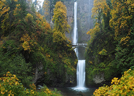
The October scene is familiar to anyone who has visited the Gorge. It’s Multnomah falls, of course, dressed in autumn colors:

mhnp_calendar24

A bugs-eye view of Multnomah Falls?

[click here for a large image]

If the photo looks different than your typical Multnomah Falls view, that’s because I blended a total of eight images to create a horizontal format of this very vertical falls to better fit the calendar. Here’s what the composite looked like before blending the images:

mhnp_calendar25

To young photographers of the digital age, blending photos is routine. But for those of us who started out in the age of film photography and darkrooms, the ability to blend and stack images is nothing short of magical – and fun! While younger photographers are increasingly exploring film photography as a retro art, the digital age is infinitely more enjoyable than the days of dark rooms, chemicals and expensive film and print paper for this photographer.

I paused before including a winter-season photo of Wahclella Falls for the November calendar image (below). Why? Because I’ve used a photo from this area in nearly every calendar since I started assembling these more than a decade ago. It’s my favorite Gorge hike – I visited Tanner Creek and Wahclella Falls five times in 2016 – and have photographed this magnificent scene dozens of times, and yet it never gets old.

mhnp_calendar26

Wahclella Falls is a winter spectacle!

[click here for a large image]

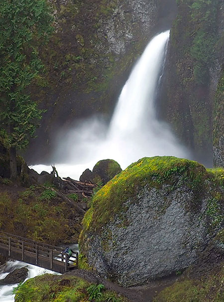
I decided to include this Wahclella Falls scene because it captured a particularly wild day on Tanner Creek last winter. The stream was running high, filling the canyon with mist and seasonal waterfalls drifted down the walls of the gorge on all sides.

The huge splash pool at the base of the falls was especially wild – more like ocean surf than a Cascade stream, and if you look closely, you can also see a hiker braving the rain and cold to take in this view:

mhnp_calendar27

Roaring falls, big boulder… and tiny hiker

I also liked the turbulent stream below the falls, which also boiled more like ocean surf than a mountain stream:

mhnp_calendar28

Tanner Creek comes alive in winter

 So, another calendar featuring Wahclella Falls? Yes, and it certainly won’t be the last. This is among the most magical places in the Gorge – or anywhere!

 Finally, for the December image I selected a photo from my first official attempt at capturing the Milky Way over Mount Hood. This view is across Laurance Lake, on the north side of the mountain:

mhnp_calendar29

Milky Way rising over Laurance Lake and Mount Hood

[click here for a large image]

The glow on the opposite side of the lake is a campfire at the Kinnikinnick Campground, and was just a lucky addition to the scene. While we waited for the Milky Way to appear, there were several campers arriving, making for some interesting photo captures. With a 30-second exposure set for stars, this image also captures the path of a car driving along the south side of the lake to the campground:

mhnp_calendar30

Headlights and campfires in a Laurance Lake time exposure

My tour guide and instructor that evening was Hood River Photographer Brian Chambers, who I profiled in this WyEast Blog article in June. Thanks for a great trip, Brian!

mhnp_calendar31

The author with Brian Chambers somewhere under the Milky Way

So, if you’re looking to support the blog and Mount Hood National Park campaign or just have an ugly fridge to cover, you can order the new calendar on Zazzle.

_________________

…and finally, given the unusual events in our recent national election, some reflections on what it might mean for Mount Hood and the Gorge…

Post-election deju vu: back to the future..?

mhnp_calendar32

Viewed through the lens of protecting public lands and the environment, the presidential election results on November 8 are discouraging, at best. For those of us who have voted in a few elections, it feels a lot like the Reagan Revolution of 1980.

So, the following is a bit of speculation on what lies ahead based upon what we’ve been through before, but with the caveat that unlike that earlier populist surge against government, the environmental agenda of the coming Trump administration is somewhat less clear and appears less ideologically driven.

Ronald Reagan’s vision for government brought a very specific mission to dismantle environmental regulations and open up public lands to commercial interests. To carry out the mission, President Reagan appointed the highly controversial James Watt to head the Department of Interior, and the nearly as controversial Anne Gorsuch to run the EPA. John Block was tapped to head of the Department of Agriculture (which oversees the U.S. Forest Service). Watt and Gorsuch were attorneys, Block a farmer who had entered politics as an agriculture administrator in the State of Illinois.

mhnp_calendar33

James Watt’s radical vision for our public lands threatened to derail Ronald Reagan in his first term

Watt and Gorsuch became infamous for their open disdain for conservationists and the agencies they were appointed to administer. Watt was the Reagan administration’s sympathetic gesture to the original Sagebrush Rebellion. Block focused primarily on an ideological rollback of farm subsidies and programs that dated to the Dust Bowl, and that would eventually be his downfall.

The important lesson is that all three rode in with a “revolution” mandate, and over-reached in their zeal to rewrite American policy overnight. The blowback was instant, and though they did harm our conservation legacy during their embattled tenures, they didn’t have the lasting impact many had feared. Both Watt and Gorsuch were forced to resign before the end of President Reagan’s first term, and Block resigned in the first year of Reagan’s second term.

mhnp_calendar34

Even Readers Digest covered the EPA Superfund scandal that drove Anne Gorsuch out of office!

Gorsuch was eventually pushed out by Reagan for attempting to conceal EPA Superfund files from Congress as part of an unfolding scandal, becoming the first agency head to be cited for contempt of Congress. Before the scandal drove her from office, Gorsuch became Anne Gorsuch Burford when she married James Burford, Reagan’s Bureau of Land Management (BLM) chief, further fueling concern about whether environmental protections could be objectively enforced on BLM lands.

John Block lasted five years, but was pushed out in early 1986 as the worst farm crisis since the Great Depression unfolded under his tenure. Watt left in more spectacular fashion after stating (apparently a joke) that an ideally balanced advisory panel would include ”a black, a woman, two Jews and a cripple.” (and in the age of Google, he has been deservedly forgotten, with the more consequential James Watt – inventor of the steam engine – reclaiming his name in history).

mhnp_calendar35

Bloom County has some fun with Oregon’s Rajneeshee saga… and Ronald Reagan’s failed cabinet appointees

Will history repeat itself? We’ll see, but there is no reason to assume that the conservation community – and, importantly, the American public – will be any less motivated to speak out if the Trump administration attempts a similar rollback on public land and environmental protections to what the Reagan Administration attempted.

Yes, there will be lost ground, but there will also be unexpected gains. That’s our system. Recall that the same President Reagan who brought James Watt to the national stage also signed the Columbia River Gorge Scenic Area Act into law thirty years ago, on November 17, 1986 (famously “holding his nose”, in his words). In his first term, President Reagan signed the Oregon Wilderness Act into law on June 26, 1984, creating 22 new wilderness areas covering more than 800,000 acres.

As President Obama said in his reflection on the election, “democracy is messy”. He also reminded the president-elect that our system of governance is more cruise ship than canoe, and that turning it around is a slow and difficult process, no matter what “mandate” you might claim. That is by design, of course.

…and the WyEast Blog in 2017..?

Looking ahead toward 2017, I hope to keep up my current pace of WyEast Blog articles as I also continue my efforts as board president for Trailkeepers of Oregon, among other pursuits. And spend time on the trail, of course!

mhnp_calendar36

The author somewhere in Oregon’s next national park…

As always, thanks for reading the blog, and especially for the kind and thoughtful comments many of you have posted over the years. The blog is more magazine than forum, but I do enjoy hearing different perspectives and reactions to the articles.

Despite the election shocker this year, I’ve never felt better about Mount Hood and the Gorge someday getting the recognition (and Park Service stewardship) they deserve! That’s because of a passionate new generation of conservations are becoming more involved in the direction of our nation and our public land legacy. The 2016 election seems to have accelerated the passion this new generation of stewards brings to the fight.

Our future is in very good hands, indeed.

 See you on the trail in 2017!

 Tom Kloster | Wy’East Blog


Scorpions!

At first glance, just a wayward crayfish.. but wait! Is that (gulp!) a scorpion's tail..?

At first glance, just a wayward crayfish.. but wait! Is that (gulp!) a scorpion's tail..?

A couple of years ago, I stopped to do some trail tending on the way down from Tamanawas Falls, on the Cold Spring Creek trail. It was dusk, and I was moving some rocks around to improve the tread in a gravelly area, on a slope just above the rushing creek. I spotted what looked like an oval coin, where I had just turned over a rock. Closer inspection revealed a pair of pincers and a tail, perfectly coiled up and tucked in around an armored body.

I thought it might be a crayfish that had somehow made its way up the slope to the trail. But suddenly, the creature exploded into motion, bolting to the top of a nearby rock at a speed that no crayfish could reach out of water. At that point, the tail was extended, and I realized I was looking at a scorpion!

It was nearly dark, so I quickly set up my tripod, as the scorpion sat motionless for me — apparently agreeable to an unscheduled portrait. The first view (above) was his semi-alert position that he held until I moved the camera closer for a better shot. At that point, he went into what can only be described as a “defensive” posture (below), and I must say that this sent some of my primal neurons into overdrive!

What scorpions do when they've decided their photo-op is over..!

What scorpions do when they've decided their photo-op is over..!

I snapped a couple more shots of this pose before he abruptly raced up the slope — right past my foot, alarmingly — and into the brush. It was exhilarating because I don’t often stumble upon some new creature that I haven’t seen before, and especially one this exotic and seemingly out-of-place. What was a scorpion doing in a lush, mountain canyon along a rushing stream? Aren’t they desert dwellers?

After the trip, I researched scorpions a bit, and learned that they do, indeed, inhabit the Cascades as far north as British Columbia. Though I have yet to positively identify this one, it appears to be Paruroctonus boreus, the Northern Scorpion, or possibly one of the Vaejovis scorpion species native to Oregon. Its body was about 2″ in length, claws roughly an inch long, and the tail around 2″ long.

Oregon State University zoologist Philip Brownell provides helpful background in this article on just how scorpions could survive in a place like Cold Spring canyon, where deep snow covers the ground for months every winter. The key is their unique metabolic ability go into stasis in underground burrows, using little oxygen and requiring little food until conditions on the surface improve. But unlike other hibernating creatures, scorpions can quickly switch from stasis to active hunting in a matter of minutes.

Scorpion Mountain, in the Bull of the Woods country south of Mount Hood, might just have been inspired by the real thing, after all..!

Scorpion Mountain, in the Bull of the Woods country south of Mount Hood, might just have been inspired by the real thing, after all..!

Scorpions are live-bearing, with the female carrying her brood on her back until their first molt, upon which they head off on their own. If you get the creepy-crawlies from the sight of scorpions, I don’t suggest Googling images of a female ferrying her batch of young one around! They’re also nocturnal, so you’re unlikely to ever see one in the Cascades.

And what of the dreaded venom? Well, the Northern Scorpion’s venom is listed as a potentially dangerous neurotoxin for humans by some sources, with swelling and pain at the site of the sting, and possibly other more serious reactions. So it’s pretty clear that these creatures are to be seen, but not handled.

According to the National Geographic article link, above, the toxicity of the venom is inversely proportional to the size of the pincers, since large-clawed scorpions tend to hunt their insect prey with their claws, where small-clawed species are more likely to depend on their venom to immobilize their prey.

The spot where I found my specimen was classic habitat for Northern scorpion, according to several web sources. This species apparently lives on dry, loose riverbank slopes in much of its range. So that means that the entire Cold Spring Creek canyon is prime habitat, not to mention most every other canyon in this part of the Cascades.

So, keep that in mind, next time you’re turning over stones in the woods!