Mount Hood National Recreation Area Legislation: 10 Things to know!

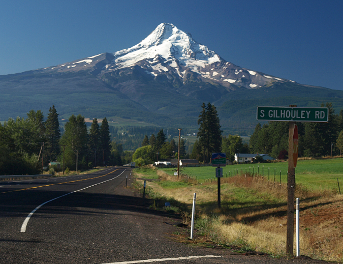
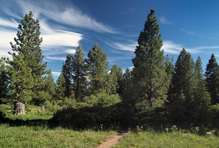
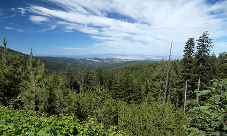
Mount Hood from Lolo Pass

After nearly ten years of informal meetings and town halls, Senator Ron Wyden and Rep. Earl Blumenauer recently released a much-anticipated framework for legislation that will fundamentally change the management direction for Mount Hood and expand protections for the Columbia River Gorge. 

The legislative details are forthcoming, but for now Sen. Wyden and Rep. Blumenauer are asking for public comment on a general legislative concept by January 7 – this Friday! That’s a very short comment period, but if you love WyEast Country (and you wouldn’t be reading this if you didn’t!) please consider weighing in, even if only to send a sentence or two on what is most important to you as this legislation takes shape.

Here are 10 things to know about this new proposal for Mount Hood and the Gorge:

1. It’s a very big deal for Mount Hood! At this time, it’s still a legislative concept, but it will frame the ultimate details of the legislation, and the scope of the concept is broad. This is the most sweeping legislation proposed for Mount Hood since the Oregon National Forest was created in 1908 (and later renamed the Mount Hood National Forest in 1924). This is a big deal for Mount Hood. More than the original Mount Hood Wilderness area created with the Wilderness Act in 1964, more than the subsequent wilderness additions in 1978, 1984 and 2009. And more than the Northwest Forest Act of 1992. 

Why? Because the legislation would shift the core function of the forest away from commercial logging and toward forest restoration and enhanced recreation. This is a sea change for the Forest Service – and for the mountain. The degree to which this pivot is enforced in law depends solely on what the coming legislation says, and therefore the importance of weighing in early and often (as Rep. Blumenauer likes to say).

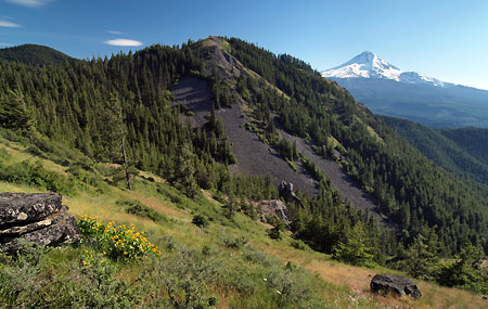
2. It’s big deal for the Gorge, too! While the greatest impact of the proposed legislation would be on Mount Hood and the federal lands that surround the mountain, additional protections and recreation enhancements for the Gorge are part of the proposal. They represent the most important step forward since the Columbia River Gorge National Scenic Area was established in 1986.

Crown Point and the Columbia River Gorge

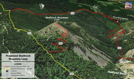
3. Say it with me: Mount Hood National Recreation Area! The central and most powerful feature of the legislative concept is a dramatic expansion of the Mount Hood National Recreation Area (NRA). “Expansion” you might ask? Since when has a Mount Hood NRA even existed? Since 2009, as it turns out – though few know this, and it’s understandable. The awkwardly titled “Lewis and Clark Mount Hood Wilderness” bill that President Obama signed into law in 2009 added new wilderness and a number of other protections for Mount Hood, but tucked into the bill were three small areas to the east and southeast of the mountain deemed the “Mount Hood NRA”. 

At the time, the creation of these NRA postage stamps was really just a consolation prize to mountain bikers who stood to lose access to trails falling inside the new wilderness areas. This is a frustrating and contentious issue among should-be conservation allies that was never anticipated when the Wilderness Act was signed into law in 1964 (bicycles are interpreted as mechanized, and thus excluded under the law). Though token as the original Mount Hood NRA units were, I wrote in this article several years ago that they also represented an opportunity to someday help Mount Hood achieve full recognition as a national treasure worthy of permanent protection. It was legislative foot in the door that may be about to open much wider.

The power of the NRA is clear in the legislative concept: it would encompass most of the Mount Hood National Forest north the Clackamas River, or roughly half the forest. The Forest Service would be thereby directed to write a new management plan for this vast area that focuses on forest restoration, recreation and watershed and water quality. This is a long-overdue change from the commercial logging mission that has hammered the mountain since the 1950s. As envisioned in the legislative concept, the new mandate would be to restore forest health and promote recreational activities that are in concert with a recovering forest that will be allowed to grow old, once again. 

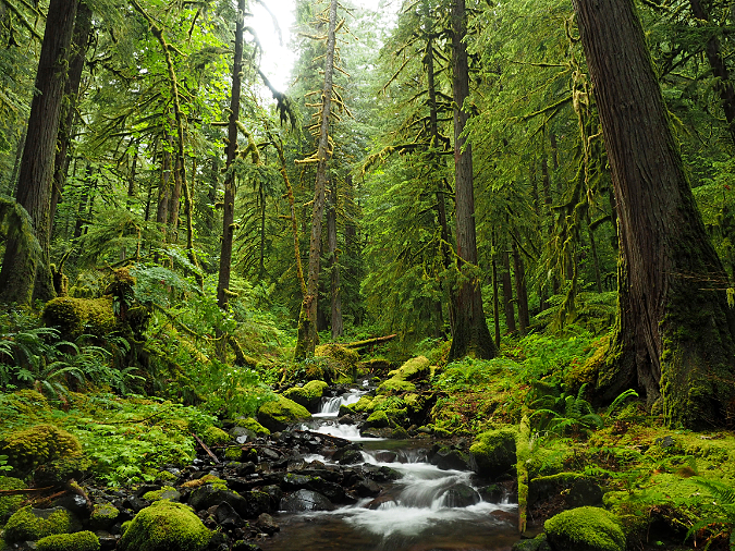
Rainforest along Whale Creek on the Clackamas River Trail

Did you know the current plan guiding the Forest Service for their management decisions was adopted more than 30 years ago, in 1990? The Portland region, alone, has grown by well over 1 million residents in that time, but aside from expansion of the commercial ski resorts, recreation opportunities on Mount Hood haven’t expanded — with the resulting traffic and trailhead crowding we see as a familiar reminder. The legislative concept speaks directly to this crisis in management, with a clear directive to the Forest Service to change its focus to better reflect the interests and concerns of a changed region. This is a sea change for Mount Hood.

Conservationists remain wary of the NRA, however. Why? Because they rightly point to the fact that every NRA in this country is a bit different, each tailored to the specific area they were created for. In Oregon, this includes the Oregon Dunes and Hells Canyon, for example. While some NRAs are written with conservation in mind, others are relatively toothless and don’t give the Forest Service much direction in how to manage these areas. This is why the details in the legislative language matters. 

4. More Wilderness and Wild & Scenic Rivers. Senator Wyden has been particularly focused on expanding Oregon’s system of Wild & Scenic Rivers in recent years, a protection that mostly prevents rivers from being dammed, but also offers other protections intended to keep river corridors healthy and functioning for wildlife. The proposed legislation would add sections of the West Fork Hood River, Lake Branch, Coe and Eliot Branches, Cold Spring Creek and the Dog River to the Wild & Scenic River system in the Hood River basin, alone. On the west side of the mountain, sections of the Clear Fork of the Sandy River, Zigzag River and Still Creek would be added to the Wild & Scenic River system. The limit to this protection is that it only applies to public lands, and most of these streams flow through private lands, as well. These stretches located outside public ownership are not included in the legislative concept. 

Wilderness expansions are an expected part of any new conservation bill for Mount Hood and the Gorge, even though most of the truly wild areas have already protected through past legislation. Therefore, most of the new areas being proposed are expansions of existing wilderness, including Lost Lake Butte, the middle Coe and Eliot Branch canyons near Cloud Cap, popular Tamanawas Falls, the east side of Bluegrass Ridge, the Red Hill area along the Old Vista Ridge trail and several small expansions along the east end of the Salmon Huckleberry Wilderness.

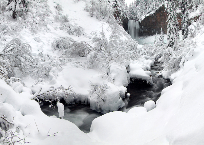
Tamanawas Falls on Cold Spring Creek, one of the new wilderness areas in the proposed legislation

5. Moving trail stewardship up the Forest Service priority list? Ask someone who volunteers as a trail steward for one of the non-profits who work in WyEast Country (Trailkeepers of Oregon, Pacific Crest Trail Association, Mazamas, Backcountry Horsemen, Oregon Equestrian Trails, and Oregon Mountain Biking Coalition, to name among the most active) and they will tell you that one of the main obstacles in putting tools in the hands of volunteers on our trails is the Forest Service, itself. Compared to working with local and state land managers, navigating the Forest Service is a real challenge, even when you’re trying to bring needed resources in the form of volunteer labor.

The legislative concept builds on outreach conducted by Rep. Blumenauer’s staff to most of these groups to figure out what’s missing in the current Forest Service structure and what could be done differently to make trail stewardship volunteering easier. As written, the concept is a bit squishy, but the general themes of dedicating more Forest Service staff to serve as a coordination hub, and giving them new tools for coordinating virtually with volunteers is a good start. More thoughts on this topic follow in this article.

6. Talking with the tribes. This legislative concept has been in development for a while, and to the credit of Rep. Blumenauer and Sen. Wyden, it was slowed along the way to ensure meaningful consultation with affected tribes. As drafted, the legislative concept focuses on Forest Service obligations to better consult and coordinate with the tribes and to specifically to deliver on a first foods plan that would be added to the policies that guide forest management. More thoughts on this topic follow, as well.

Looking across the Columbia River to the town of Lyle from Rowena Plateau

7. Gorge Towns to Trails vision. Long advocated by Friends of the Columbia Gorge, this is a bold, long-term vision to create a European-style trekking network encircling the Columbia River Gorge National Scenic Area. The legislative concept gives a nod to the vision in all but name, along with a general direction to the Forest Service to develop a comprehensive system plan for all trails the Gorge. 

It’s no secret that in the past the Columbia Gorge Commission staff has viewed new trails in the Gorge quite negatively, and National Scenic Area staff have also been reluctant to consider trail expansion, as well. This, despite the overwhelming growth in demand and resulting overcrowding that is apparent to anyone who spends time in the Gorge. The proposed legislation would guide staff at both agencies with a clearer vision for how and where trails will be expanded in the Gorge, and how existing trails experiencing overuse can be better managed.

8. Improving Mount Hood & Gorge Transportation. Who can argue with this? It can only get better, right? And yet, this is perhaps the squishiest of the elements in the legislative concept, as most of what it calls for is already being provided and the concept simply calls for more – as in more public transit and transportation “options” (read: bikeways?), more rest areas, more law enforcement, more emergency response capacity. What the concept misses is that transportation, itself, is a recreation experience, not just a service. More thoughts on this topic follow below, as well.

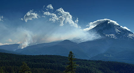
The Dollar Lake Fire on Mount Hood (September 2, 2011)

9. Forest Fire “management”? Well, it’s safe to say that as a society we are beginning to grapple with the reality that a century of aggressive forest fire suppression coupled with a warming climate has set up an impossibly volatile circumstance in our forests. But I would emphasize the word “beginning”, because while the scientists and public agencies (and even a few politicians) understand the situation, there remains intense public pressure to somehow prevent forest fires – especially from people who live in the so-called “urban-rural interface”. This is policy jargon for people who live on private forested acreages abutting our public lands in places like the U.S. 26 corridor, and who are at real risk from catastrophic forest fires.

At best, we might be able to reduce the number of human-caused fires. These are still the majority, including the massive Riverside (2020) and Eagle Creek (2017) fires that scorched a large chunk of Mount Hood National Forest in the past five years. The proposed legislation tries to ease into this with by requiring the Forest Service to create a “mitigation and adaptation” plan for managing both fire risk and response. “Mitigation” would include prescribed burns and thinning crowded plantations on old clear cuts to improve forest health and fire resilience – two of the main ways the Forest Service is responding to the growth in catastrophic fires in the West. 

“Adaptation” is less defined in the proposed legislation, however. The elephant in the room are the thousands of homes and summer cabins (hundreds of them on federal land through 99-year leases) located in that “urban-rural interface”. Can they be protected? The fire that tore through the communities of Talent and Phoenix in Southern Oregon in 2020 didn’t stop at the urban-rural interface, they burned right in developed urban areas. “Adaptation” suggests that we might change how and where we live in relations to forests in the future, so what does that mean for the urban-rural interface, before or after fire? I don’t envy the Forest Service on this task, nor will this legislation solve the larger policy dilemma, but there’s no question it will need to be part of developing a Mount Hood NRA plan.

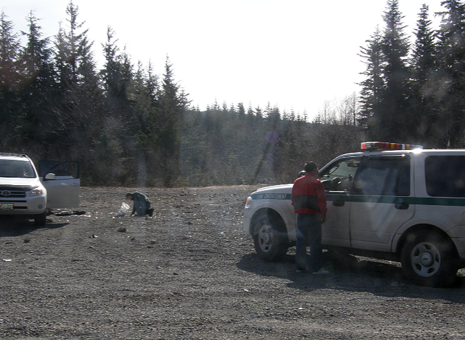
In a rare moment of justice, these target shooters were caught in a no shooting zone on Wildcat Mountain, and asked to clean up their trash while the deputy watched (2010)

10. Who isn’t for public safety in our forests? This is another topic the proposed legislation didn’t have much choice in acknowledging. Most who visit Mount Hood in the Gorge are keenly aware of the lawless activity that finds refuge in a vast area with little law enforcement presence. The legislative concept calls for more funding, including for local law enforcement, as well as “public education”. More thoughts on this topic follow, as well.

So, I’ve highlighted the main take-aways as a WyEast advocate who has long dreamed of a fundamental shift on management focus like this, but the legislative concept has more.

You can download the concept document here:

Draft Legislative Concept

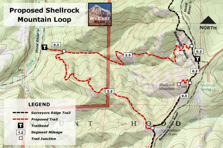
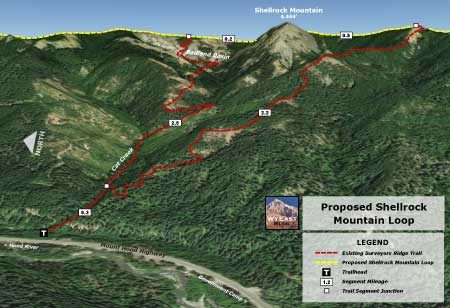
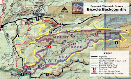
You can also view and download the surprisingly detailed draft concept map here:

Draft Concept Map

And you can comment directly on the proposed Mount Hood NRA legislation here:

Public Comment Form

This will take you to an online form for sharing your thoughts. The following are what I plan to share during this comment period – and they might be useful to you, as well.

What’s Missing from the Concept?

Though there’s a looming comment deadline of January 7 (this Friday!), this legislative process is just getting started, and there will be more opportunities to weigh in while congressional staff drafts the actual legislation. With any luck (and some will be needed!) and enough support, this just might make it through the most divisive Congress in recent memory.

Here are a few things I’d like to see in the new Mount Hood legislation:

1. Restorative justice for the tribes. This means more than “living up to our statutory obligations”, as currently written in the legislative concept. Most of the statutes governing tribes in this country are rooted in our dark history of displacement and oppression of native populations, and the presumption that what was taken from the tribes must forever be lost. Restorative justice means to reverse the harm, and for Mount Hood and the Gorge might include restoring the ecosystems that provide first foods – as included in the legislative concept. But it might include dedicating or expanding public lands for the sole purpose of restoring exclusive tribal access to sacred places.

Restorative justice should include an inventory of interpretive and directional signage and symbols, too, to become inclusive of pre-white settlement history and customs, and reverse some of the cultural erasure caused by place names and white-centric written history. The most egregious examples are interpretive signs located along the Oregon Trail and Barlow Road. In my view, every one of these should include the perspective of native peoples who were pushed aside by westward expansion. But only the tribes can speak to this history from a perspective of cultural suffering, loss and continuing harm these migratory roads represent. 

Only by meaningfully engaging and listening to the tribes can the Forest Service know what a larger restorative justice commitment would look like, but it should be part of their mandate for the proposed Mount Hood NRA.

Restorative justice for tribes begins with never forgetting — nor accepting — the cultural harm to native peoples caused by white settlement in WyEast country (Celilo Falls in the late 1950s, a few years before it disappeared behind The Dalles Dam)

2. Making public lands truly public. Show up at a popular trailhead in the Gorge or on Mount Hood and you’ll immediately see that our public lands are an overwhelmingly white space. This is especially true for trails and campgrounds, as many recent studies have documented. Why is this? 

Ask a person of color, and researchers will tell you that white people who dominate the trails and campgrounds are a big part of the problem. The hostility ranges from outright and overt racist attacks to simple comments like “it’s so nice to see a person like you out here.” Well meant? Perhaps, but also unwelcome and uninvited when a simple “hello” is how a white person might have been greeted. Official signage at trailheads and campgrounds can be similarly hostile and unwelcoming in ways that are racist. It’s a problem that requires a plan of action to change.

Removing the barriers that make our public lands unwelcoming to people of color is within our reach, and must be at the core of how the proposed Mount Hood NRA is managed

The legislative concept should speak explicitly to this in the provisions required for the Mount Hood NRA management plan. As written, the concept vaguely mentions providing a “variety of recreational experiences to serve diverse users”. It should be more specific: our public lands have a racial diversity problem that implies specific bias that prevents black and brown Americans from sharing these special places equally. That’s unacceptable and should be a filter for everything in the new management plan.

Like the previous topic on restorative justice for tribes, this work must begin with the Forest Service directly engaging – and listening — to communities of color as they develop a plan of action. This conversation also means meeting black and brown communities where they are, not at a remote ranger station located miles from the nearest population center. It’s a long-overdue conversation and the proposed Mount Hood NRA is the perfect vehicle to begin this work.

3. Law enforcement without all the baggage? When I walked into White River Falls State Park last summer with a friend who is a young Black man, he groaned, cringed visibly and shook his head at a giant new sign (below) that the Oregon Parks and Recreation Department had placed at the trailhead. No doubt it was installed to deal with heavy vandalism in recent years to the historic structures in the park, but I’m quite sure the park managers didn’t intend the reaction my friend experienced. They message was intended to protect the very resources he came here to enjoy, but made him feel deeply unwelcome, instead.

This sign at White River Falls betrays a tone-deafness to how images of law enforcement might impact communities of color – in this case, literally the image a faceless authoritarian with a finger pointed at arriving visitors

It’s a painful fact that we live in fraught times with our law enforcement. So, when I read the public safety element of the legislative concept, I had that new sign at White River Falls in mind. What is the law enforcement issue there? Largely, young people tagging historic structures. I doubt the new sign with have much impact (except to become a new target for tagging?), but an occasional human law enforcement presence might help – or perhaps a security camera?

I don’t presume to know the answers, but having my own vehicles broken into a couple of times at trailheads — and having encountered much more troubling lawless behavior away from the more popular areas—I do think the idea of providing federal funding for expanded law enforcement through local counties is a good one. But given the times we live in, I’d also like to see that funding come with strings attached: the officers should be uniformed distinctly and differently from their local agency, as Mount Hood NRA officers. Creating a new, hybrid law enforcement identity would also be an opportunity to build some racial diversity in the generally rural law enforcement jurisdictions that would carry out this work.

I’m also quite open to security cameras at trailheads – as most hikers are (especially younger hikers). There was a time when this might have been controversial (say, ten years ago?) but today these are among the few public places that don’t have some sort of security monitoring, right down to our front doors, complete with doorbell cams. Lawless people know this, and it’s evidenced by the piles of broken glass than can be found throughout most of the major trailheads in the Gorge and on Mount Hood. 

Law enforcement on public lands is a thorny topic, indeed, but one that needs more thought and attention than is reflected in the current legislative concept.

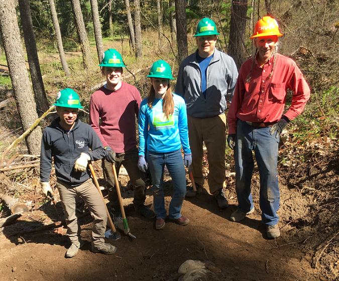
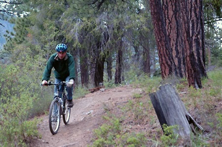
Trailkeepers of Oregon (TKO) volunteers building new trail at Punchbowl Falls Park

4. Set benchmarks for recreation. You may know that Congress has a long history of setting annual logging quotas for the Forest Service that must be met. So, if the purpose of the Mount Hood NRA is to shift the management emphasis of the forest from commercial logging to forest recovery and recreation for Mount Hood and the Gorge, why not set quotas for recreation? 

This could be in the form of new trails and trailheads constructed, or the number of hikers who show up at trailheads – or both – measured per capita, as defined by the population living within 100 miles of the Mount Hood NRA, for example. Since the late 1960s, the Forest Service has acknowledged an ongoing growth in demand for trails, yet the system hasn’t grown, and what we have has increasingly fallen into disrepair. Why is this?

One of the greatest barriers to expanding trails is simply a mindset within the Forest Service. After decades of inadequate funding from Congress for trail construction and maintenance, the agency culture has been apprehensive to even talking about new trails. This, despite the obvious demand and overcrowding on the existing system. The problem also includes doing the needed planning, engineering and environmental assessments needed to advance new trail projects when funding does come – a critical obstacle that only the Forest Service can remove.

The proposed Mount Hood NRA provides an opportunity to link the new agency focus on recreation to both the growing interest in trails and sheer numbers of people living in proximity to the forest. If specific benchmarks were set up as funding incentive in the legislation, it could speed the transition of the Forest Service culture from logging to forest recovery and recreation, including making the planning work needed to move new trail projects from concept to construction a priority in agency budgets.

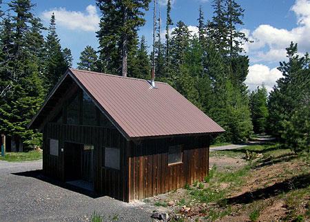
The opening segment of the new Mirror Lake Trail, the first accessible trail built on Mount Hood in decades

5. Accessible trails and trailheads are not a luxury. For too long our public land agencies have viewed recreation opportunities for people with disabilities as something outside the norm. The result is a woefully inadequate system of accessible outdoor trails for people who use walkers, wheelchairs or other mobility devices. As our population becomes increasingly older in coming years, and the share with disabilities grows, this unmet need for accessible trails will only accelerate.

There have been some shining successes – the Lost Creek nature trail and Little Crater Lake trail area couple of my favorites. But even these trails fail to get the basic maintenance needed to remain fully accessible. The legislative concept should include a specific provision that a complete system of accessible recreation facilities and sites be incorporated into the Mount Hood NRA plan and constructed as part of the benchmarked targets described above.

Who hasn’t stopped here to admire this roadside view?

6. Transportation IS a recreation experience! There’s a spot near Hood River, along the Mount Hood Loop, that I blogged about years ago. The view of Mount Hood and the upper Hood River Valley that unfolds there is world class. More often than not on a clear day, there’s a car or two pulled over, with someone taking photos with their phone. It’s not surprising, as since the original Mount Hood Loop was completed in the early 1920s, it has been a classic touring route. It just hasn’t been managed that way for many years.

It’s true that the modern Mount Hood Loop carries a lot of traffic, and the proposed legislation concept speaks to the basic transportation needs that exist – the lack of meaningful transit, the complete lack of a safe bikeway along Highway 35 and U.S. 26 and (less explicitly) the lack of what planners call “demand management” to promote incentives for visitors to use travel options like transit and visit outside of peak travel times. Demand management would include managing peak period parking at major trailheads and destinations in the Gorge and on Mount Hood – again, implied, but not specific.

These are all good things needed to make traveling around the mountain and through the Gorge a better experience, and less of a barrier to people who don’t have access (or prefer not to use a car), in particular. But the legislative concept should also call for the Oregon Department of Transportation (ODOT) and Forest Service to work collaboratively to create a transportation vision – a long-range plan to make the experience of traveling to and around the mountain a destination, in itself. 

Congress can’t directly regulate ODOT, but it can regulate an arm of the U.S. Department of Transportation known as the Western Federal Lands Highway Division. This is an agency with a regional office in Vancouver that has led several projects on Mount Hood in recent years, including the White River Bridge replacement, the historic Sahalie Falls Bridge restoration and designing and constructing the new Mirror Lake Trailhead. They have long worked with ODOT, and could be the avenue for the new legislation to be specific about improving the traveling experience on the mountain through a collaborative planning effort with ODOT.

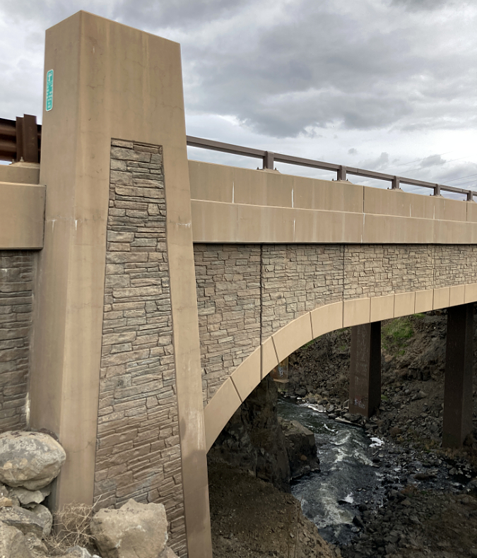
ODOT’s designs for new structures in the Columbia Gorge draw from a carefully developed policy guidance developed by the agency (the new Fifteenmile Bridge on I-84)

Elements of a Mount Hood NRA transportation plan could build on the excellent design policy that ODOT has followed for the Columbia River Gorge National Scenic Area over the past two decades. This policy guides the design and maintenance details of I-84 and the Historic Columbia River Highway from the smallest details (did you know the back of freeway signs in the Gorge are painted “national park brown”?) to bold, as ODOT gradually replaces old slab-style concrete freeway bridges in the Gorge with handsome new structures that are a visual complement to scenic area (shown above).

A Mount Hood NRA transportation plan should also incorporate the re-imagining of several long- abandoned or bypassed sections of the old loop highway into a continuation of the world-class Historic Columbia River Highway State Trail that is nearing completion in the Gorge. ODOT has built the in-house expertise for this work, and will soon have the capacity once their work on the Gorge trail “final five” miles is completes over the new few years. I posted two articles on this concept for Mount Hood early in 2021 (and have also shared these with congressional staff – please feel free to mention them in your comments, too!)

Mount Hood Loop Highway State Trail Proposal – Part One

Mount Hood Loop Highway State Trail Proposal – Part Two

Another piece of the transportation puzzle that calls for a plan under the new Mount Hood NRA are the off-highway, paved forest routes, like Lolo Pass Road (FR 18/ FR 1810), Dufur Mill Road (FR 44) and White River Road (FR 48) that function as scenic drives, but suffer badly from disrepair and a complete lack of visitor amenities. Each of these routes needs a management plan and vision for making them the positive recreational experience that the public is already seeking when the venture on to these roads.

Which brings me to a final element of a Mount Hood NRA transportation plan – gateways, enhanced directional signage, waysides, pullouts and interpretive displays that tell the story of WyEast country to the traveling public. These are all things you would find in a parkway design in one of our national parks, and the Mount Hood NRA should have parkway designations for Highway 35, U.S. 26 and the off-highway routes mentioned above, too, with design guidelines to ensure a great travel experience as the system is developed over time. There are plenty of great parkway plans to draw from, the proposed legislation just needs to provide the mandate to do the work.

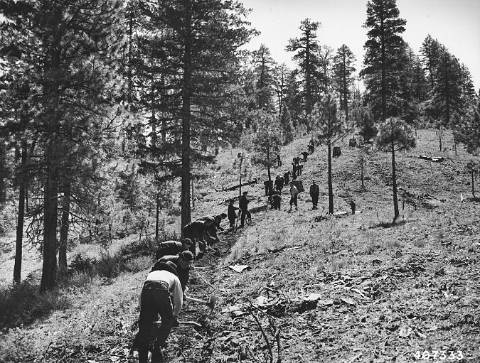
Civilian Conservation Corps crews building trail in the 1930s

7. The CCC? It was a great idea in 1932… And it’s still a great idea: the Civilian Conservation Corps (CCC) was created by President Franklin Delano Roosevelt to get young, idle men off the street and into productive work that would give them job skills, food, housing, clothing and a modest paycheck ($30/month, of which $25 was sent to their families!). It was among the most popular New Deal programs, but sadly, the CCC was disbanded in 1942 as our country went to war.

The proposed Mount Hood NRA provides a unique opportunity to revive the CCC model, but in modernized form. The benefits to the NRA are clear, with youth workers helping to restore, build and maintain trails, trailheads and campgrounds, along with habitat and forest restoration work – all things the original CCC did, and whose work still shapes what we see in our forests today.

A modern CCC would be open to all youth, not just young men, and compensation could include college tuition credits, along with a paycheck, room and board. Mount Hood already has Forest Service facilities that could (again) become CCC camps – Camp Zigzag, Timber Lake in the Clackamas River corridor and the Herman Creek work center in the Gorge, to name some of the more obvious options. 

The legislative concept hints at this possibility, but it should be fully incorporated as a core element of the vision for the Mount Hood NRA in order to drive the needed Congressional funding.

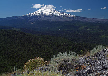
Badger Creek Wilderness and Mount Hood from the White River Wildlife Area

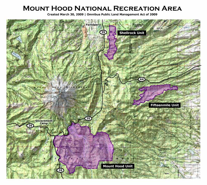
8. Let’s get the boundaries right. The overall scope of the Mount Hood NRA, as expressed on the draft map [link], is terrific. Notably, it includes both Forest Service and Bureau of Land Management (BLM) lands along the west edge (along the US 26 corridor), as well as the various pieces of federal land that frame the upper Hood River Valley. It would have been easy to leave these small parcels out, but they provide an important starting point for public land acquisition by the Forest Service to better define the Mount Hood NRA – though a directive to do this work should be included in the legislation. The now-permanent Land and Water Conservation Fund already provides an important funding conduit for these needed land acquisitions.

There are also a few pieces missing from the proposed Mount Hood NRA on the concept map. First, most of the Badger Creek Wilderness is excluded. This is a big oversight if the goal of the proposed Mount Hood NRA is to shift the Forest Service focus to recreation. Why? Because the Badger Creek Wilderness has a deep backlog of trail maintenance needs that are out of reach for urban volunteers doing day trips, as many of the Badger Creek trails are remote and require overnight crews.

Second, the nearby Dog River drainage that falls within The Dalles watershed management area is excluded. The Dog River is proposed to become a Wild and Scenic River in the legislative concept, and the Dog River basin already has a lot of recreation activity, as it is not a fenced watershed. Well-traveled Dufur Mill Road (FR 44) travels extensively through the watershed, and a number of other forest roads, hiking and biking trails are in or near the watershed, including the popular High Prairie trailhead. It makes sense to include Dog River in the Mount Hood NRA in order to more effectively manage these activities — and to ensure that recreation will continue to be allowed here.

Pup Creek Falls is excluded from the proposed Mount Hood NRA, along most of  the Clackamas River National Recreation Trail

A third map oversight is along the south edge of the proposed Mount Hood NRA, where the south half of the Roaring River Wilderness is left outside the proposed recreation area, along with a section of the Clackamas River that is traversed by the Clackamas River National Scenic Trail. Some of this area was burned in the 2020 Riverside fire, and that reality, alone, is reason enough to bring it into the NRA to direct resources toward rebuilding and restoring trails and campgrounds. While I would like to see the entire Clackamas basin brought into the NRA, that will have to wait for future legislation. For now, extending the proposed Mount Hood NRA boundary south to the Collawash River confluence would be a reasonable start.

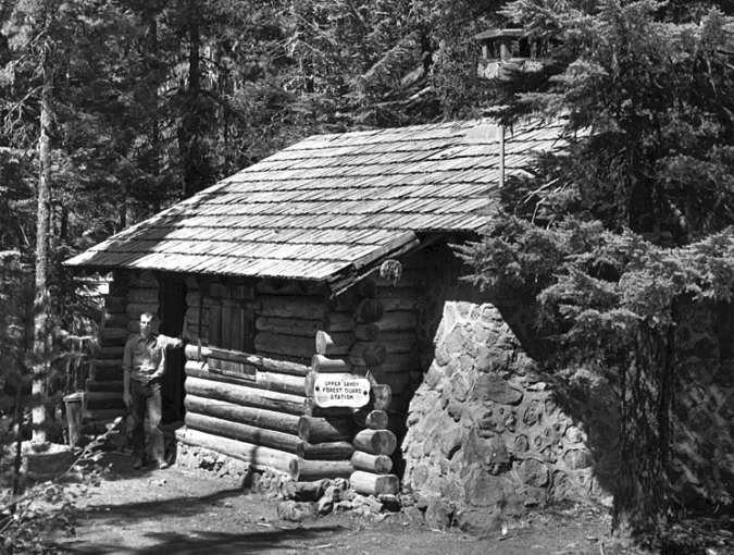
The Upper Sandy Guard Station in better days. Today, it is on the brink of being unsalvageable, despite being on the National Historic Register

9. Don’t forget our history! Finally, an important missing element in the legislative concept is some sort of recognition that we are rapidly losing historic structures through the Mount Hood National Forest. The 2020 Riverside Fire destroyed several of these priceless buildings, so recognizing and preserving the remaining gems is even more urgent today. The Mount Hood NRA management plan should include an updated historic resources inventory and plan for capital investments needed to stabilize or restore sites and structures – ideally, in partnership with non-profit partners.

What can you do?

That’s a deep dive into the legislative concept, along with ways it might be improved. If you have read this far, kudos for being a friend of Mount Hood and the Gorge! The next step is to weigh in, and you’d be surprised how much your thoughts matter to congressional staff – they really do care! The timeline for commenting on the concept and map is short – they must be submitted by this Friday, January 7. Again, here’s the online form for commenting:

Mount Hood NRA Proposal — Public Comment Form

That said, if you’re not able to weigh in during this round, watch this space – I’ll post updates on the legislation as it (hopefully) moves forward. While there is a lot of major legislation churning through Congress right now, it’s entirely possible that this concept will get turned into a bill that makes it through both chambers… with a little luck and a push for all who love Mount Hood and the Gorge!

The “Other” Shellrock Mountain

Mount Hood rises above Shellrock Mountain and Badlands Basin

Mount Hood rises above Shellrock Mountain and Badlands Basin

Hidden in plain sight above the Hood River Valley, Shellrock Mountain is a little-known peak with a familiar name. Though it shares a name with its better-known cousin in the Columbia River Gorge, the “other” Shellrock Mountain has much more to offer, and is easier to explore.

The “other” Shellrock Mountain is located along the Surveyors Ridge trail, a route popular with mountain bikers who ride from one glorious viewpoint to another along this well-traveled route. At one point on the trail, an obscure wooden sign points to Shellrock Mountain, but really just marks a short spur trail with a view of the south face of Shellrock. Beyond this modest view, few visitors take the time to explore the mountain or the rugged Badlands Basin, located nearby.

Hidden in plain sight: Shellrock Mountain is from Cooper Spur Road

Hidden in plain sight: Shellrock Mountain is from Cooper Spur Road

[click here for a larger view]

Reaching the summit of Shellrock Mountain involves a short, stiff off-trail scramble up the northeast slope of the peak (more about that later), where a stunning view stretches from the nearby glaciers of Mount Hood to the big peaks of the southern Washington Cascades and arid desert country of the eastern Columbia River Gorge.

Shellrock Mountain sits astride the Hood River Fault, a 20-mile long scarp that forms the east wall of the Hood River Valley. The scarp also forms the last high ridge of the Cascade Range in the Mount Hood area, with evergreen forests giving way to the arid deserts of Eastern Oregon just a few miles east of Shellrock Mountain. This proximity to the desert ecosystem brings together a blend of mountain and desert flora and fauna that make Shellrock Mountain and its surrounding area unique.

While most of the uplifted ridge along the Hood River Fault is composed of ancient layers of basalt, andesite and dacite, the Badlands Basin reveals the more recent debris of a pyroclastic flow, the same roiling mixture of steam, volcanic ash and rock that roared from Mount St. Helens in the May 1980 eruption. This flow originated from Mount Hood during its early formation.

Badlands Basin sprawls against the northern foot of Shellrock Mountain

Badlands Basin sprawls against the northern foot of Shellrock Mountain

Badlands Basin is located at the headwaters of Cat Creek, on the north flank of Shellrock Mountain. Here, the ancient pyroclastic flow has been carved into a fantastic landscape of pinnacles, ridges and goblins that is unmatched elsewhere in the region. The Badland Basin formation spreads across about 100 acres, rising nearly 1,000 above Cat Creek.

The maze of formations in Badlands Basin as viewed from Shellrock Mountain

The maze of formations in Badlands Basin as viewed from Shellrock Mountain

Exploring the Badlands Basin is a rugged and surreal experience for the rare visitors who make their way through the jagged formations. No trails go here, and the terrain is both steep and exposed. But once inside the formation, individual spires and ridges take on a new life, as their bizarre shapes come into focus on a human scale. The Badlands are surprisingly alive, too, with a unique ecosystem of desert and sun-loving alpine flora thriving in dry meadows among the rock outcrops.

Badlands Basin: “The Grizzly Bear”

Badlands Basin: “The Grizzly Bear”

Badlands Basin: “The Hippo”

Badlands Basin: “The Hippo”

Badlands Basin: “The Iguana”

Badlands Basin: “The Iguana”

Together, Shellrock Mountain and the adjacent Badlands Basin are special places that beg to be explored. While the Surveyors Ridge Trail provides a good view into the area, new trails that explore the strange formations of the Badlands up-close and reach the airy summit of Shellrock Mountain could make these places much more accessible for hikers and cyclists. What would these new trails look like?

Proposal: Shellrock Mountain Loop Trail

This proposal calls for a new trail to Shellrock Mountain and Badland Basin from the Loop Highway. Why start at the highway? It makes sense for several reasons: first, the new trailhead at Cat Creek would be only about one-third mile from the popular Dog River Trailhead, making a long and spectacular loop possible for mountain bikers, as the Dog River Trail also connects to the Surveyors Ridge Trail.

Second, a highway trailhead would make the area much more accessible and secure for all visitors, as highway trailheads are easier for law enforcement to patrol, and highway traffic, alone, acts as significant deterrent against car clouters.

ShellrockMountain08

[click here for a large version]

Finally, a trailhead along the Loop Highway could be open most of the year, allowing for winter snowshoe access to the high country around Shellrock Mountain when the Surveyors Ridge Road is buried under snowdrifts.

The proposed Shellrock Mountain Loop would have two legs: a 2.5 mile northern leg would follow Cat Creek to the base of Badlands Basin, then wind through the rock formations to a junction with the Surveyors Ridge Trail. A southern leg would climb the long ridge west of Shellrock Mountain to a separate junction with the Surveyors Ridge Trail, about a mile south of the northern leg. The Surveyors Ridge trail would connect these new trails, creating the loop.

A short summit spur trail would lead from the existing Surveyors Ridge Trail to the rocky top of Shellrock Mountain, providing a side-trip option for cyclists on the ridge and the main destination for hikers on the new Shellrock loop trail.

The following oblique views show the proposed trails from both west and east perspectives:

ShellrockMountain09

[click here for a large version]

ShellrockMountain10

[click here for a large version]

What Would it Take?

In 2009, President Obama signed a bill into law creating the Mount Hood National Recreation Area (MHNRA), a small but significant new form of protection for the Mount Hood area. The MHNRA concept has mountain bikes in mind, as it provides a way to protect recreation areas in a wild state, but without bicycle restrictions (under federal law, bicycles are not allowed in designated wilderness areas).

Shellrock Mountain and Mt. Hood from the Surveyors Ridge Trail

Shellrock Mountain and Mt. Hood from the Surveyors Ridge Trail

The entirety of Shellrock Mountain and the Badlands Basin fall within the MHNRA designation, and as such, deserve to be considered for proposals like this one. The Forest Service has shown an encouraging willingness to work with mountain biking advocates to build new bike trails in the Surveyors Ridge area, too. So while the agency has generally opposed building new trails anywhere else, there is a good chance that the Shellrock Mountain Loop could be build if mountain bike advocates were to embrace the idea.

The first mile of both legs of the new trail would also fall on Hood River County land. The county currently focuses most of its energy on logging its forest holdings, but has worked with mountain bikers in the Post Canyon area to diversify the kinds of uses that county land can be dedicated to.

Nope, this sign doesn’t lead to Shellrock Mountain… yet…

Nope, this sign doesn’t lead to Shellrock Mountain… yet…

In the Shellrock Mountain area, Hood River County has already logged off the big trees, so hopefully the County would see the wisdom of shifting the focus in this area to recreation, as well – and possibly consider funding for trail construction, as well.

Most importantly, mountain biking advocates like the International Mountain Biking Association (IMBA) have a terrific record of trail building, and with help from other trail advocates like Trailkeepers of Oregon (TKO), could be the catalyst in bringing together a collaborative effort of volunteers, the Forest Service and Hood River County in creating this new trail system.

How to Visit Shellrock Mountain

Sturdy hikers can visit Shellrock Mountain today with a bit of wayfinding expertise and some bushwhacking skills. The best starting point is an unofficial trailhead located along the Surveyors Ridge Road.

A brave bushwhacker heads for Shellrock’s summit

A brave bushwhacker heads for Shellrock’s summit

To reach the trailhead from Hood River, drive the Loop Highway (OR 35) ten miles south of I-84 to a crest just beyond the Mount Hood Mill, where you turn left onto Pinemont Drive. This road eventually becomes Surveyors Ridge Road, alternating between paved and gravel surfaces, but is always easily passable for any car.

At almost exactly 11 miles from where you turned off the main highway, watch for an unmarked trail heading to the right at an obvious bend in the road. Park here, and follow the short path to the Surveyors Ridge Trail, just a few feet off the gravel road. Shellrock Mountain is visible directly ahead of you!

The open summit ridge of Shellrock Mountain

The open summit ridge of Shellrock Mountain

From here, turn left (south) and follow the Surveyors Ridge trail for about one-third mile to a gentle crest along the forested east shoulder of Shellrock Mountain. If you pass the trail sign pointing to Shellrock Mountain, you’ve gone too far.

At the crest, head directly uphill on whatever path you can find through the forest, then abruptly leave the trees and reach the open east slopes of Shellrock Mountain, where you will wind among patches of manzanita and ocean spray as you work your way toward the summit. Don’t forget to look back periodically to help you retrace your steps upon your return!

Mount Hood fills the horizon from the top of Shellrock Mountain

Mount Hood fills the horizon from the top of Shellrock Mountain

Soon, you will reach the summit ridge with a series of viewpoints of the Badlands Basin (and your starting point) spreading out to the north and Mount Hood towering to the southwest.

From this vantage point, you can also see the full extent of the 2008 Gnarl Fire that burned the eastern slopes of Mount Hood, sweeping from near Gnarl Ridge on the far left horizon toward Cloud Cap, located right of center. The historic Cloud Cap Inn was barely spared by this blaze. In 2011, the Dollar Fire was started by a lightning strike west of Cloud Cap, sweeping over the right shoulder of the mountain for several miles toward Lolo Pass. For more on the Dollar Fire, click here.

Early stages of the 2008 Gnarl Fire from near Shellrock Mountain

Early stages of the 2008 Gnarl Fire from near Shellrock Mountain

You’ll want to linger on the summit, and be sure to bring along a good map to help you identify the many features near and far that can be seen from this lonely summit. For photographer, the best time to visit in in the morning, which the light on Mount Hood is at its best.

Enjoy!

Billy Bob, meet Joe Spandex…!

BillyBob01

This article is the second in a series of proposals for new “bikepacking” areas around Mount Hood and in the Gorge — places where cyclists can ride to overnight, off-road campsites. As with the earlier Waucoma Bicycle Backcountry proposal, the concept here is to convert fading logging roads into dual-track bicycle routes, complementing existing single-track trails that already exist in the area.

This proposal focuses on the potential for the Billy Bob Sno-Park to be put to work year-round, using the otherwise vacant facility in the snow-free season as the gateway to a new mountain bike network. The trailhead would become the hub of the newly created Mount Hood National Recreation Area (NRA) unit that covers the Fifteenmile Creek canyon backcountry, and was designed with backcountry bicycling in mind.

The Billy Bob Trailhead

The Billy Bob Winter Shelter

The Billy Bob Winter Shelter

The existing Billy Bob Sno-Park features a winter shelter, complete with wood stove, and is provided for snowmobiles and Nordic skiers. A local snowmobile club is under contract with the Forest Service to groom some forest roads as snowmobile routes, while ski trails are un-groomed and seldom used. Snowshoers also use Billy Bob as a base for reaching the nearby Fivemile Butte and Flag Point lookouts, as both can be rented during the winter.

The winter shelter is at the south end of a very large, paved turnaround suitable for up to 40 vehicles, including trailers carrying snowmobiles. Like the nearby Little John SnoPark, the parking area appears to be an asphalt relic from the logging heyday of the 80s and 90s, originally serving as a loading area for log trucks.

Plenty of parking here..!

Plenty of parking here..!

A pit toilet is also located here, at the northwest corner of the turnaround, opposite the shelter. Presumably, the toilet is kept snow-free in winter, but is also open in summer (though not regularly serviced… ahem!) to the rare visitor in the off-season. There is no water provided at Billy Bob.

The "modern" pit toilet at Billy Bob is relatively new

The “modern” pit toilet at Billy Bob is relatively new

In addition to winter use by snowmobiles and occasional skiers and snowshoers, Billy Bob is sometimes used as a base camp during the fall hunting season, as the surrounding area remains popular for hunting.

Fortunately, the site is far enough from population centers and major highways that it has largely been spared from the dual scourge of illegal dumping and target shooting that plagues similar pullouts and trailheads on the west side of the mountain.

The Proposal

BillyBob05

Click here for a large map

How would the new Fifteenmile Canyon bicycle backcountry work? The first step would be conversion of a number of old logging roads in the area to become dual-track bike trails. In this way, the routes could also continue to function as snowmobile or ski trails in the winter. These proposed routes are shown in yellow on the map.

Next, a few new dual-track trails are proposed (in solid red) where they would better connect the existing network of logging tracks and directly connect the Billy Bob site to nearby drive-up campgrounds at Pebble Ford and the Underhill Site. Abandoned logging spurs make up the bulk of these new routes, so little new construction would be required to complete these dual-track gaps.

Recovering ponderosa forests in the area are a reminder of the clearcutting heyday of the 80s and 90s

Recovering ponderosa forests in the area are a reminder of the clearcutting heyday of the 80s and 90s

The purpose of dual-track trails is to provide less experienced cyclists and families with young kids a less challenging, more relaxed alternative to single track for trail riding. Dual-track routes allow for cyclists to easily pass on the trail, so are a good solution for busy trails where riders with a range of skill levels are expected. The dual-track design would also allow for safer shared use by cyclists, hikers and horses.

In Fifteenmile Canyon, the proposal calls for converting several roads to dual track to create a loop system located along the boundaries of the new Mount Hood NRA. The dual track loop would be gated, with motorized entry limited to service vehicles for maintenance or emergency access.

Stands of large ponderosa and larch are still intact within the canyons of the Eightmile NRA

Stands of large ponderosa and larch are still intact within the canyons of the Eightmile NRA

Within the proposed dual-track loop system, the NRA is centered on the steep maze of gulches, draws and ravines that form thousand-foot deep Fifteenmile Creek canyon. Three existing hiking trails (dashed black on map) extend into the canyon, one following Fifteenmile Creek, and two climbing the north and south slopes of the canyon, connecting to area campgrounds.

The proposal would fill in a few gaps in the existing single-track trail network that explores the Fifteenmile Creek backcountry, including (in dashed red on map) a new route that would extend west from the creek canyon to Bulo Point, a lovely, almost forgotten viewpoint, treated badly during the recent logging bonanza. A new single-track tie would connect the Pebble Ford and Fifteenmile campgrounds and short tie near Fraley Point would complete the single-track system.

Ridgetop meadows and interesting rock outcrops are found throughout the area

Ridgetop meadows and interesting rock outcrops are found throughout the area

The trails at the heart of the Fifteenmile Creek backcountry traverse some of the most ecologically diverse terrain in Oregon, from sun-baked Oregon white oak stands and open balsamroot meadows on sunny slopes and ridgetops to giant ponderosa and western larch parklands along canyon slopes. There are even lush, shady Western red cedar and red alder groves tucked along Fifteenmile Creek.

The proposal calls for three new bicycle camps within this beautiful, quiet backcountry. These campsites would consist of 4-6 groomed tent sites, one or two picnic tables, fire rings and secure bike racks — a comfortable step up from the truly primitive level of wilderness, but still providing a rustic backcountry experience. This, after all, is what the NRA was created for!

The Billy Bob concept calls for 3-way sharing by trail users

The Billy Bob concept calls for 3-way sharing by trail users

A total of ten trailheads are shown on the proposal map. Some already exist, some would be new, but all would need to be upgraded under this proposal to be geared toward backcountry cyclists. This includes a complete trail map with difficulty ratings for trail segments, information on the backcountry camps and “share the trail” information for all users — as these trails would continue to serve hikers and horses, as well as cyclists.

Connections to Points Beyond

Views into the Columbia Basin desert abound from the many high points in the Fifteenmile backcountry

Views into the Columbia Basin desert abound from the many high points in the Fifteenmile backcountry

The main focus of the Billy Bob trailhead proposal is the “bikepacking” potential for the Fifteenmile Canyon backcountry, but a wealth of nearby destinations are close enough to make for fine day trips from the proposed new trailhead.

Nearby Fivemile Butte is already a popular goal for cyclists, with a lookout tower and picnic tables that provide for a rewarding destination. The Flag Point Lookout is also within reach, and still in service during the summer, providing an especially interesting destination, as the lookout staff usually welcome visitors with a tour of the tower.

Cyclists visiting the Fivemile Butte Lookout

Cyclists visiting the Fivemile Butte Lookout

Lookout Mountain is also within reach, although the summit trail falls within the Badger Creek Wilderness, and thus is off-limits to bikes. But cyclists can still ride to High Prairie on a mix of trails and primitive roads and make the short final ascent of the mountain on foot — an equally satisfying option to riding.

The remote Flag Point Lookout is still staffed in summer

The remote Flag Point Lookout is still staffed in summer

The Boy Scouts operate Camp Baldwin just to the north of the proposed bicycle backcountry, with a summer camp program that draws thousands of scouts each year. The camp program includes mountain biking into the surrounding forests, so the proposed Fifteenmile bicycle backcountry would be a natural fit for the Scouts. Even better is the possibility of an ongoing partnership between mountain biking organizations and the Scouts to build and maintain trails in the area over the long term.

Does it Make Sense?

The Surveyors Ridge area to the west of Billy Bob and Fifteenmile Canyon is already a very popular cycling destination, with overflowing trailheads on most summer weekends, so there seems more than enough demand to justify this proposal. More importantly, the Fifteenmile backcountry would provide a unique, overnight “bikepacking” experience for cyclists that doesn’t exist elsewhere on Mount Hood’s east side.

Cyclist on popular Surveyors Ridge (The Oregonian)

Cyclist on popular Surveyors Ridge (The Oregonian)

An emerging bicycle sport that could complement summer riding on the proposed trail nework is “fat biking” or snow biking. Fat bikes use oversized tires to put cyclists on snow-covered trails in winter, and it’s possible that the Billy Bob trailhead and proposed bicycle network could serve this growing form of cycling.

BillyBob14

Likewise, Nordic skiing and snowshoeing are continuing to grow in popularity, and though winter access to the Billy Bob trailhead is a long ride from the Portland area it could provide an important option for Gorge-based visitors looking for something away from the Portland crowds that often overwhelm Mount Hood on winter weekends.

What would it take?

Like the earlier [link=]Waucoma Bicycle Backcountry[/link] proposal on this blog, the viability of this proposal is in its simplicity: less than eight miles of new trail would open a 50-mile network, with dozens of loop options that could be tailored to the ability of individual mountain bikers.

Most of the work required could be done with the help of volunteers, from trail building and campsite development to signage and ongoing maintenance. Some heavy equipment would be required to develop the main trailhead at Billy Bob and to decommission vehicle access on some of the converted roads, and would have to be provided by the Forest Service.

Views from the open ridgetops in Fifteenmile Backcountry extend north to Mount Adams and Mount Rainer in Washington

Views from the open ridgetops in Fifteenmile Backcountry extend north to Mount Adams and Mount Rainer in Washington

The proposal would also require the Forest Service to fully devote the Fifteenmile Canyon to quiet recreation during the snow-free months. A few years ago, that would have been unlikely, but in recent years, the agency has not only adopted plans to phase out hundreds of miles of logging roads, but also adopted a new policy to focus OHV use in a few, very specific areas of the forest.

These recent developments could move this proposal if public support exists for a bicycle backcountry, although the Forest Service will need continued support from quiet recreation advocates to convert old logging roads to trails: recently, the agency has put plans to phase out old roads in the Barlow Ranger District that encompasses the Fifteenmile backcountry on hold, due in part to pressure from OHV groups.

The good news is that mountain bicycling organizations are already working hard to develop trails elsewhere in the Mount Hood region and hopefully would find this proposal worth pursuing, too. If you’re a mountain biker, you can do your part by sharing this article with like-minded enthusiasts, or your favorite mountain biking organization that could serve as a champion!
____________

Bikepacking Resources:

Bikepacking.net is an online community that focuses on off-road touring, away from cars, with great information on gear, routes and trip planning.

The Adventure Cycling Association posted this helpful article on how to pack for your bikepack trip.

The International Mountain Bicycling Association (IMBA) is the premier organization and advocate for backcountry bicycling.

In the Mount Hood region, the Northwest Trail Alliance is the IMBA Chapter doing the heavy-lifting on bicycle trail advocacy.

The IMBA has a guide to fat biking.

Proposal: Waucoma Bicycle Backcountry

It’s no secret that mountain bikes have been relegated to second-class status when it comes to recreation trails. They’re not allowed in designated wilderness areas, and even with the special set-asides for mountain bikes called out in the recent Mount Hood Wilderness additions, the trail options around the mountain are limited.

It’s also true that bikes and hikers don’t always mix well. Since I’m both a hiker and cyclist, I’m probably more comfortable than most hikers when it comes to shared trails. I love to hike and bike the Surveyor’s Ridge Trail, for example, but most hikers shy away because of its popularity among mountain bikers.

The view toward Mount Hood from Blowdown Mountain

This article is a proposal for something a little different for mountain bikers: the concept is to convert fading logging roads in a scenic area directly adjacent to the Mark O. Hatfield Wilderness to become a dedicated bicycle backcountry. In addition to providing an exciting set of mountain biking trails, the concept would specifically allow for bikepacking — overnight camping at a several destinations that would be bike-in, only.

Most importantly, this new destination would be close to both Portland and the mountain biking hub of Hood River, where bicycle tourism has become an important part of the recreation economy.

[click here for a large, printable map]

The best part of this proposal is that it wouldn’t take much to put the network together. Converting fading roads and constructing just 2.9 miles of new trail (shown in yellow on the map, above) would create a 25-mile bike network of bike-only trails (shown in blue) in an area with terrific scenery, creating as close to a wilderness experience as you can have while on two wheels.

The Proposal

The proposed bicycle backcountry would straddle the high country along Waucoma Ridge, about ten miles due north of Mount Hood. Two main trailheads would serve the backcountry: a new trailhead would be constructed in the headwaters valley of Divers Creek, serving as the primary entry into the bicycle backcountry. The existing Wahtum Lake trailhead would serve as overflow. Both are accessed on paved roads. A third, more remote trailhead would be located at the headwaters of Green Point Creek, accessed by a primitive road.

The view toward Indian Mountain from Waucoma Ridge

Trails

The proposed network has three kinds of bicycle facilities: converted logging roads (dashed blue on the map) functioning as single or dual track routes, new single track bike trails (dashed yellow) and striped bikeways (solid blue) on a short segment of paved Wahtum Lake Road that serves as a critical connection in the proposed network.

The focus of the network is on bicycle loop tours. From the proposed new trailhead, dozens of tour variations are possible, thanks to the dense network of old roads in this area, and the potential to connect and convert them. One out-and-back trail exists, following the Waucoma Road to Indian Mountain (under this proposal, the road would be gated to motor vehicles at the Wahtum Lake trailhead)

Washington’s big volcanoes fill the skyline on the slopes of Indian Mountain

The main focus of the new trail system would be Blowdown Mountain, a surprisingly rugged shield volcano whose gentle summit ridge belies a rugged east face, featuring a craggy volcanic plug rising above a series of forested glacial cirques. An attractive spur road traverses the entire summit ridge of Blowdown Mountain, and would form the spine of the trail network in this part of the bicycle backcountry.

Three small lakes are located in glacial cirques on the northeast flank of the mountain, and views from the high ridges include nearby Mount Hood, to the south, and the high peaks of the Hatfield Wilderness, to the north. The big Washington State volcanoes complete the scene on the northern skyline.

Spring wildflowers line the rustic route Indianhead Ridge with Mount Hood in the distance

The western part of the proposed network focuses on Indianhead Ridge, another high shoulder of the Waucoma Ridge complex, extending south toward the West Fork Hood River. The proposed trail network in this section would include extensive ridge top rides, with panoramic views of Mount Hood and the steep east face of Indian Mountain.

This part of the bicycle backcountry would also encompass the Waucoma Ridge Road, gating and converting the route to bike-only use except for Forest Service vehicles. The road leads through exceptionally scenic terrain, including the former lookout site on Indian Mountain, and fine views into the Eagle Creek valley, within the Hatfield Wilderness. The road, itself, forms the Hatfield Wilderness boundary.

Beautiful Scout Lake in the proposed Waucoma bicycle backcountry

This section of the proposal network also includes seldom-visited Scout Lake, a beautiful forest lake that has historically been stocked with brook trout by the Oregon Department of Fish and Wildlife (ODFW).

Campsites

Five bikepacking campsites are proposed along the new trail circuit. One is simply the existing Indian Springs Campground, an excellent but largely forgotten primitive campground in need of repair. New campsites would be located at Ottertail Lake, the Talus Pond near Gray Butte, Mosquito Lake and Scout Lake, with each offering 5-15 tent sites.

Unlike the nearby Hatfield Wilderness, bikepacking campsites in the new backcountry would feature rustic picnic tables, fire rings and secure hitching racks for bicycles — features that aren’t allowed in a wilderness area, but would be welcome additions in the bicycle backcountry.

Mosquito Lake basin from Blowdown Mountain, with Mt. Defiance and Mt. Adams in the distance

What would it take?

The viability of this proposal is in its simplicity: less than three miles of new trail would open a 25-mile network, with dozens of loop options that could be tailored to the ability of individual mountain bikers. Most of the work required could be done with the help of volunteers, from trail building and campsite development to signage and ongoing maintenance. Some heavy equipment would be required to develop the new, main trailhead and decommission vehicle access to converted roads.

The view across Ottertail Lake basin toward Tomlike Mountain and Mt. St. Helens

Of course, the proposal would also require the Mount Hood National Forest (MHNF) to fully devote the Waucoma Ridge area to quiet recreation. A few years ago, that would have been unlikely, but in recent years, the agency has not only adopted plans to phase out hundreds of miles of logging roads, but also a policy to focus OHV use in a few, very specific areas of the forest. The recent developments could move this proposal into the realm of the possible if sufficient support exists for a bicycle backcountry.

It would take dedicated support from the mountain biking community to make the case to the Forest Service, ideally in a partnership with the agency that would include volunteer support in developing the trail system.

Cyclist on the new Sandy Ridge trail system, an example of collaboration between the USFS and bicycle advocates (City of Sandy)

The good news is that mountain bicycling organizations are already working hard to develop trails elsewhere in the Mount Hood region (such as the Sandy Ridge trail complex, pictured above) and hopefully would find this proposal worth pursuing. If you’re a mountain biker, you can do your part by forwarding this article to like-minded enthusiasts, or your favorite mountain biking organization. It’s a great project just looking for a champion!
____________

Bikepacking Resources

Bikepacking.net is an online community that focuses on off-road touring, away from cars, with great information on gear, routes and trip planning.

The Adventure Cycling Association posted this helpful article on how to pack for your bikepack trip.

Another good article on what to pack for your bikepack on the WhileOutRiding.com blog.

The International Mountain Bicycling Association is the premier organization and advocate for backcountry bicycling.

In the Mount Hood region, the Northwest Trail Alliance is the IMBA Chapter doing the heavy-lifting on bicycle trail advocacy.

The New Mount Hood National Recreation Area

When the Omnibus Public Land Management Act of 2009 was signed into law by President Obama last year, most of the media attention focused on the new wilderness lands set aside in Oregon. This included a number of new wilderness areas and expansion of existing areas around Mount Hood and in the Columbia Gorge.

But the legislation also contained a new creature of federal law that hardly noticed: creation of the Mount Hood National Recreation Area (NRA). The new designation joined a number of similar “national recreation areas” on United States Forest Service (USFS) land, and added to the confusion that already exists between USFS areas under this designation, and the completely different National Park Service (NPS) designation of “national recreation area.”

The difference is usually found in the fine print, where commercial logging or other extractive uses are allowed in the USFS version of a “national recreation area”, albeit with limitations, whereas such activities are never permitted under NPS management.

This is true for the new Mount Hood NRA, as well. While the 2009 legislation called for the USFS to “provide for the protection, preservation, and enhancement of recreational, ecological, scenic, cultural, watershed, and fish and wildlife values” in the new recreation area, the Forest Service isn’t quite prohibited from carrying out the activities they’ve come to be known for — timber harvest and road building – unless the NRA overlaps a designated wilderness area.

Timber Harvest – The new law allows the “cutting, sale, or removal of timber within the Mount Hood NRA to the extent necessary to improve the health of the forest in a manner that maximizes the retention of large trees, improves the habitats of threatened, endangered, or sensitive species or maintains or restores the composition and structure of the ecosystem by reducing the risk of uncharacteristic wildfire.”

That’s a mouthful, but it does represent a major departure from the status quo commercial timber harvesting that the USFS has employed over the past sixty years across the Mount Hood region. Simply prioritizing the “retention of large trees” is revolutionary for the agency, since these were the prime targets of thousands of timber sales over the past many decades under the pseudo-science of being “decadent” and “unproductive”.

Road Building – The act states that “no new or temporary roads shall be constructed or reconstructed within the Mount Hood NRA except as necessary to protect the health and safety of individuals in cases of an imminent threat of flood, fire, or any other catastrophic event that, without intervention, would cause the loss of life or property; to conduct environmental cleanup required by the United States; to allow for the exercise of reserved or outstanding rights provided for by a statute or treaty; to prevent irreparable resource damage by an existing road; or to rectify a hazardous road condition.”

Another mouthful, and less of a change for the USFS, since pretty much any new road project could be justified under these criteria. But in reality, the agency has experienced collapsing timber revenues and steep cuts in its operating budgets in recent years to pay for new roads. The road building era of the USFS is over, and the Mount Hood National Forest is among several that going through a process to plan for the closure and decommissioning of unneeded roads to reduce maintenance liability and enhance fish habitat. Nonetheless, the new legislation probably makes it a bit harder to build new roads within the NRA, even if the funds are available.

Bicycles – The act doesn’t come out and say it, but the driving purpose behind the creation of the Mount Hood NRA is to provide new protections against logging and development in areas that not only have a high scenic value, but are also popular with mountain bikers. Because bicycles are not allowed inside wilderness areas (yet), the NRA designation became an important political compromise with bike advocates who initially opposed the legislation for the numerous areas that would become off-limits to bikes.

The implication in this intent is that the areas included in the “national recreation area” will be a priority for developing new bike trails and trailhead facilities, including the conversion of surplus logging roads to bicycle trails in some cases. The act provided no funding for this new programmatic emphasis, however, so the work of building and maintaining bicycle trails in the new “national recreation area” will continue to be an uphill struggle, and require the help of volunteers.

Where is the Mount Hood National Recreation Area?

The new Mount Hood NRA covers approximately 34,550 acres in an arc composed of three separate units, each located to the east and south of the mountain. The map below shows the extent and relationship of the three Mount Hood NRA units:

click here for a larger version of the map

The three units of the NRA are located in close proximity to the Mount Hood Loop Highway, and easily accessed from the Portland region, and the communities of Mount Hood and the Gorge. All three are already popular recreation destinations, so the new NRA designation simply embraces and protects this function, while ensuring that cyclists continue to have access.

The Shellrock Unit (map below) of the Mount Hood NRA is the smallest and most northern in the complex. This unit is centered on the popular Surveyor’s Ridge trail complex that features miles of some of the finest single-track cycling in Oregon, and has easy access from Forest Roads 44 and 17.

This is also one of the most heavily logged corners of the Mount Hood National Forest, and will require decades of restoration management to recover. However, the extensive network of logging roads also serves as a prime candidate for conversion to single or dual track bicycle trails. This area features some of the finest views of Mount Hood to be found, so the future is bright for recreation in this unit.

The Fifteenmile Unit (map below) is located due east of Mount Hood, along Forest Road 44, and adjacent to the Badger Creek Wilderness (located to the south). This is also a popular area with cyclists, and like the Shellrock Unit, this area has been brutally logged over the past three decades.

Worse, the remaining forest stands in the Fifteenmile Unit have been hit hard by beetle infestations and drought cycles, resulting in some of the most stressed forests in the Mount Hood region. These conditions, combined with a century or fire suppression where fire is an essential component in the forest ecology has left a tinderbox just waiting for a catastrophic fire.

It will take decades of restoration management to bring back the parkland forests of ponderosa pine, western larch and Oregon white oak that once dominated the area. But as with the Shellrock Unit, the potential for converting logging roads in the Fifteenmile Unit to single and dual track bicycle routes is excellent. The area has a unique blend of high desert and Mount Hood viewpoints that already make it a popular destination, so the NRA designation bodes well for both restoring the forests and expanding recreation here.

The Mount Hood Unit (map below) is the third and final piece of the Mount Hood NRA complex. This is by far the largest of the three units, extending from the Salmon River on the west to the Badger Creek Wilderness on the east, and encompassing a large segment of the upper White River valley. Unlike the other units, the Mount Hood portion of the NRA complex incorporates new wilderness areas, including the Twin Lakes, Barlow Ridge and Bonney Butte wilderness areas. A segment of the Pacific Crest Trail passes through the west edge of this unit of the NRA.

The range of recreation activities is diverse in this largest of the three NRA units, ranging from heavy winter use by skiers, snowshoers and snowmobiles, and summer use by hikers, equestrians and cyclists. The most popular cycling areas are in the eastern portion, along the Gunsight Trail and in the vicinity of Bonney Meadows and the Boulder Lakes.

The eastern portion of this unit is also the most heavily logged, especially in the southeast corner of the NRA, near Boulder Creek. However, like the Shellrock and Fifteenmile units, the logging road network in the Mount Hood unit provide an excellent opportunity for conversion to single or dual track bicycle routes.

What’s Next?

In the near term, the new Mount Hood NRA functions mostly as a curiosity, though in time it will shape USFS decisions on forest management. The main benefit in the short term is more protection for recreation in these areas, and perhaps expanded opportunities for bicycling.

But in the long term, the designation has an intriguing possibility of serving as a steppingstone to National Park status. For example, it could be eventually expanded to cover a much larger (or all) of the Mount Hood National Forest. This could happen in the near term, as demand for recreation from the rapidly growing Portland area continues to outpace what the Forest Service is able to deliver under its current management approach, and is clearly the preferred public use for the forest.

Thus, if a large portion (or all) of the Mount Hood National Forest were to be designated as an NRA, the step to transferring the area to the National Park Service becomes much more plausible, since the Park Service already administers a number of NRAs under its jurisdiction.

In this way, an obscure, almost accidental element of the Omnibus Public Land Management Act of 2009 might have paved a new way for Mount Hood to finally join the ranks of other national parks.