WyEast Bats Last: The White River Saga Continues!

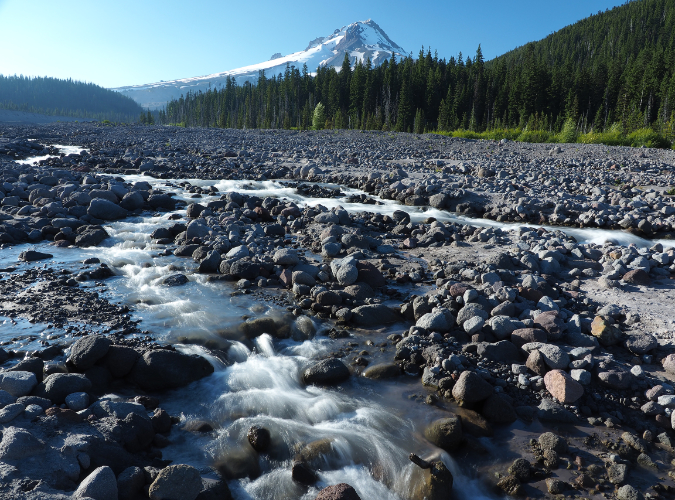
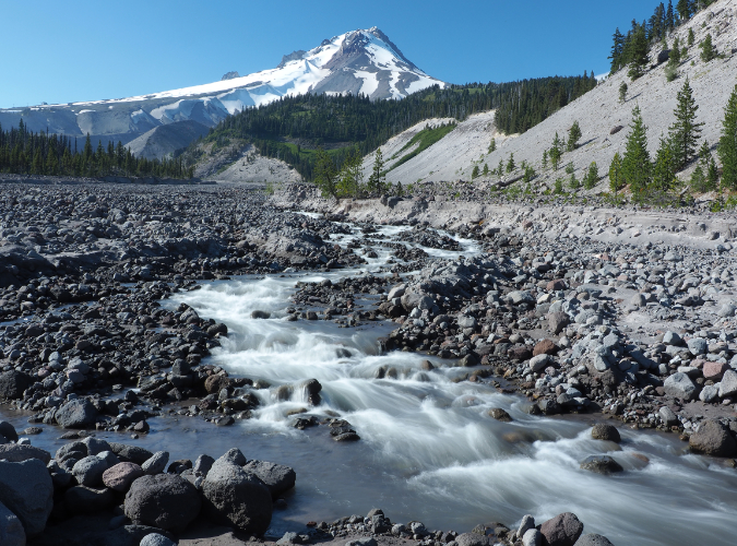
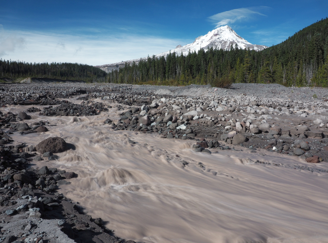
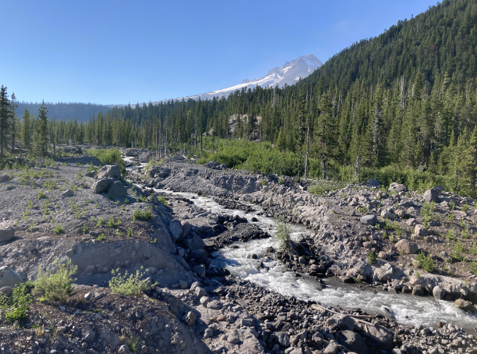
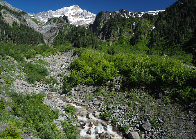
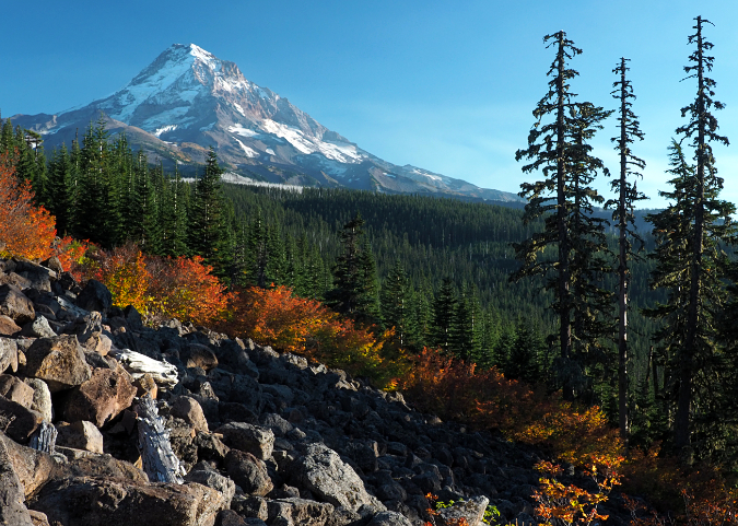
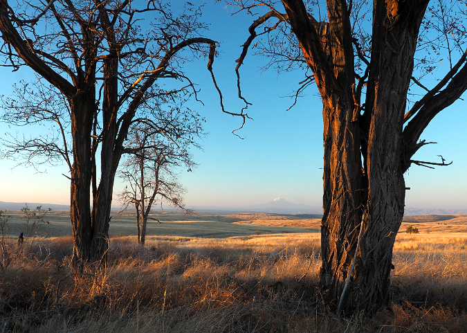
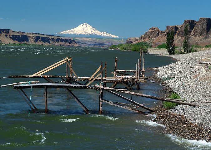
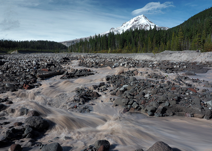
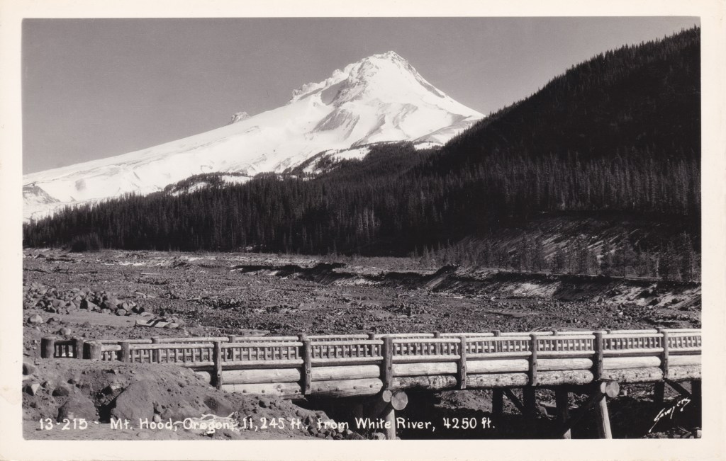
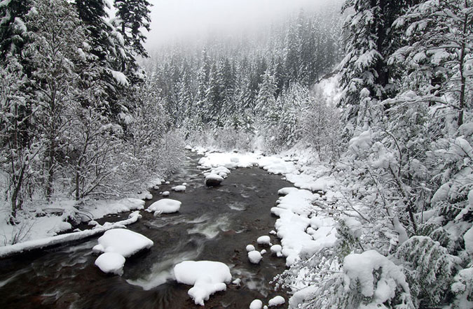
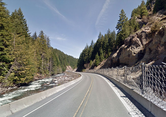
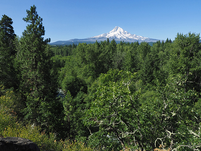
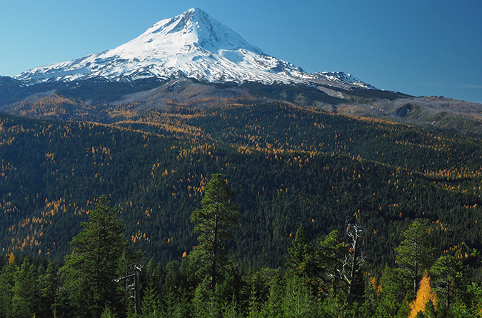
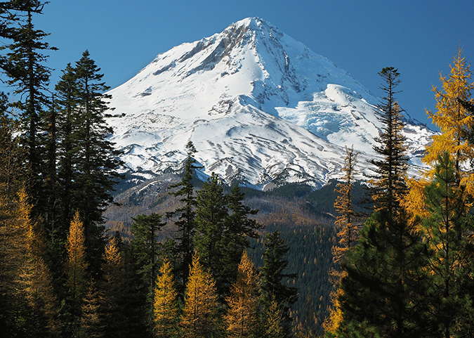
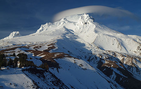
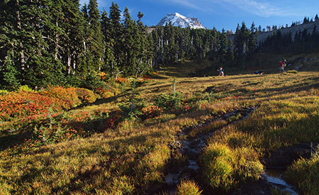
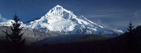
Mount Hood and the White River as it appeared early in the summer of 2020

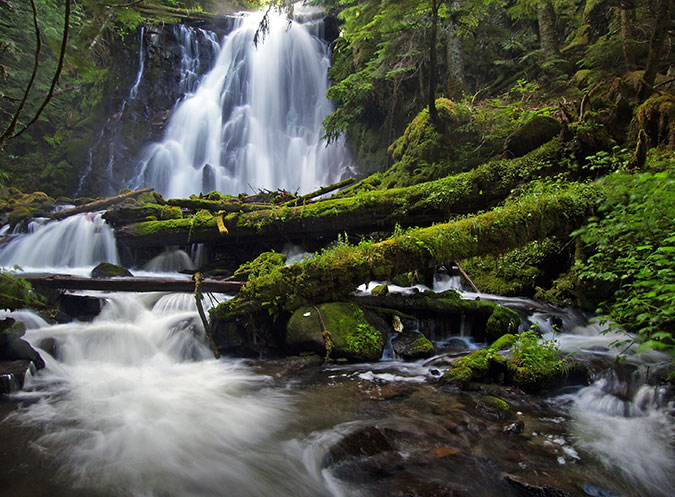
Mount Hood’s glaciers may be retreating, but if anything, the melting ice and more extreme weather that climate change is bringing to the mountain have only made the streams that emerge from its glaciers that much more volatile. 

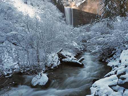
Glacial streams are inherently intimidating: ice cold and rising dramatically within hours when glacial melting accelerates on hot summer days to become churning river of mud and silt. They can make for terrifying fords for Timberline Trail hikers and wreak havoc on downstream roads and streambanks. But the worst events typically come in fall or late spring, when sudden warming and heavy rain can trigger rapid snowmelt on the mountain, turning these streams into unruly torrents.

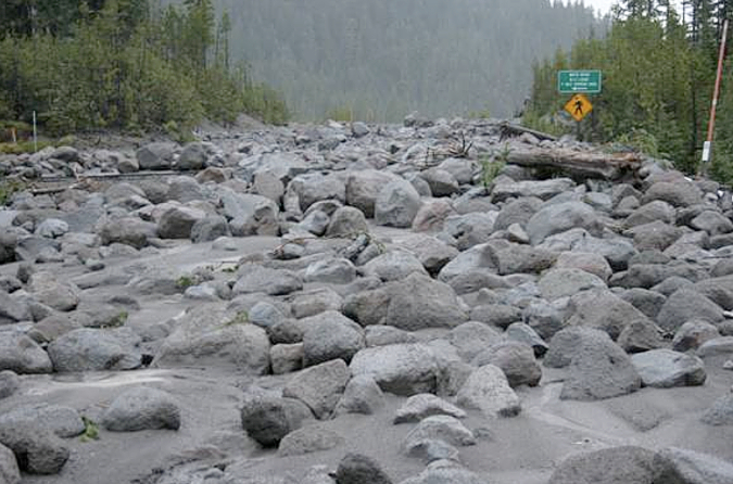
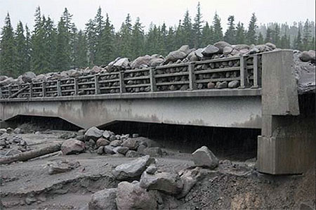
Highway 35 was buried under a sea of boulders in the November 2006 White River debris flow (ODOT)

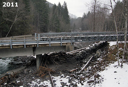
Such was the setting in November 2006, when a warm front with heavy rains pounded the mountain, rapidly melting the first snows of autumn that added to the explosive runoff. The worst damage to infrastructure came from the raging White River and Newton Creek, two glacial streams that emerge from the southeast side of the mountain. The streams also happen to flank the Meadows ski resort, so when both streams effortlessly swept away whole sections of the Mount Hood Loop highway (OR 35), the resort suddenly found itself cut off from the rest of Oregon.

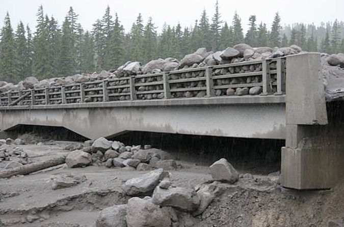
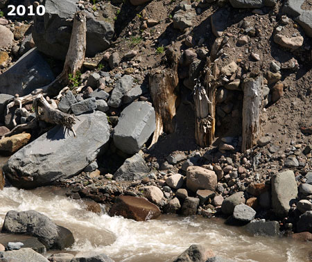
The 2006 floods washed away the bridge approaches and stacked boulders eight feet deep on top of the former White River Bridge (ODOT)

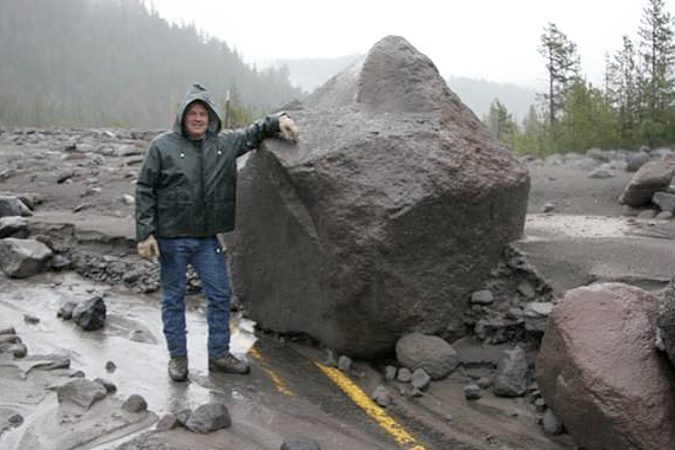
Highway worker posing with a boulder dropped by the White River on the centerline of Highway 35 during the 2006 floods (ODOT)

Oregon Department of Transportation (ODOT) crews quickly restored temporary access to the resort, but the damage to the highway was profound. Newton Creek had simply swept away the roadbed along an entire section of the highway, while the White River had swept away the bridge approaches on both sides of the concrete span over the stream – then proceeded to pile a collection of boulders on top of the stranded bridge, just for emphasis! 

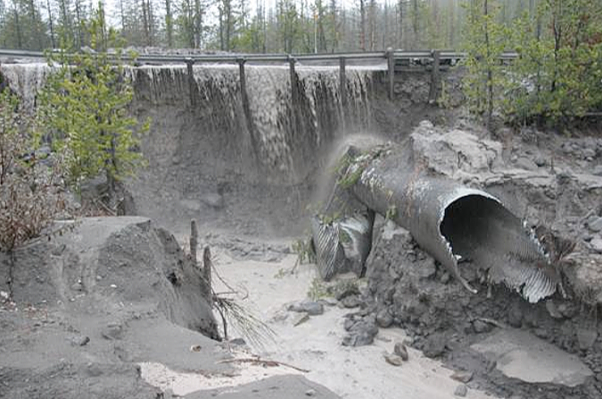
This overflow culvert at the east end of the old bridge approach was overwhelmed in the 2006 flood, as the White River spilled over the top of the highway, instead (ODOT)

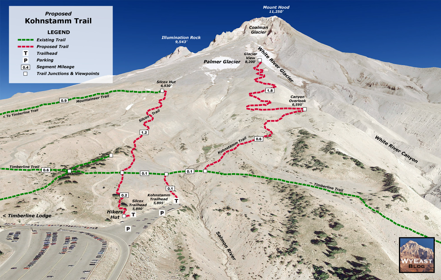
Undaunted, the highway engineers at ODOT and the Federal Highway Administration turned to a recently completed 2003 study of design solutions for several flood-prone spot along the Highway 35. From these, a pair of projects totaling $20 million were proposed to finally tame the two streams – a “permanent” fix, as the study described it.

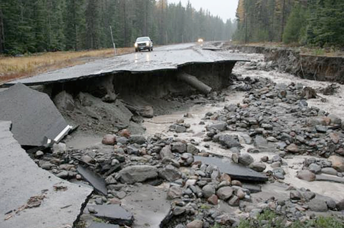
East of the White River, the 2006 floods also sent a torrent of water and debris down Newton and Clark Creeks, erasing sections of Highway 35 near Hood River Meadows (ODOT)

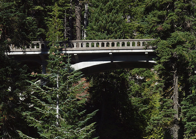
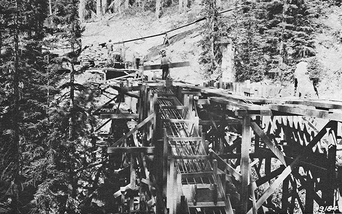
Once again, the plan was to go bigger. For Newton Creek, the now rebuilt highway includes a massive, 30-foot wide, rock-lined flood channel running parallel to the highway, with box culverts periodically spaced to allow floodwaters to cross under the road. For the White River, a series of option were considered, including a tunnel (!) and completely relocating the highway. But in the end, the option of simply replacing the older span with a much larger bridge was selected. The new bridge was completed in 2012.

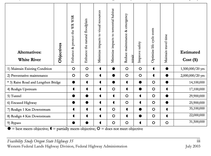
Options considered in the 2003 study of possible Highway 35 crossings of the White River

[click here for a larger version of this table]

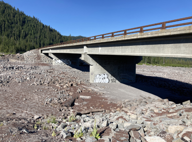
The preferred option for the White River also included a second span over Green Apple Creek, a small stream located just east of main crossing, and a feature that would serve as an overflow for the White River. Between the bridges, the new highway crossing is constructed on a high berm of fill, twenty feet above the expanse of sand and boulders that make up the White River floodplain, and berms also support the approaches to both bridges on either side of the floodplain.

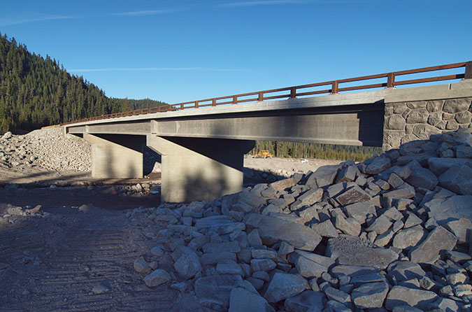
When they were completed in 2012, six years after the floods that had swept away sections of the highway, these structures seemed gargantuan compared to the previous incarnation of the highway. Yet, looking down upon the new White River Bridge from higher up on the mountain, it is really nothing more than a speed bump for the raging monster the White River is capable of.

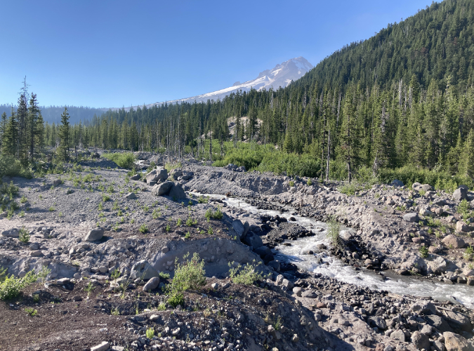
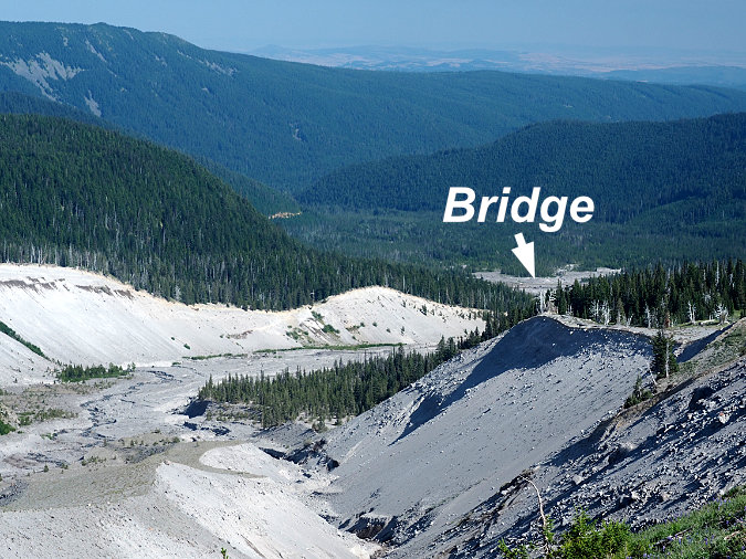
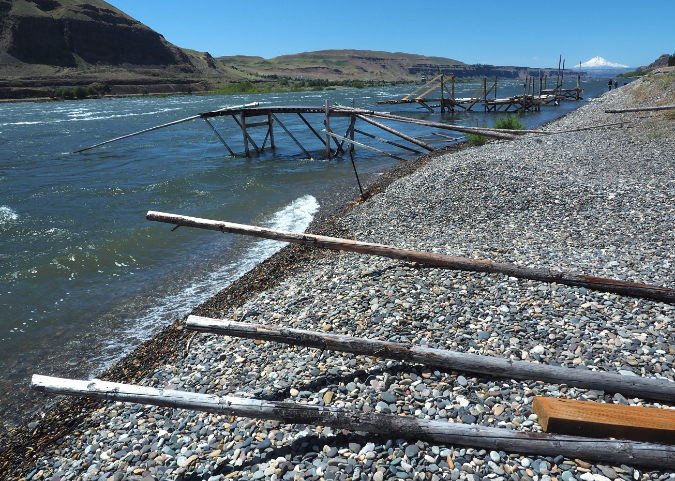
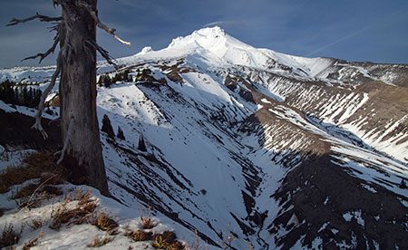
The White River has been moving east for several years. This view is from early summer 2020, when the upstream section of the river had already moved almost to the east canyon wall

For the past decade, the new structures seemed to be working as planned by the highway engineers. The White River continued to meander about in its wide flood channel, as it has for millennia, but it still found its way to the newer, bigger bridge opening. Until last winter, that is.

Sometime during the winter of 2020-21, the river abruptly formed another new channel along the east side of its floodplain, beginning about one mile above the new highway bridge. In recent years, the river had been gradually moving in this direction, including a smaller flood event in the fall of 2020 that spilled debris into the White River West SnoPark. Today’s radically new channel is a continuation of this eastward movement, almost to the east wall of the canyon. 

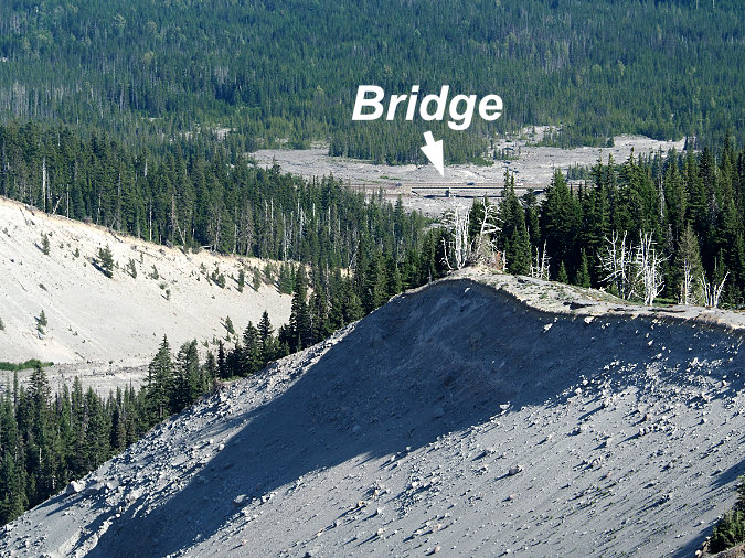
This view from the fall of 2020 followed a debris flow that sent rock and gravel into the White River West SnoPark and set the stage for the big shift in the river’s course that would follow over the coming winter. The river was actively meandering across the latest flow in this view, settling on a new course

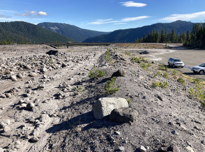
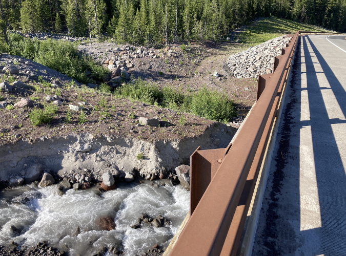
The berm in the center of this view was built after the 2006 floods to project the White River West SnoPark parking area (on the right) from future flooding (the White River floodplain is on the left). The fall 2020 debris flow managed to breach the berm, spreading rock and gravel across the southern corner of the parking area (the third car and most distant car in this photo is parked on the debris). The new (and now dry) White River Bridge is in the distance

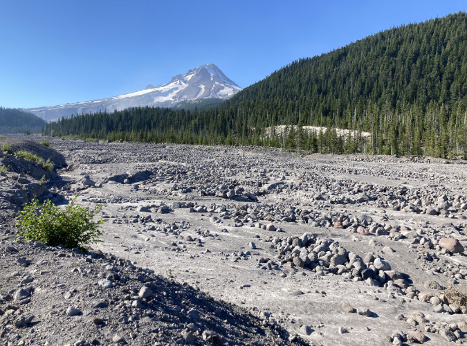
By the spring of 2021, the White River had completely abandoned the main floodplain and now flows beyond the row of tress in the far distance

Looking downstream from the new White River Bridge in 2021, the former riverbed is now completely dry, with the river now flowing beyond the band of trees on the left

The White River Bridge is only a few years old, but now spans only a dry streambed

This decision to include a second bridge in the new design turned out to be fortuitous over the last winter, at least in the near term. This “overflow” bridge is now the main crossing of the recently relocated White River. Had ODOT opted to simply replace the culverts that once existed here, the river would have easily taken out a section of the berm that supports the highway between the two new bridges, closing the highway, once again. However, the second span is much smaller than the main span, so it is unclear whether the river will continue to cooperate with the highway engineers and stick to this unplanned route.

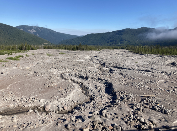
This view shows the new channel carved by the White River sometime during the winter of 2020-21

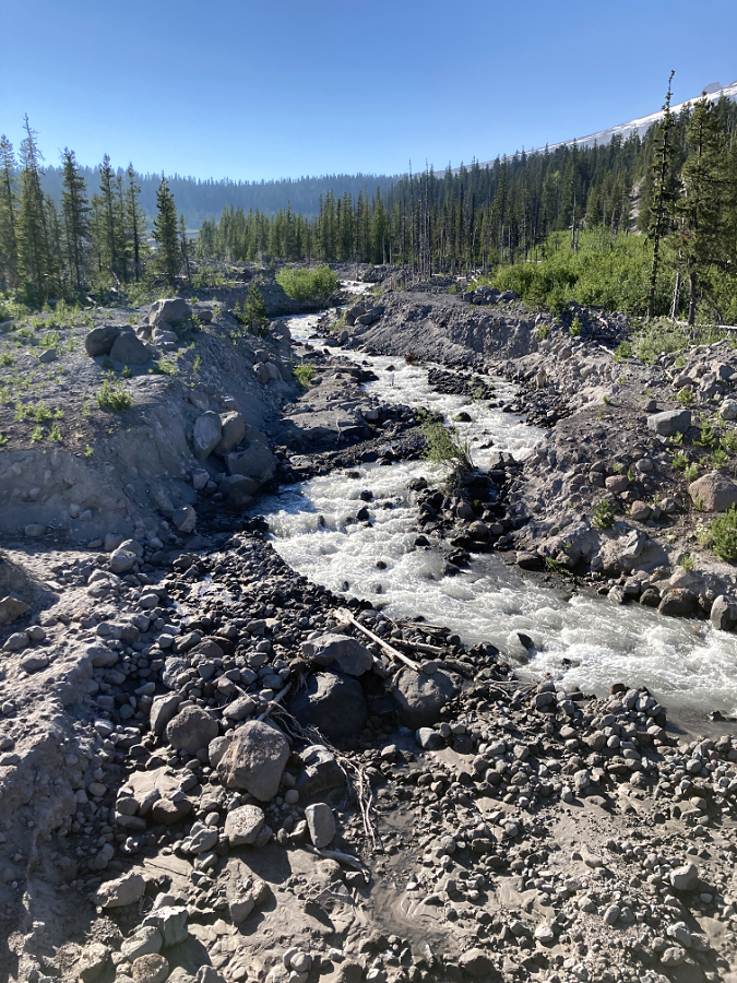
The White River carved a 20-foot-deep riverbed through loose floodplain material to form the new channel

The new bridge design included this secondary opening as a backup to the main bridge, though it is now the primary crossing of the relocated White River. The highway slopes downward as it moves east of here, dropping below the elevation of the White River floodplain, and thereby creating the potential for the river to migrate further east, threatening the fill section of the highway in the distance in this view

The channel shifts on the White River might seem to be sudden, but in reality, they are perpetual. The White River (along with the rest of Mount Hood’s glacial streams) bring tremendous loads of rock and silt with them. This has always been the case, with melting glaciers releasing debris caught up in the river of ice, some of it building piles of rock called moraines, and some carried off by the rivers that flow from the glaciers.

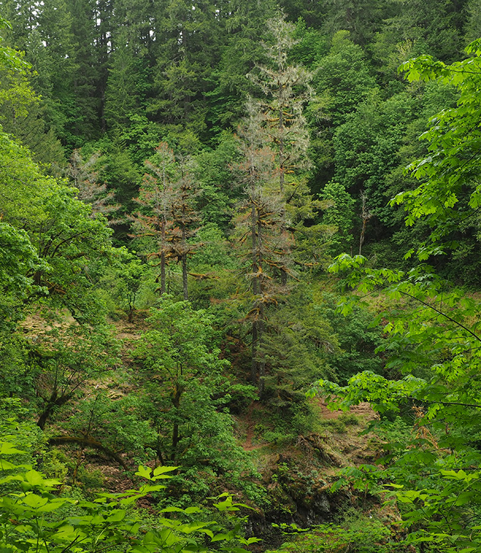
In the past few decades, the cycle of glacial erosion has been compounded by the retreat of the glaciers, themselves. All of Mount Hood’s glaciers are rapidly losing ice in the face of a warming climate, and the retreat of larger glaciers like the White River, Eliot, Sandy and Coe leaves behind bare ground once covered in ice. 

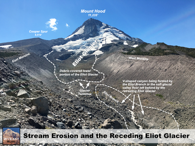
When this happens, and erosion shifts from slow-moving ice to fast-running water, the amount of debris and water moving down the glacial streams grows dramatically. The following diagram (see below) explains this relationship in the context of the rapidly retreating Eliot Glacier, Mount Hood’s largest body of ice, located on the mountain’s northeast side.

[click here for a larger version of this schematic]

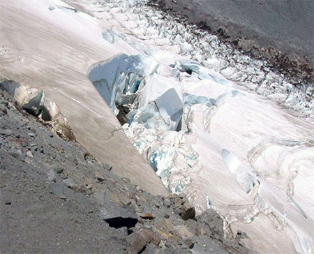
Glaciers plow wide, U-shaped valley as they grind away at the mountain, whereas streams cut deep, V-shaped canyons. When glaciers like the Eliot retreat, they expose their u-shaped valleys to stream erosion, and their outflow streams (in this case the Eliot Branch) immediately go to work cutting V-shaped canyons into the soft, newly exposed valley floor, resulting in much more material moving downstream in more volatile events.

In the schematic, the lower part of the Eliot Glacier is somewhat hidden to the casual eye, as it’s covered with rock and glacial till. This is true of most glaciers – the white upper extent marks where they are actively building up more ice with each winter, and the lower, typically debris-covered lower extent is where the ice is actively melting with each season, leaving behind a layer of collected debris that has been carried down in the flowing ice.

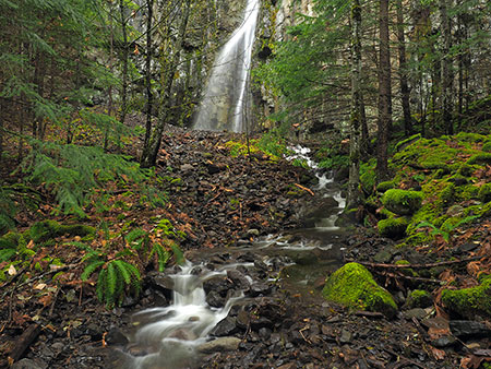
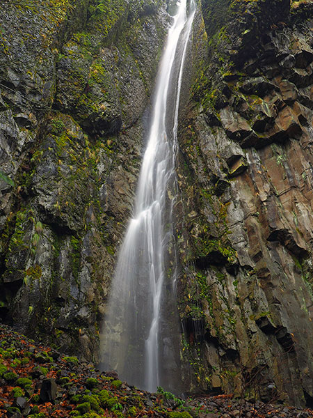
The terminus of the glacier in the schematic marks the point where the Eliot Branch flows from the glacier. As the terminus continues to retreat uphill with continued shrinking of the Eliot Glacier, more of the U-shaped glacial valley floor is exposed. At the bottom of the schematic, the floor of the valley has been exposed for long enough to allow the Eliot Branch to already have eroded a sizeable V-shaped canyon in the formerly flat valley. This rapid erosion has fed several debris flows down the Eliot Branch canyon in recent years, including one as recently as this month, abruptly closing the road to Laurance Lake. 

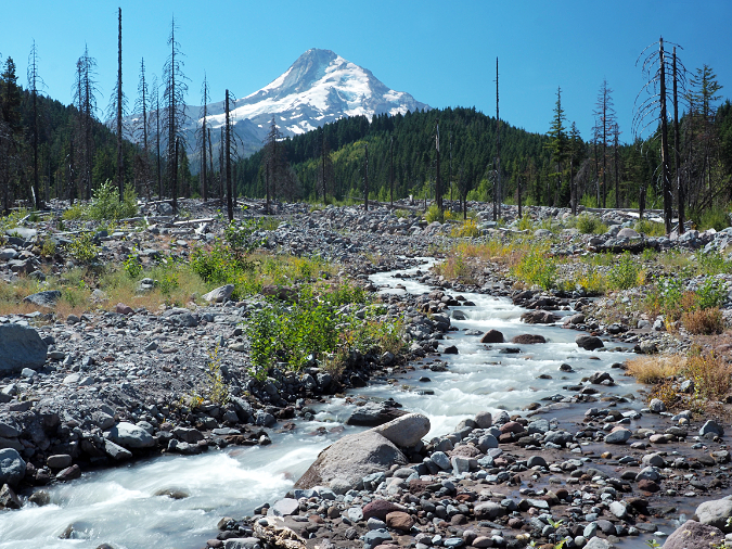
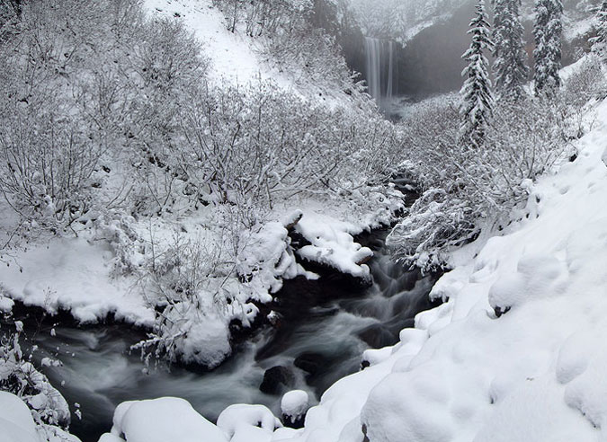
The Eliot Branch continues to spread debris flows across its floodplain, burying trees in as much as 20 feet of rock and gravel. This section of the Eliot Branch flooded again earlier this month, closing the only road to Laurance Lake

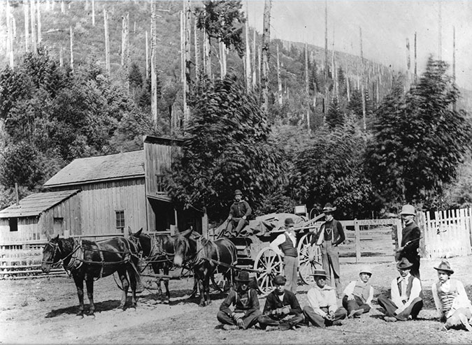
We’ve seen plenty of examples of this activity around the mountain over the past couple of decades, too. In 2006 the mountain was especially active, with flooding and debris from the Sandy, Eliot, Newton Clark and White River glaciers doing extensive downstream damage to roads – this was the event that removed the highway at the White River and Newton Creek. Smaller events occurred in 1998, as well. In the 2006 event, the Lolo Pass Road was completely removed near Zigzag and the Middle Fork Hood River (which carries the outflow from the Eliot and Coe glaciers) destroyed bridges and roads in several spots.

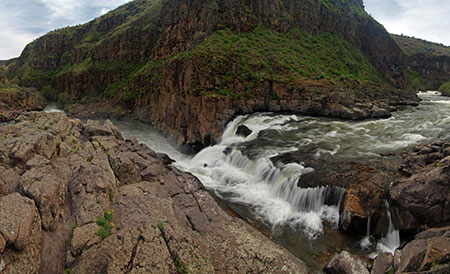
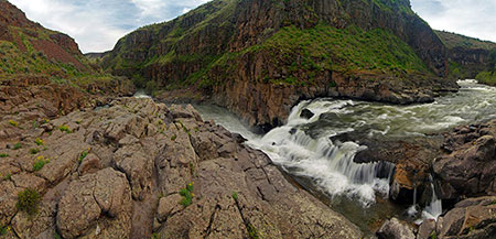
Even in quieter times, the White River has moved its channel around steadily. That’s because the heavy debris load in the river eventually settles out when it reaches the floodplain, filling the active river channel. This eventually elevates the river to a point where it spills into older channels or even into other lower terrain. Because of the broad width of the White River floodplain at the base of the mountain, this phenomenon has occurred hundreds of times over the millennia, and the river will continue to make these moves indefinitely. 

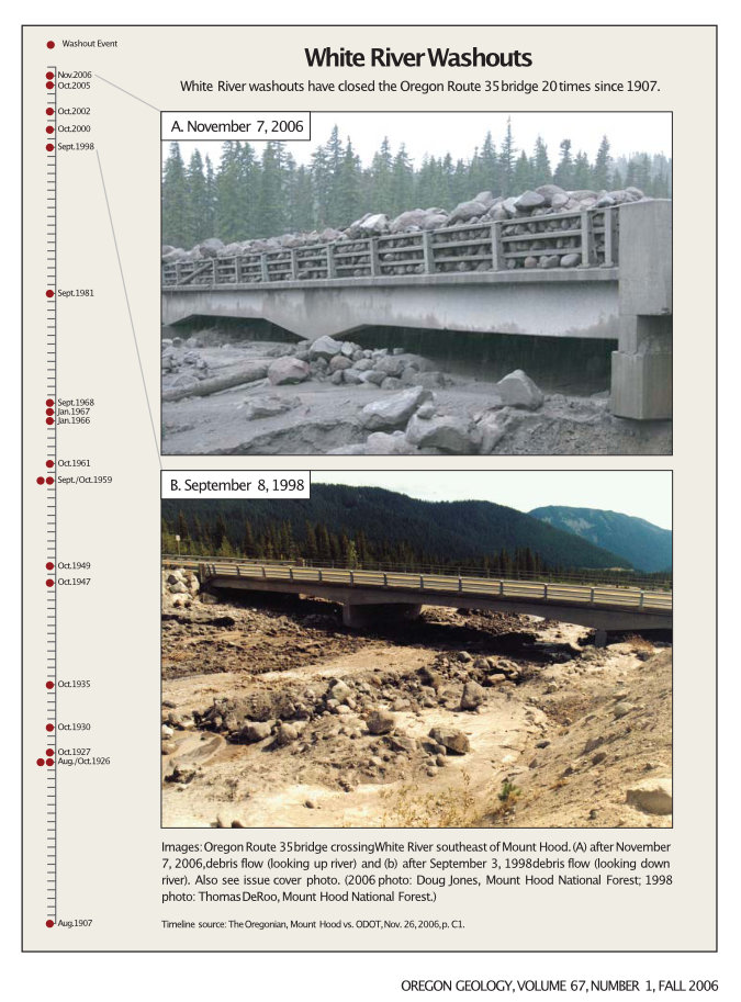
To underscore this point, the 2003 highway study of potential solutions for Highway 35 includes this eye-opening chart that shows just how many times the White River has flooded the highway or overtaken the bridges – nearly 20 events since the highway was first completed in 1925!

[click here for a larger version of this timeline]

Therein lies the folly of trying to force the river into a single 100-foot opening (or even a second overflow opening) on a half-mile wide floodplain. The fact that much of the floodplain is devoid of trees is a visual reminder that the river is in control here, and very active. It has a long history of spreading out and moving around that long precedes our era of roads and automobiles.

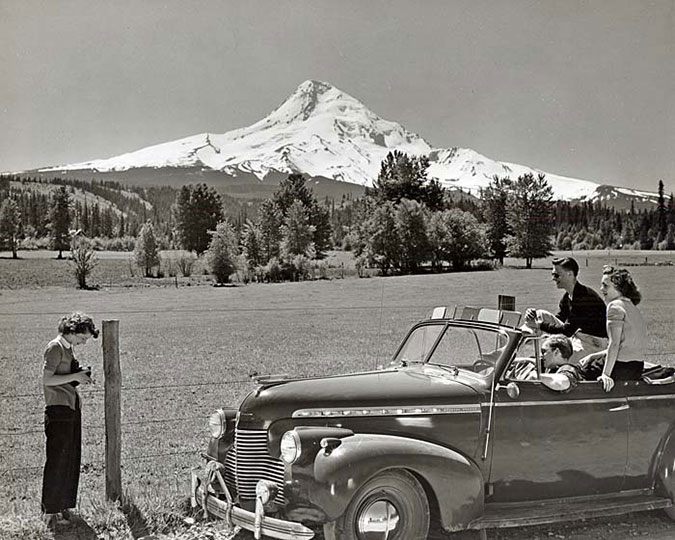
But the White River has an added twist in its volatility compared to most of the other glacial streams that flow from Mount Hood. The vast maze of sandy canyons that make up the headwaters of the White River are quite new, geologically speaking – at least as they appear today. This is because of a series of volcanic events in the 1780s known as the Old Maid eruptions covered Mount Hood’s south side with a deep blanket of new volcanic debris. The same gentle south slopes that Timberline Lodge and Government Camp sit on today didn’t exist before those eruptions, just 240 years ago.

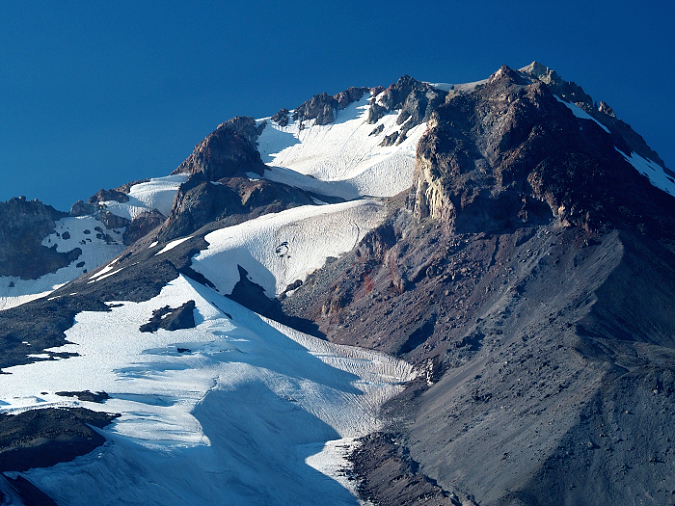
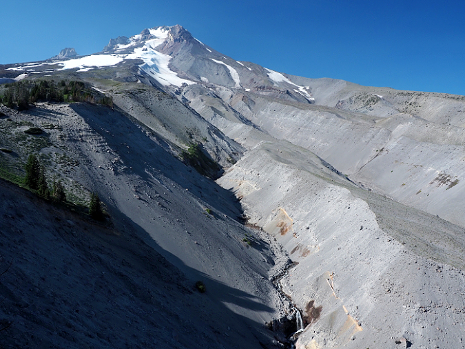
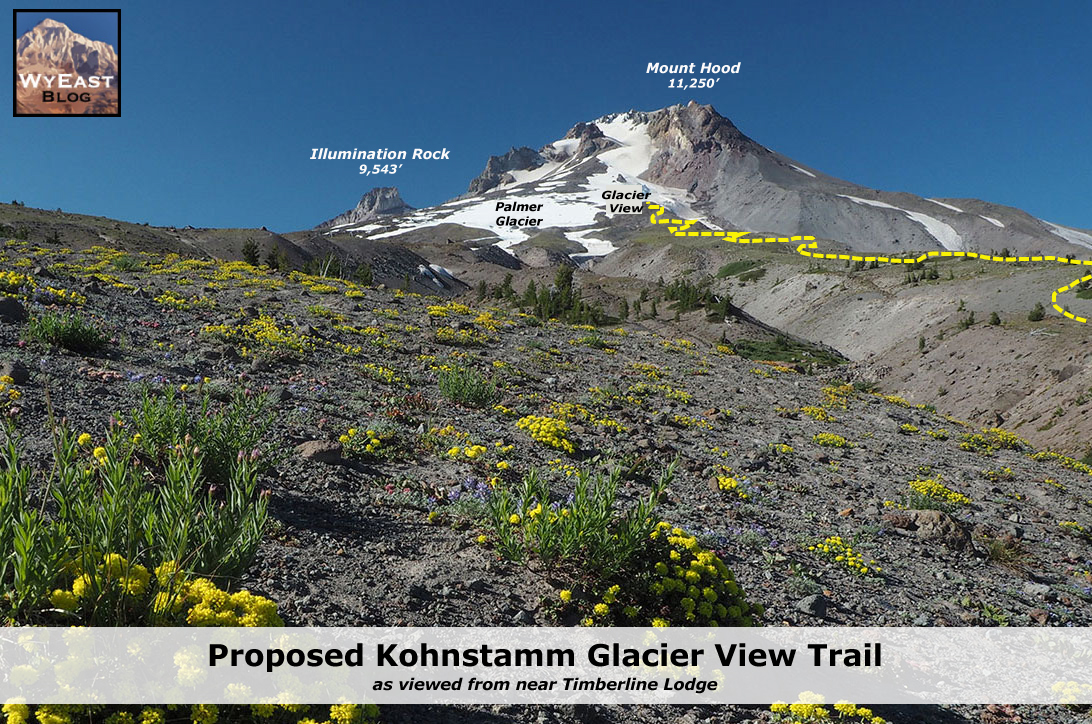
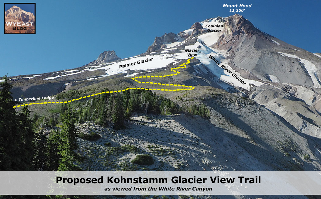
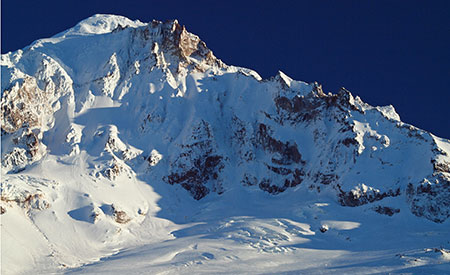
The White River Glacier (center) flows from near the crater of Mount Hood, and rests upon soft slopes of rock and ash debris that were created by the Old Maid eruptions of the 1780s. The large rock monolith poking up from the crater (left of center) is Crater Rock, an 800-foot lava dome that formed during the Old Maid eruptions

The Old Maid eruptions created other new features on the mountain – notably, 800-foot Crater Rock, a prominent monolith that was pushed up from the south edge of the crater. Meanwhile, the eruptions also generated lahars, the name given to sudden, massive mudflows that can range from ice cold to boiling, depending on the origin of the event. These flows rushed down the White River, Zigzag and Sandy River valleys, burying whole forests under debris ranging from mud and silt to boulders the size of delivery trucks.

The Old Maid eruptions take their name from Old Maid Flat, located along the Sandy River, where a new forest is still struggling to take hold on top of the volcanic debris, more than two centuries later. At the White River, trees buried by the lahars can be seen in the upper canyon, where the river has cut through the Old Maid eruption debris to reveal the former canyon floor, and trees still lying where they were knocked over (more about those buried forests toward the end of this article).

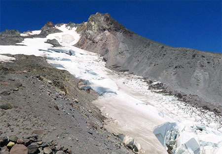
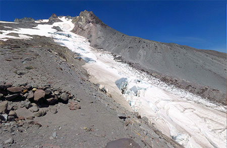
From high on the rim of the White River canyon, the endless supply of rock and ash from the Old Maid deposits is apparent – along with the impossibly tiny (by comparison) “bigger bridge” over the White River

This telephoto view of the new White River bridge from the same vantage point in the upper White River canyon reveals the structure to be a mere speed bump compared to the scale and power of the White River

For this reason, the White River has an especially unstable headwaters area compared to other glaciers on the mountain, with both glacial retreat and the unstable debris from recent lahars triggering repeated flash floods and debris flows here. That’s why the question of whether the new, bigger and bolder highway bridge over the White River will be washed out is more a question of when. It will be, and in our era of rapid climate change, the answer is probably sooner than later.

Is there a better solution? Perhaps simply acknowledging that the river is perpetually on the move, and designing the road with regular reconstruction in mind, as opposed to somehow finding a grand, permanent solution. That’s at odds with the culture of highway building in this country, as it could mean simply accepting more frequent closures and more modest bridge structures – perhaps structures that could even be moved and reused when the river changes course?

The 2003 Federal Highways study actually acknowledges this reality, even if the brawny, costly designs that were ultimately constructed in 2012 do not:

“It is imperative to remember that geological, meteorological, and hydrological processes that result in debris flows, floods, and rock fall have occurred for millions of years, and will occur for millions of years to come. They are naturally occurring phenomena that with current technology cannot be completely stopped or controlled. Thus, the best that can be hoped for is to minimize the destructive, highway– closing impacts of events at the study sites.” (FHWA Highway 35 Feasibility Study, 2003)

The White River seems to be enjoying its new channel and change of scenery…

In the meantime, the newly relocated White River an awesome sight. We’re so accustomed to bending nature to our will in this modern world that it’s refreshing to see a place where nature has no intention of being fenced in (or channeled, in this case). 

Do rivers have a sense of humor or experience joy? As I looked down upon the White River sparkling and splashing down its new channel this summer, it seemed to be thoroughly enjoying the pure freedom of flowing wherever it wants to. It’s yet another reminder that “nature bats last”, and in WyEast country, the mountain – and its rivers — will always have the final word. 

For us, it’s that strangely comforting reminder that we’re quite insignificant in the grand scheme of things, despite our attempts to pretend otherwise.

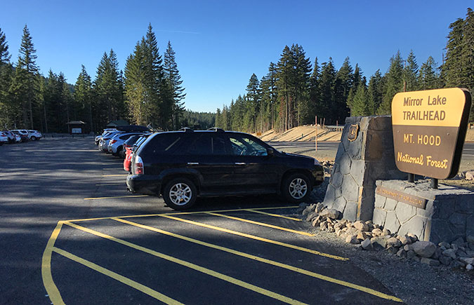
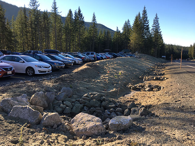
How to visit the White River

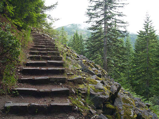
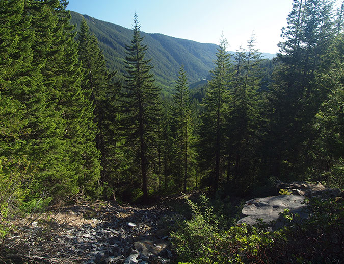
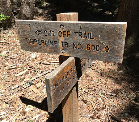
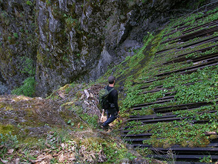
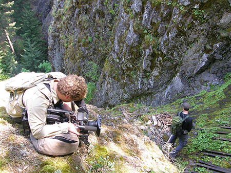
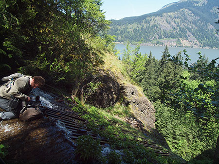
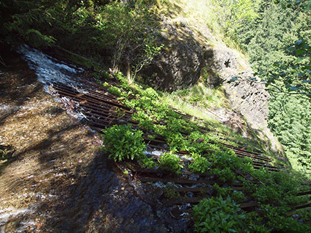
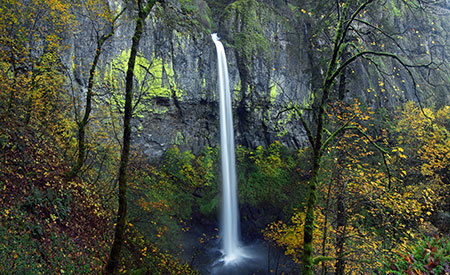
If you’re interested in experiencing the living geology of the White River, an easy introduction is to park at the White River West SnoPark area and trailhead, then head up the trail toward the mountain for a quarter mile or so. From here, the river has moved to the far side of the floodplain, but for the adventurous, it’s cross-country walk across sand and boulders to reach the stream. There, you can soak your feet in ice cold, usually milky water and watch the river moving the mountain in real time, pebble-by-pebble. The main trail is almost always within sight, so it would be tough to get lost in the open terrain here.

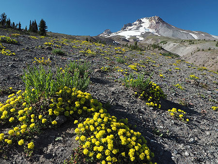
Look closely – those tan stripes near the bottom of the White River canyon mark the pre-Old Maid eruption slopes of Mount Hood, now buried under ash and debris from the lahars. Several preserved trees that were knocked down by the eruption can be seen along these margins. This viewpoint is along the Timberline Trail, just east of Timberline Lodge.

To see the relocated White River, park at the White River East SnoPark and walk to the east bridge – now the main crossing of the White River. The view upstream includes the top of Mount Hood, but watch out for speeding traffic when crossing the highway!

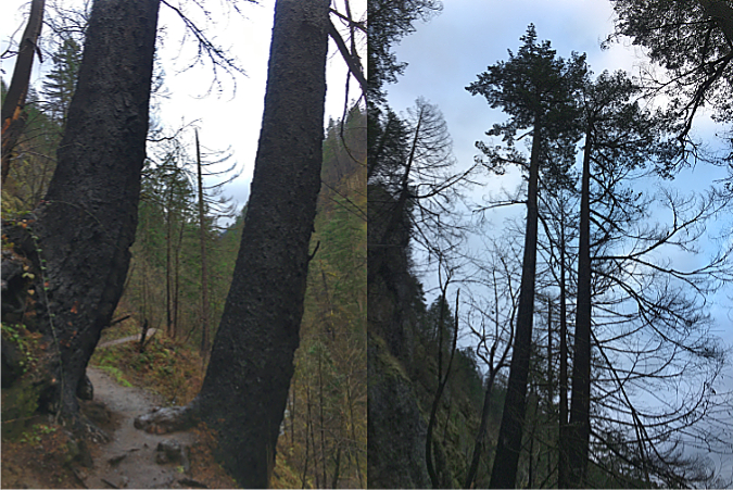
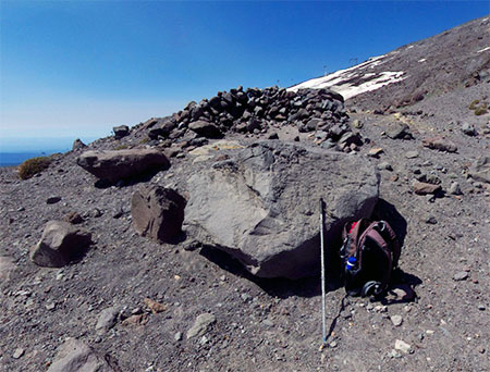
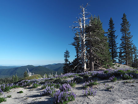
To see the buried White River forest, you can park at Timberline Lodge and follow the Timberline Trail (which is also the Pacific Crest Trail here) east for about a mile, where the trail drops to the rim of the upper White River canyon. The views here are spectacular, but if you look directly below for a waterfall on the nearest branch of the White River, you’ll also see the reddish-yellow mark of the former valley floor and the bleached remains of several ghost trees buried in the eruptions 240 years ago. Watch your step, here, and stay on the trail – the canyon rim is unstable and actively eroding!

___________________

Tom Kloster | July 2021

2021 Campaign Calendar!

As I write this annual year-end post after a calamitous 2020, the world seems just a bit more hopeful. The presidential election will shift public lands policy 180 degrees back toward conservation and restoration, and with the release of two COVID-19 vaccines, the end of the world pandemic is finally on the horizon.

And so, I share some of the stories behind this year’s Mount Hood National Park Campaign scenic calendar with a cautious spring in my step (or my fingers as they type this sentence, at least). You can pick up a copy of the calendar here for $29.95:

2021 Mount Hood National Park Campaign Scenic Calendar

As always, all proceeds will go to Trailkeepers of Oregon (TKO) to support their ongoing effort to care for trails as gateways to our public lands. Zazzle prints these calendars with exceptionally high quality, and they also have large enough boxes to be quite functional for tracking important dates and your trail plans. They make nice gifts, too, of course!

Over the years, I’ve described the Mount Hood National Park Campaign as “an idea campaign” with the simple goal of keeping alive the promise of better protections and restoring the grandeur Mount Hood and the Gorge. I started the project in 2004 as a way to continually remind Oregonians and Washingtonians living in WyEast Country that national park protection was proposed at least three times in Congress, in the 1890s, 1920s and the 1930s. Each time, logging and other extraction industries (and later, the emerging ski industry) were the chief opponents — along with the Forest Service, itself.

Thomas Cole painted this idyllic scene of Native American life in WyEast Country in the 1870s. The mountain continues to be beacon of inspiration and awe for people living in its shadow to this day

If you’ve watched Ken Burns’ magnificent National Parks series, you know that every park was a battle, typically between short-term exploitation interests and progressives looking toward posterity for future generations. There were no easy wins.

And, so it will be for Mount Hood and the Gorge until enough locals (or our children and grandchildren) recognize national park protection as both urgent and deserving for these world-class places. We haven’t treated them too well over the past 150 years, but real change is suddenly afoot in 2020. What? Yes, you read that correctly… and I will share more about that exciting news in future blog posts!

This beautiful cove at the foot of Crown Point was called “Echo Bay” when it was still connected to the Columbia River in this 1870s photo. This was among the spots that inspired the first Congressional effort to create a national park here

But until then, this article is a tour of some of the places that make WyEast country special, and are featured in the 2021 MHNP Campaign scenic calendar. As always, every image in the new calendar was captured over the past year and, as in past years, there are some lesser-known places mixed in with some of the more familiar.

The 2021 Calendar Images

Salmon River in late Autumn

The cover image for the 2021 calendar comes from a very familiar spot along the Old Salmon River Trail, near the community of Zigzag. This quiet trail was bypassed — and spared — when the Salmon River Road was built in the post-World War II logging boom. Today it offers one of the most accessible trails into ancient rainforest anywhere in the Pacific Northwest. This photo was taken just a few weeks ago, too. Because of its low elevation, it’s a trail you can hike year-round. Here’s the Oregon Hikers Field Guide description of the trail.

For January, I chose an image captured from above the West Fork Hood River Valley, on Butcher Knife Ridge. In this scene, Mount Hood is emerging from the clouds after the first big winter storm of fall. I’ll be posting more articles in 2021 about the West Fork valley, as there is some very exciting news to share about this area.

Mount Hood’s rugged northwest face in early winter as viewed from Butcher Knife Ridge

The February image is a familiar view of Wahclella Falls on Tanner Creek, one of the premier trails in the Columbia River Gorge. Before the 2017 Eagle Creek Fire, I visited this trail several times each year, as it’s not only a personal favorite, but also a trail that makes for a great introduction to the Gorge for new hikers or visiting family.

Wahclella Falls on Tanner Creek

The image in the new calendar is from a visit last winter, and it was my first since the fire. Though the fire did burn through the lower Tanner Creek canyon, many trees survived, especially around Wahclella Falls. Notably, a pair of big trees familiar to hikers also survived — the twin Douglas firs flanking the lower trail (below). As of this year, their upper canopies are still green more than two years after the fire, and that bodes well for them to survive for many years to come.

The familiar twin Douglas firs along the Wahclella Falls Trail have survived the 2017 Gorge fire… so far

What I couldn’t have guessed is that the COVID-19 pandemic restrictions kicked in just a couple weeks after my visit, and Wahclella Falls was once again closed to the public.

As hard as these Gorge trail closures have been for hikers, there are a couple of silver linings. First, they have allowed trail volunteers from TKO, the Pacific Crest Trail Association (PCTA) and other volunteer trail organization to continue the hard work of restoring trails damaged by fire without having to accommodate hiker traffic. Perhaps more importantly, the closures have also allowed forest recovery to begin within the pressures that heavy visitation on popular Gorge trails brings.

Lower White River Falls in spring

The March image (above) features Lower White River Falls, a lesser-known cascade downstream from the main falls at White River Falls State Park. Where the main falls is a raucous spectacle, the lower falls is quiet waterfall in a secluded canyon, where it is framed by desert wildflowers in late spring.

Poison likes to grow in the shade of boulders along the White River — watch where you sit!

The user path to the lower falls has become increasingly prominent in recent years as more visitors discover this pretty spot (and its excellent swimming hole), but be forewarned, the path is lined with Poison Ivy. This relative of Poison Oak bears a close resemblance, but grows as a ground low ground cover in the sandy floodplain along the river, often in the shelter of boulders and old logs.

Lower White River Falls

For April, I selected another scene from Mount Hood’s rain shadow, a wildflower meadow on the edge of the tree line where forests give way to the desert country east of the Cascades. This bucolic scene looks across the rolling wheat country of Wasco County, toward the Columbia Hills and the Columbia River, on the horizon (below).

Wildflower meadows on the east slope of the Cascades near Friend

Though you wouldn’t know from this photo, the South Valley Fire swept through this area in 2018, one of three major range fires that combined that year to burn nearly 200,000 acres. Two years later, and only the scattered snags of Ponderosa pine, Western juniper and burned fence posts hint at the fire, as the sage and grass savannah has recovered in a remarkably short time. But the fires had a human toll, too. Homes and barns were burned, as well as several historic farmsteads that can never be replaced.

Only a few charred remains tell the story of the 2018 range fires east of Mount Hood

Switching back to the west side of the Cascades, I chose a scene from a visit to Silver Falls State Park for the May image. With many of the Gorge waterfall trails still closed by the aftermath of the Eagle Creek Fire, Silver Falls visitation has exploded over the past couple years, as hikers look for new places to get their waterfall fix.

Visiting Silver Falls State Park is pretty close to a national park experience, as the park is loaded with 1930s Civilian Conservation Corp construction and the Oregon Parks and Recreation Department do an excellent job maintaining and curating the park’s network of scenic trails. Lower South Falls (below, and the May image in the new calendar) and nearby Middle North Falls are favorites among photographers in the park, and they have some similarities. Both begin as a wide curtain of falling water before crashing onto the rocky basalt aprons that make up their base, and both have a trail behind them.

Lower South Falls on Silver Creek

A few years ago, a local Republican legislator introduced a bill proposing National Monument status for Silver Creek. The bill didn’t go anywhere, but it was a nice opportunity to showcase the area and a reminder that seeking national park status can be a bipartisan effort, even in these days of deep political division.

Pandemic-compliant blogger at Silver Creek State Park

Visiting Silver Falls State Park (and most other state parks) in 2020 also meant controlling the COVID-19 virus while huffing and puffing on a buy trail. While I was discouraged by the disregard for masks on my trips to Silver Falls last spring (maybe 1 in 5 had one), there has been a noticeable uptick in mask use in our state parks national forests since. That’s good, because in a year of pandemic shutdowns and closures, the benefits of being outdoors and connecting with nature have never been greater.

Crowds of pandemic-defying hikers at Silver Falls State Park on Memorial Day 2020

For June, I chose a scene from just off the Timberline Trail, along the rim of the White River Canyon (below). This expansive Lupine meadow is only a few steps from the trail, but just out of view and thus known to surprisingly few.

Summer Lupine meadows along the rim of White River canyon

If only this blog had a virtual scratch-and-sniff, as there is nothing quite as heady as the sweetly-scented mountain air in a Lupine meadow, and this one was no exception. For those who haven’t had the experience, Lupine are in the pea family, and have the same sweet aroma as garden sweet peas — but with a mountain backdrop!

For July, I chose another wildflower scene, though this one fits more of a rock garden motif, featuring yellow Buckwheat and purple Penstemmon among the chunks of andesite scattered here. This is the historic Cooper Spur shelter, just off the Timberline Trail on the mountain’s north side. Cooper Spur, proper, rises to the left and the Eliot Glacier tumbles down Mount Hood’s north face to the right of the shelter. This is one of several stone shelters built by the Civilian Conservation Corps in the early 1930s and today is one of just three that still survive (the other survivors are at McNeil Point and Cairn Basin).

Cooper Spur Shelter in summer

Follow the climbers trail to the right of the shelter to the nearby moraine viewpoint (marked by large cairn) and you’ll have a front-row view of the Eliot Glacier. While I was there, a house-sized ice blocks suddenly collapsed (below), filling the canyon with a roar! It’s always a thrill to see and hear our glaciers in action.

Icefall collapse on the Eliot Glacier!

Another mountain scene fills out the summer as the August image in the new calendar. This multi-image composite assembles the impossibly massive scene at the western base of the mountain, where the Timberline Trail fords the twin branches of the Muddy Fork (below). From here, the mountain rises more than 7,000 vertical feet above the scene, and dramatic waterfalls tumble down the 800-foot cliffs that frame the canyon.

The wide-open scenery of the Muddy Fork canyon

The Muddy Fork valley is a volatile, continually changing landscape. In the early 2000s, a massive debris flow swept through, felling an entire forest and leaving a 25-foot layer of rock and sand on the valley floor. The Muddy Fork has since carved through the debris, all the way down to the former valley floor, revealing the stumps of trees that were snapped off by the event. Some are visible along the stream at the center the above photo. Meanwhile, the rest of the Muddy Fork debris flow is already dense with Red Alder, Cottonwood and Douglas Fir pioneers that are quickly re-establishing the forest, continuing the eternal cycle of forest renewal.

Several photos in this year’s calendar are from the dry country east of Mount Hood, in the rain shadow of the Cascade Range. I made several trips there while researching the strange desert mounds unique to the area (see “Mystery of the Desert Mounds“) and I fell back in love with the landscape, having spent time living there in the early 1980s. The September image in the new calendar is of a lesser-known gem in this area, the historic Nansene Community Hall (below) located on the northern slopes of Tygh Ridge.

Remains of the historic Nansene Community Hall on Tygh Ridge

The community hall dates back to the early 1900s, when sheep ranching was still the dominant industry in the area. Sprawling wheat fields and cattle have long since replaced the sheep herds, but thanks to the arid climate, abandoned wood structures from the early white settlement era can survive intact for a century or more. But they can’t survive fire, and while many historic homestead structures were destroyed by the 2018 range fires that swept through the area, Nansene Hall was among those spared.

Thankfully, the iconic grain elevator at Boyd survived the fire, too, and this photo (below) was a candidate for the calendar, save for the fact that Mount Hood isn’t peeking over the horizon!

Grain elevator on Fifteenmile Creek at Boyd

Several historic schoolhouses in the area also survived the fire, including the picturesque Center Ridge Schoolhouse (below), located a couple miles northeast of the Nansene Commumity Hall. This amazingly intact old building was designed with more aesthetics in mind than you might guess. The big windows along the west side of the structure define its single classroom, but the building was sited at an angle to ensure that Mount Hood filled the horizon through those windows, while Mount Adams looms to the north of its playground!

Center Ridge Schoolhouse and Mount Adams

While exploring the Tygh Ridge area this year, I happened upon a toxic creature that was unknown to me: the Green Blister Beetle (below), part of the legendary family of bugs that Spanish Fly is derived from. This iridescent native of the western states is highly toxic to the touch, though I only learned that later, when I was trying to identify this bug from photos I had taken while surrounded by a swarm of them in the field!

Don’t touch the Green Blister Beetle! (though the smaller beetles in this photo don’t seem to be bothered by their toxic neighbor)

Fortunately, I did not handle them, as that can lead to a potentially dangerous reaction. So, while we don’t have many toxic plants and creatures to navigate in the Pacific Northwest, here’s a new one for the list of those to avoid.

The Blister Beetle confab was unfolding in the historic Kingsley Catholic Cemetery, one of the more photogenic spots in the Tygh Ridge area. While walking among the pioneer graves that day last June, I also spotted this wonderful note hanging from a tree, a most welcome bit of hope and optimism in an otherwise grim pandemic year:

Sometimes a simple note can make a tough year a little better…

I later shared the note with a friend in the Dufur area, who in turn shared it in local circles there, hopefully drawing some interest. Little discoveries like this are poignant reminders that the future is always bright through young eyes, and it’s our job as elders to embrace their optimism and sense of promise.

For October, I selected a scene familiar to many (below). This is the view from just below the Vista Ridge trailhead, where the mountain suddenly unfolds for arriving hikers. It’s a popular roadside spot for evening photography, especially in fall when Vine Maple light up the scene.

The popular photographers’ tableau at Vista Ridge

However… when I stopped there this fall, I was quite annoyed to see that Forest Service contractors hired to brush out the road had dumped their slash right in the middle of this lovely talus slope! Sacrilege! So, I took a deep breath, put on a pair of gloves and spent a couple hours dragging the slash down the road to another debris pile that was out of view in a nearby wooded area.

Aargh!

Sacrilegious!

Why get my dander up over this? Because talus slopes are special. They’re scenic and offer welcome views in our heavily forested region, of course. But they’re also home to species that depend on these unique places to survive. The best known are the tiny Pika who live exclusively in talus fields, but they are just part of the unique web of plants and animals found in these rocky islands. They deserve to be revered as unique places in the same way that our understanding of deserts has evolved in recent years to see them as places full of life, despite their lack of trees.

For November, I went back to yet another image from the slopes of Tygh Ridge (below). This is a view looking north across the broad, gentle apron of the ridge toward Mount Adams, shining on the far horizon. Less obvious in this autumn view are the many fallow fields where wheat was once planted, but now are carpeted with wildflowers and native grasses. What gives?

Tygh Ridge Locust trees frame Mount Adams

This photo (below) from a nearby spot was taken in June, and shows the expansive meadows that now cover formerly plowed land on Tygh Ridge. It turns out that these areas have been allowed to recover with native grassland species to benefit wildlife as part of the federal Conservation Reserve Program. It’s an opt-in program that compensates farmers for making long-term commitments (typically 10 or 15 years) to leave fields fallow for wildlife recovery. Hundreds of acres on Tygh Ridge are now part of this program.

Lupine meadows on Tygh Ridge are part of the Conservation Reserve Program that compensates famers for allowing fields to revert to natural cover to benefit wildlife

Heading back to the west side for December, I chose another image from beautiful Silver Falls State Park, though not of one of the iconic waterfalls. Instead, this scene (below) captures a classic winter rainforest scene, with the bare, contorted limbs of moss-draped Bigleaf maple revealed, now that their summer jacket of leaves has been discarded for the winter.

North Fork Silver Creek in winter

With all of the tragedy and trauma that 2020 brought to the world, this simple scene seemed most appropriate for closing out the calendar for the coming year: calming, cool and reflective, and with a needed sense of order and eternity that a misty day in the rainforest can bring us.

Remembering 2020..?

Riverside Fire exploding into a conflagration in September

Assembling this year’s calendar was yet another reminder of the horrendous year we are leaving behind. While spending time in the outdoors is always a needed escape, in 2020 we suddenly found many of our favorite forest sanctuaries closed by COVID-19. Later, the massive Riverside and Beachie fires roared through the Clackamas and Mount Jefferson areas, perhaps closing them for years to come, and with little known about the full impact of these fires at this time.

As I sorted through about 130 images that I’d set aside over the year, everything fell into two categories: burned in the fires or not. We still don’t know just how extensively the Riverside Fire burned the Molalla River watershed, for example, though we do know that it reached all the way to the Willamette Valley, causing evacuations in several communities on the valley floor — an unthinkable development in our recent history with fire. The Molalla River corridor remains closed, and it could be years before the Bureau of Land Management reopens the area to the public.

The Molalla Eye… before the fire

Some spots were spared, if just barely. Just south of the Molalla corridor, the Riverside and Beachie fires converged and bolted Silver Falls State Park. The park was spared, but not nearby Shellburg Falls, which was intensely burned, with no surviving forest. The Little North Fork valley was equally charred, including historic structures at Opal Creek.

Upper Butte Creek Falls… spared by the fire

Meanwhile, the fires followed ridgetops above Abiqua and Butte Creeks, but left the waterfalls and big trees there intact. Butte Creek was on my mind, as I had just made a trip there last June, when I ran into a family learning to fly fish at Upper Butte Creek Falls. While this spot didn’t burn, it will still likely be affected by the fires. As we’ve learned following the 2017 Eagle Creek Fire in the Gorge, stream corridors spared by the actual fire will soon fill with logs downed by the burn, and this will likely be the case in places like Butte Creek in coming years.

Fishing at Butte Creek

I’ve posted many articles about fire, and our need to come to terms with both its inevitability and benefits. And while it was frustrating to learn that the Riverside Fire was — once again — human-caused, it’s also the case that the forest will recover. With that recovery comes opportunities to rethink how we manage the Clackamas River watershed, and I’ll be posting more on that topic in the coming year. If catastrophic fires are a reset for the forest, then they can also be a reset for how we manage them.

While the wildfires took center stage in Oregon in September, the COVID-19 crisis is the tragedy that will forever mark 2020. Like many, social distancing took me outdoors, but I quickly found that my usual haunts were packed with people, and too many were without masks or observing basic precautions for preventing transmission of the virus.

So, I ventured a bit farther afield in WyEast country, visiting several places for the very first time, but also taking great pains not to interact with others and risk accidentally being a spreader, myself. Once such place was Cliffs Park, a remarkable spot along the Columbia River that offers a stunning view of the Columbia River. On a quiet Sunday, I had the place to myself, but the empty fishing platforms were a reminder that indigenous peoples have been fishing these beaches for millennia — and that in our pandemic, Native Americans have been among the hardest hit by the virus.

Tribal fishing platforms at Cliffs Park

Cliffs Park

Looking downstream at Cliffs Park, WyEast rises above the basalt walls of the Gorge, and the scene seems timeless. Turn around and look upstream, and the John Day Dam fills the horizon, another reminder of the cultural devastation that white settlement brought to the indigenous societies that had flourished along the river for millennia — and the trauma they still carry from the loss of Celilo Falls, just downstream from Cliffs Park, and inundated by The Dalles Dam in 1957. This recent piece in Portland Monthly on the subject is well worth reading:

The Rise and Fall of Kah-Nee-Ta

It’s fairly easy to be socially distant (and completely alone) in the wide-open desert country east of Mount Hood, but what about some pandemic solitude on the mountain? It turns out to be in plain sight, if you’re willing to do some boulder-hopping. Over the summer, I made several cross-country forays into the White River flood zone, and to my surprise, the river channel abruptly changed sometime in late summer, before my final visit in late September.

The White River strikes back… again!

My guess is that a cloudburst or just some steady rain had kicked off a debris slide far up the canyon, but the volume was such that the entire floodplain was affected, with a couple feet of new sand and cobbles left behind by the flood. On my visit, the river was still trying to find its new course, and made a wonderful clattering noise it rocks and pebbles rolled down the stream in the muddy water.

The White River finding its new path

It’s not the first time the White River has changed course, that’s for sure, and it certainly won’t be the last. Seeing the raw forces of nature steadily at work was also quite reassuring. Yes, humanity has been struggling with a pandemic this year, but the mountain didn’t even notice. Nature has a way of putting our human frailty in helpful perspective, and reminding us that we’re temporary features here.

And, on a personal note…

Everyone has their list of reasons to hate 2020, and I certainly have mine. I’ll start with an odd one that connects some dots, and it’s about my photography. After decades of making some of the most innovative, compact cameras that seemed to be designed with hikers and active photographers in mind, Olympus announced last June that it would be selling off its camera division. What..??

It turns out that like all traditional camera makers, Olympus had seen sales sag with the explosion of smartphone and their amazingly good photo capability. No surprise, there, and I’m no exception. I marvel at what my iPhone can do. But I’ve also been a loyal Olympus user since I was 18 years old.

End of an era for this photographer? Not a chance! My newest Olympus (complete with collapsing 14-45mm zoom lens) sitting in the palm of my hand…

The good news is that the buyer of the Olympus line is planning to continue offering a full lineup under the old brand name, so we’ll see how that goes. But in the meantime, I used this troubling news as rationale to double down and pick up a few lenses and another camera body that will help me keep this blog full of photos for years to come!

Here’s where I will connect some dots, as the Olympus news had deeper significance with me, as I got the photography bug from my oldest brother Pete, who died in 2017. Pete is on my mind whenever I’m out in the forest or up in the mountains shooting with my beloved Olympus cameras. He helped me pick out my first Olympus camera when I was a teenager.

Me (left) as a 20-year old with my late brother Pete and my first Olympus way back in 1982. Pete was my photography inspiration and my mentor

Pete and I had a special connection that went beyond photography, and I’m thankful for the time I had with him, but I’m especially thankful for the time I still have to be out exploring the world. I’d wish he could still join me, and after losing him, I’ll surely never take my time on this earth for granted again.

This regrettable year also marked the passing of my dad on September 1. He was 91 years old, and like my brother Pete, had a huge impact on my life. Dad moved our family out here from Iowa in 1962, just few weeks before I was added as the last of five kids (and the only one born in Oregon). Dad was drawn to the Pacific Northwest by the active outdoor life, and passed that appreciation on to his kids — and to my mom, who passed away in September 2018. Together, they climbed mountains, backpacked, camped, fished and when it came time to retire, lived out their years on a forested hilltop.

My folks enjoying a pitcher and pizza just three years ago, in September 2017. These transplanted Iowans gave me my love of the Pacific Northwest outdoors

Needless to say, my life moving forward has changed forever with the loss of both parents and my oldest brother. But if every kid wants to make their family proud, I felt good when it came time to sort through the things my folks left behind. Their home was full of photographs, sketches and sculptures that I’d made for them over the years, and they had even saved every Mount Hood calendar I’d printed since starting these in 2004!

So, I know they were pleased that they had successfully planted that outdoor life and conservation ethic in me, and whatever I can do as a conservationist and advocate in my remaining life, it will be an extension of their influence — and Pete’s, too. I’ll always miss them, but whenever I’m in the outdoors, I’m really still with them!

Their passing is also a reminder to me (and all of us) that an essential part of being a conservationist and steward for our public lands is to pass along that ethic and passion to those who will follow us, a role that is now even more prominent in my own mind.

Looking forward to 2021!

What’s coming in 2021 for this blog? As always, I have lots of articles underway, and as I mentioned at the top, the potential for some very big news for the mountain. I will post on that topic as soon as I learn more. I also hope to see some of the Riverside Fire aftermath first-hand and report on what the Clackamas watershed looks like today, along with ongoing visits to some lesser-known spots in WyEast country.

The author at Lower White River Falls in June (with mask in stored position!)

Most of all, a return to life beyond the pandemic is on all of our minds, perhaps as soon as next summer. Until then, thanks for reading the blog and for indulging me in these annual reflections. Best to you in 2021, and I hope to see you on the trail, sometime!


Tom Kloster | December 2020

Proposal: Historic Mount Hood Loop Highway State Trail (Part 2 of 2)

Yellow paint still marks the old centerline of an abandoned section of the historic Mount Hood Loop highway, nearly covered with more than 60 years of moss and ferns.

Part 1 of this article introduced the idea of restoring the surviving sections of the old Mount Hood Loop Highway to become part of a world-class cycle tour along this historic route. Part 2 focuses on these surviving historic sections of the old road, from Zigzag on the west side of the mountain to the Sherwood Campground on the east side, and how to bring this vision to reality.

________________

THE CONCEPT

In the near-century since the original Mount Hood Loop was completed in early 1920s, the old route has gradually been replaced with straighter, faster “modern” highways. In areas outside Mount Hood National Forest, the bypassed sections of the old road are mostly still in use, often serving as local roads. But inside the national forest, from Zigzag to Sherwood Campground, long sections of the old road were simply abandoned, left to revert to nature when new, modern roads were built in the 1950s and 60s. Some bypassed sections are still in use, though mostly forgotten.

This is 1930s-era map (below) shows the original alignment of the Mount Hood Loop highway in red and the approximate location of the modern highway alignments of US 26 and OR 35 superimposed in black:

[click here for a large version of this map]

The concept of reconnecting these forgotten sections of historic road is straightforward, building on the example of the Historic Columbia River Highway (HCRH) in the Columbia Gorge. As in the Gorge, places where modern highways on Mount Hood simply abandoned or bypassed the old route, the surviving segments of the old road would be the historic building blocks for creating a new “state trail”, which is simply a paved bicycle and pedestrian path closed to automobiles. 

Sections where the historic route was completely destroyed by modern highways would be reconnected with new trail, like we see in the Gorge, or with protected shoulder lanes on quiet sections of the modern highway in a couple areas.

This map shows the overall concept for restoring the route as the Historic Mount Hood Loop State Trail:

[click here for the 11×17″ JPG version]

[click here for the 11×17″ PDF version]

Segments shown in blue on the concept map are where bypassed sections of the old highway still survive and segments shown in red are where new trails would connect the surviving historic segments. All of the new trail sections are proposed to follow existing forest roads to minimize costs and impacts on the forest. 

The concept map also shows several trailheads along the route where visitors would not only use to access the trail, but would also have trail information and toilets. These trailheads already exist in most cases, with several functioning as winter SnoParks that could be used year-round as part of the new trail concept.

Six Forest Service campgrounds (Tollgate, Camp Creek, Still Creek, Trillium Lake, Robinhood and Sherwood) already exist along the proposed route and two long-forgotten campgrounds (Twin Bridges and Hood River Meadows) are still intact and could easily be reopened as bikepacking-only destinations.

EXPLORING THE ROUTE

The next part of this article explores the scenic and historic highlights of the historic highway in three sections, from Rhododendron on the west side of the mountain to the Sherwood Campground and East Fork Hood River on the east side.

West Section – Rhododendron to Government Camp

The historic bridge over the Little Zigzag River survives, marking the beginning of a gracefully, winding ascent of Laurel Hill along the old loop highway

Beginning at the tiny mountain community of Zigzag, it’s possible to follow a couple bypassed segments of the old loop highway, notably along Faubion Road, but most of this section would follow a new, protected path on US 26 to Rhododendron, where the off-high trail concept begins. 

Part 1 of this article outlined the economic benefits of cycle touring, and by anchoring the west end of the new trail in Rhododendron, this small community would benefit from tourism in a way that speeding winter ski traffic simply doesn’t offer. The gateway trailhead would be located at the east end of Rhododendron, connecting to the Tollgate Campground, the first camping opportunity along the proposed route

The Barlow Road Tollgate near Rhododendron in the 1880s

From Tollgate, the new route would follow the Pioneer Bridle Trail for the next two miles to the Kiwanis Camp Road junction, on US 26. This is a lightly used section of the Pioneer Bridle Trail, which was built by the Civilian Conservation Corps from Tollgate to Government Camp in the 1930s. This part of the corridor follows the relatively flat valley floor of the Zigzag River, so there is plenty of room for a new trail to run parallel to the Pioneer Bridle Trail, as another option.

Pioneer Bridle Trail east of Tollgate

Once at the Kiwanis Camp Road junction, the new route would share this quiet forest road for the next next couple miles. Kiwanis Camp Road is actually a renamed, surviving section of the old highway and still provides access to the Paradise Park and Hidden Lake trails into the Mount Hood Wilderness. 

The Zigzag River passing through the old Twin Bridges campground site

Along the way, this section of old highway passes the site of the long-abandoned Twin Bridges campground, where a surviving bridge also forms the trailhead for the Paradise Park Trail. This shady old campground is quite beautiful, with the rushing Zigzag River passing through it. It could easily be reopened as a bikepacking-only camping spot along the tour.

Little Zigzag Falls

This operating section of old highway soon ends at the Little Zigzag River and the short spur trail to pretty Little Zigzag Falls. The enormous turnaround here once served as a rock quarry for the original loop highway, and has plenty of room serve as trailhead for the new state trail

From here, the old road begins an ascent of Laurel Hill, one of the most scenic and fascinating sections of the old highway. Large boulders now block the old highway at the historic bridge that crosses the Little Zigzag River, and from there, an abandoned section of the old road begins the traverse of Laurel Hill.

Abandoned historic highway section near the Little Zigzag crossing

This abandoned section of historic road crosses the upper portion of the Pioneer Bridle Trail where an unusual horse tunnel was constructed under the old highway as part of creating the Bridle Trail. It’s hard to imagine enough highway traffic in the 1930s to warrant this structure, but perhaps the trail builders were concerned about speeding Model As surprising visitors crossing the road on horseback? Whatever the reason, the stone bridge/tunnel structure is one of the many surviving gems hidden along the old highway corridor.

Pioneer Bridle Trail tunnel under an abandoned section of the historic loop highway

From the Pioneer Bridle tunnel overcrossing, the old road soon dead-ends at a tall embankment, where modern US 26 cuts across the historic route. The spot where the modern highway was built was once one of the most photographed waysides along the old highway, appearing in dozens of postcards and travel brochures. It was the first good view of the mountain from the old highway as it ascended from the floor of the Zigzag Valley to Government Camp (below).

While much of the old road has survived, the modern alignment of US 26 cut through this spot on the old loop, creating one of two gaps on Laurel Hill that will require significant structures to reconnect

Although almost all of the old highway survives where it climbs the Laurel Hill grade, this spot marks one of the two major gaps along the way that would require a significant new structure to reconnect the route. A second gap occurs at the crest of Laurel Hill, to the east, where the modern highway cuts deeply through the mountain. This map shows the surviving, abandoned sections of the historic highway along the Laurel Hill grade and upper and lower gaps that must be bridged:

[click here for a large version of this map]

On the ground, the lower Laurel Hill gap looks like this:

The lower Laurel Hill gap is at a well-known spot where a history marker points toward a short trail to one of the Barlow Road “chutes” that white migrants on the Oregon Trail endured in their final push to the Willamette Valley. 

ODOT has made this section of highway much faster and more freeway-like in recent years in the name of “safety”, but in the process made it impossible for hikers to cross the highway from the Pioneer Bridge Trail to visit the Barlow Road chute. A freeway-style median now blocks anyone from simply walking across the highway and cyclone fences have been added to the north side to make sure hikers get the message.

Given this reality, both of the Laurel Hill gaps would be great candidates for major new crossings, along the lines of work ODOT has done in the Gorge to reconnect the HCRH. This viaduct (below) was recently built by ODOT at Summit Creek, on the east side of Shellrock Mountain, where the modern I-84 alignment similarly took a bite out of an inclined section of the old highway, leaving a 40-foot drop-off where the old road once contoured downhill. This sort of solution could work at the lower Laurel Hill gap, too.

This new bicycle and pedestrian viaduct reconnects surviving segments of the original highway near Summit Creek along the Historic Columbia River Highway State Trail.

Beyond the Laurel Hill history marker on the south side of the modern US 26, a set of 1950s stone steps (below) leads occasional visitors up to the next section of abandoned Mount Hood Loop highway, where the old route continues its steady climb of Laurel Hill.

Stone steps leading from US 26 to the Barlow Road “chute” on Laurel Hill

This section of the abandoned route is in remarkably good shape, despite more than 60 years of no maintenance, whatsoever. It also briefly serves as the trail to a viewpoint of the Barlow Road chute — a footpath to the top of the chute resumes on the opposite side of the old highway, about 100 yards from the stone steps.

Abandoned section of the loop highway near the Barlow Road chute

When the historic highway was built in the 1920s, the Barlow Road was still clearly visible and only a few decades old. Despite the care they used elsewhere to build the scenic new road in concert with the landscape, there was no care given to preserving the old Barlow Road. Thus, the historic highway cut directly across the chute, permanently removing a piece of Oregon history. 

Today, the footpath to the top of the chute still gives a good sense of just how daunting this part of the journey was (below). This short spur trail, and others like it along the surviving sections of the old highway, would be integrated into the restored Mount Hood Loop route, providing side attractions for cyclists and hikers to explore along the way.

Looking down the Barlow Road chute from the interpretive trail

Beyond the Barlow chute, the old highway enters a very lush section of forest, where foot traffic from explorers continues to keep a section of old pavement bare (below). Scratch the surface, and even under this much understory, the old highway continues to be in very good condition and could easily be restored in the same way old sections of highway in the Gorge have been brought back to life as a trail.

Abandoned section of the old loop highway near Yocum Falls

Some of the foot traffic along the abandoned Laurel Hill section of the old loop road is headed toward a little-known user path that drops steeply down to Yocum Falls, on Camp Creek. This is a lovely spot that deserves a proper trail someday, and would make an excellent family destination, much as the Little Zigzag Falls trail is today.

Yocum Falls is mostly forgotten since the construction of the modern highway, but remains as beautiful as when it was featured on postcards in the 1920s

Yocum Falls was once well known, as the full extent of this multi-tiered cascade could be seen from along the old highway. As this old postcard from the 1920s shows (below), Camp Creek also served as a fire break for the Sherar Burn, which encompassed much of the area south of today’s US 26 in the early 1900s. You can see burned forest on the south (right) side in this photo and surviving forest on the north (left) side:

Yocum Falls in a 1920s postcard view from the original Mount Hood Loop Highway

The fire also created this temporary view of the falls in the early 1900s, but the forest has since recovered and obscured the view. Today, the short hike down to the falls on the user path is required for a front-row view of Yocum Falls.

Beyond the falls, the abandoned highway makes a pronounced switchback and begins a traverse toward the crest of Laurel Hill. Here, the vegetation becomes more open, and road surface more visible (below).

Abandoned section of the old highway as it approaches the crest of Laurel Hill

Soon this abandoned section of old road makes another turn, this time onto the crest of Laurel Hill. When the historic highway was built, this stretch was still recovering from the Sherar Burn, and the summit was dense with rhododendron and beargrass that put on an annual flower show each June. This was perhaps the most iconic stop along the old route, appearing on countless postcards, calendars and print ads (below).

1940s tourism ad featuring the (then) famous view of Mount Hood from Laurel Hill

Today, most of this section has reforested, but there are still views of the mountain and opportunities for new viewpoints that could match what those Model A drivers experienced in the early days of touring on Mount Hood.

Soon, this abandoned section of old road on Laurel Hill reaches the upper gap, where ODOT has recently made the yawning cut through the crest of the hill even wider. This schematic is a view of the cut looking north (toward the mountain), with the stubs of the historic highway shown: 

If there is any good news here, it is that the modern highway cut is perpendicular to the old loop highway, making it possible to directly connect the surviving sections of the old road with a new bridge. This view (below) is from the eastern stub of the old route, where it suddenly arrives at the modern highway cut. The stub on west side of the cut is plainly visible across US 26:

This panoramic view (below) from the same spot gives a better sense of the gap and the opportunity to bride the upper Laurel Hill gap as part of restoring the old route as a trail. A bonus of bridging the upper gap would be an exceptional view of Mount Hood, which fills the northern skyline from here.

The upper gap is about 250 feet across and 40 feet deep, so are there any local examples of a bridge that could span this? One historic example is the old Moffett Creek Bridge on the HCRH, pictured below while it was being constructed in 1916. This bridge measures about 200 feet in length with a single arch.

Moffett Creek Bridge construction along the Columbia River Highway in 1916

The City of Portland recently broke ground on the new Earl Blumenauer Bridge, a bicycle and pedestrian crossing over Sullivan’s Gulch (and I-84) in Portland. This very modern design (below) might not be the best look for restoring a historic route on Mount Hood, but at 475 feet in length, this $13.7 million structure does give a sense of what it would take to span the upper gap at Laurel Hill. 

The City of Portland recently broke ground for this new bicycle and pedestrian bridge over Sullivan’s Gulch, linking the Lloyd District to Portland’s Central Eastside (City of Portland)

That sounds like a big price tag, but consider that ODOT recently spent three times that amountsimply to add a lane and build a concrete median on the Laurel Hill section of US 26. It’s more about priorities and a vision for restoring the old road than available highway funding. More about that in a moment.

Moving east from the upper Laurel Hill gap, the abandoned section of the old highway continues (below) toward Government Camp, eventually reaching the Glacier View trailhead, where the surviving old highway now serves as the access road to this popular, but cramped, SnoPark.

Abandoned section of the loop highway near Government Camp

Sadly, the Forest Service recently destroyed a portion of the abandoned loop highway just west of the Glacier View trailhead, leaving heaps of senselessly plowed-up pavement behind. While destroying this section of historic road was frustrating (and possibly illegal), it can still be restored fairly easily. But this regrettable episode was another reminder of the vulnerability of the old highway without a plan to preserve and restore it.

Piles of paving line a short section of the abandoned loop highway near Government Camp where the Forest Service recently destroyed the road surface with no consideration of its historic value — a senseless reminder of the vulnerability of this precious route

From the Glacier View trailhead, the old road become an operating roadway once again, curving south to another junction with US 26, across from the new Mirror Lake trailhead, where a major new recreation site completed in 2018. This trailhead provides parking, restrooms and interpretive displays for visitors to the popular Mirror Lake trail, and is immediately adjacent to the Mount Hood Ski Bowl resort and lodge.

Plans call for a new bicycle and pedestrian bridge over US 26 at the Mirror Lake trailhead, spanning one of the critical gaps necessary to reconnect the old highway route

Crossing the US 26 at this junction is a sketchy, scary experience, especially on foot or a bicycle. Fortunately, the 2014 Mount Hood Multimodal Plan, adopted jointly by the Forest Service and ODOT, calls for a major bicycle and pedestrian bridge here to allow for safe crossing by hikers, cyclists, skiers and snowshoers, so a plan is already in place to resolve this obstacle.

Middle Section – Government Camp to Barlow Pass

Mount Hood mirrored in one of the ponds at Multorpor Fen (State of Oregon)

From the Mirror Lake trailhead, the old highway loops through today’s parking lot at the Mount Hood Ski Bowl resort, then crosses US 26 again to loop through the mountain village of Government Camp. These graceful curves in the old route were bisected when the modern US 26 was built in the 1950s, leaving them intact as local access roads. However, because the Government Camp section of the old road serves as the village main street, the concept for a Mount Hood Loop Highway State Trail parallels the south edge of US 26 along a proposed new trail section, and avoids two crossings of the modern highway in the process. 

However, a more interesting (but complicated) option in this area is possible along the south edge of the Multorpor Fen, an intricate network of ponds, bogs and meadows sandwiched between the east and west Mount Hood Ski Bowl resort units. The remarkable view in the photo above shows one of the ponds along this alternate route, far enough from the modern highway to make traffic noise a distant hum. However, this route would also require crossing a section of private land at Ski Bowl East. The mountain views and buffer from the highway make this an option worth considering, nonetheless.

Both options are shown on the concept map at the top of this article, and either route through the Government Camp area leads to the northern foot of Multorpor Mountain, where the concept for the state trail is to repurpose a combination of existing and abandoned forest roads as new trail to historic Summit Meadow and popular Trillium Lake, where the second and third campgrounds along the proposed trail are located.

Historic Summit Meadow, a crucial resting spot for white Oregon Trail migrants in the 1840s along the old Barlow Road
Mount Hood from Trillium Lake

From Trillium Lake, the new trail would follow existing forest roads toward Red Top Meadow, to the east, then follow a new route for about a mile to the continuation of the historic loop highway, just east of the US 26/OR 35 junction. Here, a surviving section of the old road is maintained and remains open to the public, passing the mysterious Pioneer Woman’s Grave site as it climbs toward Barlow Pass. 

Surviving section of the old loop highway near Barlow Pass that is still open for use
This massive, carved history marker once stood at the Pioneer Woman’s Grave along the old loop highway, near Barlow Pass
The badly neglected Pioneer Woman’s Grave site today

When the original highway was completed in the 1920s, a viewpoint along this section of the road was called “Buzzard Point” and inspired postcards and calendar photos in its day. Few call this spot Buzzard Point anymore, but the view survives, along with a rustic roadside fountain built of native stone and still carrying spring water to the passing public. In winter, this section of the old road is also popular with skiers and snowshoers.

This 1920s view from Buzzard Point was well-known in the heyday of the old loop highway
This surviving stone water fountain near Buzzard Point is still flowing nearly a century after it was built!

This section of the old route continues another mile or so to the large SnoPark at Barlow Pass, another important trailhead that serves both the loop highway corridor and the Pacific Crest Trail.

East Section – Barlow Pass to Sherwood Campground

Barlow Road history sign at the Barlow Pass trailhead, where the Pacific Crest Trail crosses the historic loop highway

From Barlow Pass, the trail concept calls for a protected bikeway on the shoulder of OR 35, where it crosses the White River and climbs to Bennett Pass. It would be possible for the trail to take a different route along this section, but the traffic volumes and speed on OR 35 are much less intimidating than those on US 26, especially from spring through fall, when ski resort traffic all but disappears. There is also plenty of room to add protected bike lanes along this section of OR 35, including on the new bridge over the White River that was completed just a few years ago.

The Mount Hood Loop trail concept would follow this section of OR 35 as a protected bikeway from Barlow Pass to the White River and Bennett Pass
The White River crossing has always been a popular stop along the Mount Hood Loop Highway. In the early days, motorists could stop here to picnic and pick up souvenirs at “White River Park”
The White River is a notoriously wild glacial stream that has a long history of washing out the loop highway bridges — this was the first bridge to span the river as it appeared in the 1920s
This is a 1930s version of the White River Bridge, one still constructed of logs and planks
Franklin and Eleanor Roosevelt stopped at the White River crossing in 1937 on their famous tour of the Mount Hood Loop Highway and dedication of Timberline Lodge

Upon reaching Bennett Pass, the proposed route would once again follow an especially scenic section of bypassed historic highway, with views of waterfalls, alpine meadows and the mountain towering above.

Mount Hood from the original Mount Hood Loop Highway at Bennett Pass in the 1930s
1950s view of the Mount Hood Loop Highway at Bennett Pass before the modern highway was constructed

Of the many scenes along the old road that were postcard favorites, the view of the Sahalie Falls Bridge, stone fountain and falls in the background was among the most popular. The bridge was the largest structure on the original loop highway, and a scenic highlight (you can read more about the history of the bridge in this 2013 blog article “Restoring the Sahalie Falls Bridge”)

The graceful Sahalie Falls bridge is the architectural highlight of the old loop highway, and was restored in 2013
The Sahalie Falls Bridge under construction in the 1920s
Popular postcard view of the Sahalie Falls Bridge and stone fountain from the 1920s

Today, the bridge is once again in excellent condition, having been restored by the Federal Highway Administration in 2013. For years, the bridge had been closed to automobiles because of its state of disrepair, but today it stands as perhaps the most significant historic highway feature along the old road.

From Sahalie Falls, the historic road curves east through subalpine forests before arriving at Hood River Meadows, among the largest on Mount Hood and another spot that was featured in countless postcards and advertisements during the heyday of the old road. 

1920s view of the old loop highway at Hood River Meadows. This nearly forgotten section of the old highway still operates today.

The long-abandoned Hood River Meadows campground also survives here, along the east side of the meadows, and is still in excellent condition. This site could be reopened as a second bikepacking-only camping spot along the proposed trail. 

1940s tourism ad featuring Mount Hood from the loop highway at Hood River Meadows

Next, the historic road curves toward OR 35 where it also serves as the resort access road for the Hood River Meadows ski complex. From the spot where the old road meets OR 35, there are a couple more abandoned road sections along the north edge of OR 35 that could be reconnected as part of the Loop Highway trail concept, but this is the last of the surviving sections of the old road on this part of the mountain.

From here, the trail concept would connect a series of old forest roads on a gradual descent of the East Fork Hood River valley, toward Sherwood Campground, located along the East Fork, and completing the Mount Hood Loop Highway State Trail.

East Fork Hood River near Sherwood Campground in winter

Sherwood Campground is a very old, still operating campground that includes another stone fountain from the old highway, located near the campground entrance. The campground is also a jumping off point for the popular trail to Tamanawas Falls. Nearby Little John SnoPark would serve as the main eastern trailhead for the new trail, with a short connecting route the main trail. 

Historic stone fountain from the original loop Highway at Sherwood Campground
Tamanawas Falls, just off the loop highway near Sherwood Campground

Sherwood Campground would form the eastern terminus of the historic section of the proposed Loop Highway State Trail. From here the larger Mount Hood scenic loop route would follow OR 35 through the narrowing canyon of the East Fork to the wide expanse of the upper Hood River Valley. 

This narrow section of the loop highway is where a safe, protected bikeway will need to thread the needle between cliffs and the East Fork Hood River

The canyon section along the East Fork is a crux segment for the loop route, with the modern highway wedged between the river and a wall of steep cliffs and talus slopes. Engineers designing a safe bikeway through this section of road could take some inspiration from the Shellrock Mountain in the Gorge, where the HCRH State Trail threads a similar corridor between I-84 and the talus slopes of Shellrock Mountain. This crux section along the East Fork is about a mile long.

WHERE TO START?

Touring the upper Hood River Valley in the 1950s

What would it take for this concept to become a reality? A crucial first step would be a feasibility study inspired by the HCRH State Trail, with an emphasis on the potential this example offers for restoring and reconnecting historic sections of the old Mount Hood Loop Highway on Mount Hood. 

Rock crusher along the original loop highway during its construction in the 1920s

An obvious sponsor for this work would be the Oregon Department of Transportation, working in partnership with the U.S. Forest Service. These agencies have worked together to bring the Historic Columbia River Highway State Trail to reality and have both the experience and capacity to repeat this success story on Mount Hood. The following outline could be a starting point for their work:

Mount Hood Loop Highway State Trail Feasibility Study 

Purpose Statement

Restore and reconnect surviving sections of the historic Mount Hood Loop Highway from Rhododendron to Sherwood Campground as a paved state trail the combines shared right-of-way and non-motorized trail experiences.

Feasibility Study Objectives

  • Identify new, paved trail segments needed on public land to complete the loop using existing forest road alignments whenever possible.
  • Identify surviving historic resources and new interpretive opportunities along the trail.
  • Identify multimodal trailhead portals at the trail termini and at major destinations along the trail, including Rhododendron and Government Camp.
  • Identify bike-and-hike opportunities that build on soft-trail access from a new, paved state trail.
  • Coordinate and correlate route and design options and opportunities with the 2014 Mount Hood Multimodal Transportation Planand the Mount Hood Scenic Byway Interpretive Plan and Design Guidelines.
  • Identify an alternate bicycle route for the Mount Hood Scenic Byway from Sandy to Rhododendron that does not follow the US 26 shoulder.
  • Identify design solutions for designing a protected shoulder bikeway in the crux section of OR 35 in the East Fork canyon.
  • Engage public and private stakeholders and the general public in developing the feasibility study.

But what would it really take..?

Railing and sidewalk repairs underway to the historic Sahalie Falls Bridge in 2013

While ODOT has directly managed construction of the HCRH State Trail in the Gorge, a lesser-known federal agency has been taking the lead in recent, similar projects on Mount Hood. A little-known division of the Federal Highway Administration known as Federal Lands Highway is gaining a growing reputation for innovative, sustainable designs in recent projects on our federal public lands. 

On Mount Hood, Federal Lands Highway oversaw the restoration of the Sahalie Falls Bridge in 2013, a long-overdue project that rescued this priceless structure from the brink of oblivion. Like any highway agency, they excelled at the roadway element of the project, like restoring the bridge and related structure. Other opportunities were missed, however, including improving the adjacent parking areas and providing interpretive amenities for visitors. 

Forms for new railing caps on the Sahalie Falls Bridge in 2013
Federal Lands Highway rebuilt the footing for the historic water fountain at Sahalie Falls as part of the bridge restoration project
The newly restored Sahalie Falls Bridge and fountain in 2014

Federal Lands Highway also completed a major reconstruction of OR 35 at Newton Creek in 2012. This project was in response to massive flooding of this surprisingly powerful glacial stream in 2006. Their work here shows some of the negatives of a highway agency taking the lead, with a very large footprint on the land and a big visual impact with over-the-top, freeway-style “safety” features that are old-school by today’s design practices.

The mega-culvert project built by Federal Lands Highway at Newton Creek in 2012

In 2012, Federal Lands Highway also completed (yet another!) bridge replacement over the White River, which was also damaged in the 2006 floods. The massive new bridge is similarly over-the-top to their work at Newton Creek, but Federal Lands Highway deserves credit for rustic design features that blend the structure with the surroundings, including native stone facing on the bridge abutments.

Western Federal Lands completed the new White River Bridge in 2012

The most promising recent work on Mount Hood by Federal Lands Highway is the completion of the new Mirror Lake Trailhead in 2018. This project involved a significant planning effort in a complex location with multiple design alternatives. Their work here involved the public, too, something their earlier work at White River, Sahalie Falls and Newton Creek neglected.

The new Mirror Lake Trailhead was completed in a partnership of Federal Lands Highway, the Forest Service and ODOT in 2018

The final result at Mirror Lake is an overall success, despite the controversy of moving the trailhead to begin with. The new trailhead is now a prototype of what other trailheads along a restored Mount Hood Loop Highway State Trailcould (and should) look like, complete with restrooms, interpretive signs, bicycle parking and accessibility for people using mobility devices.

New shoulder swales along US 26 were part of the Mirror Lake trailhead project, helping to protect water quality of Camp Creek from highway runoff
The new Mirror Lake Trailhead plaza includes restrooms, interpretive signage, bike parking and seating for visitors

Beyond the hardscape features at the new trailhead, Federal Lands Highways worked with the Forest Service to replant areas along a new paved section of trail. This work provides another useful template for how the two federal agencies could work together with ODOT in a larger restoration of the old Loop Highway as a new trail.

Though it looks a little rough, this area along the new, paved section of the Mirror Lake Trail was landscaped with native materials as part of the new trailhead project
Landscape restoration at the new trailhead included woody forest debris, native understory starts and hydro-seeding to protect newly planted areas from erosion

One of the compelling reason for Federal Lands Highway to take a leading role in a Loop Highway trail project is the unfortunate fact that ODOT has ceded the right-of-way for several of the abandoned sections of the old road to the Forest Service. This would make it difficult for ODOT to use state funds to restore these sections without a federal transportation partner like Federal Lands Highway helping to navigate these jurisdictional hurdles. 

However, governance hurdles like this existed in the Gorge, too, and state and federal partners simply worked together to resolve them, provided they had a clear mandate to work toward.

Getting behind the idea… and creating a mandate

The original Mount Hood Loop Highway in the Hood River Valley in the 1930s

Bringing this trail concept to reality will take more than a feasibility study, of course — and even that small step will take some political lifting by local officials, cycling advocates, the local tourism community and even our congressional delegation. While the money is clearly there for ODOT to begin this work, it would only happen with enough political support to begin the work.

The good news is that Oregon’s congressional delegation is increasingly interested in outdoor recreation and our tourism economy, especially when where a coalition of advocates and local officials share a common vision. With the HCRH State Trail in the Gorge nearing completion after more than 30 years of dedicated effort by advocates and ODOT, it’s a good time to consider completing the old loop as the next logical step in restoring a part of our legacy.

The idea of loop around Mount Hood began as soon as the Columbia River Highway was completed in 1915. This article in The Oregon described the first documented trip around the mountain using a patchwork of roads that existed before the Mount Hood Loop was constructed in the 1920s (large PDF versions of this article can be viewed at the links, below)

1915 Article – Page 1 (PDF)

1915 Article – Page 2 (PDF)

Rumor has it that new legislation is in the works to ramp up protection and improve recreation opportunities for Mount Hood and the Gorge. Including theMount Hood Loop Highway State Trail concept in new legislation would be an excellent catalyst for moving this idea from dream to reality. 

But could this really happen in today’s fraught political environment in Washington D.C.? Don’t rule it out: President Reagan was notorious for his hostility toward public lands, and yet he infamously “held his nose” and signed the Columbia River Gorge legislation into law in 1986, including the mandate to devise a plan to restore surviving sections of the HCRH as a trail. 

So, could this happen in the era of Trump for Mount Hood? Stay tuned…

2020 MHNP Campaign Calendar!

2020 MHNP Campaign Calendar Cover

The coming year marks the 16th annual scenic calendar that I’ve assembled for the Mount Hood National Park Campaign, with each calendar drawing from photos from the previous year of Mount Hood country. In the beginning, the proceeds helped defray the costs of the campaign website and (beginning in 2008) the WyEast Blog. But for the past several years, all proceeds have gone to Trailkeepers of Oregon (TKO), our premier trail stewards and advocates in Oregon (more on that toward the end of this article).

Looking back, the early calendars were more than a bit rough, especially given the clunky on-demand printing options in those early days of the internet and the emerging state of digital cameras, too! This is the “homey” inaugural cover that featured Elk Cove as it appeared way back in 2004:

The first calendar! Way back in 2004… a bit rough…

Over the years, the calendar has evolved, and on-demand printing quality has become downright exceptional. Each year I set aside my favorite photos over the course of the year, typically a few dozen by the time calendar season rolls around. Then the hard part begins: picking just 13 images to tell the story of Mount Hood and the Gorge. And as in years passed, this blog article tells a bit of the backstory behind images in the new calendar and includes a few photos that didn’t make the calendar.

________________

For 2020, the cover image is from a favorite spot on Middle Mountain, the rambling series of forested buttes that separate the upper and lower portions of the Hood River Valley. The sylvan view of Mount Hood from here is hard to match:

The stunning view of the Upper Hood River Valley frm Middle Mountain

But the story of Middle Mountain is a bit less idyllic. Though most of the mountain is owned by Hood River County, the agency still hasn’t gotten the memo on modern, sustainable forestry and continues to aggressively log these public lands with old-school clearcuts. 

This makes for low (or at least lower) taxes for Hood River County residents, but at the expense of future sustainability of the forest — which means future generations in Hood River are really paying the tab. This rather large clearcut (below) appeared this year, just east of the spot where the cover image for the calendar was captured, on a climate-vulnerable south-facing slope. 

Still doing 1950s forestry practices in Hood River County…

Will the forest recover here once again, as it always has before? Probably. But Pacific Northwest forest scientists are warning Oregonians not to take our low-elevation Douglas fir forests for granted, as they may not return, especially on hot south and west-facing slopes. Consider that just uphill from this spot some slopes on Middle Mountain are already too dry to support conifers, and are home to a few scattered Oregon white oak trees. Now would be a good time for Hood River County to adopt a longer view of its forests, and begin planning for more selective, sustainable harvests that don’t put the survival of their forests at risk.

For the January calendar image, I chose a close-up of the Sandy Headwall, which forms Mount Hood’s towering west face. This is a favorite spot for me after the first big snowfall of the year, when the mountain is suddenly transformed into a glowing white pyramid:

January features the Sandy Headwall on Mount Hood’s west face

I have a little secret to share about this view, too. It turns out I’m not much of an “alpenglow” fan, which is downright sacrilegious for a photographer to admit! So, you’re unlikely to see one in the annual calendar. I just prefer the long shadows and shades of blue and ivory that light up in the hour beforesunset that are featured in the January image.

If you’re not familiar, alpenglow is that rosy cast that often appears at or just after sunset, and pictured on waytoo many postcards and calendars — at least for my taste! But my other little secret is that I still capture plenty of alpenglow photos, too. Who knows, maybe my tastes will change someday? 

The following image didn’t make the calendar, but it shows the transformation from the above view that unfolded over the course of 30 minutes or as sun dropped over the horizon that cold, October evening:

Some people really like Alpenglow… apparently…

February also features another snow scene, this time along the White River, when the stream nearly disappeared under ten feet of snow last winter:

February features the White River smothered in winter snow

But the White River photo came courtesy of an aborted snowshoe trip that day at nearby Pocket Creek. My plan was to hike up to a view of Mount Hood and Elk Mountain from the north slopes of Gunsight Ridge. I had made the trip about ten years ago and liked the sense of depth that having Elk Mountain in front of Mount Hood created from this angle. Instead, here’s what I found when I reached the viewpoint:

Erm… what happened to my view..!?

This isn’t the first viewpoint that has disappeared behind growing forests in my years of exploring Mount Hood, nor am I sad that the view went away. After all, this one came courtesy of a 1980s Forest Service clearcut, and while the view was nice, a recovered forest is even better. And besides, I still have this photo from 2009 to remind me of view that once existed here:

The view in 2009 was a bit more expansive!

So, I returned to the trailhead that day and headed over to the White River for a short snowshoe trip in the evening light. While I picked a photo of the river and mountain for the calendar, there were some very pretty views unfolding behind me, too. These images capture the last rays of winter sun lighting up the crests of Bonney Butte and Barlow Butte. They may not be calendar-worthy, but are lovely scenes, nonetheless:

The frosted crest of Bonney Butte lights up as the sun goes down
Snowy Barlow Butte at sunset

For the March calendar image, I picked a scene from Rowena Plateau, a spot famous for its spectacular displays of yellow Balsamroot and blue Lupine. The calendar view looks north across the Columbia River to the Washington community of Lyle, a town that nests seamlessly into the Gorge landscape, thanks in large part to the protections of the Columbia River Gorge National Scenic Area:

March features the annual flower spectacle on the Rowena Plateau

But the view behind me that day was pretty nice, too, though it didn’t make it into the calendar. This image (below) looks south toward McCall Point from the same vantage point, with still more drifts of wildflowers spreading across the terraced slopes:

Wildflower drifts on the slopes of McCall Point

For April, I chose a popular scene along the Old Salmon River Trail on Mount Hood’s southwest side just as the bright greens of spring were exploding in this rainforest. Here, a grove of 600-year old Western red cedar and Douglas fir somehow avoided several cycles of logging in the 1800s and 1900s to survive as the closest ancient forest to Portland:

April features ancient rainforests along the Old Salmon River Trail

How big is that Western red cedar on left? I’ve been asked that question a few times, and short of actually measuring it, I stepped in front of the camera to serve as a human yardstick (well, two yards, as I’m exactly six feet tall). Subtract a few inches for my hat, and I’d estimate the trunk to be about 15 feet across at the base and about 10 feet thick a bit further up. 

What do you think?

Ancient hiker among the forest ancients…

One thing is for sure, we’re so fortunate that these old sentinels have survived to give us a glimpse into what many of our rainforest valleys used to look like. 

Further down the trail, I also captured this scene (below) of a pair of leaning giants that mark the spot of an ancient nurse log, long since rotted away and revealing the roots that once anchored these trees to the nurse log when they were youngsters. Someday, they will fall and become nurse logs, too, repeating the rainforest cycle.

Nurse log babies a century later…

This unique pair of trees is easy to find if you’re exploring the Old Salmon River Trail. They’re located right along the river (below), at a scenic spot just off the trail where there are plenty of boulders for picnics and even a tiny beach in summer. It’s just beyond one of the rustic footbridges along the trail, and downstream from the ancient tree grove.

The Salmon River along the Old Salmon River Trail… alas, this photo didn’t make the calendar!

For May, I chose another photo from the Rowena Plateau, partly because it was such a good bloom this year, but also for the gnarled Oregon white oak that grows on this little knoll (below).

May features White oaks at Rowena surrounded by bouquets of Balsamroot and Lupine

After exploring Rowena that day, I crossed the river and spent the evening over at Columbia Hills State Park, in Washington. While this sprawling preserve is certainly no secret these days, you can still count on it being pretty lonely once you hike into the vast meadows along the park’s trails. 

This is the scene looking back toward The Dalles and Mount Hood as the sun dropped over the horizon on that lovely spring day:

Vast wildflower meadows sweep toward the Columbia River and Mount Hood at Columbia Hills State Park

For June, I selected an old standby, the understated but elegant Upper Butte Creek Falls (below), located in the Santiam State Forest. I visit Butte Creek at least twice each year, just because the area is so delightful, and also because it’s a showcase of what Oregon’s state forests could be.

The Oregon Department of Forestry has gradually expanded recreation opportunities throughout the state forest system over the past couple of decades, in recognition of growing demand for trails in our state. It’s an uphill battle, as state forests have generally been viewed by our state and local governments as a cash register, thanks to 1930s era laws that have traditionally been interpreted as promoting logging above all else. 

June features lovely Upper Butte Creek Falls in the Santiam State Forest

Today, a group of Oregon counties are actually suing the state for “retroactive” payments based on this interpretation, though it’s an absurd and misguided case of robbing Peter to pay Paul. If successful, the “state” (that’s you and me) could pay over $1 billion to a handful of counties (possibly you, possibly me) to right this purported wrong. This power play further underscores the need to radically rethink how we manage our state forests in an era of climate change and changing values among the public.

While the area along the Butte Creek trail remains a verdant rainforest, it’s really just an island, with much of the surrounding public forest logged in the past, and planned for more logging. Adjacent private timberlands are faring even worse, with companies like Weyerhaeuser liquidating their holdings with massive clear cuts in the lower Butte Creek canyon.

The changing climate is starting to take its toll here, too. This view of Butte Creek Falls was taken on the same visit as the June calendar image, but as the photo shows, the creek is running at perhaps a third of its “normal” June flow after dry spring this year, with much of the falls already running dry. We’re learning that “normal” is no longer as drought years continue to become the new normal.

Low water in June at Butte Creek Falls

The warning signs of the changing climate are already showing up on the rocky viewpoint above Butte Creek Falls, where several Douglas fir (below) finally succumbed to the stress of summer droughts this year on the thin, exposed soils of this outcropping. 

Early victims of climate change above Butte Creek

This is how climate change is beginning to make its mark throughout our forests, with trees growing in poor or thin soils lacking the groundwater moisture to make it through summer droughts. These trees are often further weakened and eventually killed by insects and diseases that attack drought-stressed forests. 

The good news is that a new generation of forest scientists is sounding the alarm and as we’ve seen, a new generation of young people are made climate change their rallying cry. So, while we’re very late in taking action, I’m optimistic that Oregon will emerge as a leader in tackling climate change, starting with our magnificent forests.

For July, I chose another waterfall scene, this time in the sagebrush deserts east of Mount Hood, where the White River crashes over a string of three waterfalls on its way into the Deschutes River canyon (below).

July features thundering White River Falls

Most people hike the paved trail into the rugged canyon, which begins an impressive, but partly obscured view of the dramatic upper falls. But few follow the fenced canyon rim upstream to this nice profile (below), just a short distance off the paved route. From here, the basalt buttes and mesas of Tygh Valley fill the horizon and remnants from the early 1900s power plant that once hummed here are visible on a side channel, below. 

A different take on White River Falls

In 2011, I posted this article with a proposal for expanding tiny White River Falls State Park to save it from the kind of development it had just dodged at the time. Hopefully, we’ll eventually see White River Falls better protected and some of its history restored and preserved!

The August image in the new calendar is from my beloved Owl Point, a spot on the north side of Mount Hood that I visit several times each year as a volunteer for Trailkeepers of Oregon (TKO). In this view (below), evening shadows were starting to reach across the talus slopes below Owl Point, where low mats of purple Davidson’s penstemon painted the summer scene. 

August features Owl Point in the Mount Hood Wilderness… of course!

I was alone that day, scouting the trail for an upcoming TKO volunteer work party, so I had the luxury of spending a lot of time just watching the evening unfold through my camera. For photographers, clouds are always the unpredictable frosting that can make (or break) a photo, and the lovely wisps in the calendar image floated in from nowhere to frame the mountain while I sat soaking in the view. 

I joined a TKO trail crew the next weekend for our second year of “officially” caring for the Old Vista Ridge Trail to Owl Point since TKO formally adopted the trail from the Forest Service in 2018. We had a great turnout, with crews clearing several logs with crosscut saws and doing some major rock work (below) where TKO will be realigning a confusing switchback along the trail.

TKO volunteers doing some serious rock work on the Old Vista Ridge Trail
TKO crews at Owl Point in August, celebrated a day of successful trail stewardship

For September, something a little different for the calendar: Sawmill Falls on the Little North Fork of the Santiam River (below). This is a well-known spot on the Opal Creek trail, but the surprise is that I’d somehow never hiked this trail, despite growing up in Portland and having spent a lot of time exploring nearby Henline Creek over the past several years. But my explanation is fairly simple: this has been among the most notoriously crowded trails in Oregon for many years, and I’ve always just shied away.

September features Sawmill Falls in the Opal Creek Wilderness

Then my friend Jeff e-mailed to remind me that we were way overdue for a hike, and so we picked Opal Creek as one that neither of us had checked the box on before. It turned out to be a lovely day on a very pretty trail, and because we had picked a weekday, it was surprisingly quiet, too.

The photo of Sawmill Falls gives a better sense of the weather that day — lots of sun, and so this image is among a very few long-exposure waterfall scenes I’ve attempted in full sun. It’s also a blended image from three separate exposures, which is a lot of work to capture an scene! One benefit of shooting in the sun was the opportunity to include some puffy clouds and blue sky as a backdrop, making this a very “summery” image.

Here’s a secret about my good friend Jeff: he’s the founder of TKO!

The conditions were more forgiving that day when we reached the bridge above Opal Pool, as a nice bank of clouds floated over and provided the kind of overcast that I’m normally looking for with long-exposure waterfall photos. Here’s a view (below) of Opal Creek taken from the footbridge that didn’t make the calendar:

Opal Creek cascade from the bridge above Opal Pool

The October image in the new calendar is from a roadside pullout that nobody seems to stop at, and yet it provides a very nice view of Mount Hood and the East Fork Hood River (below). This spot is on a rise along Highway 35, just south of the Highway Department maintenance yard. 

October features the East Fork Hood River and Mount Hood after an early snowfall

If you stop here in mid-October, you’ll enjoy quite a show, with brilliant Cottonwood lighting up the valley floor in shades of bright yellow and gold and Oregon white oak in the foreground providing orange and red accents. And if you pick a clear day after the first snowfall, Mount Hood will light up the horizon with a bright new jacket of white. 

How bright are the fall colors? Here’s the exact scene a few months earlier, for comparison:

The East Fork overlook as it appears for most of the spring and summer…

Like the earlier scene near Bennett Pass, this viewpoint is gradually becoming obscured, too. You can see the difference in the two Ponderosa pines on the left side of the photo. The larger, more distant tree (at the edge of the photo) hasn’t changed as visibly, but the younger Ponderosa (second from left) is quickly blocking the view of the river. 

For comparison, here’s a photo from 2008 showing just how much the younger pine has grown, along with the Oregon white oak in the right foreground:

…and the East Fork overlook in 2008, when the trees were much smaller!

In this case, however, the East Fork Hood River is on the side of tourists and photographers. The river is famously volatile, thanks to its glacial origins on Mount Hood, and periodically undercuts the steep banks here, taking whole trees in the process. This is a scene of almost constant change, and I won’t be surprised if the younger Ponderosa nearest the river eventually becomes driftwood on its way downriver!

The October image is also from the Hood River Valley, and also a roadside view. This well-known scene is located on Laurance Lake Drive, just off Clear Creek Road, near Parkdale. Thanks in no small part to Oregon’s statewide planning laws, this remains an operating farm more than a 170 years after the area was first cleared by white settlers.

November features Mount Hood from the road to Laurance Lake

The patch of Cottonwoods at the center of the field that provide the fall color show have been growing there for some time, too — or at least they are descendants from an earlier grove. This view (below) from the 1940s shows how the area appeared when most of the roads were still gravel and twenty years before the reservoir we know as Laurance Lake was even constructed. This image is from the Oregon State Archives, and staged for tourism ads, as you might guess!

1940s tourism stock photo from the same spot as the November calendar image!

Here’s a tip if you’re exploring the Hood River Valley in October and the Cottonwoods have turned. At about the same time the Western larch along the upper stretches of the East Fork and east slopes of Mount Hood area also turning to their fall shades of yellow and gold.

In fact, the November calendar photo was just a stop on the way for me as I headed up to the mountain to take in the Western larch colors. These photos feature the east side of Mount Hood and its many groves of Larch as viewed from the slopes of Lookout Mountain, and are among those that didn’t make the calendar this year.

Western larch lighting up the east slopes of Mount Hood
Mount Hood framed by golden Western Larch on the slopes of Lookout Mountain

For December, I chose another scene along the East Fork Hood River, albeit lesser known. This spot (below) is near the confluence of the East Fork with Polallie Creek, and was captured after a couple days of freezing fog in the upper Hood River Valley:

December features this frosty scene along the East Fork Hood River

This is one of my favorite times to be in the forest, though it can be a bit treacherous! The unmatched scenery makes the slippery trip worth it, as the frosted forests combine with the fog to create a truly magical scene. 

Here are a couple more images from that day in the freezing fog that didn’t make the calendar:

East Fork Hood River freezing fog event
Frost-flocked Douglas fir and Ponderosa pine on the slopes above the East Fork

Since switching to Zazzle to produce the annual calendars, I’ve had a back page to work with, and I have used this space to feature a few wildflower photos from the past year (below).

Nine wildflower shots from hikes throughout Mount Hood country this year fill in the back cover of the calendar

Each wildflower image has a story behind it, and among the most memorable is the Buckwheat in the lower right corner. This little plant was growing at the summit of Lookout Mountain (below), in the Badger Creek Wilderness, east of Mount Hood. 

Buckwheat adding color to the rocky summit of Lookout Mountain

Buckwheat is a tough, low-growing, drought tolerant wildflower that thrives in the rocky soils there, but what made the spot memorable were the thousands (millions?) of Ladybugs swarming on the summit that day. Entomologists tell us that several inspect species migrate to ridges and mountains from adjacent valleys to mate, keeping their gene pool stable and healthy in the process, but I’m thinking they might just enjoy the mountain views, too? 

Hard to photograph, but picture this on every surface on the summit of Lookout Mountain!

The Wild rose in the top row is also in foreground of this image of Crown Point and the Columbia River Gorge (below). I considered this image for the calendar, but skipped it until I can capture a more prolific flower display in the foreground… maybe next year!

Gorgeous Gorge! But the Wild rose blooms..? Meh…

Finally, the white Mockorange in the center of the bottom row was captured at this somewhat obscure spot along Butcher Knife Ridge (below), in the West Fork Hood Valley. This was another also-ran as a calendar image, but watch for some exciting news in a future blog story about this corner of Mount Hood country!

Mount Hood rising above the West Fork valley and framed by Mockorange blossoms

If you’d like a calendar, they’re easy to order online for $25 from Zazzle. Just follow this link:

2020 Mount Hood National Park Campaign Calendar

They’re beautifully printed by Zazzle, ship quickly and make nice gifts! And I’ll also be donating all proceeds to Trailkeepers of Oregon (TKO).

_______________________

If you’ve followed the WyEast blog for a while, you probably noticed that things look a bit different around here, as of this month. It’s true, a mere eleven years after I made this first post…

You know, that first article was just weird..!

…I’ve changed the WordPress theme for the blog. But I do admit that I didn’t have much choice. My most recent posts were having serious formatting problems, as in my last post (below) where the column text and photos were out of alignment. Other less obvious problems were popping up when publishing new posts, making what for a very cumbersome process.

Alert! Formatting unraveling! Abort! Abort!

In digging through pages of tedious WordPress documentation to figure out what was up, I finally came across this unwelcome message:

Aargh!!

What? My theme is retired? Since when..?  And who says! 

Ah, the pace of progress. So, recognizing that things would only get worse, I’ve spent the past couple weeks customizing a “modern” theme called “Hemingway” to retain as much of the look and readability of the blog as I can. I’ll probably need to continue tweaking the settings, so thanks in advance for your patience!

If you’re wondering about the new banner, the backstory is that I originally created banner below. However, it didn’t work well with the new theme, which resizes the banner for whatever device the user is viewing, and decapitated Mount Hood in the process! Aargh!

Sigh… the one that didn’t work out…

So, I opted to continue the “misty forest” look from the original banner, which was from a scene captured in 2008 near Horsetail Creek in the Gorge. The new banner draws from image captured of Horsetail Creek, Katanai Rock, located in Ainsworth State Park.

The original Katanai Rock image was taken several years ago, on a spring day as storm clouds were just clearing from the walls of the Gorge, creating a mystical scene that Tolkien might have dreamed up:

Mists on Katanai Rock as a storm clears…

To create the banner, I converted the original image to sepia and did some toning to soften the shadows a bit:

…and the sepia version…

[click here for the large view of Katanai Rock]

Look closely at the large view and there’s a wispy waterfall floating down the west side of Katanai Rock and lots of massive old trees wrapped in mist… it’s Rivendell!

Finally, the new banner incorporates just the top of Katanai Rock in a crop that allows it to adjust to anything from an iPhone to a 27″ monitor like the one I’m working on, right now:

…which becomes the new banner!

So, that’s how the new look came about! And as with each of the previous 11 years on the blog, I’m looking forward to another year of articles. I’ve got lots of topics in the hopper, and hopefully some that you will enjoy and find worth reading.

Thank you for stopping by over the past year, and thank you for being a friend of Mount Hood and the Columbia River Gorge!

I’ll see you on the trail in 2020!

Tom KlosterWyEast Blog

Kohnstamm Memorial Trail?

Entering the Kohnstamm Memorial Wilderness

When President Barack Obama signed the Omnibus Public Lands Management Act of 2009 into law on March 30, 2009, more than a dozen new pocket wilderness areas and additions to existing wilderness were created around Mount Hood and in the Clackamas watershed. 

Among these, the Richard L. Kohnstamm Memorial Area expanded the Mount Hood Wilderness to the east of Timberline Lodge to encompass the White River canyon, extending from Mount Hood’s crater to about the 5,000 foot level, including a segment of the Timberline Trail and Pacific Crest Trail that traverses the canyon. This wilderness addition was created to “recognize the balance between wild and developed areas in the national public lands system and to create a tribute to the man who saved Timberline Lodge.”

The wilder side of the Timberline area is now the Kohnstamm Memorial Area, an extension of the Mount Hood Wilderness just east of the lodge

Richard Kohnstamm was the longtime force behind the RLK Company, operators of the Timberline Resort, which has a permit to operate the historic Timberline Lodge, which in turn is owned by the American public. 

After his duty as a gunner during World War II, Kohnstamm returned home to earn his masters degree in social work from Columbia University. After college, he moved to Portland to take a job at a local social services non-profit. Soon after arriving here, he made a visit to Timberline Lodge, where he was immediately taken with the beauty of the massive building. 

Richard Kohnstamm at Timberline in 1957 (Oregon Encyclopedia)

But Kohnstamm saw a tarnished jewel, as the lodge had quickly fallen into disrepair following its construction by the Works Progress Administration in 1937. The Forest Service had revoked the operating permit for the lodge and was looking for a new operator, and so began the Kohnstamm era at Timberline. By all accounts, he did, indeed, save the lodge. 

Kohnstamm soon teamed with John Mills to found the Friends of Timberline, a non-profit dedicated to preservation of the history, art and architecture of the remarkable building. The unique partnership between the Forest Service, Friends of Timberline and the RLK Company to preserve the lodge in perpetuity continues to this day, and is known as the Timberline Triumvirate. 

Today, the lodge continues to thrive, and summer resort operations have now expanded to include a controversial bike park centered on the Jeff Flood chairlift. After years of legal challenges, the RLK Company build miles of bicycle trails descending from main lodge to the base of the lift, where cyclists can load themselves and their bikes for a quick ride back to the top. 

The Timberline Resort’s new bike park opened this summer (photo: Timberline)

It’s a high-adrenaline activity made easy, with no hills to climb. But the development of this new attraction underscored the fact that the Timberline resort operators and Forest Service have done little over the decades to enhance the hiking experience around the lodge, despite plenty of demand. 

The reason is pretty obvious: hikers don’t buy lift tickets. Yes, some hikers help fill the hotel rooms in summer, and still more stop by to support the restaurants in the lodge, but filling ski lifts continues to the focus at Timberline.

Bikes riding the Jeff Flood lift back to the lodge (photo: Timberline)

Today, hikers at Timberline are limited to walking along the Timberline Trail or hiking the Mountaineer Trail, a semi-loop that climbs to a lift terminal, where it dead-ends at a dirt service road. Hikers usually follow the steep, dusty road back to lodge to complete a loop.

But perhaps the Richard L Kohnstamm Memorial Area could be inspiration for the Forest Service and RLK Company to bring new trails to the area, and a create a more welcoming trailhead for visitors who aren’t staying at the lodging or paying to ride the resort lifts? In that spirit, the following is a concept for a new trail that would be an instant classic on the mountain, rivaled only by the popular Cooper Spur Trail on Mount Hood’s north side for elevation and close-up looks into an active glacier.

Proposal: Kohnstamm Glacier View Trail

The proposed Glacier View Trail would climb the broad ridge that separates the White River and Salmon River canyons, just east of Timberline Lodge. The new trail would begin just across the Salmon River from the lodge, at a junction along the Timberline Trail, and end at Glacier View, a scenic high point on the ridge between the Palmer and White River glaciers. 

This viewpoint is already visited by a few intrepid explorers each year for its spectacular views into Mount Hood’s crater and the rugged crevasses of the White River Glacier. The schematic below shows how the new route would appear from Timberline Lodge:

(click image to enlarge)

Another perspective (below) of the proposed trail shows the route as it would appear from further east along the Timberline Trail, where it travels along the rim of White River canyon. This angle also shows the tumbling descent of the White River Glacier and the steep west wall of the canyon that would provide several overlooks from the new trail:

(click image to enlarge)

Thanks to the gentle, open terrain, the new trail would climb in broad, graded switchbacks, eventually reaching an elevation of 8,200 feet. This is just shy of the elevation of Cooper Spur, and would make the Kohnstamm Glacier View Trail the second-highest trail on the mountain.

The viewpoint at Glacier View (below) is already marked by a stone windbreak built by hikers that complements several handy boulders (below) to make this a fine spot for relaxing and taking in the view.

End of the trail at Glacier View (photo: Google)

From the Glacier View viewpoint, Mount Hood’s crater and the upper reaches of the White River Glacier (below) are surprisingly rugged and impressive, given the generally gentle terrain of Mount Hood’s south side. From this perspective, the Steel Cliffs and Crater Rock dominate the view as they tower over the glacier.

Mount Hood’s crater and the upper reach of the White River Glacier from Glacier View (photo: Google)
White River Glacier from Glacier View (photo: Google)

But the scene-stealer is the White River Glacier, which stair-steps down a series of icefalls directly in front of Glacier View (below), providing a close-up look into the workings of an active glacier. Lucky hikers might even hear the glacier occasionally moving from this close-up perspective as it grinds its way down the mountain.

Crevasses in the White River Glacier below Glacier View (photo: Google)

The view to the south from Glacier View (below) features the long, crevasse-fractured lower reaches of the White River Glacier, and below, the maze of sandy ravines which make up the sprawling White River Canyon. The deserts of Eastern Oregon are on the east (left) horizon from this perspective, and the Oregon Cascades spread out to the south.

The view down the White River Canyon from Glacier View (photo: Google)

The hike to Glacier View from Timberilne Lodge on the proposed Kohnstamm Trail would be about 2.5 miles long, climbing about 2,300 feet along the way, and would undoubtedly become a marquee hike on the mountain, if similar trails like Cooper Spur and McNeil Point are any gauge. But the backlog of trail needs at Timberline extend beyond having a marquee viewpoint hike like this. 

The Kohnstamm trail concept therefore includes other trail improvements in the Timberline area that would round out the trail system here. The following schematic (below) include building a new 1.4 mile trail from the upper stub of the Mountaineer Trail to Timberline Lodge, allowing hikers to complete the popular loop without walking the dusty, somewhat miserable service road below Silcox hut, often dodging resort vehicles along the way.

(click image to enlarge)

The broader Kohnstamm trail concept also calls for using the east parking area as a day-hiking hub in the summer months, with clearly marked trailheads that would consolidate the maze of confusing user trails that are increasingly carving up the wildflower meadows here. The new hub would also include restrooms, interpretive displays, picnic tables and other hiker amenities that would make for a better hiking experience.

Time for a makeover? Abandoned lift terminal at the proposed trail hub

A more ambitious element of the concept is to convert the neglected bones of an abandoned lodge structure (above) at the east parking area to become a hiker’s hut where visitors could relax after a hike, fill water bottles or learn about hiking options from Mount Hood’s volunteer trail ambassadors. 

This element might even tempt the Timberline resort operators to help make these trail concepts a reality if it offered an opportunity to provide concessions to hikers. After all, hiking is the fastest growing activity on the mountain (and on public lands), not skiing (or even mountain biking). Creating a hiking hub could be an opportunity for the Timberline operators to evolve their future vision for the resort to better match what people are coming to the mountain for.

What would it take?

Trail building is typically heavy work that involves clearing vegetation and building a smooth tread where rocks and roots are the rule. But the proposed Kohnstamm Trail would be very different, as the entire route is above the tree line and would be on the loose volcanic debris that makes up the smooth south side of Mount Hood. Trail building here would be much simpler, from the ease of surveying without trees and vegetation to get in the way, to actual trail construction in the soft soil surface. For these reasons, much of this work would be ideal for volunteers to help with.

In reality, the greatest obstacles to realizing this concept would likely be regulatory. Convincing the Forest Service to permit a new trail would be a tall hurdle, in itself. But if the Timberline resort operators were behind the idea, it would almost certainly be approved, especially if the resort embraced building and maintaining the trail hub improvements. Who knows, maybe they will even spot this article..?

Author’s Confessions…

As a postscript, I thought I’d post a few confessions from days of yore. I grew up in Portland and began skiing at Timberline Lodge as a tiny tot. I continued to avidly ski at the Mount Hood resorts for many years until giving up alpine skiing in the early 90s, largely in response to the expansion of the Meadows resort into lovely Heather Canyon, a deal-breaker for me. I loved the sport, but saw the beauty of the mountain under continual threat from the resort operations — and still do. Today, I make due with snow shoes and occasional trips on Nordic skis, though I do miss the thrill of alpine skiing!

The author skiing Timberline in 1978

An earlier awakening for me came in 1978, with the construction of the Palmer Lift at Timberline. This lift completed Richard Kohnstamm’s vision for year-round skiing on the mountain. But it was the first lift on Mount Hood to climb that far above the tree line, and was an immediate eyesore. Sadly, the conversion of the Palmer Glacier to become plowed rectangle of salted snow (see “Stop Salting the Palmer Glacier!”) that can be seen for miles completed the travesty.

That Palmer Lift debacle was soon followed by an even more egregious lift at Mount Bachelor, one that I wrote about 37 years ago in this (ahem!) riveting bit of self-righteous student journalism! (below)

(click image to enlarge)

When I stumbled across this old clipping from my days as a columnist at the Oregon State University student newspaper, I initially winced at the creative flourishes (…hey, I was 20 years old!). But my sentiments about these lifts — and the Heather Canyon lift at Meadows — remain unchanged. They were a step too far, and represented a real failure of the Forest Service to protect the mountain from over-development.

That said, I do believe the ski resorts can be managed in a more sustainable way that doesn’t harm the mountain. We’re certainly not there yet, and because all three of the major resorts (Timberline, Ski Bowl and Meadows) all sit on public land, I believe we all have a right to help determine that more sustainable future. 

In this article, I’ve made a case for accommodating more than just lift ticket purchasers in the recreation vision at Timberline Lodge. In future articles I’ll make the case for rounding out the mission for the other resorts in a way that meets the broader interests of those of us who own the land.

2018 Mount Hood National Park Calendar!

00aCoverHoodLoloPassEvening

Mount Hood’s imposing west face is featured on the cover

[click here for a large image]

Each year since the Mount Hood National Park Campaign began in 2004, I’ve published a wall calendar to celebrate the many reasons why Mount Hood and the Columbia River Gorge should be our next national park. You can pick up this year’s calendar here:

2018 Mount Hood National Park Campaign Calendar

The monthly layout remains the same as last year, with a classic “grid” design that serves nicely as a working calendar for kitchens or offices. The finished calendar hangs 14 inches wide by 22 inches tall, with a white wire binding, and the print quality of the photos is excellent!

00bSamplePage

In the past I’ve used calendar sales help cover some of the modest costs of keeping the campaign website and WyEast blog up and running, but beginning this year I will shift to sending all proceeds to Trailkeepers of Oregon, and in turn, TKO’s coming efforts to help recover our Columbia River Gorge trails from the impacts of the 2017 Eagle Creek Fire.

The great thing about putting these calendars together is that it ensures I continue exploring new places in the gorge and on the mountain, as each calendar consists exclusively of photos I’ve taken over the previous year. In this year’s calendar article, I’ll provide some of the stories behind the photos in the new Mount Hood National Park Campaign Calendar — sort of a visual year-in-review!

The WyEast Year in Images

The following is a rundown of the 12 images inside the calendar by month, with a link to a large version of each image, too (you can see them by clicking the link beneath each preview image).

The 2018 calendar begins with the cover image (at the top of the article), featuring the steep Sandy Headwall on Mount Hood’s imposing west face. This is the view Portlanders have of their mountain from afar, but a close-up look from along the Timberline Trail reveals the crevassed Sandy and Reid glaciers tumbling down the slopes and the deep Muddy Fork canyon, almost directly below. This is Mount Hood’s “tallest” side, with a vertical rise of more than 7,000 feet from the Muddy Fork valley floor to the 11,250-foot summit.

The January image in the new calendar features a chilly Cold Spring Creek on Mount Hood’s east slope:

01aColdSpringCreekScene

Cold Spring Creek in Winter

[click here for a large image]

Only a few years ago, the snowshoe hike along Cold Spring Creek to Tamanawas Falls was completely off the radar for most, but in recent years its popularity has soared, and the trailhead is now packed on winter weekends.

One twist this year was a Forest Service noticed tacked up at the trailhead:

01bColdSpringCreekScene

Hmm…

As it turned out, what apparently was a difficult rock fall to negotiate over the summer was much easier to travel with a couple feet of snow covering the debris. The rocks fell in a section of canyon just below the falls that experienced an enormous cliff collapse in the early 2000s, and continues to be active.

For February, I selected a photo from a near-perfect winter day in the upper White River Canyon, along the popular Boy Scout Ridge snowshoe route:

02aWhiteRiverCanyon

Upper White River Canyon

[click here for a large image]

The day began with clear blue skies, which is glorious, of course, but not so great for photography. After reaching a favorite viewpoint in the upper canyon, though, bands of clouds began floating in, making for some memorable scenes of a cloud-framed mountain. The photo below was taken on the way out that day, as evening shadows began to stretch across the lower canyon.

02bWhiteRiverCanyon

White River and Mount Hood

[click here for a large image]

As covered in previous articles, fire in the Columbia River Gorge is as much a part of the ecology as the trees, themselves. But if you had told me the extent of the Eagle Creek Fire last spring, I wouldn’t have believed you.

For hikers, it’s almost like the Eagle Creek Fire was connecting dots among favorite Columbia River Gorge beauty spots, with only a few of the iconic waterfalls that make the Oregon side of the Gorge famous escaping the flames. So, even knowing and accepting that fire is a necessary and beneficial part of the ecosystem still doesn’t blunt the harsh reality that this fire felt personal. And it’s going to take awhile to heal.

As the fire raged west toward Portland last September, my immediate thought was Tanner Creek, the next drainage to the west of Eagle Creek and directly in the path of the inferno. If I had to pick a spot that embodies almost everything that defines the Columbia River Gorge, Tanner Creek’s lower canyon is it, culminating with spectacular Wahclella Falls.

This canyon is as fine a temple as nature can create, and it’s a sanctuary I visit many times each year. This is my most treasured place in the Gorge… and now I wondered “Would it burn?”

03aWahclellaFallsWide

Wahclella Falls on Tanner Creek

[click here for a large image]

03bWahclellaFallsWide

Waterfall enthusiasts visiting the altar at Wahclella Falls last spring

I didn’t know the answer to that question until a week or two ago, when I came upon some aerial photos of the Gorge taken sometime this fall. My scientific acceptance — embrace, in fact — of fire in our forests aside, I was selfishly relieved to see that the deep gorge surrounding Wahclella Falls had somehow been missed by the fire. Or had simply resisted it.

This photo shows Wahclella Falls and its iconic grove of Western Red Cedar mostly intact, though much of the surrounding Tanner Creek canyon was severely burned:

03cWahclellaFallsWide

Wahclella Falls after the fire

Wahclella Falls is at the bottom of the photo, and Tanner Creek’s lesser-known upper gorge and the string of waterfalls that continue above Wahclella Falls can also be seen in this view. This is a place where I hope to see a trail, someday. Maybe in the destruction of the forest we’ll see new trails to places like this, where we take in new sights while also watching our Gorge recover?

For the March image, I selected another Gorge waterfall. This is the last in a string of waterfalls on Moffett Creek, located immediately to the west of Tanner, Creek. This falls is generally known as Moffett Creek Falls or simply Moffett Falls:

04aMoffettFalls

Moffett Falls

 [click here for a large image]

This waterfall is off-trail, and requires walking a mile or so up the streambed of Moffett Creek to reach it. I first visited this falls in the early 1980s, and have returned several times over the years. Sometime in the late 1980s or early 1990s, a massive rock fall occurred here, and completely changed the landscape below the falls and the canyon slopes to the west.

Before the fire, the scene was already one of recovering forests, with young groves of Red Alder flanking the falls and lining the rearranged creek for 100 yards downstream. The Eagle Creek fire was just the most recent calamity to sweep through this spot, and such is the dynamic, often cataclysmic nature of the Columbia River Gorge.

04bMoffettFalls

Snowdrifts on Moffett Creek in mid-April!

Our trip last April was complicated by an extremely late snowpack, following a very wet and snowy winter in the Gorge. The canyon, itself, was a tangle of downfall from the harsh winter, making it a rough trip compared to previous years.

How did the fire affect Moffett Falls? Much more significantly than Wahclella Falls, on nearby Tanner Creek. Like Tanner Creek, Moffett Creek is located just west of Eagle Creek and was in the direct path of the fire during its most explosive, early phase. As this aerial photo taken sometime this fall shows, the entire forest around Moffett Falls appears to have been killed by the flames:

04cMoffettFalls

Someday, I hope to see a trail to Moffett Creek’s waterfalls, too. Who knows, maybe the changes wrought by the fire will allow the Forest Service to consider that possibility? It turns out this idea isn’t new, at all. In fact, it was proposed in January 1916, when the brand new (now historic) Columbia River Highway was about to open:

04dMoffettFalls

Excerpt from The Oregonian (January 30, 1916)

04eMoffettFalls

Map excerpt from The Oregonian showing the proposed Moffett Creek Trail (January 30, 1916)

More about that trail concept, and the need for a long-term trail plan for the Gorge in a future article…!

Did you know that today’s Silver Creek State Park has been proposed to become a national monument or park at least a couple of times in the past? It makes sense, given the spectacular concentration of waterfalls within this beautiful preserve, and especially with the legacy of trails and lodges left by the Civilian Conservation Corps (CCC) during their 1930s heyday. Many believe it to be a national park or monument today!

With this in mind, I selected a scene from a May visit to Silver Creek’s North Fork as a reminder that there are more than simply the show-stopper waterfalls to this amazing place:

05aSilverCreekBoulderScene

North Fork Silver Creek

[click here for a large image]

While our current regime in Washington D.C. is more focused on tearing away protections from our public in order to sell our resources off to corporate interests at bargain prices, it’s also true that the exploitation/conservation pendulum in our country swings both ways.

In some ways, the outrageous anti-environment, anti-science and anti-public lands extremism we’re seeing with the Trump administration has already kicked off a counter-movement. It can’t come soon enough, and hopefully you’ve joined in the opposition, too.

05bSilverCreekBoulderScene

Misty Silver Creek Forest

Someday, when the pendulum does swing, Silver Creek would make an excellent unit of a future Mount Hood National Park. Why? Because the current park contains just a small slice of Silver Creek’s larger ecosystem, and today’s beautiful scenes of waterfalls and mossy glades are increasingly threatened by upstream development and industrial-scale logging. Watch for a future article on this topic, too!

While on the subject of threatened places, the June image in the 2018 calendar captures another such spot on the other side of Mount Hood: Bald Butte, located along the east wall of the Hood River Valley:

06aBaldButteSouthSlopeHood

Mount Hood in late May from Bald Butte’s sprawling meadows

[click here for a large image]

This lovely butte rises directly above the Hood River Ranger Station, so close that Forest Service workers can enjoy the expansive wildflower spectacle from their offices, about a mile-and-a-half away as the crow flies, and some 2,200 vertical feet below.

You’d think being at the Forest Service’s front door would give pause to those who view our public lands as their personal playground to destroy. But Hood River County has a lot of off-highway vehicle (OHV) enthusiasts, and some in that community make a point of illegally driving their jeeps, quads and dirt bikes up the fragile slopes of Bald Butte — despite prominent signage prohibiting their use and periodic efforts to block them.

This is an ongoing battle with rogues that will someday be won, but it will take the OHV community policing itself to make the change happen. There will never be enough Forest Service crews to fill that void.

06bBaldButteSouthSlopeHood

Growing OHV damage to Bald Butte

How bad it is? Well, the old lookout track that serves as the hikers trail to the summit has become deeply rutted by illegal jeep and motorcycle users, which in turn, has inspired them to form parallel tracks on the open wildflower slopes (above). It will take decades for the damage to recover, even if the law breakers were stopped today.

Meanwhile, dirt bikers have hauled in chainsaws in order to carve new trails through the forests on the east slopes of Bald Butte. It’s not a pretty picture, and so far, nobody in the OHV community seems to be stepping up to confront the lawlessness.

06cBaldButteSouthSlopeHood

Dirt bike tracks don’t lie…

The Forest Service has indicated an interest to work with trail organizations (like TKO) to step up the efforts to keep OHV vandals out of Bald Butte, but in the meantime, they’re doing a lot of damage — which, in turn, is a black eye for anyone who enjoys using OHVs responsibly. Let’s hope they will join in the effort to protect Bald Butte, too.

For more about Bald Butte, and comparison photos that show the rapid progression of the OHV damage there, please see this earlier article on the blog – you can read it here.

For the July calendar image, I picked this 3-part composite of the Muddy Fork and Mount Hood. Look closely and you can see the series of towering waterfalls that drop from the hanging valleys on Yocum Ridge, in upper right. This is one of Mount Hood’s most rugged and untamed spots:

07aMuddyForkPanorama

Mount Hood’s Muddy Fork canyon

[click here for a large image]

Though we had a decent snowpack in the Cascades in 2017, it melted fast when summer arrived, and many trails on Mount Hood’s west slopes were opening by late June. So, when college friends David and Robin, from Colorado, called to say they would be in Portland and wanted to spend a day on the mountain, the hike to the Muddy Fork Crossing was the perfect choice!

07bMuddyForkPanorama

Old friends and The Mountain

It turned out to be a bluebird day, but what I found most interesting as we caught up on our parallel lives was their reaction to being in Pacific Northwest alpine country, again. Though David grew up here, he still marveled at the magnificence of our forests, especially the huge Noble fir groves we passed through, and Robin was especially taken with the amount of water, everywhere!

It was a timely reminder for me to never take our unique ecosystems for granted. Colorado has more big peaks than most any state of the country, but we are unique in our abundance or water and the verdant landscape it brings, from our rainforests, streams and lakes to the glaciers that hang from our peaks.

As we head into the uncertainty of climate change in coming decades, we’ll need to learn to view these seemingly abundant resources as precious and threatened, and no longer something to take for granted.

07cMuddyForkPanorama

Finally!

Another surprise along the hike was a new sign — finally! — marking the well-trod “cut off” that shortcuts the Timberline Trail where Bald Mountain (not to be confused with Bald Butte) meets McGee Ridge. I’m sure there was some official slight-of-hand required for the Forest Service to post this junction, as it is simply a user trail, and thus unsanctioned. But it’s a good call that will help hikers better negotiate the maze of trails in this area.

For August, I selected a photo from a favorite meadow perched along a ridge I call the White River Rim. A fragile island of Whitebark Pine, Mountain Hemlock and Subalpine Fir groves grow here, hemmed in on both sides by deep, perpetually eroding canyons of loose sand and boulder.

08aHoodWhiteRiverRimLowerMeadow

Lupine fields on the White River Rim

[click here for a large image]

To the east of the rim is a maze of deep ravines that make up the White River Canyon. As the White River continues to cut into the loose volcanic slopes, here, whole sections of the ridge-top forests and wildflower meadows perched on the rim slide into the canyon.

The Salmon River is gradually eroding the rim from the west, as well, though less voraciously than the White River. In some spots, the flat ridge top is just a few feet wide, and losing ground fast. This is one of the most dynamic areas on the mountain.

The image below is also from along the rim above the White River, looking south and away from the mountain. This view captures the skeleton of a magnificent Mountain Hemlock and its still-surviving grove companions:

08bHoodWhiteRiverRimLowerMeadow

Sentinel Whitepark Pine on the White River Rim

[click here for a large image]

Mountain Hemlock often growth in tight, circular groves, and I suspect botanists will someday discover that these groves communicate in some way as part of their collective strategy for survival, just as Douglas Fir are now known to communicate. Forest ecologist Suzanne Simard summed it us this way:

“I wondered, could Douglas fir recognize its own kin, like mama grizzly and her cub? So we set about an experiment, and we grew mother trees with kin and stranger’s seedlings. And it turns out they do recognize their kin. 

“Mother trees colonize their kin with bigger mycorrhizal networks. They send them more carbon below ground. They even reduce their own root competition to make elbow room for their kids. When mother trees are injured or dying, they also send messages of wisdom on to the next generation of seedlings.

“So we’ve used isotope tracing to trace carbon moving from an injured mother tree down her trunk into the mycorrhizal network and into her neighboring seedlings, not only carbon but also defense signals. And these two compounds have increased the resistance of those seedlings to future stresses. So trees talk.”

Botanists once viewed a dying or dead tree in a grove like this as one whose biomass had grown too large to support in drought periods, but could another explanation be that the larger tree simply opted to turn over the future of the grove to its younger siblings? We still have so much to learn from our forests…

The September image in the new calendar captures an intersection of three threads of good fortune: an afternoon away form work to visit the mountain, clear weather after an early autumn snowstorm and moonrise over Illumination Saddle, the narrow ridge that connect Illumination Rock to the main summit ridges of Mount Hood.

09aHoodWestFaceMoonrise

Moonrise over Illumination Saddle

[click here for a large image]

Time off from work on a clear autumn day was by design, but the moonrise was pure luck. While there are web tools for figuring out celestial paths from any point on the ground, I do confess that I’m not likely to use them. I simply sat at a favorite spot on the summit of Bald Mountain (not Bald Butte!) for an hour or so, waiting for the sunset, and was suddenly treated to the moon emerging over the saddle as an unexpected surprise!

So, why not use the modern tools? Partly, it just seems like a chore in what should be an enjoyable hobby. But I’d also be turning what was a wonderful surprise into one more thing to worry about — and that’s not why I head into the woods, after all. There’s something to be said for turning over the keys to Mother Nature, right?

And on that point, perhaps the best memory from that cold evening on Bald Mountain last fall was watching the sun set through the trees on the hike back down through the ancient Noble Fir forest.

09bHoodWestFaceMoonrise

Winter sunset in the Noble forest

This grove of 300-year old giants somehow escaped the chainsaws when the Clear Fork valley, below, was logged in the 1960s, 70s and 80s. It remains as a rare reminder of what used to be — and what will be again, if we allow it.

For the October image, fall colors were in order, and with the Gorge trails mostly closed by the Eagle Creek Fire, I headed south to Butte Creek, located just north of Silver Falls State Park in the Santiam State Forest. I picked a serene scene along the creek…

10aButteCreekScene

Butte Creek in autumn

[click here for a large image]

…though this peaceful spot is just 100 yards or so above Butte Creek Falls, which was raging that day, after a series of Pacific fronts had rolled through.

Butte Creek Falls is among my favorites, anywhere, and I’ve included it in past calendars. So, thus the quieter stream scene for 2018, but here’s a look at the high water at the falls that day:

10bButteCreekScene

Butte Creek Falls

[click here for a large image]

Even more than nearby Silver Falls State Park, the Butte Creek canyon (and its twin, Abiqua Creek, just over the ridge) is in desperate need of a better management vision, and would make for an excellent extension of a future Mount Hood National Park. More about that in a future article, as well..!

Though I’ve hiked the short loop trail at Butte Creek many times, the fire in the Gorge had forest ecology and the role of fire in my mind on this visit, and noticed a small army of “legacy trees” throughout the rainforest here.

10cButteCreekScene

The skeletons of Butte Creek’s “legacy trees” are hiding in plain sight

These ancient stumps and snags are from the last big fire to come through the area are called “legacy trees” for the benefits they bring from the old forest to the new. This area likely burned more than a century ago, yet the skeletons of the old forest still serve a crucial role in the health of the new forest.

As they slowly decay, old snags and stumps provide habitat for birds and other wildlife, and once fallen, they become “nurse logs”, upon which new trees grow. They also provide nutrients to the precious mountain soil as they decay — something a log hauled off to become lumber or cardboard can never do.

For November in the new calendar, I selected an image from the upper Hood River Valley, with Mount Hood rising above fields owned by a family that has continuously farmed the valley since the 1800s. On this day in late October, the Cottonwood grove at the center of the photo was in peak form, and the fresh coat of snow on the mountain was softened by a light haze in the air from farmers burning orchard trimmings.

11aClearCreekFieldsHood

Upper Hood River Valley in autumn

[click here for a large image]

But this wasn’t my first attempt at the photo! As shown below, I’d stopped here a couple of weeks earlier, after another early snowfall had blanketed the mountain. At that point, the Cottonwoods were still in their summer green, but what a different two weeks makes! I’ve cropped images from both visits identically for comparison:

11bClearCreekFieldsHood

Hood River Valley scene in mid-October…

11cClearCreekFieldsHood

…and two weeks later!

Notice how much sharper the mountain was on the earlier visit? It could have been wind conditions sweeping away smoke from orchard fires that day, or perhaps the burning season hadn’t begun, yet? Nonetheless, I liked the depth created by the haze in the second view, too.

For the December image, I picked this view of Tamanawas Falls on Cold Spring Creek, captured the same day as the opening photo of the creek in the January image. This is always a magical spot, but I’ll share a couple of details about the trip that made the day memorable.

12aTamanawasStreamWide

Tamanawas Falls on Cold Spring Creek

[click here for a large image]

First, it’s always an icebox in Cold Spring Canyon in winter. Why? Because the low sun angle in winter months can’t reach the canyon floor due to the steep terrain in all directions. So, while the above image looks like it was taken on an overcast day, the view straight up was of a bright blue sky.

The image below shows the cliff section where the recent rock fall occurred, and you can see that the trees on the canyon rim are basking in sun and have shed much of their snow.

12bTamanawasStreamWide

Sunshine above, icebox below…

For slow shutter speed waterfall photographers (like me), this icebox canyon effect means a perpetually cold canyon in winter, but also very good photo conditions. There is one exception to the shady icebox, and that’s when the sun very briefly finds its way through the upper canyon of Cold Spring Creek and lights up the top of the falls for a few minutes. Here’s what that looked like on a trip in 2015:

12dTamanawasStreamWide

Patience pays if you want to catch the winter sunburst at Tamanawas Falls!

The other story behind this photo is found in the following image. The black metal wand is actually part of a tripod leg (and possibly a piece of my pride, too) that snapped off when I took a fairly long, unscheduled slide down the ice-covered slopes near the falls that day.

12cTamanawasStreamWide

Winter gear, somewhat intact…

My mistake was trying to get a little too close for a different angle on the falls, and my humility was only magnified by the fact that a young snowshoeing family watched the whole thing unfold in front of them. As I pretended to calmly fold up my mangled tripod as if it were all a planned event, I overheard their young son say to his parents “Woah! Did you see that man crash and burn??” Yes, I’m afraid everyone did..!

The Zazzle calendar format I’ve been using for the past couple of years also offer a back page, so I’ve continued to use that for wildflower photos that otherwise wouldn’t make it into the calendar.

From the top left for the 2018 calendar, reading right, they are Arrowleaf Balsamroot, Mariposa Lily, Oregon Sunshine, Bicolor Triteleia, Paintbrush, Lupine, Tiger Lily, Larkspur and Bleeding Heart:

13BackCover2018

[click here for a large image]

That’s it for the 2018 calendar, but what about the photos I couldn’t fit in..?

One that didn’t make it…

14aElkCoveHood

Elk Cove on Mount Hood’s north side

[click here for a large image]

I’ve made at least one trip to Elk Cove every summer for as long as I can remember, and have a particular spot that I always shoot from (though I also try new spots each year, too!). It’s a favorite scene, but has also been in many calendars in past years, so Elk Cove is taking the year off from the 2018 calendar.

But worse, it seemed like bad luck to use this photo, given the somewhat scary tumble I took on the way back to the trailhead later that day.

It began with staying too late on the mountain for that gorgeous early evening light, then getting waylaid on the way down the Vista Ridge Trail trail by (more!) plump huckleberries. I filled another water bottle, then hoofed it at high speed in the growing darkness, hoping to avoid digging that annoying headlamp out of my pack.

That was my final error. Just 3/4 mile from the trailhead, where the Vista Ridge Trail crosses a rocky, dusty section in the Dollar Lake Burn, I tripped on a particularly sneaky rock and went airborne, crashing into the base of a bleached snag. Fortunately for my head, I had put my arm out ahead of me in the fall. Unfortunately for my arm, it took the brunt of the blow.

It hurt a LOT, and I just laid there for a moment, trying to figure out if I was seriously hurt. Nope, all parts seemed to be functioning… except better my better judgment, of course!

14bElkCoveHood

Ridiculous… but functional!

What followed was a frantic search, first for my tripod (which I had hurled into the ravine below the trail during the fall), then in my pack for my headlamp (where WAS it?) as my right forearm ballooned up to alarming dimensions. Then came a very long 3/4 mile down the trail to the car.

Once there, I was further chagrined to see that I was, in fact, the last person on the trail that day… more humble pie on the menu! Fortunately, I wasn’t more seriously injured in the fall, or worse, knocked unconscious. Gulp. I ran through a list of the emergency supplies I keep in my pack in my mind…

Meanwhile, my bloated arm was now turning purple, so I turned an extra boot sock into a makeshift wrap and packed a couple of ice bricks from the cooler. I feared a broken arm — after all, I’d broken this arm twice as a kid (don’t ask). The long drive down the mountain was “interesting” without the benefit of an opposing thumb on my sore arm, and I let out a big sigh of relief when I finally arrived at home later that night.

14cElkCoveHood

The radiologist remarked on my unusually curvy bones, courtesy a pair of childhood breaks… but no break this time!

X-rays a few days later confirmed that I just had a very deep bruise (to both forearm AND pride, it turns out), and several weeks of alternating hot and cold packs followed as things gradually got back to normal.

But MORE importantly, I was able to return to the scene of the crash a couple weeks after the event and recover my tripod — yes, the tripod I purchased to replace the one I smashed at Tamanawas Falls!

Here are a couple of schematics that tell the embarrassing story:

14dElkCoveHood

The scene of the crash…

14eElkCoveHood

…and my poor tripod!

The Elk Cove trip was my most painful fiasco of 2017, but not the only one over the past summer. The other would belong to…

…an epic eclipse fiasco!

15aEclipe

Recon data for the eclipse!

You may have heard: we experience a total eclipse in WyEast Country last August! I thought long and hard about setting up camp somewhere south of Mount Hood, in the path of totality, but having taken just one day off work, decided to avoid the predicted crowds and traffic jams (which did happen!)

Instead, I set up at my beloved Owl Point, on the north edge of the Mount Hood wilderness, and just outside the path of totality (as shown in the map, above). I’m not sure what I expected, but I came prepared with two cameras and two tripods (below) to document the scene at five-minute intervals. I left home at 5 AM and was on the trail by 7:30, anticipating great things!

15bEclipe

Dual camera setup, weird light underway

It did turn out to be a memorable experience, but certainly not the beautiful spectacle I had imagined.

First, the strange light during the eclipse was not really pleasant — more just weird and eerie. It made sense to me later, that simply blocking out the sun mid-day would create a cast more like what we see when there’s heavy forest fire smoke in the atmosphere — harsh reddish-yellow — as opposed to the soft colors we see at sunset, when the sun’s rays are filtered through a lot more atmosphere.

I also learned what the scientists had been telling us: that even with near totality, the sun is blindingly powerful, so from this point just outside the path of totality, it was more “dimmed” than “dark” outside. That said, the birds did go quiet, as advertised. That part was surprisingly creepy.

While I plunked away at intervals with my big cameras, I also captured a few with my phone — including this panorama as totality approached. An eerie scene, yes, but what really jumped out is that I also captured the image of the sun in the lens reflections. I’ve enlarged a section, below:

15cEclipe

Just short of totality… note the blue dots!

15dEclipe

Close-up of blue dots reveals the to be reflections of the eclipse in the camera lens!

The following views capture the scene just before and during totality from Owl Point:

15eEclipe

The view from Owl Point just before totality… weird!

15fEclipe

The view from Owl Point at totality… kinda creepy!

What I found most interesting (beyond the weird colors) is that I could see the far side of the path of totality over the west shoulder of the mountain during totality. That gave me the best sense of what the event was all about, and I was glad to have experienced it, though it was definitely not what I was expecting. Just a very interesting experience.

On the way out that day in August, I took the opportunity to pick a water bottle full of plump huckleberries, and also some time to reflect on my place in the universe. I had lost a close family member in July, and a day alone on the mountain was just what I needed to sort out my feelings and replay some good memories in my mind.

15gEclipe

Tasty consolation prize!

The mountains are great for that sort of thing, and we’re so lucky to live in a place where we have that luxury right in our backyard.

And the huckleberries? They were converted into tasty muffins the next day!

Looking ahead to 2018

I’m looking forward to posting a few more articles in the coming year than has been my recent pace. There’s a lot to cover on the WyEast beat, and I’ll be refocusing my volunteer efforts a bit more on advocacy this year, including this blog.

The Eagle Creek recovery effort will be a recurring theme, of course. There is so much to learn from the fire, and there are many crucial choices ahead for land management, too. In particular, I’ll be weighing in on a few topics that I think our non-profit advocates have a blind spot for, or perhaps are shying away from.

16AbiquaFallsTom

The author at Abiqua Falls a week or so ago…

Most importantly, I’ll spend as much time as I can out in WyEast Country, exploring, documenting and celebrating our precious public lands. As always, thanks for reading the blog, and I hope to see you out there, too!

See you on the trail in 2018!

Tom Kloster

WyEast Blog

Warren Falls: A Postscript (Part 1 of 2)

warrenfallspostscript01

Warren Falls lives! Well, on a few days each year, after heavy rainfall…

The campaign to restore Warren Falls in the Columbia River Gorge is over, at least for now.

The Oregon Department of Transportation (ODOT) is putting the final touches on the latest section of the Historic Columbia River Highway (HCRH) State Trail, from Starvation Creek to Lindsey Creek (more on that in part two of this article), and undoing their diversion tunnel at Warren Falls was not part of the deal.

While Warren Creek now has an especially handsome bridge on the new state trail, the dry cliffs of beautiful Warren Falls (below) will continue to be a ghostly testament to the arrogance and carelessness of our modern age – except on those rare stormy days each winter when the falls briefly reappears (above).

warrenfallspostscript02

Warren Falls as it exists most of the time… for now…

Restoring the falls would have been the perfect companion to the HCRH State Trail project, itself an epic restoration project. Samuel Lancaster would surely have approved, too. It was a once in a century opportunity to do the work while heavy equipment was right in front of the falls. But if fighting City Hall is an uphill battle, then the castle walls at ODOT are still more foreboding.

The agency isn’t a monolith. There was encouragement and support from sympathetic professionals at ODOT along the way, albeit plenty of opposition from others. In the end, the agency formerly known only as the Oregon Highway Department revealed its roots, reluctant to step beyond its narrow right-of-way.

And yet the Historic Highway State Trail project, itself, is a bold step forward from simply building highways, and one the agency has been truly committed to. Thus, I’m hopeful about ODOT’s future, and the new state trail has much for us to be proud of.

warrenfallspostscript03

So very close… but not this time…

[click here for a larger view]

Perhaps most disappointing is ODOT’s lack of ownership and sense of responsibility for a stream diversion project that today would be considered a crime against nature. Even when Warren Creek was diverted and the falls destroyed in 1939, it was jarringly at odds with the vision and reverence for the landscape of Samuel Lancaster’s Columbia River Highway, and should have sent up red flags for the Highway Department.

Still more astonishing was learning during the course of this project that none other than Conde McCullough – engineering deity to many as the designer of Oregon’s most treasured highway bridges of the 1920s and 30s – signed off on the diversion project while serving as chief engineer!

Worse, we also learned along the way that it was completely illegal to destroy the falls, even back in 1939, as revealed in this article on the blog.  Oregon wasn’t a very big place back then, so it’s hard to believe the law protecting the falls went unnoticed at the time… but the truth on that point will likely never be known.

warrenfallspostscript04

Warren Falls flows briefly in 2015

Perhaps the greatest irony in the Warren Falls saga is that the original diversion project was designed to protect one the bridges on Sam Lancaster’s famous new road – by destroying one of the more spectacular waterfalls along the route. Lancaster died in March 1941, so it’s doubtful that he was even aware of the project as it moved forward in 1939. Let’s hope so, anyway.

Today, the crumbling diversion dam and tunnel are still listed as “assets” by ODOT, but are really just orphans, and now all but forgotten by the agency for the foreseeable future. Short of Oregon Parks and Recreation (OPRD) taking on the decommissioning as part of some sort of larger Warren Creek restoration project, the most likely outcome is continued deterioration of the diversion structure until nature finally reclaims it.

So, the campaign to restore Warren Falls is over… or is it?

Postscript… and premonition?

After years of attending meetings, writing letters, giving tours to all manner of advocates and officials and even a segment on OPB’s “Oregon Field Guide”, there weren’t many stones left to turn in coaxing ODOT to bring Warren Falls back to its original glory. On the surface, there’s very little to show for the effort.

But is that really true? It depends on how you define victory.

warrenfallspostscript05

OPB crew at Warren Falls in 2012

Yes, in the immediate future ODOT will continue to treat Warren Creek like a glorified storm culvert, and the former Warren Falls will continue to be a depository for “trash” (what the original engineers called the rock and woody debris we now know are essential to a stream health) separated from the creek’s flow. That’s a shame, and a missed opportunity for the agency to show that it has evolved from its “Highway Department” past.

warrenfallspostscript06

OPB crew above Warren Falls in 2012

But over the past five years, tens of thousands of people have learned the story of Warren Falls thanks to the OPB coverage, thousands more have viewed the WyEast Blog stories here and on the Restore Warren Falls Facebook page, and hundreds have visited the falls site, with more making the side trip each year to pay homage to what once was – and will be, again.

Until they see the silent cliffs where Warren Falls once flowed, most of these visitors have no idea that today’s Hole-in-the-Wall Falls is simply a man-made attraction that came at the cost of destroying Warren Falls. Armed with the history of Warren Falls, few who visit can view it as anything less than an environmental tragedy.

So, despite losing this round, Warren Falls has a lot of new friends, and a lot of people who love the Gorge have gained a better understanding of the lasting cost of “progress” and the chore of undoing our handiwork, even in places we seek to protect most.

Which brings me to…

(Not so) Secrets of the Monkey Wrench Gang…

Oh, how I wish I could share all of the schemes for liberating Warren Falls that have come my way over the past five years! They range from temporary performance art to more permanent alterations that would probably be illegal… if any governing entities were actually concerned about the fate of Warren Falls.

Still more surprising is the range of Monkey-Wrench-Gang-wannabes who proposed taking the restoration of Warren Falls into their own hands: you’ll just have to use your imagination, but some were rather prominent folks who left me speechless with their audacious plans.

So, I’ll share a few highlights, with the strict caveat from the WyEast Blog Legal Department:

NONE OF THESE ACTIVITIES APPEARS TO BE LEGAL, at least not without prior permission from the OPRD or ODOT (and good luck with that, by the way), and therefore the following DOES NOT CONDONE OR ENDORSE these ideas in any way!

Whew. Okay, well one of the most popular schemes is to roll plastic tarps over the giant “trash rack” that forms the screen over the Warren diversion tunnel. This would allow the pristine waters of Warren Creek to ride a plastic liner above the tunnel and over the natural falls. Sort of a giant slippery-slide, but with a real surprise at the end!

warrenfallspostscript07

The massive “trash rack” that turned Warren Falls dry in 1939

Someday (on my deathbed, or possibly at the dedication of a restored Warren Falls?) I may reveal an especially prominent individual who personally pitched a version of the slippery slide to me – truly, one of the more unexpected twists in this five-year saga!

Most versions of the slippery slide focused on getting a really good look at what an unaltered Warren Falls looked like via a temporary restoration. But Warren Creek gets pretty wild and wooly in winter, so this would likely be a very brief restoration.

There’s also the question of what would happen to the tarps, once swept away, as there is a lot of potential for adding more man-made junk to an already defaced stream (assuming the tarps didn’t get hung up on the cliffs or left hanging form the outflow to Hole-in-the-Wall Falls).

warrenfallspostscript08

OPB’s Michael Bendixen filming the “trash rack” above the brink of Warren Falls in 2012

Others suggested (WyEast Blog Legal Department repeat notice: not condoning this!) speeding up the “weathering” process that has already begun to expose and compromise the steel beams that form the “trash rack” at the top of the falls.

It turns out that in just the ten years since I’ve been advocating to restore the falls, this part of the diversion has shown noticeable deterioration, and seems to be speeding up. It turns out the top of the “trash rack” is the weakest point in the design, and is steadily unraveling. So, I’m not sure Mother Nature needs much help at this point, despite the enthusiastic volunteers out there.

warrenfallspostscript09

OPB’s Michael Bendixen on top of the “trash rack” that rests on a cobble dam that is gradually eroding away

These photos show the vulnerability of the steel “trash rack” beams where the mortar that once fully embedded them above the diversion tunnel has been significantly compromised since 1939 by the relentless flow Warren Creek:

warrenfallspostscript10

A closer look at the lip of the “trash rack” showing the masonry cap on the cobble dam

warrenfallspostscript11

The masonry cap has worn thin where it anchors the top of the “trash rack” and a small garden flourishes where debris has clogged the giant grate

warrenfallspostscript12

Creative types see an opportunity to speed up the demise of the “trash rack” where these steel beams are almost freed from the concrete cap by weathering

The motive for speeding up the release of the beams varies among schemes and schemers.

One version is to allow enough stream material to pass under the protective “trash rack” to plug up the surprisingly narrow diversion tunnel leading to Hole-in-the-Wall Falls. Which is just 60” in diameter. This is probably what Mother Nature has in mind, though it may take awhile.

Another angle on speeding up the weathering at the top of the steel beams is to allow larger debris (logs, large rocks) to wedge between the beams, thus acting as levers to literally tear it apart with hydraulic pressure during high stream flow. To a large extent, this is already happening, as at least half the rack is plugged with smaller cobbles that are twisting and bending the steel beams with the effects of freeze and thaw during the winter months.

warrenfallspostscript13

Vince Patton from Oregon Field Guide inspecting the access vault on the west end of the “trash rack”

At least one Warren Falls fan spotted the open vault above the west end of the diversion structure and suggested diverting the creek into this hole (WyEast Blog Legal Department reprise: this is not an endorsement! Plus, you might fall into a tunnel that spit out as a man-made waterfall!), where it could move debris large enough to plug the bypass tunnel. I’m not positive, but I think solid basalt prevents this from happening – either through creative monkey-wrenching or courtesy Mother Nature. But I was impressed at the attention to detail from those who love Warren Falls!

As much as I enjoyed hearing these inspired pitches for a DIY restoration of Warren Falls, one of the reasons I advocated for removing the “trash rack” structure and filling the bypass tunnel in an orderly way was to avoid having a bunch of steel debris entombed at the lip of this beautiful falls. I’d still much prefer a thoughtful decommissioning of the diversion over a disorganized mess – whether triggered by humans or nature.

We owe it to future generations to do this right. And who knows, we may still get the chance!

What the Future Holds: Warren’s Cousins

Short of an unforeseen intervention, the restoration of Warren Falls by forces of nature will take awhile. But it turns out that Warren Falls has some similarly trod-upon cousins in the area who have suffered flagrant abuse, then been abandoned to recover on their own.

The good news: in all cases, nature is winning… albeit, very slowly.

warrenfallspostscript14

White River Falls needlessly goes dry each summer, thanks to a derelict Pacific Power diversion that sends the river around the falls (visible dropping in on the right).

A spectacular example is White River Falls, located in a state park by that name on the east side of Mount Hood. The falls is just upstream from the confluence of the White River with the Deschutes River.

More than a century ago, the Wasco Milling Company diverted much of the falls to a giant pipeline that fed a powerhouse downstream. Energy from the powerhouse was transmitted to The Dalles. Wasco Milling later sold the plant to Pacific Power, and it was finally shut down in 1960, when the land was transferred to the state of Oregon.

Pacific Power left quite a mess behind. The abandoned power plant, numerous pipelines and the diversion dam all still survive on state park land today. During high runoff in winter and spring the diversion channel is overwhelmed, and the former glory of White River Falls is on display. But by late summer, the entire flow is still diverted into the bypass channel, tumbling around the falls where the diversion pipe once existed.

warrenfallspostscript15

The derelict diversion channel at White River Falls

In this way, the situation at White River is not unlike present-day Hole-in-the-Wall Falls burping out of the Warren Falls bypass tunnel where it once connected to a flume that carried the creek over the old highway and to the Columbia River.

And like Warren Falls, the bypass channel “falls” at White River is a sad, ugly duckling compared to the magnificent original falls. But while there is no plan to formally decommission the diversion at White River Falls, the approach to the diversion dam is increasingly clogged with silt and debris, and should eventually fail, finally closing the chapter on the Wasco Milling Company era.

A few years ago, I reported on a now-scrapped scheme by Wasco County officials to reboot the White River generating plant, proving once again the wise words of John Muir: “Nothing dollarable is safe.” Even in an Oregon state park, it turns out.

A closer cousin to Warren Falls is popular Bridal Veil Falls, located at the far west end of the Columbia Gorge. Though few of the thousands of visitors who hike to the base of Bridal Veil Falls each year can even imagine what this spot looked like just a few decades ago, it was one of the most heavily degraded areas in the Gorge.

warrenfallspostscript16

The lower tier of famous Bridal Veil Falls was altered for mill operations! Who knew?

The mill town of Bridal Veil was once located just 100 yards below the falls, though the town is now nothing more than concrete foundations and rusted cables covered in moss and undergrowth. In this eastward view (below) from the early 1900s, today’s Bridal Veil exit from I-84 to Multnomah Falls would be located near the buildings at the far end of the mill town.

warrenfallspostscript17

The mill town of Bridal Veil in the early 1900s

The pile of rough-cut timber in the foreground marks the terminus of log flumes that fed the Bridal Veil mill. At least three timber flumes carried logs and rough lumber to the mill from the slopes of Larch Mountain. One flume closely followed Bridal Veil Creek with the kind of roller coaster ride theme park “log rides” have tried to replicate ever since.

In the scene below (from about 1900) the audacious scale of the flume is evident as it courses down the canyon, about a mile above Bridal Veil Falls, and just below Middle Bridal Veil Falls. The area had already been heavily logged by this time and the stream was viewed as nothing more than a steady water source and convenient path for moving old-growth timber to the mill.

warrenfallspostscript18

The main flume followed a ravaged Bridal Veil canyon to the mill

This view (below) of the converging flumes coming into the mill site conceals Bridal Veil Falls, which is located directly beneath the flumes. Today’s trail to the falls would have travelled under all three flumes where they converge in this scene.

warrenfallspostscript19

Flumes over Bridal Veil Falls (the falls is located directly below the flumes)

Bridal Veil Falls not only had a trio of log flumes passing overhead, the falls itself was also modified by the mill, presumably to carry water to the mill (though this is just my own speculation – I’d love to hear from mill historians who know more about this!)

The photo below shows the falls in the late 1800s, just before the lower tier had been raised about 15 feet, creating a pool below the upper tier and allowing for a diversion structure (?) to presumably carry a piped portion of the creek to the nearby mill.

During periods of low water today, you can still see parts of the diversion structure at Bridal Veil Falls poking from the water (below).

warrenfallspostscript21

Lower tier of Bridal Veil Falls as it exists today

Here are detailed views of the diversion structure that raised the lower tier of Bridal Veil Falls to what we see today:

warrenfallspostscript22

A closer look at what seems to be a cobble dam that raised the height of the lower tier of Bridal Veil Falls…

warrenfallspostscript23

…and a still closer look…

This rare view from the early 1900s shows the diversion structure already in ruins or perhaps under construction? In either case, its purpose only lasted a short period, and in this way the falls is a kindred spirit to Warren Falls, where the short-lived diversion functioned for barely a decade before becoming obsolete and abandoned.

warrenfallspostscript24

The cobble dam shortly after construction… or perhaps after it was abandoned?

Today, there are still a lot of concrete and steel reminders of the mill town, though they’re often hidden in plain sight, under layers of rust, moss and ferns. For example, this view (below) of the stream below Bridal Veil Falls reveals a “boulder” that is actually a concrete footing and an intake pipe for one of the mill ponds.

warrenfallspostscript25

Mill relics hiding under moss at Bridal Veil Falls

Other large waterfalls on Bridal Veil Creek were impacted by the mill operation, but have recovered dramatically in the decades since the mill finally closed in the 1960s. Here are then-and-now photos of Middle and Upper Bridal Veil Falls:

warrenfallspostscript26

[click here for a larger version]

warrenfallspostscript27

[click here for a larger version]

In more recent years, stolen automobiles have periodically been pushed from the cliffs along historic Palmer Mill Road into Bridal Veil canyon. Some of these dumped vehicles have been pulled from the canyon, but others are too difficult to reach, and are slowly fading into the forest.

While they have undoubtedly released engine fluids into the creek and have plastic parts that will last for decades, nature and Bridal Veil Creek are nonetheless making short work of the rest of these vehicles.

warrenfallspostscript28

Moss and ferns consuming a dumped Hyundai Santa Fe just above Upper Bridal Veil Falls (photo courtesy Jamen Lee)

Unlike Warren Falls, the waterfalls on Bridal Veil Creek were never completely diverted from their natural streambed, yet the overall impact of logging and milling at Bridal Veil had a much larger impact on the larger watershed than anything Warren Creek endured. The fact that Mother Nature has consumed most of what wasn’t salvaged when the flumes were pulled from Bridal Veil canyon in the mid-1900s is an inspiration for the ongoing recovery of Warren Falls.

In time, all traces of our impact on the environment really can heal – provided we allow it to happen. Responsibly cleaning up after ourselves would be a more noble path, of course, but at least nature seems to forgive us in time… so far.

Warren Falls Lives!

warrenfallspostscript29

False alarm! Horsetail does look a lot like Warren Falls, though…

A few weeks ago, the local waterfall hunting community had a brief moment of excitement when a vintage 1918 film seemed to include a rare view of Warren Falls! But after looking more closely at the images, it turned out to be Horsetail Falls in very low flow. So, the hunt for a photograph of Warren Falls before the 1939 diversion project continues.

But the similarity was real, so the following is a rough guess of what we might see – and perhaps, sooner than we think: Warren Falls flowing again, returning its amazing amphitheater to mossy green, as the diversion structure continues to crumble into history.

warrenfallspostscript30

For waterfall devotees, this is Horsetail Falls superimposed on Warren’s dry cliff with the reversed base of Dry Creek Falls providing the foreground.

[click here for a large version]

Of course, we already know what a small amount of flow over Warren Falls looks like during high runoff events, as shown in previous photos in this article. What we don’t know is what the full force of Warren Creek might look like coming over this 120-foot escarpment, and especially what it might do with 77 years of accumulated stream debris piled at the base of the natural falls.

We have a pretty good idea, though, based on recent dam removals around the Pacific Northwest. It turns out that streams are surprisingly quick to redistribute accumulated debris and restore themselves to their natural stream state, as we’ve seen with dam removals on the Hood, Little Sandy and White Salmon rivers.

Today, Warren Creek below falls has been reduced to ditch, radically moved by ODOT from its former channel in the 1950s and devoid of the rocks and woody debris essential to a healthy stream since 1939, thanks to the “trash rack”.

warrenfallspostscript31

Add some rocks and logs to lower Warren Creek and it might look like this someday

[click here for a large version]

When Warren Falls returns, the huge pile of stream debris will begin to move downstream, and the debris-starved lower section of Warren Creek will develop the pools and eddies necessary for salmon and steelhead to spawn, as imagined above.

The good news is that the new HCRH State Trail passes high and wide over Warren Creek, ensuring that the creek can evolve back to a natural state in the future without a redux of the 1930s highway impacts that led to the diversion of Warren Falls.

When will Warren Falls return? Not just now… but perhaps sooner than we think.

Meanwhile, we wait… and watch.

_____________________

(Part two of this article will focus on a review of the newly completed Historic Columbia River Highway State Trail segment from Starvation Creek to Wonder Creek, and passing Warren Falls)

_____________________

 To revisit the complete history of the Restore Warren Falls project, here are earlier WyEast blog articles on the subject:

 An Overdue Warren Falls Update (and a bombshell!)

“Warren Falls Lives… Again?”

Warren Falls Solutions

“Warren Falls, we’re ready for your closeup…”

 Warren Falls Mystery… Solved!

Restoring Warren Creek Falls

_____________________

Warren Falls on Oregon Field Guide

_____________________

Restore Warren Falls on Facebook!


2015 Calendar… and looking back on 2014!

The view from Owl Point is the cover image for 2015

The view from Owl Point is the cover image for 2015

Each year since 2004 I’ve published a wall calendar dedicated to the special places that make Mount Hood and the Gorge a national treasure — and of national park caliber! You can pick one up for $30 at the Mount Hood National Park Campaign store at CafePress, and you’ll also be supporting the campaign website and this blog when you do!

The following is a preview of the calendar images I picked for the 2015 edition, along with some backstory behind the photos. All of the photos were taken from November 2013 through October 2014. Part of the challenge each year is to come up with 13 new calendar-worthy images, which in turn ensures that I get out on the trail and poke around my favorite haunts, plus a few new spots whenever I can!

For January, I picked a close-up view of the upper Sandy Glacier and the towering cliffs of the Sandy Headwall. This view came from an early snowfall last winter, one of several trips I made to the Bald Mountain and McGee Ridge:

January features the upper Sandy Glacier and towering Sandy Headwall

January features the upper Sandy Glacier and towering Sandy Headwall

On one of those trips to the McGee Ridge viewpoint, I had just set up my camera and tripod along the Timberline Trail when a pair of climbers came down from the mountain. They were obviously not typical hikers, and soon I realized that they were the explorers I had just written a blog article about! “Sandy Glacier Caves: Realm of the Snow Dragon!” was written partly in anticipation of the Oregon Field Guide 2013 premiere episode that featured the glacier Caves… and my new trail acquaintances, Brent McGregor and Eric Guth.

Look closely, and you can see Eric and Brent's boot prints in the snow near the Snow Dragon cave

Look closely, and you can see Eric and Brent’s boot prints in the snow near the Snow Dragon cave

Brent and Eric pointed out several features around the glacier caves from our vantage point. I was later able to add a postscript to the original article to elaborate on some of the new details about their discovery that I learned that day on the trail.

Eric Guth and Brent McGregor on the trail in 2013

Eric Guth and Brent McGregor on the trail in 2013

I’ve also been able to help Brent with his historic research on the formation of the glacier caves with a series of images I’d taken of the Sandy Glacier since the early 2000s. I’ve photographed the glacier in detail pretty much every year for more than a decade, mostly because of it’s scenic beauty, so it was great to discover a more practical use for all those photos!

For February, I picked a photo from a memorable winter day on Mount Defiance (below) after a bank of freezing fog had settled in on the mountain for several days. Nearly every surface was covered with long, beautifully developed ice crystals that had grown undisturbed in the almost still air of the freezing fog layer.

February features a frosty forest on the slopes of Mt. Defiance

February features a frosty forest on the slopes of Mt. Defiance

On that frosty day, I also stopped to photograph the sign shown below on the way up to Mount Defiance, as it showed amazing insight and precision by the Hood River County road department in deciding where to stop plowing!

Winter wonderland ahead!

Winter wonderland ahead!

For March, I picked a scene from the Pacific Crest Trail where it climbs along the west rim of the White River canyon. This section of trail is also part of the Timberline Trail, and is surprisingly overlooked, given the views and close proximity to Timberline Lodge.

March features the White River Canyon from the Pacific Crest Trail

March features the White River Canyon from the Pacific Crest Trail

I posted an article in 2011 on the buried forests that can be seen here. The deeply carved maze of ravines that make up the White River canyon are cut into volcanic debris from the Old Maid eruptions that occurred from 1760 to 1810, and subsequent erosion has revealed some of the well-preserved trees that were buried in these eruptions. The 2011 article describes how to view these old specimens.

I also enjoyed watching a lenticular cloud form over the mountain in the hour or two that I sat on the canyon rim that evening last winter — one of my favorite mountain phenomena. You can see just the beginning of the cloud over the summit in the calendar view, and the tiny sliver later blossomed into the classic lenticular cloud shown in the view below, as I was packing up for the day:

Lenticular cloud forming over The Mountain

Lenticular cloud forming over The Mountain

Lenticular clouds typically form when moist air from approaching weather fronts is compressed as it passes over the big volcanoes in the Cascade Range. They often form as much as a day before the cloud bands of a Pacific front actually arrive, so are a useful barometer of changing conditions.

For April, I picked something a little different: a desert scene just a few miles east of the mountain, where the same White River that originates from its namesake glacier in the previous scene flows east into the rugged rimrock country of Oregon’s High Desert, shown below:

April features the lower falls at White River Falls State Park

April features the lower falls at White River Falls State Park

Over the millennia, the White River has carved through many layers of Columbia River basalt to form its desert canyon, but as it approaches the confluence with the Deschutes, the river encounters an especially tough series of basalt layers. The result is the spectacular White River Falls, a misty green emerald in the desert, protected in a small state park.

The lower falls pictured in the April image is about one-half mile downstream from the main falls, and well off the popular trail in the area. The calendar image is actually just a cropped portion of a very wide panorama (below) that captures more of the rugged scene at the lower falls.

Original jumbo-pano that the calendar image was cropped from

Original jumbo-pano that the calendar image was cropped from

The scoured bedrock in the foreground of this view is testament to volatile nature of the White River: seasonal floods regularly surge to this depth, engulfing the floor of the canyon.

In another 2011 article titled “Close Call at White River Falls”, I described the threats to this magnificent area, and why it deserved better protection — perhaps someday a unit of Mount Hood National Park?

The old powerhouse at White River Falls

The old powerhouse at White River Falls

In addition to the natural scenery, the canyon is home to the fascinating ruins of an early 1900s hydroelectric plant. Desert weather has helped preserve the many relics in the area, but arid conditions haven’t prevented vandals from taking an increasing toll on priceless historic resources.

The powerhouse is amazingly well-preserved inside

The powerhouse is amazingly well-preserved inside

Hopefully, we can someday stabilize the White River Falls site and preserve the remaining traces of history for future generations to explore.

For May, I chose another unusual image for a Mount Hood National Park calendar: Middle North Falls on Silver Creek. Why? Mostly because what we now know as Silver Falls State Park was once proposed to become a national park in the 1920s! It would have been a terrific addition. The scenery, alone blows away many of the existing national parks monuments in our park system!

May features the famous Middle North Falls on Silver Creek

May features the famous Middle North Falls on Silver Creek

Alas, the national park proposal failed after a National Park Service study deemed the logged-over landscape of the 1920s too ravaged to be worthy of park status. Thankfully, that didn’t stop the Civilian Conservation Corps in the 1930s from building the elaborate, magnificent trail system and beautiful South Falls Lodge (listed on the National Historic Register in 1983) that we still enjoy today.

The national park idea for Silver Falls resurfaced again in 2008, when Oregon State Senator (then Representative) Fred Girod proposed it during a special session. Notably, Dr. Girod is a Republican from Stayton, representing the Senate district that encompasses Silver Falls State Park, so maybe we’ll see the idea resurrected in the future? I like that maverick thinking, Senator!

Trail ranger leading a kids hike at Silver Creek -- how very cool!

Trail ranger leading a kids hike at Silver Creek — how very cool!

On the visit last spring when I photographed Middle North Falls, I was reminded that Oregon’s state parks do a pretty good job of embracing the national park tradition at Silver Creek when a young ranger appeared, leading a group of youngsters on a day hike. Kudos to Oregon Parks and Recreation Department for providing programs like these!

Could Silver Falls State Park become a unit of a future Mount Hood National Park? Why not! One tangible benefit would be the opportunity to expand the footprint from the current park boundaries to include the rest of the upper watershed of Silver Creek. The park more than doubled in size in 1958, when a federally funded expansion added in a portion of the headwaters, bringing the park to the present size of just over 90,000 areas.

The amazing, national-park-quality amphitheater behind North Falls

The amazing, national-park-quality amphitheater behind North Falls

Yet, heavy logging and large private inholdings upstream continue to impact Silver Creek stream with silt and algae blooms. These impacts could easily be reversed if the upper watershed were managed for conservation and recreation, instead — especially if the park were expanded to include the upper watershed and its associated habitat.

For June, I picked an image of Butte Creek Falls, a nearby cousin to Silver Creek located even closer to Mount Hood, within the Santiam State Forest. Like Silver Creek, the upper watershed of Butte Creek is heavily logged, with some obvious sediment and algae in the stream as a result.

June features Butte Creek Falls

June features Butte Creek Falls

Also like Silver Creek, the health of Butte Creek could be turned around with a shift to managing for conservation and recreation. Unlike Silver Creek, most of the lands in the upstream watershed are already held in the public trust by the State of Oregon.

Unfortunately, our state forests are held captive by a legislature determined to log them to feed the state general fund — and to ensure that rural counties that already pay only a fraction of the property taxes levied in other parts of Oregon aren’t inconvenienced with paying for their own schools.

Therefore, the best way to restore Butte Creek would be to transfer it to Oregon Parks and Recreation Department as a very large state park… or incorporate it into a future Mount Hood National Park! At a minimum, it’s time for the Santiam State forest to focus on restoring forests and protecting watersheds, not just future timber sales.

Always travel with an automotive repair expert!

Always travel with an automotive repair expert!

The behind-the-scenes, somewhat embarrassing story that goes with the Butte Creek Falls image is one of my hiking buddy Jamie Chabot helping change a flat tire after our trip to Butte Creek and nearby Abiqua Falls. We managed to take a couple of wrong turns in the maze of logging roads and clearcuts that surround the small preserve containing Butte Creek: at some point, I jumped out to survey the canyon below to figure out where we went wrong… only to hear a HISSSSSSS coming from one of the rear tires!

There was no room to pull off to the side, so we were in the awkward predicament of having the car up on a jack in the middle of an active logging road. Fortunately, we were able to install the spare before a loaded log truck came barreling our way! My belated apologies to Jamie for doing the heavy work while I took pictures… but somebody had to document the episode for posterity!

Jamie was also my hiking companion on a couple of trips to Owl Point last summer. This has been an annual favorite of mine since a group of volunteers from the Portland Hikers forum rescued the Old Vista Ridge from being lost to official Forest Service neglect in 2007.

Each year, the trail seems to get better, thanks to a lot of unofficial TLC from anonymous trail tenders. Today, the Old Vista Ridge trail is in great shape and now forms the boundary of the expanded Mount Hood Wilderness, so in that sense has been etched into legal permanence. Hopefully, it will eventually make it back onto the Forest Service inventory of officially maintained trails, a status it clearly deserves.

July features Mount Hood from Owl Point

July features Mount Hood from Owl Point

There are now several geocaches and a trail log tucked along the historic old trail, and it’s amazing to see how busy the area has become now that it has been featured in several popular hiking guides (including Williams Sullivan’s “100 Hikes in Northwest Oregon” and Paul Gerald’s “60 Hikes within 60 Miles of Portland”).

One trail log had more than 60 entries for just 2014, including this wonderful entry from a young family introducing their kids to the adventures of hiking and exploring the Mount Hood backcountry at a very young age:

My favorite Old Vista Ridge trail log entry… ever..!

My favorite Old Vista Ridge trail log entry… ever..!

One of my favorite experiences on the trail is seeing young families introducing their junior hikers to our public lands, battered field guides in hand. Just like my own formative experiences just a few decades ago.

For August, I picked an image from another of my favorite spots, just off the Cooper Spur trail, above the lower extent of the Eliot Glacier. This image was taken on one of those days when clouds were wrapped around the mountain for much of the day, but suddenly cleared for a few minutes — just long enough to capture a few photos before the mountain disappeared, once again:

August features the Eliot Glacier on Mount Hood's north flank

August features the Eliot Glacier on Mount Hood’s north flank

I certainly do not mind sitting on the shoulder of the mountain waiting out the clouds (there’s no such thing as a bad day on the mountain, after all!), but a bonus during this wait was learning a new bird species (to me), as a pair of these small birds (below) stopped by to check me out:

Horned lark at Cooper Spur

Horned lark at Cooper Spur

This is a horned lark, a wintertime migrant to our area, and the pair I saw had likely arrived recently when I spotted them last August. The Portland area actually has a year-round resident population of streaked horned larks, which look similar to horned larks and are a threatened species. These are details I learned after the trip from the helpful folks at the Portland Audubon Society.

According to Audubon staff, horned Larks are widespread songbirds of fields, deserts, and tundra, where they forage for seeds and insects, and sing a high, tinkling song — and thus were quite at home in the tundra conditions of Mount Hood’s high east side. Though they are considered common, they have undergone a sharp decline in the last half-century. Their very generalized range map shows them wintering from the Cascades west and breeding in summer in Canada tundra/steppe terrain.

For September I picked an image from Wyeast Basin, taken toward the end of a lovely early autumn day as a family and their dog ambled across the sprawling meadow. Wyeast Basin is remarkable for the surprising number of springs bubbling up from the mountain slopes and racing one another downhill, often just a few feet apart.

September features early autumn colors at WyEast Basin

September features early autumn colors at WyEast Basin

While this view (above) from the calendar is the familiar scene at WyEast Basin, I also turned my tripod around to capture the web of springs and streamlets flowing north toward the big Washington volcanoes, on the distant horizon. The talus slopes of Owl Point can also be seen in the distance from here, just above the tree line.

The view north to Owl Point and the Washington Cascades from WyEast Basin

The view north to Owl Point and the Washington Cascades from WyEast Basin

For October, the scene is from Elk Meadows, perhaps the most photogenic of the string of alpine meadows on Mount Hood’s rugged north side. In this view, the Coe Glacier tumbles below the summit, and 7,853-foot Barrett Spur looms darkly on the left. Avalanches roll off Barrett Spur in winter, sometimes with devastating effect on the alpine forests below, as the many bleached snags and stumps in Elk Cove suggest.

October features beautiful Elk Cove in autumn

October features beautiful Elk Cove in autumn

My companions for the Elk Cove hike this fall were Jamie Chabot and Jeff Statt. I met both when Trailkeepers of Oregon (TKO) was founded in 2007: Jeff was the founding president of the new non-profit, and Jamie the original creative force behind the TKO logo, Portland Hikers calendars and the TKO web identity.

Tom, Jamie & Jeff enjoying a little slice of paradise at Elk Cove

Tom, Jamie & Jeff enjoying a little slice of paradise at Elk Cove

Both Jeff and Jamie continue to support TKO after all these years as the organization continues to grow, and we still meet up for periodic trail stewardship projects together. I’m honored to have them as trail friends, and having them along on this hike made it extra-special!

For November, I picked a familiar view of Triple Falls on Oneonta Creek, taken during an especially wet week in the Gorge. Normally, the somewhat muddy runoff in this scene would be a deal-killer for photos, but I came around to the idea that in this case, it told the story of swollen Cascade streams during the stormy months of late autumn rather nicely, so added it to the mix.

November features a swollen Triple Falls on Oneonta Creek

November features a swollen Triple Falls on Oneonta Creek

I was memorably soaked on the hike to Triple Falls, not because rain is particularly unique in the Gorge, but because I had just re-ducked my trusty canvas hat (for waterproofing)… but had left it drying in the oven, at home! I discovered this fact at the Oneonta trailhead, so circled back to the Multhnomah Falls lodge to see what sort of hats were in stock.

It turns out that baseball caps are the ONLY option at the Multnomah Falls lodge — and I HATE baseball caps! (primarily because they don’t fit all that well on my basketball-sized head..!) Well, at least I could support my alma mater, and I hit the trail $20 poorer with a ridiculous, ill-fitting beanie that (sort of) kept my large, bald head dry…

You would hate baseball caps, too, if you had a basketball-sized head like mine…

You would hate baseball caps, too, if you had a basketball-sized head like mine…

Once on the trail, I also ran across one of the most extensive landslides to form in recent years, cutting away a 100-foot swath of the Oneonta Trail along a steep canyon section. Trail crews had constructed a temporary crossing of the slide, but just a few days after that trip in November, the slide claimed more ground, erasing the temporary trail. Such is the ongoing challenge of keeping trails open in the very active landscapes of the Gorge and Mount Hood!

A rip-roaring Oneonta Creek after the first big autumn storms

A rip-roaring Oneonta Creek after the first big autumn storms

For December, I picked a late fall image of Elowah Falls, taken from one of the long-bypassed viewpoints along the original Civilian Conservation Corps route described in this recent article on McCord Creek.

December features a wide pano of Elowah Falls on McCord Creek

December features a wide pano of Elowah Falls on McCord Creek

Photographing a 213′ waterfall at close range means a wide-angle lens and blending some images. In this case, I merged three vertical images taken with my 11mm lens to create the panoramic view. This is my first time photographing from this spot, and I will definitely return!

By now you’ve been introduced to my trail buddy Jamie, and on the way out from Elowah Falls that day I ran into Jamie and his two boys! They were headed toward the upper falls on McCord Creek on that very busy hiking day in the Gorge. It was great to see Jamie passing on the hiking tradition to boys!

Jamie and his rugged boys hitting the trail at McCord Creek

Jamie and his rugged boys hitting the trail at McCord Creek

That’s it for the 2015 Mount Hood National Park Campaign calendar highlights, and now for a few thoughts on the blog…

Thanks for another year!

I launched the WyEast Blog in 2008 as a simpler way to promote Mount Hood and the Gorge as “national park-worthy” than updates to the project website would allow. And though I didn’t post quite as often this year for a whole variety of reasons (mostly, real life getting in the way), I was amazed to see the readership for the WyEast Blog continue to grow in 2014.

Yours truly taking in the first big snowfall on Mount Hood in early November

Yours truly taking in the first big snowfall on Mount Hood in early November

In early 2014, the monthly page views edged above the 5,000 mark for the first time, and jumped well above that mark during the peak hiking months of spring and summer. More importantly, the list of official blog followers has grown steadily to 141 this year. These are the true Mount Hood and Gorge junkies that I have in mind when I post to the blog, and these are also the folks who send me both nice notes and periodic corrections — both are greatly appreciated!

I posted a total of 14 articles this year, down a bit from previous years, but bringing the six-year total to 136 articles. I’ve also got a bunch of new articles in the oven, ready to post when time allows. So, the WyEast Blog will be around for awhile!

The two most popular articles continue to be:

10 Common Poison Oak Myths (2012)

Ticks! Ticks! (10 common myths) (2013)

The “ticks” article has been viewed 38,147 times since I posted it in 2013, and the poison oak piece 21,545 times — sort of amazing! But these numbers have validated my obsession with providing thorough, detailed, geek-worthy articles that are more in the magazine format than typical blog fare.

Taking in the fall colors at Butte Creek

Taking in the fall colors at Butte Creek

So, enough facts, figures and anecdotes: if you’ve read this far in my annual, somewhat (ahem!) self-indulgent post, THANK YOU for being a reader… and most importantly, thanks for being a friend of Mount Hood and the Gorge!

See you on the trail in 2015!

Tom Kloster
WyEast Blog

Sandy Glacier Caves: Realm of the Snow Dragon

The Sandy Glacier is front and center in the classic view of Mount Hood from Lolo Pass

The Sandy Glacier is front and center in the classic view of Mount Hood from Lolo Pass

Oregon Public Broadcasting’s venerable Oregon Field Guide series kicks off it’s 25th season in October with a remarkable story on the hidden network of glacier caves that have formed under the Sandy Glacier, high on Mount Hood’s west flank.

In the video preview (below), Oregon Field Guide executive producer Steve Amen says that “in the 25 years we’ve been doing Oregon Field Guide, this is the biggest geologic story that we have ever done”. This is bold statement from a program that has confronted all manner of danger in documenting Oregon’s secret places!

Glacier caves are formed by melt water seeping through glaciers and flowing along the bedrock beneath glaciers. Over time, intricate networks of braided tunnels can form. Because a glacier is, by definition, a river of moving ice, exploring a glacier cave is inherently dangerous — and this is what makes the upcoming Oregon Field Guide special so ambitious.

Otherworldly scene from Oregon Field Guide's upcoming "Glacier Caves" special (Brent McGregor/OPB)

Otherworldly scene from Oregon Field Guide’s upcoming “Glacier Caves” special (Brent McGregor/OPB)

Cave explorers have been actively exploring and mapping the extent of the Sandy Glacier caves for the past three years. This previously unknown network of caves has been dubbed the Snow Dragon Glacier Cave System by cavers Eduardo Cartaya, Scott Linn and Brent McGregor in July 2011. Cavers have since surveyed (to date) well over a mile of caves in the network, with parts of the cave system nearly 1,000 feet deep.

Ice Cave or Glacier Cave? Here in volcano country, it’s worth noting that a glacier cave is different than an ice cave. Where a glacier cave has roof of glacial ice, an ice cave occurs where persistent ice forms inside an underground, rock cave. In the Pacific Northwest, we have several examples where ice has accumulated inside lava tubes to form true ice caves, such as the Guler Ice Cave near Mount Adams and Sawyer’s Ice Cave in Central Oregon.

To date, the Snow Dragon cave network consists of three caves that intersect, dubbed the Snow Dragon, Frozen Minotaur, and Pure Imagination caves. Within these caves explorers have discovered a fantastic landscape of streams and waterfalls flowing under a massive, sculpted ceiling of ice.

The caves are punctuated by moulins (pronounced “MOO-lawn”), or vertical shafts in the ice formed by meltwater. Some of these moulins are dry, some are still flowing, and a few have have grown to become skylights large enough serve as entry points into the cave system for daring explorers.

Caving expeditions to the Sandy Glacier caves by the National Speleological Society (NSS) in 2011 and 2012 were featured in the February 2013 NSS News, with a dramatic photo of colossal moulin on its cover. These volunteer expeditions included NSS geologists, glaciologists, spelunkers, scuba divers and mountain climbers who spent eight days documenting the cave system from a base camp high atop the Sandy Glacier.

Sandy Glacier caves on the cover of the National Speleological Society News earlier this year

Sandy Glacier caves on the cover of the National Speleological Society News earlier this year

According to the NSS explorers, the Snow Dragon cave complex is the largest ice cave complex in the lower forty-eight states, and one of the largest in the world. To date, these explorers have found icy passages ranging from huge, ballroom-sized open spaces with 40-foot ceilings to narrow, flooded crawl sapces only a few feet high, and passable only with diving gear.

The Oregon High Desert Grotto, an affiliate of the NSS, has posted a series of fascinating maps documenting their explorations on their website.

The Story Behind the Sandy Glacier Caves?

Glacier caves typically form near the snout of a glacier, and explorers simply follow the outflow stream into the cave system. Such was the case with Paradise Ice Caves at Mount Rainier (now disappeared) at the terminus of the Paradise Glacier. More recently, hikers have explored the outflow opening at the Sandy Glacier, as well.

Topographic map of Mount Hood's west flank and the Sandy Glacier

Topographic map of Mount Hood’s west flank and the Sandy Glacier

[click for a larger map]

The Snow Dragon caves under the Sandy Glacier are different, however. While the glacier does have an outflow opening to the cave system, the cave network extends far beyond the terminus of the glacier, apparently reaching almost to the headwall, nearly a mile away and almost 2,500 feet above the terminus in elevation. The scale and scope of these caves seems to be partly the result of the glacier shrinking, and not just the effects of melting near the terminus of the glacier.

This broader phenomenon first became apparent when a huge moulin — known informally to many hikers as the “glory hole” and formally named the Cerberus Moulin by cavers — appeared in the glacier a few years ago. The Cerberus Moulin is plainly visible to hikers from nearby McNeil Point, which also serves as the jump-off point for explorers.

The Cerberus Moulin is located along the lower, receding edge of the Sandy Glacier

The Cerberus Moulin is located along the lower, receding edge of the Sandy Glacier

A closer view of the Cerberus Moulin in the Sandy Glacier

A closer view of the Cerberus Moulin in the Sandy Glacier

The following photos of the Sandy Glacier were taken nine years apart, in 2003 and 2012, and show the startling retreat of the glacier over just the past decade. The Cerberus Moulin had not yet formed in the 2003 photo, but is plainly visible in the 2012 image. For reference, the broad moraine to the left of the Cerberus Moulin is labeled as (A) in the photos:

Sandy Glacier in 2003

Sandy Glacier in 2003

Sandy Glacier in 2012

Sandy Glacier in 2012

The photo comparison shows big changes in the activity of the glacier, too. What was once an icefall near the terminus of the glacier (B) in 2003 has since receded to the point that the rock outcrop that was beneath (and formed) the icefall is now exposed in the 2012 image. Likewise, the lower third of the glacier (C) was clearly crevassed and actively moving in the 2003 image compared to the 2012 image, where an absence of crevasses shows little glacial movement occurring today in this section of the glacier.

The rapidly shrinking glacier could be an explanation for the relative stability and remarkable extent of the caves underneath the ice. The increased melting is sending more runoff through and under the glacier, helping to form new moulins feeding into the ice caves.

The slowing movement of the lower portion of the glacier could also help explain why the cave network has become so extensive, as more actively flowing ice would be more likely to destroy fragile ice caves before they could become so extensive and interconnected.

Part of a Larger Story

The Sandy Glacier Caves discovery is really part of the much larger story of Mount Hood’s rapidly shrinking glaciers. After millennia of relative stability, we are witnessing broader changes to the landscape surrounding in response to the retreat of the glacial ice.

The downstream effects in recent years from Mount Hood’s melting glaciers have been startling, and the Sandy Glacier is no exception. Sometime during the winter of 2002-03, a massive debris flow was unleashed from just below the terminus of the Sandy Glacier, and roared down the Muddy Fork canyon. The wall of mud and rock swept away whole forests in its wake, burying a quarter mile-wide swath in as much as fifty feet of debris.

Looking across the 2002-03 Muddy Fork debris flow

Looking across the 2002-03 Muddy Fork debris flow

The view (above) looking across the 2002-03 Muddy Fork debris flow shows toppled trees at the margins, while the forests in the main path of the flow were simply carried away.

The view downstream (below) from the center of the debris flow shows the scope of the destruction, with the debris at least 50 feet deep in this spot where the Timberline Trail crosses the Muddy Fork.

Looking downstream from the middle of the 2002-03 Muddy Fork debris flow

Looking downstream from the middle of the 2002-03 Muddy Fork debris flow

The Muddy Fork has only recently carved its way down through the 2002-03 debris to the original valley floor, revealing mummified stumps from the old forest and visible giving scale to the scope of the event (below).

Seven years after the 2002-03 flow, the Muddy Fork had cut a channel down to its original elevation, revealing the full depth of the flow.

Seven years after the 2002-03 flow, the Muddy Fork had cut a channel down to its original elevation, revealing the full depth of the flow.

These stumps of trees snapped off by the 2002-03 debris flow have reappeared where the Muddy Fork has carved down to the original river level.

These stumps of trees snapped off by the 2002-03 debris flow have reappeared where the Muddy Fork has carved down to the original river level.

With no way to know how long Mount Hood’s glaciers will continue to retreat, catastrophic events of this kind will recur in the coming decades. Runoff from the retreating glaciers will continue to carve away at newly exposed terrain once covered by ice, with periodic debris flows occurring as routine events.

In November 2006, another major flood event in the Sandy River canyon caused damage even further downstream, in the Brightwood area, where private homes line the Sandy River:

Damage from the 2006 flood was still being repaired when yet another major storm burst stormed down the valley in January 2011. During this event, a large section of Lolo Pass road briefly becoming part of the Sandy River, and scores of homes were cut off from emergency responders:

The 2011 event washed out the south approach to the Old Maid Flat Bridge over the Sandy River, forcing the Forest Service to jury-rig a temporary ramp to the bridge. The entire crossing has since been replaced, but like all repairs to streamside roads around the mountain, there is no reason to assume that another event won’t eventually destroy the new bridge, too.

The Old Maid Flat Bridge over the Sandy River was repaired with a temporary approach ramp (on the right in this photo) where the bridge approach had washed out by raging water

The Old Maid Flat Bridge over the Sandy River was repaired with a temporary approach ramp (on the right in this photo) where the bridge approach had washed out by raging water

The two homes in the distance barely survived the 2011 flood event on the Sandy River

The two homes in the distance barely survived the 2011 flood event on the Sandy River

This wider view shows the rebuilt section of Lolo Pass Road that was briefly a channel of the Sandy River during the January 2011 flood

This wider view shows the rebuilt section of Lolo Pass Road that was briefly a channel of the Sandy River during the January 2011 flood

Similar events have occurred over the past several years on the White River, Ladd Creek, East Fork Hood River and the Middle Fork Hood River. The predicted climate changes driving these events give every indication that we will continue to watch similar dramatic changes unfold around Mount Hood in decades to come.

The November 2006 debris flows in the White River canyon buried Highway 35 in boulders (ODOT)

The November 2006 debris flows in the White River canyon buried Highway 35 in boulders (ODOT)

During the 2006 debris flows, the old White River Bridge was completely inundated, leaving an eight-foot layer of boulders on the bridge (ODOT)

During the 2006 debris flows, the old White River Bridge was completely inundated, leaving an eight-foot layer of boulders on the bridge (ODOT)

By late 2012, the Federal Highway Administration had built a new, much larger bridge over the White River designed to survive future debris flows

By late 2012, the Federal Highway Administration had built a new, much larger bridge over the White River designed to survive future debris flows

Just as the wildfires that burned through forests on the eastern and northern flanks of Mount Hood over the past few years have given us new insights into the cycle of forest renewal, the unfolding geological events linked to changing glaciers provide a similar opportunity to better understand these natural processes, too.

While these destructive events are tragic to our sentimental eyes, the rebirth of a forest ecosystem is truly remarkable to witness — as is the discovery of the Sandy Glacier ice caves in the midst of the larger decline of Mount Hood’s glaciers. All of these sweeping events are reminders that we’re just temporary spectators to ancient natural forces forever at work in shaping “our” mountain and its astoundingly complex ecosystems.

So, stay tuned and enjoy, this show is to be continued!
_________________________

OPB Airing Dates

Here are the broadcast dates for the Oregon Field Guide premiere:

• Thursday, October 10 at 8:30 p.m. on OPB TV
• Sunday, October 13 at 1:30 a.m. on OPB TV
• Sunday, October 13 at 6:30 p.m. on OPB TV

For fans of the show, a 25th Anniversary retrospective will also be airing on Thursday, October 3rd. You can learn more about OFG and view their video archive on their website.
_________________________

October 4th Postscript

Author with Brent McGregor on October 4

Author with Brent McGregor on October 4

In the small world department, I had the honor of meeting epic caver, climber and photographer extraordinaire Brent McGregor on the Timberline Trail this afternoon. He and caving partner Eric Guth had spent the night near the entrance to the Snow Dragon Glacier Cave!

After learning a LOT more about the Snow Dragon cave complex from Brent today (and having my jaw drop repeatedly as I heard about their exploits under the glacier!), I’ve updated the above article — including the more accurate use of the name Cerberus Moulin in lieu of the generic “glory hole” nickname that some hikers have been using.

Brent also pointed me to a couple fascinating new videos from OPB that just add to the anticipation of the Glacier Caves premiere on OPB:

Behind the Scenes of Glacier Caves: Mt. Hood’s Secret World

Special Glacier Caves website from OPB

And finally, one more link: the Glacier Caves OPB documentary will be screened in a free, special preview on October 9th at the Hollywood Theater. Here’s the link to the event Facebook page:

Glacier Caves Special Preview

Thanks for the terrific conversation, Brent – great meeting you and Eric!

Close Call at White River Falls

The magnificent desert falls on the White River survived a close brush with disaster this month, when a throwback proposal by Wasco County to divert the river as part of a new hydropower project was scrapped.

Like so many hydro projects of decades passed, this one would have had “little impact”, according to proponents. Yet, as we take in the summertime view of the 90-foot plunge pictured above, it’s obvious that diverting the river would have an immediate impact on the natural beauty of the area. Would half the falls be diverted? Two-thirds? All of it?

(click here for a PDF of Dalles Chronicle article)

Though the Wasco County proposal was ultimately dropped because of concerns voiced by the Oregon State Parks Commission, it wasn’t for lack of “goodies” offered up in exchange for the diversion. The County promised trail improvements for recreation, and interpretive facilities for the structures left behind from the last hydro project here.

White River Falls with the rocky gulch of Devils Halfacre in the background

The old plant was shut down in 1960, and the land subsequently transferred to the state, first as the “Tygh Valley State Wayside”, then today’s “White River Falls State Park.”

The falls and adjacent White River Gorge are truly a forgotten gem in Oregon, save for a few fishermen in spring and fall, and a lot of teenagers in summer, seeking out the swimming holes below the falls. Yet, the area is only two hours from Portland, and offers some of the most accessible desert scenery in the state.

In recent years, hikers have begun to explore the area, following boot paths and game trails downstream toward the confluence with the Deschutes River, just over two miles below the falls.

White River Gorge from the falls overlook

What most visitors don’t know is that much of the rugged backdrop for the falls is private land. Most surprisingly, these private holdings include the most of the White River gorge, all the way to the Deschutes confluence, and this beautiful area has somehow escaped development over the years.

Concept: White River Gorge Recreation Area

With Wasco County politicians dreaming up hydro projects for the White River, this article is intended as a more forward-looking counterpoint that actually embraces the scenic and recreational values in the area.

As a starting point, the National Recreation Lands boundary that encompasses the larger Deschutes Canyon could be expanded to include White River Falls, White River Gorge and the adjacent Winter Ridge and Devils Halfacre areas. This could provide the direction needed for state and federal land agencies to begin acquiring private land and planning for recreation.

It’s unclear what the “National Recreation Lands” boundary actually means, however. It seems to mirror the Wild and Scenic River designation for the Deschutes Canyon on USGS maps, but may be an orphan from old federal plans and policies no longer in force. Current federal planning documents for the lower Deschutes Canyon are also badly out of date, so a better legal mechanism likely exists for recognizing the potential for recreation in the White River Gorge area. In the end, some sort of designation is needed to identify the extent of the new recreation area.

The following map outlines the concept, with the proposed new White River Gorge recreation area bounded in dashed red, existing White River Falls State park in green and federal land holdings (BLM) in yellow:

(Click here for a much larger, more readable map)

The proposal: a network of new desert trails

The main focus of the concept is to build new trails in the White River Gorge, proper, and on the adjacent highlands that I’ve called Winter Ridge for the purpose of this article. The gorge is mostly private land outside the present state park boundaries, so like all of the trail proposals called for in this article, a new White River Gorge trail implies public ownership or easement.

The dashed red lines on the map show the new trail extending through the canyon from the falls to the confluence with the Deschutes, along with a short viewpoint loop within the current state park boundaries. This would become a premier hiking trail in the region, providing a unique riverside hiking experience in a roadless desert canyon.

The first portion of this new trail would simply follow the existing route down to the old power plant, with a new loop climbing back to the trailhead, via a canyon viewpoint above the falls. This part of the proposal could be built now, as it falls entirely within the current state park boundary.

Remains from the former power station in White River Gorge

The canyon trail would offer a unique interpretive opportunity where relics of the old power plant still exist. The Wasco County hydro proposal recognized the historic importance of these structures, and called for interpretive improvements along this existing trail, at the penstock and in the old power plant. These historic structures have been badly vandalized over time, and could greatly benefit from some modest renovation and protection.

In addition to the White River Gorge trail, the proposal calls for a network of hike and bike trails over the broad slopes of Winter Ridge. This area rises steeply above the confluence of the Deschutes and White rivers, with views nearly 800 feet down into the gorge from the open crest. The west slopes drop gently to the trailhead at White River Falls, with sweeping views of Devils Halfacre, Tygh Ridge, Mount Hood and Mount Jefferson.

The proposed trails shown on Winter Ridge (in green on the map) are almost entirely along existing paths and roads, and would require little beyond signage to improve them for hikers and mountain bikers.

Desert mounds along Winter Ridge (the black dot is a juniper tree, for scale)

Though a portion of Winter Ridge is farmed with winter wheat, much of the terrain is in a native state. The upper slopes of the ridge feature an odd landform unique to the Lower Deschutes River country: countless mounds of soil and rock, often organized in rows. They span 10-20 feet in width, and stand a few feet in height.

These odd “desert mounds” appear on shallow slopes and hilltops throughout the Tygh Ridge area, and this would be one of the few areas where visitors could examine these mysterious formations, up close, and learn some of the many theories about their origin.

Thinking Big: an expansive trail network at Devils Halfacre

It is impossible to stand at White River Falls and not notice the rugged, picturesque rim rock cliffs and massive bluffs that rise to the south of the White River Gorge. This rocky maze is the Devils Halfacre, and though in private holdings now, it offers an especially interesting potential for recreation.

Black basalt cliffs and talus slopes of Tuskan Ridge rise above the White River Gorge

The area falls into two general units: the rocky gulch of Devils Halfacre, proper, and the huge mesa forming the east wall of the gulch, which I’ve called Tuskan Ridge for the purpose of this proposal (see map). A network of trails and dirt tracks already exists here, and could easily be adapted to become an exceptional hike and bike trail network. These trails would lead hikers, bikers or possibly equestrians past rugged rock formations to spectacular, cliff-top viewpoints.

The Devils Halfacre area has excellent potential for trailhead access from both Highway 216 and Oak Springs Road. The terrain here rivals popular destinations in the eastern Columbia River Gorge, and would offer a unique chance to bring sustainable recreation tourism to the local economy.

Looking Forward

The concept presented here is just one way in which recreation and landscape restoration could be combined to preserve the White River Gorge area.

The intense demand for mountain biking opportunities also offers the potential to transform the local economy, especially since the area is just far enough from the Portland metropolitan area to draw overnight and weekend visitors who could support local businesses.

Mount Hood, rising across Tygh Valley from Winter Ridge

At a minimum, now is the time for Wasco County to aim for a more sustainable vision for White River Falls and its surroundings, instead of rehashing old, exploitive ideas that would degrade the area, and that have already failed here, before.

The Oregon State Parks Commission was right to challenge the County’s attempt to turn back the clock at White River Falls. Now would be the perfect time for the County to partner with the Parks Commission and federal agencies to forge a new vision that does justice to the remarkable landscape that exists here.