A Second Chance and New Vision for Oneonta?

Oneonta Tunnel traffic jam at the west portal shortly after completion in 1916. The highway had not yet been paved when the tunnel opened.

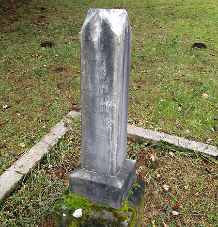
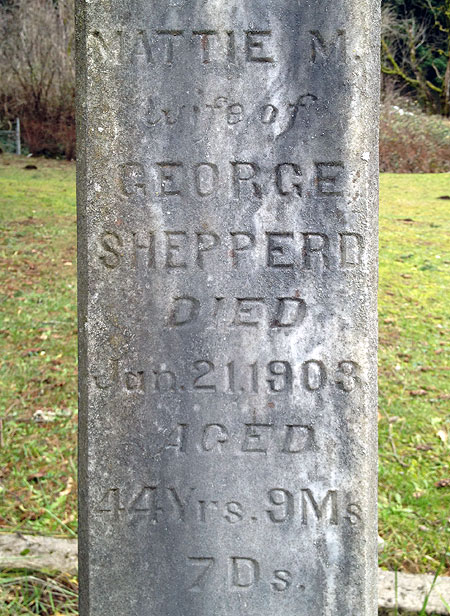
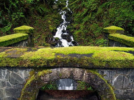
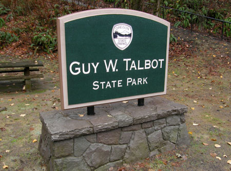
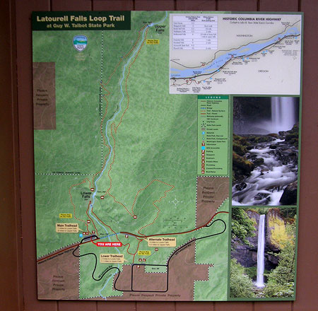
In the span of just about a decade, the Oneonta Tunnel on the Historic Columbia River Highway (HCRH) has endured a wild ride. The tunnel had been closed since the 1940s when the old highway was rerouted around the cliffs of Oneonta Bluff, and for more than half a century lived only in memories and photographs. 

Then, the tunnel was carefully restored to its original glory in 2006 as part of the ongoing effort to restore and reconnect the HCRH. But within just few years, the beautiful restoration work was badly vandalized by uncontrolled mobs of thoughtless young people unleashed upon Oneonta Gorge by social media (see “Let’s Clear the Logjam at Oneonta Gorge). Then, in September 2017, the restored timber lining was completely burned away during the Eagle Creek Fire.

Today, the tunnel stands empty and fenced-off, waiting to be brought back to life, once again. But does it make sense to restore it as before, only to set this historic gem up for more vandalism? Or could it be restored in a different way, as part of a larger vision for protecting the history and natural beauty of both the tunnel and Oneonta Gorge, while also telling the story of the scenic highway, itself? More on that idea in a moment… 

First, a look at how we got here.

Before the dams and after the railroads…

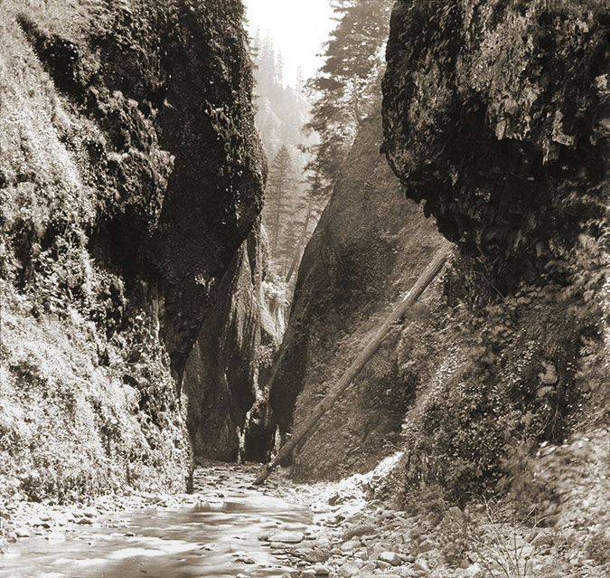
Looking at Oneonta Tunnel today, it’s hard to understand why the original highway alignment went through Oneonta Bluff to begin with, instead of simply going around it? Why wasn’t it simply built in the current alignment of the historic highway, which curves around the bluff? The answer can be seen in this photo (below) taken before the old highway was built.

Oneonta Bluff before construction of the new highway and tunnel in 1916. The new road was squeezed on the uphill side of the railroad line in many spots in the Gorge, forcing creative solutions from the visionary road designer Samuel Lancaster.

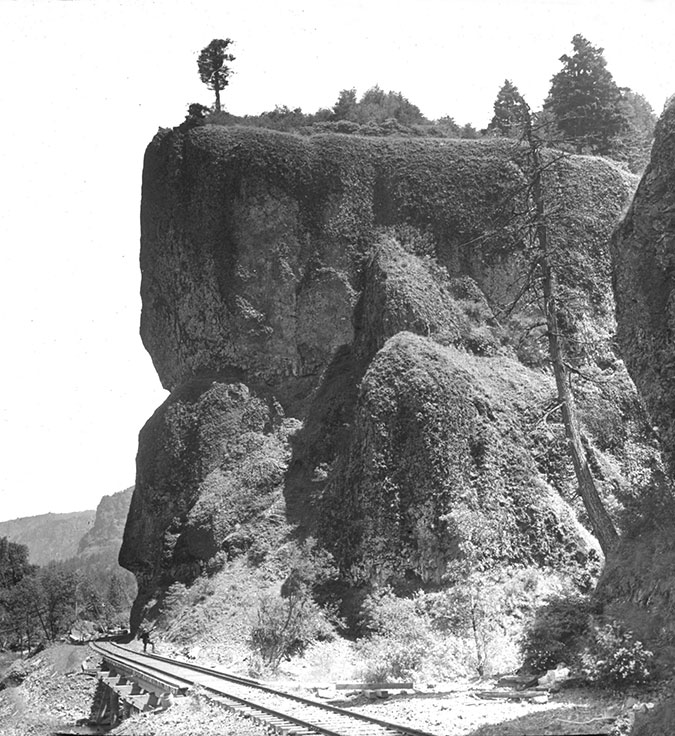
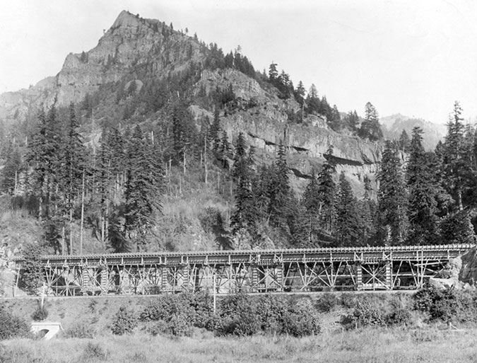
It turns out the original railroad alignment crossed Oneonta Creek on a trestle where the current highway is located today, and was also built snug against the base of Oneonta Bluff. Why was it built this way? Because in the era before Bonneville and Grand Coulee dams were completed in the 1930s (along with the many dams in the Columbia basin that followed), the Columbia River fluctuated wildly during spring runoff. So, the original rail line was built to stand above seasonal flood levels of the time.

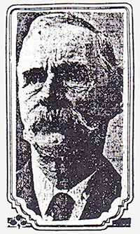
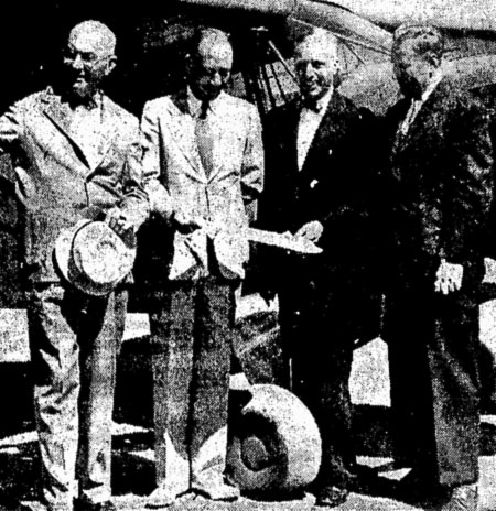
When Samuel Lancaster assessed the situation in the 1910s, the only options for his new highway were to move the railroad or tunnel through the bluff. As with other spots in the Gorge where the railroads were an obstacle for the new highway, the second option turned out to be the most expedient, and the Oneonta Tunnel was born. 

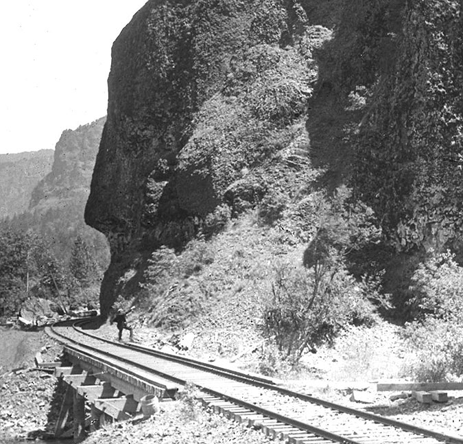
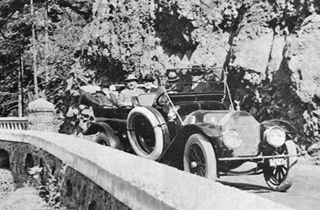
This close-up look (below) at previous photo shows a man standing on the railroad trestle crossing Oneonta Creek, pointing to what would soon be the west portal to the new tunnel, and I believe this to be Samuel Lancaster on a survey trip — though that’s just my speculation.

Close-up view of what might be Samuel Lancaster pointing at the future west portal at the Oneonta Tunnel site

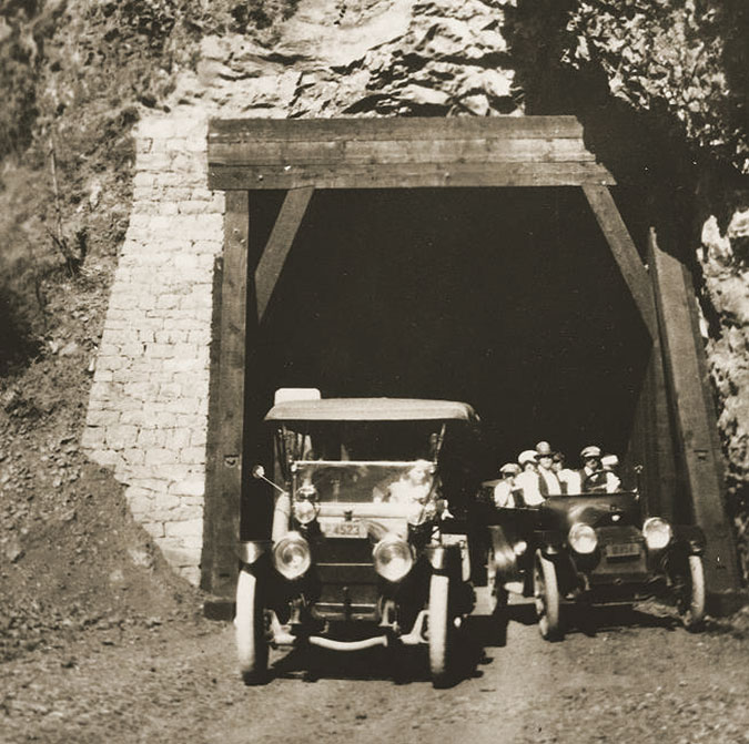
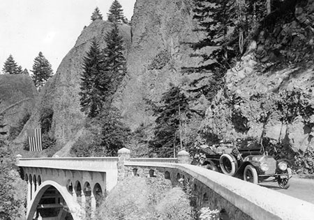
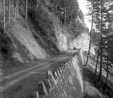
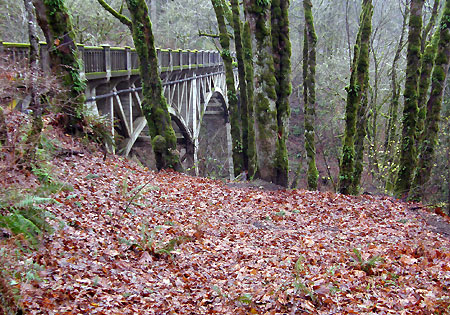
When the original alignment of the old highway opened in 1916, the new road paralleled the old railroad grade closely, especially east of the tunnel (below), where a retaining wall and wood guardrail separated the somewhat taller road grade from the railroad.

The east portal of Oneonta Tunnel shortly after completion in 1916

Sometime after the original tunnel was built, possibly in the 1930s, the railroad was moved away from the bluff, perhaps because of falling debris from the Oneonta Bluff landing on the tracks, or maybe just part of modernizing the rail line over time. The flood control provided by dams on the Columbia River beginning in the 1930s (and especially the relatively stable “pool” created behind Bonneville Dam) allowed the railroads to move several sections of their tracks in the Gorge onto extensive rock fill during this period, often well into the river, itself. 

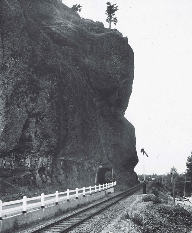
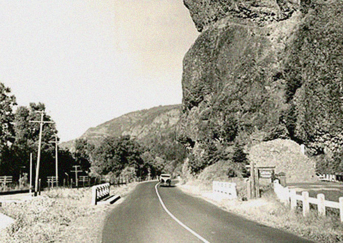
This photo (below) from the 1930s shows the west portal of Oneonta Tunnel after the railroad had been move northward, away from Oneonta Bluff, but before the highway had been realigned to bypass the tunnel.

West approach to the Oneonta Tunnel in the late 1930s after the railroad had been moved away from the bluff, opening the door for the highway, itself, to be routed around the bluff

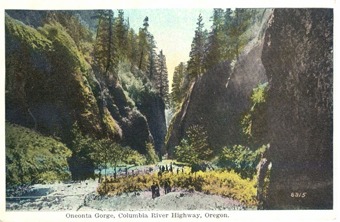
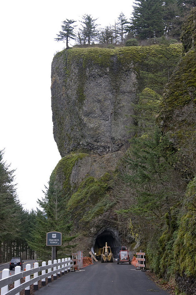
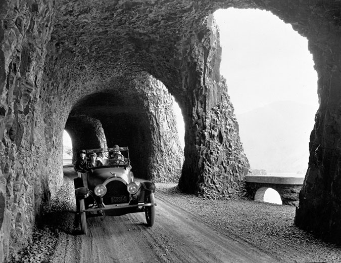
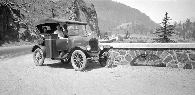
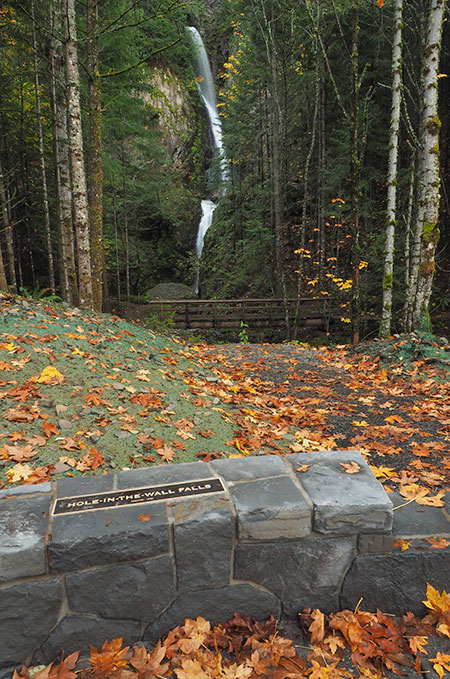
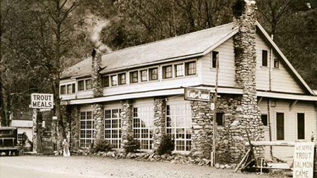
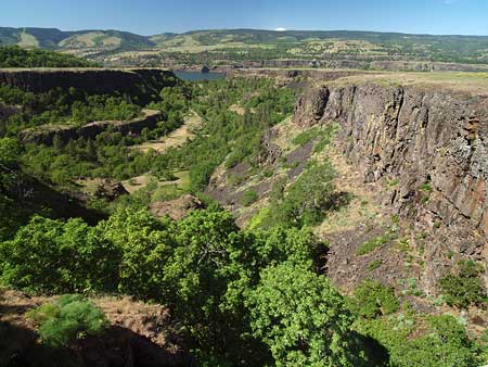
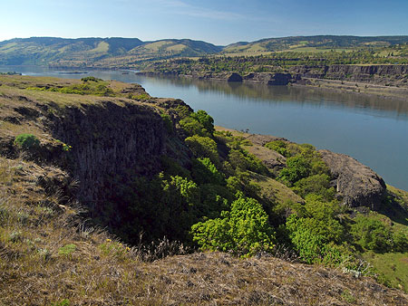
The tunnel at Oneonta Bluff was one of several along the old highway, though it was easily overshadowed as an attraction by the famous “tunnel with windows” at Mitchell Point, to the east and the spectacular “twin tunnels” near Mosier. What made Oneonta Tunnel famous was the view into impossibly narrow Oneonta Gorge, which suddenly appears as you approach the west portal. 

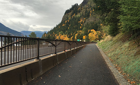
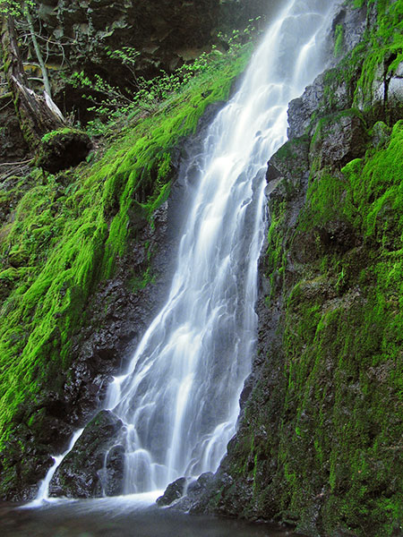
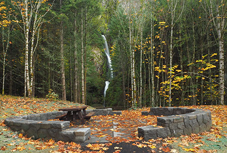
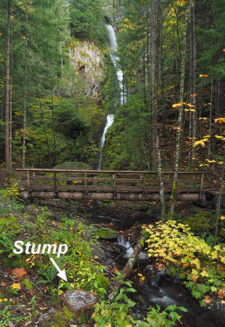
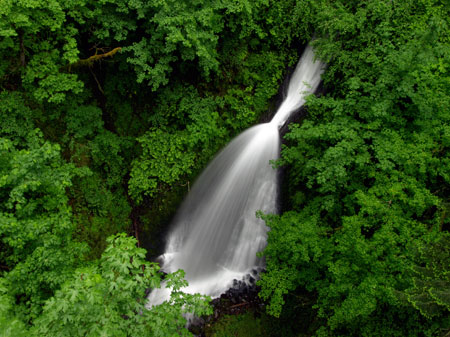
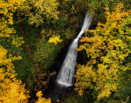
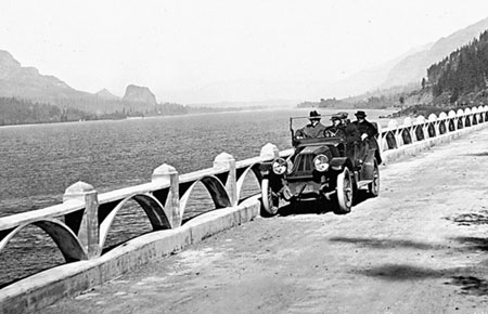
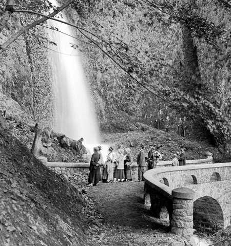
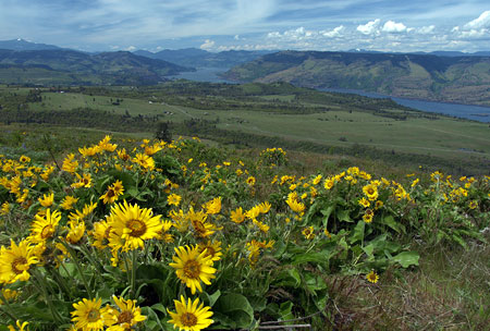
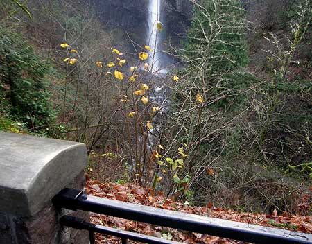
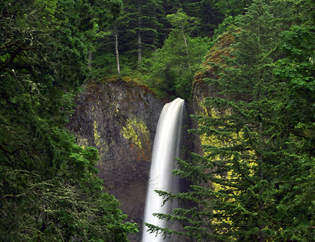
Oneonta Gorge has been a popular tourist attraction since the old highway opened in 1916. For nearly a century, adventurers have waded up the creek to the graceful 120-foot waterfall that falls into Oneonta Gorge, about a mile from the historic highway bridge. Only in recent years has overcrowding presented a serious threat to both the unique cliff ecosystem and the historic highway features here.

Early visitors to Oneonta Gorge in the 1920s

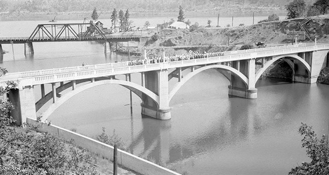
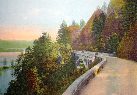
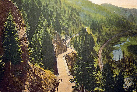
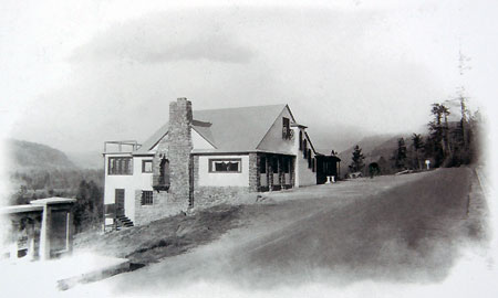
In the 1930 and 1940s, the Oregon Highway Department began a series of projects in the Gorge aimed at “modernizing” the old highway as the dawn of the 1950s freeway-building loomed. A new river-level route was built to bypass the steep climb the original route takes over Crown Point, with the new route following what is today’s I-84 alignment. 

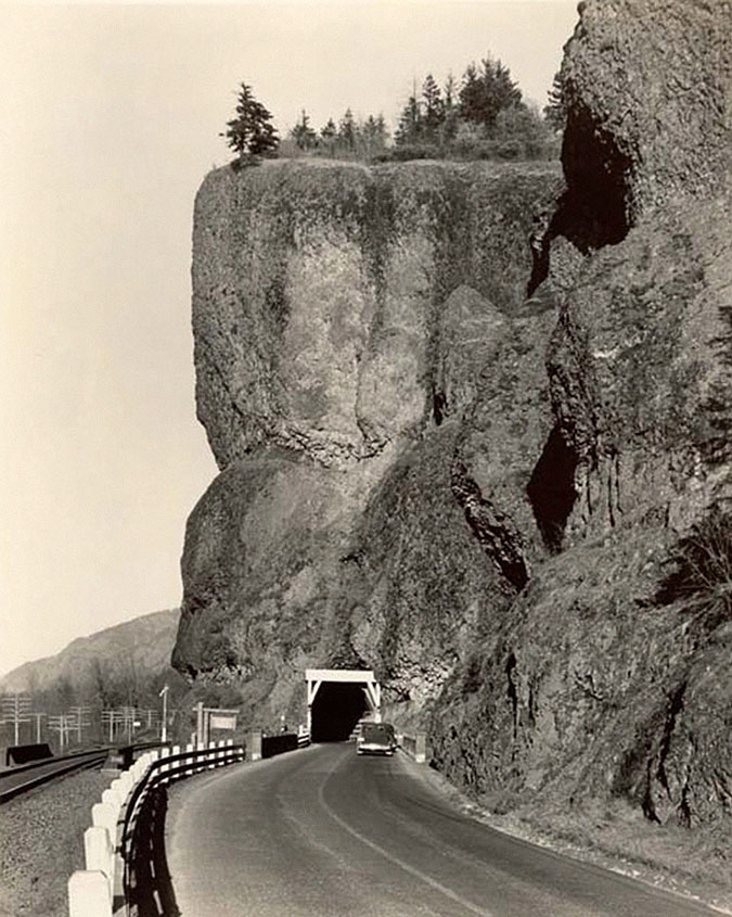
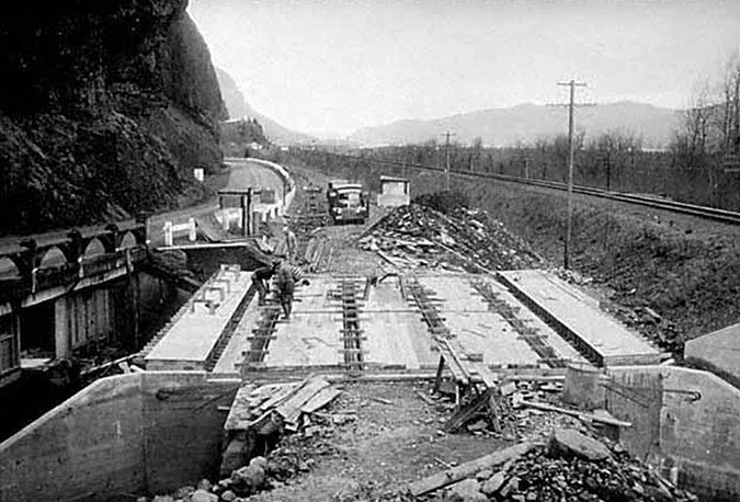
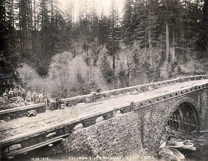
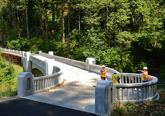
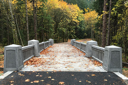
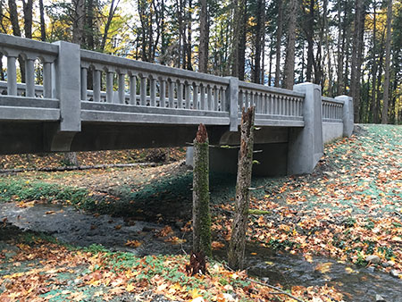
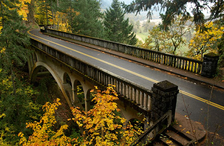
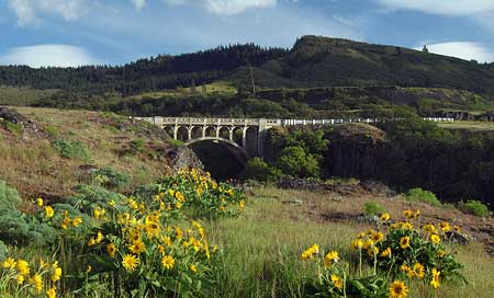
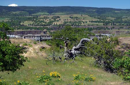
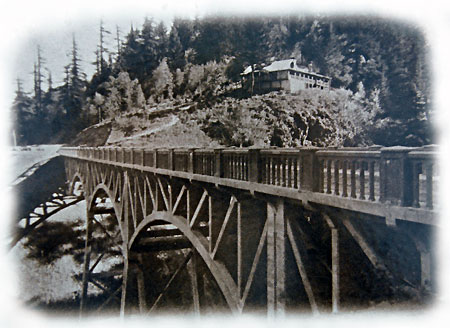
At Tooth Rock (above Bonneville Dam) a new tunnel was blasted through the cliffs to bypass the intricate viaducts built atop the cliffs by Samuel Lancaster. That tunnel still serves eastbound I-84 today, and has become a historic feature in its own right. And at Oneonta Bluff, a new bridge and tunnel bypass (below) took advantage of the relocated railroad, and was completed in 1948.

The (then) new highway bypass bridge under construction in 1948; the original bridge is to the left, and still remains today

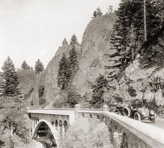
When the new bridge and realigned highway section opened, the original bridge Samuel Lancaster built at Oneonta Creek was left in place, thankfully, and it survives today as a elegant viewpoint into Oneonta Gorge and gateway to the tunnel. The Oneonta Tunnel was also decommissioned at the time, with fill at both entrances (below). The tunnel remained this way for the next half-century, as a curiosity for history buffs but forgotten by most.

The realigned historic highway after 1948, with the tunnel (on the right) decommissioned with rock fill at both ends

The rebirth of Oneonta Tunnel began with a bold vision for restoring and reconnecting the surviving sections of the Historic Columbia River Highway as part of the landmark 1986 Columbia River National Scenic Area act, with this simple language: 

16 U.S.C. 544j Section 12. Old Columbia River Highway: The Oregon Department of Transportation shall, in consultation with the Secretary and the Commission, the State of Oregon and the counties and cities in which the Old Columbia River Highway is located, prepare a program and undertake efforts to preserve and restore the continuity and historic integrity of the remaining segments of the Old Columbia River Highway for public use as a Historic Road, including recreation trails to connect intact and usable segments.

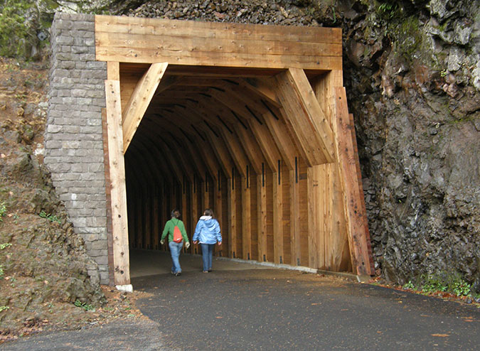
And so began what will eventually be a four-decade effort to restore the old highway to its original grandeur, with many beautiful new segments designed as if Samuel Lancaster were still here overseeing the project. Work began elsewhere on the old route in the 1980s, but eventually came to the Oneonta Tunnel in 2006 (below). 

Restoration of the Oneonta Tunnel begins in 2006 (ODOT)

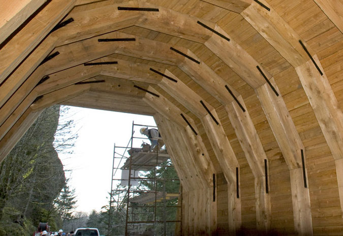
The restoration began with simply excavating the old tunnel, and later rebuilding the stone portals at both ends and installing cedar sheathing to line the interior. A new visitor’s parking area was created outside the east portal and the original white, wooden guardrails were also recreated.

Restored interior wood lining nearly complete in the Oneonta Tunnel in 2006 (ODOT)

For the next few years, the restored tunnel stood as a remarkable tribute to the work of Samuel Lancaster and our commitment to preserving the history of the Gorge. It was a popular stop for visitors and also served as fun part of a hiking loop linking the Horsetail and Oneonta trails.

Vandalism & Oneonta Gorge

Every new technology brings unintended consequences, and the advent of social media over the past two decades has been undeniably hard on our public lands. Where visitors once studied printed field guides and maps to plan their adventures, today’s decisions are more often based on a photo posted in some Facebook group or on Instagram, where hundreds will see it as the place to be right now. 

This has resulted in the “Instagram Effect”, where huge surges in visits follow social media posts, both in the immediate near-term for a given place, and in the long-term interest in hiking and the outdoors. According to a 2017 study by Nielsen Scarborough, hiking in the Pacific Northwest has nearly doubled in popularity the past ten years, with Portland and Seattle ranking second and third (in that order) in the nation for number of hiking enthusiasts — Salt Lake City took the top spot. 

Overall, that’s very good news for our society because hiking and spending time outdoors are good for all of us, and we live in a part of the world where we have some of the most spectacular places to be found anywhere in our own backyard. But the immediate effect of social media can often spell bad news when hordes of ill-equipped and ill-informed people descend upon a place that is trending on their phone.

Social media conga-line waiting to enter Oneonta Gorge in 2016 (Photo: John Speth)
Traffic jam at the Oneonta log jam in 2015 (Photo: TJ Thorne)
Traffic jam at the second Oneonta log jam in 2015 (Photo: TJ Thorne)
Cattle call at Oneonta Gorge in 2015 (Photo: TJ Thorne)

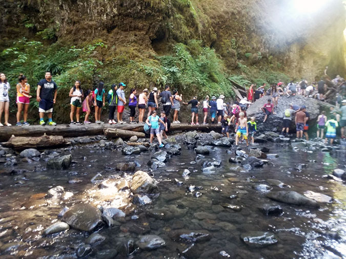
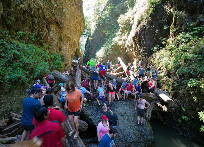
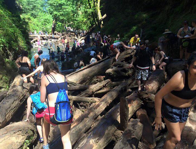
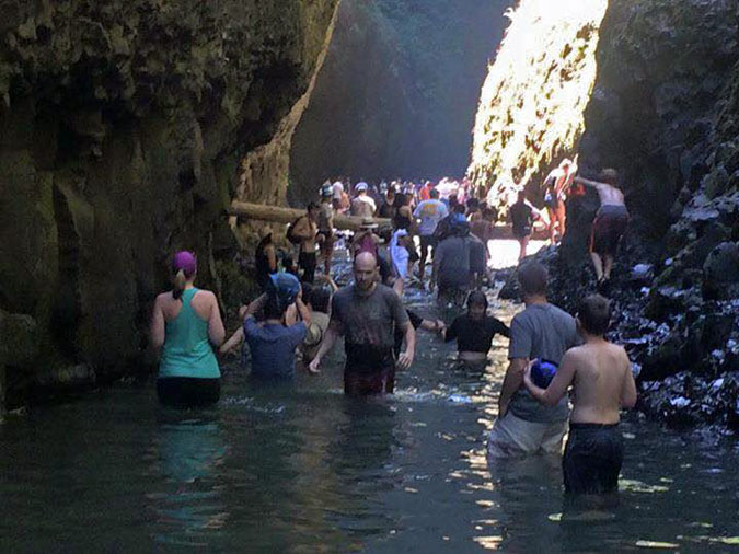
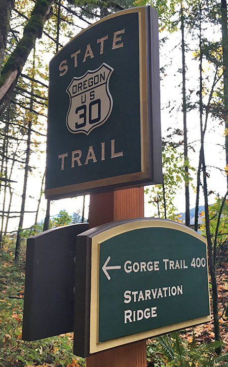
Oneonta Gorge is one of the special places that fell victim to the Instagram Effect, with huge crowds of young people overwhelming the canyon on summer days over the past decade. Sadly, the Forest Service did absolutely nothing to curb the invasion, despite the obvious threat to the rare ecosystem here, and hazardous conditions presented by the infamous log-jam that has blocked the entrance to the canyon since the late 1990s (see “Let’s Clear the Logjam at Oneonta Gorge).

And another unfortunate casualty of this unmanaged overcrowding was the Oneonta Tunnel, itself, when the Oneonta Gorge mobs stopped by to record themselves for posterity in the soft, brand-new cedar walls of the restored tunnel (below). While the vandalism was maddening, the lack of any sort of public response from the Forest Service or ODOT to stem the tide was equally frustrating.

The massive defacing of the restored Oneonta Tunnel interior…
…coincided with the explosive, unmanaged crowds that descended…
…upon Oneonta Gorge in the era of social media…

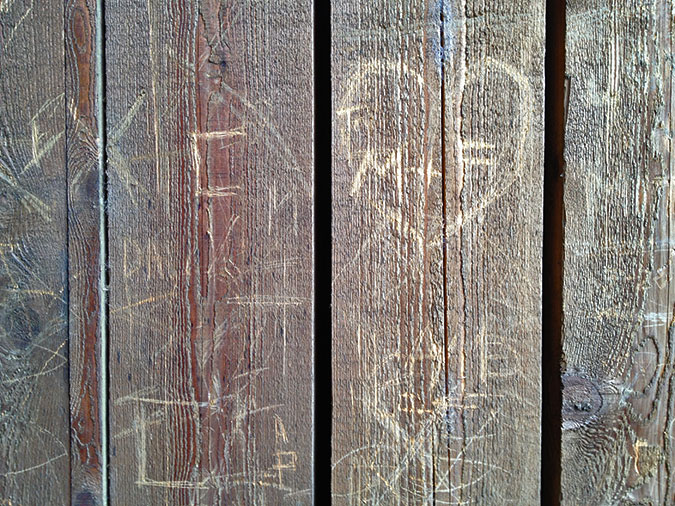
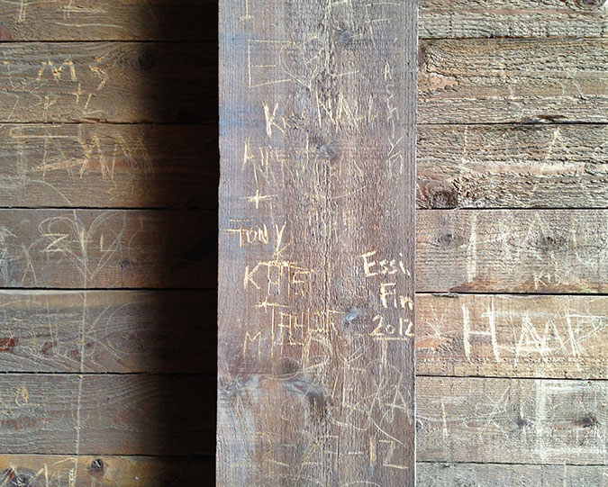
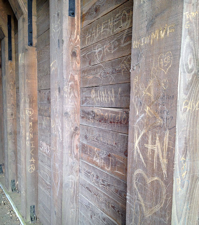
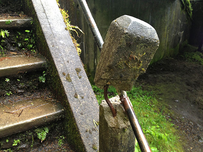
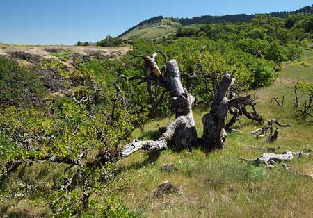
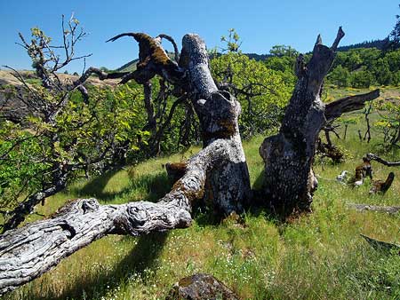
The vandalism didn’t stop with the destruction of the tunnel walls, however. The unmanaged crowds also tagged spots throughout the area with graffiti, and damaged some of the priceless historic features (below) left for us by Samuel Lancaster.

Damage to historic highway features like this staircase came with the disrespectful mobs of young people coming to Oneonta Gorge over the past decade

As discouraging as the damage at Oneonta was, it was also completely predictable. The idea of limiting access to popular spots in the Gorge is one that the public land managers at the state and federal level have been loath to consider, even when overuse is clearly harming the land and our recreation infrastructure. The problem is made worse by the crazy quilt of intertwined state and federal lands in the Gorge, complicating efforts to manage access, even if the will existed.

Then the fire happened in September 2017, changing everything…

The Fire

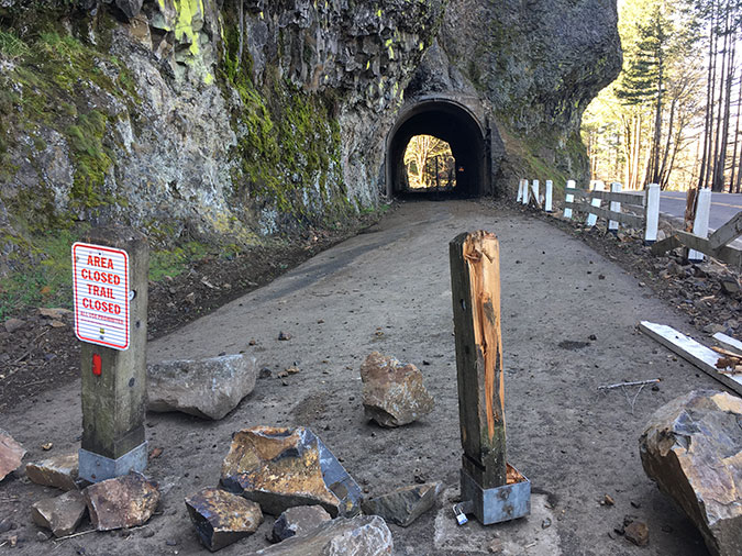
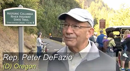
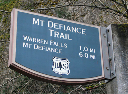
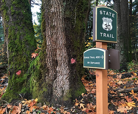
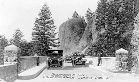
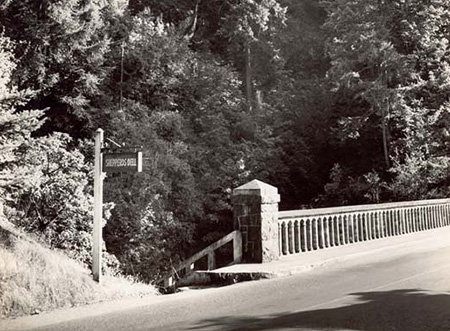
When the Eagle Creek Fire was ignited on Labor Day weekend in 2017 by a careless firework tossed from a cliff, few imagined that it would ultimately spread to burn a 25-mile swath of the Oregon side of the Gorge, from Shepperd’s Dell on the west to the slopes of Mount Defiance on the east. In the aftermath, the entire burn zone was closed to the public, and much of it still is. While the fire closure put enormous pressure on the few trails that remained open, it also opened the door to rethinking how we access to trails within the burn zone when they are reopened. How and when that happens remains to be seen.

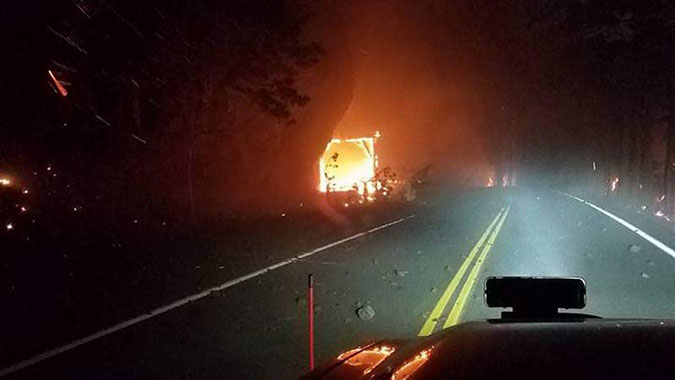
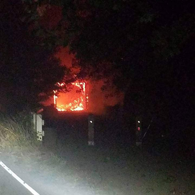
At Oneonta Bluff, the images of the fire were dramatic and unexpected: the inferno spread to the interior of the restored tunnel and lit up the wood lining, completely burning it away like lit fuse. Local news affiliate KPTV published these views (below) taken by fire crews as the tunnel burned.

East portal view of the Oneonta Tunnel burning in September 2017 (KPTV)
West portal view of the Oneonta Tunnel burning in September 2017 (KPTV)

The Oregon Department of Transportation (ODOT) spent the weeks after the fire in 2017 assessing the damage to the historic highway, including these photos of the burned-out tunnel (below).

West portal view of the Oneonta Tunnel after the fire in 2017 (ODOT)
East portal view of the Oneonta Tunnel after the fire in 2017 (ODOT)

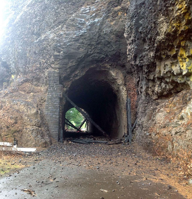
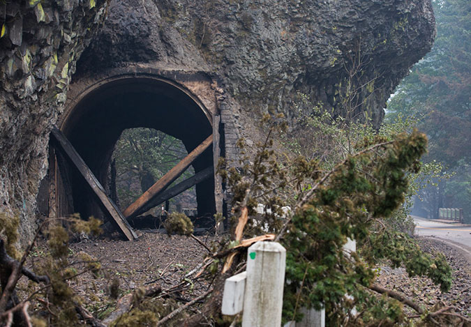
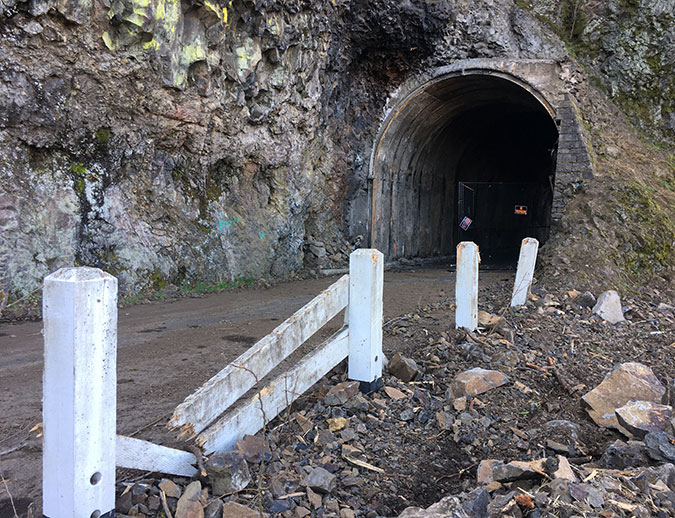
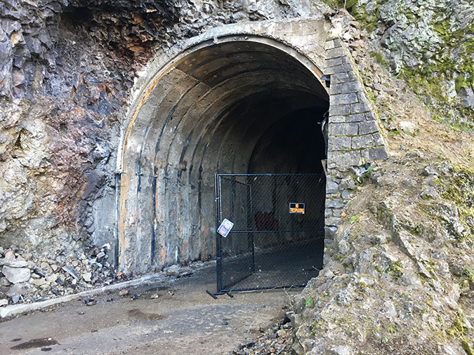
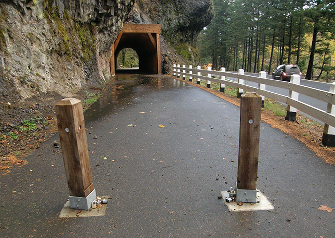
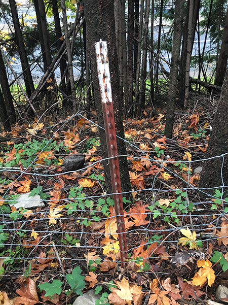
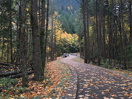
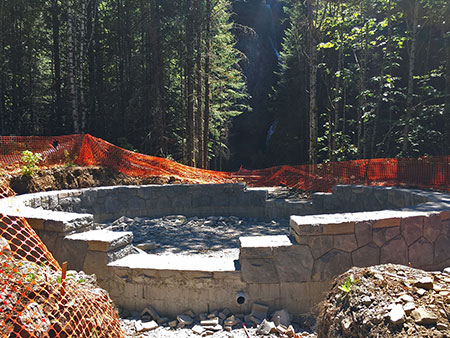
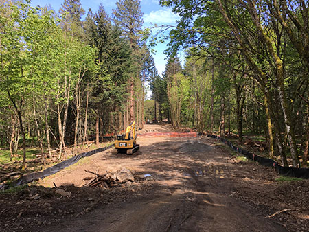
Today, the scene at Oneonta Tunnel hasn’t changed that much. ODOT eventually stripped the remaining, charred timbers from the tunnel and fenced off both portals to the public (below), though vandals have since pushed the fencing aside. The area remains closed indefinitely.

Charred reminders of the fire in 2020 at Oneonta Tunnel
East portal approach to the Oneonta Tunnel in 2020
East portal of the Oneonta Tunnel in 2020
Gated east portal of the Oneonta Tunnel in 2020, opened by vandals

Though it might be heresy to admit, my immediate reaction when I saw the images of the burning tunnel in 2017 was relief. There was no end in sight to the social-media driven vandalism, and the interior had pretty much been ruined at that point, so the fire presented an unexpected opportunity for a redo, someday. Quite literally, it’s an opportunity for Oneonta Tunnel to rise from the ashes, but perhaps in a new way this time.

Remembering what we lost

A new vision for restoring Oneonta Tunnel — and protecting Oneonta Gorge — begins with remembering the fine restoration work completed in 2006. What follows is a look back at what that looked like, before social media took its toll.

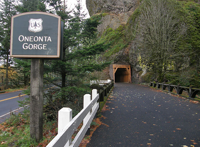
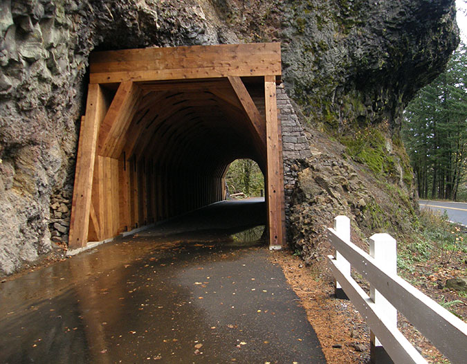
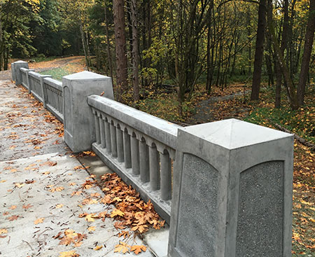
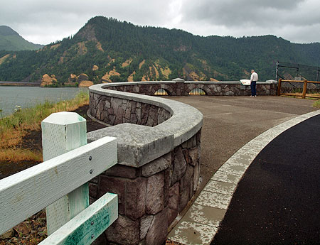
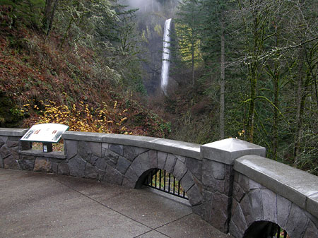
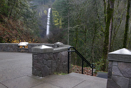
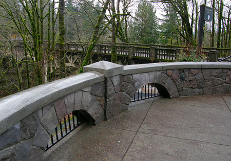
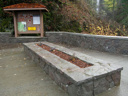
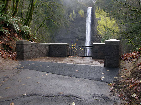
At the west portal to the tunnel (where the original Oneonta Bridge, with its graceful arched railings, still stands), the restoration included a gateway sign, restored, painted guardrails built in the style of the original highway and an interpretive display near the tunnel entrance (below). The design functioned as a wide, paved trail, with the idea that cyclists touring the historic highway would pull off the main road and ride through the short tunnel section on a path closed to cars.

West portal of the Oneonta Tunnel in 2008, shortly after the renovation

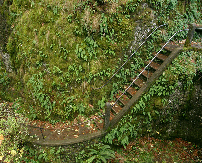
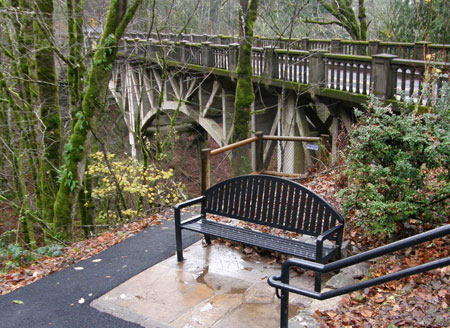
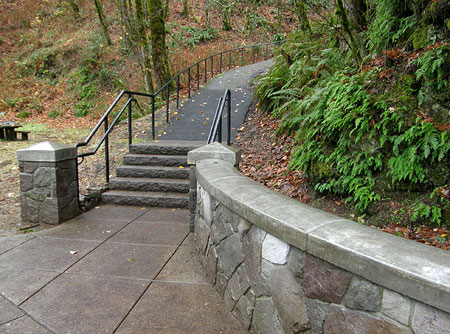
From the original highway bridge over Oneonta Creek, the view extended into Oneonta Gorge, but also down to this fanciful stairway (below) right out of a Tolkien novel. This feature of the original historic highway continues to take visitors down to the banks of Oneonta Creek (the landing Newell in the bottom center of the photo, at the base of the stairs, is the one broken by vandals in an earlier photo). Just out of view at the top of the stairs is a picturesque bench built into the mossy cliff.

Historic Oneonta Stairwell in 2008

The west portal restoration included new stonework around the timber frame that closely matched the original design (below). 

West portal of the restored Oneonta Tunnel in 2008

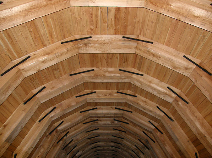
Inside, the restored tunnel was lined with cedar plank walls and ceiling, supported by arched beams (below).

Wood interior of the restored Oneonta Tunnel in 2008

The east portal was similar to the west end of the tunnel, with stone masonry trim supporting the portal timbers (below).

East portal of the restored Oneonta Tunnel in 2008

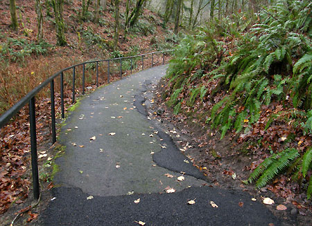
Like the west side, the east entrance approach (below) was designed for cyclists to leave the highway and tour the tunnel and historic bridge before returning to the main road. 

East portal approach to the Oneonta Tunnel in 2008

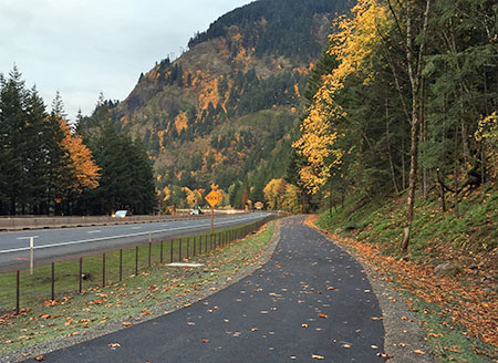
In practice, most of the traffic in the tunnel before the fire came from hikers and curious visitors parking on the east and west sides and walking the path to the viewpoint into Oneonta Gorge. This is partly because bicycle touring in the Gorge focuses on the extensive car-free-sections of the historic highway, though the shared-road portions of the old highway are expected to see continued growth in cycling as the entirety of the old route is fully restored.

A Fresh Start (and Vision)

Oneonta Gorge in about 1900, more than a decade before the first automobiles would travel through the Columbia River Gorge

The 2006 restoration of Oneonta Tunnel and its approaches was based on the idea of it simply serving as a bicycle and pedestrian path as part of the larger historic highway restoration project. But the tragic defacing of the newly restored tunnel is a painful reminder that it’s simply not safe to assume it will be respected if left open to the public, unprotected, as it was before. Even gates are not enough, as vandals have since demonstrated by tearing open the temporary fencing on the burned-out tunnel.

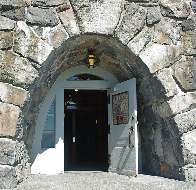
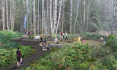
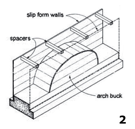
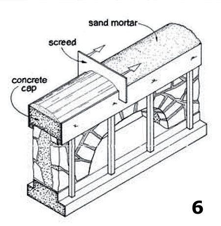
But what if we considered the tunnel and its paved approaches, including the historic highway bridge, as a useful space instead of a path? The tunnel is surprisingly wide, at 20 feet, and 125 feet long. That’s 2,500 feet of interior space! What if the tunnel were restored this time with the idea of using this as interior space? As a history museum, in fact? With the paved approaches as plazas with outdoor seating, tables and bike parking?

Though it’s not a perfect comparison, there is an excellent model to look to in southern Utah, just east of the town of Kanab, where the privately operated Moqui Cave Natural History Museum is built inside a sandstone cave. The cave was once a speakeasy, then a dance hall in the 1930s, before it was finally converted to become a museum in the 1040s.

Moqui Cave Museum near Kanab, Utah (Wikipedia)

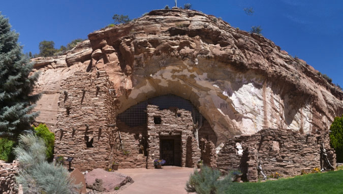
While passing through Kanab on a recent road trip, the stonework blending with the standstone cave entrance at Moqui Cave (below) reminded me of the restored stonework at Oneonta tunnel portals, and how the entrances to the tunnel might be enclosed to create a museum space at Oneonta.

Moqui Cave Museum entrance (TripAdvisor)

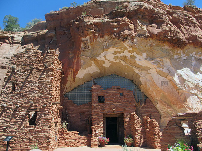
Like our Oneonta Tunnel, Moqai Cave is mostly linear in shape (below), with displays of ancient Puebloan artifacts and fossil dinosaur tracks displayed along its sandstone walls.

Moqui Cave Museum interior (TripAdvisor)

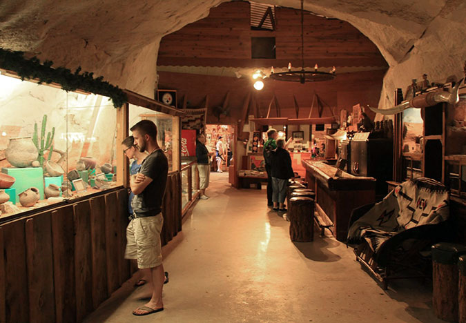
These section of the Moqui Cave are roughly the same width and height of the Oneonta Tunnel, with plenty of room for both displays and walking space.

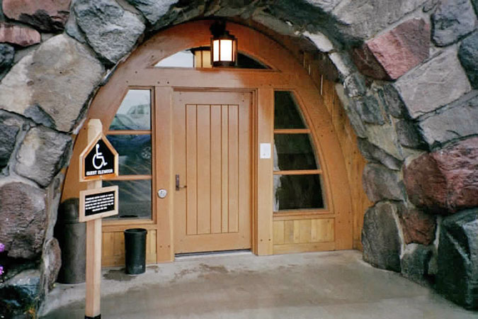
Other solutions for enclosing the entrance at Oneonta Tunnel could draw from our own Timberline Lodge, on Mount Hood. While the stone foundation for the lodge is man-made, it’s not unlike the basalt portals at Oneonta. This is the familiar main entrance on the south side of the lodge (below), showing how the massive wood entry doors are built into the arched stone lodge foundation.

Historic Timberline Lodge entrance door (Wikipedia)

About ten years ago, another entrance to Timberline Lodge was handsomely renovated (below) to become barrier-free, yet still the massive, rugged lodge style that was pioneered here. This updated design shows how modern accessibility requirements could be met at an enclosed Oneonta Tunnel.

Restored Timberline Lodge side entry door (Versatile Wood Products)

There are other examples for enclosing Oneonta Tunnel as a museum space, too. While it would be a departure from Samuel Lancaster original purpose and design to enclose the tunnel, I suspect he would approve, given how the Gorge has changed in the century since he built the original highway.

There are logistics questions, of course. Is the Oneonta Tunnel weatherproof? If the dry floors during winter the months after the 2006 renovation are any indication, than yes, having 150 feet of solid basalt above you provides good weather proofing! Does the tunnel have power? Not yet, but a power source is just across the highway along the railroad corridor. These are among the questions that would have to be answered before the tunnel could be used as a museum, but the potential is promising!

Getting a handle on parking…

One of the most vexing problems along the busy westerly section of the Historic Columbia River Highway is how to manage parking as a means for managing overall crowding. Today, parking is largely unmanaged in this part of the Gorge, which might sound great if you believe there is such a thing as “free parking” (there isn’t). But in practice, it has the opposite effect, with epic traffic jams on weekends and holidays, and travelers waiting wearily for their “free” spot at one of the waterfall pullouts.

Weekend traffic jams on the historic highway are the norm today, and result from unmanaged parking (KATU)

At Oneonta, the lack of managed parking is at the heart of the destruction that mobs descending on Oneonta Gorge brought to the area, including the defacing of the tunnel. Some simple, proven parking management steps are essential, no matter what comes next at Oneonta. First, parking spaces must be marked, with a limited number of spots available and enforced. Can’t find a spot? Come back later, or better yet, at a less crowded time. 

Second, the parking should be managed with time limits (30 minutes, 60 minutes and a some 120 minute spots for Oneonta Gorge explorers). Timed parking also allows for eventual parking fees during peak periods, which in turn, could help pay for badly-needed law enforcement in the Gorge. Eventually, it makes sense to meter all parking spots in the Gorge, but that’s going to take some a level of cooperation between ODOT, the Forest Service and Oregon State Parks that we haven’t seen before, so lots of work lies ahead on that front.

So, these are all basic tools of the trade for managing parking in urban areas, and the traffic in the Gorge is well beyond urban levels. It’s time to begin managing it with that reality in mind.

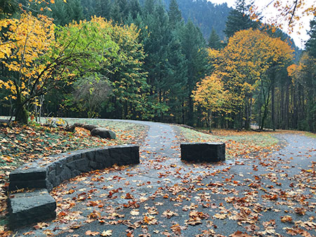
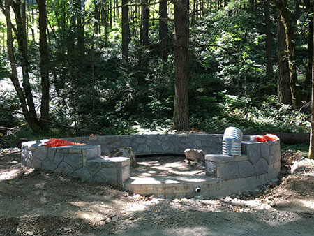
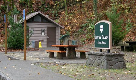
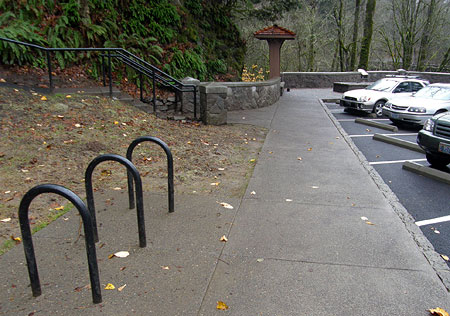
The east parking area (below) at the Oneonta Tunnel was rebuilt as part of the tunnel restoration in 2006, but is poorly designed, with a huge area dedicated to parallel parking. 

Unmarked, poorly designed shoulder parking at the new pullout east of the Oneonta Tunnel comes complete with a sidewalk, and could be easily be restriped and better managed with angled spaces

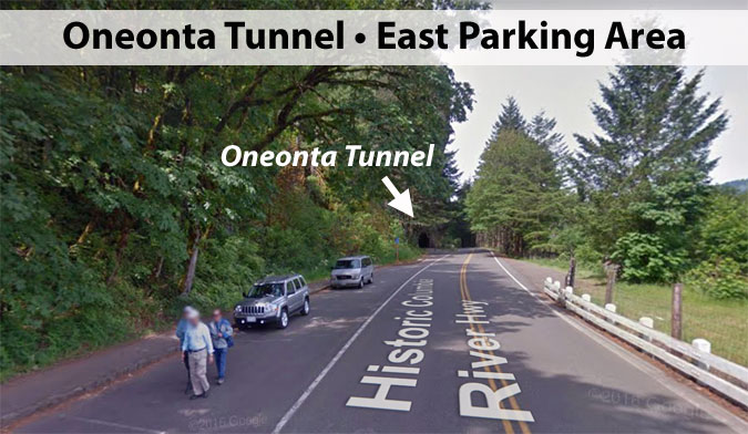
However, this relatively new parking area includes a (rarely used) sidewalk, and thus it could be striped with angled spaces that would make for more efficient parking and also include space for a tour bus pullout. ODOT would just need to take a deep breath, since this would involve visitors backing into the travel lane when exiting a spot — a bugaboo for old-school highway engineers. But drivers manage this all time in the city. We can handle it.

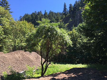
The west parking area (below) at Oneonta is an unfortunate free-for all, with an unmanaged shoulder that was ground zero for the huge social media crowds that began clogging Oneonta Gorge in the late 2000s. This area needs a limited number of marked, timed parking spots no matter what happens at Oneonta in the future. There’s also plenty of room for a sidewalk or marked path in front of the parking spaces, along the foot of the cliffs, similar to the new sidewalk built east of the tunnel. This would make for much safer circulation of pedestrians here.

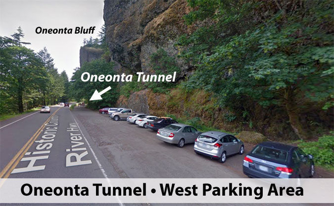
The west parking area would also be the best place for accessible parking spaces, since it offers the shortest, easiest access to the tunnel and views of Oneonta Gorge from the historic bridge.

Looking west for inspiration… and operations?

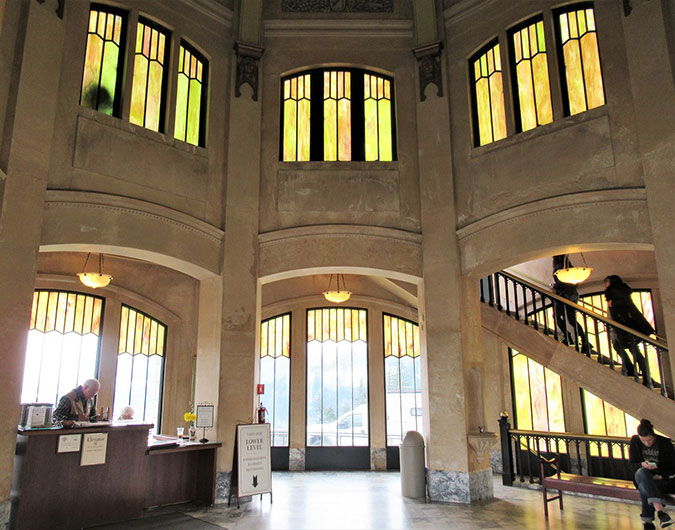
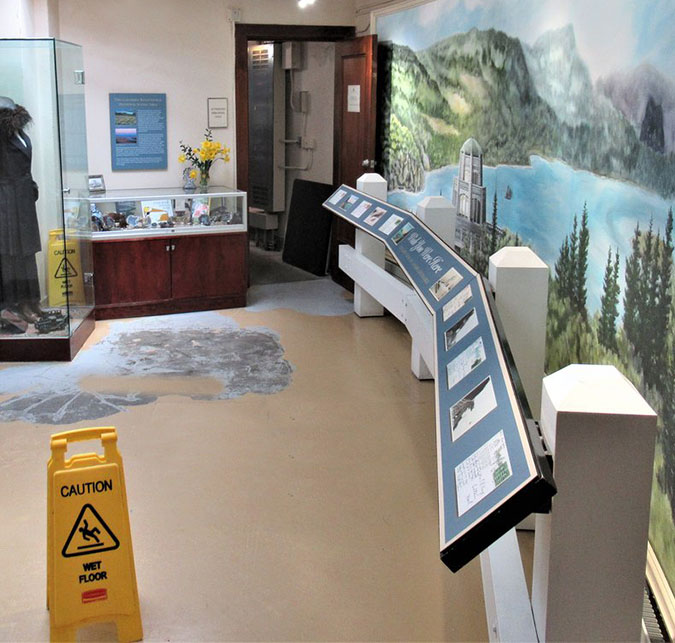
Most who visit the iconic Vista House at Crown Point don’t know that the interpretive museum inside the building is operated as a partnership between the non-profit Friends of Vista House and Oregon State Parks.

Vista House rotunda (TripAdvisor)

The Friends formed in 1982, well before the Columbia River Gorge Scenic Area was created in 1986, and have done a remarkable job bringing the Vista House back from a serious backlog of needed repairs. Today, it is among the jewels that draw visitors to the Gorge.

Vista House interpretive displays and gift shop (TripAdvisor)

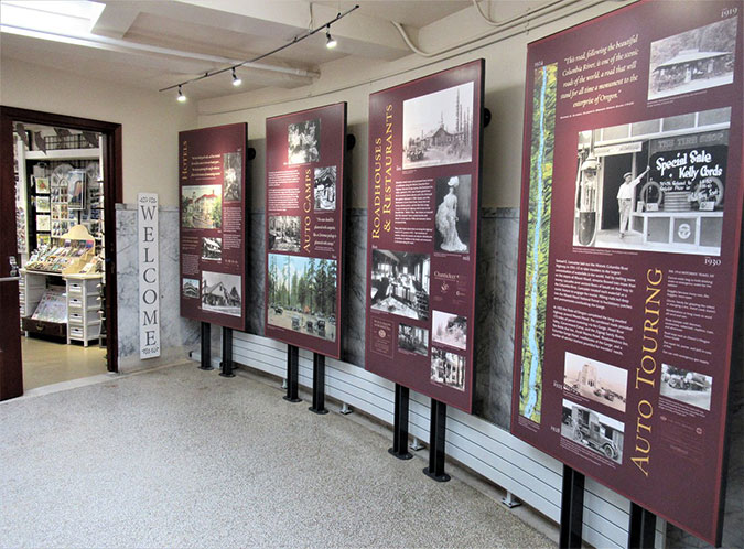
In their partnership with State Parks, the Friends operate a museum inside Vista House, as well as a gift shop and espresso bar in the lower level. Proceeds from the gift shop are directed to their ongoing efforts to preserve and interpret this structure for future generations.

Vista House interpretive displays (TripAdvisor)

The unique partnership between the Friends of Vista House and Oregon State Parks is a proven, successful model, and it could be a foundation for a museum in the restored Oneonta Tunnel. Could the Friends operate a similar facility at Oneonta as part of an expanded mission? Perhaps. Or perhaps another non-profit could be formed as a steward for the tunnel, in partnership with the U.S. Forest Service and State Parks? 

Crucially, having a staffed presence at Oneonta would allow for effectively managing access to Oneonta Gorge, itself, using a timed entry permit system. This is a proven approach to protecting vulnerable natural areas from overuse, and the Forest Service already uses timed permits elsewhere. Ideally, this permitting function would be funded by the Forest Service, and would include interpretive services for other visitors discovering the area, as well.

Focus on Sam Lancaster’s Road?

Samuel Lancaster, the dreamer behind the Columbia River Highway

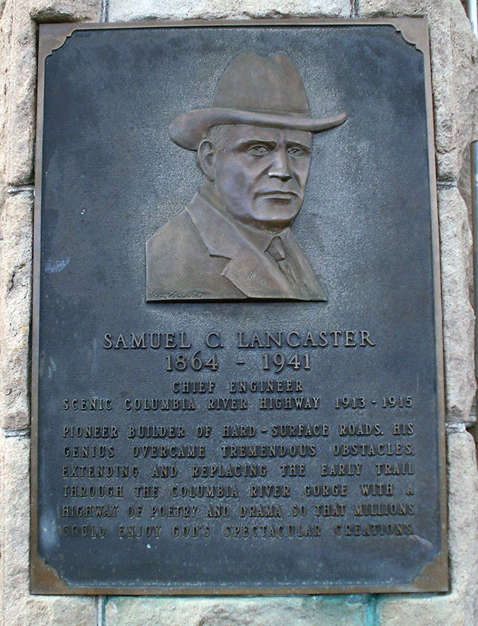
On the cut stone wall of the Vista House, a bronze plaque honoring Samuel Lancaster provides a very brief introduction to the man. Displays inside Vista House, and elsewhere in the Gorge, also tell his story in shorthand. But Lancaster’s original vision and continued legacy in shaping how we experience the Gorge deserves a more prominent place. A converted Oneonta Tunnel Museum would be a perfect place to tell that story.

The walls of the tunnel provide a combined 250 feet of display space, which could allow visitors to have a detailed look at some of the secrets of Sam Lancaster’s amazing road. The State of Oregon has a rich archive of historical photos of the highway during its construction phase, mostly unseen by the public for lack of a venue. 

These include rare photos of spectacular structures now lost to time. Among these (below) is the soaring bridge at McCord Creek, destroyed to make room for the modern freeway, and the beautiful arched bridge at Hood River, replaced with a modern concrete slab in the 1980s.

The soaring, former McCord Creek Bridge under construction in 1915 (ODOT)
The graceful former Hood River Bridge in the 1920s, replaced with a freeway-style concrete slab in the 1980s (ODOT)

A new Oneonta Tunnel Museum could tell the story of Sam Lancaster’s inspiration for the famous windowed tunnel at Mitchell Point (below), another lost treasure along the old highway destroyed by modern freeway construction.

The former Mitchel Point Tunnel of many windows (ODOT)

A new museum at Oneonta could also tell the story of the surviving gems along the old road that are now part of the Historic Columbia River Highway State Trail. These include (below) the spectacular section between Hood River and Mosier, with its iconic twin tunnels, the beautifully crafted stone bridge at Eagle Creek and the graceful arched bridge at Shepperd’s Dell.

1920s scene along the spectacular Mosier Twin Tunnels section of the old highway
Eagle Creek Bridge construction in 1915 (note the group of stonemasons in the viewing alcove on the left)
Shepperd’s Dell Bridge on dedication day in 1916. Samuel Lancaster is riding in backseat of  the first automobile (photo trivia: the big Douglas fir at the far left in this image is still standing and survived the 2017 Eagle Creek fire with some scorching to its massive trunk!)

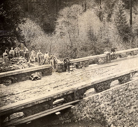
The story behind the building of the old highway extends beyond the genius of Samual Lancaster and the beauty of the design. The construction, itself, was a monumental undertaking, and the stories of the people who built this road deserve to be told in a lasting way for future generations.

The Lancaster story continues today, as well. Since the 1980s, ODOT, Oregon State Parks and scores of dedicated volunteers have steered the ongoing effort to restore and reconnect the old route, as called for when the Columbia River Gorge National Scenic Area Actwas signed into law in 1986.

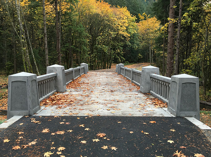
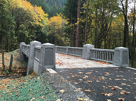
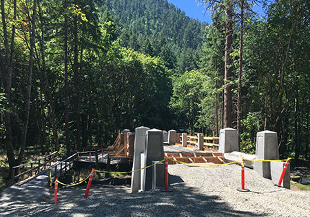
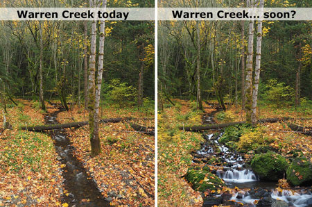
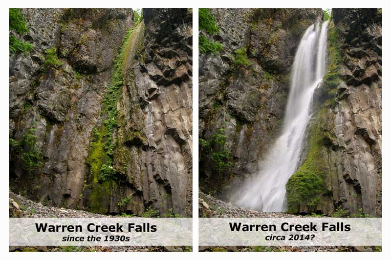
Many of the restoration projects are epic achievements in their own right, and deserve to have their story told for future generations to appreciate. All are inspired in some way by Samuel Lancaster’s original vision for a road blended seamlessly into the Gorge landscape in way that allows visitors to fully immerse themselves in the scenery. These include handsome new bridges (below) at Warren Creek and McCord Creek, as well as a planned recreation of the Mitchell Pont Tunnel.

The new bridge over Warren Creek on the restored Columbia River Highway State Trail
The new bridge over McCord Creek on the restored Columbia River Highway State Trail

What would it take to create an Oneonta Tunnel Museum dedicated to Samuel Lancaster’s enduring vision? Capital funding, of course, but that will surely come at some point, given the current state of the tunnel after the fire. It would also take a willing non-profit partner and a strong interest from the Forest Service, ODOT and Oregon State Parks to try something different when it comes time to once again restore the tunnel. But the time to start that conversation is now, before the agencies start down the path of simply repeating mistakes from the past decade.

So, for now, this is just an idea. But in the meantime, if you’d like to learn more about Samuel Lancaster and his amazing highway, there are two books that should be in every Gorge-lover’s library. And they make for especially good reading in this time in which we’re not able to visit the Gorge! 

The first is Samuel Lancaster’s own book, The Columbia: America’s Great Highway, first published in 1916 by Lancaster, himself. This book is as eccentric and sweeping as Lancaster’s own imagination, and his love for the Gorge comes through in his detailed descriptions of the natural and human history. It’s easy to see how his vision for “designing with nature” grew from his intense interest in the natural landscape of the Gorge.

Lancaster’s original book was reproduced in 2004 by Schiffer as a modern edition, and is still in print. The modern version includes restored, full-color plates from the 1916 edition, as well as additional plates that were added to a 1926 version by Sam Lancaster.

Essential reading for any Gorge lover!

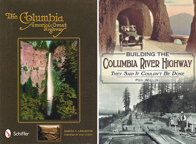
A wonderful bookend to Sam Lancaster’s classic is Building the Columbia River Highway: They Said it Couldn’t Be Done by Oregon author Peg Willis. This exceptional book focuses on the highway, itself, and the collection of characters who came together to make Samuel Lancaster’s bold vision become reality.

Peg’s book also includes a terrific selection of seldom-seen historic photos of the highway during it’s original construction, reproduced with fine quality. In fact, the stories and images in this book would a perfect blueprint for the future Oneonta Tunnel Museum… someday!

_________________

As always, thanks for stopping by and reading through yet another long-form article in our era of tweets and soundbites!

Special thanks to Oregon photographer TJ Thorne, who contributed photos of the Oneonta Gorge summer crowds for this article. Those were just a few snapshots from his iPhone, but please visit TJ’s website to see his amazing fine art nature photography from landscapes across the American West, and please consider supporting his work.

Oregon’s outdoor photographers serve as our eyes on the forest, taking us places we might otherwise never see. They help the rest of us better appreciate and protect our public lands through their dedicated work, but they need our support to continue their work. 

Thanks, TJ!

_________________

Tom Kloster • April 2020

Warren Falls: A Postscript (Part 2 of 2)

hcrh_review01a

The first part of this article focused on the missed opportunity to restore Warren Falls as part of construction of the most recent phase of the Historic Columbia River Highway (HCRH) State Trail. This article takes a look at this newly completed section of trail.

_________________

hcrh_review01b

Congressman Peter DeFazio at the grand opening of the new HCRH segment in October (ODOT)

In October, the Oregon Department of Transportation (ODOT) opened the latest section of the HCRH State Trail, a segment stretching from the trailhead at the Starvation Creek wayside west to Lindsey Creek. A portion of this newest section follows the original highway grade where it passes Cabin Creek Falls, but most of the route is a completely new trail – or more accurately, a paved multi-purpose path open to both hikers and cyclists.


hcrh_review01c

The newly revamped Starvation Creek Trailhead

The new HCRH trail segment begins in a small plaza constructed at the south edge of the Starvation Creek wayside. Early plans called for a complete reconstruction of the parking area, but budget constraints intervened, and most of the work here is along the margins of the existing parking lot. The trailhead plaza features some to-be-installed interpretive signs in the shade of a group of bigleaf maple trees, a pleasant meeting spot for hikers or cyclists.

Missing from the revamped trailhead is the original Forest Service trailhead sign that once pointed to Warren Falls (below). It’s unclear if this sign will be reinstalled, but given that Warren Falls, itself, was not “reinstalled” as part of this project, the chances are probably slim.

hcrh_review01d

This sign has gone missing!

The sign actually referred to what is now called Hole-in-the-Wall Falls, where Warren Creek emerges from the diversion tunnel built by ODOT in 1939. The unintended reference to the original falls made for an inspiring Forest Service gaffe for advocates of restoring Warren Falls!

The first few yards of the new trail generally follows the existing route along the Starvation Creek wayside freeway exit ramp. It’s still a noisy, harsh walk through this area, but ODOT has dressed up this section with a sturdy cobble wall and new paving.

hcrh_review01e

Cobble retaining wall near Starvation Creek

The trail concrete barricades along this section that protect the trail from freeway traffic also feature the same decorative steel fencing found elsewhere on the HCRH State Trail, giving a bit more sense of separation from speeding vehicles. The new trail is also slightly elevated here, reducing the noise impacts somewhat from the old trail that was mostly at the ramp grade.

hcrh_review01f

Decorative steel fencing near Starvation Creek

Soon, the new trail drops to the only original section of Columbia River Highway on this restored section of trail, where the old road passed in front of Cabin Creek Falls. An elegant but confusing signpost has been added at the junction with the Starvation Ridge Cutoff trail, pointing to Gorge Trail 400, which currently does not exist in this section of the Gorge.

I didn’t hear back from ODOT as to whether a trail renumbering is in the works that would extend the Gorge Trail to Starvation Creek, but it may be that the Forest Service is planning to stitch together a extension of the Gorge Trail from pieces of the Starvation Ridge and Defiance Trails. That would be a welcome development!

hcrh_review02a

Trail 400..? Is a trail re-numbering in the works?

The location of the new sign almost suggests that the infamous Starvation Cutoff trail – one of the steepest in the Gorge – would be renumbered as the Starvation Ridge trail, with the bypassed section of the current Starvation Ridge trail becoming Trail 400.

Confused..? So are many hikers who visit the area with its already confusing trail network. So, keep your fingers crossed that the Forest Service is rethinking trail numbers and signage in conjunction with the new HCRH trail.

For now, the actual Starvation Cutoff Trail has not changed, though HCRH workers added a nice set of steps at the start of this very steep route.

hcrh_review02b

New steps at the otherwise humble Starvation Cutoff trailhead

The old pavement in this original highway section was resurfaced with new asphalt as part of the project, but otherwise the route here is much as it was when the highway opened in 1916, including a roadside view of Cabin Creek Falls. However, ODOT missed an opportunity to organize the hordes of visitors who now scramble to the falls along a cobweb of boot paths.

Formalizing a single spur with a properly constructed trail (below) would be a great project for a non-profit like [link]Trailkeepers of Oregon (TKO)[/link] in conjunction with Oregon Parks and Recreation (OPRD), who now manage the trail and adjacent park lands.

hcrh_review02c

Cabin Creek could use a formal path to the falls… and a new sign

[click here for a large version]

Cabin Creek Falls is popular with families (where kids can safely play in the basalt-rimmed splash pool) and photographers (who love this delicate, mossy falls). For many casual visitors, this is already the turn-around point on their walk from the trailhead, with Cabin Creek being the highlight of their experience, so a spur trail would be a nice addition to allow visitors to get off the pavement and explore a soft trail.

hcrh_review02d

Cabin Creek Falls up close

ODOT also cleaned out the large, stone culvert (below) where Cabin Creek flows under the HCRH State Trail. This display of original dry masonry was mostly buried in debris and undergrowth until the trail project was constructed, so the restoration provides a nice look at the craftsmanship of the original highway.

hcrh_review02e

Original dry masonry culvert survives at Cabin Creek

As the new trail route reaches the west end of the original highway section, ODOT thoughtfully place a small memorial (below) in the paving – a nice historic reference to the original highway.

hcrh_review03a

HCRH plaque marks the original highway route near Cabin Creek Falls

As the new route leaves the beautiful, forested section of original highway at Cabin Creek, it suddenly follows the freeway for about 200 yards due to steep slopes along the Gorge wall. This jarringly noisy section could use some replanting to at least create a visual buffer from freeway traffic.

hcrh_review03b

Noisy, barren stretch of the new trail west of Cabin Creek

Soon, the new HCRH route thankfully curves back into the forest on a surprisingly massive structured fill. This structure was required to maintain the modest trail grade as the route climbs from the freeway shoulder to a slight rise near Warren Creek.

This section is bordered with stained wood guardrails, a new design that departs from the vintage-style white guardrails in other sections of the restored highway, but provides a nice aesthetic that will also be easier to maintain.

hcrh_review03c

This large, structured fill west of Cabin Creek was required to maintain the trail grade for bicycles

This following view shows the same spot in July, at the height of construction, and before the fill was completed:

hcrh_review03d

Structured fill near Cabin Creek during construction last July

ODOT was careful to document cultural resources along the route when designing the new trail, including a set of stone ovens built by the original highway masons who camped here during highway construction in the early 1900s. The historic ovens are better protected than before by the raised trail design and guardrails (below), though still fully visible for those who know what they’re looking for.

hcrh_review03e

The historic stone ovens can be seen from the elevated trail section west of Cabin Creek… if you know where to look

One disappointing detail along this section of trail is a long gabion basket wall (below), apparently constructed to catch loose debris from an adjacent slope. The steel cages holding this wall together will hopefully be covered in moss and ferns in time, but for now it’s an eyesore on an otherwise handsome section of the trail.

hcrh_review03f

Would Sam Lancaster have approved of a wire mesh gabion wall..?

Another sore thumb in this forest section is a rusty mesh fence (below) along the freeway right-of-way that should have at least been painted, if not completely replaced as part of the project. Maybe ODOT still has plans to replace this eyesore?

hcrh_review03g

Nope, Sam Lancaster wouldn’t go for this…

As the new section of the HCRH State Trail approaches Warren Creek, it enters a significant cut section to maintain its gentle grade. Thankfully, a huge anthill along this section was spared, one of the interesting curiosities along the former soft trail that used to pass through this forest.

hcrh_review03h

Hydro-seeded cut slope and the big anthill near Warren Creek

This following view is from July, when construction was still underway and the ant colony was no doubt thankful for the protective fence:

hcrh_review03i

The giant anthill lives!

The view below was taken during the construction looks east at the cut section along the new trail. Because the rustic forest trail that once passed through this area was completely destroyed by the new HCRH trail, the reconfigured landscape will be a shock for hikers who hiked the trail in the past. Though hydro-seeded with grass, this section could benefit from some re-vegetation efforts to further speed up healing.

hcrh_review03j

The cut grade near Warren Creek under construction in July

Beyond the cut section, the new route crosses the original channel of Warren Creek, and for those with a sharp eye, a pair of cobble foundations for early homesteads that once lined the creek. Here, the trail reaches a half-circle bench where an all-access side trail curves up to the viewpoint of Hole-in-the-Wall Falls (more on that later in this article).

hcrh_review04a

Half-circle bench serves as the jump-off point to the Hole-in-the-Wall viewpoint

It’s unclear if interpretive signs will be added to this area, but at one time the story of how Warren Creek was diverted in 1939 was planned for the spot where the new trail crosses the old, dry creek bed.

Another new trail sign is also located at the all-access spur trail to Hole-in-the-Wall Falls, as this is also the route to the Starvation Ridge and Defiance Trails. This sign also includes a mysterious reference to Gorge Trail 400, further suggesting that a re-numbering of trails in the area is in the works. A large, multi-trunked bigleaf maple was also spared at this junction.

hcrh_review04b

Bigleaf maple spared… and another mystery reference to Trail 400..?

The following view is looking from the new HCRH State Trail toward the Hole-in-the-Wall spur trail, showing the proximity to Warren Falls. The green hydro-seeded area in the photo is where the construction staging area for the project, underscoring the missed opportunity to restore Warren Falls as part of the project – it was just a few yards beyond the staging area.

hcrh_review04c

So very close: Warren Falls from the main construction staging area

hcrh_review04d

Staging area during construction in July – the last time we’ll see heavy equipment this close to Warren Falls for generations?

The humble elderberry (below) in the middle of the staging area was spared by ODOT, a nice consideration in a project that did impact a lot of trees. Hopefully, there are plans to expand native plantings here, as this area was covered with invasive Himalayan blackberries for decades before the trail project and will surely revert to invasive species without a deliberate restoration effort.

hcrh_review04e

This apparently well-connected elderberry dodged the ODOT bulldozers!

Moving west, the new HCRH State Trail segment passes through another forested section where the trail rises on fill necessary to bring it to grade with a handsome new bridge over Warren Creek (visible in the distance in the view, below). This is an especially attractive section of trail.

hcrh_review05a

Looking west along the attractive new trail section approaching the Warren Creek Bridge

For some reason, many of the trees that were cut for this new section of trail were left piled along the base of the fill (below). The fill slope has been hydro-seeded, so it seems unlikely that the more work is planned to remove or repurpose the log piles, so apparently the were left in this manner on purpose?

hcrh_review05b

Piled logs along the elevated grade approaching Warren Creek Bridge

Looking back to the construction period last summer, you can also see the good work ODOT did to cut back English ivy that was rampant in this area. While ivy was left intact on the forest floor, it was cleared from dozens of trees in this section of the trail.

hcrh_review05c

Invasive English ivy was trimmed from dozens of trees near Warren Creek

The highlight of the new HCRH trail segment is where the route crosses Warren Creek. Here, a handsome new bridge faithfully echoes the design ethic of Samuel Lancaster, but is probably more elaborate than the original bridge constructed at Warren Creek in 1916. Lancaster’s bridge was destroyed when the first version of the modern highway was built in 1950.

hcrh_review05d

The handsome new Warren Creek Bridge is the jewel of the new trail segment

Though no visual record exists, the original Warren Creek Bridge was modest in length, at just 18 feet, and likely resembled the surviving bridge at Gorton Creek to the west, or possibly the original bridge at Viento Creek to the east (shown below).

hcrh_review05e

The original Warren Creek Bridge probably followed one of these designs

The design of the original Warren Creek Bridge inadvertently helped lead the Highway Department to bypass Warren Falls, as stream debris was clogging the bridge opening. The 1941 project files also describe the original bridge being “replaced in a different location” as part of the diversion project, so there may have been two version of the original bridge over Warren Creek before the modern highway was constructed in the 1950s.

hcrh_review05f

Warren Creek Bridge under construction in July

hcrh_review05g

Pavement texture samplers being tested for the project

hcrh_review05h

Looking west across the new Warren Creek Bridge

hcrh_review05i

Railing detail and the view downstream from Warren Creek Bridge

Construction of the new HCRH bridge over Warren Creek was an involved undertaking, with the surprisingly wide span leaving plenty of room for a (someday) restored Warren Falls to move 70+ years of accumulated rock and woody debris down the stream channel.

hcrh_review05j

Built to last, with plenty of room for Warren Creek to once again move rock and log debris down its channel… someday…

There’s nothing natural about Warren Creek in this area, as it looks (and is) more like a drainage ditch. This is because original streambed is now a dry ravine several hundred yards to the east, and the current streambed is where the Highway Department moved the creek decades ago, when the modern highway was first built in the 1950s.

hcrh_review05k

Ditch-like, man-made channel of Warren Creek as viewed from the new bridge

As described in the first part of this article, the someday restoration of Warren Falls will once again allow rocks and woody debris to migrate into the lower channel, eventually transforming the “ditch” into a healthy stream (below) that can fully support endangered salmon and steelhead.

hcrh_review05l

What a healthy Warren Creek might look like from the bridge, someday…

[click here for a larger version]

While ODOT missed the larger opportunity to help this stream restoration along when it declined to restore Warren Falls, the agency also missed the easy opportunity to simply add a few boulders and logs to the section of Warren Creek near the bridge when heavy equipment was in the area. That’s too bad, but perhaps the OPRD will someday enhance this stream section as part of managing the new trail.

hcrh_review06a

Looking west from near the Warren Creek Bridge to the Lancaster Falls viewpoint

From Warren Creek, the new trail follows another fill section to a mostly obstructed viewpoint of Lancaster Falls on Wonder Creek from a small seating area. This viewpoint (below) could use some light pruning to reveal the falls, and perhaps something that’s still in the works by OPRD.

hcrh_review06b

Lancaster Falls viewpoint

One oddity about Wonder Creek is that it mostly disappears into ground before reaching the culvert that carries Warren Creek under I-84 and to the Columbia River. This is partly due to the modest flow from spring-fed Wonder Creek, but also because the slopes below the falls are mostly composed of unconsolidated talus covered with a thin layer of soil and vegetation. So, most of the time the stream is simply absorbed into the water table below the falls.

Yet, in high runoff periods, the new state trail will accommodate the flow with extensive drainage features designed to carry Wonder Creek under the fill section and to the Warren Creek freeway culvert.

hcrh_review06c

Trail construction near the Lancaster Falls viewpoint in July

hcrh_review06d

Lancaster Falls viewpoint under construction in July

Another oddity of Lancaster Falls is its illusive nature. Though thousands of hikers each year view the modest, 20-foot lower tier of the falls where it spills across the Defiance Trail, few know of it’s full extent – and perhaps wonder why Samuel Lancaster wasn’t honored with a more spectacular landmark.

This is the view (below) of Lancaster Falls that most hikers see today, and this this is also the portion of the falls that can be glimpsed through the trees from the new HCRH trail viewpoint:

hcrh_review06e

Lancaster Falls as most know it, along the Defiance Trail

But viewed from across the Columbia River, along Washington’s Highway 14, Lancaster Falls takes on a completely different scale. This view shows the lower 20-foot tier that most know as “Lancaster Falls” completely dwarfed by the towering 300-foot extent of the falls:

hcrh_review06f

The full extent of Lancaster Falls as viewed from the Washington side of the Columbia

While it’s possible to scramble to the base of the main tier of Lancaster Falls, the slopes are unstable and already being impacted by off-trail visitors, so it’s probably best that only a most portion of the falls is (somewhat) visible from the new HCRH route. Hopefully, interpretive signage is in the works for the viewpoint that tells the story of Samuel Lancaster..?

hcrh_review06g

1920s view of the HCRH from Lindsey Creek looking toward Wind Mountain

From the Lancaster Falls viewpoint, the new trail heads west to a section where it once again follows the shoulder of I-84 to Lindsey Creek and the end of new construction. ODOT is working the next trail segment, which will connect from Lindsey Creek to the Wyeth Campground, crossing the base of famously unstable Shellrock Mountain along the way.

Hole-in-the-Wall Falls Spur Trail

hcrh_review07a

Original concept for the Hole-in-the-Wall Falls viewpoint

One of the design highlights of the new HCRH trail section is a short all-access spur tail to an overlook of Hole-in-the-Wall Falls, the man-made outflow tunnel that continues to drain Warren Falls of its water. The completed overlook has been scaled back from its original design (shown above), and now features one of the signature circular seating areas, complete with a picnic table (below).

hcrh_review07b

Hole-in-the-Wall Falls viewpoint

A small plaque at the viewpoint identifies Hole-in-the-Wall Falls, which until now has not been an officially recognized name or has appeared on any official maps. A nice nod to the origin if the “falls” is the byline “Created 1939”. Hopefully, there will be future interpretive displays here, as the story of Warren Falls would be a great addition to this overlook.

hcrh_review07c

Hole-in-the-Wall Falls viewpoint

hcrh_review07d

Hole-in-the-Wall Falls plaque

hcrh_review07e

Hole-in-the-Wall Falls viewpoint under construction in July

The Starvation Ridge Trail picks up from the south side of the Hole-in-the-Wall Falls overlook, heading across a footbridge over Warren Creek.

A closer look near the footbridge (below) reveals a surprising disappointment: the stump of a streamside Douglas fir cut improve the view of the falls. It’s too bad that the tree wasn’t simply limbed to provide a view, as it was one of the few larger trees stabilizing the banks of Warren Creek.

hcrh_review07f

Hole-in-the-Wall Falls bridge… and stump?

hcrh_review07g

Unfortunate remains of the offending Douglas fir along Warren Creek

While it’s disappointing to think about the opportunities missed at Warren Falls, the Hole-in-the-Wall Falls overlook and beautiful new Warren Creek Bridge, are still a big a step in the right direction toward someday moving Warren Creek from neglected afterthought to a valued resource that deserves to be restored. ODOT deserves major kudos for their thoughtful work on this section of trail!

“Love what they’ve done with the place…”

hcrh_review08a

Heavy construction of the new “trail” in July looked more like a road to many hikers

Last summer I encountered another hiker while surveying the progress of the new HCRH trail in the Warren Creek area. He was making his way to the Defiance Trail, and when he saw me taking photos, shouted angrily “Love what they’ve done with the place!”

I’ve heard this reaction to the State Trail from many hikers over the years, as avid hikers are often aghast at what they see as more of a “road” than trail. The scope of construction impacts on the natural landscape of the Columbia River Gorge National Scenic Area (CRGNSA) and the millions in public funds being spent on the project rankles hikers who don’t see themselves actually using the trail.

Many hikers are also mystified as to how this project can received tens of million in funding while other, heavily overused Gorge trails are falling apart for lack of adequate funding.

hcrh_review08b

Extensive cut and fill necessary to maintain trail grade meant a wide construction swath

These reactions are understandable, if misguided. The restoration of the surviving HCRH and the future trail segments that will soon complete the original route from Troutdale to The Dalles is an epic effort of ambition and vision in an era when both are rare quantities.

When the route is completed, it will become a world-class cycling attraction, and it is already drawing visitors from around the world. Guided bicycle tours have become a thriving business in the Gorge because of ODOT’s commitment to bringing the HCRH State Trail vision to reality, and businesses in Gorge towns are already seeing the benefits.

Other projects to promote the trail are also in the works. ODOT’s Gorge Hubs project is a new partnership with six cities in the Gorge to provide traveler information for trail users and boost the local economy. The Friends of the Gorge have launched the Gorge Towns to Trails project, a complementary effort to the HCRH State Trail to connect Gorge communities to public lands via trails.

hcrh_review08c

Tourism in the Gorge is as old as the historic highway, itself. This is the Lindsey Creek Inn that once stood where the newly completed HCRH State Trail approaches Lindsey Creek

Plenty of local visitors will continue to use the HCRH State Trail as the project nears completion over the next few years, but the real benefit for Gorge communities is from visitors coming from outside the region. Unlike local visitors, tourists coming from elsewhere will book hotel rooms, purchase meals and take home locally-made products and art from the Gorge to memorialize their trip. These visitors make a much larger contribution to the Gorge economy than a local visitor who might stop by a brewpub on the way back from a day trip.

hcrh_review08d

Gorge sunset from near Starvation Creek along the newly completed HCRH State Trail

A 2011 National Park Service study of tourism dollars shows outside visitors spending anywhere from 7 to 12 times the amount that local visitors spend on a visit to a given park, bringing hundreds of millions to local economies at many parks. There’s no reason why the Gorge can’t better manage the our already heavy demand from local visitors to the Gorge to allow for more outside visitors drawn by the HCRH State Trail to spend their dollars here.

The bigger picture is that anyone opposed to seeing casinos or bottled water plants in the Gorge should be part of supporting a tourism economy that builds on the scenery. Yes, tourism impacts must be managed to protect the Gorge for future generations, but the health of the Gorge economy is the essential ingredient to providing these protections over the long term.

The HCRH State Trail is part of that formula, and it deserves enthusiastic support from anyone who loves the Gorge. If you own a bicycle (or pair of walking shoes), give it a try — and then recommend it as an exciting new vacation destination to distant friends and family!

The Farmer and his Dell

Hand-colored photo from the 1920s showing the west approach to Shepperd's Dell

Hand-colored photo from the 1920s showing the west approach to Shepperd’s Dell

For nearly a century, countless travelers on the Historic Columbia River Highway have admired the idyllic scene that unfolds at Shepperd’s Dell, one that has also appeared on dozens of postcards and calendars over the decades.

George Shepperd's sole memorial in the Columbia Gorge is this small plaque on the Shepperd's Dell bridge

George Shepperd’s sole memorial in the Columbia Gorge is this small plaque on the Shepperd’s Dell bridge

Yet, beyond the fanciful name and a small bronze plaque at the east end of the highway bridge, few know the story behind the man who gave this land to the public to be enjoyed in perpetuity. Who was George Shepperd? This article is about the modest farmer who gave us his “dell”.

Threading the Needle

George Shepperd’s story is interwoven with the brilliant vision of a true icon in our regional history, Samuel Lancaster, the chief engineer and designer of the Historic Columbia River Highway. Had Sam Lancaster not attempted to frame sweeping views and hidden natural features at every turn with his epic road design, Shepperd’s Dell might have remained a mostly hidden secret.

Lancaster saw his new highway as something to be experienced, not simply the shortest path through the Gorge:

“…as Consulting Engineer in fixing the location and directing the construction of the Columbia River Highway… I studied the landscape with much care and became acquainted with its formation and its geology. I was profoundly impressed by its majestic beauty and marveled at the creative power of God, who made it all… [I] want [visitors] to enjoy the Highway, which men built as a frame to the beautiful picture which God created.”

-Samuel C. Lancaster (1916)

With this grand vision, Lancaster saw a special opportunity to showcase nature at Shepperd’s Dell. When approaching from Crown Point, the old highway rounds a blind corner cut into sheer cliffs, high above the Columbia when the graceful, arched bridge spanning Shepperd’s Dell suddenly comes into view.

Sam Lancaster and other dignitaries are pictured here at Shepperd's Dell on the opening day of the Columbia River Highway in 1916

Sam Lancaster and other dignitaries are pictured here at Shepperd’s Dell on the opening day of the Columbia River Highway in 1916

Tall basalt domes rise above the bridge, and from mid-span, visitors are treated with a view into the shady, fern-draped “dell” holding Young Creek. A graceful, 8-tiered waterfall leaps a total of 220 feet through a twisting gorge, much of it hidden from view in the mossy recesses of the dell.

In his inspired design for Shepperd’s Dell, Sam Lancaster’s threaded the needle by spanning the narrow canyon at the midpoint of the falls. By any other highway engineer of the time, this would have been a travesty, but Lancaster’s gracefully arched bridge and careful attention to detail achieves the opposite: he transformed this little grotto into one of those rare examples where man and nature meld in idyllic harmony. This artful balance is the enduring lure of Shepperd’s Dell to this day, making it a favorite stop along the old highway.

Samuel Lancaster's iconic bridge at Shepperd's Dell as it appears today

Samuel Lancaster’s iconic bridge at Shepperd’s Dell as it appears today

Sam Lancaster said this of his design for Shepperd’s Dell:

“The white arch of concrete bridges a chasm 150 feet in width and 140 feet in depth. The roadway is cut out of solid rock [and] a sparkling waterfall leaps from beetling cliffs and speaks of George Shepperd’s love for the beautiful, and the good that men can do.”

-Samuel Lancaster (1916)

Complementing the highway is a rustic footpath leading from the bridge to a viewpoint at the edge of the falls. The footpath is cut into the vertical walls of the dell and framed with Lancaster’s signature arched walls. From the falls viewpoint, the vista sweeps from a close-up of the cascades on Young Creek to the graceful arch of the highway bridge, soaring above the canyon. This is understandably among the most treasured scenes in the Columbia Gorge.

1920s postcard view of Shepperd's Dell showing the Bishop's Cap in the distance.

1920s postcard view of Shepperd’s Dell showing the Bishop’s Cap in the distance.

Samuel Lancaster created this scene as we experience it today, but only because George Shepperd made it possible by showing Lancaster his secret waterfall, and offering to donate his land to the highway project so that others might enjoy his dell in perpetuity.

Who was George Shepperd?

When Sam Lancaster was building his touring road through the Columbia Gorge, a number of well-to-do land owners with vast holdings in the area generously donated both right-of-way and some of the adjacent lands that hold the string of magnificent waterfalls and scenic overlooks that we enjoy today. Until the highway idea was conceived in the early 1900s, the Gorge was mostly valued for its raw resources, with several salmon canneries and lumber mills along the river and the forests heavily logged. The idea of a parkway was new, and part of the surging interest in creating national parks and expanding outdoor recreation across the country.0

Middle tier of the falls at Shepperd's Dell as viewed from the highway bridge

Middle tier of the falls at Shepperd’s Dell as viewed from the highway bridge

George Shepperd was equally generous with his donation, but he wasn’t a timber baron or salmon cannery tycoon. Instead, Shepperd was a transplanted Canadian farmer who had moved his family here after a short stay Iowa in the 1880s. Samuel Lancaster wrote this of Shepperd:

“The tract of eleven acres at this point, given by George Shepperd for a public park, is unexcelled. God made this beauty spot and gave it to a man with a great heart. Men of wealth and high position have done big things for the Columbia River Highway which will live in history; but George Shepperd, the man of small means, did his part full well.”

-Samuel Lancaster (1916)

George Shepperd, his wife Matilda and their sons William and Stuart moved from Goderich Township, Ontario (roughly halfway between Toronto and Detroit) to a farm in Audobon County, Iowa in 1880, where the couple gave birth to two more sons, George Jr. and John.

George Shepperd's extensive holdings in the early 1900s were mostly hills and ravines (shown in yellow), with the donated Shepperd's Dell parcel shown in green. Much of Shepperd's remaining land has since been brought into public ownership

George Shepperd’s extensive holdings in the early 1900s were mostly hills and ravines (shown in yellow), with the donated Shepperd’s Dell parcel shown in green. Much of Shepperd’s remaining land has since been brought into public ownership

In 1889, the Shepperds moved again, this time to Oregon where they settled in the Columbia River Gorge on a 160-acre land claim along Young Creek, just west of the mill town of Bridal Veil. Their fifth child, a daughter named Myra, was born just a year after they arrived, in November 1890. Upon settling in Oregon, George Shepperd supported his family by farming, dairying and working at the nearby Bridal Veil Lumber Mill.

At this point in history, the George Shepperd story becomes complicated: in May 1895, George and Matilda divorced, and in January 1896, George married Martha “Mattie” Maria Cody Williams, who had also recently divorced. Mattie apparently met George when the Shepperd and Williams families had traveled west to Oregon together in 1889. The “Cody” in Mattie’s lineage was indeed William F. “Buffalo Bill” Cody, a first cousin.

The view today from Shepperd's Dell toward Crown Point includes some of George Shepperd's former pasture lands, now in public ownership and managed for wildlife.

The view today from Shepperd’s Dell toward Crown Point includes some of George Shepperd’s former pasture lands, now in public ownership and managed for wildlife.

George Shepperd was 47 years old when he married 37 year-old Mattie in 1896, and while the first years of their new marriage seemed to have been blissful, the next 35 years of his life were a rollercoaster of tragedies and triumphs.

The tragedy began in 1901 when his eldest son, William J. Shepperd, boarded a train to Portland to pick up supplies for the business he and his brother George Jr. had in Hood River. William reportedly waved to friends and family from the rear platform as he passed through Bridal Veil and the Shepperd farm, then was never seen again.

Local news accounts speculated that William had been “Shanghied” while in Portland and taken aboard a foreign cargo ship. Ten years later, William’s surviving wife Osie and son Raymond also disappeared after living with the Shepperds and members of Osie’s family in Portland for several years. They were never heard from again by George Shepperd.

The Bridal Veil Historic Cemetery is tucked among the trees near the Angels Rest trailhead

The Bridal Veil Historic Cemetery is tucked among the trees near the Angels Rest trailhead

More tragedy ensued in 1903, when George Shepperd lost his beloved Mattie, just seven years after the two had married. There is no record of why she died, though some accounts describe her as “crippled” in those years. She was only 44 years old.

If the impressive memorial he erected for Mattie at the Bridal Veil cemetery is any indication, George was profoundly heartbroken. He never married again. The melancholy epitaph at the base of her grave marker reads:

“One by one earth’s ties are broken, as we see our love decay, and the hope so fondly cherished brighten but to pass away.”

The infant grave of Elizabeth Dutro is also located within the otherwise empty Shepperd family plot, next to Mattie’s grave and dated October 15, 1903 – seven months after Mattie was buried. Baby Dutro seems to be Mattie’s granddaughter by Bertha Delma Williams Dutro, her daughter from her first marriage. Bertha Dutro lived until 1963, and had two more daughters. She is buried at the Idlewildle Cemetery in Hood River.

Mattie Shepperd's grave marker at the Bridal Veil Cemetery

Mattie Shepperd’s grave marker at the Bridal Veil Cemetery

Mattie Shepperd, "wife of George Shepperd"

Mattie Shepperd, “wife of George Shepperd”

The tiny Bridal Veil Cemetery is still maintained and open to the public, though a bit hard to locate: an obscure gravel driveway drops off the north shoulder of the I-84 access road at Bridal Veil, just below the Historic Columbia River Highway. A number of early settlers from the area are buried in this lonely window into the past.

Baby Dutro was laid to rest a few feet away and nine months after Mattie Shepperd

Baby Dutro was laid to rest a few feet away and nine months after Mattie Shepperd

Over the next few years, George Shepperd must have met Samuel Lancaster as the engineer began his surveys of a possible highway route through the Gorge. Travel in the Gorge at that time was mostly by train, and the Shepperd farm was one of the many stops along the route. No record of their meeting exists, but George was described as an early supporter of the highway, and this is surely the time when he realized that he could be part of Lancaster’s grand vision.

Some accounts suggest that the sudden loss of Mattie was also part of George Shepperd’s motivation to leave a lasting legacy with a land donation, but there is no record of this. Instead, it was simply the beauty of Shepperd’s Dell that seemed to motivate him.

Newspaper accounts also show that Shepperd had many opportunities to sell his property for substantial profit, as the new highway was quickly dotted with roadhouses and gift shops aimed at the new stream of tourists. The Oregonian later reported: “ever since the highway was constructed, Mr. Shepperd has received offers to purchase the tract, but has refused them, having in mind an intention to dedicate the property to the use of the public.”

Early 1930s postcard view of Shepperd's Dell.

Early 1930s postcard view of Shepperd’s Dell.

In March 1914, George Shepperd’s land donation along Young Creek was announced as part of the construction of the Columbia River Highway. But by late 1915, Shepperd was involved in a legal dispute with a neighboring landowner who attempted to take claim to the land he had donated – the land that is now Shepperd’s Dell. By 1916, George Shepperd was counter-suing on grounds of fraud to clear the title – one that stemmed from a loan that one of Shepperd’s sons had taken years earlier. The Oregonian reported the events with the headline “Good Deed Spoiled” as a nod to Shepperd’s noble intentions:

“A few years ago, the elder Mr. Shepperd, owner of an 80-acre piece of land above the Columbia River, deeded 10 acres, including the famous Shepperd’s Dell, to the City of Portland as a public playground. The Columbia River Highway was being built and it was apparent to Mr. Shepperd that this attractive place would be a valuable possession to the city. While he was a comparatively poor man, he determined, instead of selling the property for a small fortune that he could have received for it, give it free of cost to the public.”

(The Oregonian, March 16, 1916)

Thankfully, Shepperd prevailed in the legal dispute. At that point in the dramatic early history of the new highway, the Shepperd’s Dell section of the road had already been constructed, but who knows what might have been built there had the land slipped away from public ownership?

In November 1915, George Shepperd was fighting a second legal battle, joining the City of Portland in a lawsuit against the Bridal Veil Lumber Co., and their plan to divert Young Creek away from Shepperd’s Dell and into a generating facility to provide power for their mill. The City and Shepperd prevailed in this suit, as well.

This is the only known photo of George Shepperd. It appeared in the Oregon Journal in 1915.

This is the only known photo of George Shepperd. It appeared in the Oregon Journal in 1915.

George Shepperd’s personal roller coaster continued on June 8, 1916, when he found himself seated among the most honored guests at the spectacular dedication of the Columbia River Highway at Crown Point. Shepperd was recognized in the formal program along with historical luminaries like Sam Hill, Samuel Lancaster, Julius Meier, Simon Benson and John B. Yeon. The ceremony was kicked off audaciously by President Woodrow Wilson unfurling an American Flag remotely by pressing a telegraph button in the White House, surely a highlight for a modest farmer from Canada.

Though surrounded by millionaires and elite scions of Portland’s old money at the grand opening, Shepperd stood apart from his honored peers that day: John B. Yeon, who had been appointed roadmaster in the campaign for the Columbia River Highway project, summed it up best:

Mr. Shepperd’s donation is worthy of the highest praise, especially in view of the fact that he [is] not a wealthy man. He has made a sacrifice for the public good that ought to make some of our rich men ashamed of themselves.

John B. Yeon, Oregon Journal, April 23, 1915

Close-up view of the vehicle carrying Sam Lancaster as he passed Shepperd's Dell during the grand opening of the Columbia River Highway in June 1916.

Close-up view of the vehicle carrying Sam Lancaster as he passed Shepperd’s Dell during the grand opening of the Columbia River Highway in June 1916.

In an earlier 1915 front-page feature previewing the new highway (still under construction), the Oregonian described Shepperd’s Dell this way:

“One of the wonder spots on the Columbia Highway, in the daintiness and sublimity combined with its scenery is Shepperd’s Dell, which was donated to the highway as a public park by George Shepperd, because he loved the spot and because he wanted it preserved forever for the enjoyment of people who come along the highway.

Mr. Shepperd is not a rich man and his donation is one of the most noteworthy in the history of the highway. At Shepperd’s Dell is one of the finest bridges on the highway and a trail has been built leading down from the highway to the dell and back to the beautiful little waterfall and springs in the gorge. The view back from the trail, looking through the arch made by the concrete span, is one of the most beautiful on the highway.”

(Sunday Oregonian, August 29, 1915)

George Shepperd’s Final Years

This home on NE Stanton Street in Portland is where George Shepperd lived out the final years of his life.

This home on NE Stanton Street in Portland is where George Shepperd lived out the final years of his life.

In 1917, sixteen years after his eldest son William had vanished and six years after William’s wife Osie had disappeared with his grandson Raymond, George Shepperd sought foreclosure on 120 acres of land he had given to the young couple shortly before William disappeared in 1901. The title was cleared by April 1919, and Shepperd promptly donated the land, including a four-room farmhouse, to the local YMCA. The YMCA reported that the house and property would be converted into a model boys camp and lodge:

“A party of boys will visit the place today to clear off sufficient land for a baseball diamond and athletic field and to commence the work of remodeling the lodge. The camp will be used by the boys this summer for short camping trips, covering a period of only a few days, and is especially intended for use of those boys who are unable to devote the time required to make the trip to the regular summer camp at Spirit Lake.”

(The Oregonian, April 4, 1919)

By 1920s, George Shepperd had finally retired from his farm at Shepperd’s Dell, having survived his second wife Mattie and a remarkable series of peaks and valleys in his life. He moved to Portland, and lived there until passing away at his residence on NE Stanton Street in July 1930.

George Shepperd's modest grave marker at Riverview Cemetery.

George Shepperd’s modest grave marker at Riverview Cemetery.

Shepperd left an estate of about $8,000 to his remaining sons and daughter, primarily property in the Shepperd’s Dell area. But he hadn’t forgotten his missing grandson Raymond, and left him a token “five dollars in cash”, (about $70 today) presumably in hopes that the execution of his estate might somehow reconnect Raymond with the Shepperd family.

George Shepperd is interred at Portland’s Riverview Cemetery, along with many other important figures from the early period in Portland’s history. His understated gravesite is surprisingly distant from where his wife Mattie is buried in the Bridal Veil cemetery, and we can only guess as to why his surviving children didn’t bury him there.

George Shepperd Jr. in an early 1940s news account, on the right.

George Shepperd Jr. in an early 1940s news account, on the right.

George’s children produced nineteen grandchildren, and the Shepperd family name lives on throughout the Pacific Northwest.

His second-oldest son Stuart lived until 1952, when the Oregonian reported that an “elderly man” had collapsed on a sidewalk in downtown Portland, apparently from a heart attack. At the time of his death, Stuart Shepperd was residing in Latourell, near the family homestead in the Columbia Gorge. His surviving brother George G. was still living in Bridal Veil at the family homestead at that time.

George G. Shepperd and his wife Emma left the Shepperd farm in 1953 or 1954 and George G. lived until 1961. George G Shepperd’s son George “Junior” went on to become a prominent officer for the Oregon Bank, and died in 1975. The youngest of George Shepperd’s four boys, John, died in 1959. Myra Shepperd, George’s only daughter and the only one of his children born in Oregon, lived until 1975.

The bridge at Shepperd's Dell in the 1940s, complete with a white highway sign from that era.

The bridge at Shepperd’s Dell in the 1940s, complete with a white highway sign from that era.

The original 10-acre Shepperd’s Dell park was transferred from the City of Portland to the Oregon State Park system in September 1940. The state made a series of additional purchases to expand the park over the next several decades, bringing the total size of today’s park to more than 500 acres.

Today, Shepperd’s Dell State Park encompasses Bridal Veil Falls, Coopey Falls and the west slope of Angels Rest, to the east, in addition to its namesake waterfall grotto.

George Shepperd’s legacy… and ours?

Shepperd's Dell lights up with fall colors each autumn.

Shepperd’s Dell lights up with fall colors each autumn.

Imagine the Columbia River Highway without Shepperd’s Dell, and you can truly appreciate the magnitude of George Shepperd’s generosity and vision. There’s an important lesson from his legacy: bringing land into public ownership is complicated, expensive and often messy, and thus requires great determination.

Flash forward to our times, and consider the hundreds of private holdings that still remain in the Columbia River Gorge. Then imagine the “good that men can do” (in Samuel Lancaster’s words) — what if just a few of these parcels were donated to the public in perpetuity in our time?

This unusual hand-colored photo from the 1920s is from the Bishops Cap, looking west toward the bridge at Shepperd's Dell. Though the trees have grown, much of the rest of this scene is preserved today.

This unusual hand-colored photo from the 1920s is from the Bishops Cap, looking west toward the bridge at Shepperd’s Dell. Though the trees have grown, much of the rest of this scene is preserved today.

Hopefully, the spirit of George Shepperd’s humble generosity will live on in the hearts of those fortunate few who still hold private property in the Gorge, but we’re also fortunate to have several non-profit organizations with land trusts to help the transition along:

The Friends of the Columbia River Gorge have become the most active in recent years in securing critical private holdings in the Gorge. Without Friends of the Gorge, we would not have secured lands at Cape Horn, Mosier Plateau of the Lyle Cherry Orchard, for example, among more than a dozen sites acquired by the Friends.

The Trust for Public Land serves as a critical go-between in helping secure private lands for eventual public purchase. Without the Trust, we would not have secured nearly 17,000 acres in the Gorge through more than sixty separate transactions over the past 30 years.

The Nature Conservancy continues to acquire endangered ecosystems, and their extensive holdings at Rowena Plateau and McCall Point also serve as some of the most visited recreation trails in the Gorge.

The Columbia Land Trust is another important player in securing private lands in the Gorge, as well as the rest of the lower Columbia River. Their focus is on riparian sites and securing critical habitat.

Very few of us will ever find ourselves in the position of George Shepperd, with a waterfall or craggy viewpoint to give to the public, but we can be part of that enlightened tradition in a smaller way. Please consider supporting these organizations in their efforts to expand our public lands in the Gorge!
________________

His Heirs
The Oregon Journal • July 23, 1930

ShepperdsDell22

GEORGE SHEPPERD was a poor man but he gave all that he had. Without intending it he made for him a memorial that will for all time identify his name with unselfish public service.

He owned a few rocky acres in the Gorge of the Columbia. It was land from which a living could be wrested only by dint of much toil. But through it ran a small stream that at last leaped and laughed and spiraled its way down through the great basaltic cliff that was the wall of the gorge. The course of the cataract led to Shepperd’s Dell.

It was for many years George Shepperd’s habit to go on Sunday afternoon with the children and sit beneath a tree and look down upon the exquisitely fashioned spot. The harsh outlines of the rock, cast up aeons ago by volcanic fires, were softened and carved into fantastic and beautiful forms by the streamlet. Maidenhair fern clung precariously to the cliff. Flowers bloomed under the shadow of the tall and somber firs.

When the Columbia River Highway was built George Shepperd gave Shepperd’s Dell to the people as their beauty spot forever. At other points along the highway “No Trespass” signs appeared where property was privately owned. George Shepperd left a welcome.

One wonders if there will be a bright Sunday afternoon when the spirit of this humble man will be allowed to return and brood over Shepperd’s Dell and share in the pleasure of the many who revel there. Having little, he gave all, and it became much.

(Postscript: after his death the Oregon Journal published this tribute to George Shepperd. We are all still “his heirs”. I would someday like to see these words cast in bronze and tucked into a shady corner of his Dell so that a bit of his story might be known the many who visit this spot)
________________

Acknowledgements: as you might have guessed from the length, this was among the more challenging articles to research for this blog, as very little is written about George Shepperd. An especially big big thank-you goes to Scott Daniels, reference librarian at the Oregon Historical Society, who helped me locate the only known biography of George Shepperd.

The obscure Shepperd biography was written in 1997 by Muriel Thompson, a great-great niece of George Shepperd. Thompson traveled to Oregon to conduct some of her in-depth research, including court records from the various legal actions Shepperd was party to and digging into Oregon Journal archives at a time when news searches meant poring over microfiche archives. It’s an invaluable account of George Shepperd’s life and legacy.

The stairs leading into Shepperd's Dell from the bridge as they appeared in the 1940s - the signpost no longer exists, though the rest of the scene is largely unchanged.

The stairs leading into Shepperd’s Dell from the bridge as they appeared in the 1940s – the signpost no longer exists, though the rest of the scene is largely unchanged.

Thompson’s biography did not have the benefit of today’s internet research tools, and through a variety of these sources, I was able to piece together a fuller picture of George Shepperd’s complex life than was possible in 1997, especially details about his two marriages and additional historic news accounts about his land donation and the construction of the Columbia River Highway.

There is still plenty of mystery surrounding this important player in the history of the Columbia Gorge: did any structures from George Shepperd’s farm survive? Why did his children bury him at Riverview Cemetery instead of Bridal Veil, by his beloved Mattie? What became of his grandson Raymond, by his vanished eldest son William? As always, I welcome any new or corrected information, and especially contact with any of his descendents. One of the unexpected joys in writing this blog is the opportunity to connect directly with grandchildren and great-grandchildren of important people in our regional history!

Stone Walls of the Columbia River Highway

Lancaster's familiar arched walls line the approach to the Eagle Creek bridge

Lancaster’s familiar arched walls line the approach to the Eagle Creek bridge

Of all the engineering treasures created by Samuel Lancaster in building the (now Historic) Columbia River Highway, perhaps most iconic are the rustic stone walls that line the old road. Their graceful arches and elegant caps are a beautiful, familiar presence that has become inseparable from the surrounding natural landscape.

The walls are as functional as they are handsome: foremost, they serve as guardrails, designed to keep 1916 Ford Model T drivers on the spectacular new touring road with its perilous cliffs and winding route. But Lancaster also used them to frame the sweeping Gorge views and blend the new roadway into its rugged natural surroundings.

The intricate details sketched in the HAER record for the Historic Columbia River Highway continue to guide restoration of the old road today

The intricate details sketched in the HAER record for the Historic Columbia River Highway continue to guide restoration of the old road today

This article examines Lancaster’s stone walls in more detail. The drawings included in the article are from the Historic American Engineering Record (HAER) program, established in 1969 by the National Park Service to document historic sites and structures.

In 1995, the HAER program worked with Robert Hadlow, historian at the Oregon Department of Transportation (ODOT), to produce 27 pages of detailed drawings illustrating Samuel Lancaster’s amazing Columbia River Highway. This historical record continues to guide the restoration of the old highway to this day, as it transforms to become the Historic Columbia River Highway State Trail. The sketches in this article are the result of this work, and now reside in the Library of Congress.

Three Basic Designs

There are three major guardrail designs found along the old highway: the familiar arched stone walls with concrete cap, a lighter concrete arch found on several viaducts and bridges and the standard Oregon Highway Department wood fences of the era — painted white, and found throughout the old highway, but especially east of Hood River.

The standard arched railing found throughout the Gorge

The standard arched railing found throughout the Gorge

The lighter concrete arch and rail design found on viaducts and bridges

The lighter concrete arch and rail design found on viaducts and bridges

ODOT has been restoring wood guardrails along the old highway throughout the Gorge since the 1990s

ODOT has been restoring wood guardrails along the old highway throughout the Gorge since the 1990s

A fourth design is something less than a railing: along several sections of the road, Lancaster used vertical basalt blocks to form an irregular low wall (or tall curb?). These primarily function to mark the edge of the roadway, as even a Model T could easily jump these barriers. This design (pictured below) is found in several sections of the old road in the western Gorge.

Basalt blocks serve as a tall curb on several sections of highway to mark the edge of the roadway

Basalt blocks serve as a tall curb on several sections of highway to mark the edge of the roadway

Capped arch design on the East Multnomah viaduct (Beacon Rock in the background)

Capped arch design on the East Multnomah viaduct (Beacon Rock in the background)

Standard capped arches under construction at the Eagle Creek Bridge in 1915

Standard capped arches under construction at the Eagle Creek Bridge in 1915

Lancaster took advantage of the terrain to frame pullouts and viewpoints with his iconic stone walls

Lancaster took advantage of the terrain to frame pullouts and viewpoints with his iconic stone walls

The capped arch design was carried into some of the major pullouts and hiking trails along the old highway, including Women’s Forum Park, Crown Point, Sheperd’s Dell, Wahkeena Falls and Multnomah Falls. More recently, capped arch walls have been added to the refurbished waysides at Latourell Falls and Mitchell Point.

New capped arch walls at Wahkeena Falls in 1917

New capped arch walls at Wahkeena Falls in 1917

The original capped arch walls at Wahkeena (shown new in the previous photo) has survived the elements -- and a major rockfall in the late 1960s

The original capped arch walls at Wahkeena (shown new in the previous photo) has survived the elements — and a major rockfall in the late 1960s

This box culvert near Shepperd's Dell was built in the 1990s using the capped arch design

This box culvert near Shepperd’s Dell was built in the 1990s using the capped arch design

New capped arch walls were added to the Latourell Falls wayside in 2013, with a twist: painted iron bars now keep toy poodles and small children from crawling under them!

New capped arch walls were added to the Latourell Falls wayside in 2013, with a twist: painted iron bars now keep toy poodles and small children from crawling under them!

In the 25 years since restoration of the old highway began in earnest, a handful of exceptionally skilled, local stonemasons are responsible for the many new or restored walls that now grace the Historic Columbia River Highway. Their work is as much art as construction, and their old-world skills are rare in this day and age.

The remainder of this article looks at how these beautiful walls are constructed.

Built by Artisans

GorgeStoneWalls16

The capped arch walls along the old highway are a labor-intensive effort, with individual basalt blocks split and trimmed to fit and mortar on site. Many of the stone workers working on the original highway were Italian immigrants whose skills and masonry secrets were passed down from generations of stonemasons.

Not much is known about these early laborers, though research by ODOT historians suggest that a series of cobble ovens near Warren Creek were built by Italian workers. These ovens may have used them to bake fresh bread by crews camped along the old highway during its construction.

You can find the stone ovens today along the Starvation Ridge Trail, just off modern-day I-84. Plans for extending the Historic Columbia River Highway State Trail in this area have been carefully designed to preserve these historic features.

Italian stonemasons likely built the cobble ovens that survive near Warren Creek

Italian stonemasons likely built the cobble ovens that survive near Warren Creek

Building the stone walls began with cutting blocks of basalt to size using drills to create a break line, then a combination of “feathers” and wedges to split the basalt to custom shapes (Figure 1).

GorgeStoneWalls18

The walls are assembled atop a concrete footing that maintains the linear path of the wall. A close look at the capped arch walls shows two runs of cut stone. The first run consists of slightly tapered basalt blocks set over an arched form constructed of wood planks called an “arch buck” (Figures 2 and 3).

GorgeStoneWalls19

Plank forms also frame the outer face of the stone walls – these are shown as “slip form walls” in Figures 2 and 3. These forms are built up as stones are set in the wall, with wood spacers used to ensure the slip form maintains a uniform width for the masonry wall.

GorgeStoneWalls20

A second run of stone facing consists of irregular basalt pieces used to fill the spaces in the wall between the arch stones. After the stone for each section of wall has been set with a mortar grout, the space between the outer stone facing is filled with concrete (Figure 4). Once the concrete fill has set, the wood forms are removed in this initial phase of stone wall construction.

GorgeStoneWalls21

In the second phase of wall construction, the concrete cap is added The cap clearly has a decorative function, but it is also designed to protect the integrity of the wall below by shielding the interior of the stonework from the elements.

Cap construction begins with another wood form built slightly wider than the wall, itself, to provide a protective overhang. Galvanized wire is suspended inside the form, where concrete will be poured around it for reinforcement. Once the form is in place, concrete is poured into the cap form, leaving a flat concrete top (Figure 5).

GorgeStoneWalls22

In the final step, the wood form for the concrete cap is removed, and a slightly arched mortar finished is formed on top of the flat concrete cap. A curved wood “screed” is used to trim the sand mortar to the rounded top that we recognize on the caps today (Figure 6).

As always, Lancaster gave us a pleasing finish with his design, but the rounded top is also functional, discouraging water and debris from collecting on top of the walls.

GorgeStoneWalls23

Creating the iconic stone walls is slow work. But in Lancaster’s day, labor was plentiful and cheap, and he employed dozens of workers to inch their way along the new highway, building the stone walls section by section.

Today’s restored and rebuilt walls are constructed in much the same way as they were a century ago, as described in this recent article on the Sahalie Falls Bridge. While they are painstaking to build, Samuel Lancaster’s walls have survived the elements, with miles of walls in excellent condition after a century of harsh Columbia Gorge weather — a real testament to their quality and design.

More to come..!

Recently completed stonework and traditional wood guardrails at the refurbished Mitchell Point Overlook

Recently completed stonework and traditional wood guardrails at the refurbished Mitchell Point Overlook

For those who love the stonework details of the Historic Columbia River Highway, the past 30 years have been a renaissance. Since the mid-1980s, ODOT and Oregon State Parks and Recreation have partnered to restore or rebuild basalt stonework throughout the Gorge as the Historic Columbia River Highway State Trail takes shape.

The good news is that more restoration and reconstruction is on the way. ODOT will soon extend the state trail west of Starvation Creek, including special stonework details at Cabin Creek, Warren Creek and Lindsey Creek.

Stonemasons on the recently completed Eagle Creek Bridge in 1915

Stonemasons on the recently completed Eagle Creek Bridge in 1915

Plans call for completing the state trail in the next few years, linking all of the remaining sections of the Historic Columbia River Highway from Troutdale to The Dalles. While the spectacular Gorge scenery is the main attraction along this emerging, world-class route, the stunning design of the road itself is what makes the journey so memorable.

What would Samuel Lancaster think of the renewed interest in his vision for the Columbia River Highway? Certainly, he would be thrilled to see his dream of scenic parkway being rediscovered. But given his attention to craftsmanship and blending with the Gorge environment, he would be especially pleased with the careful attention today’s designers are paying to the rustic details — including those iconic stone walls!

The Ancient Rowena Oak

The Rowena Oak

The Rowena Oak

Somewhere under the heading of “hidden in plain sight” is a remarkable Oregon white oak (Quercus garryana) growing just a few yards from the Historic Columbia River Highway, near Rowena Crest. I stumbled across this old sentinel a few weeks ago while exploring the sprawling fields of arrowleaf balsamroot that Rowena is known for.

The venerable Rowena oak is not a particularly graceful tree: you won’t find it in coffee table books or on postcards. Though the gnarled trunks of these slow-growing trees are often living works of art, the Rowena oak is as much a battered monument to simple survival as it is a living sculpture. But it’s well worth a visit for anyone who loves ancient trees, and makes for a unique stop for those exploring the old highway.

Dry Canyon Bridge and McCall Point from Rowena Plateau

Dry Canyon Bridge and McCall Point from Rowena Plateau

The tree is located in a most unlikely spot, near the brink of craggy Dry Canyon, a Missoula Flood feature that is part of the Rowena Dell canyon complex.

The sheer canyon walls are a reminder that the oaks surviving the harsh Rowena climate are anchored in a very thin layer of soil, atop hundreds of feet of layered basalt. This semi-desert ecosystem has an average of just 14 inches of rain per year, with hot, dry summers and freezing winters, and our infamous Gorge winds ready to strike up at any time, year-round.

The fact that Oregon white oaks can live to be hundreds of years old in this environment is truly remarkable. Part of their secret lies in a large taproot that not only anchors the trees in this windy, hostile environment, but also provides trees access to deep groundwater stored in the layers of basalt bedrock. The main taproot in these trees is complemented by a strong lateral root system, giving our native oaks an especially impressive root structure compared to most other tree species.

Dry Canyon and Rowena Dell from the highway bridge

Dry Canyon and Rowena Dell from the highway bridge

Despite these challenges, the oak trees of the dry savannah found at Rowena are thriving, and even the ancient sentinels in these groves are blooming and producing acorns with each spring.

The Rowena Oak grows just a few yards from the historic Dry Canyon bridge, and was clearly here to witness the construction Samuel Lancaster’s Historic Columbia River Highway and Conde McCullough’s iconic highway bridge over the rocky gorge in 1921. The old tree probably stood witness to first railroads being built in the late 1800s, as well — and the rise and fall of the salmon canning industry that swept through the Gorge toward the end of the 1800s.

The Rowena Oak with the Dry Canyon Bridge in the background

The Rowena Oak with the Dry Canyon Bridge in the background

In fact, at roughly two feet in diameter, the Rowena Oak could easily pre-date the arrival of Europeans in this part of North America. An Oregon State University (OSU) study of similar Oregon white oak habitat in Southern Oregon found that trees greater than 15″ in diameter were consistently 200 years or more years in age. The oldest oak in the OSU study was a whopping 429 years old, truly a testament to survival.

The huge, cascading Rowena Oak hangs into the protected niche of Dry Canyon

The huge, cascading Rowena Oak hangs into the protected niche of Dry Canyon

The arid climate at Rowena may be tough on trees, but it also helps preserve the life history of the old giants as they gradually succumb to the elements. Their broken tops and limbs are often preserved exactly where they fell decades ago, as mute testimony to the years of hardship these ancient trees have endured.

The Rowena oak is a great example, as it is surrounded by its own debris from decades of the ice storms, relentless winds and even the occasional lightning strike that are part of survival in the Gorge. The density of Oregon White oak wood helps in the preservation, as well — the same hardness that preserves its wood in the wild is also why these trees have historically been used to make furniture, flooring and barrels.

The Rowena Oak with Sevenmile Hill in the distance

The Rowena Oak with Sevenmile Hill in the distance

The Rowena oak has huge, twin trunks, the top of each toppled long ago by the elements. Lacking a top, the tree relies on four massive, sprawling limbs to survive, highlighting another survival secret of this species: Oregon White Oak sprouts prolifically from dormant buds on stumps and along trunks when tops are cut or broken off. This ability to adapt helped the Rowena oak survive what could have been catastrophic damage for most tree species.

The eastern of the two trunks points two massive, arching limbs toward the rim of Dry Canyon, and a closer look reveals yet another survival secret of this ancient tree: a tangle of branches cascade over the cliff like a leafy waterfall, with a lush canopy protected from the worst of the Gorge weather that sweeps across the top of the plateau.

A closer look at the sprawling Rowena Oak

A closer look at the sprawling Rowena Oak

A third major limb, nearly a foot thick, snakes a surprising 50 feet from the eastern trunk, along the exposed cliff edge of the canyon. This huge limb hovers just 2-3 feet above the ground — yet doesn’t touch — thanks to the tremendous strength of its wood.

The huge, contorted limbs of the Rowena Oak have "eyes" that seem to be watching curious visitors!

The huge, contorted limbs of the Rowena Oak have “eyes” that seem to be watching curious visitors!

The western of the two main trunks has just one surviving major limb, a crooked, cracked affair that touches ground at several points, surrounded by the bleached bones of its own branches, broken off over the decades. Each of the fracture points in this broken old limb is marked with a thicket of new sprouts, showing how this old tree continues to regenerate, extending its long life.

One of the many bleached "bones" that help tell the survival story of the Rowena Oak

One of the many bleached “bones” that help tell the survival story of the Rowena Oak

While the Rowena Oak may look haggard, its growing limbs are healthy, putting out annual bursts of new leaves each spring, along with surprisingly abundant flower clusters. These will soon yield acorns, completing a reproductive cycle this tree has likely repeated since the time when Lewis and Clark passed by, if not longer.

Spring brings another flush of new leaves on the venerable Rowena Oak

Spring brings another flush of new leaves on the venerable Rowena Oak

Spring blossoms on the Rowena Oak

Spring blossoms on the Rowena Oak

Though most have been stripped by the elements or wildlife, several acorns from last year’s crop are still attached to the Rowena Oak, waiting to be dispersed. A mature Oregon white oak can produce anywhere from 20 to 50 lbs of acorns in a season, depending on growing conditions.

Acorns may look tough, but they are designed to sprout new tree seedlings as soon as moisture and warmth allow, as the seeds only remain viable for a year or so. Only a very few will sprout, and only a tiny fraction of seedlings will survive to become trees.

A few acorns from last season are still attached to the Rowena Oak

A few acorns from last season are still attached to the Rowena Oak

The thickets of younger Oregon white oak trees we see in some parts of the Gorge today may be the result of fire suppression over the past century. Studies of Oregon white oak groves in the Willamette Valley by Oregon State University suggest that pre-settlement fires regularly thinned out seedlings, allowing established oak trees to thrive without the competition of young oaks. Fire also kept other, competing tree species at bay that otherwise would have crowded out the native white oaks.

Visiting the Rowena Oak

Though the spectacular fields of yellow balsamroot and blue lupine have mostly faded, Rowena is always fascinating to explore. The Nature Conservancy owns and manages a sizeable conservation preserve covering much of the area.

Visiting the Rowena Oak

Visiting the Rowena Oak

(click here for a larger map in a new window)

A lower trail leads across the Rowena Plateau to a cliff-edge view of the Columbia River, and an upper trail climbs to McCall Point to a sweeping view of Mount Hood and the Gorge. Less adventurous hikers can still enjoy terrific views of the Gorge by simply hiking the first quarter mile or so of these trails, so there are hiking options for every ability.

The Rowena Oak is located just a few steps off the Historic Columbia River Highway, immediately west of the Dry Canyon Bridge. Roadside parking is available as you approach the bridge from Mosier. Simply walk uphill along the west edge of the canyon, and you will immediately spot the old oak from a low rise adjacent to the highway. This is an easy, rewarding stop for families with young kids, as the tree tells a fascinating story of survival.

Spectacular river views reward hikers on the Rowena Plateau trail

Spectacular river views reward hikers on the Rowena Plateau trail

The longer hikes to the Rowena Plateau and McCall Point are quite busy during April and May during the wildflower bloom, but you’ll have them to yourself later in summer and fall, when the flowers are gone but the landscape is just as impressive. While the upper trail leads to broad views of the Columbia River and Mount Hood, the lower trail has a unique pair of “kolk” lakes formed during the Missoula Floods, and equally impressive views of the river and Rowena Dell.

Springtime balsamroot atop McCall Point on the upper trail

Springtime balsamroot atop McCall Point on the upper trail

As with all eastern Gorge hikes, use caution hiking in the heat of summer, as there is little tree canopy to shade these trails. The Nature Conservancy also asks that you stay on the trails, and be aware of the triple hazard of rattlesnakes, poison oak and ticks that are standard for the eastern Gorge. The first two in this list are easy to avoid, but you should prepare for ticks, and follow more rigorous precautions (see this recent article on ticks for a few tips). Note that the trails at Rowena are closed in the winter, when they can be slick and potentially hazardous.

Latourell Falls Makeover (Part 1)

Today’s wayside is located at the east end of the Latourell Bridge, where the Falls Chalet roadhouse once stood in 1914 (shown here)

Today’s wayside is located at the east end of the Latourell Bridge, where the Falls Chalet roadhouse once stood in 1914 (shown here)

Over the past few years, Oregon Parks & Recreation has set the high bar for recreation improvements on the state lands it manages in the Columbia River Gorge Scenic Area. The latest project is a handsome, thoughtful makeover of the Latourell Falls wayside, located along the Historic Columbia River Highway (HCRH) in Talbot State Park.

The Latourell wayside serves thousands of Gorge tourists each year, and also functions as the trailhead for the very popular Latourell Falls loop trail. The site has a long history, and was once home to a pair of roadhouses during the heyday of Samuel Lancaster’s world-class highway in the early 1900s.

The Falls Villa roadhouse was located across the road from today’s wayside through the 1930s, now marked only by a stand of mature bigleaf maple

The Falls Villa roadhouse was located across the road from today’s wayside through the 1930s, now marked only by a stand of mature bigleaf maple

Modest improvements to the wayside over the years included interpretive historic signs added in the 1990s that tracked the colorful human history of the area, but for the most part, the site was dated and dingy. The restoration work completed last summer is thus a major upgrade that deserves a review here. The work was completed with a special grant secured by the Oregon State Parks department

Makeover Review

Front and center in the rebuilt wayside is the official state park sign, constructed in the standardized style used for both national forest and state park units throughout the Columbia Gorge National Scenic Area (CGNSA). The sign is mounted on a newly constructed basalt base, also designed in the uniform CGNSA style.

Welcome (again) to Guy W. Talbot State Park!

Welcome (again) to Guy W. Talbot State Park!

One missed opportunity in repurposing the existing entry sign was the chance to tell the story of Guy Talbot (picture below, in the early 1930s), one of the business titans of early Portland. Talbot donated the land containing Latourell Falls and the gorgeous canyon above the falls, so deserves more than passing mention in the human story of the area (along with other benefactors who donated the lands we now know as the state parks gems dotting the Historic Columbia River Highway).

Guy W. Talbot as he appeared in 1933 on the front page of the Oregonian, announcing his retirement

Guy W. Talbot as he appeared in 1933 on the front page of the Oregonian, announcing his retirement

Two enamel interpretive panels installed at the wayside in the 1990s were salvaged and reinstalled in the new layout. One focuses on the history of the historic highway (the photos of the roadhouses, above, are from this display) and is now mounted in outside a new restroom (below). It’s a well-trafficked location, albeit sorely lacking in aesthetic appeal! The second interpretive sign is located at the main falls overlook, and briefly describes the history of private land donations for parks in the Gorge.

The new restroom is located at the east end of the wayside, tucked away from most of the picnic tables and a good distance from the new falls overlook plaza. While modern budgets probably require the low-maintenance advantage of pit toilets, the more civilized flush toilets that were removed were an aesthetic notch above the smelly nature of a chemical toilet.

The new restroom is (unfortunately) the standard pit-toilet style found elsewhere along the old highway

The new restroom is (unfortunately) the standard pit-toilet style found elsewhere along the old highway

Considering the volume of visitors to this park, plumbed toilets may be essential — we shall find out soon enough! Fortunately, flush toilets at historic highway waysides still survive at Bridal Veil, Multnomah Falls, Ainsworth State Park, Eagle Creek, Bridge of the Gods and Starvation Creek.

But a major improvement that comes with the new restroom is the location on the south side of the old highway, adjacent to the parking area — the old restroom required crossing the highway. The new toilets are also ADA accessible, along with the drinking fountain located outside the restroom and two of the nearby picnic tables.

Accessible drinking fountain located outside the restroom

Accessible drinking fountain located outside the restroom

An unexpected benefit from the relocated restrooms: it turns out the old restrooms blocked a very nice view of the Latourell Bridge (below), framed by mossy bigleaf maple trees. The old restroom site is marked only by a flat spot below the highway. The low-headroom trail under the bridge that once accessed the restroom has also been decommissioned.

The view that used to be behind the restroom..!

The view that used to be behind the restroom..!

Other details of the new wayside design include basalt curbs that edge the repaved parking area (below), and bicycle racks for cyclists touring the old highway to safely stop and admire the upper viewpoint, fill water bottles, picnic or use the restrooms.

Stone curbs show the attention to details paid by the designers

Stone curbs show the attention to details paid by the designers

One thoughtful aspect of the new bicycle racks is the central location: too often, bicycle parking is relegated to an unused corner. This makes for much less secure parking than a more prominent location, where the public eye is more likely to deter sketchy behavior.

Centrally located bike racks front the main parking area

Centrally located bike racks front the main parking area

The west end of the wayside is the primary focus for visitors, with a handsome plaza and several new visitor amenities. A concrete-capped stone wall in the Gorge style wraps around the plaza, with notched insets for visitor information and interpretive sign installations.

An attractive, new visitor information sign (below) is an excellent addition to the wayside. While it contains the standard park information found at most state parks, an excellent trail map describing the Latourell Creek loop hike is also featured. Even better, the map isn’t of the cartoonish variety often found at tourist waysides. Instead, it shows accurate trail information and even includes elevation contours!

The handsome new visitor information sign at the Latourell wayside

The handsome new visitor information sign at the Latourell wayside

The visitor map does a good job of showing the hiking options and trail highlights, as well as helpful tips on the multiple (and somewhat confusing) trailheads that provide access to the loop. A nice cartographic touch is attention to showing private lands that abut the park (though hopefully some future version of this map will show those lands in public ownership, through the Columbia Gorge Scenic Area acquisition program!)

The excellent, new Latourell Falls Loop map

The excellent, new Latourell Falls Loop map

One minor map glitch exists: the labeling of “Upper Falls” and “Lower Falls” may work for most people, but using the proper place name for Latourell Falls (instead of “Lower Falls”) would be more accurate and informative to those visiting the park for the first time (the upper falls is known unofficially as “Upper Latourell Falls”, so not an issue). There’s rarely a good reason to deviate from official geographic names on maps, after all.

A closer look at the excellent detail on the new park map

A closer look at the excellent detail on the new park map

Hopefully, the State Parks folks will also provide a downloadable, online copy of this map at some point — one that non-profits like Portland Hikers could also offer on their user-created Field Guide, for example.

Another nice touch on the visitor information sign is the high-profile shout-out to the Columbia Group of the Sierra Club, the volunteer trail stewards for the Talbot State Park (thanks, Sierra Club!). Not only are the signs a welcome recognition of trail volunteers, but also a subtle tool for raising public awareness to the unfortunate reality that volunteers have become an essential partner to public agencies in keeping our trail system open.

Kudos to the Sierra Club volunteers!

Kudos to the Sierra Club volunteers!

The photo below shows the new visitor information sign from the perspective of the new plaza, with the restrooms visible in the far distance.

The view toward the visitor signboard and steps leading to the upper falls viewpoint from the new plaza (interpretive sign in foreground)

The view toward the visitor signboard and steps leading to the upper falls viewpoint from the new plaza (interpretive sign in foreground)

This view also shows the second notched inset in the curving basalt wall that defines the plaza overlook, where the second refurbished interpretive sign has been installed. This sign briefly describes how Latourell Falls and other nearby parks came into public ownership in the early 1900s, and is the only mention of Guy Talbot in the wayside beyond the entry signs — an oversight that is a missed opportunity in the redesign (more about that coming in Part 2 of this article).

Latourell Falls from the new plaza overlook (with the interpretive sign on the left)

Latourell Falls from the new plaza overlook (with the interpretive sign on the left)

The new plaza corrects many serious problems with the old design, starting with the need for a more spacious falls overlook that respects the historic design of the Samuel Lancaster’s Columbia River Highway. The new plaza meets this test with flying colors, including a subtle, but helpful detail of steps replacing ramps at both the upper and lower loop trailheads.

Another view from the plaza showing the interpretive sign (in the distance) and steps leading to the lower end of the Latourell Falls loop

Another view from the plaza showing the interpretive sign (in the distance) and steps leading to the lower end of the Latourell Falls loop

Because the opening segments of the loop in both directions are paved, there has always been a temptation for people with strollers (or worse, wheelchairs) to assume the trail is safe for wheeled vehicles — it is not! Thus, the new steps will help visitors with strollers and mobility devices to avoid the dangerous mistake of venturing onto the loop trail.

The plaza forms a semi-circle in order to incorporate a second view of the spectacular Latourell Bridge in addition to the falls view. This is an unexpected discovery for visitors arriving over the bridge, unaware of its soaring height and graceful arches.

Wayside details: Samuel Lancaster would approve!

Wayside details: Samuel Lancaster would approve!

On this detail, the designers hit a home run, with a series of arches built into the basalt walls that beautifully echo the bridge design, and seamlessly tie the wayside into the highway, itself, as a natural extension of Samuel Lancaster’s masterpiece. Each arch also includes a painted steel grate – a nice detail that will keep kids and pets on the plaza-side of the stone walls.

A newly installed, arch-back bench at the head of the lower loop trailhead gives a similar nod to the historic bridge, while also helping terminate the decommissioned path that once accessed the old restroom, via a narrow, sketchy path that ducked beneath the bridge (the wood post rails in the photo below block the route of the old path).

This stately bench salutes the old highway bridge, a nice touch!

This stately bench salutes the old highway bridge, a nice touch!

In the center of the new plaza, the designers have incorporated a long planter-bench (below) that will be a welcome respite for visitors to sit and enjoy the view. However, the design of the bench planter is problematic: The narrow planting compartment is not irrigated, and thus presents a tough landscape dilemma. The designers planted mahonia nervosa, or longleaf Oregon grape that should be drought-tolerant enough to survive, and compact enough to fit the narrow space. But it will also a prickly companion to share the bench with! Perhaps this was intentional (as a means to keep the plants from being crushed)?

The other dilemma with planters of this type is the frustrating reality that it will become an oversized ashtray over time. In the end, it might have made more sense to simply design a wide bench with a solid top for the plaza (which is certainly an option for retrofitting this bench, as needed).

A large planter bench anchors the new plaza

A large planter bench anchors the new plaza

The revamped wayside also includes improvements to the popular upper viewpoint, located just east of the visitor information sign. The upper viewpoint path is also the trailhead for the upper portion of the Latourell Falls loop.

The stairway to the upper viewpoint path (below) also forms the terminus of the stone wall that defines around the plaza, and is nicely designed to simply lead wandering visitors to the overlook. Like the steps at the opposite end of the plaza that lead to the lower trail, these steps may help deter wheelchairs and strollers from the steep, unsafe climb to the upper viewpoint.

New steps leading to the upper falls viewpoint and loop trail

New steps leading to the upper falls viewpoint and loop trail

Unfortunately, the upper viewpoint path is one of the disappointments in the Latourell makeover. The short, existing section of paved trail to the viewpoint is steep and slick even for able-bodied hikers. Worse, it becomes a terrifying skating rink in winter ice conditions — which happens to be a time when the Gorge is often crowded with visitors admiring the spectacle of waterfalls transformed into ice cathedrals.

While the new handrails help, a home-run design here would have been a series of steps and landings all the way to the viewpoint — picture a scaled down version of the stairs approaching the lower Multnomah Falls viewpoint as an example. Instead, the improved steps at the base of the path taper onto the old path in a fairly awkward transition, an understandable budget constraint, no doubt, but a missed opportunity, nonetheless.

Unfortunately, this ugly, occasionally dangerous path remains a sore thumb…

Unfortunately, this ugly, occasionally dangerous path remains a sore thumb…

After walking the brief section of old paving, visitors suddenly reach a completely reconstructed upper falls viewpoint (below) with nice attention paid to views. The basalt surround at the viewing platform has a subtle cutout where a steel fence allows the falls to be more fully viewed when approaching the overlook. This design replaces an old stone wall that once blocked the view from the trail, so is an especially thoughtful detail.

The revamped upper viewpoint platform is a major upgrade, albeit marred by the ugly approach on a steep, outmoded old trail

The revamped upper viewpoint platform is a major upgrade, albeit marred by the ugly approach on a steep, outmoded old trail

The awkward transition from the ugly remnant section of the old pathway to the new platform detracts from the otherwise beautiful scene, but is also something that can be remedied with future enhancement to the viewpoint.

The disappearing Latourell Falls view: a thorny problem?

The disappearing Latourell Falls view: a thorny problem?

Some unfinished business exists at the upper viewpoint, and it might fit into the State Parks operations budget: any photographer will attest to some much-needed “view management” here. Over the past decade or two, the brushy slope below the viewpoint (below) has swallowed up the bottom third of the falls. It’s something that a bit of pruning would greatly enhance. As recently as the 1990s the splash pool at the base of Latourell Falls was clearly visible from the viewpoint.

A Legacy Achievement

Though there will always more work to do in bringing the Gorge trails and byways closer to the national park standard, the Latourell Falls makeover is a terrific step in that direction. The project achieves a level of quality and permanence that few improvements manage.

Latourell Falls from the new wayside plaza

Latourell Falls from the new wayside plaza

The new space created and constructed by the State Parks team will easily last for decades, joining the rest of the historic Columbia River Highway as a stunning blend of nature and architecture that continue to thrill visitors from around the world. It’s truly a legacy project, and all who were involved in the design and construction deserve our kudos – thank you!
______________________________

(Next up in the Part 2 of this article: a look at the Latourell Loop trail and possible improvements that would bring this popular trail to its full potential)
______________________________

Read an article on the Latourell wayside makeover

Read an article on the local stone masons uniquely skilled to do the kind of work on display at Latourell Falls

Our Gorge: Their Summer Destination..!

Look! Behind you… it’s Multnomah Falls!

Thanks to being one of the country’s original motoring routes, countless automobile ads have been filmed along the Mount Hood Loop Highway over the years. Usually, our world-class scenery is little more than an un-credited extra in the casting, though always a welcome affirmation of the national park qualities of Mount Hood and the Columbia Gorge!

But this summer, two new ads from Infiniti get more personal with the Gorge as “your summer destination”. True, it’s the luxury Infiniti G Sedan (and the affluent buyers they are courting) that the company has in mind, but like few ads before it, these 30-second spots use the Gorge setting as the main selling point. They’re fun to watch for local Gorge enthusiasts, especially some digital slight-of-hand for the sharp-eyed.

Cruising Waterfall Alley

The first ad opens with a stylish 30-something couple in a contemporary art gallery, admiring a metal sculpture. Behind them is a rather nice abstract painting of Multnomah Falls, featuring the Benson Bridge (was it created for the ad?).

After a brief daydream involving a cruise ship and spritely grandpa running by in a red Speedo, the couple turns toward the painting behind them and proclaims: “Let’s go on vacation there!”

Ah, now you see it! Nice painting, too…

Cut to a lovely summer view of Multnomah Falls and Benson Bridge… and a car zipping across the pedestrians-only bridge…? Clearly, a driving maneuver made possible through the miracle of computer generated imagery (CGI), but fun to see for those who know the location!

Look out, pedestrians! Luxury sedan coming through..!

Before your eyes can zero in on the car atop Benson Bridge, the scene cuts to the same car coming across the similarly arched Shepperd’s Dell bridge. For the national audience watching this ad, the two bridges do appear to be the one and the same, adding to the fun for local Gorge aficionados who know better.

Aren’t you going to slow down for the waterfall..?

From Shepperd’s Dell, the sleek new Infiniti now passes in front of Horsetail Falls as the fine print appears: “Professional driver. Closed course. Do not attempt.” Good advice… especially if you still owe on your $37,000 luxury sedan!

Nope, not stopping at this falls, either…

Next, the ad cuts to a section of historic highway that appears to be just east of Shepperd’s Dell, with a verdant green forest canopy reflecting off the hood of the well-polished Inifiti. A squiggly “sharp turns” sign completes the scene and message: sure, it looks like a sedan, but it drives like a sports car!

That squiggly arrow means “go faster”, right..?

Then, another abrupt U-turn, and we complete the high-speed tour of Waterfall Alley with a spin around Crown Point. The colors and river level in the background show this scene to have been filmed in the peak of spring in May or early June, under overcast skies, as were the previous clips in the sequence.

Hey, you’re speeding past a world-class viewpoint..!

The exception is the opening Multnomah Falls shot — the only clip without an actual vehicle operating in it. This clip appears to have been filmed later, possibly mid-summer, and clearly under sunny conditions, too. Could this be a stock video clip with the CGI added?

Here’s the complete video of “your summer destination” in Waterfall Alley – enjoy the ride!


______________________

Cruising Rowena Crest

One of these ads would be fun enough for local Gorge junkies to study, but a twin ad filmed in the eastern Gorge is equally intriguing. This commercial begins with a somewhat younger 30-something couple (the Infiniti G is apparently an “entry level” luxury model… hmm…) this time admiring a mysterious coffee table book in an upscale bookstore (is this a film set, or real location..?)

Definitely not Powell’s, but the book looks interesting…

Like the first couple, this pair daydreams of a tropical vacation (on Bora Bora), then comes to their senses when a coconut thumps the hood of their hyper-polished Infiniti sedan. Startled from their daydream, they take a look at the two-page spread in the huge art book before them and proclaim: “Let’s go here!”

…now the book looks REALLY interesting!

The colossal book looks like it must be a custom-made prop, but does have a caption running down the left side that describes driving this scenic route in Oregon — perhaps this is a real book?

If so, the camera crews went to extraordinary efforts to match the location for the first shot in first video sequence — or is it the other way around? If the book was created as a prop for the ad, the stills of this scene for the book were clearly shot later in the summer than the filming of the driving sequences, as evidenced by the summer colors along the freeway and Sevenmile Hill, in the background.

A couple of quick cuts in the opening sequence along the historic highway show off a lovely section of Samuel Lancaster’s beautiful old road, featuring the artful stonework and remarkable effort to blend with the landscape that continues to make the Historic Columbia River Highway a “summer destination” for visitors from around the world.

Ah… you might want to slow down on this curve…

…or not… glad there’s a “professional” at the wheel…

Next, the still spotless Infiniti sedan makes another time-travel maneuver, appearing on the Rowena Loops, just to the east of the opening clip. This is one of the most photographed sections of the old highway for the purpose of selling fast cars, so an expected clip in this ad.

Clearly, he saw another squiggly arrow sign…

The next clip is back in geographic sequence, picking up the sedan as it passes another terrific Lancaster design feature: the graceful roadside viewpoint just below Rowena Crest. Though a bit sketchy for pulling off (especially with professional Infiniti drivers speeding by), this little overlook is one of the lovelier details along the historic highway.

Wait! Another view… point… eh… never mind.

The second ad ends up with another leap to the east, near Rowena, proper, just below the loops. The amazingly bug and dust free Inifiti zooms past a nice section of restored wooden historic highway guardrail before the commercial fades to text.

The shiniest car to ever visit Rowena?

Here’s the complete video for the second ad – another fun 30-second ride!


______________________

Do these ads matter?

Beyond the welcome confirmation by Madison Avenue of the Gorge and Mount Hood as places of national park caliber (and generally assumed as such by most out-of-state visitors), these moments in the national spotlight have real benefits for our region. I tried a few web searches using the catch phrase from the ad, and found many queries and discussions from curious viewers trying to figure out where these ads were filmed.

A Google search for “Infiniti commercial” shows the waterfall spots to be popular

If ads like these translate into out-of-state visitors coming to experience the Columbia River Gorge and Mount Hood for themselves, it’s a big win for the local economy: visitors from outside our region spend much more than locals when they’re here, especially on lodging and dining.

That’s a good thing for the Gorge and Mount Hood communities, even if we can’t take credit for the free advertising — our breathtaking landscape gets star billing for that!

Starvation Creek Loop Hike

Cabin Creek Falls

This blog has featured a series of articles on restoration of the former (and future!) Warren Falls, located in the Starvation Creek area. But there is a lot more to see in this interesting and less-traveled corner of the Columbia River Gorge, and this loop hike explores an amazing variety of scenery on a short, but demanding circuit.

Along this way, you’ll see four waterfalls, one “dormant” waterfall, ford two creeks, visit hanging meadows, peer over the brink of some truly breathtaking cliffs and enjoy expansive views of the Columbia River Gorge. You’ll want to print the large version of the trail map, below, as the trail network in the area is dense, and trail signage unreliable.

[click here for a larger, printable trail map]

The hike is best done from late April through early November, as the conditions can be somewhat treacherous in icy winter conditions, and the stream fords difficult in winter and early spring. But for adventurous hikers, this loop is generally open year-round, and provides a nice hiking option when snow covers the high country.

Hiker’s grim warning on a temporary sign at the Starvation Ridge Cutoff Trail..!

Note that the loop described here follows a specific direction, tackling the very steep Starvation Ridge Cutoff Trail first, in the uphill direction. This might seem counter-intuitive, but the steepness of this path is much harder on your knees going down than on your lungs and legs going up — and it can feel a bit slick and sketchy to descend, due to the steepness and exposure.

The Hike

The trail begins at the Starvation Creek Trailhead (directions at the end of this article). Head west from the parking area, walking parallel to the freeway exit, then drop into the trees following a section of the old Columbia River Highway. ODOT will soon be restoring this section of highway as part of a state recreation trail, so watch for construction to begin soon.

The welcome signpost marking the top of the Starvation Ridge Cutoff Trail

A short distance from the trailhead, you’ll see a signboard on the left marking the Starvation Ridge Cutoff Trail No. 414B (if you reach Cabin Creek Falls, you’ve gone too far). Take a deep breath, and begin the stiff climb up this trail, as it threads its way in a series of switchbacks through the towering cliffs that frame the Starvation Creek area.

Soon, the trail curves into the upper canyon of Cabin Creek, leaving the sounds of the freeway behind, and continuing steeply above the creek into dense forest until you reach the signpost marking the upper junction with the Starvation Ridge Trial No. 414.

The dizzying view of the trailhead from the top of the Cutoff Trail

The main loop heads to the right (west), and crosses Cabin Creek. But before you continue in that direction, make a brief detour to the left (east), following the Starvation Ridge Trail uphill for about 200 yards to a spectacular cliff-top viewpoint, a few feet off the trail. From here, you can peer a dizzying 500 vertical feet down to the trailhead and the tiny cars, trucks and freight trains moving below.

Looking west toward Shellrock Mountain and Wind Mountain from the Cabin Creek viewpoint

After resting your legs (and lungs) from the Starvation Cutoff trail, and enjoying the sweeping view from the overlook, retrace your steps back to the junction, and continue west on Trail 414, fording Cabin Creek. From here, the route climbs from the Cabin Creek canyon in a series of short, well-graded switchbacks, and passes another towering cliff-top viewpoint on the right.

The trail soon crests a divide marked by a 1930s-vintage transmission tower, and descends into Warren Creek canyon in a series of switchbacks traversing an enormous hanging meadow. In late April and May, the meadow features beautiful displays of shooting star and other wildflowers, but offers stunning views any time of year.

Shooting Star in the hanging meadow above Warren Creek

Great Hounds Tongue near Cabin Creek

Soon, the trail re-enters forest, then reaches Warren Creek, a potentially difficult ford in winter and early spring. There’s no bridge here, so cross carefully. Warren Creek is the stream that once flowed over Warren Falls, just downstream from the ford. Since 1939 it has been diverted through an odd bypass tunnel that now forms manmade “Hole-in-the-Wall Falls”. You’ll pass both later on the hike.

From Warren Creek, the trail makes a gentle traverse along the forested canyon wall, then turns and crests another ridge below a second transmission tower, before descending across another open area with terrific views of the Columbia River Gorge.

The trail passes this mossy, cliff-top rock garden near Warren Creek

The view west from the Warren Creek viewpoint

The trail now descends to a 3-way junction of the Starvation Ridge (No. 414) and Mount Defiance (No. 413) trails, poorly marked with a very old signpost. From here, the loop hike continues to the right, turning steeply downhill. But first, go straight 200 yards to beautiful Lancaster Falls on Wonder Creek. This magnificent waterfall is named for Samuel Lancaster, the visionary engineer who designed the Historic Columbia River Highway.

Lower, trailside tier of Lancaster Falls

The best trailside view of Lancaster Falls is from the west bank, so be sure to rock-hop your way across. From there, you can also see part of the tall, lacy main tier of this beautiful waterfall (if you’re feeling really adventurous, it’s possible to scramble to a close-up view of the upper tier by heading uphill from the trail, just east of Wonder Creek).

After cooling off at Lancaster Falls, backtrack to the 3-way junction, and rejoin on the Starvation Ridge Trail No. 414, heading left as it descends steeply across an open slope, soon reaching a sturdy, new footbridge over Warren Creek.

Part of the magnificent main tier of Lancaster Trails, located off-trail

You’ll have views of man-made Hole-in-the-Wall Falls from the bridge, but waterfall lovers should take a few minutes to follow the obvious boot path that parallels the dry streambed to the left of the falls.

This streambed leads to the original, natural location of Warren Creek Falls — the topic of several articles on this blog. The hauntingly quiet amphitheater of the original falls is eerie, and it’s easy to imagine the sound and spectacle that once existed when Warren Creek poured over this cascade. During the periods of heavy winter runoff, Warren Creek occasionally overtops the diversion tunnel, and briefly flows down its natural falls. If you look closely, you’ll see evidence of winter storm events that have briefly brought the original falls and streambed back to life.

Warren Falls flowing in one of its rare winter appearances in March 2012

After taking in the scene at the former Warren Falls, retrace your steps on the boot path to the footbridge and turn right, continuing along the main trail for your return to the trailhead (note: the restored Historic Columbia River Highway and trail will soon be constructed in this area, with a new trailhead for the Starvation Ridge Trail relocated to this spot).

The route briefly passes an open area, and then re-enters forest. Watch for old, stone foundations covered in ivy in this area — you’re passing turn-of-the-century homesteads lost to time. Sharp-eyed hikers will also spot a pair of enormous anthills, each measuring six feet in height. A bit further, and you’ll also pass dome-shaped stone bake ovens, possibly built in the early 1900s by highway workers (see the map below for help in finding these traces of human history in the Warren Falls area).

[click here for a larger, printable map]

Finally, the trail rejoins the abandoned section of the old highway, following it to lovely Cabin Creek Falls. Photographers should take a moment to walk the short boot path to the base of the falls to capture the exceptionally beautiful scene. Crane your neck upward, and you will see the huge cliffs to the left of the falls that you skirted above on the Starvation Ridge Cutoff Trail!

To complete your journey, continue along the old highway grade back to the trailhead. A great way to end this hike is with a final stop at magnificent Starvation Creek Falls, the star attraction in this part of the Gorge. To reach the falls, head past the restrooms, and take the spur trail on the right. A string of streamside picnic tables make this an idyllic spot to relax after your hike, and enjoy a picnic lunch.

Misty base of Starvation Creek Falls

Hike Logistics

The usual Columbia River Gorge precautions apply on this hike: you’ll find poison oak, ticks and sheer cliffs, so it’s not a great choice for kids. If you’re bringing small kids on this hike, consider just hiking the lower portion to Lancaster Falls, where they will have plenty to enjoy without steep trails or dangerous exposure.

The steepness of the hike makes it a good candidate for cool weather, too. Hiking poles are especially helpful, and dogs should be leashed on this trail.

Getting there

The trailhead is at the Starvation Creek rest area, located at Exit 55 on I-84, about an hour east of Portland. The trailhead has water and restrooms, and no trailhead permit is required. The Starvation Creek exit is eastbound-only, so to return to Portland, you’ll need to drive another mile east to the Viento State Park exit, then follow the signs west to Portland.

For information on the Historic Columbia River Highway restoration project, check out the ODOT website, and click on “ongoing projects” for construction updates:

Historic Columbia River Highway Project

Visit Restore Warren Falls! on Facebook for more information on the project.

Exploring Mitchell Point

Looking west into the Gorge from Mitchell Point.

If you find yourself overwhelmed by the crowds at Angels Rest, Mitchell Point in the east end of the Gorge is terrific alternative that offers equally stunning views, without the circus atmosphere.

Though the hike is just 2.6 miles round-trip, the elevation gain is around 1,000 vertical feet, thanks to an often steep path. But the unfolding scenery will distract you from the huffing and puffing required to reach the summit. Be sure to pick a sunny day for this hike, and if you make the trip from late April through early June, you’ll also be rewarded with a variety of wildflowers along the way.

An East Gorge Icon

Mitchell Point is unmistakable to travelers rushing by on I-84, rising dramatically from the forested Gorge slopes, just west of Hood River.

The main summit is a dizzying rocky spine towering 1,000 feet above the Columbia River and I-84. Below the main summit is Mitchell Spur, a tilted, ramp-shaped peak with a sheer cliff that rises nearly 400 feet above the highway. The Native American names for these prominent outcrops were Storm King (Mitchell Point) and Little Storm King (Mitchell Spur). The current name reportedly comes from an early trapper who lived in the area.

Mitchell Point from the west.

Like most of the rocky outcrops that frame the Columbia Gorge, Mitchell Point is composed of flood basalts — layers of dense lava spread over the region in the very distant geologic past. In this part of the Gorge, earth movements have tilted these ancient flows to the south at 30-degree angle. This tilt is most evident in Mitchell Spur, where exposed cliffs reveal the many layers of basalt that shape the terrain.

But it took the ice age Missoula Floods to shape Mitchell Point as we now know it. These monumental floods repeatedly swept through the Gorge 13,000 years ago at depths of up to 600 feet deep and speeds up to 80 mph.

The ancient floods stripped away loose material from the walls of the Columbia Gorge, exposing the familiar rocky crags we now know as Crown Point, Rooster Rock, Beacon Rock and Mitchell Point. The tilt of the underlying basalt at Mitchell Point has allowed the steep north face of the rock to maintain its near-vertical pitch, millennia after the floods subsided.

Mitchell Point from the Washington Side in the 1920s, showing the river-level railroad grade, old highway viaduct and famous Mitchell Point Tunnel.

[click here for a larger view]

When the railroads were built through the Gorge in the late 1800s, they hugged the cliffs in places like Mitchell Point, where rocky bluffs jutted into the river. This meant that Samuel Lancaster, the visionary engineer of the historic Columbia River Highway, was left with little space for his iconic road when construction began in 1914.

In these spots, Lancaster applied daring creativity by engineering his road onto the steep walls of the gorge, high above the river. At Mitchell Point, his remarkable design traced the side of Mitchell Spur, carved into the basalt face 100 feet above the railroad in 1915. Near the east end, he famously designed a 385-foot tunnel with windows carved into solid rock.

The five windows of Mitchell Point Tunnel from the east approach.

There were a total of five arched windows carved into the Mitchell Point Tunnel, each forming a roadside alcove. Each alcove was fitted with the standard arched masonry rail found throughout the gorge, constructed of basalt with a concrete cap.

These stone walls had the practical function of keeping early visitors (and their automobiles) from slipping through the open windows, and onto the railroad tracks far below, but also added an aesthetic finishing detail that is typical of Samuel Lancaster’s designs.

Equally amazing was the approach to the Mitchell Point Tunnel — a viaduct (pictured below) anchored to the vertical walls of Mitchell Spur led directly into the west portal of the tunnel. For early visitors in touring cars, it was truly a thrilling ride, and a dramatic gateway to the famous tunnel.

The tunnel was destroyed in 1966 when modern-day I-84 was built, though much of the ledge that once held the old highway can still be seen today. New plans call for re-creating at least a portion of the tunnel as part of completing the Historic Columbia River Highway trail.

West end of Mitchell Point Tunnel in 1916.

As you explore the Mitchell Point area, be sure to stop by the Anna and Vinzenz Lausmann memorial near the trailhead. There, you can thank the Lausmann family for their generous donation of the surrounding land to the State of Oregon for “park purposes [to] further the recreational and scenic aspects of the Columbia River Gorge” on December 28, 1954.

The area to the west of the trailhead falls within Wygant State Park, and was also a gift to the public, donated by Simeon and Olivia Reed in 1933. Seneca Fouts donated the land to the east in 1944, encompassing the top of Mitchell Point, and the area now carries his name as Seneca Fouts State Natural Area. The Lausmann donation completed the puzzle in 1954, preserving the entirety of Mitchell Point forever.

Hiking Mitchell Point

The trail to Mitchell Point is unmarked and a bit obscure, at first. Simply head toward the state park signboard at the south end of the parking area and follow a paved trail a short distance before veering left and uphill onto an obvious unpaved path.

[click here for a larger view]

The rustic route meanders through open forest for a few hundred yards, then begins climbing an occasionally steep series of switchbacks. Look closely, and you’ll note the trail briefly follows the original 1870s wagon road through the Gorge, a primitive road that traversed between Mitchell Point and Mitchell Spur.

The trailhead, with Mitchell Point rising above.

After climbing a few switchbacks through young forest, you’ll notice a trail heading off to the north at the final switchback, at about 0.4 miles. If you have the time and are looking for a little adventure, this path heads off to Mitchell Spur. The first section is an obvious trail to the saddle between Mitchell Spur and Mitchell Point, and from there it’s a cross country through a steep meadow to the obvious summit.

Looking up at Mitchell Point from the lower trail.

The main route continues past the spur trail and soon enters a broad talus field, traversing steeply across the loose rock. You’ll have your first views of the Columbia River from here — a tantalizing preview of the views ahead, and just enough to make up for the steep climb.

The trail briefly enters forest, then heads back across the talus slope to a switchback before traversing back and re-entering dense forest. You’ll have a good view of the summit ridge through the trees, and can admire the hundreds of tiny calypso orchids that bloom along this shady section of trail in late April and early May.

The rocky spine of Mitchell Point from the upper trail.

Soon the trail passes through a final stand of large douglas fir before emerging in an open powerline corridor. Though not the most aesthetic setting for a trail, the corridor does offer a profusion of wildflowers in spring, including impressive clumps of a striking blue flower called great hounds tongue.

Great hounds tongue blooms in late April and early May near the crest of Mitchell Point.

The trail makes another quick switchback in the powerline corridor, then reaches an open saddle directly below Mitchell Point, at 1.1 miles.

From here, the summit is framed in gnarled Oregon white oak. Even the transmission towers are interesting, as they offer a glimpse into the 1930s construction heyday when so much of Oregon’s infrastructure was built through New Deal programs that eased the Great Depression.

Built to last: Depression-era transmission towers were installed when Bonneville Dam was constructed in the 1930s.

From the saddle, the final 0.2 mile stretch to the summit of Mitchell Point heads off to the north. The trail is steep and slick in spots, but you won’t mind, because the unfolding scenery is breathtaking. The west face of Mitchell Point drops off in a harrowing series of cliffs, while the east face is a steep hanging meadow. The summit path follows the narrow ridgeline between these slopes.

The trail ends just short of the true summit, but don’t attempt to go further — the exposure is extreme, and the view isn’t any better. Instead, pick one of any number of perches along the summit ridge to relax and enjoy the view.

The final pitch to the summit of Mitchell Point.

The vista to the west extends to Stevenson Washington, and the Table Mountain-Greenleaf Peak complex, beyond. To the east, the view reaches toward the grassy highlands of Burdoin Mountain, above White Salmon, Washington. The summit of Mount Defiance rises high above the forests to the southwest.

Far below, you can watch tiny trucks and cars inching along on I-84, and an occasional freight train passing along both shores of the Columbia, looking like model train sets. Barges loaded with Eastern Oregon grain also look like toys from this lofty perspective.

Tiny trucks, trains and barges move through the Gorge in this view from the summit of Mitchell Point.

Depending on the season and weather, you might get buzzed by dive-bombing cliff swallows while taking in the summit view. Though vertigo-inducing, it’s fascinating to peer over the edge of the sheer summit and watch these aerial acrobats streak through air to their nests in the cliffs below.

For all its scenery, Mitchell Point is a steep climb with plenty of exposure in the final stretch, so best to leave small kids at home, and keep dogs on a leash. As with any eastern Gorge hike, learn to identify (and avoid) poison oak, and check for ticks after your hike.

How to Get There

To visit Mitchell Point, print the large version of the trail map (above) as a pocket reference, then head east from Portland on I-84 to Exit 58, which takes you to Lausmann State Park and the Mitchell Point trailhead.

The finest accommodations can be found at Lausmann State Park.

No pass is required at this trailhead. Carry water, as no reliable sources are available. A toilet is provided at the trailhead.

To return to Portland, you’ll have to head further east on I-84 to the next interchange, at Hood River to reach westbound I-84).

Addendum

Chris Elbert points out the following on the Oregon State Parks website: “April 19, 2012 Note: The park will be closed May 1-Oct. 15 for parking lot and overlook improvements.”

Though this message was posted on the Seneca Fouts State Natural Area page and not on the Vincenz Lausmann State Park page, it’s safe to assume the reference is to the same parking area. If you should find the gate closed and don’t want to wait until October, there is plenty of space for parking off the entrance road, and near I-84, and it’s a short walk from there to the trailhead.

Thanks for the heads-up, Chris!

Warren Falls Mystery… Solved!


(Click here for a larger view)

It was the summer of 1939, and Depression-era Americans were escaping the hard times with the theater releases of “Gone with the Wind” and “The Wizard of Oz”. In Europe, Hitler’s invasion of Poland in September of 1939 ignited World War II.

Against the sweeping backdrop of this pivotal year in history, a odd story was playing out on obscure Warren Creek, near Hood River in the Columbia River Gorge. This is the story of how today’s manmade Hole-in-the-Wall Falls was created, and Warren Falls was (temporarily, at least) lost to time. It all began 15,000 years ago…

15,000 Years Ago – The string of waterfalls on Warren Creek were formed as a result of the Bretz Floods. Also known as the Missoula Floods, these were a cataclysmic series of bursts from glacial Lake Missoula that scoured out the Columbia River Gorge over a 2,000 year span. The events finally ended with the ice age, about 13,000 years ago.

J. Harlen Bretz faced decades of controversy before his flood theory was accepted

Today’s rugged cliffs in the Columbia Gorge were over-steepened by the Bretz floods, leaving tributary streams like Warren Creek cascading down the layers of sheer, exposed basalt bedrock. Geologist J. Harlen Bretz published his theory describing the great floods in 1923, just a few years before Warren Falls would be diverted from its natural channel.

June 6, 1916 – Samuel Lancaster’s Columbia River Highway is dedicated, and immediately hailed as one of the pre-eminent roadway engineering feats in the world. The spectacular new road brings a stream of touring cars into the Gorge for the first time, with Portlanders marveling at the new road and stunning scenery.

Samuel Lancaster touring his beautiful new highway in 1916

Lancaster’s new highway passed Warren Falls under what is now I-84, crossing Warren Creek on a small bridge, and passing two homesteads, a small restaurant and service station that were once located near the falls. Today, this section of the old road is about to be restored as a multi-use path as part of the Historic Columbia River Highway project.

July 29, 1939 – Robert H. “Sam” Baldock is midway through his 24-year tenure as Oregon State Highway Engineer (1932-1956), an influential career spanning the formative era of the nation’s interstate highway era. Baldock advocated for the construction of what would eventually become I-84 in the Columbia Gorge, initially built as a “straightened” US 30 that bypassed or obliterated Samuel Lancaster’s visionary Columbia River.

Thirties-era Chiefs: Oregon Highway Engineer Sam Baldock (left) and Assistant Highway Engineer Conde B. McCullough (right)

In a letter to the Union Pacific Railroad, Baldock describes an ingenious “trash rack” and bypass tunnel at Warren Falls that had just been released to bid, on July 27. The project was designed to address an ongoing maintenance problem where Warren Creek had repeatedly clogged the openings on the old highway and railroad bridges with rock and log debris.

While the Baldock proposal for Warren Creek seems a brutal affront to nature by today’s standards, an irony in this bit of history is that his assistant highway engineer was none other than Conde B. McCullogh, the legendary bridge designer whose iconic bridges define the Oregon Coast Highway.

McCullough designed several bridges along the Columbia River Highway, as well, yet he apparently passed on the opportunity to apply a more elegant design solution to the Warren Creek flooding problem. Otherwise, we might have an intact Warren Falls today, perhaps graced by another historic bridge or viaduct in the McCullough tradition!

Historic site map of the Warren Falls diversion project (1939)

(Click here for a larger view of this map)

At the time of the Warren Falls diversion project, the railroad was located adjacent to the highway (it was later moved onto fill in the Columbia River when the modern I-84 alignment was built in the 1950s).

The Union Pacific had already attempted to address the Warren Creek issue with a flume built to carry the stream over the railroad and away from the railroad bridge. This initial effort by the railroad appears to have been the catalyst for a joint project with ODOT to build an even larger diversion.

This map blends historic information from ODOT site plans with the modern-day location of Warren Creek.

(Click here for a larger view of this map)

August 10, 1939 – Union Pacific Railroad Resident Engineer S. Murray responds to Baldock’s July 29 letter, praising the “trash rack” and tunnel design solution, but also offering an alternative approach to the tunnel scheme:

“I think possibly we have all approached this problem from the reverse end. Above the falls there is a deposit of gravel about 600 feet long and of varying widths and depths, and possibly there are 10,000 yards of it ready to move.

Would it not be practicable and sensible to simply hoist a cat up the cliff and into the canyon and push this material down over the falls and then away from the course of the water, and then construct a small barrier of creosoted timber so as to hold back future deposits until they accumulate in sufficient amount to justify their being moved again?”

In the letter, Murray suggests that Baldock’s Highway Department do a comparative cost analysis of this alternative, as he expected to “have difficulty in obtaining approval” of the Union Pacific’s participation in the project “under [the] present railroad financial situation.”

The Union Pacific proposed hoisting a bulldozer like this one to the top of Warren Falls and using it to push debris over the brink!

August 30, 1939 – In his response to Murray, Sam Baldock declines to consider the counter proposal to simply bulldoze the debris above Warren Falls as an alternative to the tunnel project, and instead, continues advancing a $14,896.27 construction contract to complete the diversion project for Warren Creek.

September 2, 1939 – Murray responds immediately to Baldock’s August 30 letter. With disappointment and surprising candor, he dryly quotes a 1934 letter where Baldock had proposed completely moving both the highway and railroad to the north, and away from Warren Falls, as a solution to the debris problem, apparently to underscore his belief that Baldock’s tunnel project would be a short-term, costly fix at best.

This earlier 1934 correspondence from Baldock turns out to be prophetic, of course, with the modern-day alignment of I-84 and the Union Pacific railroad ultimately carrying out Baldock’s vision.

Baldock’s faster, straighter version of the Columbia River Highway began to emerge in the 1940s (near Mitchell Point).

These proposals for altering Warren Creek may seem brazen and completely irresponsible by today’s environmental standards, but consider that at the time the dam building era on the Columbia River was just getting underway. By comparison, these “improvements” to nature were just another effort to conquer the land in the name of progress.

These schemes also underscore how visionary Samuel Lancaster really was: far ahead of his colleagues of the day, and some 75 years ahead of the 1990s reawakening among engineers to “context sensitive” design in the modern engineering profession.

Cross-section plans for the “trash rack” design at the head of the Warren Creek diversion tunnel; the odd structure still survives and continues to function today.

October 2, 1939 – Work on the Warren Falls diversion project begins. The full project includes the diversion tunnel and flume, plus reconstruction of a 0.69 mile section of Lancaster’s historic highway and two bridges. In the fall of 1939, the highway contractor built a highway detour road, new highway bridges, and excavated the flume ditch and relief channels.

Work on the “trash rack” and associated blasting for the diversion tunnel bogged down, however, with the contractor continuing this work through the winter of 1940. Despite the modest budget, ODOT records show that the contractor “made a very good profit” on the project, and completed work on September 21, 1940.

The budget for the project was as follows:

Compared to modern-day transportation projects that routinely run in the millions, seeing costs detailed to the penny seems almost comical. Yet, at the time both the Oregon Highway Department and Union Pacific Railroad were strapped for cash, and very cost-conscious about the project. A series of letters between the sponsors continued well beyond its completion to hash out an eventual 50/50 agreement to pay for construction and ongoing maintenance of the stream diversion structures.

After the 1940s – the reconstruction of the Columbia River Highway at Warren Creek was part of a gradual effort to widen and straighten US 30 along the Columbia River. Today’s eastbound I-84 still passes through the Tooth Rock Tunnel, for example, originally built to accommodate all lanes on the straighter, faster 1940s version of US 30.

The beginning of the end: construction of the “new” bridge at Oneonta Creek in 1948, one of many projects to make the old highway straighter and faster. Both this bridge, and the original Lancaster bridge to the right, still survive today.

By the early 1950s, most of Sam Lancaster’s original highway had been bypassed or obliterated by the modernized, widened US 30. Much of the new route was built on fill pushed into the Columbia River, in order to avoid the steep slopes that Lancaster’s design was built on.

Passage of the federal Interstate and Defense Highways Act in 1956 moved highway building in the Gorge up another notch, with construction of I-80N (today’s I-84) underway. The new, four-lane freeway followed much of the US 30 alignment, though still more of Lancaster’s original highway was obliterated during the freeway construction. This was the final phase of freeway expansion in the Gorge, and was completed by 1963.

In the Warren Creek area, interstate highway construction in the late 1950s finally achieved what Sam Baldock had envisioned back in his correspondence of 1932, with the Union Pacific railroad moved onto fill reaching far into the Columbia River, creating what is now known as Lindsay Pond, an inlet from the main river that Lindsay, Wonder and Warren creeks flow into today. The “improved” 2-lane US 30 of the 1940s had become today’s four-lane freeway by the early 1960s.

Coming Full Circle: Restoring Warren Falls

Since the mid-1990s, ODOT and the Friends of the Historic Columbia River Highway have worked to restore, replace and reconnect Samuel Lancaster’s magnificent old road. In some sections, the road continues to serve general traffic, though most of the restoration focus is on re-opening or re-creating formerly closed sections as a bike and pedestrian trail.

The trail segment in the Warren Falls vicinity is now entering its design phase, and is slated for construction as early as 2016, commemorating the centennial of Lancaster’s road. Though initially excluded from the plan, the restoration of Warren Falls is now shown as a “further study” item — a step forward, for sure, but still a long way from reality. The plan does call for an overlook of both the historic Warren Falls and Hole-in-the-Wall falls (shown below).

Proposed trail alignment along the reconstructed Historic Columbia River Highway.

(Click here for a larger view of the trail plan)

There are three key reasons to restore Warren Falls now:

1. Funding is Available: The nexus for incorporating the restoration of Warren Falls into the larger trail project is clear: the trail project will require environmental mitigation projects to offset needed stream crossings and other environmental impacts along the construction route. Restoring the falls and improving fish habitat along Warren Creek would be a terrific candidate for this mitigation work.

2. The Right Thing to Do: Restoring the falls is also an ethical imperative for ODOT. After all, it was the former Oregon Highway Department that diverted Warren Creek, and therefore it falls upon ODOT to decommission the diversion tunnel and restore the falls. Doing this work in conjunction with the nearby trail project only makes sense, since construction activity will already be occurring in the area. Most importantly, it also give ODOT an opportunity to simply do the right thing.

Ain’t no way to treat a lady: the obsolete Warren Creek diversion tunnel is not only a maintenance and safety liability for ODOT (photo by Zach Forsyth)

3. Saves ODOT Money: Finally, the restoration makes fiscal sense for ODOT. The Warren Creek diversion tunnel is still on the books as an infrastructure asset belonging to ODOT, which in turn, means that ODOT is liable for long-term maintenance or repairs, should the tunnel fail.

The tunnel also represents a safety liability for ODOT, as more rock climbers and canyoneers continue to discover the area and actually travel through the tunnel. Decommissioning the tunnel and diversion would permanently remove this liability from ODOT’s operating budget.

Not good enough: excerpt from the HCRC restoration mentions the “Historic Warren Falls site”, missing the opportunity to restore the falls to its natural state.

How can you help restore Warren Falls? Right now, the best forum is the Historic Columbia River Highway Advisory Committee, a mostly-citizen panel that advises ODOT on the trail project. A letter or e-mail to the committee can’t hurt, especially since the project remains a “further study” item. You can find contact information for the committee on the HCRH page on ODOT’s website.

But it is also clear that Oregon State Parks will need to be a project partner to restore Warren Falls. The best way to weigh in is an e-mail or letter to the office of Oregon State Parks & Recreation (OSPRD) director Tim Wood. You can find contact information on the Oregon State Parks website. This is one of those rare opportunities where a few e-mails could really make a difference, and now is the time to be heard!
_______________________________________

Special thanks go to Kristen Stallman, ODOT coordinator for the HCRH Advisory Committee, for providing a wealth of historic information on the Warren Creek bypass project.

To read Oral Bullards‘ 1971 article on Hole-in-the-Wall Falls, click here. Though largely accurate, note that Bullards’ article is based on interviews of ODOT employees at the time, and not the original project files that were the basis for this blog article.

Next: a simple, affordable design solution for restoring Warren Falls!

Restoring Warren Creek Falls

Early 1900s map of Warren Creek, before the falls was diverted

Until the 1930s, Warren Creek was much like it’s neighbors to the east and west in the Columbia River Gorge, plunging in a spectacular waterfall as it reached the final wall of cliffs lining the river. For millennia, the stream had slowly carved a huge amphitheater in sheer basalt, thundering into a deep splash pool at the base of the cliffs, before rushing to the Columbia.

The railroads crossed Warren Creek in the late 1800s, and by the 1920s, Samuel Lancaster’s iconic Historic Columbia River Highway had been constructed, and passed the stream near the falls. Sometime in the late 1930s, the Oregon Highway Department determined that Warren Creek posed a risk to the highway grade, and made the improbable decision to re-route the falls through a tunnel, depositing the stream a few hundred yards to the west.

Man-made Hole-in-the-Wall Falls flows from a tunnel

The legacy of this bizarre project is man-made waterfall now known as Hole-in-the-Wall Falls, for the fact that Warren Creek continues to burst out of the diversion tunnel blasted in the 1930s. The true falls are still “upstream”, so to speak — the streambed of Warren Creek above the man-made diversion is now dry, though it looks to have flowed yesterday.

At the head of the dry streambed, the former Warren Creek Falls also looks as if it flowed recently, even though the diversion has been in place for more than 70 years. A bright green ribbon of moss and ferns traces the graceful chute where a horsetail-shaped falls once roared down the cliffs. A huge mound of debris has since accumulated at the base of the falls, perhaps from occasional overflows of the weir above the falls that normally directs the stream flow to the diversion tunnel.

The dramatic basalt amphitheater of Warren Creek Falls

Someday, a natural storm or geologic event will surely block the tunnel, or destroy the weir, and Warren Creek Falls will once again flow through its magnificent grotto. But why wait? What better statement of our dedication to healing the misguided scars of the human past than to bring back this lovely waterfall?

The benefits would be many. First, the natural setting of the falls is unique and spectacular, and would become an instant destination for hikers and waterfall lovers. Though there are hundreds of waterfalls pouring over basalt cliffs in the Gorge, the basalt columns at Warren Creek Falls are especially dramatic. Restoring the falls would also add back several hundred yards of salmon and steelhead habitat, since Warren Creek flows directly from the falls site to the Columbia.

Approaching Warren Creek Falls from the dry streambed

The project could also serve a preventive purpose, since the long-term impact of introducing water to the bypass tunnel may be undermining the stability of the huge cliff face that it passes behind. Already, there are signs of spalling rock on the cliffs near the tunnel, suggesting that the diversion is having an impact on the structural integrity of the cliff. Decommissioning the tunnel could at least arrest this impact.

A section of the long-dry streambed that looks to have flowed yesterday

As fanciful as this project seems to be in a time of tight public budgets, there happens to be a once-in-a-generation opportunity to link the restoration project to a nearby transportation improvement. According to tentative plans for the Historic Columbia River Highway (HCRC) project, the segment of old highway that passes in front of the falls will soon be restored and reopened as a bikeway and pedestrian path, similar to other sections that have been restored over the past two decades.

There is perfect symmetry to linking the waterfall restoration to the reopening of the highway, since it was the highway that led to the demise of the falls. This symbolism is important as a statement of healing and environmental justice. Therefore the project planning should include not only the planners, scientists, architects and engineers needed to design the effort, but also Native Americans representing the countless generations of native peoples who likely visited this spot over the millennia, and perhaps considered it to be of spiritual significance.

The HCRH plan is the key for restoring Warren Creek Falls

How would this work?

How would restoration of Warren Creek Falls work? The first task would be to prepare the dry stream bed for the return of an energetic, flowing stream. Warren Creek is fed year-round by snowmelt from the high slopes of Mount Defiance, and the dry streambed provides a perfect opportunity to engineer an ideal salmon and steelhead habit.

Next, the crowded thicket of young Douglas fir that has colonized the spray slope of the splash pool, near the falls, would need to be thinned and prepared to grow into a healthy stand, perhaps someday framing the falls.

There is also a fair amount of English ivy in the area (dating back to the roadhouses and homesteads that once dotted the old highway) that must be pulled, and this would make for an ideal volunteer project. Likewise, groups like Trailkeepers of Oregon could design and build the short footpath needed to take visitors from the old highway to the base of the newly restored falls.

Finally, the stream diversion at the top of the falls would need to be dismantled. Blocking the diversion tunnel is straightforward – the tunnel is only about five feet in diameter, and could be filled with natural stone or a manufactured plug. The weir at the top would also be removed, allowing the stream to flow into its natural course, and over the falls.

Upon completion of the project, Warren Creek Falls might look something like this:

(click here for a larger view)

What would become of the man-made Hole-in-the-Wall Falls? It would be reduced to a mossy spot on the cliffs, much like Warren Creek Falls is today. But interpretive signage along the adjacent trails could simply point to this curiosity as a symbol of humanity’s hubris, and an earlier time when engineers moved inconvenient waterfalls simply because they could.

This should be an easy project to accomplish, but unlike those bold days of the 1930s, when an engineer could simply decide to move a waterfall, modern times call for more planning and preparation. The HCRH project provides the perfect venue for accomplishing the planning and for funding the project.

However, it will require ODOT to be creative, and involve other state and federal agencies that can help with the project details. But with some ingenuity and dedication, it is quite possible that the falls could be flowing again by 2014, the centennial celebration of Samuel Lancaster’s spectacular road. It’s hard to imagine a better tribute to Lancaster’s original vision than to restore a falls that he specifically had in mind when he designed this section of his elegant highway.

Visiting the falls

It’s fun and interesting to visit the dry Warren Creek Falls. Simply follow I—84 to the Starvation Creek State Park exit, park at the rest area, then follow the trail signs pointing west to the Starvation Ridge Trail. The route briefly follows noisy I-84, then ducks into the trees, following the moss-covered surface of the old highway past Cabin Creek Falls, a tall, wispy cascade framed by house-sized boulders.

A short distance beyond Cabin Creek, the route becomes a forest trail, soon arriving at the bridge over Warren Creek at the half-mile mark, at the base of Hole-in-the-Wall Falls. Look to the left before crossing the bridge, and you will see the dry former stream bed of Warren Creek coming around a bend. Simply follow the old stream bed for 200 yards to the massive, hauntingly quiet amphitheater of the former falls. Look closely, and you’ll see markings on the cliff that date back to the construction work on the bypass tunnel that passes behind this cliff.

Cliff markings at Warren Creek Falls dating to the construction of the diversion tunnel

You can extend your hike another half mile to Lancaster Falls by continuing over the bridge, then uphill to a T-junction: go right for a short distance to reach the bottom tier of this very tall falls, named for Thomas Lancaster. For still more hiking, you can retrace your steps to the T-junction, then continue about one-half mile east and uphill on the Starvation Ridge Trail to Warren Creek. You’ll pass scenic cliffs and viewpoints along the way, and the bridge-less trail crossing at Warren Creek makes for a pleasant lunch spot.