Horkelia Meadow… or is it Hackelia?

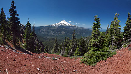
Horkelia01UpperSouthHoodView

Mount Hood from Horkelia Meadow

On the east side of Mount Hood lies a pretty mountain meadow that is visited by thousands each year, but known to very few. Right about now, this little meadow is in its peak summer bloom, thanks to a low snowpack this year. The place is Horkelia Meadow, a modest, subalpine gem in the Fire Forest country of the eastern Cascades.

If you’ve ever traveled Lookout Mountain Road to the High Prairie trailhead, you’ve passed right through Horkelia Meadow, though you can be forgiven for not being familiar with the name. Years ago, a Forest Service sign marked the spot, but only a discarded signpost remains today.

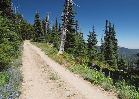
Horkelia02LookoutRoad

Horkelia Meadow straddles popular Lookout Mountain Road

Horkelia Meadow marks an area where a layer of underlying volcanic rock forces the water table to the surface at the top of the steep western scarp of Lookout Mountain. The geology creates a number of springs in the vicinity, and at rolling Horkelia Meadow, the soils are just moist enough to keep the surrounding conifer forests at bay.

The resulting meadow is the perfect habitat for an array of wildflowers and wildlife. You’re likely to see elk and deer sign here, as well as raptors in the big trees that edge the meadow, preying on mice, voles and even the snowshoe hare that live here.

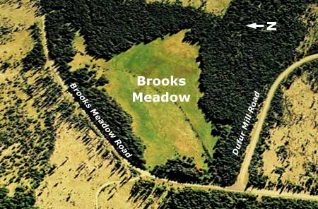
Horkelia03TopoMap

Horkelia Meadow is located in the subalpine forests on the north slopes of Lookout Mountain

Among the earliest blooms of summer at Horkelia Meadow come from a wildflower commonly known as Jessica Sticktight, Blue Stickseedof simply Stickseed. These are showy flowers that line the borders of Horkelia meadow, along the forest margins.

Horkelia04HackeliaMicrantha

Blue Stickseed

Horkelia05HackeliaMicrantha

Blue Stickseed flower detail

The common name “Stickseed” is self-explanatory when you look at the seed pods that form after the bloom, with each fruit covered in sticky spikes (below). When they dry out in late summer, they’re well designed to hitch a ride on passing wildlife — or your hiking socks!

But what caught my eye after a recent visit to the meadow was the botanical name for Blue Stickseed: Hackelia micrantha.Surely, there must be a connection to the naming of Horkelia Meadow?

Horkelia06HackeliaMicranthaCaliforniaNativePlantSociety

Seed pod on Blue Stickseed (photo: California Native Plant Society)

After searching through a stack of wildflower guides and web resources, I learned that Horkelia fusca or Tawny Horkelia does, indeed, grow in the area. It has been spotted at nearby Bottle Prairie and Brooks Meadow, both located to the north of Horkelia Meadow and about 1,000 feet lower in elevation.

So, a return trip was in order to see if Horkelia fuscaactually grows at Horkelia Meadow. Sure enough, it’s scattered throughout the lower sections of the meadow, far from Lookoout Mountain Road. Where Blue Stickseed is abundant throughout the meadow, Tawny Horkelia is scattered about, sometimes in open forest along the meadow edges, sometimes in dry spots near the center of the lower meadow.

Horkelia07TawnyHorkelia

Tawny Horkelia at its namesake meadow

Compared to the showy Blue Stickseed, Tawny Horkelia is a humble bystander in the meadow. These are modest little plants, happy to fill a niche in the ecosystem, but mostly noticeable to wildflower fans.

Therefore, my hunch is that a case of mistaken identity made its way onto Forest Service maps, as Hackelia micrantha— the Blue Stickseed — is lush and very prominent in the meadow during its bloom, and worthy of being its namesake. It’s also dominates along the heavily traveled upper meadow, where Lookout Mountain Road passes through, and where Tawny Horkelia doesn’t seem to grow.

Meanwhile, it also seems that Horkelia Meadow was named fairly recently. The original primitive road was built through the meadow in the 1930s as part of the Bennett Pass Road (see this article on the blog), but Forest Service maps suggest that the Horkelia Meadow was named sometime in the early 1970s.

Horkelia08MapHistory

[Click here for large view]

This is when industrial logging and associated road building went into high gear in the Lookout Mountain area (see below), and the old dirt road to Lookout Mountain was rebuilt and graveled to handle log trucks. During this period, named landmarks were helpful for logging crews navigating the tangle of new roads. I think Horkelia Meadow was (mis)named for that very purpose.

Horkelia Meadow has a bouquet of wildflower species and is a fine spot for a casual ramble to explore its secrets — hidden in plain sight! In early summer the Blue Stickseed are joined by Larkspur sprinkled throughout the meadow. Later, Scarlet Gilia, yellow Buckwheat and blue Lupine take over in a second wave of flowers.

Horkelia09Larkspur

Larkspur in early June at Horkelia Meadow

Horkelia10Lupine

Lupine just beginning to bloom in early June at Horkelia Meadow
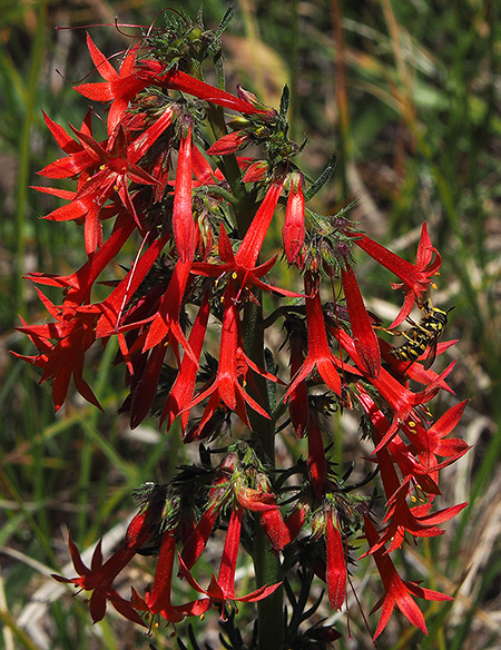
Horkelia11ScarletGilia

Scarlet Gilia in late June at Horkelia Meadow

In addition to the wildflowers, low thickets of Sticky Currant also grow on the meadow margins and along fallen trees that have dropped into the meadow (below). The summer berries on this species of currant are (as the name suggests) sticky and not edible, but the flowers put on an attractive show in early summer.

Horkelia12Currant

Sticky currant at Horkelia Meadow

The summer wildflower show also extends into the shade of the forests that surround Horkelia Meadow, with lush carpets of Vanilla Leaf (below), white Anemone and other wildflowers more commonly found in the wet forests along the Cascade crest.

Horkelia13VanillaLeaf

Vanilla Leaf at Horkelia Meadow

Fire suppression in the 20th century combined with aggressive clear cutting by the Forest Service over the past four decades has disrupted much of the Fire Forest ecosystem on the east side of Mount Hood. In many areas, the result is a crowded thicket of true firs, replacing the fire-dependent species of Ponderosa pine, Western larch, Lodgepole pine and Douglas fir that used to dominate. This, in turn, has triggered a cycle of beetle infestations among the crowded, weakened fir forests across the mountains of Eastern Oregon, often followed by catastrophic fires that kill even the fire-dependent tree species.

The good news is that the Forest Service has begun thinning some of these unnatural forests in an effort to restore the Fire Forest structure, including the use of controlled burns in some areas (see “Fire Forests of the Cascades”) Over time, this could help restore the natural forest ecosystem.

Horkelia14BurnedStump

A walk around Horkelia Meadow shows remnants of the old Fire Forest cycle that once dominated the area, creating open, park-like forests under towering trees. If you look closely, you can even find a few traces (above) of the last forest fire to sweep through the area, decades ago, when the forests were much different than today.

Horkelia15LarchGrove

A trio of fire-dependent Western Larch along the east margins of Horkelia Meadow

Whether fire returns to the areas as a planned burn or natural event, the Fire Forest species are still here and ready to resume their role as the dominant trees of this ecosystem… if we will allow it.

Exploring Horkelia Meadow

Horkelia16SmallMap

[Click here for a handy, large map to print for your tour!]

The old Fire Forest remnants scattered around Horkelia Meadow, some living and some standing as skeleton trees, provide easy landmarks for a tour. The starting point for exploring the meadow is the high point at the east end of the meadow, just off the Lookout Mountain road (from the recommended parking spot described at the end of the article, follow the road uphill for 100 yards).

At this upper end of Horkelia Meadow stands a gnarled, burly skeleton of what I call the “Big Bear Tree” (below), as it looks like it might be lumbering off into the woods, having lost his top. The low, dense branching on this ancient skeleton suggests this was an enormous Englemann spruce, a species that thrives in forests along the Cascade crest, especially along meadow margins. A living Englemann spurce can be found at the lower edge of of the main meadow, below.

Horkelia17BigBearTree

The “Big Bear” skeleton tree at the upper end of Horkelia Meadow

In early summer, the meadows around the “Big Bear Tree” are also filled with Blue Stickseed and Larkspur.

Heading downhill and across the road, pass a larch grove and head toward the bones of a very large, double-trunked Ponderosa pine (below). I call this old tree the “Patriarch” because it clearly ruled over Horkelia Meadow until fairly recently. Air photos show this giant still standing and alive in 2005, but toppled by 2010. The amount of bark left on the trunk is a good indicator of how recently this tree died.

Horkelia18PatriarchTree

“Patriarch Tree” at the center of the meadow, a huge, double-trunked Ponderosa pine that has toppled within the last decade or so

Horkelia19PatriarchTree

Newly toppled Patriarch Tree at Horkelia Meadow

Next, head downhill into the main meadow, located to the west and tucked away from the road, out of sight to passing travelers. Here, a large, multi-trunked Ponderosa Pine I call “The Flyswatter” towers over the scene at the north end of the meadow. This big snag is a favorite of raptors, especially owls, and is actually two snags, with the tall, single-trunked skeleton of what was likely a Grand fir wrapped in the bleached limbs of the old Ponderosa.

As you walk toward “The Flyswatter”, look for a couple of handsome Lodgepole pine growing along the east margin of the main meadow, another important species in Fire Forests.

Horkelia20Flyswatter

“The Flyswatter” skeleton tree and the lower part of Horkelia Meadow
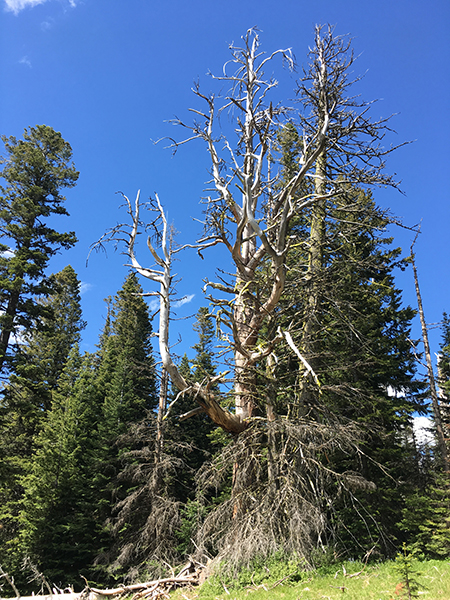
Horkelia21FlySwatter

“The Flyswatter” tree skeleton

Just beyond “The Flyswatter” (and over a large, collapsed trunk you’ll need to navigate) is the mostly hidden northwest meadow. This pretty spot used to be guarded by another large Ponderosa pine that has long since become a skeleton, and now lies across the meadow. Based on air photos, it looks to have fallen sometime in the 1970s (below). I call this one the “Dragon Tail” tree (below).

Horkelia22Dragon

The “Dragon Tail” tree in the hidden northwest meadow

Returning to the main meadow, a pair of big Ponderosa pine come into view (below) at the top of the slope. I call these the “Odd Couple”, as one is a nearly perfect Ponderosa specimen, while its twin is anything but, with a twisted, leaning top and huge, gnarled branches. Both were once in the shadow of the massive “Patriarch Tree”, whose skeleton lies just a few yards away.

Horkelia23OddCouple

The heart of Horkelia Meadow, with the “Odd Couple” to the left of center

Horkelia24OddCouple

The “Odd Couple” at the center of Horkelia Meadow

The grassy, shaded landing between this pair of Ponderosa makes a nice spot to relax and enjoy the surrounding meadow. From here, you can appreciate the tortured life of the southernmost tree of the pair. The deep scar running down the west side of its trunk and deep wound at the base of the trunk suggest a lightning strike — a common cause of demise for big trees that grow in exposed places like Horkelia Meadow (below).

Horkelia25OddCouple

Scarred trunk of the southernmost “Odd Couple” pair

Lightning may have taken out the nearby Patriarch Tree, too — seen here from the Odd Couple:

Horkelia26OddCouple

The “Patriarch Tree” skeleton lies just beyond the “Odd Couple”

Look up into the tortured twin and you can see (below) that the main trunk is really a surviving limb that took over to replace the main trunk after the original top was destroyed — whether by lighting or simply a windstorm.

Horkelia27OddCouple

The curvy, leaning top of the southern “Odd Couple” twin

The base of this old tree (below) shows another familiar trademark of big Ponderosa pine, a broad dome of “puzzle pieces” that have accumulated around the tree over the decades. These platforms of accumulated bark chips and pine needles give these handsome trees their park-like appearance, as if the meadow has been carefully trimmed around the tree.

Horkelia28OddCouple

Ponderosa bark piled up to form an apron around this giant at Horkelia Meadow

Ponderosa don’t choose to be multi-trunked, but they can adapt this way when topped by weather or lightening. The extra load of lateral limbs adapting to become a replacement trunk results in some very impressive trees, with upturned limbs 18″ or more across emerging from the trunk of the twisting “Odd Couple” twin (below). Over time, though, these trees are still more prone to collapse than single-trunked trees from heavy snow accumulation or wind on their bulky branch structure.

Horkelia29OddCouple

Heavy-duty limbs on the more gnarled of the “Odd Couple” Ponderosa pair

The bark on Ponderosa pine is both fascinating and beautiful. The puzzle-like flakes (below) continually shed as the bark on the tree grows. The dark furrows in the bark form as the tree expands under its thick bark jacket, pulling it apart

Horkelia30OddCouple

Bark detail on the more gnarled of the “Odd Couple” Ponderosa pine

Ponderosa pine bark on a mature tree can be several inches thick, and this is the main defense against fire, a needed and necessary part of the Fire Forest ecosystem. The combination of protective bark and high crown allows the biggest trees to survive multiple fires and thrive to produce offspring after each successive burn. In this way, the recently fallen “Patriarch Tree” could easily be the parent of the “Odd Couple” and other big Ponderosa pine around Horkelia Meadow.

Horkelia31OddCouple

Recent cones from the more gnarled twin of the “Odd Couple” Ponderosa pine at Horkelia Meadow

The gnarled sibling in the “Odd Couple” has had a harder life that its twin, for sure, but it continues to generate cones and seeds (above). In the end, that’s all a Ponderosa Pine lives to do, no matter how funky its shape. Over time, the toughest, most resilient trees decide the future of the forest with their offspring.

Horkelia32OddCouple

Old fire rings between the “Odd Couple” Ponderosa pine trees

If you do find yourself having a snack or picnic under the “Odd Couple”, you won’t be the first. Nearly lost in a thick carpet of Ponderosa needles is a pair of old fire rings (above). How long since these were uses? Decades, perhaps? They could even date back to a time when herders brought sheep up from the Dufur Valley to graze the slopes of Lookout Mountain in the early 1900s, and have since been forgotten in this little meadow (and just in case, please leave them be as remnants from an earlier time).

So, where’s the mountain?

Horkelia33SouthMeadowHood

Mount Hood from the lower south meadow

The upper and main meadows offer occasional peeks at the top of Mount Hood, but the best views are from the south meadows, located downslope from Lookout Mountain Road, beyond a curtain of trees. Here, the western scarp of Lookout Mountain begins to fall away quickly, with the south meadows perched above steep forested slopes, below.

To reach the hidden south meadows, head across the main meadow through a gap in the trees that is directly in line with the Odd Couple. Here, you’ll arrive at the top of the upper south meadow, and you can then meander downhill through another gap to the larger, lower south meadow. Mount Hood Views abound here, and the lower meadow is also a fine spot for a picnic.

Horkelia34LowerSouthMeadowBluegrassRidge

Bluegrass Ridge from the lower south meadow

The view from the lower south meadow also includes Blue Grass Ridge, which forms the eastern edge of the Mount Hood Wilderness. From here, you can see the traces of the 2006 Bluegrass Fire that burned most of the crest of Bluegrass Ridge, and the 2008 Gnarl Fire that burned the eastern slopes of Mount Hood all the way to Cloud Cap Inn, on the northwest horizon.

These recent burns are recovering quickly, with a bright green understory of Western larch, Lodgepole pine and White pine emerging under a ghost forest of bleached snags. While these were the first fires to burn the east slope of the mountain in more than a century, the landscape they left behind is what the area looked like before fire suppression in the 20th Century — a diverse mosaic of mature and recovering Fire Forests.

Horkelia35SouthMeadowSharkFishing

Shark fishing in the south meadow… can you see “Jaws”?

There are a few more name-worthy skeleton trees along the way as you drop down to the lower south meadow. First, you’ll pass a bleached stump that I originally called “Jaws”, but then spotted a “fisherman” complete with a deep sea fishing rod just up the hill — and thus, “Shark Fishing” for this trio (above).

At the top of the lower meadow a pair of stout Ponderosa skeletons are the “Goal Posts” (perhaps because it’s World Cup season). The meadows just below the “Goal Posts” have an excellent mix of wildflowers right now, too, and are where the Scarlet Gilia were in bloom on my last visit.
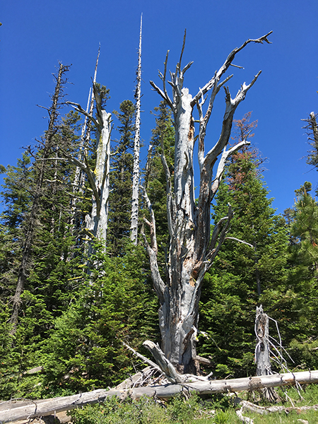
Horkelia36SouthMeadowGoalPosts

The Goal Posts in the lower south meadow

I know it’s a little silly to name all of these ghost trees, but hopefully it will help navigate the meadows if you choose to visit. It’s also a way for me to stop and appreciate the story each of these silent old patriarchs has to tell… and it’s just fun, too!

Horkelia Meadow at Work

I used to worry that fallen trees would eventually consume precious meadows with the accumulating debris, but it turns out that the meadows do just fine in consuming the trees, instead. One phenomenon you might notice as you explore Horkelia Meadow is log traces. These look like very straight trails, at first, but are really just places where fallen trees have nearly been absorbed into the meadow, and the grasses and wildflowers have all but covered what’s left of the fallen log.

There’s a prominent log trace in the upper south meadow that tells the story nicely. Fuzzy air photos from the mid-1990s (below) show a pair of fallen, bleached skeleton trees lying intact across the meadow. These trees could easily have stood as snags for decades after they died, but once on the ground, trees begin to decompose much more quickly.

Fifteen years later, in 2010, air photos show that the smaller of the two skeleton trees had really begun to fall apart, while the larger tree was mostly intact and still many of it’s bleached limbs.

Horkelia37LogTraceComparison

[Click here for a large view]

By last summer, however, air photos show the smaller tree had faded to a line of decaying wood in the meadow and the larger tree has lost most of its remaining limbs over the previous seven years. Today, the smaller tree has left just a trace in the meadow, and will soon completely disappear.

This cycle has played out countless times at Horkelia Meadow over the centuries, with many trees falling and fading into the meadow, each adding more valuable organic matter to the soil in the process. While new trees continue to emerge along the meadow margins, they’ll eventually suffer the same fate, too. The meadow is holding its own in this battle with the surrounding forest!

Horkelia38SnagSeedling

Young Grand Fir growing where an old giant once stood

As you explore the lower south meadow, you may notice a lot of blowdown along the lower margins of the meadow. These trees weren’t brought down by old age or meadow moisture, but instead were victims of a late 1980s clearcut. The extent of the clearcut is obvious on the map at the top of the article, and as you can see, it is littered with blowdown.

The fallen trees in the clearcut all point uphill. That’s because the prevailing winds coming from the west pushed them that way after the surrounding forests were logging, leaving the remaining trees suddenly exposed them to the full brunt of winter storms. Some of these could have simply been left behind by loggers — perhaps they too small to bother cutting — and larger trees might have been left to reseed the clearcut. Most have since toppled.

Horkelia39ClearcutBlowdown

Heavy blowdown on the edges of the 1980s Horkelia clearcut

Other blowdown along the margins of the meadow occurred in areas where trees were clearly left standing as a failed “buffer” to protect the meadow — a common practice that has destroyed thousands of trees along similar clearcut margins throughout the Mount Hood area. And after thirty years, the clearcut is just beginning to recover from logging, yet another reminder that high elevation clearcuts in the Cascades were never a sustainable practice, and never should have happened. Let’s hope we’ve seen the end of it here.

If you walk through the old clearcut, you’ll also notice hundreds of what look like small, nylon mesh bags sprinkled about. These were used to protect new  seedlings when the clearcut was stocked with a new “plantation” of trees. It’s another failed effort, as most of these seedlings did not survive the harsh winters and dry summers here.

Horkelia40ReplantingBag

Non-biodegradable seedling nets from the 1980s logging at Horkelia Meadow

Unfortunately, you will also notice these little mesh bags throughout the lower south meadow. Whether intentional or simply through sloppy incompetence, the Forest Service actually “replanted” a natural meadow when the adjacent clearcut was replanted. What were they thinking? Fortunately, all that survives are the dozens of nylon bags, and the meadow remains intact and thriving today.

If you’re looking for a community service, scout troop or other group project and want to help Horkelia Meadow out, I suspect the Forest Service would give you the okay to retrieve these bags from the meadow. Unfortunately, they are not biodegradable, so will be there until they are removed. They’re held down by metal stakes, but can be pulled out by hand if you wear a pair of heavy gloves. Give the Hood River Ranger District a call if you’re up for the task!

How to get there…

Horkelia Meadow is easy to visit, and makes for a nice add-on to your trip to Lookout Mountain or other hikes in the area. It’s best visited in morning or evening, as the southwest exposure is often hot during the summer. You can walk the margins of the meadow in under an hour and gain a nice appreciation of flora, large and small, of this lesser-known spot.

Horkelia41SignPost

All that’s left of the old Horkelia Meadow sign is this old signpost

To find the meadow, follow paved Forest Road 44 about 3.5 miles from the Highway 35 junction, toward Dufur. Just beyond the busy Surveyors Ridge Trailhead (on the left), watch for the poorly signed Lookout Mountain (Road 4410), on the right. Horkelia Meadow straddles this dusty, sometimes bumpy gravel road 1.3 miles from the Forest Road 44 junction.

Horkelia42Road140

Park at the marked Forest Road 140 spur

I recommend parking at the junction with primitive road 140, on the left as just as you reach Horkelia Meadow. There’s room to park here without impacting the meadow wildflowers, but be sure you don’t blog the spur road.

To tour the meadow, walk up the road to the upper end, watching for the “Big Bear” skeleton on the left, then use the map at the top of this article to find your way.

Horkelia43BotanyClass

Botany class exploring Horkelia Meadow

To help protect the area, please follow these basic rules of meadow etiquette when exploring, as there is no developed trail at Horkelia Meadow:

  • Hose or brush off boots before every hike to help slow the spread of invasive species, especially when hiking off-trail
  • Don’t gather flowers, seeds or anything else in the meadows — “take only memories (and photos) and leave only footprints”
  • Don’t step on flowering plants, step between them
  • Try not to follow faint paths you might encounter in the meadows — while they are likely deer or elk trails, repeated walking on them could make them permanent
  • No fires, dogs, loud voices or drones (aargh!) that might disturb the wildlife and other visitors when venturing off-trail, especially in meadows

You’ll undoubtedly have the place to yourself — but if you should see a car parked along the road, consider stopping another time for your visit.

Thanks, and enjoy Horkelia Meadow! Or is it Hackelia Meadow…?

Proposal: Bennett Pass Historic Backroad

bennettpassbackroad00

Mount Hood from Historic Bennett Pass Road

One of the many misconceptions about our national parks is that visiting means contending with the masses along crowded paved roads, with the only chance for solitude limited to trails that are beyond the abilities of many visitors, including the elderly, those with limited mobility or young families.

But the truth is that our national parks also feature some of the most stunning primitive backroads for those looking for a more accessible way to get off the beaten track.

One of the most spectacular is the Titus Canyon Road in Death Valley National Park, and the concept behind Titus Canyon has stuck in my mind since I first visited the park in the early 1980s.

One-Way Concept

bennettpassbackroad01

Titus Canyon: Yogi Bear does not drive here!

Titus Canyon Road begins east of Death Valley, at the near-ghost town of Rhyolite, climbs over 5,000 foot Red Pass, then begins a spiraling descent of nearly a vertical mile as it enters the increasingly narrow gorge of Titus Canyon. When the road finally emerges near sea level, from the east wall of Death Valley, the floor of Titus Canyon has shrunk to a point that two cars would not be able to pass.

bennettpassbackroad02

One-way trip to heaven… in Death Valley

This is where the genius of Titus Canyon Road comes in. The Park Service has designated this a one-way road, with traffic allowed only in the direction of Death Valley.

The physical constraint at the lower end of Titus Canyon is the determining factor, to be sure, but the broader effect is that one-way traffic provides a remarkably relaxing experience in which visitors can focus on the scenery, not dodging oncoming traffic. The one-way design also negates driving through clouds of dust from oncoming vehicles, a notable benefit on primitive roads.

bennettpassbackroad03

Titus Canyon narrows (and my 1980s Honda Civic, back in the day)

So, how does this relate to Mount Hood? Part of the Mount Hood National Park Campaign concept calls for repurposing some of the thousands of miles of failing, obsolete logging roads in the Mount Hood National Forest into scenic backroads or trails for hiking or biking.

Most of these roads were constructed during the industrial logging heyday from the 1950s through the late 1980s, and were solely designed around clear cuts, not a concern for the respecting landscape or taking in the scenery.

But a few of these roads date back to an earlier era, when the first few roads connected major destinations in the new Mount Hood National Forest in the 1920s and early 1930s. These roads were often built without machinery, and subsequently follow the contours of the land in a way that roads from the industrial logging era rarely do.

Historic Bennett Pass Road

bennettpassbackroad04

Views into the remote Badger Creek Wilderness abound along historic Bennett Pass Road

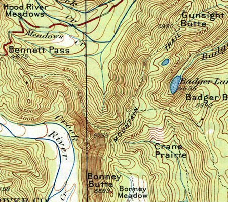
One such historic forest road connects High Prairie and Lookout Mountain, located 8 miles due east of Mount Hood, to Bennett Pass, on the southeast shoulder of the mountain. For travelers of the Mount Hood Loop Highway, the old route follows the high ridges that form the wall of the East Fork Hood River valley, as you descend from Bennett Pass toward Hood River.

Today, the historic Bennett Pass Road is a bumpy, often grinding minefield to navigate. It’s hard to imagine that it was the main forest route when it was built, but it still passes some of the finest scenery in the area along the way, and has the potential to be an exceptional scenic backroad.

bennettpassbackroad05

1920s map when the future Bennett Pass Road was still just a “mountain trail”

When it was built in the early 1930s, the historic road followed the route of an early forest trail along the ridge that connects Bennett Pass to a Forest Service guard station that once stood at High Prairie (if you know where to look, you can still find the ruins). The road was built by the Civilian Conservation Corps (CCC) in the early 1930s by crews based in Camp Friend, located to the east of Lookout Mountain, and just south of the town of Dufur. The Camp Friend crews also built several lookouts in the area and the historic road to Flag Point.

Today, the historic Bennett Pass Road serves as the western boundary for the Badger Creek Wilderness and the northern boundary for the White River Unit of the Mount Hood National Recreation area. This easy proximity to both of these protected areas brings a string of fine trail opportunities along the route for exploring nearby viewpoints, lakes and meadows on foot.

bennettpassbackroad06

Boulder Creek Valley and Echo Point in the White River Unit of the Mount Hood National Recreation Area from the historic Bennett Pass Road

The northern section of the historic Bennett Pass Road, from High Prairie to Dufur Mill Road, was bypassed and decommissioned in the late 1980s when the newer, gravel-surfaced road to High Prairie was constructed. For the purpose of the Bennett Pass Historic Backroad concept, this newer section is included in the proposal, with the Dufur Mill Road junction serving as the starting point for the backroad tour and Bennett Pass as the end point.

How would it be different?

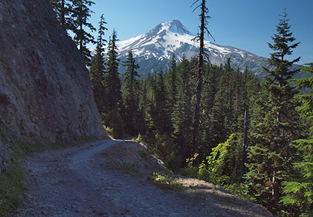
How would the Bennett Pass Historic Backroad differ from what is on the ground today? First, it would be one-way from High Prairie to Bennett Pass, the historic section of the original road that still survives. Like Titus Canyon, this portion of Bennett Pass Road has a few spots where passing an oncoming vehicle would by physically impossible – notably below Lookout Mountain and along a notorious stretch etched into a cliff known as the Terrible Traverse.

bennettpassbackroad07

Leaving the Terrible Traverse en route to Bennett Pass

But like Titus Canyon, the purpose of the one-way tour is mainly to allow for a greater sense of remoteness and ability to truly appreciate the rugged scenery along the way.

Second, the concept of a scenic backroad also includes ADA-compliant picnic and restroom facilities along the way to ensure that all visitors can enjoy the tour. As our population ages and our society becomes more socially inclusive of those with limited mobility, providing accessible alternatives for exploring our public lands has become a critical, largely unmet need.

Some of these facilities are already in place at existing trailheads and could be made accessible with modest improvements. Other spots along the route would need these basic improvements.

bennettpassbackroad08

Enjoying Mt. Jefferson and views into the Badger Creek Wilderness at 10 mph along the historic Bennett Pass Road

Finally, a 10-mph speed limit would ensure that the proposed Bennett Pass Historic Backroad tour remains focused on users looking for a relaxing, scenic way to enjoy the area. This means that OHV users accustomed to traveling at greater speeds would need to find other places to make noise and disturb other forest visitors — and besides, the Forest Service has set aside areas for OHVs elsewhere in the forest.

bennettpassbackroad09

The faded (and assassinated) top sign warns passenger vehicles from venturing onto the historic Bennett Pass Road

Today, it’s hard to get much beyond 5-mph in many sections of the Bennett Pass Road due to a profound lack of maintenance, so a light upgrade to the surface and periodic maintenance is part of the concept. In the 1980s, I navigated Titus Canyon Road in a Honda Civic, and there’s no reason why a better maintained Bennett Pass Road couldn’t accommodate passenger cars traveling at 10 mph. That’s part of being inclusive, after all.

Signage is deficient or completely absent along much of the route today, so the backroad concept also calls for improved directional signage and occasional interpretive signage along the tour, as well. Interpretive signage could be as simple as mileposts that link to a downloadable PDF or podcast describing the rich natural and cultural history of the area.

The Bennett Pass Historic Backroad Tour

The full tour covers just over 14 miles, but at 10-mph with a few stops along the way, the Bennett Pass Historic Backroad tour would take the average family two or three hours to complete. Add an hour on each end to reach the tour from Portland, and this would make an exceptional choice for urban visitors looking for a new way to explore Mount Hood country.

Here’s a tiny map of the concept:

bennettpassbackroad10

But by all means, please click here for a very large version of the map to see the details that make up this proposal.

Tour Description

0.0 to 2.8 mi. – Dufur Mill Road to Sunrise Rocks – The tour starts at gravel Lookout Mountain Road (Road 4410) where it begins on paved Dufur Mill Road (Highway 44), north of Lookout Mountain. This is the section of the route built in the 1980s to bypass a (now abandoned) portion of the historic road.

After climbing through forest and passing pretty Horkelia Meadow, this segment ends at the mostly unknown Sunrise Rocks, a fine, currently undeveloped picnic spot with a commanding view of Mount Hood, across the East Fork Hood River valley.

bennettpassbackroad11

The sprawling Mount Hood view from semi-secret Sunrise Rocks

The Bennett Pass Historic Backroad concept (see map) also calls for a new trail in the area, from the Little John winter recreation area to Sunrise Rocks, providing another way to enjoy this overlook for hikers looking for a challenge and a year-round purpose for the Little John trailhead.

bennettpassbackroad12

Sunrise Rocks from the Little John trailhead and parking area… someday a trail from here?

2.8 to 4.9 mi. – Sunrise Rocks to High Prairie – after taking in the view at Sunrise Rocks, the route continues for another 2 miles along the newer road section to High Prairie, a major destination for hikers and equestrians. Families looking for a picnic or short hike can explore the sprawling meadows here, or take the longer 5-mile loop to the airy summit of Lookout Mountain, where the view stretches up and down the Cascades and into the high desert country of Eastern Oregon.

bennettpassbackroad13

Acres of subalpine wildflowers and a maze of family-friendly trails await at High Prairie

4.9 to 7.2 mi. – High Prairie to Gunsight Ridge – two-way travel ends at High Prairie in the historic backroad concept, and from this point forward the tour would be one-way toward Bennett Pass along the surviving, original section of the historic Bennett Pass Road. The segment of original road from High Prairie to Gunsight Ridge is the most breathtaking on the tour, with huge views of Mount Hood and exposed sections where drivers will be gripping the wheel — and taking in the views.

bennettpassbackroad14

Sweeping Mount Hood views abound where the historic Bennett Pass Road skirts Lookout Mountain

Several scenic pullouts are located along this section, as well as a major trailhead at Gumjuwac Saddle, with trails heading in five directions! Hiking options from the saddle include longer trips to Badger Lake and Lookout Mountain, or the nearby Gumjuwac Overlook, just 0.8 miles from the saddle.

bennettpassbackroad15

Mount Hood after an early autumn snow from the Gumjuwac Overlook

The proposed Gunsight Ridge picnic area would be located at a large pullout above pretty Jean Lake, with access to the Gunsight Trail. Jean Lake can be visited via a family-friendly 0.6 mile trail that descends to the lake.

bennettpassbackroad16

Pretty Jean Lake is a short forest hike from the historic Bennett Pass Road

7.2 to 9.0 mi. – Gunsight Ridge to Camp Windy – the short drive from Gunsight Ridge to Camp Windy is just below the ridge crest, with frequent views into the Badger Creek Wilderness, and later, into the White River unit of the Mount Hood National Recreation Area.

bennettpassbackroad17

Expansive meadows at Camp Windy roll down the slopes of Gunsight Ridge

Modest picnic facilities and a vintage toilet already exist at Camp Windy, a lovely mountainside meadow, but new facilities would be needed as part of the scenic backroad concept. A short spur road here provides access to the Badger Saddle trailhead, and the 3.5-mile round trip hike to Badger Lake.

bennettpassbackroad18

Mount Hood from the Gunsight Ridge Trail

9.0 to 10.1 mi. – Camp Windy to Bonney Junction – From Camp Windy, the historic road continues to a 3-way junction with Bonney Meadows Road (Road 4891). The historic backroad concept calls for the Bonney Meadows route to function as a 2-way facility, allowing access to the Bennett Pass Historic Backroad at its midpoint, and for Bennett Pass visitors to make side trips to Bonney Meadows and Bonney Butte, just off the Bennett Pass tour.

bennettpassbackroad19

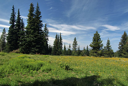
Peaceful Bonney Meadows with Mount Hood peeking over the ridge

Bonney Meadows already has a rustic campground perfect for picnics and exploring the nearby meadows. Families looking for something more challenging can make the 4.5 mile round-trip hike to exceptionally scenic Boulder Lake, or try a shorter hike to Bonney Butte, known for its raptor surveys. Bonney Meadows also has several developed campsites, so families could opt to camp here, midway through the tour.

bennettpassbackroad20

Lovely Boulder Lake

10.1 to 12.4 mi. – Bonney Junction to Newton Clark Overlook – from Bonney Junction, the historic Bennett Pass Road turns abruptly north and descends briefly before arriving at a catwalk section of road carved into the crest of the ridge. Here, the tour passes the Terrible Traverse, marked by an extraordinary rock gateway cut by the early road builders. This is the Titus Canyon equivalent for the Bennett Pass Road, as there is no room for passing (or error) along this section!

bennettpassbackroad21

The dramatic gates to the Terrible Traverse

Just beyond the traverse, the road drops to a saddle with an excellent view of Mount Hood at the proposed Newton Clark overlook and picnic site.

bennettpassbackroad22

The Newton Clark Glacier and its enormous moraine from the proposed Newton Clark overlook

This spot is also one of several backcountry lodge locations proposed in the Mount Hood National Park Campaign to allow for Euro-style chalet-to-chalet trekking. These modest lodges would be rustic and quiet, along the lines of Cloud Cap Inn, and open year-round to also serve Nordic skiers and snowshoers.

bennettpassbackroad23

It turns out the Hood River County Sheriff digs the Newton Clark overlook, too (Courtesy Hood River Co.)

12.4 to 14.2 mi. – Newton Clark Overlook to Bennett Pass – from Newton Clark Overlook, the remainder of the route continues along the ridge top through handsome stands of noble fir to the large trailhead and parking area at Bennett Pass, ending the tour.

What would it take?

While some of the proposals featured in this blog are notably ambitions, this one is pretty simple, and could be accomplished in the near-term. The Forest Service would need to do some grading, add some gravel in some sections and step up maintenance of the historic Bennett Pass Road. Picnic and toilet facilities would need to be added in a few spots and new signage to help visitors navigate and appreciate the tour would be needed.

bennettpassbackroad24

Wildflowers line the historic Bennett Pass Road in summer

Establishing a one-way route would be a taller order for the Forest Service, but there are already a few limited one-way routes along forest roads, so the idea is not without precedent. One obvious exception to a one-way rule is for emergency access, of course, but other visitors would probably appreciate the peace of mind in knowing they won’t meet another vehicle at the blind curve midway along the Terrible Traverse!

How to visit?

The good news is that you can visit the proposed Bennett Pass Historic Backroad today with a few considerations in mind:

  1. The road is generally only open in summer, from mid-June through early October. The best time to visit is in July, when wildflowers are blooming throughout the tour, and the worst time is after heavy rain, when a few muddy sections might just swallow your vehicle.
  1. Parts of the historic portion of the road are very, very rough. Until a Bennett Pass Historic Backroad brings some surface improvements and periodic maintenance to this old route, plan on a slow, sometimes jarring ride that will test your nerves, tires and suspension. High clearance vehicles with AWD or 4WD, only!
bennettpassbackroad25

This collage of scraped rocks on Bennett Pass Road is mute testimony to the folly of taking a passenger vehicle there – don’t try it!

  1. The roads are poorly signed, so you’ll need a forest map. I recommend the National Geographic map for Mount Hood National Forest in their Trails Illustrated series. Never trust a GPS device or smart phone to navigate forest roads!
bennettpassbackroad26

The author hanging out on the historic Bennett Pass Road

With these precautions in mind, the old Bennett Pass Road is fun to explore and always un-crowded.

Take it slow and enjoy the ride!

How will the summer of 2015 affect our fall colors?

Shepperd's Dell dressed in autumn golds

Shepperd’s Dell dressed in autumn golds

Oregon may not have the neon rainbow of New England’s fall colors, but we put on a pretty good show if you know where and when to look. However, 2015 will be different, as the extended drought and scorching summer heat has already affected our fall colors this year, even before the leaves began to turn.

To understand why, you have to start with the basics of how leaf colors change with the seasons, and how weather and other factors influence the autumn show each year.

Leaf Biology 101!

Most of our northwest deciduous trees and shrubs leaf out in spring, grow green leaves through the summer, then turn to various shades of yellow and gold in fall, with a few red leaves in the mix. Vine maple, huckleberry and mountain ash provide our most brilliant reds, and most of the larger deciduous trees in our forests turn to some shade of gold, orange or yellow.

Vine maple colors range from pale yellow (in shade) to bright crimson (in full sun)

Vine maple colors range from pale yellow (in shade) to bright crimson (in full sun)

The green color in summer and spring foliage comes from chlorophyll, the amazing molecule that absorbs sunlight and allows for photosynthesis — the process by which plants convert sunlight into carbohydrates (sugars) essential to their growth.

During the spring and summer growing seasons, chlorophyll is produced continually, keeping deciduous leaves green. But as the days shorten with the approach of winter, the decrease in sunlight triggers a change in how cells in the stem of each leaf divide, gradually blocking the flow of both nutrients and chlorophyll to leaves. The cells that form this barrier within the leaf stem are known as the “abscission layer”.

Like vine maple, mountain ash fall colors range from light yellow to brilliant red, based on sun exposure

Like vine maple, mountain ash fall colors range from light yellow to brilliant red, based on sun exposure

Ready for more leaf biology? Well, the yellows, reds and golds of autumn are colors that already reside in leaves, but are revealed as the change to the flow of chlorophyll is blocked by the development of the abscission layer in early fall.

Yellows and golds in fall leaves come from “xanthophylls”, a pigment thought to regulate light in the photosynthesis process. Reds and purples come from “anthocyanins”, a molecule that is believed to complement the green of cholorophyll in the photosynthesis process — but is more commonly is found in flowers, where it functions to attract pollinators.

Dark, cool and wet…

Okay, enough leaf biology! If deciduous leaves are certain to turn color in autumn by their very chemistry, how do environmental factors fit into the leaf cycle? Here are the key forces that shape the timing and brilliance (or lack thereof) in our autumn color show:

Bright sun and cool temperatures: a crisp, abrupt fall pattern speeds up and pronounces the abscission process by which chlorophyll is blocked from leaves. This helps to promote sudden and dramatic color shows. Likewise, a mild, extended Indian Summer tends to slow the process, with a more gradual color change and leaves changing and falling over a longer period.

Cool mountain nights and bright, sunny days set these vine maple ablaze on Mount Hood's Vista Ridge

Cool mountain nights and bright, sunny days set these vine maple ablaze on Mount Hood’s Vista Ridge

Bright days and cool nights also enhance reds and purples in plants with abundant anthocyanins in their leaves. These include vine maple, huckleberry and mountain ash, our most vibrant fall foliage. That’s also why these colors are more prominent at higher elevations where bright days cool nights are guaranteed, even as the valleys are under a blanket of fog.

Early frosts: contrary to popular belief, early frosts hurt fall colors more than they help, as the production of anthocyanin-based colors of red and purple are abruptly interrupted by a premature formation of the abscission layer. If you’ve hiked in the mountains in late August after an early cold snap, you’ve undoubtedly seen a carpet of dropped leaves under huckleberries and other deciduous shrubs.

Drought: like early frosts, drought can trigger a premature formation of the abscission layer, leading to early color change and leaf drop. If you’ve been hiking in the Gorge or on Mount Hood this summer, you likely saw this effect of the drought we are experiencing. While some leaves survive later into autumn, the broader effect is a muted show, as many leaves have already dropped long before the typical fall color season. This is has already been the effect of the drought this year in both the Gorge and on Mount Hood.

Early autumn storms: the arrival of a Pineapple Express storm pattern during Labor Day week of 2013 did a fine job of stripping our maples and other deciduous trees of many of their leaves weeks before they would normally turn and begin to lose their foliage. It’s not common for early storms of this magnitude in our region, so it might be the most notorious culprit in stealing our fall colors!

The colors in this view of Umbrella Falls on Mount Hood are mostly huckleberry -- red when in full sun and yellow in shady stream areas

The colors in this view of Umbrella Falls on Mount Hood are mostly huckleberry — red when in full sun and yellow in shady stream areas

In an ideal year, normal rainfall in spring and summer are followed by a cool, dry Indian summer with warm days and cool nights in the 40s or 50s. This year, we’ve got the Indian summer condtions, but the drought has already triggered leaf drop in a lot of our deciduous forests. Thus, we’re likely to have a so-so color display this Fall.

Where and When to Catch the Colors

A muted fall color display this year shouldn’t keep you from heading out to enjoy it! In a typical year, the high country colors peak in September through early October. Mid-elevation areas and canyons usually peak from mid-October through mid-November, depending on the mix of tree species.

Here are some of the best spots in the Mount Hood area to catch the autumn color:

Elk Cove from Vista Ridge – this 9-mile out-and-back hike is one of the best for exploring Mount Hood’s high country without having to ford glacial streams or suffer huge elevation gains (though you will gain substantial elevation). In September of a typical year, fall colors light up the trail, especially as you descend into Elk Cove, but note that the colors are long gone from this hike in our drought year — see the Oregon Hikers Field Guide description

Elk Cove in late September (in a typical year)

Elk Cove in late September (in a typical year)

Clackamas River Trail – another close option for Portlanders, with a moderately long hike to Pup Creek Falls, albeit with moderate elevation gain. This trail is lined with bigleaf maple, but also has impressive vine maple shows in a recovering burn section that bring shades or red and coral to the trail in October. You’ll also see Douglas maple here, a close but less common cousin to vine maple — see the Oregon Hikers Field Guide description

Brilliant vine maple along the Clackamas River Trail

Brilliant vine maple along the Clackamas River Trail

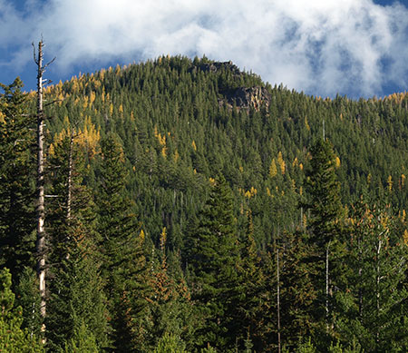
Lookout Mountain Loop – Always a spectacular hike on a clear day, in October you will also see the annual spectacle of western larch turning golden yellow across the eastern slopes of the Cascades. Larch are a deciduous conifer — a rarity, and an impressive sight — see the Oregon Hikers Field Guide description

Whole mountainsides around Lookout Mountain light up with western larch turning in mid-to-late October

Whole mountainsides around Lookout Mountain light up with western larch turning in mid-to-late October

Latourell Falls Loop – Very close to Portland, this is a popular family hike that visits two waterfalls in a lovely rainforest canyon. In late October, bigleaf maple that dominate the forests here light up in shades of yellow and orange, often covering the trail ankle-deep in their huge leaves — see the Oregon Hikers Field Guide description

The Latourell Falls loop trail still has some color in early November

The Latourell Falls loop trail still has some color in early November

Starvation Creek Loop – like the Latourell loop, Starvation Creek has an abundance of bigleaf maple, but the crisper weather and abundant sun of the eastern Gorge often makes for a brighter show here. Families can simply explore the paved trails around the main falls, but the Lower Starvation hike makes for a fun, if sometimes steep loop past more waterfalls and clifftop viewpoints — see the Oregon Hikers Field Guide description

Bigleaf and vine maple put on a reliable show at Starvation Creek Falls in October

Bigleaf and vine maple put on a reliable show at Starvation Creek Falls in October

Butte Creek Trail – an under-appreciated family trail that does require navigating some harshly managed corporate timber holdings. The outrageous, utterly unsustainable clear-cutting only makes the pristine public forests and waterfalls along the trail that much more spectacular in comparison. This is an ideal October hike, with fall colors typically peaking in the last half of the month. This trail really shines in rainy or overcast weather, when the rainforest glows with countless autumn shades of yellow, gold and orange against a backdrop of deep green – see the Oregon Hikers Field Guide description

The author ankle-deep in maple leaves on the Butte Creek Trail

The author ankle-deep in maple leaves on the Butte Creek Trail

The great thing about taking in fall colors is that the weather really doesn’t matter — a soggy hike through the brilliant yellows of bigleaf and vine maple in a waterfall canyon is just as spectacular as a sunny day hiking through a sea of red and orange in Mount Hood’s huckleberry fields.

Better yet, if you have kids, it’s also a great time to expose them to hiking and exploring the outdoors… though you should also plan on hauling home a hand-picked collection of autumn leaves..!

Enjoy!

Mount Hood’s Ancient Whitebarks

Ancient Whitebark pine on Gnarl Ridge

Ancient Whitebark pine on Gnarl Ridge

If you have spent much time in Mount Hood’s alpine country, you probably already recognize the Whitebark pine. This rugged cousin to our more common Ponderosa and Lodgepole pines thrives where no other trees can, braving subzero winters and hot, dry summers at the upper extreme of timberline.

Ancient Whitebark pine grove on Lookout Mountain

Ancient Whitebark pine grove on Lookout Mountain

Whitebark pine is easy to identify on Mount Hood. True to their name, they have white bark on younger limbs, and their typically gnarled, picturesque forum is iconic in our Cascade Mountain landscape. These slow-growing patriarchs often live to 500 years or more, with some trees known to survive for more than 1,000 years.

In protected stands below the tree line, they can grow 60-70 feet tall (around Cloud Cap Inn), while in open areas, they creep along the ground, forming a “krummholz” — a low mat of branches stunted by the elements (famously, on Gnarl Ridge, which draws its name from the ancient Whitebarks that grow there).

Whitebark pines have limber branches to withstand the elements

Whitebark pines have limber branches to withstand the elements

Up close, Whitebark pine can be identified by its needles, with five per bundle (compared to two for Lodgepole and three for Ponderosa pine). Whitebark cones don’t open when dry, yet are hardly ever found intact. That’s because of the unique, mutual relationship these trees have with a bird called Clark’s nutcracker, named for William Clark, co-captain of the Lewis & Clark Corps of Discovery expedition.

Clark’s nutcracker subsists almost entirely on the large, nutritious seeds hidden in Whitebark cones. These birds have evolved with an ability to crack the cones and store the seeds in buried caches, for later consumption. The Whitebark pine, in turn, is almost completely dependent on these birds for reproduction, when young seedlings sprout from seeds cached by the nutcracker.

Clark's Nutcracker at Crater Lake (Wikimedia)

Clark’s Nutcracker at Crater Lake (Wikimedia)

In this way, the Whitebark pine is considered by scientists to be a “keystone” species at the center of a broad, highly dependent web of life. In addition to its co-mutual relationship with Clark’s nutcracker, Whitebarks also support other high-elevation species, serving as “islands” of life in otherwise barren alpine zones. These islands shelter mammals, birds and insects migrating through alpine areas and serve as permanent habitat for many mountain plant and animal species.

Whitebark pine seeds serve as a direct food source for several other species in addition to Clark’s nutcracker. The seeds are large and high in fat, and at least 12 species of birds are known to feed on them. The seeds are also a primary good source for ground squirrels living in alpine zones, where they store large quantities of seed in “middens”.

Surprisingly, Whitebark seeds are also an important food source for black bear and the grizzly bear, with both bear species raiding the middens of ground squirrels. For grizzly bears in the Greater Yellowstone Area, Whitebark pine seeds are considered so important in the their diet that the long-term viability of the bear population is linked to the survival of the Whitebark.

A Species in Trouble

Sadly, the Whitebark pine is in deep trouble. The triple threat of (1) an exotic fungal disease known as white pine blister rust, (2) mass infestations of mountain pine beetle and (3) the effects of fire suppression have weakened and killed millions of these trees across Mountain West.

Blister rust (boundary shown in red) has affected almost all Whitebark pine range (green) in North America

Blister rust (boundary shown in red) has affected almost all Whitebark pine range (green) in North America

The U.S. Fish and Wildlife Service (USFW) estimated in 2007 that 800,000 acres of Whitebarks have been lost across the west, an startling statistic given the small, rare alpine habitat that these trees need to survive.

Global warming may turn out to be the nail in the coffin for this venerable species, as less hardy tree species continue to crowd and compete for space in areas once habitable only by the Whitebark pine.

Massive Whitebark pine die-off in Yellowstone (USFWS)

Massive Whitebark pine die-off in Yellowstone (USFWS)

Several efforts to save the species are underway. In July 2011, the U.S. Fish and Wildlife Service (USFWS) determined that the Whitebark pine needed federal protection and that without it, the tree would soon be extinct within as few as two to three generations. However, the tree has not been formally listed in the United States as endangered, due to federal agency funding constraints.

In June 2012, the Canadian federal government declared Whitebark pine endangered, making it the first tree species to be declared endangered in Western Canada.

Whitebark04

The Whitebark Pine Ecosystem Foundation is a science-based, non-profit organization that exists to conserve and restore the Whitebark pine, but their efforts are dependent on support from the public in making the survival of this species a priority with our land management agencies.

Conservation efforts for the Whitebark focus on harvesting seeds from trees that seem to have a natural resistance to white pine blister rust and restoring the role of fire in forest management. Both strategies will require the full engagement of our federal land agencies, and thus the need for a non-profit like the Whitebark Pine Ecosystem Foundation to press the issue in our utterly dysfunctional national government. Please consider supporting them!

Lookout Mountain Sentinels

One of the best places to view ancient Whitebark pine up close is along the crest of Lookout Mountain, located due east of Mount Hood. Like most Whitebark stands around Mount Hood, the trees on Lookout Mountain are in decline, yet hundreds have (so far) survived the triple threat facing the species.

A large stand of Whitebark pine just below the main summit of Lookout Mountain provides a stark example of the die-off that is affecting the species. As shown in the photos below (1983 and 2008), scores of trees in this stand have died in recent years:

Healthy stands of Whitebark pine thrived on the south slope of Lookout Mountain in 1983

Healthy stands of Whitebark pine thrived on the south slope of Lookout Mountain in 1983

Over the past decade, almost the entire stand of Whitebark pine on the south slope has died

Over the past decade, almost the entire stand of Whitebark pine on the south slope has died

The Lookout Mountain grove is on the hot, dry south slope of the peak, so the trees here are clearly stressed by the environment, even without the blister rust and beetle attacks now affecting the species.

On the more protected east slope of the main summit, a remarkable group of ancient Whitebark pine (pictured below) is soldiering on, though some of the oldest sentinels in this group now seem to be fading fast.

Whitebark patriarch near the summit of Lookout Mountain beginning to show stress in 2002

Whitebark patriarch near the summit of Lookout Mountain beginning to show stress in 2002

By 2013, only one of the ancient tree's five trunks is still alive, though healthy younger trees are growing nearby

By 2013, only one of the ancient tree’s five trunks is still alive, though healthy younger trees are growing nearby

Some of the trees in the eastern group are truly ancient. Several were cut in 1930, when a road was built to the summit and a lookout tower constructed. Amazingly, the bleached stumps of these old trees still survive, more than 80 years later.

One of these stumps measuring about a foot across still shows its growth rings, showing that it was 280 years old when it was cut in 1930! This means the tree started life on Lookout Mountain in 1650, twenty years before the Hudson Bay Company was formed under a charter from King Charles II. This tree was already 174 years by the time Dr. John McLoughlin established his Hudson Bay Company outpost at Fort Vancouver, in 1824, and more than 200 years old before tiny Portland, Oregon was incorporated in 1851.

A particularly ancient patriarch in this grove (shown in the photo pairs above and below) grows due east of the summit, along the Divide Trail. This old survivor appears to be the oldest Whitebark pine on Lookout Mountain. While it’s age is unknown, the diameter of its multiple trunks substantially exceeds that of the nearby cut trees, so this ancient sentinel could be 300-500 years old, or more.

A profile view of the patriarch tree in 2002 shows health growth on the eastern trunk (center)

A profile view of the patriarch tree in 2002 shows health growth on the eastern trunk (center)

This profile view from 2013 shows significant dieback on the eastern trunk over the past decade (center)

This profile view from 2013 shows significant dieback on the eastern trunk over the past decade (center)

Sadly, this old veteran is fading fast, with only one living trunk surviving as of this summer. Even as the old tree succumbs to the elements, it continues to serve as a fascinating, beautiful testament to the struggle that Whitebark pines face in their preferred habitat.

A closer look at the old tree (below) shows five sprawling trunks, each more than a foot in diameter. This old survivor looks a bit like a huge, grey octopus (complete with two weathered eyes, looking back at you!).

At its center, the patriarch Whitebark sprawls like an octopus, with five major trunks, each more than a foot in diameter

At its center, the patriarch Whitebark sprawls like an octopus, with five major trunks, each more than a foot in diameter

Ancient Whitebarks at this elevation are typically a twisted tangle of living and dead trunks, and in the case of the Lookout Mountain patriarch tree, only the north and east of the five main trunks survive.

As the photos that follow illustrate, the north trunk may have seen its last summer this year, as its remaining needles suddenly died back as of early July. The surviving east trunk is in better shape, with several green boughs, but its needles obviously lack the vigor of nearby, younger Whitebarks. Clearly, the old giant is in its final years of living after centuries on this unforgiving mountain slope.

A rusty remnant from the days when a lookout tower stood on the mountain hangs on one of the living limbs of the patriarch Whitebark pine

A rusty remnant from the days when a lookout tower stood on the mountain hangs on one of the living limbs of the patriarch Whitebark pine

The bleached bones where the patriarch tree has died back can survive for decades in the arid alpine climate of Lookout Mountain

The bleached bones where the patriarch tree has died back can survive for decades in the arid alpine climate of Lookout Mountain

Yellowing needles on the remaining (east) living trunk of the patriarch Whitebark spell trouble for this old tree

Yellowing needles on the remaining (east) living trunk of the patriarch Whitebark spell trouble for this old tree

This view shows the north trunk of the Patriarch tree, thriving as recently as 2002, but now reduced to a thicket of dead shoots

This view shows the north trunk of the Patriarch tree, thriving as recently as 2002, but now reduced to a thicket of dead shoots

After centuries of growth, this dying cluster of limbs on the north trunk of the patriarch Whitebark marks the last sign of life on this trunk of the old tree, a startling reminder of how quickly our Whitebark pine forests are fading

After centuries of growth, this dying cluster of limbs on the north trunk of the patriarch Whitebark marks the last sign of life on this trunk of the old tree, a startling reminder of how quickly our Whitebark pine forests are fading

As discouraging as the plight of the Whitebark pine might be, the efforts by our federal land agencies and the Whitebark Pine Ecosystem Foundation provide at least a shot at saving the species — and the complex alpine ecosystem that it anchors.

The saga of the American bison provides some encouragement. The species numbered 60 million prior to western expansion, but was decimated to an estimated 541 animals before protection and restoration efforts began in earnest. Today, about 500,000 bison are known to exist, with about 15,000 restored as wild herds. Hopefully, a similar success story for the Whitebark pine will be recounted by future generations, thanks to our current efforts to save the tree.

Exploring Lookout Mountain

The loop hike to Lookout Mountain from High Prairie makes a fine summer outing for families. The full loop covers just 3.2 miles and climbs about 550 feet, and the sweeping summit views provide a big payoff for the moderate effort.

Though the trail is usually snow-free from late June through mid-October, the hike is best in late July and early August, long enough after snowmelt to be mostly bug-free, but early enough to enjoy some of the wildflowers that summer brings to the mountain.

Whitebark17

(click here for a large, printable map)

The best way to hike the loop is to start with the west leg. This is a rustic trail that immediately heads to the right from the High Prairie trailhead, gently climbing through beautiful meadows and open forests. Stay straight where boot paths appear from both sides at about 0.8 miles, and soon reach the first dramatic view along the hike: Mount Hood, framed by a brick-red slope of volcanic cinders and spires.

Red cinders frame Mount Hood from the east leg of the Lookout Mountain loop

Red cinders frame Mount Hood from the east leg of the Lookout Mountain loop

At about 1.3 miles, the west leg meets the Gumjuwac Trail on the south slope of Lookout Mountain. Turn left here, and soon reach the west summit of Lookout Mountain, with a commanding view of Mount Hood and the East Fork Hood River valley, more than 3,000 feet below.

The flat rock outcrops here make for a nice destination in their own right, but to see the old Whitebark pines, you’ll want to continue the hike. The trail now turns east, and follows the summit crest of Lookout Mountain, with several dramatic viewpoints and interesting rock outcrops along the way. A number of Whitebark pine also line the trail, though these trees are protected enough to be in an upright form. The views from the crest are into the winding canyons of the Badger Creek valley, to the south.

Mount Hood from the west summit of Lookout Mountain

Mount Hood from the west summit of Lookout Mountain

The summit crest traverse continues for about 0.3 miles before reaching the old lookout road in a saddle below the main summit. To reach the top, go right (uphill) on the old road and pass through one of the decimated Whitebark stands as you near the main summit of Lookout Mountain. You will reach the summit about 0.2 miles from the saddle, where you can see the crumbing foundations of the 1930 lookout structure and nearby garage.

From the summit, views extend far into the high deserts of Eastern Oregon, south to Mt. Jefferson and the Three Sisters and north to Mt. St. Helens, Mt. Rainier and Mt. Adams. Mount Hood dominates the western skyline. A bit closer are the meadows of High Prairie, where you started your hike, and the tiny lookout tower atop Flag Point, to the east. Badger Lake can also be seen nestled in the forested wilderness to the south.

The view east from the summit of Lookout Mountain

The view east from the summit of Lookout Mountain

To complete the east leg of the loop, simply follow the old lookout road back to the trailhead, passing through handsome mountain hemlock forests and the upper meadows of High Prairie along the way.

To visit the patriarch Whitebark pine described in this article, watch for the Divide Trail on your left as you descend from the top — just a few hundred feet from the summit. The patriarch tree is on the left, just a few yards down the Divide Trail. Use care around the tree so that future generations can enjoy its beauty — whether still living or as a bleached reminder of what once was.
_________________

Directions to High Prairie

To reach the trailhead at High Prairie, follow Highway 35 from Hood River (or Government Camp) to the Forest Road 44 junction, where signs point to Dufur and Camp Baldwin. Drive 3.8 miles on this paved road and watch for a poorly signed, gravel Road 4410 on the right. Follow this dusty collection of washboards and potholes for 4.5 miles to High Prairie, turning right at a T-intersection in the meadow to drive the final 200 yards to the trailhead.

A Northwest Forest Pass is required to park here. Pit toilets are provided. Carry water, as no reliable sources are found on this hike.

Brooks Meadow: Discovering a Hidden Gem

Brooks Meadow from the west

Brooks Meadow is one in a string of sunny meadows located on the gentle northern slopes of Lookout Mountain, just east of Mount Hood. At 35 acres, Brooks Meadow is among the largest, and has a long human history thanks to the water and forage it offers. It was likely visited for centuries by Native Americans, and in the late 1800s, was grazed with sheep following white settlement of the region.

(Click here for larger view of Brooks Meadow)

Early settlement trails in the area connected the dots between meadows and water sources, with several converging at the Brooks Meadow by the early 1900s. A guard station was constructed at the upper end at that time, near the junction of three trails at the north edge of the meadow. Later, the trails became primitive forest roads.

Brooks Meadow was surrounded by clearcuts by the 1980s

By the 1950s, sheep and cattle grazing in the Lookout Mountain area was on the decline, giving way to a boom in commercial logging. Timber harvests focused on the big ponderosa and larch stands unique to the east slopes, and mills in the area thrived. The timber boom hit its peak in the 1980s, when miles of logging roads and hundreds of clearcuts transformed the slopes of Lookout Mountain.

When the sawdust settled in the early 1990s, Brooks Meadow was somehow spared, a lush island in a forest that had been almost completely logged in all directions. By sheer luck, when the commercial logging boom swept the area, the old primitive road and trail system was mostly bypassed or destroyed by the modern, paved roads that carries logs to the mills.

A thin veil of trees were spared along the periphery of Brooks Meadow

At Brooks Meadow, a new paved route was built around the north side of the meadow (shown above), bypassing the historic dirt track through the center of the meadow. The Dufur Mill Road was also paved, and routed just south of the meadow, proper.

Thankfully, the relocated roads kept the steady stream of log trucks out of the meadow, and allowed the fragile ecosystem to survive the logging era relatively intact. In fact, the curtain of trees that was spared along the margins largely hides the meadow from today’s travelers, allowing Brooks Meadow to remain surprisingly unknown.

Old topographic maps still show the abandoned dirt roads and former Guard Station at Brooks Meadow

When the paved roads were built, the primitive roads through the meadow were simply abandoned, and never properly decommissioned. In the intervening years, these abandoned roads have begun to reforest, thanks to the drainage that keeps the old roadbed drier than the surrounding meadow, and survivable for trees.

A closer view (below) of Brooks Meadow shows the abandoned road, and the dotted line of young trees that have begun to grow along the old roadbed. The location of the former guard station that once stood here is also shown.

The old road through Brooks Meadow is revealed by the young trees growing along it

Many of the meadows in the Mount Hood area are shrinking, thanks in part to a century of fire suppression and climate changes that allow for gradually encroaching forests. For Brooks Meadow, the threat comes from within, as well, with the strip of forest along the old road threatening to divide-and-conquer the meadow with reforestation.

This doesn’t have to happen, of course. The purpose of this article is to prod the U.S. Forest Service to consider a brushing project to remove the young trees along the old roadbed, and perhaps consider changes to the road’s drainage features that would help the old roadbed blend into the meadow, once again.

The brushing project is straightforward: there are about 60 young trees scattered along the old road, and they are small enough to removed by volunteers armed with bow saws and loppers. The drainage project would likely require more work, but could still be done by volunteers, assuming it is akin to trail maintenance work using hand tools.

Here is my offer to the U.S. Forest Service: I will assemble work crews of 10-12 volunteers for the brushing and drainage work needed to save Brooks Meadow. I believe the brushing could be done in a single day, and the drainage work in 2-3 volunteer days. Let’s get it done – we just need the green light from you!

Visiting Brooks Meadow

The best time to visit Brooks Meadow is in June and early July, when the wildflowers are at their best. In many spots, the flowers are waist-deep, and you will be surrounded by the sound of buzzing bees, singing birds and perhaps even spot elk or deer. There is no formal trail, but the going is easy if you follow the tree line along the edges of the meadow.

Elk grazing in the upper section of Brooks Meadow in 2009

(Click here for a larger view)

The route begins at the pullout “trailhead” at the west end of the meadow (see driving instructions, below). The best way to tour the meadow is clockwise from the pullout, following just inside the treeline. This will keep your feet fairly dry, and protect the most pristine inner portions of the meadow from human traffic.

In the clockwise loop around the meadow, you will be rewarded with mountain views from the upper end, and huge drifts of wildflowers in early summer. Autumn is also a beautiful time to visit the meadow, though you should wear hunters colors whenever hiking on the east side in fall. In morning and evening, there are often elk and deer browsing in the meadow. Be forewarned not to approach elk herds — simply enjoy them from a distance.

(Click here for a larger map)

One uncommon plant to look for in the meadow is Agoseris elata, or tall agoseris. This plant is in the sunflower family, and looks a bit like a dandelion blossom on steroids. Agoseris elata grows in just two places in the entire Mount Hood National Forest — Brooks Meadow and nearby Bottle Prairie.

How to Get There

Brooks Meadow is located just off Forest Road 44, east of Mount Hood. Follow Oregon 35 from either Hood River or US 26 to the Forest Road 44 junction. Turn east, and follow Road 44 uphilll for several miles to the obvious intersection with Forest Road 17, where Forest Road 44 abruptly turns right. Continue straight at this intersection, onto Road 17, and immediately watch for a pullout just 100 yards from the intersection.

(There are no restrooms or water sources at this informal trailhead. The nearest facilities are at the Sherwood campground, located along Highway 35, north of the Road 44 junction)

Postscript

After publishing this article, I noticed that the Forest Service and City of The Dalles have been busy posting the boundaries of The Dalles Water Watershed, again, including the informal trailhead at Brooks Meadow.

At least the shooters appreciate the new targets posted at Brooks Meadow

It’s a bit hard to take the closure seriously (most don’t, actually), given how the agencies have carved up this once pristine area with miles of logging roads and hundreds of clearcuts. More absurd is the fact that the “protected” stream flowing from the meadow is soon piped under paved Brooks Meadow Road in an open culvert — apparently, an area where protection isn’t required. Beer cans tossed in the culvert from passing pickup trucks complete this ironic picture.

So, use your judgment in visiting Brooks Meadow. While it’s hard to believe that hikers visiting the meadow to appreciate its beauty would actually be prosecuted (and spend the advertised six months in jail and a $500 fine, no less!) the posted closure is for real, unfortunately.

Flag Point Lookout

In the early days at the turn of the 20th Century, the U.S. Forest Service was primarily a security force, tasked with guarding our public lands from timber thieves and squatters. This role expanded to include fire suppression in the early 1900s, a move that we see today as ecologically disastrous, but at the time, responded to massive fires destroying living trees that were valued in board feet, not biology.

The most enduring legacy from this era was the construction of thousands of fire lookouts, hundreds of forest guard stations and a sprawling network connecting trails and primitive dirt roads.

Though the lookouts and guard stations are mostly gone, the trail network still survives as the backbone of today’s recreation trail system. A few trails still lead to surviving lookouts scattered across the country. This article describes one such survivor, the Flag Point Lookout, located at 5,636 feet on a rocky, flat-topped bluff two miles east of Lookout Mountain.

The primitive road to Flag Point is surrounded on three sides by the Badger Creek Wilderness

The Flag Point Lookout is unique in that it continues to serve as an active fire lookout during the summer. The view from the lookout surveys a broad sweep of the eastern slopes of Lookout Mountain, far into the Eastern Oregon sagebrush and ranchland, and south into the rugged Badger Creek Wilderness.

The second structure on Flag Point was this L-4 cabin constructed in 1932, and later replaced by the current structure

Since the establishment of the Badger Creek Wilderness in 1984, The Flag Point lookout and the long, rugged 1930s-era dirt road leading to it have been surrounded on three sides by federally protected wilderness (The same 1984 legislation left two other surviving lookouts in the Mount Hood area, the Devils Peak and Bull of the Woods towers, inside new wilderness areas, where they are now maintained by volunteers as hiking destinations).

The first lookout structure at Flag Point was a six-foot square cabin on a 40-foot pole tower, built in 1924. It must have been terrifying in rough conditions, and was soon replaced with the popular L-4 style cabin (pictured above) on a 30-foot pole tower in 1932, a design that was found across Oregon.

Later improvements to the second tower were made in 1955, and a series of outbuildings were added over the years, replacing the original tent camp that accompanied the first structure.

The current lookout tower and outbuildings at Flag Point

In 1973, the third and current lookout structure was built — an R-6 flat top cabin on a 41-foot tower constructed of sturdy, pressure-treated cross-timbers. Like many lookouts, the structure is primarily held in place by stay cables, and simply rests upon its four concrete foundation feet.

Though the current structure is still too young to be listed on the National Historic Register, it has been listed on the National Lookout Register. It will become eligible for the historic register in just 13 years, in 2023.

Amazingly, the tower is anchored by cables, and simply sits upon its four foundation piers

The Flag Point Lookout is also notable for the remarkable forest ecosystem that surrounds it, where stands of fir and mountain hemlock blend with western larch and ponderosa as east meets west. The rain shadow effect of the Cascade Range is plainly visible from Flag Point, where the sweeping view extends far into the sagebrush deserts of Eastern Oregon.

Ironically, these are fire forests, an ecosystem that has specifically evolved around wildfire cycles, and thus have suffered greatly from the well-intended “protection” from fire that the lookouts have provided. Today, natural fires in the Badger Creek Wilderness are likely to be allowed to burn, with the Forest Service intervening only when homes or private property outside the wilderness are threatened.

The plank staircases are beautifully constructed with rabbet and dado joints, and enclosed with galvanized steel mesh

Beneath the forest canopy, the wildflowers of Flag Point are as diverse as the conifers, with mountain and desert species mingling in the sunny, open meadows. The Divide Trail, connecting Flag Point to Lookout Mountain, provides one of the best wildflower hikes in the region in early summer, traversing through miles of meadows and rock gardens along the way.

Flag Point was an important forest destination in its time, and still serves as the hub for several forest trails that are a legacy of the early lookout era. In addition to the Divide Trail, the lookout has trails radiating to Ball Point, Gordon Butte and Badger Creek. Today, most visitors to the lookout arrive via the access road, but hikers and horse packers also regularly visit the lookout from this network of wilderness trails.

The key to the design of the Flag Point tower is a sturdy maze of treated cross-timbers

The cabin atop the Flag Point lookout consists of a 14-by-14 foot interior, surrounded by an airy exterior catwalk. Steel mesh fills the gap between catwalk railings, adding some degree of confidence for vertiginous visitors.

The small cabin is furnished with a bed, a wood stove for heat, gas cook stove, table and chair, and a solar lighting system — a modern amenity that early lookouts couldn’t have imagined.

Looking east, the view extends beyond the Cascades and across the Oregon desert country (USFS Photo)

At the center of the cabin is a map table that echoes the original Osborne fire finders used to pinpoint fire locations. Outside, a rope and pulley system is used to haul supplies and firewood to the catwalk from the base of the tower.

Water for drinking, cooking and washing must be hauled in to the tower by truck, though early lookouts simply carried water from the nearby Sunrise and Sunset springs. Outbuildings include an outhouse, woodshed and an A-frame communications shack has been added to the west of the tower.

The view to the west provides a spectacular look at Mount Hood and nearby Lookout Mountain (USFS Photo)

Visiting the Lookout

Anyone can visit the Flag Point Lookout by simply parking at the locked gate, and hiking about one quarter mile to the lookout complex. The tower is generally staffed from June 1 through October 15, so be courteous and let the lookout know you’re visiting before climbing the tower. If you’re lucky, the lookout will be on site and invite you up for a tour. If the tower is closed, you can still climb to the lower catwalk for a close-up look at the structure, and views of the surrounding terrain.

The Flag Point lookout also makes for an interesting add-on to the Divide Trail hike to Lookout Mountain. You can simply hike to the lookout along the Flag Point Road from the Divide Trail (about 3/4 mile each way), or shuttle your car to the gate, saving about a mile of road hiking, round-trip.

In winter, the Forest Service rents the lookout cabin to skiers looking for a rugged, remote experience. Of the handful of lookouts open as winter rentals, the Flag Point Lookout is one of the most challenging to reach. You can learn more about winter rentals at the lookout here.

Relic from a bygone era, this 1940s DeSoto is slowly fading into the forest near Flag Point, where it was mysteriously parked decades ago

How to Get There

Reaching the lookout is an adventure in its own right. The last few miles of forest roads are generally open from June through October. From Portland, drive east on US 26 through Government Camp, then follow Highway 35 across the White River, and down the East Fork Hood River valley, beyond the Meadows ski resort.

Turn east (right) on Road 44, where signs point to Dufur and Camp Baldwin, and follow this paved road for 8 miles to the poorly marked junction with Road 4420. Turn south (right) and follow this paved forest road as it eventually curves past the Fifteenmile Campground. Just beyond the sharp bend at the campground, watch for dirt road No. 200, heading abruptly uphill and to the right. This is the Flag Point road, and it bumps along for the next 3.5 miles to the lookout gate. Parking is available near the gate.

Note: unfortunately, the Forest Service has recently ditched this road with a series of water bars that make for very slow going, and make the trip a rough ride for passenger vehicles – take it slowly!