Proposal: Historic Mount Hood Loop State Trail (Part 1 of 2)

Description: Macintosh HD:Users:Tom:Desktop:20xxxx Mount Hood Loop Part 1:HoodLoopPartOne01LaurelHillCar1920s.jpg
1920s traveler admiring the view from Laurel Hill on the brand new Mount Hood Loop Highway

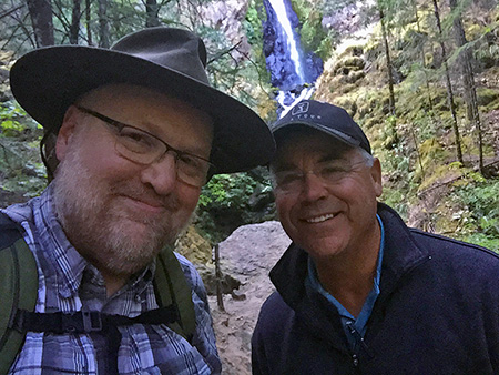
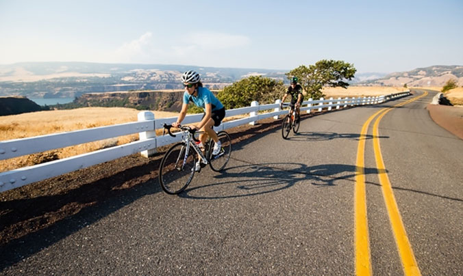
The year is 2035, and a family of tourists is just arriving at a local bed and breakfast in the village of Brightwood, Oregon, along the old Mount Hood Loop highway. They have just traveled 45 miles from Portland International Airport to Brightwood on the first of a six-day, world-class cycling tour of Mount Hood and the Columbia River Gorge.

On the first day of their tour they followed quiet country roads through the beautiful farms and picturesque pastures of the lower Sandy River Valley. Mount Hood floated on the horizon for much of their ride, hinting at the sights to come. After a night in Brightwood, the family will continue on to the village of Rhododendron, where the newly completed Historic Mount Hood Loop (HMHL) State Trail begins a spectacular tour of some of Oregon’s finest scenery.

Description: Macintosh HD:Users:Tom:Desktop:20xxxx Mount Hood Loop Part 1:HoodLoopPartOne02LittleZigzagBridge1937.jpg
Selling huckleberries at the just-opened Little Zigzag Bridge on the loop highway in the 1920s

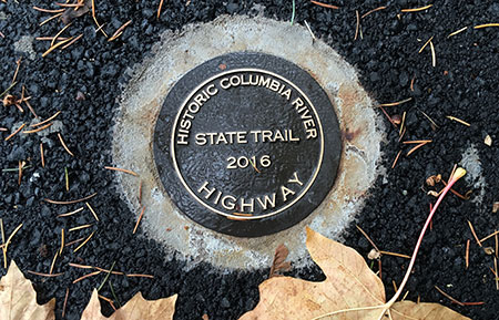
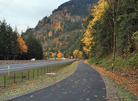
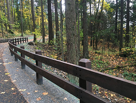
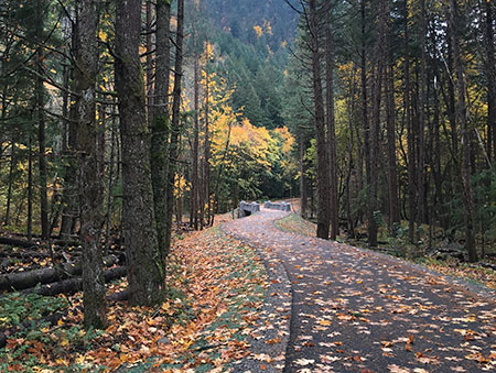
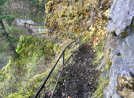
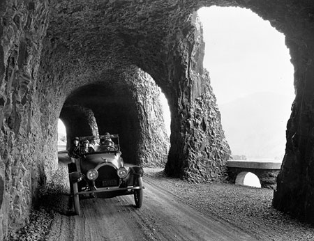
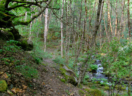
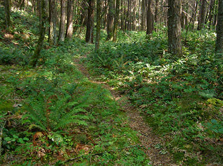
Inspired by the recently completed Historic Columbia River Highway (HCRH) State Trail, this new trail follows once forgotten or abandoned segments of the historic Mount Hood Loop highway, with new connecting segments completing the route through mossy rainforests, alpine meadows and along mountain streams. Most of the new trail is far from the traffic, noise and hazards of the modern highway corridor, taking visitors back in time and pace of what it was like to experience the original loop highway more than a century ago.

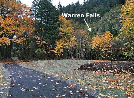
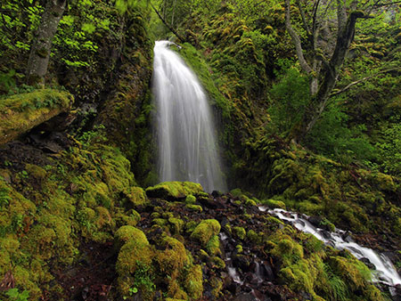
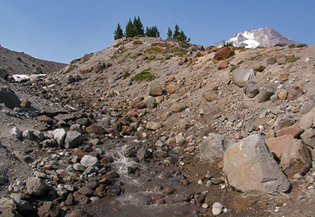
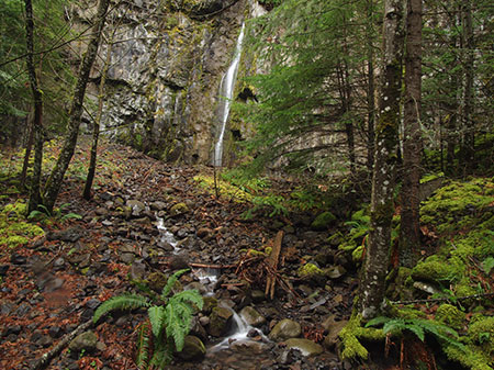
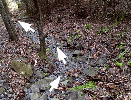
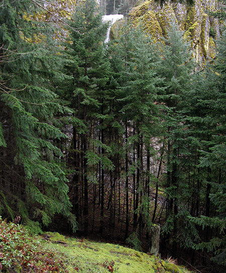
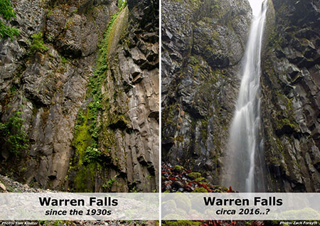
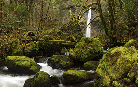
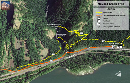
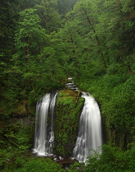
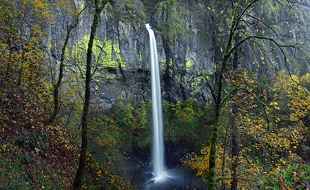
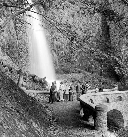
A few miles up the new route, at the Little Zigzag River, the family parks their bikes for a short hike to a shady waterfall. Next, they will climb Laurel Hill along restored sections of the original highway, where route passes the nearly 200-year old ruts from covered wagons on the Oregon Trail that can still be seen. Their next stop is in Government Camp for lunch, with a visit to the Mount Hood Cultural Center and Museum.

Description: Macintosh HD:Users:Tom:Desktop:20xxxx Mount Hood Loop Part 1:HoodLoopPartOne03LittleZigzagBend1920s.jpg
Mount Hood Loop Highway construction in the early 1920s at the Little Zigzag Bridge

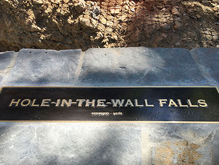
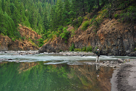
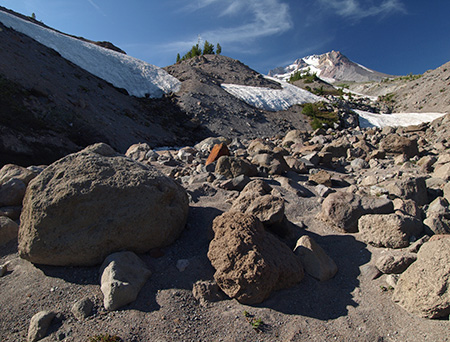
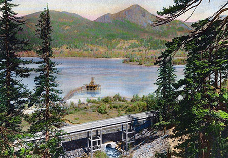
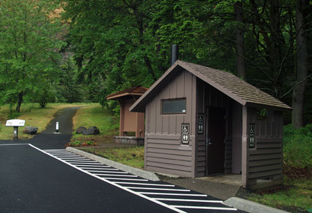
From Government Camp, their tour descends past Summit Meadows to iconic Trillium Lake, then heads east to the White River and Hood River Meadows. At Sherwood Campground they reach the east end of the new HMHL State Trail, and park their bicycles for the night. Here, they will stay in one of the well-stocked Forest Service yurts that overlook the East Fork Hood River. After a light dinner, the family hikes the easy trail to nearby Tamanawas Falls to cap a specular day on the mountain.

On their third day, the family begins a scenic descent along the Mount Hood Loop into the orchards of the Hood River Valley, stopping in the village of Parkdale for lunch and at roadside fruit stands along the way. They arrive in the town of Hood River by late afternoon, with plenty of time to explore the town’s galleries, shops and restaurants before checking in to the historic Hood River Hotel for the third night of their tour. 

The once (and future!) tunnel with windows at Mitchell Point

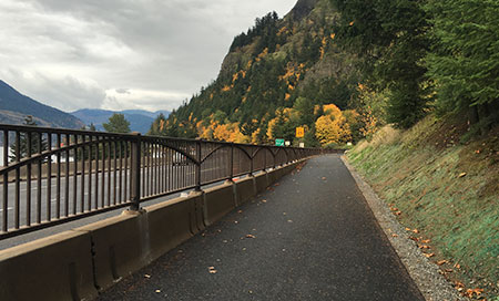
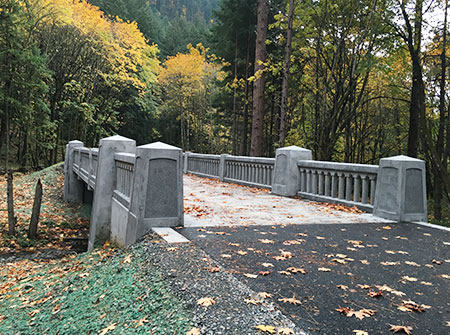
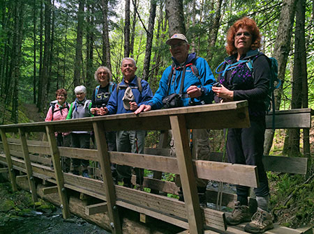
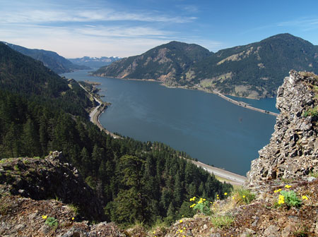
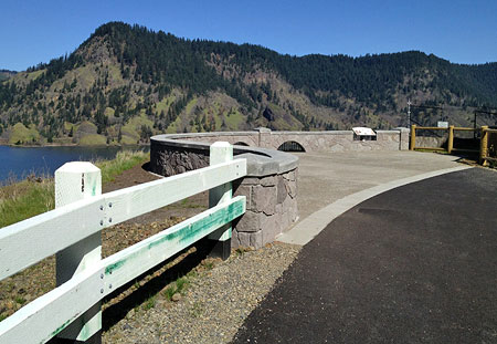
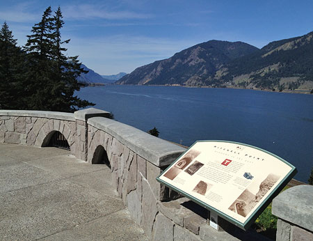
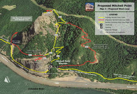
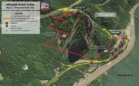
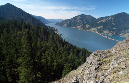
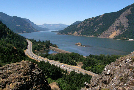
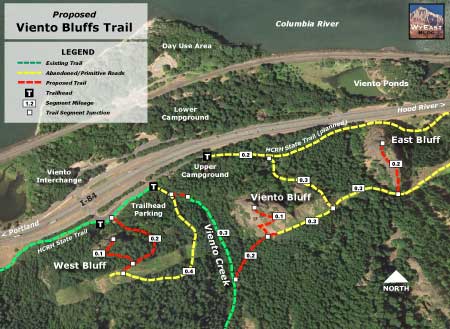
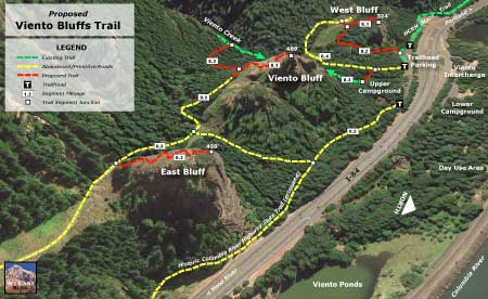
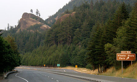
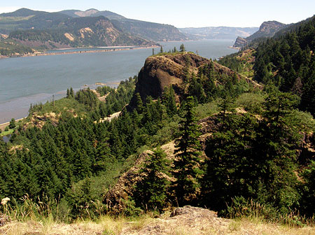
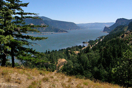
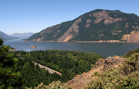
From Hood River, the family spends their fourth day on the spectacular, world-famous HCRH State Trail, traveling west through the newly restored Mitchell Point Tunnel and a stop at the short, new viewpoint hike to Viento Bluffs. A bicycle-friendly hotel in Cascade Locks serves as their base for a longer, late afternoon hike along the scenic Pacific Crest Trail.

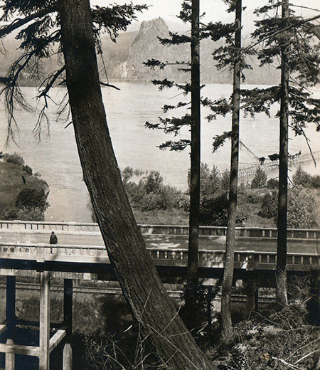
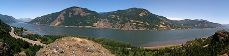
On the fifth day of their circuit, the family continues their tour on the HCRH State Trail from Cascade Locks to the west trailhead at Ainsworth State Park, where they follow the Historic Columbia River Highway west to Multnomah Falls for lunch and another short hike to the iconic Benson Bridge. Finally, they make the climb past Crown Point and then down to their final night at a Troutdale bed and breakfast, located along the Sandy River. 

From Troutdale, the family will return to PDX and a flight home after their memorable six-day, 155-mile journey along the old Mount Hood Loop — no car required!

________________

In this two-part article, we’ll explore some long-forgotten sections of the old Mount Hood Loop highway, and the potential for bringing them back to life in the same way that abandoned sections of the old Columbia River Highway have been reclaimed. But does restoring the historic Mount Hood Loop Highway as a state trail make sense?

Yes, if you consider that bicycle tourism contributes $83 billion annually to U.S. economy, according to a 2017 study by the Outdoor Industry Association. Or that bicycle tourism in Oregon brings more than $400 million to our state economy, according to a 2012 study by Travel Oregon. And studies also show that touring cyclists tend to be older, wealthier and spend more when they travel, making them a coveted market in tourism.

Bicycle touring on Grand Canyon’s car-free South Rim (NPS)

Most importantly, these tourists don’t speed home after a day on the mountain to spend their money back in Portland. Instead, they invest in the local tourism economy along their multi-day tours, supporting the local lodging, restaurants, guides, museums and galleries that rely on tourist dollars to survive.

This article opened with a story about a future family traveling the 155-mile Mount Hood Loop over six days, but more ambitious riders could easily complete the loop in two or three days. Visitors with more time could easily spend a week or more exploring side trails and the towns along the loop, including a visit to historic Timberline Lodge.

Description: Macintosh HD:Users:Tom:Desktop:20xxxx Mount Hood Loop Part 1:HoodLoopPartOne09TouringMap.jpg
Bicycle touring options from bold to leisurely would be possible on the restored Mount Hood Loop.

The nearly completed HCRH State Trail has also shown that local cyclists and walkers use the route in day-segments, taking advantage of the many trailheads along the way to explore the trail in sections. Some of these day-use visitors are also looking for bike-and-hike adventures on foot trails that connect to the HCRH State Trail. A new HMHL State Trail could offer the same bike-and-hike opportunities, as well as winter skiing and snowshoeing.

The National Park Service is leading the way among our federal land agencies in both promoting bicycle tourism and in managing new forms of cycling — notably, e-bikes (electric bikes), which are now permitted in several parks where motorized travel is otherwise prohibited. Why permit e-bikes? Partly because of the explosive growth in e-bikes, but also because e-bikes allow more people to experience cycling. They have zero emissions and are nearly as quiet as non-electric bikes, so they are just as compatible in natural settings as conventional bikes. Because e-bikes are opening the sport of cycling to a much wider audience, they have only added to the demand for safe, scenic places to ride, and help make the case to go big in how we plan for trails in Oregon.

Description: Macintosh HD:Users:Tom:Desktop:20xxxx Mount Hood Loop Part 1:HoodLoopPartOne09HCRH.jpg
Touring on the Historic Columbia River Highway near Rowena Crest (Travel Oregon)

While Oregon has been at the forefront of promoting bicycle tourism, other states with the kind of scenery that draws national and international tourism are catching on, too. Montana now sees a half-million touring cyclists visit their state each year, and other states like Colorado and Vermont are also seeing the benefits of bicycle tourism to their small towns and rural economies.

Building on our Success in the Gorge

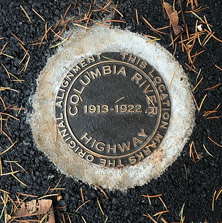
In 1986, a decades-long effort to restore abandoned sections of the Historic Columbia River Highway as a recreation trail began with this simple passage in the legislation that created the Columbia River National Scenic Area:

16 U.S.C. 544j Section 12. Old Columbia River Highway: The Oregon Department of Transportation shall, in consultation with the Secretary and the Commission, the State of Oregon and the counties and cities in which the Old Columbia River Highway is located, prepare a program and undertake efforts to preserve and restore the continuity and historic integrity of the remaining segments of the Old Columbia River Highway for public use as a Historic Road, including recreation trails to connect intact and usable segments.

This revolutionary provision recognized both the intrinsic value of preserving and celebrating the historic highway and the exponential growth in demand for recreation opportunities in our growing region. Both principles still apply today as the original vision for creating the HCRH State Trail nears completion. 

Description: Macintosh HD:Users:Tom:Desktop:20xxxx Mount Hood Loop Part 1:HoodLoopPartOne04HCRH2018.jpg
ODOT has gradually rebuilt a new trail in the style of Samuel Lancaster’s original design where modern freeway construction destroyed the historic Columbia River Scenic Highway.

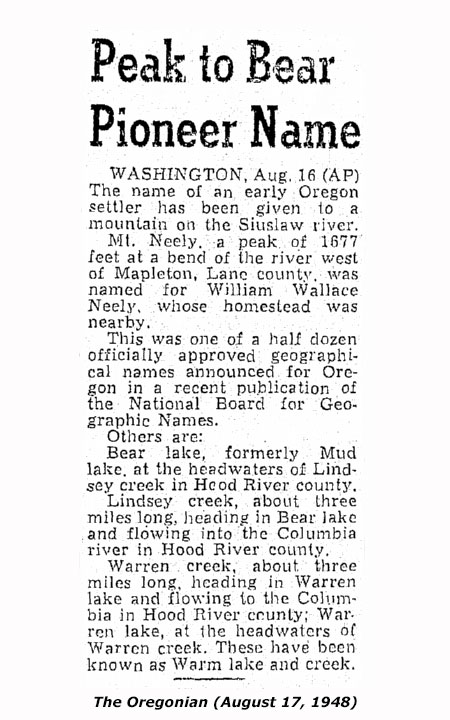
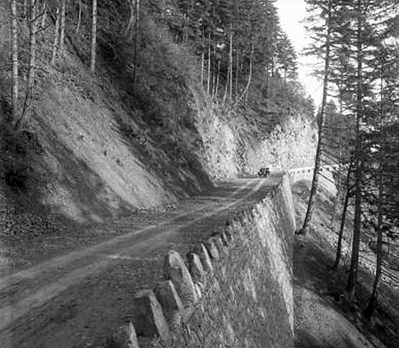
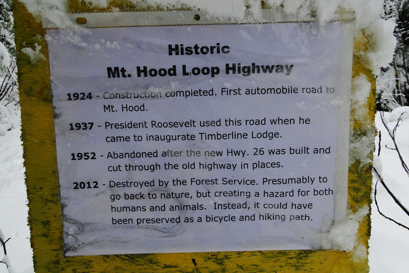
With our proven success in saving and restoring the old highway in the Gorge, it’s the right time to look ahead toward a new vision of completing the larger Mount Hood Loop, as it once existed. Like the Columbia River Highway, the surviving historic highway segments on Mount Hood are at serious risk of being lost forever. Neither ODOT nor the Forest Service have any plans to “preserve and restore the continuity and historic integrity” of this remaining piece of the old Mount Hood Loop.

The Vision: Restoring the Mount Hood Loop Experience

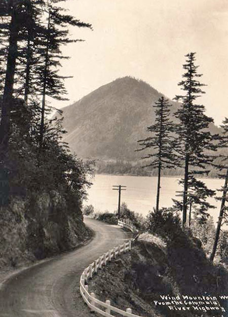
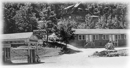
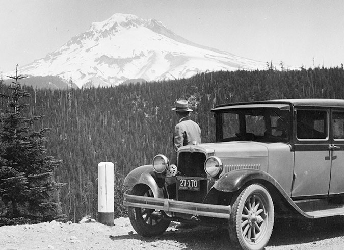
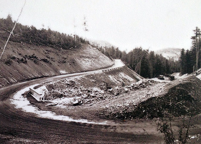
Much of the original Mount Hood Loop Highway was abandoned or bypassed in the late 1950s, when the modern, “straightened” route we know today was constructed. 

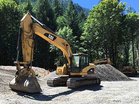
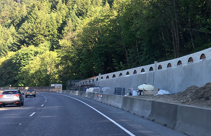
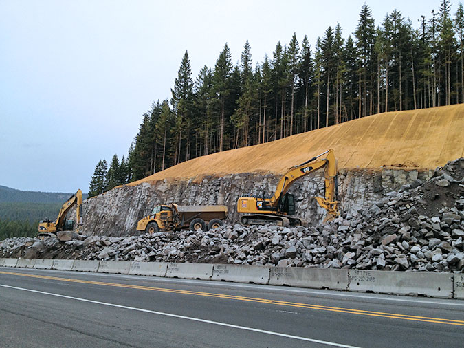
Over the decades much of the “modern” road was incrementally widened from the original two lanes in the 1960s to four lanes in over the past two decades making it much more of a “freeway” than a “scenic highway”. Most recently, ODOT spent tens of millions to make our “scenic” highway even wider at Laurel Hill, near Government Camp, in order to add lanes and a freeway-style concrete median. 

Description: Macintosh HD:Users:Tom:Desktop:20xxxx Mount Hood Loop Part 1:HoodLoopPartOne05MirrorLakeWidening2014.jpg
No shortage of funding, here… ODOT just spent $37 million blasting away more of Laurel Hill in order to widen Highway 26 and add a freeway-style concrete median.

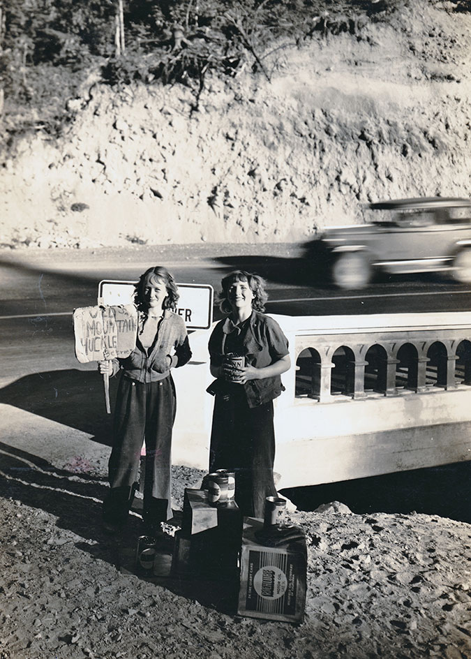
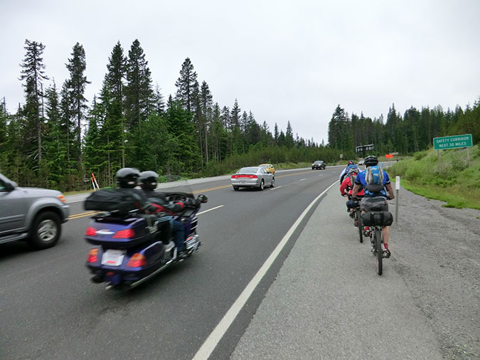
Today, drivers brave enough to pull off at the few pullouts that remain on US 26 are overwhelmed by the noise of speeding traffic and trucks. Few cyclists even consider making this scary trip, which means fewer touring cyclists to support the mountain economy.

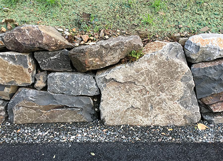
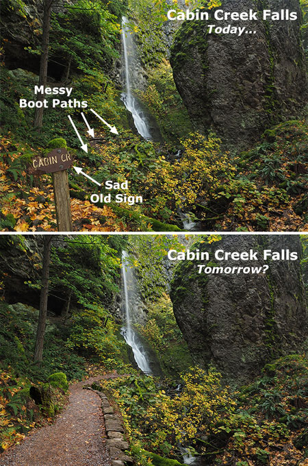
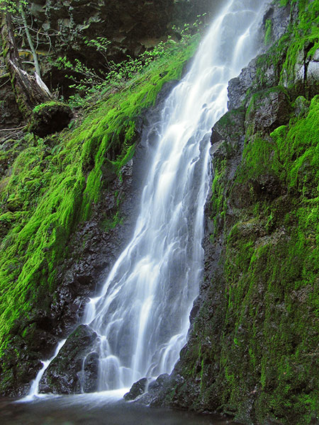
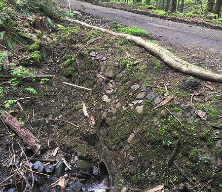
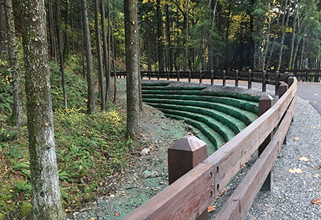
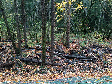
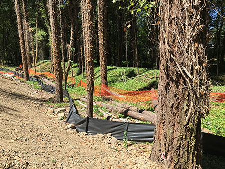
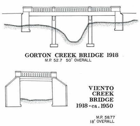
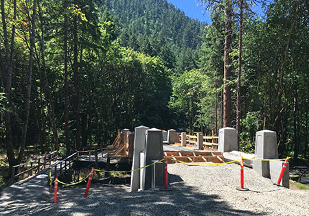
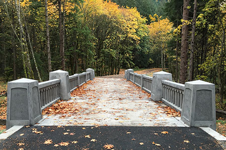
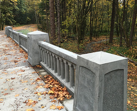
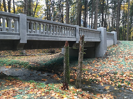
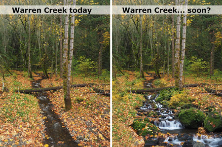
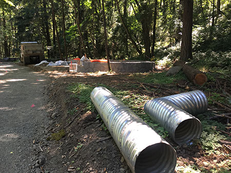
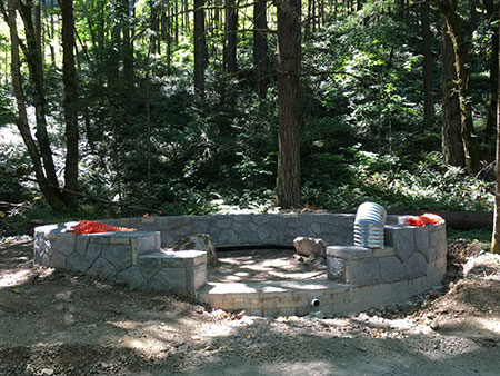
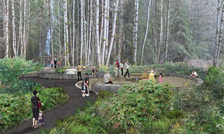
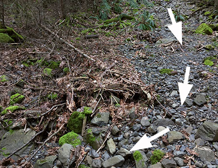
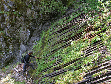
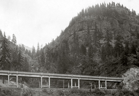
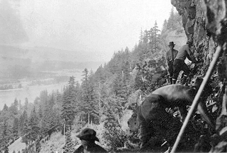
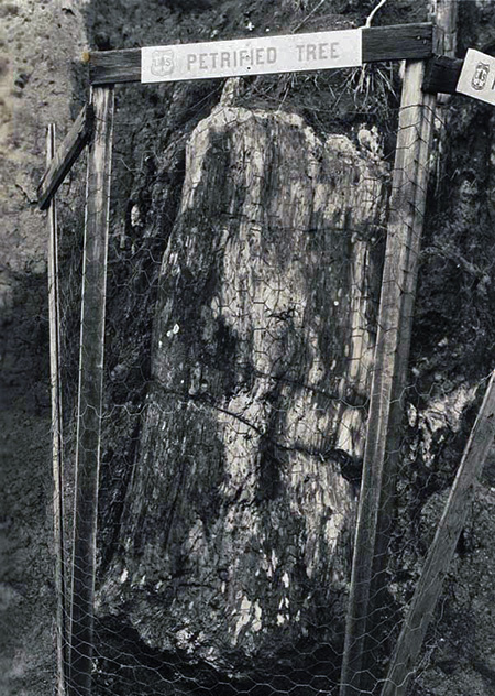
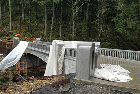
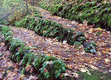
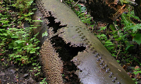
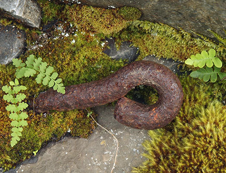
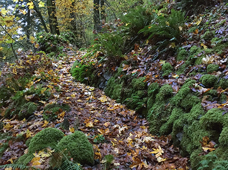
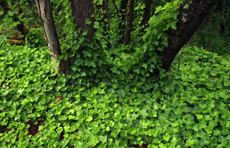
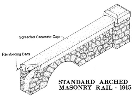
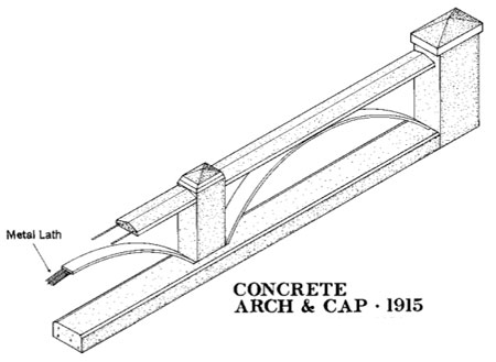
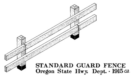
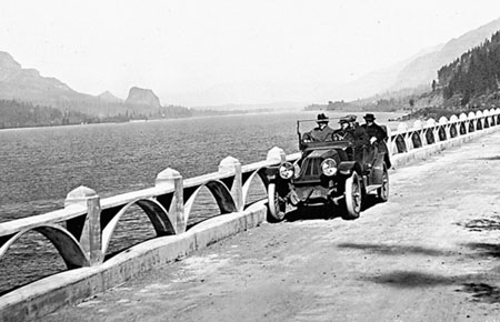
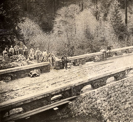
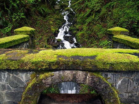
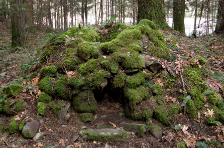
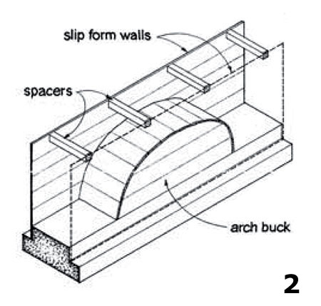
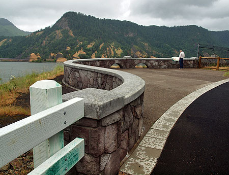
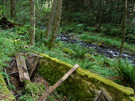
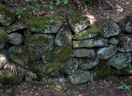
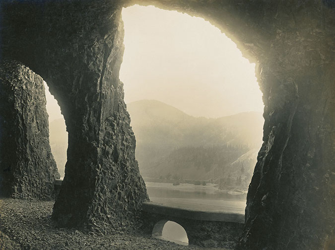
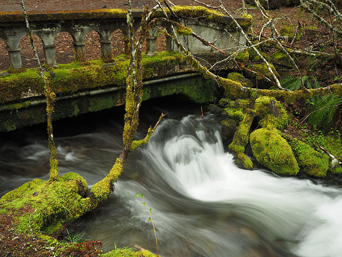
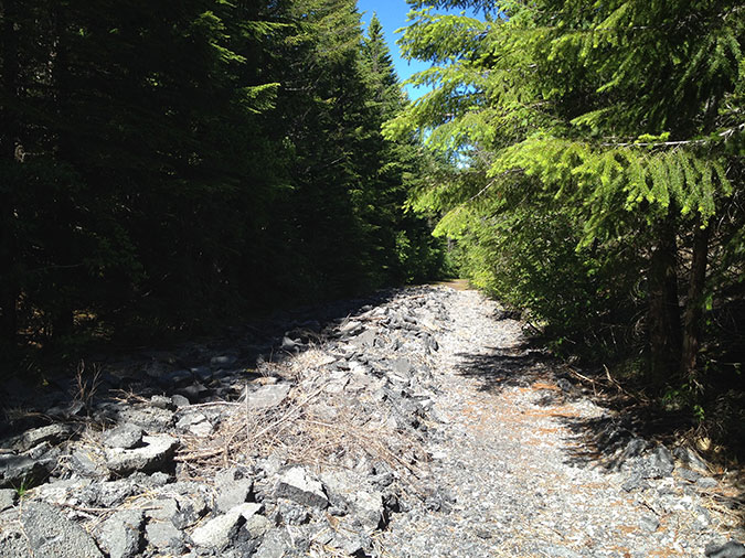
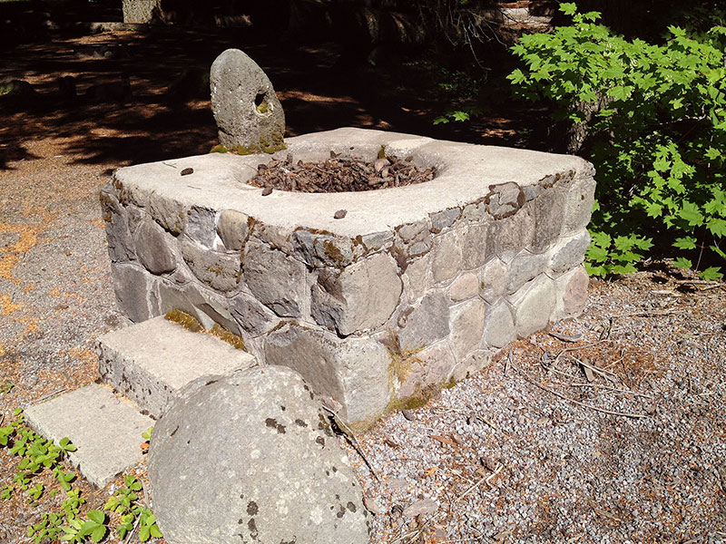
The good news? Half-hidden under 60 years of moss and ferns, a series of historic bridges, stone fountains and other historic features still survive from the original loop highway, with spectacular roadside scenery that can’t be matched by the modern road. These historic features are mostly neglected, if not outright abandoned, and are waiting for a new vision to bring them back to life.

Description: Macintosh HD:Users:Tom:Desktop:20xxxx Mount Hood Loop Part 1:HoodLoopPartOne03LittleZigzagBridge.jpg
The old Little Zigzag Bridge survives under a century of moss. The huckleberry pickers pictured in the second photo in this article were standing just to the left of this view.

The template for saving these historic remnants and repurposing them to become part of a new recreation route would have seemed farfetched thirty years ago. Today, our newly restored HCRH State Trail not only serves as a perfect model for how to fund, design and build such a facility, it also reminds us that the Gorge trail is part of the larger vision, with the two trails connecting to trace the entire Mount Hood Loop of the 1920s.

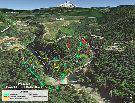
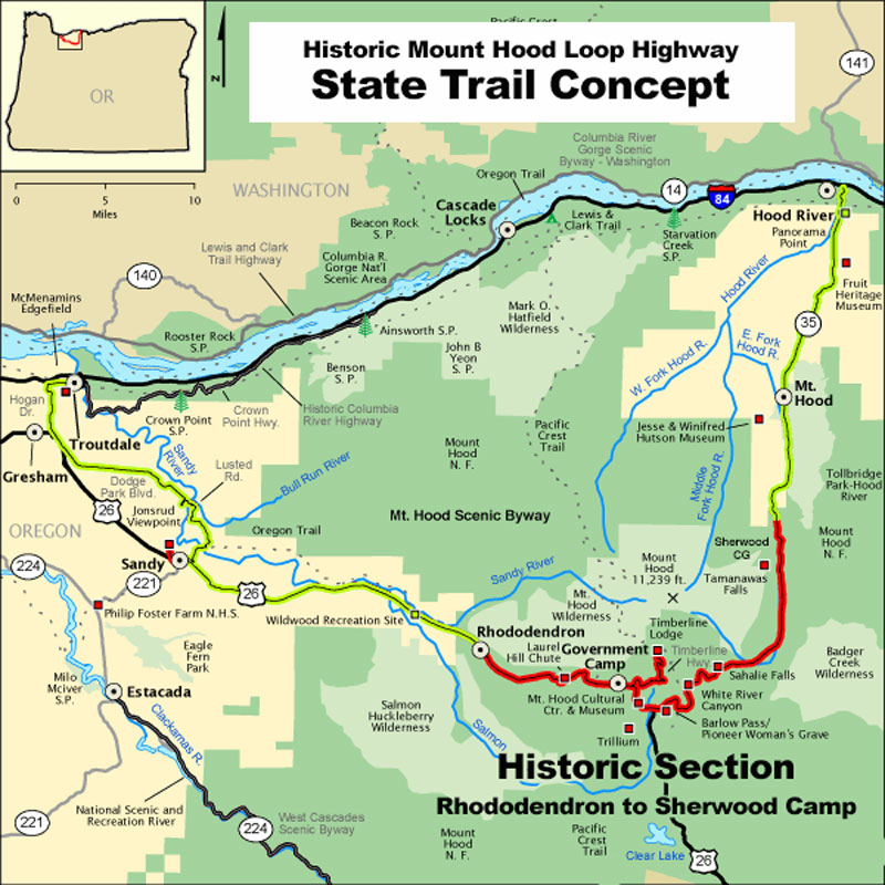
Three Trail Sections

It turns out the entire route of the proposed HMHL State Trail falls along the Mount Hood National Scenic Byway corridor, a special highway designation extending from Troutdale to Hood River.

Description: Macintosh HD:Users:Tom:Desktop:19xxxx Mount Hood Loop Trail:ScenicByways.jpg

This is very good news as a starting point for restoring and reconnecting the old highway as part of the Mount Hood Loop. From a bureaucracy perspective, it means the route is already designated in a way that allows ODOT to spend money in the corridor on projects that make it safer and more scenic for visitors using any mode of travel. But if you read the scenic byway description, it’s pretty clear that bicycles are an afterthought. It doesn’t have to be that way.

For the purpose of this proposal, the Mount Hood National Scenic Byway route is the foundation for the trail concept that would restore and reconnect surviving historic sections of the original highway. Like the Historic Columbia River Highway corridor, the idea is to restore bypassed sections of the original highway to reconnect the other, surviving sections as a continuous route. 

This combination of existing and restored routes is organized into three sections that generally follow the existing Mount Hood National Scenic Byway corridor, beginning in Troutdale. The west and east sections are shared roads that mostly need better signage, while the middle, historic section would be a mix of shared roads and paved trails that follow restored highway segments connected by new trail segments. 

Here’s a description of each of the three segments of the Mount Hood National Scenic Byway, reimagined:

West Section – Troutdale to Rhododendron: The west leg of the route would follow much of the existing scenic byway from Troutdale to Sandy, traveling through the sprawling nurseries and berry fields of East Multnomah County. The current scenic byway route joins heavily traveled US 26 in Sandy, following the highway all the way to Mount Hood. It’s a noisy and dangerous route for anyone, but especially cyclists. Therefore, instead of joining US 26 there, the reimagined route would head in a different direction.

Description: Macintosh HD:Users:Tom:Desktop:20xxxx Mount Hood Loop Part 1:HoodLoopPartOne05MarriedWithBikes01.jpg
The terrifying ride along Mount Hood 26 makes this section of the Mount Hood Scenic Byway anything but scenic for cyclists (photo: Married with Bikes blog)

From Sandy, the new Mount Hood National Scenic Byway route would turn east to follow historic Marmot Road and Barlow Trail Road to the mountain community of Zigzag. From there, a short section of old highway along the Faubion Loop and a very short, protected bike path along US 26 would complete the connection to the Rhododendron community. 

Description: Macintosh HD:Users:Tom:Desktop:19xxxx Mount Hood Loop Trail:OR_MountHoodScenicBywayWestSection.jpg
Loop Highway State Trail Concept: West Section

This quiet, safer and more scenic alternative route is shown in dashed red on the above map. Along the way, visitors would travel through picturesque farmland with Mount Hood views and the forest communities of Marmot, Brightwood, Zigzag and Rhododendron. Several riverside parks and the Sandy Ridge mountain bike park are also located along this part of the route.

Design elements along this 37-mile segment would build on existing scenic byway guidelines, with improved way-finding and interpretive signs that would help cyclists and drivers more easily follow the loop and locate lodging and other services.

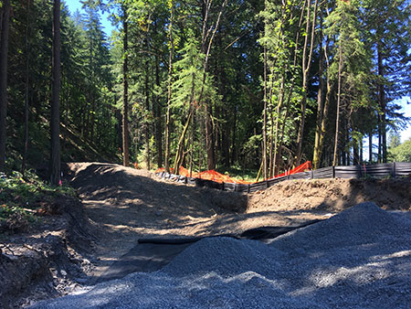
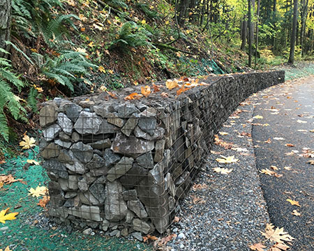
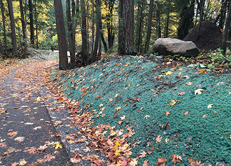
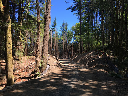
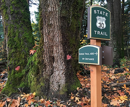
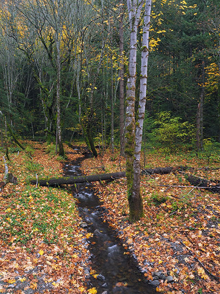
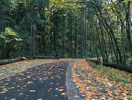
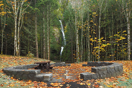
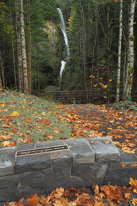
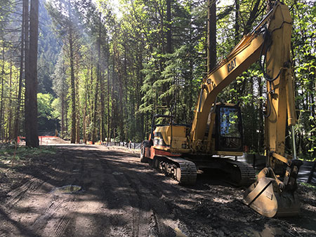
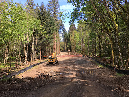
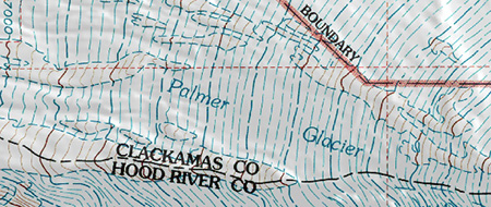
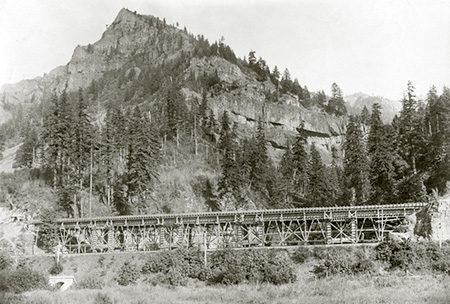
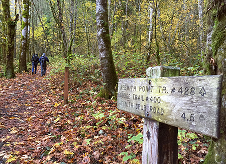
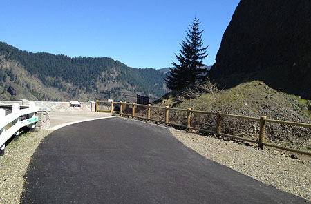
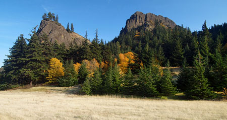
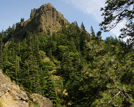
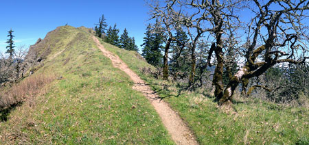
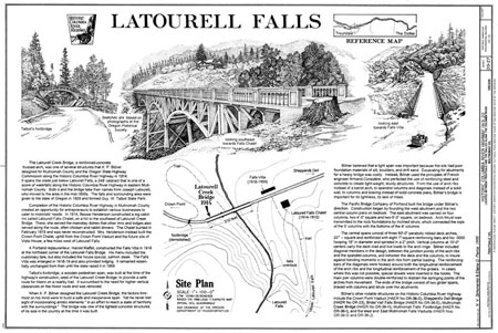
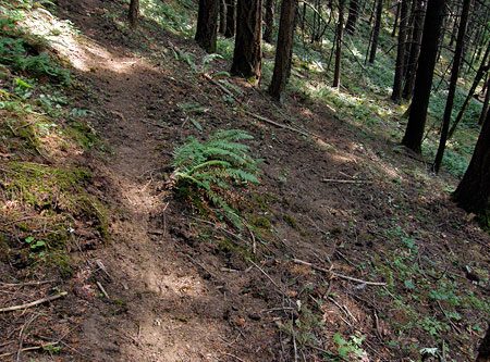
Historic Highway Section – Rhododendron to Sherwood Camp:This section is the main focus of the proposed Historic Mount Hood Loop State Trail and extends from Rhododendron to Sherwood Campground.This section includes several miles of bypassed and abandoned highway that have the potential to become a spectacular, world-class cycling experience. Today, many of these historic features are at risk, with no plans by ODOT or the Forest Service to protect them.

Description: Macintosh HD:Users:Tom:Desktop:20xxxx Mount Hood Loop Part 1:HoodLoopPartOne10Decommission2012.jpg
The Forest Service destroyed the original paved surface a half-mile section of the historic loop highway in 2012 for no particular reason. Fortunately, the roadbed was left intact.
Description: Macintosh HD:Users:Tom:Desktop:20xxxx Mount Hood Loop Part 1:HoodLoopPartOne11DecommissionGuy Meacham.JPG
Fans of the surviving sections of the old highway are out there! This sign was posted where the Forest Service destroyed the historic highway surface in the previous photo (Photo: Guy Meacham)

From Rhododendron, the section of the Mount Hood Loop route would follow a series of connecting multi-use trails that would combine with still-operating segments and long-abandoned secxtions of the old highway for the next 28 miles, traversing some of the most scenic places along the Mount Hood loop, all the while avoiding busy US 26.

Description: Macintosh HD:Users:Tom:Desktop:20xxxx Mount Hood Loop Part 1:HoodLoopPartOne12BywayHistoricSection.jpg
Loop Highway State Trail Concept: Historic Section

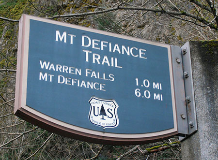
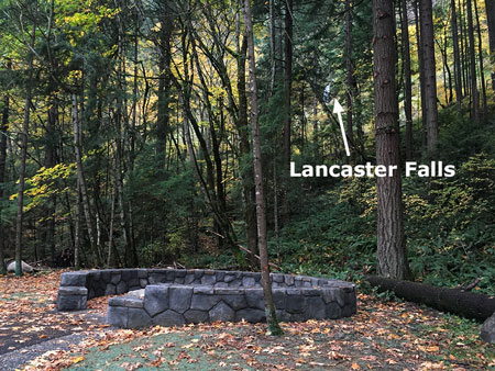
Along the way, the proposed route would pass several historic bridges, campgrounds, historic Government Camp and traces of the original Barlow Road that formed the final stretch of the Oregon Trail. There are many possible side trips along this historic section of the proposed loop, including the historic Timberline Lodge and several trailheads with bike-and-hike opportunities.

East Section – Sherwood Camp to Hood River: From the Sherwood Campground, the remaining 27 miles of the restoredMount Hood Loop would follow OR 35, a much less busy, two-lane highway with room for a shoulder bikeway. This section of the loop route would follow the same alignment as the Mount Hood National Scenic Byway, traversing some of Oregon’s most beautiful landscapes in the orchards and forests of the Hood River Valley.

Description: Macintosh HD:Users:Tom:Desktop:20xxxx Mount Hood Loop Part 1:HoodLoopPartOne13BywayEastSection.jpg
Loop Highway State Trail Concept: East Section

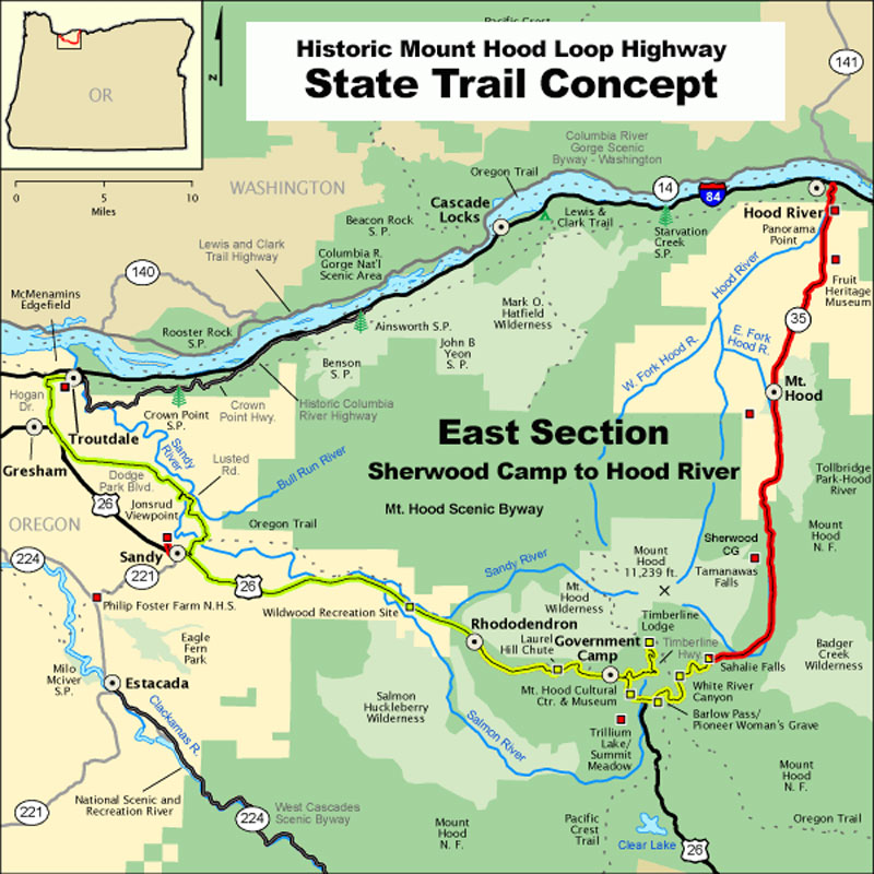
The east section ends at the town of Hood River, which lies at the mid-point of the HCRH State Trail. The 51-mile return route to Troutdale begins here, and traverses the exceptional scenery of the western Columbia River Gorge, including Multnomah Falls and Crown Point.

Through some miracle, this original fountain that once graced the old highway survives nearly a century later at Sherwood Camp, just a few feet from the modern highway. This is just one of many historic traces of the old route that have survived and call out for a new vision to protect and restore them.

There is no shortage of scenery along the Mount Hood Loop, but many visitors who come today are surprised and disappointed by the lack of pullouts, interpretive signs and heavy highway and winter ski resort traffic that makes it all but impossible to enjoy the modern highway. 

Can we reimagine the Mount Hood National Scenic Byway to provide a better alternative to the rush of the modern highways by restoring the surviving segments of the historic highway? Our experience in the Gorge says yes, and the old Mount Hood Loop could join the Gorge as a world-class touring destination. But what would it take to get there?

________________

Next up in Part 2: how we get there, including a virtual tour the surviving sections of the historic Mount Hood Loop Highway and the opportunities for restoring this exceptionally scenic old road as a state trail.

Warren Falls: A Postscript (Part 2 of 2)

hcrh_review01a

The first part of this article focused on the missed opportunity to restore Warren Falls as part of construction of the most recent phase of the Historic Columbia River Highway (HCRH) State Trail. This article takes a look at this newly completed section of trail.

_________________

hcrh_review01b

Congressman Peter DeFazio at the grand opening of the new HCRH segment in October (ODOT)

In October, the Oregon Department of Transportation (ODOT) opened the latest section of the HCRH State Trail, a segment stretching from the trailhead at the Starvation Creek wayside west to Lindsey Creek. A portion of this newest section follows the original highway grade where it passes Cabin Creek Falls, but most of the route is a completely new trail – or more accurately, a paved multi-purpose path open to both hikers and cyclists.


hcrh_review01c

The newly revamped Starvation Creek Trailhead

The new HCRH trail segment begins in a small plaza constructed at the south edge of the Starvation Creek wayside. Early plans called for a complete reconstruction of the parking area, but budget constraints intervened, and most of the work here is along the margins of the existing parking lot. The trailhead plaza features some to-be-installed interpretive signs in the shade of a group of bigleaf maple trees, a pleasant meeting spot for hikers or cyclists.

Missing from the revamped trailhead is the original Forest Service trailhead sign that once pointed to Warren Falls (below). It’s unclear if this sign will be reinstalled, but given that Warren Falls, itself, was not “reinstalled” as part of this project, the chances are probably slim.

hcrh_review01d

This sign has gone missing!

The sign actually referred to what is now called Hole-in-the-Wall Falls, where Warren Creek emerges from the diversion tunnel built by ODOT in 1939. The unintended reference to the original falls made for an inspiring Forest Service gaffe for advocates of restoring Warren Falls!

The first few yards of the new trail generally follows the existing route along the Starvation Creek wayside freeway exit ramp. It’s still a noisy, harsh walk through this area, but ODOT has dressed up this section with a sturdy cobble wall and new paving.

hcrh_review01e

Cobble retaining wall near Starvation Creek

The trail concrete barricades along this section that protect the trail from freeway traffic also feature the same decorative steel fencing found elsewhere on the HCRH State Trail, giving a bit more sense of separation from speeding vehicles. The new trail is also slightly elevated here, reducing the noise impacts somewhat from the old trail that was mostly at the ramp grade.

hcrh_review01f

Decorative steel fencing near Starvation Creek

Soon, the new trail drops to the only original section of Columbia River Highway on this restored section of trail, where the old road passed in front of Cabin Creek Falls. An elegant but confusing signpost has been added at the junction with the Starvation Ridge Cutoff trail, pointing to Gorge Trail 400, which currently does not exist in this section of the Gorge.

I didn’t hear back from ODOT as to whether a trail renumbering is in the works that would extend the Gorge Trail to Starvation Creek, but it may be that the Forest Service is planning to stitch together a extension of the Gorge Trail from pieces of the Starvation Ridge and Defiance Trails. That would be a welcome development!

hcrh_review02a

Trail 400..? Is a trail re-numbering in the works?

The location of the new sign almost suggests that the infamous Starvation Cutoff trail – one of the steepest in the Gorge – would be renumbered as the Starvation Ridge trail, with the bypassed section of the current Starvation Ridge trail becoming Trail 400.

Confused..? So are many hikers who visit the area with its already confusing trail network. So, keep your fingers crossed that the Forest Service is rethinking trail numbers and signage in conjunction with the new HCRH trail.

For now, the actual Starvation Cutoff Trail has not changed, though HCRH workers added a nice set of steps at the start of this very steep route.

hcrh_review02b

New steps at the otherwise humble Starvation Cutoff trailhead

The old pavement in this original highway section was resurfaced with new asphalt as part of the project, but otherwise the route here is much as it was when the highway opened in 1916, including a roadside view of Cabin Creek Falls. However, ODOT missed an opportunity to organize the hordes of visitors who now scramble to the falls along a cobweb of boot paths.

Formalizing a single spur with a properly constructed trail (below) would be a great project for a non-profit like [link]Trailkeepers of Oregon (TKO)[/link] in conjunction with Oregon Parks and Recreation (OPRD), who now manage the trail and adjacent park lands.

hcrh_review02c

Cabin Creek could use a formal path to the falls… and a new sign

[click here for a large version]

Cabin Creek Falls is popular with families (where kids can safely play in the basalt-rimmed splash pool) and photographers (who love this delicate, mossy falls). For many casual visitors, this is already the turn-around point on their walk from the trailhead, with Cabin Creek being the highlight of their experience, so a spur trail would be a nice addition to allow visitors to get off the pavement and explore a soft trail.

hcrh_review02d

Cabin Creek Falls up close

ODOT also cleaned out the large, stone culvert (below) where Cabin Creek flows under the HCRH State Trail. This display of original dry masonry was mostly buried in debris and undergrowth until the trail project was constructed, so the restoration provides a nice look at the craftsmanship of the original highway.

hcrh_review02e

Original dry masonry culvert survives at Cabin Creek

As the new trail route reaches the west end of the original highway section, ODOT thoughtfully place a small memorial (below) in the paving – a nice historic reference to the original highway.

hcrh_review03a

HCRH plaque marks the original highway route near Cabin Creek Falls

As the new route leaves the beautiful, forested section of original highway at Cabin Creek, it suddenly follows the freeway for about 200 yards due to steep slopes along the Gorge wall. This jarringly noisy section could use some replanting to at least create a visual buffer from freeway traffic.

hcrh_review03b

Noisy, barren stretch of the new trail west of Cabin Creek

Soon, the new HCRH route thankfully curves back into the forest on a surprisingly massive structured fill. This structure was required to maintain the modest trail grade as the route climbs from the freeway shoulder to a slight rise near Warren Creek.

This section is bordered with stained wood guardrails, a new design that departs from the vintage-style white guardrails in other sections of the restored highway, but provides a nice aesthetic that will also be easier to maintain.

hcrh_review03c

This large, structured fill west of Cabin Creek was required to maintain the trail grade for bicycles

This following view shows the same spot in July, at the height of construction, and before the fill was completed:

hcrh_review03d

Structured fill near Cabin Creek during construction last July

ODOT was careful to document cultural resources along the route when designing the new trail, including a set of stone ovens built by the original highway masons who camped here during highway construction in the early 1900s. The historic ovens are better protected than before by the raised trail design and guardrails (below), though still fully visible for those who know what they’re looking for.

hcrh_review03e

The historic stone ovens can be seen from the elevated trail section west of Cabin Creek… if you know where to look

One disappointing detail along this section of trail is a long gabion basket wall (below), apparently constructed to catch loose debris from an adjacent slope. The steel cages holding this wall together will hopefully be covered in moss and ferns in time, but for now it’s an eyesore on an otherwise handsome section of the trail.

hcrh_review03f

Would Sam Lancaster have approved of a wire mesh gabion wall..?

Another sore thumb in this forest section is a rusty mesh fence (below) along the freeway right-of-way that should have at least been painted, if not completely replaced as part of the project. Maybe ODOT still has plans to replace this eyesore?

hcrh_review03g

Nope, Sam Lancaster wouldn’t go for this…

As the new section of the HCRH State Trail approaches Warren Creek, it enters a significant cut section to maintain its gentle grade. Thankfully, a huge anthill along this section was spared, one of the interesting curiosities along the former soft trail that used to pass through this forest.

hcrh_review03h

Hydro-seeded cut slope and the big anthill near Warren Creek

This following view is from July, when construction was still underway and the ant colony was no doubt thankful for the protective fence:

hcrh_review03i

The giant anthill lives!

The view below was taken during the construction looks east at the cut section along the new trail. Because the rustic forest trail that once passed through this area was completely destroyed by the new HCRH trail, the reconfigured landscape will be a shock for hikers who hiked the trail in the past. Though hydro-seeded with grass, this section could benefit from some re-vegetation efforts to further speed up healing.

hcrh_review03j

The cut grade near Warren Creek under construction in July

Beyond the cut section, the new route crosses the original channel of Warren Creek, and for those with a sharp eye, a pair of cobble foundations for early homesteads that once lined the creek. Here, the trail reaches a half-circle bench where an all-access side trail curves up to the viewpoint of Hole-in-the-Wall Falls (more on that later in this article).

hcrh_review04a

Half-circle bench serves as the jump-off point to the Hole-in-the-Wall viewpoint

It’s unclear if interpretive signs will be added to this area, but at one time the story of how Warren Creek was diverted in 1939 was planned for the spot where the new trail crosses the old, dry creek bed.

Another new trail sign is also located at the all-access spur trail to Hole-in-the-Wall Falls, as this is also the route to the Starvation Ridge and Defiance Trails. This sign also includes a mysterious reference to Gorge Trail 400, further suggesting that a re-numbering of trails in the area is in the works. A large, multi-trunked bigleaf maple was also spared at this junction.

hcrh_review04b

Bigleaf maple spared… and another mystery reference to Trail 400..?

The following view is looking from the new HCRH State Trail toward the Hole-in-the-Wall spur trail, showing the proximity to Warren Falls. The green hydro-seeded area in the photo is where the construction staging area for the project, underscoring the missed opportunity to restore Warren Falls as part of the project – it was just a few yards beyond the staging area.

hcrh_review04c

So very close: Warren Falls from the main construction staging area

hcrh_review04d

Staging area during construction in July – the last time we’ll see heavy equipment this close to Warren Falls for generations?

The humble elderberry (below) in the middle of the staging area was spared by ODOT, a nice consideration in a project that did impact a lot of trees. Hopefully, there are plans to expand native plantings here, as this area was covered with invasive Himalayan blackberries for decades before the trail project and will surely revert to invasive species without a deliberate restoration effort.

hcrh_review04e

This apparently well-connected elderberry dodged the ODOT bulldozers!

Moving west, the new HCRH State Trail segment passes through another forested section where the trail rises on fill necessary to bring it to grade with a handsome new bridge over Warren Creek (visible in the distance in the view, below). This is an especially attractive section of trail.

hcrh_review05a

Looking west along the attractive new trail section approaching the Warren Creek Bridge

For some reason, many of the trees that were cut for this new section of trail were left piled along the base of the fill (below). The fill slope has been hydro-seeded, so it seems unlikely that the more work is planned to remove or repurpose the log piles, so apparently the were left in this manner on purpose?

hcrh_review05b

Piled logs along the elevated grade approaching Warren Creek Bridge

Looking back to the construction period last summer, you can also see the good work ODOT did to cut back English ivy that was rampant in this area. While ivy was left intact on the forest floor, it was cleared from dozens of trees in this section of the trail.

hcrh_review05c

Invasive English ivy was trimmed from dozens of trees near Warren Creek

The highlight of the new HCRH trail segment is where the route crosses Warren Creek. Here, a handsome new bridge faithfully echoes the design ethic of Samuel Lancaster, but is probably more elaborate than the original bridge constructed at Warren Creek in 1916. Lancaster’s bridge was destroyed when the first version of the modern highway was built in 1950.

hcrh_review05d

The handsome new Warren Creek Bridge is the jewel of the new trail segment

Though no visual record exists, the original Warren Creek Bridge was modest in length, at just 18 feet, and likely resembled the surviving bridge at Gorton Creek to the west, or possibly the original bridge at Viento Creek to the east (shown below).

hcrh_review05e

The original Warren Creek Bridge probably followed one of these designs

The design of the original Warren Creek Bridge inadvertently helped lead the Highway Department to bypass Warren Falls, as stream debris was clogging the bridge opening. The 1941 project files also describe the original bridge being “replaced in a different location” as part of the diversion project, so there may have been two version of the original bridge over Warren Creek before the modern highway was constructed in the 1950s.

hcrh_review05f

Warren Creek Bridge under construction in July

hcrh_review05g

Pavement texture samplers being tested for the project

hcrh_review05h

Looking west across the new Warren Creek Bridge

hcrh_review05i

Railing detail and the view downstream from Warren Creek Bridge

Construction of the new HCRH bridge over Warren Creek was an involved undertaking, with the surprisingly wide span leaving plenty of room for a (someday) restored Warren Falls to move 70+ years of accumulated rock and woody debris down the stream channel.

hcrh_review05j

Built to last, with plenty of room for Warren Creek to once again move rock and log debris down its channel… someday…

There’s nothing natural about Warren Creek in this area, as it looks (and is) more like a drainage ditch. This is because original streambed is now a dry ravine several hundred yards to the east, and the current streambed is where the Highway Department moved the creek decades ago, when the modern highway was first built in the 1950s.

hcrh_review05k

Ditch-like, man-made channel of Warren Creek as viewed from the new bridge

As described in the first part of this article, the someday restoration of Warren Falls will once again allow rocks and woody debris to migrate into the lower channel, eventually transforming the “ditch” into a healthy stream (below) that can fully support endangered salmon and steelhead.

hcrh_review05l

What a healthy Warren Creek might look like from the bridge, someday…

[click here for a larger version]

While ODOT missed the larger opportunity to help this stream restoration along when it declined to restore Warren Falls, the agency also missed the easy opportunity to simply add a few boulders and logs to the section of Warren Creek near the bridge when heavy equipment was in the area. That’s too bad, but perhaps the OPRD will someday enhance this stream section as part of managing the new trail.

hcrh_review06a

Looking west from near the Warren Creek Bridge to the Lancaster Falls viewpoint

From Warren Creek, the new trail follows another fill section to a mostly obstructed viewpoint of Lancaster Falls on Wonder Creek from a small seating area. This viewpoint (below) could use some light pruning to reveal the falls, and perhaps something that’s still in the works by OPRD.

hcrh_review06b

Lancaster Falls viewpoint

One oddity about Wonder Creek is that it mostly disappears into ground before reaching the culvert that carries Warren Creek under I-84 and to the Columbia River. This is partly due to the modest flow from spring-fed Wonder Creek, but also because the slopes below the falls are mostly composed of unconsolidated talus covered with a thin layer of soil and vegetation. So, most of the time the stream is simply absorbed into the water table below the falls.

Yet, in high runoff periods, the new state trail will accommodate the flow with extensive drainage features designed to carry Wonder Creek under the fill section and to the Warren Creek freeway culvert.

hcrh_review06c

Trail construction near the Lancaster Falls viewpoint in July

hcrh_review06d

Lancaster Falls viewpoint under construction in July

Another oddity of Lancaster Falls is its illusive nature. Though thousands of hikers each year view the modest, 20-foot lower tier of the falls where it spills across the Defiance Trail, few know of it’s full extent – and perhaps wonder why Samuel Lancaster wasn’t honored with a more spectacular landmark.

This is the view (below) of Lancaster Falls that most hikers see today, and this this is also the portion of the falls that can be glimpsed through the trees from the new HCRH trail viewpoint:

hcrh_review06e

Lancaster Falls as most know it, along the Defiance Trail

But viewed from across the Columbia River, along Washington’s Highway 14, Lancaster Falls takes on a completely different scale. This view shows the lower 20-foot tier that most know as “Lancaster Falls” completely dwarfed by the towering 300-foot extent of the falls:

hcrh_review06f

The full extent of Lancaster Falls as viewed from the Washington side of the Columbia

While it’s possible to scramble to the base of the main tier of Lancaster Falls, the slopes are unstable and already being impacted by off-trail visitors, so it’s probably best that only a most portion of the falls is (somewhat) visible from the new HCRH route. Hopefully, interpretive signage is in the works for the viewpoint that tells the story of Samuel Lancaster..?

hcrh_review06g

1920s view of the HCRH from Lindsey Creek looking toward Wind Mountain

From the Lancaster Falls viewpoint, the new trail heads west to a section where it once again follows the shoulder of I-84 to Lindsey Creek and the end of new construction. ODOT is working the next trail segment, which will connect from Lindsey Creek to the Wyeth Campground, crossing the base of famously unstable Shellrock Mountain along the way.

Hole-in-the-Wall Falls Spur Trail

hcrh_review07a

Original concept for the Hole-in-the-Wall Falls viewpoint

One of the design highlights of the new HCRH trail section is a short all-access spur tail to an overlook of Hole-in-the-Wall Falls, the man-made outflow tunnel that continues to drain Warren Falls of its water. The completed overlook has been scaled back from its original design (shown above), and now features one of the signature circular seating areas, complete with a picnic table (below).

hcrh_review07b

Hole-in-the-Wall Falls viewpoint

A small plaque at the viewpoint identifies Hole-in-the-Wall Falls, which until now has not been an officially recognized name or has appeared on any official maps. A nice nod to the origin if the “falls” is the byline “Created 1939”. Hopefully, there will be future interpretive displays here, as the story of Warren Falls would be a great addition to this overlook.

hcrh_review07c

Hole-in-the-Wall Falls viewpoint

hcrh_review07d

Hole-in-the-Wall Falls plaque

hcrh_review07e

Hole-in-the-Wall Falls viewpoint under construction in July

The Starvation Ridge Trail picks up from the south side of the Hole-in-the-Wall Falls overlook, heading across a footbridge over Warren Creek.

A closer look near the footbridge (below) reveals a surprising disappointment: the stump of a streamside Douglas fir cut improve the view of the falls. It’s too bad that the tree wasn’t simply limbed to provide a view, as it was one of the few larger trees stabilizing the banks of Warren Creek.

hcrh_review07f

Hole-in-the-Wall Falls bridge… and stump?

hcrh_review07g

Unfortunate remains of the offending Douglas fir along Warren Creek

While it’s disappointing to think about the opportunities missed at Warren Falls, the Hole-in-the-Wall Falls overlook and beautiful new Warren Creek Bridge, are still a big a step in the right direction toward someday moving Warren Creek from neglected afterthought to a valued resource that deserves to be restored. ODOT deserves major kudos for their thoughtful work on this section of trail!

“Love what they’ve done with the place…”

hcrh_review08a

Heavy construction of the new “trail” in July looked more like a road to many hikers

Last summer I encountered another hiker while surveying the progress of the new HCRH trail in the Warren Creek area. He was making his way to the Defiance Trail, and when he saw me taking photos, shouted angrily “Love what they’ve done with the place!”

I’ve heard this reaction to the State Trail from many hikers over the years, as avid hikers are often aghast at what they see as more of a “road” than trail. The scope of construction impacts on the natural landscape of the Columbia River Gorge National Scenic Area (CRGNSA) and the millions in public funds being spent on the project rankles hikers who don’t see themselves actually using the trail.

Many hikers are also mystified as to how this project can received tens of million in funding while other, heavily overused Gorge trails are falling apart for lack of adequate funding.

hcrh_review08b

Extensive cut and fill necessary to maintain trail grade meant a wide construction swath

These reactions are understandable, if misguided. The restoration of the surviving HCRH and the future trail segments that will soon complete the original route from Troutdale to The Dalles is an epic effort of ambition and vision in an era when both are rare quantities.

When the route is completed, it will become a world-class cycling attraction, and it is already drawing visitors from around the world. Guided bicycle tours have become a thriving business in the Gorge because of ODOT’s commitment to bringing the HCRH State Trail vision to reality, and businesses in Gorge towns are already seeing the benefits.

Other projects to promote the trail are also in the works. ODOT’s Gorge Hubs project is a new partnership with six cities in the Gorge to provide traveler information for trail users and boost the local economy. The Friends of the Gorge have launched the Gorge Towns to Trails project, a complementary effort to the HCRH State Trail to connect Gorge communities to public lands via trails.

hcrh_review08c

Tourism in the Gorge is as old as the historic highway, itself. This is the Lindsey Creek Inn that once stood where the newly completed HCRH State Trail approaches Lindsey Creek

Plenty of local visitors will continue to use the HCRH State Trail as the project nears completion over the next few years, but the real benefit for Gorge communities is from visitors coming from outside the region. Unlike local visitors, tourists coming from elsewhere will book hotel rooms, purchase meals and take home locally-made products and art from the Gorge to memorialize their trip. These visitors make a much larger contribution to the Gorge economy than a local visitor who might stop by a brewpub on the way back from a day trip.

hcrh_review08d

Gorge sunset from near Starvation Creek along the newly completed HCRH State Trail

A 2011 National Park Service study of tourism dollars shows outside visitors spending anywhere from 7 to 12 times the amount that local visitors spend on a visit to a given park, bringing hundreds of millions to local economies at many parks. There’s no reason why the Gorge can’t better manage the our already heavy demand from local visitors to the Gorge to allow for more outside visitors drawn by the HCRH State Trail to spend their dollars here.

The bigger picture is that anyone opposed to seeing casinos or bottled water plants in the Gorge should be part of supporting a tourism economy that builds on the scenery. Yes, tourism impacts must be managed to protect the Gorge for future generations, but the health of the Gorge economy is the essential ingredient to providing these protections over the long term.

The HCRH State Trail is part of that formula, and it deserves enthusiastic support from anyone who loves the Gorge. If you own a bicycle (or pair of walking shoes), give it a try — and then recommend it as an exciting new vacation destination to distant friends and family!

Cool news in the summer heat!

Hood River Confluence at Punchbowl Park (photo by Peter Marbach)

Hood River Confluence at Punchbowl Park (photo by Peter Marbach)

In my last post, I alluded to some pending good news on the WyEast beat, and in this article I’ll share a trio of pleasantly cool developments for our otherwise scorching summer:

Punchbowl Park Project

Starting off with the big news, the folks behind the Punchbowl Park project learned in late June that they had been awarded a State of Oregon grant of $470,000. These funds will make it possible for Hood River County to acquire the 103-acre Punchbowl Park site in partnership with the Western Rivers Conservancy.

Kayakers at the Hood River Confluence at Punchbowl Park (photo by Peter Marbach)

Kayakers at the Hood River Confluence at Punchbowl Park (photo by Peter Marbach)

This is a huge step forward for this citizen-led movement, a major grass-roots effort guided by Heather Staten of the Hood River Valley Residents Committee (HRVRC). Now that the future of the site is secure, Heather and her organization will be working with the county to begin building a recreational trail network through the new park for the public to enjoy.

Map of proposed trail network at Punchbowl Park

Map of proposed trail network at Punchbowl Park

[click here for a larger map]

Much more work lies ahead for Punchbowl Park, and I’ll continue to post updates here on new developments and opportunities to get involved in the trail building over the coming years. Kudos to Heather and those who pitched in for the tireless work that made this happen. Bringing this area into public ownership is a once-in-a-lifetime opportunity, and one that will pay off for many generations to come!

You can already explore Punchbowl Park in its undeveloped state now by following the maze of user trails that already exist there. You will likely notice signs of recent logging — part of an operation to remove diseased trees from the forest in hopes of limiting their spread. The long-term plan for the new park is to let nature take over, and allow the forest to recover to a more natural state after a century of timber harvesting.

Restore Warren Falls

Warren Creek canyon (and falls) from across the Columbia

Warren Creek canyon (and falls) from across the Columbia

For a second bit of cool news, we move west to Warren Falls. In mid-July, I sent a “Hail Mary” plea to local legislators in the Hood River area asking for their (divine?) intervention to somehow prod the Oregon Department of Transportation (ODOT) into decommissioning the Warren Creek diversion tunnel and restoring Warren Falls. I’ve posted several articles on this proposal (as well as this Oregon Field Guide story) in hopes of doing this needed restoration work when the state will have heavy equipment in the area as part of the next phase of the Historic Columbia River Highway (HCRH) State Trail, which will soon cross Warren Creek.

My plea for help was answered promptly and with enthusiasm by State Senator Chuck Thomsen of Hood River. Senator Thomsen agreed to me at the Starvation Creek Wayside early one morning last week for an inspection of the Warren Falls site and a briefing on my proposal to restore the falls. After our tour, he offered to write a letter to both ODOT and the Governor’s office asking them to put Warren Falls on their to-do list. Boom!

The author with Senator Chuck Thomsen at Warren Creek

The author with Senator Chuck Thomsen at Warren Creek

More to come, but simply contacting a legislator has already triggered a call from an ODOT surrogate, essentially asking me to cease and desist in my efforts. I assured them that I had no desire to delay the larger state trail project, but still believe the agency should (and can) do right by undoing their illegal diversion of Warren Creek — and restoring Warren Falls in the process.

I’m convinced that if ODOT channeled the spirit of Samuel Lancaster when he designed the historic highway a century ago, they would easily discover both the will and funding needed to make this happen. And if they do, Sam Lancaster will surely approve — wherever he might be!

If you’re interested in more detail, here’s a (large) PDF of my Hail Mary! letter to Senator Thomsen.

Palmer Glacier gets a Reprieve

Like tractors on a corn field, snowcats plow (and salt) the Palmer Glacier for summer skiers

Like tractors on a corn field, snowcats plow (and salt) the Palmer Glacier for summer skiers

Five years ago, I posted this article challenging the Timberline Ski Resort on their practice of “conditioning” the Palmer Glacier with the equivalent of 500 tons (picture 500 pickup loads) of salt on the glacier each summer.

To defend the practice, the resort points to water quality testing downstream showing only “reasonably elevated levels” of salt in the tributaries that feed into the Salmon River, as if there is something reasonable about purposely pouring salt into one of our premier rivers. The Salmon River is not only treasured for its epic waterfalls and rugged gorge, it’s also a wild and scenic river and among the few salmon and steelhead streams in the Oregon Cascades with no downstream dams to block fish migration. There’s a lot at stake, here.

The source of the Salmon River at the terminus of the Palmer Glacier

The source of the Salmon River at the terminus of the Palmer Glacier

The Forest Service, meanwhile, is also of the “well, let’s see what happens” mindset, and officially permits the Timberline resort to keep dumping tons of salt on Mount Hood most fragile glacier. And yes, it’s still a glacier in name, though you may have noticed that the official media term coming from both the Timberline Resort and the Forest Service is the dismissive “Palmer Snowfield”. I can only guess the thinking behind this, but it’s hard to imagine it not being an attempt to downplay the impacts of salting the glacier.

Yup, still the Palmer Glacier…

Yup, still the Palmer Glacier…

Meanwhile, the Palmer Glacier continues to shrink, along with the rest of our Cascade glaciers in this period of global climate change. The Timberline Resort actually posted a letter to President Obama on their website proclaiming their “strong support for policies to address climate change”, all the while purposely accelerating the melting of their bread-and-butter glacier. Given the contradiction, it’s fairly easy to differentiate the empty rhetoric from the short-term profit motives.

How salty is this runoff from the Palmer Glacier? Enough for the Timberline Resort to be on the defensive, apparently.

How salty is this runoff from the Palmer Glacier? Enough for the Timberline Resort to be on the defensive, apparently.

Ski areas don’t just bring invisible pollution to the Salmon River -- here, a broken boundary pole and ski trash litter the Salmon River headwaters.

Ski areas don’t just bring invisible pollution to the Salmon River — here, a broken boundary pole and ski trash litter the Salmon River headwaters.

The greatest tragedy is that we own the land and the glacier, not the resort. They’re simply leasing the space. So, after the glacier is gone, we’ll own the polluted alpine slopes left behind by the salting practice — as the effects of salt pollution are long-term in nature, and of little concern for ski resort balance sheets or Forest Service concession permits.

So, where’s the cool news in this story? Just that the Timberline resort is closing down the Palmer ski season this weekend — a full month before their advertised “June through Labor Day” summer season concludes.

The Palmer Glacier won't miss those snowcats, skiers or tons of salt this August!

The Palmer Glacier won’t miss those snowcats, skiers or tons of salt this August!

This bit of good news for the Palmer Glacier and Salmon River is real: it translates into hundreds of tons of salt that won’t be spread on the glacier over the month of August this year, and that in turn equals less salt in the river and fragile alpine slopes in a dangerously low water year. It might even mean less melting of the glacier than might happen otherwise.

So, it’s cool news of a sort… and might just help keep the Palmer Glacier around just a bit longer.

An Overdue Warren Falls Update (…and a bombshell!)

Warren Falls lives! Well, occasionally… during the wettest winter storms

Warren Falls lives! Well, occasionally… during the wettest winter storms

Time is running out on the Restore Warren Falls! project. This summer the next phase of the Historic Columbia River Highway (HCRH) State Trail project will begin construction of a segment that will pass right in front of the falls.

The new trail construction in the area is not simply an ideal opportunity to finally undo what the Oregon Department of Transportation (ODOT) did to this magnificent waterfall 76 years ago — it’s probably the only opportunity in our lifetimes.

In that spirit, I thought an update on the project and Warren Falls was in order — plus share a bit of a bombshell that was sent to me recently!

Checking in on Warren Falls

First, a quick visit to Warren Creek: in mid-April I made a couple visits to Warren Falls as part of my twice-annual Friends of the Gorge hikes. As has become the norm in recent years, the natural falls clearly flowed again this winter during heavy runoff that overwhelmed the diversion weir at the top of the falls.

The flood path from the briefly reborn falls cleared leaf debris as shown by the arrows in this photo…

The flood path from the briefly reborn falls cleared leaf debris as shown by the arrows in this photo…

…and in this photo, where the overflow stream continued down the ancient creekbed

…and in this photo, where the overflow stream continued down the ancient creekbed

These regular overflows make more sense when you look at the condition of the weir — the following photos from the top of the falls show just how clogged the giant “trash rack” has become, and also how badly the upper lip of the rack has been exposed as the concrete diversion dam continues to erode:

Over its 76-year life the enormous weir has become twisted and clogged with debris, causing more overflows each year

Over its 76-year life the enormous weir has become twisted and clogged with debris, causing more overflows each year

The steel beams that make up the weir are also coming loose from their foundation as the concrete diversion dam deteriorates with time

The steel beams that make up the weir are also coming loose from their foundation as the concrete diversion dam deteriorates with time

The Friends of the Gorge hikers always marvel at the strange, unsettling scene of a dry waterfall. Like most who visit Warren Falls, many are also saddened by the idea that the ODOT could have been so cavalier in altering such a beautiful scene at Warren Creek so grotesquely.

While the original decision to divert the falls can arguably be blamed on the thinking of the era (late 1930s), I would submit that allowing this tragic mistake to continue to exist is equally cavalier and dismissive of the natural landscape at Warren Creek. Thus, my campaign to attach the burden of undoing the mess at Warren Falls to ODOT — and in particular, their looming state trail construction project that will soon begin in the area.

Gorge Friends hike at Warren Creek in April

Gorge Friends hike at Warren Creek in April

While researching Warren Falls over the winter, I finally found a definitive story on the official naming of the creek. The name “Warren” comes from Warren “Barney” Cooper, and early forest ranger in the Mount Hood area (and part of the Cooper family described in this previous article).

This Oregonian article documents (in the last paragraph) when Warren Cooper’s name finally became the official name of the creek in 1948, though it had been in unofficial use for years:

WarrenFallsUpdate07

So, we now learn that Warren Lake and creek were once called “Warm Lake” and “Warm Creek”. Warren Lake is situated on a high, rocky shoulder of Mount Defiance, and shallow enough to be “warm” in late summer, so that could be the simplest explanation for this early name.

The name “Warren” appears on maps and early documents from well before this 1948 decision, so the timing of the article is interesting, especially so long after Warren Cooper’s death in 1920. Was the naming in 1948 simply cartographic housekeeping or an overdue recognition of a pioneering forest ranger by those who followed him?

As always, every answer brings a few new questions!

Friends of Warren Falls… are everywhere!

Since the Oregon Field Guide story on the Restore Warren Falls! project first aired the fall of 2012 (watch the documentary here), several anonymous “friends” of Warren Falls have quietly contacted me with offers to help.

OFG's Vince Patton and Michael Bendixen looking for the illusive Warren Falls in the winter of 2012

OFG’s Vince Patton and Michael Bendixen looking for the illusive Warren Falls in the winter of 2012

Most surprising among the proposals were offers to simply “monkey-wrench” the weir at the top of the falls to speed up its demise! While I’m sympathetic to both the frustration and impatience behind the monkey-wrenchers out there, I’m also concerned that tinkering with the weir might actually be illegal (though it’s hard to see how a decaying structure that no public agency will claim responsibility for could somehow also become the basis for legal action..?)

More importantly, I’m concerned that formally removing the weir and associated debris will become increasingly difficult if the structure is further compromised. I’ve therefore thanked the monkey-wrenchers for their passion, but encouraged them to be patient and allow the slow wheels of government to turn a bit further..!

…and the bombshell…

Another piece of information that trickled in from an anonymous attorney and friend of Warren Falls is found in plain sight: in the Oregon Revised Statutes. Specifically, ORS 538.200, which exists solely to prohibit the diversion of “streams forming waterfalls near the Columbia River Highway” for “any purpose whatsoever”.

While quite clear in its intent, this might seem like a very general reference. But the statute (which was signed into law in the early 1900s, before the Warren Falls diversion) goes on to list each of the streams and waterfalls that fall under this protection — including Warren Creek, in ORS 538.200(26)!

An unusual view of Warren Creek topping its weir and overflowing into its natural falls (visible behind the trees)

An unusual view of Warren Creek topping its weir and overflowing into its natural falls (visible behind the trees)

What does this new information mean? For starters, it means that ODOT — at the time, called the Oregon Highway Division — broke the law in 1939 when it blasted a diversion tunnel and erected a dam and weir to pipe Warren Creek away from its natural falls and streambed. That is quite clear.

What is unknown is whether the ODOT decision to defy the law in the late 1930s was brazen in its intent. As hard as that possibility is to believe, it is also very hard to believe the agency wouldn’t have known about the law, given that it had been enacted just a few years prior the Warren Falls diversion project being concocted in the early 1930s — and was specifically aimed at the state’s premier highway of the era.

What does it mean today? In my view, it means that ODOT now has BOTH a legal and ethical responsibility to undo what it has done to Warren Falls. That couldn’t be more clear.

The End Game?

For the past four years I’ve been beating the drum to connect the restoration of Warren Falls to the massive, multi-million dollar Historic Columbia River Highway state trail project, without much success. So far I have:

• been turned away by both Oregon State Parks and the U.S. Forest Service, both claiming the falls lies on the other agency’s property (though it quite clearly falls on Oregon State Parks land)

• unsuccessfully pitched the cause to three of the premier conservation groups active in the Gorge, including on-site tours, but did not persuade any of the groups to adopt the cause.

• unsuccessfully made the case twice before the Historic Columbia River Highway steering committee, with some sympathetic interest from the committee, but a deep reluctance to seriously consider the idea. It was added as an item “for consideration” — but later dropped due to cost concerns.

• successfully pitched the idea to the producers of Oregon Field Guide story, and while ODOT staff involved in that effort were sympathetic to the state of Warren Falls, the publicity created by the story did not change their recommendations to their steering committee for any further consideration of restoring the falls.

• posted a string of articles on this blog and started a Facebook group two years ago to continue to rally the cause, but these efforts haven’t made a noticeable dent at ODOT, either.

We are now in the end game, and I don’t think the Warren Falls will ever be restored if the work doesn’t happen when ODOT has heavy equipment in the area later this year. After that, it will most likely be up to Mother Nature, and that’s would be such a sad commentary to future generations when they judge the state of the world we choose to leave them.

From the beginning, I have argued that restoring the falls isn’t about money, but rather, about responsibility. ODOT created the mess that now exists at Warren Creek, and for a whole variety of safety, ethical, environmental — and now, legal — reasons that I’ve argued over the years, it’s time for the agency to own up to their responsibility.

No fooling, ODOT has $2 million annually in a “contingency” fund for exactly the kind of work that restoring Warren Falls would entail — and just allocated another half-million dollars to cover additional costs for the state trail project in the Warren Creek area.

It turns out the money has always been there, too. On April 1, ODOT quietly pulled nearly a half-million dollars in “contingency” funds into this latest phase of the state trail as a consent item before the Oregon Transportation Commission. The new money is for a previously unplanned bridge over nearby Gorton Creek, a worthy addition at the east end of the current phase of construction. Warren Falls could be restored for a fraction of that amount – if only the will and sense of agency responsibility at ODOT existed.

My next efforts will focus beyond ODOT, given my fruitless efforts to work with the agency. At the top of my list of arguments is the newly discovered fact that the agency violated state law when they built the project in 1939 — underscoring the notion that ODOT has both ethical and legal obligations to own up to restoring the falls. The agency clearly has funding available for worthy efforts like this one if the desire exists. I will be making that argument, as well.

There's still time to realize this vision… but not much.

There’s still time to realize this vision… but not much.

I’ll post a follow-ups to article with more details soon, and especially how you might be able to help get the restoration of Warren Falls unstuck from our state bureaucracy. Most of all, a big thanks to all who have offered to help — and as always, thank you reading this blog and caring about Mount Hood and the Gorge!

Rediscovering McCord Creek!

McCord Creek takes on more subtle hues in winter

McCord Creek takes on more subtle hues in winter

Beautiful McCord Creek boasts a pair of impressive waterfalls that are among the most photogenic in the Columbia River Gorge. The falls are tucked into John B. Yeon State Park, a lesser-known park located about halfway between Multnomah Falls and Cascade Locks.

The rustic CCC-era trails to McCord Creek’s waterfalls have been “discovered” in recent years from spring through fall by crowds of weekend hikers. Yet, the area is surprisingly un-crowded during the wet winter months, from late fall through early spring, and the muted winter tones are just as beautiful.

The area also has a long and fascinating human history that is on display throughout the hike, if you know where to look. This article provides a guide to both the trail and the history of the McCord Creek area.

Frank Warren's salmon cannery (site of today's Warrendale) in 1902

Frank Warren’s salmon cannery (site of today’s Warrendale) in 1902

The human history in this part of the Gorge stretches back thousands of years, as the river was home to a thriving culture of Native American peoples.

The Upper Chinookan people of the Columbia River Gorge fished the legendary autumn salmon runs and picked huckleberries and other wild fruits and forage before moving away from the river during the often harsh winters that we know so well today. An especially elaborate example of the mysterious stone pits thought to be built by native people for ceremonial purposes can still be found high above McCord Creek, on Wauneka Point.

White settlement came to the Gorge in the 1800s, and ushered in an era of profound tragedy for the native people, with epidemics of measles and other European diseases decimating native populations, and white settlement displacing native peoples from places they had inhabited for millennia. It’s an uncomfortable reality to confront today, but also important to never forget as we try to understand our history.

White settlers were equally destructive for the land and natural resources, as well. In a matter of a few decades, the Gorge slopes were almost completely logged of ancient forests and giant fish wheels built along the river were part of the commercial overfishing that nearly collapsed the salmon runs that had sustained Native Americans here for thousands of years.

Frank and Anna Warren in the early 1900s

Frank and Anna Warren in the early 1900s

Frank Warren was among the prominent industrialists operating fish wheels to supply a cannery he built at Warrendale. Today, only a residential district by that name remains to mark the site, just downstream from McCord Creek.

In the heyday of the Columbia River canneries at the turn of the 20th Century, canned salmon from the Warren packing company was exported around the world, and Columbia River canned salmon was as ubiquitous as cans of tuna are in our supermarkets today. But overfishing by gill nets, fish traps and fish wheels nearly destroyed the salmon runs. Fish wheels were finally outlawed by the 1930s, as the canning industry on the Columbia continued its decline. The last salmon cannery on the river closed in the 1970s.

1890s Harpers Weekly illustration of a Columbia River fish wheel

1890s Harpers Weekly illustration of a Columbia River fish wheel

Warren’s packing business made him a millionaire, and he and his wife Anna celebrated their 40th anniversary in style with a 3-month European tour in 1912. For their return trip, the Warrens reserved a first-class stateroom on the maiden voyage of the RMS Titanic.

Anna Warren’s riveting account of the Titanic disaster in April 1912 was featured in the Morning Oregonian twelve days after the incident, creating a local sensation. Her tragic story recounted how her husband Frank helped her onto a lifeboat, with Anna assuming he had followed her in. Instead, when she looked back, she saw Frank helping other women into the boats.

At the time Anna Warren’s account was published, Frank Warren’s fate was still unknown, but he was later identified as among the more than 1,500 who perished that night. Anna Warren was one of just 710 survivors of the disaster.

Myron Kelly's pulp mill at McCord Creek in the 1890s

Myron Kelly’s pulp mill at McCord Creek in the 1890s

At about the same time that Frank Warren was operating his Warrendale cannery in the late 1800s, another settler by the name of Myron Kelly was operating a small pulp mill near McCord Creek. Kelly’s mill used a pair of 400-foot long, riveted steel penstocks to power the pulp manufacturing. Though the mill is long gone, portions of the penstocks still survive. They are clearly visible in the 1890s view of the mill, above.

The penstocks were fed with water from McCord Creek, diverted from above the waterfalls, and routed to the penstocks along the cliff-top ledge we now use as a hiking trail. Kelly used a natural break between basalt layers to blast out the ledge, and hardware from the pipe system is still found throughout the cliff area today. Black cottonwood trees — the same we see lining the river today — provided the raw material for making pulp.

This 1890s photo shows water spouting from the long penstock that drove Myron Kelly's pulp mill

This 1890s photo shows water spouting from the long penstock that drove Myron Kelly’s pulp mill

Surviving portions of the two penstocks are prominently crossed by the trail to Upper McCord Creek Falls, along with other relics sprinkled through the forest. The large wood water cistern located near McCord Creek trailhead is not from the Kelly pulp mill era, surprisingly, and was added later to supply water to area homes.

The early industrial settlements in the Gorge relied on railroads and ships for transport, as there was no road until the early 1900s. That changed in 1916, when the new Columbia River Highway was dedicated with much fanfare. The highway is still famous, cherished by millions of visitors over the past century for its careful attention to the landscape and surrounding Gorge scenery. Perhaps most iconic are its string of graceful bridges.

Columbia River Highway bridge at McCord Creek under construction in 1915 (Wauneka Point towers above)

Columbia River Highway bridge at McCord Creek under construction in 1915 (Wauneka Point towers above)

The original highway bridge at McCord Creek was completed in 1915, and while it wasn’t as graceful as some of the more famous arched bridges, it was nonetheless a spectacular structure. Early travelers not only had a front-row view of Elowah Falls on McCord Creek, but also a sweeping vista across the Columbia to Beacon Rock and the mountains that rise along the Washington side of the Gorge.

The original McCord Creek Bridge was among the longest along the old highway at 365 feet. The old structure was durable enough to be incorporated into the first “modern” highway in the Gorge in the 1950s, when much of the original Columbia River Highway was bypassed. The original McCord Creek Bridge was simply expanded to carry the wider road, and later a twin structure was built to accommodate the development of today’s freeway. The original bridge structure was finally replaced in 1987 with a new bridge, after 70 years of service.

Completed McCord Creek bridge in 1915, with the Kelly pulp mill conduits visible in the cliffs high above, and Elowah Falls behind the bridge

Completed McCord Creek bridge in 1915, with the Kelly pulp mill conduits visible in the cliffs high above, and Elowah Falls behind the bridge

The new McCord Creek Bridge in the 1920s as it appeared from the cliffs above Elowah Falls

The new McCord Creek Bridge in the 1920s as it appeared from the cliffs above Elowah Falls

By the 1930s, the New Deal programs of Franklin D. Roosevelt’s national recovery effort brought the Civilian Conservation Corps (CCC) to the Gorge. Many of the trails we enjoy today were built — or rebuilt — by the CCC, including the McCord Creek trail.

The CCC crews were expert trail builders, and made quick work of the steep Gorge slopes with carefully graded switchbacks constructed with miles of hand-built, rustic stone retaining walls. The original trail at McCord Creek began at the east end of the old highway bridge, traversed to dramatic viewpoints of Elowah Falls, then crossed McCord Creek to climb the east shoulder of the canyon to the upper falls.

Civilian Conservation Corps crew building the catwalk section of the McCord Creek Trail in 1936 (highway bridge visible in lower left corner of photo)

Civilian Conservation Corps crew building the catwalk section of the McCord Creek Trail in 1936 (highway bridge visible in lower left corner of photo)

It was here that the CCC trail builders seized upon the route of Myron Kelly’s penstock conduit around the towering cliffs above Elowah Falls. The photo above shows crews clearing the ledge in 1936 to repurpose the route as a bold new hiking trail.

The galvanized steel handrails that now give some assurance to hikers along this airy catwalk are not mentioned in a fairly detailed 1936 Daily Oregonian story describing the new trail. These were probably added in the 1950s, when similar railings were installed in other parks around the Gorge — and it’s easy to see why this retrofit was needed as you walk along the 300-foot brink!

Beacon Rock and the McCord Creek Bridge as they appeared from the original CCC trail to Elowah Falls

Beacon Rock and the McCord Creek Bridge as they appeared from the original CCC trail to Elowah Falls

The 1936 Daily Oregonian article also mentions one of the more famous features of the area during the early days of the Columbia River Highway. The McCord Creek Bridge construction in 1915 had unearthed a large petrified tree near the east end of the bridge, embedded in the road cut. The tree became a popular feature along the old road, and also marked the start of the McCord Creek trail.

The whereabouts of the petrified tree are unknown today, as it must have been moved (or destroyed) when the modern highway was constructed in the 1950s. Curious Gorge author Scott Cook speculates that it may have found its way to Cascade Locks, where a petrified log now sits on display at the Marine Park. Petrified logs are not uncommon in this part of the Gorge, however, so the fate of this most famous log may never be known for certain.

Update: Scott Cook has located the petrified tree! It was apparently shipped to the University of Oregon Natural History Museum when the modern freeway was built, and placed next to a replica of the Willamette Meteorite. Scott tells me that ODOT historic highway staff approached museum officials a couple of years ago about moving the tree back to its original home (of a few million years), but it’s unclear if that idea gained any traction. The beautiful new McCord Creek bridge sure seems like an appropriate home for the old tree! Stay tuned – I’ll report any news on the subject as it comes.

This petrified log was located at the east end of the McCord Creek bridge, near the original trailhead

This petrified log was located at the east end of the McCord Creek bridge, near the original trailhead

The human history of the McCord Creek area has taken another dramatic turn in recent years with the construction of the Historic Columbia River Highway (HCRH) State Trail. The new bike and pedestrian route is an ambitious, decades-long effort by the State of Oregon to restore lost sections of the original highway, eventually re-connecting the entire original route from Troutdale to The Dalles.

In 2012, construction of the HCRH State Trail section from John B. Yeon State Park to Tanner Creek was in full swing, and featured a handsome new bridge over McCord Creek that rivals the original highway bridges in its design and attention to detail.

The new Historic Columbia River Highway state trail bridge at McCord Creek under construction in 2012

The new Historic Columbia River Highway state trail bridge at McCord Creek under construction in 2012

The completion of this new segment of the HCRH State Trail has opened loop high opportunities in the McCord Creek area, as well as the opportunity to bike and hike — as described below in this article.

Exploring the Trail Secrets of McCord Creek

A young family enjoying the McCord Creek Trail in late autumn

A young family enjoying the McCord Creek Trail in late autumn

Now that you know some of the history of McCord Creek, it’s time to explore the trail! This is a half-day hike for most, so makes for a great option during the short days of winter, when most higher elevation trails are snowed in. It’s also a great family hike, with lots to look at and modest grades throughout, thanks to careful design by its CCC builders.

Like most Gorge trails, the hike has cliffs, poison oak and ticks, so keep an eye on small kids, leash your dog, learn to identify and avoid poison oak and do a tick check when you get home. One of the added advantages of doing this hike during the winter months is that poison oak leaves have dropped, greatly reducing the possibility of bringing home an itchy rash from your hike! Ticks are also much less active in winter — and not particularly prevalent in this particular area — though you should always do a tick check after hiking in the Gorge.

McCord Creek Trail map

McCord Creek Trail map

[click here for a larger, printable map]

The hike starts at the John B. Yeon trailhead (driving instructions at the end of this article), and after passing the old wooden cistern mentioned above, you immediately reach the first poorly-signed junction. The trail to the right heads off to Nesmith Point, so continue straight (left) instead, past an empty signpost and traverse above the trailhead parking area.

Soon, the trail begins a very gradual climb on what is actually an old roadbed, now just a very wide and rustic path. This section of trail was opened sometime after the modern freeway was constructed in the 1950s, and the original trailhead for the McCord Creek trail relocated from its old location on the east side of the creek.

The first of several confusing signs along the trail…

The first of several confusing signs along the trail…

At about one-half mile from the trailhead, the old roadbed ends at a “T” junction with the original CCC trail and another confusing signpost. From this point in the hike, the trip has two forks, with up-and-back spurs to follow, one to each of the two waterfalls. The best way to enjoy the hike is to go right at this junction, and continue climbing toward Upper McCord Creek Falls as your first destination.

As you climb the 1.2 miles to the upper falls, watch for the beautifully constructed stone retaining walls that line much of the trail. They are now cloaked in moss and licorice fern, but have held up amazingly well since the stones were first placed almost 80 years ago by CCC workers.

Legacy of the CCC - rustic stone retaining walls like these are found throughout the hike

Legacy of the CCC – rustic stone retaining walls like these are found throughout the hike

After several switchbacks through steep forest, you will encounter the remains of the old pulp mill penstock pipes. One is located at the end of a switchback, the other crosses the main trail.

Look closely at the second pipe, and you can see the doomed efforts of some early trail crew to actually cut through the surprisingly solid pipe! Up close, you can also see the thousands of rivets used to assemble pipes of this kind in the late 1800s in a way that could withstand the intense water pressure.

Myron Kelly's sturdy penstock pipes still survive along the upper trail

Myron Kelly’s sturdy penstock pipes still survive along the upper trail

The trail passes through a couple more switchbacks beyond the penstock pipes before reaching the spectacular and exhilarating catwalk section, some 300 dizzying feet above McCord Creek. The handrail makes this section very safe, so take the time to look for traces of the old mill conduit that once carried water from McCord Creek around this ledge — there are old bolts and bits of pipe if you watch closely.

The catwalk section has reassuring railing atop the 300-foot cliffs

The catwalk section has reassuring railing atop the 300-foot cliffs

Traces of the old waterworks are still visible on the upper trail

Traces of the old waterworks are still visible on the upper trail

The views from the cliffs are also impressive. On most days, Aldrich and Table Mountains on the Washington side of the Columbia River dominate the horizon, but on clear days, the very top of Mount Adams can also be seen. Further on, the catwalk section of trail also allows a birds-eye view of Elowah Falls dropping into its huge amphitheater, far below.

Sweeping cliff-top views stretch across the Columbia to Aldrich and Table Mountains -- and the very top of Mount Adams, in the distance

Sweeping cliff-top views stretch across the Columbia to Aldrich and Table Mountains — and the very top of Mount Adams, in the distance

If you happen to be hiking the trail during the busier months of May or early June, you’ll have an extra treat on the catwalk section, as the rocks are lined with tiny, hanging wildflowers that cling to the cliffs. Conversely, if you hike the trail in very cold winter weather, you’ll find a spectacular array of icicles along this section (making the handrail that much more appreciated!)

The catwalk portion of the hike ends abruptly when the trail disappears into the lush upper canyon of McCord Creek. Just a few steps into this beautiful rainforest, the view suddenly opens to the twin cascades of Upper McCord Creek Falls. This is an idyllic spot to stop for lunch and photographs. The trail continues a few hundred yards to the edge of McCord Creek, just above the falls, where the intake for Myron Kelly’s pulp plant was apparently located.

Lovely Upper McCord Creek Falls

Lovely Upper McCord Creek Falls

To complete the second leg of the hike, retrace your route down to the “T” junction and continue straight (right) in a traverse across a mossy talus field. Soon, the trail abruptly drops into the lower McCord Creek canyon with another series of switchbacks. In this section, you’ll see old cable railings at an overgrown viewpoint that dates to the 1940s or 50s. You will also have a view down to the new McCord Creek Bridge on the HCRH State Trail, far below.

The lower trail soon traverses above noisy McCord Creek before arriving at the spectacular base of 213-foot Elowah Falls. The trail crosses the stream on a wooden footbridge here, and during the rainy season, expect to get wet — the spray is impressive!

This pretty section of the original CCC trail is now bypassed, but fun to explore

This pretty section of the original CCC trail is now bypassed, but fun to explore

You can do the fragile canyon ecosystem at Elowah Falls a favor in this area by not scrambling up the various boot paths that have formed here. Most are dead-ends left by hiking newbies that go nowhere, but are beginning to have an impact on the landscape.

Instead, there’s a better way to visit a lesser-visited viewpoint of the falls. Simply continue beyond the footbridge and begin traversing downstream along the canyon for about one-quarter mile. As the trail begins to curve away from the stream, watch for an obvious path on the right and above the main trail. This is a bypassed section of the original trail, and it’s in excellent shape for exploring.

You can follow the old tread past a couple of switchbacks, then to a fork, where a short spur leads left to a spectacular, boulder-top view of the Elowah Falls, framed by bigleaf maples. The main portion of the old tread continues a bit further, then dead-ends at another great view of the falls, where you can also see the modern trail and footbridge, below.

Elowah Falls from a viewpoint along the old trail section

Elowah Falls from a viewpoint along the old trail section

If you do explore this abandoned section of trail, please stay on the tread — it’s obvious and easy to follow, with much of it still lined with CCC stone retaining walls. In recent years, boot paths to the viewpoints on the old trail have formed from the modern trail, below, so be sure not to reinforce these and simply retrace your steps along the old route to return to the main trail.

If you’re looking for a longer hike and more variety, you can also continue east from Elowah Falls for about a mile to the newly completed HCRH State Trail, where you’ll find a signpost marking the junction. Turn left on the wide, paved trail and follow it 1.2 miles back to the Yeon Trailhead, passing the impressive new McCord Creek Bridge along the way — another nice stop along the hike. This section of the new HCRH State Trail is noisy, as it follows the freeway closely, but it’s an interesting and new way to appreciate the Gorge from a different perspective.

How to Get There

From Portland, take I-84 to Ainsworth (Exit 35), a few miles east of Multnomah Falls and the eastern access to the drivable western section of the Historic Columbia River Highway. Turn left at the first intersection, then almost immediately turn right onto a frontage road where signs points to Warrendale. From here, continue east on the frontage road to the Yeon State Park trailhead, where the frontage road terminates at an eastbound freeway ramp. To return to Portland, follow the frontage road west to the Ainsworth interchange, and follow signs to Portland.

No trailhead permits are required here, and no restrooms or water are provided (note: water and restrooms are available just west of the Ainsworth interchange, at Ainsworth State Park). Dogs must be leashed in this state park! At least two dogs have had to be rescued by search and rescue teams in the Gorge after falling from cliffs this year because of careless owners who took exception to posted rules. Please set an example and respect this rule… and enjoy your trip!
______________

Special thanks to Scott Cook for his help on this article! Be sure to pick up a copy of Scott’s new guide to Portland: PDXccentric: the odyssey of Portland oddities! You can learn more on the PDXccentric Facebook page.

Proposal: Mitchell Point Loop Trails

Looking west in the Gorge from Mitchell Point

Looking west in the Gorge from Mitchell Point

Author’s note: this proposal is the latest in a series on this blog aimed at a major Oregon Parks and Recreation Department (OPRD) effort underway to update the 1994 Gorge Parks Plan. OPRD staff will make key decisions on future trail projects for the Gorge over the next four months, so now is the time to weigh in! More information on how to get involved in this important work is included at the end of this article.
_________________

Mitchell Point is a rugged basalt spine that towers a thousand feet above the Columbia River, just five miles west of Hood River. This spectacular outcrop rises in the transition zone where the wet rainforests of the western Cascades meet dry Oregon white oak and Ponderosa pine country of the eastern slope in a unique jumble of ecosystems and geology.

The steep hike to Mitchell Point is described in this WyEast Blog article, and makes for an excellent year-round destination for hikers looking for something a bit less crowded (and a bit more rugged) than viewpoints like Angel’s Rest.

This article focuses on recent improvements to the Mitchell Point wayside and trailhead, and the potential to expand the trails at Mitchell Point to allow for better exploration of the unique landscapes found here, and a deeper appreciation of the colorful human history, as well.

Kudos on Recent Upgrades!

A short, new segment of the Historic Columbia River Highway State Trail leads to the refurbished Mitchell Point overlook

A short, new segment of the Historic Columbia River Highway State Trail leads to the refurbished Mitchell Point overlook

In 2012, the OPRD completed a major overhaul of the Mitchell Point wayside and overlook, with excellent results. Mitchell Point falls within the borders of the Vinzenz Lausmann and Seneca Fouts state parks, and has long served as a scenic wayside for highway travelers and as the trailhead for the Mitchell Point and Wygant trails.

The recent overhaul at Mitchell Point also acknowledges a new function for the trailhead: the Historic Columbia River Highway (HCRH) State Trail project will soon extend through the area, including a proposed tunnel through Mitchell Point, proper, that gives a nod to the iconic highway tunnel that once thrilled highway travelers here.

The restored overlook features a sweeping view of the Columbia Gorge and interpretive display on the iconic former Mitchell Point "Tunnel of Many Vistas"

The restored overlook features a sweeping view of the Columbia Gorge and interpretive display on the iconic former Mitchell Point “Tunnel of Many Vistas”

In many ways, the original Mitchell Point Tunnel, with it’s famous “windows” carved in solid basalt, was the scenic and engineering highlight of the old highway. Sadly, the tunnel (along with much of the original highway) was destroyed to allow for freeway widening in 1966.

The original Mitchell Point Tunnel as it appeared around 1920. The tunnel was destroyed to make way for freeway widening in 1966

The original Mitchell Point Tunnel as it appeared around 1920. The tunnel was destroyed to make way for freeway widening in 1966

The recent improvements to the Mitchell Point wayside include a redesigned parking lot (complete with native landscaping, bus and bike parking) and a series of handsome stone walls in the Columbia River Highway style that frame the Columbia River overlook. Interpretive history displays are posted in two locations, describing the colorful human history of an area that has now largely reverted to back to nature.

The short walk to the river overlook also gives a glimpse of the planned extension of the HCRH State Trail. As seen in the photo below, the broad paved path is actually a section of the state trail where it approaches the overlook, then bends toward the sheer cliffs at the base of Mitchell Point, ending at a log fence (for now). The proposed tunnel will eventually cut through Mitchell Point here, with a short side-tunnel to a river viewpoint somewhere near the midpoint.

The new section of the HCRH State Trail points toward a planned bicycle and pedestrian tunnel through Mitchell Point

The new section of the HCRH State Trail points toward a planned bicycle and pedestrian tunnel through Mitchell Point

New bicycle racks and native plants are part of the Mitchell Point facelift

New bicycle racks and native plants are part of the Mitchell Point facelift

The improved Mitchell Point wayside also includes a new information kiosk and upgraded restrooms, making this a nearly full-service starting point for hikers — with the sole exception of running water, as none is available at the wayside.

A surprising glitch in the generally excellent attention to detail is the wayside overhaul is an ill-placed square of landscaping in the middle of the paved information kiosk mini-plaza (below). The native salal planted in this tiny square of soil are surely doomed to be trampled by visitors, but more concerning is the impact on accessibility for mobility impaired visitors attempting to avoid this unnecessary obstacle. Fortunately, it’s easily fixed with a few sacks of concrete – hopefully before it becomes a problem.

This refurbished sign kiosk has an unfortunate glitch: an ill-placed patch of landscaping

This refurbished sign kiosk has an unfortunate glitch: an ill-placed patch of landscaping

A year-round, accessible restroom completes the upgrade at the Mitchell Point wayside

A year-round, accessible restroom completes the upgrade at the Mitchell Point wayside

Traces of the rich human history of the area can be seen throughout the Mitchell Point area, and the pair of new interpretive displays help put a face on the early settlements and businesses that once operated here. The history of the Mitchell Point “Tunnel of Many Vistas” at the overlook is excellent, and told with well-known images of this famous structure. But the history of the Little Boy Ranch and its operators found near the parking area is especially welcome, as it helps repeat visitors understand the many traces of old structures and even trees and landscape plants that can still be found sprinkled through the forest.

The Little Boy Ranch motel and cabins at Mitchell Point in the 1930s. The buildings were razed as part of freeway construction in the early 1960s

The Little Boy Ranch motel and cabins at Mitchell Point in the 1930s. The buildings were razed as part of freeway construction in the early 1960s

This 1920s Christmas card from Charles and Helena Parker's Little Boy Ranch featured their children, Charles Jr. and Joan

This 1920s Christmas card from Charles and Helena Parker’s Little Boy Ranch featured their children, Charles Jr. and Joan

While most of the historical traces at Mitchell Point are subtle and treasured, one is not: English ivy left over from the Little Boy Ranch days is rampant in several sections of the park, and unfortunately, the wayside upgrade didn’t include pulling ivy from the park. This is another oversight that can be easily corrected, as the ivy is mostly confined to the immediate wayside area, and is a good candidate for a volunteer public service projects.

Rampant English ivy is among the unwelcome traces of the Little Boy Ranch era at Mitchell Point

Rampant English ivy is among the unwelcome traces of the Little Boy Ranch era at Mitchell Point

Another surprising gap in the wayside and trailhead upgrade is the lack of signage for the Mitchell Point and Wygant trails that begin here. A few boulders and a bollard barricade have been installed at the old path leading toward the Mitchell Point Trail, but there is still no signage to help visitors navigate the trail (below).

New bollard and boulders, but no sign to mark the Mitchell Point trail?

New bollard and boulders, but no sign to mark the Mitchell Point trail?

Worse, the actual trail to Mitchell Point splits off the paved path as an obscure, unsigned boot path, while the paved route continues (confusingly) to a few picnicking sites (below). This oversight is easily remedied, though there is some question whether OPRD really views the Mitchell Point trail as one of its own, despite the growing use and popularity. Now is good time for the state parks to finally embrace this trail, starting with needed signage.

The formal Mitchell Point Trail is even more obscure, but this is an easily corrected oversight in the OPRD restoration project

The formal Mitchell Point Trail is even more obscure, but this is an easily corrected oversight in the OPRD restoration project

The Wygant Trail fares somewhat better, with an existing HCRH-themed sign posted about 100 yards west of the Mitchell Point wayside, along a surviving segment of the old highway. But better signage at the wayside is needed to help hikers actually find this trail. This is another oversight that is relatively easy to correct, and in this case, could be incorporated into the planned improvements to the HCRH that are coming to this area.

A surviving segment of the old highway serves as the start of the Wygant Trail, though existing signage is obscure

A surviving segment of the old highway serves as the start of the Wygant Trail, though existing signage is obscure

Despite these oversights, the upgrade to the Mitchell Point wayside and trailhead are a big step forward, with excellent attention to detail and continuity with other recently improved parks and waysides in the Gorge. Kudos to the OPRD for their efforts!

The remainder of this article focuses on new trails that could be added to the park, building on existing facilities and the new HCRH State Trail with new hiking loops that explore the area.

Proposal: West Loop Trail

The first leg of an expanded trail system would be a new route traversing a series of open slopes to the west of Mitchell Point, joining the existing Mitchell Point Trail just below the main summit ridge (see map below)

MitchellPointTrails15

[click here to open a large map in a new window]

A highlight of this new 0.8 mile trail would be a close-up look at the stunted Oregon white oak groves that somehow survive on the dry, windy slopes here. Though not the western-most stand of oaks in the Gorge, this colony is among the most accessible, and the new trail would provide an opportunity for casual hikers to learn about this unique and fascinating ecosystem.

Oregon white oak in the Gorge often grow in picturesque, stunted groves on the harshest of sites

Oregon white oak in the Gorge often grow in picturesque, stunted groves on the harshest of sites

Oak galls are formed by wasp larvae, and are common on Oregon white oak leaves

Oak galls are formed by wasp larvae, and are common on Oregon white oak leaves

This new trail would also be built with a less demanding grade than the existing Mitchell Point Trail, giving less hardy hikers a more manageable option for reaching the summit.

Combined with the existing Mitchell Point Trail, the new would create a 2.6 mile loop for active hikers. Casual hikers and young families could make a shorter hike, with the beautiful oak stands and river views less than one-half mile from the trailhead as the main destination (perhaps with a couple of well-placed trailside benches).

Proposal: East Loop & Mitchell Spur

The east slope of Mitchell Point is unknown territory, even to hikers familiar with the area. This part of the proposal includes a new trail connection along the east slope, from the crest of Mitchell Point to the planned HCRH State Trail, creating a loop hike via the proposed new HCRH tunnel (see map, below).

MitchellPointTrails18

[click here to open a large map in a new window]

A lower loop would also be created with an extension of the existing boot path that leads to the foot of Mitchell Spur, the familiar basalt prow that towers over the highway at Mitchell Point. A formal side path would lead to the viewpoint atop the spur, providing another less strenuous alternative for casual hikers to the somewhat challenging Mitchell Point summit trail.

Mitchell Spur (left) is the lower rampart of Mitchell Point (right) in this highway view

Mitchell Spur (left) is the lower rampart of Mitchell Point (right) in this highway view

Mitchell Point looms above in this view from Mitchell Spur

Mitchell Point looms above in this view from Mitchell Spur

The east loop would join the Mitchell Point trail at this point along the summit ridge

The east loop would join the Mitchell Point trail at this point along the summit ridge

Combined with the existing Mitchell Point trail, the proposed East Loop would create a 3.6 mile hike, including stops at the summits of Mitchell Point and Mitchell Spur. Another option would be a loop using both the east and west trail proposals, a 3.8 mile round trip that would avoid the somewhat rugged talus section of the existing Mitchell Point trail altogether. Other loops from the Mitchell Point trailhead would also be possible, including the ability to follow the planned extension of the HCRH State Trail.

Yet another possibility that comes with the completion of the HCRH State Trail is the idea of a bike-and-hike trailhead for the proposed East Loop trail, where bicycle parking could be provided to allow cyclists to ride and park at the base of the trail. This concept has great potential for other trails that will eventually stub out at the completed HCRH State Trail — including the Wygant Trail in the Mitchell Point area.

What would it take?

The proposals in this article focus on relatively simple, affordable trail projects. Each of the proposed trail segments build on existing trailhead facilities and planned HCRH improvements in the area, while providing a significantly expanded series of hiking opportunities.

Sweeping river vistas from the summit leg of the Mitchell Point trail

Sweeping river vistas from the summit leg of the Mitchell Point trail

The proposals also lend themselves to volunteer construction, as the easy access from Portland and Hood River would allow public agencies and trail advocates in the region to easily organize volunteer crews to clear and build trails incrementally.

Most importantly, the OPRD is now in the process of updating its 1994 master plan for the Columbia Gorge, and it’s a crucial opportunity to bring new trail ideas into the plan! The OPRD recognizes the demand for new trails in the area, and is actively seeking ideas for projects that are both affordable and ecologically sustainable. The proposals in this article meet both tests, and ought to be included in the updated plan.

What You Can Do!

First, take a look at the Gorge Parks Plan website — our state recreation planners have done an exceptional job scoping the state of our Gorge parks as a starting point for updating the 1994 plan.

Next, weigh in on why new trails are important in the Gorge — and here are some of the proposals posted in this blog as a starting point:

Angels Rest Loop Proposal

Bridal Veil Canyon Proposal

Latourell Loop Makeover Proposal

Viento Bluff Trails Proposal

Mitchell Point Trails Proposal

Finally, consider signing up as a subscriber to the Gorge Parks Plan blog to stay informed. A surprisingly small number of dedicated citizens have been involved thus far in this public process, so you have an opportunity to make a real impact! More information on the Gorge planning effort to come in this blog, as well.

And as always, thanks for doing your part to advocate for the Gorge!

Stone Walls of the Columbia River Highway

Lancaster's familiar arched walls line the approach to the Eagle Creek bridge

Lancaster’s familiar arched walls line the approach to the Eagle Creek bridge

Of all the engineering treasures created by Samuel Lancaster in building the (now Historic) Columbia River Highway, perhaps most iconic are the rustic stone walls that line the old road. Their graceful arches and elegant caps are a beautiful, familiar presence that has become inseparable from the surrounding natural landscape.

The walls are as functional as they are handsome: foremost, they serve as guardrails, designed to keep 1916 Ford Model T drivers on the spectacular new touring road with its perilous cliffs and winding route. But Lancaster also used them to frame the sweeping Gorge views and blend the new roadway into its rugged natural surroundings.

The intricate details sketched in the HAER record for the Historic Columbia River Highway continue to guide restoration of the old road today

The intricate details sketched in the HAER record for the Historic Columbia River Highway continue to guide restoration of the old road today

This article examines Lancaster’s stone walls in more detail. The drawings included in the article are from the Historic American Engineering Record (HAER) program, established in 1969 by the National Park Service to document historic sites and structures.

In 1995, the HAER program worked with Robert Hadlow, historian at the Oregon Department of Transportation (ODOT), to produce 27 pages of detailed drawings illustrating Samuel Lancaster’s amazing Columbia River Highway. This historical record continues to guide the restoration of the old highway to this day, as it transforms to become the Historic Columbia River Highway State Trail. The sketches in this article are the result of this work, and now reside in the Library of Congress.

Three Basic Designs

There are three major guardrail designs found along the old highway: the familiar arched stone walls with concrete cap, a lighter concrete arch found on several viaducts and bridges and the standard Oregon Highway Department wood fences of the era — painted white, and found throughout the old highway, but especially east of Hood River.

The standard arched railing found throughout the Gorge

The standard arched railing found throughout the Gorge

The lighter concrete arch and rail design found on viaducts and bridges

The lighter concrete arch and rail design found on viaducts and bridges

ODOT has been restoring wood guardrails along the old highway throughout the Gorge since the 1990s

ODOT has been restoring wood guardrails along the old highway throughout the Gorge since the 1990s

A fourth design is something less than a railing: along several sections of the road, Lancaster used vertical basalt blocks to form an irregular low wall (or tall curb?). These primarily function to mark the edge of the roadway, as even a Model T could easily jump these barriers. This design (pictured below) is found in several sections of the old road in the western Gorge.

Basalt blocks serve as a tall curb on several sections of highway to mark the edge of the roadway

Basalt blocks serve as a tall curb on several sections of highway to mark the edge of the roadway

Capped arch design on the East Multnomah viaduct (Beacon Rock in the background)

Capped arch design on the East Multnomah viaduct (Beacon Rock in the background)

Standard capped arches under construction at the Eagle Creek Bridge in 1915

Standard capped arches under construction at the Eagle Creek Bridge in 1915

Lancaster took advantage of the terrain to frame pullouts and viewpoints with his iconic stone walls

Lancaster took advantage of the terrain to frame pullouts and viewpoints with his iconic stone walls

The capped arch design was carried into some of the major pullouts and hiking trails along the old highway, including Women’s Forum Park, Crown Point, Sheperd’s Dell, Wahkeena Falls and Multnomah Falls. More recently, capped arch walls have been added to the refurbished waysides at Latourell Falls and Mitchell Point.

New capped arch walls at Wahkeena Falls in 1917

New capped arch walls at Wahkeena Falls in 1917

The original capped arch walls at Wahkeena (shown new in the previous photo) has survived the elements -- and a major rockfall in the late 1960s

The original capped arch walls at Wahkeena (shown new in the previous photo) has survived the elements — and a major rockfall in the late 1960s

This box culvert near Shepperd's Dell was built in the 1990s using the capped arch design

This box culvert near Shepperd’s Dell was built in the 1990s using the capped arch design

New capped arch walls were added to the Latourell Falls wayside in 2013, with a twist: painted iron bars now keep toy poodles and small children from crawling under them!

New capped arch walls were added to the Latourell Falls wayside in 2013, with a twist: painted iron bars now keep toy poodles and small children from crawling under them!

In the 25 years since restoration of the old highway began in earnest, a handful of exceptionally skilled, local stonemasons are responsible for the many new or restored walls that now grace the Historic Columbia River Highway. Their work is as much art as construction, and their old-world skills are rare in this day and age.

The remainder of this article looks at how these beautiful walls are constructed.

Built by Artisans

GorgeStoneWalls16

The capped arch walls along the old highway are a labor-intensive effort, with individual basalt blocks split and trimmed to fit and mortar on site. Many of the stone workers working on the original highway were Italian immigrants whose skills and masonry secrets were passed down from generations of stonemasons.

Not much is known about these early laborers, though research by ODOT historians suggest that a series of cobble ovens near Warren Creek were built by Italian workers. These ovens may have used them to bake fresh bread by crews camped along the old highway during its construction.

You can find the stone ovens today along the Starvation Ridge Trail, just off modern-day I-84. Plans for extending the Historic Columbia River Highway State Trail in this area have been carefully designed to preserve these historic features.

Italian stonemasons likely built the cobble ovens that survive near Warren Creek

Italian stonemasons likely built the cobble ovens that survive near Warren Creek

Building the stone walls began with cutting blocks of basalt to size using drills to create a break line, then a combination of “feathers” and wedges to split the basalt to custom shapes (Figure 1).

GorgeStoneWalls18

The walls are assembled atop a concrete footing that maintains the linear path of the wall. A close look at the capped arch walls shows two runs of cut stone. The first run consists of slightly tapered basalt blocks set over an arched form constructed of wood planks called an “arch buck” (Figures 2 and 3).

GorgeStoneWalls19

Plank forms also frame the outer face of the stone walls – these are shown as “slip form walls” in Figures 2 and 3. These forms are built up as stones are set in the wall, with wood spacers used to ensure the slip form maintains a uniform width for the masonry wall.

GorgeStoneWalls20

A second run of stone facing consists of irregular basalt pieces used to fill the spaces in the wall between the arch stones. After the stone for each section of wall has been set with a mortar grout, the space between the outer stone facing is filled with concrete (Figure 4). Once the concrete fill has set, the wood forms are removed in this initial phase of stone wall construction.

GorgeStoneWalls21

In the second phase of wall construction, the concrete cap is added The cap clearly has a decorative function, but it is also designed to protect the integrity of the wall below by shielding the interior of the stonework from the elements.

Cap construction begins with another wood form built slightly wider than the wall, itself, to provide a protective overhang. Galvanized wire is suspended inside the form, where concrete will be poured around it for reinforcement. Once the form is in place, concrete is poured into the cap form, leaving a flat concrete top (Figure 5).

GorgeStoneWalls22

In the final step, the wood form for the concrete cap is removed, and a slightly arched mortar finished is formed on top of the flat concrete cap. A curved wood “screed” is used to trim the sand mortar to the rounded top that we recognize on the caps today (Figure 6).

As always, Lancaster gave us a pleasing finish with his design, but the rounded top is also functional, discouraging water and debris from collecting on top of the walls.

GorgeStoneWalls23

Creating the iconic stone walls is slow work. But in Lancaster’s day, labor was plentiful and cheap, and he employed dozens of workers to inch their way along the new highway, building the stone walls section by section.

Today’s restored and rebuilt walls are constructed in much the same way as they were a century ago, as described in this recent article on the Sahalie Falls Bridge. While they are painstaking to build, Samuel Lancaster’s walls have survived the elements, with miles of walls in excellent condition after a century of harsh Columbia Gorge weather — a real testament to their quality and design.

More to come..!

Recently completed stonework and traditional wood guardrails at the refurbished Mitchell Point Overlook

Recently completed stonework and traditional wood guardrails at the refurbished Mitchell Point Overlook

For those who love the stonework details of the Historic Columbia River Highway, the past 30 years have been a renaissance. Since the mid-1980s, ODOT and Oregon State Parks and Recreation have partnered to restore or rebuild basalt stonework throughout the Gorge as the Historic Columbia River Highway State Trail takes shape.

The good news is that more restoration and reconstruction is on the way. ODOT will soon extend the state trail west of Starvation Creek, including special stonework details at Cabin Creek, Warren Creek and Lindsey Creek.

Stonemasons on the recently completed Eagle Creek Bridge in 1915

Stonemasons on the recently completed Eagle Creek Bridge in 1915

Plans call for completing the state trail in the next few years, linking all of the remaining sections of the Historic Columbia River Highway from Troutdale to The Dalles. While the spectacular Gorge scenery is the main attraction along this emerging, world-class route, the stunning design of the road itself is what makes the journey so memorable.

What would Samuel Lancaster think of the renewed interest in his vision for the Columbia River Highway? Certainly, he would be thrilled to see his dream of scenic parkway being rediscovered. But given his attention to craftsmanship and blending with the Gorge environment, he would be especially pleased with the careful attention today’s designers are paying to the rustic details — including those iconic stone walls!

Proposal: Viento Bluff Trails

Looking west from the summit of Viento Bluff

Looking west from the summit of Viento Bluff

This is the third in a series of new trail proposals for Oregon State Parks land in the Columbia Gorge. This article follows previous proposals for a Bridal Veil Canyon Trail and Angels Rest Loop. All three have the potential to fit into the Oregon State Parks and Recreation (OSPRD) master planning for the Columbia Gorge that is happening right now.

Like the Angels Rest Loop and Bridal Veil Canyon proposals, this trail would be aimed at families, vacationing visitors to the region and those trying out hiking for the first time. Unlike the earlier proposals, the Viento area is little known to most who visit the Gorge. For a moderate effort, this proposal would provide explore the unique, transitional ecosystem found in the mid-section of the Gorge, as well as some sweeping views and towering cliffs.

Trail map of the proposal

Trail map of the proposal

(Click here for a larger map)

The Viento proposal stitches together several rustic service roads that already exist with new trail segments that would take hikers to three separate, cliff-top viewpoints. All three viewpoints rise high above the popular campgrounds at Viento State Park, and would provide an excellent, moderate hiking challenge for campers and day-visitors, alike.

The map above shows the proposed network of trails, and the oblique view, below, gives a sense of the steep topography that would make the Viento area so interesting as a hiking destination.

Perspective view of the proposal

Perspective view of the proposal

(Click here for a larger map)

The proposed Viento Bluff trails would also build on a planned extension of the mostly-complete Historic Columbia River Highway (HCRH) State Trail, providing bike-and-hike opportunities along this emerging, world-class facility. A six-million dollar extension of the trail will soon extend east from the Viento Trailhead to Perham Creek, completing another link in a route that will eventually extend from Troutdale to The Dalles.

A bit of history on the name “Viento” is in order. While the word means “windy” in Spanish — an often fitting name for this narrow spot in the Gorge — the name was actually coined in the 1800s for an early railroad stop in the area using the first two letters from the surnames of railroad builder Henry Villard, one of his investors, William Endicott, and a local railroad contractor named Tolman (the origin of the name and other local history can be found on an interpretive display near the entrance to Viento State Park).

The following is a detailed description of the three viewpoints that make up the Viento Bluffs and proposed trails that would lead to them.

Viento Bluff Trail

Viento Bluff is a familiar landmark to those traveling I-84

Viento Bluff is a familiar landmark to those traveling I-84

The main focus of the proposed trail network is Viento Bluff, the most prominent of the rocky outcrops that rise above Viento State Park, and a familiar landmark to travelers passing through the Gorge.

While Viento Bluff rises as sheer, 300-foot vertical wall on its north face, the steeply tilted basalt flows that form the bluff have a relatively gentle, meadow-covered south slope. The proposed summit trail would circle the bluff to reach this southern approach.

Historic CCC path along Viento Creek

Historic CCC path along Viento Creek

The trail would begin at the existing day use parking area at the Upper Viento Campground, initially traveling on an existing footpath that follows Viento Creek into its shady, forested canyon. Here, the project would consist of a new footbridge connecting the existing trailhead to the old footpath, and improving the existing tread to basic trail standards.

Historic CCC path

Historic CCC path

The existing footpath appears to be one of the many vestiges of the Civilian Conservation Corps (CCC) in the Viento area. The CCC was created by Franklin D. Roosevelt as part of his Great Depression-era “New Deal” to put young men to work making infrastructure improvements to public lands across the country.

Several stone retaining walls in the area, the original (upper) Viento campground and a collapsed campground water house still remain from the CCC period. The surviving footpath originally led to the water house, but now terminates at its moss-covered ruins, along a pretty section of Viento Creek.

Remains of the old CCC water house along Viento Creek

Remains of the old CCC water house along Viento Creek

From near the end of the existing footpath, the proposed route would turn east, climbing the slope to Viento Bluff in an easy traverse along a heavily used game trail. The deer and elk have done a find job in this section, with a grade that works well as a hiking trail!

Game trail leading from Viento Creek to the bluff

Game trail leading from Viento Creek to the bluff

Soon, this game trail reaches a forested saddle behind Viento Bluff, and enters one of the most lush, abundant stands of poison oak anywhere in the Gorge — one of the few obstacles to realizing the Viento Bluffs trail.

While it’s an ominous sight for anyone sensitive to poison oak, routing a trail to the bluff through this section would be less difficult than appearances might suggest. The open, meadow-covered south slope of the bluff is only about 20 yards beyond the poison oak section, so the exposure would be no more than many trails in the Gorge that pass through poison oak patches. But it would need to be built carefully, and maintained accordingly.

Poison Oak heaven in the saddle south of Viento Bluff!

Poison Oak heaven in the saddle south of Viento Bluff!

From the saddle, the route reaches the stuff of a dirt service road approaching from the east (more about that in a moment), and from this point, the proposed summit trail would begin an exceptionally scenic ascent of Viento Bluff’s south slope, traversing a steep meadow in switchbacks through scattered White Oak and Ponderosa Pine.

The south slope of Viento Bluff as viewed from the East Bluff

The south slope of Viento Bluff as viewed from the East Bluff

The summit of Viento Bluff is exposed on three sides, with vertical drops into the forest below. If this were a remote wilderness viewpoint, simply terminating the viewpoint trail at the top would be safe enough. But because it’s a state park with families and less-experienced hikers, some sort of cable or wood railing would probably be needed here. The wood railings at the Bridal Veil State Park overlook might be a good model for this site, and easily constructed here.

Gorge panorama from Viento Bluff

Gorge panorama from Viento Bluff

The view from the summit of Viento Bluff is impressive, especially given the relatively moderate climb required. The rocky slopes of Dog Mountain dominate the view across the Columbia River, and the sweeping panorama extends as far west as Table Mountain and east to Mitchell Point and the town of White Salmon, beyond.

The summit is quite spacious, providing room for visitors to sit and spend some time taking in the scene or having a trailside picnic. It is also far enough above the busy river corridor to be largely beyond the noise of traffic, while still allowing for interesting views of trucks, trains and barges passing by in the busy transportation corridor provided by the Columbia River Gorge.

East Bluff Trail

The East Bluff as seen from Viento Bluff

The East Bluff as seen from Viento Bluff

The second trail in this proposal would lead from the Upper Viento Campground and trailhead to the East Bluff, an impressive basalt outcrop that is nearly as imposing as Viento Bluff. The East Bluff rises directly above I-84, yet is oddly less visible from the freeway, and therefore less familiar to travelers.

The route to the East Bluff would begin along the proposed extension of the HCRH State Trail, east of the Upper Viento Campground. From a point along the State Trail route, about one quarter mile beyond the campground, a primitive service heads south, climbing the steep ravine between the East Bluff and Viento Bluff. This spur road soon reaches in the power line corridor that crosses the saddle to south of the two bluffs.

Mitchell Point and White Salmon in the distance from the East Bluff

Mitchell Point and White Salmon in the distance from the East Bluff

From the saddle, one fork of the service road heads to the right, to Viento Bluff, as mentioned previously in this article. Along with the proposed new trail from Viento Creek, this route would create a loop hike to Viento Bluff, and a connection to the East Bluff (see map).

The left fork of the service road heads toward the East Bluff. This proposal calls for a new trail here, leaving the service road and traversing the open south slopes of the East Bluff in switchbacks.

The view west toward Dog Mountain and Stevenson from the East Bluff

The view west toward Dog Mountain and Stevenson from the East Bluff

The views from the East Bluff are expansive, encompassing the same stretch of the Gorge as the view from Viento Bluff, but including a unique perspective of Viento Bluff, itself.

The true summit of the East Bluff has a brass 1939 U.S. Geological Survey marker stamped “Viento”. The survey marker dates to the year when Bonneville Dam had just been completed, along with the old power line corridor behind the bluffs that took power from the new dam to Hood River and points east — likely the reason for a survey marker in this spot.

USGS marker on the summit of the East Bluff

USGS marker on the summit of the East Bluff

The summit of the East Bluff is quite broad, and even somewhat brushy in spots. But several dramatic viewpoints ring the edges — much like Angels Rest in the western Gorge, but with a lot less effort. Like Viento Bluff, the cliffs are extremely exposed, and would require some sort of cable or wood fencing, given the location in a state park and relatively easy access.

The loop connection to the proposed Viento Bluff trail (from Viento Creek) would allow for both summits to be included on a longer hike, or simply a hike around Viento Bluff for those who don’t want to climb the actual summit.

West Bluff Loop Trail

West Bluff from the Viento interchange

West Bluff from the Viento interchange

The third piece of the Viento proposal is a short loop trail to the west bluff, a basalt wall rising 250 feet above the Viento interchange and Upper Viento Campground trailhead.

The purpose of the West Bluff trail is to provide a more approachable destination for less ambitious or able-bodied hikers and families with small children. While not as imposing as Viento Bluff and the East Bluff, the West Bluff still delivers impressive views of the Columbia Gorge and an interesting, almost aerial view into the Viento Campground and interchange area, directly below.

This service road would form the east leg of the West Bluff trail loop

This service road would form the east leg of the West Bluff trail loop

The east leg of the loop would follow an existing dirt service road south from the existing trailhead, then fork uphill along a second service road that crosses within a few hundred yards of the West Bluff crest. A spur trail would climb the last stretch to the cliff-top viewpoints. Like the other summits, some sort of fence or railing would be in order here, as the cliffs drop over 200 feet to the trailhead below.

The west leg of the loop would be a new trail climbing a ravine directly below the West Bluff, connecting to the new summit spur. The complete West Bluff loop would cover less than a mile, and gain less than 300 feet elevation, yet give hikers a real sense of achievement. The West Bluff loop would also be the closest of the proposed trails to the main Viento Campground, so well situated to serve campers interested in a modest hike.

An interesting option for the West Bluff trail would be a barrier-free route. While this would be a much more substantial undertaking, it would be one of the few viewpoint trails in the Columbia Gorge available for visitors with limited mobility.

What would it take?

Much of this proposal builds on the repurposing of existing service roads to become wide trails — at least most of the time. The idea is to allow utility workers to access these roads when needed, but functioning as wide trails as their primary purpose. The service roads are owned and maintained by the Bonneville Power Administration (BPA), and see little use by the agency, so a shared purpose might be a way for the BPA to partner with Oregon State Parks to enhance and maintain these routes.

Historic retaining wall at Viento from the CCC era

Historic retaining wall at Viento from the CCC era

There are also several new hiking trail segments in this proposal. All would be straightforward to build, with few topographic or environmental obstacles. Because they are located in a highly accessible area (access from I-84), these new trails could be excellent candidates for construction by volunteer groups like Trailkeepers of Oregon.

Upper Viento Campground restroom is within a few yards of the trailhead

Upper Viento Campground restroom is within a few yards of the trailhead

The HCRH State Trail already has a major trailhead at Viento

The HCRH State Trail already has a major trailhead at Viento

One of the advantages of expanding hiking opportunities in the Viento area is the potential to take advantage of the existing recreation infrastructure: two campgrounds, a day use area, a large supply of trailhead parking, restrooms within a few yards of the trailhead, access to the HCRH State Trail and direct freeway access to I-84. Adding new trails to the area would simply make better use of these existing amenities in addition to enhancing the camping experience at Viento State Park.

What can you do..?

If you like this proposal, there is a unique opportunity to weigh in right now and make your voice heard: share your comments with Oregon Parks & Recreation Division (OPRD), the state agency that operates Viento State Park, and the sole agency responsible for trail planning in the park.

Seldom-seen rubber boa spotted along Viento Creek

Seldom-seen rubber boa spotted along Viento Creek

Over the next year the state is conducting a long-range planning effort to scope future recreation needs in the Gorge. [url]You can weigh in with your thoughts over here.[/url] So far, the State Parks have had fairly light participation in their public outreach, so it’s important to make your views known!

Please consider including links to the Veinto Bluffs, Bridal Veil Canyon and Angels Rest Loop proposals in this blog when you comment — here are the quick links to paste into your message:

https://wyeastblog.org/2012/01/15/proposal-bridal-veil-canyon-trail/

https://wyeastblog.org/2013/08/31/angels-rest-loop-one-way-trip-to-heaven/

https://wyeastblog.org/2013/09/22/proposal-viento-bluff-trails/

And as I’ve pitched in previous articles, please consider supporting Trailkeepers of Oregon, a non-profit, grass-roots organization that offers meet-up trail stewardship projects in the Gorge and around the region (full disclosure: the author is a founding and current board member of TKO and number one fan of the organization!)