The Noblest of Firs

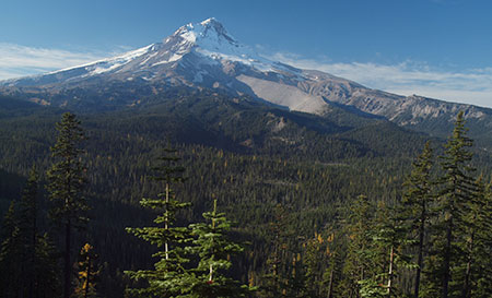
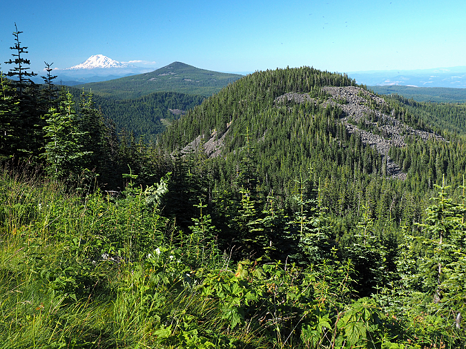
Forests of Noble fir forests spread out to the horizon along the crest of Waucoma Ridge, just north of Mount Hood (Mount Adams in the distance)

We’re coming into another holiday season when millions of Americans will set up a Christmas tree cut in Oregon. There’s a good chance it will be a Noble fir, long prized as the most beautiful and durable of Christmas trees, representing about a third of the cut tree industry here. 

There was a time when Noble fir grown as holiday trees were left in their natural state, which features elegant tiers of symmetrical branches and soft, deep green, upwardly curving needles. In recent years, Nobles grown for mass-market consumption have increasingly been sheared to produce a densely branched, unnatural thicket (acknowledging my bias, here!) in the same way that Douglas fir have long been cultivated in the Christmas tree trade. Still, the un-sheared Nobles remain the gold standard, and they sell for gold-standard prices at tree lots, too.

New grown emerging on Noble fir boughs

Noble fir cones

In Oregon, families also have the option of cutting their own Christmas trees at U-cut tree farms, a popular benefit of living in a region that produces millions of holiday trees for the nation. It’s also possible to cut your own tree on National Forest land, a tradition that dates back a century or more. Though more regulated today by the U.S. Forest Service, families looking for a more adventurous option than local tree lot can head up to designated areas on the mountain (typically powerline corridors or recovering clear cuts) and bring home their own cut tree.

The author at age 11 (second from left) with family and friends on a 1973 trip to Lolo Pass to cut Christmas trees. Noble fir were always the goal, but in those days of heavier mountain snows, simply reaching the Noble fir zone in December was an adventure!

Christmas trees are pretty much the extent of public knowledge of the noblest of our true firs. As the common name might suggest, noble fir is the largest of all true firs. Their name was given in the fall of 1825 by botanist David Douglas when he ventured into the high country above the Columbia River River Gorge, in the vicinity of today’s Cascade Locks. Though he wasn’t specific about the peak he climbed on the north side of the river, it is believed to be today’s Table Mountain. A few days later, he climbed to a high point on the Oregon side, most likely today’s Benson Plateau.

On this pair of climbs, he came upon magnificent, old-growth stands of Noble fir, and gave them their well-deserved name. While they are undeniably beautiful as young trees, old-growth Noble fir are a sight to behold. Like many of our Pacific Northwest conifers, these trees grow to be giants, with the largest on record reaching nearly 300 feet in height and nearly 10 feet in diameter.  

Old-growth Noble fir forests near Mount Hood’s Bennett Pass

An ancient Noble fir giant towers above the surrounding forest canopy near Bennett Pass

Noble fir are also unique to the Pacific Northwest, with a range that extends from just above of Snoqualmie Pass in Washington south to the Siskiyou Mountains in Southern Oregon and the Trinity Alps region along the northern edge of California. In their southern extent, they are known to hybridize with California’s Shasta fir, a variety of the Red fir that grows in the Sierras and extends into the southern fringe of the Noble fir range.

Despite their willingness to grow in planted rows as farmed Christmas tree seedlings in the hot, dry summers of the Willamette Valley floor, Noble fir are a subalpine species. They typically grow at elevations of 3,500 feet to 5,500 feet, where they are long-lived and acclimated to the harsh winters of our mountains. Not surprisingly, they grow more slowly under these conditions, but they are tremendously adaptable, and often grow on very steep mountain slopes and exposed, rocky ridgetops.

Centuries-old Noble fir giant near Bennett Pass

Noble fir is a sun-loving pioneer species in our forests, quickly colonizing in burn areas to form pure, long-lived stands. Hike through one of the towering old-growth stands found in the high country of the Columbia Gorge or on the peaks surrounding Mount Hood, and you’re likely walking through an old burn, with the age of the trees as a good indicator of when fire last roared through, long ago. That’s because they are not only post-fire colonizers, but also highly susceptible to fire as mature trees, as they lack the protective bark of fire-adapted conifers like Ponderosa pine and Western larch.

This cycle of burn-and-rebirth in our Noble fir forests is on full display today on the north slopes of Mount Hood, where the 2011 Dollar Lake Fire burned through sprawling stands of subalpine Noble fir. These forests were almost entirely killed where the fires swept through, yet today, the forest recovery is already well underway, with young Noble fir seedlings leading the way among other post-fire pioneer species.

Ghost forest of Noble fir skeletons where the Dollar Lake Fire swept through a decade ago

Ancient Noble fir killed by the Dollar Lake Fire will provide wildlife habitat for many decades to come as a new forest grows here

Noble fir seedling emerging from the charred ashes of the Dollar Lake Fire

Meanwhile, across the Clear Branch canyon on the north of the mountain, the forests along the crest of Blue Ridge and at Owl Point (along today’s Old Vista Ridge Trail) are made up almost entirely of Noble fir that had colonized an earlier burn there, one that occurred sometime in the early 1900s. This pair of photos (below) from Owl Point shows how the foreground was burned and just beginning to recover in 1952, while 70 years later the scene is reversed: the forests along Blue Ridge and Owl Point have largely recovered, while the north slope of the mountain is just beginning its recovery from the 2011 Dollar lake Fire.

When our Noble fir forests are spared of fire and logging, individual trees can easily live up to 400 years.  The oldest known Noble fir have reached 600 to 700 years, though trees of this age are exceedingly rare after more than a century of commercial logging in the Pacific Northwest. 

In the early days of extensive logging, in the late 1800s and early 1900s, true firs were considered a lesser wood, so the timber industry marketed the massive, old-growth Noble firs as “Larch”. This explains two Larch Mountains in the Columbia River Gorge, one on each side of the river, and each the site of extensive turn-of-the-century logging in the early 1900s. The better-known Larch Mountain is on the Oregon side, and its broad, high elevation slopes provided a perfect habitat for Noble fir.

Loggers felling a massive Noble fir on Larch Mountain in 1905

By the early 1900s, the Bridal Veil Mill on the Columbia River had established an upstream sister mill in the heart of these Noble fir forests, where the trees were hundreds of years old, having been spared by fire for many centuries. The upstream mill was known as the Palmer Mill (and later, New Palmer Mill, after the first mill burned), and a road on Larch Mountain still carries its name. 

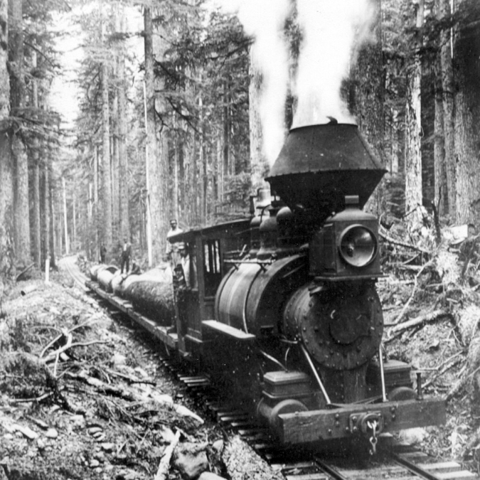
Loggers carried giant Noble fir cut on the slopes of Larch Mountain to the New Palmer Mill on logging railroads. This scene is from 1905

Old-growth Noble fir logs were milled at the original Palmer Mill site on the north slope of Larch Mountain. This scene is from 1896, when logging of the virgin Noble fir forests there was in its heyday

Palmer Mill was attached to the main mill by a long flume that followed Bridal Veil Creek, and it was the hub for a massive logging enterprise on Larch Mountain that felled most of the virgin Noble fir forests. Huge logs were first sent to Palmer Mill on a branched system of logging railroad spurs, then milled into rough lumber that was floated down the flume system to the Bridal Veil Mill for finishing into construction grade lumber.

Today, all but a few traces of the Palmer Mill are gone, and many of the Noble fir forests on Larch Mountain are approaching 100 years in age. The area somehow dodged the 2017 Gorge Fire that swept through vast areas of the Gorge, burning through thousands of acres of Noble fir forests in the Gorge high country. 

Noble fir in the age of Climate Change

Today, Noble fir country in the western Oregon Cascades is a checkerboard of clear cuts that mark the advent of National Forest logging that began on a commercial scale in the late 1940s. When these trees were cut, the catch phrase used to justify logging ancient forests was “sustained yield”, though sustained yield forestry never envisioned restoring ancient forests to their natural state. Instead, the management philosophy was to provide a continual supply of 60-100 year-old trees from plantations that could be repeatedly logged via a vast network of logging roads built in our forests from the late 1940s through the early 1990s.

When 7.5 minute USGS maps were created in the 1950s and early 60s, there were already thousands of clear cuts on Forest Service lands that showed up on the new maps as a checkboard in heavily logged areas like Mount Hood’s Blue Ridge (shown here). Many more clear cuts followed, and sixty years later, these clear cuts are often overcrowded plantations of conifers that the Forest Service is now thinning through new timber sales

Despite the early bias against true firs, the wood produced by Noble fir eventually came to be valued for being light and strong, and was used during World War II in aircraft, as well as more common construction uses in windows, doors and paper production. This led to aggressive logging in the later years of the commercial timber boom of the 1950s-90s, when lower elevation forests had already been logged over, and high-elevation Noble fir forests were increasingly targeted. 

The Pacific Crest Trail follows the crest of this ridge near Lolo Pass, where heavily logged, high-elevation Noble fir forests have been slow to recover. These clear cuts are now 40-50 years old, and yet the stunted, crowded young plantation trees are still dwarfed by the groves of big, old-growth trees that were spared the chainsaw

Clearcutting on the steep, mountainous terrain where Noble fir grow was never sustainable, at least as measured in human lifetimes. The big, high elevation Noble fir forests sold off by the Forest Service were often hundreds of years old, with even the smaller-diameter trees well over a century old. There was never a chance to produce a rotating “crop” of trees at these elevations large enough to justify logging for generations to come, but that didn’t slow the rush to log these forests.

Instead, the logging boom finally peaked with the listing of the Spotted Owl and subsequent “timber wars” in the early 1990s, and it has never fully recovered, though some logging on our national forests continues today.

This Noble fir fell across the Timberline Trail recently, and was sawed out by trail crews. While it is only about 15” in diameter, a count of the annual growth rings revealed this tree to be over 160 years old, demonstrating how elevation and mountain conditions slow the growth of these trees

It’s easily to lose perspective on just how old the trees in our mountain forests really are. The above is a timeline of human events that unfolded since this tree took root as a Noble fir seedling on Mount Hood until a windstorm knocked it down in 2020. This tree is approximately 14 inches in diameter and 160 years old.

These stumps near Bennet Pass mark some of the oldest and largest Noble fir ever logged near Mount Hood, with some of these trees approaching 300 years old when they were cut. These stumps look like they might be a couple years old, with bark still intact. In fact, these trees were logged about 30 years ago, yet the Noble fir seedlings growing in this recovering clear cut are barely six feet tall

This is the same stump that appears in the foreground in the previous photo, with approximate dates according to tree rings. When it was cut, it has lived through more than a quarter of the first millennium.

The Bennett Pass clear cut (shown above) might look recent, given the intact condition of the stumps and the young Noble fir trees just getting established. Yet, this forest was cut nearly 30 years ago, as shown in the aerial photo pair (below). Thanks to its high elevation at over 4,000 feet, and resulting slow forest recovery, this logged area is still just beginning to reforest.

After nearly 30 years, this clear cut in an old-growth Noble fir forest near Bennett Pass is only beginning to recover

These examples are typical of logged Noble fir forests throughout the Mount Hood National Forest. They simply haven’t recovered at the pace the Forest Service assumed when logging was still king. Noble fir seedlings in these cut-over areas have often grown very slowly, reaching just 6 or 8 feet in height after 30 or 40 years of post-logging recovery. The slow recovery has also compounded the fragmentation effect on wildlife that depend on uninterrupted old-growth forest habitat.

Today, the Forest Service is grappling with the perfect storm of an aging, overbuilt system of spur roads from the heyday of commercial logging coupled with increasingly catastrophic forest fires resulting from climate change and a century of fire suppression. This is especially true in high-elevation Noble fir country, where clear cut plantations are especially vulnerable to summer drought and fire, and logging roads are impacted by severe winter conditions.

To meet these challenges, along with Congressional quotas for timber production that have always been unsustainable, the Forest Service has pivoted to forest thinning the thickets of young plantation trees in previously logged areas. It’s arguable that this strategy will help restore forests to a healthy state, but sadly, the Forest Service mission isn’t to restore a mature, healthy forest. Their goal is to bring more marketable logs to maturity, the primary management objective for much of Mount Hood National Forest.

Forest thinning operation on Butcher Knife Ridge, north of Mount Hood, where roughly one third of the trees have been removed from a clear cut plantation to encourage a more diverse forest structure

Forest thinning typically produces massive piles of woody debris, as seen here on Blue Ridge, just outside the Mount Hood Wilderness. Logging debris was historically burned as “slash”, though new uses are under development to make better use of this material as we enter the age of widespread forest thinning

The jury is out as to whether forest thinning improves the health of crowded plantations better than simply doing nothing, given the impact of heavy equipment on tree root systems and the forest understory.  The science does suggest that thinning can help as a preventative means for reducing forest fire severity, since it removes potential fuel from the forest. The benefit of thinning Noble fir plantations is less clear, however, since the species is already more vulnerable to fire than other conifers, and seldom survives fire.

Noble fir also tolerate crowded conditions better than other conifers, presumably because these trees are so effective at colonizing burns and often form nearly pure stands in the process. Young Noble fir forests often have little understory beyond a carpet of beargrass because the trees are so closely spaced. But these pure stands have also evolved to self-thin over time, maturing to a more open canopy that allows huckleberry, rhododendron and other mountain understory species to thrive among more widely spaced, mature trees. In these forests, young Noble fir are also part of the understory, as the forest canopy continues to regenerate.

The following images show self-thinning in a young (about 80 years old) Noble fir forest on Bald Mountain, along the Timberline Trail. A recent windstorm selectively toppled the weakest among these trees, a timeless process that Noble fir don’t need our help with.

Recent downfall in a young stand of Noble fir on Bald Mountain are part of an ongoing, self-thinning process these trees have evolved for

Recent self-thinning event in a pure Noble fir stand on Bald Mountain. If it doesn’t burn, this protected forest inside the Mount Hood Wilderness will continue to self-thin, becoming an old-growth Noble fir forest in time

With logged high-elevation forests recovering very slowly, and high-elevation spur roads failing especially badly, and the mounting negative impacts of clear cutting, continued logging of our Noble fir forests simply isn’t a sustainable practice. A new management philosophy that centers on forest restoration and climate adaptation over timber extraction is long overdue.

Instead of waiting a century or more to produce marketable Noble fir saw logs, these recovering forests could be sold for credits on the carbon market, using their gradual recovery as carbon offsets for polluting industries. Over the long term, Noble fir have immense capacity for carbon capture and storage. Scientists studying the ancient Noble fir forests at the Goat March Research Natural Area, near Mount St. Helens, have determined this forest to have a biomass second only to the coastal Redwood forests of Northern California.

A mature, thriving Noble fir forest at the 4,000 elevation on Mount Hood, with a diverse mix of mature and younger trees, and a few wildlife snags 

Such a shift in Forest Service philosophy would not only help the global response to climate change, it would also yield a host of other benefits that high elevation forests in our region provide – a list that include critical wildlife habitat, cooler and more stable stream runoff for endangered salmon and steelhead and crucial water supplies for nearby communities that depend on mountain snowpack that forests help retain.

Mature Noble fir forest on Mount Hood, with towering old-growth trees mixed with younger trees and a dense understory

Such a shift in focus would also allow for the Forest Service to retire many of its deteriorating logging spur roads, and revenue from the sale of carbon credits could provide needed funding to do the work. Beyond the escalating cost to maintain them, these roads are notorious for triggering landslides and dumping sediments into streams when cut-and-fill roadbeds fail from plugged culverts or landslides. They also represent an increasing hazard in the form of human-caused forest fires and illegal dumping, as some of the worst lawless activity occurs on these remote roads where law enforcement simply cannot have a meaningful presence.

This road decommissioning work has already begun in the Mount Hood National Forest, though only in fits and starts, as it has thus far been driven by declining agency budgets more than an eye toward forest recovery and restoration. A focus on the broader outcomes of climate, water quality and fish habitat could speed up this important work with a new sense of urgency.

Where to see Noble fir

Want to see some of these trees close-up? One of the best and most accessible places is the short trail to Sherrard Point, which is the rocky summit pinnacle of Larch Mountain. The road to the summit picnic area and Sherrard Point trail is gated in the winter, but usually opens by early June. An easy, paved trail and series of stairsteps leads to the viewpoint.

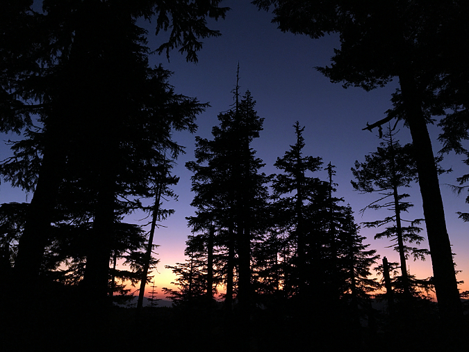
Noble fir giants at sunset in WyEast country

If you’d like a longer hike, the short, steep climb to the summit of Bald Mountain, near Lolo Pass, leads through some of the best old growth Noble fir in the Mount Hood area:

Bald Mountain from Top Spur

For an even longer hike, start from Lolo Pass and follow the Pacific Crest Trail to Bald Mountain, with much of the route through Noble fir forests:

Bald Mountain from Lolo Pass

Perhaps the best Noble fir forests in the Cascades are at Goat Marsh, near Mt. St. Helens. A short trail takes you into this fascinating research area and some of the largest known Noble fir trees in the world:

Goat Marsh Lake

Bald Mountain and Goat Marsh are snowed in during the winter months, but typically open by early June.

Enjoy!

_________________

Tom Kloster | November 2021

Proposal: Historic Mount Hood Loop Highway State Trail (Part 2 of 2)

Yellow paint still marks the old centerline of an abandoned section of the historic Mount Hood Loop highway, nearly covered with more than 60 years of moss and ferns.

Part 1 of this article introduced the idea of restoring the surviving sections of the old Mount Hood Loop Highway to become part of a world-class cycle tour along this historic route. Part 2 focuses on these surviving historic sections of the old road, from Zigzag on the west side of the mountain to the Sherwood Campground on the east side, and how to bring this vision to reality.

________________

THE CONCEPT

In the near-century since the original Mount Hood Loop was completed in early 1920s, the old route has gradually been replaced with straighter, faster “modern” highways. In areas outside Mount Hood National Forest, the bypassed sections of the old road are mostly still in use, often serving as local roads. But inside the national forest, from Zigzag to Sherwood Campground, long sections of the old road were simply abandoned, left to revert to nature when new, modern roads were built in the 1950s and 60s. Some bypassed sections are still in use, though mostly forgotten.

This is 1930s-era map (below) shows the original alignment of the Mount Hood Loop highway in red and the approximate location of the modern highway alignments of US 26 and OR 35 superimposed in black:

[click here for a large version of this map]

The concept of reconnecting these forgotten sections of historic road is straightforward, building on the example of the Historic Columbia River Highway (HCRH) in the Columbia Gorge. As in the Gorge, places where modern highways on Mount Hood simply abandoned or bypassed the old route, the surviving segments of the old road would be the historic building blocks for creating a new “state trail”, which is simply a paved bicycle and pedestrian path closed to automobiles. 

Sections where the historic route was completely destroyed by modern highways would be reconnected with new trail, like we see in the Gorge, or with protected shoulder lanes on quiet sections of the modern highway in a couple areas.

This map shows the overall concept for restoring the route as the Historic Mount Hood Loop State Trail:

[click here for the 11×17″ JPG version]

[click here for the 11×17″ PDF version]

Segments shown in blue on the concept map are where bypassed sections of the old highway still survive and segments shown in red are where new trails would connect the surviving historic segments. All of the new trail sections are proposed to follow existing forest roads to minimize costs and impacts on the forest. 

The concept map also shows several trailheads along the route where visitors would not only use to access the trail, but would also have trail information and toilets. These trailheads already exist in most cases, with several functioning as winter SnoParks that could be used year-round as part of the new trail concept.

Six Forest Service campgrounds (Tollgate, Camp Creek, Still Creek, Trillium Lake, Robinhood and Sherwood) already exist along the proposed route and two long-forgotten campgrounds (Twin Bridges and Hood River Meadows) are still intact and could easily be reopened as bikepacking-only destinations.

EXPLORING THE ROUTE

The next part of this article explores the scenic and historic highlights of the historic highway in three sections, from Rhododendron on the west side of the mountain to the Sherwood Campground and East Fork Hood River on the east side.

West Section – Rhododendron to Government Camp

The historic bridge over the Little Zigzag River survives, marking the beginning of a gracefully, winding ascent of Laurel Hill along the old loop highway

Beginning at the tiny mountain community of Zigzag, it’s possible to follow a couple bypassed segments of the old loop highway, notably along Faubion Road, but most of this section would follow a new, protected path on US 26 to Rhododendron, where the off-high trail concept begins. 

Part 1 of this article outlined the economic benefits of cycle touring, and by anchoring the west end of the new trail in Rhododendron, this small community would benefit from tourism in a way that speeding winter ski traffic simply doesn’t offer. The gateway trailhead would be located at the east end of Rhododendron, connecting to the Tollgate Campground, the first camping opportunity along the proposed route

The Barlow Road Tollgate near Rhododendron in the 1880s

From Tollgate, the new route would follow the Pioneer Bridle Trail for the next two miles to the Kiwanis Camp Road junction, on US 26. This is a lightly used section of the Pioneer Bridle Trail, which was built by the Civilian Conservation Corps from Tollgate to Government Camp in the 1930s. This part of the corridor follows the relatively flat valley floor of the Zigzag River, so there is plenty of room for a new trail to run parallel to the Pioneer Bridle Trail, as another option.

Pioneer Bridle Trail east of Tollgate

Once at the Kiwanis Camp Road junction, the new route would share this quiet forest road for the next next couple miles. Kiwanis Camp Road is actually a renamed, surviving section of the old highway and still provides access to the Paradise Park and Hidden Lake trails into the Mount Hood Wilderness. 

The Zigzag River passing through the old Twin Bridges campground site

Along the way, this section of old highway passes the site of the long-abandoned Twin Bridges campground, where a surviving bridge also forms the trailhead for the Paradise Park Trail. This shady old campground is quite beautiful, with the rushing Zigzag River passing through it. It could easily be reopened as a bikepacking-only camping spot along the tour.

Little Zigzag Falls

This operating section of old highway soon ends at the Little Zigzag River and the short spur trail to pretty Little Zigzag Falls. The enormous turnaround here once served as a rock quarry for the original loop highway, and has plenty of room serve as trailhead for the new state trail

From here, the old road begins an ascent of Laurel Hill, one of the most scenic and fascinating sections of the old highway. Large boulders now block the old highway at the historic bridge that crosses the Little Zigzag River, and from there, an abandoned section of the old road begins the traverse of Laurel Hill.

Abandoned historic highway section near the Little Zigzag crossing

This abandoned section of historic road crosses the upper portion of the Pioneer Bridle Trail where an unusual horse tunnel was constructed under the old highway as part of creating the Bridle Trail. It’s hard to imagine enough highway traffic in the 1930s to warrant this structure, but perhaps the trail builders were concerned about speeding Model As surprising visitors crossing the road on horseback? Whatever the reason, the stone bridge/tunnel structure is one of the many surviving gems hidden along the old highway corridor.

Pioneer Bridle Trail tunnel under an abandoned section of the historic loop highway

From the Pioneer Bridle tunnel overcrossing, the old road soon dead-ends at a tall embankment, where modern US 26 cuts across the historic route. The spot where the modern highway was built was once one of the most photographed waysides along the old highway, appearing in dozens of postcards and travel brochures. It was the first good view of the mountain from the old highway as it ascended from the floor of the Zigzag Valley to Government Camp (below).

While much of the old road has survived, the modern alignment of US 26 cut through this spot on the old loop, creating one of two gaps on Laurel Hill that will require significant structures to reconnect

Although almost all of the old highway survives where it climbs the Laurel Hill grade, this spot marks one of the two major gaps along the way that would require a significant new structure to reconnect the route. A second gap occurs at the crest of Laurel Hill, to the east, where the modern highway cuts deeply through the mountain. This map shows the surviving, abandoned sections of the historic highway along the Laurel Hill grade and upper and lower gaps that must be bridged:

[click here for a large version of this map]

On the ground, the lower Laurel Hill gap looks like this:

The lower Laurel Hill gap is at a well-known spot where a history marker points toward a short trail to one of the Barlow Road “chutes” that white migrants on the Oregon Trail endured in their final push to the Willamette Valley. 

ODOT has made this section of highway much faster and more freeway-like in recent years in the name of “safety”, but in the process made it impossible for hikers to cross the highway from the Pioneer Bridge Trail to visit the Barlow Road chute. A freeway-style median now blocks anyone from simply walking across the highway and cyclone fences have been added to the north side to make sure hikers get the message.

Given this reality, both of the Laurel Hill gaps would be great candidates for major new crossings, along the lines of work ODOT has done in the Gorge to reconnect the HCRH. This viaduct (below) was recently built by ODOT at Summit Creek, on the east side of Shellrock Mountain, where the modern I-84 alignment similarly took a bite out of an inclined section of the old highway, leaving a 40-foot drop-off where the old road once contoured downhill. This sort of solution could work at the lower Laurel Hill gap, too.

This new bicycle and pedestrian viaduct reconnects surviving segments of the original highway near Summit Creek along the Historic Columbia River Highway State Trail.

Beyond the Laurel Hill history marker on the south side of the modern US 26, a set of 1950s stone steps (below) leads occasional visitors up to the next section of abandoned Mount Hood Loop highway, where the old route continues its steady climb of Laurel Hill.

Stone steps leading from US 26 to the Barlow Road “chute” on Laurel Hill

This section of the abandoned route is in remarkably good shape, despite more than 60 years of no maintenance, whatsoever. It also briefly serves as the trail to a viewpoint of the Barlow Road chute — a footpath to the top of the chute resumes on the opposite side of the old highway, about 100 yards from the stone steps.

Abandoned section of the loop highway near the Barlow Road chute

When the historic highway was built in the 1920s, the Barlow Road was still clearly visible and only a few decades old. Despite the care they used elsewhere to build the scenic new road in concert with the landscape, there was no care given to preserving the old Barlow Road. Thus, the historic highway cut directly across the chute, permanently removing a piece of Oregon history. 

Today, the footpath to the top of the chute still gives a good sense of just how daunting this part of the journey was (below). This short spur trail, and others like it along the surviving sections of the old highway, would be integrated into the restored Mount Hood Loop route, providing side attractions for cyclists and hikers to explore along the way.

Looking down the Barlow Road chute from the interpretive trail

Beyond the Barlow chute, the old highway enters a very lush section of forest, where foot traffic from explorers continues to keep a section of old pavement bare (below). Scratch the surface, and even under this much understory, the old highway continues to be in very good condition and could easily be restored in the same way old sections of highway in the Gorge have been brought back to life as a trail.

Abandoned section of the old loop highway near Yocum Falls

Some of the foot traffic along the abandoned Laurel Hill section of the old loop road is headed toward a little-known user path that drops steeply down to Yocum Falls, on Camp Creek. This is a lovely spot that deserves a proper trail someday, and would make an excellent family destination, much as the Little Zigzag Falls trail is today.

Yocum Falls is mostly forgotten since the construction of the modern highway, but remains as beautiful as when it was featured on postcards in the 1920s

Yocum Falls was once well known, as the full extent of this multi-tiered cascade could be seen from along the old highway. As this old postcard from the 1920s shows (below), Camp Creek also served as a fire break for the Sherar Burn, which encompassed much of the area south of today’s US 26 in the early 1900s. You can see burned forest on the south (right) side in this photo and surviving forest on the north (left) side:

Yocum Falls in a 1920s postcard view from the original Mount Hood Loop Highway

The fire also created this temporary view of the falls in the early 1900s, but the forest has since recovered and obscured the view. Today, the short hike down to the falls on the user path is required for a front-row view of Yocum Falls.

Beyond the falls, the abandoned highway makes a pronounced switchback and begins a traverse toward the crest of Laurel Hill. Here, the vegetation becomes more open, and road surface more visible (below).

Abandoned section of the old highway as it approaches the crest of Laurel Hill

Soon this abandoned section of old road makes another turn, this time onto the crest of Laurel Hill. When the historic highway was built, this stretch was still recovering from the Sherar Burn, and the summit was dense with rhododendron and beargrass that put on an annual flower show each June. This was perhaps the most iconic stop along the old route, appearing on countless postcards, calendars and print ads (below).

1940s tourism ad featuring the (then) famous view of Mount Hood from Laurel Hill

Today, most of this section has reforested, but there are still views of the mountain and opportunities for new viewpoints that could match what those Model A drivers experienced in the early days of touring on Mount Hood.

Soon, this abandoned section of old road on Laurel Hill reaches the upper gap, where ODOT has recently made the yawning cut through the crest of the hill even wider. This schematic is a view of the cut looking north (toward the mountain), with the stubs of the historic highway shown: 

If there is any good news here, it is that the modern highway cut is perpendicular to the old loop highway, making it possible to directly connect the surviving sections of the old road with a new bridge. This view (below) is from the eastern stub of the old route, where it suddenly arrives at the modern highway cut. The stub on west side of the cut is plainly visible across US 26:

This panoramic view (below) from the same spot gives a better sense of the gap and the opportunity to bride the upper Laurel Hill gap as part of restoring the old route as a trail. A bonus of bridging the upper gap would be an exceptional view of Mount Hood, which fills the northern skyline from here.

The upper gap is about 250 feet across and 40 feet deep, so are there any local examples of a bridge that could span this? One historic example is the old Moffett Creek Bridge on the HCRH, pictured below while it was being constructed in 1916. This bridge measures about 200 feet in length with a single arch.

Moffett Creek Bridge construction along the Columbia River Highway in 1916

The City of Portland recently broke ground on the new Earl Blumenauer Bridge, a bicycle and pedestrian crossing over Sullivan’s Gulch (and I-84) in Portland. This very modern design (below) might not be the best look for restoring a historic route on Mount Hood, but at 475 feet in length, this $13.7 million structure does give a sense of what it would take to span the upper gap at Laurel Hill. 

The City of Portland recently broke ground for this new bicycle and pedestrian bridge over Sullivan’s Gulch, linking the Lloyd District to Portland’s Central Eastside (City of Portland)

That sounds like a big price tag, but consider that ODOT recently spent three times that amountsimply to add a lane and build a concrete median on the Laurel Hill section of US 26. It’s more about priorities and a vision for restoring the old road than available highway funding. More about that in a moment.

Moving east from the upper Laurel Hill gap, the abandoned section of the old highway continues (below) toward Government Camp, eventually reaching the Glacier View trailhead, where the surviving old highway now serves as the access road to this popular, but cramped, SnoPark.

Abandoned section of the loop highway near Government Camp

Sadly, the Forest Service recently destroyed a portion of the abandoned loop highway just west of the Glacier View trailhead, leaving heaps of senselessly plowed-up pavement behind. While destroying this section of historic road was frustrating (and possibly illegal), it can still be restored fairly easily. But this regrettable episode was another reminder of the vulnerability of the old highway without a plan to preserve and restore it.

Piles of paving line a short section of the abandoned loop highway near Government Camp where the Forest Service recently destroyed the road surface with no consideration of its historic value — a senseless reminder of the vulnerability of this precious route

From the Glacier View trailhead, the old road become an operating roadway once again, curving south to another junction with US 26, across from the new Mirror Lake trailhead, where a major new recreation site completed in 2018. This trailhead provides parking, restrooms and interpretive displays for visitors to the popular Mirror Lake trail, and is immediately adjacent to the Mount Hood Ski Bowl resort and lodge.

Plans call for a new bicycle and pedestrian bridge over US 26 at the Mirror Lake trailhead, spanning one of the critical gaps necessary to reconnect the old highway route

Crossing the US 26 at this junction is a sketchy, scary experience, especially on foot or a bicycle. Fortunately, the 2014 Mount Hood Multimodal Plan, adopted jointly by the Forest Service and ODOT, calls for a major bicycle and pedestrian bridge here to allow for safe crossing by hikers, cyclists, skiers and snowshoers, so a plan is already in place to resolve this obstacle.

Middle Section – Government Camp to Barlow Pass

Mount Hood mirrored in one of the ponds at Multorpor Fen (State of Oregon)

From the Mirror Lake trailhead, the old highway loops through today’s parking lot at the Mount Hood Ski Bowl resort, then crosses US 26 again to loop through the mountain village of Government Camp. These graceful curves in the old route were bisected when the modern US 26 was built in the 1950s, leaving them intact as local access roads. However, because the Government Camp section of the old road serves as the village main street, the concept for a Mount Hood Loop Highway State Trail parallels the south edge of US 26 along a proposed new trail section, and avoids two crossings of the modern highway in the process. 

However, a more interesting (but complicated) option in this area is possible along the south edge of the Multorpor Fen, an intricate network of ponds, bogs and meadows sandwiched between the east and west Mount Hood Ski Bowl resort units. The remarkable view in the photo above shows one of the ponds along this alternate route, far enough from the modern highway to make traffic noise a distant hum. However, this route would also require crossing a section of private land at Ski Bowl East. The mountain views and buffer from the highway make this an option worth considering, nonetheless.

Both options are shown on the concept map at the top of this article, and either route through the Government Camp area leads to the northern foot of Multorpor Mountain, where the concept for the state trail is to repurpose a combination of existing and abandoned forest roads as new trail to historic Summit Meadow and popular Trillium Lake, where the second and third campgrounds along the proposed trail are located.

Historic Summit Meadow, a crucial resting spot for white Oregon Trail migrants in the 1840s along the old Barlow Road
Mount Hood from Trillium Lake

From Trillium Lake, the new trail would follow existing forest roads toward Red Top Meadow, to the east, then follow a new route for about a mile to the continuation of the historic loop highway, just east of the US 26/OR 35 junction. Here, a surviving section of the old road is maintained and remains open to the public, passing the mysterious Pioneer Woman’s Grave site as it climbs toward Barlow Pass. 

Surviving section of the old loop highway near Barlow Pass that is still open for use
This massive, carved history marker once stood at the Pioneer Woman’s Grave along the old loop highway, near Barlow Pass
The badly neglected Pioneer Woman’s Grave site today

When the original highway was completed in the 1920s, a viewpoint along this section of the road was called “Buzzard Point” and inspired postcards and calendar photos in its day. Few call this spot Buzzard Point anymore, but the view survives, along with a rustic roadside fountain built of native stone and still carrying spring water to the passing public. In winter, this section of the old road is also popular with skiers and snowshoers.

This 1920s view from Buzzard Point was well-known in the heyday of the old loop highway
This surviving stone water fountain near Buzzard Point is still flowing nearly a century after it was built!

This section of the old route continues another mile or so to the large SnoPark at Barlow Pass, another important trailhead that serves both the loop highway corridor and the Pacific Crest Trail.

East Section – Barlow Pass to Sherwood Campground

Barlow Road history sign at the Barlow Pass trailhead, where the Pacific Crest Trail crosses the historic loop highway

From Barlow Pass, the trail concept calls for a protected bikeway on the shoulder of OR 35, where it crosses the White River and climbs to Bennett Pass. It would be possible for the trail to take a different route along this section, but the traffic volumes and speed on OR 35 are much less intimidating than those on US 26, especially from spring through fall, when ski resort traffic all but disappears. There is also plenty of room to add protected bike lanes along this section of OR 35, including on the new bridge over the White River that was completed just a few years ago.

The Mount Hood Loop trail concept would follow this section of OR 35 as a protected bikeway from Barlow Pass to the White River and Bennett Pass
The White River crossing has always been a popular stop along the Mount Hood Loop Highway. In the early days, motorists could stop here to picnic and pick up souvenirs at “White River Park”
The White River is a notoriously wild glacial stream that has a long history of washing out the loop highway bridges — this was the first bridge to span the river as it appeared in the 1920s
This is a 1930s version of the White River Bridge, one still constructed of logs and planks
Franklin and Eleanor Roosevelt stopped at the White River crossing in 1937 on their famous tour of the Mount Hood Loop Highway and dedication of Timberline Lodge

Upon reaching Bennett Pass, the proposed route would once again follow an especially scenic section of bypassed historic highway, with views of waterfalls, alpine meadows and the mountain towering above.

Mount Hood from the original Mount Hood Loop Highway at Bennett Pass in the 1930s
1950s view of the Mount Hood Loop Highway at Bennett Pass before the modern highway was constructed

Of the many scenes along the old road that were postcard favorites, the view of the Sahalie Falls Bridge, stone fountain and falls in the background was among the most popular. The bridge was the largest structure on the original loop highway, and a scenic highlight (you can read more about the history of the bridge in this 2013 blog article “Restoring the Sahalie Falls Bridge”)

The graceful Sahalie Falls bridge is the architectural highlight of the old loop highway, and was restored in 2013
The Sahalie Falls Bridge under construction in the 1920s
Popular postcard view of the Sahalie Falls Bridge and stone fountain from the 1920s

Today, the bridge is once again in excellent condition, having been restored by the Federal Highway Administration in 2013. For years, the bridge had been closed to automobiles because of its state of disrepair, but today it stands as perhaps the most significant historic highway feature along the old road.

From Sahalie Falls, the historic road curves east through subalpine forests before arriving at Hood River Meadows, among the largest on Mount Hood and another spot that was featured in countless postcards and advertisements during the heyday of the old road. 

1920s view of the old loop highway at Hood River Meadows. This nearly forgotten section of the old highway still operates today.

The long-abandoned Hood River Meadows campground also survives here, along the east side of the meadows, and is still in excellent condition. This site could be reopened as a second bikepacking-only camping spot along the proposed trail. 

1940s tourism ad featuring Mount Hood from the loop highway at Hood River Meadows

Next, the historic road curves toward OR 35 where it also serves as the resort access road for the Hood River Meadows ski complex. From the spot where the old road meets OR 35, there are a couple more abandoned road sections along the north edge of OR 35 that could be reconnected as part of the Loop Highway trail concept, but this is the last of the surviving sections of the old road on this part of the mountain.

From here, the trail concept would connect a series of old forest roads on a gradual descent of the East Fork Hood River valley, toward Sherwood Campground, located along the East Fork, and completing the Mount Hood Loop Highway State Trail.

East Fork Hood River near Sherwood Campground in winter

Sherwood Campground is a very old, still operating campground that includes another stone fountain from the old highway, located near the campground entrance. The campground is also a jumping off point for the popular trail to Tamanawas Falls. Nearby Little John SnoPark would serve as the main eastern trailhead for the new trail, with a short connecting route the main trail. 

Historic stone fountain from the original loop Highway at Sherwood Campground
Tamanawas Falls, just off the loop highway near Sherwood Campground

Sherwood Campground would form the eastern terminus of the historic section of the proposed Loop Highway State Trail. From here the larger Mount Hood scenic loop route would follow OR 35 through the narrowing canyon of the East Fork to the wide expanse of the upper Hood River Valley. 

This narrow section of the loop highway is where a safe, protected bikeway will need to thread the needle between cliffs and the East Fork Hood River

The canyon section along the East Fork is a crux segment for the loop route, with the modern highway wedged between the river and a wall of steep cliffs and talus slopes. Engineers designing a safe bikeway through this section of road could take some inspiration from the Shellrock Mountain in the Gorge, where the HCRH State Trail threads a similar corridor between I-84 and the talus slopes of Shellrock Mountain. This crux section along the East Fork is about a mile long.

WHERE TO START?

Touring the upper Hood River Valley in the 1950s

What would it take for this concept to become a reality? A crucial first step would be a feasibility study inspired by the HCRH State Trail, with an emphasis on the potential this example offers for restoring and reconnecting historic sections of the old Mount Hood Loop Highway on Mount Hood. 

Rock crusher along the original loop highway during its construction in the 1920s

An obvious sponsor for this work would be the Oregon Department of Transportation, working in partnership with the U.S. Forest Service. These agencies have worked together to bring the Historic Columbia River Highway State Trail to reality and have both the experience and capacity to repeat this success story on Mount Hood. The following outline could be a starting point for their work:

Mount Hood Loop Highway State Trail Feasibility Study 

Purpose Statement

Restore and reconnect surviving sections of the historic Mount Hood Loop Highway from Rhododendron to Sherwood Campground as a paved state trail the combines shared right-of-way and non-motorized trail experiences.

Feasibility Study Objectives

  • Identify new, paved trail segments needed on public land to complete the loop using existing forest road alignments whenever possible.
  • Identify surviving historic resources and new interpretive opportunities along the trail.
  • Identify multimodal trailhead portals at the trail termini and at major destinations along the trail, including Rhododendron and Government Camp.
  • Identify bike-and-hike opportunities that build on soft-trail access from a new, paved state trail.
  • Coordinate and correlate route and design options and opportunities with the 2014 Mount Hood Multimodal Transportation Planand the Mount Hood Scenic Byway Interpretive Plan and Design Guidelines.
  • Identify an alternate bicycle route for the Mount Hood Scenic Byway from Sandy to Rhododendron that does not follow the US 26 shoulder.
  • Identify design solutions for designing a protected shoulder bikeway in the crux section of OR 35 in the East Fork canyon.
  • Engage public and private stakeholders and the general public in developing the feasibility study.

But what would it really take..?

Railing and sidewalk repairs underway to the historic Sahalie Falls Bridge in 2013

While ODOT has directly managed construction of the HCRH State Trail in the Gorge, a lesser-known federal agency has been taking the lead in recent, similar projects on Mount Hood. A little-known division of the Federal Highway Administration known as Federal Lands Highway is gaining a growing reputation for innovative, sustainable designs in recent projects on our federal public lands. 

On Mount Hood, Federal Lands Highway oversaw the restoration of the Sahalie Falls Bridge in 2013, a long-overdue project that rescued this priceless structure from the brink of oblivion. Like any highway agency, they excelled at the roadway element of the project, like restoring the bridge and related structure. Other opportunities were missed, however, including improving the adjacent parking areas and providing interpretive amenities for visitors. 

Forms for new railing caps on the Sahalie Falls Bridge in 2013
Federal Lands Highway rebuilt the footing for the historic water fountain at Sahalie Falls as part of the bridge restoration project
The newly restored Sahalie Falls Bridge and fountain in 2014

Federal Lands Highway also completed a major reconstruction of OR 35 at Newton Creek in 2012. This project was in response to massive flooding of this surprisingly powerful glacial stream in 2006. Their work here shows some of the negatives of a highway agency taking the lead, with a very large footprint on the land and a big visual impact with over-the-top, freeway-style “safety” features that are old-school by today’s design practices.

The mega-culvert project built by Federal Lands Highway at Newton Creek in 2012

In 2012, Federal Lands Highway also completed (yet another!) bridge replacement over the White River, which was also damaged in the 2006 floods. The massive new bridge is similarly over-the-top to their work at Newton Creek, but Federal Lands Highway deserves credit for rustic design features that blend the structure with the surroundings, including native stone facing on the bridge abutments.

Western Federal Lands completed the new White River Bridge in 2012

The most promising recent work on Mount Hood by Federal Lands Highway is the completion of the new Mirror Lake Trailhead in 2018. This project involved a significant planning effort in a complex location with multiple design alternatives. Their work here involved the public, too, something their earlier work at White River, Sahalie Falls and Newton Creek neglected.

The new Mirror Lake Trailhead was completed in a partnership of Federal Lands Highway, the Forest Service and ODOT in 2018

The final result at Mirror Lake is an overall success, despite the controversy of moving the trailhead to begin with. The new trailhead is now a prototype of what other trailheads along a restored Mount Hood Loop Highway State Trailcould (and should) look like, complete with restrooms, interpretive signs, bicycle parking and accessibility for people using mobility devices.

New shoulder swales along US 26 were part of the Mirror Lake trailhead project, helping to protect water quality of Camp Creek from highway runoff
The new Mirror Lake Trailhead plaza includes restrooms, interpretive signage, bike parking and seating for visitors

Beyond the hardscape features at the new trailhead, Federal Lands Highways worked with the Forest Service to replant areas along a new paved section of trail. This work provides another useful template for how the two federal agencies could work together with ODOT in a larger restoration of the old Loop Highway as a new trail.

Though it looks a little rough, this area along the new, paved section of the Mirror Lake Trail was landscaped with native materials as part of the new trailhead project
Landscape restoration at the new trailhead included woody forest debris, native understory starts and hydro-seeding to protect newly planted areas from erosion

One of the compelling reason for Federal Lands Highway to take a leading role in a Loop Highway trail project is the unfortunate fact that ODOT has ceded the right-of-way for several of the abandoned sections of the old road to the Forest Service. This would make it difficult for ODOT to use state funds to restore these sections without a federal transportation partner like Federal Lands Highway helping to navigate these jurisdictional hurdles. 

However, governance hurdles like this existed in the Gorge, too, and state and federal partners simply worked together to resolve them, provided they had a clear mandate to work toward.

Getting behind the idea… and creating a mandate

The original Mount Hood Loop Highway in the Hood River Valley in the 1930s

Bringing this trail concept to reality will take more than a feasibility study, of course — and even that small step will take some political lifting by local officials, cycling advocates, the local tourism community and even our congressional delegation. While the money is clearly there for ODOT to begin this work, it would only happen with enough political support to begin the work.

The good news is that Oregon’s congressional delegation is increasingly interested in outdoor recreation and our tourism economy, especially when where a coalition of advocates and local officials share a common vision. With the HCRH State Trail in the Gorge nearing completion after more than 30 years of dedicated effort by advocates and ODOT, it’s a good time to consider completing the old loop as the next logical step in restoring a part of our legacy.

The idea of loop around Mount Hood began as soon as the Columbia River Highway was completed in 1915. This article in The Oregon described the first documented trip around the mountain using a patchwork of roads that existed before the Mount Hood Loop was constructed in the 1920s (large PDF versions of this article can be viewed at the links, below)

1915 Article – Page 1 (PDF)

1915 Article – Page 2 (PDF)

Rumor has it that new legislation is in the works to ramp up protection and improve recreation opportunities for Mount Hood and the Gorge. Including theMount Hood Loop Highway State Trail concept in new legislation would be an excellent catalyst for moving this idea from dream to reality. 

But could this really happen in today’s fraught political environment in Washington D.C.? Don’t rule it out: President Reagan was notorious for his hostility toward public lands, and yet he infamously “held his nose” and signed the Columbia River Gorge legislation into law in 1986, including the mandate to devise a plan to restore surviving sections of the HCRH as a trail. 

So, could this happen in the era of Trump for Mount Hood? Stay tuned…

The Larch!

Larch00

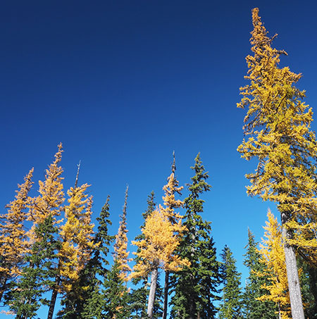
Western larch light up Mount Hood’s eastern slopes each fall

The title of this post might take you back to “No. 1… THE LARCH” (followed by “No. 3… THE LARCH!” and “…now for something completely different…”).

This might have been the most obscure of Monty Python’s many recurring non-sequiturs, and it is indelibly imprinted in the minds of among those of us of a certain age… but the Pythons had it right: the larch isa remarkable tree, and it really can be “recognized from quite a long way away”.

At about this time each fall, Oregon’s only deciduous conifer explodes into shades of bright yellow, gold and orange before dropping its needles for the winter. Western larch (Larix occidentals) spends most of the spring and summer growing season blending in with other conifers in the forest, and are thus easily missed. But for the next few weeks, they will be flamboyantly on display, and are worth a visit to the east side forests they call home.

Larch02

Larch grove along the East Fork Hood River

Western larch is one of about a dozen larch found around the world, but it is the only larch found in Oregon. Its range extends north to British Columbia and east to Idaho, Montana and Alberta. It’s also among the largest of the larch species, capable of growing nearly 200 feet tall on massive trunks up to five feet across. Our Western larch is often called “tamarack” by locals, but that name actually belongs to a different, smaller species that grows in the eastern part of the continent.

Western larch has a distinctive shape compared to other forest conifers. Its crown is narrow and tapered, like a candle, and it often grows in groves were its shape allows closely spaced trees to thrive. Larch trees can survive extreme cold and thrive in subalpine forests with winters are frigid and summers are hot and dry — exactly the climate found on the east slopes of Mount Hood. Here, Western larch often dominates the forests and form the westernmost reach of the species.

Larch03

Larch seedling on Lookout Mountain

Western larch is also prolific in producing offspring, with thickets of young larch growing among the big trees, especially after fire or logging. Young trees are fast-growing, often adding a foot or more of new growth each year.

The branches of Western larch are unique and easy to spot, even during its “green” phase in spring and summer. New growth emerges bright yellow-green in spring from rows of knobs along its limbs, with clusters of needles held in tufts that emerge from each knob. This gives the foliage a delicate, lacy appearance during the growing season, when its foliage gradually deepens to dark green.

Larch04

Western larch are easy to spot by their tufted foliage

Their bare limbs have distinctive,  gnarled, picturesque shape in winter, when the needles have dropped. The cones of Western larch are small, and also arranged among the small knobs that dot its limbs.

Larch05

Western larch foliage

Mount Hood’s east side forests are also “fire forests”, ecosystems where frequent fires are essential to forest health. Like the neighboring Ponderosa pine that it typically associates with, Western larch has thick bark designed to protect mature trees from repeated fires. For added fire protection, larch drop their lower limbs at the tree mature, keeping the growing tree canopy high and out of reach of fires sweeping through the understory.

Larch06

The bark on Western Larch is thick and fire-resistant, similar to its Ponderosa pine neighbors

But in the recent catastrophic fires that have swept through the east and north slopes of Mount Hood, the flames were intense enough to reach larch canopies, killing thousands of these normally fire resistant trees. Despite this, young larch seedlings are among the most prominent trees leading the forest recovery in the aftermath of the Bluegrass Fire (2006), Gnarl Fire (2008) and Dollar Lake Fire (2011) that burned most of Mount Hood’s eastern and northern flanks.

Larch07

Western Larch shed their lower limbs, keeping their growing crowns out of reach of low-intensity fire that would likely burn the other, low-branched conifers in this forest near Hood River Meadows.

Western larch can live to be at least 1,000 years old — that’s the age of “Gus”, the largest and oldest larch of any species in the world. Gus is a Western larch growing in a grove of ancient larch survivors in Montana, and is at the heart of a magnificent larch grove that should be on every big tree hunter’s “bucket list”.

Mount Hood’s most venerable Western larch might be the stunted patriarch growing from a high rock outcrop along Surveyors Ridge (below) at a spot I call Tamarack Rock (an explanation for that improper name is found in this 2009 blog article), where it enjoys a magnificent view of Mount Hood, but also endures the brunt of Pacific storms sweeping across the Cascades in winter and intense heat and drought over the summer months. This old tree is likely centuries old, and has survived fires, logging and undoubtedly a few lightning strikes is this exposed location.

Larch08

Ancient larch on Tamarack Rock

Like most of our native species, the Western larch was used by Native Americans for food and materials. The resin under its bark was used for medicinal purposes and larch wood was used for poles and as firewood. Today, it is still prized as exceptional firewood.

Which brings us to perhaps the most unfortunate threat to Western larch in our increasingly busy forests: being cut down as “dead” during its dormant, leafless winter phase. Too many perfectly healthy larch trees meet this completely avoidable fate in our forests and cities each year.

Larch09

These oddly shaped larch near Brooks Meadow have been attacked by the Larch casebearer, an introduced European moth that can defoliate and even kill Western larch.

A more worrisome threat is the Larch casebearer, a European insect that can defoliate Western larch. The parasites that keep the casebearer in check in Europe has not been effective as an introduced counter measure in the Western larch range, and the long-term impact of this introduced bug on our larch stands is still unknown.

Larch10

Larch stand in mid-summer with browned foliage from a heavy attack by Larch casebearer

The photo above looks like it might be a larch grove in fall, but the photo was taken along the Lookout Mountain Road in mid-summer, showing the crowns of several Western larch under heavy attack by the Larch casebearer. The State of Oregon has published this fact sheet with more information on the casebearer.

Where to see Western Larch

From now through early November, Western larch will be putting on a show along the eastern leg of the Mount Hood Loop Highway, where OR 35 follows the East Fork of the Hood River to Bennett Pass. Bennett Pass roughly marks the dividing line for its range, with big stands of larch suddenly appearing east of the pass.

Larch11

Larch trees fading to orange and gold in November along the Gumjuwac Trail

If you have more time, the Dufur Mill Road (Forest Road 44) has still more Western larch on display, including along the unimproved road to High Prairie on Lookout Mountain. And if you simply travel Highway 26 across the Cascades, you’ll see Western larch from Blue Box Pass east to the edge of the forest.

If you’re looking for a trail to hike or ride a bike through larch stands, the Dog River Trail (No. 675) and Zigzag Trail (No. 678) are good choices. Both are quiet, though you’ll share the Dog River Trail with mountain bikers. Other trails along the East Fork also offer nice larch stands.

Proposal: Bennett Pass Historic Backroad

bennettpassbackroad00

Mount Hood from Historic Bennett Pass Road

One of the many misconceptions about our national parks is that visiting means contending with the masses along crowded paved roads, with the only chance for solitude limited to trails that are beyond the abilities of many visitors, including the elderly, those with limited mobility or young families.

But the truth is that our national parks also feature some of the most stunning primitive backroads for those looking for a more accessible way to get off the beaten track.

One of the most spectacular is the Titus Canyon Road in Death Valley National Park, and the concept behind Titus Canyon has stuck in my mind since I first visited the park in the early 1980s.

One-Way Concept

bennettpassbackroad01

Titus Canyon: Yogi Bear does not drive here!

Titus Canyon Road begins east of Death Valley, at the near-ghost town of Rhyolite, climbs over 5,000 foot Red Pass, then begins a spiraling descent of nearly a vertical mile as it enters the increasingly narrow gorge of Titus Canyon. When the road finally emerges near sea level, from the east wall of Death Valley, the floor of Titus Canyon has shrunk to a point that two cars would not be able to pass.

bennettpassbackroad02

One-way trip to heaven… in Death Valley

This is where the genius of Titus Canyon Road comes in. The Park Service has designated this a one-way road, with traffic allowed only in the direction of Death Valley.

The physical constraint at the lower end of Titus Canyon is the determining factor, to be sure, but the broader effect is that one-way traffic provides a remarkably relaxing experience in which visitors can focus on the scenery, not dodging oncoming traffic. The one-way design also negates driving through clouds of dust from oncoming vehicles, a notable benefit on primitive roads.

bennettpassbackroad03

Titus Canyon narrows (and my 1980s Honda Civic, back in the day)

So, how does this relate to Mount Hood? Part of the Mount Hood National Park Campaign concept calls for repurposing some of the thousands of miles of failing, obsolete logging roads in the Mount Hood National Forest into scenic backroads or trails for hiking or biking.

Most of these roads were constructed during the industrial logging heyday from the 1950s through the late 1980s, and were solely designed around clear cuts, not a concern for the respecting landscape or taking in the scenery.

But a few of these roads date back to an earlier era, when the first few roads connected major destinations in the new Mount Hood National Forest in the 1920s and early 1930s. These roads were often built without machinery, and subsequently follow the contours of the land in a way that roads from the industrial logging era rarely do.

Historic Bennett Pass Road

bennettpassbackroad04

Views into the remote Badger Creek Wilderness abound along historic Bennett Pass Road

One such historic forest road connects High Prairie and Lookout Mountain, located 8 miles due east of Mount Hood, to Bennett Pass, on the southeast shoulder of the mountain. For travelers of the Mount Hood Loop Highway, the old route follows the high ridges that form the wall of the East Fork Hood River valley, as you descend from Bennett Pass toward Hood River.

Today, the historic Bennett Pass Road is a bumpy, often grinding minefield to navigate. It’s hard to imagine that it was the main forest route when it was built, but it still passes some of the finest scenery in the area along the way, and has the potential to be an exceptional scenic backroad.

bennettpassbackroad05

1920s map when the future Bennett Pass Road was still just a “mountain trail”

When it was built in the early 1930s, the historic road followed the route of an early forest trail along the ridge that connects Bennett Pass to a Forest Service guard station that once stood at High Prairie (if you know where to look, you can still find the ruins). The road was built by the Civilian Conservation Corps (CCC) in the early 1930s by crews based in Camp Friend, located to the east of Lookout Mountain, and just south of the town of Dufur. The Camp Friend crews also built several lookouts in the area and the historic road to Flag Point.

Today, the historic Bennett Pass Road serves as the western boundary for the Badger Creek Wilderness and the northern boundary for the White River Unit of the Mount Hood National Recreation area. This easy proximity to both of these protected areas brings a string of fine trail opportunities along the route for exploring nearby viewpoints, lakes and meadows on foot.

bennettpassbackroad06

Boulder Creek Valley and Echo Point in the White River Unit of the Mount Hood National Recreation Area from the historic Bennett Pass Road

The northern section of the historic Bennett Pass Road, from High Prairie to Dufur Mill Road, was bypassed and decommissioned in the late 1980s when the newer, gravel-surfaced road to High Prairie was constructed. For the purpose of the Bennett Pass Historic Backroad concept, this newer section is included in the proposal, with the Dufur Mill Road junction serving as the starting point for the backroad tour and Bennett Pass as the end point.

How would it be different?

How would the Bennett Pass Historic Backroad differ from what is on the ground today? First, it would be one-way from High Prairie to Bennett Pass, the historic section of the original road that still survives. Like Titus Canyon, this portion of Bennett Pass Road has a few spots where passing an oncoming vehicle would by physically impossible – notably below Lookout Mountain and along a notorious stretch etched into a cliff known as the Terrible Traverse.

bennettpassbackroad07

Leaving the Terrible Traverse en route to Bennett Pass

But like Titus Canyon, the purpose of the one-way tour is mainly to allow for a greater sense of remoteness and ability to truly appreciate the rugged scenery along the way.

Second, the concept of a scenic backroad also includes ADA-compliant picnic and restroom facilities along the way to ensure that all visitors can enjoy the tour. As our population ages and our society becomes more socially inclusive of those with limited mobility, providing accessible alternatives for exploring our public lands has become a critical, largely unmet need.

Some of these facilities are already in place at existing trailheads and could be made accessible with modest improvements. Other spots along the route would need these basic improvements.

bennettpassbackroad08

Enjoying Mt. Jefferson and views into the Badger Creek Wilderness at 10 mph along the historic Bennett Pass Road

Finally, a 10-mph speed limit would ensure that the proposed Bennett Pass Historic Backroad tour remains focused on users looking for a relaxing, scenic way to enjoy the area. This means that OHV users accustomed to traveling at greater speeds would need to find other places to make noise and disturb other forest visitors — and besides, the Forest Service has set aside areas for OHVs elsewhere in the forest.

bennettpassbackroad09

The faded (and assassinated) top sign warns passenger vehicles from venturing onto the historic Bennett Pass Road

Today, it’s hard to get much beyond 5-mph in many sections of the Bennett Pass Road due to a profound lack of maintenance, so a light upgrade to the surface and periodic maintenance is part of the concept. In the 1980s, I navigated Titus Canyon Road in a Honda Civic, and there’s no reason why a better maintained Bennett Pass Road couldn’t accommodate passenger cars traveling at 10 mph. That’s part of being inclusive, after all.

Signage is deficient or completely absent along much of the route today, so the backroad concept also calls for improved directional signage and occasional interpretive signage along the tour, as well. Interpretive signage could be as simple as mileposts that link to a downloadable PDF or podcast describing the rich natural and cultural history of the area.

The Bennett Pass Historic Backroad Tour

The full tour covers just over 14 miles, but at 10-mph with a few stops along the way, the Bennett Pass Historic Backroad tour would take the average family two or three hours to complete. Add an hour on each end to reach the tour from Portland, and this would make an exceptional choice for urban visitors looking for a new way to explore Mount Hood country.

Here’s a tiny map of the concept:

bennettpassbackroad10

But by all means, please click here for a very large version of the map to see the details that make up this proposal.

Tour Description

0.0 to 2.8 mi. – Dufur Mill Road to Sunrise Rocks – The tour starts at gravel Lookout Mountain Road (Road 4410) where it begins on paved Dufur Mill Road (Highway 44), north of Lookout Mountain. This is the section of the route built in the 1980s to bypass a (now abandoned) portion of the historic road.

After climbing through forest and passing pretty Horkelia Meadow, this segment ends at the mostly unknown Sunrise Rocks, a fine, currently undeveloped picnic spot with a commanding view of Mount Hood, across the East Fork Hood River valley.

bennettpassbackroad11

The sprawling Mount Hood view from semi-secret Sunrise Rocks

The Bennett Pass Historic Backroad concept (see map) also calls for a new trail in the area, from the Little John winter recreation area to Sunrise Rocks, providing another way to enjoy this overlook for hikers looking for a challenge and a year-round purpose for the Little John trailhead.

bennettpassbackroad12

Sunrise Rocks from the Little John trailhead and parking area… someday a trail from here?

2.8 to 4.9 mi. – Sunrise Rocks to High Prairie – after taking in the view at Sunrise Rocks, the route continues for another 2 miles along the newer road section to High Prairie, a major destination for hikers and equestrians. Families looking for a picnic or short hike can explore the sprawling meadows here, or take the longer 5-mile loop to the airy summit of Lookout Mountain, where the view stretches up and down the Cascades and into the high desert country of Eastern Oregon.

bennettpassbackroad13

Acres of subalpine wildflowers and a maze of family-friendly trails await at High Prairie

4.9 to 7.2 mi. – High Prairie to Gunsight Ridge – two-way travel ends at High Prairie in the historic backroad concept, and from this point forward the tour would be one-way toward Bennett Pass along the surviving, original section of the historic Bennett Pass Road. The segment of original road from High Prairie to Gunsight Ridge is the most breathtaking on the tour, with huge views of Mount Hood and exposed sections where drivers will be gripping the wheel — and taking in the views.

bennettpassbackroad14

Sweeping Mount Hood views abound where the historic Bennett Pass Road skirts Lookout Mountain

Several scenic pullouts are located along this section, as well as a major trailhead at Gumjuwac Saddle, with trails heading in five directions! Hiking options from the saddle include longer trips to Badger Lake and Lookout Mountain, or the nearby Gumjuwac Overlook, just 0.8 miles from the saddle.

bennettpassbackroad15

Mount Hood after an early autumn snow from the Gumjuwac Overlook

The proposed Gunsight Ridge picnic area would be located at a large pullout above pretty Jean Lake, with access to the Gunsight Trail. Jean Lake can be visited via a family-friendly 0.6 mile trail that descends to the lake.

bennettpassbackroad16

Pretty Jean Lake is a short forest hike from the historic Bennett Pass Road

7.2 to 9.0 mi. – Gunsight Ridge to Camp Windy – the short drive from Gunsight Ridge to Camp Windy is just below the ridge crest, with frequent views into the Badger Creek Wilderness, and later, into the White River unit of the Mount Hood National Recreation Area.

bennettpassbackroad17

Expansive meadows at Camp Windy roll down the slopes of Gunsight Ridge

Modest picnic facilities and a vintage toilet already exist at Camp Windy, a lovely mountainside meadow, but new facilities would be needed as part of the scenic backroad concept. A short spur road here provides access to the Badger Saddle trailhead, and the 3.5-mile round trip hike to Badger Lake.

bennettpassbackroad18

Mount Hood from the Gunsight Ridge Trail

9.0 to 10.1 mi. – Camp Windy to Bonney Junction – From Camp Windy, the historic road continues to a 3-way junction with Bonney Meadows Road (Road 4891). The historic backroad concept calls for the Bonney Meadows route to function as a 2-way facility, allowing access to the Bennett Pass Historic Backroad at its midpoint, and for Bennett Pass visitors to make side trips to Bonney Meadows and Bonney Butte, just off the Bennett Pass tour.

bennettpassbackroad19

Peaceful Bonney Meadows with Mount Hood peeking over the ridge

Bonney Meadows already has a rustic campground perfect for picnics and exploring the nearby meadows. Families looking for something more challenging can make the 4.5 mile round-trip hike to exceptionally scenic Boulder Lake, or try a shorter hike to Bonney Butte, known for its raptor surveys. Bonney Meadows also has several developed campsites, so families could opt to camp here, midway through the tour.

bennettpassbackroad20

Lovely Boulder Lake

10.1 to 12.4 mi. – Bonney Junction to Newton Clark Overlook – from Bonney Junction, the historic Bennett Pass Road turns abruptly north and descends briefly before arriving at a catwalk section of road carved into the crest of the ridge. Here, the tour passes the Terrible Traverse, marked by an extraordinary rock gateway cut by the early road builders. This is the Titus Canyon equivalent for the Bennett Pass Road, as there is no room for passing (or error) along this section!

bennettpassbackroad21

The dramatic gates to the Terrible Traverse

Just beyond the traverse, the road drops to a saddle with an excellent view of Mount Hood at the proposed Newton Clark overlook and picnic site.

bennettpassbackroad22

The Newton Clark Glacier and its enormous moraine from the proposed Newton Clark overlook

This spot is also one of several backcountry lodge locations proposed in the Mount Hood National Park Campaign to allow for Euro-style chalet-to-chalet trekking. These modest lodges would be rustic and quiet, along the lines of Cloud Cap Inn, and open year-round to also serve Nordic skiers and snowshoers.

bennettpassbackroad23

It turns out the Hood River County Sheriff digs the Newton Clark overlook, too (Courtesy Hood River Co.)

12.4 to 14.2 mi. – Newton Clark Overlook to Bennett Pass – from Newton Clark Overlook, the remainder of the route continues along the ridge top through handsome stands of noble fir to the large trailhead and parking area at Bennett Pass, ending the tour.

What would it take?

While some of the proposals featured in this blog are notably ambitions, this one is pretty simple, and could be accomplished in the near-term. The Forest Service would need to do some grading, add some gravel in some sections and step up maintenance of the historic Bennett Pass Road. Picnic and toilet facilities would need to be added in a few spots and new signage to help visitors navigate and appreciate the tour would be needed.

bennettpassbackroad24

Wildflowers line the historic Bennett Pass Road in summer

Establishing a one-way route would be a taller order for the Forest Service, but there are already a few limited one-way routes along forest roads, so the idea is not without precedent. One obvious exception to a one-way rule is for emergency access, of course, but other visitors would probably appreciate the peace of mind in knowing they won’t meet another vehicle at the blind curve midway along the Terrible Traverse!

How to visit?

The good news is that you can visit the proposed Bennett Pass Historic Backroad today with a few considerations in mind:

  1. The road is generally only open in summer, from mid-June through early October. The best time to visit is in July, when wildflowers are blooming throughout the tour, and the worst time is after heavy rain, when a few muddy sections might just swallow your vehicle.
  1. Parts of the historic portion of the road are very, very rough. Until a Bennett Pass Historic Backroad brings some surface improvements and periodic maintenance to this old route, plan on a slow, sometimes jarring ride that will test your nerves, tires and suspension. High clearance vehicles with AWD or 4WD, only!

bennettpassbackroad25

This collage of scraped rocks on Bennett Pass Road is mute testimony to the folly of taking a passenger vehicle there – don’t try it!

  1. The roads are poorly signed, so you’ll need a forest map. I recommend the National Geographic map for Mount Hood National Forest in their Trails Illustrated series. Never trust a GPS device or smart phone to navigate forest roads!

bennettpassbackroad26

The author hanging out on the historic Bennett Pass Road

With these precautions in mind, the old Bennett Pass Road is fun to explore and always un-crowded.

Take it slow and enjoy the ride!

Mount Hood Loop Interpretive Signs

Original “Historic Oregon” sign at Barlow Pass in the 1940s (Wikimedia Commons)

Original “Historic Oregon” sign at Barlow Pass in the 1940s (Wikimedia Commons)

One of the unexpected discoveries in launching the Mount Hood National Park Campaign in 2004 was the surprising number of people who think our mountain and gorge are already protected as a national park!

This tragic misconception is shared by newbies and natives, alike, so my conclusion is that it comes from the “park-like” visual cues along the Mount Hood Loop: the historic lodges, rustic stone work and graceful bridges along the old highway. There is also a surprising (if disjointed) collection of interpretive signs that you might expect to find in a bona fide national park.

The new (or restored?) sign at Barlow Pass in 2010

The new (or restored?) sign at Barlow Pass in 2010

The interpretive signs around Mount Hood are an eclectic mish-mash of survivors from various public and private efforts over the years to tell the human and natural history of the area.

The oldest signs tell the story of the Barlow Road, the miserable mountain gauntlet that marked the end of the Oregon Trail. The above images show one of the best known of these early signs, a mammoth carved relief that stands at Barlow Pass (the current sign appears to be a reproduction of the original).

Less elaborate signs and monuments of assorted vintage and styles are sprinkled along the old Barlow Road route wherever it comes close to the modern loop highway: Summit Prairie, Pioneer Woman’s Gravel, Laurel Hill.

More recently, the Forest Service and Oregon State Parks have been adding much-needed interpretive signage along the Historic Columbia River Highway (as described in this article), an encouraging new trend.

Oregon State Parks interpretive panels are showing out throughout the Gorge

Oregon State Parks interpretive panels are showing out throughout the Gorge

Thus, I was thrilled when the Forest Service Center for Design and Interpretation in McCall, Idaho contacted me last year about a new series of roadside signs planned for the Mount Hood Loop. They had seen my photos online, and were looking for some very specific locations and subjects.

In the end, the project team picked eight of my images to be included on a series of four interpretive signs. The following is a preview of the signs, and some of the story behind the project. The new signs should be installed soon, and hopefully will survive at least a few seasons on the mountain!

The Signs

The first installation will be placed somewhere along the Salmon River Road, probably near the Salmon River trailhead. This sign focuses on fisheries and the role of the Sandy River system as an unimpeded spawning stream for salmon and steelhead.

This sign will appear near the Salmon River (USFS)

This sign will appear near the Salmon River (USFS)

(click here for a large view)

Part of the narrative for this sign focuses on the removal of the Marmot and Little Sandy dams, a nice milestone in connecting the network of Wild and Scenic Rivers in the Sandy watershed to the Columbia. A PGE photo of the Marmot Dam demolition in 2007 is included on the display, along with river scenes of the Sandy and Salmon. The Salmon River image on the first sign is the only one I captured specifically for the project, in early 2012. It’s a rainy winter scene along the Old Salmon River Trail.

The second sign will be placed at the Little Zigzag trailhead, located along a section of the original Mount Hood Loop highway at the base of the Laurel Hill Grade. The site already has an interpretive sign, so I’m not sure if this is an addition or replacement for the existing (and somewhat weather-worn) installation.

This sign will be located at the Little Zigzag trailhead (USFS)

This sign will be located at the Little Zigzag trailhead (USFS)

(click here for a large view)

The content of the Little Zigzag sign is unique, launching into a surprisingly scientific explanation of how the negative ions created by streams and waterfalls feed your brain to give you a natural high! Not your everyday interpretive sign..! It also includes a decent trail map describing the hike to Little Zigzag falls, as well as other trails in the area.

The Forest Service used several of my images on this sign: views of Little Zigzag Falls, the Little Zigzag River and several botanical shots are incorporated into the layout.

The Little Zigzag Falls image has a bit of a back story: the Forest Service designers couldn’t take their eyes off a log sticking up from the left tier of the falls. To them, it looked like some sort of flaw in the image. I offered to edit it out, and after much debate, they decided to go ahead and use the “improved” scene. While I was at it, I also clipped off a twig on the right tier of the falls. Both edits can be seen on the large image, below:

USFS_Panel_1a

(click here for a larger image)

I should note that I rarely edit features out of a photo — and only when the element in question is something ephemeral, anyway: loose branches, logs, or other debris, mostly… and sometimes the occasional hiker (or dog) that walks into a scene!

The third sign will be installed at the popular Mirror Lake trailhead, near Government Camp. Like the Little Zigzag sign, this panel has a trail map and hike description for Mirror Lake and Tom Dick and Harry Mountain.

A nice touch on Mirror Lake sign is the shout-out to the Children & Nature Network, a public-private collaborative promoting kids in the outdoors. I can’t think of a better trail for this message, as Mirror Lake has long been a “gateway” trail where countless visitors to Mount Hood have had their first real hiking experience.

This sign will be at the Mirror Lake trailhead (USFS)

This sign will be at the Mirror Lake trailhead (USFS)

(click here for a large view)

The Forest Service team used a couple of my photos in the Mirror Lake layout: a summertime shot of the lake with Tom Dick and Harry Mountain in the background, and a family at the edge of the lake, and a second “classic” view of alpenglow on Mount Hood from the lakeshore.

The fourth sign in the series focuses on geology. Surprisingly, it’s not aimed at familiar south side volcanic features like Crater Rock — a theme that was called out in some of the early materials the Forest Service sent me. Instead, this panel describes huge Newton Clark Ridge, and will apparently be installed at the Bennett Pass parking area.

This sign is planned for Bennett Pass (USFS)

This sign is planned for Bennett Pass (USFS)

(click here for a large view)

In a previous blog article, I argue Newton Clark Ridge to be a medial moraine, as opposed to currently accepted theory of a pyroclastic flow deposited on top of a glacier. The Forest Service interpretive panel mostly goes with the conventional pyroclastic flow theory, but hedges a bit, describing it as “remnant” of two glaciers… which sounds more like a medial moraine!

The Newton Clark Ridge sign also includes a description of the many debris flows that have rearranged Highway 35 over the past few decades (and will continue to). One missed opportunity is to have included some of the spectacular flood images that ODOT and Forest Service crews captured after the last event, like this 2006 photo of Highway 35 taken just east of Bennett Pass:

Missed opportunity: photo of the 2006 Newton Creek Floods (USFS)

Missed opportunity: photo of the 2006 Newton Creek Floods (USFS)

The Forest Service used two of my photos for this sign, both taken from viewpoints along the old Bennett Pass Road, about two miles south of the parking area. One wrinkle in how well this sign actually works for visitors is the fact that Newton-Clark Ridge is only partially visible from the Bennett Pass parking lot, whereas it is very prominent from the viewpoints located to the south. Maybe this was the point of using the photos?

The real Newton Clark (1837-1918)

The real Newton Clark (1837-1918)

There is also a glitch in this panel that I failed to catch during the production phase: the hyphen between “Newton” and “Clark” in the title and throughout the text. There’s a lot of confusion about this point, but it turns out that Newton Clark was one person, not two: a decorated Civil War veteran who fought at Shiloh and Vicksburg, among many prominent battles, then moved to the Hood River Valley in 1887, where he was a local surveyor, farmer and early explorer of Mount Hood’s backcountry.

Newton Clark was part of the first white party to visit (and name) Lost Lake, and today’s Newton Clark Glacier and nearby Surveyors Ridge are named for him. The confusion comes from the subsequent naming of the two major streams that flow from the Newton Clark Glacier as “Clark Creek” and “Newton Creek”, suggesting two different namesakes. Hopefully, the local Forest Service staff caught this one before the actual sign was produced!

Strange Bedfellows?

I was somewhat torn as to whether to post this article, as it goes without saying that the WyEast Blog and Mount Hood National Park Campaign are not exactly open love letters to the U.S. Forest Service. So, why did I participate in their interpretive sign project?

First, it wasn’t for the money – there wasn’t any, and I didn’t add a dime to the federal deficit! I don’t sell any of my photos, though I do regularly donate them to friendly causes. So, even though the Forest Service did offer to pay for the images, they weren’t for sale.

One that won’t be built? This sign was originally conceived for Buzzard Point, near Barlow Pass, but it’s not clear if it made the final cut (USFS)

One that won’t be built? This sign was originally conceived for Buzzard Point, near Barlow Pass, but it’s not clear if it made the final cut (USFS)

(click here for a large version)

In this case, once I understood the purpose of the project, it quickly moved into the “worthy cause” column, and I offered to donate whatever images the Forest Service could use, provided I see the context — and now you have, too, in this preview of the new signs!

I will also point out that the Forest Service project staff were terrific to work with, and very dedicated to making a positive difference. We’re fortunate to have them in public service, and that’s a genuine comment, despite my critiques of the agency, as a whole.

Here’s a little secret about the crazy-quilt-bureaucracy that is the Forest Service: within the ranks, there are a lot of professionals who are equally frustrated with the agency’s legacy of mismanagement. While I may differ on the ability of the agency to actually be reformed, I do commend their commitment to somehow making it work. I wish them well in their efforts, and when possible, I celebrate their efforts on this blog.

So you want to change the Forest Service from within..?

1960s visitors in Glacier National Park (NPS)

1960s visitors in Glacier National Park (NPS)

Given the frustrating peril of good sailors aboard a sinking ship, it turns out there are some great options for supporting those in the Forest Service ranks seeking to make a positive difference. So, I thought I would close this article by profiling a couple of non-profit advocacy organizations with a specific mission of promoting sustainable land management and improving the visitor experience on our public lands. I hope you will take a look at what they do, and consider supporting them if you’re of like mind:

USFS_Panel_7

The National Association for Interpretation (NAI) is a not-for-profit 501(c)(3) involved in the interpretation of natural and cultural heritage resources in settings such as national parks, forests, museums, nature centers and historical sites. Their membership includes more than 5,000 volunteers and professionals in over 30 countries.

Original “Historic Oregon” sign at Barlow Pass in the 1940s (Wikimedia Commons)

Original “Historic Oregon” sign at Barlow Pass in the 1940s (Wikimedia Commons)

The Forest Service has a conservation watchdog group all its own, Forest Service Employees for Environmental Ethics (FSEEE), a not-for-profit 501(c)(3) based right here in Oregon. Their mission is to protect our national forests and to reform the U.S. Forest Service by advocating environmental ethics, educating citizens, and defending whistleblowers. The FSEEE membership is made up of thousands of concerned citizens, former and present Forest Service employees, other public land resource managers, and activists working to change the Forest Service’s basic land management philosophy.

I take great comfort in simply knowing that both organizations exist, and are actively keeping an eye on the Forest Service… from within!