Proposal: Historic Mount Hood Loop Highway State Trail (Part 2 of 2)

Yellow paint still marks the old centerline of an abandoned section of the historic Mount Hood Loop highway, nearly covered with more than 60 years of moss and ferns.

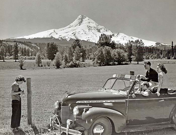
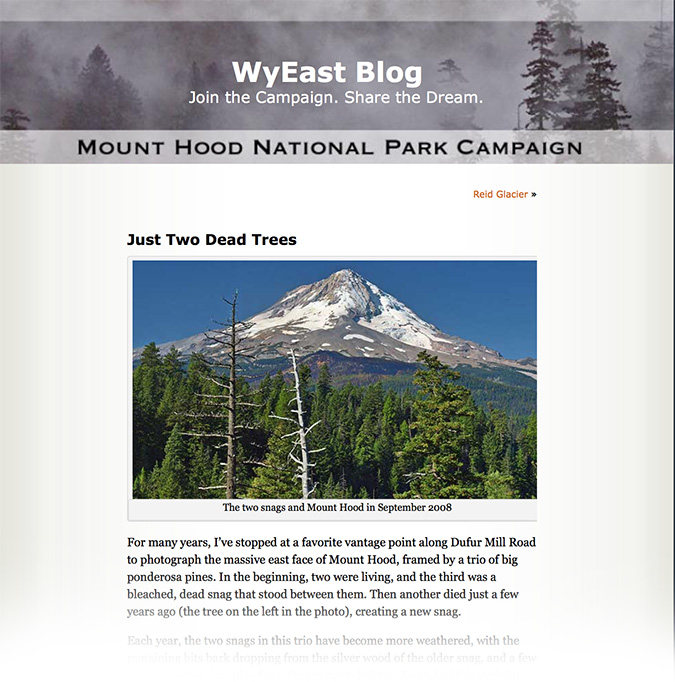
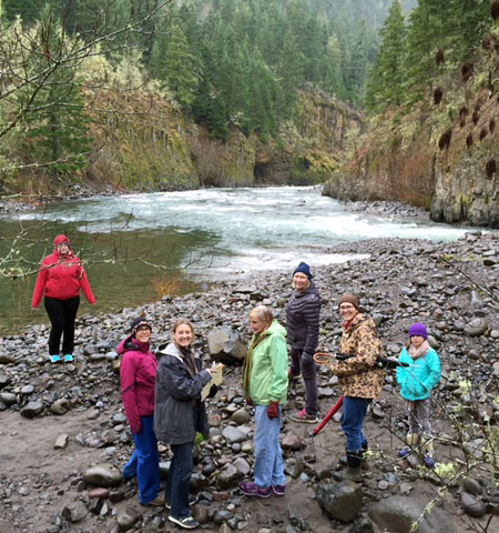
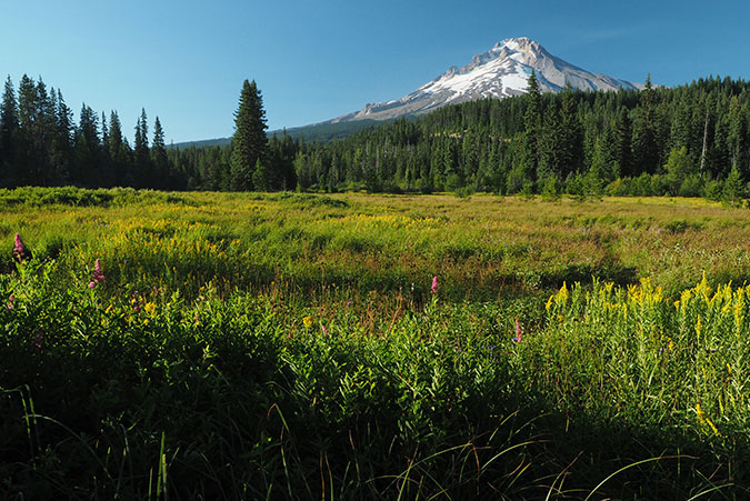
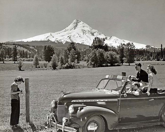
Part 1 of this article introduced the idea of restoring the surviving sections of the old Mount Hood Loop Highway to become part of a world-class cycle tour along this historic route. Part 2 focuses on these surviving historic sections of the old road, from Zigzag on the west side of the mountain to the Sherwood Campground on the east side, and how to bring this vision to reality.

________________

THE CONCEPT

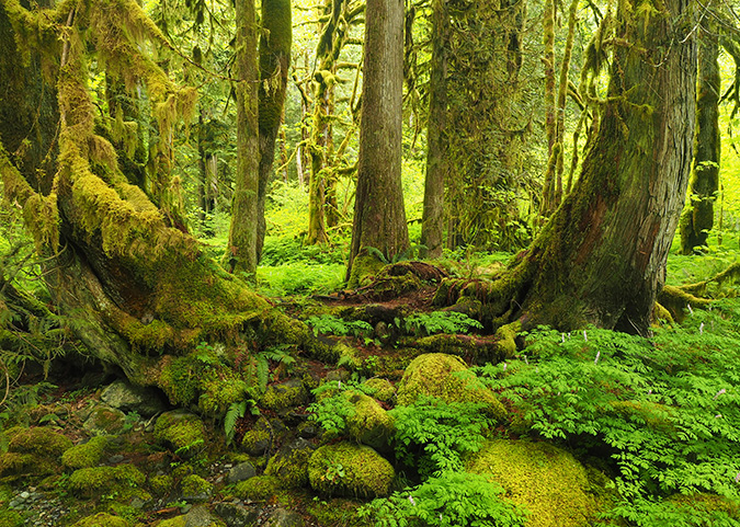
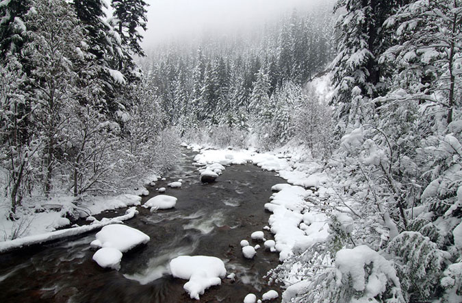
In the near-century since the original Mount Hood Loop was completed in early 1920s, the old route has gradually been replaced with straighter, faster “modern” highways. In areas outside Mount Hood National Forest, the bypassed sections of the old road are mostly still in use, often serving as local roads. But inside the national forest, from Zigzag to Sherwood Campground, long sections of the old road were simply abandoned, left to revert to nature when new, modern roads were built in the 1950s and 60s. Some bypassed sections are still in use, though mostly forgotten.

This is 1930s-era map (below) shows the original alignment of the Mount Hood Loop highway in red and the approximate location of the modern highway alignments of US 26 and OR 35 superimposed in black:

[click here for a large version of this map]

The concept of reconnecting these forgotten sections of historic road is straightforward, building on the example of the Historic Columbia River Highway (HCRH) in the Columbia Gorge. As in the Gorge, places where modern highways on Mount Hood simply abandoned or bypassed the old route, the surviving segments of the old road would be the historic building blocks for creating a new “state trail”, which is simply a paved bicycle and pedestrian path closed to automobiles. 

Sections where the historic route was completely destroyed by modern highways would be reconnected with new trail, like we see in the Gorge, or with protected shoulder lanes on quiet sections of the modern highway in a couple areas.

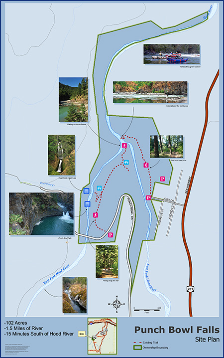
This map shows the overall concept for restoring the route as the Historic Mount Hood Loop State Trail:

[click here for the 11×17″ JPG version]

[click here for the 11×17″ PDF version]

Segments shown in blue on the concept map are where bypassed sections of the old highway still survive and segments shown in red are where new trails would connect the surviving historic segments. All of the new trail sections are proposed to follow existing forest roads to minimize costs and impacts on the forest. 

The concept map also shows several trailheads along the route where visitors would not only use to access the trail, but would also have trail information and toilets. These trailheads already exist in most cases, with several functioning as winter SnoParks that could be used year-round as part of the new trail concept.

Six Forest Service campgrounds (Tollgate, Camp Creek, Still Creek, Trillium Lake, Robinhood and Sherwood) already exist along the proposed route and two long-forgotten campgrounds (Twin Bridges and Hood River Meadows) are still intact and could easily be reopened as bikepacking-only destinations.

EXPLORING THE ROUTE

The next part of this article explores the scenic and historic highlights of the historic highway in three sections, from Rhododendron on the west side of the mountain to the Sherwood Campground and East Fork Hood River on the east side.

West Section – Rhododendron to Government Camp

The historic bridge over the Little Zigzag River survives, marking the beginning of a gracefully, winding ascent of Laurel Hill along the old loop highway

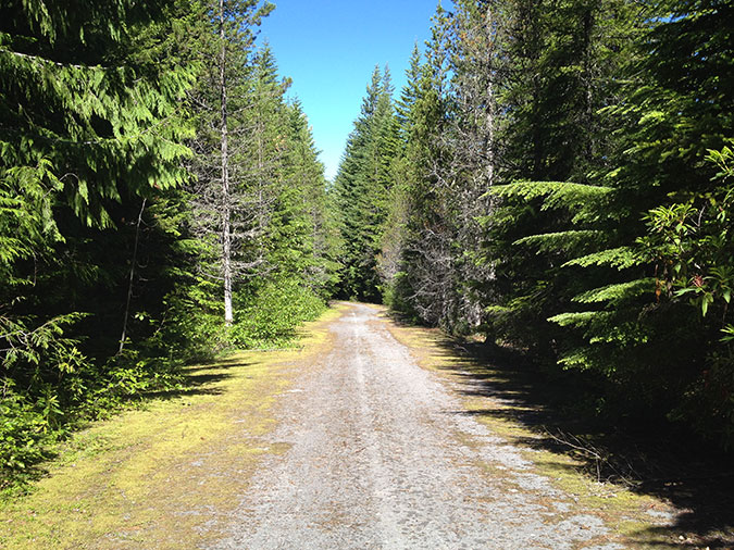
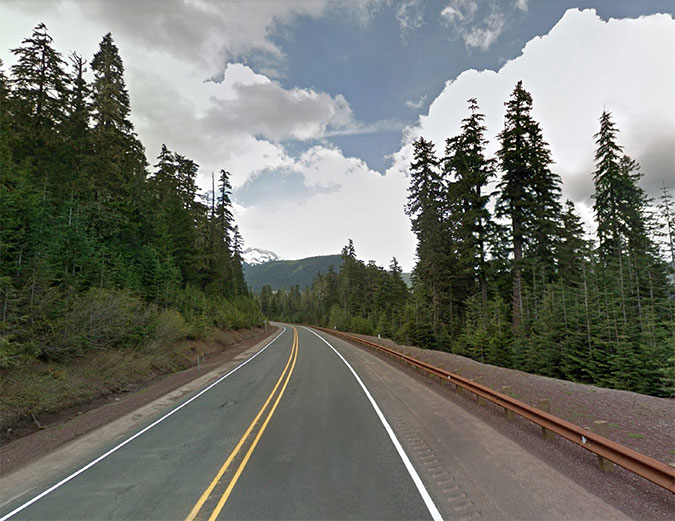
Beginning at the tiny mountain community of Zigzag, it’s possible to follow a couple bypassed segments of the old loop highway, notably along Faubion Road, but most of this section would follow a new, protected path on US 26 to Rhododendron, where the off-high trail concept begins. 

Part 1 of this article outlined the economic benefits of cycle touring, and by anchoring the west end of the new trail in Rhododendron, this small community would benefit from tourism in a way that speeding winter ski traffic simply doesn’t offer. The gateway trailhead would be located at the east end of Rhododendron, connecting to the Tollgate Campground, the first camping opportunity along the proposed route

The Barlow Road Tollgate near Rhododendron in the 1880s

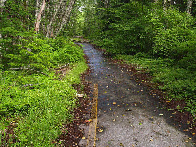
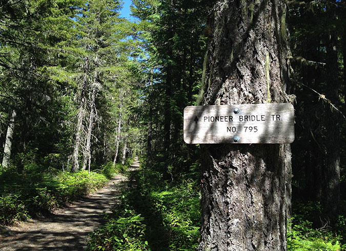
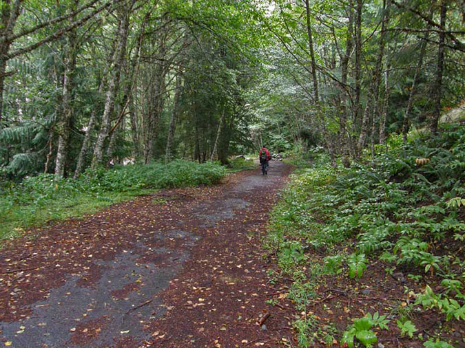
From Tollgate, the new route would follow the Pioneer Bridle Trail for the next two miles to the Kiwanis Camp Road junction, on US 26. This is a lightly used section of the Pioneer Bridle Trail, which was built by the Civilian Conservation Corps from Tollgate to Government Camp in the 1930s. This part of the corridor follows the relatively flat valley floor of the Zigzag River, so there is plenty of room for a new trail to run parallel to the Pioneer Bridle Trail, as another option.

Pioneer Bridle Trail east of Tollgate

Once at the Kiwanis Camp Road junction, the new route would share this quiet forest road for the next next couple miles. Kiwanis Camp Road is actually a renamed, surviving section of the old highway and still provides access to the Paradise Park and Hidden Lake trails into the Mount Hood Wilderness. 

The Zigzag River passing through the old Twin Bridges campground site

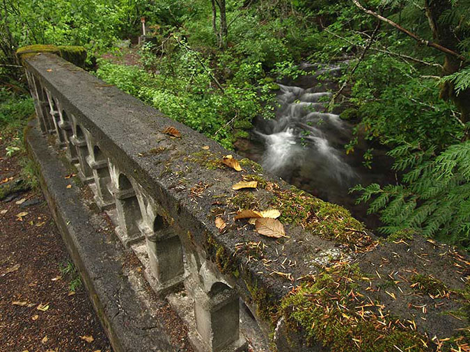
Along the way, this section of old highway passes the site of the long-abandoned Twin Bridges campground, where a surviving bridge also forms the trailhead for the Paradise Park Trail. This shady old campground is quite beautiful, with the rushing Zigzag River passing through it. It could easily be reopened as a bikepacking-only camping spot along the tour.

Little Zigzag Falls

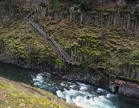
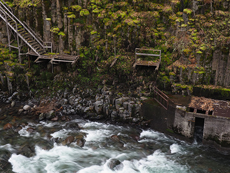
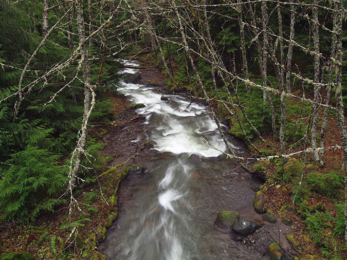
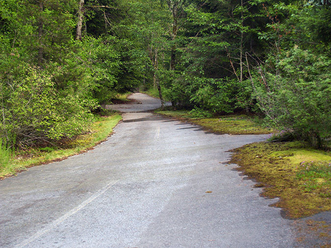
This operating section of old highway soon ends at the Little Zigzag River and the short spur trail to pretty Little Zigzag Falls. The enormous turnaround here once served as a rock quarry for the original loop highway, and has plenty of room serve as trailhead for the new state trail

From here, the old road begins an ascent of Laurel Hill, one of the most scenic and fascinating sections of the old highway. Large boulders now block the old highway at the historic bridge that crosses the Little Zigzag River, and from there, an abandoned section of the old road begins the traverse of Laurel Hill.

Abandoned historic highway section near the Little Zigzag crossing

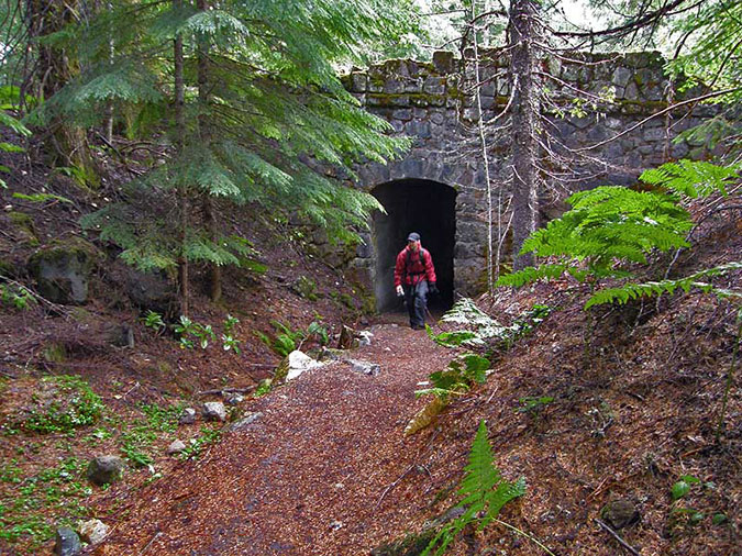
This abandoned section of historic road crosses the upper portion of the Pioneer Bridle Trail where an unusual horse tunnel was constructed under the old highway as part of creating the Bridle Trail. It’s hard to imagine enough highway traffic in the 1930s to warrant this structure, but perhaps the trail builders were concerned about speeding Model As surprising visitors crossing the road on horseback? Whatever the reason, the stone bridge/tunnel structure is one of the many surviving gems hidden along the old highway corridor.

Pioneer Bridle Trail tunnel under an abandoned section of the historic loop highway

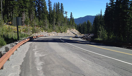
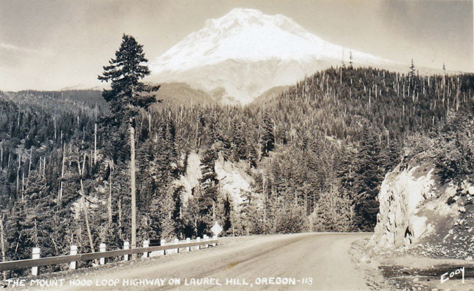
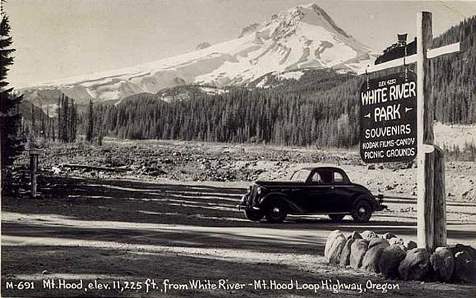
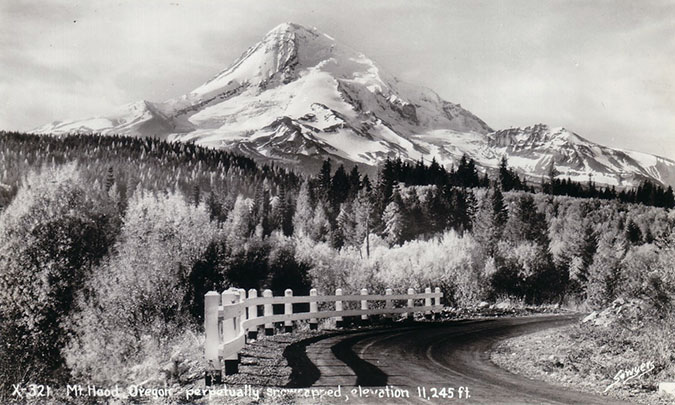
From the Pioneer Bridle tunnel overcrossing, the old road soon dead-ends at a tall embankment, where modern US 26 cuts across the historic route. The spot where the modern highway was built was once one of the most photographed waysides along the old highway, appearing in dozens of postcards and travel brochures. It was the first good view of the mountain from the old highway as it ascended from the floor of the Zigzag Valley to Government Camp (below).

While much of the old road has survived, the modern alignment of US 26 cut through this spot on the old loop, creating one of two gaps on Laurel Hill that will require significant structures to reconnect

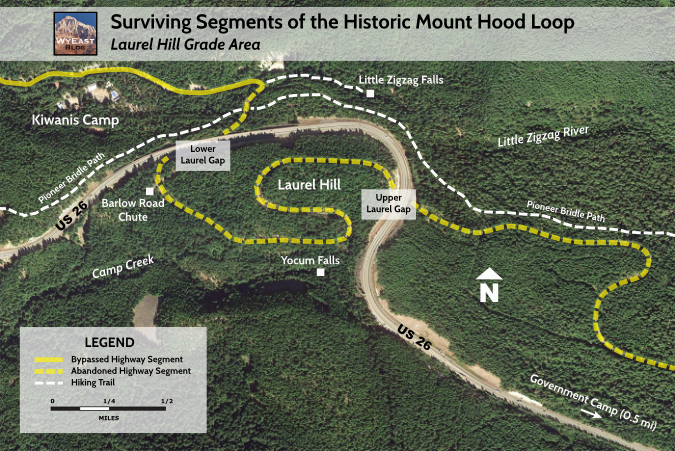
Although almost all of the old highway survives where it climbs the Laurel Hill grade, this spot marks one of the two major gaps along the way that would require a significant new structure to reconnect the route. A second gap occurs at the crest of Laurel Hill, to the east, where the modern highway cuts deeply through the mountain. This map shows the surviving, abandoned sections of the historic highway along the Laurel Hill grade and upper and lower gaps that must be bridged:

[click here for a large version of this map]

On the ground, the lower Laurel Hill gap looks like this:

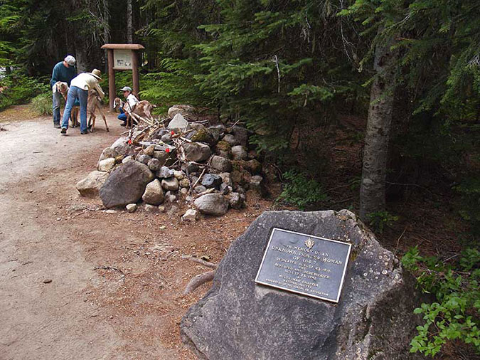
The lower Laurel Hill gap is at a well-known spot where a history marker points toward a short trail to one of the Barlow Road “chutes” that white migrants on the Oregon Trail endured in their final push to the Willamette Valley. 

ODOT has made this section of highway much faster and more freeway-like in recent years in the name of “safety”, but in the process made it impossible for hikers to cross the highway from the Pioneer Bridge Trail to visit the Barlow Road chute. A freeway-style median now blocks anyone from simply walking across the highway and cyclone fences have been added to the north side to make sure hikers get the message.

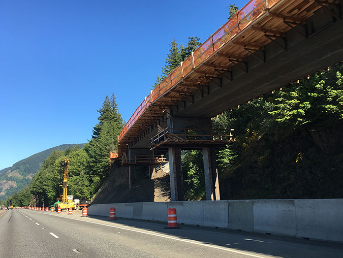
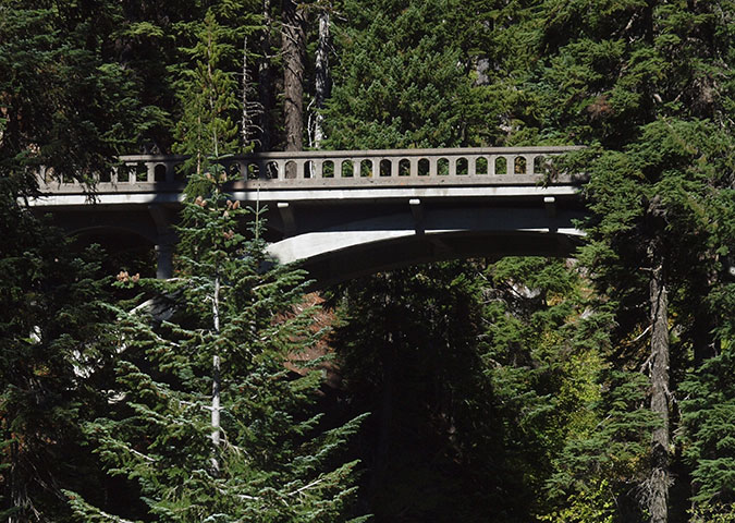
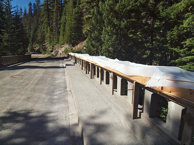
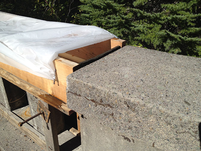
Given this reality, both of the Laurel Hill gaps would be great candidates for major new crossings, along the lines of work ODOT has done in the Gorge to reconnect the HCRH. This viaduct (below) was recently built by ODOT at Summit Creek, on the east side of Shellrock Mountain, where the modern I-84 alignment similarly took a bite out of an inclined section of the old highway, leaving a 40-foot drop-off where the old road once contoured downhill. This sort of solution could work at the lower Laurel Hill gap, too.

This new bicycle and pedestrian viaduct reconnects surviving segments of the original highway near Summit Creek along the Historic Columbia River Highway State Trail.

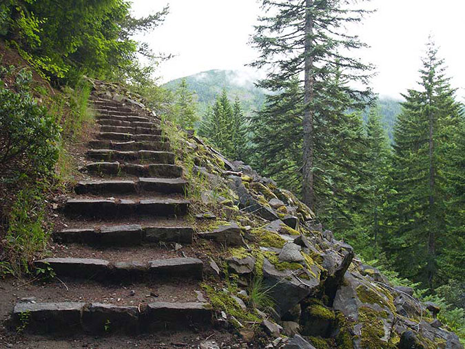
Beyond the Laurel Hill history marker on the south side of the modern US 26, a set of 1950s stone steps (below) leads occasional visitors up to the next section of abandoned Mount Hood Loop highway, where the old route continues its steady climb of Laurel Hill.

Stone steps leading from US 26 to the Barlow Road “chute” on Laurel Hill

This section of the abandoned route is in remarkably good shape, despite more than 60 years of no maintenance, whatsoever. It also briefly serves as the trail to a viewpoint of the Barlow Road chute — a footpath to the top of the chute resumes on the opposite side of the old highway, about 100 yards from the stone steps.

Abandoned section of the loop highway near the Barlow Road chute

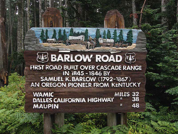
When the historic highway was built in the 1920s, the Barlow Road was still clearly visible and only a few decades old. Despite the care they used elsewhere to build the scenic new road in concert with the landscape, there was no care given to preserving the old Barlow Road. Thus, the historic highway cut directly across the chute, permanently removing a piece of Oregon history. 

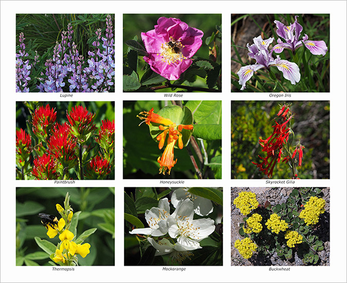
Today, the footpath to the top of the chute still gives a good sense of just how daunting this part of the journey was (below). This short spur trail, and others like it along the surviving sections of the old highway, would be integrated into the restored Mount Hood Loop route, providing side attractions for cyclists and hikers to explore along the way.

Looking down the Barlow Road chute from the interpretive trail

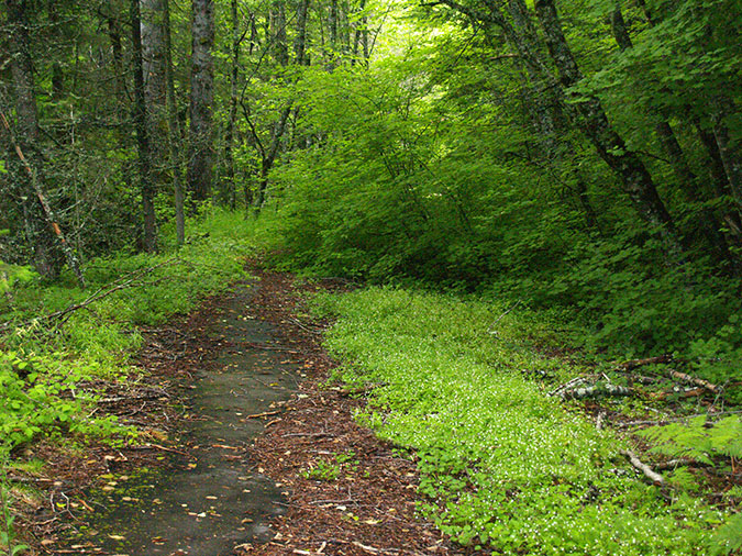
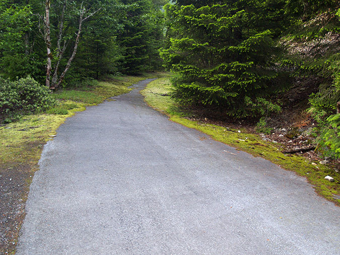
Beyond the Barlow chute, the old highway enters a very lush section of forest, where foot traffic from explorers continues to keep a section of old pavement bare (below). Scratch the surface, and even under this much understory, the old highway continues to be in very good condition and could easily be restored in the same way old sections of highway in the Gorge have been brought back to life as a trail.

Abandoned section of the old loop highway near Yocum Falls

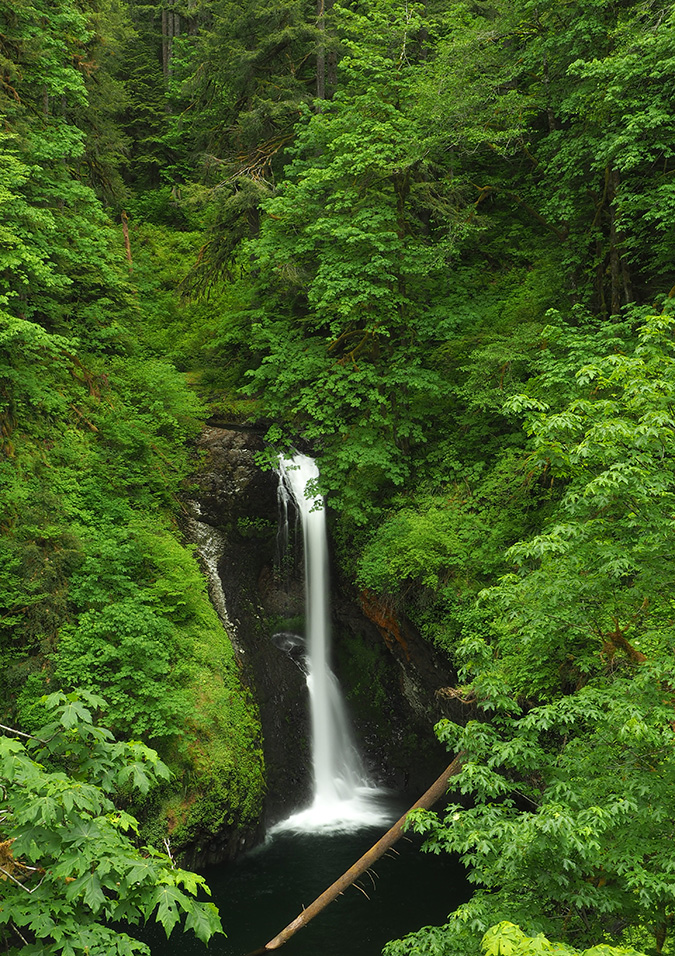
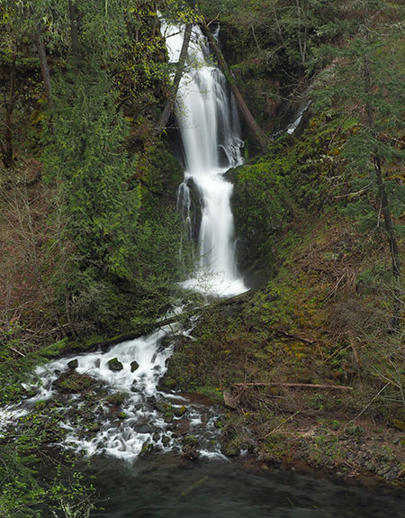
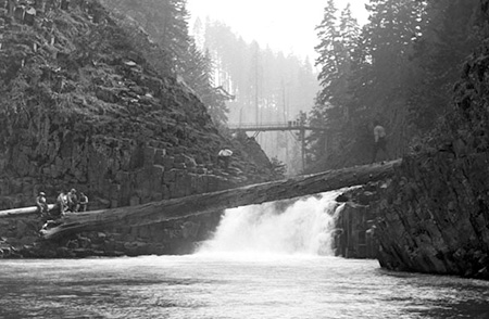
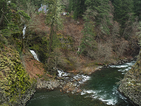
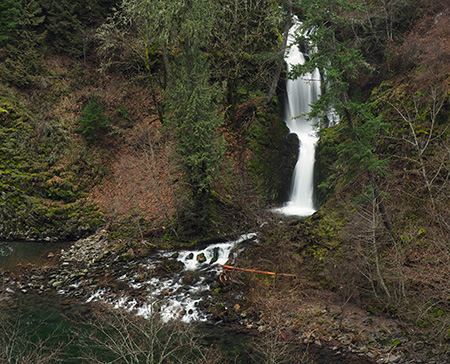
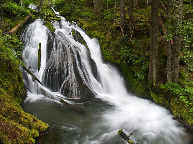
Some of the foot traffic along the abandoned Laurel Hill section of the old loop road is headed toward a little-known user path that drops steeply down to Yocum Falls, on Camp Creek. This is a lovely spot that deserves a proper trail someday, and would make an excellent family destination, much as the Little Zigzag Falls trail is today.

Yocum Falls is mostly forgotten since the construction of the modern highway, but remains as beautiful as when it was featured on postcards in the 1920s

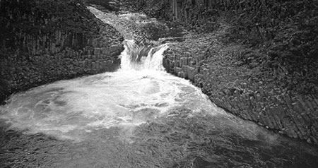
Yocum Falls was once well known, as the full extent of this multi-tiered cascade could be seen from along the old highway. As this old postcard from the 1920s shows (below), Camp Creek also served as a fire break for the Sherar Burn, which encompassed much of the area south of today’s US 26 in the early 1900s. You can see burned forest on the south (right) side in this photo and surviving forest on the north (left) side:

Yocum Falls in a 1920s postcard view from the original Mount Hood Loop Highway

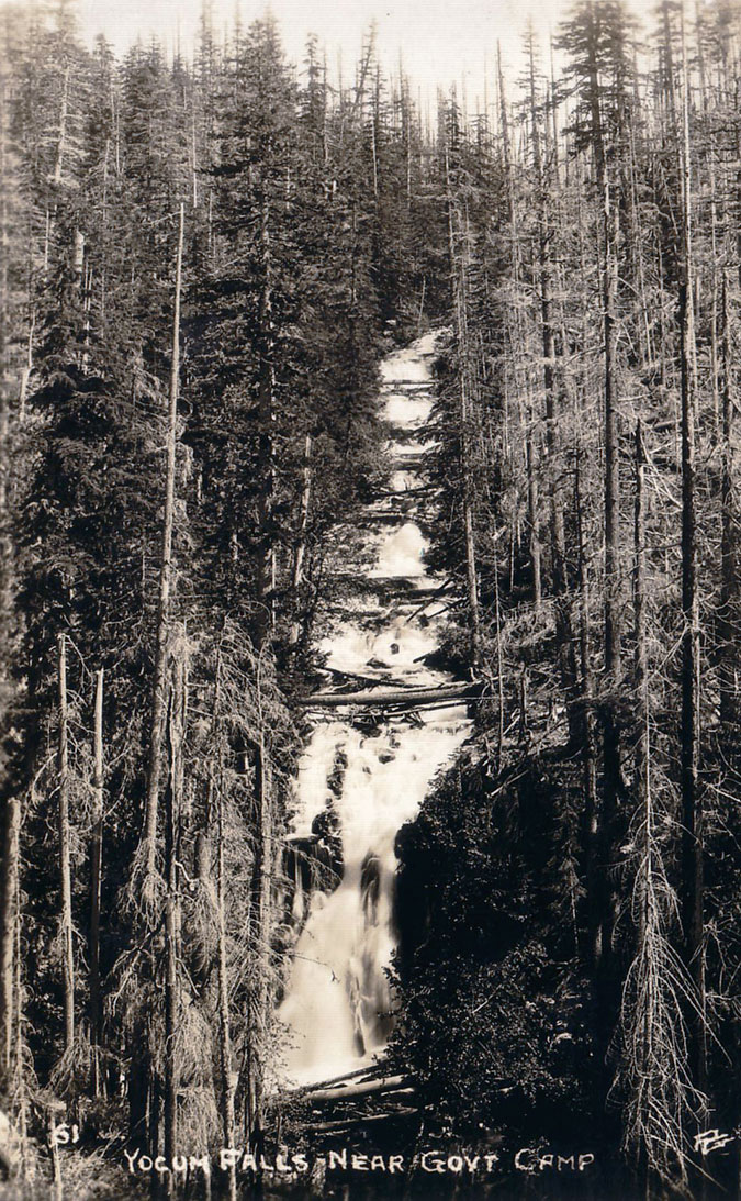
The fire also created this temporary view of the falls in the early 1900s, but the forest has since recovered and obscured the view. Today, the short hike down to the falls on the user path is required for a front-row view of Yocum Falls.

Beyond the falls, the abandoned highway makes a pronounced switchback and begins a traverse toward the crest of Laurel Hill. Here, the vegetation becomes more open, and road surface more visible (below).

Abandoned section of the old highway as it approaches the crest of Laurel Hill

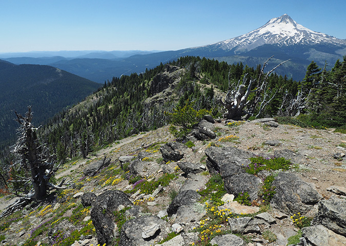
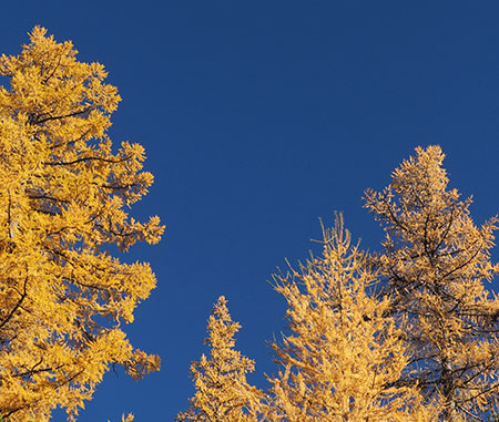
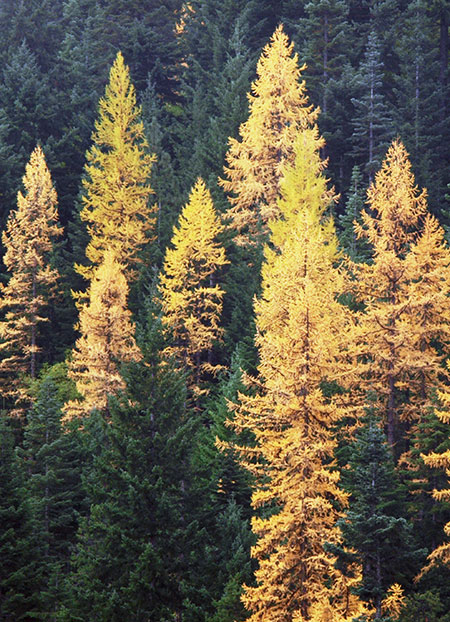
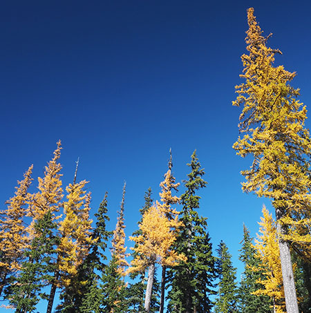
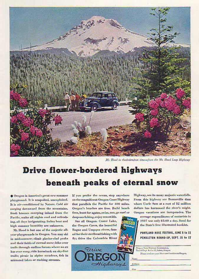
Soon this abandoned section of old road makes another turn, this time onto the crest of Laurel Hill. When the historic highway was built, this stretch was still recovering from the Sherar Burn, and the summit was dense with rhododendron and beargrass that put on an annual flower show each June. This was perhaps the most iconic stop along the old route, appearing on countless postcards, calendars and print ads (below).

1940s tourism ad featuring the (then) famous view of Mount Hood from Laurel Hill

Today, most of this section has reforested, but there are still views of the mountain and opportunities for new viewpoints that could match what those Model A drivers experienced in the early days of touring on Mount Hood.

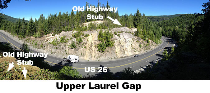
Soon, this abandoned section of old road on Laurel Hill reaches the upper gap, where ODOT has recently made the yawning cut through the crest of the hill even wider. This schematic is a view of the cut looking north (toward the mountain), with the stubs of the historic highway shown: 

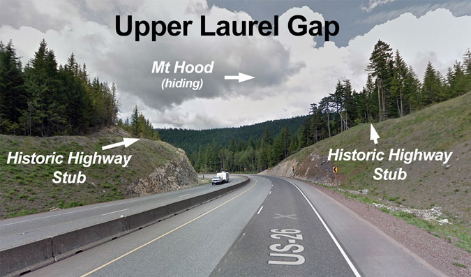
If there is any good news here, it is that the modern highway cut is perpendicular to the old loop highway, making it possible to directly connect the surviving sections of the old road with a new bridge. This view (below) is from the eastern stub of the old route, where it suddenly arrives at the modern highway cut. The stub on west side of the cut is plainly visible across US 26:

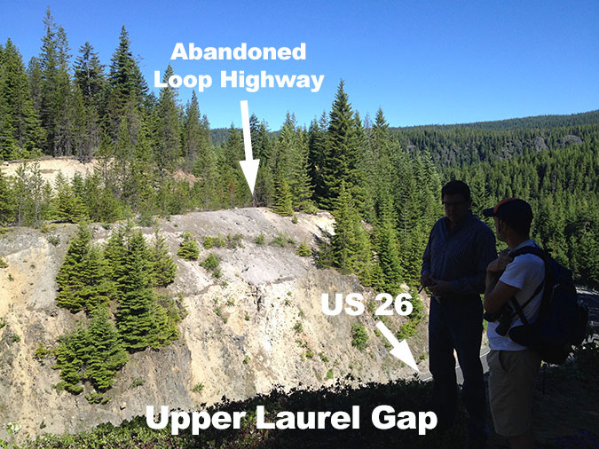
This panoramic view (below) from the same spot gives a better sense of the gap and the opportunity to bride the upper Laurel Hill gap as part of restoring the old route as a trail. A bonus of bridging the upper gap would be an exceptional view of Mount Hood, which fills the northern skyline from here.

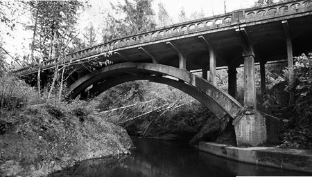
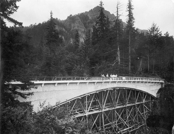
The upper gap is about 250 feet across and 40 feet deep, so are there any local examples of a bridge that could span this? One historic example is the old Moffett Creek Bridge on the HCRH, pictured below while it was being constructed in 1916. This bridge measures about 200 feet in length with a single arch.

Moffett Creek Bridge construction along the Columbia River Highway in 1916

The City of Portland recently broke ground on the new Earl Blumenauer Bridge, a bicycle and pedestrian crossing over Sullivan’s Gulch (and I-84) in Portland. This very modern design (below) might not be the best look for restoring a historic route on Mount Hood, but at 475 feet in length, this $13.7 million structure does give a sense of what it would take to span the upper gap at Laurel Hill. 

The City of Portland recently broke ground for this new bicycle and pedestrian bridge over Sullivan’s Gulch, linking the Lloyd District to Portland’s Central Eastside (City of Portland)

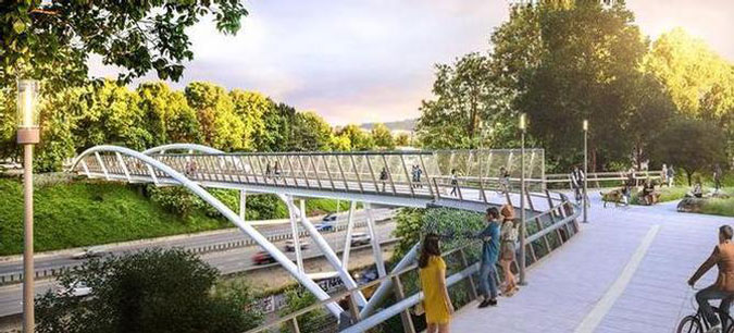
That sounds like a big price tag, but consider that ODOT recently spent three times that amountsimply to add a lane and build a concrete median on the Laurel Hill section of US 26. It’s more about priorities and a vision for restoring the old road than available highway funding. More about that in a moment.

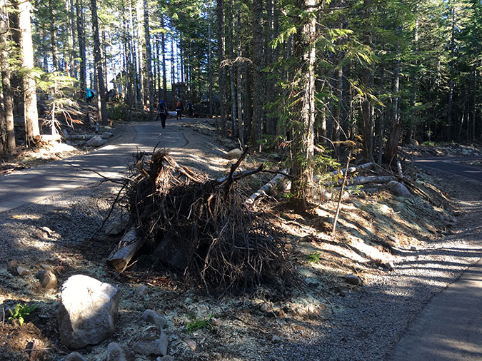
Moving east from the upper Laurel Hill gap, the abandoned section of the old highway continues (below) toward Government Camp, eventually reaching the Glacier View trailhead, where the surviving old highway now serves as the access road to this popular, but cramped, SnoPark.

Abandoned section of the loop highway near Government Camp

Sadly, the Forest Service recently destroyed a portion of the abandoned loop highway just west of the Glacier View trailhead, leaving heaps of senselessly plowed-up pavement behind. While destroying this section of historic road was frustrating (and possibly illegal), it can still be restored fairly easily. But this regrettable episode was another reminder of the vulnerability of the old highway without a plan to preserve and restore it.

Piles of paving line a short section of the abandoned loop highway near Government Camp where the Forest Service recently destroyed the road surface with no consideration of its historic value — a senseless reminder of the vulnerability of this precious route

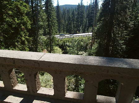
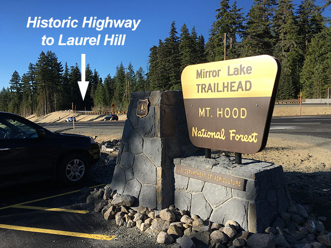
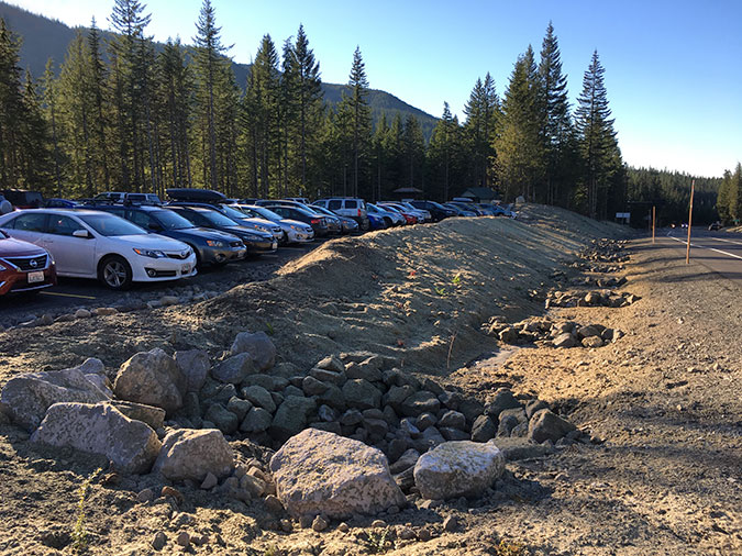
From the Glacier View trailhead, the old road become an operating roadway once again, curving south to another junction with US 26, across from the new Mirror Lake trailhead, where a major new recreation site completed in 2018. This trailhead provides parking, restrooms and interpretive displays for visitors to the popular Mirror Lake trail, and is immediately adjacent to the Mount Hood Ski Bowl resort and lodge.

Plans call for a new bicycle and pedestrian bridge over US 26 at the Mirror Lake trailhead, spanning one of the critical gaps necessary to reconnect the old highway route

Crossing the US 26 at this junction is a sketchy, scary experience, especially on foot or a bicycle. Fortunately, the 2014 Mount Hood Multimodal Plan, adopted jointly by the Forest Service and ODOT, calls for a major bicycle and pedestrian bridge here to allow for safe crossing by hikers, cyclists, skiers and snowshoers, so a plan is already in place to resolve this obstacle.

Middle Section – Government Camp to Barlow Pass

Mount Hood mirrored in one of the ponds at Multorpor Fen (State of Oregon)

From the Mirror Lake trailhead, the old highway loops through today’s parking lot at the Mount Hood Ski Bowl resort, then crosses US 26 again to loop through the mountain village of Government Camp. These graceful curves in the old route were bisected when the modern US 26 was built in the 1950s, leaving them intact as local access roads. However, because the Government Camp section of the old road serves as the village main street, the concept for a Mount Hood Loop Highway State Trail parallels the south edge of US 26 along a proposed new trail section, and avoids two crossings of the modern highway in the process. 

However, a more interesting (but complicated) option in this area is possible along the south edge of the Multorpor Fen, an intricate network of ponds, bogs and meadows sandwiched between the east and west Mount Hood Ski Bowl resort units. The remarkable view in the photo above shows one of the ponds along this alternate route, far enough from the modern highway to make traffic noise a distant hum. However, this route would also require crossing a section of private land at Ski Bowl East. The mountain views and buffer from the highway make this an option worth considering, nonetheless.

Both options are shown on the concept map at the top of this article, and either route through the Government Camp area leads to the northern foot of Multorpor Mountain, where the concept for the state trail is to repurpose a combination of existing and abandoned forest roads as new trail to historic Summit Meadow and popular Trillium Lake, where the second and third campgrounds along the proposed trail are located.

Historic Summit Meadow, a crucial resting spot for white Oregon Trail migrants in the 1840s along the old Barlow Road
Mount Hood from Trillium Lake

From Trillium Lake, the new trail would follow existing forest roads toward Red Top Meadow, to the east, then follow a new route for about a mile to the continuation of the historic loop highway, just east of the US 26/OR 35 junction. Here, a surviving section of the old road is maintained and remains open to the public, passing the mysterious Pioneer Woman’s Grave site as it climbs toward Barlow Pass. 

Surviving section of the old loop highway near Barlow Pass that is still open for use
This massive, carved history marker once stood at the Pioneer Woman’s Grave along the old loop highway, near Barlow Pass
The badly neglected Pioneer Woman’s Grave site today

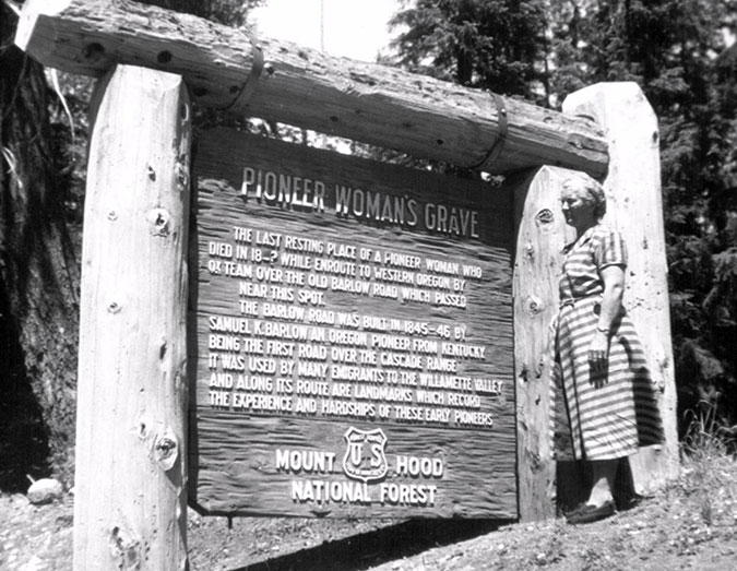
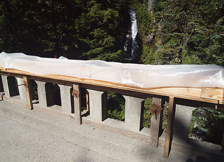
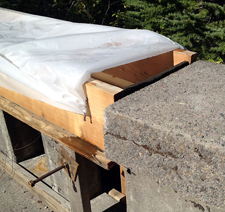
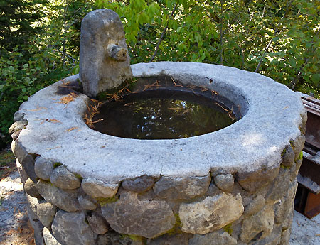
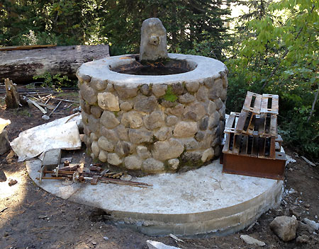
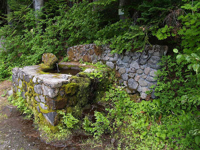
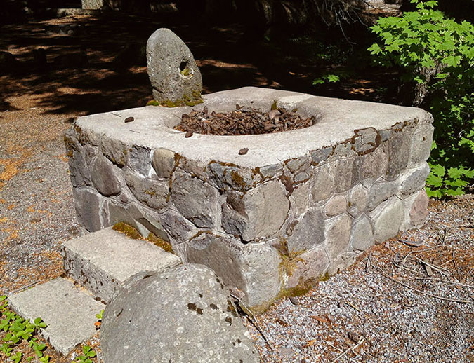
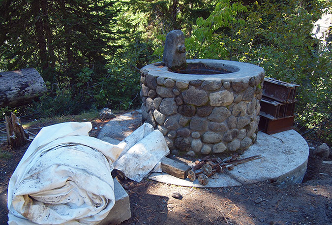
When the original highway was completed in the 1920s, a viewpoint along this section of the road was called “Buzzard Point” and inspired postcards and calendar photos in its day. Few call this spot Buzzard Point anymore, but the view survives, along with a rustic roadside fountain built of native stone and still carrying spring water to the passing public. In winter, this section of the old road is also popular with skiers and snowshoers.

This 1920s view from Buzzard Point was well-known in the heyday of the old loop highway
This surviving stone water fountain near Buzzard Point is still flowing nearly a century after it was built!

This section of the old route continues another mile or so to the large SnoPark at Barlow Pass, another important trailhead that serves both the loop highway corridor and the Pacific Crest Trail.

East Section – Barlow Pass to Sherwood Campground

Barlow Road history sign at the Barlow Pass trailhead, where the Pacific Crest Trail crosses the historic loop highway

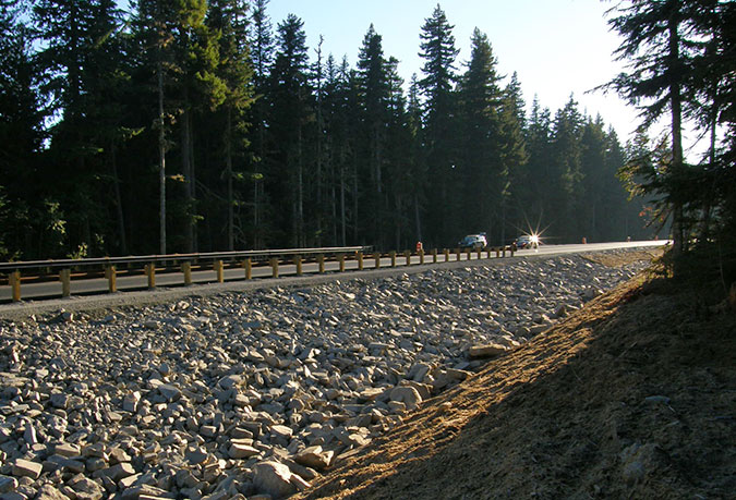
From Barlow Pass, the trail concept calls for a protected bikeway on the shoulder of OR 35, where it crosses the White River and climbs to Bennett Pass. It would be possible for the trail to take a different route along this section, but the traffic volumes and speed on OR 35 are much less intimidating than those on US 26, especially from spring through fall, when ski resort traffic all but disappears. There is also plenty of room to add protected bike lanes along this section of OR 35, including on the new bridge over the White River that was completed just a few years ago.

The Mount Hood Loop trail concept would follow this section of OR 35 as a protected bikeway from Barlow Pass to the White River and Bennett Pass
The White River crossing has always been a popular stop along the Mount Hood Loop Highway. In the early days, motorists could stop here to picnic and pick up souvenirs at “White River Park”
The White River is a notoriously wild glacial stream that has a long history of washing out the loop highway bridges — this was the first bridge to span the river as it appeared in the 1920s
This is a 1930s version of the White River Bridge, one still constructed of logs and planks
Franklin and Eleanor Roosevelt stopped at the White River crossing in 1937 on their famous tour of the Mount Hood Loop Highway and dedication of Timberline Lodge

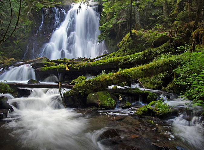
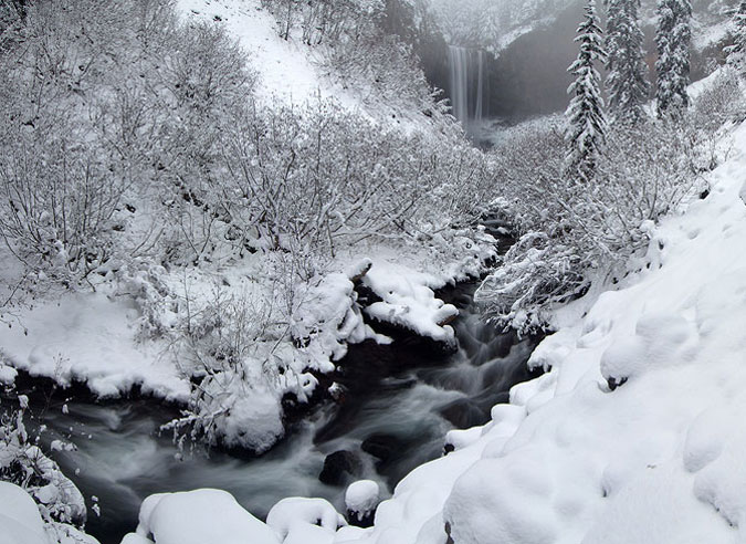
Upon reaching Bennett Pass, the proposed route would once again follow an especially scenic section of bypassed historic highway, with views of waterfalls, alpine meadows and the mountain towering above.

Mount Hood from the original Mount Hood Loop Highway at Bennett Pass in the 1930s
1950s view of the Mount Hood Loop Highway at Bennett Pass before the modern highway was constructed

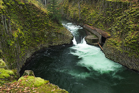
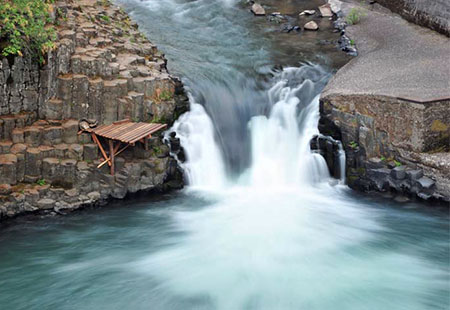
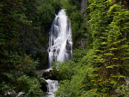
Of the many scenes along the old road that were postcard favorites, the view of the Sahalie Falls Bridge, stone fountain and falls in the background was among the most popular. The bridge was the largest structure on the original loop highway, and a scenic highlight (you can read more about the history of the bridge in this 2013 blog article “Restoring the Sahalie Falls Bridge”)

The graceful Sahalie Falls bridge is the architectural highlight of the old loop highway, and was restored in 2013
The Sahalie Falls Bridge under construction in the 1920s
Popular postcard view of the Sahalie Falls Bridge and stone fountain from the 1920s

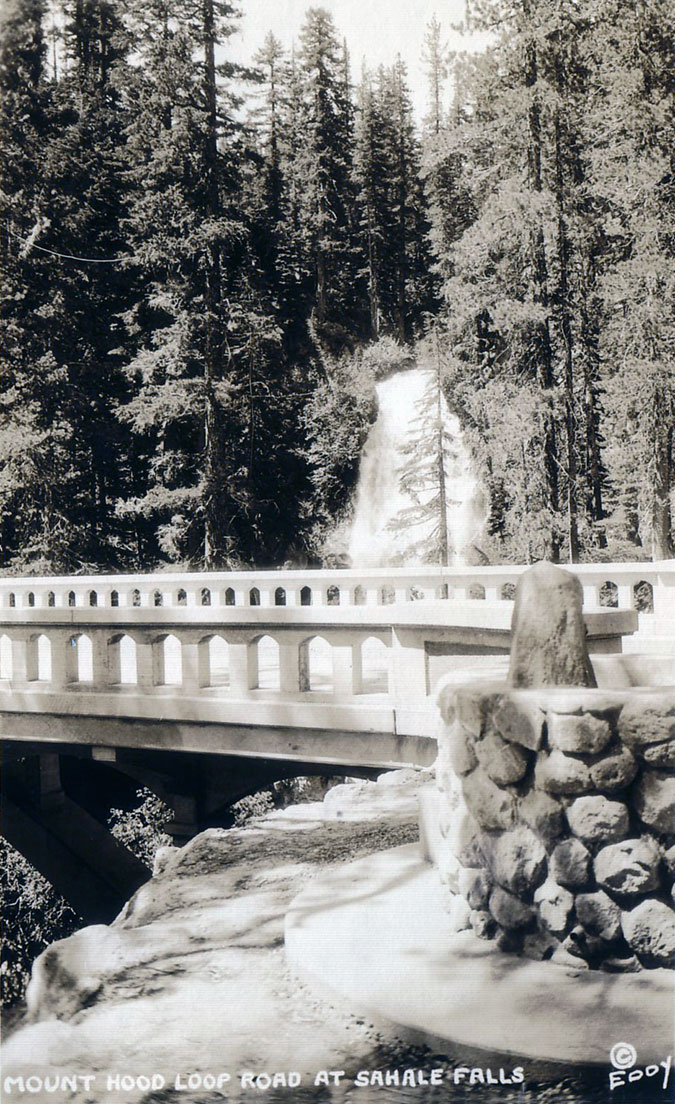
Today, the bridge is once again in excellent condition, having been restored by the Federal Highway Administration in 2013. For years, the bridge had been closed to automobiles because of its state of disrepair, but today it stands as perhaps the most significant historic highway feature along the old road.

From Sahalie Falls, the historic road curves east through subalpine forests before arriving at Hood River Meadows, among the largest on Mount Hood and another spot that was featured in countless postcards and advertisements during the heyday of the old road. 

1920s view of the old loop highway at Hood River Meadows. This nearly forgotten section of the old highway still operates today.

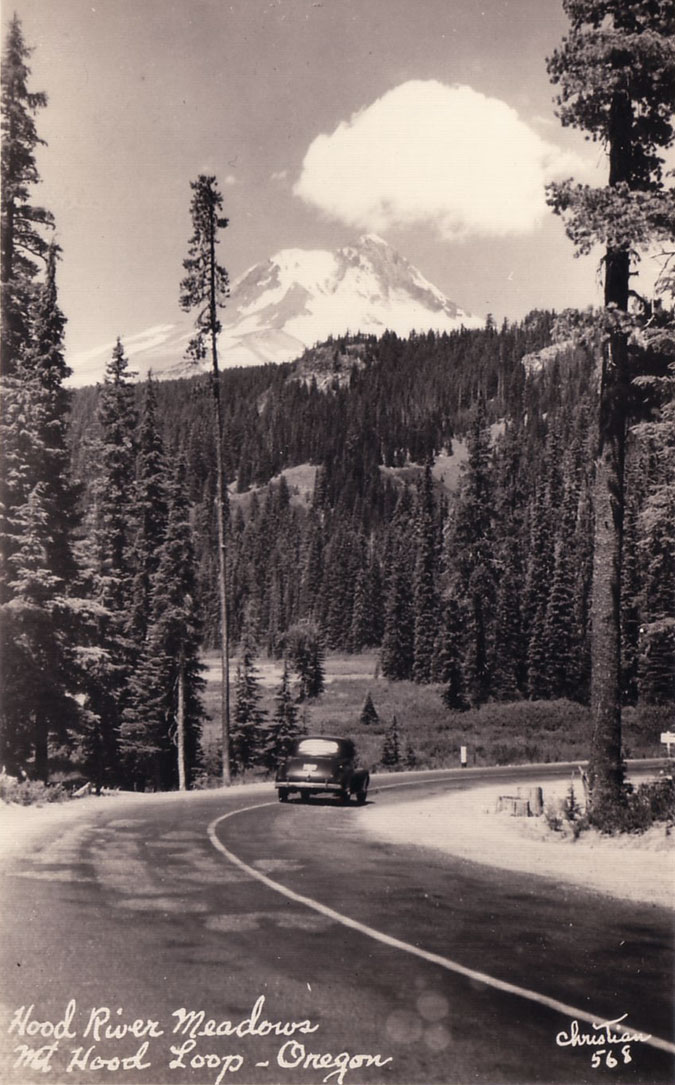
The long-abandoned Hood River Meadows campground also survives here, along the east side of the meadows, and is still in excellent condition. This site could be reopened as a second bikepacking-only camping spot along the proposed trail. 

1940s tourism ad featuring Mount Hood from the loop highway at Hood River Meadows

Next, the historic road curves toward OR 35 where it also serves as the resort access road for the Hood River Meadows ski complex. From the spot where the old road meets OR 35, there are a couple more abandoned road sections along the north edge of OR 35 that could be reconnected as part of the Loop Highway trail concept, but this is the last of the surviving sections of the old road on this part of the mountain.

From here, the trail concept would connect a series of old forest roads on a gradual descent of the East Fork Hood River valley, toward Sherwood Campground, located along the East Fork, and completing the Mount Hood Loop Highway State Trail.

East Fork Hood River near Sherwood Campground in winter

Sherwood Campground is a very old, still operating campground that includes another stone fountain from the old highway, located near the campground entrance. The campground is also a jumping off point for the popular trail to Tamanawas Falls. Nearby Little John SnoPark would serve as the main eastern trailhead for the new trail, with a short connecting route the main trail. 

Historic stone fountain from the original loop Highway at Sherwood Campground
Tamanawas Falls, just off the loop highway near Sherwood Campground

Sherwood Campground would form the eastern terminus of the historic section of the proposed Loop Highway State Trail. From here the larger Mount Hood scenic loop route would follow OR 35 through the narrowing canyon of the East Fork to the wide expanse of the upper Hood River Valley. 

This narrow section of the loop highway is where a safe, protected bikeway will need to thread the needle between cliffs and the East Fork Hood River

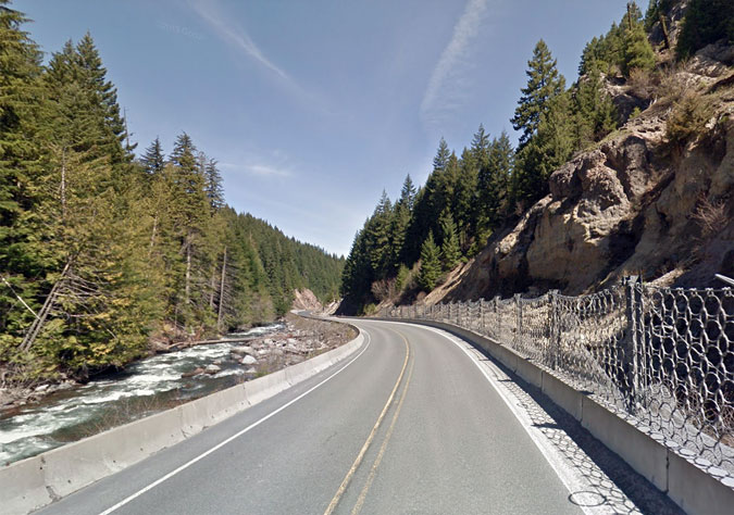
The canyon section along the East Fork is a crux segment for the loop route, with the modern highway wedged between the river and a wall of steep cliffs and talus slopes. Engineers designing a safe bikeway through this section of road could take some inspiration from the Shellrock Mountain in the Gorge, where the HCRH State Trail threads a similar corridor between I-84 and the talus slopes of Shellrock Mountain. This crux section along the East Fork is about a mile long.

WHERE TO START?

Touring the upper Hood River Valley in the 1950s

What would it take for this concept to become a reality? A crucial first step would be a feasibility study inspired by the HCRH State Trail, with an emphasis on the potential this example offers for restoring and reconnecting historic sections of the old Mount Hood Loop Highway on Mount Hood. 

Rock crusher along the original loop highway during its construction in the 1920s

An obvious sponsor for this work would be the Oregon Department of Transportation, working in partnership with the U.S. Forest Service. These agencies have worked together to bring the Historic Columbia River Highway State Trail to reality and have both the experience and capacity to repeat this success story on Mount Hood. The following outline could be a starting point for their work:

Mount Hood Loop Highway State Trail Feasibility Study 

Purpose Statement

Restore and reconnect surviving sections of the historic Mount Hood Loop Highway from Rhododendron to Sherwood Campground as a paved state trail the combines shared right-of-way and non-motorized trail experiences.

Feasibility Study Objectives

  • Identify new, paved trail segments needed on public land to complete the loop using existing forest road alignments whenever possible.
  • Identify surviving historic resources and new interpretive opportunities along the trail.
  • Identify multimodal trailhead portals at the trail termini and at major destinations along the trail, including Rhododendron and Government Camp.
  • Identify bike-and-hike opportunities that build on soft-trail access from a new, paved state trail.
  • Coordinate and correlate route and design options and opportunities with the 2014 Mount Hood Multimodal Transportation Planand the Mount Hood Scenic Byway Interpretive Plan and Design Guidelines.
  • Identify an alternate bicycle route for the Mount Hood Scenic Byway from Sandy to Rhododendron that does not follow the US 26 shoulder.
  • Identify design solutions for designing a protected shoulder bikeway in the crux section of OR 35 in the East Fork canyon.
  • Engage public and private stakeholders and the general public in developing the feasibility study.

But what would it really take..?

Railing and sidewalk repairs underway to the historic Sahalie Falls Bridge in 2013

While ODOT has directly managed construction of the HCRH State Trail in the Gorge, a lesser-known federal agency has been taking the lead in recent, similar projects on Mount Hood. A little-known division of the Federal Highway Administration known as Federal Lands Highway is gaining a growing reputation for innovative, sustainable designs in recent projects on our federal public lands. 

On Mount Hood, Federal Lands Highway oversaw the restoration of the Sahalie Falls Bridge in 2013, a long-overdue project that rescued this priceless structure from the brink of oblivion. Like any highway agency, they excelled at the roadway element of the project, like restoring the bridge and related structure. Other opportunities were missed, however, including improving the adjacent parking areas and providing interpretive amenities for visitors. 

Forms for new railing caps on the Sahalie Falls Bridge in 2013
Federal Lands Highway rebuilt the footing for the historic water fountain at Sahalie Falls as part of the bridge restoration project
The newly restored Sahalie Falls Bridge and fountain in 2014

Federal Lands Highway also completed a major reconstruction of OR 35 at Newton Creek in 2012. This project was in response to massive flooding of this surprisingly powerful glacial stream in 2006. Their work here shows some of the negatives of a highway agency taking the lead, with a very large footprint on the land and a big visual impact with over-the-top, freeway-style “safety” features that are old-school by today’s design practices.

The mega-culvert project built by Federal Lands Highway at Newton Creek in 2012

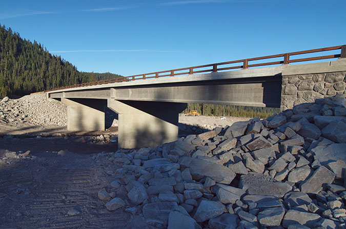
In 2012, Federal Lands Highway also completed (yet another!) bridge replacement over the White River, which was also damaged in the 2006 floods. The massive new bridge is similarly over-the-top to their work at Newton Creek, but Federal Lands Highway deserves credit for rustic design features that blend the structure with the surroundings, including native stone facing on the bridge abutments.

Western Federal Lands completed the new White River Bridge in 2012

The most promising recent work on Mount Hood by Federal Lands Highway is the completion of the new Mirror Lake Trailhead in 2018. This project involved a significant planning effort in a complex location with multiple design alternatives. Their work here involved the public, too, something their earlier work at White River, Sahalie Falls and Newton Creek neglected.

The new Mirror Lake Trailhead was completed in a partnership of Federal Lands Highway, the Forest Service and ODOT in 2018

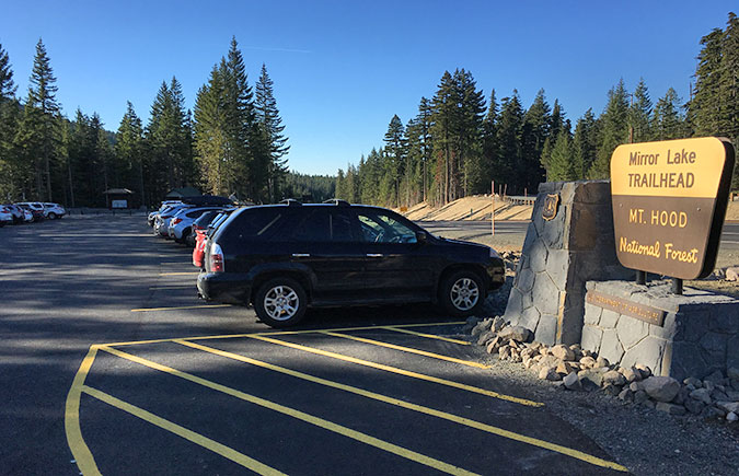
The final result at Mirror Lake is an overall success, despite the controversy of moving the trailhead to begin with. The new trailhead is now a prototype of what other trailheads along a restored Mount Hood Loop Highway State Trailcould (and should) look like, complete with restrooms, interpretive signs, bicycle parking and accessibility for people using mobility devices.

New shoulder swales along US 26 were part of the Mirror Lake trailhead project, helping to protect water quality of Camp Creek from highway runoff
The new Mirror Lake Trailhead plaza includes restrooms, interpretive signage, bike parking and seating for visitors

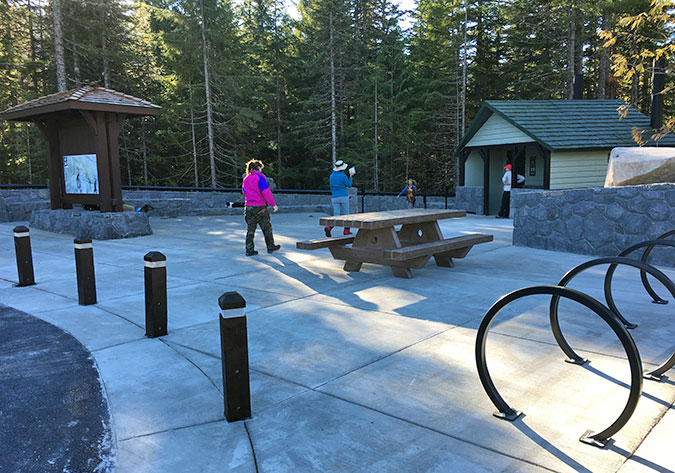
Beyond the hardscape features at the new trailhead, Federal Lands Highways worked with the Forest Service to replant areas along a new paved section of trail. This work provides another useful template for how the two federal agencies could work together with ODOT in a larger restoration of the old Loop Highway as a new trail.

Though it looks a little rough, this area along the new, paved section of the Mirror Lake Trail was landscaped with native materials as part of the new trailhead project
Landscape restoration at the new trailhead included woody forest debris, native understory starts and hydro-seeding to protect newly planted areas from erosion

One of the compelling reason for Federal Lands Highway to take a leading role in a Loop Highway trail project is the unfortunate fact that ODOT has ceded the right-of-way for several of the abandoned sections of the old road to the Forest Service. This would make it difficult for ODOT to use state funds to restore these sections without a federal transportation partner like Federal Lands Highway helping to navigate these jurisdictional hurdles. 

However, governance hurdles like this existed in the Gorge, too, and state and federal partners simply worked together to resolve them, provided they had a clear mandate to work toward.

Getting behind the idea… and creating a mandate

The original Mount Hood Loop Highway in the Hood River Valley in the 1930s

Bringing this trail concept to reality will take more than a feasibility study, of course — and even that small step will take some political lifting by local officials, cycling advocates, the local tourism community and even our congressional delegation. While the money is clearly there for ODOT to begin this work, it would only happen with enough political support to begin the work.

The good news is that Oregon’s congressional delegation is increasingly interested in outdoor recreation and our tourism economy, especially when where a coalition of advocates and local officials share a common vision. With the HCRH State Trail in the Gorge nearing completion after more than 30 years of dedicated effort by advocates and ODOT, it’s a good time to consider completing the old loop as the next logical step in restoring a part of our legacy.

The idea of loop around Mount Hood began as soon as the Columbia River Highway was completed in 1915. This article in The Oregon described the first documented trip around the mountain using a patchwork of roads that existed before the Mount Hood Loop was constructed in the 1920s (large PDF versions of this article can be viewed at the links, below)

1915 Article – Page 1 (PDF)

1915 Article – Page 2 (PDF)

Rumor has it that new legislation is in the works to ramp up protection and improve recreation opportunities for Mount Hood and the Gorge. Including theMount Hood Loop Highway State Trail concept in new legislation would be an excellent catalyst for moving this idea from dream to reality. 

But could this really happen in today’s fraught political environment in Washington D.C.? Don’t rule it out: President Reagan was notorious for his hostility toward public lands, and yet he infamously “held his nose” and signed the Columbia River Gorge legislation into law in 1986, including the mandate to devise a plan to restore surviving sections of the HCRH as a trail. 

So, could this happen in the era of Trump for Mount Hood? Stay tuned…

2020 MHNP Campaign Calendar!

2020 MHNP Campaign Calendar Cover

The coming year marks the 16th annual scenic calendar that I’ve assembled for the Mount Hood National Park Campaign, with each calendar drawing from photos from the previous year of Mount Hood country. In the beginning, the proceeds helped defray the costs of the campaign website and (beginning in 2008) the WyEast Blog. But for the past several years, all proceeds have gone to Trailkeepers of Oregon (TKO), our premier trail stewards and advocates in Oregon (more on that toward the end of this article).

Looking back, the early calendars were more than a bit rough, especially given the clunky on-demand printing options in those early days of the internet and the emerging state of digital cameras, too! This is the “homey” inaugural cover that featured Elk Cove as it appeared way back in 2004:

The first calendar! Way back in 2004… a bit rough…

Over the years, the calendar has evolved, and on-demand printing quality has become downright exceptional. Each year I set aside my favorite photos over the course of the year, typically a few dozen by the time calendar season rolls around. Then the hard part begins: picking just 13 images to tell the story of Mount Hood and the Gorge. And as in years passed, this blog article tells a bit of the backstory behind images in the new calendar and includes a few photos that didn’t make the calendar.

________________

For 2020, the cover image is from a favorite spot on Middle Mountain, the rambling series of forested buttes that separate the upper and lower portions of the Hood River Valley. The sylvan view of Mount Hood from here is hard to match:

The stunning view of the Upper Hood River Valley frm Middle Mountain

But the story of Middle Mountain is a bit less idyllic. Though most of the mountain is owned by Hood River County, the agency still hasn’t gotten the memo on modern, sustainable forestry and continues to aggressively log these public lands with old-school clearcuts. 

This makes for low (or at least lower) taxes for Hood River County residents, but at the expense of future sustainability of the forest — which means future generations in Hood River are really paying the tab. This rather large clearcut (below) appeared this year, just east of the spot where the cover image for the calendar was captured, on a climate-vulnerable south-facing slope. 

Still doing 1950s forestry practices in Hood River County…

Will the forest recover here once again, as it always has before? Probably. But Pacific Northwest forest scientists are warning Oregonians not to take our low-elevation Douglas fir forests for granted, as they may not return, especially on hot south and west-facing slopes. Consider that just uphill from this spot some slopes on Middle Mountain are already too dry to support conifers, and are home to a few scattered Oregon white oak trees. Now would be a good time for Hood River County to adopt a longer view of its forests, and begin planning for more selective, sustainable harvests that don’t put the survival of their forests at risk.

For the January calendar image, I chose a close-up of the Sandy Headwall, which forms Mount Hood’s towering west face. This is a favorite spot for me after the first big snowfall of the year, when the mountain is suddenly transformed into a glowing white pyramid:

January features the Sandy Headwall on Mount Hood’s west face

I have a little secret to share about this view, too. It turns out I’m not much of an “alpenglow” fan, which is downright sacrilegious for a photographer to admit! So, you’re unlikely to see one in the annual calendar. I just prefer the long shadows and shades of blue and ivory that light up in the hour beforesunset that are featured in the January image.

If you’re not familiar, alpenglow is that rosy cast that often appears at or just after sunset, and pictured on waytoo many postcards and calendars — at least for my taste! But my other little secret is that I still capture plenty of alpenglow photos, too. Who knows, maybe my tastes will change someday? 

The following image didn’t make the calendar, but it shows the transformation from the above view that unfolded over the course of 30 minutes or as sun dropped over the horizon that cold, October evening:

Some people really like Alpenglow… apparently…

February also features another snow scene, this time along the White River, when the stream nearly disappeared under ten feet of snow last winter:

February features the White River smothered in winter snow

But the White River photo came courtesy of an aborted snowshoe trip that day at nearby Pocket Creek. My plan was to hike up to a view of Mount Hood and Elk Mountain from the north slopes of Gunsight Ridge. I had made the trip about ten years ago and liked the sense of depth that having Elk Mountain in front of Mount Hood created from this angle. Instead, here’s what I found when I reached the viewpoint:

Erm… what happened to my view..!?

This isn’t the first viewpoint that has disappeared behind growing forests in my years of exploring Mount Hood, nor am I sad that the view went away. After all, this one came courtesy of a 1980s Forest Service clearcut, and while the view was nice, a recovered forest is even better. And besides, I still have this photo from 2009 to remind me of view that once existed here:

The view in 2009 was a bit more expansive!

So, I returned to the trailhead that day and headed over to the White River for a short snowshoe trip in the evening light. While I picked a photo of the river and mountain for the calendar, there were some very pretty views unfolding behind me, too. These images capture the last rays of winter sun lighting up the crests of Bonney Butte and Barlow Butte. They may not be calendar-worthy, but are lovely scenes, nonetheless:

The frosted crest of Bonney Butte lights up as the sun goes down
Snowy Barlow Butte at sunset

For the March calendar image, I picked a scene from Rowena Plateau, a spot famous for its spectacular displays of yellow Balsamroot and blue Lupine. The calendar view looks north across the Columbia River to the Washington community of Lyle, a town that nests seamlessly into the Gorge landscape, thanks in large part to the protections of the Columbia River Gorge National Scenic Area:

March features the annual flower spectacle on the Rowena Plateau

But the view behind me that day was pretty nice, too, though it didn’t make it into the calendar. This image (below) looks south toward McCall Point from the same vantage point, with still more drifts of wildflowers spreading across the terraced slopes:

Wildflower drifts on the slopes of McCall Point

For April, I chose a popular scene along the Old Salmon River Trail on Mount Hood’s southwest side just as the bright greens of spring were exploding in this rainforest. Here, a grove of 600-year old Western red cedar and Douglas fir somehow avoided several cycles of logging in the 1800s and 1900s to survive as the closest ancient forest to Portland:

April features ancient rainforests along the Old Salmon River Trail

How big is that Western red cedar on left? I’ve been asked that question a few times, and short of actually measuring it, I stepped in front of the camera to serve as a human yardstick (well, two yards, as I’m exactly six feet tall). Subtract a few inches for my hat, and I’d estimate the trunk to be about 15 feet across at the base and about 10 feet thick a bit further up. 

What do you think?

Ancient hiker among the forest ancients…

One thing is for sure, we’re so fortunate that these old sentinels have survived to give us a glimpse into what many of our rainforest valleys used to look like. 

Further down the trail, I also captured this scene (below) of a pair of leaning giants that mark the spot of an ancient nurse log, long since rotted away and revealing the roots that once anchored these trees to the nurse log when they were youngsters. Someday, they will fall and become nurse logs, too, repeating the rainforest cycle.

Nurse log babies a century later…

This unique pair of trees is easy to find if you’re exploring the Old Salmon River Trail. They’re located right along the river (below), at a scenic spot just off the trail where there are plenty of boulders for picnics and even a tiny beach in summer. It’s just beyond one of the rustic footbridges along the trail, and downstream from the ancient tree grove.

The Salmon River along the Old Salmon River Trail… alas, this photo didn’t make the calendar!

For May, I chose another photo from the Rowena Plateau, partly because it was such a good bloom this year, but also for the gnarled Oregon white oak that grows on this little knoll (below).

May features White oaks at Rowena surrounded by bouquets of Balsamroot and Lupine

After exploring Rowena that day, I crossed the river and spent the evening over at Columbia Hills State Park, in Washington. While this sprawling preserve is certainly no secret these days, you can still count on it being pretty lonely once you hike into the vast meadows along the park’s trails. 

This is the scene looking back toward The Dalles and Mount Hood as the sun dropped over the horizon on that lovely spring day:

Vast wildflower meadows sweep toward the Columbia River and Mount Hood at Columbia Hills State Park

For June, I selected an old standby, the understated but elegant Upper Butte Creek Falls (below), located in the Santiam State Forest. I visit Butte Creek at least twice each year, just because the area is so delightful, and also because it’s a showcase of what Oregon’s state forests could be.

The Oregon Department of Forestry has gradually expanded recreation opportunities throughout the state forest system over the past couple of decades, in recognition of growing demand for trails in our state. It’s an uphill battle, as state forests have generally been viewed by our state and local governments as a cash register, thanks to 1930s era laws that have traditionally been interpreted as promoting logging above all else. 

June features lovely Upper Butte Creek Falls in the Santiam State Forest

Today, a group of Oregon counties are actually suing the state for “retroactive” payments based on this interpretation, though it’s an absurd and misguided case of robbing Peter to pay Paul. If successful, the “state” (that’s you and me) could pay over $1 billion to a handful of counties (possibly you, possibly me) to right this purported wrong. This power play further underscores the need to radically rethink how we manage our state forests in an era of climate change and changing values among the public.

While the area along the Butte Creek trail remains a verdant rainforest, it’s really just an island, with much of the surrounding public forest logged in the past, and planned for more logging. Adjacent private timberlands are faring even worse, with companies like Weyerhaeuser liquidating their holdings with massive clear cuts in the lower Butte Creek canyon.

The changing climate is starting to take its toll here, too. This view of Butte Creek Falls was taken on the same visit as the June calendar image, but as the photo shows, the creek is running at perhaps a third of its “normal” June flow after dry spring this year, with much of the falls already running dry. We’re learning that “normal” is no longer as drought years continue to become the new normal.

Low water in June at Butte Creek Falls

The warning signs of the changing climate are already showing up on the rocky viewpoint above Butte Creek Falls, where several Douglas fir (below) finally succumbed to the stress of summer droughts this year on the thin, exposed soils of this outcropping. 

Early victims of climate change above Butte Creek

This is how climate change is beginning to make its mark throughout our forests, with trees growing in poor or thin soils lacking the groundwater moisture to make it through summer droughts. These trees are often further weakened and eventually killed by insects and diseases that attack drought-stressed forests. 

The good news is that a new generation of forest scientists is sounding the alarm and as we’ve seen, a new generation of young people are made climate change their rallying cry. So, while we’re very late in taking action, I’m optimistic that Oregon will emerge as a leader in tackling climate change, starting with our magnificent forests.

For July, I chose another waterfall scene, this time in the sagebrush deserts east of Mount Hood, where the White River crashes over a string of three waterfalls on its way into the Deschutes River canyon (below).

July features thundering White River Falls

Most people hike the paved trail into the rugged canyon, which begins an impressive, but partly obscured view of the dramatic upper falls. But few follow the fenced canyon rim upstream to this nice profile (below), just a short distance off the paved route. From here, the basalt buttes and mesas of Tygh Valley fill the horizon and remnants from the early 1900s power plant that once hummed here are visible on a side channel, below. 

A different take on White River Falls

In 2011, I posted this article with a proposal for expanding tiny White River Falls State Park to save it from the kind of development it had just dodged at the time. Hopefully, we’ll eventually see White River Falls better protected and some of its history restored and preserved!

The August image in the new calendar is from my beloved Owl Point, a spot on the north side of Mount Hood that I visit several times each year as a volunteer for Trailkeepers of Oregon (TKO). In this view (below), evening shadows were starting to reach across the talus slopes below Owl Point, where low mats of purple Davidson’s penstemon painted the summer scene. 

August features Owl Point in the Mount Hood Wilderness… of course!

I was alone that day, scouting the trail for an upcoming TKO volunteer work party, so I had the luxury of spending a lot of time just watching the evening unfold through my camera. For photographers, clouds are always the unpredictable frosting that can make (or break) a photo, and the lovely wisps in the calendar image floated in from nowhere to frame the mountain while I sat soaking in the view. 

I joined a TKO trail crew the next weekend for our second year of “officially” caring for the Old Vista Ridge Trail to Owl Point since TKO formally adopted the trail from the Forest Service in 2018. We had a great turnout, with crews clearing several logs with crosscut saws and doing some major rock work (below) where TKO will be realigning a confusing switchback along the trail.

TKO volunteers doing some serious rock work on the Old Vista Ridge Trail
TKO crews at Owl Point in August, celebrated a day of successful trail stewardship

For September, something a little different for the calendar: Sawmill Falls on the Little North Fork of the Santiam River (below). This is a well-known spot on the Opal Creek trail, but the surprise is that I’d somehow never hiked this trail, despite growing up in Portland and having spent a lot of time exploring nearby Henline Creek over the past several years. But my explanation is fairly simple: this has been among the most notoriously crowded trails in Oregon for many years, and I’ve always just shied away.

September features Sawmill Falls in the Opal Creek Wilderness

Then my friend Jeff e-mailed to remind me that we were way overdue for a hike, and so we picked Opal Creek as one that neither of us had checked the box on before. It turned out to be a lovely day on a very pretty trail, and because we had picked a weekday, it was surprisingly quiet, too.

The photo of Sawmill Falls gives a better sense of the weather that day — lots of sun, and so this image is among a very few long-exposure waterfall scenes I’ve attempted in full sun. It’s also a blended image from three separate exposures, which is a lot of work to capture an scene! One benefit of shooting in the sun was the opportunity to include some puffy clouds and blue sky as a backdrop, making this a very “summery” image.

Here’s a secret about my good friend Jeff: he’s the founder of TKO!

The conditions were more forgiving that day when we reached the bridge above Opal Pool, as a nice bank of clouds floated over and provided the kind of overcast that I’m normally looking for with long-exposure waterfall photos. Here’s a view (below) of Opal Creek taken from the footbridge that didn’t make the calendar:

Opal Creek cascade from the bridge above Opal Pool

The October image in the new calendar is from a roadside pullout that nobody seems to stop at, and yet it provides a very nice view of Mount Hood and the East Fork Hood River (below). This spot is on a rise along Highway 35, just south of the Highway Department maintenance yard. 

October features the East Fork Hood River and Mount Hood after an early snowfall

If you stop here in mid-October, you’ll enjoy quite a show, with brilliant Cottonwood lighting up the valley floor in shades of bright yellow and gold and Oregon white oak in the foreground providing orange and red accents. And if you pick a clear day after the first snowfall, Mount Hood will light up the horizon with a bright new jacket of white. 

How bright are the fall colors? Here’s the exact scene a few months earlier, for comparison:

The East Fork overlook as it appears for most of the spring and summer…

Like the earlier scene near Bennett Pass, this viewpoint is gradually becoming obscured, too. You can see the difference in the two Ponderosa pines on the left side of the photo. The larger, more distant tree (at the edge of the photo) hasn’t changed as visibly, but the younger Ponderosa (second from left) is quickly blocking the view of the river. 

For comparison, here’s a photo from 2008 showing just how much the younger pine has grown, along with the Oregon white oak in the right foreground:

…and the East Fork overlook in 2008, when the trees were much smaller!

In this case, however, the East Fork Hood River is on the side of tourists and photographers. The river is famously volatile, thanks to its glacial origins on Mount Hood, and periodically undercuts the steep banks here, taking whole trees in the process. This is a scene of almost constant change, and I won’t be surprised if the younger Ponderosa nearest the river eventually becomes driftwood on its way downriver!

The October image is also from the Hood River Valley, and also a roadside view. This well-known scene is located on Laurance Lake Drive, just off Clear Creek Road, near Parkdale. Thanks in no small part to Oregon’s statewide planning laws, this remains an operating farm more than a 170 years after the area was first cleared by white settlers.

November features Mount Hood from the road to Laurance Lake

The patch of Cottonwoods at the center of the field that provide the fall color show have been growing there for some time, too — or at least they are descendants from an earlier grove. This view (below) from the 1940s shows how the area appeared when most of the roads were still gravel and twenty years before the reservoir we know as Laurance Lake was even constructed. This image is from the Oregon State Archives, and staged for tourism ads, as you might guess!

1940s tourism stock photo from the same spot as the November calendar image!

Here’s a tip if you’re exploring the Hood River Valley in October and the Cottonwoods have turned. At about the same time the Western larch along the upper stretches of the East Fork and east slopes of Mount Hood area also turning to their fall shades of yellow and gold.

In fact, the November calendar photo was just a stop on the way for me as I headed up to the mountain to take in the Western larch colors. These photos feature the east side of Mount Hood and its many groves of Larch as viewed from the slopes of Lookout Mountain, and are among those that didn’t make the calendar this year.

Western larch lighting up the east slopes of Mount Hood
Mount Hood framed by golden Western Larch on the slopes of Lookout Mountain

For December, I chose another scene along the East Fork Hood River, albeit lesser known. This spot (below) is near the confluence of the East Fork with Polallie Creek, and was captured after a couple days of freezing fog in the upper Hood River Valley:

December features this frosty scene along the East Fork Hood River

This is one of my favorite times to be in the forest, though it can be a bit treacherous! The unmatched scenery makes the slippery trip worth it, as the frosted forests combine with the fog to create a truly magical scene. 

Here are a couple more images from that day in the freezing fog that didn’t make the calendar:

East Fork Hood River freezing fog event
Frost-flocked Douglas fir and Ponderosa pine on the slopes above the East Fork

Since switching to Zazzle to produce the annual calendars, I’ve had a back page to work with, and I have used this space to feature a few wildflower photos from the past year (below).

Nine wildflower shots from hikes throughout Mount Hood country this year fill in the back cover of the calendar

Each wildflower image has a story behind it, and among the most memorable is the Buckwheat in the lower right corner. This little plant was growing at the summit of Lookout Mountain (below), in the Badger Creek Wilderness, east of Mount Hood. 

Buckwheat adding color to the rocky summit of Lookout Mountain

Buckwheat is a tough, low-growing, drought tolerant wildflower that thrives in the rocky soils there, but what made the spot memorable were the thousands (millions?) of Ladybugs swarming on the summit that day. Entomologists tell us that several inspect species migrate to ridges and mountains from adjacent valleys to mate, keeping their gene pool stable and healthy in the process, but I’m thinking they might just enjoy the mountain views, too? 

Hard to photograph, but picture this on every surface on the summit of Lookout Mountain!

The Wild rose in the top row is also in foreground of this image of Crown Point and the Columbia River Gorge (below). I considered this image for the calendar, but skipped it until I can capture a more prolific flower display in the foreground… maybe next year!

Gorgeous Gorge! But the Wild rose blooms..? Meh…

Finally, the white Mockorange in the center of the bottom row was captured at this somewhat obscure spot along Butcher Knife Ridge (below), in the West Fork Hood Valley. This was another also-ran as a calendar image, but watch for some exciting news in a future blog story about this corner of Mount Hood country!

Mount Hood rising above the West Fork valley and framed by Mockorange blossoms

If you’d like a calendar, they’re easy to order online for $25 from Zazzle. Just follow this link:

2020 Mount Hood National Park Campaign Calendar

They’re beautifully printed by Zazzle, ship quickly and make nice gifts! And I’ll also be donating all proceeds to Trailkeepers of Oregon (TKO).

_______________________

If you’ve followed the WyEast blog for a while, you probably noticed that things look a bit different around here, as of this month. It’s true, a mere eleven years after I made this first post…

You know, that first article was just weird..!

…I’ve changed the WordPress theme for the blog. But I do admit that I didn’t have much choice. My most recent posts were having serious formatting problems, as in my last post (below) where the column text and photos were out of alignment. Other less obvious problems were popping up when publishing new posts, making what for a very cumbersome process.

Alert! Formatting unraveling! Abort! Abort!

In digging through pages of tedious WordPress documentation to figure out what was up, I finally came across this unwelcome message:

Aargh!!

What? My theme is retired? Since when..?  And who says! 

Ah, the pace of progress. So, recognizing that things would only get worse, I’ve spent the past couple weeks customizing a “modern” theme called “Hemingway” to retain as much of the look and readability of the blog as I can. I’ll probably need to continue tweaking the settings, so thanks in advance for your patience!

If you’re wondering about the new banner, the backstory is that I originally created banner below. However, it didn’t work well with the new theme, which resizes the banner for whatever device the user is viewing, and decapitated Mount Hood in the process! Aargh!

Sigh… the one that didn’t work out…

So, I opted to continue the “misty forest” look from the original banner, which was from a scene captured in 2008 near Horsetail Creek in the Gorge. The new banner draws from image captured of Horsetail Creek, Katanai Rock, located in Ainsworth State Park.

The original Katanai Rock image was taken several years ago, on a spring day as storm clouds were just clearing from the walls of the Gorge, creating a mystical scene that Tolkien might have dreamed up:

Mists on Katanai Rock as a storm clears…

To create the banner, I converted the original image to sepia and did some toning to soften the shadows a bit:

…and the sepia version…

[click here for the large view of Katanai Rock]

Look closely at the large view and there’s a wispy waterfall floating down the west side of Katanai Rock and lots of massive old trees wrapped in mist… it’s Rivendell!

Finally, the new banner incorporates just the top of Katanai Rock in a crop that allows it to adjust to anything from an iPhone to a 27″ monitor like the one I’m working on, right now:

…which becomes the new banner!

So, that’s how the new look came about! And as with each of the previous 11 years on the blog, I’m looking forward to another year of articles. I’ve got lots of topics in the hopper, and hopefully some that you will enjoy and find worth reading.

Thank you for stopping by over the past year, and thank you for being a friend of Mount Hood and the Columbia River Gorge!

I’ll see you on the trail in 2020!

Tom KlosterWyEast Blog

The Larch!

Larch00

Western larch light up Mount Hood’s eastern slopes each fall

The title of this post might take you back to “No. 1… THE LARCH” (followed by “No. 3… THE LARCH!” and “…now for something completely different…”).

This might have been the most obscure of Monty Python’s many recurring non-sequiturs, and it is indelibly imprinted in the minds of among those of us of a certain age… but the Pythons had it right: the larch isa remarkable tree, and it really can be “recognized from quite a long way away”.

At about this time each fall, Oregon’s only deciduous conifer explodes into shades of bright yellow, gold and orange before dropping its needles for the winter. Western larch (Larix occidentals) spends most of the spring and summer growing season blending in with other conifers in the forest, and are thus easily missed. But for the next few weeks, they will be flamboyantly on display, and are worth a visit to the east side forests they call home.

Larch02

Larch grove along the East Fork Hood River

Western larch is one of about a dozen larch found around the world, but it is the only larch found in Oregon. Its range extends north to British Columbia and east to Idaho, Montana and Alberta. It’s also among the largest of the larch species, capable of growing nearly 200 feet tall on massive trunks up to five feet across. Our Western larch is often called “tamarack” by locals, but that name actually belongs to a different, smaller species that grows in the eastern part of the continent.

Western larch has a distinctive shape compared to other forest conifers. Its crown is narrow and tapered, like a candle, and it often grows in groves were its shape allows closely spaced trees to thrive. Larch trees can survive extreme cold and thrive in subalpine forests with winters are frigid and summers are hot and dry — exactly the climate found on the east slopes of Mount Hood. Here, Western larch often dominates the forests and form the westernmost reach of the species.

Larch03

Larch seedling on Lookout Mountain

Western larch is also prolific in producing offspring, with thickets of young larch growing among the big trees, especially after fire or logging. Young trees are fast-growing, often adding a foot or more of new growth each year.

The branches of Western larch are unique and easy to spot, even during its “green” phase in spring and summer. New growth emerges bright yellow-green in spring from rows of knobs along its limbs, with clusters of needles held in tufts that emerge from each knob. This gives the foliage a delicate, lacy appearance during the growing season, when its foliage gradually deepens to dark green.

Larch04

Western larch are easy to spot by their tufted foliage

Their bare limbs have distinctive,  gnarled, picturesque shape in winter, when the needles have dropped. The cones of Western larch are small, and also arranged among the small knobs that dot its limbs.

Larch05

Western larch foliage

Mount Hood’s east side forests are also “fire forests”, ecosystems where frequent fires are essential to forest health. Like the neighboring Ponderosa pine that it typically associates with, Western larch has thick bark designed to protect mature trees from repeated fires. For added fire protection, larch drop their lower limbs at the tree mature, keeping the growing tree canopy high and out of reach of fires sweeping through the understory.

Larch06

The bark on Western Larch is thick and fire-resistant, similar to its Ponderosa pine neighbors

But in the recent catastrophic fires that have swept through the east and north slopes of Mount Hood, the flames were intense enough to reach larch canopies, killing thousands of these normally fire resistant trees. Despite this, young larch seedlings are among the most prominent trees leading the forest recovery in the aftermath of the Bluegrass Fire (2006), Gnarl Fire (2008) and Dollar Lake Fire (2011) that burned most of Mount Hood’s eastern and northern flanks.

Larch07

Western Larch shed their lower limbs, keeping their growing crowns out of reach of low-intensity fire that would likely burn the other, low-branched conifers in this forest near Hood River Meadows.

Western larch can live to be at least 1,000 years old — that’s the age of “Gus”, the largest and oldest larch of any species in the world. Gus is a Western larch growing in a grove of ancient larch survivors in Montana, and is at the heart of a magnificent larch grove that should be on every big tree hunter’s “bucket list”.

Mount Hood’s most venerable Western larch might be the stunted patriarch growing from a high rock outcrop along Surveyors Ridge (below) at a spot I call Tamarack Rock (an explanation for that improper name is found in this 2009 blog article), where it enjoys a magnificent view of Mount Hood, but also endures the brunt of Pacific storms sweeping across the Cascades in winter and intense heat and drought over the summer months. This old tree is likely centuries old, and has survived fires, logging and undoubtedly a few lightning strikes is this exposed location.

Larch08

Ancient larch on Tamarack Rock

Like most of our native species, the Western larch was used by Native Americans for food and materials. The resin under its bark was used for medicinal purposes and larch wood was used for poles and as firewood. Today, it is still prized as exceptional firewood.

Which brings us to perhaps the most unfortunate threat to Western larch in our increasingly busy forests: being cut down as “dead” during its dormant, leafless winter phase. Too many perfectly healthy larch trees meet this completely avoidable fate in our forests and cities each year.

Larch09

These oddly shaped larch near Brooks Meadow have been attacked by the Larch casebearer, an introduced European moth that can defoliate and even kill Western larch.

A more worrisome threat is the Larch casebearer, a European insect that can defoliate Western larch. The parasites that keep the casebearer in check in Europe has not been effective as an introduced counter measure in the Western larch range, and the long-term impact of this introduced bug on our larch stands is still unknown.

Larch10

Larch stand in mid-summer with browned foliage from a heavy attack by Larch casebearer

The photo above looks like it might be a larch grove in fall, but the photo was taken along the Lookout Mountain Road in mid-summer, showing the crowns of several Western larch under heavy attack by the Larch casebearer. The State of Oregon has published this fact sheet with more information on the casebearer.

Where to see Western Larch

From now through early November, Western larch will be putting on a show along the eastern leg of the Mount Hood Loop Highway, where OR 35 follows the East Fork of the Hood River to Bennett Pass. Bennett Pass roughly marks the dividing line for its range, with big stands of larch suddenly appearing east of the pass.

Larch11

Larch trees fading to orange and gold in November along the Gumjuwac Trail

If you have more time, the Dufur Mill Road (Forest Road 44) has still more Western larch on display, including along the unimproved road to High Prairie on Lookout Mountain. And if you simply travel Highway 26 across the Cascades, you’ll see Western larch from Blue Box Pass east to the edge of the forest.

If you’re looking for a trail to hike or ride a bike through larch stands, the Dog River Trail (No. 675) and Zigzag Trail (No. 678) are good choices. Both are quiet, though you’ll share the Dog River Trail with mountain bikers. Other trails along the East Fork also offer nice larch stands.

Punchbowl Park is (mostly) open for Business!

PunchbowlParkUpdate01

Punchbowl Falls

Spring is a wonderful time to visit the new Punchbowl Falls County Park, located on the West Fork of the Hood River, near Dee. This article is offered an update on the new trails that area gradually being constructed in the park and a guide to visiting this beautiful area for a sneak preview while the trails are being completed.

Punchbowl Falls Park was acquired from a private timber company by the Western Rivers Conservancy just a few years ago, and finally came into public ownership in 2015 when Hood River County received a state grant to transfer the land from the conservancy. Trailkeepers of Oregon (TKO) has since been busy constructing a new loop trail geared toward families and casual hikers looking for an easy stroll with a lot of scenery.

PunchbowlParkUpdate02

New entry sign at Punchbowl Falls Park

In 2016, TKO volunteers completed most of the West Fork Trail, a scenic route that traverses the open bluffs above the Punchbowl Gorge before arriving at a spectacular cliff-top viewpoint above Punchbowl Falls. The remaining segment of the West Fork Trail is expected to be completed by early summer, and will include a short spur to a viewpoint of beautiful Dead Point Falls, where a boisterous Dead Point Creek cascades into the West Fork.

PunchbowlParkUpdate03

Punchbowl Falls Park Trails

(Click here for a large, printable trail map)

Over the summer and fall, TKO also expects to complete the Dogwood Trail, a short forest hike that will create a loop back to the trailhead. The completed loop will be just 0.8 miles in length, making it ideal for families and casual hikers. While the West Fork portion features views and rugged terrain, the Dogwood Trail offers a quiet forest and vibrant fall colors from vine maple and dogwoods that thrive under the Douglas fir and Ponderosa pine canopy.

The West Fork Trail

You can hike most of the new West Fork Trail now. Just look for an obvious new path heading off to the left about 100 feet down the park service road from the gate at the trailhead. The new trail descends briefly through forest before providing the first of many views into the Punchbowl Gorge.

As you travel this section, you’ll pass through several groves of gnarled Oregon White Oak that thrive along the rocky bluffs. Watch for the collapsing remains of an old stairwell making its way down the cliffs on the far side of the Gorge, too. These stairs were built in the 1950s, when the concrete fish ladder was constructed along the west side of the falls. While the ladder mars the natural beauty of the area, it does provide passage to extensive upstream fish habitat for salmon and steelhead.

PunchbowlParkUpdate04

The old stairway to the fish ladder has seen better days…

You will also pass a series of faint trails that cross the new hikers route. While these informal paths are often used by kayakers to portage the falls, they were originally travelled by tribal fishermen visiting the falls. The area below the falls is still reserved for tribal fishing, and you may see local Native Americans fishing for salmon and steelhead from the cliffs inside the Punchbowl, just as their ancestors have for centuries.

The new trail soon descends through more Oregon White Oak groves to the spectacular viewpoint of Punchbowl Falls. Plan to spend some time here watching the mesmerizing churn of the falls into the huge pool below. Keep an eye on kids and pets, here — there are no railings along the abrupt cliff edge.

PunchbowlParkUpdate05

The massive amphitheater at Punchbowl Falls

On clear days the viewpoint above Punchbowl Falls has an added surprise: Mount Hood rising in the distance, above the Punchbowl Gorge. From this viewpoint, you may also see tribal fishermen on the rocks below — while it is fine to watch them work from above, please be courteous.

The fish ladder to the right of the falls was completed in 1959. Here’s what Punchbowl Falls looked like before the ladder was constructed:

PunchbowlParkUpdate06

Punchbowl Falls before the fish ladder was constructed in 1959

Hopefully, the ladder can someday be rebuilt in a way that restores some of the beauty of this spot, as it surely could not have been built in this manner under today’s environmental protections. This amazing place has deep significance to Native Americans, and it seems appropriate to undo some of the impacts of our modern age on a place so valued by the tribes.

From the Punchbowl overlook, the route climbs back into forest for a few hundred yards. TKO crews are still completing the groomed tread, but the rough path is easy to follow. Watch for a faint side trail heading off to the left a few yards before the West Fork Trail ends at the service road. This spur path leads to a terrific view of Dead Point Falls, where Dead Point Creek cascades into the West Fork. Watch kids and pets here, too, as the viewpoint is unprotected.

PunchbowlParkUpdate07

Deadpoint Falls

While the West Fork Trail currently ends at the park service road, the Dogwood Trail will soon begin on the opposite side of the road and provide a loop trail back to the trailhead. In the meantime, read on for other places to explore…

Exploring the Confluence

PunchbowlParkUpdate08

The Confluence

It’s easy to explore the northern section of Punchbowl Falls Park using the park service road and some of the fishing trails that crisscross the area. One of the most dramatic places to visit is the confluence of the West and East forks of the Hood River.

To reach the confluence, turn left on the service road from the end of the West Fork Trail and follow it to an obvious turnaround, where the road makes a sharp turn to the right, around the nose of a ridge. Look for a fisherman’s path on the left, heading steeply downhill hill to the confluence.

PunchbowlParkUpdate09

Rowdy East Fork Hood River at the Confluence

The two rivers area study in contrasts. The East Fork is unruly and filled with glacial till, and has built a huge pile of cobbles were it meets the West Fork at the confluence. The West Fork is cold and clear, with a large eddy that makes for good fishing and safe place for kids to wade in summer.

Wildflowers and Fall Colors

PunchbowlParkUpdate10

Grass Widow above the Punchbowl Gorge

Spring and fall are the best times to visit Punchbowl Falls Park. In spring the waterfalls are at their best, and there are wildflowers blooming throughout the park. In fall, the park lights up with autumn colors that only the east side forests can offer. Both seasons are quiet compared to the summer months, when the park can be quite busy with swimmers and floaters on weekends.

Wildflowers at the park are a unique blend of east and west. In April, the bluffs above Punchbowl Gorge are blanketed with Grass Widow (above), a desert flower common in the Columbia Gorge east of Rowena. The same meadows of grass widow are shared by Larkspur (below), more common in the wet west end of the Gorge.

PunchbowlParkUpdate11

Larkspur along the West Fork Trail

In forested areas, you’re likely to see Trillium (below), a hallmark of the rainforests of the western Gorge, and in early spring you’ll find Glacier Lily (below) where the trail passes through Oregon White Oak groves.

PunchbowlParkUpdate12

Trillium along the Dogwood Trail

PunchbowlParkUpdate13

Glacier Lily near the Punchbowl Falls overlook

Watch closely and you might spot Calypso Orchid (below). This is another native more common in the wet forests of the west Gorge, but makes its home in the transitional forests of Punchbowl Falls Park.

PunchbowlParkUpdate14

Calypso Orchid along the Dogwood Trail

In autumn, Pacific Dogwood (below) brings brilliant color to the forest understory throughout the park. In western Oregon, dogwood generally fade to pale yellow or pink in the fall, but on the east side of the Cascades, these graceful trees take on brilliant shades of coral, crimson and burgundy. In spring, Pacific Dogwood also blooms with handsome white flowers. When completed, the new Dogwood Trail will pass through several groves of these beautiful trees.

PunchbowlParkUpdate15

Dogwood in Autumn at Punchbowl Falls Park

Vine Maple is everywhere in the forests of Punchbowl Falls Park, and like the native dogwood, these graceful trees light up in autumn, providing shades of crimson, orange and bright yellow. Vine Maple crowd the route of the new Dogwood Trail, and will combine with the dogwoods to make this an exceptionally beautiful autumn hike.

PunchbowlParkUpdate16

Vine Maple in Autumn

Fall colors in Punchbowl Park peak in mid-October and spring wildflowers are at their best from mid-April through early June.

A View into the Gorge

PunchbowlParkUpdate17

West Fork entering Punchbowl Gorge

If you still have time after visiting the West Fork Trail and the confluence, once last corner of Punchbowl Falls Park you might want to explore is the dizzying view from the bridge located just beyond the trailhead parking area. Simply walk about 200 yards to the soaring bridge for a spectacular look into Punchbowl Gorge, but use care — the railings are uncomfortably low!

PunchbowlParkUpdate18

The Narrows in Punchbowl Gorge

The view upstream from the bridge encompasses the West Fork roaring into the narrow mouth of the Gorge, framed by towering walls of columnar basalt. The small structure just upstream is a river gauge used to monitor stream flows on the West Fork. The view downstream from the bridge peers into the narrows section of the gorge, with the West fork carving stunning curves and pools into the basalt walls.

These scenes, and the massive basalt amphitheater of Punchbowl Falls area among the best Columbia River basalt formations found anywhere in the region. It’s mind-boggling that this spectacular canyon was in the hands of a private timber company for more than a century! Thankfully, it is now protected in perpetuity as a nature park.

What’s Ahead?

PunchbowlParkUpdate19

The author with TKO volunteers and county officials at a recent scouting trip at Punchbowl Park

Much work lies ahead for Punchbowl Falls Park this year. TKO has several volunteer work parties planned (you can learn more about them here), and Hood River County will begin improving the parking area at the trailhead to be a more accessible.

By fall of 2017, the new Dogwood Trail should be completed, and TKO volunteers will install trail signs on both the West Fork and Dogwood trails, officially opening the new loop to visitors. Over the long term, Hood River County and TKO are also planning an extension of the West Fork trail to the confluence and other trails in the new park.

Where to Find Punchbowl Falls Park?

PunchbowlParkUpdate20

Punchbowl Gorge and bridge from the West Fork Trail

It’s easy to get to the new park! From Hood River, take 12th Avenue south where it soon becomes Tucker Road (aka Route 281). Follow Tucker Road and signs pointing to Lost Lake. After crossing the Hood River at Tucker Bridge, watch for the Dee Highway immediately veering off to the right.

Follow Dee Highway (also part of Route 281) to the rusty, dusty remains of the old mill town of Dee. Veer right again, crossing railroad tracks and then the East Fork Hood River, then turn right again onto Punchbowl Road just beyond the bridge. Stay straight on Punchbowl Road at a 3-way junction, then enter forest at a hairpin turn. Watch for the parking area on the right, just short of the high bridge over the West Fork Hood River.

The new trail begins just beyond the metal gate that marks the park service road.

Enjoy!


Punchbowl Park Update

PunchbowlUpdate01

In late January, I posted an article on the proposed Punchbowl Park project at the confluence of the east and west forks of the Hood River. Since then, community activists have worked with Hood River County officials to move the project forward with a remarkable public outreach effort and bold vision for the new park.

Heather Staten, executive director of the Hood River Valley Residents Committee (HRVRC) and the leading force behind the project took a few minutes this week to give an update on the project, and what lies ahead for this exciting proposal.
______________

WyEast Blog: How did the Punchbowl Park project get started, and what is the role of the HRVRC?

Heather Staten: Hood River County and Western Rivers Conservancy, the property’s current owner, had worked unsuccessfully for several years on grants to fund acquisition of the 100-acre property as a County Park. Those efforts had flown under the radar of most local people, even those with close associations to the property. Last summer, David Meriwether, the County Administrator approached me about conducting a robust public process where we would really discover the community’s vision for the property.

My organization, the Hood River Valley Residents Committee (HRVRC), was well-placed to run such a public outreach effort. We’re Oregon’s oldest local land-use advocacy group, with a 38-year history of protecting farms, forests and special natural places. David also knew me from the campaign to reopen Hood River’s libraries when they were closed due to budget cuts. So he knew we had both the local knowledge and organizational capacity to run a really inclusive public process.

WyEast: You’ve made a real effort to involve the broader community in this planning effort. What are some of the most common themes you’re hearing?

Staten: This was a community planning effort. I can’t imagine many planning processes that involved as many people as intensely as this one. Part of it is the nature of the property–it is spectacularly beautiful. People are passionate about it so they have strong opinions. They use it, love it and want to protect it.

One of the things that was interesting to me was how people prioritized protecting the place over whatever they did there. There was real consensus that preserving the natural and ecological features of the place was the most important thing. Whenever there was choice that provided greater convenience for users but at the price of degrading the resource, the public always chose to protect the resource. For instance, they rejected campgrounds and drive up boat ramps.

Heather Staten (holding notebook) on one of her many community tours of the proposed Punchbowl Park

Heather Staten (holding notebook) on one of her many community tours of the proposed Punchbowl Park

WyEast: What makes the site special in a way that warrants a public park?

Staten: Everyone falls under the spell of the rugged wild beauty of the site and its unique and stunning combination of basalt columns, fast moving water and rich flora and fauna. It packs a lot of diversity in a relatively small site — two waterfalls, the confluence of two rivers, basalt canyon, conifer forest on the west side of the property and a really lovely Oregon white oak woodland on the east side.

There is the thrilling experience of walking along the ridge of the canyon with the water crashing far below then a very different experience down at the confluence when you stand at water level with rivers on either side of you joining together. The site provides rare and precious access to the river for anglers, kayakers, rafters and swimmers. In 15 miles, there are only a couple of legal public access points to the river.

WyEast: The proposal includes several new trails. Aren’t there already trails on the site? What would the new trails offer and how would they be built?

Staten: Until now the trail system has consisted of an old logging road and a spider web of social trails that people have created all over the ridge above the West Fork. People know about the waterfall, they can hear and see the water so they cut their own paths to get there. There are so many of these social trails that they are causing environmental damage.

The big idea is to build a new trail to go where people want to go. The new trail will run along the ridge and connect the major, stunning views and access points along the west fork offering kind of a curated experience of the river canyon. Also as part of Phase One we’ll build a forest loop through the woods.

We’ve got an even grander plan for Phase Two, a wooden footbridge over the East Fork that would link the east and west sides of the property. It will greatly expand the length of the trail system and offer a greater diversity of experience. The east side of the river is a hidden gem, with an intact Oregon white oak forest, great vistas of the confluence and river access to the main stem Hood River.

The trail building will mostly be a volunteer effort. We were lucky to meet with Trailkeepers of Oregon (TKO) several months ago — their advice has been invaluable. Trailkeepers will provide the professional expertise and tools and Hood River will provide the local volunteer muscle. It’s a model that Hood River County has used successfully for all of their mountain bike trails on county forest land.

Trail concept proposed as part of the Punchbowl Park plan

Trail concept proposed as part of the Punchbowl Park plan

[click here for a larger view]

WyEast: Punchbowl Falls has been a traditional Native American fishing site, were tribal interests involved in the park planning? If so, what sort of themes did you hear from the tribes?

Staten: The area around Punchbowl Falls, particularly the bowl just below the falls, has been a fishing site for members of the Confederated Tribes of the Warms Springs (CTWS) and their tribal ancestors for centuries. Tribal members attended the public meetings and we consulted with the manager of the CTWS hatchery program in the area.

Tribal members were concerned with interference with their fishing season and with the protection of the riparian corridor for salmon and steelhead habitat. Along with ODFW, the Tribes have been working for the last few years to restore a spring Chinook run to the Hood River. Spring Chinook used to be a very productive fishery on the Hood River but was effectively extinct by the late 1960s, a casualty of dams and detrimental logging practices.

Fishing platform at Punchbowl Falls (courtesy Heather Staten)

Fishing platform at Punchbowl Falls (courtesy Heather Staten)

In 2010, the Powerdale Dam was removed from its location downstream from the Punchbowl area, making the Hood River a free-flowing river again. It’s still early, but there are signs that the chinook run is coming back, so tribal members were concerned that any development at the park, like trail building, be done in a way that did not effect water quality.

Along with their treaty fishing rights, the tribes have some exclusive fishing rights at the property: only tribal members are permitted to fish within 200 feet of Punchbowl Falls. Sport anglers must stay downstream of that boundary, just north of where Dead Point Creek falls enters the Hood River.

WyEast: When you visit Punchbowl Falls, it’s hard not to notice the concrete fish ladder that was built in the 1950s, as it’s a bit of an eyesore. What is the long-term plan for the fish ladder?

Staten: Yes, it is an eyesore, but it is used by fish as part of the salmon recovery program. There is not yet a plan for the fish ladder. Investigating whether the fish ladder could be removed was outside the scope of this project but definitely worth further research.

Punchbowl Falls is one of the most photographed locations in Hood River County so we have seen hundreds of old photos of the falls before the fish ladder was constructed in 1959. It does kind of break your heart when you see the basalt columns on the west side of the falls that have been replaced by that concrete.

Punchbowl Falls in 1942, before construction of the fish ladder (in 1959)

Punchbowl Falls in 1942, before construction of the fish ladder (in 1959)

WyEast: Last week the Hood River County Board of Commissioners endorsed the Punchbowl Park proposal. What are the next steps?

Staten: The Board of Commissioners endorsed the park proposal, committed to a budget to develop the park and authorized the County to apply for grants to fund the park’s acquisition. The Commissioners were supportive, enthusiastic and excited about the opportunity to create this park. The big deadline coming up is April 1, when we need to have our grant application in for the Local Government Grant Program of Oregon Parks and Recreation Department (OPRD).

WyEast: Anything else you’d like to add?

Staten: At the end of our presentation to the Board of Commissioners, the chair asked if anyone in the audience would like to speak. A gentleman stood up and said that whenever he went to a National Park, somewhere in experiencing the park, he felt a moment of gratitude because he realized that 100 years ago someone had the vision and the drive to save it for the public, like John Muir at Yosemite. He said that at Punchbowl, we had the opportunity to be the people that saved it for future generations. This is a park not just for us, but also for our great-great grandchildren.

WyEast: Heather, thanks for taking the time to talk about the project, and for all your work in leading this effort. It’s truly a once-in-a-lifetime opportunity, and you’ve really galvanized the community with your vision for protecting this amazing place!

_________________

To view a copy of the Punchbowl Park plan, click here to download a PDF version.

Finally, a chance to save Punchbowl Falls!

Mount Hood rises in the distance above Punchbowl Falls

Mount Hood rises in the distance above Punchbowl Falls

After nearly 150 years in private ownership, a spectacular basalt gorge along the West Fork Hood River might finally be preserved as a new park. The second of two community meetings on the proposal is rapidly approaching, and is well worth attending if you’re interested in the future of this magnificent place:

Punchbowl Falls Community Workshop
Tuesday, February 10th – 6-7:30 pm
Hood River County Offices
601 State Street, Hood River

If you can’t make the meeting, the county has also set up an online comment forum: click here to complete the survey

About the Proposal

The centerpiece of this exciting proposal is Punchbowl Falls, a cousin to the more famous Punch Bowl Falls on Eagle Creek, in the Columbia Gorge. Both are textbook examples of a “punch bowl” waterfall, pouring into huge, circular bowls carved over the millennia by the upwelling action of the plunging waterfalls. While the more famous Punch Bowl Falls is taller, the Punchbowl Falls on the West Fork is far more powerful, and has carved a much larger amphitheater.

But first, a word about names, as much confusion exists between these waterfall cousins: the lesser-known “Punchbowl” on the West Fork is spelled as one word, while the more famous “Punch Bowl” falls on Eagle Creek uses two words. It’s subtle difference, but important, as these are the official USGS names for the waterfalls, as shown on the maps below:

PunchBowl01

The story of how Punchbowl Falls may finally be preserved for the public began in 2006, when the Western Rivers Conservancy acquired a 20-acre parcel containing the falls from West Fork from Longview Fiber (this is a company that has been aggressively clear-cutting its vast holdings in the upper West Fork watershed over the past decade at an alarming and reckless pace in recent years, so the risk to Punchbowl Falls was real).

The surrounding 82 acres that make up the balance of the Western Rivers property were purchased from Pacificorp in 2010, in tandem with the utility removing its Powerdale Dam, a few miles downstream on the main branch of the Hood River. This purchase includes the beautiful and rugged confluence of the East and West Forks of the Hood River, a powerful spot that remains surprisingly wild and pristine, given the long human presence in this area.

This acquisition marks the beginning of an ambitious effort by the Western Rivers Conservancy to acquire and restore thousands of acres of unprotected West Fork watershed that have been ravaged by relentless logging over the past 130 years, and the eventual restoration of native salmon runs to this beautiful canyon.

Peering into the huge amphitheater at Punchbowl Falls

Peering into the huge amphitheater at Punchbowl Falls

The removal of the dam and consolidation of private land in the spectacular Punchbowl Falls area are huge developments toward the long-term restoration of the Hood River riparian system.

But much work lies ahead, and the most immediate question is whether Hood River County can secure the funds to purchase the 102 acre Punchbowl Falls site from Western Rivers Conservancy for $578,000 — an asking price that is about half the value of the property.

To reach this goal, Hood River County is an application for an Oregon Parks and Recreation (OPRD) grant for purchase of this Punchbowl site. An unsuccessful application was submitted, but failed to win OPRD funding, so in this round the Hood River Valley Residents Committee (HRVRC), a local land-use advocacy group, is sponsoring community outreach activities to help broaden support for the county park proposal.

Early 1900s postcard view of salmon jumping Punchbowl Falls

Early 1900s postcard view of salmon jumping Punchbowl Falls

The area has a long history of recreation as a popular swimming and fishing, which explains why the HRVRC events thus far have had a very strong response: 60 people attended the first community workshop in January, and more than 400 responses have been submitted to the comment website.

Should Hood River County fail to secure state funding for purchase of the site in the near future, the Western River Conservancy is likely to eventually sell the property to another private conservation group, putting future public access in question. While the site has never been more protected from private development, continued public access is now very much at stake.

Early 1900s swimmers cross the falls on a giant old-growth log; note the log bridge in the background where the modern high bridge is now located (Hood River History Museum)

Early 1900s swimmers cross the falls on a giant old-growth log; note the log bridge in the background where the modern high bridge is now located (Hood River History Museum)

It’s apparently common for small communities like Hood River County to win funding on a second try from OPRD for projects like this, so your feedback and support is important in helping make the case to the State of Oregon that Punchbowl Falls and the Hood River confluence deserve to be both protected and forever open to the public as a park.

Please take the time to complete the survey if you can’t make the final county meeting in February: Punchbowl Falls Park Survey

Here’s a map of the proposal from the Hood River County website to familiarize you with the area:

PunchBowl05

Click here for a larger PDF version of the map.

A Virtual Tour of the Site

If you haven’t been to Punchbowl Falls, here’s a brief virtual tour. The visit starts at this unassuming steel gate at a large parking turnout, just before Punchbowl Road crosses a high bridge over the West Fork:

The gate at the Punchbowl Falls trailhead

The gate at the Punchbowl Falls trailhead

A short walk down a rustic service road leads to a maze of informal side paths veering off to the left, toward the imposing rim of the West Fork gorge.

The main attraction here is the massive basalt amphitheater carved by Punchbowl Falls. The walls of the canyon provide some of the best displays of columnar basalt jointing found anywhere in the region. How large is the amphitheater? The scale is hard to appreciate from photos, but Portland’s Memorial Coliseum would fit inside, with headroom to spare!

Looking into the Punchbowl from the east

Looking into the Punchbowl from the east

The curving concrete structure to the right of the falls is a fish ladder constructed in 1957 to improve fish passage (though early photos clearly show fish climbing the falls). A closer look at the fish ladder reveals a dilapidated wooden staircase attached to the basalt columns on the far wall of the canyon. The stairs appear to have been added at the time the fish ladder was constructed:

A rickety staircase descends the west wall of the canyon to the fish ladder

A rickety staircase descends the west wall of the canyon to the fish ladder

An even closer look shows the staircase to be in a serious state of disrepair, and a potentially dangerous hazard to the many swimmers who flock to the Punchbowl in summer:

That last step to the fish ladder is a doozy..!

That last step to the fish ladder is a doozy..!

This is an example of the kind of feedback to include when you comment on the park proposal — for example, simply removing the stairs, and perhaps removing or modifying the fish ladder (below) could help it blend these features with the natural surroundings and make the area safer for visitors.

Downstream view of the fish ladder…

Downstream view of the fish ladder…

….and the upstream view

….and the upstream view

A look downstream from above Punchbowl Falls reveals another waterfall cascading into the gorge from the west. This is the falls on Dead Point Creek, which flows from the high slopes of Mt. Defiance into the Hood River:

Downstream view from above the Punchbowl to Dead Point Falls

Downstream view from above the Punchbowl to Dead Point Falls

The structures above Dead Point Falls are part of a fish hatchery built by the State of Oregon in 1920. The state sold the hatchery at some point in the past, and it is now owned by Troutlodge, a private company that grows and markets fish eggs from several hatcheries in the western states. The hatchery has also been on the market over the past year, but (unfortunately) is not part of the park proposal at this time. Perhaps this could be a second phase of a county park purchase?

Walking downstream along the canyon rim, Dead Point Falls comes into full view. The falls and the canyon wall below the hatchery are fully within the lands owned by the Western Rivers Conservancy, and part of the park proposal:

Dead Point Falls

Dead Point Falls

A closer look at the Dead Point Falls shows a second tier spilling in from the right side. This is the outflow from the hatchery ponds, located behind the buildings that can be seen from the canyon rim, and makes for a unique waterfall:

Dead Point Falls

Dead Point Falls

One of the buildings in the 1920 fish hatchery complex on Dead Point Creek

One of the buildings in the 1920 fish hatchery complex on Dead Point Creek

After visiting a series of waterfall viewpoints along the canyon rim, the network of boot paths curves back to the primitive service road, which descends gently toward the confluence of the West and East Forks of the Hood River — about 1/2 mile downstream from the trailhead.

The confluence is a remarkable place where two powerful rivers collide, creating an enormous gravel bar that makes for a fine lunch spot for taking in the scene. The West Fork enters the confluence at a leisurely pace, emerging from a deep pool between basalt buttresses. The East Fork (shown below) makes a more raucous entrance, roaring around a sharp bend in a series of steep rapids as it tumbles toward the West Fork.

The confluence of the East and West Forks

The confluence of the East and West Forks

The confluence area is fully contained within the Western Rivers Conservancy property, and would be part of a future park. The conservancy holdings include the west (far) wall of the canyon for another mile downstream from this spot, and about the first half-mile of the east wall of the canyon beyond the East Fork is included.

After returning to the trailhead parking area, it’s worth taking a few minutes to walk down Punchbowl Road to the dizzying concrete bridge that spans the upper gorge. There’s plenty of room to safely walk on the bridge, but the side walls are low enough that you’ll want to keep an eye on young kids and pets on a leash.

The dizzying view into Punchbowl Gorge from the bridge

The dizzying view into Punchbowl Gorge from the bridge

From the bridge vantage point, the West Fork corkscrews through a narrow gorge carved into spectacular basalt formations. The gorge area surrounding the bridge is also within the Western Rivers Conservancy holdings, and part of the park proposal.

The proposed park site also has trail access in the Winans community, located on the east side of the East Fork, where Iowa Street joins the Dee Highway, north of the Dee junction. This trail is much less traveled than those in the Punchbowl Falls area, and mainly used for fishing access to the area below the confluence.

How to find Punchbowl Falls?

If you would like to visit the area after reading this virtual tour, simply follow the Dee Highway from Hood River to the old mill town of Dee, forking to the right and following signs to Lost Lake. Immediately after crossing the East Fork in Dee, head right at a sprawling 3-way intersection, then go straight at another 3-way junction, onto Punchbowl Road. Watch for a large parking area on the right after a short distance, just before the road crosses the high bridge over the Punchbowl gorge.

Restoring the Sahalie Falls Bridge

East Fork Bridge at Sahalie Falls as it appears from the modern Loop Highway

East Fork Bridge at Sahalie Falls as it appears from the modern Loop Highway

After years of delay and public agency wrangling, the long-awaited restoration of the East Fork Bridge at Sahalie Falls (henceforth simply called the “Sahalie Falls Bridge” in this article) began this summer. The project is advancing under a division of the Federal Highway Administration (FHWA) responsible for roads on public lands, and is scheduled for completion this year.

The Sahalie Falls Bridge was constructed as part of the final leg of the Mount Hood Loop Highway in the late 1920s. The bridge was completed in 1928, and is the most dramatic nod to the Samuel Lancaster’s Columbia River Highway on the Mount Hood portion of the loop highway.

Construction of the East Fork Bridge in 1928 (USFS)

Construction of the East Fork Bridge in 1928 (USFS)

The structure was designed by federal lands bridge engineer H.R. Angwin as a graceful arch, spanning the East Fork directly in front of Sahalie Falls, with decorative railings and sidewalks built to allow travelers to stop and take in the inspiring views.

Complementing the idyllic setting is a cobblestone-faced drinking fountain, installed at the east end of the bridge. The fountain once provided a continuous supply of ice-cold mountain water to visitors, and was one of three original stone fountains placed along the Mount Hood portion of the old loop highway.

Sparkling new Sahalie Falls bridge and fountain in the early 1930s

Sparkling new Sahalie Falls bridge and fountain in the early 1930s

The bridge carried loop highway traffic well into the 1950s, until the modern-day Highway 35 was built, bypassing this section of the old road. The new “straightened” highway not only deprived travelers of seeing Sahalie Falls, it also skipped the mountain views across beautiful Hood River Meadows, just east of the falls on the old road.

Today, this bypassed section of the old highway remains open to the public (when snow-free) and will be drivable again once the bridge restoration is complete.

Who was H.R. Angwin?

One of the mysteries of the old bridge at Sahalie Falls is the life of the designer and builder, Henry Raymond (H.R.) Angwin. Public records show him to be the Senior Bridge Engineer in the San Francisco office for the U.S. Bureau of Public Roads from the 1930s through the 1950s. Over the span of his career, Angwin designed dozens of bridges in the western states.

Oakland Tribune Sunday, September 30, 1917

BETROTHALS HOME WEDDING

In a picturesque setting of pink, Miss Neville Stevenson became the bride last night of Henry Raymond Angwin. Eighty relatives [witnessed the] ceremony read by Dr. John Stevenson and William Angwin.

The bride wore a smart frock of white and silver with a conventional tulle veil and orange blossoms, and carried a shower bouquet of lilies of the valley. Her attendant, Miss [Mabel] Gustaffson, blonde as the bride is dark, was in pretty contrast to pink satin and tulle. The bride’s gown was taupe broadcloth with a chic taupe hat white fox furs accenting the tulle.

Mr. and Mrs. Angwin [will] leave for an extended trip through the east, visiting the interesting cities en route. The bride is the daughter of Mr. and Mrs. A. V. Stevenson, whose home on Newton Street was the scene of the pretty service. Returning to Oakland, the young people will take an apartment in the Piedmont.

H.R. Angwin was born in 1889, graduated from Oakland High School in California in January 1907, and married Neville Stevenson ten years later, in 1917. They had been married 52 years when H.R. Angwin died in 1969. Neville Angwin died twelve years later, in 1981.

The Angwins had at least two children, Joy and Robert. Joy died as an infant, and is buried at Mountain View Cemetery in Oakland with her parents.

Mountain View Cemetery in Oakland, resting place of the Angwins (Wikimedia)

Mountain View Cemetery in Oakland, resting place of the Angwins (Wikimedia)

Cemetery marker for Henry, Neville and Joy Angwin (BillionGraves.com)

Cemetery marker for Henry, Neville and Joy Angwin (BillionGraves.com)

H.R. Angwin designed and built a number of familiar Oregon bridges during his tenure as a federal bridge engineer. The East Fork Bridge at Sahalie Falls was one of his first, completed in 1928. Two years later, Angwin designed and built the larger, and equally graceful Salmon River Bridge in Lincoln County. This hard-working gem also survives today, carrying heavy traffic on Highway 18 to the Oregon Coast.

H.R. Angwin's Salmon River Bridge in Lincoln County

H.R. Angwin’s Salmon River Bridge in Lincoln County

Several other Angwin bridges are scattered across Oregon, but most notable in the Mount Hood area are the steel truss bridges built along the Clackamas River Highway in the 1950s: Carter Bridge, Armstrong Bridge, Whitewater Bridge and Cripple Creek bridge all continue to carry traffic today.

(Author’s note: sadly, not much has been written about H.R. Angwin’s long career as a federal bridge builder, so this part of the article is included in hopes of improving awareness of his contributions, and perhaps inspiring further accounts of life)

The 2013 Restoration Project

Frost damage to the railings on the Sahalie Falls Bridge in 2009

Frost damage to the railings on the Sahalie Falls Bridge in 2009

The Sahalie Falls Bridge had begun to show signs of serious deterioration by the late 1990s, and by the mid-2000s, whole chunks of the north railing were breaking loose — sadly, helped along by vandals pulling at the exposed rebar.

Railing Damage on the East Fork Bridge in 2009

Railing Damage on the East Fork Bridge in 2009

By 2008, the Oregon Department of Transportation (ODOT) had blocked vehicle access to the bridge, and a project was proposed in the state highway budget to restore the bridge. The original ODOT restoration project later evolved to become a FHWA project by 2011.

The restoration focuses on three areas of needed repair: (1) rebuilding the approach abutments on both ends of the bridge, (2) replacing the heavily damaged north railing cap and (3) restoring the footing on the historic fountain at the east end of the bridge (there may be other repairs planned, but there is little information available for this project, so this list covers the repairs underway as of October of this year).

Construction at the old bridge was finally in full swing in September 2013

Construction at the old bridge was finally in full swing in September 2013

Restoring the bridge abutments involves pouring new reinforced concrete footings at each end of the bridge span and improving surface drainage at the west end to direct storm runoff away from the bridge. The gravel pullouts at both ends of the bridge also appear due for grading and resurfacing as part of the project, as they currently serve as construction staging areas.

The following images show the recent drainage work at the west end, along the approach to the west bridge abutment (as of mid-October), including a recently installed culvert (under the wet fill in the first photo) to address the drainage issues apparent in the earlier 2009 photo (second photo):

Major drainage work is underway as part of reconstructing the west bridge abutment

Major drainage work is underway as part of reconstructing the west bridge abutment

Repeated repairs to the abutment and debris washed onto the roadway is apparent in this 2009 view of the west approach to the bridge

Repeated repairs to the abutment and debris washed onto the roadway is apparent in this 2009 view of the west approach to the bridge

Repairs to the north railing cap extend for the full length of the bridge, with the new cap seated on original concrete railings. As of mid-October, the forms for the new cap had been constructed and were ready to be poured, presumably with concrete, topped by sand mortar. The next series of images show more detail of the railing cap replacement:

Forms in place for pouring a new cap along the north railing

Forms in place for pouring a new cap along the north railing

The forms for the new caps are secured from below with screw clamps

The forms for the new caps are secured from below with screw clamps

Close-up view of the wood forms constructed for the new railing cap

Close-up view of the wood forms constructed for the new railing cap

A peek inside the railing caps (below) shows careful attention to original design details, including quarter-round trim along the outer edges. New reinforcing rods are wired to the original rebar posts embedded in the rails.

When the new caps are poured, masons will use a screed (board) cut with a low arch to repeat the slightly curved top seen in the original cap. The plastic sheeting attached to the forms will be secured over the newly poured caps to slow the curing process to ensure a strong set.

A peek into the railing cap forms shows careful attention to original design details

A peek into the railing cap forms shows careful attention to original design details

In a nearby pile of demolition rubble, chunks of the old railing cap show the quarter round detail that follows the outer edge of the caps

In a nearby pile of demolition rubble, chunks of the old railing cap show the quarter round detail that follows the outer edge of the caps

The south railing is not part of the restoration project, apparently because of its relatively sound condition

The south railing is not part of the restoration project, apparently because of its relatively sound condition

The third element of the Sahalie Falls Bridge project is replacement of a portion of the concrete footing that supports the historic cobble-faced fountain. In the 2009 photo (below) you can see where a section of the fountain base facing the East Fork (behind the fountain) had sunk toward the creek over time, threatening the stability of the fountain.

The sunken east abutment and partially sunken footing on the old fountain can be seen in this 2009 view

The sunken east abutment and partially sunken footing on the old fountain can be seen in this 2009 view

The bowl and rim of the old fountain were restored at some point in the more recent past, and are not part of the current project. The fountain is one of three that survive along the loop highway. The fountain at Buzzard Point still functions, while the fountains at Sahalie Falls and Sherwood Campground (below) are no longer operational and simply serve as rain basins.

The bowl and rim of the fountain were restored at some point in the more recent past

The bowl and rim of the fountain were restored at some point in the more recent past

The three historic Mount Hood Loop fountains, compared

The three historic Mount Hood Loop fountains, compared

[Click here for a larger comparison photo]

This view shows the new concrete footing in place on downslope side of the old fountain

This view shows the new concrete footing in place on downslope side of the old fountain

Crews saved this piece of the old fountain footing -- perhaps to be repurposed as a bench?

Crews saved this piece of the old fountain footing — perhaps to be repurposed as a bench?

Once the restoration project is complete, the Sahalie Falls section of the old loop will re-open to traffic. For the past decade or so, the route has been signed as one-way at the west end, where it connects to the Bennett Pass interchange, so the best way to explore the old highway is follow the signs to Hood River Meadows, then turn left onto the old road before reaching the Meadows resort parking.

Celebrating the Historic Sahalie Falls Bridge

Now that the restoration work is finally underway, the stage is set for some much-needed visitor improvements to the Sahalie Falls area. The view of the falls from the historic bridge is missed by too many travelers, and the odd near-miss with the Umbrella Falls trail (just 100 yards from the bridge, but with no trail connection) has resulted in some messy boot paths formed by hikers attempting to see Sahalie Falls.

This proposal would address both issues, and make it easier to visit the old bridge and falls, whether as a spur from nearby hiking trails, or simply by pulling off Highway 35.

Sahalie Falls trail proposals

Sahalie Falls trail proposals

[Click here for a large map]

The first part of the proposal is a short hiking spur from the bridge to the nearby Umbrella Falls Trail. This would be a very simple trail to build, and could easily be constructed by volunteers. It would not only provide a safe way for hikers to view the falls, but would also allow for the various boot paths along this slope to be decommissioned, and some of the trampled vegetation to be restored.

The pullout on Highway 35 at Sahalie Falls is wide enough to easily allow for roadside parking and a new trailhead

The pullout on Highway 35 at Sahalie Falls is wide enough to easily allow for roadside parking and a new trailhead

The second part of the proposal is an accessible loop trail that would allow the elderly, disabled and families with small children to experience the East Fork in a new way.

The trailhead for the new loop would be at the east end of an existing pullout on Highway 35, where the historic highway bridge can be seen from the modern loop road. The first leg of the new loop trail would follow the East Fork to the base of little-known Lower Sahalie Falls, a charming waterfall hidden in the canyon beneath the historic bridge.

Lower Sahalie Falls

Lower Sahalie Falls

From here, the new accessible loop trail would cross the East Fork in front of the lower falls and gently traverse up the west slope of the canyon to the west bridge approach. Once at the old highway grade, the new path would cross the historic bridge, providing a view back to the trailhead pullout on Highway 35.

View down the East Fork to Highway 35 from the historic Sahalie Falls Bridge

View down the East Fork to Highway 35 from the historic Sahalie Falls Bridge

Visitors to the bridge inevitably cross to admire the views from both sides, so an accessible route would probably warrant a marked crossing at the two bridgeheads, where people using mobility devices could most safely access the sidewalks.

After enjoying the views from the bridge, visitors would continue past the east end to a resumption of the new loop trail, following the east leg back to the trailhead. The total distance of the accessible loop would be about 0.3 miles with a very modest elevation gain of about 60 feet.

View of Sahalie Falls from the historic loop highway bridge

View of Sahalie Falls from the historic loop highway bridge

Accessible trails are often paved, but for this new route, a better option would be fine gravel, mostly because it would provide better traction in an often wet environment. But the proposed loop is also within the deposit zone for winter highway snow removal that sends a lot of grit used to sand icy roads far into the adjacent forest. A gravel trail surface could actually be enhanced by these annual deposits, where a paved surface would require sweeping to remove winter gravel.

What Would it Take?

As with all proposals in this blog, the Sahalie Falls accessible trail concept relies on the U.S. Forest Service — and in this case, Oregon Department of Transportation — acknowledging the need for more recreational and interpretive opportunities in the Gorge and on Mount Hood.

While the proposed spur connection to the Umbrella Falls trail could be built by volunteers, the proposed accessible loop trail would be a major endeavor that could only be accomplished by the Forest Service in conjunction with ODOT.

The original USGS survey marker at the east end of the bridge has been uncovered from years of debris

The original USGS survey marker at the east end of the bridge has been uncovered from years of debris

The added twist in this proposal is the need for an accessible trail, something in very short supply in our region despite a rapidly growing elderly and disabled population. Oregon State Parks and Recreation has made great strides in responding to this need in recent years, but the Forest Service lags behind badly, with few accessible facilities built in the last 30 years.

Fortunately, a new guide for designing accessible trails has recently been developed by the Access Recreation project, an ad-hoc organization formed to develop better design guidelines for public agencies involved in trail-building.

SahalieFallsBridge28

The guidelines are now available on the Access Oregon website, and cover everything from trail surface and slope recommendations to best practices for signage and trailside amenities that address the needs of elderly and disabled trail users. It’s a great resource for trail advocates and public agencies, alike — and could help shape new trail options on Mount Hood!

New Lidar Maps of Mount Hood

The age of the microprocessor has ushered in a revolution in the fields of cartography and geosciences. After all, few could have imagined streaming Google Earth imagery over a worldwide web when the first air photos were being scanned and digitized in the 1980s.

The latest innovation on the geo-data front promises still more detailed geographic information than has ever been available before: Lidar (light detection and ranging) is a new technology that uses aircraft-mounted lasers to scan the earth at an astonishing level of detail. The resulting data can be processed to create truly mind-boggling terrain images that are rocking the earth sciences.

The Oregon Department of Geology & Mineral Industries (DOGAMI) has kicked off a project to develop a statewide lidar database. The effort began with a pilot project in the Portland metropolitan region in 2006, expanding to become a statewide effort in late 2007. Some of the first available imagery encompasses the Mount Hood region, including the Columbia River Gorge. The following map shows DOGAMI’s progress in lidar coverage (in gray) as of 2011:

A New Way to See Terrain

Lidar imagery has a “lunar” look, thanks to its tremendous detail and the ability for lidar new technology to “see through” forest vegetation. This view of Larch Mountain, for example, immediately reveals the peak to be the volcanic cone that it is, complete with a blown-out crater that was carved open by ice-age glaciers:

Move closer to the Larch Mountain view, and even more detail emerges from the lidar imagery. In the following close-up view, details of the Larch Mountain Road and parking area can be seen, as well as some of the hiking trails in the area:

The Oregon lidar imagery includes elevation contour data, and for hikers and explorers using the new information to plan outings, this is probably an essential layer to include. Here is the previous close-up image of Larch Mountain with elevation data shown:

The contours are not simply a rehash of USFS ground-survey data, but instead, derived from the lidar scans. In this way, the contours are as direct a reflection of the lidar data as the shaded relief that gives the images their 3-D drama.

There are some caveats to the new lidar technology: while it is possible to see most roads and even some trails in great detail, in many areas, lidar doesn’t pick up these features at all. Lidar also edits most vegetation out of the scene, though the state does provide topographic overlays for vegetation.
DOGAMI is now streaming the lidar data over its Lidar Data Viewer website, finally putting the new imagery in the eager hands of the general public. For this article, I’ll focus on the highlights of my first “tour” of the Mount Hood and Columbia River Gorge areas covered by the project so far — a familiar landscape viewed through the “new eyes” of lidar.

Seeing the Landscape with “New Eyes”

The first stop on the lidar tour is the Nesmith Point scarp face, a towering wall of cliffs that rise nearly 4,000 feet above Ainsworth State Park, near the rural district of Dodson. The Nesmith fault scarp has always been difficult to interpret from USGS topgraphic maps, with a maze of confusing contour lines that do little to explain the landscape. Air photos are even less helpful, with the steep, north-facing slopes proving nearly impossible to capture with conventional photography.

The lidar coverage of the Nesmith scarp (above) reveals the origin of the formation: a massive collapse of the former Nesmith volcano into the Columbia River, probably triggered by the Bretz Floods during the last ice age.

The Nesmith scarp continues to be one of the most unstable places in the Gorge. Over the millennia, countless debris flows have rushed down the slopes toward the Columbia, forming a broad alluvial fan of layered debris where traffic rushes along I-84 today. In February 1996, the most recent in this ancient history of debris flows poured down the canyons and across the alluvial fan, destroying homes and closing both I-84 and the railroad for several days.

Lidar provides a new tool for monitoring unstable terrain like the Nesmith scarp, and may help in preventing future loss of life and public infrastructure when natural hazards can be more fully understood.

The ability to track detailed topographic changes over time with lidar is the focus of the next stop on the lidar tour: the Reid Glacier on Mount Hood’s rugged west face. As shown in the lidar image, above, bands of crevasses along the Reid Glacier show up prominently, and for the first time this new technology will allow scientists to monitor very detailed movements of our glaciers.

This new capability could not have come at a better time as we search for answers in the effort to respond to global climate change. In the future, annual lidar scans may allow geologists and climate scientists to monitor and animate glaciers in a way never possible before.

Moving to Mount Hood’s south slopes on the lidar tour, this image shows the junction of US 26 and Highway 35, which also happens to be built on the alluvial fan formed by the Salmon River, just below its steep upper canyon.

Unlike the nearby White River, the Salmon has had relatively few flood events in recent history. To the traveling public, this spot is simply a flat, forested valley along the loop highway. Yet, the lidar image shows dozens of flood channels formed by the Salmon River over the centuries, suggesting that the river has temporarily stabilized in its current channel — but not for long.

DOGAMI geologists are already examining the lidar imagery for these clues to “sleeping” calamities: ancient landslides, fault lines and flood zones concealed by a temporary carpet of our ever-advancing forests.

The lidar images reveal a similar maze of flood channels at our next stop, where glacial Newton and Clark creeks join to form the East Fork Hood River. This spot is a known flood risk, as Highway 35 is currently undergoing a major reconstruction effort where debris flows destroyed much of the highway in November 2006.

While the highway engineers are confident the new highway grade will hold up to future flood events, the above lidar image tells another story: with dozens of flood channels crossing the Highway 35 grade, it seems that no highway will be immune to floods and debris flows in this valley.

The new lidar images also provide an excellent tool for historical research. The following clip from below Cloud Cap Inn on Mount Hood’s north side is a good example, with the lidar image clearly showing the “new”, gently graded 1926 road to Cloud Cap criss-crossing the very steep 1889 wagon (or “stage”) road it replaced:

The Cloud Cap example not only highlights the value of lidar in pinpointing historic features, but also in archiving them. In 2008, the Gnarl Fire swept across the east slopes of Mount Hood, leaving most of the Cloud Cap grade completely burned. Thus, over time, erosion of the exposed mountain slopes may erase the remaining traces of the 1889 wagon road, but lidar images will ensure that historians will always know the exact location of the original roads in the area.

Moving north to the Hood River Valley, the value of lidar in uncovering geologic secrets is apparent at Booth Hill. This is a spot familiar to travelers as the grade between the upper and lower Hood River valleys. Booth Hill is an unassuming ridge of forested buttes that helps form the divide. But lidar reveals the volcanic origins of Booth Hill by highlighting a hidden crater (below) that is too subtle to be seen on topographic maps — yet jumps off the lidar image:

Another, nearby geologic secret is revealed a few miles to the south, near the Mount Hood Store. Here, an enormous landslide originates from Surveyors Ridge, just south of Bald Butte, and encompasses at least three square miles of jumbled terrain (below):

Still more compelling (or perhaps foreboding) is the fact that the Bonneville Power Administration (BPA) chose this spot to build the transmission corridor that links The Dalles Dam to the Willamette Valley. The lidar image shows a total of 36 BPA transmission towers built on the landslide, beginning at the upper scarp and ending at the toe of the landslide, where a substation is located.

As with most of the BPA corridor, the slopes under the transmission lines have been stripped of trees, and gouged with jeep tracks for powerline access. Could these impacts on the slide reactivate it? Lidar will at least help public land agencies identify potential natural hazards, and plan for contingencies in the event of a disaster.

Mount Hood Geologic Guide and Recreation Map

You can tour the lidar data on DOGAMI’s Lidar Data Viewer, but for portability, you can’t beat the new lidar-based recreation map created by DOGAMI’s Tracy Pollock. The new map unfolds to 18×36”, and is printed on water-resistant paper for convenient use in the field.

Side A of the new map focuses on the geology of Mount Hood, with a close-up view of the mountain and most of the Timberline Trail:

(click here for a larger version)

Side B of the map has a broader coverage, and focuses on recreation. Most hiking trails and forest roads are shown, as well as the recent Mount Hood area wilderness additions signed into law in 2009:

(click here for a larger version)

You can order printed copies of this new map for the modest price of $6.00 from the DOGAMI website, or pick it up at DOGAMI offices. It’s a great way to rediscover familiar terrain through the new lens of lidar.

The Newton Clark Moraine

Mount Hood and the Newton Clark Moraine from Bennett Pass Road

Tucked on the remote east shoulder of Mount Hood is the Newton Clark Moraine, the largest glacial formation on the mountain, and one of its most prominent features. Yet this huge, snaking ridge remains one of Mount Hood’s least known and most mysterious landmarks.

At over three miles in length, and rising as much as a thousand feet above the glacial torrents that flow along both flanks, the Newton Clark Moraine easily dwarfs the more famous moraines along the nearby Eliot Glacier.

East Face Detail with Newton Clark Moraine

How big is it? The Newton Clark Moraine contains roughly 600 million cubic yards of debris, ranging from fine gravels and glacial till to house-sized boulders. This translates to 950 million tons of material, which in human terms, means it would take 73 million dump truck loads to haul it away.

Backcountry skiers often call the moraine “Pea Gravel Ridge”, which is a poor choice of words, as pea gravel is something you would expect in tumbled river rock. The Newton Clark Moraine is just the opposite: a jumble of relatively young volcanic debris, some of it located where it fell in Mount Hood’s eruptive past, some of it moved here by the colossal advance of the Newton Clark Glacier during the last ice age.

Newton Clark Moraine

As a result, the rocks making up the moraine are sharp and raw, not rounded, and the debris is largely unsorted. Giant boulders perch precariously atop loose rubble, making the moraine one of the most unstable places on the mountain.

In recent years, erosion on Mount Hood has been accelerating with climate change. Sections of the Newton Clark Moraine are regularly collapsing into Newton and Clark creeks, creating massive debris flows that have repeatedly washed out Highway 35, below.

2006 Newton Creek Washout on Highway 35 (USFS)

Today, an ambitious Federal Highway Administration project is underway to rebuild and — supposedly — prevent future washouts on Highway 35 at Newton Creek and the White River. But given those 73 million dump truck loads of debris located upstream on Newton Creek, it’s likely that nature has different plans for the area as climate change continues to destabilize the landscape.

Something a Little Different

Most glacial moraines on Mount Hood are lateral moraines, formed along the flanks of glaciers, or terminal moraines formed at the end of a glacier. The Newton Clark Moraine is different: it is a medial moraine, meaning that it formed between two rivers of ice.

(Wikipedia)

As shown in this schematic (above), medial moraines are more common in places like Alaska or Chile, where much larger glaciers flow for miles, like rivers. When these glaciers merge, a medial moraine is often created, marked by the characteristic stripe of rock that traces the border between the combined streams of ice.

At the surface of a glacier, only the top of a medial moraine is visible. Only upon a glacier retreating can the full size of a medial moraine be appreciated. In this way, the height of the Newton Clark Moraine is a reasonable estimate of the height (or depth) of the ancestral Newton Clark Glacier during the most recent ice age advance — the crest of the moraine approximates the depth of the former glacier.

The Newton Clark Prow

The Newton Clark Moraine is even more unique in that the two bodies of ice that formed the moraine flowed from the same glacier. Like the modern Newton Clark Glacier, the much larger ice age ancestor also began as a single, wide body of ice on Mount Hood’s east flank, but then split as it flowed around the massive rocky prow that now marks the terminus to the glacier.

The outcrop is typical of the stratovolcanoes that make up the high peaks of the Cascades. Stratovolcanoes are formed like a layer cake, with alternating flows of tough, erosion-resistant magma and loose ash and debris deposits. The Newton Clark Prow is a hard layer of magma in the “cake” that is Mount Hood, with looser layers of volcanic ash and debris piled above and below.

Newton Clark Prow detail from Gnarl Ridge

In fact, without this broad rib of volcanic rock to shore up its eastern side, the very summit of Mount Hood might well have been further eroded during the series of glacial advances that have excavated the peak.

Similar rocky outcrops appear elsewhere on the mountain, forming Mississippi Head, Yocum Ridge, Barrett Spur and the Langille Crags. Hikers visiting Gnarl Ridge know the Newton Clark Prow from the many waterfalls formed by glacial runoff cascading over its cliffs.

(Click here for a larger version)

The much softer and less consolidated rock below the prow made it easy for the ice age ancestor of the Newton Clark to scour away the mountain. This action created the huge alpine canyons that Clark and Newton creeks flow through today, as well as the enormous U-shaped valley of the East Fork Hood River.

A Glimpse into the Ice Age

While today’s Newton Clark Glacier flows a little over a mile down the east face of the mountain, its giant ice age ancestor once flowed more than 12 miles down the East Fork valley (today’s Highway 35 route), nearly to the junction of today’s Cooper Spur road. At its peak, the ancestral glacier was more than 1,200 feet deep as it flowed down the valley.

If you were to walk along the crest of the Newton Clark Moraine at that time (as suggested in the illustration, below), you would have likely been able to walk directly across the ice to Gnarl Ridge or today’s Meadows lifts, as the Clark and Newton Creek valleys were filled to the rim with rivers of ice.

Ancestral Newton Clark Glacier Extent

(Click here for a larger version)

This most recent ice age is known to scientists as the Fraser Glaciation, and extended from about 30,000 years ago until about 10,000 years ago. At its peak, the zone of perpetual snow was as low as 3,400 feet, though probably closer to 4,000 feet in the area east of Mount Hood.

This means the deflation zone — the point in its path when a glacier is melting ice more quickly than snowfall can replace — was probably somewhere near the modern-day Clark Creek Sno-Park, or possibly as low as the Gumjuwac Trailhead, where today’s Highway 35 crosses the East Fork.

Below this point, the ancestral glacier would have changed character, from a white jumble of cascading ice to one covered in rocky debris, yet still flowing toward its terminus at roughly at modern-day confluence of the East Fork with Polallie Creek (the map below shows a very generalized estimate of the ancestral glacier)

Geologists believe the Fraser-era glacial advances followed the path of earlier glaciers in their flow patterns. With the Newton-Clark glacier, scientists have found traces of at least two previous glacial advances from even more ancient glacial periods that extended far down the East Fork Valley prior to the Fraser Glaciation. This helps explain the magnitude of the glacial features in the East Fork valley, having been repeatedly carved into an enormous U-shaped trough by rivers of ice over the millennia.

Ancestral Newton Clark Glacier extending down the East Fork valley

(Click here for a larger version)

The timing of the Fraser Glaciation is even more fascinating, as it coincides with the arrival of the first humans in the Americas. It was during this time — at least 15,000 years ago, and likely much earlier — that the first nomadic people crossed the Bering Straight and moved down the Pacific Coast.

Does this mean that the earliest humans in the region might have camped at the base of Mount Hood’s enormous ice age glaciers, perhaps hunting for summer game along the outflow streams? No evidence exists to show just how far humans pushed into Mount Hood’s prehistoric valleys, but scientists now believe people have lived along the Columbia River for at least 10,000 years, and the oral histories of some tribes in the region are also believed to extend back to that time.

How to See It

The best way to see and appreciate the Newton Clark Moraine is along the Timberline Trail where it follows Gnarl Ridge. This route offers a wide-open view across Newton Canyon to the moraine. You can also see the active geology at the headwaters of Newton Creek, where the slopes of the moraine continue to change every winter. On a breezy day, you might also notice sulfur fumes blowing over the summit from the crater — a reminder that Mount Hood is still very much a living volcano today.

Mount Hood and the Newton Clark Moraine (on the left) from Gnarl Ridge

You can follow a detailed hike description to Gnarl Ridge from the Portland Hikers Field Guide at the following link:

Portland Hikers Field Guide: Gnarl Ridge Hike

Another way to see the moraine is from rustic Bennett Pass Road. In summer, you can walk or bike along the old road from Bennett Pass, and there are several viewpoints across the East Fork valley to the headwaters and the Newton Clark Moraine. In winter, you can park as the Bennett Pass Sno-Park and ski or snowshoe to one of the viewpoints — a popular and scenic option.

The most adventurous way to visit is to simply hike the crest of the moraine, itself. This trip is only for the most fit and experienced hikers, as the final segment is off-trail, climbing high above the Timberline Trail. The reward is not only close-up look at the mountain from atop the moraine, but also a rare look at a series of spectacular waterfalls that can only be seen from this vantage point.

Whatever option you choose, you’ll have unique glimpse into Mount Hood’s past — and possibly its future — through one of the mountain’s most unusual geologic features.

They paved paradise, put up a parking lot…

The sprawling Mount Hood Meadow parking lot is a sea of cars in ski season

The sprawling Mount Hood Meadow parking lot is a sea of cars in ski season

First-timers arriving at the Mount Hood Meadows resort in winter are greeted with a handsome view of the broad southeast face of the mountain — framed by a giant, mall-sized parking lot. Since the resort first opened in 1967, the parking lot has been a continued bone of contention for mountain defenders.

The original 6-acre lot covers what were once mountain meadows and groves of ancient subalpine fir and mountain hemlock. Growth rings in trees cut on nearby ski slopes show the cleared forest to have been upwards of 200 years old, and among the oldest alpine trees on the mountain. The lot has since been augmented by a 3-acre overflow lot in the forests below, and the 5-acre Hood River Meadows satellite lot built in the late 1970s. The resort master plan calls for another 8 acres of parking, which would bring the total for Meadows to an equivalent of 22 city blocks of high-elevation pavement.

A visual comparison of the main Meadows lot (center) to Elk Cove, on Mount Hood's north side and a similar footprint in downtown Portland.

A visual comparison of the main Meadows lot (center) to Elk Cove, on Mount Hood's north side and a similar footprint in downtown Portland.

But the deed is done, and Meadows has begun to respond to pressure to minimize expansion of the lot to the extent that buses are now used to transport a few skiers. But the long-term solutions must include variable fees on parking and lift tickets that help even out the demand to park at the resort, and prevent the huge weekend crowds that drive parking pressures (as well as highway congestion).

This will surely be fought by the resort operators, but they’re running their business on leased, public land. You and I own the parking lot, and the land under the lodge and every lift tower the resort operators have constructed. So it’s fair to say “enough is enough” as the land owners. And enough IS enough for the Meadows resort. From this point forward, the operation should focus on reducing parking, not expanding it.

What would pricing do to help manage parking? Done correctly, and in tandem with lift ticket prices, variable pricing would distribute traffic on Highways 26 and 35 in a way that prevents traffic jams on weekends, and pressure to expand these routes for a few skiers. It would also reduce lift lines, and pressure on lodge facilities. But most of all, it would allow the parking lot at Meadows to stop growing — an eventually, be reduced in size.

Ski buses at Meadows are lost in the sea of automobiles - a fact that must change in order to reclaim some of the paved areas, and restore sustainability to the resort.

Ski buses at Meadows are lost in the sea of automobiles - a fact that must change in order to reclaim some of the paved areas, and restore sustainability to the resort.

Why should the current lot be reduced in size? Because the design of the main lot has a substantial impact on the headwaters of the East Fork Hood River, which flows around the east perimeter of the parking area, then plunges over lovely Umbrella Falls — just 300 feet from the south edge of the lot.

As might be expected, the splash pool of the falls is littered with debris tossed out by skiers, then blown into the stream by snowplows. Worse, sand and gravel blown from the roads is rapidly silting the stream, filling once-deep alpine pools with sediments that the natural stream flow cannot hope to keep pace with.

New innovations in urban parking lot management provide good examples for the Meadows resort to follow, including bioswales and pervious paving designed to contain and treat runoff. These concepts could be applied immediately, and with proven results. Across the country, storm water mitigation is being designed into new parking lots, and retrofitted into existing lots to protect water supplies.

A more permanent solution would be an undergound, structured lot that wouldn’t require plowing, and wouldn’t add any surface runoff to the stream system. A working example is the lot under Capitol Mall, in Salem — few visitors realize that the lush gardens and fountains framing Oregon’s Capitol dome are actually the roof of a parking structure. In the long term, this could provide the best solution for Meadows, and would be welcomed by skiers who now tromp through grimy parking lot slush and rows of muddy cars to reach the lodge.

Lovely Umbrella Falls splashes just a few hundred feet from the Meadows resort. Sadly, the falls is littered with parking lot debris blown by snow plows.

Lovely Umbrella Falls splashes just a few hundred feet from the Meadows resort. Sadly, the falls is littered with parking lot debris blown by snow plows.

The Meadows resort operates under a permit from the U.S. Forest Service, and can be clearly be regulated into these changes, based simply on environmental considerations. But the political reality is that the resort would likely need an economic incentive to rehabilitate the lot.

One option is to simply subsidize the development of structured parking, in tandem with an a pricing program and meaningful transit to the resort. This has been done at some of Portland’s suburban light rail stations, for example, with marked success. Another option would be to allow Meadows its long sought after overnight lodging in exchange for a major upgrade to its parking lots and transportation program, and a parking lot lid would be an excellent spot for new lodging.

In the end, undoing the parking lot damage is part of adopting a new ethic for the Meadows resort that goes beyond what is now largely a token marketing facade of “sustainability.” It’s time to expect more from the corporate tenants of our public lands.