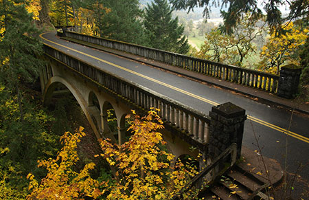
Shepperd’s Dell dressed in autumn golds
Oregon may not have the neon rainbow of New England’s fall colors, but we put on a pretty good show if you know where and when to look. However, 2015 will be different, as the extended drought and scorching summer heat has already affected our fall colors this year, even before the leaves began to turn.
To understand why, you have to start with the basics of how leaf colors change with the seasons, and how weather and other factors influence the autumn show each year.
Leaf Biology 101!
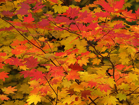
Most of our northwest deciduous trees and shrubs leaf out in spring, grow green leaves through the summer, then turn to various shades of yellow and gold in fall, with a few red leaves in the mix. Vine maple, huckleberry and mountain ash provide our most brilliant reds, and most of the larger deciduous trees in our forests turn to some shade of gold, orange or yellow.
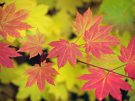
Vine maple colors range from pale yellow (in shade) to bright crimson (in full sun)
The green color in summer and spring foliage comes from chlorophyll, the amazing molecule that absorbs sunlight and allows for photosynthesis — the process by which plants convert sunlight into carbohydrates (sugars) essential to their growth.
During the spring and summer growing seasons, chlorophyll is produced continually, keeping deciduous leaves green. But as the days shorten with the approach of winter, the decrease in sunlight triggers a change in how cells in the stem of each leaf divide, gradually blocking the flow of both nutrients and chlorophyll to leaves. The cells that form this barrier within the leaf stem are known as the “abscission layer”.
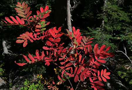
Like vine maple, mountain ash fall colors range from light yellow to brilliant red, based on sun exposure
Ready for more leaf biology? Well, the yellows, reds and golds of autumn are colors that already reside in leaves, but are revealed as the change to the flow of chlorophyll is blocked by the development of the abscission layer in early fall.
Yellows and golds in fall leaves come from “xanthophylls”, a pigment thought to regulate light in the photosynthesis process. Reds and purples come from “anthocyanins”, a molecule that is believed to complement the green of cholorophyll in the photosynthesis process — but is more commonly is found in flowers, where it functions to attract pollinators.
Dark, cool and wet…
Okay, enough leaf biology! If deciduous leaves are certain to turn color in autumn by their very chemistry, how do environmental factors fit into the leaf cycle? Here are the key forces that shape the timing and brilliance (or lack thereof) in our autumn color show:
Bright sun and cool temperatures: a crisp, abrupt fall pattern speeds up and pronounces the abscission process by which chlorophyll is blocked from leaves. This helps to promote sudden and dramatic color shows. Likewise, a mild, extended Indian Summer tends to slow the process, with a more gradual color change and leaves changing and falling over a longer period.
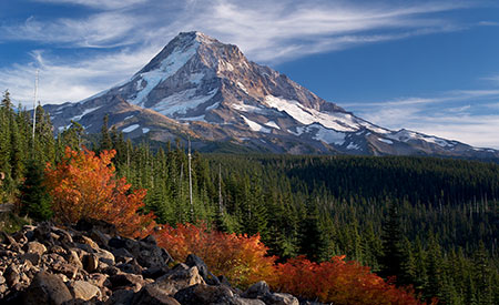
Cool mountain nights and bright, sunny days set these vine maple ablaze on Mount Hood’s Vista Ridge
Bright days and cool nights also enhance reds and purples in plants with abundant anthocyanins in their leaves. These include vine maple, huckleberry and mountain ash, our most vibrant fall foliage. That’s also why these colors are more prominent at higher elevations where bright days cool nights are guaranteed, even as the valleys are under a blanket of fog.
Early frosts: contrary to popular belief, early frosts hurt fall colors more than they help, as the production of anthocyanin-based colors of red and purple are abruptly interrupted by a premature formation of the abscission layer. If you’ve hiked in the mountains in late August after an early cold snap, you’ve undoubtedly seen a carpet of dropped leaves under huckleberries and other deciduous shrubs.
Drought: like early frosts, drought can trigger a premature formation of the abscission layer, leading to early color change and leaf drop. If you’ve been hiking in the Gorge or on Mount Hood this summer, you likely saw this effect of the drought we are experiencing. While some leaves survive later into autumn, the broader effect is a muted show, as many leaves have already dropped long before the typical fall color season. This is has already been the effect of the drought this year in both the Gorge and on Mount Hood.
Early autumn storms: the arrival of a Pineapple Express storm pattern during Labor Day week of 2013 did a fine job of stripping our maples and other deciduous trees of many of their leaves weeks before they would normally turn and begin to lose their foliage. It’s not common for early storms of this magnitude in our region, so it might be the most notorious culprit in stealing our fall colors!
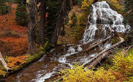
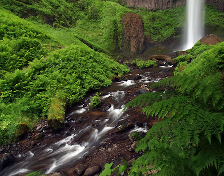
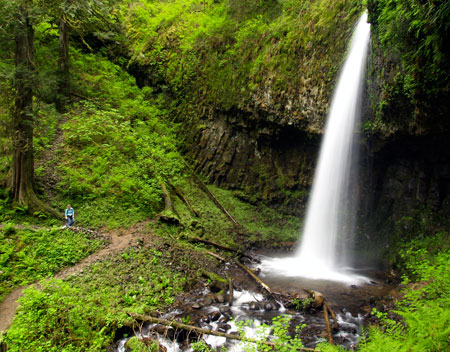
The colors in this view of Umbrella Falls on Mount Hood are mostly huckleberry — red when in full sun and yellow in shady stream areas
In an ideal year, normal rainfall in spring and summer are followed by a cool, dry Indian summer with warm days and cool nights in the 40s or 50s. This year, we’ve got the Indian summer condtions, but the drought has already triggered leaf drop in a lot of our deciduous forests. Thus, we’re likely to have a so-so color display this Fall.
Where and When to Catch the Colors
A muted fall color display this year shouldn’t keep you from heading out to enjoy it! In a typical year, the high country colors peak in September through early October. Mid-elevation areas and canyons usually peak from mid-October through mid-November, depending on the mix of tree species.
Here are some of the best spots in the Mount Hood area to catch the autumn color:
Elk Cove from Vista Ridge – this 9-mile out-and-back hike is one of the best for exploring Mount Hood’s high country without having to ford glacial streams or suffer huge elevation gains (though you will gain substantial elevation). In September of a typical year, fall colors light up the trail, especially as you descend into Elk Cove, but note that the colors are long gone from this hike in our drought year — see the Oregon Hikers Field Guide description
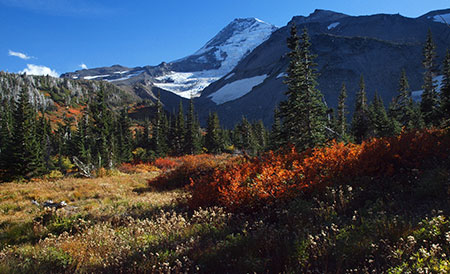
Elk Cove in late September (in a typical year)
Clackamas River Trail – another close option for Portlanders, with a moderately long hike to Pup Creek Falls, albeit with moderate elevation gain. This trail is lined with bigleaf maple, but also has impressive vine maple shows in a recovering burn section that bring shades or red and coral to the trail in October. You’ll also see Douglas maple here, a close but less common cousin to vine maple — see the Oregon Hikers Field Guide description
Brilliant vine maple along the Clackamas River Trail
Lookout Mountain Loop – Always a spectacular hike on a clear day, in October you will also see the annual spectacle of western larch turning golden yellow across the eastern slopes of the Cascades. Larch are a deciduous conifer — a rarity, and an impressive sight — see the Oregon Hikers Field Guide description
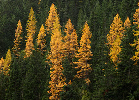
Whole mountainsides around Lookout Mountain light up with western larch turning in mid-to-late October
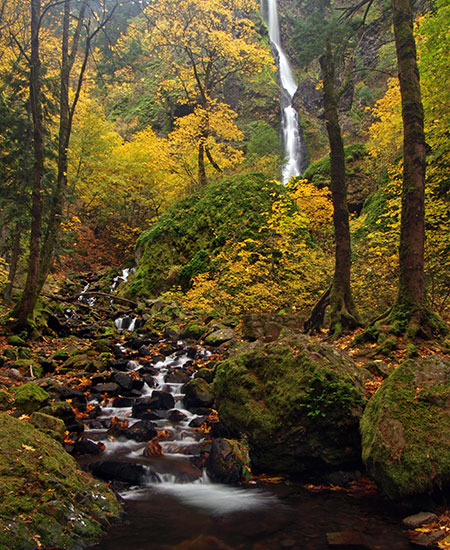
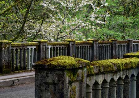
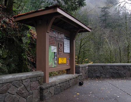
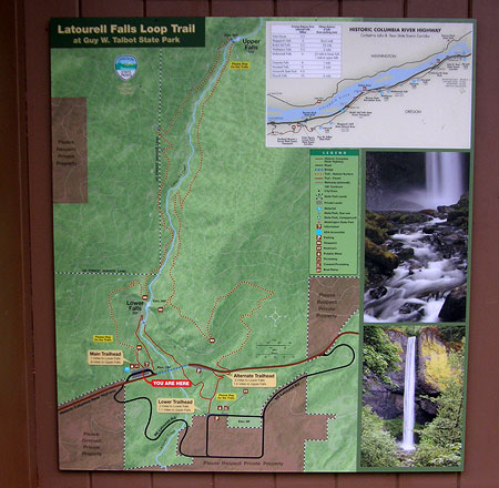
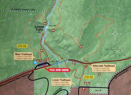
Latourell Falls Loop – Very close to Portland, this is a popular family hike that visits two waterfalls in a lovely rainforest canyon. In late October, bigleaf maple that dominate the forests here light up in shades of yellow and orange, often covering the trail ankle-deep in their huge leaves — see the Oregon Hikers Field Guide description
The Latourell Falls loop trail still has some color in early November
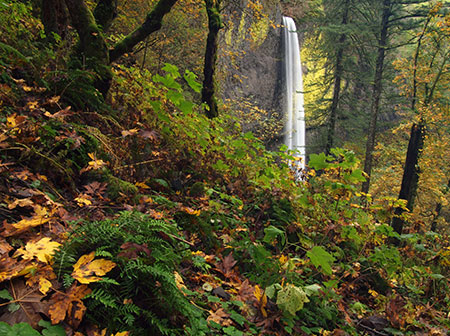
Starvation Creek Loop – like the Latourell loop, Starvation Creek has an abundance of bigleaf maple, but the crisper weather and abundant sun of the eastern Gorge often makes for a brighter show here. Families can simply explore the paved trails around the main falls, but the Lower Starvation hike makes for a fun, if sometimes steep loop past more waterfalls and clifftop viewpoints — see the Oregon Hikers Field Guide description
Bigleaf and vine maple put on a reliable show at Starvation Creek Falls in October
Butte Creek Trail – an under-appreciated family trail that does require navigating some harshly managed corporate timber holdings. The outrageous, utterly unsustainable clear-cutting only makes the pristine public forests and waterfalls along the trail that much more spectacular in comparison. This is an ideal October hike, with fall colors typically peaking in the last half of the month. This trail really shines in rainy or overcast weather, when the rainforest glows with countless autumn shades of yellow, gold and orange against a backdrop of deep green – see the Oregon Hikers Field Guide description
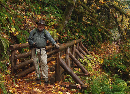
The author ankle-deep in maple leaves on the Butte Creek Trail
The great thing about taking in fall colors is that the weather really doesn’t matter — a soggy hike through the brilliant yellows of bigleaf and vine maple in a waterfall canyon is just as spectacular as a sunny day hiking through a sea of red and orange in Mount Hood’s huckleberry fields.
Better yet, if you have kids, it’s also a great time to expose them to hiking and exploring the outdoors… though you should also plan on hauling home a hand-picked collection of autumn leaves..!
Enjoy!


