Licorice Fern… Forest Contrarian?

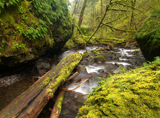
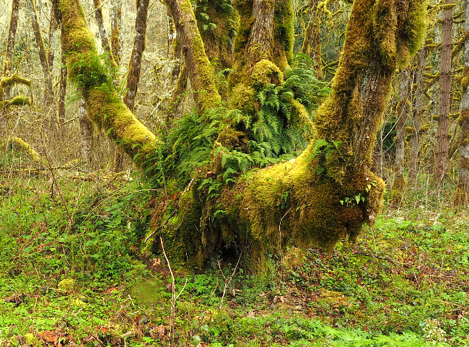
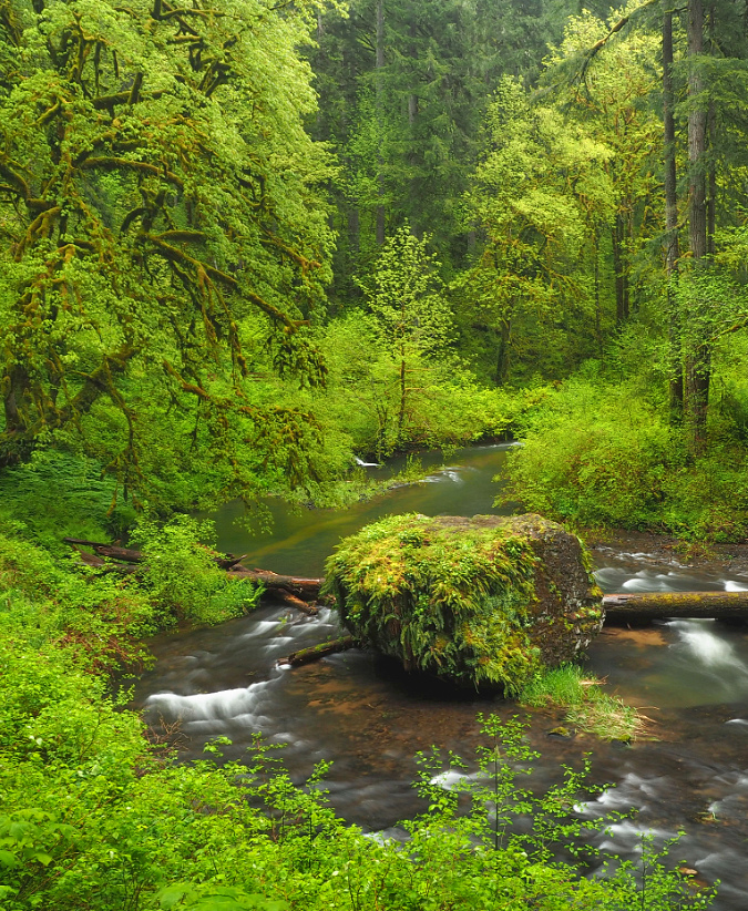
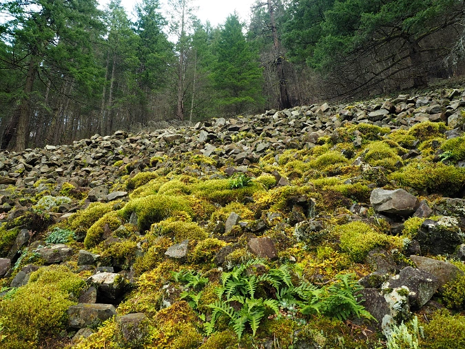
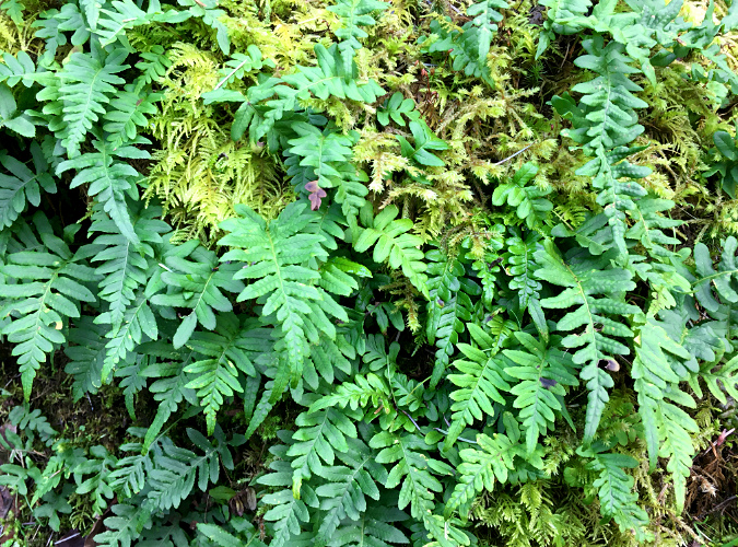
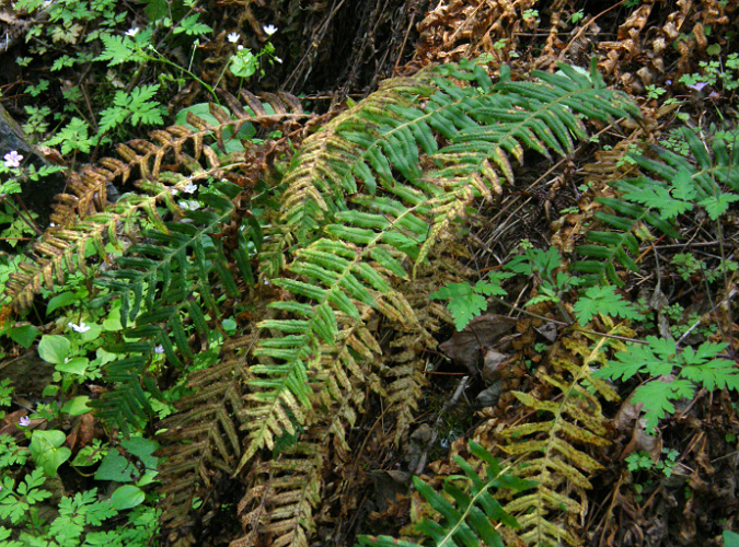
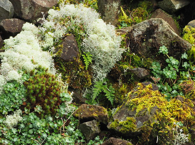
Licorice fern in their two favorite habitats – growing on moss-covered talus (foreground) and on the moss-covered trunks of a sprawling Bigleaf Maple in the Columbia River Gorge

One of the great heroes of our Pacific Northwest forests is so ubiquitous that it’s almost always hiding in plain sight. Licorice Fern (Polypodium glycyrrhiza) is a creeping fern species whose rhizomes cling to moss-covered surfaces – typically tree trunks and rocks. The many ferns around the world that belong to the Polypodium genus share the growth habit of sprouting fronds from creeping roots called rhizomes, reflecting the genus name Polypodium, which translates to “many footed”. 

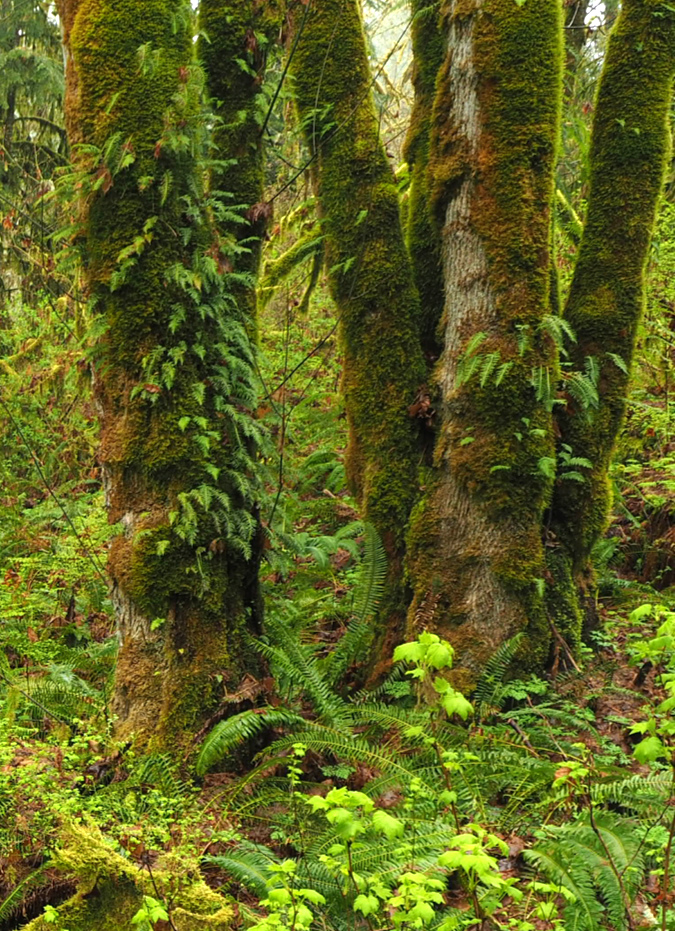
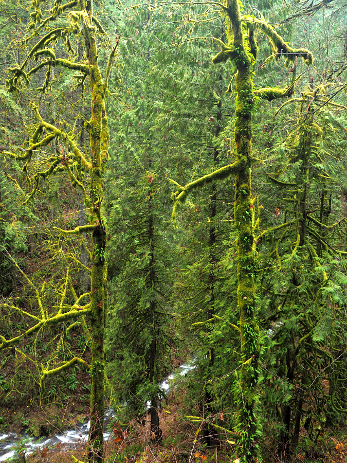
Licorice Fern on a grove of rainforest Bigleaf Maple and Red Alder along the Molalla River

While many of its cousins have especially furry “feet” to protect their rhizomes as they creep across bare surfaces, Licorice Fern has adapted to our rainforests by creeping under thick layers of moss. This not only protects their rhizomes, it also allows for more consistent access to moisture, given that these plants almost exclusively grow where there is no soil – just on rock surfaces or across tree bark. 

Like their cousins, Licorice Fern still retain enough of these fine hairs and roots on their rhizomes to anchor themselves as they grow to the underlying rock or tree bark under that protective blanket of moss.

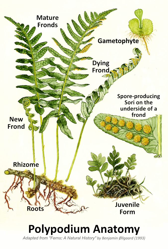
The anatomy and reproductive phases of a Licorice Fern

Licorice Fern have colonized these massive boulders along Moffett Creek where a layer of moss is enough for the ferns to take hold

The second part of their Latin name – glycyrrhiza – translates to “sweet root” and describes the licorice flavor of their rhizomes that give these ferns their common name. If you grew up in the forests of the Pacific Northwest, you probably learned as a kid to identify both Licorice Fern and Wild Ginger (another, less common plant with a strongly flavored underground stem) for their distinct flavors. Both are important first foods for indigenous people and continue to draw interest in the broader foraging community today.  

Northwest indigenous peoples chewed Licorice Fern rhizomes for their flavor and as a medicine for colds and coughs, or cooked as a prepared food (which removes an enzyme in the rhizomes that can otherwise deplete Vitamin B). If you’re curious, you don’t have to destroy a Licorice Fern to sample its flavor (or better yet, to introduce kids to the plant). Carefully peel back the moss from the edge of patch of ferns to reveal the rhizomes and snap off a small piece to chew like gum.

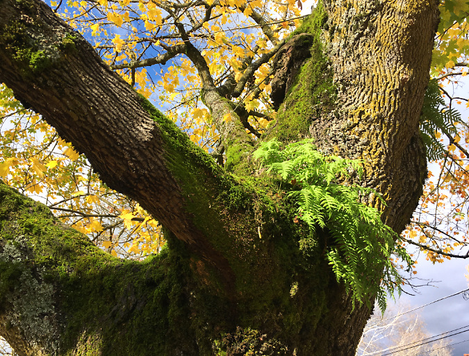
A new colony of Licorice Fern is working its way up this very large Bigleaf Maple along the Molalla River

Their specialized adaptation to our moss-covered forests also explains their range. Licorice Fern are onlyfound in along the temperate Pacific Coast, from the Alaska Panhandle south to the Redwood forests of Northern California (an odd exception is a small population found in the Idaho panhandle). Within this narrow band, it is a remarkably adaptable species, in part because of its unusual growth cycle – more about that later in the article.

Their ability to grow without soil and cling to surfaces with their rhizomes makes Licorice Fern amazingly versatile and acrobatic in its native habitat. These ferns will happily grow upside down if there’s moss and moisture to be found on a cliff overhang, just as they can be found fifty feet (or more) from the forest floor, thriving on the trunk of an old-growth Bigleaf Maple or Red Alder, their most favored tree hosts. 

Licorice Fern thrive where limbs come together on large trees like this Bigleaf Maple, where the moss is abundant and rainwater concentrates between storms

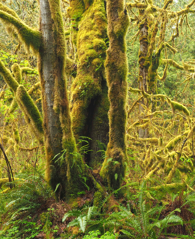
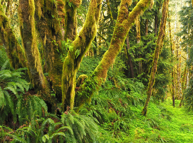
Fern heaven in a mixed rainforest of Bigleaf Maple, Red Alder and Western Redcedar near the Clackamas. Sword Fern carpet the forest flloor beneath the giant Bigleaf Maple on the left, while Licorice Fern scale its mossy limbs

Licorice ferns spread by both creeping with their “feet” and – like all ferns – by their spores. There is plenty of evidence of both forms of spreading and reproducing if you look closely in our forests. 

When creeping by their feet, their progression up a tree trunk or across a moss-covered boulder is obvious. But when you see a smaller, isolated patch high up in a tree, or alone on a boulder, it is likely a new colony is forming from spores that took hold from a nearby parent colony.

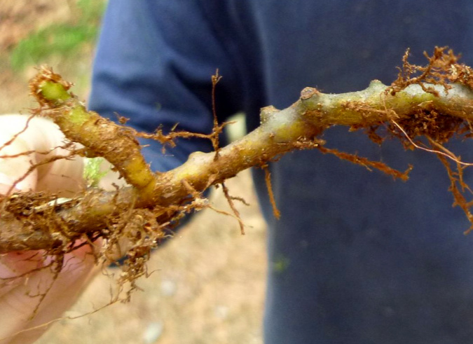
Licorice Fern rhizome – tasty! (Wikipedia Commons)

Licorice Fern growing nearly 70 feet in the air on these Bigleaf Maples along Latourell Creek

This vertical rock face along Tanner Creek has only a thin layer of moss, but it faces north and is thus protected from summer heat, allowing several Licorice Fern to become established here

You’re not likely to notice Licorice Fern during its “gametophyte” phase – the transitional state in non-flowering plants that reproduce by spores by which a new fern is born. However, if you look closely where Licorice Fern grow, you might spot juvenile ferns that have recently emerged from the gametophyte phase with tiny, developing fronds.

Airborne spores allowed Licorice Fern to colonize this giant boulder in the middle of Silver Creek

The importance of their ability to reproduce by spores is on full display right now where our rainforests have recently experienced major wildfires – most notably, the Columbia River Gorge. Unlike many understory plants whose roots were protected from scorching heat by a layer of soil, Licorice Fern were decimated by the fires – along with the moss layers they anchor themselves in. 

As the burned areas gradually recover in places like the Gorge, mosses are quickly beginning to take hold on talus slopes and burned trees. Licorice Ferns will soon follow as their spores find their way to moss layers that have grown sufficiently thick.

These cliff-dwelling Licorice Fern grow under a moist ledge on a north-facing cliff in the Gorge. This allowed them to escape the recent fire, and they will now send spores to the surrounding, burned area as it recovers from the burn

Licorice Fern spores are tiny and can travel long distances in the air, so one patch of surviving ferns in a burned area can quickly spread to form new fern colonies once the moss has returned and gametophytes can survive. 

The scene below shows a talus slope in the Gorge that was covered with a thick blanket of moss and Licorice Fern before the 2017 Eagle Creek Fire, and now must rely on spores from survivors like this small colony to restore the fern population.

The small colony in the foreground somehow escaped the heat during the Gorge fire and now will help restore the much larger colony across this slope the moss recovery continues

One of the remarkable stories in the unfolding forest recovery after the fire is how pioneer species like Licorice Fern begin to move back to areas they once dominated. Before the fire, it would have been easy to simply see these plants are pretty additions to the mossy landscape. 

Yet, in areas where the fire completely burned away the moss and fern layer on the talus slopes that define the Gorge, we now know the important role they play in helping hold these over-steepened slopes together. In places where moss and fern-covered talus had not moved for decades, the loss of this thin, living blanket has triggered countless rock slides that continue to plague trail restoration in the Gorge. In time, the moss and Licorice Fern partnership will once again return to these slopes and – barring another fire in the near term – help stabilize them, once again.

The unusual life cycle of a Licorice Fern

Licorice Fern in peak foliage… in mid-winter?

Licorice Fern are so familiar in our forests that most consider them to be perennial – like Sword Fern or Deer Fern – keeping their foliage year-round. And sometimes they are, but just as these plants can scale their foliage to local conditions, Licorice Fern are uniquely adapted to buck the conventional annual growth seasons that most plants follow, whereby new growth appears in spring and summer, followed by a dormant cycle in fall and winter.

I used to see Licorice Fern in late summer or fall looking yellowed and wilted, and assumed these plants were doing what a lot of broadleaf species do, and simply sacrificing some foliage in the face of our annual summer drought. This was based on seeing other Licorice Fern soldier through the dry spells where they were growing in more protected spots. 

Licorice Fern fronds browning out in mid-summer in the Columbia River Gorge

Then I noticed something surprising on a late October visit to the Gorge several years ago: thousands tiny Licorice Fern fronds were unrolling from the moss layer on trees and rocks that had been rejuvenated by the first big rains and cooler temperatures of the fall season. 

Researching this, I discovered that Licorice Fern often grow their annual burst of new foliage in the fall, not spring – and keep this foliage at least until the next summer drought, or until new fronds appear in the fall in places where they are more protected or have summer moisture.

Tiny new Licorice Fern fronds just beginning to emerge from drought-dormant rhizomes at Starvation Creek in mid-October

Young Licorice Fern fronds rising above the fall leaf litter near Starvation Creek in early November

Just one month into their re-emergence in late fall, this colony of Licorice Fern near Starvation Creek has produced a dense new flush of fronds that will mature to dark green and remain over winter and into the next summer drought

This upended growth cycle makes sense for a hardy fern that grows on the soil-less surfaces of trees and rocks, and thus more reliant on regular rainfall. Their thick rhizomes contain enough stored moisture to help them ride through short dry spells, but when long summer droughts hit our forests, these ferns have adapted to simply drop their foliage and go dormant until the rains reappear.

Their inverted growth calendar also explains why Licorice Fern favor deciduous host trees like Bigleaf Maple and Red Alder. Not only do these trees typically provide the thick moss layers that the ferns require, they lose their leaves in late fall and winter, when the ferns are growing and need access to light the most. While you will often see Licorice Fern in evergreen forests, their preferred environment is on deciduous trees or mossy rocks and logs in an open forest settings for this reason.

New Licorice Fern fronds emerging in fall from a moss-covered rock buried in new leaf debris – a common scene where these plants grow on rocks or logs in open forest

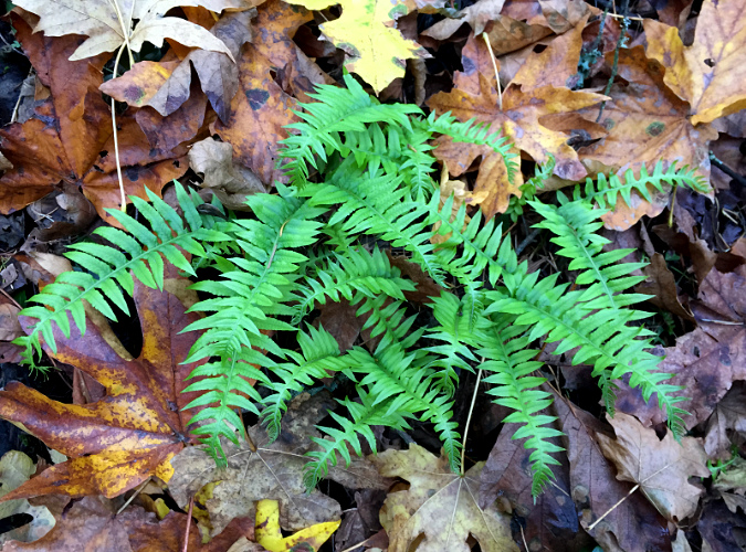
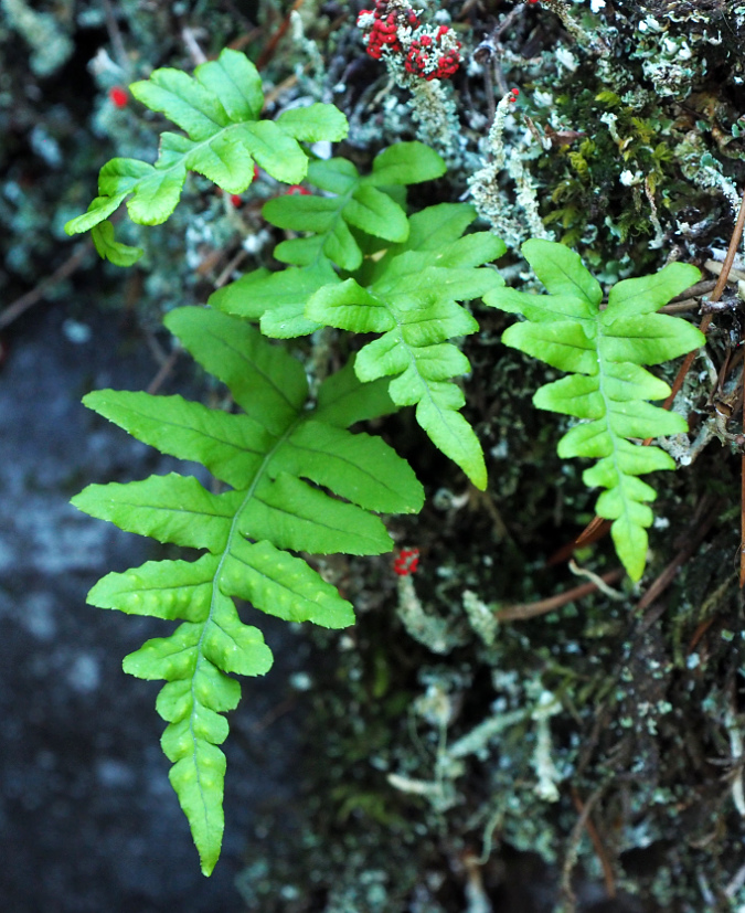
Licorice Fern also have the ability to scale their foliage to their microclimate, further expanding their adaptability. Plants in consistently cool, moist and shaded locations become quite lush, with fronds up to a foot long that persist year-round, even during summer droughts. This is why Licorice Fern appear as evergreens in rainforests on the wet west side of the Cascades.

This lush Licorice Fern colony in the Gorge grows at the protected base of a Bigleaf Maple and on adjacent moss-covered rocks – the best of both worlds for these ferns

In exposed locations where the moss layer is less thick, or they face extended summer droughts and very cold winters, Licorice Fern adapt by downsizing their foliage to minimize moisture loss and maximize the period in which they are leafed out each year. These locations include talus slopes and exposed cliffs throughout their range, or where they grow in shaded areas at the edge their range, east of the Cascades.  

In these harsh environments they typically have short, rounded fronds, sometimes just an inch or two long, and often survive by shedding their downsized foliage in early summer and going dormant for the next 4-5 months.
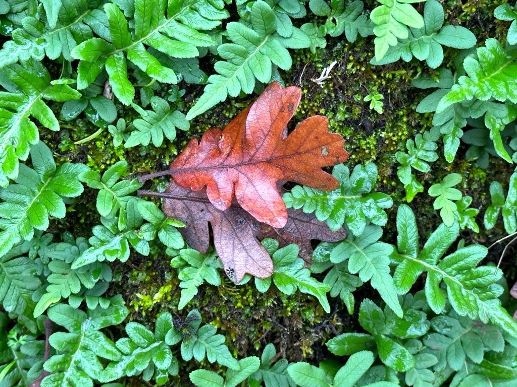
The tiny new fronds on these licorice ferns are as large as they will get on this protected boulder in an Oregon White Oak grove in the otherwise arid east Columbia River Gorge

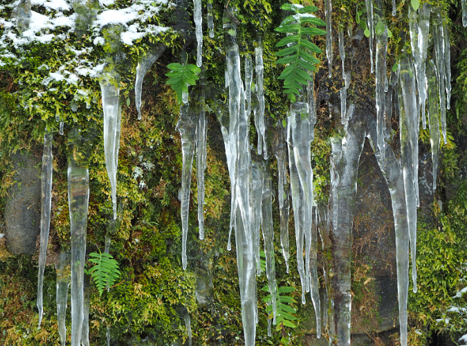
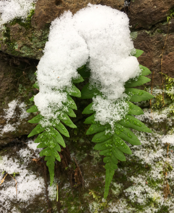
Their inverse growth cycle requires Licorice Fern to be especially hardy in winter, when tender new foliage is leafing out just as freezing temperatures arrive across most of their range. These plants are especially well-adapted to snow and ice, as can be seen every winter in the Columbia River Gorge, where winter weather conditions are especially severe. While a heavy snowfall or ice storm can level other ferns, Licorice Fern quickly bounce back and continue their upside-down growth cycle throughout winter.

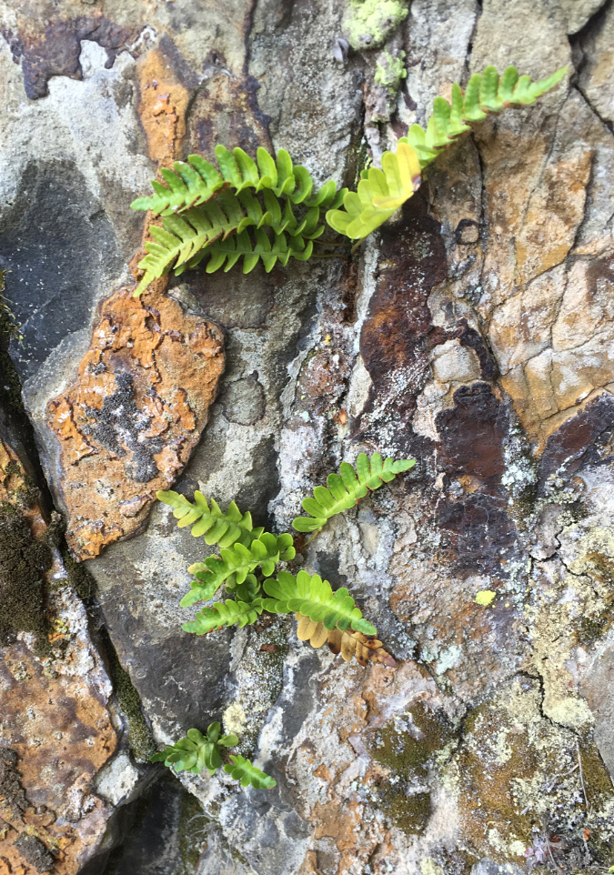
Cliff-dwelling Licorice Fern typically downsize their foliage, both to preserve moisture in these exposed locations and to withstand tough winter weather conditions

Short, flexible fronds allow Licorice Fern to be completely buried in snow and ice, then emerge and spring back, ready to continue their winter growth cycle

Tiny-leafed Licorice Fern (center) with downsized leaves that reflect the harsh conditions of this talus slope rock garden near Gorton Creek in the Columbia River Gorge

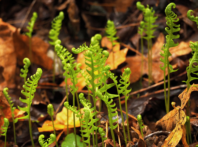
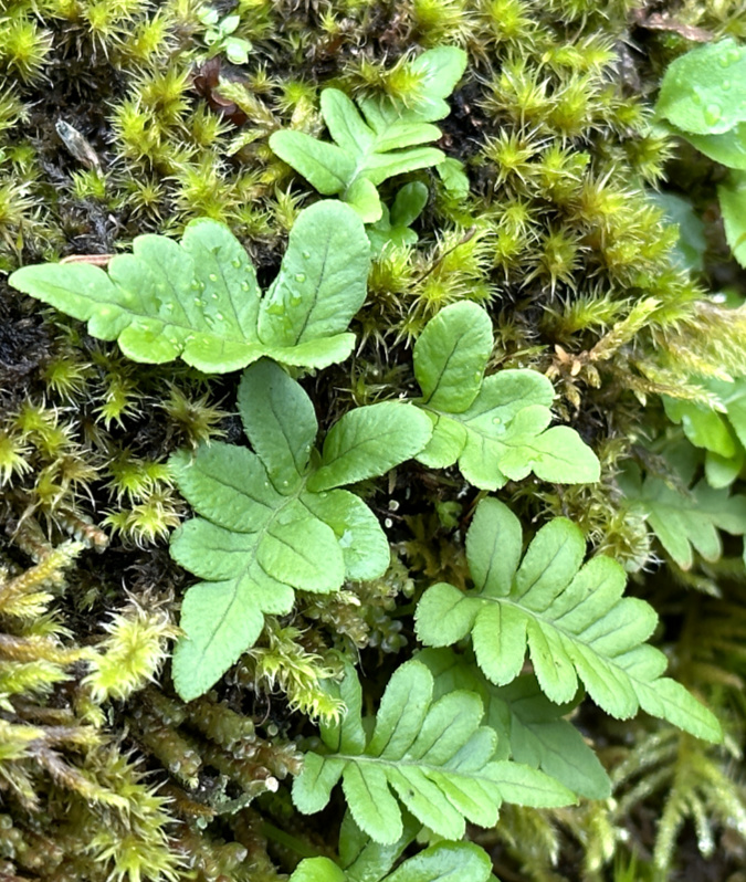
While you’re not likely to spot a gametophyte, juvenile Licorice Fern are common and easy to spot, if you look closely. Their emerging fronds are the size of thumbnail and they lack rhizomes at this stage in their growth. They are often pioneers, as well – tiny patches growing far away from established colonies. 

Juvenile Licorice ferns just beginning to emerge from moss on a talus slope boulder along Tanner Creek. The two arrows point to new fronds emerging from gametophytes. The brown Douglas Fir needles provide scale in this tiny scene

Well-developed juvenile fronds in this new colony of Licorice Fern along Tanner Creek will remain small for the first few years until these plants develop mature rhizomes under the moss layer

This young Licorice Fern has begun producing mature fronds – the wrinkles on the lower frond are from sori on its underside, where mature ferns produce their spores

Where do Licorice Fern get their nutrients when they typically do not grow in soil? The answer is that these plants are mycorrhizal, meaning they have a symbiotic relationship with fungus through their rhizomes and roots. In this relationship, the ferns use their green fronds to produce food through photosynthesis for the fungi, and in turn, the fungi provides minerals supplied from the substrate the plants are growing from. This is why it’s not unusual to find tiny Licorice Ferns growing from what sometimes seems to be solid rock.

Tiny fronds no more than two inches long help these cliff-dwelling Licorice Fern survive where they have sprouted from small cracks in the rock

While not much is known about other organisms that depend on the Licorice Fern, they are considered to be an important niche habitat for other species simply because they grow where most other plants are unable to, thus providing shelter and food for insects and other wildlife living within fern colonies.  

While researching this article, I was especially curious to know if the unique, lowland Pika population in the Columbia River Gorge relies on Licorice Fern for food or nesting material, since these intrepid animals have uniquely adapted to live in talus slopes in the Gorge, and feed on the moss that covers these rocky slopes. Hopefully, as this unlikely Pika population continues to be studied, we’ll learn if it has also developed a special reliance on Licorice Fern, as well.

Urban Licorice Ferns..?

A bit weather-battered after the January ice storm, but bouncing back quickly

Thirty-two years ago, I constructed a stone retaining wall in my backyard and — wanting that “Gorge” look that I’ve always admired – I laid a patch of moss with a few Licorice Fern rhizomes embedded in it across some landscape rocks, just above the wall. For a couple years the ferns struggled to establish, but over the years they’ve formed a tough, lush colony that has now spread to cover much of the retaining wall. 

When I took the above photo in late January, they had been battered by an ice storm, but were quickly bouncing back to winter form, and providing welcome patch of green in our extended gray, rainy season!

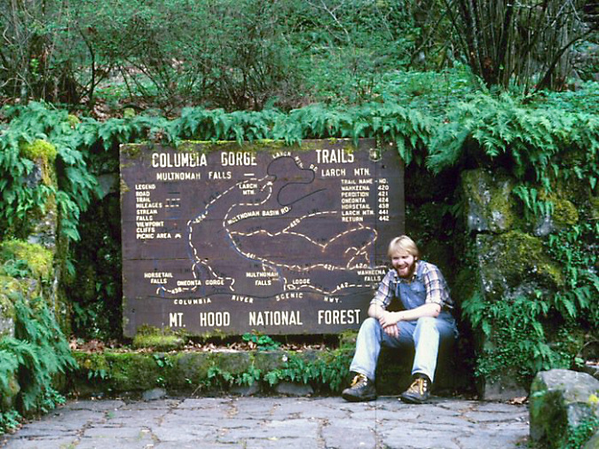
The author in 1981 (at age 19!) beginning my infatuation with licorice-ferns — and stone walls — at Wahkeena Falls

Because I lightly water these plants in summer, they remain green year-round, even in the middle of our typically hot, dry Portland summers. These urban ferns have thus adopted a growth cycle of June through April, dropping most of their previous year’s foliage (with occasional human assist) as warm weather arrives in mid-May, then vigorously rolling out new fronds by early June – apparently “aware” that I’ll be providing light watering over the summer months.

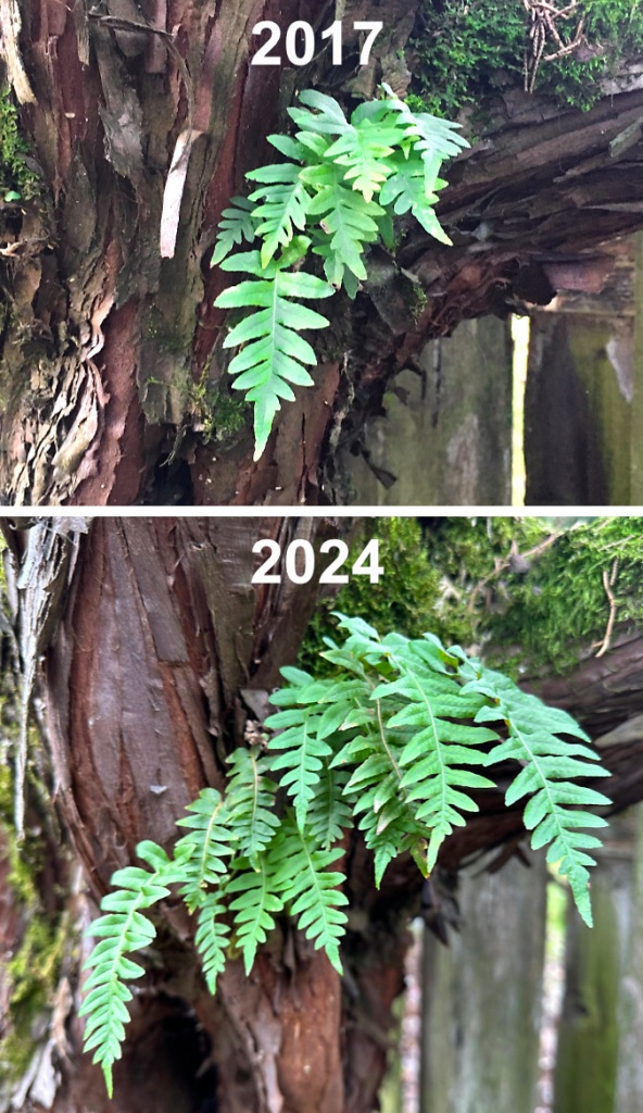
The real surprise came a few years ago when the now, well-established colony on the rock wall spread to their preferred habitat on a nearby Hollywood Juniper, of all places. There was just enough moss on the shaggy bark of this 30-year-old tree to host the ferns, and they also benefit from being shaded by the juniper’s evergreen foliage during our hot summers in Portland. 

Pioneering Licorice Fern in my backyard… on a Hollywood Juniper!

Last year, the new colony on the juniper expanded to include two tiny new colonies, just above it, in this unlikely location. Their life here is exceptionally dry during the summer season – no supplemental water and at least three months of drought each year. The original colony even survived our unprecedented “heat dome” temperature of 116 F in June 2021! These new colonies have thus adopted to the conventional growth cycle of Licorice Fern, and go dormant in late summer, then re-emerge in the fall.

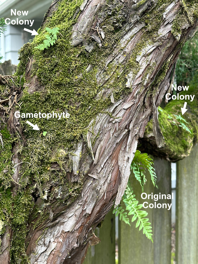
New colonies are now forming near the original Hollywood Juniper colony

The above photo shows the spreading Licorice Fern colonies on my backyard juniper tree – including a gametophyte just emerging from the moss layer. While I think the parent colony for these ferns was the most likely from the nearby rock wall, it turns out that if you look up when you pass under large, moss-bearing street trees throughout Portland, you’re likely to see Licorice Fern taking root throughout the urban area. 

This century-old Norway Maple (below) on my block has several large colonies among its sprawling limbs, as does the 60-year-old Norway Maple growing in front of my house. These colonies are thriving in the middle of the city, even as TriMet buses and other urban traffic on this busy street passes directly below them.

Licorice Fern colonies leafing out in early November on a Norway Maple street tree near my home in North Portland

As our climate continues to warm, we can only watch and learn how native plants will (hopefully) adapt. A few years ago, I wouldn’t have included any ferns on a list of resilient adapters to climate change, but the ability of Licorice Ferns to maintain an inverted growth cycle, scale their foliage to harsh local conditions and go dormant when droughts arrive should help them manage the changes ahead. 

Bringing the Forest Home…

In our time of climate change, native species that have already adapted to seasonal droughts are great options to consider for home gardens. They’re low-maintenance, bug and disease resistant and require little or no summer irrigation once they are established. But perhaps most importantly, they bring a slice of our amazing forests right into our yards for people and wildlife to enjoy year-round. If you can’t be in the forest, bring the forest to you!

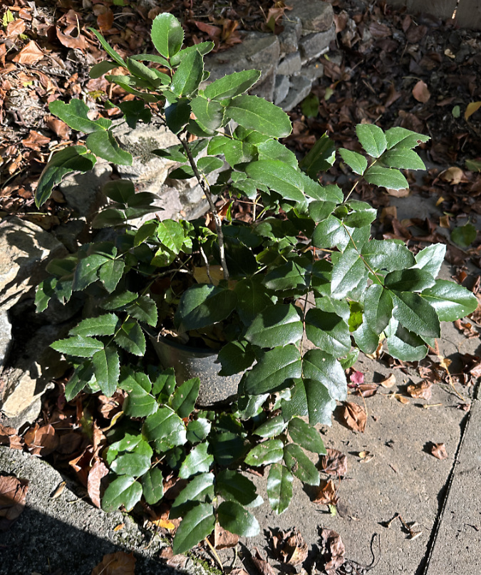
Oregon Grape collected along a forest road near Mount Hood three years ago, and now bursting from its gallon pot (including through the drain holes!), ready to be planted in the garden

I’m a longtime forest transplanter, and licorice fern are just one of the dozens of native plants I’ve collected for my home garden over the years. Like many, I’ve also gradually transitioned away from ornamentals that require heavy watering, yet still fare poorly in our increasingly hot summers.

Among my favorite transplants are the many Sword Ferns planted throughout my garden. They provide year-round green and show a similar toughness to Licorice Fern. While they don’t share the ability to flip their growing seasons, Sword Ferns are able to scale the size of their fronds to local conditions and are remarkably drought tolerant, even in direct sun. I’ve also planted Oregon Grape (pictured above), Deer Fern, Salal and many Vine Maple (below) throughout the garden.

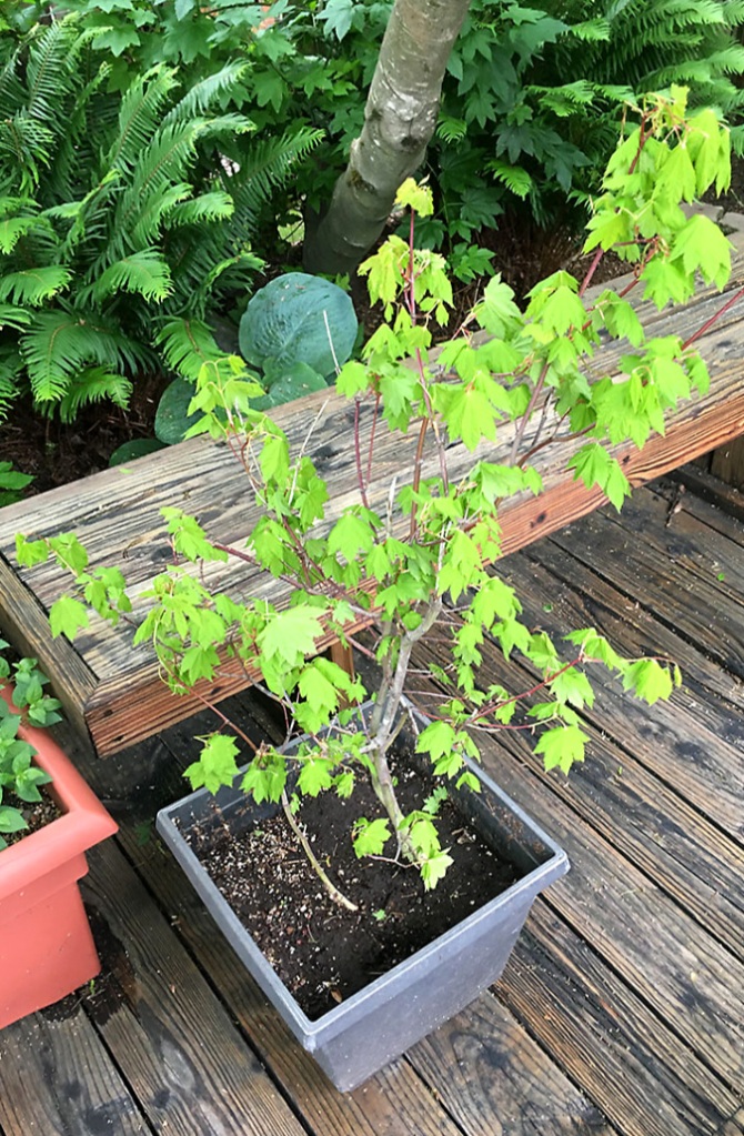
Vine maple leafing out just a few weeks after I collected it in the Clackamas River area three years ago. After two years in a planter, it developed a healthy root ball, and was able to go into the ground last spring

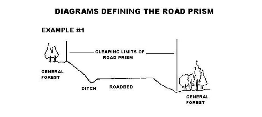
But is it legal to collect transplants on federal land? It is, though you are limited to what the Forest Service defines as the “road prism”. Generally translated, is the area along forest roads that was disturbed by construction, either for drainage or slope cuts. That includes embankments and ditches. The schematic is provided by the Forest Service:

No permit is required for non-commercial collecting. Having done this many times, I recommend digging in February or early March, just before plants emerge from winter dormancy. And don’t try to get a root ball in the normal gardening sense – forest plants have long, meandering roots that wrap around rocks and under logs, so you’re likely to end up with a “bare root” plant, even if you try to dig soil along with your transplant. 

Instead, my system is to not fight this “bare root” reality, and instead, embrace it. A shovel, pair of loppers and some hand pruners are the essential tools needed. Also, pack a few large, plastic trash bags with balls of dampened newspaper inside to keep the roots on your mostly bare-root transplants moist for the drive home. Then, plant them in the ground or in pots as soon as you’re able to. 

I like to grow my starts in containers with potting mix for a couple years to give them a chance to recover and develop a true root ball, then plant them in the yard in fall. That seems to speed up their adaptation to urban life significantly. Soon enough, they’ll asking for overpriced coffee and gluten-free mulch… 😊

You can learn more about collecting plants on Mount Hood ‘s forest roadsides here:

Harvesting Transplants on National Forest Land

______________

Tom Kloster | February 2024
The Injured Man on Molalla River Road

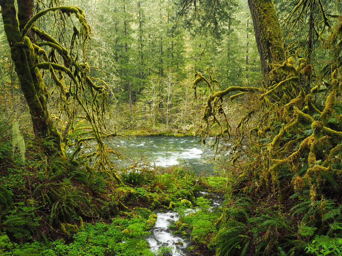
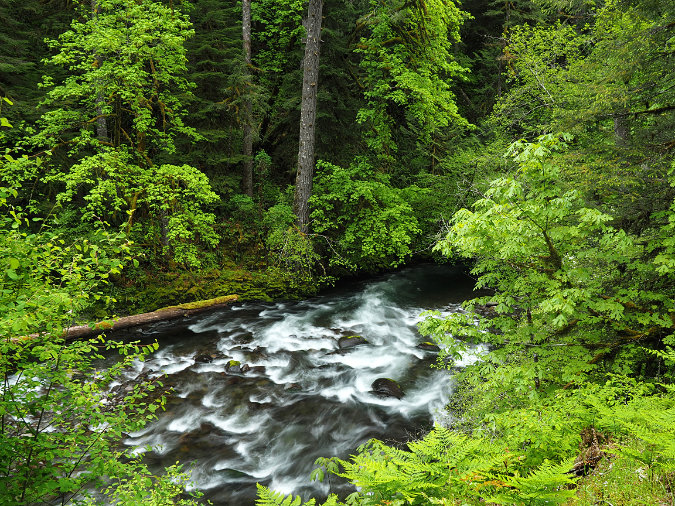
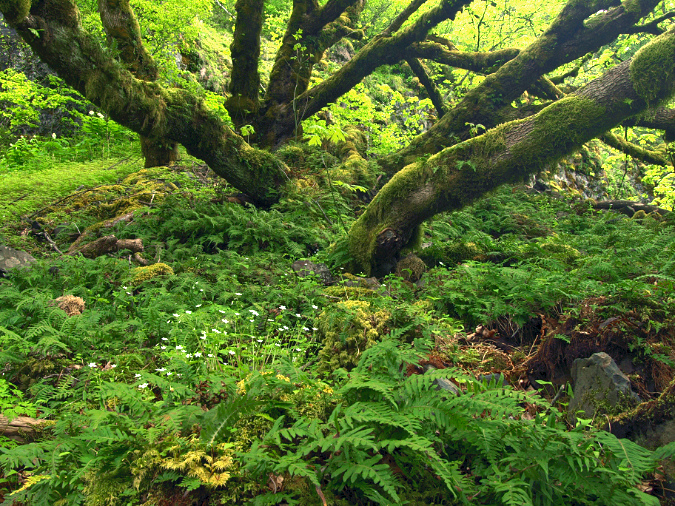
Rainforest scene in the Molalla River Canyon

Author’s note: I started this article two year ago, and set it aside because of the conflicting emotions I had from the experience described here. I’ve thought a lot about how I reacted since then. Over the past few weeks, as I watched the Riverside Fire sweep through the Molalla River canyon, memories of the event in 2018 flowed back, once again. Hopefully, a couple of years of reflection will make this a more thoughtful retelling of the story.

_______________

We live in a cruel time. Politics of fear, rage and blind ideology are stoked by countless streams of media in the endless 24-hour cycles of “news” that has little to do with our everyday lives. All of this is relentlessly boiled up daily and served as a toxic brew that feeds directly into our country’s social unrest. But the constant drumbeat is designed to make us think otherwise, of course, and to entice us tune in for another day of advertising wrapped in more fear and loathing. It’s exhausting, overwhelming and discouraging, no matter your political outlook.

So, what’s the connection to this blog? It’s in the cure. In the Pacific Northwest, we are gifted with an escape hatch from this media overload with the greatest concentration and diversity of public lands in the world. These public spaces provide us with a blissful retreat from the daily onslaught coming from cable news, talk radio and social media.

Like most, my time in the woods is almost always spent decompressing from these social stressors, and the everyday pressures of life. That’s why I spent several weekends in the spring of 2018 in the Molalla River corridor, an area that I hadn’t really explored before. It’s a strip of Bureau of Land Management (BLM) land that was assembled through land swaps with private timber companies in the 1990s, and is now fully dedicated to recreation and forest restoration.

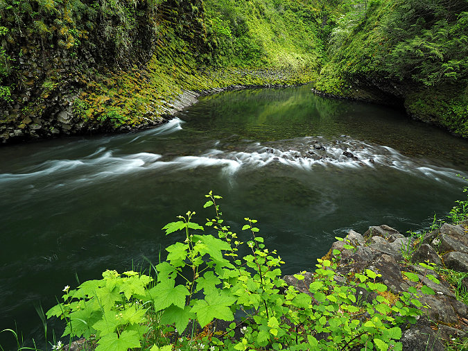
Molalla River Canyon in Spring

Most who visit the corridor are there to fish, explore the many mountain bike trails, swim in the crystal-clear Molalla River or simply enjoy the scenic drive. I went there in the off-season to take to beautiful rainforest scenery as spring foliage was just beginning to emerge. Much of the forest in the Molalla River corridor is recovering from century-old logging. The rebound is breathtaking and inspiring, despite the heavy logging that continues in the upper slopes of the watershed on land still owned by the timber companies. 

We don’t yet know how the Riverside Fire changed the landscape in the Molalla River canyon when it swept through last month, but there’s a good chance that this riparian corridor experienced a mosaic burn, where patches of surviving forest remain among more severely burned forests. I’ll report back on that once we the smoke has cleared and we can better understand the full impact of the fire on the forest.

A change in plans…

And so, I was heading back into the Molalla River corridor on that lonely, rainy Sunday morning in 2018 to photograph the forest scenery in a couple of favorite spots I had found on previous visits. Oddly, I had passed a BLM ranger parked at one of the closed picnic sites, which surprised me on an early spring weekend. Otherwise, I had the place to myself. 

Then I came upon a man lying in the middle of the road. 

At first, I thought he might be a cyclist who had been struck by a car. The corridor has miles of developed mountain bike trails, but there was no bicycle in sight, nor any vehicle. Had the man in the road been hit and left there? Was he even alive? My heart was pounding as I pulled up. Then, to my relief, the man began waving for help. Thankfully, he was alive! But a wave of fear swept over me as to what his injuries might be. 

I jumped from my car and yelled to him, “Are you okay?”

“Yes, but I broke my leg”, he answered, lifting himself awkwardly onto one elbow. 

The man looked to be in his mid-30s. His leg was badly broken, and worse, his head was bleeding steadily from just above his left eye. He was lying on wet pavement in blue jeans and a denim jacket, both completely soaked by the steady rain. I was now very concerned about the seriousness of his injuries and whether this man was going into shock. 

I ran back to the car to get a fleece blanket to cover him and asked him his name.

With a heavy accent, he said “Daniel. Daniel Hernández” offering me his wallet and identification, as if I’d asked to see it.

Now, this was not the man’s real name. I’ve simply chosen a common Hispanic surname to reflect his ethnicity, as this is central to the story. 

“I fell off the cliff and broke my leg” he said, pointing at the 70-foot escarpment directly above the road. Then, quietly repeating to himself, “Damn, that was stupid… I can’t be missing work for this…”.

Kneeling there in the rain beside him, I was struck that he felt I needed to see his identification as he lay there, badly injured. As if he had to justify his presence to me, a bystander and complete stranger.

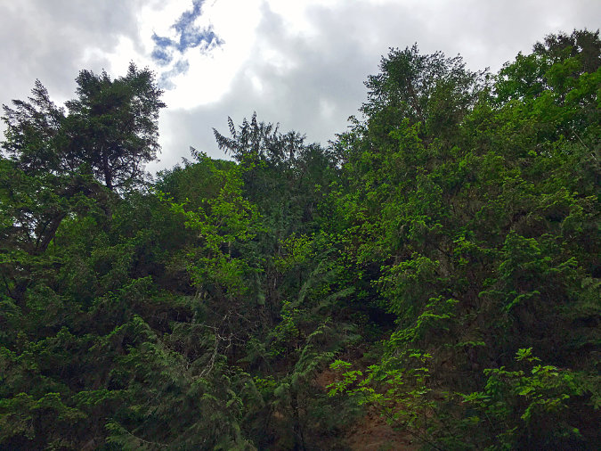
The brushy cliff Daniel Hernández fell from…

I wrapped Daniel in the blanket, and told him I had no cell service in the canyon, but that I had seen a BLM ranger a couple miles back, and wanted to drive back to try to catch him. Daniel nodded and asked if I had water for him to drink. I found a plastic cup in the car and left him on the road shivering and sipping water. It felt terrible to leave him behind, but I didn’t dare move him, and the BLM ranger might still be there and have a field radio. I could only hope that Daniel wouldn’t go into shock while I went for help, or even be hit by a car.

As I started to pull away to find help, a blue minivan suddenly appeared from the opposite direction, driving very slowly — warily — down the canyon toward us. The lone, older man inside kept his window up as he approached us, and clearly did not intend to stop. This shocked and angered me, and I jumped back out and waved him down anyway, actually stepping in front of his vehicle. He rolled his window down a few inches, and I asked him to simply stay there to keep an eye on Daniel so that I could go for help. 

The man in the blue minivan reluctantly nodded, never saying a word to me or even looking me directly in the eye. He rolled his window back up and full ahead, finally stopping his vehicle a fair distance down the road. This left Daniel lying unprotected on the pavement, 30 feet behind him. The old man was clearly fearful and didn’t want to get involved, which made me both angry and sad. I didn’t blame him for being afraid, and yet his cold indifference was infuriating. Yes, it was a scary situation, but also a very human one. Couldn’t he see that?

I jumped back in my car and raced back down the corridor to the spot where the BLM ranger had been parked, just over a mile from where Daniel lay. I felt a wave of relief to round the final corner and see the ranger loading up his truck. I pulled right up to him, startling him, I think, and told him what was unfolding just up the road. He was a young man in his 20s, but clearly knew what to do. He immediately jumped in his truck and followed me back up the road to the spot where I had left Daniel.

Where I found Daniel Hernández lying on the road. He had tumbled from the steep cliff to the left, landing in water in the ditch, and then dragged himself onto the road in hopes of being spotted by a passing car

As we approached the spot, the old man in the blue minivan quickly pulled away before we had even reached Daniel, without a word or gesture, even when I waved to him. He didn’t roll down his window or even make eye contact as he drove away. This mostly made me sad. I felt sorry for the old man, now.

The incident now took another scary turn as the BLM ranger struggled to get a 911 call out on his radio. This is apparently an ongoing problem for law enforcement and rescue within the walls of the Molalla River Canyon. He spent an agonizing 20 minutes before he finally got through, and the rain continued to fall.

While the BLM ranger worked his radio, I knelt down by Daniel to ask how he was doing. 

“Okay” he replied.

“So, what were you doing up there?” I asked, immediately realizing that I sounded more suspicious than curious.

“I just needed to get out here for some peace and quiet, man. I was exploring that trail and tried to get a look at the river, and the ground just gave way”, he said, pointing to a spot at the top of the cliff where you could see the path of his fall through broken brush and ferns.

“Where’s your car?” I asked.

“Down the road, it’s a white van where the trail starts”, he said.

At this point, the BLM ranger had made radio contact, and called out that an ambulance from nearby Molalla was on the way. He then walked over to us, and stood several feet from where Daniel lay, asking him a similar series of questions, though through the lens of law enforcement. That’s one of the roles a ranger plays on our public lands, and he had clearly seen more than his share of unlawful activity in the corridor. But it was also true that Daniel was presumed suspect, even as he lay badly injured on the road.

In that moment, another wave of unexpected fear passed through me. Had I been naïve in trying to help Daniel? Had I put myself in real danger by stopping to help him?

Daniel offered the ranger his wallet, just as he had offered it to me. The ranger took it, looked at Daniel’s identification, then handed it back. Daniel had been laying there for at least an hour at that point, and was shaking. He asked if one of us had a cigarette. The ranger frowned and said “sorry”. I told Daniel I didn’t have a cigarette, either.

I kneeled there, talking with Daniel for the next 20 minutes as we waited for the ambulance. He was staying with friends near Molalla, and visited the corridor frequently to “get away”. That’s why I was there, too, after all. Yet, the ranger’s suspicion had me wondering about Daniel’s story, now. Daniel continued to quietly lament and blame himself for his fall, wondering how he would manage paying medical bills and the work missed from his injuries. He was genuinely distraught, and as he spoke, the fear and distrust about who he was that had crept into my own mind began to melt away, once again. He was just like me, right?

As we sat there in the rain, me next to Daniel and the ranger back in his truck monitoring the radio, it hit to me that Daniel wasn’t just like me at all. He had none of the security that I so take for granted in life — financial, social and even basic equipment for being in the outdoor. His life was completely different than mine, though we had both come to the forest that day to fulfill the same basic need to recharge and find some peace. Despite our very different worlds, we both needed to step away from life’s troubles and reconnect with nature. It was yet another reminder of the cruel times and divided society we live in, creeping into the sacred public refuge of the Molalla River rainforest. 

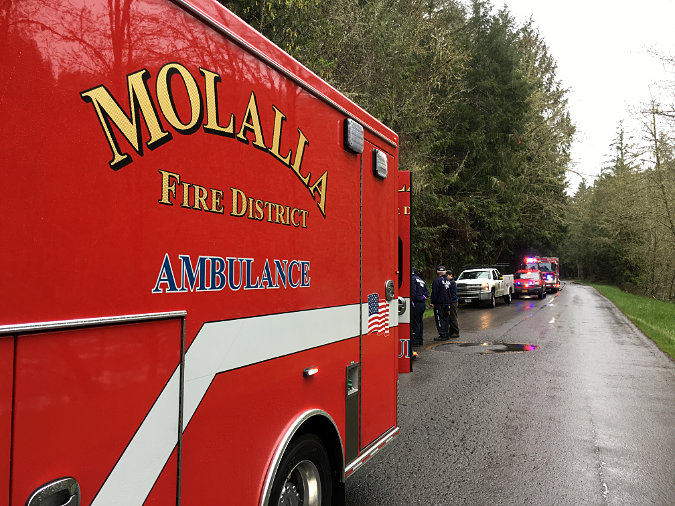
BLM Ranger and Molalla Rescue workers on the scene in April 2018

Finally, we heard both an ambulance and fire engine racing up the road, and I reached out to shake Daniel’s muddy hand to wish him well. Blood was streaked down the side of his soaked face from the wound on his forehead. He squeezed my hand hard, and I felt good about making a human connection with him — even as I secretly felt ashamed of the moments of fear and suspicion that had flashed through my mind since I first found Daniel lying on the road.

When the ambulance pulled up, another wave of relief swept over me. My worst fear had been for Daniel to go into shock, and though I have a fair amount of first aid training, the idea of actually having to treat someone with serious injuries and going in shock really scared me. The rescue workers took over, checking Daniel’s condition and preparing to load him into their ambulance. Once again, Daniel offered up his now soaked wallet and identification, without being asked, and I finally realized this was a familiar, regular ritual for him.

While the rescue team worked with Daniel, I stepped back to chat with the BLM ranger. He could have been me 30 years ago — blond, outdoorsy, just out of college and looking for a career in public lands. He talked about how lawlessness was an ongoing struggle in the corridor for his agency. Despite the popularity of the area, there is still a fair amount of illegal activity, and the BLM is woefully understaffed and unable to provide a consistent presence there. 

Rescue workers on the scene helping Daniel Hernández in April 2018

It was hard to hear such a young, enthusiastic person sound so jaded about those realities, but such is the nature of the work. And yet, it was the fact that Daniel fit a certain profile to the ranger that was most sad to me. Had I been laying on the road, I’m quite sure the reaction would have been different. Because the ranger was just like me… and Daniel was not.

When Daniel had been loaded onto a gurney and moved into the ambulance, I waved at the departing contingent of emergency vehicles and the BLM ranger. Daniel was safe, now, though his troubles in his life brought on by the fall had surely only begun. I’ll never know. We just two strangers brought together for a couple unexpected hours.

After everyone had left, I started back up the Molalla River canyon for an afternoon of soaking up the rainforest beauty. But the incident had rattled me beyond the initial shock of finding a badly injured man in the middle of a road. I spent most of that day reflecting — and regretting — my own feelings and suspicions that had emerged that morning. 

The “Molalla Eye” formation along the Molalla River

On the way out that evening, I was startled to see Daniel’s white van, parked exactly where he said it would be. It was a beat-up 1980s panel van with a temporary license taped inside the rear window. Once again, my suspicions and fears surged at the sight of the old van. It looked sketchy. But why should it have mattered? Nonetheless, it did, because that judgement was in my subconscious, too.

Then I remembered Daniel’s words: “Damn, that was stupid… I can’t be missing work for this…”. I thought about him, probably in a hospital ER at that moment, running up a tab and facing weeks without work. I thought him squeezing my hand. Did he have a family or friends to help him out? Who would come get his van?

We all like to think we’re above our fears and biases, but this was one of those moments when they reared up for me, unexpected and unwelcome. How little we know about ourselves until we are pushed outside our comfort zones, and how very jarring those hidden feelings can be when they emerge. 

And so, I resumed stewing about these many conflicting emotions for the long, rainy drive home in the dark that night… and for the next couple years.

* * * * * * *

I shared this story with friends and family through social media the next day, and received all manner of unexpected praise that I certainly wasn’t looking for. This only made me feel more uncomfortable and ashamed of the mixed emotions I had felt. Yes, I had helped this man, but in the moment, I had also moved toward fear and suspicion at the slightest suggestion. These are details I had not shared in my retelling at the time, and wished I had. It felt hollow and disingenuous, and I wished I had kept the entire story to myself.

Winter rainforest scene in the Molalla River Canyon

So, I tucked away my notes and thoughts about the incident, periodically picking it up over the past two years and trying to figure out why it had impacted me so. Then the video of the brutal killing of George Floyd by a white Minneapolis police officer swept across our already fraught social landscape last May. For so many Americans, it crystalized an urgency to finally confront the racial divides that continue to plague our society. It forced the question, “what can we do as individuals to finally end this?”

For me, the George Floyd murder took me back to Daniel Hernández. Yes, the situation was very different, but the same underlying current was there: an injured Hispanic man feeling obliged to hand over his documentation — his right to be there — to a white bystander, to a white law enforcement officer and to white emergency responders. Daniel knows he belongs to an underclass in our society, and he knew his fate that day depended on navigating the assumptions that white strangers make about him every day. That includes me, the BLM ranger, and rescue unit… and the suspicious old man in the blue minivan.

What can I do? Small steps…

Since that incident in 2018, I had been actively examining my own unconscious biases and looking for ways to be a better social advocate and ally for change, as I clearly have some unconscious biases that need to be worked through. This blog is about our public lands in WyEast Country, so I would like to share how I am putting those ideas to work when I’m out in the forest. They are very small steps, but the old trail analogy applies: a few small steps are how we begin any important journey in our lives.

For me, one overdue step was to simply get to know Hispanic culture, since this represents the largest and fastest growing minority population in Oregon (and across the country). I’m an Oregon native, and yet I knew embarrassingly little about this rapidly growing part of the Oregon family, much less the longer Hispanic history of the West that preceded white migration and settlement.

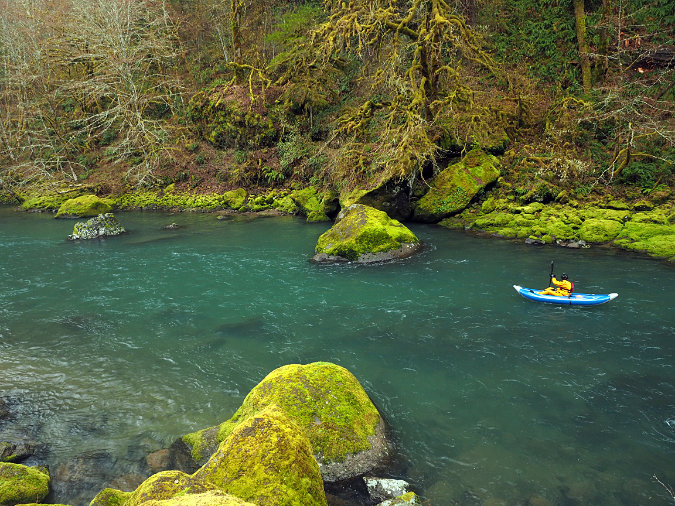
Lone kayaker on the Molalla River in early Spring

So, I decided to learn Spanish. This continues to be a choppy work in progress that has been both humbling and hopeful, but one that I remain committed to. This first step was suggested to me by a Hispanic co-worker who had immigrated to Oregon in the 1990s, and described how welcoming and inclusive it felt when an English speaker would greet her in Spanish, and even attempt a conversation, depending on their Spanish skills.

I was nervous about this idea at first, as it seemed presumptuous and perhaps even racist. Who am I to presume someone is Hispanic based on appearance or even overhearing them speak? But she was exactly right. I gave it a try, and the reaction has almost always the same: friendly and appreciative. Now, when I run into Spanish speakers on the trail, I greet them as I do everyone, but instead of “Hi”, it’s “¡Hola!” I don’t know for sure, but I suspect part of the surprise is hearing a greeting in Spanish from me, a decidedly old white guy who might not seem like a friendly face in today’s racially divisive culture. But this makes it even more rewarding for me!

Earlier this year, on a very busy Memorial Day at Silver Falls State Park, I passed dozens of hikers, including many Hispanic families. Sometimes there was a moment of surprise when I would greet them in Spanish — who is this old white dude greeting me in Spanish? But then faces would typically light up, especially from parents with young kids, and I would get an enthusiastic “¡Hola!” and “¿Cómo estás?” (“How are you?”). And I would reply “Muy bien” (“Very good”) … and then I’d have to switch to English and point out that my Spanish is pretty terrible, but I’m working on it! Even that admission usually brings broad smiles, which is doubly rewarding.

I wish I had figured this out a long time ago, but I’m thankful my Hispanic friend encouraged me take this small step. She as right, and it turns out to be much more important step than I’d imagined.

MolallaInjuredMan10.jpg
Unnamed tributary to the Molalla flowing through a Red alder bog

In our mind’s eye, we imagine that everyone else sees us as the enlightened human beings we aspire to be, exactly equal to everyone else. But I’m learning that being white brings along heavy baggage when it comes to meeting black and brown people on our public lands. We know this because of extensive research on the subject than runs across the spectrum of people of color. But if you are a white person wants to believe that you are welcoming and without bias, it can be hard to accept this truth. 

So, if I want to be part of changing that legacy, it means owning the reality that my being white is a highly privileged status in our society, and rethinking how I interact with people of color when I’m out on the trail is how I can be part of changing that injustice.

Public lands are for everyone? Not quite…

By the year 2040, our country is expected to be “majority minority”, thanks to the large and diverse Millennial generation coming of age, and an even more diverse Zoomer generation, right behind them. Whites will still make up the largest racial category for decades to come, but we will become just another minority in the larger, increasingly diverse population. So, that means the racial tensions that stem from a white majority will resolve themselves over time… right?

Possibly. But here’s the concerning news for the present: public lands continue to the be the overwhelming realm of white people, with a much less diverse cross-section of visitors compared to the overall population. The chart below from Resources for the Future shows the wide discrepancy:

Why is this? Partly culture and tradition, but research shows that most people of color fear hostility and open racism when visiting our public lands — including those who actively hike, camp and fish there, despite their apprehensions. Think about that: people of color seeking the same release from societal pressures that white people seek with time spent in nature are denied that because of the color of their skin

This unjust reality is well documented in research and should be an urgent wake-up call. Research shows people of color reporting reactions of surprise and stares from white people they encounter on the trail, which carries an unmistakable (however unintended) message of “what are YOU doing out here? Many have outright racism, as well. This is real and it’s unacceptable. 

I’d like to think that very few white people behave this way intentionally, but the good news is that remedy is very simple: be welcoming. A smile and a friendly “Hello!” is an easy enough start. If you’re hopelessly introverted, just a warm smile or wave will also do. Still friendlier options are “Beautiful day!” or “Isn’t it beautiful out here?”. These are easy greetings to offer, and I always leave every hiker I pass with “Have a great hike!”. This welcoming ethic should apply to every other activity on our public lands, of course.

Sometimes, you’ll get no response, but that happens when I greet other white people, too. Given the current reality for people of color on our public lands, I believe white people like me have an obligation to be part of the solution. It’s a pretty small step that anyone can take — and should.

MolallaInjuredMan12.jpg
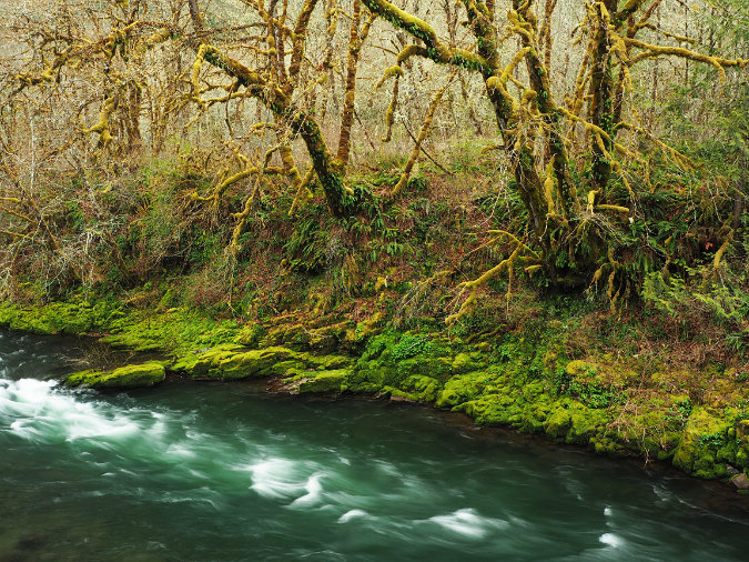
Mossy winter scene along the Molalla River

I may not be able to stop racist taunts from happening (something far too many people of color report from their experiences on our public lands, sadly), but at least I can show that as white individual, I’m committed to a different, more egalitarian future. That’s also the connection to the broader movement happening in our country, too. We can all make a difference by learning and rethinking about our own actions in everyday life. Being welcoming is a small but important step we can all take, whether on a trail, or anywhere.

____________

 e·gal·i·tar·i·an

adjective

1. relating to or believing in the principle that all people are equal and deserve equal rights and opportunities.

“a fairer, more egalitarian society”

noun

1. a person who advocates or supports egalitarian principles.

____________

There’s also a serious conservation concern that stems from the lack of diversity on our public lands, too. If our country will soon be majority minority, and people of color have not been welcomed on our public lands, then we’re headed for a time when only a few privileged white Americans will be truly invested in conserving our natural landscapes. 

I’ve been a lifelong advocate for trails public lands because they’re an egalitarian gateway to nature. While we might argue about exactly how to manage our public lands, spending time out there ensures that we all value them as special, essential spaces in our lives. Resolving to become more welcoming to people of color on our public lands has special importance in this respect. Extending a greeting is not just a welcome, it’s also a validation that acknowledges another person’s right to be there, that we ALL own these lands and we are all responsible for passing them along to the next generation. When you think about it, that’s a profoundly unifying responsibility and common purpose that could go a long way in healing a fractured society.

* * * * * * *

And this takes me back to Daniel HernándezI finally figured out that what bothered me most about that incident in the Molalla River corridor back in 2018. Where I felt a perfect right to be out in the forest that day, Daniel knew that he didn’t share that right. On paper, perhaps, but every white person he encountered that day also carried the implicit right — privilege — to judge his motives for being there, and therefore his basic right. And while I did want to help him, I was also part of that judging, even if for a few moments of doubt and fear. 

As a white person, justifying my right to be somewhere is a burden I will never have to carry. But it’s also privilege I don’t have to exercise. That’s why I’m committed to changing my own interactions with brown and black people in whatever years I have left on this planet. For me, that starts with learning, listening and questioning my own behavior, and then accepting and welcoming all who are out there soaking of the forest, just like me.

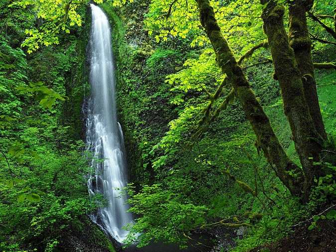
Shotgun falls, one of many hidden waterfalls in the Molalla River Canyon

Our public lands are a priceless gift from generations before us, and for so many, they are an essential refuge from life’s burdens. Now, the task is to ensure the survival of our public lands by ensuring that all Americans can experience the same joy, freedom and sense of peace they offer. It’s the egalitarian promise of our public lands. I believe we all have a responsibility to realize that promise, and the time is right now.

* * * * * * *

I know this article is long and a bit of a departure from what I usually write about on this blog, but if you’ve read this far, I appreciate you taking the time. It’s a tough subject to confront, and you may not even agree with my conclusions. But I’m always thankful for the opportunity to share my own experience with reflections with folks who share my love for WyEast Country!

Here are some resources on the topic that I found helpful, but there is much more out there on the subject that’s both informative and transformative:

Diversity in the Great Outdoors: Is Everyone Welcome in America’s Parks and Public Lands? -Resources Magazine (2019)

“For People of Color, Hiking isn’t Always an Escape” – Reno Gazette Journal (2016)

“I’m Latino. I’m Hispanic. And they’re different, so I drew a comic to explain” — Portland Cartoonist Terry Blas in Vox (2016)

“I Would But: I Am the Only Person of Color” – REI Co-Op Journal essay by Ambreen Tariq, founder of @BrownPeopleCamping (2018)

__________________

Tom KlosterOctober 2020

A Tale of Two Ranger Stations: Part Two

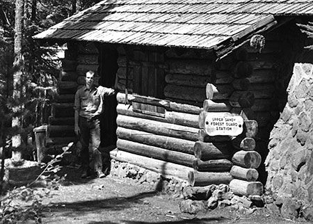
Forest Service guard on duty at the Upper Sandy station in the 1930s

Forest Service guard on duty at the Upper Sandy station in the 1930s

Mount Hood National Forest (MHNF) recently completed a $1.7 million overhaul of its Zigzag Ranger Station, the de-facto visitor gateway to Mount Hood. Yet the historic Upper Sandy Guard Station, a National Historic Landmark located just a few miles away, near popular Ramona Falls, has fallen into a serious state of disrepair.

Basic repairs needed to save the historic guard station would cost a fraction of what the Zigzag project cost, so why has the Upper Sandy structure been so badly neglected? Part two of this article looks at some of the reasons behind this frustrating paradox, and some possible solutions.

1930s: Guarding Portland’s Watershed

The Upper Sandy Guard Station was built along the newly constructed Timberline Trail in the 1930s. Its purpose was to house a Forest Service guard, stationed there to patrol the Bull Run Reserve — Portland’s water supply — where it abutted the new around-the-mountain recreation trail. At the time, the Bull Run boundary was much more expansive, touching the northwest corner of Mount Hood.

Guard stations were important landmarks for early forest travelers

Guard stations were important landmarks for early forest travelers

The Upper Sandy Guard Station was one of dozens dotting the Mount Hood National Forest in the 1930s, all built to protect forest resources from timber poaching and other illegal activities. Several of the old guard stations could only be reached by trail, and the roads that did reach them were primitive.

The guard stations also served as a supply and communications base for the scores of fire lookouts built throughout the forest, often connected by phone lines that can still be found along less-traveled trails today. As recreation use along forest trails grew in the 1920s and 30s, guard stations also provided a comforting presence for hikers exploring the largely undeveloped national forests of the time.

Today the Upper Sandy Guard Station is slowly fading away (Cheryl Hill © 2013)

Today the Upper Sandy Guard Station is slowly fading away (Cheryl Hill © 2013)

View of the handsome stonework that makes the guard station unique  (Cheryl Hill © 2013)

View of the handsome stonework that makes the guard station unique (Cheryl Hill © 2013)

The industrial logging era that began in the national forests by the late 1940s soon made guard stations obsolete: as thousands of miles of logging roads were bulldozed into remote areas once only accessible by trail, forest administrative operations were consolidated into a few ranger district office, and most of the old guard stations were shuttered.

The unused buildings soon fell into disrepair, and most of these structures were dismantled or burned by the Forest Service in the late 1950s and 1960s (along with most fire lookouts, also deemed obsolete as aerial fire surveillance began).

When the Bull Run Division boundary was changed in 1977, the Upper Sandy Guard Station was left miles away from the resource it was built to defend. One year later, the Mount Hood Wilderness was expanded to encompass the building, sealing its fate as a relic in the eyes of the Forest Service.

In recent years the roof on the Upper Sandy Guard Station has partially collapsed, despite crude repairs by volunteers  (Cheryl Hill © 2013)

In recent years the roof on the Upper Sandy Guard Station has partially collapsed, despite crude repairs by volunteers (Cheryl Hill © 2013)

The few guard stations that did survive decades of neglect intact now represent a precious glimpse into an earlier, idyllic time in the national forests. They now stand as historical gems, worthy of special protection.

Some of these structures have already been preserved, like the Clackamas Lake Guard Station near Timothy Lake, while others have been allowed to fade away nearly to oblivion, like the Upper Sandy Guard Station. A few that survived intentional destruction by the Forest Service have nonetheless been lost to neglect, like the former High Prairie Guard Station on Lookout Mountain, a building that was partially standing as recently as the early 1980s.

Ruins of the High Prairie Guard Station in 1983 before it faded into the meadow

Ruins of the High Prairie Guard Station in 1983 before it faded into the meadow

In September 2009, the National Park Service finally added the Upper Sandy Guard Station to the U.S. National Register of Historic Places, a move that many considered to be the building’s salvation. After all, the Forest Service had actively sought the historic designation and local Forest Service historians had strongly advocated for preservation of the building. Thus, the disappointment in the years since, as even the most rudimentary Forest Service efforts to stabilize the building failed to materialize.

Instead, the Forest Service posted the following notice on the building, “warning” hikers that entering the structure presented a dire hantavirus risk from resident deer mice. The notice actually admits that only one (!) documented hantavirus case has ever been documented in Oregon, and that “there is no evidence that the disease is carried by rodents who call this building home.”

Of course, deer mice surely inhabit every other historic wilderness structure in the wilderness areas around Mount Hood, yet no health warnings are posted on the shelters at McNeil Point, Cairn Basin, Cooper Spur and Elk Meadows or the lookout at Devils Peak, where hikers routinely camp inside (and maintain) the structures. So, the point of this notice on the Upper Sandy structure seems to be to frighten visitors from entering — or perhaps maintaining — the structure.

The Forest Service has posted this "health warning" on the structure to discourage visitors  (Cheryl Hill © 2013)

The Forest Service has posted this “health warning” on the structure to discourage visitors (Cheryl Hill © 2013)

The Upper Sandy Guard Station was added to the elite National Register partly because of its historic role as a base for patrolling the Bull Run Reserve, but mostly as the only surviving design of its kind in the Pacific Northwest. The building has a unique, rustic architecture that embodies the New Deal programs that put skilled craftsmen and laborers to work on our public lands as part of the 1930s economic recovery.

Most notable is the massive stone masonry end wall that has probably helped stabilize the structure as the log walls continue to deteriorate. Its unique design combining rubble stone and wood walls make it one of a kind among the more than 700 forest administrative buildings constructed during the New Deal era.

The building was constructed by a seven-man crew in the summer of 1935 with a budget of $958.88, including materials: two carpenters worked at the rate of $7/day and two laborers assisted at the more modest rate of $4/day. The guard station was completed on September 28, 1935.

Today the building suffers serious holes roof and will almost certainly be lost in a few years without an immediate effort to stabilize the structure, or better yet, all of the work needed to fully restore this building. So, why is the Forest Service allowing this to happen? Blame it on the Wilderness..?

Does the Upper Sandy Guard Station have a future? (Cheryl Hill © 2013)

Does the Upper Sandy Guard Station have a future? (Cheryl Hill © 2013)

For a time following the 2009 National Historic Register listing, the old guard station had an advocate in the Northwest Forest Conservancy (NFC), a local non-profit focused on preserving several historic forest structures in the Mount Hood National Forest. Today, the NFC appears to be inactive, and there are no advocates pressing for the building to be rescued.

Prior to the 2009 Historic Register listing, the NFC formally proposed managing a restored building. Today, several historic structures in the Tilly Jane area (on the northeast side of Mount Hood) are managed in this way by the Oregon Nordic Club under an agreement with the Forest Service.

Under such an arrangement, the Upper Sandy Guard Station could have been put it to year-round use as part of its restoration. The NFC envisioned volunteers to staff the guard station during the summer, as the proximity to both the trailhead and nearby Ramona Falls makes the guard station a natural base for both volunteers and visitors. Sadly, this plan never moved forward.

The Upper Sandy Guard Station was prominent on this 1939 map of the Timberline Trail, along with the log shelter that once stood at Ramona Falls

The Upper Sandy Guard Station was prominent on this 1939 map of the Timberline Trail

Despite the agency effort to list the building on the National Register, friends of the old guard station within the Forest Service are surprisingly scarce, and mostly limited to historic resource specialists whose workloads spans multiple forests.

Unfortunately, the Upper Sandy Guard Station carries a still heavier burden than simply a lack of interest from the Forest Service: since a 1978 expansion, the guard station has located within the Mount Hood Wilderness, which by some interpretations means it should be allowed to fade into the oblivion in deference to protecting the untrammeled nature of wilderness.

Is it really that simple? Not at all, but internal Forest Service e-mails on the fate of the historic structure show Mount Hood National Forest recreation planners quickly turning to this argument in defending the decision to let the Upper Sandy Guard Station fall further into disrepair. The same e-mail exchanges also reveal internal rivalries between recreation and historic resource staff that have more to do with protecting recreation budgets than adhering to strict interpretations of the Wilderness Act.

Letting this historic building deteriorate is also at odds with the 1999 Mount Hood National Forest facilities master plan, a forest-wide effort to address surplus Forest Service building. The facilities master plan identified the Upper Sandy Guard Station as surplus building, but set no policy for decommissioning or disposing of the structure — one of the core purposes of the facilities plan.

The Devils Peak lookout has apparently found favor with the Forest Service, despite its location inside the Salmon-Huckleberry Wilderness

The Devils Peak lookout has apparently found favor with the Forest Service, despite its location inside the Salmon-Huckleberry Wilderness

The 1999 facilities plan includes other historic structures located inside wilderness area, notably the lookouts at Bull of the Woods and nearby Devils Peak. Both lookouts are included in the National Historic Lookout Register, which is often a first step toward listing in the more rigorous National Historic Landmark Register.

While the Forest Service is silent on Bull of the Woods lookout (and the structure is now showing signs of serious disrepair) the Devils Peak Lookout is described on the Mount Hood National Forest website “open to the public” and maintained as a Forest Service facility.

Why the disparity, especially given that the Devils Peak lookout lacks National Historic Register status? For now, that remains a mystery, as the Forest Service does not seem to have a comprehensive plan for their historic wilderness structures, nor a consistent policy on which structures will be allowed to deteriorate beyond the point of repair — including the remaining Timberline Trail shelters and other facilities across the forest that have gradually been incorporated into new wilderness areas over the years.

This massive new bridge over modest Ramona Creek was built in 2012 inside the Mount Hood Wilderness, less than a mile from the Upper Sandy Guard Station.

This massive new bridge over modest Ramona Creek was built in 2012 inside the Mount Hood Wilderness, less than a mile from the Upper Sandy Guard Station.

Still more confounding is the fact that the Forest Service constructed an elaborate new bridge over Ramona Creek in 2012, just a mile from the Upper Sandy Guard Station and well within the Mount Hood Wilderness. Ramona Creek is a modest stream that can be easily crossed without a bridge, so how was this structure justified?

In a reportedly confrontational exchange in 2007 over the Upper Sandy Guard Station several years ago, a recreation planner from the Zigzag Ranger District responded to questions about the structure with “Have you READ the Wilderness Act? Man-made structures are NOT allowed!” Yet, the same planner was apparently responsible for construction of the elaborate new wilderness bridge over Ramona Creek in 2012.

Clearly, the Mount Hood National Forest has no consistent policy on structures in wilderness areas, historic or otherwise, and thus the highly selective, subjective decisions by district-level staff to build new structures while allowing historic structures to deteriorate.

So, what to do? Fortunately, the answer seems to be coming from the federal land agencies, themselves.

Rethinking the Wilderness Act

Core to the Mount Hood National Forest rationale for letting the Upper Sandy Guard Station fade into oblivion is the opinion — albeit, selectively applied — that “man made structures are not allowed” in wilderness areas. This opinion stems from a series of three recent court decisions and is now widely shared as gospel among the federal land rank-and-file staff.

The stone Cooper Spur shelter along the Timberline Trail is among the historic gems that depend on a better interpretation of the Wilderness Act to survive for future generations

The stone Cooper Spur shelter along the Timberline Trail is among the historic gems that depend on a better interpretation of the Wilderness Act to survive for future generations

However, there is an emerging opinion among wilderness experts within the federal agencies that maintaining and restoring historic wilderness structures is consistent with the 1964 Wilderness Act, and that recent court decisions are more a reflection of flawed arguments made by the federal government in defending its actions to protect historic (and other) structures in wilderness areas. This new argument starts with a key passage in the Wilderness Act, which is the basis for the recent court decisions:
Except in certain specific instances, “there shall be no…structure or installation within any [wilderness] area.” (Wilderness Act, Section 4(c))

In their defense, the federal government has pointed to another passage in the Wilderness Act, arguing that the maintenance or restoration of historic structures qualifies as “use” and is clearly called out among the public purposes of the act:

“Except as otherwise provided in this Act, wilderness areas shall be devoted to the public purposes of recreational, scenic, scientific, educational, conservation, and historical use.” (Wilderness Act, Section 4(b))

Yet, in recent decisions the courts have focused upon the “except as otherwise provided” preface to this clause, and in three key decisions have interpreted historic structures to be at odds with the Wilderness Act. The new thinking emerging among federal wilderness experts focuses on a different defense that would build on this passage in the Wilderness Act:

“A wilderness…may also contain ecological, geological, or other features of scientific, educational, scenic, or historical value.” (Wilderness Act, Section 2(c))

Under this argument, a new approach to defending protection of historic resources in wilderness areas would focus on the “value” of the resource, not “use”, and therefore the mere existence of a demonstrably historic resource like the Upper Sandy Guard Station would be enough to justify maintenance (and even restoration) over time. Finally, another section of the Wilderness Act fills out this new approach, where the act states that structures are generally prohibited except:

“…as necessary to meet minimum requirements for the administration of the area for the purpose of this Act.” (Wilderness Act, Section 4(c))

Therefore, if historic structures represent a “feature of value”, then preserving the structure would be the “minimum requirement” for administering the resource. That’s a lot of legal wrangling, but it could just be what saves our historic wilderness structures.

The Upper Sandy Guard Station sits on a flat bench above the Sandy River, just off the modern alignment of the Pacific Crest Trail.

The Upper Sandy Guard Station sits on a flat bench above the Sandy River, just off the modern alignment of the Pacific Crest Trail.

Taking this interpretation a step further, the fact that “scientific, educational (and) scenic” values are also listed suggests that preserving the Upper Sandy Guard Station by virtue of using it as an overnight rental facility or even staffing it to provide an administrative presence along the overwhelmingly popular Ramona Falls Trail would also be “values” that pass muster under the Wilderness Act. So far, this new approach has not been tested in the courts, but it does offer a hopeful alternative to the troubling direction of recent decisions.

The historic Green Mountain Lookout near Glacier Peak, saved from the federal courts in 2014 by an Act of Congress

The historic Green Mountain Lookout near Glacier Peak, saved from the federal courts in 2014 by an Act of Congress

In the meantime, historic resource advocates in the State of Washington recently short-circuited these recent court decisions in a successful effort to save the Green Mountain Lookout, located inside the Glacier Peak Wilderness.

The Forest Service was taken to court in 2010 over a major restoration of the historic lookout needed to save the structure after years of neglect, including the use of helicopters to carry materials to the remote lookout site. In 2012, the case resulted in one of the three court rulings that have since become the mantra against protecting wilderness structures, and the Forest Service began preparing to remove the building under court order.

Historic resource advocates in Washington State were stunned, and took the case to their congressional delegation. Under the leadership of Senators Patty Murray and Maria Cantwell, Congress acted to permanently protect the structure in April of this year, paving the way for the Forest Service to continue to maintain the Green Mountain lookout for the enjoyment of the public indefinitely.

Saving it by using it?

Ramona Falls is among the most visited wilderness destinations in the country and could use a better ranger presence - why not use the Upper Sandy Guard Station as a base?

Ramona Falls is among the most visited wilderness destinations in the country and could use a better ranger presence – why not use the Upper Sandy Guard Station as a base?

So, how can the Upper Sandy Guard Station be saved? Above all, the building needs an energetic advocate in the form of a non-profit dedicated to historic preservation our public lands – or perhaps even a “Friends of the Upper Sandy Guard Station” non-profit.

The fact that the Mount Hood National Forest has been so arbitrary in its decisions to maintain or build some wilderness structures while allowing others to fall into disrepair is an opportunity: consistent, persistent pressure should be enough to get the Forest Service to do the right thing, and save this priceless old building.

Another possibility is an act of Congress, mirroring the Green Mountain precedent. Given the dire state of the building, perhaps Oregon Senators Ron Wyden and Jeff Merkley could follow in the footsteps of Washington Senator Murray and Cantwell, and simply direct the Forest Service (and the courts) to preserve and restore the building?

These original windows on the guard station were intact as recently as 2008

These original windows on the guard station were intact as recently as 2008

But even with needed repairs, the Upper Sandy Guard Station still lacks a sustaining purpose beyond its intrinsic value as a historic structure. Clearly, the Forest Service sees little value in the building, but to hikers, the structure could be invaluable if managed as a recreation resource.

Here’s how: in summer the guard station could operate in its intended function, with volunteer rangers living in the building during the period when the Sandy River trail bridge is installed (late May through September).

This would put a needed presence on a trail that is heavily traveled, and unfortunately has problems with car break-ins and rowdy visitors at Ramona Falls. The building has the potential to be quite comfortable, as it was originally served with a piped water supply (since removed), and had a sink, small kitchen and even a shower stall that still survives.

Original brass window hardware was still present in 2008, but has since been stripped from by building by vandals

Original brass window hardware was still present in 2008, but has since been stripped from by building by vandals

Volunteer seasonal rangers could also serve as interpreters, giving tours of the old structure and answering questions at Ramona Falls, where the overwhelming share of visitors are casual hikers and young families new to the forest.

Once the seasonal trail bridges have been removed in fall, the guard station could transition to a winter rental, much as several lookouts in the area and the historic guard station at Tilly Jane are operated today. The Old Maid Flat area is a popular snowshoeing and Nordic skiing area, and a restored guard station would be an idyllic overnight destination in high demand. Revenue from rentals could also help pay for needed maintenance and repairs to the structure.

This magnificent fireplace stands at the center of the guard station; the room in the background is a built-in shower, lined with galvanized steel.

This magnificent fireplace stands at the center of the guard station; the room in the background is a built-in shower, lined with galvanized steel.

Could this really work? There are some logistical consideration that would have to be bridged by the Forest Service to actually bring the building back into public use, but they are not insurmountable. First, regular use of the structure would require an outhouse to be restored to the site. Hopefully the original location could be determined from old photos or building plans.

Second, the building would need to be supplied with firewood for winter use, which in turn, would require a woodshed. The National Historic Register evaluation of the building describes a shed that was apparently dismantled many years ago, but could be faithfully restored as part of reconstructing the guard station as it was originally built.

Today, the main structural risk to the building is where several holes have formed in the roof around the chimney. The tarps visible in this photo were placed by the National Historic Register survey crew in 2008 to help stabilize the building.

Today, the main structural risk to the building is where several holes have formed in the roof around the chimney. The tarps visible in this photo were placed by the National Historic Register survey crew in 2008 to help stabilize the building.

Supplying the Guard Station with firewood would be another matter, as any firewood would need to be collected without the use of power tools — a routine task for the hardy individuals who built these structures, but more daunting to us in the modern era. This could be one of the activities of the summer resident rangers. Bundles firewood could also be dropped at the site when a helicopter is already being used to pull out the Sandy River hiking bridge at the end of the summer season.

What next?

Hopefully, this beautiful old structure will find a champion soon, as time is running out for the Upper Sandy Guard Station. While the building condition was described as “excellent” as recently as the 1980s, it has begun to experience major problems from neglect. Worse, vandals have since stripped the building of furnishings and even burned the original wood shutters. The Upper Sandy Guard Station deserves better!

If you would like to help out, consider sending a message to the Forest Service or even your congressional representatives expressing your support for saving this one-of-a-kind window into the past before it’s too late:

Contact Mount Hood National Forest Contact Senator Ron Wyden Contact Senator Jeff Merkley Contact Rep. Earl Blumenauer

If you would like to see the building for yourself, it’s easy to find. The building is on a bench above the Sandy River floodplain, just a few hundred feet off the trail where the Ramona Falls loop intersects the Pacific Crest Trail, near Ramona Falls. The best time to visit is during the summer, when the Sandy River hikers bridge has been installed for the season.

A Tale of Two Ranger Stations: Part One

The new Zigzag Ranger Station

The new Zigzag Ranger Station

Mount Hood National Forest (MHNF) recently completed a much-needed, $1.7 million overhaul of its dated Zigzag Ranger Station, the de-facto visitor gateway to Mount Hood. The new ranger station and visitor center not only provide a modern facility for forest visitors, it was also designed to compliment the rare collection of historic forest buildings that sprawl across the Zigzag campus, the entirety of which was listed on the National Historic Register in 1986. It’s a big step forward for Mount Hood.

Meanwhile, the Upper Sandy Guard Station, located just a few miles away near popular Ramona Falls, has fallen into serious disrepair, all but abandoned after years of neglect. The Upper Sandy Guard Station is also listed on the National Historic Register (in 2009), yet now is on the brink of collapse. Basic repairs would cost a fraction of what the Zigzag project cost, so why the disparity?

Upper Sandy Guard Station in better days (1930s)

Upper Sandy Guard Station in better days (1930s)

This is a two-part story about the two historic ranger stations, one reborn and the other about to die, and how this frustrating chain of events came to pass. And, most importantly, how the Upper Sandy Guard Station might still be saved.

No Welcome Mat?

Mount Hood has always lacked a truly functional visitor center. For years the 1960s-era Zigzag ranger station, with its cluttered, cramped public counter, served as the main stop for visitors new to the area. The old Mount Hood National Forest headquarters was actually worse, located in a rundown section of east Division Street in Gresham, next to mini-storage. It was hardly an inspiring “gateway” to Mount Hood.

A relatively new forest headquarters building was constructed in Sandy in the 1990s with a more aesthetic design the 1990s, but is awkwardly located in a suburban industrial park, where the public is discouraged from visiting the building. Few travelers even realize they are passing the building, though it is within plain view of the Mount Hood highway.

The "new" (1990s) Mount Hood headquarters hides in an industrial park on the outskirts of Sandy.

The “new” (1990s) Mount Hood headquarters hides in an industrial park on the outskirts of Sandy.

The new headquarters in Sandy was a missed opportunity to build a visitor gateway on a scale that reflects the millions who visit the mountain each year. Most regrettable was the decision to locate the building two miles from downtown Sandy, where it could have been easily found by visitors, but also would have complemented other visitor facilities there, and reinforced the tourism economy that is so important to the town of Sandy.

This small building served as the Zigzag Ranger Station until 2013

This small building served as the Zigzag Ranger Station until 2013

By the late 1990s, the Forest Service had formed a partnership with Clackamas County and the Mount Hood Chamber to open a new visitor facility in a vacant commercial space on the Mount Hood Village RV resort grounds, a few miles west of Zigzag. This odd arrangement operated into the mid-2000s, but was eventually closed due to county budget cuts. Relatively few visitors found their way to this location, anyway, so the closure mostly impacted hikers who had enjoyed the convenience of a public restroom.

After the RV resort experiment, the visitor gateway to Mount Hood reverted to an outdoor kiosk at the 1960s-era Zigzag Ranger Station. A portable toilet was added to the parking area to complete the outdoor facilities. This arrangement served as the main visitor experience until last summer, when the handsome new ranger station and visitor center opened.

The original Zigzag Ranger Station was built by the CCC in 1935

The original Zigzag Ranger Station was built by the CCC in 1935

The good news is that the original Civilian Conservation Corps (CCC) era Zigzag Ranger Station also survives, along with nineteen other historic structures on the Zigzag site. To the credit of the MHNF, all of these structures have been well preserved over the decades for their historic significance at a time when historic forest service structure around the nation are rapidly fading away.

While the visitor gateway to Mount Hood bounced around over the past several decades, other national forests in the region were moving ahead with bold visitor centers that signaled a new focus on recreation. Notably, the Willamette National Forest built four expansive new ranger stations in the 2000s on far less travelled forest gateways than loop highway approach to Mount Hood, including a dramatic new Detroit Ranger Station (below), which opened in 2009.

The grand Detroit Lake Ranger Station and visitors center

The grand Detroit Lake Ranger Station and visitors center

Meanwhile, the Mount Hood National Forest limped along with the fading 1960s era Zigzag Ranger Station and a similarly dated and cramped Estacada Ranger Station. The Hood River Ranger Station is even worse, a leased space until recently, and little more than a portable building.

Perhaps a bit of intra-agency envy ensued, as the Mount Hood National Forest finally assembled funding in 2012 for a major upgrade to the Zigzag Ranger Station. Requests for construction bids were titled the “Mount Hood Scenic Byway Portal Project”, a fitting acknowledgement of the main focus of the building upgrade.

The New Zigzag Ranger Station

The new Zigzag Ranger Station (below) is tucked into the historic complex at Zigzag, east of the original ranger station and incorporating the 1960s era building. Though not as grandiose as the new gateway structures in nearby Willamette National Forest, the new Zigzag facility has an attractive, rustic design that complements the surrounding historic structures rather than overshadow them.

Visitor Center at the new Zigzag Ranger Station

Visitor Center at the new Zigzag Ranger Station

DKA Architecture of Seattle designed the project, which includes a remodel of the old 1960s structure with new additions that double the square footage of the facility. Payne Construction of Portland was selected from a competitive bid to build the new facility.

The new ranger station and visitor center has three main elements: (1) the indoor reception and visitors area, backed by administrative offices and conferences rooms, (2) an outdoor plaza and display gazebo and (3) separate public restrooms. The new ranger station structure is clad in clapboard siding and shingled gable roof, echoing the Cascadian architecture of the original 1935 structure.

The new Zigzag Visitors Center is fronted with a small plaza and information gazebo

The new Zigzag Visitors Center is fronted with a small plaza and information gazebo

HBB Landscape Architecture of Seattle designed the mostly rustic landscaping around the new structure. Modern touches to the landscape include a concrete, railed wheelchair ramp and sleek lighting bollards. The landscape design appropriately focuses on native plants, including sword fern, salal, Oregon grape, rhododendron and even some stonecrop tucked into a rock retaining wall, all just getting started, but well suited to thrive here.

Wheelchair parking is provided close to the gazebo with ramps to both the restroom and visitor center

Wheelchair parking is provided close to the gazebo with ramps to both the restroom and visitor center

The very modern public restroom is located across the small parking area from the new ranger station and visitor center. The proximity to US 26 and dramatic improvement over the portable toilets (yikes!) that used to be here will make these restrooms a popular stop along the loop highway – and hopefully inspire travelers to take a few minutes and explore the visitor center, as well.

The restroom exterior design has a nice touch: the traditional 1930s “open pine tree” logo is incorporated into the center gable post, a thoughtful nod to the collection of historic CCC buildings that surround the new facility. The restroom includes a single bicycle rack — minimal, but easy to expand over time, thanks to the spacious plaza in front of the restroom.

New restrooms at the Zigzag Ranger Station and Visitor Center

New restrooms at the Zigzag Ranger Station and Visitor Center

The informational kiosk in the plaza is still not complete (assuming there will eventually be information posted here!), which apparently inspired Zigzag staff to begin tacking fliers to the brand new siding near the front door with thumbtacks. That’s not how most of us would treat freshly painted siding on our homes, so it’s disappointing to see on such a beautiful new facility (not to mention that a nearly identical poster hangs two feet away, in the window on the main door).

Tacky, tacky -- hopefully, the Zigzag Ranger District will give the new facility the quality informational and interpretive displays it deserves

Tacky, tacky — hopefully, the Zigzag Ranger District will give the new facility the quality informational and interpretive displays it deserves

Likewise, the Zigzag District staff has chained a cheap galvanized trashcan to the sleek new entry rails at the main entrance stairway — jarring against the handsome new architecture, and perhaps just a temporary solution. Hopefully, a permanent trash and recycling station is on order for the plaza area!

Another gap in an otherwise fine new design for the ranger station is the lack of benches and tables outside the visitor facility. It’s another detail that can easily be addressed, and perhaps was anticipated in the landscape design, as well. The new ranger station is a pleasant place to be, and visitors will want to spend time here.

Nothing like the sight of a trashcan to say "welcome to Mount Hood!"

Nothing like the sight of a trashcan to say “welcome to Mount Hood!”

Overall, the new Zigzag ranger station and visitors center is a very big step forward, and a welcome development for those discovering Mount Hood for the first time. While the $1.7 million price tag may seem steep to some, it’s a very reasonable expense for a facility of this scale — and especially given the context of some 2.6 million visitors pouring into the area each year. Hopefully, similar facilities will eventually be constructed at the Hood River and Clackamas gateways to Mount Hood, as well.

But for many, the substantial price tag for the new Zigzag ranger station raises another question: if we can afford to build a brand new station at Zigzag, why can’t we afford to simply stabilize the beautiful Upper Sandy Guard Station, which teeters on the brink of being lost forever?
_____________________

Next: Part Two of this article looks at the fate of the Upper Sandy Guard Station

Proposal: Waucoma Bicycle Backcountry

It’s no secret that mountain bikes have been relegated to second-class status when it comes to recreation trails. They’re not allowed in designated wilderness areas, and even with the special set-asides for mountain bikes called out in the recent Mount Hood Wilderness additions, the trail options around the mountain are limited.

It’s also true that bikes and hikers don’t always mix well. Since I’m both a hiker and cyclist, I’m probably more comfortable than most hikers when it comes to shared trails. I love to hike and bike the Surveyor’s Ridge Trail, for example, but most hikers shy away because of its popularity among mountain bikers.

The view toward Mount Hood from Blowdown Mountain

This article is a proposal for something a little different for mountain bikers: the concept is to convert fading logging roads in a scenic area directly adjacent to the Mark O. Hatfield Wilderness to become a dedicated bicycle backcountry. In addition to providing an exciting set of mountain biking trails, the concept would specifically allow for bikepacking — overnight camping at a several destinations that would be bike-in, only.

Most importantly, this new destination would be close to both Portland and the mountain biking hub of Hood River, where bicycle tourism has become an important part of the recreation economy.

[click here for a large, printable map]

The best part of this proposal is that it wouldn’t take much to put the network together. Converting fading roads and constructing just 2.9 miles of new trail (shown in yellow on the map, above) would create a 25-mile bike network of bike-only trails (shown in blue) in an area with terrific scenery, creating as close to a wilderness experience as you can have while on two wheels.

The Proposal

The proposed bicycle backcountry would straddle the high country along Waucoma Ridge, about ten miles due north of Mount Hood. Two main trailheads would serve the backcountry: a new trailhead would be constructed in the headwaters valley of Divers Creek, serving as the primary entry into the bicycle backcountry. The existing Wahtum Lake trailhead would serve as overflow. Both are accessed on paved roads. A third, more remote trailhead would be located at the headwaters of Green Point Creek, accessed by a primitive road.

The view toward Indian Mountain from Waucoma Ridge

Trails

The proposed network has three kinds of bicycle facilities: converted logging roads (dashed blue on the map) functioning as single or dual track routes, new single track bike trails (dashed yellow) and striped bikeways (solid blue) on a short segment of paved Wahtum Lake Road that serves as a critical connection in the proposed network.

The focus of the network is on bicycle loop tours. From the proposed new trailhead, dozens of tour variations are possible, thanks to the dense network of old roads in this area, and the potential to connect and convert them. One out-and-back trail exists, following the Waucoma Road to Indian Mountain (under this proposal, the road would be gated to motor vehicles at the Wahtum Lake trailhead)

Washington’s big volcanoes fill the skyline on the slopes of Indian Mountain

The main focus of the new trail system would be Blowdown Mountain, a surprisingly rugged shield volcano whose gentle summit ridge belies a rugged east face, featuring a craggy volcanic plug rising above a series of forested glacial cirques. An attractive spur road traverses the entire summit ridge of Blowdown Mountain, and would form the spine of the trail network in this part of the bicycle backcountry.

Three small lakes are located in glacial cirques on the northeast flank of the mountain, and views from the high ridges include nearby Mount Hood, to the south, and the high peaks of the Hatfield Wilderness, to the north. The big Washington State volcanoes complete the scene on the northern skyline.

Spring wildflowers line the rustic route Indianhead Ridge with Mount Hood in the distance

The western part of the proposed network focuses on Indianhead Ridge, another high shoulder of the Waucoma Ridge complex, extending south toward the West Fork Hood River. The proposed trail network in this section would include extensive ridge top rides, with panoramic views of Mount Hood and the steep east face of Indian Mountain.

This part of the bicycle backcountry would also encompass the Waucoma Ridge Road, gating and converting the route to bike-only use except for Forest Service vehicles. The road leads through exceptionally scenic terrain, including the former lookout site on Indian Mountain, and fine views into the Eagle Creek valley, within the Hatfield Wilderness. The road, itself, forms the Hatfield Wilderness boundary.

Beautiful Scout Lake in the proposed Waucoma bicycle backcountry

This section of the proposal network also includes seldom-visited Scout Lake, a beautiful forest lake that has historically been stocked with brook trout by the Oregon Department of Fish and Wildlife (ODFW).

Campsites

Five bikepacking campsites are proposed along the new trail circuit. One is simply the existing Indian Springs Campground, an excellent but largely forgotten primitive campground in need of repair. New campsites would be located at Ottertail Lake, the Talus Pond near Gray Butte, Mosquito Lake and Scout Lake, with each offering 5-15 tent sites.

Unlike the nearby Hatfield Wilderness, bikepacking campsites in the new backcountry would feature rustic picnic tables, fire rings and secure hitching racks for bicycles — features that aren’t allowed in a wilderness area, but would be welcome additions in the bicycle backcountry.

Mosquito Lake basin from Blowdown Mountain, with Mt. Defiance and Mt. Adams in the distance

What would it take?

The viability of this proposal is in its simplicity: less than three miles of new trail would open a 25-mile network, with dozens of loop options that could be tailored to the ability of individual mountain bikers. Most of the work required could be done with the help of volunteers, from trail building and campsite development to signage and ongoing maintenance. Some heavy equipment would be required to develop the new, main trailhead and decommission vehicle access to converted roads.

The view across Ottertail Lake basin toward Tomlike Mountain and Mt. St. Helens

Of course, the proposal would also require the Mount Hood National Forest (MHNF) to fully devote the Waucoma Ridge area to quiet recreation. A few years ago, that would have been unlikely, but in recent years, the agency has not only adopted plans to phase out hundreds of miles of logging roads, but also a policy to focus OHV use in a few, very specific areas of the forest. The recent developments could move this proposal into the realm of the possible if sufficient support exists for a bicycle backcountry.

It would take dedicated support from the mountain biking community to make the case to the Forest Service, ideally in a partnership with the agency that would include volunteer support in developing the trail system.

Cyclist on the new Sandy Ridge trail system, an example of collaboration between the USFS and bicycle advocates (City of Sandy)

The good news is that mountain bicycling organizations are already working hard to develop trails elsewhere in the Mount Hood region (such as the Sandy Ridge trail complex, pictured above) and hopefully would find this proposal worth pursuing. If you’re a mountain biker, you can do your part by forwarding this article to like-minded enthusiasts, or your favorite mountain biking organization. It’s a great project just looking for a champion!
____________

Bikepacking Resources

Bikepacking.net is an online community that focuses on off-road touring, away from cars, with great information on gear, routes and trip planning.

The Adventure Cycling Association posted this helpful article on how to pack for your bikepack trip.

Another good article on what to pack for your bikepack on the WhileOutRiding.com blog.

The International Mountain Bicycling Association is the premier organization and advocate for backcountry bicycling.

In the Mount Hood region, the Northwest Trail Alliance is the IMBA Chapter doing the heavy-lifting on bicycle trail advocacy.

Let’s Fix the Cooper Spur Trail

The first hiking trails on Mount Hood were built in the late 1890s, radiating from the newly constructed Cloud Cap Inn on the mountain’s north side. The steep hike up the south Eliot Glacier moraine to Cooper Spur was perhaps the first trail, as it was part of the still-popular Cooper Spur route to the summit. The original climber’s trail is still used, though a much gentler route built in the 1960s now ascends the spur in a series of well-graded switchbacks.

The new, graded trail carries thousands of hikers to the top of Cooper Spur each summer. It is among the most spectacular alpine hikes in the country, with jaw-dropping views of the sheer north face of Mount Hood and a close-up look at the massive jumble of flowing ice that makes up the Eliot Glacier.

The snowfields in question on Cooper Spur are permanent enough to be mapped.

It’s hard to know exactly why the newer, graded trail was routed over a set of mostly permanent snowfields when it was built, but this design flaw continues to be a problem for this otherwise exceptional trail. The newer trail initially follows the climber’s route fairly closely, sticking to the rim of the Eliot Glacier where the snow melts early and reliably each summer.

But near the crest of Cooper Spur, the newer route suddenly crosses the face of the spur, traversing to the south shoulder and overlooking the Newton Clark Glacier. It is in this section where the route crosses a set of persistent snowfields that are nearly permanent in all but the driest years.

The snowfields clearly show up in this 1890s view of Mount Hood in late summer.

This flaw in the newer route is confusing and potentially dangerous to the many hikers who venture to the top of the spur each summer. At 8,514 feet, the summit of Cooper Spur is truly alpine, so one of the benefits of the modern trail is to provide a relatively manageable hike to the top of the spur for the average visitor, despite the high elevation.

But when the trail disappears into the snow in this final pitch, hikers often resort to climbing directly up the snowfield — a dangerous choice — or scrambling up the steep climber’s trail, with its loose rock and cinders creating a potentially dangerous option for many hikers.

The snowfields as viewed from Cloud Cap Inn in the late 1890s.

The design flaw in the newer route may also have environmental impacts: the climber’s trail isn’t really a “trail”, but rather, a braided confusion of boot paths made less stable and more extensive each year as the popularity of the Cooper Spur hike continues to grow.

Early 1900s maps don’t show the snowfields, but they do show the climber’s trail on Cooper Spur.

While the ecological impact might seem inconsequential at this elevation, where few plants can even survive, the physical scars left on the rocky slopes are real and warrant better management of recreation travel in the area.

The high tundra landscape on the slopes of Mount Hood represents one of the most unusual and sensitive in the region, and a stray boot print can last for years. The ever-increasing variations on the climber’s trail that form each summer can take years to recover, even if given the chance.

The USGS 7.5 minute maps of the 1960s were the first to map the snowfields as permanent features. This 1962 map pre-dates the modern Cooper Spur Trail.

This article makes the case for addressing this problem in a couple of steps:

1. Realign the upper portion of the Cooper Spur Trail with a series of designed, graded switchbacks that roughly follow the climber’s trail, along the Eliot Glacier rim.

2. Decommission the problem sections that are usually snow-covered.

This proposal would not only corral the hiking hordes onto a more manageable, new path near the climber’s route, it would also leaves the bulk of the east slope of Cooper Spur untouched by hikers by decommissioning the old trail. This could greatly reduce the impact of the trail on the alpine ecosystem that exists on the slopes of Cooper Spur.

[Click here for a larger version of this map]

One of the most attractive aspects of this proposal is that it would be so easy to build. Building trails at this elevation, with the absence of soils and vegetation, is straightforward and very simple. The new route would simply need to be designed and surveyed, with construction done by volunteers or youth crews like the Northwest Youth Corps.

Looking up the climber’s trail to Cooper Spur and Mount Hood.

Trail construction would consists of rolling loose boulders and rocks to form a trail bench, and smoothing the surface of the new bench into a hiking tread with the abundant volcanic ash and glacial till that makes up most of the terrain at this elevation. This work is relatively easy, and surprisingly fast (I know this firsthand because I’ve adopted a couple of nearby trails in the area, and regularly rebuild worn trail segments in this high-elevation environment of rock and ice).

How to Help

If you’ve experienced the same frustration coping with the trail to Cooper Spur, your comments to the U.S. Forest Service can have an impact. This proposal represents a fairly simple effort, and there’s a good chance the Forest Service will respond if enough hikers weigh in on the hazards of the current trail alignment.

The best way to be heard is to go to the Mount Hood National Forest contact page and speak your mind — it’s easy, and you might just help get this trail fixed for generations to come!