Proposal: Waucoma Bicycle Backcountry

It’s no secret that mountain bikes have been relegated to second-class status when it comes to recreation trails. They’re not allowed in designated wilderness areas, and even with the special set-asides for mountain bikes called out in the recent Mount Hood Wilderness additions, the trail options around the mountain are limited.

It’s also true that bikes and hikers don’t always mix well. Since I’m both a hiker and cyclist, I’m probably more comfortable than most hikers when it comes to shared trails. I love to hike and bike the Surveyor’s Ridge Trail, for example, but most hikers shy away because of its popularity among mountain bikers.

The view toward Mount Hood from Blowdown Mountain

This article is a proposal for something a little different for mountain bikers: the concept is to convert fading logging roads in a scenic area directly adjacent to the Mark O. Hatfield Wilderness to become a dedicated bicycle backcountry. In addition to providing an exciting set of mountain biking trails, the concept would specifically allow for bikepacking — overnight camping at a several destinations that would be bike-in, only.

Most importantly, this new destination would be close to both Portland and the mountain biking hub of Hood River, where bicycle tourism has become an important part of the recreation economy.

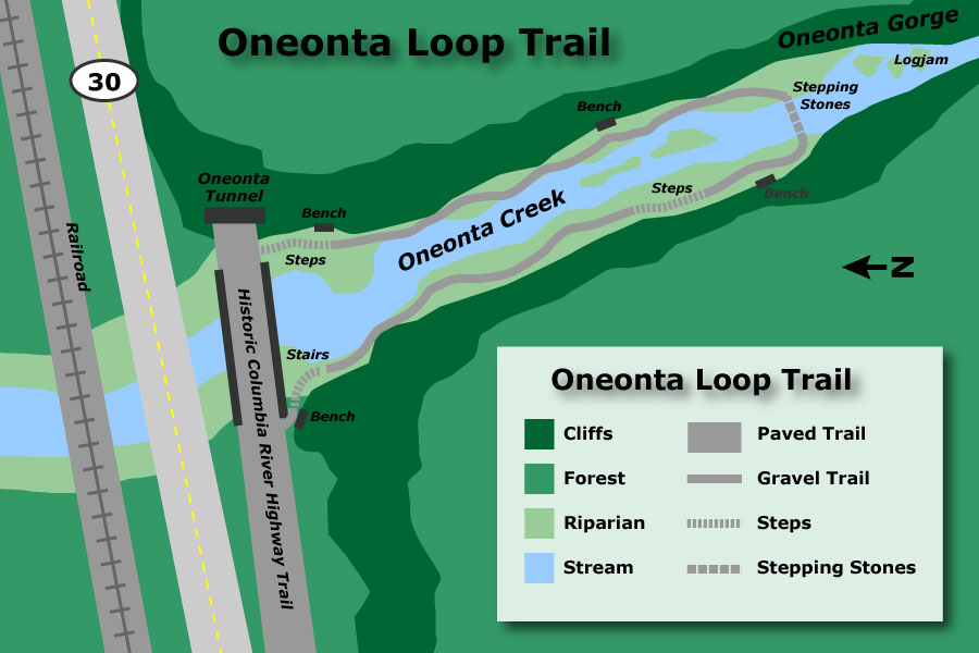
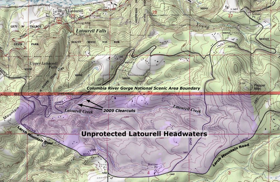
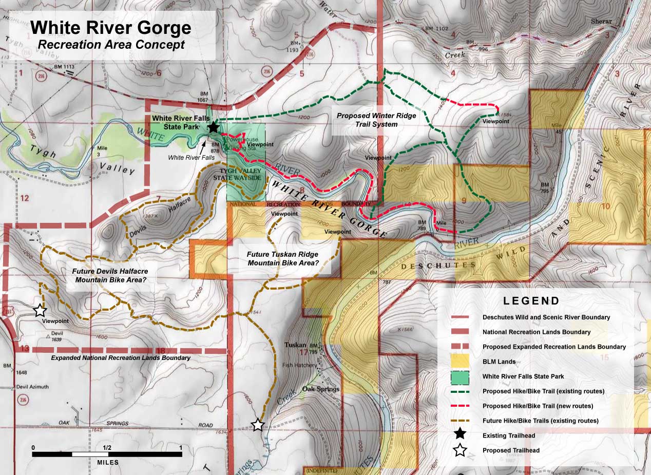
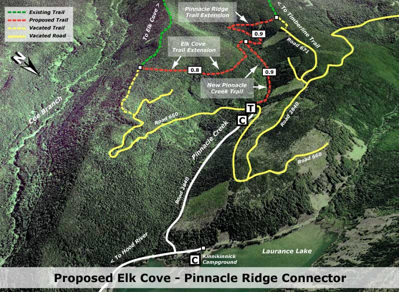
[click here for a large, printable map]

The best part of this proposal is that it wouldn’t take much to put the network together. Converting fading roads and constructing just 2.9 miles of new trail (shown in yellow on the map, above) would create a 25-mile bike network of bike-only trails (shown in blue) in an area with terrific scenery, creating as close to a wilderness experience as you can have while on two wheels.

The Proposal

The proposed bicycle backcountry would straddle the high country along Waucoma Ridge, about ten miles due north of Mount Hood. Two main trailheads would serve the backcountry: a new trailhead would be constructed in the headwaters valley of Divers Creek, serving as the primary entry into the bicycle backcountry. The existing Wahtum Lake trailhead would serve as overflow. Both are accessed on paved roads. A third, more remote trailhead would be located at the headwaters of Green Point Creek, accessed by a primitive road.

The view toward Indian Mountain from Waucoma Ridge

Trails

The proposed network has three kinds of bicycle facilities: converted logging roads (dashed blue on the map) functioning as single or dual track routes, new single track bike trails (dashed yellow) and striped bikeways (solid blue) on a short segment of paved Wahtum Lake Road that serves as a critical connection in the proposed network.

The focus of the network is on bicycle loop tours. From the proposed new trailhead, dozens of tour variations are possible, thanks to the dense network of old roads in this area, and the potential to connect and convert them. One out-and-back trail exists, following the Waucoma Road to Indian Mountain (under this proposal, the road would be gated to motor vehicles at the Wahtum Lake trailhead)

Washington’s big volcanoes fill the skyline on the slopes of Indian Mountain

The main focus of the new trail system would be Blowdown Mountain, a surprisingly rugged shield volcano whose gentle summit ridge belies a rugged east face, featuring a craggy volcanic plug rising above a series of forested glacial cirques. An attractive spur road traverses the entire summit ridge of Blowdown Mountain, and would form the spine of the trail network in this part of the bicycle backcountry.

Three small lakes are located in glacial cirques on the northeast flank of the mountain, and views from the high ridges include nearby Mount Hood, to the south, and the high peaks of the Hatfield Wilderness, to the north. The big Washington State volcanoes complete the scene on the northern skyline.

Spring wildflowers line the rustic route Indianhead Ridge with Mount Hood in the distance

The western part of the proposed network focuses on Indianhead Ridge, another high shoulder of the Waucoma Ridge complex, extending south toward the West Fork Hood River. The proposed trail network in this section would include extensive ridge top rides, with panoramic views of Mount Hood and the steep east face of Indian Mountain.

This part of the bicycle backcountry would also encompass the Waucoma Ridge Road, gating and converting the route to bike-only use except for Forest Service vehicles. The road leads through exceptionally scenic terrain, including the former lookout site on Indian Mountain, and fine views into the Eagle Creek valley, within the Hatfield Wilderness. The road, itself, forms the Hatfield Wilderness boundary.

Beautiful Scout Lake in the proposed Waucoma bicycle backcountry

This section of the proposal network also includes seldom-visited Scout Lake, a beautiful forest lake that has historically been stocked with brook trout by the Oregon Department of Fish and Wildlife (ODFW).

Campsites

Five bikepacking campsites are proposed along the new trail circuit. One is simply the existing Indian Springs Campground, an excellent but largely forgotten primitive campground in need of repair. New campsites would be located at Ottertail Lake, the Talus Pond near Gray Butte, Mosquito Lake and Scout Lake, with each offering 5-15 tent sites.

Unlike the nearby Hatfield Wilderness, bikepacking campsites in the new backcountry would feature rustic picnic tables, fire rings and secure hitching racks for bicycles — features that aren’t allowed in a wilderness area, but would be welcome additions in the bicycle backcountry.

Mosquito Lake basin from Blowdown Mountain, with Mt. Defiance and Mt. Adams in the distance

What would it take?

The viability of this proposal is in its simplicity: less than three miles of new trail would open a 25-mile network, with dozens of loop options that could be tailored to the ability of individual mountain bikers. Most of the work required could be done with the help of volunteers, from trail building and campsite development to signage and ongoing maintenance. Some heavy equipment would be required to develop the new, main trailhead and decommission vehicle access to converted roads.

The view across Ottertail Lake basin toward Tomlike Mountain and Mt. St. Helens

Of course, the proposal would also require the Mount Hood National Forest (MHNF) to fully devote the Waucoma Ridge area to quiet recreation. A few years ago, that would have been unlikely, but in recent years, the agency has not only adopted plans to phase out hundreds of miles of logging roads, but also a policy to focus OHV use in a few, very specific areas of the forest. The recent developments could move this proposal into the realm of the possible if sufficient support exists for a bicycle backcountry.

It would take dedicated support from the mountain biking community to make the case to the Forest Service, ideally in a partnership with the agency that would include volunteer support in developing the trail system.

Cyclist on the new Sandy Ridge trail system, an example of collaboration between the USFS and bicycle advocates (City of Sandy)

The good news is that mountain bicycling organizations are already working hard to develop trails elsewhere in the Mount Hood region (such as the Sandy Ridge trail complex, pictured above) and hopefully would find this proposal worth pursuing. If you’re a mountain biker, you can do your part by forwarding this article to like-minded enthusiasts, or your favorite mountain biking organization. It’s a great project just looking for a champion!
____________

Bikepacking Resources

Bikepacking.net is an online community that focuses on off-road touring, away from cars, with great information on gear, routes and trip planning.

The Adventure Cycling Association posted this helpful article on how to pack for your bikepack trip.

Another good article on what to pack for your bikepack on the WhileOutRiding.com blog.

The International Mountain Bicycling Association is the premier organization and advocate for backcountry bicycling.

In the Mount Hood region, the Northwest Trail Alliance is the IMBA Chapter doing the heavy-lifting on bicycle trail advocacy.

“Warren Falls, we’re ready for your close-up…”

On May 12, Oregon Public Broadcasting’s popular Oregon Field Guide program travelled to the site of Warren Falls to film a story on the unique history of Warren Creek: the odd 1939 highway department project that silenced the falls, and the potential for restoring the falls to its former grandeur.

Michael Bendixen and Vince Patton on the chilly January trip to Warren Falls

This was the second trip to Warren Falls for Oregon Field Guide producer Vince Patton and videographer Michael Bendixen. Both had joined me for a first look at the area on a particularly icy January day last winter when the Gorge was at its worst — freezing rain and sleet over a crusty layer of snow.

Our May 12 trip would prove to be the welcome opposite: unseasonably warm, summerlike conditions, with trails lined with ferns and wildflowers instead of snow. Along for the trip were PortlandHikers.org friends Adam Sawyer and Jamie Chabot, and Kristen Stallman and Andy Johnson, representing the ODOT team that is steering the Historic Columbia River Highway restoration project.

(from left) Adam, me, Andy, Jamie, Kristen, Vince and Michael at the trailhead

We met at the Starvation Creek trailhead at 9 AM, and loaded up our packs with OPB gear before making the short hike to Warren Falls. Along the way, the OPB team shot a few trail scenes, but were interested in getting to Warren Falls and Hole-in-the-Wall Falls while the morning light lasted.

Vince and Michael working at the mighty basalt wall formed by Warren Falls

We soon reached the massive amphitheater created by Warren Falls, where the OPB crew filmed the haunting scene of the silenced waterfall, marked only by the trail of moss that marks where the waterfall once flowed. The group spent some time here discussing the strange project that diverted Warren Creek in 1939, and the mechanics of the diversion tunnel and accompany flume that has long since disappeared.

Warren Creek had overflowed Warren Falls several times over the course of our wet winter, and there were obvious signs that a large amount of water had coursed down the old streambed. But on this day, the stream was dry, with the eerie quiet that now exists here.

Michael filming at Hole-in-the-Wall Falls

We backtracked to Hole-in-the-Wall Falls for another session of shooting. Here, the rest of the group visited while Michael and Vince captured several angles of the odd, accidental waterfall.

Adam, Andy, Jamie & Kristen at Hole-in-the-Wall Falls

For a good look at the bypass tunnel that creates Hole-in-the-Wall Falls, we moved to the knoll above the footbridge. From this spot, it’s easy to imagine the wood flume that once attached to the tunnel exit and carried Warren Creek over the old highway and railroad, all the way to the Columbia River. Only when the old flume disappeared was today’s man-made falls created.

Pointing out the man-made features of the upper portion of Hole-in-the-Wall Falls

A wood flume originally connected to the tunnel opening, carrying Warren Creek over the old highway and to the Columbia

Next, we hiked up the Starvation Ridge Trail, heading for the brink of Warren Falls, and the huge steel weir at the head of the diversion tunnel.

The original plan was to scramble down Warren Creek from the Starvation Ridge Trail ford for the quarter mile of bushwhacking required to reach the brink of the falls. But Kristen had been to the diversion structure a few days earlier with an ODOT engineering crew, and they had found a faint boot path that dropped more directly from the Starvation Ridge Trail.

We voted on the two options at the Starvation Creek ford: wet feet and a rock hop along the stream or pushing through a hillside of poison oak along the boot path? The poison oak option won the day!

Weighing the alternative routes at the upper Warren Creek crossing

We backtracked to the jump-off point for the boot path, descended through a manageable patch of poison oak, and soon found ourselves curving around a steep, grassy bluff hanging directly above the 120-foot cliffs of Warren Falls.

From here, a dramatic view of the massive Warren Creek diversion structure suddenly came into view, and the OPB crew set up to shoot the scene.

Rounding the approach to the brink of Warren Falls

Michael shoots the diversion structure from the cliff top above Warren Falls

The diversion structure is much larger up-close than the historic drawings or a glimpse from below the falls would suggest. The tilted weir is made from sixty 20-foot steel beams laid across a 28-foot wide trench carved into the cliff. Beneath the mesh of steel rails, the trench leads directly to the bypass tunnel.

A close-up view reveals at least half the weir to be filled with loose rubble, to the extent that it is lush with a strange hanging garden of wildflowers, A thicket of willow has even become established in the upper right corner of the weir, suspended 15 feet above the diversion tunnel, below. The forces of nature are taking back Warren Creek Falls, slowly but surely.

Vince takes in the huge steel weir that covers the diversion tunnel opening, rushing directly below him

The up-close view also shows most of the beams to be twisted and buckled with the ravages of time, thanks to rocks and debris getting lodged between the beams, and the effects of freeze-thaw cycles in the harsh Gorge winters.

Still, the overall structure represents an amazing ingenuity of design and construction detail to have lasted 73 years, but is still functioning as intended. While nature is clearly winning this battle, the persistence of the diversion project is silent tribute to the designers and builders who created these structures in 1939.

Jamie exploring the steel weir from below — the top of Warren Falls is few feet beyond

Jamie peers through the weir into the opening of the diversion tunnel, directly below

Vince found an opening in the upper corner of the weir, and set up a compact camera mounted on a short arm to film the scene below

The OBP team used a compact video camera mounted on an arm to shoot under the weir. Vince found an opening at the upper west corner of the weir that gave access to the view from below the steel beams.

From this angle, Vince was shooting just below the upper edge of the weir, where a 15-foot rubble and masonry dam was constructed across the creek to elevate the angle of the weir structure toward Warren Falls. For 73 years, this design has allowed for loose debris to roll off the weir and over the natural falls, while filtering the waters of Warren Creek through the weir into the bypass tunnel that now forms Hole-in-the-Wall Falls.

Vince filming the tunnel below the weir with the compact camera

Next, we moved to the top of the weir, crossing to the upper east corner of the structure. The view from the top of the weir looking over the brink of Warren Falls is impressive, as is the view toward the Columbia River. From here, Dog Mountain fills the horizon across the river.

But the fact that the river can clearly be seen from the brink makes a good case that Warren Falls was one of the “four cascades caused by small streams falling from the mountainsides” in Captain William Clark’s journal entry of October 29, 1805. The other three were presumably the nearby falls on Starvation Creek, Cabin Creek and Lancaster Falls on Wonder Creek.

Looking down Warren Falls from the top of the weir

Dog Mountain dominates the view from the top of the Warren Creek diversion dam

The view from the top of the weir shows more wear and tear on the structure: the mortared lip of the rubble dam is badly weathered, fully exposing the ends of many of the 60 steel beams that connect to it, with only a rusty bolt anchoring them to the masonry wall.

Here, the decay of the diversion system seems to be moving close to structural failure — another argument for an orderly removal of the weir, and restoration of Warren Falls before it becomes impossible to safely do so.

Close-up of the top of the weir shows the wear-and-tear of 70 years

Vince and Michael planning the shoot from the top of the Warren Falls diversion dam

Jamie helps Michael set up at the top of the diversion structure

The group settled in for a lengthy shoot at the top of the falls, where Michael and Vince worked to capture the setting, and the rest of the group enjoyed the sylvan scene along Warren Creek.

Michael shooting from midstream, at the brink…

Michael posing for a certain Oregon Field Guide fan!

It’s a long drop: Michael shooting from the top of the diversion

The OPB crew wrapped up the day’s shooting with a few interviews and reflections of the group on the diversion project, and the future of Warren Falls. We soon packed up the video gear, and started up the canyon slope for the trail.

Adam shooting the OPB crew… shooting Warren Falls…

On the trip back to the trailhead, we ran into several groups of curious hikers, all familiar with Oregon Field Guide and excited to meet the crew.

One young woman asked what we were filming, and I explained the story to her — and asked her to go to Restore Warren Falls! on Facebook. Later, she approached me at the trailhead, and asked “Why are you focusing on this when there are so many global issues facing the world?”

Jamie muggles the geocache at Warren Falls. We signed it “Oregon Field Guide”

At the time I was somewhat startled, and replied that the project to restore the Historic Columbia River Highway provided a unique opportunity for funding the restoration of Warren Falls — a good argument, and one she seemed to accept. But I wish I’d simply said “We have to start somewhere, and right now, this is as good a place as any!”

“I wondered why somebody didn’t do something. Then I realized, I am somebody.”

~Author Unknown

(Special thanks to the Vince, Michael, Jamie, Adam, Andy and especially Kristen for another great day imagining the past and future Warren Falls)

___________________________

Previous articles on restoring Warren Falls:

Restoring Warren Falls
Warren Falls Lives! (temporarily, at least)
Warren Falls Mystery… Solved!
Warren Falls Solutions
Warren Falls Lives… Again?

Restore Warren Falls! on Facebook

Warren Falls Lives… Again?

March 16 was a good day for Warren Falls: in the morning, the Historic Columbia River Highway Advisory Committee (AC) allowed me time on their agenda for a second pitch to restore Warren Falls as part of the larger historic highway trail project. After the meeting, I visited Warren Falls and was able to capture it flowing, thanks to the unusually heavy rain we had experienced in early March. Here are the highlights:

HCRC Advisory Committee

Last summer, I made a pitch to the HCRC Advisory Committee (AC) to restore Warren Falls as part of the highway restoration project, and in my second appearance, was able to provide a much more polished case. The members of the AC were engaged and clearly interested in the idea, asking many questions after the presentation. However, they are also constrained by the tight budget and timeline they are working under to complete the highway restoration by the 2016 centennial of Samuel Lancaster’s “King of Roads.”

The HCRH trail design already includes a short trail and overlook at Warren Falls

The AC chair sent me a follow-up message after the meeting offering support for all of the proposals I had laid out at the meeting — except restoration of Warren Falls itself. While that last part was disappointing, it was helpful to at least have a sense of where the AC stood on the issue, since I can now focus efforts on finding the needed funding and perhaps a project partner for ODOT to pull off the Warren Falls restoration.

The good news is the AC is supportive of several accompanying proposals that I laid out in the presentation, including:

• designing the crossing of the original Warren Creek channel to resemble a “bridge” so that there will be a place for an interpretive panel describing the history of the area

• addition of a side trail to the original Warren Falls with an interpretive panel – albeit, with “volunteer work”

• Enhancing fish habitat downstream of Hole-in-the-Wall Falls as a proposed mitigation action related to construction of the next (unfunded) trail segment west of the Starvation-Lindsey segment currently being designed

• removal of invasive species in the area – mostly, English ivy, Himalayan blackberry and Scots broom.

So, despite the disappointment of not adding the falls restoration to the current ODOT project, the list of related restoration work supported by the AC is a big step forward. In their words, the AC is “supportive of [the] idea to bring water back to the original waterfall, but given our charge, we cannot offer any monetary or construction assistance”. A partial victory, to be sure, but also a challenge to help ODOT find funding for the Warren Falls restoration.

This historic streambed of Warren Creek, now permanently cut off from the stream, could have a “bridge-like” crossing and an interpretive sign describing the area history.

An interesting footnote to the meeting was a conversation I had afterward with a reader of this blog who had watched the presentation, and thought a much simpler solution was possible for restoring Warren Falls: simply pull out the “trash rack” grate, and let Warren Creek do the rest. The stream would surely plug the tunnel with debris and gradually start flowing over its original falls without an elaborate engineering solution for retiring the tunnel.

It’s a temptingly simple idea, and came from a person with a professional background as a hydrologist, no less. So, that scaled-back option will be my starting point as I look for additional funding for bringing back Warren Falls.

Warren Falls Lives!

After the HCRH Advisory Committee presentation, I bolted for the Starvation Creek trailhead, with a strong hunch that Warren Falls would be flowing that day. Despite the bright, blue skies on March 16, the previous week had seen an unusually cold and wet weather pattern, and the gorge waterfalls visible from the highway were roaring.

As hoped, when I arrived at Hole-in-the-Wall Falls, part of Warren Creek was flowing down the normally dry channel that leads to Warren Falls. I captured the following video as I walked along the temporary stream, then rounded a corner to find water flowing over Warren Falls, once again. Warren Falls lives!

As with previous visits when Warren Falls was flowing, the experience was magical. Instead of hearing the echoes of trucks on I-84 in the dry amphitheater surrounding the falls, I could hear only the sound of Warren Creek — or the overflowing part of it, at least — cascading over the 120-foot brink of the falls, then splashing down the normally dry streambed to the point where it re-joins the main stream of Warren Creek, at Hole-in-the-Wall Falls.

This clip marks the moment when a large rock came over the falls, in the background… CRACK!

The video still image, above, marks a somewhat jarring moment on this visit, however: if you listen closely at 0:47 you can hear a CRACK! in the background, then an abrupt end to that clip in the video. This is the sound of a soccer ball-sized rock coming over the top of the falls — just as designed — and landing in the debris pile near the base. It was not only startling to hear this, but also a bit ominous, considering that on previous visits I had been standing at the base of the falls shooting video and still photos. If you visit when Warren Falls is flowing, please don’t stand near the base of the falls!

Finally, there was a pleasant surprise on the way out that day. For some reason I had never noticed, but the USFS trailhead sign at Starvation Creek (pictured at the top of this article) actually lists Warren Falls as a destination! Clearly, the Forest Service meant Hole-in-the-Wall Falls, but I choose to look upon the sign as a good omen that the real Warren Falls will be restored!

Friends for Warren Falls

My month of Warren Falls adventures continued on March 25, when I guided a Friends of the Gorge hike on a tour of the Starvation-area waterfalls, including a visit to Warren Falls. At 24 hikers, the group was by far the largest I have led to the falls site!

Friends of the Gorge hike visits the site of Warren Falls

Warren Falls was once again dry on this visit, but the group was fascinated by the odd history of the diversion project, the obvious signs that Warren Falls had recently flowed, and the magnificence of the massive basalt amphitheater that frames the falls.

Restore Warren Falls on Facebook

I’ve had many people ask how they can support the effort to restore Warren Falls. In response, I have finally set up a Facebook page for people to track progress on the project and vote their support for the idea:

Warren Falls on Facebook

You can help out by stopping by the Facebook page, like it, and then forward the web link to like-minded friends. If the project picks up enough “likes”, it will help me make the case to ODOT and elected officials that popular support exists for the project.


Thanks go out to those who have already stopped by the Facebook page, and thanks, especially, to Scott Cook for speaking out in support of Warren Falls at both HCRH Advisory Committee meetings — very much appreciated, Scott!

Please watch the Warren Falls page on Facebook for more updates on the project as the it unfolds over the next several months.

Warren Falls Solutions

The strange history of Warren Falls began shortly after completion of the Historic Columbia River Highway in the 1920s, when unruly Warren Creek repeatedly pushed debris against the modest new highway bridge that spanned the stream.

The first Warren Creek bridge was replaced as part of the waterfall diversion; no photos of the original structure survive

Oregon highway engineers subsequently diverted the creek in 1939 through a bizarre tunnel that survives to this day. The diversion created today’s manmade Hole-in-the-Wall Falls when an accompanying flume was removed sometime in the early 1960s, leaving an eerie, dry cliff where Warren Falls once thundered.

This article proposes a few solutions for restoring Warren Falls to its former glory in tandem with the ongoing ODOT project to restore the Historic Columbia River Highway.

Option A: Let Nature Take Her Course

The simplest solution for restoring Warren Falls is to simply wait for the “trash rack” diversion structure to rust away, eventually collapsing into the tunnel intake under the weight of a heavy winter flood or debris flow. Surprisingly, this hasn’t already happened over the 73-year life of the diversion project, but it is inevitable.

Debris flows periodically clog the brink of Oneonta Falls; a similar event is inevitable at Warren Falls

This is the least desirable option because it leaves the maintenance and safety liability of the diversion tunnel in ODOT’s hands, and the removal of obsolete structures to chance. The dry falls and diversion tunnel are visited regularly by curious hikers, canyoneers and rock climbers, so the unresolved safety liability the tunnel presents for ODOT is quite real.

Option B: A Large Cork

Short of waiting for the “trash rack” diversion structure to collapse on its own, the simplest option for restoring Warren Falls is to cork the tunnel intake. A vault carved like a rocky bathtub into the bedrock brink of the falls forms the tunnel intake, and provides for the “cork” solution.

Though the metal “trash rack” covers an opening of roughly 20×20 feet square, the rock vault is tapered in a v-shape, narrowing to the 5 foot width of the tunnel at the bottom of the vault. The “cork” would be a series of stacked basalt columns filling the vault and blocking the bypass tunnel opening. Approximately twenty 6-foot columns, each about 18 inches in diameter would do the job.

The 1939 construction drawings for the diversion project show the v-shaped vault carved into the lip of Warren Falls, leading to the diversion tunnel (cross-section view)

Mother Nature would provide the assist for this solution once the basalt columns are in place, with the hydraulic force of Warren Creek filling the spaces between columns with fine gravels and sediment over time. Eventually, the voids between the columns would fill completely, plugging the bypass tunnel to all but a small amount of seepage.

The lower end of the corked bypass tunnel would also be covered with a protective grate to prevent curious explorers from entering, just as a number of lava tubes in Oregon have been gated to public access. The bonus? A very large, secured bat cave is created in the process!

A stack of basalt columns like these would form the “cork” that plugs the bypass tunnel forever (Wikipedia)

How would the basalt columns get up there? The best plan would be an air crane, as the rock columns would be comparable in size and weight to the timber loads that are routinely lifted in Oregon’s helicopter logging operations.

ODOT maintains an open maintenance field just a few hundred yards from the falls site, with direct freeway access for delivering the columns to a staging area. On-the-ground workers could access the top of the falls from the Starvation Ridge Trail, but a mechanical lift from the base of the falls would be more practical.

Option C: Colossal Dental Work

The third option is the best plan for fully restoring Warren Falls to near-natural conditions. This design would “fill the cavity” of the entire bypass tunnel, permanently.

Construction detail of the lip of the masonry dam that supports the “trash rack” (cross-section view)

This solution uses the original masonry dam at the head of the bypass tunnel to temporarily pipe Warren Creek over the natural falls during the construction phase, allowing for concrete work to proceed within the bypass tunnel.

The tunnel would be plugged in two steps. First, a reinforced concrete plug would be poured at the lower opening of the bypass tunnel, sealing the tunnel exit. The plug would be disguised on the outside to match the color and texture of the basalt cliff.

Next, the rest of the tunnel would be filled with mixture of concrete and rock cobbles — roughly 100 cubic yards worth. Once the tunnel “cavity” is filled, the vault at the top of the falls would be filled with basalt columns, using the same method described in the “cork” scenario. In this case, they could be mortared in place, since this approach would already have concrete pouring equipment on site.

Wanted: dentist with masonry skills and a helicopter pilot license… (photo: Zach Forsyth)

The “dental work” option has the benefit of stabilizing basalt cliffs that form the western wall of Warren Falls by permanently filling the man-made cavity behind them. This option allows ODOT to walk away from the Warren Tunnel site forever, with almost no trace of the old stream diversion left behind.

How would ODOT move the concrete and rock to the top of the falls? Fortunately, much has changed since the tunnel was originally created, and today there is portable equipment specifically designed for the task.

First up is a truck-mounted concrete pump, normally used for precision pouring in building construction, but increasingly used to minimize environmental impacts at construction sites.

This truck-mounted concrete pump would easily reach the top of Warren Falls (Wikipedia)

Moving rock to the top of the falls would be a bit more cumbersome, but could employ a portable rock conveyor. These are widely used in commercial aggregate operations, and could conceivably be used at the Warren Falls site. A low-budget alternative is to us rock from Warren Creek’s streambed above the falls.

Moving heavy equipment to the site would drive up the cost of restoring Warren Falls, so the “dental work” option for completely decommissioning the old tunnel is probably the least viable alternative, given funding constraints. But it’s also possible that ODOT will already have equipment required to do the job in the area as part of the project to restore the historic highway.

A telescoping rock conveyor could be the solution for loading aggregate into the Warren Tunnel (Wikipedia)

Next Steps?

Why link restoration of Warren Falls to the Historic Columbia River Highway project? The answer lies in the intertwined history of the falls and the highway department: now is the time for ODOT to undo an unfortunate environmental travesty from another era.

The historic Columbia River Highway restoration project provides a once-in-a-lifetime opportunity to provide the resources needed to restore the falls. It also allows ODOT to demonstrate how much highway planning has evolved since the diversion project was conceived, more than 70 years ago.

I will be making another pitch to restore Warren Falls at the Historic Columbia River Highway advisory committee meeting on March 16 (in Hood River). Hopefully, I’ll be able to capture the imagination of the citizens and ODOT staff charged with returning the old highway to its former glory, and make the case that restoring Warren Falls ought to be part of the larger restoration effort.

More to come…

Warren Falls Mystery… Solved!


(Click here for a larger view)

It was the summer of 1939, and Depression-era Americans were escaping the hard times with the theater releases of “Gone with the Wind” and “The Wizard of Oz”. In Europe, Hitler’s invasion of Poland in September of 1939 ignited World War II.

Against the sweeping backdrop of this pivotal year in history, a odd story was playing out on obscure Warren Creek, near Hood River in the Columbia River Gorge. This is the story of how today’s manmade Hole-in-the-Wall Falls was created, and Warren Falls was (temporarily, at least) lost to time. It all began 15,000 years ago…

15,000 Years Ago – The string of waterfalls on Warren Creek were formed as a result of the Bretz Floods. Also known as the Missoula Floods, these were a cataclysmic series of bursts from glacial Lake Missoula that scoured out the Columbia River Gorge over a 2,000 year span. The events finally ended with the ice age, about 13,000 years ago.

J. Harlen Bretz faced decades of controversy before his flood theory was accepted

Today’s rugged cliffs in the Columbia Gorge were over-steepened by the Bretz floods, leaving tributary streams like Warren Creek cascading down the layers of sheer, exposed basalt bedrock. Geologist J. Harlen Bretz published his theory describing the great floods in 1923, just a few years before Warren Falls would be diverted from its natural channel.

June 6, 1916 – Samuel Lancaster’s Columbia River Highway is dedicated, and immediately hailed as one of the pre-eminent roadway engineering feats in the world. The spectacular new road brings a stream of touring cars into the Gorge for the first time, with Portlanders marveling at the new road and stunning scenery.

Samuel Lancaster touring his beautiful new highway in 1916

Lancaster’s new highway passed Warren Falls under what is now I-84, crossing Warren Creek on a small bridge, and passing two homesteads, a small restaurant and service station that were once located near the falls. Today, this section of the old road is about to be restored as a multi-use path as part of the Historic Columbia River Highway project.

July 29, 1939 – Robert H. “Sam” Baldock is midway through his 24-year tenure as Oregon State Highway Engineer (1932-1956), an influential career spanning the formative era of the nation’s interstate highway era. Baldock advocated for the construction of what would eventually become I-84 in the Columbia Gorge, initially built as a “straightened” US 30 that bypassed or obliterated Samuel Lancaster’s visionary Columbia River.

Thirties-era Chiefs: Oregon Highway Engineer Sam Baldock (left) and Assistant Highway Engineer Conde B. McCullough (right)

In a letter to the Union Pacific Railroad, Baldock describes an ingenious “trash rack” and bypass tunnel at Warren Falls that had just been released to bid, on July 27. The project was designed to address an ongoing maintenance problem where Warren Creek had repeatedly clogged the openings on the old highway and railroad bridges with rock and log debris.

While the Baldock proposal for Warren Creek seems a brutal affront to nature by today’s standards, an irony in this bit of history is that his assistant highway engineer was none other than Conde B. McCullogh, the legendary bridge designer whose iconic bridges define the Oregon Coast Highway.

McCullough designed several bridges along the Columbia River Highway, as well, yet he apparently passed on the opportunity to apply a more elegant design solution to the Warren Creek flooding problem. Otherwise, we might have an intact Warren Falls today, perhaps graced by another historic bridge or viaduct in the McCullough tradition!

Historic site map of the Warren Falls diversion project (1939)

(Click here for a larger view of this map)

At the time of the Warren Falls diversion project, the railroad was located adjacent to the highway (it was later moved onto fill in the Columbia River when the modern I-84 alignment was built in the 1950s).

The Union Pacific had already attempted to address the Warren Creek issue with a flume built to carry the stream over the railroad and away from the railroad bridge. This initial effort by the railroad appears to have been the catalyst for a joint project with ODOT to build an even larger diversion.

This map blends historic information from ODOT site plans with the modern-day location of Warren Creek.

(Click here for a larger view of this map)

August 10, 1939 – Union Pacific Railroad Resident Engineer S. Murray responds to Baldock’s July 29 letter, praising the “trash rack” and tunnel design solution, but also offering an alternative approach to the tunnel scheme:

“I think possibly we have all approached this problem from the reverse end. Above the falls there is a deposit of gravel about 600 feet long and of varying widths and depths, and possibly there are 10,000 yards of it ready to move.

Would it not be practicable and sensible to simply hoist a cat up the cliff and into the canyon and push this material down over the falls and then away from the course of the water, and then construct a small barrier of creosoted timber so as to hold back future deposits until they accumulate in sufficient amount to justify their being moved again?”

In the letter, Murray suggests that Baldock’s Highway Department do a comparative cost analysis of this alternative, as he expected to “have difficulty in obtaining approval” of the Union Pacific’s participation in the project “under [the] present railroad financial situation.”

The Union Pacific proposed hoisting a bulldozer like this one to the top of Warren Falls and using it to push debris over the brink!

August 30, 1939 – In his response to Murray, Sam Baldock declines to consider the counter proposal to simply bulldoze the debris above Warren Falls as an alternative to the tunnel project, and instead, continues advancing a $14,896.27 construction contract to complete the diversion project for Warren Creek.

September 2, 1939 – Murray responds immediately to Baldock’s August 30 letter. With disappointment and surprising candor, he dryly quotes a 1934 letter where Baldock had proposed completely moving both the highway and railroad to the north, and away from Warren Falls, as a solution to the debris problem, apparently to underscore his belief that Baldock’s tunnel project would be a short-term, costly fix at best.

This earlier 1934 correspondence from Baldock turns out to be prophetic, of course, with the modern-day alignment of I-84 and the Union Pacific railroad ultimately carrying out Baldock’s vision.

Baldock’s faster, straighter version of the Columbia River Highway began to emerge in the 1940s (near Mitchell Point).

These proposals for altering Warren Creek may seem brazen and completely irresponsible by today’s environmental standards, but consider that at the time the dam building era on the Columbia River was just getting underway. By comparison, these “improvements” to nature were just another effort to conquer the land in the name of progress.

These schemes also underscore how visionary Samuel Lancaster really was: far ahead of his colleagues of the day, and some 75 years ahead of the 1990s reawakening among engineers to “context sensitive” design in the modern engineering profession.

Cross-section plans for the “trash rack” design at the head of the Warren Creek diversion tunnel; the odd structure still survives and continues to function today.

October 2, 1939 – Work on the Warren Falls diversion project begins. The full project includes the diversion tunnel and flume, plus reconstruction of a 0.69 mile section of Lancaster’s historic highway and two bridges. In the fall of 1939, the highway contractor built a highway detour road, new highway bridges, and excavated the flume ditch and relief channels.

Work on the “trash rack” and associated blasting for the diversion tunnel bogged down, however, with the contractor continuing this work through the winter of 1940. Despite the modest budget, ODOT records show that the contractor “made a very good profit” on the project, and completed work on September 21, 1940.

The budget for the project was as follows:

Compared to modern-day transportation projects that routinely run in the millions, seeing costs detailed to the penny seems almost comical. Yet, at the time both the Oregon Highway Department and Union Pacific Railroad were strapped for cash, and very cost-conscious about the project. A series of letters between the sponsors continued well beyond its completion to hash out an eventual 50/50 agreement to pay for construction and ongoing maintenance of the stream diversion structures.

After the 1940s – the reconstruction of the Columbia River Highway at Warren Creek was part of a gradual effort to widen and straighten US 30 along the Columbia River. Today’s eastbound I-84 still passes through the Tooth Rock Tunnel, for example, originally built to accommodate all lanes on the straighter, faster 1940s version of US 30.

The beginning of the end: construction of the “new” bridge at Oneonta Creek in 1948, one of many projects to make the old highway straighter and faster. Both this bridge, and the original Lancaster bridge to the right, still survive today.

By the early 1950s, most of Sam Lancaster’s original highway had been bypassed or obliterated by the modernized, widened US 30. Much of the new route was built on fill pushed into the Columbia River, in order to avoid the steep slopes that Lancaster’s design was built on.

Passage of the federal Interstate and Defense Highways Act in 1956 moved highway building in the Gorge up another notch, with construction of I-80N (today’s I-84) underway. The new, four-lane freeway followed much of the US 30 alignment, though still more of Lancaster’s original highway was obliterated during the freeway construction. This was the final phase of freeway expansion in the Gorge, and was completed by 1963.

In the Warren Creek area, interstate highway construction in the late 1950s finally achieved what Sam Baldock had envisioned back in his correspondence of 1932, with the Union Pacific railroad moved onto fill reaching far into the Columbia River, creating what is now known as Lindsay Pond, an inlet from the main river that Lindsay, Wonder and Warren creeks flow into today. The “improved” 2-lane US 30 of the 1940s had become today’s four-lane freeway by the early 1960s.

Coming Full Circle: Restoring Warren Falls

Since the mid-1990s, ODOT and the Friends of the Historic Columbia River Highway have worked to restore, replace and reconnect Samuel Lancaster’s magnificent old road. In some sections, the road continues to serve general traffic, though most of the restoration focus is on re-opening or re-creating formerly closed sections as a bike and pedestrian trail.

The trail segment in the Warren Falls vicinity is now entering its design phase, and is slated for construction as early as 2016, commemorating the centennial of Lancaster’s road. Though initially excluded from the plan, the restoration of Warren Falls is now shown as a “further study” item — a step forward, for sure, but still a long way from reality. The plan does call for an overlook of both the historic Warren Falls and Hole-in-the-Wall falls (shown below).

Proposed trail alignment along the reconstructed Historic Columbia River Highway.

(Click here for a larger view of the trail plan)

There are three key reasons to restore Warren Falls now:

1. Funding is Available: The nexus for incorporating the restoration of Warren Falls into the larger trail project is clear: the trail project will require environmental mitigation projects to offset needed stream crossings and other environmental impacts along the construction route. Restoring the falls and improving fish habitat along Warren Creek would be a terrific candidate for this mitigation work.

2. The Right Thing to Do: Restoring the falls is also an ethical imperative for ODOT. After all, it was the former Oregon Highway Department that diverted Warren Creek, and therefore it falls upon ODOT to decommission the diversion tunnel and restore the falls. Doing this work in conjunction with the nearby trail project only makes sense, since construction activity will already be occurring in the area. Most importantly, it also give ODOT an opportunity to simply do the right thing.

Ain’t no way to treat a lady: the obsolete Warren Creek diversion tunnel is not only a maintenance and safety liability for ODOT (photo by Zach Forsyth)

3. Saves ODOT Money: Finally, the restoration makes fiscal sense for ODOT. The Warren Creek diversion tunnel is still on the books as an infrastructure asset belonging to ODOT, which in turn, means that ODOT is liable for long-term maintenance or repairs, should the tunnel fail.

The tunnel also represents a safety liability for ODOT, as more rock climbers and canyoneers continue to discover the area and actually travel through the tunnel. Decommissioning the tunnel and diversion would permanently remove this liability from ODOT’s operating budget.

Not good enough: excerpt from the HCRC restoration mentions the “Historic Warren Falls site”, missing the opportunity to restore the falls to its natural state.

How can you help restore Warren Falls? Right now, the best forum is the Historic Columbia River Highway Advisory Committee, a mostly-citizen panel that advises ODOT on the trail project. A letter or e-mail to the committee can’t hurt, especially since the project remains a “further study” item. You can find contact information for the committee on the HCRH page on ODOT’s website.

But it is also clear that Oregon State Parks will need to be a project partner to restore Warren Falls. The best way to weigh in is an e-mail or letter to the office of Oregon State Parks & Recreation (OSPRD) director Tim Wood. You can find contact information on the Oregon State Parks website. This is one of those rare opportunities where a few e-mails could really make a difference, and now is the time to be heard!
_______________________________________

Special thanks go to Kristen Stallman, ODOT coordinator for the HCRH Advisory Committee, for providing a wealth of historic information on the Warren Creek bypass project.

To read Oral Bullards‘ 1971 article on Hole-in-the-Wall Falls, click here. Though largely accurate, note that Bullards’ article is based on interviews of ODOT employees at the time, and not the original project files that were the basis for this blog article.

Next: a simple, affordable design solution for restoring Warren Falls!

Proposal: Bridal Veil Canyon Trail

Upper Bridal Veil Falls

It is an unfortunate reality that in the face of Oregon’s population doubling over the past half-century, our trail system has declined. The resulting crowding and overuse is evident on many of the trails that remain, especially on those fringing the rapidly growing Portland region.

This trend is at odds with oft-stated public goals of better public access to nature, re-introducing children to the outdoors, providing more active, quiet recreation near our urban centers, shifting toward a more sustainable forest economy and creating affordable recreation in the interest of social equity.

So, what to do? Build more trails. Soon. And take better care of what we already have.

This article lays out a specific vision for one such trail, an all-season, family-friendly loop in the Columbia Gorge. This would not only be an important step toward meeting those public goals, but also could also become a flagship project for a renewed campaign to expand our trails to meet overwhelming demand.

The place is spectacular Bridal Veil Creek, known for its namesake falls, but less known is the string of waterfalls in its shady upper canyon, or the rich history that colors the area.

The Legacy of Bridal Veil

The town of Bridal Veil in 1900

Though deceivingly green and pristine today, the Bridal Veil watershed was once the center of what was arguably the most intensive logging operation in the region.

From 1886-1936, the company town of Bridal Veil thrived at the base of Bridal Veil Falls, on the banks of the Columbia River. The mill town at Bridal Veil was connected to a hillside sister mill community known as Palmer, located on the slopes of Larch Mountain. Today’s Palmer Mill Road survives as the connecting route between the two former mills.

Loggers near New Palmer in 1912

In the turn-of-the-century heyday of these mills, logs were rough-milled at the Palmer site, and sent down a mile-long flume to the Bridal Veil mill for finishing as commercial lumber. The terminus of the flume can be seen in the lower right of the first photo (above), with a huge pile of rough cut lumber piled at its base.

Timber was hauled to the holding ponds at the Palmer site along a series of rail spurs, traces of which can still be found today in the deep forests of Larch Mountain.

Jumbo steam engine hauling logs to New Palmer in 1905

The original Palmer site operated until a fire destroyed the mill in 1902, and the New Palmer mill was constructed nearby. New Palmer operated until the Bridal Veil Falls Lumbering Company shut down in 1936, a victim of the Great Depression and the largely logged-out Bridal Veil area.

Kraft Foods bought the mill and surrounding town in 1937, and formed the Bridal Veil Lumber and Box Company. Kraft manufactured its iconic wooden cheese boxes at the mill from 1937-1960, when Bridal Veil was finally shut down for good.

Old Palmer mill pond in 1896

The town site of Bridal Veil had already begun to fade when Kraft bought the community and mill in 1937, and today only the post office and cemetery survive. The tiny post office remains a popular attraction for mailing wedding announcements and invitations (with a “Bridal Veil, OR” postmark), and is now the sole reason for its existence. The cemetery saw its last burial in 1934, and local volunteers now maintain the grounds.

In 1990, the Trust for Public Lands purchased the Bridal Veil site, with the intention of clearing the remaining structures and transferring the land to the U.S. Forest Service for restoration. A decade-long legal battle ensued between local historic preservation interests and the Trust before the buildings were finally cleared, beginning in 2001. The last structure (a church) was demolished in 2011, leaving only the post office.

Log flume near Middle Bridal Veil Falls in 1896

Though the structures are mostly gone, remnants and artifacts from the Bridal Veil logging era are everywhere in the canyon: moss-covered railroad ties can still be seen on the old logging grades, concrete foundations line the old streets of the town, and chunks of suspension cable and rusted hardware follow the old flume corridor.

Sadly, there is also modern debris in the mix: illegal dumping has plagued Palmer Mill Road for decades, including automobiles that have been rolled over the canyon rim, tumbling into Bridal Veil Creek. At least three recently dumped autos are still lodged above the upper falls today, and several have already been pulled from the creek over the years.

Kraft cheese box

The combination of historic and nuisance debris lining this beautiful canyon present a couple of opportunities for the public. Clearly, the historic traces give a unique glimpse into the past, and an opportunity to interpret the logging history for present-day visitors.

But the nuisance debris also provides an opportunity to engage the public in a major cleanup of the canyon, and ongoing stewardship, in tandem with construction of a new trail.

The Proposal

This proposal for Bridal Veil canyon has two components:

1. Building a 2.5 mile hiking trail to spectacular views of the middle and upper waterfalls along Bridal Veil Creek

2. Converting Palmer Mill Road to become a bicycle trail

The focus of the proposal is on the hiking loop — a new, all-season trail that will offer a premier hike to families and casual hikers, while taking some pressure off crowded routes in the vicinity (such as Angels Rest, Latourell Falls and the Wahkeena-Multnomah trails).

The Palmer Road conversion is a secondary piece that responds to growing demand for new bike trails, as well as the failing state of the road for vehicular traffic (more about that, below).

The following trail map shows these proposals in detail:

(click here for a larger version of the map)

One of the unique advantages of building in the Bridal Veil watershed is the already impacted nature of the landscape. Adding a trail here is a modest change compared to a century of road building and logging. The proposal also provides an opportunity to restore some of the environmental damage from past activities in the process, such as illegal dumping and invasive species that have been introduced to the canyon.

Another unique advantage is the opportunity to extend the new trail from the existing trailhead and picnic facilities that exist at Bridal Veil State Park. The park already has a paved parking area, picnic tables, year-round restroom and a couple of short hiking trails. The new trail proposal would build on these amenities, making for a full-service for casual hikers or families with young kids.

Upper Bridal Veil Creek

The trailhead is also adjacent to rustic Bridal Veil Lodge, and would certainly complement the long-term operating of this historic roadhouse by greatly expanding recreation opportunities in the area.

The new trail would begin a few feet beyond the trailhead sign on the existing Bridal Veil Falls trail, turning upstream from the current path. The new route would duck under the Historic Columbia River Highway, and follow the west side of Bridal Veil Creek closely for 0.6 miles to a new footbridge at beautiful Middle Bridal Veil Falls. Here, a few moss-covered remains of the old log flume survive among the ferns and boulders.

Middle Bridal Veil Falls

The proposed loop forks here, with the stream-level route continuing along the west side of the creek, and the eastern bluff route returning across the proposed bridge (see map, above).

The stream-level route would now climb a switchback to an overlook of Middle Bridal Veil Falls, and continue to traverse the stream for a half-mile, passing two more mid-sized waterfalls. Soon, the trail would arrive at a second bridge, just below magnificent Upper Bridal Veil Falls.

The upper falls is the main attraction of the proposed loop trail — a powerful 100-foot wall of water in a steep amphitheater. Hikers will want to enjoy this spot for a while, perhaps from the proposed footbridge, or possibly from a viewing platform similar to the deck at Bridal Veil Falls.

Upper Bridal Veil Falls

After taking in the view of the upper falls, hikers would begin the traverse of the east side of the canyon, along the return portion of the proposed loop trail. This section would gently climb the steep canyon walls to a series of open bluffs that frame the gorge. Along the way, a spur trail would connect the loop trail to the proposed bike route along Palmer Mill Road.

The return route would end with a long switchback descent to the proposed footbridge at Middle Bridal Veil Falls, and hikers would retrace their steps for the final 0.6 miles to the trailhead. The new loop would be a total 2.5 miles, round-trip.

Bridal Veil Falls

The final piece of the puzzle in the trail proposal would be a short return loop on the existing Bridal Veil Falls trail. This route would climb from the existing viewing platform above Bridal Veil Falls, traversing below the scenic highway to a new stream crossing at the highway bridge. Though this route involves extra cost and engineering challenges, it would also create a longer loop that incorporates the existing Bridal Veil Falls trail, for a total of 3.5 miles.

Converting Palmer Mill Road

While the main focus of this proposal is on new hiking trails, the deteriorating state of Palmer Mill Road — and the serious problems it creates in terms of illegal dumping and vandalism — calls the question of whether to allow traffic on this road in the long term?

2011 slide on Palmer Mill Road (Multnomah Co.)

In 2011, the road was closed for several months to allow for repairs where a sizeable section had failed. Though unintentional, the statement on Multnomah County’s website makes the case for closing the road permanently:

“The isolated road is one of the county’s few remaining gravel roads. The narrow road climbs a steep hillside above Bridal Veil Falls along Bridal Veil Creek.

No homes or businesses are located along Palmer Mill Road. The road was built to serve logging mills in the 1880s that are now long gone. Few cars use the road, so not many people noticed when a landslide closed the route in March 2011, during one of the wettest winters in recent memory.”

At a time when county transportation funds are rapidly dwindling, converting the road to become a bicycle trail would not only help the health of Bridal Veil canyon, it could also remove some of the maintenance burden for the county. It also seems to fit the county’s own direction for the corridor, as the upper segment of Palmer Mill Road has been gated to vehicles for years, and is a favorite route among cyclists and hikers.

Palmer Mill Road in autumn

Like the proposed Bridal Veil loop trail, a bike trail along Palmer Mill Road already has a developed trailhead. In this case, the paved overflow lot for the Angels Rest trail provides ready-made parking. Therefore, no new accommodations for bike trail users would be needed (though the Angels Rest trailhead is not equipped with an all-season restroom or water).

(a caveat to this proposal: the steepness of Palmer Mill Road might limit its suitability for bikes, especially downhill, and therefore might need to be managed accordingly (like the Zigzag Trail near Surveyors Ridge, for example, which requires cyclists to walk bikes in the downhill direction).

What will it take?

This proposal will require a partnership between the U.S. Forest Service (administers the upper portion of the canyon), Oregon State Parks (administers the lower section) and trail advocacy groups. While the proposed loop represents a substantial amount of trail design, engineering and construction, it is well within reach if a public-private partnership can be realized.

The scope of the proposal is about the same as the Wahclella Falls trail, which was rebuilt in the 1990s to include two sizeable footbridges and sections of new tread on steep slopes. However, there would be little or no costs associated with the trailhead at Bridal Veil Canyon, unlike the Wahclella Falls project.

(click here for a larger view of this map)

(click here for a PDF version of this map)

Sound interesting? The best way to advocate for this trail is to simply pass the idea along. I will be advocating the project with Oregon State Parks, eventually, so word-of-mouth support among hikers could be helpful.

To share this concept, download the illustrated PDF version (above) of the map and send it to friends, fellow hikers or even to Oregon State Parks or Forest Service officials, with your own suggestions for how to proceed. That’s how grassroots projects get started, after all!
___________________________

Acknowledgements: this article has been underway for a couple of years, and reflects help from several local Gorge experts. My thanks go to Bryan Swan for his research on the history (and mystery) of Upper Bridal Veil Falls, and to Greg Lief and Don Nelsen for making bushwhack trips with me to Upper and Middle Bridal Veil Falls, respectively. Special thanks go to Zach Forsyth for his intrepid explorations along the less-traveled sections of the canyon, and advice on possible trail alignments.

Let’s Fix the Cooper Spur Trail

The first hiking trails on Mount Hood were built in the late 1890s, radiating from the newly constructed Cloud Cap Inn on the mountain’s north side. The steep hike up the south Eliot Glacier moraine to Cooper Spur was perhaps the first trail, as it was part of the still-popular Cooper Spur route to the summit. The original climber’s trail is still used, though a much gentler route built in the 1960s now ascends the spur in a series of well-graded switchbacks.

The new, graded trail carries thousands of hikers to the top of Cooper Spur each summer. It is among the most spectacular alpine hikes in the country, with jaw-dropping views of the sheer north face of Mount Hood and a close-up look at the massive jumble of flowing ice that makes up the Eliot Glacier.

The snowfields in question on Cooper Spur are permanent enough to be mapped.

It’s hard to know exactly why the newer, graded trail was routed over a set of mostly permanent snowfields when it was built, but this design flaw continues to be a problem for this otherwise exceptional trail. The newer trail initially follows the climber’s route fairly closely, sticking to the rim of the Eliot Glacier where the snow melts early and reliably each summer.

But near the crest of Cooper Spur, the newer route suddenly crosses the face of the spur, traversing to the south shoulder and overlooking the Newton Clark Glacier. It is in this section where the route crosses a set of persistent snowfields that are nearly permanent in all but the driest years.

The snowfields clearly show up in this 1890s view of Mount Hood in late summer.

This flaw in the newer route is confusing and potentially dangerous to the many hikers who venture to the top of the spur each summer. At 8,514 feet, the summit of Cooper Spur is truly alpine, so one of the benefits of the modern trail is to provide a relatively manageable hike to the top of the spur for the average visitor, despite the high elevation.

But when the trail disappears into the snow in this final pitch, hikers often resort to climbing directly up the snowfield — a dangerous choice — or scrambling up the steep climber’s trail, with its loose rock and cinders creating a potentially dangerous option for many hikers.

The snowfields as viewed from Cloud Cap Inn in the late 1890s.

The design flaw in the newer route may also have environmental impacts: the climber’s trail isn’t really a “trail”, but rather, a braided confusion of boot paths made less stable and more extensive each year as the popularity of the Cooper Spur hike continues to grow.

Early 1900s maps don’t show the snowfields, but they do show the climber’s trail on Cooper Spur.

While the ecological impact might seem inconsequential at this elevation, where few plants can even survive, the physical scars left on the rocky slopes are real and warrant better management of recreation travel in the area.

The high tundra landscape on the slopes of Mount Hood represents one of the most unusual and sensitive in the region, and a stray boot print can last for years. The ever-increasing variations on the climber’s trail that form each summer can take years to recover, even if given the chance.

The USGS 7.5 minute maps of the 1960s were the first to map the snowfields as permanent features. This 1962 map pre-dates the modern Cooper Spur Trail.

This article makes the case for addressing this problem in a couple of steps:

1. Realign the upper portion of the Cooper Spur Trail with a series of designed, graded switchbacks that roughly follow the climber’s trail, along the Eliot Glacier rim.

2. Decommission the problem sections that are usually snow-covered.

This proposal would not only corral the hiking hordes onto a more manageable, new path near the climber’s route, it would also leaves the bulk of the east slope of Cooper Spur untouched by hikers by decommissioning the old trail. This could greatly reduce the impact of the trail on the alpine ecosystem that exists on the slopes of Cooper Spur.

[Click here for a larger version of this map]

One of the most attractive aspects of this proposal is that it would be so easy to build. Building trails at this elevation, with the absence of soils and vegetation, is straightforward and very simple. The new route would simply need to be designed and surveyed, with construction done by volunteers or youth crews like the Northwest Youth Corps.

Looking up the climber’s trail to Cooper Spur and Mount Hood.

Trail construction would consists of rolling loose boulders and rocks to form a trail bench, and smoothing the surface of the new bench into a hiking tread with the abundant volcanic ash and glacial till that makes up most of the terrain at this elevation. This work is relatively easy, and surprisingly fast (I know this firsthand because I’ve adopted a couple of nearby trails in the area, and regularly rebuild worn trail segments in this high-elevation environment of rock and ice).

How to Help

If you’ve experienced the same frustration coping with the trail to Cooper Spur, your comments to the U.S. Forest Service can have an impact. This proposal represents a fairly simple effort, and there’s a good chance the Forest Service will respond if enough hikers weigh in on the hazards of the current trail alignment.

The best way to be heard is to go to the Mount Hood National Forest contact page and speak your mind — it’s easy, and you might just help get this trail fixed for generations to come!

ODOT lays a big Goose Egg

Lost: the historic Goose Rock Bridge (1941-2011)

For this article, I’ll stray from WyEast country a bit, if only to illustrate just why those who love the Oregon landscape ought to be distrustful of the Oregon Department of Transportation (ODOT) when it comes to respecting Oregon’s scenic and cultural legacy. Sadly, the agency simply isn’t up to the job.

Case in point: the not-quite-finished Goose Rock Bridge, located on Highway 19 where it crosses the John Day River. The site seems like a no-brainer for what is called “context sensitive design” in engineering parlance. More plainly stated, this means moving away from the 1960s highway builder’s mentality of building over-engineered, one-size-fits-all concrete monoliths that pave over the local character of a place.

(click here for a larger map)

For the engineers who designed the new Goose Rock Bridge, the evidence that something other than a miniature version of a California freeway ramp was in order was painfully obvious:

• Located in a National Monument? Check.
• Crossing the John Day, one of Oregon’s premier scenic rivers? Check.
• Located on an Oregon Scenic Byway? Check.
• Replacing a historic highway structure? Check.
• Minimal traffic volumes? Check.
• Likely to serve bicycles and pedestrians? Check.

Any of these simple checks should have sent the engineers back to the drawing board. Instead, the public received another ugly, industrial eyesore for the millions in Oregon tax dollars spent on this blunder.

Sheep Rock rises above the John Day River, just upstream from the new bridge

So, the damage is done on the John Day River at Goose Rock, and now we’re stuck with a stinker of a bridge for the next several decades: the real question is whether ODOT can stop building goose eggs like this? The answer is yes… maybe.

What’s wrong with the design?

Why is the new bridge such a stinker? To answer that question, we can reflect on the bulleted list of design considerations listed above:

Respect the location: The project is in a National Monument, along an Oregon Scenic Byway and crosses a famed, wildly popular whitewater river. As such, the bridge should have embraced National Park Service (NPS) design elements. This is a no-brainer, and there is plenty of guidance to help ODOT with the aesthetic features, had anyone thought to look. This simple step could have made the new bridge an asset to the John Day National Monument, not an eyesore.

The famed Blue Basin is a less than a mile from the new bridge

Respect the history: The new structure replaces a bridge constructed in 1941 that may have been structurally obsolete, but had plenty of charm and historic significance to complement the setting. The original structure featured graceful, fluted concrete posts anchoring ornate, painted steel balustrades and railings. The under structure was a simple pier design, but included a graceful apron of decorative concrete arches.

Had context-sensitive design been a consideration in this project, these historic details would have been a major element in the design of the new bridge. Instead, the character of the old bridge is now but a memory.

(click here for a large photo of the historic bridge)

Design for the users: The Goose Rock Bridge carries an tiny amount of traffic by urban standards — only about 300 vehicles per day, which is the equivalent of a typical suburban cul-de-sac serving just 30 homes. Just one lane of the Banfield Freeway carries this much traffic every ten minutes.

The new bridge: freeway ramp to… nowhere?

While the bridge does carry trucks, the massive design of the new structure is still wildly over-built, with freeway-scale Jersey barricades for railings that make the new bridge hostile to the cyclists, hikers and fishermen who cross this bridge while visiting the National Monument and the John Day River. Even passenger cars are punished by the new design, with the absurd concrete freeway barricades blocking views of the river for passing motorists.

Would you walk (or pedal) across this bridge?

Instead of the meager striped shoulder that supposedly serves bicycles and pedestrian, the design should have included a segregated sidewalk. This would have been a nice addition for the walkers, fishermen and less confident cyclists crossing the structure, and would have invited stopping on the bridge to admire the view — something no user would be safe doing on the new structure.

Who’s Fault is it?

Where did this simple project to replace the old bridge get off track? That’s hard to know (assuming it was ever on track). The project is one of hundreds funded through a $2 billion bridge replacement program known as the Oregon Transportation Investment Act (OTIA).

Republicans who controlled the Oregon legislature at the time OTIA was passed into law insisted that the design work for projects be sent off to private consulting firms, in this case, two firms — OTAK and Wildish Standard Paving — where the design decisions were likely made, before receiving a final approval from ODOT.

It is a poorly kept secret that the consulting firms receiving the bulk of the OTIA bridge contracts lured many of ODOT’s bridge engineers into the private sector to do the “private” work — usually with better salaries than they might have earned designing the same bridges at ODOT. While ODOT gets the bulk of the blame for accepting the lousy design of the new Goose Rock Bridge, the consultants deserve a good share of the shame, too. For its part, OTAK boasts on its website that:

Otak is the lead consulting engineer for Wildish Standard Paving on this $40 million design-build project along US395 in Eastern Oregon. Spanning nearly half the state, this project includes replacement of seven bridges along a sensitive waterway and wild and scenic corridor.

Nice words, but there is nothing in the design that suggests OTAK ever took the “sensitive waterway” and “wild and scenic corridor” into consideration when building the new bridge. It’s a firm that has done better work, elsewhere, and should have known better in this case, too.

Designed for 30,000 vehicles per day… but carrying only 300. Cyclists and pedestrians are on their own.

Another problem was probably the way in which projects were funded. Many of the bridge projects funded through OTIA followed ODOT’s “design-build” process, which combines the design, engineering and construction into a single contract.

In this case, ODOT “bundled” seven bridges scattered across the John Day country into a single ODOT contract, which unfortunately means more blunders like the Goose Rock Bridge can be expected (if they haven’t already been built). It also means that meaningful public involvement is a remote possibility, since the whole point is to speed up project delivery and cut costs wherever possible.

When will the Goose Eggs stop?

It will take a lot to pull ODOT onto a more enlightened path. This is evidenced by the $120 million the agency has already spent to devolve the design for the Columbia River Crossing to the worst conceivable option, as well as dozens of smaller eyesores built under the OTIA bridge program.

One possibility for the future is to simply remove the aesthetic design elements of project planning from the grasp of ODOT engineers, and handing this work over to architects or volunteer design panels, instead. Another is to establish a design auditor within the agency with the staffing and authority to “stop the assembly line” before construction money flows to badly designed projects.

Jersey barricades belong on the Banfield, not on John Day River bridges

Yet another option is to simply recruit and employ engineers versed in the basics of context sensitive design, and demand the same of the relatively short list of private contractors that ODOT keeps on retainer. In the long term, this is the best option, but would first take recognition by ODOT that a problem exists. Clearly, the agency isn’t there, yet, as evidenced by the Goose Rock Bridge travesty.

There are a few bright spots at ODOT, however, including several in WyEast country. These include the new Government Camp bridge over US 26 and several recent bridge replacements along I-84 in the Columbia River Gorge Scenic Area. In both cases, consistent pressure from local advocates was part of the puzzle that led to better design.

In the case of the Gorge, ODOT has adopted a comprehensive architectural guidance for engineers on all aspects of highway design has been an invaluable tool, and could be applied statewide in scenic areas, like the John Day National Monument.

Context-sensitive design from the I-84 Corridor Strategy guidelines for the Columbia Gorge

In the meantime, hold your breath. It’s nearly impossible to spot a bad project in the byzantine ODOT design process before the construction contracts are let, and another concrete eyesore appears on the landscape. We can only hope that ODOT projects currently lined up for US 26 and OR 35 along the Mount Hood Loop draw from the recent successes in the area, and not the old freeway engineer mindset that produced the Goose Rock Bridge goose egg.

Proposal: Bald Butte Loop

Arrowleaf Balsamroot are the stars of the spring wildflower show

Each spring the parking lot at the Dog Mountain trailhead in the Columbia Gorge starts to look like Black Friday at a shopping mall: hundreds of hikers crowd the trail for the classic hike through steep meadows of blooming arrowleaf balsamroot. Who can blame them? The flower show is spectacular, even with the crowds.

But for those seeking a bit more solitude with their wildflowers — and equally impressive views — the hike up Bald Butte in the nearby Hood River Valley is a fine alternative to Dog Mountain. The blooms usually come a few weeks later here, toward the end of May and into June. Because Bald Butte lies well east of the Cascade crest, the weather is usually better here, too.

The beautiful flower display on Bald Butte frames sweeping views of Mount Hood and the Hood River Valley

Measured in travel time from the heart of Portland, Bald Butte is a bit more distant than Dog Mountain. But the somewhat longer drives includes the gorgeous final stretch up the Hood River Valley, which is a treat in itself for hikers.

Diamond in the Rough

So, why doesn’t the Bald Butte trail see more boot traffic? One answer could be the upper trailhead, which is accessed off Surveyors Ridge Road and is the unintended gateway for 4x4s, dirt bikes and quads to illegally enter the area. While the area trails are only open to hikers, bikes and horses, motorized vehicles continue to be a problem.

This 4x4 is driving illegally on the “trail” to Bald Butte

A second reason for fewer visitors at Bald Butte might be the quality of the “trail” from the upper trailhead to the summit. Here, the route officially follows the Surveyors Ridge Trail (No. 688), though the “trail” is actually an old dirt road that once served as access to a fire lookout on the summit of Bald Butte.

The road is not only difficult to enforce as a “trail”, it also provides a substandard hiking surface in many spots, with the illegal OHV use destroying the surface, and leaving a difficult mess of loose cobbles and ruts for hikers to navigate.

OHV damage to the “trail” at Bald Butte will likely require some sections to simply be closed and rehabilitated

Finally, the trail is bisected by the monstrous Bonneville Power Administration transmission corridor. This visual and ecological calamity came into being with the completion of The Dalles Dam in 1957, and is only surpassed by the dam, itself, for the negative impacts it brings to the area (see [link= https://wyeastblog.wordpress.com/2009/02/03/transmission-corridor-redux/%5DTransmission Corridor Redux[/link]

The BPA Transmission Corridor is a manageable eyesore

Despite these drawbacks, the hike is a spectacular one, and fills a unique niche by providing an early season mountain hike when many trails in the area are still snowed in.

More importantly, there are straightforward solutions for resolving these drawbacks, and thus the Bald Butte trail represents a diamond-in-the-rough opportunity, just waiting to shine. This article proposes a few the solutions that could greatly enhance the hiking experience on Bald Butte, while also mitigating some of the environmental problems that currently exist.

A new vision for Bald Butte

Spring wildflower spectacle on the slopes of Bald Butte

This proposal addresses four issues that currently diminish the Bald Butte trail:

1. Formalizes and manages the upper trailhead to prevent OHVs from straying onto trails.

2. Replaces sections of “road” that currently serve as “trail”.

3. Improves the hiking experience where the route crosses the BPA corridor.

4. Establishes a loop trail system that allows for better mixing of bikes and hikers.

Above all, the new trail connections in this proposal enhance the scenic experience for hikers by simply bringing them through more of the open meadows that are the main attraction — just as the newer, redesigned trails on Dog Mountain focus on the meadows and river views.

The following maps show these key elements for improving the trails at Bald Butte. The major new addition would be a loop trail starting at the lower end of the Oak Ridge Trail, and climbing the open slopes of Bald Butte.

[click here for a larger map]

The Surveyors Ridge Trail from the upper trailhead to the summit, where it follows the old road, would be converted to become a true trail. The new sections would be built across the BPA Corridor and along the south summit approach to Bald Butte. The current dirt road segments could then be completely decommissioned, giving the butte a much-needed rest from off-highway vehicles.

[click here for a larger map]

The BPA corridor, itself, would also be managed differently. Under this proposal, the Bonneville Power Administration would designate a scenic unit where the transmission corridor passes over the shoulder of Bald Butte. The agency would then manage the vegetation under the transmission lines with an eye toward integrating the corridor with the adjacent forests and meadows, and providing the best possible hiking experience.

This element of the proposal could be a pilot project for better management of BPA tranmission corridors in other areas, with new best-management practices developed to address OHVs, dumping, invasive species and other nuisances that tend to follow the BPA corridors. The proposed scenic unit is shown in purple on the proposal maps.

The main draw in the proposal would be a new trail crossing the open slopes of Bald Butte. This is an exceptionally scenic area, and the trail concept could be patterned after the “new” trail on Dog Mountain, with an eye toward creating a world-class hiking experience.

[click here for a larger map]

In addition to the spring wildflower spectacle, this expanded trail system on Bald Butte would provide a nearly year-round hiking and biking opportunity. The loop design would also allow for bikes to remain on the Oak Ridge Trail, with the new trail limited to hikers. This would allow hikers looking for a loop trip to use both trails, but reserving the new route for those uneasy with shared hike/bike routes.

Finally, the upper trailhead would be retained in this proposal, despite the problems it currently brings with illegal activity. The short access road to the trailhead is unsigned, poorly maintained and the surrounding area is in a raw, semi-developed state that sets the stage for the unlawful activities that occur here.

To help remedy the situation, the trailhead could be formalized and improved to appeal to legitimate forest visitors — families looking for a shorter hike or bike to the summit of Bald Butte or along the Surveyor’s Ridge Trail, for example. Despite the presence of the BPA towers, the view toward Mount Hood from the upper trailhead is sweeping, and could even serve as a picnic site or more formal viewpoint for motorists touring the area.

How to Visit Bald Butte Now

There is no need to wait until the trails at Bald Butte have been improved, as the current routes provide for terrific hike, especially in spring and early summer.

The Oak Ridge Trail serves as the first leg of the hike, beginning from the trailhead of the same name, just off Highway 35. The route then follows the Surveyors Ridge Trail past the BPA corridor and to the summit, following the old lookout road for the final segment.

A detailed hike description, with maps and photos is provided on the Portland Hikers.org Field Guide:

Bald Butte Hike Description

Enjoy!

CLIMB (the un-casino)

Mountain biking is a natural fit for the Gorge (Photo: Wikimedia Commons)

With the controversy (apparently) behind us on the now-defunct Cascade Locks casino proposal, conservationists have focused their Gorge concerns on a Nestle Corporation proposal: truck bottled water from a natural spring at a little-known fish hatchery on the edge of Cascade Locks (described in this WyEast Blog article)

The Nestle proposal is a bad idea on so many levels, and ought to be stopped. But the fracas over Nestles has overshadowed a very good idea known as the Cascade Locks International Mountain Bike Trail, or CLIMB. The concept is to simply build on the network of existing trails, old forest roads and a few new trails to create a world-class mountain biking destination, accessible from downtown of Cascade Locks.

Mountain bikers on a wintry Oakridge Trail (photo: Travel Oregon)

This proposal is exactly the kind of quiet recreation-oriented tourism strategy that put Hood River back on the map after the timber collapse in the early 1980s, and has the potential to revitalize Cascade Locks as well. The former mill town of Oakridge has kicked off a similar effort to foster bike tourism, advertising itself as the “Mountain Biking Capital of Northwest”, and bringing an impressive network of trails online over just a few years. These communities provide working examples for Cascade Locks in making a successful transition to a tourism-based economy.

Conservationists should be enthusiastically supporting the CLIMB idea, and any others like it that build on the natural and scenic character of the Gorge, as a counterpoint to the justified opposition to clunker schemes like the casino and Nestle plant that would harm the Gorge.

CLIMB West

The Cascade Locks proposal begins with a new trail traversing above the community from a western trailhead near the Bridge of the Gods to an eastern terminus at the Oxbow Fish Hatchery (where Nestle proposes to bottle the natural springs by the semi-truck load).

[click here for larger map]

Along the way, the proposed trail would cross Dry Creek, intersecting the primitive access road that follows the creek upstream to beautiful Dry Creek Falls.

Curiously, the proposal does not incorporate this old road into the mountain bike network — a missed opportunity to close the route to ATVs and motorcycles that routinely use the road to loop onto the Pacific Crest Trail. Cyclists would likely find their way to the falls, of course, but including this road segment in the system would be a great way to transition the route (and surrounding area) to quiet recreation.

Dry Creek Falls

Another missing link in the western portion of the network is from the Oxbow Fish Hatchery to Herman Creek. While the terrain here is challenging, making this connection on trails — as opposed to following the freeway frontage road, as shown in the draft plan — could be critical to the viability of the network as a system based in Cascade Locks. The goal for the project should be for cyclists to start and end their tour in Cascade Locks, not at trailheads located east of town along forest roads (though that would certainly occur, as well).

Hopefully, the plan can at least include a long-term concept for making a new trail connection across Herman Creek to fully integrate the trail system with the town of Cascade Locks.

CLIMB East

Most of the proposed CLIMB network is located along the corridor between Herman Creek and Wyeth, with a combination of new trails and existing routes that would create a number of loops and interesting destinations, with trail access at several points along the way.

[click here for larger map]

This part of the proposal envisions using Trail 400 and a short segment of the Herman Creek Trail as part of the network, a move that hikers might be leery of, but one that is highly workable and necessary to create trail loops. Trail 400 is gently graded and meticulously maintained, so is a good candidate for shared use. The segment of the Herman Creek Trail included in the proposal is really just an old road, so can easily accommodate the additional traffic and mix of bikes and hikers.

The eastern trail proposal would be anchored by the Herman Creek and Wyeth Campgrounds. While a plus for cyclists looking for a camping/cycling experience, this underscores the need for a direct trail connection from Herman Creek to Cascade Locks, and the potential economic benefit it would bring, including bike campers riding to town for a meal, beer or supplies.

Rustic bridge along Trail 400 at Gorton Creek

The Historic Columbia River Highway (HCRH) restoration project is considering adding the Herman Creek to Wyeth roadway to the historic highway corridor, a move that would provide a terrific complement to the mountain bike trail concept. Already, this road provides excellent opportunities for small trailheads accessing the proposed system, allowing for more route possibilities for cyclists and shuttles.

One missed opportunity in the eastern part of the proposal that could be both bold and iconic would be repurposing the Forest Service work center at Herman Creek to function as a trailhead base for cyclists. This historic structure dates back to the Civilian Conservation Corps era, but has been relegated to administrative uses by the Forest Service. The CLIMB proposal could turn this structure into a flagship facility for cyclists, possibility with a public-private lodge function patterned after the lodges at Timberline and Multnomah Falls.

Historic work center at Herman Creek

The old work center also features a nearly lost trail connection that switchbacks directly to the Herman Creek Campground (and shown on the CLIMB trail concept), providing a nice complement for cyclists camping in the area if the work center were to become some sort of base facility.

Thinking bit further outside the box, another opportunity could be to add the old quarry site at nearby Government Cove to the proposed trail network.

View from the beach at the Government Cove site

The quarry is on a peninsula that separates the Columbia River from the cove, and has the potential to be a terrific riding destination, especially for riders following street routes from Cascade Locks to the Herman Creek trailhead. It would also bring the CLIMB network to the river, which is currently a missing piece in the proposal. The property appears to be port-owned, so could be a natural fit, given the port’s role in advocating for the project.

Project Timeline

Since the project began in 2007, a feasibility study, conceptual trail plan and master trail plan have already been completed with funding support from the Port of Cascade Locks, City of Cascade Locks, and Hood River County.

The next step is to conduct an environmental review of the trail corridor. In late 2010, the Port of Cascade Locks reached an agreement with the U.S. Forest Service to perform the required National Environmental Policy Act (NEPA) analysis of the proposal using private consultants, since the Forest Service lacked the capacity to do this work in the near future. Several proposals to complete the work were received earlier this year, but at a cost of $170,000 to almost $400,000, were financially out of reach for the Port of Cascade Locks.

The Port and the USFS have since worked out a tentative agreement to allow this project to continue to move forward using limited Port funding to begin gathering environmental data, with the Forest Service taking over the environmental analysis in 2013, using this data.

Learn More & How to Help

For more information on the proposal, including more detailed maps, visit to the Port of Cascade Locks site here. You can also view photos of the proposed trail routes and promote the idea using the project’s Facebook link. Someday, we may have a world-class mountain bike network defining the economy in Cascade Locks, who knows?

But in the meantime, the best way to keep casinos and Nestle trucks from tainting the Gorge is to vote with your wallet, and simply to support local businesses in the Gorge that rely on tourism. If you traditionally stop somewhere in the Portland area for a beer or burger after a hike or trail ride, consider a stop in Cascade Locks, Stevenson or Hood River, instead.

Let’s clear the logjam at Oneonta Gorge

The logjam at Oneonta Gorge in May 2011

Over nearly a century, a summer rite of passage for thousands of Oregonians has been wading through the vertical-walled Oneonta Gorge to the beautiful falls hidden at the head of this slot-canyon. Since 1914, the old Columbia River Highway has brought a steady stream of visitors to the tempting view into the gorge from atop a graceful bridge.

More recently, this tradition has been tarnished by a series of natural events that have made the trip up Oneonta Gorge downright dangerous. First, a rockfall near the entrance to the Gorge in the late 1990s that left three pickup-sized boulders in the stream. Then a logjam formed behind the boulders, creating a slippery maze that hundreds of visitors each summer now struggle to navigate. Sadly, the danger prevents many families with children from even attempting the trip.

Two weeks ago, Portlanders were reminded of the dangers of the logjam when 22-year old hiker Hassan Roussi tragically — and needlessly — drowned after slipping on the logjam. In the spirit of preventing another tragedy at Oneonta Gorge, this article proposes a few solutions that address both the safety and quality of experience for visitors to this uniquely beautiful place.

Phase 1: Log the Logjam

The logjam must go. Immediately. Just saw it out, with chainsaws. The log pile took one life this month, and that’s one too many. Add the many unreported accidents that have likely occurred here, and it’s long overdue to simply remove the hazard.

The logjam and boulders that created it are a recent change at Oneonta

(click here for a larger version of this comparison)

Forget any excuses about ecological concerns, the stream playing out its natural processes or budget constraints. The arguments in favor of removing the logjam are simple:

Environmental Impacts: hundreds of visitors hike through Oneonta Gorge every summer, so the stream is only as pristine as a few hundred pairs of feet allow. Running chainsaws during an “in water” window, when salmon and steelhead are not spawning, would be no more disruptive than any of the in-stream activities that occur across the Mount Hood National Forest every year — from road projects and culvert repairs to timber harvesting.

Natural Systems: it’s true that Oneonta Creek has flushed logs from the drainage for millennia, so why one just let the natural order play out? One simple reason is public safety, of course. Unless the Forest Service is willing to close the gorge to visitors, then clearing the logjam is the only responsible option.

But there is also an economic argument against allowing the logjam to grow: eventually, it could burst during a flood event, pushing a wall of rock, logs and water against the pair of highway bridges and railroad bridge, 100 yards downstream. The result could be disastrous for these historic structures. Removing the logjam just makes sense for ODOT.

Budget Constraints: this is the standard argument for doing nothing in our national forests, but at some point, the agency will be held legally accountable for allowing recreation hazards like the logjam to persist. It might take that kind of shock to the system for the Forest Service to put recreation — and especially safety needs — ahead of other forest projects. Given the logjam has been accumulating since the 1990s, there has been plenty of opportunity for the agency to remedy this problem.

Signs like this mark the bootpaths to Oneonta Gorge

Though these signs are mostly intended to absolve the USFS from legal action, they don’t excuse the agency for allowing this hazard to accumulate

Since the boulders that created the logjam will likely take decades (or centuries) to move downstream from Oneonta Gorge, periodic logging out of accumulated debris is the obvious and appropriate action. It should happen this summer — with the recent tragedy as the impetus for fast-tracking this project. There really is no excuse for waiting.

This is completely within the scope and funding capability of the Forest Service, but could also be a joint responsibility shared with ODOT, given the risk the logjam represents for the highway bridges. It’s also a moral imperative for public agency stewards, given the risk to visitors, and the fatal outcome last week.

After the present logjam is cleared, it should be logged out regularly, perhaps every year or two. Just as other trails in the forest are cleared of winter downfall, Oneonta Gorge should be regularly cleared of dangerous logs.

Phase 2: Embrace the Bootpaths

The safety concerns at Oneonta Gorge aren’t limited to the logjam. Visitors to the area are naturally tempted by the view into the gorge from the historic Columbia River Highway bridge over Oneonta Creek, and an inviting stairway leads down from the bridge to the west bank of the stream.

Oneonta Creek from the historic highway bridge

Once at the bottom of the stairs, visitors usually follow a braided system of unofficial boot paths that climb along the west wall of the canyon, formed by thousands of feet that have tramped this way for decades.

Much of this path is a watery slog in the rainy months, ending in a slippery scramble over rock outcrops, but all of it is completely salvageable as a trail, with careful design and some tread work.

The swampy boot path along the west approach to Oneonta Gorge

On the east side of the bridge, the Forest Service and ODOT have done their best to deny access to the stream, but with little success. Hikers have pushed beyond the piled logs and root wads at the “trailhead”, keeping the long-established route to the creek obvious and well-used.

Like the boot path along the west side of the creek, the east approach would be easily upgraded to a formal trail with a bit of design and tread work.

Nice try, but no dice: intrepid creek explorers aren’t stopped by this Forest Service blockade at the east approach to Oneonta Gorge

Together, the pair of boot paths flanking Oneonta Creek offer an excellent trail opportunity. Instead of trying to keep visitors out, a formal loop trail could safely bring less hardy hikers right to the mouth of Oneonta Gorge, while better managing some of the streamside impacts that the current maze of informal routes create.

The Proposal

Over the past decade, ODOT has spent a considerable amount restoring a section of the Historic Columbia River Highway at Oneonta Creek. The project included repaving the old highway and converting it to a hike/bike trail, with new parking for visitors and, most notably, restoring the old highway tunnel through Oneonta Bluff.

The beautifully restored Oneonta Tunnel

The highway restoration project was done beautifully, but many in the recreation community questioned the expense, given the many other unmet recreation needs in the area — the Oneonta logjam among them. Now is the time to backfill this project with trail improvements that connect the restored highway to the Oneonta Gorge — the main attraction in this area.

This proposal is simple: build on the beautiful restoration of the old highway and tunnel with a simple loop trail that follows the existing boot paths to the mouth of Oneonta Gorge. Coupled with removal of the logjam, these paths would lessen the impact of the many visitors who head up the gorge each summer. But the loop would also provide an excellent opportunity for less able hikers and families with children to take a short hike and see Oneonta Gorge, up close.

The following map shows the proposed loop trail:

[click here for a larger version of the map]

The loop would expand on several existing elements. First, it would take advantage of the historic stairway at the west end of the old highway bridge as the starting point for the loop, since most visitors already approach from this side of Oneonta Creek.

The stairway sets a wonderful rustic tone for the trail, more like a narrow footpath than a modern trail. This scale should be reflected in how the rest of the loop is designed, as it is perfectly scaled (and completely irresistible) to small children.

The wonderful old stairway at the west end of the Oneonta Bridge

The stairway is in amazingly good repair, given the neglect it has suffered for nearly a century. Though at least one of the railing posts needs to be restored, the stairway is completely serviceable in its present condition.

The bench at the top of the stairs is another important design element, and would be repeated at three new locations along the proposed loop. If the tiny stairway is a perfect magnet for children, the bench is ideal for less able visitors who might walk a portion of the loop, or perhaps just the first few feet of the trail.

The historic bench at the top of the old stairway

Using these basic design cues, the loop would formalize the boot paths on both sides of Oneonta Creek, with the new trail specifically designed for periodic flooding. This is because the entire riparian area between the walls of the gorge is subject to being submerged by high water, so trail elements would have to be designed accordingly.

An excellent design prototype already exists on another Columbia Gorge trail for accomplishing this all-weather design. The newly reconstructed trail at nearby Bridal Veil Falls provides an excellent blueprint for constructing a gravel-surfaced, flood-resistant trail. In the Bridal Veil design, the gravel trail is contained by a low border of basalt rocks (below).

The newly reconstructed Bridal Veil Falls trail

The proposal also calls for steps at a couple of rock outcrops along the west side of Oneonta Creek, and where the loop connects to the old highway on the east side of the creek. These would be mortared steps, in the “CCC” style seen throughout the Columbia River Gorge.

The most unusual element of this trail proposal is the means of crossing Oneonta Creek, at the mouth of Oneonta Gorge. In low water months, this is a slippery rock hop for visitors, but with some careful design and periodic maintenance, it could be designed as a more formalized series of steppingstones, providing a safe crossing over a much longer season.

The steppingstone design would be a durable alternative to a conventional footbridge (which would not be appropriate in this location, given the visual impact), and would also be in tune with the rustic nature of the trail, itself. Depending on water levels and ability, hikers could opt to stop at the crossing, or venture across to complete the loop.

Steppingstone crossing near Pup Creek Falls on the Clackamas River Trail

The Forest Service has also provided an excellent prototype for the steppingstone crossing, though not in the Columbia Gorge. Instead, the stream crossing pictured above, on the Clackamas River Trail, serves as an excellent blueprint. The stream flow in the scene is pictured in mid-winter, and similar to the summer flows on Oneonta Creek. A design like this is clearly feasible at Oneonta, though it would take periodic maintenance to ensure that steppingstones are adjusted or replaced, as needed, to maintain a safe crossing.

Finding a Creative Path Forward

Many of the ideas in these proposals require a break from conventional Forest Service practices, but “no action” at Oneonta Gorge isn’t a serious option. The Forest Service must address the logjam hazard, at a minimum.

Hiker visiting Oneonta Gorge in 1923

The loop trail proposal would move the Oneonta area from a band-aid, substandard level of recreation support to an experience that could be a memorable highlight for many Columbia River Gorge visitors. The public should expect no less from our agency stewards.

How to get there? Clearly, the Forest Service must re-allocate funding to address the safety issue at the logjam, and soon. ODOT could be a partner in this effort, given their interest in protecting the highway bridges downstream.

But it’s also possible that ODOT or the Oregon State Parks could partner with the Forest Service in developing the loop trail. The work could also be underwritten by a corporate sponsor, given the high profile of Oneonta Gorge as a destination along the old highway.

The only limit at Oneonta Gorge is our imagination — and the willingness of our public land stewards to step up to the challenge. Now is the time.

The Hidden Shame of Latourell

Since tourists first began exploring Samuel Lancaster’s graceful new Columbia River Highway in 1915, Latourell Falls has been a favorite stop. In the early days, a pair of roadhouses (the Falls Chalet and the Falls Villa) flanked the highway at the east end of the dramatic highway bridge spanning the creek, and offered lunch with a view of the falls.

Today, the falls are the main focus of Guy Talbot State Park, with thousands of visitors each year exploring the series of loop trails that circle the lower falls and follow Latourell Creek to the upper falls.

The Falls Chalet in 1915

The scenes along Latourell Creek are beautiful and iconic, and most visitors simply accept that this place will be protected forever for the public. Yet, experienced hikers notice something different about this western-most of the waterfall trails in the Columbia Gorge: it’s not pristine, at least not in the way that other streams in the Gorge are. Despite the beautiful setting, big trees, wildflowers and waterfalls, something about this stream seems degraded.

When crossing the rustic footbridge at the thundering base of Latourell Falls, there is often a distinct odor of algae in the air. A closer look at the stream reveals not only algae on the rocks, but also crusty mineral deposits that also suggest degraded water quality in this beautiful stream, and would help explain the algae blooms.

This close-up view (below) is a detailed look at the lower right corner of the previous image of Latourell Falls. The close-up view reveals white mineral deposits and yellow-grown algae stains on several boulders and cobbles. This view also shows fine silt deposits (brown areas in the lower right) that suggest some sort of major disturbance in the watershed.

Why is this? What’s behind the water quality problems on this otherwise untouched stream?

Going to the Source

Upstream from the waterfalls and throngs of visitors along the lower canyon section of Latourell Creek, an explanation for the degraded water quality is revealed. Though few visitors to the lower reaches of the stream would imagine it, the headwaters of Latourell Creek are privately owned, with a number of homes and a lot of logging along the stream.

Amazingly, more than three quarters of the Latourell Creek watershed lies outside the protection of public parks and the Columbia River Gorge National Scenic Area (CRGNSA).

While the private homes are partly responsible for the nutrients that feed algae and leave mineral deposits in Latourell Creek (from lawn chemicals, septic tanks and other sources), the aggressive logging of private lands in the upper watershed is the greatest risk to stream quality.

The environmental impact of logging in the headwaters is painfully obvious, with canyon slopes recklessly harvested in clearcuts. This is a discredited, outmoded form of timber management that shouldn’t be practiced anywhere, much less a stream of this caliber that flows into a National Scenic Area.

The clearcut photos shown here were taken in the summer of 2010, with most of these harvests just a couple of years old. In this view (below), an older clear cut can also be seen on the hillside across the canyon, and is just beginning to recover with a light green layer of growth. Most of these forests have been cut several times, with ever-shortened growth cycles between harvests, thanks to a growing market value for marginal timber.

In this view (below) raw skid roads in the lower right drain directly into Latourell Creek, which flows along the tree line, at the edge of the clearcut. Erosion from bare slopes and logging roads is responsible for the most fine sediments (mud) seen below, in the protected sections of Latourell Creek. These sediments not only spoil the stream bottom, they also introduce minerals at a rate which promotes the growth of algae, which in turn, can also harm stream health.

Sadly, Oregon law continues to allow timber harvesting using the clearcut method, and the few environmental protections that do exist for stream protection on private timberlands are little compensation for the effects of clear cutting.

The tragic reality is that in Oregon, the timber lobby is still king. Twenty years of non-stop public relations advertising (kicked off during the early 90s Spotted Owl crisis) by Big Timber have been surprisingly effective in keeping the public largely misinformed on what is really happening in private forests.

In this view (below) of upper Latourell Creek, the private property owner has left the minimal amount of riparian “buffer” required by Oregon law. The trees in this photo are less than ten feet from the edge of Latourell Creek, and most of what you see is actually growing on the opposite bank from the clearcut. Clearly, this practice threatens severe erosion and sediments from the logged area entering the stream in a region where rainfall amounts can reach 100 inches annually.

Clearcuts threaten more than steams and water quality, however. In the 1990s, the Oregon timber lobby was forced to accept limits on clearcutting above roads and dwellings because of a number of catastrophic slides that had been triggered around the state by the practice.

Yet, few limits on logging below developed roads exist, and in the case of the upper Latourell canyon clearcuts, the impact of logging on the slopes below the local roadways is real. In the following view, large trees have not only been recklessly cut from the slope below the road, but the remaining smaller trees and shrubs have been sprayed with herbicide — a routine treatment after clearcutting — and thus killing what was left of root systems that help hold the slope together. As the image indicates, there are already active slides along this slope, triggering road repair costs that will fall upon the public to fix, not the private land owner.

This photo (below) shows the slide repair in more detail — a 200-foot section of road that has already been filled and patched repeatedly, and now will likely continue to fail thanks to a slope that has been further destabilized by aggressive logging.

What’s the Solution?

For much of Oregon, the fate of clearcutting is an open question, with the timber lobby thus far successful in its efforts to prevent the practice from being outlawed. That’s a shame, and a sad commentary on our state politics. But in the case of Latourell Creek, there’s another option.

When the authors of the Columbia River National Scenic Area (CRNSA) were drawing up maps, they focused on scenery and what could be seen from points along the Columbia River. As a result, the scenic act ignored a crucial lesson learned from the newer national parks of the 1960s — most notoriously, Redwoods National Park — that when acquiring park lands, complete ecosystems and watersheds should define the boundaries.

A look at the CRNSA boundary in the Latourell Creek headwaters shows the problem: the upper watershed falls outside the scenic area, and thus is excluded as a place for meaningful regulation or public land acquisition.

Click here for a larger map

It doesn’t have to be this way, however. These lands should be added to the CRNSA, and managed holistically, with the health of the spectacular lower canyon in mind.

After all, Latourell Creek is the only major stream on the Oregon side of the Gorge to straddle the boundary, and thus a good case can be made for amending the CRNSA boundary to incorporate the complete watershed. This would allow for better regulation of private lands in the headwaters, at a minimum, and also allow for CRNSA land acquisition funds to be used here.

Upper Latourell Falls

Another argument in favor of expanding the CRNSA boundary is the convenience of Larch Mountain Road in defining the Latourell Creek watershed. This popular recreation route is already viewed as “part” of the scenic area, albeit outside the boundary in this section. Therefore, an expanded boundary would allow the full Larch Mountain Road corridor to be managed as an extension of the scenic area. This extent is reflected on the map, above.

What Would it Take?

Amending the CRNSA requires an act of Congress, and though it sounds daunting, minor changes to federal boundaries of this sort are common as “riders” on larger federal lands bills.

While better regulation of private lands in the upper Latourell watershed would surely come from an expanded CRNSA, the chief benefit would be the ability to acquire lands for restoration. Already, the Forest Service has acquired hundreds of acres of private elsewhere in the Gorge, and the upper reaches of Latourell Creek would be best protected by fully restoring the watershed.

Upper Latourell Falls

Yet another option could be for advocacy organizations — like the Friends of the Columbia Gorge or Trust for Public Lands — to acquire the upper watershed lands. However, these groups generally operate inside the existing CRNSA boundary, and focus limited funds on still-pristine lands or those with exceptional scenic value.

In the end, it seems that our best bet is for the Oregon Congressional delegation to consider a “housekeeping” update to the CRNSA, including boundary refinements. Perhaps a 20-year review of the CRNSA is in order in 2016?

Close Call at White River Falls

The magnificent desert falls on the White River survived a close brush with disaster this month, when a throwback proposal by Wasco County to divert the river as part of a new hydropower project was scrapped.

Like so many hydro projects of decades passed, this one would have had “little impact”, according to proponents. Yet, as we take in the summertime view of the 90-foot plunge pictured above, it’s obvious that diverting the river would have an immediate impact on the natural beauty of the area. Would half the falls be diverted? Two-thirds? All of it?

(click here for a PDF of Dalles Chronicle article)

Though the Wasco County proposal was ultimately dropped because of concerns voiced by the Oregon State Parks Commission, it wasn’t for lack of “goodies” offered up in exchange for the diversion. The County promised trail improvements for recreation, and interpretive facilities for the structures left behind from the last hydro project here.

White River Falls with the rocky gulch of Devils Halfacre in the background

The old plant was shut down in 1960, and the land subsequently transferred to the state, first as the “Tygh Valley State Wayside”, then today’s “White River Falls State Park.”

The falls and adjacent White River Gorge are truly a forgotten gem in Oregon, save for a few fishermen in spring and fall, and a lot of teenagers in summer, seeking out the swimming holes below the falls. Yet, the area is only two hours from Portland, and offers some of the most accessible desert scenery in the state.

In recent years, hikers have begun to explore the area, following boot paths and game trails downstream toward the confluence with the Deschutes River, just over two miles below the falls.

White River Gorge from the falls overlook

What most visitors don’t know is that much of the rugged backdrop for the falls is private land. Most surprisingly, these private holdings include the most of the White River gorge, all the way to the Deschutes confluence, and this beautiful area has somehow escaped development over the years.

Concept: White River Gorge Recreation Area

With Wasco County politicians dreaming up hydro projects for the White River, this article is intended as a more forward-looking counterpoint that actually embraces the scenic and recreational values in the area.

As a starting point, the National Recreation Lands boundary that encompasses the larger Deschutes Canyon could be expanded to include White River Falls, White River Gorge and the adjacent Winter Ridge and Devils Halfacre areas. This could provide the direction needed for state and federal land agencies to begin acquiring private land and planning for recreation.

It’s unclear what the “National Recreation Lands” boundary actually means, however. It seems to mirror the Wild and Scenic River designation for the Deschutes Canyon on USGS maps, but may be an orphan from old federal plans and policies no longer in force. Current federal planning documents for the lower Deschutes Canyon are also badly out of date, so a better legal mechanism likely exists for recognizing the potential for recreation in the White River Gorge area. In the end, some sort of designation is needed to identify the extent of the new recreation area.

The following map outlines the concept, with the proposed new White River Gorge recreation area bounded in dashed red, existing White River Falls State park in green and federal land holdings (BLM) in yellow:

(Click here for a much larger, more readable map)

The proposal: a network of new desert trails

The main focus of the concept is to build new trails in the White River Gorge, proper, and on the adjacent highlands that I’ve called Winter Ridge for the purpose of this article. The gorge is mostly private land outside the present state park boundaries, so like all of the trail proposals called for in this article, a new White River Gorge trail implies public ownership or easement.

The dashed red lines on the map show the new trail extending through the canyon from the falls to the confluence with the Deschutes, along with a short viewpoint loop within the current state park boundaries. This would become a premier hiking trail in the region, providing a unique riverside hiking experience in a roadless desert canyon.

The first portion of this new trail would simply follow the existing route down to the old power plant, with a new loop climbing back to the trailhead, via a canyon viewpoint above the falls. This part of the proposal could be built now, as it falls entirely within the current state park boundary.

Remains from the former power station in White River Gorge

The canyon trail would offer a unique interpretive opportunity where relics of the old power plant still exist. The Wasco County hydro proposal recognized the historic importance of these structures, and called for interpretive improvements along this existing trail, at the penstock and in the old power plant. These historic structures have been badly vandalized over time, and could greatly benefit from some modest renovation and protection.

In addition to the White River Gorge trail, the proposal calls for a network of hike and bike trails over the broad slopes of Winter Ridge. This area rises steeply above the confluence of the Deschutes and White rivers, with views nearly 800 feet down into the gorge from the open crest. The west slopes drop gently to the trailhead at White River Falls, with sweeping views of Devils Halfacre, Tygh Ridge, Mount Hood and Mount Jefferson.

The proposed trails shown on Winter Ridge (in green on the map) are almost entirely along existing paths and roads, and would require little beyond signage to improve them for hikers and mountain bikers.

Desert mounds along Winter Ridge (the black dot is a juniper tree, for scale)

Though a portion of Winter Ridge is farmed with winter wheat, much of the terrain is in a native state. The upper slopes of the ridge feature an odd landform unique to the Lower Deschutes River country: countless mounds of soil and rock, often organized in rows. They span 10-20 feet in width, and stand a few feet in height.

These odd “desert mounds” appear on shallow slopes and hilltops throughout the Tygh Ridge area, and this would be one of the few areas where visitors could examine these mysterious formations, up close, and learn some of the many theories about their origin.

Thinking Big: an expansive trail network at Devils Halfacre

It is impossible to stand at White River Falls and not notice the rugged, picturesque rim rock cliffs and massive bluffs that rise to the south of the White River Gorge. This rocky maze is the Devils Halfacre, and though in private holdings now, it offers an especially interesting potential for recreation.

Black basalt cliffs and talus slopes of Tuskan Ridge rise above the White River Gorge

The area falls into two general units: the rocky gulch of Devils Halfacre, proper, and the huge mesa forming the east wall of the gulch, which I’ve called Tuskan Ridge for the purpose of this proposal (see map). A network of trails and dirt tracks already exists here, and could easily be adapted to become an exceptional hike and bike trail network. These trails would lead hikers, bikers or possibly equestrians past rugged rock formations to spectacular, cliff-top viewpoints.

The Devils Halfacre area has excellent potential for trailhead access from both Highway 216 and Oak Springs Road. The terrain here rivals popular destinations in the eastern Columbia River Gorge, and would offer a unique chance to bring sustainable recreation tourism to the local economy.

Looking Forward

The concept presented here is just one way in which recreation and landscape restoration could be combined to preserve the White River Gorge area.

The intense demand for mountain biking opportunities also offers the potential to transform the local economy, especially since the area is just far enough from the Portland metropolitan area to draw overnight and weekend visitors who could support local businesses.

Mount Hood, rising across Tygh Valley from Winter Ridge

At a minimum, now is the time for Wasco County to aim for a more sustainable vision for White River Falls and its surroundings, instead of rehashing old, exploitive ideas that would degrade the area, and that have already failed here, before.

The Oregon State Parks Commission was right to challenge the County’s attempt to turn back the clock at White River Falls. Now would be the perfect time for the County to partner with the Parks Commission and federal agencies to forge a new vision that does justice to the remarkable landscape that exists here.

Return of the Mountain Goat

Rocky Mountain Goats by Albert Bierstadt

Along their return trip across the continent, on April 10, 1806, the Lewis and Clark expedition visited a small Indian village on what is now Bradford Island, in the heart of the Columbia River Gorge. Here, they traded for a beautiful white hide from what we now know as a Rocky Mountain Goat. Meriwether Lewis described it unmistakably in his journal as a “sheep”, white in color with black, pointed horns. The Bradford Island villagers told the expedition the hide had come from goat herds on the high cliffs to the south of what is now Bonneville, on the Oregon side.

Two days later, the expedition encountered another group of Indians, this time near present-day Skamania, on the Washington side of the river. A young Indian woman in the group was dressed in another stunning white hide, and this group also told of “great numbers of these animals” found in “large flocks among the steep rocks” on the Oregon side.

Rocky Mountain Goats by John Woodhouse Audubon

A century later, New York attorney Madison Grant produced the first comprehensive study of the Rocky Mountain Goat for the New York Zoological Society, in 1905. Grant described the historical range of the species extending from British Columbia south along the Cascade Crest to Mount Jefferson. At the time of his research, he reported that mountain goats had “long since vanished from Mt. Hood and from other peaks in the western part of the State, where they once abounded”.

Coincidentally, Grant’s report was published just a few years after the Mazamas mountaineering club formed on the summit of Mount Hood, selecting the Rocky Mountain Goat as their namesake and mascot — apparently, decades after the species had been hunted out in the Mount Hood region.

Early 1900s linen postcard from Glacier National Park

Another century later, on July 27, 2010, the Oregon Department of Fish and Wildlife (ODFW) and Confederated Tribes of Warm Springs made history by releasing 45 Rocky Mountain Goats in the remote backcountry of Whitewater Canyon, on the east slopes of Mount Jefferson, just inside the Warm Springs Reservation.

The Mt. Jefferson release marked a symbolic and spiritual milestone for both conservationists and the Warm Springs Tribe, alike, restoring goats to their native range after nearly two centuries. The release also marked the first step in a major goat reintroduction effort, as envisioned in the landmark 2003 plan developed by ODFW to return goats to their former ranges throughout Oregon.

2010 release near Mt. Jefferson (Photo by Jim Yuskavitch/ODFW)

When the 2003 ODFW plan was developed, about 400 goats were established in the Wallowa and Elkhorn ranges, a few dozen in Hells Canyon, and a few scattered goats had dispersed just beyond these concentrations. The plan calls for moving goats from these established populations to historic ranges in the Oregon Cascades, including in the Columbia River Gorge. The proposed Gorge introduction sites include the rugged Herman Creek headwaters, the open slopes and ridges surrounding Tanner Butte and the sheer gorge face below Nesmith Point. The plan also calls for reintroducing goats at Three Fingered Jack and the Three Sisters in the Central Oregon Cascades.

Members of the Confederated Tribes holding goat kids at 2010 release (Photo by Jim Yuskavitch/ODFW)

The new effort to bring goats back to the Oregon Cascades is not without controversy. Conservation groups have taken the U.S. Forest Service and ODFW to court over lack of adequate environmental review of the plan to bring goats to the Gorge, and the agencies are now completing this work. The legal actions that have slowed the Gorge reintroductions helped move the Warm Springs effort forward, and are likely to move sites near Three Fingered Jack and the Three Sisters ahead of the Gorge, as well.

The 2003 reintroduction plan is also based on selling raffle-based hunting tags that fund the reintroduction program. This strategy is surprising to some, given the small number of animals surviving in Oregon. However, with the raffle for a single tag in 2010 raising nearly $25,000 for the program, it’s clear that selling hunting rights will help guarantee funding the reintroduction effort at a time when state budgets are especially tight.

Mountain Goats on Mount Hood?

The renewed interest in bringing mountain goats back to the Cascades, and the notable omission of Mount Hood from the ODFW plan as a release site, raises an obvious question: why not? The plan doesn’t provide details, but the likely arguments are lack of available habitat and the overwhelming presence of humans on Mount Hood.

The ODFW plan prioritizes sites that can support at least 50 goats, including space for adult males to roam separately from herds of females and juveniles. Without knowing a specific acreage requirement for individual animals, the following comparison of Mount Hood to the Goat Rocks area helps provide perspective — with an estimated 300 mountain goats thriving at Goat Rocks. These images are at identical scale, showing comparative amounts of alpine terrain:

The Goat Rocks (above) clearly has more prime habitat terrain at the margins of timberline, thanks to the maze of ridges that make up the range. But in total alpine area, the Goat Rocks are not much larger than Mount Hood (below), so it appears that Mount Hood has the space and habitat for at least 50 goats.

The human presence at Mount Hood is a more compelling argument against reintroducing goats. The south side of the mountain is busy year-round, thanks to three ski resorts, with lifts reaching high above timberline into what would otherwise be prime goat habitat. Snowshoers and Nordic skiers fill the less developed areas along the loop highway, making the south side one of the busiest winter sports areas in the region.

However, on the east, north and west sides of the mountain, human presence is mostly seasonal, limited to hikers in summer and fall along the Timberline Trail. These faces of the mountain have also been spared from development by the Mount Hood Wilderness, and thus offer long-term protection as relatively undisturbed habitat. This view of the mountain from the north gives a good sense of the many rugged alpine canyons and ridges that are rarely visited, and could offer high-quality goat habitat:

Since we know goats once thrived on Mount Hood, and adequate habitat seems to exist for goats to survive today, the real hurdle might simply be perception — that wildlife managers cannot imagine wild goats coexisting with the human presence that exists on some parts of the mountain. If so, we may miss a valuable opportunity to reintroduce goats where a large number visitors could view and appreciate these animals.

To help remedy this apparent blind spot, the following are a couple of digital renderings of what once was — and perhaps would could be — on Mount Hood. The first view is from Gnarl Ridge, on the east side of the mountain. Here, goats would find plenty of habitat in the high ramparts bordering the Newton Clark Glacier. This area is among the most remote on Mount Hood, so ideal for goats seeking a little privacy from human visitors:

The most obvious Mount Hood habitat is on the north side, on the remote, rocky slopes that border the Eliot, Coe and Ladd glaciers. This part of the mountain is only lightly visited above the Timberline Trail, and rarely visited in winter. It’s easy to picture goats making a home here, on the slopes of Cooper Spur:

(click here for a larger view)

Wildlife managers probably have good reason for skepticism about bringing goats back to Mount Hood. After all, the risks are clearly greater here than at less developed sites.

But let’s reverse these arguments: what if mountain goats were viewed as an end goal in restoring Mount Hood? What if this challenge were reframed as “what would it take for mountain goats to thrive here?” What if successful restoration of Mount Hood’s ecosystems were simply defined by the ability to support an iconic native species like the mountain goat, once again?
________________________

To read an Oregonian article (PDF) on the 2010 Mt. Jefferson goat release, click here.

Proposal: Elk Cove to Pinnacle Ridge Connector

This proposal calls for a new trail connector linking the historic Elk Cove Trail (No. 631) and little-used Pinnacle Ridge Trail (No. 630) on Mount Hood’s rugged north side. This new connector would create a new 9.3 mile hiking loop that could serve as a strenuous day trip for experienced hikers, or an easy overnighter for casual hikers and families.

The new trail would also allow for eventual decommissioning of at least nine miles of deteriorating logging roads (shown in yellow on the maps that follow), as the new connector would provide access to both trails from the lower Elk Cove trailhead at Pinnacle Creek, on Forest Road 2840. In this way, the proposal not only provides an ecological net benefit in restoring the area from its logging heyday, but also pays for itself in reduced life-cycle costs for forest infrastructure.

About half the nine miles of logging roads already fall within the newly expanded Mount Hood Wilderness, so will probably be abandoned without formal decommissioning by the Forest Service.

However, a substantial portion of the old road system falls outside the wilderness boundary, within the Pinnacle Creek drainage. Without the wilderness restrictions, this portion could be decommissioned using traditional machinery, thus providing a significant ecological benefit for the watershed. This would be important in any watershed, but is especially important here, where Pinnacle Creek forms a critical spawning ground for Clear Branch Bull Trout, a local species whose status the Oregon Department of Fish and Wildlife described in 2006 as “highly precarious”.

Clear Branch Bull Trout (ODFW)

Part of the old logging network also includes the first mile of “trail” that currently leads to Elk Cove. In the late 1990s, the Forest Service relocated the Elk Cove Trailhead to the current location when Pinnacle Creek washed out the road where it crossed the stream. Since then, a footbridge has replaced the old road over the creek, and the “trail” has been an increasingly brushy, mile-long walk up the truncated road on the opposite side.

This messy section of “trail” is a reminder that road-to-trail conversions may seem an attractive bargain in the short run, but are often substandard for the outdoor experience they provide. Worse, over the long-term they can become brushy thickets of alder and willow, making them more costly to maintain than a traditional trail built under established forest canopy.

Overgrown “trail” to Elk Cove is actually a road

This proposal also responds to a road closure project floated by the Forest Service in early 2010 to “provide public access to the Pinnacle Ridge and Elk Cove trails after Road 2840 is decommissioned near Kinnikinnick campground.” The Forest Service project would close Road 2840, converting much of it to trail, and thus adding another mile of road walking to the Elk Cove Trail in the process. Worse, a full 3.5 miles of road walking would be required to reach the current Pinnacle Ridge Trailhead.

In both cases, this amount of road walking is an unacceptable way to provide a quality wilderness experience on two important gateways into the Mount Hood Wilderness. The proposal in this article was submitted to the Forest Service as an alternative, however, the Forest Service project has since been withdrawn, according to their website. Hopefully, this will provide more time to make the case for a better trail solution, since their own watershed management plans call for eventual closure of most logging roads in the area (more about that, later).

What Would it Look Like?

The proposed new trail would begin at the existing Elk Cove Trailhead, along the banks of Pinnacle Creek (see map, below). Though the trailhead, itself, is not in need of significant improvements, the informal campground at the trailhead would be formalized as a tent camping area under the proposal. This would allow for weekend or overnight visitors from Portland or points beyond to arrive late, spend the night at the trailhead, and begin day or backpack trips early the next day.

(click here for larger map)

Where the existing Elk Cove Trail currently heads east, up the truncated Road 650, the proposed new Pinnacle Creek Trail would instead follow rushing Pinnacle Creek southwest for 0.9 miles to a new junction, where a pair of new connections would climb east to the Elk Cove Trail, and west to Pinnacle Ridge Trail. (shown in red on the map, above). The new Pinnacle Ridge Trail would need to sidestep old clearcuts on both sides of the creek, but would easily fit within the intact forest of the riparian corridor, providing a quality, streamside hike.

The second map (below) shows how the new connector trails would create a 9.3 mile Elk Cove to Pinnacle Ridge loop for day hikes and overnight trips, with campsites at Elk Cove, Dollar Lake and WyEast Basin. The new loop opportunity would not only make better use of the lightly used Elk Cove and Pinnacle Ridge trails, but also provide a north side access alternative to the very heavily used trailheads at Vista Ridge and Cloud Cap.

(click here for larger map)

For accessibility, the Elk Cove trailhead has the added advantage of being reached mostly on paved roads, with only the final mile on an unpaved road. This represents a substantial improvement over the long, rough ride required to reach both Cloud Cap and Vista Ridge.

The new connector trails would also provide an important aesthetic improvement to the logging road trudge along the first mile of the Elk Cove Trail — a disheartening way to begin (and end) what is otherwise a premier alpine hike.

Mount Hood from the dramatic Coe Overlook

These new trails would also provide a higher quality day hike to the little-known Coe Overlook for less experienced hikers, with a 2.3 mile, 1,500 foot climb from the trailhead to the viewpoint. This moderate hike would feature a mile of streamside hiking, virgin subalpine forests and the spectacular view of the north face that the viewpoint offers.

What Would it Take?

This new trail proposal could be largely designed and built by volunteers. Access to the work site is easy, and open from late April through early November, providing an extended season for volunteer workers. The added benefit of linking the trail project to road decommissioning would make this an excellent candidate for groups like Trailkepers of Oregon to consider.

Logistically, the lower Pinnacle Creek valley is located outside the Mount Hood Wilderness, allowing volunteers to use power equipment for trail construction, where needed, with few limitations on trail structures (such as bridges).

Elk Cove Trail at Pinnacle Creek

At this time, it is unclear why the Forest Service has withdrawn their proposal to close and convert Road 2840 to a trail, since the project was driven by a watershed restoration mandate. But if the project is reactivated, we can all have an impact on the reconfigured trail system by weighing in — and simply forwarding this alternative proposal is a way to achieve much better results.

In the meantime, both trails are well worth the extra effort needed to reach the trailheads if you are looking for a different approach to Mount Hood’s north side. Both are described in the Portland Hikers Field Guide:

Elk Cove Hike

Pinnacle Ridge to Elk Cove Hike

Depending on how the snowpack shapes up this year, both trails should be open by mid-July, and provide a great way to visit the mountain! Meanwhile, watch this blog for further Forest Service developments in the Pinnacle Creek area, and opportunities to weigh in.