Finally, a chance to save Punchbowl Falls!

Mount Hood rises in the distance above Punchbowl Falls

Mount Hood rises in the distance above Punchbowl Falls

After nearly 150 years in private ownership, a spectacular basalt gorge along the West Fork Hood River might finally be preserved as a new park. The second of two community meetings on the proposal is rapidly approaching, and is well worth attending if you’re interested in the future of this magnificent place:

Punchbowl Falls Community Workshop
Tuesday, February 10th – 6-7:30 pm
Hood River County Offices
601 State Street, Hood River

If you can’t make the meeting, the county has also set up an online comment forum: click here to complete the survey

About the Proposal

The centerpiece of this exciting proposal is Punchbowl Falls, a cousin to the more famous Punch Bowl Falls on Eagle Creek, in the Columbia Gorge. Both are textbook examples of a “punch bowl” waterfall, pouring into huge, circular bowls carved over the millennia by the upwelling action of the plunging waterfalls. While the more famous Punch Bowl Falls is taller, the Punchbowl Falls on the West Fork is far more powerful, and has carved a much larger amphitheater.

But first, a word about names, as much confusion exists between these waterfall cousins: the lesser-known “Punchbowl” on the West Fork is spelled as one word, while the more famous “Punch Bowl” falls on Eagle Creek uses two words. It’s subtle difference, but important, as these are the official USGS names for the waterfalls, as shown on the maps below:

PunchBowl01

The story of how Punchbowl Falls may finally be preserved for the public began in 2006, when the Western Rivers Conservancy acquired a 20-acre parcel containing the falls from West Fork from Longview Fiber (this is a company that has been aggressively clear-cutting its vast holdings in the upper West Fork watershed over the past decade at an alarming and reckless pace in recent years, so the risk to Punchbowl Falls was real).

The surrounding 82 acres that make up the balance of the Western Rivers property were purchased from Pacificorp in 2010, in tandem with the utility removing its Powerdale Dam, a few miles downstream on the main branch of the Hood River. This purchase includes the beautiful and rugged confluence of the East and West Forks of the Hood River, a powerful spot that remains surprisingly wild and pristine, given the long human presence in this area.

This acquisition marks the beginning of an ambitious effort by the Western Rivers Conservancy to acquire and restore thousands of acres of unprotected West Fork watershed that have been ravaged by relentless logging over the past 130 years, and the eventual restoration of native salmon runs to this beautiful canyon.

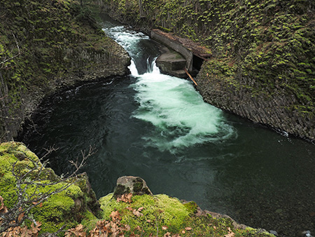
Peering into the huge amphitheater at Punchbowl Falls

Peering into the huge amphitheater at Punchbowl Falls

The removal of the dam and consolidation of private land in the spectacular Punchbowl Falls area are huge developments toward the long-term restoration of the Hood River riparian system.

But much work lies ahead, and the most immediate question is whether Hood River County can secure the funds to purchase the 102 acre Punchbowl Falls site from Western Rivers Conservancy for $578,000 — an asking price that is about half the value of the property.

To reach this goal, Hood River County is an application for an Oregon Parks and Recreation (OPRD) grant for purchase of this Punchbowl site. An unsuccessful application was submitted, but failed to win OPRD funding, so in this round the Hood River Valley Residents Committee (HRVRC), a local land-use advocacy group, is sponsoring community outreach activities to help broaden support for the county park proposal.

Early 1900s postcard view of salmon jumping Punchbowl Falls

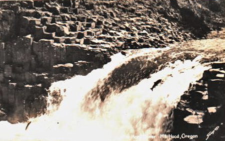
Early 1900s postcard view of salmon jumping Punchbowl Falls

The area has a long history of recreation as a popular swimming and fishing, which explains why the HRVRC events thus far have had a very strong response: 60 people attended the first community workshop in January, and more than 400 responses have been submitted to the comment website.

Should Hood River County fail to secure state funding for purchase of the site in the near future, the Western River Conservancy is likely to eventually sell the property to another private conservation group, putting future public access in question. While the site has never been more protected from private development, continued public access is now very much at stake.

Early 1900s swimmers cross the falls on a giant old-growth log; note the log bridge in the background where the modern high bridge is now located (Hood River History Museum)

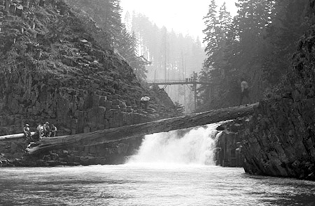
Early 1900s swimmers cross the falls on a giant old-growth log; note the log bridge in the background where the modern high bridge is now located (Hood River History Museum)

It’s apparently common for small communities like Hood River County to win funding on a second try from OPRD for projects like this, so your feedback and support is important in helping make the case to the State of Oregon that Punchbowl Falls and the Hood River confluence deserve to be both protected and forever open to the public as a park.

Please take the time to complete the survey if you can’t make the final county meeting in February: Punchbowl Falls Park Survey

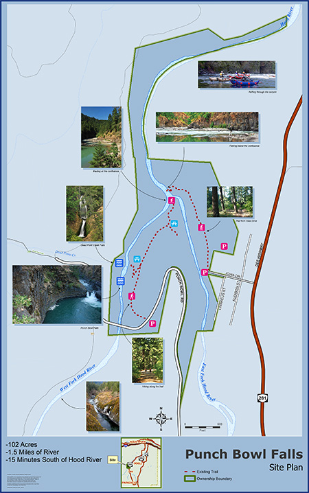
Here’s a map of the proposal from the Hood River County website to familiarize you with the area:

PunchBowl05

Click here for a larger PDF version of the map.

A Virtual Tour of the Site

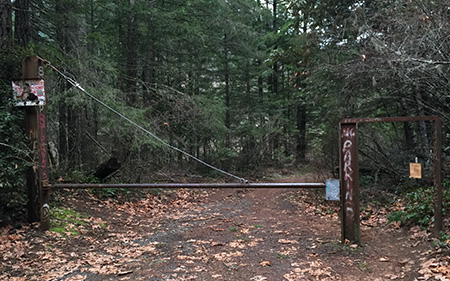
If you haven’t been to Punchbowl Falls, here’s a brief virtual tour. The visit starts at this unassuming steel gate at a large parking turnout, just before Punchbowl Road crosses a high bridge over the West Fork:

The gate at the Punchbowl Falls trailhead

The gate at the Punchbowl Falls trailhead

A short walk down a rustic service road leads to a maze of informal side paths veering off to the left, toward the imposing rim of the West Fork gorge.

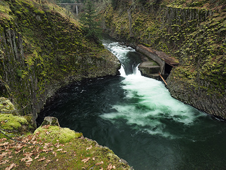
The main attraction here is the massive basalt amphitheater carved by Punchbowl Falls. The walls of the canyon provide some of the best displays of columnar basalt jointing found anywhere in the region. How large is the amphitheater? The scale is hard to appreciate from photos, but Portland’s Memorial Coliseum would fit inside, with headroom to spare!

Looking into the Punchbowl from the east

Looking into the Punchbowl from the east

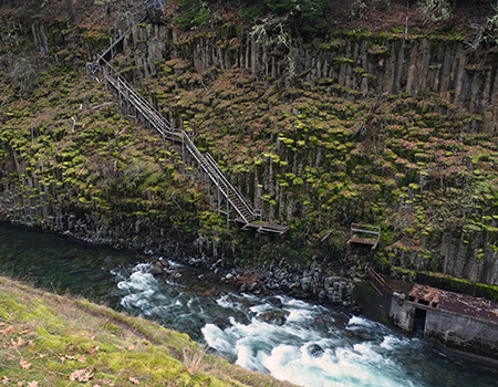
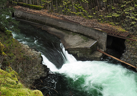
The curving concrete structure to the right of the falls is a fish ladder constructed in 1957 to improve fish passage (though early photos clearly show fish climbing the falls). A closer look at the fish ladder reveals a dilapidated wooden staircase attached to the basalt columns on the far wall of the canyon. The stairs appear to have been added at the time the fish ladder was constructed:

A rickety staircase descends the west wall of the canyon to the fish ladder

A rickety staircase descends the west wall of the canyon to the fish ladder

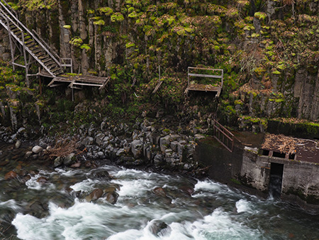
An even closer look shows the staircase to be in a serious state of disrepair, and a potentially dangerous hazard to the many swimmers who flock to the Punchbowl in summer:

That last step to the fish ladder is a doozy..!

That last step to the fish ladder is a doozy..!

This is an example of the kind of feedback to include when you comment on the park proposal — for example, simply removing the stairs, and perhaps removing or modifying the fish ladder (below) could help it blend these features with the natural surroundings and make the area safer for visitors.

Downstream view of the fish ladder…

Downstream view of the fish ladder…

….and the upstream view

….and the upstream view

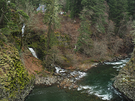
A look downstream from above Punchbowl Falls reveals another waterfall cascading into the gorge from the west. This is the falls on Dead Point Creek, which flows from the high slopes of Mt. Defiance into the Hood River:

Downstream view from above the Punchbowl to Dead Point Falls

Downstream view from above the Punchbowl to Dead Point Falls

The structures above Dead Point Falls are part of a fish hatchery built by the State of Oregon in 1920. The state sold the hatchery at some point in the past, and it is now owned by Troutlodge, a private company that grows and markets fish eggs from several hatcheries in the western states. The hatchery has also been on the market over the past year, but (unfortunately) is not part of the park proposal at this time. Perhaps this could be a second phase of a county park purchase?

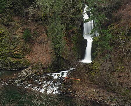
Walking downstream along the canyon rim, Dead Point Falls comes into full view. The falls and the canyon wall below the hatchery are fully within the lands owned by the Western Rivers Conservancy, and part of the park proposal:

Dead Point Falls

Dead Point Falls

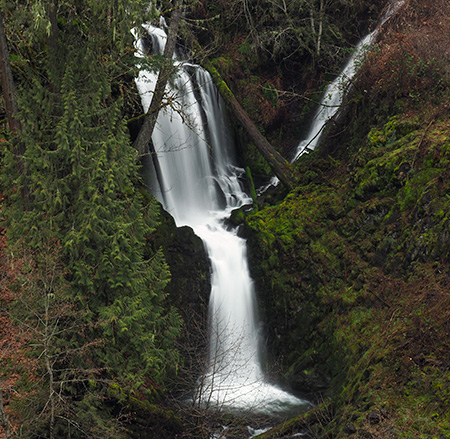
A closer look at the Dead Point Falls shows a second tier spilling in from the right side. This is the outflow from the hatchery ponds, located behind the buildings that can be seen from the canyon rim, and makes for a unique waterfall:

Dead Point Falls

Dead Point Falls

One of the buildings in the 1920 fish hatchery complex on Dead Point Creek

One of the buildings in the 1920 fish hatchery complex on Dead Point Creek

After visiting a series of waterfall viewpoints along the canyon rim, the network of boot paths curves back to the primitive service road, which descends gently toward the confluence of the West and East Forks of the Hood River — about 1/2 mile downstream from the trailhead.

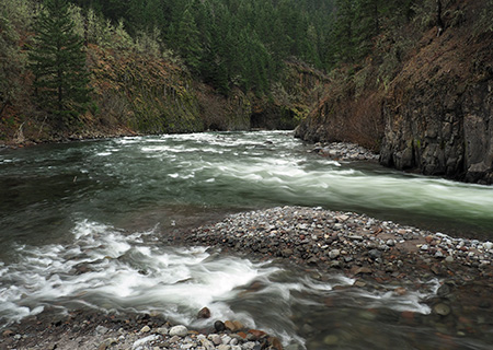
The confluence is a remarkable place where two powerful rivers collide, creating an enormous gravel bar that makes for a fine lunch spot for taking in the scene. The West Fork enters the confluence at a leisurely pace, emerging from a deep pool between basalt buttresses. The East Fork (shown below) makes a more raucous entrance, roaring around a sharp bend in a series of steep rapids as it tumbles toward the West Fork.

The confluence of the East and West Forks

The confluence of the East and West Forks

The confluence area is fully contained within the Western Rivers Conservancy property, and would be part of a future park. The conservancy holdings include the west (far) wall of the canyon for another mile downstream from this spot, and about the first half-mile of the east wall of the canyon beyond the East Fork is included.

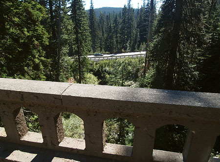
After returning to the trailhead parking area, it’s worth taking a few minutes to walk down Punchbowl Road to the dizzying concrete bridge that spans the upper gorge. There’s plenty of room to safely walk on the bridge, but the side walls are low enough that you’ll want to keep an eye on young kids and pets on a leash.

The dizzying view into Punchbowl Gorge from the bridge

The dizzying view into Punchbowl Gorge from the bridge

From the bridge vantage point, the West Fork corkscrews through a narrow gorge carved into spectacular basalt formations. The gorge area surrounding the bridge is also within the Western Rivers Conservancy holdings, and part of the park proposal.

The proposed park site also has trail access in the Winans community, located on the east side of the East Fork, where Iowa Street joins the Dee Highway, north of the Dee junction. This trail is much less traveled than those in the Punchbowl Falls area, and mainly used for fishing access to the area below the confluence.

How to find Punchbowl Falls?

If you would like to visit the area after reading this virtual tour, simply follow the Dee Highway from Hood River to the old mill town of Dee, forking to the right and following signs to Lost Lake. Immediately after crossing the East Fork in Dee, head right at a sprawling 3-way intersection, then go straight at another 3-way junction, onto Punchbowl Road. Watch for a large parking area on the right after a short distance, just before the road crosses the high bridge over the Punchbowl gorge.

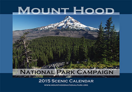
2015 Calendar… and looking back on 2014!

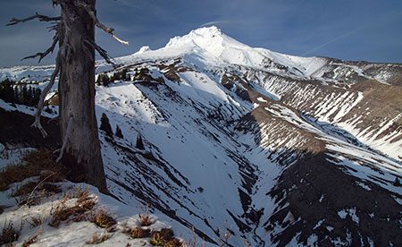
The view from Owl Point is the cover image for 2015

The view from Owl Point is the cover image for 2015

Each year since 2004 I’ve published a wall calendar dedicated to the special places that make Mount Hood and the Gorge a national treasure — and of national park caliber! You can pick one up for $30 at the Mount Hood National Park Campaign store at CafePress, and you’ll also be supporting the campaign website and this blog when you do!

The following is a preview of the calendar images I picked for the 2015 edition, along with some backstory behind the photos. All of the photos were taken from November 2013 through October 2014. Part of the challenge each year is to come up with 13 new calendar-worthy images, which in turn ensures that I get out on the trail and poke around my favorite haunts, plus a few new spots whenever I can!

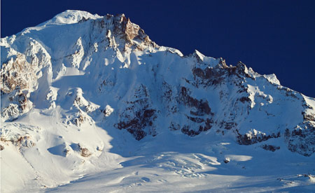
For January, I picked a close-up view of the upper Sandy Glacier and the towering cliffs of the Sandy Headwall. This view came from an early snowfall last winter, one of several trips I made to the Bald Mountain and McGee Ridge:

January features the upper Sandy Glacier and towering Sandy Headwall

January features the upper Sandy Glacier and towering Sandy Headwall

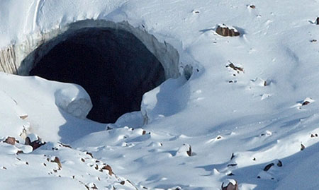
On one of those trips to the McGee Ridge viewpoint, I had just set up my camera and tripod along the Timberline Trail when a pair of climbers came down from the mountain. They were obviously not typical hikers, and soon I realized that they were the explorers I had just written a blog article about! “Sandy Glacier Caves: Realm of the Snow Dragon!” was written partly in anticipation of the Oregon Field Guide 2013 premiere episode that featured the glacier Caves… and my new trail acquaintances, Brent McGregor and Eric Guth.

Look closely, and you can see Eric and Brent's boot prints in the snow near the Snow Dragon cave

Look closely, and you can see Eric and Brent’s boot prints in the snow near the Snow Dragon cave

Brent and Eric pointed out several features around the glacier caves from our vantage point. I was later able to add a postscript to the original article to elaborate on some of the new details about their discovery that I learned that day on the trail.

Eric Guth and Brent McGregor on the trail in 2013

Eric Guth and Brent McGregor on the trail in 2013

I’ve also been able to help Brent with his historic research on the formation of the glacier caves with a series of images I’d taken of the Sandy Glacier since the early 2000s. I’ve photographed the glacier in detail pretty much every year for more than a decade, mostly because of it’s scenic beauty, so it was great to discover a more practical use for all those photos!

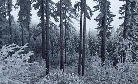
For February, I picked a photo from a memorable winter day on Mount Defiance (below) after a bank of freezing fog had settled in on the mountain for several days. Nearly every surface was covered with long, beautifully developed ice crystals that had grown undisturbed in the almost still air of the freezing fog layer.

February features a frosty forest on the slopes of Mt. Defiance

February features a frosty forest on the slopes of Mt. Defiance

On that frosty day, I also stopped to photograph the sign shown below on the way up to Mount Defiance, as it showed amazing insight and precision by the Hood River County road department in deciding where to stop plowing!

Winter wonderland ahead!

Winter wonderland ahead!

For March, I picked a scene from the Pacific Crest Trail where it climbs along the west rim of the White River canyon. This section of trail is also part of the Timberline Trail, and is surprisingly overlooked, given the views and close proximity to Timberline Lodge.

March features the White River Canyon from the Pacific Crest Trail

March features the White River Canyon from the Pacific Crest Trail

I posted an article in 2011 on the buried forests that can be seen here. The deeply carved maze of ravines that make up the White River canyon are cut into volcanic debris from the Old Maid eruptions that occurred from 1760 to 1810, and subsequent erosion has revealed some of the well-preserved trees that were buried in these eruptions. The 2011 article describes how to view these old specimens.

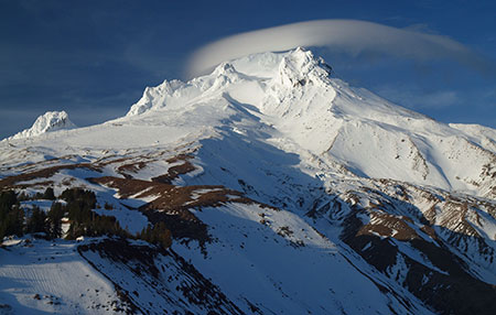
I also enjoyed watching a lenticular cloud form over the mountain in the hour or two that I sat on the canyon rim that evening last winter — one of my favorite mountain phenomena. You can see just the beginning of the cloud over the summit in the calendar view, and the tiny sliver later blossomed into the classic lenticular cloud shown in the view below, as I was packing up for the day:

Lenticular cloud forming over The Mountain

Lenticular cloud forming over The Mountain

Lenticular clouds typically form when moist air from approaching weather fronts is compressed as it passes over the big volcanoes in the Cascade Range. They often form as much as a day before the cloud bands of a Pacific front actually arrive, so are a useful barometer of changing conditions.

For April, I picked something a little different: a desert scene just a few miles east of the mountain, where the same White River that originates from its namesake glacier in the previous scene flows east into the rugged rimrock country of Oregon’s High Desert, shown below:

April features the lower falls at White River Falls State Park

April features the lower falls at White River Falls State Park

Over the millennia, the White River has carved through many layers of Columbia River basalt to form its desert canyon, but as it approaches the confluence with the Deschutes, the river encounters an especially tough series of basalt layers. The result is the spectacular White River Falls, a misty green emerald in the desert, protected in a small state park.

The lower falls pictured in the April image is about one-half mile downstream from the main falls, and well off the popular trail in the area. The calendar image is actually just a cropped portion of a very wide panorama (below) that captures more of the rugged scene at the lower falls.

Original jumbo-pano that the calendar image was cropped from

Original jumbo-pano that the calendar image was cropped from

The scoured bedrock in the foreground of this view is testament to volatile nature of the White River: seasonal floods regularly surge to this depth, engulfing the floor of the canyon.

In another 2011 article titled “Close Call at White River Falls”, I described the threats to this magnificent area, and why it deserved better protection — perhaps someday a unit of Mount Hood National Park?

The old powerhouse at White River Falls

The old powerhouse at White River Falls

In addition to the natural scenery, the canyon is home to the fascinating ruins of an early 1900s hydroelectric plant. Desert weather has helped preserve the many relics in the area, but arid conditions haven’t prevented vandals from taking an increasing toll on priceless historic resources.

The powerhouse is amazingly well-preserved inside

The powerhouse is amazingly well-preserved inside

Hopefully, we can someday stabilize the White River Falls site and preserve the remaining traces of history for future generations to explore.

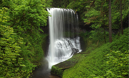
For May, I chose another unusual image for a Mount Hood National Park calendar: Middle North Falls on Silver Creek. Why? Mostly because what we now know as Silver Falls State Park was once proposed to become a national park in the 1920s! It would have been a terrific addition. The scenery, alone blows away many of the existing national parks monuments in our park system!

May features the famous Middle North Falls on Silver Creek

May features the famous Middle North Falls on Silver Creek

Alas, the national park proposal failed after a National Park Service study deemed the logged-over landscape of the 1920s too ravaged to be worthy of park status. Thankfully, that didn’t stop the Civilian Conservation Corps in the 1930s from building the elaborate, magnificent trail system and beautiful South Falls Lodge (listed on the National Historic Register in 1983) that we still enjoy today.

The national park idea for Silver Falls resurfaced again in 2008, when Oregon State Senator (then Representative) Fred Girod proposed it during a special session. Notably, Dr. Girod is a Republican from Stayton, representing the Senate district that encompasses Silver Falls State Park, so maybe we’ll see the idea resurrected in the future? I like that maverick thinking, Senator!

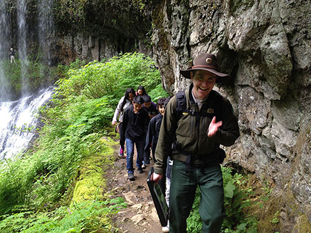
Trail ranger leading a kids hike at Silver Creek -- how very cool!

Trail ranger leading a kids hike at Silver Creek — how very cool!

On the visit last spring when I photographed Middle North Falls, I was reminded that Oregon’s state parks do a pretty good job of embracing the national park tradition at Silver Creek when a young ranger appeared, leading a group of youngsters on a day hike. Kudos to Oregon Parks and Recreation Department for providing programs like these!

Could Silver Falls State Park become a unit of a future Mount Hood National Park? Why not! One tangible benefit would be the opportunity to expand the footprint from the current park boundaries to include the rest of the upper watershed of Silver Creek. The park more than doubled in size in 1958, when a federally funded expansion added in a portion of the headwaters, bringing the park to the present size of just over 90,000 areas.

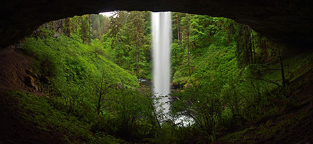
The amazing, national-park-quality amphitheater behind North Falls

The amazing, national-park-quality amphitheater behind North Falls

Yet, heavy logging and large private inholdings upstream continue to impact Silver Creek stream with silt and algae blooms. These impacts could easily be reversed if the upper watershed were managed for conservation and recreation, instead — especially if the park were expanded to include the upper watershed and its associated habitat.

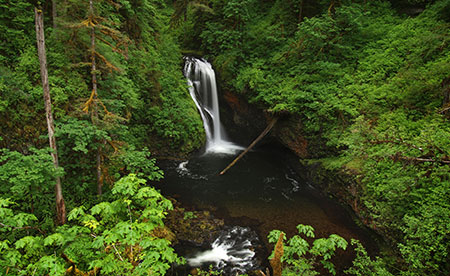
For June, I picked an image of Butte Creek Falls, a nearby cousin to Silver Creek located even closer to Mount Hood, within the Santiam State Forest. Like Silver Creek, the upper watershed of Butte Creek is heavily logged, with some obvious sediment and algae in the stream as a result.

June features Butte Creek Falls

June features Butte Creek Falls

Also like Silver Creek, the health of Butte Creek could be turned around with a shift to managing for conservation and recreation. Unlike Silver Creek, most of the lands in the upstream watershed are already held in the public trust by the State of Oregon.

Unfortunately, our state forests are held captive by a legislature determined to log them to feed the state general fund — and to ensure that rural counties that already pay only a fraction of the property taxes levied in other parts of Oregon aren’t inconvenienced with paying for their own schools.

Therefore, the best way to restore Butte Creek would be to transfer it to Oregon Parks and Recreation Department as a very large state park… or incorporate it into a future Mount Hood National Park! At a minimum, it’s time for the Santiam State forest to focus on restoring forests and protecting watersheds, not just future timber sales.

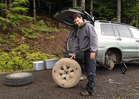
Always travel with an automotive repair expert!

Always travel with an automotive repair expert!

The behind-the-scenes, somewhat embarrassing story that goes with the Butte Creek Falls image is one of my hiking buddy Jamie Chabot helping change a flat tire after our trip to Butte Creek and nearby Abiqua Falls. We managed to take a couple of wrong turns in the maze of logging roads and clearcuts that surround the small preserve containing Butte Creek: at some point, I jumped out to survey the canyon below to figure out where we went wrong… only to hear a HISSSSSSS coming from one of the rear tires!

There was no room to pull off to the side, so we were in the awkward predicament of having the car up on a jack in the middle of an active logging road. Fortunately, we were able to install the spare before a loaded log truck came barreling our way! My belated apologies to Jamie for doing the heavy work while I took pictures… but somebody had to document the episode for posterity!

Jamie was also my hiking companion on a couple of trips to Owl Point last summer. This has been an annual favorite of mine since a group of volunteers from the Portland Hikers forum rescued the Old Vista Ridge from being lost to official Forest Service neglect in 2007.

Each year, the trail seems to get better, thanks to a lot of unofficial TLC from anonymous trail tenders. Today, the Old Vista Ridge trail is in great shape and now forms the boundary of the expanded Mount Hood Wilderness, so in that sense has been etched into legal permanence. Hopefully, it will eventually make it back onto the Forest Service inventory of officially maintained trails, a status it clearly deserves.

July features Mount Hood from Owl Point

July features Mount Hood from Owl Point

There are now several geocaches and a trail log tucked along the historic old trail, and it’s amazing to see how busy the area has become now that it has been featured in several popular hiking guides (including Williams Sullivan’s “100 Hikes in Northwest Oregon” and Paul Gerald’s “60 Hikes within 60 Miles of Portland”).

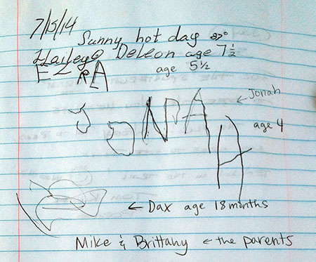
One trail log had more than 60 entries for just 2014, including this wonderful entry from a young family introducing their kids to the adventures of hiking and exploring the Mount Hood backcountry at a very young age:

My favorite Old Vista Ridge trail log entry… ever..!

My favorite Old Vista Ridge trail log entry… ever..!

One of my favorite experiences on the trail is seeing young families introducing their junior hikers to our public lands, battered field guides in hand. Just like my own formative experiences just a few decades ago.

For August, I picked an image from another of my favorite spots, just off the Cooper Spur trail, above the lower extent of the Eliot Glacier. This image was taken on one of those days when clouds were wrapped around the mountain for much of the day, but suddenly cleared for a few minutes — just long enough to capture a few photos before the mountain disappeared, once again:

August features the Eliot Glacier on Mount Hood's north flank

August features the Eliot Glacier on Mount Hood’s north flank

I certainly do not mind sitting on the shoulder of the mountain waiting out the clouds (there’s no such thing as a bad day on the mountain, after all!), but a bonus during this wait was learning a new bird species (to me), as a pair of these small birds (below) stopped by to check me out:

Horned lark at Cooper Spur

Horned lark at Cooper Spur

This is a horned lark, a wintertime migrant to our area, and the pair I saw had likely arrived recently when I spotted them last August. The Portland area actually has a year-round resident population of streaked horned larks, which look similar to horned larks and are a threatened species. These are details I learned after the trip from the helpful folks at the Portland Audubon Society.

According to Audubon staff, horned Larks are widespread songbirds of fields, deserts, and tundra, where they forage for seeds and insects, and sing a high, tinkling song — and thus were quite at home in the tundra conditions of Mount Hood’s high east side. Though they are considered common, they have undergone a sharp decline in the last half-century. Their very generalized range map shows them wintering from the Cascades west and breeding in summer in Canada tundra/steppe terrain.

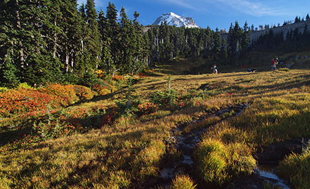
For September I picked an image from Wyeast Basin, taken toward the end of a lovely early autumn day as a family and their dog ambled across the sprawling meadow. Wyeast Basin is remarkable for the surprising number of springs bubbling up from the mountain slopes and racing one another downhill, often just a few feet apart.

September features early autumn colors at WyEast Basin

September features early autumn colors at WyEast Basin

While this view (above) from the calendar is the familiar scene at WyEast Basin, I also turned my tripod around to capture the web of springs and streamlets flowing north toward the big Washington volcanoes, on the distant horizon. The talus slopes of Owl Point can also be seen in the distance from here, just above the tree line.

The view north to Owl Point and the Washington Cascades from WyEast Basin

The view north to Owl Point and the Washington Cascades from WyEast Basin

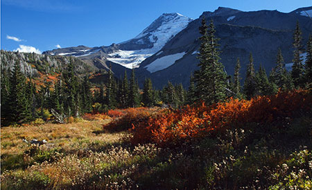
For October, the scene is from Elk Meadows, perhaps the most photogenic of the string of alpine meadows on Mount Hood’s rugged north side. In this view, the Coe Glacier tumbles below the summit, and 7,853-foot Barrett Spur looms darkly on the left. Avalanches roll off Barrett Spur in winter, sometimes with devastating effect on the alpine forests below, as the many bleached snags and stumps in Elk Cove suggest.

October features beautiful Elk Cove in autumn

October features beautiful Elk Cove in autumn

My companions for the Elk Cove hike this fall were Jamie Chabot and Jeff Statt. I met both when Trailkeepers of Oregon (TKO) was founded in 2007: Jeff was the founding president of the new non-profit, and Jamie the original creative force behind the TKO logo, Portland Hikers calendars and the TKO web identity.

Tom, Jamie & Jeff enjoying a little slice of paradise at Elk Cove

Tom, Jamie & Jeff enjoying a little slice of paradise at Elk Cove

Both Jeff and Jamie continue to support TKO after all these years as the organization continues to grow, and we still meet up for periodic trail stewardship projects together. I’m honored to have them as trail friends, and having them along on this hike made it extra-special!

For November, I picked a familiar view of Triple Falls on Oneonta Creek, taken during an especially wet week in the Gorge. Normally, the somewhat muddy runoff in this scene would be a deal-killer for photos, but I came around to the idea that in this case, it told the story of swollen Cascade streams during the stormy months of late autumn rather nicely, so added it to the mix.

November features a swollen Triple Falls on Oneonta Creek

November features a swollen Triple Falls on Oneonta Creek

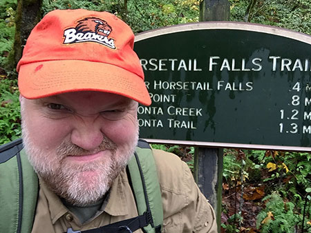
I was memorably soaked on the hike to Triple Falls, not because rain is particularly unique in the Gorge, but because I had just re-ducked my trusty canvas hat (for waterproofing)… but had left it drying in the oven, at home! I discovered this fact at the Oneonta trailhead, so circled back to the Multhnomah Falls lodge to see what sort of hats were in stock.

It turns out that baseball caps are the ONLY option at the Multnomah Falls lodge — and I HATE baseball caps! (primarily because they don’t fit all that well on my basketball-sized head..!) Well, at least I could support my alma mater, and I hit the trail $20 poorer with a ridiculous, ill-fitting beanie that (sort of) kept my large, bald head dry…

You would hate baseball caps, too, if you had a basketball-sized head like mine…

You would hate baseball caps, too, if you had a basketball-sized head like mine…

Once on the trail, I also ran across one of the most extensive landslides to form in recent years, cutting away a 100-foot swath of the Oneonta Trail along a steep canyon section. Trail crews had constructed a temporary crossing of the slide, but just a few days after that trip in November, the slide claimed more ground, erasing the temporary trail. Such is the ongoing challenge of keeping trails open in the very active landscapes of the Gorge and Mount Hood!

A rip-roaring Oneonta Creek after the first big autumn storms

A rip-roaring Oneonta Creek after the first big autumn storms

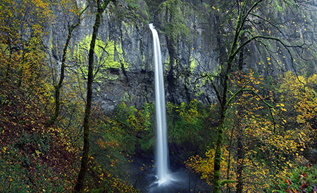
For December, I picked a late fall image of Elowah Falls, taken from one of the long-bypassed viewpoints along the original Civilian Conservation Corps route described in this recent article on McCord Creek.

December features a wide pano of Elowah Falls on McCord Creek

December features a wide pano of Elowah Falls on McCord Creek

Photographing a 213′ waterfall at close range means a wide-angle lens and blending some images. In this case, I merged three vertical images taken with my 11mm lens to create the panoramic view. This is my first time photographing from this spot, and I will definitely return!

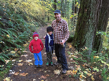
By now you’ve been introduced to my trail buddy Jamie, and on the way out from Elowah Falls that day I ran into Jamie and his two boys! They were headed toward the upper falls on McCord Creek on that very busy hiking day in the Gorge. It was great to see Jamie passing on the hiking tradition to boys!

Jamie and his rugged boys hitting the trail at McCord Creek

Jamie and his rugged boys hitting the trail at McCord Creek

That’s it for the 2015 Mount Hood National Park Campaign calendar highlights, and now for a few thoughts on the blog…

Thanks for another year!

I launched the WyEast Blog in 2008 as a simpler way to promote Mount Hood and the Gorge as “national park-worthy” than updates to the project website would allow. And though I didn’t post quite as often this year for a whole variety of reasons (mostly, real life getting in the way), I was amazed to see the readership for the WyEast Blog continue to grow in 2014.

Yours truly taking in the first big snowfall on Mount Hood in early November

Yours truly taking in the first big snowfall on Mount Hood in early November

In early 2014, the monthly page views edged above the 5,000 mark for the first time, and jumped well above that mark during the peak hiking months of spring and summer. More importantly, the list of official blog followers has grown steadily to 141 this year. These are the true Mount Hood and Gorge junkies that I have in mind when I post to the blog, and these are also the folks who send me both nice notes and periodic corrections — both are greatly appreciated!

I posted a total of 14 articles this year, down a bit from previous years, but bringing the six-year total to 136 articles. I’ve also got a bunch of new articles in the oven, ready to post when time allows. So, the WyEast Blog will be around for awhile!

The two most popular articles continue to be:

10 Common Poison Oak Myths (2012)

Ticks! Ticks! (10 common myths) (2013)

The “ticks” article has been viewed 38,147 times since I posted it in 2013, and the poison oak piece 21,545 times — sort of amazing! But these numbers have validated my obsession with providing thorough, detailed, geek-worthy articles that are more in the magazine format than typical blog fare.

Taking in the fall colors at Butte Creek

Taking in the fall colors at Butte Creek

So, enough facts, figures and anecdotes: if you’ve read this far in my annual, somewhat (ahem!) self-indulgent post, THANK YOU for being a reader… and most importantly, thanks for being a friend of Mount Hood and the Gorge!

See you on the trail in 2015!

Tom Kloster
WyEast Blog

It’s Time to Fix the Eliot Crossing!

Eliot Branch and Mount Hood before the 2006 washout

Eliot Branch and Mount Hood before the 2006 washout

Another hiking season has passed, marking eight long, inexcusable years since an intense November storm washed out the Timberline National Historic Trail near Cloud Cap in 2006.

Since then, countless hikers from around the world have arrived at this world-class destination only to find cryptic temporary notices stapled to trailhead signs announcing that the segment of the trail crossing the Eliot Branch has been closed indefinitely by the U.S. Forest Service.

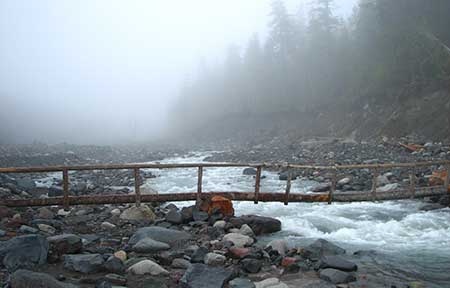
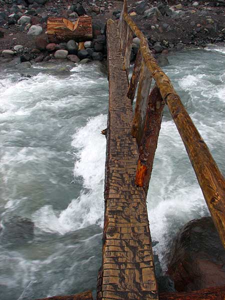
Hikers on the seasonal bridge over the Eliot Branch that was in place from the mid-1990s until 2006

Hikers on the seasonal bridge over the Eliot Branch that was in place from the mid-1990s until 2006

Most round-the-mountain hikers start at Timberline Lodge and hike clockwise, and therefore often learn of the Eliot Branch closure halfway through their 40-mile trek. Understandably, many of these hikers began working their way across the deeply eroded canyon in the years following the closure. Today hundreds of hikers each hear ignore the Forest Service notices and follow sketchy boot paths across the Eliot Branch to complete the Timberline Trail circuit.

Why the delay in repairing the trail at the Eliot Branch? The Forest Service claims lack of funding, suggesting in 2010 that “studies were underway” for a million dollar suspension bridge at the current crossing location. Such a project would “require an appropriation by Congress” to fund, according to a Forest Service district ranger at the time.

A second, more practical option under consideration was a significant reroute of the Timberline Trail at the Eliot Branch, which according to the Forest Service at the time, would require “constructing 1.5 miles of new trail to a lower crossing of the creek, then 1.5 miles back up to the existing trail”.

Eight years have passed since the 2006 washout, and four since the Forest Service last gave any indication of working toward a solution for the Timberline Trail. Since then, neither option proposed in 2010 for restoring the crossing has materialized. Instead, Oregon’s premier hiking trail remains an embarrassment, and a testament to the frustrating inability of the Forest Service to set agency priorities that match those of the public they serve.

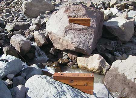
These seasonable bridge footings were bolted to a pair of huge boulders that were swept away in the 2006 washout

These seasonable bridge footings were bolted to a pair of huge boulders that were swept away in the 2006 washout

The 2006 flood event wasn’t the first time the Eliot Crossing had washed out in recent years. In the mid-1990s, a similar washout erased an earlier crossing that had been in place since the Timberline Trail was constructed in the 1930s. The Forest Service responded to the first washout by appropriating sections of a pair of climber’s trails that ascend moraines on both sides of the Eliot Canyon, and constructing a new crossing between the two trails, above the original crossing.

This new crossing (pictured above) lasted only a few years, until the 2006 storm further deepened the Eliot Branch canyon, this time much more substantially. The new crossing featured a pair of bridge anchors bolted to boulders that straddled the Eliot Branch, and a seasonal bridge that could be reassembled and installed on site each year, similar to the Sandy River bridge near Ramona Falls.

The sorry state of the "closed" Eliot Branch crossing today: a sketchy scramble up a crumbling 300 foot slope, aided by a rope left by hikers

The sorry state of the “closed” Eliot Branch crossing today: a sketchy scramble up a crumbling 300 foot slope, aided by a rope left by hikers

Removable, seasonal bridges are an excellent solution to the dilemma of keeping the Timberline Trail open in an era when retreating glaciers and increasingly erratic weather promises to continue deepening all of Mount Hood’s newly exposed glacial valleys.

This point was underscored earlier this year when an unusually strong summer storm washed out the seasonal Sandy River crossing. While one hiker was tragically killed in the incident, dozens were able to cross to safety because of the seasonal bridge.

For this reason, studying elaborate permanent solutions, such as the “million dollar” suspension bridge, are an exercise in futility. Whole sections of the Eliot Branch canyon have collapsed into the stream over the past two decades during heavy flooding, and there is no reason to assume that this pattern won’t continue to rearrange the landscape for decades to come.

This article proposes a more modest and immediate fix that mirrors the re-route option once considered by the Forest Service. This is a project that could have been constructed shortly after the 2006 floods with minimal cost and an excellent ability to adapt to future flood events.

Lessons from Up North

Wonderland Trail bridge across the Nisqually River in Mount Rainier National Park (Wikimedia)

Wonderland Trail bridge across the Nisqually River in Mount Rainier National Park (Wikimedia)

The Eliot Branch crossing is a perfect example of how the U.S. Forest Service and National Park Service differ in their budget priorities and working relationships with volunteers. It’s instructive to look at how the Park Service responded to the same 2006 storms and flooding that impacted Mount Rainier National Park.

The damage to the 92-mile Wonderland Trail around Mount Rainier was exponentially worse than anything on Mount Hood. This is largely because several of Mount Rainier’s 26 glaciers dwarf even the Eliot Glacier, Mount Hood’s largest, and the Wonderland Trail has three times the glacial stream crossings of the Timberline Trail.

The Wonderland Trail not only crosses many more glacial streams in its circuit around Mount Rainier, it also has bridges across most of them, where most of Mount Hood’s glacial streams have no bridges (requiring hikers to ford most of the glacial streams). So, not only did the Park Service have a trail more than twice as long to restore, but also many times the number of bridges to repair along the Wonderland Trail.

Despite the much greater challenge, the Park Service managed very little disruption for hikers. The Wonderland Trail uses a reservation system, and the Park Service took the precautionary step of not accepting reservations for the 2007 hiking season, in light of the scope of damage to many trail sections and crossings. Yet, the Wonderland Trail was reopened to hikers on August 3, 2007, less than a year after the 2006 floods!

The National Park Service continually maintains dozens of wilderness bridges on the 92-mile long Wonderland Trail around Mount Rainier, despite much worse washouts and much more difficult crossings than anything found on Mount Hood (Wikimedia)

The National Park Service continually maintains dozens of wilderness bridges on the 92-mile long Wonderland Trail around Mount Rainier, despite much worse washouts and much more difficult crossings than anything found on Mount Hood (Wikimedia)

The rapid repairs to the Wonderland Trail happened because re-opening the trail was a top priority for the Mount Rainier National Park. To manage this feat, the staff enlisted some 1,700 volunteers in the effort, with tens of thousands of volunteer labor from organizations like the he Washington Conservation Corps and Student Conservation Association.

The proposal described in this article for the Eliot Branch could easily have been completed in 2007, too, had restoring the trail been a priority for the Forest Service, and especially if volunteer labor had been tapped from any number of organizations involved in trail work in Oregon. Instead, the repairs have waited eight years, with no end in sight.

It’s time to finally fix the Timberline Trail to ensure the safety of hikers determined to make the crossing, and to end the embarrassment of visitors to our region from around the world experiencing this national treasure in such a shameful state of disrepair.

A Simple and Affordable Solution!

EliotCrossing07

[click to see a large version]

The simplest solution to finally restoring the Eliot Branch crossing is to go lower and low-tech. Instead of waiting for a dubious “million dollar” suspension bridge to be funded, a better option would be a new crossing downstream with a simple, seasonal plank bridge.

Why go low? Mostly because the durable bedrock layers that form Stranahan Falls (located about a mile downstream from the current crossing) have also checked down-cutting of the canyon in that stretch by the Eliot Branch. Where the upper canyon has been carved some 150 feet deeper since the 1990s, the lower canyon section, just above Stranahan falls, shows much less erosion during this period.

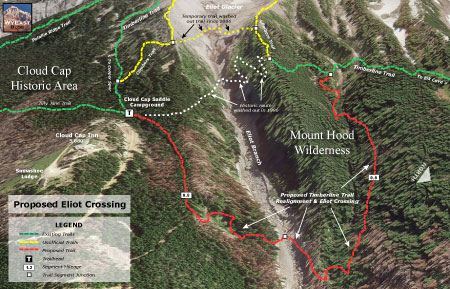
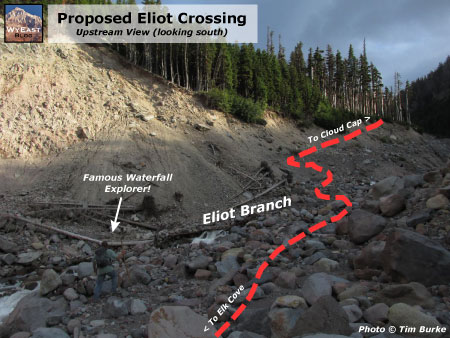
As shown on the proposal map (above), this new section of the Timberline Trail would depart from Cloud Cap Saddle trailhead, initially following a shallow ravine to the rim of the Eliot Branch canyon. The new trail would then switchback down the east wall of the canyon, reaching the new crossing (shown below) about 0.5 miles from the start of the new trail.

EliotCrossing08

[click to see a large version]

The new, lower stream crossing would be similar to most other glacial fords on the Timberline Trail, except that a bridge is proposed here (as they should be at all glacial crossings on Mount Hood – watch for a future article on that topic!).

This is in part because a bridge has traditionally been provided at this crossing, but also because the crossing location is very close to the Cloud Cap Saddle trailhead, and located at the wilderness boundary, so it would present fewer obstacles to build and maintain. Until the Eliot Branch settles down, however (and that could decades from now – or never), it makes sense to install a season bridge similar to that used on the Sandy River.

From the proposed lower crossing of the Eliot Branch, the new trail would traverse along a side stream that enters the main canyon from the west, climbing approximately 0.8 miles to the resumption of the existing Timberline Trail.

EliotCrossing09

[click to see a large version]

The 600-foot elevation loss (and subsequent gain) for this proposed new alignment of the Timberline Trail would be comparable to what was already required for the old, upper crossing, though the overall mileage of the new route would be slightly longer (by about 0.3 miles). However, the length of the proposed new trail would be less than half of what the Forest Service was considering for a lower crossing option in 2010.

The key to the new crossing location is its proximity to Stranahan Falls, and the massive band of andesite bedrock that not only forms the falls, but also prevents further down-cutting in the area above the falls. As shown the illustrations (above and below), this location is the one spot in the upper reaches of the Eliot Branch canyon that has a reasonable chance of stabilizing in the near term.

EliotCrossing10

[click to see a large version]

As an aside, the area near the brink of Stranahan Falls is arguably the most stable in terms of down cutting, with the streambed now scoured to bedrock for some distance above the falls. But a crossing here would not only add to the elevation loss/gain and distance for the new trail, it would also require some challenging trail construction in the very steep and complex terrain that surrounds the top of the falls.

There are also additional waterfalls to negotiate in the area immediately above Stranahan Falls, including a 25-foot waterslide just above the main falls and a 35″ upper falls just upstream from the waterslide. While it would surely be a spectacular location for a trail crossing, it would also very difficult to build and maintain over time.

A crossing at Stranahan Falls would also encourage more off-trail exploring of the falls area than is desirable, both for public safety and environmental concerns. So, based on these considerations, the crossing location proposed in this article seems to be the best spot for ensuring long-term stability and reasonably straightforward design and construction.

What will it Take?

Sadly, this fine bridge over Clark Creek is among the few surviving on Mount Hood, and the only surviving permanent crossing on a glacial stream.

Sadly, this fine bridge over Clark Creek is among the few surviving on Mount Hood, and the only surviving permanent crossing on a glacial stream.

What would it take to actually build this simple solution for reconnecting the Timberline Trail? Not as much as we’ve been led to believe by the Forest Service. Here’s how the proposal described in this article could be built right away, in 2015:

The total length of the proposed new Timberline Trail section is approximately 1.3 miles, with the first (and most rugged) half mile occurring outside the Mount Hood Wilderness boundary. This would allow for mechanized equipment to be used on that section of new trail, while only hand tools could be used to construct the sections west of the Eliot Branch, inside the wilderness.

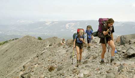
These young hikers are experiencing a tainted rite of passage with the long and often treacherous detour required to complete the Timberline Trail (Photo courtesy Christopher Alley)

These young hikers are experiencing a tainted rite of passage with the long and often treacherous detour required to complete the Timberline Trail (Photo courtesy Christopher Alley)

One Forest Service source (the USFS Trails Unlimited enterprise program) estimates the cost of building new trails to be between $2,500 to $12,000 per mile. That’s a big range, to be sure. So for the purpose of this article, I used the top of that range to put the cost of actually constructing the proposed trail at just over $15,000, given that the trail would involve both wilderness construction and steep terrain.

Other costs would include environmental analysis (if needed – this proposal may qualify as a categorical exception), design and surveying. But even if these administrative and technical costs were to triple the cost of the overall project, restoring the Timberline Trail along this alignment might still be possible for well under $100,000, using Forest Service cost estimates. That is a relatively manageable amount that could reasonably be funded from an annual Mount Hood National Forest operating budget of more than $20 million.

So, what’s the delay? First, it’s hard to believe the Forest Service hasn’t considered an inexpensive option like the one proposed here. Yet, no such project has been formally proposed by the agency.

It’s also possible that the Forest Service is still fixated on the more dramatic, elaborate fix described by forest officials in 2010. Such projects are known to bring political favor back at the USFS headquarters in Washington D.C. for their “wow factor” over more mundane projects, after all. Unfortunately, such a project does not appear in the Forest Service schedule of proposed actions (SOPA) where a proposal of that scale would almost surely have to be listed.

This is the frustrating map that still greets Timberline Trail hikers on the Mount Hood National Forest website after eight years

This is the frustrating map that still greets Timberline Trail hikers on the Mount Hood National Forest website after eight years

[click here for a large version]

A third possibility is that the Forest Service is holding the trail hostage in protest to budget cuts that have affected most federal agencies over the past several years. While this might seem far-fetched, consider that Oregon Congressmen Earl Blumenauer and Greg Walden made a much-publicized 4-day trek around the Timberline Trail in July 2005 to highlight issues facing the mountain, just one year before the Eliot Crossing washed out.

Whatever the reason, fixing the Timberline Trail doesn’t seem to be a real priority for the Forest Service. Why else would the most important trail in the Mount Hood National Forest have languished for the past eight years? In that time, the agency has spent tens of millions on other forest projects.

The sad saga of the Timberline Trail closer at the Eliot Branch is also another reminder of just how different the situation at Mount Hood might be if it were under National Park management… which is the much better solution in the long term.
________________

Special thanks to Tim Burke and Melinda Muckenthaler for use of your photos – and for some of the most amazing waterfall exploring anyone has ever done on Mount Hood!

A Tale of Two Ranger Stations: Part Two

Forest Service guard on duty at the Upper Sandy station in the 1930s

Forest Service guard on duty at the Upper Sandy station in the 1930s

Mount Hood National Forest (MHNF) recently completed a $1.7 million overhaul of its Zigzag Ranger Station, the de-facto visitor gateway to Mount Hood. Yet the historic Upper Sandy Guard Station, a National Historic Landmark located just a few miles away, near popular Ramona Falls, has fallen into a serious state of disrepair.

Basic repairs needed to save the historic guard station would cost a fraction of what the Zigzag project cost, so why has the Upper Sandy structure been so badly neglected? Part two of this article looks at some of the reasons behind this frustrating paradox, and some possible solutions.

1930s: Guarding Portland’s Watershed

The Upper Sandy Guard Station was built along the newly constructed Timberline Trail in the 1930s. Its purpose was to house a Forest Service guard, stationed there to patrol the Bull Run Reserve — Portland’s water supply — where it abutted the new around-the-mountain recreation trail. At the time, the Bull Run boundary was much more expansive, touching the northwest corner of Mount Hood.

Guard stations were important landmarks for early forest travelers

Guard stations were important landmarks for early forest travelers

The Upper Sandy Guard Station was one of dozens dotting the Mount Hood National Forest in the 1930s, all built to protect forest resources from timber poaching and other illegal activities. Several of the old guard stations could only be reached by trail, and the roads that did reach them were primitive.

The guard stations also served as a supply and communications base for the scores of fire lookouts built throughout the forest, often connected by phone lines that can still be found along less-traveled trails today. As recreation use along forest trails grew in the 1920s and 30s, guard stations also provided a comforting presence for hikers exploring the largely undeveloped national forests of the time.

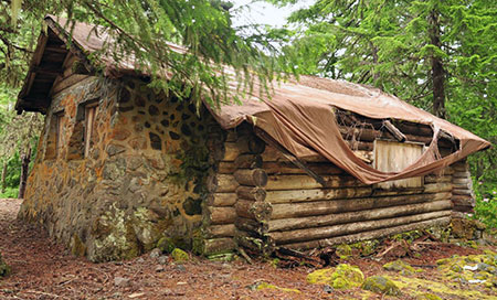
Today the Upper Sandy Guard Station is slowly fading away (Cheryl Hill © 2013)

Today the Upper Sandy Guard Station is slowly fading away (Cheryl Hill © 2013)

View of the handsome stonework that makes the guard station unique  (Cheryl Hill © 2013)

View of the handsome stonework that makes the guard station unique (Cheryl Hill © 2013)

The industrial logging era that began in the national forests by the late 1940s soon made guard stations obsolete: as thousands of miles of logging roads were bulldozed into remote areas once only accessible by trail, forest administrative operations were consolidated into a few ranger district office, and most of the old guard stations were shuttered.

The unused buildings soon fell into disrepair, and most of these structures were dismantled or burned by the Forest Service in the late 1950s and 1960s (along with most fire lookouts, also deemed obsolete as aerial fire surveillance began).

When the Bull Run Division boundary was changed in 1977, the Upper Sandy Guard Station was left miles away from the resource it was built to defend. One year later, the Mount Hood Wilderness was expanded to encompass the building, sealing its fate as a relic in the eyes of the Forest Service.

In recent years the roof on the Upper Sandy Guard Station has partially collapsed, despite crude repairs by volunteers  (Cheryl Hill © 2013)

In recent years the roof on the Upper Sandy Guard Station has partially collapsed, despite crude repairs by volunteers (Cheryl Hill © 2013)

The few guard stations that did survive decades of neglect intact now represent a precious glimpse into an earlier, idyllic time in the national forests. They now stand as historical gems, worthy of special protection.

Some of these structures have already been preserved, like the Clackamas Lake Guard Station near Timothy Lake, while others have been allowed to fade away nearly to oblivion, like the Upper Sandy Guard Station. A few that survived intentional destruction by the Forest Service have nonetheless been lost to neglect, like the former High Prairie Guard Station on Lookout Mountain, a building that was partially standing as recently as the early 1980s.

Ruins of the High Prairie Guard Station in 1983 before it faded into the meadow

Ruins of the High Prairie Guard Station in 1983 before it faded into the meadow

In September 2009, the National Park Service finally added the Upper Sandy Guard Station to the U.S. National Register of Historic Places, a move that many considered to be the building’s salvation. After all, the Forest Service had actively sought the historic designation and local Forest Service historians had strongly advocated for preservation of the building. Thus, the disappointment in the years since, as even the most rudimentary Forest Service efforts to stabilize the building failed to materialize.

Instead, the Forest Service posted the following notice on the building, “warning” hikers that entering the structure presented a dire hantavirus risk from resident deer mice. The notice actually admits that only one (!) documented hantavirus case has ever been documented in Oregon, and that “there is no evidence that the disease is carried by rodents who call this building home.”

Of course, deer mice surely inhabit every other historic wilderness structure in the wilderness areas around Mount Hood, yet no health warnings are posted on the shelters at McNeil Point, Cairn Basin, Cooper Spur and Elk Meadows or the lookout at Devils Peak, where hikers routinely camp inside (and maintain) the structures. So, the point of this notice on the Upper Sandy structure seems to be to frighten visitors from entering — or perhaps maintaining — the structure.

The Forest Service has posted this "health warning" on the structure to discourage visitors  (Cheryl Hill © 2013)

The Forest Service has posted this “health warning” on the structure to discourage visitors (Cheryl Hill © 2013)

The Upper Sandy Guard Station was added to the elite National Register partly because of its historic role as a base for patrolling the Bull Run Reserve, but mostly as the only surviving design of its kind in the Pacific Northwest. The building has a unique, rustic architecture that embodies the New Deal programs that put skilled craftsmen and laborers to work on our public lands as part of the 1930s economic recovery.

Most notable is the massive stone masonry end wall that has probably helped stabilize the structure as the log walls continue to deteriorate. Its unique design combining rubble stone and wood walls make it one of a kind among the more than 700 forest administrative buildings constructed during the New Deal era.

The building was constructed by a seven-man crew in the summer of 1935 with a budget of $958.88, including materials: two carpenters worked at the rate of $7/day and two laborers assisted at the more modest rate of $4/day. The guard station was completed on September 28, 1935.

Today the building suffers serious holes roof and will almost certainly be lost in a few years without an immediate effort to stabilize the structure, or better yet, all of the work needed to fully restore this building. So, why is the Forest Service allowing this to happen? Blame it on the Wilderness..?

Does the Upper Sandy Guard Station have a future? (Cheryl Hill © 2013)

Does the Upper Sandy Guard Station have a future? (Cheryl Hill © 2013)

For a time following the 2009 National Historic Register listing, the old guard station had an advocate in the Northwest Forest Conservancy (NFC), a local non-profit focused on preserving several historic forest structures in the Mount Hood National Forest. Today, the NFC appears to be inactive, and there are no advocates pressing for the building to be rescued.

Prior to the 2009 Historic Register listing, the NFC formally proposed managing a restored building. Today, several historic structures in the Tilly Jane area (on the northeast side of Mount Hood) are managed in this way by the Oregon Nordic Club under an agreement with the Forest Service.

Under such an arrangement, the Upper Sandy Guard Station could have been put it to year-round use as part of its restoration. The NFC envisioned volunteers to staff the guard station during the summer, as the proximity to both the trailhead and nearby Ramona Falls makes the guard station a natural base for both volunteers and visitors. Sadly, this plan never moved forward.

The Upper Sandy Guard Station was prominent on this 1939 map of the Timberline Trail, along with the log shelter that once stood at Ramona Falls

The Upper Sandy Guard Station was prominent on this 1939 map of the Timberline Trail

Despite the agency effort to list the building on the National Register, friends of the old guard station within the Forest Service are surprisingly scarce, and mostly limited to historic resource specialists whose workloads spans multiple forests.

Unfortunately, the Upper Sandy Guard Station carries a still heavier burden than simply a lack of interest from the Forest Service: since a 1978 expansion, the guard station has located within the Mount Hood Wilderness, which by some interpretations means it should be allowed to fade into the oblivion in deference to protecting the untrammeled nature of wilderness.

Is it really that simple? Not at all, but internal Forest Service e-mails on the fate of the historic structure show Mount Hood National Forest recreation planners quickly turning to this argument in defending the decision to let the Upper Sandy Guard Station fall further into disrepair. The same e-mail exchanges also reveal internal rivalries between recreation and historic resource staff that have more to do with protecting recreation budgets than adhering to strict interpretations of the Wilderness Act.

Letting this historic building deteriorate is also at odds with the 1999 Mount Hood National Forest facilities master plan, a forest-wide effort to address surplus Forest Service building. The facilities master plan identified the Upper Sandy Guard Station as surplus building, but set no policy for decommissioning or disposing of the structure — one of the core purposes of the facilities plan.

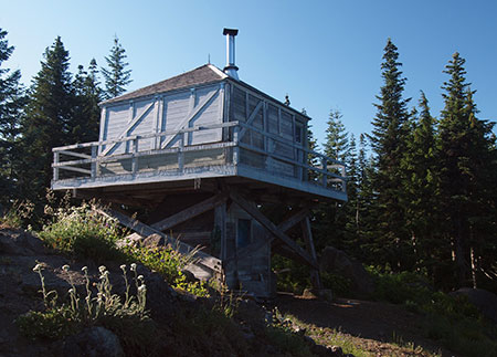
The Devils Peak lookout has apparently found favor with the Forest Service, despite its location inside the Salmon-Huckleberry Wilderness

The Devils Peak lookout has apparently found favor with the Forest Service, despite its location inside the Salmon-Huckleberry Wilderness

The 1999 facilities plan includes other historic structures located inside wilderness area, notably the lookouts at Bull of the Woods and nearby Devils Peak. Both lookouts are included in the National Historic Lookout Register, which is often a first step toward listing in the more rigorous National Historic Landmark Register.

While the Forest Service is silent on Bull of the Woods lookout (and the structure is now showing signs of serious disrepair) the Devils Peak Lookout is described on the Mount Hood National Forest website “open to the public” and maintained as a Forest Service facility.

Why the disparity, especially given that the Devils Peak lookout lacks National Historic Register status? For now, that remains a mystery, as the Forest Service does not seem to have a comprehensive plan for their historic wilderness structures, nor a consistent policy on which structures will be allowed to deteriorate beyond the point of repair — including the remaining Timberline Trail shelters and other facilities across the forest that have gradually been incorporated into new wilderness areas over the years.

This massive new bridge over modest Ramona Creek was built in 2012 inside the Mount Hood Wilderness, less than a mile from the Upper Sandy Guard Station.

This massive new bridge over modest Ramona Creek was built in 2012 inside the Mount Hood Wilderness, less than a mile from the Upper Sandy Guard Station.

Still more confounding is the fact that the Forest Service constructed an elaborate new bridge over Ramona Creek in 2012, just a mile from the Upper Sandy Guard Station and well within the Mount Hood Wilderness. Ramona Creek is a modest stream that can be easily crossed without a bridge, so how was this structure justified?

In a reportedly confrontational exchange in 2007 over the Upper Sandy Guard Station several years ago, a recreation planner from the Zigzag Ranger District responded to questions about the structure with “Have you READ the Wilderness Act? Man-made structures are NOT allowed!” Yet, the same planner was apparently responsible for construction of the elaborate new wilderness bridge over Ramona Creek in 2012.

Clearly, the Mount Hood National Forest has no consistent policy on structures in wilderness areas, historic or otherwise, and thus the highly selective, subjective decisions by district-level staff to build new structures while allowing historic structures to deteriorate.

So, what to do? Fortunately, the answer seems to be coming from the federal land agencies, themselves.

Rethinking the Wilderness Act

Core to the Mount Hood National Forest rationale for letting the Upper Sandy Guard Station fade into oblivion is the opinion — albeit, selectively applied — that “man made structures are not allowed” in wilderness areas. This opinion stems from a series of three recent court decisions and is now widely shared as gospel among the federal land rank-and-file staff.

The stone Cooper Spur shelter along the Timberline Trail is among the historic gems that depend on a better interpretation of the Wilderness Act to survive for future generations

The stone Cooper Spur shelter along the Timberline Trail is among the historic gems that depend on a better interpretation of the Wilderness Act to survive for future generations

However, there is an emerging opinion among wilderness experts within the federal agencies that maintaining and restoring historic wilderness structures is consistent with the 1964 Wilderness Act, and that recent court decisions are more a reflection of flawed arguments made by the federal government in defending its actions to protect historic (and other) structures in wilderness areas. This new argument starts with a key passage in the Wilderness Act, which is the basis for the recent court decisions:

Except in certain specific instances, “there shall be no…structure or installation within any [wilderness] area.” (Wilderness Act, Section 4(c))

In their defense, the federal government has pointed to another passage in the Wilderness Act, arguing that the maintenance or restoration of historic structures qualifies as “use” and is clearly called out among the public purposes of the act:

“Except as otherwise provided in this Act, wilderness areas shall be devoted to the public purposes of recreational, scenic, scientific, educational, conservation, and historical use.” (Wilderness Act, Section 4(b))

Yet, in recent decisions the courts have focused upon the “except as otherwise provided” preface to this clause, and in three key decisions have interpreted historic structures to be at odds with the Wilderness Act. The new thinking emerging among federal wilderness experts focuses on a different defense that would build on this passage in the Wilderness Act:

“A wilderness…may also contain ecological, geological, or other features of scientific, educational, scenic, or historical value.” (Wilderness Act, Section 2(c))

Under this argument, a new approach to defending protection of historic resources in wilderness areas would focus on the “value” of the resource, not “use”, and therefore the mere existence of a demonstrably historic resource like the Upper Sandy Guard Station would be enough to justify maintenance (and even restoration) over time. Finally, another section of the Wilderness Act fills out this new approach, where the act states that structures are generally prohibited except:

“…as necessary to meet minimum requirements for the administration of the area for the purpose of this Act.” (Wilderness Act, Section 4(c))

Therefore, if historic structures represent a “feature of value”, then preserving the structure would be the “minimum requirement” for administering the resource. That’s a lot of legal wrangling, but it could just be what saves our historic wilderness structures.

The Upper Sandy Guard Station sits on a flat bench above the Sandy River, just off the modern alignment of the Pacific Crest Trail.

The Upper Sandy Guard Station sits on a flat bench above the Sandy River, just off the modern alignment of the Pacific Crest Trail.

Taking this interpretation a step further, the fact that “scientific, educational (and) scenic” values are also listed suggests that preserving the Upper Sandy Guard Station by virtue of using it as an overnight rental facility or even staffing it to provide an administrative presence along the overwhelmingly popular Ramona Falls Trail would also be “values” that pass muster under the Wilderness Act. So far, this new approach has not been tested in the courts, but it does offer a hopeful alternative to the troubling direction of recent decisions.

The historic Green Mountain Lookout near Glacier Peak, saved from the federal courts in 2014 by an Act of Congress

The historic Green Mountain Lookout near Glacier Peak, saved from the federal courts in 2014 by an Act of Congress

In the meantime, historic resource advocates in the State of Washington recently short-circuited these recent court decisions in a successful effort to save the Green Mountain Lookout, located inside the Glacier Peak Wilderness.

The Forest Service was taken to court in 2010 over a major restoration of the historic lookout needed to save the structure after years of neglect, including the use of helicopters to carry materials to the remote lookout site. In 2012, the case resulted in one of the three court rulings that have since become the mantra against protecting wilderness structures, and the Forest Service began preparing to remove the building under court order.

Historic resource advocates in Washington State were stunned, and took the case to their congressional delegation. Under the leadership of Senators Patty Murray and Maria Cantwell, Congress acted to permanently protect the structure in April of this year, paving the way for the Forest Service to continue to maintain the Green Mountain lookout for the enjoyment of the public indefinitely.

Saving it by using it?

Ramona Falls is among the most visited wilderness destinations in the country and could use a better ranger presence - why not use the Upper Sandy Guard Station as a base?

Ramona Falls is among the most visited wilderness destinations in the country and could use a better ranger presence – why not use the Upper Sandy Guard Station as a base?

So, how can the Upper Sandy Guard Station be saved? Above all, the building needs an energetic advocate in the form of a non-profit dedicated to historic preservation our public lands – or perhaps even a “Friends of the Upper Sandy Guard Station” non-profit.

The fact that the Mount Hood National Forest has been so arbitrary in its decisions to maintain or build some wilderness structures while allowing others to fall into disrepair is an opportunity: consistent, persistent pressure should be enough to get the Forest Service to do the right thing, and save this priceless old building.

Another possibility is an act of Congress, mirroring the Green Mountain precedent. Given the dire state of the building, perhaps Oregon Senators Ron Wyden and Jeff Merkley could follow in the footsteps of Washington Senator Murray and Cantwell, and simply direct the Forest Service (and the courts) to preserve and restore the building?

These original windows on the guard station were intact as recently as 2008

These original windows on the guard station were intact as recently as 2008

But even with needed repairs, the Upper Sandy Guard Station still lacks a sustaining purpose beyond its intrinsic value as a historic structure. Clearly, the Forest Service sees little value in the building, but to hikers, the structure could be invaluable if managed as a recreation resource.

Here’s how: in summer the guard station could operate in its intended function, with volunteer rangers living in the building during the period when the Sandy River trail bridge is installed (late May through September).

This would put a needed presence on a trail that is heavily traveled, and unfortunately has problems with car break-ins and rowdy visitors at Ramona Falls. The building has the potential to be quite comfortable, as it was originally served with a piped water supply (since removed), and had a sink, small kitchen and even a shower stall that still survives.

Original brass window hardware was still present in 2008, but has since been stripped from by building by vandals

Original brass window hardware was still present in 2008, but has since been stripped from by building by vandals

Volunteer seasonal rangers could also serve as interpreters, giving tours of the old structure and answering questions at Ramona Falls, where the overwhelming share of visitors are casual hikers and young families new to the forest.

Once the seasonal trail bridges have been removed in fall, the guard station could transition to a winter rental, much as several lookouts in the area and the historic guard station at Tilly Jane are operated today. The Old Maid Flat area is a popular snowshoeing and Nordic skiing area, and a restored guard station would be an idyllic overnight destination in high demand. Revenue from rentals could also help pay for needed maintenance and repairs to the structure.

This magnificent fireplace stands at the center of the guard station; the room in the background is a built-in shower, lined with galvanized steel.

This magnificent fireplace stands at the center of the guard station; the room in the background is a built-in shower, lined with galvanized steel.

Could this really work? There are some logistical consideration that would have to be bridged by the Forest Service to actually bring the building back into public use, but they are not insurmountable. First, regular use of the structure would require an outhouse to be restored to the site. Hopefully the original location could be determined from old photos or building plans.

Second, the building would need to be supplied with firewood for winter use, which in turn, would require a woodshed. The National Historic Register evaluation of the building describes a shed that was apparently dismantled many years ago, but could be faithfully restored as part of reconstructing the guard station as it was originally built.

Today, the main structural risk to the building is where several holes have formed in the roof around the chimney. The tarps visible in this photo were placed by the National Historic Register survey crew in 2008 to help stabilize the building.

Today, the main structural risk to the building is where several holes have formed in the roof around the chimney. The tarps visible in this photo were placed by the National Historic Register survey crew in 2008 to help stabilize the building.

Supplying the Guard Station with firewood would be another matter, as any firewood would need to be collected without the use of power tools — a routine task for the hardy individuals who built these structures, but more daunting to us in the modern era. This could be one of the activities of the summer resident rangers. Bundles firewood could also be dropped at the site when a helicopter is already being used to pull out the Sandy River hiking bridge at the end of the summer season.

What next?

Hopefully, this beautiful old structure will find a champion soon, as time is running out for the Upper Sandy Guard Station. While the building condition was described as “excellent” as recently as the 1980s, it has begun to experience major problems from neglect. Worse, vandals have since stripped the building of furnishings and even burned the original wood shutters. The Upper Sandy Guard Station deserves better!

If you would like to help out, consider sending a message to the Forest Service or even your congressional representatives expressing your support for saving this one-of-a-kind window into the past before it’s too late:

Contact Mount Hood National Forest Contact Senator Ron Wyden Contact Senator Jeff Merkley Contact Rep. Earl Blumenauer

If you would like to see the building for yourself, it’s easy to find. The building is on a bench above the Sandy River floodplain, just a few hundred feet off the trail where the Ramona Falls loop intersects the Pacific Crest Trail, near Ramona Falls. The best time to visit is during the summer, when the Sandy River hikers bridge has been installed for the season.

The “Other” Shellrock Mountain

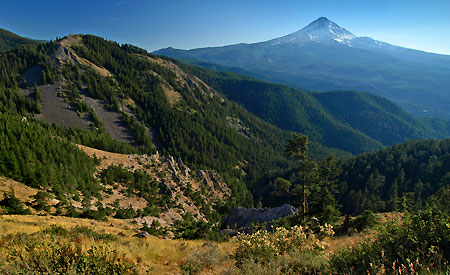
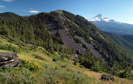
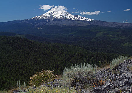
Mount Hood rises above Shellrock Mountain and Badlands Basin

Mount Hood rises above Shellrock Mountain and Badlands Basin

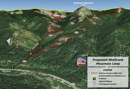
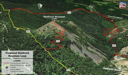
Hidden in plain sight above the Hood River Valley, Shellrock Mountain is a little-known peak with a familiar name. Though it shares a name with its better-known cousin in the Columbia River Gorge, the “other” Shellrock Mountain has much more to offer, and is easier to explore.

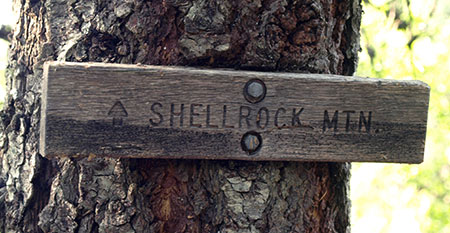
The “other” Shellrock Mountain is located along the Surveyors Ridge trail, a route popular with mountain bikers who ride from one glorious viewpoint to another along this well-traveled route. At one point on the trail, an obscure wooden sign points to Shellrock Mountain, but really just marks a short spur trail with a view of the south face of Shellrock. Beyond this modest view, few visitors take the time to explore the mountain or the rugged Badlands Basin, located nearby.

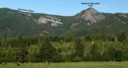
Hidden in plain sight: Shellrock Mountain is from Cooper Spur Road

Hidden in plain sight: Shellrock Mountain is from Cooper Spur Road

[click here for a larger view]

Reaching the summit of Shellrock Mountain involves a short, stiff off-trail scramble up the northeast slope of the peak (more about that later), where a stunning view stretches from the nearby glaciers of Mount Hood to the big peaks of the southern Washington Cascades and arid desert country of the eastern Columbia River Gorge.

Shellrock Mountain sits astride the Hood River Fault, a 20-mile long scarp that forms the east wall of the Hood River Valley. The scarp also forms the last high ridge of the Cascade Range in the Mount Hood area, with evergreen forests giving way to the arid deserts of Eastern Oregon just a few miles east of Shellrock Mountain. This proximity to the desert ecosystem brings together a blend of mountain and desert flora and fauna that make Shellrock Mountain and its surrounding area unique.

While most of the uplifted ridge along the Hood River Fault is composed of ancient layers of basalt, andesite and dacite, the Badlands Basin reveals the more recent debris of a pyroclastic flow, the same roiling mixture of steam, volcanic ash and rock that roared from Mount St. Helens in the May 1980 eruption. This flow originated from Mount Hood during its early formation.

Badlands Basin sprawls against the northern foot of Shellrock Mountain

Badlands Basin sprawls against the northern foot of Shellrock Mountain

Badlands Basin is located at the headwaters of Cat Creek, on the north flank of Shellrock Mountain. Here, the ancient pyroclastic flow has been carved into a fantastic landscape of pinnacles, ridges and goblins that is unmatched elsewhere in the region. The Badland Basin formation spreads across about 100 acres, rising nearly 1,000 above Cat Creek.

The maze of formations in Badlands Basin as viewed from Shellrock Mountain

The maze of formations in Badlands Basin as viewed from Shellrock Mountain

Exploring the Badlands Basin is a rugged and surreal experience for the rare visitors who make their way through the jagged formations. No trails go here, and the terrain is both steep and exposed. But once inside the formation, individual spires and ridges take on a new life, as their bizarre shapes come into focus on a human scale. The Badlands are surprisingly alive, too, with a unique ecosystem of desert and sun-loving alpine flora thriving in dry meadows among the rock outcrops.

Badlands Basin: “The Grizzly Bear”

Badlands Basin: “The Grizzly Bear”

Badlands Basin: “The Hippo”

Badlands Basin: “The Hippo”

Badlands Basin: “The Iguana”

Badlands Basin: “The Iguana”

Together, Shellrock Mountain and the adjacent Badlands Basin are special places that beg to be explored. While the Surveyors Ridge Trail provides a good view into the area, new trails that explore the strange formations of the Badlands up-close and reach the airy summit of Shellrock Mountain could make these places much more accessible for hikers and cyclists. What would these new trails look like?

Proposal: Shellrock Mountain Loop Trail

This proposal calls for a new trail to Shellrock Mountain and Badland Basin from the Loop Highway. Why start at the highway? It makes sense for several reasons: first, the new trailhead at Cat Creek would be only about one-third mile from the popular Dog River Trailhead, making a long and spectacular loop possible for mountain bikers, as the Dog River Trail also connects to the Surveyors Ridge Trail.

Second, a highway trailhead would make the area much more accessible and secure for all visitors, as highway trailheads are easier for law enforcement to patrol, and highway traffic, alone, acts as significant deterrent against car clouters.

ShellrockMountain08

[click here for a large version]

Finally, a trailhead along the Loop Highway could be open most of the year, allowing for winter snowshoe access to the high country around Shellrock Mountain when the Surveyors Ridge Road is buried under snowdrifts.

The proposed Shellrock Mountain Loop would have two legs: a 2.5 mile northern leg would follow Cat Creek to the base of Badlands Basin, then wind through the rock formations to a junction with the Surveyors Ridge Trail. A southern leg would climb the long ridge west of Shellrock Mountain to a separate junction with the Surveyors Ridge Trail, about a mile south of the northern leg. The Surveyors Ridge trail would connect these new trails, creating the loop.

A short summit spur trail would lead from the existing Surveyors Ridge Trail to the rocky top of Shellrock Mountain, providing a side-trip option for cyclists on the ridge and the main destination for hikers on the new Shellrock loop trail.

The following oblique views show the proposed trails from both west and east perspectives:

ShellrockMountain09

[click here for a large version]

ShellrockMountain10

[click here for a large version]

What Would it Take?

In 2009, President Obama signed a bill into law creating the Mount Hood National Recreation Area (MHNRA), a small but significant new form of protection for the Mount Hood area. The MHNRA concept has mountain bikes in mind, as it provides a way to protect recreation areas in a wild state, but without bicycle restrictions (under federal law, bicycles are not allowed in designated wilderness areas).

Shellrock Mountain and Mt. Hood from the Surveyors Ridge Trail

Shellrock Mountain and Mt. Hood from the Surveyors Ridge Trail

The entirety of Shellrock Mountain and the Badlands Basin fall within the MHNRA designation, and as such, deserve to be considered for proposals like this one. The Forest Service has shown an encouraging willingness to work with mountain biking advocates to build new bike trails in the Surveyors Ridge area, too. So while the agency has generally opposed building new trails anywhere else, there is a good chance that the Shellrock Mountain Loop could be build if mountain bike advocates were to embrace the idea.

The first mile of both legs of the new trail would also fall on Hood River County land. The county currently focuses most of its energy on logging its forest holdings, but has worked with mountain bikers in the Post Canyon area to diversify the kinds of uses that county land can be dedicated to.

Nope, this sign doesn’t lead to Shellrock Mountain… yet…

Nope, this sign doesn’t lead to Shellrock Mountain… yet…

In the Shellrock Mountain area, Hood River County has already logged off the big trees, so hopefully the County would see the wisdom of shifting the focus in this area to recreation, as well – and possibly consider funding for trail construction, as well.

Most importantly, mountain biking advocates like the International Mountain Biking Association (IMBA) have a terrific record of trail building, and with help from other trail advocates like Trailkeepers of Oregon (TKO), could be the catalyst in bringing together a collaborative effort of volunteers, the Forest Service and Hood River County in creating this new trail system.

How to Visit Shellrock Mountain

Sturdy hikers can visit Shellrock Mountain today with a bit of wayfinding expertise and some bushwhacking skills. The best starting point is an unofficial trailhead located along the Surveyors Ridge Road.

A brave bushwhacker heads for Shellrock’s summit

A brave bushwhacker heads for Shellrock’s summit

To reach the trailhead from Hood River, drive the Loop Highway (OR 35) ten miles south of I-84 to a crest just beyond the Mount Hood Mill, where you turn left onto Pinemont Drive. This road eventually becomes Surveyors Ridge Road, alternating between paved and gravel surfaces, but is always easily passable for any car.

At almost exactly 11 miles from where you turned off the main highway, watch for an unmarked trail heading to the right at an obvious bend in the road. Park here, and follow the short path to the Surveyors Ridge Trail, just a few feet off the gravel road. Shellrock Mountain is visible directly ahead of you!

The open summit ridge of Shellrock Mountain

The open summit ridge of Shellrock Mountain

From here, turn left (south) and follow the Surveyors Ridge trail for about one-third mile to a gentle crest along the forested east shoulder of Shellrock Mountain. If you pass the trail sign pointing to Shellrock Mountain, you’ve gone too far.

At the crest, head directly uphill on whatever path you can find through the forest, then abruptly leave the trees and reach the open east slopes of Shellrock Mountain, where you will wind among patches of manzanita and ocean spray as you work your way toward the summit. Don’t forget to look back periodically to help you retrace your steps upon your return!

Mount Hood fills the horizon from the top of Shellrock Mountain

Mount Hood fills the horizon from the top of Shellrock Mountain

Soon, you will reach the summit ridge with a series of viewpoints of the Badlands Basin (and your starting point) spreading out to the north and Mount Hood towering to the southwest.

From this vantage point, you can also see the full extent of the 2008 Gnarl Fire that burned the eastern slopes of Mount Hood, sweeping from near Gnarl Ridge on the far left horizon toward Cloud Cap, located right of center. The historic Cloud Cap Inn was barely spared by this blaze. In 2011, the Dollar Fire was started by a lightning strike west of Cloud Cap, sweeping over the right shoulder of the mountain for several miles toward Lolo Pass. For more on the Dollar Fire, click here.

Early stages of the 2008 Gnarl Fire from near Shellrock Mountain

Early stages of the 2008 Gnarl Fire from near Shellrock Mountain

You’ll want to linger on the summit, and be sure to bring along a good map to help you identify the many features near and far that can be seen from this lonely summit. For photographer, the best time to visit in in the morning, which the light on Mount Hood is at its best.

Enjoy!

Heirs to George Shepperd’s Legacy

1890s view of George Shepperd's farm on the Columbia, located just east of Shepperd's Dell (Photo courtesy Rosemary Guttridge)

1890s view of George Shepperd’s farm on the Columbia, located just east of Shepperd’s Dell (Photo courtesy Rosemary Guttridge)

George Shepperd’s place in our history comes from his generous donation of Shepperd’s Dell to the public in 1915, as the historic Columbia River Highway was nearing completion.

After posting the story of George Shepperd recently in “The Farmer and his Dell” , his great-great granddaughter Rosemary (Shepperd) Guttridge contacted me with a few updates to the article and some wonderful photographs. This follow-up article includes several of her Shepperd family photographs and a brief interview with Rosemary Guttridge — and a proposal for finally honoring George Shepperd at his namesake dell in the Columbia River Gorge.

George and Matilda Shepperd (his first wife) in roughly the 1870s (Photo courtesy Rosemary Guttridge)

George and Matilda Shepperd (his first wife) in roughly the 1870s (Photo courtesy Rosemary Guttridge)

The first of the family photos provided by Rosemary Guttridge (above) shows a very young George Shepperd with his first wife, Matilda. This undated photo is likely from the 1870s, when Shepperd was still in his mid-20s and before the couple moved their young family to Iowa. They would farm for a decade on the open prairie before finally heading west to Oregon.

The second image (below) shows the humble farmhouse on the prairie where George and Matilda’s lived through the 1880s, and where their family grew to include four young sons: William, Stuart, George G. and John. A close look at this image shows Matilda standing in the foreground with two of the boys:

George and Matilda Shepperd's farm on the Iowa prairie in the 1880s (Photo courtesy Rosemary Guttridge)

George and Matilda Shepperd’s farm on the Iowa prairie in the 1880s (Photo courtesy Rosemary Guttridge)

In 1889, the Shepperds moved west to Oregon, claiming a few parcels of land at the mouth of Young Creek, just west of the sawmill at Bridal Veil. In the 1912-vintage map, below, the approximate location of the Shepperd farmhouse is shown:

Approximate location of the Shepperd Farm on an early 1900s map of the area

Approximate location of the Shepperd Farm on an early 1900s map of the area

This is a rough guess of the location based on images of the farm showing Crown Point in the distance, a flooded Columbia River and the first rail line to be constructed on the Oregon side of the Gorge. The cluster of buildings shown to the east on this map are part of the mill town of Bridal Veil, and located on the site of today’s Bridal Veil State Park.

The following is an enlarged view from the image in the top of the article focusing on the Shepperd farmhouse. Power poles mark the railroad (directly behind and below the house) and there is even a rowboat on the river:

Enlarged view of the Shepperd farm house - note the rowboat in the background and railroad tracks immediately below the house (Photo courtesy Rosemary Guttridge)

Enlarged view of the Shepperd farm house – note the rowboat in the background and railroad tracks immediately below the house (Photo courtesy Rosemary Guttridge)

The above image shows the area around the house to be a bit barren, and the Shepperd family history dates this photo to 1898, roughly nine years after George and Matilda Shepperd claimed the land. For a larger view of the farm photo (including Crown Point on the horizon) click here.

The most stunning and fascinating of the images shared by Rosemary Guttridge is the following family portrait, taken in approximately 1895, based on the ages of the family members. The photo tells a story of change in the family, as it was taken in the period after George and Matilda Shepperd had divorced in 1895, but before George had remarried to Mattie Williams in January 1896.

George Shepperd's family in about 1892, shortly after he and Matilda had divorced (Photo courtesy Rosemary Guttridge)

George Shepperd’s family in about 1892, shortly after he and Matilda had divorced (Photo courtesy Rosemary Guttridge)

The family portrait provides our first good look at George Shepperd, 46 years old in this photo, and also a man to his right who seems to be his older brother by three years, Matthew Shepperd. Matthew shows up as living at the Shepperd farm in the 1900 census, so one possibility is that he arrived to help George with the farm and raising his children after George and Matilda divorced.

A closer look at George Shepperd from the family photo (Photo courtesy Rosemary Guttridge)

A closer look at George Shepperd from the family photo (Photo courtesy Rosemary Guttridge)

This man appears to be George Shepperd's older brother Matthew (Photo courtesy Rosemary Guttridge)

This man appears to be George Shepperd’s older brother Matthew (Photo courtesy Rosemary Guttridge)

A highlight of the family photo is little Myra Shepperd (below), just five years old in 1895, and striking a brave pose as the lone daughter in a house full of men and young boys:

Baby Myra Shepperd, youngest of George and Matilda's children and their only daughter (Photo courtesy Rosemary Guttridge)

Baby Myra Shepperd, youngest of George and Matilda’s children and their only daughter (Photo courtesy Rosemary Guttridge)

Despite this challenging start, Myra went on to marry Robert Earley when she was 18 (in 1908), and they had two children of their own. Myra lived until 1975, when she died at the age of 85.

The identity of the three older sons in the family photo is somewhat confusing, but Rosemary Guttridge is certain that her grandfather, George G. Shepperd, is standing on the far left (tallest of the three boys). Though he looks older than his years in this photo, he would have been just thirteen.

Annotated George Shepperd family photo, circa 1895

Annotated George Shepperd family photo, circa 1895

[click here for a larger version of the annotated photo]

Rosemary Guttridge shared another portrait of her grandfather, George G. Shepperd, taken in 1902 (below) when he was 20 years old. George G. would marry Emma Fick in 1914, and the couple moved to the Shepperd farm in 1920, after his father had retired to Portland. George and Emma farmed and raised dairy cattle on the farm until 1953 or 1954.

George G. Shepperd, third son of George Shepperd and Rosemary Guttridge's grandfather at the age of 20 in 1902 (Photo courtesy Rosemary Guttridge)

George G. Shepperd, third son of George Shepperd and Rosemary Guttridge’s grandfather at the age of 20 in 1902 (Photo courtesy Rosemary Guttridge)

George G. Shepperd’s son (and Rosemary Guttridge’s father) was George Shepperd Jr. (known simply as “Junior” in the Shepperd Family). He spent much of his childhood at the Shepperd farm in the 1920s and 30s, and married Suzanne Curtis in 1940. Their very young children George Scott and Rosemary visited the family farm before their grandparents moved to Portland in the early 1950s.

George Junior died in 1975 but his wife Suzanne has survived him by nearly four decades, and is still living today in the Gresham area at age 97.

George Shepperd's farmhouse some years after the first photo was taken, perhaps in the early 1900s (Photo courtesy Rosemary Guttridge)

George Shepperd’s farmhouse some years after the first photo was taken, perhaps in the early 1900s (Photo courtesy Rosemary Guttridge)

Rosemary Guttridge shared another photo (above) of the Shepperd farm that is dated 1898, but seems to be taken much later than the earlier photo (at the top of the article), judging by the size of the established trees in this photo. Assuming the first photo was taken in the 1890s, this photo is likely to be from sometime in the early 1900s.

In early April 2014, I interviewed Rosemary (Shepperd) Guttridge to gain her personal insight into the legacy of George Shepperd and life at Shepperd’s Dell:
_______________

WyEast Blog: Rosemary, thanks for answering a few questions about your family — the Shepperds of beautiful Shepperd’s Dell! George Shepperd was your great-grandfather, but I don’t think he was alive when you were born, is that right?

He died in 1930 when my dad would have been 15 years old.

From the scant records I have, my grandparents, George G. and Emma Shepperd moved out to the family farm at Shepperd’s Dell from Beaverton in 1920. The must have lived with my grandmother’s family there. And I’m not sure if my great-grandfather moved to Portland at that time [editor’s note: the Oregon Journal obituary for George Shepperd suggests that he moved to Portland in about 1912]

WyEast Blog: So, your grandfather is George G. Shepperd, the third son of George Shepperd — and your father is George Shepperd, Jr., is that right? From the family history you shared with me, there are George Shepperds in the family line that date back to England in the 1700s – that’s a lot of George Shepperds to keep straight!

There are certainly many Georges in the family tree and unfortunately they didn’t seem to use middle names often so it is a bit hard to keep them straight.

The first recorded George Shepperd (in our family Bible) was born sometime in the late 1780s and his son was James, who was my great-grandfather’s father. Now we’re back to Georges! Great-grandfather George was born in 1848, his son, my grandfather George G., was born in 1881 and his son, my father George (known as Junior in school), was born in 1915.

Wouldn’t want to stop there!! My brother, George Scott is one more. And I realized my mother’s grandfather is George. Then after my father passed away, my mother married… yep, another George!!

I think the family is done with that name for now!

The Shepperd farm in the 1940s when George G. and Emma Shepperd were raising dairy cattle there (Photo courtesy Rosemary Guttridge)

The Shepperd farm in the 1940s when George G. and Emma Shepperd were raising dairy cattle there (Photo courtesy Rosemary Guttridge)

WyEast Blog: Your grandparents lived on the family farm at Shepperd’s Dell until sometime in the 1950s. Do you have memories of them from the farm?

My only memory was when I was probably 3 or 4 years old trying to feed the cows some grass. I reached through the barbed wire fence with handful of grass and caught my arm. The scar is still quite visible.

I don’t remember anything about the inside of the farmhouse, the barns or the views. My brother says he remembers staying overnight at the farm and he had to sleep upstairs with no heat or lights and it was “scary”.

My grandmother mentioned more than once the hobos who would come [to the house] for a meal. She said [the family] had left some kind of mark on the gate, which meant they could stop.

George G. Shepperd and a couple of young helpers on the Shepperd Farm in the 1940s (Photo courtesy Rosemary Guttridge)

George G. Shepperd and a couple of young helpers on the Shepperd Farm in the 1940s (Photo courtesy Rosemary Guttridge)

WyEast Blog: You also sent a wonderful photo of the Shepperd land claim, with the Columbia River and Crown Point as the backdrop – what a beautiful place to have a farm! But it must have been a hard life living through the harsh winters the Gorge is known for — is that something that has been passed down in your family history?

My grandfather was a dairy farmer, which must have been so very tough in the winters. Not sure how they even got the milk to town.

My father left the farm after some college and became a banker. Not sure he thought diary farming was much fun!

WyEast Blog: The photo of the Shepperd farm shows at least three buildings – a farmhouse and at least two barns. Is this the same farmhouse that your grandparents later lived in? Does it survive today?

There is nothing left of the old farmhouse or barn. Now, in its place is a rambling one-story house.

I’m not even sure what happened to the place after Grandpa and Grandma moved to Portland in 1953 or 1954. Hopefully some other relatives can read this and help out with what they know.

George G. and Emma Shepperd at the Shepperd farm in 1942 (Photo courtesy Rosemary Guttridge)

George G. and Emma Shepperd at the Shepperd farm in 1942 (Photo courtesy Rosemary Guttridge)

WyEast Blog: George Shepperd’s second wife, Mattie, died in 1903, just a few years after they were married and was buried at the Bridal Veil Cemetery. George placed a remarkable grave marker there — is there any family history about their short marriage? George was clearly heartbroken by her death, based on the inscriptions on her memorial.

Wish I knew something about this. And again, perhaps some relatives will surface and help!

Small cascades in Shepperd's Dell

Small cascades in Shepperd’s Dell

WyEast Blog: You’ve undoubtedly visited Shepperd’s Dell many times in your life, and that must be an amazing feeling, to know that your great-grandfather made that park possible. Do you still visit Shepperd’s Dell, and what is it like for you to see the sign with your family name on it?

The Dell is very special and beautiful. I have a room in my house that is dedicated to any pictures or painting I can find of the area. I haven’t found anything new for quite some time, but I still look when I come to the west side of Oregon. I had wanted to get married on the platform down the path from the highway but it could not fit very many people so had to make other plans

WyEast Blog: Thanks for your help in piecing together a bit more of George Shepperd’s story, Rosemary – very much appreciated! Any other thoughts you’d like to share for this interview?

Again, I hope some of the relatives will read this and contact you with more information. I think some of them live in the Portland area. Wouldn’t it be great to get more pictures and to clear up so many of the questions!

WyEast Blog: Well, I will certainly let you know if I do hear from other relatives, Rosemary! Thanks, again, for tending to your family history, and especially the legacy of your great-grandfather.
_____________________

Special thanks go out to Rosemary (Shepperd) Guttridge for sharing so much of her family history. Rosemary has also given me permission to post a companion Wikipedia article on George Shepperd, including some of the family photos. I’ll post an update on this blog when the Wikipedia page is complete.
_____________________

Shepperd's Dell bridge and the modest memorial plaque

Shepperd’s Dell bridge and the modest memorial plaque

Postscript: Telling the Story

The story of George Shepperd is inspiring on so many levels, and yet has been nearly forgotten in our written history of the Columbia River Gorge. His story deserves to be told to all who visit his Dell, and who might wonder about the mysterious name on the bronze plaque at the east end of the Shepperd’s Dell bridge.

Perhaps the most compelling reason to tell George Shepperd’s story is that he was one of us: a man of modest means who faced real hardships and tragedy in his life. He was different from the well-known timber barons and political icons whose names are engraved on monuments throughout the Columbia River Gorge. This distinction is important, as it inspires all of us to rise above our own everyday struggles, and strive for lasting contributions that will define us after we’re gone.

“Do you not know that a man is not dead while his name is still spoken?”

– Terry Pratchett

In this spirit, we should seize upon an opportunity in the form of a new Oregon State Parks plan for the Gorge that calls for renovating the Shepperd’s Dell wayside. The time is perfect to do justice to the memory of George Shepperd.

Two memorials are in order: one describing the history of the place, including the Shepperd farm, the donation of Shepperd’s Dell and the construction of the iconic bridge that spans the Dell. This part of the story could be told at the existing wayside, using this familiar interpretive sign format found in other refurbished park sites in the Gorge:

An interpretive sign like this could tell the story of Shepperd's Dell

An interpretive sign like this could tell the story of Shepperd’s Dell

The second memorial should be to George Shepperd, the man. This memorial has already been written: when he died at the age of 82 in July 1930, the Oregon Journal printed a poignant tribute that still serves as a most eloquent salute to George Shepperd.

In remembering him, this tribute should be engraved for the ages (in bronze) and placed at the peaceful waterfall overlook at the end of the Shepperd’s Dell footpath, where visitors could reflect upon his gift to us — as we are “His Heirs”:

18ShepperdMemorial

You can learn more and comment on the Oregon State Parks early plans for Shepperd’s Dell (and other state parks in the Gorge) on their Gorge Parks Plan website. While you’re there, consider putting in a good word for the legacy and memory of George Shepperd – as his fortunate heirs, it’s the least we can do!

Gorge Plan hits crucial stretch!

Columbia River Gorge from Chanticleer Point

Columbia River Gorge from Chanticleer Point

If you’ve been following the progress of the Oregon Parks and Recreation Department’s (OPRD) new Gorge Recreation Plan, you may have commented during the earlier, fairly conceptual phases of the project. On April 24, the OPRD gave us the first real look at on-the-ground specifics with a first draft of the plan.

At first glance, the new plan has a lot to like, and it is crucial for trail advocates to weigh in to support this effort now! Why? Because hiking is being portrayed by a few land managers as “the problem” in the Gorge. Ironically, this is because the state and federal land agencies that manage the Gorge have failed to keep pace with the rapid growth in recreation demand over recent decades, and some trails have (predictably) suffered from overuse as a result.

Switchback on the Angels Rest Trail coming unraveled from overuse

Switchback on the Angels Rest Trail coming unraveled from overuse

Yes, trails like Angels Rest and Eagle Creek are wildly overcrowded during peak hiking periods, and they are most certainly showing the wear. But the answer isn’t to lock the public out of the Gorge! Instead, expanding opportunities with a few new trails and better ways to use existing routes is the realistic solution. But it will take the U.S. Forest Service, Oregon State Parks and Oregon Department of Transportation working together to make that happen. The draft Gorge Plan makes a big step in this direction, and it deserves our support.

What’s in the plan?

The 20-year update to the Gorge Recreation Plan was kicked off last fall with an assessment of existing recreational, cultural and natural resources currently found on State Park lands in the Gorge, and an inventory of natural or scenic features that should be protected from recreation-oriented improvements.

From this basic understanding of existing conditions, the State Parks staff has since assembled a detailed set of project proposals that attempt to fill in some of the facility gaps in the system. The overall vision is framed in a west-to-east schematic (sample shown below) that describes the assets currently found at each State Park in the Gorge, as well as proposals to enhance each of the parks.

Sample schematic from the draft Gorge Parks Plan

Sample schematic from the draft Gorge Parks Plan

Once you figure out how the schematic works, it’s an efficient way for ordinary citizens to really understand what is being proposed by the OPRD. You can download a PDF of the schematic on this OPRD web page and review it in detail. The final version of this document will guide park decisions for decades to come, so it’s very important to give OPRD your input now!

The draft plan includes major upgrades at seven park sites, including Chanticleer Point (Women’s Forum Park), Rooster Rock, Bridal Veil Falls, Ainsworth, Wyeth, Viento and West Mayer state parks. Each of these major upgrade proposals is described in poster format, as follows:

Sample major project page from the draft Gorge Parks Plan

Sample major project page from the draft Gorge Parks Plan

In each case, new trails, restrooms, bike/hike campsites and other major improvements that would enhance quiet recreation in the Gorge are proposed. There is a lot to like in these proposals, and the State Parks staff have not only put a lot of creative thought in assembling them, but have also been listening to recreation advocates seeking to make the state parks more reflective of current recreation demand — both in volume and variety. You can download a PDF of a detailed poster describing these proposals on this OPRD page.

The Trails

First, some exciting news: several trail concepts proposed on this blog have made it into the OPRD proposal for the Gorge! Special thanks go to readers who have weighed in with support for these proposals – your voice matters. Other trail concepts came from OPRD staff and the newly formed Gorge Recreation Coalition, a broad advocacy group consisting of several non-profit organizations focused on quiet recreation in the Gorge.

The following are highlights from the major trail proposals included in the draft plan, and all can be downloaded from this OPRD web page. This map key will help decipher existing versus proposed facilities:

04GorgePlanLegend

First up, the draft plan proposes a new trail following a fascinating old road grade from Rooster Rock to Chanticleer Point (Women’s Forum Park), perhaps the most photographed vantage point in the Columbia River Gorge.

Proposed Women's Forum (Chanticleer) Trail

Proposed Women’s Forum (Chanticleer) Trail

Including this trail is a nice step forward, but the concept should more fully embrace the historic nature of the old road. After all, this rustic old road pre-dates the historic highway, and was once how visitors accessed the former Chanticleer Inn (below) from a rail stop at the Rooster Rock Cannery. The Inn was one in a string of roadhouses that once defined tourism in the Columbia Gorge.

Chanticleer Inn circa 1920

Chanticleer Inn circa 1920

Therefore, this trail should be known as the “Chanticleer Grade Trail”, to keep this important history alive, with interpretive signage along the route designed to give hikers a sense of what the trip up the old road must have been like more than a century ago. Here’s a recent trip report that gives a sense of the potential for this trail.

Next up is a proposed trail connecting the Bridal Veil Falls trail to Angels Rest. The concept is a good one, to the extent that it might take some pressure off the heavily impacted Angels Rest trail. It also traverses public lands currently out of reach to most visitors. Unfortunately, it wouldn’t have the direct benefit that [url=]the Angels Rest Loop[/url] proposal on this blog would have, and this option requires more trail to be constructed.

Proposed Bridal Veil to Angels Rest Trail

Proposed Bridal Veil to Angels Rest Trail

The Bridal Veil proposal also seems to leave out a couple of prime opportunities along Bridal Veil Creek, including the possibility of a Bridal Veil Canyon Trail described in this blog, and a universal access trailhead and trail located at the old Bridal Veil Mill site, just downstream from Bridal Veil Falls. The latter was proposed in the Gorge Coalition comments on the draft plan. Both trail improvements should be added to the draft plan.

Moving eastward, another important trail proposal in the draft plan would fill a gap in Trail 400, east of Ainsworth State Park. This missing link would allow for some long loop hikes for hikers seeing a challenge, and especially for campers staying at the Ainsworth campground (where a number of additional improvements are proposed).

Proposed Ainsworth Gap Trail

Proposed Ainsworth Gap Trail

Further to the east, the draft plan proposes to include the Viento Bluff Trails described in this blog. This would be a series of straightforward, easy-to-build connections that would create a network of family-friendly loops from the Viento Campground.

Proposed Viento Bluffs Trail

Proposed Viento Bluffs Trail

The “existing trails” shown in the Viento area on the draft map are a bit confusing, as some of the trails don’t actually seem to exist, but the general idea for the area is captured, and this ought to be a high priority for OPRD. The easy access and proximity of Viento State Park to the Portland area also make these proposed trails prime candidates for volunteer labor.

Finally, the new trail proposals include yet another concept from this blog, the Mitchell Point Loop Trail. While the eastern loop from the blog version is dropped from the State Parks proposal, the western loop is retained, and this would be a dramatic enhancement to existing the Mitchell Point trail.

Proposed Mitchell Point Loop

Proposed Mitchell Point Loop

This new trail should also be a priority for construction as a viable alternative to the Angels Rest Trail. Though a longer drive from Portland, the views are equally spectacular, and the scenery more rugged. The west loop would also add a series of Oregon oak-covered bluffs to the experience, a unique alterative to the Angels Rest experience.

What’s missing from the Mitchell Point proposal? Notably, a future for the nearby Wygant and Chetwoot trails, routes that are rapidly disappearing from lack of maintenance and some rough treatment by BPA crews. A portion of the Wygant Trail shows up on the Mitchell Point map, so at least the draft plan is not proposing to formally abandon this route, but it does deserve to be called out for restoration.

You can review all of the proposed trail enhancements in PDF form on this page on the OPRD website.

How to be Heard

Oregon State Parks staff will be holding a public meeting on Wednesday, April 30 at the Corbett Fire Station. Despite the short notice and distant location for most Portlanders, it’s important to weigh in. If you can’t make it to the open house, then be sure to weigh in via the Gorge Parks Plan project website. The website is set up in blog format, so simply scroll down to comment at the bottom. The OPRD staff has thus far proven to be interested and responsive to public feedback on the Gorge Parks Plan, so your comments will be considered in a meaningful way.

The OPRD goal for the third set of public meetings is to roll out their draft Gorge Plan proposals and hear public input, especially on the prioritization of the proposed park improvements.

January Gorge Parks Plan meeting in Cascade Locks

January Gorge Parks Plan meeting in Cascade Locks

State Parks staff have posed the following questions for the public to consider:

1. Of the improvements proposed, what do you see as priorities?

2. If you could see only one of the proposed improvements implemented, which would it be?

3. Are there proposed improvements that you think should wait?

4. Is there anything you would like to see that hasn’t been captured in the proposals?

Thus far, the OPRD meetings have been lightly attended, but those who have taken the time to weigh in have been heard. It’s worth your time, and this is a rare opportunity to shape the future of recreation in the Gorge. Remember, this is a 20-year planning window, and the new Gorge Parks Plan will set the stage for how parks are manage for decades to come.

Please consider taking the time to weigh in!

The Farmer and his Dell

Hand-colored photo from the 1920s showing the west approach to Shepperd's Dell

Hand-colored photo from the 1920s showing the west approach to Shepperd’s Dell

For nearly a century, countless travelers on the Historic Columbia River Highway have admired the idyllic scene that unfolds at Shepperd’s Dell, one that has also appeared on dozens of postcards and calendars over the decades.

George Shepperd's sole memorial in the Columbia Gorge is this small plaque on the Shepperd's Dell bridge

George Shepperd’s sole memorial in the Columbia Gorge is this small plaque on the Shepperd’s Dell bridge

Yet, beyond the fanciful name and a small bronze plaque at the east end of the highway bridge, few know the story behind the man who gave this land to the public to be enjoyed in perpetuity. Who was George Shepperd? This article is about the modest farmer who gave us his “dell”.

Threading the Needle

George Shepperd’s story is interwoven with the brilliant vision of a true icon in our regional history, Samuel Lancaster, the chief engineer and designer of the Historic Columbia River Highway. Had Sam Lancaster not attempted to frame sweeping views and hidden natural features at every turn with his epic road design, Shepperd’s Dell might have remained a mostly hidden secret.

Lancaster saw his new highway as something to be experienced, not simply the shortest path through the Gorge:

“…as Consulting Engineer in fixing the location and directing the construction of the Columbia River Highway… I studied the landscape with much care and became acquainted with its formation and its geology. I was profoundly impressed by its majestic beauty and marveled at the creative power of God, who made it all… [I] want [visitors] to enjoy the Highway, which men built as a frame to the beautiful picture which God created.”

-Samuel C. Lancaster (1916)

With this grand vision, Lancaster saw a special opportunity to showcase nature at Shepperd’s Dell. When approaching from Crown Point, the old highway rounds a blind corner cut into sheer cliffs, high above the Columbia when the graceful, arched bridge spanning Shepperd’s Dell suddenly comes into view.

Sam Lancaster and other dignitaries are pictured here at Shepperd's Dell on the opening day of the Columbia River Highway in 1916

Sam Lancaster and other dignitaries are pictured here at Shepperd’s Dell on the opening day of the Columbia River Highway in 1916

Tall basalt domes rise above the bridge, and from mid-span, visitors are treated with a view into the shady, fern-draped “dell” holding Young Creek. A graceful, 8-tiered waterfall leaps a total of 220 feet through a twisting gorge, much of it hidden from view in the mossy recesses of the dell.

In his inspired design for Shepperd’s Dell, Sam Lancaster’s threaded the needle by spanning the narrow canyon at the midpoint of the falls. By any other highway engineer of the time, this would have been a travesty, but Lancaster’s gracefully arched bridge and careful attention to detail achieves the opposite: he transformed this little grotto into one of those rare examples where man and nature meld in idyllic harmony. This artful balance is the enduring lure of Shepperd’s Dell to this day, making it a favorite stop along the old highway.
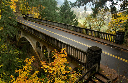
Samuel Lancaster's iconic bridge at Shepperd's Dell as it appears today

Samuel Lancaster’s iconic bridge at Shepperd’s Dell as it appears today

Sam Lancaster said this of his design for Shepperd’s Dell:

“The white arch of concrete bridges a chasm 150 feet in width and 140 feet in depth. The roadway is cut out of solid rock [and] a sparkling waterfall leaps from beetling cliffs and speaks of George Shepperd’s love for the beautiful, and the good that men can do.”

-Samuel Lancaster (1916)

Complementing the highway is a rustic footpath leading from the bridge to a viewpoint at the edge of the falls. The footpath is cut into the vertical walls of the dell and framed with Lancaster’s signature arched walls. From the falls viewpoint, the vista sweeps from a close-up of the cascades on Young Creek to the graceful arch of the highway bridge, soaring above the canyon. This is understandably among the most treasured scenes in the Columbia Gorge.

1920s postcard view of Shepperd's Dell showing the Bishop's Cap in the distance.

1920s postcard view of Shepperd’s Dell showing the Bishop’s Cap in the distance.

Samuel Lancaster created this scene as we experience it today, but only because George Shepperd made it possible by showing Lancaster his secret waterfall, and offering to donate his land to the highway project so that others might enjoy his dell in perpetuity.

Who was George Shepperd?

When Sam Lancaster was building his touring road through the Columbia Gorge, a number of well-to-do land owners with vast holdings in the area generously donated both right-of-way and some of the adjacent lands that hold the string of magnificent waterfalls and scenic overlooks that we enjoy today. Until the highway idea was conceived in the early 1900s, the Gorge was mostly valued for its raw resources, with several salmon canneries and lumber mills along the river and the forests heavily logged. The idea of a parkway was new, and part of the surging interest in creating national parks and expanding outdoor recreation across the country.0

Middle tier of the falls at Shepperd's Dell as viewed from the highway bridge

Middle tier of the falls at Shepperd’s Dell as viewed from the highway bridge

George Shepperd was equally generous with his donation, but he wasn’t a timber baron or salmon cannery tycoon. Instead, Shepperd was a transplanted Canadian farmer who had moved his family here after a short stay Iowa in the 1880s. Samuel Lancaster wrote this of Shepperd:

“The tract of eleven acres at this point, given by George Shepperd for a public park, is unexcelled. God made this beauty spot and gave it to a man with a great heart. Men of wealth and high position have done big things for the Columbia River Highway which will live in history; but George Shepperd, the man of small means, did his part full well.”

-Samuel Lancaster (1916)

George Shepperd, his wife Matilda and their sons William and Stuart moved from Goderich Township, Ontario (roughly halfway between Toronto and Detroit) to a farm in Audobon County, Iowa in 1880, where the couple gave birth to two more sons, George Jr. and John.

George Shepperd's extensive holdings in the early 1900s were mostly hills and ravines (shown in yellow), with the donated Shepperd's Dell parcel shown in green. Much of Shepperd's remaining land has since been brought into public ownership

George Shepperd’s extensive holdings in the early 1900s were mostly hills and ravines (shown in yellow), with the donated Shepperd’s Dell parcel shown in green. Much of Shepperd’s remaining land has since been brought into public ownership

In 1889, the Shepperds moved again, this time to Oregon where they settled in the Columbia River Gorge on a 160-acre land claim along Young Creek, just west of the mill town of Bridal Veil. Their fifth child, a daughter named Myra, was born just a year after they arrived, in November 1890. Upon settling in Oregon, George Shepperd supported his family by farming, dairying and working at the nearby Bridal Veil Lumber Mill.

At this point in history, the George Shepperd story becomes complicated: in May 1895, George and Matilda divorced, and in January 1896, George married Martha “Mattie” Maria Cody Williams, who had also recently divorced. Mattie apparently met George when the Shepperd and Williams families had traveled west to Oregon together in 1889. The “Cody” in Mattie’s lineage was indeed William F. “Buffalo Bill” Cody, a first cousin.

The view today from Shepperd's Dell toward Crown Point includes some of George Shepperd's former pasture lands, now in public ownership and managed for wildlife.

The view today from Shepperd’s Dell toward Crown Point includes some of George Shepperd’s former pasture lands, now in public ownership and managed for wildlife.

George Shepperd was 47 years old when he married 37 year-old Mattie in 1896, and while the first years of their new marriage seemed to have been blissful, the next 35 years of his life were a rollercoaster of tragedies and triumphs.

The tragedy began in 1901 when his eldest son, William J. Shepperd, boarded a train to Portland to pick up supplies for the business he and his brother George Jr. had in Hood River. William reportedly waved to friends and family from the rear platform as he passed through Bridal Veil and the Shepperd farm, then was never seen again.

Local news accounts speculated that William had been “Shanghied” while in Portland and taken aboard a foreign cargo ship. Ten years later, William’s surviving wife Osie and son Raymond also disappeared after living with the Shepperds and members of Osie’s family in Portland for several years. They were never heard from again by George Shepperd.

The Bridal Veil Historic Cemetery is tucked among the trees near the Angels Rest trailhead

The Bridal Veil Historic Cemetery is tucked among the trees near the Angels Rest trailhead

More tragedy ensued in 1903, when George Shepperd lost his beloved Mattie, just seven years after the two had married. There is no record of why she died, though some accounts describe her as “crippled” in those years. She was only 44 years old.

If the impressive memorial he erected for Mattie at the Bridal Veil cemetery is any indication, George was profoundly heartbroken. He never married again. The melancholy epitaph at the base of her grave marker reads:

“One by one earth’s ties are broken, as we see our love decay, and the hope so fondly cherished brighten but to pass away.”

The infant grave of Elizabeth Dutro is also located within the otherwise empty Shepperd family plot, next to Mattie’s grave and dated October 15, 1903 – seven months after Mattie was buried. Baby Dutro seems to be Mattie’s granddaughter by Bertha Delma Williams Dutro, her daughter from her first marriage. Bertha Dutro lived until 1963, and had two more daughters. She is buried at the Idlewildle Cemetery in Hood River.
Mattie Shepperd's grave marker at the Bridal Veil Cemetery

Mattie Shepperd’s grave marker at the Bridal Veil Cemetery

Mattie Shepperd, "wife of George Shepperd"

Mattie Shepperd, “wife of George Shepperd”

The tiny Bridal Veil Cemetery is still maintained and open to the public, though a bit hard to locate: an obscure gravel driveway drops off the north shoulder of the I-84 access road at Bridal Veil, just below the Historic Columbia River Highway. A number of early settlers from the area are buried in this lonely window into the past.
Baby Dutro was laid to rest a few feet away and nine months after Mattie Shepperd

Baby Dutro was laid to rest a few feet away and nine months after Mattie Shepperd

Over the next few years, George Shepperd must have met Samuel Lancaster as the engineer began his surveys of a possible highway route through the Gorge. Travel in the Gorge at that time was mostly by train, and the Shepperd farm was one of the many stops along the route. No record of their meeting exists, but George was described as an early supporter of the highway, and this is surely the time when he realized that he could be part of Lancaster’s grand vision.

Some accounts suggest that the sudden loss of Mattie was also part of George Shepperd’s motivation to leave a lasting legacy with a land donation, but there is no record of this. Instead, it was simply the beauty of Shepperd’s Dell that seemed to motivate him.

Newspaper accounts also show that Shepperd had many opportunities to sell his property for substantial profit, as the new highway was quickly dotted with roadhouses and gift shops aimed at the new stream of tourists. The Oregonian later reported: “ever since the highway was constructed, Mr. Shepperd has received offers to purchase the tract, but has refused them, having in mind an intention to dedicate the property to the use of the public.”

Early 1930s postcard view of Shepperd's Dell.

Early 1930s postcard view of Shepperd’s Dell.

In March 1914, George Shepperd’s land donation along Young Creek was announced as part of the construction of the Columbia River Highway. But by late 1915, Shepperd was involved in a legal dispute with a neighboring landowner who attempted to take claim to the land he had donated – the land that is now Shepperd’s Dell. By 1916, George Shepperd was counter-suing on grounds of fraud to clear the title – one that stemmed from a loan that one of Shepperd’s sons had taken years earlier. The Oregonian reported the events with the headline “Good Deed Spoiled” as a nod to Shepperd’s noble intentions:

“A few years ago, the elder Mr. Shepperd, owner of an 80-acre piece of land above the Columbia River, deeded 10 acres, including the famous Shepperd’s Dell, to the City of Portland as a public playground. The Columbia River Highway was being built and it was apparent to Mr. Shepperd that this attractive place would be a valuable possession to the city. While he was a comparatively poor man, he determined, instead of selling the property for a small fortune that he could have received for it, give it free of cost to the public.”

(The Oregonian, March 16, 1916)

Thankfully, Shepperd prevailed in the legal dispute. At that point in the dramatic early history of the new highway, the Shepperd’s Dell section of the road had already been constructed, but who knows what might have been built there had the land slipped away from public ownership?

In November 1915, George Shepperd was fighting a second legal battle, joining the City of Portland in a lawsuit against the Bridal Veil Lumber Co., and their plan to divert Young Creek away from Shepperd’s Dell and into a generating facility to provide power for their mill. The City and Shepperd prevailed in this suit, as well.

This is the only known photo of George Shepperd. It appeared in the Oregon Journal in 1915.

This is the only known photo of George Shepperd. It appeared in the Oregon Journal in 1915.

George Shepperd’s personal roller coaster continued on June 8, 1916, when he found himself seated among the most honored guests at the spectacular dedication of the Columbia River Highway at Crown Point. Shepperd was recognized in the formal program along with historical luminaries like Sam Hill, Samuel Lancaster, Julius Meier, Simon Benson and John B. Yeon. The ceremony was kicked off audaciously by President Woodrow Wilson unfurling an American Flag remotely by pressing a telegraph button in the White House, surely a highlight for a modest farmer from Canada.

Though surrounded by millionaires and elite scions of Portland’s old money at the grand opening, Shepperd stood apart from his honored peers that day: John B. Yeon, who had been appointed roadmaster in the campaign for the Columbia River Highway project, summed it up best:

Mr. Shepperd’s donation is worthy of the highest praise, especially in view of the fact that he [is] not a wealthy man. He has made a sacrifice for the public good that ought to make some of our rich men ashamed of themselves.

John B. Yeon, Oregon Journal, April 23, 1915

Close-up view of the vehicle carrying Sam Lancaster as he passed Shepperd's Dell during the grand opening of the Columbia River Highway in June 1916.

Close-up view of the vehicle carrying Sam Lancaster as he passed Shepperd’s Dell during the grand opening of the Columbia River Highway in June 1916.

In an earlier 1915 front-page feature previewing the new highway (still under construction), the Oregonian described Shepperd’s Dell this way:

“One of the wonder spots on the Columbia Highway, in the daintiness and sublimity combined with its scenery is Shepperd’s Dell, which was donated to the highway as a public park by George Shepperd, because he loved the spot and because he wanted it preserved forever for the enjoyment of people who come along the highway.

Mr. Shepperd is not a rich man and his donation is one of the most noteworthy in the history of the highway. At Shepperd’s Dell is one of the finest bridges on the highway and a trail has been built leading down from the highway to the dell and back to the beautiful little waterfall and springs in the gorge. The view back from the trail, looking through the arch made by the concrete span, is one of the most beautiful on the highway.”

(Sunday Oregonian, August 29, 1915)

George Shepperd’s Final Years
This home on NE Stanton Street in Portland is where George Shepperd lived out the final years of his life.

This home on NE Stanton Street in Portland is where George Shepperd lived out the final years of his life.

In 1917, sixteen years after his eldest son William had vanished and six years after William’s wife Osie had disappeared with his grandson Raymond, George Shepperd sought foreclosure on 120 acres of land he had given to the young couple shortly before William disappeared in 1901. The title was cleared by April 1919, and Shepperd promptly donated the land, including a four-room farmhouse, to the local YMCA. The YMCA reported that the house and property would be converted into a model boys camp and lodge:

“A party of boys will visit the place today to clear off sufficient land for a baseball diamond and athletic field and to commence the work of remodeling the lodge. The camp will be used by the boys this summer for short camping trips, covering a period of only a few days, and is especially intended for use of those boys who are unable to devote the time required to make the trip to the regular summer camp at Spirit Lake.”

(The Oregonian, April 4, 1919)

By 1920s, George Shepperd had finally retired from his farm at Shepperd’s Dell, having survived his second wife Mattie and a remarkable series of peaks and valleys in his life. He moved to Portland, and lived there until passing away at his residence on NE Stanton Street in July 1930.

George Shepperd's modest grave marker at Riverview Cemetery.

George Shepperd’s modest grave marker at Riverview Cemetery.

Shepperd left an estate of about $8,000 to his remaining sons and daughter, primarily property in the Shepperd’s Dell area. But he hadn’t forgotten his missing grandson Raymond, and left him a token “five dollars in cash”, (about $70 today) presumably in hopes that the execution of his estate might somehow reconnect Raymond with the Shepperd family.

George Shepperd is interred at Portland’s Riverview Cemetery, along with many other important figures from the early period in Portland’s history. His understated gravesite is surprisingly distant from where his wife Mattie is buried in the Bridal Veil cemetery, and we can only guess as to why his surviving children didn’t bury him there.

George Shepperd Jr. in an early 1940s news account, on the right.

George Shepperd Jr. in an early 1940s news account, on the right.

George’s children produced nineteen grandchildren, and the Shepperd family name lives on throughout the Pacific Northwest.

His second-oldest son Stuart lived until 1952, when the Oregonian reported that an “elderly man” had collapsed on a sidewalk in downtown Portland, apparently from a heart attack. At the time of his death, Stuart Shepperd was residing in Latourell, near the family homestead in the Columbia Gorge. His surviving brother George G. was still living in Bridal Veil at the family homestead at that time.

George G. Shepperd and his wife Emma left the Shepperd farm in 1953 or 1954 and George G. lived until 1961. George G Shepperd’s son George “Junior” went on to become a prominent officer for the Oregon Bank, and died in 1975. The youngest of George Shepperd’s four boys, John, died in 1959. Myra Shepperd, George’s only daughter and the only one of his children born in Oregon, lived until 1975.

The bridge at Shepperd's Dell in the 1940s, complete with a white highway sign from that era.

The bridge at Shepperd’s Dell in the 1940s, complete with a white highway sign from that era.

The original 10-acre Shepperd’s Dell park was transferred from the City of Portland to the Oregon State Park system in September 1940. The state made a series of additional purchases to expand the park over the next several decades, bringing the total size of today’s park to more than 500 acres.

Today, Shepperd’s Dell State Park encompasses Bridal Veil Falls, Coopey Falls and the west slope of Angels Rest, to the east, in addition to its namesake waterfall grotto.

George Shepperd’s legacy… and ours?

Shepperd's Dell lights up with fall colors each autumn.

Shepperd’s Dell lights up with fall colors each autumn.

Imagine the Columbia River Highway without Shepperd’s Dell, and you can truly appreciate the magnitude of George Shepperd’s generosity and vision. There’s an important lesson from his legacy: bringing land into public ownership is complicated, expensive and often messy, and thus requires great determination.

Flash forward to our times, and consider the hundreds of private holdings that still remain in the Columbia River Gorge. Then imagine the “good that men can do” (in Samuel Lancaster’s words) — what if just a few of these parcels were donated to the public in perpetuity in our time?
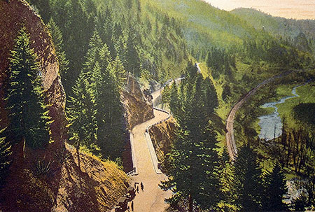
This unusual hand-colored photo from the 1920s is from the Bishops Cap, looking west toward the bridge at Shepperd's Dell. Though the trees have grown, much of the rest of this scene is preserved today.

This unusual hand-colored photo from the 1920s is from the Bishops Cap, looking west toward the bridge at Shepperd’s Dell. Though the trees have grown, much of the rest of this scene is preserved today.

Hopefully, the spirit of George Shepperd’s humble generosity will live on in the hearts of those fortunate few who still hold private property in the Gorge, but we’re also fortunate to have several non-profit organizations with land trusts to help the transition along:

• The Friends of the Columbia River Gorge have become the most active in recent years in securing critical private holdings in the Gorge. Without Friends of the Gorge, we would not have secured lands at Cape Horn, Mosier Plateau of the Lyle Cherry Orchard, for example, among more than a dozen sites acquired by the Friends.

• The Trust for Public Land serves as a critical go-between in helping secure private lands for eventual public purchase. Without the Trust, we would not have secured nearly 17,000 acres in the Gorge through more than sixty separate transactions over the past 30 years.

• The Nature Conservancy continues to acquire endangered ecosystems, and their extensive holdings at Rowena Plateau and McCall Point also serve as some of the most visited recreation trails in the Gorge.

• The Columbia Land Trust is another important player in securing private lands in the Gorge, as well as the rest of the lower Columbia River. Their focus is on riparian sites and securing critical habitat.

Very few of us will ever find ourselves in the position of George Shepperd, with a waterfall or craggy viewpoint to give to the public, but we can be part of that enlightened tradition in a smaller way. Please consider supporting these organizations in their efforts to expand our public lands in the Gorge!
________________

His Heirs
The Oregon Journal • July 23, 1930

ShepperdsDell22

GEORGE SHEPPERD was a poor man but he gave all that he had. Without intending it he made for him a memorial that will for all time identify his name with unselfish public service.

He owned a few rocky acres in the Gorge of the Columbia. It was land from which a living could be wrested only by dint of much toil. But through it ran a small stream that at last leaped and laughed and spiraled its way down through the great basaltic cliff that was the wall of the gorge. The course of the cataract led to Shepperd’s Dell.

It was for many years George Shepperd’s habit to go on Sunday afternoon with the children and sit beneath a tree and look down upon the exquisitely fashioned spot. The harsh outlines of the rock, cast up aeons ago by volcanic fires, were softened and carved into fantastic and beautiful forms by the streamlet. Maidenhair fern clung precariously to the cliff. Flowers bloomed under the shadow of the tall and somber firs.

When the Columbia River Highway was built George Shepperd gave Shepperd’s Dell to the people as their beauty spot forever. At other points along the highway “No Trespass” signs appeared where property was privately owned. George Shepperd left a welcome.

One wonders if there will be a bright Sunday afternoon when the spirit of this humble man will be allowed to return and brood over Shepperd’s Dell and share in the pleasure of the many who revel there. Having little, he gave all, and it became much.

(Postscript: after his death the Oregon Journal published this tribute to George Shepperd. We are all still “his heirs”. I would someday like to see these words cast in bronze and tucked into a shady corner of his Dell so that a bit of his story might be known the many who visit this spot)
________________

Acknowledgements: as you might have guessed from the length, this was among the more challenging articles to research for this blog, as very little is written about George Shepperd. An especially big big thank-you goes to Scott Daniels, reference librarian at the Oregon Historical Society, who helped me locate the only known biography of George Shepperd.

The obscure Shepperd biography was written in 1997 by Muriel Thompson, a great-great niece of George Shepperd. Thompson traveled to Oregon to conduct some of her in-depth research, including court records from the various legal actions Shepperd was party to and digging into Oregon Journal archives at a time when news searches meant poring over microfiche archives. It’s an invaluable account of George Shepperd’s life and legacy.

The stairs leading into Shepperd's Dell from the bridge as they appeared in the 1940s - the signpost no longer exists, though the rest of the scene is largely unchanged.

The stairs leading into Shepperd’s Dell from the bridge as they appeared in the 1940s – the signpost no longer exists, though the rest of the scene is largely unchanged.

Thompson’s biography did not have the benefit of today’s internet research tools, and through a variety of these sources, I was able to piece together a fuller picture of George Shepperd’s complex life than was possible in 1997, especially details about his two marriages and additional historic news accounts about his land donation and the construction of the Columbia River Highway.

There is still plenty of mystery surrounding this important player in the history of the Columbia Gorge: did any structures from George Shepperd’s farm survive? Why did his children bury him at Riverview Cemetery instead of Bridal Veil, by his beloved Mattie? What became of his grandson Raymond, by his vanished eldest son William? As always, I welcome any new or corrected information, and especially contact with any of his descendents. One of the unexpected joys in writing this blog is the opportunity to connect directly with grandchildren and great-grandchildren of important people in our regional history!
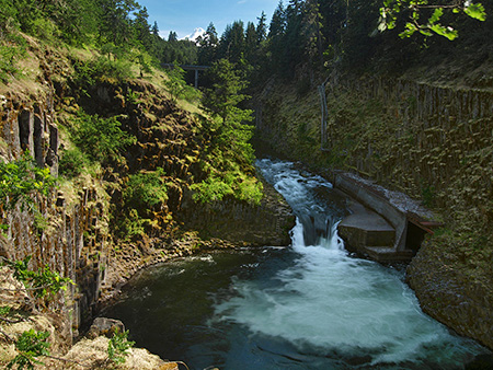
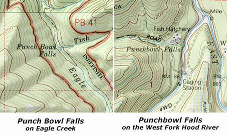
Ski Traffic & the Loop Highway: Part 2

The winter weekend crush of skiers is nothing new on Mount Hood

The winter weekend crush of skiers is nothing new on Mount Hood

(This is the second in a two-part article. The first part focused on the latest plans to add more parking to the Meadows resort, another step in the wrong direction for Mount Hood, but one that (unfortunately) has already been approved by the U.S. Forest Service. This part focuses on the future, and a promising new strategy that seems to finally be turning the page on an era when ODOT and the Mount Hood ski resorts simply paved their way out of weekend traffic problems with more parking and wider highways.)
__________________

Since the early days of developed snow sports on Mount Hood in the 1920s, winter weekend traffic jams have been the norm. The cars have changed (and so has the highway, regrettably), but the same bottlenecks appear in pretty much the same spots, as thousands of Portlanders pour into the ski resorts over a few short winter weekends each year.

Intrepid auto tours reached Government Camp on dirt roads years before the loop highway was completed in the early 1920s

Intrepid auto tours reached Government Camp on dirt roads years before the loop highway was completed in the early 1920s

From the beginning, there have been overflow parking lots, ski buses, shuttles — even an aerial tram in the early 1950s known as the Skiway — all in an attempt to stem the weekend ski traffic.

In 2013, the Oregon Department of Transportation (ODOT), in partnership with the U.S. Forest Service, the Federal Highway Administration and Clackamas and Hood River county officials, kicked off yet another effort to address the winter traffic overload.

In the 1920s, Government Camp was the center of winter activity -- and overflowing with cars

In the 1920s, Government Camp was the center of winter activity — and overflowing with cars

While this is just the latest of several ODOT-led efforts over the years to better manage the Loop Highway, the draft Mount Hood Multimodal Transportation Plan (MHMTP) is the best effort yet. While still only a document full of recommendations, the new plan offers real promise that federal, state and local officials are now more serious about managing the relatively short season of ski traffic gridlock.

Timberline Lodge was overflowing with cars as soon as it opened in the late 1930s

Timberline Lodge was overflowing with cars as soon as it opened in the late 1930s

Instead of attempting to rebuild the entire highway corridor to meet the peak demands of ski resort traffic that occurs over a few weekends each year, the MHMTP focuses instead on low-cost, high-impact tools. This is a radical and positive change in mindset — even if the plan itself still has a few gaps.

The stakes are high when it comes to managing traffic on Mount Hood. The ski resorts have little incentive to do anything except ask the general public to cough up more tax dollars for ever-wider highways. After all, it’s a sweet deal for the resorts and skiers, alike: in Oregon, just one in 25 residents ski, so the subsidy for highway projects catering to ski traffic is enormous.

ODOT is currently seeking bids in the latest round of road widening, this time along the slopes of Laurel Hill in what will eventually total more than $60 million in state gas tax funding over the past decade to widen the Loop Highway from Brightwood to Government Camp.

Camp Creek takes the brunt of trash and pollution from US 26. This scene is the unimproved roadside trailhead at Mirror Lake, where a chemical toilet (and associated trash) sits precariously above a steep bank dropping directly into the stream

Camp Creek takes the brunt of trash and pollution from US 26. This scene is the unimproved roadside trailhead at Mirror Lake, where a chemical toilet (and associated trash) sits precariously above a steep bank dropping directly into the stream

Just a few hundred yards downstream from the scene in the previous photo, Camp Creek spills over beautiful Yocum Falls, a seldom-visited spot bypassed by the modern highway. The pool below the falls is sullied with plastic cups, sport drink bottles and tires that have found their way into the stream from the highway

Just a few hundred yards downstream from the scene in the previous photo, Camp Creek spills over beautiful Yocum Falls, a seldom-visited spot bypassed by the modern highway. The pool below the falls is sullied with plastic cups, sport drink bottles and tires that have found their way into the stream from the highway

The traditional “building your way out” mindset has been bad for business in the local communities along the highway. The wider, noisier road has made it even less attractive for day tourists to risk a stop at the remaining shops and restaurants in the corridor. Worse, the huge 5-lane cross sections built on Highway 26 over the last decade have effectively cut the mountain villages in half by creating a scary barrier for local traffic to navigate, whether on foot, bicycle or in a vehicle.

Widening the Loop Highway is even worse for the natural environment, as highway trash, polluted runoff and blown gravel enters directly into the Salmon River, Still Creek, Camp Creek (pictured above) and the Zigzag River. All four streams serve as important salmon and steelhead habitat, a fact lost on the rush to make room for a few weekends of ski traffic each year.

A New Direction?

The Mount Hood Skiway was an early 1950s experiment to lessen parking pressure on Timberline Lodge - it failed, but may have been ahead of its time!

The Mount Hood Skiway was an early 1950s experiment to lessen parking pressure on Timberline Lodge – it failed, but may have been ahead of its time!

ODOT’s new MHMTP is both comprehensive and innovative. The plan is guided by the following objectives for how future travel should occur on the mountain:

• Improved highway safety for all users
• Expanded travel options year-round
• Reduced peak travel demand
• Enhanced mobility and access to recreation and local communities
• New projects should be financially feasible and sustainable
• New projects should be achievable in the next 15 years

The new focus on cost-effectiveness and a broader definition of desired outcomes beyond simply chasing traffic is new for ODOT — and for Mount Hood. It follows the lead of urban areas across the country, where cities are increasingly moving away from big-ticket road projects that seldom provide the advertised safety or mobility benefits used to justify them, and toward more practical solutions that have fewer unintended consequences.

A decade of futile "widening for safety" projects in the Highway 26 corridor has mostly resulted in dividing local communities and increasing highway runoff, with little traffic benefit

A decade of futile “widening for safety” projects in the Highway 26 corridor has mostly resulted in dividing local communities and increasing highway runoff, with little traffic benefit

To achieve these core objectives in managing the Mount Hood travel corridor, the MHMTP lays out four areas of proposed action – this is the real substance of the plan:

1. Better managing the system: in this area, the plan calls for another plan known as a “concept of operations”, which is transportation jargon for an operations blueprint for the Mount Hood loop from the City of Sandy to Hood River. Elements of an operations blueprint could range from web-based traveler information to new or upgraded electronic message signs along the highway, with real-time updates on traffic, parking, transit and emergencies.

The goal of this element of the MHMTP is to make the best use of the system through better-informed travelers and to better coordinate the various public agencies (ODOT, the Forest Service and the two counties) involved in operating the road system.

How it could be better: the details of the “concept for operations” aren’t nailed down at this point (thus the need for another plan), but one strategy not mentioned in the list of possibilities is variable speed limits along the entire loop. This key recommendation from ODOT’s 2010 Highway 26 Safety Audit deserves to be a priority above other, more costly highway projects already moving forward in the area. DOTs around the country are using this technology with excellent results in improving safety and traffic efficiency, and ODOT should join the movement.

An even larger gap in the strategy is an unwillingness by ODOT and the Forest Service to require the ski resorts to adopt peak pricing as a means to help spread out demand. The resorts are loathe to do this, given their troubled future (as described in Part 1 of this article), but if all three major resorts adopt the same policy, they will at least retain their current competitive positions with one another, while Mount Hood’s communities and environment would benefit from a coordinated effort to spread out the highway demand.

Not in the plan: pricing incentives for parking and lift tickets at the big three resorts to spread demand from weekend peaks

Not in the plan: pricing incentives for parking and lift tickets at the big three resorts to spread demand from weekend peaks

Sadly, it will be a very long time before the Forest Service asks the resort to adopt more aggressive peak pricing for lift tickets, but that is the best long-term solution available for spreading out ski demand. Short of that, ODOT holds the cards for managing parking, as all parking along the mountain portion of the Mount Hood Loop Highway falls within a state-designated SnoPark permit area.

Currently, ODOT charges a generic fee for annual and day passes to park at the SnoPark lots (including all three ski resorts), but the agency should consider using these permits to better manage demand on the highway. This is a very low-cost strategy to avoid some very high-cost road widening projects.

2. Bicycle and pedestrian projects: this much-needed element of the plan calls for improved bike and pedestrian crossings at key locations along the loop highway. Highway widening is also called for to allow for more shoulder space for bicycles, along with bike safety improvements at key intersections and traveler information for bicycles. While not driven by ski resorts, this element of the plan embraces the potential for Mount Hood to become a more balanced, year-round recreation destination, and the Loop Highway becoming less of a barrier to hikers and cyclists.

Notably, the famously crowded Mirror Lake trailhead is called out for relocation to address safety issues with the current trailhead. The new trailhead could be sited across the highway, accessed from an existing section of the Historic Mount Hood Loop Highway (that now serves the Glacier View SnoPark), and connected to the current trailhead with a new pedestrian bridge over US 26.

Rumble strips are very effective at keeping distracted drivers out of bike lanes, but bikes also need enough lane space to keep away from the rumble strip

Rumble strips are very effective at keeping distracted drivers out of bike lanes, but bikes also need enough lane space to keep away from the rumble strip

How it could be better: “widening” for bicycle lanes is a default recommendation that you might expect from ODOT, but the lanes along the Mount Hood loop are already very wide in many spots, so keep your fingers crossed that our highway planners are judicious about where to actually widen the road. In most cases, simply providing rumble strips along the shoulder stripe would go a long way to keep cycles safe from motor vehicle traffic, and require fewer subalpine trees to be cut for road widening.

A major gap in this element of the MHMTP is lack of policy direction on speeding or travel speeds — two of the three main contributors to serious accidents identified in the 2010 ODOT safety study (with winter conditions as the third).

Extending and enforcing the existing ODOT safety corridor and 45 mph speed limit from Rhododendron to the Hood River Meadows entrance to Mount Hood Meadows would make cycling along this most mountainous portion of the loop highway much safer – which in turn, makes cycling more attractive, especially on the lower sections of the loop that are generally snow free year-round.

"Widening for bicycle lanes" sounds easy, but the devil is in the details when the road travels through public forest lands

“Widening for bicycle lanes” sounds easy, but the devil is in the details when the road travels through public forest lands

3. Improved transit service: The MHMTP plan calls for new transit from Sandy to the mountain, and Clackamas County recently received a US Department of Transportation grant to expand its Mount Hood Express bus service from Sandy to Ski Bowl, Government Camp and Timberline Lodge. Rides are $2 each direction, with ten buses daily during the ski season, seven in the off-season. The trip from Sandy to Government Camp takes about 55 minutes and Timberline Lodge at about 75 minutes, so quite competitive with driving times and much less expensive.

It’s a good start, and long overdue. The fact that almost all traffic heading to the mountain during the winter season is destined for Government Camp, Timberline or Meadows makes the Mount Hood area highly serviceable with transit, provided a long-term funding mechanism can be found.

For too long, a very limited supply of shuttles and private ski buses at the Mount Hood resorts have been the sole transit option along the loop highway

For too long, a very limited supply of shuttles and private ski buses at the Mount Hood resorts have been the sole transit option along the loop highway

How it could be better: The proposed transit service in the MHMTP is great if you’re coming from Sandy — or able to drive and park your car there — but it doesn’t allow for truly car-free trips to the mountain in a region that is increasingly interested in having this option.

For years, people have wondered aloud about “extending MAX to the mountain”, but that will never happen — the cost would be astronomical and the ridership on the best of days wouldn’t come close to justifying the cost. But bus transit is completely within reach, and well-suited to the demand.

A proposal called “The Boot Loop” on this blog showed how it could be done — save for public and private interests along the loop highway coming together to make it happen. Let’s hope the Mountain Express pilot project is just the beginning of a more comprehensive transit system on Mount Hood and in the Gorge.

4. Safety projects: several critiques of ODOT’s ill-conceived “widening for safety” campaign along the Mount Hood loop have appeared in this blog over the past few years, and thankfully, some of the worst elements of the most recent phase between Rhododendron and Government Camp have been dropped.

Most recently, ODOT failed to receive construction bids within its project budget for this latest phase, and that is potentially good news if it means that some of the remaining bloated, environmentally destructive elements of the project (like cutting back cliffs on Laurel Hill) are scaled back.

Given this context, the safety projects contained in the MHMTP plan are refreshingly sensible and practice — truly “safety” projects, and not just an old-school highway widening agenda wrapped in an attractuve safety package.

ODOT owes the rural communities (like Rhododendron, above) along the loop highway retrofits to undo the damage from the "widening for safety"

ODOT owes the rural communities (like Rhododendron, above) along the loop highway retrofits to undo the damage from the “widening for safety”

How it could be better: travel speed is the single most important lever for highway engineers to reach for if improved safety is truly the desired outcome. ODOT was bold and forward-thinking when it adopted a safety corridor along a portion of Highway 26 several years ago, and especially when the agency adopted a 45 mph speed limit from Wildwood to Rhododendron.

There’s no reason why this successful strategy can’t be extended for the remainder of the ski commute along the Loop Highway, to the lower entrance at Mount Hood Meadows. As the 2010 ODOT safety audit clearly showed, nearly ALL of the serious accidents in this corridor were directly tied to heavy winter travel, and especially weekends, when the predictable crush of day skiers descends upon the mountain.

What’s Next?

ODOT will be wrapping up the MHMTP shortly. You can track the final recommendations on their project website:

Mount Hood Multimodal Transportation Plan website

As the MHMTP moves forward toward funding, the focus will shift to Clackamas and Hood River counties, the Forest Service, ODOT and the ski resorts working collaboratively to bring the various strategies completion. The plan sets forth three tiers of project, but all recommendations fall within a (relatively) short window of 15 years.

The Mirror Lake trailhead could see big changes under the proposed MHMTP plan

The Mirror Lake trailhead could see big changes under the proposed MHMTP plan

ODOT has an institutional habit of saying it “owns” the highways, but in fact, the public owns it – that’s us! Thus, it falls upon the true owners of the Loop Highway to track the details — the specific projects that will carry out the new direction called for in the MHMTP. Perhaps more importantly, it falls upon us to speak out against more funding of old-school road widening projects cloaked as “safety improvements” that could effectively cancel out the MHMTP proposals.

Over the next few years, the recommendations in the MHMTP will gradually be funded through ODOT’s statewide transportation improvement program and similar capital funding programs at the local level. Watch this blog for more details on how the dollars actually roll out in coming years on our beloved loop highway!
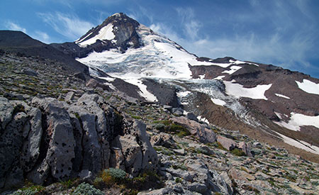
Proposal: Mitchell Point Loop Trails

Looking west in the Gorge from Mitchell Point

Looking west in the Gorge from Mitchell Point

Author’s note: this proposal is the latest in a series on this blog aimed at a major Oregon Parks and Recreation Department (OPRD) effort underway to update the 1994 Gorge Parks Plan. OPRD staff will make key decisions on future trail projects for the Gorge over the next four months, so now is the time to weigh in! More information on how to get involved in this important work is included at the end of this article.
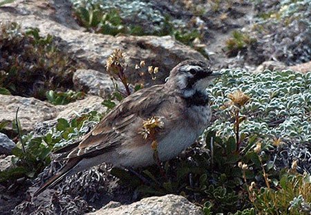
_________________

Mitchell Point is a rugged basalt spine that towers a thousand feet above the Columbia River, just five miles west of Hood River. This spectacular outcrop rises in the transition zone where the wet rainforests of the western Cascades meet dry Oregon white oak and Ponderosa pine country of the eastern slope in a unique jumble of ecosystems and geology.

The steep hike to Mitchell Point is described in this WyEast Blog article, and makes for an excellent year-round destination for hikers looking for something a bit less crowded (and a bit more rugged) than viewpoints like Angel’s Rest.

This article focuses on recent improvements to the Mitchell Point wayside and trailhead, and the potential to expand the trails at Mitchell Point to allow for better exploration of the unique landscapes found here, and a deeper appreciation of the colorful human history, as well.

Kudos on Recent Upgrades!
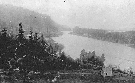
A short, new segment of the Historic Columbia River Highway State Trail leads to the refurbished Mitchell Point overlook

A short, new segment of the Historic Columbia River Highway State Trail leads to the refurbished Mitchell Point overlook

In 2012, the OPRD completed a major overhaul of the Mitchell Point wayside and overlook, with excellent results. Mitchell Point falls within the borders of the Vinzenz Lausmann and Seneca Fouts state parks, and has long served as a scenic wayside for highway travelers and as the trailhead for the Mitchell Point and Wygant trails.

The recent overhaul at Mitchell Point also acknowledges a new function for the trailhead: the Historic Columbia River Highway (HCRH) State Trail project will soon extend through the area, including a proposed tunnel through Mitchell Point, proper, that gives a nod to the iconic highway tunnel that once thrilled highway travelers here.

The restored overlook features a sweeping view of the Columbia Gorge and interpretive display on the iconic former Mitchell Point "Tunnel of Many Vistas"

The restored overlook features a sweeping view of the Columbia Gorge and interpretive display on the iconic former Mitchell Point “Tunnel of Many Vistas”

In many ways, the original Mitchell Point Tunnel, with it’s famous “windows” carved in solid basalt, was the scenic and engineering highlight of the old highway. Sadly, the tunnel (along with much of the original highway) was destroyed to allow for freeway widening in 1966.

The original Mitchell Point Tunnel as it appeared around 1920. The tunnel was destroyed to make way for freeway widening in 1966

The original Mitchell Point Tunnel as it appeared around 1920. The tunnel was destroyed to make way for freeway widening in 1966

The recent improvements to the Mitchell Point wayside include a redesigned parking lot (complete with native landscaping, bus and bike parking) and a series of handsome stone walls in the Columbia River Highway style that frame the Columbia River overlook. Interpretive history displays are posted in two locations, describing the colorful human history of an area that has now largely reverted to back to nature.

The short walk to the river overlook also gives a glimpse of the planned extension of the HCRH State Trail. As seen in the photo below, the broad paved path is actually a section of the state trail where it approaches the overlook, then bends toward the sheer cliffs at the base of Mitchell Point, ending at a log fence (for now). The proposed tunnel will eventually cut through Mitchell Point here, with a short side-tunnel to a river viewpoint somewhere near the midpoint.

The new section of the HCRH State Trail points toward a planned bicycle and pedestrian tunnel through Mitchell Point

The new section of the HCRH State Trail points toward a planned bicycle and pedestrian tunnel through Mitchell Point

New bicycle racks and native plants are part of the Mitchell Point facelift

New bicycle racks and native plants are part of the Mitchell Point facelift

The improved Mitchell Point wayside also includes a new information kiosk and upgraded restrooms, making this a nearly full-service starting point for hikers — with the sole exception of running water, as none is available at the wayside.

A surprising glitch in the generally excellent attention to detail is the wayside overhaul is an ill-placed square of landscaping in the middle of the paved information kiosk mini-plaza (below). The native salal planted in this tiny square of soil are surely doomed to be trampled by visitors, but more concerning is the impact on accessibility for mobility impaired visitors attempting to avoid this unnecessary obstacle. Fortunately, it’s easily fixed with a few sacks of concrete – hopefully before it becomes a problem.

This refurbished sign kiosk has an unfortunate glitch: an ill-placed patch of landscaping

This refurbished sign kiosk has an unfortunate glitch: an ill-placed patch of landscaping

A year-round, accessible restroom completes the upgrade at the Mitchell Point wayside

A year-round, accessible restroom completes the upgrade at the Mitchell Point wayside

Traces of the rich human history of the area can be seen throughout the Mitchell Point area, and the pair of new interpretive displays help put a face on the early settlements and businesses that once operated here. The history of the Mitchell Point “Tunnel of Many Vistas” at the overlook is excellent, and told with well-known images of this famous structure. But the history of the Little Boy Ranch and its operators found near the parking area is especially welcome, as it helps repeat visitors understand the many traces of old structures and even trees and landscape plants that can still be found sprinkled through the forest.

The Little Boy Ranch motel and cabins at Mitchell Point in the 1930s. The buildings were razed as part of freeway construction in the early 1960s

The Little Boy Ranch motel and cabins at Mitchell Point in the 1930s. The buildings were razed as part of freeway construction in the early 1960s

This 1920s Christmas card from Charles and Helena Parker's Little Boy Ranch featured their children, Charles Jr. and Joan

This 1920s Christmas card from Charles and Helena Parker’s Little Boy Ranch featured their children, Charles Jr. and Joan

While most of the historical traces at Mitchell Point are subtle and treasured, one is not: English ivy left over from the Little Boy Ranch days is rampant in several sections of the park, and unfortunately, the wayside upgrade didn’t include pulling ivy from the park. This is another oversight that can be easily corrected, as the ivy is mostly confined to the immediate wayside area, and is a good candidate for a volunteer public service projects.

Rampant English ivy is among the unwelcome traces of the Little Boy Ranch era at Mitchell Point

Rampant English ivy is among the unwelcome traces of the Little Boy Ranch era at Mitchell Point

Another surprising gap in the wayside and trailhead upgrade is the lack of signage for the Mitchell Point and Wygant trails that begin here. A few boulders and a bollard barricade have been installed at the old path leading toward the Mitchell Point Trail, but there is still no signage to help visitors navigate the trail (below).

New bollard and boulders, but no sign to mark the Mitchell Point trail?

New bollard and boulders, but no sign to mark the Mitchell Point trail?

Worse, the actual trail to Mitchell Point splits off the paved path as an obscure, unsigned boot path, while the paved route continues (confusingly) to a few picnicking sites (below). This oversight is easily remedied, though there is some question whether OPRD really views the Mitchell Point trail as one of its own, despite the growing use and popularity. Now is good time for the state parks to finally embrace this trail, starting with needed signage.

The formal Mitchell Point Trail is even more obscure, but this is an easily corrected oversight in the OPRD restoration project

The formal Mitchell Point Trail is even more obscure, but this is an easily corrected oversight in the OPRD restoration project

The Wygant Trail fares somewhat better, with an existing HCRH-themed sign posted about 100 yards west of the Mitchell Point wayside, along a surviving segment of the old highway. But better signage at the wayside is needed to help hikers actually find this trail. This is another oversight that is relatively easy to correct, and in this case, could be incorporated into the planned improvements to the HCRH that are coming to this area.

A surviving segment of the old highway serves as the start of the Wygant Trail, though existing signage is obscure

A surviving segment of the old highway serves as the start of the Wygant Trail, though existing signage is obscure

Despite these oversights, the upgrade to the Mitchell Point wayside and trailhead are a big step forward, with excellent attention to detail and continuity with other recently improved parks and waysides in the Gorge. Kudos to the OPRD for their efforts!

The remainder of this article focuses on new trails that could be added to the park, building on existing facilities and the new HCRH State Trail with new hiking loops that explore the area.

Proposal: West Loop Trail

The first leg of an expanded trail system would be a new route traversing a series of open slopes to the west of Mitchell Point, joining the existing Mitchell Point Trail just below the main summit ridge (see map below)

MitchellPointTrails15

[click here to open a large map in a new window]

A highlight of this new 0.8 mile trail would be a close-up look at the stunted Oregon white oak groves that somehow survive on the dry, windy slopes here. Though not the western-most stand of oaks in the Gorge, this colony is among the most accessible, and the new trail would provide an opportunity for casual hikers to learn about this unique and fascinating ecosystem.

Oregon white oak in the Gorge often grow in picturesque, stunted groves on the harshest of sites

Oregon white oak in the Gorge often grow in picturesque, stunted groves on the harshest of sites

Oak galls are formed by wasp larvae, and are common on Oregon white oak leaves

Oak galls are formed by wasp larvae, and are common on Oregon white oak leaves

This new trail would also be built with a less demanding grade than the existing Mitchell Point Trail, giving less hardy hikers a more manageable option for reaching the summit.

Combined with the existing Mitchell Point Trail, the new would create a 2.6 mile loop for active hikers. Casual hikers and young families could make a shorter hike, with the beautiful oak stands and river views less than one-half mile from the trailhead as the main destination (perhaps with a couple of well-placed trailside benches).

Proposal: East Loop & Mitchell Spur

The east slope of Mitchell Point is unknown territory, even to hikers familiar with the area. This part of the proposal includes a new trail connection along the east slope, from the crest of Mitchell Point to the planned HCRH State Trail, creating a loop hike via the proposed new HCRH tunnel (see map, below).

MitchellPointTrails18

[click here to open a large map in a new window]

A lower loop would also be created with an extension of the existing boot path that leads to the foot of Mitchell Spur, the familiar basalt prow that towers over the highway at Mitchell Point. A formal side path would lead to the viewpoint atop the spur, providing another less strenuous alternative for casual hikers to the somewhat challenging Mitchell Point summit trail.

Mitchell Spur (left) is the lower rampart of Mitchell Point (right) in this highway view

Mitchell Spur (left) is the lower rampart of Mitchell Point (right) in this highway view

Mitchell Point looms above in this view from Mitchell Spur

Mitchell Point looms above in this view from Mitchell Spur

The east loop would join the Mitchell Point trail at this point along the summit ridge

The east loop would join the Mitchell Point trail at this point along the summit ridge

Combined with the existing Mitchell Point trail, the proposed East Loop would create a 3.6 mile hike, including stops at the summits of Mitchell Point and Mitchell Spur. Another option would be a loop using both the east and west trail proposals, a 3.8 mile round trip that would avoid the somewhat rugged talus section of the existing Mitchell Point trail altogether. Other loops from the Mitchell Point trailhead would also be possible, including the ability to follow the planned extension of the HCRH State Trail.

Yet another possibility that comes with the completion of the HCRH State Trail is the idea of a bike-and-hike trailhead for the proposed East Loop trail, where bicycle parking could be provided to allow cyclists to ride and park at the base of the trail. This concept has great potential for other trails that will eventually stub out at the completed HCRH State Trail — including the Wygant Trail in the Mitchell Point area.

What would it take?

The proposals in this article focus on relatively simple, affordable trail projects. Each of the proposed trail segments build on existing trailhead facilities and planned HCRH improvements in the area, while providing a significantly expanded series of hiking opportunities.

Sweeping river vistas from the summit leg of the Mitchell Point trail

Sweeping river vistas from the summit leg of the Mitchell Point trail

The proposals also lend themselves to volunteer construction, as the easy access from Portland and Hood River would allow public agencies and trail advocates in the region to easily organize volunteer crews to clear and build trails incrementally.

Most importantly, the OPRD is now in the process of updating its 1994 master plan for the Columbia Gorge, and it’s a crucial opportunity to bring new trail ideas into the plan! The OPRD recognizes the demand for new trails in the area, and is actively seeking ideas for projects that are both affordable and ecologically sustainable. The proposals in this article meet both tests, and ought to be included in the updated plan.

What You Can Do!

First, take a look at the Gorge Parks Plan website — our state recreation planners have done an exceptional job scoping the state of our Gorge parks as a starting point for updating the 1994 plan.

Next, weigh in on why new trails are important in the Gorge — and here are some of the proposals posted in this blog as a starting point:

Angels Rest Loop Proposal

Bridal Veil Canyon Proposal

Latourell Loop Makeover Proposal

Viento Bluff Trails Proposal

Mitchell Point Trails Proposal

Finally, consider signing up as a subscriber to the Gorge Parks Plan blog to stay informed. A surprisingly small number of dedicated citizens have been involved thus far in this public process, so you have an opportunity to make a real impact! More information on the Gorge planning effort to come in this blog, as well.

And as always, thanks for doing your part to advocate for the Gorge!

Restoring the Sahalie Falls Bridge

East Fork Bridge at Sahalie Falls as it appears from the modern Loop Highway

East Fork Bridge at Sahalie Falls as it appears from the modern Loop Highway

After years of delay and public agency wrangling, the long-awaited restoration of the East Fork Bridge at Sahalie Falls (henceforth simply called the “Sahalie Falls Bridge” in this article) began this summer. The project is advancing under a division of the Federal Highway Administration (FHWA) responsible for roads on public lands, and is scheduled for completion this year.

The Sahalie Falls Bridge was constructed as part of the final leg of the Mount Hood Loop Highway in the late 1920s. The bridge was completed in 1928, and is the most dramatic nod to the Samuel Lancaster’s Columbia River Highway on the Mount Hood portion of the loop highway.

Construction of the East Fork Bridge in 1928 (USFS)

Construction of the East Fork Bridge in 1928 (USFS)

The structure was designed by federal lands bridge engineer H.R. Angwin as a graceful arch, spanning the East Fork directly in front of Sahalie Falls, with decorative railings and sidewalks built to allow travelers to stop and take in the inspiring views.

Complementing the idyllic setting is a cobblestone-faced drinking fountain, installed at the east end of the bridge. The fountain once provided a continuous supply of ice-cold mountain water to visitors, and was one of three original stone fountains placed along the Mount Hood portion of the old loop highway.

Sparkling new Sahalie Falls bridge and fountain in the early 1930s

Sparkling new Sahalie Falls bridge and fountain in the early 1930s

The bridge carried loop highway traffic well into the 1950s, until the modern-day Highway 35 was built, bypassing this section of the old road. The new “straightened” highway not only deprived travelers of seeing Sahalie Falls, it also skipped the mountain views across beautiful Hood River Meadows, just east of the falls on the old road.

Today, this bypassed section of the old highway remains open to the public (when snow-free) and will be drivable again once the bridge restoration is complete.

Who was H.R. Angwin?

One of the mysteries of the old bridge at Sahalie Falls is the life of the designer and builder, Henry Raymond (H.R.) Angwin. Public records show him to be the Senior Bridge Engineer in the San Francisco office for the U.S. Bureau of Public Roads from the 1930s through the 1950s. Over the span of his career, Angwin designed dozens of bridges in the western states.

Oakland Tribune Sunday, September 30, 1917

BETROTHALS HOME WEDDING

In a picturesque setting of pink, Miss Neville Stevenson became the bride last night of Henry Raymond Angwin. Eighty relatives [witnessed the] ceremony read by Dr. John Stevenson and William Angwin.

The bride wore a smart frock of white and silver with a conventional tulle veil and orange blossoms, and carried a shower bouquet of lilies of the valley. Her attendant, Miss [Mabel] Gustaffson, blonde as the bride is dark, was in pretty contrast to pink satin and tulle. The bride’s gown was taupe broadcloth with a chic taupe hat white fox furs accenting the tulle.

Mr. and Mrs. Angwin [will] leave for an extended trip through the east, visiting the interesting cities en route. The bride is the daughter of Mr. and Mrs. A. V. Stevenson, whose home on Newton Street was the scene of the pretty service. Returning to Oakland, the young people will take an apartment in the Piedmont.

H.R. Angwin was born in 1889, graduated from Oakland High School in California in January 1907, and married Neville Stevenson ten years later, in 1917. They had been married 52 years when H.R. Angwin died in 1969. Neville Angwin died twelve years later, in 1981.

The Angwins had at least two children, Joy and Robert. Joy died as an infant, and is buried at Mountain View Cemetery in Oakland with her parents.

Mountain View Cemetery in Oakland, resting place of the Angwins (Wikimedia)

Mountain View Cemetery in Oakland, resting place of the Angwins (Wikimedia)

Cemetery marker for Henry, Neville and Joy Angwin (BillionGraves.com)

Cemetery marker for Henry, Neville and Joy Angwin (BillionGraves.com)

H.R. Angwin designed and built a number of familiar Oregon bridges during his tenure as a federal bridge engineer. The East Fork Bridge at Sahalie Falls was one of his first, completed in 1928. Two years later, Angwin designed and built the larger, and equally graceful Salmon River Bridge in Lincoln County. This hard-working gem also survives today, carrying heavy traffic on Highway 18 to the Oregon Coast.

H.R. Angwin's Salmon River Bridge in Lincoln County

H.R. Angwin’s Salmon River Bridge in Lincoln County

Several other Angwin bridges are scattered across Oregon, but most notable in the Mount Hood area are the steel truss bridges built along the Clackamas River Highway in the 1950s: Carter Bridge, Armstrong Bridge, Whitewater Bridge and Cripple Creek bridge all continue to carry traffic today.

(Author’s note: sadly, not much has been written about H.R. Angwin’s long career as a federal bridge builder, so this part of the article is included in hopes of improving awareness of his contributions, and perhaps inspiring further accounts of life)

The 2013 Restoration Project

Frost damage to the railings on the Sahalie Falls Bridge in 2009

Frost damage to the railings on the Sahalie Falls Bridge in 2009

The Sahalie Falls Bridge had begun to show signs of serious deterioration by the late 1990s, and by the mid-2000s, whole chunks of the north railing were breaking loose — sadly, helped along by vandals pulling at the exposed rebar.

Railing Damage on the East Fork Bridge in 2009

Railing Damage on the East Fork Bridge in 2009

By 2008, the Oregon Department of Transportation (ODOT) had blocked vehicle access to the bridge, and a project was proposed in the state highway budget to restore the bridge. The original ODOT restoration project later evolved to become a FHWA project by 2011.

The restoration focuses on three areas of needed repair: (1) rebuilding the approach abutments on both ends of the bridge, (2) replacing the heavily damaged north railing cap and (3) restoring the footing on the historic fountain at the east end of the bridge (there may be other repairs planned, but there is little information available for this project, so this list covers the repairs underway as of October of this year).

Construction at the old bridge was finally in full swing in September 2013

Construction at the old bridge was finally in full swing in September 2013

Restoring the bridge abutments involves pouring new reinforced concrete footings at each end of the bridge span and improving surface drainage at the west end to direct storm runoff away from the bridge. The gravel pullouts at both ends of the bridge also appear due for grading and resurfacing as part of the project, as they currently serve as construction staging areas.

The following images show the recent drainage work at the west end, along the approach to the west bridge abutment (as of mid-October), including a recently installed culvert (under the wet fill in the first photo) to address the drainage issues apparent in the earlier 2009 photo (second photo):

Major drainage work is underway as part of reconstructing the west bridge abutment

Major drainage work is underway as part of reconstructing the west bridge abutment

Repeated repairs to the abutment and debris washed onto the roadway is apparent in this 2009 view of the west approach to the bridge

Repeated repairs to the abutment and debris washed onto the roadway is apparent in this 2009 view of the west approach to the bridge

Repairs to the north railing cap extend for the full length of the bridge, with the new cap seated on original concrete railings. As of mid-October, the forms for the new cap had been constructed and were ready to be poured, presumably with concrete, topped by sand mortar. The next series of images show more detail of the railing cap replacement:

Forms in place for pouring a new cap along the north railing

Forms in place for pouring a new cap along the north railing

The forms for the new caps are secured from below with screw clamps

The forms for the new caps are secured from below with screw clamps

Close-up view of the wood forms constructed for the new railing cap

Close-up view of the wood forms constructed for the new railing cap

A peek inside the railing caps (below) shows careful attention to original design details, including quarter-round trim along the outer edges. New reinforcing rods are wired to the original rebar posts embedded in the rails.

When the new caps are poured, masons will use a screed (board) cut with a low arch to repeat the slightly curved top seen in the original cap. The plastic sheeting attached to the forms will be secured over the newly poured caps to slow the curing process to ensure a strong set.

A peek into the railing cap forms shows careful attention to original design details

A peek into the railing cap forms shows careful attention to original design details

In a nearby pile of demolition rubble, chunks of the old railing cap show the quarter round detail that follows the outer edge of the caps

In a nearby pile of demolition rubble, chunks of the old railing cap show the quarter round detail that follows the outer edge of the caps

The south railing is not part of the restoration project, apparently because of its relatively sound condition

The south railing is not part of the restoration project, apparently because of its relatively sound condition

The third element of the Sahalie Falls Bridge project is replacement of a portion of the concrete footing that supports the historic cobble-faced fountain. In the 2009 photo (below) you can see where a section of the fountain base facing the East Fork (behind the fountain) had sunk toward the creek over time, threatening the stability of the fountain.

The sunken east abutment and partially sunken footing on the old fountain can be seen in this 2009 view

The sunken east abutment and partially sunken footing on the old fountain can be seen in this 2009 view

The bowl and rim of the old fountain were restored at some point in the more recent past, and are not part of the current project. The fountain is one of three that survive along the loop highway. The fountain at Buzzard Point still functions, while the fountains at Sahalie Falls and Sherwood Campground (below) are no longer operational and simply serve as rain basins.

The bowl and rim of the fountain were restored at some point in the more recent past

The bowl and rim of the fountain were restored at some point in the more recent past

The three historic Mount Hood Loop fountains, compared

The three historic Mount Hood Loop fountains, compared

[Click here for a larger comparison photo]

This view shows the new concrete footing in place on downslope side of the old fountain

This view shows the new concrete footing in place on downslope side of the old fountain

Crews saved this piece of the old fountain footing -- perhaps to be repurposed as a bench?

Crews saved this piece of the old fountain footing — perhaps to be repurposed as a bench?

Once the restoration project is complete, the Sahalie Falls section of the old loop will re-open to traffic. For the past decade or so, the route has been signed as one-way at the west end, where it connects to the Bennett Pass interchange, so the best way to explore the old highway is follow the signs to Hood River Meadows, then turn left onto the old road before reaching the Meadows resort parking.

Celebrating the Historic Sahalie Falls Bridge

Now that the restoration work is finally underway, the stage is set for some much-needed visitor improvements to the Sahalie Falls area. The view of the falls from the historic bridge is missed by too many travelers, and the odd near-miss with the Umbrella Falls trail (just 100 yards from the bridge, but with no trail connection) has resulted in some messy boot paths formed by hikers attempting to see Sahalie Falls.

This proposal would address both issues, and make it easier to visit the old bridge and falls, whether as a spur from nearby hiking trails, or simply by pulling off Highway 35.

Sahalie Falls trail proposals

Sahalie Falls trail proposals

[Click here for a large map]

The first part of the proposal is a short hiking spur from the bridge to the nearby Umbrella Falls Trail. This would be a very simple trail to build, and could easily be constructed by volunteers. It would not only provide a safe way for hikers to view the falls, but would also allow for the various boot paths along this slope to be decommissioned, and some of the trampled vegetation to be restored.

The pullout on Highway 35 at Sahalie Falls is wide enough to easily allow for roadside parking and a new trailhead

The pullout on Highway 35 at Sahalie Falls is wide enough to easily allow for roadside parking and a new trailhead

The second part of the proposal is an accessible loop trail that would allow the elderly, disabled and families with small children to experience the East Fork in a new way.

The trailhead for the new loop would be at the east end of an existing pullout on Highway 35, where the historic highway bridge can be seen from the modern loop road. The first leg of the new loop trail would follow the East Fork to the base of little-known Lower Sahalie Falls, a charming waterfall hidden in the canyon beneath the historic bridge.

Lower Sahalie Falls

Lower Sahalie Falls

From here, the new accessible loop trail would cross the East Fork in front of the lower falls and gently traverse up the west slope of the canyon to the west bridge approach. Once at the old highway grade, the new path would cross the historic bridge, providing a view back to the trailhead pullout on Highway 35.

View down the East Fork to Highway 35 from the historic Sahalie Falls Bridge

View down the East Fork to Highway 35 from the historic Sahalie Falls Bridge

Visitors to the bridge inevitably cross to admire the views from both sides, so an accessible route would probably warrant a marked crossing at the two bridgeheads, where people using mobility devices could most safely access the sidewalks.

After enjoying the views from the bridge, visitors would continue past the east end to a resumption of the new loop trail, following the east leg back to the trailhead. The total distance of the accessible loop would be about 0.3 miles with a very modest elevation gain of about 60 feet.

View of Sahalie Falls from the historic loop highway bridge

View of Sahalie Falls from the historic loop highway bridge

Accessible trails are often paved, but for this new route, a better option would be fine gravel, mostly because it would provide better traction in an often wet environment. But the proposed loop is also within the deposit zone for winter highway snow removal that sends a lot of grit used to sand icy roads far into the adjacent forest. A gravel trail surface could actually be enhanced by these annual deposits, where a paved surface would require sweeping to remove winter gravel.

What Would it Take?

As with all proposals in this blog, the Sahalie Falls accessible trail concept relies on the U.S. Forest Service — and in this case, Oregon Department of Transportation — acknowledging the need for more recreational and interpretive opportunities in the Gorge and on Mount Hood.

While the proposed spur connection to the Umbrella Falls trail could be built by volunteers, the proposed accessible loop trail would be a major endeavor that could only be accomplished by the Forest Service in conjunction with ODOT.

The original USGS survey marker at the east end of the bridge has been uncovered from years of debris

The original USGS survey marker at the east end of the bridge has been uncovered from years of debris

The added twist in this proposal is the need for an accessible trail, something in very short supply in our region despite a rapidly growing elderly and disabled population. Oregon State Parks and Recreation has made great strides in responding to this need in recent years, but the Forest Service lags behind badly, with few accessible facilities built in the last 30 years.

Fortunately, a new guide for designing accessible trails has recently been developed by the Access Recreation project, an ad-hoc organization formed to develop better design guidelines for public agencies involved in trail-building.

SahalieFallsBridge28

The guidelines are now available on the Access Oregon website, and cover everything from trail surface and slope recommendations to best practices for signage and trailside amenities that address the needs of elderly and disabled trail users. It’s a great resource for trail advocates and public agencies, alike — and could help shape new trail options on Mount Hood!

Proposal: Viento Bluff Trails

Looking west from the summit of Viento Bluff

Looking west from the summit of Viento Bluff

This is the third in a series of new trail proposals for Oregon State Parks land in the Columbia Gorge. This article follows previous proposals for a Bridal Veil Canyon Trail and Angels Rest Loop. All three have the potential to fit into the Oregon State Parks and Recreation (OSPRD) master planning for the Columbia Gorge that is happening right now.

Like the Angels Rest Loop and Bridal Veil Canyon proposals, this trail would be aimed at families, vacationing visitors to the region and those trying out hiking for the first time. Unlike the earlier proposals, the Viento area is little known to most who visit the Gorge. For a moderate effort, this proposal would provide explore the unique, transitional ecosystem found in the mid-section of the Gorge, as well as some sweeping views and towering cliffs.

Trail map of the proposal

Trail map of the proposal

(Click here for a larger map)

The Viento proposal stitches together several rustic service roads that already exist with new trail segments that would take hikers to three separate, cliff-top viewpoints. All three viewpoints rise high above the popular campgrounds at Viento State Park, and would provide an excellent, moderate hiking challenge for campers and day-visitors, alike.

The map above shows the proposed network of trails, and the oblique view, below, gives a sense of the steep topography that would make the Viento area so interesting as a hiking destination.

Perspective view of the proposal

Perspective view of the proposal

(Click here for a larger map)

The proposed Viento Bluff trails would also build on a planned extension of the mostly-complete Historic Columbia River Highway (HCRH) State Trail, providing bike-and-hike opportunities along this emerging, world-class facility. A six-million dollar extension of the trail will soon extend east from the Viento Trailhead to Perham Creek, completing another link in a route that will eventually extend from Troutdale to The Dalles.

A bit of history on the name “Viento” is in order. While the word means “windy” in Spanish — an often fitting name for this narrow spot in the Gorge — the name was actually coined in the 1800s for an early railroad stop in the area using the first two letters from the surnames of railroad builder Henry Villard, one of his investors, William Endicott, and a local railroad contractor named Tolman (the origin of the name and other local history can be found on an interpretive display near the entrance to Viento State Park).

The following is a detailed description of the three viewpoints that make up the Viento Bluffs and proposed trails that would lead to them.

Viento Bluff Trail

Viento Bluff is a familiar landmark to those traveling I-84

Viento Bluff is a familiar landmark to those traveling I-84

The main focus of the proposed trail network is Viento Bluff, the most prominent of the rocky outcrops that rise above Viento State Park, and a familiar landmark to travelers passing through the Gorge.

While Viento Bluff rises as sheer, 300-foot vertical wall on its north face, the steeply tilted basalt flows that form the bluff have a relatively gentle, meadow-covered south slope. The proposed summit trail would circle the bluff to reach this southern approach.

Historic CCC path along Viento Creek

Historic CCC path along Viento Creek

The trail would begin at the existing day use parking area at the Upper Viento Campground, initially traveling on an existing footpath that follows Viento Creek into its shady, forested canyon. Here, the project would consist of a new footbridge connecting the existing trailhead to the old footpath, and improving the existing tread to basic trail standards.

Historic CCC path

Historic CCC path

The existing footpath appears to be one of the many vestiges of the Civilian Conservation Corps (CCC) in the Viento area. The CCC was created by Franklin D. Roosevelt as part of his Great Depression-era “New Deal” to put young men to work making infrastructure improvements to public lands across the country.

Several stone retaining walls in the area, the original (upper) Viento campground and a collapsed campground water house still remain from the CCC period. The surviving footpath originally led to the water house, but now terminates at its moss-covered ruins, along a pretty section of Viento Creek.

Remains of the old CCC water house along Viento Creek

Remains of the old CCC water house along Viento Creek

From near the end of the existing footpath, the proposed route would turn east, climbing the slope to Viento Bluff in an easy traverse along a heavily used game trail. The deer and elk have done a find job in this section, with a grade that works well as a hiking trail!

Game trail leading from Viento Creek to the bluff

Game trail leading from Viento Creek to the bluff

Soon, this game trail reaches a forested saddle behind Viento Bluff, and enters one of the most lush, abundant stands of poison oak anywhere in the Gorge — one of the few obstacles to realizing the Viento Bluffs trail.

While it’s an ominous sight for anyone sensitive to poison oak, routing a trail to the bluff through this section would be less difficult than appearances might suggest. The open, meadow-covered south slope of the bluff is only about 20 yards beyond the poison oak section, so the exposure would be no more than many trails in the Gorge that pass through poison oak patches. But it would need to be built carefully, and maintained accordingly.

Poison Oak heaven in the saddle south of Viento Bluff!

Poison Oak heaven in the saddle south of Viento Bluff!

From the saddle, the route reaches the stuff of a dirt service road approaching from the east (more about that in a moment), and from this point, the proposed summit trail would begin an exceptionally scenic ascent of Viento Bluff’s south slope, traversing a steep meadow in switchbacks through scattered White Oak and Ponderosa Pine.

The south slope of Viento Bluff as viewed from the East Bluff

The south slope of Viento Bluff as viewed from the East Bluff

The summit of Viento Bluff is exposed on three sides, with vertical drops into the forest below. If this were a remote wilderness viewpoint, simply terminating the viewpoint trail at the top would be safe enough. But because it’s a state park with families and less-experienced hikers, some sort of cable or wood railing would probably be needed here. The wood railings at the Bridal Veil State Park overlook might be a good model for this site, and easily constructed here.

Gorge panorama from Viento Bluff

Gorge panorama from Viento Bluff

The view from the summit of Viento Bluff is impressive, especially given the relatively moderate climb required. The rocky slopes of Dog Mountain dominate the view across the Columbia River, and the sweeping panorama extends as far west as Table Mountain and east to Mitchell Point and the town of White Salmon, beyond.

The summit is quite spacious, providing room for visitors to sit and spend some time taking in the scene or having a trailside picnic. It is also far enough above the busy river corridor to be largely beyond the noise of traffic, while still allowing for interesting views of trucks, trains and barges passing by in the busy transportation corridor provided by the Columbia River Gorge.

East Bluff Trail

The East Bluff as seen from Viento Bluff

The East Bluff as seen from Viento Bluff

The second trail in this proposal would lead from the Upper Viento Campground and trailhead to the East Bluff, an impressive basalt outcrop that is nearly as imposing as Viento Bluff. The East Bluff rises directly above I-84, yet is oddly less visible from the freeway, and therefore less familiar to travelers.

The route to the East Bluff would begin along the proposed extension of the HCRH State Trail, east of the Upper Viento Campground. From a point along the State Trail route, about one quarter mile beyond the campground, a primitive service heads south, climbing the steep ravine between the East Bluff and Viento Bluff. This spur road soon reaches in the power line corridor that crosses the saddle to south of the two bluffs.

Mitchell Point and White Salmon in the distance from the East Bluff

Mitchell Point and White Salmon in the distance from the East Bluff

From the saddle, one fork of the service road heads to the right, to Viento Bluff, as mentioned previously in this article. Along with the proposed new trail from Viento Creek, this route would create a loop hike to Viento Bluff, and a connection to the East Bluff (see map).

The left fork of the service road heads toward the East Bluff. This proposal calls for a new trail here, leaving the service road and traversing the open south slopes of the East Bluff in switchbacks.

The view west toward Dog Mountain and Stevenson from the East Bluff

The view west toward Dog Mountain and Stevenson from the East Bluff

The views from the East Bluff are expansive, encompassing the same stretch of the Gorge as the view from Viento Bluff, but including a unique perspective of Viento Bluff, itself.

The true summit of the East Bluff has a brass 1939 U.S. Geological Survey marker stamped “Viento”. The survey marker dates to the year when Bonneville Dam had just been completed, along with the old power line corridor behind the bluffs that took power from the new dam to Hood River and points east — likely the reason for a survey marker in this spot.

USGS marker on the summit of the East Bluff

USGS marker on the summit of the East Bluff

The summit of the East Bluff is quite broad, and even somewhat brushy in spots. But several dramatic viewpoints ring the edges — much like Angels Rest in the western Gorge, but with a lot less effort. Like Viento Bluff, the cliffs are extremely exposed, and would require some sort of cable or wood fencing, given the location in a state park and relatively easy access.

The loop connection to the proposed Viento Bluff trail (from Viento Creek) would allow for both summits to be included on a longer hike, or simply a hike around Viento Bluff for those who don’t want to climb the actual summit.

West Bluff Loop Trail

West Bluff from the Viento interchange

West Bluff from the Viento interchange

The third piece of the Viento proposal is a short loop trail to the west bluff, a basalt wall rising 250 feet above the Viento interchange and Upper Viento Campground trailhead.

The purpose of the West Bluff trail is to provide a more approachable destination for less ambitious or able-bodied hikers and families with small children. While not as imposing as Viento Bluff and the East Bluff, the West Bluff still delivers impressive views of the Columbia Gorge and an interesting, almost aerial view into the Viento Campground and interchange area, directly below.

This service road would form the east leg of the West Bluff trail loop

This service road would form the east leg of the West Bluff trail loop

The east leg of the loop would follow an existing dirt service road south from the existing trailhead, then fork uphill along a second service road that crosses within a few hundred yards of the West Bluff crest. A spur trail would climb the last stretch to the cliff-top viewpoints. Like the other summits, some sort of fence or railing would be in order here, as the cliffs drop over 200 feet to the trailhead below.

The west leg of the loop would be a new trail climbing a ravine directly below the West Bluff, connecting to the new summit spur. The complete West Bluff loop would cover less than a mile, and gain less than 300 feet elevation, yet give hikers a real sense of achievement. The West Bluff loop would also be the closest of the proposed trails to the main Viento Campground, so well situated to serve campers interested in a modest hike.

An interesting option for the West Bluff trail would be a barrier-free route. While this would be a much more substantial undertaking, it would be one of the few viewpoint trails in the Columbia Gorge available for visitors with limited mobility.

What would it take?

Much of this proposal builds on the repurposing of existing service roads to become wide trails — at least most of the time. The idea is to allow utility workers to access these roads when needed, but functioning as wide trails as their primary purpose. The service roads are owned and maintained by the Bonneville Power Administration (BPA), and see little use by the agency, so a shared purpose might be a way for the BPA to partner with Oregon State Parks to enhance and maintain these routes.

Historic retaining wall at Viento from the CCC era

Historic retaining wall at Viento from the CCC era

There are also several new hiking trail segments in this proposal. All would be straightforward to build, with few topographic or environmental obstacles. Because they are located in a highly accessible area (access from I-84), these new trails could be excellent candidates for construction by volunteer groups like Trailkeepers of Oregon.

Upper Viento Campground restroom is within a few yards of the trailhead

Upper Viento Campground restroom is within a few yards of the trailhead

The HCRH State Trail already has a major trailhead at Viento

The HCRH State Trail already has a major trailhead at Viento

One of the advantages of expanding hiking opportunities in the Viento area is the potential to take advantage of the existing recreation infrastructure: two campgrounds, a day use area, a large supply of trailhead parking, restrooms within a few yards of the trailhead, access to the HCRH State Trail and direct freeway access to I-84. Adding new trails to the area would simply make better use of these existing amenities in addition to enhancing the camping experience at Viento State Park.

What can you do..?

If you like this proposal, there is a unique opportunity to weigh in right now and make your voice heard: share your comments with Oregon Parks & Recreation Division (OPRD), the state agency that operates Viento State Park, and the sole agency responsible for trail planning in the park.

Seldom-seen rubber boa spotted along Viento Creek

Seldom-seen rubber boa spotted along Viento Creek

Over the next year the state is conducting a long-range planning effort to scope future recreation needs in the Gorge. [url]You can weigh in with your thoughts over here.[/url] So far, the State Parks have had fairly light participation in their public outreach, so it’s important to make your views known!

Please consider including links to the Veinto Bluffs, Bridal Veil Canyon and Angels Rest Loop proposals in this blog when you comment — here are the quick links to paste into your message:

Proposal: Bridal Veil Canyon Trail

Angels Rest Loop: One Way Trip to Heaven?

https://wyeastblog.org/2013/09/22/proposal-viento-bluff-trails/ ‎

And as I’ve pitched in previous articles, please consider supporting Trailkeepers of Oregon, a non-profit, grass-roots organization that offers meet-up trail stewardship projects in the Gorge and around the region (full disclosure: the author is a founding and current board member of TKO and number one fan of the organization!)

Angels Rest Loop: One Way Trip to Heaven?

Looking across the Columbia River in winter to the Silver Star Range from Angels Rest

Looking across the Columbia River in winter to the Silver Star Range from Angels Rest

The popular hike to Angel’s Rest in the Columbia River Gorge is a rite of passage for long-time Oregonians and newcomers alike, because for many of us, this beautiful trail was our first hiking experience. I first hiked the trail sometime in the 1970s, and have returned many times over the years — most memorably, on the inaugural Trailkeepers of Oregon stewardship project in April 2008.

The (formerly skinny and shaggy) author on top of Angels Rest in 1981 and an older, wiser and (and much balder) version in 2013!

The (formerly skinny and shaggy) author on top of Angels Rest in 1981 and an older, wiser and (and much balder) version in 2013!

The trail has a lot to offer, with sweeping views of the Columbia River Gorge and a brief streamside section along Coopey Creek (which cascades over a pair of waterfalls below the trail). Since the Multnomah Falls Fire of 1991, the hike has offered a close-up look at a recovering forest along the upper reaches of the trail. The 1,600 elevation gain over 2.4 miles to the top of Angels Rest is within reach for most hikers, yet challenging enough to give any hiker a thrill when reaching the rocky, often blustery summit.

The Angels Rest trail also has the distinction of being among the most accessible to Portland, with a trailhead located at a freeway interchange 30 minutes from downtown, and with enough parking to supply a small army. Add the emergence of year-round hiking on our low-elevation trails in recent years, and the unfortunate result is one of the most rapidly deteriorating trails in our region.

The Angels Rest trailhead was expanded and improved in 2000 to include stone walls and trailhead signage in the style found elsewhere along the Historic Columbia River Highway

The Angels Rest trailhead was expanded and improved in 2000 to include stone walls and trailhead signage in the style found elsewhere along the Historic Columbia River Highway

The gradual deterioration of this old trail takes many forms. Along the lower section, the once-narrow traverse across moss and fern-covered talus slopes has broken down, with the path now straddling trees (the original trail is the upper third of the tread):

AngelsRestLoop04

Over time, this could damage the roots of the tree in the above photo to a point where it cannot survive. This threatens not only the tree but also the trail, as tree roots are critical in holding steep, loose Gorge slopes together in a climate where annual rainfall exceeds 100 inches per year.

This badly eroded spot is the overlook above Coopey Falls, along the lower trail:

AngelsRestLoop05

The damage here is fairly obvious: the original trail hugged the vegetation line along the right, but the crush of hikers attempting to view the falls has stripped away both vegetation and soil on the left. Over time, this has left roots of trees clinging to edge of the cliffs below exposed and unlikely to survive, making the trees themselves less likely to survive.

Beyond the Coopey Falls viewpoint, the trail reaches the first of many sections showing the impact of year-round hiking on the trail. Here, winter hikers have worn the new path to the left of the main trail tread in an effort to avoid standing water and mud in the main trail, which has become trenched from overuse:

AngelsRestLoop06

Further up the trail, the path has become so wide that the edges are almost hard to determine:

AngelsRestLoop07

The hikers in the distance in the view above offer a clue as to how this happens: as trails widen from overuse, hikers start waking side-by-side. It’s a natural instinct, but one that the trails were never designed to accommodate.

The scene below shows another example of winter hikers wearing down the edges of the formal trail in an effort to stay out of the mud:

AngelsRestLoop08

While walking adjacent to the trail might work for the first few hikers along one of these sections, in the end, it just creates more mud during the wet season — and an even wider trail as hikers continue to push the edges of the trail outward.

Until a few years ago, the effects of hiking were on display to epic proportions along an upper section of trail, where an enormous mud pit formed as hikers continued to walk ever higher on the shoulders of the widening trail:

AngelsRestLoop09

The section shown above devolved so badly that in 2008, the [url]Trailkeepers of Oregon (TKO)[/url] worked with the U.S. Forest Service to simply bypass that segment with a new trail alignment. The following photo shows TKO volunteers constructing this new section in April 2008:

AngelsRestLoop10

While the new trail was built to a conventional width, the continued heavy, year-round crush of hikers has since “widened” this section to nearly double its original width in just five years:

AngelsRestLoop11

The upper trail includes several switchbacks, and these are traditionally the Achilles heel of any Gorge trail. Newbie hikers and kids can’t seem to resist cutting switchbacks.

Normally, this is manageable by simply blocking shortcuts to discourage the relatively small number of rogue hikers. But with the heavy foot traffic on the Angels Rest Trail, the sheer volume of switchback cutting overwhelms the trail, turning well-designed turns into a muddy, sloping mess:

AngelsRestLoop12

The above switchback was also built with the trail relocation project in 2008, and has barely survived five years of heavy travel from Angels Rest hikers.

The long-term answer to overuse at Angels Rest is to provide new, badly needed hiking alternatives in the Columbia Gorge, such as the Bridal Veil Canyon Trail proposed on this blog.

But Angel’s Rest needs help, too. One way to help this old trail survive for future generations to enjoy is to simply cut the traffic in half — not through restrictions or trail fees, but by creating a one-way hiking loop. The rest of this article outlines a proposal for making this happen.

Creating an Angels Rest Loop Trail

Winter view into the Gorge from Angels Rest

Winter view into the Gorge from Angels Rest

The concept of a one-way Angels Rest loop is simple: construct a separate, new route to Angels Rest that would form the return leg of the loop. The result would instantly cut the number of boots on the Angels Rest Trail by half, allowing the existing sections to be rehabilitated so that this old trail can last indefinitely.

AngelsRestLoop14

[click here for a large map]

The proposed loop trail would split from the existing route about 0.2 miles from the trailhead, just before the current route heads across the lower talus slopes (see map, above). The existing trail would continue to be 2-way for the first 0.2 miles, where the gentle terrain allows for a wider trail.

The new route would function as the downhill portion of the loop so that it could be designed with downhill travel in mind. This would include a gentle incline and minimizing the number of switchbacks compared to the current route. This could have tremendous benefits for the existing route, as a disproportionate share of trail damage to the existing route is from hikers speeding downhill.

Upper Coopey Falls would be a highlight of a connector between the new and existing trails

Upper Coopey Falls would be a highlight of a connector between the new and existing trails

The new return trail would also be designed to have a mid-point connection to the existing trail via a new bridge across Coopey Creek at Upper Coopey Falls (pictured above). The purpose of this connection is to bring hikers to the upper falls on a formal trail where several muddy boot paths have already been worn into the canyon walls by hikers seeking a view.

The mid-point connection would also allow less hardy hikers or families with small children to simply complete a lower loop of just over a mile in length, while still respecting the one-way trail system. The mid-way connector would also lead lower-loop hikers past beautiful Coopey Falls, one of the highlights of the proposed return trail.

The new trail would take hikers past the base of beautiful Coopey Falls, located on public land, but currently only reachable by crossing private property

The new trail would take hikers past the base of beautiful Coopey Falls, located on public land, but currently only reachable by crossing private property

From the summit of Angels Rest, the proposed return route would descend through the hanging valley immediately east of summit. This new route would skirt little-known Foxglove Falls, a wispy 120-foot seasonal cascade hidden in the forest, then switchback down to a basalt bench that wraps around the base of Angel’s Rest. Here, the trail passes through the fire zone, and would have broad views of the Gorge before descending in a gentle curve to the new junction at the Upper Coopey Falls connector trail.

The proposed loop trail would traverse below these cliffs on the north side of Angels Rest

The proposed loop trail would traverse below these cliffs on the north side of Angels Rest

From the Upper Coopey Falls connector, the new route would continue to descend, passing the base of Coopey Falls on a new footbridge, then traversing west, where it would reconnect with the main trail near the trailhead, completing the loop.

The new trail would have views like this of the Columbia River Gorge

The new trail would have views like this of the Columbia River Gorge

The new return trail would travel 1.7 miles in its descent, exactly the same length as the climb along the existing trail. Thus, the hike to Angel’s Rest along the new loop would retain the same mileage and elevation gain as it does today.

The Gorge viewpoints along the proposed new trail, along with stops at Foxglove Falls, Upper Coopey Falls and Coopey Falls, would be significant enhancements to the hike, making a classic trail even better. So, what would it take to realize this proposal?

An Idea within Reach…

This 1911 map shows an upper trail to Angels Rest from the long-vanished mill town of Palmer, long before the Depression-era trail we know today was constructed

This 1911 map shows an upper trail to Angels Rest from the long-vanished mill town of Palmer, long before the Depression-era trail we know today was constructed

The proposed loop trail would be built entirely on public lands, and much of the work could be done by volunteers working in partnership with the Forest Service. Beyond the actual trail, here are some of the other elements of the project, and more opportunities to involve volunteers in the work:

Footbridges: the proposed new loop trail would require two new footbridges: at Coopey Falls and Upper Coopey Falls. These could be excellent volunteer opportunities, as volunteers have helped construct other trail bridges in the Gorge in recent years

Invasive Species: like many spots in the western Gorge, the slopes of Angel’s Rest host invasive species – in particular, English ivy, Himalayan blackberry and Shiny Geranium. The new loop trail segment would actually improve the ability to control these species by providing new access to affected areas. Native plant advocates could become partners in the project in order to remove invasive plants as part of trail construction.

Even on the grayest of winter weekends, cars spill far beyond the overflow parking area at Angels Rest, lining the shoulders of the Historic Highway

Even on the grayest of winter weekends, cars spill far beyond the overflow parking area at Angels Rest, lining the shoulders of the Historic Highway

Trailhead Facilities: the existing parking area, including the large overflow area and shoulder parking along the Historic Columbia River Highway, is more than adequate to serve the proposed loop. In fact, the loop is in response to a trail that is inadequate for the parking! But the trail does not have restroom facilities, a serious deficiency with unpleasant repercussions for a site that can have as many as 100 cars on a busy weekend. The Forest Service and Oregon State Parks and Recreation could partner to address this need as part of creating the loop trail.

Ongoing Stewardship: ongoing maintenance of the trail is also well suited for volunteers, and could be a blueprint for a new, more intensive effort to keep trails in top condition, addressing trail damage before it spirals. The trailhead is close to Portland and easy to find, and the proposed loop route would be short enough for most volunteers to navigate with equipment, or when carrying out debris. The low elevation of the trail means more opportunities for volunteer work, and the beauty and close proximity to Portland would make it an attractive volunteer option.

What can you do?

Angels Rest was one of the scenic highlights along this 1938 Auto Club guide to the Historic Columbia River Highway.

Angels Rest was one of the scenic highlights along this 1938 Auto Club guide to the Historic Columbia River Highway.

If you like this proposal, there area couple of opportunities to weigh in right now and make your voice heard:

1. Send off an e-mail to the staff at the Columbia River Gorge National Scenic Area: here’s the link (you can use the feedback form at the bottom of their web page). This is the federal agency responsible for most of the trails in the gorge, and would be the lead agency in making this loop happen.

2. Weigh in with Oregon Parks & Recreation Division (OPRD), the state agency that operates the series of state parks along the Historic Columbia River Highway. While much of the proposed Angels Rest loop trail travels on U.S. Forest Service lands, the loop also crossed state parks lands. Over the next year the state is conducting a long-range planning effort to scope future recreation needs in the Gorge. You can weigh in over here, using their blog comment format to make your voice heard.

The State Parks and Forest Service national scenic area staff work together to plan and maintain trails in the Columbia River Gorge, so weighing in with the state planning effort is an opportunity to make any of your ideas on recreation needs known to both agencies. So far, the State Parks have had fairly light participation in their public outreach, so it’s important to make your views known!

Don’t be shy about including links to the Bridal Veil Canyon and Angels Rest Loop proposals in this blog, either — here are the quick links to paste into your message:

https://wyeastblog.org/2012/01/15/proposal-bridal-veil-canyon-trail/

https://wyeastblog.org/2013/08/31/angels-rest-loop-one-way-trip-to-heaven/

Finally, consider supporting Trailkeepers of Oregon (TKO), a local non-profit, grass-roots organization that offers meet-up trail stewardship projects in the Gorge and around the region (full disclosure: the author is a founding and current board member of TKO and number one fan of the organization!)

Billy Bob, meet Joe Spandex…!

BillyBob01

This article is the second in a series of proposals for new “bikepacking” areas around Mount Hood and in the Gorge — places where cyclists can ride to overnight, off-road campsites. As with the earlier Waucoma Bicycle Backcountry proposal, the concept here is to convert fading logging roads into dual-track bicycle routes, complementing existing single-track trails that already exist in the area.

This proposal focuses on the potential for the Billy Bob Sno-Park to be put to work year-round, using the otherwise vacant facility in the snow-free season as the gateway to a new mountain bike network. The trailhead would become the hub of the newly created Mount Hood National Recreation Area (NRA) unit that covers the Fifteenmile Creek canyon backcountry, and was designed with backcountry bicycling in mind.

The Billy Bob Trailhead

The Billy Bob Winter Shelter

The Billy Bob Winter Shelter

The existing Billy Bob Sno-Park features a winter shelter, complete with wood stove, and is provided for snowmobiles and Nordic skiers. A local snowmobile club is under contract with the Forest Service to groom some forest roads as snowmobile routes, while ski trails are un-groomed and seldom used. Snowshoers also use Billy Bob as a base for reaching the nearby Fivemile Butte and Flag Point lookouts, as both can be rented during the winter.

The winter shelter is at the south end of a very large, paved turnaround suitable for up to 40 vehicles, including trailers carrying snowmobiles. Like the nearby Little John SnoPark, the parking area appears to be an asphalt relic from the logging heyday of the 80s and 90s, originally serving as a loading area for log trucks.

Plenty of parking here..!

Plenty of parking here..!

A pit toilet is also located here, at the northwest corner of the turnaround, opposite the shelter. Presumably, the toilet is kept snow-free in winter, but is also open in summer (though not regularly serviced… ahem!) to the rare visitor in the off-season. There is no water provided at Billy Bob.

The "modern" pit toilet at Billy Bob is relatively new

The “modern” pit toilet at Billy Bob is relatively new

In addition to winter use by snowmobiles and occasional skiers and snowshoers, Billy Bob is sometimes used as a base camp during the fall hunting season, as the surrounding area remains popular for hunting.

Fortunately, the site is far enough from population centers and major highways that it has largely been spared from the dual scourge of illegal dumping and target shooting that plagues similar pullouts and trailheads on the west side of the mountain.

The Proposal

BillyBob05

Click here for a large map

How would the new Fifteenmile Canyon bicycle backcountry work? The first step would be conversion of a number of old logging roads in the area to become dual-track bike trails. In this way, the routes could also continue to function as snowmobile or ski trails in the winter. These proposed routes are shown in yellow on the map.

Next, a few new dual-track trails are proposed (in solid red) where they would better connect the existing network of logging tracks and directly connect the Billy Bob site to nearby drive-up campgrounds at Pebble Ford and the Underhill Site. Abandoned logging spurs make up the bulk of these new routes, so little new construction would be required to complete these dual-track gaps.

Recovering ponderosa forests in the area are a reminder of the clearcutting heyday of the 80s and 90s

Recovering ponderosa forests in the area are a reminder of the clearcutting heyday of the 80s and 90s

The purpose of dual-track trails is to provide less experienced cyclists and families with young kids a less challenging, more relaxed alternative to single track for trail riding. Dual-track routes allow for cyclists to easily pass on the trail, so are a good solution for busy trails where riders with a range of skill levels are expected. The dual-track design would also allow for safer shared use by cyclists, hikers and horses.

In Fifteenmile Canyon, the proposal calls for converting several roads to dual track to create a loop system located along the boundaries of the new Mount Hood NRA. The dual track loop would be gated, with motorized entry limited to service vehicles for maintenance or emergency access.

Stands of large ponderosa and larch are still intact within the canyons of the Eightmile NRA

Stands of large ponderosa and larch are still intact within the canyons of the Eightmile NRA

Within the proposed dual-track loop system, the NRA is centered on the steep maze of gulches, draws and ravines that form thousand-foot deep Fifteenmile Creek canyon. Three existing hiking trails (dashed black on map) extend into the canyon, one following Fifteenmile Creek, and two climbing the north and south slopes of the canyon, connecting to area campgrounds.

The proposal would fill in a few gaps in the existing single-track trail network that explores the Fifteenmile Creek backcountry, including (in dashed red on map) a new route that would extend west from the creek canyon to Bulo Point, a lovely, almost forgotten viewpoint, treated badly during the recent logging bonanza. A new single-track tie would connect the Pebble Ford and Fifteenmile campgrounds and short tie near Fraley Point would complete the single-track system.

Ridgetop meadows and interesting rock outcrops are found throughout the area

Ridgetop meadows and interesting rock outcrops are found throughout the area

The trails at the heart of the Fifteenmile Creek backcountry traverse some of the most ecologically diverse terrain in Oregon, from sun-baked Oregon white oak stands and open balsamroot meadows on sunny slopes and ridgetops to giant ponderosa and western larch parklands along canyon slopes. There are even lush, shady Western red cedar and red alder groves tucked along Fifteenmile Creek.

The proposal calls for three new bicycle camps within this beautiful, quiet backcountry. These campsites would consist of 4-6 groomed tent sites, one or two picnic tables, fire rings and secure bike racks — a comfortable step up from the truly primitive level of wilderness, but still providing a rustic backcountry experience. This, after all, is what the NRA was created for!

The Billy Bob concept calls for 3-way sharing by trail users

The Billy Bob concept calls for 3-way sharing by trail users

A total of ten trailheads are shown on the proposal map. Some already exist, some would be new, but all would need to be upgraded under this proposal to be geared toward backcountry cyclists. This includes a complete trail map with difficulty ratings for trail segments, information on the backcountry camps and “share the trail” information for all users — as these trails would continue to serve hikers and horses, as well as cyclists.

Connections to Points Beyond

Views into the Columbia Basin desert abound from the many high points in the Fifteenmile backcountry

Views into the Columbia Basin desert abound from the many high points in the Fifteenmile backcountry

The main focus of the Billy Bob trailhead proposal is the “bikepacking” potential for the Fifteenmile Canyon backcountry, but a wealth of nearby destinations are close enough to make for fine day trips from the proposed new trailhead.

Nearby Fivemile Butte is already a popular goal for cyclists, with a lookout tower and picnic tables that provide for a rewarding destination. The Flag Point Lookout is also within reach, and still in service during the summer, providing an especially interesting destination, as the lookout staff usually welcome visitors with a tour of the tower.

Cyclists visiting the Fivemile Butte Lookout

Cyclists visiting the Fivemile Butte Lookout

Lookout Mountain is also within reach, although the summit trail falls within the Badger Creek Wilderness, and thus is off-limits to bikes. But cyclists can still ride to High Prairie on a mix of trails and primitive roads and make the short final ascent of the mountain on foot — an equally satisfying option to riding.

The remote Flag Point Lookout is still staffed in summer

The remote Flag Point Lookout is still staffed in summer

The Boy Scouts operate Camp Baldwin just to the north of the proposed bicycle backcountry, with a summer camp program that draws thousands of scouts each year. The camp program includes mountain biking into the surrounding forests, so the proposed Fifteenmile bicycle backcountry would be a natural fit for the Scouts. Even better is the possibility of an ongoing partnership between mountain biking organizations and the Scouts to build and maintain trails in the area over the long term.

Does it Make Sense?

The Surveyors Ridge area to the west of Billy Bob and Fifteenmile Canyon is already a very popular cycling destination, with overflowing trailheads on most summer weekends, so there seems more than enough demand to justify this proposal. More importantly, the Fifteenmile backcountry would provide a unique, overnight “bikepacking” experience for cyclists that doesn’t exist elsewhere on Mount Hood’s east side.

Cyclist on popular Surveyors Ridge (The Oregonian)

Cyclist on popular Surveyors Ridge (The Oregonian)

An emerging bicycle sport that could complement summer riding on the proposed trail nework is “fat biking” or snow biking. Fat bikes use oversized tires to put cyclists on snow-covered trails in winter, and it’s possible that the Billy Bob trailhead and proposed bicycle network could serve this growing form of cycling.

BillyBob14

Likewise, Nordic skiing and snowshoeing are continuing to grow in popularity, and though winter access to the Billy Bob trailhead is a long ride from the Portland area it could provide an important option for Gorge-based visitors looking for something away from the Portland crowds that often overwhelm Mount Hood on winter weekends.

What would it take?

Like the earlier [link=]Waucoma Bicycle Backcountry[/link] proposal on this blog, the viability of this proposal is in its simplicity: less than eight miles of new trail would open a 50-mile network, with dozens of loop options that could be tailored to the ability of individual mountain bikers.

Most of the work required could be done with the help of volunteers, from trail building and campsite development to signage and ongoing maintenance. Some heavy equipment would be required to develop the main trailhead at Billy Bob and to decommission vehicle access on some of the converted roads, and would have to be provided by the Forest Service.

Views from the open ridgetops in Fifteenmile Backcountry extend north to Mount Adams and Mount Rainer in Washington

Views from the open ridgetops in Fifteenmile Backcountry extend north to Mount Adams and Mount Rainer in Washington

The proposal would also require the Forest Service to fully devote the Fifteenmile Canyon to quiet recreation during the snow-free months. A few years ago, that would have been unlikely, but in recent years, the agency has not only adopted plans to phase out hundreds of miles of logging roads, but also adopted a new policy to focus OHV use in a few, very specific areas of the forest.

These recent developments could move this proposal if public support exists for a bicycle backcountry, although the Forest Service will need continued support from quiet recreation advocates to convert old logging roads to trails: recently, the agency has put plans to phase out old roads in the Barlow Ranger District that encompasses the Fifteenmile backcountry on hold, due in part to pressure from OHV groups.

The good news is that mountain bicycling organizations are already working hard to develop trails elsewhere in the Mount Hood region and hopefully would find this proposal worth pursuing, too. If you’re a mountain biker, you can do your part by sharing this article with like-minded enthusiasts, or your favorite mountain biking organization that could serve as a champion!
____________

Bikepacking Resources:

Bikepacking.net is an online community that focuses on off-road touring, away from cars, with great information on gear, routes and trip planning.

The Adventure Cycling Association posted this helpful article on how to pack for your bikepack trip.

The International Mountain Bicycling Association (IMBA) is the premier organization and advocate for backcountry bicycling.

In the Mount Hood region, the Northwest Trail Alliance is the IMBA Chapter doing the heavy-lifting on bicycle trail advocacy.

The IMBA has a guide to fat biking.

Highway 26: Last Chance to weigh in!

Mount Hood from the Mirror Lake Trail

Mount Hood from the Mirror Lake Trail

After several years of planning, the proposed safety projects on the Mount Hood Highway (Highway 26) are nearly a done deal, and have entered a final round of public review and comment — with comments due April 7th!

The project has been the subject of several articles on this blog, and thankfully, has been scaled-back somewhat from the original, old school “widen for safety” retread of 1950s highway mentality that dominated earlier phases in the corridor. That said, the project has simply moved from a failed grade to something like a C-minus, at best. It needs your input to be more than an eyesore for the traveling public.

Google Earth perspective on the US26 Laurel Hill Grade

Google Earth perspective on the US26 Laurel Hill Grade

The highway section in question is the Laurel Hill grade, west of Government Camp. Ever since Oregon Trial pioneers lowered their covered wagons down the infamous talus “chute” on Laurel Hill, this spot has vexed road designers.

The current highway alignment is no exception: despite blasting away a good portion of Laurel Hill, the road is still a steep, curving, often treacherous route. The need for safety improvements is on the mark, but it’s unclear if the solutions proposed by the Oregon Department of Transportation (ODOT) will deliver, as some of the best (and least expensive) recommendations from their own safety study were dropped from the project at the very start.

It’s not to late to add some of these more practical, potentially more effective solutions to the project, even if the highway engineers seem determined to widen the road and chip away more of Laurel Hill as their preferred solution. More on how you can weigh in at the conclusion of this article.

US26Comments02

(click here for a larger map in a new window)

But first, an overview of the ODOT final proposal is in order, starting with kudos to the agency (yes, you read that right!) for greatly improving their public involvement. Having reviewed a lot of ODOT projects over the years, I’m impressed with the effort the agency has made in this final round of outreach for Highway 26.

Though in-person open houses have continued to be limited to the Welches area (despite the fact that the vast majority of highway users — and taxpayers — live in the metro area), the web tools provided by ODOT in this round of public review are especially well done, and arguably a better format for most citizens than traditional open houses.

The Project

The following are “before-and-after” digital renderings of the major elements of the Highway 26 safety project. A link to the ODOT virtual open house is included at the end of this article, and includes these renderings at much larger scale.

The number shown on each pair of images corresponds to the map shown above (or you can click here to open a large version of the map in a new window or tab). The tour starts from the west, at the base of the Laurel Hill grade, and proceeds east toward Government Camp.

US26Comments03

The project begins at the west (lower) end of the Laurel Hill grade. A number of small changes are proposed along this approach, but the most notable is proposal to cut back the cliff at the “Map Curve”, the ODOT name for the wide bend in the highway where Mount Hood first looms into view — a very popular, if somewhat harrowing pullout for visitors.

The rendering above shows what the scaled-back cliff at the Map Curve would look like from the west, as you pass the familiar road cut and rock outcrop known by ODOT as “Silent Rock. As the renderings show, the scaled-back cliff would be a major undertaking. The purpose of this element of the project is to prevent rocks from falling on the highway. According to ODOT, this is safety concern in the area, and the cause of numerous crashes over the years.

US26Comments04

This is another before-and-after rendering of the scaled-back cliff, this time looking west from near the Map Curve toward the base of Laurel Hill. This view shows another proposed feature: a continuous concrete median, extending from just below the Map Curve to just above the Mirror Lake trailhead, for a total of about 2.5 miles.

The ODOT plans for the median call for an “aesthetic” concrete that complements natural material found in the area. The capped concrete median (installed near Bennett Pass) pictured in public outreach materials would, indeed, be a significant improvement over a standard barricade:

US26Comments04a

Unfortunately, the design pictured in the ODOT before-and-after renderings, omit the faux cap, greatly diminishing the “aesthetic” qualities of the proposed barriers.

Other highway departments around the country are experimenting with similar “context sensitive” alternatives for concrete medians in natural or scenic environments, such as this example from CalTrans, installed in the San Luis Obispo area:

US26Comments04b

The cost of aesthetic medians will be a major driver in the ODOT final decision, but the longevity of the medians (30-40 years?) call for getting it right the first time. ODOT should be installing something special that truly enhances the Mount Hood Highway experience, not just something “less worse” than a standard freeway barricade.

The next rendering (below) is from the Map Curve, this time looking east toward Mount Hood. This view also shows the proposed median as well as the scaled-back cliff.

US26Comments05

It’s hard to argue with the need to reduce hazardous rock fall in the Map Curve area, except to imagine a parallel universe where foresighted engineers had tunneled through Laurel Hill when the modern highway was originally built..!

But alas, the current alignment is our reality, and based on the materials provided by ODOT, the scaled-back cliff is another least-worst solution for the problem. The engineers are proposing a steeper-than-standard cliff face when completed, but with a larger catchment at the base, thus (hopefully) reducing the number of rocks that make it to the roadway while also minimizing the amount of road widening to accommodate the catchment.

The towering road cut at the Highway 26 “Map Curve” will get taller and much longer under the ODOT safety proposal (photo: ODOT)

The towering road cut at the Highway 26 “Map Curve” will get taller and much longer under the ODOT safety proposal (photo: ODOT)

ODOT surveyed the existing cliff with the aid of a helicopter, and the scope of this element of the project is truly daunting: as shown in the image above, the man-made cliff is already very large, and making an even taller cut will be a tricky endeavor, indeed.

This element of the project appears to already be a done deal, so the best we can hope for is that the resulting scars on the landscape aren’t any more jarring than what can already be seen (and heard) from nearby recreation trails. Keep your fingers crossed.

US26Comments06

The next rendering (above) is from a point just beyond the Map Curve, looking back at the curve and the adjacent runaway truck ramp (a feature that dates back to the late 1970s). As with the previous views, the changes here include the scaled-back cliff section and continuous concrete median.

Next up is a before-and-after view toward the mountain from high saddle on Laurel Hill where the highway crosses from the south face to the north side of the ridge. This spot is familiar to travelers as the site of the historic Laurel Hill Chute interpretive sign and trail. The rendering shows the proposed median, road widening to 4-lanes and another substantially scaled-back cliff section to address reported rock fall hazards.

US26Comments07

Notably absent from this rendering is a new pullout and trailhead for the historic Laurel Hill Chute site, hopefully just an oversight by the artists. ODOT has not suggested in the written materials for the project that trail access at this point will be eliminated. This is a detail worth commenting on if visiting this fascinating remnant of the original Oregon Trail is one of your family traditions.

The next before-and-after rendering (below) is from the same section of road, also looking east, but from the bottom of an embankment on the opposite side of the highway, where the Pioneer Bridge Trail parallels the road. Here, a structural retaining wall is proposed to provide the additional roadway width needed to widen the highway to four lanes and add the center median. Kudos to ODOT for a context-sensitive solution with this retaining wall: the rendering suggests it will be constructed with faux-stone facing, thus lessening the visual blight for hikers, cyclists and equestrians using the trail, if not the overwhelming noise from highway traffic.

US26Comments08

The proposed widening to 4 lanes in this section is significantly scaled back from earlier incarnations of the Laurel Hill safety project. This is a welcome change to the design, as ODOT’s own safety data shows only occasional spikes in traffic volumes — on holidays and peak summer and winter weekends — that road widening would do little to resolve. Most of the time, traffic volumes on Highway 26 are far below built capacity, and the few (and arguably avoidable) traffic jams that occur don’t warrant costly widening projects.

The final before-and-after view is from opposite the Mirror Lake trailhead, looking west (downhill) toward Laurel Hill. Here, the rendering shows another proposal to cut back an existing slope to address rock fall and sight distance concerns, the upper extent of the proposed median and another section of highway proposed to be widened to 4 lanes.

The Mirror Lake trailhead is unquestionably dangerous, thanks to very heavy use and its location on a relatively steep curve. The proposed median will should eliminate the possibility of crossover crashes throughout its proposed 2.5 mile extent, but is especially warranted at this location.

US26Comments09

However, the median will also prevent left turns in and out of the Mirror Lake trailhead, forcing hikers approaching from Portland to continue west to Government Camp to make their return trip. With the median terminating just east of the trailhead, visitors will be tempted to make a U-turn, a potential hazard ODOT has not addressed in the proposal.

Likewise, visitors coming to Mirror Lake from Government Camp will have to drive 3.5 miles to the bottom of Laurel Hill, and presumably turn around at the Kiwanis Camp junction in order reach the trailhead.

Civil disobedience ensued in 2010 when ODOT abruptly closed the Mirror Lake trailhead to winter parking

Civil disobedience ensued in 2010 when ODOT abruptly closed the Mirror Lake trailhead to winter parking

These changes at Mirror Lake will be unwelcome news to hikers who have already chafed at the recent winter closure of the trailhead by ODOT. In the end, it’s probably a “least worst” trade-off in the interest of traffic safety, but ODOT could be doing much more to make this element a real step forward for Mirror Lake visitors.

For example, it’s hard to tell from the “after” rendering, but the Mirror Lake trailhead appears unchanged: this is a missed opportunity, as ODOT will spend tens of millions on the overall Laurel Hill safety project, and a more carefully and aesthetically designed parking area here, separated from the highway traffic, could further improve traffic safety.

US26Comments11

ODOT has a lot of recent experience in this area from their excellent trailhead parking improvements in the Columbia River Gorge, including Angels Rest, Horsetail Falls and Yeon State Park. These relatively new designs provide a perfect template for the Mount Hood Highway, and follow the aesthetic lead ODOT has already taken in recent years with context sensitive designs for the Multorpor overcrossing and Government Camp signage, for example.

Getting it right the first time!

The current round of projects coming to the Mount Hood Highway are the most recent in a string stretching back decades, and clearly will not be the last. Though the final designs ODOT is proposing in the interest of “safety” are less destructive than some of the initial concepts, there are still a number of missed opportunities and questionable “solutions” on the table.

1920s motorists enjoying the view from a kinder, gentler Mount Hood Highway in 1931

1920s motorists enjoying the view from a kinder, gentler Mount Hood Highway in 1931

It’s probably too late to turn back some of the more questionable elements, but there’s still time to advocate where opportunities have been missed. Here’s a rundown of some additions that could make this project more successful. Consider adding these to your own comments!

1. Retain the Laurel Hill Chute Trailhead: this important historic site has been a family stopping point for generations, and must not be lost to road widening. ODOT should propose an improved pullout for visitors at the current trailhead.

2. Make the Mirror Lake Trailhead a showpiece: ODOT should follow its own lead with new trailheads built in the Gorge, and make this trailhead more than just a dusty highway pull-off. Mirror Lake is the “gateway” trail for many first-time visitors to the mountain and the pullout and trailhead ought to be designed accordingly.

3. Use architecturally enhanced medians: the proposed exposed aggregate medians are a tiny step in the right direction, but this element of the project will be the most visible to the traveling public. Let’s aim higher with architecturally themed medians that coordinate with recent improvements to the Government Camp streetscape — and at a minimum, the capped design used at Bennett Pass.

4. Look for storm water solutions to protect Camp Creek: the project is silent about the ongoing effects of polluted Highway 26 runoff on adjacent Camp Creek, a salmon and steelhead-bearing stream. ODOT will be putting down an immense amount of asphalt and new road fill with this project, so will they also improve storm water capture in the process?

5. Don’t wait to install variable speed signs & photo radar: this is one of the least expensive solutions in ODOT’s own safety audit, but moved to the back of the line from the very start. Why wait? Install variable speed limit signs and photo radar now for use during hazardous conditions.

6. Extend the Highway 26 Safety Corridor: ODOT bravely reduced the posted speed limit to 45 MPH from Wildwood to Rhododendron in an earlier phase of the Highway 26 safety campaign. Now it’s time to extend this safety corridor to Timberline Road. It’s an inexpensive, extremely effective safety solution whose time as come — plus, reduced speeds greatly reduce noise impacts for those living along the corridor and recreating on nearby public lands, a dual benefit.

7. Develop a long-term strategy for the resorts: the dirty little secret in ODOT’s 15-year campaign to address safety in the Mount Hood corridor is that almost all of the crashes occur in winter, on a few weekends when the roads are icy. It’s not rocket science to deduce that most of this is due to the huge spikes in traffic coming from the three major ski resorts on the mountain. It’s time to manage winter resort traffic comprehensively, and give skiers real alternatives to driving to the mountain in adverse conditions (more on that in a future article…)

In the long term, the most sustainable solution for the highway is to manage it as a scenic parkway, and put an end to the constant, incremental creep toward becoming an unmanageable, unlivable urban freeway sprawling over the shoulder of iconic Mount Hood (…more on that in a future article, as well…)

Go ahead, weigh in… by April 7th!

ODOT has done a very good job assembling a “virtual open house”, so if you care about Mount Hood and want to weigh in on their plans, it really couldn’t be easier. Simply go to their project website and explore:

Highway 26 Virtual Open House

Remember, comments are due by April 7th! While it’s true that many of the project elements are likely a done deal, you can still have an impact by making your concerns known. Projects like this have a sizable “contingency” budget set aside for this very reason, and now is the time to guide how those funds (your tax dollars) are spent!

The original Laurel Hill grade in the 1920s, shortly after the Mount Hood Highway opened

The original Laurel Hill grade in the 1920s, shortly after the Mount Hood Highway opened


____________________________

For more background on this proposal, you can also read these previous WyEast Blog articles on the topic:

Highway 26 Widening: Part 1

Highway 26 Widening: Part 2

Highway 26 Widening Postscript… and Requiem?

Tollgate Maples… and the Highway