Fire-free Mount Hood Wilderness?

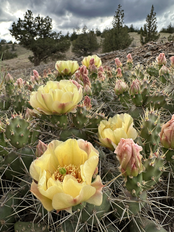
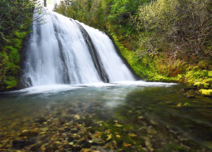
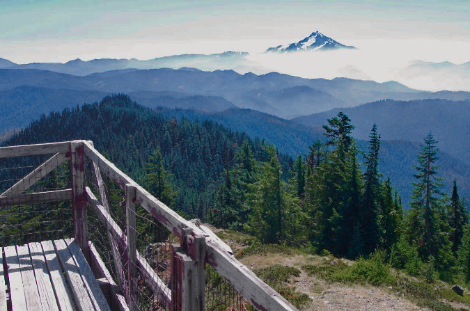
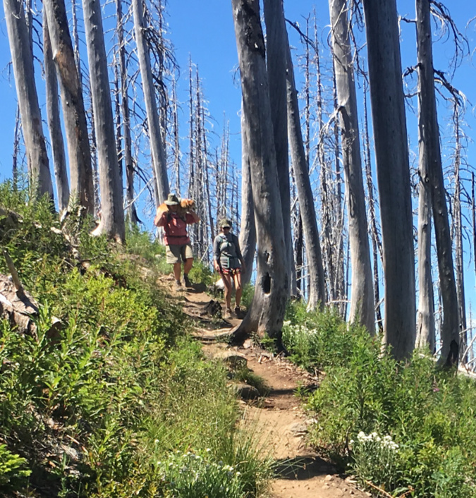
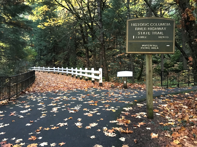
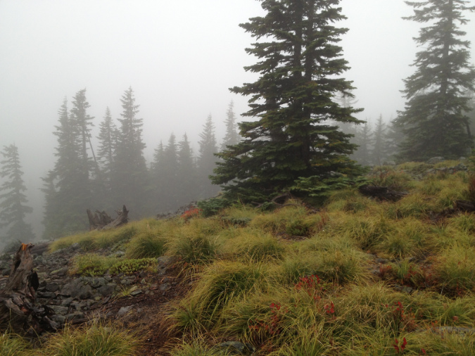
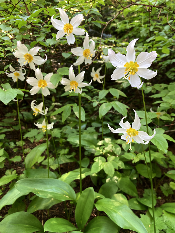
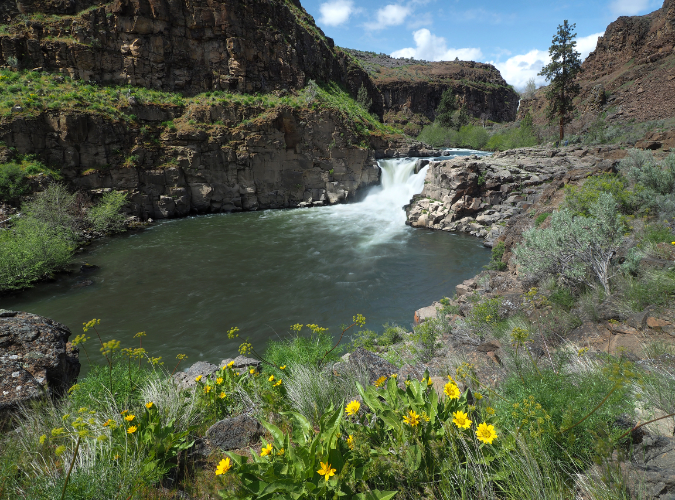
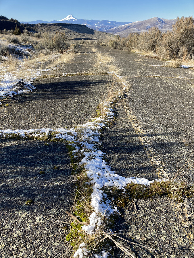
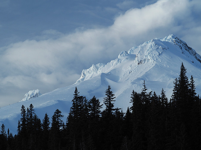
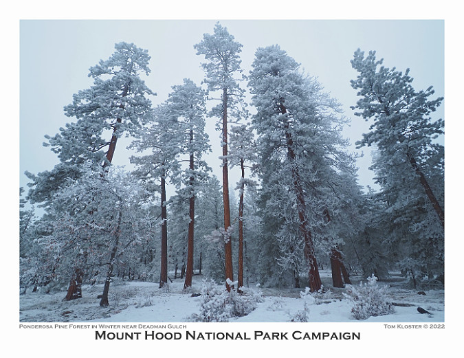
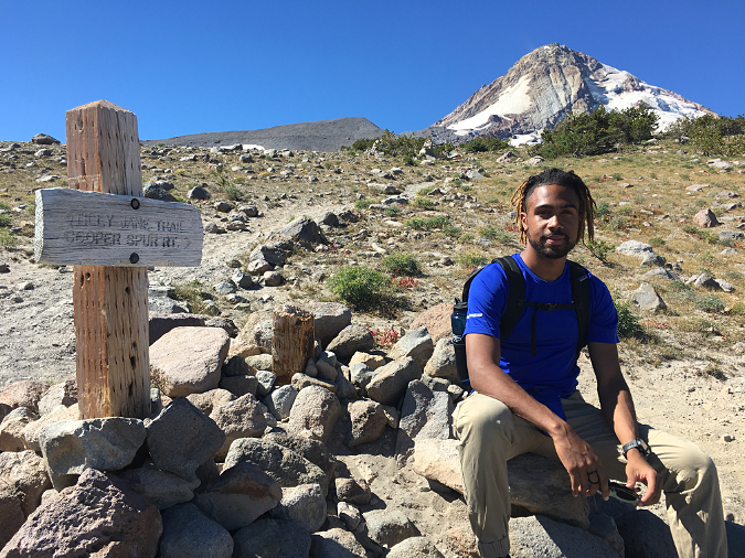
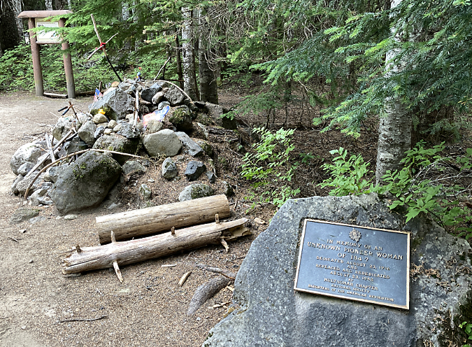
The ancient Whitebark pines on Gnarl Ridge have managed to dodge wildfires for centuries through their rugged isolation, but can they survive our wilderness campfires?

Fire season was off to an ominous start this year with the Rowena and Burdoin fires sweeping across hundreds of acres of oak and pine savannah in the Gorge, destroying several homes. Yet, these early fires were a bit of an anomaly. Thus far, at least.  We enjoyed a healthy, lingering snowpack in the Cascades this summer, and despite a late-August heat wave and the fires currently burning in sagebrush country east of the mountains, we’ve had a mostly cooler summer that seems more like 1980s than our overheated summers of today. 

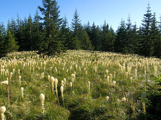
I’ve pointed this out to a fair number of younger hikers on the trail this summer while crossing rejuvenated snowfields on the Timberline Trail in early August. Until sometime around 2000, when the effects of climate change seemed to be visibly escalating, this is what summers were like here: a three-month drought with a couple heat waves, to be sure, but mostly moderate temperatures and even a few wet summer storms to break up the dry spell. 

Our unexpected respite from extreme heat this year could also blunt the severity of our annual wildfire season, though it bears remembering that some of our most destructive firestorms have happened in September.

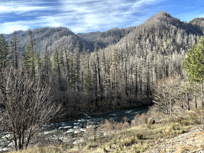
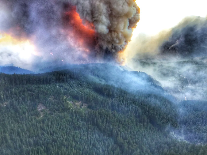
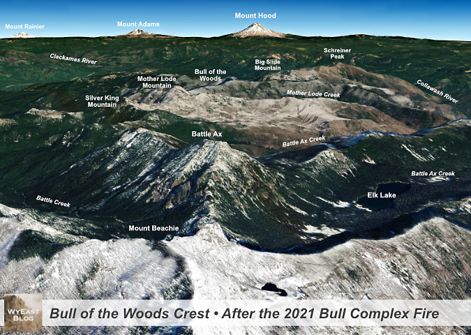
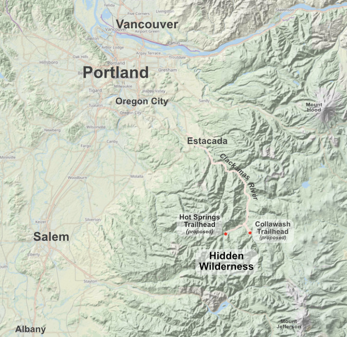
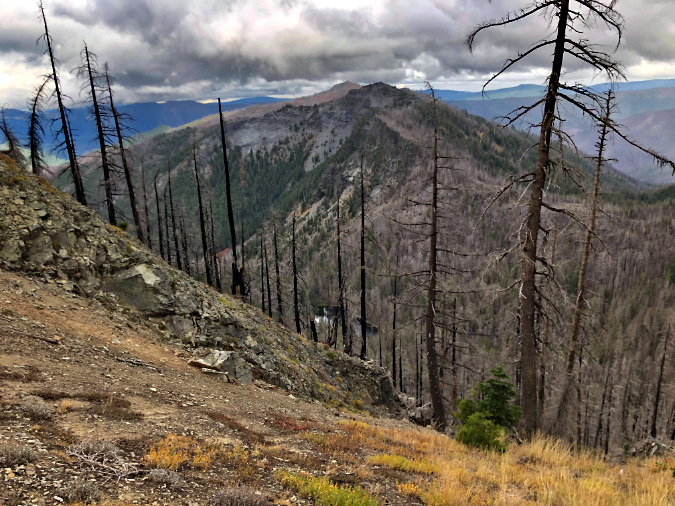
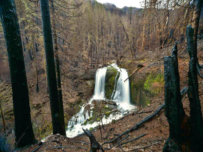
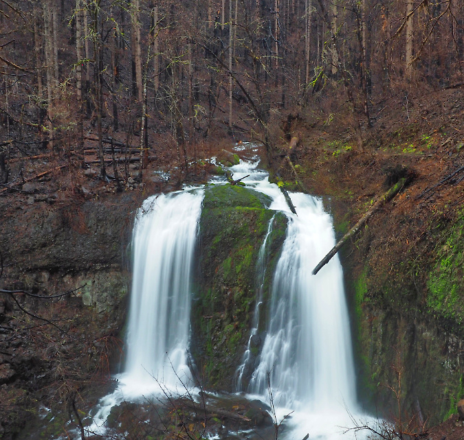
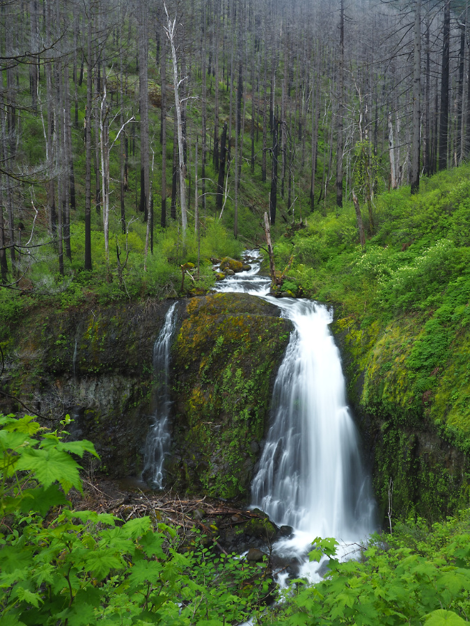
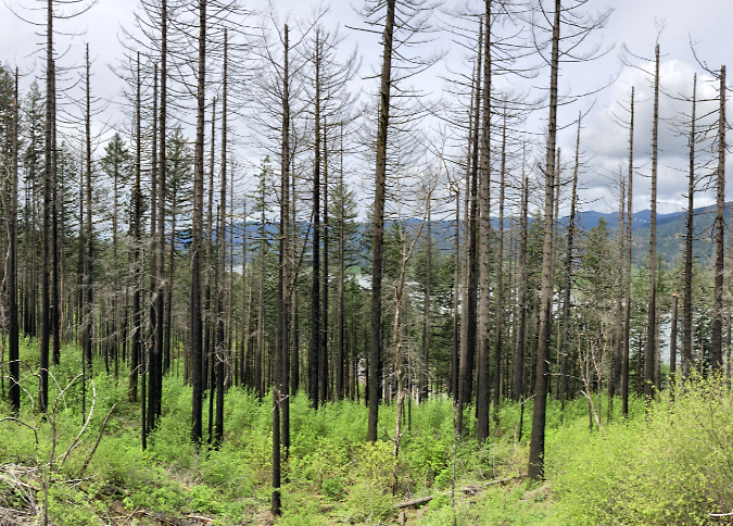
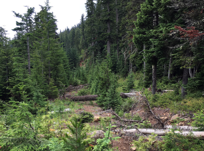
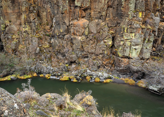
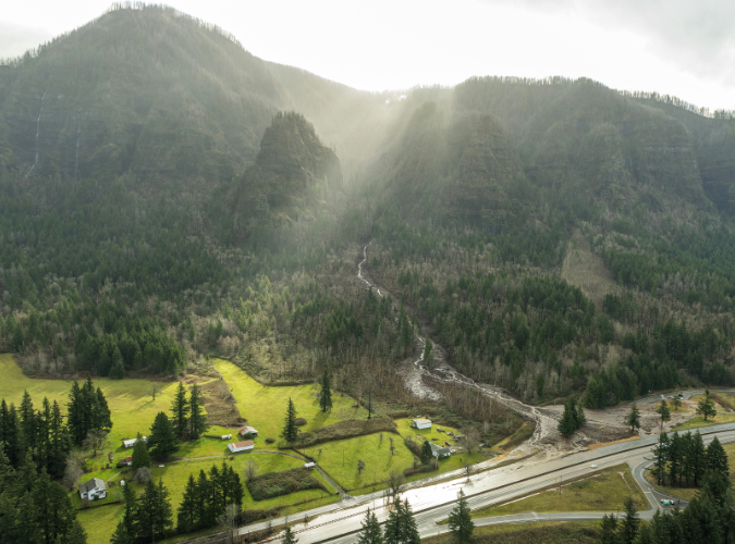
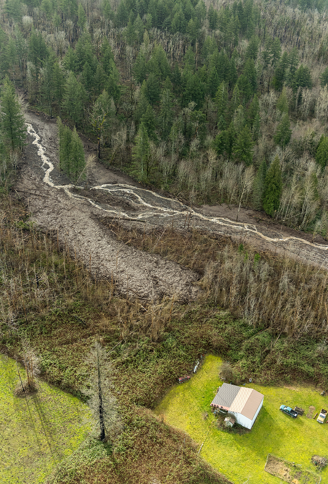
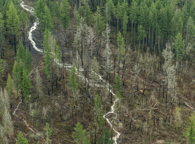
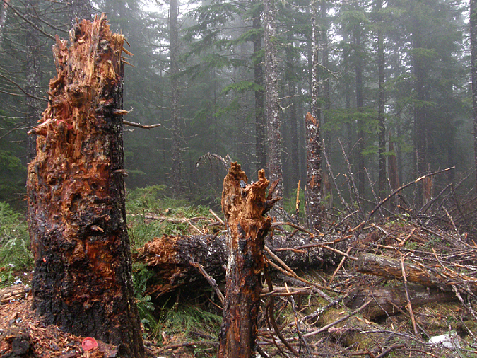
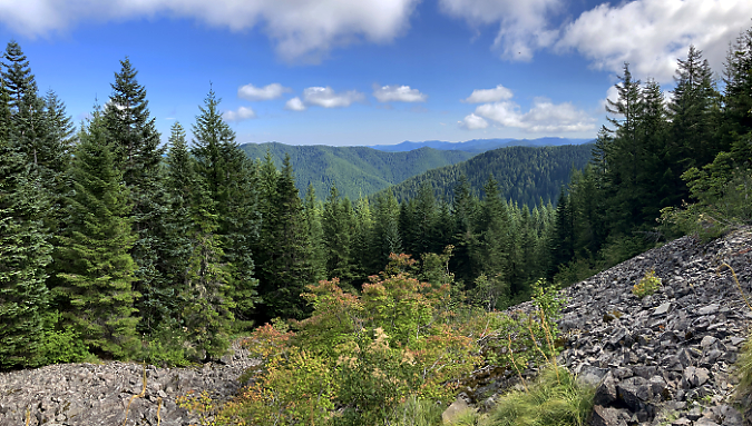
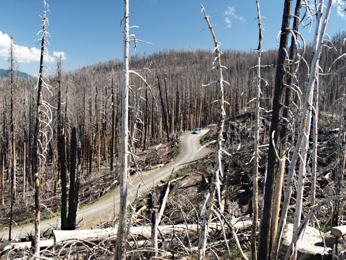
Not out of the woods with our fire season, just yet. The human-caused Riverside Fire started on September 8, 2020 and eventually burned 138,000 acres of the Clackamas River basin over the following weeks, much of the burn hot enough to create ghost forests where nothing survived. This scene looking into the Whale Creek basin is one of those places.

If we do make it past this Labor Day weekend without catastrophic fires in the Cascades – the five-year anniversary of the catastrophic fires that swept through in 2020 — odds are good that we will have enjoyed an unearned break this year in an otherwise non-stop era of major wildland fires. The emphasis should be on unearned, however, as we’re not making nearly enough progress in achieving a sustainable balance of healthy, beneficial fires in our forests. 

Instead, we’ve catapulted from a century of unhealthy fire suppression and unsustainable forestry into the unhappy payback: a modern era of destructive, catastrophic fires fueled by the combined effects of fire suppression and overcrowded clearcut plantations in a rapidly warming climate. Add in a climate-denying administration in Washington DC that seems bent on somehow turning our collective clock back to 1955, and we’re losing ground fast on what otherwise could be a manageable crisis.

So, yes. There’s plenty of room for frustration and discouragement with the current state of affairs. But there are also encouraging signs that a return to more enlightened times has already begun, and the pendulum is beginning to swing toward science sustainability, once again. With that in mind, and in the spirit of “planning for good times during the bad”, this piece focuses on simple actions that we could take locally to help slow some of the momentum of a wildland fire cycle that is burning our forests faster than they can recover. 

“We have met the enemy….”

You would be hard-pressed to find anyone under the age of 40 who knows what the “Sunday funnies” is (or was), much less Walt Kelly’s wise possum named Pogo. On the first Earth Day in 1970, Kelly produced a poster with the now-famous “we have met the enemy and he is us” strip, a play on a lesser-known military quote dating back to the War of 1812. Pogo’s version resonated, and Walt Kelly repeated it in this strip published on the second Earth Day, in 1971:
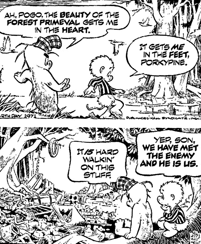
Pogo was right…

We’ve made real progress on environmental pollution since then, but Pogo’s observation could easily apply to our current wildfire crisis. Here’s a stunning statistic: research from the U.S. Forest Service in 2020 estimated that nearly 85 percent of wildland fires are caused by humans! That’s obviously an unacceptable number. The list of human causes? Campfires and debris burning are at the top of the list, followed by sparks from heavy equipment, fireworks and discarded cigarettes (arson is surprisingly high on the list – something to research for a future article?)

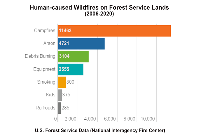
Campfires are the overwhelming human cause of wildfires

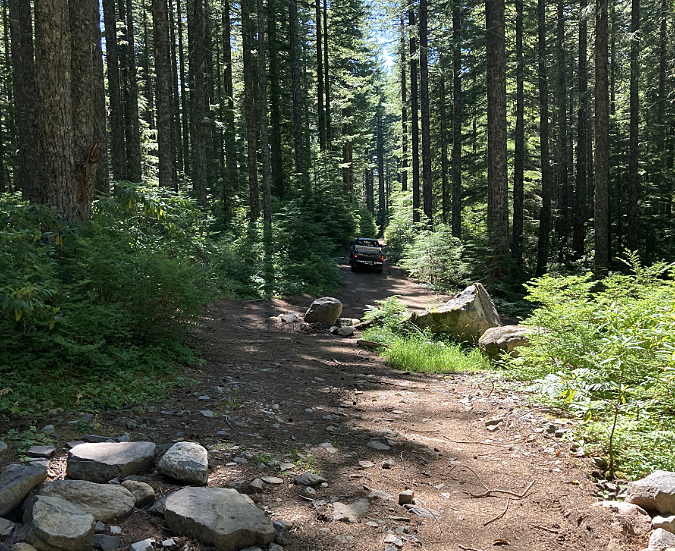
On our public lands, debris burning (as in logging slash) and sparks from heavy equipment mostly fall into the realm of logging and road construction, off-road vehicles and gas chainsaws used for firewood gathering.  If you narrow the focus to human-caused fires that begin in our protected wilderness and backcountry areas, the list becomes much shorter: campfires, discarded cigarettes and (rarely) fireworks.

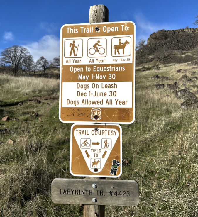
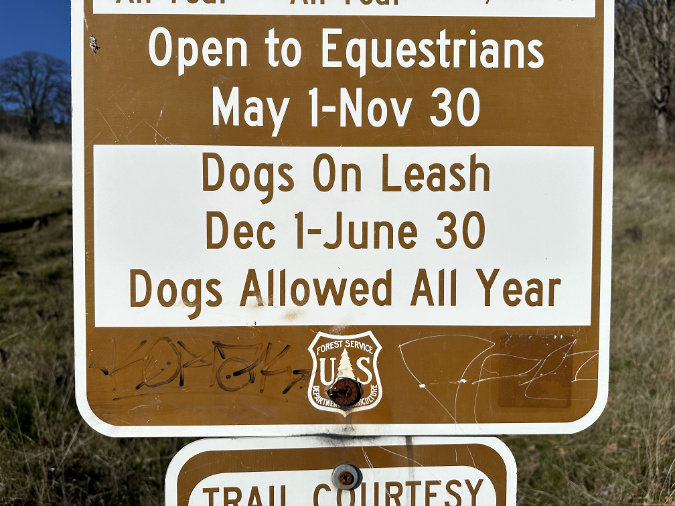
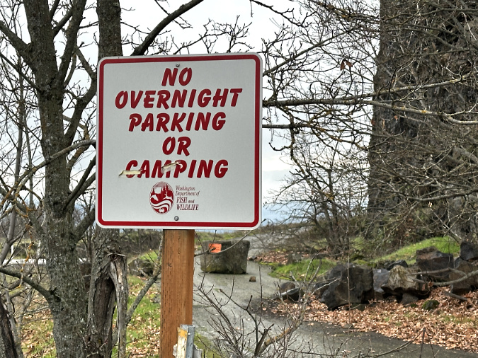
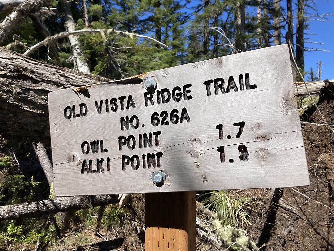
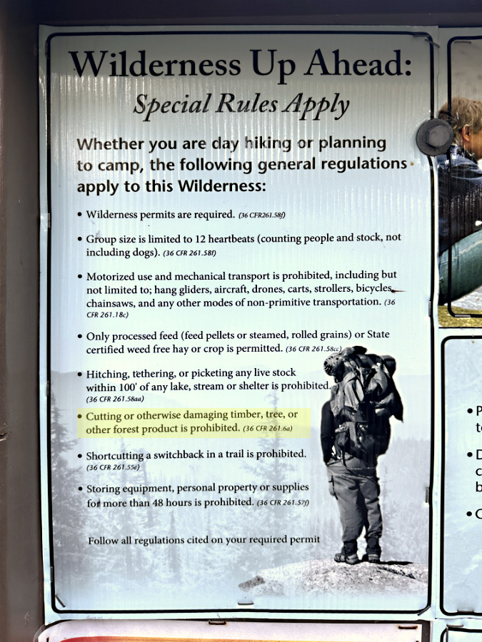
Narrowing a bit further to something we can tackle right here in WyEast Country, this article will focus on campfires within the protected Mount Hood Wilderness, and the surprising lack of restrictions on them. Few even know there are restrictions, but if someone were inclined to look it up, the list of places where campfires are prohibited on Mount Hood is puzzling, at best. Here’s the complete regulation:

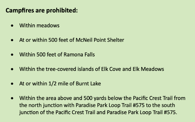
Mount Hood Wilderness regulations on campfires (USFS)

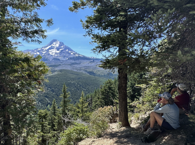
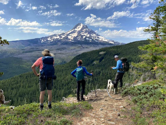
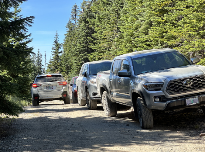
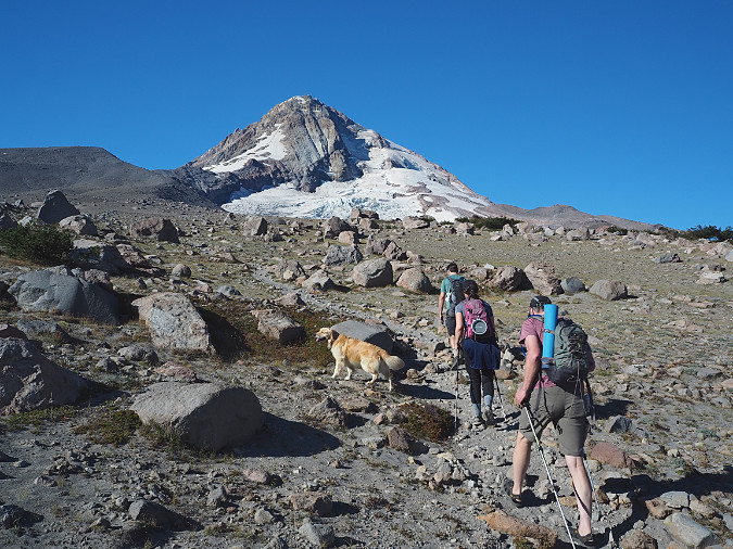
First, some context: TKO’s Wilderness Ambassadors are counting in excess of 300 people heading to Paradise Park on the Timberline Trail each day on summer weekends this year – and that’s just one of the gateway points into the wilderness. Even if you assume that some meaningful share of the tens of thousands who enter the Mount Hood Wilderness are aware of campfire restrictions, these rules still seem random and confusing. 

How would the average person know how far “500 feet from the McNeil Point Shelter”, or a “half-mile from Burnt Lake” is? What’s a “tree-covered island” versus a grove of trees at Elk Cove and Elk Meadows? The last rule is especially puzzling, though it seems to describe a near-total ban at Paradise Park. Add in the ever-shrinking number of Forest Service rangers available to patrol the Mount Hood Wilderness, and it’s hard to believe these restrictions are having any real impact as written, however well-intended. 

Making the case: Protecting the wilderness experience

Though seemingly random, the places on Mount Hood called out in the campfire ban is instructive. These are all heavily-visited places where the increased wildlife risk of campfires is compounded by a degraded wilderness experience. It’s a compelling argument that anyone who has visited these places over time can testify to, as the human impacts are all-too apparent in each of the spots listed – and getting worse.

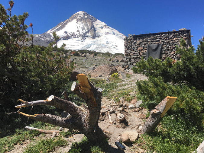
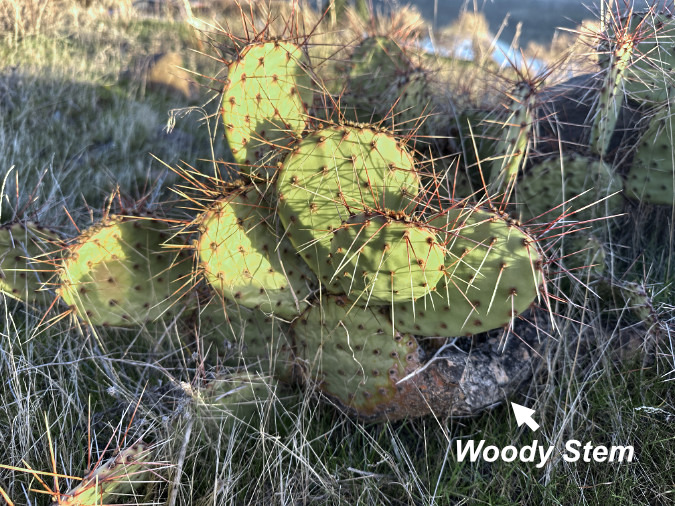
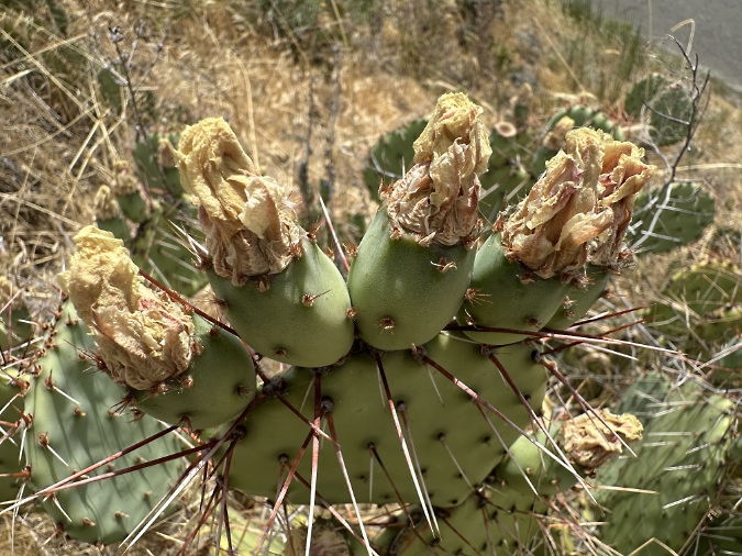
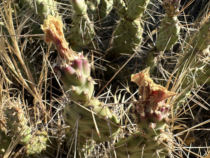
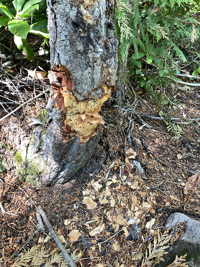
Once the cutting starts, it’s hard to stop. This butchered Whitebark pine had the misfortune of taking root near the Cooper Spur Shelter, perhaps before shelter and Timberline Trail even existed. It was still living as recently as 2020 (when these fresh cuts had been made), even as novice hikers continued hacking it apart for firewood too green to even burn

That’s why impacts on the human experience are a great starting point in making the case for a more effective, comprehensive campfire ban within the Mount Hood Wilderness. After all, much of the wilderness is very heavily visited, and many other popular spots face the same pressures as those few included in the current campfire ban. If visible impact from heavy use is the criterion, the Forest Service has simply lagged behind in adding to this list.

So, where to start in expanding the list? How about the entirety of Elk Cove and Elk Meadows, not simply the “tree islands”? And what about Cairn Basin, Eden Park and WyEast Basin? Or the rest of the Timberline Trail corridor for that matter? If you were to add every spot along the trail where campsites overflow with backpackers each summer, the dots on the map would quickly merge, making the case for a total ban. It’s simply too complex to describe or enforce a nuanced campfire ban with today’s widespread visitor pressure across so much of the Mount Hood Wilderness. Everything inside the wilderness boundary deserves this protection.

Making the case: A rogue’s gallery of wilderness campfires

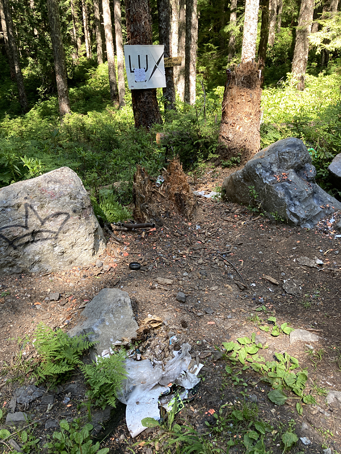
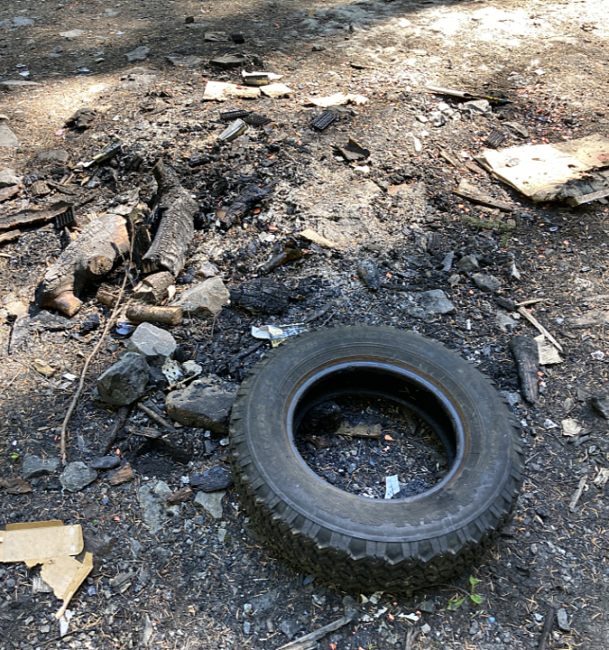
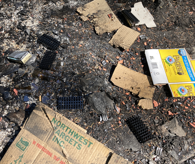
I’ve lost track of how many ill-conceived campfire rings that I’ve decommissioned within the Mount Hood Wilderness over the years, but it is an ongoing and increasingly frustrating task. Most of these were not strictly banned under the Forest Service restrictions described above, but they very clearly violated basic “leave no trace” ethics. Worse, they were typically left smoldering, almost always because they had been built in a place too far from a water source to be safely extinguished. So, the campers simply walked away, leaving the seeds for a human-caused wilderness fire to chance. This rogue’s gallery is a sampler of what we are up against:

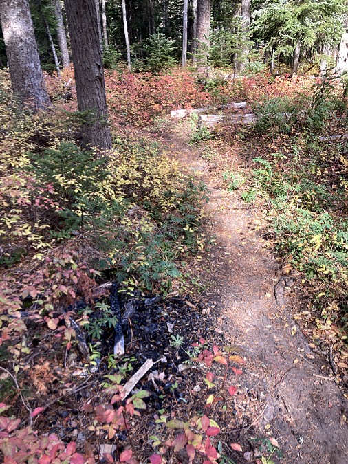
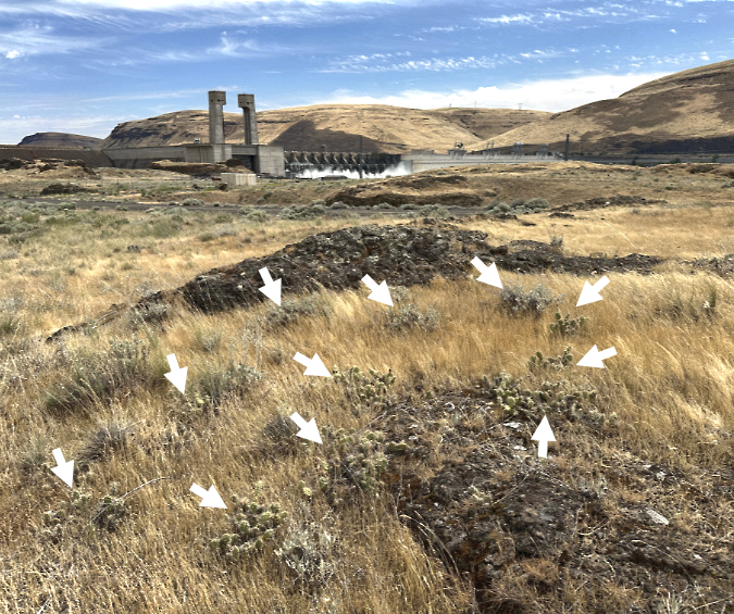
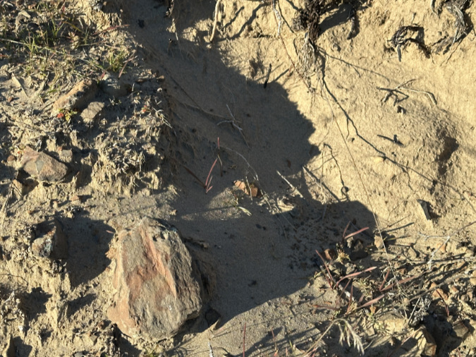
Not even a fire ring here, just a campfire built on top of the underbrush and forest duff layer along the Newton Creek Trail. It’s dumb luck this fire didn’t spread – likely due to fortuitous wet weather arriving that fall. Note the half-burned limbs left in the pit – how long did they smolder before the rains put this fire out?

This fire had been built on top of Bald Mountain, more than a mile from the nearest water source. It is typical of new campfires in the Mount Hood Wilderness. Lacking a saw, campers simply burned the ends of uncut logs and limbs, often several feet in length. With no fire ring, even the small limbs are spilling out of the campfire, in effect creating lit fuses for this fire to spread to the dry forest duff in all directions – as it already had when I took to photo. The half-burned stump adds to the risk, as it could smolder for days without being properly extinguished. 

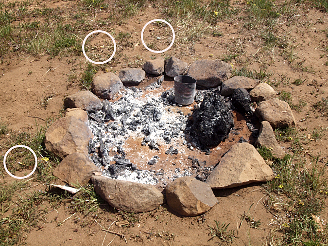
Another new firepit that had been recently built on a dry ridge top on the east side of the mountain, more than a mile from any water source. It was left smoldering, along with burned trash and (circled) cigarette butts that weren’t even dropped into the fire pit – checking two boxes for this fire on the list of most common causes

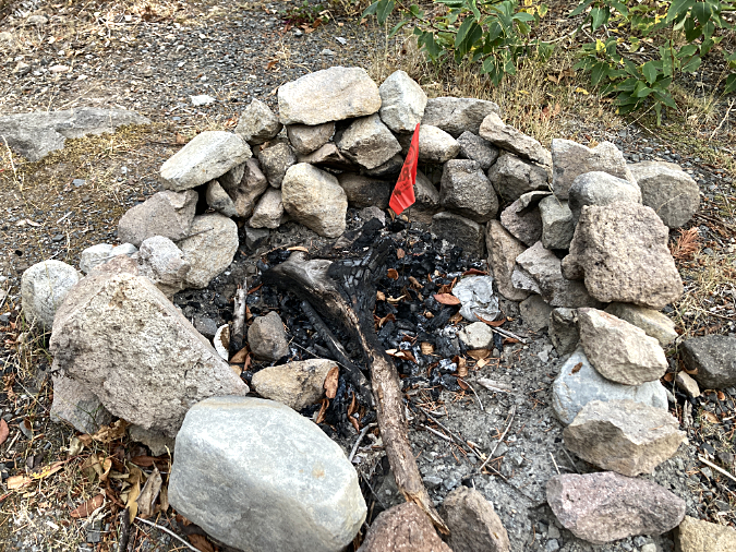
Amid the half-burned wood and charred foil, fire has a small orange flag you might have seen in heavily used fire pits during fire season…

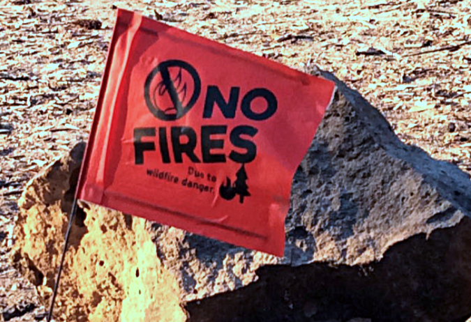
…upon closer inspection, they turn out to be temporary bans put in effect during extreme fire risk. Placing these requires intensive wilderness staff capacity, though, and with no clear penalty identified for violators, are they even be heeded?

As some of these detailed captions show, new fire rings usually betray their builders. Almost aways, they contain burned foil, cans and melted plastic that a seasoned, knowledgeable backcountry visitor would never leave behind. Half-burned (and often green) firewood is the other giveaway, usually chopped with a hatchet that few experienced hikers would carry. They are also typically built on top of the flammable forest duff layer, instead of an area cleared to bare, mineral soil.

Smoldering, abandoned campfires don’t always put out a lot of smoke, even when they’re still very hot. This video is from a fire left burning in the Badger Creek Wilderness in the middle of August, far from any water source. Doubly frustrating was using much of my water supply on that hot day to put out a careless campfire…

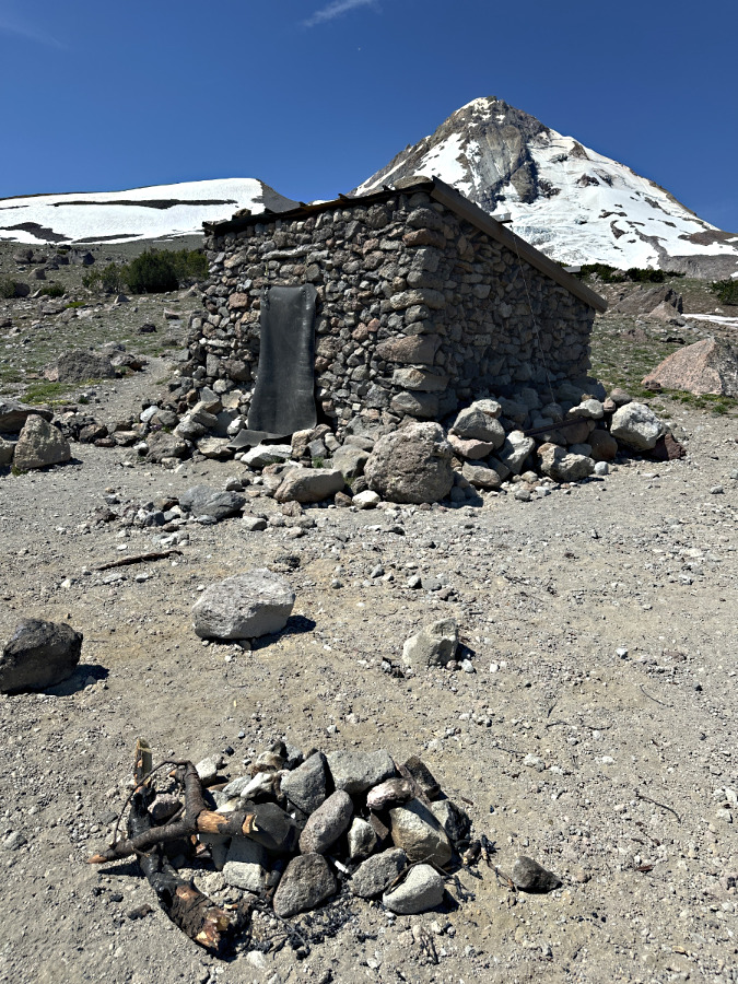
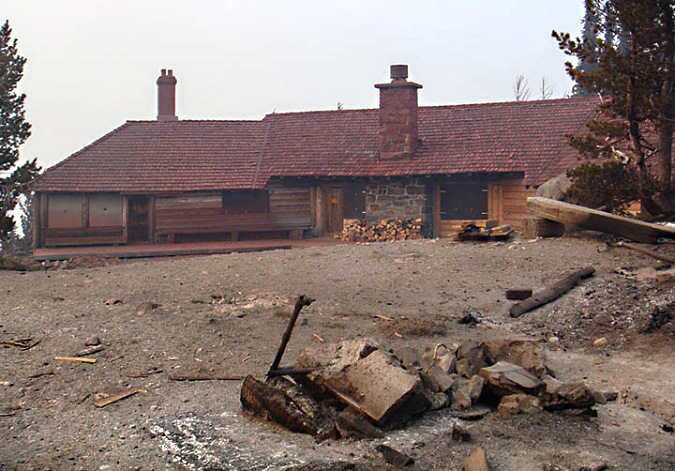
The next photo set in this rogue’s gallery is a case study of the historic Cooper Spur stone shelter on the Timberline Trail, where misguided campfires are a recurring problem. The shelter draws regular overnight campers who, in turn, have built several rock wall windbreaks around tent sites. Not exactly “no trace”, but also not unusual on the mountain. In this case, they must also be viewed in the context of being next to a man-made stone shelter. The hand of man prominent here, however rustic.

Camping among the rocks at the Cooper Spur shelter has become increasingly common in recent years, thanks in large part to social media, and helping to drive the increase in campfires here

However, there is no water source anywhere near the shelter, so it’s not an ideal camping spot. It’s an even worse place to build campfires. Most campers at the shelter do abide by this obvious ethic, but the few who don’t leave a permanent record of their visit for all who follow in this very popular place. That’s because, beyond the lack of water to reasonably extinguish a fire, there’s also a lack of firewood… except for the federally-listed, threatened Whitebark pines that cling to life here, at nearly 7,000 feet elevation.

I’ve decommissioned many campfires here since unofficially adopting some trails in the area nearly 25 years ago. All of these campfires were perfectly legal under the current Forest Service rules, but also completelyunethical from a “leave no trace” perspective. They also fail simple common sense, given the obvious lack of a nearby water source to put them out. 

To put a face on this ongoing struggle, here are some of the rogue campfires that I’ve decommissioned at the Cooper Spur shelter in recent years:

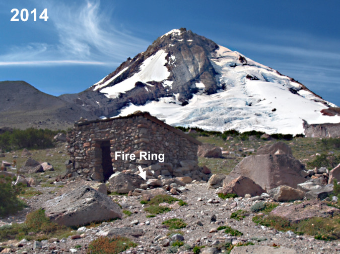
This fire ring has been rebuilt against a boulder, directly in front of the shelter – a favorite location for the campfire builders

A closer look at the 2014 fire ring. The boulder is charred from many fires built here, but the rest of this ring was new, as you can see by the mostly uncharred, smaller rocks

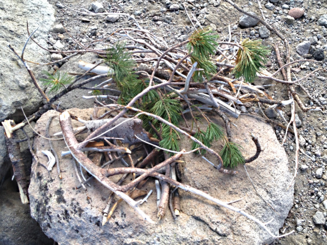
Fuel piled next to the 2014 fire ring includes green limbs pulled from a nearby Whitebark pine, typical signs of a novice

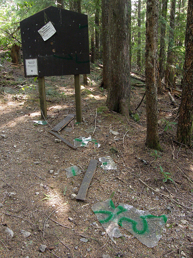
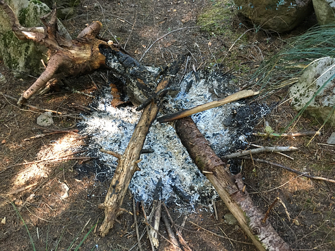
In the intervening years since these photos were taken in 2014, I’ve disassembled and decommissioned this fire ring repeatedly, as the charred boulder seems to attract ever more campfire building at this spot. However, this year things seemed to escalate sharply. This was the scene in late July:

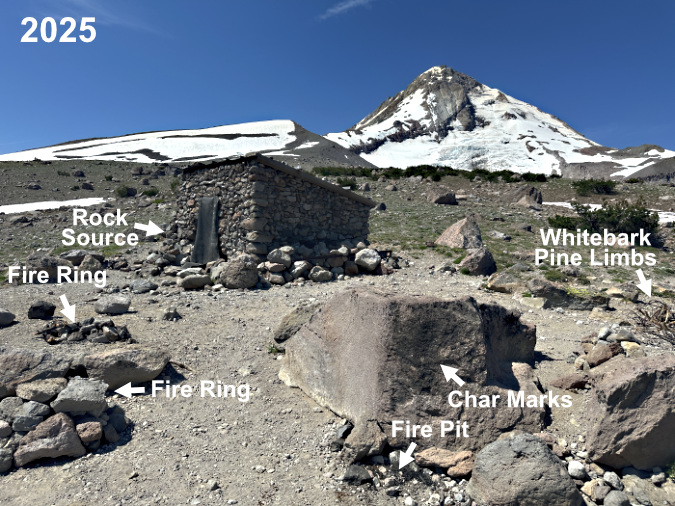
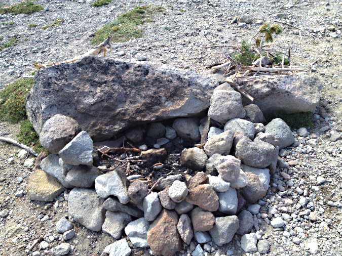
Three campfires – within a few feet of one another? The fire ring on the far left was built in the middle of the trail, the one below on the left was built (once again) against the same boulder shown in the 2014 photos and the fire pit in the lower right was also new – the first in this spot. A large stack of Whitebark Pine limbs, both dead and living, are piled over on the right

A closer look at the new ring built in the middle of the trail shows half-burned Whitebark pine limbs and an attempt to extinguish the fire by piling rocks on top.

A closer look at the new ring shows the rock source to be the recently collapsed corner of the Cooper Spur Shelter – those are mortar traces attached to the rock in this photo. Pure vandalism to use these rocks before they could be to repair the shelter, of course

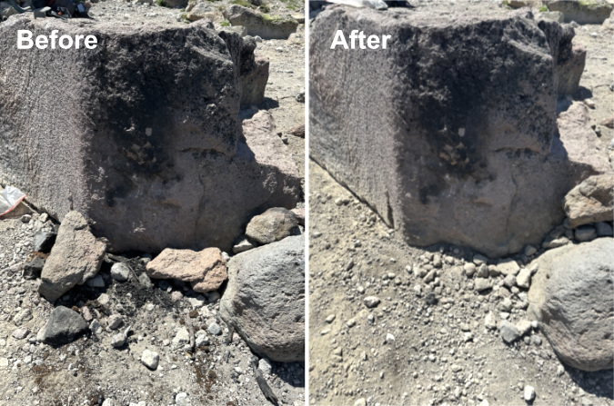
Decommissioning all three of these fire rings at the Cooper Spur shelter meant carrying at least a dozen gallon-size ziplock bags of (cold) ashes to dump in a discrete spot, moving all of the visibly charred rocks from the area and covering up what was left with a light dusting of loose gravel. However, the char marks left on the large boulder in this newest fire location will be there for many years to come, likely encouraging more fires here so long as they are legal.

This was among the charred Whitebark pine logs scattered from the three fires, apparently in an attempt to put the fire out? This log was cut with a hatchet, another telltale sign of a novice camper

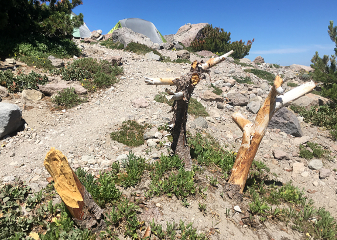
What’s left of this Whitebark pine near the three new fire pits at the shelter shows signs of limbs being sawed, chopped or simply broken off. The stumps still have their bark, so it’s unclear if this was a living tree when it was targeted for firewood

While it has been a frustrating rinse-and-repeat cycle to continually undo these fire rings, it’s also informative. They point to wilderness visitors who require very simple, understandable and enforceable regulations. Even if the area around the shelter were added to the current list of banned places on the Forest Service list, the campfires would almost certainly continue, given the lack of awareness of where fires are prohibited in the wilderness.

Making the case: Current rules aren’t working

In researching this article, I spoke to several seasoned hikers who have been visiting the Mount Hood Wilderness for many years. Even among this veteran cohort there was tremendous confusion and misinformation about the restrictions that do exist, or even where to find them. Some were adamant that campfires were already banned “above the Timberline Trail”, while others believed the ban was “above the timberline”. None could name all of the place-specific bans described in the actual policy, and most could only name one or two. This level of misinformation among the most experienced hikers bodes poorly for the thousands of less-savvy visitors to the wilderness each year might know.

Today’s wilderness hikers on Mount Hood rely more on social media and third-party phone apps for their trail information than on official web content from public agencies, making it increasingly challenging to communicate rules and restrictions

The lack of awareness and understanding of the existing campfire ban is easy to diagnose. First, the official Mount Hood National Forest website is labyrinth, and it’s especially tough to navigate if you’re looking for recreation information. When I Googled “Mount Hood Wilderness”, only the unhelpful Mount Hood National Forest home page and generic “recreation” page showed up in the top 20 search results. Both are dead-ends.

The crucial link for wilderness information (including campfire regulations) is found elsewhere on the website, on a page describing all of the wilderness areas within the national forest – a page Google did not find with a search for “Mount Hood Wilderness.” From this page, the link to information on regulations for the Mount Hood Wilderness is buried in a text blurb that contains a link to this external website describing the campfire policy. 

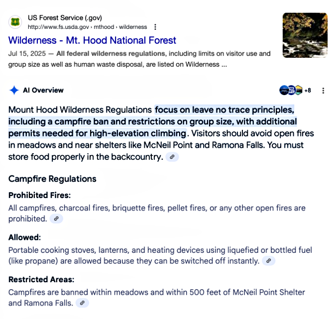
Even a specific Google search for “Mount Hood Wilderness Regulations” takes you to the generic wilderness page for all wilderness areas, where you would still need to track down the buried link to the external page that actually lists the regulations. Few will ever find this information, unfortunately – including Google’s search engine. Google’s AI-powered search provided an even more confusing result, reporting a complete ban on wilderness campfires (!) followed by a partial mention of the actual policy (only for McNeil Point and Ramona Falls):

Google AI not so intelligent when it comes to finding USFS regulations…

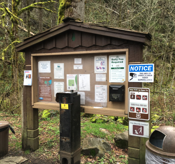
So, the internet isn’t much help in tracking down the existing campfire regulations. However, the current ban is clearly described at wilderness trailheads around Mount Hood – if you look closely – along with general guidelines on wilderness ethics, including no-trace ethics campfires.

These are the trailhead signs at the Cloud Cap trailhead, the entry point for the Cooper Spur Shelter, and the standard signboard format for most wilderness trailheads on Mount Hood:

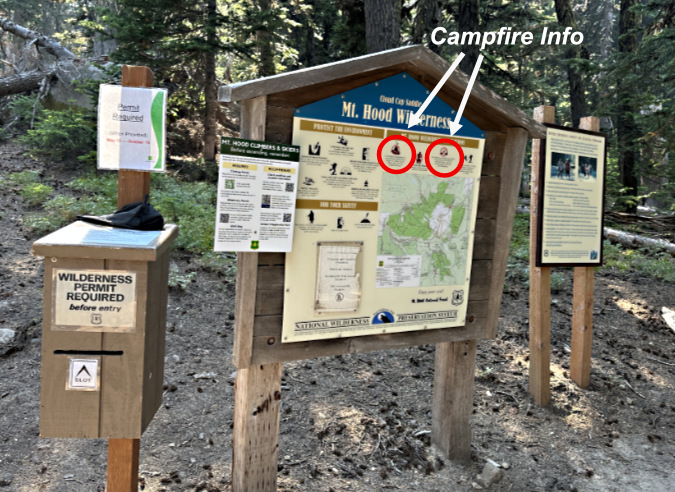
There’s a lot of information at Mount Hood’s wilderness access points. Look closely at this sign at the Cloud Cap trailhead and you might find the limited restrictions on campfires (circled)…

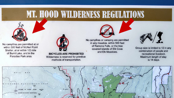
…and a closer view of the campfire restrictions from the above wilderness trailhead sign. The wording here is simplified from the official regulations, yet still quite nuanced for visitors unfamiliar with the wilderness

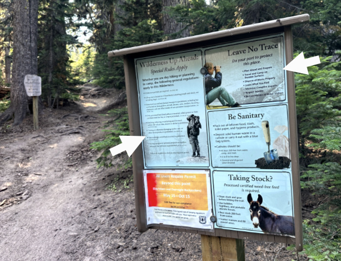
A second sign at the Cloud Cap wilderness trailhead provides still more information for visitors. The two arrows point to additional info on campfires…

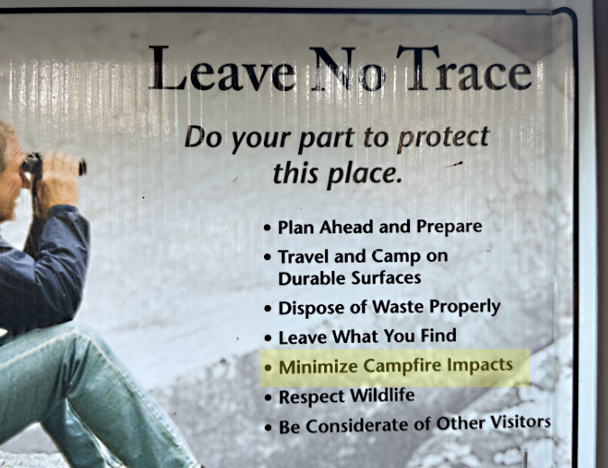
…this enlarged view of the inset on the upper right calls for “minimizing” (highlight added) campfire impacts under the Leave No Trace (LNT) principles…

…and the inset on the left side of the second trailhead sign lists special rules for wilderness, including “cutting or otherwise damaging timber, tree or other forest product” (highlight added)

The current, limited campfire ban is also posted on the back of required wilderness permits, which are required at the Mount Hood Wilderness entry points (except this year, unfortunately, due to Forest Service staff cuts):

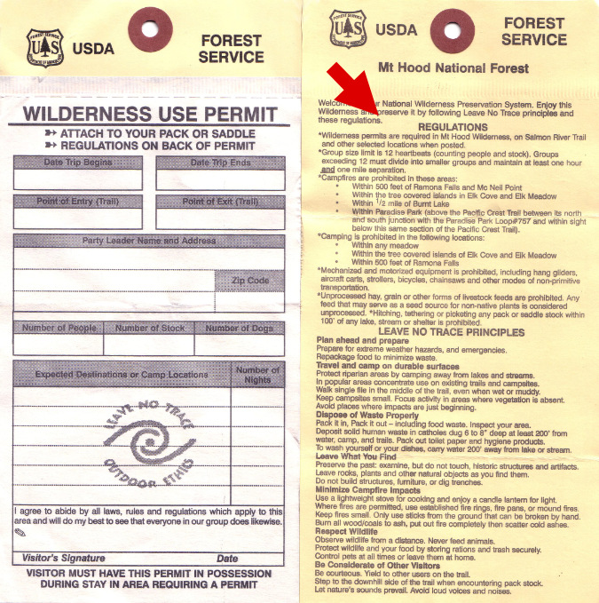
There it is! The red arrow points to the Mount Hood Wilderness regulations printed in full on the back of the permit

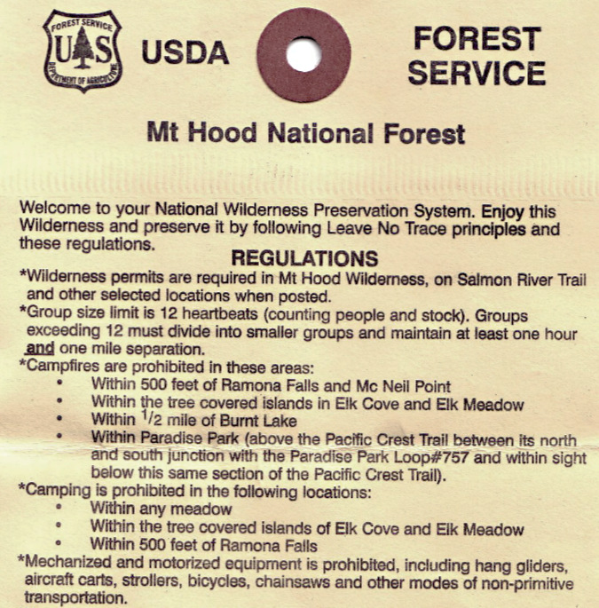
A closer look at the permit shows a nearly complete version of the existing, limited campfire ban within the Mount Hood Wilderness, albeit slightly simplified from the online, official version

So, the regulations are certainly available enough where it matters – at the trailhead. But the fact that so few know or understand them suggests they aren’t really being read by wilderness visitors – whether on the entry signboards or on the back of permits. That’s likely a case of information overload (there is a lot to read on these signs) and human nature (does anyone really read instructions before assembly..?)  Add the complexity of the regulation, and it translates into a policy that is not only too limited in its geographic scope, but also in its effective communication to wilderness visitors.

Making the case: Protecting human life and property

Do the risks and impacts that campfires present at the Cooper Spur Shelter and elsewhere in the Mount Hood Wilderness warrant a total ban on campfires? Thirty or forty years ago, my answer would have been “no”. But the current state of our forests and changing climate doesn’t leave us the luxury to be romantic or sentimental about campfires.

Cloud Cap Inn covered in red fire retardant during the Gnarl Fire in 2008. This historic, priceless 1889 gem narrowly survived the event (USFS)

Cloud Cap area transforming into a massive ghost forest of bleached snags in 2010, two years after the Gnarl Fire

We’ve seen a string of three major fires in the Mount Hood Wilderness in recent years that have completely altered the forests on the north and east slopes of the mountain: the Bluegrass Fire (2006), Gnarl Fire (2008) the Dollar Lake Fire (2011) all burned hot across thousands of acres of subalpine Noble fir, Mountain hemlock and Western larch at an unsustainable pace, leaving large expanses of ghost forest that are only beginning to regenerate today. 

None of these fires were human-caused, surprisingly. But there’s little comfort to be found there, given the number of people who visit the wilderness each year – and the number unattended, smoldering campfires they leave behind.  

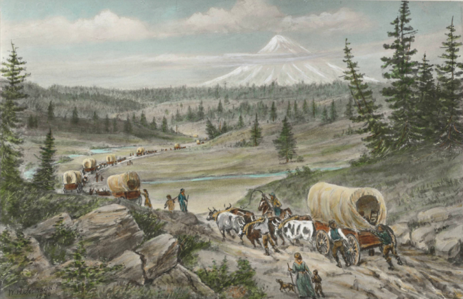
It’s also only a matter of time before similar wildfires return to the south and west sides of the mountain, where a century of fire suppression has left these forests primed for a major fire. And the risk to property and human life on the south side of the mountain is far more significant.  Early photos like those below show the extent of the most recent fires to rage through today’s Government Camp area in the decades before the completion of the Mount Hood Loop Highway in the 1920s, and the subsequent flood of ski resorts, Forest Service cabin leases and homes on private land that followed.

This view of the Government Camp area from Multorpor Fen before much development had occurred on the mountain. The arrows point to the ghost forests that marked widespread burns across what are now heavily developed ski resorts and private homes on Mount Hood’s south flank. After more than a century since these fires burned through, the south side of the mountain is primed for a major wildfire

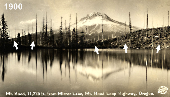
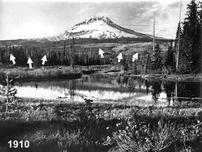
While the surge in recent wildfires on Mount Hood has focused on the east and north sides of the mountain, the west and south sides were the main focus of wildfires in the early 1900s. This view is of Mirror Lake in about 1900, when much of the area south of today’s US 26 had burned in the Kinzel fire

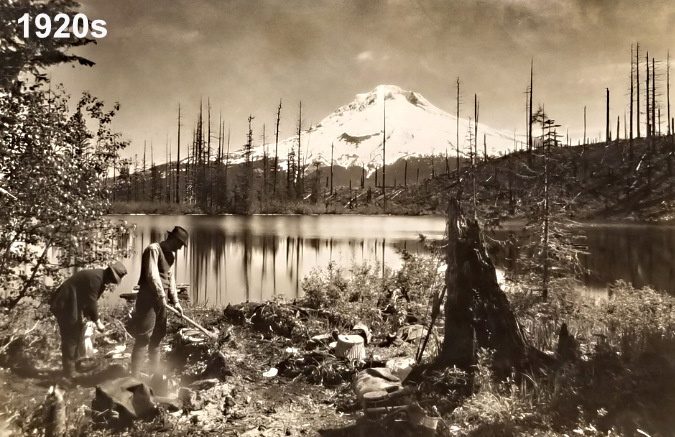
This later view of Mirror Lake from the 1920s shows little forest recovery – and the beginning of what is now more than a century of camping — and campfires

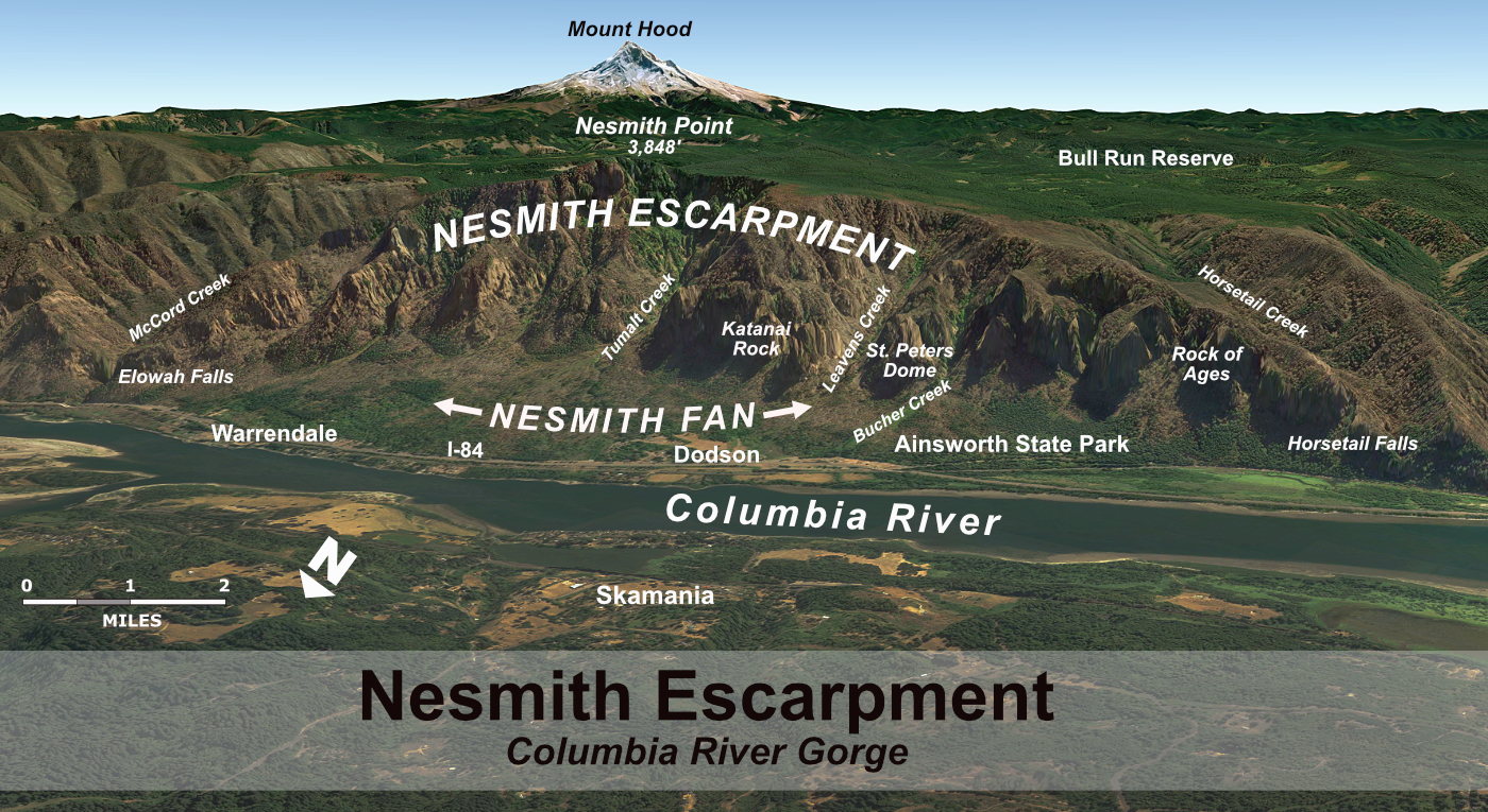
The risk to human life and property only grows as you move to the Zigzag Mountain arm of the wilderness. Zigzag Mountain comprises a complex of forested ridges and peaks that extends ten miles west from Paradise Park on Mount Hood to the community of Zigzag, where the Zigzag and Sandy River valleys converge. Zigzag Mountain and much of the surrounding area burned repeatedly in the early 1900s, long before there were thousands of people living in forest homes along both rivers and scores of businesses had located along this section of the Mount Hood Loop Highway.

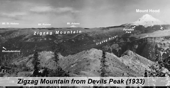
The view from Devils Peaks in the 1930s looked much different than today. The peak, itself, had recently been burned over in the Kinzel and Sherar fires, while the area north along Zigzag Mountain was also burned in a series of very large fires in 1904 and 1910 – including the Burnt Lake Fire

[click here for a large version of the Zigzag Mountain infographic]

While it is inevitable that wildfires will someday sweep through these areas again, igniting one with an unattended, smoldering wilderness campfire doesn’t have to be the cause. And while the Zigzag Mountain portion of the Mount Hood Wilderness is less busy with visitors, the human and property risks from wilderness campfires here are far greater because of the proximity to developed areas immediately adjacent to the wilderness. 

Making the case: Protecting the Whitebarks

Protecting human life and property is deservedly the driver in wildfire management, but on Mount Hood, the impact of wilderness campfires extends to our threatened Whitebark pines. I described both their significance as a keystone species and plight in this article several years ago. These are trees worth protecting. 

Their ability to thrive in extreme, high elevation environments is part of their secret to dodging forest fires. The ancient groves of Whitebark on the mountain are often so isolated and scattered in their alpine setting that fires racing through the more continuous subalpine forests far below have repeatedly missed them simply because they were out of reach from the flames.

This advantage was borne out again with the recent fires on the east and north sides of the mountain, where the flames seemed to die out as they reached the tree line, well short of many of the ancient Whitebark groves. Their remote habitat is not out of our reach, however — or the impact of our campfires. 

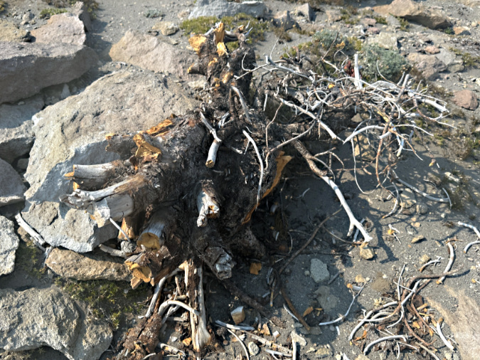
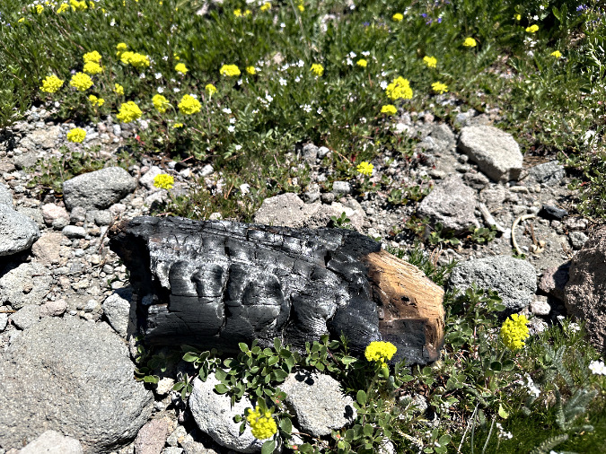
This unlucky Whitebark pine has been harvested down to a stump for firewood at the Cooper Spur Shelter

The campfire threat to Whitebarks comes from being hacked apart for scarce firewood this far above the tree line. However, Mountain hemlock and other subalpine species are continuing to spread upward in elevation in our warming climate, infiltrating the once isolated Whitebark Pine groves, and thus increasing their exposure to wildfire.

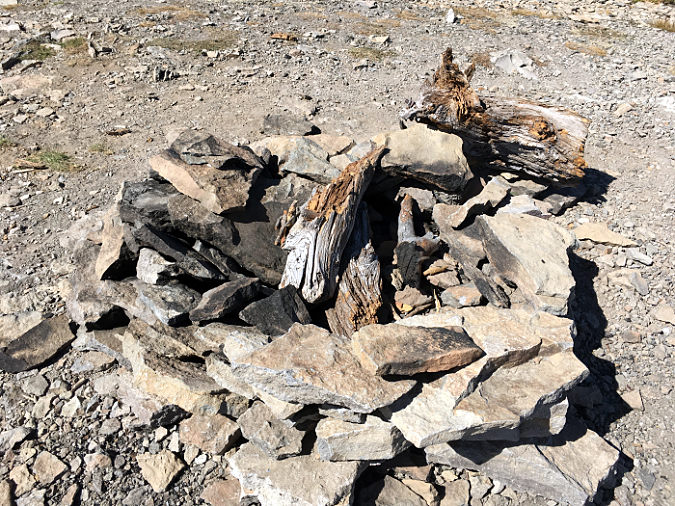
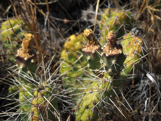
Mature limbs from Whitebark pine in a large fire pit on the summit of Lookout Mountain, in the Badger Creek Wilderness

There is also an important aesthetic argument for caring about our Whitebarks. While you can’t place a dollar value on the visual and emotional impact of seeing a massive, ancient Whitebark pine in the wild, for most of us it is an awe-inspiring sight. Their contorted shape and especially their bleached bones tell a story of remarkable survival – but they can also provide senseless firewood to a few campers who don’t know any better. 

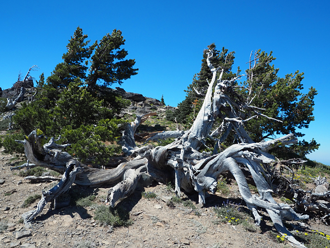
These ancient Whitebark pine skeletons are as beautiful and dramatic as they are vulnerable: the fire pit in the previous image is just a few yards beyond this grove

Beyond our human impact on these trees, Whitebark pine are experiencing a massive die-off across the West from a invasive diseases, insect infestations and worsening drought episodes driven by climate change. This has led them to be federally listed as a threatened species. Given their plight and importance, Whitebark pine may be the best reason for a total campfire ban in the Mount Hood Wilderness.

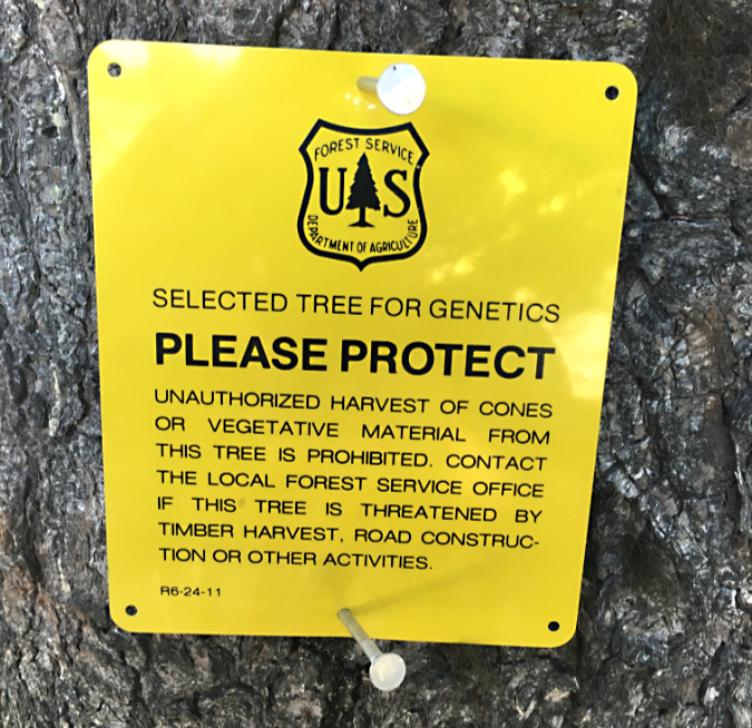
Whitebark pine along the Timberline Trail selected for seed harvesting in a Forest Service project to help save the species

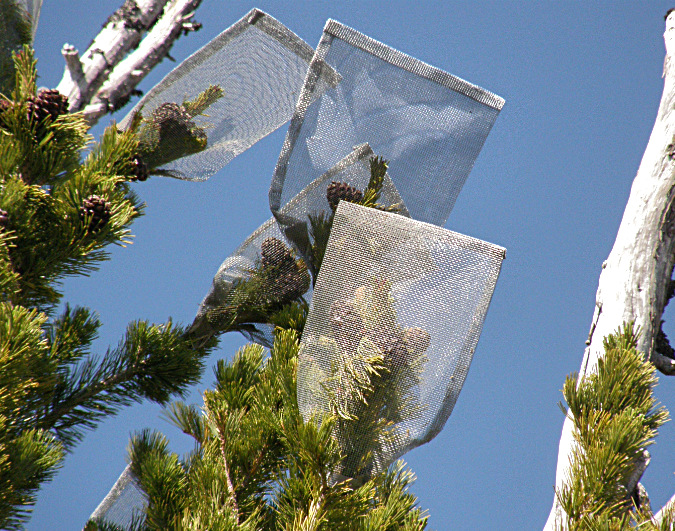
Seed collection bags on one of Mount Hood’s selected Whitebark pines for genetic research

Since the 1990s, scientists at Mount Hood National Forest have been part of the national recovery effort for Whitebarks, where seeds are being collected from disease resistant trees for propagation to help replace groves where widespread die-offs have occurred in recent years. For more information on this effort, check out the Whitebark Pine Ecosystem Foundation, a leader in the effort to rescue this unique species.

All of these arguments – the threats to our remaining forests, to human life and property and to the Whitebarks — bring me to the conclusion that now is the time for a complete ban on campfires within the Mount Hood Wilderness. No exceptions. Just a simple, understandable and permanent ban.

Making the case: How it’s done elsewhere

The Park Service bans all wilderness fires within Mount Rainier National Park, a model for Mount Hood (NPS)

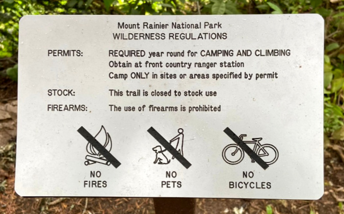
No doubt the Forest Service would be wary of doing this, but there is already precedent within our national parks. Mount Rainier National Park bans campfires in all backcountry areas, the equivalent of wilderness there. Many western national parks have complete bans seasonally every summer – including in their campgrounds – often beginning as early as late May or early June. These include North Cascades, Olympic, Crater Lake and Mount Rainier national parks in the Northwest, and several other national parks across the country.

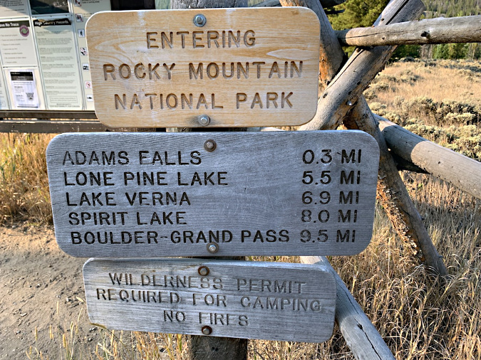
Wilderness campfires are completely banned at Rocky Mountain National Park (NPS)

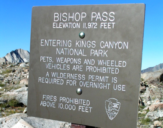
Kings Canyon National Park has a limited prohibition, banning campfires only in alpine areas above 10,000 feet – an abstract metric that would be unlikely to register with newbie hikers most prone to building campfires in these areas (NPS)

Beyond the goal of simply reducing the risk of human-caused fires, the simplicity of complete campfire bans helps compensate for the inevitable lack of enforcement capacity in wilderness areas, whether in national parks or forests. Unattended or dangerously built campfires aren’t there because people want to start a wildland fire, they’re simple a result of ignorance of the risks they present. 

The Park Service approach is a simple, direct, teachable way to serve both outcomes – to prevent the risk of human caused fire, and to educate the public on the reality of the risk. A total ban is at least something that can be understood and thus has a chance of being reasonably self-enforced.

Making the case: Taming our inner caveman…

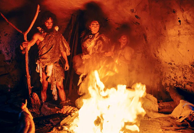
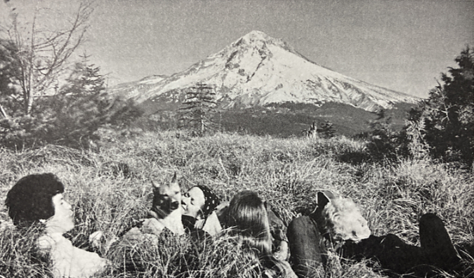
Heat, light and cooking, all in one. We do seem to retain a primal connection to fire (…that looks to be one of my ancestors on the left, by the way – holding a very large marshmallow stick…)

There’s an undeniable romance with campfires that gives pause to land managers like the Forest Service when it comes to pre-emptively regulating them. Yet, human-caused catastrophic wildfires in WyEast Country in recent years in places like the Columbia River Gorge in 2017 (infamously caused by teenagers with fireworks) and the massive Clackamas Riverside Fire in 2020 (apparently caused by a campfire) have begun to change that posture, albeit very gradually.

For the past few decades, the focus of culture change with wildfire has been on a better public understanding of the benefits and necessity of fire in our forest. It’s an essential piece of changing our attitudes, especially since prescribed burns continue to be controversial — despite their proven value. However, letting go of campfires as a ritualistic part of the outdoor experience has not been directly confronted by the Forest Service – yet. 

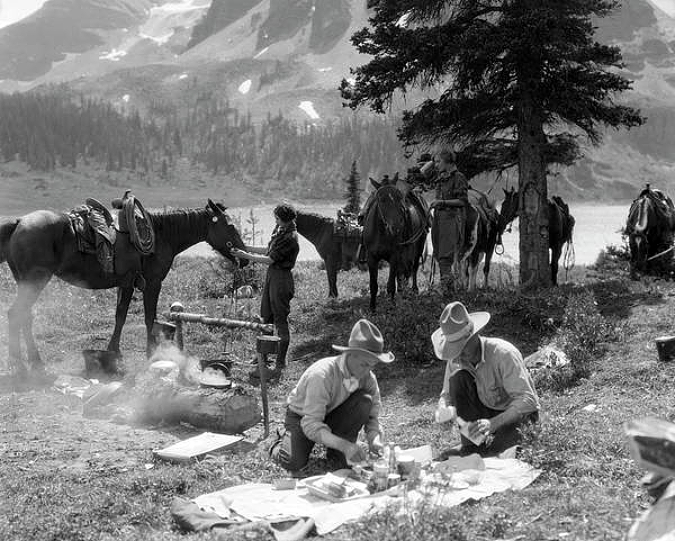
The mythology of the American West in the 1800s continues to be another part of our romance with campfires. These cowboys are preparing their morning Double Caramel Frappuccino with freshly baked Petite Vanilla Bean scones…

The utilitarian purpose of campfires for cooking is long gone. For wilderness backpackers, alternatives to a wood fire for cooking came in the early 1950s, when compact gas and alcohol stoves were first developed, based on portable military stoves. Today, the advantage of stoves for their simplicity, ease of use and certainty for cooking has made them standard practice for backpackers. And while it’s true that you can’t roast marshmallows or hot dogs over a portable gas stove, that’s what our developed campgrounds offer.

It is true that a fire can be a life-saving source of heat in a wilderness emergency, but so can proper clothing and shelter that are among the 10 essentials that every hiker should carry. And a rare emergency survival fire that might be warranted still represents a fraction of the impact and risk that not having any limit on campfires represents. 

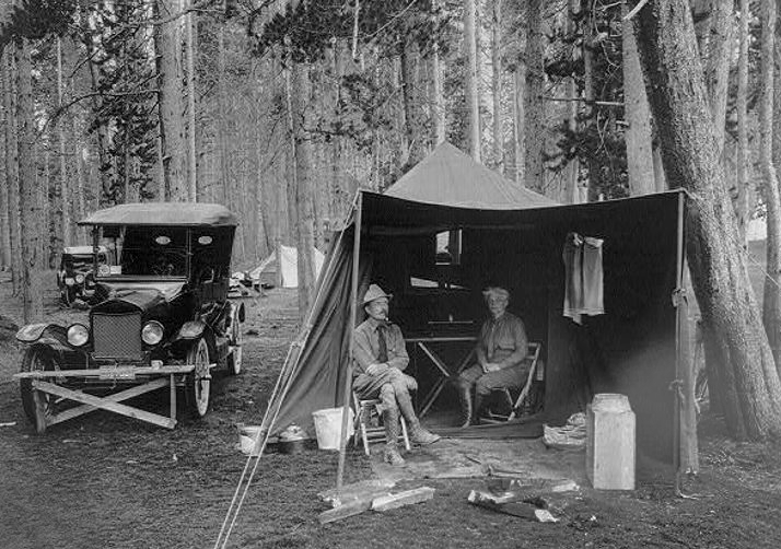
Our modern-day connection of campfires to the camping tradition began with the arrival of the automobile and developed roads into our public lands in the 1920s. Though early adopters hauled everything for their campsite in their Model T, developed public campgrounds with picnic tables and formal campfire pits soon followed. Campfires in developed campgrounds today are rarely the source of wildfires today, so they continue to provide a safe solution for campers looking for that S’mores experience

In the end, the most personally compelling case for a ban in our time may be the environmental impacts and risk of wildfires that campfires bring. People head for the wilderness to get away from the human-impacted world, and the despair and sense of loss that so many have shared from our recent, catastrophic fires in the Gorge and on Mount Hood underscore just how personal the connection to wilderness is. That’s a winning argument for a ban that most would understand. 

Wilderness is special, and this is where a broader understanding of the ethics of wilderness campfires could begin. What not begin growing that awareness here on Mount Hood? 

Making it Happen…

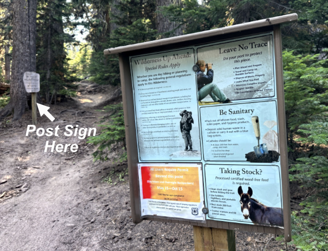
The good news is that a national forest supervisor can make this happen with the stroke of a pen, as these policies are made at the local level. The most direct approach would begin with signage at Mount Hood’s wilderness trailheads, with both regulatory and interpretive messages. For those who take the time to read the signboards (and we salute you!), the messages already posted could be adapted to make the interpretive case for a campfire ban. 

However, if the goal is to get the message across to the majority of visitors, a blunt, direct and unavoidable approach is warranted. Like this sign – which, for the record, is not a real Forest Service sign (yet):

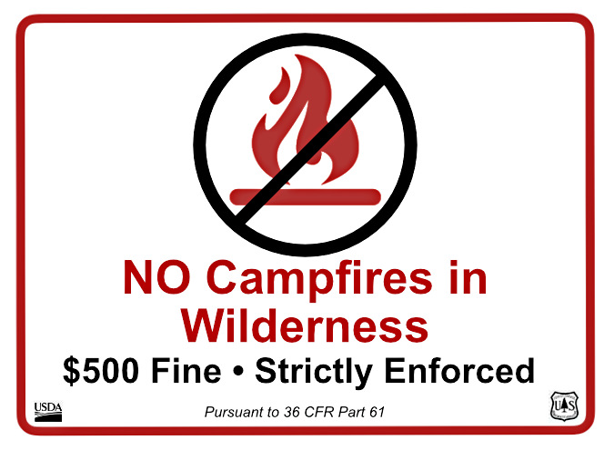
Keep it simple and direct. To ensure visibility, a sign like this should be posted away from the information overload of the main signboards and directly below the wilderness boundary markers that that are typically the last sign a hiker passes when entering the wilderness. Again, this example is from Cloud Cap, where you can see the wilderness marker in the distance, just up the trail:

Make the campfire ban (and associated fine) the last thing hikers see as they enter the wilderness, where it might just catch their attention…

To reinforce this very direct approach, the same message could be added to the front of the wilderness permits to better catch the eye of those of us (ahem) who are clearly not reading the back of the form:

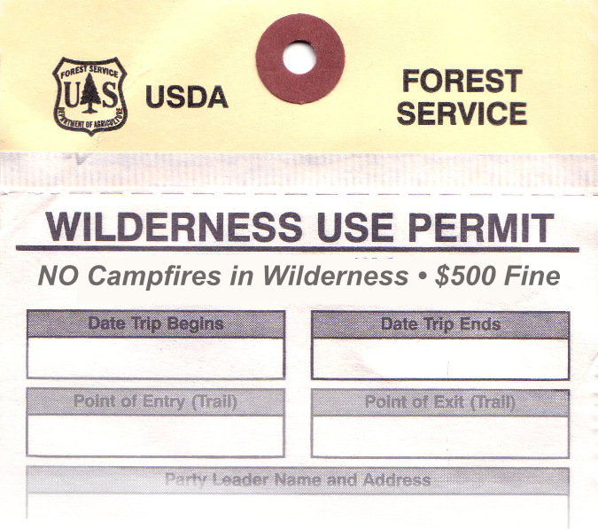
…and make it the first thing they see when they complete their wilderness permit

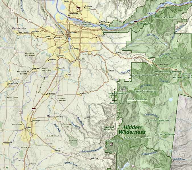
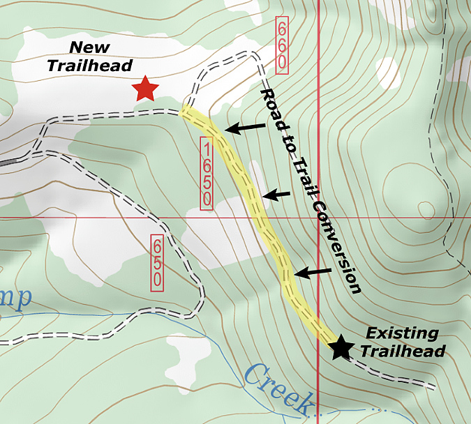
Where would this ban apply? Everywhere inside the Mount Hood Wilderness boundary shown below. The wilderness has been expanded several times since the “Mount Hood Primitive Area” was first designated as wilderness in 1964. This is the current boundary where the campfire ban would apply – and including a ban icon on maps like this could be still another helpful reminder for visitors:

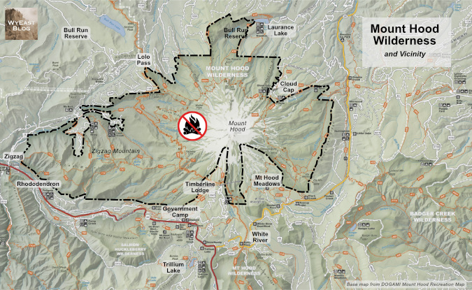
The boundary of the Mount Hood Wilderness where the campfire ban should be enacted

[click here for larger view of the map]

While I’ve highlighted what most consider to be the Mount Hood Wilderness on this map, several nearby wilderness areas have been created or expanded since the 1980s, including the Salmon-Huckleberry Wilderness and Badger Creek Wilderness, as well as smaller pocket-wilderness additions at places like Twin Lakes and Tom Dick and Harry Mountain. Should these areas be included in the campfire ban, too? 

My answer is no, at least for now. That’s because these areas are mostly less visited and – with the exception of the summit of Lookout Mountain in the Badger Creek Wilderness — don’t have a Whitebark pine population that could be impacted by wilderness campfires. Over the longer term? Yes, these areas should also be included, as we continue to grapple with the wildfire crisis that is unfolding in our forests.

Why it matters…

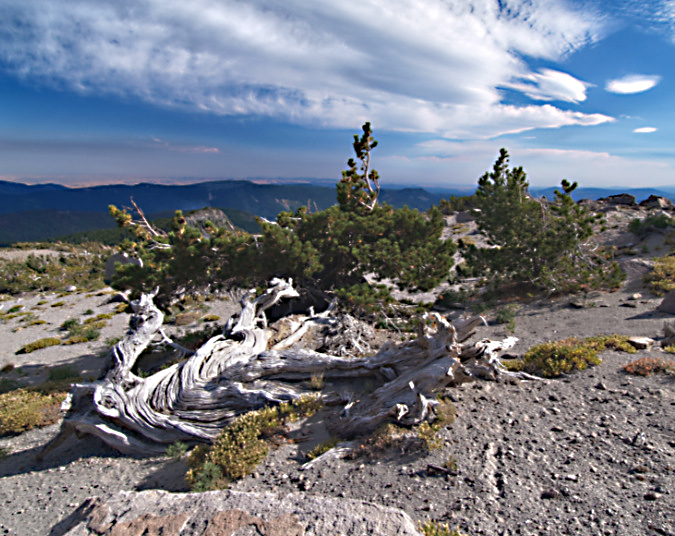
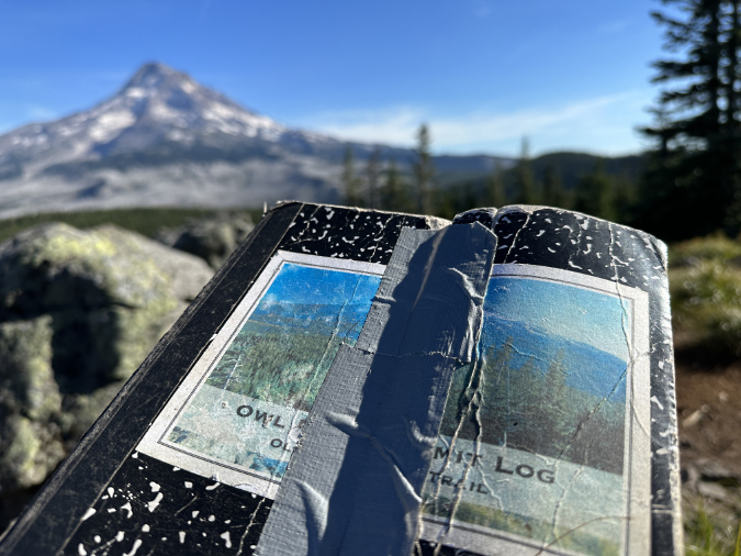
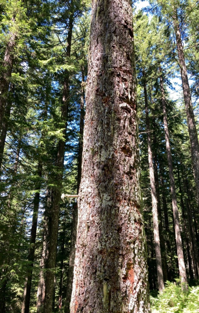
Ancient Whitebark pine just off the Timberline Trail on Gnarl Ridge

I’ll close with a photo of one of my favorite Whitebark pine ancients (above). It has likely been growing in this sandy flat near the crest of Gnarl Ridge for at least a couple centuries. And it therefore likely witnessed multiple eruptions of smoke and ash from Mount Hood in the late 1700s as a young tree, the last major eruptive period on the mountain.

This old survivor was just getting established here when Lewis and Clark opened the floodgates to white settlement, and thus far it has survived our arrival in the intervening 200 years. Because of its remote home on the mountain, it also survived the Gnarl Fire in 2008, and very likely other wildfires on Mount Hood’s east slope over the centuries. So far, it has also survived the bug and disease infestations attacking our Whitebark pine forests.

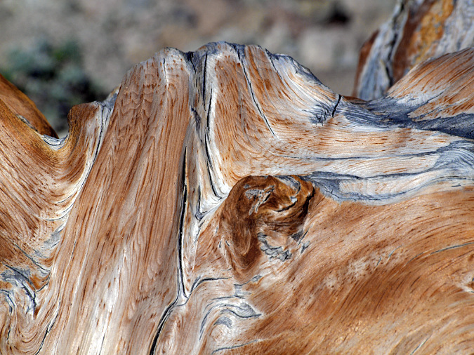
Constant sculpting of this ancient Whitebark pine on Gnarl Ridge from blowing sand and ice crystals prevents the it from oxidizing to grey before it is sanded away, continually revealing the underlying color of the wood

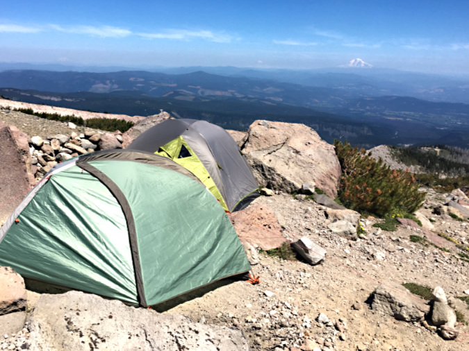
This old tree is also about 200 feet from a group of tent sites along the Timberline Trail. What it may not escape is some camper snapping off its ancient, gnarled limbs for firewood — or worse, a spot wildfire caused by an unattended campfire left burning here for lack of a nearby water source on this windy, exposed alpine ridge.

For me, helping these threatened survivors live another century so that future generations might see and be inspired by them is perhaps the reason of all for finally putting an end to our wilderness campfires.

_____________ 

Tom Kloster • August 2025

_____________

Postscript: I’ve noted this in recent articles, but it bears repeating: this piece is written at a time when the Forest Service, National Park Service and Bureau of Land Management are under siege from a hostile administration in an unprecedented, orchestrated and blatantly corrupt attack on our public lands. My intent is certainly not to pile on at a time when our public workers at these agencies need our support and respect. 

However, I also accept the unfortunate reality that it will take many years to restore these organizations. In the meantime, we will need new approaches to protecting our public lands until we eventually rebuild the agencies charged with their management.  This article is written in that spirit and in deep support for our public lands agencies.

Columbia Prickly Pear?

Columbia Prickly Pear colony thriving on the morning side of WyEast

I am a cactus fanatic. As a seven-year-old, I had a row of them in my bedroom window. They were little collectibles in 2-inch pots that you could buy at Fred Meyer for 49 cents. On my first road trip to the Desert Southwest in 1984 I couldn’t get enough of them. That was the first of many trips, often timed to capture cactus in bloom – to me, the ultimate in wildflower beauty.

Cactus are the rattlesnakes of the desert wildflower community. They combine exquisite beauty with remarkable evolution for a strong self-defense. Did you know that cactus spines are really their leaves, modified for both defense and shade? Or that the pad on a prickly pear cactus is really a thickened stem that carries out photosynthesis in the absence of green leaves? They have evolved to a point that seems downright alien to most other flowering plants.

Brittle Prickly Pear colony growing in the Painted Hills Unit, John Day Fossil Beds National Monument

A few years ago, I came across my first prickly pear cactus in Oregon. It was one of our native species, Brittle Prickly Pear, growing in the John Day National Monument at the Painted Hills Unit. I revisited that patch a couple of times over the years, and finally saw it in bloom – another highlight! 

Since then, I have found dozens of Brittle Prickly Pear colonies all around the Painted Hills and adjacent Sutton Mountain areas, often covered with blossoms in late May and early June. Even in bloom, these plants are easy to miss in their native desert habitat. Their compact pads are rounded, about the size and shape of your thumb, and covered in grey spines that also act as camouflage against the desert floor. A mature plant has 20 to 30 pads growing in a low mat that is usually less than 6 inches tall. 

Brittle Prickly Pear blossoms at Sutton Mountain, near the Painted Hills

Brittle Prickly Pear bear fruit after blooming and can spread by seed, mostly by birds who navigate the cactus spines to feed on the soft inner part of the fruit. Called “tunas”, their fruit is sweet, putting the “pear” in their common name. Like other Prickly Pear species, they have long been used by indigenous people as a food source and medicinally. Fruit from larger Prickly Pear species is still used to make jams and other foods in Native American and Mexican culture.

Their heavy coat of spines and the ability of pads to freely break away is how Brittle Prickly Pear most commonly reproduce. When kicked loose by deer hoof or hiking boot, a stray pad is given a chance to take root and start a new patch in a local colony of cactus. This is how these “brittle” cousins in the Prickly Pear family earned their common name.

Our northern cactus may be diminutive in stature, but they are built small for a reason. Unlike their much larger relatives in the Sonoran Desert, ours endure bitter winter cold and months of winter storms that would flatten the larger cactus you might see in the Sonoran deserts of Arizona or New Mexico. 

Ahab and Moby Cactus…

Given my cactus obsession, I had it in my mind to someday see another of our local cactus: the Columbia Prickly Pear, a species that only grows in low-elevation deserts of the Columbia River and Snake River basins. It became my white whale, and I was determined to see Moby Cactus!

There is still some debate as to whether these are a separate species or a hybrid of our Brittle Prickly Pear and Plains Prickly Pear. The latter is a much more common species that grows across much of the West. Botanists have yet to fully agree on this, so for now Columbia Prickly Pear is called Opuntia Columbiana X Griffiths. The last part of the Latin name comes from botanist David Griffiths, who first documented the species for Western science in the 1920s. 

Pioneering western botanist David Griffiths in 1903 (Università di Padova)

Griffiths was from a Welsh family that immigrated to South Dakota in 1870, when he was just three years old. He earned a doctorate in botany from Columbia University in 1900, and went on to distinguished career as a groundbreaking scientist working for the U.S. Department of Agriculture (USDA). There, he spent the first part of the 20th century traveling across the American West documenting plants and photographing the range conditions of the Great Basin at a time when the impacts of fencing and heavy grazing on the desert ecosystem were first beginning to appear. 

His work was seminal in helping the USDA improve range management practices on our public lands across the West. When Griffiths died in 1935, he donated his botanical records and collection of glass-negative photographs to The Smithsonian National Museum, along with hundreds of Opuntia specimen that he had collected over his career. The Smithsonian describes his archives in bulk terms — 43 cubic feet, to be exact!  Griffiths’ field research legacy is still cited by today’s botanists and rangeland scientists, and his name lives on in our local Columbia Prickly Pear.

One of David Griffiths dozens of field notebooks. These pages describe the inside of Prickly Pear fruit. He is believed to have sliced fruit open and simply pressed them against the page to create these images (Smithsonian Museum)

Though David Griffiths has come to be remembered mainly for his passion for the Opuntia family of cactus, his interest in these tough, versatile survivors initially came from a belief that they could somehow be a livestock feed source on the open range. As odd as this sounds, the pads and fruit are already important for deer, antelope, squirrels and other wildlife who either consume the pads whole or work around the spines to get to the flesh. Other wildlife are more opportune, and consume Prickly Pear after range fires have swept through, searing their spines off. This is precisely how indigenous people prepared the nutrient-rich pads and fruit as a first food for millennia, though the spines were also used for sewing, fish hooks and other purposes.

Not too long before Griffiths first cataloged Prickly Pear cactus, white immigrants to the American West discovered them, as well – and not in a good way.  Journals from the Oregon Trail describe the misery of migrants stepping through prickly pear as they crossed the western plains in worn out shoes, as most who traveled the Oregon Trail walked beside their wagons for much of the journey.

Our native cactus are easy to miss in the wild. There are at least five patches of Columbia Prickly Pear in this colony along the Columbia River – marked by arrows. In spring, they are especially well-hidden in new, green grass

Having skewered myself a few times with their spines, I can attest to the lingering soreness that comes with getting poked by a Prickly Pear. I suspect native peoples were more adept at navigating them — even nurturing them, perhaps, since they were valued for their food and cultural value. The photo above gives a sense of how well-camouflaged our Columbia Prickly Pear are in the desert grasslands and sagebrush country of the eastern Columbia River Gorge. The arrows point to several patches of cactus in this colony, each no more than 10 inches tall, yet wide enough to snare an inattentive foot!

The 2025 cactus hunt…

Local wildflower buffs and botanists had already done the hard work and locating Columbia Prickly Pear in the east Columbia River Gorge, making my mission much simpler. There were at least three well-documented colonies, and knowing this, I made 2025 the year that I would see them for the first time – and perhaps even photograph them in bloom.

I initially set out over the winter to simply locate the known colonies from fairly general maps posted online. The first colony was located across the river from the Dallas Dam in a most unlikely spot, surrounded by buzzing transmission lines from the dam and traffic noise from interstate 84. However, this colony was also safely within the confines Seufert Park, a Corps of Engineers site adjacent to The Dallas Dam visitor center.

Columbia Prickly Pear thriving just upstream from the Columbia River Bridge in The Dalles. While these can be tough to spot in spring and summer, they stand out strikingly in winter with their spines capturing the low-angle sun and surrounding grasses dormant and flattened by the winter elements

A short trail hike and a bit of cross country exploring took me straight to a colony of about a dozen cactus patches. They looked much like their Brittle Prickly Pear cousins, though their pads were more flattened and slightly larger. It was a thrill to see them growing right here in WyEast country, with the Columbia River spreading out below and Mount Hood shining on the horizon. I’d found my whale!

The next stop took me across the river to Avery Landing, another Corps of Engineers recreation site, just upstream from Columbia Hills State Park and Horsethief Butte. Expecting to find a similar colony here,  I wasn’t prepared to find a much larger group of much larger plants! The pads on these plants were as much as 6 inches across, and flat like the Prickly Pear cactus I had seen in the Desert Southwest. These plants stood as much as 2 feet high, and were growing on a high, rocky bench with a beautiful backdrop of the Columbia River and Mount Hood, beyond.

Prickly Pear cactus at Avery Landing grow on a rocky bench, a few hundred feet above the park and Columbia River. These are much larger plants than what I saw at Seifert Park.. why?

With the summer grasses and wildflowers dormant, the structure of Prickly Pear on these very large plants was easier to understand. New pads – the modified stems – grow from nodes on the edge of older pads, with typically 1-3 new pads emerging each spring, as shown below. 

How Prickly Pear grow, typically with one to three new pads forming on the margins of an older pad

Over time, this growth habit eventually tips the plants over from the successive weight of each new pad, making them seem to be growing horizontally. When pads touch the ground, they can easily take root, forming a new plant and helping further spread the patch from the original, parent plant. In the image below, each successive pad marks at least one year of growth, as new pads don’t always form on old pads. Thus, this stem of four successive pads is at least four years old, with the newest pad nearly touching ground where it might take root.

This chain of Prickly Pear pads originally stood upright, but has gradually tipped and sprawled with the weight of each successive new pad. Eventually, these pads can root and form new plants if they touch the ground

Though not as common, some older pads that support many newer pads eventually become woody stems to support the load. The image below shows how these stems gradually change from green, energy-producing pads to brown, more conventional stems. The pad near the woody portion of the stem is undergoing this transition, having lost the chlorophyll from the lower portion of the pad.

This Prickly Pear at Avery Landing has developed a woody stem from what was once a green pad in order to hold up the heavy load of successive pads that have emerged

For a cactus fanatic, exploring the colony at Avery Landing was a heady experience! But I had one more colony to visit in completing my initial tour of Prickly Pear in the Gorge.

The final winter stop took me Cliffs Park, yet another Corps of Engineers site, located on the Washington side of the river at John Day Dam. This is a familiar place to me, as I have photographed the beautiful river scenes and ancient gravel beaches that line the Columbia here many times. Using online maps, I found just two small plants that were about the same size in stature as those in Seaford Park, but in much smaller patches. It was a disappointing stop, especially compared to the large colony of very large Prickly Pear at Avery landing. Did I miss something?

Like the Columbia Prickly Pear at Seifert Park, the small colony at Cliffs Park grows in the shadow of one of the massive Columbia River Dams. The John Day Dam rises above this cactus patch

However, as I was photographing the small colony at Cliffs Park, I noticed new buds emerging from some of the pads (below). Were these flower buds or new stems? Surprisingly, some of the buds were also located on the flat side of the pad in addition to the edges. This was quite different from what I had seen at Avery Landing. I was now determined to come back and do a more thorough search in this area and document the growth of these buds in spring.

The arrows point to new buds emerging from this Columbia Prickly Pear at Cliffs Park in early March. Are these flower buds or new pads forming?

As spring approached, I made several more visits to the impressive colony at Avery Landing, and was especially excited in early May to find the plants loaded with flower buds (below). These buds developed very quickly, over just a couple weeks. 

Hundreds of flower buds were nearly ready to open at the Avery Landing Prickly Pear colony in mid-May

When the Avery landing colony finally began blooming in late May, I was there with my camera to capture it all, including a photo with the trifecta of cactus blossoms, Mount Hood, and the Columbia River that I had been hoping to capture (second photo, below).

The first Prickly Pear blossoms to open in the Avery Landing colony in late May

Trifecta! Blooming Prickly Pear, the Columbia River and Mount Hood a few days after Memorial Day in late May

However, this is where the story takes an unexpected turn. When I took these photos, I thought the Prickly Pear colony at Avery Park to simply be a more vigorous, over-achieving version of the same Columbia Prickly Pear growing across the river, at Seufert Park. Perhaps their much larger size was simply a reflection their habitat? Where the Seufert Park and Cliffs Park colonies were growing on arid, thin soils atop basalt outcrops, the Avery Park colony grows in deep, sloping sand and gravel deposits left behind by the Missoula floods. Perhaps these soils simply offer more moisture and nutrients than are available to their smaller neighbors across the river?

Only after sharing photos of the Avery Landing colony in an online wildflower community, did I learn that the Avery Landing cactus were not our native Columbia Prickly Pear at all! Instead, these are Desert Prickly Pear, an introduced species known as Opuntia Phaeacantha that grow across much of the desert southwest and into the southern Great Basin. Fact is, their true identity wasn’t completely surprising to me, as the growth habits and size of the two species are so different. But it was disappointing.

Desert Prickly Pear is the true identity of the introduced cactus species growing at Avery Landing

It’s hard to say whether these Desert Prickly Pear were planted here intentionally or arrived here accidentally, but they are thriving now. They have formed an extensive colony of at least 25 separate groups that span a 100-yard long bench above the Columbia River. Their size and the extent of the colony suggests they have been here for some time – likely decades or longer – so they are clearly here to stay.

It’s hard to know exactly how the Desert Prickly Pear cactus have been spreading in the Avery Park colony, but because they are mostly clustered along an abandoned road grade (as highlighted on the map below), their spread here could simply be from human or wildlife activity kicking pads loose to root and begin a new patch.

The Desert Prickly Pear colony at Avery Landing grows on a gravel bench that splits off the access road to the park. The separate groups that make up the colony fall within the highlighted area on this map

However, when I visited the colony again in mid-June, the blossoms had mostly faded and the colony was busy forming hundreds of fruit – tunas – that I think might be the primary explanation for the size of the colony. That’s because there is plenty of wildlife sign here, including a very active colony of California ground squirrels living in the basalt outcrops that border the bench. I suspect they are among the wildlife species feeding on the fairly large tunas and thereby spreading their seeds.

Desert Prickly Pear blossoms have dried up on this plant by early June. They will soon drop off as the fruit beneath ripens

Desert Prickly Pear fruit after blossoms have fallen off in mid-June. They will eventually turn to a reddish-purple color as they ripen

As disappointing as the revelation of their true identity was, the colony of Desert Prickly Pear at Avery Landing is nonetheless a spectacular sight. We may be seeing our future here, too, as climate change spurs plant species from across the spectrum to migrate northward as our Pacific Northwest climate becomes warmer. Already, this colony of Desert Prickly Pear is proving the eastern Columbia River Gorge to be an ideal habitat for a species whose native range is nearly 1,000 miles to the south.

Because I had spent much of the annual bloom window in May at Avery Landing, focused on what I thought were Columbia Prickly Pear cactus, I hurriedly doubled back to the colony at Seufert Park hoping to catch the colony there in bloom. No such luck. By the time I returned there in early June, they were completely bloomed out. Still, I was encouraged to see so many dried blossoms on these plants. I knew I would have another chance to photograph them next year, and a fair estimate of their bloom window in late May.

Columbia Prickly Pear at Seufert Park, with dried blossoms just days after the annual bloom cycle. Blossoms here were much less prolific than on the Desert Prickly Pear at Avery landing. The arrows mark just two blossoms on this large patch

Dried Columbia Prickly Pear blossoms at Seufert Park. The fruit (or “tunas”) beneath the spent blossoms were developing quickly here, already turning to their characteristic ripened hue of deep reddish-purple

Finding only dried blossoms at Seufert Park, I headed east on a very hot June day to revisit the tiny group of Columbia Prickly Pear I had seen at Cliffs Park by the John Day Dam. Perhaps these might still have a few blooms? This time, I ignored the online documentation on the colony and explored the basalt outcrop they grow on more broadly. Sure enough, just 50 yards from the two small plants I had seen on my first visit, I came across at least two dozen well-developed patches in a colony that surpassed Seufert Park. Eureka!

However, the desert grassland had completely browned out for the summer at Cliffs Park, and the cactus were completely bloomed out, too. Still, I was excited to find so many plants here and spent much time that day exploring and photographing them.

Part of the surprising Columbia Prickly Pear colony at Cliffs Park (John Day Dam in the distance). Each arrow marks a separate patch

Then, just as I was getting ready to leave the Cliffs Park colony, I came across one last patch of Columbia, Prickly Pear with a single blossom still hanging on. Fortunately, nobody was around to hear when I let out a whoop! I set up my camera and documented that lonely cactus blossom like no flower has ever been photographed. Ahab had finallyfound his whale!

A straggler! One last Columbia Prickly Pear blossoms (center right) was hanging on for my visit to Cliffs Park in early June. And yes, a trifecta – snowy WyEast and the Columbia River are in the distance

Last of the Columbia Prickly Pear blooming at Cliffs Park in early June

Though I missed most of the spring cactus bloom at Cliffs Park, there was plenty of evidence that it had been a good year, with ripening fruit throughout the colony. And while the blooms had been fairly scattered across the colony, there were also plenty of new pads that had developed over the spring, with new, soft spines that were still hardening into new armor.

Fruit forming beneath dried blossoms on Columbia Prickly Pear at Cliffs Park

The Columbia Prickly Pear colony at Cliffs Park is healthy, with several blooms and many new pads emerging this spring. In this view, four new pads have formed. They can be identified by their short spines that have yet to fully mature

It was already hot and dry at the Cliffs Park colony by early June, so these plants won’t get much moisture until well into September, putting their unique water storage ability into use, once again. 

Columbia Prickly Pear at Cliffs Park ready for the summer dry season. This plant has added just one new pad this season (lower right), illustrating how slowly these plants grow in their harsh environment

While the rest of the desert goes dormant until the rains return, these unique plants will remain green and producing food for their root systems throughout the summer and their spines will help protect them when most other forage is long dried up in the desert landscape. This is the genius of their evolution.

They seem to like it on the rocks…

Learning that the Avery Landing cactus colony was an introduced species and not the native Columbia Prickly Pear we have at Seufert Park and Cliffs Park helped me understand the preferred habitats for both species, as they are quite different. 

The Desert Prickly Pear at Avery Landing is happy on flat or steep slopes, provided that it can grow in loose, sandy or gravely soils. The Gorge has plenty of this with deep Missoula flood deposits lining the river on both sides, sometimes hundreds of feet deep. 

Desert Prickly Pear at Avery Landing seem to prefer the loose benches of Missoula Flood sand and gravel that were left here by ice age floods

Desert Prickly Pear seem highly adaptable, some growing in flat areas and hollows, while others thrive in steep ravines and slopes

Sandy soils seem to be key to the flourishing Desert Prickly Pear colony at Avery Landing 

Colorful Missoula Flood gravels are mixed with the sandy soils at Avery Landing, another ingredient the Desert Prickly Pear seem to favor

In contrast, the Columbia Prickly Pear colonies at Seufert Park and Cliffs Park are growing in loose scrabble directly on top of exposed basalt outcrops where the Missoula Floods scoured the bedrock. These are harsh places that seemed impossible for a plant to survive, yet our native Columbia Prickly Pear seems to prefer them. 

Columbia Prickly Pear at Seufert Park grow in thin, gravelly soils on a basalt bench above river. A second cactus patch in this view is shown with an arrow

This Columbia Prickly Pear at Cliffs Park is growing from a narrow crack in the basalt

This young Columbia Prickly Pear at Cliffs Park has somehow found a toehold on top of a basalt slab

This is especially apparent at Cliffs Park, where the colony is scattered across a low basalt table, despite being surrounded by deep soil deposits of gravel and sand on three sides.

The Cliffs Park colony favors the top of this dry basalt ledge over the deeper soils that surround it, perhaps because there is less competition there from other plants?

The best explanation might be simple competition, as the sandy areas with deeper soils support much more vegetation, including several wildflower species, where the basalt table is mostly limited to grasses, moss and lichen. Where a thin layer of soil has accumulated on the table, the Columbia Prickly Pear seem most at home. Their unique ability to withstand extreme drought also makes them uniquely able to grow under these harsh conditions.

Helping the Columbia Prickly Pear thrive?

While our Columbia Prickly Pear are not common, they are (fortunately) neither rare nor threatened. They’re just quite hard to find. That’s a shame, because they are unique and deserve to be more widely known and appreciated. This article was written in that spirit (including some general directions for finding them, below). 

Were Columbia Prickly Pear much more common in the Gorge when Benjamin Gifford took this photo in 1899 at today’s Cliffs Park? I think so…

Why are they so uncommon? My theory as to their present scarcity is simply the wear and tear on the Columbia Gorge since the era of white settlement began nearly 200 years ago. Heavy grazing, first by sheep, then cattle, surely had an impact. Railroad, highway and dam construction followed, and – most recently – windmills. All disrupted our native flora and fauna. Unlike most other wildflowers, cactus are slow growers, and I suspect they are simply more vulnerable to frequent disturbance. This might be another explanation for colonies living atop rocky basalt outcrops where not much else survives.

To help remedy this state of affairs for our Columbia Prickly Pear in a small way, I’ve taken on a project that I thought I’d share here. 

The oddly small number of our native cactus in their native landscape inspired me to try propagating them with the intent of starting some new colonies. My (perhaps half-baked) plan is to offer them to public land managers in the Gorge interested in to establishing new Columbia Prickly Pear colonies in a few new spots of similar habitat along the river – of which there are many.

With that goal in mind, I had collected some pads at Avery Landing last winter for propagating before I knew these to be a different species than our native Columbia Prickly Pear. They rooted nicely, but now they will be donated to a garden in Portland – not the Gorge. 

Prickly Pear propagate readily, even from the somewhat withered, bedraggled state of these Desert Prickly Pear cuttings in March

By May the Desert Prickly Pear starts had plumped up from their withered state, showing they had quickly grown new roots. Soon, they began pushing out buds for new pads just two months after I planting. Three new buds are numbered here

By early July, the Desert Prickly Pear cuttings were fully rooted and forming new pads

More recently, I collected some pads from our Columbia Prickly Pear. I’m hoping to root them over the summer and offer them to any interested public land managers, especially state parks. Collecting the pads was simple and discreet – as in, I left no trace. The tools involved a pair of kitchen tongs, a paring knife, leather gloves and a paper grocery sack (as I said in my opening, I’m a cactus fanatic, and growing them is in my wheelhouse!). Once harvested, I gave them a few days for the cut to form a callous before planting them in a 50/50 mix of potting soil and perlite.

Columbia Prickly Pear pads collected for propagation in mid-June

Columbia Prickly Pear pads ready for potting in mid-June

The Columbia Prickly Pear nursery in the foreground (smaller pads with yellow-green coloring and white/grey spines) is clearly different in this side-by-side comparison to the much larger Desert Prickly Pear starts (in back, with blue-green pads and red/brown spines) 

And then there’s the little cactus shown below. As I was exploring the colony at Cliffs Park, I found this seedling growing on the gravel shoulder of the park road, just a few inches from the asphalt pavement. I had nearly flattened it when I parked on the shoulder! It was clearly doomed there, so thanks to a small trowel I carry my trail car, this little rescue is now growing happily in a pot, waiting to be planted in some permanent location where it might start a new colony.

The little rescued cactus also gave me a good look at their root systems in the wild. They are surprisingly shallow-rooted! It makes sense when you consider their ability to store water in their pads, and their preferred habitat in shallow, rocky soils.

The Cliffs Park rescue cactus gave me my first look at the surprisingly small root system these plants have in the wild

The Cliffs Park rescue cactus potted and growing in his (her?) new home for a while

I don’t have a specific plan for this project beyond propagating a few plants, but my lifelong cactus obsession would not let me do otherwise. I just think that more people should see these amazing plants in places where they likely used to grow in the East Gorge, before white settlement.

Should you propagate these plants? It’s perfectly legal to take cuttings, so if you own property in the East Gorge with the right habitat and are looking to add native species, yes. You would be helping this unique species thrive. Otherwise, simply admiring them in the wild is the best plan. They don’t make for great ornamental cactus for urban settings compared to the many cultivars out there that have been bred for our gardens.

Where you can see them…

If you are interested in seeing cactus growing right here in the Columbia River Gorge, the colonies at Avery Landing and Cliffs Park are very easy to visit. Both bloom from mid-May into early June. Like many cactus species, the blossoms seem to open during the middle of the day and into evening, so afternoons are the best bet for a visit. However, they are fascinating plants to see any time of year, not just during the blooming cycle.

The Columbia River Gorge Prickly Pear tour begins in The Dalles (and ends at Big Jim’s for a milkshake, of course)

[click here for a large, printable map]

While the Avery Landing colony of Desert Prickly Pear are not native, they are beautiful and grow in a spectacular setting. Most of the colony grows along an old road grade that splits off the paved access road to the park. Watch for it heading off to the right just past the winery at the top of the hill. If you cross the railroad tracks, you have gone too far. Here’s a view (below) of the road grade looking back toward the park road and winery – you can park where I did.

Looking east along the old road grade that is home to a large Desert Prickly Pear colony

Part of the Avery Landing colony is on private land, and clearly defined as such with the fence gate. Please respect private property rights. 

To see our native Columbia Prickly Pear, you can visit them along the paved access road to Cliffs Park, located on the Washington side of the river at John Day Dam. Follow the road into the park, and pull off just before it turns to gravel. Here’s a wayfinding photo – watch for these signs and pull off just beyond them. The cactus colony is on the low basalt bench just ahead, on the right (north) side of the road.

The Cliffs Park colony is located on the low, rocky bench directly beyond these park signs

Walk slow and carefully to avoid stepping on them – both for your benefit and theirs! And as with any desert hiking, watch your step for rattlesnakes, too. While you’re not likely to see one, they do like to bask in late morning and early afternoon in rocky areas like this.

The towering backdrop to the Cliffs Park colony are the sacred bluffs that I described in this article (you’ll need to scroll down). This is the area where a proposed energy project is being contested by area tribes and many other groups. 

If you’d like to learn more about the controversial project from the perspective of the Rock Creek Band of the Yakama Nation, a powerful new documentary called “These Sacred Hills” is currently being screened around our region.  https://sacredhillsfilm.com

The sacred hills rise above the Cliffs Park colony of Columbia Prickly Pear

While you are at Cliffs Park, consider traveling a bit further down the gravel road to visit the expansive pebble beach composed of Missoula flood deposits. Mount Hood floats on the horizon, making this one of the most beautiful spots on the Columbia River.

Mount Hood rises above traditional fishing platforms and the vast beaches of Missoula Flood rocks at Cliffs Park

This is a traditional Indian fishing spot, and you will see several fishing platforms here. The park is open to everyone, but please respect the tribal fisheries and the native fisherman who may be working here. I personally choose not to photograph indigenous people fishing, even on public lands.

I did not include Seifert Park on this itinerary for a couple reasons. First, the cactus here are harder to find than those at Avery Landing and Cliffs Park. Also, while it is public land and open to anyone to explore, the park also includes treaty-protected tribal fisheries. If you do go there, please respect the rights and privacy of the tribes. 

These rocky outcrops are home to the Seifert Park colony of Columbia Prickly Pear, but they are also protected tribal fisheries. Please be respectful if you explore here

To see our little Columbia Prickly Pear cactus growing in the most unlikely of places gives a sense of the timelessness of nature, despite these colonies being surrounded by transmission towers, the noise of the dam spillways, railroad and highway traffic and the bones of abandoned industries. While the hand of man has not been kind to these areas, the resiliency of nature is truly impressive and inspiring. 
_______________

Tom Kloster • July 2025

A New Vision for Oregon’s Hidden Wilderness

One of the dozens of unnamed, unmapped and off-trail waterfalls hidden in the canyons of the Opal Creek wilderness. This rarely visited falls is on Henline Creek

Heading south from Portland along old Highway 99E brings you first to the historic river town of Milwaukie, then up a forested bluff, past the end of the MAX light line and to the Oak Grove district of Clackamas County. From here, the old highway turns southeast, and makes a long, straight (and dreary) descent through the clutter of strip malls and used car lots on its approach to the edge cities of Gladstone and Oregon City. Normally, this is a grim part of this drive, but that last descent holds a surprise on clear winter days: a prominent cluster of mountain ridges on the horizon just high enough to be snowcapped well into June. What are these peaks?

These are the high crags and ridges that form the rugged crest of the Bull of the Woods Wilderness, the adjoining Opal Creek Wilderness and nearby Table Rock Wilderness areas. The Bull of the Woods and Table Rock areas were protected by Congress in the landmark Oregon Wilderness Act of 1984 and protection for the Opal Creek area followed in 1996. Before it was protected in 1984, the Bull of the Woods area was known to conservationists as the Hidden Wilderness. It’s an apt name and one that I’ll use interchangeably in this article, because despite the surprisingly close proximity to nearly 3 million people in the Willamette Valley, this wilderness remains mostly unknown today.

The Bull of the Woods, Table Rock and Opal Creek wilderness areas are located 30 miles due west of Salem and about 50 miles southeast of the Portland Metro Area.

[click here for a larger view]

We often say this about the lesser-known gems in our scenery-overloaded corner of the country, but if these areas were located in any state east of the Rockies, they’d be a major attraction. More than a dozen craggy peaks across the three wilderness areas rise above 5,000 feet, and the network of streams that radiate from this complex of mountains and steep ridges are among the most pristine in Oregon. 

Together, the streams combine to form the beautiful Collawash River, Hot Springs Fork of the Clackamas, Molalla River and Little North Fork of the Santiam. These rivers are known for their unusual clarity, thanks to their protected headwaters. 

Sawmill Falls is located on the Little North Fork of the Santiam River that flows from the Opal Creek Wilderness. This photo was taken just before the Bull Complex Fire impacted this part of the Little North Fork in 2021

Opal Creek, a major tributary to the Little North Fork and the namesake for its own wilderness. This photo was also taken before the Bull Complex fire in 2021

The Hidden Wilderness high country is also dotted with dozens of subalpine lakes and tarns that fill cirques and valleys left behind 15,000 years ago by ice age glaciers, when the peaks of the Hidden Wilderness rose high above the timberline. Below the lakes and peaks, dozens of spectacular waterfalls are hidden in the deep, forested canyons. These remain mostly unnamed and little known, and are inaccessible by trail.

A surprisingly dense network or trails traverses the area, however, though they weren’t built with hikers in mind. Some of these trails were built in the late 1800s, during a mining boom that saw a major influx of human activity when gold was discovered along the Little North Fork in 1859 – the same year the State of Oregon was admitted to the union. 

Small-scale hard rock mining later expanded across the mineral-rich Hidden Wilderness region to include copper, zinc and lead. Silver King Mountain, in the heart of the wilderness, was named for one of these mining claims. Today, old mining shafts and rusted relics from this era still remain scattered through the forests of the Hidden Wilderness, adding to the mystery and intrigue of the area.

Henline Falls in the Opal Creek Wilderness is named for a miner who made a claim here in the late 1800s. Abandoned mine shafts can still be found along the creek, including one at the base of the falls. This photo was taken before area was impacted by the 2021 Bull Complex Fire

Hikers exploring the abandoned mine at Henline Falls. Mining relics from the late 1800s and early 1900s are found across the Hidden Wilderness


Many of the area trails were built later, when the area was first designated as national forest in the early 1900s. These trails were built to connect the network of fire lookout towers built atop several peaks in the Hidden Wilderness and to the subalpine lakes that provided a water source for lookouts and stock animals. In those early days of the Forest Service, trails also connected guard station, where forest rangers were stationed and “ranged” the forest trails to protect public lands from illegal logging and grazing. Hikers would not discover these trails until the 1920s and 30s, when the first roads brought weekend campers to the forest.

The original cupola-style Battle Ax Mountain  fire lookout in the 1930s (USFS)

The Bull of the Woods fire lookout in the 1950s with Mount Jefferson in the distance (USFS)

Most of the historic lookouts and guard stations in WyEast Country were destroyed by the Forest Service in the 1960s, deemed obsolete when air surveillance for fires took over and the modern cobweb of logging roads transformed access within the forest. The old lookout on Bull of the Woods Mountain survived until very recently, when it was destroyed in the Bull Complex Fire in 2021. More than a dozen lookouts and guard stations once stood in the Hidden Wilderness, but only the unique stone Pechuck Lookout structure on Table Mountain and the historic Bagby Guard Station survive today. 

Bagby Hot Springs Guard Station in 1913, among the few guard stations where rangers were guaranteed a warm bath every night!

Most of the early 1900s lookouts and guard stations were destroyed in the 1960s, but the historic Bagby Hot Springs Guard Station survives today and serves as a northern gateway to the Bull of the Woods Wilderness

For many years, an unofficial network of dedicated trail advocates has worked to keep the historic network of trails in the larger Clackamas area alive in the face of years of Forest Service neglect, and, more recently, the wave of wildfires that have brought many of the trails here to the brink of being lost forever. A reputation for lawlessness and confusing, poorly maintained trailhead access roads left over from the big logging era of the 1960s, 70s and 80s in the Clackamas River corridor have also discouraged hikers who might otherwise come here to explore this wilderness gem, hidden in plain sight. 

The trail system in the Hidden Wilderness has been in slow decline for decades, first from logging that destroyed many trails and trailheads, and later through lack of maintenance and the impacts of frequent wildfires

The unprecedented attack on federal agencies in recent months by the current administration will only add to the struggle to keep the existing trails open in the near term. But in the longer term, there’s no reason to believe this regrettable trend won’t be reversed. This administration will be replaced in just a few short years, and the demand for more and better trail access to our public lands will only grow in that time. 

A strong public backlash against the administration’s public lands policies has organized in recent weeks, underscoring the obvious — that people deeply value our public lands, and expect to have access to them. It’s also true that we are in the middle of a generational transition in national leadership, with younger leaders much more likely to view conservation, clean water and recreation as the primary purposes of our public lands.

With this longer, more hopeful future in mind, the rest of this article focuses on the Hidden Wilderness as it could be, and can be. It’s a positive vision for restoring and expanding trail access into the area, embracing and restoring some of the history that has been lost, and in doing so, provide the Hidden Wilderness the care this remarkable place deserves.

Return of Wildfire: It’s still (mostly) a good thing…

The Janus Fire grew rapidly and combined with other blazes to become the Bull Complex in the summer of 2021 (USFS)

When the Janus Butte fire sparked on a ridge above the Collawash River in August 2021, it felt like a recurring bad dream for many, given the series of devastating fires that had roared through the Mount Hood National Forest in the fall of 2020. 

While most of the very recent fires in WyEast Country (including the 36 Pit Fire in 2014, the Eagle Creek Fire in 2017 and the massive Riverside Fires in 2020) were notoriously human-caused, the Janus fire was different. Instead, this was a natural wildfire that began with lightning strikes that ignited several small fires in the Collawash River headwaters. By mid-August of 2021, these fires would merge with the Janus Fire and become known as the Bull Complex, named for the Bull of the Woods Wilderness, where they were advancing quickly.

The Bull Complex eventually burned nearly 25,000 acres (shown in pink), with roughly half the Bull of the Woods Wilderness (in dark green) affected. This fire spared previously burned areas to the west, in the adjacent Opal Creek Wilderness, where the 2020 Beachie Creek Fire resulted in more than 90 percent mortality over much of the 190,000 acre extent

By the end of September 2021, the Bull Complex had burned just short of 25,000 acres. Though significant, this burn was only fraction of the 190,000-acre Beachie Creek Fire that swept through the adjacent Opal Creek Wilderness and 138,000-acre Riverside Fire that burned through the Clackamas River area to the north the previous year. 

Together, this combination of natural and human-caused fires left a massive burn scar across much of the Clackamas River and Little North Fork watersheds that will take decades to recover. While science tells us that wildfires are a healthy and necessary part of our forest ecosystem, how could burns this extensive be a good thing? 

This aerial view shows the impact of the Bull Complex Fire on the heart of the Bull of the Woods Wilderness. The burned slopes of Mount Beachie (in the foreground) are from the much larger Beachie Creek Fire in 2020.

[click here for a large version]

The answer is nuanced. The combined effect of a century of fire suppression and our changing climate has resulted in an unsustainable sequence of fires in recent years in terms of their size, intensity and frequency. This will make forest recovery in some of the largest (and, notably, human-caused) burns much slower. But where recent burns were smaller and less intense, the recovery cycle is already well underway, and the benefits that science promises are already apparent in these places, including in the Bull of the Woods Wilderness.

The Bull Complex Fire is a good example. The fire burned mostly along steep mountain slopes and ridgetops, including through hundreds of acres of standing snags from a series of earlier fires in the Bull of the Woods that swept through the heart of the wilderness in 2008, 2010 and 2011, completely clearing these slopes for what will most likely become beargrass and huckleberry fields for many years to come. The fire also skipped over several forested canyons that had been spared by earlier fires, allowing trees in these areas to continue to age as mature forests, retaining the biological complexity that only old growth forests can bring to a forest ecosystem. 

While the Bull Complex was mostly a beneificial fire for the forest ecosystem, it wasn’t so kind to human infrastructure. It will take years to repair trails impacted by the fire, and many favorite camping spots at the high lakes were completely burned. Perhaps most distressing on the human side of the equation was the loss of the historic Bull of the Woods Lookout tower that as completely destroyed by the fire (more on that later in this article). 

For the first few weeks, it seemed the 2021 Bull Complex Fire might spare the historic Bull of the Woods fire lookout, but in early September of that year, the fire surged west, completely destroying the old structure (TKO)

Just three years after the Bull Complex Fire, the 2024 fire season threatened to bring yet another blaze to the Bull of the Woods when Sandstone Fire flared up just north of the Hot Springs Fork last September. Like the Bull Complex, this fire threatened the historic structures at Bagby Hot Springs that had been spared by the 2021 fires. Fortunately, the fire was soon contained and cool fall weather set in before it could spread south to the Bagby area.

The rapid succession of wildfire in recent years in the Hidden Wilderness area has felt jarring mostly because fires here had been successfully suppressed for so long. There was a sense that our forests could remain green and unburned, indefinitely, and that they had always looked this way. But if you look closely at photos taken in the 1930s as part of an expansive Forest Service surveying effort, the forests then looked much like our fire-impacted forests of today. While the current pace of fires feels alarming, we are looking at a forest ecosystem that is much closer to its pre-forest management days, with an ecosystem in a far healthier state that was more adapted to fire.

The following photos are from that 1930s survey, and clearly show a forest that had repeatedly burned with smaller, beneficial fires in the decades prior. For the first image, I paired the 1930s view with one took in 1981, showing how the forests south of the Bull of the Woods had already covered the landscape in the absence of fire during the 50-year period between the images:

[click here for a large version]

This 1930s view from Bull of the Woods shows recent burns along the ridges to the southeast that were likely ignited by lightning, and only burned small patches – a desirable “mosaic” pattern that is beneficial to forests:

[click here for a large version]

Looking to the west from Bull of the Woods in the 1930s revealed yet another recent burn in the Pansy Basin, and area that is now forested and has largely survived more recent fires:

[click here for a large version]

This view is from Whetstone Mountain, looking east toward today’s Bull of the Woods Wilderness, showing much of the upper headwaters of Battle Ax Creek burned. Some of these early fires may also have been human caused by mining activity in the area – a mining camp is visible in this image:

[click here for a large version]

With the recent series of fires repeatedly burning the area, what will the Hidden Wilderness look like in another 50 or 100 years? We have a local example that might provide a preview: Silver Star Mountain, which looms on Portland’s northeast horizon. This area experienced a series of devastating (and mostly human-caused) fires in the early 1900s. Due to erosion and extensive canopy loss from these fires, the forest didn’t fully recover, leaving large areas of subalpine meadows and beargrass fields that persist today. The spring wildflower season and sweeping views year-round from the open ridgetops make it a popular hiking destination and important island of open habitat in the surrounding sea of forest. 

Spring bloom along Ed’s Trail on the north ridge of Silver Star Mountain.. This area is still recovering from devastating fires more than a century ago

Like the peaks and ridges that make up the Hidden Wilderness, Silver Star Mountain forms the western slope of the Cascades, taking the full brunt of Pacific storms. The intense weather has contributed greatly to the slow the recovery at Silver Star through erosion and brutal winters that stunt emerging forests. By comparison, today’s landscape at Silver Start Mountain looks a lot like the one that existed in the 1930s lookout surveys of the Hidden Wilderness, suggesting what the future might look like here. 

The long-term impact of recent fires on human infrastructure in the Hidden Wilderness are easier to predict. We’ve learned in the recovery from the 2017 Eagle Creek Fire in the Columbia Gorge that fires have long-term impacts on trails as the forest recovers, from ongoing erosion to falling snags and explosive growth of the rejuvenated understory that continually overcomes trails.

Silver Star Mountain gives a good idea of what most of our forests looked like before fire suppression began in the early 1900s. The open peaks here provide important subalpine habitat that we will now likely see in the Hidden Wilderness as it recovers from fire

Access roads have also been affected by the fires, especially in the heavily burned Opal, Battle Ax and Mother Lode creek valleys, adding to questions about their sustainability in an era when industrial logging no longer provides revenue to justify the extensive logging road network built in the 1950s, 60s and 70s, and radical cuts to Forest Service budgets by the current administration raise serious questions about our ability to maintain today’s network of forest roads in the future.

Drawing a new vision from the past?

Way back in 1980, when I was college freshman at Oregon State University, I jumped into the Oregon conservation movement with both feet. Commercial logging on our public lands was moving at an appalling pace, and the few wild places left in the Western Cascades were very much in peril. As Mark Twain wrote, “history doesn’t repeat itself, but it often rhymes”, and that first year of Ronald Reagan’s presidency felt a lot like what we are experiencing now from a conservation perspective — albeit with more grace and nuance, to say the least, Yet, the intent was the same: slash public agency budgets and sell off from our public lands where they could be sold. 

The author with a poster fundraiser for the OSU Student Chapter of the Sierra Club back in the day. At $10 this raised some funds and made it onto a lot of dorm room walls!

In response, local activists across Oregon were organizing to advocate for very place-specific islands of intact wilderness that had been spared from logging. The strategy of the day was to publish hiking guides and brochures to help advertise what was at stake with these remaining, still untouched gems. My own involvement was with the Salmon-Huckleberry Wilderness effort, where I put together a brochure and map in collaboration with a conservation group based in Portland to help get the word out. Thankfully, the Salmon-Huckleberry was among the areas protected in the landmark, Republican-sponsored 1984 Oregon Wilderness Act that Ronald Reagan eventually signed into law.

Of these local, grass-roots efforts around Oregon in the late 70s and early 80s, nobody topped the fine field guide published by the Central Cascades Conservation Council, a Salem-area group that gave the Hidden Wilderness its name. Their excellent guide (pictured below) not only provided the most complete trail descriptions for the area to date, but also included an excellent, folded topographic trail map tucked into the back!  I was hooked, and made my first overnight trips into the Hidden Wilderness in the summer of 1981. 

One of my treasured copies of the Oregon Hidden Wilderness guide and map – you can still find these as used book stores now and then!

The core strategy of those late 70s and early 80s conservation efforts was “eyes on the forest”, the idea that bringing people to endangered places was essential to creating public awareness and advocacy. Thus, the many brochures and guides created by non-profits in that era to introduce people to less-visited places that were gravely threatened by logging. They were largely successful in that objective, as some long-forgotten trails in placed like the Hidden Wilderness were newly “discovered”.

The Bull of the Woods and Table Rock areas were included in 1984 wilderness legislation and the Opal Creek Wilderness was created through a later bill in 1996. These were big wins for the conservation effort, bringing long fought-for protection to the greater Hidden Wilderness area.

The author atop Battle Ax in the fall of 1981

However, these conservation victories in the 1980s and 90s also marked the beginning of a long cycle of decline of the historic trail networks across our national forests as we entered the current era of federal defunding of our public lands. Continued logging on the borders of the new wilderness areas has also continued to chip away at the gateway trails and trailheads, and recent fires have compounded the deterioration of trails access to trailheads. 

Therein, lies the opportunity. With trails once again on the brink of being lost forever, and a public both horrified by the administration’s attack on public lands and eager to have better access to the places, are we at a moment for a renewed vision for our public lands? 

I think so! There’s a saying from the civil rights era that applies: “during the good times, plan for the bad, and during the bad times plan for the good” We’re certainly in a bad time, but I do believe a period of reconstruction is ahead. So, in that spirit, read on for one way in which the Hidden Wilderness could be reimagined when those better times arrive.

Making the Hidden Wilderness less “hidden”…?


The “eyes on the forest” strategy can still be a powerful, lasting solution to some lingering challenges facing the Hidden Wilderness today. Much of the illegal and destructive behavior that has long dogged backcountry in the Clackamas River corridor traces directly to a lack of eyes on the forest. Even a slight uptick in visitors traveling to campgrounds and trails is a proven antidote to lawless activity like dumping, illegal shooting off-roading outside designated areas. 

The existing trail network in the Hidden Wilderness extensive and lightly visited, with plenty of room to accommodate more hikers if trails and trailheads were given more attention. Bringing new hikers is also a help to gateway communities with recreation-based economies who increasingly depend on tourist dollars to survive.

The author backpacking the Hidden Wilderness in 1981. Short shorts were just a thing back then, no further explanation provided…

Most importantly, a program to rebuild and expand the trail network in the hidden Wilderness would help fill the deep deficit in outdoor recreation opportunities that exists in the greater region. The number of trails within a couple hours of Portland has actually decreased since their peak in the 1930s while the metropolitan area population has ballooned from just 500,000 in 1940 to more than 2.5 million residents today – a five-fold increase whose impact is obvious on our trails. It’s not a surprise that maintained trails with good access are often very crowded today.

As communities in the Portland region and Willamette Valley continue to grow, it makes sense to reinvest and improve the trail networks that already exist in places like the Hidden Wilderness, right in our own backyard. It’s also an opportunity for everyday people to be part of that solution through volunteer trail work (more on that in a moment).

Twin Gateway Proposal

Though there are several existing access points of varying condition to the Hidden Wilderness, this article focuses on greatly improving the northern access from the Clackamas River corridor, along Highway 224, which functions as the most direct route from the Portland Metro region. Two new “gateway” trailheads are proposed (below).

The proposed Hot Springs and Collawash gateway trailheads in relation to the Portland Metro region and Clackamas River corridor

[click here for a large version]

The first gateway trailhead would be along the Hot Springs Fork of the Clackamas, at the now-closed Pegleg Falls recreation site. This new gateway to the wilderness would feature a completely new trail along scenic, virtually unknown and (so far) unburned Pansy Creek, with a second, short connecting trail along the Hot Springs Fork linking to the already very popular Bagby Hot Springs recreation site. 

The proposed Hot Springs gateway would repurpose the mothballed Pegleg Falls picnic site

The new Hot Springs trailhead would be the starting point for a dramatic loop trail system into the heart of the Hidden Wilderness, while avoiding further crowding at the Bagby parking area, where most visitors are there simply for a day to visit the hot springs. The new trailhead would also take advantage of the Pegleg Falls recreation site, a picnic area that has fallen into disrepair, but could easily be reopened and repurposed as a gateway trailhead.

The second gateway trailhead would be along the Collawash River, just above its confluence with the Hot Springs Fork. This new trailhead would repurpose an overgrown logging yard just off the Collawash River Road. Like the Pegleg Falls site, it is easily accessed from paved roads, a significant improvement for those not wanting to navigate miles of deteriorating, poorly marked logging roads and the lawless activity that is too often found there.

For less experienced hikers, or people concerned about driving backcountry roads, this sign announcing miles of poorly maintained gravel roads ahead is an unwelcome sight. The new Collawash gateway trailhead would spare hikers five miles of backroad travel to reach Dickey Creek

The new Collawash gateway trailhead would also save backpackers ten miles of backroad travel to the sketchy Elk Lake trailhead with a new trail to the Elk Lake Trail via the Collawash River

With both proposed gateways, the main objective is to create loop trail systems into the Hidden Wilderness with easily accessible, well-developed trailheads that will not only draw new visitors, but also be easy to maintain, for law enforcement to patrol and for everyone to feel safer leaving a vehicle there overnight.

A second important objective is to provide more year-round recreation opportunities. Both new trailheads would be at the relatively low elevation of just 2,000 feet, and thus largely snow-free and mostly open year-round. The new trails along the Collawash River, Dickey Creek and Pansy Creek would be relatively low elevation routes, mostly under 2,500 feet, providing much-needed, all-season streamside trails to provide alternatives and take pressure off the limited number of existing, all-season trails in the region.

A closer look at both gateway trailhead concepts follows…

The Hot Springs Fork Gateway

The Hot Springs Fork gateway would salvage the long-abandoned day-use area at Pegleg Falls, a beautiful spot that really deserves to be restored. The site is just 65 miles from downtown Portland, and accessed entirely on paved roads. From the proposed gateway trailhead, a new footbridge across the Hot Springs fork would lead to a proposed Pansy Creek trial and a new Hot Springs connector trail to the Bagby trailhead, just upstream.  The map below shows the concept in detail, and how these new connections would create a grand backbacking loop into the heart of the Hidden Wilderness.

[click here for a large version of this map]

The section of the Hot Springs Fork at Pegleg Falls is exceptionally scenic, with summer swimming holes for picknickers and upstream views of 20-foot Pegleg Falls. While the proposed trails would provide exciting new routes into the wilderness for backpackers, they would also serve casual hikers looking for a less challenging experience, as the first section of the new Pansy Creek Trail and proposed Hot Springs Connector would offer easy, streamside routes through lush forest.

Despite the closure of the picnic site, Pegleg Falls remains as a beautiful spot along the Hot Springs Fork that is now gated off to the public

Dilapidated chain-link fences and other leftovers from the defunct Pegleg Falls site could be responsibly removed or repurposed as part of creating a new gateway trailhead here

The new Pansy Creek trail would also bring a surprise for day hikers and backpackers, with an little-known series of waterfalls along the lower three miles of the proposed route. These have only been seen in recent years by a few intrepid waterfall explorers, though loggers likely explored the stream during they logging heyday of the 1960s, 70s and 80s. While the Pansy Creek valley is still recovering from heavy logging in the past, the valley has managed to escape fire in recent years, making this an especially lush rainforest route along the stream corridor. 

For day hikers, the Pansy Creek waterfalls would be within a couple miles of the new gateway trailhead at Pegleg Falls. For backpackers, they would mark the start of an exceptional two-or-three day trek that takes them past waterfalls, mountain lakes and high peaks.

Beautiful Pansy Falls along the proposed Pansy Creek trail (Tim Burke)

Upper Pansy Falls along the proposed Pansy Creek trail (Tim Burke)

The upper extent of the loop also includes a proposed connecting trail between the Bagby and and new Pansy Creek trails, creating shorter loop options for both backpackers and day-hikers. This new connector and the proposed Pansy Creek Trail would join the existing wilderness trail system at Pansy Lake.

The proposed Pansy Creek trail would join the existing trail system at Pansy Lake, the stream’s headwaters

The new loop trails would also promote more use of the existing Bagby Trail, an important and historic route that is rarely visited beyond the popular hot springs site. As a result, this trail had fallen into disrepair over the years, and is only now being gradually restored by volunteers.

Do you recognize this waterfall? Not many would, even though it is located just beyond popular Bagby Hot Spring. Beyond the hot springs, this lovely trail is only lightly used, in part because of years of deferred maintenance

This excellent camping spot along the Bagby Trail is only lightly used today, but would be part of a spectacular new wilderness loop with the proposed new Hot Springs gateway trailhead

The Collawash Gateway

The new Collawash gateway trailhead would be the starting point for new trails along both the Collawash River and an extension of the Dickey Creek trail connecting to the new Collawash trail. Together, these new routes would create a spectacular loop reaching into the high country of the Hidden Wilderness (see concept map, below).

[click here for a large version of this map]

The Collawash River is already a popular spot in the Clackamas Corridor, and for good reason. The unique geology of the area and clarity of its tributary streams in the high country of the Hidden Wilderness make for a stunning canyon of deep, clear pools framed by enormous boulders and cliffs. An ancient landslide extends for several miles on the east side of the Collawash, continually reshaping the east wall of the canyon and creating steep whitewater rapids and deep pools along this way.

The new trail would follow the more stable west side of the canyon, in a section of river where the Collawash road climbs quite high and to the east of the canyon. The result would be a true wilderness experience, despite the parallel road corridor. This section of river has never had a trail, so only kayakers and rafters have been here to witness a canyon of spectacular beauty. The new trail would instantly become among the most scenic in the region, eventually connecting to the existing Elk Lake Creek Trail, which leads into the high country of the Hidden Wilderness.

Though paralleled by miles of logging roads, the upper Collawash River remains wild and spectacular. A new trail here would be among the most scenic in the region

The proposed new Collawash River trail and gateway trailhead would largely replace this current “gateway” to the Hidden Wilderness at Elk Lake Creek, where a massive clearcut on the mountain slope ahead greets hikers

Complementing a new Collawash River trail would be an extension of the existing Dickey Creek Trail downstream to the Collawash (see previous concept map). This would allow the Forest Service to abandoning the steep canyon wall descent that currently provides access to Dickey Creek, and even the old logging spur road used to reach the current trailhead. The purpose of this new trail is to provide direct access to Dickey Creek from a far more accessible trailhead, and offer a longer trail experience along this beautiful stream for day hikers or backpackers heading further into the Hidden Wilderness.

What would it take to bring these concepts to reality? More on that in a moment…

Bring back the Bull of the Woods Lookout?

For those who had visited the historic Bull of the Woods lookout over the years, the 2021 Bull Fire felt personal when it swept over the peak, burning the lookout and the traces of at least one outbuilding. Like most wilderness lookouts, it had been in disrepair, the result of limited federal agency budgets that made basic trail maintenance here a challenge and a general reluctance by the Forest Service to maintain fire lookouts that are no longer in use.

Lost in the 1991 fire – the plaque marking the Bull of the Woods fire lookout as a national historic site (Zach Urness)

The historic 1942 structure that burned was not the first lookout at Bull of the Woods. The earliest lookout here was built in the 1920s, and eventually replaced with the classic L-4 design structure that stood here for nearly 80 years. The frame for the original tower was pre-fabricated at the Zigzag Civilian Conservation Corps camp (now the site of the Zigzag Ranger Station). The frame, cabin and outbuildings were then assembled on site with the materials hauled in on pack animals.

The view from the catwalk on the Bull of the Woods lookout was 360 degrees, but it was the view to the southeast of Mount Jefferson rising over the backcountry of the Hidden Wilderness that was most captivating

The Bull of the Woods lookout was last staffed in the summer of 1964. Somehow, it was spared over the next few years when the Forest Service burned dozens of lookouts and guard stations around Mount Hood to the ground as aerial fire surveillance took over. 

Thirty-two years later, it was added to the National Historic Register after being nominated by the non-profit Forest Fire Lookout Association. Like most listings for historic forest structures, the status did little to bring resources to preserve the building. Sadly, we have seen this play out across WyEast Country, with priceless, historic structures like the Little Sandy Guard Station and Timberline Trail shelters on Mount Hood falling apart in recent years before our eyes. 

The fire took the lookout building at Bull of the Woods but restored the view of Big Slide Lake, far below

So, this seems to be the end of the story for the Bull of the Woods lookout… or is it? It doesn’t have to be, though it would literally require an act of Congress to replace it. There is precedent, in fact. In Washington State, the much-loved Green Mountain lookout had fallen into disrepair in the 1990s, and was finally closed to the public in 1994. 

After efforts to make on-site repairs in the late 1990s failed to adequately restore the structure, volunteers worked with the Forest Service to completely remove the lookout, piece by piece, and restore it off-site over a five-year period.  With the support of private foundation grants, the restored parts were then re-assembled on site in 2009. 

Green Mountain lookout being reassembled on its perch in the Glacier Peak Wilderness in 2009 (Photo: Spokane Review)

This decade-long effort to preserve the lookout did not go unnoticed, however.  The restoration of the Green Mountain lookout within the bounds of the Glacier Peak Wilderness triggered a lawsuit by the Montana-based Wilderness Watch conservation group. They challenged the replacement of the structure as a violation of the Wilderness Act, and in 2012 a federal judge agreed, ordering its removal. The newly restored lookout seemed doomed, once again.

This is where the act of Congress came in. Washington Senators Patty Murray and Maria Cantwell introduced legislation to specifically exempt the Green Mountain Lookout from the Wilderness Act, a bill that President Obama signed into law in 2014.

Volunteers hanging a stewardship program welcome banner at the Green Mountain Lookout in 2019, five years after the rebuilt structure was saved from demolition (Photo: Everett Herald)

Today, the lookout still stands as one of the most popular hiking destinations in the state of Washington. To ensure its care in perpetuity, the Washington Trails Association has partnered with the Forest Service to establish an ongoing stewardship program at the lookout to staff the structure with volunteers during the summer hiking seasons, serving as forest interpreters for hikers visiting the lookout and care for the structure, itself.

Could a similar case be made to restore the lookout at Bull of the Woods? It would be a heavy lift, to be sure, but it could also help further the cause of protecting – and sometimes even replacing – historic structures in our forests. After all, they were here long before wilderness protections were created, and they serve as priceless traces of our forest history.

What would it take?

How can any of this ever happen… new trails, new trailheads, restored lookouts? Especially in the current political environment? That’s the inevitable question, of course, as the current administration in Washington continues their dismantling of our federal agencies and threatens to sell off our public lands. 

My optimism comes from past cycles of trail building that have always come in waves, and my belief that a renewed focus on recreation and conservation is around the corner.

CCC trail crew working in the Mount Hood National Forest in the 1930s

Our greatest era of trail building came in the 1930s, thanks to New Deal job creators like the Civilian Conservation Corps (CCC) and Works Progress Administration (WPA). These programs were a direct result the economic calamity of the times, and a willingness of Americans to reinvent government on a grand scale. The majority of the trails we enjoy today were built (or rebuilt) over just one decade when these programs were in full swing. World War II brought an end to the CCC and WPA, but the spirit and success of these programs remain on full display on public lands throughout the country.

A lesser-talked about golden era for trails came in the 1970s, and it, too, followed a period of social turbulence and unrest in the 1960s. While it’s true that logging on federal lands was hitting its peak at that time, it was also the case that new trails were being built by the Forest Service around the country. The Youth Conservation Corps (YCC) was created in August 1970 as an updated version of the CCC to help with this work, and signed into law by President Nixon, no less! The YCC still exists today, though somewhat scaled back from its 1970s heyday.

Today’s trail along the Hot Springs Fork to Baby Hot Springs was one of hundreds rebuilt by the CCC in the 1930s and further improved by the YCC in the 1970s

Flash forward to 1993, when AmeriCorps was created as part of the National Community and Community Trust Act, bipartisan legislation that has enabled millions of young people to gain experience and find direction in their lives in the three decades that have followed. In Oregon, this includes trail work on some of our most iconic trails, including the Timberline Trail. 

While these programs and our agencies who administer them are under attack from the current administration, only Congress can create government programs and fund them. So, while are in an unprecedented time of belligerence toward the very idea of democracy and self-governance, it’s also true that these programs (and the country) will survive this ugly era. Why? Because they are popular and represent a minimal expense in the larger federal budget.

Eugene-based Northwest Youth Corp partners with AmeriCorps in their young adult leaders program. I ran into this group on the Timberline Trail one evening, where they were relaxing at camp after another day of trail work. When I offered to take a group portrait, their pride was overwhelming: they dropped everything and ran to get their hardhats and tools. It was a memorable encounter more than 15 years ago, and I’m certain their experience continues to enhance and shape their adult lives

That’s where my optimism is grounded. You wouldn’t know it from what is unfolding in our nation’s capital right now, but Americans aren’t nearly as divided as opportunists like the current president and his supporters seek to project. Access to our public lands is considered a sacred right by most Americans, across the political spectrum, and already the public is strongly objecting to the direction this administration has taken. When the impacts of the recent job cuts at the Forest Service and other land agencies begin to be felt over the coming months and years, it will be a real wake-up call, especially to the rural communities where most of these jobs are based. 

The truism “you don’t know what you’ve got till it’s gone” perfectly captures our very human tendency to take things for granted when they are going well– until they aren’t and we’re forced to reconcile with our role in what we’ve lost. I’m confident that we’re not only at that moment, but also to a historic degree that rises to the level of the 1930s and 1970s activism and reforms. Trails will be part of that, along with a renewed vision for public lands. 

Trailkeepers of Oregon (TKO) and the Hidden Wilderness

I would be remiss if I didn’t include mention of the work Trailkeepers of Oregon (TKO) has begun in the Hidden Wilderness. TKO began sending volunteer crews here a few years ago to begin chipping away at the backlog of maintenance and the impact of recent fires on the trail system. In 2024, that work focused on the beautiful Dickey Creek Trail — the northern route into the wilderness that would be extended with the proposal in this article.

The plan was for TKO was to continue their work going forward, eventually restoring the larger trail network In the Bull of the Woods and Opal Creek wilderness areas, where crosscut saw expertise and backcountry crews are required under the Wilderness Act.

TKO volunteers reopening the burned section of the Dickey Creek Trail in 2024

The budget freezes and staffing cuts under the new administration has changed that. Among the fallout from the haphazard cuts to our public agencies is not only the loss of core agency staff for critical functions like firefighting, but also staff who empower volunteers who do the bulk of the trail maintenance and construction in today’s National Forests. 

While we navigate out of the current political moment, the impact of the current staff cuts is real. Recreation programs at the Forest Service had already been running on fumes since the 1990s, so there really was no “fat” to trim, as much as the administration would like us to believe. The result has been a devastating loss in both human capacity and institutional knowledge within the Forest Service and other federal land management agencies. Unfortunately, it will takes many years to rebuild them once this storm is behind us.

TKO volunteers clearing logs from the lower Dickey Creek Trail with crosscut saws in 2024

But the current problem extends to non-profits like TKO who have contracts with the Forest Service to lead volunteer trail crews. The administration has frozen many of the small grants used to fund these contracts. This has put TKO and other trail-oriented non-profits at risk, so now is a great time to send some extra support to help bridge the gap:

Trailkeepers of Oregon (TKO)

Filling the gap will allow TKO continue to care for trails on Mount Hood and in the Gorge, despite the current uncertainty in Forest Service grants. It’s also form of resistance, since the value of spending time in nature on our public lands seems to be a foreign concept to this regime. And if you’re already stepped up to support TKO, thank you!

There is a saying “In the good times, plan for the bad, and in the bad times, plan for the good” that applies to this moment. Yes, there is much work ahead in keeping our trails open and ensuring that our public lands remain public, but we should also keep dreaming about those better days ahead when we can once again go big on trails and recreation in WyEast Country. That day will come! 

And if you’ve read this far, thanks for hanging in there on what became a rather lengthy and unwieldy article! I appreciate your patience and, as always, thanks for stopping by!

_______________ 

Author’s Obscure Postcript…

As you probably noticed, I included a few grainy images in this article from a 1981 backpacking trip into the Hidden Wilderness with my college roommate Dave. We took his early 70s Toyota Carolla wagon up the bumpy road to the Dickey Creek Trailhead while dodging log trucks, as there was very active logging at the time. For the next four days we hiked, swam, explored, fished and took in the views.

They don’t make ‘em like this anymore… and yes, I still have this camera!

However, it wasn’t until decades later that I discovered an undeveloped 126 film cartridge in this old camera that I carried on hikes in those days. I sent it off to be developed, and sure enough, it was filled with exactly 12 images from that trip – one complete roll. I had graduated to an Olympus OM-1 SLR camera shortly after that trip, and had forgotten about the roll of film left in the old Kodak Instamatic! 

These grainy photos are priceless to me now, and it was fun to find a purpose for them in this piece!
_______________ 

Tom Kloster | June 2025

To leash… or not to leash? (hiking with dogs)

The author with our current pack — Shasta, Whiskey and Weston

There probably isn’t a more divisive topic among hikers than whether dogs should be leashed on trails. To qualify myself, I’ve included a few images of me with the beautiful pack of dogs that pretty much run our lives. We love dogs (and cats). My wife and I have owned 11 in our nearly 41 years together, with plenty of time spent in the outdoors with them. For what they are worth, those are my bona fides for posting this opinion piece!

My own experience as a longtime dog owner informs me on a couple fronts in the debate over leashes. First, owning a dog is an ongoing learning experience where the humans become increasingly aware of what is (and isn’t) in their control when hard-wired canine behavior simply takes over, no matter how well a dog has been trained. Second, nobody can love your dog as much as you do, and — can it be true? — sometimes people might really dislike your dog! What is  wrong with these people?

Dogs and exploring have gone hand-in-hand since the evolution of domestic canines. This rare trail scene is from around 1900 on the west summit of Lookout Mountain, with Mount Hood in the distance. Rover is even caught barking in this unusual image (head sticking in on the far left)

And thus the ongoing debate over leashes and trails. It really shouldn’t be a debate, because dogs should ALWAYS be in a leash on hiking trails. If they need a space to play unleashed, and don’t have room at home or a fenced backyard, then a dog park is semi-safest bet. Otherwise, when dogs are outside the home, they should be on a leash – especially on hiking trails.

Why? Aren’t trails meant to be a place where both you and your dog can escape the stresses of urban life and become immersed in nature? Absolutely. But as a physical space, trails are narrow, confined spaces, often in steep terrain with little room to navigate approaching hikers – or for other hikers to navigate you and your dog. This is especially true for our most popular trails, where you likely to encounter many other hikers, often with their own dogs. Keeping your dog on leash is as basic a gesture of mutual respect for others in sharing the trail. And while we humans find roaming a tree to be a stress-buster, dogs are usually more stressed off-leash than on one. They’re pack animals and leashes (with the pack leader at the other end) help maintain the pack order they crave.

Oregon Humane Society Technical Animal Rescue Team (OHSTAR) volunteers in 2014 rescuing an off-leash dog that had fallen over a 150-foot cliff in the Columbia River Gorge. Most don’t survive these falls (photo: OHS)

Leashing your dog also protects it from harm, especially from other dogs. Dogs on trails behave differently than they might at home, including how they interact with other dogs they may perceive as a threat in an unfamiliar place. Unleashed dogs in WyEast Country also fall from cliffs in the Columbia River Gorge with regularity, and usually don’t survive. Rescuing those that survive the fall often involves putting volunteer crews at risk. This is why the Oregon Humane Society (OHS) recommends always keeping your dog on a leash when on the trail.

Perhaps most compellingly, leashing your dog helps avoid traumatizing other people who may have a deep fear of dogs, especially large dogs. This includes young children inexperienced with dogs, and whose lifetime perspective comes from their earliest encounters with animals, especially big dogs. 

When leashes are required… should you say something?

I hiked the Labyrinth Trail in the east Columbia River Gorge a few weeks ago, and noted the obvious sign at the trailhead: leashes required from December 1 through June 30. Winter and early spring are my preferred seasons for this trail, so it has been an ongoing frustration of mine to see so many people flouting this simple rule. After all, it’s intended to protect wildlife during a vulnerable season, who could disagree with that? Normally, I just grit my teeth and greet folks in a friendly way, but with a thought bubble that says “didn’t you SEE the sign?”

Yes, this signpost at the Labyrinth Trail is busy and somewhat confusing….

…but the leash requirement is quite clear!

Within a minute of taking the above photos, two hikers came from behind me with a pair of dogs off-leash, glanced at the sign, and walked right by without pausing to leash their pups. Emboldened by my recent high-speed chase for my stolen backpack, I decided to self-deputize as a ranger for some enforcement of my own that day, and speak up to people who had their dogs off-leash. I made the trip an experiment in “reminding” folks of the seasonal leash requirement. The response was not what I expected!

Over the course of that cool, clear Sunday afternoon, I encountered eight separate groups of hikers with dogs. Seven groups were on the main trail, and of these, only two had their dogs on-leash. The eighth group was walking along the abandoned section of highway that leads to the signed trailhead, and had two dogs on leash. Of the five groups who had dogs unleashed, the degree of roaming ahead of their owners varied largely based on size, with big dogs much more likely to roam. 

How did people respond when some greybeard stranger confronted them about their off-leash-dog? There were a variety of reactions, though I’m pleased to say that I gradually perfected a non-threatening (I think) approach to my newly self-deputized role of The Enforcer.

This pup is properly leashed on the high slopes of Mount Hood, protecting alpine wildlife who have little cover at this elevation

On my first encounter, the owner seemed startled and surprised that anybody would say something about their off-leash dog. I opened the conversation with “Hi, just FYI this trail is on leash-only this time of year.” They broke eye contact and muttered something that sounded like “oh, okay…”. I responded with a cheerful “have a nice hike!”. 

It felt very awkward. While I always greet people I see on the trail, it’s usually just to wish them a nice hike. Commenting on their off-leash dog came across as a scold, something I wouldn’t want to be on the receiving end of, nor is my nature to do. I don’t know even how effective the “scold” was on this firsts encounter, as the person certainly didn’t pause to leash their dog as they scooted down the trail in the opposite direction.

The next encounter is one I rehearsed when I saw a pair of big dogs running wild in the short video clip that I captured, below. I really wanted to talk to this group because these dogs were roaming well beyond sight of the owners. This is clearly the impact on wildlife that leash rules are intended to minimize, let alone the impact on other hikers — especially those with their own dogs. Alas, I never did catch up with this group, though I did hear much whistling and loud calling as they attempted to keep their unruly dogs within sight. I wondered how many other hikers might have had their day on the Labyrinth Trail spoiled by unwelcome encounters with this group? Or wildlife that had been terrorized or even harmed?

Dogs gone wild on the Labyrinth Trail…

Next, the pair of hikers with three dogs in the second part of the video approached me. This was the same pair that had walked right past the trailhead sign. I attempted a smoother, more sympathetic delivery on this encounter: “Hi, how are you? Hey, you might not know, but this trail requires a leash this time of year. It’s sort of hidden on the trailhead sign.” That’s not remotely true, of course, but I wanted to try something less threatening in this round. 

One of the hikers said in a rather surly reply “well WE didn’t see any sign“ and the other simply looked quite annoyed that I had dared to say anything at all. Thud. Clearly, my smooth, low-key delivery hadn’t worked. So, I replied “no worries, not trying to be a jerk, I just thought you would want to know. Have a great hike!” Silence. 

I’m not sure how that last part landed with this pair, but there is zero chance they had not seen the sign at the trailhead, nor did they bother to leash up their dogs as they headed off from our exchange on the trail. Did they actually read the sign on some earlier visit? Hard to know, but from my vantage point they walked right past it, as if they had hiked the trail many times. Most of us stop to read directional signs, after all, especially if we’re not familiar with the trail.

While I’d like to give them the benefit of the doubt, more likely they just decided the rules do not apply to them. That was the vibe I got from our brief exchange, and therein lies one of the great obstacles to posting leash requirements on trails without any enforcement. Some people really just don’t care, unfortunately.

This dog on the Cooper Spur Trail should be on a leash. Big dogs can terrorize a lot of wildlife in open terrain. On Mount Hood, unleashed dogs also regularly chase wildlife onto loose glacial canyon slopes, sometimes becoming stranded and requiring rescue

The next two sets of hikers had their dogs on-leash, so I decided to complement my self-appointed policing with some unsolicited praise. The first was an older hiker with an adorable dog that looks like it might have been an unlikely Corgi – German Shepherd mix. I greeted them with “Hi! Thank you for keeping your dog on leash!” 

The hiker smiled (I think the dog did, too) and replied that it was the only way they could really keep track of where their low-to-the-ground dog was, and that they worried about it tangling with a rattlesnake or other hazards off trail. That’s a responsible dog owner! I’ll return to those potential hazards later in this article. I wished them a good hike and moved on.

Even little dogs should be leashed. Though they may not be scary, even when they approach grownups aggressively or barking, they can be terrifying to youngsters. This hiker is setting a great example by leashing their small dog in the Mount Hood Wilderness

The second group with their dog on-leash was a young couple with a roughly six-year-old kid and a very friendly golden retriever. I said “Hi! Thank you for leashing your dog, not many people are today!” Then, thinking about impressionable young ears, I added “I think the leash requirement is to protect wildlife this time of year.“ 

The couple beamed and were very receptive. I’m going to guess they spent some time talking to their youngster about this as they headed up the trail – hopefully, anyway. They were setting a really good example, and what kid doesn’t want to watch out for wildlife?

Family outing to Elk Cove with their beautiful, big dog properly leashed — and they even posed for me!

I continued to fine-tune my comments as I encountered still more hikers with off-leash dogs. 

“Hi! Beautiful day up here! Hey, just letting you know that this trail requires a leash this time of year. Your dogs are beautiful! Have a good hike.” 

“You, too!” they called back to me with smiles.

Bing! Bing! Bing! It turns out that dog platitudes are the secret sauce – of course! In both cases where I tried this approach, they even thanked me for giving them a heads-up. Truthfully, a couple of these dogs were downright homely, but they were beautiful to their owners, and that’s all that matters — as any dog owner knows.

This dad is setting a good example for his son at Horsethief Butte. Leashing your dog on trails is a great way to help youngsters understand the importance of protecting wildlife and respecting other hikers

Take-aways from my self-deputized stint as leash-enforcer? Most people follow the rules, or are at least open to following the rules. Yes, there will always be those who knowingly exempt themselves from the rules the rest of us choose to live by (and yes, people with that mindset are having a bit of a moment in our society right now), but most people appreciate the concept of The Commons — and our responsibility as individuals to protect it from tragedy.

Better signage where leashes are required could build on these generally good intentions. At the Labyrinth Trail, the signage is a part of the problem. While simply stating regulations in rather dry fashion at trailheads is the default on our public lands, here’s another way this could be conveyed both firmly, and in a more explanatory way at the Labyrinth:

Clear, concise and visible…

Too pollyannish? Okay, here’s an alternative version for the more self-centered hiker with dogs:

When altruism doesn’t work, try fear…

These examples are also important in their location. By the time most people get to the Labyrinth trailhead, they have already hiked a fair distance an abandoned highway section that functions as the access trail from Rowland Lake. Before my creative license was applied, here’s the actual sign that greets hundreds of hikers who park here every week to hike the Labyrinth Trail:

The existing signpost could use an upgrade!

Fair enough, but this would be a great spot to post the leash rules where dog owners can still fetch (ahem) a leash from the car, or perhaps even decide to pick another trail. The existing sign post was installed by the Washington Department of Fish and Wildlife, so it would require some agency coordination, as the Labyrinth Trail is on U.S. Forest Service land, but I suspect the two could agree in the interest of protecting wildlife.

Just beyond the “no overnight parking” signpost is one of the more obscure signs in the Columbia Gorge:

This is one solution to wood signposts that rot off at the base…

Whoever installed this hunting sign meant business: it’s bolted to a basalt boulder… which also means that hunting season is every season? Maybe this could also be a spot to talk about the on-leash season and its purpose?

Another problem with the Labyrinth leash rule is that it’s way too complicated for most to remember. On-leash season starts on December 1? Or was it December 30? And it ends on June 30 …? Or was it June 1? Or May 30? Add in the May 1 to November 30 equestrian season, and this is the sort of trailhead word salad that people begin to tune out. 

Meanwhile, just a few miles to the east (below) at the Catherine Creek trailhead, leashes are required year-round on trails that are inter-connected to the Labyrinth trial network (below).

The Forest Service has a tighter leash on its dog policies at nearby Catherine Creek, including a bit of explanation to educate pet owners

Though the conflicting policy is confusing, this is much better, and  kudos to the Forest Service for drawing a bright line with leashes on the Catherine Creek end of the trail system. More leash-rule signs should follow the Catherine Creek model. Protecting wildlife and other hikers is important, and making this point clearly and prominently where people park, before they head up the trail, is as important at the message, itself. 

The Catherine Creek policy also gets it right on leashes, overall. Given the many good reasons for alwayskeeping dogs on leash, complicated seasonal requirements don’t make much sense, and only serve undermine the main goal of protecting wildlife if hikers are confused.

Kids and wildlife are the best arguments for leashes

I have been charged many times by loose dogs whose owners are far behind or out of sight. Fortunately, I have never had to harm one by defending myself with a hiking pole, but I’ve come close on a couple occasions with a couple of big, snarling dogs. Inevitably, the owners catch up, and — usually embarrassed — apologize that “Fido is never like that at home!” 

Think your dog is under “voice control”? That’s a fallacy – especially with a puppy like this one seen on the McIntyre Ridge trail. Were it to wander off and become lost, the chances of this young dog surviving in a wilderness would be slim

In these moments, I’m usually irritated enough that I don’t say anything at all, but in my new, more forward mindset, I already have a response: “But Fido isn’t home, is he? And neither are you. So unless he’s on a leash with you at the other end, this is how you should expect him to respond to a stranger. He’s a dog.” 

Well, I’ll say that in my unspoken thought bubble, at least — but it’s quite true, and any dog owner should know this. Most dogs are not themselves when they’re out on a trail, away from home.

I’ve also watched several off-leash dogs chase down wildlife, from tiny pikas to rabbits and deer. I was hiking on Mount Hood with a friend once and they commented on the lack of marmots compared to Mount Rainier – a national park where dogs are simply not allowed on trails. I knew the reason, but a few years ago I was able to catch a canine culprit in the act just west of Timberline Lodge. These hikers (below) had climbed past me, and they were just beyond this section of trail when their roaming dog took off in a sprint.

Fido way out ahead, looking for wildlife to chase down..

I already had my camera out, and photographed the dog as it chased a terrorized marmot down the rocky slope on the right (see below), across the snowfield and up to the marmot’s den, under some boulders on the left side of the snowfield. The owners were yelling helplessly as the dog attempted to dig into the marmot’s den at least 100 yards away from them. For its part, the marmot climbed up on the boulder and tried frantically to distract the dog. Why? Probably because this was in late spring and it may have had a litter of pups in its den. Marmots give birth to litters of just 3-8 young every other year, so they’re highly vulnerable to natural predation, never mind unruly dogs. 

[click here for a larger view]

None of this incident was the fault of the dog: it was just being a dog. The owners? They were just being thoughtless. Did they leash their dog after this incident? Nope. Why would they? The official pet policy for Mount Hood National Forest requires leashes “in developed areas” (that legal definition is left to visitors to figure that out). Otherwise, the Forest Service simply requires that “all dogs must be within sight of the owner and in complete voice control.” 

That last part is the real misnomer. There is no such thing as “complete voice control” of a dog, especially out in nature. The illusion that this level of discipline even exists results in lots of sad signs posted at trailheads where an off-leash dog has been lost in the woods. The cruel reality is that most these lost dogs will likely die from exposure to the elements, injury or even predation — not something any dog owner would wish for their pet.

Posters like this get me every time, and I see them all the time at trailheads. Losing one pup in a rugged area like the Hatfield Wilderness is heartbreaking, but two? I don’t know if these dogs were ever found, but the risks of falling or getting stranded on a cliff in the Gorge have needlessly claimed many dogs over the years

While impacts on wildlife can seem a bit abstract when drawing the line on leashes, a more compelling argument comes when off-leash dogs terrorize young children on trails. It’s more common that most of us would like to believe, and usually only reported when a child is injured (or worse) by an off-leash dog. Young kids are disproportionally attacked by dogs compared to adults, accounting for more than half of all dog bite victims. Kids four years and under are also the most likely to be fatally attacked, a horrific outcome to consider.

A more far-reaching impact is on the untold number of young kids who are traumatized by an off-leash, out-of-control dog on a trail. This isn’t even a factor in most land agency leash rules, but for our broader society, it could be the most lasting. It’s so widespread, it has a name: cynophobia, or the fear of dogs, with most adults reporting that this condition began with a terrifying childhood experience. An off-leash dog aggressively rushing a youngster on the trail might not result in a dog bite, but it could needlessly be cheating that child of a lifetime of the joy that having a pet offers by instilling deep fear from an early, scary encounter.

Young kids and off-leash dogs — especially big dogs — don’t mix on trails. These moms are setting a great example on the Wahclella Falls trail by leashing the family dog on this popular path

With a crazy quilt of uneven, confusing and mostly ineffective public land leash rules, most trail users are poorly informed on the true risks and impacts of having their dogs off-leash, while some folks are just plain defiant their perceived right to let their dog run loose. 

Only in our national parks (and a few local parks, like Metro’s in the Portland region) is there a serious effort to manage dogs, and usually with a fair amount of grousing from dog owners. While the National Park Service has been especially fearless in how they manage dogs, other state and federal land agencies continue to be wary of confronting the issue. So, is this a problem that can even be fixed?

It’s on us…

Unfortunately, the public agency reluctance won’t be solved anytime soon, as the lack of continuity in leash rules simply reflects the lack of consensus – and knowledge — among dog owners. Therefore, it’s really up to us as hikers and dog owners to change the culture of off-leash dogs. The days when dogs could run free on our trails on public lands are long over, both because of the sheer number of people using our trails, but also because we now know of the impact it has on wildlife, the environment and our dogs.

That’s not a pack on the hiker in the back — it’s their injured 30-lb dog that they were carrying out of the Mount Hood Wilderness. Keeping a dog on-leash is the best way to keep it safe from injury on the trail – though in this case, the trail proved too much for the dog, and it would have been a safer call to simply leave Fido at home for this hike

Is it possible to foster a new, grassroots leash ethic for dogs? Of course! After all, not many people toss garbage out the window when driving these days, though this was common practice until the anti-litter campaigns of the 1960s and early 70s. Those efforts grew from local, grassroots efforts that changed both our ethics and laws. Recycling began in the same way in the 1970s, first as a grassroots movement, and eventually transforming how governments manage waste collection.

Hikers with dogs began their own ethics conversion in the late 1990s with poop bags, an outgrowth of the Leave No Trace movement that has now become mainstream. Yes, people forget to pick up their poop bags on the way out (pro tip: tie them to your pack — yes, you read that correctly), but only a few leave them behind when you consider how many dogs and hikers are using our most popular trails. The overall benefit is still very good.

This hiker set their poop bag on a stump, presumably to help remember it on the way out? 

These hikers went for strength in numbers, but the best plan is to tie it to your pack. Nobody wants to see forgotten poop bags on the trail!

How do we start a new on-leash ethics movement? Why not online? I probably don’t have the pull with Mark Zuckerberg to add a trending “My dog is leashed!” badge to Facebook or Instagram, but short of that… why, I can at least post some handy (and somewhat facetious) clip ‘n save wallet cards on my obscure blog to download and share! 

I’ve provided two versions to reflect our divisive times. The first appeals to the recent lurch toward self-involvement and me-ism that is reigning in our current political climate. This clip-n-save card speaks to the self-interest in all of us – like it or not:

Card for the times..?

But for those who seek a higher philosophical plane — and perhaps defying the current political zeitgeist — please join me in carrying this more altruistic version:

Card for the caring!

Conflicted? You can carry both! Better yet, we can all simply adopt these principles in our everyday trail ethics. Whatever our motivation, the facts argue for keeping dogs leashed on trails, simple as that. The first step is knowing the facts — clip those cards — and especially the risks of letting Fido run wild. Who knows, we might just change our little corner of the world?

The author back in 2009 with our big (and little) dog pack — Borzoi sisters Joker and Jester and our little rescue Whippet Jinx. He thought he was a borzoi, too… and so did the girls!

Thanks for reading this far, and for caring about our public lands in WyEast Country. I hope to see you and your (lovingly leashed) dogs on the trail, sometime!
___________

Postscript: I’ll close this article with another acknowledgment that our federal lands workforce are under unprecedented, highly personal attack by a new administration stacked with political appointees chosen for their radical, fringe views toward the environment, and who are openly hostile to the very concept of public lands that belong to everyone. The attacks are reckless, cruel and purposely vindictive to the perceived “enemies” of the regime. 

In just the past two weeks, thousands of Forest Service, Bureau of Land Management and National Park Service workers have been fired for the crime of being recently hired, or having accepted a promotion or new position. It’s outrageous, illogical and probably illegal, but that doesn’t make it any easier for the public servants who have been targeted.

U.S. Representative Cliff Bentz answering to a one of four overflow town hall crowds last week across Eastern Oregon that confronted him over the attack on the federal workforce last week

We’ll be on defense on this front for the next few years, unfortunately. So, at this moment, it’s especially important to share our unequivocal support for the federal workers who have devoted their careers to caring for our public lands. We can all do that with kind words when we see them working in the field, by helping them care for the land, and by pushing back on disinformation wherever we see it. 

Hundreds turnout out in Gresham last weekend to press freshman U.S. Representative Maxine Dexter to do more to push back on the attack on federal agencies (photo: OPB News)

We can also act by voicing our support for public lands and federal workers to our congressional representatives and senators. It really does work. Oregon’s lone Republican in Congress recently got a loud taste of it when he ventured home to what he thought would be a just another series of safe, sleepy town halls in his Eastern Oregon district. Instead, he faced overflow crowds of angry, deeply concerned constituents. 

Other Oregon representatives have seen similar town hall turnouts and are reporting thousands of phone calls from concerned constituents, and they are scrambling for ways to be accountable. This is already having an impact! More to come, of course, but the tide does seem to be turning…

_________________

Tom Kloster • March 2025

Incident at Starvation Creek

Foggy day at Starvation Creek…

What’s wrong with this photo? Okay, plenty from a photographer’s perspective – starting with the water spot on the lens and a picnic table sticking into the photo. But it turns out the REAL problem that foggy day last December at Starvation Creek Falls was happening BEHIND me. This is the story of how my backpack was stolen by a bold theft ring… and how I got it back! 

__________________

I was standing out in the middle of Starvation Creek on Christmas Eve last month with my camera on a tripod for long exposures. The Gorge streams were running high after weeks of steady rainfall, and I was mostly trying to keep spray off the lens that day. My embarrassingly large, overly stuffed winter backpack was sitting maybe 20 feet above me on the short user trail that follows the east side of the creek in this popular rest stop – just out of earshot. That’s where things went very wrong.

At some point, a woman across the creek on the paved “official” trail was waving to me. The falls and creek were very noisy with all the extra runoff, so I couldn’t hear her at all. I thought she was asking if she was stepping into my photo, so I yelled “no” and gave her a thumbs up. Well, it turns out she was asking if the two “kids” behind me were with me – I didn’t even know they were there! I learned this unfortunate reality a few minutes later when I turned around to discover that my pack had disappeared.

The scene of the pack heist at Starvation Creek…

[click here for a large version]

It was so brazen that at first I was stunned, thinking it must have rolled into the creek, instead. But when it was clear it had been stolen, I realized I might catch up the thieves at the Starvation Creek parking area. 

So, I sprinted back to the trailhead and, once again, met the woman who had called to me from across the creek. This is when I learned what she had been shouting to me about. She was very helpful and able to describe “two teenagers, one with bushy dark hair”. Critically, she also said they had gone east on the paved trail Historic Highway State Trail – away from the Starvation Creek trailhead that was just a few hundred feet away, and toward the next trailhead to the east, at Viento State Park, about one mile away.

Determined to head them off at the pass, I thanked her and jumped in the car, roaring east to Viento State Park. Along the way, I did a mental inventory of all that was in my pack: pretty much EVERYTHING but my camera, tripod and a car key that I always keep in a zipped pants pocket. My phone, wallet, house keys, camera lenses and a bunch of other gear — along with a fairly new winter pack that I loved were all gone. PRIMAL SCREAM MOMENT! (…and boy, did it feel good!)

Sign at the Viento trailhead. Safeguard your valuables, indeed..!

Within a couple minutes, I pulled into the Viento trailhead, and — no cars! Weird. But knowing there was no way they could have made it this far on foot so quickly, I then circled under the highway to the north Viento Campground, located on the opposite side, to see if their getaway car was parked there.

As I approached the north campground entrance, an older, black sedan was heading toward me along the main access road. I waved my arm out the window to flag them down to see if they’d seen a couple teenagers with my large grey pack in tow. I could tell the driver wasn’t going to stop for me – frustrating — so I crowded over the center line, partly blocking the road, and held my hand up for him to stop. After all, who doesn’t stop when someone is waving for help?

North Viento campground… where I encountered a sketchy dude…

The driver finally stopped, rolled down his window and responded with deadpan “no, I didn’t see any kids.” He was a sketchy guy and his car was trashed inside, so, a few alarms went off in my head. He also clearly just wanted to leave. However, there was no way he could have gotten this far on foot in the amount of time that had elapsed since my pack was snatched, and he was more like 30-something — not remotely a teenager. So, I said “thanks” and circled back to Starvation Creek to see if I could trap the teen thieves on the other end! 

This entailed backtracking five miles west on the freeway to the Wyeth exit, then doubling back four miles east to return to Starvation Creek State Park, which is only accessible eastbound. This turned out to be a VERY roundabout route when attempting to break up a backpack-stealing ring. I thus “may” have exceeded the speed limit slightly en route — and also let of a few more Chewbacca-esque PRIMAL SCREAMS! (…they did seem to help!)

Whew… finally back to Starvation Creek!

Then came the serendipitous part of this saga: when I finally reached the Starvation Creek exit and was pulling in, the SAME SKETCHY DUDE in the black BMW from Viento was leaving! He was pulling out at exactly the moment I pulled in! My window was down, and we locked eyes as we passed each other. He then floored it onto the freeway ramp and I did a Dukes-of-Hazard-esque U-turn in the middle of the entrance road (okay, that’s how it was in my imagination, at least) and sped after him (that part is very true)!

The scene of the chance re-encounter at Starvation Creek

The guy had barely merged onto the freeway when I saw something roll out of his passenger door and onto the shoulder… MY PACK!! I skidded off to grab it, threw it on the passenger seat, and jumped back in the car to resume the chase. I really had no idea what had been taken from it at that point in the saga and I was determined to at least get the license plate number on the getaway car.

Heading east in pursuit, I will admit to autobahn-like speeds, yet I never did catch up with the guy. However, to my great relief, my pack had held together despite being dumped from speeding vehicle, and I had already found my house key and iPhone in the top of my pack. Before dumping it with the pack, the thieves had clearly tried to disable my phone by smashing it against something (the dash of their car?), but didn’t even make dent (…thank you, Apple and polycarbonate screen protectors!). 

Forensic map of the great pack heist and subsequent perp chase…

[click here for a large version]

When I finally gave up the chase and pulled off the freeway at the west end of Hood River, I was able to do a better inventory. ALL of my camera great was still in there and intact, despite the pack being tossed out of a moving car at freeway speeds, unzipped! Only my wallet was gone, along with a few hundred bucks in cash, my driver ID, a couple blank checks and some credit cards. I can handle that! 

I then spent some quality time on my newly recovered phone with my wife, who was a complete ROCK STAR in getting credit cards frozen while I was still driving home. She was still on the phone trudging through that thankless task when I pulled in later that afternoon. Even better? She had homemade clam chowder in sourdough bread bowls waiting for me! That definitely took the sting out of an otherwise crappy Christmas Eve..!

A reasonable facsimile of my calming, much-appreciated Christmas Eve dinner… (photo: QVC)

On my trip back to Portland I also called the Hood River County Sheriff to report the theft, and this is where it got really interesting. After my initial call, a deputy called me back within 20 minutes to get a more detailed account. I described the sketchy guy in what I remembered to be a black, older BMW with Washington plates. This is also when I described the contents of my wallet and remembered the two blank checks (side note: if you’ve read this far, don’t carry blank checks with you, as that mistake meant racing back to Portland to reach the bank before early closing – it was Christmas Eve, after all – to completely close our checking account and open a new one). 

My new heroes! I took this photo of a Hood River County deputy near Bennett Pass several years ago, patrolling the old Bennett Pass Road.

Not long after the phone call, the deputy texted me two suspect photos! One guy was a clear match, with long, greasy black hair, where the other had sort of a buzz cut. I texted the deputy that, to my eye, they were the same guy, but slightly different angles and with radically different hair. Bingo! The deputy replied “I thought you might notice that. Yes, this is the same man. Do you think you could identify the vehicle you saw in a photo?” I replied “HELLLL YESSSSS, DEP-YOO-TEEEEE!!!” (Okay, so really, I just texted “Yes, happy to!”).

That’s where it stands. I’ve since sent documentation from a couple attempts to use the now-useless credit cards to the Hood River County Sherriff, but no word on a car to identify. That said, the mere fact that I talked to an actual police officer and that the ringleader in this theft was already on their radar was all I really needed to hear.

Lessons learned?

Takeaways from this saga? I don’t think this episode changes my practice of keeping my valuables in my pack when I’m on a trail vs. carrying them on me when I traveling to and from a trailhead. The exception on the trail is my car key, which I keep in a zipped pants pocket. Always. I shudder to think how things would have played out had I not had my car key! I also learned the hard way not to carry any checks with me. Nobody uses them much anymore, and they completely expose you if they are stolen along with ID. Lesson learned!

Reunited gear! This camera kit has traveled a lot of miles on my back, great that I was able to recover it!

It was also a pretty weird set of circumstances that day, so I’ve been careful not to overthink any takeaways going forward. I usually keep my pack a few feet away when it’s not on my back – and it’s almost always on my back when I’m hiking. That said, it is kind of creepy that the BMW dude’s accomplices seems to have followed me up that side trail with the intent of stealing my pack. This unfolded within a couple hundred yards of a freeway rest stop at Starvation Creek, so that’s a driving factor compared to being off on some trail, far from thieves and their getaway drivers.

The other twist is that the BMW guy and his accomplices seem to have been using the paved trail linking Starvation Creek State Park to Viento State Park as a getaway route. Now that I know it was the same sketchy dude I had originally questioned at Viento all along, my guess is that after encountering me, he called his accomplices while they were still on their escape route and told them to turn back to Starvation Creek, where he would pick them up. If so, he likely saw ME following him onto the freeway, backtracking the same route he was taking to pick them up! That might explain why they were able to toss the pack so quickly, including the bashed-up phone.

My main lasting souvenir from the episode is this water bottle that took a hard hit when my pack hit pavement on the shoulder of I-84. It survived with a few deep scratches to join me on many more adventures.

If this is all true, another theory I have is that they might have been using that side path along Starvation Creek as simply as a place to dump stolen items looted from cars parked at the rest stop to retrieve later. The side path is rarely used this time of year, and there are some truck-sized boulders with dry “caves” underneath them that could be used for precisely this purpose. 

If this theory proves true, it could explain how they stumbled upon me and my pack, and then realized that I had my back to them and couldn’t hear anything – sort of a chance opportunity compared to the much more common smash-and-grab theft from cars that continues to be a real problem in the Columbia River Gorge.

My original winter pack didn’t fare so well from being tossed from the getaway car, so it has since been honorably retired and replaced with this identical edition. Looking forward to many more adventures with this new friend!

I’ve shared this strange story with friends and family since the event, and chided by a few for taking chase in the way I did – that I was taking great risk in doing so. That’s a personal choice we all make, of course, but I have a good sense of situational safety and my mission wasn’t to confront the thieves, it was to identify them via the plates on their getaway car. The only face-to-face exchange I had was with the ringleader, and at that point I had no idea he was part of the theft, nor did he have reason to suspect that I did. Instead, he simply seemed very nervous and eager to get away both times that I made eye contact, not to engage me. I have no regrets, all things considered.

So, is a pain in the ass to lose your wallet on a supposed Christmas Eve escape to nature? Absolutely. But it could have been much worse, AND I’m also ridiculously, infinitely and disproportionately fortunate in this often very unfair world. Episodes like this only serve drive that point home more profoundly. In the larger picture of what really matters, I will take this bit of Christmas Eve coal and relish it with all that is good in my life. 

Making our Trailheads More Secure?

The lovely gateway to the Historic Columbia River Trail at Starvation Creek Falls. Should anyone have to fear being a theft victim by simply stopping here to enjoy this public space?

I’ll end this article with some broader takeaways on the theft problem that continues to plague visitors to the Columbia River Gorge. Yes, there are break-ins on some of the more popular trailheads on Mount Hood and elsewhere, but the Gorge has become notorious for the number of smash-and-grab thefts that occur every year.

Why the Gorge? Part of the answer lies in the sheer number of visitors and proximity to Portland and booming Gorge towns like Hood River. Quick access to I-84 makes it especially easy for smash-and-grab thieves to exit the crime scene and disappear into nearby towns within a few minutes. Over the years, Multnomah County, Hood River County and the Oregon State Police have periodically stepped-up their patrols, but all three law enforcement agencies face budget realities that make it hard to maintain steady patrols at Gorge recreation sites. Break-ins happen in a matter of a minute or two, and there’s really no way that current law enforcement can provide enough presence to deter that.

The beautiful new trailhead at Wyeth had barely opened when broken car window glass began to appear in 2020

While it’s true that property crimes are petty and mostly a nuisance, they do have an impact on the tourism economy of the Gorge communities that is concerning. This is especially true for high-dollar visitors from out of state or abroad who come here only to have their travel belongings stolen by local thieves. That’s the kind of experience that makes a return visit less likely, and is also likely to be shared in our modern world of social media and online travel reviews.

One option for expanding traditional law enforcement is a special patrol dedicated to the Gorge and independently funded through a lodging tax within the Gorge cities. Nobody likes raising taxes and policy makers fear even asking the voters the question, but many tourism-based communities have long enacted lodging taxes as a way to provide services that are especially connected to tourism. Perhaps this could fund special units based within the two county Sheriff departments dedicated to the theft problem?

Another approach that hikers have talked about for many years are trailhead cameras. Simply the existence of cameras could have an effect, just as photo radar cameras on our urban roads slow travel speeds and red light-running, whether they’re on or not. Cameras are gradually starting to show up in recreation areas around the country, too, so the idea does seem to be catching on – if only through necessity.

The blue sign on the right appeared at the Wahclella Falls trailhead in 2016,

The surveillance (or at least the sign) at Wahclella Falls has since disappeared. It wasn’t there when my own car was broken into at this trailhead in April 2021.

The Forest Service placed the above camera notice at the Wahclella Falls trailhead in 2016, though I don’t know if the signs (or cameras?) have since been maintained. My own car was broken into at this trailhead on a beautiful Sunday morning in April 2021, and the signs (and cameras?) had been pulled at that time. I mostly suffered a smashed window in that incident, as I think the thieves were likely spooked by arriving hikers before they could do much looting. The story might have been quite different on a quiet weekday morning.

The 2016 sign at Wahclella Falls (and any other site) could also have been more effective in deterring thieves had it been posted prominently along the entrance road, and not lost in this blizzard of trail notices that even law-abiding visitors rarely stop to read. I suspect land managers are wary about making these too prominent, as placing surveillance cameras in public spaces of any kind remains controversial, whether for privacy or other concerns. 

I do share the concern that stepped-up policing and surveillance might prevent law-abiding visitors from going to the Gorge, given our current state of fear of law enforcement in this country and an openly racist, vindictive regime in power in Washington. As with all law enforcement, it’s a trade-off, but one that I think ought to be considered in the Gorge, and soon.

Despite the current political environment, I remain optimistic that we’ll figure this out, eventually. The Gorge means too much to us and we have a long tradition in Oregon of finding our own creative path to solutions. In the meantime, carry what you can’t afford to lose with you when you’re in the Gorge… and you might also consider investing in a Trunk Monkey until better solutions to the theft problem are found. 😊

________________

Tom Kloster • February 2025 

Restoring Trails… and Hope? The Owl Point Register Story (Part 2 of 2)

The prolific 2021 Beargrass bloom at Owl Point

When I posted Part 1 of this article last month, the theme was about the redemptive, restorative power of time spent in the outdoors. At the time, I wasn’t alone in dreading the November elections, and the prospect of a renewed attack on public lands protections (and democracy, itself). 

Flash forward one month, and the election landscape has radically changed in ways nobody could have predicted. I suddenly find myself with renewed hope and optimism that the next four years might bring more federal action on the climate crisis and protection of our public lands. Words like hope, optimism and bipartisanship have even found their way back into the national debate.

Our antiquated Electoral College system will ensure this election continues to be political nail-biter, yet it was through this lens of renewed optimism that I read through more comments in the Owl Point Register for this sequel. Part 2 of this article draws from the hundreds of messages left in the log between 2017 and 2023, and I chose a select few that further underscore the title of this two-part series. 

Read on… with hope!

_______________

With the country suddenly talking about our shared future, again, what better way to begin Part 2 than with this wonderful message from a determined young family that tried – and succeeded – after three attempts to make it to Owl Point in the summer of 2017:

I so love seeing families on this trail. Here’s another family message from the same month in 2017, in this case with kids old enough to be Swifties:

In the Oregon Hikers Field Guide the Old Vista Ridge trail is described as “family friendly” because It’s just long enough to give kids a workout (and hopefully they will sleep all the way home) and sense of accomplishment at reaching their goal at Owl Point. Along the way, there are interesting things that appeal uniquely to kids: short side trails to secret viewpoints, mysterious talus caves, lots of boulders to climb, the “elephant trunk tree” near Blind Luck Meadow and a string of kid-friendly geocaches. 

The Owl Point Register serves as one more feature for kids to explore, often writing the entry on behalf of their family, or at least giving their parents an assist. The summit box also has some local history and a guide to Mount Hood’s features for older kids and parents to ponder (more about that toward the end of the article).

There were a series of important milestones in the Old Vista Ridge trail saga that began in 2017, and led to this old trail formally being recognized by the Forest Service, once again. I previewed what was to come in this message I wrote in early July of that year on my annual scouting trip:

The second paragraph in the above entry refers to my oldest brother, Pete, who died unexpectedly and tragically of suicide that July, at just 66 years old. He died just two days before I wrote this message. Pete was a hero to me in every way, and I still think of him most days – but especially when I’m out on the trail. 

I’d forgotten spending that day up on the Old Vista Ridge trail, so soon after his death, until I re-read this message. It makes sense. Owl Point continues to be one of my go-to places when I need to sort out life and regain perspective. As I said in that message in 2017, Pete would have loved it up there, and I only wish I had somehow made that happen when he was alive.

The 20-year-old me and my late brother Pete (right) talking cameras in 1982. Pete got me hooked on photography, music from folk to classical and so much more that defines me today. I can’t blame him for those overalls, however! Such was my wardrobe during my college years. I still have that camera that I’m holding – Olympus OM-1, my first real camera. Pete helped me pick it out. It still works as if it were brand new, and taking a roll of film with it now is like having Pete back, if only for the moment.

Two weeks after that early July scouting trip in 2017, I was joined by Forest Service (USFS) staff from the Hood River District and Trailkeepers of Oregon (TKO) executive director Steve Kruger for an official walk-through of the trail. The goal was to assess its restored condition and finalize an agreement with the USFS for TKO to adopt and maintain the trail in perpetuity in exchange for it being formally recognized by agency, once again. The USFS team included Claire Fernandez, then the Hood River District recreation manager, and two forest resource specialists, Mike and Ken (below)

Mike, Steve, Claire and Ken at Owl Point on July 26, 2017

Our first stop that day was at the unofficial trailhead, marked by these hand-made signs. The first order of business was to figure out where official USFS trail signs should be located to replace these user-made signs. It turned out that Claire had done some heavy lifting with a few of her USFS colleagues by smoothing over some bad feelings over these unsanctioned signs and advocating for the trail to be formally reopened. I’m convinced that without Claire’s efforts behind the scenes, the official status of the Old Vista Ridge Trail would still be in limbo.

The old user-made signs posted at the Old Vista Ridge trailhead in July 2017

When we reached Owl Point, I held my breath as Claire immediately spotted the register box, then opened it and began reading through some of the messages in the log. I watched out of the corner of my eye from fifteen feet away, pretending to take photos. I was certain we would be asked to remove it, along with the hand-made trail signage. In just five years, the box had become an important part of what made Owl Point such a fun hike, and I was dreading a request to remove it.

Instead, she carefully packed the log back into the register box after reading entries for a few minutes, then closed the lid and didn’t say a word about it to me. I’ve never asked her, but I suspect as a person who has devoted her professional life to outdoor recreation, she appreciated the dozens of joyful, often quite personal notes that people had been moved to write in the log while at the view from Owl Point. 

The Owl Point Register box in July 2017

The Forest Service walk-through hike that day finally sent the formal paperwork into motion, and TKO officially adopted the Old Vista Ridge trail later that year. As you will see later in this article, the timing couldn’t have been better, as future events would have made it nearly impossible for volunteers to unofficially keep the trail open.

This entry from 2017 jumped out to me for the fact that a pair of long-distance visitors (England and Connecticut) made their way to Katsuk Point, an off-trail, somewhat challenging trek that few hikers attempt:

Here’s yet another message from the Portland Parks & Recreation Senior Hikers group. By 2017, they had become annual visitors, with a group of 17 along for this hike:

Here’s a message I’ve included as a cultural date stamp, as even the Owl Point Register wasn’t immune from a Game of Thrones reference in 2017 — though I was pleased to see that Owl Point won out over the premier episode!

I love the following message from a first-time solo hiker. Noting the date, it is surely must have been one that Claire read when she opened the log four days later? Perhaps it was this wonderful, heartfelt entry that saved the Owl Point Register?

August messages in the log book commonly mention the two things that seem to arrive every summer, these days: huckleberries and wildfire smoke:

The smoke had cleared a week later when I posted this message (below) in the log on August 21, 2017. The event? The solar eclipse that had turned Oregon into crazytown that year. While Owl Point was just outside the path of totality, I was looking for solitude that day, and decided to experience something short of totality from the Old Vista Ridge Trail, away from the predicted traffic jams. As it turned out, I was the only person there that day!

Why, I even included highly scientific sketches of the eclipse phases in my log message! I had, in fact, mapped out the path in detail using some of the tools (below) that were available for eclipse-watchers.

Totality path of the August 2017 solar eclipse

Detailed delineation of the totality zone beginning just south of Mount Hood

I wasn’t sure what to expect from the eclipse, but I wanted to capture both a timed sequence of images and some informal shots. Add in an iPhone, I was busy documenting the slow-motion changes unfolding in the sky.

My camera kit for the day: two DSLRs with wide and telephoto options. Not pictured: two tripods… a heavy load that day!

I arrived at Owl Point a few minutes past 9 AM to find a clear, bright sky. A typical summer day on the Old Vista Ridge trail:

The view from Owl Point in the hour prior to the eclipse

Here’s my camera setup as the eclipse began to unfold. This was taken with my iPhone, and picked up a weird yellowish glare that was filtered out of the images captured on my two larger cameras:

Dual cameras ready to go as the eclipse begins

Assembling a series of images from the camera on the left, this sequence (below) spans the eclipse from beginning to totality. In final two images, the bright band along the west shoulder of the mountain is actually daylight from beyond the path of totality – an unexpected and otherworldly effect.

[click here for a large view of this sequence]

This iPhone panorama was taken as totality approached, and gives a better sense of how strange it was to be looking south, past the path of totality, to the daylight beyond. It might look like a cloud band, but it’s really a thin strip of night passing overhead:

Panorama of the eclipse as it approached totality

I’d created a schedule with 10-minute intervals between timed images, so I also took advantage of the healthy huckleberry crop at Owl Point that day…

One-half water bottle is enough for a huckleberry cobbler…!

This message from September 2017 (below) is a first in the log – a portmanteau!  The Schweitzer + Franks families = the Schwanks! I’m going to guess that Latte was a canine member of the party, and I especially liked the unexpected last part of this entry. So many people are inspired to reflect on lost friends and family while at Owl Point.

More long-distance visitors from California came to Owl Point to close out the 2017 hiking season:

…and these out-of-towners from Texas opened the 2018 season:

More early visitors in 2018, with the second group spending the night at Owl Point and adding botanical sketches:

While there are a few posts in the Owl Point Log that mention overnight stays, they’re not common. I suspect that’s mainly because there’s no water source up there, and thus the group above would have had to carry water in (including for Cedar) to augment the wine and beer!

Here’s a post from a couple of trail friends that I run into periodically who were up at Owl Point in 2018 as part of the Cascade Pika Watch effort:

Here’s a notable, if understated, post from that same day in early July, 2018, when the Old Vista Ridge trail was formally re-dedicated as part of TKO’s 10th Anniversary:

In fact, this event had originally been scheduled for September 2017, but the raging Eagle Creek Fire had closed public access to much of the area north of Mount Hood as the fire raced through the Hatfield Wilderness backcountry in the Columbia River Gorge.

The rescheduled event in 2018 kicked off with a typical trailhead orientation for volunteers, with TKO’s Steve Kruger presiding (in yellow hard hat):

TKO 10th Anniversary trailhead talk at the Old Vista Ridge grand re-opening in July 2018

On this special day, TKO volunteers would be installing official USFS signage along the trail as part of the re-dedication, in addition to the annual tasks of clearing logs and brush.

New trail signs and posts in the USFS pickup in July 2018

These trail signs were installed by TKO volunteers in July 2018 and have survived six winters and counting. Volunteers also lugged six 8-foot 4×4” posts up the trail, each buried 18” in rocky soil – a real workout!

TKO Executive Director Steve Kruger and Hood River District Ranger Janeen Tervo re-dedicating the Old Vista Ridge trail on July 8, 2018. Cutting the ribbon involved a handsaw, loppers and trail flagging, of course. Old and new trailhead signs are leaning against the base of the tree

TKO grand re-opening celebration at Owl Point on July 8, 2018 – the first of our annual TKO anniversary events there

Two groups visiting Owl Point on the same day in late July 2018 shared the sentiment that so many of us can relate to – that we’re so very lucky to live here! My condolences to the folks who made the second entry, too. Vermont is lovely, but not as lovely as the Pacific Northwest (I may have just triggered a few Vermonters):

Another out-of-owner in 2018, this time from Connecticut…

By August 2018, the original Owl Point Log had completely filled, and I placed a blank, new edition. For the next year or so, I also left the original log in place for folks to read, with this message:

Closing out the original Owl Point Log after six years…

The cover of the original Owl Point Log after six years up on the mountain

The new Owl Point Log (Volume 2) begins with this message:

I placed the new log as part of yet another TKO trip to the Old Vista Ridge trail on August 5, 2018. Most of the volunteers that day were focused on clearing the last few logs on the trail, but I worked with TKO intern Karen to finish installing the last of the trail signs at Owl Point (below) and Alki Point.

The author and TKO intern Karen installing the (then) brand new Owl Point spur trail sign in August 2018

More out-of-towners in 2018, this time from Maryland visiting a recently transplanted New Yorker:

…and another annual visit in 2018 from the Portland Parks & Recreation Senior Hikers group – 25 hikers on this outing!

Hiker Jim (below) was apparently so elated with the view from Owl Point in September 2018 that he was suspended in mid-air above the rocks (or so I interpret his sketch):

Guide book author Matt Reeder (below) is a longtime friend of the Old Vista Ridge trail, having not only included it in his “Off the Beaten Trail” guide, but also placing a photo from the trail on the cover!

Matt Reader featured a view from the Old Vista Ridge Trail on his “Off the Beaten Trail” guide

This series of visitors in early October, 2018 shared a common fate: Mount Hood lost in the clouds:

You might wonder why people would pick a viewpoint trail on a cloudy day, but it’s not that simple with Owl Point, especially early and late in the hiking season. Vista Ridge and Owl Point lie precisely on the Cascade divide, a mile-high crest where moist marine air coming off the Pacific often condenses into a low cloud cap, even as Mount Hood rises above into blue skies.

Here’s what it looks like at Owl Point when this happens – this is the view west, into the fog that is seemingly a stationary cloud:

Cloud cap engulfing Owl Point on a fall day

Yet, looking east toward the Hood River Valley you can see the cloud isn’t stationary, at all – and, in fact, is dissipating right above you, with blue skies to the east:

Looking toward the Hood River Valley and Surveyor’s Ridge from under a cloud cap at Owl Point

Here’s what that effect looks like from up on the Timberline Trail – a “cloud waterfall” of marine air condensing into a rolling fog bank as it pushes from the west (left) over Vista Ridge and Owl Point, then cascading and evaporating into the dry air mass to the east (right in this photo) side of the divide:

Cloud cap forming a “cloud waterfall” at Owl Point

This effect can be very local, or become widespread when a weak Pacific front pushes in, as shown in this view from above Elk Cove, looking down on the Cascade divide and Owl Point:

Widespread “cloud waterfalls” along the Cascade crest – the view looking north from Mount Hood toward Mount St. Helens

Even on the clearest spring and fall days, cloud banks can form over Vista Ridge and Owl Point without notice. The clouds those October 2018 hikers encountered had cleared by the time I visited later that month, with an added bonus: they had dusted the mountain with an early coat of fresh snow – a magical time of year on the mountain:

The dusting of snow on Mount Hood described in my October 2018 log entry

Here’s a message from a dedicated grandma – with her 16-month toddler – that caught my eye:

This post from 2018 mentions another guidebook that helped bring folks to the Old Vista Ridge Trail, Paul Gerald’s popular “60 Hikes within 60 minutes of Portland” guide. A lesser-known fact is that Paul served on the TKO board for several years, including a stint as TKO board president. Thank you, Paul!

Kicking off the 2019 hiking season, this is perhaps the most international series of messages to date in the Owl Point Log:

I’ve circled the exclamation marks – while I can’t read the least three messages, they all seem to have been impressed with the view from Owl Point!

Here’s one more from that group of international visitors in 2019 (and if you are a reader of this blog and can translate any of these messages, please add as a comment):

An “opposites attract” milestone message in July 2019, plus more out-of-towners from North Carolina:

…and yet another milestone message. There have been a few marriage proposals and baby announcements, but this is the first adoption announcement to appear in the Owl Point Log. I especially loved that a subsequent visitor added a congratulations:

Here’s the first “animal in heat” (!) sticker to appear in the log, along with some very polished cartoons:

Yet another pair of entries from the author, this time on a scouting trip in July 2019 for the annual TKO anniversary event on the Old Vista Ridge Trail:

When I re-read this message for this article, I wondered just how gorgeous those clouds really were? Digging back into my photo archives, it’s true – they were spectacular:

WyEast looking lovely under painterly clouds back in the summer of 2019

…the mountain was pretty nice that day, too!

Here’s another long-distance visitor in 2019, this time from Germany:

My rough translation of the above entry: It was a wonderful day at Mount Hood. My dad and I had a great day. I love Oregon.” German speakers, help me out if you can!

Also from July 2019, another successful Pika survey:

It doesn’t surprise me that Pika thrive here. While their habitat throughout the west is threatened by climate change, much of the talus (their sole habitat) faces southeast and is shaded from late afternoon heat by the Owl Point ridgeline and stands of Noble fir. Hopefully, this will be enough to keep their familiar “meep” calls coming from the rocks here for decades to come.

Here’s a string of recent arrivals (from Nashville) and more long-distance visitors who stopped by on the same day in July, 2019 (if you can help with translation, please add a comment).

August 2019 brought the second annual TKO celebration to the Old Vista Ridge trail (below) with another large group of volunteers for our annual trail tending. More logs to clear, more huckleberries to brush away from the trail and another fine day up at the mountain!

In that second year of what has since become our annual tradition, we captured the next in a series of group portraits that continue to this day (below). So far, the mountain has been out for every one of our events up at Owl Point. Though that streak surely can’t last forever, it does make for a great photo opportunity:

Team portrait from the annual TKO stewardship event in 2019

Here are a few more excerpts from 2019 in the Owl Point Log, beginning with this post that is personally inspiring to me, as hiking until I die is one of my life goals!

This post from first-timers in 2019 carries a common theme found through the log – that Owl Point is now on their annual hiking list:

This entry from September, 2019 made me smile – a couple of parents who survived summer break with kids seeking refuge at Owl Point and more out-of-towners (Colorado and Utah) discovering our huckleberries:

These back-to-back entries from October 2019 provide a nice contrast of “locals right where they’re meant to be” followed by more faraway visitors from Australia and The Netherlands reminding us that we live in a slice of Heaven here in WyEast country:

More out-of-towners from Seattle and West Palm Beach to close out the 2019 season, just ahead of the first snowfall that year:

As the snow began to fall that winter, burying the Old Vista Ridge trail under several feet of snow, we couldn’t have imagined that the entire world was about to turn upside down. Even our public lands were closed to entry in those early weeks of the COVID pandemic in the spring of 2020. By June of that year, public lands had reopened, and masked, pandemic-stressed hikers began arriving at Owl Point:

As if charting the five stages of grief, messages in the Owl Point Log in 2020 become more circumspect as the summer season arrived. Pandemic commentary gave way to life milestones and personal reflections as socially-distanced people reconnected with one another on the trail – among the safest places to be during the pandemic.

These friends reunited to celebrate a birthday (Chris is mentioned in Part 1 of this article):

Trails were an especially important refuge for older hikers in 2020, considered the most vulnerable among us to the COVID-19 virus – like these veteran hikers:

This pair of messages (below) from July 18, 2020 caught my eye. Hikers Matt and Jen filled in the creative blank left by Josh and Marissa on – collaboration!

The year 2020 had more unpleasant surprises for Oregon with the Labor Day windstorm and subsequent forests fires that raged up and down the Cascades. Owl Point was not spared from the wind event, and you can spot it in the Owl Point Log comments. I’ve highlighted a comment I wrote in the margins that fall to mark the windstorm:

The mess was as bad as the many comments in the Owl Point Log suggested. Dozens of trees were down, especially along the first mile of the Old Vista Ridge Trail. Here’s what the trail looked like in the spring of 2021, when I made my first trip to survey the damage:

Blowdown from the 2020 Labor Day windstorm burying the Old Vista Ridge Trail

Most startling were the number of very large trees that went down at the Old Vista Ridge trailhead. Yet, somehow the sign TKO volunteers had installed just two years before was (mostly) spared in jumble of debris:

Dented but still standing – the Old Vista Ridge trailhead sign after the 2020 Labor Day windstorm

The author surveying the damage from the 2020 Labor Day windstorm

It would still be a few weeks before TKO volunteers were scheduled to clear the mess in the summer of 2021 when I added the following message, so I included a bit of encouragement to hikers who were still pushing their way through debris to reach Owl Point that year:

This was the scene on August 11, 2021 when TKO volunteers descended upon the Old Vista Ridge trail and began the task of clearing dozens of downed trees:

TKO volunteers tackled many piles of fallen trees like this in 2021 (Photo: TKO)

TKO used the event as an opportunity provide crosscut saw training to volunteers, a requirement in wilderness areas where power saws are banned:

TKO volunteers clearing the trail one log at a time with crosscut saws (Photo: TKO)

Newly cleared section of the Old Vista Ridge trail in August 2021 (Photo: TKO)

Despite the messy trail conditions that year, you could feel the collective exhale of folks as the pandemic restrictions were gradually lifted. Plenty of thankful messages like these appear in the Owl Point Log:

This is a fun post from that summer (below). Ali got the last word in, but do you think Brendon knew what she had written? 

Meanwhile, these Rhode Islanders were in Oregon for a wedding in September 2021:

That year brought the first out-of-towners from eastern Canada, too:

Here’s the final from 2021 – an especially philosophical message left very late in the hiking season:

The 2022 hiking season arrived with a very late snowmelt, as noted by these long-distance visitors from the Netherlands:

There were still big snowdrifts in a few spots when I visited a week later with my old friend Ted and his two kids, who were home from college. It was a brisk, breezy and beautiful day to show off the beauty of Owl Point to some first-time visitors:

The author giving Ted and his kids a tour of heaven

Ted’s kids asked for some extra adventure, so I obliged with an off-trail visit to Katsuk Point and one of the more dramatic ceremonial Indian pit located nearby:

Blustery, beautiful day at Katsuk Point

Off-trail Indian Pit near Owl Point

Here’s another thoughtful message (and a toast!) from that summer, posted by out-of-towners from Minnesota and Wisconsin:

…and another Wisconsin group from the week prior – girls trip!

Mount Hood seems to inspire haiku – this entry was added in late August of 2022:

Not surprisingly, this isn’t the first mention of aliens in the Owl Point Log, but it might be the best:

Hiking buddies Kyrie and David left this very detailed sketch of the mountain in September 2022:

More locals returning to Owl Point in October 2022, plus road-trip out-of-towners from the Bay Area admiring our mountain:

Among the last messages from 2022 is from these Scranton, Pennsylvania out-of-towners, who were also enthused about trendy restaurants in Portland: 

The 2023 season opens with one of the finest entries to date in the Owl Point Log. Hiker Anna gives a literary spin to the natural history of the area, including a nice botanical sketch of Beargrass in bloom (the second in that I’ve included in this article):

Beargrass and Avalanche Lilies are mentioned often in the log by early summer visitors, so to put a face on these wildflowers, here’s a quick primer on these favorites.

First up, Avalanche Lily. The explosion of these lovely wildflowers in the Dollar Lake Burn area has made the main Vista Ridge Trail a new favorite among photographers, but there are plenty of these lilies growing along the northern sections of the Old Vista Ridge trail. The form carpets of white flowers under the Noble Fir canopy in late June and early July, especially in the section between Blind Luck Meadow and the Owl Point junction.

Avalanche Lilies near Owl Point in early July

Beargrass is also found throughout the hike to Owl Point, but it is most prolific in the area around Blind Luck Meadow and fringing the talus slopes at Owl Point, itself. Beargrass blooms in June and early July on tall spikes that gradually unfold whorls of tiny, individual blossoms from the bottom, up. 

This example at Owl Point has just begun to bloom:

Beargrass bloom beginning to unfurl

Here’s an example of Beargrass at Blind Luck Meadow at it peak, with the top of the spire fully open. For photographers, this is the Beargrass bloom stage they are seeking:

Beargrass in full bloom

Beargrass are fickle in their blooming habits. While there’s a widespread myth that these flowers bloom in seven-year cycles, it is true that individual plants rarely bloom in consecutive years. The abundance of blooming Beargrass in a particular area is more a measure of abundant spring rainfall, soil moisture and especially access to sunlight. Owl Point had prolific Beargrass years in 2016 and 2021, while other years had few or no bloom at all. 

2016 Beargrass bloom at Owl Point

Another myth is that bears eat Beargrass roots. Also not true, though deer and elk to graze on their foliage, and bears have been known to use their leaves as bedding. Native peoples also used the tough leaves from Beargrass in woven baskets and the fleshy roots for medicinal purposes.

This brings me to the conclusion of the second volume of the Owl Point Log book in, with yet another entry of my own, made while on a TKO scouting trip in July 2023. Notable in this message was the plume of smoke that I watched rising from the east shoulder of the mountain while I was at Owl Point that day. The fire turned out to be further south, along the White River. By the time reached home that night, it had exploded into a substantial fire.

Then, there was this entry from later that month in 2023 (below) by two USFS rangers researching the trail. Once again, I was relieved to read that they appreciated the Owl Point Register box and log book – and the view, of course!

This note (below) marked the most ambitious annual TKO outing to date on the Old Vista Ridge Trail. Not only were there volunteers clearing logs and brush along the Old Vista Ridge trail, a separate group had backpacked to WyEast Basin and spent two days clearing over 100 logs from the main Vista Ridge trail with crosscut saws.

The annual event portrait for 2023 (below) shows both crews meeting up at Owl Point for lunch. On hand were a couple gallons of ice-cold lemonade (hauled two miles in!) and several dozen homemade cookies. The bright yellow sunshades mark the overnight crew that worked the Vista Ridge trail – a very exposed area since the 2011 Dollar Fire swept through.

The dual-crew TKO meetup at Owl Point in 2023

TKO crosscut crews on the main Vista Ridge Trail for an overnight logout in July 2023 (Photo: TKO)

Crosscut crews celebrating 110 logs cleared in two days in 2023

The final (and perfect) entry in Volume 2 of the Owl Point Log is this artful sketch (below) by Honey. I’m going to guess that Honey climbed a tree while at Owl Point? 

The second volume was close to full by August 2023, but worse, the cover was falling apart. A kind visitor had done some first aid with duct tape, but alas, it was time to retire this one…

The second volume to the Owl Pont Log was well-loved..

And so, I left this note to close out the second volume:

Where are the first two volumes of the Owl Point Log kept? In TKO’s archives – which really means a closet in my home office. When TKO does have an archive, someday, they will move to that more appropriate place.

The archived first and second editions of the Owl Pont Log… safe in my closet

…and so, in August of last year I place the third volume of the Owl Point Log in the summit register, along with a fresh version of the Old Vista Ridge scrapbook, maps and visual guide to Mount Hood’s features (below). Judging by the folds, and comments in the log, these get well-used by hikers wanting to learn a bit more about the area and Mount Hood.

The contents of the Owl Point Register – log, scrapbook, maps and a guide to Mount Hood’s features

And what about the box, itself? So far, it’s doing remarkably well (below), considering the abuse it receives from the elements up on Owl Point. I painted it with army-green Rustoleum back in 2012, and though it’s showing some rust around the edges, It has remained water-tight for twelve years and counting. 

Eleven winters and counting at Owl Point

[click here for a large version]

For those who don’t recognize it, the box is an old Army ammo can that I picked up at the venerable (and since closed) Andy and Bax in Portland. At some point, I’ll need to replace the box, as well – and find a new army surplus store!

What’s ahead for the Old Vista Ridge Trail?

When TKO adopted the Old Vista Ridge Trail – our founding trail – it was part of a broader vision for the area that TKO presented to the Forest Service in 2016. There are lots of proposals in that vision for improving trails and trailhead on the north side of Mount Hood. Among them, the next priority is to provide a route to Owl Point from the east, from the Laurance Lake trailhead.

TKO volunteers clearing a log near Owl Point in July 2024

Currently, TKO’s adopted segment of the Old Vista Ridge trail ends at this sign (below), at Alki Point. From here, the unmaintained trail continues downhill to the site of the old Red Hill Guard Station and tiny Perry Lake (more of a pond). 

TKO intern Karen helping plant the “trail not maintained” sign at the end of the adopted segment of the Old Vista Ridge Trail in 2018

TKO’s vision is to construct a roughly one-mile connector from Perry Lake to the upper trailhead of the Laurance Lake trail. This schematic shows the proposed connector, as viewed from high on Mount Hood, looking north:

[click here for a large version]

The Laurance Lake Trail was built sometime in the early 1990s and originally envisioned as a mountain bike loop. However, a landslide destroyed the old logging spur that was intended to complete the loop. Later, that part of the planned route was incorporated into the Mount Hood Wilderness, and bicycle travel is now prohibited there.

The orphaned stub of the Laurance Lake Trail remains popular for the views of the lake (below) from the open talus slope the trail traverses and the easy uphill grade that was originally built for bikes.

Laurance Lake and Mount Hood from the Laurance Lake Trail

Beyond the talus slopes the trail reaches a ridgetop that eventually extends west to Owl Point. An upper trailhead exists here, too, making construction of the connector trail convenient for crews, since work on the new trail would begin here.

Upper trailhead for the Laurance Lake Trail

Hikers have worn a path along the first quarter mile of the proposed route to and opening along the valley rim (below), with a sweeping view of the mountain.

Upper Laurance Lake Trail viewpoint

From the upper trailhead and viewpoint, the new connector would travel through a gently sloped forest for about a mile, then emerge where the unmaintained section of the Old Vista Ridge trail begins. From here, a series of expansive views into the Mount Hood Wilderness unfold along the way to Owl Point.

One of the many views along the unmaintained section of the Old Vista Ridge Trail (photo: Janice Abbagliato Messervier)

There is no timeline for this work, and federal planning processes are slow, but I’m hopeful that this new route and others that TKO has proposed can happen sooner than later. It’s no secret why people are increasingly seeking time out on trails in our public lands – the many messages in the Owl Point Log are testament to that – and there’s a tremendous backlog in meeting that need. I’m looking forward to working with TKO to be part of making it happen.

The annual TKO event at Owl Point in 2024

[click here for a large version]

Thanks for indulging me this far in a rather sprawling article and a trip down memory lane! As always, I appreciate folks stopping by and especially for being a friend of WyEast.

Hope to see you on the trail, sometime!
______________

Tom Kloster | August 2024

The Campaign Calendar at 20 Years!

The 2024 Campaign Calendar is the twentieth edition!

With the December holiday season comes my annual Mount Hood National Park Campaign calendar, but this year is a bit of a milestone: the 2024 calendar is the 20th edition since I began putting these together back in 2003! Much has changed over those years, so this article includes both a retrospective from the early calendars and highlights from the 2024 edition, so I hope you’ll indulge me!

The new calendars for 2024 are print-on-demand and available now from Zazzle. You can find them here:

See the 2024 Mount Hood National Park Campaign Calendar on Zazzle

Zazzle does excellent work and these can be shipped direct to anywhere. As always, all proceeds go to Trailkeepers of Oregon (TKO) for their crucial work in volunteer trail stewardship and advocacy.

Looking back to the very beginning…

It was back in 2003 when I kicked off the “idea campaign” for a Mount Hood National Park that encompasses Mount Hood and the Gorge. It’s an idea that has made it as far as legislation in Congress on several occasions as early as the 1890s, but never made it as far as the president’s desk to become law – usually due to moneyed interests in exploiting the mountain. Thus, the purpose of the “idea campaign” is to simply keep the national park idea alive.

Shooting the Salmon River with my first digital camera in 2003 (Greg Lief)

I’ve been asked many times “do you really think Mount Hood will become a national park?” I do, of course. Eventually. Most of our national parks had a long and bumpy road to finally being established, often starting as a national monument or recreation area – but always because they had exceptional natural and cultural features unmatched elsewhere. That’s why I believe that Mount Hood will eventually join the ranks of Crater Lake, Mount Rainier and the Olympics and receive the level of commitment to both conservation and recreation that only the National Park Service can offer. In the meantime, this blog serves as place to celebrate those natural and cultural features that make Mount Hood and the Gorge unparalleled places worth protecting, while spotlighting threats to the mountain.

With this goal, the first calendar (below) was an outgrowth of the idea campaign as a visual way to celebrate the many places and landscapes that combine to make WyEast Country so exceptional. Back in 2004, there were also new technologies that helped make a custom calendar possible: I had recently purchased my first digital camera and CafePress had emerged as a quality on-demand printing service as part of the dotcom revolution. 

The first cover… back in 2004

The first calendar was modest – printed at 8.5×11 inches with color reproduction that was decidedly “approximate”, though still a big leap forward from color photocopies of the 1990s. The first edition featured a recurring, favorite spot of mine on the cover – Elk Cove on Mount Hood’s north side. 

From this start, the calendar evolved over the next 20 years in technology, print quality and the landscapes I featured. This collage (below) of the 20 annual covers shows some of that evolution.

[click here for a large version]

Looking back, the two constants among cover subjects were waterfalls and the mountain, though the places and vantage points varied greatly. One of the best rewards in putting the calendars together has been the opportunity to explore different corners of the mountain and gorge, as I set a goal early on to feature new images taken during the previous year in each calendar. While there are a few spots I go back to nearly every year, I’ve also been able to feature new places and perspectives not seen elsewhere.

Looking across those old cover images, I’m also able to see how the cover design evolved. The first two calendars used a script font that looks ridiculous to me now, and by 2006 I had moved on to the “national park” fonts I use today – notably, Copperplate — along with the color scheme I had used on the (then) brand new Mount Hood National Park Campaign website. The graphic below the main image was from bumper stickers I also had printed at CafePress at the time.

Getting there… improved fonts in 2006

The cover of the 2006 calendar is the first in a series of reminder among the covers that there are no constants in WyEast Country. Everything changes, and lately, change seems to be accelerating, as the cover image of Mount Hood from the Elk Cove trail underscores. Just two years after I took this photo, the Gnarl Fire had roared across the east flank of the mountain, nearly engulfing Cloud Cap Inn. Then, three years after the Gnarl Fire, the Dollar Lake Fire had burned much of the forest on the north slope of the mountain shown in this image.

The 2011 Dollar Lake Fire started just below the rocky viewpoint where this cover photo was taken. Today, the sea of green Noble Fir and Mountain Hemlock that once covered the slopes has been replaced by a ghost forest of silver tree skeletons, with a new forest just getting underway in their. The following photo comparison from this viewpoint (below) shows the dramatic changes to the north side in stark contrast. 

The Dollar Lake Fire burned thousands of acres of subalpine forest on Mount Hood’s north slope in 2011

The Dollar Lake Fire brought an unexpected opportunity to witness and document the forest recovery, and without the assistance of man, as most of the fire was within the Mount Hood Wilderness. As such, the Forest Service has adopted a hands-off policy and is deferring to the natural forest recovery process. I’ve since posted several articles tracking the recovery:

“After the Dollar Lake Fire” (June 2012)

Dollar Lake Fire: Five Years After” (October 2016)

“10 Years After the Dollar Lake Fire” (November 2022)

The 2007 calendar marked a technology change when CafePress began offering a much larger format, measuring 11×17”. This required a different photo aspect, but also gave sweeping vistas the space they need to be truly appreciated. Such was the case with the first calendar cover in this larger format in 2007, when the sprawling view of Mount Hood’s east face (below) from Gnarl Ridge was the cover image. This edition also featured what has become the basic design for the cover, along with a blue color scheme that I’ve alternated with the original green theme over the years.

Going ultra-wide with a new format in 2007

In 2008, I started this blog as an alternative to making constant updates to the campaign website. This  opened still more opportunities to explore and capture WyEast country in words and imagery, with deeper dives and more details in the long form that I prefer. As the blog shifted my focus toward emerging risks to Mount Hood and the Gorge, so my photography shifted, and the calendar began to include more remote and obscure places on the mountain.

There’s a story behind the nearly identical cover scenes of Upper McCord Falls (below) that appeared on both the 2011 and 2013 calendars. In 2012 I lost all of my original digital files from the 2011 calendar in a computer upgrade, and by 2013 I’d clearly forgotten what the earlier cover images was. Apparently, I liked that view of Upper McCord Falls enough to put it back on the cover — though I had also upgraded my camera between these covers, so at least the 2013 version was an improvement on the earlier take – to my eye, at least! (for this article, I recreated the 2011 cover from a printed copy of the calendar I saved).

Seeing double-double!

As with so many places in the Gorge that I had taken for granted in my life, it never occurred to me that the forests surrounding Elowah Falls and Upper McCord Falls would soon be completely burned, leaving a landscape will take generations to return to the lush, mature forests that I grew up with. As it turned out, Upper McCord Falls was the first trail I visited within the “restricted area” following the September 2017 Eagle Creek Fire. It was just five months after the fire when I headed up there in February 2018 with a Trailkeepers of Oregon (TKO) crew to survey the trail damage.

The devastation was much more extensive than I expected on what would be the first of many trips into the restricted area after the fire. I had hiked through the recent burns on Mount Hood in previous years, and was braced for seeing ancient trees reduced to burned snags, but what makes the aftermath of fire in the Gorge so unique is the terrain. The forest was playing  a greater role in holding the steep slopes of the Gorge together than I think anyone realized, and just five months after the fire the scale of erosion and ground movement was alarming.

Locating surviving trail tread after the fire at McCord Creek in early 2018

The scene at Upper McCord Falls was startling, as well. The burn was severe around the falls, killing the entire forest. The layers of green moss that survived the burn on the cliffs and boulders nearest the falls seemed like they had been hand-tinted onto the brown landscape, like an old postcard.

Upper McCord Falls in February 2018 (Randi Mendoza, Oregon Parks & Recreation) 

The trail seemed a total loss in several areas on that trip where sliding mud and rock had completely covered the tight series of switchbacks originally carved into the slope by the Civilian Conservation Corps back in the 1930s. In the years that followed the fire, TKO volunteers have removed tons of debris from the trail and reconstructed damaged stone walls built by the CCC, restoring the tread to nearly its original design today.

Upper McCord Falls a few months after the fire

On the way out from that first visit after the fire, the clouds broke at the west end of the Gorge just as darkness was falling, creating the weird illusion that the charred forest silhouetted against dark the clouds and flaming sunset was still burning. As with all who love the Gorge, it was the beginning of a journey for me in accepting the reality of the fire – including the senseless act that started the blaze, as well as the inevitability of this fire being long overdue – and finally, a deeper appreciation for the resilience of our forests in which fire an essential destructive force.

Burned forests at McCord Creek on my first trip after the fire appeared to be on fire, once again, as a brilliant sunset lit up at the west end of he Gorge

Revisiting the slopes leading to Upper McCord Falls last spring, the resurgence of the understory and beginnings of a new forest was inspiring after five summers of forest recovery. While I won’t live long enough to see big trees replace those that were killed in the fire, the surviving trees are bouncing back strongly, and watching the renewal of the Gorge forests is as inspiring in its own way as the big trees we lost. 

A stand of Douglas fir that survived the fire is surrounded by a thriving understory along the McCord Creek trail in Spring 2023

Meanwhile, Upper McCord Falls looks quite different five years later, as well (below). The understory has made a vigorous comeback, but more surprising is the east (left) segment of this twin falls, which appears to be plugged with debris released into McCord Creek from the fire – at least for now. Prior to the burn, the twin tier would have been flowing when I took this photo last spring, just as it was in the calendar covers in 2011 and 2013. 

Upper McCord Falls six years after the fire in Spring 2023

Upper McCord Falls has historically had as many as three segments cascading from the basalt ledge that forms the cascade (a third tier once flowed to the left of east tier as recently as the 1970s, as shown below), so in time, there’s no reason to assume the second (or even third) tiers will re-emerge. The defining factor is simply the amount of rock and log debris piled up on top of the basalt ledge. 

Since the 1970s, the debris had been further stabilized by a colony of Red Alder that was the main force holding the pile of boulders and debris together, eventually blocking the third tier of the falls completely. Today, those trees have been killed, and with the volatile flooding on Gorge streams since the fire, there’s good reason to expect McCord Creek to re-arrange the shape of Upper McCord Falls by removing some or all of the debris plugging parts of the waterfall.

Upper McCord was a triple falls in the 1970s! (Don Lowe)

Where the tree canopy along the McCord Creek trail system were completely burned (below), the forest recovery is now in full swing, choking the route in many spots with Thimbleberry, Vine Maple, Douglas Maple and many other understory plants whose roots survived the burn, allowing them to bounce back quickly.

Forest understory surging back after six years at McCord Creek

Bigleaf Maple are bouncing back in this way, too, pointing to a future deciduous forest canopy as the first phase of recovery in many of the burned areas. Along the lower sections of the McCord Creek trail, ten-foot shoots have exploded from the roots of Bigleaf maple trees whose killed tops still stand as bleached snags (below). Many of these recovering maples will become multi-stemmed trees, a familiar sight in Oregon’s forest and one answer as to why mature Bigleaf Maple so often have multiple trunks.

Bigleaf Maples regrowing from the base of burned trees whose roots survived the fire

The drama at McCord Creek continued a few short years after the fire when the west cliff wall of the Elowah Falls amphitheater collapsed in the winter of 2021. There’s no science (yet) to make the connection, but the Gorge has seen a series of cliff failures since the 2017 Eagle Creek Fire. Could these events be linked to the loss of vegetation or corresponding runoff on Gorge slopes? Perhaps, but as I described in the previous article on the 1973 Tanner Creek landslide, there are unique forces at work in the Gorge that date back to the last ice age, so events like these are the norm, not the exception.

Elowah Falls cliff collapse in the spring of 2021 (Drew Stock, Trailkeepers of Oregon)

TKO volunteers discovered the Elowah Falls cliff collapse in 2021 and captured the dramatic photos shown here. In the immediate aftermath of the collapse, McCord Creek disappeared into the loose basalt cobbles that had filled the creek channel and buried the Trail 400 footbridge to its railings. That condition was temporary, however, as by last spring McCord Creek had already carried away much of the small debris and excavated the footbridge. The images below show the erosive power of the stream over a period of just two years.

Debris burying McCord Creek and its footbridge immediately after the collapse (Drew Stock, Trailkeepers of Oregon)

Elowah Falls footbridge excavated (and railings removed!) by McCord Creek after just two years

Like most cliff collapses in the Gorge, the jumbled debris fan at Elowah Falls is a mix of truck-sized boulders that managed to hold together amid a sea of smaller boulders and fractured basalt cobbles where parts of the once-solid rock face had simply crumbled during the event.

Large blocks of basalt mixed with smaller cobbles in the debris pile at the base of the collapsed cliff

Today, a massive scar is still obvious on the cliff wall where the basalt gave way (below). In time, however, the evidence from event will be hidden under a fresh carpet of moss and Licorice Fern, once again giving that deceptive illusion of stability that has never really existed in the Gorge.

Looking up the debris fan at the massive scar left behind by the cliff collapse at Elowah Falls in Spring 2023

While the cliff collapse at Elowah Falls was massive in scale, it spared the spectacular trail to Upper McCord Falls where it is carved into the basalt walls 400 feet above the creek. In fact, hikers passing along this vertigo-inducing stretch of trail might not even notice that a large section of the wall directly below them had collapsed into the creek, as the impact is mostly hidden from this airy view (below).

Elowah Falls seems unchanged from above along the Upper McCord Trail

If the cliff collapse Elowah Falls was impressive to see, the earlier collapse at Punch Bowl Falls on Eagle Creek was downright shocking. After Multnomah Falls, and Crown Point, the view into the mossy cavern that holds Punch Bowl Falls might be the most iconic in the Gorge. The idyllic scene drew photographers from around the world before the fire, and even gave its name to the category of “punchbowl” waterfalls.

Punch Bowl Falls as it once appeared in 2012

I posted an extensive piece on this event when it showed up unexpectedly on a series of aerial surveys the State of Oregon had conducted to track landslides after the Eagle Creek Fire. The Punch Bowl collapse occurred just months after the fire, sometime in early 2018. The “restricted area” was still in effect at the time, so the first few people to see the aftermath in person were trail volunteers working to put the Eagle Creek trail back together. Today, you can see the re-arranged landscape by taking the Lower Punch Bowl spur trail down to the falls.

Aftermath of the 2018 cliff collapse at Punch Bowl Falls

Getting that classic shot of Punch Bowl Falls during spring runoff usually entailed wading knee-deep into Eagle Creek to get a look into the hidden cavern that holds the falls. The cliff collapse has since changed things a bit. For now, there are a pair of good-sized boulders that landed in the entrance to the cavern, blocking the traditional view. 

In time, Eagle Creek will dismantle much of the debris from the collapse, and even these boulders will eventually break apart or be pushed downstream by the enormous force of the stream during winter floods. This will be aided by the many fallen logs that have dropped into the stream since the fire, and now act as erosive battering rams and levers as they move downstream.

The ”modern” calendar design emerges in 2016

The final design and format emerged in 2016 with a switch in vendors

Year twelve in the calendar series brought a major shift and format and improved quality when I moved printing from CafePress to Zazzle. The image reproduction at Zazzle is excellent and the overall printing process much better, resolving some quality concerns that drove me to make the move. Zazzle also brought the added opportunity to have a printed back cover on the calendar, kicking off the grid of nine botanical photos that I continue to include each year. Like the scenic views in each calendar, the botanical images are captured over the course of the prior year on my forays into WyEast Country.

New with the 2016 calendar? A printed back cover!

One last profile of note from past calendars is the 2019 edition, where lovely Whale Creek in the Clackamas River watershed is featured. This idyllic scene is – or was – typical of the beautiful rainforests there. Despite a long and frustrating history of aggressive logging over more than a past century, some of the finest ancient forests in the region survived here. Sadly, the Riverside Fire – yet another human-caused event – started just upstream from this spot along the Clackamas, and eventually burned 120,000 acres of forest, as well as numerous structures.

This scene from Whale Creek taken before the 2020 Riverside Fire was featured on the 2019 calendar

I’ve posted many articles on the necessity and benefits of wildfire in our forests, but the Riverside Fire underscores a few caveats to the science. As I described in this 2021 article, we are burning our forests faster than is sustainable. This stems from multiple factors adding up to a perfect storm: a century of fire suppression coupled with heavy logging has left us with thousands of old clearcuts packed with thickets of overplanted, fire-prone young trees and decades of fuel buildup. Add climate change, with our summers getting drier and hotter, and our forests have become a tinder box in most years, not just the occasional hot summer.

The same section of Whale Creek after the fire in 2020 (USFS)

Given this confluence of stresses on our forests, we’re doing an especially poor job preventing human-caused fires – they account for 70 percent of wildfires in Oregon! As I point out in the linked article, we’ll need to set some unwelcome limits on human behavior if we hope to slow down the burning to sustainable levels. So far, the Forest Service is moving very slowly in limited access during extreme fire danger, though successful liability lawsuits against power companies whose live lines triggered some of the 2020 fires may change that thinking.

TKO crews clearing big logs on the Clackamas River Trail after the Riverside Fire

Some good news from the Clackamas? TKO crews have already been working on reopening trails damaged in the fire. Like the Gorge, the Clackamas River canyon is steep country, so keeping trails open as the forest recovers will be a long-term endeavor.

That’s a look back at 20 years of campaign calendars, and now…

…looking ahead to 2024!

The view from Inspiration Point is the cover image for 2024

For the 2024 calendar cover, I selected an image of Mount Hood’s fearsome north face (above), as viewed from a tiny, unofficial trail that I maintain at Inspiration Point (located at the 3-mile mark on bumpy  Cloud Cap Road). How long have I been stopping here? I looked back at my photo archive, and the earliest I could find was a slide from the summer of 1984 – which means I’ll celebrate my 40th summer visiting this lovely spot when I stop at Inspiration Point next year!

Clouds capping the mountain on the road to Cloud Cap in this 1980s view from Inspiration Point

On the back cover of the new calendar, yet another collection of nine wildflowers that I photographed over the past year is featured – including a couple that were new to me. 

Back cover of the 2024 calendar

Putting it all together, here’s a jumbo collage of the 12 monthly images in the 2024 calendar, plus the covers and a snapshot of the page layout:

[click here for a large version]

For the January image in the new calendar (below), I selected a view of Mount Hood’s northwest side, with Cathedral Ridge and the Sandy Glacier Headwall covered in an early dusting of autumn snow. On this day last October, the mountain was emerging from the clouds after being socked in most of the day.

Northwest face of Mount Hood with early autumn snow

For the February image I thought I’d mix things up a bit with this view of the lower Deschutes River canyon at Oak Springs (below), a corner of WyEast Country that not many find their way to. On this day last winter, a dusting of snow had fallen on Tygh Ridge, the long fault scarp that rises in the distance – another lesser visited spot on this lonely, dry side of the mountain.

Lower Deschutes River and Tygh Ridge from above Oak Springs

For March, a more familiar scene (below) along a quiet section of the lower Salmon River features a group of Lady Ferns. The Old Salmon River Trail follows this stretch of river through some of the best rainforest and oldest trees within easy reach of Portland.

Lower Salmon River in Spring

I chose another stream scene for April, though this one is less familiar to most. This is Viento Creek (below), in the east Gorge, just a few miles west of Hood River at Viento State Park.

Viento Creek in the East Gorge

There’s a backstory associated with this photo, as I’ve been working with TKO for the past few years to create a new family-friendly trail from the Viento Campground to a magnificent viewpoint on the Viento Bluffs. The new trail will someday pass the stream scene shown above, enroute to expansive views of the Columbia River – but with a short route that it will be welcoming to casual hikers and young kids. Watch this space for more news on this project!

TKO and State Parks crew surveying a new trail at Viento Bluff earlier this year

The picturesque view from Viento Bluff will someday become a family trail destination

The May calendar image features another stretch of the Salmon River (below). This pretty cascade has become a popular spot for photographers in recent years. I included it in this year’s calendar partly for symbolic purposes, as this scene appeared in the very first calendar in 2004. This is also where Greg Lief’s image at the top of this article of me shooting photos was captured in 2003 – hard to believe that was 20 years ago!

Springtime on the Salmon River

June brings another symbolic favorite, as Elk Cove appeared on the cover of the first calendar, and in several subsequent editions over the years – and almost always from this very spot (below) along the Timberline Trail. As much as the mountain has changed in recent years, this view remains a bit of a constant – always lovely, but especially the Western Pasqueflower are putting on their “Muppets of the Mountains” show.

Summer wildflowers putting on their annual show at Elk Cove

For July I selected another repeat spot, one of my favorite viewpoints of Mount Hood and the Eliot Glacier from the shoulder of Cooper Spur (below). I posted a look-back article on this area earlier this year to kick off a series of then-and-now photo retrospectives. 

Mount Hood and the Eliot Glacier from the Cooper Spur Trail

For the August image, I selected another scene from a blog article, in this case a view of the recovering Muddy Fork valley where a landslide swept through two decades ago. This event and several now-and-then photo comparisons are over here.

Muddy Fork of the Sandy River

For September, I chose something a bit different, with a cliff-top view into the lower White River Canyon (below) at White River Falls State Park. So many things make Mount Hood unique (and worthy of national park protection!), but the compact collection of wildly different climate zones might be at the top of the list. There aren’t many places in the world where a 2-hour drive from the middle of a major metropolitan area takes you from rainforest to desert, with glacier-covered volcano rising above you the entire time!

Lower White River Canyon in desert country

The October image stays with the desert theme, and features Lower White River Falls. In spring, this canyon lights up with desert wildflowers that I’ve included in previous calendar editions, but the tawny yellows, gold and reds of autumn create their own beauty in this rugged landscape.

Lower White River Falls in Autumn

White River Falls State Park remains a diamond in the rough, with much potential for both improved recreation and conservation of the natural and cultural features in the park. The area is becoming more popular, and that has translated into some visible impacts – and therefore several proposals to respond to this increased demand are featured in this article from earlier this year.

Loop Trail concept for White River Falls State Park

For November, fall colors along Vista Ridge and fresh snow on the mountain are featured (below). This scene is surprisingly easy to get to – it’s along the access road to the Vista Ridge Trailhead, another increasingly popular spot on the mountain. This article from last summer includes some proposals for managing the pressures the newfound popularity is bringing to Vista Ridge.

Brilliant fall colors on Vista Ridge

Finally, a view of the mountain after the first big snowfall of the season (below) from the lightly traveled Gumjuwac Trail, gateway to the Badger Creek Wilderness. My favorite viewpoint hikes are to “pocket views” – those spots where a steep talus slope or rocky outcrop provides an unexpected view – and this rocky crest just below Gumjuwac Saddle is among the best, and was featured on the front of the 2016 calendar, as well.

Pocket viewpoint along the Gumjuwac Trail in winter

On the way up to the Gumjuwac viewpoint, I followed the chunky footprints of a Black bear for much of the route. Hiking in snow is a useful reminder that wildlife are always out there, even if we don’t have snow on the ground to record their travels. This is their home, after all, we are the visitors.

Bear tracks along the Gumjuwac Trail

Bear tracks in fresh snow on the Gumjuwac Trail

So, that’s it for my annual calendar review! If you made it this far and would like order one, they are available here – and all proceeds go to Trailkeepers of Oregon (TKO):

2024 Mount Hood National Park Calendar

As always, thanks for visiting the blog. Looking ahead to next year, I already have several articles underway, with the usual collection of deep dives, new proposals and reflections on the past. I hope you’ll continue to stop by!

The author at Owl Point in 2008 (Andy Prahl)

Best to you in the coming year – see you on the trail in 2024!

_______________ 

Tom Kloster | December 2023

Rx for the Vista Ridge Trailhead!

Mount Hood’s scenic wonders beckon on the final approach to the Vista Ridge trailhead on Forest Road 1650

Public lands across the nation experienced a big spike in visitors during the recent pandemic, continuing a growth trend that has been in motion for decades. In WyEast Country, this has placed an unprecedented burden on some of Mount Hood’s under-developed trailheads, like the one at Vista Ridge, on the mountain’s north side. 

The scenic gems within a few miles of this trailhead are among the mountain’s most iconic: Cairn Basin, Eden Park, Elk Cove, WyEast Basin and Owl Point draw hikers here, despite the washboards along the dusty final gravel road stretch – and the completely inadequate trailhead. 

The Vista Ridge is located on Mount Hood’s rugged north side and reached from Lolo Pass Road

The pandemic isn’t the only driver in the growing popularity of Vista Ridge. The 2011 Dollar Lake Fire torched Vista Ridge, leaving a vast ghost forest behind. In the years since, the forest recovery has featured a carpet of Avalanche Lilies in early summer that draws still more visitors to this trailhead. And since 2007, volunteers have restored the Old Vista Ridge trail to Owl Point, adding yet another popular hiking destination here.

It is abundantly apparent to anyone using the existing Vista Ridge trailhead that it was never designed or developed to be one. Instead, it was the result of a plan during the logging heyday of the 1960s to extend Forest Road 1650 over the crest of Vista Ridge and connect to the growing maze of logging roads to the east, in the Clear Branch valley. 

For reasons unknown, that never happened, and by the late 1960s the road stub defaulted into an unimproved trailhead for the Vista Ridge Trail when a short trail connection from the road stub to the saddle was built, instead. This new trail connection short-circuited the northern two miles of the Vista Ridge trail, but has since been restored reopened as the Old Vista Ridge trail. This is how today’s Vista Ridge trailhead came to be on a steep hillside at the abrupt end of a defunct logging spur.

The existing Vista Ridge trailhead is simply a logging spur that was abandoned mid-construction in the 1960s, and thus lacks even a simple turnaround

While it was still lightly used as recently as the early 2000s, the popularity of the Vista Ridge trailhead has grown dramatically over the past 15 years. Today, dozens of cars are shoehorned into this dead-end spur during the busy summer hiking season.

Parking at the trailhead is a haphazard affair, at best. There is room for about 6 cars along the south edge of the stub, though it was never graded for this purpose, and thus even these “spaces” are a minefield of sneaky, axel-cracking pits and oil-pan ripping boulders. These semi-organized spaces fill immediately on summer days, so most who come here end up parking at the stubbed-out end of the spur or spill out along the narrow final approach of Road 1650. 

Overflow from the cramped existing trailhead routinely spills over to the narrow Road 1650 approach during the summer hiking season

Spillover parking on this section of Road 1650 is only unsafe for passing vehicles, it also impacts a resident Pika population living in these talus slopes

Because the existing trailhead was never designed or graded as a parking area, visitors must navigate large boulders and deep pits to find parking

The scars on this boulder are testimony to the real damage caused by the lack of an improved parking surface at the existing Vista Ridge trailhead

The constrained, chaotic parking at the Vista Ridge Trailhead and resulting overflow on busy weekends is frustrating enough for visitors, but it also creates a safety problem for emergency response. This trailhead provides the best access to the northern part of the Mount Hood Wilderness, yet there is often no way to turn a vehicle around in summer, much less park a fire truck or ambulance here.

The overflow parking on the narrow access road is not only stressful an potentially dangerous for visitors to navigate, it also creates an access problem for larger emergency vehicles attempting to reach the trailhead

This visitor was forced to back nearly 1/4 mile down the access road after reaching the full parking lot and overflow shoulder parking that left no room to turn around

The origins of the short trail connector from today’s trailhead to the historic Vista Ridge Trail has unclear origins, it appears to have been built between 1963 and 1967, and it was clearly intended to replace the northern portion of the Vista Ridge Trail – the section that has since been restored as the Old Vista Ridge Trail.  

While most of the short connector trail is a well-constructed and graded route through dense forest, the first 200 yards are a miserable, rocky mess where the “trail” is really just a rough track that was bulldozed for a planned extension of the logging spur, but never fully graded. This sad introduction to the wonders that lie ahead is a frustrating chore to hike – and an ankle-twisting nightmare to re-negotiate at the end of your hike. 

This signpost is the sole “improvement” at the Vista Ridge trailhead, leaving much room for improvement at what has become one of Mount Hood’s most popular trailheads

The first 1/3 mile of the Vista Ridge trail follows an abandoned, partially constructed section of logging spur that has significant surface and drainage problems that also leave much room for improvement as the gateway to this popular area

Add to these trailhead and trail condition woes an ongoing lack of proper signage to help people actually find Vista Ridge, and you have a discouraging start to what should be stellar wilderness experience for visitors – many from around the country and even the world. Thus, the following: a proposal to finally fix these issues at Vista Ridge and give this sub-par portal into the Mount Hood Wilderness the attention it has long deserved.

The Proposal…

The problems that plague the existing Vista Ridge Trailhead all stem from its accidental location on the steep mountainside. As a result, there is no way to safely accommodate needed parking, a turnaround or other trailhead amenities in the current location. The good news is that flat ground lies about 1/2 mile away, where Road 1650 passes an already disturbed site that was part of a recent logging operation.

This map shows the proposed new trailhead site – roughly 1/2 mile northwest of the existing trailhead – and the section of existing road (highlighted in yellow) that would be converted to trail

To make this new location work, the section of Road 1650 from the proposed new trailhead to the old (highlighted above in yellow) would be converted to trail. Normally, adding a half-mile of converted road to a hike would be a minus, but this segment of Road 1650 is stunning (see below), with spectacular views of Mount Hood. The talus slopes that provide these views are also home to colonies of Pika that provide their distinctive “meep!” as you pass through – something that can’t be appreciated from a car.

Converted roads don’t always make for great trails, but the approach to the existing Vista Ridge trailhead is exceptionally scenic and would make for a fine gateway trail to the Mount Hood Wilderness

The first step in creating the new trailhead (and even without the new trailhead) would be restored signage to help visitors find their way from Lolo Pass Road to Vista Ridge, especially at the confusing fork (below) located just short of the proposed trailhead.

Finding the Vista Ridge trailhead is a challenge. The signpost at this crucial fork just below the trailhead had lost its sign in this view from two years ago, but the entire post has since disappeared. A new trailhead would include restoring directional signage to help visitors navigate the route

Next up, the obvious spot for the new trailhead (below) is a yarding area from a logging operation that was impacted more recently with a nearby thinning project. Dirt logging spurs radiate in all directions from this cleared area, allowing for new trailhead parking to incorporate these already impacted areas to minimize environmental impacts.

The proposed new trailhead site was previously disturbed with a logging operations

Until recently, the proposed new parking area faced a wall of trees to the south, but a tree thinning project on the opposite side of Road 1650 has suddenly provided a Mount Hood view (below). The purpose of the thinning was to enhance forest health by removing smaller, crowded plantation trees to promote huckleberries in the understory – an important first food harvested by area tribes. 

Should the huckleberries thrive as planned and bring berry harvesters to the area, this could be another benefit of providing trailhead parking here. For now, the thinning just provide a sneak-peak at the mountain that lie ahead for hikers or a backdrop for people using picnic tables at the trailhead (more about that in a moment).

The proposed new trailhead is directly across Road 1650 from a recently thinned area

It looks pretty grim now, but the tree thinning project across from the proposed is intended to spur the huckleberry understory to allow for berry harvesting… eventually

The concept for the new trailhead parking is to use an old dirt logging spur that splits off the Vista Ridge Road as the entrance to the parking loop. The existing Road 1650 would be closed and converted to trail from this point forward. The logging spur is shown on the left in the photo below, along with the portion of Road 1650 where the trail conversion would begin. The existing trailhead lies about 1/2 mile from this point.

The existing road conversion to trail would begin here, with the new parking access following the logging spur on the left

Roughly 200 yards beyond the proposed trailhead, the views open up along existing Road 1650 where it crosses the first of two talus slopes (below). This is one of those “wow!” spots that comes as a surprise to hikers as they drive to the existing trailhead. The right half (downhill) in this converted section of the existing road would be retained as trail, the left (uphill) side would be decommissioned.

The final 1/2 mile of Road 1950 is scenic in all seasons, with Beargrass blooms in early summer and brilliant fall colors emerging by late summer

How does this work? The decommissioning of the uphill half of the existing road could be accomplished by upturning the surface with a backhoe – a process used to decommission miles of logging roads in recent years around Mount Hood country. The scene below is a typical example from a decommissioned road near Black Lake, located a few miles north of Mount Hood, on Waucoma Ridge. In this example, the goal was to completely retire the road, though the same method can be used to convert a road to single-track trail.

This road near Black Lake was decommissioned in the early 2000s and is gradually revegetating

Just beyond the first “wow!” talus viewpoint, the mountain comes into view once again along the existing Road 1650 as it crosses the second talus slope, just before reaching the existing trailhead. This slope here is unique in that it consists of red lava (below), a somewhat uncommon sight around Mount Hood that adds to the scenic beauty. Like the first talus section, this slope is also home to Pika colonies, adding to the trail experience. The right half of the converted road would be retained as trail here, and the left (uphill) side decommissioned.

Without overflow parking blocking the view, the final stretch of the access road passes this scenic and somewhat unusual talus slope composed of red lava rocks

Beyond the practical benefits of moving the Vista Ridge trailhead to make it safer and more functional, there are also compelling conservation arguments for the move. First, it would allow the Forest Service to retire another segment of old logging road – and though only 1/2 mile in length, in its current state it nonetheless contributes to the massive backlog of failing roads built during the logging heyday that the agency can no longer afford to maintain.

There are also noisy (meep!) wildlife benefits, as the Pika colonies living in both talus slopes are likely impacted by the noise, vibration and pollution that the steady stream of hikers bring as they drive – and increasingly park – along this scenic section of road.

Because most road-to-trail conversions around Mount Hood have been driven by wilderness boundary expansions, washouts or other abrupt events, there aren’t many examples of intentional conversions to point to. Instead, most conversions are simply abandoned roadbeds that nature is gradually reclaiming, like the section of the Elk Cove trail shown below.

The lower section of the Elk Cove Trail follows an old logging road that was simply closed, but not formally converted to trail

Beyond often being a hot, dusty trudge for hikers looking for a true trail experience, old roads that aren’t intentionally converted also lack proper trail design features for stormwater runoff and drainage, as seen on the opening section of the existing Vista Ridge trail. Abandoned roads also lead to thickets of brush and young trees as the forest moves in, making maintenance of trails that follow these routes a constant chore. It simply makes more sense to undertake true conversions from road to trail on these routes in the long run.

Recently converted road-to-trail at Salmon Butte (Oregon Hikers)

There are very good examples of intentional conversions, and among the best is the Salmon Butte Trail, where the Forest Service decommissioned a section of road in 2010 and intestinally created meandering trail through mounds of earth along the old roadbed to further conceal evidence of the road from hikers. Just a few years after the conversion (above) the signs of the old road were already fading fast, creating a more authentic trail experience. Self-sustaining drainage features were also incorporated into the design. The same approach could be applied to decommission both the final road section and the current trailhead parking area at Vista Ridge.

Finally, improvements to the opening stretch of the existing Vista Ridge trail that also follows old roadbed is in order. This short section (below) is typical of a road that wasn’t property converted to trail, and as a result suffers from serious runoff erosion during the winter and spring. The result is a cobbled mess that is hard on ankles and morale as hikers set off for their hike. 

If this looks like a dry streambed, that’s because it is! It’s also the opening 1/3 mile section of the Vista Ridge Trail where it follows an abandoned, partly constructed road bed that becomes a running stream in the winter months

There are some basic trail drainage features that could keep this section from becoming a river during the wet months. Next, some of the most miserably rocky sections could be covered with gravel – but from where? It turns out the Forest Service left a couple of large piles (below) where today’s trailhead is located when work on extending this road was abandoned more than 50 years ago. 

Northwest Youth Corps crew did just this about a decade ago, but because the drainage problem wasn’t addressed, most of that first layer of gravel has been washed away and their efforts long since erased.There are some basic trail drainage features that could keep this section from becoming a river during the wet months. Next, some of the most miserably rocky sections could be covered with gravel – but from where? It turns out the Forest Service left a couple of large piles (below) where today’s trailhead is located when work on extending this road was abandoned more than 50 years ago. 

Let’s put this leftover pile of gravel from the logging days to work!

How a parking loop would work…

Putting it all together, this proposal (below) shows how the new trailhead parking could be accomplished as a parking loop, as opposed to a parking lot. The inset images include an aerial image of the current, dead-end trailhead parking at the same scale as the proposed loop map for direct comparison. The topographic inset map shows the proposed trailhead and parking loop, along with the proposed road conversion in relation to the existing trailhead (be sure to click on “large version” link below for a closer look!) 

[click here for a large version]

Why a loop? First, it’s the least impactful on the environment. Instead of clearing a wide area to provide room for cars to back in and out, the parking is simply provided along the right shoulder of the loop – like parallel parking in the city – but with nature left intact inside the “donut hole” of the loop.  

In this case, the loop would follow a series of old logging skid roads, further minimizing the impact on the forest. But perhaps most importantly from an environmental impact perspective, adding a couple hundred yards of new loop road here would allow a half-mile section of existing road to be retired and converted to trail, a clear net gain, overall.

Busy trailheads call for amenities like improved signage and toilets – and space for emergency vehicles to have access. These vehicles were called to the trailhead where a hiker was injured in the Clackamas River area – fortunately, the trailhead was located along a paved forest road with ready access and space to turn around

Another important benefit of a loop is to provide a much-needed turnaround at the end of a dead-end road for forest rangers and emergency responders. This might be the most compelling reason to fix the Vista Ridge trailhead sooner than later, as today’s overflowing dead-end parking area is a disaster waiting to happen should fire trucks or other emergency vehicles need to access the Vista Ridge trail on a busy weekend.  

Designing the parking loop…

From a user perspective, a parking loop is efficient and easy to navigate. The one-way design ensures that people arriving here would always reach the closest available parking spot to the trailhead first. This is the opposite of the current dead-end trailhead, where hikers arriving later in the day often park in less-than-safe spots along the access road when they see overflow shoulder parking occurring, for fear of not being able to turn around in the cramped trailhead lot – often after spaces have opened up in the main parking area.

As shown in the parking schematic (above), the relocated trailhead would accommodate up to 30 vehicles along a 1,100-foot-long loop – or about three times what the current dead-end parking area allows. The loop would be gravel-surfaced, 16-feet wide and designed to flow one-way in a counter-clock-wise direction, with shoulder parking allowed on the right side.

The new trailhead could also be a Northwest Forest Pass site with the required toilets, picnic tables and welcoming signage for visitors, something that the space constraints at the current lot would not allow. These could be located in the “donut hole” center of the loop. Making this a forest pass site would also address one of the more dire needs at Vista Ridge – a toilet! The heavy use at the trailhead and steep terrain has turned a couple of more accessible trees adjacent to the parking area into de-facto toilets, with unpleasant results. 

Industrial toilets at a busy trailhead in the Columbia Gorge – functional, but not exactly a complement to the outdoor experience!

The Forest Service has upped its game with pit toilets in recent year at some Northwest Forest Pass sites, replacing industrial porta-potties (above) that are the last thing you want to see as you set off for a wilderness experience with more aesthetic toilets, like the one at the High Prairie trailhead (below), just east of Mount Hood. This would be a great choice for a new trailhead at Vista Ridge.

Rustic toilet design at the High Prairie trailhead, gateway to the Badger Creek Wilderness

The are also more substantial examples around Mount Hood that are wheelchair accessible, like this one at the Billy Bob snow park near Lookout Mountain (below).

Accessible, rustic toilet design at the Billy Bob snow park near Lookout Mountain

Why an accessible toilet? Because there’s also an opportunity for the converted road section in this proposal to incorporate an accessible trail surface to at least one of the talus viewpoints along the way – like this well-photographed spot along the existing road (below), located just a few hundred yards from the proposed trailhead. 

This view is from the shoulder of the current access road, just a few hundred yards from the proposed new Vista Ridge trailhead. Converting the road to an accessible trail design and providing some simple amenities (e.g., a picnic table) would make this a welcome new destination for people with limited mobility or who use mobility devices

Accessible trail opportunities are in woefully short supply around Mount Hood, an unacceptable reality. There’s room at this viewpoint for an accessible picnic table, benches and perhaps interpretive signage — allowing for the extended Vista Ridge trail to serve a wider spectrum of visitors and abilities, not just able-bodied hikers heading into the wilderness.

What would it take?

There are two main parts to this proposal: (1) building the new parking loop and (2) converting the final half-mile section of Road 1650 to become a trail. The first part – the parking loop, pit toilets, picnic tables, signage and other trailhead amenities — would have to be built by the Forest Service. However, this work could likely be fast-tracked as an exemption under the environmental review process, since it involves relocating an existing parking area and would result in much less roadway than the current trailhead. That environmental analysis would also have to be completed by the Forest Service.

The second part of this proposal — the road-to-trail conversion — could be completed as a partnership between the Forest Service and volunteers, like Trailkeepers of Oregon (TKO), who already maintain the Old Vista Ridge and Vista Ridge trails. The Forest Service could complete the rough backhoe work to reduce the converted road to single track, and volunteer crews could finalize the tread and drainage on the converted trail. 

Volunteers could also install viewpoint benches and picnic tables for an accessible trail and trailhead signage at the new parking area. Some of the heavier work could be contracted to organizations like the Northwest Youth Corps, which has a long history of trail work around Mount Hood.

Northwest Youth Corp crew working on the Vista Ridge Trail

How could this concept move forward? Funding is always a concern for the Forest Service, but there’s also unprecedented funding coming online right now for the federal agencies from the 2022 Inflation Reduction Act. This project could compete for these funds, many of which are competitive, especially if it includes an accessible trail. Creating a new Northwest Forest Pass site would also generate revenue (in theory) to help maintain the new trailhead. 

Volunteer crews from TKO are already working from this trailhead every summer to maintain the Vista Ridge and Old Vista Ridge trails. The over-crowding at the existing trailhead has already made their work more difficult, so contributing to the trail conversion effort would be a natural fit for TKO volunteers to be part of.

The author on the Old Vista Ridge trail

In the meantime, if you want to experience the wonders of Vista Ridge and Old Vista Ridge, the best plan is to avoid this trailhead on Fridays, Saturdays and Sundays from July through mid-September. If you must go on those days, then it’s not a bad idea to simply park on the shoulder of Road 1650 where this new trailhead is proposed, and simply walk the scenic final half mile to the current trailhead. You’ll get mountain views, hear the local pikas calling out, avoid the stressful chaos of the existing trailhead – and with any luck, you’ll be getting a preview of things to come!

__________________

Tom Kloster | August 2023

White River Falls 3.0

White River Falls during spring runoff

Every year, a growing number of summer visitors flock to White River Falls State Park to witness the spectacle pictured above, only to find a naked basalt cliff where the falls should be! The spring runoff has long since subsided by mid-summer, and field irrigation in Tygh Valley also draws heavily from the tributary streams that feed the river during the dry season. Worse, part of what’s left when this federally protected Wild and Scenic River finally reaches the park is diverted by a century-old waterworks into a side channel that bypasses the main falls. It’s a sad sight compared to the powerful show in winter and spring, but it doesn’t have to be this way.

Many of these same visitors hike down to see the historic, century-old powerhouse at the base of the falls that once used the diverted river water to spin some of Oregon’s earliest hydroelectric turbines. Though mostly in ruins, the site is fascinating – yet the trail to it is a slick, sketchy goat path coming apart at the seams that hikers struggle with. This short hike doesn’t have to be this way.

The hidden lower tier and punchbowl is called Celestial Falls

Lower White River Canyon

Some hikers push beyond the historic powerhouse to the lesser-known lower falls, and then still further, to a dramatic view into the lower White River canyon. Here, the river finally has carved a rugged path to its confluence with the mighty Deschutes, just a few miles downstream. It’s a striking and beautiful riverside hike, but the “trail” consists of a maze of user paths that are gradually destroying the drifts of wildflowers along the canyon floor. This trail doesn’t have to be this way, either.

Lesser-known Lower White River Falls

In recent years, White River Falls State Park has also become a popular stop for cyclists touring the route from Maupin to Tygh Valley, then looping back through the Deschutes River canyon. While the park has an excellent restroom and day-use picnic area that would make for a terrific stopover, overnight camping is not allowed, even for cyclists camping in tents. This, too, does not have to be this way.

The increased popularity has begun to noticeably wear on the park. The good news is that in the past couple years Oregon Parks and Recreation (OPRD) rangers and the park’s  dedicated volunteer park hosts have stepped up their efforts to care for the park infrastructure and get a handle on vandalism (mostly tagging) that had plagued the historic powerhouse. Still, much more is needed to unlock the amazing potential this park holds as a premier destination. It’s time to reimagine White River Falls. 

Historic White River Powerhouse just downstream from the falls

[click here for a larger view]

Turbines inside the powerhouse a few years ago, before vandalism began to take a heavy toll. Oregon State Parks has since closed off entry with heavy barriers

[click here for a larger view]

As it stands, the park lacks a comprehensive vision for how its natural and historic wonders can best be protected, while still keeping pace with ever-growing numbers of visitors. It’s a surprisingly big and mostly undiscovered place, and an updated blueprint could achieve both outcomes: protecting and restoring the natural and historic landscape for future generations, while also making it accessible for all to explore and enjoy. While the park includes a surprising amount of backcountry now, White River Falls also holds the potential to become a much larger park that restores and showcases the unique desert landscape and ecosystem found here.

This article includes several proposals for new trails and campsites to better manage the growing demand and provide a better experience for visitors, expanding the park to better protect the existing resources, and even a re-plumbing of the waterworks to allow White River Falls to flow in summer as it once did before it was diverted more than a century ago. 

An Unexpected Past

Grist mill at White River Falls in the late 1800s. This rare view reveals a northern cascading segment of the falls to have been part of the natural scene, and not created by the power plant diversion channel that was constructed in the early 1900s.

White River Falls was never envisioned as a park by the white migrants who settled in Tygh Valley and Wasco County in the mid-1800s. In their day, waterfalls were viewed mostly as obstacles to river navigation or power sources to run mills. The falls surely had a more spiritual and harmonious value to native peoples who had lived, fished and gathered along its banks for millennia before white settlers arrived. The Oregon Trail passed through Tygh Valley, and soon the new migrants had cleared the valley and began to build irrigation ditches to bring water to the cleared farmland. By the late 1800s, a grist mill was built at White River Falls, powered by the falling water.

By the early 1900s, the grist mill was replaced with a much more ambitious project, and the abandoned hydroelectric plant we see today was constructed at the base of the falls in 1910. A concrete diversion channel was built where the grist mill stood, and a low diversion dam brought a steady flow from the White River into a series of pipes and penstocks that powered the turbines below. Power from the new plant was carried north to The Dalles, one of the earliest long-distance hydroelectric transmission projects in the country.

Aerial view of the White River Powerhouse and network of penstocks taken in the early 1900s. The group of structures at the top of the photo were located where today’s picnic area and restrooms are now. This photo also shows the concrete dam holding the settling pond, in the upper right. This structure still exists today. The diversion dam is partly visible at the left edge of the photo, with its diversion pipe leading first to the settling pond, then to the lower penstock pipe leading down to the powerhouse at the bottom of this photo.

The White River is a glacial stream that flows from a glacier by the same name on Mount Hood’s south slope, just above Timberline Lodge. Because of its glacial origin, the hydro plant included a large settling pond to separate the fine, grey glacial till that gives the White River its name. The settling pond still survives today (albeit dry), along with the diversion dam and much of the pipe and penstock system. These features are all visible in the aerial photo (above) and described in the interpretive schematic (below) provided by Oregon State Parks.

[click here for a larger view]

After fifty years of operation, the powerhouse had become obsolete and fallen into disrepair, and by the early 1960s it was abandoned. Giant new dams on the Columbia and Deschutes rivers had long since eclipsed it, and the constant chore of separating glacial sediments from the river water made it costly to operate. 

How white is the White River? This recent aerial view shows the White River flowing from the upper left corner toward its confluence with the Deschutes River, the wide, dark stream flowing from the lower left. When the crystal clear waters of the Deschutes mix with the silty glacial water of the White River during peak glacier melt in late summer, the result is a pale blue-green Deschutes River downstream from the confluence (flowing toward the middle right)

The site was an unlikely candidate for a new park, given the dilapidated buildings and pipelines scattered across the area. But thankfully, the raw power and beauty of White River Falls made the case for a second act as a public park and nature preserve borne from an industrial site. For many years, the reimagined White River Falls was simply the quiet “Tygh Valley Wayside”, and was way off the radar of most Oregonians. It only drew a few visitors and only the gravel parking area and main falls overlook were improved to a park standard.

Panoramic view of Lower White River Falls during spring high water. The basalt bench to the left marks where flood events on the river have repeatedly overtopped this ledge, scouring the bedrock

The park had one (hopefully) final scare in its natural recovery just over a decade ago, when Wasco County pitched a new hydroelectric plant at the site, promising “minimal impact” on the natural setting. Thankfully, Oregon State Parks expressed major concerns and the proposal died a quiet death. You can read an earlier blog article on this ill-conceived proposal here.

Over the past two decades, growth in the Wasco County and increased interest from Oregon’s west side population in the unique desert country east of Mount Hood has finally put White River Falls on the recreation map. Today, the parking area overflows with visitors on spring and summer weekends, and the park has become a deservedly well-known destination. The rugged beauty of the area, combined with the fascinating ruins from another era make it one of Oregon’s most unique spots. These are the elements that define the park, and must also be at the center of a future vision for this special place.

A new vision for the next century: White River Falls 3.0

  1. New & Sustainable Trails

Weekend visitors skittering down the steep, slick path to the old powerhouse

The trail into the canyon as it exists today is deceptive, to say the least. It beings as a wide, paved path that crosses an equally wide plank bridge below the old sediment pond dam. Once across, however, it quickly devolves. Visitors are presented with a couple of reasonable-looking dead-ends that go nowhere (I will revisit one of those stubs in a moment), while a much more perilous option is the “official” trail, plunging down a slippery-in-all-seasons (loose scrabble in summer, mud in winter) goat path. Still, the attraction of the river below — and especially the fascinating powerhouse ruins – beckon, so most soldier on.

Soon, this sketchy trail reaches a somehow steeper set of deteriorating steps, built long ago with railroad ties and concrete pads. And still, the river continues to beckon, so most folks continue the dubious descent. The “official” trail then ends abruptly at the old powerhouse, where a popular beach along the river is a favorite wading spot in summer. This is the turnaround spot for most visitors. The return up the steps and scrabble of the goat path is challenging in any season, but it’s particularly daunting in summer, when desert heat reflecting off this south-facing wall of the canyon is blazing hot.

Hikers navigating the steep, deteriorating stairway section of the “official” goat path into White River canyon

Looking back at the loose cobbles and scrabble that make up the upper section of the “official” trail into the canyon. Two hikers at the top of the trail consider their fate before continuing the descent

The stairway section has deteriorated enough that hikers are simply bypassing it, which is damaging the slope and causing the stairs to come apart still faster

The railroad tie steps were filled with poured concrete pads at some point, making this a very difficult repair job. In the long term, this section of the “official” trail simply needs to be bypassed with a properly graded route and the old goat path turned back to sagebrush

Beyond the “official” trail, a user path skirts a fenced river gauge, then slips through a patch of waist-deep sagebrush before dropping down to a beautiful streamside flat. Here, Ponderosa pine survive in the deep sand along the riverbank and rugged basalt cliffs soar above the trail. This path soon passes Lower White River Falls before ending at an impressive viewpoint looking downstream, where the White River tumbles another two miles through a deep canyon to its confluence with the Deschutes River.

The “unofficial” trail below the powerhouse was little known just ten years ago, but today it is quickly devolving into a tangle of user paths as an increasing number of visitors push further into the canyon. The flat canyon floor is quickly becoming a maze of these social paths, greatly impacting the desert wildflowers that grow here.

In contrast to the “official” trail, the lower “unofficial” trail rambles at a pleasant grade along various user paths through a beautiful canyon floor framed by towering basalt cliffs

After flying under the radar, the lower canyon has been “discovered”, with a maze of new social paths forming in the past few years that are gradually expanding and destroying the wildflowers that grow here

So, how to fix this? The first step is to improve both the “official” and “unofficial” trail sections to something resembling proper trails. The official route is a tall order, and in the long term, it really needs to be retired and replaced with a correctly graded trail that can be safely navigated and doesn’t trigger heart attacks for visitors making their way back out of the canyon. In the near term, however, simply repairing the damaged stairs and adding a few more in a couple of especially steep sections would buy some time until a better trail can be built.

The unofficial, lower trail is a much easier fix. It simply needs a single route with improved tread and modest stone steps in a couple spots, while also retiring the many braided user paths that have formed. The new interest in the lower trail underscores a more significant need, however, and that’s the main focus of this trail proposal: this hike is simply too short to be satisfying for many visitors.

The solution? Build a return loop from the current terminus of the lower, unofficial trail that traverses the canyon rim back to the trailhead. This simple concept is shown in the map, below.

[click here for a larger view]

The proposed return trail (shown in red) would be approximately one-half mile long, making the new loop about one mile in length – short enough for families and casual hikers, yet long enough to make for a more immersive experience. The loop would also allow hikers to avoid climbing back up the goat path section of the existing trail, buying some time until that segment can be rebuilt. The upper end of the proposed loop would actually follow the well-defined game path that many hikers assume to be the main trail where it now connects at the top of the “official” goat path.

Another surprise feature of the loop? The new route would not only provide spectacular views into the canyon and its waterfalls from above, but Mount Hood also appears on the horizon, rising directly above White River Falls. While most hikers would likely continue to first follow the existing trail to the old powerplant, then complete the new loop from there, the rim trail could also work in reverse for hikers looking for big views without the challenging up-and-back climb and steep steps on the existing trail. The upper end of the new rim trail would traverse at a nearly level grade to a spectacular viewpoint (shown on the map, above) that would be a fine turnaround destination just one-quarter mile from the trailhead.

One important detail of this trail concept that should be completed in the near-term is a formalized spur trail to the Celestial Falls overlook. This is an irresistible, yet extremely dangerous overlook just off the main goat path section of the “official trail”, with abrupt, vertical drop-offs and another maze of sketchy social trails. 

The stunning overlook at Celestial Falls is a scary mix of ever-expanding social trails and abrupt vertical cliffs that needs near-term attention to be stabilized and made safer for hikers

[click here for a larger view]

Much of the new return trail would follow game paths (like this one at the upper end of the proposed trail) that already traverse above the rim of the canyon.

The new rim trail would bring hikers to this spectacular birds-eye view of White River Falls and Mount Hood on the horizon (Oregon State Parks)

The crux to completing the new loop is a short section of new trail that would climb from the current terminus of the “unofficial” trail to the rim of the canyon, where the new route would then traverse at a nearly even grade back to the trailhead. The crux section follows a sloped ridge through a gap in the canyon rimrock, as is shown in the close-up map (below). 

[click here for a larger view]

The end of the user path in the lower canyon marks the start of the proposed new trail, where a set of switchbacks would ascend the slope to the left to the canyon rim and return to the trailhead

The crux section would require some switchbacks and thoughtful trail planning, but it is no steeper than the terrain covered by the “official” trail at the start of the hike. What would it take to make this trail vision happen? More on that toward the end of this article.

2. Accessible Trails

Did you know that rural Oregon has a higher percentage of elderly and mobility limited folks in its population than the state’s major urban areas? Yet, even in our most urban areas, Oregon is woefully short on accessible trails, and the gap is even greater away from major population centers. At White River Falls, there are building blocks for a new accessible trail system that could be phased in over time to become among the finest in the state.

The existing parking area is gravel and would need at least a couple paved spots to be considered accessible

This paved path starts (inexplicably) about 50 feet from the edge of the gravel parking area and leads to the fenced, main viewpoint (in the distance)

Currently, the parking area and initial approach to the main falls overlook is a combination of gravel and mowed lawn that falls short of an accessible. Just a short distance from the gravel parking area, a paved path leads to the fenced overlook of the falls, where interpretive signs tell some of the unique history of the area. It wouldn’t take much to make this viewpoint fully accessible.

The wide plank bridge that crosses below the old settling pond dam (left) and marks the east end of the paved trail system at White River Falls. The “official” goat path down to the old powerplant begins at the far end of the plank bridge

From the main viewpoint, paved routes head off on two directions. The wide, gently sloping main route heads east, across the plank bridge and then ending abruptly where the goat path section of the main trail begins. Like the main viewpoint, this section could be curated to make the terminus at the bridge more interesting as a stopping point, including history of the concrete settlement pond dam that rises directly above the bridge and some of the penstock pipe remains that still survive here. This is also the point where signage marking the hiker trails ahead is sorely needed – including some cautions about the state of the goat path trail.

The west end of paved trail system ends here, at a profile view of the falls

Another paved trail spur heads west from the main viewpoint, along a fenced cliff to a fine profile view of the falls. The pavement ends here, and a user path continues along the fence to a view of the diversion canal that once fed river water into the old hydro plant. This section of the paved trail system is somewhat narrow and uneven, but it could also be improved with some relatively minor work, including improving the surface and creating a more intentional viewpoint of the falls.

From the end of the paving, the fencing continues west to a view of the diversion channel (center)

New interpretive signage could also be added here to tell the story of this part of the park, since this is where the original grist mill also stood. The views here include Tygh Valley, and new signage could also describe the natural history of the White River and the native peoples who lived here before white migrants settled in the area. 

Profile view of White River Falls from near the end of the paved section of the west spur. This is a fine viewpoint that could be improved to be a more accessible destination with interpretive stories about the surrounding area

Oregon State Parks has provided picnic tables at the main viewpoint in the past, but to make the existing paved routes more accommodating as accessible trails, several benches along the way would be an important addition. This is perhaps the most overlooked feature on accessible trails, yet they are especially important in a hot desert environment. The National Park Service sets the standard on this front in their parks across the American Southwest, where resting spots are prominent on all trails, especially where a spot of shade is available.

Thinking more boldly, a new accessible trail spur could be added along the nearly level grade below the main viewpoint that once carried water in huge steel pipes. Most of the pipes are gone, but a few remain to tell the story of the old power plant. This grade leads to a front-row view of the main falls that is close enough to catch spray during the spring runoff. It’s also an area where park visitors chronically (but understandably) ignore the many “AREA CLOSED” signs to take in this spectacular view. 

Fences and warning signs are no match for these Millennials, but they are right about the view: this lower viewpoint ought to be a spot that more people can enjoy

In this case, the scofflaws are right: this viewpoint ought to be open to the public, and an accessible trail spur would expand that to include all of the public. This proposed accessible spur is shown as the dotted blue line in the trail concept map (above).

Looking east along the existing paved spur to the settling pond dam and plank bridge; the proposed accessible spur trail to the lower falls viewpoint would follow a well-established bench that once held penstock pipe (now covered in blackberries in the lower right)

Another view of the proposed accessible trail spur from the plank bridge, looking west, and showing the blackberry-covered bench that the trail would follow. White River Falls is just beyond the rock outcrop in the upper right

There’s are chunks of penstock pipe along this route, and maybe these could become part of the interpretive history? This entire spur trail concept is possible only because the grade was blasted from basalt for the penstock pipes, which is a great way to connect the industrial history of the site to the park that exists today. From the lower viewpoint, those folks who we rarely provide great accessible trail experiences for would be rewarded with an exhilarating, mist-in-your-face view of White River Falls.

3. Walk-in Campsites

The word is out to cyclists that White River Falls is a perfect lunch spot on touring loops from Maupin and Tygh Valley. The restrooms were recently upgraded, the water fountain restored to include a water supply for filling bottles and there are plenty of shady picnic tables under the grove of Black Locust  and Cottonwood trees that surround the parking and picnic areas.

A growing number of these cyclists are “bikepackers” camping along a multi-day tour, often starting from as far away as Portland, and there’s new interest in bike-in campsites for these folks. Unlike a traditional car-camping format, these campgrounds require only a network of trails and simple tent sites with a picnic table. 

The modern restrooms at White River Falls State Park have been recently renovated to be accessible and are in top condition

This newly restored water fountain has a handy spigot on the back for filling water bottles (and dog dishes, as seen here)

The park has a nice spot for exactly this kind of campground just to the west of the parking lot and picnic areas. Today, it’s just a very large, mowed lawn that slopes gently toward the White River, with a nice view of Mount Hood. Creating a bike-in campground here wouldn’t take much – no underground utilities or paving would be required, just some paths and graded camp spots. The park already has on-site hosts living here from spring through fall to keep an eye on things, and that coincides with the bicycle touring season.

The wide west lawn adjacent to the main picnic area (marked by the group of trees) at White River Falls State Park

Looking toward the west lawn (and riparian Cottonwood groves, beyond) from the picnic area

Perhaps most important would be to add some trees to shade this area. Right now, the west lawn is blazing hot in summer, so more of the tough, drought-tolerant Black Locusts that grow in the picnic area could provide needed shade without requiring irrigation. Even better, our native Western Juniper would provide some shade, as well as year-round screening and windbreaks.

4. Bringing Back the Falls

From roughly mid-July until the fall rains kick in, a visit to White River Falls can be a bit deflating. Instead of a thundering cascade, the main face of the falls is often reduced to a bare basalt cliff. 

White River Falls in full glory during spring runoff

White River Falls by late summer, when most of the flow diverted away from the falls by the old waterworks system

Why is this? In part, seasonal changes in the river from spring runoff to the summer droughts that are typical of Oregon. But the somewhat hidden culprit is the low diversion dam that once directed the White River to the penstocks that fed to the old powerhouse. The hydroelectric plant is now in ruins, but during the dry months the diversion dam still pushes most of the river  into a concrete diversion channel, which then spills down the right side of the falls.

The entire flow of the White River was channeled through the diversion channel on this summer day in August 2021. At this time of year, the glacial silt that gives the river its name is most prominent

The entirety of the diversion system is now a relic, and the old dam should be breached. There are more than aesthetics involved, too. White River Falls creates a whole ecosystem in the shady canyon below, with wildflowers and wildlife drawn to this rare spot in the middle of the desert by the cool, falling water. 

The earlier image of the original grist mill shows that a side tier of the falls always existed, even before the L-shaped diversion dam was built. However, as this aerial schematic (below) shows, the natural flow of the river is straight over the falls, not over the side tier.

The diversion system at White River Falls is simple. The low, L-shaped dam at the top of this aerial view directs water to the concrete diversion channel at the right. From here, river water once flowed into the metal penstock pipes and on to the hydroelectric works, below. Today, the diversion channel simply flows over a low cataract and back into the main splash pool of White River Falls. In this view, the river was high enough for water to still flow over the diversion dam and then over the falls, but by mid-summer, the dam diverts the entire river into the side channel, drying up the falls.

I have argued for restoring waterfalls to their natural grandeur before in this blog, and in this case the same rule applies: nature will eventually remove the diversion dam, but why not be proactive and do it now? Why deprive today’s visitors the experience of seeing the falls as it once was?

5. Thinking big… and bigger?

In an earlier article I imagined a much larger desert park centered on White River Falls. Just 100 miles and about two hours from Portland, it would become the most accessible true Oregon desert experience for those living on the rainy side of the mountains. 

That possibility still exists, thanks to several puzzle parts in the form land owned by the Oregon State Parks and Oregon Fish and Wildlife (both shown in purple on the map, below) and federal Bureau of Land Management (shown in orange) along the lower White River and its confluence with the Deschutes River.

[click here for a much larger view of this map]

There’s a lot of private land (shown in yellow on the map) in this concept of an expanded park, as well, most of it held by about a half-dozen land owners. Such is the nature of desert land holdings, where typical ranches cover hundreds (if not thousands) of acres. Why did I include these areas? Because area surrounding White River Falls includes one of the least-known and most fascinating landscapes in WyEast Country, and it that warrants long-term protection and restoration. 

Most notable is the ancient river channel to the south of the White River Falls that I’ve called “Devils Gulch” for lack of a proper (and deserved!) name, as it is adjacent to a pair of basalt buttes called Devils Halfacre. This dry channel was formed by a massive landslide along the south wall of Tygh Valley that is nearly five miles long and more than a mile wide, and has likely been moving for millennia. The landslide may have begun as a single, catastrophic event, then continued for move slowly over the centuries, eventually diverting the White River north to its current route over White River Falls. I’ll be posting a future, in-depth article on this amazing geologic feature in addition to the following photos and caption highlights (and if any geoscience graduate students are reading this, we could use research in the form of a thesis on this area!)

This is the fascinating view across a massive, jumbled landslide and into the former canyon of the White River before it was diverted by the landslide. Today, the river flows beyond the two flat-topped buttes known as Devils Halfacre, in the upper left corner of this photo, diverted from the dry “Devils Gulch” valley at the center of this photo

This is a closer look at the two buttes known as Devils Halfacre. They once formed the north side of the ancient White River canyon, but the debris in the lower third of the photo diverted the river north sometime in the distant past. Today’s White River flows where the ribbon of Cottonwoods marks the valley floor, beyond the two buttes. White River Falls is behind the larger butte in the center. Snowy Tygh Ridge is in the distance

Below the landslide, the floor of the ancient White River canyon is fully intact. Beyond these dry meanders where a river once flowed is today’s White River canyon, marked by the canyon wall in the upper right of this view

This view of the east end of the landslide shows distinct rows of basalt debris formed by the landslide known as transverse ridges. These ridges form perpendicular to the direction of flow, in this case from the cliffs in the upper right that formed the source of the landslide toward what was the ancient path of the White River, in the lower left

Basalt rimrock is a common sight in Oregon’s sagebrush country, but in this case, the cliffs are a scarp resulted from a massive landslide event, not gradual erosion

This view from just below the landslide scarp looks north, toward Tygh Ridge, and across more than a mile of landslide debris now covered in sagebrush and desert grasses. The landslide covers roughly the bottom two-thirds of this photo

Looking west along the landslide scarp, Mount Hood and the Cascades rise on the western horizon

Another mostly forgotten feature in this larger park concept is a 1.5-mile section of old Highway 197 that was bypassed in the 1950s when the modern route was constructed. Because the desert does a fine job in preserving things, this piece of old road looks as if it were closed yesterday, not a half-century ago. While much of the historic road was destroyed by the modern highway, this section provides a view-packed tour of the Tygh Valley landslide from this graceful old road, including views into Devils Gulch. 

The original highway from The Dalles to Maupin curved with the landscape, as compared to its 1950s-era replacement that used cut-and-fill design to make modern highways straighter and faster. This long-bypassed section of the old road is where the historic highway remnant makes a dramatic descent into the Tygh Valley. Surprisingly, even the painted centerlines still survive after more than 60 years of being abandoned!

Mount Hood rises above the highway for much of this lost highway, as well. If you simply enjoy following old routes like this, it’s a resource in its own right, but it could also be an excellent jumping-off point for hike or bike trails in an expanded park. Like accessible trails, mountain bike trails are lacking in Oregon, especially on the dry east side of the Cascades. For cyclists touring Highway 197, it could be an excellent, traffic-free alterative to a steep section along the modern highway alignment. 

Cracks in the old paving are quickly discovered by moss and grasses. After making a sharp turn in its descent into Tygh Valley, the surviving section of old road points toward Mount Hood for much of its remaining length

Hundreds of mysterious desert mounds dot the slopes of Tygh Ridge, including large swarm along the north rim of the White River Canyon, downstream from the falls

Finally, there are flat-topped bluffs above the White River gorge (one that I’ve called the Tuskan Table, others north of the river) that have never been plowed, and still hold desert mounds – another topic I’ve written about before. Left ungrazed, desert mounds function like raised wildflower beds, providing both wildlife habitat and a refuge for native desert plants that have been displaced by grazing.

This is private land, so I haven’t ventured to these spots along the White River rim, but there’s a very good chance they are home to a threatened wildflower species that grows here and nowhere else in the world – the Tygh Valley Milkvetch. Scientists have documented the greatest threat to this beautiful species to be grazing, and therefore the importance of setting some protected habitat aside for these rare plants as part of the larger park concept.

Tuskan Table is a stunning, flat-topped peninsula of basalt that separates the Tygh Valley from the Deschutes River. In this view the table forms the west wall of the Deschutes Canyon. The White River joins the Deschutes just beyond Tuskan Table, in the upper right of this view

As the name suggests, the beautiful and extremely rare Tygh Valley Milkvetch grows only here, and thrives in several of the areas proposed as part of the larger White River Falls park concept (photo: Adam Schneider)

It turns out there is quite a bit of movement toward expanding park and wildlife lands in the lower Deschutes area. A few miles to the north, the Oregon Department of Fish and Wildlife has acquired several thousand acres in recent years along the north slopes of Tygh Ridge, where a series of side canyons and ravines drop into the Deschutes River. 

The federal Bureau of Land Management has also been expanding its holdings to the south, along the Deschutes River, and upstream from Tygh Valley, where the White River flows through a deep basalt canyon. In both cases, these acquisitions have been through willing seller programs, often made possible through the federal Land and Water fund for public land purchases.

Making White River 3.0 happen..?

After some lean years in the 80s and early 90s, Oregon’s state park system has seen relatively stable funding thanks to a dedicated stream from the Oregon lottery approved (and later re-upped) by voters. This has allowed the state to open the first new parks in decades – Stub Stewart in the Portland Area and Cottonwood Canyon on the John Day River. Other parks have benefitted, too, with major upgrades at iconic spots like Silver Falls State Park. So, a refurbishing at White River is certainly within reach, if not a current priority.

Rugged canyon country in White River Falls State Park

The first step is a new park master plan. This is the document that guides park managers and volunteers toward a common vision and it is created through a planning effort that includes the public, area tribes and others interested in the future of the park. 

What would a new master plan look like? It might include ideas from this article, along with other ideas for accommodating the growing interest in the area and the need to actively manage the visitor impacts that are becoming visible. It would likely include plans to do nothing at all in places that should remain undisturbed, for ecological or cultural reasons. 

Mostly, a new park plan for White River Falls should go big – not simply be a property management plan, but one that seeks to assemble a complete snapshot of the unique desert ecosystem that surrounds White River Falls through an expansion of the park. Cottonwood Canyon State Park is a fine model, as it was once a private cattle ranch, and is now being restored to its original desert habitat.

_________

“Make no little plans. They have no magic to stir men’s blood and probably will not themselves be realized. Make big plans, aim high in hope and work, remembering that a noble, logical diagram once recorded will never die, but long after we are gone will be a living thing, asserting itself with ever growing insistency” (Daniel Burnham)

_________

Once a park master plan is in place, new trails are the easiest and most affordable first step, especially in desert country. Much of what I’ve described here could be built by volunteer organizations, like Trailkeepers of Oregon (TKO). A new tent campground might be as simple as grading and adding water lines, also a manageable cost. 

The White River has carved a deep gorge into hundreds of feet of Columbia River Basalt below the falls

Acquiring land for a greatly expanded park? There are plenty of tools and funding sources for this, but the first step is a vision described in a park master plan. The partners in making it happen would be public land agencies who already have holdings in the area, including Oregon State Parks, Oregon Department of Fish and Wildlife and the BLM. Tools for making it happen could range from outright purchase from willing sellers to conservation easements and wildlife easements. 

While researching the area, I discovered that a private, California-based hunting club has already leased hundreds of acres of private land within the expanded park concept for use by its members. Other land trusts may be interested in this unique area, as well, and could lead the way to an expanded park, as they have in other new parks in WyEast Country.

Winter sunset at White River Falls

And how about removing the diversion dam? This would be a more complex project that would probably require an environmental review, among other questions that would have to be answered. The actual removal is less an issue, as the dam is only a few feet tall and could easily be breached. Even without a plan for removal, the diversion dam is doomed. It hasn’t been maintained for decades and will eventually succumb to the wrath of the river. If we don’t remove the dam, the White River surely will!

I’ve written about the future of White River Falls in this article, but you don’t have to wait. You can enjoy it now! Here are some tips for visiting White River Falls: 

_____________ 

• for maximum waterfall effect and the best wildflowers, stop by in late April and throughout May, but consider a weekday – the secret is out!

• bring hiking poles for the trip into the canyon – you won’t regret it.

• factor summer heat into your trip – the hike out of the canyon can be grueling on a hot August day.

• watch for poison ivy on the boot path below the main falls – the leaves are similar to poison oak, but it grows as a low groundcover, often around boulders that might otherwise look like a great sitting spot!

• make a driving loop through the town of Maupin and a section of the Deschutes Canyon from Maupin to Sherars Falls part of your trip.

• stop at the Historic Balch Hotel in Dufur and a walk down Dufur’s main street to Kruger’s Grocery on your return trip. It’s always important to support local communities when traveling through WyEast Country.

• finally, for Portlanders, stop at Big Jim’s drive-in at the east end of the Dalles for cool milkshake (and crinkle fries?) on the long drive home

_____________ 

Enjoy – and who knows? I might even see you out on the trail!

Tom Kloster | February 2023

2023 Campaign Calendar!

It is that time of year, so I will indulge in my annual plug for the Mount Hood National Park Campaign Calendar, of which all proceeds go to benefit Trailkeepers of Oregon (TKO). This article covers this year’s calendar scenes with some of their backstory, but if you’re itching to get a calendar before reading any further, here’s the link to my Zazzle store:

2023 Mount Hood National Park Calendar

Zazzle does a truly amazing job with these. They are beautifully printed on quality paper and orders typically arrive within about 10 days or so. I’ll post another link at the bottom of this article if you’d like to learn more about the images, first.

Another Year in WyEast Country…

Starting with the cover image (above), I picked an scene captured this fall, near Lolo Pass, on Mount Hood’s northwest side. This is my favorite profile of Mount Hood – a nearly perfect pyramid seemingly cut from solid stone that belies its origin as a stratovolcano. While most big Cascade volcanoes are lumpy and dome-shaped, glaciers have sculpted Mount Hood to have the many distinctive faces that often bely its volcanic origin. The sheer, towering Sandy Headwall in this view is among its most impressive.

For January (above), I chose an image of a stunted group of Oregon white oak over on the east side of Mount Hood. Here, the forests transitions in the dry rain shadow of the Cascades from Ponderosa pine and Douglas fir at higher elevations, to short, tortured oaks that seldom exceed 10 or 15 feet in height – a tenth of what they might achieve under less harsh conditions. Eventually the oaks give way to the sagebrush hills of Oregon’s desert country.

Freezing fog crystals on Oregon white oak leaves

On this particular visit, freezing fog had hovered over the area for several days, leaving everything flocked in elaborate ice crystals. It’s one of my favorite weather phenomena, and it is surprisingly common in select spots on the east side of the mountain, where freezing fog often banks up against the Cascades in winter. 

Freezing fog crystals on an Oregon white oak

The February image (below) in the new calendar features the last light of a winter day on Mount Hood’s crater, as viewed on a snowshoe trick into the White River Canyon. From this perspective, you can visualize the extent of the mountain’s last major eruption in the 1790s. The smooth south slopes on the left that extend all the way from the crater area to Government Camp were formed by debris flows that streamed down the mountain as new lava poured out in the crater. Though it seems timeless, today’s Crater Rock — an 800-foot monolith guarding the left side of the crater — was formed during this event, and is just 230 years old!

This snowshoe trip was memorable for the changing conditions. It was a brief ray of winter sun between storms. It had been a cloudy day, with the mountain mostly hiding in the overcast. The next weather system was already moving in, but as evening approached, the clouds suddenly lifted from them mountain for about an hour. The image below was taken about 20 minutes before the calendar view, as the clouds were still lifting away from the summit. After the brief light show, sun dropped down and the mountain disappeared into clouds, once again.

Winter clouds lifting from the mountain in late afternoon

For March, I choose a sylvan scene at Columbia Hills Nature Preserve, on the north side of the Columbia River in the desert country east of Mount Hood. Here, the wildflowers were just beginning to bloom while the grove of Oregon white oak was still dormant after a cold, windy winter. The wispy spring clouds completed the scene! The Columbia Hills are a gem, and their transformation from cattle ranch to wildland over the past few decades is one of the great recent conservation stories in WyEast county.

While I was setting up this photo, a pair of Western fence lizards were courting on a stack of rocks, nearby. They had found a warm, protected spot on a brisk day and didn’t seem too concerned about me. Just two friends soaking up the sun, or was it a romantic interlude? Hard to say, but they clearly were enjoying the re-emergence of spring, too.

Just friends..?

…or maybe more..?

The April calendar image (below) is a bit of an abstract made possible by weird geology and the brilliant colors of spring in the desert landscape. These are the Ortley Pinnacles, a sharply tilted layer of flood basalts that has been so uplifted that the once liquid layers of rock now stand almost on end. The bright yellow patches are Bigleaf maple flowering on the steep talus and groves (still leafless in this view) of Oregon white oak can be seen in the upper left.

The scale of this image is a bit hard to appreciate, too, so this wider image (below) shows the river, a freight train and the 2,000-foot north wall of the Columbia River Gorge for reference. Though  beautiful at any time of the year, the rainbow of colors in the east Gorge are especially striking in mid-spring.

Freight train passing under the Ortley Pinnacles in the east Columbia River Gorge

Staying on the east side of Mount Hood, the May calendar image features another Columbia Hills Nature Preserve scene. This view, looking toward Mount Hood (and Mount Jefferson for the sharp-eyed), is across vast fields of yellow Arrowleaf balsamroot and blue Lupine that famously carpet the area in spring.

This is an increasingly popular place for hikers and photographers during the spring bloom, with people coming from all over the world to capture the spectacle of these meadows. 

While setting up another photo, I watched an unexpected drama suddenly unfold through my lens (below). A white SUV suddenly appeared, with the driver apparently unaccustomed to driving on backroads. Rounding the corner too fast, they skidded off the soft shoulder and were quickly stuck in the ditch. Another driver soon stopped, and everyone seemed to be okay. Later, I passed a tow truck from The Dalles finally arriving to pull them out. A memorable day for these visitors, but at least they had a lovely  backdrop while waiting for the tow!

If you’re doing to ditch your car, you might has well choose a scenic spot!

For June, an image of White River Falls in all its spring runoff glory is the featured image. This is a favorite spot I’ve been visiting since the early 1980s. Over those years, it has continued to recover from its industrial past to re-emerge as one of the most striking features in the desert country east of Mount Hood. Until 1960, a small hydroelectric plant built at the turn of the 20th Century operated here, and much of the old infrastructure still remains in place as sort of an industrial ruins.

As the park gathered popularity in the late 2000s, the interior of the old power house took a real beating, with lot of tagging and senseless vandalism. Like so many parks, the steep increase in visitation is also taking a toll on the trails at White River falls, with old staircases just wearing out from the heavy use and new user paths sprouting in all directions. 

In recent years, Oregon Parks and Recreation Department (OPRD) has stepped up their efforts at White River Falls, including securely enclosing the power house interior against further damage and increasing their efforts to managing tagging at the park. On-site park hosts now care for the park for from spring through fall, as well. Fact is, any park with a swimming hole is bound to deal with these issues, so it’ good to see OPRD beginning to get ahead of the problem.

These steps made of railroad ties and concrete slabs have seen better days at White River Falls

I continued the White River Falls theme in July, with a view of the lesser-known Lower White River Falls. This lovely spot is a short walk down the canyon from the historic powerhouse and is framed by desert wildflowers in early summer.

The trail to the lower falls – like most in the park – are social trails. Unfortunately, they are have become increasingly tangled and impactful as ever more new trails form with the growth in visitation. In desert environments, managing trail routes is especially important, as new user trails can leave tracks that last decades. 

The good news at White River Falls is that there is a lot of park and thus much potential to spread visitors out a bit with a modest expansion of the trail system. And, the trails in the impacted areas just need some care and management to become sustainable again. Much of the work could be done by volunteers, too. Given the relative remoteness of the park, one option could be “volunteer vacation” events where trail volunteers spend a week working at a site. This would take advantage of the new restrooms and other accommodations already at the park.

Keeping hikers on the few trails that exist at White River Falls is a challenge. These hikers walked right past a closure sign.

In the coming year I’ll be sharing some concepts for expanding trail opportunities at White River Falls with an eye toward accommodating the continued growth in popularity and preserving its beauty and history. Both can be accomplished with some thoughtful planning, much of the work by volunteers.

Moving to August, I made the unusual choice of an image with people in it! That wasn’t really the plan, but these hikers walked through my setup and so I captured a few images. I later decided they added to the story of the pilgrimage experience that hiking up the shoulder of Mount Hood offers so many – in this case, the venerable trail to Cooper Spur.

I had about a dozen images from this sequence and chose one that would be anonymous. However, another consideration was an off-leash dog with the lead group. I’m a dog-lover (I currently have three) and am of the view that dogs in wilderness should always be leashed. There are lots of good reasons for this, mostly for the benefit of both wildlife and the dogs. However, this is not the law, and even in the few National Forest areas where leashes are mandated, the U.S. Forest Service does little to enforce the rules.

Hikers (and a hiker’s best friend) on the trail to Cooper Spur

Given that reality, I’ve got a mostly-written piece on “dog etiquette for hikers” that I will eventually post on the blog. Dog owners are just looking for a great outdoor experience, after all, and mostly don’t realize the impact of off-leash pets, so in the end, managing how we take our pets into the wild really depends on awareness and culture change. I’m already seeing that happen, albeit slowly.

For September, I chose an image of the Eliot Glacier from the same Cooper Spur hike featured in the previous month. The Eliot remains Mount Hood’s largest glacier, and the view into its mass of crevasses and seracs is truly breathtaking from the upper reaches of Cooper Spur. Yet, for old timers like me, the changes in the glacier in recent years are increasingly worrisome. To put a face on the change over the past couple of decades, I’ll be posting an article soon that does exactly that: side-by-side comparisons of change over the past 20 years. The differences are startling, and hopefully helpful inspiration to do our part to address global climate change.

A pleasant surprise that September day on Cooper Spur were swarms of Ladybugs all along the crest! Entomologists have studied this phenomenon extensively, and the thinking is that when bugs from opposite valleys meet along ridgetops to mate, they are rewarded with genetic diversity. In the moment, however, it was just a wild and crazy party atmosphere among the little beetles!

Scenic spot for a Ladybug convention!

Lots of action, here – beetle romance in the air!

Moving on to October, I chose this image of Mount Hood from the shoulder of Vista Ridge. I’ve spent a lot of time on this side of the mountain over the past couple of decades, and like much of the mountain, this corner has seen a rapid increase in visitation. The Vista Ridge trailhead is really just a stubbed logging road, and thus ill equipped to handle the amount of traffic it sees, with cars park at crazy angles and backed up down the road on busy weekends.

Therefore, another piece I’m planning to post in the coming year is a new trailhead concept for Vista Ridge that I’m actively working on with Trailkeepers of Oregon (TKO) to advance. 

The idea is to solve the current trailhead crowding issues while also converting a section of the current access road to become an accessible trail – turning the roadside view captured above into a trail destination for less able-bodied visitors or those with mobility devices. Far too few of these opportunities exist on the mountain, so this seems like a good starting point.

Future Vista Ridge trailhead? Maybe…

The relocated Vista Ridge parking area would move downhill by a half mile to a recently logged area (above) that is already disturbed and better situated as a trailhead. Some of this work could be done by volunteers, but it will take a partnership with the Forest Service to make this happen. More to come on this concept!

For November, I chose a wintery scene from the Ponderosa pine country of Lookout Mountain, located just east of Mount Hood in the Badger Creek Wilderness. This image is from still another freezing frost event, along with a skiff of snow on the ground from an early winter storm.

The contrast of rust-colored Ponderosa bark to the cool blues and greens of frost-covered pine needles is truly striking during these events. The effect is also fleeting, as even a light breeze can shake the ice crystals loose in a miniature snow flurry, and a break in the clouds would quickly melt them away.

Freezing fog scene in a Ponderosa forest

Ice crystals decorating Ponderosa pine limbs

Last up, the December image is from another winter trek into the White River Canyon (below). On this quiet trip, I followed another snowshoer and her dog into the canyon on a weekday afternoon when crowds on the mountain were few. 

Heading into the White River Canyon in winter

On the way back down the canyon, I set up the camera for some evening views of the mountain using long exposures to capture the movement of the White River. This image (below) ended up being my pick for the calendar.

However, I wrestled between a couple of images from this trip for the calendar, both taken from exactly the same spot, though about 20 minutes apart. So, if you like pink alpenglow scenes, you’ll be disappointed in my choice of the previous photo for the calendar!  The image below was last light on the mountain that day.

Alpenglow along the White River

As with most years, I chose the 13 calendar images for 2023 from about 150 “keepers” that I had pulled aside over the year as favorites. The best thing about putting the calendar together each year is sharing my experiences in WyEast Country, while also challenging myself to see new places, or see familiar places in new ways. Every year I learn new so many new secrets about Mount Hood and the Gorge!

Also among the photos each year are nine wildflower images on the back of the calendar. My thanks to Paul Slichter’s for his terrific Flora and Fauna Northwest website and to the Oregon Wildflowers Facebook group administered by Greg Lief and Adam Schneider for their help on identifying several of these beauties.

So, there’s the backstory! If you’d like a calendar, they’re easy to order online from Zazzle – and to repeat, all proceeds go to Trailkeepers of Oregon (TKO), as always. Just follow this link:

2023 Mount Hood National Park Campaign Calendar

As always, thanks for following the WyEast Blog for another year. I hope to run into you on the trail sometime in 2023!

Tom Kloster | December 2022

Mount Hood National Recreation Area Legislation: 10 Things to know!

Mount Hood from Lolo Pass

After nearly ten years of informal meetings and town halls, Senator Ron Wyden and Rep. Earl Blumenauer recently released a much-anticipated framework for legislation that will fundamentally change the management direction for Mount Hood and expand protections for the Columbia River Gorge. 

The legislative details are forthcoming, but for now Sen. Wyden and Rep. Blumenauer are asking for public comment on a general legislative concept by January 7 – this Friday! That’s a very short comment period, but if you love WyEast Country (and you wouldn’t be reading this if you didn’t!) please consider weighing in, even if only to send a sentence or two on what is most important to you as this legislation takes shape.

Here are 10 things to know about this new proposal for Mount Hood and the Gorge:

1. It’s a very big deal for Mount Hood! At this time, it’s still a legislative concept, but it will frame the ultimate details of the legislation, and the scope of the concept is broad. This is the most sweeping legislation proposed for Mount Hood since the Oregon National Forest was created in 1908 (and later renamed the Mount Hood National Forest in 1924). This is a big deal for Mount Hood. More than the original Mount Hood Wilderness area created with the Wilderness Act in 1964, more than the subsequent wilderness additions in 1978, 1984 and 2009. And more than the Northwest Forest Act of 1992. 

Why? Because the legislation would shift the core function of the forest away from commercial logging and toward forest restoration and enhanced recreation. This is a sea change for the Forest Service – and for the mountain. The degree to which this pivot is enforced in law depends solely on what the coming legislation says, and therefore the importance of weighing in early and often (as Rep. Blumenauer likes to say).

2. It’s big deal for the Gorge, too! While the greatest impact of the proposed legislation would be on Mount Hood and the federal lands that surround the mountain, additional protections and recreation enhancements for the Gorge are part of the proposal. They represent the most important step forward since the Columbia River Gorge National Scenic Area was established in 1986.

Crown Point and the Columbia River Gorge

3. Say it with me: Mount Hood National Recreation Area! The central and most powerful feature of the legislative concept is a dramatic expansion of the Mount Hood National Recreation Area (NRA). “Expansion” you might ask? Since when has a Mount Hood NRA even existed? Since 2009, as it turns out – though few know this, and it’s understandable. The awkwardly titled “Lewis and Clark Mount Hood Wilderness” bill that President Obama signed into law in 2009 added new wilderness and a number of other protections for Mount Hood, but tucked into the bill were three small areas to the east and southeast of the mountain deemed the “Mount Hood NRA”. 

At the time, the creation of these NRA postage stamps was really just a consolation prize to mountain bikers who stood to lose access to trails falling inside the new wilderness areas. This is a frustrating and contentious issue among should-be conservation allies that was never anticipated when the Wilderness Act was signed into law in 1964 (bicycles are interpreted as mechanized, and thus excluded under the law). Though token as the original Mount Hood NRA units were, I wrote in this article several years ago that they also represented an opportunity to someday help Mount Hood achieve full recognition as a national treasure worthy of permanent protection. It was legislative foot in the door that may be about to open much wider.

The power of the NRA is clear in the legislative concept: it would encompass most of the Mount Hood National Forest north the Clackamas River, or roughly half the forest. The Forest Service would be thereby directed to write a new management plan for this vast area that focuses on forest restoration, recreation and watershed and water quality. This is a long-overdue change from the commercial logging mission that has hammered the mountain since the 1950s. As envisioned in the legislative concept, the new mandate would be to restore forest health and promote recreational activities that are in concert with a recovering forest that will be allowed to grow old, once again. 

Rainforest along Whale Creek on the Clackamas River Trail

Did you know the current plan guiding the Forest Service for their management decisions was adopted more than 30 years ago, in 1990? The Portland region, alone, has grown by well over 1 million residents in that time, but aside from expansion of the commercial ski resorts, recreation opportunities on Mount Hood haven’t expanded — with the resulting traffic and trailhead crowding we see as a familiar reminder. The legislative concept speaks directly to this crisis in management, with a clear directive to the Forest Service to change its focus to better reflect the interests and concerns of a changed region. This is a sea change for Mount Hood.

Conservationists remain wary of the NRA, however. Why? Because they rightly point to the fact that every NRA in this country is a bit different, each tailored to the specific area they were created for. In Oregon, this includes the Oregon Dunes and Hells Canyon, for example. While some NRAs are written with conservation in mind, others are relatively toothless and don’t give the Forest Service much direction in how to manage these areas. This is why the details in the legislative language matters. 

4. More Wilderness and Wild & Scenic Rivers. Senator Wyden has been particularly focused on expanding Oregon’s system of Wild & Scenic Rivers in recent years, a protection that mostly prevents rivers from being dammed, but also offers other protections intended to keep river corridors healthy and functioning for wildlife. The proposed legislation would add sections of the West Fork Hood River, Lake Branch, Coe and Eliot Branches, Cold Spring Creek and the Dog River to the Wild & Scenic River system in the Hood River basin, alone. On the west side of the mountain, sections of the Clear Fork of the Sandy River, Zigzag River and Still Creek would be added to the Wild & Scenic River system. The limit to this protection is that it only applies to public lands, and most of these streams flow through private lands, as well. These stretches located outside public ownership are not included in the legislative concept. 

Wilderness expansions are an expected part of any new conservation bill for Mount Hood and the Gorge, even though most of the truly wild areas have already protected through past legislation. Therefore, most of the new areas being proposed are expansions of existing wilderness, including Lost Lake Butte, the middle Coe and Eliot Branch canyons near Cloud Cap, popular Tamanawas Falls, the east side of Bluegrass Ridge, the Red Hill area along the Old Vista Ridge trail and several small expansions along the east end of the Salmon Huckleberry Wilderness.

Tamanawas Falls on Cold Spring Creek, one of the new wilderness areas in the proposed legislation

5. Moving trail stewardship up the Forest Service priority list? Ask someone who volunteers as a trail steward for one of the non-profits who work in WyEast Country (Trailkeepers of Oregon, Pacific Crest Trail Association, Mazamas, Backcountry Horsemen, Oregon Equestrian Trails, and Oregon Mountain Biking Coalition, to name among the most active) and they will tell you that one of the main obstacles in putting tools in the hands of volunteers on our trails is the Forest Service, itself. Compared to working with local and state land managers, navigating the Forest Service is a real challenge, even when you’re trying to bring needed resources in the form of volunteer labor.

The legislative concept builds on outreach conducted by Rep. Blumenauer’s staff to most of these groups to figure out what’s missing in the current Forest Service structure and what could be done differently to make trail stewardship volunteering easier. As written, the concept is a bit squishy, but the general themes of dedicating more Forest Service staff to serve as a coordination hub, and giving them new tools for coordinating virtually with volunteers is a good start. More thoughts on this topic follow in this article.

6. Talking with the tribes. This legislative concept has been in development for a while, and to the credit of Rep. Blumenauer and Sen. Wyden, it was slowed along the way to ensure meaningful consultation with affected tribes. As drafted, the legislative concept focuses on Forest Service obligations to better consult and coordinate with the tribes and to specifically to deliver on a first foods plan that would be added to the policies that guide forest management. More thoughts on this topic follow, as well.

Looking across the Columbia River to the town of Lyle from Rowena Plateau

7. Gorge Towns to Trails vision. Long advocated by Friends of the Columbia Gorge, this is a bold, long-term vision to create a European-style trekking network encircling the Columbia River Gorge National Scenic Area. The legislative concept gives a nod to the vision in all but name, along with a general direction to the Forest Service to develop a comprehensive system plan for all trails the Gorge. 

It’s no secret that in the past the Columbia Gorge Commission staff has viewed new trails in the Gorge quite negatively, and National Scenic Area staff have also been reluctant to consider trail expansion, as well. This, despite the overwhelming growth in demand and resulting overcrowding that is apparent to anyone who spends time in the Gorge. The proposed legislation would guide staff at both agencies with a clearer vision for how and where trails will be expanded in the Gorge, and how existing trails experiencing overuse can be better managed.

8. Improving Mount Hood & Gorge Transportation. Who can argue with this? It can only get better, right? And yet, this is perhaps the squishiest of the elements in the legislative concept, as most of what it calls for is already being provided and the concept simply calls for more – as in more public transit and transportation “options” (read: bikeways?), more rest areas, more law enforcement, more emergency response capacity. What the concept misses is that transportation, itself, is a recreation experience, not just a service. More thoughts on this topic follow below, as well.

The Dollar Lake Fire on Mount Hood (September 2, 2011)

9. Forest Fire “management”? Well, it’s safe to say that as a society we are beginning to grapple with the reality that a century of aggressive forest fire suppression coupled with a warming climate has set up an impossibly volatile circumstance in our forests. But I would emphasize the word “beginning”, because while the scientists and public agencies (and even a few politicians) understand the situation, there remains intense public pressure to somehow prevent forest fires – especially from people who live in the so-called “urban-rural interface”. This is policy jargon for people who live on private forested acreages abutting our public lands in places like the U.S. 26 corridor, and who are at real risk from catastrophic forest fires.

At best, we might be able to reduce the number of human-caused fires. These are still the majority, including the massive Riverside (2020) and Eagle Creek (2017) fires that scorched a large chunk of Mount Hood National Forest in the past five years. The proposed legislation tries to ease into this with by requiring the Forest Service to create a “mitigation and adaptation” plan for managing both fire risk and response. “Mitigation” would include prescribed burns and thinning crowded plantations on old clear cuts to improve forest health and fire resilience – two of the main ways the Forest Service is responding to the growth in catastrophic fires in the West. 

“Adaptation” is less defined in the proposed legislation, however. The elephant in the room are the thousands of homes and summer cabins (hundreds of them on federal land through 99-year leases) located in that “urban-rural interface”. Can they be protected? The fire that tore through the communities of Talent and Phoenix in Southern Oregon in 2020 didn’t stop at the urban-rural interface, they burned right in developed urban areas. “Adaptation” suggests that we might change how and where we live in relations to forests in the future, so what does that mean for the urban-rural interface, before or after fire? I don’t envy the Forest Service on this task, nor will this legislation solve the larger policy dilemma, but there’s no question it will need to be part of developing a Mount Hood NRA plan.

In a rare moment of justice, these target shooters were caught in a no shooting zone on Wildcat Mountain, and asked to clean up their trash while the deputy watched (2010)

10. Who isn’t for public safety in our forests? This is another topic the proposed legislation didn’t have much choice in acknowledging. Most who visit Mount Hood in the Gorge are keenly aware of the lawless activity that finds refuge in a vast area with little law enforcement presence. The legislative concept calls for more funding, including for local law enforcement, as well as “public education”. More thoughts on this topic follow, as well.

So, I’ve highlighted the main take-aways as a WyEast advocate who has long dreamed of a fundamental shift on management focus like this, but the legislative concept has more.

You can download the concept document here:

Draft Legislative Concept

You can also view and download the surprisingly detailed draft concept map here:

Draft Concept Map

And you can comment directly on the proposed Mount Hood NRA legislation here:

Public Comment Form

This will take you to an online form for sharing your thoughts. The following are what I plan to share during this comment period – and they might be useful to you, as well.

What’s Missing from the Concept?

Though there’s a looming comment deadline of January 7 (this Friday!), this legislative process is just getting started, and there will be more opportunities to weigh in while congressional staff drafts the actual legislation. With any luck (and some will be needed!) and enough support, this just might make it through the most divisive Congress in recent memory.

Here are a few things I’d like to see in the new Mount Hood legislation:

1. Restorative justice for the tribes. This means more than “living up to our statutory obligations”, as currently written in the legislative concept. Most of the statutes governing tribes in this country are rooted in our dark history of displacement and oppression of native populations, and the presumption that what was taken from the tribes must forever be lost. Restorative justice means to reverse the harm, and for Mount Hood and the Gorge might include restoring the ecosystems that provide first foods – as included in the legislative concept. But it might include dedicating or expanding public lands for the sole purpose of restoring exclusive tribal access to sacred places.

Restorative justice should include an inventory of interpretive and directional signage and symbols, too, to become inclusive of pre-white settlement history and customs, and reverse some of the cultural erasure caused by place names and white-centric written history. The most egregious examples are interpretive signs located along the Oregon Trail and Barlow Road. In my view, every one of these should include the perspective of native peoples who were pushed aside by westward expansion. But only the tribes can speak to this history from a perspective of cultural suffering, loss and continuing harm these migratory roads represent. 

Only by meaningfully engaging and listening to the tribes can the Forest Service know what a larger restorative justice commitment would look like, but it should be part of their mandate for the proposed Mount Hood NRA.

Restorative justice for tribes begins with never forgetting — nor accepting — the cultural harm to native peoples caused by white settlement in WyEast country (Celilo Falls in the late 1950s, a few years before it disappeared behind The Dalles Dam)

2. Making public lands truly public. Show up at a popular trailhead in the Gorge or on Mount Hood and you’ll immediately see that our public lands are an overwhelmingly white space. This is especially true for trails and campgrounds, as many recent studies have documented. Why is this? 

Ask a person of color, and researchers will tell you that white people who dominate the trails and campgrounds are a big part of the problem. The hostility ranges from outright and overt racist attacks to simple comments like “it’s so nice to see a person like you out here.” Well meant? Perhaps, but also unwelcome and uninvited when a simple “hello” is how a white person might have been greeted. Official signage at trailheads and campgrounds can be similarly hostile and unwelcoming in ways that are racist. It’s a problem that requires a plan of action to change.

Removing the barriers that make our public lands unwelcoming to people of color is within our reach, and must be at the core of how the proposed Mount Hood NRA is managed

The legislative concept should speak explicitly to this in the provisions required for the Mount Hood NRA management plan. As written, the concept vaguely mentions providing a “variety of recreational experiences to serve diverse users”. It should be more specific: our public lands have a racial diversity problem that implies specific bias that prevents black and brown Americans from sharing these special places equally. That’s unacceptable and should be a filter for everything in the new management plan.

Like the previous topic on restorative justice for tribes, this work must begin with the Forest Service directly engaging – and listening — to communities of color as they develop a plan of action. This conversation also means meeting black and brown communities where they are, not at a remote ranger station located miles from the nearest population center. It’s a long-overdue conversation and the proposed Mount Hood NRA is the perfect vehicle to begin this work.

3. Law enforcement without all the baggage? When I walked into White River Falls State Park last summer with a friend who is a young Black man, he groaned, cringed visibly and shook his head at a giant new sign (below) that the Oregon Parks and Recreation Department had placed at the trailhead. No doubt it was installed to deal with heavy vandalism in recent years to the historic structures in the park, but I’m quite sure the park managers didn’t intend the reaction my friend experienced. They message was intended to protect the very resources he came here to enjoy, but made him feel deeply unwelcome, instead.

This sign at White River Falls betrays a tone-deafness to how images of law enforcement might impact communities of color – in this case, literally the image a faceless authoritarian with a finger pointed at arriving visitors

It’s a painful fact that we live in fraught times with our law enforcement. So, when I read the public safety element of the legislative concept, I had that new sign at White River Falls in mind. What is the law enforcement issue there? Largely, young people tagging historic structures. I doubt the new sign with have much impact (except to become a new target for tagging?), but an occasional human law enforcement presence might help – or perhaps a security camera?

I don’t presume to know the answers, but having my own vehicles broken into a couple of times at trailheads — and having encountered much more troubling lawless behavior away from the more popular areas—I do think the idea of providing federal funding for expanded law enforcement through local counties is a good one. But given the times we live in, I’d also like to see that funding come with strings attached: the officers should be uniformed distinctly and differently from their local agency, as Mount Hood NRA officers. Creating a new, hybrid law enforcement identity would also be an opportunity to build some racial diversity in the generally rural law enforcement jurisdictions that would carry out this work.

I’m also quite open to security cameras at trailheads – as most hikers are (especially younger hikers). There was a time when this might have been controversial (say, ten years ago?) but today these are among the few public places that don’t have some sort of security monitoring, right down to our front doors, complete with doorbell cams. Lawless people know this, and it’s evidenced by the piles of broken glass than can be found throughout most of the major trailheads in the Gorge and on Mount Hood. 

Law enforcement on public lands is a thorny topic, indeed, but one that needs more thought and attention than is reflected in the current legislative concept.

Trailkeepers of Oregon (TKO) volunteers building new trail at Punchbowl Falls Park

4. Set benchmarks for recreation. You may know that Congress has a long history of setting annual logging quotas for the Forest Service that must be met. So, if the purpose of the Mount Hood NRA is to shift the management emphasis of the forest from commercial logging to forest recovery and recreation for Mount Hood and the Gorge, why not set quotas for recreation? 

This could be in the form of new trails and trailheads constructed, or the number of hikers who show up at trailheads – or both – measured per capita, as defined by the population living within 100 miles of the Mount Hood NRA, for example. Since the late 1960s, the Forest Service has acknowledged an ongoing growth in demand for trails, yet the system hasn’t grown, and what we have has increasingly fallen into disrepair. Why is this?

One of the greatest barriers to expanding trails is simply a mindset within the Forest Service. After decades of inadequate funding from Congress for trail construction and maintenance, the agency culture has been apprehensive to even talking about new trails. This, despite the obvious demand and overcrowding on the existing system. The problem also includes doing the needed planning, engineering and environmental assessments needed to advance new trail projects when funding does come – a critical obstacle that only the Forest Service can remove.

The proposed Mount Hood NRA provides an opportunity to link the new agency focus on recreation to both the growing interest in trails and sheer numbers of people living in proximity to the forest. If specific benchmarks were set up as funding incentive in the legislation, it could speed the transition of the Forest Service culture from logging to forest recovery and recreation, including making the planning work needed to move new trail projects from concept to construction a priority in agency budgets.

The opening segment of the new Mirror Lake Trail, the first accessible trail built on Mount Hood in decades

5. Accessible trails and trailheads are not a luxury. For too long our public land agencies have viewed recreation opportunities for people with disabilities as something outside the norm. The result is a woefully inadequate system of accessible outdoor trails for people who use walkers, wheelchairs or other mobility devices. As our population becomes increasingly older in coming years, and the share with disabilities grows, this unmet need for accessible trails will only accelerate.

There have been some shining successes – the Lost Creek nature trail and Little Crater Lake trail area couple of my favorites. But even these trails fail to get the basic maintenance needed to remain fully accessible. The legislative concept should include a specific provision that a complete system of accessible recreation facilities and sites be incorporated into the Mount Hood NRA plan and constructed as part of the benchmarked targets described above.

Who hasn’t stopped here to admire this roadside view?

6. Transportation IS a recreation experience! There’s a spot near Hood River, along the Mount Hood Loop, that I blogged about years ago. The view of Mount Hood and the upper Hood River Valley that unfolds there is world class. More often than not on a clear day, there’s a car or two pulled over, with someone taking photos with their phone. It’s not surprising, as since the original Mount Hood Loop was completed in the early 1920s, it has been a classic touring route. It just hasn’t been managed that way for many years.

It’s true that the modern Mount Hood Loop carries a lot of traffic, and the proposed legislation concept speaks to the basic transportation needs that exist – the lack of meaningful transit, the complete lack of a safe bikeway along Highway 35 and U.S. 26 and (less explicitly) the lack of what planners call “demand management” to promote incentives for visitors to use travel options like transit and visit outside of peak travel times. Demand management would include managing peak period parking at major trailheads and destinations in the Gorge and on Mount Hood – again, implied, but not specific.

These are all good things needed to make traveling around the mountain and through the Gorge a better experience, and less of a barrier to people who don’t have access (or prefer not to use a car), in particular. But the legislative concept should also call for the Oregon Department of Transportation (ODOT) and Forest Service to work collaboratively to create a transportation vision – a long-range plan to make the experience of traveling to and around the mountain a destination, in itself. 

Congress can’t directly regulate ODOT, but it can regulate an arm of the U.S. Department of Transportation known as the Western Federal Lands Highway Division. This is an agency with a regional office in Vancouver that has led several projects on Mount Hood in recent years, including the White River Bridge replacement, the historic Sahalie Falls Bridge restoration and designing and constructing the new Mirror Lake Trailhead. They have long worked with ODOT, and could be the avenue for the new legislation to be specific about improving the traveling experience on the mountain through a collaborative planning effort with ODOT.

ODOT’s designs for new structures in the Columbia Gorge draw from a carefully developed policy guidance developed by the agency (the new Fifteenmile Bridge on I-84)

Elements of a Mount Hood NRA transportation plan could build on the excellent design policy that ODOT has followed for the Columbia River Gorge National Scenic Area over the past two decades. This policy guides the design and maintenance details of I-84 and the Historic Columbia River Highway from the smallest details (did you know the back of freeway signs in the Gorge are painted “national park brown”?) to bold, as ODOT gradually replaces old slab-style concrete freeway bridges in the Gorge with handsome new structures that are a visual complement to scenic area (shown above).

A Mount Hood NRA transportation plan should also incorporate the re-imagining of several long- abandoned or bypassed sections of the old loop highway into a continuation of the world-class Historic Columbia River Highway State Trail that is nearing completion in the Gorge. ODOT has built the in-house expertise for this work, and will soon have the capacity once their work on the Gorge trail “final five” miles is completes over the new few years. I posted two articles on this concept for Mount Hood early in 2021 (and have also shared these with congressional staff – please feel free to mention them in your comments, too!)

Mount Hood Loop Highway State Trail Proposal – Part One

Mount Hood Loop Highway State Trail Proposal – Part Two

Another piece of the transportation puzzle that calls for a plan under the new Mount Hood NRA are the off-highway, paved forest routes, like Lolo Pass Road (FR 18/ FR 1810), Dufur Mill Road (FR 44) and White River Road (FR 48) that function as scenic drives, but suffer badly from disrepair and a complete lack of visitor amenities. Each of these routes needs a management plan and vision for making them the positive recreational experience that the public is already seeking when the venture on to these roads.

Which brings me to a final element of a Mount Hood NRA transportation plan – gateways, enhanced directional signage, waysides, pullouts and interpretive displays that tell the story of WyEast country to the traveling public. These are all things you would find in a parkway design in one of our national parks, and the Mount Hood NRA should have parkway designations for Highway 35, U.S. 26 and the off-highway routes mentioned above, too, with design guidelines to ensure a great travel experience as the system is developed over time. There are plenty of great parkway plans to draw from, the proposed legislation just needs to provide the mandate to do the work.

Civilian Conservation Corps crews building trail in the 1930s

7. The CCC? It was a great idea in 1932… And it’s still a great idea: the Civilian Conservation Corps (CCC) was created by President Franklin Delano Roosevelt to get young, idle men off the street and into productive work that would give them job skills, food, housing, clothing and a modest paycheck ($30/month, of which $25 was sent to their families!). It was among the most popular New Deal programs, but sadly, the CCC was disbanded in 1942 as our country went to war.

The proposed Mount Hood NRA provides a unique opportunity to revive the CCC model, but in modernized form. The benefits to the NRA are clear, with youth workers helping to restore, build and maintain trails, trailheads and campgrounds, along with habitat and forest restoration work – all things the original CCC did, and whose work still shapes what we see in our forests today.

A modern CCC would be open to all youth, not just young men, and compensation could include college tuition credits, along with a paycheck, room and board. Mount Hood already has Forest Service facilities that could (again) become CCC camps – Camp Zigzag, Timber Lake in the Clackamas River corridor and the Herman Creek work center in the Gorge, to name some of the more obvious options. 

The legislative concept hints at this possibility, but it should be fully incorporated as a core element of the vision for the Mount Hood NRA in order to drive the needed Congressional funding.

Badger Creek Wilderness and Mount Hood from the White River Wildlife Area

8. Let’s get the boundaries right. The overall scope of the Mount Hood NRA, as expressed on the draft map [link], is terrific. Notably, it includes both Forest Service and Bureau of Land Management (BLM) lands along the west edge (along the US 26 corridor), as well as the various pieces of federal land that frame the upper Hood River Valley. It would have been easy to leave these small parcels out, but they provide an important starting point for public land acquisition by the Forest Service to better define the Mount Hood NRA – though a directive to do this work should be included in the legislation. The now-permanent Land and Water Conservation Fund already provides an important funding conduit for these needed land acquisitions.

There are also a few pieces missing from the proposed Mount Hood NRA on the concept map. First, most of the Badger Creek Wilderness is excluded. This is a big oversight if the goal of the proposed Mount Hood NRA is to shift the Forest Service focus to recreation. Why? Because the Badger Creek Wilderness has a deep backlog of trail maintenance needs that are out of reach for urban volunteers doing day trips, as many of the Badger Creek trails are remote and require overnight crews.

Second, the nearby Dog River drainage that falls within The Dalles watershed management area is excluded. The Dog River is proposed to become a Wild and Scenic River in the legislative concept, and the Dog River basin already has a lot of recreation activity, as it is not a fenced watershed. Well-traveled Dufur Mill Road (FR 44) travels extensively through the watershed, and a number of other forest roads, hiking and biking trails are in or near the watershed, including the popular High Prairie trailhead. It makes sense to include Dog River in the Mount Hood NRA in order to more effectively manage these activities — and to ensure that recreation will continue to be allowed here.

Pup Creek Falls is excluded from the proposed Mount Hood NRA, along most of  the Clackamas River National Recreation Trail

A third map oversight is along the south edge of the proposed Mount Hood NRA, where the south half of the Roaring River Wilderness is left outside the proposed recreation area, along with a section of the Clackamas River that is traversed by the Clackamas River National Scenic Trail. Some of this area was burned in the 2020 Riverside fire, and that reality, alone, is reason enough to bring it into the NRA to direct resources toward rebuilding and restoring trails and campgrounds. While I would like to see the entire Clackamas basin brought into the NRA, that will have to wait for future legislation. For now, extending the proposed Mount Hood NRA boundary south to the Collawash River confluence would be a reasonable start.

The Upper Sandy Guard Station in better days. Today, it is on the brink of being unsalvageable, despite being on the National Historic Register

9. Don’t forget our history! Finally, an important missing element in the legislative concept is some sort of recognition that we are rapidly losing historic structures through the Mount Hood National Forest. The 2020 Riverside Fire destroyed several of these priceless buildings, so recognizing and preserving the remaining gems is even more urgent today. The Mount Hood NRA management plan should include an updated historic resources inventory and plan for capital investments needed to stabilize or restore sites and structures – ideally, in partnership with non-profit partners.

What can you do?

That’s a deep dive into the legislative concept, along with ways it might be improved. If you have read this far, kudos for being a friend of Mount Hood and the Gorge! The next step is to weigh in, and you’d be surprised how much your thoughts matter to congressional staff – they really do care! The timeline for commenting on the concept and map is short – they must be submitted by this Friday, January 7. Again, here’s the online form for commenting:

Mount Hood NRA Proposal — Public Comment Form

That said, if you’re not able to weigh in during this round, watch this space – I’ll post updates on the legislation as it (hopefully) moves forward. While there is a lot of major legislation churning through Congress right now, it’s entirely possible that this concept will get turned into a bill that makes it through both chambers… with a little luck and a push for all who love Mount Hood and the Gorge!

In the Realm of St. Peter

St. Peters Dome rising above the January 13 Bucher Creek debris flow that swept across I-84, killing one person (ODOT)

It seems a world away as we enter yet another summer drought, with record-breaking heat waves and an early wildfire season in WyEast country. Yet, just a few months ago, on January 13th, the tragic story of a Warrendale Resident being swept away in her car by a winter debris flow in the Columbia Gorge filled our local news. The event closed a 10-mile section of I-84 from Ainsworth State Park to Tanner Creek and the area was evacuated after the National Weather Service issued a flash flood warning. 

Some of the local media coverage also connected the dots, reporting on the long history of dangerous debris flows in this part of the Gorge. This was not a freak tragedy, but rather, a completely predictable event. The well-known hazard zone stretches from Ainsworth State Park on the west to Yeon State Park, five miles to the east, encompassing the hamlets of Dodson and Warrendale in its path. While the steep walls throughout the Gorge are infamous for producing rockfall and landslides, this stretch is notoriously active. Why?

Slip-sliding away…

Geoscientists don’t have a particular name for this geologically active area, but the unifying feature is a near-vertical wall that I will call the Nesmith Escarpment for the purpose of this article. The name that comes from Nesmith Point, which has the distinction of being the tallest feature on the Gorge rim, rising nearly 4,000 feet from the banks of Columbia River. The Nesmith Escarpment was largely created by the ancient, catastrophic Missoula Floods that shaped much of what we know as the Columbia River Gorge during the last ice, more than 13,000 years ago. These floods repeatedly scoured the Gorge with torrents hundreds of feet deep, often enough to overtop today’s Crown Point and Rowena Plateau.

Tumalt Creek is the largest of the volatile streams that flow from the towering, over-steepened Gorge walls of the Nesmith Escarpment(ODOT)

As the massive Missoula Floods cut into the slopes below Nesmith Point, the over-steepened terrain began to collapse into the river. It’s a process that continues to this day, gradually expanding the escarpment and leaving behind sheer basalt towers of resistant bedrock along the lower slopes. Of these, St. Peters Dome is the most prominent, along with Rock of Ages and Katanai Rock (the informal name for the impressive monolith that rises just east of St. Peters Dome).

The headwaters of Tumalt Creek flow from the highest walls of the Nesmith Escarpment, where the red, volcanic layers of the Nesmith Volcano that rests on the Gorge rim have been exposed by erosion  (ODOT)

Adding to the geologic uniqueness of the Nesmith Escarpment is Nesmith Point, itself. Located at the top of the escarpment, the familiar layer-cake stack of basalt flows that make up so much of the Gorge geology gives way at Nesmith Point to bright red and yellow layers of clay and cinders that reveal the uppermost part of the escarpment to be the remains of a volcano. The northern half of the volcano has been torn away over the millennia by the growing escarpment, leaving a visible cross-section of the volcanic dome. The surviving, southern half of the Nesmith volcano is gently sloping, like other dome volcanoes that line the Oregon side of the Gorge (the familiar peaks of Larch Mountain and Mount Defiance among them).

[Click here for a large version of the schematic]

The result of all this erosion is a 3-mile-long amphitheater of collapsing layers of volcanic debris and basalt walls resting uncomfortably and over-steepened upon ancient sediments at the base of the cliffs that make for a slippery, unstable foundation. Rain, winter freezes and gravity will therefore continue to chip away at the escarpment for millennia.

Over the many centuries since the Missoula Floods, this relentless erosion has built a huge apron of what geoscientists call an “alluvial fan” at the base of the Nesmith Escarpment. This name describes the flood debris that accumulates where canyon streams prone to flash-flooding suddenly reach a valley floor, slowing and depositing debris over time. The resulting layers typically form a broad, gently sloped wedge shaped like a fan. For the purpose of this article, the fan at the base of the Nesmith Escarpment will be referred to as the Nesmith Fan

(Source: State of Wyoming)

(Source: City of Scottsdale)

One of the defining features of an alluvial fan is the erratic, constantly shifting course of the streams that create them. Because of their shallow slope and the accumulation of debris, these streams continually change course as they spread their loads of rock and gravel on the fan.

If the Nesmith Escarpment and debris fan were located in a desert environment, these defining features would be exposed and easy to see. But in the forested western Gorge, the dense rainforest vegetation quickly covers debris flows with new growth, often within five or ten years, making it hard to recognize how active the geology really is. It’s therefore easy to understand why settlements like Dodson and Warrendale were built upon on the Nesmith Fan, where the fertile ground and gentle terrain were friendly to farming and home sites. The spectacular cliffs of the Nesmith Escarpment simply provided a beautiful backdrop for these communities. Yet, it’s also an increasingly hazardous place for anyone to live.

The image below shows the Nesmith Escarpment and debris fan in a way that wasn’t possible until LIDAR technology was developed. LIDAR allows highly detailed images of topography even in areas like the Gorge, where dense forests cover the terrain. The LIDAR view shows the steep walls of the escarpment in stark relief, including the hundreds of steep ravines that have formed along the escarpment.

Lidar view of the Nesmith Escarpment and debris fan

The LIDAR view also reveals the alluvial deposits that make up the Nesmith Fan to be a series of hundreds (or even thousands) of overlapping debris flows from the roughly dozen streams that flow from the Nesmith Escarpment, each helping to gradually build the enormous alluvial fan. The wrinkled surface of the fan reveals the hundreds of flood channels that have developed over the millennia as countless debris flows have swept down from the cliffs above.

This view (looking east toward Dodson from Ainsworth State Park) shows the vulnerability of I-84 and the Union Pacific Railroad where they cross the 3-mile-wide expanse of the Nesmith Fan. The 2021 debris flows and flooding damage to the Ainsworth interchange can be seen at the center of the photo, where the interstate was temporary closed by the event (ODOT)

[Click here for a large version of this image]

During the very wet winter of 1996, a series of major debris flow roared down from the Nesmith Escarpment, sweeping cars off I-84 and closing the freeway for several days. A train on the Union Pacific line was knocked off its tracks and many home were damaged.

During the event, debris from Leavens Creek, near St. Peters Dome, swept toward the Dodson area, eventually engulfing the Royse house, which was located near the Ainsworth interchange. The scene was shocking, burying the home in debris that rose to the second floor and destroying outbuildings on the Royse farm. You can read Carol Royse’s riveting account of the event on Portland State researcher Kenneth Cruikshank’s excellent web page describing the 1996 debris flows here.

The Royse House in Dodson (with St. Peters Dome beyond) after a series of debris flows on Leavens Creek engulfed the structure in 1996 (The Oregonian)

The Royse home stood half-buried and visible from the freeway for many years, becoming a prominent reminder of the power of the Gorge. By the mid-2000s, a new forest of Red alder and Cottonwood had already enveloped the debris path and the Royse home, eventually obscuring it from view until the Eagle Creek Fire destroyed both the structure and newly established forest in 2017. 

The more recent debris flows in January of this year struck some of the same spots that were impacted in the 1996 and 2001 events. The Tumalt Creek drainage was once again very active, sending debris onto I-84 and closing the freeway. To the west, the Leavens and Bucher creek drainages also sent debris onto the highway and the site of the former Royse home.

As jarring as these changes are to us, this cycle of destruction, rebirth and more destruction has unfolded hundreds of times on the Nesmith Fan. It’s simply part of the ongoing evolution of the landscape.

How do they start?

Debris flows are a mud and rock version of an snow avalanche. They typically begin with oversaturated soils on steep terrain that suddenly liquifies from its own weight. Once it begins to move, the flow can incorporate still more oversaturated soil as it gathers speed, just as a snow avalanche triggers downslope snow to move. The steepness of the terrain is a key factor in how fast a debris flow can move, and on very steep slopes they can reach as much as 100 miles per hour, though they typically slow as the debris reaches the base of the slope and spreads out to form alluvial fans.

These towering twin cascades where Bucher Creek originates along the Nesmith Escarpment rival Multnomah Falls in height. The impossibly steep terrain here is the source of both the debris and sudden flash floods that have helped build the Nesmith Fan, far below (ODOT)

A heavy rain event can also trigger a debris flow by creating stream flooding that erodes and undermines stream banks, causing debris to slide from canyon walls. This form of debris flow is common in the larger canyons in the Columbia Gorge, but less so on the Nesmith Escarpment, where most of the streams are small and only flow seasonally. Here, it’s the steepness of the slopes and the unstable geology that makes the area so prone to debris flows.

Debris flows are different from landslides. A debris flow is typically quite liquid and fast moving, like cake batter being poured into pan. Landslides are typically slow, with a large mass sliding as a whole, like an omelet sliding from a skillet onto a plate. In the Gorge, landslides are common and mostly occur where the underlying geology is oversaturated and allows the overlying terrain to move. The upper walls of the Nesmith Escarpment are scared by hundreds of landslides, and in the right conditions, these slide can trigger debris flows that spread far beyond the landslide.

What about fires and logging?

A third trigger for debris flows is the sudden removal of the forest overstory. The big trees in our Pacific Northwest forests capture and hold a tremendous amount of rain on their surfaces that never reaches the ground, with some of the moisture directly absorbed by the trees and much of it simply evaporating. Clear cut logging removes this buffer, allowing much more precipitation to suddenly reach the soil, triggering erosion, landslides and debris flows. 

Logging roads are especially impactful by cutting into the soil profile on steep slopes and allowing runoff to infiltrate under the soil layer and destabilized soils. This is well-documented as a source of major landslides in heavily logged areas. Thankfully, most of the forested western end of the Gorge is protected from logging, including the Nesmith Escarpment (though early white settlers logged these areas of the Gorge extensively)

The 2017 Eagle Creek Fire has not only destabilized steep slopes throughout the burn by killing the protective forest cover, it also revealed the tortured landscape of braided flood channels on the Nesmith Fan once hidden under dense vegetation. This image from just after the fire shows a volunteer trail crew scouting Trail 400 where it crosses the fan. The route curves in and out of the dozens of channels and debris piles formed by past flood events

Fire can have a similar effect on runoff when the forest canopy is completely killed. This is why new research shows that attempting to log recently burned areas can have serious effects by disturbing newly exposed soils and worsening the increased erosion that would already result from fires.

In the Gorge, the 2017 Eagle Creek Fire burned most of the Nesmith Escarpment, raising serious concerns about the debris flow activity accelerating here in the coming decades. The debris flows earlier this year may have been the first major events to have been triggered as much by deforestation from the fire as by oversaturated soils. The following photo pair shows the extent of the burn on the Nesmith Escarpment, with the first photo taken just a few weeks before the fire in 2017 and the second photo taken in 2018, when the fire’s impact was clearly visible.

The January 2021 debris flow

The Oregon Department of Transportation (ODOT) has been making regular flights over the Eagle Creek Fire burn since late 2017 to monitor for potential flooding and landslides. While the main purpose of these surveys is to anticipate impacts on the highway, ODOT is also amassing an invaluable library of historic photos that document the fire and resulting geologic events in a way that has never been done before.

Their most recent flight includes photos from the January 2021 debris flows that tell the story in a way that words cannot match:

This view looking west toward the Ainsworth Interchange shows how Bucher Creek had completely covered the south half of the interchange and sent mud and debris flowing east on the freeway, itself. The 1996 and 2001 debris flows impacted much of the same area (ODOT)

A closer look at the 2021 debris flows where the Ainsworth interchange was overwhelmed with debris. A green highway sign marks what used to be a freeway on-ramp (ODOT)

Bucher creek briefly pushed the lobe of mud and debris in the lower right of this view directly toward the home in the first photo, before changing direction to the path the creek is following in this photo. This is a good example of how accumulated debris regularly forces the streams that carry the debris into new channels. (ODOT)

This view looking back at the Bucher Creek debris flow lobe shows just how close it came to the home and outbuildings shown in the previous photo (ODOT)

The view down Bucher Creek debris flow toward St. Peters Dome and the Columbia River from near the crest of the Nesmith Escarpment (ODOT)

Landslide in burned timber near the crest of the Nesmith Escarpment. This landslide fed debris directly into the Bucher Creek debris flow, and onto the freeway more than 3,500 feet below (ODOT)

What to do?

It’s tempting to wish away future geologic hazards by taking comfort from what we perceive to be more predictable past. After all, the modern Gorge we know has been evolving for more than 13,000 years, and long periods of slope stabilization have marked recent centuries. But can we count on periods of stability in a future that will be shaped by global climate change? 

Almost surely not. All indications are for more volatility in both weather and flood events like those that have built the Nesmith Fan. Recent evidence increasingly supports the reality that our landscapes are changing along with the climate. In a 2016 report on landslide risks by Multnomah County, the number of events escalated over the past 25 years, including at the Nesmith Escarpment (see table, below).

The best path for adapting to this reality and becoming more resilient in response to future events is to accept the ongoing risk from the Nesmith Escarpment. In the near-term, this means regularly repairing I-84 and the parallel Union Pacific railroad after flood events that will become increasingly common and disruptive. It also means installing early warning systems along these routes for the traveling public and commers, as well as the residents of the area who live in harm’s way. 

The 2021 debris flow along Tumalt Creek during this year’s series of flood events on the Nesmith Fan was a textbook example of why adapting in the near-term to protect existing infrastructure is a tall order. The following images show just how unpredictable and unmanageable this steam has become for ODOT.

Once Tumalt Creek reaches the foot of the Nesmith Escarpment and begins to flow across the fan, its course continually shifts and changes, making it very difficult to predict where each debris flow event might be headed (ODOT)

A single culvert (above) carries Tumalt Creek under the freeway and frontage road, but the Nesmith Fan is a maze of shifting streambeds by definition, making it nearly impossible to force streams to obey culvert locations (ODOT)

The channel carrying the debris flow on Tumalt Creek that overwhelmed the frontage road and I-84 in February later dried up, with the creek shifting to another channel after the flood (ODOT)

This screen was installed at another culvert that Tumalt Creek has swept through in past debris flow eventsl. While this device might keep small debris flows from overwhelming the culvert, it has no chance against the increasingly large debris flows that we can expect on the Nesmith Fan (ODOT)

This is the view from the frontage road looking upstream at the large, main culvert intended for Tumalt Creek – though it had shifted out of the channel when this photo was taken a few months after the February event. The flatness of the terrain on the Nesmith Fan is evident here, with no obvious stream chanel except for the grading and contouring by highway crews (ODOT)

Adapting to a new reality

In the long term, coping with debris flows also means facing some tough questions for those who live on the Nesmith Fan. For some, it’s a place where families have settled for generations. For others, it’s a dream home they’ve put their life savings into on the Columbia River in the heart of the Gorge. But for anyone who lives here, the risks are real and growing – as the death of a local resident in this year’s debris flows reminds us.

Across the country, climate change and rising sea levels are impacting millions of homes and businesses built in floodplains formerly classified as “100-year”, but now seeing regular flooding. In the past, the U.S. Government has provided public flood insurance for those living or operating a business in a flood zone, but the increasing frequency of catastrophic events in flood and hurricane-prone regions like the Mississippi Valley, Texas, Florida and Carolina coasts is pushing federal flood insurance premiums sharply up. This does not bode well for those living and working in hazard zones in the Pacific Northwest, including the rural communities scattered across the Nesmith Fan.

Notices like this will become a way of life for Nesmith Fan residents in coming years

In some places along the Mississippi Valley, the federal government has begun simply relocating homes, and even whole towns, rather than rebuilding them in harm’s way. Could this be a model for the Nesmith Fan? Possibly, though most of the private homes in the path of debris flows are not in the flood plain, and may not be eligible for any form of subsidized federal insurance or assistance, short of a disaster.

A more direct approach that could be taken at the state level is a simple buy-out, over time. Where flood-prone areas in other parts of the country might simply have value as farm or grazing land, the Gorge is a world class scenic area, and both public land agencies and non-profits are actively acquiring land for conservation and public use. As Gorge locations go, it’s hard to find a spot as spectacular as the Nesmith Fan and the escarpment that rises above it.

Already, the Forest Service and Oregon State Parks have acquired land on the Nesmith Fan for recreation and to provide habitat under the Columbia River Gorge National Scenic Area provisions, including at least two parcels with coveted river access. Permanent funding of the federal Land and Water Conservation Fund last year should also help jump-start public acquisitions in the Gorge that have stalled in recent years, and could help spur land owners considering their options.

Katanai Rock (left) and St. Peters Dome (right) rise above orchards at Dodson in this 1940s view from the old Columbia River Highway

Recent events are surely changing the dynamic for landowners in the Gorge, as well. Would some residents living on the Nesmith Fan be more open to a buy-out after witnessing the devastation of last year’s debris flows, knowing that more are likely to come in the wake of the Eagle Creek Fire? Probably. Others – especially the string of luxury homes along the Columbia River – might be more motivated by legacy, and for these folks, non-profit conservation trusts and easements could be a tool for transitioning private land into public ownership over time.

In the meantime, expect more flooding, debris flows and periodic closures of I-84 during the rainy months. And probably more fires in summer, too. This is the new normal in the Realm of St. Peter, after all, and it’s a cycle that will continue for all our lifetimes, and beyond.

Gorge Roundup (addendum)

Tribal fishing platforms line the Columbia River as Mount Hood floats on the horizon at the proposed Columbia Hills pumped energy project site

A few folks had questions about the Goldendale Energy Project (what I called the “Columbia Hills Energy Project” in my last post), so I thought I’d post some resources for anyone looking to learn more about the project and how to help the coalition of opponents.

______________________

Recent coverage by Northwest Public Broadcasting:

‘It’s Irreversible’: Goldendale Green Energy Project Highlights a History of Native Dispossession

______________________

February 2020 letter to Governors Jay Inslee and Kate Brown from the coalition of opponents:

RE: Opposition to ​Rye Development’s proposed Goldendale Energy Storage Hydroelectric Project 

______________________

Columbia Riverkeeper statement and Q&A on the project:

Stand in Solidarity with Tribal Nations

______________________

November 2020 announcement of acquisition of the project by foreign investors:

Copenhagen Infrastructure Partners (CIP) Acquires Pumped Storage Project

______________________

Washington Department of Ecology website for the project:

Industrial Facilities Permits: Goldendale Energy

Pioneer Woman’s Grave

/Volumes/Tom/Desktop/20xxxx Pioneer Woman's Grave/PioneerGrave01.jpg

“The Barlow Cutoff” by William Henry Jackson (1930)

One of the loneliest landmarks in WyEast Country is approaching the century mark, and while the years have not been kind, it’s a spot that deserves to be preserved. The place is the Pioneer Woman’s Grave, located along a long-bypassed section of the original Mount Hood Loop Highway.

Roadbuilders discovered the grave in 1924 while building the original loop road. The grave was marked by an old wagon tongue and the remains of a woman were buried in a makeshift box built from wagon sideboards. Based on oral histories from Barlow Road tollgate operators, some historians believe this woman was survived by her husband and two young children, who continued on to the Willamette Valley after burying her here in the mid-1840s.

PioneerGrave01.jpg

The Pioneer Woman’s Grave is just off OR 35 where a surviving section of the original Mount Hood Loop Highway heads off into the forest

The grave is located just east of the busy US 26/OR 35 interchange, where a small, brown sign along modern OR 35 points to the historic site along a scenic and surprisingly well-preserved section of the original highway route. Today, the site is underwhelming, to say the least. The grave is marked by a haphazard pile of stones on the shoulder of the old road, and “graced” with all manner of ephemera left by visitors.

/Volumes/Tom/Desktop/20xxxx Pioneer Woman's Grave/PioneerGrave02.jpg

Pioneer Woman’s Grave in 2020

Several years ago, the Forest Service installed a new interpretive sign broadly describing the origins of the grave, but without much cultural context or detail. The sign is mounted in a heavy timber frame that gives a nod to a much larger, carved version built here in the 1930s.

/Volumes/Tom/Desktop/20xxxx Pioneer Woman's Grave/PioneerGrave03.jpg

Relatively new Forest Service interpretive sign at the Pioneer Woman’s Grave

A brass plaque near the grave was placed here by the Daughters of the American Revolution (DAR), a non-profit organization that maintains historic markers around Oregon (and the country). The original plaque was installed on the grave, itself. The current plaque was moved to a boulder a few feet from the grave in 1982.

/Volumes/Tom/Desktop/20xxxx Pioneer Woman's Grave/PioneerGrave04.jpg

D.A.R. plaque at the Pioneer Woman’s Grave

/Volumes/Tom/Desktop/20xxxx Pioneer Woman's Grave/PioneerGrave05.jpg

D.A.R. plaque at the Pioneer Woman’s Grave

Beyond the signs and plaques, the Pioneer Woman’s Grave historic site can only be described as rundown and shabby. The set of timber steps that climb a low berm that fronts the site is rotting away. Foot traffic has largely bypassed the crude steps and trampled whatever vegetation was once growing along the berm.

/Volumes/Tom/Desktop/20xxxx Pioneer Woman's Grave/PioneerGrave06.jpg

Crumbling wood steps at the grave memorial

The wood cross on the Pioneer Woman’s Grave is long gone, and the remaining pile of rocks doesn’t exactly inspire reverence and respect. The few who might notice the nearby dedication plaque and interpretive sign learn that this is a grave site, but the overall scene is haphazard and kind of sad.

Remembrances… or Disrespect?

In recent years, “offerings” left by visitors have escalated at the Pioneer Woman’s Grave. They range from flowers and sentimental toys to a few religious tokens left in earnest. But mostly, the memorial has become cacophony of random tchotchkes that have little to do with the site or respect for the human remains that lie beneath the stones. To give a sense of the scene, here’s recent sampling of these offerings from a few weeks ago:

/Volumes/Tom/Desktop/20xxxx Pioneer Woman's Grave/PioneerGrave07.jpg

Flowers, fir cones and a plastic robot…

/Volumes/Tom/Desktop/20xxxx Pioneer Woman's Grave/PioneerGrave08.jpg

…Teddy bear…

/Volumes/Tom/Desktop/20xxxx Pioneer Woman's Grave/PioneerGrave09.jpg

…cross pendant…

/Volumes/Tom/Desktop/20xxxx Pioneer Woman's Grave/PioneerGrave10.jpg

…rubber ducky…

/Volumes/Tom/Desktop/20xxxx Pioneer Woman's Grave/PioneerGrave11.jpg

…superhero metal CDs…

/Volumes/Tom/Desktop/20xxxx Pioneer Woman's Grave/PioneerGrave12.jpg

…Liberace tapes…

/Volumes/Tom/Desktop/20xxxx Pioneer Woman's Grave/PioneerGrave13.jpg

…bubble gum and taco sauce…

/Volumes/Tom/Desktop/20xxxx Pioneer Woman's Grave/PioneerGrave14.jpg

…Minions, ammunition and COVID masks…

/Volumes/Tom/Desktop/20xxxx Pioneer Woman's Grave/PioneerGrave15.jpg

…and a severed jumper cable clamp.

If the original intent of this roadside monument was to honor nameless migrants who perished along Oregon Trail, then today’s version has lost its way. The Pioneer Woman’s Grave deserves better, and even some modest improvements would bring needed dignity to the site. More about that in a moment, but first, there is inspiration to be gained from other historic burial sites along the Oregon Trail.

Remembering the dead along the Oregon Trail

The Oregon Trail was a dangerous, often deadly trip for white migrants crossing into the West, with an estimated 1 in 10 dying along the way. Most were buried where they died, and their surviving families simply continued their push westward. Many of these graves are now preserved and celebrated as part of our traditional view of white settlement of the West. 

In the early 1970s, one of these graves along a branch of the Oregon Trail, just east of Casper, Wyoming, was uncovered while a rancher was building a new road. Anthropology students from Casper College exhumed the remains and discovered this to be the burial place of 1852 pioneer Quintina Snodderly. 

/Volumes/Tom/Desktop/20xxxx Pioneer Woman's Grave/PioneerGrave16.jpg

Quintina Snodderly grave today (WyomingHistory.org)

For many years, the Quintina Snodderly story was a mystery until owners of the ranch tracked down a descendent living in Scio, Oregon. We know from her skeletal remains that she was likely crushed under a wagon wheel, perhaps stumbling or falling while walking aside a wagon. Most who arrived on the Oregon Trail walked much of the way to reduce the burden for ox teams pulling heavy wagons.

Quintina’s surviving husband Jacob and their eight children made it to Scio, in the mid-Willamette Valley of the Oregon Territory, by the fall of 1852. Jacob died in 1889 at the age of 78, thirty years after Oregon became a state in 1859, and is buried in Scio.

PioneerGrave17.jpg

Newly restored Quintina Snodderly grave as it appeared in 1987 (findagrave.com)

The Oregon-California Trail Association took the lead in reburying Quintina Snodderly’s remains in 1987, covering the grave with cobbles that replicated typical burials along the trail in the mid-1800s and surrounding the grave site with a wooden corral fence (above) to help preserve it. An interpretive marker (below) describes Quintina Snodderly’s journey and story.

PioneerGrave18.jpg

Quintina Snodderly plaque placed by the Oregon-California Trails Association (findagrave.com)

Not far from the Snodderly grave in the North Platte valley of Wyoming are the twin graves of Martin Ringo and J.P. Parker, who also died along the Oregon Trail. Parker was from Iowa and died in 1860, though nothing else is known about him. Martin Ringo died tragically from a self-inflicted shotgun injury that was graphically described in newspaper accounts of the day:

“Just after daylight on the morning of July 30, 1864 Mr. Ringo stepped out… of the wagon, as I suppose, for the purpose of looking around to see if Indians were in sight and his shotgun went off accidentally in his own hands, the load entering at his right eye and coming out at the top of his head. At the report of his gun I saw his hat blown up 20 feet in the air and his brains were scattered in all directions. I never saw a more heartrending sight, and to see the distress and agony of his wife and children was painful in the extreme. Mr. Ringo’s death cast a gloom over the whole company… He was buried near the place he was shot in as decent a manner as was possible with the facilities on the plains” (Liberty Missouri Tribune, 1864)

Martin Ringo’s legacy played out after his death when his grieving widow Mary pushed forward, eventually raising their children in California’s Central Valley. Their oldest son John, who was 14 years old when his father was killed, brought infamy to the respected family name. He emerged as an outlaw and gunfighter in Arizona, the man known as Johnny Ringo who was killed near Tombstone, Arizona. His murder is unsolved, but speculation has included a revenge killing by either Doc Holliday or Wyatt Earp, notoriety that Martin Ringo couldn’t have imagined for his son!

/Volumes/Tom/Desktop/20xxxx Pioneer Woman's Grave/PioneerGrave17.jpg

The J.P. Parker and Martin Ringo graves near Casper, Wyoming (WyomingHistory.org)

Like the Snodderly grave, the Ringo-Parker graves are located on private ranch land, but have been preserved with a simple metal rail fence and marked with an interpretive marker placed by the Oregon-California Trails Association.

The Pioneer Woman’s grave was discovered during construction of the original Mount Hood Loop Highway in 1924, and were later placed under a cobble grave by road workers, much as Oregon Trail migrants buried their dead along the trail. A small cross was added to the grave (below). This soon became a popular stop for motorists along the new loop highway.

/Volumes/Tom/Desktop/20xxxx Pioneer Woman's Grave/PioneerGrave18.jpg

First restoration of the Pioneer Woman’s Grave along the (then unpaved) Mount Hood Loop Highway in the early 1930s

According to the Forest Service, the restored Pioneer Woman’s Grave was formally dedicated in 1931 by Forest Supervisor Thomas Sherrard and members of the Portland Progressive Club. Based on the photo of the ceremony (below), the site wasn’t improved for visitors at the time, simply marked as a gravesite.

PioneerGrave22.jpg

Dedication of the restored Pioneer Woman’s Grave in 1931 (USFS)

In 1936, the DAR added a plaque to the grave, and shortly thereafter, Civilian Conservation Corps (CCC) craftsmen working with the Forest Service placed a large interpretive sign there that would stand for many years.

/Volumes/Tom/Desktop/20xxxx Pioneer Woman's Grave/PioneerGrave19.jpg

1930s view of the Pioneer Woman’s Grave with the large, carved Forest Service sign added to the site. Note the original DAR plaque installed on the grave, itself.

/Volumes/Tom/Desktop/20xxxx Pioneer Woman's Grave/PioneerGrave20.jpg

1930s postcard with the sign text replaced and reversed for easier reading!

The DAR has marked another “unknown” Oregon pioneer grave to the west, the Pioneer Child Grave in Multnomah County. This historic grave also survived highway builders, albeit on an epic scale compared to the Pioneer Woman’s Grave. In 1849 a family traveling the Columbia Gorge route of the Oregon Trail camped at a spring near today’s Wilkes School on their final push to Oregon City. That night, their 11-year-old daughter died, apparently after a long illness. She was buried there in the next day in a makeshift coffin and her parents moved on to Oregon City, never returning.

PioneerGrave23.jpg

The current location of the Pioneer Child’s grave memorial is at the corner of NE 169th and Wilkes Avenue in Gresham. 

The story of the Pioneer Child later caught the imagination of students at the original Wilkes School, located near the grave, and they took it upon themselves to build a picket fence around the site and tend to the grave. In 1949, the construction of the original Banfield Freeway threatened the grave, and a former student of Wilkes School began a campaign to mark the grave with a memorial to protect it from future freeway widening. Finally, in 1955 a large boulder brought in by the Union Pacific Railroad was placed at the grave and a bronze plaque describing the site history was installed and dedicated.

In 1989 a freeway widening project once again threatened the grave and memorial. The DAR worked with highway engineers to relocated the Pioneer Child memorial to the south side of the widened Banfield Freeway, at what is now the corner of 149th and Wilkes Road. The original grave site is also marked by a plaque set in concrete along the Union Pacific Railroad, on the opposite side of the freeway from the memorial and inaccessible to the public.

PioneerGrave24.jpg

The Daughters of the American Revolution placed this plaque on the Pioneer Child grave when the first Banfield Freeway was constructed in the early 1950s

Over the years volunteers have periodically tended to the grave, though the location in front of the freeway maintenance gate and adjacent, massive freeway sound wall still seems precarious. The monument is directly across from the modern Wilkes School, and perhaps someday the school grounds might make for a more respectful and protected location.

Telling the whole story

Romanticized scenes showing Indians and white migrants in peaceful interaction continue the myth that white settlement of Indian lands was a “manifest destiny”.

In recent years, our traditional view of the Oregon Trail has continued to evolve as white Americans have begun to acknowledge the role of white settlement in the West as a major contributor to the broader genocide of Native Americans who had lived here for millennia. For their part, Indians living along the migration route were largely friendly and helpful to white settlers. This, despite the threat the steady stream of migrants posed to their way of life and how white mythology portrayed “hostile Indians” in our history and arts. In fact, more Indians than whites were killed in trail conflicts between the migrants and the native peoples whose lands the Oregon Trail invaded.

This larger story deserves more attention as we continue to curate the history of the Oregon Trail along its route, not just the story of the white migrants who traveled it. Some newer interpretive signs have begun to acknowledge that white American myths celebrating the western migration completely ignore the devastating toll and continued trauma that genocide has wrought upon Native Americans. We still have a long way to go in our society reckoning. A simple start would be to include an Indian perspective at every site where more than a simple grave marker exists. 

What could the future hold for the Pioneer Woman?

/Volumes/Tom/Desktop/20xxxx Pioneer Woman's Grave/PioneerGrave26.jpg

1940s visitor and the massive Pioneer Woman’s Grave sign that was installed in the 1930s

Despite the somewhat new interpretive sign, the Pioneer Woman’s Grave on Mount Hood has become a sad and disrespectful eyesore. So, what could be done to improve it and pay more appropriate respect to the history of the site? The other Oregon Trail graves described in this article provide some working examples of how the site might be restored. 

But the Pioneer Woman’s Grave is different, since it lies along the final stretch of the migration route to Oregon. That these pioneers came close to their dream of reaching the Willamette Valley, only to fall short by a few days is especially poignant. Does a pile of rocks convey that cruel fate? Not really. But what about a more formal marker?

Pioneer cemeteries on both side of the Cascades include many white migrants who traveled the trail, and drawing from the period style of these cemeteries could be an appropriate way to bring more dignity to the Pioneer Woman’s Grave that a heap of stones. Fine examples exist in a pair of cemeteries located in the lonely Kingsley district, just off the original Barlow Road route, on the east side of Mount Hood (and featured in this recent article on Desert Mounds). These historic cemeteries are filled with pioneer graves, most in the Victorian-style of the mid-1800s. Many include wrought-iron fences to mark family plots, as seen in this example from the upper cemetery in Kingsley (below).

/Volumes/Tom/Desktop/20xxxx Pioneer Woman's Grave/PioneerGrave23.jpg

The Upper Kingsley Cemetery in the desert country east of Mount Hood lies along the Barlow Road and has many graves dating to the mid-to-late 1800s. This cemetery provides inspiration for period-specific grave fencing and monuments that could be appropriate for the Pioneer Woman’s grave.

Creating a fenced, mini-cemetery could be a historically accurate way to protect the Pioneer Woman’s Grave from foot traffic and bring a sense of dignity to the site. For example, the decapitated obelisk monument (perhaps it once had a cross on top?) shown below is also in the upper Kingsley Cemetery, and dates to the late 1800s. A monument like this could also provide a non-religious model for more formally marking the Pioneer Woman’s Grave in a period-specific manner. 

/Volumes/Tom/Desktop/20xxxx Pioneer Woman's Grave/PioneerGrave24.jpg

This century-old monument in the Upper Kingsley Cemetery lost its top, but could still be a model for a new marker at a rededicated Pioneer Woman’s Grave.

While these treatments would depart from the crude graves that were built along the Oregon Trail, they do represent what pioneers would have placed upon these graves if they’d had the means — and how they marked graves of the era in the pioneer settlements they created along the trail and in the Willamette Valley.

Other details at the Pioneer Woman’s Grave need attention, too. The crude timber steps placed in the road embankment don’t do justice to the site, nor do they help visitors. Most simply walk up the dirt slope. A low stone retaining wall with more substantial steps and a ramp would be a welcome addition in a site makeover.

A real missed opportunity at the current site is the proximity to one of the best-preserved sections of the original Barlow Road, located just a few yards from the Pioneer Woman’s Grave, where the trail fords a fork of the Salmon River. This could make for an excellent interpretive trail, perhaps built to be accessible so that visitors with limited mobility or using mobility devices could experience traveling in the path of pioneer wagons.

/Users/kloster/Desktop/PioneerGrave31.jpg

Deep ruts left by pioneer wagons are plainly visible just a few yards from the Pioneer Woman’s Grave and could be incorporated into the interpretive experience (Photo by John Sparks and OregonHikers.org)

Perhaps most importantly, the site needs context about the native people whose trails the Barlow Road borrowed as it was blazed over the shoulder of Mount Hood by Sam Barlow. Today’s tribes continue to fish and gather berries and other foods and plant materials from the forest, as they have for millennia. This is just one story from an Indian perspective that could be told as part of providing cultural context and acknowledging the ultimate cost of white migration to native peoples at the Pioneer Woman’s Grave.

How to Visit?

Though our forests are currently closed by fires, you can walk a section of the original wagon route from Barlow Road to the Pioneer Woman’s Grave describe in this Oregon Hikers Field Guide entry. And you can always simply stop by the grave by following the old highway segment west from the Barlow Pass trailhead or following signs on OR 35 just past the US 26 junction.

Let’s Take Back Wildcat Mountain!

Wildcat Mountain’s (now) forested summit as viewed from a surviving meadow along McIntyre Ridge

From Portland, the broad, densely forested slopes of Wildcat Mountain blend in with the surrounding Cascade foothills. The Mount Hood Loop Highway ruses past the northern foot of the mountain (the iconic Ivy Bear restaurant is located by Wildcat Creek, one of many streams that flow from the mountain). Wildcat Mountain Road (Forest Road 36) is the main access to the area, along with its extension, Forest Road 3626. Both are paved roads, and provide quick access from nearby communities to the west.

A century ago, the Wildcat Mountain was much different. Historic fires had repeatedly swept across the its slopes, creating sprawling Beargrass meadows along the broad northern shoulder of Wildcat Mountain known as McIntyre Ridge. Sheep were grazed here in the late 1800s and a fire lookout was constructed on the (then) bald, windswept summit of Wildcat Mountain in the 1930s.

White migrants to Oregon arriving along the Barlow Road in the mid-1800s made land claims to the lower slopes of Wildcat Mountain, logging the forests and clearing pastures that are still farmed today. The unclaimed upper slopes were eventually incorporated into the Cascade Range Forest Reserve in 1893, a predecessor of today’s Mount Hood National Forest. This marked the beginning of aggressive fire suppression in our national forests and heavy logging of the standing trees on the mountain.

This 1933 view from the (then open) summit of Wildcat Mountain shows the wide-open expanse of McIntyre Ridge spreading out to the north, thanks to repeated fires that maintained the extensive Beargrass meadows. Only fragments of these meadows survive today

Most of the claimed lands on the lower slopes of Wildcat Mountain have since been acquired as corporate timber holdings, and these forests have been repeatedly logged since the mid-1900s. The Forest Service logged much of the unburned forest on public lands on the middle slopes of Wildcat Mountain from the 1950s through the late 1980s. Meanwhile, fire suppression was allowing the open, upper slopes on McIntyre Ridge to gradually reforest.

As recently at the late 1960s, when Don and Roberta Lowe’s classic “100 Oregon Hiking Trails” was published, the old lookout trail along McIntyre Ridge to the summit of Wildcat Mountain still passed through broad meadows. They described being able to pick out the downtown buildings of Portland from the open summit. And as recently as the early 1990s, Mount Hood could still be easily seen from the top of Wildcat Mountain, though a rising forest of Mountain hemlock and Noble fir were rapidly advancing toward the summit.

Roberta Lowe and friends enjoying the view that existed on Wildcat Mountain until forests overcame the summit in the 1990s (from “62 Trails Northern Oregon Cascades” by Don & Roberta Lowe)

Today, the view from the summit of Wildcat Mountain has all but disappeared, mostly overtaken by the advancing forest. If you know where to look, you can still find remains of the old forest lookout among the trees. McIntyre Ridge still has a few Beargrass meadows along the historic lookout trail, though most have also been overtaken by forest. But this is a temporary state, as recent wildfires in the Gorge and on Mount Hood have reminded us. Wildcat Mountain will burn again, and there’s good reason to believe that the summit and McIntyre Ridge burned fairly regularly in the past, before human fire suppression.

The Struggle for Wildcat Mountain

The changes to Wildcat Mountain’s forests and meadows over the past several decades are just part of the story. The area has also been a source of intense struggle over public land management. The Forest Service aggressively managed the forests here for log production well into the 1980s, and this helped trigger the creation of the 62,000-acre Salmon-Huckleberry Wilderness in 1984. Wildcat Mountain and McIntyre Ridge formed the western edge of the new preserve. At the time, the new wilderness was unique in that it focused primarily on protecting forests, whereas Oregon’s wilderness areas prior to 1984 were mainly “rock and ice” preserves centered on the big Cascade peaks, away from prime logging areas.

Mount Hood emerging from the clouds after a November snowfall on Wildcat Mountain. This scene was captured in 1989 as Pacific rhododendron and young Noble fir were beginning to overtake the once open summit

However, the creation of the Salmon-Huckleberry Wilderness did little to change Forest Service management of the public lands adjacent to the new wilderness, and the focus on logging continued on the remaining, unprotected slopes of Wildcat Mountain. The resulting tangle of logging roads on both public and private lands in this area became a magnet for illegal off-road vehicles and target shooting, largely because its close proximity to Portland. This has become a serious and ongoing challenge for forest managers and law enforcement.

Forest Service logging on Wildcat Mountain had mainly focused on areas below Forest Road 3626, which contours across the gentle west slope just above the 3,000-foot level. This did not go unnoticed by conservationists and the Oregon Congressional delegation, and in 2009, most of the remaining uncut forests on Wildcat Mountain were added to the Salmon-Huckleberry Wilderness by Congress, with Road 3626 serving as the expanded wilderness boundary.

Salmon-Huckleberry Wilderness boundary sign along the Douglas Trail

This more recent expansion of the wilderness has only added to tensions with target shooters and off-road vehicles. Both groups have had a heavy impact on the area in recent years, with shooting galleries littered with trash and large trees literally felled by overwhelming gunfire. Off-roaders have illegally pushed miles into the wilderness, creating new “roads” to bypass Forest Service barriers. Illegal dumping also become a problem, adding to the problems facing land managers.

Timber corporations have responded to the lawlessness by closing their lands to any shooting, and the Forest Service closed a 4-mile section of Forest Road 12 to target shooting, as well. This has had the unintended effect of pushing target shooters and off-roaders still further along Forest Road 3626, and into the Salmon-Huckleberry Wilderness.

Most of today’s shooters aren’t hunters. They’re usually young, suburban kids packing high-powered weapons and handguns and showing little respect for our public lands. These shooters were in a closed area immediately adjacent to Wildcat Mountain Road

Sadly, the lawlessness in the area has also had dampening effect on hikers, a negative feedback loop that only encourages more lawless behavior. Illegal target shooters, off-roaders and dumpers go to places where they think they won’t be seen. Bringing more hikers to Wildcat Mountain is one of the best and most sustainable ways to discourage these illegal activities. It’s a proven concept known as “eyes on the forest”.

But it’s going to take some work. Today, the vandalized trailheads, shot-up or missing signage and vanishing trail views on the mountain are combining to make this convenient, beautiful wilderness destination an afterthought for hikers as they head for already crowded, more distant options where they won’t have to confront these problems.

Bullet-riddled sign announcing the Forest Service ban on shooting along sections of Forest Road 3626 on Wildcat Mountain. This sign was eventually destroyed by shooters

Shooters along Wildcat Mountain Road and Road 3626 have toppled dozens of full-sized trees with thousands of rounds fired at targets attached to the trees, or simply in a deliberate effort to drop them

On a recent visit to the New McIntyre Trailhead, I pulled up behind a truck full of young shooters. I hopped out and said “hello” and began to pull out my pack and hiking poles. When they realized I wasn’t going anywhere soon, they abruptly packed up and left. Even better, three more groups of hikers arrived shortly thereafter — and I’m quite certain other shooters came upon this group of parked cars that day and reversed course, too. That’s how the “eyes on the forest” effect of positive, legal recreation can chase away lawless activity.

Off-roaders have been increasingly bold in crossing into the Salmon-Huckleberry Wilderness in the Wildcat Mountain area in recent years. When the Forest Service placed boulders at the New McIntyre Trailhead in the mid-2000s, off-roaders simply pushed through a new “road” through dense forest to skirt the boulders. This illegal road continues to be used by off-roaders to take their trucks and ATVs into the wilderness area today.

The “road” on the left was created illegally by off-roaders in jeeps and ATVs in the late 2000s to bypass barriers placed at the McIntyre Ridge Trailhead. The actual trail is on the right and leads to the trailhead

The lower portion of the McIntyre Ridge Trail travels through open forest on a very old forest road. This has allowed off-roaders to drive along the trail for nearly a mile into the wilderness area, damaging both the trail and the forest floor where they have simply created new routes where logs have fallen across the trail, blocking their path.

The McIntyre Ridge Trail is on the left, but off-roaders created the road on the right to bypass the two trees flanking the trail. This spot is one-half mile inside the Salmon-Huckleberry Wilderness

A tree dropped across the McIntyre Ridge Trail in 2019 and off-roaders simply plowed through the forest on the left to create a new route for their vehicles, This spot is well inside the wilderness boundary

Off-roaders have been chopping down trees to widen the McIntyre Ridge where the trail narrows about a mile from the trailhead, an outrageous violation of federal law in a protected wilderness area

Where the McIntyre Ridge Trail eventually narrows, off-roaders have even been cutting trees to push their vehicles further into the wilderness. This level of lawlessness has been happening for many years, and it long past time to finally shut it down.

This article contains a series of modest proposals for turning the situation around on Wildcat Mountain by making it preferred hiking destination through improvements to the trails and trailheads. These include new signage, improved trailheads and some creative trail re-routing to bring back the views that hikers look for in their trail experience. How can this be done? More on that at the end of this article.

The Trails

Wildcat Mountain will burn again, and if the series of large fires on Mount Hood and in the Columbia River Gorge are any indication, we will see fire much more frequently in this century as a result of heavy fire suppression in the 20th Century. Someday, Wildcat Mountain and McIntyre Ridge might even return to the expansive complex of meadows that once existed here over time.

Mount Hood from the lower McIntyre Ridge Trail

Until that day, there are still magnificent views to be had if you know where to look. On the existing McIntyre Ridge Trail to Wildcat Mountain, two prominent viewpoints remain — a pocket view of Mount Hood near the trailhead (pictured above) and a more sweeping view of the mountain from a surviving meadow further along the ridge.

This latter viewpoint is the focus for most who hike the McIntyre Ridge Trail. Some years ago, the Forest Service allowed a memorial bench to be installed here, and though it is gradually collapsing under the weight of winter snows, the view it was designed for survives. This spot is often called the “Bench Viewpoint”, and remains a popular hiking destination, despite the problems in the Wildcat Mountain area.

The “bench” viewpoint along the McIntyre Ridge Trail, the most common destination for hikers today

But it turns out that a couple more viewpoints are tucked into the forest just off the McIntyre Ridge Trail, and with some modest trail realignments they would make for a much more scenic gateway into the Salmon-Huckleberry Wilderness.

The first is a rocky wall called “Kinnikinnick Cliff”. It rises directly above the existing trail, and offers a commanding view of Mount Hood and the entire Hoodland corridor, 3,000 feet below. Mount Adams, Mount Rainier and the Goat Rocks can be seen to the north, and the rugged canyons and forested ridges of the Salmon-Huckleberry Wilderness spread out to the southeast. This viewpoint is just over a mile from the unofficial New McIntyre Trailhead and would offer a nice option for casual hikers who want to experience wilderness with big views.

Kinnickinnick Cliff is mostly unseen from the McIntire Ridge Trail, though it rises directly above it in a rugged wall with sweeping view

Mount Hood rises above the Salmon-Huckleberry Wilderness in this panoramic view from Kinnickinnick Cliff. Smoke from the White River fire is visible in this August 2020 view, partly obscuring the mountain. Mount Adams and Mount Rainier can also be seen also on the northern horizon

[click here for a large version of the panorama]

Rerouting the existing trail to visit Kinnikinnick Cliff also has the benefit of bypassing an especially tedious section along the existing trail that I call “Misery Hill”. Though not particularly long, it’s very steep and badly eroded, and there’s no way to fix this problematic section of trail without a major reroute. Thus, the concept of moving the trail to the top of Kinnikinnick Cliff to provide a better grade along with a spectacular new view.

The “Misery Hill” section of the McIntyre Ridge Trail interrupts and otherwise well-graded trail and should be bypassed

The second hidden viewpoint is also just off the existing trail, located south of Kinnikinnick Cliff and just north of the largest of the remaining Beargrass meadows along the trail. This view is from the top of a beautiful talus slope that drops down the east side of McIntyre Ridge. The vista extends across the remote Boulder Creek canyon, below, and into the heart of the Salmon-Huckleberry and Roaring River wilderness areas. Mount Hood also peeks between the trees along the north edge of the talus viewpoint.

The talus viewpoint is just a few yards off the existing McIntyre Trail and provides a view deep into the remote ridges and canyons of the Salmon-Huckleberry and Roaring River wilderness areas

[click here for a large version of the panorama]

Rerouting the trail to visit the Talus Viewpoint is straightforward. Though hidden from the existing trail, the viewpoint is only 100 feet away, separated from the exiting trail by a low ridge. A modest realignment in the trail would add the Talus Viewpoint as another scenic highlight and destination for hikers along the McIntyre Ridge Trail.

The following maps show these proposed trail concepts:

[click here for a large version of this map]

[click here for a large version of this map]

[click here for a large version of this map]

Taking hikers to new viewpoints is a great way to increase interest in the Wildcat Mountain area, as well as make the wilderness experience more satisfying for anyone hiking the McIntyre Ridge Trail. Just a few more law-abiding visitors to the area could have a big impact on pushing the unlawful activity away from Wildcat Mountain, too — a virtuous cycle that is within reach.

The Trailheads

Hikers will put up with a lot to reach a favorite trail, but they shouldn’t have to. Until just a few years ago, the McIntyre Ridge Trail was accessed from Highway 26, where an especially rough Bureau of Land Management (BLM) logging spur climbs the north end of the ridge. This miserable route ended abruptly in the middle of a clear cut, with little room for parking. Worse, shooters and vandals were trashing the area. Because of this, the BLM abruptly closed the access road in the mid-2000s, with no consideration for an alternative access to the McIntyre Ridge Trail.

Hikers at the unofficial New McIntyre trailhead on Wildcat Mountain

The current and unofficial “New McIntyre” trailhead is simply a turnaround at the end of a short logging spur at the north end of Forest Road 3626. From this turnaround, hikers are able to follow an old skid road a short distance to the McIntyre Ridge Trail, joining it about a mile above of the original trailhead. While not recognized by the Forest Service, this unofficial trailhead is now the de facto access to McIntyre Ridge.

In the beginning (in the late 2000s), this turnaround was lightly visited and made for an excellent and safe parking spot for hikers. The half-mile gravel spur road from Forest Road 3626 was in good condition and easily traveled by passenger cars. This didn’t last long. As private timber corporations began to gate their road network on the lower slopes of Wildcat Mountain, illegal shooting, dumping and off-road activity eventually “discovered” the New McIntyre Trailhead.

Shooters have “discovered” the New McIntyre trailhead as other shooting galleries on Wildcat Mountain have been closed

Shooters at the New McIntyre trailhead recently felled two mature trees used as targets and other trees have been seriously injured

This big tree has suffered collateral damage from target shooters at the New McIntyre because it stands just 20 feet behind one of the target trees. Its bark has been seriously compromised by stray gunfire, with pitch bleeding from much of its trunk. If the shooting stopped tomorrow, this tree might survive

Shooters don’t like to be seen. The young men in the pickup disappearing in the distance are making a hasty exit from the New McIntire Trailhead after I showed up and began to unload my hiking gear

The damage is discouraging. Trees are badly scarred by target shooters, with some already toppled by assault. Boulders placed by the Forest Service to keep off-road vehicles out of the wilderness have been vandalized by taggers and the OHVs have simply built a new road into the wilderness that bypasses the barriers. In the center of the turnaround, heaps of half-burned garbage, beer cans and shell casings are routinely scattered around a large bonfire pit. The access road has devolved into a chain of massive mud holes, thanks to OHVs using it as a “play” area.

On a recent visit to the New McIntyre Trailhead, I was pleasantly surprised to find a 2-person Forest Service crew there picking up the place. But without new users coming here to self-enforce this as a lawful recreation area, it will be an endless cat-and-mouse chase for the Forest Service. They simply don’t have the crews needed to heavily patrol Wildcat Mountain to keep up with the mess left behind by shooters and off-roaders.

Burned trash left by shooters at the New McIntyre Trailhead

There’s no question who left this burned garbage behind at the New McIntyre Trailhead. Alcohol containers are almost always mixed in with the shooter trash and vandalism

These Forest Service crews arrived at the New McIntyre trailhead on a recent July weekend to clean up after shooters. They reported cleaning up this spot before, along with other illegal shooting sites along Wildcat Mountain Road

Though the current situation is frustrating, the fix is straightforward. First, the Forest Service should formally recognize the New McIntyre Trailhead as the main access point for the McIntyre Ridge Trailhead. Next, the access road (Forest Road 108) and turnaround should be graded and graveled to improve both the appearance and accessibility for hikers.

Crucially, more barrier boulders should also be added to block the illegal OHV road that bypasses the old barrier. Finally, the tagging and vandalism on the old barrier rocks should be sandblasted from them, as painted messages on rocks only encourages more tagging and shooting.

Off-road vehicle “play” in recent years has turned the short access road to the New McIntyre trailhead into an obstacle course of mud pits and ruts

“No Shooting” stencils on the boulders placed around the New McIntyre trailhead were well-intended, by have only drawn more tagging and vandalism

This “No Shooting” stencil at the New McIntyre trailhead has drown gunfire at close range. Combined with empty beer trash scattered about, this spectacle stands as a reminder that today’s shooters are often both reckless and intoxicated, a dangerous combination

Finally, the New McIntyre Trailhead needs signage — a signboard with a map of the Salmon-Huckleberry Wilderness, a trailhead marker pointing to the McIntyre Ridge Trail and a wilderness entry marker that can be seen from the trailhead. Will these be shot up by the shooters? Initially, yes. They probably will. But if enough cars are parked at this trailhead, the shooters and off-roaders will eventually find another place to do their work.

Similar improvements are needed at the nearby Douglas Trailhead, as well. Though it was built less than 10 years ago, the off-roaders and shooters have already had a pretty big impact there, too. Today, the trailhead needs a cosmetic overhaul and the decommissioned road that leads to the old trailhead needs to be decommissioned — again.

The Douglas Trailhead was relocated a few years ago to reduce the amount of lawlessness, but shooters and off-roaders have continued their assault

This used to be the wilderness entry sign at the Douglas Trailhead, before shooters and vandals tagged the plexiglass sign cover, then shot it to pieces

The Douglas Trailhead used to be located at an old quarry that was a locus of illegal activity and closed off when the new trailhead was built. Off-roaders have since re-opened the road to the quarry and pushed past barriers placed by the forest service to continue their destruction here

This landscape island at the new Douglas Trailhead turnaround has become another OHV “play” feature, with jeeps and ATVs driving right over the top

The goal is simple: the Douglas and New McIntyre trailheads must feel safe and well-maintained for hikers to finally tip the scales on Wildcat Mountain toward lawful, low-impact recreation. This can be done with some modest improvements and some persistence by the Forest Service.

The Roads

The half-mile spur road to the New McIntyre Trailhead is an obvious liability for hikers attempting to visit the area, but Wildcat Mountain Road (Road 36) and Road 3626 both need help, too. The good news is that both are paved and in surprisingly good condition. The bad news is that signage is non-existent, thanks to shooters and other vandalism. This also undermines the sense of safety needed to draw hikers to the area, and it just makes the roads needlessly hard to navigate.

Shooters made a target out of this sign pleading with off-roaders to stay on the road. The obscure third bullet is meaningless, anyway, since the Salmon Huckleberry Wilderness boundary along Road 3626 are not marked

Today, much of Wildcat Mountain Road is already closed to target shooting, but you’d never know it on a summer weekend, when carloads of mostly young men continue to come here to shoot. Signs that once explained what was off-limits and what was still open for shooting have long since been shot to pieces and removed. Even with the signage, the partial closure was confusing and too difficult to enforce.

Instead, it’s time to close the entirety of the Wildcat Mountain Road system to target shooting, including the private timber holdings, since they have already closed their properties. There are plenty of other places for shooters to go, and even lawful target shooting is incompatible with the adjacent Salmon-Huckleberry Wilderness. The folks who live along the lower sections of Wildcat Mountain Road would certainly embrace a no-shooting policy, too, as they also suffer the brunt of lawless activity.

Shooter damage to a sign along Forest Road 2636

This hard-to-find sign buried in the brush along Wildcat Mountain Road (Road 26) is likely seen by none

One tool for enforcing a shooting closure would be to make good use of the steel Forest Service gate on Wildcat Mountain Road near the forest boundary. The gate is located just below the spur road to the Douglas Trailhead, and could simply be closed when the upper slopes of Wildcat Mountain are covered in snow — roughly November through April.

Forest Service gate on Wildcat Mountain Road (Road 26)

Why close the area in winter? It turns out that some of the worst vandalism and OHV use occurs during these months, when few hikers are here to provide eyes on the forest. This may not be a needed as a long-term solution, but it could help change behavior and begin to turn the tide in the near term.

Making it Happen

How can all of this happen? The good news is that it wouldn’t cost much. The Forest Service already has budgets for road maintenance, and repairs to the New McIntyre spur road and turnaround could be prioritized for those funds. Likewise, signage for the trailhead and wayfinding signs along Wildcat Mountain Road and Road 3626 could also be prioritized in existing Forest Service maintenance budgets.

Beargrass meadow in full bloom along the McIntyre Ridge Trail

Closing the area to target shooters? That’s an administrative action that can be done overnight, assuming the Forest Service is willing to make that call. It should be an easy one, as the damage left behind is harming the forest and already costing the agency to patrol and clean up. It’s a case that hiking and trail advocates will need to make in order to move the agency forward.

Designing new trails is often a heavier lift with the Forest Service, as this usually require an environmental analysis, planning and surveying. However, “realigning” an existing trail can often be done without an exhaustive environmental analysis, so the proposals in this article might be less problematic to move forward than a completely new trail.

July Beargrass blooms frame Mount Hood on McIntyre Ridge

Even better, both of the trail realignments proposed here are close to the trailhead and very close to Portland, making them excellent candidates for volunteer organizations like Trailkeepers of Oregon (TKO) to take on as day trips.

Can all of this really happen? The answer is “yes” if the problem statement is “how do we simultaneously improve access to the Salmon-Huckleberry Wilderness while ending lawless behavior in the area.” That’s a compelling and proven strategy. So, let’s take back Wildcat Mountain!


Tom Kloster
August 2020