WyEast Blog News!

What AI thinks of the WyEast Blog of late…. uncanny accuracy!

The crickets are chirping and (AI-generated) tumbleweeds are rolling around the WyEast Blog this fall, so I thought I’d post an overdue update: the blog lives! Just a bit behind on posts.

First off, some personal news: I’ll be retiring after 40 years in public service at the end of this month! I surely never planned to work this long, but I’ve been gifted with a job I love, an amazing agency to be part of for 33 of those years and with a team of co-workers who have become like family, many whom I have worked with for decades. Most every day is rewarding and fun, and for that I feel stupid fortunate!

Young punk in the 90s in luxury window cube…. This was weekend attire, by the way. The internet hadn’t been invented just yet, so working overtime mean a trip into the office, typically on Saturday mornings. Lots of museum pieces on my desk – notably, Kodak slide trays and a preview carrousel projector on the far right that we called R2D2. Fancy cassette/CD boombox on the shelf (probably playing Everclear or Green Day… it was the 90!) and a Macintosh Centris computer on the desk. 

However, sometime early this year I knew the time was right. I’ll be 64 in January, after all! Mainly, it was the fact that I’ve been able to bring a new tier of diverse, talented young professionals onboard since COVID amid the “great resignation”, making it much easier to hand off the baton and step aside. The luxury of an orderly succession in these times has been profoundly rewarding, knowing that the future of the organization I care so much about is in great hands!

Old fart reprising the previous 90s pose in my old cube for a photo-op a few weeks ago. CRT monitors have long since given way to flat screens and I don’t think the younger workers could identify a slide tray if I were to put one in their hands. The building was completely remodeled after COVID to a “hoteling” format with no formal offices. Today, most workers (myself included) working a hybrid schedule of telework/in-person days. It’s a brave new work office world!

The race toward retirement over the past few months has been a hectic transition for my team at work, but to spice things up, my wife and I kicked off the second phase of a major home renovation we started during COVID, and that has been in the works since we bought house more than 33 years ago. The timing wasn’t the intended plan, as we started working on the design way back in January, but it has combined with my retirement sprint to create a perfect storm of (muddy) chaos on the home front. 

Foundation forms for a kitchen addition to our old 1944 house in North Portland. Project completion is scheduled for February!

A saving grace is that much of the work that I’m contributing to the project (interior painting, casing and trimming windows and doors, installing pantry cabinets and building a new back porch… it’s a long list!) begins in January, in tandem with my retirement. I can’t say that was well-planned, but it turned out to be fortuitous timing.

Looking ahead to retirement, my plans include MUCH more time on endeavors like this blog. plus time up on the Mountain and in the Gorge, of course. I continue to serve on the board for Trailkeepers of Oregon (TKO) and have various projects I’m involved in on that front that I’m looking forward to leaning into, as well.

On that note, I’ll close with my annual calendars, as all proceeds go straight to TKO. This year I’ve branched out a bit, with dual calendars. First up, the 23rd edition of the Mount Hood National Campaign calendar, featuring the view from Gnarl Ridge on the cover for 2026:

 2026 Mount Hood Calendar cover

And for something a bit different, I’ve also created an Oregon High Desert calendar:

2025 Oregon High Desert Calendar cover

The desert calendar is a bit of a preview of my retirement, as I began making what I call my “old man in the desert” trips in spring and fall each year since COVID in what was initially an effort to simply isolate and avoid crowds. These trips ignited an old passion for Oregon’s Outback that remains strong for me, and thus the collection of photos for this calendar. I’m already planning my spring “old man in the desert” escape!

Both calendars measure 11×14″ and are printed on glossy, high quality stock. They are available on my Zazzle store at the link below — including full previews of the monthly images:

Tom’s Mount Hood and Oregon Desert Calendars

Zazzle ships relatively quickly, so if you’re looking for stocking stuffers, these should arrive by the holidays if ordered in the next week or two. You can also ship them direct as gifts from the Zazzle store!

Squaring the circle after 18 years! The USFS gave TKO the green light to add our field guide trail map and info about upcoming volunteer stewardship opportunities on the Vista Ridge and Old Vista Ridge trail at their shared trailhead this summer. This comes after (ahem!) an unauthorized rescue of the Old Vista Ridge Trail that began way back in 2007, an effort that eventually allowed this beautiful old trail to be officially recognized by the USFS, once again. Today, TKO has an ongoing agreement to maintain both trails annually.

So there’s my mea culpa for the tumbling tumbleweeds around here. Happily, I have many articles in the queue for 2026 (and beyond) and can’t wait to begin working on them full-time as a retired person! In the meantime, my very best to those who follow this blog and, as always…  

I hope to see you on the trail sometime!

_____________________ 

Tom Kloster | December 2025

Restoring Trails… and Hope? The Owl Point Register Story (Part 2 of 2)

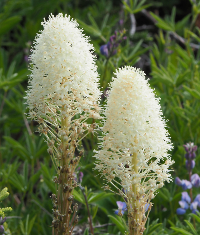
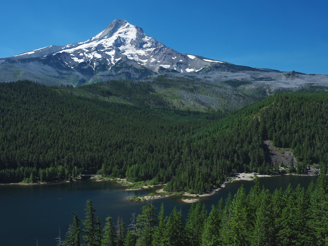
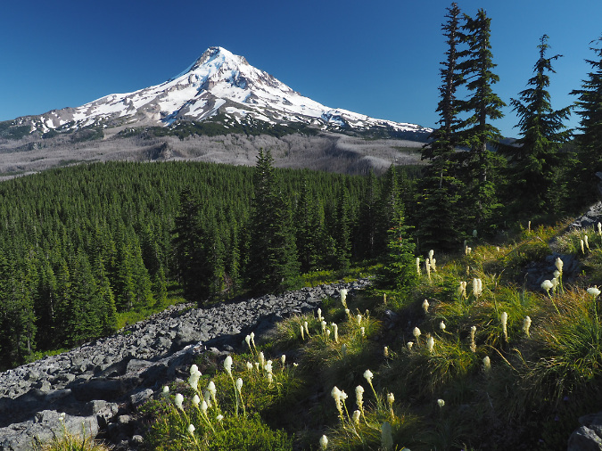
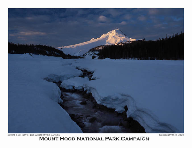
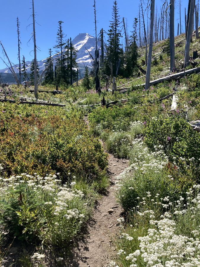
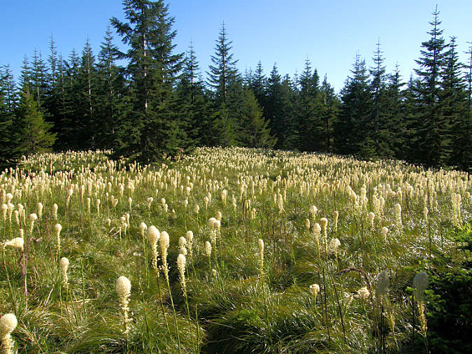
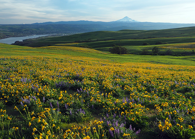
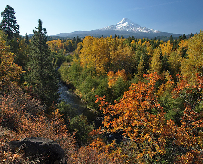
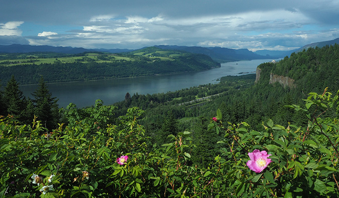
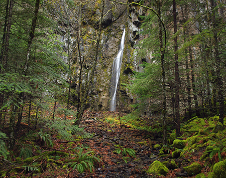
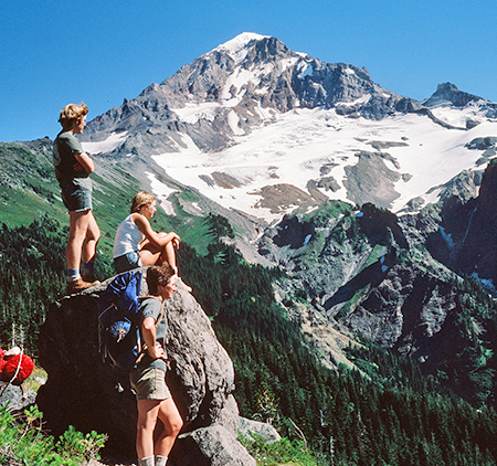
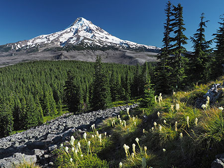
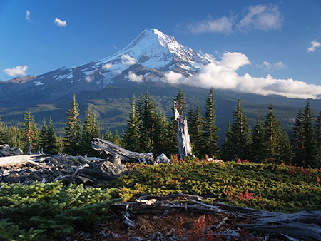
The prolific 2021 Beargrass bloom at Owl Point

When I posted Part 1 of this article last month, the theme was about the redemptive, restorative power of time spent in the outdoors. At the time, I wasn’t alone in dreading the November elections, and the prospect of a renewed attack on public lands protections (and democracy, itself). 

Flash forward one month, and the election landscape has radically changed in ways nobody could have predicted. I suddenly find myself with renewed hope and optimism that the next four years might bring more federal action on the climate crisis and protection of our public lands. Words like hope, optimism and bipartisanship have even found their way back into the national debate.

Our antiquated Electoral College system will ensure this election continues to be political nail-biter, yet it was through this lens of renewed optimism that I read through more comments in the Owl Point Register for this sequel. Part 2 of this article draws from the hundreds of messages left in the log between 2017 and 2023, and I chose a select few that further underscore the title of this two-part series. 

Read on… with hope!

_______________

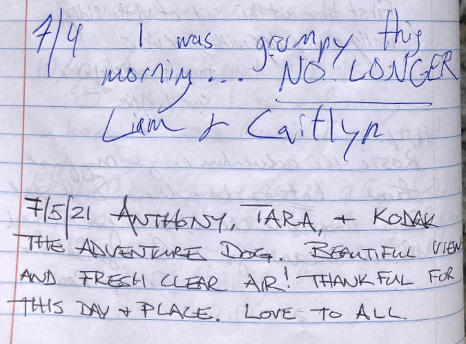
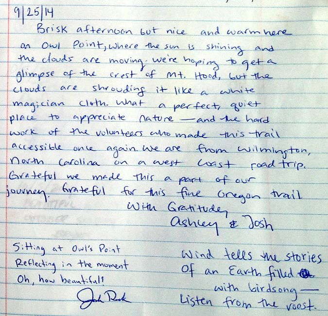
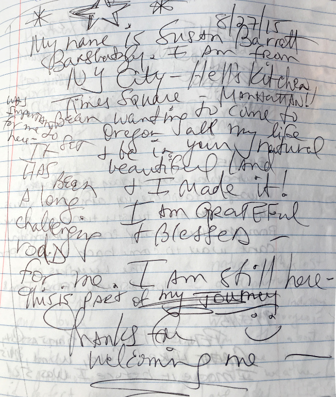
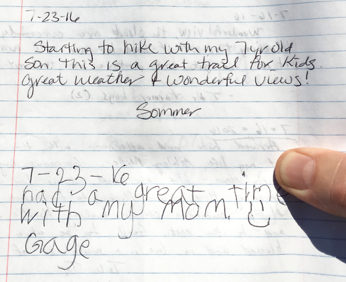
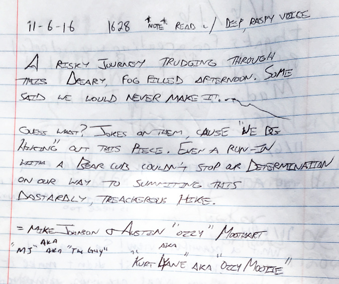
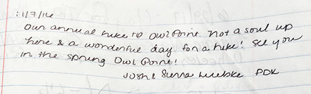
With the country suddenly talking about our shared future, again, what better way to begin Part 2 than with this wonderful message from a determined young family that tried – and succeeded – after three attempts to make it to Owl Point in the summer of 2017:

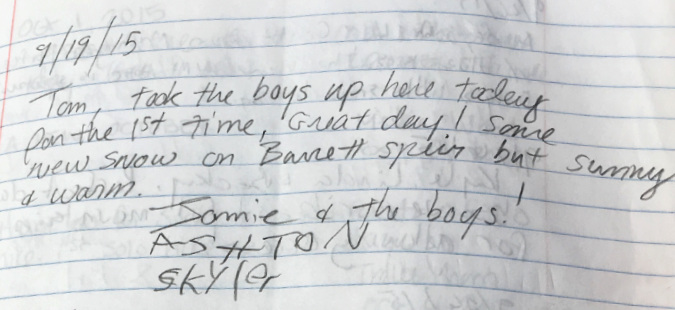
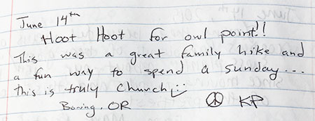
I so love seeing families on this trail. Here’s another family message from the same month in 2017, in this case with kids old enough to be Swifties:

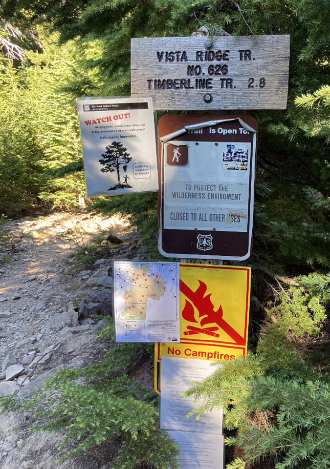
In the Oregon Hikers Field Guide the Old Vista Ridge trail is described as “family friendly” because It’s just long enough to give kids a workout (and hopefully they will sleep all the way home) and sense of accomplishment at reaching their goal at Owl Point. Along the way, there are interesting things that appeal uniquely to kids: short side trails to secret viewpoints, mysterious talus caves, lots of boulders to climb, the “elephant trunk tree” near Blind Luck Meadow and a string of kid-friendly geocaches. 

The Owl Point Register serves as one more feature for kids to explore, often writing the entry on behalf of their family, or at least giving their parents an assist. The summit box also has some local history and a guide to Mount Hood’s features for older kids and parents to ponder (more about that toward the end of the article).

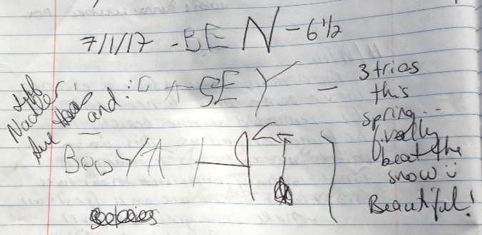
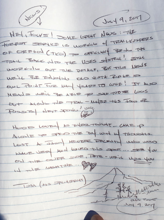
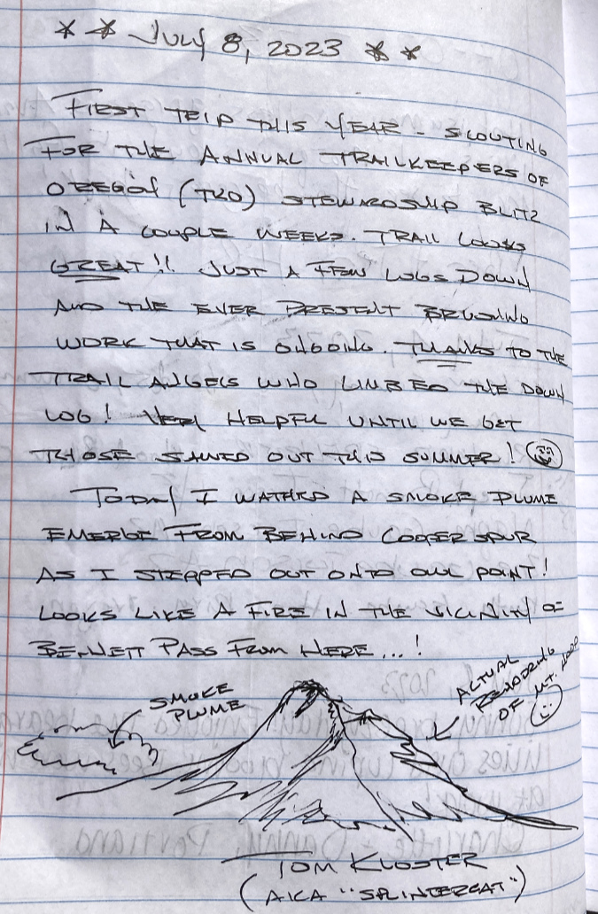
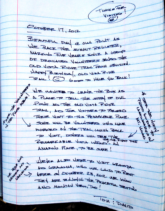
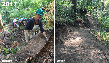
There were a series of important milestones in the Old Vista Ridge trail saga that began in 2017, and led to this old trail formally being recognized by the Forest Service, once again. I previewed what was to come in this message I wrote in early July of that year on my annual scouting trip:

The second paragraph in the above entry refers to my oldest brother, Pete, who died unexpectedly and tragically of suicide that July, at just 66 years old. He died just two days before I wrote this message. Pete was a hero to me in every way, and I still think of him most days – but especially when I’m out on the trail. 

I’d forgotten spending that day up on the Old Vista Ridge trail, so soon after his death, until I re-read this message. It makes sense. Owl Point continues to be one of my go-to places when I need to sort out life and regain perspective. As I said in that message in 2017, Pete would have loved it up there, and I only wish I had somehow made that happen when he was alive.

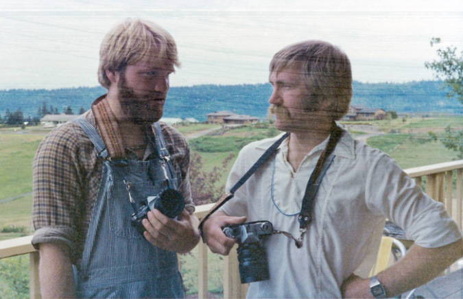
The 20-year-old me and my late brother Pete (right) talking cameras in 1982. Pete got me hooked on photography, music from folk to classical and so much more that defines me today. I can’t blame him for those overalls, however! Such was my wardrobe during my college years. I still have that camera that I’m holding – Olympus OM-1, my first real camera. Pete helped me pick it out. It still works as if it were brand new, and taking a roll of film with it now is like having Pete back, if only for the moment.

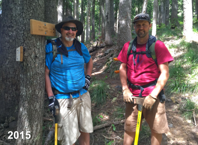
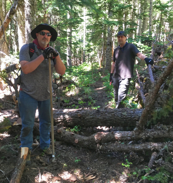
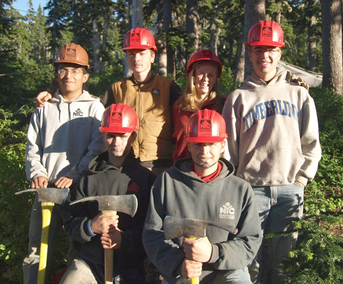
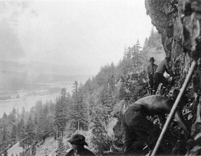
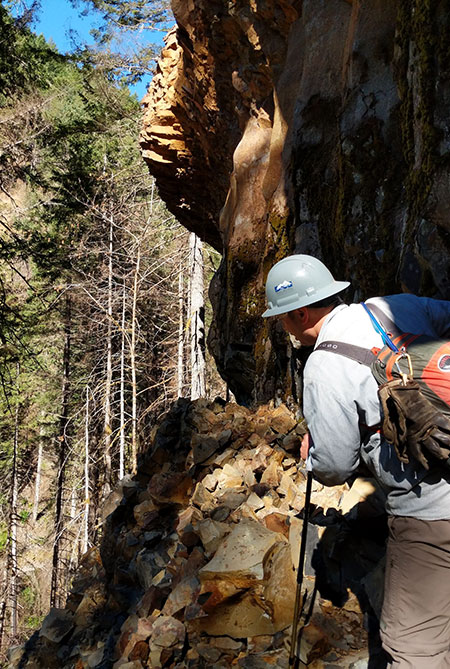
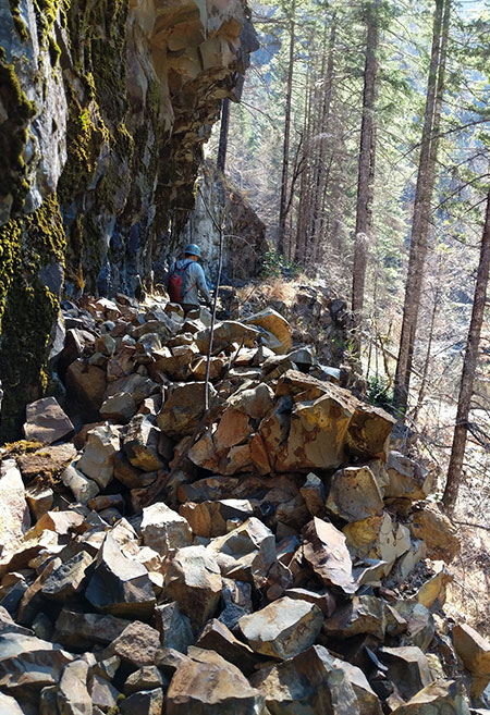
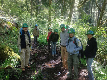
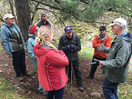
Two weeks after that early July scouting trip in 2017, I was joined by Forest Service (USFS) staff from the Hood River District and Trailkeepers of Oregon (TKO) executive director Steve Kruger for an official walk-through of the trail. The goal was to assess its restored condition and finalize an agreement with the USFS for TKO to adopt and maintain the trail in perpetuity in exchange for it being formally recognized by agency, once again. The USFS team included Claire Fernandez, then the Hood River District recreation manager, and two forest resource specialists, Mike and Ken (below)

Mike, Steve, Claire and Ken at Owl Point on July 26, 2017

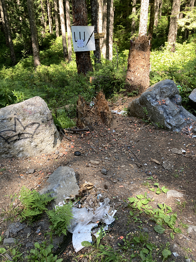
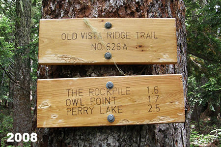
Our first stop that day was at the unofficial trailhead, marked by these hand-made signs. The first order of business was to figure out where official USFS trail signs should be located to replace these user-made signs. It turned out that Claire had done some heavy lifting with a few of her USFS colleagues by smoothing over some bad feelings over these unsanctioned signs and advocating for the trail to be formally reopened. I’m convinced that without Claire’s efforts behind the scenes, the official status of the Old Vista Ridge Trail would still be in limbo.

The old user-made signs posted at the Old Vista Ridge trailhead in July 2017

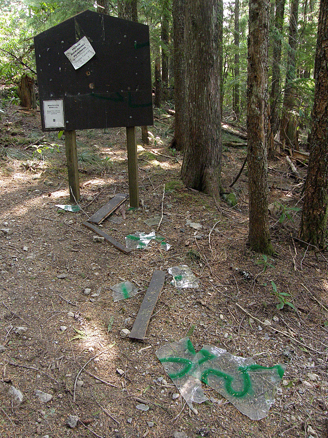
When we reached Owl Point, I held my breath as Claire immediately spotted the register box, then opened it and began reading through some of the messages in the log. I watched out of the corner of my eye from fifteen feet away, pretending to take photos. I was certain we would be asked to remove it, along with the hand-made trail signage. In just five years, the box had become an important part of what made Owl Point such a fun hike, and I was dreading a request to remove it.

Instead, she carefully packed the log back into the register box after reading entries for a few minutes, then closed the lid and didn’t say a word about it to me. I’ve never asked her, but I suspect as a person who has devoted her professional life to outdoor recreation, she appreciated the dozens of joyful, often quite personal notes that people had been moved to write in the log while at the view from Owl Point. 

The Owl Point Register box in July 2017

The Forest Service walk-through hike that day finally sent the formal paperwork into motion, and TKO officially adopted the Old Vista Ridge trail later that year. As you will see later in this article, the timing couldn’t have been better, as future events would have made it nearly impossible for volunteers to unofficially keep the trail open.

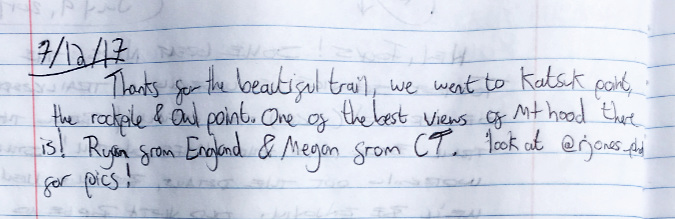
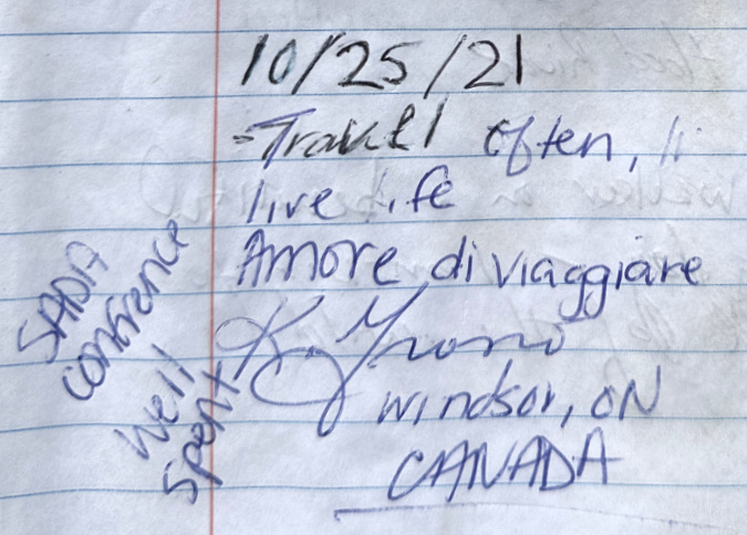
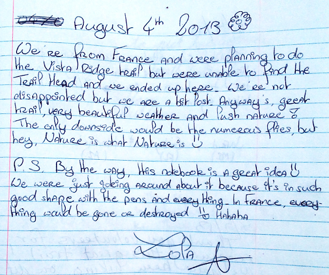
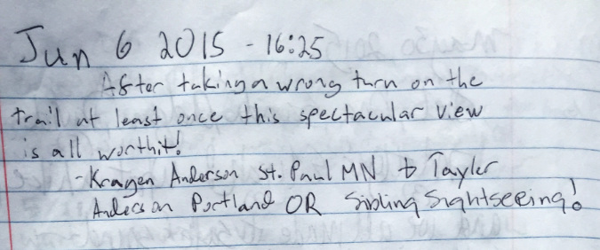
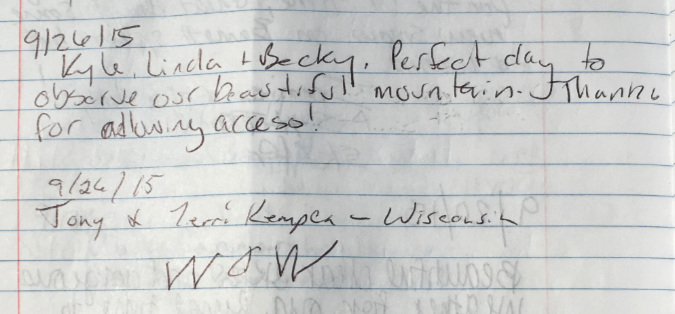
This entry from 2017 jumped out to me for the fact that a pair of long-distance visitors (England and Connecticut) made their way to Katsuk Point, an off-trail, somewhat challenging trek that few hikers attempt:

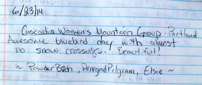
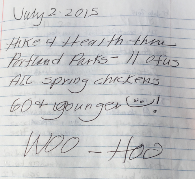
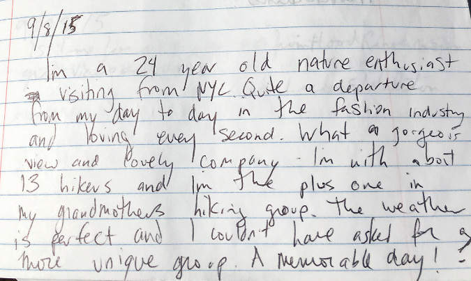
Here’s yet another message from the Portland Parks & Recreation Senior Hikers group. By 2017, they had become annual visitors, with a group of 17 along for this hike:

Here’s a message I’ve included as a cultural date stamp, as even the Owl Point Register wasn’t immune from a Game of Thrones reference in 2017 — though I was pleased to see that Owl Point won out over the premier episode!

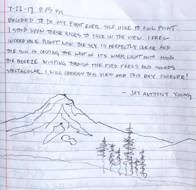
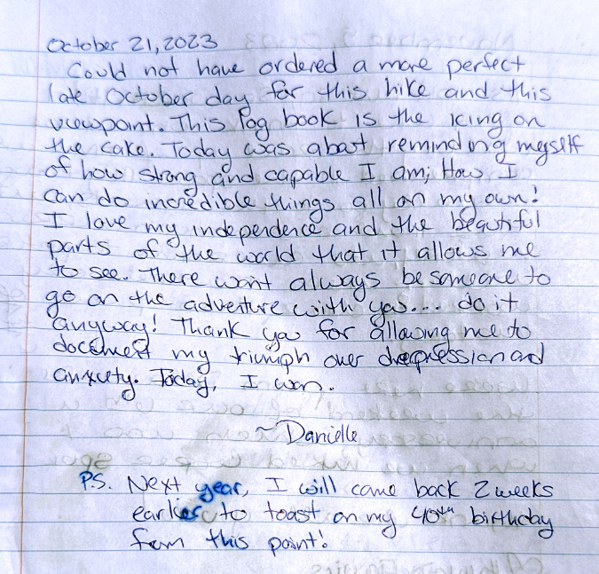
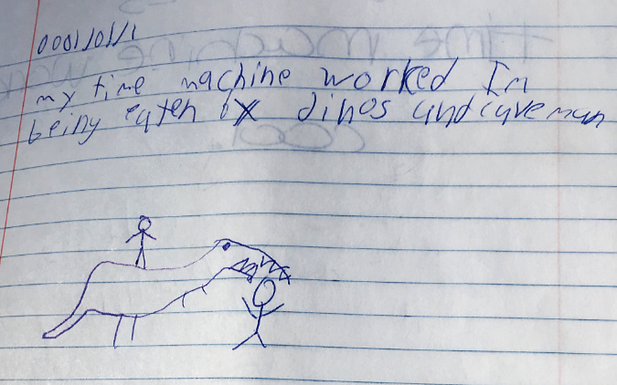
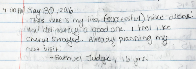
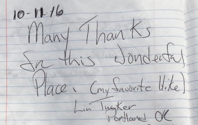
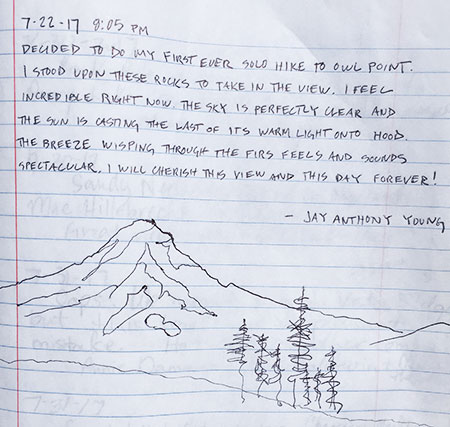
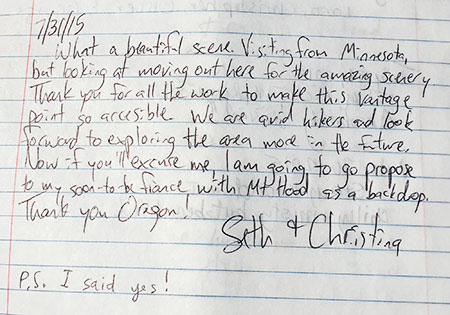
I love the following message from a first-time solo hiker. Noting the date, it is surely must have been one that Claire read when she opened the log four days later? Perhaps it was this wonderful, heartfelt entry that saved the Owl Point Register?

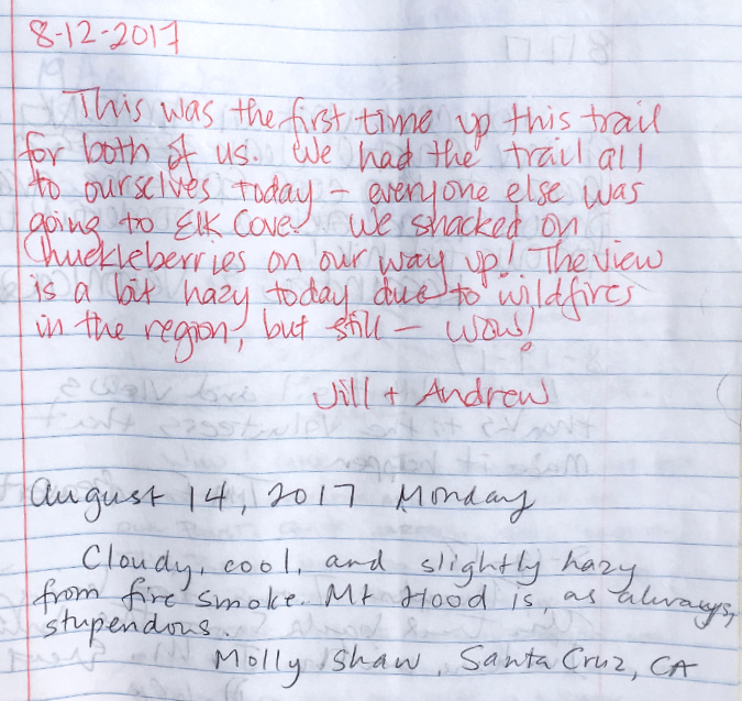
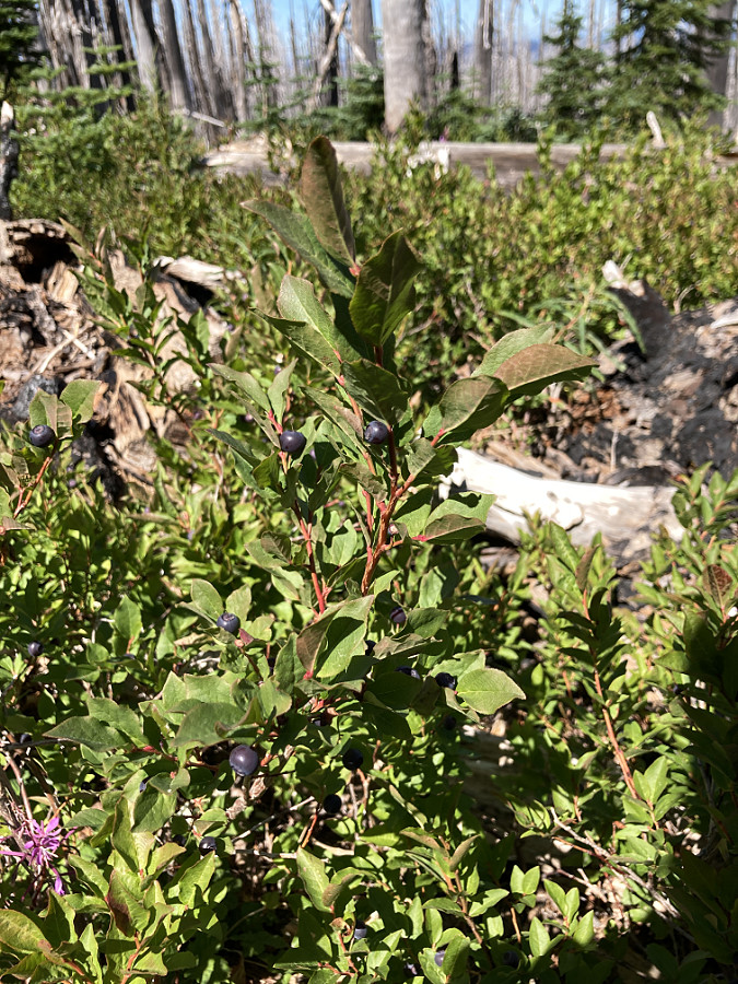
August messages in the log book commonly mention the two things that seem to arrive every summer, these days: huckleberries and wildfire smoke:

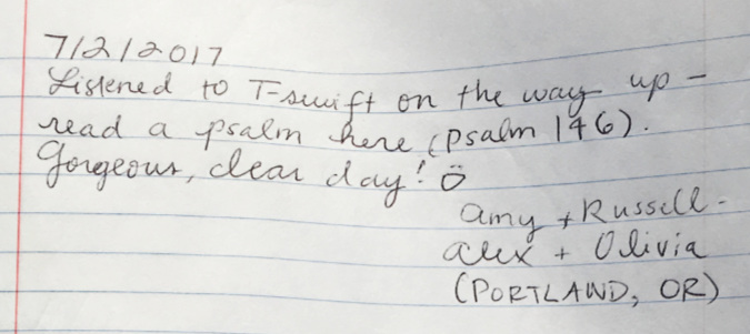
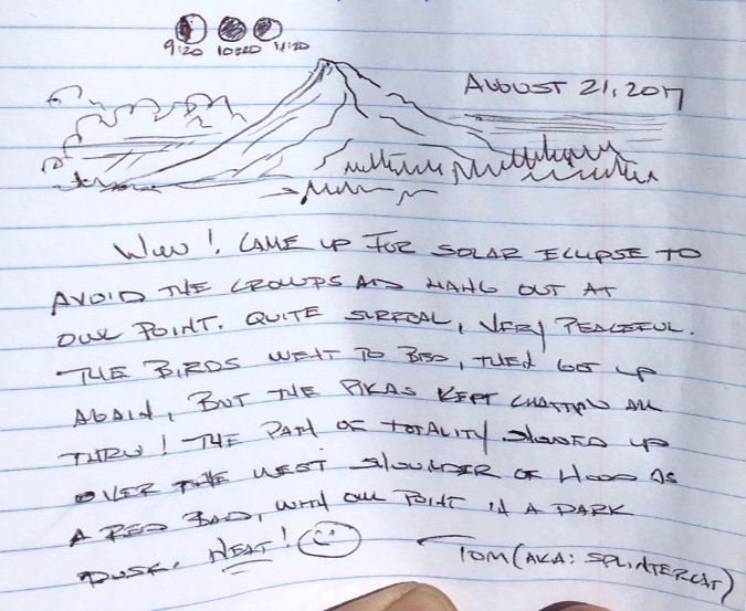
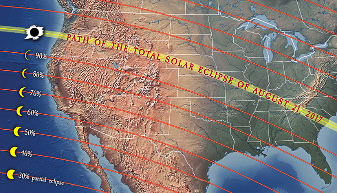
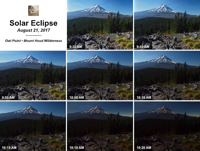
The smoke had cleared a week later when I posted this message (below) in the log on August 21, 2017. The event? The solar eclipse that had turned Oregon into crazytown that year. While Owl Point was just outside the path of totality, I was looking for solitude that day, and decided to experience something short of totality from the Old Vista Ridge Trail, away from the predicted traffic jams. As it turned out, I was the only person there that day!

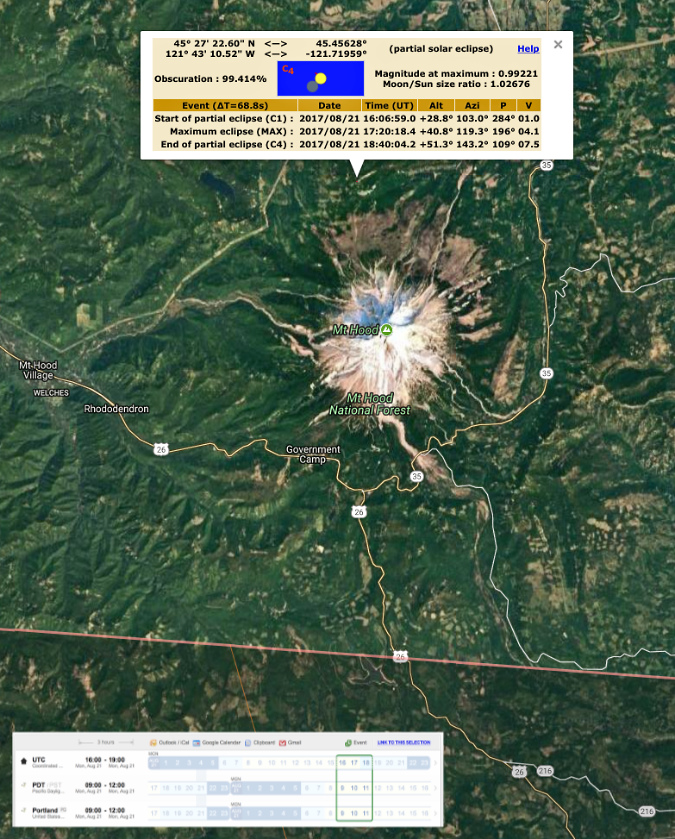
Why, I even included highly scientific sketches of the eclipse phases in my log message! I had, in fact, mapped out the path in detail using some of the tools (below) that were available for eclipse-watchers.

Totality path of the August 2017 solar eclipse

Detailed delineation of the totality zone beginning just south of Mount Hood

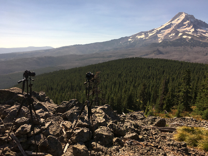
I wasn’t sure what to expect from the eclipse, but I wanted to capture both a timed sequence of images and some informal shots. Add in an iPhone, I was busy documenting the slow-motion changes unfolding in the sky.

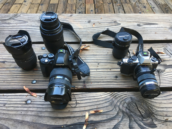
My camera kit for the day: two DSLRs with wide and telephoto options. Not pictured: two tripods… a heavy load that day!

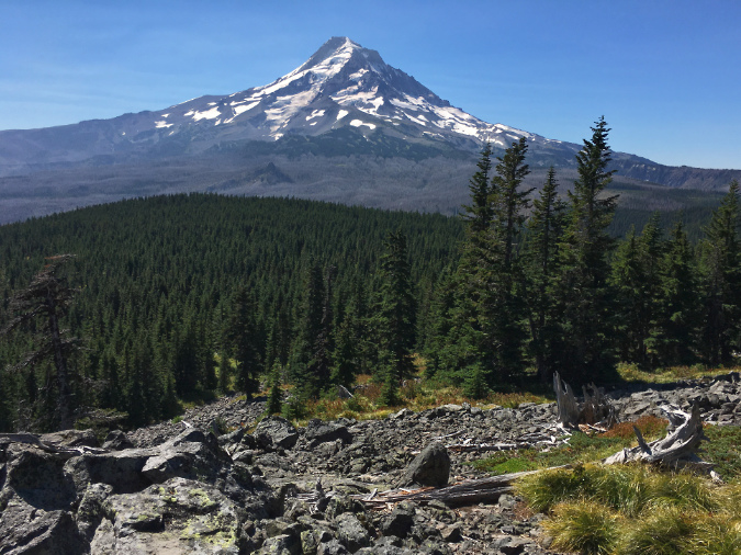
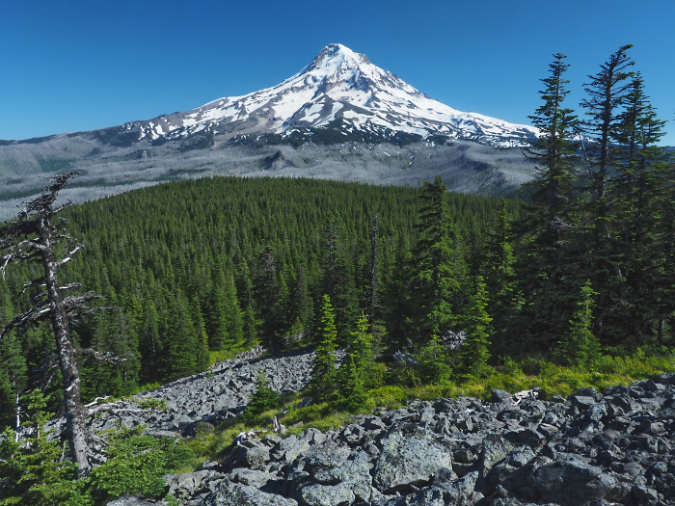
I arrived at Owl Point a few minutes past 9 AM to find a clear, bright sky. A typical summer day on the Old Vista Ridge trail:

The view from Owl Point in the hour prior to the eclipse

Here’s my camera setup as the eclipse began to unfold. This was taken with my iPhone, and picked up a weird yellowish glare that was filtered out of the images captured on my two larger cameras:

Dual cameras ready to go as the eclipse begins

Assembling a series of images from the camera on the left, this sequence (below) spans the eclipse from beginning to totality. In final two images, the bright band along the west shoulder of the mountain is actually daylight from beyond the path of totality – an unexpected and otherworldly effect.

[click here for a large view of this sequence]

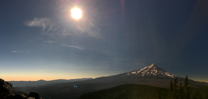
This iPhone panorama was taken as totality approached, and gives a better sense of how strange it was to be looking south, past the path of totality, to the daylight beyond. It might look like a cloud band, but it’s really a thin strip of night passing overhead:

Panorama of the eclipse as it approached totality

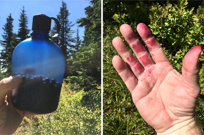
I’d created a schedule with 10-minute intervals between timed images, so I also took advantage of the healthy huckleberry crop at Owl Point that day…

One-half water bottle is enough for a huckleberry cobbler…!

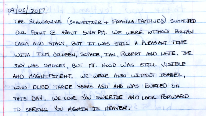
This message from September 2017 (below) is a first in the log – a portmanteau!  The Schweitzer + Franks families = the Schwanks! I’m going to guess that Latte was a canine member of the party, and I especially liked the unexpected last part of this entry. So many people are inspired to reflect on lost friends and family while at Owl Point.

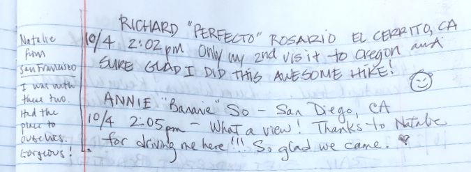
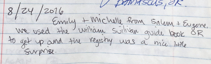
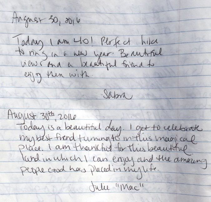
More long-distance visitors from California came to Owl Point to close out the 2017 hiking season:

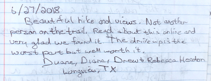
…and these out-of-towners from Texas opened the 2018 season:

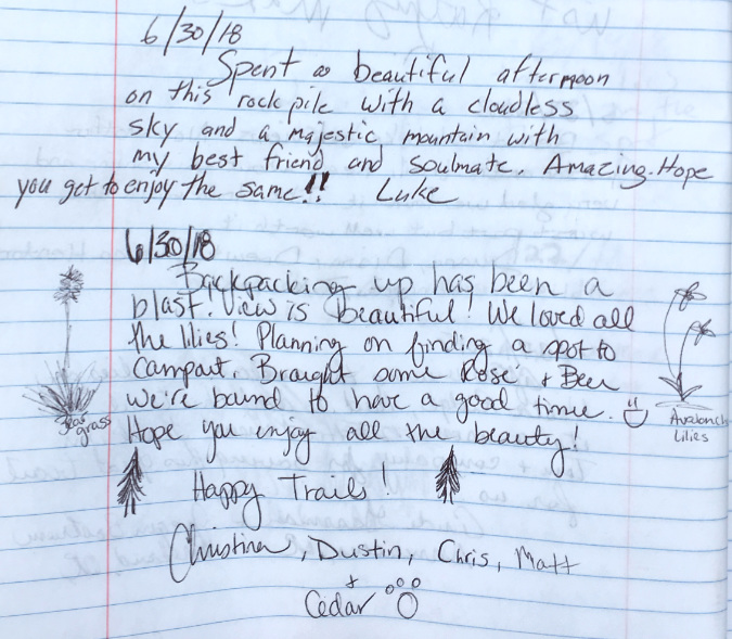
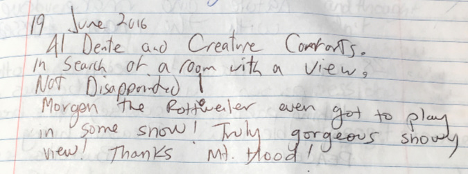
More early visitors in 2018, with the second group spending the night at Owl Point and adding botanical sketches:

While there are a few posts in the Owl Point Log that mention overnight stays, they’re not common. I suspect that’s mainly because there’s no water source up there, and thus the group above would have had to carry water in (including for Cedar) to augment the wine and beer!

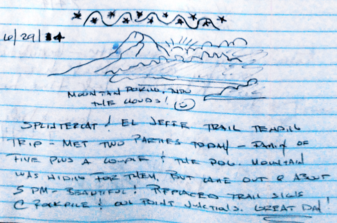
Here’s a post from a couple of trail friends that I run into periodically who were up at Owl Point in 2018 as part of the Cascade Pika Watch effort:

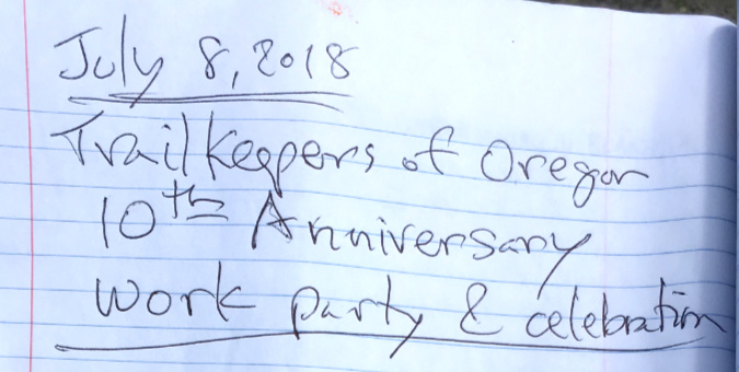
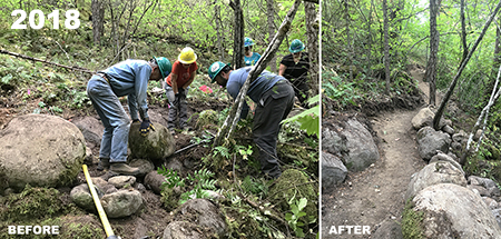
Here’s a notable, if understated, post from that same day in early July, 2018, when the Old Vista Ridge trail was formally re-dedicated as part of TKO’s 10th Anniversary:

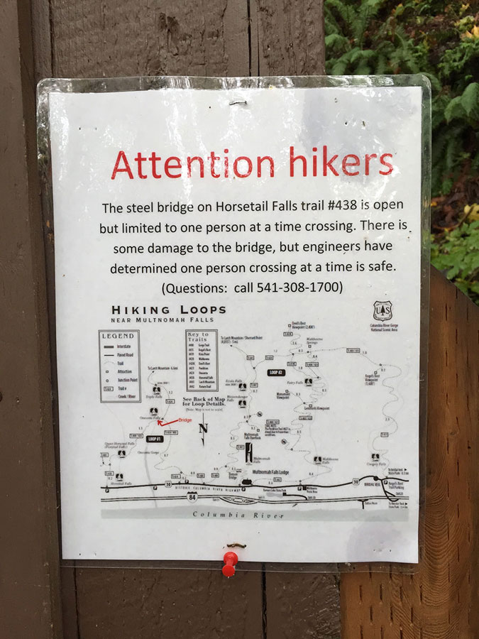
In fact, this event had originally been scheduled for September 2017, but the raging Eagle Creek Fire had closed public access to much of the area north of Mount Hood as the fire raced through the Hatfield Wilderness backcountry in the Columbia River Gorge.

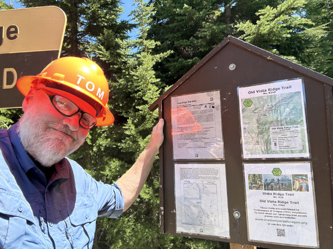
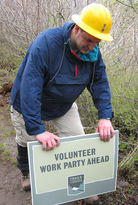
The rescheduled event in 2018 kicked off with a typical trailhead orientation for volunteers, with TKO’s Steve Kruger presiding (in yellow hard hat):

TKO 10th Anniversary trailhead talk at the Old Vista Ridge grand re-opening in July 2018

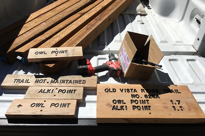
On this special day, TKO volunteers would be installing official USFS signage along the trail as part of the re-dedication, in addition to the annual tasks of clearing logs and brush.

New trail signs and posts in the USFS pickup in July 2018

These trail signs were installed by TKO volunteers in July 2018 and have survived six winters and counting. Volunteers also lugged six 8-foot 4×4” posts up the trail, each buried 18” in rocky soil – a real workout!

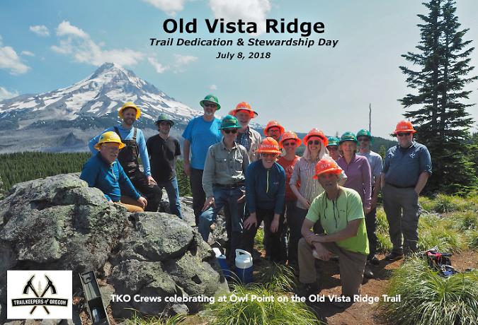
TKO Executive Director Steve Kruger and Hood River District Ranger Janeen Tervo re-dedicating the Old Vista Ridge trail on July 8, 2018. Cutting the ribbon involved a handsaw, loppers and trail flagging, of course. Old and new trailhead signs are leaning against the base of the tree

TKO grand re-opening celebration at Owl Point on July 8, 2018 – the first of our annual TKO anniversary events there

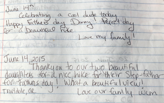
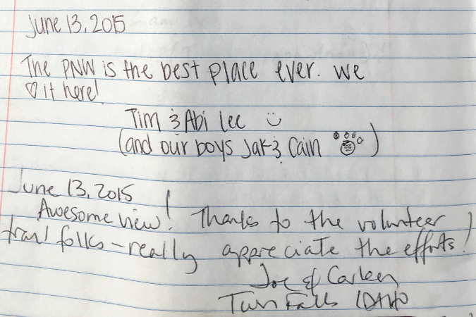
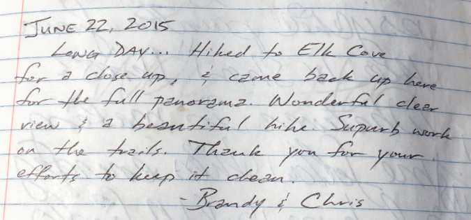
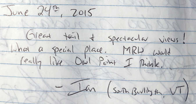
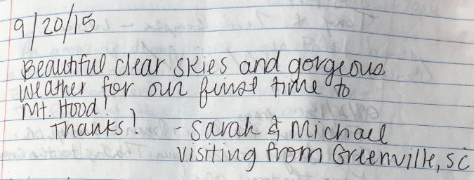
Two groups visiting Owl Point on the same day in late July 2018 shared the sentiment that so many of us can relate to – that we’re so very lucky to live here! My condolences to the folks who made the second entry, too. Vermont is lovely, but not as lovely as the Pacific Northwest (I may have just triggered a few Vermonters):

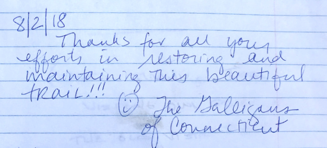
Another out-of-owner in 2018, this time from Connecticut…

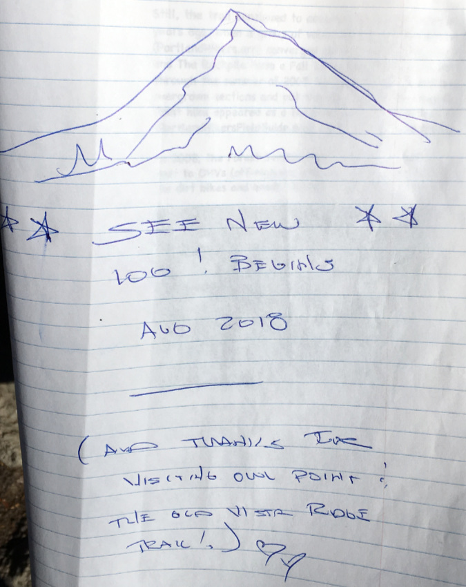
By August 2018, the original Owl Point Log had completely filled, and I placed a blank, new edition. For the next year or so, I also left the original log in place for folks to read, with this message:

Closing out the original Owl Point Log after six years…

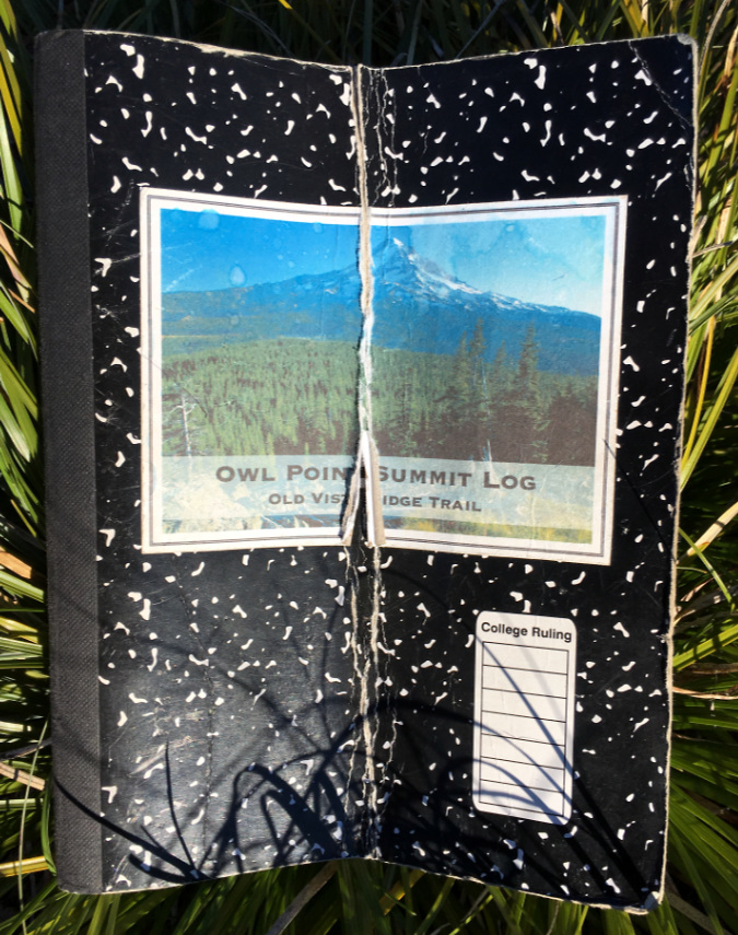
The cover of the original Owl Point Log after six years up on the mountain

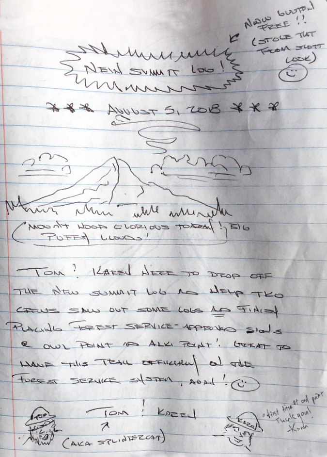
The new Owl Point Log (Volume 2) begins with this message:

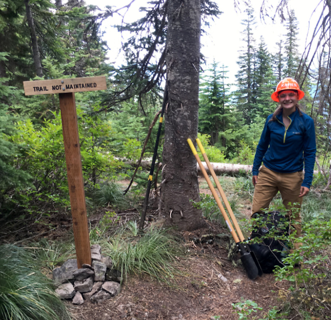
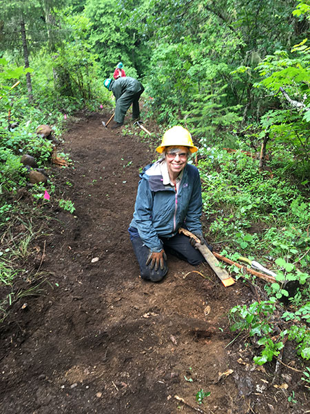
I placed the new log as part of yet another TKO trip to the Old Vista Ridge trail on August 5, 2018. Most of the volunteers that day were focused on clearing the last few logs on the trail, but I worked with TKO intern Karen to finish installing the last of the trail signs at Owl Point (below) and Alki Point.

The author and TKO intern Karen installing the (then) brand new Owl Point spur trail sign in August 2018

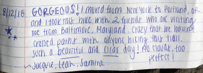
More out-of-towners in 2018, this time from Maryland visiting a recently transplanted New Yorker:

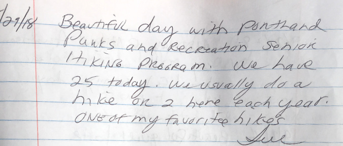
…and another annual visit in 2018 from the Portland Parks & Recreation Senior Hikers group – 25 hikers on this outing!

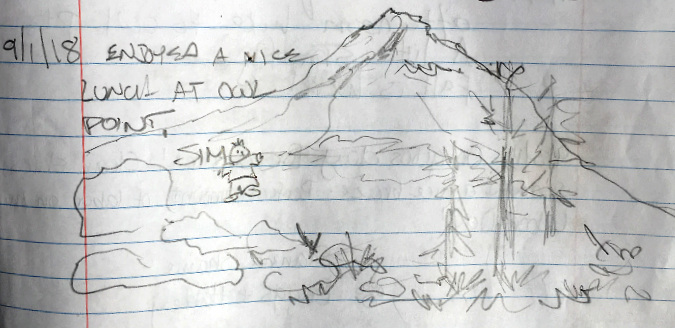
Hiker Jim (below) was apparently so elated with the view from Owl Point in September 2018 that he was suspended in mid-air above the rocks (or so I interpret his sketch):

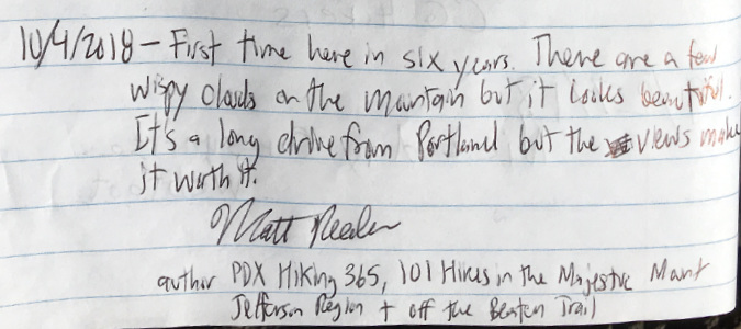
Guide book author Matt Reeder (below) is a longtime friend of the Old Vista Ridge trail, having not only included it in his “Off the Beaten Trail” guide, but also placing a photo from the trail on the cover!

Matt Reader featured a view from the Old Vista Ridge Trail on his “Off the Beaten Trail” guide

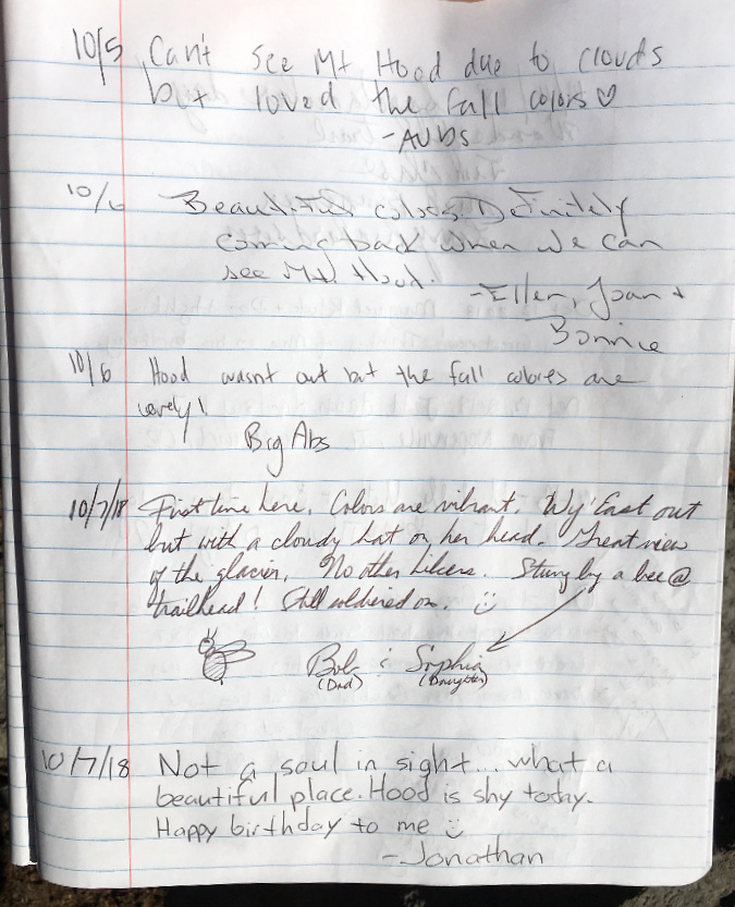
This series of visitors in early October, 2018 shared a common fate: Mount Hood lost in the clouds:

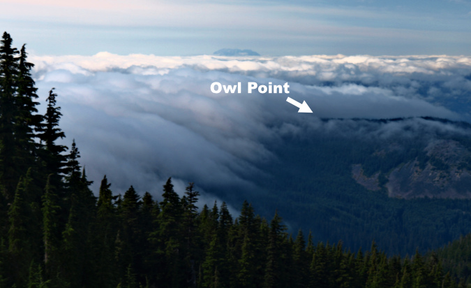
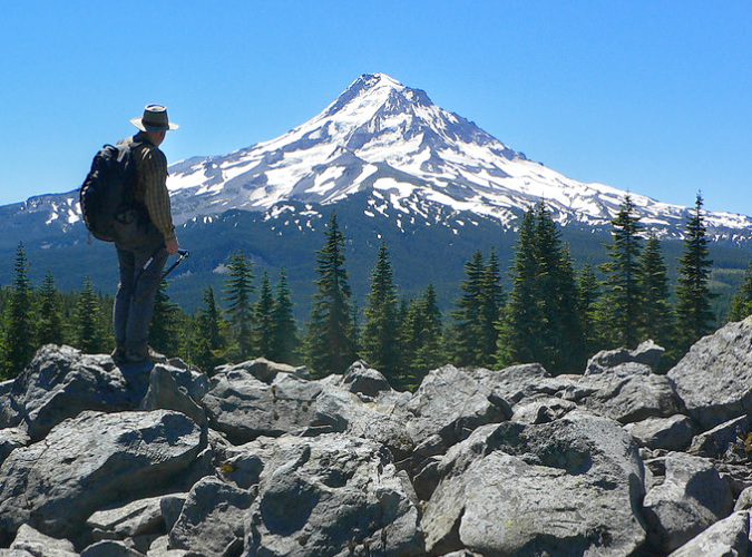
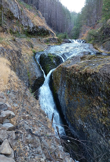
You might wonder why people would pick a viewpoint trail on a cloudy day, but it’s not that simple with Owl Point, especially early and late in the hiking season. Vista Ridge and Owl Point lie precisely on the Cascade divide, a mile-high crest where moist marine air coming off the Pacific often condenses into a low cloud cap, even as Mount Hood rises above into blue skies.

Here’s what it looks like at Owl Point when this happens – this is the view west, into the fog that is seemingly a stationary cloud:

Cloud cap engulfing Owl Point on a fall day

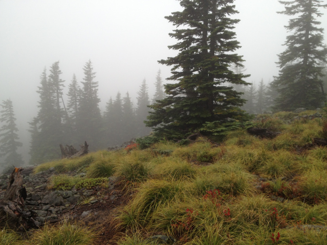
Yet, looking east toward the Hood River Valley you can see the cloud isn’t stationary, at all – and, in fact, is dissipating right above you, with blue skies to the east:

Looking toward the Hood River Valley and Surveyor’s Ridge from under a cloud cap at Owl Point

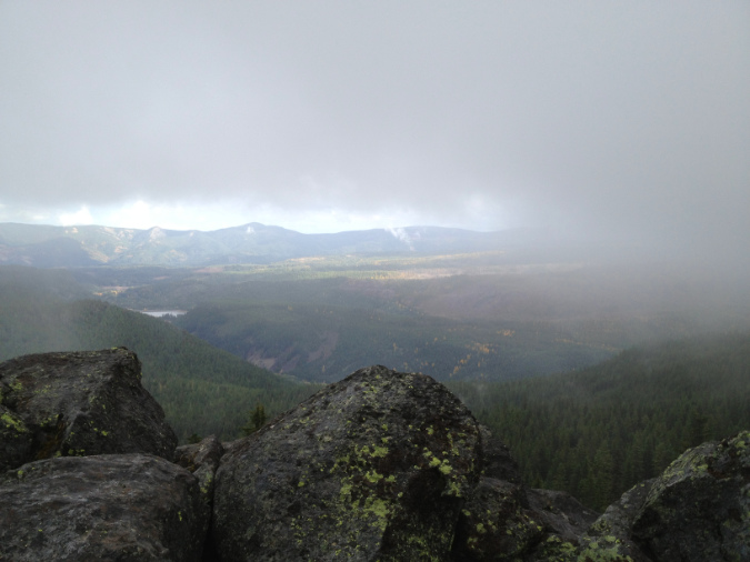
Here’s what that effect looks like from up on the Timberline Trail – a “cloud waterfall” of marine air condensing into a rolling fog bank as it pushes from the west (left) over Vista Ridge and Owl Point, then cascading and evaporating into the dry air mass to the east (right in this photo) side of the divide:

Cloud cap forming a “cloud waterfall” at Owl Point

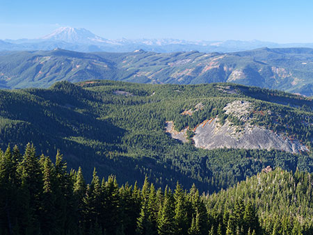
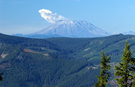
This effect can be very local, or become widespread when a weak Pacific front pushes in, as shown in this view from above Elk Cove, looking down on the Cascade divide and Owl Point:

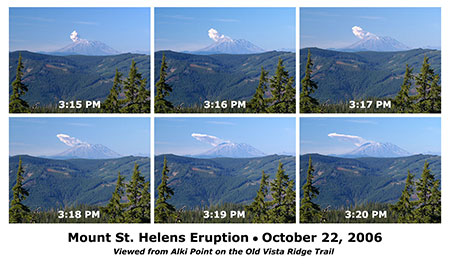
Widespread “cloud waterfalls” along the Cascade crest – the view looking north from Mount Hood toward Mount St. Helens

Even on the clearest spring and fall days, cloud banks can form over Vista Ridge and Owl Point without notice. The clouds those October 2018 hikers encountered had cleared by the time I visited later that month, with an added bonus: they had dusted the mountain with an early coat of fresh snow – a magical time of year on the mountain:

The dusting of snow on Mount Hood described in my October 2018 log entry

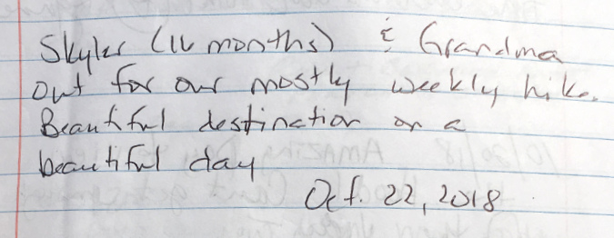
Here’s a message from a dedicated grandma – with her 16-month toddler – that caught my eye:

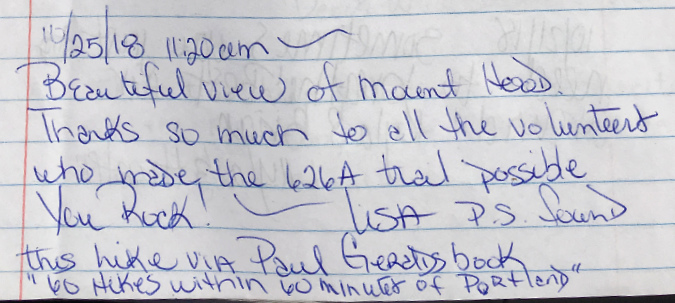
This post from 2018 mentions another guidebook that helped bring folks to the Old Vista Ridge Trail, Paul Gerald’s popular “60 Hikes within 60 minutes of Portland” guide. A lesser-known fact is that Paul served on the TKO board for several years, including a stint as TKO board president. Thank you, Paul!

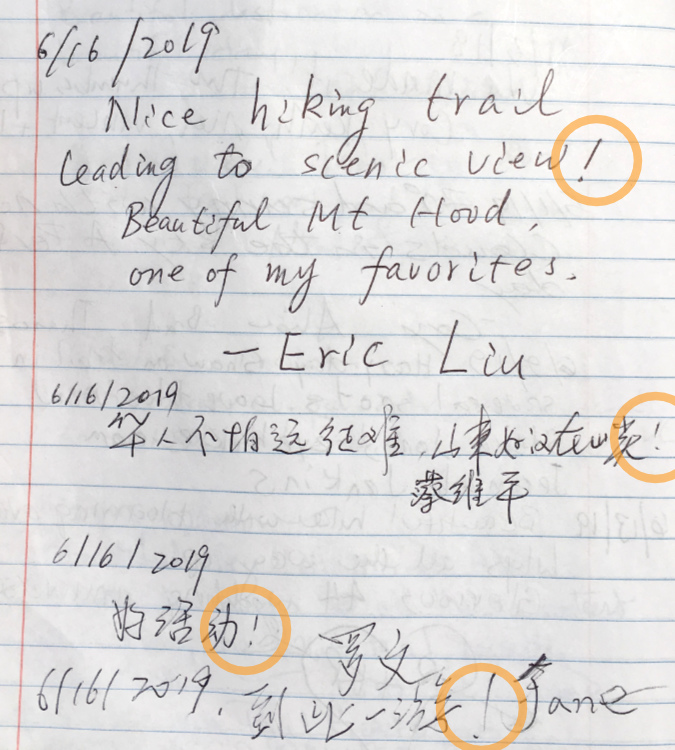
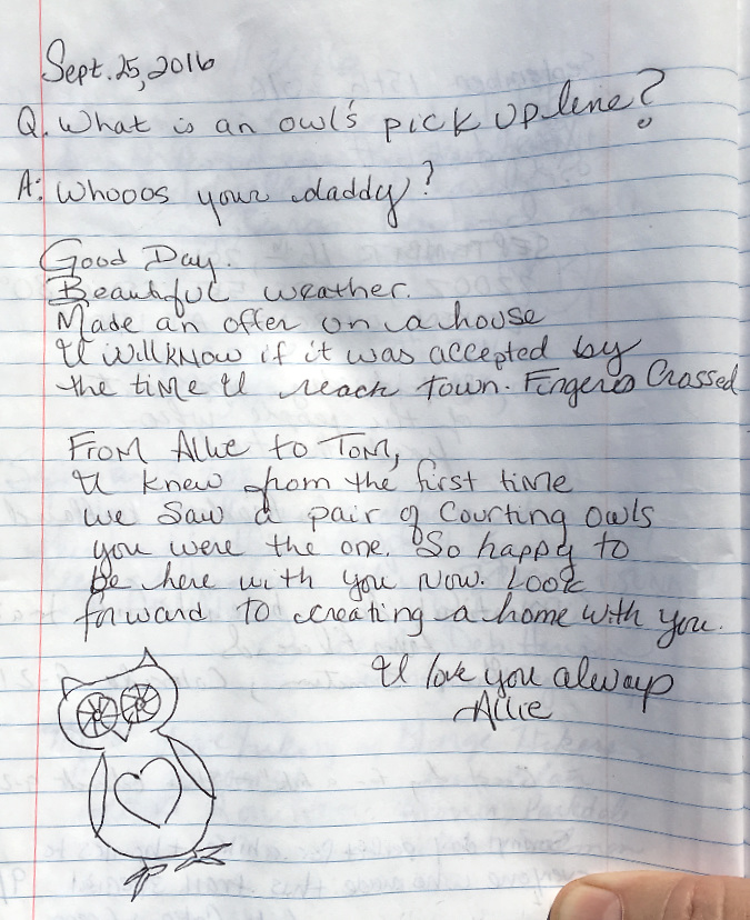
Kicking off the 2019 hiking season, this is perhaps the most international series of messages to date in the Owl Point Log:

I’ve circled the exclamation marks – while I can’t read the least three messages, they all seem to have been impressed with the view from Owl Point!

Here’s one more from that group of international visitors in 2019 (and if you are a reader of this blog and can translate any of these messages, please add as a comment):

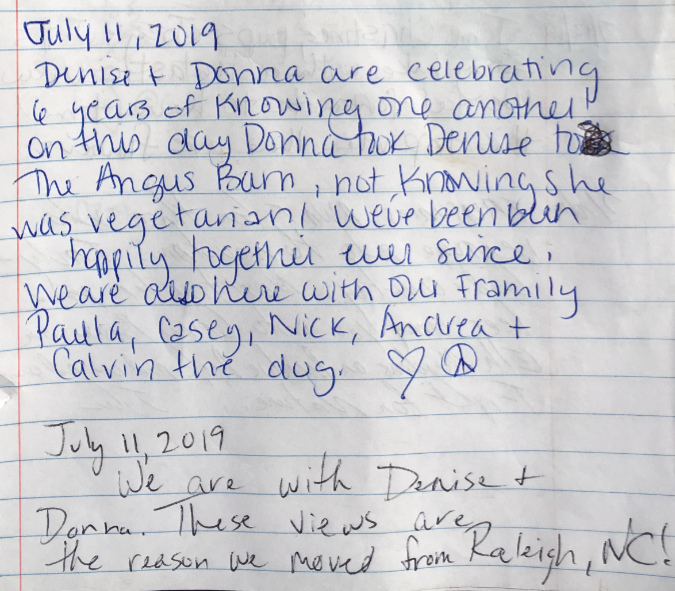
An “opposites attract” milestone message in July 2019, plus more out-of-towners from North Carolina:

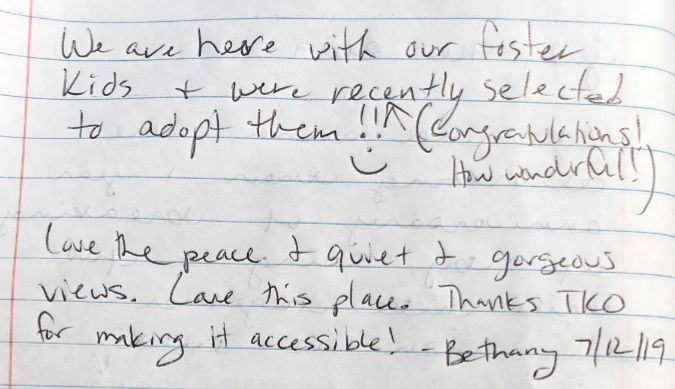
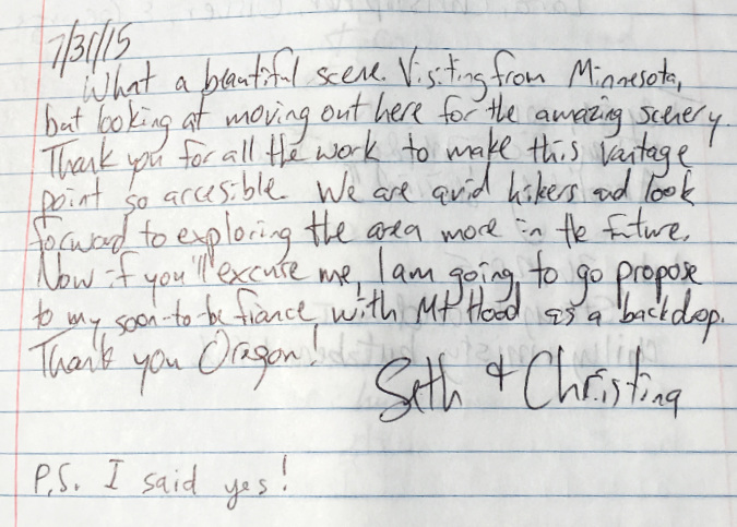
…and yet another milestone message. There have been a few marriage proposals and baby announcements, but this is the first adoption announcement to appear in the Owl Point Log. I especially loved that a subsequent visitor added a congratulations:

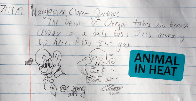
Here’s the first “animal in heat” (!) sticker to appear in the log, along with some very polished cartoons:

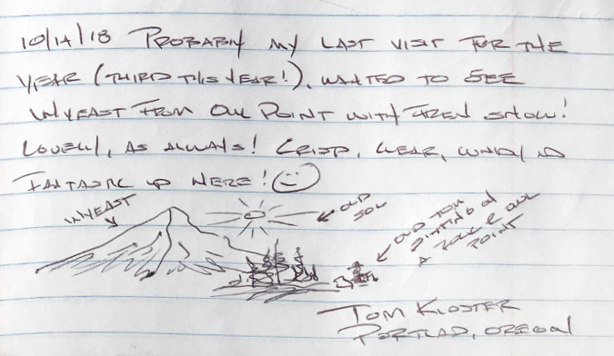
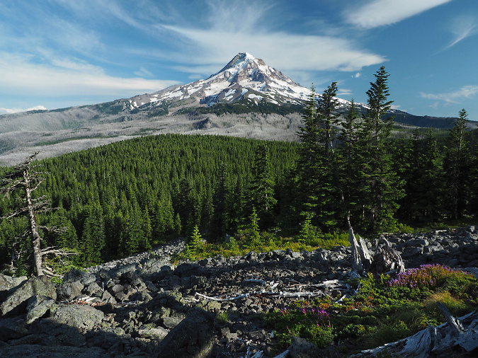
Yet another pair of entries from the author, this time on a scouting trip in July 2019 for the annual TKO anniversary event on the Old Vista Ridge Trail:

When I re-read this message for this article, I wondered just how gorgeous those clouds really were? Digging back into my photo archives, it’s true – they were spectacular:

WyEast looking lovely under painterly clouds back in the summer of 2019

…the mountain was pretty nice that day, too!

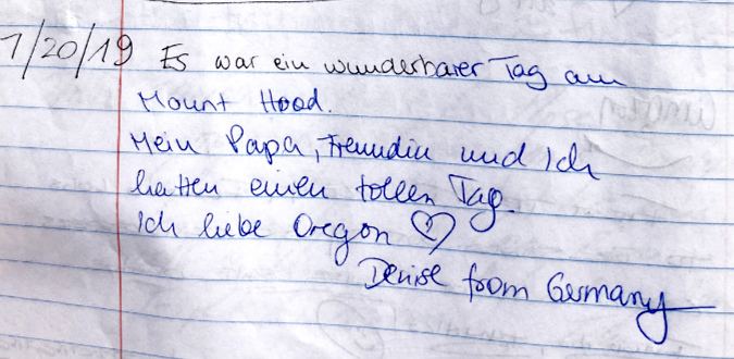
Here’s another long-distance visitor in 2019, this time from Germany:

My rough translation of the above entry: It was a wonderful day at Mount Hood. My dad and I had a great day. I love Oregon.” German speakers, help me out if you can!

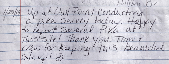
Also from July 2019, another successful Pika survey:

It doesn’t surprise me that Pika thrive here. While their habitat throughout the west is threatened by climate change, much of the talus (their sole habitat) faces southeast and is shaded from late afternoon heat by the Owl Point ridgeline and stands of Noble fir. Hopefully, this will be enough to keep their familiar “meep” calls coming from the rocks here for decades to come.

Here’s a string of recent arrivals (from Nashville) and more long-distance visitors who stopped by on the same day in July, 2019 (if you can help with translation, please add a comment).

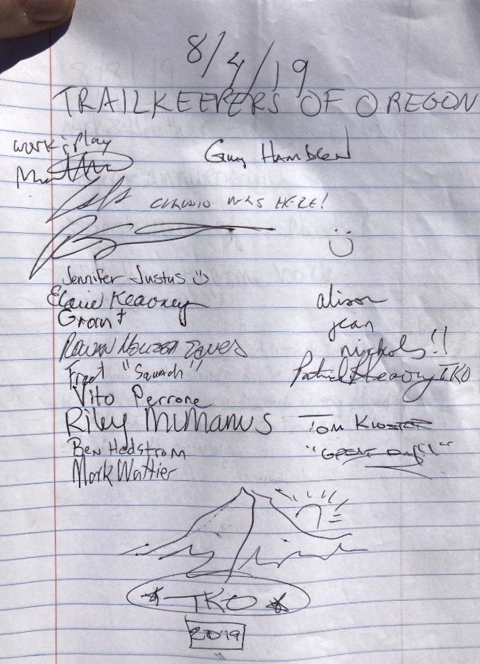
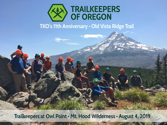
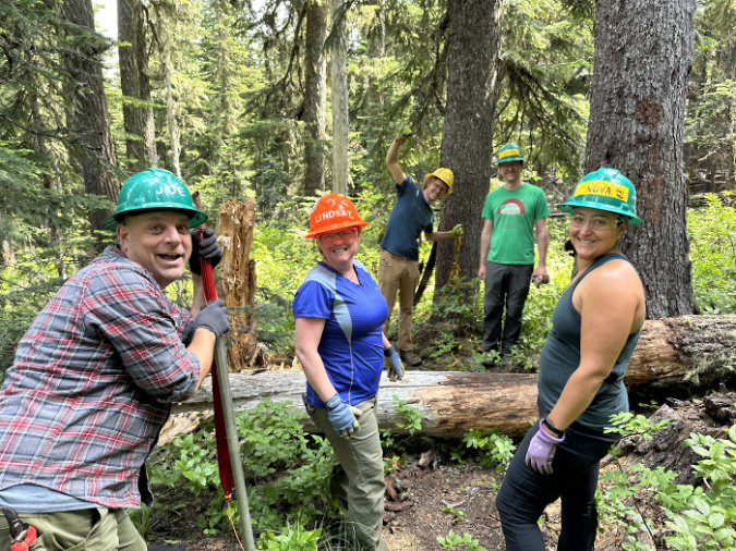
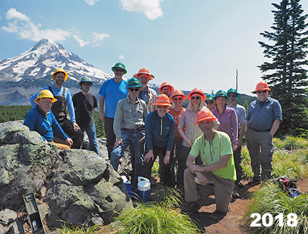
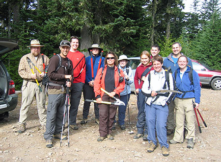
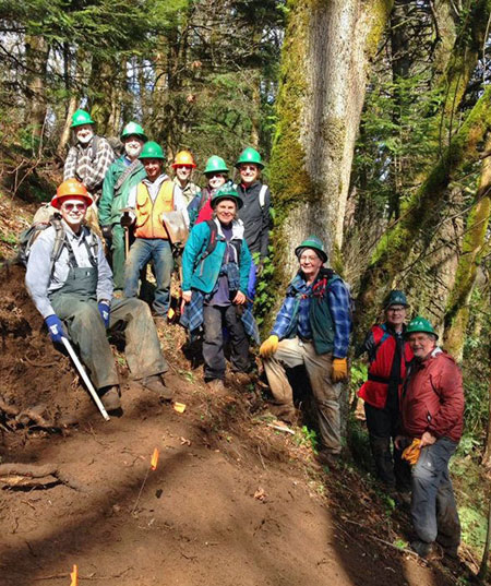
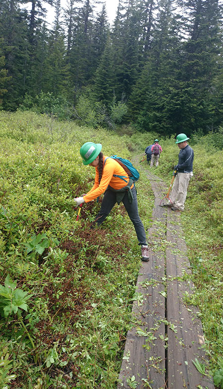
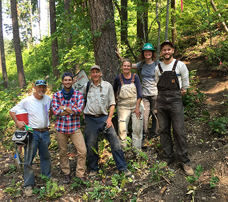
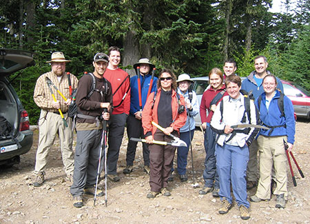
August 2019 brought the second annual TKO celebration to the Old Vista Ridge trail (below) with another large group of volunteers for our annual trail tending. More logs to clear, more huckleberries to brush away from the trail and another fine day up at the mountain!

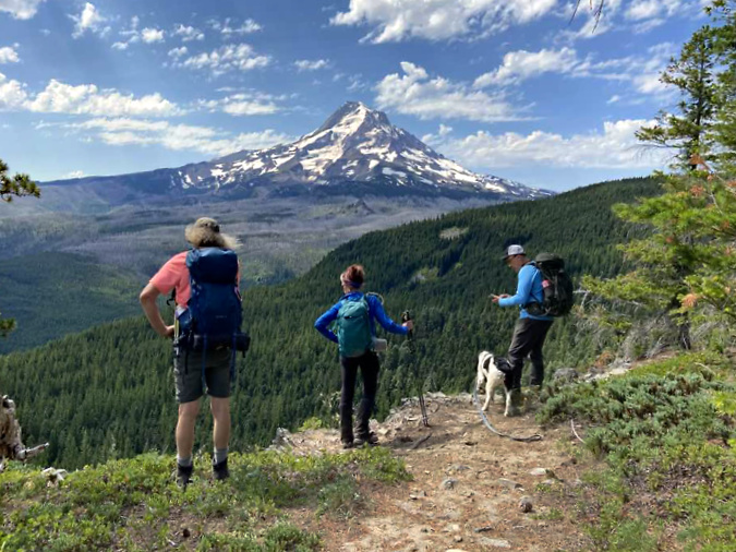
In that second year of what has since become our annual tradition, we captured the next in a series of group portraits that continue to this day (below). So far, the mountain has been out for every one of our events up at Owl Point. Though that streak surely can’t last forever, it does make for a great photo opportunity:

Team portrait from the annual TKO stewardship event in 2019

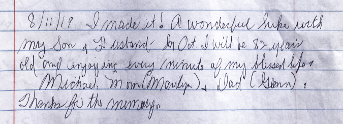
Here are a few more excerpts from 2019 in the Owl Point Log, beginning with this post that is personally inspiring to me, as hiking until I die is one of my life goals!

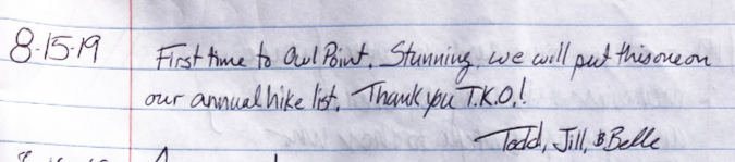
This post from first-timers in 2019 carries a common theme found through the log – that Owl Point is now on their annual hiking list:

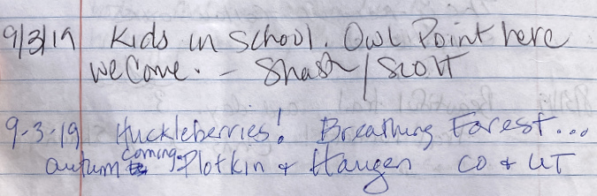
This entry from September, 2019 made me smile – a couple of parents who survived summer break with kids seeking refuge at Owl Point and more out-of-towners (Colorado and Utah) discovering our huckleberries:

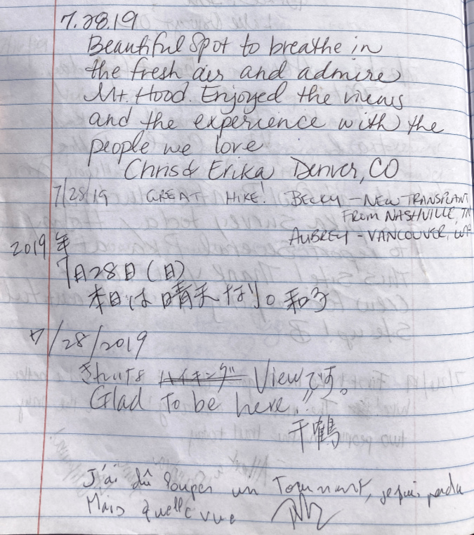
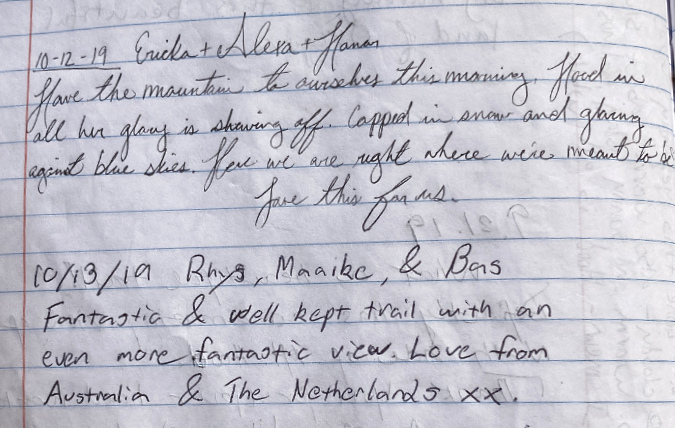
These back-to-back entries from October 2019 provide a nice contrast of “locals right where they’re meant to be” followed by more faraway visitors from Australia and The Netherlands reminding us that we live in a slice of Heaven here in WyEast country:

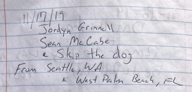
More out-of-towners from Seattle and West Palm Beach to close out the 2019 season, just ahead of the first snowfall that year:

As the snow began to fall that winter, burying the Old Vista Ridge trail under several feet of snow, we couldn’t have imagined that the entire world was about to turn upside down. Even our public lands were closed to entry in those early weeks of the COVID pandemic in the spring of 2020. By June of that year, public lands had reopened, and masked, pandemic-stressed hikers began arriving at Owl Point:

As if charting the five stages of grief, messages in the Owl Point Log in 2020 become more circumspect as the summer season arrived. Pandemic commentary gave way to life milestones and personal reflections as socially-distanced people reconnected with one another on the trail – among the safest places to be during the pandemic.

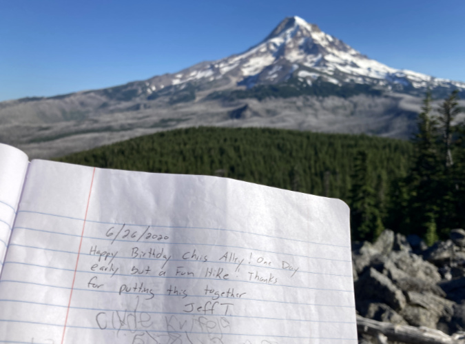
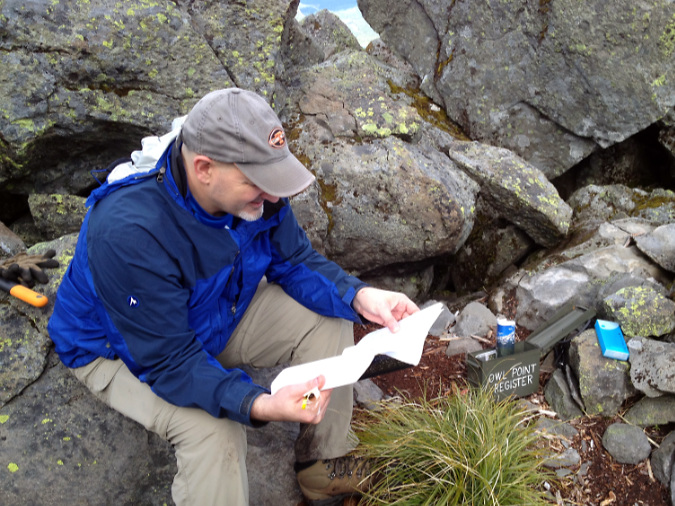
These friends reunited to celebrate a birthday (Chris is mentioned in Part 1 of this article):

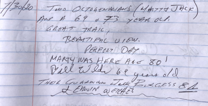
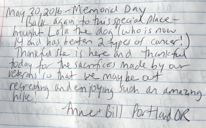
Trails were an especially important refuge for older hikers in 2020, considered the most vulnerable among us to the COVID-19 virus – like these veteran hikers:

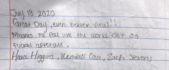
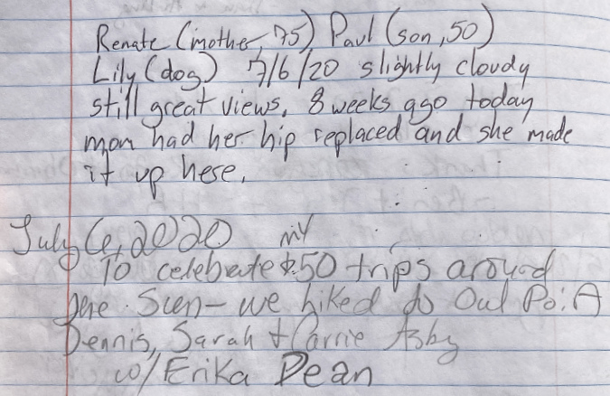
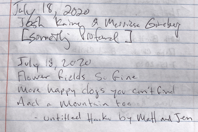
This pair of messages (below) from July 18, 2020 caught my eye. Hikers Matt and Jen filled in the creative blank left by Josh and Marissa on – collaboration!

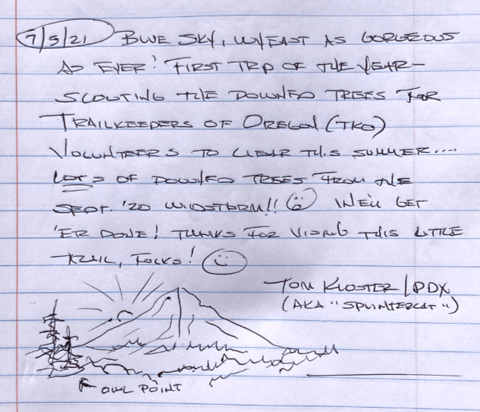
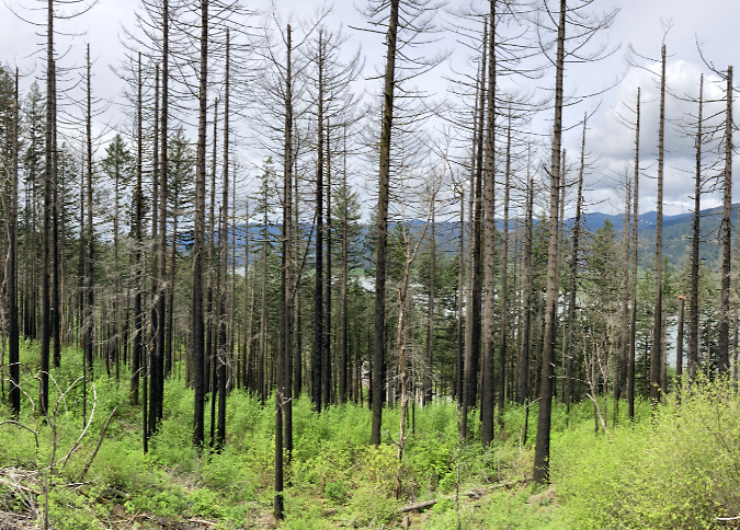
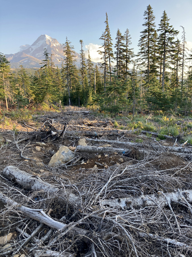
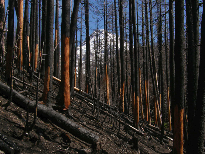
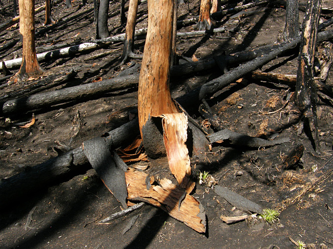
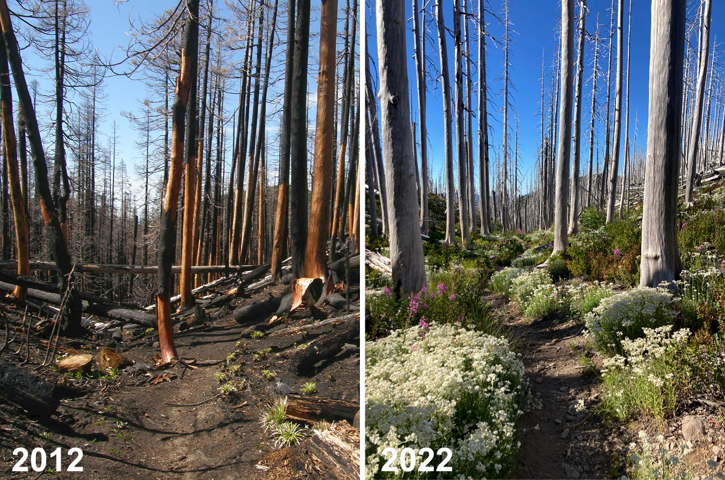
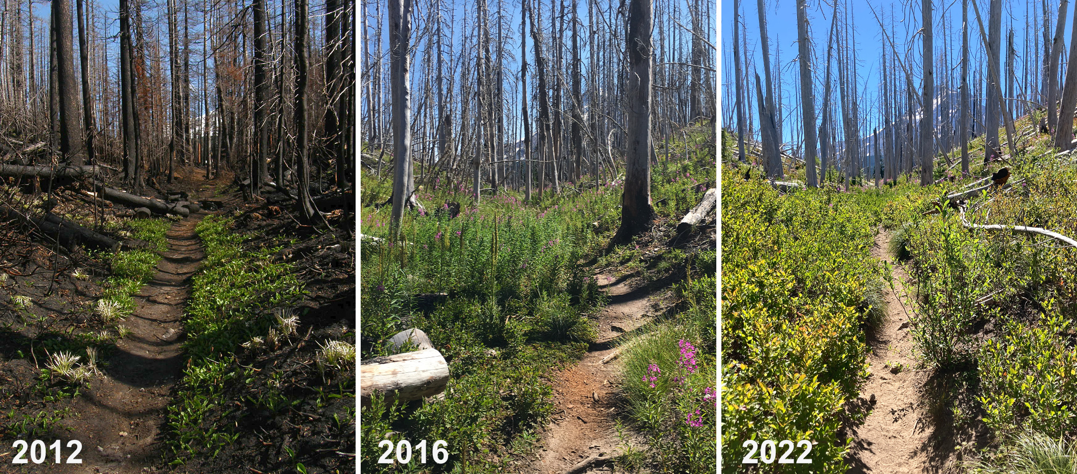
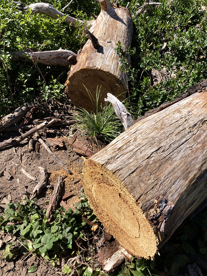
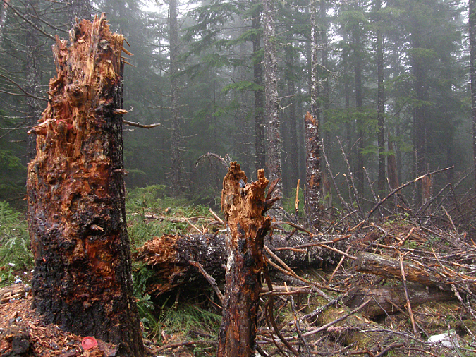
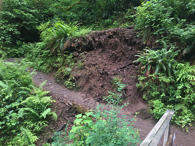
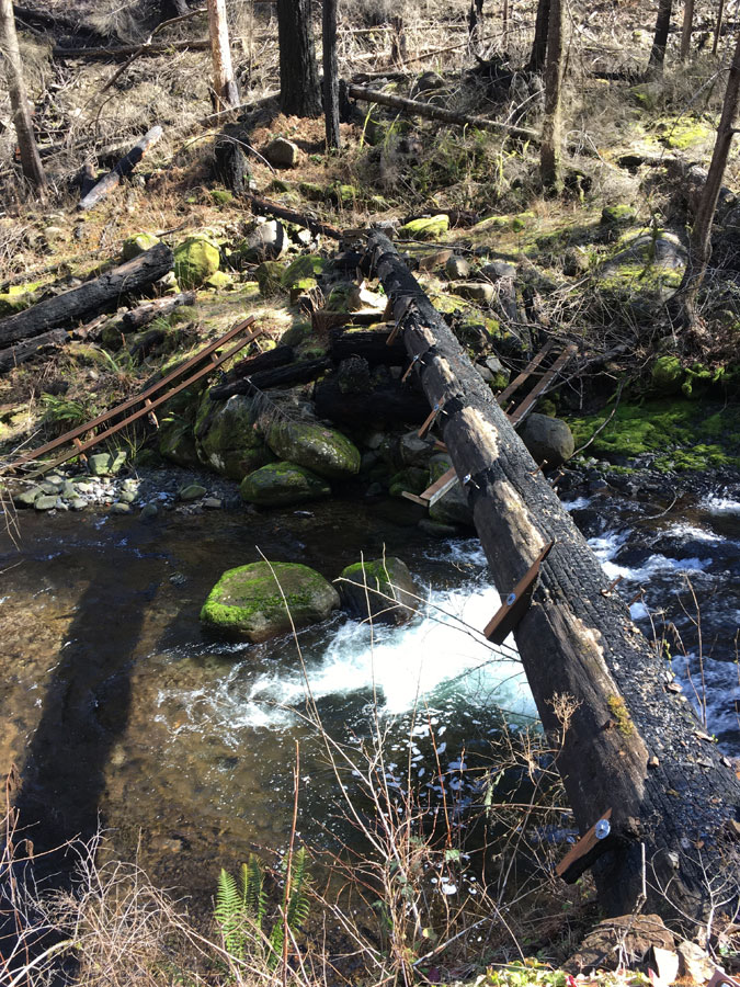
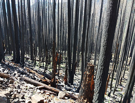
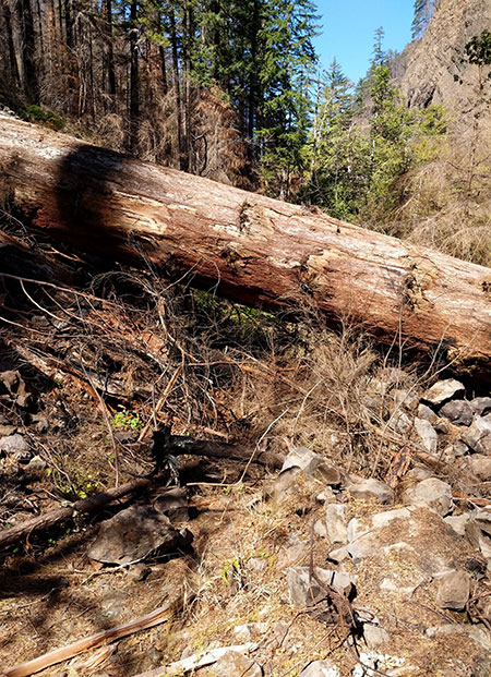
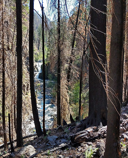
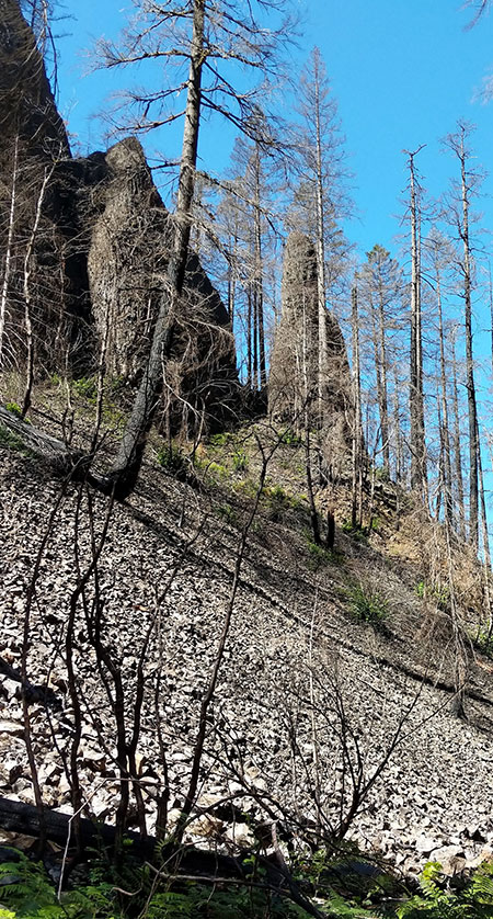
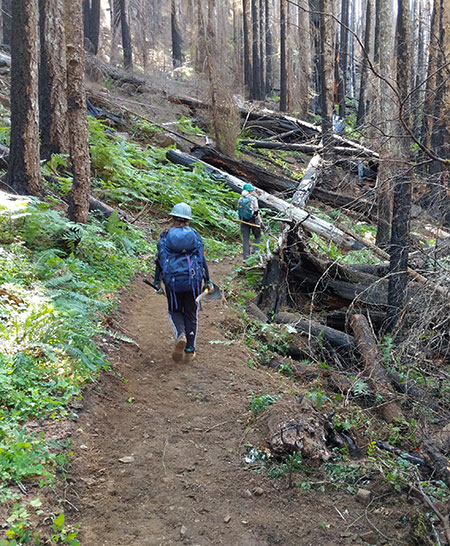
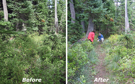
The year 2020 had more unpleasant surprises for Oregon with the Labor Day windstorm and subsequent forests fires that raged up and down the Cascades. Owl Point was not spared from the wind event, and you can spot it in the Owl Point Log comments. I’ve highlighted a comment I wrote in the margins that fall to mark the windstorm:

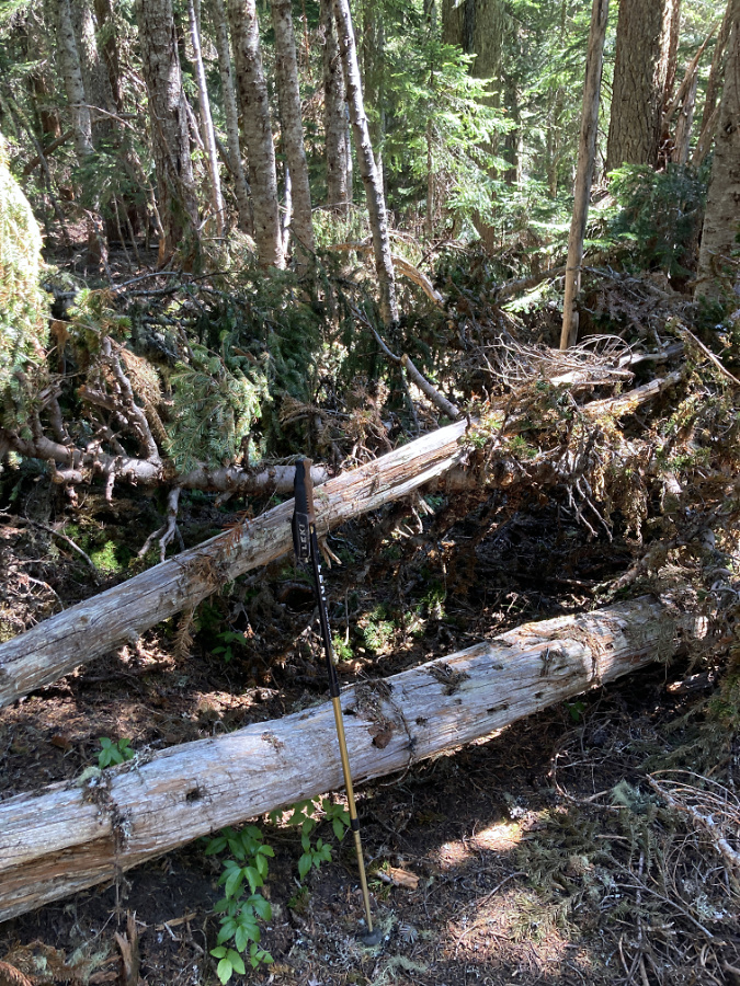
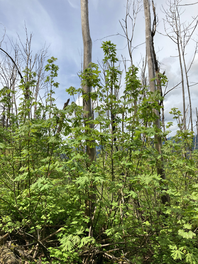
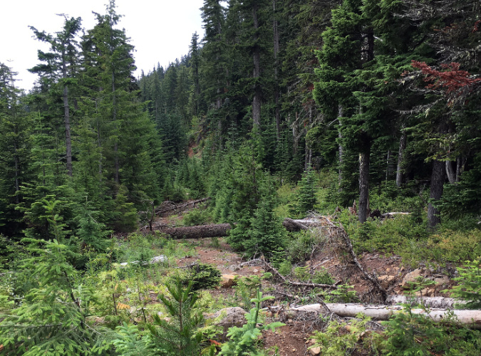
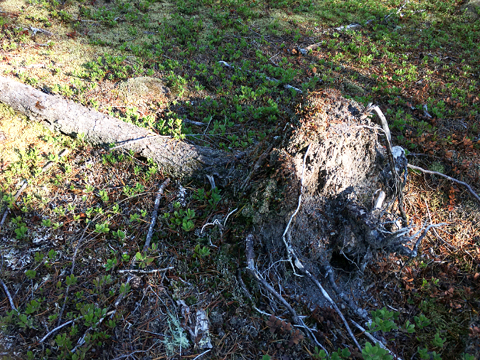
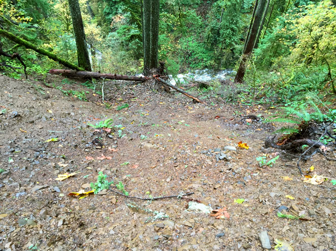
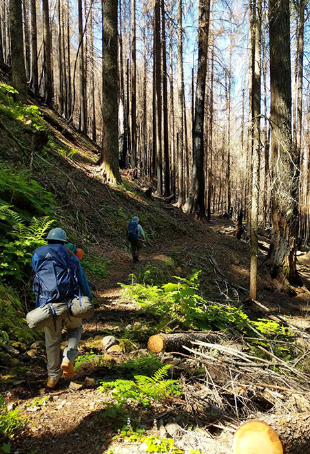
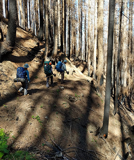
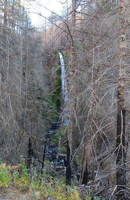
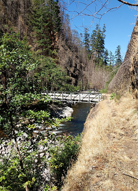
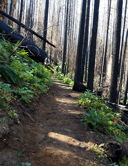
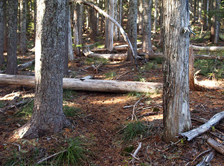
The mess was as bad as the many comments in the Owl Point Log suggested. Dozens of trees were down, especially along the first mile of the Old Vista Ridge Trail. Here’s what the trail looked like in the spring of 2021, when I made my first trip to survey the damage:

Blowdown from the 2020 Labor Day windstorm burying the Old Vista Ridge Trail

Most startling were the number of very large trees that went down at the Old Vista Ridge trailhead. Yet, somehow the sign TKO volunteers had installed just two years before was (mostly) spared in jumble of debris:

Dented but still standing – the Old Vista Ridge trailhead sign after the 2020 Labor Day windstorm

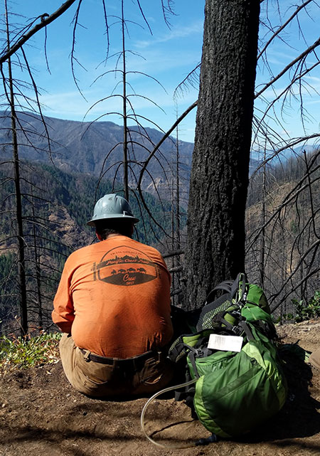
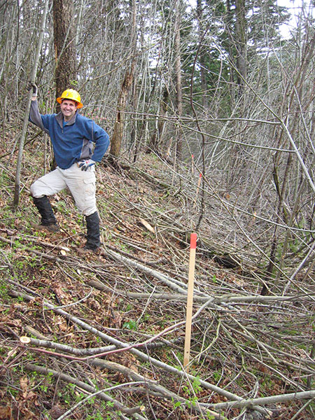
The author surveying the damage from the 2020 Labor Day windstorm

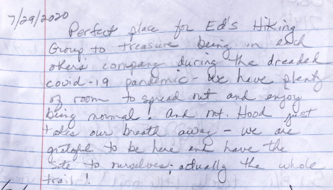
It would still be a few weeks before TKO volunteers were scheduled to clear the mess in the summer of 2021 when I added the following message, so I included a bit of encouragement to hikers who were still pushing their way through debris to reach Owl Point that year:

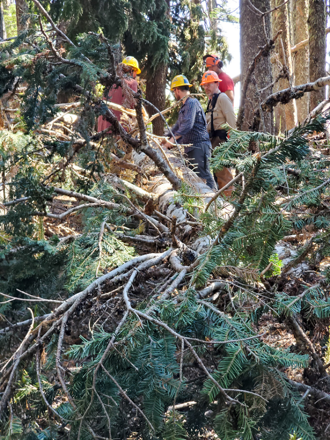
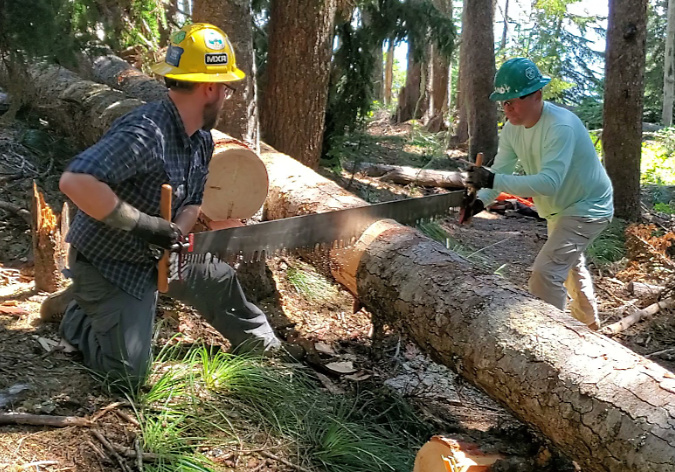
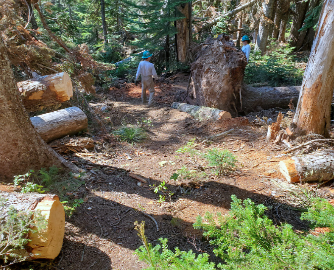
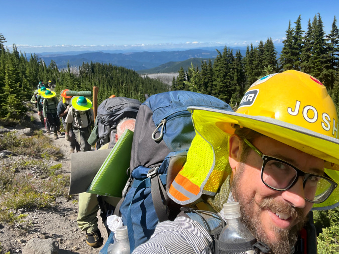
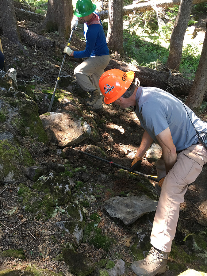
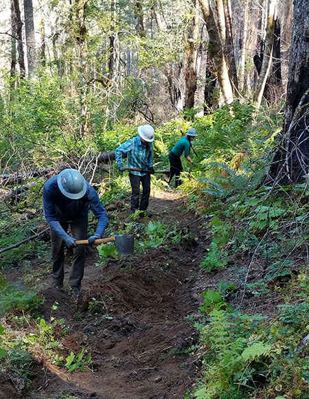
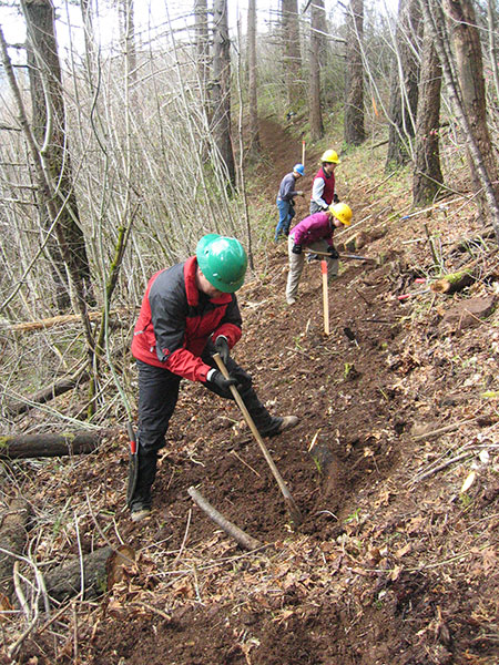
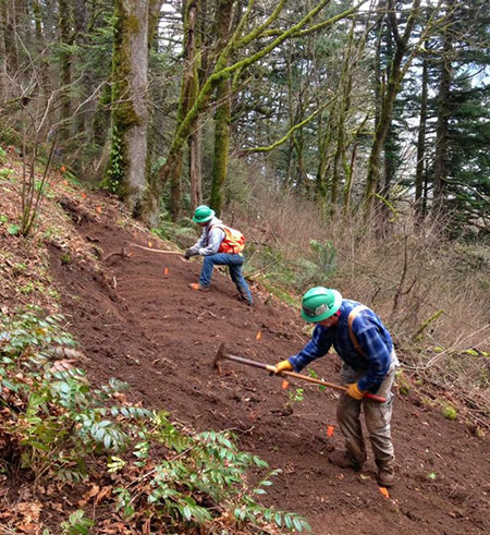
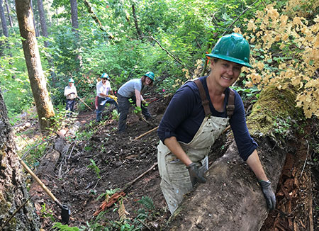
This was the scene on August 11, 2021 when TKO volunteers descended upon the Old Vista Ridge trail and began the task of clearing dozens of downed trees:

TKO volunteers tackled many piles of fallen trees like this in 2021 (Photo: TKO)

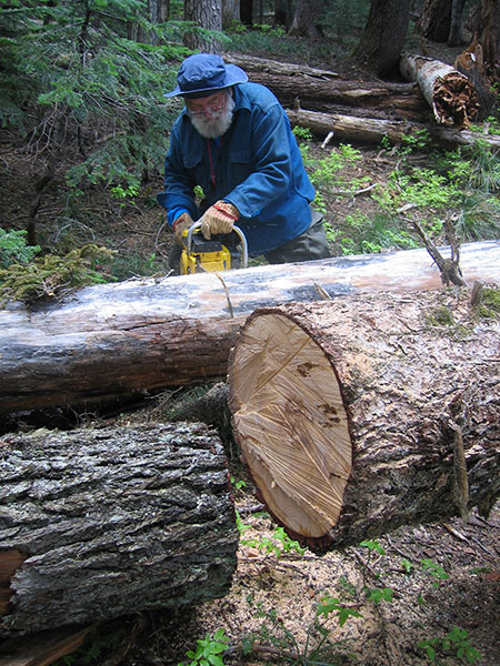
TKO used the event as an opportunity provide crosscut saw training to volunteers, a requirement in wilderness areas where power saws are banned:

TKO volunteers clearing the trail one log at a time with crosscut saws (Photo: TKO)

Newly cleared section of the Old Vista Ridge trail in August 2021 (Photo: TKO)

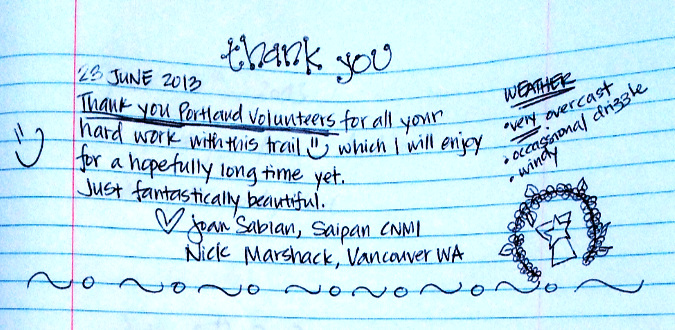
Despite the messy trail conditions that year, you could feel the collective exhale of folks as the pandemic restrictions were gradually lifted. Plenty of thankful messages like these appear in the Owl Point Log:

This is a fun post from that summer (below). Ali got the last word in, but do you think Brendon knew what she had written? 

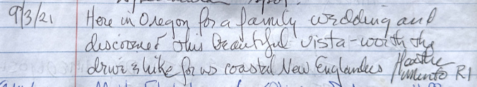
Meanwhile, these Rhode Islanders were in Oregon for a wedding in September 2021:

That year brought the first out-of-towners from eastern Canada, too:

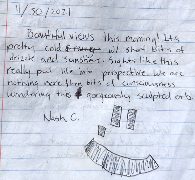
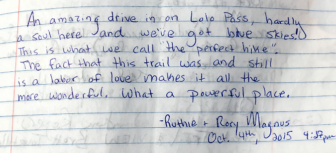
Here’s the final from 2021 – an especially philosophical message left very late in the hiking season:

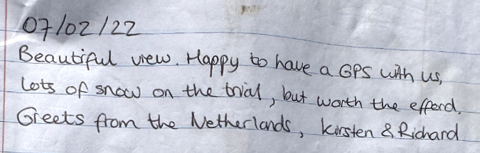
The 2022 hiking season arrived with a very late snowmelt, as noted by these long-distance visitors from the Netherlands:

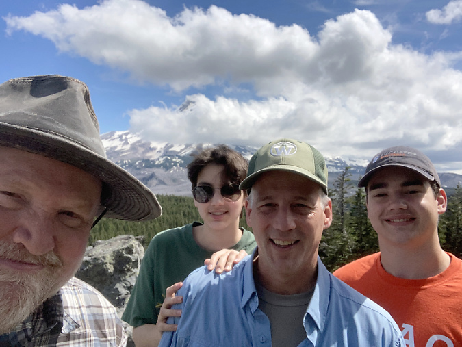
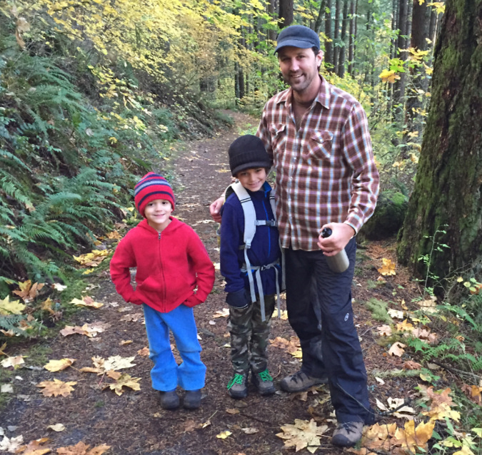
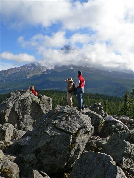
There were still big snowdrifts in a few spots when I visited a week later with my old friend Ted and his two kids, who were home from college. It was a brisk, breezy and beautiful day to show off the beauty of Owl Point to some first-time visitors:

The author giving Ted and his kids a tour of heaven

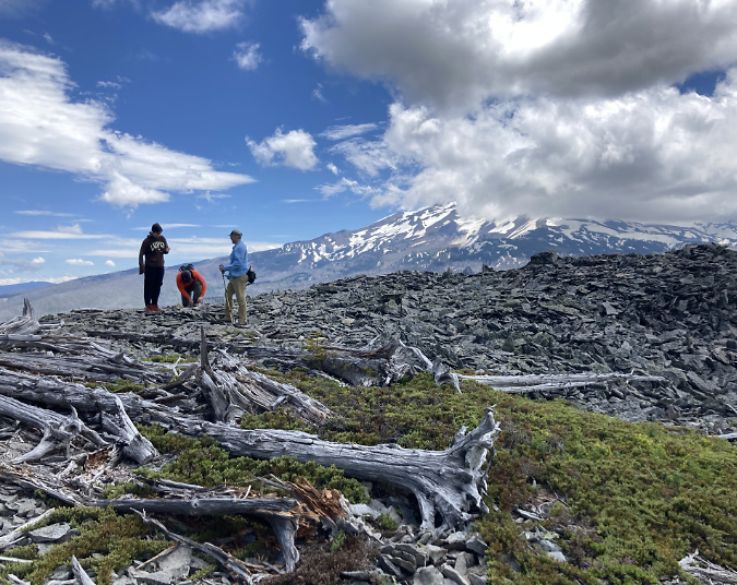
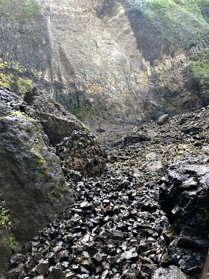
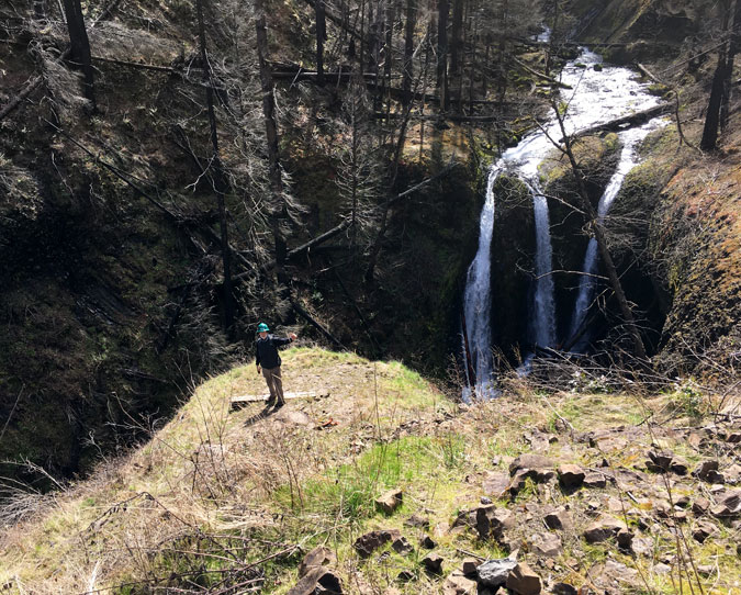
Ted’s kids asked for some extra adventure, so I obliged with an off-trail visit to Katsuk Point and one of the more dramatic ceremonial Indian pit located nearby:

Blustery, beautiful day at Katsuk Point

Off-trail Indian Pit near Owl Point

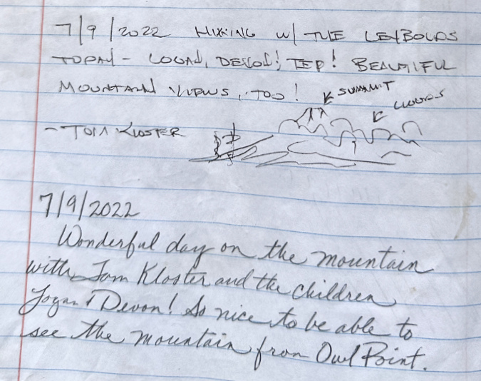
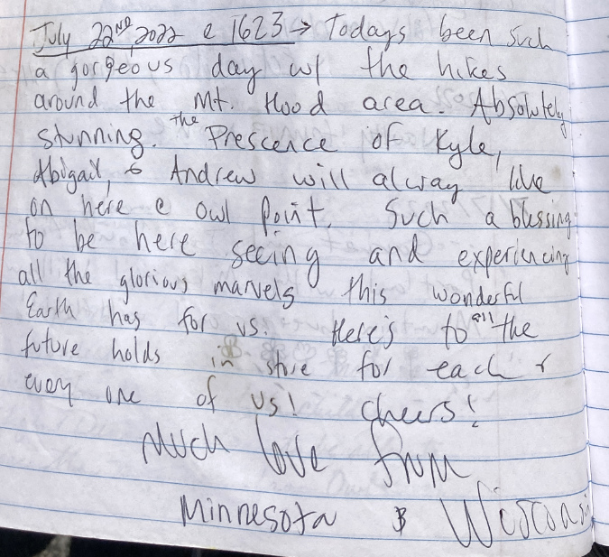
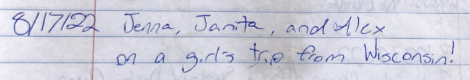
Here’s another thoughtful message (and a toast!) from that summer, posted by out-of-towners from Minnesota and Wisconsin:

…and another Wisconsin group from the week prior – girls trip!

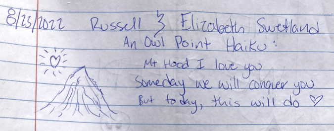
Mount Hood seems to inspire haiku – this entry was added in late August of 2022:

Not surprisingly, this isn’t the first mention of aliens in the Owl Point Log, but it might be the best:

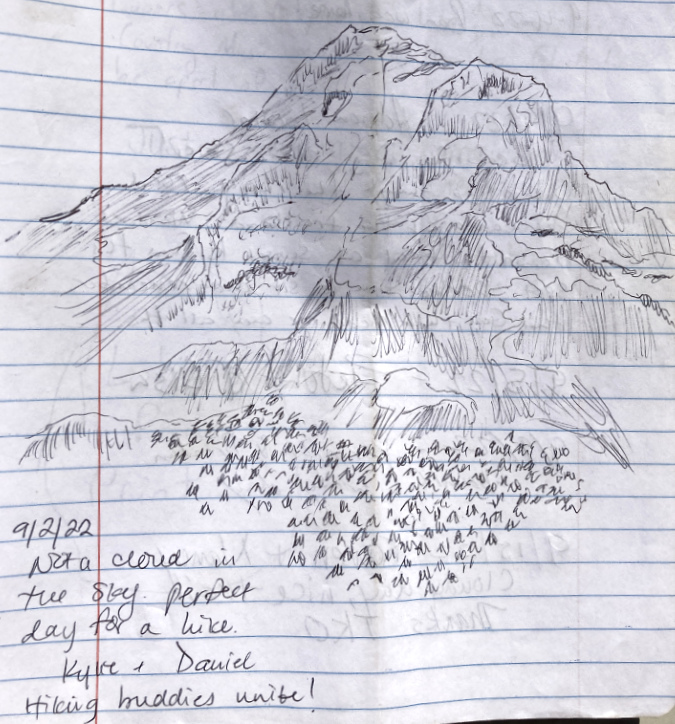
Hiking buddies Kyrie and David left this very detailed sketch of the mountain in September 2022:

More locals returning to Owl Point in October 2022, plus road-trip out-of-towners from the Bay Area admiring our mountain:

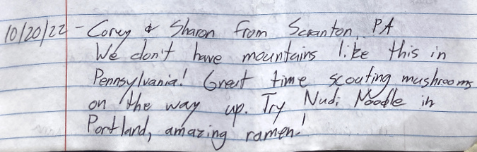
Among the last messages from 2022 is from these Scranton, Pennsylvania out-of-towners, who were also enthused about trendy restaurants in Portland: 

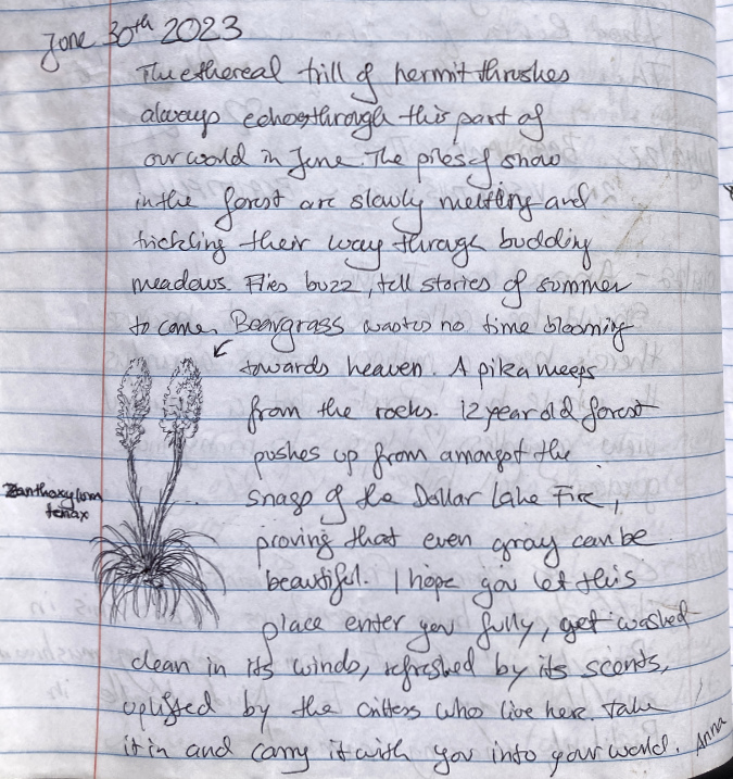
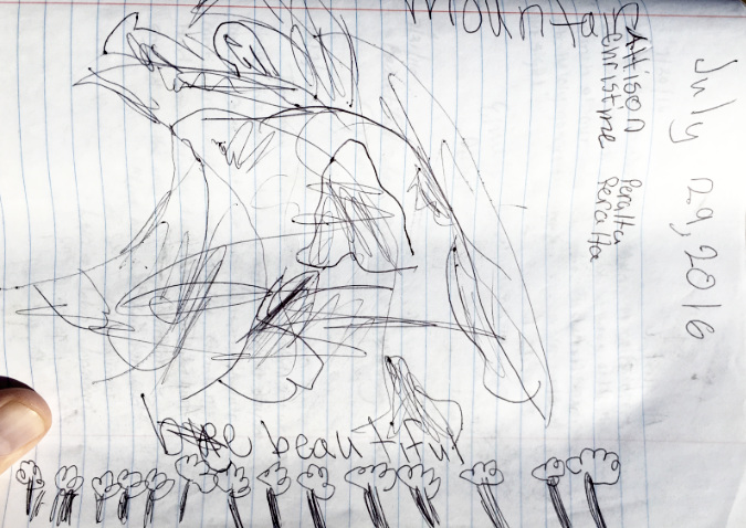
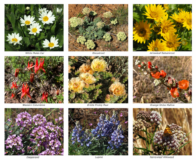
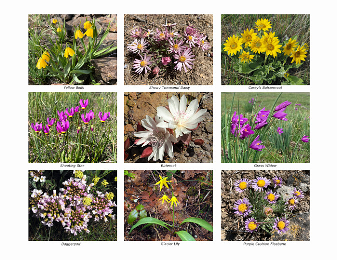
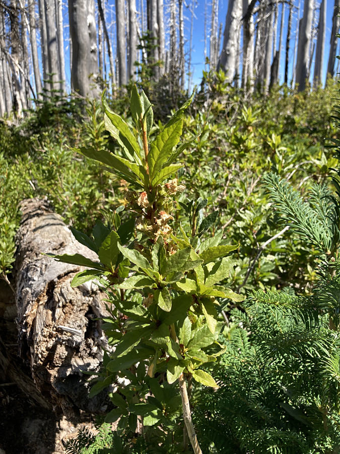
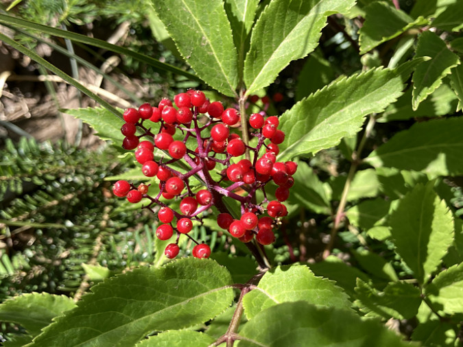
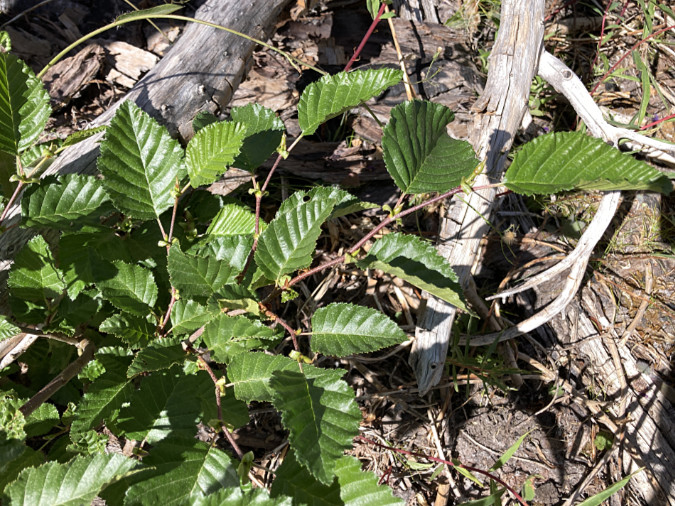
The 2023 season opens with one of the finest entries to date in the Owl Point Log. Hiker Anna gives a literary spin to the natural history of the area, including a nice botanical sketch of Beargrass in bloom (the second in that I’ve included in this article):

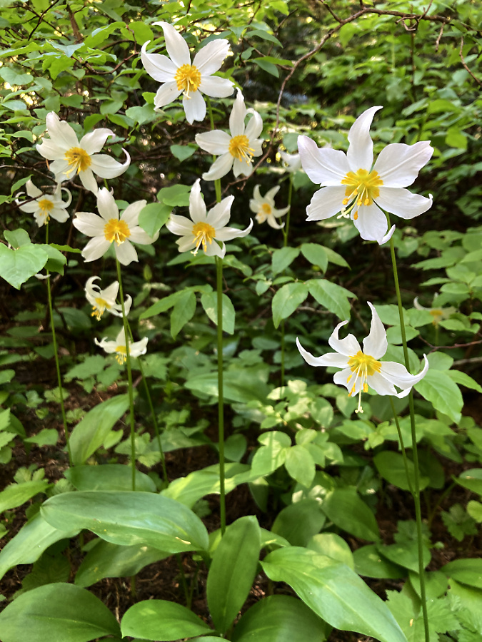
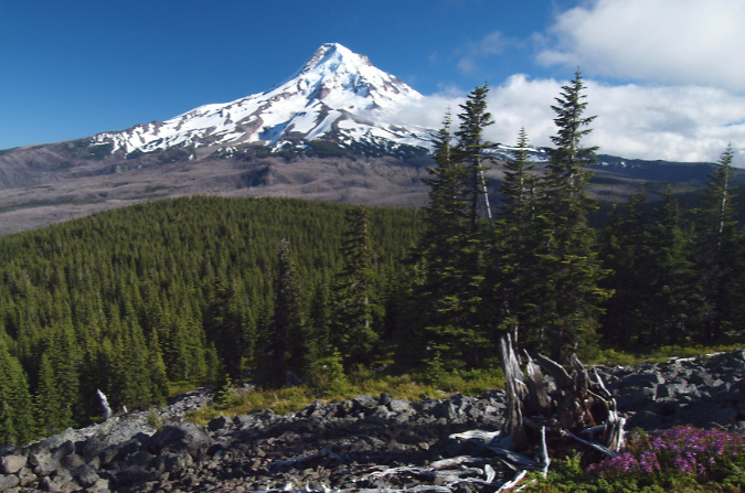
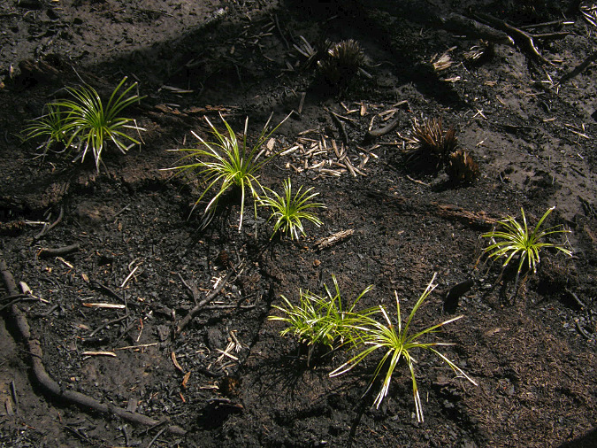
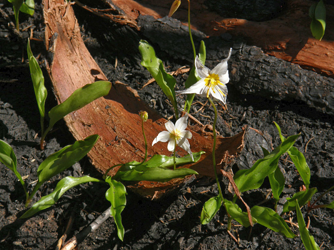
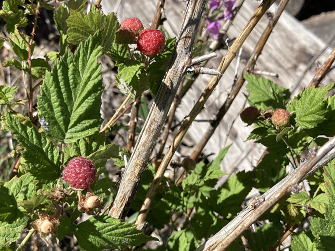
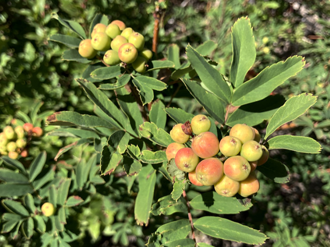
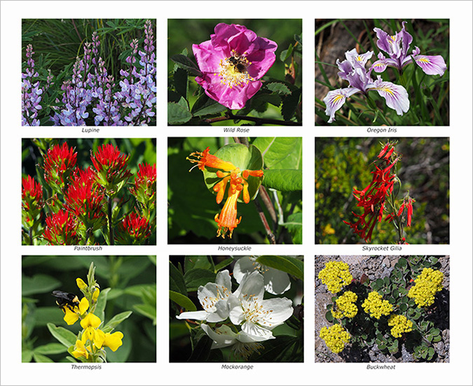
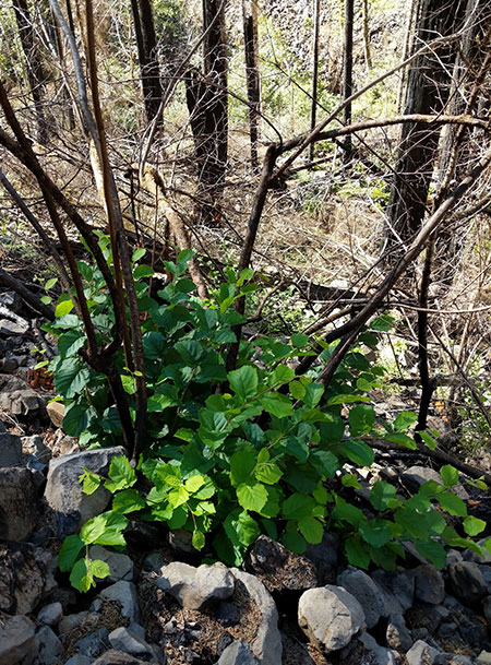
Beargrass and Avalanche Lilies are mentioned often in the log by early summer visitors, so to put a face on these wildflowers, here’s a quick primer on these favorites.

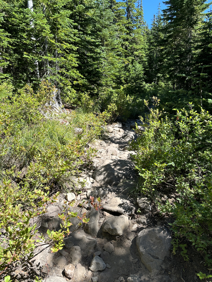
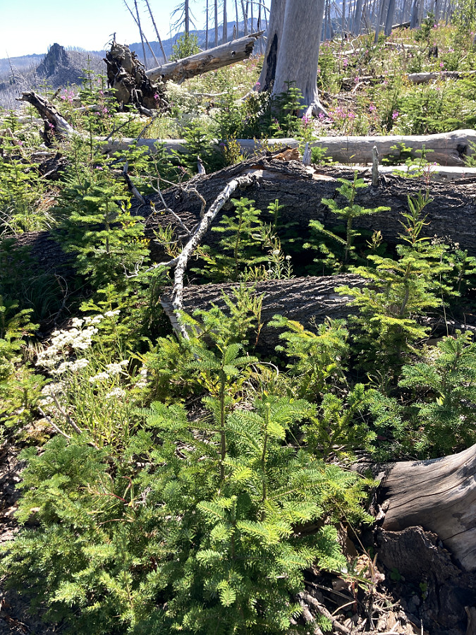
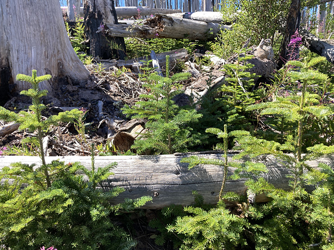
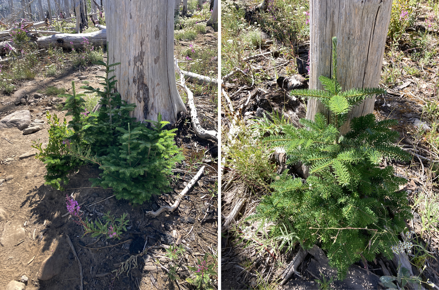
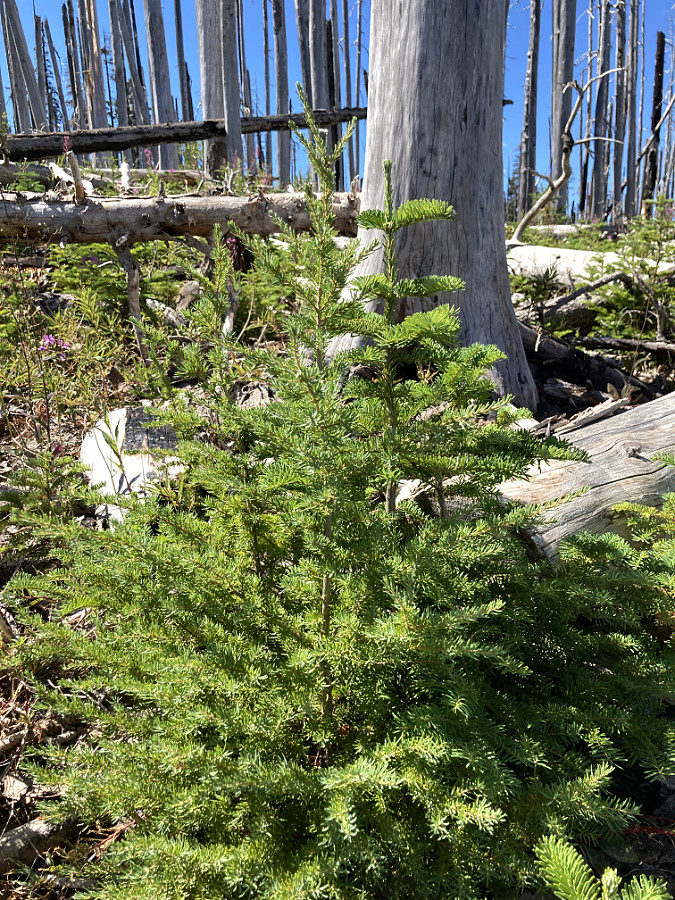
First up, Avalanche Lily. The explosion of these lovely wildflowers in the Dollar Lake Burn area has made the main Vista Ridge Trail a new favorite among photographers, but there are plenty of these lilies growing along the northern sections of the Old Vista Ridge trail. The form carpets of white flowers under the Noble Fir canopy in late June and early July, especially in the section between Blind Luck Meadow and the Owl Point junction.

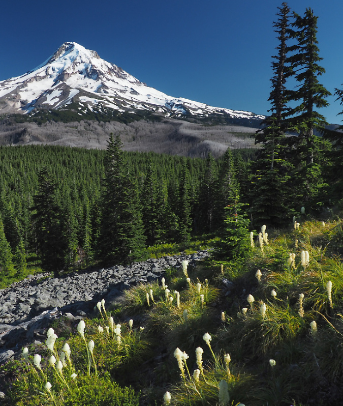
Avalanche Lilies near Owl Point in early July

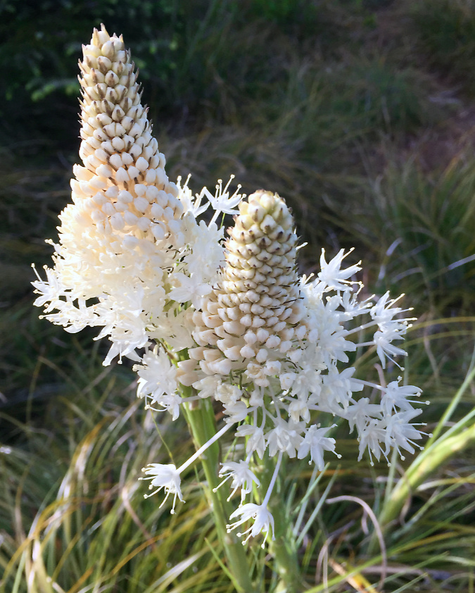
Beargrass is also found throughout the hike to Owl Point, but it is most prolific in the area around Blind Luck Meadow and fringing the talus slopes at Owl Point, itself. Beargrass blooms in June and early July on tall spikes that gradually unfold whorls of tiny, individual blossoms from the bottom, up. 

This example at Owl Point has just begun to bloom:

Beargrass bloom beginning to unfurl

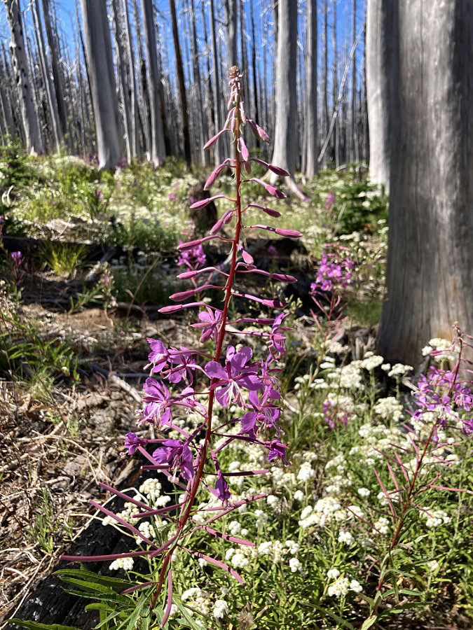
Here’s an example of Beargrass at Blind Luck Meadow at it peak, with the top of the spire fully open. For photographers, this is the Beargrass bloom stage they are seeking:

Beargrass in full bloom

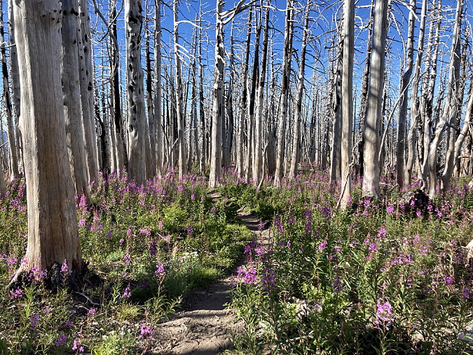
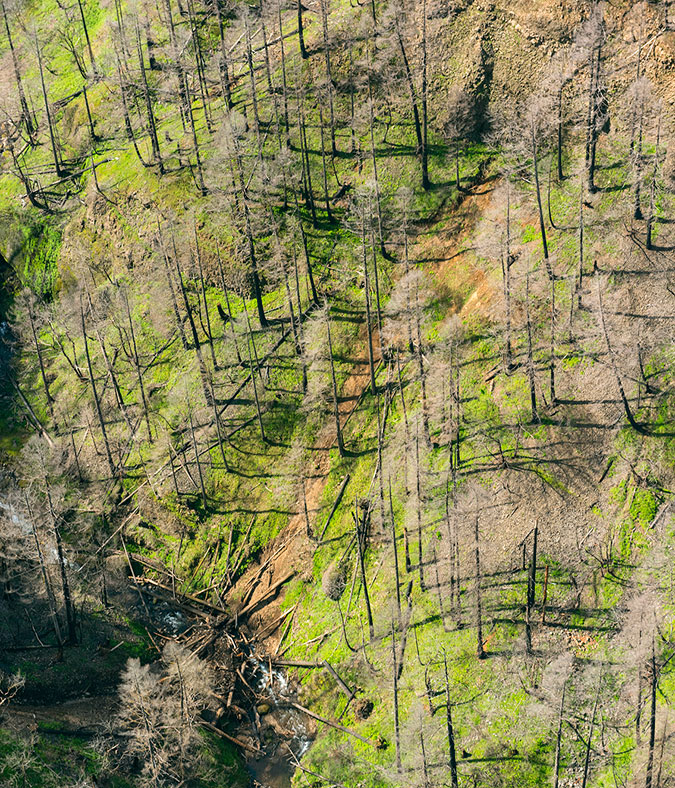
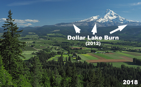
Beargrass are fickle in their blooming habits. While there’s a widespread myth that these flowers bloom in seven-year cycles, it is true that individual plants rarely bloom in consecutive years. The abundance of blooming Beargrass in a particular area is more a measure of abundant spring rainfall, soil moisture and especially access to sunlight. Owl Point had prolific Beargrass years in 2016 and 2021, while other years had few or no bloom at all. 

2016 Beargrass bloom at Owl Point

Another myth is that bears eat Beargrass roots. Also not true, though deer and elk to graze on their foliage, and bears have been known to use their leaves as bedding. Native peoples also used the tough leaves from Beargrass in woven baskets and the fleshy roots for medicinal purposes.

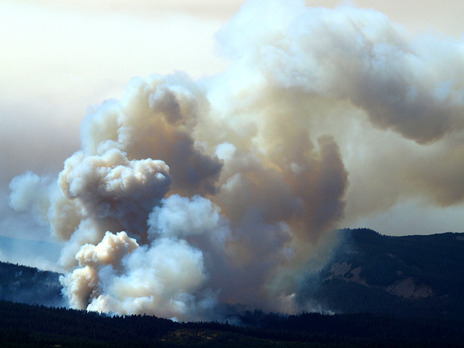
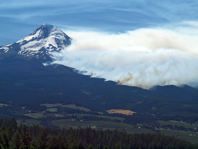
This brings me to the conclusion of the second volume of the Owl Point Log book in, with yet another entry of my own, made while on a TKO scouting trip in July 2023. Notable in this message was the plume of smoke that I watched rising from the east shoulder of the mountain while I was at Owl Point that day. The fire turned out to be further south, along the White River. By the time reached home that night, it had exploded into a substantial fire.

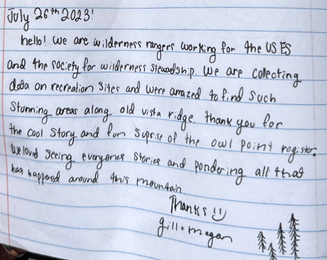
Then, there was this entry from later that month in 2023 (below) by two USFS rangers researching the trail. Once again, I was relieved to read that they appreciated the Owl Point Register box and log book – and the view, of course!

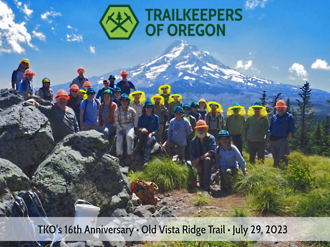
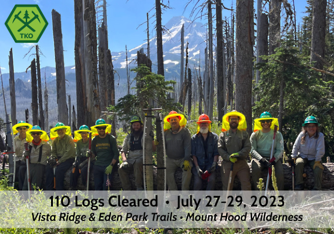
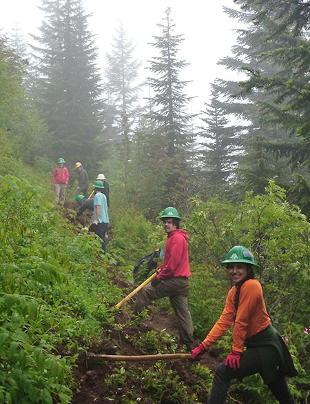
This note (below) marked the most ambitious annual TKO outing to date on the Old Vista Ridge Trail. Not only were there volunteers clearing logs and brush along the Old Vista Ridge trail, a separate group had backpacked to WyEast Basin and spent two days clearing over 100 logs from the main Vista Ridge trail with crosscut saws.

The annual event portrait for 2023 (below) shows both crews meeting up at Owl Point for lunch. On hand were a couple gallons of ice-cold lemonade (hauled two miles in!) and several dozen homemade cookies. The bright yellow sunshades mark the overnight crew that worked the Vista Ridge trail – a very exposed area since the 2011 Dollar Fire swept through.

The dual-crew TKO meetup at Owl Point in 2023

TKO crosscut crews on the main Vista Ridge Trail for an overnight logout in July 2023 (Photo: TKO)

Crosscut crews celebrating 110 logs cleared in two days in 2023

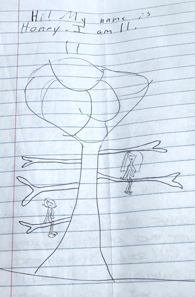
The final (and perfect) entry in Volume 2 of the Owl Point Log is this artful sketch (below) by Honey. I’m going to guess that Honey climbed a tree while at Owl Point? 

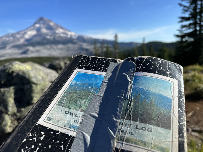
The second volume was close to full by August 2023, but worse, the cover was falling apart. A kind visitor had done some first aid with duct tape, but alas, it was time to retire this one…

The second volume to the Owl Pont Log was well-loved..

And so, I left this note to close out the second volume:

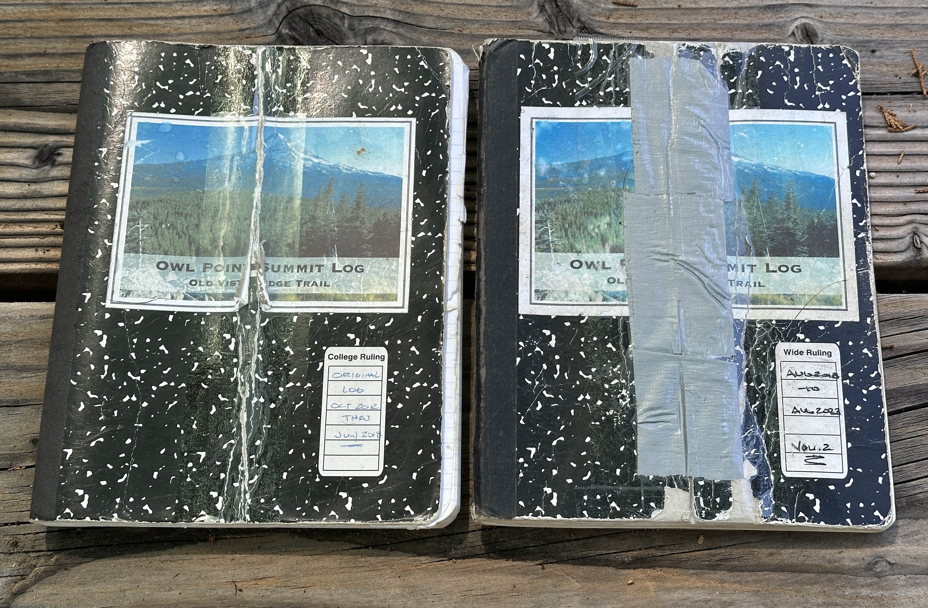
Where are the first two volumes of the Owl Point Log kept? In TKO’s archives – which really means a closet in my home office. When TKO does have an archive, someday, they will move to that more appropriate place.

The archived first and second editions of the Owl Pont Log… safe in my closet

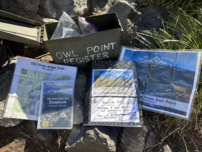
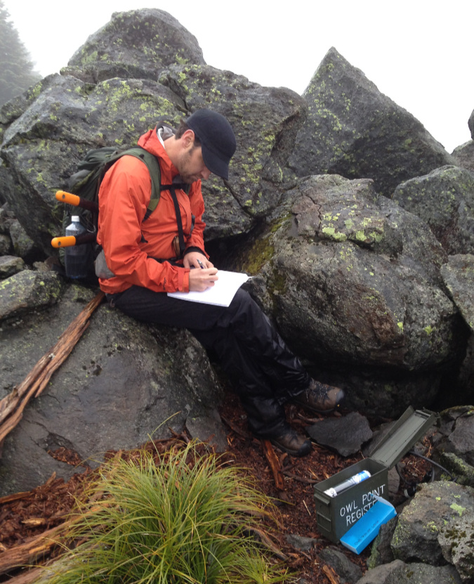
…and so, in August of last year I place the third volume of the Owl Point Log in the summit register, along with a fresh version of the Old Vista Ridge scrapbook, maps and visual guide to Mount Hood’s features (below). Judging by the folds, and comments in the log, these get well-used by hikers wanting to learn a bit more about the area and Mount Hood.

The contents of the Owl Point Register – log, scrapbook, maps and a guide to Mount Hood’s features

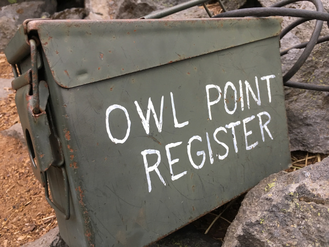
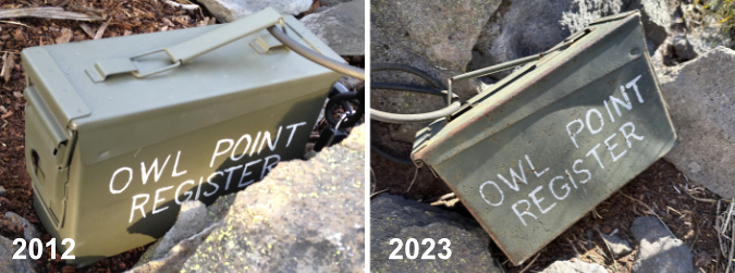
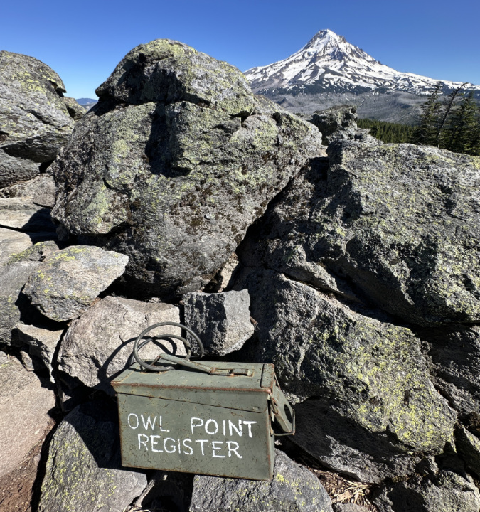
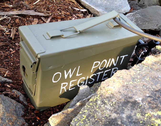
And what about the box, itself? So far, it’s doing remarkably well (below), considering the abuse it receives from the elements up on Owl Point. I painted it with army-green Rustoleum back in 2012, and though it’s showing some rust around the edges, It has remained water-tight for twelve years and counting. 

Eleven winters and counting at Owl Point

[click here for a large version]

For those who don’t recognize it, the box is an old Army ammo can that I picked up at the venerable (and since closed) Andy and Bax in Portland. At some point, I’ll need to replace the box, as well – and find a new army surplus store!

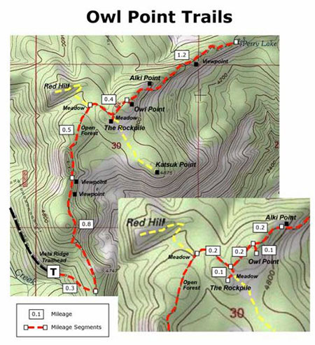
What’s ahead for the Old Vista Ridge Trail?

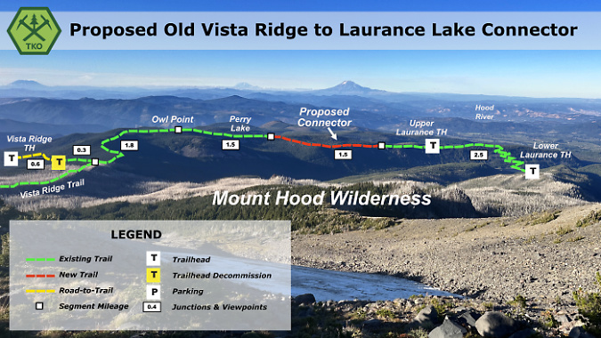
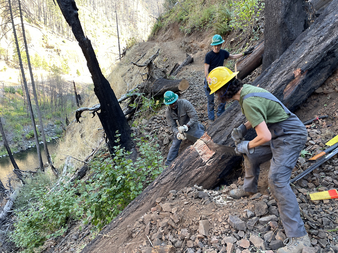
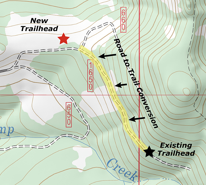
When TKO adopted the Old Vista Ridge Trail – our founding trail – it was part of a broader vision for the area that TKO presented to the Forest Service in 2016. There are lots of proposals in that vision for improving trails and trailhead on the north side of Mount Hood. Among them, the next priority is to provide a route to Owl Point from the east, from the Laurance Lake trailhead.

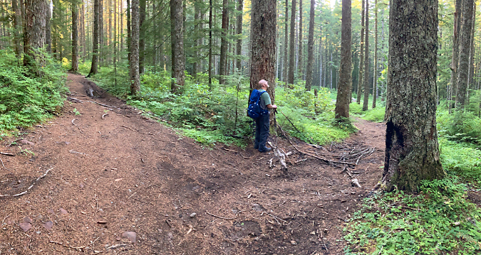
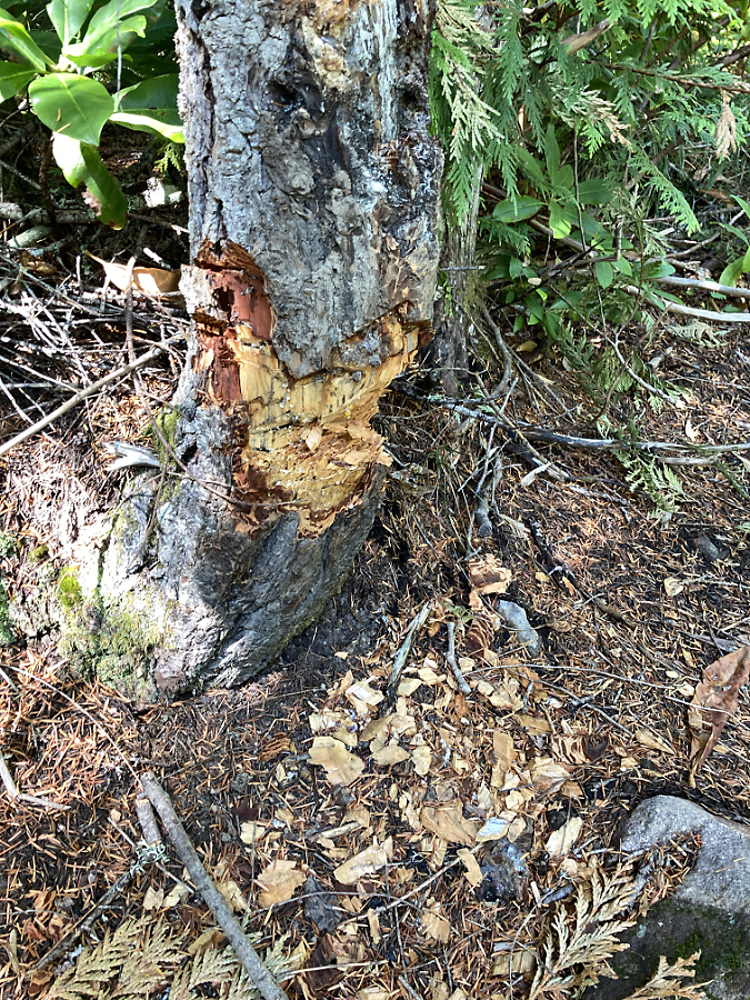
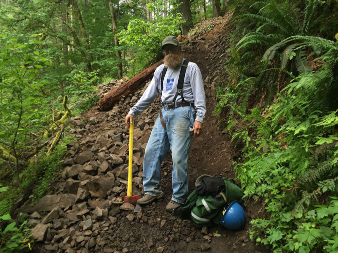
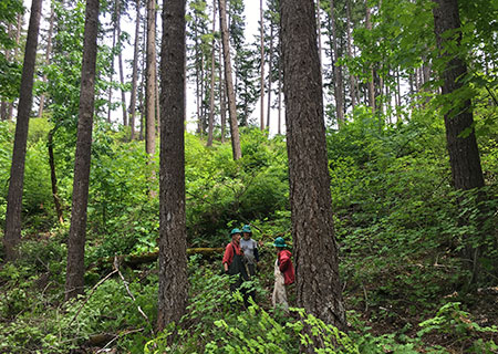
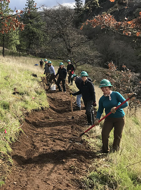
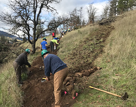
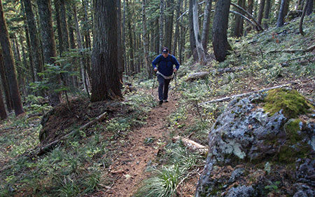
TKO volunteers clearing a log near Owl Point in July 2024

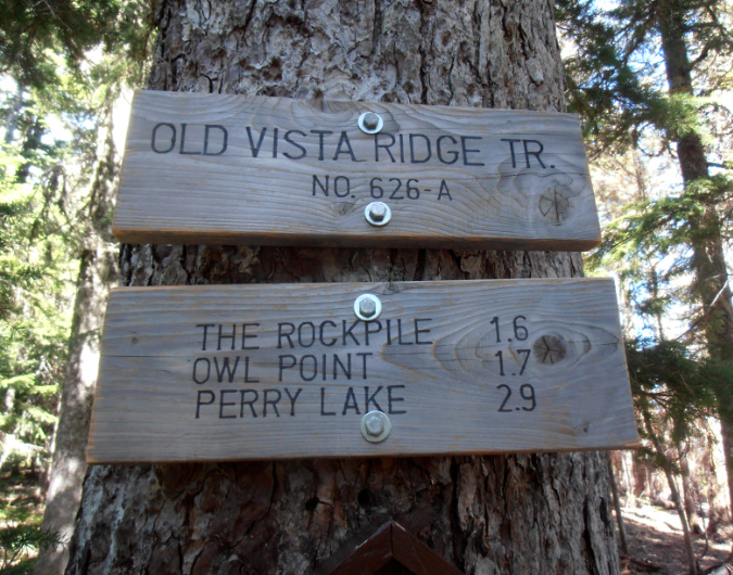
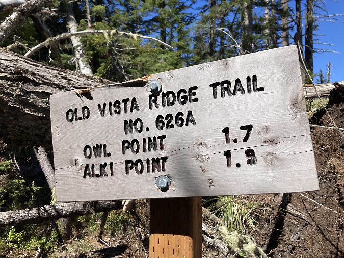
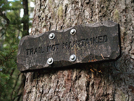
Currently, TKO’s adopted segment of the Old Vista Ridge trail ends at this sign (below), at Alki Point. From here, the unmaintained trail continues downhill to the site of the old Red Hill Guard Station and tiny Perry Lake (more of a pond). 

TKO intern Karen helping plant the “trail not maintained” sign at the end of the adopted segment of the Old Vista Ridge Trail in 2018

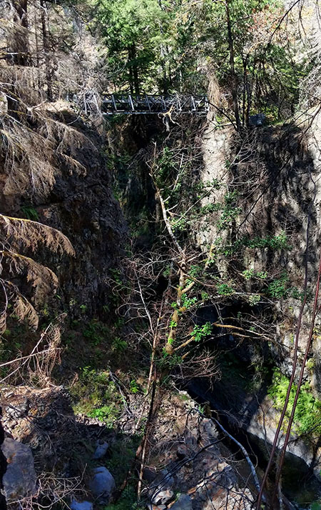
TKO’s vision is to construct a roughly one-mile connector from Perry Lake to the upper trailhead of the Laurance Lake trail. This schematic shows the proposed connector, as viewed from high on Mount Hood, looking north:

[click here for a large version]

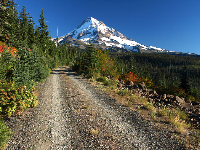
The Laurance Lake Trail was built sometime in the early 1990s and originally envisioned as a mountain bike loop. However, a landslide destroyed the old logging spur that was intended to complete the loop. Later, that part of the planned route was incorporated into the Mount Hood Wilderness, and bicycle travel is now prohibited there.

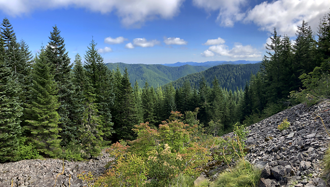
The orphaned stub of the Laurance Lake Trail remains popular for the views of the lake (below) from the open talus slope the trail traverses and the easy uphill grade that was originally built for bikes.

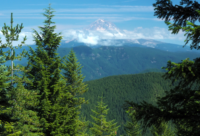
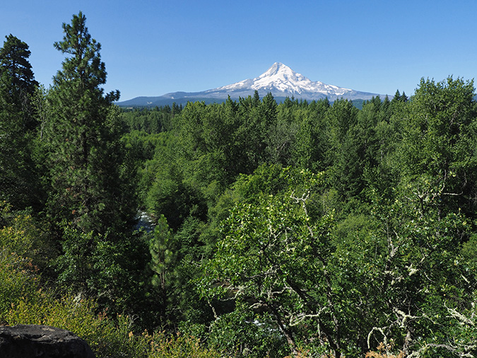
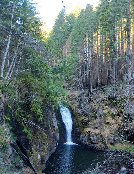
Laurance Lake and Mount Hood from the Laurance Lake Trail

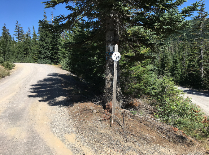
Beyond the talus slopes the trail reaches a ridgetop that eventually extends west to Owl Point. An upper trailhead exists here, too, making construction of the connector trail convenient for crews, since work on the new trail would begin here.

Upper trailhead for the Laurance Lake Trail

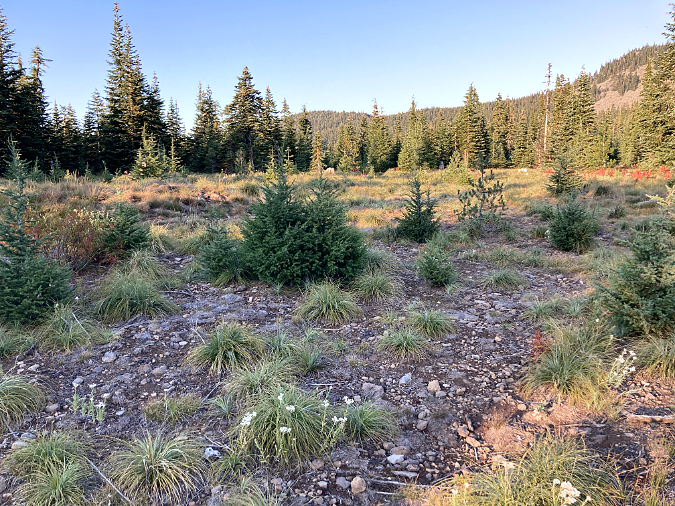
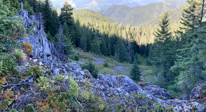
Hikers have worn a path along the first quarter mile of the proposed route to and opening along the valley rim (below), with a sweeping view of the mountain.

Upper Laurance Lake Trail viewpoint

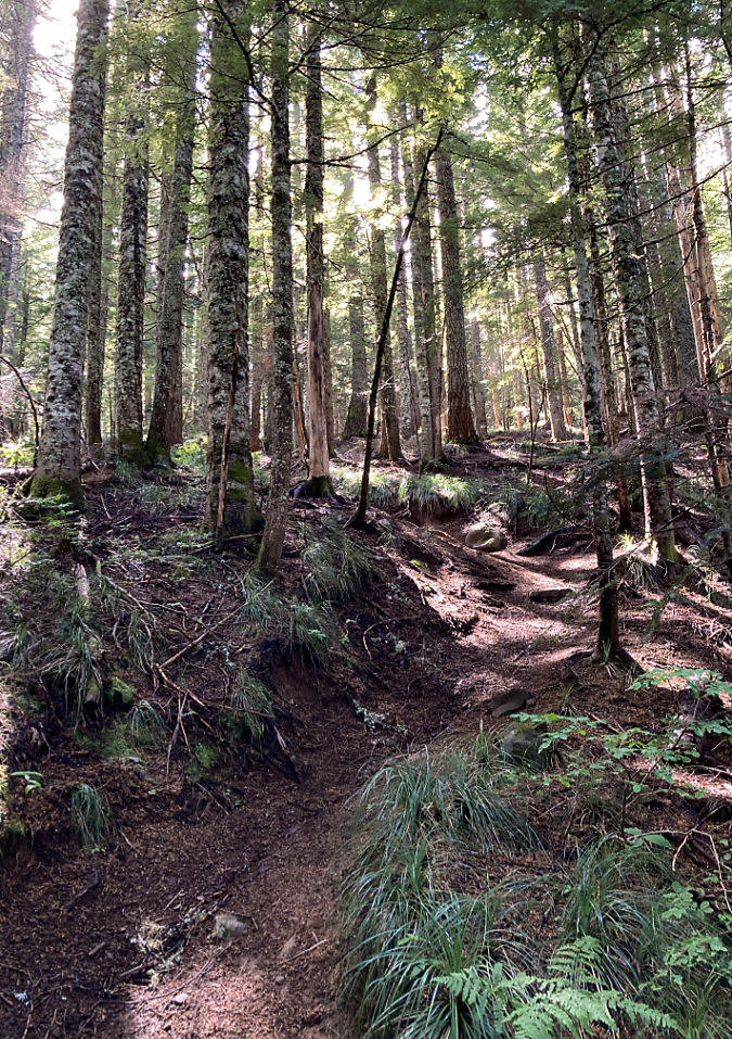
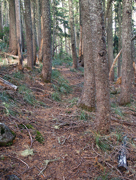
From the upper trailhead and viewpoint, the new connector would travel through a gently sloped forest for about a mile, then emerge where the unmaintained section of the Old Vista Ridge trail begins. From here, a series of expansive views into the Mount Hood Wilderness unfold along the way to Owl Point.

One of the many views along the unmaintained section of the Old Vista Ridge Trail (photo: Janice Abbagliato Messervier)

There is no timeline for this work, and federal planning processes are slow, but I’m hopeful that this new route and others that TKO has proposed can happen sooner than later. It’s no secret why people are increasingly seeking time out on trails in our public lands – the many messages in the Owl Point Log are testament to that – and there’s a tremendous backlog in meeting that need. I’m looking forward to working with TKO to be part of making it happen.

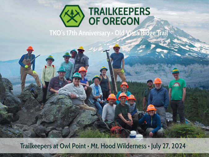
The annual TKO event at Owl Point in 2024

[click here for a large version]

Thanks for indulging me this far in a rather sprawling article and a trip down memory lane! As always, I appreciate folks stopping by and especially for being a friend of WyEast.

Hope to see you on the trail, sometime!
______________

Tom Kloster | August 2024

Restoring Trails… and Hope? The Owl Point Register Story (Part 1 of 2)

Dad and daughter signing in at Owl Point in 2016 (photo courtesy of Sergey Kiselev)

Making time for this blog is always a challenge, given my day job, caring for family and a broken-down old house… and all the other distractions in life that we ALL tend to! So, I’m a bit tardy with this article. But to be candid, it’s the political chaos unfolding at the national level in this election year that has been on my mind in a big way, making it hard to think about the places and things I care about most, right here in WyEast country. I also know I’m hardly alone in being discouraged and fearful about what the November election might bring for our country. It’s a crazy time in America. Again.

Then I had a breakthrough last week. I was up at my beloved Owl Point, on Mount Hood’s north side, scouting for an upcoming trail stewardship event. While there, I was doing my annual tending to the summit register I placed there in 2012. It’s a simple setup: a painted steel ammo box with some maps and photos of the area and a simple log book for folks to sign. 

Twelve tough years in the elements, and the Owl Point Register is still holding up in 2024!

When I placed it back in in the fall of 2012, I didn’t expect a big response. Though the Old Vista Ridge trail to Owl Point had been re-opened by volunteers five years prior, in the summer of 2007, it was still only lightly visited. The Forest Service would not formally recognize the trail as “maintained” for another five years. Looking back now — twelve years later — more than 1,000 entries by individuals, couples, families, hiking groups and even the occasional dog fill 272 pages (and counting) that have now spilled into a third edition of the register!

Given its popularity, I’ve always fretted about the box being vandalized or stolen, thus losing all those entries and the wonderful personal histories they contain. Therefore, whenever I’m up at Owl Point I take photos of the latest entries as a backup, of sorts. In this way, I’ve maintained a running digital (so to speak) version of the register since the very beginning.

It was in this context of capturing the latest entries that I came across the following message last week. It had been entered last October, just before the winter snows closed in on Owl Point:

Reading Danielle’s brave, vulnerable message immediately broke through the political noise, dread and polarization that has been swirling in my head in this miserable election season. It  reminded me that the antidote to all of the toxicity washing over our society right was right in front of me – Mount Hood towering above and Danielle’s personal testament in my hands. It was a needed reminder of the limitless restorative powers of just being out in nature, rediscovering who we are and what we care about most, and being reminded that we’re always stronger than we think.

And therein was the breakthrough for me: return my own focus to being an active advocate and steward for our natural landscapes right here in WyEast Country: for a better future for Mount Hood and the Gorge and for the trails that provide access for everyone to our precious public lands. 

Restoring my focus back to these things that matter most to me, and making time to be outside in nature has already helped provide me the renewed sense of hope and perspective I’ll need to make a difference this fall — and beyond. It was always there, but Danielle’s messages was the reminder I needed to look past the discouraging distractions and toward things that I can directly impact right here in my corner of the world.

Mount Hood shining under a brilliant summer sky last week in this view from Owl Point – the highlight of the Old Vista Ridge trail

And thus, this article. It’s simply a collection of highlights that I’ve selection from the hundreds of messages posted in the Owl Point Register since 2012. I’ve chosen them based upon the joy, hope, graciousness and good humor they offer. They range from poignant and spiritual to whimsical and silly. Yet, in every message you can feel how just being there at Owl Point, taking in that amazing scene, has inspired these messages. The first batch of selections spans the first five seasons, from fall 2012 through 2016. Part 2 of this article will draw highlights from 2017 through the present.

I hope these will resonate with you as they do with me, perhaps restoring some much-needed hope and faith in humanity for you, as well, in this crazy, consequential time we are living in. 

It all started in October 2012…

The freshly painted Owl Point Register on the day it was placed – October 17, 2012. The ammo can was from Andy & Bax in Portland (the iconic store recently closed, ending an era). I added a coat of army-green Rustoleum and some shaky, hand-painted lettering…

The Owl Point Register came about as part of a plan to bring more folks to the (then) little-known Old Vista Ridge trail, with an eye toward creating broader awareness of this largely unknown corner of Mount Hood’s backcountry. The register not only lets visitors share their thoughts with those who follow in their footsteps, it also describes the rich history of the area, and has maps and a photo guide to the features on Mount Hood that they can study as they take in the view.

In 2009, President Obama signed an expansion of the Mount Hood Wilderness into law that pushed the protected area north by about a mile, to where it now follows much of the Old Vista Ridge trail as the official wilderness boundary. It was a welcome recognition of the restored trail and an overdue expansion of protections for the mountain, yet still leaves the rugged country north of the trail unprotected. Thus, the continued goal to make the area known to hikers who can help advocate for its future. As recently as 2008, the Forest Service had proposed an off-road vehicle “play area” for Owl Point and Old Vista Ridge, so the risks of losing this wild place are still very real.

Old Vista Ridge Jedi-volunteer Jamie Chabot becoming one of the first to sign the new register on a foggy day in November 2012

Within the first year, the register began to fill with messages from hikers. Many were astonished at the “new” view from Owl Point that the trail provided – one of the finest of the mountain, and yet largely unknown at the time. There were also many kudos for those who had rescued the Old Vista Ridge trail and continued to restore this historic route. This was especially rewarding to the handful of trail volunteers doing the work, as it was still unofficial, and there was no guarantee that the Forest Service would eventually recognize the trail, even in its restored state.

The opening message in the register was written by me on October 17, with a bit of an introduction to Owl Point:

I’d forgotten until preparing this article that I also recorded scattering the ashes of my beloved grandparents on that first day! They had asked me to someday place their remains on Mount Hood, and there simply was simply no better place than Owl Point. I still check in with them every time I’m up there – and they always report that they’re enjoying the amazing view!

2013

The register began to really catch on during its first full season at Owl Point, in 2013. Among the early surprises: international visitors… to Owl Point? It turns out this hike description that I wrote in the Oregon Hikers Field Guide had reached far beyond the shadow of Mount Hood to wherever internet access existed. In this case, all the way to Saipan:

…and soon, more international visitors to Owl Point – from Austria:

…and from France!

The postscript from the French visitors surprised me, too! I don’t know that Americans have any better track record than Europeans when it comes to respecting public spaces, but I do think that the particular slice of humanity that is willing to walk two miles into a wilderness for a mountain view does. Hikers are good people.

2014

As the popularity of the Old Vista Ridge trail continued to grow, entries in the Owl Point Register began to include organized hiking groups, like this one:

Every year, I’ve also added my own entries to help me track the changes since my last visit. Here’s a message from a trail tending trip in 2014 with Jeff Statt, another Jedi-volunteer. As you can see, seeing other hikers on the trail was still a novelty at the time and very rewarding:

So, what did the mountain look like on that June day in 2014? Like this:

The view from Owl Point in June 2014

Here’s Jedi Jeff reading some of the latest entries in the register on that day back in 2014:

Jedi-volunteer Jeff Statt reading the Owl Point Register in 2014

Among my favorite entries over the years are those from young families. I had the good fortune of growing up with an outdoors-oriented family, an experience that has since shaped every aspect of my life. Thus, I love to see young parents adventuring into the forest with their kids. In this case, parents Mike and Brittany signed in with a bunch of kids in July 2014:

This notable entry in 2014 is from documentary film maker Christopher Alley, made on a scouting trip to Owl Point:

Chris (white shirt in the photo, below) returned the next year with his crew, and I was privileged to come along for the ride. Spending time with them ranks among the best adventures I’ve stumbled into in my life. 

Documentary filmmaker Chris Alley and his crew at Owl Point in 2015

Plenty of close friendships are shared in the Owl Point Register, too – along with many Owl-themed sketches and memes:

So, where did Owl Point get its name? No, not from any official proclamation or map. I confess: I made it up! But that backstory will have to wait until a future article…

By the fall of 2014, the register was filling up fast, often with reflective messages from visitors near and far – like this introspective pair from North Carolina:

Often visitors are inspired to include ballpoint art of Mount Hood, like this entry from October 2014:

I’m a visual thinker, too, so I do appreciate the urge to draw when inspired – thank you, Francesca! 

2015

Reunited with my college friend David in May 2015

The Old Vista Ridge trail to Owl Point has become one of my go-to hikes with out-of-town visitors looking for a Mount Hood adventure. Such was the case in the spring of 2015 when my college roommate David Shafer (above, with me) was in town. David is originally from Portland, so while he’s been in Colorado for many years, now, he still knows his Hood – as you can tell from his message in the Owl Point Register:

I’m not the only person who brings out-of-towners to Owl Point – in this case, sibling escaping to the mountain in June 2015:

For the record, in the years since this message was posted, those confusing junctions have largely been resolved, and signs posted at those that remain, so fewer folks are getting turned around on the route to the Owl Point trailhead.

The spectacular view of Mount Hood from Owl Point has inspired many spiritual reflections in the register over the years – like this one:

This 2015 message from a Chinese visitor came complete with Mandarin and English praises for our mountain:

Continuing the out-of-town theme, these visitors from Oregon, Texas and Sydney, Australia made the trip on consecutive days in June of 2015:

…though the meaning of the Aussie message is lost in translation for me!

Here’s another from around the world, this time a reflective message from a Russian visitor seeking the restorative power that is so specific to time spent alone on a mountain trail:

Here’s another spiritual sentiment from 2015 that I can sign onto…

…and on the same day, two families taking dad out for a hike on Father’s Day recorded this:

Still another family (and their dog) and some visitors from Idaho left this entry in June 2015:

These youngsters left a message in June 2015:

No doubt Eli and Tyson enjoyed the view, but one of the best parts of having a summit register is watching kids’ eyes light up when they see it. I don’t know how much they absorb from its contents, but they DO love to open the box and unpack it!

This message from a pair of especially energetic hikers caught my eye: 

One of my goals is to eventually complete a trail connecting Old Vista Ridge to Laurance Lake, something the Forest Service has already agreed to in concept, at least. This would allow for a very long wilderness loop for backpackers that connects Owl Point to the Timberline Trail via Elk Cove and WyEast Basin.

Here’s the first post from a Vermonter…

…and this is an enthusiastic message from one of the formal hiking groups that have added Owl Point to their annual offerings. These folks were in an older group of 60+ “spring chickens” from Portland:

Second only to seeing young kids on the trail, I do love to see older hikers on outings like this. They inspire me, as I’m now in their cohort (ahem!) at age 62, and they seem – make that, they ARE – among the happiest, most contented people I know!

Still more out-of-towners, this time two South Carolinians celebrating an anniversary  – another surprisingly common theme among visitors to Owl Point:

…and still more out-of-towners visiting WyEast country in July 2015 (with their dog) – this time from Detroit and San Francisco:

As had been the case for several years, I was joined once again by Jedi-volunteers Jamie and Jeff in the summer of 2015 for more trail tending (below). At this point in its restoration, the Old Vista Ridge trail was starting to look like it had never been abandoned, with the growing number of boots on the trail making it look well used and well loved.

Old Vista Ridge Jedi-volunteers Jeff Statt and Jamie Chabot

This message from July 2015 is a first for the register – a marriage proposal! These folks were visiting from Minnesota:

…and naturally she said “yes”! It’s the Owl Point effect, and this is just one of my life events that have been recorded in the Owl Point register over the past 12 years.

Sometimes complete strangers become acquaintances by virtue of meeting on a trail like Old Vista Ridge, as seems to be the case with these visitors:

More out-of-towners, this time hecking the box for visitors to the Upper Left corner of the country from the Lower Right corner:

This eclectic group took me a few reads to figure out, but we seem to have five out-of-towners (two from the U.K.) visiting a Portlander:

Sometimes visitors leave big, bold messages of hope – like this one from August 2015:

…and sometimes there’s just anonymous whimsey… or maybe not?

The above time machine message was just too much for this youngster to resist a few days later:

Aha! So, cavemen eat hikers, too? Well, I’ll just add them to the list with mosquitos and black flies… and dinosaurs.

Place a summit register in front of a stunning mountain view, and you often find entries from people experiencing a crossroad in their life or celebrating a personal milestone. This message is such a great example. I’ve included an enlargement of the sidebar on the left (which is a bit difficult to read), as this is the crux of the message from this transplanted New Yorker:

Enlarged view of the reflective sidebar:

The challenge of a new trail, the experience of being in a deep forest, the vastness of a mountain view spreading out before you and the satisfaction of reaching your destination. This seems to inspire so many visitors to Owl Point to step away from the background noise of their daily lives and allow needed time for reflection and restoring the sense of peace of gratitude that we all need. I know it has this effect on me, every time I go there.

More out-of-towners in 2015, this time from Wisconsin and Missouri:

And another New Yorker, this time a young person in their mid-20s joining their grandmother’s hiking group for the trip to Owl Point. There are many family entries like this, and they underscore the role trails can play in creating experiences that bridge generations and bond our relationships:

On the theme of family bonding, Jedi-volunteer Jamie Chabot wasn’t all work at Owl Point back in 2015. Here, he made a point of bringing his young boys to walk the trail their dad helped build:

Jamie is a single dad, so making the time to help restore the Old Vista Ridge trail and provide his boys with an outdoor-oriented life takes real effort. Hopefully his boys (below, with Jamie, in early 2015) will hike this trail for many decades to come, knowing that their dad played an important part in making it happen!

Jedi-volunteer Jamie Chabot on the trail with his boys in 2015

Here are still more grateful out-of-staters admiring our backyard in 2015 – these folks are from South Carolina and Wisconsin:

One of the final entries recorded in the fall of 2015 is what mindfulness and gratitude are all about. This is why public lands, and the trails that allow us to experience them, matter so much in our modern world:

2016

While this year’s election year turmoil has brought back unwelcome flashbacks to the 2016 election debacle, that year was especially lovely at Owl Point. The Beargrass bloom cycle was enjoying one of its peak years (below) and a healthy snowpack on the mountain lingered well into summer.

Summer 2016 brought a spectacular Beargrass bloom to Owl Point

These grateful hikers were among the first to hike the trail in 2016 when they visited on Memorial Day, likely crossing a few snow patches along the way and leaving a reflective message of thanks and appreciation in the summit register:

This coming-of-age message from the same day in 2016 is among my favorites, as I was also 16 when I completed my own first solo overnight hike on Mount Hood:

Samuel is 24 years old, now, wherever he might be. Hopefully, this early confidence-builder will continue to be one of those childhood formative experiences that keep us pushing forward throughout our adult lives. I know it was for me – I still remember that first solo trip like it was yesterday!

Here are a pair of dog messages from the same day in June 2016 – the second one is especially inspired… in an offbeat, Steven Wright way:

The Old Vista Ridge trail is a great option for dogs. It’s largely forest traveling, with plenty of shade and a soft trail surface that’s easy on their pads. It’s also uncrowded, making it easier to navigate with your pup and avoid unwanted interactions with other dogs. Notably, while I have seen plenty of dogs up there in the 17 years I’ve been involved with this trail, I have yet to find one of those notorious, orphaned bags of dog poop left behind – that’s quite a streak! 

This message from July 2016 took me a couple of reads to figure out, but it’s both tongue-in-cheek and an earnestly triumphant message from a person just getting their trail legs under them:

Here’s another favorite from that year. I love seeing families on the trail, and especially a single parent out their children. It takes a lot of commitment, but they’re doing such an important thing that will forever influence their kid’s lives:

(…and apologies for my thumb in a few of these – they were all taken up at Owl Point, and quite often I was battling the wind to hold the pages down with one hand while shooting the photos with the other!)

Here’s another out-of-towner, this time from Hawaii – a first for the register:

In this message, WyEast country counts as Heaven on earth, and I can surely sign on to that (and no offense to Ireland):

More mountain-inspired sketch art (and my thumb, again)….

…and still more art, this time from budding artists. Sure, I can see the mountain! I think…

I can definitely see the trees! Thank you for the fine art, Allison and Christine – and yes, it is beautiful.

Jedi-volunteers Jeff and Jamie clearing winter blowdown on the Old Vista Ridge trail in July 2016

A good number of messages in the register share the frustration at our unpredictable weather that the example below carries. Yet, these messages invariably end with deep appreciation for time spent in the mountains, even if “the friendly giant Mount Hood” is hiding in the clouds. As the saying goes, “there are no bad days on the trail”:

Still another New Yorker shared a message in 2016, this time a visitor from upstate – plus a couple of local dogs give two paws up on the view:

And yet another anniversary celebration that year….

This message from 2016 is significant for the mention of William Sullivan’s guidebook:

Sullivan added the Old Vista Ridge trail to his fourth edition of the popular Northwest Oregon hiking guide, published in 2013. This edition followed both the reopening of trail by volunteers, and the 2011 Dollar Lake Fire that torched the nearby Vista Ridge Trail. The fire left Old Vista Ridge and Owl Point untouched, which Sullivan describes as a shady, green alternatives to the better-known trails that now traverse the burn. Sullivan’s guide surely sent a few more hikers from well-beyond WyEast country to the trail.

Here’s a wonderful pair of messages from August 2016 that simply celebrate a friendship:

This brief message stands out for the location. The farm community of Parkdale is plainly visible from Owl Point, directly below, in the Upper Hood River valley. While it’s fun to see entries in the register from all over the world, it’s especially rewarding to know that local residents are enjoying this trail, too:

Here’s a fun message that covers a lot of ground, from corny jokes to a new life together that hikers Allie and Tom were about to embark upon:

Bonus points to this couple for the owl sketch and symbolism! Hopefully, they can still return to Owl Point once in a while to recharge and remember this significant day for them back in 2016.

Jeff and Jamie relaxing on the rocks at Owl Point after a day of trail work in July 2016…

…where the view is the reward!

Still more out-of-staters in the register in 2016, this time from Scott and Grant in Georgia:

I googled it, and that last part refers to the Georgia Institute of Technology mascot – the Yellow Jackets! Georgia Tech is located in downtown Atlanta and Cumming is a northern suburb.

Here’s a message from September 2016 that jumps from a simple weather report to being surprisingly philosophical:

This message is straightforward, but “my favorite hike” is always music to my ears when it comes to Old Vista Ridge and Owl Point:

…and then there’s this message that still resonates today – or echoes, perhaps?

Note the date. The country was in the middle of deeply divisive political meltdown that fall, just as we find ourselves in today. As the current election cycle looms, this message from eight years ago is such a good reminder to take time out and gain perspective in that way that a day on the mountain can provide. The sound of wind and scent of a mountain forest really can help drown out the unwelcome echoes from everyday life that we often carry with us. 

Just a few days ahead of the 2016 election, Rex and Jay were poetic in this message – though I still can’t figure out what “somambucent” means!

That fall brought a lot of reflective comments to the Owl Point register. Here are a pair of messages left on the Sunday before the 2016 election – one from a philosopher and the other a first-timer to our mountains:

..and on that same November Sunday, a pair of visitors with multiple aliases left this tongue-in-cheek ode to determination “to be read in a deep, raspy voice”. I chose Orson Welles:

This message – left three days after the 2016 election – serves as yet another reminder that we’ll always need our trails (and the public lands they lead us into) as a counterbalance to the twists and turns of everyday life. Trails help us reconnect with “what is truly important in our lives” when we most need to restore that faith. 

I’m quoting Patty and Lynn (and Theodore and Mighty Dog) on that part, as they said exactly that in this final message in the Owl Point register for 2016:

Reading through these messages eight year later reminded me that we did, in fact, survive that election cycle. While real harm was done to our democracy (and to our public lands) during the four years that followed, we also lived another day to work toward “that more perfect union”. With progress comes setbacks – and 2016 was a doozy.

Nobody knows what more the 2024 election will bring this fall, though we’re off to a very rough start. Being alone with the view on that stellar, crystal-clear day up at Owl Point last week, and reading through the many hopeful, joyful and gracious messages left in the summit register restored a bit of my faith in humanity. In the end, we have so much more in common than the political battles might suggest.

The messages also reminded me to block out the political noise (and now violence, sadly) in this election cycle and sharpen my focus on being an active advocate and steward for trails and public lands. Yes, my vote might make a difference in the fall election, but I know I can make a difference right here in WyEast Country. That’s where I need to keep my head and heart through this turbulent time we’re in.

_____________

The author getting his head straight (once again) at Owl Point on July 11, 2024

In Part 2 of this article I’ll continue with more highlights from the Owl Point Register from 2017 to the present. This was an especially positive era for the Old Vista Ridge trail, despite the dysfunctional national political backdrop… and a global pandemic! More than ever, the trails were our inspiration and refuge, and Old Vista Ridge delivered.

More to come!

Tom Kloster | July 2024

The Campaign Calendar at 20 Years!

The 2024 Campaign Calendar is the twentieth edition!

With the December holiday season comes my annual Mount Hood National Park Campaign calendar, but this year is a bit of a milestone: the 2024 calendar is the 20th edition since I began putting these together back in 2003! Much has changed over those years, so this article includes both a retrospective from the early calendars and highlights from the 2024 edition, so I hope you’ll indulge me!

The new calendars for 2024 are print-on-demand and available now from Zazzle. You can find them here:

See the 2024 Mount Hood National Park Campaign Calendar on Zazzle

Zazzle does excellent work and these can be shipped direct to anywhere. As always, all proceeds go to Trailkeepers of Oregon (TKO) for their crucial work in volunteer trail stewardship and advocacy.

Looking back to the very beginning…

It was back in 2003 when I kicked off the “idea campaign” for a Mount Hood National Park that encompasses Mount Hood and the Gorge. It’s an idea that has made it as far as legislation in Congress on several occasions as early as the 1890s, but never made it as far as the president’s desk to become law – usually due to moneyed interests in exploiting the mountain. Thus, the purpose of the “idea campaign” is to simply keep the national park idea alive.

Shooting the Salmon River with my first digital camera in 2003 (Greg Lief)

I’ve been asked many times “do you really think Mount Hood will become a national park?” I do, of course. Eventually. Most of our national parks had a long and bumpy road to finally being established, often starting as a national monument or recreation area – but always because they had exceptional natural and cultural features unmatched elsewhere. That’s why I believe that Mount Hood will eventually join the ranks of Crater Lake, Mount Rainier and the Olympics and receive the level of commitment to both conservation and recreation that only the National Park Service can offer. In the meantime, this blog serves as place to celebrate those natural and cultural features that make Mount Hood and the Gorge unparalleled places worth protecting, while spotlighting threats to the mountain.

With this goal, the first calendar (below) was an outgrowth of the idea campaign as a visual way to celebrate the many places and landscapes that combine to make WyEast Country so exceptional. Back in 2004, there were also new technologies that helped make a custom calendar possible: I had recently purchased my first digital camera and CafePress had emerged as a quality on-demand printing service as part of the dotcom revolution. 

The first cover… back in 2004

The first calendar was modest – printed at 8.5×11 inches with color reproduction that was decidedly “approximate”, though still a big leap forward from color photocopies of the 1990s. The first edition featured a recurring, favorite spot of mine on the cover – Elk Cove on Mount Hood’s north side. 

From this start, the calendar evolved over the next 20 years in technology, print quality and the landscapes I featured. This collage (below) of the 20 annual covers shows some of that evolution.

[click here for a large version]

Looking back, the two constants among cover subjects were waterfalls and the mountain, though the places and vantage points varied greatly. One of the best rewards in putting the calendars together has been the opportunity to explore different corners of the mountain and gorge, as I set a goal early on to feature new images taken during the previous year in each calendar. While there are a few spots I go back to nearly every year, I’ve also been able to feature new places and perspectives not seen elsewhere.

Looking across those old cover images, I’m also able to see how the cover design evolved. The first two calendars used a script font that looks ridiculous to me now, and by 2006 I had moved on to the “national park” fonts I use today – notably, Copperplate — along with the color scheme I had used on the (then) brand new Mount Hood National Park Campaign website. The graphic below the main image was from bumper stickers I also had printed at CafePress at the time.

Getting there… improved fonts in 2006

The cover of the 2006 calendar is the first in a series of reminder among the covers that there are no constants in WyEast Country. Everything changes, and lately, change seems to be accelerating, as the cover image of Mount Hood from the Elk Cove trail underscores. Just two years after I took this photo, the Gnarl Fire had roared across the east flank of the mountain, nearly engulfing Cloud Cap Inn. Then, three years after the Gnarl Fire, the Dollar Lake Fire had burned much of the forest on the north slope of the mountain shown in this image.

The 2011 Dollar Lake Fire started just below the rocky viewpoint where this cover photo was taken. Today, the sea of green Noble Fir and Mountain Hemlock that once covered the slopes has been replaced by a ghost forest of silver tree skeletons, with a new forest just getting underway in their. The following photo comparison from this viewpoint (below) shows the dramatic changes to the north side in stark contrast. 

The Dollar Lake Fire burned thousands of acres of subalpine forest on Mount Hood’s north slope in 2011

The Dollar Lake Fire brought an unexpected opportunity to witness and document the forest recovery, and without the assistance of man, as most of the fire was within the Mount Hood Wilderness. As such, the Forest Service has adopted a hands-off policy and is deferring to the natural forest recovery process. I’ve since posted several articles tracking the recovery:

“After the Dollar Lake Fire” (June 2012)

Dollar Lake Fire: Five Years After” (October 2016)

“10 Years After the Dollar Lake Fire” (November 2022)

The 2007 calendar marked a technology change when CafePress began offering a much larger format, measuring 11×17”. This required a different photo aspect, but also gave sweeping vistas the space they need to be truly appreciated. Such was the case with the first calendar cover in this larger format in 2007, when the sprawling view of Mount Hood’s east face (below) from Gnarl Ridge was the cover image. This edition also featured what has become the basic design for the cover, along with a blue color scheme that I’ve alternated with the original green theme over the years.

Going ultra-wide with a new format in 2007

In 2008, I started this blog as an alternative to making constant updates to the campaign website. This  opened still more opportunities to explore and capture WyEast country in words and imagery, with deeper dives and more details in the long form that I prefer. As the blog shifted my focus toward emerging risks to Mount Hood and the Gorge, so my photography shifted, and the calendar began to include more remote and obscure places on the mountain.

There’s a story behind the nearly identical cover scenes of Upper McCord Falls (below) that appeared on both the 2011 and 2013 calendars. In 2012 I lost all of my original digital files from the 2011 calendar in a computer upgrade, and by 2013 I’d clearly forgotten what the earlier cover images was. Apparently, I liked that view of Upper McCord Falls enough to put it back on the cover — though I had also upgraded my camera between these covers, so at least the 2013 version was an improvement on the earlier take – to my eye, at least! (for this article, I recreated the 2011 cover from a printed copy of the calendar I saved).

Seeing double-double!

As with so many places in the Gorge that I had taken for granted in my life, it never occurred to me that the forests surrounding Elowah Falls and Upper McCord Falls would soon be completely burned, leaving a landscape will take generations to return to the lush, mature forests that I grew up with. As it turned out, Upper McCord Falls was the first trail I visited within the “restricted area” following the September 2017 Eagle Creek Fire. It was just five months after the fire when I headed up there in February 2018 with a Trailkeepers of Oregon (TKO) crew to survey the trail damage.

The devastation was much more extensive than I expected on what would be the first of many trips into the restricted area after the fire. I had hiked through the recent burns on Mount Hood in previous years, and was braced for seeing ancient trees reduced to burned snags, but what makes the aftermath of fire in the Gorge so unique is the terrain. The forest was playing  a greater role in holding the steep slopes of the Gorge together than I think anyone realized, and just five months after the fire the scale of erosion and ground movement was alarming.

Locating surviving trail tread after the fire at McCord Creek in early 2018

The scene at Upper McCord Falls was startling, as well. The burn was severe around the falls, killing the entire forest. The layers of green moss that survived the burn on the cliffs and boulders nearest the falls seemed like they had been hand-tinted onto the brown landscape, like an old postcard.

Upper McCord Falls in February 2018 (Randi Mendoza, Oregon Parks & Recreation) 

The trail seemed a total loss in several areas on that trip where sliding mud and rock had completely covered the tight series of switchbacks originally carved into the slope by the Civilian Conservation Corps back in the 1930s. In the years that followed the fire, TKO volunteers have removed tons of debris from the trail and reconstructed damaged stone walls built by the CCC, restoring the tread to nearly its original design today.

Upper McCord Falls a few months after the fire

On the way out from that first visit after the fire, the clouds broke at the west end of the Gorge just as darkness was falling, creating the weird illusion that the charred forest silhouetted against dark the clouds and flaming sunset was still burning. As with all who love the Gorge, it was the beginning of a journey for me in accepting the reality of the fire – including the senseless act that started the blaze, as well as the inevitability of this fire being long overdue – and finally, a deeper appreciation for the resilience of our forests in which fire an essential destructive force.

Burned forests at McCord Creek on my first trip after the fire appeared to be on fire, once again, as a brilliant sunset lit up at the west end of he Gorge

Revisiting the slopes leading to Upper McCord Falls last spring, the resurgence of the understory and beginnings of a new forest was inspiring after five summers of forest recovery. While I won’t live long enough to see big trees replace those that were killed in the fire, the surviving trees are bouncing back strongly, and watching the renewal of the Gorge forests is as inspiring in its own way as the big trees we lost. 

A stand of Douglas fir that survived the fire is surrounded by a thriving understory along the McCord Creek trail in Spring 2023

Meanwhile, Upper McCord Falls looks quite different five years later, as well (below). The understory has made a vigorous comeback, but more surprising is the east (left) segment of this twin falls, which appears to be plugged with debris released into McCord Creek from the fire – at least for now. Prior to the burn, the twin tier would have been flowing when I took this photo last spring, just as it was in the calendar covers in 2011 and 2013. 

Upper McCord Falls six years after the fire in Spring 2023

Upper McCord Falls has historically had as many as three segments cascading from the basalt ledge that forms the cascade (a third tier once flowed to the left of east tier as recently as the 1970s, as shown below), so in time, there’s no reason to assume the second (or even third) tiers will re-emerge. The defining factor is simply the amount of rock and log debris piled up on top of the basalt ledge. 

Since the 1970s, the debris had been further stabilized by a colony of Red Alder that was the main force holding the pile of boulders and debris together, eventually blocking the third tier of the falls completely. Today, those trees have been killed, and with the volatile flooding on Gorge streams since the fire, there’s good reason to expect McCord Creek to re-arrange the shape of Upper McCord Falls by removing some or all of the debris plugging parts of the waterfall.

Upper McCord was a triple falls in the 1970s! (Don Lowe)

Where the tree canopy along the McCord Creek trail system were completely burned (below), the forest recovery is now in full swing, choking the route in many spots with Thimbleberry, Vine Maple, Douglas Maple and many other understory plants whose roots survived the burn, allowing them to bounce back quickly.

Forest understory surging back after six years at McCord Creek

Bigleaf Maple are bouncing back in this way, too, pointing to a future deciduous forest canopy as the first phase of recovery in many of the burned areas. Along the lower sections of the McCord Creek trail, ten-foot shoots have exploded from the roots of Bigleaf maple trees whose killed tops still stand as bleached snags (below). Many of these recovering maples will become multi-stemmed trees, a familiar sight in Oregon’s forest and one answer as to why mature Bigleaf Maple so often have multiple trunks.

Bigleaf Maples regrowing from the base of burned trees whose roots survived the fire

The drama at McCord Creek continued a few short years after the fire when the west cliff wall of the Elowah Falls amphitheater collapsed in the winter of 2021. There’s no science (yet) to make the connection, but the Gorge has seen a series of cliff failures since the 2017 Eagle Creek Fire. Could these events be linked to the loss of vegetation or corresponding runoff on Gorge slopes? Perhaps, but as I described in the previous article on the 1973 Tanner Creek landslide, there are unique forces at work in the Gorge that date back to the last ice age, so events like these are the norm, not the exception.

Elowah Falls cliff collapse in the spring of 2021 (Drew Stock, Trailkeepers of Oregon)

TKO volunteers discovered the Elowah Falls cliff collapse in 2021 and captured the dramatic photos shown here. In the immediate aftermath of the collapse, McCord Creek disappeared into the loose basalt cobbles that had filled the creek channel and buried the Trail 400 footbridge to its railings. That condition was temporary, however, as by last spring McCord Creek had already carried away much of the small debris and excavated the footbridge. The images below show the erosive power of the stream over a period of just two years.

Debris burying McCord Creek and its footbridge immediately after the collapse (Drew Stock, Trailkeepers of Oregon)

Elowah Falls footbridge excavated (and railings removed!) by McCord Creek after just two years

Like most cliff collapses in the Gorge, the jumbled debris fan at Elowah Falls is a mix of truck-sized boulders that managed to hold together amid a sea of smaller boulders and fractured basalt cobbles where parts of the once-solid rock face had simply crumbled during the event.

Large blocks of basalt mixed with smaller cobbles in the debris pile at the base of the collapsed cliff

Today, a massive scar is still obvious on the cliff wall where the basalt gave way (below). In time, however, the evidence from event will be hidden under a fresh carpet of moss and Licorice Fern, once again giving that deceptive illusion of stability that has never really existed in the Gorge.

Looking up the debris fan at the massive scar left behind by the cliff collapse at Elowah Falls in Spring 2023

While the cliff collapse at Elowah Falls was massive in scale, it spared the spectacular trail to Upper McCord Falls where it is carved into the basalt walls 400 feet above the creek. In fact, hikers passing along this vertigo-inducing stretch of trail might not even notice that a large section of the wall directly below them had collapsed into the creek, as the impact is mostly hidden from this airy view (below).

Elowah Falls seems unchanged from above along the Upper McCord Trail

If the cliff collapse Elowah Falls was impressive to see, the earlier collapse at Punch Bowl Falls on Eagle Creek was downright shocking. After Multnomah Falls, and Crown Point, the view into the mossy cavern that holds Punch Bowl Falls might be the most iconic in the Gorge. The idyllic scene drew photographers from around the world before the fire, and even gave its name to the category of “punchbowl” waterfalls.

Punch Bowl Falls as it once appeared in 2012

I posted an extensive piece on this event when it showed up unexpectedly on a series of aerial surveys the State of Oregon had conducted to track landslides after the Eagle Creek Fire. The Punch Bowl collapse occurred just months after the fire, sometime in early 2018. The “restricted area” was still in effect at the time, so the first few people to see the aftermath in person were trail volunteers working to put the Eagle Creek trail back together. Today, you can see the re-arranged landscape by taking the Lower Punch Bowl spur trail down to the falls.

Aftermath of the 2018 cliff collapse at Punch Bowl Falls

Getting that classic shot of Punch Bowl Falls during spring runoff usually entailed wading knee-deep into Eagle Creek to get a look into the hidden cavern that holds the falls. The cliff collapse has since changed things a bit. For now, there are a pair of good-sized boulders that landed in the entrance to the cavern, blocking the traditional view. 

In time, Eagle Creek will dismantle much of the debris from the collapse, and even these boulders will eventually break apart or be pushed downstream by the enormous force of the stream during winter floods. This will be aided by the many fallen logs that have dropped into the stream since the fire, and now act as erosive battering rams and levers as they move downstream.

The ”modern” calendar design emerges in 2016

The final design and format emerged in 2016 with a switch in vendors

Year twelve in the calendar series brought a major shift and format and improved quality when I moved printing from CafePress to Zazzle. The image reproduction at Zazzle is excellent and the overall printing process much better, resolving some quality concerns that drove me to make the move. Zazzle also brought the added opportunity to have a printed back cover on the calendar, kicking off the grid of nine botanical photos that I continue to include each year. Like the scenic views in each calendar, the botanical images are captured over the course of the prior year on my forays into WyEast Country.

New with the 2016 calendar? A printed back cover!

One last profile of note from past calendars is the 2019 edition, where lovely Whale Creek in the Clackamas River watershed is featured. This idyllic scene is – or was – typical of the beautiful rainforests there. Despite a long and frustrating history of aggressive logging over more than a past century, some of the finest ancient forests in the region survived here. Sadly, the Riverside Fire – yet another human-caused event – started just upstream from this spot along the Clackamas, and eventually burned 120,000 acres of forest, as well as numerous structures.

This scene from Whale Creek taken before the 2020 Riverside Fire was featured on the 2019 calendar

I’ve posted many articles on the necessity and benefits of wildfire in our forests, but the Riverside Fire underscores a few caveats to the science. As I described in this 2021 article, we are burning our forests faster than is sustainable. This stems from multiple factors adding up to a perfect storm: a century of fire suppression coupled with heavy logging has left us with thousands of old clearcuts packed with thickets of overplanted, fire-prone young trees and decades of fuel buildup. Add climate change, with our summers getting drier and hotter, and our forests have become a tinder box in most years, not just the occasional hot summer.

The same section of Whale Creek after the fire in 2020 (USFS)

Given this confluence of stresses on our forests, we’re doing an especially poor job preventing human-caused fires – they account for 70 percent of wildfires in Oregon! As I point out in the linked article, we’ll need to set some unwelcome limits on human behavior if we hope to slow down the burning to sustainable levels. So far, the Forest Service is moving very slowly in limited access during extreme fire danger, though successful liability lawsuits against power companies whose live lines triggered some of the 2020 fires may change that thinking.

TKO crews clearing big logs on the Clackamas River Trail after the Riverside Fire

Some good news from the Clackamas? TKO crews have already been working on reopening trails damaged in the fire. Like the Gorge, the Clackamas River canyon is steep country, so keeping trails open as the forest recovers will be a long-term endeavor.

That’s a look back at 20 years of campaign calendars, and now…

…looking ahead to 2024!

The view from Inspiration Point is the cover image for 2024

For the 2024 calendar cover, I selected an image of Mount Hood’s fearsome north face (above), as viewed from a tiny, unofficial trail that I maintain at Inspiration Point (located at the 3-mile mark on bumpy  Cloud Cap Road). How long have I been stopping here? I looked back at my photo archive, and the earliest I could find was a slide from the summer of 1984 – which means I’ll celebrate my 40th summer visiting this lovely spot when I stop at Inspiration Point next year!

Clouds capping the mountain on the road to Cloud Cap in this 1980s view from Inspiration Point

On the back cover of the new calendar, yet another collection of nine wildflowers that I photographed over the past year is featured – including a couple that were new to me. 

Back cover of the 2024 calendar

Putting it all together, here’s a jumbo collage of the 12 monthly images in the 2024 calendar, plus the covers and a snapshot of the page layout:

[click here for a large version]

For the January image in the new calendar (below), I selected a view of Mount Hood’s northwest side, with Cathedral Ridge and the Sandy Glacier Headwall covered in an early dusting of autumn snow. On this day last October, the mountain was emerging from the clouds after being socked in most of the day.

Northwest face of Mount Hood with early autumn snow

For the February image I thought I’d mix things up a bit with this view of the lower Deschutes River canyon at Oak Springs (below), a corner of WyEast Country that not many find their way to. On this day last winter, a dusting of snow had fallen on Tygh Ridge, the long fault scarp that rises in the distance – another lesser visited spot on this lonely, dry side of the mountain.

Lower Deschutes River and Tygh Ridge from above Oak Springs

For March, a more familiar scene (below) along a quiet section of the lower Salmon River features a group of Lady Ferns. The Old Salmon River Trail follows this stretch of river through some of the best rainforest and oldest trees within easy reach of Portland.

Lower Salmon River in Spring

I chose another stream scene for April, though this one is less familiar to most. This is Viento Creek (below), in the east Gorge, just a few miles west of Hood River at Viento State Park.

Viento Creek in the East Gorge

There’s a backstory associated with this photo, as I’ve been working with TKO for the past few years to create a new family-friendly trail from the Viento Campground to a magnificent viewpoint on the Viento Bluffs. The new trail will someday pass the stream scene shown above, enroute to expansive views of the Columbia River – but with a short route that it will be welcoming to casual hikers and young kids. Watch this space for more news on this project!

TKO and State Parks crew surveying a new trail at Viento Bluff earlier this year

The picturesque view from Viento Bluff will someday become a family trail destination

The May calendar image features another stretch of the Salmon River (below). This pretty cascade has become a popular spot for photographers in recent years. I included it in this year’s calendar partly for symbolic purposes, as this scene appeared in the very first calendar in 2004. This is also where Greg Lief’s image at the top of this article of me shooting photos was captured in 2003 – hard to believe that was 20 years ago!

Springtime on the Salmon River

June brings another symbolic favorite, as Elk Cove appeared on the cover of the first calendar, and in several subsequent editions over the years – and almost always from this very spot (below) along the Timberline Trail. As much as the mountain has changed in recent years, this view remains a bit of a constant – always lovely, but especially the Western Pasqueflower are putting on their “Muppets of the Mountains” show.

Summer wildflowers putting on their annual show at Elk Cove

For July I selected another repeat spot, one of my favorite viewpoints of Mount Hood and the Eliot Glacier from the shoulder of Cooper Spur (below). I posted a look-back article on this area earlier this year to kick off a series of then-and-now photo retrospectives. 

Mount Hood and the Eliot Glacier from the Cooper Spur Trail

For the August image, I selected another scene from a blog article, in this case a view of the recovering Muddy Fork valley where a landslide swept through two decades ago. This event and several now-and-then photo comparisons are over here.

Muddy Fork of the Sandy River

For September, I chose something a bit different, with a cliff-top view into the lower White River Canyon (below) at White River Falls State Park. So many things make Mount Hood unique (and worthy of national park protection!), but the compact collection of wildly different climate zones might be at the top of the list. There aren’t many places in the world where a 2-hour drive from the middle of a major metropolitan area takes you from rainforest to desert, with glacier-covered volcano rising above you the entire time!

Lower White River Canyon in desert country

The October image stays with the desert theme, and features Lower White River Falls. In spring, this canyon lights up with desert wildflowers that I’ve included in previous calendar editions, but the tawny yellows, gold and reds of autumn create their own beauty in this rugged landscape.

Lower White River Falls in Autumn

White River Falls State Park remains a diamond in the rough, with much potential for both improved recreation and conservation of the natural and cultural features in the park. The area is becoming more popular, and that has translated into some visible impacts – and therefore several proposals to respond to this increased demand are featured in this article from earlier this year.

Loop Trail concept for White River Falls State Park

For November, fall colors along Vista Ridge and fresh snow on the mountain are featured (below). This scene is surprisingly easy to get to – it’s along the access road to the Vista Ridge Trailhead, another increasingly popular spot on the mountain. This article from last summer includes some proposals for managing the pressures the newfound popularity is bringing to Vista Ridge.

Brilliant fall colors on Vista Ridge

Finally, a view of the mountain after the first big snowfall of the season (below) from the lightly traveled Gumjuwac Trail, gateway to the Badger Creek Wilderness. My favorite viewpoint hikes are to “pocket views” – those spots where a steep talus slope or rocky outcrop provides an unexpected view – and this rocky crest just below Gumjuwac Saddle is among the best, and was featured on the front of the 2016 calendar, as well.

Pocket viewpoint along the Gumjuwac Trail in winter

On the way up to the Gumjuwac viewpoint, I followed the chunky footprints of a Black bear for much of the route. Hiking in snow is a useful reminder that wildlife are always out there, even if we don’t have snow on the ground to record their travels. This is their home, after all, we are the visitors.

Bear tracks along the Gumjuwac Trail

Bear tracks in fresh snow on the Gumjuwac Trail

So, that’s it for my annual calendar review! If you made it this far and would like order one, they are available here – and all proceeds go to Trailkeepers of Oregon (TKO):

2024 Mount Hood National Park Calendar

As always, thanks for visiting the blog. Looking ahead to next year, I already have several articles underway, with the usual collection of deep dives, new proposals and reflections on the past. I hope you’ll continue to stop by!

The author at Owl Point in 2008 (Andy Prahl)

Best to you in the coming year – see you on the trail in 2024!

_______________ 

Tom Kloster | December 2023

Rx for the Vista Ridge Trailhead!

Mount Hood’s scenic wonders beckon on the final approach to the Vista Ridge trailhead on Forest Road 1650

Public lands across the nation experienced a big spike in visitors during the recent pandemic, continuing a growth trend that has been in motion for decades. In WyEast Country, this has placed an unprecedented burden on some of Mount Hood’s under-developed trailheads, like the one at Vista Ridge, on the mountain’s north side. 

The scenic gems within a few miles of this trailhead are among the mountain’s most iconic: Cairn Basin, Eden Park, Elk Cove, WyEast Basin and Owl Point draw hikers here, despite the washboards along the dusty final gravel road stretch – and the completely inadequate trailhead. 

The Vista Ridge is located on Mount Hood’s rugged north side and reached from Lolo Pass Road

The pandemic isn’t the only driver in the growing popularity of Vista Ridge. The 2011 Dollar Lake Fire torched Vista Ridge, leaving a vast ghost forest behind. In the years since, the forest recovery has featured a carpet of Avalanche Lilies in early summer that draws still more visitors to this trailhead. And since 2007, volunteers have restored the Old Vista Ridge trail to Owl Point, adding yet another popular hiking destination here.

It is abundantly apparent to anyone using the existing Vista Ridge trailhead that it was never designed or developed to be one. Instead, it was the result of a plan during the logging heyday of the 1960s to extend Forest Road 1650 over the crest of Vista Ridge and connect to the growing maze of logging roads to the east, in the Clear Branch valley. 

For reasons unknown, that never happened, and by the late 1960s the road stub defaulted into an unimproved trailhead for the Vista Ridge Trail when a short trail connection from the road stub to the saddle was built, instead. This new trail connection short-circuited the northern two miles of the Vista Ridge trail, but has since been restored reopened as the Old Vista Ridge trail. This is how today’s Vista Ridge trailhead came to be on a steep hillside at the abrupt end of a defunct logging spur.

The existing Vista Ridge trailhead is simply a logging spur that was abandoned mid-construction in the 1960s, and thus lacks even a simple turnaround

While it was still lightly used as recently as the early 2000s, the popularity of the Vista Ridge trailhead has grown dramatically over the past 15 years. Today, dozens of cars are shoehorned into this dead-end spur during the busy summer hiking season.

Parking at the trailhead is a haphazard affair, at best. There is room for about 6 cars along the south edge of the stub, though it was never graded for this purpose, and thus even these “spaces” are a minefield of sneaky, axel-cracking pits and oil-pan ripping boulders. These semi-organized spaces fill immediately on summer days, so most who come here end up parking at the stubbed-out end of the spur or spill out along the narrow final approach of Road 1650. 

Overflow from the cramped existing trailhead routinely spills over to the narrow Road 1650 approach during the summer hiking season

Spillover parking on this section of Road 1650 is only unsafe for passing vehicles, it also impacts a resident Pika population living in these talus slopes

Because the existing trailhead was never designed or graded as a parking area, visitors must navigate large boulders and deep pits to find parking

The scars on this boulder are testimony to the real damage caused by the lack of an improved parking surface at the existing Vista Ridge trailhead

The constrained, chaotic parking at the Vista Ridge Trailhead and resulting overflow on busy weekends is frustrating enough for visitors, but it also creates a safety problem for emergency response. This trailhead provides the best access to the northern part of the Mount Hood Wilderness, yet there is often no way to turn a vehicle around in summer, much less park a fire truck or ambulance here.

The overflow parking on the narrow access road is not only stressful an potentially dangerous for visitors to navigate, it also creates an access problem for larger emergency vehicles attempting to reach the trailhead

This visitor was forced to back nearly 1/4 mile down the access road after reaching the full parking lot and overflow shoulder parking that left no room to turn around

The origins of the short trail connector from today’s trailhead to the historic Vista Ridge Trail has unclear origins, it appears to have been built between 1963 and 1967, and it was clearly intended to replace the northern portion of the Vista Ridge Trail – the section that has since been restored as the Old Vista Ridge Trail.  

While most of the short connector trail is a well-constructed and graded route through dense forest, the first 200 yards are a miserable, rocky mess where the “trail” is really just a rough track that was bulldozed for a planned extension of the logging spur, but never fully graded. This sad introduction to the wonders that lie ahead is a frustrating chore to hike – and an ankle-twisting nightmare to re-negotiate at the end of your hike. 

This signpost is the sole “improvement” at the Vista Ridge trailhead, leaving much room for improvement at what has become one of Mount Hood’s most popular trailheads

The first 1/3 mile of the Vista Ridge trail follows an abandoned, partially constructed section of logging spur that has significant surface and drainage problems that also leave much room for improvement as the gateway to this popular area

Add to these trailhead and trail condition woes an ongoing lack of proper signage to help people actually find Vista Ridge, and you have a discouraging start to what should be stellar wilderness experience for visitors – many from around the country and even the world. Thus, the following: a proposal to finally fix these issues at Vista Ridge and give this sub-par portal into the Mount Hood Wilderness the attention it has long deserved.

The Proposal…

The problems that plague the existing Vista Ridge Trailhead all stem from its accidental location on the steep mountainside. As a result, there is no way to safely accommodate needed parking, a turnaround or other trailhead amenities in the current location. The good news is that flat ground lies about 1/2 mile away, where Road 1650 passes an already disturbed site that was part of a recent logging operation.

This map shows the proposed new trailhead site – roughly 1/2 mile northwest of the existing trailhead – and the section of existing road (highlighted in yellow) that would be converted to trail

To make this new location work, the section of Road 1650 from the proposed new trailhead to the old (highlighted above in yellow) would be converted to trail. Normally, adding a half-mile of converted road to a hike would be a minus, but this segment of Road 1650 is stunning (see below), with spectacular views of Mount Hood. The talus slopes that provide these views are also home to colonies of Pika that provide their distinctive “meep!” as you pass through – something that can’t be appreciated from a car.

Converted roads don’t always make for great trails, but the approach to the existing Vista Ridge trailhead is exceptionally scenic and would make for a fine gateway trail to the Mount Hood Wilderness

The first step in creating the new trailhead (and even without the new trailhead) would be restored signage to help visitors find their way from Lolo Pass Road to Vista Ridge, especially at the confusing fork (below) located just short of the proposed trailhead.

Finding the Vista Ridge trailhead is a challenge. The signpost at this crucial fork just below the trailhead had lost its sign in this view from two years ago, but the entire post has since disappeared. A new trailhead would include restoring directional signage to help visitors navigate the route

Next up, the obvious spot for the new trailhead (below) is a yarding area from a logging operation that was impacted more recently with a nearby thinning project. Dirt logging spurs radiate in all directions from this cleared area, allowing for new trailhead parking to incorporate these already impacted areas to minimize environmental impacts.

The proposed new trailhead site was previously disturbed with a logging operations

Until recently, the proposed new parking area faced a wall of trees to the south, but a tree thinning project on the opposite side of Road 1650 has suddenly provided a Mount Hood view (below). The purpose of the thinning was to enhance forest health by removing smaller, crowded plantation trees to promote huckleberries in the understory – an important first food harvested by area tribes. 

Should the huckleberries thrive as planned and bring berry harvesters to the area, this could be another benefit of providing trailhead parking here. For now, the thinning just provide a sneak-peak at the mountain that lie ahead for hikers or a backdrop for people using picnic tables at the trailhead (more about that in a moment).

The proposed new trailhead is directly across Road 1650 from a recently thinned area

It looks pretty grim now, but the tree thinning project across from the proposed is intended to spur the huckleberry understory to allow for berry harvesting… eventually

The concept for the new trailhead parking is to use an old dirt logging spur that splits off the Vista Ridge Road as the entrance to the parking loop. The existing Road 1650 would be closed and converted to trail from this point forward. The logging spur is shown on the left in the photo below, along with the portion of Road 1650 where the trail conversion would begin. The existing trailhead lies about 1/2 mile from this point.

The existing road conversion to trail would begin here, with the new parking access following the logging spur on the left

Roughly 200 yards beyond the proposed trailhead, the views open up along existing Road 1650 where it crosses the first of two talus slopes (below). This is one of those “wow!” spots that comes as a surprise to hikers as they drive to the existing trailhead. The right half (downhill) in this converted section of the existing road would be retained as trail, the left (uphill) side would be decommissioned.

The final 1/2 mile of Road 1950 is scenic in all seasons, with Beargrass blooms in early summer and brilliant fall colors emerging by late summer

How does this work? The decommissioning of the uphill half of the existing road could be accomplished by upturning the surface with a backhoe – a process used to decommission miles of logging roads in recent years around Mount Hood country. The scene below is a typical example from a decommissioned road near Black Lake, located a few miles north of Mount Hood, on Waucoma Ridge. In this example, the goal was to completely retire the road, though the same method can be used to convert a road to single-track trail.

This road near Black Lake was decommissioned in the early 2000s and is gradually revegetating

Just beyond the first “wow!” talus viewpoint, the mountain comes into view once again along the existing Road 1650 as it crosses the second talus slope, just before reaching the existing trailhead. This slope here is unique in that it consists of red lava (below), a somewhat uncommon sight around Mount Hood that adds to the scenic beauty. Like the first talus section, this slope is also home to Pika colonies, adding to the trail experience. The right half of the converted road would be retained as trail here, and the left (uphill) side decommissioned.

Without overflow parking blocking the view, the final stretch of the access road passes this scenic and somewhat unusual talus slope composed of red lava rocks

Beyond the practical benefits of moving the Vista Ridge trailhead to make it safer and more functional, there are also compelling conservation arguments for the move. First, it would allow the Forest Service to retire another segment of old logging road – and though only 1/2 mile in length, in its current state it nonetheless contributes to the massive backlog of failing roads built during the logging heyday that the agency can no longer afford to maintain.

There are also noisy (meep!) wildlife benefits, as the Pika colonies living in both talus slopes are likely impacted by the noise, vibration and pollution that the steady stream of hikers bring as they drive – and increasingly park – along this scenic section of road.

Because most road-to-trail conversions around Mount Hood have been driven by wilderness boundary expansions, washouts or other abrupt events, there aren’t many examples of intentional conversions to point to. Instead, most conversions are simply abandoned roadbeds that nature is gradually reclaiming, like the section of the Elk Cove trail shown below.

The lower section of the Elk Cove Trail follows an old logging road that was simply closed, but not formally converted to trail

Beyond often being a hot, dusty trudge for hikers looking for a true trail experience, old roads that aren’t intentionally converted also lack proper trail design features for stormwater runoff and drainage, as seen on the opening section of the existing Vista Ridge trail. Abandoned roads also lead to thickets of brush and young trees as the forest moves in, making maintenance of trails that follow these routes a constant chore. It simply makes more sense to undertake true conversions from road to trail on these routes in the long run.

Recently converted road-to-trail at Salmon Butte (Oregon Hikers)

There are very good examples of intentional conversions, and among the best is the Salmon Butte Trail, where the Forest Service decommissioned a section of road in 2010 and intestinally created meandering trail through mounds of earth along the old roadbed to further conceal evidence of the road from hikers. Just a few years after the conversion (above) the signs of the old road were already fading fast, creating a more authentic trail experience. Self-sustaining drainage features were also incorporated into the design. The same approach could be applied to decommission both the final road section and the current trailhead parking area at Vista Ridge.

Finally, improvements to the opening stretch of the existing Vista Ridge trail that also follows old roadbed is in order. This short section (below) is typical of a road that wasn’t property converted to trail, and as a result suffers from serious runoff erosion during the winter and spring. The result is a cobbled mess that is hard on ankles and morale as hikers set off for their hike. 

If this looks like a dry streambed, that’s because it is! It’s also the opening 1/3 mile section of the Vista Ridge Trail where it follows an abandoned, partly constructed road bed that becomes a running stream in the winter months

There are some basic trail drainage features that could keep this section from becoming a river during the wet months. Next, some of the most miserably rocky sections could be covered with gravel – but from where? It turns out the Forest Service left a couple of large piles (below) where today’s trailhead is located when work on extending this road was abandoned more than 50 years ago. 

Northwest Youth Corps crew did just this about a decade ago, but because the drainage problem wasn’t addressed, most of that first layer of gravel has been washed away and their efforts long since erased.There are some basic trail drainage features that could keep this section from becoming a river during the wet months. Next, some of the most miserably rocky sections could be covered with gravel – but from where? It turns out the Forest Service left a couple of large piles (below) where today’s trailhead is located when work on extending this road was abandoned more than 50 years ago. 

Let’s put this leftover pile of gravel from the logging days to work!

How a parking loop would work…

Putting it all together, this proposal (below) shows how the new trailhead parking could be accomplished as a parking loop, as opposed to a parking lot. The inset images include an aerial image of the current, dead-end trailhead parking at the same scale as the proposed loop map for direct comparison. The topographic inset map shows the proposed trailhead and parking loop, along with the proposed road conversion in relation to the existing trailhead (be sure to click on “large version” link below for a closer look!) 

[click here for a large version]

Why a loop? First, it’s the least impactful on the environment. Instead of clearing a wide area to provide room for cars to back in and out, the parking is simply provided along the right shoulder of the loop – like parallel parking in the city – but with nature left intact inside the “donut hole” of the loop.  

In this case, the loop would follow a series of old logging skid roads, further minimizing the impact on the forest. But perhaps most importantly from an environmental impact perspective, adding a couple hundred yards of new loop road here would allow a half-mile section of existing road to be retired and converted to trail, a clear net gain, overall.

Busy trailheads call for amenities like improved signage and toilets – and space for emergency vehicles to have access. These vehicles were called to the trailhead where a hiker was injured in the Clackamas River area – fortunately, the trailhead was located along a paved forest road with ready access and space to turn around

Another important benefit of a loop is to provide a much-needed turnaround at the end of a dead-end road for forest rangers and emergency responders. This might be the most compelling reason to fix the Vista Ridge trailhead sooner than later, as today’s overflowing dead-end parking area is a disaster waiting to happen should fire trucks or other emergency vehicles need to access the Vista Ridge trail on a busy weekend.  

Designing the parking loop…

From a user perspective, a parking loop is efficient and easy to navigate. The one-way design ensures that people arriving here would always reach the closest available parking spot to the trailhead first. This is the opposite of the current dead-end trailhead, where hikers arriving later in the day often park in less-than-safe spots along the access road when they see overflow shoulder parking occurring, for fear of not being able to turn around in the cramped trailhead lot – often after spaces have opened up in the main parking area.

As shown in the parking schematic (above), the relocated trailhead would accommodate up to 30 vehicles along a 1,100-foot-long loop – or about three times what the current dead-end parking area allows. The loop would be gravel-surfaced, 16-feet wide and designed to flow one-way in a counter-clock-wise direction, with shoulder parking allowed on the right side.

The new trailhead could also be a Northwest Forest Pass site with the required toilets, picnic tables and welcoming signage for visitors, something that the space constraints at the current lot would not allow. These could be located in the “donut hole” center of the loop. Making this a forest pass site would also address one of the more dire needs at Vista Ridge – a toilet! The heavy use at the trailhead and steep terrain has turned a couple of more accessible trees adjacent to the parking area into de-facto toilets, with unpleasant results. 

Industrial toilets at a busy trailhead in the Columbia Gorge – functional, but not exactly a complement to the outdoor experience!

The Forest Service has upped its game with pit toilets in recent year at some Northwest Forest Pass sites, replacing industrial porta-potties (above) that are the last thing you want to see as you set off for a wilderness experience with more aesthetic toilets, like the one at the High Prairie trailhead (below), just east of Mount Hood. This would be a great choice for a new trailhead at Vista Ridge.

Rustic toilet design at the High Prairie trailhead, gateway to the Badger Creek Wilderness

The are also more substantial examples around Mount Hood that are wheelchair accessible, like this one at the Billy Bob snow park near Lookout Mountain (below).

Accessible, rustic toilet design at the Billy Bob snow park near Lookout Mountain

Why an accessible toilet? Because there’s also an opportunity for the converted road section in this proposal to incorporate an accessible trail surface to at least one of the talus viewpoints along the way – like this well-photographed spot along the existing road (below), located just a few hundred yards from the proposed trailhead. 

This view is from the shoulder of the current access road, just a few hundred yards from the proposed new Vista Ridge trailhead. Converting the road to an accessible trail design and providing some simple amenities (e.g., a picnic table) would make this a welcome new destination for people with limited mobility or who use mobility devices

Accessible trail opportunities are in woefully short supply around Mount Hood, an unacceptable reality. There’s room at this viewpoint for an accessible picnic table, benches and perhaps interpretive signage — allowing for the extended Vista Ridge trail to serve a wider spectrum of visitors and abilities, not just able-bodied hikers heading into the wilderness.

What would it take?

There are two main parts to this proposal: (1) building the new parking loop and (2) converting the final half-mile section of Road 1650 to become a trail. The first part – the parking loop, pit toilets, picnic tables, signage and other trailhead amenities — would have to be built by the Forest Service. However, this work could likely be fast-tracked as an exemption under the environmental review process, since it involves relocating an existing parking area and would result in much less roadway than the current trailhead. That environmental analysis would also have to be completed by the Forest Service.

The second part of this proposal — the road-to-trail conversion — could be completed as a partnership between the Forest Service and volunteers, like Trailkeepers of Oregon (TKO), who already maintain the Old Vista Ridge and Vista Ridge trails. The Forest Service could complete the rough backhoe work to reduce the converted road to single track, and volunteer crews could finalize the tread and drainage on the converted trail. 

Volunteers could also install viewpoint benches and picnic tables for an accessible trail and trailhead signage at the new parking area. Some of the heavier work could be contracted to organizations like the Northwest Youth Corps, which has a long history of trail work around Mount Hood.

Northwest Youth Corp crew working on the Vista Ridge Trail

How could this concept move forward? Funding is always a concern for the Forest Service, but there’s also unprecedented funding coming online right now for the federal agencies from the 2022 Inflation Reduction Act. This project could compete for these funds, many of which are competitive, especially if it includes an accessible trail. Creating a new Northwest Forest Pass site would also generate revenue (in theory) to help maintain the new trailhead. 

Volunteer crews from TKO are already working from this trailhead every summer to maintain the Vista Ridge and Old Vista Ridge trails. The over-crowding at the existing trailhead has already made their work more difficult, so contributing to the trail conversion effort would be a natural fit for TKO volunteers to be part of.

The author on the Old Vista Ridge trail

In the meantime, if you want to experience the wonders of Vista Ridge and Old Vista Ridge, the best plan is to avoid this trailhead on Fridays, Saturdays and Sundays from July through mid-September. If you must go on those days, then it’s not a bad idea to simply park on the shoulder of Road 1650 where this new trailhead is proposed, and simply walk the scenic final half mile to the current trailhead. You’ll get mountain views, hear the local pikas calling out, avoid the stressful chaos of the existing trailhead – and with any luck, you’ll be getting a preview of things to come!

__________________

Tom Kloster | August 2023

2023 Campaign Calendar!

It is that time of year, so I will indulge in my annual plug for the Mount Hood National Park Campaign Calendar, of which all proceeds go to benefit Trailkeepers of Oregon (TKO). This article covers this year’s calendar scenes with some of their backstory, but if you’re itching to get a calendar before reading any further, here’s the link to my Zazzle store:

2023 Mount Hood National Park Calendar

Zazzle does a truly amazing job with these. They are beautifully printed on quality paper and orders typically arrive within about 10 days or so. I’ll post another link at the bottom of this article if you’d like to learn more about the images, first.

Another Year in WyEast Country…

Starting with the cover image (above), I picked an scene captured this fall, near Lolo Pass, on Mount Hood’s northwest side. This is my favorite profile of Mount Hood – a nearly perfect pyramid seemingly cut from solid stone that belies its origin as a stratovolcano. While most big Cascade volcanoes are lumpy and dome-shaped, glaciers have sculpted Mount Hood to have the many distinctive faces that often bely its volcanic origin. The sheer, towering Sandy Headwall in this view is among its most impressive.

For January (above), I chose an image of a stunted group of Oregon white oak over on the east side of Mount Hood. Here, the forests transitions in the dry rain shadow of the Cascades from Ponderosa pine and Douglas fir at higher elevations, to short, tortured oaks that seldom exceed 10 or 15 feet in height – a tenth of what they might achieve under less harsh conditions. Eventually the oaks give way to the sagebrush hills of Oregon’s desert country.

Freezing fog crystals on Oregon white oak leaves

On this particular visit, freezing fog had hovered over the area for several days, leaving everything flocked in elaborate ice crystals. It’s one of my favorite weather phenomena, and it is surprisingly common in select spots on the east side of the mountain, where freezing fog often banks up against the Cascades in winter. 

Freezing fog crystals on an Oregon white oak

The February image (below) in the new calendar features the last light of a winter day on Mount Hood’s crater, as viewed on a snowshoe trick into the White River Canyon. From this perspective, you can visualize the extent of the mountain’s last major eruption in the 1790s. The smooth south slopes on the left that extend all the way from the crater area to Government Camp were formed by debris flows that streamed down the mountain as new lava poured out in the crater. Though it seems timeless, today’s Crater Rock — an 800-foot monolith guarding the left side of the crater — was formed during this event, and is just 230 years old!

This snowshoe trip was memorable for the changing conditions. It was a brief ray of winter sun between storms. It had been a cloudy day, with the mountain mostly hiding in the overcast. The next weather system was already moving in, but as evening approached, the clouds suddenly lifted from them mountain for about an hour. The image below was taken about 20 minutes before the calendar view, as the clouds were still lifting away from the summit. After the brief light show, sun dropped down and the mountain disappeared into clouds, once again.

Winter clouds lifting from the mountain in late afternoon

For March, I choose a sylvan scene at Columbia Hills Nature Preserve, on the north side of the Columbia River in the desert country east of Mount Hood. Here, the wildflowers were just beginning to bloom while the grove of Oregon white oak was still dormant after a cold, windy winter. The wispy spring clouds completed the scene! The Columbia Hills are a gem, and their transformation from cattle ranch to wildland over the past few decades is one of the great recent conservation stories in WyEast county.

While I was setting up this photo, a pair of Western fence lizards were courting on a stack of rocks, nearby. They had found a warm, protected spot on a brisk day and didn’t seem too concerned about me. Just two friends soaking up the sun, or was it a romantic interlude? Hard to say, but they clearly were enjoying the re-emergence of spring, too.

Just friends..?

…or maybe more..?

The April calendar image (below) is a bit of an abstract made possible by weird geology and the brilliant colors of spring in the desert landscape. These are the Ortley Pinnacles, a sharply tilted layer of flood basalts that has been so uplifted that the once liquid layers of rock now stand almost on end. The bright yellow patches are Bigleaf maple flowering on the steep talus and groves (still leafless in this view) of Oregon white oak can be seen in the upper left.

The scale of this image is a bit hard to appreciate, too, so this wider image (below) shows the river, a freight train and the 2,000-foot north wall of the Columbia River Gorge for reference. Though  beautiful at any time of the year, the rainbow of colors in the east Gorge are especially striking in mid-spring.

Freight train passing under the Ortley Pinnacles in the east Columbia River Gorge

Staying on the east side of Mount Hood, the May calendar image features another Columbia Hills Nature Preserve scene. This view, looking toward Mount Hood (and Mount Jefferson for the sharp-eyed), is across vast fields of yellow Arrowleaf balsamroot and blue Lupine that famously carpet the area in spring.

This is an increasingly popular place for hikers and photographers during the spring bloom, with people coming from all over the world to capture the spectacle of these meadows. 

While setting up another photo, I watched an unexpected drama suddenly unfold through my lens (below). A white SUV suddenly appeared, with the driver apparently unaccustomed to driving on backroads. Rounding the corner too fast, they skidded off the soft shoulder and were quickly stuck in the ditch. Another driver soon stopped, and everyone seemed to be okay. Later, I passed a tow truck from The Dalles finally arriving to pull them out. A memorable day for these visitors, but at least they had a lovely  backdrop while waiting for the tow!

If you’re doing to ditch your car, you might has well choose a scenic spot!

For June, an image of White River Falls in all its spring runoff glory is the featured image. This is a favorite spot I’ve been visiting since the early 1980s. Over those years, it has continued to recover from its industrial past to re-emerge as one of the most striking features in the desert country east of Mount Hood. Until 1960, a small hydroelectric plant built at the turn of the 20th Century operated here, and much of the old infrastructure still remains in place as sort of an industrial ruins.

As the park gathered popularity in the late 2000s, the interior of the old power house took a real beating, with lot of tagging and senseless vandalism. Like so many parks, the steep increase in visitation is also taking a toll on the trails at White River falls, with old staircases just wearing out from the heavy use and new user paths sprouting in all directions. 

In recent years, Oregon Parks and Recreation Department (OPRD) has stepped up their efforts at White River Falls, including securely enclosing the power house interior against further damage and increasing their efforts to managing tagging at the park. On-site park hosts now care for the park for from spring through fall, as well. Fact is, any park with a swimming hole is bound to deal with these issues, so it’ good to see OPRD beginning to get ahead of the problem.

These steps made of railroad ties and concrete slabs have seen better days at White River Falls

I continued the White River Falls theme in July, with a view of the lesser-known Lower White River Falls. This lovely spot is a short walk down the canyon from the historic powerhouse and is framed by desert wildflowers in early summer.

The trail to the lower falls – like most in the park – are social trails. Unfortunately, they are have become increasingly tangled and impactful as ever more new trails form with the growth in visitation. In desert environments, managing trail routes is especially important, as new user trails can leave tracks that last decades. 

The good news at White River Falls is that there is a lot of park and thus much potential to spread visitors out a bit with a modest expansion of the trail system. And, the trails in the impacted areas just need some care and management to become sustainable again. Much of the work could be done by volunteers, too. Given the relative remoteness of the park, one option could be “volunteer vacation” events where trail volunteers spend a week working at a site. This would take advantage of the new restrooms and other accommodations already at the park.

Keeping hikers on the few trails that exist at White River Falls is a challenge. These hikers walked right past a closure sign.

In the coming year I’ll be sharing some concepts for expanding trail opportunities at White River Falls with an eye toward accommodating the continued growth in popularity and preserving its beauty and history. Both can be accomplished with some thoughtful planning, much of the work by volunteers.

Moving to August, I made the unusual choice of an image with people in it! That wasn’t really the plan, but these hikers walked through my setup and so I captured a few images. I later decided they added to the story of the pilgrimage experience that hiking up the shoulder of Mount Hood offers so many – in this case, the venerable trail to Cooper Spur.

I had about a dozen images from this sequence and chose one that would be anonymous. However, another consideration was an off-leash dog with the lead group. I’m a dog-lover (I currently have three) and am of the view that dogs in wilderness should always be leashed. There are lots of good reasons for this, mostly for the benefit of both wildlife and the dogs. However, this is not the law, and even in the few National Forest areas where leashes are mandated, the U.S. Forest Service does little to enforce the rules.

Hikers (and a hiker’s best friend) on the trail to Cooper Spur

Given that reality, I’ve got a mostly-written piece on “dog etiquette for hikers” that I will eventually post on the blog. Dog owners are just looking for a great outdoor experience, after all, and mostly don’t realize the impact of off-leash pets, so in the end, managing how we take our pets into the wild really depends on awareness and culture change. I’m already seeing that happen, albeit slowly.

For September, I chose an image of the Eliot Glacier from the same Cooper Spur hike featured in the previous month. The Eliot remains Mount Hood’s largest glacier, and the view into its mass of crevasses and seracs is truly breathtaking from the upper reaches of Cooper Spur. Yet, for old timers like me, the changes in the glacier in recent years are increasingly worrisome. To put a face on the change over the past couple of decades, I’ll be posting an article soon that does exactly that: side-by-side comparisons of change over the past 20 years. The differences are startling, and hopefully helpful inspiration to do our part to address global climate change.

A pleasant surprise that September day on Cooper Spur were swarms of Ladybugs all along the crest! Entomologists have studied this phenomenon extensively, and the thinking is that when bugs from opposite valleys meet along ridgetops to mate, they are rewarded with genetic diversity. In the moment, however, it was just a wild and crazy party atmosphere among the little beetles!

Scenic spot for a Ladybug convention!

Lots of action, here – beetle romance in the air!

Moving on to October, I chose this image of Mount Hood from the shoulder of Vista Ridge. I’ve spent a lot of time on this side of the mountain over the past couple of decades, and like much of the mountain, this corner has seen a rapid increase in visitation. The Vista Ridge trailhead is really just a stubbed logging road, and thus ill equipped to handle the amount of traffic it sees, with cars park at crazy angles and backed up down the road on busy weekends.

Therefore, another piece I’m planning to post in the coming year is a new trailhead concept for Vista Ridge that I’m actively working on with Trailkeepers of Oregon (TKO) to advance. 

The idea is to solve the current trailhead crowding issues while also converting a section of the current access road to become an accessible trail – turning the roadside view captured above into a trail destination for less able-bodied visitors or those with mobility devices. Far too few of these opportunities exist on the mountain, so this seems like a good starting point.

Future Vista Ridge trailhead? Maybe…

The relocated Vista Ridge parking area would move downhill by a half mile to a recently logged area (above) that is already disturbed and better situated as a trailhead. Some of this work could be done by volunteers, but it will take a partnership with the Forest Service to make this happen. More to come on this concept!

For November, I chose a wintery scene from the Ponderosa pine country of Lookout Mountain, located just east of Mount Hood in the Badger Creek Wilderness. This image is from still another freezing frost event, along with a skiff of snow on the ground from an early winter storm.

The contrast of rust-colored Ponderosa bark to the cool blues and greens of frost-covered pine needles is truly striking during these events. The effect is also fleeting, as even a light breeze can shake the ice crystals loose in a miniature snow flurry, and a break in the clouds would quickly melt them away.

Freezing fog scene in a Ponderosa forest

Ice crystals decorating Ponderosa pine limbs

Last up, the December image is from another winter trek into the White River Canyon (below). On this quiet trip, I followed another snowshoer and her dog into the canyon on a weekday afternoon when crowds on the mountain were few. 

Heading into the White River Canyon in winter

On the way back down the canyon, I set up the camera for some evening views of the mountain using long exposures to capture the movement of the White River. This image (below) ended up being my pick for the calendar.

However, I wrestled between a couple of images from this trip for the calendar, both taken from exactly the same spot, though about 20 minutes apart. So, if you like pink alpenglow scenes, you’ll be disappointed in my choice of the previous photo for the calendar!  The image below was last light on the mountain that day.

Alpenglow along the White River

As with most years, I chose the 13 calendar images for 2023 from about 150 “keepers” that I had pulled aside over the year as favorites. The best thing about putting the calendar together each year is sharing my experiences in WyEast Country, while also challenging myself to see new places, or see familiar places in new ways. Every year I learn new so many new secrets about Mount Hood and the Gorge!

Also among the photos each year are nine wildflower images on the back of the calendar. My thanks to Paul Slichter’s for his terrific Flora and Fauna Northwest website and to the Oregon Wildflowers Facebook group administered by Greg Lief and Adam Schneider for their help on identifying several of these beauties.

So, there’s the backstory! If you’d like a calendar, they’re easy to order online from Zazzle – and to repeat, all proceeds go to Trailkeepers of Oregon (TKO), as always. Just follow this link:

2023 Mount Hood National Park Campaign Calendar

As always, thanks for following the WyEast Blog for another year. I hope to run into you on the trail sometime in 2023!

Tom Kloster | December 2022

10 Years After the Dollar Lake Fire

The Dollar Lake Fire at its peak in early September 2011

On August 26, 2011, a lightning storm ignited a small wildfire near Inspiration Point, just below the Elk Cove Trail on Mount Hood’s north side. What became known as the Dollar Lake Fire started in full view on a Friday, during the busy summer hiking season. The fire was immediately photographed and reported to the Forest Service by several hikers – and in full view from the Hood River Ranger Station near Parkdale, a few miles north.

The initial Forest Service response was to allow the fire to burn, consistent with agency policy on wildland fires. It seemed to be a small, slow-moving event, and it was located completely within the boundaries of the Mount Hood Wilderness, where no structures would be threatened. Besides, there were several other big fires burning in Oregon that summer already competing for the agency’s stretched resources.

Forests exploding into flames near Vista Ridge as the Dollar Lake Fire moved west

Over the next ten days everything changed. Unseasonably strong east winds began to fan the blaze, exploding the fire to more than 4,500 acres. And it was still spreading fast, with just 10 percent of the fire perimeter contained. As the fire continued to spread, it made a run toward Lolo Pass, threatening the Bonneville Power Administration transmission corridor and Portland’s Bull Run Watershed – the source of drinking water for more than a million people. 

Suddenly, it had become the top firefighting priority in the state. At its peak there were hundreds of firefighters battling the Dollar Lake Fire as it continued to burn and spread westward.

By the time the fall rains arrived that October, the fire had consumed more than 6,300 acres of subalpine forest in a 5-mile swath stretching from the historic Cloud Cap Inn on the east to Cathedral Ridge on the west. The historic Timberline Trail was largely spared, surprisingly, but much of the high elevation forest just below the tree line was completely burned. These forests were dominated by  Mountain Hemlock, Noble Fir and Western Larch stands that had last burned more than a century ago.

Dollar Lake Fire from above the Hood River Valley in early September 2011

Like the Eagle Creek Fire that would follow in 2017, the Dollar Lake Fire provided a front-row seat for people in the greater Portland area to better appreciate the awesome power of a wildfire. Much of the media coverage focused on the destructive force of these fires, but in the aftermath, both events have also served to raise awareness of both the need and benefits of fire, as well as the resiliency of a recovering forest. 

In 2016 I posted this 5-year progress report on the forest recovery in the wake of the Dollar Lake Fire. At the time, the recovery was in its earliest stages, though making remarkable progress. The past summer marks the tenth growing season since the fire, and this article is a visual update on the ongoing forest recovery in the wake of the fire.

The recovery has come a long, long way…

Charred forests along Vista Ridge in June 2012

When I first ventured into the burn zone in June 2012, the devastation seemed nearly complete. Much of the Dollar Lake Fire had been a scorching crown fire that killed entire forests, as opposed to a beneficial ground fire that might have burned away forest debris, but left many of the mature trees surviving. As a result, there is little of the desirable “mosaic” burn pattern in the Dollar Lake burn, where islands of trees spared by the fire help spur the forest recovery and provide refuge for wildlife during the burn – another beneficial effect of a less catastrophic fire. 

Bark piles forming one year after the fire in 2012

Living conifers don’t really burn in a high-intensity event like the Dollar Lake Fire. Instead, they’re quickly killed, but mostly left standing. The heat of the fire torches green needles, blackens tree bark and explodes the thin, moist cambium layer under their bark — the living tissue that connects a tree’s roots to its green foliage — but leaves the solid interior of a tree unburned.

This effect of a very hot fire could be seen all over the ground in the immediate aftermath of the fire in 2012. Great piles of scorched tree bark had sluffed off the standing trees, no longer attached by a living cambium layer. Early in the recovery, these bark piles were crucial in helping prevent erosion of the bare, burned ground, and also provided the first protected spots for pioneer seedling to take hold.

The ground itself was also scorched and black, but even in that first spring after the fire it was clear that some of the understory plants had survived. Thanks to their protected underground root systems., Beargrass and Avalanche Lily were already sprouting from the burnt soil just eight months after the fire.

Beargrass emerging from the blackened soil in June 2012

Avalanche lilies emerging from the burned forest in June 2012

In the first year after the fire, the bare, de-barked snags of trees killed by the fire were a striking reddish color, but just one summer of sun exposure quickly began to fade them into the silver “ghost forest” of today. A full decade of harsh mountain weather has since removed many of the smaller limbs from the standing “ghosts” and as their roots decay with time, many of the killed trees are now falling. This growing accumulation of downed logs adds still more organic debris to the burned ground, and provides shade and nutrients to help young plants to germinate and grow.

At 10 years the post-fire pioneers are still at work

As the Dollar Lake Fire recovery progressed over the past ten summers, a familiar sequence unfolded in the most intensely burned areas, where the fire had burned to bare soil. Pink, abundant Firestar (aka Fireweed) [add a blog link here] was the first to reseed into the burn area. The surviving Avalanche Lilies also took advantage of cleared soil, and within just a few years these tiny plants were creating a spectacular flower show for early summer visitors to the Dollar Lake burn.

This intensely burned ravine along Vista Ridge was filled with Firestar in the first years after the fire, but has not transitioned to shrubby understory plants, a few small conifers and sun-loving perennials Pearly everlasting and Goldenrod

In the first summer (2012) after the fire, only a few Avalanche Lilies grew in this section of the burn. Five years after the fire (2016) Firestar dominated this area with its lush foliage and beautiful blooms, growing as much as 4 feet tall. Ten growing seasons after the fire (2022) shows the transition from the early post-fire pioneers like Firestar, to shrubby plants like Huckleberry and Azalea, with many 2 or 3-foot tall confers mixed in.

Next, conifers and shrubby plants began to appear, and they have steadily expanded their presence to dominate the areas where the recovery has made the most progress. In other areas – especially at higher elevations in the burn zone – the pioneering Firestar still dominates, and small conifers and shrubby understory plants are only beginning to appear, yet these slower areas are following the same succession pattern from wildflowers to young trees and shrubs.

Huckleberries growing from surviving roots in a heavily burned area five years after the fire

Heading into the recovery, a surprising number of mountain Huckleberry plants that had dominated the understory before the fire were emerging from their unburned roots. After ten years, familiar thickets of Huckleberry are already producing heavy berry crops in places where the fire burned less hot. However, outside these less-burned areas new Huckleberry plants have been slow to take hold, and are only just beginning to appear, despite their prolific fruit production and subsequent distribution of seeds by bird and other wildlife. 

It turns out that Huckleberries spread mostly by layering – the term for roots that form when a sprawling branch or twig touches the ground, starting a new plant that will eventually grow separately from the parent. It’s a slower process than spreading by seed, but the post-fire recovery of Huckleberries is revealing the advantages of a deeply rooted plant that can readily regrow from its many sprawling, rooted stems.

Huckleberries bounced back quickly in lightly burned areas, producing fruit within five years of the fire

They don’t produce a tasty fruit like Huckleberry, but our native Azalea (and its lookalike, False Azalea) have also bounced back strongly in areas where the fire was less hot, allowing more of their roots to survive. Before the burn, these plants were one of the most prolific understory shrubs, often mixed in with Huckleberries. But while Huckleberries are beginning to take hold in more intensely burned areas, thanks to their broad seed distribution, few Azalea (and False Azalea) have appeared in these areas at this point in the recovery.

Azalea returning in a lightly burned area  five years after the fire

In the early years of the recovery, Firestar dominated the entire burn and formed spectacular drifts with its elegant, violet flower spikes. Firestar are sun-loving perennials that grow readily from seeds carried in the wind on silky sails, and thus their ability to rapidly colonize a burn in the years immediately following a fire.

After ten growing seasons, Firestar continue to dominate higher elevations in the burn, where the summers are shorter and the forest recovery is slower. At lower elevations in the burn, the shade these plants initially provided for other seedlings has allowed a diverse array of other understory plants to become established and thrive, largely replacing Firestar. These are workhorse plants that are essential to post-fire recovery, yet their role is a fleeting one.

Firestar was everywhere in the early years of the forest recovery

Firestar still carpets the higher elevation ghost forests of the Dollar Lake burn where the recovery is unfolding more slowly

One of the less obvious pioneers of the early recovery are Rushes. Normally associated with wet areas, they were a surprising piece of the forest recovery puzzle when they appeared scattered throughout the burn in the first years. These are perennials with tough root systems that help hold bare soil and also make them somewhat drought tolerant.

Rush

Were Rushes growing here before the fire, and simply emerged from surviving roots after the burn, just as some of the Beargrass that survived? That’s probably the best explanation, but Rushes are one of the surprising early workhorses in the recovery that continue to be thrive as part of the recovering forest.

Berries are among the new arrivals

After ten growing seasons, the recovery in the aftermath of the Dollar Lake Fire has entered an explosive new phase. The diversity of plant species in the regenerating understory is rapidly expanding to include a surprising variety of new shrubs and small deciduous trees that are taking hold among the surviving huckleberries and azaleas.

Among the new arrivals are five new berry-bearing shrubs and small trees, including (pictured below, in order) our native Wild raspberry, Mountain ash, Thimbleberry, Red-flowering currant and Red Elderberry. Add these to the freely fruiting Huckleberries, and the recovering burn has become a summer magnet for birds, bears and other wildlife that thrive on our native berries. These animals, in turn, spread the seeds from these berries, further accelerating the forest recovery.

Wild raspberry

Mountain ash

Thimbleberry

Red-flowering currant

Red elderberry

 Broadleaf trees are also making a comeback in the burn zone, though they tend to be scattered and still somewhat uncommon at this stage of the recovery. Among these are Scouler’s willow, Cottonwood and the subalpine Sitka alder – three species that typically colonize forest openings and mountain roadsides where they have access to sun. 

Within the burn zone, Scouler’s willow and Sitka alder can thrive all the way to timberline (at 6,000 feet), while Black cottonwood typically grow below about 5,000. These species are likely to expand their presence in coming years, as they are fast-growing pioneers that can outpace young conifers, and often fill recently burned or cleared areas in the first decades of recovery. 

Scouler’s willow

Young Cottonwood seedling

Cottonwood foliage

Sitka alder

This natural progression from deciduous trees to conifers in recovering forests is purposely skipped over in most commercial logging operations on both public and private timber lands. Timber companies typically use herbicides to kill the surviving understory in the first growing season following a new clearcut, including deciduous trees like these. Then conifer seedlings are planted to accelerate the production of new saw logs. 

While this practice maximizes profits, but it also robs the soil of years of organic debris from deciduous trees, along with the nitrogen that species like Red alder uniquely fix in the soil with their root systems, enriching it for future, larger conifers to thrive. New research has also revealed that Red alder and other nitrogen-fixing deciduous species actually break down solid rock into available minerals for other tree species to absorb, including the conifers that typically follow Red alder in forest recovery. This newly understood benefit of the deciduous phase of forest recovery is especially crucial in our mountain forests, where soils are thin and rocky.

Wildflowers continue to expand their role, too

Wildflowers were the first pioneers to the burn, and they continue to play an important role in the recovery. After ten growing seasons, the list of prominent wildflowers in the burn has expanded from Avalanche Lily, Beargrass and Firestar to include many new species. The most prominent among the new arrivals are Goldenrod and Pearly everlasting. Both are late-blooming, sun-loving and drought tolerant species that are now thriving and spreading throughout the burn.

Goldenrod

Other new wildflower arrivals include purple Asters and several species of Lupine. These are sun-lovers that were not present in shade of the forest before the burn. Their arrival shows the ability of plants to reseed across miles of burned forest with the help of birds, other wildlife and hiker’s boots. Over time (as measured in decades) returning conifers will shade these slopes, once again, and these wildflowers will fade away, ceding the burn area to more shade-tolerant species, once again.

Aster

Dwarf lupine

A new forest is emerging… slowly

The mystique of replanting burned areas runs deep in Oregon lore, with Civilian Conservation Corps (CCC) crews replanting burns throughout Oregon in the 1930s and school kids from Portland helping replant the infamous Tillamook Burn – a series of four large, overlapping burns in the Coast Range that stretched from 1933 to 1951. As it is today on private timber lands, the focus then was on salvaging burned trees and planting conifer seedlings to produce new, harvestable trees as quickly as possible. 

Colony of Noble fir seedlings growing in a protected enclosure of fallen logs on Vista Ridge

In nature, conifers do readily reseed after fires and logging, but compared to understory plants capable of regrowing from surviving roots, conifer seedlings are initially slow to compete. They’re also vulnerable to the harsh conditions in mountain settings – long, cold winters with a snowpack measured in feet followed by very dry summers with almost no precipitation from July through September. 

At ten years, the Dollar Fire recovery includes plenty of young conifers, though most are still just a foot tall and less than five years old. Few of these seedlings will survive to become large trees. The lucky few that do are typically found in protected spots – in the shade of standing snags or among fallen, decaying logs that provide shade and nutrients.

Noble fir seedlings growing along a fallen log, where their roots are shaded and the log helps conserve soil moisture and provides nutrients as it slowly decays

Noble fir seedings huddled  on the cool, shaded north side of standing ghost trees

The clumping of young conifers is a preview of what is to come in the recovery. Walk through a 30 or 40-year-old burn and you will find trees growing in groups, providing protection for one another and sharing the best spots for young trees to grow. Over decades, these groups will expand and grow together, forming a continuous stand. Over centuries, just a few of these original trees will survive to become forest giants. 

Mixed colony of Mountain hemlock and Noble fir competing in a favorable nursery spot among fallen logs

The small grove of Noble fir in the distance survived the fire, and now these trees protect one another in their suddenly exposed setting. In the coming decades, more colonies of young trees like these will begin to reforest the Dollar Lake burn – first in small groups and later spreading to once again form a continuous canopy

In the first years of the recovery, young conifers in the Dollar Lake burn were mostly Mountain hemlock and Noble fir, two species that dominate subalpine forests on Mount Hood. But at ten years, the recovery includes a couple new species in the mix: Lodgepole pine and Western white pine. 

Both pines are common trees in our mountain forests, though with different growth habits. Lodgepole tend to grow in stands, often in dry, rocky sites. Western white pine rarely grow in stands, and are instead sprinkled throughout a mature forest. Both species bring diversity to the emerging forest that underscores the benefit of periodic fires in our forest ecosystem.

Two pines are returning to the burn – Western white pine (left) and the more common Lodgepole pine (right).

All of the photos in this article were taken along the Vista Ridge Trail in the Mount Hood Wilderness, a route the climbs through the heart of the Dollar Lake burn, from about the 4,000-foot level to the Timberline Trail, at about 6,000 feet elevation. This is prime Noble fir country, but at lower elevations in the burn, conifers like Western larch are an important part of the forest recovery. Oddly missing (thus far) at the lower elevations of the burn are Douglas fir. In time, this iconic species will undoubtedly join the rest of the evergreens re-establishing the forest here.

Why is tree species diversity so important in a forest? While it’s true that we have many ancient stands that are largely of a single species, climate change will almost certainly affect the recovery of the Dollar Fire burn. The recent fires on Mount Hood and in the Gorge will give us a living laboratory to see just how individual species fare with longer, warmer summers and milder winters. The new watch word in climate science is resiliency – the ability to adapt and survive in rapidly changing conditions.

For our forests, species resiliency will be the key, as our climate is expected to change too quickly for individual species to adapt to through natural selection. Instead, it will be the species already suited to warmer, dryer conditions that will be able to survive and thrive in the future. The best guess in the Pacific Northwest is that our climate zones will shift north by a few hundred miles. That could mean Portland someday having a climate like today’s Roseburg or Medford, with Mount Hood’s forests someday looking more like today’s Southern Oregon Cascades. 

The roles are reversed in this Cascade forest, located 300 miles south of Mount Hood at about 5,000 elevation; Lodgepole pine are the predominant species, with young Noble fir and Mountain hemlock sprinkled within the Lodgepole stands. The debris piles are part of a fuel reduction effort in this forest near Crater Lake.

Forest scientists are already experimenting with this possibility by planting test stands of Southern Oregon forest species in British Columbia, hundreds of miles north of their native latitude. The larger question is whether whole forests will adapt this way over time through gradual migration, or whether it will up to individual species to quickly select more drought-tolerant mutations in their gene pool – a proposition that will centuries to play out. 

In the meantime, some tree species already present on Mount Hood are already poised to gradually assume a larger role in the forest of the future. 

Today, Lodgepole pine are mostly found in scattered groves near rocky outcroppings and on dry slopes on Mount Hood, but the species still dominates areas where the volcanic eruptions of the late 1700s laid down deep layers of debris in the White River, Zigzag and Sandy River valleys. While they may look young, these are often very old trees, stunted by their harsh growing conditions.

Stunted, slow-growing lodgepole pine are still the dominant conifer some 200 years after the Old Maid eruptions laid down deep gravel deposits on the floor of the Sandy River canyon

Newly forming soils are thin at Old Maid Flat, revealed by shallow-rooted Lodgepole that are easily tipped  in winter storms

Just five inches in diameter, this stunted Lodgepole at Old Maid Flat was over 75 years old when it was felled for firewood

Lodgepole are well-adapted to these sandy, nutrient-poor soils. After more than two centuries, other conifer species are only beginning to appear in these Lodgepole stands. These slowly recovering forests may be a preview of how future burns will recover in Mount Hood’s future.

In this way, having a few Lodgepole pine and Western white pine join the recovering forest mix as part of the Dollar Fire recovery is a good insurance policy, should the Noble fir and Mountain hemlock forests that once stood here struggle to thrive in a changing climate.

What’s next for the Dollar Lake Fire recovery?

While much has changed in just ten growing seasons, the forest recovery from the Dollar Lake Fire has only begun. The lives of our big trees and mature forests evolve over centuries, not in the few decades of a human life. Everyone reading this article will be long gone when the forests here look anything like they did before the fire, though we will witness the earliest stages of a new forest forming.

Hikers in the ghost forests on Vista Ridge in August 2022

We’re accustomed to pushing our forests to grow on our terms for maximum profit – mass replanting of marketable conifers and skipping over the initial recovery of understory plants and deciduous trees by aggressive use of herbicides. Like most of our forest practices centered on log production, we’re now learning that nature knows how to do this better than we ever will, and in ways we’re still just beginning to understand. 

On Mount Hood, nature has been given the opportunity to recover on her own terms where the Dollar Fire roared through, without logging and plantation planting. This is because much of the burn had been set aside as an expansion of the Mount Hood Wilderness just two years before the fire, in 2009. Thus, no rush to “salvage” burned trees by the timber industry. Instead, the slow-motion recovery of the forest, as it has done countless times before over the millennia. 

Fallen logs within the Mount Hood Wilderness must be cleared with hand tools

Though the Dollar Lake Fire was caused by lightning, most of the intense fires we have seen on Mount Hood, in the Gorge and around Oregon over the past two decades are a product of human carelessness. The large majority of forest fires are human-caused, in fact, and made more catastrophic by fuels built up from 120 years of fire suppression and our warming, drying climate.  

It’s safe to assume this is the “new normal”, too, and thus the importance of understanding how our forests recover after these events – and most importantly, turning our attention to the future, when conditions favoring these fires will be increasingly common. The good news is that nature is remarkably resilient, especially when we don’t get in the way. We’re seeing that unfold in just a decade of recovery across the Dollar Lake burn.

As the forest recovery continues to evolve, there will be plenty of changes for those who walk the trails on Mount Hood, too. We have already entered a phase of the recovery where the shrubby understory has begun to return with gusto at lower elevations. This is going to mean lots of brushing by hand to keep once-shady trails open, along with ongoing logouts for snags that will drop across trails for decades to come. It’s hard work, but also rewarding – and a another way to better understand how the forest is recovering.

Hand-sawed log among more than 70 cleared by Trailkeepers of Oregon (TKO) crews in 2020

Most of this trail maintenance on the Vista Ridge trail is done by volunteers with Trailkeepers of Oregon (TKO). In 2020 and 2021, alone, TKO’s volunteer sawyers cut through nearly 100 fallen logs along this trail with crosscut saws – a requirement inside the wilderness area, where mechanized equipment is not permitted. Brushing will also be done by volunteers for the foreseeable future, by hand with clippers and loppers. 

If you’d like to lend a hand you can watch the TKO events calendar. You can find more information about TKO events here:

Trailkeepers of Oregon (TKO)

One-day trail parties on Vista Ridge and other trails within the Dollar Lake burn are scheduled every summer, usually from mid-July through September. No experience is needed and all abilities are welcome – the only requirement is a desire to give back!

Let’s Take Back Wildcat Mountain!

Wildcat Mountain’s (now) forested summit as viewed from a surviving meadow along McIntyre Ridge

From Portland, the broad, densely forested slopes of Wildcat Mountain blend in with the surrounding Cascade foothills. The Mount Hood Loop Highway ruses past the northern foot of the mountain (the iconic Ivy Bear restaurant is located by Wildcat Creek, one of many streams that flow from the mountain). Wildcat Mountain Road (Forest Road 36) is the main access to the area, along with its extension, Forest Road 3626. Both are paved roads, and provide quick access from nearby communities to the west.

A century ago, the Wildcat Mountain was much different. Historic fires had repeatedly swept across the its slopes, creating sprawling Beargrass meadows along the broad northern shoulder of Wildcat Mountain known as McIntyre Ridge. Sheep were grazed here in the late 1800s and a fire lookout was constructed on the (then) bald, windswept summit of Wildcat Mountain in the 1930s.

White migrants to Oregon arriving along the Barlow Road in the mid-1800s made land claims to the lower slopes of Wildcat Mountain, logging the forests and clearing pastures that are still farmed today. The unclaimed upper slopes were eventually incorporated into the Cascade Range Forest Reserve in 1893, a predecessor of today’s Mount Hood National Forest. This marked the beginning of aggressive fire suppression in our national forests and heavy logging of the standing trees on the mountain.

This 1933 view from the (then open) summit of Wildcat Mountain shows the wide-open expanse of McIntyre Ridge spreading out to the north, thanks to repeated fires that maintained the extensive Beargrass meadows. Only fragments of these meadows survive today

Most of the claimed lands on the lower slopes of Wildcat Mountain have since been acquired as corporate timber holdings, and these forests have been repeatedly logged since the mid-1900s. The Forest Service logged much of the unburned forest on public lands on the middle slopes of Wildcat Mountain from the 1950s through the late 1980s. Meanwhile, fire suppression was allowing the open, upper slopes on McIntyre Ridge to gradually reforest.

As recently at the late 1960s, when Don and Roberta Lowe’s classic “100 Oregon Hiking Trails” was published, the old lookout trail along McIntyre Ridge to the summit of Wildcat Mountain still passed through broad meadows. They described being able to pick out the downtown buildings of Portland from the open summit. And as recently as the early 1990s, Mount Hood could still be easily seen from the top of Wildcat Mountain, though a rising forest of Mountain hemlock and Noble fir were rapidly advancing toward the summit.

Roberta Lowe and friends enjoying the view that existed on Wildcat Mountain until forests overcame the summit in the 1990s (from “62 Trails Northern Oregon Cascades” by Don & Roberta Lowe)

Today, the view from the summit of Wildcat Mountain has all but disappeared, mostly overtaken by the advancing forest. If you know where to look, you can still find remains of the old forest lookout among the trees. McIntyre Ridge still has a few Beargrass meadows along the historic lookout trail, though most have also been overtaken by forest. But this is a temporary state, as recent wildfires in the Gorge and on Mount Hood have reminded us. Wildcat Mountain will burn again, and there’s good reason to believe that the summit and McIntyre Ridge burned fairly regularly in the past, before human fire suppression.

The Struggle for Wildcat Mountain

The changes to Wildcat Mountain’s forests and meadows over the past several decades are just part of the story. The area has also been a source of intense struggle over public land management. The Forest Service aggressively managed the forests here for log production well into the 1980s, and this helped trigger the creation of the 62,000-acre Salmon-Huckleberry Wilderness in 1984. Wildcat Mountain and McIntyre Ridge formed the western edge of the new preserve. At the time, the new wilderness was unique in that it focused primarily on protecting forests, whereas Oregon’s wilderness areas prior to 1984 were mainly “rock and ice” preserves centered on the big Cascade peaks, away from prime logging areas.

Mount Hood emerging from the clouds after a November snowfall on Wildcat Mountain. This scene was captured in 1989 as Pacific rhododendron and young Noble fir were beginning to overtake the once open summit

However, the creation of the Salmon-Huckleberry Wilderness did little to change Forest Service management of the public lands adjacent to the new wilderness, and the focus on logging continued on the remaining, unprotected slopes of Wildcat Mountain. The resulting tangle of logging roads on both public and private lands in this area became a magnet for illegal off-road vehicles and target shooting, largely because its close proximity to Portland. This has become a serious and ongoing challenge for forest managers and law enforcement.

Forest Service logging on Wildcat Mountain had mainly focused on areas below Forest Road 3626, which contours across the gentle west slope just above the 3,000-foot level. This did not go unnoticed by conservationists and the Oregon Congressional delegation, and in 2009, most of the remaining uncut forests on Wildcat Mountain were added to the Salmon-Huckleberry Wilderness by Congress, with Road 3626 serving as the expanded wilderness boundary.

Salmon-Huckleberry Wilderness boundary sign along the Douglas Trail

This more recent expansion of the wilderness has only added to tensions with target shooters and off-road vehicles. Both groups have had a heavy impact on the area in recent years, with shooting galleries littered with trash and large trees literally felled by overwhelming gunfire. Off-roaders have illegally pushed miles into the wilderness, creating new “roads” to bypass Forest Service barriers. Illegal dumping also become a problem, adding to the problems facing land managers.

Timber corporations have responded to the lawlessness by closing their lands to any shooting, and the Forest Service closed a 4-mile section of Forest Road 12 to target shooting, as well. This has had the unintended effect of pushing target shooters and off-roaders still further along Forest Road 3626, and into the Salmon-Huckleberry Wilderness.

Most of today’s shooters aren’t hunters. They’re usually young, suburban kids packing high-powered weapons and handguns and showing little respect for our public lands. These shooters were in a closed area immediately adjacent to Wildcat Mountain Road

Sadly, the lawlessness in the area has also had dampening effect on hikers, a negative feedback loop that only encourages more lawless behavior. Illegal target shooters, off-roaders and dumpers go to places where they think they won’t be seen. Bringing more hikers to Wildcat Mountain is one of the best and most sustainable ways to discourage these illegal activities. It’s a proven concept known as “eyes on the forest”.

But it’s going to take some work. Today, the vandalized trailheads, shot-up or missing signage and vanishing trail views on the mountain are combining to make this convenient, beautiful wilderness destination an afterthought for hikers as they head for already crowded, more distant options where they won’t have to confront these problems.

Bullet-riddled sign announcing the Forest Service ban on shooting along sections of Forest Road 3626 on Wildcat Mountain. This sign was eventually destroyed by shooters

Shooters along Wildcat Mountain Road and Road 3626 have toppled dozens of full-sized trees with thousands of rounds fired at targets attached to the trees, or simply in a deliberate effort to drop them

On a recent visit to the New McIntyre Trailhead, I pulled up behind a truck full of young shooters. I hopped out and said “hello” and began to pull out my pack and hiking poles. When they realized I wasn’t going anywhere soon, they abruptly packed up and left. Even better, three more groups of hikers arrived shortly thereafter — and I’m quite certain other shooters came upon this group of parked cars that day and reversed course, too. That’s how the “eyes on the forest” effect of positive, legal recreation can chase away lawless activity.

Off-roaders have been increasingly bold in crossing into the Salmon-Huckleberry Wilderness in the Wildcat Mountain area in recent years. When the Forest Service placed boulders at the New McIntyre Trailhead in the mid-2000s, off-roaders simply pushed through a new “road” through dense forest to skirt the boulders. This illegal road continues to be used by off-roaders to take their trucks and ATVs into the wilderness area today.

The “road” on the left was created illegally by off-roaders in jeeps and ATVs in the late 2000s to bypass barriers placed at the McIntyre Ridge Trailhead. The actual trail is on the right and leads to the trailhead

The lower portion of the McIntyre Ridge Trail travels through open forest on a very old forest road. This has allowed off-roaders to drive along the trail for nearly a mile into the wilderness area, damaging both the trail and the forest floor where they have simply created new routes where logs have fallen across the trail, blocking their path.

The McIntyre Ridge Trail is on the left, but off-roaders created the road on the right to bypass the two trees flanking the trail. This spot is one-half mile inside the Salmon-Huckleberry Wilderness

A tree dropped across the McIntyre Ridge Trail in 2019 and off-roaders simply plowed through the forest on the left to create a new route for their vehicles, This spot is well inside the wilderness boundary

Off-roaders have been chopping down trees to widen the McIntyre Ridge where the trail narrows about a mile from the trailhead, an outrageous violation of federal law in a protected wilderness area

Where the McIntyre Ridge Trail eventually narrows, off-roaders have even been cutting trees to push their vehicles further into the wilderness. This level of lawlessness has been happening for many years, and it long past time to finally shut it down.

This article contains a series of modest proposals for turning the situation around on Wildcat Mountain by making it preferred hiking destination through improvements to the trails and trailheads. These include new signage, improved trailheads and some creative trail re-routing to bring back the views that hikers look for in their trail experience. How can this be done? More on that at the end of this article.

The Trails

Wildcat Mountain will burn again, and if the series of large fires on Mount Hood and in the Columbia River Gorge are any indication, we will see fire much more frequently in this century as a result of heavy fire suppression in the 20th Century. Someday, Wildcat Mountain and McIntyre Ridge might even return to the expansive complex of meadows that once existed here over time.

Mount Hood from the lower McIntyre Ridge Trail

Until that day, there are still magnificent views to be had if you know where to look. On the existing McIntyre Ridge Trail to Wildcat Mountain, two prominent viewpoints remain — a pocket view of Mount Hood near the trailhead (pictured above) and a more sweeping view of the mountain from a surviving meadow further along the ridge.

This latter viewpoint is the focus for most who hike the McIntyre Ridge Trail. Some years ago, the Forest Service allowed a memorial bench to be installed here, and though it is gradually collapsing under the weight of winter snows, the view it was designed for survives. This spot is often called the “Bench Viewpoint”, and remains a popular hiking destination, despite the problems in the Wildcat Mountain area.

The “bench” viewpoint along the McIntyre Ridge Trail, the most common destination for hikers today

But it turns out that a couple more viewpoints are tucked into the forest just off the McIntyre Ridge Trail, and with some modest trail realignments they would make for a much more scenic gateway into the Salmon-Huckleberry Wilderness.

The first is a rocky wall called “Kinnikinnick Cliff”. It rises directly above the existing trail, and offers a commanding view of Mount Hood and the entire Hoodland corridor, 3,000 feet below. Mount Adams, Mount Rainier and the Goat Rocks can be seen to the north, and the rugged canyons and forested ridges of the Salmon-Huckleberry Wilderness spread out to the southeast. This viewpoint is just over a mile from the unofficial New McIntyre Trailhead and would offer a nice option for casual hikers who want to experience wilderness with big views.

Kinnickinnick Cliff is mostly unseen from the McIntire Ridge Trail, though it rises directly above it in a rugged wall with sweeping view

Mount Hood rises above the Salmon-Huckleberry Wilderness in this panoramic view from Kinnickinnick Cliff. Smoke from the White River fire is visible in this August 2020 view, partly obscuring the mountain. Mount Adams and Mount Rainier can also be seen also on the northern horizon

[click here for a large version of the panorama]

Rerouting the existing trail to visit Kinnikinnick Cliff also has the benefit of bypassing an especially tedious section along the existing trail that I call “Misery Hill”. Though not particularly long, it’s very steep and badly eroded, and there’s no way to fix this problematic section of trail without a major reroute. Thus, the concept of moving the trail to the top of Kinnikinnick Cliff to provide a better grade along with a spectacular new view.

The “Misery Hill” section of the McIntyre Ridge Trail interrupts and otherwise well-graded trail and should be bypassed

The second hidden viewpoint is also just off the existing trail, located south of Kinnikinnick Cliff and just north of the largest of the remaining Beargrass meadows along the trail. This view is from the top of a beautiful talus slope that drops down the east side of McIntyre Ridge. The vista extends across the remote Boulder Creek canyon, below, and into the heart of the Salmon-Huckleberry and Roaring River wilderness areas. Mount Hood also peeks between the trees along the north edge of the talus viewpoint.

The talus viewpoint is just a few yards off the existing McIntyre Trail and provides a view deep into the remote ridges and canyons of the Salmon-Huckleberry and Roaring River wilderness areas

[click here for a large version of the panorama]

Rerouting the trail to visit the Talus Viewpoint is straightforward. Though hidden from the existing trail, the viewpoint is only 100 feet away, separated from the exiting trail by a low ridge. A modest realignment in the trail would add the Talus Viewpoint as another scenic highlight and destination for hikers along the McIntyre Ridge Trail.

The following maps show these proposed trail concepts:

[click here for a large version of this map]

[click here for a large version of this map]

[click here for a large version of this map]

Taking hikers to new viewpoints is a great way to increase interest in the Wildcat Mountain area, as well as make the wilderness experience more satisfying for anyone hiking the McIntyre Ridge Trail. Just a few more law-abiding visitors to the area could have a big impact on pushing the unlawful activity away from Wildcat Mountain, too — a virtuous cycle that is within reach.

The Trailheads

Hikers will put up with a lot to reach a favorite trail, but they shouldn’t have to. Until just a few years ago, the McIntyre Ridge Trail was accessed from Highway 26, where an especially rough Bureau of Land Management (BLM) logging spur climbs the north end of the ridge. This miserable route ended abruptly in the middle of a clear cut, with little room for parking. Worse, shooters and vandals were trashing the area. Because of this, the BLM abruptly closed the access road in the mid-2000s, with no consideration for an alternative access to the McIntyre Ridge Trail.

Hikers at the unofficial New McIntyre trailhead on Wildcat Mountain

The current and unofficial “New McIntyre” trailhead is simply a turnaround at the end of a short logging spur at the north end of Forest Road 3626. From this turnaround, hikers are able to follow an old skid road a short distance to the McIntyre Ridge Trail, joining it about a mile above of the original trailhead. While not recognized by the Forest Service, this unofficial trailhead is now the de facto access to McIntyre Ridge.

In the beginning (in the late 2000s), this turnaround was lightly visited and made for an excellent and safe parking spot for hikers. The half-mile gravel spur road from Forest Road 3626 was in good condition and easily traveled by passenger cars. This didn’t last long. As private timber corporations began to gate their road network on the lower slopes of Wildcat Mountain, illegal shooting, dumping and off-road activity eventually “discovered” the New McIntyre Trailhead.

Shooters have “discovered” the New McIntyre trailhead as other shooting galleries on Wildcat Mountain have been closed

Shooters at the New McIntyre trailhead recently felled two mature trees used as targets and other trees have been seriously injured

This big tree has suffered collateral damage from target shooters at the New McIntyre because it stands just 20 feet behind one of the target trees. Its bark has been seriously compromised by stray gunfire, with pitch bleeding from much of its trunk. If the shooting stopped tomorrow, this tree might survive

Shooters don’t like to be seen. The young men in the pickup disappearing in the distance are making a hasty exit from the New McIntire Trailhead after I showed up and began to unload my hiking gear

The damage is discouraging. Trees are badly scarred by target shooters, with some already toppled by assault. Boulders placed by the Forest Service to keep off-road vehicles out of the wilderness have been vandalized by taggers and the OHVs have simply built a new road into the wilderness that bypasses the barriers. In the center of the turnaround, heaps of half-burned garbage, beer cans and shell casings are routinely scattered around a large bonfire pit. The access road has devolved into a chain of massive mud holes, thanks to OHVs using it as a “play” area.

On a recent visit to the New McIntyre Trailhead, I was pleasantly surprised to find a 2-person Forest Service crew there picking up the place. But without new users coming here to self-enforce this as a lawful recreation area, it will be an endless cat-and-mouse chase for the Forest Service. They simply don’t have the crews needed to heavily patrol Wildcat Mountain to keep up with the mess left behind by shooters and off-roaders.

Burned trash left by shooters at the New McIntyre Trailhead

There’s no question who left this burned garbage behind at the New McIntyre Trailhead. Alcohol containers are almost always mixed in with the shooter trash and vandalism

These Forest Service crews arrived at the New McIntyre trailhead on a recent July weekend to clean up after shooters. They reported cleaning up this spot before, along with other illegal shooting sites along Wildcat Mountain Road

Though the current situation is frustrating, the fix is straightforward. First, the Forest Service should formally recognize the New McIntyre Trailhead as the main access point for the McIntyre Ridge Trailhead. Next, the access road (Forest Road 108) and turnaround should be graded and graveled to improve both the appearance and accessibility for hikers.

Crucially, more barrier boulders should also be added to block the illegal OHV road that bypasses the old barrier. Finally, the tagging and vandalism on the old barrier rocks should be sandblasted from them, as painted messages on rocks only encourages more tagging and shooting.

Off-road vehicle “play” in recent years has turned the short access road to the New McIntyre trailhead into an obstacle course of mud pits and ruts

“No Shooting” stencils on the boulders placed around the New McIntyre trailhead were well-intended, by have only drawn more tagging and vandalism

This “No Shooting” stencil at the New McIntyre trailhead has drown gunfire at close range. Combined with empty beer trash scattered about, this spectacle stands as a reminder that today’s shooters are often both reckless and intoxicated, a dangerous combination

Finally, the New McIntyre Trailhead needs signage — a signboard with a map of the Salmon-Huckleberry Wilderness, a trailhead marker pointing to the McIntyre Ridge Trail and a wilderness entry marker that can be seen from the trailhead. Will these be shot up by the shooters? Initially, yes. They probably will. But if enough cars are parked at this trailhead, the shooters and off-roaders will eventually find another place to do their work.

Similar improvements are needed at the nearby Douglas Trailhead, as well. Though it was built less than 10 years ago, the off-roaders and shooters have already had a pretty big impact there, too. Today, the trailhead needs a cosmetic overhaul and the decommissioned road that leads to the old trailhead needs to be decommissioned — again.

The Douglas Trailhead was relocated a few years ago to reduce the amount of lawlessness, but shooters and off-roaders have continued their assault

This used to be the wilderness entry sign at the Douglas Trailhead, before shooters and vandals tagged the plexiglass sign cover, then shot it to pieces

The Douglas Trailhead used to be located at an old quarry that was a locus of illegal activity and closed off when the new trailhead was built. Off-roaders have since re-opened the road to the quarry and pushed past barriers placed by the forest service to continue their destruction here

This landscape island at the new Douglas Trailhead turnaround has become another OHV “play” feature, with jeeps and ATVs driving right over the top

The goal is simple: the Douglas and New McIntyre trailheads must feel safe and well-maintained for hikers to finally tip the scales on Wildcat Mountain toward lawful, low-impact recreation. This can be done with some modest improvements and some persistence by the Forest Service.

The Roads

The half-mile spur road to the New McIntyre Trailhead is an obvious liability for hikers attempting to visit the area, but Wildcat Mountain Road (Road 36) and Road 3626 both need help, too. The good news is that both are paved and in surprisingly good condition. The bad news is that signage is non-existent, thanks to shooters and other vandalism. This also undermines the sense of safety needed to draw hikers to the area, and it just makes the roads needlessly hard to navigate.

Shooters made a target out of this sign pleading with off-roaders to stay on the road. The obscure third bullet is meaningless, anyway, since the Salmon Huckleberry Wilderness boundary along Road 3626 are not marked

Today, much of Wildcat Mountain Road is already closed to target shooting, but you’d never know it on a summer weekend, when carloads of mostly young men continue to come here to shoot. Signs that once explained what was off-limits and what was still open for shooting have long since been shot to pieces and removed. Even with the signage, the partial closure was confusing and too difficult to enforce.

Instead, it’s time to close the entirety of the Wildcat Mountain Road system to target shooting, including the private timber holdings, since they have already closed their properties. There are plenty of other places for shooters to go, and even lawful target shooting is incompatible with the adjacent Salmon-Huckleberry Wilderness. The folks who live along the lower sections of Wildcat Mountain Road would certainly embrace a no-shooting policy, too, as they also suffer the brunt of lawless activity.

Shooter damage to a sign along Forest Road 2636

This hard-to-find sign buried in the brush along Wildcat Mountain Road (Road 26) is likely seen by none

One tool for enforcing a shooting closure would be to make good use of the steel Forest Service gate on Wildcat Mountain Road near the forest boundary. The gate is located just below the spur road to the Douglas Trailhead, and could simply be closed when the upper slopes of Wildcat Mountain are covered in snow — roughly November through April.

Forest Service gate on Wildcat Mountain Road (Road 26)

Why close the area in winter? It turns out that some of the worst vandalism and OHV use occurs during these months, when few hikers are here to provide eyes on the forest. This may not be a needed as a long-term solution, but it could help change behavior and begin to turn the tide in the near term.

Making it Happen

How can all of this happen? The good news is that it wouldn’t cost much. The Forest Service already has budgets for road maintenance, and repairs to the New McIntyre spur road and turnaround could be prioritized for those funds. Likewise, signage for the trailhead and wayfinding signs along Wildcat Mountain Road and Road 3626 could also be prioritized in existing Forest Service maintenance budgets.

Beargrass meadow in full bloom along the McIntyre Ridge Trail

Closing the area to target shooters? That’s an administrative action that can be done overnight, assuming the Forest Service is willing to make that call. It should be an easy one, as the damage left behind is harming the forest and already costing the agency to patrol and clean up. It’s a case that hiking and trail advocates will need to make in order to move the agency forward.

Designing new trails is often a heavier lift with the Forest Service, as this usually require an environmental analysis, planning and surveying. However, “realigning” an existing trail can often be done without an exhaustive environmental analysis, so the proposals in this article might be less problematic to move forward than a completely new trail.

July Beargrass blooms frame Mount Hood on McIntyre Ridge

Even better, both of the trail realignments proposed here are close to the trailhead and very close to Portland, making them excellent candidates for volunteer organizations like Trailkeepers of Oregon (TKO) to take on as day trips.

Can all of this really happen? The answer is “yes” if the problem statement is “how do we simultaneously improve access to the Salmon-Huckleberry Wilderness while ending lawless behavior in the area.” That’s a compelling and proven strategy. So, let’s take back Wildcat Mountain!


Tom Kloster
August 2020

Proposal: Oneonta Loop Trail

Beautiful Middle Oneonta Falls

The Columbia River Gorge is so rich with natural beauty that it’s pretty hard to pick favorites. Yet, when it comes to graceful waterfalls cascading through verdant, rainforest canyons, Oneonta Creek is near the top of my list. A previous article on this blog presented a new vision for managing access to stunning Oneonta Gorge and restoring the historic Oneonta Tunnel. This article examines Oneonta Canyon above the Oneonta Gorge, where more waterfalls and rugged beauty brought thousands to the trails here before the 2017 Eagle Creek Fire.

Iconic Triple Falls on Oneonta Creek

The fire has since changed the Gorge landscape for most of our lifetimes, and the forest is just beginning a post-fire recovery cycle that has unfolded here countless times over the millennia. But while the starkness of the burned landscape is something that we are still adjusting to, the fire gives us a once-in-century opportunity to rethink and rebalance how we recreate in the Gorge.

Oneonta Creek experienced some of the most intense burning during the fire, and almost none of the dense forest canopy survived, and still the forest has already begun to restore itself. What can we do to restore our human presence at Oneonta in a way that will be sustainable for the next century, leaving a legacy for future generations like the one that we inherited?

Before the 2017 Fire: Signs of Stress

The spectacular scenery along the Oneonta Creek was already drawing huge, unsustainable crowds of hikers well before the Eagle Creek Fire roared through Oneonta Canyon, and the visible impacts were everywhere. Some of the impact was on the human environment, including the very trails and bridges that brought hikers into Oneonta Canyon. And some of the impact was on the land, itself, with hikers straying from developed trails to create destructive social paths and shortcuts in many spots. These informal trails had become badly eroded, often undermining the main trails, themselves. 

Social trail damage near the lower Oneonta Creek footbridge

One place where these impacts escalated alarmingly in the years before the fire was the lower footbridge on Oneonta Creek, located just above Oneonta Falls and just below Oneonta Bridge Falls. As shown in the photo above, crowds of hikers had carved a new path to a pool in the creek at the west abutment of the bridge, stripping away fragile vegetation and filling the pool with eroded debris.

The photo below shows how this social path has not only destroyed the thin layer of soil and forest understory on the slopes of Oneonta Creek, but was also undermining the main trail, itself, which was gradually sliding down the slope.

Social trail eroding both the slope and the shoulder of the main trail (on the left)

Even the lower Oneonta footbridge was in trouble before the fire. The Forest Service began posting a warning on the bridge a few years before the fire limiting it to one hiker at a time, yet another reminder of the serious disinvestment we have been making in our Gorge trails for the past thirty years. The rapid growth in visitors during this same period only increased the impact on structures like this, which were long overdue for repair or replacement.

Warning sign for hikers approaching the lower Oneonta footbridge

Meanwhile, at the east end of the lower Oneonta Bridge, curious crowds had pushed a new social path upstream, past Oneonta Bridge Falls (below). Social paths form when hikers head off-trail in search of a new viewpoint or water feature. When more hikers the steps of the first, the increasing foot traffic gradually formalizes social until they become hard to distinguish from legitimate trails — except that they are rarely “built” in a way that is sustainable, and often bring serious harm to the landscape.

Social trail heading toward Middle Oneonta Falls from the lower Oneonta Creek bridge

Meanwhile, things were getting worse on the east side of the lower Oneonta Bridge, too, where hikers had cut the short switchback just above the bridge (below) to the point that it began collapsing before the fire closed the area to the public. Why do people do this? Mostly, it’s ignorance, inexperience and overcrowding, and often by children who are not getting needed guidance from parents on why this is not okay.

Heavy damage from shortcutting on this switchback at the east end of the lower Oneonta Creek bridge

Heading beyond the lower Oneonta bridge, another major social path had formed on the west side of the creek (below), where hikers had created a long shortcut directly down the canyon slope where a long switchback exists on the main trail. The damage here was obvious and quite recent when this photo was taken about 18 months before the fire. When social paths become this prominent, the damage begins to spiral, with new or inexperienced hikers mistaking them for a legitimate route, and further compounding the problem with still more foot traffic. The overcrowding on the Oneonta Trail only added to the spiraling effect.

Hikers shortcutting this switchback have created a new social trail nearly as wide as the main Oneonta Creek trail

While hikers were causing the bulk of the impact before the fire, Mother Nature was busy in Oneonta Canyon, too. The photo below was taken after the 2017 fire, and reveals a major landslide that began moving years before the fire. The slide extends from Oneonta Creek (where it has left a pile of trees and debris visible in this photo) to the cliffs well above Oneonta Trail. A fifty-yard section of the trail was erased by the slide, with several efforts in the years just before the fire to stabilize a new route above the old trail.

Landslide along the middle section of Oneonta Creek that threatens long-term viability of the current trail

Here’s a view (below) of the landslide looking downhill toward Oneonta Creek from where the original Oneonta Creek Trail was once located. The big trees still standing in the path of the landslide in this view were burned in the fire, which will further destabilize this slope and allow the slide to accelerate in coming years.

Looking down the landslide toward Oneonta Creek in 2015, before the fire

When the original section of the Oneonta Trail was swept away by the landslide, the Forest Service built this set of stairs (below) to a new crossing of the slide, about 30 yards uphill from where the old trail had been.

Bypass trail built to temporarily navigate the Oneonta Trail landslide

This photo (below) shows the new, temporary crossing of the slide as it existed before the fire, but volunteer trail crews visiting the Oneonta Trail earlier this year report that this temporary route has also become eroded since the fire. The continued instability of the landslide raises real questions about whether a safe route can be maintained here in the near-term.

Wide angle view of the temporary route built across the landslide a few years before the 2017 Eagle Creek Fire

Landslides like this are an ongoing part of the Gorge geology, but in this case, it also marks a spot where an increasingly busy social path dropped down to Middle Oneonta Falls. The growing traffic to this off-trail falls was already taking its toll on the terrain before the slide. So, was the landslide triggered by erosion along the social path? There’s no way to know, but it’s certainly possible that the social path contributed to the sudden instability of the slope.

On my last visit to the upper Oneonta Canyon before the 2017 fire, I ran into bit of trail legend named Bruce, who was a longtime trail worker in the Gorge dating back to the 1980s. He was rebuilding the approach to the slide, and we talked about how Forest Service crews were struggling to simply keep pace with the impact of growing crowds and shrinking agency staff for basic trail maintenance. Major repairs, like those required the slide, were completely overwhelming his crews.

Gorge trail crew legend Bruce (now retired) working near the slide on the Oneonta Trail in 2014

Bruce was wistful about the situation, as he was planning to retire soon, and the trails he had worked so hard on were not faring well as he prepared to turn them over to a new generation of trail workers. 

Beyond the problematic landslide, the Oneonta Trail arrives at Triple Falls, an iconic destination that most hikers are coming here for. In the years before the fire, the overlook at Triple Falls was literally crumbling under the pressure from overuse. The photo below shows the view from the main trail, where a tangle of social paths cutting directly downslope to the badly eroded viewpoint can plainly be seen.

Widespread slope damage where a network of social trails has cut into the Triple Falls overlook

A well-graded spur trail provides access to the viewpoint, but few used it. Instead, most follow the steps of this hiker (below) and simply cut directly up the slope to rejoin the trail. Over the past decade, the damage from erosion here had increased alarmingly.

Another hiker adding to the impact of the social trails at the Triple Falls overlook in 2014

Earlier this year, the volunteer trail crews assessing the Oneonta Trail captured these views of the Triple Falls overlook, showing how the burned over landscape also offers a unique opportunity to rethink and rebuild this overlook trail before hikers are allowed to return.

The Triple Falls overlook was stripped bare by the Eagle Creek Fire (photo: Trailkeepers of Oregon)
Triple Falls after the Eagle Creek Fire (photo: Trailkeepers of Oregon)

Just beyond Triple Falls, the Oneonta Trail crossed the creek on this upper footbridge (below), installed by volunteers and Forest Service crews about ten years ago.

Upper Oneonta Creek footbridge before the 2017 Gorge Fire

 This year’s volunteer crews found that the 2017 fire hadn’t spared the upper bridge, as the photo below shows. This represents yet another opportunity to think about how the area will reopened. While the bridge provides critical link to the rest of the Oneonta Creek trail system, it also led to a growing network of eroding social paths on the east side of Triple Falls.

Upper Oneonta Creek Footbridge after the Gorge Fire (photo: Trailkeepers of Oregon)

Today, we have a unique opportunity for a reboot, with the canyon just beginning its post-fire recover and still closed to the public. As traumatic as the Eagle Creek Fire was for those who love the Gorge, having the forest burned away was like lifting a window shade on the terrain beneath the forest. Where the fire destroyed a dense forest, it also laid bare the underlying terrain and geology, providing a rare opportunity to plan for our Gorge trail system as it enters its second century.

For trail builders, it’s a perfect opportunity to take a good look at the land for opportunities to refine existing trails and to build trails for future generations of hikers. This includes adjusting existing trail alignments to more stable terrain and replacing social paths with sustainable trails that can help curious hikers explore the beauty of the area without harming it. The fire also cleared the forest understory, making trail building a lot easier.

A New Vision for Oneonta

With this unique opportunity in mind, this proposal focuses on a new loop trail along the middle section of Oneonta Canyon, where little known Middle Oneonta Falls has been hidden in plain sight over the century since the first trail was built here. Middle Oneonta Falls is among of the most graceful in the Columbia Gorge, and waterfall enthusiasts have long followed the steep, brushy social path that led to the falls. I made my first trip there in the late 1970s, when I was 16 years old, and returned many times over the years.

Though my photography skills were pretty rough 38 years ago, this is how Middle Oneonta Falls looked way back in 1982. This is also where the falls would first come into view on the proposed Oneonta Loop Trail 

It’s hard to know why the original trail builders passed by Middle Oneonta Falls, and chose to route the main trail high above the falls. The falls can plainly be heard thundering in the forest below, and from one spot on the trail, the brink of the falls can be seen. But for most hikers, Middle Oneonta Falls remained unknown.

This proposal would change that, with a new loop that would not only lead hikers to Middle Oneonta Falls on a well-designed trail, but also take them behindthe falls! More on that, in a moment. Here’s the general location of the proposed loop (shown in yellow) as it relates to the existing Oneonta and Horsetail Creek trails (shown in green):

[click here for a large map]

Why build a new loop trail at Middle Oneonta Falls? One reason is pragmatic: the word is out, and this beautiful waterfall is no longer a secret, as well-worn social paths prove. And, with the forest now burned away, the falls will be plainly visible from the main Oneonta trail, making it impossible to prevent new social paths from forming as curious hikers look for a way to reach the falls.

Given these realities, this concept also focuses on how to make a new loop trail to Middle Oneonta Falls one that provides a new and much-needed destination for casual hikers and families with young kids looking for something less strenuous than what a lot of Gorge hikes require. Loops are the most popular trail option for hikers, too, since they provide a continuous stream of new scenery and adventure.

In the long-term, loops also offer a management tool that is seldom used today, but has great merit in heavily traveled places like the Gorge: one-way trails. On crowded trails in steep terrain, one of the biggest impacts comes from people simply passing other hikers coming from the option direction, gradually breaking down the shoulders of trails over time. One-way trails eliminate this problem, and the provide a better hiking experience with less sense of crowding, too.

With these trail themes in mind, what follows is a tour of the proposed Oneonta Loop Trail, using an exceptional series of aerial photos captured by the State of Oregon in the aftermath of the Eagle Creek Fire. 

The first view (below) captures the existing Oneonta Canyon trail system from Oneonta Falls to Triple Falls, with the proposed new loop trail shown in yellow. The new loop trail would follow the more stable east side of Oneonta Canyon, avoiding the landslide on the west side (which is also shown on the map).

[click here for a large map]

As the above map shows, another benefit of the proposed loop is that it could also serve as a reroute for the existing Oneonta Creek Trail if it becomes impossible to maintain a trail across the landslide, as the new loop would connect to the main trail upstream from the slide.

The next series of maps walk through the proposed loop trail in more detail, starting at the bottom, where the new trail would begin where a social path already extends into the canyon from the lower Oneonta Bridge (below).

[click here for a large map]

From there, the route to Middle Oneonta Falls is surprisingly straightforward (below), and quite short — less than one-half mile. This would make the falls an easy destination for young families and hikers who don’t want to tackle the longer and more strenuous climb to Triple Falls.

[click here for a large map]

Once at Middle Oneonta Falls (below), the new trail would take advantage of the huge cavern behind the falls to avoid building and maintaining another trail bridge, and simply pass behind the falls, instead. 

[click here for a large map]

For hikers coming from the Horsetail Falls trailhead, this would also be the second behind-the-falls experience, having already passed behind Ponytail Falls along the way. This would make the hike to Middle Oneonta Falls a magnet for families with kids, as nothing quite compares with being in a cave behind a waterfall for young hikers!

After passing behind Middle Oneonta Falls, the new loop trail (below) would climb the west slope of Oneonta Canyon just upstream from the slide in a series of four switchbacks, and rejoin the main trail. From there, hikers could continue on to Triple Falls or turn back to the trailhead to complete the new loop.

[click here for a large map]

The next few schematics show how the trail would pass behind beautiful Middle Oneonta Falls. The first view (below) is from slightly downstream, and shows the forested bench opposite the falls where the new trail would descend toward the cave.

[click here for a large schematic]

The next view (below) is from the base of the cliffs at the west side of the falls. The big boulder shown in the previous schematic should help you orient this view, as it is marked in both schematics. This view provides a better look into the cave, which is made up of loose river cobbles and well above the stream level in all but the heaviest runoff. Note my fellow waterfall explorer behind the 90-foot falls (!) for scale. 

[click here for a large schematic]

A third schematic of the falls (below) is from further downstream. This view gives a better sense of the large bench in front of the falls where the approach trail would be located, and how the exit from the cave would navigate a narrow spot between the creek (by the “Big Boulder”) and cliffs on the west side of the falls.

[click here for a large schematic]

As the photos in these schematics show, this is an exceptionally beautiful spot, and though it is now recovering from the fire, it would still make for an easy and popular new destination in the Gorge. Would more visitors make it less pristine? Perhaps, but on my last trips to Middle Oneonta Falls I had to clean up campfire rings built directly adjacent to the creek and carry out beer cans and trash, so it’s also true that legitimizing the trail here would bring “eyes on the forest that would help discourage this sort of thoughtless damage.

Further upstream, there’s also work to do at Triple Falls. This map (below) shows how the main trail could be relocated to follow the existing (and seldom used) spur to the viewpoint and be extended to simply bypass the section of existing trail that drives creation of social trails.

[click here for a large map]

This would provide a long-term solution to the maze of social paths that have formed between the existing trail and the Triple Falls viewpoint. This is a very simple fix, and should be done immediately, while the area is still closed to hikers and the burned over ground and exposed rock make trail construction much easier.

What would it take?

The entirety of Oneonta Canyon is within the Mount Hood National Forest, but administered by the Columbia River Gorge National Scenic Area (CRGNSA) unit of the Forest Service. Despite the creation of the scenic area in 1986 as a celebration of the beauty of the Gorge, there have been no new trails on Forest Service lands in the western Gorge for more than three decades. In fact, the agency has periodically proposed abandoning some of the lightly used backcountry trails in the Mark O. Hatfield Wilderness that have fallen behind in maintenance. 

Oneonta Creek scene before the fire near Triple Falls

The Forest Service is reacting to a long period of strained recreation budgets dating back to the 1990s, but our recent history of disinvestment should not prevent us from looking ahead to the needs of this century. The lack of a future vision is part of what prevents new trails from being designed and built, as there are already plenty of ideas for new trails that could be sustainably built in the western Gorge to help take pressure off the existing system.

The last new trail built in this part of the Columbia River Gorge is the Wahclella Falls loop, completed in 1988. Today, this wonderful loop trail is iconic and among the most beloved in the Gorge. But until the 1980s, a brushy, sketchy user path is how hikers reached Wahclella Falls. Recognizing the need to formalize an official trail, the Forest Service worked with volunteers who completely rebuilt the old trail and added a new leg on the west side of the canyon, creating the well-designed, exceptional loop we know today.

Tiny Maidenhair spleenwort (for scale, the larger fronds at the top of Licorice fern!) are as uncommon as they are beautiful, and are found along the Oneonta Creek Trail near Triple Falls

This proposal for an Oneonta Loop trail would be a great candidate for a similar effort, with Forest Service and volunteer workers creating a new trail that would not only provide a much-needed trail option in the western Gorge, but that would also remedy the social trails that have developed and potentially serve as a new, main route if the landslide on the current trail cannot be stabilized. 

In the aftermath of the Eagle Creek Fire, now is a perfect time to reboot trail building in the Gorge and Oneonta would be the perfect spot to get started. The area is still closed to the public, and trail volunteers have already begin scouting the trail to assess fire damage and make plans for repairs. This scouting work could be expanded to site the new loop trail, and there’s no better way to bring volunteers to trail projects than to build new trails. 

Civilian Conservation Corps (CCC) crews building the cliff-hugging trail above Elowah Falls in 1936

And finally, consider this: almost all of the trails in the Columbia Gorge (and the rest of Mount Hood National Forest) were built over the course of just two decades, in the 1920s and 30s. Amazingly, the system we have today is less than half of what was existed before the industrial logging era began after World War II. And in that period of decline, few new trails were added.

While forest trails were initially built as basic transportation for forest rangers, the Great Depression brought a new focus on recreation and enhancing our public lands through the work of the Civilian Conservation Corps (CCA) and Works Progress Administration (WPA). Our best trails were built during this golden age of trail construction, when trails were designed to thrill hikers with amazing views and adventures. These federal workforce program were put in place under Franklin D. Roosevelt as part of the national recovery plan, when unemployment during the Great Depression exceeded 20 percent, with no end in sight.

Sound familiar? Our normally gridlocked U.S. Congress has just allocated nearly $4 trillion in emergency funding to shore up the country as an unprecedented Coronavirus pandemic takes hold. And congressional leaders are already proposing more stimulus funding in the form of public infrastructure to continue pumping money into the economy and creating work for the jobless. Are we on the brink of another trail-building renaissance in our national forests? Quite possibly — but only if we begin planning for that possibility now.

___________________

And one more thing…

There is a LOT of confusion about place names on Oneonta Creek. USGS topographic maps show only Oneonta Falls and Triple Falls, but Oneonta Falls is shown where Middle Oneonta Falls is located. This is clearly a map error, though one that has endured (and confused) for a very long time. In fact, Oneonta Falls is the tall, narrow falls at the head of Oneonta Gorge and is identified as such in early photos of the Gorge taken long before anyone knew much about the upper canyon.

A case of mistaken waterfall identity at Oneonta…

Meanwhile, there’s a small waterfall right in front of the lower Oneonta footbridge that is often called “Middle Oneonta Falls”, only because it’s in plain sight and so few know that there’s a much larger “Middle Oneonta Falls” just a half-mile upstream. Fortunately, the USGS got Triple Falls right!

So, for the purpose of this article (and in general), I refer to the small falls by the lower footbridge as “Oneonta Bridge Falls”, just to clear things up a bit. Creative, right? Well, neither is “Triple Falls”! Or “Middle Oneonta Falls”, for that matter! But at least we know which waterfalls we’re talking about. Remember, there’s no detail too small for THIS blog!

Thanks again for reading this far, folks!

___________________

Tom Kloster | May 2020

2020 MHNP Campaign Calendar!

2020 MHNP Campaign Calendar Cover

The coming year marks the 16th annual scenic calendar that I’ve assembled for the Mount Hood National Park Campaign, with each calendar drawing from photos from the previous year of Mount Hood country. In the beginning, the proceeds helped defray the costs of the campaign website and (beginning in 2008) the WyEast Blog. But for the past several years, all proceeds have gone to Trailkeepers of Oregon (TKO), our premier trail stewards and advocates in Oregon (more on that toward the end of this article).

Looking back, the early calendars were more than a bit rough, especially given the clunky on-demand printing options in those early days of the internet and the emerging state of digital cameras, too! This is the “homey” inaugural cover that featured Elk Cove as it appeared way back in 2004:

The first calendar! Way back in 2004… a bit rough…

Over the years, the calendar has evolved, and on-demand printing quality has become downright exceptional. Each year I set aside my favorite photos over the course of the year, typically a few dozen by the time calendar season rolls around. Then the hard part begins: picking just 13 images to tell the story of Mount Hood and the Gorge. And as in years passed, this blog article tells a bit of the backstory behind images in the new calendar and includes a few photos that didn’t make the calendar.

________________

For 2020, the cover image is from a favorite spot on Middle Mountain, the rambling series of forested buttes that separate the upper and lower portions of the Hood River Valley. The sylvan view of Mount Hood from here is hard to match:

The stunning view of the Upper Hood River Valley frm Middle Mountain

But the story of Middle Mountain is a bit less idyllic. Though most of the mountain is owned by Hood River County, the agency still hasn’t gotten the memo on modern, sustainable forestry and continues to aggressively log these public lands with old-school clearcuts. 

This makes for low (or at least lower) taxes for Hood River County residents, but at the expense of future sustainability of the forest — which means future generations in Hood River are really paying the tab. This rather large clearcut (below) appeared this year, just east of the spot where the cover image for the calendar was captured, on a climate-vulnerable south-facing slope. 

Still doing 1950s forestry practices in Hood River County…

Will the forest recover here once again, as it always has before? Probably. But Pacific Northwest forest scientists are warning Oregonians not to take our low-elevation Douglas fir forests for granted, as they may not return, especially on hot south and west-facing slopes. Consider that just uphill from this spot some slopes on Middle Mountain are already too dry to support conifers, and are home to a few scattered Oregon white oak trees. Now would be a good time for Hood River County to adopt a longer view of its forests, and begin planning for more selective, sustainable harvests that don’t put the survival of their forests at risk.

For the January calendar image, I chose a close-up of the Sandy Headwall, which forms Mount Hood’s towering west face. This is a favorite spot for me after the first big snowfall of the year, when the mountain is suddenly transformed into a glowing white pyramid:

January features the Sandy Headwall on Mount Hood’s west face

I have a little secret to share about this view, too. It turns out I’m not much of an “alpenglow” fan, which is downright sacrilegious for a photographer to admit! So, you’re unlikely to see one in the annual calendar. I just prefer the long shadows and shades of blue and ivory that light up in the hour beforesunset that are featured in the January image.

If you’re not familiar, alpenglow is that rosy cast that often appears at or just after sunset, and pictured on waytoo many postcards and calendars — at least for my taste! But my other little secret is that I still capture plenty of alpenglow photos, too. Who knows, maybe my tastes will change someday? 

The following image didn’t make the calendar, but it shows the transformation from the above view that unfolded over the course of 30 minutes or as sun dropped over the horizon that cold, October evening:

Some people really like Alpenglow… apparently…

February also features another snow scene, this time along the White River, when the stream nearly disappeared under ten feet of snow last winter:

February features the White River smothered in winter snow

But the White River photo came courtesy of an aborted snowshoe trip that day at nearby Pocket Creek. My plan was to hike up to a view of Mount Hood and Elk Mountain from the north slopes of Gunsight Ridge. I had made the trip about ten years ago and liked the sense of depth that having Elk Mountain in front of Mount Hood created from this angle. Instead, here’s what I found when I reached the viewpoint:

Erm… what happened to my view..!?

This isn’t the first viewpoint that has disappeared behind growing forests in my years of exploring Mount Hood, nor am I sad that the view went away. After all, this one came courtesy of a 1980s Forest Service clearcut, and while the view was nice, a recovered forest is even better. And besides, I still have this photo from 2009 to remind me of view that once existed here:

The view in 2009 was a bit more expansive!

So, I returned to the trailhead that day and headed over to the White River for a short snowshoe trip in the evening light. While I picked a photo of the river and mountain for the calendar, there were some very pretty views unfolding behind me, too. These images capture the last rays of winter sun lighting up the crests of Bonney Butte and Barlow Butte. They may not be calendar-worthy, but are lovely scenes, nonetheless:

The frosted crest of Bonney Butte lights up as the sun goes down
Snowy Barlow Butte at sunset

For the March calendar image, I picked a scene from Rowena Plateau, a spot famous for its spectacular displays of yellow Balsamroot and blue Lupine. The calendar view looks north across the Columbia River to the Washington community of Lyle, a town that nests seamlessly into the Gorge landscape, thanks in large part to the protections of the Columbia River Gorge National Scenic Area:

March features the annual flower spectacle on the Rowena Plateau

But the view behind me that day was pretty nice, too, though it didn’t make it into the calendar. This image (below) looks south toward McCall Point from the same vantage point, with still more drifts of wildflowers spreading across the terraced slopes:

Wildflower drifts on the slopes of McCall Point

For April, I chose a popular scene along the Old Salmon River Trail on Mount Hood’s southwest side just as the bright greens of spring were exploding in this rainforest. Here, a grove of 600-year old Western red cedar and Douglas fir somehow avoided several cycles of logging in the 1800s and 1900s to survive as the closest ancient forest to Portland:

April features ancient rainforests along the Old Salmon River Trail

How big is that Western red cedar on left? I’ve been asked that question a few times, and short of actually measuring it, I stepped in front of the camera to serve as a human yardstick (well, two yards, as I’m exactly six feet tall). Subtract a few inches for my hat, and I’d estimate the trunk to be about 15 feet across at the base and about 10 feet thick a bit further up. 

What do you think?

Ancient hiker among the forest ancients…

One thing is for sure, we’re so fortunate that these old sentinels have survived to give us a glimpse into what many of our rainforest valleys used to look like. 

Further down the trail, I also captured this scene (below) of a pair of leaning giants that mark the spot of an ancient nurse log, long since rotted away and revealing the roots that once anchored these trees to the nurse log when they were youngsters. Someday, they will fall and become nurse logs, too, repeating the rainforest cycle.

Nurse log babies a century later…

This unique pair of trees is easy to find if you’re exploring the Old Salmon River Trail. They’re located right along the river (below), at a scenic spot just off the trail where there are plenty of boulders for picnics and even a tiny beach in summer. It’s just beyond one of the rustic footbridges along the trail, and downstream from the ancient tree grove.

The Salmon River along the Old Salmon River Trail… alas, this photo didn’t make the calendar!

For May, I chose another photo from the Rowena Plateau, partly because it was such a good bloom this year, but also for the gnarled Oregon white oak that grows on this little knoll (below).

May features White oaks at Rowena surrounded by bouquets of Balsamroot and Lupine

After exploring Rowena that day, I crossed the river and spent the evening over at Columbia Hills State Park, in Washington. While this sprawling preserve is certainly no secret these days, you can still count on it being pretty lonely once you hike into the vast meadows along the park’s trails. 

This is the scene looking back toward The Dalles and Mount Hood as the sun dropped over the horizon on that lovely spring day:

Vast wildflower meadows sweep toward the Columbia River and Mount Hood at Columbia Hills State Park

For June, I selected an old standby, the understated but elegant Upper Butte Creek Falls (below), located in the Santiam State Forest. I visit Butte Creek at least twice each year, just because the area is so delightful, and also because it’s a showcase of what Oregon’s state forests could be.

The Oregon Department of Forestry has gradually expanded recreation opportunities throughout the state forest system over the past couple of decades, in recognition of growing demand for trails in our state. It’s an uphill battle, as state forests have generally been viewed by our state and local governments as a cash register, thanks to 1930s era laws that have traditionally been interpreted as promoting logging above all else. 

June features lovely Upper Butte Creek Falls in the Santiam State Forest

Today, a group of Oregon counties are actually suing the state for “retroactive” payments based on this interpretation, though it’s an absurd and misguided case of robbing Peter to pay Paul. If successful, the “state” (that’s you and me) could pay over $1 billion to a handful of counties (possibly you, possibly me) to right this purported wrong. This power play further underscores the need to radically rethink how we manage our state forests in an era of climate change and changing values among the public.

While the area along the Butte Creek trail remains a verdant rainforest, it’s really just an island, with much of the surrounding public forest logged in the past, and planned for more logging. Adjacent private timberlands are faring even worse, with companies like Weyerhaeuser liquidating their holdings with massive clear cuts in the lower Butte Creek canyon.

The changing climate is starting to take its toll here, too. This view of Butte Creek Falls was taken on the same visit as the June calendar image, but as the photo shows, the creek is running at perhaps a third of its “normal” June flow after dry spring this year, with much of the falls already running dry. We’re learning that “normal” is no longer as drought years continue to become the new normal.

Low water in June at Butte Creek Falls

The warning signs of the changing climate are already showing up on the rocky viewpoint above Butte Creek Falls, where several Douglas fir (below) finally succumbed to the stress of summer droughts this year on the thin, exposed soils of this outcropping. 

Early victims of climate change above Butte Creek

This is how climate change is beginning to make its mark throughout our forests, with trees growing in poor or thin soils lacking the groundwater moisture to make it through summer droughts. These trees are often further weakened and eventually killed by insects and diseases that attack drought-stressed forests. 

The good news is that a new generation of forest scientists is sounding the alarm and as we’ve seen, a new generation of young people are made climate change their rallying cry. So, while we’re very late in taking action, I’m optimistic that Oregon will emerge as a leader in tackling climate change, starting with our magnificent forests.

For July, I chose another waterfall scene, this time in the sagebrush deserts east of Mount Hood, where the White River crashes over a string of three waterfalls on its way into the Deschutes River canyon (below).

July features thundering White River Falls

Most people hike the paved trail into the rugged canyon, which begins an impressive, but partly obscured view of the dramatic upper falls. But few follow the fenced canyon rim upstream to this nice profile (below), just a short distance off the paved route. From here, the basalt buttes and mesas of Tygh Valley fill the horizon and remnants from the early 1900s power plant that once hummed here are visible on a side channel, below. 

A different take on White River Falls

In 2011, I posted this article with a proposal for expanding tiny White River Falls State Park to save it from the kind of development it had just dodged at the time. Hopefully, we’ll eventually see White River Falls better protected and some of its history restored and preserved!

The August image in the new calendar is from my beloved Owl Point, a spot on the north side of Mount Hood that I visit several times each year as a volunteer for Trailkeepers of Oregon (TKO). In this view (below), evening shadows were starting to reach across the talus slopes below Owl Point, where low mats of purple Davidson’s penstemon painted the summer scene. 

August features Owl Point in the Mount Hood Wilderness… of course!

I was alone that day, scouting the trail for an upcoming TKO volunteer work party, so I had the luxury of spending a lot of time just watching the evening unfold through my camera. For photographers, clouds are always the unpredictable frosting that can make (or break) a photo, and the lovely wisps in the calendar image floated in from nowhere to frame the mountain while I sat soaking in the view. 

I joined a TKO trail crew the next weekend for our second year of “officially” caring for the Old Vista Ridge Trail to Owl Point since TKO formally adopted the trail from the Forest Service in 2018. We had a great turnout, with crews clearing several logs with crosscut saws and doing some major rock work (below) where TKO will be realigning a confusing switchback along the trail.

TKO volunteers doing some serious rock work on the Old Vista Ridge Trail
TKO crews at Owl Point in August, celebrated a day of successful trail stewardship

For September, something a little different for the calendar: Sawmill Falls on the Little North Fork of the Santiam River (below). This is a well-known spot on the Opal Creek trail, but the surprise is that I’d somehow never hiked this trail, despite growing up in Portland and having spent a lot of time exploring nearby Henline Creek over the past several years. But my explanation is fairly simple: this has been among the most notoriously crowded trails in Oregon for many years, and I’ve always just shied away.

September features Sawmill Falls in the Opal Creek Wilderness

Then my friend Jeff e-mailed to remind me that we were way overdue for a hike, and so we picked Opal Creek as one that neither of us had checked the box on before. It turned out to be a lovely day on a very pretty trail, and because we had picked a weekday, it was surprisingly quiet, too.

The photo of Sawmill Falls gives a better sense of the weather that day — lots of sun, and so this image is among a very few long-exposure waterfall scenes I’ve attempted in full sun. It’s also a blended image from three separate exposures, which is a lot of work to capture an scene! One benefit of shooting in the sun was the opportunity to include some puffy clouds and blue sky as a backdrop, making this a very “summery” image.

Here’s a secret about my good friend Jeff: he’s the founder of TKO!

The conditions were more forgiving that day when we reached the bridge above Opal Pool, as a nice bank of clouds floated over and provided the kind of overcast that I’m normally looking for with long-exposure waterfall photos. Here’s a view (below) of Opal Creek taken from the footbridge that didn’t make the calendar:

Opal Creek cascade from the bridge above Opal Pool

The October image in the new calendar is from a roadside pullout that nobody seems to stop at, and yet it provides a very nice view of Mount Hood and the East Fork Hood River (below). This spot is on a rise along Highway 35, just south of the Highway Department maintenance yard. 

October features the East Fork Hood River and Mount Hood after an early snowfall

If you stop here in mid-October, you’ll enjoy quite a show, with brilliant Cottonwood lighting up the valley floor in shades of bright yellow and gold and Oregon white oak in the foreground providing orange and red accents. And if you pick a clear day after the first snowfall, Mount Hood will light up the horizon with a bright new jacket of white. 

How bright are the fall colors? Here’s the exact scene a few months earlier, for comparison:

The East Fork overlook as it appears for most of the spring and summer…

Like the earlier scene near Bennett Pass, this viewpoint is gradually becoming obscured, too. You can see the difference in the two Ponderosa pines on the left side of the photo. The larger, more distant tree (at the edge of the photo) hasn’t changed as visibly, but the younger Ponderosa (second from left) is quickly blocking the view of the river. 

For comparison, here’s a photo from 2008 showing just how much the younger pine has grown, along with the Oregon white oak in the right foreground:

…and the East Fork overlook in 2008, when the trees were much smaller!

In this case, however, the East Fork Hood River is on the side of tourists and photographers. The river is famously volatile, thanks to its glacial origins on Mount Hood, and periodically undercuts the steep banks here, taking whole trees in the process. This is a scene of almost constant change, and I won’t be surprised if the younger Ponderosa nearest the river eventually becomes driftwood on its way downriver!

The October image is also from the Hood River Valley, and also a roadside view. This well-known scene is located on Laurance Lake Drive, just off Clear Creek Road, near Parkdale. Thanks in no small part to Oregon’s statewide planning laws, this remains an operating farm more than a 170 years after the area was first cleared by white settlers.

November features Mount Hood from the road to Laurance Lake

The patch of Cottonwoods at the center of the field that provide the fall color show have been growing there for some time, too — or at least they are descendants from an earlier grove. This view (below) from the 1940s shows how the area appeared when most of the roads were still gravel and twenty years before the reservoir we know as Laurance Lake was even constructed. This image is from the Oregon State Archives, and staged for tourism ads, as you might guess!

1940s tourism stock photo from the same spot as the November calendar image!

Here’s a tip if you’re exploring the Hood River Valley in October and the Cottonwoods have turned. At about the same time the Western larch along the upper stretches of the East Fork and east slopes of Mount Hood area also turning to their fall shades of yellow and gold.

In fact, the November calendar photo was just a stop on the way for me as I headed up to the mountain to take in the Western larch colors. These photos feature the east side of Mount Hood and its many groves of Larch as viewed from the slopes of Lookout Mountain, and are among those that didn’t make the calendar this year.

Western larch lighting up the east slopes of Mount Hood
Mount Hood framed by golden Western Larch on the slopes of Lookout Mountain

For December, I chose another scene along the East Fork Hood River, albeit lesser known. This spot (below) is near the confluence of the East Fork with Polallie Creek, and was captured after a couple days of freezing fog in the upper Hood River Valley:

December features this frosty scene along the East Fork Hood River

This is one of my favorite times to be in the forest, though it can be a bit treacherous! The unmatched scenery makes the slippery trip worth it, as the frosted forests combine with the fog to create a truly magical scene. 

Here are a couple more images from that day in the freezing fog that didn’t make the calendar:

East Fork Hood River freezing fog event
Frost-flocked Douglas fir and Ponderosa pine on the slopes above the East Fork

Since switching to Zazzle to produce the annual calendars, I’ve had a back page to work with, and I have used this space to feature a few wildflower photos from the past year (below).

Nine wildflower shots from hikes throughout Mount Hood country this year fill in the back cover of the calendar

Each wildflower image has a story behind it, and among the most memorable is the Buckwheat in the lower right corner. This little plant was growing at the summit of Lookout Mountain (below), in the Badger Creek Wilderness, east of Mount Hood. 

Buckwheat adding color to the rocky summit of Lookout Mountain

Buckwheat is a tough, low-growing, drought tolerant wildflower that thrives in the rocky soils there, but what made the spot memorable were the thousands (millions?) of Ladybugs swarming on the summit that day. Entomologists tell us that several inspect species migrate to ridges and mountains from adjacent valleys to mate, keeping their gene pool stable and healthy in the process, but I’m thinking they might just enjoy the mountain views, too? 

Hard to photograph, but picture this on every surface on the summit of Lookout Mountain!

The Wild rose in the top row is also in foreground of this image of Crown Point and the Columbia River Gorge (below). I considered this image for the calendar, but skipped it until I can capture a more prolific flower display in the foreground… maybe next year!

Gorgeous Gorge! But the Wild rose blooms..? Meh…

Finally, the white Mockorange in the center of the bottom row was captured at this somewhat obscure spot along Butcher Knife Ridge (below), in the West Fork Hood Valley. This was another also-ran as a calendar image, but watch for some exciting news in a future blog story about this corner of Mount Hood country!

Mount Hood rising above the West Fork valley and framed by Mockorange blossoms

If you’d like a calendar, they’re easy to order online for $25 from Zazzle. Just follow this link:

2020 Mount Hood National Park Campaign Calendar

They’re beautifully printed by Zazzle, ship quickly and make nice gifts! And I’ll also be donating all proceeds to Trailkeepers of Oregon (TKO).

_______________________

If you’ve followed the WyEast blog for a while, you probably noticed that things look a bit different around here, as of this month. It’s true, a mere eleven years after I made this first post…

You know, that first article was just weird..!

…I’ve changed the WordPress theme for the blog. But I do admit that I didn’t have much choice. My most recent posts were having serious formatting problems, as in my last post (below) where the column text and photos were out of alignment. Other less obvious problems were popping up when publishing new posts, making what for a very cumbersome process.

Alert! Formatting unraveling! Abort! Abort!

In digging through pages of tedious WordPress documentation to figure out what was up, I finally came across this unwelcome message:

Aargh!!

What? My theme is retired? Since when..?  And who says! 

Ah, the pace of progress. So, recognizing that things would only get worse, I’ve spent the past couple weeks customizing a “modern” theme called “Hemingway” to retain as much of the look and readability of the blog as I can. I’ll probably need to continue tweaking the settings, so thanks in advance for your patience!

If you’re wondering about the new banner, the backstory is that I originally created banner below. However, it didn’t work well with the new theme, which resizes the banner for whatever device the user is viewing, and decapitated Mount Hood in the process! Aargh!

Sigh… the one that didn’t work out…

So, I opted to continue the “misty forest” look from the original banner, which was from a scene captured in 2008 near Horsetail Creek in the Gorge. The new banner draws from image captured of Horsetail Creek, Katanai Rock, located in Ainsworth State Park.

The original Katanai Rock image was taken several years ago, on a spring day as storm clouds were just clearing from the walls of the Gorge, creating a mystical scene that Tolkien might have dreamed up:

Mists on Katanai Rock as a storm clears…

To create the banner, I converted the original image to sepia and did some toning to soften the shadows a bit:

…and the sepia version…

[click here for the large view of Katanai Rock]

Look closely at the large view and there’s a wispy waterfall floating down the west side of Katanai Rock and lots of massive old trees wrapped in mist… it’s Rivendell!

Finally, the new banner incorporates just the top of Katanai Rock in a crop that allows it to adjust to anything from an iPhone to a 27″ monitor like the one I’m working on, right now:

…which becomes the new banner!

So, that’s how the new look came about! And as with each of the previous 11 years on the blog, I’m looking forward to another year of articles. I’ve got lots of topics in the hopper, and hopefully some that you will enjoy and find worth reading.

Thank you for stopping by over the past year, and thank you for being a friend of Mount Hood and the Columbia River Gorge!

I’ll see you on the trail in 2020!

Tom KlosterWyEast Blog

WyEast Blog at 10 years! (and counting!)

00_2018DufurMillRoadHoodFramed

First snow of autumn 2018 on Mount Hood as seen from Dufur Mill Road

Last November marked 10 years since I started the WyEast Blog, way back in 2008. It was a pretty hopeful year, as you may recall, followed by some very progressive reforms for how our public lands are managed.  And my, how things can change — elections do have consequences! So, as always, the work continues as we weather another round of political attacks on our hard-fought protections for public lands.

Much has changed in WyEast country over the past 10 years, too, but certainly not my commitment to a better future for Mount Hood and the Columbia River Gorge. I’m frequently asked “do you reallythink Mount Hood will become a national park?” and my response is always the same, “a little more every day!”Why? Because despite the currently bleak situation in Washington D.C., we’re (finally) witnessing the start to a changing of the guard in generational leadership at all levels of our society. The Millennials are here!

01_TomEagleCreek

Author on my last visit to Eagle Creek, about a year before the September 2017 fire

What will history say about the Baby Boomers as they (reluctantly) hand over the reins to a younger generation? For all they have given us in their epic contributions to art and culture, they have also been surprisingly awful when it comes to conservation, woefully lacking in both courage and imagination. It’s true the Millennials are overdue in taking the reins, but since twice delivering the first African American to the U.S. presidency (a man who the Boomers voted overwhelmingly against, history shall note), they have steadily expanded their presence on the local, state and national political scenes. The 2016 elections represented the beginning of what will become a tidal wave in coming years, too.

By wide margins, Millennials are genuinely committed to conservation and sustainability, more balanced in their personal lives in how they manage ambition and status, and much less materialistic and consumptive than their elders. The numbers prove this. And thus my confidence that the Millennials’ turn at governance can (and will) return us to the bold conservation legacy of past eras and previous generations of leadership. The pendulum will swing, once again, and I believe that expanding our national park system will be part of that renaissance.

In the beginning…

Ten years ago, I started this blog with a rather obscure look at a couple of dead trees at a favorite roadside viewpoint of mine, along Dufur Mill Road. Here’s what that spot used to look like:

02_2008DufurMillRoad

The two snags featured in the very first article on this blog… but what about the big fir on the right?

Sometime that year, both snags on the left side of the photo were felled, possibly for firewood, a common activity in that area. At the time I was dismayed at the senseless loss of a couple of valauble and (to me) beautiful snags. Mount Hood’s old ghost trees are essential for wildlife and forest health, after all! And thus, my first article began what would become many looks at the lesser-known and under-appreciated corners of WyEast country, all in celebration of our magical mountain and gorge!

Today, the view from this spot on Dufur Mill Road is still much the same, minus the old snags. Here’s what it looked like a couple of weeks ago (below), where you can pick out individual trees in the background that appear much the same. The large Douglas fir on the right side of the original photo still stands, too, but what about the apparent change in height of this tree between the above and below photos?

03_2018DufurMillRoad01

Today the two snags are long gone, but the big Douglas fir is still standing

Yes, the old fir did grow, but not by that much. It turns out that in the 10 years since the original photo was taken, a young Douglas fir has grown from just a few feet tall to nearly 20 feet — blocking the original view! Here’s what today’s scene looks like as viewed from the exact spot as the 2008 photo:

04_2018DufurMillRoad02

The only true constant in the forest… is change!

The changes in this favorite spot of mine are a good metaphor for so many places on Mount Hood and in the Gorge over the past ten years, where the only constant is change. This article explores some of the changes, plus a rundown of the most read and least read articles on the blog. Hope you enjoy the look back!

The Articles

Including this retrospective, I’ve posted 184 articles on the blog since November 2008, ranging from the incredibly obscure (my favorite!) to the surprisingly popular.

In the first five years, visitors grew gradually to a couple thousand annually, then abruptly jumped to 30,000 in 2013 and 60,000 in 2014! Since then, visitors have hovered between 70,000 and 90,000 annually. A decent share also click through to the Mount Hood National Park Campaign website, and who knows? One of those visitors might be the future congresswoman or senator who introduces a bill to make Mount Hood and the Gorge a national park! That’s the goal of an “idea campaign”, after all — and why I started the blog.

But blog metrics don’t really tell the full story, as a select few posts have been the major drivers in visits over the years. These posts continue to pop up each week in the blog stats, years after they were first published.

At the top of that list is an article debunking the many persistent myths about ticks that continue to circulate among the hiking community. I published “Ticks! Ticks! (10 Common Myths” in April 2013, and it’s the main reason for the big jump in traffic that year that has since continued. The article now has 173,000 views and counting — and that’s great news, as ticks present a growing health risk in the Gorge now that Lyme disease has spread to our region.

05_Ticks!Ticks!

Nobody likes ticks… but people do like this article!

Right behind ticks in our apparent collective anxiety is poison oak, and a companion piece called “10 Common Poison Oak Myths” is thus the second most read article on the blog. A lot of bad information circulates online among hikers on both the risks and treatment for poison oak exposure. This article was posted in 2012, before the tick article, but caught fire after the piece on ticks began to drive search engines toward the blog. Today, the poison oak article has had 78,000 visitors and shows up every week in blog stats.

06_10PoisonOakMyths

I’d been itching to write the sequel to this one…

The 2017 Eagle Creek Fire kicked off a series of articles covering the aftermath of the fire. The first article featured some of the earliest views into the burn as seen from the Washington side of the Gorge, just after the smoke had cleared. This article was widely shared in social media, with 23,000 views and counting.

08_FirstLookGorgeFire

The first look into the smoky aftermath…

Later articles spotlighting the burn were based on State of Oregon aerial reconnaissance photos that provided exceptional detail of the devastation at iconic places in the Gorge and the nearly immediate signs of recovery that was already underway. One of these revealed a massive cliff collapse at Punch Bowl Falls in early 2018, just a few months after the fire.

07_CliffCollapse

Perhaps more shocking than the Eagle Creek Fire, itself, were the dual cliff collapses at Metlako Falls and Punchbowl Falls on Eagle Creek.

We will never know if the cliff collapse resulted from the effects of the fire, but when the State of Oregon aerial surveys revealed the collapse, it came as a shock to anyone who knew this spot. More than 25,000 readers have viewed the article and it continues to be visited regularly.

While it’s great to see a big response to an article, truth be told, my favorite posts are among the least read. This describes mostof the posts on the blog, of course!

One of these lesser-read pieces was in 2010, when I posted a proposal to restore Warren Falls, a virtually unknown spot near Starvation Creek that had been brutally altered by Highway Department engineers in the 1930s. I had long been saddened to see how this beautiful spot had been manhandled by the same Highway Department that had gracefully navigated other waterfalls in the Gorge with beautiful bridges, viaducts and overlooks, and hoped that ODOT might incorporate restoration of the falls into a major effort to reconnect the original Historic Columbia River Highway.

09_RestoringWarrenFalls

This became a bit of a crusade for a few years, including a featured spot on OPB’s Oregon Field Guide, but in the end, ODOT wasn’t interested in owning up to their crime against nature (and as I pointed out in one of the follow-up articles, the diversion was a clear violation of state statute, too!). Score another one for the highway builders, but I remain hopeful that someday we will undo this travesty.

10_RestoringWarrenFalls

Warren Falls comes (briefly) alive in 2014!

In the meantime, a vestige of the original falls appears a few times each winter when ODOT’s diversion dam and bypass tunnel are overwhelmed by high runoff, bringing Warren Falls back to life, if only briefly.

And while ODOT once again turned its back on Warren Creek, Mother Nature may bring her wrath upon the diversion structures in the aftermath of the Eagle Creek Fire. Ironically, the original project was in response to Warren Creek carrying heavy rock and wood debris onto the old highway following an early 1900s burn in the upper canyon Eighty years later, the upper canyon has burned again, and another cycle of heavy debris flows is likely in coming years. She does bat last, after all…

In happier ODOT news, an August 2012 article proposing a “Boot Loop” transit service around the mountain and through the gorge seemed far-fetched at the time, but ODOT has since operated transit in the west end of the Gorge and helped fund transit to Timberline Lodge. Currently, a “round the mountain” transit study is underway to explore the potential for completing the loop. That’s great news!

11_BootLoop

Not such a goofy idea after all..?

The Gorge Express and Mount Hood Express bus lines are general purpose, too, whereas the “Boot Loop” idea was more narrowly aimed at recreation. The broader transit service we’re now seeing on the ground is far better, providing essential service to places where basic transit connections were long overdue. Kudos to ODOT for moving beyond their highway roots and bringing much-needed transportation alternatives to the mountain and gorge!

10 years of Big Changes

Mount Hood and the Columbia River Gorge have seen some epic changes over the past 10 years, perhaps most notably the Dollar Lake Fire on Mount Hood’s north slope in 2012 and the Eagle Creek Fire that burned much of the Oregon side of the Gorge in 2017. But there were many other significant changes, too, albeit somewhat overshadowed by the big fire events. The following are a few “then and now” highlights of these notable changes in WyEast country over the past ten years.

Global warming? Absolutely. Despite the frustrating, science-defying (and completely cynical) state of denial coming from the White House and Republican Party, bright red warning flags are showing up all around us, including on Mount Hood. As the photo pair below shows, the Eliot Glacier continues to recede at an alarming rate, as do the rest of Mount Hood’s twelve glaciers. I’ve marked a couple of prominent rock outcrops adjacent to the lower Eliot Galcier icefall to show how the “firn” line has retreated. The firn line is the point in a moving glacier that marks equilibrium, with the glacier is accumulating ice above the line and losing ice (melting) where it flows below the firn line.

12_2008EliotMoraine

Blue ice still spilled over the lower Eliot Glacier icefall in 2008

As the photos show, the lower icefall (just above and left of the outcrop marked “A”) is notably smaller and darker, with debris carried within the glacier now exposed by melting at this level due to the rising firn line. Both photos were taken in late summer, when summer melting was at its peak.

13_2018EliotMoraine

Global warming is rapidly changing the once-mighty Eliot Glacier

The once-permanent snowfields on the margins of the glacier are also noticeably smaller and seem doomed in the near future. Permanent snowfields are the most vulnerable ice features on the mountain and a good visual indicator of the speed in which global warming is melting our glaciers.

While future generations may forgive us for failing to actually slow or stop global warming, they surely will never forgive us for willful denial of its existence as a human-caused crisis of our own making. Let’s hope we can make up some lost ground in the near future, with the Millennial generation finally taking charge.

The changes to the Eliot Glacier are also being felt downstream, no more so than in the upper reaches of the Eliot Branch canyon, where a more volatile glacial outflow is rapidly carving into the once glacier-covered valley floor, constantly changing the landscape. In 2006, the stream flooded once again, greatly deepening the canyon and making it unsafe to cross for hikers on the Timberline Trail. This situation languished for nine years, with many hikers choosing to scale the crumbling canyon wall (shown below) with the aid of a worn rope anchored to a boulder!

14_2014EliotMoraine

The ever-deepening canyon on the upper reaches of the Eliot Branch

This blog played a small part in helping the Forest Service move forward with a new crossing of the Eliot Branch when a ranger from the Hood River District read this 2014 article and reached out to discuss options for a new, downstream crossing. Along the way, I updated the map from the blog article to align with Forest Service and Trailkeepers of Oregon (TKO) plans for the restored crossing, and it even made the cover of a local newspaper in Hood River! (…okay, so it’s an advertising tabloid…!)

15_2018EliotMoraine

Not exactly the New York Times, but I’ll take it!

The newly reconnected trail drops steadily from Cloud Cap Inn to a section of the raging Eliot Branch that has (somewhat) stabilized, and can be reasonably crossed in the summer months. Though there are no immediate plans for a trail bridge here, the Forest Service moved large boulders in the stream to serve as stepping stones, hopefully making the crossing a bit safer for hikers. The restored trail opened in 2017.

16_EliotCrossingUSFS2017

The newly constructed Timberline Trail just above the Eliot Crossing (photo: USFS)

Moving down to the Hood River Valley, the iconic view of Mount Hood from this field along Laurance Lake Road (below) looks much the same today as it did in 2008, albeit with some logging on private land in the distance. What you can’t see in the 2008 view is that it was captured just a year after voters approved Measure 49, which reversed 2004’s deceptive Measure 37. This earlier measure would have almost certainly brought resort development and luxury McMansions to the Hood River Valley.

17_2008UpperHoodValley

The timeless view of Mount Hood from Laurance Lake Road

18_2018UpperHoodValley

…still pretty much the same ten years later!

Even better, this farm has since come under the ownership of a member of the Parkdale Valley Land Trust, and is now even more likely to remain unchanged for the foreseeable future. Which, in turn, means that a spot that hasn’t change since the 1950s (below) might look much the same in the 2050s. That’s a great legacy being carried forward to future generations.

18a_1950sUpperHoodValley

Maybe past really can be prologue..? (photo: State Archives)

Here’s another view of the Parkdale area in the Upper Hood River Valley from Middle Mountain, a mostly county-owned forested ridge that separates the upper and lower valleys. From this spot, the most notable change is a silver band of ghost trees marking the 2012 Dollar Lake burn, clearly visible along the northern shoulders of the mountain.

19_2008MiddleMountain

The upper Hood River Valley ten years ago…

20_2018MiddleMountain

…and earlier last year…

The Dollar Lake Fire was the third in rapid succession (following the Bluegrass Fire in 2006 and Gnarl Ridge Fire in 2008) to burn the slopes of Mount Hood. As jarring as the changes may be, these new burns provide a front-row seat to the rapidly recovering forest, a timeless and essential cycle that has been disrupted by the Forest Service policy of aggressive fire suppression over the past century.  State and federal land agencies have only just begun to rethink their approach to fire moving forward, a change in culture that will take many years to fully achieve, especially in the era of climate change.

21_VistaRidgeBurn2016

Huckleberries sprouting from the base of a burned snag in the Dollar Lake Burn

One unexpected benefit of the fires on Mount Hood was preparing those (like me) who love the mountain and gorge for the devastating Eagle Creek Fire that raged through the western Columbia River Gorge in September 2017. The Mount Hood fires helped many who understood the abstract benefit of forest fires come to grips with the emotional reality of seeing a favorite place changed, and begin to appreciate the stark beauty in the burned landscape and witness the unfolding forest rebirth.

For the past year, thousands of volunteers with organizations like Trailkeepers of Oregon (TKO) have been working with the Forest Service and Oregon State Parks to begin digging out miles of burned trails in the gorge. Last November, the Forest Service officially opened the first of these cleared trails, including the iconic Larch Mountain Trail that follows Multnomah Creek, giving hikers their first look at the changed landscape, and a chance to expand their own understanding and acceptance of fire in our forests.

Earlier last year, I joined TKO crews to work on the trail and capture photos of familiar scenes as they now appear, after the fire. This set shows Weisendanger Falls from the same spot before and after the fire:

22_2008WeisendangerStreamView

Weisendanger Falls on Multnomah Creek ten years ago…

23_2018WeisendangerStreamView

…and in spring 2018, after the Eagle Creek Fire swept through

While the area below Weisendanger Falls shows signs of the fire — notably , more logs in the creek — this photo pair shows the extent of the burn above the falls, where the forest was more substantially impacted:

24_2008WeisendangerPortrait

Weisendanger Falls before…

25_2018WeisendangerPortrait

…and after the fire, in spring 2018

Similar scenes can be found throughout the Eagle Creek Burn, where the fire generally left a beneficial “mosaic” pattern, with heavily burned areas mixed with largely intact forest. These areas are expected to recover quickly, with healthy patches of surviving forest helping adjacent burned areas recover by reseeding, providing cover for wildlife and creating shade. But there are exceptions, especially Oneonta canyon, where the burn was especially catastrophic. The recovery in these places will span decades.

* * * * *

Thus far in this 10-year retrospective article, the focus has been on big changes brought by nature (albeit with an assist from man), but there have been plenty of changes brought by humans over the past ten years, too — both good and bad.

Let’s start with the bad (and ugly). Tragically, corporate timber behemoth Weyerhaeuser became the major private land owner in the West Fork Hood River valley over the past decade, taking ownership of private forests that had long been held by Longview Fibre (and then briefly by a Canadian equity trader). Though Longview Fibre had greatly accelerated logging in the 2000s, Weyerhauser has ramped up the destruction and embarked on a complete liquidation of the forests along a West Fork. Their purported “sustainability” mission is laughable in the modern area of chasing stock prices with massive, unsustainable clear cutting.

This scene is along the spectacular West Fork canyon, just above the Lake Branch confluence. It’s a crime against nature that any private entity should own land of this scenic and ecologic value, and Weyerhauser’s recent “stewardship” is proof:

26_WestForkCanyon2008

Weyerhauser didn’t own it yet, but the assault had begun…

27_WestForkCanyon2018

…but Weyerhauser greatly accelerated the deforestation of the West Fork

Not seen in these photos are the miles of shoddy logging roads cut into steep slopes in order to haul out the logs and the millions of gallons of liquid herbicide sprayed on the slopes of the West Fork canyon to kill whatever vegetation managed to survive the logging show. Modern corporate logging is about exterminating native forests and replacing them with hybridized tree farms, make no mistake about it.

Some of the more appalling Weyerhaeuser logging practices are on display along the canyon section of the West Fork, where the river cascades beneath towering basalt cliffs where the scenery would merit park status anywhere else in the country. In this spot, a healthy forest directly adjacent to the canyon wall was cut in 2016 and sprayed with herbicides in 2017, with no regard to the river corridor, directly below:

28_WestForkCanyonBluff2008

A forested bluff above the West Fork canyon ten years ago…

29_WestForkCanyonBluff2018

…and in 2018 after Weyerhaeuser had “sustainably managed” it…

While it’s tough to see healthy forests cut on such a reckless scale, it’s also possible that Weyerhaeuser’s new lust for quick profits over sustainability could tempt the company to sell their cut over lands to the public in the interest of protecting the West Fork valley over the long term. After all, it will take decades for these forests to recover, and Weyerhaeuser seems to have lost patience with timelines on that scale. The sooner we can reclaim these precious lands for the public, the better.Watch for a future blog proposal on that subject!

On to more positive developments!  2018 also marked the grand re-opening of the Old Vista Ridge Trail, a wonderful “lost” trail that winds north from the Vista Ridge Trailhead to a dramatic view of Mount Hood’s north side from a rocky spur known as Owl Point. The trail was unofficially reopened in 2007 by volunteers from the Oregon Hiker’s forum and maintained ever since, a project that led to the formation of Trailkeepers of Oregon (TKO).

30_OwlPointSign2008

User-made trail signs ten years ago…

Over that time, it became clear that the trail needed to be officially recognized by the Forest Service in order to be properly maintained over the long haul. After much discussion, the agency signed an agreement with TKO in 2017 to adopt the trail, caring for it in perpetuity.

The grand re-opening was originally planned for the fall of 2017, but the Eagle Creek Fire intervened, with much of the north side of Mount Hood closed to the public for fear of the fire moving south into the West Fork valley and toward the mountain.

31_ForestServiceTrailSigns2018

…replaced with official Forest Service signs last summer!

In July of last year, the rescheduled re-opening finally happened, with an official “cutting of the survey tape” with loppers and a log saw by TKO’s executive director Steve Kruger and Hood River District Ranger Janeen Tervo. A celebratory stewardship day followed on the trail, and so began a new era for this wonderful trail. TKO and the Forest Service are planning other new trails in the area, so hopefully Old Vista Ridge marks the beginning of a trail renaissance on Mount Hood.

32_OldVistaDedication

Making it official!

33_OldVistaRidgeGroup

TKO volunteers celebrate at Owl Point on dedication day

The Old Vista Ridge Trail is snowed in for the winter, now, but you can visit most years from mid-June through October to admire the view and the new, official trail signs! Read more about the trail in the Oregon Hikers Field Guide.

Not far from Old Vista Ridge, another “lost” spot was saved in 2015 when the Western Rivers Conservancy rescued it from Weyerhauser through a direct land purchase. Western Rivers later sold the land to Hood River County at a deep discount, thanks to a Oregon Parks and Recreation Grant, which in turn was submitted on behalf of the county by another non-profit, Thrive Hood River (then called the Hood River Valley Residents Committee). Trailkeepers of Oregon (TKO) was in the mix, too, offering to build a trail system in the new county park as part of matching contribution toward the state grant.

34_PunchbowlSign2018

This sign marks a new era for Punchbowl Falls

Sound complicated? It was! But the good news today is that most of the trails envisioned in the original park concept are now complete, and can be explored today. There are still a few finishing touches (notably, trail signs, which are currently in progress thanks to a Hood River scout troop — this is very much a DIY park!), but the main pieces to this new nature park are in place for all to enjoy.

The main focus of the new park is dramatic Punchbowl Falls, a powerful waterfall on the West Fork of the Hood River that has carved an enormous amphitheater from solid basalt. The area just below the falls is also reserved for tribal fishing, a native tradition here that spans millennia and continues to plays a central cultural and economic role for local tribes.

35_PunchbowlFalls

The massive basalt amphitheater at Punchbowl Falls

When the new trail network at Punchbowl Falls Park was first scouted in 2016, great care was taken to respect fishing paths used by the tribes to access the falls, while also providing a way for park visitors to enjoy the many views in this beautiful canyon. Another goal was to consolidate the confusing maze of user trails in the area. All of the work was completed by volunteers from 2016 through last fall.

36_ScoutingTrip2016

Volunteers scouting the proposed trail network

37_DogwoodTrail2017

Building the Dogwood Trail in 2017

38_AHS_BeforeAfter

Building the lower Yew Trail last year

The newest trail was completed last November, and follows the West Fork to the confluence of the East and West Forks of the Hood River, another popular feature in the park. Though the trails won’t be signed until early next year, they’re easy to follow and explore, and the park is especially peaceful in winter if you’re looking for a quiet walk in the forest. You can read about the hike here in the Oregon Hikers Field Guide.

39_WestForkTrail2018

The completed Yew Trail along the West Fork this fall

The new Punchbowl Falls Park spans roughly two miles of river, forever protecting land that had been left to the mercy of private timber corporations for more than a century. As if to underscore this point, Weyerhauser promptly logged off an entire hillside that rises directly above the new park before the site had even been transferred to county ownership.  Thankfully, they spared the Punchbowl property from a similar fate before selling it to Western Rivers.

40_WeyerhauserClearcutBridgeView

Thanks for the new view from Punchbowl Bridge, Weyerhauser…

Another big change over the past decade came to perhaps the most popular trail on Mount Hood, the venerable Mirror Lake trail, located near Government Camp. For nearly a century, this beloved trail to a small mountain lake was a “first hike” to thousands visiting the mountain for the first time, including me!

41_MirrorLakeHood2008

One last snowshoe trip to Mirror Lake before ODOT closed winter access

A series of early articles in this blog focused on an ill-conceived ODOT project to widen Highway 26 in the Laurel Hill section, just west of Government Camp. The original Mirror Lake trailhead was part of the collateral damage of this now-completed road widening project. Even before the widening project, ODOT began closing the old trailhead during the winter months, cutting off access to legions of snowshoers and skiers who had used it for years. Later, the widening project finished the job permanently, and the old trailhead is now closed – including removal of the old footbridge over Camp Creek.

42_MirrorLakeSnoPark2008

Dogged snowshoers were not easily deterred by the winter closure in 2010

While ODOT focused on highway widening, a little known federal highway agency known as the Federal Lands Division worked with the Forest Service to design and build a new Mirror Lake trailhead at the west end of the Mount Hood Ski Bowl parking lot. This arm of the Federal Highway Administration also oversaw the recent replacement of the White River Bridge and restoration of the Historic Sahalie Falls Bridge, near Hood River Meadows. The new Mirror Lake Trailhead opened just a few weeks ago, and was immediately filled to overflowing with visitors.

43_NewMirrorLakeTrailhead01

The new Mirror Lake Trailhead

44_NewMirrorLakeTrailhead02

The new trailhead features toilets and handsome stone work

I’ll post a proper review of the new trailhead and trail once the snow melts this year, but perhaps the best outcome is restored winter access to the Mirror Lake area. Another important element of the project is a barrier-free design from the trailhead to a new footbridge over Camp Creek, a much-needed addition to the very limited number of accessible trails in the Mount Hood area.

45_NewMirrorLakeTrailhead03

Paved, barrier-free section of the new Mirror Lake Trail

One of the more profound changes of the past ten years came when President Obama signed a major wilderness bill into law in 2009 that greatly expanded wilderness protection in the Gorge and around Mount Hood. That law protected several small areas on the margins of existing wilderness that had been left out of earlier legislation. One such area is along the western margins of the lightly visited Salmon Huckleberry Wilderness, which ironically is the closest designated wilderness to the Portland metropolitan area. The expanded boundary incorporates forested slopes of Wildcat Mountain and McIntyre Ridge that had long been tempting targets for Forest Service timber sales.

At about that time in the late 2000s, the Bureau of Land Management abruptly closed a northern access point to the Salmon-Huckleberry Wilderness, where an old logging spur provided access to the McIntyre Ridge Trail. Hikers soon discovered a new way to access McIntyre Ridge from another logging spur located on Forest Service land, which in turn led to an ancient roadbed from a long-ago era when a forest lookout tower stood on Wildcat Mountain.

46_NewMcIntyreTrailhead01

This section of the McIntyre Ridge Trail follows a former lookout access road

The Forest Service still has not embraced the “New McIntyre Trailhead”, as it is known to hikers, but this unofficial trailhead has restored public access to this newly protected corner of the Salmon Huckleberry Wilderness. More importantly, this is an area where “eyes on the forest” are especially important, as the Wildcat Mountain area has a long history of lawlessness and abuse from shooters, dumpers and 4-wheelers.

47_NewMcIntyreTrailhead02

Blaze along the McIntyre Ridge Trail

48_NewMcIntyreTrailhead03

Shooters can’t seem to resist destroying public property… and anything else they can shoot

The good news is that hikers have continued to use the McIntyre Ridge trail over the ensuing years, though there are still too many reports of illegal activity. Just last summer, a local hiker came across a pair of pickups that had driven at least a mile into the Salmon Huckleberry Wilderness along McIntyre Ridge and set up a camp in the middle of the trail! Worse, off-roaders have cut completely new roads into the wilderness on the margins of the Salmon Huckleberry, especially in this area. These are federal crimes, of course, though Forest Service resources for enforcing the law are minimal.

49_NewMcIntyreTrailhead04

Rogue off-roaders well inside the Salmon Huckleberry Wilderness earlier this year (photo: Walrus)

Fortunately, public land law-breakers are well aware of their illegal behavior and tend to shy away from busy recreation areas. Therefore, my hope is that the Forest Service will eventually recognize and champion the New McIntyre trailhead as for protecting the wilderness through “eyes on the forest”. More to come in future articles on this little corner of Mount Hood country..

And the next 10 years..?

Looking at the many profound changes in the Gorge and around Mount Hood over the past ten years, it’s easy to feel a bit overwhelmed and discouraged by the pace and scale of change. The 2017 Eagle Creek Fire was especially traumatic for so many who love the Gorge. But the changes are also a reminder of the ongoing need for vigilance in protecting these special places and the role we all have to continue moving Mount Hood and the Gorge toward a new vision of restoration and renewal and away from our exploitive, often destructive past.

I’m optimistic that we’ll continue making progress in coming years, just as we have over the past decade that I’ve documented with this blog.  I plan to continue posting articles here to track the changes and make regular deep dives into the lesser known corners of the Gorge and Mount Hood. And I’ll also dream a bit about how we might better care for these places that we all love while making our public lands more accessible to everyone.

50_TomDarlene1974

Hiking with Mom on Park Ridge in my formative years!

Over the course of the past ten years, I’ve tried to post at least once per month, but you might have noticed that I haven’t quite kept that pace over the past year or two.  That’s largely due to the fact that my elderly folks have suddenly needed more help as they both struggled with failing health. In September, my mom passed away after a long and cruel struggle with memory disease, so we’ve now shifted to supporting my 89-year old dad as he adjusts to suddenly living alone after 68 years of marriage.

While sorting through family memories of Mom, I came across a photo (above) from a family backpack through the Mount Jefferson Wilderness, way back in 1974 when I was 12 years old. I was already an experienced hiker and backpacker at that point in my life, thanks to the love of the outdoors my Iowan parents shared in their beloved, adopted Pacific Northwest.

51_TomCarolDarlene1975

Me (standing on the rock, of course!) with my mom and sister on a Timberline Trail backpack in 1976

That’s a precious gift my folks gave to me and I’m thankful every day for my good fortune to have been raised with boots on my feet and a pack on my back! Too many in our spectacular corner of the world take our public lands for granted, and barely make the time or effort to explore them, often because they don’t really know how to. That’s another motivation for the blog and the Mount Hood National Park “idea campaign”. Our public lands are a gift for all of us, and I’ll also continue to post articles that celebrate this legacy and provide tips for how to explore the lesser-known corners of WyEast country.

52_TomRiversideTrail2007

Older, grayer but ready for another 10 years of celebrating WyEast!

Well, that’s probably more than enough for this retrospective article. But if you’re read this far, thank you for taking the time to visit the blog and especially those who’ve reached out with a comment or e-mail over the years. Much appreciated! I’ve got a bunch of articles and a few surprises in the works heading into 2019, and I’m looking forward to another 10 years!

I hope to see you here along the way — and on the trail, too!

_________________

Tom Kloster • January 2019

Eagle Creek Trail: One Year After the Fire

EagleCreekRevisited00

Charred trail sign inside the Eagle Creek Burn restricted zone (photo: Nathan Zaremskiy)

September marked the one-year anniversary of the Eagle Creek Fire, the now-infamous, human-caused burn that charred 50,000 acres on the Oregon side of the Columbia River Gorge. Today, much of the burn is still closed to public access, though Forest Service and Oregon State Parks crews have been working with volunteers within the restricted zone to steadily reopen the miles of trails that were affected by the fire.

I met Nate Zaremskiy on one of those volunteer efforts last spring, where we worked with a Trailkeepers of Oregon (TKO) crew to restore the Larch Mountain Trail above Multnomah Falls. Nate is an avid hiker, outdoor photographer and Gorge advocate. At just 20 years old, he is one of the heroes in the Gorge recovery effort and the inspiring face of a new generation of Oregonians dedicated to conservation and stewardship.

EagleCreekRevisited01

The author and Nate working on the Larch Mountain Trail earlier this year

Nate has been busy this year as regular trail crew volunteer with the Gorge Recovery Team partner organizations on restoration projects throughout the restricted zone, including both TKO and the Pacific Crest Trail Association(PCTA).

In September, Nate served on an overnight PCTA crew focused on restoring the upper section of the Eagle Creek Trail, in the heart of the burn. On this trip, he was part of a small scouting party that was the first to visit the section of trail from High Bridge to Twister Falls. His photos from the scouting trip both jarring and encouraging, as they show not only the impact of the burn but also how the Gorge ecosystem has already begun to recover in this first year after the fire.

The following is a recent interview with Nate that features startling photos from his amazing scouting visit to the Eagle Creek Trail.

_______________________

Tom: Nate, thanks for taking the time to share your experience from the one-year anniversary trip to Eagle Creek and for all your recovery work in the Gorge this year! Tell us about this particular trip to Eagle Creek — it was an overnight PCTA project, is that right?

Nate: My pleasure, Tom! Thanks for having me on your blog! Yes it was, the crew set out on the morning of September 1 from Wahtum Lake, which happened to be the eve of the fire’s anniversary. The goal for this trip was just like any other I’ve been on, except I wouldn’t be enjoying a nice big burger in Cascade Locks for a couple nights. Instead the crew would be enjoying our stay together at campsite in a small island of surviving trees, sharing stories and just having a good time.

Our goal for the next couple days on the project was to clear brush, do some tread reconstruction and create a passable trail on some of the rougher stuff trail sections near Tunnel falls.

EagleCreekRevisited02

Entering the restricted zone from the Wahtum Lake trailhead (photo: Nathan Zaremskiy)

Tom: Your photos from the trip capture the descent from the green forests around Wahtum Lake to the total burn in the upper reaches of the Eagle Creek canyon. What was it like to drop into the burn in this way, knowing that you were among the first to be there after the fire?

Nate: It was a very interesting and a unique hike. It is definitely something I’ll remember for the rest of my life, simply because of the sheer scale of the Gorge Trails Recovery Team efforts in the burned area this year.

EagleCreekRevisited03

Descending into the burn along the upper Eagle Creek Trail (photo: Nathan Zaremskiy)

Hiking past the crystal clear blue waters of Wahtum Lake and the thick greens along the upper trail, only to eventually come to a place where almost nothing is alive, really hits you. I’m not really sure what word I’m looking for to describe the feeling. It felt awesome that we were among the first back to the canyon, which felt really special, very special.

I’m not sure if everyone felt the same way, but I felt like this was more than my day crew experiences elsewhere in the Gorge. This was something more sacred, I guess you could say, at least to me.

EagleCreekRevisited04

Heavily burned section of the upper Eagle Creek Trail (photo: Nathan Zaremskiy)

Tom: When we met on the Larch Mountain Trail last spring, one of the really notable changes at that relatively low elevation was the amount of regrowth from understory plants whose roots has survived the fire. Lots of sword fern and vine maple had survived, and many of the bigleaf maple and red alder also had new growth bursting from the base of burned trunks. Did you see a similar recovery occurring at higher elevations along the upper sections of Eagle Creek?

Nate: I did, in many places! Especially down in the canyon. I saw lots, and I mean LOTS, of new growth taking over the burnt remains. Even in the most burned parts of the trail, I saw at least some green on the ground trying to recover, a lot of ferns, mainly.

EagleCreekRevisited05

Completely burned forest along upper Eagle Creek (photo: Nathan Zaremskiy)

Tom: We also saw a “mosaic” burn pattern along the Larch Mountain Trail, where the intensity of the fire varied greatly from place to place, allowing the forest over story to survive in many areas. Was that true along the upper section of Eagle Creek, as well?

Nate: From where we first entered the burn zone to just a mile and a half above 7½ Mile Camp, the forest was just completely blackened. However, as we got closer to the creek, we saw more and more live trees, especially near streams. I can’t remember exactly, but it looked like the ridge across Eagle Creek from 7½ Mile Camp might have burned more in the mosaic pattern, but I can’t really be sure. I did notice that a lot of trees beside Eagle Creek survived.

EagleCreekRevisited06

Sevenmile Falls after the fire (photo: Nathan Zaremskiy)

Tom: One of your photos shows Sevenmile Falls, which is the uppermost in the string of waterfalls along Eagle Creek, and located just above Twister Falls. It looks like much of the forest canopy survived there — can you describe it in more detail?

Nate: Sevenmile Falls was one of the more promising spots along the trip, the trees around it survived very well. The trail was pretty torn up, and lots of slides and small trees made for a bit of a treacherouspassage, but a lot of vegetation and large trees have survived pretty well in that area, especially on the south side of the falls where the sun didn’t dry the cliff out as much.

Tom: You also have several shots of Twister Falls, and it looks like more of a mosaic burn pattern here. What did you see on this part of the trail? Did the steepness of the canyon here affect the burn?

Nate: Amazingly, the base of the falls and a few hundred feet downstream looked untouched, pretty much pure Gorge jungle. Looking above the falls, I saw a lot of burned trees, though, so I’m not really sure if the canyon had much to do with it.

EagleCreekRevisited07

Eagle Creek Trail and the brink of Twister Falls after the fire (photo: Nathan Zaremskiy)

Tom: The Eagle Creek trail is famous for being built right into the cliffs, and the section just below Twister Falls is known as the “Vertigo Mile” for the dizzying turn it makes high above the falls. Your photos show a pretty significant fire impact on the forest in this area. But the actual trail, including those VERY helpful hand cables, looks like it survived, is that right?

Nate: You’re right, the cables did look like they survived the fire, enough for us to hold onto them at least! I’m not sure if they are one hundred percent trustworthy, though, simply because of their age and going through a fire. You never know what has fallen on them, and if the heat from the fire affected the metal at all.

The trail was in really good condition from Twister Falls to just before the turn toward Tunnel Falls. The overhanging cliff probably acted as a barrier and sent rockslides out just enough to avoid impacting the majority of Vertigo Mile section of trail.

EagleCreekRevisited08

“Vertigo Mile” section of the Eagle Creek Trail after the fire (photo: Nathan Zaremskiy)

EagleCreekRevisited09

“Vertigo Mile” after the fire (photo: Nathan Zaremskiy)

EagleCreekRevisited10

Eagle Creek Trail post-fire damage just below the”Vertigo Mile” (photo: Nathan Zaremskiy)

Tom: Perhaps the most iconic spot along the Eagle Creek Trail after Punch Bowl Falls is Tunnel Falls, at about the six-mile mark on the trail. In an earlier WyEast Blog article on the fire, I posted aerial photos that showed this part of the canyon to be pretty heavily burned. Can you describe how the area fared, especially the trail and tunnel behind the falls?

Nate: So, the tunnel is in perfect condition, if not better, because of the ferns growing down from it created such a neat little curtain around the edges when hiking out of it. Without hiker traffic over the past year, the plants growing out of the cliff wall near tunnel are actually overtaking the cables, so much that it was difficult to even find the cable! The plants have grown so much along the cliff that they’re in your face if you do hold onto the cable.

The area around Tunnel Falls did not fare too well. There were a few trees near the falls that had a green crown or had completely survived, but the rest of the forest here burned. A few of the burned trees had a bit of green remaining, just we will have to wait and see if some of these recover.

The south (upstream) side of the falls had a few landslides and a wash out, but the north (downstream) side of the falls is just terrible, with lots of work needed to get the trail restored. Some parts in this section are completely washed out, some are buried under slides and the rest will need a little reconstruction, so we’ll see what the future holds here.

EagleCreekRevisited11

Tunnel Falls one year after the fire (photo: Nathan Zaremskiy)

EagleCreekRevisited12

Downstream view of Tunnel Falls one year after the fire (photo: Nathan Zaremskiy)

Tom: Your photos show a real surprise just below Tunnel Falls, where the trail passes a cliff section high above Grand Union Falls. You came across a cliff collapse here that covered the trail with debris! Was the trail, itself, intact under the debris? And how did you manage to get through that section..? It looks pretty sketchy!

Nate: Oh, that was a surprise. It was just so unbelievable. The scouting trip almost ended right there and it wasn’t even close to noon. I’m not sure if the trail is perfectly intact, it’s really difficult to make that call considering there was up to five feet of microwave-size rock on top of it. But whatever is holding the debris is most likely the trail shelf, so maybe the trail is intact under all that rockfall.

If I may add, the cliff collapsed right onto the “pothole” section of the trail [where blasting the original trail left concave bowls in the columnar basalt], so it’ll be interesting to see if any of those formations happened to survive.

We spent a good 20 minutes deciding if we would be able to continue past the rockfall and searching for a safe route across. I’ve opted to crawl my way over the rocks and hug the wall as slowly as I could, since it seemed stable enough to hold my weight so long as I watched my step. My scouting partner opted to go below this cliff section, scrambling below the trail, traversingthe rockfall, and climbing back up to the trail beyond the collapse.

Our crew leader and another volunteer also scrambled across the slide later to meet us when we were coming back up the trail, so three people were cross the collapse in both directions, but it definitely was not safe enough for regular work crews. Based on our experience, the collapse was declared impassible for safety reasons, as it is just too risky to send people across.

EagleCreekRevisited13

Cliff collapse along the trail above Grand Union Falls (photo: Nathan Zaremskiy)

Cliff collapse above Grand Union Falls (photo: Nathan Zaremskiy)

Tom: When I first saw the photos of the cliff collapse, my immediate reaction was how much fun —but also dangerous— it will be to roll those boulders off the trail, since it’s a good 50 to 70 foot drop-off! Does the PCTA have plans for volunteers to do this work, or will it be left to Forest Service crews?

Nate: Both of us thought the same thing! How fun would it be to watch and listen to those rocks tossed over the edge! The project I worked on along lower Eagle Creek had many of those and it always brought a “Woooo!” moment to everyone. I’m not really sure who is going to tackle this rock fall. There was a PCTA crew planned shortly after our trip but winter weather has forced the project to be postponed until next spring. So, we’ll see.

EagleCreekRevisited14

Cliff collapse along the trail with Grand Union Falls in the distance (photo: Nathan Zaremskiy)

Tom: One of the photos you took in the trail section near Wy’east Camp and Blue Grouse Camp shows Western hazel sprouting from its charred base. Can you describe the recovery in this part of the canyon? Did the tree canopy survive here, too? How did the trail, itself, fare in this section?

Nate: Those sprouts were everywhere! In every direction you’d see sticks poking out of the ground and at the base of them is a little or big patch of green, so these guys are wasting no time in recovering. Amazingly, Wy’east Camp was left completely untouched. My scouting partner described it as “a little oasis”. Most of the canopy has survived around Wy’east camp as well, and looked promising for the future. It still amazes me how Wy’east Camp was spared that way, and it might be one of the few places along a Gorge trail that survived that well.

EagleCreekRevisited16

Western hazel sprouting new growth from roots that survived the fire (photo: Nathan Zaremskiy)

Tom: It would good to see the intact 4½ Mile Bridge in your photos! The photo below shows several big conifers just below the bridge that survived the fire, too, plus a large downfall. Can you describe what you saw in this section of trail?

Nate: Just above 4½ Mile Bridge there was a section of trail that was kind of in a little valley of it’s own, and most of it was buried under a foot or two of rock for a good hundred or so feet. The cliff section downstream from the bridge was buried in a few feet of soil and rock, so had to dig in some steps to get through because of how steep the slide had settled. The canopy in the cliff section also survived pretty well, but immediately downstream from the bridge the forest mostly burned up with only a few survivors to tell the tale to new growth.

The big tree across the trail will definitely need a patient crew to tackle it because of its size. There were many downed trees on the trail, with lots of branches that forced us to either crawl over, through or under the trees. I even had to to take my pack off in one place just to get through.

EagleCreekRevisited17

4½Mile Bridge on Eagle Creek (photo: Nathan Zaremskiy)

Tom: The photo of 4½ Mile Bridge also slows a lot of plants growing right across the trail! That’s surprising to see, after just one year of this trail not having heavy foot traffic. Was this common along the trail?

Nate: For most of the trail there was just a whole lot of rock, downed trees, and a lot of stuff trying to grow back. So yes, it was pretty common to see a bush or some ferns branching out over the trail, or grass creeping in on it. It really is incredible to see everything grow back so quickly! Just like the trip on the Larch Mountain Trail, where the big ferns have already grown over the trail and needed a lot of trimming. I felt bad for hacking at all those huge ferns, but it needed to be done. I can only imagine how much grow will happen next spring at lower elevations.

EagleCreekRevisited18

Downed Western red cedar near High Bridge (photo: Nathan Zaremskiy)

Tom: One of the surprises from your scouting photos was the view of Skoonichuk Falls from the trail! While this is one of the major waterfalls along Eage Creek, it was also one of the most difficult to see from the trail. It looks like the fire not only opened up the view, but also burned pretty intensely here. Can you describe the scene in more detail?

Nate: It was really cool to see! New views thanks to the fire, really. Skoonichuk had been a waterfall I’d always miss because it was so protected from view. And you’re right, the fire did burn more intensely here, with the majority of the canopy gone. There were a few lucky survivors here and there that are just barely holding on. I’m guessing it’s probably because the trail was a little higher in that area and had more sun exposure to dry out over the summer before the fire, which just let the fire roar through. The trail was in pretty decent shape in this section, considering it was a high intensity burn in there. Just some branches and rocks on the trail, but otherwise pretty good shape.

EagleCreekRevisited19

Skoonichuk Falls on Eagle Creek one year after the fire (photo: Nathan Zaremskiy)

Tom: Another surprise in this section of trail is the pinnacle along a section of cliffs that had been hidden in the forest before the fire. What is this, exactly?

Nate: This was a cool find, I’ve never noticed the pinnacle before the fire, and seeing the burned trees with its branches still attached provided a clear explanation why the pinnacles were not visible before the fire. And like you’ve said, the fire definitely opened up the view, which is very common throughout the trail and the Gorge. I noticed many more new views from the trail because of the fire, the pinnacles being one of them, which is pretty neat. Seeing dozens of new views and a few amazing ones, it makes me wonder what other secrets are hiding out there.

EagleCreekRevisited20

Pinnacle near High Bridge revealed by the fire (photo: Nathan Zaremskiy)

Tom: Your scouting photos end at the upstream end of High Bridge, another iconic spot along the Eagle Creek Trail. It looks like some of the forest survived, here, but I can see why you didn’t go farther downstream — the wood deck burned away on the bridge! The thought of crossing a 90-foot deep gorge there without the benefit of bridge decking is more than a little scary. Can you tell us more about how this area was affected by the fire?

Nate: So, some of the trees around the bridge survived completely, and most of the trees around the bridge survived, though a little scorched. Most of Tenas Camp had burned completely away, canopy and all, leaving nothing but rock, roots and snags behind where tent spots used to be, which was a fantastic example of just how much material had burned away with the fire.

If the thought of crossing High Bridge in its current condition is scary, imagine standing at the edge of it! We’d already crawled over the cliff collapse above a major drop, but just standing beside the burned bridge made me nervous. You won’t find me crossing this bridge any time soon without a reliable safety harness. Heck, even when it had decking the bridge still wasn’t a comfortable place to lean over!

Even though we had only ¾ of a mile to Fern Creek Bridge, which was our goal, the obvious decision was to end the scouting trip at High Bridge. That leaves that little ¾ mile section below the bridge as “the land of the unknown”, as I call it, since crews scouting the lower trail have only made it to Fern Creek Bridge. To this day it’s bugging me that we were so close, and yet it’s still a mystery.

EagleCreekRevisited21

The deep gorge at High Bridge after the fire (photo: Nathan Zaremskiy)

EagleCreekRevisited22

Deck-less High Bridge after the fire…yikes! (photo: Nathan Zaremskiy)

Tom: That’s right, so earlier this year, you were also part of volunteer crews working the lower section of the Eagle Creek Trail. How close did you get to High Bridge from the other side? Can you tell us how that section of trail fared?

Nate: What I’ve heard is that later crews made it as far up as Fern Creek Bridge, which was burned out like High Bridge and declared impassible, splitting the upper and lower Eagle Creek trail sections in two for now.

The furthest I’ve made it up the lower section was to Tish Creek Bridge, which I was so happy to see intact! I’d been on the volunteer crews back in February 2017 that cleared a snow path for the installation of that bridge, and when we were back there after the fire, I don’t think I’ve ever been so happy to see a bridge before!

Lower Eagle Creek Trail has taken a very heavy beating from the fire. Slide after slide after slide, some taking multiple trail volunteers and multiple crew trips to clear. Much of the trail was just littered with baseball-sized rock, with a big slide in a gully along the trail. Yet, lower Eagle Creek canyon had many more trees survive the fire.

EagleCreekRevisited23

PCTA crews restoring the upper Eagle Creek Trail (photo: Nathan Zaremskiy)

Tom: The main purpose of the PCTA overnight crew in September was to work on the upper section of the Eagle Creek Trail, and you took several photos of the volunteers working on trail restoration. Can you describe what we’re seeing in this sequence?

Nate: Much of what we were doing in places like that is bringing the tread back up to standard and removing logs from the trail. A couple volunteers were working ahead doing some brushing in places that that were a bit overgrown, followed by crews doing tread reconstruction and clearing small logs and branches.

In the above photo, the volunteer in distance is brushing the trail corridor and the two volunteers in the middle are following behind, cutting the trail back into its original location. This system worked pretty well and we managed to restore a pretty good chunk of trail in just a few hours.

EagleCreekRevisited24

PCTA volunteers hiking on a freshly restored section of the Eagle Creek Trail (photo: Nathan Zaremskiy)

EagleCreekRevisited25

Freshly restored section of the Eagle Creek Trail (photo: Nathan Zaremskiy)

Tom: Nate, thanks for all the time and energy you’ve put into helping with the Gorge recovery. Would you like to share any other thoughts on the experience and what it has meant for you?

Nate: Thanks again, Tom! It’s been an incredible and truly life changing summer. The whole experience really is once in a lifetime. This is a fire that will go down the ages because of how many people were affected by it, and really, because the Gorge is like a national park to people. If Yosemite Valley burned the way the Gorge did, it would never be forgotten.

I believe the fire has been the best thing to happen to the Gorge since being designated as a national scenic area, because it brought people from as far as D.C to work together on the recovery. Without the fire, the Gorge Trails Recovery Team would never have been created, and the way the fire brought thousands of people together to get out on the trails and help in the recovery is truly historic. It had been almost impossible to get a spot on a volunteer crew earlier this year because of how fast they filled up!

EagleCreekRevisited26

PCTA volunteer taking a break along the upper Eagle Creek Trail (photo: Nathan Zaremskiy)

We’ve always had the Gorge right there and available, so when it suddenly shut down overnight, I feel like everyone suddenly realized how fragile it is. Most of the best trails were closed and the places we knew and loved were so close but so out of reach. Hopefully this will inspire more people take better care of our environment.

This trip and the past summer has meant the world to me. It has changed the way I look at fires, how the Gorge recovers from them, and how much work goes into maintaining a trail. I’ve met a lot of great people on the trails, and that is probably the best part about it. It’s been a rough summer for me, both mentally and financially, and being out there fixing a trail that millions enjoy brought me a lot of peace and really made me a much better person. I wouldn’t trade those experiences for anything!

EagleCreekRevisited27

Trail hero Nate Zaremskiy scouting the upper Eagle Creek Trail one year after the fire, in September 2018

Tom: Thanks for taking the time to share this experience, Nate! I look forward to seeing you on the trail, again!

Nate: You’re welcome! And thanks again for having me on here. I’m sure we will cross paths again one of these days.

Tom: No doubt about that, Nate!

_______________________________

You can learn more about Nate Zaremskiy and see his beautiful landscape photography on his website:

Nathan Zaremskiy

Trailkeepers of Oregon (TKO) and the Pacific Crest Trail Association (PCTA) are leading trail recovery projects in the Gorge, year-round. Here’s where you can learn more about upcoming volunteer projects or make donations to help support these organizations:

Trailkeepers of Oregon (TKO)

Pacific Crest Trail Association (PCTA)

_______________________________ 

And now, a word from our Trailkeepers..!

TKO_Ask_0000

TKO volunteers scouting the Dogwood Trail at Punchbowl Park in early 2017

Author’s note: many of you know that I’ve been involved with Trailkeepers of Oregon (TKO) since we formed in 2007 — in fact, I’m the sole remaining founder still serving on the TKO board! For the past few years, I’ve also been serving as the board president, but I’ll be handing the reins for that role over to a new president in January so that I can refocus my efforts with the board on trail stewardship and advocacy projects… and few more articles here, too!

While this blog is normally focused on Mount Hood and the Gorge, I hope you’ll indulge me (again) in wearing my TKO hat on this #GivingTuesday in a pitch for your support of TKO — especially if you spend time on our public trails. You can donate through either of these portals:

Willamette Week Give!Guide

TKO’s Membership Page

You’re also welcome to join our volunteer crews (really!), but anyone can support us by becoming a member. To make this article it a bit more interesting, the following is a bit of history of the organization. If you’d like to learn more about TKO, read on…!

_________________

Way back in 2006, local hikers Jeff Statt and Jeff Black created the Portland Hikers Forum, a private web board for hikers and trail enthusiasts. The community grew quickly, but never became a profitable commercial endeavor — as was the case with most forums in those days.

TKO_Ask_2007_OldVistaRidge

Our founding trip to the Old Vista Ridge Trail in September 2007

Instead, the Portland Hikers Forum proved to be a great tool for organizing. With the hiking community increasingly alarmed by the state of trail maintenance in Oregon, several of us organized what would become TKO’s founding trail project in the summer of 2007.

That trail is now known as the Old Vista Ridge Trail, and at the time was a largely forgotten, completely overgrown route on Mount Hood north side. An ancient “Trail Not Maintained” sign was bolted to a tree, an unintended challenge for a group of hikers looking to reverse the trend of trail neglect!

TKO_Ask_2008AngelsRest01

Our founding president, Jeff Statt at Angels Rest in 2008

After an inspiring (and tiring!) day of brushing out huckleberries and mountain ash, much progress was made in restoring the old route, and the idea of TKO was born. But while the need for volunteer help at Old Vista Ridge was obvious, it was also completely unsanctioned, and it was clear that something more formal (an sanctioned) was needed to launch a bona fide stewardship program.

Shortly after the trip, Jeff Statt organized the first meeting of the as-yet un-named organization dedicated to trail stewardship. The invitees included non-profits with an interest in trails and conservation and land managers from the U.S. Forest Service and Oregon Parks and Recreation. The strong consensus at this inaugural meeting was that a need existed for an organization like TKO to take the lead on trail stewardship in Oregon — and so the work began to launch a new non-profit!

TKO_Ask_2008AngelsRest02

Our first NEW trail — a re-route of the Angels Rest Trail in 2008

Early on, the board consisted of non-profit staff from supporting organizations, including Friends of the Columbia Gorge, the Pacific Crest Trail Association, Northwest Forest Conservancy, Trails Club of Oregon, Washington Trails Association (WTA) and BARK.

Friends of the Gorge, in particular, mentored TKO in those early days, and continues to be our strongest partner. The CRAG Law Center was also an essential resource for us in those early days, helping us navigate the legal path toward non-profit status.

TKO_Ask_2008AngelsRest03

TKO volunteers building the re-route at Angels Rest in 2008

The new organization was initially called the Oregon Trails Conservancy. That name lasted for a few months, then evolved into the Trails Association of Oregon (TAO), mirroring the WTA, our someday model for growing the organization. By mid-2008, the board decided that “TAO” wasn’t quite the right acronym for the group, and Trailkeepers of Oregon — or TKO — was finally born.

Volunteer artist (and founding board member) Jamie Chabot created the iconic logo that we still use today. It’s a modern twist on the old CCC themes of the 1930s, including the fir tree at the center that echoes details found in some of the CCC structures at the Eagle Creek Campground in the Columbia River Gorge.

TKO_Ask_2008_TKO_logo

By early 2008, TKO had already sponsored several stewardship projects, mostly focused on trail maintenance and restoration in places around the greater Portland region. But in April 2008, we kicked off our first “new” project, a major re-route of the heavily used (over-used, really) Angels Rest Trail in the Columbia Gorge.

The project involved cutting a new trail through a thicket of Bigleaf maple whips that had grown up in the wake of the 1991 Multnomah Falls Fire that swept across Angels Rest. It was tough work, but seeing a completely new trail come to life was a big step forward for TKO, and helped us focus our mission on the need for more new trails to keep pace with growing demand in the region.

We were on our way!

TKO_Ask_2012CampWilkerson01

One of TKO’s enthusiastic volunteers installing a new culvert at Camp Wilkerson Park in 2012

TKO_Ask_2012CampWilkerson02

The finished culvert at Camp Wilkerson in 2012

By 2009, Jeff Statt had transferred ownership of the (then) Portland Hikers Forum and Field Guide to TKO for $1, and TKO adopted its core mission of “stewardship (our trail projects), education (our field guide) and community (our forum)” that still guides the organization today.

Dozens of trail projects followed, often in state and county parks, where land managers were eager for the volunteer labor and TKO enjoyed the surprising lack of red tape that comes with volunteering on our federal lands. These included new trails at places like Stub Stewart State Park, Tryon Creek State Park, Camp Wilkerson County Park and Beaver Falls County Park.

TKO_Ask_2012CampWilkerson03

Happy volunteers at Camp Wilkerson after a good day of trailkeeping!

Another big change came in 2013, when TKO re-named our forum and field guide from the familiar “Portland” to “Oregon”. This change reflected TKO’s statewide mission, and the need to be inclusive beyond the Portland metropolitan area — though our forum and field guide continue to include Southwest Washington as a natural extension of the greater Portland region.

In 2014, TKO’s somewhat clunky website was upgraded by volunteers to allow for online event registration — another big step forward, and one that allowed us to accelerate our stewardship projects and have a bigger impact on the ground. This ushered in a new era of many more trail projects and TKO finally winning some grants to help fund our work.

TKO_Ask_2012CapeHornWTA01

Teaming up with the Washington Trails Alliance (WTA) on the new Cape Horn Trail in 2012

TKO_Ask_2012CapeHornWTA02

WTA & TKO volunteers at Cape Horn in 2012

The first of these grants came from REI in 2016, and allowed TKO to purchase enough tool sets for two additional crews of up to 12 volunteers, greatly expanding our impact.

More grants followed from REI and Travel Oregon in 2017, allowing us to celebrate TKO’s 10th anniversary by hiring Steve Kruger as first executive director. Bringing Steve onboard has had a huge impact on our ability to manage our ever-growing schedule of trail projects and our Oregon Hikers Forum and Oregon Hikers Field Guide. Steve is also a skilled crew leader, and regularly takes our volunteers into the field for trail projects.

We’ve also started a membership program in 2017, and as mentioned in the introduction to this article, I hope you’ll consider joining TKO! We’re a 501(c)(3) non-profit, and this year were selected to be in Willamette Week’s Give! Guide — and that’s the preferred way to donate, though you can also join at our website. Both links are at the top of the article.

TKO_Ask_2013MetlakoOverlook01

TKO volunteer heading up the Eagle Creek Trail in 2013 for some viewpoint maintenance

TKO_Ask_2013MetlakoOverlook02

The author at the Metlako Falls viewpoint after restoring the view in 2013

Here are some highlights of what TKO has been doing for Oregon’s trails over the past few years, by the numbers:

  • Since we started up the membership program a few weeks ago, we already have 170 members and counting!
  • Our work is winning us grants — $45,000 over the past 18 months — to help us continue to take care of Oregon’s trails
  • We kicked off our first micro-donations drive this fall on the Oregon Hikers forum, with 174 donors contributing in our first online campaign
  • On October 27th in we hosted the first annual Oregon Trails Summit in Bend, Oregon. More than 200 trail advocates, nonprofit partners, land managers and other private businesses took part

Bringing Steve Kruger onboard as TKO’s executive director has greatly expanded our stewardship program:

  • In 2016, we ramped up our stewardship program from roughly monthly projects in prior years to a total of 45 project days — tripling our efforts and involving more than 350 volunteers
  • In 2017 (thus far) we’re way ahead of last year’s pace, with 75 project days logged already, and 525 volunteer trailkeepers joining our crews!

TKO_Ask_2014MirrorLakeTDH01

Yes, the boardwalk at Mirror Lake was still there when TKO crews cleared the brush in 2014!

TKO_Ask_2014MirrorLakeTDH02

TKO crews repairing the tread on the Mirror Lake Trail in 2014

Many of you have asked me about the future of trails in the Gorge after the Eagle Creek Fire after an earlier article in the blog about the fire. In early October, the Forest Service called a meeting of Gorge advocates a few weeks ago to begin planning the recovery, and Steve Kruger and I were there on behalf of TKO. While there were dozens of organizations represented, the eyes in the room kept turning toward TKO as the question of restoring our Gorge trails emerged as the most pressing concern.

As the meeting wrapped up, the Forest Service and State Parks staff turned to us, as well. Everyone is looking to TKO to help lead this effort.

So, that’s the good news. But as much as TKO has earned our growing reputation, we’re also a very young organization with a lot of work ahead of us to become the truly statewide force that we’ve always known Oregon needed.

TKO_Ask_2016PunchbowlPark01

Planning the West Fork Trail at Punchbowl Park in 2016

TKO_Ask_2016PunchbowlPark02

TKO volunteers building the new Deadpoint Falls overlook at Punchbowl Park in 2017

TKO_Ask_2016PunchbowlPark03

Building the Dogwood Trail at Punchbowl Park in 2017

What’s next for TKO? Here’s what we’re planning for 2018 — and what our membership program and other fundraising efforts will help deliver:

  • Columbia River Gorge – in response to the Eagle Creek Fire, facilitate Gorge Trails Recovery Team with trail skills workshops, restoration of our legacy trails and a renewed effort to expand trails in the Gorge in areas that were not affected by the fire
  • Mt Hood National Forest – district by district, plan for Treasured Landscapes campaign in partnership with the National Forest Foundation and position TKO to be central to trails stewardship and future planning
  • Oregon Coast Trail – establish presence for supporting OCT initiatives and build a stewardship program on the north Oregon Coast, starting with a new trail link from Manzanita to Neahkahnie Mountain.

Steve Kruger’s work will continue to focus on TKO’s development and expanding our partnerships with public agencies, nonprofits and corporate sponsors to expand our reach and build a sustainable nonprofit statewide

TKO_Ask_2017_MosierPlateau01

TKO crews re-routing a section of the Mosier Plateau trail last Friday

TKO_Ask_2017_MosierPlateau02

Meadow sod from the new trail was used to decommission the old, eroded route

We’re also planning to supplement our volunteer crew leader program with interns from the Student Conservation Association to bring new crews to the Oregon Coast, Mount Hood and Columbia Gorge. This will allow us to put still more volunteers on the ground where they are needed.

TKO will also sponsor a second-annual Oregon Trails Summit in 2018, and will help facilitate statewide coalition and advocacy efforts through the newly created Oregon Office of Outdoor Recreation

If all of this sounds exciting… well, it is! Thanks for reading this far and considering a donation or membership with TKO, everyone — we’ll make sure your support counts!

See you on the trail in 2018!

TKO_Ask_2017_Tom

The author on the Butte Falls Trail in October 2017

Tom Kloster, President

Trailkeepers of Oregon

PO Box 14814

Portland, OR 97293

 tom.kloster@trailkeepersoforegon.org

http://www.trailkeepersoforegon.org


TKO’s 10th Anniversary at Owl Point

OVR10th00

Mount Hood from Owl Point

Ten years ago, on September 22, 2007, Trailkeepers of Oregon (TKO) was borne out of an ad-hoc effort by a group of volunteers to save what is now known as the Old Vista Ridge Trail. On September 10 of this year, TKO will be celebrating our anniversary with (naturally!) a day of trailkeeping on the Old Vista Ridge Trail.

But this day will be a first for TKO, as we will have U.S. Forest Service officials on hand to formally re-dedicate the trail, bringing it out of the shadows and officially recognized are more than half a century. Of course, there will be some celebrating at Owl Point to wrap up the festivities, too!

OVR10th01

(Click here for a larger map)

The Old Vista Ridge Trail is a true gem. It winds through subalpine forests past a string of dramatic views, sprawling talus slopes and tiny meadows before arriving at Owl Point, the star attraction along the old route. Owl Point offers an exquisite view of our favorite mountain, and from a unique perspective that is surprisingly uncommon, even to longtime Mount Hood lovers.

OVR10th02

This sign once marked the start of the Old Vista Ridge Trail

Under a new agreement with the Forest Service, TKO will maintain the Old Vista Ridge Trail in perpetuity as part of bringing it back into the official USFS trail system. The first phase of this adoption agreement extends to Alki Point, one stop beyond Owl Point, where the big Washington volcanoes spread out on the northern horizon. In the future, TKO has plans to adopt the rest of the old trail to tiny Perry Lake, and also to build a new connector trail that will eventually make Owl Point a destination that can be reached from Laurance Lake, just a few miles from Parkdale.

Here’s a look back to how the Old Vista Ridge Trail came on to TKO’s radar, or more accurately, how this old trail inspired the volunteers who would come to form TKO.

Following a Faint Path in 2006

OVR10th03

The author visiting with the incomparable Roberta Lowe!

The Old Vista Ridge story starts with epic field guide authors Don and Roberta Lowe. I can’t begin to describe the impact their classic books had on my life growing up in Oregon, and I was stunned when they answered a letter I wrote to them as a student way back in the 1980s, ans was working on a field guide project of my own.

Today, I’m happy to report that I meet with Roberta Lowe periodically for lunch, and I continue to embarrass her by bringing along stacks of their books for autographs every time we get together (I have dozens… sorry, Roberta!). One of their books holds the key to Old Vista Ridge. It’s this one:

OVR10th04

This is the most collected of the Lowe’s many books

The Lowes published the now-coveted “50 Hikes” guide in the mid-1980s, and it was unique in that it contained several “lost trails” in Mount Hood country — old routes that hadn’t been maintained in years and were on the brink of becoming forever lost to neglect.

One of these lost gems was the Old Vista Ridge Trail. Don Lowe’s photo of Mount Hood from Red Hill, the off-trail cinder cone that was the main destination in their description of Old Vista Ridge stuck in my mind for two decades before I finally made the effort to explore this old route in 2006.

Red Hill can be seen from the Timberline Trail, and as I planned the hike from this high perspective in the summer of 2006, I also noticed a series of rocky outcrops and meadows near Red Hill, along the Old Vista Ridge Trail. Where these viewpoint accessible from the old trail, too?

OVR10th05

Looking toward Red Hill and Owl Point from the Timberline Trail (Mt. St. Helens on the horizon)

On October 6, 2006, hiking partner and fellow photographer Greg Lief joined me for a first trip along the Old Vista Ridge Trail. At first, the faint trail was encouraging: lots of downfall, but also sections that were completely intact after more than 40 years of neglect.

OVR10th06

Greg Lief on the Old Vista Ridge Trail in 2006

OVR10th07

Hundreds of logs blocked the trail in 2006

OVR10th08

A few signs of maintenance, long ago – note the cut ends on the logs in the foreground

But as we pressed further from that “Trail Not Maintained” sign at the trailhead, conditions deteriorated rapidly. By the time the old trail crested the ridge top, we were wading through waist-deep thickets of huckleberries and mountain ash, and barely able to find the old tread.

We weren’t the only people visiting Old Vista Ridge, though. Plastic flagging periodically marked the route, especially where the going was most rough. Clearly, other folks cared about this old trail.

OVR10th09

Yikes… rough going, here!

The string of viewpoints I had seen from above on the Timberline Trail, proved illusive once we were down in the forest. Eventually, we followed a game trail through a beautiful subalpine meadow and came to what I thought might be the main viewpoint — and a stunning view of Mount Hood emerging from autumn clouds in the late afternoon sun. After capturing this beautiful scene, we declared victory, and trudged back through two miles of brush and fallen trees to the trailhead.

OVR10th10

Our first look at the view from The Rockpile in October 2016

Once back at home, I realized that the viewpoint we had reached was not the one we were aiming for — the prominent outcrop I had seen from up on the Timberline Trail. Instead, it was a talus dome now known as The Rockpile, just a quarter mile or so from the main viewpoint. Time to return!

So, two weeks later, on October 22, Greg and I returned to fight our way back up the Old Vista Ridge Trail, this time certain we would find that most prominent viewpoint. But first, we pressed on to find the end of the Old Vista Ridge Trail, at tiny Perry Lake. It was more of a pond, but lovely, nonetheless. We also explored the remains of the old Red Hill Guard Station and fire lookout, near the lake.

OVR10th11

Tiny Perry Lake in October 2016

Next, we traced our steps back up the Old Vista Ridge Trail to another viewpoint we had passed along the way, a spot we now know as Alki Point that features a view looking north toward the Columbia River Gorge and the big Washington volcanoes.

OVR10th12

The panoramic view from Alki Point in October 2016

As we stood admiring Alki Point and taking a few photos, we had an amazing stroke of luck: steam suddenly began billowing from Mount St. Helens! We stayed and watched the minor eruption, capturing these rare photos of the event:

OVR10th13

Mount St. Helens erupting on October 22, 2006

OVR10th14

(Click here for a larger view)

The last order of business on that memorable October 22 trip was to find the main viewpoint that had stood out so prominently from the Timberline Trail.

We soon discovered that it was just off the main trail, and could be found by skirting above a series of talus slopes adjacent to the trail. As we approached the rugged, windswept viewpoint, a Great Horned Owl floated close overhead — and now Owl Point had a name!

OVR10th15

Our stunning first look at Mount Hood from Owl Point in October 2006

Our first look at Owl Point was simply stunning, and far beyond what I had imagined when looking down on the area during that summer of 2006. The viewpoint was just far enough from the mountain to give remarkable perspective, but close enough that we felt we could reach out and touch it. It is simply one of the finest views of the mountain, anywhere.

Bringing Old Vista Ridge back in 2007

The beauty of Owl Point (and later, threats of a proposed dirt bike play park that would destroy the trail) stuck in my mind after those first trips in the fall of 2006, and by the summer of 2007 several folks on the fledgling Portland Hikers online forum (now OregonHikers.org) conspired to simply go and maintain this beautiful old trail. We really had no idea what we were doing, nor that we would be creating some hard feelings with the USFS that we would eventually have to reconcile in order to formally adopt the trail.

OVR10th16

September 22, 2007 founding trip to Old Vista Ridge

The 2007 volunteer work included several ad hoc “clipper trips” by Portland Hikers forum members to clear brush, and dozens of logs were cleared by experienced chainsaw volunteers among our web community. Our most notable of these informal events came on September 22, 2007, when a group of volunteers met to take on the most unruly sections of brush along the old trail.

OVR10th17

Volunteers made a big impact that day!

OVR10th18

Sawing logs in 2007

The impact we made on that day particular inspired everyone, and on way down the mountain that evening, we talked about creating a service arm of the old Portland Hikers community. A few weeks later, we had formed what was originally known as the “Trails Association of Oregon”, though by early 2008 we had switched to Trailkeepers of Oregon (TKO). Soon, we had non-profit status, and the rest if history, as the saying goes!

OVR10th19

Celebrating at Owl Point on September 22, 2007

If you haven’t guessed by now, I’ve been involved with TKO and its Oregon Hikers Forum and Field Guide from the beginning, so the grand re-opening of Old Vista Ridge is a pretty big thrill for me. In 2012, we posted a summit log at Owl Point, and there is nothing more rewarding than reading the inspired comments from hikers reconnecting with nature as they take in the view. Here are some samples from the past couple years:

OVR10th20

OVR10th21

OVR10th22

OVR10th23

OVR10th24

OVR10th25

OVR10th26

OVR10th27

As we move forward under the new agreement, TKO will continue to care for this trail in partnership with the Forest Service. We have lots of work planned to improve the trail and make the experience even better, and I’ll periodically showcase that work here.

How to Join TKO at the September 10th Event

If you have never been part of a trail stewardship project, TKO’s September 10 event at Old Vista Ridge is a wonderful way to start. For the adventurous, we’ll have a couple crews using crosscut saws to clear logs — a very cool experience, if you’ve never done that before.

For the less adventurous, we’ll also have crews doing what we did way back in 2007: taking loppers to huckleberries and mountain ash along the trail. If you’ve pruned a hedge, then you can do this!

OVR10th28

TKO volunteers in a recent project at Punchbowl Park, near Hood River

One of the best things about being part of a TKO crew is knowing that you’ve helped keep our trails around for future generations to enjoy. It’s a VERY satisfying feeling! It’s easy to RSVP for the event, but space is limited. Just go to this link and sign up online on the TKO website:

September 10 • Old Vista Ridge 10th Anniversary Project

We’ll have other fun events as part of this special stewardship project, including the trail dedication and a 10th Anniversary celebration at the end of the day.

As always, thanks for reading the WyEast Blog, and I hope you’ll consider joining us on September 10, too!


Addendum

Over the past week, TKO has been working closely with the U.S. Forest Service to monitor the Eagle Creek Fire in the Columbia River Gorge and the potential of the fire to move south. Based on an abundance of caution for the health and safety of the many volunteers who had registered for this event, TKO and the Forest Service have decided to postpone the September 10 Old Vista Ridge event until a later date. I’ll provide updates here on the blog, when available.

To respond to Buck’s comment (below), TKO will be also working with the Forest Service to assess the trail damage in the Gorge after the smoke clears, and will be working (likely for years) to restore the trails there. In the meantime, TKO has set up a dedicated e-mail list that you can join to receive periodic updates on that effort and opportunities to help:

TKO Response to the Eagle Creek Fire & Special E-mail List

Thanks for asking, Buck!

WyEast Roundup!

Lots going on as we enter 2016 in WyEast country, so this article is a bit of a roundup, beginning with yet another commemorative nod from our federal government in the form of…

Columbia River Gorge Priority Mail Express Stamp!

WyEastRoundup01Stamp01

On December 30, 2015 the U.S. Postal Service released another stamp celebrating the Columbia River Gorge, joining the 1992 USPS postcard of the same, classic scene of Crown Point as viewed from Chanticleer Point (Women’s Forum Park).

WyEastRoundup01Stamp02

While the 1992 commemorative card was an affordable $0.19, the new Gorge stamp is a hefty $22.95, making for a steep addition to stamp collections! This new Priority Mail Express stamp is available in panes of 10 (for a mere $229.50!), and in the words of the Postal Service, the new stamp “celebrates the grandeur of the Columbia River Gorge” with the following:

Approximately 80 miles long and up to 4,000 ft. deep, the gorge runs along the Columbia River to form part of the border between Oregon and Washington. The stamp art captures the beauty of the Columbia River as it winds its way through the steep cliffs of the Cascade Mountain Range. The historic Vista House sitting atop Crown Point and overlooking the river 725 ft. below shimmers in the golden light of the setting sun.

Illustrator Dan Cosgrove of Chicago worked under the direction of Phil Jordan of Falls Church, VA, to create the stamp image.

The artists captured a faithful rendering of the scene, but I can’t help but wonder why a local illustrator wasn’t selected? After all, the Portland region is home to so many, including Paul A. Lanquist (PAL), the creative force behind dozens of “new retro” posters of Pacific Northwest scenes, like this view of Vista House:

Courtesy: Discover the Northwest

Courtesy: Discover the Northwest

So, save your money on that spendy USPS stamp and consider supporting a Northwest artist, instead. You can find Paul Lanquist’s posters at Discover the Northwest and many other outlets.

Still Creek Trails

As part of a recent series of articles on the Mirror Lake backcountry and Wind Creek Basin, I proposed the following concept for eventually expanding trails in this pocket wilderness:

WyEastRoundup02StillCreek01

(click here for large map)

After posting these articles, I happened to be researching the area for a related topic and was surprised to find many of my “proposed” trails on early maps. I’m going to chalk that up as “imitation being the sincerest form of flattery” as I’m sure I’ve studied these maps before, and must have noticed these earlier trails! Or so it would seem?

Nonetheless, it was a pleasant (re)surprise to discover that we once had a hefty trail network here, as it helps make the case for bringing more trails in this area to reality someday. Past is prologue! And who knows, maybe some of these old treads still survive?

WyEastRoundup02StillCreek02

(click here for large map)

A closer look at the 1937 forest map (above, marked with red arrows) reveals a rim trail that followed the north side of Still Creek valley from Camp Creek to – what’s that? – a trail between Still Creek and Mirror Lake!

These old trails show up on a more “official” 1939 forest map (below), with added detail showing the connector to Still Creek continuing south to (what still exists today as) the Eureka Peak trail. This explains what has always been an odd trail fragment at Eureka Peak and raises the intriguing question of whether the segment north of Still Creek to Wind Lake and beyond still exists?

WyEastRoundup02StillCreek03

(click here for large map)

These old routes persist on forest maps dating into the late 1940s, when the commercial logging assault on our forests began wiping out hundreds of miles of old trails (below).

WyEastRoundup02StillCreek04

(click here for large map)

But Mirror Lake, the Wind Creek Basin and Still Creek valley were still recovering from the catastrophic Sherar Burn when the logging bonanza took off in the mid-1900s, and were mostly spared from clear cutting and logging roads. That not only gave today’s pocket wilderness, but it also bodes well for traces of these old trails to still survive – and someday be rediscovered and restored, perhaps?

Eliot Crossing Update

Lots of news on the Eliot Crossing proposal, first described in this WyEast Blog article from 2014. As reported earlier, the Forest Service is moving a trail project forward this year that will finally restore the missing section of the Timberline Trail at the Eliot Branch crossing.

The following map originally appeared in this blog, but later became a Trailkeepers of Oregon (TKO) map for the purpose of the Eliot Crossing project, and now is being shared with the Forest Service, as well:

WyEastRoundup03EliotCrossing

(click here for large map)

In January, Claire Pitner, Forest Service project manager for the new trail at the Hood River Ranger District, sent this good news to local non-profits involved in the project:

“I wanted to let you know that the environmental analysis for the Eliot Reroute was signed yesterday. Furthermore, earlier this week we received word that the Regional Office is providing funding to complete the project. Much of the work will be done using a contractor with volunteer assistance as well.

“We are working on finalizing the contract package in hopes of having a contractor long before we are able to access and do work at the site. I’m looking forward to working with TrailKeepers to get some good work done this summer!”

By early February, the local media picked up on the story with (surprise!) mentions of the WyEast Blog in The Oregonian and Willamette Week – a nice plug for the blog and the Eliot Crossing project!

In early March, the TKO board will be meeting with the Forest Service and several other non-profit organizations to begin planning volunteer activities related to the project. It should be a fun, family-friendly opportunity for volunteers to be part of the project, and I’ll post updates on the project as more details become available.

LG TV Mystery Mountain Ad

I’ll end the roundup on a whimsical note, courtesy LG, the electronics giant. I spotted the following print ad over the holidays and something about it looked too familiar – as it should have. This is our very own Trillium Lake…

Do not attempt to adjust your television…

Do not attempt to adjust your television…

…except it isn’t, unless you’re looking in the rear-view mirror of your kayak (or canoe). A closer look at the mountain (below) shows all the major features of WyEast reversed, with a misplaced White River glacier flowing down the southwest slope of the mountain (imagine the mayhem in Rhododendron!), and poor Illumination Rock and Mississippi Head rudely moved to the east side of the mountain:

This looks vaguely familiar…

This looks vaguely familiar…

But the really goofy part of this ad is the appearance of what seems to be an Italian (Burano?) or perhaps Icelandic fishing village teleported to the Oregon Cascades:

Preview of a future Forest Service concession..?

Preview of a future Forest Service concession..?

As always, it’s good to see our mountain (and Gorge) making regular appearances in print media from around the world, even if the graphic artists can’t resist making a few improvements. Even with the artistic tinkering, these ads underscore the world-class nature of these amazing places… and their national park-worthiness, of course!