WyEast Blog at 10 years! (and counting!)

00_2018DufurMillRoadHoodFramed

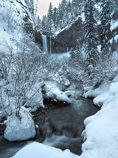
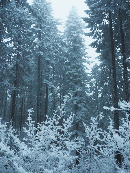
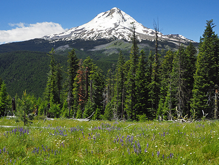
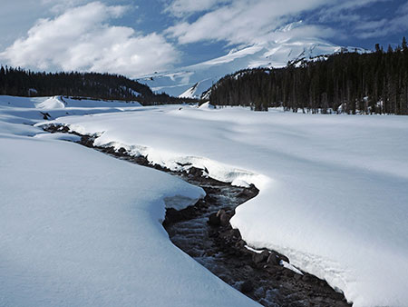
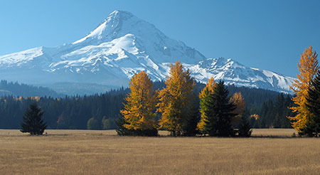
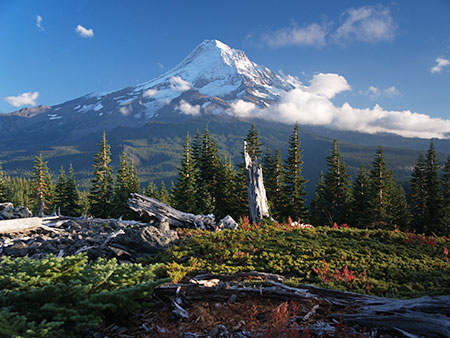
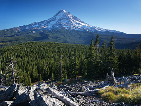
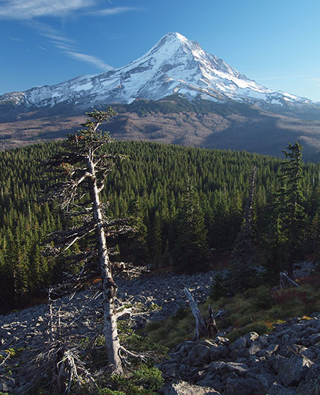
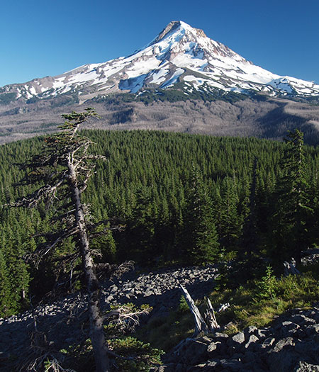
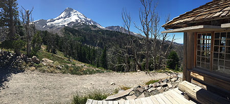
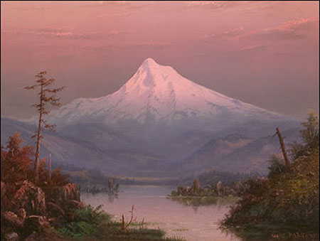
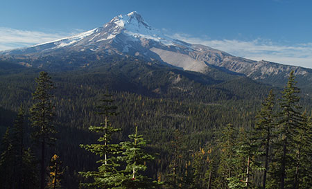
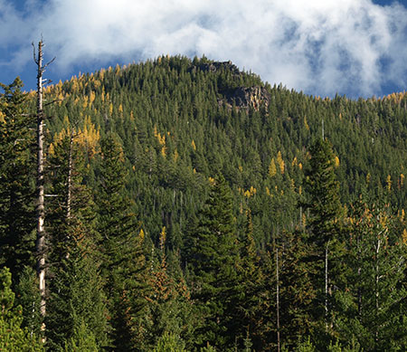
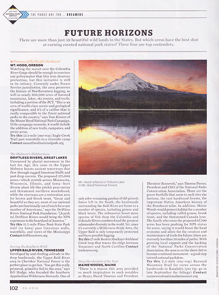
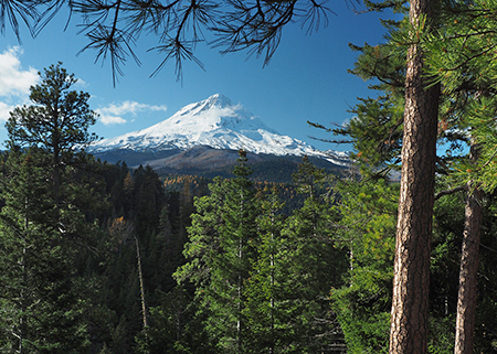
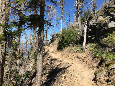
First snow of autumn 2018 on Mount Hood as seen from Dufur Mill Road

Last November marked 10 years since I started the WyEast Blog, way back in 2008. It was a pretty hopeful year, as you may recall, followed by some very progressive reforms for how our public lands are managed.  And my, how things can change — elections do have consequences! So, as always, the work continues as we weather another round of political attacks on our hard-fought protections for public lands.

Much has changed in WyEast country over the past 10 years, too, but certainly not my commitment to a better future for Mount Hood and the Columbia River Gorge. I’m frequently asked “do you reallythink Mount Hood will become a national park?” and my response is always the same, “a little more every day!”Why? Because despite the currently bleak situation in Washington D.C., we’re (finally) witnessing the start to a changing of the guard in generational leadership at all levels of our society. The Millennials are here!

01_TomEagleCreek

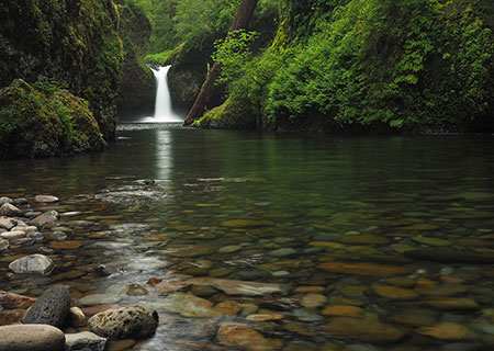
Author on my last visit to Eagle Creek, about a year before the September 2017 fire

What will history say about the Baby Boomers as they (reluctantly) hand over the reins to a younger generation? For all they have given us in their epic contributions to art and culture, they have also been surprisingly awful when it comes to conservation, woefully lacking in both courage and imagination. It’s true the Millennials are overdue in taking the reins, but since twice delivering the first African American to the U.S. presidency (a man who the Boomers voted overwhelmingly against, history shall note), they have steadily expanded their presence on the local, state and national political scenes. The 2016 elections represented the beginning of what will become a tidal wave in coming years, too.

By wide margins, Millennials are genuinely committed to conservation and sustainability, more balanced in their personal lives in how they manage ambition and status, and much less materialistic and consumptive than their elders. The numbers prove this. And thus my confidence that the Millennials’ turn at governance can (and will) return us to the bold conservation legacy of past eras and previous generations of leadership. The pendulum will swing, once again, and I believe that expanding our national park system will be part of that renaissance.

In the beginning…

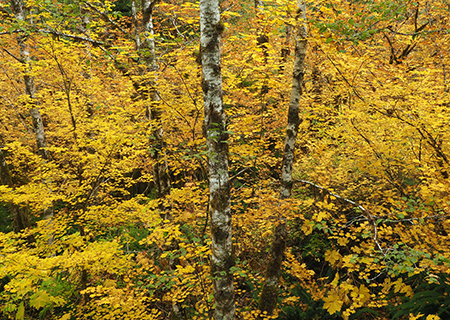
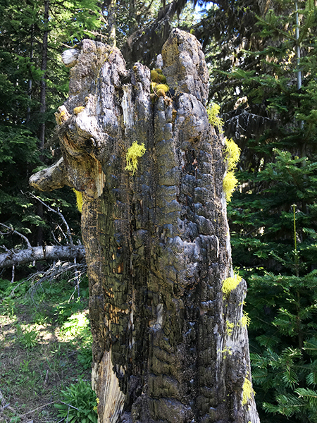
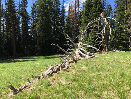
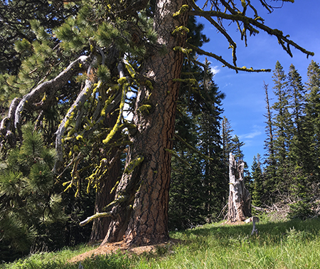
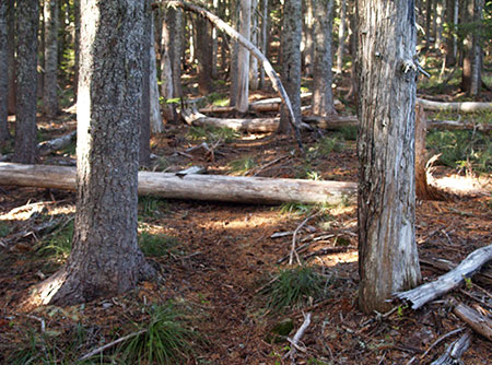
Ten years ago, I started this blog with a rather obscure look at a couple of dead trees at a favorite roadside viewpoint of mine, along Dufur Mill Road. Here’s what that spot used to look like:

02_2008DufurMillRoad

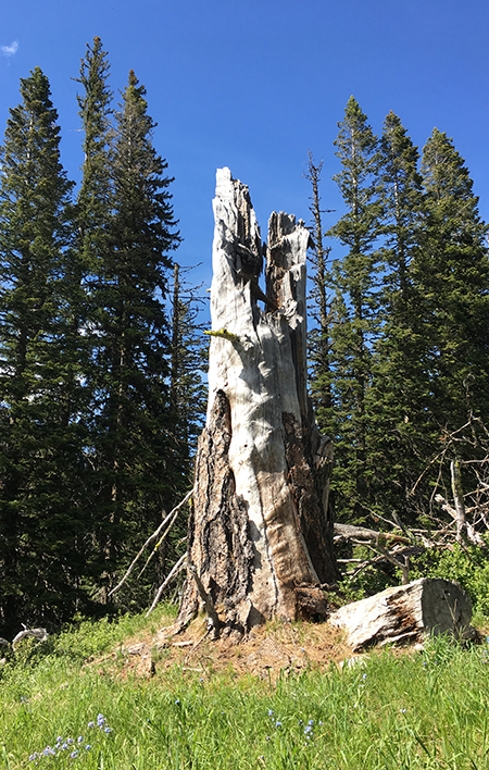
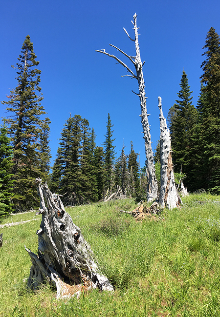
The two snags featured in the very first article on this blog… but what about the big fir on the right?

Sometime that year, both snags on the left side of the photo were felled, possibly for firewood, a common activity in that area. At the time I was dismayed at the senseless loss of a couple of valauble and (to me) beautiful snags. Mount Hood’s old ghost trees are essential for wildlife and forest health, after all! And thus, my first article began what would become many looks at the lesser-known and under-appreciated corners of WyEast country, all in celebration of our magical mountain and gorge!

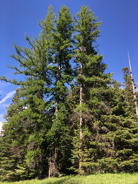
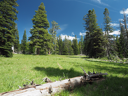
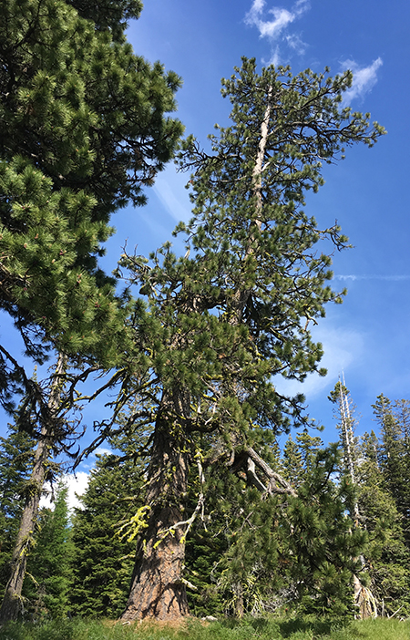
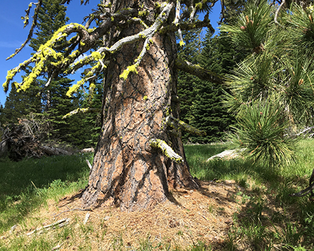
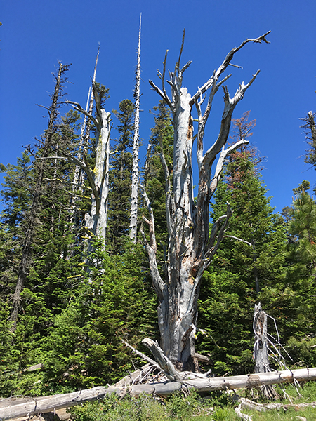
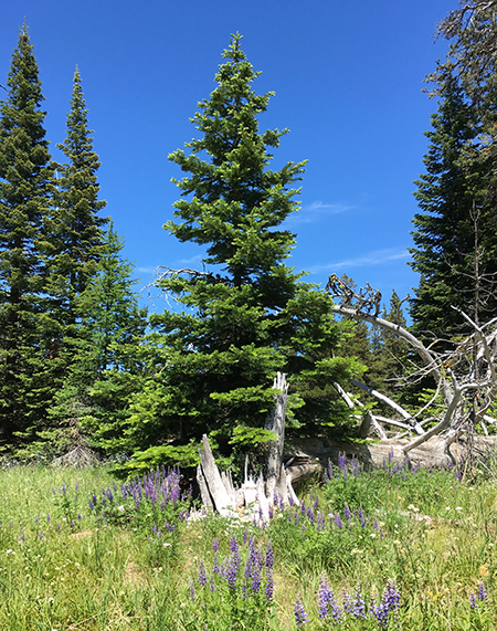
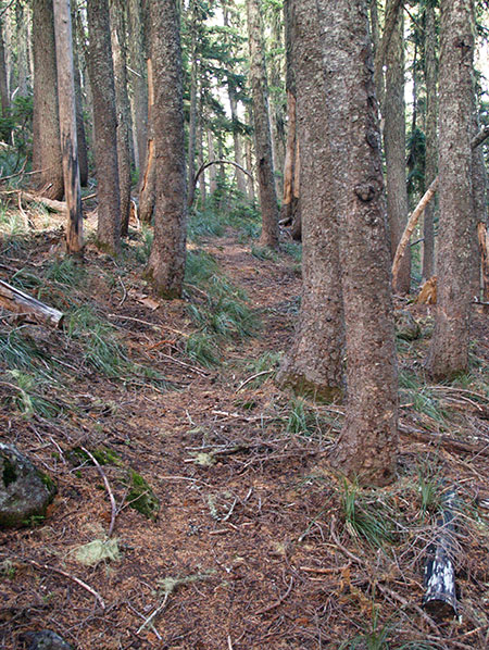
Today, the view from this spot on Dufur Mill Road is still much the same, minus the old snags. Here’s what it looked like a couple of weeks ago (below), where you can pick out individual trees in the background that appear much the same. The large Douglas fir on the right side of the original photo still stands, too, but what about the apparent change in height of this tree between the above and below photos?

03_2018DufurMillRoad01

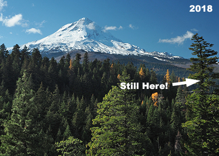
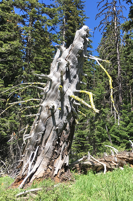
Today the two snags are long gone, but the big Douglas fir is still standing

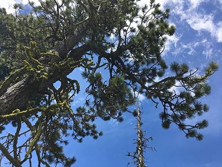
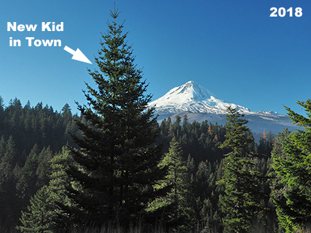
Yes, the old fir did grow, but not by that much. It turns out that in the 10 years since the original photo was taken, a young Douglas fir has grown from just a few feet tall to nearly 20 feet — blocking the original view! Here’s what today’s scene looks like as viewed from the exact spot as the 2008 photo:

04_2018DufurMillRoad02

The only true constant in the forest… is change!

The changes in this favorite spot of mine are a good metaphor for so many places on Mount Hood and in the Gorge over the past ten years, where the only constant is change. This article explores some of the changes, plus a rundown of the most read and least read articles on the blog. Hope you enjoy the look back!

The Articles

Including this retrospective, I’ve posted 184 articles on the blog since November 2008, ranging from the incredibly obscure (my favorite!) to the surprisingly popular.

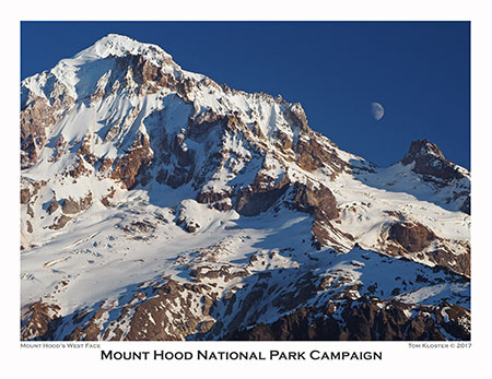
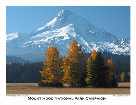
In the first five years, visitors grew gradually to a couple thousand annually, then abruptly jumped to 30,000 in 2013 and 60,000 in 2014! Since then, visitors have hovered between 70,000 and 90,000 annually. A decent share also click through to the Mount Hood National Park Campaign website, and who knows? One of those visitors might be the future congresswoman or senator who introduces a bill to make Mount Hood and the Gorge a national park! That’s the goal of an “idea campaign”, after all — and why I started the blog.

But blog metrics don’t really tell the full story, as a select few posts have been the major drivers in visits over the years. These posts continue to pop up each week in the blog stats, years after they were first published.

At the top of that list is an article debunking the many persistent myths about ticks that continue to circulate among the hiking community. I published “Ticks! Ticks! (10 Common Myths” in April 2013, and it’s the main reason for the big jump in traffic that year that has since continued. The article now has 173,000 views and counting — and that’s great news, as ticks present a growing health risk in the Gorge now that Lyme disease has spread to our region.

05_Ticks!Ticks!

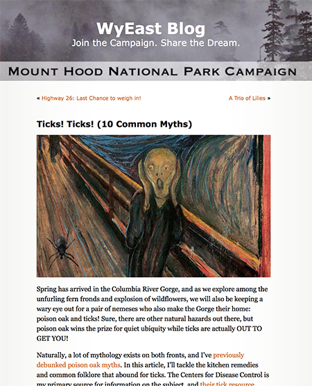
Nobody likes ticks… but people do like this article!

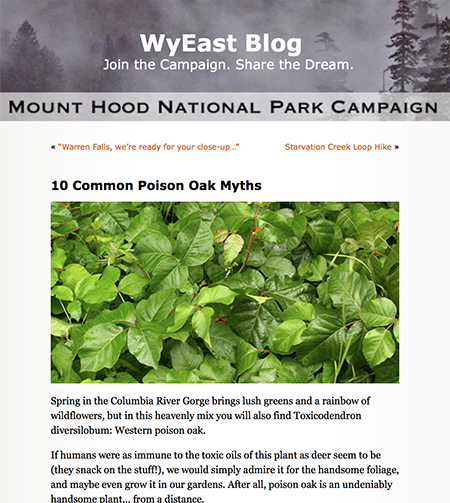
Right behind ticks in our apparent collective anxiety is poison oak, and a companion piece called “10 Common Poison Oak Myths” is thus the second most read article on the blog. A lot of bad information circulates online among hikers on both the risks and treatment for poison oak exposure. This article was posted in 2012, before the tick article, but caught fire after the piece on ticks began to drive search engines toward the blog. Today, the poison oak article has had 78,000 visitors and shows up every week in blog stats.

06_10PoisonOakMyths

I’d been itching to write the sequel to this one…

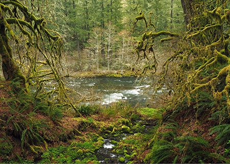
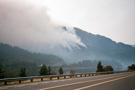
The 2017 Eagle Creek Fire kicked off a series of articles covering the aftermath of the fire. The first article featured some of the earliest views into the burn as seen from the Washington side of the Gorge, just after the smoke had cleared. This article was widely shared in social media, with 23,000 views and counting.

08_FirstLookGorgeFire

The first look into the smoky aftermath…

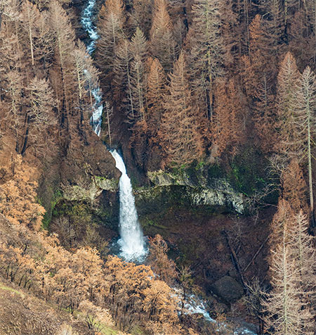
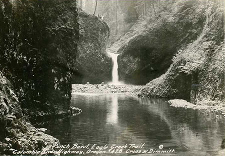
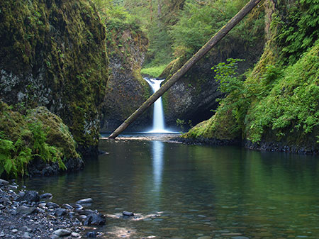
Later articles spotlighting the burn were based on State of Oregon aerial reconnaissance photos that provided exceptional detail of the devastation at iconic places in the Gorge and the nearly immediate signs of recovery that was already underway. One of these revealed a massive cliff collapse at Punch Bowl Falls in early 2018, just a few months after the fire.

07_CliffCollapse

Perhaps more shocking than the Eagle Creek Fire, itself, were the dual cliff collapses at Metlako Falls and Punchbowl Falls on Eagle Creek.

We will never know if the cliff collapse resulted from the effects of the fire, but when the State of Oregon aerial surveys revealed the collapse, it came as a shock to anyone who knew this spot. More than 25,000 readers have viewed the article and it continues to be visited regularly.

While it’s great to see a big response to an article, truth be told, my favorite posts are among the least read. This describes mostof the posts on the blog, of course!

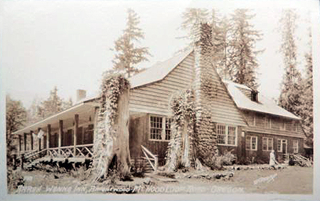
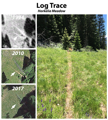
One of these lesser-read pieces was in 2010, when I posted a proposal to restore Warren Falls, a virtually unknown spot near Starvation Creek that had been brutally altered by Highway Department engineers in the 1930s. I had long been saddened to see how this beautiful spot had been manhandled by the same Highway Department that had gracefully navigated other waterfalls in the Gorge with beautiful bridges, viaducts and overlooks, and hoped that ODOT might incorporate restoration of the falls into a major effort to reconnect the original Historic Columbia River Highway.

09_RestoringWarrenFalls

This became a bit of a crusade for a few years, including a featured spot on OPB’s Oregon Field Guide, but in the end, ODOT wasn’t interested in owning up to their crime against nature (and as I pointed out in one of the follow-up articles, the diversion was a clear violation of state statute, too!). Score another one for the highway builders, but I remain hopeful that someday we will undo this travesty.

10_RestoringWarrenFalls

Warren Falls comes (briefly) alive in 2014!

In the meantime, a vestige of the original falls appears a few times each winter when ODOT’s diversion dam and bypass tunnel are overwhelmed by high runoff, bringing Warren Falls back to life, if only briefly.

And while ODOT once again turned its back on Warren Creek, Mother Nature may bring her wrath upon the diversion structures in the aftermath of the Eagle Creek Fire. Ironically, the original project was in response to Warren Creek carrying heavy rock and wood debris onto the old highway following an early 1900s burn in the upper canyon Eighty years later, the upper canyon has burned again, and another cycle of heavy debris flows is likely in coming years. She does bat last, after all…

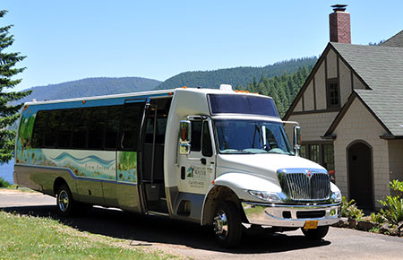
In happier ODOT news, an August 2012 article proposing a “Boot Loop” transit service around the mountain and through the gorge seemed far-fetched at the time, but ODOT has since operated transit in the west end of the Gorge and helped fund transit to Timberline Lodge. Currently, a “round the mountain” transit study is underway to explore the potential for completing the loop. That’s great news!

11_BootLoop

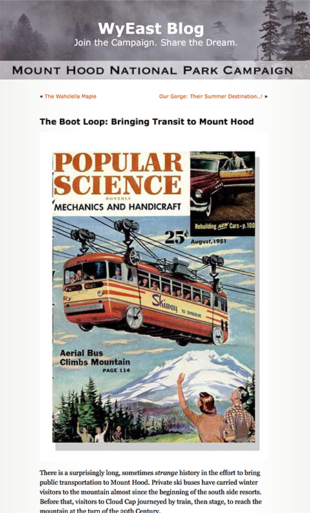
Not such a goofy idea after all..?

The Gorge Express and Mount Hood Express bus lines are general purpose, too, whereas the “Boot Loop” idea was more narrowly aimed at recreation. The broader transit service we’re now seeing on the ground is far better, providing essential service to places where basic transit connections were long overdue. Kudos to ODOT for moving beyond their highway roots and bringing much-needed transportation alternatives to the mountain and gorge!

10 years of Big Changes

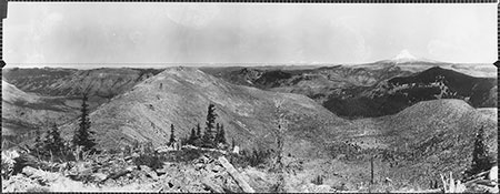
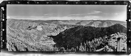
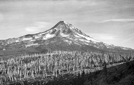
Mount Hood and the Columbia River Gorge have seen some epic changes over the past 10 years, perhaps most notably the Dollar Lake Fire on Mount Hood’s north slope in 2012 and the Eagle Creek Fire that burned much of the Oregon side of the Gorge in 2017. But there were many other significant changes, too, albeit somewhat overshadowed by the big fire events. The following are a few “then and now” highlights of these notable changes in WyEast country over the past ten years.

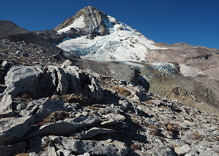
Global warming? Absolutely. Despite the frustrating, science-defying (and completely cynical) state of denial coming from the White House and Republican Party, bright red warning flags are showing up all around us, including on Mount Hood. As the photo pair below shows, the Eliot Glacier continues to recede at an alarming rate, as do the rest of Mount Hood’s twelve glaciers. I’ve marked a couple of prominent rock outcrops adjacent to the lower Eliot Galcier icefall to show how the “firn” line has retreated. The firn line is the point in a moving glacier that marks equilibrium, with the glacier is accumulating ice above the line and losing ice (melting) where it flows below the firn line.

12_2008EliotMoraine

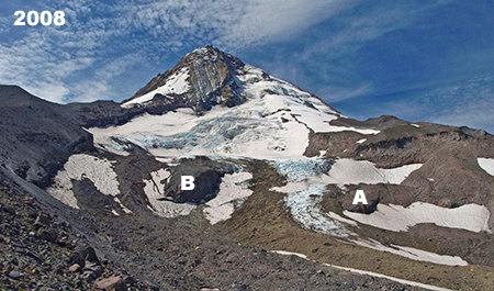
Blue ice still spilled over the lower Eliot Glacier icefall in 2008

As the photos show, the lower icefall (just above and left of the outcrop marked “A”) is notably smaller and darker, with debris carried within the glacier now exposed by melting at this level due to the rising firn line. Both photos were taken in late summer, when summer melting was at its peak.

13_2018EliotMoraine

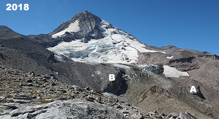
Global warming is rapidly changing the once-mighty Eliot Glacier

The once-permanent snowfields on the margins of the glacier are also noticeably smaller and seem doomed in the near future. Permanent snowfields are the most vulnerable ice features on the mountain and a good visual indicator of the speed in which global warming is melting our glaciers.

While future generations may forgive us for failing to actually slow or stop global warming, they surely will never forgive us for willful denial of its existence as a human-caused crisis of our own making. Let’s hope we can make up some lost ground in the near future, with the Millennial generation finally taking charge.

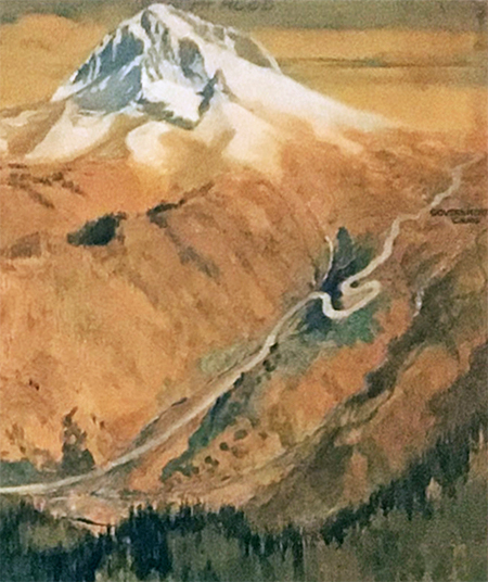
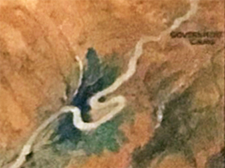
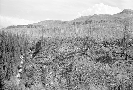
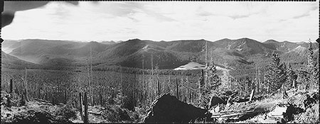
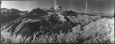
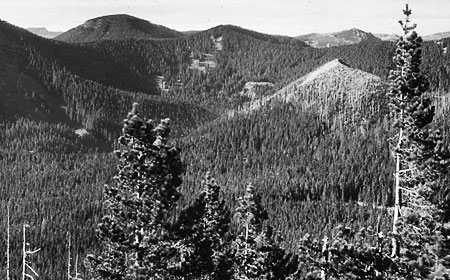
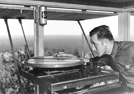
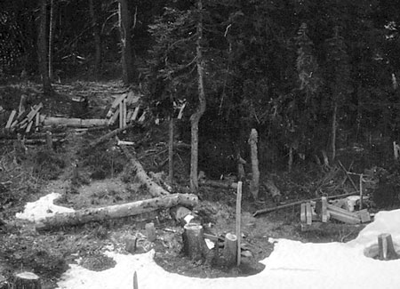
The changes to the Eliot Glacier are also being felt downstream, no more so than in the upper reaches of the Eliot Branch canyon, where a more volatile glacial outflow is rapidly carving into the once glacier-covered valley floor, constantly changing the landscape. In 2006, the stream flooded once again, greatly deepening the canyon and making it unsafe to cross for hikers on the Timberline Trail. This situation languished for nine years, with many hikers choosing to scale the crumbling canyon wall (shown below) with the aid of a worn rope anchored to a boulder!

14_2014EliotMoraine

The ever-deepening canyon on the upper reaches of the Eliot Branch

This blog played a small part in helping the Forest Service move forward with a new crossing of the Eliot Branch when a ranger from the Hood River District read this 2014 article and reached out to discuss options for a new, downstream crossing. Along the way, I updated the map from the blog article to align with Forest Service and Trailkeepers of Oregon (TKO) plans for the restored crossing, and it even made the cover of a local newspaper in Hood River! (…okay, so it’s an advertising tabloid…!)

15_2018EliotMoraine

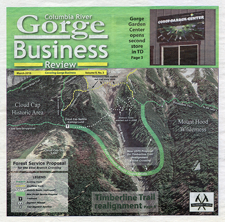
Not exactly the New York Times, but I’ll take it!

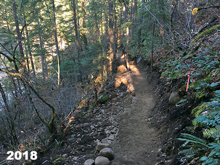
The newly reconnected trail drops steadily from Cloud Cap Inn to a section of the raging Eliot Branch that has (somewhat) stabilized, and can be reasonably crossed in the summer months. Though there are no immediate plans for a trail bridge here, the Forest Service moved large boulders in the stream to serve as stepping stones, hopefully making the crossing a bit safer for hikers. The restored trail opened in 2017.

16_EliotCrossingUSFS2017

The newly constructed Timberline Trail just above the Eliot Crossing (photo: USFS)

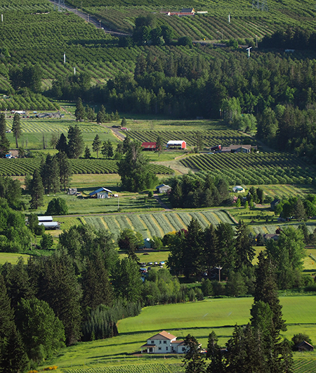
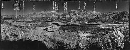
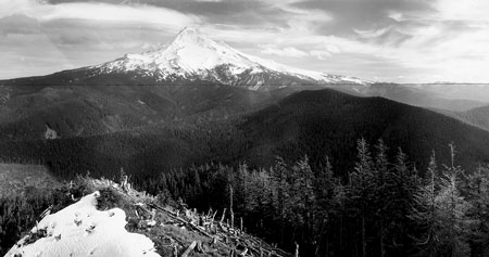
Moving down to the Hood River Valley, the iconic view of Mount Hood from this field along Laurance Lake Road (below) looks much the same today as it did in 2008, albeit with some logging on private land in the distance. What you can’t see in the 2008 view is that it was captured just a year after voters approved Measure 49, which reversed 2004’s deceptive Measure 37. This earlier measure would have almost certainly brought resort development and luxury McMansions to the Hood River Valley.

17_2008UpperHoodValley

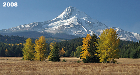
The timeless view of Mount Hood from Laurance Lake Road

18_2018UpperHoodValley

…still pretty much the same ten years later!

Even better, this farm has since come under the ownership of a member of the Parkdale Valley Land Trust, and is now even more likely to remain unchanged for the foreseeable future. Which, in turn, means that a spot that hasn’t change since the 1950s (below) might look much the same in the 2050s. That’s a great legacy being carried forward to future generations.

18a_1950sUpperHoodValley

Maybe past really can be prologue..? (photo: State Archives)

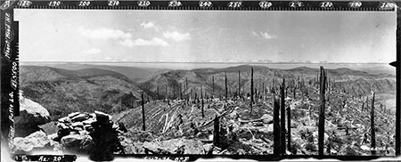
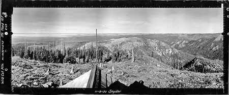
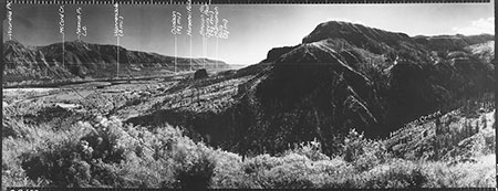
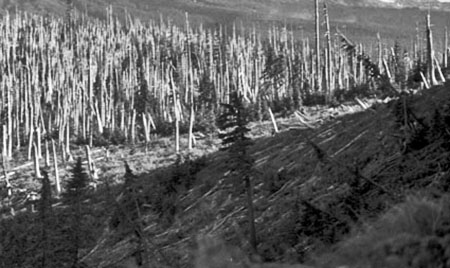
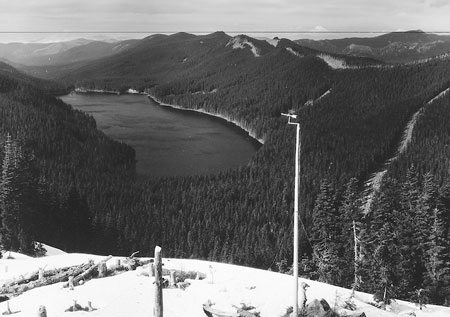
Here’s another view of the Parkdale area in the Upper Hood River Valley from Middle Mountain, a mostly county-owned forested ridge that separates the upper and lower valleys. From this spot, the most notable change is a silver band of ghost trees marking the 2012 Dollar Lake burn, clearly visible along the northern shoulders of the mountain.

19_2008MiddleMountain

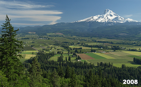
The upper Hood River Valley ten years ago…

20_2018MiddleMountain

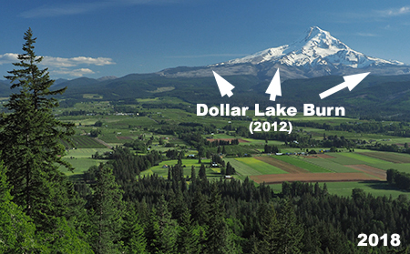
…and earlier last year…

The Dollar Lake Fire was the third in rapid succession (following the Bluegrass Fire in 2006 and Gnarl Ridge Fire in 2008) to burn the slopes of Mount Hood. As jarring as the changes may be, these new burns provide a front-row seat to the rapidly recovering forest, a timeless and essential cycle that has been disrupted by the Forest Service policy of aggressive fire suppression over the past century.  State and federal land agencies have only just begun to rethink their approach to fire moving forward, a change in culture that will take many years to fully achieve, especially in the era of climate change.

21_VistaRidgeBurn2016

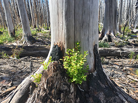
Huckleberries sprouting from the base of a burned snag in the Dollar Lake Burn

One unexpected benefit of the fires on Mount Hood was preparing those (like me) who love the mountain and gorge for the devastating Eagle Creek Fire that raged through the western Columbia River Gorge in September 2017. The Mount Hood fires helped many who understood the abstract benefit of forest fires come to grips with the emotional reality of seeing a favorite place changed, and begin to appreciate the stark beauty in the burned landscape and witness the unfolding forest rebirth.

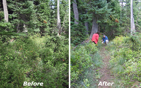
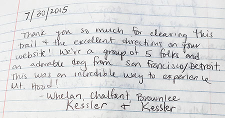
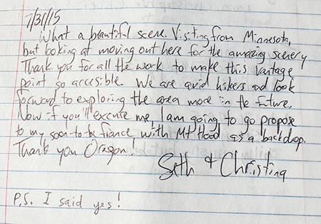
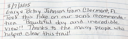
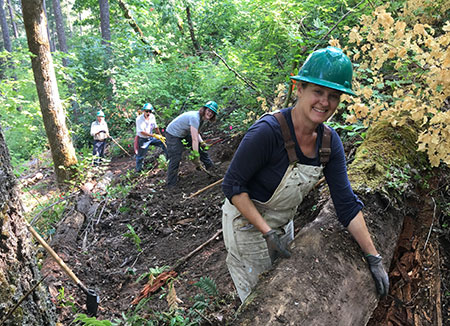
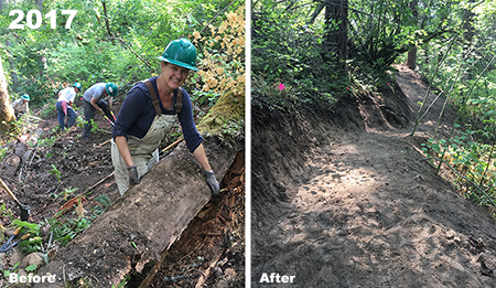
For the past year, thousands of volunteers with organizations like Trailkeepers of Oregon (TKO) have been working with the Forest Service and Oregon State Parks to begin digging out miles of burned trails in the gorge. Last November, the Forest Service officially opened the first of these cleared trails, including the iconic Larch Mountain Trail that follows Multnomah Creek, giving hikers their first look at the changed landscape, and a chance to expand their own understanding and acceptance of fire in our forests.

Earlier last year, I joined TKO crews to work on the trail and capture photos of familiar scenes as they now appear, after the fire. This set shows Weisendanger Falls from the same spot before and after the fire:

22_2008WeisendangerStreamView

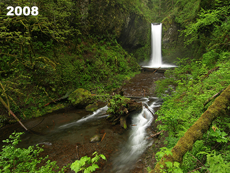
Weisendanger Falls on Multnomah Creek ten years ago…

23_2018WeisendangerStreamView

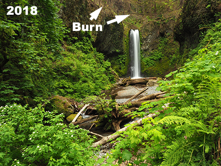
…and in spring 2018, after the Eagle Creek Fire swept through

While the area below Weisendanger Falls shows signs of the fire — notably , more logs in the creek — this photo pair shows the extent of the burn above the falls, where the forest was more substantially impacted:

24_2008WeisendangerPortrait

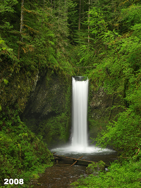
Weisendanger Falls before…

25_2018WeisendangerPortrait

…and after the fire, in spring 2018

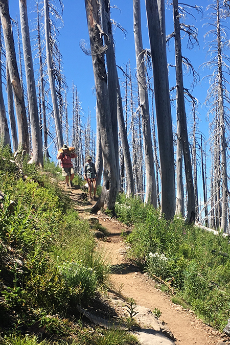
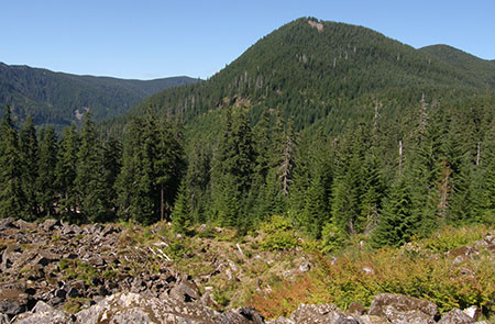
Similar scenes can be found throughout the Eagle Creek Burn, where the fire generally left a beneficial “mosaic” pattern, with heavily burned areas mixed with largely intact forest. These areas are expected to recover quickly, with healthy patches of surviving forest helping adjacent burned areas recover by reseeding, providing cover for wildlife and creating shade. But there are exceptions, especially Oneonta canyon, where the burn was especially catastrophic. The recovery in these places will span decades.

* * * * *

Thus far in this 10-year retrospective article, the focus has been on big changes brought by nature (albeit with an assist from man), but there have been plenty of changes brought by humans over the past ten years, too — both good and bad.

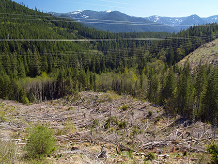
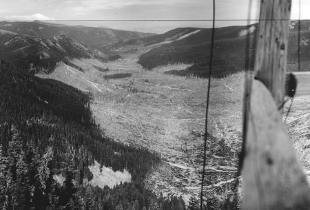
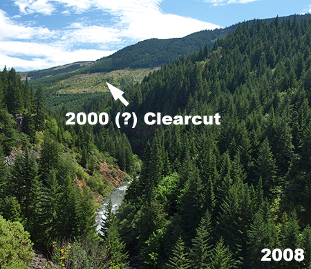
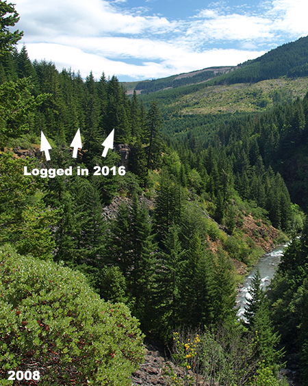
Let’s start with the bad (and ugly). Tragically, corporate timber behemoth Weyerhaeuser became the major private land owner in the West Fork Hood River valley over the past decade, taking ownership of private forests that had long been held by Longview Fibre (and then briefly by a Canadian equity trader). Though Longview Fibre had greatly accelerated logging in the 2000s, Weyerhauser has ramped up the destruction and embarked on a complete liquidation of the forests along a West Fork. Their purported “sustainability” mission is laughable in the modern area of chasing stock prices with massive, unsustainable clear cutting.

This scene is along the spectacular West Fork canyon, just above the Lake Branch confluence. It’s a crime against nature that any private entity should own land of this scenic and ecologic value, and Weyerhauser’s recent “stewardship” is proof:

26_WestForkCanyon2008

Weyerhauser didn’t own it yet, but the assault had begun…

27_WestForkCanyon2018

…but Weyerhauser greatly accelerated the deforestation of the West Fork

Not seen in these photos are the miles of shoddy logging roads cut into steep slopes in order to haul out the logs and the millions of gallons of liquid herbicide sprayed on the slopes of the West Fork canyon to kill whatever vegetation managed to survive the logging show. Modern corporate logging is about exterminating native forests and replacing them with hybridized tree farms, make no mistake about it.

Some of the more appalling Weyerhaeuser logging practices are on display along the canyon section of the West Fork, where the river cascades beneath towering basalt cliffs where the scenery would merit park status anywhere else in the country. In this spot, a healthy forest directly adjacent to the canyon wall was cut in 2016 and sprayed with herbicides in 2017, with no regard to the river corridor, directly below:

28_WestForkCanyonBluff2008

A forested bluff above the West Fork canyon ten years ago…

29_WestForkCanyonBluff2018

…and in 2018 after Weyerhaeuser had “sustainably managed” it…

While it’s tough to see healthy forests cut on such a reckless scale, it’s also possible that Weyerhaeuser’s new lust for quick profits over sustainability could tempt the company to sell their cut over lands to the public in the interest of protecting the West Fork valley over the long term. After all, it will take decades for these forests to recover, and Weyerhaeuser seems to have lost patience with timelines on that scale. The sooner we can reclaim these precious lands for the public, the better.Watch for a future blog proposal on that subject!

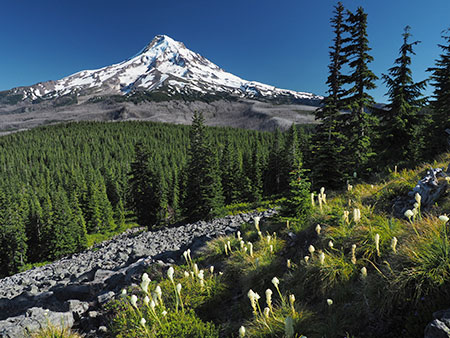
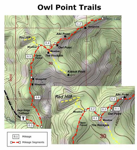
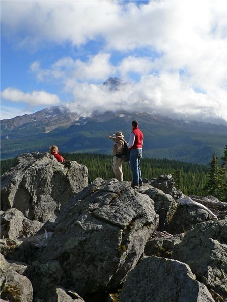
On to more positive developments!  2018 also marked the grand re-opening of the Old Vista Ridge Trail, a wonderful “lost” trail that winds north from the Vista Ridge Trailhead to a dramatic view of Mount Hood’s north side from a rocky spur known as Owl Point. The trail was unofficially reopened in 2007 by volunteers from the Oregon Hiker’s forum and maintained ever since, a project that led to the formation of Trailkeepers of Oregon (TKO).

30_OwlPointSign2008

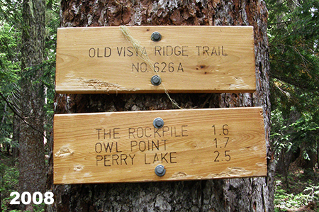
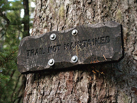
User-made trail signs ten years ago…

Over that time, it became clear that the trail needed to be officially recognized by the Forest Service in order to be properly maintained over the long haul. After much discussion, the agency signed an agreement with TKO in 2017 to adopt the trail, caring for it in perpetuity.

The grand re-opening was originally planned for the fall of 2017, but the Eagle Creek Fire intervened, with much of the north side of Mount Hood closed to the public for fear of the fire moving south into the West Fork valley and toward the mountain.

31_ForestServiceTrailSigns2018

…replaced with official Forest Service signs last summer!

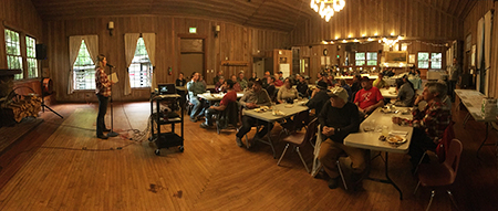
In July of last year, the rescheduled re-opening finally happened, with an official “cutting of the survey tape” with loppers and a log saw by TKO’s executive director Steve Kruger and Hood River District Ranger Janeen Tervo. A celebratory stewardship day followed on the trail, and so began a new era for this wonderful trail. TKO and the Forest Service are planning other new trails in the area, so hopefully Old Vista Ridge marks the beginning of a trail renaissance on Mount Hood.

32_OldVistaDedication

Making it official!

33_OldVistaRidgeGroup

TKO volunteers celebrate at Owl Point on dedication day

The Old Vista Ridge Trail is snowed in for the winter, now, but you can visit most years from mid-June through October to admire the view and the new, official trail signs! Read more about the trail in the Oregon Hikers Field Guide.

Not far from Old Vista Ridge, another “lost” spot was saved in 2015 when the Western Rivers Conservancy rescued it from Weyerhauser through a direct land purchase. Western Rivers later sold the land to Hood River County at a deep discount, thanks to a Oregon Parks and Recreation Grant, which in turn was submitted on behalf of the county by another non-profit, Thrive Hood River (then called the Hood River Valley Residents Committee). Trailkeepers of Oregon (TKO) was in the mix, too, offering to build a trail system in the new county park as part of matching contribution toward the state grant.

34_PunchbowlSign2018

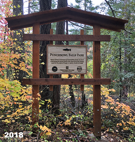
This sign marks a new era for Punchbowl Falls

Sound complicated? It was! But the good news today is that most of the trails envisioned in the original park concept are now complete, and can be explored today. There are still a few finishing touches (notably, trail signs, which are currently in progress thanks to a Hood River scout troop — this is very much a DIY park!), but the main pieces to this new nature park are in place for all to enjoy.

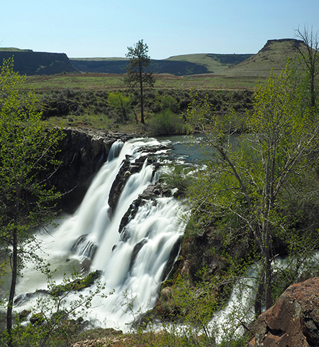
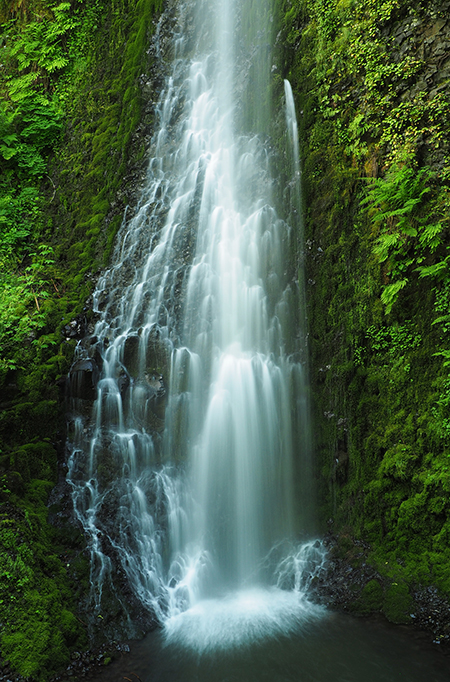
The main focus of the new park is dramatic Punchbowl Falls, a powerful waterfall on the West Fork of the Hood River that has carved an enormous amphitheater from solid basalt. The area just below the falls is also reserved for tribal fishing, a native tradition here that spans millennia and continues to plays a central cultural and economic role for local tribes.

35_PunchbowlFalls

The massive basalt amphitheater at Punchbowl Falls

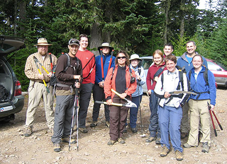
When the new trail network at Punchbowl Falls Park was first scouted in 2016, great care was taken to respect fishing paths used by the tribes to access the falls, while also providing a way for park visitors to enjoy the many views in this beautiful canyon. Another goal was to consolidate the confusing maze of user trails in the area. All of the work was completed by volunteers from 2016 through last fall.

36_ScoutingTrip2016

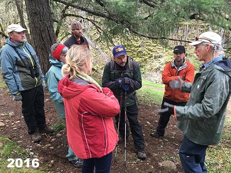
Volunteers scouting the proposed trail network

37_DogwoodTrail2017

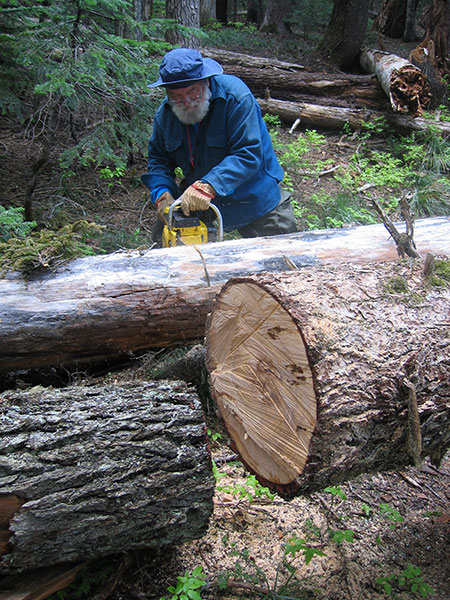
Building the Dogwood Trail in 2017

38_AHS_BeforeAfter

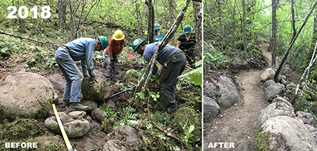
Building the lower Yew Trail last year

The newest trail was completed last November, and follows the West Fork to the confluence of the East and West Forks of the Hood River, another popular feature in the park. Though the trails won’t be signed until early next year, they’re easy to follow and explore, and the park is especially peaceful in winter if you’re looking for a quiet walk in the forest. You can read about the hike here in the Oregon Hikers Field Guide.

39_WestForkTrail2018

The completed Yew Trail along the West Fork this fall

The new Punchbowl Falls Park spans roughly two miles of river, forever protecting land that had been left to the mercy of private timber corporations for more than a century. As if to underscore this point, Weyerhauser promptly logged off an entire hillside that rises directly above the new park before the site had even been transferred to county ownership.  Thankfully, they spared the Punchbowl property from a similar fate before selling it to Western Rivers.

40_WeyerhauserClearcutBridgeView

Thanks for the new view from Punchbowl Bridge, Weyerhauser…

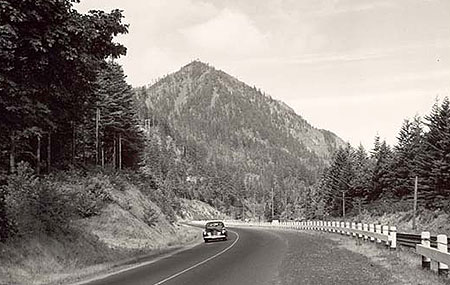
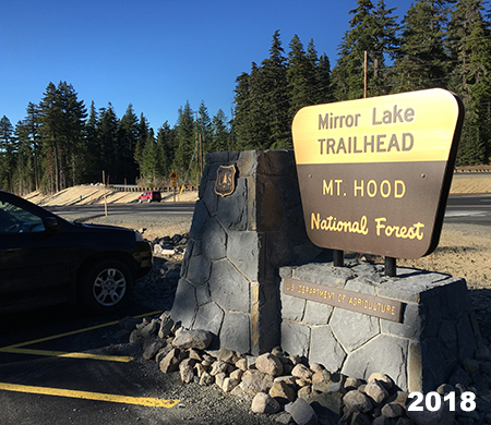
Another big change over the past decade came to perhaps the most popular trail on Mount Hood, the venerable Mirror Lake trail, located near Government Camp. For nearly a century, this beloved trail to a small mountain lake was a “first hike” to thousands visiting the mountain for the first time, including me!

41_MirrorLakeHood2008

One last snowshoe trip to Mirror Lake before ODOT closed winter access

A series of early articles in this blog focused on an ill-conceived ODOT project to widen Highway 26 in the Laurel Hill section, just west of Government Camp. The original Mirror Lake trailhead was part of the collateral damage of this now-completed road widening project. Even before the widening project, ODOT began closing the old trailhead during the winter months, cutting off access to legions of snowshoers and skiers who had used it for years. Later, the widening project finished the job permanently, and the old trailhead is now closed – including removal of the old footbridge over Camp Creek.

42_MirrorLakeSnoPark2008

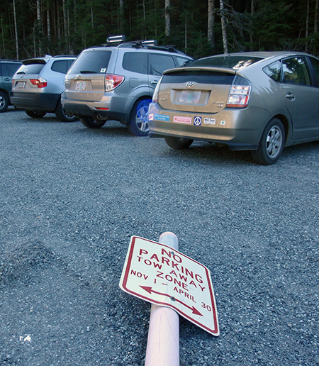
Dogged snowshoers were not easily deterred by the winter closure in 2010

While ODOT focused on highway widening, a little known federal highway agency known as the Federal Lands Division worked with the Forest Service to design and build a new Mirror Lake trailhead at the west end of the Mount Hood Ski Bowl parking lot. This arm of the Federal Highway Administration also oversaw the recent replacement of the White River Bridge and restoration of the Historic Sahalie Falls Bridge, near Hood River Meadows. The new Mirror Lake Trailhead opened just a few weeks ago, and was immediately filled to overflowing with visitors.

43_NewMirrorLakeTrailhead01

The new Mirror Lake Trailhead

44_NewMirrorLakeTrailhead02

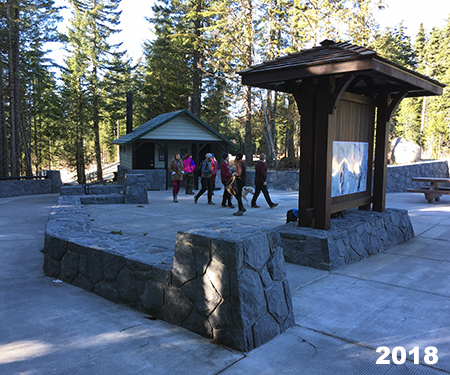
The new trailhead features toilets and handsome stone work

I’ll post a proper review of the new trailhead and trail once the snow melts this year, but perhaps the best outcome is restored winter access to the Mirror Lake area. Another important element of the project is a barrier-free design from the trailhead to a new footbridge over Camp Creek, a much-needed addition to the very limited number of accessible trails in the Mount Hood area.

45_NewMirrorLakeTrailhead03

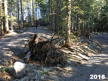
Paved, barrier-free section of the new Mirror Lake Trail

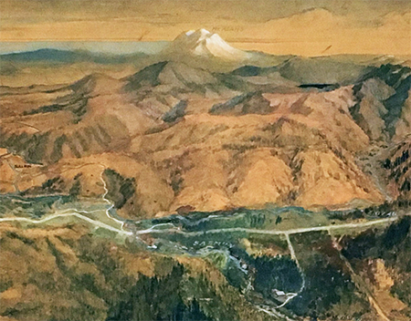
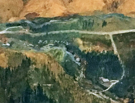
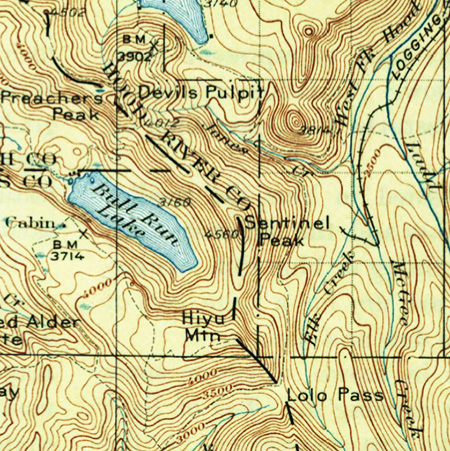
One of the more profound changes of the past ten years came when President Obama signed a major wilderness bill into law in 2009 that greatly expanded wilderness protection in the Gorge and around Mount Hood. That law protected several small areas on the margins of existing wilderness that had been left out of earlier legislation. One such area is along the western margins of the lightly visited Salmon Huckleberry Wilderness, which ironically is the closest designated wilderness to the Portland metropolitan area. The expanded boundary incorporates forested slopes of Wildcat Mountain and McIntyre Ridge that had long been tempting targets for Forest Service timber sales.

At about that time in the late 2000s, the Bureau of Land Management abruptly closed a northern access point to the Salmon-Huckleberry Wilderness, where an old logging spur provided access to the McIntyre Ridge Trail. Hikers soon discovered a new way to access McIntyre Ridge from another logging spur located on Forest Service land, which in turn led to an ancient roadbed from a long-ago era when a forest lookout tower stood on Wildcat Mountain.

46_NewMcIntyreTrailhead01

This section of the McIntyre Ridge Trail follows a former lookout access road

The Forest Service still has not embraced the “New McIntyre Trailhead”, as it is known to hikers, but this unofficial trailhead has restored public access to this newly protected corner of the Salmon Huckleberry Wilderness. More importantly, this is an area where “eyes on the forest” are especially important, as the Wildcat Mountain area has a long history of lawlessness and abuse from shooters, dumpers and 4-wheelers.

47_NewMcIntyreTrailhead02

Blaze along the McIntyre Ridge Trail

48_NewMcIntyreTrailhead03

Shooters can’t seem to resist destroying public property… and anything else they can shoot

The good news is that hikers have continued to use the McIntyre Ridge trail over the ensuing years, though there are still too many reports of illegal activity. Just last summer, a local hiker came across a pair of pickups that had driven at least a mile into the Salmon Huckleberry Wilderness along McIntyre Ridge and set up a camp in the middle of the trail! Worse, off-roaders have cut completely new roads into the wilderness on the margins of the Salmon Huckleberry, especially in this area. These are federal crimes, of course, though Forest Service resources for enforcing the law are minimal.

49_NewMcIntyreTrailhead04

Rogue off-roaders well inside the Salmon Huckleberry Wilderness earlier this year (photo: Walrus)

Fortunately, public land law-breakers are well aware of their illegal behavior and tend to shy away from busy recreation areas. Therefore, my hope is that the Forest Service will eventually recognize and champion the New McIntyre trailhead as for protecting the wilderness through “eyes on the forest”. More to come in future articles on this little corner of Mount Hood country..

And the next 10 years..?

Looking at the many profound changes in the Gorge and around Mount Hood over the past ten years, it’s easy to feel a bit overwhelmed and discouraged by the pace and scale of change. The 2017 Eagle Creek Fire was especially traumatic for so many who love the Gorge. But the changes are also a reminder of the ongoing need for vigilance in protecting these special places and the role we all have to continue moving Mount Hood and the Gorge toward a new vision of restoration and renewal and away from our exploitive, often destructive past.

I’m optimistic that we’ll continue making progress in coming years, just as we have over the past decade that I’ve documented with this blog.  I plan to continue posting articles here to track the changes and make regular deep dives into the lesser known corners of the Gorge and Mount Hood. And I’ll also dream a bit about how we might better care for these places that we all love while making our public lands more accessible to everyone.

50_TomDarlene1974

Hiking with Mom on Park Ridge in my formative years!

Over the course of the past ten years, I’ve tried to post at least once per month, but you might have noticed that I haven’t quite kept that pace over the past year or two.  That’s largely due to the fact that my elderly folks have suddenly needed more help as they both struggled with failing health. In September, my mom passed away after a long and cruel struggle with memory disease, so we’ve now shifted to supporting my 89-year old dad as he adjusts to suddenly living alone after 68 years of marriage.

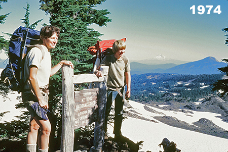
While sorting through family memories of Mom, I came across a photo (above) from a family backpack through the Mount Jefferson Wilderness, way back in 1974 when I was 12 years old. I was already an experienced hiker and backpacker at that point in my life, thanks to the love of the outdoors my Iowan parents shared in their beloved, adopted Pacific Northwest.

51_TomCarolDarlene1975

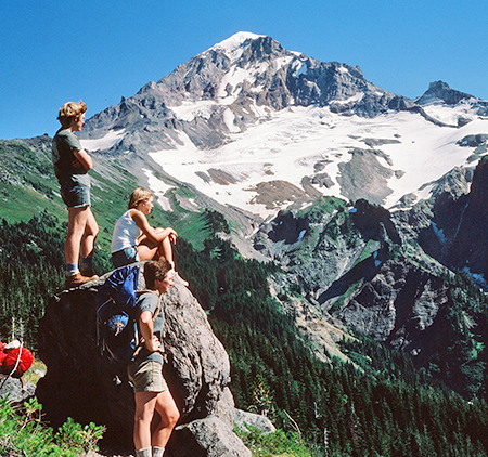
Me (standing on the rock, of course!) with my mom and sister on a Timberline Trail backpack in 1976

That’s a precious gift my folks gave to me and I’m thankful every day for my good fortune to have been raised with boots on my feet and a pack on my back! Too many in our spectacular corner of the world take our public lands for granted, and barely make the time or effort to explore them, often because they don’t really know how to. That’s another motivation for the blog and the Mount Hood National Park “idea campaign”. Our public lands are a gift for all of us, and I’ll also continue to post articles that celebrate this legacy and provide tips for how to explore the lesser-known corners of WyEast country.

52_TomRiversideTrail2007

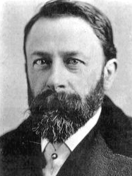
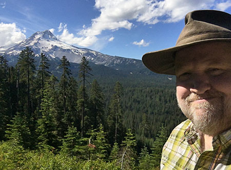
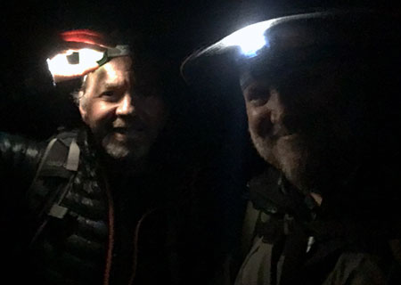
Older, grayer but ready for another 10 years of celebrating WyEast!

Well, that’s probably more than enough for this retrospective article. But if you’re read this far, thank you for taking the time to visit the blog and especially those who’ve reached out with a comment or e-mail over the years. Much appreciated! I’ve got a bunch of articles and a few surprises in the works heading into 2019, and I’m looking forward to another 10 years!

I hope to see you here along the way — and on the trail, too!

_________________

Tom Kloster • January 2019

2019 Campaign Calendar!

00CoverWhaleCreek

Calendar cover for 2019 featuring Whale Creek

[Click here for a large image]

‘Tis the season for top ten lists and year-end retrospectives, so in that spirit my annual Mount Hood National Park Campaign Calendar is pretty good snapshot of 12 favorite spots of mine across WyEast country this year. Since 2004, I’ve created an annual calendar dedicated to the campaign, each with a fresh set of photos. If you’d like a 2019 calendar, there’s info at the bottom of the article and ALL proceeds will once again go to Trailkeepers of Oregon (TKO).

________________

The annual campaign calendar has been a great motivator for exploring new terrain and improving my photography skills over the years. Each year the calendar project also renews my conviction that Mount Hood and the Gorge are uniquely special places, and deserve better care.

This article is a short tour of the 12 spots that made it into the 2019 calendar, with a few stories behind the photos and reflection on these increasingly fragile landscapes.

Starting with the cover image (at the top of the article), the calendar begins at lovely Whale Creek, a tributary of the Clackamas River that is also featured in the March image, so more about that spot in a moment.

Next up, the January image (below) captures the awesome west face of Mount Hood, where the Sandy Headwall towers 3,000 feet above the Sandy Glacier. This snowy view was captured from near Lolo Pass last winter.

01aLoloPassEastHood

January features the awesome Sandy Headwall

[Click here for a large image]

Not included in the close-up view are the bare slopes of Barrett Spur (below) and other alpine ramparts of Mount Hood that still didn’t have their winter snowpack in early February, when these photos were taken. While it’s not uncommon to have a late snowpack in the Cascades, these events are becoming more common as global warming unfolds in our own backyard.

01bLoloPassEastBarrettSpur

Low snow on Barrett Spur in February tells the story of our changing climate

For February, I chose a close-up perspective of the ice “pillows” that form at the base of Tamanawas Falls (below) in winter. This has become a very popular winter destination in recent years, thanks in large part to social media! (…ahem…)

02aTamanawasFallsDetail

February features Tamanawas Falls

[Click here for a large image]

Tamanawas is Chinook jargon for “guiding spirit”, and is one version among a couple variations in spelling. More challenging is the pronunciation, and with the advent of social media, all manner of spoken variations are being used. For some reason, an especially popular spoken version that doesn’t even correlate to the actual spelling is “tah-ma-WAHN-us”.

It turns out the most accepted pronunciation is “ta-MAH-na-wahs”. I’ve been saying a slight variation of “ta-MAN-a-wahs” for most of my life, so I’ll need to work on that!

02bTamanawasFalls

Cold Spring Creek and Tamanawas Falls in winter

As mentioned earlier, the March calendar image is from Whale Creek (below), located in the heart of the Clackamas River canyon. The creek is hidden in plain sight, flowing through the Indian Henry Campground and next to the east trailhead of the Clackamas River Trail. This area features some of the finest rainforest in WyEast country.

03aWhaleCreekBigCedars

March features a rainforest scene along Whale Creek

[Click here for a large image]

Whale Creek was just one of many places in the Clackamas and Molalla River watersheds that I found myself exploring this year while much of the Oregon portion of the Columbia River Gorge was closed by the Eagle Creek fire. I visited the lower reaches of Whale Creek after seeing stunning photos of a string of waterfalls on the upper reaches of the creek, and quickly fell in love with this pretty stream. Watch for a future article on a trail concept I’ve been working on for Whale Creek with TKO and some area waterfall explorers.

03bWhaleCreekScene

Whale Creek in the Clackamas River canyon

Sadly, the Clackamas River corridor has a bad reputation, thanks to a history of lawless behavior (the recent Pit Fire was started by illegal target shooting, for example) and a long history of Forest Service management that viewed the area more like a tree farm than a forest — and the two go hand in hand, by the way.

Yet, hidden in the now-recovering rainforests of the Clackamas are dozens of spectacular waterfalls, towering basalt walls and rugged vistas that rival the Columbia River Gorge in beauty. There are also a lot of big trees that somehow dodged the logging heyday of past decades.

03cWhaleCreekSnow

Whale Creek in winter

The Clackamas River corridor holds great promise for future recreation alternative to places like the Gorge, and the proven cure for lawless behavior is lawful recreation. I’m optimistic that we’ll make that transition here, and begin valuing places like Whale Creek for the intrinsic value of its forests, not just the saw logs it can produce.

04aWhiteRiverFalls

April features White River Falls State Park

[Click here for a large image]

For the April calendar image, I selected a photo of White River Falls, both for the contrast in WyEast country ecosystems it displays and because this little state park could use some love and expanded boundaries. I posted an article with just such a proposal a few years ago, you can find it over here.

04bWhiteRiverUpperFalls

White River Falls with unprotected desert country beyond

The May calendar image features a sweeping view of the Upper Hood River Valley (below) from little known, seldom-noticed Middle Mountain. Its name tells the story, as forested Middle Mountain divides the upper and lower portions of the Hood River Valley. I learned of this spot about ten years ago from a local photographer and have gone back pretty much every year since.

05aMiddleMountainHood

May features the Upper Hood River Valley as viewed from Middle Mountain

[Click here for a large image]

Zooming in a bit to this idyllic landscape reveals a seemingly timeless farm scene that is easy to take for granted. And yet, these farms were at great peril just a few years ago, when voters passed the deceptive Measure 37 in 2004. The law was pitched as a way for landowners to “seek compensation” for land use regulation, but in truth was just another end-run around Oregon’s protections for farm and forestlands.

Voters later passed Measure 49, in 2007, blunting the impact of the earlier measure, but only after hundreds of urban-scale developments were approved in rural areas across Oregon (including a pair of giant, illuminated billboards along the Mount Hood Highway that still remain today). It was a reminder that while our farms may look timeless, we can never take them for granted. They will always need our support and protection if we want places like this to exist for future generations.

05bUpperValleyFarmDetail

Timeless farm scene below Middle Mountain

Much of Middle Mountain is owned by the public, where county-owned forest lands continue to be (mis)managed as a cash register by Hood River County (the county likes to refer to these land as their “tree farm”). Local residents no doubt enjoy their modest tax rates, as a result, but I’m hoping the rapidly changing demographics in Hood River will bring a different mindset to how the thousands of acres of county forests that ring the Hood River Valley are managed.

05cMiddleMountainLogTruckSign

Logging is still king on Middle Mountain…

One immediate concern on Middle Mountain is the manner of logging. Large clear cuts, like those scarring the slopes of Middle Mountain, are an unsustainable practice, with proven harmful impacts to forest health, water quality and salmon and steelhead populations. Clear cuts are also the cheapest, easiest way to bring haul logs out of the forest. That bottom line might be unavoidable for private forests, but as a public agency, Hood River County should at least adopt a selective harvest policy that leaves standing trees in logged areas.

05dMiddleMountainLogTruck

…keeping Hood River County coffers full…

The county should also reject the reckless use of herbicides sprayed on logged over lands. This is a practice the private industry uses to shortcut the natural forest recovery and speed up the next harvest. The idea is to destroy the recovering forest understory in a logged area so that plantation seedlings might grow a little faster.

05eMiddleMountainTimberSaleBoundary

The forest on the left is next to go…

I’m not certain the county uses this practice on public lands, but it seems to be the case. Consider this notice posted a few days ago on their website:

“Recreation trails are sometimes temporarily closed during additional forest management operations. Operations such as the burning of slash, herbicide application, and the planting of seedlings, will necessitate trail closures. Trails are re-opened once operations are complete.”

This certainly sounds like the private industry practice…

05fMiddleMountainTimberSaleBoundarySign

…might as well add “for now” to the last line on this boundary marker, unfortunately.

Of course, the county could show real leadership and simply ban this practice on private lands in Hood River County, as well. That is, if water quality, wildlife, salmon and steelhead habitat, long-term forest health and tourism are a county priority over the fastest route to clear cutting more logs. My sense is that voters in Hood River County are increasingly focused on these broader concerns, even if the county leadership isn’t there yet.

06aShotgunFallsPortrait

June features Shotgun Falls in the Molalla River canyon

[Click here for a large image]

For the June calendar image, I selected another lesser-known spot, graceful Shotgun Falls (above) in the Molalla River canyon. This pretty, off-trail waterfall has been on my list for some time, and the Gorge closure inspired me to finally make this trip last spring for a much-needed waterfall fix.

06bShotgunFallsBase

Shotgun Falls

Shotgun Falls is a classic “Oregon” waterfall, cascading over a tall, mossy basalt cliff. The falls is a short creek walk from the Molalla River Road, but protected by a 20-foot barrier falls just downstream that requires a slippery scramble to navigate. It’s an increasingly popular off-trail trip, and the streambed is starting to show the wear and tear, making this a great candidate for a proper trail that families with young kids and hikers looking for an easy waterfall trip could enjoy. More to come on this idea..!

06cShotgunFallsSlopeDamage

Time for a real trail, here…

Sometimes a random moment burns a place and time in the forest into your memory. One such moment occurred on my trip to Shotgun Falls when my pack suddenly tipped while shooting photos from high above the falls. To my horror, it went bounding into the canyon, finally stopping just short of Shotgun Creek, about 60 feet below. Thankfully, my camera gear was safely zipped inside and I didn’t even end up with a soggy pack — the difference between a fond memory and forgettable one!

06dShotgunFallsTomsDroppedPack

Takes a licking, keeps on zipping!

The July calendar image features a picture-perfect wildflower scene along Cove Creek (below), located at the base of Barrett Spur in Elk Cove. This idyllic spot is kept open by a deep, lingering snowpack in spring and regular winter avalanches that shear off trees, allowing the alpine meadows to thrive.

07aCoveCreakBarrettSpur

July features Cove Creek and Barrett Spur

[Click here for a large image]

Looking downstream along Cove Creek (below), 99 Ridge can be seen in the distance, covered with ghost trees killed by the 2012 Dollar Lake Fire. The fire reached the margins of Elk Cove, but passed over most of the forests here.

07boveCreekAdams99Ridge

The Dollar Lake Burn swept over 99 Ridge, in the background in this view of Cove Creek

On this trip to Elk Cove, I met a pair of hikers carrying their exhausted pup down the trail. When I chatted briefly with them, I was reminded that hikers are really nice people: they didn’t even know each other. The man carrying the dog had run into the woman as she struggled to carry her dog back to the trailhead. He offered to carry the poor pup the rest of the way!

07cVistaRidgeHikersCarryingDog

Hikers are nice people! (…see text…)

For the August calendar image, I selected a familiar view of Mount Hood from high on the shoulder of Cooper Spur (below). The Eliot Glacier dominates the view here, even as it recedes from global warming. As the glacier recedes, the exposed canyon floor once covered by ice has rapidly eroded, which in turn has  begun to destabilize the moraines that flank the canyon.

08aHoodEliotGlacierPortrait

August features the mighty Eliot Glacier

[Click here for a large image]

I experienced the hazards of the destabilized moraines firsthand when I stopped along the South Eliot Moraine that day and set my pack on a 4-foot long boulder that seemed to be the perfect trailside bench. Before I could park myself on the “bench”, it suddenly gave way, careening end-over-end into the Eliot Branch canyon, kicking off dozens of other rocks and an impressive dust storm along the way!

08bEliotMoraineDustCloud

The south Eliot Moraine continues to crumble…

Thankfully, there were no hikers below — and I was also relieved that I’d snapped up my pack before the boulder disappeared over the edge! Clearly, my pack has nine lives… though I’m not sure how many remain…

08cEliotMoraineBoulderRollEliotBranch

Seeing the boulder finally land among the jumbled rocks 300 feet below was powerful reminder of the scale of this place, as the 4-foot “bench” rock was dwarfed by dozens of larger boulders scattered below the moraine.

08dEliotMoraineBoulderRoll

A 4-foot boulder becomes a pebble among the debris rolling into the Eliot Branch canyon

The September calendar image captures fall colors along Still Creek, on Mount Hood’s southwest side. This photo was taken on a visit to a recent Forest Service project designed to restore salmon and steelhead habitat on Still Creek.

09aAutumnForestStillCreek

September features a grove of Red Alder along Still Creek wrapped in brilliant Vine Maple foliage

[Click here for a large image]

The project site was a badly overused “dispersed” campsite that had become an eyesore over the years. To rehabilitate the site, the Forest Service excavated a large trench to block vehicle access to the streamside campsite, reinforced the barrier with a row of boulders. So far, these barriers seems to be working, as there were no signs of continued camping or off-road vehicle use in the area.

09bStillCreekRestoration

Forest Service stream restoration work on Still Creek

At the heart of the restoration project, several very large logs with root wads attached (below) were hauled into the stream to create the natural “woody debris” habitat that our native salmon and steelhead rely upon. The logs and roots create deep pools and places for small fish to hide from predation as they mature to adulthood.

09cStillCreekRestoration

Bringing back logs and root wads that create prime fish habitat

There’s something primeval about uprooted trees lying across the creek. This is what most of our streams looked like before the settlement era, when forests were logged, streams were tamed and few big trees were left to become “woody debris”. The panorama below shows the full extend of this Forest Service restoration project.

09dStillCreekRestoration

Panoramic view of the restoration site

[Click here for a large image]

On a select few days each fall, the first high elevation snow of the season is followed by a few days of bright, clear weather — and with any luck, all of this coincides with fall colors. Such was the case in the calendar image I selected for October (below), with Mount Hood framed by flaming Vine Maple, as viewed from the Lolo Pass area.

10aHoodLoloPassRoadFallMaples

October features an early snow on Mount Hood, framed by Vine Maples

[Click here for a large image]

Whenever I shoot this scene, an image of a scalloped-edge vintage postcard is in my mind. Thanks to many postcards from the 1940s, 50s and 60s that captured this side of the mountain in autumn, the scene is iconic. This card (below) from the 1950s is typical of the era, and was captured just around the corner from where I shot the 2019 calendar image.

10bLoloPassPostcard

Timeless inspiration, with fancy scalloped edges!

For the November calendar image, I selected a rainforest scene from along the Molalla River (below), where bare winter trees reveal the contorted, mossy limbs of Bigleaf and Vine Maple.

11aMolallaRiverRainforestMossyGlen

November features a pristine rainforest scene along the Molalla River

[Click here for a large image]

While the above certainly scene looks pristine, it’s really not. One of my favorite photographic themes is to capture “pristine” scenery in places that are not — but could be, if managed with an eye toward restoration. Such was the case with the previous photo from Lolo Pass, where transmission towers were literally buzzing overhead, and with the Molalla River, where a road culvert dumped the little stream in the photo from a 4-foot galvanized pipe.

11bMolallaRiverMile8CreekCulvert

…which turns out to not be all that pristine..!

Beauty can be found everywhere, and the path to restoration in even the most impacted areas in WyEast country begins when we see places not just for what they once were, but for what they could be, again.

The December calendar image is a freezing fog scene from the east slopes of Mount Defiance (below). This stunning phenomenon occurs a few times each winter when temperature inversions blanket the eastern Columbia River Gorge with dense fog and frigid temperatures. The effect is magical, though traveling the roads in these conditions can be treacherous!

12aBinnsHillFrostForest

December features a crystal wonderland from freezing fog on the slopes of Mount Defiance

[Click here for a large image]

The frosting of ice coating the forest in these scenes is called “soft rime”, and is made up of feathery, fragile crystals that can be brushed off like a fine powder. Soft rime forms when super-cooled vapor in fog accumulates directly on tree surfaces in delicate, elaborate crystals. Hard rime is defined as ice forming from freezing fog that first condenses to water droplets, then freezes on surfaces, creating a clear, hardened ice layer.

12bKingsleyFrostForest

Freezing fog on Mount Defiance

Soft rime accumulations can be quite impressive in the Gorge, depending on how long the fog event lasts. These scenes were captured after five days of freezing fog and represent about the maximum amount of ice that can accumulate before crystals break off under their own weight.

12cKingsleyFrostForest

Freezing fog on Mount Defiance

This photo (below) is a close-up of soft rime accumulations on a Golden Chinkapin growing on the slopes of Mount Defiance. These crystals as much as three inches long.

12dFrostedChinkapin

Soft rime ice crystals

The scene below shows an odd transition from bare road (and car) to frosted forest that looks like a photoshop creation. In this spot the rime had coated the trees and understory, but not the gravel road in the foreground, creating the strange two-tone scene. This photo is also a bit of a farewell, as my venerable trail car of the past many years years is featured. This old friend was retired to quiet a life in the city just a few months after this photo was taken, at the ripe old age of 13 years and 212,000 miles!

12eKingsleyFrostForestToyota

Farewell to an old friend…

The back page of the 2019 calendar features nine wildflower images from the past year. If you’ve followed articles on the blog, you’ll recognize a several photos featured in stories on Horkelia Meadow and Punchbowl Falls.

From top left and reading across, these flowers are Hackelia micrantha (Horkelia Meadow), Chocolate Lily (Punchbowl Falls Park), Oregon Iris (Shellburg Falls), Buckwheat (Horkelia Meadow), Calypso Orchid (Punchbowl Falls Park), Oregon Grape (Molalla River), Horkelia fusca (Horkelia Meadow), Collomia grandiflora (Clackamas River) and Skyrocket Gilia (Horkelia Meadow).

13BackCover2019

A year in wildflowers!

[Click here for a large image]

So, that’s it for the 2019 campaign calendar! I’ve already started colleting images for next year’s calendar and I’m looking forward to yet another year of exploring all corners of America’s next national park. Maybe I’ll even see you out on the trail!

14ShotgunFallsTom

Old goat that wandered up a creek…

In the meantime, you can order the 2019 calendar over at Zazzle. They’re beautifully printed, oversized designs with functional writing space — they’re working calendars and make great gifts! The calendars sell for $29.95, but Zazzle regularly offers deep discounts, so it’s worth watching for sales. This year, all proceeds from calendars will go to Trailkeepers of Oregon (TKO).

You can order a 2019 campaign calendar here

Thanks for reading this far, and I hope you’re able to get out and explore Mount Hood and the Gorge over the holidays!

_______________

Tom Kloster  •  December 2019

The Larch!

Larch00

Western larch light up Mount Hood’s eastern slopes each fall

The title of this post might take you back to “No. 1… THE LARCH” (followed by “No. 3… THE LARCH!” and “…now for something completely different…”).

This might have been the most obscure of Monty Python’s many recurring non-sequiturs, and it is indelibly imprinted in the minds of among those of us of a certain age… but the Pythons had it right: the larch isa remarkable tree, and it really can be “recognized from quite a long way away”.

At about this time each fall, Oregon’s only deciduous conifer explodes into shades of bright yellow, gold and orange before dropping its needles for the winter. Western larch (Larix occidentals) spends most of the spring and summer growing season blending in with other conifers in the forest, and are thus easily missed. But for the next few weeks, they will be flamboyantly on display, and are worth a visit to the east side forests they call home.

Larch02

Larch grove along the East Fork Hood River

Western larch is one of about a dozen larch found around the world, but it is the only larch found in Oregon. Its range extends north to British Columbia and east to Idaho, Montana and Alberta. It’s also among the largest of the larch species, capable of growing nearly 200 feet tall on massive trunks up to five feet across. Our Western larch is often called “tamarack” by locals, but that name actually belongs to a different, smaller species that grows in the eastern part of the continent.

Western larch has a distinctive shape compared to other forest conifers. Its crown is narrow and tapered, like a candle, and it often grows in groves were its shape allows closely spaced trees to thrive. Larch trees can survive extreme cold and thrive in subalpine forests with winters are frigid and summers are hot and dry — exactly the climate found on the east slopes of Mount Hood. Here, Western larch often dominates the forests and form the westernmost reach of the species.

Larch03

Larch seedling on Lookout Mountain

Western larch is also prolific in producing offspring, with thickets of young larch growing among the big trees, especially after fire or logging. Young trees are fast-growing, often adding a foot or more of new growth each year.

The branches of Western larch are unique and easy to spot, even during its “green” phase in spring and summer. New growth emerges bright yellow-green in spring from rows of knobs along its limbs, with clusters of needles held in tufts that emerge from each knob. This gives the foliage a delicate, lacy appearance during the growing season, when its foliage gradually deepens to dark green.

Larch04

Western larch are easy to spot by their tufted foliage

Their bare limbs have distinctive,  gnarled, picturesque shape in winter, when the needles have dropped. The cones of Western larch are small, and also arranged among the small knobs that dot its limbs.

Larch05

Western larch foliage

Mount Hood’s east side forests are also “fire forests”, ecosystems where frequent fires are essential to forest health. Like the neighboring Ponderosa pine that it typically associates with, Western larch has thick bark designed to protect mature trees from repeated fires. For added fire protection, larch drop their lower limbs at the tree mature, keeping the growing tree canopy high and out of reach of fires sweeping through the understory.

Larch06

The bark on Western Larch is thick and fire-resistant, similar to its Ponderosa pine neighbors

But in the recent catastrophic fires that have swept through the east and north slopes of Mount Hood, the flames were intense enough to reach larch canopies, killing thousands of these normally fire resistant trees. Despite this, young larch seedlings are among the most prominent trees leading the forest recovery in the aftermath of the Bluegrass Fire (2006), Gnarl Fire (2008) and Dollar Lake Fire (2011) that burned most of Mount Hood’s eastern and northern flanks.

Larch07

Western Larch shed their lower limbs, keeping their growing crowns out of reach of low-intensity fire that would likely burn the other, low-branched conifers in this forest near Hood River Meadows.

Western larch can live to be at least 1,000 years old — that’s the age of “Gus”, the largest and oldest larch of any species in the world. Gus is a Western larch growing in a grove of ancient larch survivors in Montana, and is at the heart of a magnificent larch grove that should be on every big tree hunter’s “bucket list”.

Mount Hood’s most venerable Western larch might be the stunted patriarch growing from a high rock outcrop along Surveyors Ridge (below) at a spot I call Tamarack Rock (an explanation for that improper name is found in this 2009 blog article), where it enjoys a magnificent view of Mount Hood, but also endures the brunt of Pacific storms sweeping across the Cascades in winter and intense heat and drought over the summer months. This old tree is likely centuries old, and has survived fires, logging and undoubtedly a few lightning strikes is this exposed location.

Larch08

Ancient larch on Tamarack Rock

Like most of our native species, the Western larch was used by Native Americans for food and materials. The resin under its bark was used for medicinal purposes and larch wood was used for poles and as firewood. Today, it is still prized as exceptional firewood.

Which brings us to perhaps the most unfortunate threat to Western larch in our increasingly busy forests: being cut down as “dead” during its dormant, leafless winter phase. Too many perfectly healthy larch trees meet this completely avoidable fate in our forests and cities each year.

Larch09

These oddly shaped larch near Brooks Meadow have been attacked by the Larch casebearer, an introduced European moth that can defoliate and even kill Western larch.

A more worrisome threat is the Larch casebearer, a European insect that can defoliate Western larch. The parasites that keep the casebearer in check in Europe has not been effective as an introduced counter measure in the Western larch range, and the long-term impact of this introduced bug on our larch stands is still unknown.

Larch10

Larch stand in mid-summer with browned foliage from a heavy attack by Larch casebearer

The photo above looks like it might be a larch grove in fall, but the photo was taken along the Lookout Mountain Road in mid-summer, showing the crowns of several Western larch under heavy attack by the Larch casebearer. The State of Oregon has published this fact sheet with more information on the casebearer.

Where to see Western Larch

From now through early November, Western larch will be putting on a show along the eastern leg of the Mount Hood Loop Highway, where OR 35 follows the East Fork of the Hood River to Bennett Pass. Bennett Pass roughly marks the dividing line for its range, with big stands of larch suddenly appearing east of the pass.

Larch11

Larch trees fading to orange and gold in November along the Gumjuwac Trail

If you have more time, the Dufur Mill Road (Forest Road 44) has still more Western larch on display, including along the unimproved road to High Prairie on Lookout Mountain. And if you simply travel Highway 26 across the Cascades, you’ll see Western larch from Blue Box Pass east to the edge of the forest.

If you’re looking for a trail to hike or ride a bike through larch stands, the Dog River Trail (No. 675) and Zigzag Trail (No. 678) are good choices. Both are quiet, though you’ll share the Dog River Trail with mountain bikers. Other trails along the East Fork also offer nice larch stands.

Arrah Wanna Time Travel

ArrahWanna00

The giant boulder at the camp entrance is hard to miss!

Earlier this year, I attended a Trailkeepers of Oregon (TKO) event at Camp Arrah Wanna, a venerable youth camp located in the deep forests along the Salmon River, west of Mount Hood. The camp’s origins are a bit hazy, but today’s youth camp emerged from the Arrah Wanna Inn, one of many roadside hotels and restaurants that lined the Mount Hood Loop Highway soon after it opened in the early 1920s.

ArrahWanna01

The original Arrah Wanna Inn as it appeared in the 1920s

During the heyday of the Arrah Wanna Inn, travelers explored the area in a growing network of trails to nearby forest lookouts and along the Salmon River. Locals also served as fishing and horseback tour guides to the growing stream of auto tourists.

ArrahWanna02

Early visitor to the Salmon River near Camp Arrah Wanna in 1915 (Wikimedia Commons)

Today, the camp hosts outdoor school each spring, faith-based youth camps in summer and winter and many other private retreats and events over the course of the year.

Today’s main lodge at the camp is housed in the historic Arrah Wanna Inn building. And though it has been decades since I spent my summers in high school and college working at camp, walking into the dining room in the main lodge brought back a flood of great memories.

ArrahWanna03

The rustic dining hall in the main lodge

Walking through the old dining room, something hanging above the east fireplace caught my eye: a huge watercolor panorama of the surrounding Mount Hood country!

ArrahWanna04

The panoramic masterpiece in the main lodge dining room

[click here for a large view]

Panoramic, hand-tinted photos and paintings of Mount Hood were popular in the early 1900s, but this was different. This painting was intended so have some geographic accuracy, and is clearly a custom original. The frame and age of painting suggest that it was originally done for the Arrah Wanna Inn, and simply came with the building when Camp Arrah Wanna was established.

The artist behind this beautiful painting is unknown, though there may be a signature hidden inside the frame or on the back of the painting. The rest of this article is a tour of the details in this amazing, little known painting, section by section.

Taking a closer look…

ArrahWanna05

Close-up of the Salmon and Sandy River valleys with Mount Adams on the horizon

Front and center in the painting is the Welches community, known today as the Resort at the Mountain. Mount Adams appears on the horizon in this view, which is geographically correct. The large butte in front of Mount Adams in a mystery, however. My guess is that it reflects Hickman Butte, locked away behind the gates that close the Bull Run watershed to the public today, but the site of a prominent forest lookout in the 1920s, when I think this painting was made.

Looking more closely at the details in the Welches area, you can clearly see the Arrah Wanna Inn, which is why I believe this was created for the Inn as a custom artwork.

ArrahWanna06

Detail of the Arrah Wanna Inn in the 1920s or early 1930s

In the foreground of the painting, a horseback party has arrived at a viewpoint overlooking the Salmon and Sandy River valleys (below). The artist has used some license here to place both Mount Adams and Welches in view, but in reality Mount Adams can only be seen from the upper part of Huckleberry Mountain. The long-unmaintained Arrah Wanna Trail did climb directly to Huckleberry Mountain, and there were viewpoints of the the valleys from sections of this old trail, so I think the artist simply merged these perspectives.

ArrahWanna07

Detail of horseback party arriving at a viewpoint on Huckleberry Mountain

It’s hard to see, but the image shows a man leading five women and two horses to this viewpoint, with a second man bringing up the rear. We can only guess on the significance of the group — is it a biographical detail of the artist, perhaps? We’ll probably never know.

Also visible in this close-up look at the painting (below) is the Samuel Welch homestead and pasture that gave the community its name. The pasture was once known as “Billy’s Goat Pasture”, after Samual Welch’s son William, and today has been converted to be part of the golf course at the Inn at the Mountain.

ArrahWanna08

Detailed view of the Samuel Welch homestead that is today’s Welches community

Moving to the upper left corner of the painting (below), the artist included remarkable detail of Portland and the farm towns like Gresham, Powell Valley, Troutdale and Sandy that have since become suburbs.

Look closely, and you can see that the artist has carefully included Mount Scott, Kelley Butte, Mount Tabor and Rocky Butte in the painting details, as well as the Clackamas River, Cazadero interurban rail line, Columbia River and once-perfect cone of Mount St. Helens on the horizon.

ArrahWanna09

Mount St. Helens rising above the Sandy River eastern edge of Portland

These details show the artist to be a person with excellent knowledge of the area, since several of these features are in gegrpahically correct, but not actually visible from Huckleberry Mountain without floating a couple thousand feet above the summit.

Moving to the right side of the painting, the artist has rendered a beautiful and very accurate portrait of Mount Hood (below). Zigzag Mountain — the long ridge in front of the mountain — is correctly shown as burned over. Lookout photos from the 1930s confirm that nearly all of this ridge burned in the early 1900s, though forests have largely returned today.

ArrahWanna10

Beautifully rendered view of Mount Hood and the historic loop highway

A closer look (below) shows the confluence of the Zigzag and Sandy Rivers at today’s Zigzag community. The gray coloring along the Sandy River (approaching from the top) is also accurate to the period. In the early 1900s, the devastation from the Old Maid Flat eruptions of the late 1700s were still on display, as early photos show. Though mostly forested now, the valley floor was still a mostly open plain of cobbles and volcanic debris when the painting was created.

ArrahWanna11

Detailed view of the Zigzag River confluence with the Sandy River

There’s another example of artistic license in this part of the painting, too. The large lake in the distance (below) appears to be Bull Run Lake, with Buck Peak rising behind it. The lake is completely hidden from the vantage point for the painting by intervening peaks and ridges.

ArrahWanna12

Bull Run Lake is included in the details of this painting

I had to “fly” to over 18,000 feet — almost 3 vertical miles — above Huckleberry Mountain to actually see Bull Run Lake from this perspective. But the artist’s license in showing this detail is also another example of great knowledge of the area landscape, as the position of the lake is geographically correct. That’s a real feat in an era when only a few, small-scale topographic maps of the region existed!

Looking more closely at Mount Hood and the loop highway where it climbs through the Zigzag Valley and up Laurel Hill to Government Camp (below) shows more terrific details. On the mountain, major features like Steel Cliff, Illumination Rock, Reid Glacier and Yocum Ridge are all included and proportionally accurate, with a bit of artistic license. If you look very closely, you can even pick out Cathedral Ridge, McNeil Point and Barrett Spur, all of which are geographically accurate from the vantage point of Huckleberry Mountain.

ArrahWanna13

Mount Hood and the Zigzag Valley

Looking very closely at Laurel Hill and the highway approach to Government Camp (below), the old loops on the historic highway are shown in great detail, along with the Little Zigzag River at the first highway switchback and Yocum Falls on Camp Creek to the right of the third switchback. The burn details are also correct, here, as most of the area around Government Camp had burned and was just beginning to recover in the early 1900s.

ArrahWanna14

Detailed view of the historic loop highway where it climbs Laurel Hill to Government Camp

The kind staff at Camp Arrah Wanna allowed me to share these images, and hopefully they will satisfy your curiosity, as well. The camp is a non-profit operation, and not really equipped to handle tourists dropping by to admire old paintings! But if you or an organization you belong to is looking for a site for a retreat or gather, consider supporting Camp Arrah Wanna! It’s one of the real gems on the old highway circuit, and relies on event bookings to keep this beautiful slice of history alive.

ArrahWanna15

The historic Arrah Wanna Inn is now the main lodge at Camp Arrah Wanna (photo: Camp Arrah Wanna)

You can learn more about Camp Arrah Wanna and find contact information here:

Camp Arrah Wanna

24075 E. Arrah Wanna Boulevard

Welches, Oregon  97067 

I’m also able to share even higher resolution images of the painting than what I posted for this article. Please reach out to me if you’re interested.

Horkelia Meadow… or is it Hackelia?

Horkelia01UpperSouthHoodView

Mount Hood from Horkelia Meadow

On the east side of Mount Hood lies a pretty mountain meadow that is visited by thousands each year, but known to very few. Right about now, this little meadow is in its peak summer bloom, thanks to a low snowpack this year. The place is Horkelia Meadow, a modest, subalpine gem in the Fire Forest country of the eastern Cascades.

If you’ve ever traveled Lookout Mountain Road to the High Prairie trailhead, you’ve passed right through Horkelia Meadow, though you can be forgiven for not being familiar with the name. Years ago, a Forest Service sign marked the spot, but only a discarded signpost remains today.

Horkelia02LookoutRoad

Horkelia Meadow straddles popular Lookout Mountain Road

Horkelia Meadow marks an area where a layer of underlying volcanic rock forces the water table to the surface at the top of the steep western scarp of Lookout Mountain. The geology creates a number of springs in the vicinity, and at rolling Horkelia Meadow, the soils are just moist enough to keep the surrounding conifer forests at bay.

The resulting meadow is the perfect habitat for an array of wildflowers and wildlife. You’re likely to see elk and deer sign here, as well as raptors in the big trees that edge the meadow, preying on mice, voles and even the snowshoe hare that live here.

Horkelia03TopoMap

Horkelia Meadow is located in the subalpine forests on the north slopes of Lookout Mountain

Among the earliest blooms of summer at Horkelia Meadow come from a wildflower commonly known as Jessica Sticktight, Blue Stickseedof simply Stickseed. These are showy flowers that line the borders of Horkelia meadow, along the forest margins.

Horkelia04HackeliaMicrantha

Blue Stickseed

Horkelia05HackeliaMicrantha

Blue Stickseed flower detail

The common name “Stickseed” is self-explanatory when you look at the seed pods that form after the bloom, with each fruit covered in sticky spikes (below). When they dry out in late summer, they’re well designed to hitch a ride on passing wildlife — or your hiking socks!

But what caught my eye after a recent visit to the meadow was the botanical name for Blue Stickseed: Hackelia micrantha.Surely, there must be a connection to the naming of Horkelia Meadow?

Horkelia06HackeliaMicranthaCaliforniaNativePlantSociety

Seed pod on Blue Stickseed (photo: California Native Plant Society)

After searching through a stack of wildflower guides and web resources, I learned that Horkelia fusca or Tawny Horkelia does, indeed, grow in the area. It has been spotted at nearby Bottle Prairie and Brooks Meadow, both located to the north of Horkelia Meadow and about 1,000 feet lower in elevation.

So, a return trip was in order to see if Horkelia fuscaactually grows at Horkelia Meadow. Sure enough, it’s scattered throughout the lower sections of the meadow, far from Lookoout Mountain Road. Where Blue Stickseed is abundant throughout the meadow, Tawny Horkelia is scattered about, sometimes in open forest along the meadow edges, sometimes in dry spots near the center of the lower meadow.

Horkelia07TawnyHorkelia

Tawny Horkelia at its namesake meadow

Compared to the showy Blue Stickseed, Tawny Horkelia is a humble bystander in the meadow. These are modest little plants, happy to fill a niche in the ecosystem, but mostly noticeable to wildflower fans.

Therefore, my hunch is that a case of mistaken identity made its way onto Forest Service maps, as Hackelia micrantha— the Blue Stickseed — is lush and very prominent in the meadow during its bloom, and worthy of being its namesake. It’s also dominates along the heavily traveled upper meadow, where Lookout Mountain Road passes through, and where Tawny Horkelia doesn’t seem to grow.

Meanwhile, it also seems that Horkelia Meadow was named fairly recently. The original primitive road was built through the meadow in the 1930s as part of the Bennett Pass Road (see this article on the blog), but Forest Service maps suggest that the Horkelia Meadow was named sometime in the early 1970s.

Horkelia08MapHistory

[Click here for large view]

This is when industrial logging and associated road building went into high gear in the Lookout Mountain area (see below), and the old dirt road to Lookout Mountain was rebuilt and graveled to handle log trucks. During this period, named landmarks were helpful for logging crews navigating the tangle of new roads. I think Horkelia Meadow was (mis)named for that very purpose.

Horkelia Meadow has a bouquet of wildflower species and is a fine spot for a casual ramble to explore its secrets — hidden in plain sight! In early summer the Blue Stickseed are joined by Larkspur sprinkled throughout the meadow. Later, Scarlet Gilia, yellow Buckwheat and blue Lupine take over in a second wave of flowers.

Horkelia09Larkspur

Larkspur in early June at Horkelia Meadow

Horkelia10Lupine

Lupine just beginning to bloom in early June at Horkelia Meadow

Horkelia11ScarletGilia

Scarlet Gilia in late June at Horkelia Meadow

In addition to the wildflowers, low thickets of Sticky Currant also grow on the meadow margins and along fallen trees that have dropped into the meadow (below). The summer berries on this species of currant are (as the name suggests) sticky and not edible, but the flowers put on an attractive show in early summer.

Horkelia12Currant

Sticky currant at Horkelia Meadow

The summer wildflower show also extends into the shade of the forests that surround Horkelia Meadow, with lush carpets of Vanilla Leaf (below), white Anemone and other wildflowers more commonly found in the wet forests along the Cascade crest.

Horkelia13VanillaLeaf

Vanilla Leaf at Horkelia Meadow

Fire suppression in the 20th century combined with aggressive clear cutting by the Forest Service over the past four decades has disrupted much of the Fire Forest ecosystem on the east side of Mount Hood. In many areas, the result is a crowded thicket of true firs, replacing the fire-dependent species of Ponderosa pine, Western larch, Lodgepole pine and Douglas fir that used to dominate. This, in turn, has triggered a cycle of beetle infestations among the crowded, weakened fir forests across the mountains of Eastern Oregon, often followed by catastrophic fires that kill even the fire-dependent tree species.

The good news is that the Forest Service has begun thinning some of these unnatural forests in an effort to restore the Fire Forest structure, including the use of controlled burns in some areas (see “Fire Forests of the Cascades”) Over time, this could help restore the natural forest ecosystem.

Horkelia14BurnedStump

A walk around Horkelia Meadow shows remnants of the old Fire Forest cycle that once dominated the area, creating open, park-like forests under towering trees. If you look closely, you can even find a few traces (above) of the last forest fire to sweep through the area, decades ago, when the forests were much different than today.

Horkelia15LarchGrove

A trio of fire-dependent Western Larch along the east margins of Horkelia Meadow

Whether fire returns to the areas as a planned burn or natural event, the Fire Forest species are still here and ready to resume their role as the dominant trees of this ecosystem… if we will allow it.

Exploring Horkelia Meadow

Horkelia16SmallMap

[Click here for a handy, large map to print for your tour!]

The old Fire Forest remnants scattered around Horkelia Meadow, some living and some standing as skeleton trees, provide easy landmarks for a tour. The starting point for exploring the meadow is the high point at the east end of the meadow, just off the Lookout Mountain road (from the recommended parking spot described at the end of the article, follow the road uphill for 100 yards).

At this upper end of Horkelia Meadow stands a gnarled, burly skeleton of what I call the “Big Bear Tree” (below), as it looks like it might be lumbering off into the woods, having lost his top. The low, dense branching on this ancient skeleton suggests this was an enormous Englemann spruce, a species that thrives in forests along the Cascade crest, especially along meadow margins. A living Englemann spurce can be found at the lower edge of of the main meadow, below.

Horkelia17BigBearTree

The “Big Bear” skeleton tree at the upper end of Horkelia Meadow

In early summer, the meadows around the “Big Bear Tree” are also filled with Blue Stickseed and Larkspur.

Heading downhill and across the road, pass a larch grove and head toward the bones of a very large, double-trunked Ponderosa pine (below). I call this old tree the “Patriarch” because it clearly ruled over Horkelia Meadow until fairly recently. Air photos show this giant still standing and alive in 2005, but toppled by 2010. The amount of bark left on the trunk is a good indicator of how recently this tree died.

Horkelia18PatriarchTree

“Patriarch Tree” at the center of the meadow, a huge, double-trunked Ponderosa pine that has toppled within the last decade or so

Horkelia19PatriarchTree

Newly toppled Patriarch Tree at Horkelia Meadow

Next, head downhill into the main meadow, located to the west and tucked away from the road, out of sight to passing travelers. Here, a large, multi-trunked Ponderosa Pine I call “The Flyswatter” towers over the scene at the north end of the meadow. This big snag is a favorite of raptors, especially owls, and is actually two snags, with the tall, single-trunked skeleton of what was likely a Grand fir wrapped in the bleached limbs of the old Ponderosa.

As you walk toward “The Flyswatter”, look for a couple of handsome Lodgepole pine growing along the east margin of the main meadow, another important species in Fire Forests.

Horkelia20Flyswatter

“The Flyswatter” skeleton tree and the lower part of Horkelia Meadow

Horkelia21FlySwatter

“The Flyswatter” tree skeleton

Just beyond “The Flyswatter” (and over a large, collapsed trunk you’ll need to navigate) is the mostly hidden northwest meadow. This pretty spot used to be guarded by another large Ponderosa pine that has long since become a skeleton, and now lies across the meadow. Based on air photos, it looks to have fallen sometime in the 1970s (below). I call this one the “Dragon Tail” tree (below).

Horkelia22Dragon

The “Dragon Tail” tree in the hidden northwest meadow

Returning to the main meadow, a pair of big Ponderosa pine come into view (below) at the top of the slope. I call these the “Odd Couple”, as one is a nearly perfect Ponderosa specimen, while its twin is anything but, with a twisted, leaning top and huge, gnarled branches. Both were once in the shadow of the massive “Patriarch Tree”, whose skeleton lies just a few yards away.

Horkelia23OddCouple

The heart of Horkelia Meadow, with the “Odd Couple” to the left of center

Horkelia24OddCouple

The “Odd Couple” at the center of Horkelia Meadow

The grassy, shaded landing between this pair of Ponderosa makes a nice spot to relax and enjoy the surrounding meadow. From here, you can appreciate the tortured life of the southernmost tree of the pair. The deep scar running down the west side of its trunk and deep wound at the base of the trunk suggest a lightning strike — a common cause of demise for big trees that grow in exposed places like Horkelia Meadow (below).

Horkelia25OddCouple

Scarred trunk of the southernmost “Odd Couple” pair

Lightning may have taken out the nearby Patriarch Tree, too — seen here from the Odd Couple:

Horkelia26OddCouple

The “Patriarch Tree” skeleton lies just beyond the “Odd Couple”

Look up into the tortured twin and you can see (below) that the main trunk is really a surviving limb that took over to replace the main trunk after the original top was destroyed — whether by lighting or simply a windstorm.

Horkelia27OddCouple

The curvy, leaning top of the southern “Odd Couple” twin

The base of this old tree (below) shows another familiar trademark of big Ponderosa pine, a broad dome of “puzzle pieces” that have accumulated around the tree over the decades. These platforms of accumulated bark chips and pine needles give these handsome trees their park-like appearance, as if the meadow has been carefully trimmed around the tree.

Horkelia28OddCouple

Ponderosa bark piled up to form an apron around this giant at Horkelia Meadow

Ponderosa don’t choose to be multi-trunked, but they can adapt this way when topped by weather or lightening. The extra load of lateral limbs adapting to become a replacement trunk results in some very impressive trees, with upturned limbs 18″ or more across emerging from the trunk of the twisting “Odd Couple” twin (below). Over time, though, these trees are still more prone to collapse than single-trunked trees from heavy snow accumulation or wind on their bulky branch structure.

Horkelia29OddCouple

Heavy-duty limbs on the more gnarled of the “Odd Couple” Ponderosa pair

The bark on Ponderosa pine is both fascinating and beautiful. The puzzle-like flakes (below) continually shed as the bark on the tree grows. The dark furrows in the bark form as the tree expands under its thick bark jacket, pulling it apart

Horkelia30OddCouple

Bark detail on the more gnarled of the “Odd Couple” Ponderosa pine

Ponderosa pine bark on a mature tree can be several inches thick, and this is the main defense against fire, a needed and necessary part of the Fire Forest ecosystem. The combination of protective bark and high crown allows the biggest trees to survive multiple fires and thrive to produce offspring after each successive burn. In this way, the recently fallen “Patriarch Tree” could easily be the parent of the “Odd Couple” and other big Ponderosa pine around Horkelia Meadow.

Horkelia31OddCouple

Recent cones from the more gnarled twin of the “Odd Couple” Ponderosa pine at Horkelia Meadow

The gnarled sibling in the “Odd Couple” has had a harder life that its twin, for sure, but it continues to generate cones and seeds (above). In the end, that’s all a Ponderosa Pine lives to do, no matter how funky its shape. Over time, the toughest, most resilient trees decide the future of the forest with their offspring.

Horkelia32OddCouple

Old fire rings between the “Odd Couple” Ponderosa pine trees

If you do find yourself having a snack or picnic under the “Odd Couple”, you won’t be the first. Nearly lost in a thick carpet of Ponderosa needles is a pair of old fire rings (above). How long since these were uses? Decades, perhaps? They could even date back to a time when herders brought sheep up from the Dufur Valley to graze the slopes of Lookout Mountain in the early 1900s, and have since been forgotten in this little meadow (and just in case, please leave them be as remnants from an earlier time).

So, where’s the mountain?

Horkelia33SouthMeadowHood

Mount Hood from the lower south meadow

The upper and main meadows offer occasional peeks at the top of Mount Hood, but the best views are from the south meadows, located downslope from Lookout Mountain Road, beyond a curtain of trees. Here, the western scarp of Lookout Mountain begins to fall away quickly, with the south meadows perched above steep forested slopes, below.

To reach the hidden south meadows, head across the main meadow through a gap in the trees that is directly in line with the Odd Couple. Here, you’ll arrive at the top of the upper south meadow, and you can then meander downhill through another gap to the larger, lower south meadow. Mount Hood Views abound here, and the lower meadow is also a fine spot for a picnic.

Horkelia34LowerSouthMeadowBluegrassRidge

Bluegrass Ridge from the lower south meadow

The view from the lower south meadow also includes Blue Grass Ridge, which forms the eastern edge of the Mount Hood Wilderness. From here, you can see the traces of the 2006 Bluegrass Fire that burned most of the crest of Bluegrass Ridge, and the 2008 Gnarl Fire that burned the eastern slopes of Mount Hood all the way to Cloud Cap Inn, on the northwest horizon.

These recent burns are recovering quickly, with a bright green understory of Western larch, Lodgepole pine and White pine emerging under a ghost forest of bleached snags. While these were the first fires to burn the east slope of the mountain in more than a century, the landscape they left behind is what the area looked like before fire suppression in the 20th Century — a diverse mosaic of mature and recovering Fire Forests.

Horkelia35SouthMeadowSharkFishing

Shark fishing in the south meadow… can you see “Jaws”?

There are a few more name-worthy skeleton trees along the way as you drop down to the lower south meadow. First, you’ll pass a bleached stump that I originally called “Jaws”, but then spotted a “fisherman” complete with a deep sea fishing rod just up the hill — and thus, “Shark Fishing” for this trio (above).

At the top of the lower meadow a pair of stout Ponderosa skeletons are the “Goal Posts” (perhaps because it’s World Cup season). The meadows just below the “Goal Posts” have an excellent mix of wildflowers right now, too, and are where the Scarlet Gilia were in bloom on my last visit.

Horkelia36SouthMeadowGoalPosts

The Goal Posts in the lower south meadow

I know it’s a little silly to name all of these ghost trees, but hopefully it will help navigate the meadows if you choose to visit. It’s also a way for me to stop and appreciate the story each of these silent old patriarchs has to tell… and it’s just fun, too!

Horkelia Meadow at Work

I used to worry that fallen trees would eventually consume precious meadows with the accumulating debris, but it turns out that the meadows do just fine in consuming the trees, instead. One phenomenon you might notice as you explore Horkelia Meadow is log traces. These look like very straight trails, at first, but are really just places where fallen trees have nearly been absorbed into the meadow, and the grasses and wildflowers have all but covered what’s left of the fallen log.

There’s a prominent log trace in the upper south meadow that tells the story nicely. Fuzzy air photos from the mid-1990s (below) show a pair of fallen, bleached skeleton trees lying intact across the meadow. These trees could easily have stood as snags for decades after they died, but once on the ground, trees begin to decompose much more quickly.

Fifteen years later, in 2010, air photos show that the smaller of the two skeleton trees had really begun to fall apart, while the larger tree was mostly intact and still many of it’s bleached limbs.

Horkelia37LogTraceComparison

[Click here for a large view]

By last summer, however, air photos show the smaller tree had faded to a line of decaying wood in the meadow and the larger tree has lost most of its remaining limbs over the previous seven years. Today, the smaller tree has left just a trace in the meadow, and will soon completely disappear.

This cycle has played out countless times at Horkelia Meadow over the centuries, with many trees falling and fading into the meadow, each adding more valuable organic matter to the soil in the process. While new trees continue to emerge along the meadow margins, they’ll eventually suffer the same fate, too. The meadow is holding its own in this battle with the surrounding forest!

Horkelia38SnagSeedling

Young Grand Fir growing where an old giant once stood

As you explore the lower south meadow, you may notice a lot of blowdown along the lower margins of the meadow. These trees weren’t brought down by old age or meadow moisture, but instead were victims of a late 1980s clearcut. The extent of the clearcut is obvious on the map at the top of the article, and as you can see, it is littered with blowdown.

The fallen trees in the clearcut all point uphill. That’s because the prevailing winds coming from the west pushed them that way after the surrounding forests were logging, leaving the remaining trees suddenly exposed them to the full brunt of winter storms. Some of these could have simply been left behind by loggers — perhaps they too small to bother cutting — and larger trees might have been left to reseed the clearcut. Most have since toppled.

Horkelia39ClearcutBlowdown

Heavy blowdown on the edges of the 1980s Horkelia clearcut

Other blowdown along the margins of the meadow occurred in areas where trees were clearly left standing as a failed “buffer” to protect the meadow — a common practice that has destroyed thousands of trees along similar clearcut margins throughout the Mount Hood area. And after thirty years, the clearcut is just beginning to recover from logging, yet another reminder that high elevation clearcuts in the Cascades were never a sustainable practice, and never should have happened. Let’s hope we’ve seen the end of it here.

If you walk through the old clearcut, you’ll also notice hundreds of what look like small, nylon mesh bags sprinkled about. These were used to protect new  seedlings when the clearcut was stocked with a new “plantation” of trees. It’s another failed effort, as most of these seedlings did not survive the harsh winters and dry summers here.

Horkelia40ReplantingBag

Non-biodegradable seedling nets from the 1980s logging at Horkelia Meadow

Unfortunately, you will also notice these little mesh bags throughout the lower south meadow. Whether intentional or simply through sloppy incompetence, the Forest Service actually “replanted” a natural meadow when the adjacent clearcut was replanted. What were they thinking? Fortunately, all that survives are the dozens of nylon bags, and the meadow remains intact and thriving today.

If you’re looking for a community service, scout troop or other group project and want to help Horkelia Meadow out, I suspect the Forest Service would give you the okay to retrieve these bags from the meadow. Unfortunately, they are not biodegradable, so will be there until they are removed. They’re held down by metal stakes, but can be pulled out by hand if you wear a pair of heavy gloves. Give the Hood River Ranger District a call if you’re up for the task!

How to get there…

Horkelia Meadow is easy to visit, and makes for a nice add-on to your trip to Lookout Mountain or other hikes in the area. It’s best visited in morning or evening, as the southwest exposure is often hot during the summer. You can walk the margins of the meadow in under an hour and gain a nice appreciation of flora, large and small, of this lesser-known spot.

Horkelia41SignPost

All that’s left of the old Horkelia Meadow sign is this old signpost

To find the meadow, follow paved Forest Road 44 about 3.5 miles from the Highway 35 junction, toward Dufur. Just beyond the busy Surveyors Ridge Trailhead (on the left), watch for the poorly signed Lookout Mountain (Road 4410), on the right. Horkelia Meadow straddles this dusty, sometimes bumpy gravel road 1.3 miles from the Forest Road 44 junction.

Horkelia42Road140

Park at the marked Forest Road 140 spur

I recommend parking at the junction with primitive road 140, on the left as just as you reach Horkelia Meadow. There’s room to park here without impacting the meadow wildflowers, but be sure you don’t blog the spur road.

To tour the meadow, walk up the road to the upper end, watching for the “Big Bear” skeleton on the left, then use the map at the top of this article to find your way.

Horkelia43BotanyClass

Botany class exploring Horkelia Meadow

To help protect the area, please follow these basic rules of meadow etiquette when exploring, as there is no developed trail at Horkelia Meadow:

  • Hose or brush off boots before every hike to help slow the spread of invasive species, especially when hiking off-trail
  • Don’t gather flowers, seeds or anything else in the meadows — “take only memories (and photos) and leave only footprints”
  • Don’t step on flowering plants, step between them
  • Try not to follow faint paths you might encounter in the meadows — while they are likely deer or elk trails, repeated walking on them could make them permanent
  • No fires, dogs, loud voices or drones (aargh!) that might disturb the wildlife and other visitors when venturing off-trail, especially in meadows

You’ll undoubtedly have the place to yourself — but if you should see a car parked along the road, consider stopping another time for your visit.

Thanks, and enjoy Horkelia Meadow! Or is it Hackelia Meadow…?

2018 Mount Hood National Park Calendar!

00aCoverHoodLoloPassEvening

Mount Hood’s imposing west face is featured on the cover

[click here for a large image]

Each year since the Mount Hood National Park Campaign began in 2004, I’ve published a wall calendar to celebrate the many reasons why Mount Hood and the Columbia River Gorge should be our next national park. You can pick up this year’s calendar here:

2018 Mount Hood National Park Campaign Calendar

The monthly layout remains the same as last year, with a classic “grid” design that serves nicely as a working calendar for kitchens or offices. The finished calendar hangs 14 inches wide by 22 inches tall, with a white wire binding, and the print quality of the photos is excellent!

00bSamplePage

In the past I’ve used calendar sales help cover some of the modest costs of keeping the campaign website and WyEast blog up and running, but beginning this year I will shift to sending all proceeds to Trailkeepers of Oregon, and in turn, TKO’s coming efforts to help recover our Columbia River Gorge trails from the impacts of the 2017 Eagle Creek Fire.

The great thing about putting these calendars together is that it ensures I continue exploring new places in the gorge and on the mountain, as each calendar consists exclusively of photos I’ve taken over the previous year. In this year’s calendar article, I’ll provide some of the stories behind the photos in the new Mount Hood National Park Campaign Calendar — sort of a visual year-in-review!

The WyEast Year in Images

The following is a rundown of the 12 images inside the calendar by month, with a link to a large version of each image, too (you can see them by clicking the link beneath each preview image).

The 2018 calendar begins with the cover image (at the top of the article), featuring the steep Sandy Headwall on Mount Hood’s imposing west face. This is the view Portlanders have of their mountain from afar, but a close-up look from along the Timberline Trail reveals the crevassed Sandy and Reid glaciers tumbling down the slopes and the deep Muddy Fork canyon, almost directly below. This is Mount Hood’s “tallest” side, with a vertical rise of more than 7,000 feet from the Muddy Fork valley floor to the 11,250-foot summit.

The January image in the new calendar features a chilly Cold Spring Creek on Mount Hood’s east slope:

01aColdSpringCreekScene

Cold Spring Creek in Winter

[click here for a large image]

Only a few years ago, the snowshoe hike along Cold Spring Creek to Tamanawas Falls was completely off the radar for most, but in recent years its popularity has soared, and the trailhead is now packed on winter weekends.

One twist this year was a Forest Service noticed tacked up at the trailhead:

01bColdSpringCreekScene

Hmm…

As it turned out, what apparently was a difficult rock fall to negotiate over the summer was much easier to travel with a couple feet of snow covering the debris. The rocks fell in a section of canyon just below the falls that experienced an enormous cliff collapse in the early 2000s, and continues to be active.

For February, I selected a photo from a near-perfect winter day in the upper White River Canyon, along the popular Boy Scout Ridge snowshoe route:

02aWhiteRiverCanyon

Upper White River Canyon

[click here for a large image]

The day began with clear blue skies, which is glorious, of course, but not so great for photography. After reaching a favorite viewpoint in the upper canyon, though, bands of clouds began floating in, making for some memorable scenes of a cloud-framed mountain. The photo below was taken on the way out that day, as evening shadows began to stretch across the lower canyon.

02bWhiteRiverCanyon

White River and Mount Hood

[click here for a large image]

As covered in previous articles, fire in the Columbia River Gorge is as much a part of the ecology as the trees, themselves. But if you had told me the extent of the Eagle Creek Fire last spring, I wouldn’t have believed you.

For hikers, it’s almost like the Eagle Creek Fire was connecting dots among favorite Columbia River Gorge beauty spots, with only a few of the iconic waterfalls that make the Oregon side of the Gorge famous escaping the flames. So, even knowing and accepting that fire is a necessary and beneficial part of the ecosystem still doesn’t blunt the harsh reality that this fire felt personal. And it’s going to take awhile to heal.

As the fire raged west toward Portland last September, my immediate thought was Tanner Creek, the next drainage to the west of Eagle Creek and directly in the path of the inferno. If I had to pick a spot that embodies almost everything that defines the Columbia River Gorge, Tanner Creek’s lower canyon is it, culminating with spectacular Wahclella Falls.

This canyon is as fine a temple as nature can create, and it’s a sanctuary I visit many times each year. This is my most treasured place in the Gorge… and now I wondered “Would it burn?”

03aWahclellaFallsWide

Wahclella Falls on Tanner Creek

[click here for a large image]

03bWahclellaFallsWide

Waterfall enthusiasts visiting the altar at Wahclella Falls last spring

I didn’t know the answer to that question until a week or two ago, when I came upon some aerial photos of the Gorge taken sometime this fall. My scientific acceptance — embrace, in fact — of fire in our forests aside, I was selfishly relieved to see that the deep gorge surrounding Wahclella Falls had somehow been missed by the fire. Or had simply resisted it.

This photo shows Wahclella Falls and its iconic grove of Western Red Cedar mostly intact, though much of the surrounding Tanner Creek canyon was severely burned:

03cWahclellaFallsWide

Wahclella Falls after the fire

Wahclella Falls is at the bottom of the photo, and Tanner Creek’s lesser-known upper gorge and the string of waterfalls that continue above Wahclella Falls can also be seen in this view. This is a place where I hope to see a trail, someday. Maybe in the destruction of the forest we’ll see new trails to places like this, where we take in new sights while also watching our Gorge recover?

For the March image, I selected another Gorge waterfall. This is the last in a string of waterfalls on Moffett Creek, located immediately to the west of Tanner, Creek. This falls is generally known as Moffett Creek Falls or simply Moffett Falls:

04aMoffettFalls

Moffett Falls

 [click here for a large image]

This waterfall is off-trail, and requires walking a mile or so up the streambed of Moffett Creek to reach it. I first visited this falls in the early 1980s, and have returned several times over the years. Sometime in the late 1980s or early 1990s, a massive rock fall occurred here, and completely changed the landscape below the falls and the canyon slopes to the west.

Before the fire, the scene was already one of recovering forests, with young groves of Red Alder flanking the falls and lining the rearranged creek for 100 yards downstream. The Eagle Creek fire was just the most recent calamity to sweep through this spot, and such is the dynamic, often cataclysmic nature of the Columbia River Gorge.

04bMoffettFalls

Snowdrifts on Moffett Creek in mid-April!

Our trip last April was complicated by an extremely late snowpack, following a very wet and snowy winter in the Gorge. The canyon, itself, was a tangle of downfall from the harsh winter, making it a rough trip compared to previous years.

How did the fire affect Moffett Falls? Much more significantly than Wahclella Falls, on nearby Tanner Creek. Like Tanner Creek, Moffett Creek is located just west of Eagle Creek and was in the direct path of the fire during its most explosive, early phase. As this aerial photo taken sometime this fall shows, the entire forest around Moffett Falls appears to have been killed by the flames:

04cMoffettFalls

Someday, I hope to see a trail to Moffett Creek’s waterfalls, too. Who knows, maybe the changes wrought by the fire will allow the Forest Service to consider that possibility? It turns out this idea isn’t new, at all. In fact, it was proposed in January 1916, when the brand new (now historic) Columbia River Highway was about to open:

04dMoffettFalls

Excerpt from The Oregonian (January 30, 1916)

04eMoffettFalls

Map excerpt from The Oregonian showing the proposed Moffett Creek Trail (January 30, 1916)

More about that trail concept, and the need for a long-term trail plan for the Gorge in a future article…!

Did you know that today’s Silver Creek State Park has been proposed to become a national monument or park at least a couple of times in the past? It makes sense, given the spectacular concentration of waterfalls within this beautiful preserve, and especially with the legacy of trails and lodges left by the Civilian Conservation Corps (CCC) during their 1930s heyday. Many believe it to be a national park or monument today!

With this in mind, I selected a scene from a May visit to Silver Creek’s North Fork as a reminder that there are more than simply the show-stopper waterfalls to this amazing place:

05aSilverCreekBoulderScene

North Fork Silver Creek

[click here for a large image]

While our current regime in Washington D.C. is more focused on tearing away protections from our public in order to sell our resources off to corporate interests at bargain prices, it’s also true that the exploitation/conservation pendulum in our country swings both ways.

In some ways, the outrageous anti-environment, anti-science and anti-public lands extremism we’re seeing with the Trump administration has already kicked off a counter-movement. It can’t come soon enough, and hopefully you’ve joined in the opposition, too.

05bSilverCreekBoulderScene

Misty Silver Creek Forest

Someday, when the pendulum does swing, Silver Creek would make an excellent unit of a future Mount Hood National Park. Why? Because the current park contains just a small slice of Silver Creek’s larger ecosystem, and today’s beautiful scenes of waterfalls and mossy glades are increasingly threatened by upstream development and industrial-scale logging. Watch for a future article on this topic, too!

While on the subject of threatened places, the June image in the 2018 calendar captures another such spot on the other side of Mount Hood: Bald Butte, located along the east wall of the Hood River Valley:

06aBaldButteSouthSlopeHood

Mount Hood in late May from Bald Butte’s sprawling meadows

[click here for a large image]

This lovely butte rises directly above the Hood River Ranger Station, so close that Forest Service workers can enjoy the expansive wildflower spectacle from their offices, about a mile-and-a-half away as the crow flies, and some 2,200 vertical feet below.

You’d think being at the Forest Service’s front door would give pause to those who view our public lands as their personal playground to destroy. But Hood River County has a lot of off-highway vehicle (OHV) enthusiasts, and some in that community make a point of illegally driving their jeeps, quads and dirt bikes up the fragile slopes of Bald Butte — despite prominent signage prohibiting their use and periodic efforts to block them.

This is an ongoing battle with rogues that will someday be won, but it will take the OHV community policing itself to make the change happen. There will never be enough Forest Service crews to fill that void.

06bBaldButteSouthSlopeHood

Growing OHV damage to Bald Butte

How bad it is? Well, the old lookout track that serves as the hikers trail to the summit has become deeply rutted by illegal jeep and motorcycle users, which in turn, has inspired them to form parallel tracks on the open wildflower slopes (above). It will take decades for the damage to recover, even if the law breakers were stopped today.

Meanwhile, dirt bikers have hauled in chainsaws in order to carve new trails through the forests on the east slopes of Bald Butte. It’s not a pretty picture, and so far, nobody in the OHV community seems to be stepping up to confront the lawlessness.

06cBaldButteSouthSlopeHood

Dirt bike tracks don’t lie…

The Forest Service has indicated an interest to work with trail organizations (like TKO) to step up the efforts to keep OHV vandals out of Bald Butte, but in the meantime, they’re doing a lot of damage — which, in turn, is a black eye for anyone who enjoys using OHVs responsibly. Let’s hope they will join in the effort to protect Bald Butte, too.

For more about Bald Butte, and comparison photos that show the rapid progression of the OHV damage there, please see this earlier article on the blog – you can read it here.

For the July calendar image, I picked this 3-part composite of the Muddy Fork and Mount Hood. Look closely and you can see the series of towering waterfalls that drop from the hanging valleys on Yocum Ridge, in upper right. This is one of Mount Hood’s most rugged and untamed spots:

07aMuddyForkPanorama

Mount Hood’s Muddy Fork canyon

[click here for a large image]

Though we had a decent snowpack in the Cascades in 2017, it melted fast when summer arrived, and many trails on Mount Hood’s west slopes were opening by late June. So, when college friends David and Robin, from Colorado, called to say they would be in Portland and wanted to spend a day on the mountain, the hike to the Muddy Fork Crossing was the perfect choice!

07bMuddyForkPanorama

Old friends and The Mountain

It turned out to be a bluebird day, but what I found most interesting as we caught up on our parallel lives was their reaction to being in Pacific Northwest alpine country, again. Though David grew up here, he still marveled at the magnificence of our forests, especially the huge Noble fir groves we passed through, and Robin was especially taken with the amount of water, everywhere!

It was a timely reminder for me to never take our unique ecosystems for granted. Colorado has more big peaks than most any state of the country, but we are unique in our abundance or water and the verdant landscape it brings, from our rainforests, streams and lakes to the glaciers that hang from our peaks.

As we head into the uncertainty of climate change in coming decades, we’ll need to learn to view these seemingly abundant resources as precious and threatened, and no longer something to take for granted.

07cMuddyForkPanorama

Finally!

Another surprise along the hike was a new sign — finally! — marking the well-trod “cut off” that shortcuts the Timberline Trail where Bald Mountain (not to be confused with Bald Butte) meets McGee Ridge. I’m sure there was some official slight-of-hand required for the Forest Service to post this junction, as it is simply a user trail, and thus unsanctioned. But it’s a good call that will help hikers better negotiate the maze of trails in this area.

For August, I selected a photo from a favorite meadow perched along a ridge I call the White River Rim. A fragile island of Whitebark Pine, Mountain Hemlock and Subalpine Fir groves grow here, hemmed in on both sides by deep, perpetually eroding canyons of loose sand and boulder.

08aHoodWhiteRiverRimLowerMeadow

Lupine fields on the White River Rim

[click here for a large image]

To the east of the rim is a maze of deep ravines that make up the White River Canyon. As the White River continues to cut into the loose volcanic slopes, here, whole sections of the ridge-top forests and wildflower meadows perched on the rim slide into the canyon.

The Salmon River is gradually eroding the rim from the west, as well, though less voraciously than the White River. In some spots, the flat ridge top is just a few feet wide, and losing ground fast. This is one of the most dynamic areas on the mountain.

The image below is also from along the rim above the White River, looking south and away from the mountain. This view captures the skeleton of a magnificent Mountain Hemlock and its still-surviving grove companions:

08bHoodWhiteRiverRimLowerMeadow

Sentinel Whitepark Pine on the White River Rim

[click here for a large image]

Mountain Hemlock often growth in tight, circular groves, and I suspect botanists will someday discover that these groves communicate in some way as part of their collective strategy for survival, just as Douglas Fir are now known to communicate. Forest ecologist Suzanne Simard summed it us this way:

“I wondered, could Douglas fir recognize its own kin, like mama grizzly and her cub? So we set about an experiment, and we grew mother trees with kin and stranger’s seedlings. And it turns out they do recognize their kin. 

“Mother trees colonize their kin with bigger mycorrhizal networks. They send them more carbon below ground. They even reduce their own root competition to make elbow room for their kids. When mother trees are injured or dying, they also send messages of wisdom on to the next generation of seedlings.

“So we’ve used isotope tracing to trace carbon moving from an injured mother tree down her trunk into the mycorrhizal network and into her neighboring seedlings, not only carbon but also defense signals. And these two compounds have increased the resistance of those seedlings to future stresses. So trees talk.”

Botanists once viewed a dying or dead tree in a grove like this as one whose biomass had grown too large to support in drought periods, but could another explanation be that the larger tree simply opted to turn over the future of the grove to its younger siblings? We still have so much to learn from our forests…

The September image in the new calendar captures an intersection of three threads of good fortune: an afternoon away form work to visit the mountain, clear weather after an early autumn snowstorm and moonrise over Illumination Saddle, the narrow ridge that connect Illumination Rock to the main summit ridges of Mount Hood.

09aHoodWestFaceMoonrise

Moonrise over Illumination Saddle

[click here for a large image]

Time off from work on a clear autumn day was by design, but the moonrise was pure luck. While there are web tools for figuring out celestial paths from any point on the ground, I do confess that I’m not likely to use them. I simply sat at a favorite spot on the summit of Bald Mountain (not Bald Butte!) for an hour or so, waiting for the sunset, and was suddenly treated to the moon emerging over the saddle as an unexpected surprise!

So, why not use the modern tools? Partly, it just seems like a chore in what should be an enjoyable hobby. But I’d also be turning what was a wonderful surprise into one more thing to worry about — and that’s not why I head into the woods, after all. There’s something to be said for turning over the keys to Mother Nature, right?

And on that point, perhaps the best memory from that cold evening on Bald Mountain last fall was watching the sun set through the trees on the hike back down through the ancient Noble Fir forest.

09bHoodWestFaceMoonrise

Winter sunset in the Noble forest

This grove of 300-year old giants somehow escaped the chainsaws when the Clear Fork valley, below, was logged in the 1960s, 70s and 80s. It remains as a rare reminder of what used to be — and what will be again, if we allow it.

For the October image, fall colors were in order, and with the Gorge trails mostly closed by the Eagle Creek Fire, I headed south to Butte Creek, located just north of Silver Falls State Park in the Santiam State Forest. I picked a serene scene along the creek…

10aButteCreekScene

Butte Creek in autumn

[click here for a large image]

…though this peaceful spot is just 100 yards or so above Butte Creek Falls, which was raging that day, after a series of Pacific fronts had rolled through.

Butte Creek Falls is among my favorites, anywhere, and I’ve included it in past calendars. So, thus the quieter stream scene for 2018, but here’s a look at the high water at the falls that day:

10bButteCreekScene

Butte Creek Falls

[click here for a large image]

Even more than nearby Silver Falls State Park, the Butte Creek canyon (and its twin, Abiqua Creek, just over the ridge) is in desperate need of a better management vision, and would make for an excellent extension of a future Mount Hood National Park. More about that in a future article, as well..!

Though I’ve hiked the short loop trail at Butte Creek many times, the fire in the Gorge had forest ecology and the role of fire in my mind on this visit, and noticed a small army of “legacy trees” throughout the rainforest here.

10cButteCreekScene

The skeletons of Butte Creek’s “legacy trees” are hiding in plain sight

These ancient stumps and snags are from the last big fire to come through the area are called “legacy trees” for the benefits they bring from the old forest to the new. This area likely burned more than a century ago, yet the skeletons of the old forest still serve a crucial role in the health of the new forest.

As they slowly decay, old snags and stumps provide habitat for birds and other wildlife, and once fallen, they become “nurse logs”, upon which new trees grow. They also provide nutrients to the precious mountain soil as they decay — something a log hauled off to become lumber or cardboard can never do.

For November in the new calendar, I selected an image from the upper Hood River Valley, with Mount Hood rising above fields owned by a family that has continuously farmed the valley since the 1800s. On this day in late October, the Cottonwood grove at the center of the photo was in peak form, and the fresh coat of snow on the mountain was softened by a light haze in the air from farmers burning orchard trimmings.

11aClearCreekFieldsHood

Upper Hood River Valley in autumn

[click here for a large image]

But this wasn’t my first attempt at the photo! As shown below, I’d stopped here a couple of weeks earlier, after another early snowfall had blanketed the mountain. At that point, the Cottonwoods were still in their summer green, but what a different two weeks makes! I’ve cropped images from both visits identically for comparison:

11bClearCreekFieldsHood

Hood River Valley scene in mid-October…

11cClearCreekFieldsHood

…and two weeks later!

Notice how much sharper the mountain was on the earlier visit? It could have been wind conditions sweeping away smoke from orchard fires that day, or perhaps the burning season hadn’t begun, yet? Nonetheless, I liked the depth created by the haze in the second view, too.

For the December image, I picked this view of Tamanawas Falls on Cold Spring Creek, captured the same day as the opening photo of the creek in the January image. This is always a magical spot, but I’ll share a couple of details about the trip that made the day memorable.

12aTamanawasStreamWide

Tamanawas Falls on Cold Spring Creek

[click here for a large image]

First, it’s always an icebox in Cold Spring Canyon in winter. Why? Because the low sun angle in winter months can’t reach the canyon floor due to the steep terrain in all directions. So, while the above image looks like it was taken on an overcast day, the view straight up was of a bright blue sky.

The image below shows the cliff section where the recent rock fall occurred, and you can see that the trees on the canyon rim are basking in sun and have shed much of their snow.

12bTamanawasStreamWide

Sunshine above, icebox below…

For slow shutter speed waterfall photographers (like me), this icebox canyon effect means a perpetually cold canyon in winter, but also very good photo conditions. There is one exception to the shady icebox, and that’s when the sun very briefly finds its way through the upper canyon of Cold Spring Creek and lights up the top of the falls for a few minutes. Here’s what that looked like on a trip in 2015:

12dTamanawasStreamWide

Patience pays if you want to catch the winter sunburst at Tamanawas Falls!

The other story behind this photo is found in the following image. The black metal wand is actually part of a tripod leg (and possibly a piece of my pride, too) that snapped off when I took a fairly long, unscheduled slide down the ice-covered slopes near the falls that day.

12cTamanawasStreamWide

Winter gear, somewhat intact…

My mistake was trying to get a little too close for a different angle on the falls, and my humility was only magnified by the fact that a young snowshoeing family watched the whole thing unfold in front of them. As I pretended to calmly fold up my mangled tripod as if it were all a planned event, I overheard their young son say to his parents “Woah! Did you see that man crash and burn??” Yes, I’m afraid everyone did..!

The Zazzle calendar format I’ve been using for the past couple of years also offer a back page, so I’ve continued to use that for wildflower photos that otherwise wouldn’t make it into the calendar.

From the top left for the 2018 calendar, reading right, they are Arrowleaf Balsamroot, Mariposa Lily, Oregon Sunshine, Bicolor Triteleia, Paintbrush, Lupine, Tiger Lily, Larkspur and Bleeding Heart:

13BackCover2018

[click here for a large image]

That’s it for the 2018 calendar, but what about the photos I couldn’t fit in..?

One that didn’t make it…

14aElkCoveHood

Elk Cove on Mount Hood’s north side

[click here for a large image]

I’ve made at least one trip to Elk Cove every summer for as long as I can remember, and have a particular spot that I always shoot from (though I also try new spots each year, too!). It’s a favorite scene, but has also been in many calendars in past years, so Elk Cove is taking the year off from the 2018 calendar.

But worse, it seemed like bad luck to use this photo, given the somewhat scary tumble I took on the way back to the trailhead later that day.

It began with staying too late on the mountain for that gorgeous early evening light, then getting waylaid on the way down the Vista Ridge Trail trail by (more!) plump huckleberries. I filled another water bottle, then hoofed it at high speed in the growing darkness, hoping to avoid digging that annoying headlamp out of my pack.

That was my final error. Just 3/4 mile from the trailhead, where the Vista Ridge Trail crosses a rocky, dusty section in the Dollar Lake Burn, I tripped on a particularly sneaky rock and went airborne, crashing into the base of a bleached snag. Fortunately for my head, I had put my arm out ahead of me in the fall. Unfortunately for my arm, it took the brunt of the blow.

It hurt a LOT, and I just laid there for a moment, trying to figure out if I was seriously hurt. Nope, all parts seemed to be functioning… except better my better judgment, of course!

14bElkCoveHood

Ridiculous… but functional!

What followed was a frantic search, first for my tripod (which I had hurled into the ravine below the trail during the fall), then in my pack for my headlamp (where WAS it?) as my right forearm ballooned up to alarming dimensions. Then came a very long 3/4 mile down the trail to the car.

Once there, I was further chagrined to see that I was, in fact, the last person on the trail that day… more humble pie on the menu! Fortunately, I wasn’t more seriously injured in the fall, or worse, knocked unconscious. Gulp. I ran through a list of the emergency supplies I keep in my pack in my mind…

Meanwhile, my bloated arm was now turning purple, so I turned an extra boot sock into a makeshift wrap and packed a couple of ice bricks from the cooler. I feared a broken arm — after all, I’d broken this arm twice as a kid (don’t ask). The long drive down the mountain was “interesting” without the benefit of an opposing thumb on my sore arm, and I let out a big sigh of relief when I finally arrived at home later that night.

14cElkCoveHood

The radiologist remarked on my unusually curvy bones, courtesy a pair of childhood breaks… but no break this time!

X-rays a few days later confirmed that I just had a very deep bruise (to both forearm AND pride, it turns out), and several weeks of alternating hot and cold packs followed as things gradually got back to normal.

But MORE importantly, I was able to return to the scene of the crash a couple weeks after the event and recover my tripod — yes, the tripod I purchased to replace the one I smashed at Tamanawas Falls!

Here are a couple of schematics that tell the embarrassing story:

14dElkCoveHood

The scene of the crash…

14eElkCoveHood

…and my poor tripod!

The Elk Cove trip was my most painful fiasco of 2017, but not the only one over the past summer. The other would belong to…

…an epic eclipse fiasco!

15aEclipe

Recon data for the eclipse!

You may have heard: we experience a total eclipse in WyEast Country last August! I thought long and hard about setting up camp somewhere south of Mount Hood, in the path of totality, but having taken just one day off work, decided to avoid the predicted crowds and traffic jams (which did happen!)

Instead, I set up at my beloved Owl Point, on the north edge of the Mount Hood wilderness, and just outside the path of totality (as shown in the map, above). I’m not sure what I expected, but I came prepared with two cameras and two tripods (below) to document the scene at five-minute intervals. I left home at 5 AM and was on the trail by 7:30, anticipating great things!

15bEclipe

Dual camera setup, weird light underway

It did turn out to be a memorable experience, but certainly not the beautiful spectacle I had imagined.

First, the strange light during the eclipse was not really pleasant — more just weird and eerie. It made sense to me later, that simply blocking out the sun mid-day would create a cast more like what we see when there’s heavy forest fire smoke in the atmosphere — harsh reddish-yellow — as opposed to the soft colors we see at sunset, when the sun’s rays are filtered through a lot more atmosphere.

I also learned what the scientists had been telling us: that even with near totality, the sun is blindingly powerful, so from this point just outside the path of totality, it was more “dimmed” than “dark” outside. That said, the birds did go quiet, as advertised. That part was surprisingly creepy.

While I plunked away at intervals with my big cameras, I also captured a few with my phone — including this panorama as totality approached. An eerie scene, yes, but what really jumped out is that I also captured the image of the sun in the lens reflections. I’ve enlarged a section, below:

15cEclipe

Just short of totality… note the blue dots!

15dEclipe

Close-up of blue dots reveals the to be reflections of the eclipse in the camera lens!

The following views capture the scene just before and during totality from Owl Point:

15eEclipe

The view from Owl Point just before totality… weird!

15fEclipe

The view from Owl Point at totality… kinda creepy!

What I found most interesting (beyond the weird colors) is that I could see the far side of the path of totality over the west shoulder of the mountain during totality. That gave me the best sense of what the event was all about, and I was glad to have experienced it, though it was definitely not what I was expecting. Just a very interesting experience.

On the way out that day in August, I took the opportunity to pick a water bottle full of plump huckleberries, and also some time to reflect on my place in the universe. I had lost a close family member in July, and a day alone on the mountain was just what I needed to sort out my feelings and replay some good memories in my mind.

15gEclipe

Tasty consolation prize!

The mountains are great for that sort of thing, and we’re so lucky to live in a place where we have that luxury right in our backyard.

And the huckleberries? They were converted into tasty muffins the next day!

Looking ahead to 2018

I’m looking forward to posting a few more articles in the coming year than has been my recent pace. There’s a lot to cover on the WyEast beat, and I’ll be refocusing my volunteer efforts a bit more on advocacy this year, including this blog.

The Eagle Creek recovery effort will be a recurring theme, of course. There is so much to learn from the fire, and there are many crucial choices ahead for land management, too. In particular, I’ll be weighing in on a few topics that I think our non-profit advocates have a blind spot for, or perhaps are shying away from.

16AbiquaFallsTom

The author at Abiqua Falls a week or so ago…

Most importantly, I’ll spend as much time as I can out in WyEast Country, exploring, documenting and celebrating our precious public lands. As always, thanks for reading the blog, and I hope to see you out there, too!

See you on the trail in 2018!

Tom Kloster

WyEast Blog

Fire in WyEast Country

01MirrorLakeHood1920s

Scorched Mirror Lake just beginning to recover from the Sherar Burn in early 1900s

Oh, if only our lives spanned 800 years instead of 80! No doubt we would see (and zealously protect) our world differently with the benefit of that long perspective. And it turns out that Bowhead whales, Greenland sharks and even pond Koi can live well beyond two centuries. Heck, the lowly Icelandic clam can live up to 500 years! The advantage these creatures have over humanity is the ability to see the cycles of life as a perpetual rhythm, not simply discrete events.

Which brings us to the deep sadness that so many of us are experiencing with Eagle Creek Fire of 2017 in the Columbia River Gorge. To so many of us, losing the lush green forests that framed the waterfalls and cliff-top vistas in the Gorge is like losing an old friend.

Yet, with a bit more longevity, we’d be able to see the cycles of fire and recovery repeat in succession, and we could even look forward to walking again among 200 year old forest giants along today’s scorched trails in the Gorge. Oh, to be an Icelandic clam…

02YocumFallsTomDickMountain1936

Yocum Falls and Tom Dick and Harry Mountain as they appeared after the Sherar Burn in the early 1900s

[click here for a larger view]

For many of us, the Eagle Creek Fire of 2017 feels like a redux of 2008 and 2011, when the Gnarl Ridge and Dollar Lake fires burned off forests on the east and north sides of Mount Hood, respectively. Just as fire crews worked this month to protect Multnomah Falls Lodge and the Vista House at Crown Point from fire in the Gorge, crews in 2008 and 2011 scrambled to protect iconic Cloud Cap Inn, the nearby Snowshoe Lodge and the many historic CCC structures at Tilly Jane from the fires.

For those of a certain age, the hike to Mirror Lake on Mount Hood once involved walking beneath hundreds of bleached snags reaching to the sky. These were the remnants of the Sherar Burn that scorched the entirety of Tom Dick and Harry Mountain, along with the upper Still Creek valley and points south in the early 1900s. The visible traces of this fire lasted prominently well into the 1980s, though the forest has largely recovered today.

03PunchbowlFalls1920s

The prominent gravel bar at the base of Punch Bowl Falls on Eagle Creek in the early 1900s resulted from erosion from a nineteenth century fire.

The Eagle Creek Fire of 2017 in the Columbia Gorge will also follow this timeless sequence of destruction and renewal. There’s also some comfort to be gained from knowing that we’ve had a steady stream of fires in the Gorge, even in the very short timeframe of white settlement:

1902 – Yacolt Fire (238,000 acres)

1910 – Carson Fire (2,716 acres)

1917 – Stevenson Fire (7,606 acres)

1927 – Rock Creek Fire (52,500 acres)

1929 – Dole Valley Fire (202,500 acres)

1936 – Born Fire (7,897 acres)

1949 – Beacon Rock Fire (3,658 acres)

1952 – Skamania Fire (1,057 acres)

1991 – Wauna Point (375 acres)

1991 – Multnomah Falls Fire (1,200 acres)

1997 – Eagle Creek Fire (7 acres)

2000 – Oneonta Fire (5 acres)

2003 – Herman Creek Fire (375 acres)

2017 – Eagle Creek Fire (33,000+ acres)

The Forest Service reports that nearly all of the reported Gorge fires in recent decades (98%) have been human caused, but that certainly doesn’t mean the Gorge wouldn’t have burned without human behavior. The Forest Service describes the uniquely explosive fire conditions in the Gorge as follows:

“From early September through mid-October the west end of the gorge offers the best of all worlds from a fire’s perspective. The tremendous fuel loading of a west side forest coupled with hot and dry wind and incredibly steep terrain make for some of the most spectacular burning conditions the Pacific Northwest has to offer.”

Early white settlers to the Gorge called this “the Devil Wind” after the inferno that was the Yacolt Fire burned a quarter million acres on the north side of the river in less than 36 hours.

1991 Gorge Fires

04WaunaFire1991

Wauna Fire burning above Eagle Creek in 1991

Few remember it today, but in 1991 a pair of fires burned a sizeable stretch of the Oregon side of the Columbia River Gorge. The Multnomah Falls fire was a spectacular event, burning 1,200 acres along the Gorge wall from Multnomah Falls to Angels Rest, and nearly burning the historic Multnomah Falls Lodge. Sound familiar?

05MultnomahFallsFire1991

Multnomah Falls fire in 1991

The Multnomah Falls burn of 1991 has recovered quickly, and few hikers realize that the young forests along the popular Angels Rest trail were the direct result of the burn, though bleached snags still stand to tell the story. Visitors to Multnomah Falls still walk along the jumbo-size debris nets installed below the Benson Bridge to catch debris from the burned slopes of the 1991 fire, above. A major casualty of the 1991 fire was the beloved Perdition Trail that once connected Multnomah Falls to Wahkeena Falls on a route etched into the Gorge cliffs.

In 1991, the smaller Wauna Fire also burned 375 acres on the slopes directly above the west bank of Eagle Creek, below Wauna Point. This area has also largely recovered in the years since.

Early Fires in the Gorge

06TripleFallsOneonta1890s

This unusual photo of Triple Falls from the 1890s shows snags from an earlier fire in Oneonta canyon in the background.

Early photos show that fire has been a routine part of the Columbia River Gorge ecology. That pattern changed with fire suppression efforts in the 20th century, which in turn, set the conditions for the catastrophic Eagle Creek Fire of 2017. Photos from Oneonta canyon (above) in the 1890s show slopes covered in bleached snags, suggesting a major fire sometime in the 1800s.

07ShellrockMountain1950s

Shellrock Mountain’s east and south slopes were still recovering from fire in this 1940s view from the old Columbia River Highway.

Further east, places like the east slopes of Shellrock Mountain (above) were much less forested than today, thanks to repeated fires in the Gorge.

08BridgeOfGodsWaunekaPoint1930s

Snow covers the burned east slopes of Wauneka Point, the ridge that divides McCord and Moffett Creeks, in this 1930s view from Bridge of the Gods. This ridge burned again in the 2017 Eagle Creek Fire.

[click here for a larger view]

The above photo of the (then) new Bridge of the Gods in the early 1930s also shows large open slopes on Wauneka Point in the background, marked by winter snow. These slopes had largely reforested in subsequent years, but burned again in the Eagle Creek Fire of 2017, repeating a timeless cycle.

09BonnevilleAldrichHamilton1936

Burned over Aldrich Mountain and Hamilton Mountain in 1936.

[click here for a larger view]

Construction-era photos of Bonneville Dam in the late 1930s also provide detail on the state of the forests in Gorge at that time. The view north (above) shows burned-over Aldrich and Hamilton Mountains, both completely burned in the catastrophic Yacolt Burn.

10BonnevilleConstruction1935

Burned over Ruckel Ridge and Benson Plateau in 1937.

[click here for a larger view]

Looking to the southwest from the dam site, Ruckel Ridge and Benson Plateau (above) were also largely burned over in the late 1930s. These areas burned again in the Eagle Creek Fire of 2017.

1931-34 Lookout Survey: A History of Fires

Given that we’re stuck with relatively short stints on this planet, we humans do have the unique ability to record history for the benefit of our descendants. And it turns out that in the 1930s and early 1940s, early forest rangers in WyEast country did just that with a series of lookout tower panoramas.

This rich photographic resource was mostly forgotten until just a few years ago, when caches of these images archived in university photo collections were scanned and uploaded to the web in high resolution. They provide an astonishing, invaluable amount of detail, most from the years 1930-36.

Ironically, these panoramic images were captured as part of the massive U.S. Forest Service effort to prevent fires, with each set providing a 360-degree survey from the hundreds of lookout sites that were developed on public lands across the country.

In the Pacific Northwest, the panoramic photos provide an excellent glimpse into the way our forests had evolved for millennia, and before fire suppression took hold. The following are a few clips from this archive for places through the Mount Hood country and in the Columbia River Gorge.

Basin Point (1933)

11BasinPointNorth1933

Mount Hood from obscure Basin Point, now overgrown with trees.

[click here for a larger view]

Basin Point is largely forgotten today, but at one time this high spot north of today’s Timothy Lake provided a lookout location for the upper Oak Grove Fork basin. This lookout site probably wouldn’t have been used had it not been for a fire that had fairly recently swept over the butte, burning away a young forest that was still getting established here. The view is from the south edge of the Sherar Burn, a fire that swept across a large area south of Government Camp sometime in the late 1800s or early 1900s.

Buck Peak (1933)

12BuckPeakNorth1933

This view is from Buck Peak toward the burned-over Eagle Creek and Tanner Creek Valleys.

[click here for a larger view]

Today, Buck Peak is known for its sweeping views of Mount Hood and Lost Lake, but view (above) to the north from the former lookout site also shows the burned over Eagle Creek and Tanner Creek Valleys, with burned Tanner Butte as the prominent peak left of center. The upper slopes of the mostly unburned Lake Branch valley, to the right, also show signs of fire.

Bull of the Woods (1934)

13BullofWoodsEast1934

The view looking southeast to Mount Jefferson from Bull of the Woods lookout shows a healthy mosaic of recent burns and recovering forest in the 1930s.

[click here for a larger view]

Fires have returned in recent years to Bull of the Woods, thanks in part to its wilderness protection that puts the land off-limits to timber harvesting (and thus “okay to burn” from a fire suppression perspective). This view looking toward Mount Jefferson shows a mosaic of recent burns and recovering forest, a healthy pattern that is returning with new fires in recent years.

Chinidere Mountain – North (1934)

14ChinidereNorth1934

This view looking north from Chinidere Mountain into the Herman Creek valley shows much of the drainage burned in the 1930s.

[click here for a larger view]

Today, the view to the north from popular Chinidere Mountain is gradually being obscured by recovering forests. This 1934 view shows the large burn that extended across the Herman Creek drainage at the time, from Benson Plateau (left of center) over Tomlike Mountain (right of center) toward Green Point Mountain (left edge of this photo). Though the forest here had almost completely recovered, much of the area in this view was burned again in the Eagle Creek fire of 2017.

Chinidere Mountain – West (1934)

15ChinidereWest1934

This view west from Chinidere Mountain shows recovering forests in the Eagle Creek drainage.

[click here for a larger view]

This view looking west from Chinidere Mountain into the Eagle Creek drainage shows a recovering forest in the upper valley and on the adjacent slopes of Indian Mountain (to the left) and Tanner Butte (right of center).

This area was at the heart of the Eagle Creek and Indian fires in 2017, and much of the area shown in this view burned.

Devils Peak (1933)

16DevilsPeakNorth1933

This 1930s view from Devils Peak shows an extensive burn on Zigzag Mountain and lower slopes of Devils Peak.

[click here for a larger view]

The old lookout tower still survives on Devils Peak, located within the Salmon-Huckleberry Wilderness, but the view of Mount Hood has nearly disappeared behind the recovering forest. This 1930s view shows the extensive burn that encompassed the long ridge of Zigzag Mountain (center, in the distance) and lower slopes of Devils peak, in the foreground. Both areas have since mostly reforested in the era of fire suppression.

The west end of Tom Dick and Harry Mountain is the burned-over ridge extending below Mount Hood in this photo, part of the late 1800s Sherar Burn. The burned lower slopes of Devils Peak and upper Still Creek valley were also burned in this historic fire.

Green Point Mountain (1934)

17GreenPointWest1934

This view from Green Point Mountain shows an extensive pattern of fires in the upper Herman Creek Valley.

[click here for a larger view]

In this view from Green Point Mountain, evidence of a mosaic burn stands out, with completely burned forest near the summit and surviving forest just below. The heavily burned slopes of Tomlike Mountain (center) and Chinidere Mountain (left of center) are in the distance are part of a wide mosaic of burns in the upper Herman Creek valley.

Old growth trees along Herman Creek today are proof that even large fires here didn’t completely burn the drainage. The Eagle Creek fire of 2017 burned a significant part of the Herman Creek drainage, and it is unknown how the old growth stands fared in the face of this recent fire.

High Rock (1933)

18HighRockNorth1933

The Abbott Burn encompassed the area surrounding High Rock, including the upper Roaring River drainage.

[click here for a larger view]

The view from High Rock looking north to Mount Hood was once surrounded by the extensive Abbott Burn, which engulfed much of the Roaring River watershed and part of the Salmon River backcountry sometime in the 1800s or early 20th century.

In the 1930s, a Civilian Conservation Corps (CCC) camp was established on the shoulder of High Rock, and a small army of CCC workers planted thousands of trees across the Abbott Burn. Many survived, and much of the reforestation in the Roaring River valley resulted from this forest intervention effort. But the rocky high country of Signal Buttes and other nearby ridges are still largely open and covered in fields of huckleberries, with the forest recovery advancing much more slowly.

This pattern of open, regularly burned peaks and ridge alternating with lush canyon floors is the natural state of our forests. Lightning-caused fires regularly burn away forests surviving on the thin, dry soils found higher slopes and ridges, and larger trees in moist soils on lower slopes and canyon bottoms are better able to survive natural fires.

Lost Lake Butte (1933)

19LostLakeButteWest1933

The burned upper slopes of Lost Lake Butte as they appeared in the 1930s, with Lost Lake in shimmering the distance.

[click here for a larger view]

Though the old-growth giants on the shores of Lost Lake have dodged or resisted fire for centuries, the forests on the dry, upper slopes of Lost Lake Butte were burned sometime in the late 1800s in a classic mosaic pattern that can be seen in the 1930s panoramic photos.

In the photo above, strips of larger, surviving trees can be seen within the burn, and a distinct line between the young,recovering forest in the burn area and larger trees that survived the fire is clearly visible along the near shore of Lost Lake. Raker Point (featured in the next photo) is visible as the open spur at the far right edge of the Lost Lake Butte panorama.

Raker Point (1933)

20RakerPointWest1933

Hundreds of snags along the crest of Sawtooth Ridge and Raker Point (in the distance) show the extent of fire on the north side of Lost Lake, sometime in the late 1800s or early 1900s.

[click here for a larger view]

Raker Point is a little known peak located just north of Lost Lake, on the west end of Sawtooth Ridge (Raker Point is the distant open spur right of center in this photo). The ridge and Raker Point were burned sometime in the late 1800s or early 1900s, possibly in the same fire that scorched Lost Lake Butte. The recovery on Raker Point was well under way in the 1930s photos, with 10-20 year old seedlings rising up among the hundreds of bleached snags left from the fire.

Lost Lake was one of the earliest recreation destinations in WyEast country, with hardy visitors from the Hood River Valley making their way to campsites along the lake shore as early as the 1890s. In the 1920s, a “modern” dirt road was finally completed to Lost Lake, roughly along the same route as today’s paved highway.

Signal Buttes (1933)

21SignalButtesNorth1933

Located west of High Rock, the Signal Buttes were completely burned in the Abbott fire of the early 1900s, and are still recovering today.

[click here for a larger view]

Today, the Signal Buttes are at the heart of the Roaring River Wilderness, and as described above, are still slowly recovering from the Abbott Burn fire that swept the area, despite efforts by the CCC in the 1930s to replant the forest here. The patch of unburned forest on the floor of the Roaring River valley (in the low area of the photo, below Mount Hood) are old growth Douglas fir and Western red cedar that survived the Abbot Burn — and likely many fires before that, as trees more than 1,000 years old are found here.

It’s also likely that the Signal Buttes will continue to be an open expanse of Beargrass meadows and Huckleberry fields if fires are allowed to burn here, once again. In this way, the Roaring River Wilderness is well on its way to a more natural condition of open ridges and a mosaic of old and recovering forests on the canyon floor and walls. Because the area was permanently protected as wilderness in 2009, future generations will have an opportunity to watch the forest here continue to evolve with fire, once again.

The rugged ridges and peaks just beyond Signal Buttes in this panorama are the high country of today’s Salmon-Huckleberry Wilderness. In contrast to the Signal Buttes, this northern extent of the Abbott Burn has largely recovered, with just a few peaks and ridgetops remaining as open Beargrass and Huckleberry fields.

Tumala Mountain (1933)

22SquawMtnEast1933

This view looking east from Tumala Mountain shows the burned ridges of the Salmon River and Roaring River high country in the 1930s. Mount Hood is on the extreme left.

[click here for a larger view]

This remarkable panorama from Tumala Mountain shows a burned-over landscape in much of what are today’s Salmon-Huckleberry (areas to the left) and Roaring River (areas to the right) wilderness areas. Most of this landscape is now heavily forested, with the exception of a few ridge tops and the crest of the Signal Buttes, described earlier and visible as the completely burned ridges in the upper right of this photo.

This photo also shows a healthy mosaic burn pattern on the nearby mountains immediate slopes, with bands of trees surviving between burned strips. This more natural fire pattern creates a rich habitat that, in combination with the series of lakes in the glacial valley at the foot of the peak, makes for an ideal landscape for wildlife.

You may notice that the photo markings on the left identify this as “Squaw Mountain”. In 2007, the Oregon Geographic Names Board renamed this peak out of respect for indigenous peoples, as the term “squaw” is considered derogatory. This change is part of a larger effort to rename other landmarks using “squaw” across the state. The word Tumala means “tomorrow” or “afterlife” in Chinook jargon, and is an apt name for this idyllic spot in WyEast country.

Summit Meadows (1930)

23SummitMeadowsNorth1930

This 1930 view of Summit Meadows shows signs of an extensive fire along the south slopes of Mount Hood in the vicinity of Government Camp.

[click here for a larger view]

Early photos of Government Camp and Summit Meadows on Mount Hood’s south side show thousands of bleached snags marking a fairly recent fire in the area. These could mark a series of discrete fires or could be related to the larger Sherar Burn or the fires that swept Zigzag Mountain in roughly the late 1800s.

23aGovernmentCamp1915

Extensive burns on Mount Hood above Government Camp in 1915 (Courtesy: History Museum of Hood River County)

The extent of the historic fires on Mount Hood’s south side is especially interesting given the degree of resort development here in the century since fire suppression began. The volcanic soils on Mount Hood’s south shoulder are among the youngest on the mountain, as much of the area was buried in fresh volcanic debris from eruptions that occurred in the late 1700s.

This makes the forests here especially vulnerable to fire because of the poorly developed soils, southern exposure and late summer stress from seasonal drought. Yet, the degree of development on this side of Mount Hood also makes it unlikely that forest fires will ever be allowed to burn naturally. Instead, these forests are good candidates for prescribed, controlled burns that could restore the forests to a more natural state while also protecting the hundreds of structures located here.

Tanner Butte (1930)

24TannerButteWest1930

This 1930 view from massive Tanner Butte looks west through charred forests toward Tanner Creek canyon, the Bull Run Watershed (on the left) and Larch Mountain (on the right horizon).

[click here for a larger view]

Tanner Butte and its long northern ridge is a prominent landmark in the backcountry of the Columbia River Gorge, dividing the Eagle Creek and Tanner Creek drainages. The panoramic photos from 1930 show a heavily burned landscape in this area, and longtime hikers can still remember when the ridges around Tanner Butte were still covered with open meadows, as recently as the 1970s.

More recently, the forests had recovered across almost all of the burned areas shown in this panorama, but the Eagle Creek Fire of 2017 appears to have hit the Tanner Creek basin especially hard. This could be a result of the relatively young, even-aged forest here, but fire suppression almost certainly played a role in this fire becoming catastrophic.

Much of the area visible here is within the Mark O. Hatfield Wilderness, and will provide yet another laboratory for future generations to watch and learn from as the forest recovers.

Wildcat Mountain (1933)

25WildcatMtnNorth1933

The view from Wildcat Mountain toward McIntyre Ridge and Portland in the far distance.

[click here for a larger view]

Wildcat Mountain lies at the western edge of the Salmon-Huckleberry Wilderness, and Portland’s downtown high-rises are visible from its summit. Or, at least they were a couple of decades ago, before the recovering forests here enveloped the summit with a stand of Noble fir and Mountain hemlock.

Broad McIntyre Ridge (pictured in the distance in this photo) still has a few open Beargrass meadows with sweeping views of Mount Hood, but even here the forest is advancing rapidly.

The 1930s panoramic view shows a completely different landscape, with mixed stands of forests in the valleys below the Wildcat Mountain and its ridges that suggest a long history of mosaic burns. Without fire suppression, McIntyre Ridge and Wildcat Mountain would likely have burned again since the 1930s.

Since 1984, this area has been protected as wilderness, so future fires will likely be allowed to burn. If the recent Eagle Creek fire in the Gorge is any indication, the young forests that have grown since this panorama was taken are likely to be the first to burn, as we saw in the Tanner Creek and Eagle Creek areas.

Wolf Camp Butte (1933)

26WolfCampButteEast

This view doesn’t exist anymore, thanks to a completely recovered forest on Wolf Camp Butte.

[click here for a larger view]

Wolf Camp Butte is another lookout site made obscure by the recovering forest that has completely covered the summit. More of a high spot than a peak, this 1933 view from the former lookout site provides us with an excellent look at the extent of the Sherar Burn. The canyon in on the right holds the Salmon River, descending from the Palmer Glacier on Mount Hood (just out of view to the left).

This fire burned north to present-day Government Camp and south to at least the Salmon River, encompassing a very large area. Parts of the Sherar Burn may have been replanted by the CCC in the 1930s, and the area is almost completely reforested today.

Wauna Point (1936)

27WaunaPointNorth1936

This view is from Wauna Point on the Oregon side of the Gorge, looking toward Table Mountain on the Washington side.

[click here for a larger view]

This view from Wauna Point, directly above Eagle Creek, shows a long history of fire in the Gorge, with a mosaic forest pattern on the slopes of Table Mountain on the far side of the river that extends eastward toward Wind Mountain. The big trees on the Oregon side mark the Eagle Creek campground, a section of forest that also survived the recent catastrophic fire. The spot where this panorama was taken burned in the small 1991 Wauna Fire, and has since largely recovered.

1940s Gorge Lookout Surveys

In the years following completion of Bonneville Dam in 1937, a series of panoramic lookout photos were made from spots around the dam. Like the earlier 1930s panoramas, these photos provide a valuable snapshot of the state of forests in the Gorge at a time when fire suppression had just begun. They’re also nicely annotated with major landmarks identified!

Aldrich Butte – North (1941)

28AldrichButteNorth1941

[click here for a larger view]

Like the view from Wauna Point on the Oregon side, this view toward Table Mountain shows a healthy blend of big trees that have survived periodic fires and more recently burned slopes covered on meadows and recovering forest.

Aldrich Butte nearly burned again in 2017, when embers from the Eagle Creek Fire floated more than a mile across the Columbia River and ignited a small fire here.

Aldrich Butte – South (1941)

29AldrichButteSouth1941

The view south from Aldrich Butte toward Bonneville Dam and Oregon side of the Gorge.

[click here for a larger view]

This expansive view from Aldrich Butte shows the complex mosaic forest patterns created by repeated fires on Benson Plateau and “County Line Ridge”, which is now more commonly known as Wauna Ridge or Tanner Ridge.

This amazing photo not only shows how fire has shaped the forests on the upper slopes and ridges of the Gorge, but also how big trees in the canyons and at river level have often dodged or resisted fire.

Aldrich Butte – West (1941)

30AldrichButteWest1941

The view west from Aldrich Butte shows Hamilton Mountain (in Washington) and the steep wall of the Oregon side of the Gorge in the distance.

[click here for a larger view]

Like the view of Benson Plateau on the Oregon side, this view of Hamilton Mountain from Aldrich Butte shows a complex mosaic of forest types and ages that resulted from fire. On the far side of the river, the burned slopes of Wauneka Point can also be seen on the far left. Wauneka Point and the steep face of the Oregon side of the Gorge was heavily burned in the Eagle Creek fire of 2017.

Our Next Century with Fire?

There are so many variables at work in how we move from a century of forest fire suppression to — hopefully — an era where we learn to live with and appreciate the role of fire.

Will the public accept the inevitability of forest fires, and the implicit need to rethink building vacation homes and resorts in our forests? Will a return to sustainable, beneficial fires resume quickly, or will the catastrophic fires that suppression has set the stage for continue for decades or even centuries?

An even larger question is whether climate change will significantly accelerate the number of catastrophic fires? And how will climate change affect the ability for forests to regenerate in burned areas?

These are the difficult questions that future generations will be grappling with for decades to come.

31DollarLakeMosaicPattern

Parts of the 2011 Dollar Lake Fire in the Mount Hood Wilderness burned in a beneficial mosaic pattern, as seen here at Eden Park. This is the goal of restoring the role of fire in our forests.

But signs of a shift in thinking are encouraging, starting with a broad consensus among forest scientists that fire suppression has been disastrous over the long term. Good public lands policy is always rooted in good science, and some of our scientists have also emerged to become influential leaders of agencies like the U.S. Forest Service and National Park Service, too. Let’s hope that continues.

Events like the Eagle Creek Fire of 2017 are also important learning opportunities for the general public. Over the next several decades, the millions who treasure the Columbia Gorge as their own “backyard” will have an unprecedented opportunity to better understand the role of fire in the Gorge ecosystem. Gorge land managers and advocates are already telling this story, as are local media outlets. That’s encouraging.

32DollarLakeFireProgressionMap

New mapping tools allowed land managers to document the daily progression of the 2011 Dollar Lake Fire with unprecedented detail. This information will be a gift to future generations of scientists and land managers.

New mapping tools that allow us to document fires in astonishing detail are also helping scientists better understand the dynamics of fires and forest recovery. This new level of documentation will help us move back to a sustainable relationship.

Even better, the flood of new fire mapping and data will be our gift to the future, helping future generations continue to better understand our forests, just as the lookout panoramas from the 1930s are helping us today. Hopefully, our actions now will ensure that future generations inherit forests that look more like those 1930s panoramas, as well.

33DollarFireRecovery

From death comes renewal: huckleberry seedling growing from the bark of a tree in the burn area of the 2011 Dollar Lake Fire.

There’s good news on that front, too. Our youngest generations who had their first outdoor experiences on Mount Hood and in the Gorge will also be the scientists and policy makers of the future, and will steer public lands policy.

Their close-up experiences with fire in their formative years will surely drive their passion to move our forests back toward a health relationship with fire, so long as we all continue to learn and appreciate the essential role of fire in WyEast country.

TKO’s 10th Anniversary at Owl Point

OVR10th00

Mount Hood from Owl Point

Ten years ago, on September 22, 2007, Trailkeepers of Oregon (TKO) was borne out of an ad-hoc effort by a group of volunteers to save what is now known as the Old Vista Ridge Trail. On September 10 of this year, TKO will be celebrating our anniversary with (naturally!) a day of trailkeeping on the Old Vista Ridge Trail.

But this day will be a first for TKO, as we will have U.S. Forest Service officials on hand to formally re-dedicate the trail, bringing it out of the shadows and officially recognized are more than half a century. Of course, there will be some celebrating at Owl Point to wrap up the festivities, too!

OVR10th01

(Click here for a larger map)

The Old Vista Ridge Trail is a true gem. It winds through subalpine forests past a string of dramatic views, sprawling talus slopes and tiny meadows before arriving at Owl Point, the star attraction along the old route. Owl Point offers an exquisite view of our favorite mountain, and from a unique perspective that is surprisingly uncommon, even to longtime Mount Hood lovers.

OVR10th02

This sign once marked the start of the Old Vista Ridge Trail

Under a new agreement with the Forest Service, TKO will maintain the Old Vista Ridge Trail in perpetuity as part of bringing it back into the official USFS trail system. The first phase of this adoption agreement extends to Alki Point, one stop beyond Owl Point, where the big Washington volcanoes spread out on the northern horizon. In the future, TKO has plans to adopt the rest of the old trail to tiny Perry Lake, and also to build a new connector trail that will eventually make Owl Point a destination that can be reached from Laurance Lake, just a few miles from Parkdale.

Here’s a look back to how the Old Vista Ridge Trail came on to TKO’s radar, or more accurately, how this old trail inspired the volunteers who would come to form TKO.

Following a Faint Path in 2006

OVR10th03

The author visiting with the incomparable Roberta Lowe!

The Old Vista Ridge story starts with epic field guide authors Don and Roberta Lowe. I can’t begin to describe the impact their classic books had on my life growing up in Oregon, and I was stunned when they answered a letter I wrote to them as a student way back in the 1980s, ans was working on a field guide project of my own.

Today, I’m happy to report that I meet with Roberta Lowe periodically for lunch, and I continue to embarrass her by bringing along stacks of their books for autographs every time we get together (I have dozens… sorry, Roberta!). One of their books holds the key to Old Vista Ridge. It’s this one:

OVR10th04

This is the most collected of the Lowe’s many books

The Lowes published the now-coveted “50 Hikes” guide in the mid-1980s, and it was unique in that it contained several “lost trails” in Mount Hood country — old routes that hadn’t been maintained in years and were on the brink of becoming forever lost to neglect.

One of these lost gems was the Old Vista Ridge Trail. Don Lowe’s photo of Mount Hood from Red Hill, the off-trail cinder cone that was the main destination in their description of Old Vista Ridge stuck in my mind for two decades before I finally made the effort to explore this old route in 2006.

Red Hill can be seen from the Timberline Trail, and as I planned the hike from this high perspective in the summer of 2006, I also noticed a series of rocky outcrops and meadows near Red Hill, along the Old Vista Ridge Trail. Where these viewpoint accessible from the old trail, too?

OVR10th05

Looking toward Red Hill and Owl Point from the Timberline Trail (Mt. St. Helens on the horizon)

On October 6, 2006, hiking partner and fellow photographer Greg Lief joined me for a first trip along the Old Vista Ridge Trail. At first, the faint trail was encouraging: lots of downfall, but also sections that were completely intact after more than 40 years of neglect.

OVR10th06

Greg Lief on the Old Vista Ridge Trail in 2006

OVR10th07

Hundreds of logs blocked the trail in 2006

OVR10th08

A few signs of maintenance, long ago – note the cut ends on the logs in the foreground

But as we pressed further from that “Trail Not Maintained” sign at the trailhead, conditions deteriorated rapidly. By the time the old trail crested the ridge top, we were wading through waist-deep thickets of huckleberries and mountain ash, and barely able to find the old tread.

We weren’t the only people visiting Old Vista Ridge, though. Plastic flagging periodically marked the route, especially where the going was most rough. Clearly, other folks cared about this old trail.

OVR10th09

Yikes… rough going, here!

The string of viewpoints I had seen from above on the Timberline Trail, proved illusive once we were down in the forest. Eventually, we followed a game trail through a beautiful subalpine meadow and came to what I thought might be the main viewpoint — and a stunning view of Mount Hood emerging from autumn clouds in the late afternoon sun. After capturing this beautiful scene, we declared victory, and trudged back through two miles of brush and fallen trees to the trailhead.

OVR10th10

Our first look at the view from The Rockpile in October 2016

Once back at home, I realized that the viewpoint we had reached was not the one we were aiming for — the prominent outcrop I had seen from up on the Timberline Trail. Instead, it was a talus dome now known as The Rockpile, just a quarter mile or so from the main viewpoint. Time to return!

So, two weeks later, on October 22, Greg and I returned to fight our way back up the Old Vista Ridge Trail, this time certain we would find that most prominent viewpoint. But first, we pressed on to find the end of the Old Vista Ridge Trail, at tiny Perry Lake. It was more of a pond, but lovely, nonetheless. We also explored the remains of the old Red Hill Guard Station and fire lookout, near the lake.

OVR10th11

Tiny Perry Lake in October 2016

Next, we traced our steps back up the Old Vista Ridge Trail to another viewpoint we had passed along the way, a spot we now know as Alki Point that features a view looking north toward the Columbia River Gorge and the big Washington volcanoes.

OVR10th12

The panoramic view from Alki Point in October 2016

As we stood admiring Alki Point and taking a few photos, we had an amazing stroke of luck: steam suddenly began billowing from Mount St. Helens! We stayed and watched the minor eruption, capturing these rare photos of the event:

OVR10th13

Mount St. Helens erupting on October 22, 2006

OVR10th14

(Click here for a larger view)

The last order of business on that memorable October 22 trip was to find the main viewpoint that had stood out so prominently from the Timberline Trail.

We soon discovered that it was just off the main trail, and could be found by skirting above a series of talus slopes adjacent to the trail. As we approached the rugged, windswept viewpoint, a Great Horned Owl floated close overhead — and now Owl Point had a name!

OVR10th15

Our stunning first look at Mount Hood from Owl Point in October 2006

Our first look at Owl Point was simply stunning, and far beyond what I had imagined when looking down on the area during that summer of 2006. The viewpoint was just far enough from the mountain to give remarkable perspective, but close enough that we felt we could reach out and touch it. It is simply one of the finest views of the mountain, anywhere.

Bringing Old Vista Ridge back in 2007

The beauty of Owl Point (and later, threats of a proposed dirt bike play park that would destroy the trail) stuck in my mind after those first trips in the fall of 2006, and by the summer of 2007 several folks on the fledgling Portland Hikers online forum (now OregonHikers.org) conspired to simply go and maintain this beautiful old trail. We really had no idea what we were doing, nor that we would be creating some hard feelings with the USFS that we would eventually have to reconcile in order to formally adopt the trail.

OVR10th16

September 22, 2007 founding trip to Old Vista Ridge

The 2007 volunteer work included several ad hoc “clipper trips” by Portland Hikers forum members to clear brush, and dozens of logs were cleared by experienced chainsaw volunteers among our web community. Our most notable of these informal events came on September 22, 2007, when a group of volunteers met to take on the most unruly sections of brush along the old trail.

OVR10th17

Volunteers made a big impact that day!

OVR10th18

Sawing logs in 2007

The impact we made on that day particular inspired everyone, and on way down the mountain that evening, we talked about creating a service arm of the old Portland Hikers community. A few weeks later, we had formed what was originally known as the “Trails Association of Oregon”, though by early 2008 we had switched to Trailkeepers of Oregon (TKO). Soon, we had non-profit status, and the rest if history, as the saying goes!

OVR10th19

Celebrating at Owl Point on September 22, 2007

If you haven’t guessed by now, I’ve been involved with TKO and its Oregon Hikers Forum and Field Guide from the beginning, so the grand re-opening of Old Vista Ridge is a pretty big thrill for me. In 2012, we posted a summit log at Owl Point, and there is nothing more rewarding than reading the inspired comments from hikers reconnecting with nature as they take in the view. Here are some samples from the past couple years:

OVR10th20

OVR10th21

OVR10th22

OVR10th23

OVR10th24

OVR10th25

OVR10th26

OVR10th27

As we move forward under the new agreement, TKO will continue to care for this trail in partnership with the Forest Service. We have lots of work planned to improve the trail and make the experience even better, and I’ll periodically showcase that work here.

How to Join TKO at the September 10th Event

If you have never been part of a trail stewardship project, TKO’s September 10 event at Old Vista Ridge is a wonderful way to start. For the adventurous, we’ll have a couple crews using crosscut saws to clear logs — a very cool experience, if you’ve never done that before.

For the less adventurous, we’ll also have crews doing what we did way back in 2007: taking loppers to huckleberries and mountain ash along the trail. If you’ve pruned a hedge, then you can do this!

OVR10th28

TKO volunteers in a recent project at Punchbowl Park, near Hood River

One of the best things about being part of a TKO crew is knowing that you’ve helped keep our trails around for future generations to enjoy. It’s a VERY satisfying feeling! It’s easy to RSVP for the event, but space is limited. Just go to this link and sign up online on the TKO website:

September 10 • Old Vista Ridge 10th Anniversary Project

We’ll have other fun events as part of this special stewardship project, including the trail dedication and a 10th Anniversary celebration at the end of the day.

As always, thanks for reading the WyEast Blog, and I hope you’ll consider joining us on September 10, too!


Addendum

Over the past week, TKO has been working closely with the U.S. Forest Service to monitor the Eagle Creek Fire in the Columbia River Gorge and the potential of the fire to move south. Based on an abundance of caution for the health and safety of the many volunteers who had registered for this event, TKO and the Forest Service have decided to postpone the September 10 Old Vista Ridge event until a later date. I’ll provide updates here on the blog, when available.

To respond to Buck’s comment (below), TKO will be also working with the Forest Service to assess the trail damage in the Gorge after the smoke clears, and will be working (likely for years) to restore the trails there. In the meantime, TKO has set up a dedicated e-mail list that you can join to receive periodic updates on that effort and opportunities to help:

TKO Response to the Eagle Creek Fire & Special E-mail List

Thanks for asking, Buck!

Owl Point Sentinel Tree

2006OwlPointSentinelTree

Mount Hood from Owl Point in October 2006

Just over a decade has passed since I first visited Owl Point, a spectacular rocky viewpoint along the Old Vista Ridge Trail, on Mount Hood’s north side. At the time, the trail had fallen into disrepair after years of neglect, but it has since rebounded thanks to volunteers pitching in.

Since that first visit, I’ve been to Owl Point every year to admire and photograph the dramatic view of Mount Hood and enjoy the relative solitude, compared to many other places on the mountain. I’ve watched the landscape change, sometimes dramatically, as was the case with the 2011 Dollar Lake Fire that swept the north side of Mount Hood. But I’ve also watched more subtle changes as the details of this beautiful spot become ever more familiar.

2008OwlPointSentinelTree

The author at Owl Point in 2008 (Photo: Andy Prahl)

One of those more subtle features is a craggy Noble Fir perched among the boulders on the exposed south flank of Owl Point. This old survivor can be seen in the far left of one of the first photos I shot in 2006 (at the top of the article) and in the photo, above, taken in 2008 by trail volunteer Andy Prahl.

If you’ve followed this blog over the years, you’ve seen earlier articles about “sentinel trees”. These are trees that seem to defy the odds and elements in their size, grandeur or simple tenacity in finding a way to survive. This tree certainly qualifies.

From an aesthetic perspective, the old Noble Fir at Owl Point is a gift for photographers, adding testimony to the rugged, often harsh conditions found there. The old tree also adds a nice visual balance and interest to the scene. So, in this way the Owl Point sentinel tree has become an old friend to this photographer.

2011OwlPointSentinelTree01

Owl Point in July 2011, with the old Noble Fir on the left – just days before the Dollar Lake Fire

In 2011, I visited Owl Point just a few days before the catastrophic Dollar Lake Fire swept across the north slopes of Mount Hood, burning 6,300 acres of subalpine wilderness. The photo above is among the last that I captured of the once-green forests on the mountain before the fire changed the landscape.

Though the fire burned for more than two months that summer, Owl Point and the Old Vista Ridge Trail were somehow spared and the craggy old Noble Fir sentinel tree at Old Point lived on.

2011OwlPointSentinelTree02

The Dollar Lake Fire in 2011

After the fire, Owl Point served as one of the best places to absorb the full scope of the Dollar Lake Fire, with nearly the entire extent of the burn visible from there. While the brown swath of scorched trees was jarring to look at, it was also a reminder that fire is a regular and necessary visitor to our forests.

The forests we lost to the fire have since given us a new window into how new forests emerge from the ashes, a process as old as the forests, themselves.

2012OwlPointSentinelTree01

Browned slopes of Mount Hood one year after the fire in 2012

The old Noble Fir sentinel tree at Owl Point had witnessed fire before the Dollar Lake Fire, and from a much closer vantage point. Sometime in the early 1900s, a similarly large fire swept across the high country north of Mount Hood, scorching Owl Point and thousands of acres in the surrounding area.

This 1952 photo (below) shows the forest recovery from this earlier fire at Owl Point just getting underway, decades after the burn. In fact, the area is still in recovery today, a century after the fire.

2012OwlPointSentinelTree02

Early 1900s burn that swept across Owl Point (Courtesy: Hood River History Museum)

The view from 1952 is an inverse scene from what we see today, with a scorched foreground and lush, green slopes on Mount Hood. These contrasting images over time area a reminder of the fire cycles that are as natural to the area as rain and wind.

A closer look at the 1952 photo reveals several trees that survived the older fire, thanks to their isolation in the open talus fields below Owl Point:

2012OwlPointSentinelTree02a

These trees on the talus slopes of Owl Point survived the earlier fire

One of these fortunate survivors is the sentinel tree at Owl Point that we know today. Though only 30-40 feet tall, it could easily be a century or more old, stunted by the harsh conditions on the talus slope.

While the old Noble Fir at Owl Point appears to have dodged a couple of forest fires in its lifetime, the tree began to show signs of stress in 2012, the year after the Dollar Lake Fire. Foliage (below) from some of its lower limbs began to drop, suggesting the beginning of its decline.

2012OwlPointSentinelTree04

Owl Point sentinel tree in 2012, one year after the Dollar Lake Fire

By 2014 (below), the signs of stress were more ominous, and it was clear that the old sentinel tree was losing its battle to survive the elements at Owl Point.

2014OwlPointSentinelTree01

Owl Point sentinel tree in 2014

After the snowpack melted off in 2016, the situation for the old tree had become dire as it struggled to maintain the remaining foliage in its crown (below), a sign that the tree might not survive the season.

2016OwlPointSentinelTree01

Stress claims the crown of the Owl Point sentinel tree in 2016

But a closer look (below) this summer at the dying tree tells a different story. While the exposed upper portion of the tree has clearly lost its battle, a fringe of healthy new foliage is thriving around the base of the tree. It turns out that while the Owl Point Noble Fir has lost its main trunk, it is still very much alive.

2017OwlPointSentinelTree01

Owl Point sentinel tree finally succumbs to the elements in 2017

An even closer look at the base of the old tree (below) shows the secret of “krummholz”, the name for stunted trees that survive in harsh alpine environments. Trees like this Noble Fir adapt to their conditions by producing new leaders from their lowest branches to replace dying or broken tops.

These new leaders on Noble Fir growing as krummholz often form dense mats of foliage at the base of a tree, low enough to be protected by winter snowpack from the harshest weather conditions. This is clearly the case for the Owl Point sentinel tree.

2017OwlPointSentinelTree02

A new beginning for the Owl Point Noble Fir…

The classic example of a krummholz in Mount Hood country is the Whitebark Pine, a tree that thrives above 5,000 feet, often gnarled beyond imagination by the elements. The example below shows the skeleton of an ancient Whitebark Pine (on Lookout Mountain), surrounded by new leaders that have merged from limbs flattened to the ground by winter snowpack.

2017WhitebarkKrummholz

Ancient Whitebark Pine krummholz on Lookout Mountain

While winter conditions regularly shear off new growth that pokes above the snowpack on a krummholz, a rapidly growing new trunk like the one emerging at the base of the Owl Point sentinel tree can eventually survive and grow to replace the older tree. This is clearly a slow process, and one that I won’t likely be around to witness!

But in the near-term, photographers like me will be able to watch the dying trunk of the Owl Point sentinel tree gradually weathering to become a dramatic sun-bleached snag that will be photogenic in its own right. And, as the new leader continues to rise from the base of the old trunk, this striking old tree will continue tell a powerful story of survival.

_____________

You can visit Owl Point and see its sentinel Noble Fir by following the 4-mile round trip Old Vista Ridge hike from the Vista Ridge Trailhead. The hike is described here in the Oregon Hikers Field Guide.


Proposal: Raker Point Trail

01RakerPointPostcard1940s

The view from Raker Point in a 1930s postcard

Each year, thousands visit beautiful Lost Lake, one of the most beautiful and iconic places in Mount Hood country. The view of Mount Hood mirrored in the lake has been photographed countless times and has graced hundreds of postcards, calendars and scenic books. Some visitors to the lake climb the old lookout trail to Lost Lake Butte, which provides a sweeping view of the mountain, but only glimpses of the lake as once-burned forests continue to recover there.

Yet, not long ago, another dramatic view was possible: Lost Lake nestled in the forests beneath Mount Hood, framed with blooming Pacific Rhododendrons. This scene was captured from the crest of Raker Point, a rocky spur due north of Lost Lake, and briefly a forest lookout site in the early 1930s.

02RakerPointPostcardLarge1950s

The view from Raker Point as captured in a Ray Atkeson postcard in the late 1940s

The view from Raker Point appeared in early postcards, and was later captured by Oregon’s famed photographer Ray Atkeson (above) in images that appeared widely in calendars, postcards and even automobile ads (below) in the 1950s.

03RakerPointLincolnAd1951

1951 Lincoln ad featuring the view from Raker Point

Ironically, the famous images captured by Atkeson were made possible by the industrial logging that began sweeping our national forests in the decades following World War II. By the late 1940s, a logging spur pushed over the saddle between Sawtooth Ridge and Raker Point, providing easy access to the spectacular view, even as it enabled the destruction of old growth forests that once grew there.

Today, the old logging road to Raker Point has been decommissioned by the Forest Service and the clearcut slopes are slowly recovering. Now, Raker Point has become all but forgotten.

Where is Raker Point?

04RakerPointFromLostLake2001

Raker Point isn’t the tallest or most impressive among the Cascade peaks that rise up around Lost Lake, but it is the best positioned for a grand view of the lake and Mount Hood. Raker Point can be seen from the Lakeshore Trail, where it rounds the south end of the lake, as shown above.

When the Forest Service first brought a road to Lost Lake and lookout towers to the Lost Lake area in the 1920s and early 1930s, Raker Point was much more prominent, thanks to wildfires in the early 1900s that had cleared both Raker Point and Lost Lake Butte. Their open summits made ideal forest lookout sites.

This early 1930s view shows Raker Point and other nearby peaks from Hiyu Mountain, another lookout site located several miles to the south, and Raker Point’s bald summit clearly stands out:

05HiyuMountainView1930s

[click here for a larger image]

A closer 1933 view from nearby Lost Lake Butte in 1933 shows the scorched summit of Raker Point much more clearly. The impressive old growth forests of the Lost Lake Basin are also on display in this view:

06LostLakeButteWest1933

Scorched Raker Point from Lost Lake Butte in the early 1930s

This rare 1933 perspective of Raker Point and Lost Lake is from Sawtooth Ridge, where a temporary (and misnamed) “Raker Point” lookout was briefly located:

07RakerPointWest1933

[click here for a larger panorama]

The origin of Raker Point’s name is unclear, but it’s likely that an early Forest Service ranger or surveyor named the peak — and perhaps was the namesake, too?

Today, forests have returned to all but the rocky summit and surrounding talus slopes on Raker Point. This view (below) from the Lake Branch Road shows the now green slopes, with just a small opening near the top of the butte. Does this mean the classic view of Lost Lake and Mount Hood captured by Ray Atkeson in the 1940s has been lost?

08RakerPoint03

Raker Point rises above the talus fields along the Lake Branch Road

The answer can be found on the opposite side of Raker Point. This view from Indian Mountain, located a few miles north and across the Lake Branch Valley from Raker Point, shows the still open, rocky crest framed in talus slopes and groves of Noble Fir:

09RakerPointFromIndianMountain2011

The rocky crest of Raker Point from the north, as viewed from Indian Mountain

While rhododendrons may not thrive on the summit, the views of Mount Hood and Lost Lake are clearly still intact, though probably framed in Noble fir boughs and drifts of huckleberries.

The Proposal

The Lost Lake area already has a fine network of trails, but a new route to Raker Point would bring needed opportunities to this popular recreation area.

First, the classic view from Raker Point is reason enough to warrant trail access to the summit. But a trail to Raker Point would also serve as a more attainable challenge for families visiting Lost Lake.

Today, hikers can make the 2-mile trek to the summit of Lost Lake Butte. Yet, while the view from there is excellent, it pales in comparison to Raker Point. More importantly, a trail to Raker Point would shave 400 feet of elevation gain in half the distance compared to the Lost Lake Butte hike, making it much more accessible to casual hikers and families with young children.

10RakerPointProposal

[click here for a large map]

The proposed trail is simple: it would begin along a segment of the Old Skyline Trail that traverses the base of the Raker Point, and connects to the nearby campground, resort cabins and lodge at Lost Lake.

Trail building would be straightforward, as well. The area is outside protected wilderness, so would not present limitations on the use of power saws and or other heavy equipment in the construction. The modest 1-mile length of the proposed new trail also puts it within financial reach in this era of cash-strapped federal land agencies.

11LostLakeButteWestPanorama1933

[click here for a large panorama]

The new trail would also be accessible from trailheads along the Lake Branch Road, allowing hikers to visit the trail without adding to the crowds and congestion at Lost Lake, proper.

What would it take to make this happen? Interest from Forest Service officials, for sure, but support from the Lost Lake Resort operators, in particular, could put this new trail on a fast track. The resort would clearly benefit from a new family-friendly trail option near the lodge, and would be powerful advocates if they were to bring this argument to the Forest Service.

So, consider mentioning the idea if you happen to visit the resort this summer..!

__________________________

Postscript: at about the time I was writing this article, uber-adventurer Paul Turner was exploring Raker Point and nearby Sawtooth Ridge. He posted some excellent photos from his trip over here on the Oregon Hikers forum. Thanks, Paul!

Bierstadt in Oregon

Bierstadt01

Albert Bierstadt’s magical 1869 vision of Mount Hood

Long before white settlement had reshaped the American West, artists were traveling with early explorers to capture scenes of the stunning landscape and native peoples. This was the first view most Easterners in our young country had of places like Yellowstone, the Grand Canyon and Yosemite — places that would eventually become the crown jewels of our national park system.

And just as Mount Hood and the Columbia River Gorge are still believed by many to be part of the national park system, the painters and photographers of the mid-1800s captured them in their untouched state along with the other great places in the West. This article tells the story of how Albert Bierstadt and other artists of the era came to Oregon to capture the beauty of our mountain and the Columbia River, how their art helped inspire the original national parks movement and how their work still resonates with us today.

Longing for Nature

In the mid-1800s, the Industrial Revolution was in full swing in the cities along America’s east coast, and the public was beginning suffer from its effects. In booming New York, massive tenements were constructed to house factory workers in apartments that were often without daylight and access to fresh air or plumbing.

Bierstadt02

Crowded life in New York’s tenements of the mid-1800s led to a public yearning for a greener world

Coal burning was creating stagnant clouds of pollution that coated our eastern cities in soot, and there was a growing yearning for the greener, simpler world of our agrarian past. The carnage of the America Civil War in the 1860s only compounded the nostalgia. Thus, the Romantic period of the 19th Century was a movement that responded to pressures of the Industrial Revolution, glorifying a past rooted in nature.

Bierstadt03

Simple access to light and fresh air was a luxury in New York’s mid-1800s tenements

The Romantic movement emphasized the sublimity and beauty of nature, and dominated American art during this period, especially the untamed American West that was glorified in monumental landscapes by artists of the Hudson River School.

Bierstadt04

Thomas Cole’s 1847 “Home in the Woods” envisioned an idyllic green world in stark contrast to life in the big cities of the Industrial Revolution

The Hudson River School was a mid-19th century American art movement embodied by a group of landscape painters whose aesthetic vision came to define romanticism in this country. The paintings for which the movement is named originally depicted the Hudson River Valley and its founding is generally credited to Thomas Cole, who painted until his early death in 1848.

The Second Wave

Cole was followed by a second wave of Hudson River artists who grew to become celebrities in their time, including Frederic Edwin Church, Albert Bierstadt, and later, Thomas Moran.

Bierstadt and Moran became best known for their epic paintings of the untamed American West in the last half of the 1800s. Their paintings were the popular equivalent of movie blockbusters today, with huge canvases dramatically unveiled in sensational public events.

Bierstadt05

Thomas Moran’s dramatic scene of a storm over the Grand Canyon still wows viewers today

While the Hudson River School artists often glorified nature, they also brought people into their scenes in an idealized way, as part of the epic landscape. Native Americans were portrayed as nobly beautiful in these romanticized landscapes, and conversely, Bierstadt also created similarly noble scenes of white settlers migrating west in his Oregon Trail paintings, on their way to claim lands belonging to Native Americans.

The two ideas are a strange contradiction, given the de facto genocide that was unfolding upon Native Americans in the West when Cole and Bierstadt were creating these masterpieces. But the Hudson River artists were glorifying nature (and American Indians) as a divine creation of their Christian God, and so it makes sense that their paintings also fit the “manifest destiny” justification for westward migration of white settlers, however contradictory.

Bierstadt06

Just as Bierstadt’s “Last of the Buffalo” (1889) brought the reality of the slaughter of America’s bison herds to Easterners in the 1800s, it now provides a window into the past for new generations of Americans learning about the western migration. It was the last of his monumental paintings, and directly triggered the first bison census, leading to protections for the species.

While Hudson River artists worked in dramatic realism, their romanticized scenes were often an idealized hybrid of multiple locations captured by the artists in their field studies in the West. Both Cole and Bierstadt made regular trips to what were often very remote, rugged locations for their studies, then returned to their studios to create the massive masterpieces that evoked the overall sense of wonder they had experienced in the West.

Bierstadt07

Bierstadt’s “Oregon Trail” (1869) helped establish the enduring mythology of westward migration.

This is often a point of criticism for these painters, as the country was also experiencing the invention of photography, and realism in painting was increasingly being held up against tintype photos by early photographers to gauge their accuracy. Yet, just as photographers attempt to capture light and subject in a way that captures the drama and feeling of a place, Hudson River artists were similarly compiling scenes that captured their own memories and experiences in a West.

Bierstadt08

The author on a recent pilgrimage to view Bierstadt’s “Among the Sierra” (1868), on permanent display in the Smithsonian American Art Museum.

The Hudson River artists also influenced the creation of our first national parks, with masterpieces of Yellowstone and Yosemite that persuaded Congress to establish the very first protections for our most spectacular wild places. Albert Bierstadt painted many scenes in Yosemite over the years, along with many other wild places across the West that would ultimately be protected from exploitation.

Bierstadt in Oregon

Albert Bierstadt was born in Solingen, Germany, in 1832, but soon immigrated with his parents to New Bedford, Massachusetts at the age of two. He began drawing as a child, and by his early twenties was painting with oils as part of the Hudson River School movement. He would paint over 500 paintings over the course of his remarkable life.

In 1859, he traveled west with a U.S. Government survey crew, sketching scenes that he would later turn into his epic masterpieces in his studios in New York and Rome. This was one of many trips west for Bierstadt over his long painting career. One of these paintings, “Landers Peak, Rocky Mountains”, sold for $25,000 after it was completed in 1863, an astronomical figure for that time (Bierstadt later purchased this painting from the buyer to give to his brother).

Bierstadt09a

Albert Bierstadt “Landers Peak, Rocky Mountains” (1863)

 [click here for a large view]

Bierstadt’s huge, panoramic paintings were an immediate sensation with the public, and he quickly became the preeminent painter of the American West during the mid-1800s.

Bierstadt first came to Oregon beginning in the early 1860s, and painted Mount Hood at least four times — the most of any Pacific Northwest scene. He made at least three extended trips to Oregon, twice in the 1860s and later in the 1890s, as his career was winding down.

Bierstadt09b

Albert Bierstadt in the mid-1800s

This undated, possibly earliest Bierstadt work shows a scene on the Columbia River, with trio of canoes and a towering version of Mount Hood, basking in alpenglow. At first, the peak looks more like Mount Rainier, but a closer look shows a reasonably accurate rendering of the Sandy Headwall and other west face features, albeit with a healthy dose of artistic license:

Bierstadt10

One of Albert Bierstadt early paintings of Mount Hood (date unknown)

Another early Bierstadt work from the same lower Columbia River perspective shows alpenglow lighting up the mist along the river and, notably, what appears to be Barrett Spur on the mountain’s north flank, makes this a somewhat more literal image:

Bierstadt11

Albert Bierstadt “Morning Thirst – Mount Hood” (date unknown)

In the fall of 1863, Bierstadt made his second trip west and painted a pastoral scene on the north side of the mountain, as viewed from the Hood River Valley. This spare, relatively small portrayal (just 20 inches wide) is much more literal, with many familiar north face features captured, along with Lookout Mountain, to the east. Bierstadt also used artistic license to include Mount Jefferson peeking over the west shoulder of Mount Hood:

Bierstadt12

Albert Bierstadt’s 1863 view of Mount Hood from the Hood River Valley

This painting is thought to have been in preparation for the much larger paintings of Mount Hood that would follow. His companion on the 1863 trip, Fritz Hugh Ludlow, recalled the visit in a published account that followed:

“After a night’s rest, Bierstadt spent nearly the entire morning making studies of Hood from an admirable post of observation at the top of one of the highest foothills — a point several miles southeast of town, which he reached under the guidance of an old Indian interpreter and trapper” (Atlantic Monthly. December 1864)

In 1865, Bierstadt completed a very large piece that pictures an idealized, but much more literal Mount Hood towering over the Columbia Gorge. Multnomah Falls and even Larch Mountain are included in the artist’s blend of iconic features. Mount Jefferson and the Three Sisters float on the distant horizon:

Bierstadt13a

Albert Bierstadt’s massive 1865 painting of Mount Hood created a public sensation

[click here for a large version]

This massive painting measures ten feet wide by six feet tall, and created a sensation with the American public when it was unveiled. In 1876, it was one of six monumental paintings selected by Bierstadt for display at the Paris World’s Fair, bringing Mount Hood to international fame.

The painting was one of many portraits of Mount Hood that become part of the public’s imagination of the West, finally putting a face on the towering icon that settler accounts had described at the end of the Oregon Trail. Today, this painting can be viewed at Gerald Peters Gallery in Santa Fe, New Mexico.

This stunning work shows the mountain and Gorge in much more detail than his earlier studies. Mount Hood’s most familiar features — Barrett Spur, Yocum Ridge and Illumination Rock — are detailed, along with Multnomah Falls, Latourell Falls, Phoca Rock and Sherrard Point atop Larch Mountain.

Bierstadt13b

Detail from Bierstadt’s “Mount Hood” (1865)

The Gorge peaks are oddly deforested in this view. While logging in the Gorge cleared most of the slopes around Larch Mountain by the end of the 1800s, the forests probably would have been much more intact in 1865, when access to the Gorge was still extremely limited, so the barren slopes are more likely artistic license. Yet, Bierstadt did include trees in the foreground that are true to the Gorge, with rugged conifers typical of ancient Douglas fir that have survived the extreme Gorge elements, twisted white oaks and a billowy group of bigleaf maple in the right foreground.

In 1869, Bierstadt completed what to many is his ultimate masterpiece of Mount Hood: a smaller (five feet wide by just over four feet tall), more refined version of his 1865 work that brings all of the elements of the earlier painting with much more dramatic, evening light.

Bierstadt14a

Albert Bierstadt 1869 refinement of his more famous 1865 Mount Hood portrait

[click here for a large version]

This final piece is housed right here our very own Portland Art Museum, and worth the price of admission, alone. Bierstadt’s final take on our mountain remains the most glorious of the Romantic period paintings of Mount Hood.

While it’s easy to critique Bierstadt’s creative rearranging of geography, it’s also understandable: visitors today still seek that “perfect spot” where all of the pieces of the tableau that make up the Gorge and Mount Hood experience.

The view from Sherrard Point on Larch Mountain comes close, for example, with its 360-degree view encompassing the Gorge, Columbia Delta, Mount Hood, the string of big Cascade volcanoes in the distance and the craggy top of Larch Mountain and its magnificent stand of Noble fir filling the foreground. A mind’s eye recollection of the view of being there brings all of these pieces together as part of the memory, just as Bierstadt combined elements in his paintings that were about the experience of being there, not simply documentation of the elements.

Bierstadt14b

A closer look at Bierstadt’s 1869 masterpiece shows Multnomah Falls (left), Latourell Falls (center), Larch Mountain and Sherrard Point (center right) and Mount Jefferson in the distance

Mid-1900s Mount Hood Loop Highway visitors picked up postcard folios at souvenir stands and roadhouses along the loop looking to capture their memory in a similar way. These little booklets contained a series of cards showing off the most iconic spots in the Gorge and on the mountain that a visitor might have seen in a day spent driving the loop, but just as Bierstadt rearranged scenic elements, the folio covers of these postcard collections often blended the images to create a mosaic that pulled all of the pieces together.

Bierstadt15

1940s Loop Highway Postcard Folio

More recently, cartographic artist Jim Niehues created a magnificent, modern-day mental map of the area with just enough cartographic license to capture the feeling of being there, while still preserving the basic geography of the Gorge and mountain.

Bierstadt16

Like Bierstadt before him, Jim Niehues brought a mind’s eye view of Mount Hood and the Gorge together in this stunning piece of cartographic art

Bierstadt visited the region long before the south side of Mount Hood had become the focus of tourism in the 1920s, with the arrival of the loop highway. Instead, his visits took him to the north side of the mountain to points along the Columbia River and in the Hood River Valley that were accessible by rail.

It’s unknown if he actually visited the slopes of the mountain on his visits in the 1860s and 70s, when his famous works of Mount Hood were created, but Jack Grauer’s “A Complete History of Mount Hood” shows Bierstadt visiting Cloud Cap Inn in 1890. According to Grauer, Bierstadt is third from the right in this rare photo, wearing a light hat:

Bierstadt17a

Closer views suggest and older and grayer Bierstadt:

Bierstadt17b

Bierstadt17c

Albert Bierstadt would have been 60 years old at the time of this visit. Clearly, this trip shows that he remained an intrepid explorer in his later years. The trip to Cloud Cap Inn, which had opened just one year prior, entailed a train ride from Portland to Hood River, where the horse-drawn Cloud Cap Stage was waiting to take visitors on a rugged, five-hour ride up the mountain to the lodge that was not for the faint-of-heart.

Bierstadt17d

Albert Bierstadt stood here!

Today, you can still see the ruts of the original stage road that led to the inn at grades in excess of 20 percent. Since the 1940s, a new road has criss-crossed the original stage route in a graded series of switchbacks, allowing modern-day visitors to marvel at the ordeal that earlier visitors like Bierstadt endured on the way to Cloud Cap!

Bierstadt’s Other Works in the Region

While Bierstadt’s epic paintings of Mount Hood were widely known and celebrated, his rendering of Multnomah Falls is less known, possibly because it came later in his career, and at just 3 by 5 feet, was relative “small” compared to his huge panoramic scenes. Bierstadt captures Multnomah Falls with much literal accuracy on a typically misty autumn day:

Bierstadt18a

Bierstadt’s “Multnomah Falls” (late 1800s)

[Click here for a large version]

Today, Bigleaf maples still frame the falls in gold in autumn, but Bierstadt did add a rocky bluff beyond the falls to add depth to the painting:

Bierstadt18b

Though this painting is undated, Bierstadt likely created it before a log bridge spanning the lower falls was built in the early 1880s:

Bierstadt18c

The stream detail in the foreground gives a sense of what it must have been like to approach our tallest waterfall in its truly wild state, before today’s developed paths and viewpoints were built:

Bierstadt18d

Bierstadt painted the Columbia River as a foreground for most of his Mount Hood scenes, but surprisingly, a view down the Columbia Gorge from near Crown Point was not one of his subjects. This undated Bierstadt painting of the Columbia captures a scene that may be on the east side of the Cascades in desert country, perhaps in the vicinity of today’s Horsethief Butte State Park, looking west:

Bierstadt19

Albert Bierstadt’s Columbia River scene

If Bierstadt did make it to the mid-Columbia region, it’s unclear whether he visited Celilo Falls. It surely would have provided all of the elements for one of his panoramic paintings, complete with a Native American villages and fisherman working the salmon runs, yet there are no paintings of Celilo among his works.

Instead, we can only wonder what his take might have been, perhaps alogn the lines of Thomas Moran’s stunning portrayal of “Shoshone Falls” (1900) on the Snake River:

Bierstadt20

Thomas Moran’s “Shoshone Falls” (1900)

Bierstadt painted several of the big Cascade Mountain volcanoes, including this view of Mount Adams, perhaps inspired by alpine meadows above Takhlakh Lake the mountain’s west side:

Bierstadt21

Albert Bierstadt’s “Mount Adams” (1875)

He made a few paintings of Mount St. Helens, all from the shore of the lower Columbia River. This scene shows Mount Adams (or possibly Mount Rainier) peeking over the shoulder of St. Helens:

Bierstadt22

Albert Bierstadt’s “Mount St. Helens” (date unknown)

Bierstadt painted mighty Mount Rainer from the tidal flats of Puget Sound, near Tacoma, in a scene that includes our native Madrona trees (on the left), a nice touch of literal accuracy:

Bierstadt23

Albert Bierstadt’s “Mount Rainier” (date unknown)

Finally, for avid hikers this small, untitled Bierstadt piece sure looks like Mount Jefferson as viewed from northwest of Jefferson Park, above the Whitewater trail:

Bierstadt24

Untitled Bierstadt piece — is this Mount Jefferson?

At the time Bierstadt was in Oregon, this would have been a remarkably rugged, remote area for anyone reach, so it’s probably more likely coincidence that this so closely resembles Jefferson, but who knows? Maybe we will discover another undocumented chapter in his travels in the future.

The Other Painters

There were many fine paintings of Mount Hood made by other artists during the 1800s, when Bierstadt was visiting the region. Explorer and self-taught artist Paul Kane is best known for his early portraits of native people in the West. Kane was among the earliest to arrive in Mount Hood country and paint the mountain while spending the winter of 1846 at Fort Vancouver.

Bierstadt25a

Paul Kane in the 1840s

Among Kane’s best known work is a scene depicting Chinook people living along the lower Columbia River in the early 1850s, with Mount Hood as the backdrop:

Bierstadt25b

Paul Kane’s “Chinook Indians in front of Mount Hood” (1850s)

John Mix Stanley was another prominent explorer and self-taught painter who visited the region. Stanley first came west in 1842, and was known for his portraits of Native American life captured during the first half of the 1800s.

Bierstadt26a

John Mix Stanley

His 1855 lithograph of Mount Hood shows tribal life along the Columbia, as viewed from near The Dalles:

Bierstadt26b

In 1865, a fire at the Smithsonian destroyed much of his work, and Stanley set about recreating some of the most memorable scenes from his travels in the West from sketches and memory.

His trip through the Columbia Gorge by boat in 1853 apparently made a special impact on Stanley, and his 1870 “Mountain Landscape with Indians”, captured these memories in composite. This painting was also likely inspired by the success of Bierstadt’s panoramic 1865 view of Mount Hood, as well:

Bierstadt26c

Stanley’s first rendition of Mount Hood from the Columbia River (1870)

In 1871, Stanley created a much larger (five by eight feet!) version of the same scene with a more stylized Mount Hood. This masterpiece blends the west face of Mount Hood, familiar as the view on Portland’s skyline, and elements from throughout the Gorge, including a Native American village:

Bierstadt26d

Stanley’s panoramic 1871 masterpiece of Mount Hood and the Columbia River

[click here for a large version]

Boston artist Robert Swain Gifford created a somewhat bizarre version of Mount Hood in 1874 that continues to circulate widely today as a collectable print:

Bierstadt27a

R.S. Gifford’s stylized 1874 take on Mount Hood

This exaggerated view attempts to capture the mountain from the north side, in the vicinity of Hood River, but is oddly cartoonish in comparison to other, more realistic works that were being created at that time.

In the 1880s, Gifford created this much more accurate etching of Mount Hood from the Columbia River narrows at The Dalles:

Bierstadt27b

R.S. Gifford’s 1880s engraving of Mount Hood from The Dalles

Though he was not known for his western art, Gifford’s 1880s rendering of Mount Hood has been widely published and remains popular with print collectors today.

Another painter by the name of Gifford (though unrelated) was Sanford Robinson Gifford, another Hudson River School artist. Sanford Gifford created this dreamlike view of Mount Hood and the Columbia River in 1875:

Bierstadt28

Sanford Robinson Gifford’s “Mount Hood” (1875)

Sanford Gifford’s scene is not too far from reality, with elements that nearly exist in reality as viewed from the north side of the river near today’s Washougal.

Artist Frederick Ferdinand Schafer was a German immigrant with a studio in San Francisco. He painted scenes from throughout the West, including this view of Mount Hood described as being from The Dalles:

Bierstadt29

Ferdinand Schafer’s “Mount Hood” (date unknown)

Schafer worked from field notes and sketches, which might explain why this scene “from The Dalles” looks nothing like the area. Instead, this perspective of the mountain could be from the upper Hood River Valley, possibly merging the canyon of the East Fork Hood River with the mountain as it appears from the valley. The trees on the right look a lot like mountain hemlock, though they might be inspired by Ponderosa pine that are found through the east Gorge.

Connecticut painter Gilbert Munger was another student of the Hudson River School, and a friend of John Mix Stanley. Munger served as an engineer in the Civil War, and traveled west after the war as part of an emerging movement of more literal, grounded landscape painting that adhered to geographic accuracy.

Bierstadt30a

Gilbert Munger in the 1870s

Munger painted at least two versions of Mount Hood in the 1870s that show his characteristic attention to accuracy, both from the Hood River area:

Bierstadt30b

Bierstadt30c

Both of Munger’s pieces faithfully show the iconic, open foothills that define the east Gorge today from Hood River eastward. His paintings have enough detail to show the Eliot Glacier on Mount Hood’s northeast slope with surprising accuracy for the time.

San Francisco artist Julian Walbridge Rix created one of my favorite early paintings of Mount Hood, an 1888 scene from the Hood River area that faithfully captures both the geography of the mountain and the local geology and ecology of the east side forests:

Bierstadt35

“Mount Hood” (1888) by Julian Rix

Rix was a member of San Francisco’s Bohemian Club and may have been encouraged by Albert Bierstadt as he began his landscape painting career in the 1870s.

A truly pioneering painter who should be more celebrated here in Mount Hood country is Grafton Tyler Brown. He painted in the late 1800s, and was notable as the first African American painter to work in the Pacific Northwest and California. Brown was born in Philadelphia, where his father was a freeman and abolitionist.

Bierstadt36a

Grafton Tyler Brown in his studio

Brown moved to San Francisco while in his twenties and working as a lithographer. He later lived in Portland and Victoria, British Columbia during his painting career. Brown painted at least two surviving paintings depicting Mount Hood. The first was completed in 1884 and shows a bright scene along the Hood River, near the town of Hood River:

Bierstadt36b

Brown’s “Mount Hood” (1884)

The detail on this piece looks almost like it was painted with modern acrylics.

A later piece completed by Brown in 1889 shows a classic Columbia River scene near The Dalles with Mount Hood reflecting in the river:

Bierstadt36c

John Englehart arrived later on the scene, painting western landscapes in the 1890s and early 1900s. In 1902, Englehart moved his studio from San Francisco to Portland, where he exhibited in the Lewis and Clark Centennial Exposition in 1905.

Englehart’s Mount Hood paintings follow the Hudson River School style, but the art world had moved on to European impressionism by the time he was creating these scenes, and he never attained the acclaim of earlier Hudson River artists.

This Englehart scene shows Barrett Spur on the left, suggesting a view from the west or northwest, perhaps along the Sandy River:

Bierstadt37a

Mount Hood scene by John Englehart

This Englehart painting is a different take on the mountain, with a river scene that seems too small to be the Columbia River, though there’s no reason to assume that the artist didn’t simply stylize that detail for the purpose of his composition:

Bierstadt37b

Englehart’s vision of Mount Hood… and the Columbia River?

These Englehart pieces appear to be from the 1890s.

Eliza Barchus was another pioneering artist based in Portland who made her name at the 1905 Lewis & Clark Exposition, where she won a gold medal for her landscapes. Barchus was widowed at the age of 35, and her artwork became the sole source of income for her family at a time when very few women were working artists. She ran a downtown studio in Portland and later expanded her business to include construction and homebuilding.

Bierstadt38a

Eliza Barchus in the 1890s

Bierstadt39b

Eliza Barchus in her Portland studio in the early 1900s

Barchus painted romantic scenes of Mount Hood, the Columbia Gorge, Multnomah Falls and many other familiar scenes here in Mount Hood country during her long life (she lived to be 102 years old).

Bierstadt39c

“Mount Hood” (early 1900s) by Eliza Barchus

William Samuel Parrott also had a studio in downtown Portland in the late 1800s, and specialized in Pacific Northwest landscapes. Like Munger, his paintings were geographically accurate, yet also captured the romantic sensibility of the Hudson River School. This Mount Hood scene by Parrott is in the Portland Art Museum collection, though not currently on public display:

Bierstadt40

William Parrott’s rendering of Mount Hood (late 1800s)

There were other landscape artists working the Pacific Northwest during the late 1800s, but the public was moving on toward new trends in art. The popularity of the Hudson River style had faded from public favor by the turn of the 20th Century, replaced by interest in impressionism and other more modern artistic movements.

It’s not coincidental that the romantic landscape era of painting faded with end of the Western frontier, as the two were intertwined in the American imagination. But art from the era still offers a lasting sense of this remarkable period in our history in way that early photography or writing from the period don’t fully capture. Thanks to the vision and audacity of artists like Bierstadt, we can still experience what it felt like to live in that time of wonder and exploration.

Bierstadt is still inspiring our imagination…

Bierstadt died in 1902, twelve years after his last visit to Mount Hood. For many decades during the era of modern art, his work was dismissed and ignored as out of fashion, but he was rediscovered in the 1970s. His legacy has since been celebrated in popular art, including a couple of U.S. postage stamps in recent years.

Bierstadt41

Bierstadt’s “Last of the Buffalo” celebrated by the U.S. Postal Service in 1998

Why the resurgence in interest? While Bierstadt’s work in the 1800s served to capture the pristine spectacle of the American West, today it serves as a reminder of what once what, and what might be — what should be — as we move into an new era of restoration in our country’s evolution.

There’s an ironic tragedy in the fact that Bierstadt’s career centered on celebrating the wild, unspoiled beauty of the west, yet culminated with “The Last of the Buffalo” a stark warning of what we had already lost — and what he had witnessed in the half-century he spent documenting the American West. We’ll never know if Bierstadt had misgivings about the effect his paintings had in spurring western migration, but he was clearly aware of the effects that white settlement of the West had wrought.

Bierstadt42

One of Bierstadt’s many stunning takes on Yosemite appeared on this stamp in 2008

It’s also no accident that I’ve used Bierstadt’s Mount Hood masterpiece as the backdrop for the Mount Hood National Park Campaign website. In this magical piece, Bierstadt brought together the essential elements of what makes the Mount Hood area so unique, and so worthy of Park Service protection as a national shrine.

It’s true, much restoration is needed and a completely different management mindset is in order to bring Mount Hood and the Gorge back to their former ecological state. But Bierstadt’s dreamlike portrayal provides the perfect inspiration to aim for that lofty vision, and break away from our current, unsustainable path of incremental over-development and exploitation.

Postscript

A disclaimer from the author upon posting this article: while I’m an avid fan of the Hudson River School artists who traveled to the American West in the 1800s, I’m certainly no scholar on the subject! I welcome any corrections or additions that more knowledgeable readers might provide.

Bierstadt43

The author on a recent visit to see the great western landscape paintings at the Smithsonian American Art Museum

This article has been in the works for about five years, as I’ve not only had to learn the subject matter, but was also surprised to discover that the life of Albert Bierstadt is poorly covered by historians. This may be due to his art falling out of favor by the time of his death in 1902, but hopefully the future will bring a more thorough look at this remarkable American.

Bierstadt44

Bierstadt’s “Mount Hood” (1869) is on permanent display at the Portland Art Museum (courtesy Portland Art Museum)

In the meantime, make your own pilgrimage to the Portland Art Museum to see our very own Bierstadt Mount Hood masterpiece in person. You will surely be inspired by his timeless vision of our mountain!

Proposal: Bennett Pass Historic Backroad

bennettpassbackroad00

Mount Hood from Historic Bennett Pass Road

One of the many misconceptions about our national parks is that visiting means contending with the masses along crowded paved roads, with the only chance for solitude limited to trails that are beyond the abilities of many visitors, including the elderly, those with limited mobility or young families.

But the truth is that our national parks also feature some of the most stunning primitive backroads for those looking for a more accessible way to get off the beaten track.

One of the most spectacular is the Titus Canyon Road in Death Valley National Park, and the concept behind Titus Canyon has stuck in my mind since I first visited the park in the early 1980s.

One-Way Concept

bennettpassbackroad01

Titus Canyon: Yogi Bear does not drive here!

Titus Canyon Road begins east of Death Valley, at the near-ghost town of Rhyolite, climbs over 5,000 foot Red Pass, then begins a spiraling descent of nearly a vertical mile as it enters the increasingly narrow gorge of Titus Canyon. When the road finally emerges near sea level, from the east wall of Death Valley, the floor of Titus Canyon has shrunk to a point that two cars would not be able to pass.

bennettpassbackroad02

One-way trip to heaven… in Death Valley

This is where the genius of Titus Canyon Road comes in. The Park Service has designated this a one-way road, with traffic allowed only in the direction of Death Valley.

The physical constraint at the lower end of Titus Canyon is the determining factor, to be sure, but the broader effect is that one-way traffic provides a remarkably relaxing experience in which visitors can focus on the scenery, not dodging oncoming traffic. The one-way design also negates driving through clouds of dust from oncoming vehicles, a notable benefit on primitive roads.

bennettpassbackroad03

Titus Canyon narrows (and my 1980s Honda Civic, back in the day)

So, how does this relate to Mount Hood? Part of the Mount Hood National Park Campaign concept calls for repurposing some of the thousands of miles of failing, obsolete logging roads in the Mount Hood National Forest into scenic backroads or trails for hiking or biking.

Most of these roads were constructed during the industrial logging heyday from the 1950s through the late 1980s, and were solely designed around clear cuts, not a concern for the respecting landscape or taking in the scenery.

But a few of these roads date back to an earlier era, when the first few roads connected major destinations in the new Mount Hood National Forest in the 1920s and early 1930s. These roads were often built without machinery, and subsequently follow the contours of the land in a way that roads from the industrial logging era rarely do.

Historic Bennett Pass Road

bennettpassbackroad04

Views into the remote Badger Creek Wilderness abound along historic Bennett Pass Road

One such historic forest road connects High Prairie and Lookout Mountain, located 8 miles due east of Mount Hood, to Bennett Pass, on the southeast shoulder of the mountain. For travelers of the Mount Hood Loop Highway, the old route follows the high ridges that form the wall of the East Fork Hood River valley, as you descend from Bennett Pass toward Hood River.

Today, the historic Bennett Pass Road is a bumpy, often grinding minefield to navigate. It’s hard to imagine that it was the main forest route when it was built, but it still passes some of the finest scenery in the area along the way, and has the potential to be an exceptional scenic backroad.

bennettpassbackroad05

1920s map when the future Bennett Pass Road was still just a “mountain trail”

When it was built in the early 1930s, the historic road followed the route of an early forest trail along the ridge that connects Bennett Pass to a Forest Service guard station that once stood at High Prairie (if you know where to look, you can still find the ruins). The road was built by the Civilian Conservation Corps (CCC) in the early 1930s by crews based in Camp Friend, located to the east of Lookout Mountain, and just south of the town of Dufur. The Camp Friend crews also built several lookouts in the area and the historic road to Flag Point.

Today, the historic Bennett Pass Road serves as the western boundary for the Badger Creek Wilderness and the northern boundary for the White River Unit of the Mount Hood National Recreation area. This easy proximity to both of these protected areas brings a string of fine trail opportunities along the route for exploring nearby viewpoints, lakes and meadows on foot.

bennettpassbackroad06

Boulder Creek Valley and Echo Point in the White River Unit of the Mount Hood National Recreation Area from the historic Bennett Pass Road

The northern section of the historic Bennett Pass Road, from High Prairie to Dufur Mill Road, was bypassed and decommissioned in the late 1980s when the newer, gravel-surfaced road to High Prairie was constructed. For the purpose of the Bennett Pass Historic Backroad concept, this newer section is included in the proposal, with the Dufur Mill Road junction serving as the starting point for the backroad tour and Bennett Pass as the end point.

How would it be different?

How would the Bennett Pass Historic Backroad differ from what is on the ground today? First, it would be one-way from High Prairie to Bennett Pass, the historic section of the original road that still survives. Like Titus Canyon, this portion of Bennett Pass Road has a few spots where passing an oncoming vehicle would by physically impossible – notably below Lookout Mountain and along a notorious stretch etched into a cliff known as the Terrible Traverse.

bennettpassbackroad07

Leaving the Terrible Traverse en route to Bennett Pass

But like Titus Canyon, the purpose of the one-way tour is mainly to allow for a greater sense of remoteness and ability to truly appreciate the rugged scenery along the way.

Second, the concept of a scenic backroad also includes ADA-compliant picnic and restroom facilities along the way to ensure that all visitors can enjoy the tour. As our population ages and our society becomes more socially inclusive of those with limited mobility, providing accessible alternatives for exploring our public lands has become a critical, largely unmet need.

Some of these facilities are already in place at existing trailheads and could be made accessible with modest improvements. Other spots along the route would need these basic improvements.

bennettpassbackroad08

Enjoying Mt. Jefferson and views into the Badger Creek Wilderness at 10 mph along the historic Bennett Pass Road

Finally, a 10-mph speed limit would ensure that the proposed Bennett Pass Historic Backroad tour remains focused on users looking for a relaxing, scenic way to enjoy the area. This means that OHV users accustomed to traveling at greater speeds would need to find other places to make noise and disturb other forest visitors — and besides, the Forest Service has set aside areas for OHVs elsewhere in the forest.

bennettpassbackroad09

The faded (and assassinated) top sign warns passenger vehicles from venturing onto the historic Bennett Pass Road

Today, it’s hard to get much beyond 5-mph in many sections of the Bennett Pass Road due to a profound lack of maintenance, so a light upgrade to the surface and periodic maintenance is part of the concept. In the 1980s, I navigated Titus Canyon Road in a Honda Civic, and there’s no reason why a better maintained Bennett Pass Road couldn’t accommodate passenger cars traveling at 10 mph. That’s part of being inclusive, after all.

Signage is deficient or completely absent along much of the route today, so the backroad concept also calls for improved directional signage and occasional interpretive signage along the tour, as well. Interpretive signage could be as simple as mileposts that link to a downloadable PDF or podcast describing the rich natural and cultural history of the area.

The Bennett Pass Historic Backroad Tour

The full tour covers just over 14 miles, but at 10-mph with a few stops along the way, the Bennett Pass Historic Backroad tour would take the average family two or three hours to complete. Add an hour on each end to reach the tour from Portland, and this would make an exceptional choice for urban visitors looking for a new way to explore Mount Hood country.

Here’s a tiny map of the concept:

bennettpassbackroad10

But by all means, please click here for a very large version of the map to see the details that make up this proposal.

Tour Description

0.0 to 2.8 mi. – Dufur Mill Road to Sunrise Rocks – The tour starts at gravel Lookout Mountain Road (Road 4410) where it begins on paved Dufur Mill Road (Highway 44), north of Lookout Mountain. This is the section of the route built in the 1980s to bypass a (now abandoned) portion of the historic road.

After climbing through forest and passing pretty Horkelia Meadow, this segment ends at the mostly unknown Sunrise Rocks, a fine, currently undeveloped picnic spot with a commanding view of Mount Hood, across the East Fork Hood River valley.

bennettpassbackroad11

The sprawling Mount Hood view from semi-secret Sunrise Rocks

The Bennett Pass Historic Backroad concept (see map) also calls for a new trail in the area, from the Little John winter recreation area to Sunrise Rocks, providing another way to enjoy this overlook for hikers looking for a challenge and a year-round purpose for the Little John trailhead.

bennettpassbackroad12

Sunrise Rocks from the Little John trailhead and parking area… someday a trail from here?

2.8 to 4.9 mi. – Sunrise Rocks to High Prairie – after taking in the view at Sunrise Rocks, the route continues for another 2 miles along the newer road section to High Prairie, a major destination for hikers and equestrians. Families looking for a picnic or short hike can explore the sprawling meadows here, or take the longer 5-mile loop to the airy summit of Lookout Mountain, where the view stretches up and down the Cascades and into the high desert country of Eastern Oregon.

bennettpassbackroad13

Acres of subalpine wildflowers and a maze of family-friendly trails await at High Prairie

4.9 to 7.2 mi. – High Prairie to Gunsight Ridge – two-way travel ends at High Prairie in the historic backroad concept, and from this point forward the tour would be one-way toward Bennett Pass along the surviving, original section of the historic Bennett Pass Road. The segment of original road from High Prairie to Gunsight Ridge is the most breathtaking on the tour, with huge views of Mount Hood and exposed sections where drivers will be gripping the wheel — and taking in the views.

bennettpassbackroad14

Sweeping Mount Hood views abound where the historic Bennett Pass Road skirts Lookout Mountain

Several scenic pullouts are located along this section, as well as a major trailhead at Gumjuwac Saddle, with trails heading in five directions! Hiking options from the saddle include longer trips to Badger Lake and Lookout Mountain, or the nearby Gumjuwac Overlook, just 0.8 miles from the saddle.

bennettpassbackroad15

Mount Hood after an early autumn snow from the Gumjuwac Overlook

The proposed Gunsight Ridge picnic area would be located at a large pullout above pretty Jean Lake, with access to the Gunsight Trail. Jean Lake can be visited via a family-friendly 0.6 mile trail that descends to the lake.

bennettpassbackroad16

Pretty Jean Lake is a short forest hike from the historic Bennett Pass Road

7.2 to 9.0 mi. – Gunsight Ridge to Camp Windy – the short drive from Gunsight Ridge to Camp Windy is just below the ridge crest, with frequent views into the Badger Creek Wilderness, and later, into the White River unit of the Mount Hood National Recreation Area.

bennettpassbackroad17

Expansive meadows at Camp Windy roll down the slopes of Gunsight Ridge

Modest picnic facilities and a vintage toilet already exist at Camp Windy, a lovely mountainside meadow, but new facilities would be needed as part of the scenic backroad concept. A short spur road here provides access to the Badger Saddle trailhead, and the 3.5-mile round trip hike to Badger Lake.

bennettpassbackroad18

Mount Hood from the Gunsight Ridge Trail

9.0 to 10.1 mi. – Camp Windy to Bonney Junction – From Camp Windy, the historic road continues to a 3-way junction with Bonney Meadows Road (Road 4891). The historic backroad concept calls for the Bonney Meadows route to function as a 2-way facility, allowing access to the Bennett Pass Historic Backroad at its midpoint, and for Bennett Pass visitors to make side trips to Bonney Meadows and Bonney Butte, just off the Bennett Pass tour.

bennettpassbackroad19

Peaceful Bonney Meadows with Mount Hood peeking over the ridge

Bonney Meadows already has a rustic campground perfect for picnics and exploring the nearby meadows. Families looking for something more challenging can make the 4.5 mile round-trip hike to exceptionally scenic Boulder Lake, or try a shorter hike to Bonney Butte, known for its raptor surveys. Bonney Meadows also has several developed campsites, so families could opt to camp here, midway through the tour.

bennettpassbackroad20

Lovely Boulder Lake

10.1 to 12.4 mi. – Bonney Junction to Newton Clark Overlook – from Bonney Junction, the historic Bennett Pass Road turns abruptly north and descends briefly before arriving at a catwalk section of road carved into the crest of the ridge. Here, the tour passes the Terrible Traverse, marked by an extraordinary rock gateway cut by the early road builders. This is the Titus Canyon equivalent for the Bennett Pass Road, as there is no room for passing (or error) along this section!

bennettpassbackroad21

The dramatic gates to the Terrible Traverse

Just beyond the traverse, the road drops to a saddle with an excellent view of Mount Hood at the proposed Newton Clark overlook and picnic site.

bennettpassbackroad22

The Newton Clark Glacier and its enormous moraine from the proposed Newton Clark overlook

This spot is also one of several backcountry lodge locations proposed in the Mount Hood National Park Campaign to allow for Euro-style chalet-to-chalet trekking. These modest lodges would be rustic and quiet, along the lines of Cloud Cap Inn, and open year-round to also serve Nordic skiers and snowshoers.

bennettpassbackroad23

It turns out the Hood River County Sheriff digs the Newton Clark overlook, too (Courtesy Hood River Co.)

12.4 to 14.2 mi. – Newton Clark Overlook to Bennett Pass – from Newton Clark Overlook, the remainder of the route continues along the ridge top through handsome stands of noble fir to the large trailhead and parking area at Bennett Pass, ending the tour.

What would it take?

While some of the proposals featured in this blog are notably ambitions, this one is pretty simple, and could be accomplished in the near-term. The Forest Service would need to do some grading, add some gravel in some sections and step up maintenance of the historic Bennett Pass Road. Picnic and toilet facilities would need to be added in a few spots and new signage to help visitors navigate and appreciate the tour would be needed.

bennettpassbackroad24

Wildflowers line the historic Bennett Pass Road in summer

Establishing a one-way route would be a taller order for the Forest Service, but there are already a few limited one-way routes along forest roads, so the idea is not without precedent. One obvious exception to a one-way rule is for emergency access, of course, but other visitors would probably appreciate the peace of mind in knowing they won’t meet another vehicle at the blind curve midway along the Terrible Traverse!

How to visit?

The good news is that you can visit the proposed Bennett Pass Historic Backroad today with a few considerations in mind:

  1. The road is generally only open in summer, from mid-June through early October. The best time to visit is in July, when wildflowers are blooming throughout the tour, and the worst time is after heavy rain, when a few muddy sections might just swallow your vehicle.
  1. Parts of the historic portion of the road are very, very rough. Until a Bennett Pass Historic Backroad brings some surface improvements and periodic maintenance to this old route, plan on a slow, sometimes jarring ride that will test your nerves, tires and suspension. High clearance vehicles with AWD or 4WD, only!

bennettpassbackroad25

This collage of scraped rocks on Bennett Pass Road is mute testimony to the folly of taking a passenger vehicle there – don’t try it!

  1. The roads are poorly signed, so you’ll need a forest map. I recommend the National Geographic map for Mount Hood National Forest in their Trails Illustrated series. Never trust a GPS device or smart phone to navigate forest roads!

bennettpassbackroad26

The author hanging out on the historic Bennett Pass Road

With these precautions in mind, the old Bennett Pass Road is fun to explore and always un-crowded.

Take it slow and enjoy the ride!

2017 Campaign Calendar!

mhnp_calendar01

[click here for a large image]

Each year since the Mount Hood National Park Campaign began in 2004, I’ve published a wall calendar to celebrate the many reasons why Mount Hood and the Columbia River Gorge should be our next national park. You can pick up a calendar here:

 2017 Mount Hood National Park Campaign Calendar

The calendar sales help cover some of the costs of keeping the campaign website and WyEast blog up and running. More importantly, they ensure that I continue to explore new places in the gorge and on the mountain, as each calendar consists exclusively of photos I’ve taken in the previous year. In this article, I’ll provide some of the stories behind the photos in the new Mount Hood National Park Campaign Calendar.

 The Calendar

Beginning in 2016, I’ve published the calendar at Zazzle, where the quality of printing and binding is much better than my former printer. The excellent print quality shows in the front cover (above), a view of the northwest face of Mount Hood from Cathedral Ridge where the color accuracy does justice to the vibrant cliffs on this side of the mountain.

An added bonus with Zazzle is the ability to include a full-color spread on the back of the calendar. As with the 2016 calendar, I’ve used this space to show off some of the flora I’ve photographed over the past year – and this year, I added berries and a butterfly to the mix, too:

mhnp_calendar02

[click here for a large image]

The monthly layout remains the same as last year, with a classic design that serves nicely as a working calendar for kitchens or offices:

 mhnp_calendar03

The finished calendar hangs 14 inches wide by 22 inches tall, with a white wire binding.

 The Images

The following is a rundown of the 12 images inside the calendar by month, with a link to a large version of each image, too. This year, I’ve posted especially large versions to allow for a closer look at these scenes (in a new window), and you can see them by clicking the link beneath each preview image.

The 2017 calendar begins with a chilly Tamanawas Falls for the January image. This impressive waterfall is located on Cold Spring Creek on Mount Hood’s east slope:

mhnp_calendar04

Tamanawas Falls in winter clothes

 [click here for a large image]

This popularity of this trail in winter has ballooned in recent years, from almost no visitors just a decade ago to traffic jams on winter weekends today.

The scenery explains the popularity. While the trail is lovely in the snow-free seasons, it’s downright magical after the first heavy snows in winter. The scene below is typical of the many breathtaking vistas along the hike during the snow season.

mhnp_calendar05

Cold Spring Creek gets just a little bit colder

It’s still possible to have the place to yourself, however. Go on a weekday, and you’re likely to find just a few hikers and snowshoers on the trail. Thus far, no Snow Park pass is required here – though that will surely come if the weekend crowds continue!

For February, I picked an image of Mount Hood’s steep north face, featuring the icefalls of the Coe and Ladd glaciers:

mhnp_calendar06

Mount Hood’s mighty north face from Owl Point

[click here for a large image]

This view is unique to the extent that it was taken from the Old Vista Ridge trail to Owl Point – a route that was reopened in 2007 by volunteers and provides a perspective of the mountain rarely seen by most visitors.

 For March, I selected an image of Upper Butte Creek Falls:

mhnp_calendar07

Lovely Upper Butte Creek Falls in spring

[click here for a large image]

This is on the margins of Mount Hood country, but deserves better protections than the Oregon Department of Forestry (ODF) can ever provide, given their constitutional obligation to log state forests to provide state revenue.

While ODF has done a very good job with the short trails that reach the waterfalls of Butte Creek, the bulk of the watershed is still heavily managed for timber harvests. Who knows, someday maybe it will be part of a Mount Hood National Park? It’s certainly worthy.

On this particular trip last spring, I returned to the trailhead to find these notes on my windshield:

mhnp_calendar08

Our future is in good hands!

Not much damage to the car, and the note more than made up for it! I did contact Jesse, and ended up speaking to his dad. I thanked him for being an excellent parent. With dads (and moms) like this, our future is in good hands!

For April, I picked this scene from Rowena Crest at the height of the Balsamroot and Lupine bloom season:

mhnp_calendar09

Rowena Crest in April splendor

[click here for a large image]

Just me and a few hundred other photographers up there to enjoy the wildflowers on that busy, sunny Sunday afternoon! Look closely, and you can see a freight train heading west on the Union Pacific tracks in the distance, lending scale to the enormity of the Gorge.

For the May image, I chose the classic scene of Punch Bowl Falls along the popular Eagle Creek Trail in the Gorge:

mhnp_calendar10

Punch Bowl Falls in spring

 [click here for a large image]

The spring rains faded quickly this year, resulting in much lower flows along Eagle Creek by the time spring greenery was emerging, making it less chilly to wade out to the view of the falls. To the right of the falls you can also see the latest downfall to land in front of the falls. To my eye, this adds to the scene, so I see it as a plus.

This isn’t the first big tree to drop into the Punch Bowl in recent years. In the mid-2000s, another large tree fell directly in front of the falls, much to the frustration of photographers:

mhnp_calendar11

Punch Bowl Falls in 2006 with an earlier fallen tree in front of the falls

 That earlier tree was flushed out a few years ago, only to be replaced by the current, somewhat less obtrusive downfall a couple of years ago. Here’s a wider view showing this most recent addition, including the giant root ball:

mhnp_calendar13

Gravity at work once again at Punch Bowl Falls

This pattern will continue as it has for millennia, as other large Douglas fir trees are leaning badly along the rim of the Punch Bowl. They eventually will drop into the bowl, too, frustrating future generations of photographers!

 The Punch Bowl, itself, changes over time. This early view from the 1920s shows a lot more debris inside the bowl compared to recent decades, possibly from erosion that followed an early 1900s forest fire in the Eagle Creek canyon:

mhnp_calendar12

Punch Bowl Falls in the 1920s

Look closely and you can see flapper-era hikers on the rim of the bowl and several rock stacks left by visitors on the gravel bar – some things never change!

The June image in the new calendar is the opposite of Punch Bowl Falls. While thousands visit Eagle Creek each year, the remote spot pictured below is rarely visited by anyone, despite being less than a mile from Wahtum Lake and the headwaters of Eagle Creek. This view is from a rugged, unnamed peak along Waucoma Ridge, looking toward another unnamed butte and snowy Mount Adams, in the distance:

mhnp_calendar14

A place of ancient significance, yet lost in our modern time

[click here for a large image]

For the purpose of keeping track of unnamed places, I’ve called the talus-covered butte in the photo “Pika Butte”, in honor of its numerous Pika residents. The peak from which the photo is taken is an extension of Blowdown Ridge, a much-abused, heavily logged and mostly forgotten beauty spot that deserves to be restored and placed under the care of the National Park Service.

The view of “Pika Butte” was taken while exploring several off-trail rock knobs and outcrops along Blowdown Ridge, but what made this spot really special was stumbling acxross a cluster of Indian pits (sometimes called vision quest pits). One pit is visible in the lower left corner of the wide view (above) and you can see three in this close-up view from the same spot:

mhnp_calendar15

If only these stones could tell us the story behind the mystery!

Nobody really knows why ancient people in the region made these pits, but it’s always a powerful experience to find them, and imagine the lives of indigenous peoples unfolding in the shadow of Mount Hood. These pits had a clear view of the Hood River Valley, with the Columbia River and Mount Adams in the distance. Indian pits often feature a sweeping mountain or river view, adding to the theory that they were built with a spiritual purpose.

For July, another photo from Owl Point along the Old Vista Ridge trail. This wide view shows some of the beargrass in bloom on the slopes of Owl Point on a sunny afternoon in July:

mhnp_calendar16

Mount Hood fills the skyline from Owl Point

[click here for a large image]

Since this historic trail was adopted by volunteers in 2007, it has become increasingly popular with hikers. Several geocaches are located along the way, as well as a summit register at Owl Point with notes from hikers from all over the world. A few recent entries among hundreds in the register show the impact that this amazing “new” view of Mount Hood has on visitors to Old Vista Ridge:

mhnp_calendar17

mhnp_calendar18

mhnp_calendar19

In a few months I’ll share some exciting news about the Old Vista Ridge Trail, Owl Point and the surrounding areas on Mount Hood’s north slope. Stay tuned!

For August, I picked another scene on the north side of the mountain, this time at iconic Elk Cove along the Timberline Trail:

mhnp_calendar20

Swale along Cove Creek in Elk Cove

[click here for a large image]

The hiker (and his dog) approaching me in this photo stopped to chat, and I was surprised to learn that he was a regular reader of this blog!

As we talked about the changes to the cove that came with the 2011 Dollar Lake Fire (that burned the north and west margins of the cove), he mentioned finding the foundation from the original Civilian Conservation Corps (CCC) shelter in the brush near Cove Creek! We crossed the creek and in a short distance, came to the unmistakable outline of the shelter:

mhnp_calendar21

The old Elk Cove shelter foundation is surprisingly intact – but hidden

This structure was once one of several along the Timberline Trail, but fell into disrepair following avalanche damage sometime in the 1950s or early 1960s. This image is apparently from the mid-1960s, showing the still somewhat intact ruins of the shelter:

mhnp_calendar22

The beginning of the end for the Elk Cove shelter in the 1960s

The location of the shelter was a surprise to me, as I had long thought the building was located near a prominent clearing and campsite near the middle of Elk Cove. Now that I know the exact location, I plan to reproduce the 1960s image on my next trip to the cove, for comparison.

For September, I chose a quiet autumn scene along Gorton Creek, near the Wyeth Campground in the Columbia Gorge (below). This is a spot I’ve photographed many times, just downstream from popular Emerald Falls:

mhnp_calendar23

Pretty Gorton Creek in the Wyeth area of the Gorge

[click here for a large image]

This area has a fascinating history, as today’s Wyeth Campground is located on the grounds of Civilian Public Service Camp No. 1, a World War II work camp for conscientious objectors. The men serving at this camp built roads and trails throughout the Gorge, in addition to many other public works projects. The camp operated from 1941-1946. You can learn more about the Wyeth work camp here.

The October scene is familiar to anyone who has visited the Gorge. It’s Multnomah falls, of course, dressed in autumn colors:

mhnp_calendar24

A bugs-eye view of Multnomah Falls?

[click here for a large image]

If the photo looks different than your typical Multnomah Falls view, that’s because I blended a total of eight images to create a horizontal format of this very vertical falls to better fit the calendar. Here’s what the composite looked like before blending the images:

mhnp_calendar25

To young photographers of the digital age, blending photos is routine. But for those of us who started out in the age of film photography and darkrooms, the ability to blend and stack images is nothing short of magical – and fun! While younger photographers are increasingly exploring film photography as a retro art, the digital age is infinitely more enjoyable than the days of dark rooms, chemicals and expensive film and print paper for this photographer.

I paused before including a winter-season photo of Wahclella Falls for the November calendar image (below). Why? Because I’ve used a photo from this area in nearly every calendar since I started assembling these more than a decade ago. It’s my favorite Gorge hike – I visited Tanner Creek and Wahclella Falls five times in 2016 – and have photographed this magnificent scene dozens of times, and yet it never gets old.

mhnp_calendar26

Wahclella Falls is a winter spectacle!

[click here for a large image]

I decided to include this Wahclella Falls scene because it captured a particularly wild day on Tanner Creek last winter. The stream was running high, filling the canyon with mist and seasonal waterfalls drifted down the walls of the gorge on all sides.

The huge splash pool at the base of the falls was especially wild – more like ocean surf than a Cascade stream, and if you look closely, you can also see a hiker braving the rain and cold to take in this view:

mhnp_calendar27

Roaring falls, big boulder… and tiny hiker

I also liked the turbulent stream below the falls, which also boiled more like ocean surf than a mountain stream:

mhnp_calendar28

Tanner Creek comes alive in winter

 So, another calendar featuring Wahclella Falls? Yes, and it certainly won’t be the last. This is among the most magical places in the Gorge – or anywhere!

 Finally, for the December image I selected a photo from my first official attempt at capturing the Milky Way over Mount Hood. This view is across Laurance Lake, on the north side of the mountain:

mhnp_calendar29

Milky Way rising over Laurance Lake and Mount Hood

[click here for a large image]

The glow on the opposite side of the lake is a campfire at the Kinnikinnick Campground, and was just a lucky addition to the scene. While we waited for the Milky Way to appear, there were several campers arriving, making for some interesting photo captures. With a 30-second exposure set for stars, this image also captures the path of a car driving along the south side of the lake to the campground:

mhnp_calendar30

Headlights and campfires in a Laurance Lake time exposure

My tour guide and instructor that evening was Hood River Photographer Brian Chambers, who I profiled in this WyEast Blog article in June. Thanks for a great trip, Brian!

mhnp_calendar31

The author with Brian Chambers somewhere under the Milky Way

So, if you’re looking to support the blog and Mount Hood National Park campaign or just have an ugly fridge to cover, you can order the new calendar on Zazzle.

_________________

…and finally, given the unusual events in our recent national election, some reflections on what it might mean for Mount Hood and the Gorge…

Post-election deju vu: back to the future..?

mhnp_calendar32

Viewed through the lens of protecting public lands and the environment, the presidential election results on November 8 are discouraging, at best. For those of us who have voted in a few elections, it feels a lot like the Reagan Revolution of 1980.

So, the following is a bit of speculation on what lies ahead based upon what we’ve been through before, but with the caveat that unlike that earlier populist surge against government, the environmental agenda of the coming Trump administration is somewhat less clear and appears less ideologically driven.

Ronald Reagan’s vision for government brought a very specific mission to dismantle environmental regulations and open up public lands to commercial interests. To carry out the mission, President Reagan appointed the highly controversial James Watt to head the Department of Interior, and the nearly as controversial Anne Gorsuch to run the EPA. John Block was tapped to head of the Department of Agriculture (which oversees the U.S. Forest Service). Watt and Gorsuch were attorneys, Block a farmer who had entered politics as an agriculture administrator in the State of Illinois.

mhnp_calendar33

James Watt’s radical vision for our public lands threatened to derail Ronald Reagan in his first term

Watt and Gorsuch became infamous for their open disdain for conservationists and the agencies they were appointed to administer. Watt was the Reagan administration’s sympathetic gesture to the original Sagebrush Rebellion. Block focused primarily on an ideological rollback of farm subsidies and programs that dated to the Dust Bowl, and that would eventually be his downfall.

The important lesson is that all three rode in with a “revolution” mandate, and over-reached in their zeal to rewrite American policy overnight. The blowback was instant, and though they did harm our conservation legacy during their embattled tenures, they didn’t have the lasting impact many had feared. Both Watt and Gorsuch were forced to resign before the end of President Reagan’s first term, and Block resigned in the first year of Reagan’s second term.

mhnp_calendar34

Even Readers Digest covered the EPA Superfund scandal that drove Anne Gorsuch out of office!

Gorsuch was eventually pushed out by Reagan for attempting to conceal EPA Superfund files from Congress as part of an unfolding scandal, becoming the first agency head to be cited for contempt of Congress. Before the scandal drove her from office, Gorsuch became Anne Gorsuch Burford when she married James Burford, Reagan’s Bureau of Land Management (BLM) chief, further fueling concern about whether environmental protections could be objectively enforced on BLM lands.

John Block lasted five years, but was pushed out in early 1986 as the worst farm crisis since the Great Depression unfolded under his tenure. Watt left in more spectacular fashion after stating (apparently a joke) that an ideally balanced advisory panel would include ”a black, a woman, two Jews and a cripple.” (and in the age of Google, he has been deservedly forgotten, with the more consequential James Watt – inventor of the steam engine – reclaiming his name in history).

mhnp_calendar35

Bloom County has some fun with Oregon’s Rajneeshee saga… and Ronald Reagan’s failed cabinet appointees

Will history repeat itself? We’ll see, but there is no reason to assume that the conservation community – and, importantly, the American public – will be any less motivated to speak out if the Trump administration attempts a similar rollback on public land and environmental protections to what the Reagan Administration attempted.

Yes, there will be lost ground, but there will also be unexpected gains. That’s our system. Recall that the same President Reagan who brought James Watt to the national stage also signed the Columbia River Gorge Scenic Area Act into law thirty years ago, on November 17, 1986 (famously “holding his nose”, in his words). In his first term, President Reagan signed the Oregon Wilderness Act into law on June 26, 1984, creating 22 new wilderness areas covering more than 800,000 acres.

As President Obama said in his reflection on the election, “democracy is messy”. He also reminded the president-elect that our system of governance is more cruise ship than canoe, and that turning it around is a slow and difficult process, no matter what “mandate” you might claim. That is by design, of course.

…and the WyEast Blog in 2017..?

Looking ahead toward 2017, I hope to keep up my current pace of WyEast Blog articles as I also continue my efforts as board president for Trailkeepers of Oregon, among other pursuits. And spend time on the trail, of course!

mhnp_calendar36

The author somewhere in Oregon’s next national park…

As always, thanks for reading the blog, and especially for the kind and thoughtful comments many of you have posted over the years. The blog is more magazine than forum, but I do enjoy hearing different perspectives and reactions to the articles.

Despite the election shocker this year, I’ve never felt better about Mount Hood and the Gorge someday getting the recognition (and Park Service stewardship) they deserve! That’s because of a passionate new generation of conservations are becoming more involved in the direction of our nation and our public land legacy. The 2016 election seems to have accelerated the passion this new generation of stewards brings to the fight.

Our future is in very good hands, indeed.

 See you on the trail in 2017!

 Tom Kloster | Wy’East Blog


“Princess of the Pacific Northwest”

BackpackerMagazine00

The “Princess of the Pacific Northwest” in her regal summer robes (Mount Hood from Elk Cove)

A friend alerted me last week to some unexpected publicity for the Mount Hood National Park Campaign: a mention in Backpacker Magazine’s special National Parks issue! If you’ve followed the blog for awhile, this isn’t the first time the park idea for Mount Hood has made the national media – Sunset Magazine suggested included the mountain in a similar piece a few years ago, as covered in this blog article.

I should confess to not reading this magazine much, as it as always seemed a bit fluffy and gear-obsessed. But while I’ll excerpt the Mount Hood mention here, it’s definitely worth picking up a copy of the National Park issue (August 2016 issue, on newsstands now).

BackpackerMagazine01

Backpacker’s special National Parks issue on newsstands now (August 2016)

There are surprisingly thorough articles in this issue of Backpacker on the state of our National Parks, covering everything from the worrisome lack of diversity among parks visitors to the impacts that we are all seeing as our public lands grow increasingly popular. There’s even a piece on Interior Secretary Sally Jewell’s 21st Century Conservation Service Corps, a new effort to reboot the spirit and scope of FDR’s Civilian Conservation Corps in our time.

The Mount Hood National Park mention comes way back on page 102 of the magazine. Four future parks are profiled as “top contenders” for joining the park system, including our own Mount Hood (and Columbia River Gorge), Driftless Rivers in the upper Midwest, Upper Bald River in Tennessee and Maine Woods, where National Monument status seems closer than ever after years of determined effort.

BackpackerMagazine02

Mount Hood at the top of the list! The “Princess of the Pacific Northwest”

But Mount Hood gets the lead and photo (Mirror Lake) in the piece, along with the wonderful tagline “Princess of the Pacific Northwest”. Mount Hood has sometimes been called the “Queen of the Cascades” over the years in a nod to “King” Rainier (often called the “Monarch of the Cascades”), but “princess” works well, too!

The article suggests the Eagle Creek trail as the best pick for exploring for new visitors. It’s also a good choice for underscoring the connection between Mount Hood and the Gorge, with the Mount Hood Loop the new national park together.

BackpackerMagazine03

Sure, you can read about Mount Hood here, but this issue of Backpacker is worth picking up, with several good articles on our National Parks

But what would the best pick for an alpine hike have been? Most likely the short, popular trail to Mirror Lake or maybe something near Timberline Lodge, as the south side does seem to be the default for national media coverage. But local hikers would also look to McNeil Point, Elk Cove, Cooper Spur or Gnarl Ridge as the finest Mount Hood trail experiences.

And as much as Mount Hood is (deceivingly) serene and lovely in the photo from Trillium Lake, I would have picked one of the more rugged sides for the article, like the towering west face from Lolo Pass…

BackpackerMagazine04

“Princess of the Pacific Northwest” in her elegant winter robes (Lolo Pass)

…or the rugged north face from the Eliot Glacier moraine…

BackpackerMagazine05

“Princess of the Pacific Northwest” showing her wild side (Eliot Glacier)

…or even something lesser-known, like Badlands Basin on the east side, in Mount Hood’s ran shadow…

BackpackerMagazine06

“Princess of the Pacific Northwest” from the less-traveled east side (Badland Basin)

…but those images can wait until Backpacker Magazine profiles Mount Hood as the NEWEST national park in the system, one that finally protects the Princess of the Pacific Northwest” for all time!

____________

In other media mentions, the Oregonian ran this “what if” piece on national parks that didn’t happen a couple weeks ago. It includes an interesting (if incomplete) history of the idea for Mount Hood, but oddly it makes no mention of the Gorge, which came very close to national park status when the Gorge Act was coming together in the 1980s.

Unfinished business, to be sure… but an idea whose time will come!

‘Tis a lesson you should heed

Try, try, try again

If at first you don’t succeed

Try, try, try again

-Thomas H. Palmer and Frederick Maryat (1847)

____________

A New Vision: Restoring Hiyu Mountain

Hiyu01BullRunHood1900s

Early 1900s view of Mount Hood and Bull Run Lake, with Hiyu Mountain on the far right and Sentinel Peak on the left

Hidden in plain sight at the foot of Mount Hood and the headwaters of Portland’s Bull Run watershed, Hiyu Mountain is a little-known, much abused gem. No one knows why this graceful, crescent-shaped mountain was named with the Chinook jargon word for “much” or “many”, and sadly, only a very few know of Hiyu Mountain today.

This little mountain deserves better. The broader vision of the Mount Hood National Park Campaign is to heal and restore Mount Hood and the Gorge as a place for conservation and sustainable recreation, ending a century of increasing commercial exploitation and profiteering. As part of this vision, Hiyu Mountain could once again become a place of “hiyu” beauty, where snowcapped WyEast fills the horizon and where Bull Run Lake, indigo source of Portland’s drinking water, could finally be seen and celebrated by the public these lands belong to.

Two Worlds

Hiyu02BullRunHood2010GuyMeacham

Dodge Island and Mount Hood from Bull Run Lake; Hiyu Mountain is the tall, crescent-shaped ridge rising behind the island (photo courtesy Guy Meacham)

Hiyu Mountain rises 1,500 feet directly above Bull Run Lake, the uppermost source of Portland’s water supply. Lolo Pass is on the south shoulder of the mountain, connecting the Hood River and Sandy River valleys. The two sides of Hiyu Mountain mountain couldn’t be more different.

The northern slope that forms the shoreline of the Bull Run Lake is almost untouched by man, almost as pristine as it was when the Bull Run Watershed was established in the late 1800s.

Hiyu03TopoMap1911

Early 1900s map of Hiyu Mountain and Bull Run Lake

Massive old growth Noble fir forests tower along these northern slopes, where rain and snow from Pacific storm fronts is captured, emerging in the crystal mountain springs that form the headwaters of the Bull Run River.

Almost no one visits this part of Bull Run, save for an occasional Portland Water Bureau worker. This land has been strictly off-limits to the public for nearly 120 years, and remained untouched even as the Bull Run Reserve was developed as a municipal watershed.

Hiyu04ForestMap1915

Early 1900s map showing Hiyu Mountain and the first trails over Lolo Pass

On the south slope of Hiyu Mountain things were surprisingly pristine until the 1950s. This area was also part of the original Bull Run Reserve, but was later ceded – in large part because the south slopes of Hiyu Mountain drain to the Clear Fork of the Sandy River, and away from the Bull Run watershed.

Since the 1950s, a conspiracy of forces has almost completely altered the south face of the mountain and its summit crest. By the mid-1950s, the Forest Service had begun what would become an extensive industrial logging zone here, mining ancient trees in dozens of sprawling, high-elevation clear cuts in the remote Clear Fork valley.

These forests will take centuries to recover, and are today mostly thickets of plantation conifers in woeful need of thinning. The maze of logging roads constructed to cut the forests are now buckling and sliding into disrepair on the steep mountain slopes.

Hiyu05TopoMap1927

1927 map of Hiyu Mountain, Bull Run Lake and the south corner of Lost Lake

By the late 1950s, a logging road had finally pushed over the crest of Lolo Pass. At just 3,330 feet, Lolo is the lowest of mountain passes on Mount Hood and a route long used by Native Americans. But surprisingly, it was the last to see a road in modern times. The road over Lolo Pass coincided with the completion of The Dalles Dam in 1957, some 50 miles east on the Columbia River.

While the dam is most notorious for drowning Cello Falls, a place where native peoples had lived, fished and traded for millennia, it also sent half-mile wide power transmission corridors west to Portland and south to California. Thus, the new road over Lolo Pass enabled the most egregious insult to Hiyu Mountain, with the parade of transmission towers we see today tragically routed over the shoulder of Mount Hood.

The power corridor took advantage of the easy passage over Lolo Pass, an absence of tourists and public awareness (at the time) on this remote side of the mountain, and was built with complete disregard for the natural landscape. It remains as Mount Hood’s worst scar.

Hiyu06TransmissionLines

The Bonneville Power Administration’s quarter-mile wide perpetual clearcut that follows their transmission lines over the shoulder of Hiyu Mountain

 Today, the south side of Hiyu Mountain remains a jarring landscape of ragged clearcuts, failing logging roads and the quarter-mile wide swath of power lines.

With regular clearing and herbicides, the Bonneville Power Administration (BPA) ensures that nothing much grows under its transmission lines except invasive weeds. It’s a perpetual, linear clearcut that serves primarily as a place for illegal dumping and a shooting range for lawless gun owners who ignore (or shoot) the hundreds of BPA “no trespassing” signs. It is truly an ugly and shameful scene that cries out for a better management vision.

The Lookout Era

Hiyu07Lookout1930

The original lookout tower on Mount Hood in the late 1920s

By 1929, the Forest Service had built a 20-foot wooden lookout tower with an open platform atop Hiyu Mountain (above). It was an ideal location, with sweeping views of both the Bull Run Reserve and the entire northwest slope of Mount Hood. A roof was soon added to the original structure, but in 1933 a more standard L-4 style lookout cabin replaced the original structure (below). The new lookout provided enclosed living quarters for lookout staff, complete with a cot, table and wood stove – and an Osborne fire finder in the center of the one-room lookout.

Hiyu08Lookout1933

The 1933 Hiyu Mountain Lookout in the 1950s

Hiyu09Firefinder

Osborne Fire finder in the 1930s (USDA)

When the new Hiyu Mountain lookout was constructed in 1933, the Forest Service was also completing a comprehensive photographic survey from its hundreds of lookout sites throughout Oregon. These photos are now an invaluable historical record. Forest Service photographers used a special panoramic camera to capture the full sweep of the view from each lookout, creating a trio of connecting panoramas from each location.

The following photographs are taken from a panoramic survey at Hiyu Mountain in 1934, and tell us what the area looked like in those early days.

The first photo (below) looks north, toward Bull Run Lake, but also shows the fresh fire lane cut into the forest along the Bull Run Reserve boundary – visible on the right and along the ridge at the top of the photo.

Hiyu10BullRunLakeView1934

Bull Run Lake from Hiyu Mountain in 1934

(click here for a larger photo)

The fire lane is no longer maintained and has now largely reforested. The northern view also shows a simple wind gauge mounted on a pole below the lookout tower and the perfect cone of Mt. St. Helens on the horizon, as it existed before its catastrophic 1980 eruption.

The view to the northeast (below) shows Mount Adams on the distant horizon, and a completely logged West Fork Hood River valley, below. The Mount Hood Lumber Company milled the old growth trees cut from this valley at the mill town of Dee, on the Hood River. The ruins of their company town (and a few surviving structures) can still be seen along the Lost Lake Highway today. Trees cut in the West Fork valley were transported to Dee by a train, and a portion of today’s Lolo Pass road actually follows the old logging railroad bed.

Hiyu11WestForkView1934

The logged-over West Fork valley from Hiyu Mountain in 1934

(click here for a larger photo)

Unfortunately, much of the West Fork valley continues to be in private ownership today. Longview Fiber owned the valley for decades, but sold their holdings in a corporate takeover in the late 2000s to a Toronto-based Canadian trust. More recently, Weyerhauser took ownership of the valley, and has embarked on a particularly ruthless (and completely unsustainable) logging campaign that rivals the complete destruction seen in these photos from the 1930s (watch for a future WyEast Blog article on this unfortunate topic).

To the southeast (below), Mount Hood fills the horizon in spectacular fashion, but there are some interesting details in the photo, too. In the foreground, the rocky spur that forms the true summit of Hiyu Mountain has been cleared to enhance the lookout views. The continued swath of logging in the West Fork valley can be seen reaching the foot of Mount Hood on the left.

Hiyu12HoodView1934

Mount Hood from Hiyu Mountain in 1934

(click here for a larger photo)

A detailed look (below) at the western panorama in the Hiyu Mountain series shows a lot of cleared forest, a necessity as the summit ridge continues in this direction for than a mile, blocking visibility for the new lookout. In this detailed scene, we can also see stacked logs and lumber that were presumably used to build a garage and other outbuilding that were added to the site in the 1930s.

Hiyu13WestView1934

Recently cleared trees at the Hiyu Lookout site in 1934

 (click here for a larger photo)

When it was constructed, the lookout on Hiyu Mountain was remote and reached only by trail. Materials for the new structured were brought in by packhorse. The nearest forest guard station was at Bull Run Lake, where Portland Water Bureau rangers staffed log cabins while guarding the water supply.

A dense network of trails connected the Hiyu Mountain lookout to Bull Run Lake and other lookouts in the area. As the 1930s era Forest Service map (below) shows, a telephone line (the dash-dot line) also connected Hiyu Mountain to other lookouts on Hiyu Mountain and to the cabins at Bull Run Lake. The phone line north of the lookout followed the fire lane, and is likely still there, lost in the forest regrowth.

Hiyu14TrailsMap

1930s map of Hiyu Mountain showing the extensive trail network of the pre-logging area

The 1930s forest map also shows the original alignment of the (then) new Oregon Skyline Trail, now the Pacific Crest Trail (PCT). According to the map, the trail crossed right through the logged-over area of the West Fork valley (between the tributaries of Elk Creek and McGee Creek on the map) in the 1934 panorama photos, so not exactly a scenic alignment. Today’s McGee Creek trail is a remnant of this earlier route from Mount Hood to Lost Lake.

Today’s PCT stays near the ridge tops, roughly following some of the old forest trails from Mount Hood to Lolo Pass, then across the east slope of Hiyu Mountain, toward Sentinel Peak. A 1946 forest map (below) shows the Oregon Skyline Trail to already have been moved to the ridges between Bald Mountain and Lost Lake, though the area was still without roads at the time.

Hiyu15_1946TrailsMap

1946 forest map of the Hiyu Mountain area – oddly, Lolo Pass is not even marked!

By the early 1950s, there were dozens of forest lookouts in the area north of Mount Hood, with structures on nearby Buck Mountain, Indian Mountain, Lost Lake Butte, Bald Mountain, East Zigzag Mountain, West Zigzag Mountain and Hickman Butte. All were within sight of the lookout on Hiyu Mountain, and must have provided welcome — if distant – company to lookout staff.

During the 1950s, roads were finally pushed into the Clear Fork valley and over Lolo Pass as the industrial logging era began on our national forests. During this period, a logging road was constructed between Lolo Pass and Bull Run Lake, including a spur that climbs to the summit of Hiyu Mountain.

Hiyu16BullRunView1953

Bull Run Lake from Hiyu Mountain in the 1950s

Though not widely known today, the logging agenda of the U.S. Forest Service from the 1950s through the 1980s did not spare the Bull Run Reserve. In the 1960s and 70s, alone, some 170 mile of logging roads were cut into the mountain slopes of Bull Run. By the 1990s, 14,500 acres of these “protected” old growth forests of 500-year old trees had been cut, or roughly 20 percent of the entire watershed had been logged. Public protests and legal challenges to stop the logging began as early as 1973, but only in 1996 did legislation finally ban the destruction of Bull Run’s remaining ancient forests.

By the early 1960s, the Forest Service had begun to phase out the forest lookouts, and Hiyu Mountain’s lookout structure was removed by 1967. Since then, the main function of the summit road has been to log the south slope and summit ridge of the mountain and to provide access to radio antennas where the old lookout building once stood. The easy road access to the summit also brought one of Mount Hood’s seismic monitors to Hiyu Mountain in more recent years.

The Ridiculous Red Zone

Hiyu17BullRunLake1960

Hiyu Mountain is the long, dark ridge rising above Bull Run Lake and in front of Mount Hood in this 1960s photo

As recently at the 1980s, it was still legal – and physically possible – to follow the old, unmaintained lookout trail from Lolo Pass to the summit of Hiyu Mountain. Sadly, the Forest Service has since officially closed the trail as part of their stepped-up campaign with the City of Portland Water Bureau to deny any public access to the Bull Run Reserve, even for areas outside the physical watershed.

A few have dared to follow the Hiyu Mountain trail in recent years, and report it to be overgrown, but in excellent shape. The trail climbs through magnificent old Noble fir stands before emerging at the former lookout site. The route doesn’t come remotely close to the actual water supply in Bull Run, which underscores the ridiculousness of the no-entry policy.

Meanwhile, in recent years the City of Portland has been forced to flush entire reservoirs at Mount Tabor and in Washington Park because of suspected contamination from vandals. Yet, these reservoirs continue to be completely accessible and uncovered and in the middle of the city, protected only by fences.

Hiyu18BullRunLakeHiyuPWB

Mount Hood from Bull Run Lake – Hiyu Mountain is the tall ridge immediately in front of Mount Hood in this view (Portland Water Bureau)

Why so little security in the middle of Portland, where the actual water supply is in plain sight and easily vandalized, and so much security where there is little chance of coming anywhere near the water source?

The answer seems to be a mix of dated laws, entrenched bureaucracy and a heavy dose of smokescreen marketing. Portland’s water supply has been under scrutiny by federal regulators in recent years for its vulnerability to tampering – or, perhaps more likely, natural hazards like landslides (Bull Run Lake was created by one, after all), catastrophic forest fires or even a volcanic eruption at nearby Mount Hood. This is because the water coming into city pipes is currently unfiltered.

Hiyu19TourBus

Portland’s Water Bureau provides day tours for a limited number of Portlanders each summer willing to pay $21 for the trip. This is the only way the public can legally visit Bull Run (Wikimedia)

Portland’s elected officials are loathe to fund the price tag for modernizing the system to make it more safe and resilient. In their effort to avoid having to fund and build a filtration system, the City has instead relied heavily on the feel-good mystique of the Bull Run Reserve as a pristine, off-limits place where such measures simply aren’t needed. So far, Portlanders seem content to buy this excuse for preserving the status quo.

That’s too bad, because it’s always shortsighted to exclude the public from access to our public lands, especially if the purpose is as important as ensuring safe drinking water in perpetuity.

A better approach for both the City and the Forest Service would be just the opposite: look for opportunities to involve Portlanders in their Bull Run watershed, including trails like the route to Hiyu Mountain that could give a rare look at the source of our drinking water. Which brings us to…

A New Vision for Hiyu Mountain?

Hiyu20TillamookForestCenterTribune

The popular reproduction lookout tower at the Tillamook Forest Center (Portland Tribune)

We already have a model for honoring Hiyu Mountain’s history at the Tillamook Forest Center, in Oregon’s Coast Range. This relatively new interpretive site is occasionally mocked for its prominent forest lookout tower without a view, but the purpose of the lookout is to educate visitors, not spot fires. Each year, thousands of visitors get a glimpse of how these lookouts came to be, and why they have largely disappeared from the landscape.

A similar project could work at Hiyu Mountain, though a restored lookout tower there could be for the dual purpose of educating visitors on both the history of forest lookouts and the story of the Bull Run Reserve, with birds-eye view of Bull Run Lake from the tower. A restored Hiyu Mountain tower could also provide a more aesthetic alternative for mounting Forest Service communications equipment now installed on top of the mountain.

The concept below would reopen the road to the summit of Hiyu Mountain to the public, with a restored lookout tower as the main attraction. Visitors would have stunning views of Mount Hood and into Bull Run Lake. The old lookout trail from Lolo Pass would also be reopened, providing a way for more active visitors to explore the area and visit the restored lookout tower.

Hiyu21ConceptMapSmall

(Click here for a larger map)

This concept would not put anyone in contact with Bull Run Lake or any of Portland’s Bull Run water, though it would provide a terrific view of the source of our drinking water. It would also pull back the shroud of secrecy around our watershed that allowed hundreds of acres of irreplaceable Bull Run old growth to forest be quietly logged just a few decades ago – the very sort of activity the public should know about when it’s happening on our public lands.

Another feature in this concept is an accessible trail (see map, below) to viewpoints of Bull Run Lake and a pair of scenic ponds that somehow survived the massive Forest Service clearcutting campaign on Hiyu Mountain’s crest.

The idea is to provide much-needed trail experiences for people with limited mobility or who use mobility devices, such as canes, walkers or wheelchairs. Trails with this focus are in short supply and demand for accessible trails is growing rapidly as our region grows. Why build it here? Because everyone should be able to see and learn about their water source, regardless of their mobility.

Hiyu22AllAccessTrailMapSmall

(Click here for a larger map)

These recreational and interpretive features would also allow Hiyu Mountain to begin recovering from a half-century of abuse and shift toward a recreation and interpretive focus in the future. While logged areas are gradually recovering, the area will need attention for decades to ensure that mature stands of Noble fir once again tower along Hiyu Mountain’s slopes.

What would it take..?

What would it take to achieve this vision? The Hiyu Mountain lookout trail is in fairly good shape, and could be restored by volunteers in a single season if the entry ban were lifted. The concept for an accessible loop could be funded with grants that specifically target accessible trails if the Forest Service were to pursue it. And forest lookout organizations already maintain several historic lookouts in Oregon, so they could be a resource for recreating and maintaining a lookout at Hiyu Mountain.

Hiyu23BullRunGate

Welcome to your Bull Run watershed… (Wikimedia)

Most of the infrastructure is already in place, and just waiting for a better management vision for Hiyu Mountain. I’ve described one here, and there are surely others that could provide both public access and restoration.

But only the U.S. Forest Service and City of Portland Water Bureau can move us away from the antiquated entry ban at Bull Run. Hiyu Mountain would be the perfect place to start!