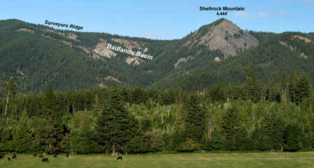
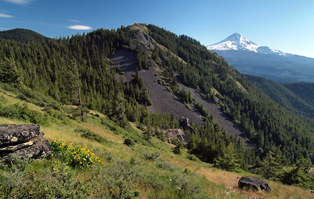
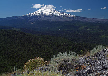
Mount Hood rises above Shellrock Mountain and Badlands Basin
Hidden in plain sight above the Hood River Valley, Shellrock Mountain is a little-known peak with a familiar name. Though it shares a name with its better-known cousin in the Columbia River Gorge, the “other” Shellrock Mountain has much more to offer, and is easier to explore.
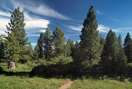
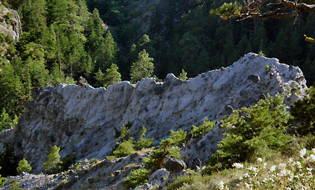
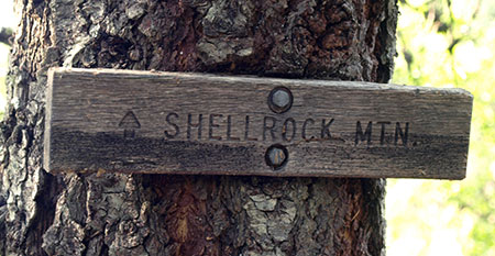
The “other” Shellrock Mountain is located along the Surveyors Ridge trail, a route popular with mountain bikers who ride from one glorious viewpoint to another along this well-traveled route. At one point on the trail, an obscure wooden sign points to Shellrock Mountain, but really just marks a short spur trail with a view of the south face of Shellrock. Beyond this modest view, few visitors take the time to explore the mountain or the rugged Badlands Basin, located nearby.
Hidden in plain sight: Shellrock Mountain is from Cooper Spur Road
[click here for a larger view]
Reaching the summit of Shellrock Mountain involves a short, stiff off-trail scramble up the northeast slope of the peak (more about that later), where a stunning view stretches from the nearby glaciers of Mount Hood to the big peaks of the southern Washington Cascades and arid desert country of the eastern Columbia River Gorge.
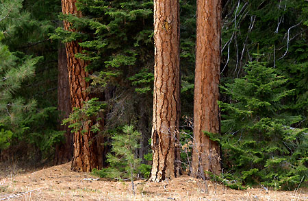
Shellrock Mountain sits astride the Hood River Fault, a 20-mile long scarp that forms the east wall of the Hood River Valley. The scarp also forms the last high ridge of the Cascade Range in the Mount Hood area, with evergreen forests giving way to the arid deserts of Eastern Oregon just a few miles east of Shellrock Mountain. This proximity to the desert ecosystem brings together a blend of mountain and desert flora and fauna that make Shellrock Mountain and its surrounding area unique.
While most of the uplifted ridge along the Hood River Fault is composed of ancient layers of basalt, andesite and dacite, the Badlands Basin reveals the more recent debris of a pyroclastic flow, the same roiling mixture of steam, volcanic ash and rock that roared from Mount St. Helens in the May 1980 eruption. This flow originated from Mount Hood during its early formation.
Badlands Basin sprawls against the northern foot of Shellrock Mountain
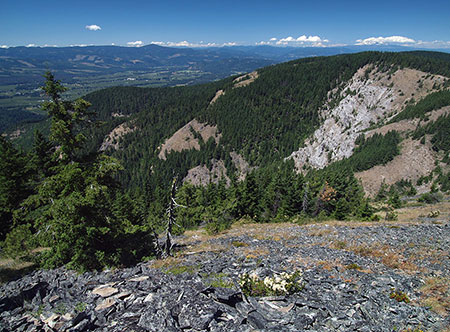
Badlands Basin is located at the headwaters of Cat Creek, on the north flank of Shellrock Mountain. Here, the ancient pyroclastic flow has been carved into a fantastic landscape of pinnacles, ridges and goblins that is unmatched elsewhere in the region. The Badland Basin formation spreads across about 100 acres, rising nearly 1,000 above Cat Creek.
The maze of formations in Badlands Basin as viewed from Shellrock Mountain
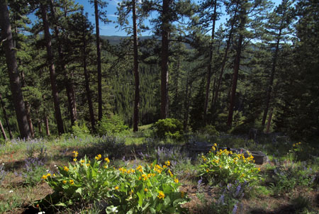
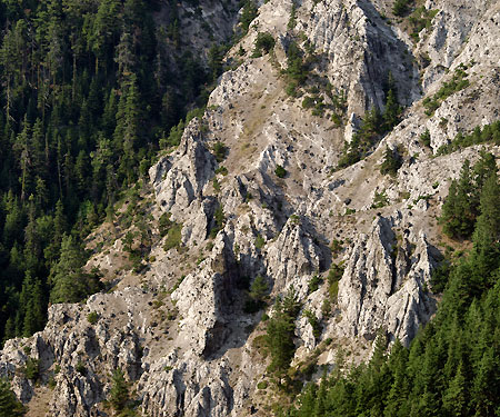
Exploring the Badlands Basin is a rugged and surreal experience for the rare visitors who make their way through the jagged formations. No trails go here, and the terrain is both steep and exposed. But once inside the formation, individual spires and ridges take on a new life, as their bizarre shapes come into focus on a human scale. The Badlands are surprisingly alive, too, with a unique ecosystem of desert and sun-loving alpine flora thriving in dry meadows among the rock outcrops.
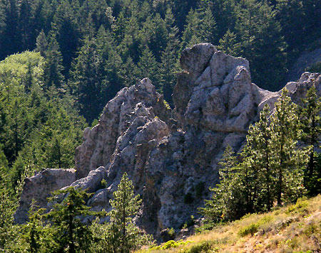
Badlands Basin: “The Grizzly Bear”
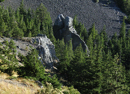
Badlands Basin: “The Hippo”
Badlands Basin: “The Iguana”
Together, Shellrock Mountain and the adjacent Badlands Basin are special places that beg to be explored. While the Surveyors Ridge Trail provides a good view into the area, new trails that explore the strange formations of the Badlands up-close and reach the airy summit of Shellrock Mountain could make these places much more accessible for hikers and cyclists. What would these new trails look like?
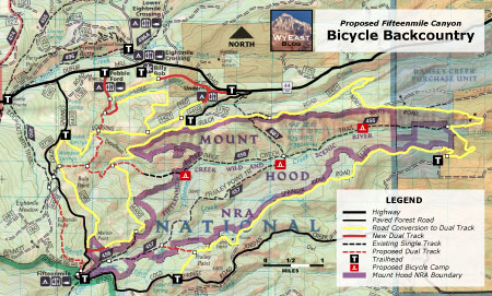
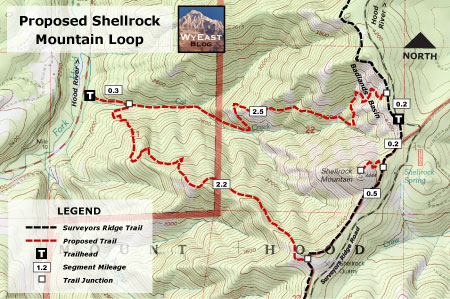
Proposal: Shellrock Mountain Loop Trail
This proposal calls for a new trail to Shellrock Mountain and Badland Basin from the Loop Highway. Why start at the highway? It makes sense for several reasons: first, the new trailhead at Cat Creek would be only about one-third mile from the popular Dog River Trailhead, making a long and spectacular loop possible for mountain bikers, as the Dog River Trail also connects to the Surveyors Ridge Trail.
Second, a highway trailhead would make the area much more accessible and secure for all visitors, as highway trailheads are easier for law enforcement to patrol, and highway traffic, alone, acts as significant deterrent against car clouters.
[click here for a large version]
Finally, a trailhead along the Loop Highway could be open most of the year, allowing for winter snowshoe access to the high country around Shellrock Mountain when the Surveyors Ridge Road is buried under snowdrifts.
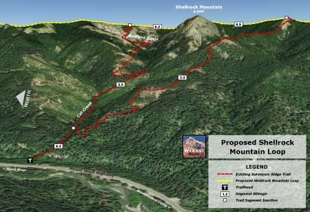
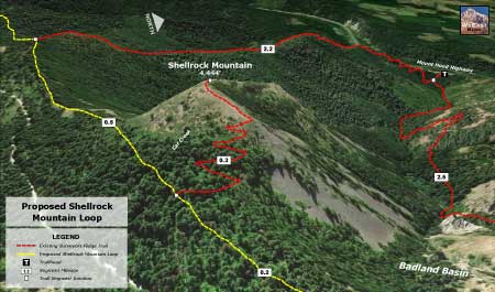
The proposed Shellrock Mountain Loop would have two legs: a 2.5 mile northern leg would follow Cat Creek to the base of Badlands Basin, then wind through the rock formations to a junction with the Surveyors Ridge Trail. A southern leg would climb the long ridge west of Shellrock Mountain to a separate junction with the Surveyors Ridge Trail, about a mile south of the northern leg. The Surveyors Ridge trail would connect these new trails, creating the loop.
A short summit spur trail would lead from the existing Surveyors Ridge Trail to the rocky top of Shellrock Mountain, providing a side-trip option for cyclists on the ridge and the main destination for hikers on the new Shellrock loop trail.
The following oblique views show the proposed trails from both west and east perspectives:
[click here for a large version]
[click here for a large version]
What Would it Take?
In 2009, President Obama signed a bill into law creating the Mount Hood National Recreation Area (MHNRA), a small but significant new form of protection for the Mount Hood area. The MHNRA concept has mountain bikes in mind, as it provides a way to protect recreation areas in a wild state, but without bicycle restrictions (under federal law, bicycles are not allowed in designated wilderness areas).
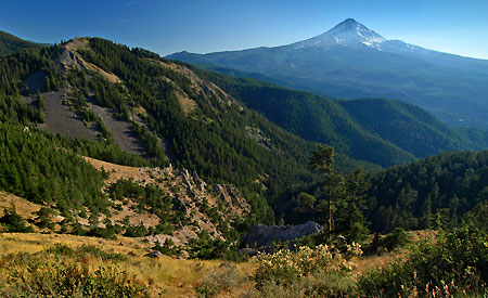
Shellrock Mountain and Mt. Hood from the Surveyors Ridge Trail
The entirety of Shellrock Mountain and the Badlands Basin fall within the MHNRA designation, and as such, deserve to be considered for proposals like this one. The Forest Service has shown an encouraging willingness to work with mountain biking advocates to build new bike trails in the Surveyors Ridge area, too. So while the agency has generally opposed building new trails anywhere else, there is a good chance that the Shellrock Mountain Loop could be build if mountain bike advocates were to embrace the idea.
The first mile of both legs of the new trail would also fall on Hood River County land. The county currently focuses most of its energy on logging its forest holdings, but has worked with mountain bikers in the Post Canyon area to diversify the kinds of uses that county land can be dedicated to.
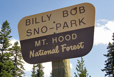
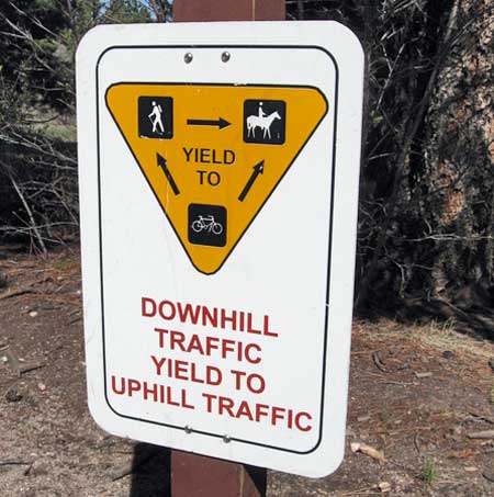
Nope, this sign doesn’t lead to Shellrock Mountain… yet…
In the Shellrock Mountain area, Hood River County has already logged off the big trees, so hopefully the County would see the wisdom of shifting the focus in this area to recreation, as well – and possibly consider funding for trail construction, as well.
Most importantly, mountain biking advocates like the International Mountain Biking Association (IMBA) have a terrific record of trail building, and with help from other trail advocates like Trailkeepers of Oregon (TKO), could be the catalyst in bringing together a collaborative effort of volunteers, the Forest Service and Hood River County in creating this new trail system.
How to Visit Shellrock Mountain
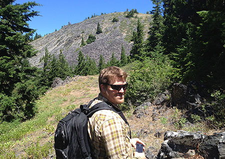
Sturdy hikers can visit Shellrock Mountain today with a bit of wayfinding expertise and some bushwhacking skills. The best starting point is an unofficial trailhead located along the Surveyors Ridge Road.
A brave bushwhacker heads for Shellrock’s summit
To reach the trailhead from Hood River, drive the Loop Highway (OR 35) ten miles south of I-84 to a crest just beyond the Mount Hood Mill, where you turn left onto Pinemont Drive. This road eventually becomes Surveyors Ridge Road, alternating between paved and gravel surfaces, but is always easily passable for any car.
At almost exactly 11 miles from where you turned off the main highway, watch for an unmarked trail heading to the right at an obvious bend in the road. Park here, and follow the short path to the Surveyors Ridge Trail, just a few feet off the gravel road. Shellrock Mountain is visible directly ahead of you!
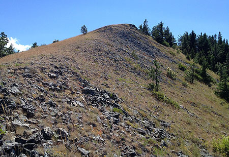
The open summit ridge of Shellrock Mountain
From here, turn left (south) and follow the Surveyors Ridge trail for about one-third mile to a gentle crest along the forested east shoulder of Shellrock Mountain. If you pass the trail sign pointing to Shellrock Mountain, you’ve gone too far.
At the crest, head directly uphill on whatever path you can find through the forest, then abruptly leave the trees and reach the open east slopes of Shellrock Mountain, where you will wind among patches of manzanita and ocean spray as you work your way toward the summit. Don’t forget to look back periodically to help you retrace your steps upon your return!
Mount Hood fills the horizon from the top of Shellrock Mountain
Soon, you will reach the summit ridge with a series of viewpoints of the Badlands Basin (and your starting point) spreading out to the north and Mount Hood towering to the southwest.
From this vantage point, you can also see the full extent of the 2008 Gnarl Fire that burned the eastern slopes of Mount Hood, sweeping from near Gnarl Ridge on the far left horizon toward Cloud Cap, located right of center. The historic Cloud Cap Inn was barely spared by this blaze. In 2011, the Dollar Fire was started by a lightning strike west of Cloud Cap, sweeping over the right shoulder of the mountain for several miles toward Lolo Pass. For more on the Dollar Fire, click here.
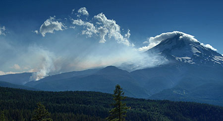
Early stages of the 2008 Gnarl Fire from near Shellrock Mountain
You’ll want to linger on the summit, and be sure to bring along a good map to help you identify the many features near and far that can be seen from this lonely summit. For photographer, the best time to visit in in the morning, which the light on Mount Hood is at its best.
Enjoy!