A New Vision for Oregon’s Hidden Wilderness

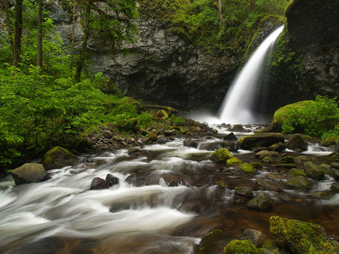
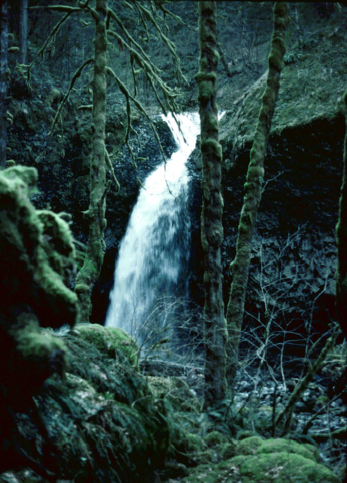
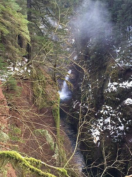
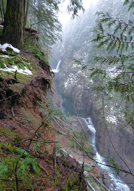
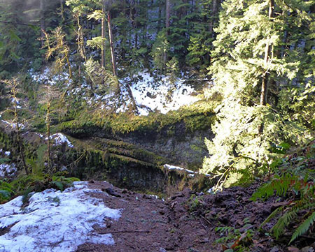
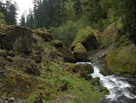
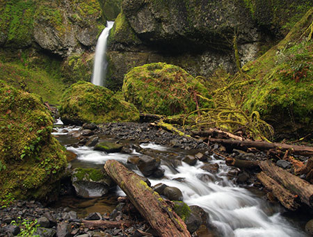
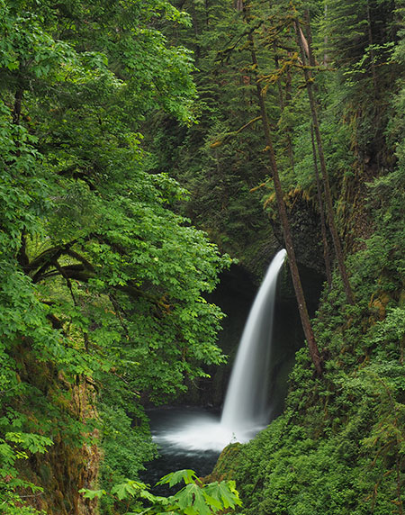
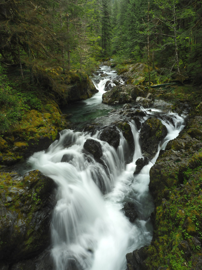
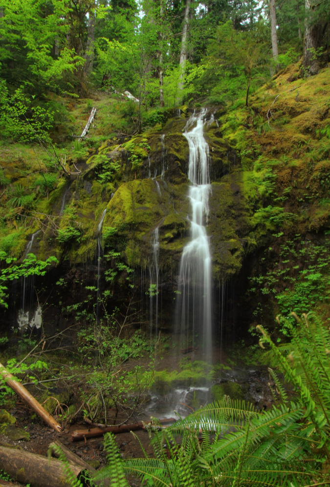
One of the dozens of unnamed, unmapped and off-trail waterfalls hidden in the canyons of the Opal Creek wilderness. This rarely visited falls is on Henline Creek

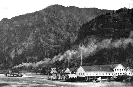
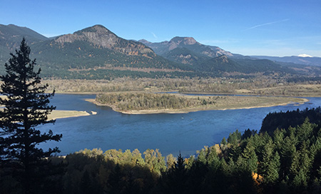
Heading south from Portland along old Highway 99E brings you first to the historic river town of Milwaukie, then up a forested bluff, past the end of the MAX light line and to the Oak Grove district of Clackamas County. From here, the old highway turns southeast, and makes a long, straight (and dreary) descent through the clutter of strip malls and used car lots on its approach to the edge cities of Gladstone and Oregon City. Normally, this is a grim part of this drive, but that last descent holds a surprise on clear winter days: a prominent cluster of mountain ridges on the horizon just high enough to be snowcapped well into June. What are these peaks?

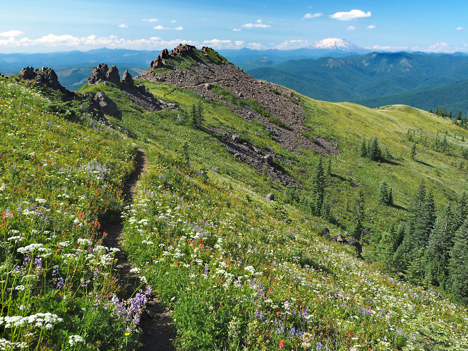
These are the high crags and ridges that form the rugged crest of the Bull of the Woods Wilderness, the adjoining Opal Creek Wilderness and nearby Table Rock Wilderness areas. The Bull of the Woods and Table Rock areas were protected by Congress in the landmark Oregon Wilderness Act of 1984 and protection for the Opal Creek area followed in 1996. Before it was protected in 1984, the Bull of the Woods area was known to conservationists as the Hidden Wilderness. It’s an apt name and one that I’ll use interchangeably in this article, because despite the surprisingly close proximity to nearly 3 million people in the Willamette Valley, this wilderness remains mostly unknown today.

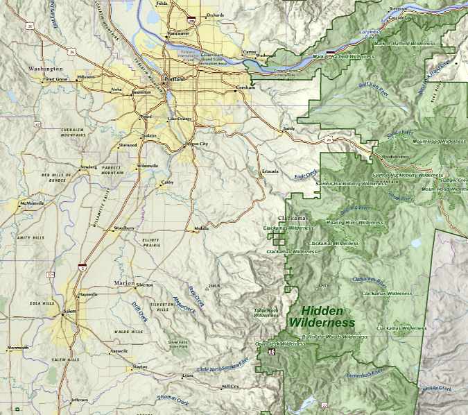
The Bull of the Woods, Table Rock and Opal Creek wilderness areas are located 30 miles due west of Salem and about 50 miles southeast of the Portland Metro Area.

[click here for a larger view]

We often say this about the lesser-known gems in our scenery-overloaded corner of the country, but if these areas were located in any state east of the Rockies, they’d be a major attraction. More than a dozen craggy peaks across the three wilderness areas rise above 5,000 feet, and the network of streams that radiate from this complex of mountains and steep ridges are among the most pristine in Oregon. 

Together, the streams combine to form the beautiful Collawash River, Hot Springs Fork of the Clackamas, Molalla River and Little North Fork of the Santiam. These rivers are known for their unusual clarity, thanks to their protected headwaters. 

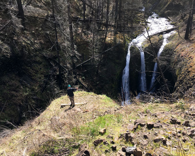
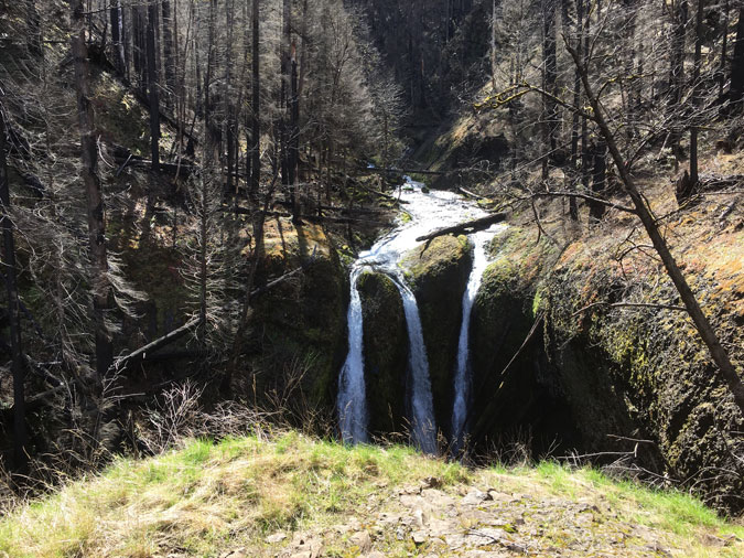
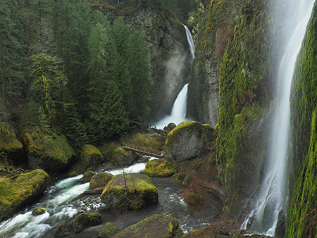
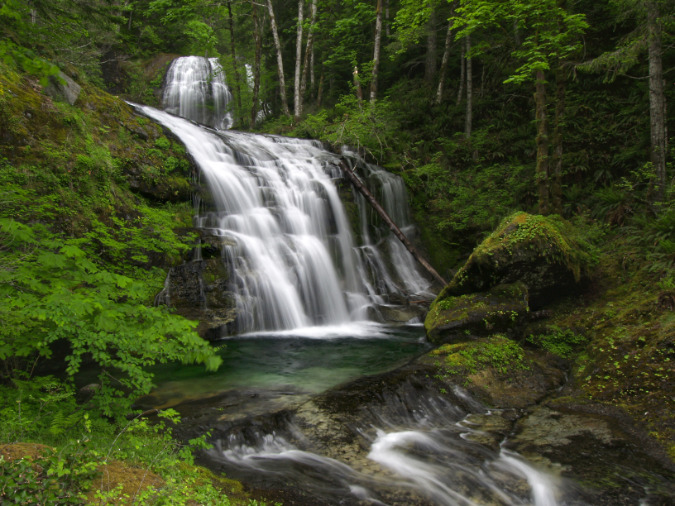
Sawmill Falls is located on the Little North Fork of the Santiam River that flows from the Opal Creek Wilderness. This photo was taken just before the Bull Complex Fire impacted this part of the Little North Fork in 2021

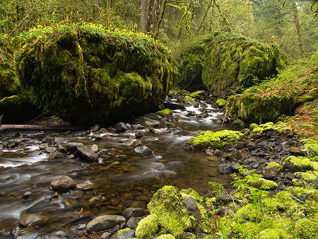
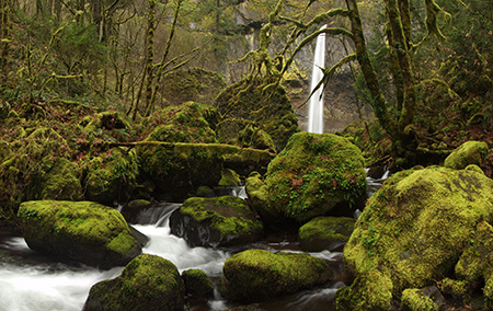
Opal Creek, a major tributary to the Little North Fork and the namesake for its own wilderness. This photo was also taken before the Bull Complex fire in 2021

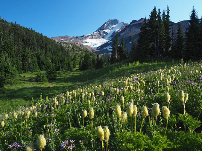
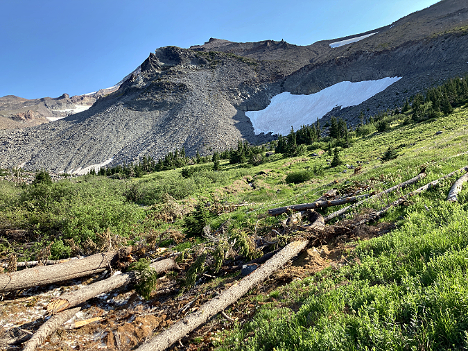
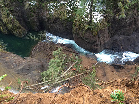
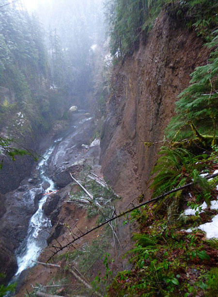
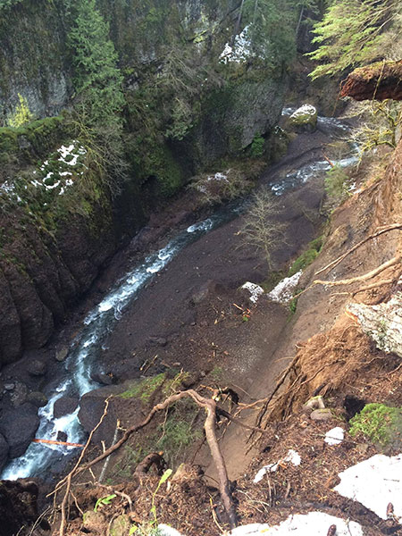
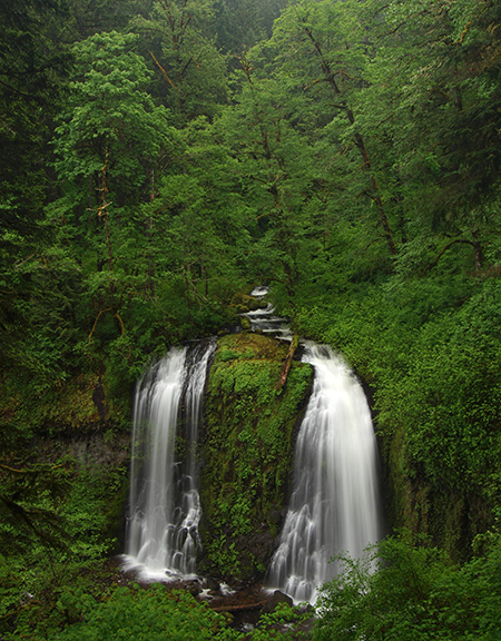
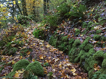
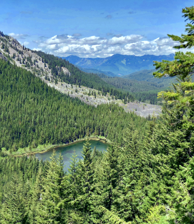
The Hidden Wilderness high country is also dotted with dozens of subalpine lakes and tarns that fill cirques and valleys left behind 15,000 years ago by ice age glaciers, when the peaks of the Hidden Wilderness rose high above the timberline. Below the lakes and peaks, dozens of spectacular waterfalls are hidden in the deep, forested canyons. These remain mostly unnamed and little known, and are inaccessible by trail.

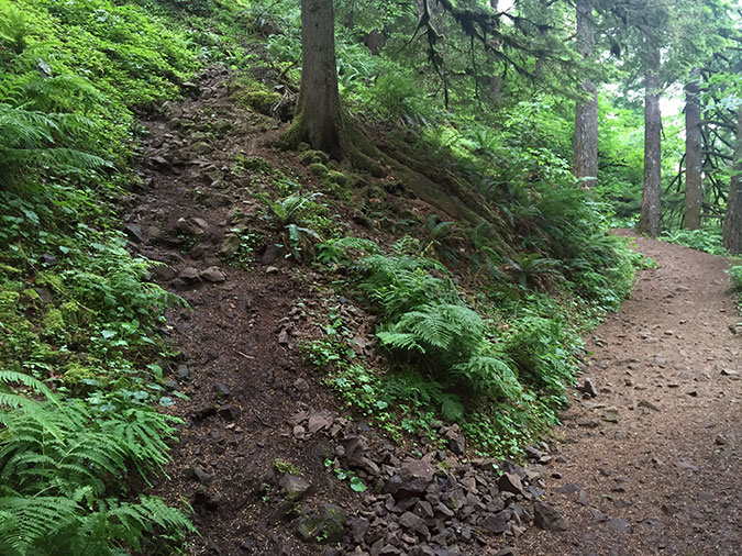
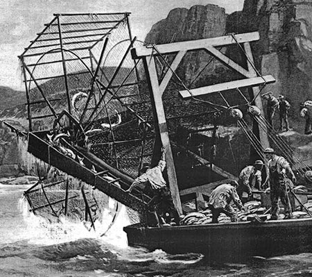
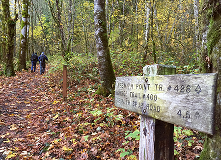
A surprisingly dense network or trails traverses the area, however, though they weren’t built with hikers in mind. Some of these trails were built in the late 1800s, during a mining boom that saw a major influx of human activity when gold was discovered along the Little North Fork in 1859 – the same year the State of Oregon was admitted to the union. 

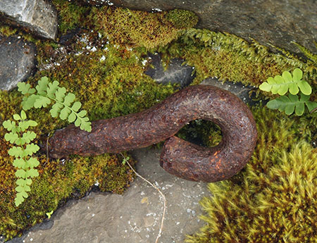
Small-scale hard rock mining later expanded across the mineral-rich Hidden Wilderness region to include copper, zinc and lead. Silver King Mountain, in the heart of the wilderness, was named for one of these mining claims. Today, old mining shafts and rusted relics from this era still remain scattered through the forests of the Hidden Wilderness, adding to the mystery and intrigue of the area.

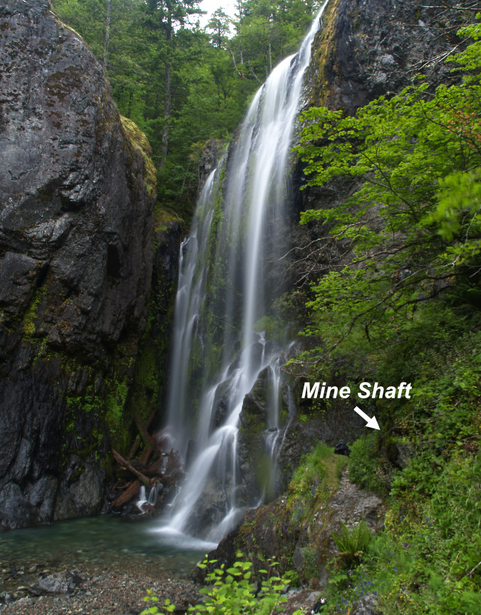
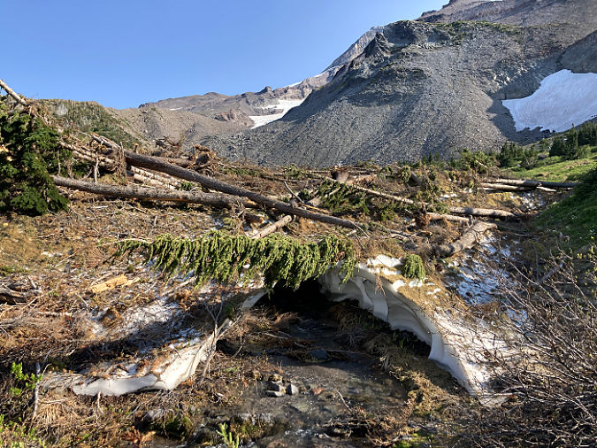
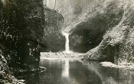
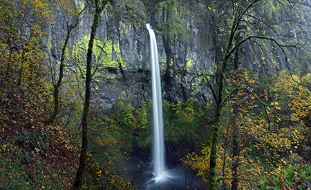
Henline Falls in the Opal Creek Wilderness is named for a miner who made a claim here in the late 1800s. Abandoned mine shafts can still be found along the creek, including one at the base of the falls. This photo was taken before area was impacted by the 2021 Bull Complex Fire

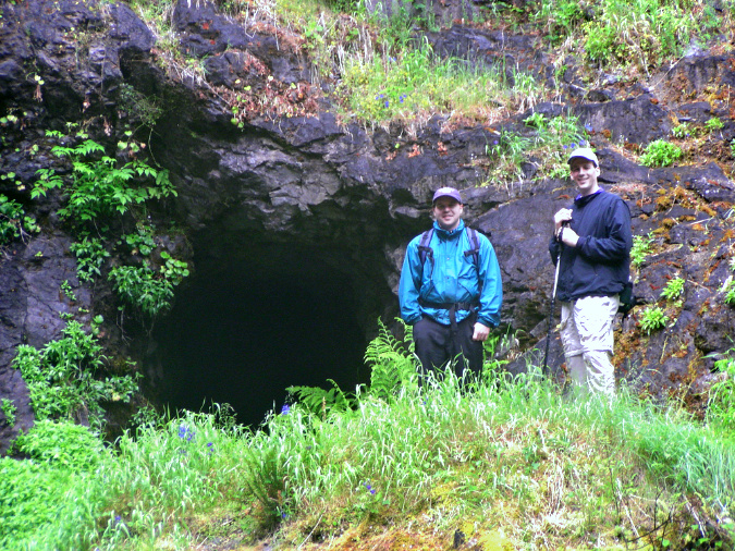
Hikers exploring the abandoned mine at Henline Falls. Mining relics from the late 1800s and early 1900s are found across the Hidden Wilderness


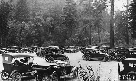
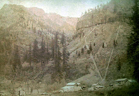
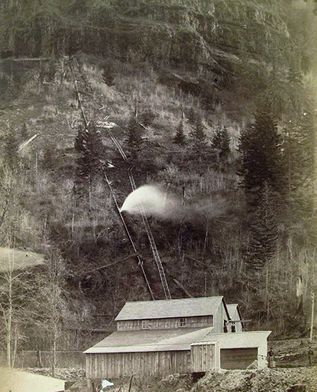
Many of the area trails were built later, when the area was first designated as national forest in the early 1900s. These trails were built to connect the network of fire lookout towers built atop several peaks in the Hidden Wilderness and to the subalpine lakes that provided a water source for lookouts and stock animals. In those early days of the Forest Service, trails also connected guard station, where forest rangers were stationed and “ranged” the forest trails to protect public lands from illegal logging and grazing. Hikers would not discover these trails until the 1920s and 30s, when the first roads brought weekend campers to the forest.

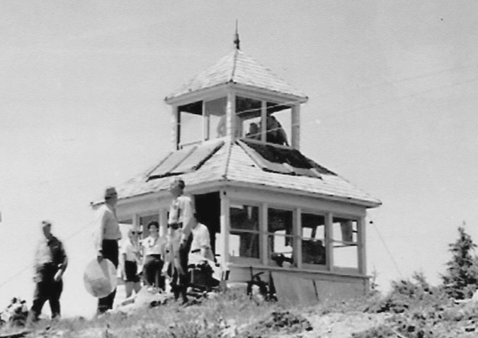
The original cupola-style Battle Ax Mountain  fire lookout in the 1930s (USFS)

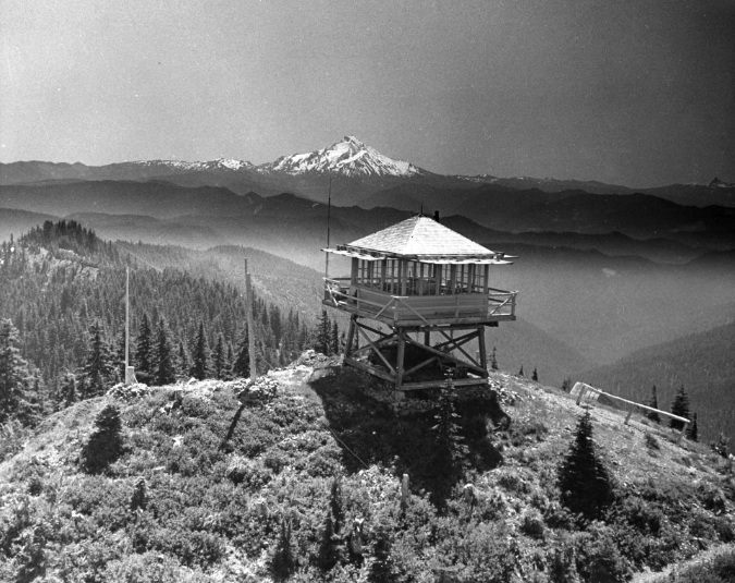
The Bull of the Woods fire lookout in the 1950s with Mount Jefferson in the distance (USFS)

Most of the historic lookouts and guard stations in WyEast Country were destroyed by the Forest Service in the 1960s, deemed obsolete when air surveillance for fires took over and the modern cobweb of logging roads transformed access within the forest. The old lookout on Bull of the Woods Mountain survived until very recently, when it was destroyed in the Bull Complex Fire in 2021. More than a dozen lookouts and guard stations once stood in the Hidden Wilderness, but only the unique stone Pechuck Lookout structure on Table Mountain and the historic Bagby Guard Station survive today. 

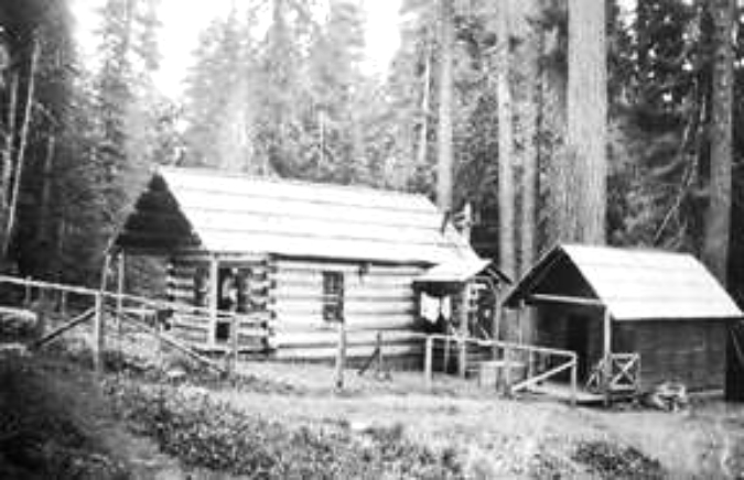
Bagby Hot Springs Guard Station in 1913, among the few guard stations where rangers were guaranteed a warm bath every night!

Most of the early 1900s lookouts and guard stations were destroyed in the 1960s, but the historic Bagby Hot Springs Guard Station survives today and serves as a northern gateway to the Bull of the Woods Wilderness

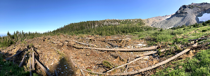
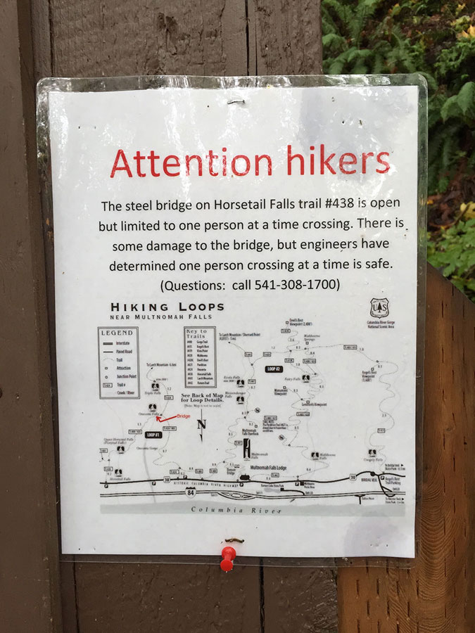
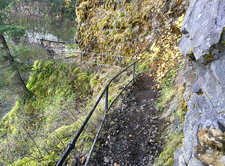
For many years, an unofficial network of dedicated trail advocates has worked to keep the historic network of trails in the larger Clackamas area alive in the face of years of Forest Service neglect, and, more recently, the wave of wildfires that have brought many of the trails here to the brink of being lost forever. A reputation for lawlessness and confusing, poorly maintained trailhead access roads left over from the big logging era of the 1960s, 70s and 80s in the Clackamas River corridor have also discouraged hikers who might otherwise come here to explore this wilderness gem, hidden in plain sight. 

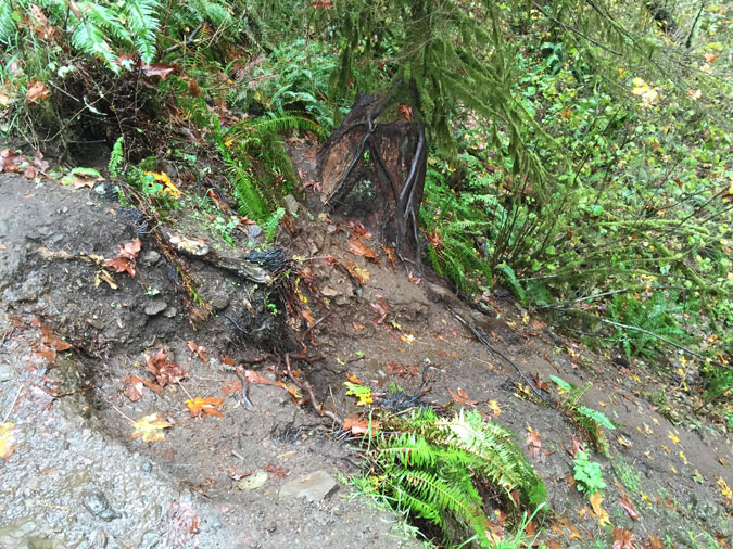
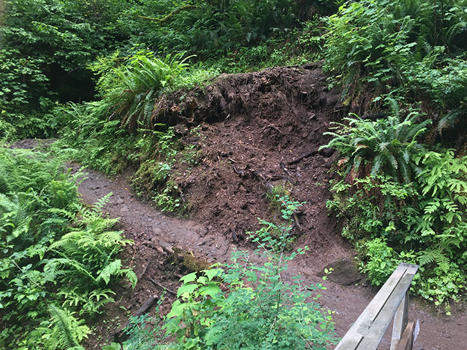
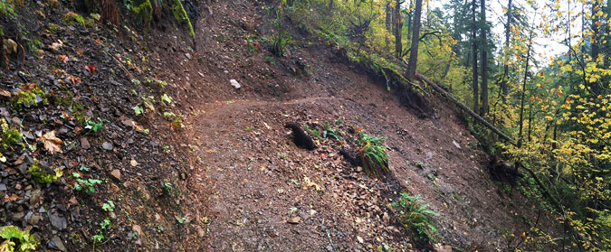
The trail system in the Hidden Wilderness has been in slow decline for decades, first from logging that destroyed many trails and trailheads, and later through lack of maintenance and the impacts of frequent wildfires

The unprecedented attack on federal agencies in recent months by the current administration will only add to the struggle to keep the existing trails open in the near term. But in the longer term, there’s no reason to believe this regrettable trend won’t be reversed. This administration will be replaced in just a few short years, and the demand for more and better trail access to our public lands will only grow in that time. 

A strong public backlash against the administration’s public lands policies has organized in recent weeks, underscoring the obvious — that people deeply value our public lands, and expect to have access to them. It’s also true that we are in the middle of a generational transition in national leadership, with younger leaders much more likely to view conservation, clean water and recreation as the primary purposes of our public lands.

With this longer, more hopeful future in mind, the rest of this article focuses on the Hidden Wilderness as it could be, and can be. It’s a positive vision for restoring and expanding trail access into the area, embracing and restoring some of the history that has been lost, and in doing so, provide the Hidden Wilderness the care this remarkable place deserves.

Return of Wildfire: It’s still (mostly) a good thing…

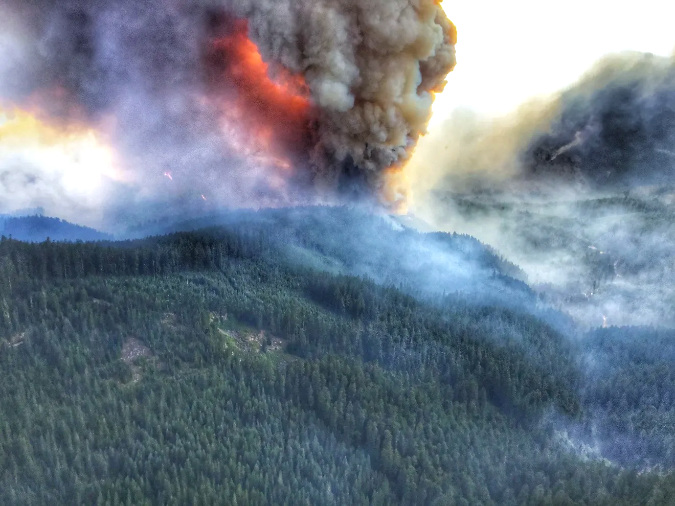
The Janus Fire grew rapidly and combined with other blazes to become the Bull Complex in the summer of 2021 (USFS)

When the Janus Butte fire sparked on a ridge above the Collawash River in August 2021, it felt like a recurring bad dream for many, given the series of devastating fires that had roared through the Mount Hood National Forest in the fall of 2020. 

While most of the very recent fires in WyEast Country (including the 36 Pit Fire in 2014, the Eagle Creek Fire in 2017 and the massive Riverside Fires in 2020) were notoriously human-caused, the Janus fire was different. Instead, this was a natural wildfire that began with lightning strikes that ignited several small fires in the Collawash River headwaters. By mid-August of 2021, these fires would merge with the Janus Fire and become known as the Bull Complex, named for the Bull of the Woods Wilderness, where they were advancing quickly.

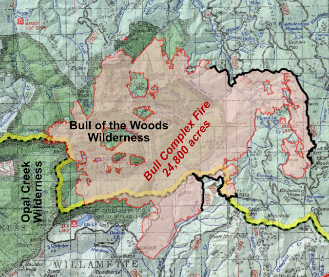
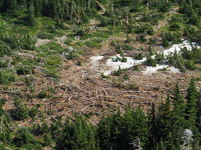
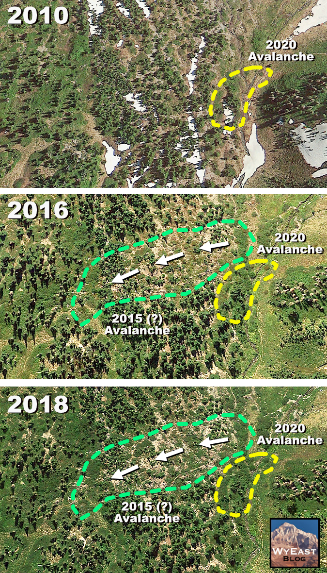
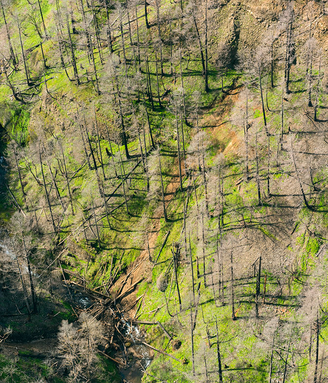
The Bull Complex eventually burned nearly 25,000 acres (shown in pink), with roughly half the Bull of the Woods Wilderness (in dark green) affected. This fire spared previously burned areas to the west, in the adjacent Opal Creek Wilderness, where the 2020 Beachie Creek Fire resulted in more than 90 percent mortality over much of the 190,000 acre extent

By the end of September 2021, the Bull Complex had burned just short of 25,000 acres. Though significant, this burn was only fraction of the 190,000-acre Beachie Creek Fire that swept through the adjacent Opal Creek Wilderness and 138,000-acre Riverside Fire that burned through the Clackamas River area to the north the previous year. 

Together, this combination of natural and human-caused fires left a massive burn scar across much of the Clackamas River and Little North Fork watersheds that will take decades to recover. While science tells us that wildfires are a healthy and necessary part of our forest ecosystem, how could burns this extensive be a good thing? 

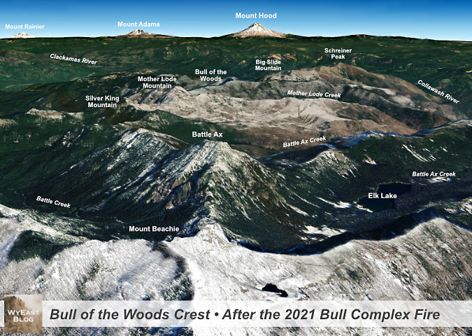
This aerial view shows the impact of the Bull Complex Fire on the heart of the Bull of the Woods Wilderness. The burned slopes of Mount Beachie (in the foreground) are from the much larger Beachie Creek Fire in 2020.

[click here for a large version]

The answer is nuanced. The combined effect of a century of fire suppression and our changing climate has resulted in an unsustainable sequence of fires in recent years in terms of their size, intensity and frequency. This will make forest recovery in some of the largest (and, notably, human-caused) burns much slower. But where recent burns were smaller and less intense, the recovery cycle is already well underway, and the benefits that science promises are already apparent in these places, including in the Bull of the Woods Wilderness.

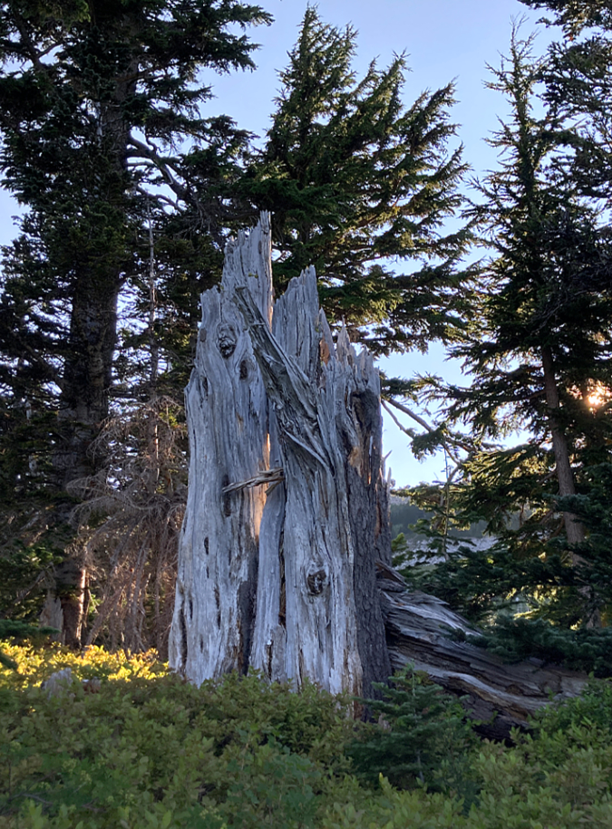
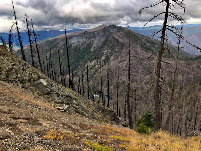
The Bull Complex Fire is a good example. The fire burned mostly along steep mountain slopes and ridgetops, including through hundreds of acres of standing snags from a series of earlier fires in the Bull of the Woods that swept through the heart of the wilderness in 2008, 2010 and 2011, completely clearing these slopes for what will most likely become beargrass and huckleberry fields for many years to come. The fire also skipped over several forested canyons that had been spared by earlier fires, allowing trees in these areas to continue to age as mature forests, retaining the biological complexity that only old growth forests can bring to a forest ecosystem. 

While the Bull Complex was mostly a beneificial fire for the forest ecosystem, it wasn’t so kind to human infrastructure. It will take years to repair trails impacted by the fire, and many favorite camping spots at the high lakes were completely burned. Perhaps most distressing on the human side of the equation was the loss of the historic Bull of the Woods Lookout tower that as completely destroyed by the fire (more on that later in this article). 

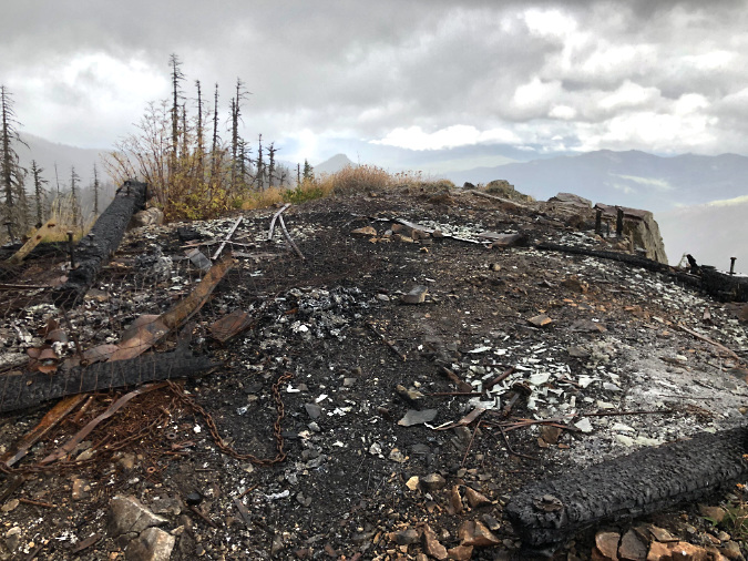
For the first few weeks, it seemed the 2021 Bull Complex Fire might spare the historic Bull of the Woods fire lookout, but in early September of that year, the fire surged west, completely destroying the old structure (TKO)

Just three years after the Bull Complex Fire, the 2024 fire season threatened to bring yet another blaze to the Bull of the Woods when Sandstone Fire flared up just north of the Hot Springs Fork last September. Like the Bull Complex, this fire threatened the historic structures at Bagby Hot Springs that had been spared by the 2021 fires. Fortunately, the fire was soon contained and cool fall weather set in before it could spread south to the Bagby area.

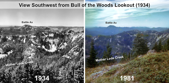
The rapid succession of wildfire in recent years in the Hidden Wilderness area has felt jarring mostly because fires here had been successfully suppressed for so long. There was a sense that our forests could remain green and unburned, indefinitely, and that they had always looked this way. But if you look closely at photos taken in the 1930s as part of an expansive Forest Service surveying effort, the forests then looked much like our fire-impacted forests of today. While the current pace of fires feels alarming, we are looking at a forest ecosystem that is much closer to its pre-forest management days, with an ecosystem in a far healthier state that was more adapted to fire.

The following photos are from that 1930s survey, and clearly show a forest that had repeatedly burned with smaller, beneficial fires in the decades prior. For the first image, I paired the 1930s view with one took in 1981, showing how the forests south of the Bull of the Woods had already covered the landscape in the absence of fire during the 50-year period between the images:

[click here for a large version]

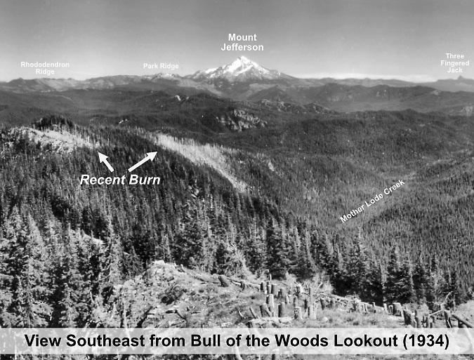
This 1930s view from Bull of the Woods shows recent burns along the ridges to the southeast that were likely ignited by lightning, and only burned small patches – a desirable “mosaic” pattern that is beneficial to forests:

[click here for a large version]

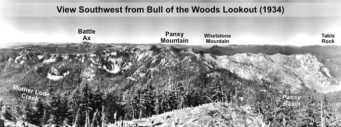
Looking to the west from Bull of the Woods in the 1930s revealed yet another recent burn in the Pansy Basin, and area that is now forested and has largely survived more recent fires:

[click here for a large version]

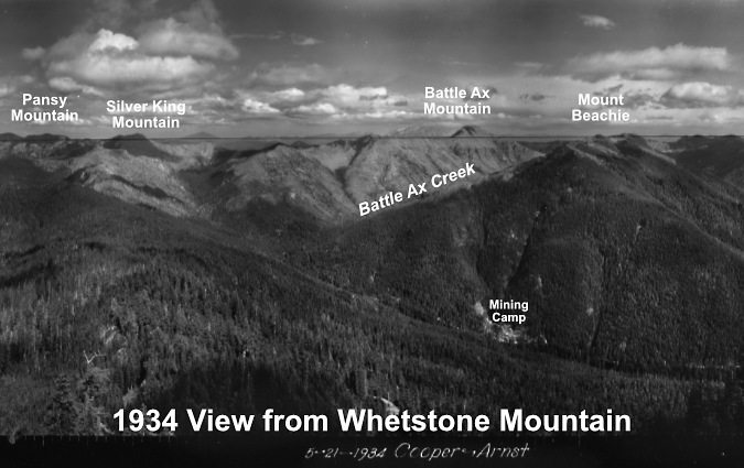
This view is from Whetstone Mountain, looking east toward today’s Bull of the Woods Wilderness, showing much of the upper headwaters of Battle Ax Creek burned. Some of these early fires may also have been human caused by mining activity in the area – a mining camp is visible in this image:

[click here for a large version]

With the recent series of fires repeatedly burning the area, what will the Hidden Wilderness look like in another 50 or 100 years? We have a local example that might provide a preview: Silver Star Mountain, which looms on Portland’s northeast horizon. This area experienced a series of devastating (and mostly human-caused) fires in the early 1900s. Due to erosion and extensive canopy loss from these fires, the forest didn’t fully recover, leaving large areas of subalpine meadows and beargrass fields that persist today. The spring wildflower season and sweeping views year-round from the open ridgetops make it a popular hiking destination and important island of open habitat in the surrounding sea of forest. 

Spring bloom along Ed’s Trail on the north ridge of Silver Star Mountain.. This area is still recovering from devastating fires more than a century ago

Like the peaks and ridges that make up the Hidden Wilderness, Silver Star Mountain forms the western slope of the Cascades, taking the full brunt of Pacific storms. The intense weather has contributed greatly to the slow the recovery at Silver Star through erosion and brutal winters that stunt emerging forests. By comparison, today’s landscape at Silver Start Mountain looks a lot like the one that existed in the 1930s lookout surveys of the Hidden Wilderness, suggesting what the future might look like here. 

The long-term impact of recent fires on human infrastructure in the Hidden Wilderness are easier to predict. We’ve learned in the recovery from the 2017 Eagle Creek Fire in the Columbia Gorge that fires have long-term impacts on trails as the forest recovers, from ongoing erosion to falling snags and explosive growth of the rejuvenated understory that continually overcomes trails.

Silver Star Mountain gives a good idea of what most of our forests looked like before fire suppression began in the early 1900s. The open peaks here provide important subalpine habitat that we will now likely see in the Hidden Wilderness as it recovers from fire

Access roads have also been affected by the fires, especially in the heavily burned Opal, Battle Ax and Mother Lode creek valleys, adding to questions about their sustainability in an era when industrial logging no longer provides revenue to justify the extensive logging road network built in the 1950s, 60s and 70s, and radical cuts to Forest Service budgets by the current administration raise serious questions about our ability to maintain today’s network of forest roads in the future.

Drawing a new vision from the past?

Way back in 1980, when I was college freshman at Oregon State University, I jumped into the Oregon conservation movement with both feet. Commercial logging on our public lands was moving at an appalling pace, and the few wild places left in the Western Cascades were very much in peril. As Mark Twain wrote, “history doesn’t repeat itself, but it often rhymes”, and that first year of Ronald Reagan’s presidency felt a lot like what we are experiencing now from a conservation perspective — albeit with more grace and nuance, to say the least, Yet, the intent was the same: slash public agency budgets and sell off from our public lands where they could be sold. 

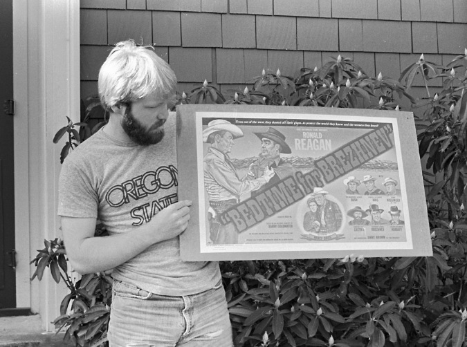
The author with a poster fundraiser for the OSU Student Chapter of the Sierra Club back in the day. At $10 this raised some funds and made it onto a lot of dorm room walls!

In response, local activists across Oregon were organizing to advocate for very place-specific islands of intact wilderness that had been spared from logging. The strategy of the day was to publish hiking guides and brochures to help advertise what was at stake with these remaining, still untouched gems. My own involvement was with the Salmon-Huckleberry Wilderness effort, where I put together a brochure and map in collaboration with a conservation group based in Portland to help get the word out. Thankfully, the Salmon-Huckleberry was among the areas protected in the landmark, Republican-sponsored 1984 Oregon Wilderness Act that Ronald Reagan eventually signed into law.

Of these local, grass-roots efforts around Oregon in the late 70s and early 80s, nobody topped the fine field guide published by the Central Cascades Conservation Council, a Salem-area group that gave the Hidden Wilderness its name. Their excellent guide (pictured below) not only provided the most complete trail descriptions for the area to date, but also included an excellent, folded topographic trail map tucked into the back!  I was hooked, and made my first overnight trips into the Hidden Wilderness in the summer of 1981. 

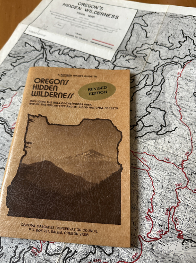
One of my treasured copies of the Oregon Hidden Wilderness guide and map – you can still find these as used book stores now and then!

The core strategy of those late 70s and early 80s conservation efforts was “eyes on the forest”, the idea that bringing people to endangered places was essential to creating public awareness and advocacy. Thus, the many brochures and guides created by non-profits in that era to introduce people to less-visited places that were gravely threatened by logging. They were largely successful in that objective, as some long-forgotten trails in placed like the Hidden Wilderness were newly “discovered”.

The Bull of the Woods and Table Rock areas were included in 1984 wilderness legislation and the Opal Creek Wilderness was created through a later bill in 1996. These were big wins for the conservation effort, bringing long fought-for protection to the greater Hidden Wilderness area.

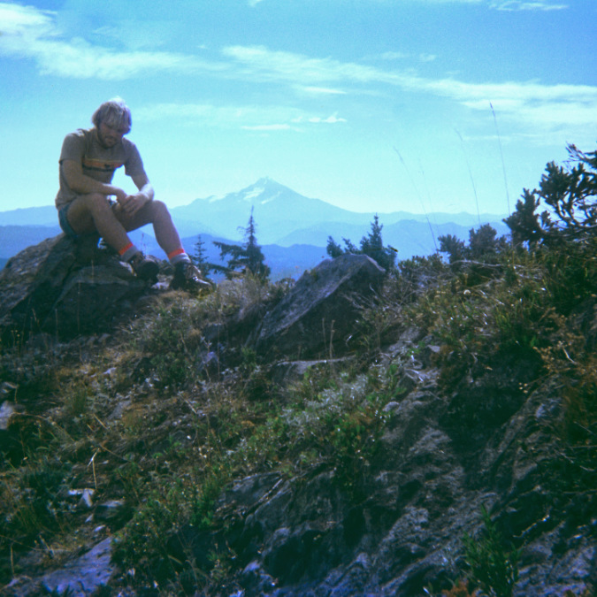
The author atop Battle Ax in the fall of 1981

However, these conservation victories in the 1980s and 90s also marked the beginning of a long cycle of decline of the historic trail networks across our national forests as we entered the current era of federal defunding of our public lands. Continued logging on the borders of the new wilderness areas has also continued to chip away at the gateway trails and trailheads, and recent fires have compounded the deterioration of trails access to trailheads. 

Therein, lies the opportunity. With trails once again on the brink of being lost forever, and a public both horrified by the administration’s attack on public lands and eager to have better access to the places, are we at a moment for a renewed vision for our public lands? 

I think so! There’s a saying from the civil rights era that applies: “during the good times, plan for the bad, and during the bad times plan for the good” We’re certainly in a bad time, but I do believe a period of reconstruction is ahead. So, in that spirit, read on for one way in which the Hidden Wilderness could be reimagined when those better times arrive.

Making the Hidden Wilderness less “hidden”…?


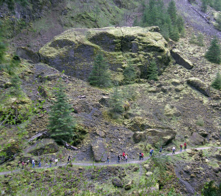
The “eyes on the forest” strategy can still be a powerful, lasting solution to some lingering challenges facing the Hidden Wilderness today. Much of the illegal and destructive behavior that has long dogged backcountry in the Clackamas River corridor traces directly to a lack of eyes on the forest. Even a slight uptick in visitors traveling to campgrounds and trails is a proven antidote to lawless activity like dumping, illegal shooting off-roading outside designated areas. 

The existing trail network in the Hidden Wilderness extensive and lightly visited, with plenty of room to accommodate more hikers if trails and trailheads were given more attention. Bringing new hikers is also a help to gateway communities with recreation-based economies who increasingly depend on tourist dollars to survive.

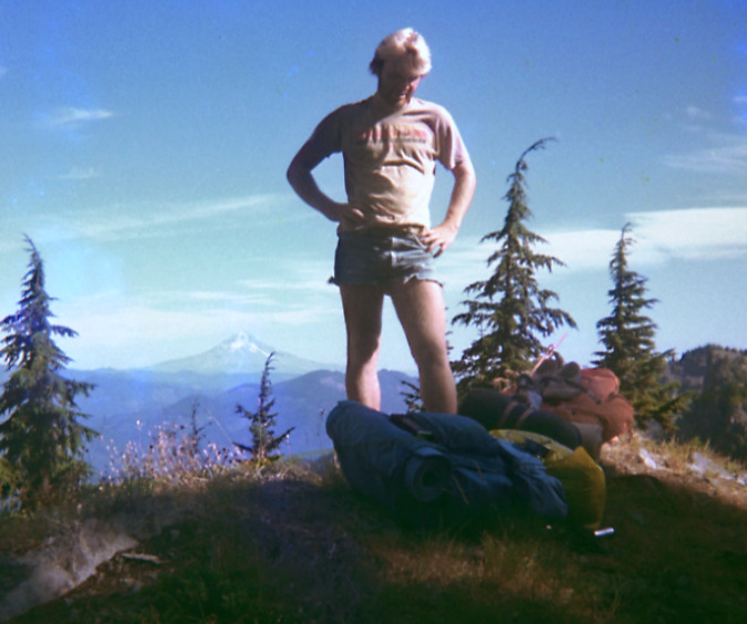
The author backpacking the Hidden Wilderness in 1981. Short shorts were just a thing back then, no further explanation provided…

Most importantly, a program to rebuild and expand the trail network in the hidden Wilderness would help fill the deep deficit in outdoor recreation opportunities that exists in the greater region. The number of trails within a couple hours of Portland has actually decreased since their peak in the 1930s while the metropolitan area population has ballooned from just 500,000 in 1940 to more than 2.5 million residents today – a five-fold increase whose impact is obvious on our trails. It’s not a surprise that maintained trails with good access are often very crowded today.

As communities in the Portland region and Willamette Valley continue to grow, it makes sense to reinvest and improve the trail networks that already exist in places like the Hidden Wilderness, right in our own backyard. It’s also an opportunity for everyday people to be part of that solution through volunteer trail work (more on that in a moment).

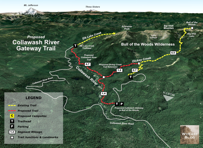
Twin Gateway Proposal

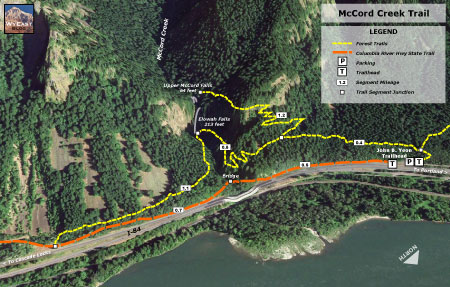
Though there are several existing access points of varying condition to the Hidden Wilderness, this article focuses on greatly improving the northern access from the Clackamas River corridor, along Highway 224, which functions as the most direct route from the Portland Metro region. Two new “gateway” trailheads are proposed (below).

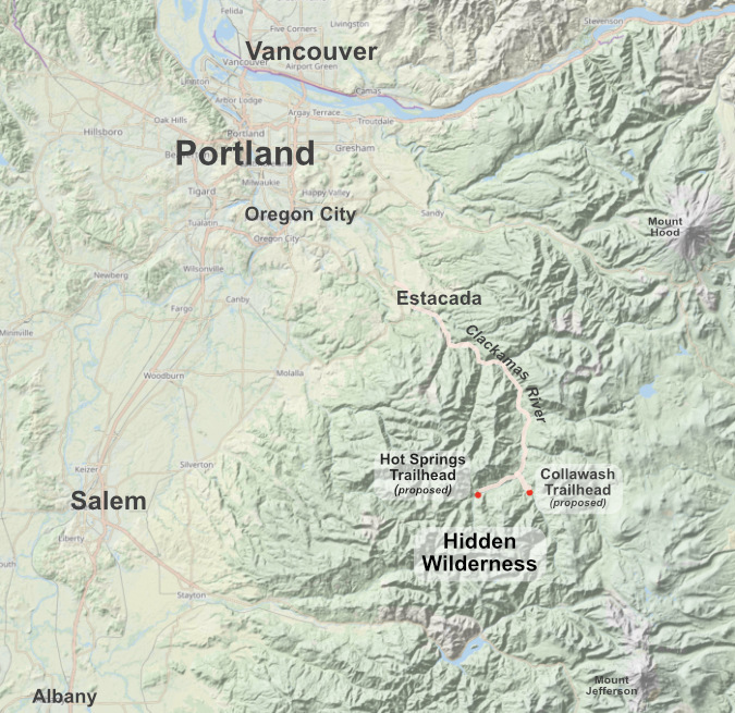
The proposed Hot Springs and Collawash gateway trailheads in relation to the Portland Metro region and Clackamas River corridor

[click here for a large version]

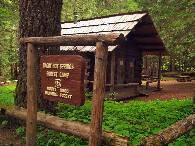
The first gateway trailhead would be along the Hot Springs Fork of the Clackamas, at the now-closed Pegleg Falls recreation site. This new gateway to the wilderness would feature a completely new trail along scenic, virtually unknown and (so far) unburned Pansy Creek, with a second, short connecting trail along the Hot Springs Fork linking to the already very popular Bagby Hot Springs recreation site. 

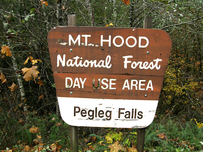
The proposed Hot Springs gateway would repurpose the mothballed Pegleg Falls picnic site

The new Hot Springs trailhead would be the starting point for a dramatic loop trail system into the heart of the Hidden Wilderness, while avoiding further crowding at the Bagby parking area, where most visitors are there simply for a day to visit the hot springs. The new trailhead would also take advantage of the Pegleg Falls recreation site, a picnic area that has fallen into disrepair, but could easily be reopened and repurposed as a gateway trailhead.

The second gateway trailhead would be along the Collawash River, just above its confluence with the Hot Springs Fork. This new trailhead would repurpose an overgrown logging yard just off the Collawash River Road. Like the Pegleg Falls site, it is easily accessed from paved roads, a significant improvement for those not wanting to navigate miles of deteriorating, poorly marked logging roads and the lawless activity that is too often found there.

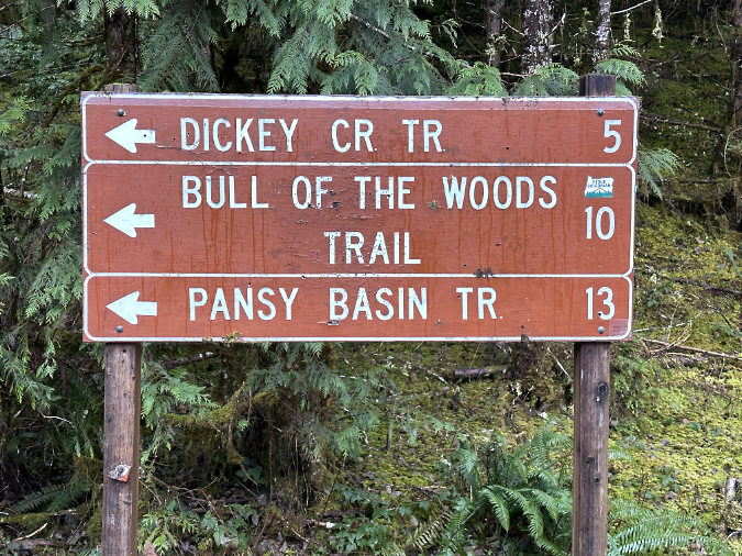
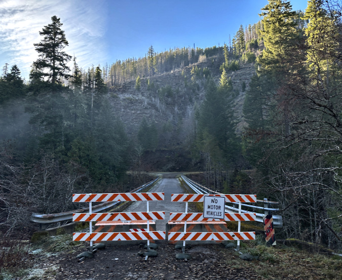
For less experienced hikers, or people concerned about driving backcountry roads, this sign announcing miles of poorly maintained gravel roads ahead is an unwelcome sight. The new Collawash gateway trailhead would spare hikers five miles of backroad travel to reach Dickey Creek

The new Collawash gateway trailhead would also save backpackers ten miles of backroad travel to the sketchy Elk Lake trailhead with a new trail to the Elk Lake Trail via the Collawash River

With both proposed gateways, the main objective is to create loop trail systems into the Hidden Wilderness with easily accessible, well-developed trailheads that will not only draw new visitors, but also be easy to maintain, for law enforcement to patrol and for everyone to feel safer leaving a vehicle there overnight.

A second important objective is to provide more year-round recreation opportunities. Both new trailheads would be at the relatively low elevation of just 2,000 feet, and thus largely snow-free and mostly open year-round. The new trails along the Collawash River, Dickey Creek and Pansy Creek would be relatively low elevation routes, mostly under 2,500 feet, providing much-needed, all-season streamside trails to provide alternatives and take pressure off the limited number of existing, all-season trails in the region.

A closer look at both gateway trailhead concepts follows…

The Hot Springs Fork Gateway

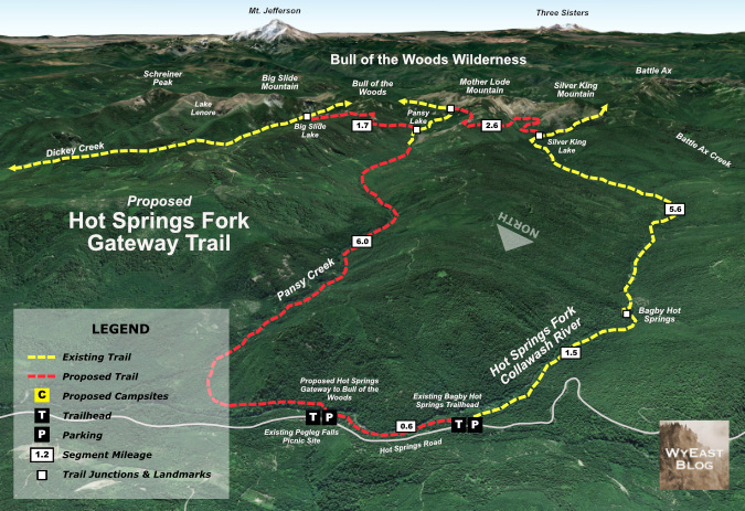
The Hot Springs Fork gateway would salvage the long-abandoned day-use area at Pegleg Falls, a beautiful spot that really deserves to be restored. The site is just 65 miles from downtown Portland, and accessed entirely on paved roads. From the proposed gateway trailhead, a new footbridge across the Hot Springs fork would lead to a proposed Pansy Creek trial and a new Hot Springs connector trail to the Bagby trailhead, just upstream.  The map below shows the concept in detail, and how these new connections would create a grand backbacking loop into the heart of the Hidden Wilderness.

[click here for a large version of this map]

The section of the Hot Springs Fork at Pegleg Falls is exceptionally scenic, with summer swimming holes for picknickers and upstream views of 20-foot Pegleg Falls. While the proposed trails would provide exciting new routes into the wilderness for backpackers, they would also serve casual hikers looking for a less challenging experience, as the first section of the new Pansy Creek Trail and proposed Hot Springs Connector would offer easy, streamside routes through lush forest.

Despite the closure of the picnic site, Pegleg Falls remains as a beautiful spot along the Hot Springs Fork that is now gated off to the public

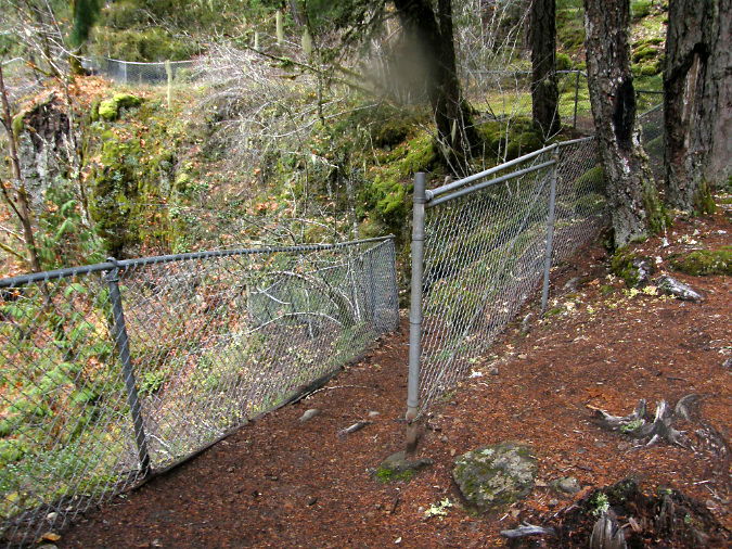
Dilapidated chain-link fences and other leftovers from the defunct Pegleg Falls site could be responsibly removed or repurposed as part of creating a new gateway trailhead here

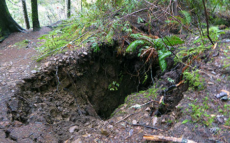
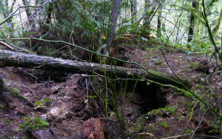
The new Pansy Creek trail would also bring a surprise for day hikers and backpackers, with an little-known series of waterfalls along the lower three miles of the proposed route. These have only been seen in recent years by a few intrepid waterfall explorers, though loggers likely explored the stream during they logging heyday of the 1960s, 70s and 80s. While the Pansy Creek valley is still recovering from heavy logging in the past, the valley has managed to escape fire in recent years, making this an especially lush rainforest route along the stream corridor. 

For day hikers, the Pansy Creek waterfalls would be within a couple miles of the new gateway trailhead at Pegleg Falls. For backpackers, they would mark the start of an exceptional two-or-three day trek that takes them past waterfalls, mountain lakes and high peaks.

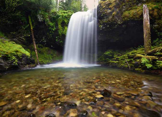
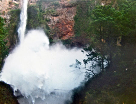
Beautiful Pansy Falls along the proposed Pansy Creek trail (Tim Burke)

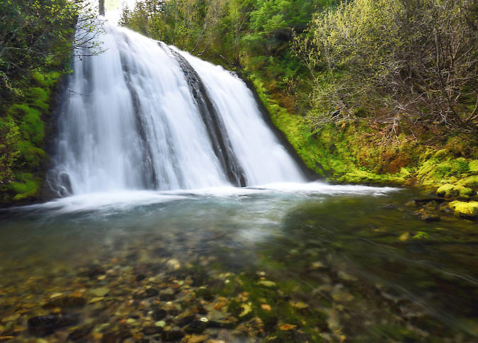
Upper Pansy Falls along the proposed Pansy Creek trail (Tim Burke)

The upper extent of the loop also includes a proposed connecting trail between the Bagby and and new Pansy Creek trails, creating shorter loop options for both backpackers and day-hikers. This new connector and the proposed Pansy Creek Trail would join the existing wilderness trail system at Pansy Lake.

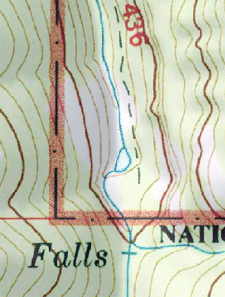
The proposed Pansy Creek trail would join the existing trail system at Pansy Lake, the stream’s headwaters

The new loop trails would also promote more use of the existing Bagby Trail, an important and historic route that is rarely visited beyond the popular hot springs site. As a result, this trail had fallen into disrepair over the years, and is only now being gradually restored by volunteers.

Do you recognize this waterfall? Not many would, even though it is located just beyond popular Bagby Hot Spring. Beyond the hot springs, this lovely trail is only lightly used, in part because of years of deferred maintenance

This excellent camping spot along the Bagby Trail is only lightly used today, but would be part of a spectacular new wilderness loop with the proposed new Hot Springs gateway trailhead

The Collawash Gateway

The new Collawash gateway trailhead would be the starting point for new trails along both the Collawash River and an extension of the Dickey Creek trail connecting to the new Collawash trail. Together, these new routes would create a spectacular loop reaching into the high country of the Hidden Wilderness (see concept map, below).

[click here for a large version of this map]

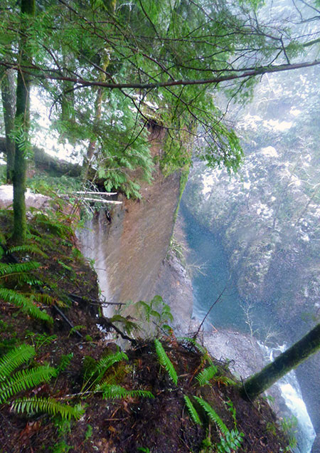
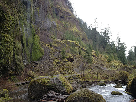
The Collawash River is already a popular spot in the Clackamas Corridor, and for good reason. The unique geology of the area and clarity of its tributary streams in the high country of the Hidden Wilderness make for a stunning canyon of deep, clear pools framed by enormous boulders and cliffs. An ancient landslide extends for several miles on the east side of the Collawash, continually reshaping the east wall of the canyon and creating steep whitewater rapids and deep pools along this way.

The new trail would follow the more stable west side of the canyon, in a section of river where the Collawash road climbs quite high and to the east of the canyon. The result would be a true wilderness experience, despite the parallel road corridor. This section of river has never had a trail, so only kayakers and rafters have been here to witness a canyon of spectacular beauty. The new trail would instantly become among the most scenic in the region, eventually connecting to the existing Elk Lake Creek Trail, which leads into the high country of the Hidden Wilderness.

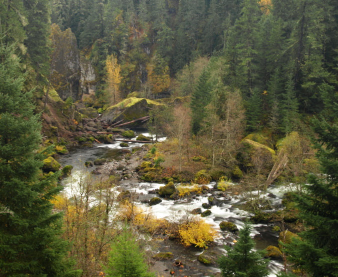
Though paralleled by miles of logging roads, the upper Collawash River remains wild and spectacular. A new trail here would be among the most scenic in the region

The proposed new Collawash River trail and gateway trailhead would largely replace this current “gateway” to the Hidden Wilderness at Elk Lake Creek, where a massive clearcut on the mountain slope ahead greets hikers

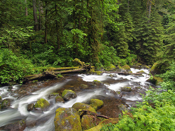
Complementing a new Collawash River trail would be an extension of the existing Dickey Creek Trail downstream to the Collawash (see previous concept map). This would allow the Forest Service to abandoning the steep canyon wall descent that currently provides access to Dickey Creek, and even the old logging spur road used to reach the current trailhead. The purpose of this new trail is to provide direct access to Dickey Creek from a far more accessible trailhead, and offer a longer trail experience along this beautiful stream for day hikers or backpackers heading further into the Hidden Wilderness.

What would it take to bring these concepts to reality? More on that in a moment…

Bring back the Bull of the Woods Lookout?

For those who had visited the historic Bull of the Woods lookout over the years, the 2021 Bull Fire felt personal when it swept over the peak, burning the lookout and the traces of at least one outbuilding. Like most wilderness lookouts, it had been in disrepair, the result of limited federal agency budgets that made basic trail maintenance here a challenge and a general reluctance by the Forest Service to maintain fire lookouts that are no longer in use.

Lost in the 1991 fire – the plaque marking the Bull of the Woods fire lookout as a national historic site (Zach Urness)

The historic 1942 structure that burned was not the first lookout at Bull of the Woods. The earliest lookout here was built in the 1920s, and eventually replaced with the classic L-4 design structure that stood here for nearly 80 years. The frame for the original tower was pre-fabricated at the Zigzag Civilian Conservation Corps camp (now the site of the Zigzag Ranger Station). The frame, cabin and outbuildings were then assembled on site with the materials hauled in on pack animals.

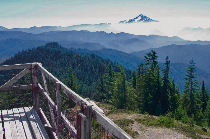
The view from the catwalk on the Bull of the Woods lookout was 360 degrees, but it was the view to the southeast of Mount Jefferson rising over the backcountry of the Hidden Wilderness that was most captivating

The Bull of the Woods lookout was last staffed in the summer of 1964. Somehow, it was spared over the next few years when the Forest Service burned dozens of lookouts and guard stations around Mount Hood to the ground as aerial fire surveillance took over. 

Thirty-two years later, it was added to the National Historic Register after being nominated by the non-profit Forest Fire Lookout Association. Like most listings for historic forest structures, the status did little to bring resources to preserve the building. Sadly, we have seen this play out across WyEast Country, with priceless, historic structures like the Little Sandy Guard Station and Timberline Trail shelters on Mount Hood falling apart in recent years before our eyes. 

The fire took the lookout building at Bull of the Woods but restored the view of Big Slide Lake, far below

So, this seems to be the end of the story for the Bull of the Woods lookout… or is it? It doesn’t have to be, though it would literally require an act of Congress to replace it. There is precedent, in fact. In Washington State, the much-loved Green Mountain lookout had fallen into disrepair in the 1990s, and was finally closed to the public in 1994. 

After efforts to make on-site repairs in the late 1990s failed to adequately restore the structure, volunteers worked with the Forest Service to completely remove the lookout, piece by piece, and restore it off-site over a five-year period.  With the support of private foundation grants, the restored parts were then re-assembled on site in 2009. 

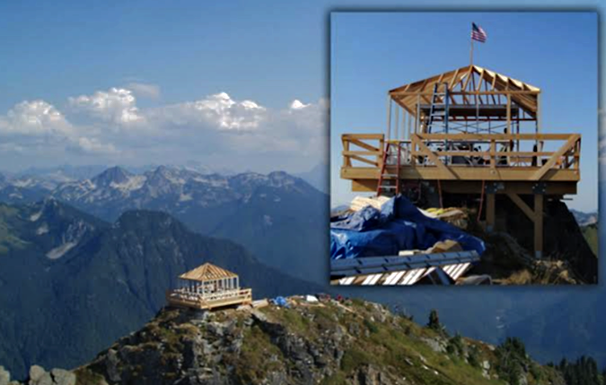
Green Mountain lookout being reassembled on its perch in the Glacier Peak Wilderness in 2009 (Photo: Spokane Review)

This decade-long effort to preserve the lookout did not go unnoticed, however.  The restoration of the Green Mountain lookout within the bounds of the Glacier Peak Wilderness triggered a lawsuit by the Montana-based Wilderness Watch conservation group. They challenged the replacement of the structure as a violation of the Wilderness Act, and in 2012 a federal judge agreed, ordering its removal. The newly restored lookout seemed doomed, once again.

This is where the act of Congress came in. Washington Senators Patty Murray and Maria Cantwell introduced legislation to specifically exempt the Green Mountain Lookout from the Wilderness Act, a bill that President Obama signed into law in 2014.

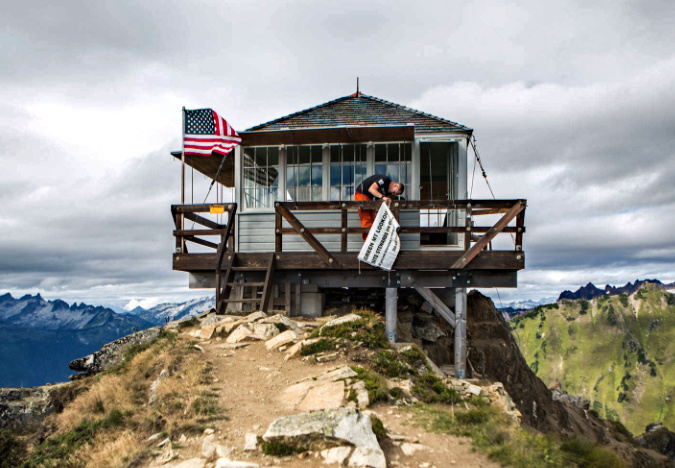
Volunteers hanging a stewardship program welcome banner at the Green Mountain Lookout in 2019, five years after the rebuilt structure was saved from demolition (Photo: Everett Herald)

Today, the lookout still stands as one of the most popular hiking destinations in the state of Washington. To ensure its care in perpetuity, the Washington Trails Association has partnered with the Forest Service to establish an ongoing stewardship program at the lookout to staff the structure with volunteers during the summer hiking seasons, serving as forest interpreters for hikers visiting the lookout and care for the structure, itself.

Could a similar case be made to restore the lookout at Bull of the Woods? It would be a heavy lift, to be sure, but it could also help further the cause of protecting – and sometimes even replacing – historic structures in our forests. After all, they were here long before wilderness protections were created, and they serve as priceless traces of our forest history.

What would it take?

How can any of this ever happen… new trails, new trailheads, restored lookouts? Especially in the current political environment? That’s the inevitable question, of course, as the current administration in Washington continues their dismantling of our federal agencies and threatens to sell off our public lands. 

My optimism comes from past cycles of trail building that have always come in waves, and my belief that a renewed focus on recreation and conservation is around the corner.

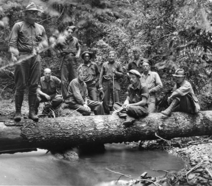
CCC trail crew working in the Mount Hood National Forest in the 1930s

Our greatest era of trail building came in the 1930s, thanks to New Deal job creators like the Civilian Conservation Corps (CCC) and Works Progress Administration (WPA). These programs were a direct result the economic calamity of the times, and a willingness of Americans to reinvent government on a grand scale. The majority of the trails we enjoy today were built (or rebuilt) over just one decade when these programs were in full swing. World War II brought an end to the CCC and WPA, but the spirit and success of these programs remain on full display on public lands throughout the country.

A lesser-talked about golden era for trails came in the 1970s, and it, too, followed a period of social turbulence and unrest in the 1960s. While it’s true that logging on federal lands was hitting its peak at that time, it was also the case that new trails were being built by the Forest Service around the country. The Youth Conservation Corps (YCC) was created in August 1970 as an updated version of the CCC to help with this work, and signed into law by President Nixon, no less! The YCC still exists today, though somewhat scaled back from its 1970s heyday.

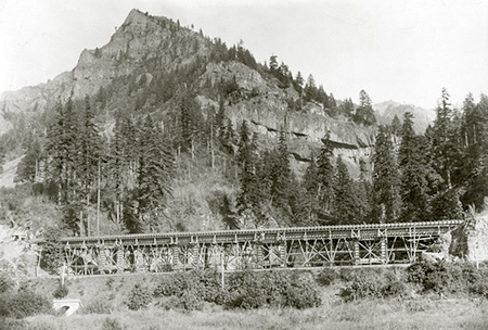
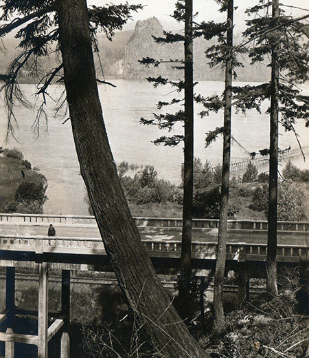
Today’s trail along the Hot Springs Fork to Baby Hot Springs was one of hundreds rebuilt by the CCC in the 1930s and further improved by the YCC in the 1970s

Flash forward to 1993, when AmeriCorps was created as part of the National Community and Community Trust Act, bipartisan legislation that has enabled millions of young people to gain experience and find direction in their lives in the three decades that have followed. In Oregon, this includes trail work on some of our most iconic trails, including the Timberline Trail. 

While these programs and our agencies who administer them are under attack from the current administration, only Congress can create government programs and fund them. So, while are in an unprecedented time of belligerence toward the very idea of democracy and self-governance, it’s also true that these programs (and the country) will survive this ugly era. Why? Because they are popular and represent a minimal expense in the larger federal budget.

Eugene-based Northwest Youth Corp partners with AmeriCorps in their young adult leaders program. I ran into this group on the Timberline Trail one evening, where they were relaxing at camp after another day of trail work. When I offered to take a group portrait, their pride was overwhelming: they dropped everything and ran to get their hardhats and tools. It was a memorable encounter more than 15 years ago, and I’m certain their experience continues to enhance and shape their adult lives

That’s where my optimism is grounded. You wouldn’t know it from what is unfolding in our nation’s capital right now, but Americans aren’t nearly as divided as opportunists like the current president and his supporters seek to project. Access to our public lands is considered a sacred right by most Americans, across the political spectrum, and already the public is strongly objecting to the direction this administration has taken. When the impacts of the recent job cuts at the Forest Service and other land agencies begin to be felt over the coming months and years, it will be a real wake-up call, especially to the rural communities where most of these jobs are based. 

The truism “you don’t know what you’ve got till it’s gone” perfectly captures our very human tendency to take things for granted when they are going well– until they aren’t and we’re forced to reconcile with our role in what we’ve lost. I’m confident that we’re not only at that moment, but also to a historic degree that rises to the level of the 1930s and 1970s activism and reforms. Trails will be part of that, along with a renewed vision for public lands. 

Trailkeepers of Oregon (TKO) and the Hidden Wilderness

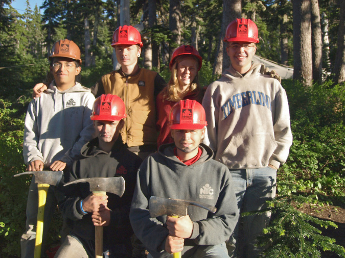
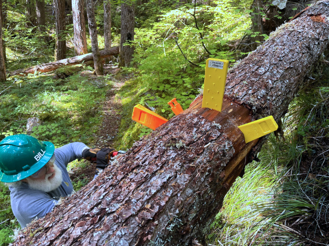
I would be remiss if I didn’t include mention of the work Trailkeepers of Oregon (TKO) has begun in the Hidden Wilderness. TKO began sending volunteer crews here a few years ago to begin chipping away at the backlog of maintenance and the impact of recent fires on the trail system. In 2024, that work focused on the beautiful Dickey Creek Trail — the northern route into the wilderness that would be extended with the proposal in this article.

The plan was for TKO was to continue their work going forward, eventually restoring the larger trail network In the Bull of the Woods and Opal Creek wilderness areas, where crosscut saw expertise and backcountry crews are required under the Wilderness Act.

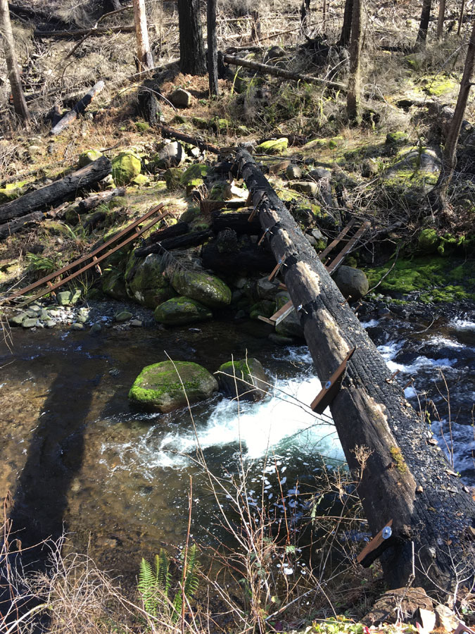
TKO volunteers reopening the burned section of the Dickey Creek Trail in 2024

The budget freezes and staffing cuts under the new administration has changed that. Among the fallout from the haphazard cuts to our public agencies is not only the loss of core agency staff for critical functions like firefighting, but also staff who empower volunteers who do the bulk of the trail maintenance and construction in today’s National Forests. 

While we navigate out of the current political moment, the impact of the current staff cuts is real. Recreation programs at the Forest Service had already been running on fumes since the 1990s, so there really was no “fat” to trim, as much as the administration would like us to believe. The result has been a devastating loss in both human capacity and institutional knowledge within the Forest Service and other federal land management agencies. Unfortunately, it will takes many years to rebuild them once this storm is behind us.

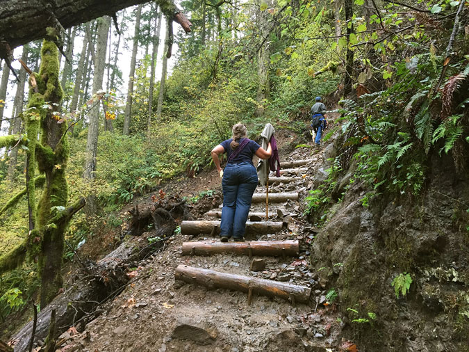
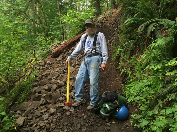
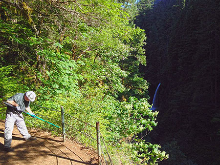
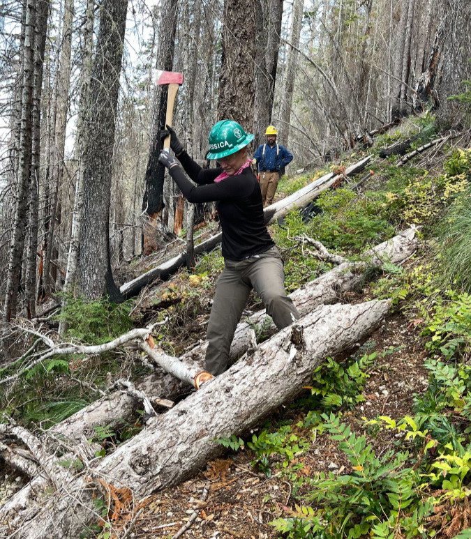
TKO volunteers clearing logs from the lower Dickey Creek Trail with crosscut saws in 2024

But the current problem extends to non-profits like TKO who have contracts with the Forest Service to lead volunteer trail crews. The administration has frozen many of the small grants used to fund these contracts. This has put TKO and other trail-oriented non-profits at risk, so now is a great time to send some extra support to help bridge the gap:

Trailkeepers of Oregon (TKO)

Filling the gap will allow TKO continue to care for trails on Mount Hood and in the Gorge, despite the current uncertainty in Forest Service grants. It’s also form of resistance, since the value of spending time in nature on our public lands seems to be a foreign concept to this regime. And if you’re already stepped up to support TKO, thank you!

There is a saying “In the good times, plan for the bad, and in the bad times, plan for the good” that applies to this moment. Yes, there is much work ahead in keeping our trails open and ensuring that our public lands remain public, but we should also keep dreaming about those better days ahead when we can once again go big on trails and recreation in WyEast Country. That day will come! 

And if you’ve read this far, thanks for hanging in there on what became a rather lengthy and unwieldy article! I appreciate your patience and, as always, thanks for stopping by!

_______________ 

Author’s Obscure Postcript…

As you probably noticed, I included a few grainy images in this article from a 1981 backpacking trip into the Hidden Wilderness with my college roommate Dave. We took his early 70s Toyota Carolla wagon up the bumpy road to the Dickey Creek Trailhead while dodging log trucks, as there was very active logging at the time. For the next four days we hiked, swam, explored, fished and took in the views.

They don’t make ‘em like this anymore… and yes, I still have this camera!

However, it wasn’t until decades later that I discovered an undeveloped 126 film cartridge in this old camera that I carried on hikes in those days. I sent it off to be developed, and sure enough, it was filled with exactly 12 images from that trip – one complete roll. I had graduated to an Olympus OM-1 SLR camera shortly after that trip, and had forgotten about the roll of film left in the old Kodak Instamatic! 

These grainy photos are priceless to me now, and it was fun to find a purpose for them in this piece!
_______________ 

Tom Kloster | June 2025

Elk Cove Avalanche!

Mount Hood from Elk Cove in 2021

When it comes to bucolic alpine scenes on Mount Hood, it’s hard to beat Elk Cove. From the spectacular wildflower gardens that line ice-cold Cove Creek to the sweeping views of Mount Hood and the mighty Coe Glacier, the cove serves up one postcard scene after another. 

But behind the mountain scenery are some very wild winters. The same steep walls that give Elk Cove its alpine beauty are also a setup for powerful avalanches. These mostly originate on the lower slopes of Barrett Spur and sweep across the cove with surprising regularity. 

Mount Hood in 1931 from the same spot as the previous photo, when trees were more sparse at Elk Cove

Early photos of Elk Cove suggest that avalanches were once even more devastating than what we experience today, and probably more frequent, judging by the advancing stands of Mountain Hemlock that have since spread across the cove. The change is most likely a reflection of our warming climate and declining snowpack in recent decades, but winter continues to take its toll. Major avalanches still roar into the cove with regularity, leveling trees and leaving piles of debris in their wake.

The shell of the old CCC stone shelter at Elk Cove as it appeared in the early 1960s, after being hit by numerous avalanches over the prior 30 years

When the Timberline Trail was built through Elk Cove in the early 1930s, Franklin Roosevelt’s legendary Civilian Conservation Corps (CCC) constructed one of their many iconic stone shelters here, one of six that were built along the trail. They couldn’t have known the site they picked was perhaps the most exposed to avalanches of any spot within the cove, and by the early 1960s, the shelter had already been badly damaged. Today, only a few rocks mark the shelter’s former location.

The 2021 Elk Cove Avalanche

Sometime last winter, yet another avalanche swept off the lower slopes of Barrett Spur, once again landing very near where the old stone CCC shelter had once stood. The debris field left behind by the avalanche was easily spotted by hikers ascending Barrett Spur over the summer, and it is also visible from the Timberline Trail where it enters the Elk Cove.

The following schematic shows Elk Cove and the path of the 2021 avalanche in relation to Mount Hood:

[click here for a larger version of this schematic]

This schematic gives a more detailed view of Elk Cove and the approximate path of the 2021 avalanche, including the steep wall along Barrett Spur that is so prone to avalanches (the Timberline Trail is shown in dashed yellow):

[click here for a larger version of this schematic]

From the ground, the debris field left where the avalanche came to rest is striking. This series of views looking down from 99 Ridge (which forms the west wall of Elk Cove) show where the avalanche stopped, and the debris it left behind:

Mount Hood and the 2021 Elk Cove avalanche site

Closer view of Elk Cove and the avalanche debris field

More detailed view of the avalanche debris field

This detailed view from above gives a sense of scale to the hundreds of trees that were caught up in the avalanche and swept into Elk Cove

The debris comes into view where the Timberline Trail curves into the west meadow of Elk Cove, along beautiful Cove Creek. Most hikers were likely too busy looking at the wildflowers along the trail this summer to notice the pile of logs just around the bend, but for regular visitors, the avalanche debris was startling!

Elk Cove avalanche and Cove Creek from the Timberline Trail

The origin of the avalanche can be read from the orientation of the many trees caught up in the wave of snow and ice, as they generally point in the direction of the flow. The schematic below shows the path the avalanche took into Elk Cove before the snow and debris finally came to a stop last winter:

[click here for a larger version of this schematic]

Up close, the awesome power of the avalanche becomes apparent. Whole trees were snapped off and stacked like cordwood in a debris pile as much as 20-foot deep.

The avalanche swept down from the slopes of Barrett Spur (to the right in this view), as indicated by the felled trees pointing to the left, in the direction of the flow

In a typical winter, Elk Cove might have 15-20 feet of snow on the ground, and this snowpack is why small trees on steep mountain slopes are often spared from avalanches, since they are buried under heavy snow in winter. In the view below, the winter snowpack also protected the lush wildflower gardens that line the upper reaches of Cove Creek (seen in the distance), with the avalanche sweeping across these gentle slopes before finally settling on the floor of the cove.

The beautiful wildflower meadows in the upper reaches of Cove Creek were spared from the debris thanks to being on gently sloped terrain and under a blanket of winter snow when the avalanche swept through

Large trees aren’t so fortunate. If they’ve managed to escape avalanches along the base of Barrett Spur long enough to grow taller than the winter snowpack, it’s only luck. In time, most of the taller trees in Elk Cove will be swept away by future avalanches. 

This panoramic view of the 2021 avalanche gives a sense of the scale of the event, with the sprawling pile of debris covering roughly 2-3 acres:

Panoramic view of the 2021 Elk Cove avalanche

[click here for a larger version of the panorama]

By early August, when these photos were taken, it would be easy to think the avalanche was just a pile of trees roaring down the mountain, but in fact, this debris is what’s left now that most of the snow and ice has melted away. Look closely, and you can see that a layer of snow and ice has yet to melt away from under the pile when this photo was taken:

6-10 feet of snow still remains under the debris pile as of early August

The 2021 avalanche dumped part of its debris on top of Cove Creek, but the stream made quick work of the pile over the winter. By summer, it had already melted an extensive tunnel under the mountain of snow, ice and debris (below).

Cove Creek carved this snow cave under the debris pile following the avalanche

The huge pile of snow left in Elk Cove by the avalanche brought another surprise: some of the earliest blooming wildflowers were still just emerging in early August, thanks to the extra snow depth left behind by the avalanche. Among these was Western Pasque Flower, a species of Anemone that blooms within a couple weeks of snowmelt, and therefore rarely see by hikers. In fact, most know this beautiful wildflower by its whimsical seed heads, and by the name “Old Man of the Mountain”. The opening image in this article shows a field of Western Pasque Flower gone to seed.

Normally an early bloomer, this Western Pasque Flower was in bloom in early August, thanks to the late-melting margins of the avalanche debris field

How often to avalanches like this occur at Elk Cove? Probably every winter, though events large enough to topple trees seem to occur every 10 years or so, depending on snowpack and weather conditions. Avalanches are most common in mid-winter, when weak snow layers and heavy snowfalls can cause snow to begin to slide on steep mountain slopes. Once they begin, avalanches can travel nearly 60 miles per hour, giving them the destructive force to level forests and buildings in their path.

Ghosts Hiding in Plain Sight

While the 2021 avalanche at Elk Cove is impressive, it is by no means unusual. A look at aerial photos between 2010 and 2021 shows that another avalanche swept through the same area in about 2015. Based on the orientation of downed trees from his earlier event, it originated on some of the same slopes on Barrett Spur that produced the last winter’s avalanche.

In the air photo comparison, below, the location of the new, 2021 avalanche debris pile is marked in yellow. When the 2010 air photo was taken, the forests at the center of the image were intact, but by the summer of 2016, an avalanche had clearly swept through the area. Based on the lack of reddish/orange debris in the 2016 image – the color of recently killed trees – suggests that this avalanche occurred at least a year earlier. So, for the purpose of this article, I’ve described it as the “2015 Avalanche”, and marked its extend in green.

Air photos show the signs of a roughly 2015 avalanche that swept through the same part of Elk Cove as the 2021 event

In both the 2016 and 2018 views, the path of this earlier avalanche is clearly marked by downed trees that point in the direction (right to left) of the moving snow and ice. Though it impacted a larger area in the cove than the 2021 avalanche, the 2015 event brought less woody debris into the cove, suggesting that it originated on a less forested part of the west wall of Elk Cove. In fact, some of the trees in its path on the floor of the cove survived the avalanche, suggesting that the lack of woody debris in the 2015 event made it somewhat less destructive where it finally came to a stop.

While both of these avalanches are awesome reminders of the power of the elements in alpine country, Elk Cove has a few ghosts from the past that suggest much more fearsome events. Tucked into one of the mature, forested “tree islands” at Elk Cove is a ghost tree that give mute testimony to just how powerful an avalanche on Mount Hood can be. The stump of this ghost tree (below) is nearly four feet in diameter and was toppled many decades ago. 

This giant ghost tree at Elk Cove was toppled long ago by a very large avalanche

This old ghost was once a very large Mountain Hemlock before it was toppled. Today, its broken remains could easily be 100 years old, marking an avalanche that might have preceded the arrival of the Timberline Trail and those 1930s CCC crews on Mount Hood. 

How do we know this old tree was destroyed by an avalanche? The telltale sign is where the tree was snapped off, marking the level of the winter snowpack when the avalanche swept through, and its top is pointed downslope, in the direction the avalanche was moving. Thanks to long, cold winters and dry summers, the shattered remains of this old tree (and several others like it in the cove) have survived to tell the story. 

Since that big avalanche, several good-sized trees have grown up around the old ghost tree, helping put an approximate date of 70-100 years since any avalanche of this scale has swept through the heart of Elk Cove. And though it has been many decades since that event, the days of these younger trees are surely numbered, too, as another epic avalanche in Elk Cove is inevitable.

How to Visit

If you’re an able-bodied hiker, you can visit Elk Cove most easily from the Vista Ridge trailhead. It’s a 9-mile hike round trip, but with well-graded trails and no glacial streams to navigate. If you visit the avalanche debris field, please tread lightly, as the rustic path that once led to the upper reaches of Cove Creek was partly buried with debris, and the surrounding area is covered with a fragile meadow of Western Pasque Flower.

You can find a trail description here in the Oregon Hikers Field Guide. Why, you might even know the author of this field guide entry..!

Tom Kloster | August 2021

Proposal: Oneonta Loop Trail

Beautiful Middle Oneonta Falls

The Columbia River Gorge is so rich with natural beauty that it’s pretty hard to pick favorites. Yet, when it comes to graceful waterfalls cascading through verdant, rainforest canyons, Oneonta Creek is near the top of my list. A previous article on this blog presented a new vision for managing access to stunning Oneonta Gorge and restoring the historic Oneonta Tunnel. This article examines Oneonta Canyon above the Oneonta Gorge, where more waterfalls and rugged beauty brought thousands to the trails here before the 2017 Eagle Creek Fire.

Iconic Triple Falls on Oneonta Creek

The fire has since changed the Gorge landscape for most of our lifetimes, and the forest is just beginning a post-fire recovery cycle that has unfolded here countless times over the millennia. But while the starkness of the burned landscape is something that we are still adjusting to, the fire gives us a once-in-century opportunity to rethink and rebalance how we recreate in the Gorge.

Oneonta Creek experienced some of the most intense burning during the fire, and almost none of the dense forest canopy survived, and still the forest has already begun to restore itself. What can we do to restore our human presence at Oneonta in a way that will be sustainable for the next century, leaving a legacy for future generations like the one that we inherited?

Before the 2017 Fire: Signs of Stress

The spectacular scenery along the Oneonta Creek was already drawing huge, unsustainable crowds of hikers well before the Eagle Creek Fire roared through Oneonta Canyon, and the visible impacts were everywhere. Some of the impact was on the human environment, including the very trails and bridges that brought hikers into Oneonta Canyon. And some of the impact was on the land, itself, with hikers straying from developed trails to create destructive social paths and shortcuts in many spots. These informal trails had become badly eroded, often undermining the main trails, themselves. 

Social trail damage near the lower Oneonta Creek footbridge

One place where these impacts escalated alarmingly in the years before the fire was the lower footbridge on Oneonta Creek, located just above Oneonta Falls and just below Oneonta Bridge Falls. As shown in the photo above, crowds of hikers had carved a new path to a pool in the creek at the west abutment of the bridge, stripping away fragile vegetation and filling the pool with eroded debris.

The photo below shows how this social path has not only destroyed the thin layer of soil and forest understory on the slopes of Oneonta Creek, but was also undermining the main trail, itself, which was gradually sliding down the slope.

Social trail eroding both the slope and the shoulder of the main trail (on the left)

Even the lower Oneonta footbridge was in trouble before the fire. The Forest Service began posting a warning on the bridge a few years before the fire limiting it to one hiker at a time, yet another reminder of the serious disinvestment we have been making in our Gorge trails for the past thirty years. The rapid growth in visitors during this same period only increased the impact on structures like this, which were long overdue for repair or replacement.

Warning sign for hikers approaching the lower Oneonta footbridge

Meanwhile, at the east end of the lower Oneonta Bridge, curious crowds had pushed a new social path upstream, past Oneonta Bridge Falls (below). Social paths form when hikers head off-trail in search of a new viewpoint or water feature. When more hikers the steps of the first, the increasing foot traffic gradually formalizes social until they become hard to distinguish from legitimate trails — except that they are rarely “built” in a way that is sustainable, and often bring serious harm to the landscape.

Social trail heading toward Middle Oneonta Falls from the lower Oneonta Creek bridge

Meanwhile, things were getting worse on the east side of the lower Oneonta Bridge, too, where hikers had cut the short switchback just above the bridge (below) to the point that it began collapsing before the fire closed the area to the public. Why do people do this? Mostly, it’s ignorance, inexperience and overcrowding, and often by children who are not getting needed guidance from parents on why this is not okay.

Heavy damage from shortcutting on this switchback at the east end of the lower Oneonta Creek bridge

Heading beyond the lower Oneonta bridge, another major social path had formed on the west side of the creek (below), where hikers had created a long shortcut directly down the canyon slope where a long switchback exists on the main trail. The damage here was obvious and quite recent when this photo was taken about 18 months before the fire. When social paths become this prominent, the damage begins to spiral, with new or inexperienced hikers mistaking them for a legitimate route, and further compounding the problem with still more foot traffic. The overcrowding on the Oneonta Trail only added to the spiraling effect.

Hikers shortcutting this switchback have created a new social trail nearly as wide as the main Oneonta Creek trail

While hikers were causing the bulk of the impact before the fire, Mother Nature was busy in Oneonta Canyon, too. The photo below was taken after the 2017 fire, and reveals a major landslide that began moving years before the fire. The slide extends from Oneonta Creek (where it has left a pile of trees and debris visible in this photo) to the cliffs well above Oneonta Trail. A fifty-yard section of the trail was erased by the slide, with several efforts in the years just before the fire to stabilize a new route above the old trail.

Landslide along the middle section of Oneonta Creek that threatens long-term viability of the current trail

Here’s a view (below) of the landslide looking downhill toward Oneonta Creek from where the original Oneonta Creek Trail was once located. The big trees still standing in the path of the landslide in this view were burned in the fire, which will further destabilize this slope and allow the slide to accelerate in coming years.

Looking down the landslide toward Oneonta Creek in 2015, before the fire

When the original section of the Oneonta Trail was swept away by the landslide, the Forest Service built this set of stairs (below) to a new crossing of the slide, about 30 yards uphill from where the old trail had been.

Bypass trail built to temporarily navigate the Oneonta Trail landslide

This photo (below) shows the new, temporary crossing of the slide as it existed before the fire, but volunteer trail crews visiting the Oneonta Trail earlier this year report that this temporary route has also become eroded since the fire. The continued instability of the landslide raises real questions about whether a safe route can be maintained here in the near-term.

Wide angle view of the temporary route built across the landslide a few years before the 2017 Eagle Creek Fire

Landslides like this are an ongoing part of the Gorge geology, but in this case, it also marks a spot where an increasingly busy social path dropped down to Middle Oneonta Falls. The growing traffic to this off-trail falls was already taking its toll on the terrain before the slide. So, was the landslide triggered by erosion along the social path? There’s no way to know, but it’s certainly possible that the social path contributed to the sudden instability of the slope.

On my last visit to the upper Oneonta Canyon before the 2017 fire, I ran into bit of trail legend named Bruce, who was a longtime trail worker in the Gorge dating back to the 1980s. He was rebuilding the approach to the slide, and we talked about how Forest Service crews were struggling to simply keep pace with the impact of growing crowds and shrinking agency staff for basic trail maintenance. Major repairs, like those required the slide, were completely overwhelming his crews.

Gorge trail crew legend Bruce (now retired) working near the slide on the Oneonta Trail in 2014

Bruce was wistful about the situation, as he was planning to retire soon, and the trails he had worked so hard on were not faring well as he prepared to turn them over to a new generation of trail workers. 

Beyond the problematic landslide, the Oneonta Trail arrives at Triple Falls, an iconic destination that most hikers are coming here for. In the years before the fire, the overlook at Triple Falls was literally crumbling under the pressure from overuse. The photo below shows the view from the main trail, where a tangle of social paths cutting directly downslope to the badly eroded viewpoint can plainly be seen.

Widespread slope damage where a network of social trails has cut into the Triple Falls overlook

A well-graded spur trail provides access to the viewpoint, but few used it. Instead, most follow the steps of this hiker (below) and simply cut directly up the slope to rejoin the trail. Over the past decade, the damage from erosion here had increased alarmingly.

Another hiker adding to the impact of the social trails at the Triple Falls overlook in 2014

Earlier this year, the volunteer trail crews assessing the Oneonta Trail captured these views of the Triple Falls overlook, showing how the burned over landscape also offers a unique opportunity to rethink and rebuild this overlook trail before hikers are allowed to return.

The Triple Falls overlook was stripped bare by the Eagle Creek Fire (photo: Trailkeepers of Oregon)
Triple Falls after the Eagle Creek Fire (photo: Trailkeepers of Oregon)

Just beyond Triple Falls, the Oneonta Trail crossed the creek on this upper footbridge (below), installed by volunteers and Forest Service crews about ten years ago.

Upper Oneonta Creek footbridge before the 2017 Gorge Fire

 This year’s volunteer crews found that the 2017 fire hadn’t spared the upper bridge, as the photo below shows. This represents yet another opportunity to think about how the area will reopened. While the bridge provides critical link to the rest of the Oneonta Creek trail system, it also led to a growing network of eroding social paths on the east side of Triple Falls.

Upper Oneonta Creek Footbridge after the Gorge Fire (photo: Trailkeepers of Oregon)

Today, we have a unique opportunity for a reboot, with the canyon just beginning its post-fire recover and still closed to the public. As traumatic as the Eagle Creek Fire was for those who love the Gorge, having the forest burned away was like lifting a window shade on the terrain beneath the forest. Where the fire destroyed a dense forest, it also laid bare the underlying terrain and geology, providing a rare opportunity to plan for our Gorge trail system as it enters its second century.

For trail builders, it’s a perfect opportunity to take a good look at the land for opportunities to refine existing trails and to build trails for future generations of hikers. This includes adjusting existing trail alignments to more stable terrain and replacing social paths with sustainable trails that can help curious hikers explore the beauty of the area without harming it. The fire also cleared the forest understory, making trail building a lot easier.

A New Vision for Oneonta

With this unique opportunity in mind, this proposal focuses on a new loop trail along the middle section of Oneonta Canyon, where little known Middle Oneonta Falls has been hidden in plain sight over the century since the first trail was built here. Middle Oneonta Falls is among of the most graceful in the Columbia Gorge, and waterfall enthusiasts have long followed the steep, brushy social path that led to the falls. I made my first trip there in the late 1970s, when I was 16 years old, and returned many times over the years.

Though my photography skills were pretty rough 38 years ago, this is how Middle Oneonta Falls looked way back in 1982. This is also where the falls would first come into view on the proposed Oneonta Loop Trail 

It’s hard to know why the original trail builders passed by Middle Oneonta Falls, and chose to route the main trail high above the falls. The falls can plainly be heard thundering in the forest below, and from one spot on the trail, the brink of the falls can be seen. But for most hikers, Middle Oneonta Falls remained unknown.

This proposal would change that, with a new loop that would not only lead hikers to Middle Oneonta Falls on a well-designed trail, but also take them behindthe falls! More on that, in a moment. Here’s the general location of the proposed loop (shown in yellow) as it relates to the existing Oneonta and Horsetail Creek trails (shown in green):

[click here for a large map]

Why build a new loop trail at Middle Oneonta Falls? One reason is pragmatic: the word is out, and this beautiful waterfall is no longer a secret, as well-worn social paths prove. And, with the forest now burned away, the falls will be plainly visible from the main Oneonta trail, making it impossible to prevent new social paths from forming as curious hikers look for a way to reach the falls.

Given these realities, this concept also focuses on how to make a new loop trail to Middle Oneonta Falls one that provides a new and much-needed destination for casual hikers and families with young kids looking for something less strenuous than what a lot of Gorge hikes require. Loops are the most popular trail option for hikers, too, since they provide a continuous stream of new scenery and adventure.

In the long-term, loops also offer a management tool that is seldom used today, but has great merit in heavily traveled places like the Gorge: one-way trails. On crowded trails in steep terrain, one of the biggest impacts comes from people simply passing other hikers coming from the option direction, gradually breaking down the shoulders of trails over time. One-way trails eliminate this problem, and the provide a better hiking experience with less sense of crowding, too.

With these trail themes in mind, what follows is a tour of the proposed Oneonta Loop Trail, using an exceptional series of aerial photos captured by the State of Oregon in the aftermath of the Eagle Creek Fire. 

The first view (below) captures the existing Oneonta Canyon trail system from Oneonta Falls to Triple Falls, with the proposed new loop trail shown in yellow. The new loop trail would follow the more stable east side of Oneonta Canyon, avoiding the landslide on the west side (which is also shown on the map).

[click here for a large map]

As the above map shows, another benefit of the proposed loop is that it could also serve as a reroute for the existing Oneonta Creek Trail if it becomes impossible to maintain a trail across the landslide, as the new loop would connect to the main trail upstream from the slide.

The next series of maps walk through the proposed loop trail in more detail, starting at the bottom, where the new trail would begin where a social path already extends into the canyon from the lower Oneonta Bridge (below).

[click here for a large map]

From there, the route to Middle Oneonta Falls is surprisingly straightforward (below), and quite short — less than one-half mile. This would make the falls an easy destination for young families and hikers who don’t want to tackle the longer and more strenuous climb to Triple Falls.

[click here for a large map]

Once at Middle Oneonta Falls (below), the new trail would take advantage of the huge cavern behind the falls to avoid building and maintaining another trail bridge, and simply pass behind the falls, instead. 

[click here for a large map]

For hikers coming from the Horsetail Falls trailhead, this would also be the second behind-the-falls experience, having already passed behind Ponytail Falls along the way. This would make the hike to Middle Oneonta Falls a magnet for families with kids, as nothing quite compares with being in a cave behind a waterfall for young hikers!

After passing behind Middle Oneonta Falls, the new loop trail (below) would climb the west slope of Oneonta Canyon just upstream from the slide in a series of four switchbacks, and rejoin the main trail. From there, hikers could continue on to Triple Falls or turn back to the trailhead to complete the new loop.

[click here for a large map]

The next few schematics show how the trail would pass behind beautiful Middle Oneonta Falls. The first view (below) is from slightly downstream, and shows the forested bench opposite the falls where the new trail would descend toward the cave.

[click here for a large schematic]

The next view (below) is from the base of the cliffs at the west side of the falls. The big boulder shown in the previous schematic should help you orient this view, as it is marked in both schematics. This view provides a better look into the cave, which is made up of loose river cobbles and well above the stream level in all but the heaviest runoff. Note my fellow waterfall explorer behind the 90-foot falls (!) for scale. 

[click here for a large schematic]

A third schematic of the falls (below) is from further downstream. This view gives a better sense of the large bench in front of the falls where the approach trail would be located, and how the exit from the cave would navigate a narrow spot between the creek (by the “Big Boulder”) and cliffs on the west side of the falls.

[click here for a large schematic]

As the photos in these schematics show, this is an exceptionally beautiful spot, and though it is now recovering from the fire, it would still make for an easy and popular new destination in the Gorge. Would more visitors make it less pristine? Perhaps, but on my last trips to Middle Oneonta Falls I had to clean up campfire rings built directly adjacent to the creek and carry out beer cans and trash, so it’s also true that legitimizing the trail here would bring “eyes on the forest that would help discourage this sort of thoughtless damage.

Further upstream, there’s also work to do at Triple Falls. This map (below) shows how the main trail could be relocated to follow the existing (and seldom used) spur to the viewpoint and be extended to simply bypass the section of existing trail that drives creation of social trails.

[click here for a large map]

This would provide a long-term solution to the maze of social paths that have formed between the existing trail and the Triple Falls viewpoint. This is a very simple fix, and should be done immediately, while the area is still closed to hikers and the burned over ground and exposed rock make trail construction much easier.

What would it take?

The entirety of Oneonta Canyon is within the Mount Hood National Forest, but administered by the Columbia River Gorge National Scenic Area (CRGNSA) unit of the Forest Service. Despite the creation of the scenic area in 1986 as a celebration of the beauty of the Gorge, there have been no new trails on Forest Service lands in the western Gorge for more than three decades. In fact, the agency has periodically proposed abandoning some of the lightly used backcountry trails in the Mark O. Hatfield Wilderness that have fallen behind in maintenance. 

Oneonta Creek scene before the fire near Triple Falls

The Forest Service is reacting to a long period of strained recreation budgets dating back to the 1990s, but our recent history of disinvestment should not prevent us from looking ahead to the needs of this century. The lack of a future vision is part of what prevents new trails from being designed and built, as there are already plenty of ideas for new trails that could be sustainably built in the western Gorge to help take pressure off the existing system.

The last new trail built in this part of the Columbia River Gorge is the Wahclella Falls loop, completed in 1988. Today, this wonderful loop trail is iconic and among the most beloved in the Gorge. But until the 1980s, a brushy, sketchy user path is how hikers reached Wahclella Falls. Recognizing the need to formalize an official trail, the Forest Service worked with volunteers who completely rebuilt the old trail and added a new leg on the west side of the canyon, creating the well-designed, exceptional loop we know today.

Tiny Maidenhair spleenwort (for scale, the larger fronds at the top of Licorice fern!) are as uncommon as they are beautiful, and are found along the Oneonta Creek Trail near Triple Falls

This proposal for an Oneonta Loop trail would be a great candidate for a similar effort, with Forest Service and volunteer workers creating a new trail that would not only provide a much-needed trail option in the western Gorge, but that would also remedy the social trails that have developed and potentially serve as a new, main route if the landslide on the current trail cannot be stabilized. 

In the aftermath of the Eagle Creek Fire, now is a perfect time to reboot trail building in the Gorge and Oneonta would be the perfect spot to get started. The area is still closed to the public, and trail volunteers have already begin scouting the trail to assess fire damage and make plans for repairs. This scouting work could be expanded to site the new loop trail, and there’s no better way to bring volunteers to trail projects than to build new trails. 

Civilian Conservation Corps (CCC) crews building the cliff-hugging trail above Elowah Falls in 1936

And finally, consider this: almost all of the trails in the Columbia Gorge (and the rest of Mount Hood National Forest) were built over the course of just two decades, in the 1920s and 30s. Amazingly, the system we have today is less than half of what was existed before the industrial logging era began after World War II. And in that period of decline, few new trails were added.

While forest trails were initially built as basic transportation for forest rangers, the Great Depression brought a new focus on recreation and enhancing our public lands through the work of the Civilian Conservation Corps (CCA) and Works Progress Administration (WPA). Our best trails were built during this golden age of trail construction, when trails were designed to thrill hikers with amazing views and adventures. These federal workforce program were put in place under Franklin D. Roosevelt as part of the national recovery plan, when unemployment during the Great Depression exceeded 20 percent, with no end in sight.

Sound familiar? Our normally gridlocked U.S. Congress has just allocated nearly $4 trillion in emergency funding to shore up the country as an unprecedented Coronavirus pandemic takes hold. And congressional leaders are already proposing more stimulus funding in the form of public infrastructure to continue pumping money into the economy and creating work for the jobless. Are we on the brink of another trail-building renaissance in our national forests? Quite possibly — but only if we begin planning for that possibility now.

___________________

And one more thing…

There is a LOT of confusion about place names on Oneonta Creek. USGS topographic maps show only Oneonta Falls and Triple Falls, but Oneonta Falls is shown where Middle Oneonta Falls is located. This is clearly a map error, though one that has endured (and confused) for a very long time. In fact, Oneonta Falls is the tall, narrow falls at the head of Oneonta Gorge and is identified as such in early photos of the Gorge taken long before anyone knew much about the upper canyon.

A case of mistaken waterfall identity at Oneonta…

Meanwhile, there’s a small waterfall right in front of the lower Oneonta footbridge that is often called “Middle Oneonta Falls”, only because it’s in plain sight and so few know that there’s a much larger “Middle Oneonta Falls” just a half-mile upstream. Fortunately, the USGS got Triple Falls right!

So, for the purpose of this article (and in general), I refer to the small falls by the lower footbridge as “Oneonta Bridge Falls”, just to clear things up a bit. Creative, right? Well, neither is “Triple Falls”! Or “Middle Oneonta Falls”, for that matter! But at least we know which waterfalls we’re talking about. Remember, there’s no detail too small for THIS blog!

Thanks again for reading this far, folks!

___________________

Tom Kloster | May 2020

Metlako Landslide!

metlakocollapse01

Metlako Falls from the viewpoint that is no more…

The buzz in hiking circles over the past few weeks has been the massive cliff collapse at iconic Metlako Falls on Eagle Creek. While the falls, itself (and the gorgeous surrounding amphitheater that also includes 100-foot Sorenson Creek Falls) was not affected by the collapse, the cliff-edge viewpoint that countless hikers have visited over the decades is now only a memory.

It started with a crack in the ground…

In late November, local hiker Karl Peterson posted a report with images of a deep, ominous crack in the forest floor above the Metlako viewpoint at his Portland Hikers Facebook group. Karl correctly predicted that some sort of collapse or landslide was imminent, though few expected something of this scale.

metlakocollapse02kep

The foreboding crack that formed in November (photo: Karl E. Peterson)

metlakocollapse03kep

Another view of the crack in late November (photo: Karl E. Peterson)

While major landslides and cliff collapses are regular events that continue to shape the Gorge as we know it, Karl’s discovery of the crack appears to be the first time an imminent collapse was observed and predicted in this way. Karl also reported trees leaning toward the 200-foot abyss, a more common predictor of landslides.

Roughly a month after Karl’s discovery, a massive 300-400 foot long section of the east wall of the gorge below Metlako Falls dropped 200 feet into Eagle Creek. The collapse occurred sometime between December 17 (currently, the date of the last known photo taken from the overlook) and 26 (when the first known photos of the collapse were taken), but was apparently not witnessed by anyone – and thankfully, nobody was injured or killed by the event.

metlakocollapse04nz

Metlako Falls from above the old viewpoint – for reference, the arching maple in front of the falls is the same as the one to the left of the falls in the opening photo in this article (photo: Nathan Zaremskiy)

Given the year-round crowds on the Eagle Creek trail, the lack of eyewitnesses suggests the collapse occurred at night, or perhaps on a day when travel was especially light due to winter weather in the Gorge that week.

The sheer volume of debris in the creek was enough to temporarily block the stream, and a deep pool is still backed up behind the jumble of automobile-sized boulders and smaller material, as shown in these amazing photos by Karl, and fellow photographers Don Nelsen and Nathan Zaremskiy:

metlakocollapse05dn

A view of the sheer escarpment where the cliff split off and the large pool created by the debris in the creek below (photo: Don Nelsen)

metlakocollapse06dn

A wider view of the new escarpment and debris at the base of the cliff, with Metlako Falls in the distance (photo: Don Nelsen)

metlakocollapse07nz

This dizzying view looks straight down from the brink at Eagle Creek, pushed against the west cliff wall by the debris pile (photo: Nathan Zaremskiy)

The escarpment left by the collapse is sheer and still unstable, with trees and remnants of forest floor still dangling on the edge, as shown in these photos taken after the event:

metlakocollapse08dn

This view looks downstream toward the old viewpoint location and the full extent of the collapse (photo: Don Nelsen)

metlakocollapse09nz

Another view looking downstream from just below the old viewpoint, and toward the bend in Eagle Creek at the north end of the Metlako gorge (photo: Nathan Zaremskiy)

A portion of the short spur trail to the old Metlako viewpoint still exists… until it ends at this scary abyss:

metlakocollapse10kep

The old spur trail ends abruptly at the edge of the new escarpment… yikes! (photo: Karl E. Peterson)

Nathan Zaremskiy also created this stunning YouTube video of the scene after the collapse:

Just the Gorge doing its thing?

It turns out that the collapse at Metlako is as routine to the evolution of the Gorge landscape as rain, waterfalls and basalt cliffs, albeit measured over decades and centuries.

Several collapses have occurred over the past few decades, and are fairly well documented. One of the most dramatic occurred on September 6, 1995 when a massive, bus-sized slab of basalt dislodged from the vertical cliff behind Multnomah Falls.

Even in the era before ubiquitous cell phone cameras, one visitor managed to capture this startling image of the of the rockfall exploding into the splash pool at the base of the falls, completely inundating Benson Bridge (you can see it if you look closely) with water and debris:

metlakocollapse11multnomah1995

The astonishing photo capturing the rockfall at Multnomah Falls in 1995 (USFS)

One person on the bridge was slightly injured with flying rock debris, but amazingly, no deaths or other injuries were reported.

In 1973, a massive cliff collapse along Tanner Creek below Wahclella Falls was so large that it temporarily stopped the flow of the creek, cutting off the water supply downstream to the Bonneville Hatchery. The landslide created a lake on Tanner Creek that persisted until the late 1970s, long enough to show up on USGS topo maps:

metlakocollapse12tannermap

The lake formed by the Tanner Creek cliff collapse in 1973 lasted just long enough to appear on USGS maps.

Today, this slide is still recovering, and remains one of the most visible and fascinating places to witness the power of nature at work. The trail to Wahclella Falls was rebuilt as a loop in the late 1980s, with the western leg traveling over the toe of the landslide, among the giant boulders left in its wake.

metlakocollapse13tannercreek01

The view downstream toward the Tanner Creek landslide debris field (and west leg of the loop trail).

metlakocollapse14tannercreek02

The giant boulders in this downstream view are at the toe of the Tanner Creek landslide, and initially dammed the creek here to form a small lake.

The east leg of the loop trail climbs high above the creek, providing a birds-eye view of the scene, and true sense of scale of the event:

metlakocollapse15tannercreek03

This view across Tanner Creek canyon shows hikers along the trail section that crosses the debris field below one of several house-sized boulders scattered in the rubble.

Though we don’t know exactly how or when the jumble of house-sized boulders scattered below Wahclella Falls arrived there, they each bring their own story of a catastrophic wall collapse that is part of a continuum as the Gorge streams continue to etch their canyons into the underlying basalt.

metlakocollapse16tannercreek04

Each of the giant boulders scattered below Wahcella Falls has its own story of a major cliff collapse.

A less-traveled canyon just over the ridge from Tanner Creek also experienced a major wall collapse sometime in the recent past. Moffett Creek cascades over its own spectacular series of wateralls, but no trails lead into this remote canyon. Instead, explorers follow the stream, where massive boulders are scattered along the way. In one section, they form a beautiful moss-covered garden, with glacier lilies blooming on top of the boulders in early spring:

metlakocollapse17moffettcreek01

Giant boulders scattered along Moffett Creek

At Moffett Falls, the first waterfall on the stream, a major rockfall dropped the garage-sized boulders in front of the cascade sometime in the late 1980s or 1990s:

metlakocollapse18moffettcreek02

The huge boulders below Moffett Creek Falls are relatively new arrivals to the scene.

This event also obliterated an alder forest that extended along the canyon floor below the falls, perhaps as the debris dam abruptly collapsed under the pressure of Moffett Creek backing up behind it.

What’s next for Metlako?

Eagle Creek is perhaps the most visited trail in the Gorge, with hikers crowding the area since the trail first opened nearly a century ago, but the history of the old spur trail and viewpoint at Metlako Falls is unclear.

Because of the early popularity of the trail, it’s odd that old photos of the falls don’t seem to exist, compared to the many photos and postcards from the 1920s and 1930s of other waterfalls and overlooks along the trail. This suggests that the viewpoint at Metlako Falls was developed later.

metlakocollapse19eaglecreek01

Overflowing parking at Eagle Creek is not new..!

metlakocollapse20eaglecreek02

Early photos of Punchbowl Falls and other sights along the Eagle Creek trail are common… so why not Metlako Falls?

The galvanized steel posts and cable railings at the old viewpoint were newer than the original hand cables that famously line several of the exposed cliff sections along the trail, so it seems likely they were added later – perhaps with the spur trail, itself.

One possibility could be that Civilian Conservation Corps (CCC) workers built the spur and overlook in the 1930s, when other trails were being added throughout the Gorge. The railing design also matches that of other trails built in the 1930s and 1940s in the Gorge.

metlakocollapse21eaglecreek03

Panoramic view of the old viewpoint at Metlako, now lost to the ages.

(click here for a large view of the old Metlako viewpoint)

metlakocollapse22eaglecreek04

The steel railings at Metlako seemed newer than the original trail (and the tagging still newer)

For now, the Forest Service has roped off the short spur trail that once led to Metlako Falls, warning hikers to stay away from the still-unstable area. But the agency is also reported to be exploring the possibility of a new viewpoint of the falls.

Such a viewpoint seems unlikely, based on early reports by hikers. The collapse took away an enormous amount of cliff, yet left a section near the falls that now blocks the view from the new cliff wall downstream. If so, Metlako may live on mostly as a memory for most, though photographers with drones will no doubt attempt to recreate the iconic view that once was!

Like losing an old friend…

…and on a personal note, the news of the Metlako viewpoint collapse came hard, as I had been doing periodic maintenance of the overlook several years ago as a volunteer for Trailkeepers of Oregon to preserve the view.

metlakocollapse23eaglecreek05

Improving the view at Metlako Falls

The work consisted of carrying an 18-foot pole pruner to the site and trimming the thicket of bigleaf maple shoots, ocean spray and snowberry that blocked the view and encouraged visitors to climb over the railing (!) for a look at the falls.

It was fun and rewarding work, albeit unnerving to watch the trimmings float over the vertical brink of the 200-foot cliff and into the creek, below. I worked with the sure safety of a the cable fence, but always thought about the rugged early trail builders who worked along these cliffs to create the original Eagle Creek trail – brave souls!

So, to close out this article, I’ll post one of the last photos I took from the old viewpoint in June 2016…

metlakocollapse24eaglecreek06

Metlako Falls as it will live on in photographs and memories.

…and along with so many other hikers and waterfall lovers, say goodbye to this wonderful spot…

Rediscovering McCord Creek!

McCord Creek takes on more subtle hues in winter

McCord Creek takes on more subtle hues in winter

Beautiful McCord Creek boasts a pair of impressive waterfalls that are among the most photogenic in the Columbia River Gorge. The falls are tucked into John B. Yeon State Park, a lesser-known park located about halfway between Multnomah Falls and Cascade Locks.

The rustic CCC-era trails to McCord Creek’s waterfalls have been “discovered” in recent years from spring through fall by crowds of weekend hikers. Yet, the area is surprisingly un-crowded during the wet winter months, from late fall through early spring, and the muted winter tones are just as beautiful.

The area also has a long and fascinating human history that is on display throughout the hike, if you know where to look. This article provides a guide to both the trail and the history of the McCord Creek area.

Frank Warren's salmon cannery (site of today's Warrendale) in 1902

Frank Warren’s salmon cannery (site of today’s Warrendale) in 1902

The human history in this part of the Gorge stretches back thousands of years, as the river was home to a thriving culture of Native American peoples.

The Upper Chinookan people of the Columbia River Gorge fished the legendary autumn salmon runs and picked huckleberries and other wild fruits and forage before moving away from the river during the often harsh winters that we know so well today. An especially elaborate example of the mysterious stone pits thought to be built by native people for ceremonial purposes can still be found high above McCord Creek, on Wauneka Point.

White settlement came to the Gorge in the 1800s, and ushered in an era of profound tragedy for the native people, with epidemics of measles and other European diseases decimating native populations, and white settlement displacing native peoples from places they had inhabited for millennia. It’s an uncomfortable reality to confront today, but also important to never forget as we try to understand our history.

White settlers were equally destructive for the land and natural resources, as well. In a matter of a few decades, the Gorge slopes were almost completely logged of ancient forests and giant fish wheels built along the river were part of the commercial overfishing that nearly collapsed the salmon runs that had sustained Native Americans here for thousands of years.

Frank and Anna Warren in the early 1900s

Frank and Anna Warren in the early 1900s

Frank Warren was among the prominent industrialists operating fish wheels to supply a cannery he built at Warrendale. Today, only a residential district by that name remains to mark the site, just downstream from McCord Creek.

In the heyday of the Columbia River canneries at the turn of the 20th Century, canned salmon from the Warren packing company was exported around the world, and Columbia River canned salmon was as ubiquitous as cans of tuna are in our supermarkets today. But overfishing by gill nets, fish traps and fish wheels nearly destroyed the salmon runs. Fish wheels were finally outlawed by the 1930s, as the canning industry on the Columbia continued its decline. The last salmon cannery on the river closed in the 1970s.

1890s Harpers Weekly illustration of a Columbia River fish wheel

1890s Harpers Weekly illustration of a Columbia River fish wheel

Warren’s packing business made him a millionaire, and he and his wife Anna celebrated their 40th anniversary in style with a 3-month European tour in 1912. For their return trip, the Warrens reserved a first-class stateroom on the maiden voyage of the RMS Titanic.

Anna Warren’s riveting account of the Titanic disaster in April 1912 was featured in the Morning Oregonian twelve days after the incident, creating a local sensation. Her tragic story recounted how her husband Frank helped her onto a lifeboat, with Anna assuming he had followed her in. Instead, when she looked back, she saw Frank helping other women into the boats.

At the time Anna Warren’s account was published, Frank Warren’s fate was still unknown, but he was later identified as among the more than 1,500 who perished that night. Anna Warren was one of just 710 survivors of the disaster.

Myron Kelly's pulp mill at McCord Creek in the 1890s

Myron Kelly’s pulp mill at McCord Creek in the 1890s

At about the same time that Frank Warren was operating his Warrendale cannery in the late 1800s, another settler by the name of Myron Kelly was operating a small pulp mill near McCord Creek. Kelly’s mill used a pair of 400-foot long, riveted steel penstocks to power the pulp manufacturing. Though the mill is long gone, portions of the penstocks still survive. They are clearly visible in the 1890s view of the mill, above.

The penstocks were fed with water from McCord Creek, diverted from above the waterfalls, and routed to the penstocks along the cliff-top ledge we now use as a hiking trail. Kelly used a natural break between basalt layers to blast out the ledge, and hardware from the pipe system is still found throughout the cliff area today. Black cottonwood trees — the same we see lining the river today — provided the raw material for making pulp.

This 1890s photo shows water spouting from the long penstock that drove Myron Kelly's pulp mill

This 1890s photo shows water spouting from the long penstock that drove Myron Kelly’s pulp mill

Surviving portions of the two penstocks are prominently crossed by the trail to Upper McCord Creek Falls, along with other relics sprinkled through the forest. The large wood water cistern located near McCord Creek trailhead is not from the Kelly pulp mill era, surprisingly, and was added later to supply water to area homes.

The early industrial settlements in the Gorge relied on railroads and ships for transport, as there was no road until the early 1900s. That changed in 1916, when the new Columbia River Highway was dedicated with much fanfare. The highway is still famous, cherished by millions of visitors over the past century for its careful attention to the landscape and surrounding Gorge scenery. Perhaps most iconic are its string of graceful bridges.

Columbia River Highway bridge at McCord Creek under construction in 1915 (Wauneka Point towers above)

Columbia River Highway bridge at McCord Creek under construction in 1915 (Wauneka Point towers above)

The original highway bridge at McCord Creek was completed in 1915, and while it wasn’t as graceful as some of the more famous arched bridges, it was nonetheless a spectacular structure. Early travelers not only had a front-row view of Elowah Falls on McCord Creek, but also a sweeping vista across the Columbia to Beacon Rock and the mountains that rise along the Washington side of the Gorge.

The original McCord Creek Bridge was among the longest along the old highway at 365 feet. The old structure was durable enough to be incorporated into the first “modern” highway in the Gorge in the 1950s, when much of the original Columbia River Highway was bypassed. The original McCord Creek Bridge was simply expanded to carry the wider road, and later a twin structure was built to accommodate the development of today’s freeway. The original bridge structure was finally replaced in 1987 with a new bridge, after 70 years of service.

Completed McCord Creek bridge in 1915, with the Kelly pulp mill conduits visible in the cliffs high above, and Elowah Falls behind the bridge

Completed McCord Creek bridge in 1915, with the Kelly pulp mill conduits visible in the cliffs high above, and Elowah Falls behind the bridge

The new McCord Creek Bridge in the 1920s as it appeared from the cliffs above Elowah Falls

The new McCord Creek Bridge in the 1920s as it appeared from the cliffs above Elowah Falls

By the 1930s, the New Deal programs of Franklin D. Roosevelt’s national recovery effort brought the Civilian Conservation Corps (CCC) to the Gorge. Many of the trails we enjoy today were built — or rebuilt — by the CCC, including the McCord Creek trail.

The CCC crews were expert trail builders, and made quick work of the steep Gorge slopes with carefully graded switchbacks constructed with miles of hand-built, rustic stone retaining walls. The original trail at McCord Creek began at the east end of the old highway bridge, traversed to dramatic viewpoints of Elowah Falls, then crossed McCord Creek to climb the east shoulder of the canyon to the upper falls.

Civilian Conservation Corps crew building the catwalk section of the McCord Creek Trail in 1936 (highway bridge visible in lower left corner of photo)

Civilian Conservation Corps crew building the catwalk section of the McCord Creek Trail in 1936 (highway bridge visible in lower left corner of photo)

It was here that the CCC trail builders seized upon the route of Myron Kelly’s penstock conduit around the towering cliffs above Elowah Falls. The photo above shows crews clearing the ledge in 1936 to repurpose the route as a bold new hiking trail.

The galvanized steel handrails that now give some assurance to hikers along this airy catwalk are not mentioned in a fairly detailed 1936 Daily Oregonian story describing the new trail. These were probably added in the 1950s, when similar railings were installed in other parks around the Gorge — and it’s easy to see why this retrofit was needed as you walk along the 300-foot brink!

Beacon Rock and the McCord Creek Bridge as they appeared from the original CCC trail to Elowah Falls

Beacon Rock and the McCord Creek Bridge as they appeared from the original CCC trail to Elowah Falls

The 1936 Daily Oregonian article also mentions one of the more famous features of the area during the early days of the Columbia River Highway. The McCord Creek Bridge construction in 1915 had unearthed a large petrified tree near the east end of the bridge, embedded in the road cut. The tree became a popular feature along the old road, and also marked the start of the McCord Creek trail.

The whereabouts of the petrified tree are unknown today, as it must have been moved (or destroyed) when the modern highway was constructed in the 1950s. Curious Gorge author Scott Cook speculates that it may have found its way to Cascade Locks, where a petrified log now sits on display at the Marine Park. Petrified logs are not uncommon in this part of the Gorge, however, so the fate of this most famous log may never be known for certain.

Update: Scott Cook has located the petrified tree! It was apparently shipped to the University of Oregon Natural History Museum when the modern freeway was built, and placed next to a replica of the Willamette Meteorite. Scott tells me that ODOT historic highway staff approached museum officials a couple of years ago about moving the tree back to its original home (of a few million years), but it’s unclear if that idea gained any traction. The beautiful new McCord Creek bridge sure seems like an appropriate home for the old tree! Stay tuned – I’ll report any news on the subject as it comes.

This petrified log was located at the east end of the McCord Creek bridge, near the original trailhead

This petrified log was located at the east end of the McCord Creek bridge, near the original trailhead

The human history of the McCord Creek area has taken another dramatic turn in recent years with the construction of the Historic Columbia River Highway (HCRH) State Trail. The new bike and pedestrian route is an ambitious, decades-long effort by the State of Oregon to restore lost sections of the original highway, eventually re-connecting the entire original route from Troutdale to The Dalles.

In 2012, construction of the HCRH State Trail section from John B. Yeon State Park to Tanner Creek was in full swing, and featured a handsome new bridge over McCord Creek that rivals the original highway bridges in its design and attention to detail.

The new Historic Columbia River Highway state trail bridge at McCord Creek under construction in 2012

The new Historic Columbia River Highway state trail bridge at McCord Creek under construction in 2012

The completion of this new segment of the HCRH State Trail has opened loop high opportunities in the McCord Creek area, as well as the opportunity to bike and hike — as described below in this article.

Exploring the Trail Secrets of McCord Creek

A young family enjoying the McCord Creek Trail in late autumn

A young family enjoying the McCord Creek Trail in late autumn

Now that you know some of the history of McCord Creek, it’s time to explore the trail! This is a half-day hike for most, so makes for a great option during the short days of winter, when most higher elevation trails are snowed in. It’s also a great family hike, with lots to look at and modest grades throughout, thanks to careful design by its CCC builders.

Like most Gorge trails, the hike has cliffs, poison oak and ticks, so keep an eye on small kids, leash your dog, learn to identify and avoid poison oak and do a tick check when you get home. One of the added advantages of doing this hike during the winter months is that poison oak leaves have dropped, greatly reducing the possibility of bringing home an itchy rash from your hike! Ticks are also much less active in winter — and not particularly prevalent in this particular area — though you should always do a tick check after hiking in the Gorge.

McCord Creek Trail map

McCord Creek Trail map

[click here for a larger, printable map]

The hike starts at the John B. Yeon trailhead (driving instructions at the end of this article), and after passing the old wooden cistern mentioned above, you immediately reach the first poorly-signed junction. The trail to the right heads off to Nesmith Point, so continue straight (left) instead, past an empty signpost and traverse above the trailhead parking area.

Soon, the trail begins a very gradual climb on what is actually an old roadbed, now just a very wide and rustic path. This section of trail was opened sometime after the modern freeway was constructed in the 1950s, and the original trailhead for the McCord Creek trail relocated from its old location on the east side of the creek.

The first of several confusing signs along the trail…

The first of several confusing signs along the trail…

At about one-half mile from the trailhead, the old roadbed ends at a “T” junction with the original CCC trail and another confusing signpost. From this point in the hike, the trip has two forks, with up-and-back spurs to follow, one to each of the two waterfalls. The best way to enjoy the hike is to go right at this junction, and continue climbing toward Upper McCord Creek Falls as your first destination.

As you climb the 1.2 miles to the upper falls, watch for the beautifully constructed stone retaining walls that line much of the trail. They are now cloaked in moss and licorice fern, but have held up amazingly well since the stones were first placed almost 80 years ago by CCC workers.

Legacy of the CCC - rustic stone retaining walls like these are found throughout the hike

Legacy of the CCC – rustic stone retaining walls like these are found throughout the hike

After several switchbacks through steep forest, you will encounter the remains of the old pulp mill penstock pipes. One is located at the end of a switchback, the other crosses the main trail.

Look closely at the second pipe, and you can see the doomed efforts of some early trail crew to actually cut through the surprisingly solid pipe! Up close, you can also see the thousands of rivets used to assemble pipes of this kind in the late 1800s in a way that could withstand the intense water pressure.

Myron Kelly's sturdy penstock pipes still survive along the upper trail

Myron Kelly’s sturdy penstock pipes still survive along the upper trail

The trail passes through a couple more switchbacks beyond the penstock pipes before reaching the spectacular and exhilarating catwalk section, some 300 dizzying feet above McCord Creek. The handrail makes this section very safe, so take the time to look for traces of the old mill conduit that once carried water from McCord Creek around this ledge — there are old bolts and bits of pipe if you watch closely.

The catwalk section has reassuring railing atop the 300-foot cliffs

The catwalk section has reassuring railing atop the 300-foot cliffs

Traces of the old waterworks are still visible on the upper trail

Traces of the old waterworks are still visible on the upper trail

The views from the cliffs are also impressive. On most days, Aldrich and Table Mountains on the Washington side of the Columbia River dominate the horizon, but on clear days, the very top of Mount Adams can also be seen. Further on, the catwalk section of trail also allows a birds-eye view of Elowah Falls dropping into its huge amphitheater, far below.

Sweeping cliff-top views stretch across the Columbia to Aldrich and Table Mountains -- and the very top of Mount Adams, in the distance

Sweeping cliff-top views stretch across the Columbia to Aldrich and Table Mountains — and the very top of Mount Adams, in the distance

If you happen to be hiking the trail during the busier months of May or early June, you’ll have an extra treat on the catwalk section, as the rocks are lined with tiny, hanging wildflowers that cling to the cliffs. Conversely, if you hike the trail in very cold winter weather, you’ll find a spectacular array of icicles along this section (making the handrail that much more appreciated!)

The catwalk portion of the hike ends abruptly when the trail disappears into the lush upper canyon of McCord Creek. Just a few steps into this beautiful rainforest, the view suddenly opens to the twin cascades of Upper McCord Creek Falls. This is an idyllic spot to stop for lunch and photographs. The trail continues a few hundred yards to the edge of McCord Creek, just above the falls, where the intake for Myron Kelly’s pulp plant was apparently located.

Lovely Upper McCord Creek Falls

Lovely Upper McCord Creek Falls

To complete the second leg of the hike, retrace your route down to the “T” junction and continue straight (right) in a traverse across a mossy talus field. Soon, the trail abruptly drops into the lower McCord Creek canyon with another series of switchbacks. In this section, you’ll see old cable railings at an overgrown viewpoint that dates to the 1940s or 50s. You will also have a view down to the new McCord Creek Bridge on the HCRH State Trail, far below.

The lower trail soon traverses above noisy McCord Creek before arriving at the spectacular base of 213-foot Elowah Falls. The trail crosses the stream on a wooden footbridge here, and during the rainy season, expect to get wet — the spray is impressive!

This pretty section of the original CCC trail is now bypassed, but fun to explore

This pretty section of the original CCC trail is now bypassed, but fun to explore

You can do the fragile canyon ecosystem at Elowah Falls a favor in this area by not scrambling up the various boot paths that have formed here. Most are dead-ends left by hiking newbies that go nowhere, but are beginning to have an impact on the landscape.

Instead, there’s a better way to visit a lesser-visited viewpoint of the falls. Simply continue beyond the footbridge and begin traversing downstream along the canyon for about one-quarter mile. As the trail begins to curve away from the stream, watch for an obvious path on the right and above the main trail. This is a bypassed section of the original trail, and it’s in excellent shape for exploring.

You can follow the old tread past a couple of switchbacks, then to a fork, where a short spur leads left to a spectacular, boulder-top view of the Elowah Falls, framed by bigleaf maples. The main portion of the old tread continues a bit further, then dead-ends at another great view of the falls, where you can also see the modern trail and footbridge, below.

Elowah Falls from a viewpoint along the old trail section

Elowah Falls from a viewpoint along the old trail section

If you do explore this abandoned section of trail, please stay on the tread — it’s obvious and easy to follow, with much of it still lined with CCC stone retaining walls. In recent years, boot paths to the viewpoints on the old trail have formed from the modern trail, below, so be sure not to reinforce these and simply retrace your steps along the old route to return to the main trail.

If you’re looking for a longer hike and more variety, you can also continue east from Elowah Falls for about a mile to the newly completed HCRH State Trail, where you’ll find a signpost marking the junction. Turn left on the wide, paved trail and follow it 1.2 miles back to the Yeon Trailhead, passing the impressive new McCord Creek Bridge along the way — another nice stop along the hike. This section of the new HCRH State Trail is noisy, as it follows the freeway closely, but it’s an interesting and new way to appreciate the Gorge from a different perspective.

How to Get There

From Portland, take I-84 to Ainsworth (Exit 35), a few miles east of Multnomah Falls and the eastern access to the drivable western section of the Historic Columbia River Highway. Turn left at the first intersection, then almost immediately turn right onto a frontage road where signs points to Warrendale. From here, continue east on the frontage road to the Yeon State Park trailhead, where the frontage road terminates at an eastbound freeway ramp. To return to Portland, follow the frontage road west to the Ainsworth interchange, and follow signs to Portland.

No trailhead permits are required here, and no restrooms or water are provided (note: water and restrooms are available just west of the Ainsworth interchange, at Ainsworth State Park). Dogs must be leashed in this state park! At least two dogs have had to be rescued by search and rescue teams in the Gorge after falling from cliffs this year because of careless owners who took exception to posted rules. Please set an example and respect this rule… and enjoy your trip!
______________

Special thanks to Scott Cook for his help on this article! Be sure to pick up a copy of Scott’s new guide to Portland: PDXccentric: the odyssey of Portland oddities! You can learn more on the PDXccentric Facebook page.

Blazes!

Trail blazing is the ancient practice of marking paths with a system of symbols to help travelers navigate, and since the rise of recreational hiking in the 1800s, has been adapted to foot trails. Blazes are generally placed at eye-level, and spaced frequently enough to reassure hikers of the route.

In other parts of the country, where trails often cross private lands and many are maintained by hiking clubs, blazes can take the form of painted dots and symbols or small signs or medallions attached to trees, with hundreds of localized variations. These symbols are easy for volunteers to maintain, and often lend their design to the trail name (e.g., the “White Cross”, “Red Dot” and “White Cross” trails in New Hampshire’s White Mountains)

In the Pacific Northwest, where most of our hiking is on public lands, we are used to the standard Forest Service tree blazes that still mark most of our trails (like the one pictured at the top of this article). Though the practice of chopping blazes into trees has long been discontinued out of consideration for trees and trail aesthetics, many of the original blazes still remain, decades later.

Where trails leave the forest canopy, many Northwest trails are marked with stone cairns, such as along Gunsight Ridge (above) near Mount Hood. Along Mount Hood’s famous Timberline trail, cairns along the high eastern section are further accented by 6x6x8 cedar posts (below) that have been gracefully carved by the elements over the years.

Today, the legacy of Pacific Northwest trail blazing is fading quickly, as most blazes were made at least 50 years ago, and some as much as a century ago. The example below, on Mount Hood, is from a standing snag that tells a familiar story: the tree survived the initial blaze marks for many years — long enough to heal — before finally dying and losing its bark, revealing the layers of blaze-scarred wood, beneath.

Most northwest trees large enough to withstand a blaze are very large, long-lived species, so there are also countless examples of blazes that have simply been swallowed up by successive seasons of growth. With a sharp eye, you can often spot examples like the one below, where only the healed-over scar of the blaze remains. This tree has nearly erased the blaze scars that were likely made in the 1930s or 40s, but could easily thrive and grow for another century or more.

The Forest Service Standard

By the 1930s, the Forest Service had established a simple standard for blazes that is responsible for the thousands of blaze remnants that we see today. The Forest Service blaze consisted of an 8” rectangle topped by a 2” rectangle, forming the familiar upside-down exclamation mark that we still find on our trails. The width of the rectangles was determined by the width of an axe blade, roughly 4” across.

The following instructional diagram is from a Forest Service trail manual dating to the 1930s, and provided the basics for the thousands of young Civilian Conservation Corps (CCC) workers who flooded the nation’s forests and parks during the Depression, building trails, campgrounds and roads.

As the diagram (above) shows, the Forest Service blaze was designed for speed, with trail crews quickly working their way along paths, blazing as they went. The crews of the 1930s covered thousands of miles of trails, as the trail network of the day was more than twice what survives today.

The following is another schematic from the same manual, providing more tips for the CCC crews on how to cut blazes:

Though most of our trail blazes in the Pacific Northwest follow this standard (or use cairns in open areas), one notable exception exists that is closer to the Eastern system of customized trail icons: the Pacific Crest Trail (PCT).

Throughout its length, the trail is marked with the familiar triangular shield (below), though the old-style metal PCT signs still survive in many sections of the trail.

The PCT sign is an accepted Forest Service standard, and it makes sense that an iconic sign is warranted, as most of the PCT is stitched together from the cobweb of forest trails that existed prior to the PCT, making for many potentially confusing junctions along the way.

There are also a few local trails in our region that carry an iconic, themed logo that follows the Eastern style, thanks to the work of a few volunteers in the 1970s and 80s. Most notable among them was Basil W. Clark, who not only helped build new trails, but also created illustrated signs for them, such as the “Chetwoot Loop” sign, below:

Clark’s whimsical icon signs also appeared at Devils Rest and Trapper Creek, as well as other spots in the Gorge, and a few still remain today, providing a charming, rustic feel that is unique to these spots. Click here for an early 1980s Oregonian tribute to Clark.

A Future for Themed Blazes?

Chopping blazes into living trees is now a relic of the past, but is there a future for more contemporary blazes along our forest trails? After all, we have only a few decades left before all traces of this earlier era are erased, and trails will be completely reliant on other forms of signage and markings.

One route that could benefit from an iconic, tailored blaze sign is the Timberline Trail. The system of cairns built in the most alpine sections are a good start, but along the rest of the route, there are many spots where the web of intersecting approach routes make it confusing to know if you are still on the loop trail. The Timberline Trail has a couple of easy options for a blaze theme — the Timberline Lodge logo (below, left) or perhaps a CCC-based logo (below, right), given the unique history of the trail.

Other candidates could be the simple loop paths that circle Lost Lake and Trillium Lake, two of Mount Hood’s most visited destinations. Both have thousands of newbie hikers visiting them in the course of a year, many hiking for the very first time. Both trails also have a maze of unofficial, unmarked fisherman and campground paths that can make staying on the loop trail confusing, so a system of blaze signs would provide a useful function.

How might this come about?

As Basil Clark proved, themed blazes are a perfect project for volunteers, from designing and creating the signs, to providing the ongoing installation and maintenance inherent to trail signage. Perhaps trail organizations like Trailkeepers of Oregon, the Mazamas or the Trails Club of Oregon would jump at the opportunity to provide this service?

As always, one way you can help is to propose this idea (or any others you might have) to the Forest Service through their online suggestion box.