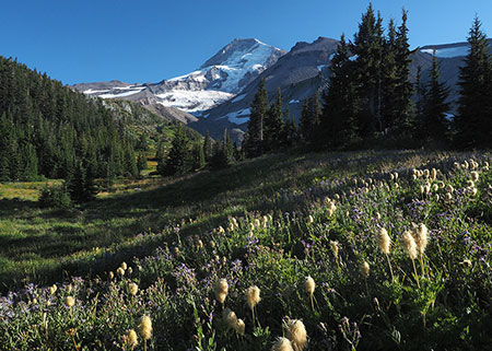
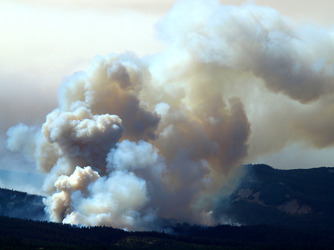
The Dollar Lake Fire at its peak in early September 2011
On August 26, 2011, a lightning storm ignited a small wildfire near Inspiration Point, just below the Elk Cove Trail on Mount Hood’s north side. What became known as the Dollar Lake Fire started in full view on a Friday, during the busy summer hiking season. The fire was immediately photographed and reported to the Forest Service by several hikers – and in full view from the Hood River Ranger Station near Parkdale, a few miles north.
The initial Forest Service response was to allow the fire to burn, consistent with agency policy on wildland fires. It seemed to be a small, slow-moving event, and it was located completely within the boundaries of the Mount Hood Wilderness, where no structures would be threatened. Besides, there were several other big fires burning in Oregon that summer already competing for the agency’s stretched resources.
Forests exploding into flames near Vista Ridge as the Dollar Lake Fire moved west
Over the next ten days everything changed. Unseasonably strong east winds began to fan the blaze, exploding the fire to more than 4,500 acres. And it was still spreading fast, with just 10 percent of the fire perimeter contained. As the fire continued to spread, it made a run toward Lolo Pass, threatening the Bonneville Power Administration transmission corridor and Portland’s Bull Run Watershed – the source of drinking water for more than a million people.
Suddenly, it had become the top firefighting priority in the state. At its peak there were hundreds of firefighters battling the Dollar Lake Fire as it continued to burn and spread westward.
By the time the fall rains arrived that October, the fire had consumed more than 6,300 acres of subalpine forest in a 5-mile swath stretching from the historic Cloud Cap Inn on the east to Cathedral Ridge on the west. The historic Timberline Trail was largely spared, surprisingly, but much of the high elevation forest just below the tree line was completely burned. These forests were dominated by Mountain Hemlock, Noble Fir and Western Larch stands that had last burned more than a century ago.
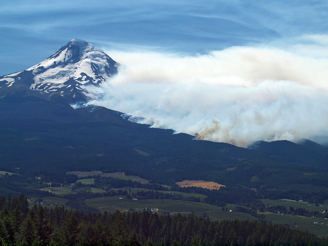
Dollar Lake Fire from above the Hood River Valley in early September 2011
Like the Eagle Creek Fire that would follow in 2017, the Dollar Lake Fire provided a front-row seat for people in the greater Portland area to better appreciate the awesome power of a wildfire. Much of the media coverage focused on the destructive force of these fires, but in the aftermath, both events have also served to raise awareness of both the need and benefits of fire, as well as the resiliency of a recovering forest.
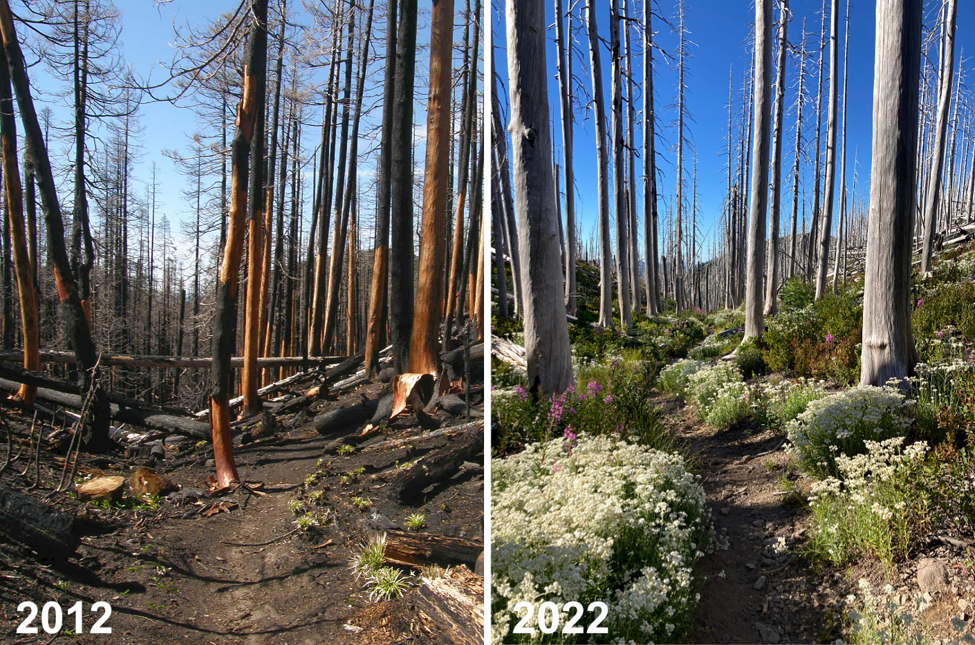
In 2016 I posted this 5-year progress report on the forest recovery in the wake of the Dollar Lake Fire. At the time, the recovery was in its earliest stages, though making remarkable progress. The past summer marks the tenth growing season since the fire, and this article is a visual update on the ongoing forest recovery in the wake of the fire.
The recovery has come a long, long way…
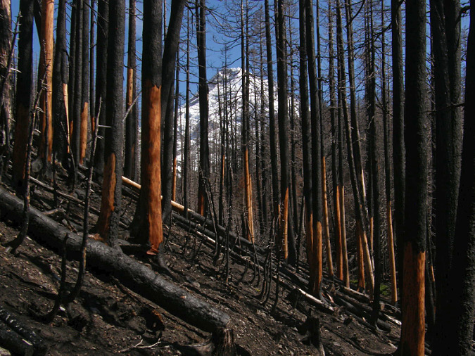
Charred forests along Vista Ridge in June 2012
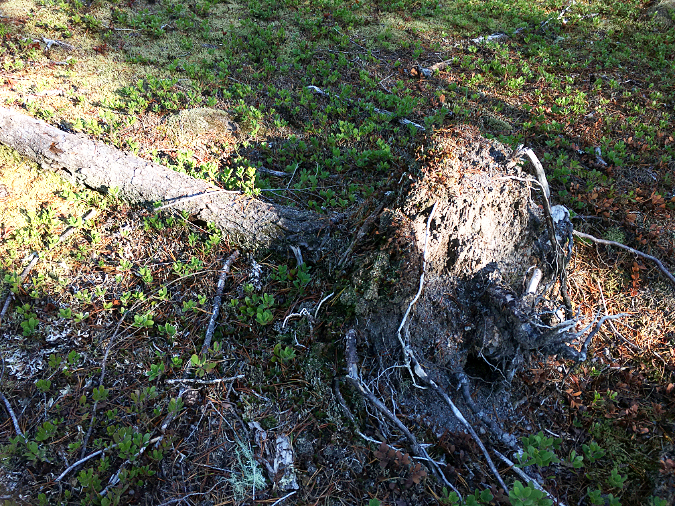
When I first ventured into the burn zone in June 2012, the devastation seemed nearly complete. Much of the Dollar Lake Fire had been a scorching crown fire that killed entire forests, as opposed to a beneficial ground fire that might have burned away forest debris, but left many of the mature trees surviving. As a result, there is little of the desirable “mosaic” burn pattern in the Dollar Lake burn, where islands of trees spared by the fire help spur the forest recovery and provide refuge for wildlife during the burn – another beneficial effect of a less catastrophic fire.
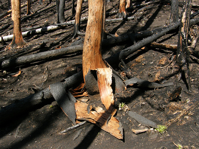
Bark piles forming one year after the fire in 2012
Living conifers don’t really burn in a high-intensity event like the Dollar Lake Fire. Instead, they’re quickly killed, but mostly left standing. The heat of the fire torches green needles, blackens tree bark and explodes the thin, moist cambium layer under their bark — the living tissue that connects a tree’s roots to its green foliage — but leaves the solid interior of a tree unburned.
This effect of a very hot fire could be seen all over the ground in the immediate aftermath of the fire in 2012. Great piles of scorched tree bark had sluffed off the standing trees, no longer attached by a living cambium layer. Early in the recovery, these bark piles were crucial in helping prevent erosion of the bare, burned ground, and also provided the first protected spots for pioneer seedling to take hold.
The ground itself was also scorched and black, but even in that first spring after the fire it was clear that some of the understory plants had survived. Thanks to their protected underground root systems., Beargrass and Avalanche Lily were already sprouting from the burnt soil just eight months after the fire.
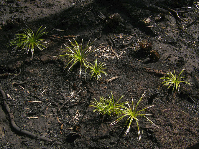
Beargrass emerging from the blackened soil in June 2012
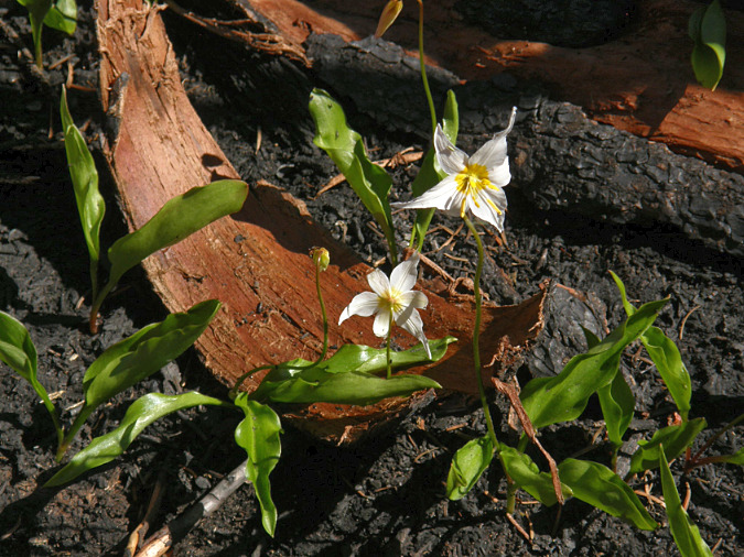
Avalanche lilies emerging from the burned forest in June 2012
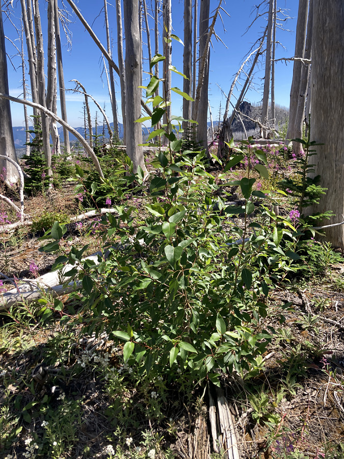
In the first year after the fire, the bare, de-barked snags of trees killed by the fire were a striking reddish color, but just one summer of sun exposure quickly began to fade them into the silver “ghost forest” of today. A full decade of harsh mountain weather has since removed many of the smaller limbs from the standing “ghosts” and as their roots decay with time, many of the killed trees are now falling. This growing accumulation of downed logs adds still more organic debris to the burned ground, and provides shade and nutrients to help young plants to germinate and grow.
At 10 years the post-fire pioneers are still at work
As the Dollar Lake Fire recovery progressed over the past ten summers, a familiar sequence unfolded in the most intensely burned areas, where the fire had burned to bare soil. Pink, abundant Firestar (aka Fireweed) [add a blog link here] was the first to reseed into the burn area. The surviving Avalanche Lilies also took advantage of cleared soil, and within just a few years these tiny plants were creating a spectacular flower show for early summer visitors to the Dollar Lake burn.
This intensely burned ravine along Vista Ridge was filled with Firestar in the first years after the fire, but has not transitioned to shrubby understory plants, a few small conifers and sun-loving perennials Pearly everlasting and Goldenrod
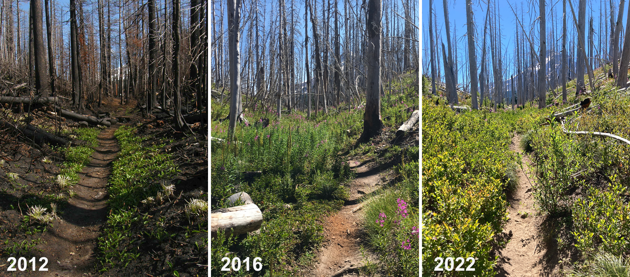
In the first summer (2012) after the fire, only a few Avalanche Lilies grew in this section of the burn. Five years after the fire (2016) Firestar dominated this area with its lush foliage and beautiful blooms, growing as much as 4 feet tall. Ten growing seasons after the fire (2022) shows the transition from the early post-fire pioneers like Firestar, to shrubby plants like Huckleberry and Azalea, with many 2 or 3-foot tall confers mixed in.
Next, conifers and shrubby plants began to appear, and they have steadily expanded their presence to dominate the areas where the recovery has made the most progress. In other areas – especially at higher elevations in the burn zone – the pioneering Firestar still dominates, and small conifers and shrubby understory plants are only beginning to appear, yet these slower areas are following the same succession pattern from wildflowers to young trees and shrubs.
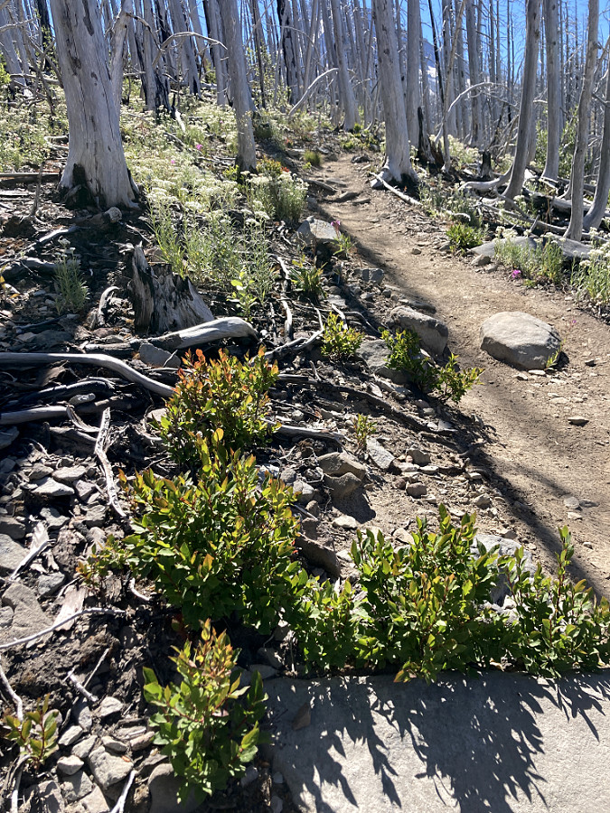
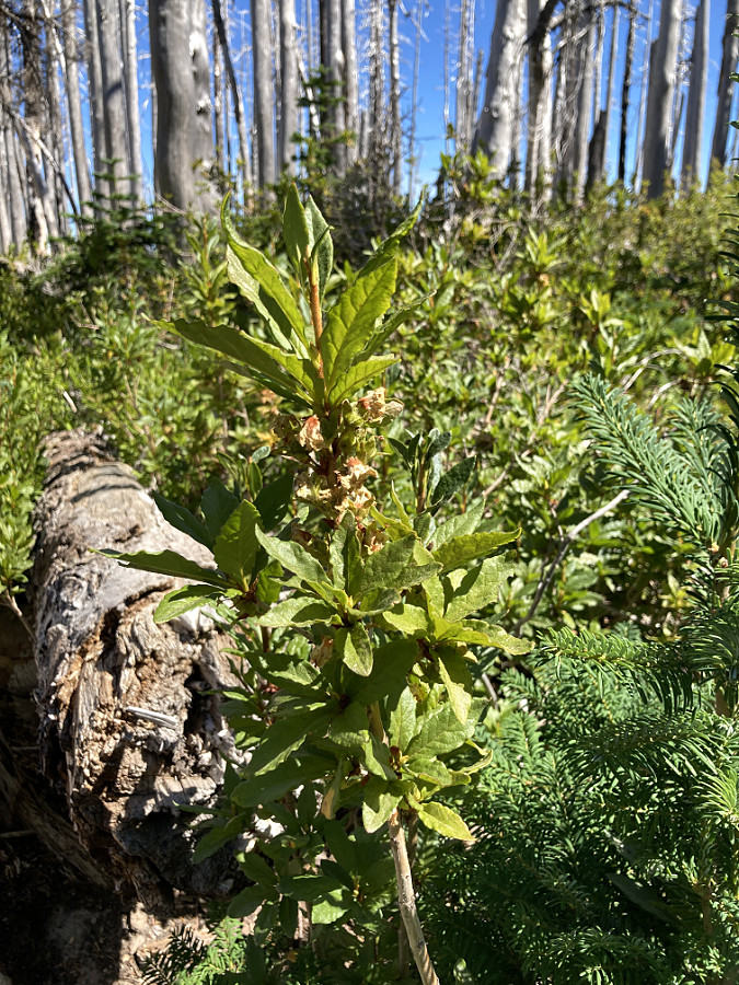
Huckleberries growing from surviving roots in a heavily burned area five years after the fire
Heading into the recovery, a surprising number of mountain Huckleberry plants that had dominated the understory before the fire were emerging from their unburned roots. After ten years, familiar thickets of Huckleberry are already producing heavy berry crops in places where the fire burned less hot. However, outside these less-burned areas new Huckleberry plants have been slow to take hold, and are only just beginning to appear, despite their prolific fruit production and subsequent distribution of seeds by bird and other wildlife.
It turns out that Huckleberries spread mostly by layering – the term for roots that form when a sprawling branch or twig touches the ground, starting a new plant that will eventually grow separately from the parent. It’s a slower process than spreading by seed, but the post-fire recovery of Huckleberries is revealing the advantages of a deeply rooted plant that can readily regrow from its many sprawling, rooted stems.
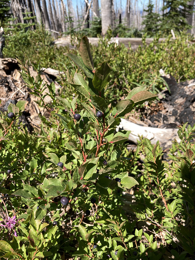
Huckleberries bounced back quickly in lightly burned areas, producing fruit within five years of the fire
They don’t produce a tasty fruit like Huckleberry, but our native Azalea (and its lookalike, False Azalea) have also bounced back strongly in areas where the fire was less hot, allowing more of their roots to survive. Before the burn, these plants were one of the most prolific understory shrubs, often mixed in with Huckleberries. But while Huckleberries are beginning to take hold in more intensely burned areas, thanks to their broad seed distribution, few Azalea (and False Azalea) have appeared in these areas at this point in the recovery.
Azalea returning in a lightly burned area five years after the fire
In the early years of the recovery, Firestar dominated the entire burn and formed spectacular drifts with its elegant, violet flower spikes. Firestar are sun-loving perennials that grow readily from seeds carried in the wind on silky sails, and thus their ability to rapidly colonize a burn in the years immediately following a fire.
After ten growing seasons, Firestar continue to dominate higher elevations in the burn, where the summers are shorter and the forest recovery is slower. At lower elevations in the burn, the shade these plants initially provided for other seedlings has allowed a diverse array of other understory plants to become established and thrive, largely replacing Firestar. These are workhorse plants that are essential to post-fire recovery, yet their role is a fleeting one.
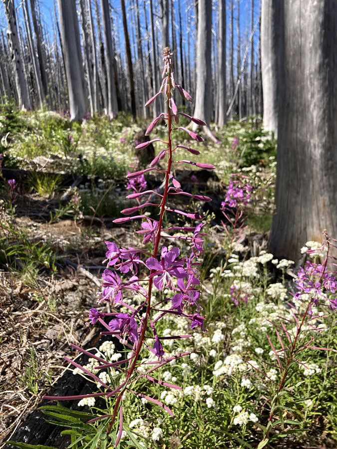
Firestar was everywhere in the early years of the forest recovery
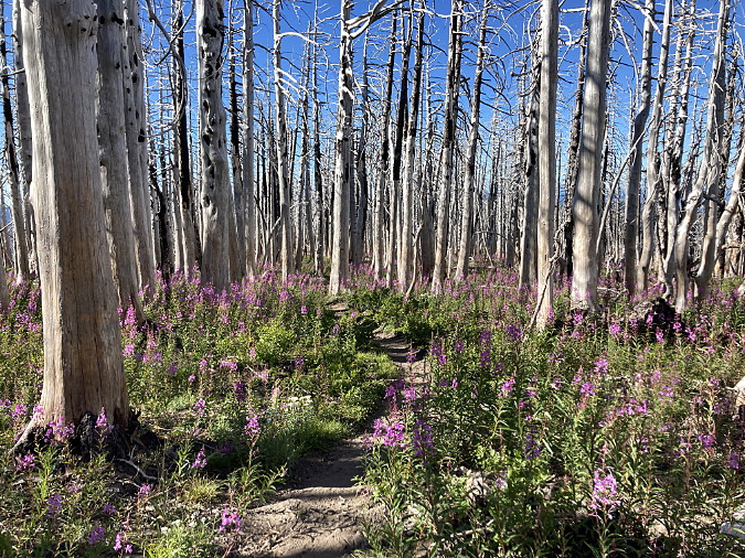
Firestar still carpets the higher elevation ghost forests of the Dollar Lake burn where the recovery is unfolding more slowly
One of the less obvious pioneers of the early recovery are Rushes. Normally associated with wet areas, they were a surprising piece of the forest recovery puzzle when they appeared scattered throughout the burn in the first years. These are perennials with tough root systems that help hold bare soil and also make them somewhat drought tolerant.
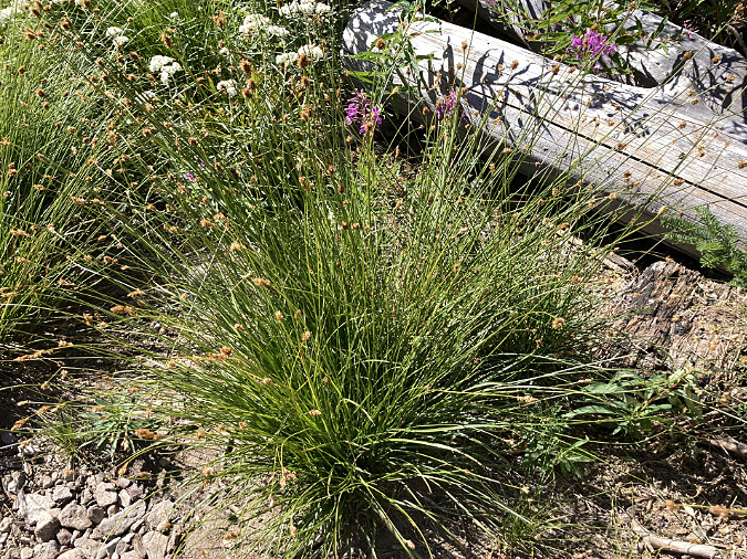
Rush
Were Rushes growing here before the fire, and simply emerged from surviving roots after the burn, just as some of the Beargrass that survived? That’s probably the best explanation, but Rushes are one of the surprising early workhorses in the recovery that continue to be thrive as part of the recovering forest.
Berries are among the new arrivals
After ten growing seasons, the recovery in the aftermath of the Dollar Lake Fire has entered an explosive new phase. The diversity of plant species in the regenerating understory is rapidly expanding to include a surprising variety of new shrubs and small deciduous trees that are taking hold among the surviving huckleberries and azaleas.
Among the new arrivals are five new berry-bearing shrubs and small trees, including (pictured below, in order) our native Wild raspberry, Mountain ash, Thimbleberry, Red-flowering currant and Red Elderberry. Add these to the freely fruiting Huckleberries, and the recovering burn has become a summer magnet for birds, bears and other wildlife that thrive on our native berries. These animals, in turn, spread the seeds from these berries, further accelerating the forest recovery.
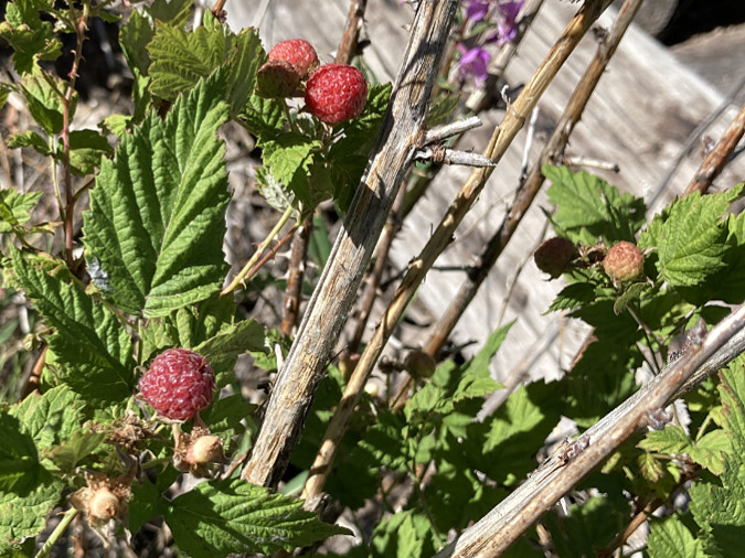
Wild raspberry
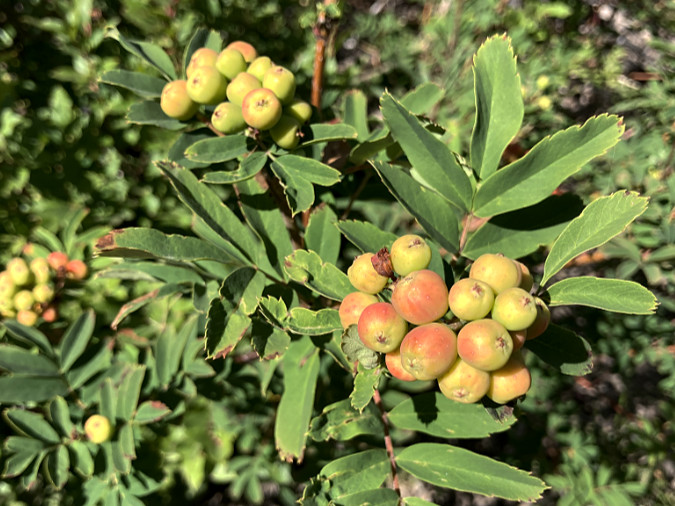
Mountain ash
Thimbleberry
Red-flowering currant
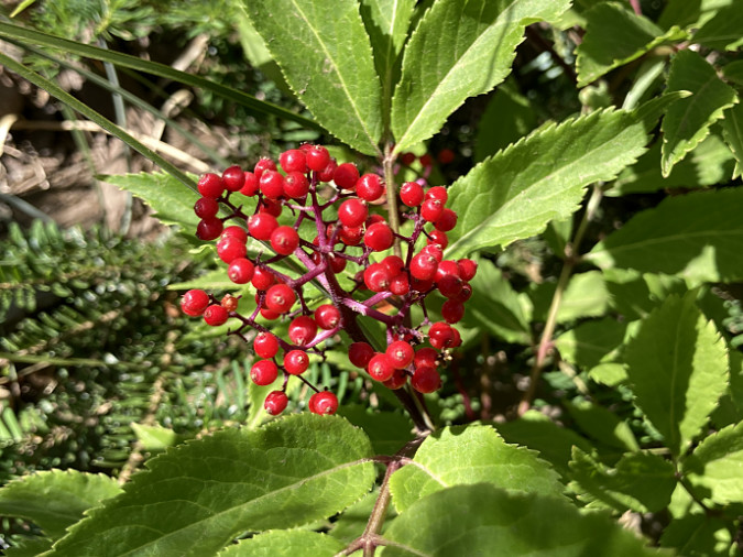
Red elderberry
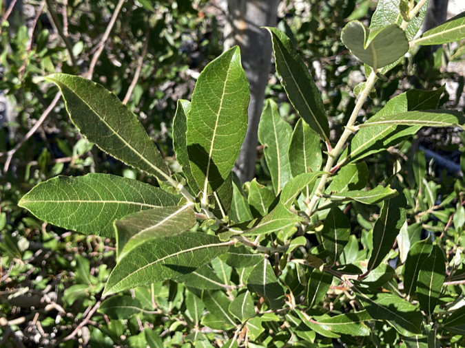
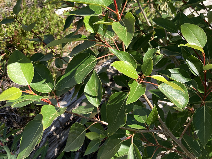
Broadleaf trees are also making a comeback in the burn zone, though they tend to be scattered and still somewhat uncommon at this stage of the recovery. Among these are Scouler’s willow, Cottonwood and the subalpine Sitka alder – three species that typically colonize forest openings and mountain roadsides where they have access to sun.
Within the burn zone, Scouler’s willow and Sitka alder can thrive all the way to timberline (at 6,000 feet), while Black cottonwood typically grow below about 5,000. These species are likely to expand their presence in coming years, as they are fast-growing pioneers that can outpace young conifers, and often fill recently burned or cleared areas in the first decades of recovery.
Scouler’s willow
Young Cottonwood seedling
Cottonwood foliage
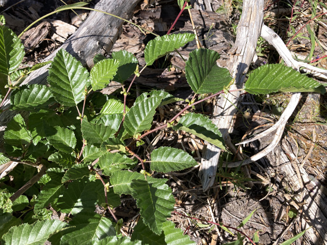
Sitka alder
This natural progression from deciduous trees to conifers in recovering forests is purposely skipped over in most commercial logging operations on both public and private timber lands. Timber companies typically use herbicides to kill the surviving understory in the first growing season following a new clearcut, including deciduous trees like these. Then conifer seedlings are planted to accelerate the production of new saw logs.
While this practice maximizes profits, but it also robs the soil of years of organic debris from deciduous trees, along with the nitrogen that species like Red alder uniquely fix in the soil with their root systems, enriching it for future, larger conifers to thrive. New research has also revealed that Red alder and other nitrogen-fixing deciduous species actually break down solid rock into available minerals for other tree species to absorb, including the conifers that typically follow Red alder in forest recovery. This newly understood benefit of the deciduous phase of forest recovery is especially crucial in our mountain forests, where soils are thin and rocky.
Wildflowers continue to expand their role, too
Wildflowers were the first pioneers to the burn, and they continue to play an important role in the recovery. After ten growing seasons, the list of prominent wildflowers in the burn has expanded from Avalanche Lily, Beargrass and Firestar to include many new species. The most prominent among the new arrivals are Goldenrod and Pearly everlasting. Both are late-blooming, sun-loving and drought tolerant species that are now thriving and spreading throughout the burn.
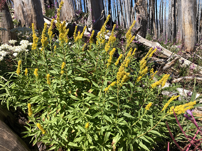
Goldenrod
Other new wildflower arrivals include purple Asters and several species of Lupine. These are sun-lovers that were not present in shade of the forest before the burn. Their arrival shows the ability of plants to reseed across miles of burned forest with the help of birds, other wildlife and hiker’s boots. Over time (as measured in decades) returning conifers will shade these slopes, once again, and these wildflowers will fade away, ceding the burn area to more shade-tolerant species, once again.
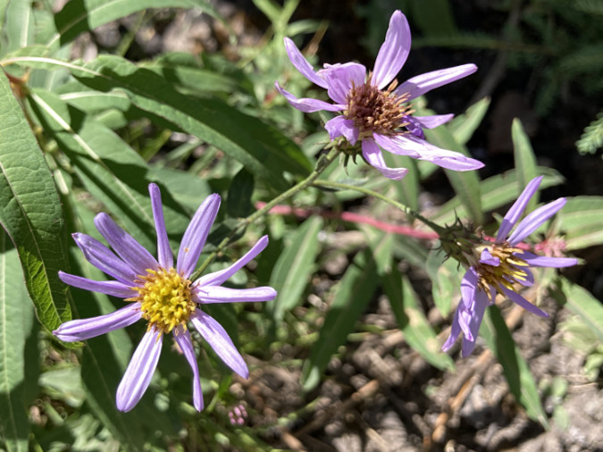
Aster
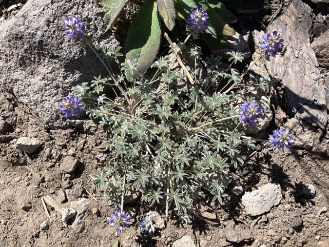
Dwarf lupine
A new forest is emerging… slowly
The mystique of replanting burned areas runs deep in Oregon lore, with Civilian Conservation Corps (CCC) crews replanting burns throughout Oregon in the 1930s and school kids from Portland helping replant the infamous Tillamook Burn – a series of four large, overlapping burns in the Coast Range that stretched from 1933 to 1951. As it is today on private timber lands, the focus then was on salvaging burned trees and planting conifer seedlings to produce new, harvestable trees as quickly as possible.
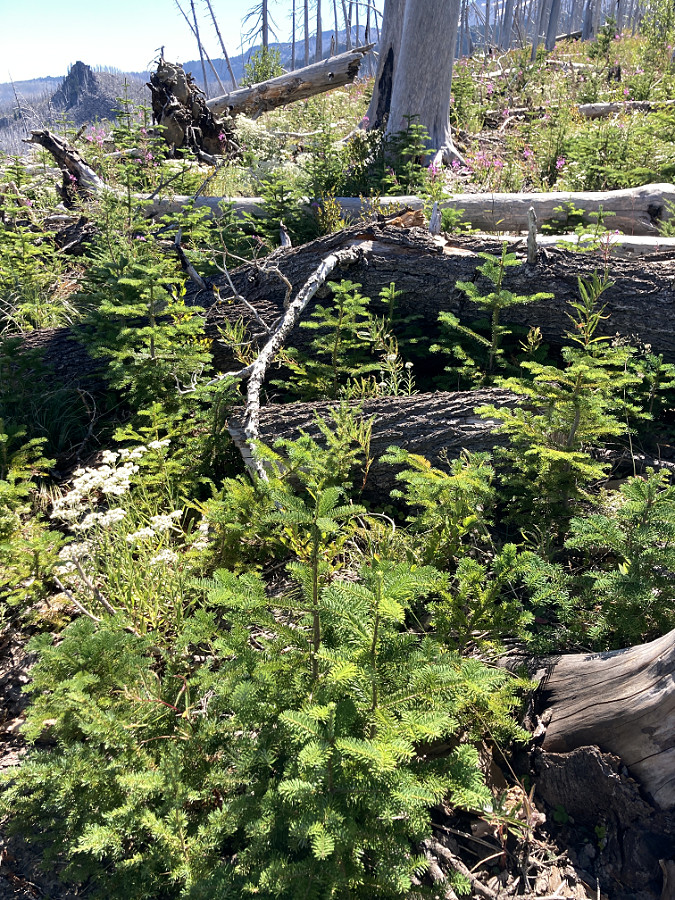
Colony of Noble fir seedlings growing in a protected enclosure of fallen logs on Vista Ridge
In nature, conifers do readily reseed after fires and logging, but compared to understory plants capable of regrowing from surviving roots, conifer seedlings are initially slow to compete. They’re also vulnerable to the harsh conditions in mountain settings – long, cold winters with a snowpack measured in feet followed by very dry summers with almost no precipitation from July through September.
At ten years, the Dollar Fire recovery includes plenty of young conifers, though most are still just a foot tall and less than five years old. Few of these seedlings will survive to become large trees. The lucky few that do are typically found in protected spots – in the shade of standing snags or among fallen, decaying logs that provide shade and nutrients.
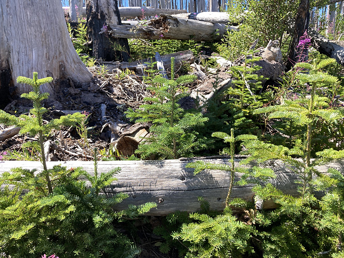
Noble fir seedlings growing along a fallen log, where their roots are shaded and the log helps conserve soil moisture and provides nutrients as it slowly decays
Noble fir seedings huddled on the cool, shaded north side of standing ghost trees
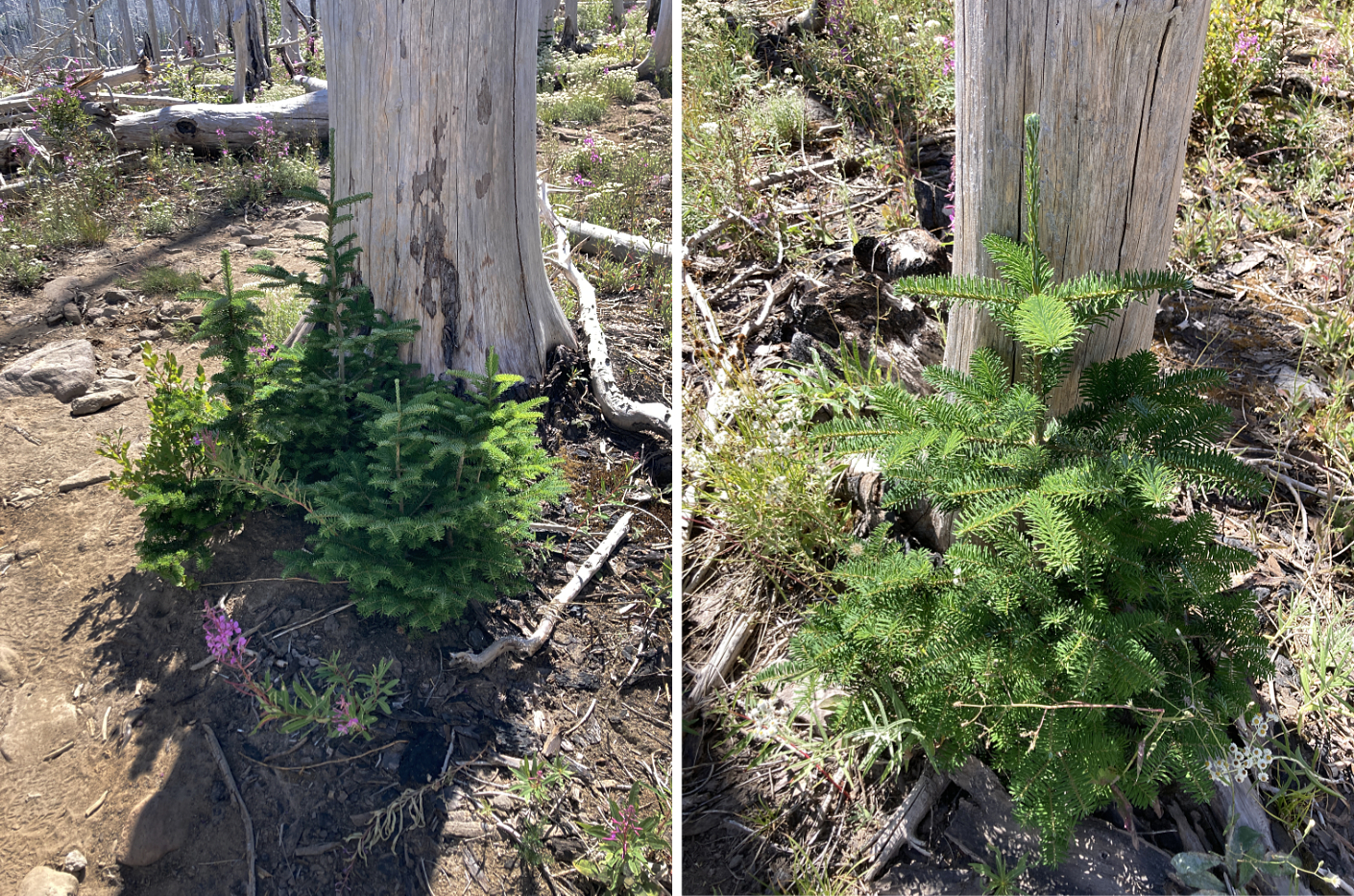
The clumping of young conifers is a preview of what is to come in the recovery. Walk through a 30 or 40-year-old burn and you will find trees growing in groups, providing protection for one another and sharing the best spots for young trees to grow. Over decades, these groups will expand and grow together, forming a continuous stand. Over centuries, just a few of these original trees will survive to become forest giants.
Mixed colony of Mountain hemlock and Noble fir competing in a favorable nursery spot among fallen logs
The small grove of Noble fir in the distance survived the fire, and now these trees protect one another in their suddenly exposed setting. In the coming decades, more colonies of young trees like these will begin to reforest the Dollar Lake burn – first in small groups and later spreading to once again form a continuous canopy
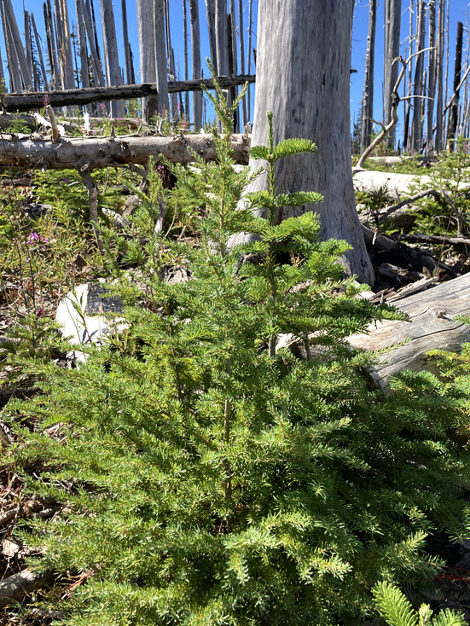
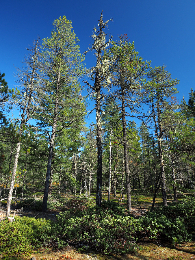
In the first years of the recovery, young conifers in the Dollar Lake burn were mostly Mountain hemlock and Noble fir, two species that dominate subalpine forests on Mount Hood. But at ten years, the recovery includes a couple new species in the mix: Lodgepole pine and Western white pine.
Both pines are common trees in our mountain forests, though with different growth habits. Lodgepole tend to grow in stands, often in dry, rocky sites. Western white pine rarely grow in stands, and are instead sprinkled throughout a mature forest. Both species bring diversity to the emerging forest that underscores the benefit of periodic fires in our forest ecosystem.
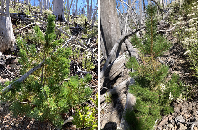
Two pines are returning to the burn – Western white pine (left) and the more common Lodgepole pine (right).
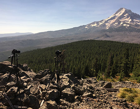
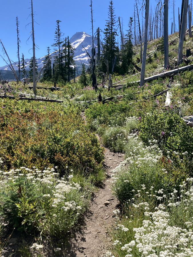
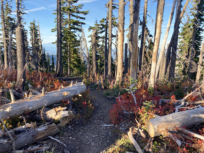
All of the photos in this article were taken along the Vista Ridge Trail in the Mount Hood Wilderness, a route the climbs through the heart of the Dollar Lake burn, from about the 4,000-foot level to the Timberline Trail, at about 6,000 feet elevation. This is prime Noble fir country, but at lower elevations in the burn, conifers like Western larch are an important part of the forest recovery. Oddly missing (thus far) at the lower elevations of the burn are Douglas fir. In time, this iconic species will undoubtedly join the rest of the evergreens re-establishing the forest here.
Why is tree species diversity so important in a forest? While it’s true that we have many ancient stands that are largely of a single species, climate change will almost certainly affect the recovery of the Dollar Fire burn. The recent fires on Mount Hood and in the Gorge will give us a living laboratory to see just how individual species fare with longer, warmer summers and milder winters. The new watch word in climate science is resiliency – the ability to adapt and survive in rapidly changing conditions.
For our forests, species resiliency will be the key, as our climate is expected to change too quickly for individual species to adapt to through natural selection. Instead, it will be the species already suited to warmer, dryer conditions that will be able to survive and thrive in the future. The best guess in the Pacific Northwest is that our climate zones will shift north by a few hundred miles. That could mean Portland someday having a climate like today’s Roseburg or Medford, with Mount Hood’s forests someday looking more like today’s Southern Oregon Cascades.
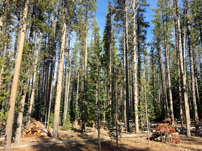
The roles are reversed in this Cascade forest, located 300 miles south of Mount Hood at about 5,000 elevation; Lodgepole pine are the predominant species, with young Noble fir and Mountain hemlock sprinkled within the Lodgepole stands. The debris piles are part of a fuel reduction effort in this forest near Crater Lake.
Forest scientists are already experimenting with this possibility by planting test stands of Southern Oregon forest species in British Columbia, hundreds of miles north of their native latitude. The larger question is whether whole forests will adapt this way over time through gradual migration, or whether it will up to individual species to quickly select more drought-tolerant mutations in their gene pool – a proposition that will centuries to play out.
In the meantime, some tree species already present on Mount Hood are already poised to gradually assume a larger role in the forest of the future.
Today, Lodgepole pine are mostly found in scattered groves near rocky outcroppings and on dry slopes on Mount Hood, but the species still dominates areas where the volcanic eruptions of the late 1700s laid down deep layers of debris in the White River, Zigzag and Sandy River valleys. While they may look young, these are often very old trees, stunted by their harsh growing conditions.
Stunted, slow-growing lodgepole pine are still the dominant conifer some 200 years after the Old Maid eruptions laid down deep gravel deposits on the floor of the Sandy River canyon
Newly forming soils are thin at Old Maid Flat, revealed by shallow-rooted Lodgepole that are easily tipped in winter storms
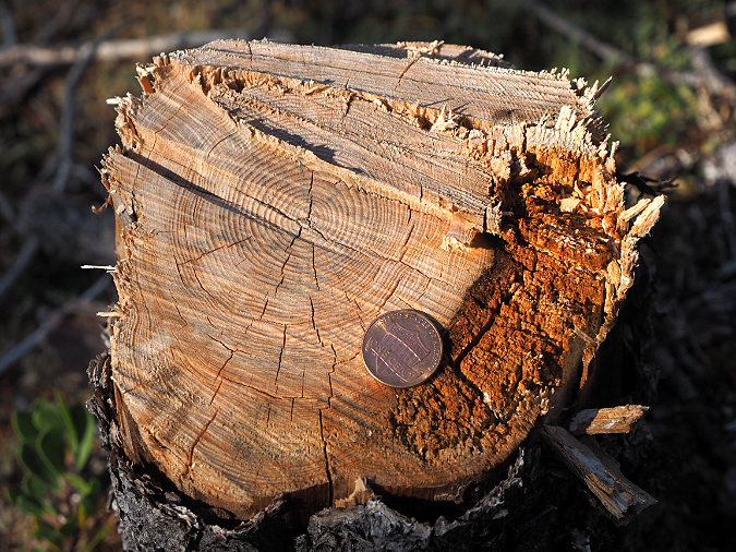
Just five inches in diameter, this stunted Lodgepole at Old Maid Flat was over 75 years old when it was felled for firewood
Lodgepole are well-adapted to these sandy, nutrient-poor soils. After more than two centuries, other conifer species are only beginning to appear in these Lodgepole stands. These slowly recovering forests may be a preview of how future burns will recover in Mount Hood’s future.
In this way, having a few Lodgepole pine and Western white pine join the recovering forest mix as part of the Dollar Fire recovery is a good insurance policy, should the Noble fir and Mountain hemlock forests that once stood here struggle to thrive in a changing climate.
What’s next for the Dollar Lake Fire recovery?
While much has changed in just ten growing seasons, the forest recovery from the Dollar Lake Fire has only begun. The lives of our big trees and mature forests evolve over centuries, not in the few decades of a human life. Everyone reading this article will be long gone when the forests here look anything like they did before the fire, though we will witness the earliest stages of a new forest forming.
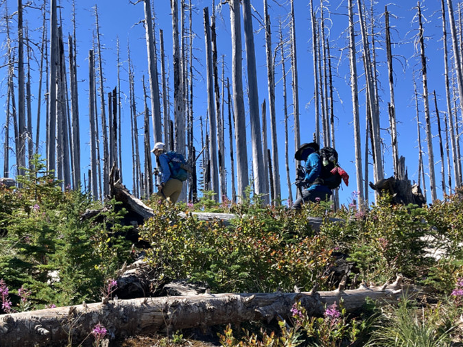
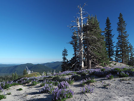
Hikers in the ghost forests on Vista Ridge in August 2022
We’re accustomed to pushing our forests to grow on our terms for maximum profit – mass replanting of marketable conifers and skipping over the initial recovery of understory plants and deciduous trees by aggressive use of herbicides. Like most of our forest practices centered on log production, we’re now learning that nature knows how to do this better than we ever will, and in ways we’re still just beginning to understand.
On Mount Hood, nature has been given the opportunity to recover on her own terms where the Dollar Fire roared through, without logging and plantation planting. This is because much of the burn had been set aside as an expansion of the Mount Hood Wilderness just two years before the fire, in 2009. Thus, no rush to “salvage” burned trees by the timber industry. Instead, the slow-motion recovery of the forest, as it has done countless times before over the millennia.
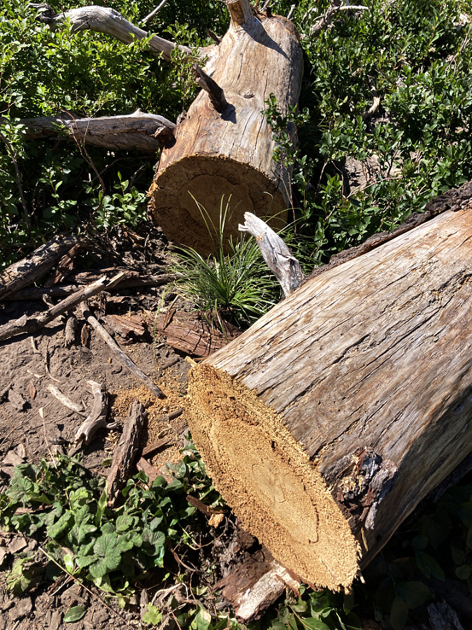
Fallen logs within the Mount Hood Wilderness must be cleared with hand tools
Though the Dollar Lake Fire was caused by lightning, most of the intense fires we have seen on Mount Hood, in the Gorge and around Oregon over the past two decades are a product of human carelessness. The large majority of forest fires are human-caused, in fact, and made more catastrophic by fuels built up from 120 years of fire suppression and our warming, drying climate.
It’s safe to assume this is the “new normal”, too, and thus the importance of understanding how our forests recover after these events – and most importantly, turning our attention to the future, when conditions favoring these fires will be increasingly common. The good news is that nature is remarkably resilient, especially when we don’t get in the way. We’re seeing that unfold in just a decade of recovery across the Dollar Lake burn.
As the forest recovery continues to evolve, there will be plenty of changes for those who walk the trails on Mount Hood, too. We have already entered a phase of the recovery where the shrubby understory has begun to return with gusto at lower elevations. This is going to mean lots of brushing by hand to keep once-shady trails open, along with ongoing logouts for snags that will drop across trails for decades to come. It’s hard work, but also rewarding – and a another way to better understand how the forest is recovering.
Hand-sawed log among more than 70 cleared by Trailkeepers of Oregon (TKO) crews in 2020
Most of this trail maintenance on the Vista Ridge trail is done by volunteers with Trailkeepers of Oregon (TKO). In 2020 and 2021, alone, TKO’s volunteer sawyers cut through nearly 100 fallen logs along this trail with crosscut saws – a requirement inside the wilderness area, where mechanized equipment is not permitted. Brushing will also be done by volunteers for the foreseeable future, by hand with clippers and loppers.
If you’d like to lend a hand you can watch the TKO events calendar. You can find more information about TKO events here:
One-day trail parties on Vista Ridge and other trails within the Dollar Lake burn are scheduled every summer, usually from mid-July through September. No experience is needed and all abilities are welcome – the only requirement is a desire to give back!