Mount Hood’s Pint-sized Glaciers

Two of Mount Hood’s pint-sized glaciers are hidden in plain sight in this sunset view from the Mazama Trail

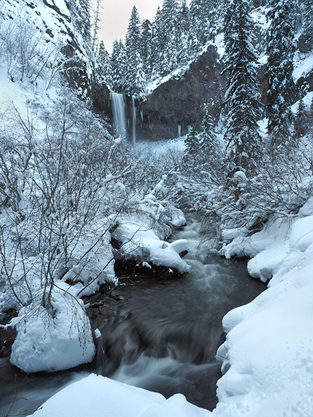
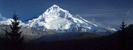
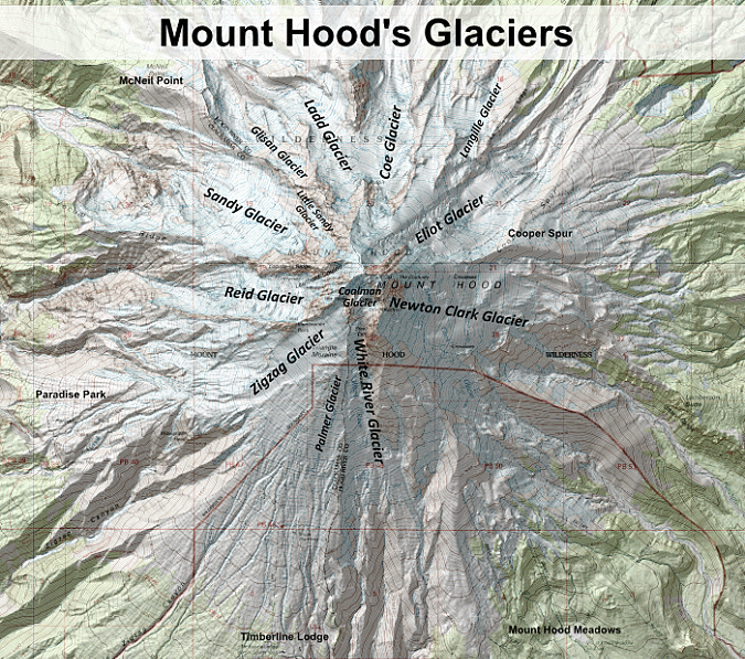
Officially, Mount Hood has twelve glaciers, though two — the Langille on the north side and Palmer on the south side — seem to have slowed to permanent snowfield status. The distinction comes from downward movement, which typically results in cracks, or crevasses, in the moving ice. Crevasses are the telltale sign of a living glacier.

Living glaciers are conveyor belts for mountain ice, capturing and compacting snowfall into ice at the top of the glacier, which then begins to flow downhill from the sheer weight of the accumulation. This downward movement becomes river of ice that carries immense amounts of rock and debris captured in the ice, eventually carving U-shaped valleys in the mountain.

Mount Hood’s largest glaciers carved the huge canyons we see radiating in all directions from the mountain today. These canyons were made when the glaciers were much larger, during the Pleistocene ice age that ended several thousand years ago. The ice on Mount Hood has since retreated, though today’s much smaller glaciers continue their excavating high on the mountain.

The dramatic retreat of the Eliot Glacier on Mount Hood over the past century is captured in these photo comparisons from 1901 and 2012 (Glacier Rephoto Database)

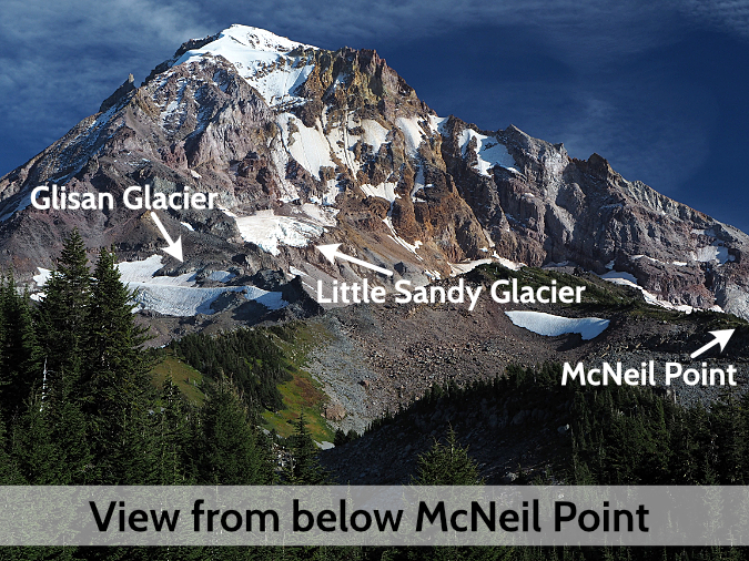
The smallest glaciers on Mount Hood are the Coalman Glacier, located high in the volcano’s crater, and the Glisan Glacier, located on the northwest shoulder of the mountain. They are tiny compared to the impressive Eliot, Ladd, Coe and Sandy glaciers, but these tiny glaciers are still moving, have well-developed crevasses and both are clearly separate from the larger glaciers. Thus, they were recognized as living glaciers in their own right when Mount Hood was being mapped more than a century ago.

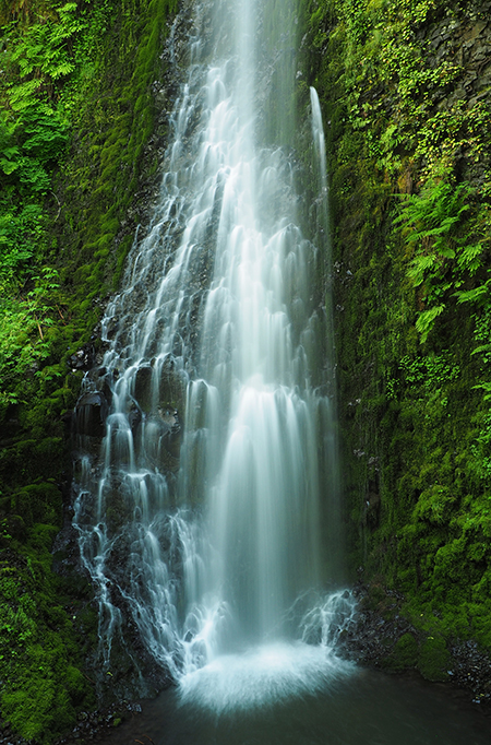
Another tiny glacier is without a formal name, and would have been Mount Hood’s thirteenth glacier had it been mapped with the others in the early 1900s. Known informally as the Little Sandy Glacier, this small body of ice is perched on the rocky shoulder of Cathedral Ridge, near the Glisan Glacier. The Little Sandy hangs on cliffs high above the sprawling Sandy Glacier, which it drains into.

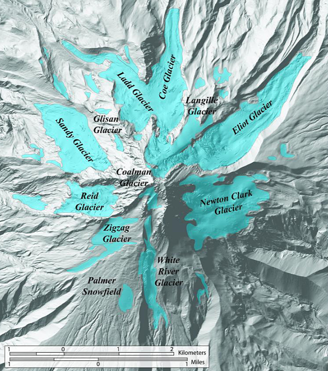
The map below shows each of Mount Hood’s glaciers, from the tiny Glisan to the massive Eliot, largest on the mountain:

[click here for a larger version of the map]

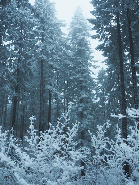
This article takes a closer look at these lesser-known, tiny glaciers. While small, all three have been surprisingly resilient in the era of climate change, when our glaciers are rapidly shrinking. Their tiny size and survival (so far) makes them helpful indicators of the long-term effects of global warming on Mount Hood, and a visual reminder of just how fragile our alpine ecosystems are as the planet continues to heat up.
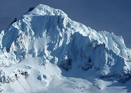
The Coalman Glacier

The Coalman Glacier is located in Mount Hood’s crater, high above the White River Glacier

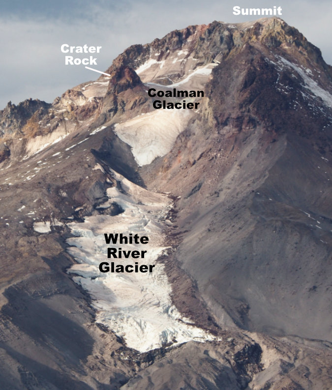
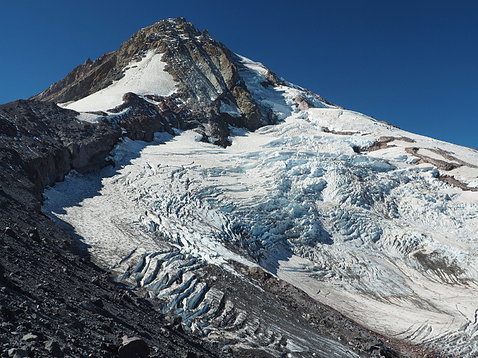
This glacier is known to few, and yet is probably the most visited on Mount Hood. The Coalman Glacier fills the crater of Mount Hood, extending from below the summit to Crater Rock, and is crossed by thousands of climbers following the popular south side route to the summit each year. Along their climb, they follow a ridge of ice along the glacier called “The Hogsback” to the Coalman Glacier’s “bergschrund”, the name given to a crevasse that typically forms near the top of most glaciers, and a common feature to many glaciers on Mount Hood. For climbers on Mount Hood, the bergschrund on the Coalman Glacier is simply called “The Bergschrund”, and it is the main technical obstacle on the south side route to the summit.

The entire Coalman Glacier lies above 10,000 feet, and as a result, this tiny glacier is well-situated to survive a warming climate. Historic photos (shown later in this article) suggest the Coalman Glacier was once connected to the White River Glacier, located immediately below, as recently as the late 1800s.

Mount Hood’s summit lookout in the 1920s

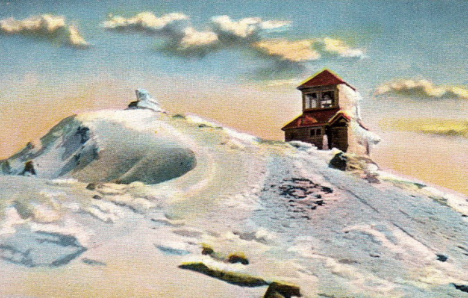
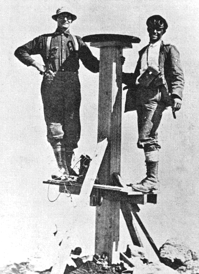
The Coalman Glacier was named for Elijah “Lige” Coalman, the legendary mountain guide who manned the former fire lookout on the summit of Mount Hood from 1915 to 1933. Lige Coalman climbed Mount Hood nearly 600 times in his lifetime, sometimes making multiple climbs in one day to carry 100 pound loads of supplies to the summit lookout. In Jack Grauer’s classic Mount Hood: A Complete History, he describes Lige Coalman’s legendary stamina:

“…The great vitality of Coleman was demonstrated by one day he spent in 1910. He and a climbing client ate breakfast at the hotel in Government Camp. They then climbed to the summit of Mount Hood and down to Cloud Cap Inn where the client wanted to go. After lunch at Cloud Cap, Lige climbed back over the summit and arrived for dinner at Government Camp at 5:00 p.m.”

The Coalman Glacier was formally recognized as a separate body of ice from the nearby White River and Zigzag glaciers in the 1930s. However, this tiny glacier went unnamed until Lige Coalman died in 1970, and the Oregon Geographic Names Board named the small glacier he had navigated hundreds of times in his memory. Fittingly, Lige Coalman’s ashes were spread on Mount Hood’s summit.

Lige Coalman (left) on the first summit lookout on Mount Hood in 1915 (from “Mount Hood: A Complete History” by Jack Grauer)

Though the south side route is considered the easiest way to the summit of Mount Hood, every route on the mountain is dangerous. Many tragedies have unfolded over the decades on the Coalman Glacier, when climbers have fallen into The Bergschrund crevasse or slid into the steaming volcanic vents in the crater. Perhaps most notorious was the May 2002 climbing disaster, when three climbers were killed and four injured by a disastrous fall into The Bergschrund.

1920s climbers on the Hogsback on the Coalman Glacier. The wide crevasse known as The Bergschrund lies ahead as they make their way toward the summit (USFS)

While the 2002 accident was tragic enough, it was the rescue operation that made the incident infamous when an Air Force helicopter suddenly crashed onto the Coalman Glacier, rolling several times before coming to a rest below the Hogsback. News cameras hovering above the scene broadcast the event in real-time, and the sensational footage was seen around the world. Though several Air Force crew were injured, nobody was killed in the helicopter crash.

The Glisan Glacier

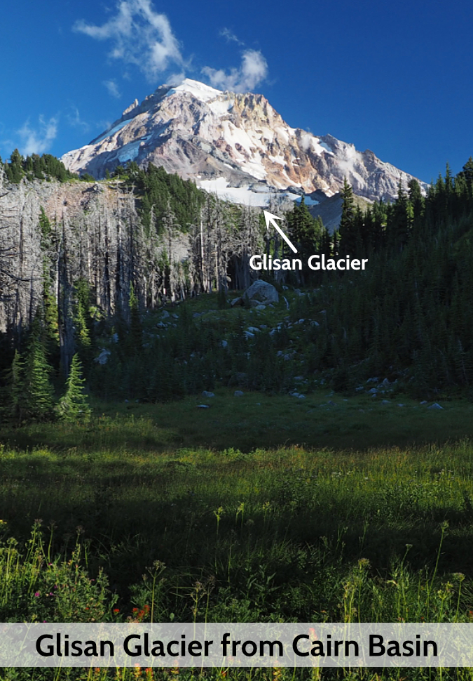
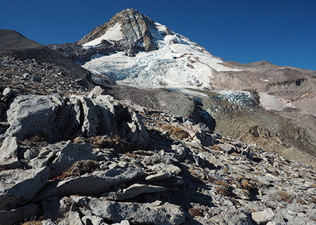
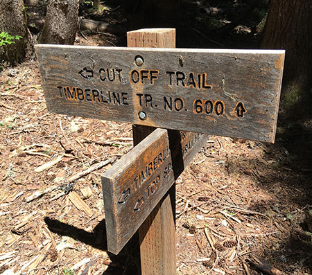
The Glisan is Mount Hood’s smallest named glacier, tucked against Cathedral Ridge on the northwest side of the mountain. This tiny glacier is hidden in plain sight, located directly above popular Cairn Basin and McNeil Point, where thousands of hikers pass by on the Timberline Trail every year. It was named for Rodney Lawrence Glisan Jr. by the Oregon Geographic Names Board in 1938. The name was proposed by the Mazamas, Mount Hood’s iconic climbing club, following an expedition to the northwest side of the mountain in 1937.

Rodney Glisan Jr. in the late 1800s (Mazama Library and Historical Collections)

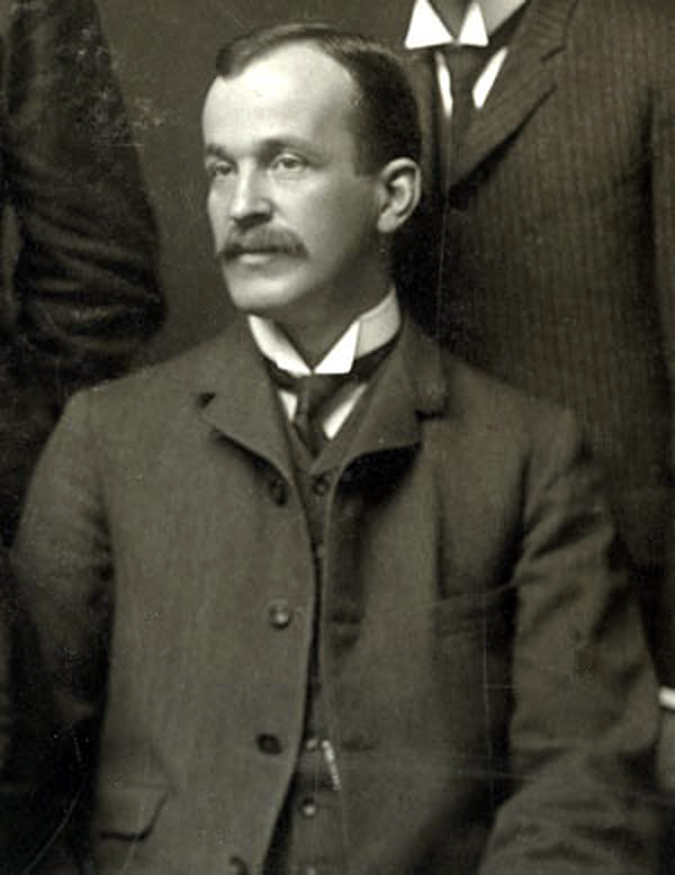
Glisan was a prominent Portland lawyer and civic leader in the late 1800s and early 1900s, and son of one of the founding fathers of the city. He served on the Portland City Council and in the Oregon Legislature, as well as other civic roles. But his passion was for the outdoors, and as a Mazama, Rodney Glisan climbed most of the major Cascade and Sierra peaks during his eventful life.

The glacier that carries Rodney Glisan’s name was once much larger, and its outflow carved a steep canyon lined with vertical cliffs that now form the shoulder of the lower ramparts of Cathedral Ridge. Today, this rugged canyon is without trails and unknown to most who visit the mountain.

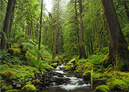
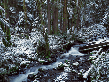
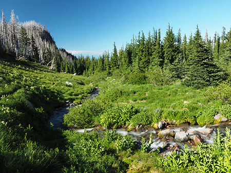
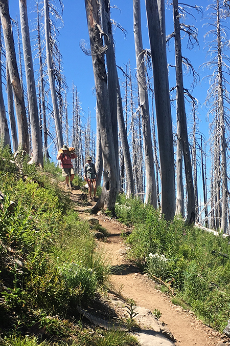
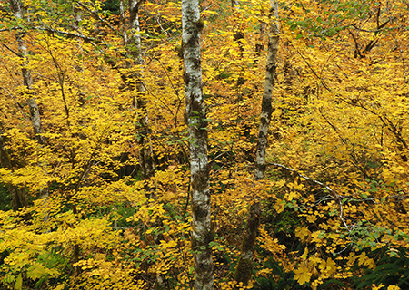
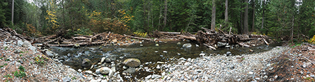
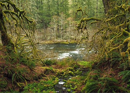
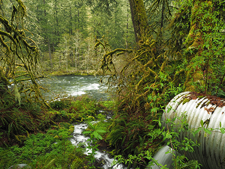
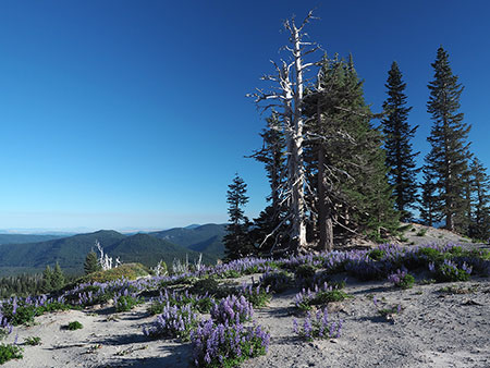
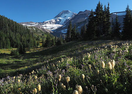
Most hikers visiting McNeil Ridge wouldn’t know they’re looking at the Glisan Glacier as they make the final climb above the tree line, but the glacier’s outflow is a popular stop along the way. This beautiful stream flows through some of the finest wildflower meadows on the mountain (pictured above).

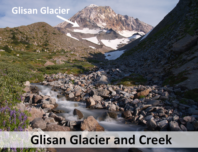
Oddly enough, this glacial stream is unnamed, though it’s much larger than many named streams on the mountain. In fact, it’s the only glacial outflow on the mountain that is unnamed. Thus, on my growing list of planned submissions to the Oregon Geographic Names Board is to simply name this pretty stream “Glisan Creek”, since it’s a prominent and helpful landmark along the Timberline Trail. Naming the creek might bring a bit more awareness and appreciation for the tiny Glisan Glacier, too!

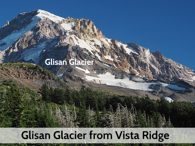
As Mount Hood’s glaciers go, the Glisan isn’t much to look at today. The glacier is much smaller than when it was named in the 1930s, judging by topographic maps (below) that show a lower portion of the glacier that has since become a series of permanent snowfields that are no longer part of the glacier.

The Glisan Glacier also has an odd shape, wider than it is long. Presumably, this is due to both shrinking over the past century and possibly winter wind patterns affecting snow accumulation on this little body of ice. But it is moving, with a prominent series of crevasses opening up every summer on its crest. It’s also surprisingly resilient in its modern, shortened state, bucking the trend (for now) of shrinking glaciers throughout the Cascades.

Topographic maps created in the mid-1900s show the former extent of the Glisan Glacier

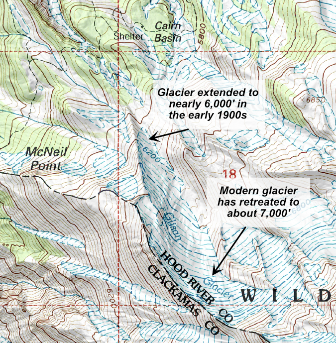
Topographic maps still show the former extent of the Glisan Glacier in the mid-1900s, when it extended to nearly 6,000 feet in elevation. Today, the glacier has retreated to about the 7,000-foot level.

The position of the Glisan Glacier on northwest side of the mountain could also be part of the explanation for its resilience. The glacier flows from the north side of Cathedral Ridge, where it is protected from the hottest late summer sun, and it also benefits from being in the direct path of winter storms that slam the west face of the mountain with heavy snowfall. Will the Glisan Glacier continue to survive? Possibly, thanks to its protected position and having already retreated to the 7,000-foot elevation. Time will tell.

The Little Sandy Glacier

This little glacier should have been Mount Hood’s thirteenth named glacier, but it has the misfortune of lying very close to the much larger Sandy Glacier and was passed over when the first topographic maps were created in the early 1900s. And yet, it was called out in Forest Conditions in the Cascade Range, the seminal 1902 original survey of the (then) “Cascade Forest Reserve”, the precursor to the national forests that now stretch the length of the Oregon Cascades:

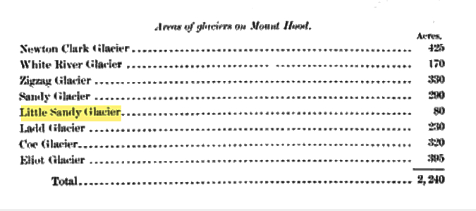
It was tiny then, at just 80 acres. But at the time of the 1902 survey, the Reid, Langille, Palmer and Coalman glaciers had yet to be named, so this will be my argument in adding the Little Sandy Glacier to my (still!) growing list of name proposals for the Oregon Board of Geographic Names to consider.

Why is a name important for this tiny glacier? In part, because without names we tend to not pay attention to important features on our public lands, usually to their detriment. But in the case of the Little Sandy Glacier, there are some good public safety arguments, since the glacier is adjacent to a couple of the climbing routes used on the mountain. Formalizing its name could help search and rescue efforts compared to the informal use of the name today.

The Little Sandy Glacier is a heavily-crevassed body of ice perched on the cliffs of Cathedral Ridge, high above the much larger Sandy Glacier

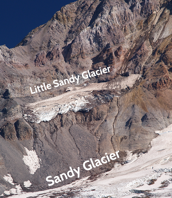
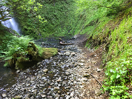
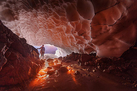
Like the nearby Glisan Glacier, the Little Sandy is oddly shaped. Wider than it is long, it hangs seemingly precariously on a massive cliff and is heavily fractured with crevasses. In summer, meltwater from the Little Sandy cascades over long cliff and down a talus slope where it then flows under the Sandy Glacier, joining other meltwater streams there.

What does the future hold for the Little Sandy Glacier? Like the Glisan Glacier, it benefits from heavy snow accumulation where winter storms pound the west face of the mountain. Yet, unlike the Glisan, the Little Sandy Glacier hangs on a southwest-facing wall and is exposed to direct afternoon sun in summer.

Surprisngly, this doesn’t seem to have dramatically affected the size of the glacier over the years, perhaps because it sits so high on the mountain. The base of the glacier is at an elevation of about 8,400 feet (higher than Mt. St. Helens) and the upper extent of the glacier begins just above 9,000 feet. This combination of high elevation and heavy winter snowpack suggest the Little Sandy Glacier will continue to survive for some time to come, even as global warming continues to shrink Mount Hood’s glaciers.

Tracking Mount Hood’s Changing Glaciers

Mount Hood’s Eliot Glacier is impressive, but in truth is a fraction of its size just a few decades ago.

Who is tracking the changes in Mount Hood’s glaciers? The answer is a collection of federal and state agencies, university researchers and non-profits concerned with the rapid changes unfolding on the mountain.

The U.S. Geological Survey has the most comprehensive monitoring program for Mount Hood, though it is mainly focused on volcanic hazards presented by the mountain. From this perspective, the glaciers and permanent snowfields on Mount Hood represent a disaster risk in the event of renewed volcanic activity, as past eruptions have triggered massive mudflows when snow and ice were abruptly melted by steam and hot ash.

Mount Hood’s glaciers, as recognized by the U.S. Geological Survey (USGS)

The late 1700s eruptions that created today’s Crater Rock and the smooth south side that Timberline Lodge sits on also sent mudflows down the Sandy River to its confluence with the Columbia River. The delta of mud and volcanic ash at the confluence gave the river its name, when the Lewis and Clark Expedition reached the scene just a few years after the event, calling it the “quick sand river”. The potential reach of future mudflows is why the USGS continues to monitor Mount Hood’s glaciers.

The U.S. Bureau of Reclamation and other water resource and fisheries agencies are also tracking the glaciers from the perspective of downstream water supplies and quality. Mount Hood’s glaciers not only provide critical irrigation and drinking water for those who live and farm around the mountain, they also ensure cool water temperatures in summer that are critical for endangered salmon and steelhead survival.

In academia, Portland State University geologist Andrew Fountain has been a leading local voice in tracking change in our glaciers, collaborating with federal agencies to monitor glaciers across the American West. Several PSU students have completed graduate theses on Mount Hood’s glaciers under Dr. Fountain, including glaciologist Keith Jackson’s excellent research on the Eliot Glacier.

The once-mighty White River Glacier on Mount Hood has receded dramatically over the past century (Glacier RePhoto Databse)

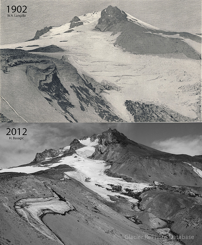
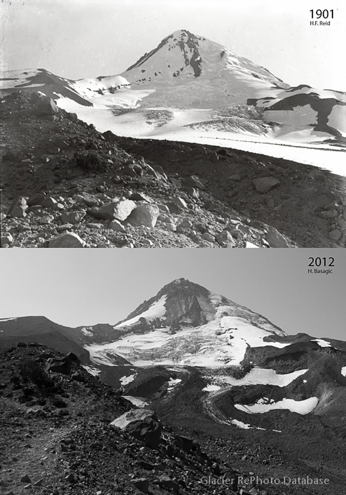
Dr. Fountain’s research features photo pairing where historic images of Mount Hood’s glaciers have been recreated to show a century of change on the mountain. These images (above and at the top of the article) of the White River and Eliot glaciers are examples, and show the power of these comparisons in understanding the scale and pace of change.

The following is a shorter-term comparison of my own images of the Eliot Glacier, taken in 2002 and 2019 at about the same time of year (in late summer). Look closely, and the changes are profound even in this 17-year timeframe. Geologists call the boundary on a glacier where melting exceeds accumulation the “firn line”. Typically, glaciers appear as mostly ice and snow above the firn line compared to much more rock and glacial till below the firn line, where the ice is melting away and leaving debris behind.

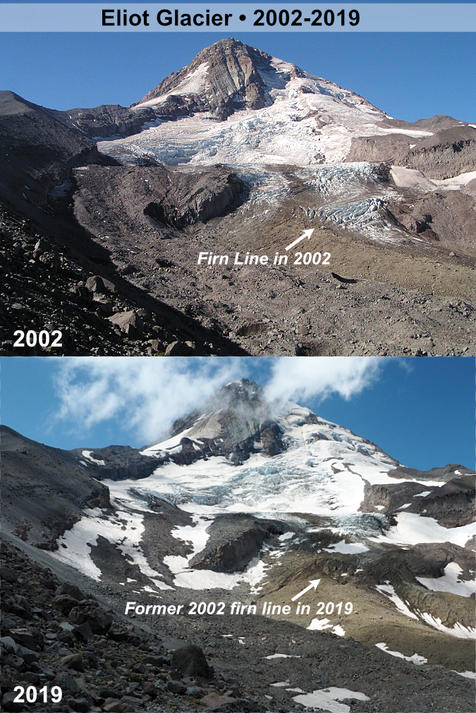
In 2002, the firn line on the Eliot Glacier had risen the lower icefall as the glacier receded, as shown in the image pair, above. The 2002 firn line is indicated by the white and blue ice still dominating the lower icefall. But by 2019, the firn line had moved partway up the lower icefall, as shown in the second image. Over time, scientists expect the glaciers on Mount continue to gradually retreat in this way as they increasingly losing more ice than they gain each year in our warming climate.

What Lies Ahead?

Will Mount Hood’s glaciers completely disappear? Perhaps, someday, if global warming goes unchecked. If climate change can be slowed, we may see the glaciers stabilize as smaller versions of what we see today. While the few remaining glaciers in the Rockies are already very small and on the brink of disappearing, glaciers on the big volcanoes of the Cascades of Oregon and Washington are still large and active. They have advantage of a very wet and cool winter climate that ensures heavy snowfall at the highest elevations, even as the climate warms.

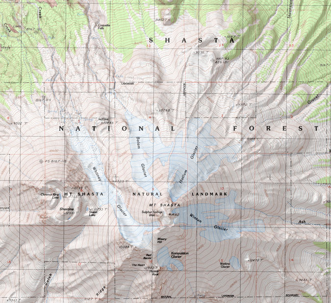
One way to preview the future of Mount Hood’s glaciers is to look south to California’s Mount Shasta, at the lower end of the Cascade Range. At just over 14,000 feet, Shasta is tall enough to have seven named glaciers, even in a much warmer climate — though only four seem to still be active. Compare that to Mount Rainier, in Washington, which is also a 14,000-foot volcano, but has 26 glaciers, with several very large, active glaciers that dwarf anything found on Mount Shasta or Mount Hood.

Despite its height, Mount Shasta’s glaciers only survive above 10,000 feet due to the mountain’s southern latitude in the Cascade Range

The difference is latitude, of course. Climate change is having the effect if sliding us gradually toward the warmer climate we see to the south today, at Mount Shasta, where glaciers are smaller, but still survive above the 10,000-foot level. If Shasta is an indicator, then glaciers will continue to flow for some time at the upper elevations of Mount Hood and the other big volcanoes in northern Oregon and Washington for some time to come, perhaps even surviving if climate change remains unchecked.

In the meantime, the changes on Mount Hood are just one more reminder of how climate change is impacting almost every aspect of our lives and our natural legacy, and why changing the human behavior that is driving climate change is the existential challenge of our time. Though time is short, we can still ensure that future generations will see spectacular glaciers flowing down Mount Hood’s slopes in the next century.

2019 Campaign Calendar!

00CoverWhaleCreek

Calendar cover for 2019 featuring Whale Creek

[Click here for a large image]

‘Tis the season for top ten lists and year-end retrospectives, so in that spirit my annual Mount Hood National Park Campaign Calendar is pretty good snapshot of 12 favorite spots of mine across WyEast country this year. Since 2004, I’ve created an annual calendar dedicated to the campaign, each with a fresh set of photos. If you’d like a 2019 calendar, there’s info at the bottom of the article and ALL proceeds will once again go to Trailkeepers of Oregon (TKO).

________________

The annual campaign calendar has been a great motivator for exploring new terrain and improving my photography skills over the years. Each year the calendar project also renews my conviction that Mount Hood and the Gorge are uniquely special places, and deserve better care.

This article is a short tour of the 12 spots that made it into the 2019 calendar, with a few stories behind the photos and reflection on these increasingly fragile landscapes.

Starting with the cover image (at the top of the article), the calendar begins at lovely Whale Creek, a tributary of the Clackamas River that is also featured in the March image, so more about that spot in a moment.

Next up, the January image (below) captures the awesome west face of Mount Hood, where the Sandy Headwall towers 3,000 feet above the Sandy Glacier. This snowy view was captured from near Lolo Pass last winter.

01aLoloPassEastHood

January features the awesome Sandy Headwall

[Click here for a large image]

Not included in the close-up view are the bare slopes of Barrett Spur (below) and other alpine ramparts of Mount Hood that still didn’t have their winter snowpack in early February, when these photos were taken. While it’s not uncommon to have a late snowpack in the Cascades, these events are becoming more common as global warming unfolds in our own backyard.

01bLoloPassEastBarrettSpur

Low snow on Barrett Spur in February tells the story of our changing climate

For February, I chose a close-up perspective of the ice “pillows” that form at the base of Tamanawas Falls (below) in winter. This has become a very popular winter destination in recent years, thanks in large part to social media! (…ahem…)

02aTamanawasFallsDetail

February features Tamanawas Falls

[Click here for a large image]

Tamanawas is Chinook jargon for “guiding spirit”, and is one version among a couple variations in spelling. More challenging is the pronunciation, and with the advent of social media, all manner of spoken variations are being used. For some reason, an especially popular spoken version that doesn’t even correlate to the actual spelling is “tah-ma-WAHN-us”.

It turns out the most accepted pronunciation is “ta-MAH-na-wahs”. I’ve been saying a slight variation of “ta-MAN-a-wahs” for most of my life, so I’ll need to work on that!

02bTamanawasFalls

Cold Spring Creek and Tamanawas Falls in winter

As mentioned earlier, the March calendar image is from Whale Creek (below), located in the heart of the Clackamas River canyon. The creek is hidden in plain sight, flowing through the Indian Henry Campground and next to the east trailhead of the Clackamas River Trail. This area features some of the finest rainforest in WyEast country.

03aWhaleCreekBigCedars

March features a rainforest scene along Whale Creek

[Click here for a large image]

Whale Creek was just one of many places in the Clackamas and Molalla River watersheds that I found myself exploring this year while much of the Oregon portion of the Columbia River Gorge was closed by the Eagle Creek fire. I visited the lower reaches of Whale Creek after seeing stunning photos of a string of waterfalls on the upper reaches of the creek, and quickly fell in love with this pretty stream. Watch for a future article on a trail concept I’ve been working on for Whale Creek with TKO and some area waterfall explorers.

03bWhaleCreekScene

Whale Creek in the Clackamas River canyon

Sadly, the Clackamas River corridor has a bad reputation, thanks to a history of lawless behavior (the recent Pit Fire was started by illegal target shooting, for example) and a long history of Forest Service management that viewed the area more like a tree farm than a forest — and the two go hand in hand, by the way.

Yet, hidden in the now-recovering rainforests of the Clackamas are dozens of spectacular waterfalls, towering basalt walls and rugged vistas that rival the Columbia River Gorge in beauty. There are also a lot of big trees that somehow dodged the logging heyday of past decades.

03cWhaleCreekSnow

Whale Creek in winter

The Clackamas River corridor holds great promise for future recreation alternative to places like the Gorge, and the proven cure for lawless behavior is lawful recreation. I’m optimistic that we’ll make that transition here, and begin valuing places like Whale Creek for the intrinsic value of its forests, not just the saw logs it can produce.

04aWhiteRiverFalls

April features White River Falls State Park

[Click here for a large image]

For the April calendar image, I selected a photo of White River Falls, both for the contrast in WyEast country ecosystems it displays and because this little state park could use some love and expanded boundaries. I posted an article with just such a proposal a few years ago, you can find it over here.

04bWhiteRiverUpperFalls

White River Falls with unprotected desert country beyond

The May calendar image features a sweeping view of the Upper Hood River Valley (below) from little known, seldom-noticed Middle Mountain. Its name tells the story, as forested Middle Mountain divides the upper and lower portions of the Hood River Valley. I learned of this spot about ten years ago from a local photographer and have gone back pretty much every year since.

05aMiddleMountainHood

May features the Upper Hood River Valley as viewed from Middle Mountain

[Click here for a large image]

Zooming in a bit to this idyllic landscape reveals a seemingly timeless farm scene that is easy to take for granted. And yet, these farms were at great peril just a few years ago, when voters passed the deceptive Measure 37 in 2004. The law was pitched as a way for landowners to “seek compensation” for land use regulation, but in truth was just another end-run around Oregon’s protections for farm and forestlands.

Voters later passed Measure 49, in 2007, blunting the impact of the earlier measure, but only after hundreds of urban-scale developments were approved in rural areas across Oregon (including a pair of giant, illuminated billboards along the Mount Hood Highway that still remain today). It was a reminder that while our farms may look timeless, we can never take them for granted. They will always need our support and protection if we want places like this to exist for future generations.

05bUpperValleyFarmDetail

Timeless farm scene below Middle Mountain

Much of Middle Mountain is owned by the public, where county-owned forest lands continue to be (mis)managed as a cash register by Hood River County (the county likes to refer to these land as their “tree farm”). Local residents no doubt enjoy their modest tax rates, as a result, but I’m hoping the rapidly changing demographics in Hood River will bring a different mindset to how the thousands of acres of county forests that ring the Hood River Valley are managed.

05cMiddleMountainLogTruckSign

Logging is still king on Middle Mountain…

One immediate concern on Middle Mountain is the manner of logging. Large clear cuts, like those scarring the slopes of Middle Mountain, are an unsustainable practice, with proven harmful impacts to forest health, water quality and salmon and steelhead populations. Clear cuts are also the cheapest, easiest way to bring haul logs out of the forest. That bottom line might be unavoidable for private forests, but as a public agency, Hood River County should at least adopt a selective harvest policy that leaves standing trees in logged areas.

05dMiddleMountainLogTruck

…keeping Hood River County coffers full…

The county should also reject the reckless use of herbicides sprayed on logged over lands. This is a practice the private industry uses to shortcut the natural forest recovery and speed up the next harvest. The idea is to destroy the recovering forest understory in a logged area so that plantation seedlings might grow a little faster.

05eMiddleMountainTimberSaleBoundary

The forest on the left is next to go…

I’m not certain the county uses this practice on public lands, but it seems to be the case. Consider this notice posted a few days ago on their website:

“Recreation trails are sometimes temporarily closed during additional forest management operations. Operations such as the burning of slash, herbicide application, and the planting of seedlings, will necessitate trail closures. Trails are re-opened once operations are complete.”

This certainly sounds like the private industry practice…

05fMiddleMountainTimberSaleBoundarySign

…might as well add “for now” to the last line on this boundary marker, unfortunately.

Of course, the county could show real leadership and simply ban this practice on private lands in Hood River County, as well. That is, if water quality, wildlife, salmon and steelhead habitat, long-term forest health and tourism are a county priority over the fastest route to clear cutting more logs. My sense is that voters in Hood River County are increasingly focused on these broader concerns, even if the county leadership isn’t there yet.

06aShotgunFallsPortrait

June features Shotgun Falls in the Molalla River canyon

[Click here for a large image]

For the June calendar image, I selected another lesser-known spot, graceful Shotgun Falls (above) in the Molalla River canyon. This pretty, off-trail waterfall has been on my list for some time, and the Gorge closure inspired me to finally make this trip last spring for a much-needed waterfall fix.

06bShotgunFallsBase

Shotgun Falls

Shotgun Falls is a classic “Oregon” waterfall, cascading over a tall, mossy basalt cliff. The falls is a short creek walk from the Molalla River Road, but protected by a 20-foot barrier falls just downstream that requires a slippery scramble to navigate. It’s an increasingly popular off-trail trip, and the streambed is starting to show the wear and tear, making this a great candidate for a proper trail that families with young kids and hikers looking for an easy waterfall trip could enjoy. More to come on this idea..!

06cShotgunFallsSlopeDamage

Time for a real trail, here…

Sometimes a random moment burns a place and time in the forest into your memory. One such moment occurred on my trip to Shotgun Falls when my pack suddenly tipped while shooting photos from high above the falls. To my horror, it went bounding into the canyon, finally stopping just short of Shotgun Creek, about 60 feet below. Thankfully, my camera gear was safely zipped inside and I didn’t even end up with a soggy pack — the difference between a fond memory and forgettable one!

06dShotgunFallsTomsDroppedPack

Takes a licking, keeps on zipping!

The July calendar image features a picture-perfect wildflower scene along Cove Creek (below), located at the base of Barrett Spur in Elk Cove. This idyllic spot is kept open by a deep, lingering snowpack in spring and regular winter avalanches that shear off trees, allowing the alpine meadows to thrive.

07aCoveCreakBarrettSpur

July features Cove Creek and Barrett Spur

[Click here for a large image]

Looking downstream along Cove Creek (below), 99 Ridge can be seen in the distance, covered with ghost trees killed by the 2012 Dollar Lake Fire. The fire reached the margins of Elk Cove, but passed over most of the forests here.

07boveCreekAdams99Ridge

The Dollar Lake Burn swept over 99 Ridge, in the background in this view of Cove Creek

On this trip to Elk Cove, I met a pair of hikers carrying their exhausted pup down the trail. When I chatted briefly with them, I was reminded that hikers are really nice people: they didn’t even know each other. The man carrying the dog had run into the woman as she struggled to carry her dog back to the trailhead. He offered to carry the poor pup the rest of the way!

07cVistaRidgeHikersCarryingDog

Hikers are nice people! (…see text…)

For the August calendar image, I selected a familiar view of Mount Hood from high on the shoulder of Cooper Spur (below). The Eliot Glacier dominates the view here, even as it recedes from global warming. As the glacier recedes, the exposed canyon floor once covered by ice has rapidly eroded, which in turn has  begun to destabilize the moraines that flank the canyon.

08aHoodEliotGlacierPortrait

August features the mighty Eliot Glacier

[Click here for a large image]

I experienced the hazards of the destabilized moraines firsthand when I stopped along the South Eliot Moraine that day and set my pack on a 4-foot long boulder that seemed to be the perfect trailside bench. Before I could park myself on the “bench”, it suddenly gave way, careening end-over-end into the Eliot Branch canyon, kicking off dozens of other rocks and an impressive dust storm along the way!

08bEliotMoraineDustCloud

The south Eliot Moraine continues to crumble…

Thankfully, there were no hikers below — and I was also relieved that I’d snapped up my pack before the boulder disappeared over the edge! Clearly, my pack has nine lives… though I’m not sure how many remain…

08cEliotMoraineBoulderRollEliotBranch

Seeing the boulder finally land among the jumbled rocks 300 feet below was powerful reminder of the scale of this place, as the 4-foot “bench” rock was dwarfed by dozens of larger boulders scattered below the moraine.

08dEliotMoraineBoulderRoll

A 4-foot boulder becomes a pebble among the debris rolling into the Eliot Branch canyon

The September calendar image captures fall colors along Still Creek, on Mount Hood’s southwest side. This photo was taken on a visit to a recent Forest Service project designed to restore salmon and steelhead habitat on Still Creek.

09aAutumnForestStillCreek

September features a grove of Red Alder along Still Creek wrapped in brilliant Vine Maple foliage

[Click here for a large image]

The project site was a badly overused “dispersed” campsite that had become an eyesore over the years. To rehabilitate the site, the Forest Service excavated a large trench to block vehicle access to the streamside campsite, reinforced the barrier with a row of boulders. So far, these barriers seems to be working, as there were no signs of continued camping or off-road vehicle use in the area.

09bStillCreekRestoration

Forest Service stream restoration work on Still Creek

At the heart of the restoration project, several very large logs with root wads attached (below) were hauled into the stream to create the natural “woody debris” habitat that our native salmon and steelhead rely upon. The logs and roots create deep pools and places for small fish to hide from predation as they mature to adulthood.

09cStillCreekRestoration

Bringing back logs and root wads that create prime fish habitat

There’s something primeval about uprooted trees lying across the creek. This is what most of our streams looked like before the settlement era, when forests were logged, streams were tamed and few big trees were left to become “woody debris”. The panorama below shows the full extend of this Forest Service restoration project.

09dStillCreekRestoration

Panoramic view of the restoration site

[Click here for a large image]

On a select few days each fall, the first high elevation snow of the season is followed by a few days of bright, clear weather — and with any luck, all of this coincides with fall colors. Such was the case in the calendar image I selected for October (below), with Mount Hood framed by flaming Vine Maple, as viewed from the Lolo Pass area.

10aHoodLoloPassRoadFallMaples

October features an early snow on Mount Hood, framed by Vine Maples

[Click here for a large image]

Whenever I shoot this scene, an image of a scalloped-edge vintage postcard is in my mind. Thanks to many postcards from the 1940s, 50s and 60s that captured this side of the mountain in autumn, the scene is iconic. This card (below) from the 1950s is typical of the era, and was captured just around the corner from where I shot the 2019 calendar image.

10bLoloPassPostcard

Timeless inspiration, with fancy scalloped edges!

For the November calendar image, I selected a rainforest scene from along the Molalla River (below), where bare winter trees reveal the contorted, mossy limbs of Bigleaf and Vine Maple.

11aMolallaRiverRainforestMossyGlen

November features a pristine rainforest scene along the Molalla River

[Click here for a large image]

While the above certainly scene looks pristine, it’s really not. One of my favorite photographic themes is to capture “pristine” scenery in places that are not — but could be, if managed with an eye toward restoration. Such was the case with the previous photo from Lolo Pass, where transmission towers were literally buzzing overhead, and with the Molalla River, where a road culvert dumped the little stream in the photo from a 4-foot galvanized pipe.

11bMolallaRiverMile8CreekCulvert

…which turns out to not be all that pristine..!

Beauty can be found everywhere, and the path to restoration in even the most impacted areas in WyEast country begins when we see places not just for what they once were, but for what they could be, again.

The December calendar image is a freezing fog scene from the east slopes of Mount Defiance (below). This stunning phenomenon occurs a few times each winter when temperature inversions blanket the eastern Columbia River Gorge with dense fog and frigid temperatures. The effect is magical, though traveling the roads in these conditions can be treacherous!

12aBinnsHillFrostForest

December features a crystal wonderland from freezing fog on the slopes of Mount Defiance

[Click here for a large image]

The frosting of ice coating the forest in these scenes is called “soft rime”, and is made up of feathery, fragile crystals that can be brushed off like a fine powder. Soft rime forms when super-cooled vapor in fog accumulates directly on tree surfaces in delicate, elaborate crystals. Hard rime is defined as ice forming from freezing fog that first condenses to water droplets, then freezes on surfaces, creating a clear, hardened ice layer.

12bKingsleyFrostForest

Freezing fog on Mount Defiance

Soft rime accumulations can be quite impressive in the Gorge, depending on how long the fog event lasts. These scenes were captured after five days of freezing fog and represent about the maximum amount of ice that can accumulate before crystals break off under their own weight.

12cKingsleyFrostForest

Freezing fog on Mount Defiance

This photo (below) is a close-up of soft rime accumulations on a Golden Chinkapin growing on the slopes of Mount Defiance. These crystals as much as three inches long.

12dFrostedChinkapin

Soft rime ice crystals

The scene below shows an odd transition from bare road (and car) to frosted forest that looks like a photoshop creation. In this spot the rime had coated the trees and understory, but not the gravel road in the foreground, creating the strange two-tone scene. This photo is also a bit of a farewell, as my venerable trail car of the past many years years is featured. This old friend was retired to quiet a life in the city just a few months after this photo was taken, at the ripe old age of 13 years and 212,000 miles!

12eKingsleyFrostForestToyota

Farewell to an old friend…

The back page of the 2019 calendar features nine wildflower images from the past year. If you’ve followed articles on the blog, you’ll recognize a several photos featured in stories on Horkelia Meadow and Punchbowl Falls.

From top left and reading across, these flowers are Hackelia micrantha (Horkelia Meadow), Chocolate Lily (Punchbowl Falls Park), Oregon Iris (Shellburg Falls), Buckwheat (Horkelia Meadow), Calypso Orchid (Punchbowl Falls Park), Oregon Grape (Molalla River), Horkelia fusca (Horkelia Meadow), Collomia grandiflora (Clackamas River) and Skyrocket Gilia (Horkelia Meadow).

13BackCover2019

A year in wildflowers!

[Click here for a large image]

So, that’s it for the 2019 campaign calendar! I’ve already started colleting images for next year’s calendar and I’m looking forward to yet another year of exploring all corners of America’s next national park. Maybe I’ll even see you out on the trail!

14ShotgunFallsTom

Old goat that wandered up a creek…

In the meantime, you can order the 2019 calendar over at Zazzle. They’re beautifully printed, oversized designs with functional writing space — they’re working calendars and make great gifts! The calendars sell for $29.95, but Zazzle regularly offers deep discounts, so it’s worth watching for sales. This year, all proceeds from calendars will go to Trailkeepers of Oregon (TKO).

You can order a 2019 campaign calendar here

Thanks for reading this far, and I hope you’re able to get out and explore Mount Hood and the Gorge over the holidays!

_______________

Tom Kloster  •  December 2019

2018 Mount Hood National Park Calendar!

00aCoverHoodLoloPassEvening

Mount Hood’s imposing west face is featured on the cover

[click here for a large image]

Each year since the Mount Hood National Park Campaign began in 2004, I’ve published a wall calendar to celebrate the many reasons why Mount Hood and the Columbia River Gorge should be our next national park. You can pick up this year’s calendar here:

2018 Mount Hood National Park Campaign Calendar

The monthly layout remains the same as last year, with a classic “grid” design that serves nicely as a working calendar for kitchens or offices. The finished calendar hangs 14 inches wide by 22 inches tall, with a white wire binding, and the print quality of the photos is excellent!

00bSamplePage

In the past I’ve used calendar sales help cover some of the modest costs of keeping the campaign website and WyEast blog up and running, but beginning this year I will shift to sending all proceeds to Trailkeepers of Oregon, and in turn, TKO’s coming efforts to help recover our Columbia River Gorge trails from the impacts of the 2017 Eagle Creek Fire.

The great thing about putting these calendars together is that it ensures I continue exploring new places in the gorge and on the mountain, as each calendar consists exclusively of photos I’ve taken over the previous year. In this year’s calendar article, I’ll provide some of the stories behind the photos in the new Mount Hood National Park Campaign Calendar — sort of a visual year-in-review!

The WyEast Year in Images

The following is a rundown of the 12 images inside the calendar by month, with a link to a large version of each image, too (you can see them by clicking the link beneath each preview image).

The 2018 calendar begins with the cover image (at the top of the article), featuring the steep Sandy Headwall on Mount Hood’s imposing west face. This is the view Portlanders have of their mountain from afar, but a close-up look from along the Timberline Trail reveals the crevassed Sandy and Reid glaciers tumbling down the slopes and the deep Muddy Fork canyon, almost directly below. This is Mount Hood’s “tallest” side, with a vertical rise of more than 7,000 feet from the Muddy Fork valley floor to the 11,250-foot summit.

The January image in the new calendar features a chilly Cold Spring Creek on Mount Hood’s east slope:

01aColdSpringCreekScene

Cold Spring Creek in Winter

[click here for a large image]

Only a few years ago, the snowshoe hike along Cold Spring Creek to Tamanawas Falls was completely off the radar for most, but in recent years its popularity has soared, and the trailhead is now packed on winter weekends.

One twist this year was a Forest Service noticed tacked up at the trailhead:

01bColdSpringCreekScene

Hmm…

As it turned out, what apparently was a difficult rock fall to negotiate over the summer was much easier to travel with a couple feet of snow covering the debris. The rocks fell in a section of canyon just below the falls that experienced an enormous cliff collapse in the early 2000s, and continues to be active.

For February, I selected a photo from a near-perfect winter day in the upper White River Canyon, along the popular Boy Scout Ridge snowshoe route:

02aWhiteRiverCanyon

Upper White River Canyon

[click here for a large image]

The day began with clear blue skies, which is glorious, of course, but not so great for photography. After reaching a favorite viewpoint in the upper canyon, though, bands of clouds began floating in, making for some memorable scenes of a cloud-framed mountain. The photo below was taken on the way out that day, as evening shadows began to stretch across the lower canyon.

02bWhiteRiverCanyon

White River and Mount Hood

[click here for a large image]

As covered in previous articles, fire in the Columbia River Gorge is as much a part of the ecology as the trees, themselves. But if you had told me the extent of the Eagle Creek Fire last spring, I wouldn’t have believed you.

For hikers, it’s almost like the Eagle Creek Fire was connecting dots among favorite Columbia River Gorge beauty spots, with only a few of the iconic waterfalls that make the Oregon side of the Gorge famous escaping the flames. So, even knowing and accepting that fire is a necessary and beneficial part of the ecosystem still doesn’t blunt the harsh reality that this fire felt personal. And it’s going to take awhile to heal.

As the fire raged west toward Portland last September, my immediate thought was Tanner Creek, the next drainage to the west of Eagle Creek and directly in the path of the inferno. If I had to pick a spot that embodies almost everything that defines the Columbia River Gorge, Tanner Creek’s lower canyon is it, culminating with spectacular Wahclella Falls.

This canyon is as fine a temple as nature can create, and it’s a sanctuary I visit many times each year. This is my most treasured place in the Gorge… and now I wondered “Would it burn?”

03aWahclellaFallsWide

Wahclella Falls on Tanner Creek

[click here for a large image]

03bWahclellaFallsWide

Waterfall enthusiasts visiting the altar at Wahclella Falls last spring

I didn’t know the answer to that question until a week or two ago, when I came upon some aerial photos of the Gorge taken sometime this fall. My scientific acceptance — embrace, in fact — of fire in our forests aside, I was selfishly relieved to see that the deep gorge surrounding Wahclella Falls had somehow been missed by the fire. Or had simply resisted it.

This photo shows Wahclella Falls and its iconic grove of Western Red Cedar mostly intact, though much of the surrounding Tanner Creek canyon was severely burned:

03cWahclellaFallsWide

Wahclella Falls after the fire

Wahclella Falls is at the bottom of the photo, and Tanner Creek’s lesser-known upper gorge and the string of waterfalls that continue above Wahclella Falls can also be seen in this view. This is a place where I hope to see a trail, someday. Maybe in the destruction of the forest we’ll see new trails to places like this, where we take in new sights while also watching our Gorge recover?

For the March image, I selected another Gorge waterfall. This is the last in a string of waterfalls on Moffett Creek, located immediately to the west of Tanner, Creek. This falls is generally known as Moffett Creek Falls or simply Moffett Falls:

04aMoffettFalls

Moffett Falls

 [click here for a large image]

This waterfall is off-trail, and requires walking a mile or so up the streambed of Moffett Creek to reach it. I first visited this falls in the early 1980s, and have returned several times over the years. Sometime in the late 1980s or early 1990s, a massive rock fall occurred here, and completely changed the landscape below the falls and the canyon slopes to the west.

Before the fire, the scene was already one of recovering forests, with young groves of Red Alder flanking the falls and lining the rearranged creek for 100 yards downstream. The Eagle Creek fire was just the most recent calamity to sweep through this spot, and such is the dynamic, often cataclysmic nature of the Columbia River Gorge.

04bMoffettFalls

Snowdrifts on Moffett Creek in mid-April!

Our trip last April was complicated by an extremely late snowpack, following a very wet and snowy winter in the Gorge. The canyon, itself, was a tangle of downfall from the harsh winter, making it a rough trip compared to previous years.

How did the fire affect Moffett Falls? Much more significantly than Wahclella Falls, on nearby Tanner Creek. Like Tanner Creek, Moffett Creek is located just west of Eagle Creek and was in the direct path of the fire during its most explosive, early phase. As this aerial photo taken sometime this fall shows, the entire forest around Moffett Falls appears to have been killed by the flames:

04cMoffettFalls

Someday, I hope to see a trail to Moffett Creek’s waterfalls, too. Who knows, maybe the changes wrought by the fire will allow the Forest Service to consider that possibility? It turns out this idea isn’t new, at all. In fact, it was proposed in January 1916, when the brand new (now historic) Columbia River Highway was about to open:

04dMoffettFalls

Excerpt from The Oregonian (January 30, 1916)

04eMoffettFalls

Map excerpt from The Oregonian showing the proposed Moffett Creek Trail (January 30, 1916)

More about that trail concept, and the need for a long-term trail plan for the Gorge in a future article…!

Did you know that today’s Silver Creek State Park has been proposed to become a national monument or park at least a couple of times in the past? It makes sense, given the spectacular concentration of waterfalls within this beautiful preserve, and especially with the legacy of trails and lodges left by the Civilian Conservation Corps (CCC) during their 1930s heyday. Many believe it to be a national park or monument today!

With this in mind, I selected a scene from a May visit to Silver Creek’s North Fork as a reminder that there are more than simply the show-stopper waterfalls to this amazing place:

05aSilverCreekBoulderScene

North Fork Silver Creek

[click here for a large image]

While our current regime in Washington D.C. is more focused on tearing away protections from our public in order to sell our resources off to corporate interests at bargain prices, it’s also true that the exploitation/conservation pendulum in our country swings both ways.

In some ways, the outrageous anti-environment, anti-science and anti-public lands extremism we’re seeing with the Trump administration has already kicked off a counter-movement. It can’t come soon enough, and hopefully you’ve joined in the opposition, too.

05bSilverCreekBoulderScene

Misty Silver Creek Forest

Someday, when the pendulum does swing, Silver Creek would make an excellent unit of a future Mount Hood National Park. Why? Because the current park contains just a small slice of Silver Creek’s larger ecosystem, and today’s beautiful scenes of waterfalls and mossy glades are increasingly threatened by upstream development and industrial-scale logging. Watch for a future article on this topic, too!

While on the subject of threatened places, the June image in the 2018 calendar captures another such spot on the other side of Mount Hood: Bald Butte, located along the east wall of the Hood River Valley:

06aBaldButteSouthSlopeHood

Mount Hood in late May from Bald Butte’s sprawling meadows

[click here for a large image]

This lovely butte rises directly above the Hood River Ranger Station, so close that Forest Service workers can enjoy the expansive wildflower spectacle from their offices, about a mile-and-a-half away as the crow flies, and some 2,200 vertical feet below.

You’d think being at the Forest Service’s front door would give pause to those who view our public lands as their personal playground to destroy. But Hood River County has a lot of off-highway vehicle (OHV) enthusiasts, and some in that community make a point of illegally driving their jeeps, quads and dirt bikes up the fragile slopes of Bald Butte — despite prominent signage prohibiting their use and periodic efforts to block them.

This is an ongoing battle with rogues that will someday be won, but it will take the OHV community policing itself to make the change happen. There will never be enough Forest Service crews to fill that void.

06bBaldButteSouthSlopeHood

Growing OHV damage to Bald Butte

How bad it is? Well, the old lookout track that serves as the hikers trail to the summit has become deeply rutted by illegal jeep and motorcycle users, which in turn, has inspired them to form parallel tracks on the open wildflower slopes (above). It will take decades for the damage to recover, even if the law breakers were stopped today.

Meanwhile, dirt bikers have hauled in chainsaws in order to carve new trails through the forests on the east slopes of Bald Butte. It’s not a pretty picture, and so far, nobody in the OHV community seems to be stepping up to confront the lawlessness.

06cBaldButteSouthSlopeHood

Dirt bike tracks don’t lie…

The Forest Service has indicated an interest to work with trail organizations (like TKO) to step up the efforts to keep OHV vandals out of Bald Butte, but in the meantime, they’re doing a lot of damage — which, in turn, is a black eye for anyone who enjoys using OHVs responsibly. Let’s hope they will join in the effort to protect Bald Butte, too.

For more about Bald Butte, and comparison photos that show the rapid progression of the OHV damage there, please see this earlier article on the blog – you can read it here.

For the July calendar image, I picked this 3-part composite of the Muddy Fork and Mount Hood. Look closely and you can see the series of towering waterfalls that drop from the hanging valleys on Yocum Ridge, in upper right. This is one of Mount Hood’s most rugged and untamed spots:

07aMuddyForkPanorama

Mount Hood’s Muddy Fork canyon

[click here for a large image]

Though we had a decent snowpack in the Cascades in 2017, it melted fast when summer arrived, and many trails on Mount Hood’s west slopes were opening by late June. So, when college friends David and Robin, from Colorado, called to say they would be in Portland and wanted to spend a day on the mountain, the hike to the Muddy Fork Crossing was the perfect choice!

07bMuddyForkPanorama

Old friends and The Mountain

It turned out to be a bluebird day, but what I found most interesting as we caught up on our parallel lives was their reaction to being in Pacific Northwest alpine country, again. Though David grew up here, he still marveled at the magnificence of our forests, especially the huge Noble fir groves we passed through, and Robin was especially taken with the amount of water, everywhere!

It was a timely reminder for me to never take our unique ecosystems for granted. Colorado has more big peaks than most any state of the country, but we are unique in our abundance or water and the verdant landscape it brings, from our rainforests, streams and lakes to the glaciers that hang from our peaks.

As we head into the uncertainty of climate change in coming decades, we’ll need to learn to view these seemingly abundant resources as precious and threatened, and no longer something to take for granted.

07cMuddyForkPanorama

Finally!

Another surprise along the hike was a new sign — finally! — marking the well-trod “cut off” that shortcuts the Timberline Trail where Bald Mountain (not to be confused with Bald Butte) meets McGee Ridge. I’m sure there was some official slight-of-hand required for the Forest Service to post this junction, as it is simply a user trail, and thus unsanctioned. But it’s a good call that will help hikers better negotiate the maze of trails in this area.

For August, I selected a photo from a favorite meadow perched along a ridge I call the White River Rim. A fragile island of Whitebark Pine, Mountain Hemlock and Subalpine Fir groves grow here, hemmed in on both sides by deep, perpetually eroding canyons of loose sand and boulder.

08aHoodWhiteRiverRimLowerMeadow

Lupine fields on the White River Rim

[click here for a large image]

To the east of the rim is a maze of deep ravines that make up the White River Canyon. As the White River continues to cut into the loose volcanic slopes, here, whole sections of the ridge-top forests and wildflower meadows perched on the rim slide into the canyon.

The Salmon River is gradually eroding the rim from the west, as well, though less voraciously than the White River. In some spots, the flat ridge top is just a few feet wide, and losing ground fast. This is one of the most dynamic areas on the mountain.

The image below is also from along the rim above the White River, looking south and away from the mountain. This view captures the skeleton of a magnificent Mountain Hemlock and its still-surviving grove companions:

08bHoodWhiteRiverRimLowerMeadow

Sentinel Whitepark Pine on the White River Rim

[click here for a large image]

Mountain Hemlock often growth in tight, circular groves, and I suspect botanists will someday discover that these groves communicate in some way as part of their collective strategy for survival, just as Douglas Fir are now known to communicate. Forest ecologist Suzanne Simard summed it us this way:

“I wondered, could Douglas fir recognize its own kin, like mama grizzly and her cub? So we set about an experiment, and we grew mother trees with kin and stranger’s seedlings. And it turns out they do recognize their kin. 

“Mother trees colonize their kin with bigger mycorrhizal networks. They send them more carbon below ground. They even reduce their own root competition to make elbow room for their kids. When mother trees are injured or dying, they also send messages of wisdom on to the next generation of seedlings.

“So we’ve used isotope tracing to trace carbon moving from an injured mother tree down her trunk into the mycorrhizal network and into her neighboring seedlings, not only carbon but also defense signals. And these two compounds have increased the resistance of those seedlings to future stresses. So trees talk.”

Botanists once viewed a dying or dead tree in a grove like this as one whose biomass had grown too large to support in drought periods, but could another explanation be that the larger tree simply opted to turn over the future of the grove to its younger siblings? We still have so much to learn from our forests…

The September image in the new calendar captures an intersection of three threads of good fortune: an afternoon away form work to visit the mountain, clear weather after an early autumn snowstorm and moonrise over Illumination Saddle, the narrow ridge that connect Illumination Rock to the main summit ridges of Mount Hood.

09aHoodWestFaceMoonrise

Moonrise over Illumination Saddle

[click here for a large image]

Time off from work on a clear autumn day was by design, but the moonrise was pure luck. While there are web tools for figuring out celestial paths from any point on the ground, I do confess that I’m not likely to use them. I simply sat at a favorite spot on the summit of Bald Mountain (not Bald Butte!) for an hour or so, waiting for the sunset, and was suddenly treated to the moon emerging over the saddle as an unexpected surprise!

So, why not use the modern tools? Partly, it just seems like a chore in what should be an enjoyable hobby. But I’d also be turning what was a wonderful surprise into one more thing to worry about — and that’s not why I head into the woods, after all. There’s something to be said for turning over the keys to Mother Nature, right?

And on that point, perhaps the best memory from that cold evening on Bald Mountain last fall was watching the sun set through the trees on the hike back down through the ancient Noble Fir forest.

09bHoodWestFaceMoonrise

Winter sunset in the Noble forest

This grove of 300-year old giants somehow escaped the chainsaws when the Clear Fork valley, below, was logged in the 1960s, 70s and 80s. It remains as a rare reminder of what used to be — and what will be again, if we allow it.

For the October image, fall colors were in order, and with the Gorge trails mostly closed by the Eagle Creek Fire, I headed south to Butte Creek, located just north of Silver Falls State Park in the Santiam State Forest. I picked a serene scene along the creek…

10aButteCreekScene

Butte Creek in autumn

[click here for a large image]

…though this peaceful spot is just 100 yards or so above Butte Creek Falls, which was raging that day, after a series of Pacific fronts had rolled through.

Butte Creek Falls is among my favorites, anywhere, and I’ve included it in past calendars. So, thus the quieter stream scene for 2018, but here’s a look at the high water at the falls that day:

10bButteCreekScene

Butte Creek Falls

[click here for a large image]

Even more than nearby Silver Falls State Park, the Butte Creek canyon (and its twin, Abiqua Creek, just over the ridge) is in desperate need of a better management vision, and would make for an excellent extension of a future Mount Hood National Park. More about that in a future article, as well..!

Though I’ve hiked the short loop trail at Butte Creek many times, the fire in the Gorge had forest ecology and the role of fire in my mind on this visit, and noticed a small army of “legacy trees” throughout the rainforest here.

10cButteCreekScene

The skeletons of Butte Creek’s “legacy trees” are hiding in plain sight

These ancient stumps and snags are from the last big fire to come through the area are called “legacy trees” for the benefits they bring from the old forest to the new. This area likely burned more than a century ago, yet the skeletons of the old forest still serve a crucial role in the health of the new forest.

As they slowly decay, old snags and stumps provide habitat for birds and other wildlife, and once fallen, they become “nurse logs”, upon which new trees grow. They also provide nutrients to the precious mountain soil as they decay — something a log hauled off to become lumber or cardboard can never do.

For November in the new calendar, I selected an image from the upper Hood River Valley, with Mount Hood rising above fields owned by a family that has continuously farmed the valley since the 1800s. On this day in late October, the Cottonwood grove at the center of the photo was in peak form, and the fresh coat of snow on the mountain was softened by a light haze in the air from farmers burning orchard trimmings.

11aClearCreekFieldsHood

Upper Hood River Valley in autumn

[click here for a large image]

But this wasn’t my first attempt at the photo! As shown below, I’d stopped here a couple of weeks earlier, after another early snowfall had blanketed the mountain. At that point, the Cottonwoods were still in their summer green, but what a different two weeks makes! I’ve cropped images from both visits identically for comparison:

11bClearCreekFieldsHood

Hood River Valley scene in mid-October…

11cClearCreekFieldsHood

…and two weeks later!

Notice how much sharper the mountain was on the earlier visit? It could have been wind conditions sweeping away smoke from orchard fires that day, or perhaps the burning season hadn’t begun, yet? Nonetheless, I liked the depth created by the haze in the second view, too.

For the December image, I picked this view of Tamanawas Falls on Cold Spring Creek, captured the same day as the opening photo of the creek in the January image. This is always a magical spot, but I’ll share a couple of details about the trip that made the day memorable.

12aTamanawasStreamWide

Tamanawas Falls on Cold Spring Creek

[click here for a large image]

First, it’s always an icebox in Cold Spring Canyon in winter. Why? Because the low sun angle in winter months can’t reach the canyon floor due to the steep terrain in all directions. So, while the above image looks like it was taken on an overcast day, the view straight up was of a bright blue sky.

The image below shows the cliff section where the recent rock fall occurred, and you can see that the trees on the canyon rim are basking in sun and have shed much of their snow.

12bTamanawasStreamWide

Sunshine above, icebox below…

For slow shutter speed waterfall photographers (like me), this icebox canyon effect means a perpetually cold canyon in winter, but also very good photo conditions. There is one exception to the shady icebox, and that’s when the sun very briefly finds its way through the upper canyon of Cold Spring Creek and lights up the top of the falls for a few minutes. Here’s what that looked like on a trip in 2015:

12dTamanawasStreamWide

Patience pays if you want to catch the winter sunburst at Tamanawas Falls!

The other story behind this photo is found in the following image. The black metal wand is actually part of a tripod leg (and possibly a piece of my pride, too) that snapped off when I took a fairly long, unscheduled slide down the ice-covered slopes near the falls that day.

12cTamanawasStreamWide

Winter gear, somewhat intact…

My mistake was trying to get a little too close for a different angle on the falls, and my humility was only magnified by the fact that a young snowshoeing family watched the whole thing unfold in front of them. As I pretended to calmly fold up my mangled tripod as if it were all a planned event, I overheard their young son say to his parents “Woah! Did you see that man crash and burn??” Yes, I’m afraid everyone did..!

The Zazzle calendar format I’ve been using for the past couple of years also offer a back page, so I’ve continued to use that for wildflower photos that otherwise wouldn’t make it into the calendar.

From the top left for the 2018 calendar, reading right, they are Arrowleaf Balsamroot, Mariposa Lily, Oregon Sunshine, Bicolor Triteleia, Paintbrush, Lupine, Tiger Lily, Larkspur and Bleeding Heart:

13BackCover2018

[click here for a large image]

That’s it for the 2018 calendar, but what about the photos I couldn’t fit in..?

One that didn’t make it…

14aElkCoveHood

Elk Cove on Mount Hood’s north side

[click here for a large image]

I’ve made at least one trip to Elk Cove every summer for as long as I can remember, and have a particular spot that I always shoot from (though I also try new spots each year, too!). It’s a favorite scene, but has also been in many calendars in past years, so Elk Cove is taking the year off from the 2018 calendar.

But worse, it seemed like bad luck to use this photo, given the somewhat scary tumble I took on the way back to the trailhead later that day.

It began with staying too late on the mountain for that gorgeous early evening light, then getting waylaid on the way down the Vista Ridge Trail trail by (more!) plump huckleberries. I filled another water bottle, then hoofed it at high speed in the growing darkness, hoping to avoid digging that annoying headlamp out of my pack.

That was my final error. Just 3/4 mile from the trailhead, where the Vista Ridge Trail crosses a rocky, dusty section in the Dollar Lake Burn, I tripped on a particularly sneaky rock and went airborne, crashing into the base of a bleached snag. Fortunately for my head, I had put my arm out ahead of me in the fall. Unfortunately for my arm, it took the brunt of the blow.

It hurt a LOT, and I just laid there for a moment, trying to figure out if I was seriously hurt. Nope, all parts seemed to be functioning… except better my better judgment, of course!

14bElkCoveHood

Ridiculous… but functional!

What followed was a frantic search, first for my tripod (which I had hurled into the ravine below the trail during the fall), then in my pack for my headlamp (where WAS it?) as my right forearm ballooned up to alarming dimensions. Then came a very long 3/4 mile down the trail to the car.

Once there, I was further chagrined to see that I was, in fact, the last person on the trail that day… more humble pie on the menu! Fortunately, I wasn’t more seriously injured in the fall, or worse, knocked unconscious. Gulp. I ran through a list of the emergency supplies I keep in my pack in my mind…

Meanwhile, my bloated arm was now turning purple, so I turned an extra boot sock into a makeshift wrap and packed a couple of ice bricks from the cooler. I feared a broken arm — after all, I’d broken this arm twice as a kid (don’t ask). The long drive down the mountain was “interesting” without the benefit of an opposing thumb on my sore arm, and I let out a big sigh of relief when I finally arrived at home later that night.

14cElkCoveHood

The radiologist remarked on my unusually curvy bones, courtesy a pair of childhood breaks… but no break this time!

X-rays a few days later confirmed that I just had a very deep bruise (to both forearm AND pride, it turns out), and several weeks of alternating hot and cold packs followed as things gradually got back to normal.

But MORE importantly, I was able to return to the scene of the crash a couple weeks after the event and recover my tripod — yes, the tripod I purchased to replace the one I smashed at Tamanawas Falls!

Here are a couple of schematics that tell the embarrassing story:

14dElkCoveHood

The scene of the crash…

14eElkCoveHood

…and my poor tripod!

The Elk Cove trip was my most painful fiasco of 2017, but not the only one over the past summer. The other would belong to…

…an epic eclipse fiasco!

15aEclipe

Recon data for the eclipse!

You may have heard: we experience a total eclipse in WyEast Country last August! I thought long and hard about setting up camp somewhere south of Mount Hood, in the path of totality, but having taken just one day off work, decided to avoid the predicted crowds and traffic jams (which did happen!)

Instead, I set up at my beloved Owl Point, on the north edge of the Mount Hood wilderness, and just outside the path of totality (as shown in the map, above). I’m not sure what I expected, but I came prepared with two cameras and two tripods (below) to document the scene at five-minute intervals. I left home at 5 AM and was on the trail by 7:30, anticipating great things!

15bEclipe

Dual camera setup, weird light underway

It did turn out to be a memorable experience, but certainly not the beautiful spectacle I had imagined.

First, the strange light during the eclipse was not really pleasant — more just weird and eerie. It made sense to me later, that simply blocking out the sun mid-day would create a cast more like what we see when there’s heavy forest fire smoke in the atmosphere — harsh reddish-yellow — as opposed to the soft colors we see at sunset, when the sun’s rays are filtered through a lot more atmosphere.

I also learned what the scientists had been telling us: that even with near totality, the sun is blindingly powerful, so from this point just outside the path of totality, it was more “dimmed” than “dark” outside. That said, the birds did go quiet, as advertised. That part was surprisingly creepy.

While I plunked away at intervals with my big cameras, I also captured a few with my phone — including this panorama as totality approached. An eerie scene, yes, but what really jumped out is that I also captured the image of the sun in the lens reflections. I’ve enlarged a section, below:

15cEclipe

Just short of totality… note the blue dots!

15dEclipe

Close-up of blue dots reveals the to be reflections of the eclipse in the camera lens!

The following views capture the scene just before and during totality from Owl Point:

15eEclipe

The view from Owl Point just before totality… weird!

15fEclipe

The view from Owl Point at totality… kinda creepy!

What I found most interesting (beyond the weird colors) is that I could see the far side of the path of totality over the west shoulder of the mountain during totality. That gave me the best sense of what the event was all about, and I was glad to have experienced it, though it was definitely not what I was expecting. Just a very interesting experience.

On the way out that day in August, I took the opportunity to pick a water bottle full of plump huckleberries, and also some time to reflect on my place in the universe. I had lost a close family member in July, and a day alone on the mountain was just what I needed to sort out my feelings and replay some good memories in my mind.

15gEclipe

Tasty consolation prize!

The mountains are great for that sort of thing, and we’re so lucky to live in a place where we have that luxury right in our backyard.

And the huckleberries? They were converted into tasty muffins the next day!

Looking ahead to 2018

I’m looking forward to posting a few more articles in the coming year than has been my recent pace. There’s a lot to cover on the WyEast beat, and I’ll be refocusing my volunteer efforts a bit more on advocacy this year, including this blog.

The Eagle Creek recovery effort will be a recurring theme, of course. There is so much to learn from the fire, and there are many crucial choices ahead for land management, too. In particular, I’ll be weighing in on a few topics that I think our non-profit advocates have a blind spot for, or perhaps are shying away from.

16AbiquaFallsTom

The author at Abiqua Falls a week or so ago…

Most importantly, I’ll spend as much time as I can out in WyEast Country, exploring, documenting and celebrating our precious public lands. As always, thanks for reading the blog, and I hope to see you out there, too!

See you on the trail in 2018!

Tom Kloster

WyEast Blog

Sandy Glacier Caves: Realm of the Snow Dragon

The Sandy Glacier is front and center in the classic view of Mount Hood from Lolo Pass

The Sandy Glacier is front and center in the classic view of Mount Hood from Lolo Pass

Oregon Public Broadcasting’s venerable Oregon Field Guide series kicks off it’s 25th season in October with a remarkable story on the hidden network of glacier caves that have formed under the Sandy Glacier, high on Mount Hood’s west flank.

In the video preview (below), Oregon Field Guide executive producer Steve Amen says that “in the 25 years we’ve been doing Oregon Field Guide, this is the biggest geologic story that we have ever done”. This is bold statement from a program that has confronted all manner of danger in documenting Oregon’s secret places!

Glacier caves are formed by melt water seeping through glaciers and flowing along the bedrock beneath glaciers. Over time, intricate networks of braided tunnels can form. Because a glacier is, by definition, a river of moving ice, exploring a glacier cave is inherently dangerous — and this is what makes the upcoming Oregon Field Guide special so ambitious.

Otherworldly scene from Oregon Field Guide's upcoming "Glacier Caves" special (Brent McGregor/OPB)

Otherworldly scene from Oregon Field Guide’s upcoming “Glacier Caves” special (Brent McGregor/OPB)

Cave explorers have been actively exploring and mapping the extent of the Sandy Glacier caves for the past three years. This previously unknown network of caves has been dubbed the Snow Dragon Glacier Cave System by cavers Eduardo Cartaya, Scott Linn and Brent McGregor in July 2011. Cavers have since surveyed (to date) well over a mile of caves in the network, with parts of the cave system nearly 1,000 feet deep.

Ice Cave or Glacier Cave? Here in volcano country, it’s worth noting that a glacier cave is different than an ice cave. Where a glacier cave has roof of glacial ice, an ice cave occurs where persistent ice forms inside an underground, rock cave. In the Pacific Northwest, we have several examples where ice has accumulated inside lava tubes to form true ice caves, such as the Guler Ice Cave near Mount Adams and Sawyer’s Ice Cave in Central Oregon.

To date, the Snow Dragon cave network consists of three caves that intersect, dubbed the Snow Dragon, Frozen Minotaur, and Pure Imagination caves. Within these caves explorers have discovered a fantastic landscape of streams and waterfalls flowing under a massive, sculpted ceiling of ice.

The caves are punctuated by moulins (pronounced “MOO-lawn”), or vertical shafts in the ice formed by meltwater. Some of these moulins are dry, some are still flowing, and a few have have grown to become skylights large enough serve as entry points into the cave system for daring explorers.

Caving expeditions to the Sandy Glacier caves by the National Speleological Society (NSS) in 2011 and 2012 were featured in the February 2013 NSS News, with a dramatic photo of colossal moulin on its cover. These volunteer expeditions included NSS geologists, glaciologists, spelunkers, scuba divers and mountain climbers who spent eight days documenting the cave system from a base camp high atop the Sandy Glacier.

Sandy Glacier caves on the cover of the National Speleological Society News earlier this year

Sandy Glacier caves on the cover of the National Speleological Society News earlier this year

According to the NSS explorers, the Snow Dragon cave complex is the largest ice cave complex in the lower forty-eight states, and one of the largest in the world. To date, these explorers have found icy passages ranging from huge, ballroom-sized open spaces with 40-foot ceilings to narrow, flooded crawl sapces only a few feet high, and passable only with diving gear.

The Oregon High Desert Grotto, an affiliate of the NSS, has posted a series of fascinating maps documenting their explorations on their website.

The Story Behind the Sandy Glacier Caves?

Glacier caves typically form near the snout of a glacier, and explorers simply follow the outflow stream into the cave system. Such was the case with Paradise Ice Caves at Mount Rainier (now disappeared) at the terminus of the Paradise Glacier. More recently, hikers have explored the outflow opening at the Sandy Glacier, as well.

Topographic map of Mount Hood's west flank and the Sandy Glacier

Topographic map of Mount Hood’s west flank and the Sandy Glacier

[click for a larger map]

The Snow Dragon caves under the Sandy Glacier are different, however. While the glacier does have an outflow opening to the cave system, the cave network extends far beyond the terminus of the glacier, apparently reaching almost to the headwall, nearly a mile away and almost 2,500 feet above the terminus in elevation. The scale and scope of these caves seems to be partly the result of the glacier shrinking, and not just the effects of melting near the terminus of the glacier.

This broader phenomenon first became apparent when a huge moulin — known informally to many hikers as the “glory hole” and formally named the Cerberus Moulin by cavers — appeared in the glacier a few years ago. The Cerberus Moulin is plainly visible to hikers from nearby McNeil Point, which also serves as the jump-off point for explorers.

The Cerberus Moulin is located along the lower, receding edge of the Sandy Glacier

The Cerberus Moulin is located along the lower, receding edge of the Sandy Glacier

A closer view of the Cerberus Moulin in the Sandy Glacier

A closer view of the Cerberus Moulin in the Sandy Glacier

The following photos of the Sandy Glacier were taken nine years apart, in 2003 and 2012, and show the startling retreat of the glacier over just the past decade. The Cerberus Moulin had not yet formed in the 2003 photo, but is plainly visible in the 2012 image. For reference, the broad moraine to the left of the Cerberus Moulin is labeled as (A) in the photos:

Sandy Glacier in 2003

Sandy Glacier in 2003

Sandy Glacier in 2012

Sandy Glacier in 2012

The photo comparison shows big changes in the activity of the glacier, too. What was once an icefall near the terminus of the glacier (B) in 2003 has since receded to the point that the rock outcrop that was beneath (and formed) the icefall is now exposed in the 2012 image. Likewise, the lower third of the glacier (C) was clearly crevassed and actively moving in the 2003 image compared to the 2012 image, where an absence of crevasses shows little glacial movement occurring today in this section of the glacier.

The rapidly shrinking glacier could be an explanation for the relative stability and remarkable extent of the caves underneath the ice. The increased melting is sending more runoff through and under the glacier, helping to form new moulins feeding into the ice caves.

The slowing movement of the lower portion of the glacier could also help explain why the cave network has become so extensive, as more actively flowing ice would be more likely to destroy fragile ice caves before they could become so extensive and interconnected.

Part of a Larger Story

The Sandy Glacier Caves discovery is really part of the much larger story of Mount Hood’s rapidly shrinking glaciers. After millennia of relative stability, we are witnessing broader changes to the landscape surrounding in response to the retreat of the glacial ice.

The downstream effects in recent years from Mount Hood’s melting glaciers have been startling, and the Sandy Glacier is no exception. Sometime during the winter of 2002-03, a massive debris flow was unleashed from just below the terminus of the Sandy Glacier, and roared down the Muddy Fork canyon. The wall of mud and rock swept away whole forests in its wake, burying a quarter mile-wide swath in as much as fifty feet of debris.

Looking across the 2002-03 Muddy Fork debris flow

Looking across the 2002-03 Muddy Fork debris flow

The view (above) looking across the 2002-03 Muddy Fork debris flow shows toppled trees at the margins, while the forests in the main path of the flow were simply carried away.

The view downstream (below) from the center of the debris flow shows the scope of the destruction, with the debris at least 50 feet deep in this spot where the Timberline Trail crosses the Muddy Fork.

Looking downstream from the middle of the 2002-03 Muddy Fork debris flow

Looking downstream from the middle of the 2002-03 Muddy Fork debris flow

The Muddy Fork has only recently carved its way down through the 2002-03 debris to the original valley floor, revealing mummified stumps from the old forest and visible giving scale to the scope of the event (below).

Seven years after the 2002-03 flow, the Muddy Fork had cut a channel down to its original elevation, revealing the full depth of the flow.

Seven years after the 2002-03 flow, the Muddy Fork had cut a channel down to its original elevation, revealing the full depth of the flow.

These stumps of trees snapped off by the 2002-03 debris flow have reappeared where the Muddy Fork has carved down to the original river level.

These stumps of trees snapped off by the 2002-03 debris flow have reappeared where the Muddy Fork has carved down to the original river level.

With no way to know how long Mount Hood’s glaciers will continue to retreat, catastrophic events of this kind will recur in the coming decades. Runoff from the retreating glaciers will continue to carve away at newly exposed terrain once covered by ice, with periodic debris flows occurring as routine events.

In November 2006, another major flood event in the Sandy River canyon caused damage even further downstream, in the Brightwood area, where private homes line the Sandy River:

Damage from the 2006 flood was still being repaired when yet another major storm burst stormed down the valley in January 2011. During this event, a large section of Lolo Pass road briefly becoming part of the Sandy River, and scores of homes were cut off from emergency responders:

The 2011 event washed out the south approach to the Old Maid Flat Bridge over the Sandy River, forcing the Forest Service to jury-rig a temporary ramp to the bridge. The entire crossing has since been replaced, but like all repairs to streamside roads around the mountain, there is no reason to assume that another event won’t eventually destroy the new bridge, too.

The Old Maid Flat Bridge over the Sandy River was repaired with a temporary approach ramp (on the right in this photo) where the bridge approach had washed out by raging water

The Old Maid Flat Bridge over the Sandy River was repaired with a temporary approach ramp (on the right in this photo) where the bridge approach had washed out by raging water

The two homes in the distance barely survived the 2011 flood event on the Sandy River

The two homes in the distance barely survived the 2011 flood event on the Sandy River

This wider view shows the rebuilt section of Lolo Pass Road that was briefly a channel of the Sandy River during the January 2011 flood

This wider view shows the rebuilt section of Lolo Pass Road that was briefly a channel of the Sandy River during the January 2011 flood

Similar events have occurred over the past several years on the White River, Ladd Creek, East Fork Hood River and the Middle Fork Hood River. The predicted climate changes driving these events give every indication that we will continue to watch similar dramatic changes unfold around Mount Hood in decades to come.

The November 2006 debris flows in the White River canyon buried Highway 35 in boulders (ODOT)

The November 2006 debris flows in the White River canyon buried Highway 35 in boulders (ODOT)

During the 2006 debris flows, the old White River Bridge was completely inundated, leaving an eight-foot layer of boulders on the bridge (ODOT)

During the 2006 debris flows, the old White River Bridge was completely inundated, leaving an eight-foot layer of boulders on the bridge (ODOT)

By late 2012, the Federal Highway Administration had built a new, much larger bridge over the White River designed to survive future debris flows

By late 2012, the Federal Highway Administration had built a new, much larger bridge over the White River designed to survive future debris flows

Just as the wildfires that burned through forests on the eastern and northern flanks of Mount Hood over the past few years have given us new insights into the cycle of forest renewal, the unfolding geological events linked to changing glaciers provide a similar opportunity to better understand these natural processes, too.

While these destructive events are tragic to our sentimental eyes, the rebirth of a forest ecosystem is truly remarkable to witness — as is the discovery of the Sandy Glacier ice caves in the midst of the larger decline of Mount Hood’s glaciers. All of these sweeping events are reminders that we’re just temporary spectators to ancient natural forces forever at work in shaping “our” mountain and its astoundingly complex ecosystems.

So, stay tuned and enjoy, this show is to be continued!
_________________________

OPB Airing Dates

Here are the broadcast dates for the Oregon Field Guide premiere:

• Thursday, October 10 at 8:30 p.m. on OPB TV
• Sunday, October 13 at 1:30 a.m. on OPB TV
• Sunday, October 13 at 6:30 p.m. on OPB TV

For fans of the show, a 25th Anniversary retrospective will also be airing on Thursday, October 3rd. You can learn more about OFG and view their video archive on their website.
_________________________

October 4th Postscript

Author with Brent McGregor on October 4

Author with Brent McGregor on October 4

In the small world department, I had the honor of meeting epic caver, climber and photographer extraordinaire Brent McGregor on the Timberline Trail this afternoon. He and caving partner Eric Guth had spent the night near the entrance to the Snow Dragon Glacier Cave!

After learning a LOT more about the Snow Dragon cave complex from Brent today (and having my jaw drop repeatedly as I heard about their exploits under the glacier!), I’ve updated the above article — including the more accurate use of the name Cerberus Moulin in lieu of the generic “glory hole” nickname that some hikers have been using.

Brent also pointed me to a couple fascinating new videos from OPB that just add to the anticipation of the Glacier Caves premiere on OPB:

Behind the Scenes of Glacier Caves: Mt. Hood’s Secret World

Special Glacier Caves website from OPB

And finally, one more link: the Glacier Caves OPB documentary will be screened in a free, special preview on October 9th at the Hollywood Theater. Here’s the link to the event Facebook page:

Glacier Caves Special Preview

Thanks for the terrific conversation, Brent – great meeting you and Eric!