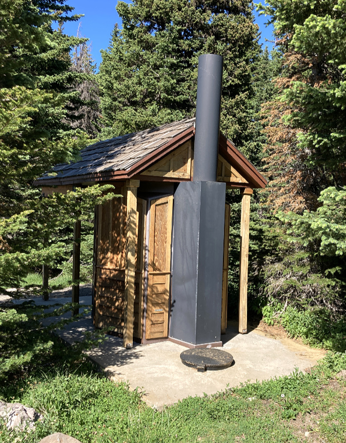
Dad and daughter signing in at Owl Point in 2016 (photo courtesy of Sergey Kiselev)
Making time for this blog is always a challenge, given my day job, caring for family and a broken-down old house… and all the other distractions in life that we ALL tend to! So, I’m a bit tardy with this article. But to be candid, it’s the political chaos unfolding at the national level in this election year that has been on my mind in a big way, making it hard to think about the places and things I care about most, right here in WyEast country. I also know I’m hardly alone in being discouraged and fearful about what the November election might bring for our country. It’s a crazy time in America. Again.
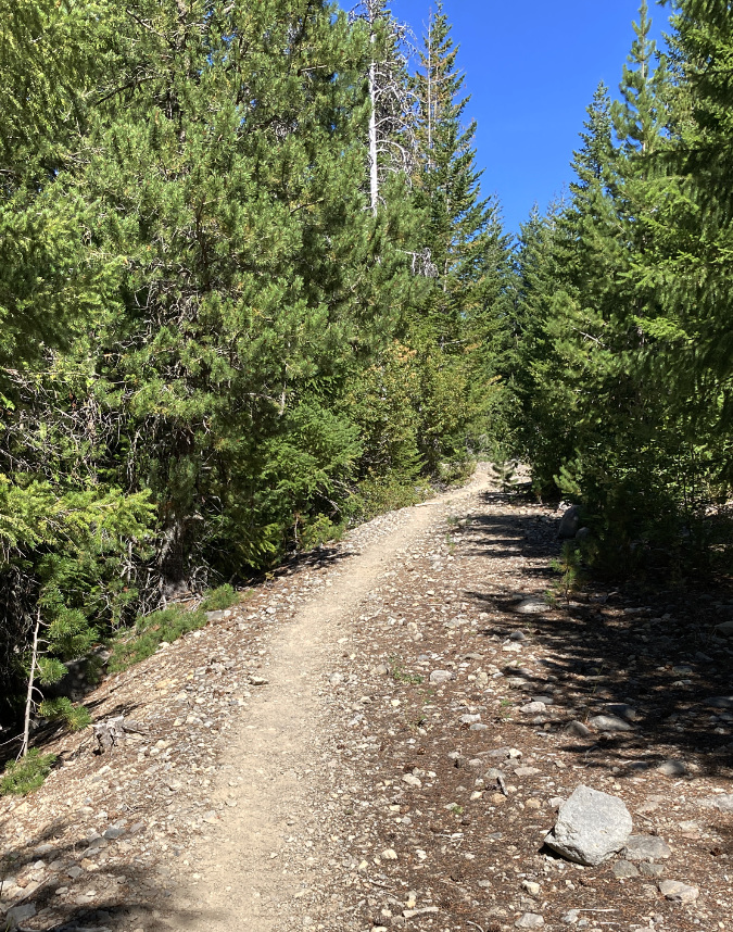
Then I had a breakthrough last week. I was up at my beloved Owl Point, on Mount Hood’s north side, scouting for an upcoming trail stewardship event. While there, I was doing my annual tending to the summit register I placed there in 2012. It’s a simple setup: a painted steel ammo box with some maps and photos of the area and a simple log book for folks to sign.
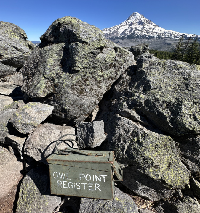
Twelve tough years in the elements, and the Owl Point Register is still holding up in 2024!
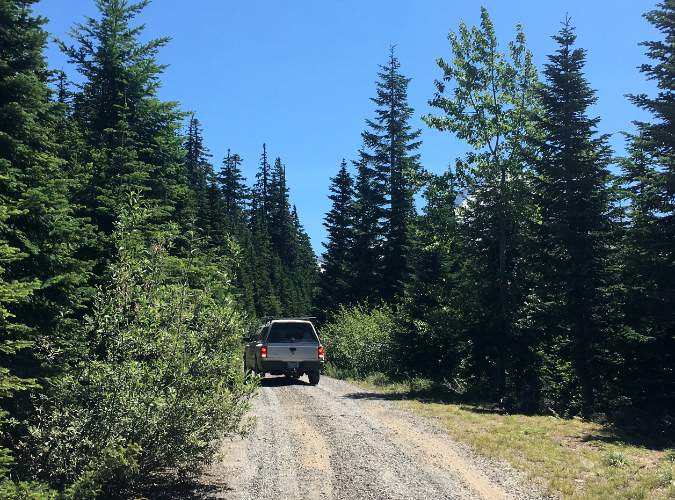
When I placed it back in in the fall of 2012, I didn’t expect a big response. Though the Old Vista Ridge trail to Owl Point had been re-opened by volunteers five years prior, in the summer of 2007, it was still only lightly visited. The Forest Service would not formally recognize the trail as “maintained” for another five years. Looking back now — twelve years later — more than 1,000 entries by individuals, couples, families, hiking groups and even the occasional dog fill 272 pages (and counting) that have now spilled into a third edition of the register!
Given its popularity, I’ve always fretted about the box being vandalized or stolen, thus losing all those entries and the wonderful personal histories they contain. Therefore, whenever I’m up at Owl Point I take photos of the latest entries as a backup, of sorts. In this way, I’ve maintained a running digital (so to speak) version of the register since the very beginning.
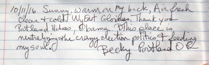
It was in this context of capturing the latest entries that I came across the following message last week. It had been entered last October, just before the winter snows closed in on Owl Point:
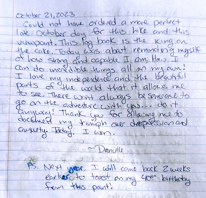
Reading Danielle’s brave, vulnerable message immediately broke through the political noise, dread and polarization that has been swirling in my head in this miserable election season. It reminded me that the antidote to all of the toxicity washing over our society right was right in front of me – Mount Hood towering above and Danielle’s personal testament in my hands. It was a needed reminder of the limitless restorative powers of just being out in nature, rediscovering who we are and what we care about most, and being reminded that we’re always stronger than we think.
And therein was the breakthrough for me: return my own focus to being an active advocate and steward for our natural landscapes right here in WyEast Country: for a better future for Mount Hood and the Gorge and for the trails that provide access for everyone to our precious public lands.
Restoring my focus back to these things that matter most to me, and making time to be outside in nature has already helped provide me the renewed sense of hope and perspective I’ll need to make a difference this fall — and beyond. It was always there, but Danielle’s messages was the reminder I needed to look past the discouraging distractions and toward things that I can directly impact right here in my corner of the world.
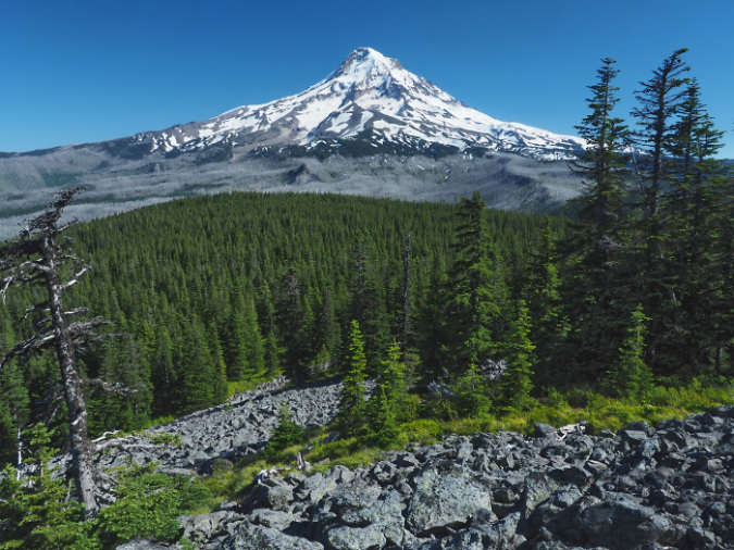
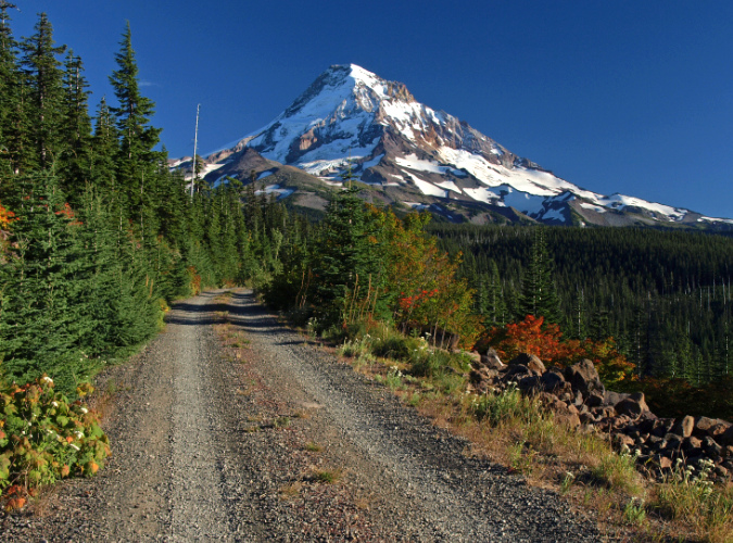
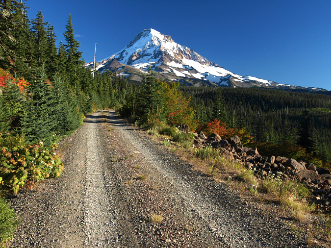
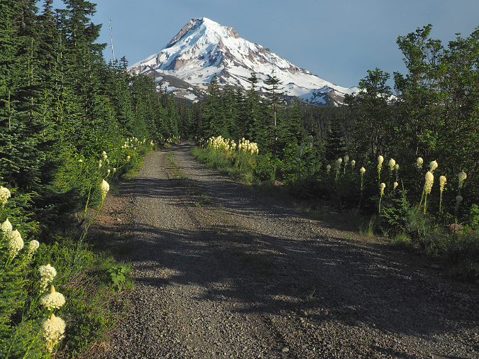
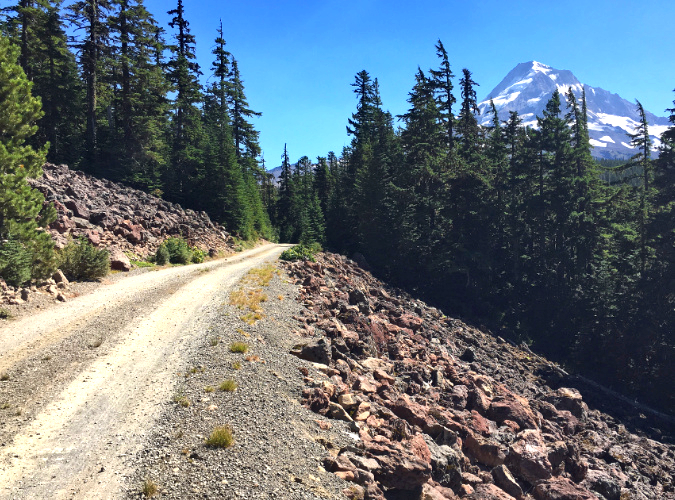
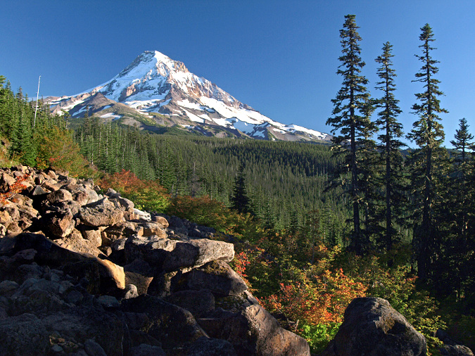
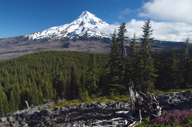
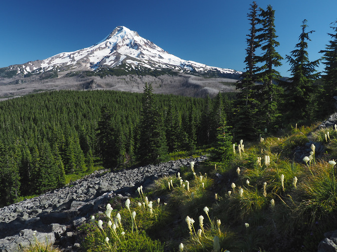
Mount Hood shining under a brilliant summer sky last week in this view from Owl Point – the highlight of the Old Vista Ridge trail
And thus, this article. It’s simply a collection of highlights that I’ve selection from the hundreds of messages posted in the Owl Point Register since 2012. I’ve chosen them based upon the joy, hope, graciousness and good humor they offer. They range from poignant and spiritual to whimsical and silly. Yet, in every message you can feel how just being there at Owl Point, taking in that amazing scene, has inspired these messages. The first batch of selections spans the first five seasons, from fall 2012 through 2016. Part 2 of this article will draw highlights from 2017 through the present.
I hope these will resonate with you as they do with me, perhaps restoring some much-needed hope and faith in humanity for you, as well, in this crazy, consequential time we are living in.
It all started in October 2012…
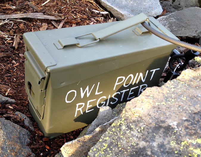
The freshly painted Owl Point Register on the day it was placed – October 17, 2012. The ammo can was from Andy & Bax in Portland (the iconic store recently closed, ending an era). I added a coat of army-green Rustoleum and some shaky, hand-painted lettering…
The Owl Point Register came about as part of a plan to bring more folks to the (then) little-known Old Vista Ridge trail, with an eye toward creating broader awareness of this largely unknown corner of Mount Hood’s backcountry. The register not only lets visitors share their thoughts with those who follow in their footsteps, it also describes the rich history of the area, and has maps and a photo guide to the features on Mount Hood that they can study as they take in the view.
In 2009, President Obama signed an expansion of the Mount Hood Wilderness into law that pushed the protected area north by about a mile, to where it now follows much of the Old Vista Ridge trail as the official wilderness boundary. It was a welcome recognition of the restored trail and an overdue expansion of protections for the mountain, yet still leaves the rugged country north of the trail unprotected. Thus, the continued goal to make the area known to hikers who can help advocate for its future. As recently as 2008, the Forest Service had proposed an off-road vehicle “play area” for Owl Point and Old Vista Ridge, so the risks of losing this wild place are still very real.
Old Vista Ridge Jedi-volunteer Jamie Chabot becoming one of the first to sign the new register on a foggy day in November 2012
Within the first year, the register began to fill with messages from hikers. Many were astonished at the “new” view from Owl Point that the trail provided – one of the finest of the mountain, and yet largely unknown at the time. There were also many kudos for those who had rescued the Old Vista Ridge trail and continued to restore this historic route. This was especially rewarding to the handful of trail volunteers doing the work, as it was still unofficial, and there was no guarantee that the Forest Service would eventually recognize the trail, even in its restored state.
The opening message in the register was written by me on October 17, with a bit of an introduction to Owl Point:
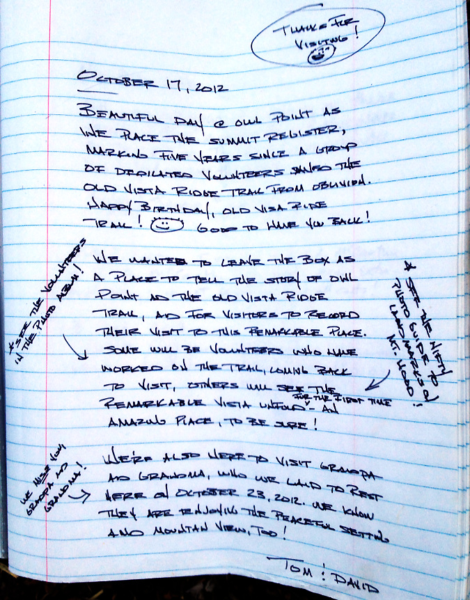
I’d forgotten until preparing this article that I also recorded scattering the ashes of my beloved grandparents on that first day! They had asked me to someday place their remains on Mount Hood, and there simply was simply no better place than Owl Point. I still check in with them every time I’m up there – and they always report that they’re enjoying the amazing view!
2013
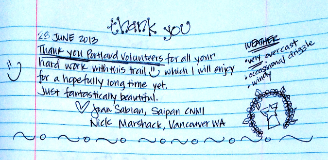
The register began to really catch on during its first full season at Owl Point, in 2013. Among the early surprises: international visitors… to Owl Point? It turns out this hike description that I wrote in the Oregon Hikers Field Guide had reached far beyond the shadow of Mount Hood to wherever internet access existed. In this case, all the way to Saipan:
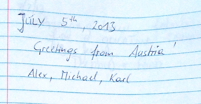
…and soon, more international visitors to Owl Point – from Austria:
…and from France!
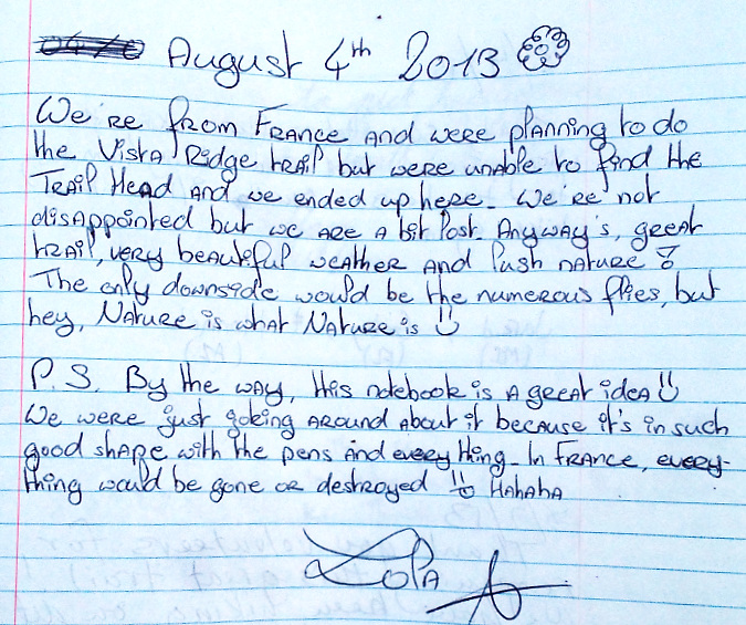
The postscript from the French visitors surprised me, too! I don’t know that Americans have any better track record than Europeans when it comes to respecting public spaces, but I do think that the particular slice of humanity that is willing to walk two miles into a wilderness for a mountain view does. Hikers are good people.
2014
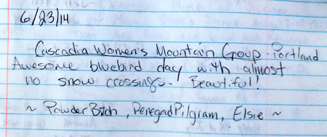
As the popularity of the Old Vista Ridge trail continued to grow, entries in the Owl Point Register began to include organized hiking groups, like this one:
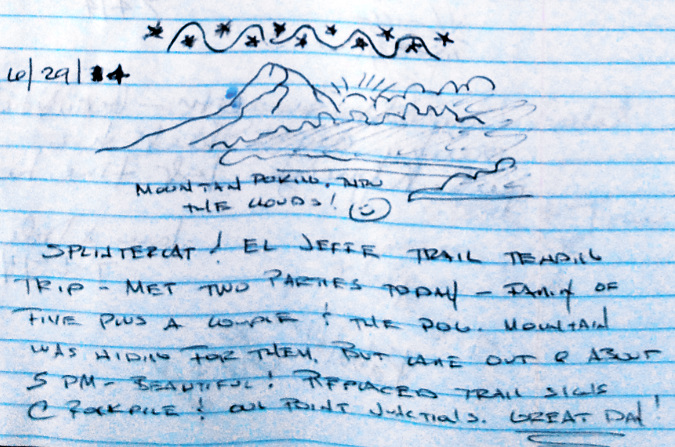
Every year, I’ve also added my own entries to help me track the changes since my last visit. Here’s a message from a trail tending trip in 2014 with Jeff Statt, another Jedi-volunteer. As you can see, seeing other hikers on the trail was still a novelty at the time and very rewarding:
So, what did the mountain look like on that June day in 2014? Like this:
The view from Owl Point in June 2014
Here’s Jedi Jeff reading some of the latest entries in the register on that day back in 2014:
Jedi-volunteer Jeff Statt reading the Owl Point Register in 2014
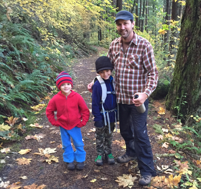
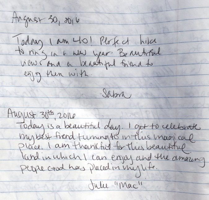
Among my favorite entries over the years are those from young families. I had the good fortune of growing up with an outdoors-oriented family, an experience that has since shaped every aspect of my life. Thus, I love to see young parents adventuring into the forest with their kids. In this case, parents Mike and Brittany signed in with a bunch of kids in July 2014:

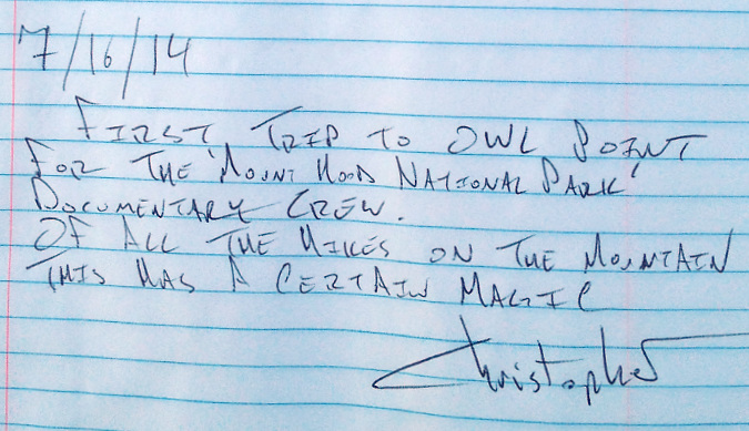
This notable entry in 2014 is from documentary film maker Christopher Alley, made on a scouting trip to Owl Point:
Chris (white shirt in the photo, below) returned the next year with his crew, and I was privileged to come along for the ride. Spending time with them ranks among the best adventures I’ve stumbled into in my life.
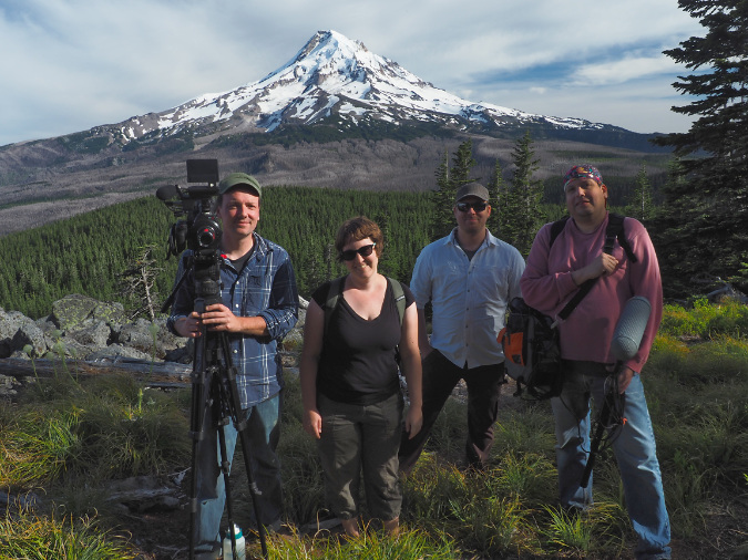
Documentary filmmaker Chris Alley and his crew at Owl Point in 2015
Plenty of close friendships are shared in the Owl Point Register, too – along with many Owl-themed sketches and memes:
So, where did Owl Point get its name? No, not from any official proclamation or map. I confess: I made it up! But that backstory will have to wait until a future article…
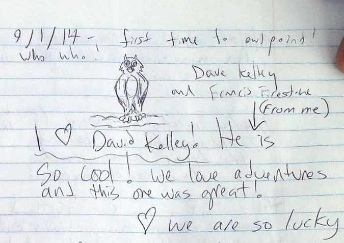
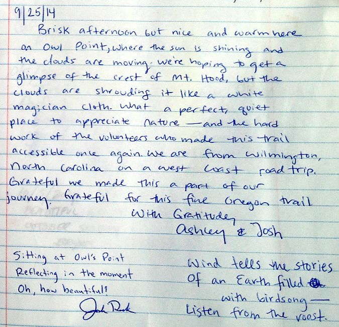
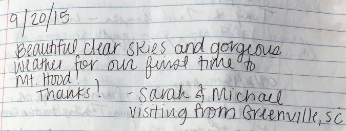
By the fall of 2014, the register was filling up fast, often with reflective messages from visitors near and far – like this introspective pair from North Carolina:
Often visitors are inspired to include ballpoint art of Mount Hood, like this entry from October 2014:
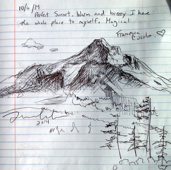
I’m a visual thinker, too, so I do appreciate the urge to draw when inspired – thank you, Francesca!
2015
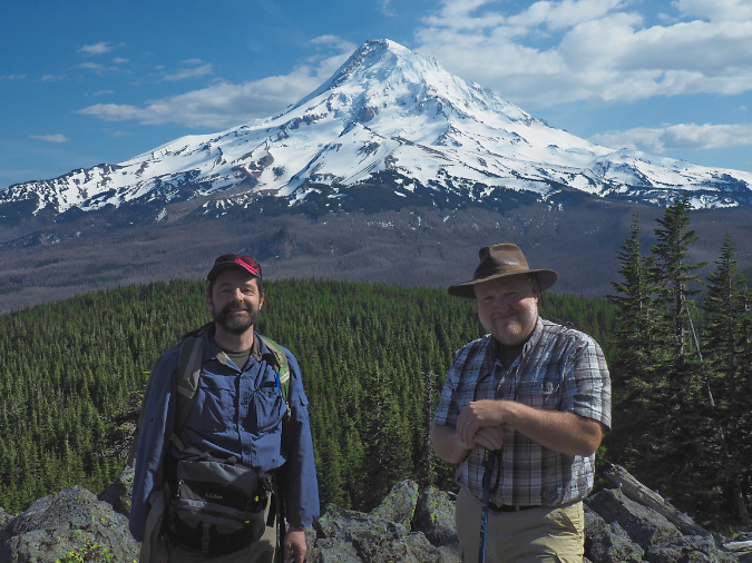
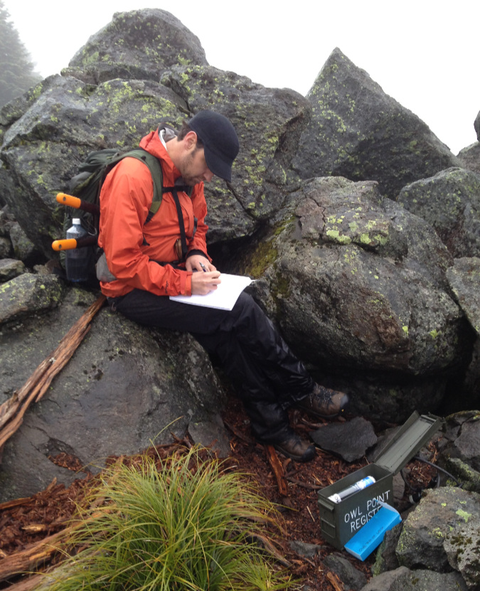
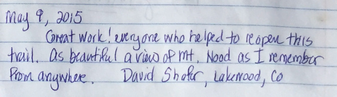
Reunited with my college friend David in May 2015
The Old Vista Ridge trail to Owl Point has become one of my go-to hikes with out-of-town visitors looking for a Mount Hood adventure. Such was the case in the spring of 2015 when my college roommate David Shafer (above, with me) was in town. David is originally from Portland, so while he’s been in Colorado for many years, now, he still knows his Hood – as you can tell from his message in the Owl Point Register:
I’m not the only person who brings out-of-towners to Owl Point – in this case, sibling escaping to the mountain in June 2015:
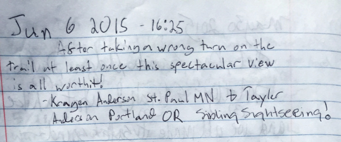
For the record, in the years since this message was posted, those confusing junctions have largely been resolved, and signs posted at those that remain, so fewer folks are getting turned around on the route to the Owl Point trailhead.
The spectacular view of Mount Hood from Owl Point has inspired many spiritual reflections in the register over the years – like this one:
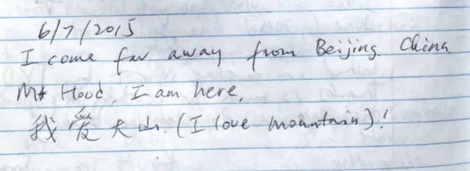
This 2015 message from a Chinese visitor came complete with Mandarin and English praises for our mountain:
Continuing the out-of-town theme, these visitors from Oregon, Texas and Sydney, Australia made the trip on consecutive days in June of 2015:
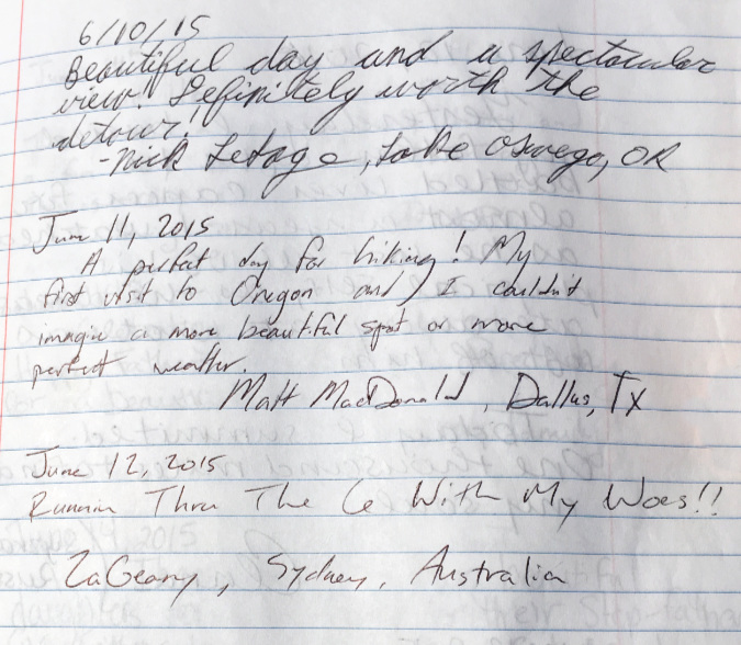
…though the meaning of the Aussie message is lost in translation for me!
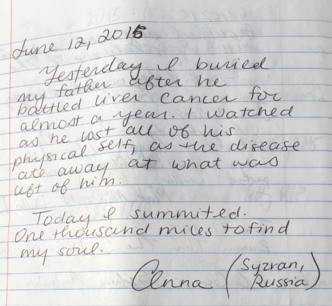
Here’s another from around the world, this time a reflective message from a Russian visitor seeking the restorative power that is so specific to time spent alone on a mountain trail:
Here’s another spiritual sentiment from 2015 that I can sign onto…
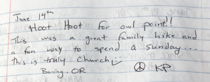
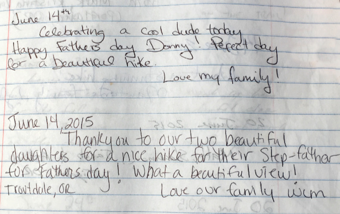
…and on the same day, two families taking dad out for a hike on Father’s Day recorded this:
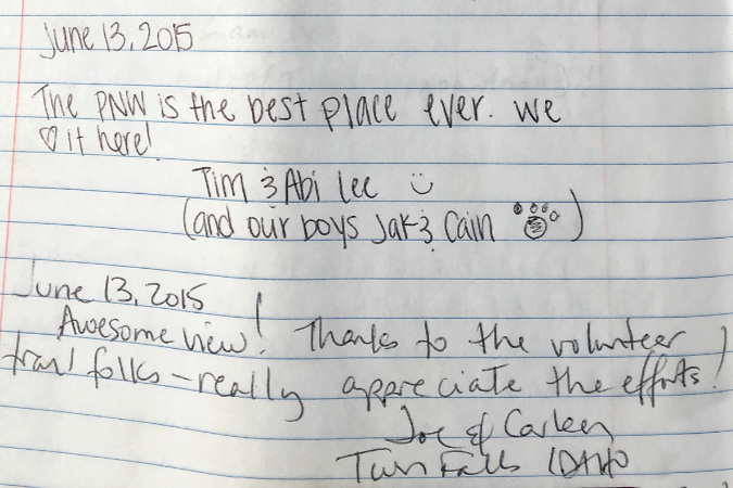
Still another family (and their dog) and some visitors from Idaho left this entry in June 2015:
These youngsters left a message in June 2015:
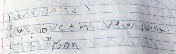
No doubt Eli and Tyson enjoyed the view, but one of the best parts of having a summit register is watching kids’ eyes light up when they see it. I don’t know how much they absorb from its contents, but they DO love to open the box and unpack it!
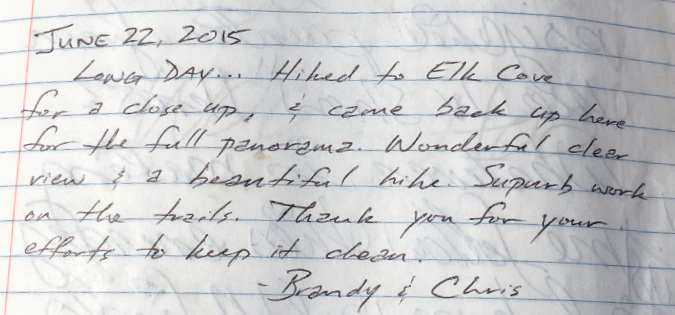
This message from a pair of especially energetic hikers caught my eye:
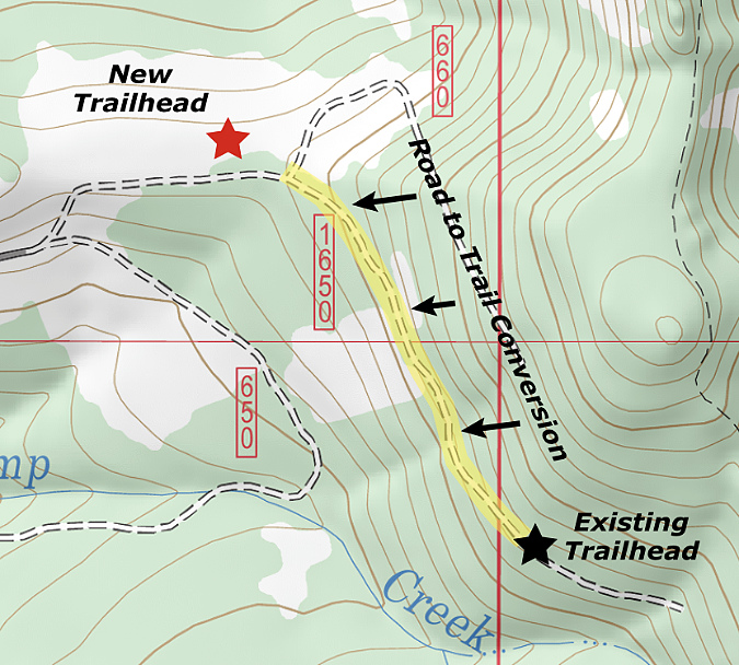
One of my goals is to eventually complete a trail connecting Old Vista Ridge to Laurance Lake, something the Forest Service has already agreed to in concept, at least. This would allow for a very long wilderness loop for backpackers that connects Owl Point to the Timberline Trail via Elk Cove and WyEast Basin.
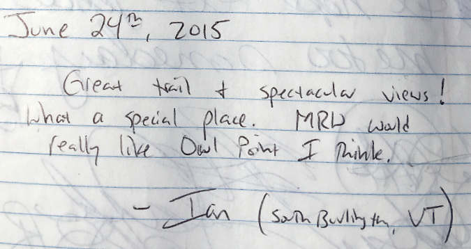
Here’s the first post from a Vermonter…
…and this is an enthusiastic message from one of the formal hiking groups that have added Owl Point to their annual offerings. These folks were in an older group of 60+ “spring chickens” from Portland:
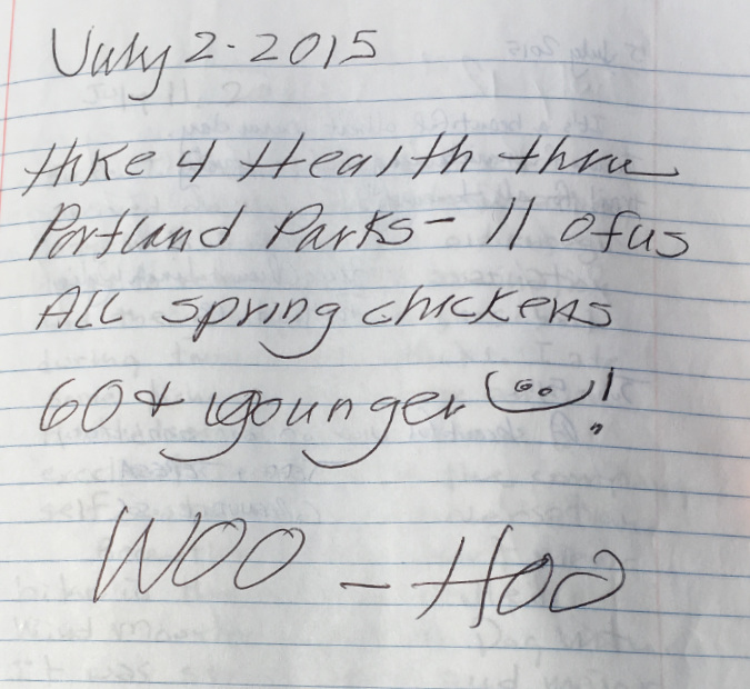
Second only to seeing young kids on the trail, I do love to see older hikers on outings like this. They inspire me, as I’m now in their cohort (ahem!) at age 62, and they seem – make that, they ARE – among the happiest, most contented people I know!
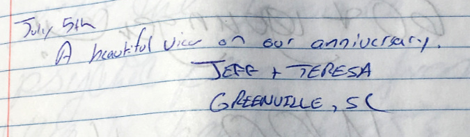
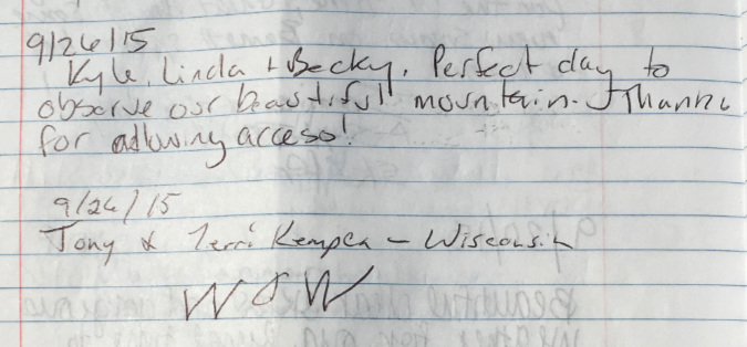
Still more out-of-towners, this time two South Carolinians celebrating an anniversary – another surprisingly common theme among visitors to Owl Point:
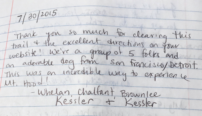
…and still more out-of-towners visiting WyEast country in July 2015 (with their dog) – this time from Detroit and San Francisco:
As had been the case for several years, I was joined once again by Jedi-volunteers Jamie and Jeff in the summer of 2015 for more trail tending (below). At this point in its restoration, the Old Vista Ridge trail was starting to look like it had never been abandoned, with the growing number of boots on the trail making it look well used and well loved.
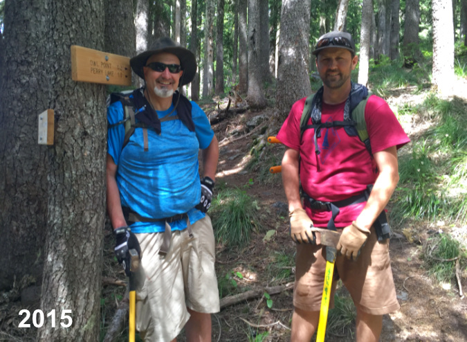
Old Vista Ridge Jedi-volunteers Jeff Statt and Jamie Chabot
This message from July 2015 is a first for the register – a marriage proposal! These folks were visiting from Minnesota:
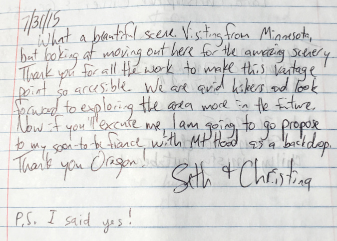
…and naturally she said “yes”! It’s the Owl Point effect, and this is just one of my life events that have been recorded in the Owl Point register over the past 12 years.
Sometimes complete strangers become acquaintances by virtue of meeting on a trail like Old Vista Ridge, as seems to be the case with these visitors:
More out-of-towners, this time hecking the box for visitors to the Upper Left corner of the country from the Lower Right corner:
This eclectic group took me a few reads to figure out, but we seem to have five out-of-towners (two from the U.K.) visiting a Portlander:
Sometimes visitors leave big, bold messages of hope – like this one from August 2015:
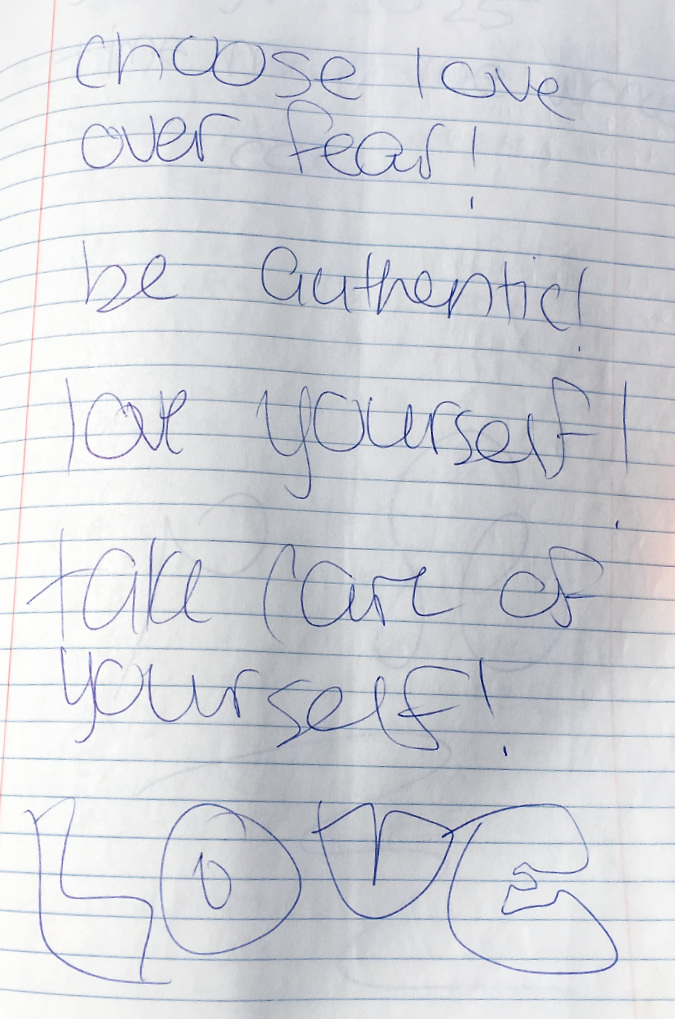
…and sometimes there’s just anonymous whimsey… or maybe not?
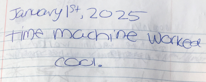
The above time machine message was just too much for this youngster to resist a few days later:
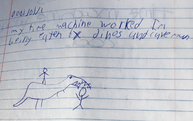
Aha! So, cavemen eat hikers, too? Well, I’ll just add them to the list with mosquitos and black flies… and dinosaurs.
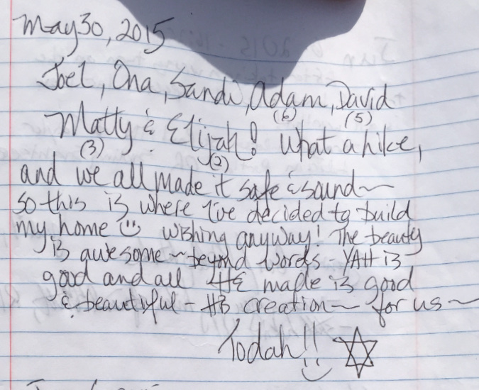
Place a summit register in front of a stunning mountain view, and you often find entries from people experiencing a crossroad in their life or celebrating a personal milestone. This message is such a great example. I’ve included an enlargement of the sidebar on the left (which is a bit difficult to read), as this is the crux of the message from this transplanted New Yorker:
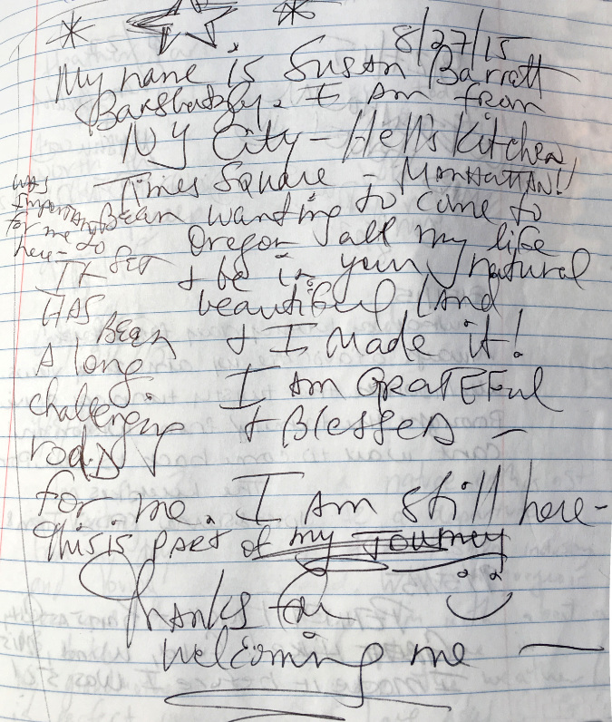
Enlarged view of the reflective sidebar:
The challenge of a new trail, the experience of being in a deep forest, the vastness of a mountain view spreading out before you and the satisfaction of reaching your destination. This seems to inspire so many visitors to Owl Point to step away from the background noise of their daily lives and allow needed time for reflection and restoring the sense of peace of gratitude that we all need. I know it has this effect on me, every time I go there.
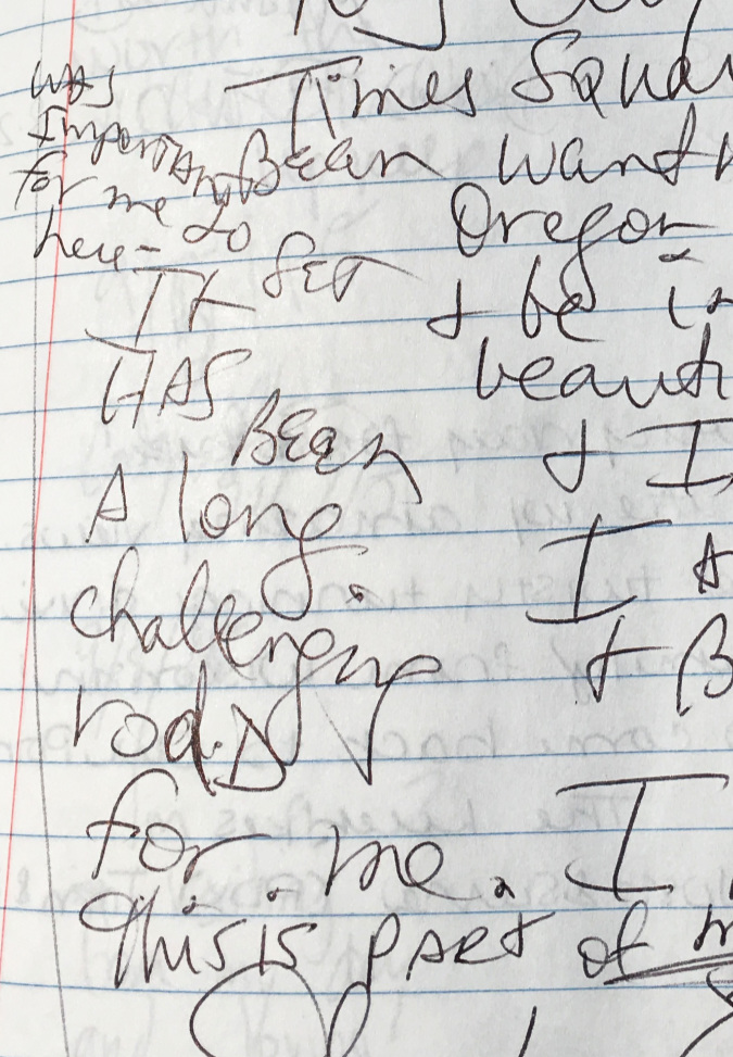
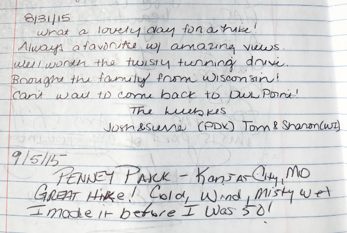
More out-of-towners in 2015, this time from Wisconsin and Missouri:
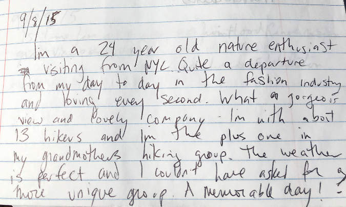
And another New Yorker, this time a young person in their mid-20s joining their grandmother’s hiking group for the trip to Owl Point. There are many family entries like this, and they underscore the role trails can play in creating experiences that bridge generations and bond our relationships:
On the theme of family bonding, Jedi-volunteer Jamie Chabot wasn’t all work at Owl Point back in 2015. Here, he made a point of bringing his young boys to walk the trail their dad helped build:
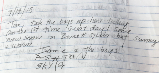
Jamie is a single dad, so making the time to help restore the Old Vista Ridge trail and provide his boys with an outdoor-oriented life takes real effort. Hopefully his boys (below, with Jamie, in early 2015) will hike this trail for many decades to come, knowing that their dad played an important part in making it happen!
Jedi-volunteer Jamie Chabot on the trail with his boys in 2015
Here are still more grateful out-of-staters admiring our backyard in 2015 – these folks are from South Carolina and Wisconsin:
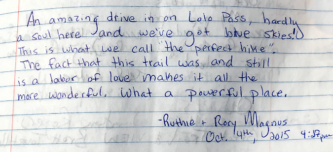
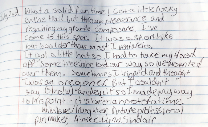
One of the final entries recorded in the fall of 2015 is what mindfulness and gratitude are all about. This is why public lands, and the trails that allow us to experience them, matter so much in our modern world:
2016
While this year’s election year turmoil has brought back unwelcome flashbacks to the 2016 election debacle, that year was especially lovely at Owl Point. The Beargrass bloom cycle was enjoying one of its peak years (below) and a healthy snowpack on the mountain lingered well into summer.
Summer 2016 brought a spectacular Beargrass bloom to Owl Point
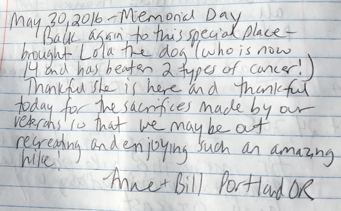
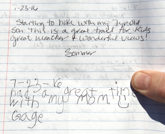
These grateful hikers were among the first to hike the trail in 2016 when they visited on Memorial Day, likely crossing a few snow patches along the way and leaving a reflective message of thanks and appreciation in the summit register:
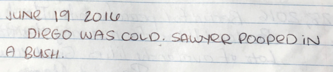
This coming-of-age message from the same day in 2016 is among my favorites, as I was also 16 when I completed my own first solo overnight hike on Mount Hood:
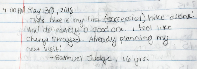
Samuel is 24 years old, now, wherever he might be. Hopefully, this early confidence-builder will continue to be one of those childhood formative experiences that keep us pushing forward throughout our adult lives. I know it was for me – I still remember that first solo trip like it was yesterday!
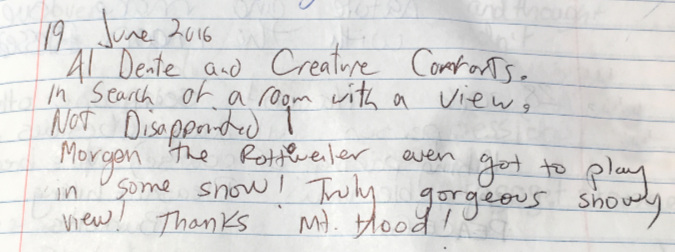
Here are a pair of dog messages from the same day in June 2016 – the second one is especially inspired… in an offbeat, Steven Wright way:
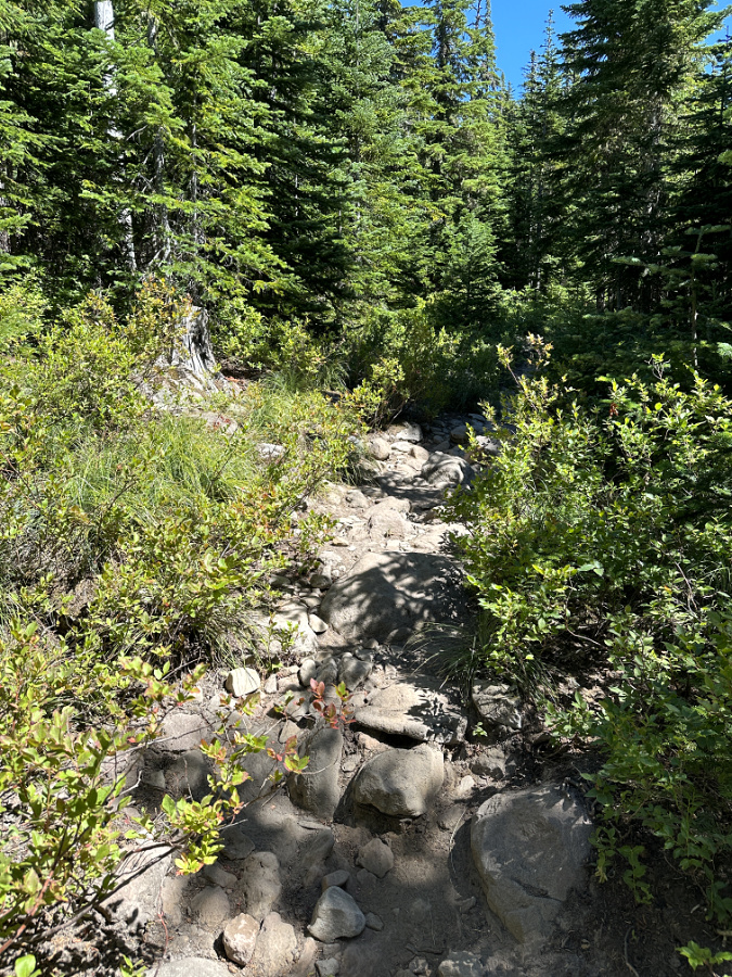
The Old Vista Ridge trail is a great option for dogs. It’s largely forest traveling, with plenty of shade and a soft trail surface that’s easy on their pads. It’s also uncrowded, making it easier to navigate with your pup and avoid unwanted interactions with other dogs. Notably, while I have seen plenty of dogs up there in the 17 years I’ve been involved with this trail, I have yet to find one of those notorious, orphaned bags of dog poop left behind – that’s quite a streak!
This message from July 2016 took me a couple of reads to figure out, but it’s both tongue-in-cheek and an earnestly triumphant message from a person just getting their trail legs under them:
Here’s another favorite from that year. I love seeing families on the trail, and especially a single parent out their children. It takes a lot of commitment, but they’re doing such an important thing that will forever influence their kid’s lives:
(…and apologies for my thumb in a few of these – they were all taken up at Owl Point, and quite often I was battling the wind to hold the pages down with one hand while shooting the photos with the other!)
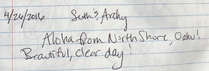
Here’s another out-of-towner, this time from Hawaii – a first for the register:
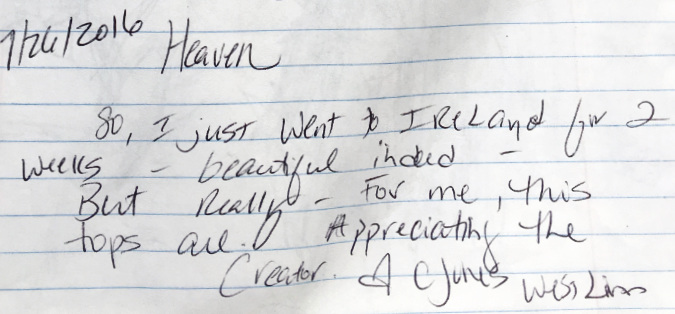
In this message, WyEast country counts as Heaven on earth, and I can surely sign on to that (and no offense to Ireland):
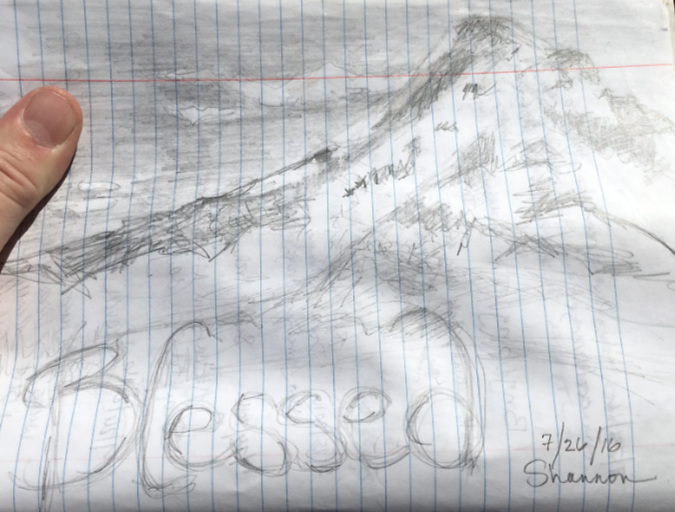
More mountain-inspired sketch art (and my thumb, again)….
…and still more art, this time from budding artists. Sure, I can see the mountain! I think…
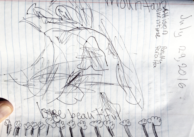
I can definitely see the trees! Thank you for the fine art, Allison and Christine – and yes, it is beautiful.
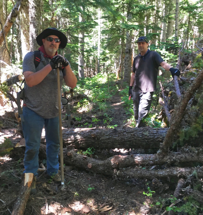
Jedi-volunteers Jeff and Jamie clearing winter blowdown on the Old Vista Ridge trail in July 2016
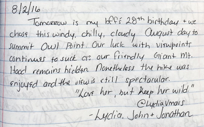
A good number of messages in the register share the frustration at our unpredictable weather that the example below carries. Yet, these messages invariably end with deep appreciation for time spent in the mountains, even if “the friendly giant Mount Hood” is hiding in the clouds. As the saying goes, “there are no bad days on the trail”:
Still another New Yorker shared a message in 2016, this time a visitor from upstate – plus a couple of local dogs give two paws up on the view:
And yet another anniversary celebration that year….
This message from 2016 is significant for the mention of William Sullivan’s guidebook:
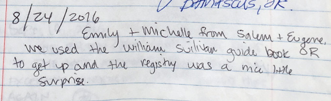
Sullivan added the Old Vista Ridge trail to his fourth edition of the popular Northwest Oregon hiking guide, published in 2013. This edition followed both the reopening of trail by volunteers, and the 2011 Dollar Lake Fire that torched the nearby Vista Ridge Trail. The fire left Old Vista Ridge and Owl Point untouched, which Sullivan describes as a shady, green alternatives to the better-known trails that now traverse the burn. Sullivan’s guide surely sent a few more hikers from well-beyond WyEast country to the trail.
Here’s a wonderful pair of messages from August 2016 that simply celebrate a friendship:
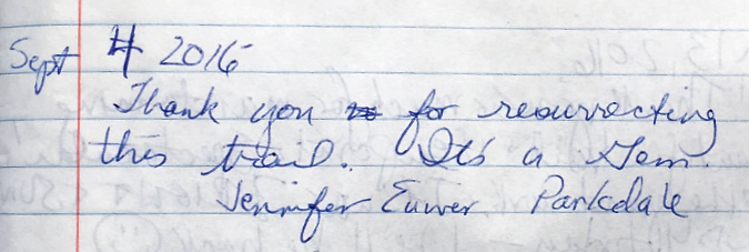
This brief message stands out for the location. The farm community of Parkdale is plainly visible from Owl Point, directly below, in the Upper Hood River valley. While it’s fun to see entries in the register from all over the world, it’s especially rewarding to know that local residents are enjoying this trail, too:
Here’s a fun message that covers a lot of ground, from corny jokes to a new life together that hikers Allie and Tom were about to embark upon:
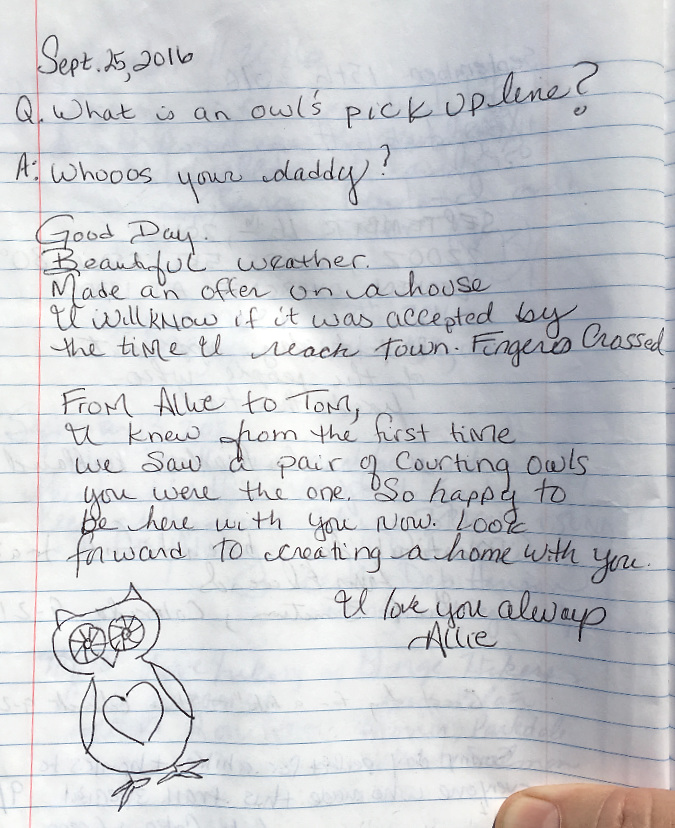
Bonus points to this couple for the owl sketch and symbolism! Hopefully, they can still return to Owl Point once in a while to recharge and remember this significant day for them back in 2016.
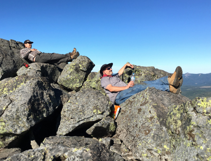
Jeff and Jamie relaxing on the rocks at Owl Point after a day of trail work in July 2016…
…where the view is the reward!
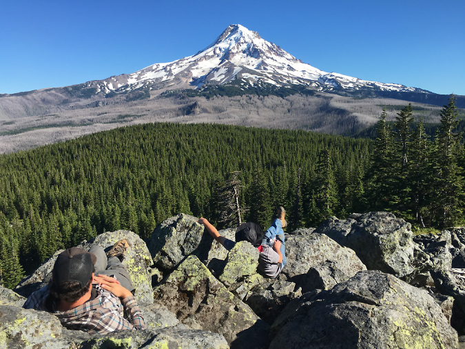
Still more out-of-staters in the register in 2016, this time from Scott and Grant in Georgia:
I googled it, and that last part refers to the Georgia Institute of Technology mascot – the Yellow Jackets! Georgia Tech is located in downtown Atlanta and Cumming is a northern suburb.
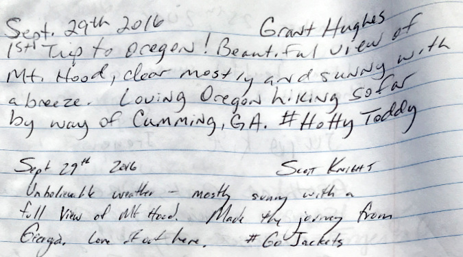
Here’s a message from September 2016 that jumps from a simple weather report to being surprisingly philosophical:
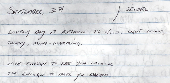
This message is straightforward, but “my favorite hike” is always music to my ears when it comes to Old Vista Ridge and Owl Point:
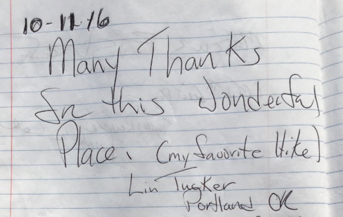
…and then there’s this message that still resonates today – or echoes, perhaps?
Note the date. The country was in the middle of deeply divisive political meltdown that fall, just as we find ourselves in today. As the current election cycle looms, this message from eight years ago is such a good reminder to take time out and gain perspective in that way that a day on the mountain can provide. The sound of wind and scent of a mountain forest really can help drown out the unwelcome echoes from everyday life that we often carry with us.
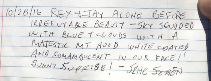
Just a few days ahead of the 2016 election, Rex and Jay were poetic in this message – though I still can’t figure out what “somambucent” means!
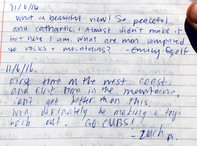
That fall brought a lot of reflective comments to the Owl Point register. Here are a pair of messages left on the Sunday before the 2016 election – one from a philosopher and the other a first-timer to our mountains:
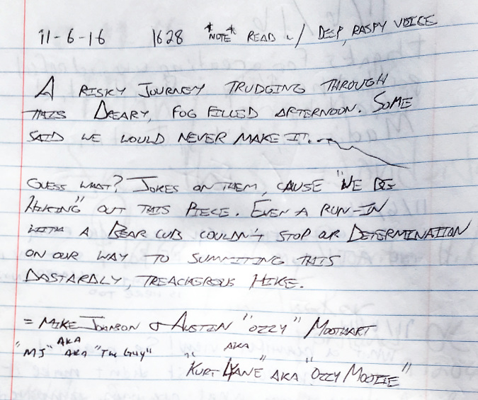
..and on that same November Sunday, a pair of visitors with multiple aliases left this tongue-in-cheek ode to determination “to be read in a deep, raspy voice”. I chose Orson Welles:
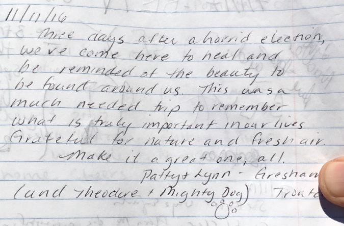
This message – left three days after the 2016 election – serves as yet another reminder that we’ll always need our trails (and the public lands they lead us into) as a counterbalance to the twists and turns of everyday life. Trails help us reconnect with “what is truly important in our lives” when we most need to restore that faith.
I’m quoting Patty and Lynn (and Theodore and Mighty Dog) on that part, as they said exactly that in this final message in the Owl Point register for 2016:
Reading through these messages eight year later reminded me that we did, in fact, survive that election cycle. While real harm was done to our democracy (and to our public lands) during the four years that followed, we also lived another day to work toward “that more perfect union”. With progress comes setbacks – and 2016 was a doozy.
Nobody knows what more the 2024 election will bring this fall, though we’re off to a very rough start. Being alone with the view on that stellar, crystal-clear day up at Owl Point last week, and reading through the many hopeful, joyful and gracious messages left in the summit register restored a bit of my faith in humanity. In the end, we have so much more in common than the political battles might suggest.
The messages also reminded me to block out the political noise (and now violence, sadly) in this election cycle and sharpen my focus on being an active advocate and steward for trails and public lands. Yes, my vote might make a difference in the fall election, but I know I can make a difference right here in WyEast Country. That’s where I need to keep my head and heart through this turbulent time we’re in.
_____________
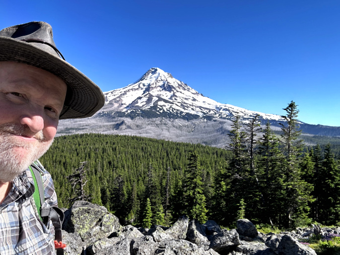
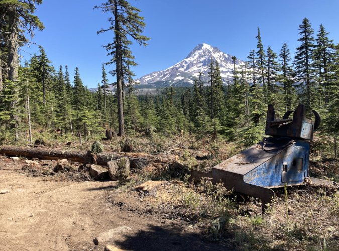
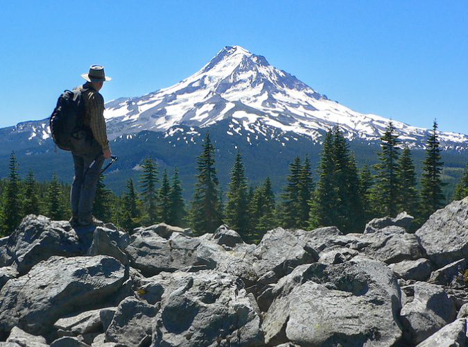
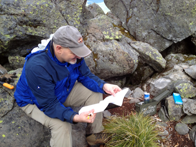
The author getting his head straight (once again) at Owl Point on July 11, 2024
In Part 2 of this article I’ll continue with more highlights from the Owl Point Register from 2017 to the present. This was an especially positive era for the Old Vista Ridge trail, despite the dysfunctional national political backdrop… and a global pandemic! More than ever, the trails were our inspiration and refuge, and Old Vista Ridge delivered.
More to come!
Tom Kloster | July 2024