Punchbowl Falls
Spring is a wonderful time to visit the new Punchbowl Falls County Park, located on the West Fork of the Hood River, near Dee. This article is offered an update on the new trails that area gradually being constructed in the park and a guide to visiting this beautiful area for a sneak preview while the trails are being completed.
Punchbowl Falls Park was acquired from a private timber company by the Western Rivers Conservancy just a few years ago, and finally came into public ownership in 2015 when Hood River County received a state grant to transfer the land from the conservancy. Trailkeepers of Oregon (TKO) has since been busy constructing a new loop trail geared toward families and casual hikers looking for an easy stroll with a lot of scenery.
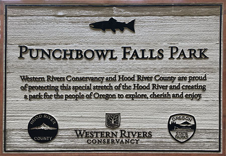
New entry sign at Punchbowl Falls Park
In 2016, TKO volunteers completed most of the West Fork Trail, a scenic route that traverses the open bluffs above the Punchbowl Gorge before arriving at a spectacular cliff-top viewpoint above Punchbowl Falls. The remaining segment of the West Fork Trail is expected to be completed by early summer, and will include a short spur to a viewpoint of beautiful Dead Point Falls, where a boisterous Dead Point Creek cascades into the West Fork.
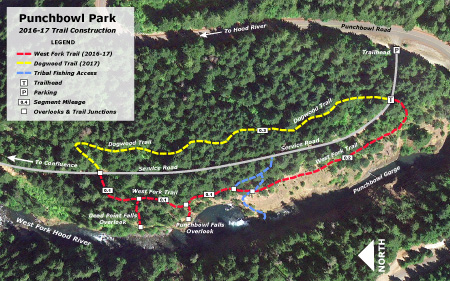
Punchbowl Falls Park Trails
(Click here for a large, printable trail map)
Over the summer and fall, TKO also expects to complete the Dogwood Trail, a short forest hike that will create a loop back to the trailhead. The completed loop will be just 0.8 miles in length, making it ideal for families and casual hikers. While the West Fork portion features views and rugged terrain, the Dogwood Trail offers a quiet forest and vibrant fall colors from vine maple and dogwoods that thrive under the Douglas fir and Ponderosa pine canopy.
The West Fork Trail
You can hike most of the new West Fork Trail now. Just look for an obvious new path heading off to the left about 100 feet down the park service road from the gate at the trailhead. The new trail descends briefly through forest before providing the first of many views into the Punchbowl Gorge.
As you travel this section, you’ll pass through several groves of gnarled Oregon White Oak that thrive along the rocky bluffs. Watch for the collapsing remains of an old stairwell making its way down the cliffs on the far side of the Gorge, too. These stairs were built in the 1950s, when the concrete fish ladder was constructed along the west side of the falls. While the ladder mars the natural beauty of the area, it does provide passage to extensive upstream fish habitat for salmon and steelhead.
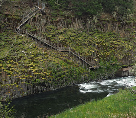
The old stairway to the fish ladder has seen better days…
You will also pass a series of faint trails that cross the new hikers route. While these informal paths are often used by kayakers to portage the falls, they were originally travelled by tribal fishermen visiting the falls. The area below the falls is still reserved for tribal fishing, and you may see local Native Americans fishing for salmon and steelhead from the cliffs inside the Punchbowl, just as their ancestors have for centuries.
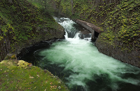
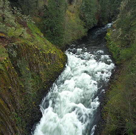
The new trail soon descends through more Oregon White Oak groves to the spectacular viewpoint of Punchbowl Falls. Plan to spend some time here watching the mesmerizing churn of the falls into the huge pool below. Keep an eye on kids and pets, here — there are no railings along the abrupt cliff edge.
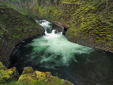
The massive amphitheater at Punchbowl Falls
On clear days the viewpoint above Punchbowl Falls has an added surprise: Mount Hood rising in the distance, above the Punchbowl Gorge. From this viewpoint, you may also see tribal fishermen on the rocks below — while it is fine to watch them work from above, please be courteous.
The fish ladder to the right of the falls was completed in 1959. Here’s what Punchbowl Falls looked like before the ladder was constructed:
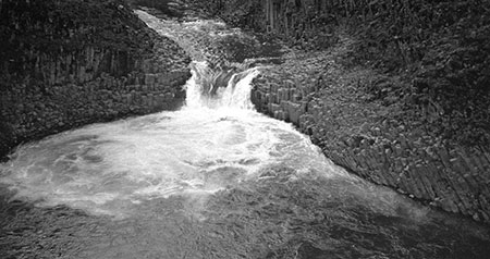
Punchbowl Falls before the fish ladder was constructed in 1959
Hopefully, the ladder can someday be rebuilt in a way that restores some of the beauty of this spot, as it surely could not have been built in this manner under today’s environmental protections. This amazing place has deep significance to Native Americans, and it seems appropriate to undo some of the impacts of our modern age on a place so valued by the tribes.
From the Punchbowl overlook, the route climbs back into forest for a few hundred yards. TKO crews are still completing the groomed tread, but the rough path is easy to follow. Watch for a faint side trail heading off to the left a few yards before the West Fork Trail ends at the service road. This spur path leads to a terrific view of Dead Point Falls, where Dead Point Creek cascades into the West Fork. Watch kids and pets here, too, as the viewpoint is unprotected.
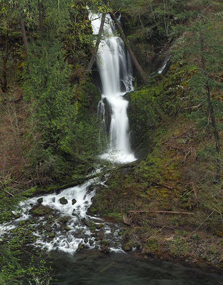
Deadpoint Falls
While the West Fork Trail currently ends at the park service road, the Dogwood Trail will soon begin on the opposite side of the road and provide a loop trail back to the trailhead. In the meantime, read on for other places to explore…
Exploring the Confluence
The Confluence
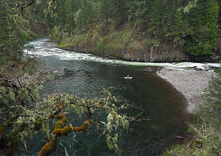
It’s easy to explore the northern section of Punchbowl Falls Park using the park service road and some of the fishing trails that crisscross the area. One of the most dramatic places to visit is the confluence of the West and East forks of the Hood River.
To reach the confluence, turn left on the service road from the end of the West Fork Trail and follow it to an obvious turnaround, where the road makes a sharp turn to the right, around the nose of a ridge. Look for a fisherman’s path on the left, heading steeply downhill hill to the confluence.
Rowdy East Fork Hood River at the Confluence
The two rivers area study in contrasts. The East Fork is unruly and filled with glacial till, and has built a huge pile of cobbles were it meets the West Fork at the confluence. The West Fork is cold and clear, with a large eddy that makes for good fishing and safe place for kids to wade in summer.
Wildflowers and Fall Colors
Grass Widow above the Punchbowl Gorge
Spring and fall are the best times to visit Punchbowl Falls Park. In spring the waterfalls are at their best, and there are wildflowers blooming throughout the park. In fall, the park lights up with autumn colors that only the east side forests can offer. Both seasons are quiet compared to the summer months, when the park can be quite busy with swimmers and floaters on weekends.
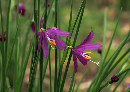
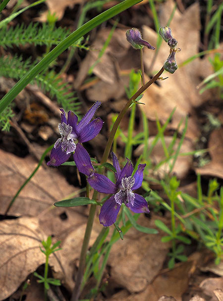
Wildflowers at the park are a unique blend of east and west. In April, the bluffs above Punchbowl Gorge are blanketed with Grass Widow (above), a desert flower common in the Columbia Gorge east of Rowena. The same meadows of grass widow are shared by Larkspur (below), more common in the wet west end of the Gorge.
Larkspur along the West Fork Trail
In forested areas, you’re likely to see Trillium (below), a hallmark of the rainforests of the western Gorge, and in early spring you’ll find Glacier Lily (below) where the trail passes through Oregon White Oak groves.
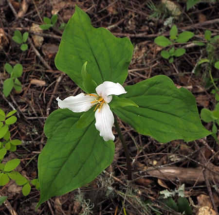
Trillium along the Dogwood Trail
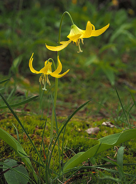
Glacier Lily near the Punchbowl Falls overlook
Watch closely and you might spot Calypso Orchid (below). This is another native more common in the wet forests of the west Gorge, but makes its home in the transitional forests of Punchbowl Falls Park.
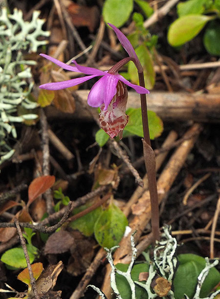
Calypso Orchid along the Dogwood Trail
In autumn, Pacific Dogwood (below) brings brilliant color to the forest understory throughout the park. In western Oregon, dogwood generally fade to pale yellow or pink in the fall, but on the east side of the Cascades, these graceful trees take on brilliant shades of coral, crimson and burgundy. In spring, Pacific Dogwood also blooms with handsome white flowers. When completed, the new Dogwood Trail will pass through several groves of these beautiful trees.
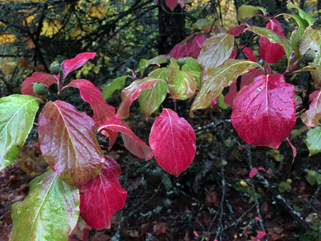
Dogwood in Autumn at Punchbowl Falls Park
Vine Maple is everywhere in the forests of Punchbowl Falls Park, and like the native dogwood, these graceful trees light up in autumn, providing shades of crimson, orange and bright yellow. Vine Maple crowd the route of the new Dogwood Trail, and will combine with the dogwoods to make this an exceptionally beautiful autumn hike.
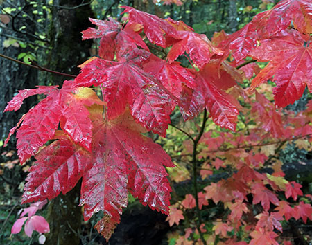
Vine Maple in Autumn
Fall colors in Punchbowl Park peak in mid-October and spring wildflowers are at their best from mid-April through early June.
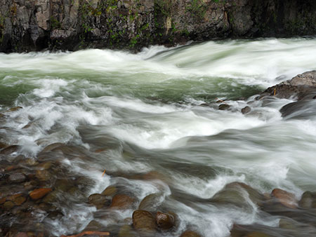
A View into the Gorge
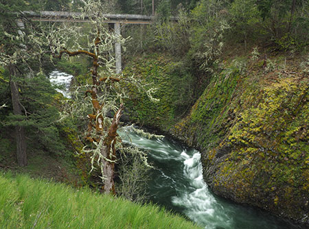
West Fork entering Punchbowl Gorge
If you still have time after visiting the West Fork Trail and the confluence, once last corner of Punchbowl Falls Park you might want to explore is the dizzying view from the bridge located just beyond the trailhead parking area. Simply walk about 200 yards to the soaring bridge for a spectacular look into Punchbowl Gorge, but use care — the railings are uncomfortably low!
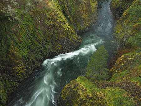
The Narrows in Punchbowl Gorge
The view upstream from the bridge encompasses the West Fork roaring into the narrow mouth of the Gorge, framed by towering walls of columnar basalt. The small structure just upstream is a river gauge used to monitor stream flows on the West Fork. The view downstream from the bridge peers into the narrows section of the gorge, with the West fork carving stunning curves and pools into the basalt walls.
These scenes, and the massive basalt amphitheater of Punchbowl Falls area among the best Columbia River basalt formations found anywhere in the region. It’s mind-boggling that this spectacular canyon was in the hands of a private timber company for more than a century! Thankfully, it is now protected in perpetuity as a nature park.
What’s Ahead?
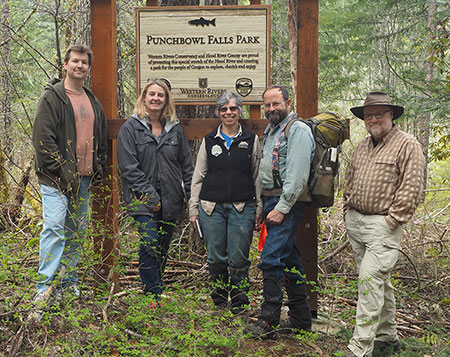
The author with TKO volunteers and county officials at a recent scouting trip at Punchbowl Park
Much work lies ahead for Punchbowl Falls Park this year. TKO has several volunteer work parties planned (you can learn more about them here), and Hood River County will begin improving the parking area at the trailhead to be a more accessible.
By fall of 2017, the new Dogwood Trail should be completed, and TKO volunteers will install trail signs on both the West Fork and Dogwood trails, officially opening the new loop to visitors. Over the long term, Hood River County and TKO are also planning an extension of the West Fork trail to the confluence and other trails in the new park.
Where to Find Punchbowl Falls Park?
Punchbowl Gorge and bridge from the West Fork Trail
It’s easy to get to the new park! From Hood River, take 12th Avenue south where it soon becomes Tucker Road (aka Route 281). Follow Tucker Road and signs pointing to Lost Lake. After crossing the Hood River at Tucker Bridge, watch for the Dee Highway immediately veering off to the right.
Follow Dee Highway (also part of Route 281) to the rusty, dusty remains of the old mill town of Dee. Veer right again, crossing railroad tracks and then the East Fork Hood River, then turn right again onto Punchbowl Road just beyond the bridge. Stay straight on Punchbowl Road at a 3-way junction, then enter forest at a hairpin turn. Watch for the parking area on the right, just short of the high bridge over the West Fork Hood River.
The new trail begins just beyond the metal gate that marks the park service road.
Enjoy!
