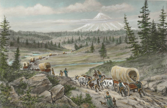
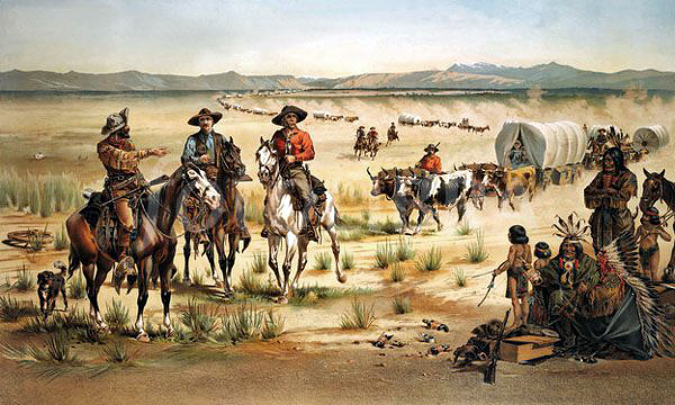
“The Barlow Cutoff” by William Henry Jackson (1930)
One of the loneliest landmarks in WyEast Country is approaching the century mark, and while the years have not been kind, it’s a spot that deserves to be preserved. The place is the Pioneer Woman’s Grave, located along a long-bypassed section of the original Mount Hood Loop Highway.
Roadbuilders discovered the grave in 1924 while building the original loop road. The grave was marked by an old wagon tongue and the remains of a woman were buried in a makeshift box built from wagon sideboards. Based on oral histories from Barlow Road tollgate operators, some historians believe this woman was survived by her husband and two young children, who continued on to the Willamette Valley after burying her here in the mid-1840s.
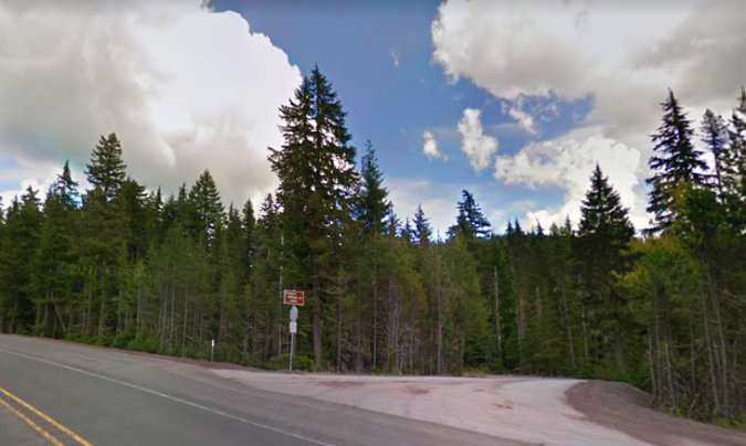
The Pioneer Woman’s Grave is just off OR 35 where a surviving section of the original Mount Hood Loop Highway heads off into the forest
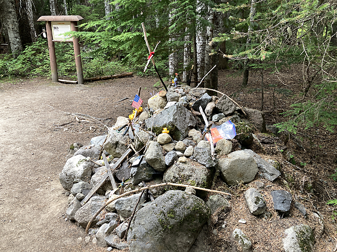
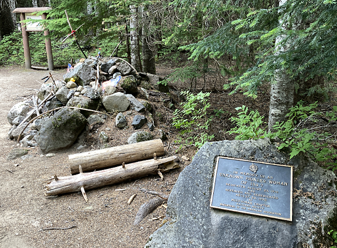
The grave is located just east of the busy US 26/OR 35 interchange, where a small, brown sign along modern OR 35 points to the historic site along a scenic and surprisingly well-preserved section of the original highway route. Today, the site is underwhelming, to say the least. The grave is marked by a haphazard pile of stones on the shoulder of the old road, and “graced” with all manner of ephemera left by visitors.
Pioneer Woman’s Grave in 2020
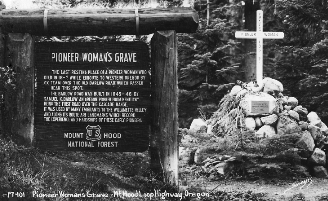
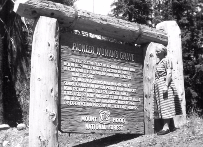
Several years ago, the Forest Service installed a new interpretive sign broadly describing the origins of the grave, but without much cultural context or detail. The sign is mounted in a heavy timber frame that gives a nod to a much larger, carved version built here in the 1930s.
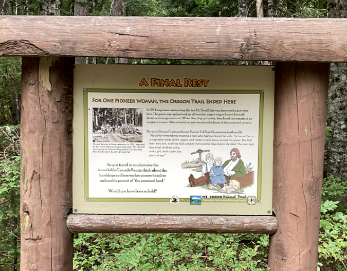
Relatively new Forest Service interpretive sign at the Pioneer Woman’s Grave
A brass plaque near the grave was placed here by the Daughters of the American Revolution (DAR), a non-profit organization that maintains historic markers around Oregon (and the country). The original plaque was installed on the grave, itself. The current plaque was moved to a boulder a few feet from the grave in 1982.
D.A.R. plaque at the Pioneer Woman’s Grave
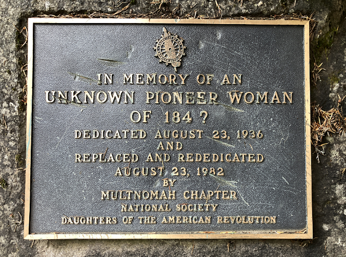
D.A.R. plaque at the Pioneer Woman’s Grave
Beyond the signs and plaques, the Pioneer Woman’s Grave historic site can only be described as rundown and shabby. The set of timber steps that climb a low berm that fronts the site is rotting away. Foot traffic has largely bypassed the crude steps and trampled whatever vegetation was once growing along the berm.
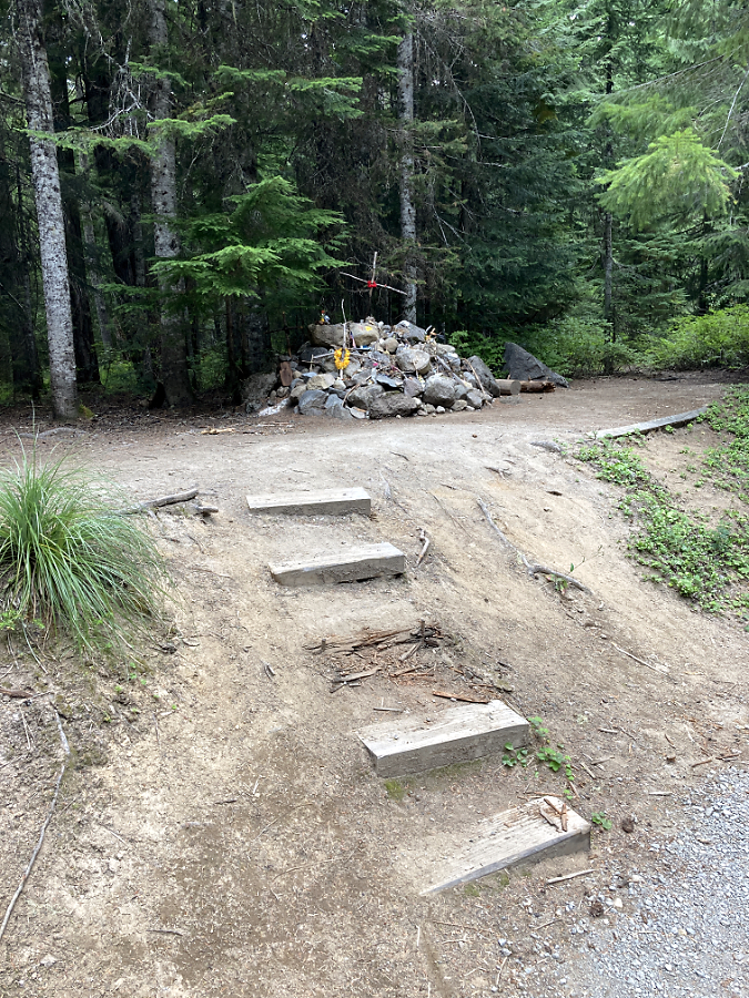
Crumbling wood steps at the grave memorial
The wood cross on the Pioneer Woman’s Grave is long gone, and the remaining pile of rocks doesn’t exactly inspire reverence and respect. The few who might notice the nearby dedication plaque and interpretive sign learn that this is a grave site, but the overall scene is haphazard and kind of sad.
Remembrances… or Disrespect?
In recent years, “offerings” left by visitors have escalated at the Pioneer Woman’s Grave. They range from flowers and sentimental toys to a few religious tokens left in earnest. But mostly, the memorial has become cacophony of random tchotchkes that have little to do with the site or respect for the human remains that lie beneath the stones. To give a sense of the scene, here’s recent sampling of these offerings from a few weeks ago:
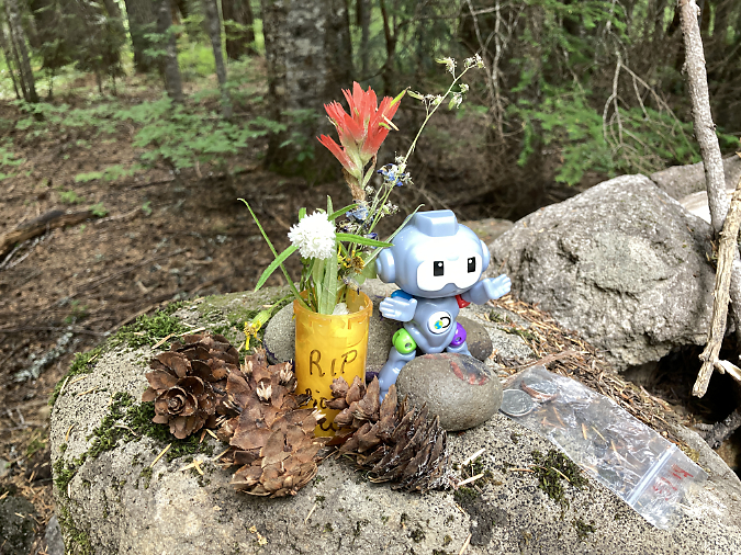
Flowers, fir cones and a plastic robot…
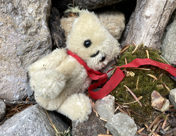
…Teddy bear…
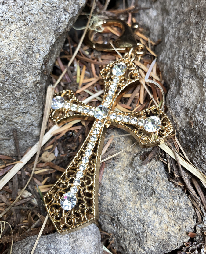
…cross pendant…

…rubber ducky…

…superhero metal CDs…
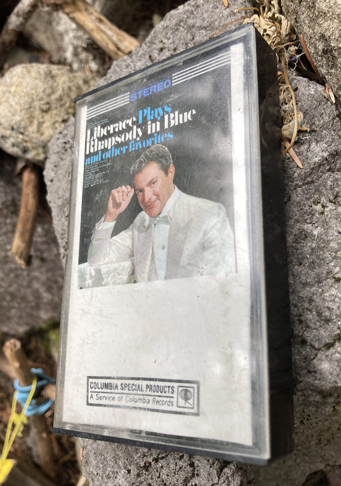
…Liberace tapes…
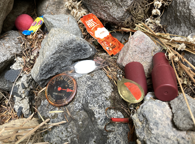
…bubble gum and taco sauce…
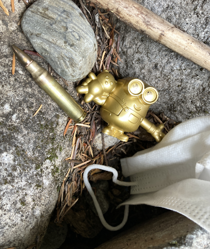
…Minions, ammunition and COVID masks…
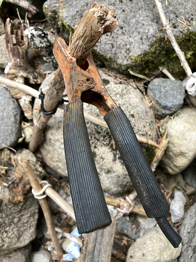
…and a severed jumper cable clamp.
If the original intent of this roadside monument was to honor nameless migrants who perished along Oregon Trail, then today’s version has lost its way. The Pioneer Woman’s Grave deserves better, and even some modest improvements would bring needed dignity to the site. More about that in a moment, but first, there is inspiration to be gained from other historic burial sites along the Oregon Trail.
Remembering the dead along the Oregon Trail
The Oregon Trail was a dangerous, often deadly trip for white migrants crossing into the West, with an estimated 1 in 10 dying along the way. Most were buried where they died, and their surviving families simply continued their push westward. Many of these graves are now preserved and celebrated as part of our traditional view of white settlement of the West.
In the early 1970s, one of these graves along a branch of the Oregon Trail, just east of Casper, Wyoming, was uncovered while a rancher was building a new road. Anthropology students from Casper College exhumed the remains and discovered this to be the burial place of 1852 pioneer Quintina Snodderly.
Quintina Snodderly grave today (WyomingHistory.org)
For many years, the Quintina Snodderly story was a mystery until owners of the ranch tracked down a descendent living in Scio, Oregon. We know from her skeletal remains that she was likely crushed under a wagon wheel, perhaps stumbling or falling while walking aside a wagon. Most who arrived on the Oregon Trail walked much of the way to reduce the burden for ox teams pulling heavy wagons.
Quintina’s surviving husband Jacob and their eight children made it to Scio, in the mid-Willamette Valley of the Oregon Territory, by the fall of 1852. Jacob died in 1889 at the age of 78, thirty years after Oregon became a state in 1859, and is buried in Scio.
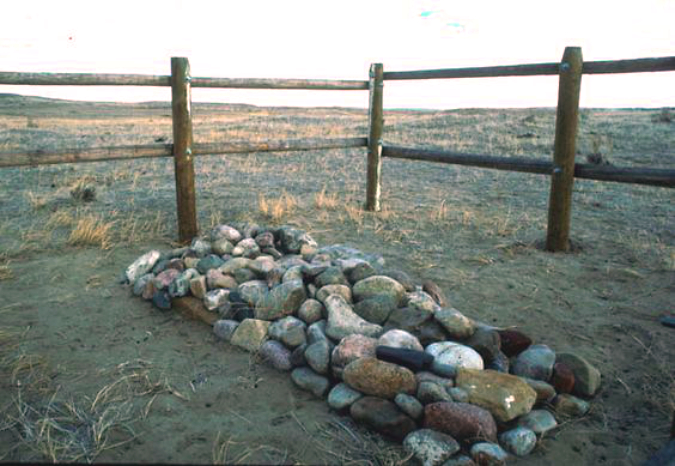
Newly restored Quintina Snodderly grave as it appeared in 1987 (findagrave.com)
The Oregon-California Trail Association took the lead in reburying Quintina Snodderly’s remains in 1987, covering the grave with cobbles that replicated typical burials along the trail in the mid-1800s and surrounding the grave site with a wooden corral fence (above) to help preserve it. An interpretive marker (below) describes Quintina Snodderly’s journey and story.
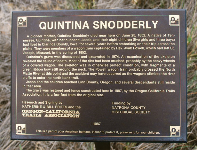
Quintina Snodderly plaque placed by the Oregon-California Trails Association (findagrave.com)
Not far from the Snodderly grave in the North Platte valley of Wyoming are the twin graves of Martin Ringo and J.P. Parker, who also died along the Oregon Trail. Parker was from Iowa and died in 1860, though nothing else is known about him. Martin Ringo died tragically from a self-inflicted shotgun injury that was graphically described in newspaper accounts of the day:
“Just after daylight on the morning of July 30, 1864 Mr. Ringo stepped out… of the wagon, as I suppose, for the purpose of looking around to see if Indians were in sight and his shotgun went off accidentally in his own hands, the load entering at his right eye and coming out at the top of his head. At the report of his gun I saw his hat blown up 20 feet in the air and his brains were scattered in all directions. I never saw a more heartrending sight, and to see the distress and agony of his wife and children was painful in the extreme. Mr. Ringo’s death cast a gloom over the whole company… He was buried near the place he was shot in as decent a manner as was possible with the facilities on the plains” (Liberty Missouri Tribune, 1864)
Martin Ringo’s legacy played out after his death when his grieving widow Mary pushed forward, eventually raising their children in California’s Central Valley. Their oldest son John, who was 14 years old when his father was killed, brought infamy to the respected family name. He emerged as an outlaw and gunfighter in Arizona, the man known as Johnny Ringo who was killed near Tombstone, Arizona. His murder is unsolved, but speculation has included a revenge killing by either Doc Holliday or Wyatt Earp, notoriety that Martin Ringo couldn’t have imagined for his son!
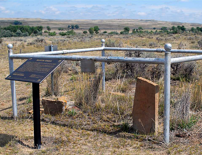
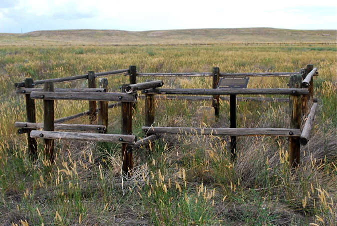
The J.P. Parker and Martin Ringo graves near Casper, Wyoming (WyomingHistory.org)
Like the Snodderly grave, the Ringo-Parker graves are located on private ranch land, but have been preserved with a simple metal rail fence and marked with an interpretive marker placed by the Oregon-California Trails Association.
The Pioneer Woman’s grave was discovered during construction of the original Mount Hood Loop Highway in 1924, and were later placed under a cobble grave by road workers, much as Oregon Trail migrants buried their dead along the trail. A small cross was added to the grave (below). This soon became a popular stop for motorists along the new loop highway.
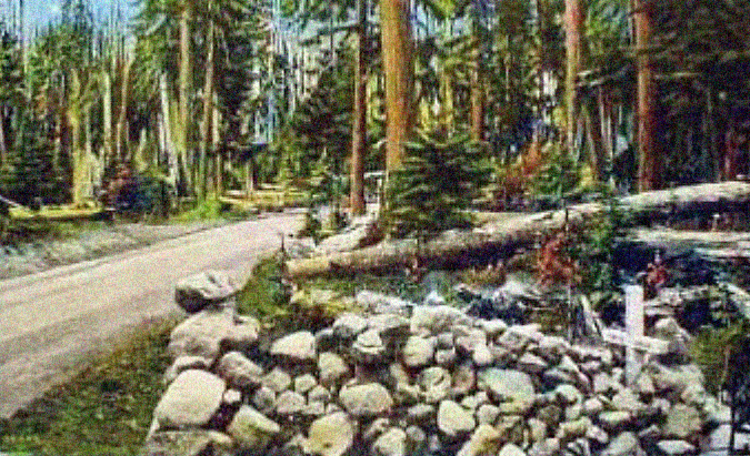
First restoration of the Pioneer Woman’s Grave along the (then unpaved) Mount Hood Loop Highway in the early 1930s
According to the Forest Service, the restored Pioneer Woman’s Grave was formally dedicated in 1931 by Forest Supervisor Thomas Sherrard and members of the Portland Progressive Club. Based on the photo of the ceremony (below), the site wasn’t improved for visitors at the time, simply marked as a gravesite.
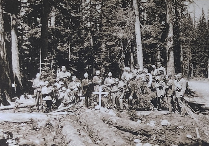
Dedication of the restored Pioneer Woman’s Grave in 1931 (USFS)
In 1936, the DAR added a plaque to the grave, and shortly thereafter, Civilian Conservation Corps (CCC) craftsmen working with the Forest Service placed a large interpretive sign there that would stand for many years.
1930s view of the Pioneer Woman’s Grave with the large, carved Forest Service sign added to the site. Note the original DAR plaque installed on the grave, itself.
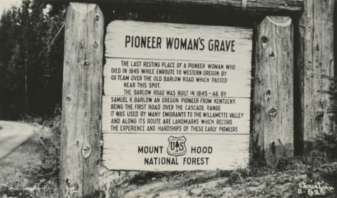
1930s postcard with the sign text replaced and reversed for easier reading!
The DAR has marked another “unknown” Oregon pioneer grave to the west, the Pioneer Child Grave in Multnomah County. This historic grave also survived highway builders, albeit on an epic scale compared to the Pioneer Woman’s Grave. In 1849 a family traveling the Columbia Gorge route of the Oregon Trail camped at a spring near today’s Wilkes School on their final push to Oregon City. That night, their 11-year-old daughter died, apparently after a long illness. She was buried there in the next day in a makeshift coffin and her parents moved on to Oregon City, never returning.
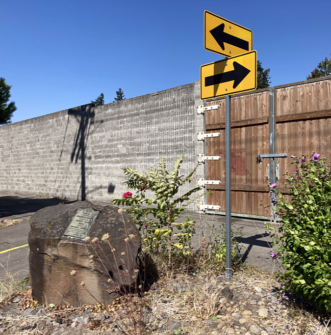
The current location of the Pioneer Child’s grave memorial is at the corner of NE 169th and Wilkes Avenue in Gresham.
The story of the Pioneer Child later caught the imagination of students at the original Wilkes School, located near the grave, and they took it upon themselves to build a picket fence around the site and tend to the grave. In 1949, the construction of the original Banfield Freeway threatened the grave, and a former student of Wilkes School began a campaign to mark the grave with a memorial to protect it from future freeway widening. Finally, in 1955 a large boulder brought in by the Union Pacific Railroad was placed at the grave and a bronze plaque describing the site history was installed and dedicated.
In 1989 a freeway widening project once again threatened the grave and memorial. The DAR worked with highway engineers to relocated the Pioneer Child memorial to the south side of the widened Banfield Freeway, at what is now the corner of 149th and Wilkes Road. The original grave site is also marked by a plaque set in concrete along the Union Pacific Railroad, on the opposite side of the freeway from the memorial and inaccessible to the public.
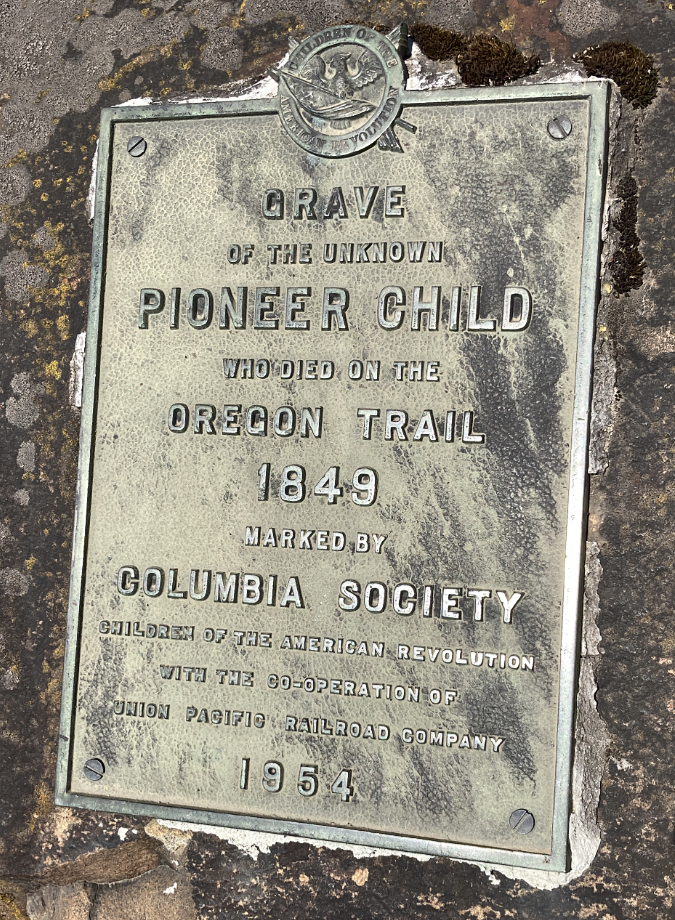
The Daughters of the American Revolution placed this plaque on the Pioneer Child grave when the first Banfield Freeway was constructed in the early 1950s
Over the years volunteers have periodically tended to the grave, though the location in front of the freeway maintenance gate and adjacent, massive freeway sound wall still seems precarious. The monument is directly across from the modern Wilkes School, and perhaps someday the school grounds might make for a more respectful and protected location.
Telling the whole story
Romanticized scenes showing Indians and white migrants in peaceful interaction continue the myth that white settlement of Indian lands was a “manifest destiny”.
In recent years, our traditional view of the Oregon Trail has continued to evolve as white Americans have begun to acknowledge the role of white settlement in the West as a major contributor to the broader genocide of Native Americans who had lived here for millennia. For their part, Indians living along the migration route were largely friendly and helpful to white settlers. This, despite the threat the steady stream of migrants posed to their way of life and how white mythology portrayed “hostile Indians” in our history and arts. In fact, more Indians than whites were killed in trail conflicts between the migrants and the native peoples whose lands the Oregon Trail invaded.
This larger story deserves more attention as we continue to curate the history of the Oregon Trail along its route, not just the story of the white migrants who traveled it. Some newer interpretive signs have begun to acknowledge that white American myths celebrating the western migration completely ignore the devastating toll and continued trauma that genocide has wrought upon Native Americans. We still have a long way to go in our society reckoning. A simple start would be to include an Indian perspective at every site where more than a simple grave marker exists.
What could the future hold for the Pioneer Woman?
1940s visitor and the massive Pioneer Woman’s Grave sign that was installed in the 1930s
Despite the somewhat new interpretive sign, the Pioneer Woman’s Grave on Mount Hood has become a sad and disrespectful eyesore. So, what could be done to improve it and pay more appropriate respect to the history of the site? The other Oregon Trail graves described in this article provide some working examples of how the site might be restored.
But the Pioneer Woman’s Grave is different, since it lies along the final stretch of the migration route to Oregon. That these pioneers came close to their dream of reaching the Willamette Valley, only to fall short by a few days is especially poignant. Does a pile of rocks convey that cruel fate? Not really. But what about a more formal marker?
Pioneer cemeteries on both side of the Cascades include many white migrants who traveled the trail, and drawing from the period style of these cemeteries could be an appropriate way to bring more dignity to the Pioneer Woman’s Grave that a heap of stones. Fine examples exist in a pair of cemeteries located in the lonely Kingsley district, just off the original Barlow Road route, on the east side of Mount Hood (and featured in this recent article on Desert Mounds). These historic cemeteries are filled with pioneer graves, most in the Victorian-style of the mid-1800s. Many include wrought-iron fences to mark family plots, as seen in this example from the upper cemetery in Kingsley (below).
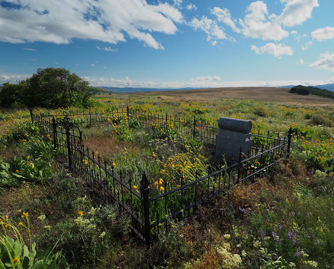
The Upper Kingsley Cemetery in the desert country east of Mount Hood lies along the Barlow Road and has many graves dating to the mid-to-late 1800s. This cemetery provides inspiration for period-specific grave fencing and monuments that could be appropriate for the Pioneer Woman’s grave.
Creating a fenced, mini-cemetery could be a historically accurate way to protect the Pioneer Woman’s Grave from foot traffic and bring a sense of dignity to the site. For example, the decapitated obelisk monument (perhaps it once had a cross on top?) shown below is also in the upper Kingsley Cemetery, and dates to the late 1800s. A monument like this could also provide a non-religious model for more formally marking the Pioneer Woman’s Grave in a period-specific manner.
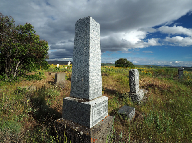
This century-old monument in the Upper Kingsley Cemetery lost its top, but could still be a model for a new marker at a rededicated Pioneer Woman’s Grave.
While these treatments would depart from the crude graves that were built along the Oregon Trail, they do represent what pioneers would have placed upon these graves if they’d had the means — and how they marked graves of the era in the pioneer settlements they created along the trail and in the Willamette Valley.
Other details at the Pioneer Woman’s Grave need attention, too. The crude timber steps placed in the road embankment don’t do justice to the site, nor do they help visitors. Most simply walk up the dirt slope. A low stone retaining wall with more substantial steps and a ramp would be a welcome addition in a site makeover.
A real missed opportunity at the current site is the proximity to one of the best-preserved sections of the original Barlow Road, located just a few yards from the Pioneer Woman’s Grave, where the trail fords a fork of the Salmon River. This could make for an excellent interpretive trail, perhaps built to be accessible so that visitors with limited mobility or using mobility devices could experience traveling in the path of pioneer wagons.
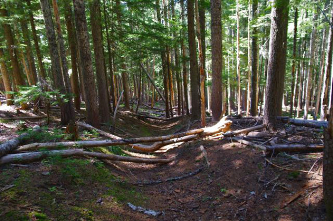
Deep ruts left by pioneer wagons are plainly visible just a few yards from the Pioneer Woman’s Grave and could be incorporated into the interpretive experience (Photo by John Sparks and OregonHikers.org)
Perhaps most importantly, the site needs context about the native people whose trails the Barlow Road borrowed as it was blazed over the shoulder of Mount Hood by Sam Barlow. Today’s tribes continue to fish and gather berries and other foods and plant materials from the forest, as they have for millennia. This is just one story from an Indian perspective that could be told as part of providing cultural context and acknowledging the ultimate cost of white migration to native peoples at the Pioneer Woman’s Grave.
How to Visit?
Though our forests are currently closed by fires, you can walk a section of the original wagon route from Barlow Road to the Pioneer Woman’s Grave describe in this Oregon Hikers Field Guide entry. And you can always simply stop by the grave by following the old highway segment west from the Barlow Pass trailhead or following signs on OR 35 just past the US 26 junction.
