Incident at Starvation Creek

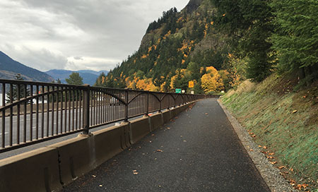
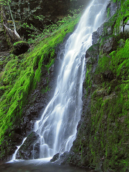
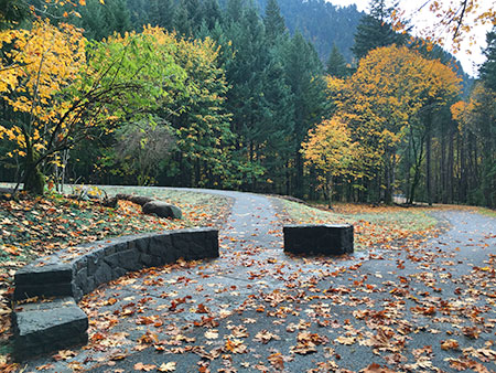
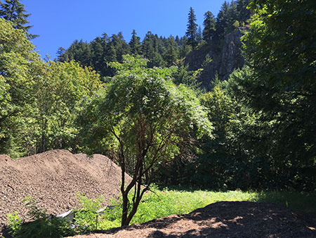
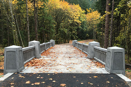
Foggy day at Starvation Creek…

What’s wrong with this photo? Okay, plenty from a photographer’s perspective – starting with the water spot on the lens and a picnic table sticking into the photo. But it turns out the REAL problem that foggy day last December at Starvation Creek Falls was happening BEHIND me. This is the story of how my backpack was stolen by a bold theft ring… and how I got it back! 

__________________

I was standing out in the middle of Starvation Creek on Christmas Eve last month with my camera on a tripod for long exposures. The Gorge streams were running high after weeks of steady rainfall, and I was mostly trying to keep spray off the lens that day. My embarrassingly large, overly stuffed winter backpack was sitting maybe 20 feet above me on the short user trail that follows the east side of the creek in this popular rest stop – just out of earshot. That’s where things went very wrong.

At some point, a woman across the creek on the paved “official” trail was waving to me. The falls and creek were very noisy with all the extra runoff, so I couldn’t hear her at all. I thought she was asking if she was stepping into my photo, so I yelled “no” and gave her a thumbs up. Well, it turns out she was asking if the two “kids” behind me were with me – I didn’t even know they were there! I learned this unfortunate reality a few minutes later when I turned around to discover that my pack had disappeared.

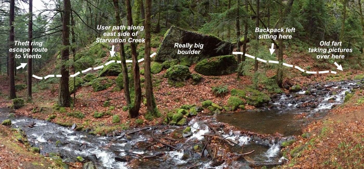
The scene of the pack heist at Starvation Creek…

[click here for a large version]

It was so brazen that at first I was stunned, thinking it must have rolled into the creek, instead. But when it was clear it had been stolen, I realized I might catch up the thieves at the Starvation Creek parking area. 

So, I sprinted back to the trailhead and, once again, met the woman who had called to me from across the creek. This is when I learned what she had been shouting to me about. She was very helpful and able to describe “two teenagers, one with bushy dark hair”. Critically, she also said they had gone east on the paved trail Historic Highway State Trail – away from the Starvation Creek trailhead that was just a few hundred feet away, and toward the next trailhead to the east, at Viento State Park, about one mile away.

Determined to head them off at the pass, I thanked her and jumped in the car, roaring east to Viento State Park. Along the way, I did a mental inventory of all that was in my pack: pretty much EVERYTHING but my camera, tripod and a car key that I always keep in a zipped pants pocket. My phone, wallet, house keys, camera lenses and a bunch of other gear — along with a fairly new winter pack that I loved were all gone. PRIMAL SCREAM MOMENT! (…and boy, did it feel good!)

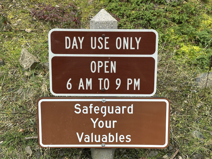
Sign at the Viento trailhead. Safeguard your valuables, indeed..!

Within a couple minutes, I pulled into the Viento trailhead, and — no cars! Weird. But knowing there was no way they could have made it this far on foot so quickly, I then circled under the highway to the north Viento Campground, located on the opposite side, to see if their getaway car was parked there.

As I approached the north campground entrance, an older, black sedan was heading toward me along the main access road. I waved my arm out the window to flag them down to see if they’d seen a couple teenagers with my large grey pack in tow. I could tell the driver wasn’t going to stop for me – frustrating — so I crowded over the center line, partly blocking the road, and held my hand up for him to stop. After all, who doesn’t stop when someone is waving for help?

North Viento campground… where I encountered a sketchy dude…

The driver finally stopped, rolled down his window and responded with deadpan “no, I didn’t see any kids.” He was a sketchy guy and his car was trashed inside, so, a few alarms went off in my head. He also clearly just wanted to leave. However, there was no way he could have gotten this far on foot in the amount of time that had elapsed since my pack was snatched, and he was more like 30-something — not remotely a teenager. So, I said “thanks” and circled back to Starvation Creek to see if I could trap the teen thieves on the other end! 

This entailed backtracking five miles west on the freeway to the Wyeth exit, then doubling back four miles east to return to Starvation Creek State Park, which is only accessible eastbound. This turned out to be a VERY roundabout route when attempting to break up a backpack-stealing ring. I thus “may” have exceeded the speed limit slightly en route — and also let of a few more Chewbacca-esque PRIMAL SCREAMS! (…they did seem to help!)

Whew… finally back to Starvation Creek!

Then came the serendipitous part of this saga: when I finally reached the Starvation Creek exit and was pulling in, the SAME SKETCHY DUDE in the black BMW from Viento was leaving! He was pulling out at exactly the moment I pulled in! My window was down, and we locked eyes as we passed each other. He then floored it onto the freeway ramp and I did a Dukes-of-Hazard-esque U-turn in the middle of the entrance road (okay, that’s how it was in my imagination, at least) and sped after him (that part is very true)!

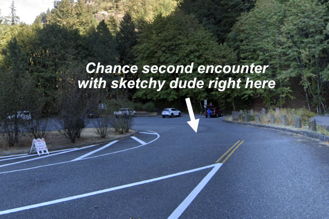
The scene of the chance re-encounter at Starvation Creek

The guy had barely merged onto the freeway when I saw something roll out of his passenger door and onto the shoulder… MY PACK!! I skidded off to grab it, threw it on the passenger seat, and jumped back in the car to resume the chase. I really had no idea what had been taken from it at that point in the saga and I was determined to at least get the license plate number on the getaway car.

Heading east in pursuit, I will admit to autobahn-like speeds, yet I never did catch up with the guy. However, to my great relief, my pack had held together despite being dumped from speeding vehicle, and I had already found my house key and iPhone in the top of my pack. Before dumping it with the pack, the thieves had clearly tried to disable my phone by smashing it against something (the dash of their car?), but didn’t even make dent (…thank you, Apple and polycarbonate screen protectors!). 

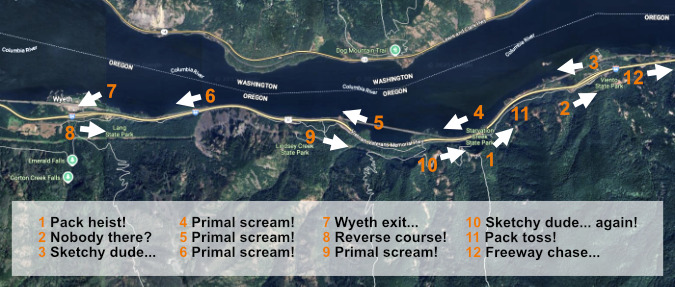
Forensic map of the great pack heist and subsequent perp chase…

[click here for a large version]

When I finally gave up the chase and pulled off the freeway at the west end of Hood River, I was able to do a better inventory. ALL of my camera great was still in there and intact, despite the pack being tossed out of a moving car at freeway speeds, unzipped! Only my wallet was gone, along with a few hundred bucks in cash, my driver ID, a couple blank checks and some credit cards. I can handle that! 

I then spent some quality time on my newly recovered phone with my wife, who was a complete ROCK STAR in getting credit cards frozen while I was still driving home. She was still on the phone trudging through that thankless task when I pulled in later that afternoon. Even better? She had homemade clam chowder in sourdough bread bowls waiting for me! That definitely took the sting out of an otherwise crappy Christmas Eve..!

A reasonable facsimile of my calming, much-appreciated Christmas Eve dinner… (photo: QVC)

On my trip back to Portland I also called the Hood River County Sheriff to report the theft, and this is where it got really interesting. After my initial call, a deputy called me back within 20 minutes to get a more detailed account. I described the sketchy guy in what I remembered to be a black, older BMW with Washington plates. This is also when I described the contents of my wallet and remembered the two blank checks (side note: if you’ve read this far, don’t carry blank checks with you, as that mistake meant racing back to Portland to reach the bank before early closing – it was Christmas Eve, after all – to completely close our checking account and open a new one). 

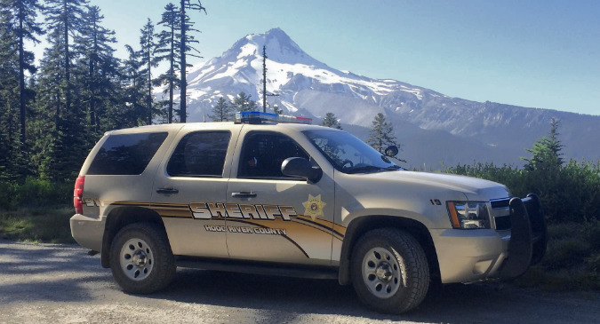
My new heroes! I took this photo of a Hood River County deputy near Bennett Pass several years ago, patrolling the old Bennett Pass Road.

Not long after the phone call, the deputy texted me two suspect photos! One guy was a clear match, with long, greasy black hair, where the other had sort of a buzz cut. I texted the deputy that, to my eye, they were the same guy, but slightly different angles and with radically different hair. Bingo! The deputy replied “I thought you might notice that. Yes, this is the same man. Do you think you could identify the vehicle you saw in a photo?” I replied “HELLLL YESSSSS, DEP-YOO-TEEEEE!!!” (Okay, so really, I just texted “Yes, happy to!”).

That’s where it stands. I’ve since sent documentation from a couple attempts to use the now-useless credit cards to the Hood River County Sherriff, but no word on a car to identify. That said, the mere fact that I talked to an actual police officer and that the ringleader in this theft was already on their radar was all I really needed to hear.

Lessons learned?

Takeaways from this saga? I don’t think this episode changes my practice of keeping my valuables in my pack when I’m on a trail vs. carrying them on me when I traveling to and from a trailhead. The exception on the trail is my car key, which I keep in a zipped pants pocket. Always. I shudder to think how things would have played out had I not had my car key! I also learned the hard way not to carry any checks with me. Nobody uses them much anymore, and they completely expose you if they are stolen along with ID. Lesson learned!

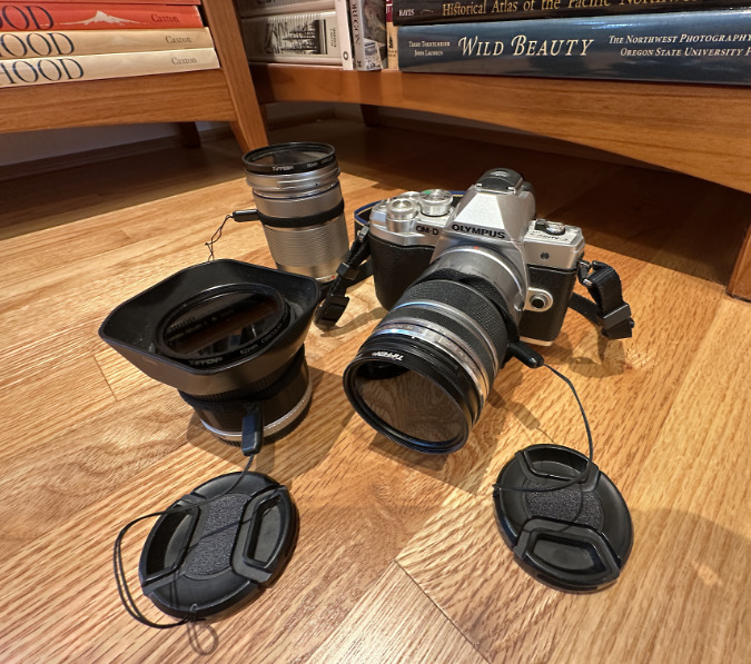
Reunited gear! This camera kit has traveled a lot of miles on my back, great that I was able to recover it!

It was also a pretty weird set of circumstances that day, so I’ve been careful not to overthink any takeaways going forward. I usually keep my pack a few feet away when it’s not on my back – and it’s almost always on my back when I’m hiking. That said, it is kind of creepy that the BMW dude’s accomplices seems to have followed me up that side trail with the intent of stealing my pack. This unfolded within a couple hundred yards of a freeway rest stop at Starvation Creek, so that’s a driving factor compared to being off on some trail, far from thieves and their getaway drivers.

The other twist is that the BMW guy and his accomplices seem to have been using the paved trail linking Starvation Creek State Park to Viento State Park as a getaway route. Now that I know it was the same sketchy dude I had originally questioned at Viento all along, my guess is that after encountering me, he called his accomplices while they were still on their escape route and told them to turn back to Starvation Creek, where he would pick them up. If so, he likely saw ME following him onto the freeway, backtracking the same route he was taking to pick them up! That might explain why they were able to toss the pack so quickly, including the bashed-up phone.

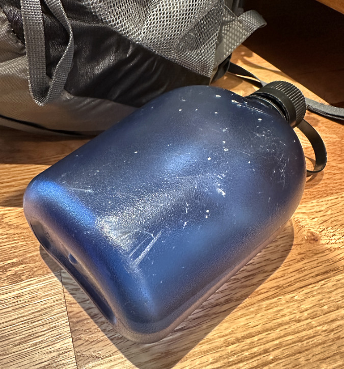
My main lasting souvenir from the episode is this water bottle that took a hard hit when my pack hit pavement on the shoulder of I-84. It survived with a few deep scratches to join me on many more adventures.

If this is all true, another theory I have is that they might have been using that side path along Starvation Creek as simply as a place to dump stolen items looted from cars parked at the rest stop to retrieve later. The side path is rarely used this time of year, and there are some truck-sized boulders with dry “caves” underneath them that could be used for precisely this purpose. 

If this theory proves true, it could explain how they stumbled upon me and my pack, and then realized that I had my back to them and couldn’t hear anything – sort of a chance opportunity compared to the much more common smash-and-grab theft from cars that continues to be a real problem in the Columbia River Gorge.

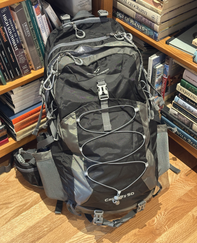
My original winter pack didn’t fare so well from being tossed from the getaway car, so it has since been honorably retired and replaced with this identical edition. Looking forward to many more adventures with this new friend!

I’ve shared this strange story with friends and family since the event, and chided by a few for taking chase in the way I did – that I was taking great risk in doing so. That’s a personal choice we all make, of course, but I have a good sense of situational safety and my mission wasn’t to confront the thieves, it was to identify them via the plates on their getaway car. The only face-to-face exchange I had was with the ringleader, and at that point I had no idea he was part of the theft, nor did he have reason to suspect that I did. Instead, he simply seemed very nervous and eager to get away both times that I made eye contact, not to engage me. I have no regrets, all things considered.

So, is a pain in the ass to lose your wallet on a supposed Christmas Eve escape to nature? Absolutely. But it could have been much worse, AND I’m also ridiculously, infinitely and disproportionately fortunate in this often very unfair world. Episodes like this only serve drive that point home more profoundly. In the larger picture of what really matters, I will take this bit of Christmas Eve coal and relish it with all that is good in my life. 

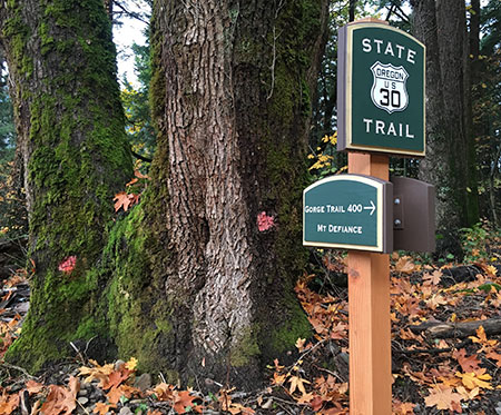
Making our Trailheads More Secure?

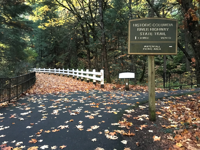
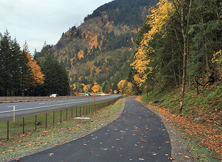
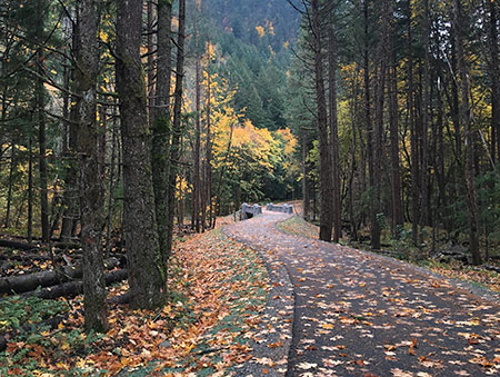
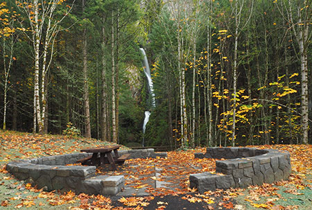
The lovely gateway to the Historic Columbia River Trail at Starvation Creek Falls. Should anyone have to fear being a theft victim by simply stopping here to enjoy this public space?

I’ll end this article with some broader takeaways on the theft problem that continues to plague visitors to the Columbia River Gorge. Yes, there are break-ins on some of the more popular trailheads on Mount Hood and elsewhere, but the Gorge has become notorious for the number of smash-and-grab thefts that occur every year.

Why the Gorge? Part of the answer lies in the sheer number of visitors and proximity to Portland and booming Gorge towns like Hood River. Quick access to I-84 makes it especially easy for smash-and-grab thieves to exit the crime scene and disappear into nearby towns within a few minutes. Over the years, Multnomah County, Hood River County and the Oregon State Police have periodically stepped-up their patrols, but all three law enforcement agencies face budget realities that make it hard to maintain steady patrols at Gorge recreation sites. Break-ins happen in a matter of a minute or two, and there’s really no way that current law enforcement can provide enough presence to deter that.

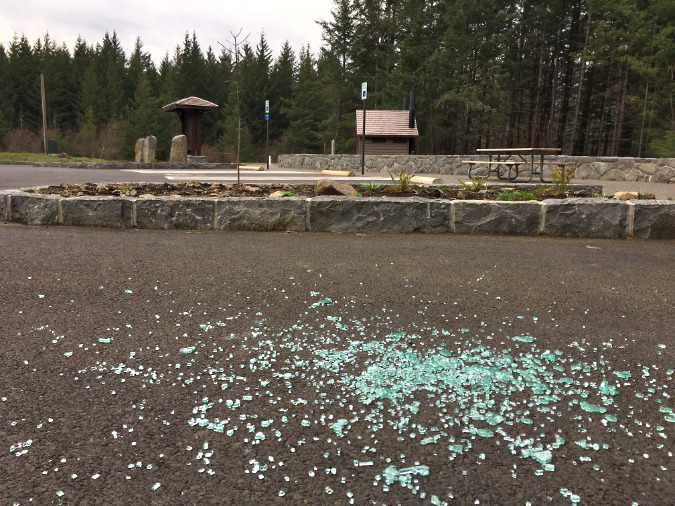
The beautiful new trailhead at Wyeth had barely opened when broken car window glass began to appear in 2020

While it’s true that property crimes are petty and mostly a nuisance, they do have an impact on the tourism economy of the Gorge communities that is concerning. This is especially true for high-dollar visitors from out of state or abroad who come here only to have their travel belongings stolen by local thieves. That’s the kind of experience that makes a return visit less likely, and is also likely to be shared in our modern world of social media and online travel reviews.

One option for expanding traditional law enforcement is a special patrol dedicated to the Gorge and independently funded through a lodging tax within the Gorge cities. Nobody likes raising taxes and policy makers fear even asking the voters the question, but many tourism-based communities have long enacted lodging taxes as a way to provide services that are especially connected to tourism. Perhaps this could fund special units based within the two county Sheriff departments dedicated to the theft problem?

Another approach that hikers have talked about for many years are trailhead cameras. Simply the existence of cameras could have an effect, just as photo radar cameras on our urban roads slow travel speeds and red light-running, whether they’re on or not. Cameras are gradually starting to show up in recreation areas around the country, too, so the idea does seem to be catching on – if only through necessity.

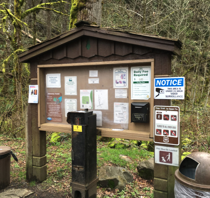
The blue sign on the right appeared at the Wahclella Falls trailhead in 2016,

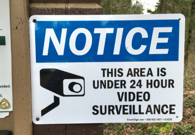
The surveillance (or at least the sign) at Wahclella Falls has since disappeared. It wasn’t there when my own car was broken into at this trailhead in April 2021.

The Forest Service placed the above camera notice at the Wahclella Falls trailhead in 2016, though I don’t know if the signs (or cameras?) have since been maintained. My own car was broken into at this trailhead on a beautiful Sunday morning in April 2021, and the signs (and cameras?) had been pulled at that time. I mostly suffered a smashed window in that incident, as I think the thieves were likely spooked by arriving hikers before they could do much looting. The story might have been quite different on a quiet weekday morning.

The 2016 sign at Wahclella Falls (and any other site) could also have been more effective in deterring thieves had it been posted prominently along the entrance road, and not lost in this blizzard of trail notices that even law-abiding visitors rarely stop to read. I suspect land managers are wary about making these too prominent, as placing surveillance cameras in public spaces of any kind remains controversial, whether for privacy or other concerns. 

I do share the concern that stepped-up policing and surveillance might prevent law-abiding visitors from going to the Gorge, given our current state of fear of law enforcement in this country and an openly racist, vindictive regime in power in Washington. As with all law enforcement, it’s a trade-off, but one that I think ought to be considered in the Gorge, and soon.

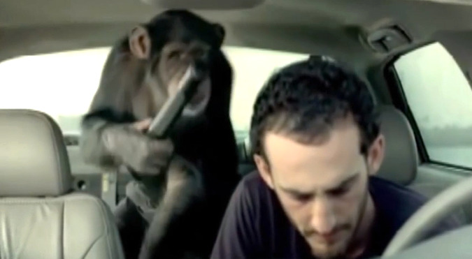
Despite the current political environment, I remain optimistic that we’ll figure this out, eventually. The Gorge means too much to us and we have a long tradition in Oregon of finding our own creative path to solutions. In the meantime, carry what you can’t afford to lose with you when you’re in the Gorge… and you might also consider investing in a Trunk Monkey until better solutions to the theft problem are found. 😊

________________

Tom Kloster • February 2025 

Warren Falls: A Postscript (Part 2 of 2)

hcrh_review01a

The first part of this article focused on the missed opportunity to restore Warren Falls as part of construction of the most recent phase of the Historic Columbia River Highway (HCRH) State Trail. This article takes a look at this newly completed section of trail.

_________________

hcrh_review01b

Congressman Peter DeFazio at the grand opening of the new HCRH segment in October (ODOT)

In October, the Oregon Department of Transportation (ODOT) opened the latest section of the HCRH State Trail, a segment stretching from the trailhead at the Starvation Creek wayside west to Lindsey Creek. A portion of this newest section follows the original highway grade where it passes Cabin Creek Falls, but most of the route is a completely new trail – or more accurately, a paved multi-purpose path open to both hikers and cyclists.


hcrh_review01c

The newly revamped Starvation Creek Trailhead

The new HCRH trail segment begins in a small plaza constructed at the south edge of the Starvation Creek wayside. Early plans called for a complete reconstruction of the parking area, but budget constraints intervened, and most of the work here is along the margins of the existing parking lot. The trailhead plaza features some to-be-installed interpretive signs in the shade of a group of bigleaf maple trees, a pleasant meeting spot for hikers or cyclists.

Missing from the revamped trailhead is the original Forest Service trailhead sign that once pointed to Warren Falls (below). It’s unclear if this sign will be reinstalled, but given that Warren Falls, itself, was not “reinstalled” as part of this project, the chances are probably slim.

hcrh_review01d

This sign has gone missing!

The sign actually referred to what is now called Hole-in-the-Wall Falls, where Warren Creek emerges from the diversion tunnel built by ODOT in 1939. The unintended reference to the original falls made for an inspiring Forest Service gaffe for advocates of restoring Warren Falls!

The first few yards of the new trail generally follows the existing route along the Starvation Creek wayside freeway exit ramp. It’s still a noisy, harsh walk through this area, but ODOT has dressed up this section with a sturdy cobble wall and new paving.

hcrh_review01e

Cobble retaining wall near Starvation Creek

The trail concrete barricades along this section that protect the trail from freeway traffic also feature the same decorative steel fencing found elsewhere on the HCRH State Trail, giving a bit more sense of separation from speeding vehicles. The new trail is also slightly elevated here, reducing the noise impacts somewhat from the old trail that was mostly at the ramp grade.

hcrh_review01f

Decorative steel fencing near Starvation Creek

Soon, the new trail drops to the only original section of Columbia River Highway on this restored section of trail, where the old road passed in front of Cabin Creek Falls. An elegant but confusing signpost has been added at the junction with the Starvation Ridge Cutoff trail, pointing to Gorge Trail 400, which currently does not exist in this section of the Gorge.

I didn’t hear back from ODOT as to whether a trail renumbering is in the works that would extend the Gorge Trail to Starvation Creek, but it may be that the Forest Service is planning to stitch together a extension of the Gorge Trail from pieces of the Starvation Ridge and Defiance Trails. That would be a welcome development!

hcrh_review02a

Trail 400..? Is a trail re-numbering in the works?

The location of the new sign almost suggests that the infamous Starvation Cutoff trail – one of the steepest in the Gorge – would be renumbered as the Starvation Ridge trail, with the bypassed section of the current Starvation Ridge trail becoming Trail 400.

Confused..? So are many hikers who visit the area with its already confusing trail network. So, keep your fingers crossed that the Forest Service is rethinking trail numbers and signage in conjunction with the new HCRH trail.

For now, the actual Starvation Cutoff Trail has not changed, though HCRH workers added a nice set of steps at the start of this very steep route.

hcrh_review02b

New steps at the otherwise humble Starvation Cutoff trailhead

The old pavement in this original highway section was resurfaced with new asphalt as part of the project, but otherwise the route here is much as it was when the highway opened in 1916, including a roadside view of Cabin Creek Falls. However, ODOT missed an opportunity to organize the hordes of visitors who now scramble to the falls along a cobweb of boot paths.

Formalizing a single spur with a properly constructed trail (below) would be a great project for a non-profit like [link]Trailkeepers of Oregon (TKO)[/link] in conjunction with Oregon Parks and Recreation (OPRD), who now manage the trail and adjacent park lands.

hcrh_review02c

Cabin Creek could use a formal path to the falls… and a new sign

[click here for a large version]

Cabin Creek Falls is popular with families (where kids can safely play in the basalt-rimmed splash pool) and photographers (who love this delicate, mossy falls). For many casual visitors, this is already the turn-around point on their walk from the trailhead, with Cabin Creek being the highlight of their experience, so a spur trail would be a nice addition to allow visitors to get off the pavement and explore a soft trail.

hcrh_review02d

Cabin Creek Falls up close

ODOT also cleaned out the large, stone culvert (below) where Cabin Creek flows under the HCRH State Trail. This display of original dry masonry was mostly buried in debris and undergrowth until the trail project was constructed, so the restoration provides a nice look at the craftsmanship of the original highway.

hcrh_review02e

Original dry masonry culvert survives at Cabin Creek

As the new trail route reaches the west end of the original highway section, ODOT thoughtfully place a small memorial (below) in the paving – a nice historic reference to the original highway.

hcrh_review03a

HCRH plaque marks the original highway route near Cabin Creek Falls

As the new route leaves the beautiful, forested section of original highway at Cabin Creek, it suddenly follows the freeway for about 200 yards due to steep slopes along the Gorge wall. This jarringly noisy section could use some replanting to at least create a visual buffer from freeway traffic.

hcrh_review03b

Noisy, barren stretch of the new trail west of Cabin Creek

Soon, the new HCRH route thankfully curves back into the forest on a surprisingly massive structured fill. This structure was required to maintain the modest trail grade as the route climbs from the freeway shoulder to a slight rise near Warren Creek.

This section is bordered with stained wood guardrails, a new design that departs from the vintage-style white guardrails in other sections of the restored highway, but provides a nice aesthetic that will also be easier to maintain.

hcrh_review03c

This large, structured fill west of Cabin Creek was required to maintain the trail grade for bicycles

This following view shows the same spot in July, at the height of construction, and before the fill was completed:

hcrh_review03d

Structured fill near Cabin Creek during construction last July

ODOT was careful to document cultural resources along the route when designing the new trail, including a set of stone ovens built by the original highway masons who camped here during highway construction in the early 1900s. The historic ovens are better protected than before by the raised trail design and guardrails (below), though still fully visible for those who know what they’re looking for.

hcrh_review03e

The historic stone ovens can be seen from the elevated trail section west of Cabin Creek… if you know where to look

One disappointing detail along this section of trail is a long gabion basket wall (below), apparently constructed to catch loose debris from an adjacent slope. The steel cages holding this wall together will hopefully be covered in moss and ferns in time, but for now it’s an eyesore on an otherwise handsome section of the trail.

hcrh_review03f

Would Sam Lancaster have approved of a wire mesh gabion wall..?

Another sore thumb in this forest section is a rusty mesh fence (below) along the freeway right-of-way that should have at least been painted, if not completely replaced as part of the project. Maybe ODOT still has plans to replace this eyesore?

hcrh_review03g

Nope, Sam Lancaster wouldn’t go for this…

As the new section of the HCRH State Trail approaches Warren Creek, it enters a significant cut section to maintain its gentle grade. Thankfully, a huge anthill along this section was spared, one of the interesting curiosities along the former soft trail that used to pass through this forest.

hcrh_review03h

Hydro-seeded cut slope and the big anthill near Warren Creek

This following view is from July, when construction was still underway and the ant colony was no doubt thankful for the protective fence:

hcrh_review03i

The giant anthill lives!

The view below was taken during the construction looks east at the cut section along the new trail. Because the rustic forest trail that once passed through this area was completely destroyed by the new HCRH trail, the reconfigured landscape will be a shock for hikers who hiked the trail in the past. Though hydro-seeded with grass, this section could benefit from some re-vegetation efforts to further speed up healing.

hcrh_review03j

The cut grade near Warren Creek under construction in July

Beyond the cut section, the new route crosses the original channel of Warren Creek, and for those with a sharp eye, a pair of cobble foundations for early homesteads that once lined the creek. Here, the trail reaches a half-circle bench where an all-access side trail curves up to the viewpoint of Hole-in-the-Wall Falls (more on that later in this article).

hcrh_review04a

Half-circle bench serves as the jump-off point to the Hole-in-the-Wall viewpoint

It’s unclear if interpretive signs will be added to this area, but at one time the story of how Warren Creek was diverted in 1939 was planned for the spot where the new trail crosses the old, dry creek bed.

Another new trail sign is also located at the all-access spur trail to Hole-in-the-Wall Falls, as this is also the route to the Starvation Ridge and Defiance Trails. This sign also includes a mysterious reference to Gorge Trail 400, further suggesting that a re-numbering of trails in the area is in the works. A large, multi-trunked bigleaf maple was also spared at this junction.

hcrh_review04b

Bigleaf maple spared… and another mystery reference to Trail 400..?

The following view is looking from the new HCRH State Trail toward the Hole-in-the-Wall spur trail, showing the proximity to Warren Falls. The green hydro-seeded area in the photo is where the construction staging area for the project, underscoring the missed opportunity to restore Warren Falls as part of the project – it was just a few yards beyond the staging area.

hcrh_review04c

So very close: Warren Falls from the main construction staging area

hcrh_review04d

Staging area during construction in July – the last time we’ll see heavy equipment this close to Warren Falls for generations?

The humble elderberry (below) in the middle of the staging area was spared by ODOT, a nice consideration in a project that did impact a lot of trees. Hopefully, there are plans to expand native plantings here, as this area was covered with invasive Himalayan blackberries for decades before the trail project and will surely revert to invasive species without a deliberate restoration effort.

hcrh_review04e

This apparently well-connected elderberry dodged the ODOT bulldozers!

Moving west, the new HCRH State Trail segment passes through another forested section where the trail rises on fill necessary to bring it to grade with a handsome new bridge over Warren Creek (visible in the distance in the view, below). This is an especially attractive section of trail.

hcrh_review05a

Looking west along the attractive new trail section approaching the Warren Creek Bridge

For some reason, many of the trees that were cut for this new section of trail were left piled along the base of the fill (below). The fill slope has been hydro-seeded, so it seems unlikely that the more work is planned to remove or repurpose the log piles, so apparently the were left in this manner on purpose?

hcrh_review05b

Piled logs along the elevated grade approaching Warren Creek Bridge

Looking back to the construction period last summer, you can also see the good work ODOT did to cut back English ivy that was rampant in this area. While ivy was left intact on the forest floor, it was cleared from dozens of trees in this section of the trail.

hcrh_review05c

Invasive English ivy was trimmed from dozens of trees near Warren Creek

The highlight of the new HCRH trail segment is where the route crosses Warren Creek. Here, a handsome new bridge faithfully echoes the design ethic of Samuel Lancaster, but is probably more elaborate than the original bridge constructed at Warren Creek in 1916. Lancaster’s bridge was destroyed when the first version of the modern highway was built in 1950.

hcrh_review05d

The handsome new Warren Creek Bridge is the jewel of the new trail segment

Though no visual record exists, the original Warren Creek Bridge was modest in length, at just 18 feet, and likely resembled the surviving bridge at Gorton Creek to the west, or possibly the original bridge at Viento Creek to the east (shown below).

hcrh_review05e

The original Warren Creek Bridge probably followed one of these designs

The design of the original Warren Creek Bridge inadvertently helped lead the Highway Department to bypass Warren Falls, as stream debris was clogging the bridge opening. The 1941 project files also describe the original bridge being “replaced in a different location” as part of the diversion project, so there may have been two version of the original bridge over Warren Creek before the modern highway was constructed in the 1950s.

hcrh_review05f

Warren Creek Bridge under construction in July

hcrh_review05g

Pavement texture samplers being tested for the project

hcrh_review05h

Looking west across the new Warren Creek Bridge

hcrh_review05i

Railing detail and the view downstream from Warren Creek Bridge

Construction of the new HCRH bridge over Warren Creek was an involved undertaking, with the surprisingly wide span leaving plenty of room for a (someday) restored Warren Falls to move 70+ years of accumulated rock and woody debris down the stream channel.

hcrh_review05j

Built to last, with plenty of room for Warren Creek to once again move rock and log debris down its channel… someday…

There’s nothing natural about Warren Creek in this area, as it looks (and is) more like a drainage ditch. This is because original streambed is now a dry ravine several hundred yards to the east, and the current streambed is where the Highway Department moved the creek decades ago, when the modern highway was first built in the 1950s.

hcrh_review05k

Ditch-like, man-made channel of Warren Creek as viewed from the new bridge

As described in the first part of this article, the someday restoration of Warren Falls will once again allow rocks and woody debris to migrate into the lower channel, eventually transforming the “ditch” into a healthy stream (below) that can fully support endangered salmon and steelhead.

hcrh_review05l

What a healthy Warren Creek might look like from the bridge, someday…

[click here for a larger version]

While ODOT missed the larger opportunity to help this stream restoration along when it declined to restore Warren Falls, the agency also missed the easy opportunity to simply add a few boulders and logs to the section of Warren Creek near the bridge when heavy equipment was in the area. That’s too bad, but perhaps the OPRD will someday enhance this stream section as part of managing the new trail.

hcrh_review06a

Looking west from near the Warren Creek Bridge to the Lancaster Falls viewpoint

From Warren Creek, the new trail follows another fill section to a mostly obstructed viewpoint of Lancaster Falls on Wonder Creek from a small seating area. This viewpoint (below) could use some light pruning to reveal the falls, and perhaps something that’s still in the works by OPRD.

hcrh_review06b

Lancaster Falls viewpoint

One oddity about Wonder Creek is that it mostly disappears into ground before reaching the culvert that carries Warren Creek under I-84 and to the Columbia River. This is partly due to the modest flow from spring-fed Wonder Creek, but also because the slopes below the falls are mostly composed of unconsolidated talus covered with a thin layer of soil and vegetation. So, most of the time the stream is simply absorbed into the water table below the falls.

Yet, in high runoff periods, the new state trail will accommodate the flow with extensive drainage features designed to carry Wonder Creek under the fill section and to the Warren Creek freeway culvert.

hcrh_review06c

Trail construction near the Lancaster Falls viewpoint in July

hcrh_review06d

Lancaster Falls viewpoint under construction in July

Another oddity of Lancaster Falls is its illusive nature. Though thousands of hikers each year view the modest, 20-foot lower tier of the falls where it spills across the Defiance Trail, few know of it’s full extent – and perhaps wonder why Samuel Lancaster wasn’t honored with a more spectacular landmark.

This is the view (below) of Lancaster Falls that most hikers see today, and this this is also the portion of the falls that can be glimpsed through the trees from the new HCRH trail viewpoint:

hcrh_review06e

Lancaster Falls as most know it, along the Defiance Trail

But viewed from across the Columbia River, along Washington’s Highway 14, Lancaster Falls takes on a completely different scale. This view shows the lower 20-foot tier that most know as “Lancaster Falls” completely dwarfed by the towering 300-foot extent of the falls:

hcrh_review06f

The full extent of Lancaster Falls as viewed from the Washington side of the Columbia

While it’s possible to scramble to the base of the main tier of Lancaster Falls, the slopes are unstable and already being impacted by off-trail visitors, so it’s probably best that only a most portion of the falls is (somewhat) visible from the new HCRH route. Hopefully, interpretive signage is in the works for the viewpoint that tells the story of Samuel Lancaster..?

hcrh_review06g

1920s view of the HCRH from Lindsey Creek looking toward Wind Mountain

From the Lancaster Falls viewpoint, the new trail heads west to a section where it once again follows the shoulder of I-84 to Lindsey Creek and the end of new construction. ODOT is working the next trail segment, which will connect from Lindsey Creek to the Wyeth Campground, crossing the base of famously unstable Shellrock Mountain along the way.

Hole-in-the-Wall Falls Spur Trail

hcrh_review07a

Original concept for the Hole-in-the-Wall Falls viewpoint

One of the design highlights of the new HCRH trail section is a short all-access spur tail to an overlook of Hole-in-the-Wall Falls, the man-made outflow tunnel that continues to drain Warren Falls of its water. The completed overlook has been scaled back from its original design (shown above), and now features one of the signature circular seating areas, complete with a picnic table (below).

hcrh_review07b

Hole-in-the-Wall Falls viewpoint

A small plaque at the viewpoint identifies Hole-in-the-Wall Falls, which until now has not been an officially recognized name or has appeared on any official maps. A nice nod to the origin if the “falls” is the byline “Created 1939”. Hopefully, there will be future interpretive displays here, as the story of Warren Falls would be a great addition to this overlook.

hcrh_review07c

Hole-in-the-Wall Falls viewpoint

hcrh_review07d

Hole-in-the-Wall Falls plaque

hcrh_review07e

Hole-in-the-Wall Falls viewpoint under construction in July

The Starvation Ridge Trail picks up from the south side of the Hole-in-the-Wall Falls overlook, heading across a footbridge over Warren Creek.

A closer look near the footbridge (below) reveals a surprising disappointment: the stump of a streamside Douglas fir cut improve the view of the falls. It’s too bad that the tree wasn’t simply limbed to provide a view, as it was one of the few larger trees stabilizing the banks of Warren Creek.

hcrh_review07f

Hole-in-the-Wall Falls bridge… and stump?

hcrh_review07g

Unfortunate remains of the offending Douglas fir along Warren Creek

While it’s disappointing to think about the opportunities missed at Warren Falls, the Hole-in-the-Wall Falls overlook and beautiful new Warren Creek Bridge, are still a big a step in the right direction toward someday moving Warren Creek from neglected afterthought to a valued resource that deserves to be restored. ODOT deserves major kudos for their thoughtful work on this section of trail!

“Love what they’ve done with the place…”

hcrh_review08a

Heavy construction of the new “trail” in July looked more like a road to many hikers

Last summer I encountered another hiker while surveying the progress of the new HCRH trail in the Warren Creek area. He was making his way to the Defiance Trail, and when he saw me taking photos, shouted angrily “Love what they’ve done with the place!”

I’ve heard this reaction to the State Trail from many hikers over the years, as avid hikers are often aghast at what they see as more of a “road” than trail. The scope of construction impacts on the natural landscape of the Columbia River Gorge National Scenic Area (CRGNSA) and the millions in public funds being spent on the project rankles hikers who don’t see themselves actually using the trail.

Many hikers are also mystified as to how this project can received tens of million in funding while other, heavily overused Gorge trails are falling apart for lack of adequate funding.

hcrh_review08b

Extensive cut and fill necessary to maintain trail grade meant a wide construction swath

These reactions are understandable, if misguided. The restoration of the surviving HCRH and the future trail segments that will soon complete the original route from Troutdale to The Dalles is an epic effort of ambition and vision in an era when both are rare quantities.

When the route is completed, it will become a world-class cycling attraction, and it is already drawing visitors from around the world. Guided bicycle tours have become a thriving business in the Gorge because of ODOT’s commitment to bringing the HCRH State Trail vision to reality, and businesses in Gorge towns are already seeing the benefits.

Other projects to promote the trail are also in the works. ODOT’s Gorge Hubs project is a new partnership with six cities in the Gorge to provide traveler information for trail users and boost the local economy. The Friends of the Gorge have launched the Gorge Towns to Trails project, a complementary effort to the HCRH State Trail to connect Gorge communities to public lands via trails.

hcrh_review08c

Tourism in the Gorge is as old as the historic highway, itself. This is the Lindsey Creek Inn that once stood where the newly completed HCRH State Trail approaches Lindsey Creek

Plenty of local visitors will continue to use the HCRH State Trail as the project nears completion over the next few years, but the real benefit for Gorge communities is from visitors coming from outside the region. Unlike local visitors, tourists coming from elsewhere will book hotel rooms, purchase meals and take home locally-made products and art from the Gorge to memorialize their trip. These visitors make a much larger contribution to the Gorge economy than a local visitor who might stop by a brewpub on the way back from a day trip.

hcrh_review08d

Gorge sunset from near Starvation Creek along the newly completed HCRH State Trail

A 2011 National Park Service study of tourism dollars shows outside visitors spending anywhere from 7 to 12 times the amount that local visitors spend on a visit to a given park, bringing hundreds of millions to local economies at many parks. There’s no reason why the Gorge can’t better manage the our already heavy demand from local visitors to the Gorge to allow for more outside visitors drawn by the HCRH State Trail to spend their dollars here.

The bigger picture is that anyone opposed to seeing casinos or bottled water plants in the Gorge should be part of supporting a tourism economy that builds on the scenery. Yes, tourism impacts must be managed to protect the Gorge for future generations, but the health of the Gorge economy is the essential ingredient to providing these protections over the long term.

The HCRH State Trail is part of that formula, and it deserves enthusiastic support from anyone who loves the Gorge. If you own a bicycle (or pair of walking shoes), give it a try — and then recommend it as an exciting new vacation destination to distant friends and family!

Restoring Warren Creek Falls

Early 1900s map of Warren Creek, before the falls was diverted

Until the 1930s, Warren Creek was much like it’s neighbors to the east and west in the Columbia River Gorge, plunging in a spectacular waterfall as it reached the final wall of cliffs lining the river. For millennia, the stream had slowly carved a huge amphitheater in sheer basalt, thundering into a deep splash pool at the base of the cliffs, before rushing to the Columbia.

The railroads crossed Warren Creek in the late 1800s, and by the 1920s, Samuel Lancaster’s iconic Historic Columbia River Highway had been constructed, and passed the stream near the falls. Sometime in the late 1930s, the Oregon Highway Department determined that Warren Creek posed a risk to the highway grade, and made the improbable decision to re-route the falls through a tunnel, depositing the stream a few hundred yards to the west.

Man-made Hole-in-the-Wall Falls flows from a tunnel

The legacy of this bizarre project is man-made waterfall now known as Hole-in-the-Wall Falls, for the fact that Warren Creek continues to burst out of the diversion tunnel blasted in the 1930s. The true falls are still “upstream”, so to speak — the streambed of Warren Creek above the man-made diversion is now dry, though it looks to have flowed yesterday.

At the head of the dry streambed, the former Warren Creek Falls also looks as if it flowed recently, even though the diversion has been in place for more than 70 years. A bright green ribbon of moss and ferns traces the graceful chute where a horsetail-shaped falls once roared down the cliffs. A huge mound of debris has since accumulated at the base of the falls, perhaps from occasional overflows of the weir above the falls that normally directs the stream flow to the diversion tunnel.

The dramatic basalt amphitheater of Warren Creek Falls

Someday, a natural storm or geologic event will surely block the tunnel, or destroy the weir, and Warren Creek Falls will once again flow through its magnificent grotto. But why wait? What better statement of our dedication to healing the misguided scars of the human past than to bring back this lovely waterfall?

The benefits would be many. First, the natural setting of the falls is unique and spectacular, and would become an instant destination for hikers and waterfall lovers. Though there are hundreds of waterfalls pouring over basalt cliffs in the Gorge, the basalt columns at Warren Creek Falls are especially dramatic. Restoring the falls would also add back several hundred yards of salmon and steelhead habitat, since Warren Creek flows directly from the falls site to the Columbia.

Approaching Warren Creek Falls from the dry streambed

The project could also serve a preventive purpose, since the long-term impact of introducing water to the bypass tunnel may be undermining the stability of the huge cliff face that it passes behind. Already, there are signs of spalling rock on the cliffs near the tunnel, suggesting that the diversion is having an impact on the structural integrity of the cliff. Decommissioning the tunnel could at least arrest this impact.

A section of the long-dry streambed that looks to have flowed yesterday

As fanciful as this project seems to be in a time of tight public budgets, there happens to be a once-in-a-generation opportunity to link the restoration project to a nearby transportation improvement. According to tentative plans for the Historic Columbia River Highway (HCRC) project, the segment of old highway that passes in front of the falls will soon be restored and reopened as a bikeway and pedestrian path, similar to other sections that have been restored over the past two decades.

There is perfect symmetry to linking the waterfall restoration to the reopening of the highway, since it was the highway that led to the demise of the falls. This symbolism is important as a statement of healing and environmental justice. Therefore the project planning should include not only the planners, scientists, architects and engineers needed to design the effort, but also Native Americans representing the countless generations of native peoples who likely visited this spot over the millennia, and perhaps considered it to be of spiritual significance.

The HCRH plan is the key for restoring Warren Creek Falls

How would this work?

How would restoration of Warren Creek Falls work? The first task would be to prepare the dry stream bed for the return of an energetic, flowing stream. Warren Creek is fed year-round by snowmelt from the high slopes of Mount Defiance, and the dry streambed provides a perfect opportunity to engineer an ideal salmon and steelhead habit.

Next, the crowded thicket of young Douglas fir that has colonized the spray slope of the splash pool, near the falls, would need to be thinned and prepared to grow into a healthy stand, perhaps someday framing the falls.

There is also a fair amount of English ivy in the area (dating back to the roadhouses and homesteads that once dotted the old highway) that must be pulled, and this would make for an ideal volunteer project. Likewise, groups like Trailkeepers of Oregon could design and build the short footpath needed to take visitors from the old highway to the base of the newly restored falls.

Finally, the stream diversion at the top of the falls would need to be dismantled. Blocking the diversion tunnel is straightforward – the tunnel is only about five feet in diameter, and could be filled with natural stone or a manufactured plug. The weir at the top would also be removed, allowing the stream to flow into its natural course, and over the falls.

Upon completion of the project, Warren Creek Falls might look something like this:

(click here for a larger view)

What would become of the man-made Hole-in-the-Wall Falls? It would be reduced to a mossy spot on the cliffs, much like Warren Creek Falls is today. But interpretive signage along the adjacent trails could simply point to this curiosity as a symbol of humanity’s hubris, and an earlier time when engineers moved inconvenient waterfalls simply because they could.

This should be an easy project to accomplish, but unlike those bold days of the 1930s, when an engineer could simply decide to move a waterfall, modern times call for more planning and preparation. The HCRH project provides the perfect venue for accomplishing the planning and for funding the project.

However, it will require ODOT to be creative, and involve other state and federal agencies that can help with the project details. But with some ingenuity and dedication, it is quite possible that the falls could be flowing again by 2014, the centennial celebration of Samuel Lancaster’s spectacular road. It’s hard to imagine a better tribute to Lancaster’s original vision than to restore a falls that he specifically had in mind when he designed this section of his elegant highway.

Visiting the falls

It’s fun and interesting to visit the dry Warren Creek Falls. Simply follow I—84 to the Starvation Creek State Park exit, park at the rest area, then follow the trail signs pointing west to the Starvation Ridge Trail. The route briefly follows noisy I-84, then ducks into the trees, following the moss-covered surface of the old highway past Cabin Creek Falls, a tall, wispy cascade framed by house-sized boulders.

A short distance beyond Cabin Creek, the route becomes a forest trail, soon arriving at the bridge over Warren Creek at the half-mile mark, at the base of Hole-in-the-Wall Falls. Look to the left before crossing the bridge, and you will see the dry former stream bed of Warren Creek coming around a bend. Simply follow the old stream bed for 200 yards to the massive, hauntingly quiet amphitheater of the former falls. Look closely, and you’ll see markings on the cliff that date back to the construction work on the bypass tunnel that passes behind this cliff.

Cliff markings at Warren Creek Falls dating to the construction of the diversion tunnel

You can extend your hike another half mile to Lancaster Falls by continuing over the bridge, then uphill to a T-junction: go right for a short distance to reach the bottom tier of this very tall falls, named for Thomas Lancaster. For still more hiking, you can retrace your steps to the T-junction, then continue about one-half mile east and uphill on the Starvation Ridge Trail to Warren Creek. You’ll pass scenic cliffs and viewpoints along the way, and the bridge-less trail crossing at Warren Creek makes for a pleasant lunch spot.