Highway 26 Widening Projects – Part Two

The Oregon Department of Transportation (ODOT) is set to begin construction of more than $27 million in road widening projects along the Mount Hood Highway in 2010 and 2011. These projects are supposed to improve safety along the segment of Highway 26 located east of Rhododendron, and along the Laurel Hill grade. In reality, they will do little more than speed up traffic, and perhaps even make the highway less safe as a result.

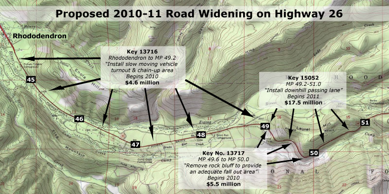
There are a total of three projects proposed for the Mount Hood corridor in this round of funding, including two “safety” projects that would widen the highway, and a third “operations” project that appears to be driven by the other two “widening for safety” proposals. The projects and their ODOT key numbers are shown on the map below.
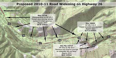
Three projects are proposed for Highway 26 in 2010-11 that will add capacity to the road, though only if you read the fine print

(click here for a larger map)

The most alarming of the projects in this round of road widening is a proposed downhill passing lane on Laurel Hill, supposedly making it “safer” for throngs of Portland-bound skiers to pass slow vehicles on the downhill grade on busy weekends. This project is a repeat of the outmoded “widening for safety” philosophy that has already impacted the lower sections of the corridor, and was described in Part One of this article.

The ODOT project details for the “downhill passing lane” are sketchy, but such projects generally assume that drivers forced to follow slow vehicles become frustrated, and attempt to pass in an unsafe manner — a potentially deadly decision on a winding, steep mountain road. But is the answer to build a wider, faster road? Or should ODOT first use all of the other tools available to manage the brief periods of peak ski traffic before spending millions to cut a wider road into the side of Laurel Hill?

The answer to these questions seem obvious, but in fact, ODOT is moving forward with the most expensive, environmentally destructive options first, in the name of safety.
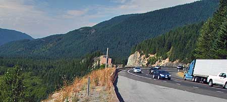
The westward view of the Laurel Hill Grade in a section proposed for widening to allow a downhill passing lane. The newly protected wilderness of the Camp Creek valley spreads out to the left.

A better solution, at least in the interim, would be to employ some of the less-expensive, less environmentally degrading approaches that have been successfully used elsewhere in the corridor. One option could be simply enforcing the current 55 mph speed limit and no-passing zones, for example, which would be much more affordable than the millions proposed to widen the highway in this difficult terrain.

Another possibility could be to extend — and enforce — the 45 mph safety corridor speed limit east from Rhododendron to the Timberline Junction, in Government Camp. Enforcing this slower 45 mph limit would result in skiers spending only an additional 90 seconds traveling the nine-mile section of Highway 26 from Government Camp to Rhododendron. This would seem a reasonable trade-off in the name of safety, especially compared to the millions it would cost to build downhill passing lanes on this mountainous section of highway.
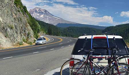
The view east (in the opposite direction of the previous photo) where road widening is proposed to add a fourth downhill lane, carved from the sheer side of Laurel Hill.

Delaying the current road-widening proposals and taking a less costly approach to improving safety would also allow ODOT to more fully evaluate the effects that growing traffic on Highway 26 is having on the surrounding area. And while it is true that delaying a project that has already moved this far in the ODOT funding pipeline is an uphill battle, it is also true that a more fiscally conservative approach is clearly more consistent with the agency’s own transportation policy than the costly widening projects that are proposed.

However, while the visionary Oregon Transportation Plan (OTP) calls for a departure from old school thinking when it comes to new highway capacity, it does not establish a detailed vision for the Mount Hood Highway. But the general direction provided by the OTP does support a least-cost approach to managing highways, and slowing down the latest road widening proposals in the Mount Hood corridor would be consistent with that policy.

Unfortunately, the badly outdated Oregon Highway Plan (OHP) sets the wrong direction for the Mount Hood Highway, emphasizing speed and road capacity over all else. But until a better vision is in place for the highway, the response by ODOT planners and engineers to safety concerns and traffic accidents in this corridor will be more road widening projects sold as “safety improvements.”

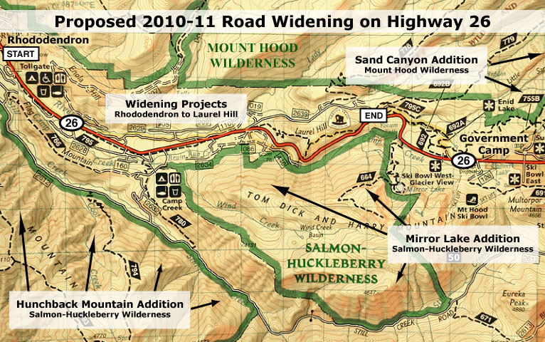
Both the Salmon-Huckleberry and Mount Hood wilderness areas saw major expansions in 2009 that were not considered in the proposed ODOT expansion projects for Highway 26

(click here for a larger map)

Over the years, this old-school approach has already created a road that is rapidly approaching a full-blown freeway in size and noise impacts on surrounding public lands. At the same time, the pressure to minimize highways impacts on the forest surroundings is still growing.

In 2009, wilderness areas around Mount Hood were significantly expanded, and the new boundaries now draw close to the highway along the Laurel Hill grade, where the “safety” widening is proposed. What will the noise impacts of the proposed highway expansion be on the new wilderness?

Already, highway noise dominates the popular Tom Dick and Harry Mountain trail inside the new wilderness, for example, more than a mile to the south and 1,500 feet above the Laurel Hill Grade. How much more noise is acceptable? How will hikers destined for these trails safely use roadside trailheads to access wilderness areas?

Nearby Camp Creek should be a pristine mountain stream, but instead carries trash and tires from the Mount Hood Highway. While it is protected by wilderness now, how will storm water runoff from an even wider highway be mitigated to avoid further degradation? How will existing pollution impacts be addressed?

The answers to these questions were not considered when this new round of “widening for safety” projects were proposed, but should be addressed before projects of this scale move to construction.
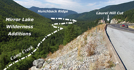
This view west along the Laurel Hill Grade shows the proximity of the new Mirror Lake wilderness additions to the highway project area.
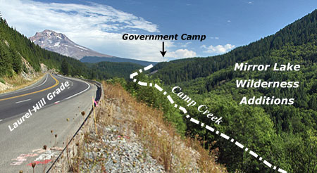
This view east along the Laurel Hill Grade, toward Mount Hood, shows the proximity of the new wilderness boundary to the project area.

In the long term, the solution to balancing highway travel needs with protection of the natural resources and local communities along the Mount Hood corridor needs a more visionary plan to better guide ODOT decisions. Such a plan could establish an alternative vision for the Mount Hood Highway that truly stands the test of time, where the highway, itself, becomes a physical asset treasured by those who live and recreate on the mountain. This should be the core principle of the new vision.

The very complexities and competing demands of the Mount Hood corridor make it a perfect pilot for such a plan — one that would help forge a new framework for managing the highway in a sustainable way that protects both community and environmental resources.

There is also room for optimism that ODOT can achieve a more visionary direction for the corridor. The agency is showing increasing sensitivity to the way in which transportation projects affect their surroundings, as evidenced by in recent projects in the Columbia Gorge and even on Mount Hood.

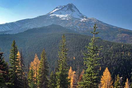
To underscore this point, I chose the logo at the top of this article because it shows a re-emerging side of ODOT that understands both the historic legacy and the need for a new vision for the Mount Hood Highway that keeps the road scenic and special. After all, Oregon’s highway tradition that includes the legacy of the Historic Columbia River Highway, the Oregon Coast Highway and the amazing state park and wayside system was largely developed as an extension of our early highways. ODOT can do this simply be reclaiming what is already the agency’s pioneering legacy..
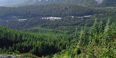
The Laurel Hill Grade on Highway 26 as viewed from a popular trail in the new Mirror Lake additions to the Salmon Huckleberry Wilderness.

The missing piece is direction from the Oregon Transportation Commission (OTC) to develop a new vision that governs how the highway is managed, and establishes desired community and environmental outcomes by which highway decisions are measured. But until a new vision for the Mount Hood Highway is in place, it makes sense to slow down the current slate of costly projects that threaten to permanently scar the landscape, and take the necessary time to develop a better plan.

If you care about the Mount Hood Highway, you should make your thoughts known on both points, and the sooner the better. The process used by ODOT to make these decisions is difficult for citizens to understand and track, especially online. So, the easiest option for weighing in is to simply send your comments in the form of an e-mail to all three tiers in the decision-making structure, using the contact information that follows.

Comments to ODOT are due by January 31, but you also can comment to the Clackamas County Commission and OTC at the same time. Contact information can be found on these links:

ODOT Region 1
(Select one of the Region 1 coordinators listed)

Clackamas County Commission

Oregon Transportation Commission (OTC)

When describing the projects, you should use the “key numbers” shown in the first map, above, as well as the project names. Simply state your concerns in your own words, but consider these critical points:

  1. The proposed Mount Hood Highway widening projects should be delayed until less-expensive, less irreversible solutions can be explored;
  2. The Mount Hood Highway needs a new vision and a better plan

Remember, these are your tax dollars being spent and your public lands at stake. You have a right to be heard, and for your voice to have an impact. With any luck, these projects can be delayed, and more enlightened approaches explored for managing our highway.
Highway 26 Widening – Part One

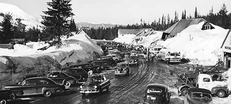
The Mount Hood Highway in the late 1950s, when it was a 2-lane scenic byway that curved through Government Camp on its famous circuit around the mountain.

Several years ago, the Oregon Department of Transportation (ODOT) began a series of safety projects in the Mount Hood Highway (Highway 26) corridor in response to a growing number of deadly highway accidents. So far, the projects are a mixed bag, with some of the projects dramatically widening the highway in an unfortunate attempt to make it “safer”. In making the decisions, ODOT is continuing to follow a path that is gradually transforming the Mount Hood Highway into something that looks more like an urban freeway, one dubious “safety” expansion project at a time.

This recent work went into high gear when Highway 26 was designated a safety corridor by the Oregon Transportation Commission (OTC), which has the effect of doubling fines for speeding and other traffic infractions. While this simple change in fines may be having an effect on driver behavior, the more aggressive action of setting (and enforcing) a new 45 mph speed limit on a portion of the corridor from Wildwood to Rhododendron has clearly been successful in bringing down speeds along this problematic corridor.

Other projects, like the cable median dividers installed on the Cherryville Hill section of the highway, are simple, inexpensive retrofits to the existing road that leave the corridor mostly untouched. These projects provide a significant improvement in safety, according to early reports (view PDF), while leaving the community character and forested highway shoulders intact.

Recent road widening projects along Highway 26 has been sold as safety improvements, but are more likely to simply encourage more speeding.

But on other safety projects in Mount Hood Highway corridor, ODOT has fallen into the old-school highway engineering trap of widening and adding lanes in the name of “safety”. The traditional thinking behind this approach is that making roads wider and adding new lanes will allow faster traffic to pass slow vehicles more safety, and to have better driver visibility and response time, thus reducing accidents.

But this traditional approach is rapidly falling out of favor, as transportation research continues to show that drivers simply drive faster with wider roads and more lanes. A truism is that on highways, speed kills, so widening a highway for safety is a contradiction, since the wider road will simply encourage more speeding and likely produce still more deadly crashes.

The “widen for safety” approach can also have profound effects on the natural environment and health and safety of communities along a corridor. Building oversized roads in rural areas brings an array of environmental and local community impacts that are rarely considered in the transportation decision-making. For example, wider roads not only require more right-of-way to be clear for new lanes, but engineers typically clear forests well beyond the roadway in such projects, justifying wide shoulders with safety and maintenance concerns, but rarely considering options that would leave roadside forests intact.

Faster speeds also have a number of unintended effects on rural communities. The immediate impact is to make it more dangerous for local traffic to enter or cross the wider highway that doubles as their main thoroughfare. Often, historic local access points are eliminated completely in the name of safety. And studies on Washington’s Snoqualamie Pass Highway also show that speeding up traffic results in drivers feeling less safe in pulling off the highway to patronize rural businesses, thereby directly affecting rural tourism economies.

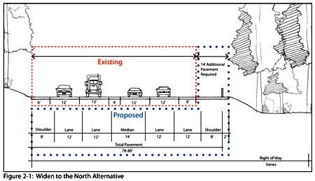
ODOT cross-section of the now constructed Wildwood to Wemme safety widening that eliminated the A.J. Dwyer Scenic Area (2007).

One of the recent projects of this sort was built between Wildwood and Wemme, where scores of trees were cut in a wide swath along the highway to add road width for “safety”. Yet, the project forever altered what the traveling public had assumed was a protected corridor, thanks to a rustic “A.J. Dwyer Scenic Area” sign that had stood for decades on the highway shoulder. As it turned out, the Dwyer preserve never had a chance in the face of a major highway project presented as a “safety improvement.”

The purpose statement in the 2007 ODOT Environmental Assessment for this “safety” project reveals the underlying highway expansion mindset behind the project — to larger goal was simply to widen the highway to “match” already wide segments abutting this segment:

“The purpose of the proposed project is to improve safety on US 26 between milepost 38.75 and milepost 40.01 and to match the cross section (width of lanes, center turn lane and shoulders) to that of the roadway to the east and west of the proposed project area.”

(Source: US 26: Wildwood-Wemme Revised Environmental Assessment 2007)

Another problematic part of such “safety” projects like the Wildwood to Wemme widening is the manner in which the larger public is excluded from participating. ODOT routinely sends notices to property owners in the vicinity — in this case, several hundred residents of the Wemme community, and holds local community meetings. But public involvement beyond the local community is largely absent, especially for those outside the local area who wish to comment online.

In this example, the local outreach effort drew only three written comments, and three oral comments at a public meeting — with one individual responsible for both a written comment and oral testimony — bringing the total public input to five individuals. Surely, a project of this magnitude and permanence deserved greater review and input from the hundreds of thousands of Oregonians who use this corridor each year, but do not happen to live in the local community.

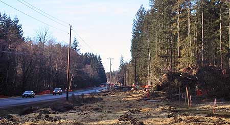
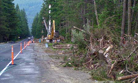
This recent safety project near Zigzag leveled hundreds of trees and converted a scenic 2-lane road into a wide highway.
A similar, recent project built between Zigzag and Rhododendron also destroyed a wide swath of forest (pictured above), and closed traditional access points for local streets in the name of safety. Because a 45 mph speed limit was also established (and enforced) in this section at the same time as the new capacity was added, we will never know if simply enforcing the lower limit might have had the very same safety benefits without the substantial costs and impacts.

One lesson from these recent “widening for safety” projects might be to strictly enforce the “safety corridor” doubling of fines first, or considering applying lower speed limits, to learn whether improved safety can be addressed more simply and cost effectively with simple changes — and with less impact on the environment and community character.

This brings us to the present, and the next round of “safety” projects in the corridor that area about to unfold, a bit further up the highway. These projects are more of the same, but entirely on public lands and in much more difficult terrain. The implication of these projects, and how to have your voice heard, is the focus of Part Two of this article.
Proposal: Gorton Creek Accessible Trail

GortonCreek01

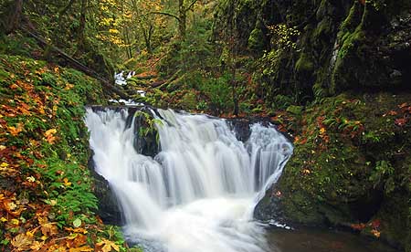
Emerald Falls on the proposed Gorton Creek Accessible Trail

The Mount Hood National Park Campaign proposes a major expansion of the trail system in the Columbia Gorge and around Mount Hood, including more opportunities for elderly, disabled and young families to experience nature. After all, hiking is the most basic form of active recreation, and should be available to all of us — especially as our region continues to grow and urbanize.

Proposed Gorton Creek Accessible Trail

Accessible trails are designed to provide access for everyone, and these facilities will be in growing demand as our country continues to age. By 2030, nearly a third of our population will be over the age of 55, and accessible trails will be in demand as never before.

In the spirit of providing accessible trails, this proposed new trail at Gorton Creek would allow for easy access to streamside vistas and photogenic Emerald Falls. This section of trail would bring visitors through a lush forest of Douglas fir, bigleaf maple and red alder.

GortonCreek02

Autumn on Gorton Creek as viewed from the proposed location of an accessible viewpoint

Gorton Creek becomes increasingly prominent as the trail draws near the stream and the sound of rushing water fills the air. Just below the proposed viewpoint of Emerald Falls and rushing Gorton Creek, there is a large gravel beach at a bend in the stream that could even provide the potential for universal access to the stream, itself — a first in the region.

The accessible portion of the new trail would largely follow an existing boot path that, in turn, follows a very old roadbed still shown on USGS maps. Thus, the gentle grade that would meet accessible trail design requirements. The dashed yellow line on the map, below, shows where the roadbed segment could be improved to provide universal access to a streamside overlook just below Emerald Falls.

GortonCreek03

Proposed Gorton Creek Family Trail

Family trails are designed to allow young children on foot, in backpacks or in strollers to have their first nature experience, and hopefully begin a lifetime of active recreation in nature.

The second part of the proposed Gorton Creek Trail would be designed for young families, with a short, easy grade leading to a viewing platform below Gorton Creek Falls. The falls is a towering 120 foot plunge set against a magnificent wall of columnar basalt, and would provide an exciting destination for budding young hikers. This section of proposed trail is shown in red on the map, above.

The family trail portion of this project would a couple of important objectives. First, it would provide a new hiking option for families with beginning hikers, with easy access from Portland and the potential to camp at Wyeth Campground as part of the adventure. Such trails are in surprisingly short supply in the Gorge, and therefore often crowded when families are most likely to visit, depriving them of a quality nature experience.

Second, this segment of the trail would combine with the lower, accessible segment to allow for extended family outings — grandparents enjoying the lower streamside viewpoint as young children and parents hike the short family spur to the main falls viewpoint, for example, with the extended family camping or picnicking at the Wyeth Campground.

Gorton Creek Restoration

While this proposal would meet growing needs for accessible trails in the region, it would remedy an escalating problem at Gorton Creek: the secret is out on Gorton Creek Falls, and waterfall enthusiasts are wreaking havoc on the trail-less canyon section above Emerald Falls as they scramble to reach the main falls, upstream. The damage to the canyon slopes (see photos, below) and stream bed is particularly worrisome given the important role the stream has as fish habitat.

GortonCreek04

Gorton Creek Falls is no longer a well-kept secret. Each summer, more visitors are pushing cross-country through the upper canyon, leaving damaged slopes and trampled vegetation in their wake

Finally, trail construction could also allow for the washed-out waterworks at Emerald Falls (see photo, below) to be permanently relocated within the trail corridor, and less prone to the periodic failures that plague the current streamside alignment. The water pipeline is currently in a precarious condition, and would greatly benefit from a trail project happening in this canyon sooner than later.

GortonCreek05

The washed out water supply line for Wyeth Campground hangs from cables anchored to stakes below Emerald Falls

To visit Gorton Creek, drive east of Cascade Locks to the Wyeth exit, turn right, then turn right again on the old highway that parallels I-84. Watch for the Wyeth Campground on the left, just before a bridge over Gorton Creek. If the campground gate is closed, park to the side, and walk through the campground to the well-marked trailhead at the south end — otherwise, you can drive to the trailhead.

To reach Emerald Falls, follow the formal trail 0.1 miles to a junction with Trail No. 400, where it crosses Gorton Creek on an impressive footbridge that kids will want to explore. Continue straight, past the bridge and Trail 400, following the obvious footpath up the east side of the stream canyon for another 0.4 miles. Watch your step around Emerald Falls, as the water works erosion has left abrupt holes and weakened stream banks. Do the canyon a favor, and don’t scramble upstream to Gorton Creek — wait for a trail to be built, instead!

(Editors Note: Trail No. 408 already carries the name “Gorton Creek Trail”, but never comes close to the creek, traversing high above the canyon rim on the shoulder of Nick Eaton Ridge. This trail eventually climbs to the summit of Green Point Mountain — and thus, might be better named the “Green Point Mountain Trail” should a new trail along Gorton Creek become a reality, if not before)

Off-Highway Vehicles

Fresh jeep tracks carve into the soft cinder summit of Red Hill, one of the areas the Forest Service would like to turn into a dirt bike playground.

Fresh jeep tracks carve into the soft cinder summit of Red Hill, one of the areas the Forest Service would like to turn into a dirt bike playground.

To get a handle on the off-highway vehicles (OHV) that are tearing up our public lands, the Mount Hood National Forest (MHNF) has embarked on a plan to concentrate them in just a few areas, presumably to reduce “conflicts” with other forest visitors.

The OHVs consist of 4-wheel ATVs, dirt bikes and 4×4 jeeps and trucks, and make up just one percent of the visitors to the forest. Their destructive, noisy, polluting quality make these vehicles a menace in the forest, whether on roads or off.

Unfortunately, the easy and most obvious solution (simply ban the vehicles!) is not politically available to the Forest Service under their convoluted “multiple use” mission. Instead, the MHNF will attempt to sacrifice a few places, as if any part of the forest should be sacrificed to an activity so senseless and destructive.

The unique geology on the summit of Red Hill, shown above and below, provides a good example of why OHVs should not be tolerated in our forests. The delicate cinder cone provides a unique view of Mount Hood, but also has the misfortune of being within reach of a logging spur. OHVs have pushed through the remaining forest to the summit of Red Hill, thoughtlessly digging ruts into the surface for the sake of a few minutes of joy-riding.

Another view of Red Hill's summit showing the criss-crossing ruts left by thoughtless OHVers.

Another view of Red Hill's summit showing the criss-crossing ruts left by thoughtless OHVers.

Similar damage can be found in sensitive areas throughout the Mount Hood National Forest, wherever logging spurs provide easy access for the OHVers. The Forest Service proposals would not only designate several areas for permanent abuse by OHVS, but also propose building new trail networks for OHV play areas.

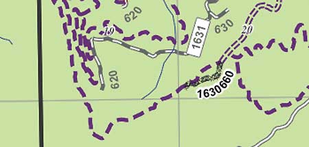
Red Hill is one of many areas that has the misfortune of falling inside one of the Forest Service “study” areas for the OHV proposal — in this case, the area is called Bear Creek. But looking at the MHNF map of the proposal, you would be hard pressed to know what is really at stake (see excerpt, below).

Cryptic map of the Bear Creek area used by the Forest Service to propose OHV playgrounds

Cryptic map of the Bear Creek area used by the Forest Service to propose OHV playgrounds

The dashed purple lines on this map show the maze of proposed dirt bike trails, but where is this? Sadly, the missing features on this map that might otherwise orient hikers familiar with the area are Red Hill, Perry Lake and the Old Vista Ridge Trail. The trail, itself, is proposed to be converted to an OHV path, and the tangle of motorcycle routes spread across the north slope of the ridge.

Look at another map of the same Bear Creek study area (below) and you begin to see the features that are at risk.

A topographic map reveals the true features and terrain at risk from the Bear Creek OHV proposal, including Red Hill, the Old Vista Ridge Trail, Owl Point and Perry Lake.

A topographic map reveals the true features and terrain at risk from the Bear Creek OHV proposal, including Red Hill, the Old Vista Ridge Trail, Owl Point and Perry Lake.

In recent years, volunteers have largely restored the Old Vista Ridge Trail, once again bringing hikers to the spectacular beargrass meadows and huckleberry fields that sprawl along the ridges around Red Hill and Owl Point, and the many stunning view of Mount Hood, towering to the south. This is a first step in bringing needed advocates to the area, and who might take a stand against the OHV idea.

Another new development since the Forest Service hatched this plan was the passage of the Lewis and Clark Mount Hood Wilderness bill. Several areas adjacent to the OHV proposals were set aside, including here at Red Hill, where the Mount Hood Wilderness was expanded to follow the Old Vista Ridge Trail, touching the OHV proposal for Bear Creek.

While it is frustrating that we must fight to save places like Red Hill and Owl Point from something as senseless as the proposed OHV plan, it is equally important to make your thoughts known. The places on the study list were selected by the Forest Service, in part, because they lack the advocates that more popular quiet recreation spots enjoy.

The view from Owl Point, along the Old Vista Ridge Trail -- proposed as a motorcycle track in the OHV plan.

The view from Owl Point, along the Old Vista Ridge Trail -- proposed as a motorcycle track in the OHV plan.

So, if you are a friend of any of the study areas, weigh in with your thoughts while the MHNF comment period is open, though October 28. The best place to learn about the OHV proposal is over here, on the Bark website. Bark has posted all of the relevant documents, and provide background on what has become a fairly confusing, complex process.

Bark has been following the issue closely for nearly three years, and helped ensure that Alternative 4 in the plan. This option has the least impact of the “build” alternatives, and excludes the Red Hill and Old Vista Ridge areas. Instead, OHVs would be focused in two areas located south of Mount Hood known as McCubbins Gulch and LaDee Flat. Alternative 4 is the pragmatic alternative that the Mount Hood National Park Campaign will endorse as a lesser of evils.

You may also contact the Forest Service directly with your comments:

Jennie O’Connor Card
Mt. Hood National Forest
6780 Highway 35
Parkdale, Oregon 97041
(541) 352-6002 ext. 634

Dry Creek Ponds: Orphaned Gems

Dry Creek flows into a series of lush ponds just south of I-84.

Dry Creek flows into a series of lush ponds just south of I-84.

Just inside the city limits of Cascade Locks — and just outside the protection of the Columbia Gorge National Scenic area — lie a series of beautiful ponds and an adjacent group natural springs so pure that a national bottled water corporation is considering a new plant here. The ponds, themselves, are posted with real estate signs advertising dream home sites in this pretty location, albeit within earshot of noisy I-84.

The ponds underscore one of the dilemmas facing natural sites in the Columbia Gorge that happen to fall within the designated “urban areas” that are excluded from scenic area protection. Most of the Gorge towns are too small to have the fiscal means to protect these orphaned gems, even if they wanted to. Meanwhile, the non-profit organizations and federal agencies involved in land acquisition focus exclusively outside these urban areas. The result is a surprising number of natural features that face great risk of development, with no clear path for protection.

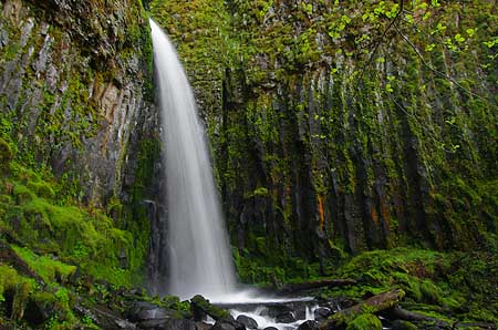
Dry Creek is better known for its waterfall, about a mile upstream from the ponds.

Dry Creek is better known for its waterfall, about a mile upstream from the ponds.

In the case of the Dry Creek Ponds, much of the land is already up for sale, and the real question is whether some sort of public purchase could intervene, and save the ponds from development. The ponds are not entirely pristine: a frontage road along I-84 borders one of the ponds, and there are a few homes tucked into the forest near the ponds. But the ponds are largely undeveloped, and surely worth more to the public as protected natural areas than to a few as exclusive home sites.

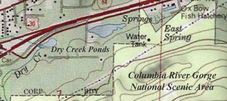
One option for protecting the ponds is the federal acquisition program operated by the Forest Service to consolidate lands within the scenic area. Their guidelines focus outside the urban areas, but a case could easily be made to cross those boundaries when natural sites are adjacent to surrounding public land. This is the case for the Dry Creek ponds, which not only abut the scenic area, but also the federal Oxbow fish hatchery.

Dry Creek ponds are located outside the protection of both the National Scenic Area boundary and the nearby Oxbow fish hatchery.

Dry Creek ponds are located outside the protection of both the National Scenic Area boundary and the nearby Oxbow fish hatchery.

A second option for protection are the private agencies involved in land acquisition within the scenic area. These organizations typically turn most of their acquisitions over to the federal government for long-management, so in the case of the Dry Creek Ponds, it would still be important to find a way for federal acquisitions to exist inside the urban areas.

A third option is for local governments to step up to the challenge, and create a municipal park or natural area for its local citizenry. In this case, the City of Cascade Locks is the local government in question, and like most of the small cities in the Gorge, is financially strapped. So a hybrid approach where the federal agencies, or perhaps the non-profits (or both) help the small cities make strategic acquisitions of places like the Dry Creek Ponds.

The ponds are teeming with wildlife, despite the noise of the nearby freeway.

The ponds are teeming with wildlife, despite the noise of the nearby freeway.

One of the truisms about sudden growth in small communities like Cascade Locks is that the civic awareness of threats to natural areas usually comes too late in the development boom. After years of slow growth, Cascade Locks is slowly awakening. So, like other Gorge communities, the town is entering a short window of opportunity for natural area protection that will be fleeting.

The Dry Creek Ponds are worth saving. The ponds are home to waterfowl, beaver and a thriving population of other species in the wetlands and forest that border the ponds. The ponds are unique in having such close proximity to Cascade Locks, and therefore easy access for visitors. This is one of only a few places in the Gorge where it is easy to get very close to a pond ecosystem, and thus could provide a valuable place for learning and wildlife watching.

Wetland birds thrive in tall marshes that border the ponds.

Wetland birds thrive in tall marshes that border the ponds.

The ponds could also provide a starting point for hikers to head up Dry Creek to the falls — or points beyond along the Pacific Crest Trail, which passes just above the ponds, inside the scenic area.

In the end, the fate of the ponds will be a measure of our collective will to protect the larger Gorge landscape for generations to come, no matter where we’ve drawn lines on maps or how we have divided public land management responsibilities. In this way, the ponds provide an opportunity for local citizens, public land stewards and non-profit environmental advocates to show that our collective vision extends across those artificial boundaries.

Restoring forests, one community at a time

Interior Secretary Ken Salazar set the Pacific Northwest forest recovery effort back on track in July when he reversed the Bureau of Land Management’s (BLM) Western Oregon Plan Revisions (the WOPR, a brilliantly unintentional blunder as acronyms go, as it became known as “The Whopper”). This represented a major step back from scientifically corrupt policies intended to enrich timber corporations at great cost to our public lands.

In this recent opinion piece in The Oregonian, Dominick DellaSala and Randi Spivak respond to Salazar’s move, and provide an excellent framework for how we should move forward to restore our public forests. Their prescription: emphasize needed thinning of the sickly, biologically sterile tree plantations left from the logging heyday of past decades, and embrace the value that our restored forests will have in the global effort to reduce carbon emissions.

The eastside forests spreading out below Lookout Mountain look healthy enough from a distance, but in reality are in dire need of a bold new restoration strategy.

The eastside forests spreading out below Lookout Mountain look healthy enough from a distance, but in reality are in dire need of a bold new restoration strategy.

As described in their article, the Siuslaw National Forest has already begun to embrace this new approach, and other public forest managers are beginning to take notice. But a truly comprehensive restoration effort must be more aggressive, and should also focus on stabilizing the forest-based communities that were left to die when the big timber operations pulled out in the 1980s and 90s

Traditional thinning offers a couple of opportunities for local communities: the timber operations involve most of the same logging skills that were once the mainstay of rural Oregon. In addition, the harvested wood from thinning offers not only traditional saw logs for small mills, but also a new economic niche in the smaller woody debris that was once discarded or burned on site in the forests. New uses for small woody debris include engineered wood products and even energy production as biomass.

A closer view of typical second-growth forests near Lookout Mountain reveals a dying, overcrowded ecosystem under great biological stress.

A closer view of typical second-growth forests near Lookout Mountain reveals a dying, overcrowded ecosystem under great biological stress.

One practical challenge in reaching this new approach will be the scaled-back network of logging roads, since the over-built system constructed in the second half of the 1900s is rapidly crumbling and infeasible to maintain for the long term. One strategy is to tie road decommissioning to forest thinning and restoration efforts, pulling out obsolete roads after forests have been largely restored. Another could be aerial operations, perhaps even balloon logging. Still another could be roadless logging with light equipment or even horses — a practice well established on small, private woodlots in Oregon.

The key to finding this new balance in sustainable forest restoration a role of direct stewardship among the forest communities — to view them as the keepers of the forest, as opposed to the “forest dependent” mindset of the industrial logging era. This means establishing an ongoing relationship between community-based forest management organizations and the federal agencies that govern most of our public forest land. These new organizations could follow the lead of watershed councils and farm bureaus, using formal governance coupled with direct management responsibilities as forest recovery agents.

A bright spot in the restoration of the eastside forests near lookout mountain, this thinned plantation is beginning to resemble a natural forest, with multi-aged stands and a recovering understory.

A bright spot in the restoration of the eastside forests near lookout mountain, this thinned plantation is beginning to resemble a natural forest, with multi-aged stands and a recovering understory.

How would the economics of community-based stewardship work? In a commodity-based model of selling products recovered from thinning, the objective is straightforward — but unlikely to be profitable as a private enterprise.

Instead, the public will likely need to provide some level of subsidy for the restoration work involved, with commodity proceeds offsetting public costs. The advantage of a public subsidy is that it provides an ongoing public interest in the health and viability of the forest communities, themselves, and could help avoid the volatility that private timber harvesting brought to these communities in their first century.

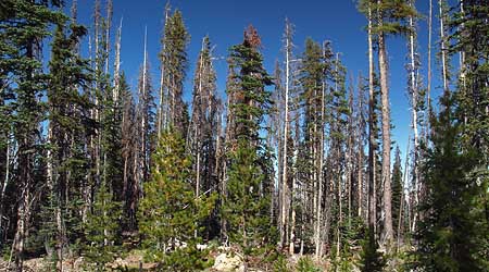
A few stands of late succession ponderosa and Western larch forest still exist on the slopes of Lookout Mountain, providing a glimpse of what a restoration policy must aim for.

A few stands of late succession ponderosa and Western larch forest still exist on the slopes of Lookout Mountain, providing a glimpse of what a restoration policy must aim for.

But the more interesting idea is to create a long-term financial model for stewardship communities based on carbon sequestration as part of global efforts to reduce carbon emissions. Carbon credits would be sold as offsets to carbon polluters, and providing a permanent incentive to bring the northwest forests back to health.

The credits could be managed as a community trust, or managed through a public-private corporation. Under this paradigm, there would be little incentive to harvest large trees, since they would exist primarily as carbon storage units under the new carbon-based economic framework.

Of course, we also know that big trees and mature forests also provide a much wider array of ecological and social benefits, but these costs have never factored in to the short-term price for raw logs in the old timber harvesting paradigm. As DellaSala and Spivak point out in their article, the Pacific Northwest is uniquely capable of storing carbon in our living forests, and to a degree nearly unmatched in the world. If this potential is given a value, then we may well seen an end to the destruction of our mature forests for saw logs and pulp that could just as easily be manufactured from private plantation materials.

The concept of community-based stewardship in carrying out forest restoration is attainable, as evidenced by the many successful public-private partnerships that exist today. But it’s unclear if the Forest Service and BLM bureaucracies are flexible or willing enough to embrace the idea.

Instead, a new conservation-based form of administration may be needed — broader than the National Park Service in scope, but borrowing from the Park Service ethic of conservation and sustainability. The Cascade Forest Preserve, perhaps, extending from the Sierras to the Canadian border? Given the grave implications of climate change, it is impossible to think too big or boldly as we search for a way forward.

Between a rock and a hard place…

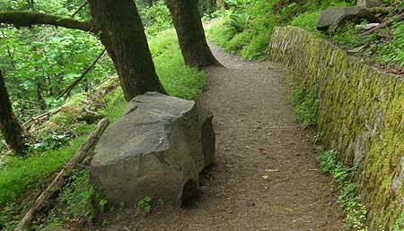
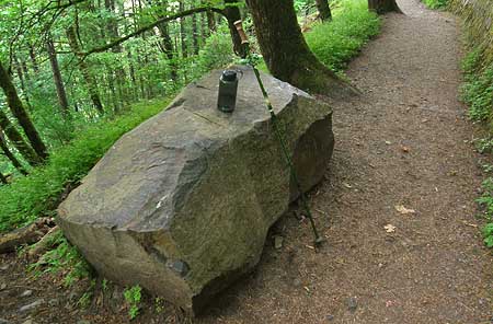
Sometime in the past couple of years, a refrigerator-sized piece of basalt split from the cliffs above Horsetail Falls, tumbled across two switchbacks on Gorge Trail 400, and landed perfectly on a third, forming a handy bench that only Mother Nature could design – or did she?

The convenient boulder that recently appeared on Trail 400, above Horsetail Falls - the work of man or nature?

The convenient boulder that recently appeared on Trail 400, above Horsetail Falls - the work of man or nature?

Rocks like this are constantly breaking loose from the walls of the gorge, usually far from the view or earshot of hikers. Through the relentless effects of water, and cycles of freeze and thaw during the winter months, bits and pieces of the stacked layers of basalt eventually break free, and join the enormous piles of talus that have accumulated beneath the cliffs over the millennia.

The new bench-boulder above Horsetail Falls is a bit chunkier than most, but tiny when compared to the house-sized boulders that are known to break loose on occasion. One infamous event near Wahclella Falls in the late 1960s was massive enough to send an entire subdivision of house-sized boulders into Tanner Creek, temporarily forming a small lake in the aftermath.

Looking down at the new boulder, the view is a bit more menacing, with a big bite taken out of the solid rock wall in the foreground, and a trail of debris, below.

Looking down at the new boulder, the view is a bit more menacing, with a big bite taken out of the solid rock wall in the foreground, and a trail of debris, below.

Assuming that the big rock did land in the middle of the trail, there are a couple of miracles that suggest divine placement. First, the boulder missed the adjacent wall, though it took a sizeable bite out of a retaining wall further uphill (see photo, above). Second, the boulder managed to land parallel to the path, and just far enough from the rock wall to allow hikers to easily slip between… a rock and a hard place!

It’s possible that trail crews could have jimmied this massive stone into its convenient position, but unlikely. Just one cubic foot of solid basalt weighs in at a staggering 188 lbs, which means that this fridge-sized weighs at least 12,000 pounds — more than six tons!

Perfect for a trailside respite, the big rock bench is already a favorite of hikers

Perfect for a trailside respite, the big rock bench is already a favorite of hikers

A more unnerving thought is the possibility of hikers actually witnessing nature at work, here, given the popularity of this well-traveled path nearly year-round. But, even with the scores of hikers walking by, there are plenty of quiet spells during the winter season, when this stone most likely made its move — and there’s also the dark of night.

However the big rock arrived, it has already become a popular stopping point for newbie hikers, puffing their way up the trail from Horsetail Falls, in search of Ponytail Falls. In this way, the big rock might just be Mother Nature’s way of tempting her most impatient species to stop and relax, if only for a moment.

Tunnel Point Wayside

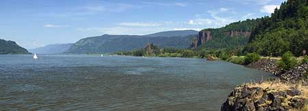
The sprawling vista into the Gorge from Tunnel Point Wayside

The sprawling vista into the Gorge from Tunnel Point Wayside

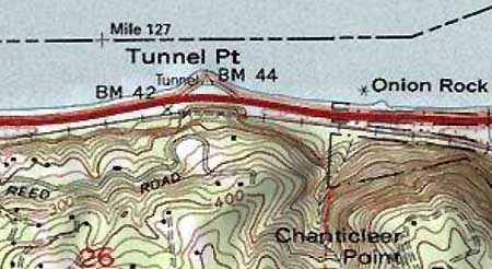
Mostly lost in the noise of Interstate-84, the tiny Tunnel Point Wayside is a forgotten bit of ground that deserves a little more respect. This spot is named for the railroad tunnel that cuts through the lower buttress of Chanticleer Point, to the south. In the early days of Highway 30 construction in the Gorge, the wayside at Tunnel Point was designed as a scenic turnout for visitors. From here, the first big view of the Gorge spreads out, with Crown Point and Vista House framing the scene.

TunnelPointMap

Today, freeway barricades prohibit access to the wayside for eastbound travelers entering the Gorge, and the turnout is an afterthought for most westbound travelers, since the Gorge view is behind them. The wayside has thus devolved into a huge, paved layover spot for semi-trucks — a sad epitaph for what should (and could) be a premier gateway viewpoint in the Gorge.

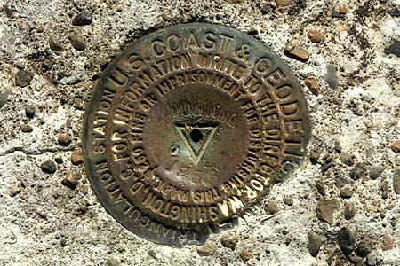
Tunnel Point has two U.S.G.S. benchmarks and a ship beacon bolted to its tiny, rocky cape. Beyond the sterile steel guardrail that borders the turnout, basalt cliffs drop 20 feet into the river. These little cliffs are likely remnants of a more noble formation, undoubtedly quarried to help build the modern highway in the Gorge in the 1940s and 50s. But they still give a sense of the natural environment that once existed here, and provide for an interesting shoreline along the river.

This USGS benchmark was placed in 1956, likely in conjunction with modern highway construction in the Gorge.

This USGS benchmark was placed in 1956, likely in conjunction with modern highway construction in the Gorge.

Look closely at these rocky mini-bluffs and you’ll see cliff-dwelling Gorge plants making a home, while red alder and Douglas fir are colonizing the rocky shoreline on both sides of Tunnel Point. Nature is making a valiant attempt to restore this spot, even if we humans are lagging in the effort.

How could the Tunnel Point Wayside be restored? For starters, the massive expanse of asphalt could be redesigned to restore green areas, with landscaping, trees, picnic tables, restrooms and perhaps a travel information center. After all, this spot is as much a gateway to the Portland metropolitan area as to the Gorge, given that access is limited to westbound travelers.

Next, a series of walking paths could be added along the little bluffs, providing a place for travelers to stretch their legs, and learn a bit about the Gorge. A wooden Oregon History sign is already mounted in the parking area, and could be restored to become part of an improved interpretive display and walking path system.

Wasted space: the vast, barren turnout at Tunnel Point.

Wasted space: the vast, barren turnout at Tunnel Point.

These improvements would provide for a welcome refuge for travelers arriving in the Portland region from points east, but what about travelers entering the Gorge from the west? Providing access to eastbound visitors would be a tall order, requiring some sort of overpass or tunnel to deliver visitors from the opposite side of the highway. The cost, logistics and visual impacts probably make this infeasible, unfortunately.
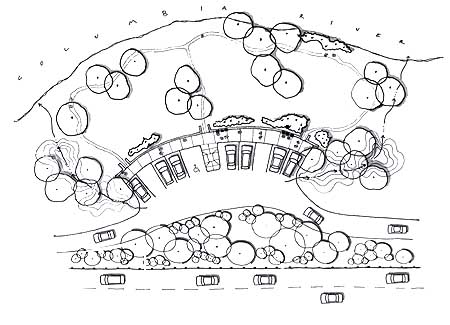
But for now, improving the wayside for westbound traffic would be a big step in the right direction. Since the wayside is within the highway right-of-way, improvements could be built by the Oregon Department of Transportation (ODOT) with highway funds, in conjunction with Oregon Parks and Recreation. Tunnel Point Wayside deserves this new lease on life, and travelers in the Gorge deserve to enjoy this unique perspective of the river and Gorge.

Postscript: after writing this article a few months ago, I ran across a “generic” roadside pullout design in the 2005 I-84 Design Strategy — a joint ODOT, U.S. Forest Service, Federal Highway Administration and Columbia Gorge Commission planning document that lays out the framework for future improvements to the highway within the Columbia River Gorge National Scenic Area.

The schematic looks tailor-made for the Tunnel Point Wayside, and in this design, reclaims much of the parking area as a park with riverside loop trail. Though hard to see in this scaled-down version, the plan calls for just ten parking spots, with trucks obviously barred from entering (the truck stops in Troutdale are only a few miles further, after all). Most interesting are bio-swales on both sides of the pullout, draining the parking area and adding more green screening from the highway. A glimpse of what might be, perhaps?
Hood River Mountain Trophy Homes

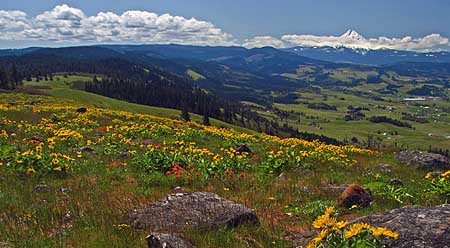
These fragile slopes on Hood River Mountain -- covered in their spring blanket of yellow balsamroot -- were recently scarred with a driveway to yet another ill-conceived trophy home.

These fragile slopes on Hood River Mountain -- covered in their spring blanket of yellow balsamroot -- were recently scarred with a driveway to yet another ill-conceived trophy home.

One of the great tragedies of the Columbia River National Scenic Area Act (signed into law on November 17, 1986) was the crude delineation of what should be protected and what should not. The official boundary was eventually determined by pulling in terrain that could be viewed from the river, and from a scenic resources perspective, this was a fair starting point.

But the flaw in this thinking is that nature rarely follows clear boundaries, and some of the most precious lands in the Gorge were excluded by virtue of being hidden from view. It’s times to correct that oversight. It was also automobile-centric, since gorge visitors on foot, bicycle or horseback are likely to visit the high points and overlooks that have a broader viewshed.

This map shows how the scenic area boundary excluded the unique, open slopes of Hood River Mountain shown in the previous photo.

This map shows how the scenic area boundary excluded the unique, open slopes of Hood River Mountain shown in the previous photo.

One such area is Hood River Mountain. Hikers flock to the area, though few realize that they’re hiking on private land (despite a sign stating so). Still fewer know that the land they are hiking on has no protection from the Columbia River National Scenic Area, though the Columbia River can be seen below. Without Oregon’s strict statewide planning, this area would be maze of roads and trophy homes by now. Instead, the mountain survives largely intact, in big parcels owned by a Washington timber company.

But not all of Hood River Mountain was spared. The northern extent had already been divided into smaller parcels by the time Oregon’s planning laws were enacted in the 1970s, and today these parcels are in high demand for trophy homes. The dwelling pictured at the top of this article was recently constructed on one such parcel, scarring the mountain forever with a quarter-mile driveway. This gouge across the delicate sloped meadows of arrowleaf balsamroot threatens to destabilize sensitive soils, placing an important ecosystem at risk.
The sprawling meadows on Hood River Mountain are owned by a (so far) benevolent timber company, but are on the wrong side of the scenic area boundary for the purpose of public protection.

The sprawling meadows on Hood River Mountain are owned by a (so far) benevolent timber company, but are on the wrong side of the scenic area boundary for the purpose of public protection.

This development on the northern tier of Hood River Mountain is a jarring reminder that in the short term, the scenic area boundary must be revisited to identify rare or endangered ecosystems, or other important resources that abut the line. Adjusting the boundary in these areas would open the door to federal protections and public acquisition of these sites over time.

In the long-term, the more difficult question of acquiring and either removing, or re-purposing some of the more egregious trophy homes must be addressed. The Forest Service has rarely crossed this line, largely due to lack of adequate funding for acquisition to begin with. Someday, this will be an important part of the restoration vision of the Mount Hood National Park Campaign. But for now, simply stopping the bleeding is a more pragmatic goal. The Forest Service must receive more funding to accelerate private acquisitions.

Trophy home gate on Hood River Mountain, where high anxiety accompanies country living for these dream-home dwellers.

Trophy home gate on Hood River Mountain, where high anxiety accompanies country living for these dream-home dwellers.

The State of Oregon and local governments can also help on this front. The state and local jurisdictions could offer a tax incentive for trophy-home owners in high-profile locations to eventually deed these homes to the public for demolition, removal or reuse as a public facility.

In the meantime, the counties that issue permits for rural trophy homes can raise the bar for what they are willing to accept in engineering as geotechnical justifications for these projects. The Forest Service could assist the counties in providing an enhanced permit process, as a strategy for preventing the least sustainable eyesores from slipping through.

Non-profit land advocates are already important partners in addressing both the short and long-term problem. Today, at least three of these organizations have begun to acquire private lands in the Gorge, and are advocating for expanding the scenic area boundaries to encompass more endangered lands. Since the non-profits are not bound by official designations, and could begin working immediately with landowners to acquire land at overlooked places like Hood River Mountain, they offer the potential to work far in advance of the federal bureaucracy.

Each of us can help by supporting the non-profits who do this work. Most prominent are the Trust for Public Lands, Friends of the Columbia Gorge and the Nature Conservancy. You can find contact information for all three in this directory of organizations. Consider joining or simply contributing to one of these groups, and helping protect some of our most unique landscapes so that they may someday be intact or rehabilitated — as part of the Mount Hood National Park vision.

They paved paradise, put up a parking lot…

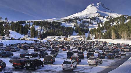
The sprawling Mount Hood Meadow parking lot is a sea of cars in ski season

The sprawling Mount Hood Meadow parking lot is a sea of cars in ski season

First-timers arriving at the Mount Hood Meadows resort in winter are greeted with a handsome view of the broad southeast face of the mountain — framed by a giant, mall-sized parking lot. Since the resort first opened in 1967, the parking lot has been a continued bone of contention for mountain defenders.

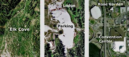
The original 6-acre lot covers what were once mountain meadows and groves of ancient subalpine fir and mountain hemlock. Growth rings in trees cut on nearby ski slopes show the cleared forest to have been upwards of 200 years old, and among the oldest alpine trees on the mountain. The lot has since been augmented by a 3-acre overflow lot in the forests below, and the 5-acre Hood River Meadows satellite lot built in the late 1970s. The resort master plan calls for another 8 acres of parking, which would bring the total for Meadows to an equivalent of 22 city blocks of high-elevation pavement.

A visual comparison of the main Meadows lot (center) to Elk Cove, on Mount Hood's north side and a similar footprint in downtown Portland.

A visual comparison of the main Meadows lot (center) to Elk Cove, on Mount Hood's north side and a similar footprint in downtown Portland.

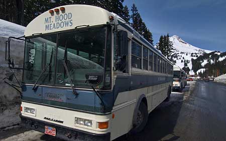
But the deed is done, and Meadows has begun to respond to pressure to minimize expansion of the lot to the extent that buses are now used to transport a few skiers. But the long-term solutions must include variable fees on parking and lift tickets that help even out the demand to park at the resort, and prevent the huge weekend crowds that drive parking pressures (as well as highway congestion).

This will surely be fought by the resort operators, but they’re running their business on leased, public land. You and I own the parking lot, and the land under the lodge and every lift tower the resort operators have constructed. So it’s fair to say “enough is enough” as the land owners. And enough IS enough for the Meadows resort. From this point forward, the operation should focus on reducing parking, not expanding it.

What would pricing do to help manage parking? Done correctly, and in tandem with lift ticket prices, variable pricing would distribute traffic on Highways 26 and 35 in a way that prevents traffic jams on weekends, and pressure to expand these routes for a few skiers. It would also reduce lift lines, and pressure on lodge facilities. But most of all, it would allow the parking lot at Meadows to stop growing — an eventually, be reduced in size.

Ski buses at Meadows are lost in the sea of automobiles - a fact that must change in order to reclaim some of the paved areas, and restore sustainability to the resort.

Ski buses at Meadows are lost in the sea of automobiles - a fact that must change in order to reclaim some of the paved areas, and restore sustainability to the resort.

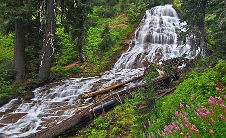
Why should the current lot be reduced in size? Because the design of the main lot has a substantial impact on the headwaters of the East Fork Hood River, which flows around the east perimeter of the parking area, then plunges over lovely Umbrella Falls — just 300 feet from the south edge of the lot.

As might be expected, the splash pool of the falls is littered with debris tossed out by skiers, then blown into the stream by snowplows. Worse, sand and gravel blown from the roads is rapidly silting the stream, filling once-deep alpine pools with sediments that the natural stream flow cannot hope to keep pace with.

New innovations in urban parking lot management provide good examples for the Meadows resort to follow, including bioswales and pervious paving designed to contain and treat runoff. These concepts could be applied immediately, and with proven results. Across the country, storm water mitigation is being designed into new parking lots, and retrofitted into existing lots to protect water supplies.

A more permanent solution would be an undergound, structured lot that wouldn’t require plowing, and wouldn’t add any surface runoff to the stream system. A working example is the lot under Capitol Mall, in Salem — few visitors realize that the lush gardens and fountains framing Oregon’s Capitol dome are actually the roof of a parking structure. In the long term, this could provide the best solution for Meadows, and would be welcomed by skiers who now tromp through grimy parking lot slush and rows of muddy cars to reach the lodge.

Lovely Umbrella Falls splashes just a few hundred feet from the Meadows resort. Sadly, the falls is littered with parking lot debris blown by snow plows.

Lovely Umbrella Falls splashes just a few hundred feet from the Meadows resort. Sadly, the falls is littered with parking lot debris blown by snow plows.

The Meadows resort operates under a permit from the U.S. Forest Service, and can be clearly be regulated into these changes, based simply on environmental considerations. But the political reality is that the resort would likely need an economic incentive to rehabilitate the lot.

One option is to simply subsidize the development of structured parking, in tandem with an a pricing program and meaningful transit to the resort. This has been done at some of Portland’s suburban light rail stations, for example, with marked success. Another option would be to allow Meadows its long sought after overnight lodging in exchange for a major upgrade to its parking lots and transportation program, and a parking lot lid would be an excellent spot for new lodging.

In the end, undoing the parking lot damage is part of adopting a new ethic for the Meadows resort that goes beyond what is now largely a token marketing facade of “sustainability.” It’s time to expect more from the corporate tenants of our public lands.

Parkdale Lava Flow

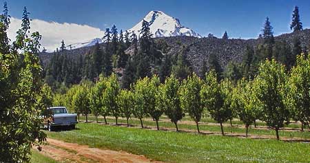
The dark wall formed by the Parkdale Lava Flow rises abruptly from the famous fruit orchards of the Hood River Valley

The dark wall formed by the Parkdale Lava Flow rises abruptly from the famous fruit orchards of the Hood River Valley

Tourists will soon be streaming into the Hood River Valley to marvel at the pink and white blossoms that blanket Oregon’s most famous apple and pear orchards each spring, with snowy Mount Hood towering above.

For many, the trip takes them to the tiny farm hamlet of Parkdale, in the heart of the upper valley. Here, the unexpected view of a dark wall of lava known as the Parkdale Lava Flow is a surprise to even longtime Oregonians. This dramatic flow is among the largest and youngest in the Cascades, yet remains surprisingly unknown.

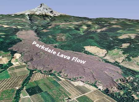
This Google Earth view looks south, from the toe of the Parkdale Lava Flow, toward its origin, at the foot of Mount Hood

This Google Earth view looks south, from the toe of the Parkdale Lava Flow, toward its origin, at the foot of Mount Hood

From the farms near Parkdale. the lava flow looks like a ridge of jumbled boulders, with the occasional Douglas fir or ponderosa pine poking out of the chaos. But viewed from above, the formation takes on a more recognizable form. Flowing north from a deep fissure at the foot of Mount Hood, the lava first poured down the valley in a single, broad stream, pushing the Middle Fork of the Hood River from its channel.

As the river of molten rock reached the flats of the upper Hood River Valley, the lava began to spread out from the river channel, with great lobes spilling sideways from the main flow onto the valley floor. By the time the eruption was over, the lava had traveled more than four miles, and poured more than 390 million cubic yards of molten rock on the surface. That’s 4 million dump truck loads of lava, and when the lava cooled, it covered nearly 3,000 acres to depths as much as 300 feet.

Aerial views show giant ripples and lobes in the Parkdale lava flow, and the displaced Middle Fork Hood River, flowing along the edge of the new lava

Aerial views show giant ripples and lobes in the Parkdale lava flow, and the displaced Middle Fork Hood River, flowing along the edge of the new lava

The Middle Fork of the Hood River must have been a hellish sight when the eruption occurred, as molten rock filled the stream bed, and vaporized both river and forest as it overwhelmed the landscape. Today, the river traces the west margin of the flow (shown on the right in the image above), with lava slopes rising steeply from the stream. This rugged terrain along the Middle Fork makes for one of the least-visited sections of river anywhere in the Mount Hood region.

The Parkdale Lava Flow is young by geologic standards at just 7,000 years old. That places the eruption at about the time when Crater Lake was formed, following the massive eruption and collapse of the former Mount Mazama.

The Parkdale Lava Flow falls partly into private ownership

The Parkdale Lava Flow falls partly into private ownership

Geologists note that the Parkdale flow overlays traces of Crater Lake ash deposited in the Mount Hood area, suggesting that the lava flowed just after the destruction of Mount Mazama. This puts both events within the period when the first Native Americans were living in the region, and we can only imagine how the ensuing chaos must have impacted these early residents.

Since the eruption 7,000 years ago, a few trees have pioneered the lava flow, mostly along shaded side slopes, but it mostly looks like it erupted very recently. As might be expected, the flow is also home to small wildlife that thrive in the shelter that the jumbled rock provides. Through sheer luck, the flow was never mined for aggregate, despite its proximity to huge construction projects, such as the dams and highways in the nearby Columbia River Gorge.

The Forest Service has designated 854 acres of the Parkdale Lava Flow as a geologic “Special Interest Area” for the stated purpose of “public recreation use, study and enjoyment.” In its forest plan, the agency has committed to managing such areas in a natural condition, pending a detailed implementation plan for each area. This is where the Parkdale Lava Flow stands today.
Part of the lava flow, along the northeast corner (see map), is on private land. While this private land is already inside the Mount Hood National Forest jurisdictional boundary, the agency rarely acquires land thanks to lack of dedicated funding or a clear mission on which lands ought to be acquired. So for now, this is yet another unique natural feature at risk of development.

In the long term, the Mount Hood National Park Campaign envisions bringing the L-shaped piece of private land into public ownership, and providing recreational and interpretive access to the area. Until that day, the area can be explored off-trail, with access from adjacent forest roads.

The Million Dollar View

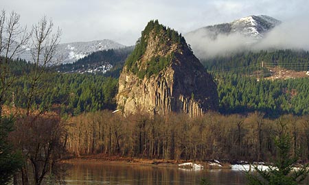
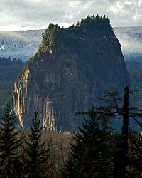
Beacon Rock rising above the Columbia, as viewed from the Oregon side

Beacon Rock rising above the Columbia, as viewed from the Oregon side

Beacon Rock rises nearly 1,000 feet above the Columbia River, and forms the nucleus of some of the finest park lands on the Washington side of the Columbia Gorge. The famous network of catwalks and stairways installed on Beacon Rock in the 1920s leads thousands of visitors to the airy summit each year to marvel at the view.

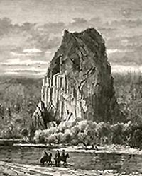
Nineteenth-century engraving of an early Beacon Rock scene

Nineteenth-century engraving of an early Beacon Rock scene

Beacon Rock, itself, is a testament to conservation, having been saved from an early 1900s scheme to actually mine the monolith for quarry stone. Today, it is among the most visited — and best loved — spots in the Gorge, with campgrounds, picnic areas and an impressive network of hiking and bicycling trails. But when the park boundaries were laid out for Beacon Rock, the Oregon side of the river was left out of the equation.

In the early days of white settlement, fish wheels operated in the shadow of Beacon Rock, along this section of the Oregon shore, harvesting salmon from the vast migrations that moved up the river.

Early settler Frank Warren operated a cannery on the site, and the town that grew around his operation became known as Warrendale. (editor’s note: Frank Warren was the only Oregon resident known to have perished on the Titanic; his wife Anna was among the few to escape in a lifeboat, and survived, while her husband stayed behind on the ship to help other women and children into lifeboats)

Present-day view of Beacon Rock from the Oregon side

Present-day view of Beacon Rock from the Oregon side

After the demise of fish wheels and the Warren cannery in the early 1900s, Warrendale began a slow slide into obscurity. Today, the former town site has largely been replaced by Interstate-84, and a dozen homes now occupy this remnant of private parcels along the Columbia River.
This is where the story gets a bit ugly. Like all inholdings in the Gorge and around Mount Hood, the river front homes in Warrendale suffer from trespassing — both by well-meaning visitors simply trying to find access to the river, and by less courteous visitors who clearly don’t respect the numerous private property postings.

The lure of the river here is undeniable. Beacon Rock towers across the Columbia, and sandy beaches line the river in summer and fall. Yet, no public access exists along this stretch of Oregon shoreline, and thus the tension between land owners and visitors.

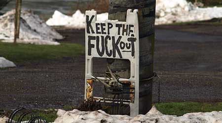
Tensions run high in Warrendale as property owners struggle to block visitors from trespassing to reach Columbia River beaches

Tensions run high in Warrendale as property owners struggle to block visitors from trespassing to reach Columbia River beaches

Some landowners have taken drastic steps, in response, posting profane signs that have shocked more than a few families who have stumbled into Warrendale. Less confrontational signs show up everywhere, making it abundantly clear that the public is not welcome in this community.

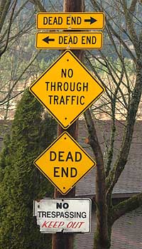
Even the official signposts in Warrendale bear blunt warnings for visitors

Even the official signposts in Warrendale bear blunt warnings for visitors

There’s no doubt that the view from these homes is among the most spectacular anywhere, but in the long term, should this stretch of beach be reserved for just a few? After all, were it not for the fish wheel and cannery that once stood here, this would likely be public land, with public access for all. Is it possible that in the long term, this unique spot can be dedicated to public access?

Not in the near term, in all likelihood. Though the Columbia River Gorge National Scenic Area (CRGNSA) receives funds each year from Congress for the express purpose of acquiring private parcels in critical locations, most acquisitions are for properties that directly abut federal or state lands, or are in pristine condition. The dozen homes in Warrendale are neither — they are separated from public lands by Interstate-84 and largely developed.

One viable option for the CRGNSA is to follow the lead of private land acquisition organizations, like the Nature Conservancy and Trust for Public Lands, and purchase conservation easements or living trusts for these properties. For private conservation groups, these have been valuable real estate tools for eventually bringing private lands into the public realm. Another option is a partnership between the CRGNSA and one of these organizations to reach a similar result.

It’s not too soon for the CRGNSA to be thinking about this possibility. This is a million dollar view that deserves to be enjoyed by all, not just a few.

Postscript: In June 2010, one of the riverfront homeowners in Warrendale, 68-year-old James Koch, threatened four salmon fishermen who were anchored for the night in their boat just offshore, then fired rifle shots toward the boat. After his arrest by Multnomah County authorities, he was found guilty of felony unlawful use of a weapon, misdemeanor menacing and misdemeanor recklessly endangering other.

During his trial, he called on neighbors who testified about the public encroaching on their riverfront property. In this November 3, 2010 Oregonian article, one of the fishermen, Steve Bruce, said he was “sickened by that attitude. It’s not just him (Koch), they all feel that they own the land under the water.”

Koch could face prison time, pending sentencing, and will lose is right to own or operate firearms.

Second Postscript: In November 2010, James Ellis Koch was sentenced in Multnomah County court to 60 days jail time and three years probation for firing weapons at four salmon fishermen who were anchored for the night in their boat just offshore from his Warrendale property.

In this November 19, 2010 Oregonian article, Judge Janice Wilson took issue not only with Koch’s unrepentant attitude, but also with the vigilante culture that exists in the Warrendale community. From the article:

James Koch also offered these words: “I’m sorry for whatever happened, the stuff that happened out there that evening.”

That prompted this response from the judge. “(That) is not an apology,” she said. “It’s actually worse than nothing. It’s an anti-apology.”

The judge said Koch wasn’t justified that night in the slightest. The fishermen weren’t making noise, they weren’t drinking and they were lawfully camping on the water. The judge said she was concerned about Koch’s attitude, as well as the attitudes of his neighbors.

Neighbors testified that they are so wary of strangers and crime that they stop unknown drivers traveling through their remote east county hamlet. Yet on the night Koch fired his weapons, they didn’t look to see what was going on because shots in their neighborhood aren’t unusual.

“I don’t know what that says about that neighborhood … but it’s a little bit scary,” the judge said. “… This vigilante culture in this neighborhood is of grave concern to the court.

Restoring Celilo Falls

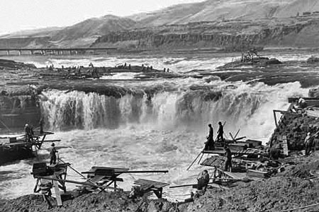
Celilo Falls has always been phantom of history to me, since I born a few years after the U.S. Army Corps of Engineers buried the falls behind The Dalles Dam in 1957. My understanding of the falls and the loss it now represents has come from old photos and maps, and a few shaky film images.

The railroad bridge in the background of this iconic view is the key to locating the falls today

The railroad bridge in the background of this iconic view is the key to locating the falls today

Yet for many, the falls and the native culture surrounding them are alive and vibrant in their memories, thanks to seeing and experiencing them first-hand. For Native Americans, the vivid memories only add to the pain of losing a place that quite literally defined a people for millennia.

The idea of restoring the falls — even temporarily — has been suggested over the years, usually to be slapped down quickly by the Corps of Engineers as unfeasible, or even dangerous. In the late 1980s, a brief, 30th anniversary movement to temporarily draw down the pool behind the dam briefly gained local momentum before the federal agencies killed any talk of the idea. The Corps likely realized that revealing the falls to the public even once could make it politically impossible to ever refill the dam again.

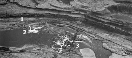
This 1940s aerial view shows the falls and railroad bridge, looking south

This 1940s aerial view shows the falls and railroad bridge, looking south

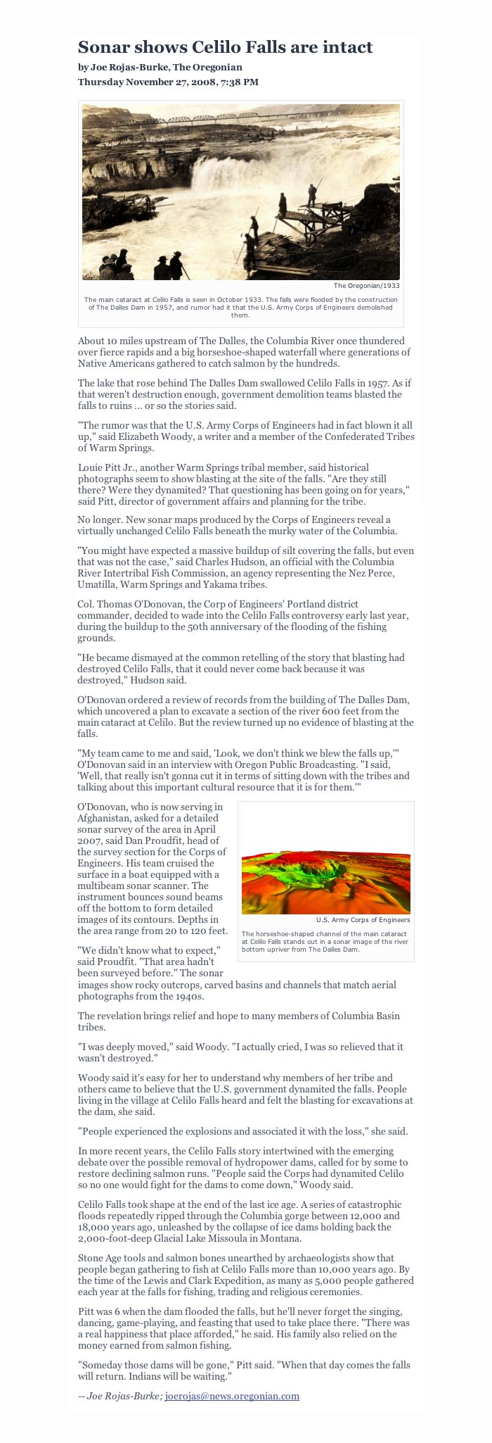
The hostility of the federal agencies toward even acknowledging the falls fanned the rumors among the local tribes that the falls had, in fact, been purposely destroyed by the Corps of Engineers just before they were inundated. This rumor persisted until last year, when a new mindset among Corps managers spurred the agency to compile a comprehensive sonar map of the falls to show that they are quite intact, beneath the still surface of the reservoir.

The sonar confirmation of the intact falls has breathed new life into the hopes of many that the falls will not just someday be restored, but perhaps someday soon. This is where the restoration of Celilo Falls fits within the scope of the MHNP Campaign: the emerging environmental theme in the coming century is restoration, and no place in the Pacific Northwest is more deserving — perhaps even the nation, considering that 11,000 years of Native American culture at Celilo makes it the oldest continuously settled place in North America.

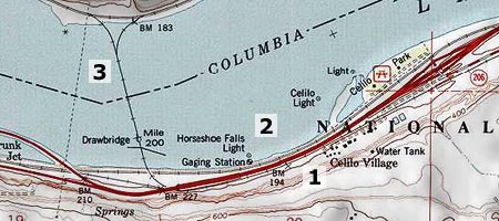
This map clip correlates today's landmarks to the aerial view of the falls, above

This map clip correlates today's landmarks to the aerial view of the falls, above

But the connection to Mount Hood is even more elemental: the mountain towers over the Celilo country like a beacon, and has been a similarly important feature in the culture of Lower Columbia tribes. Celilo and WyEast are connected, and so their restoration should be. A joined effort to heal these places expands the possibilities for both.

What will a restored Celilo Falls look like? Initially, it will likely be mineral-stained and muddy. But the new sonar maps confirm that silts have not overtaken the falls, so if the pool behind The Dalles Dam were simply lowered today, we would see a largely intact falls — perhaps even with traces of the cantilevered dip net fishing structures that once clung to the rocks around the falls. And over time, the falls would quickly recover to blend again with the surrounding landscape.

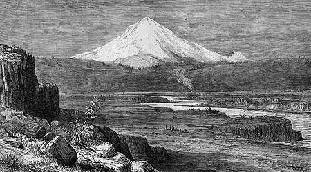
R. Swain Gifford's 1875 etching of Mount Hood towering over the Celilo Narrows is among the earliest geographically accurate renderings of the area

R. Swain Gifford's 1875 etching of Mount Hood towering over the Celilo Narrows is among the earliest geographically accurate renderings of the area

What would a restored Celilo Falls mean for the mid-Columbia economy? The immediate impact would be on power supplies, and it is unlikely that the falls could ever be restored without some alternate energy supply — perhaps a wind farm of equal wattage? — ensuring that no net loss in energy production would result.

The next big question would be impacts on shipping, but the good news here is that barges were already using the Celilo Canal to bypass the falls long before the dam was erected. The canal system would conceivably resume this function, if the falls were reborn, albeit with likely improvements and modernization.

These scene was photographed in the mid-1950s, just before the falls was inundated

These scene was photographed in the mid-1950s, just before the falls was inundated

What kind of protection should the restored Celilo Falls receive? That part is easy. The astonishing scope of history tied to the falls easily qualify the site for World Heritage status within the U.S. National Park System, perhaps as a National Historic Site. This would put the restored falls in a category with places like Mesa Verde, in Colorado, and provide the needed framework to preserve and understand the historic resources that lie beneath today’s reservoir.

Restoration of Celilo Falls is a long-term dream of so many, but movement in that direction really began as soon as the falls disappeared in 1957. The falls has never left our collective consciousness, and thus demands restoration.

Another small step toward restoration will occur in 2009, when the commemorative Confluence Project will bring an art installation to Celilo. The project is marking the two centuries since Lewis and Clark passed through the region, and the millennia of human history that makes Celilo unique. A small step, but also a bit more progress toward what I believe will be the inevitable restoration of Celilo Falls — under the gaze of a restored Mount Hood.

Transmission Corridor Redux

The current controversy over the proposed Palomar utility corridor (that would slice across the Clackamas River country, south of Mount Hood) is an uncanny reminder of the 1950s disaster that brought the Bonneville Power Administration (BPA) transmission lines to Lolo Pass, north of Mount Hood. In both cases, the result is a permanent, linear clearcut running up and down mountainsides, with almost no regard for visual or environmental impact.

The disastrous BPA transmission corridor over Lolo Pass set a new low for siting transmission corridors

The disastrous BPA transmission corridor over Lolo Pass set a new low for siting transmission corridors

The BPA lines came with the completion of the John Day and The Dalles dams, along the lower Columbia River. As if drowning the incomparable Celilo Falls weren’t enough, the transmission lines crested the Cascades at Lolo Pass, at the time one of the more remote and spectacular corners of the Mount Hood backcountry.

In the 1950s, American society was still in the early years of sprawling hydroelectric projects and rows of transmission towers marching toward the horizon. At the time, these images equaled progress, and nothing more.

the BPA corridor saws across the shoulder of Sugarloaf Mountain in this view

Transmission corridors are straight, but nature is not: the BPA corridor saws across the shoulder of Sugarloaf Mountain in this view

But the BPA lines over Lolo Pass marked a particularly senseless disregard for the landscape, needlessly ruining mountain valleys, blocking Mount Hood vistas, and creating a permanent nuisance with the permanent clearcut that is maintained along the corridor.

The transmission lines also brought a new road to Lolo Pass, along with a devastating logging program that nearly cleared the Clear Fork and Elk Creek valleys, along the corridor. The permanent clear cut below the transmission lines was maintained for decades with chemical herbicides, though the BPA has more recently bowed to pressure to maintain their swath of destruction with mechanical methods.

Over the years, the lines have multiplied, and today, the Lolo Pass swath encompasses four large transmission lines in a quarter-mile wide swath. The maze of “closed” dirt maintenance roads below the lines are a perennial draw for target shooters, off-highway vehicles and illegal dumpers. These activities, in turn, have helped turn the linear clear cut into a conduit of invasive species, brining Scotch broom and Himalayan blackberry deep into the Cascades.

The Lolo transmission corridor began on the scale of the Palomar proposal, but has grown over time

The Lolo transmission corridor began on the scale of the Palomar proposal, but has grown over time

The lessons from the Lolo Pass disaster are many, but above all, we’ve learned that a single utility corridor will almost surely grow over time, as utility planners make the case that future lines ought to follow these existing paths of least resistance.

We’ve also learned that the visual and environmental blight that the corridors create is insidious, causing forest managers to discount the value of adjacent, intact forests as somehow tainted — as less worthy of protection or even recreation use. This will surely be the case if the Palomar corridor is approved.

But the story of Lolo Pass is not complete, and the final chapter has yet to be written. Why? Because after just 50 years, the BPA lines are already approaching their design life, and will eventually need to be replaced.

Mount Hood towering above Lolo Pass

Mount Hood towering above Lolo Pass

Under the logic that led to the expansion of this corridor to encompass four parallel transmission lines, it would be easy to assume that the towers and lines will simply be replaced in place, within the existing corridor.

But it will be equally possible to imagine something better for Lolo Pass — relocating the corridor and restoring the pass, and perhaps finding a better, more efficient, less destructive way to transport our energy.

That’s the dream and vision for many who hold the former beauty of Lolo Pass in their memories, and can imaging restoring this corner of the mountain to its fomer splendor. But it’s also a reminder not to repeat the Lolo Pass mistake at Palomar, setting yet another legacy of perpetual, linear destruction in motion.

Fire Forests of the Cascades

The Gnarl Fire of 2008 shocked Portlanders by racing across the east slopes of Mount Hood, and nearly destroying the historic buildings at Cloud Cap and Tilly Jane. But as an east side fire, the Gnarl burn was relatively small, and part of what has become an annual ritual for rural communities of fighting intense blazes along the east slope of the Cascades.

The 2008 Gnarl Fire, viewed in August from Dufur Mill Road

The 2008 Gnarl Fire, viewed in August from Dufur Mill Road

The cause for the intensity of these fires is well-known and well-documented. We know that a century of fire suppression, promotion of even-aged stands of second growth in logged areas and a changing climate are forces conspiring to burn the east side forests on a scale not seen in recent decades.

But not all of the east side fires are catastrophic, even with the fuel build-up from our history of fire suppression. The 2006 fire at Bluegrass Ridge was a glimpse into what was once a routine occurrence along the east side of the Cascades. The Bluegrass Fire began as a lightning strike in the dry season, and soon spread along the east face of the ridge in a mosaic pattern: some parts of the forest were completely killed, while others were a mix, where pockets of forest survived among the burned trees.

The aftermath of the 2006 Bluegrass Fire ranged from total destruction in areas like this, to mosaic patterns where less crowded forests existed

The aftermath of the 2006 Bluegrass Fire ranged from total destruction in areas like this, to mosaic patterns where less crowded forests existed

Most significantly, the larger, fire-resistant species like western larch and ponderosa pine often survive fires in these mosaic areas, and this was the case in the Bluegrass Fire. We will know in a year or two whether the extensive larch population in the Gnarl Fire area were similarly resistant.

The survival of these big trees is the key to the natural ecosystem that defines east side forests. Forest ecologists are now calling these east side regimes “fire forests”, as a counterpoint to the west side rain forests, where abundant rainfall is the operative element in defining the forests.

The “fire forest” name is apt, since we now know that a number of tree species in this dry forest system depend on fire for natural succession that creates mature forests. In the Mount Hood area, these east side trees are Douglas fir, western larch and ponderosa pine. All three have thick, fire-resistant bark that helps them survive moderate fires, and benefit from periodic clearing of undergrowth that competes for moisture and soil nutrients. Fires, in turn, release nutrients for the big trees, further enhancing the growth of fire-resistant species.

Western larch light up the eastside forests in autumn. Larch are among the fire-resistant species that require periodic burns for their long-term health

Western larch light up the eastside forests in autumn. Larch are among the fire-resistant species that require periodic burns for their long-term health

The question for the east side forest is not whether they will continue to burn — they have evolved with fire, after all — but rather, how we will learn to live with the fires. We now know that we cannot simply extinguish them. A century of fire suppression has created mammoth fires that we simply cannot control.

We also know that we cannot prevent forest fires from starting, since the large majority begin from lighting strikes. And we know that many more catastrophic burns will occur before the east side forests return to a more sustainable condition that mimics the natural ecosystem that once thrived.

Most ominous is the recent discovery — from tree-ring research — that the Western states are coming off an unusually wet century, and that the decades ahead are likely to carry more drought, not less. So it is imperative to help the east side forests stabilize before conditions make that proposition still more difficult.

These mature, healthy forests of western larch, ponderosa pine and Douglas fir along Bluegrass Ridge survived the fire

These mature, healthy forests of western larch, ponderosa pine and Douglas fir along Bluegrass Ridge survived the fire

A first step is continuing to thin tree plantations on logged lands to help prevent still more crowded, bug-infested forests like those that are currently driving the fire epidemic. The second step is more difficult: letting fires burn. This policy will be most difficult in the many areas where rural development has encroached on forest boundaries, but it is a necessary step. Both of these steps will require a new mindset about fire, not the least of which will be a public education shift away from Smokey Bear and fire suppression and toward a modern understanding of fire.

But a third step is most difficult of all: setting fires in prescribed locations to help restore forest balance. While the rash of east side fires in recent years has made this part of restoring forest balance less urgent, it will still be necessary — and controversial. Federal agencies have already begun employing this tool, but in cases where a controlled burn becomes a wildfire, the public is not prepared to understand why that risk is necessary — and perfectly natural. Still more public outreach and education will be needed.

The good news is that the scientists are winning this debate, and even the Forest Service has gradually begun to embrace fire ecology as part of their management philosophy. The Park Service is much further long, having successfully weathered the early criticism of their prescient decision to let the huge Yellowstone fires of the mid-1980s burn.

The remarkable resilience and recovery of Yellowstone in the intervening years has not only been vindication for that bold decision, but also an invaluable lesson to land agencies across the west who are responsible for managing “fire forests”. The time to embrace fires in our forests has arrived.