Exploring Mitchell Point

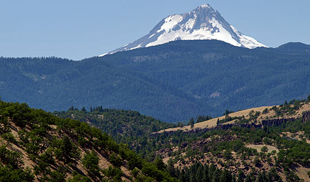
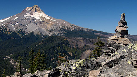
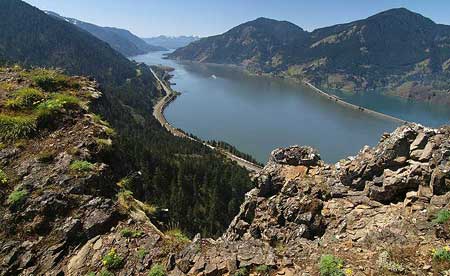
Looking west into the Gorge from Mitchell Point.

If you find yourself overwhelmed by the crowds at Angels Rest, Mitchell Point in the east end of the Gorge is terrific alternative that offers equally stunning views, without the circus atmosphere.

Though the hike is just 2.6 miles round-trip, the elevation gain is around 1,000 vertical feet, thanks to an often steep path. But the unfolding scenery will distract you from the huffing and puffing required to reach the summit. Be sure to pick a sunny day for this hike, and if you make the trip from late April through early June, you’ll also be rewarded with a variety of wildflowers along the way.

An East Gorge Icon

Mitchell Point is unmistakable to travelers rushing by on I-84, rising dramatically from the forested Gorge slopes, just west of Hood River.

The main summit is a dizzying rocky spine towering 1,000 feet above the Columbia River and I-84. Below the main summit is Mitchell Spur, a tilted, ramp-shaped peak with a sheer cliff that rises nearly 400 feet above the highway. The Native American names for these prominent outcrops were Storm King (Mitchell Point) and Little Storm King (Mitchell Spur). The current name reportedly comes from an early trapper who lived in the area.
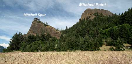
Mitchell Point from the west.

Like most of the rocky outcrops that frame the Columbia Gorge, Mitchell Point is composed of flood basalts — layers of dense lava spread over the region in the very distant geologic past. In this part of the Gorge, earth movements have tilted these ancient flows to the south at 30-degree angle. This tilt is most evident in Mitchell Spur, where exposed cliffs reveal the many layers of basalt that shape the terrain.

But it took the ice age Missoula Floods to shape Mitchell Point as we now know it. These monumental floods repeatedly swept through the Gorge 13,000 years ago at depths of up to 600 feet deep and speeds up to 80 mph.

The ancient floods stripped away loose material from the walls of the Columbia Gorge, exposing the familiar rocky crags we now know as Crown Point, Rooster Rock, Beacon Rock and Mitchell Point. The tilt of the underlying basalt at Mitchell Point has allowed the steep north face of the rock to maintain its near-vertical pitch, millennia after the floods subsided.
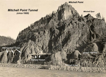
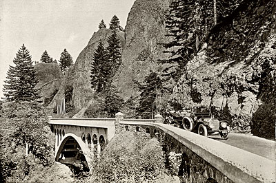
Mitchell Point from the Washington Side in the 1920s, showing the river-level railroad grade, old highway viaduct and famous Mitchell Point Tunnel.

[click here for a larger view]

When the railroads were built through the Gorge in the late 1800s, they hugged the cliffs in places like Mitchell Point, where rocky bluffs jutted into the river. This meant that Samuel Lancaster, the visionary engineer of the historic Columbia River Highway, was left with little space for his iconic road when construction began in 1914.

In these spots, Lancaster applied daring creativity by engineering his road onto the steep walls of the gorge, high above the river. At Mitchell Point, his remarkable design traced the side of Mitchell Spur, carved into the basalt face 100 feet above the railroad in 1915. Near the east end, he famously designed a 385-foot tunnel with windows carved into solid rock.
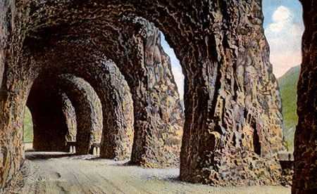
The five windows of Mitchell Point Tunnel from the east approach.

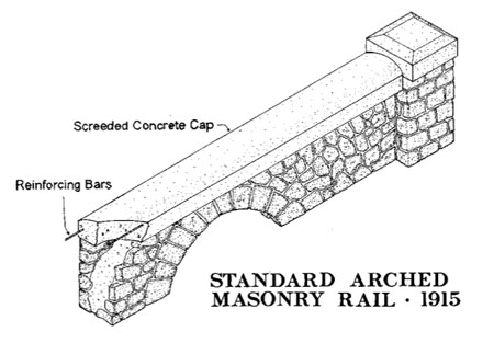
There were a total of five arched windows carved into the Mitchell Point Tunnel, each forming a roadside alcove. Each alcove was fitted with the standard arched masonry rail found throughout the gorge, constructed of basalt with a concrete cap.

These stone walls had the practical function of keeping early visitors (and their automobiles) from slipping through the open windows, and onto the railroad tracks far below, but also added an aesthetic finishing detail that is typical of Samuel Lancaster’s designs.
Equally amazing was the approach to the Mitchell Point Tunnel — a viaduct (pictured below) anchored to the vertical walls of Mitchell Spur led directly into the west portal of the tunnel. For early visitors in touring cars, it was truly a thrilling ride, and a dramatic gateway to the famous tunnel.

The tunnel was destroyed in 1966 when modern-day I-84 was built, though much of the ledge that once held the old highway can still be seen today. New plans call for re-creating at least a portion of the tunnel as part of completing the Historic Columbia River Highway trail.
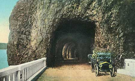
West end of Mitchell Point Tunnel in 1916.

As you explore the Mitchell Point area, be sure to stop by the Anna and Vinzenz Lausmann memorial near the trailhead. There, you can thank the Lausmann family for their generous donation of the surrounding land to the State of Oregon for “park purposes [to] further the recreational and scenic aspects of the Columbia River Gorge” on December 28, 1954.

The area to the west of the trailhead falls within Wygant State Park, and was also a gift to the public, donated by Simeon and Olivia Reed in 1933. Seneca Fouts donated the land to the east in 1944, encompassing the top of Mitchell Point, and the area now carries his name as Seneca Fouts State Natural Area. The Lausmann donation completed the puzzle in 1954, preserving the entirety of Mitchell Point forever.

Hiking Mitchell Point

The trail to Mitchell Point is unmarked and a bit obscure, at first. Simply head toward the state park signboard at the south end of the parking area and follow a paved trail a short distance before veering left and uphill onto an obvious unpaved path.

[click here for a larger view]

The rustic route meanders through open forest for a few hundred yards, then begins climbing an occasionally steep series of switchbacks. Look closely, and you’ll note the trail briefly follows the original 1870s wagon road through the Gorge, a primitive road that traversed between Mitchell Point and Mitchell Spur.
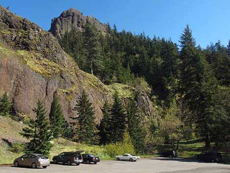
The trailhead, with Mitchell Point rising above.

After climbing a few switchbacks through young forest, you’ll notice a trail heading off to the north at the final switchback, at about 0.4 miles. If you have the time and are looking for a little adventure, this path heads off to Mitchell Spur. The first section is an obvious trail to the saddle between Mitchell Spur and Mitchell Point, and from there it’s a cross country through a steep meadow to the obvious summit.
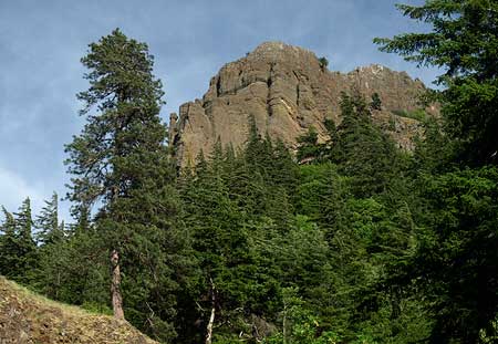
Looking up at Mitchell Point from the lower trail.

The main route continues past the spur trail and soon enters a broad talus field, traversing steeply across the loose rock. You’ll have your first views of the Columbia River from here — a tantalizing preview of the views ahead, and just enough to make up for the steep climb.

The trail briefly enters forest, then heads back across the talus slope to a switchback before traversing back and re-entering dense forest. You’ll have a good view of the summit ridge through the trees, and can admire the hundreds of tiny calypso orchids that bloom along this shady section of trail in late April and early May.
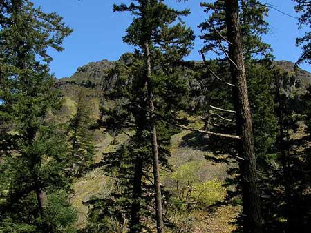
The rocky spine of Mitchell Point from the upper trail.

Soon the trail passes through a final stand of large douglas fir before emerging in an open powerline corridor. Though not the most aesthetic setting for a trail, the corridor does offer a profusion of wildflowers in spring, including impressive clumps of a striking blue flower called great hounds tongue.

Great hounds tongue blooms in late April and early May near the crest of Mitchell Point.

The trail makes another quick switchback in the powerline corridor, then reaches an open saddle directly below Mitchell Point, at 1.1 miles.

From here, the summit is framed in gnarled Oregon white oak. Even the transmission towers are interesting, as they offer a glimpse into the 1930s construction heyday when so much of Oregon’s infrastructure was built through New Deal programs that eased the Great Depression.
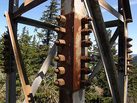
Built to last: Depression-era transmission towers were installed when Bonneville Dam was constructed in the 1930s.

From the saddle, the final 0.2 mile stretch to the summit of Mitchell Point heads off to the north. The trail is steep and slick in spots, but you won’t mind, because the unfolding scenery is breathtaking. The west face of Mitchell Point drops off in a harrowing series of cliffs, while the east face is a steep hanging meadow. The summit path follows the narrow ridgeline between these slopes.

The trail ends just short of the true summit, but don’t attempt to go further — the exposure is extreme, and the view isn’t any better. Instead, pick one of any number of perches along the summit ridge to relax and enjoy the view.
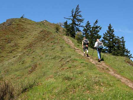
The final pitch to the summit of Mitchell Point.

The vista to the west extends to Stevenson Washington, and the Table Mountain-Greenleaf Peak complex, beyond. To the east, the view reaches toward the grassy highlands of Burdoin Mountain, above White Salmon, Washington. The summit of Mount Defiance rises high above the forests to the southwest.

Far below, you can watch tiny trucks and cars inching along on I-84, and an occasional freight train passing along both shores of the Columbia, looking like model train sets. Barges loaded with Eastern Oregon grain also look like toys from this lofty perspective.
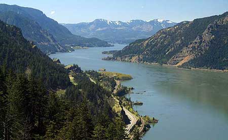
Tiny trucks, trains and barges move through the Gorge in this view from the summit of Mitchell Point.

Depending on the season and weather, you might get buzzed by dive-bombing cliff swallows while taking in the summit view. Though vertigo-inducing, it’s fascinating to peer over the edge of the sheer summit and watch these aerial acrobats streak through air to their nests in the cliffs below.

For all its scenery, Mitchell Point is a steep climb with plenty of exposure in the final stretch, so best to leave small kids at home, and keep dogs on a leash. As with any eastern Gorge hike, learn to identify (and avoid) poison oak, and check for ticks after your hike.

How to Get There

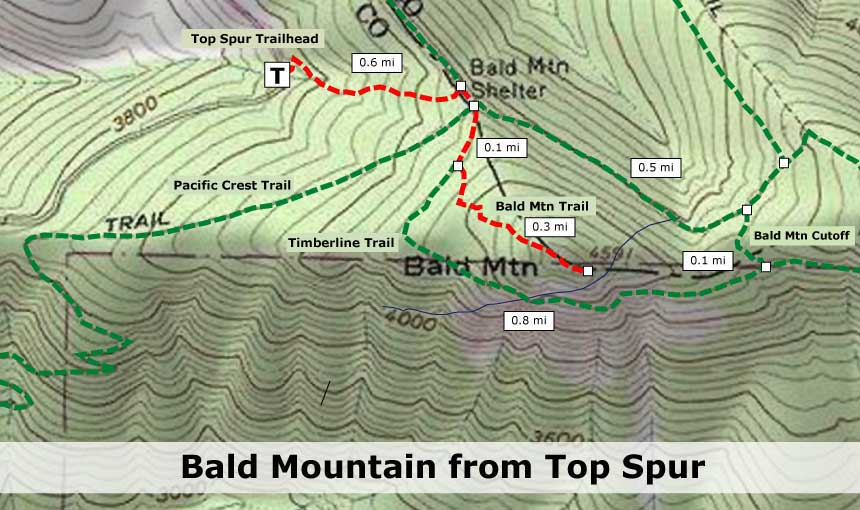
To visit Mitchell Point, print the large version of the trail map (above) as a pocket reference, then head east from Portland on I-84 to Exit 58, which takes you to Lausmann State Park and the Mitchell Point trailhead.
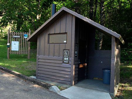
The finest accommodations can be found at Lausmann State Park.

No pass is required at this trailhead. Carry water, as no reliable sources are available. A toilet is provided at the trailhead.

To return to Portland, you’ll have to head further east on I-84 to the next interchange, at Hood River to reach westbound I-84).

Addendum

Chris Elbert points out the following on the Oregon State Parks website: “April 19, 2012 Note: The park will be closed May 1-Oct. 15 for parking lot and overlook improvements.”

Though this message was posted on the Seneca Fouts State Natural Area page and not on the Vincenz Lausmann State Park page, it’s safe to assume the reference is to the same parking area. If you should find the gate closed and don’t want to wait until October, there is plenty of space for parking off the entrance road, and near I-84, and it’s a short walk from there to the trailhead.

Thanks for the heads-up, Chris!
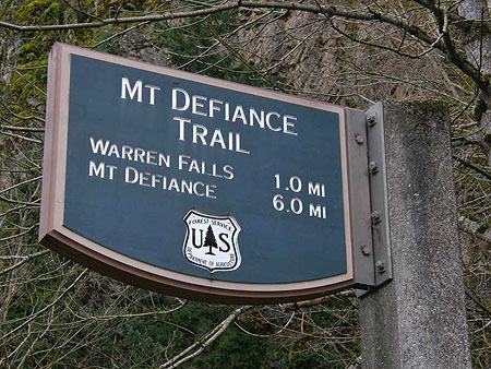
Warren Falls Lives… Again?

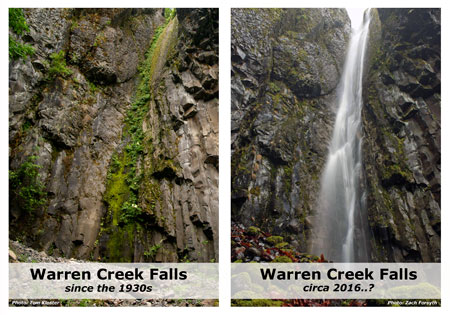
March 16 was a good day for Warren Falls: in the morning, the Historic Columbia River Highway Advisory Committee (AC) allowed me time on their agenda for a second pitch to restore Warren Falls as part of the larger historic highway trail project. After the meeting, I visited Warren Falls and was able to capture it flowing, thanks to the unusually heavy rain we had experienced in early March. Here are the highlights:

HCRC Advisory Committee

Last summer, I made a pitch to the HCRC Advisory Committee (AC) to restore Warren Falls as part of the highway restoration project, and in my second appearance, was able to provide a much more polished case. The members of the AC were engaged and clearly interested in the idea, asking many questions after the presentation. However, they are also constrained by the tight budget and timeline they are working under to complete the highway restoration by the 2016 centennial of Samuel Lancaster’s “King of Roads.”

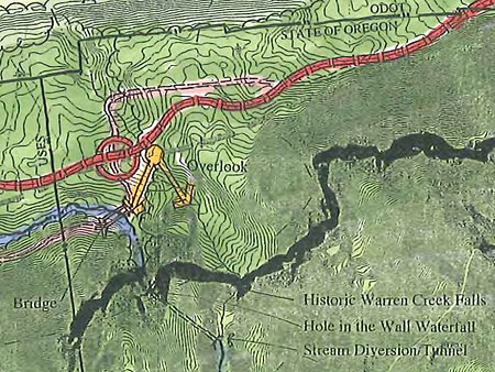
The HCRH trail design already includes a short trail and overlook at Warren Falls

The AC chair sent me a follow-up message after the meeting offering support for all of the proposals I had laid out at the meeting — except restoration of Warren Falls itself. While that last part was disappointing, it was helpful to at least have a sense of where the AC stood on the issue, since I can now focus efforts on finding the needed funding and perhaps a project partner for ODOT to pull off the Warren Falls restoration.

The good news is the AC is supportive of several accompanying proposals that I laid out in the presentation, including:

• designing the crossing of the original Warren Creek channel to resemble a “bridge” so that there will be a place for an interpretive panel describing the history of the area

• addition of a side trail to the original Warren Falls with an interpretive panel – albeit, with “volunteer work”

• Enhancing fish habitat downstream of Hole-in-the-Wall Falls as a proposed mitigation action related to construction of the next (unfunded) trail segment west of the Starvation-Lindsey segment currently being designed

• removal of invasive species in the area – mostly, English ivy, Himalayan blackberry and Scots broom.

So, despite the disappointment of not adding the falls restoration to the current ODOT project, the list of related restoration work supported by the AC is a big step forward. In their words, the AC is “supportive of [the] idea to bring water back to the original waterfall, but given our charge, we cannot offer any monetary or construction assistance”. A partial victory, to be sure, but also a challenge to help ODOT find funding for the Warren Falls restoration.

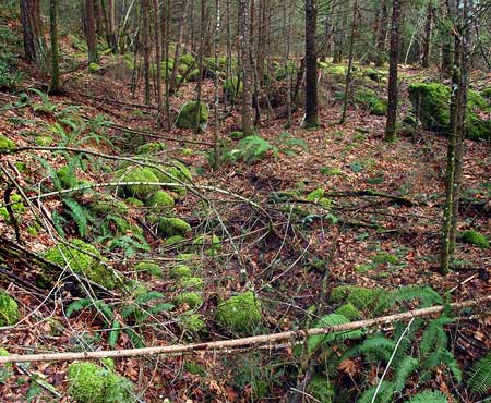
This historic streambed of Warren Creek, now permanently cut off from the stream, could have a “bridge-like” crossing and an interpretive sign describing the area history.

An interesting footnote to the meeting was a conversation I had afterward with a reader of this blog who had watched the presentation, and thought a much simpler solution was possible for restoring Warren Falls: simply pull out the “trash rack” grate, and let Warren Creek do the rest. The stream would surely plug the tunnel with debris and gradually start flowing over its original falls without an elaborate engineering solution for retiring the tunnel.

It’s a temptingly simple idea, and came from a person with a professional background as a hydrologist, no less. So, that scaled-back option will be my starting point as I look for additional funding for bringing back Warren Falls.

Warren Falls Lives!

After the HCRH Advisory Committee presentation, I bolted for the Starvation Creek trailhead, with a strong hunch that Warren Falls would be flowing that day. Despite the bright, blue skies on March 16, the previous week had seen an unusually cold and wet weather pattern, and the gorge waterfalls visible from the highway were roaring.

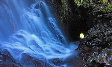
As hoped, when I arrived at Hole-in-the-Wall Falls, part of Warren Creek was flowing down the normally dry channel that leads to Warren Falls. I captured the following video as I walked along the temporary stream, then rounded a corner to find water flowing over Warren Falls, once again. Warren Falls lives!

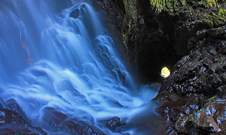
As with previous visits when Warren Falls was flowing, the experience was magical. Instead of hearing the echoes of trucks on I-84 in the dry amphitheater surrounding the falls, I could hear only the sound of Warren Creek — or the overflowing part of it, at least — cascading over the 120-foot brink of the falls, then splashing down the normally dry streambed to the point where it re-joins the main stream of Warren Creek, at Hole-in-the-Wall Falls.

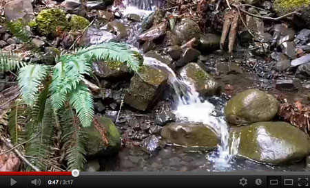
This clip marks the moment when a large rock came over the falls, in the background… CRACK!

The video still image, above, marks a somewhat jarring moment on this visit, however: if you listen closely at 0:47 you can hear a CRACK! in the background, then an abrupt end to that clip in the video. This is the sound of a soccer ball-sized rock coming over the top of the falls — just as designed — and landing in the debris pile near the base. It was not only startling to hear this, but also a bit ominous, considering that on previous visits I had been standing at the base of the falls shooting video and still photos. If you visit when Warren Falls is flowing, please don’t stand near the base of the falls!
Finally, there was a pleasant surprise on the way out that day. For some reason I had never noticed, but the USFS trailhead sign at Starvation Creek (pictured at the top of this article) actually lists Warren Falls as a destination! Clearly, the Forest Service meant Hole-in-the-Wall Falls, but I choose to look upon the sign as a good omen that the real Warren Falls will be restored!
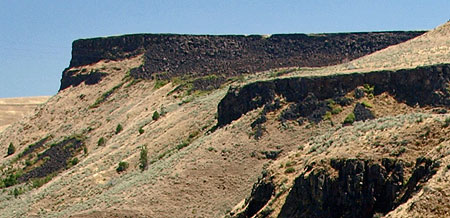
Friends for Warren Falls

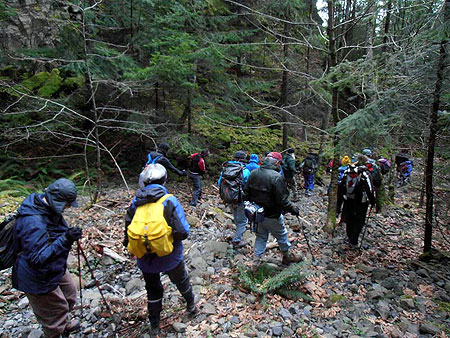
My month of Warren Falls adventures continued on March 25, when I guided a Friends of the Gorge hike on a tour of the Starvation-area waterfalls, including a visit to Warren Falls. At 24 hikers, the group was by far the largest I have led to the falls site!

Friends of the Gorge hike visits the site of Warren Falls

Warren Falls was once again dry on this visit, but the group was fascinated by the odd history of the diversion project, the obvious signs that Warren Falls had recently flowed, and the magnificence of the massive basalt amphitheater that frames the falls.

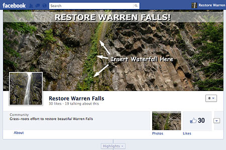
Restore Warren Falls on Facebook

I’ve had many people ask how they can support the effort to restore Warren Falls. In response, I have finally set up a Facebook page for people to track progress on the project and vote their support for the idea:

Warren Falls on Facebook

You can help out by stopping by the Facebook page, like it, and then forward the web link to like-minded friends. If the project picks up enough “likes”, it will help me make the case to ODOT and elected officials that popular support exists for the project.


Thanks go out to those who have already stopped by the Facebook page, and thanks, especially, to Scott Cook for speaking out in support of Warren Falls at both HCRH Advisory Committee meetings — very much appreciated, Scott!

Please watch the Warren Falls page on Facebook for more updates on the project as the it unfolds over the next several months.

Warren Falls Solutions

The strange history of Warren Falls began shortly after completion of the Historic Columbia River Highway in the 1920s, when unruly Warren Creek repeatedly pushed debris against the modest new highway bridge that spanned the stream.

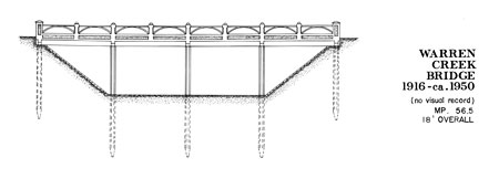
The first Warren Creek bridge was replaced as part of the waterfall diversion; no photos of the original structure survive

Oregon highway engineers subsequently diverted the creek in 1939 through a bizarre tunnel that survives to this day. The diversion created today’s manmade Hole-in-the-Wall Falls when an accompanying flume was removed sometime in the early 1960s, leaving an eerie, dry cliff where Warren Falls once thundered.

This article proposes a few solutions for restoring Warren Falls to its former glory in tandem with the ongoing ODOT project to restore the Historic Columbia River Highway.

Option A: Let Nature Take Her Course

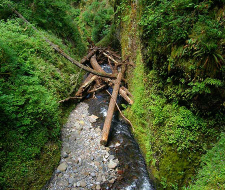
The simplest solution for restoring Warren Falls is to simply wait for the “trash rack” diversion structure to rust away, eventually collapsing into the tunnel intake under the weight of a heavy winter flood or debris flow. Surprisingly, this hasn’t already happened over the 73-year life of the diversion project, but it is inevitable.

Debris flows periodically clog the brink of Oneonta Falls; a similar event is inevitable at Warren Falls

This is the least desirable option because it leaves the maintenance and safety liability of the diversion tunnel in ODOT’s hands, and the removal of obsolete structures to chance. The dry falls and diversion tunnel are visited regularly by curious hikers, canyoneers and rock climbers, so the unresolved safety liability the tunnel presents for ODOT is quite real.

Option B: A Large Cork

Short of waiting for the “trash rack” diversion structure to collapse on its own, the simplest option for restoring Warren Falls is to cork the tunnel intake. A vault carved like a rocky bathtub into the bedrock brink of the falls forms the tunnel intake, and provides for the “cork” solution.

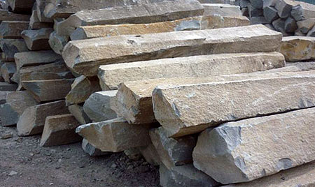
Though the metal “trash rack” covers an opening of roughly 20×20 feet square, the rock vault is tapered in a v-shape, narrowing to the 5 foot width of the tunnel at the bottom of the vault. The “cork” would be a series of stacked basalt columns filling the vault and blocking the bypass tunnel opening. Approximately twenty 6-foot columns, each about 18 inches in diameter would do the job.

The 1939 construction drawings for the diversion project show the v-shaped vault carved into the lip of Warren Falls, leading to the diversion tunnel (cross-section view)

Mother Nature would provide the assist for this solution once the basalt columns are in place, with the hydraulic force of Warren Creek filling the spaces between columns with fine gravels and sediment over time. Eventually, the voids between the columns would fill completely, plugging the bypass tunnel to all but a small amount of seepage.

The lower end of the corked bypass tunnel would also be covered with a protective grate to prevent curious explorers from entering, just as a number of lava tubes in Oregon have been gated to public access. The bonus? A very large, secured bat cave is created in the process!

A stack of basalt columns like these would form the “cork” that plugs the bypass tunnel forever (Wikipedia)

How would the basalt columns get up there? The best plan would be an air crane, as the rock columns would be comparable in size and weight to the timber loads that are routinely lifted in Oregon’s helicopter logging operations.

ODOT maintains an open maintenance field just a few hundred yards from the falls site, with direct freeway access for delivering the columns to a staging area. On-the-ground workers could access the top of the falls from the Starvation Ridge Trail, but a mechanical lift from the base of the falls would be more practical.

Option C: Colossal Dental Work

The third option is the best plan for fully restoring Warren Falls to near-natural conditions. This design would “fill the cavity” of the entire bypass tunnel, permanently.

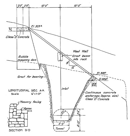
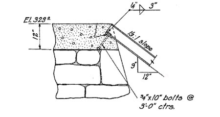
Construction detail of the lip of the masonry dam that supports the “trash rack” (cross-section view)

This solution uses the original masonry dam at the head of the bypass tunnel to temporarily pipe Warren Creek over the natural falls during the construction phase, allowing for concrete work to proceed within the bypass tunnel.

The tunnel would be plugged in two steps. First, a reinforced concrete plug would be poured at the lower opening of the bypass tunnel, sealing the tunnel exit. The plug would be disguised on the outside to match the color and texture of the basalt cliff.

Next, the rest of the tunnel would be filled with mixture of concrete and rock cobbles — roughly 100 cubic yards worth. Once the tunnel “cavity” is filled, the vault at the top of the falls would be filled with basalt columns, using the same method described in the “cork” scenario. In this case, they could be mortared in place, since this approach would already have concrete pouring equipment on site.

Wanted: dentist with masonry skills and a helicopter pilot license… (photo: Zach Forsyth)

The “dental work” option has the benefit of stabilizing basalt cliffs that form the western wall of Warren Falls by permanently filling the man-made cavity behind them. This option allows ODOT to walk away from the Warren Tunnel site forever, with almost no trace of the old stream diversion left behind.

How would ODOT move the concrete and rock to the top of the falls? Fortunately, much has changed since the tunnel was originally created, and today there is portable equipment specifically designed for the task.

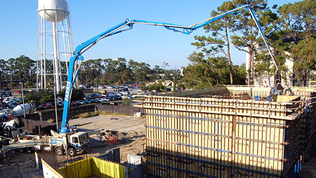
First up is a truck-mounted concrete pump, normally used for precision pouring in building construction, but increasingly used to minimize environmental impacts at construction sites.

This truck-mounted concrete pump would easily reach the top of Warren Falls (Wikipedia)

Moving rock to the top of the falls would be a bit more cumbersome, but could employ a portable rock conveyor. These are widely used in commercial aggregate operations, and could conceivably be used at the Warren Falls site. A low-budget alternative is to us rock from Warren Creek’s streambed above the falls.

Moving heavy equipment to the site would drive up the cost of restoring Warren Falls, so the “dental work” option for completely decommissioning the old tunnel is probably the least viable alternative, given funding constraints. But it’s also possible that ODOT will already have equipment required to do the job in the area as part of the project to restore the historic highway.

A telescoping rock conveyor could be the solution for loading aggregate into the Warren Tunnel (Wikipedia)

Next Steps?

Why link restoration of Warren Falls to the Historic Columbia River Highway project? The answer lies in the intertwined history of the falls and the highway department: now is the time for ODOT to undo an unfortunate environmental travesty from another era.

The historic Columbia River Highway restoration project provides a once-in-a-lifetime opportunity to provide the resources needed to restore the falls. It also allows ODOT to demonstrate how much highway planning has evolved since the diversion project was conceived, more than 70 years ago.

I will be making another pitch to restore Warren Falls at the Historic Columbia River Highway advisory committee meeting on March 16 (in Hood River). Hopefully, I’ll be able to capture the imagination of the citizens and ODOT staff charged with returning the old highway to its former glory, and make the case that restoring Warren Falls ought to be part of the larger restoration effort.

More to come…

Warren Falls Mystery… Solved!


(Click here for a larger view)

It was the summer of 1939, and Depression-era Americans were escaping the hard times with the theater releases of “Gone with the Wind” and “The Wizard of Oz”. In Europe, Hitler’s invasion of Poland in September of 1939 ignited World War II.

Against the sweeping backdrop of this pivotal year in history, a odd story was playing out on obscure Warren Creek, near Hood River in the Columbia River Gorge. This is the story of how today’s manmade Hole-in-the-Wall Falls was created, and Warren Falls was (temporarily, at least) lost to time. It all began 15,000 years ago…

15,000 Years Ago – The string of waterfalls on Warren Creek were formed as a result of the Bretz Floods. Also known as the Missoula Floods, these were a cataclysmic series of bursts from glacial Lake Missoula that scoured out the Columbia River Gorge over a 2,000 year span. The events finally ended with the ice age, about 13,000 years ago.

J. Harlen Bretz faced decades of controversy before his flood theory was accepted

Today’s rugged cliffs in the Columbia Gorge were over-steepened by the Bretz floods, leaving tributary streams like Warren Creek cascading down the layers of sheer, exposed basalt bedrock. Geologist J. Harlen Bretz published his theory describing the great floods in 1923, just a few years before Warren Falls would be diverted from its natural channel.

June 6, 1916 – Samuel Lancaster’s Columbia River Highway is dedicated, and immediately hailed as one of the pre-eminent roadway engineering feats in the world. The spectacular new road brings a stream of touring cars into the Gorge for the first time, with Portlanders marveling at the new road and stunning scenery.

Samuel Lancaster touring his beautiful new highway in 1916

Lancaster’s new highway passed Warren Falls under what is now I-84, crossing Warren Creek on a small bridge, and passing two homesteads, a small restaurant and service station that were once located near the falls. Today, this section of the old road is about to be restored as a multi-use path as part of the Historic Columbia River Highway project.

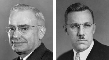
July 29, 1939 – Robert H. “Sam” Baldock is midway through his 24-year tenure as Oregon State Highway Engineer (1932-1956), an influential career spanning the formative era of the nation’s interstate highway era. Baldock advocated for the construction of what would eventually become I-84 in the Columbia Gorge, initially built as a “straightened” US 30 that bypassed or obliterated Samuel Lancaster’s visionary Columbia River.

Thirties-era Chiefs: Oregon Highway Engineer Sam Baldock (left) and Assistant Highway Engineer Conde B. McCullough (right)

In a letter to the Union Pacific Railroad, Baldock describes an ingenious “trash rack” and bypass tunnel at Warren Falls that had just been released to bid, on July 27. The project was designed to address an ongoing maintenance problem where Warren Creek had repeatedly clogged the openings on the old highway and railroad bridges with rock and log debris.

While the Baldock proposal for Warren Creek seems a brutal affront to nature by today’s standards, an irony in this bit of history is that his assistant highway engineer was none other than Conde B. McCullogh, the legendary bridge designer whose iconic bridges define the Oregon Coast Highway.

McCullough designed several bridges along the Columbia River Highway, as well, yet he apparently passed on the opportunity to apply a more elegant design solution to the Warren Creek flooding problem. Otherwise, we might have an intact Warren Falls today, perhaps graced by another historic bridge or viaduct in the McCullough tradition!

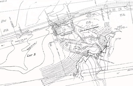
Historic site map of the Warren Falls diversion project (1939)

(Click here for a larger view of this map)

At the time of the Warren Falls diversion project, the railroad was located adjacent to the highway (it was later moved onto fill in the Columbia River when the modern I-84 alignment was built in the 1950s).

The Union Pacific had already attempted to address the Warren Creek issue with a flume built to carry the stream over the railroad and away from the railroad bridge. This initial effort by the railroad appears to have been the catalyst for a joint project with ODOT to build an even larger diversion.

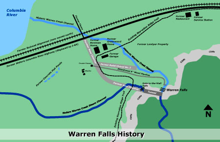
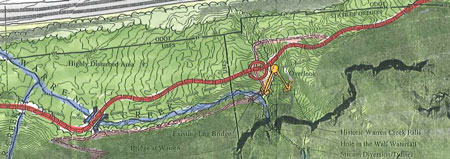
This map blends historic information from ODOT site plans with the modern-day location of Warren Creek.

(Click here for a larger view of this map)

August 10, 1939 – Union Pacific Railroad Resident Engineer S. Murray responds to Baldock’s July 29 letter, praising the “trash rack” and tunnel design solution, but also offering an alternative approach to the tunnel scheme:

“I think possibly we have all approached this problem from the reverse end. Above the falls there is a deposit of gravel about 600 feet long and of varying widths and depths, and possibly there are 10,000 yards of it ready to move.

Would it not be practicable and sensible to simply hoist a cat up the cliff and into the canyon and push this material down over the falls and then away from the course of the water, and then construct a small barrier of creosoted timber so as to hold back future deposits until they accumulate in sufficient amount to justify their being moved again?”

In the letter, Murray suggests that Baldock’s Highway Department do a comparative cost analysis of this alternative, as he expected to “have difficulty in obtaining approval” of the Union Pacific’s participation in the project “under [the] present railroad financial situation.”

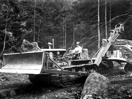
The Union Pacific proposed hoisting a bulldozer like this one to the top of Warren Falls and using it to push debris over the brink!

August 30, 1939 – In his response to Murray, Sam Baldock declines to consider the counter proposal to simply bulldoze the debris above Warren Falls as an alternative to the tunnel project, and instead, continues advancing a $14,896.27 construction contract to complete the diversion project for Warren Creek.

September 2, 1939 – Murray responds immediately to Baldock’s August 30 letter. With disappointment and surprising candor, he dryly quotes a 1934 letter where Baldock had proposed completely moving both the highway and railroad to the north, and away from Warren Falls, as a solution to the debris problem, apparently to underscore his belief that Baldock’s tunnel project would be a short-term, costly fix at best.

This earlier 1934 correspondence from Baldock turns out to be prophetic, of course, with the modern-day alignment of I-84 and the Union Pacific railroad ultimately carrying out Baldock’s vision.

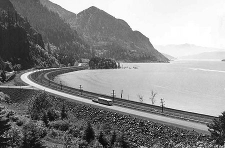
Baldock’s faster, straighter version of the Columbia River Highway began to emerge in the 1940s (near Mitchell Point).

These proposals for altering Warren Creek may seem brazen and completely irresponsible by today’s environmental standards, but consider that at the time the dam building era on the Columbia River was just getting underway. By comparison, these “improvements” to nature were just another effort to conquer the land in the name of progress.

These schemes also underscore how visionary Samuel Lancaster really was: far ahead of his colleagues of the day, and some 75 years ahead of the 1990s reawakening among engineers to “context sensitive” design in the modern engineering profession.

Cross-section plans for the “trash rack” design at the head of the Warren Creek diversion tunnel; the odd structure still survives and continues to function today.

October 2, 1939 – Work on the Warren Falls diversion project begins. The full project includes the diversion tunnel and flume, plus reconstruction of a 0.69 mile section of Lancaster’s historic highway and two bridges. In the fall of 1939, the highway contractor built a highway detour road, new highway bridges, and excavated the flume ditch and relief channels.

Work on the “trash rack” and associated blasting for the diversion tunnel bogged down, however, with the contractor continuing this work through the winter of 1940. Despite the modest budget, ODOT records show that the contractor “made a very good profit” on the project, and completed work on September 21, 1940.

The budget for the project was as follows:

Compared to modern-day transportation projects that routinely run in the millions, seeing costs detailed to the penny seems almost comical. Yet, at the time both the Oregon Highway Department and Union Pacific Railroad were strapped for cash, and very cost-conscious about the project. A series of letters between the sponsors continued well beyond its completion to hash out an eventual 50/50 agreement to pay for construction and ongoing maintenance of the stream diversion structures.

After the 1940s – the reconstruction of the Columbia River Highway at Warren Creek was part of a gradual effort to widen and straighten US 30 along the Columbia River. Today’s eastbound I-84 still passes through the Tooth Rock Tunnel, for example, originally built to accommodate all lanes on the straighter, faster 1940s version of US 30.

The beginning of the end: construction of the “new” bridge at Oneonta Creek in 1948, one of many projects to make the old highway straighter and faster. Both this bridge, and the original Lancaster bridge to the right, still survive today.

By the early 1950s, most of Sam Lancaster’s original highway had been bypassed or obliterated by the modernized, widened US 30. Much of the new route was built on fill pushed into the Columbia River, in order to avoid the steep slopes that Lancaster’s design was built on.

Passage of the federal Interstate and Defense Highways Act in 1956 moved highway building in the Gorge up another notch, with construction of I-80N (today’s I-84) underway. The new, four-lane freeway followed much of the US 30 alignment, though still more of Lancaster’s original highway was obliterated during the freeway construction. This was the final phase of freeway expansion in the Gorge, and was completed by 1963.

In the Warren Creek area, interstate highway construction in the late 1950s finally achieved what Sam Baldock had envisioned back in his correspondence of 1932, with the Union Pacific railroad moved onto fill reaching far into the Columbia River, creating what is now known as Lindsay Pond, an inlet from the main river that Lindsay, Wonder and Warren creeks flow into today. The “improved” 2-lane US 30 of the 1940s had become today’s four-lane freeway by the early 1960s.

Coming Full Circle: Restoring Warren Falls

Since the mid-1990s, ODOT and the Friends of the Historic Columbia River Highway have worked to restore, replace and reconnect Samuel Lancaster’s magnificent old road. In some sections, the road continues to serve general traffic, though most of the restoration focus is on re-opening or re-creating formerly closed sections as a bike and pedestrian trail.

The trail segment in the Warren Falls vicinity is now entering its design phase, and is slated for construction as early as 2016, commemorating the centennial of Lancaster’s road. Though initially excluded from the plan, the restoration of Warren Falls is now shown as a “further study” item — a step forward, for sure, but still a long way from reality. The plan does call for an overlook of both the historic Warren Falls and Hole-in-the-Wall falls (shown below).

Proposed trail alignment along the reconstructed Historic Columbia River Highway.

(Click here for a larger view of the trail plan)

There are three key reasons to restore Warren Falls now:

1. Funding is Available: The nexus for incorporating the restoration of Warren Falls into the larger trail project is clear: the trail project will require environmental mitigation projects to offset needed stream crossings and other environmental impacts along the construction route. Restoring the falls and improving fish habitat along Warren Creek would be a terrific candidate for this mitigation work.

2. The Right Thing to Do: Restoring the falls is also an ethical imperative for ODOT. After all, it was the former Oregon Highway Department that diverted Warren Creek, and therefore it falls upon ODOT to decommission the diversion tunnel and restore the falls. Doing this work in conjunction with the nearby trail project only makes sense, since construction activity will already be occurring in the area. Most importantly, it also give ODOT an opportunity to simply do the right thing.

Ain’t no way to treat a lady: the obsolete Warren Creek diversion tunnel is not only a maintenance and safety liability for ODOT (photo by Zach Forsyth)

3. Saves ODOT Money: Finally, the restoration makes fiscal sense for ODOT. The Warren Creek diversion tunnel is still on the books as an infrastructure asset belonging to ODOT, which in turn, means that ODOT is liable for long-term maintenance or repairs, should the tunnel fail.

The tunnel also represents a safety liability for ODOT, as more rock climbers and canyoneers continue to discover the area and actually travel through the tunnel. Decommissioning the tunnel and diversion would permanently remove this liability from ODOT’s operating budget.

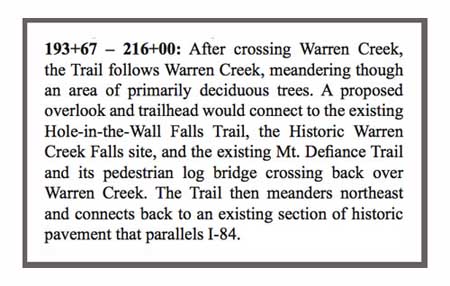
Not good enough: excerpt from the HCRC restoration mentions the “Historic Warren Falls site”, missing the opportunity to restore the falls to its natural state.

How can you help restore Warren Falls? Right now, the best forum is the Historic Columbia River Highway Advisory Committee, a mostly-citizen panel that advises ODOT on the trail project. A letter or e-mail to the committee can’t hurt, especially since the project remains a “further study” item. You can find contact information for the committee on the HCRH page on ODOT’s website.

But it is also clear that Oregon State Parks will need to be a project partner to restore Warren Falls. The best way to weigh in is an e-mail or letter to the office of Oregon State Parks & Recreation (OSPRD) director Tim Wood. You can find contact information on the Oregon State Parks website. This is one of those rare opportunities where a few e-mails could really make a difference, and now is the time to be heard!
_______________________________________

Special thanks go to Kristen Stallman, ODOT coordinator for the HCRH Advisory Committee, for providing a wealth of historic information on the Warren Creek bypass project.

To read Oral Bullards‘ 1971 article on Hole-in-the-Wall Falls, click here. Though largely accurate, note that Bullards’ article is based on interviews of ODOT employees at the time, and not the original project files that were the basis for this blog article.

Next: a simple, affordable design solution for restoring Warren Falls!

Proposal: Bridal Veil Canyon Trail

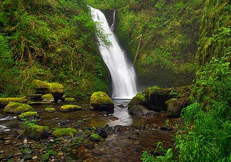
Upper Bridal Veil Falls

It is an unfortunate reality that in the face of Oregon’s population doubling over the past half-century, our trail system has declined. The resulting crowding and overuse is evident on many of the trails that remain, especially on those fringing the rapidly growing Portland region.

This trend is at odds with oft-stated public goals of better public access to nature, re-introducing children to the outdoors, providing more active, quiet recreation near our urban centers, shifting toward a more sustainable forest economy and creating affordable recreation in the interest of social equity.

So, what to do? Build more trails. Soon. And take better care of what we already have.

This article lays out a specific vision for one such trail, an all-season, family-friendly loop in the Columbia Gorge. This would not only be an important step toward meeting those public goals, but also could also become a flagship project for a renewed campaign to expand our trails to meet overwhelming demand.

The place is spectacular Bridal Veil Creek, known for its namesake falls, but less known is the string of waterfalls in its shady upper canyon, or the rich history that colors the area.

The Legacy of Bridal Veil

The town of Bridal Veil in 1900

Though deceivingly green and pristine today, the Bridal Veil watershed was once the center of what was arguably the most intensive logging operation in the region.

From 1886-1936, the company town of Bridal Veil thrived at the base of Bridal Veil Falls, on the banks of the Columbia River. The mill town at Bridal Veil was connected to a hillside sister mill community known as Palmer, located on the slopes of Larch Mountain. Today’s Palmer Mill Road survives as the connecting route between the two former mills.

Loggers near New Palmer in 1912

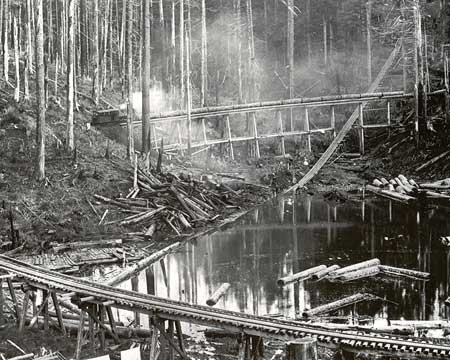
In the turn-of-the-century heyday of these mills, logs were rough-milled at the Palmer site, and sent down a mile-long flume to the Bridal Veil mill for finishing as commercial lumber. The terminus of the flume can be seen in the lower right of the first photo (above), with a huge pile of rough cut lumber piled at its base.

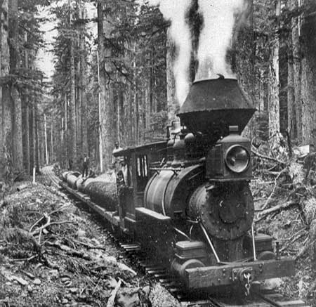
Timber was hauled to the holding ponds at the Palmer site along a series of rail spurs, traces of which can still be found today in the deep forests of Larch Mountain.

Jumbo steam engine hauling logs to New Palmer in 1905

The original Palmer site operated until a fire destroyed the mill in 1902, and the New Palmer mill was constructed nearby. New Palmer operated until the Bridal Veil Falls Lumbering Company shut down in 1936, a victim of the Great Depression and the largely logged-out Bridal Veil area.

Kraft Foods bought the mill and surrounding town in 1937, and formed the Bridal Veil Lumber and Box Company. Kraft manufactured its iconic wooden cheese boxes at the mill from 1937-1960, when Bridal Veil was finally shut down for good.

Old Palmer mill pond in 1896

The town site of Bridal Veil had already begun to fade when Kraft bought the community and mill in 1937, and today only the post office and cemetery survive. The tiny post office remains a popular attraction for mailing wedding announcements and invitations (with a “Bridal Veil, OR” postmark), and is now the sole reason for its existence. The cemetery saw its last burial in 1934, and local volunteers now maintain the grounds.

In 1990, the Trust for Public Lands purchased the Bridal Veil site, with the intention of clearing the remaining structures and transferring the land to the U.S. Forest Service for restoration. A decade-long legal battle ensued between local historic preservation interests and the Trust before the buildings were finally cleared, beginning in 2001. The last structure (a church) was demolished in 2011, leaving only the post office.

Log flume near Middle Bridal Veil Falls in 1896

Though the structures are mostly gone, remnants and artifacts from the Bridal Veil logging era are everywhere in the canyon: moss-covered railroad ties can still be seen on the old logging grades, concrete foundations line the old streets of the town, and chunks of suspension cable and rusted hardware follow the old flume corridor.

Sadly, there is also modern debris in the mix: illegal dumping has plagued Palmer Mill Road for decades, including automobiles that have been rolled over the canyon rim, tumbling into Bridal Veil Creek. At least three recently dumped autos are still lodged above the upper falls today, and several have already been pulled from the creek over the years.

Kraft cheese box

The combination of historic and nuisance debris lining this beautiful canyon present a couple of opportunities for the public. Clearly, the historic traces give a unique glimpse into the past, and an opportunity to interpret the logging history for present-day visitors.

But the nuisance debris also provides an opportunity to engage the public in a major cleanup of the canyon, and ongoing stewardship, in tandem with construction of a new trail.

The Proposal

This proposal for Bridal Veil canyon has two components:

1. Building a 2.5 mile hiking trail to spectacular views of the middle and upper waterfalls along Bridal Veil Creek

2. Converting Palmer Mill Road to become a bicycle trail

The focus of the proposal is on the hiking loop — a new, all-season trail that will offer a premier hike to families and casual hikers, while taking some pressure off crowded routes in the vicinity (such as Angels Rest, Latourell Falls and the Wahkeena-Multnomah trails).

The Palmer Road conversion is a secondary piece that responds to growing demand for new bike trails, as well as the failing state of the road for vehicular traffic (more about that, below).

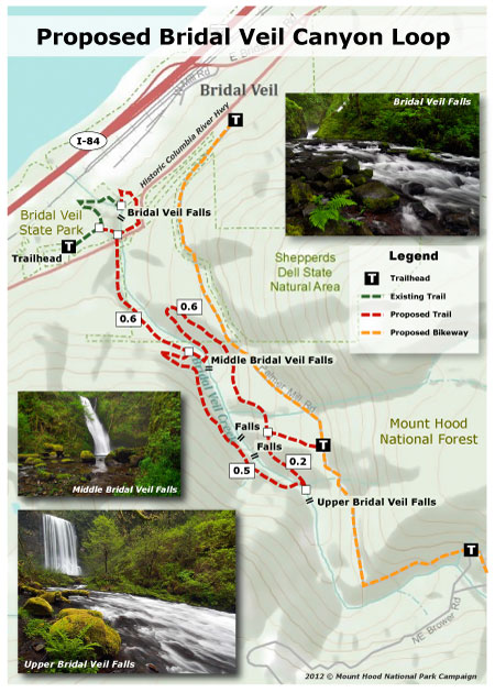
The following trail map shows these proposals in detail:

(click here for a larger version of the map)

One of the unique advantages of building in the Bridal Veil watershed is the already impacted nature of the landscape. Adding a trail here is a modest change compared to a century of road building and logging. The proposal also provides an opportunity to restore some of the environmental damage from past activities in the process, such as illegal dumping and invasive species that have been introduced to the canyon.

Another unique advantage is the opportunity to extend the new trail from the existing trailhead and picnic facilities that exist at Bridal Veil State Park. The park already has a paved parking area, picnic tables, year-round restroom and a couple of short hiking trails. The new trail proposal would build on these amenities, making for a full-service for casual hikers or families with young kids.

Upper Bridal Veil Creek

The trailhead is also adjacent to rustic Bridal Veil Lodge, and would certainly complement the long-term operating of this historic roadhouse by greatly expanding recreation opportunities in the area.

The new trail would begin a few feet beyond the trailhead sign on the existing Bridal Veil Falls trail, turning upstream from the current path. The new route would duck under the Historic Columbia River Highway, and follow the west side of Bridal Veil Creek closely for 0.6 miles to a new footbridge at beautiful Middle Bridal Veil Falls. Here, a few moss-covered remains of the old log flume survive among the ferns and boulders.

Middle Bridal Veil Falls

The proposed loop forks here, with the stream-level route continuing along the west side of the creek, and the eastern bluff route returning across the proposed bridge (see map, above).

The stream-level route would now climb a switchback to an overlook of Middle Bridal Veil Falls, and continue to traverse the stream for a half-mile, passing two more mid-sized waterfalls. Soon, the trail would arrive at a second bridge, just below magnificent Upper Bridal Veil Falls.

The upper falls is the main attraction of the proposed loop trail — a powerful 100-foot wall of water in a steep amphitheater. Hikers will want to enjoy this spot for a while, perhaps from the proposed footbridge, or possibly from a viewing platform similar to the deck at Bridal Veil Falls.

Upper Bridal Veil Falls

After taking in the view of the upper falls, hikers would begin the traverse of the east side of the canyon, along the return portion of the proposed loop trail. This section would gently climb the steep canyon walls to a series of open bluffs that frame the gorge. Along the way, a spur trail would connect the loop trail to the proposed bike route along Palmer Mill Road.

The return route would end with a long switchback descent to the proposed footbridge at Middle Bridal Veil Falls, and hikers would retrace their steps for the final 0.6 miles to the trailhead. The new loop would be a total 2.5 miles, round-trip.

Bridal Veil Falls

The final piece of the puzzle in the trail proposal would be a short return loop on the existing Bridal Veil Falls trail. This route would climb from the existing viewing platform above Bridal Veil Falls, traversing below the scenic highway to a new stream crossing at the highway bridge. Though this route involves extra cost and engineering challenges, it would also create a longer loop that incorporates the existing Bridal Veil Falls trail, for a total of 3.5 miles.

Converting Palmer Mill Road

While the main focus of this proposal is on new hiking trails, the deteriorating state of Palmer Mill Road — and the serious problems it creates in terms of illegal dumping and vandalism — calls the question of whether to allow traffic on this road in the long term?

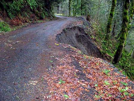
2011 slide on Palmer Mill Road (Multnomah Co.)

In 2011, the road was closed for several months to allow for repairs where a sizeable section had failed. Though unintentional, the statement on Multnomah County’s website makes the case for closing the road permanently:

“The isolated road is one of the county’s few remaining gravel roads. The narrow road climbs a steep hillside above Bridal Veil Falls along Bridal Veil Creek.

No homes or businesses are located along Palmer Mill Road. The road was built to serve logging mills in the 1880s that are now long gone. Few cars use the road, so not many people noticed when a landslide closed the route in March 2011, during one of the wettest winters in recent memory.”

At a time when county transportation funds are rapidly dwindling, converting the road to become a bicycle trail would not only help the health of Bridal Veil canyon, it could also remove some of the maintenance burden for the county. It also seems to fit the county’s own direction for the corridor, as the upper segment of Palmer Mill Road has been gated to vehicles for years, and is a favorite route among cyclists and hikers.

Palmer Mill Road in autumn

Like the proposed Bridal Veil loop trail, a bike trail along Palmer Mill Road already has a developed trailhead. In this case, the paved overflow lot for the Angels Rest trail provides ready-made parking. Therefore, no new accommodations for bike trail users would be needed (though the Angels Rest trailhead is not equipped with an all-season restroom or water).

(a caveat to this proposal: the steepness of Palmer Mill Road might limit its suitability for bikes, especially downhill, and therefore might need to be managed accordingly (like the Zigzag Trail near Surveyors Ridge, for example, which requires cyclists to walk bikes in the downhill direction).

What will it take?

This proposal will require a partnership between the U.S. Forest Service (administers the upper portion of the canyon), Oregon State Parks (administers the lower section) and trail advocacy groups. While the proposed loop represents a substantial amount of trail design, engineering and construction, it is well within reach if a public-private partnership can be realized.

The scope of the proposal is about the same as the Wahclella Falls trail, which was rebuilt in the 1990s to include two sizeable footbridges and sections of new tread on steep slopes. However, there would be little or no costs associated with the trailhead at Bridal Veil Canyon, unlike the Wahclella Falls project.

(click here for a larger view of this map)

(click here for a PDF version of this map)

Sound interesting? The best way to advocate for this trail is to simply pass the idea along. I will be advocating the project with Oregon State Parks, eventually, so word-of-mouth support among hikers could be helpful.

To share this concept, download the illustrated PDF version (above) of the map and send it to friends, fellow hikers or even to Oregon State Parks or Forest Service officials, with your own suggestions for how to proceed. That’s how grassroots projects get started, after all!
___________________________

Acknowledgements: this article has been underway for a couple of years, and reflects help from several local Gorge experts. My thanks go to Bryan Swan for his research on the history (and mystery) of Upper Bridal Veil Falls, and to Greg Lief and Don Nelsen for making bushwhack trips with me to Upper and Middle Bridal Veil Falls, respectively. Special thanks go to Zach Forsyth for his intrepid explorations along the less-traveled sections of the canyon, and advice on possible trail alignments.

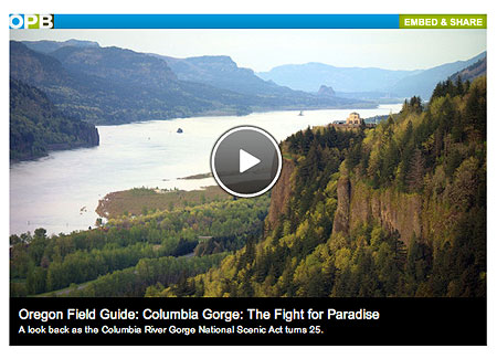
Columbia Gorge: The Fight for Paradise

On November 17, OPB’s Oregon Field Guide aired a special 1-hour look at the Columbia River Gorge Scenic Act, commemorating the 25th anniversary of the legislation.

The show provides a comprehensive look at the history of the Gorge Act, its friends and foes and some of the future challenges, including those never anticipated when the legislation was written — such as the recent land rush for wind turbine sites. Several of the most prominent early defenders of the Gorge are included, including Chuck Williams and Nancy Russell.

The program also includes in-depth look at the Native American legacy in the Gorge, and the ironic effect of the Gorge Act bringing a surge of new residents since it was signed into law — all seeking a life amid the scenery, and bringing demand for hundreds of new homes and new industry to a new level in the Gorge.

The program overlooks the massive increase in recreation demand over the past three decades, and the lack of trails to serve the crowds. Not much attention is paid to the future role of federal stewardship in the Gorge, and especially the national park vision that Chuck Williams advocated during the fight for protection.

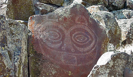
Tsagaglalal or She Who Watches (USFS)

Likewise, Senator Bob Packwood is given too much credit for passage of the Gorge Act (in his own words, of course, in typical Bob Packwood form), while Senator Mark Hatfield is not given enough. Had Hatfield been alive to comment, he would undoubtedly have given a humble account of his key role in developing the legislation. This political history might make for a future documentary on the evolution of the Gorge Act, itself, perhaps based on Carl Abbot’s book Planning a New West: The Columbia River Gorge National Scenic Area.

Still, the program provides a very good overview of the Gorge Act over the past quarter century, and how much it has already changed the public/private balance of interests in the Gorge. Here is the documentary in full (approximately 55 minutes):

SOLVED: North Side Waterfall Mystery

Fans of the classic 1975 edition of Jack Grauer’s “Mount Hood: A Complete History” have memorized the many rare photos and stories found only in this unique book. For waterfall hunters, the photo on page 226 (shown above) is particularly compelling. The 1890s image is titled “Wallalute Falls on Compass Creek”, and shows the tiny figure of a man at the base of a dramatic falls.

The mystery in this caption stems from the fact that USGS maps have long shown Wallalute Falls to be the prominent cascade on the Eliot Branch, just below Cloud Cap. This huge falls is visible from Inspiration Point on the Cloud Cap Road, and is clearly not the same as the cascade shown in the Grauer book.

This article attempts to untangle the story of these waterfalls, and the confusion surrounding the names of the remarkable, mysterious group of waterfalls spread across the Eliot, Compass and Coe drainages.

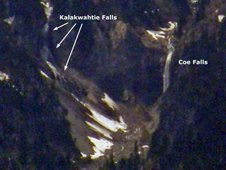
The story begins in June 2010, when I posted a report at PortlandHikers.org on my first good view of the two mapped waterfalls on the Coe Branch. I had spotted them from an off-trail outcrop on the east rim of the Hood River Valley, and captured this grainy view from a very long telephoto image:

My excitement over this sighting began with the first good look at the very tall, powerful Coe Falls. Though I had explored the brink of the falls from the Timberline Trail, I had never made the rugged descent to the base of the falls. Thus, finally seeing this magnificent waterfall in its entirety was a thrill.

I watched Coe Falls for a moment through the lens, and then to my astonishment, I realized that the adjacent falls (on an unnamed tributary to the Coe Branch) was also in plain view! While Coe Falls was towering and stately, this neighboring cascade was a sprawling, graceful veil. I gave the unnamed falls the working title of “Kalakwhahtie Falls”, which is Chinook jargon for “petticoat”, and quite descriptive of the falls (and I couldn’t bring myself to add another “Bridal Veil” falls to the long list with that name!)

Wayne Harvey’s Adventures

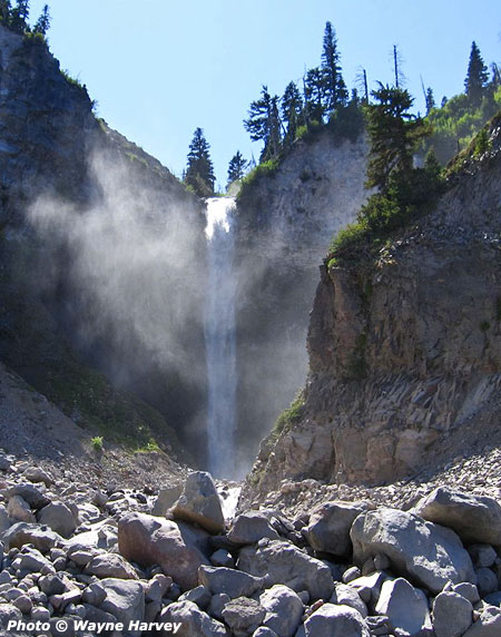
Based on my PortlandHikers.org report and the photo schematic I provided, local waterfall adventurer Wayne Harvey was intrigued, and in July 2010 made an epic solo trip into the Coe Branch canyon to explore and document this impressive pair of waterfalls. His trip produced the first known contemporary image of Coe Falls, thundering into its huge amphitheater:

Coe Falls in 2010

Wayne also captured the first known photo of Kalakwhahtie Falls, cascading over the east wall of the Coe Falls amphitheater. Though the mid-summer stream levels in Wayne’s photo (below) were notably lower than in my grainy images from across the valley, his images captured a uniquely beautiful waterfall:

Kalakwhahtie Falls in 2010

Wayne’s photos of Coe Falls immediately raised questions about the Wallalute Falls image in the Grauer book. The resemblance was striking, and without definitive modern images of the waterfalls on Compass Creek to compare to, another possibility arose: was the falls in Jack Grauer’s book actually Coe Falls?

Further intrigued by the unfolding mystery, Wayne made a second, even more rugged solo trip into the Coe Branch canyon in July 2011, this time to explore Compass Creek and document the remaining waterfalls of Mount Hood’s north slope.

Wayne’s 2011 return trip took him across the boulder-filled floor of the Coe Branch valley, then into the dense underbrush of the remote Compass Creek canyon. His first discovery was the lower of the two mapped falls on Compass Creek to be much larger than anyone had imagined, dropping roughly 100 feet into a picturesque bowl (below).

Lower Compass Falls in 2011

The larger-than-expected lower falls also presented an obstacle for Wayne as he searched for a route upstream to the main falls. He later described a scramble up a steep chute that was “all fours in places”, and the only passable route. Beyond the scramble past the lower falls, Wayne continued upstream to an impressive view of Compass Creek Falls, dropping nearly 200 feet into a sheer amphitheater (below).

The real Wallalute Falls on Compass Creek in 2011

With this image, Wayne had solved the Wallalute Falls mystery: the falls pictured in the Grauer book is clearly the same as the falls he documented on Compass Creek. Wallalute Falls is indeed on Compass Creek, not the Eliot Branch.

Unraveling the Mapping Mystery

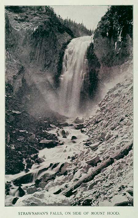
With Wayne Harvey’s trip report from Compass Creek in hand, it was now possible to unravel another waterfall mystery. This time, the confusion involves another historic photo from the area dating from the 1890s, and titled “Strawnahan’s Falls” (below):

1890s Stranahan Falls - known for decades as “Wallalute”

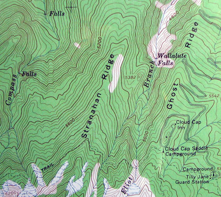
For years, waterfall hunters have recognized this falls to be the large, prominent falls on the Eliot Branch identified on maps as Wallalute Falls (shown below in its modern form). The reference to “Strawnahan” (which is clearly a misspelling of “Stranahan”, the name given to a nearby ridge in honor of area pioneers) was assumed to be either an informal name that was later replaced by “Wallalute” or simply an error on the historic photo, itself.

Stranahan Falls as it appears today, after years of recent flooding have scoured the Eliot Branch canyon

Wayne Harvey’s field documentation of the real Wallalute Falls now seems to provide definitive evidence that a map error occurred, transferring the “Wallalute” name from Compass Creek to the Eliot Branch, with the “Stranahan” name simply getting lost in the shuffle.

The following map provides the context for the USGS map error by showing the close, and potentially confusing proximity of (1) Stranahan Falls (labeled as Wallalute on USGS maps), (2) the true Wallalute Falls on Compass Creek, and (3) the lower falls on Compass Creek.

Still another twist in this saga comes from a later, more obscure edition of the Grauer book, published in 2006. In this edition, Grauer describes the work of Mount Hood pioneer Mark Weygandt building the earliest trails in the vicinity of Cloud Cap Inn:

“It was probably in this year (1900) that he built trails. One trail led from the low end of Ghost Ridge to a view of Stranahan Falls. He then extended it across Eliot Creek to Stranahan Ridge and to Wallalute Falls and Canon Balls Falls on Compass Creek, at the bottom of Adams’ Hole. Parts of this route later became part of [the] Timberline Trail. He also made a trail down Sand Creek Ridge to a viewpoint of the falls on Sand Creek, later named Polallie Creek.”

These accounts are the gold standard for Mount Hood history, partly because Grauer lived a good portion of it himself, but also because of the extensive spoken history he has documented through interviews of the historic figures, themselves.

Grauer’s description gives a name to the lower Compass Creek falls for the first time in recent memory — “Canon Ball Falls” — as well as the canyon section that encompasses both Wallalute and Canon Ball falls on Compass Creek — “Adams’ Hole”. Grauer is also definitive on the Stranahan and Wallalute names, correctly tying them to the Eliot Branch and Compass Creek, respectively.

Mapping the North Side Waterfalls

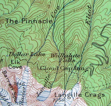
The USGS map error that created the confusion may go back more than a century, as it appears to be reflected on all USGS maps known to carry the name “Wallalute”. The follow map excerpt (below) is from 1924, and shows how the error could have occurred: note that early topographic maps didn’t always show the crosshatch used to denote waterfalls on more contemporary maps. With this omission, and the close proximity of Compass Creek and the Eliot Branch on earlier, small-scale maps, it’s easy to see how later cartographers might have been confused as to which stream Wallalute Falls was really on.

1924 USGS Map

The following USGS map excerpt (below) was published in 1962, and is the first to attach Wallalute Falls specifically to the Eliot Branch. This map appeared when the 1:24,000 topographic series was being published, and the larger scale allowed features like Wallalute Falls to be more definitively identified — or, in this case — misidentified. Though the location of Wallalute was in error on the 1962 sheets, these large-scale maps did show the the waterfalls on Compass Creek and the Coe Branch accurately for the first time.

1962 USGS Map

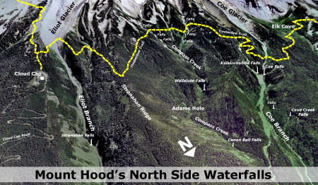
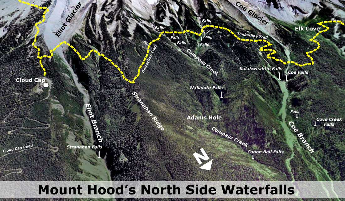
Pulling all of this together, the following is an oblique view of the north side region showing all of the waterfalls in context: Stranahan Falls on the Eliot Branch, Wallalute and Canon Ball falls on Compass Creek, and Kalakwhahtie and Coe falls on the Coe Branch.

(Click here for a larger map)

Also shown are a couple of unnamed tributary waterfalls in the Coe Branch canyon, and there are surely other waterfalls yet to be discovered in this seldom-visited area.

In an effort to close the chapter on this naming saga, I plan to provide the documentation from this article to the Oregon Board of Geographic Names (OBGN), in hopes that they can eventually look into the matter and perhaps correct the map error of more than a century ago.

Visiting the Waterfalls

The series of waterfalls described in this article are remote and difficult to reach. Visiting these waterfalls is only for expert explorers.

Wayne Harvey approached the Coe and Compass Creek falls from the Elk Cove Trail, dropping into the canyon just beyond the prominent Coe Canyon overlook. This required a rugged descent of nearly a thousand vertical feet, followed by challenging bushwhacks at stream level to the waterfalls.

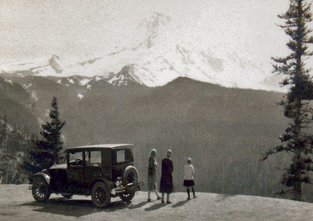
1920s Visitors to Cloud Cap taking in the view of Stranahan Falls (just to the right of the small tree in front of the car) and Mount Hood from Inspiration Point

Stranahan Falls can be seen from Inspiration Point, but represents a potentially dangerous descent into a canyon that has been destabilized by recent floods. However, there are good views of the falls from a boot path that descends to a rocky overlook, just below Inspiration Point on the Cloud Cap Road.

One of the trail concepts in the Mount Hood National Park Campaign calls for a “low trail” paralleling the Timberline Trail. On the north side of Mount Hood, this new route would connect the dots among the string of waterfalls described in this article. Wayne Harvey’s remarkable images of the waterfalls only underscore the case for providing access to these beautiful places, hiding in plain sight.

Acknowledgements: special thanks to Wayne Harvey for the use of his images and field reports, and to both Wayne Harvey and Bryan Swan of the Northwest Waterfall Survey for their help in untangling the history of geographic names in the Eliot, Compass and Coe drainages.

ODOT lays a big Goose Egg

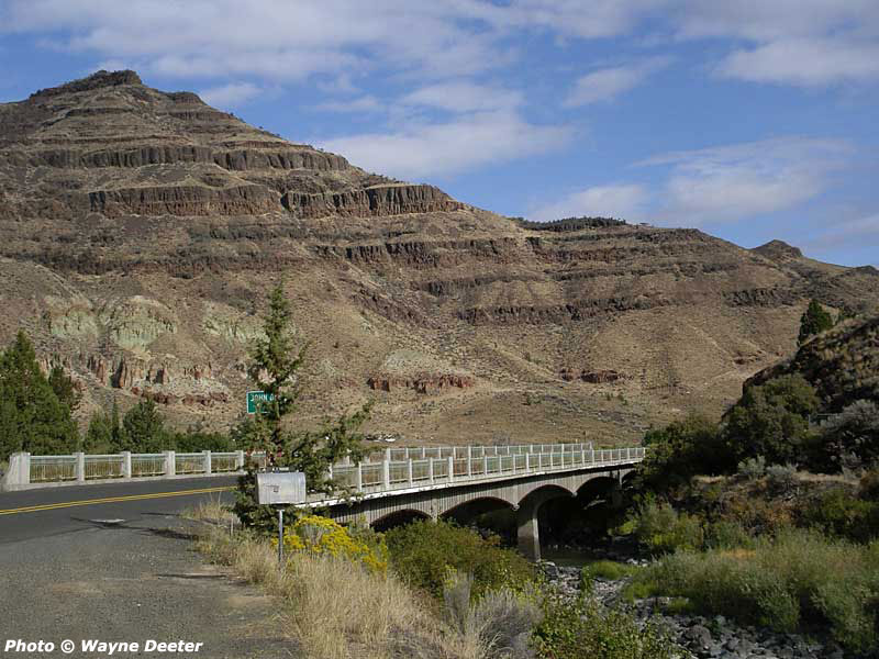
Lost: the historic Goose Rock Bridge (1941-2011)

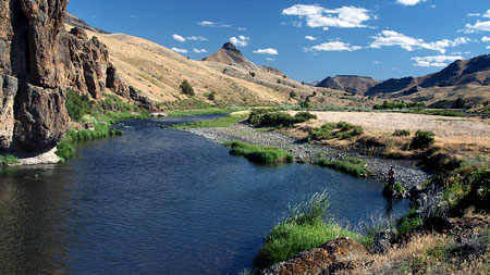
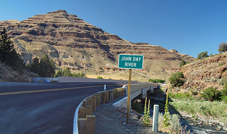
For this article, I’ll stray from WyEast country a bit, if only to illustrate just why those who love the Oregon landscape ought to be distrustful of the Oregon Department of Transportation (ODOT) when it comes to respecting Oregon’s scenic and cultural legacy. Sadly, the agency simply isn’t up to the job.

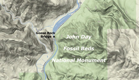
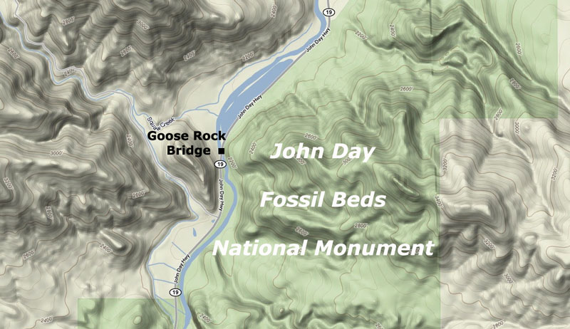
Case in point: the not-quite-finished Goose Rock Bridge, located on Highway 19 where it crosses the John Day River. The site seems like a no-brainer for what is called “context sensitive design” in engineering parlance. More plainly stated, this means moving away from the 1960s highway builder’s mentality of building over-engineered, one-size-fits-all concrete monoliths that pave over the local character of a place.

(click here for a larger map)

For the engineers who designed the new Goose Rock Bridge, the evidence that something other than a miniature version of a California freeway ramp was in order was painfully obvious:

• Located in a National Monument? Check.
• Crossing the John Day, one of Oregon’s premier scenic rivers? Check.
• Located on an Oregon Scenic Byway? Check.
• Replacing a historic highway structure? Check.
• Minimal traffic volumes? Check.
• Likely to serve bicycles and pedestrians? Check.

Any of these simple checks should have sent the engineers back to the drawing board. Instead, the public received another ugly, industrial eyesore for the millions in Oregon tax dollars spent on this blunder.

Sheep Rock rises above the John Day River, just upstream from the new bridge

So, the damage is done on the John Day River at Goose Rock, and now we’re stuck with a stinker of a bridge for the next several decades: the real question is whether ODOT can stop building goose eggs like this? The answer is yes… maybe.

What’s wrong with the design?

Why is the new bridge such a stinker? To answer that question, we can reflect on the bulleted list of design considerations listed above:

Respect the location: The project is in a National Monument, along an Oregon Scenic Byway and crosses a famed, wildly popular whitewater river. As such, the bridge should have embraced National Park Service (NPS) design elements. This is a no-brainer, and there is plenty of guidance to help ODOT with the aesthetic features, had anyone thought to look. This simple step could have made the new bridge an asset to the John Day National Monument, not an eyesore.

The famed Blue Basin is a less than a mile from the new bridge

Respect the history: The new structure replaces a bridge constructed in 1941 that may have been structurally obsolete, but had plenty of charm and historic significance to complement the setting. The original structure featured graceful, fluted concrete posts anchoring ornate, painted steel balustrades and railings. The under structure was a simple pier design, but included a graceful apron of decorative concrete arches.

Had context-sensitive design been a consideration in this project, these historic details would have been a major element in the design of the new bridge. Instead, the character of the old bridge is now but a memory.

(click here for a large photo of the historic bridge)

Design for the users: The Goose Rock Bridge carries an tiny amount of traffic by urban standards — only about 300 vehicles per day, which is the equivalent of a typical suburban cul-de-sac serving just 30 homes. Just one lane of the Banfield Freeway carries this much traffic every ten minutes.

The new bridge: freeway ramp to… nowhere?

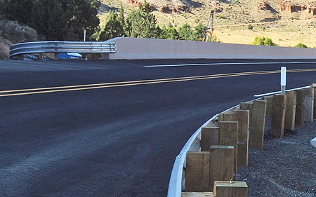
While the bridge does carry trucks, the massive design of the new structure is still wildly over-built, with freeway-scale Jersey barricades for railings that make the new bridge hostile to the cyclists, hikers and fishermen who cross this bridge while visiting the National Monument and the John Day River. Even passenger cars are punished by the new design, with the absurd concrete freeway barricades blocking views of the river for passing motorists.

Would you walk (or pedal) across this bridge?

Instead of the meager striped shoulder that supposedly serves bicycles and pedestrian, the design should have included a segregated sidewalk. This would have been a nice addition for the walkers, fishermen and less confident cyclists crossing the structure, and would have invited stopping on the bridge to admire the view — something no user would be safe doing on the new structure.

Who’s Fault is it?

Where did this simple project to replace the old bridge get off track? That’s hard to know (assuming it was ever on track). The project is one of hundreds funded through a $2 billion bridge replacement program known as the Oregon Transportation Investment Act (OTIA).

Republicans who controlled the Oregon legislature at the time OTIA was passed into law insisted that the design work for projects be sent off to private consulting firms, in this case, two firms — OTAK and Wildish Standard Paving — where the design decisions were likely made, before receiving a final approval from ODOT.

It is a poorly kept secret that the consulting firms receiving the bulk of the OTIA bridge contracts lured many of ODOT’s bridge engineers into the private sector to do the “private” work — usually with better salaries than they might have earned designing the same bridges at ODOT. While ODOT gets the bulk of the blame for accepting the lousy design of the new Goose Rock Bridge, the consultants deserve a good share of the shame, too. For its part, OTAK boasts on its website that:

Otak is the lead consulting engineer for Wildish Standard Paving on this $40 million design-build project along US395 in Eastern Oregon. Spanning nearly half the state, this project includes replacement of seven bridges along a sensitive waterway and wild and scenic corridor.

Nice words, but there is nothing in the design that suggests OTAK ever took the “sensitive waterway” and “wild and scenic corridor” into consideration when building the new bridge. It’s a firm that has done better work, elsewhere, and should have known better in this case, too.

Designed for 30,000 vehicles per day… but carrying only 300. Cyclists and pedestrians are on their own.

Another problem was probably the way in which projects were funded. Many of the bridge projects funded through OTIA followed ODOT’s “design-build” process, which combines the design, engineering and construction into a single contract.

In this case, ODOT “bundled” seven bridges scattered across the John Day country into a single ODOT contract, which unfortunately means more blunders like the Goose Rock Bridge can be expected (if they haven’t already been built). It also means that meaningful public involvement is a remote possibility, since the whole point is to speed up project delivery and cut costs wherever possible.

When will the Goose Eggs stop?

It will take a lot to pull ODOT onto a more enlightened path. This is evidenced by the $120 million the agency has already spent to devolve the design for the Columbia River Crossing to the worst conceivable option, as well as dozens of smaller eyesores built under the OTIA bridge program.

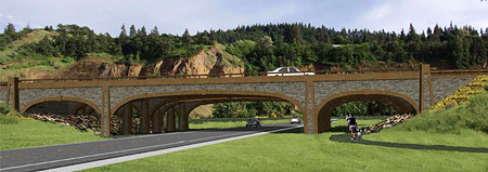
One possibility for the future is to simply remove the aesthetic design elements of project planning from the grasp of ODOT engineers, and handing this work over to architects or volunteer design panels, instead. Another is to establish a design auditor within the agency with the staffing and authority to “stop the assembly line” before construction money flows to badly designed projects.

Jersey barricades belong on the Banfield, not on John Day River bridges

Yet another option is to simply recruit and employ engineers versed in the basics of context sensitive design, and demand the same of the relatively short list of private contractors that ODOT keeps on retainer. In the long term, this is the best option, but would first take recognition by ODOT that a problem exists. Clearly, the agency isn’t there, yet, as evidenced by the Goose Rock Bridge travesty.

There are a few bright spots at ODOT, however, including several in WyEast country. These include the new Government Camp bridge over US 26 and several recent bridge replacements along I-84 in the Columbia River Gorge Scenic Area. In both cases, consistent pressure from local advocates was part of the puzzle that led to better design.

In the case of the Gorge, ODOT has adopted a comprehensive architectural guidance for engineers on all aspects of highway design has been an invaluable tool, and could be applied statewide in scenic areas, like the John Day National Monument.

Context-sensitive design from the I-84 Corridor Strategy guidelines for the Columbia Gorge

In the meantime, hold your breath. It’s nearly impossible to spot a bad project in the byzantine ODOT design process before the construction contracts are let, and another concrete eyesore appears on the landscape. We can only hope that ODOT projects currently lined up for US 26 and OR 35 along the Mount Hood Loop draw from the recent successes in the area, and not the old freeway engineer mindset that produced the Goose Rock Bridge goose egg.

The Tollgate Maples… and the Highway

The two remaining Tollgate maples

Last week, the Forest Service and Oregon Department of Transportation (ODOT) jointly announced that the main trunk of one of two remaining Barlow Road Tollgate heritage maple trees would be coming down soon:

“A 130-year-old bigleaf maple, which marks the spot of the western-most tollgate of the historic Barlow Road, has substantial decay and poses a hazard to travelers on U.S. Highway 26 (Mt. Hood Highway). The tree is planned to be felled within the next three weeks.”

(download the press release here)

On its face, the decision is both reasonable and expected. The maples were planted in the 1880s by tollgate keeper Daniel Parker, and have lived the typical lifespan of our native bigleaf maple. A third maple apparently survived until the mid-1990s, and along with the tree that will soon be removed, framed the old tollhouse that once stood on the north side of the tollgate (where the highway is located, now).

The large trunk on the right will be removed, but the three smaller trunks on the left will be spared

The good news is that the tree will live on, through suckers that have grown to become three separate trunks – a typical form for bigleaf maples. From the press release:

“The old bigleaf maple to be felled has several stems: a main stem, with a diameter of 25 inches, and three smaller 4- to 6-inch diameter stems growing from the base of the trunk. These three smaller stems, each about 25 feet tall, will be untouched by the project, while the decaying main stem will be reduced to a height of two to three feet.”

Hopefully the companion tree on the south side of the gate will also survive through new stems someday growing from its base. This is the larger of the two trees, and because of its distance from the highway, will be allowed to grow undisturbed.

The remaining maple is far enough from the road that it will be allowed to remain, undisturbed

As trees around Mount Hood go, the two maples at Tollgate aren’t particularly remarkable — there are plenty of larger, older and more impressive bigleaf maple trees growing in less traveled areas of the surrounding forests. The uniqueness of these trees, of course, is the tie to the Oregon Trail, itself, a piece of Amercian history that is deeply embedded in our cultural identity.

Sam Barlow’s Road

Most Oregonians know the story of Sam Barlow, and his daring expedition over the shoulder of Mount Hood with Joel Palmer in the fall of 1845, in search of a land route through the Cascades.

Sam Barlow and his legendary road

By 1846, the route the two men had scouted and led their own wagons over had become a business venture for Barlow: a notoriously rough toll road that thousands of Oregon settlers would travel over in the years that followed. Many described it as the worst part of their 2,000-mile journey.

The tollgate site marked by the twin maples was the final location of at least five tollgate sites that existed along the Barlow Road over the years, with this final tollgate operating from 1883 to 1918. The gatekeeper charged $5 per wagon, with smaller fees for livestock, foot travelers and even the first automobile, which arrived at the tollgate in 1903. This was a handsome price in its day, but for most travelers, it was also a one-time charge on the way to the Willamette Valley.

The Tollgate wayside fronts one of the few remaining Highway 26 segments that has remained largely unchanged little since the first highway was built in the 1920s

As the toll road era faded away in the early 1900s, plans for the first loop highway around the mountain were underway, and much of the new route followed the original Barlow Road when first leg was completed in the 1920s.

Because the Barlow Road had a number of evolving alignments over the years, many traces of the route survived the highway-building era, and can still be seen today. The original loop highway was used through the 1950s, and was then replaced with the modern alignment we know today.

The Future of Barlow Road… and Highway 26?

The tentative tone in the opening paragraph if this article stems from the terrible record ODOT and the Forest Service have in protecting the historic, scenic and environmental legacy of the Barlow Road corridor.

Highway 26 “improvement” just east of Tollgate in 2004

While the Forest Service and ODOT have made a reasonable case for removing the heritage maple at the Tollgate site, the agency has a long history of aggressive, senseless tree removals along the Mount Hood Loop. Most of this sad legacy stems from ODOT’s unstated objective to widen the highway to four lanes through the entire Mount Hood corridor at all costs — usually cloaked as a “safety” or “preservation” projects to ensure that their policy makers and the general public don’t get in the way of the underlying road widening mission that continues to drive the agency.

One strategy used by highway engineers to ease the path toward eventual road widening is to cut trees way back along highway sections in advance, as a divide-and-conquer strategy. The goal is to avoid jeopardizing a future road-widening project with public outcry over tree removal.

This practice is also rationalized under the “safety” banner, but actually encourage speeding by removing the traffic calming effect that a tree canopy creates. The use of street trees and landscaping in urban areas to discourage speeding is a widespread and fully accepted practice in the modern transportation design, but clearly hasn’t penetrated the ODOT offices yet.

Highway 35 “improvement” currently underway near Hood River Meadows is predictably cutting trees back from the roadway

In 2004, ODOT cleared the shoulders along several sections of US 26 in the vicinity of the Tollgate site, and one concern in hearing the news of the heritage tree is that this project is a precursor to tree removal along this final stretch of mostly original highway, where big trees still grow near the road.

The unstated ODOT mission to widen the loop highway to an urban freeway standard is described in detail in these earlier WyEast Blog articles:

• Highway 26 Widening – Part One

• Highway 26 Widening Projects – Part Two

• Highway 26 Widening Postscript… and Requiem?

Unfortunately, the projects described in these articles continue to advance, with a few cosmetic details thrown in to keep them moving. Sadly, they represent almost $30 million in public dollars that will make the highway a lot more like an urban freeway, while ignoring their own consultant recommendations for far less costly, more effective safety solutions.

The first phase of ODOT’s “safety and preservation” work is slated to begin just east of Tollgate this summer, and — right on schedule — the project has already been “updated” to include widening for a new westbound travel lane, along with “separate projects to remove select trees for safety reasons.” Just as predicted.

A New Vision for the Mount Hood Loop

The beautiful wayside at Tollgate is a great example of the very kind of feature that ought to be the focus of a tourism-oriented highway design along the Mount Hood Loop. Yet ODOT is about to make changes to the highway that will make it much less friendly for visitors. Is there an alternative?

1950s Mount Hood Loop wayside at White River

In a coming piece, I’ll present a different vision for the Mount Hood Loop that rejects the current ODOT plans for road widening, and the dubious “safety” claims that ODOT officials are using to cloak nearly $30 million in projects that will turn the corridor into a freeway.

This alternative vision will offer a less costly, sustainable long-term design that actually IS safer, and also much more enjoyable for the visitors to the mountain that drive the local economy.

Discovering Bald Mountain

The country is filled with “Bald Mountains”, but for sheer scenic spectacle, few can compare to the Bald Mountain that rises just four miles away from the towering west face of Mount Hood. At one time, a fire lookout stood atop this Bald Mountain, and the view from the tower must have been the envy of fire lookouts around the Northwest.

Today, Bald Mountain isn’t entirely bald, having grown a dense forest of noble fir along the crest and northern slopes over the past half-century. Yet, it was in the 1970s, when the Timberline Trail was rerouted to lead hikers across the steep, open meadows on the south slope of the mountain, that hikers became familiar with Bald Mountain. Today, this spectacular traverse continues to provide one of the most popular, exhilarating sections along the classic loop hike.

Though most visitors to Bald Mountain keep to the Timberline Trail, you can still follow the historic old path that leads to the former lookout site, with its magnificent, close-up views of Mount Hood. Thanks to the quiet efforts of a few anonymous volunteers over the decades, the trail remains open and lightly maintained, with only an occasional log to step over along the way.

As the old path climbs toward the summit, hikers find themselves in a dense, young forest, and have to use their imagination to picture the open slopes of beargrass — with no forests — that existed when the first lookout was built on “Bald” Mountain more than a century ago.

Along the old trail, hikers will also spot blazes on the few trees that stood at the time of the former lookout tower. These blazes mark most historic trails (see this recent article on blazes) in the Mount Hood area, and confirm that the present alignment of the summit path to Bald Mountain dates back to at least the World War II era, and likely before.

A look at the 1911 USGS map of Mount Hood (below) shows that a “lookout” stood on Bald Mountain long before roads crossed Lolo Pass, and decades before the Timberline Trail was built. The early lookout structure was likely no more than a wood platform, later replaced with a conventional lookout tower. Interestingly, the Beaver Lakes shown on the map have since faded away, too, filled in with forest:

The 1946 USGS map of the Mount Hood area (below) is the last to show a lookout on Bald Mountain (and the Beaver Lakes), but in the intervening years from the 1911 map, the Timberline Trail and Skyline Trail had been completed, with both routes passing just below the lookout.

In fact, it’s likely that the section of Skyline Trail from Lolo Pass to Bald Mountain was originally built for lookout access, since the trail over Lolo Pass was among the earliest built in the area, and in fact, followed an ancient Indian route connecting the Sandy and Hood River valleys.

The alternating ticks shown along the dashed trail segments on the 1946 map indicate a telephone line along the route. Today, these routes often have ceramic insulators still attached to trees, and on this route further suggest that this section of trail was originally built with the lookout in mind. The route is now part of the Pacific Crest Trail, which replaced the old Skyline Trail, and remains one of the best approaches for hiking to Bald Mountain.

What did the old tower look like?

Fire lookouts in the Pacific Northwest followed a few standard designs beginning in the 1930s, after much improvisation in the early lookout designs that were built through the 1920s. The Bald Mountain lookout probably followed this evolution, with some sort of simple platform beginning at the turn of the twentieth century, and later, a more substantial structure built to Forest Service standards.

We have a much more exact picture after June 1944, when archived Forest Service documents show a new lookout was designed, apparently to replace an existing structure on Bald Mountain. The following are samples from the 1944 architectural plans for Bald Mountain. There are no clear records of when this lookout was removed, but it was likely in the late 1950s or 1960s, when hundreds of lookouts were viewed as outmoded by the Forest Service and destroyed.

The cab — or cabin — in the 1944 designs for Bald Mountain is a 14×14 foot structure (above) that would closely resemble the surviving cab on the Devils Peak lookout, just to the southwest of Mount Hood in the Salmon-Huckleberry Wilderness. This simple design featured five windows per side and a low, pitched roof.

Inside the cab (below), the living space was organized around a Osborne fire finder, located in the center of the floor, surrounded by a wood stove, table, kitchen, storage cabinets, shelves and bunk. A catwalk wrapped around the outside of the cab, allowing lookouts to maintain the windows, raise and lower shutters and haul firewood and supplies up from below with pulleys.

The 14×14 foot cab rested atop a 43-foot wood-frame tower (below), complete with a spiraling stairway that ascended within the tower uprights. Though the tower was anchored directly to the ground, the main stabilization came from guy wires anchoring the tower to concrete footings in four directions.

The most remarkable aspect of this tower (and many others) is the fact that most of the materials were carried to the site over trails using livestock. That included the cut lumber, concrete, construction hardware, fixtures and windows — an amazing feat when you consider this was repeated dozens of times at lookout sites around the region.

The lookout plans for Bald Mountain also contain one “standard” element that wasn’t so standard, at least compared to other lookouts in the vicinity: a garage and storage shed built around the base of the tower. In this view, the stairway to the tower can be seen on the right, with the dashed lines above the garage marking the location of the tower uprights:

As this design detail from the 1944 plans suggests, there were a number of concrete footings used in the construction of the Bald Mountain lookout tower. Today, these seem to be the only remaining traces of the structure. Three footings are loose, and have been moved around and used by campers over the years. Other footings remain in the ground, mostly reclaimed by the undergrowth. This footing is located along the spur trail leading to the east viewpoint from the lookout site:

Visiting Bald Mountain

There is some irony in the historic Bald Mountain trail being “lost”, as the mountain is now almost completely circled by the Timberline Trail, and thousands of hikers make their way along this route every year. Almost all of these visitors walk right past the unmarked summit path leading to Bald Mountain.

But for those seeking the route less traveled, the hike to the summit is easy, provided you successfully navigate the maze of popular trails in the area. The key is knowing how to spot the unmarked junction with the Timberline Trail. Take a close look at this photo to help you recognize the spot if you choose to visit the old trail — this view is how the trail appears from either of the approaches described below:

From Lolo Pass: The Classic Approach

The classic hike begins at Lolo Pass, and follows the Pacific Crest Trail through handsome forests for three miles to the base of the Bald Mountain summit path. The total mileage on this option is 6.6 miles round trip, with an elevation gain of 1,400 feet. The following is a map of the Lolo Pass approach that accompanies the hike description I wrote for the Portland Hikers Field Guide:

Click here for a larger map

For a detailed description of the Lolo Pass approach, visit the Portland Hikers Field Guide page:

Lolo Pass to Bald Mountain Hike

The Field Guide description also includes driving instructions to the trailhead. This is a dry hike, so carry water — and in early summer, plan on the usual bugs that plaque hikers just after snow melt. My favorite time to hike this trail is on a clear day after the first autumn snow dusts the mountain in late September or October. This is when the area is free of bugs AND crowds.

From Top Spur: The Family Route

For a shorter hike that works well for families with kids (or for adults looking for a short afternoon or evening activity) you can also approach Bald Mountain from the Top Spur trailhead. Be forewarned that this is one of the most popular trailheads in the Mount Hood region, and mobbed on summer weekends.

But even on busy weekends, you can smile to yourself as you leave the crowds behind, and head up the quiet, old lookout path for some solitude — hidden in plain sight! From the summit viewpoint, you can literally look down on hikers passing hundreds of feet below on the Timberline Trail, oblivious to your presence.

Click here for a larger map

The Top Spur option is just two miles long, round-trip, with an elevation gain of 550 feet. Though short, portions of both the Top Spur and Bald Mountain trails are steep, so you will notice the elevation gain! The tradeoff for kids is the feeling of climbing a real mountain. Bring a pair of binoculars for kids to explore the details of Mount Hood or watch hawks float across the Muddy Fork Valley, below.

For a detailed description of the Top Spur approach, including travel instructions, visit the Portland Hikers Field Guide page:

Top Spur to Bald Mountain Hike

One of the most magical times to visit Bald Mountain is evening, when you can watch the awesome west face of Mount Hood light up at sunset, but still have enough light to hike back to the Top Spur trailhead.

Both hikes are usually open from mid-June through mid-November, and both require a Northwest Forest Pass to park. Both trailheads usually have portable toilets, but no water — be sure to carry your own.

Close Call at White River Falls

The magnificent desert falls on the White River survived a close brush with disaster this month, when a throwback proposal by Wasco County to divert the river as part of a new hydropower project was scrapped.

Like so many hydro projects of decades passed, this one would have had “little impact”, according to proponents. Yet, as we take in the summertime view of the 90-foot plunge pictured above, it’s obvious that diverting the river would have an immediate impact on the natural beauty of the area. Would half the falls be diverted? Two-thirds? All of it?

(click here for a PDF of Dalles Chronicle article)

Though the Wasco County proposal was ultimately dropped because of concerns voiced by the Oregon State Parks Commission, it wasn’t for lack of “goodies” offered up in exchange for the diversion. The County promised trail improvements for recreation, and interpretive facilities for the structures left behind from the last hydro project here.

White River Falls with the rocky gulch of Devils Halfacre in the background

The old plant was shut down in 1960, and the land subsequently transferred to the state, first as the “Tygh Valley State Wayside”, then today’s “White River Falls State Park.”

The falls and adjacent White River Gorge are truly a forgotten gem in Oregon, save for a few fishermen in spring and fall, and a lot of teenagers in summer, seeking out the swimming holes below the falls. Yet, the area is only two hours from Portland, and offers some of the most accessible desert scenery in the state.

In recent years, hikers have begun to explore the area, following boot paths and game trails downstream toward the confluence with the Deschutes River, just over two miles below the falls.

White River Gorge from the falls overlook

What most visitors don’t know is that much of the rugged backdrop for the falls is private land. Most surprisingly, these private holdings include the most of the White River gorge, all the way to the Deschutes confluence, and this beautiful area has somehow escaped development over the years.

Concept: White River Gorge Recreation Area

With Wasco County politicians dreaming up hydro projects for the White River, this article is intended as a more forward-looking counterpoint that actually embraces the scenic and recreational values in the area.

As a starting point, the National Recreation Lands boundary that encompasses the larger Deschutes Canyon could be expanded to include White River Falls, White River Gorge and the adjacent Winter Ridge and Devils Halfacre areas. This could provide the direction needed for state and federal land agencies to begin acquiring private land and planning for recreation.

It’s unclear what the “National Recreation Lands” boundary actually means, however. It seems to mirror the Wild and Scenic River designation for the Deschutes Canyon on USGS maps, but may be an orphan from old federal plans and policies no longer in force. Current federal planning documents for the lower Deschutes Canyon are also badly out of date, so a better legal mechanism likely exists for recognizing the potential for recreation in the White River Gorge area. In the end, some sort of designation is needed to identify the extent of the new recreation area.

The following map outlines the concept, with the proposed new White River Gorge recreation area bounded in dashed red, existing White River Falls State park in green and federal land holdings (BLM) in yellow:

(Click here for a much larger, more readable map)

The proposal: a network of new desert trails

The main focus of the concept is to build new trails in the White River Gorge, proper, and on the adjacent highlands that I’ve called Winter Ridge for the purpose of this article. The gorge is mostly private land outside the present state park boundaries, so like all of the trail proposals called for in this article, a new White River Gorge trail implies public ownership or easement.

The dashed red lines on the map show the new trail extending through the canyon from the falls to the confluence with the Deschutes, along with a short viewpoint loop within the current state park boundaries. This would become a premier hiking trail in the region, providing a unique riverside hiking experience in a roadless desert canyon.

The first portion of this new trail would simply follow the existing route down to the old power plant, with a new loop climbing back to the trailhead, via a canyon viewpoint above the falls. This part of the proposal could be built now, as it falls entirely within the current state park boundary.

Remains from the former power station in White River Gorge

The canyon trail would offer a unique interpretive opportunity where relics of the old power plant still exist. The Wasco County hydro proposal recognized the historic importance of these structures, and called for interpretive improvements along this existing trail, at the penstock and in the old power plant. These historic structures have been badly vandalized over time, and could greatly benefit from some modest renovation and protection.

In addition to the White River Gorge trail, the proposal calls for a network of hike and bike trails over the broad slopes of Winter Ridge. This area rises steeply above the confluence of the Deschutes and White rivers, with views nearly 800 feet down into the gorge from the open crest. The west slopes drop gently to the trailhead at White River Falls, with sweeping views of Devils Halfacre, Tygh Ridge, Mount Hood and Mount Jefferson.

The proposed trails shown on Winter Ridge (in green on the map) are almost entirely along existing paths and roads, and would require little beyond signage to improve them for hikers and mountain bikers.

Desert mounds along Winter Ridge (the black dot is a juniper tree, for scale)

Though a portion of Winter Ridge is farmed with winter wheat, much of the terrain is in a native state. The upper slopes of the ridge feature an odd landform unique to the Lower Deschutes River country: countless mounds of soil and rock, often organized in rows. They span 10-20 feet in width, and stand a few feet in height.

These odd “desert mounds” appear on shallow slopes and hilltops throughout the Tygh Ridge area, and this would be one of the few areas where visitors could examine these mysterious formations, up close, and learn some of the many theories about their origin.

Thinking Big: an expansive trail network at Devils Halfacre

It is impossible to stand at White River Falls and not notice the rugged, picturesque rim rock cliffs and massive bluffs that rise to the south of the White River Gorge. This rocky maze is the Devils Halfacre, and though in private holdings now, it offers an especially interesting potential for recreation.

Black basalt cliffs and talus slopes of Tuskan Ridge rise above the White River Gorge

The area falls into two general units: the rocky gulch of Devils Halfacre, proper, and the huge mesa forming the east wall of the gulch, which I’ve called Tuskan Ridge for the purpose of this proposal (see map). A network of trails and dirt tracks already exists here, and could easily be adapted to become an exceptional hike and bike trail network. These trails would lead hikers, bikers or possibly equestrians past rugged rock formations to spectacular, cliff-top viewpoints.

The Devils Halfacre area has excellent potential for trailhead access from both Highway 216 and Oak Springs Road. The terrain here rivals popular destinations in the eastern Columbia River Gorge, and would offer a unique chance to bring sustainable recreation tourism to the local economy.

Looking Forward

The concept presented here is just one way in which recreation and landscape restoration could be combined to preserve the White River Gorge area.

The intense demand for mountain biking opportunities also offers the potential to transform the local economy, especially since the area is just far enough from the Portland metropolitan area to draw overnight and weekend visitors who could support local businesses.

Mount Hood, rising across Tygh Valley from Winter Ridge

At a minimum, now is the time for Wasco County to aim for a more sustainable vision for White River Falls and its surroundings, instead of rehashing old, exploitive ideas that would degrade the area, and that have already failed here, before.

The Oregon State Parks Commission was right to challenge the County’s attempt to turn back the clock at White River Falls. Now would be the perfect time for the County to partner with the Parks Commission and federal agencies to forge a new vision that does justice to the remarkable landscape that exists here.

Celilo Fishing Panorama

One of the first articles I wrote for the WyEast Blog continues to be among the most popular: Restoring Celilo Falls (February 14, 2009). In the spirit of keeping the idea alive, this article is a tribute to the way of life that all but vanished when Celilo Falls disappeared in 1957, as revealed in photographs.

For this article, I blended images of Celilo Falls in the 1930s (courtesy the Oregon State University Commons archive) into a sweeping new panorama. I had viewed the individual images before, but it didn’t occur to me until recently that the following three images overlapped enough to allow for a blended panorama at relatively high resolution:

You can click here for a large view of the blended image, with the caveat that it retains the same publication terms as any other image in the Oregon State University Commons (use your browser window to pan across the image, as it is much larger than most monitors).

My original intent was simply to have a detailed panorama of the scene at Horseshoe Falls, the most iconic of the dozens of cataracts that made up the massive Celilo Falls complex. But as I stitched the images together, the details within the larger image suddenly came into view, and provided new insights into the unique way of life that had evolved over millennia at Celilo.

For example, in this clip (below) from the panorama, the surprising system for anchoring the wooden fishing platforms is revealed — a pile of rocks in a framed wooden crib! To my amazement, this method shows up in many other images of Celilo, though I had never noticed this detail before:

Another enlarged clip (below) from the panorama shows the precarious hanging platforms along a section of cliffs just below the falls, with fishermen using wooden ladders to reach what must have been slippery, intimidating perches:

In this enlargement from a separate photograph (below), taken just a few moments before the panorama images, the fisherman riding the cable shuttle to the opposite side of Horseshoe Falls is the same person visible in the panorama view (just below the fourth bridge arch):

The above view also shows a returning shuttle car, perhaps empty, or possibly loaded with filled salmon crates. Pulley systems like these moved fishermen and salmon catch on a network of cables that connected the multitude of rocky islands within the falls complex where fishing platforms were located.

In another clip (below) from the panorama, two fishermen are dipping from a group of platforms located at the extreme base of the falls. These platforms are also anchored with rocks, and are designed with dizzying overhangs that create a startling degree of exposure for the fishermen, yet provide a clear zone under the platforms for maneuvering dip nets:

The following clip (from a separate image) shows the same pair of fishermen seen in the previous clip from the panorama, but from a somewhat different angle. In this view, more details on how their platforms functioned are revealed: a crib of rocks anchors the middle platform, while and all three have large, wooden crates for salmon.

The size of the crates is also telling, as the typical salmon weighed 25-40 lbs, with many big Chinooks weighing in at well over 50 lbs. Landing these huge fish clearly required great skill, strength and agility using 15-foot dip net poles on a slippery plank surface.

Also visible in the above image are the safety ropes that the men tied to their waists while working the platforms. This was a relatively recent insurance policy in the ancient fishing tradition, and one that was seldom tested by people who had grown up around the platforms, working the salmon harvest.

The following image shows the top of the ladder seen on the right side of the panorama, but viewed from just above the platforms. As with the fishing platforms, the ladder is anchored by a wooden, rock-filled crib.

The above image also shows fisherman working on the next rock outcrop (in the upper left) seemingly afloat in the river, though clearly on another system of platforms in the larger panorama.

In another photo of the scene (below), the safety ropes can be seen in more detail — one tied to the fisherman — as well as the planked decking that was informally scabbed to platform supports.

Though sturdy, the informal construction of the platforms and catwalks makes sense, given that seasonal flooding almost certainly swept away anything that wasn’t removed by the fishermen at the conclusion of the fall fishing season. Yet, the position of individual platforms reflected traditional locations where the same families had fished over the generations. In that sense, while temporary in design, the platforms were also permanent.

The Tradition and the Legacy

Deconstructing these scenes in creating the panoramic view left me with an even greater appreciation for the fishing tradition at Celilo Falls. It also gave me new inspiration to see the falls restored, not simply for their scenic and spiritual value, but for the working fishery they provided. What a thrill it would be for the dip net fisheries to return to these rocks, and to watch them just as photographer who captured these images did!

The attraction of the Celilo restoration idea is that it is completely reachable. The falls is still there, underwater, and serving as a permanent reminder of our priorities as a society. It can be restored.

As the salmon runs continue to fade on the Columbia, along with the barge traffic once used to justify the dams, the sole argument against restoring Celilo Falls fades as well: it is as simple as finding better ways to generate — or conserve — the 1,800 megawatts of hydropower that is generated by The Dalles Dam. It’s really that simple.

Blazes!

Trail blazing is the ancient practice of marking paths with a system of symbols to help travelers navigate, and since the rise of recreational hiking in the 1800s, has been adapted to foot trails. Blazes are generally placed at eye-level, and spaced frequently enough to reassure hikers of the route.

In other parts of the country, where trails often cross private lands and many are maintained by hiking clubs, blazes can take the form of painted dots and symbols or small signs or medallions attached to trees, with hundreds of localized variations. These symbols are easy for volunteers to maintain, and often lend their design to the trail name (e.g., the “White Cross”, “Red Dot” and “White Cross” trails in New Hampshire’s White Mountains)

In the Pacific Northwest, where most of our hiking is on public lands, we are used to the standard Forest Service tree blazes that still mark most of our trails (like the one pictured at the top of this article). Though the practice of chopping blazes into trees has long been discontinued out of consideration for trees and trail aesthetics, many of the original blazes still remain, decades later.

Where trails leave the forest canopy, many Northwest trails are marked with stone cairns, such as along Gunsight Ridge (above) near Mount Hood. Along Mount Hood’s famous Timberline trail, cairns along the high eastern section are further accented by 6x6x8 cedar posts (below) that have been gracefully carved by the elements over the years.

Today, the legacy of Pacific Northwest trail blazing is fading quickly, as most blazes were made at least 50 years ago, and some as much as a century ago. The example below, on Mount Hood, is from a standing snag that tells a familiar story: the tree survived the initial blaze marks for many years — long enough to heal — before finally dying and losing its bark, revealing the layers of blaze-scarred wood, beneath.

Most northwest trees large enough to withstand a blaze are very large, long-lived species, so there are also countless examples of blazes that have simply been swallowed up by successive seasons of growth. With a sharp eye, you can often spot examples like the one below, where only the healed-over scar of the blaze remains. This tree has nearly erased the blaze scars that were likely made in the 1930s or 40s, but could easily thrive and grow for another century or more.

The Forest Service Standard

By the 1930s, the Forest Service had established a simple standard for blazes that is responsible for the thousands of blaze remnants that we see today. The Forest Service blaze consisted of an 8” rectangle topped by a 2” rectangle, forming the familiar upside-down exclamation mark that we still find on our trails. The width of the rectangles was determined by the width of an axe blade, roughly 4” across.

The following instructional diagram is from a Forest Service trail manual dating to the 1930s, and provided the basics for the thousands of young Civilian Conservation Corps (CCC) workers who flooded the nation’s forests and parks during the Depression, building trails, campgrounds and roads.

As the diagram (above) shows, the Forest Service blaze was designed for speed, with trail crews quickly working their way along paths, blazing as they went. The crews of the 1930s covered thousands of miles of trails, as the trail network of the day was more than twice what survives today.

The following is another schematic from the same manual, providing more tips for the CCC crews on how to cut blazes:

Though most of our trail blazes in the Pacific Northwest follow this standard (or use cairns in open areas), one notable exception exists that is closer to the Eastern system of customized trail icons: the Pacific Crest Trail (PCT).

Throughout its length, the trail is marked with the familiar triangular shield (below), though the old-style metal PCT signs still survive in many sections of the trail.

The PCT sign is an accepted Forest Service standard, and it makes sense that an iconic sign is warranted, as most of the PCT is stitched together from the cobweb of forest trails that existed prior to the PCT, making for many potentially confusing junctions along the way.

There are also a few local trails in our region that carry an iconic, themed logo that follows the Eastern style, thanks to the work of a few volunteers in the 1970s and 80s. Most notable among them was Basil W. Clark, who not only helped build new trails, but also created illustrated signs for them, such as the “Chetwoot Loop” sign, below:

Clark’s whimsical icon signs also appeared at Devils Rest and Trapper Creek, as well as other spots in the Gorge, and a few still remain today, providing a charming, rustic feel that is unique to these spots. Click here for an early 1980s Oregonian tribute to Clark.

A Future for Themed Blazes?

Chopping blazes into living trees is now a relic of the past, but is there a future for more contemporary blazes along our forest trails? After all, we have only a few decades left before all traces of this earlier era are erased, and trails will be completely reliant on other forms of signage and markings.

One route that could benefit from an iconic, tailored blaze sign is the Timberline Trail. The system of cairns built in the most alpine sections are a good start, but along the rest of the route, there are many spots where the web of intersecting approach routes make it confusing to know if you are still on the loop trail. The Timberline Trail has a couple of easy options for a blaze theme — the Timberline Lodge logo (below, left) or perhaps a CCC-based logo (below, right), given the unique history of the trail.

Other candidates could be the simple loop paths that circle Lost Lake and Trillium Lake, two of Mount Hood’s most visited destinations. Both have thousands of newbie hikers visiting them in the course of a year, many hiking for the very first time. Both trails also have a maze of unofficial, unmarked fisherman and campground paths that can make staying on the loop trail confusing, so a system of blaze signs would provide a useful function.

How might this come about?

As Basil Clark proved, themed blazes are a perfect project for volunteers, from designing and creating the signs, to providing the ongoing installation and maintenance inherent to trail signage. Perhaps trail organizations like Trailkeepers of Oregon, the Mazamas or the Trails Club of Oregon would jump at the opportunity to provide this service?

As always, one way you can help is to propose this idea (or any others you might have) to the Forest Service through their online suggestion box.

Warren Falls Lives! (temporarily, at least)

Warren Falls flowed briefly in early December

As an update to this recent article on restoring Warren Falls, I made a trip to the site of the former falls during a classic “pineapple express” pattern of winter monsoons earlier this month. I was thrilled to find a small amount of Warren Creek cresting the weir that has diverted the creek into a bypass tunnel for the past 75 years, and pouring over the falls.

It was remarkable to be in the amphitheater with water cascading over the escarpment, once again, and even if only temporarily. The small amount making its way over the brink completely changed the place from an eerie, somber cavern to a bright, sparkling glen. It was even more exciting to imagine the full force of Warren Creek plunging over the high cliffs, given the thundering display at Hole-in-the-Wall Falls (which is created by the bypass tunnel).

Here is a short video from that day that captures the scene and tells the story of Warren Falls:

Farewell to an Old Friend

The Bucher barn and Nesmith Point (2008)

For camera buffs, the century-old Bucher family dairy barn at the foot of St. Peters Dome in the Columbia River Gorge has been like an old friend. The huge, stately old structure could not have been more picturesque, with its bleached planks and rusty tin roof standing in dramatic contrast to the towering basalt walls of the Gorge.

Thus, it was to the great dismay of many when the barn came down this fall, and now is in the process of being salvaged.

The Bucher barn was located in the old Dodson district, a fading rural village that experienced its heyday in the 1930s, when the original Columbia River Highway was the premier travel route through the Gorge.

Until its recent collapse, the barn had survived to become the most prominent structure in the Dodson district in recent years, familiar to speeding traffic on I-84 (and plainly visible in the air photo, above).

The Bucher barn in happier days (2006)

The Bucher barn was tucked at the base of the towering cliffs and spires of Ainsworth State Park, with Yeon Mountain, Katanai Rock, St. Peters Dome and Rock of Ages filling the skyline. Nesmith Point is also prominent, and is the loftiest cliff in the Columbia Gorge, rising nearly 4,000 feet directly above the river.

The barn was located in an area that made headlines in the winter of 1996, when a series of dramatic debris flows roared down from the Gorge rim and burst across I-84, closing the freeway for five days and destroying nearby homes — but sparing the barn. (click here for a full account of the debris flows)

Beginning of the end in November 2010

In recent years, the U.S. Forest Service and Oregon State Parks have been actively acquiring private land in proximity to the Bucher barn as part of implementing the long-term vision for the Columbia River Gorge National Scenic Area. According to the National Integrated Land System (NILS), these acquisitions may cover the Bucher barn parcel, which could explain the barn coming down, though I have not been able to verify this connection.

(Note: please see the postscript to this article for updated background on the ownership of the barn and decision to bring it down).

The fallen barn in November 2010

The current deconstruction of the Bucher barn was underway by mid-November of this year. The plank siding had been partially removed from the lower half of the structure by Thanksgiving, but the main building frame was still intact.

By late November, however, the building had been toppled, tipping forward toward the frontage road with the roof framing intact. Whether the collapse was intentional or from a structural failure is unclear, though the ongoing salvage operation suggests that it was dropped intentionally.

Almost gone in December 2010

A series of early winter storms gripped the Gorge in late November and early December of this year, but the salvage work continues, and by mid-December, half the roof frame of the Bucher barn has been removed, along with most of the metal roofing.

At the current rate of removal, the barn will likely be gone in a few weeks, taking a bit of Oregon history with it. Thankfully, it is one of the more photographed barns in the region, so will live on through images that captured its charm and unique setting.

Bucher barn salvage in December 2010

The sudden demise of the Bucher barn is a reminder that historic barns are fading away across the Oregon landscape, so hopefully others can be equally appreciated and documented while they are still standing.

If you are interested in seeing this rapidly disappearing bit of history, take the Ainsworth exit on I-84, then follow signs to the eastbound Frontage Road and John B. Yeon State Park. The barn is located one-quarter mile from the interchange, just beyond the first house. Please respect the private property signs, and stay outside the fenced pasture.

Postscript

In April 2011, Breanna Mohr, a member of the Bucher family, provided some additional family history on the Bucher barn. The building once belonged to her great-grandfather, Joseph Bucher, a dairy farmer in the Dodson area. When Joseph Bucher passed away, his farm was divided among his children, and the portion that included the barn was passed to his daughter. Breana Mohr goes on to say:

“Now to explain why it is being tern down. The barn has been falling down for many years now, and my aunt could not keep up with the work that it needed… So the family decided to tear it down. This has been a hard thing for my family because they all still remember it being full of milk cows, (my grandfather was the milk man in Dodson) and having to get up early in the morning to milk the cows.”

Breanna also pointed out that I didn’t include Katanai Rock in the original article. The name was new to me, but after a bit of research, I learned that this is the local name for the huge monolith immediately above the Bucher farm. I’ve taken a shot at identifying the various landmarks that make up the towering heights of Ainsworth State Park and the Dodson area, including Katanai Rock:

Click here for a large version of this photo

Though all but the Katanai name are official and found on USGS maps, interpreting the jumble of contours on the map as they related to real features on the ground turns out to be more difficult than I’d imagined. Thus, I’d appreciate any corrections to this schematic that local residents or area explorers have to offer.

Finally, I’d like to thank Breanna Mohr and the Bucher family for not only providing historical background on the area, but also for keeping this fine old structure standing for so long. While it shall be missed by all of us, it was enjoyed for decades for its picturesque charm, and lives on in our memories, as well!