Transmission Corridor Redux

The current controversy over the proposed Palomar utility corridor (that would slice across the Clackamas River country, south of Mount Hood) is an uncanny reminder of the 1950s disaster that brought the Bonneville Power Administration (BPA) transmission lines to Lolo Pass, north of Mount Hood. In both cases, the result is a permanent, linear clearcut running up and down mountainsides, with almost no regard for visual or environmental impact.

The disastrous BPA transmission corridor over Lolo Pass set a new low for siting transmission corridors

The disastrous BPA transmission corridor over Lolo Pass set a new low for siting transmission corridors

The BPA lines came with the completion of the John Day and The Dalles dams, along the lower Columbia River. As if drowning the incomparable Celilo Falls weren’t enough, the transmission lines crested the Cascades at Lolo Pass, at the time one of the more remote and spectacular corners of the Mount Hood backcountry.

In the 1950s, American society was still in the early years of sprawling hydroelectric projects and rows of transmission towers marching toward the horizon. At the time, these images equaled progress, and nothing more.

the BPA corridor saws across the shoulder of Sugarloaf Mountain in this view

Transmission corridors are straight, but nature is not: the BPA corridor saws across the shoulder of Sugarloaf Mountain in this view

But the BPA lines over Lolo Pass marked a particularly senseless disregard for the landscape, needlessly ruining mountain valleys, blocking Mount Hood vistas, and creating a permanent nuisance with the permanent clearcut that is maintained along the corridor.

The transmission lines also brought a new road to Lolo Pass, along with a devastating logging program that nearly cleared the Clear Fork and Elk Creek valleys, along the corridor. The permanent clear cut below the transmission lines was maintained for decades with chemical herbicides, though the BPA has more recently bowed to pressure to maintain their swath of destruction with mechanical methods.

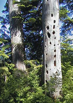
Over the years, the lines have multiplied, and today, the Lolo Pass swath encompasses four large transmission lines in a quarter-mile wide swath. The maze of “closed” dirt maintenance roads below the lines are a perennial draw for target shooters, off-highway vehicles and illegal dumpers. These activities, in turn, have helped turn the linear clear cut into a conduit of invasive species, brining Scotch broom and Himalayan blackberry deep into the Cascades.

The Lolo transmission corridor began on the scale of the Palomar proposal, but has grown over time

The Lolo transmission corridor began on the scale of the Palomar proposal, but has grown over time

The lessons from the Lolo Pass disaster are many, but above all, we’ve learned that a single utility corridor will almost surely grow over time, as utility planners make the case that future lines ought to follow these existing paths of least resistance.

We’ve also learned that the visual and environmental blight that the corridors create is insidious, causing forest managers to discount the value of adjacent, intact forests as somehow tainted — as less worthy of protection or even recreation use. This will surely be the case if the Palomar corridor is approved.

But the story of Lolo Pass is not complete, and the final chapter has yet to be written. Why? Because after just 50 years, the BPA lines are already approaching their design life, and will eventually need to be replaced.

Mount Hood towering above Lolo Pass

Mount Hood towering above Lolo Pass

Under the logic that led to the expansion of this corridor to encompass four parallel transmission lines, it would be easy to assume that the towers and lines will simply be replaced in place, within the existing corridor.

But it will be equally possible to imagine something better for Lolo Pass — relocating the corridor and restoring the pass, and perhaps finding a better, more efficient, less destructive way to transport our energy.

That’s the dream and vision for many who hold the former beauty of Lolo Pass in their memories, and can imaging restoring this corner of the mountain to its fomer splendor. But it’s also a reminder not to repeat the Lolo Pass mistake at Palomar, setting yet another legacy of perpetual, linear destruction in motion.

Boundary Clear Cut – Part One

Looking west across the devastation zone of the Boundary clear cut, where the forest was cut to the wilderness boundary, and across lakes and canyons that stood in the way

Looking west across the devastation zone of the Boundary clear cut, where the forest was cut to the wilderness boundary, and across lakes and canyons that stood in the way

Among the more grotesque of the thousands of clear cuts that sprawl across the Mount Hood National Forest is a nearly 800-acre complex along the west shoulder of Vista Ridge called the Boundary clear cut.

The Boundary cut is remarkable in that it quite literally defines the boundary of the Mount Hood Wilderness for nearly two miles, following an painfully straight line right over the lakes, streams and canyons that stood in its way.

The surgical precision of following such an arbitrary slice across the terrain betrays an astonishing degree of defiance and disregard for the management directive that comes with wilderness designations. The Forest Service planners who sold this timber in the late 1980s and early 90s were clearly carving off whatever could be rationalized under the narrowest interpretation of environmental law — if this was a lawful timber sale, at all. After all, how could cutting a pristine forest to the edge of wilderness have anything but a harmful effect on the adjacent wilderness value?

This GoogleEarth rendering shows the appalling proximity of the Boundary clear cut to Mount Hood's most pristine backcountry

This GoogleEarth rendering shows the appalling proximity of the Boundary clear cut to Mount Hood's most pristine backcountry

The price of this recklessness is substantial. The impact to the forest and watershed are the subject of this two-part article. This part focuses on the broken mindset that led to the devastation, and how it illustrates a fundamental flaw in the U.S. Forest Service mission: that this agency is simultaneously tasked with both protecting and exploiting the resources under its management.

The first flaw in agency mindset that led to this environmental tragedy is the notion that high-elevations forest can be farmed like so many rows of corn. At an elevation of 4,800 feet, the forest here consists almost entirely of slow-growing noble fir. In this zone, “sustainable” logging becomes tree mining, as it will be decades before these forests recover, and centuries before they regain their former stature as a mature ecosystem.

Noble fir are slow growing giants of our high-elevation forests; this fallen noble measures just over a foot in diameter, yet is more than 170 years old

Noble fir are slow growing giants of our high-elevation forests; this fallen noble measures just over a foot in diameter, yet is more than 170 years old

Consider the fallen noble fir pictured at left, found on a nearby hiking trail. Though measuring just over a foot in diameter, this tree is 170 years old. This should come as no surprise, given that nobles live in a zone that sees a winter snowpack of 6-12 feet in winter, and as few as four or five months when snow doesn’t cover the ground.

The second flaw in the Forest Service mindset is the notion that clear cuts and the associated network of logging roads are sustainable by any measure. Neither are, and only now has the agency begun to acknowledge this fundamental reality — more than three decades after the scientific community had debunked both practices as part of sound forest management.

Today, the tangle of deteriorating roads in the Boundary clearcut are gradually being decommissioned at taxpayer expense, to prevent further degradation of water supplies and fish habitat, and to discourage lawless behavior from off-highway thrill-riders.

The third flaw in Forest Service thinking that allowed the Boundary clear cut to happen is the assumption that timber harvest trumps all, and that steering the public away from logging operations somehow mitigates the lost recreational and scenic resources. Indeed, most trails that once threaded through the surrounding Vista Ridge area were dropped from Mount Hood National Forest maps in the 1950s and 60s, in preparation for the coming storm of industrial logging.

We now know that the logging heyday on our Forest Service lands was heavily subsidized by taxpayers, so the sight of piles of rotting logs left scattered across the Boundary clear cut only underscores the reckless, wasteful manner in which our forests were plundered

We now know that the logging heyday on our Forest Service lands was heavily subsidized by taxpayers, so the sight of piles of rotting logs left scattered across the Boundary clear cut only underscores the reckless, wasteful manner in which our forests were plundered

Sadly, this area held some of the most scenic spots found on the mountain, but the value of saw timber here trumped recreation in the Forest Service math, as was the case in much of the Mount Hood National Forest. The good news is that volunteers have recently re-opened one such trail on Vista Ridge (see the Portland Hikers Field Guide trip to Owl Point) There are also opportunities to reconnect some of the old, lost routes destroyed by logging by simply ducking inside the wilderness boundary, where the forests are still pristine and scenic.

It’s tempting to believe that the U.S. Forest Service can be reformed, and actually carry forward the restoration work needed to undo the damage that we see in places like the Boundary Clear Cut. This has been the agency message in recent years, and many well-meaning employees within the agency are working to change its course.

But the reality is that the Forest Service mission forever exposes the agency to the same political and economic winds that left us with the current logging aftermath. Only by moving Mount Hood’s battered lands into National Park Service stewardship can true restoration — and future protection from similar abuses — be truly guaranteed.

Vision Quest Sites

The Lookout Mountain vision quest site is perched high on rocky cliff

The Lookout Mountain vision quest site is perched high on rocky cliff

One of the great thrills of exploring remote mountain tops and rocky outcrops in the Mount Hood backcountry is stumbling upon a long-forgotten vision quest site. These are typically rock pits, large enough for a person — though modern visitors should never enter them, out of respect for both their spiritual and scientific significance.

Archaeologists are still debating the purpose of these pits. The most accepted theory is that these pits were built by Native Americans seeking a vision of their guardian spirit through a combination of physical exertion, deprivation and isolation. Under this theory, Native Americans would have spent several days building these pits, then meditating in them without food or human interaction in order to achieve a spiritual experience.

Other researchers argue that the pits were used as hunting blinds or to store food. But these alternative theories are hard to accept for locations like those around Mount Hood and in the Gorge. Most of this sites are on huge talus slopes or mountain tops, which would have been inconvenient as a food cache or for retrieving killed game.

The Lookout Mountain vision quest pit pictured here has still more mystery surrounding it. While the location of the pit is typical – high on a rocky knoll, overlooking the East Fork valley and Mount Hood – the walls of the pit are stacked higher and narrower than most, possibly due to the steepness of the site.

Looking down the steep slopes of Lookout Mountain from the vision quest pit

Looking down the steep slopes of Lookout Mountain from the vision quest pit

But even more perplexing are the worn traces of mortar between some of the stones (seen in the wall of the pit, toward the bottom of the second image). One possibility is that the mortar was an early attempt to preserve the site, given it’s fragile and exposed state. But who would have hauled both mortar and water to this site?

Perhaps early forest rangers who once manned a Forest Service guard station at High Prairie, a short distance away. The guard station was abandoned half a century ago, so this timing would be consistent with other, early 20th Century effort to “restore” Native American structures. This was famously done at several spots in Pueblo country, but might have happened here, too.

Whatever the answer, the Lookout Mountain vision quest site is among the most inspiring in the area, and it’s easy to imagine Native Americans seeking out spots like this for a spiritual journey. But it’s also easy to imagine sites like this being lost forever, for lack of a management imperative by the U.S. Forest Service to actively protect these places.

This kind of fragile resource is also among the best arguments for the Mount Hood National Park Campaign, since the Park Service has a long and proven track record of this sort of resource protection. In contrast, the Forest Service has aggressively logged much of the terrain around this site, oblivious to special places like this. So for now, obscurity is the best friend of these resources, until better stewardship finally comes to Mount Hood.

Reid Glacier

Soft evening light on Reid Glacier and Illumination Rock

Soft evening light on Reid Glacier and Illumination Rock

Reid Glacier, on Mount Hood’s rugged west flank, is one of the most interesting of the mountain’s 12 glaciers. This tumbling body of ice flows between the towering walls of Yocum Ridge and Hawkins cliffs, with the tall spire of Illumination Rock soaring above its deep crevasses. Oddly, Reid Glacier is the source of the Sandy River, whereas the Sandy Glacier gives birth to the Muddy Fork – some confusion on the part of early cartographers, perhaps? And while the Reid is among the most visible of Hood’s glaciers from Portland, few hikers actually make the long climb to the high meadows of Yocum Ridge for a close-up view of the glacier.

USGS view of the Reid Glacier

USGS view of the Reid Glacier

Reid Glacier is also unique as the only one of Mount Hood’s glaciers that wasn’t named for a local pioneer, or simply given a descriptive name. Instead, this secluded river of ice was named to honor Harry Fielding Reid, the eminent geophysicist who is considered to be the father of modern thinking on faults and tectonic forces.

Harry Fielding Reid (1859-1944)

Harry Fielding Reid (1859-1944)

Reid never actually visited the glacier, though he was an avid mountaineer and did study the White River Glacier extensively. The Mazamas honored Reid by naming the glacier for him at a campfire ceremony held on the mountain on July 16, 1901.

Harry Fielding Reid’s research took him around the world, and his groundbreaking work at Glacier Bay in Alaska was recognized by the naming of yet another Reid Glacier for the scientist. The Alaska glacier by the same name is much larger, of course, and is a tidewater glacier flowing into the Reid Inlet in Glacier Bay. Thus, the smaller Reid Glacier on Mount Hood lives in the shadow of its larger sibling in Alaska, with few biographies of Harry Reid making mention of the more diminutive Mount Hood namesake.

Today, the Seismological Society of America awards its top honor, the Harry Field Reid Medal, for outstanding contributions to the fields of seismology and earthquake engineering.

Just Two Dead Trees

The two snags and Mount Hood in September 2008

The two snags and Mount Hood in September 2008

For many years, I’ve stopped at a favorite vantage point along Dufur Mill Road to photograph the massive east face of Mount Hood, framed by a trio of big ponderosa pines. In the beginning, two were living, and the third was a bleached, dead snag that stood between them. Then another died just a few years ago (the tree on the left in the photo), creating a new snag.

Each year, the two snags in this trio have become more weathered, with the remaining bits bark dropping from the silver wood of the older snag, and a few more branches dropping from the younger skeleton. I watched this evolving scene with interest, but also took for granted. I was thus surprised — and saddened — to discover that these two, old sentinels had been cut down sometime this fall.

They were left simply lying on the ground, in the ravine far below the road, and it’s unclear why they were cut. When I was there, a pair of grizzled men were cutting firewood along the road, a sanctioned activity permitted by the Forest Service. Yet, these two great snags were far enough below the road to represent a real chore to recover as firewood. Indeed, the men were working the uphill side of the road, where logs could simply be rolled down to their truck. More to the point, there is plenty of downed timber for woodcutting in the area, so it was unnecessary to cut any snags, much less these two giants.

But somebody felled them, and this is just one price of the casual culture of tree cutting that reduces every standing tree on U.S. Forest Service land, dead or alive, to a dollar value in board feed of lumber, or cords of firewood or cardboard boxes. What a waste.

Two more fortunate snags live on as wildlife trees near Lost Lake

Two more fortunate snags live on as wildlife trees near Lost Lake

So this story remains a puzzle to me. I doubt many noticed these two old snags, but they surely added to the scene in ways both aesthetic — they were majestic and photogenic — and functional, since big snags are an important part of a diverse wildlife habitat in our forests. I’d often seen crows, and even a couple of hawks, sitting in these old snags over the years, and there were probably dozens of other creatures that lived in these old skeletons, or relied on them for survival.

They might have lasted for decades as bleached monuments, too. Mount Hood is dotted with century-old snags left from fires that occurred in the early 1900s, after all, since big trees like these have remarkable resistance to the elements as snags. But this pair will only remain standing in my imagination, and I’m thankful that I captured them in a few photographs over the years as a reminder of their beauty and value.