Remembering Sarah Bishop

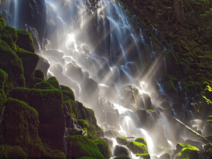
Morning sunbeams catching the mist at Ramona Falls

August was hot and dry in Oregon in 2014, and we were on the way to the hottest summer on record at the time. The combined heat and drought led to a predictable wave of wildfires that year, with a full 31 days of Level 5 fire conditions that surpassed all previous records by a full week. 

No wonder, then, that Portlanders flocked to the mountains seeking cool respite from the heat. Among the most popular escapes was Ramona Falls, among the most visited waterfalls in Oregon and located just inside the Mount Hood Wilderness. The lacy, intricate beauty that makes the falls famous to photographers also creates a unique microclimate, cooling the air at the shady base of the falls by 15 degrees or more. On busy summer days, hundreds hike the rambling 7-mile loop trail and bask in the cooling mist and absorb the beauty of this idyllic, family-friendly place.
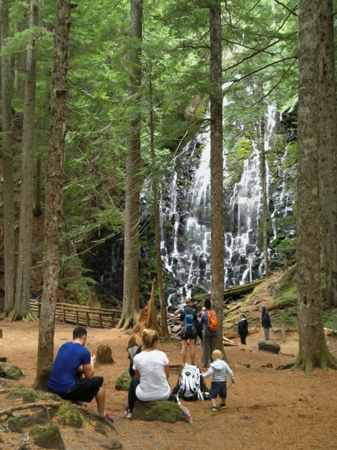
With its gentle grade and abundant scenery, the Ramona Falls loop has been a favorite family hike in the Mount Hood Wilderness for generations

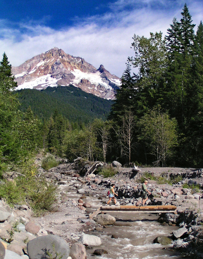
Such was the scene that year on Tuesday, August 12. Hordes of hikers had set off from the crowded trailhead that day, only to be surprised by a sudden, intense thunderstorm that gathered over Mount Hood. As they returned to the seasonal footbridge over the Sandy River, just a mile from the trailhead, they discovered a suddenly raging torrent nearly touching the bridge. 

Scores were able to cross the bridge safely, but hikers Nathan Johnson and Brent Ludwig met tragedy that day. They were taking up the rear with their group and still on the bridge when a flood surge dislodged a logjam just upstream, unleashing a sudden wave 5-8 feet deep that overtook the bridge. Both men were swept into the river. Johnson somehow survived the ordeal, but Ludwig perished in the torrent. 

Brent Ludwig had come to Oregon on a visit from his hometown of New Lenox, Illinois, but he would not return. His body was later recovered by searchers more than a mile downstream.
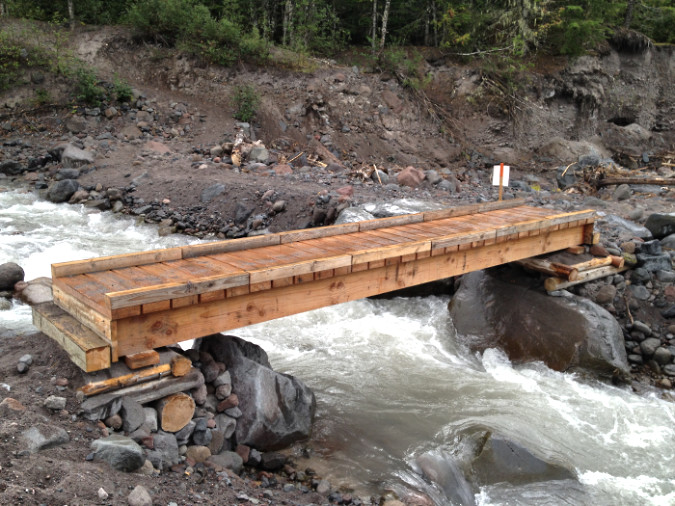
The Forest Service had just installed this seasonal bridge over the Sandy River on the Ramona Falls trail in 2013. One year later it would wash out in the tragic incident that took the life of Brent Ludwig. It has not been replaced since

Witnesses described a chaotic scene after the bridge washed out, with rescue workers ferrying hikers stranded on the north side of a raging Sandy River for several hours using a pair of tethered rafts. In all, 23 hikers were rescued that day. Meanwhile, other rescuers searched the river banks below for victims, eventually locating Ludwig.

The 2014 rescue was hampered by the relative remoteness of the washed-out bridge. Hikers who had made it across before the wash-out still had to walk another mile back to the trailhead, then drive several miles toward Highway 26 to reach the nearest cell coverage and report the dire situation.
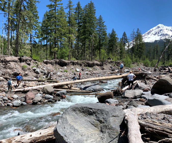
Hikers chose this precarious log to cross the Sandy River on the Ramona Falls trail in 2022… (TKO)
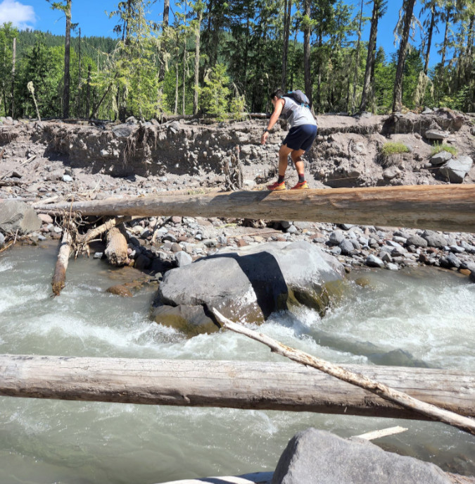
…and though it was the best available crossing, it was extremely dangerous, with hikers balancing ten feet above rushing glacial runoff and the large boulders that flank the stream (TKO)

Soon after the 2014 incident, the estate of Brent Ludwig filed suit against the Forest Service seeking damages for negligence. After many years in the courts, the case was finally decided in favor of the Forest Service in October 2021. In the meantime, the seasonal bridge on this heavily traveled trail had not been replaced, with the Forest Service pointing to the pending litigation as cause to simply leave Ramona Falls visitors to their own devices in crossing the Sandy River.

Though the court case is long settled, the Sandy River crossing still has no bridge, putting the thousands of hikers who head into the Mount Hood Wilderness for Ramona Falls each year needlessly at risk. 
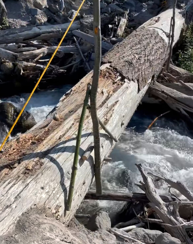
Though understandable, hikers often add makeshift rigging to log crossings, intending to improve safety – though trusting these rickety solutions can be riskier than the logs themselves. This rigged handline was later removed by volunteer trail crews in July 2024 at the request of the Forest Service (TKO)
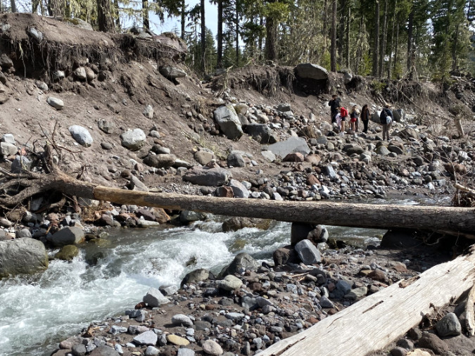
The otherwise family-friendly Ramona Falls trail puts hundreds of kids at risk each year when they must contend with the Sandy River crossing (Matt Bromley)
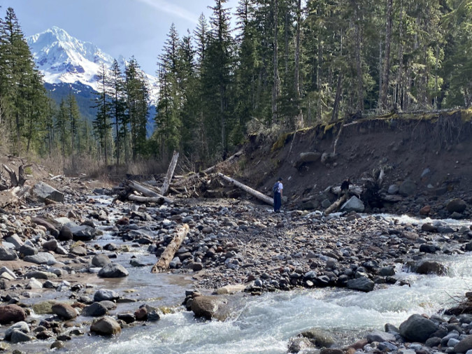
Hikers in March of this year searching for a Sandy River crossing on the Ramona Falls trail. Each winter the river reshapes the channel and shifts log piles (Matt Bromley)

Other Forest Service explanations for continuing to leave this heavily traveled crossing bridgeless have included legal restrictions from its wilderness status and the idea that leaving the crossing in its current state will somehow self-manage the overcrowding that exists on this popular trail. Still another argument is that danger involved in making the crossing is somehow part of the “wilderness experience”. 

None of these arguments holds up. First, the Wilderness Act clearly allows federal lands agencies wide discretion to construct footbridges where needed to “protect the health and safety of persons within the area”. There are many examples to point to, but most obvious are the two wilderness bridges over Ramona Creek, itself, on this very hiking loop. Both are modest stream crossings that present exponentially less risk to public health and safety than the Sandy River crossing.
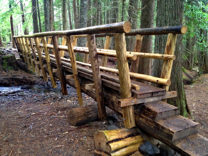
This impressive new bridge over Ramona Creek was built inside the Mount Hood Wilderness boundary in 2012, just a half-mile beyond the bridgeless Sandy River crossing

Predictably, the lack of a safe crossing at the Sandy River since the 2014 incident has also done little to deter hikers from showing up here. Instead, the crowds have grown, thanks to both social media, the growing popularity of hiking and of the spectacle of Ramona Falls, itself. There are many proven tools for managing crowded trails in our wilderness areas. Making the experience more dangerous should not be among them, nor should forcing visitors to take undue risks be considered part of the “wilderness experience”.
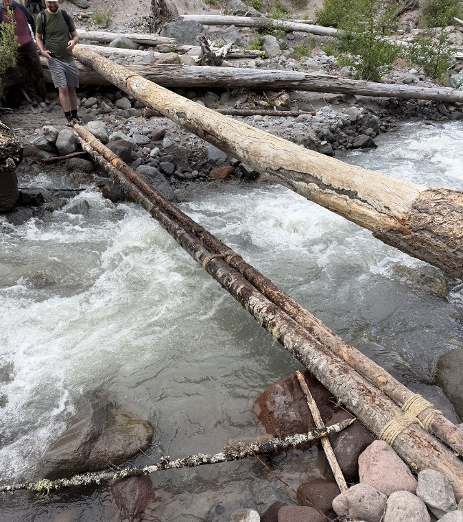
Impromptu Sandy River crossing installed by hikers, as seen in early June 2026… (Kevin Lu)
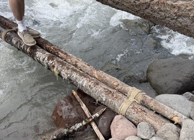
….this effort involved lashing two thin poles together (Kevin Lu)

As it proved in 2014, the Sandy River can be unruly – like all of Mount Hood’s glacial runoff streams. They are prone to flash floods year-round and have become even more erratic as the mountain’s glaciers and winter snowpack recede with global climate change. This means a nearly constant re-arranging of the river channels each year, with hikers searching for fallen logs to inch their way across the streams where trails cross them. 

While challenging for any hiker, it’s an unacceptable situation at the Sandy River crossing on the Ramona Falls trail, where young children, less able-bodied or experienced hikers and small pets make up such a large share of the visitors.

It’s long overdue to fix this crossing.

Ten Years Earlier…

The summer of 2004 was much different than 2014 would turn out to be for Oregon. The west side of the state experienced unseasonably cool, wet weather, with rare summer snows on Mount Hood as low as 6,000 feet. The last week of August that year was especially stormy, with the west slopes of the mountain receiving as much as 10 inches of rain from August 21-25. This, at a time of year when thousands of hikers from around the world come to Mount Hood to experience the iconic 42-mile Timberline Trail.  

One of these hikers was Portlander Sarah Nicole Bishop, a 27-year-old backpacker who had started her clockwise trip around the mountain at the Ramona Falls trailhead. Sarah set off across the Sandy River footbridge and past Ramona Falls on the first day of a planned 4-day loop around the mountain. She was a seasoned backpacker and well-prepared for adverse conditions.
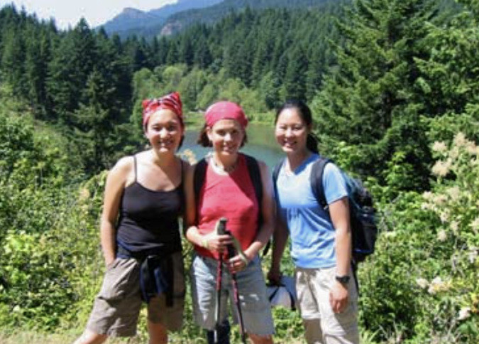
Sarah (center) and friends in 2004

By all accounts, Sarah Bishop was a force of nature just beginning to make her mark in the world. In her young life, she had worked at youth camps, been a residential counselor, social work case manager and had served as a crisis intervention specialist with Harry’s Mother, a Portland youth shelter. 

She was politically active, creating and managing 100 Percent Portland, a democracy project to promote voter registration and civic duty. Sarah was outspoken for workers’ rights and an active member of the International Workers of the World (commonly known as ‘Wobblies.’)  Her future was very bright.

On the fourth and final day of her wet circuit around the mountain, Sarah passed Timberline Lodge, stopping for hot chocolate. before pushing ahead to the Zigzag River crossing, climbing to Paradise Park. From there, she had only the steep descent to the Sandy River and two river crossings before reaching her starting point at the Ramona Falls trailhead. Sarah had safely managed several crossings over rain-swollen glacial streams on her circuit, and hikers who encountered her as she made her way back to the Ramona Falls trailhead reported that she was in good spirits and enjoying her hike. 
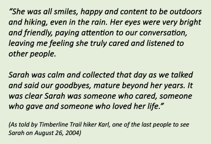
Read moving reflections here from all four hikers who encountered Sarah on August 26, 2004

Sarah had started her hike on Saturday afternoon, August 21, crossing the Ramona Falls footbridge over the Sandy River when conditions were still dry.  By that night, the weather changed and the Sandy River had flooded its banks and washed out the bridge. Worse, by the time she was returning to the trailhead on that final day of her hike, she would also have to contend with the bridgeless upper crossing of the Sandy River along the Timberline Trail. It was here that Sarah’s life was cut tragically short.
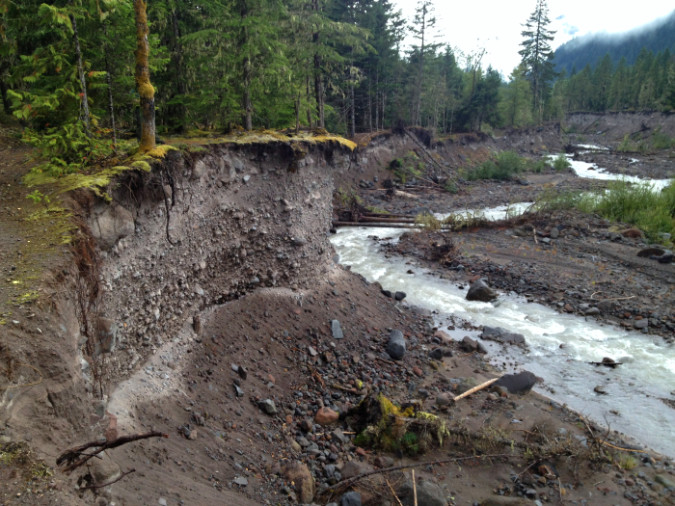
The Sandy River channel is wide and ever-changing. Much of the river is lined with steep bluffs where the stream has continually flooded and undercut its banks. This view is near the junction of the Pacific Crest and Ramona Falls trails (Bruce Bishop)

When Sarah did not return from her hike as scheduled on Tuesday, August 24, her family became concerned, but they were informed that a search and rescue could not be authorized until it was verified that Sarah was on the mountain. That kicked off a search for her truck the next day by her father Bruce and Sarah’s partner Joseph at the most likely trailheads, beginning at Cloud Cap and working clockwise. It was raining and dark when they finally found Sarah’s car at the Ramona Falls trailhead at 10 PM that evening – the last vehicle in the lot. They reported her missing to the Clackamas County Sheriff that night.

The formal search and rescue effort began the next morning on Thursday, August 26, with teams searching the 12-mile section of the Timberline Trail between the Ramona Falls trailhead and Timberline Lodge where Sarah was last seen. At around 2 PM that afternoon Sarah’s body was found along the Sandy River, about a half-mile below the upper crossing on the Timberline Trail, and just three miles from her truck.
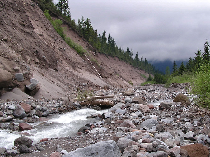
This view shows the high, unstable bluffs below the Timberline Trail ford where Sarah may have fallen while scouting for a safe crossing (Bruce Bishop)

Sarah still had the waistbelt on her pack buckled and her boots on when searchers found her, so her family believes she had been scouting for a spot to cross the unseasonably high Sandy River. While searching for a place to cross, she may have slipped into the river from the steep bluffs that line this section of the stream, possibly becoming injured in the fall. 

If you have hiked into the Mount Hood Wilderness in the decades since, you likely know Sarah’s story from the work her family has done to honor her memory and to educate hikers on the dangers of glacial stream crossings. Near each of five wilderness trailheads — Ramona Falls, Top Spur, Cloud Cap, White River and Timberline West – Sarah’s story is shared on interpretive trail signs that warn of the danger and provide tips for safe stream fords. 
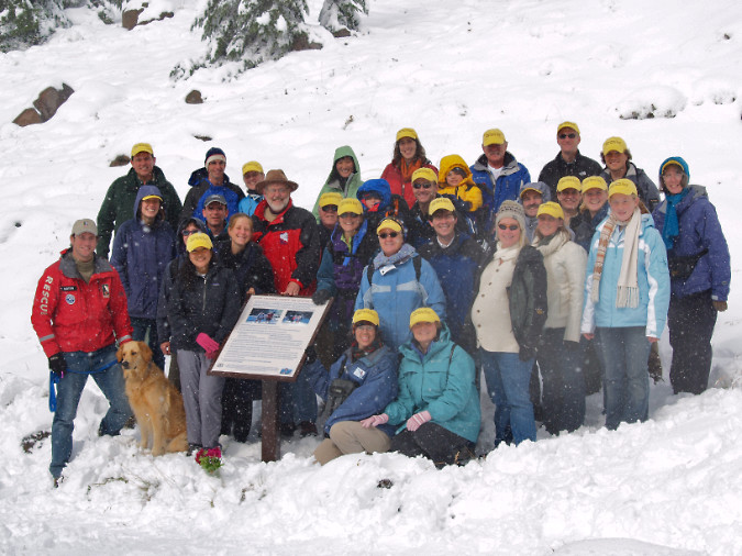
An early snowstorm greeted volunteers installing the sign west of Timberline Lodge on September 29, 2007 (Bruce Bishop)
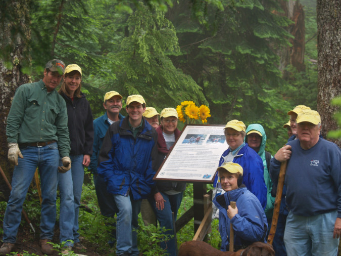
Volunteers installing the Top Spur sign on August 1, 2008 (Bruce Bishop)
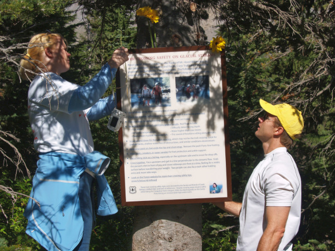
Sign installation near the White River wilderness boundary on September 27, 2009 (Bruce Bishop)

Sarah’s family worked with the Forest Service to design, build and install these signs, though they were completely privately funded. All five signs are still in place today. Sarah’s family and friends regularly visit and maintain each sign, an effort that continues to be privately funded as a labor of love by those who loved Sarah.

_________________

The seasonal Sandy River bridge on the Ramona Falls Trail was replaced by the Forest Service after Sarah died in 2004, and was installed each summer until the 2014 bridge tragedy. Sarah’s family and friends crossed the bridge in 2005 and hiked another two miles upstream to the spot where Sarah was found to celebrate her memory. Sarah’s parents, Bruce and Judy Bishop, were joined by her 83-year-old grandmother and more than two dozen others on that memorable day. The yellow caps in the photos that follow were made for the occasion, and read “Remembering Sarah Bishop”.
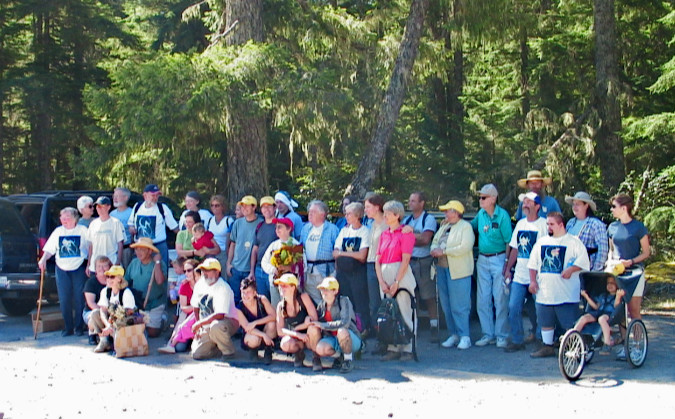
Sarahs family and friends gathered on August 27, 2005 to hike a section of the Ramona Falls loop in remembrance of her life (Bruce Bishop)
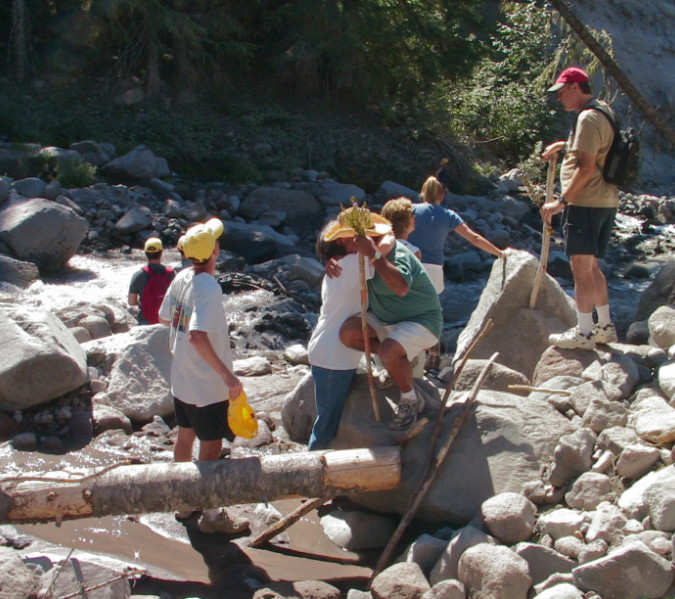
The 2005 remembrance hike ended at the upper Sandy River crossing where Sarah had lost her life the year before. Soon after, Bruce and Judy Bishop resolved to pay tribute to Sarah’s memory in service to other hikers (Bruce Bishop)

Over the next two years, Bruce and Judy worked to gain approval of the plan, and by the summer of 2009 all five signs had been installed by Sarah’s family and friends, with Forest Service staff support on hand.
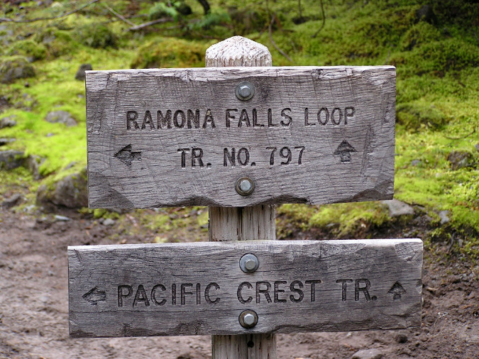
Ramona Falls Loop sign (Bruce Bishop)

Sadly, many of those who gave tribute to Sarah on that memorable day in 2005 would not be able to repeat the trip today. The bridgeless Sandy River crossing on the Ramona Falls trail is an untenable barrier for so many. While it’s a frustration for many who would simply like to visit the falls, it’s a more profound disappointment to those who would pay tribute to Sarah’s memory near the place where she died.

It’s time to fix this crossing.

_________________

Last winter, I had the privilege of meeting Bruce and learning Sarah’s story. We’ve since met several times to figure out how to get the Forest Service unstuck on this long-overdue need at  Ramona Falls – and at other increasingly dangerous glacial stream crossings around the mountain.  The following is a Q&A with Bruce on the subject:

WyEast: Bruce, when you picture the bridge finally being restored at the Ramona Falls trailhead, what would that mean to you? Who are the folks that come to mind that you’d like to see walking over it, once again?

Bruce: Our family first hiked to Ramona Falls with church families, probably in 1984 when Sarah was 7 years old.  Over 20 years later, our memorial hike included a group with a wide range of ages and abilities.  Such groups today can’t visit Ramona Falls safely.  While the hike to the river is enjoyable, continuing to the falls makes the hike spectacular.  I’d like families with young children and elderly great grandparents like us to be able to see Ramona Falls.

WyEast: By all accounts, Sarah was a force of nature, and loved being in nature. Wilderness trails seem to be where she recharged and found the energy to have an impact in her daily life. Can you tell us more about what it meant to her to be out in nature?

Bruce: In her youth, Sarah went to church camp every summer outside Molalla and became a camp staffer and director there through college.  She hiked around Mt. Rainier with a group of incoming students for her orientation to college.  It rained, and she was the only one to have packed rain gear for the hike.  After college, she hiked extensively in the Gorge and on Mount Hood.  And in early August 2004, she and a friend hiked to the top of Pilot Rock in the Rogue River Valley.  A photo from that predawn hike was used for the woodcut in the poster below.
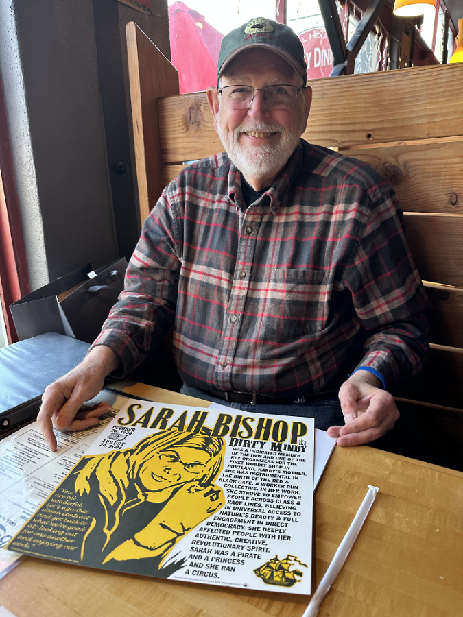
Bruce and Judy Bishop have worked for 22 years to honor Sarahs life and make something good from the tragedy of her death

WyEast: In 2005 you led your family and many of Sarah’s friends on a remembrance hike to the spot where she was found. How did that day lead to the wilderness sign project?

Bruce: 
 Many of those at the memorial hike in 2005 spent that weekend at our church camp, a place that Sarah loved.  We caravanned from the camp to the Ramona Falls trailhead for the group hike, passing the studio for Mt. Hood ceramists Dave and Suzanne Enna.  After the hike, we stopped at their studio sale, and several family members purchased pieces of Enna art.  As a youth, Dave had attended our church in downtown Portland and created the communion ware for the church, as well as Sarah’s urn.  

Following the memorial hike and inspired by Dave Enna’s ceramics, Judy and I agreed that signs promoting hiker safety would be a fitting memorial for Sarah, and we contacted Forest Service staff to turn the idea into reality.

WyEast: We’ve talked about the Ramona Falls trail being special because of both its beauty, but also its accessibility to the average person – not just avid hikers. Is that part of your motivation for finally getting the Sandy River crossing fixed? Is it something Sarah would have been passionate about?

Bruce: Sarah had a diverse array of “passions.”  Her friends who inscribed her memorial poster described her well when they wrote, “[She] was a dedicated member of the IWW and one of the key organizers for the first Wobbly shop in Portland, Harry’s Mother.  She was instrumental in the birth of the Red and Black Cafe, a worker run collective.  In her work she strove to empower people across class and race lines, believing in universal access to nature’s beauty and full engagement in direct democracy.  She deeply affected people with her authentic, creative, revolutionary spirit.  Sarah was a pirate and a princess and she ran a circus.”

_________________

So, how would this happen? If the question is to simply restore the seasonal Sandy River footbridge on the Ramona Falls trail, that’s very easy. The Forest Service simply needs to say yes. It really is that simple, and it’s long overdue. 

In reality, it won’t be that simple. Yet, I’m confident that Bruce and Judy Bishop, and all who loved Sarah, will keep at this and persuade the Forest Service to finally do what’s right for the many people who come to the Mount Hood Wilderness to spend a day in nature and marvel at the beauty of Ramona Falls. I like their odds, as they have Sarah’s memory on their side.
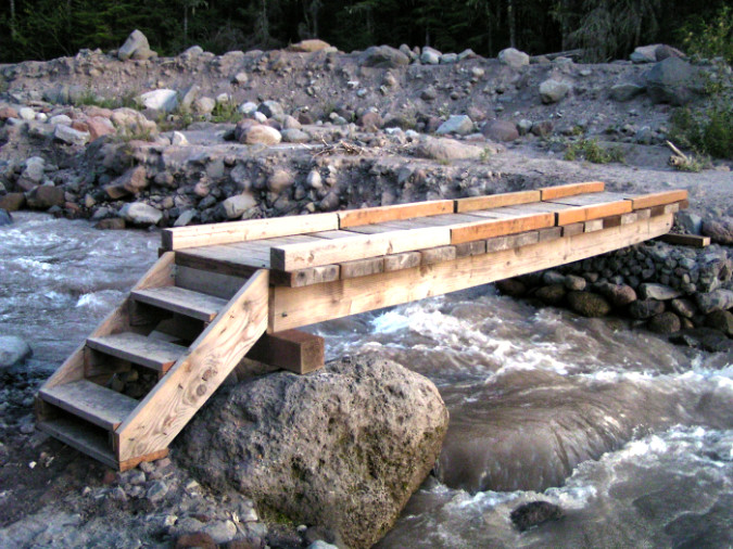
The seasonal Sandy River footbridge at the Ramona Falls trailhead on August 20, 2004. Sarah would cross this bridge on the first day of her hike around the mountain. The next morning, it was gone in the stormwaters that also took Sarahs life.

_________________

Postscript

After my first meeting with Bruce last year, I dug into my photo archives and folders to prepare this article. I remembered seeing the new trailhead signs for the first time at the Top Spur trailhead, and discovered I had taken photos of the new sign back in September 2008 — including this detailed view of Sarah:
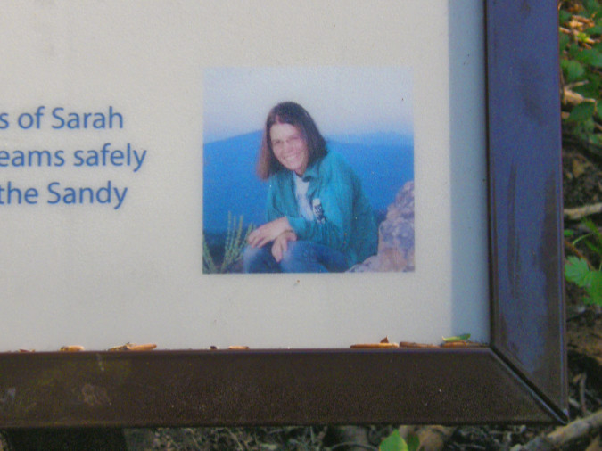
Each of the trailhead signs include Sarahs image and memory as a reminder of the real dangers that crossing glacial streams present

At the time, I remember being pleasantly surprised that the Forest Service had even agreed to the signs being posted – no small task! I also remembered the tragic incident, and after searching through my archives, I found I had saved this Oregonian article back in 2004 in a folder dedicated to the stream crossing situation on Mount Hood. Clearly, the problem is not new, though it has certainly worsened in the intervening years.

As I looked back into my photo archives, I was startled to discover that I had walked the Sandy River and Paradise Park sections of the Timberline Trail the same week Sarah had. These photos of the Sandy River from the Ramona Falls trail are from August 20, 2004, the day before Sarah would walk this trail to begin her hike:
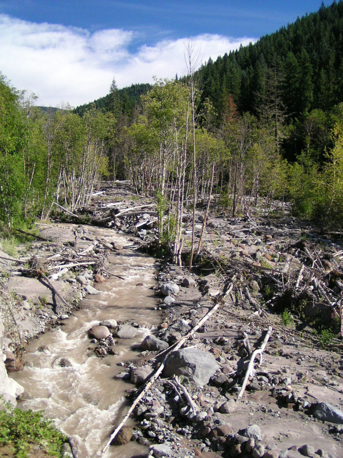
The ravaged Sandy River floodway along the Ramona Falls trail on August 20, 2004. The next day, the river would swell once again from the storm that took Sarah Bishops life

Hikers crossing the Sandy River bridge to Ramona Falls on August 20, 2004. Sarah Bishop would cross this bridge the following day to begin her 4-day trip. Within a day of her crossing, the bridge would wash out in the storm that took Sarahs life

One week later, I would hike the Timberline Trail west from Timberline Lodge to Paradise Park, the section where Sarah was last seen just days prior. My motivation for going there on that day was scenery. There had been a break in the weather, with fresh snow on the mountain from the same storm that had made Sarah’s trip so tragic. These are scenes from Paradise Park on that day, August 28, 2004:
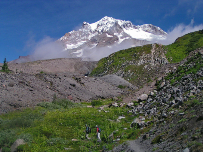
The powerful storm that swept over Mount Hood while Sarah Bishop hiked the Timberline Trail cleared abruptly, leaving a rare dusting of August snow on the mountain. This scene was captured at Paradise Park on August 28, 2004, just four days after Sarah hiked through
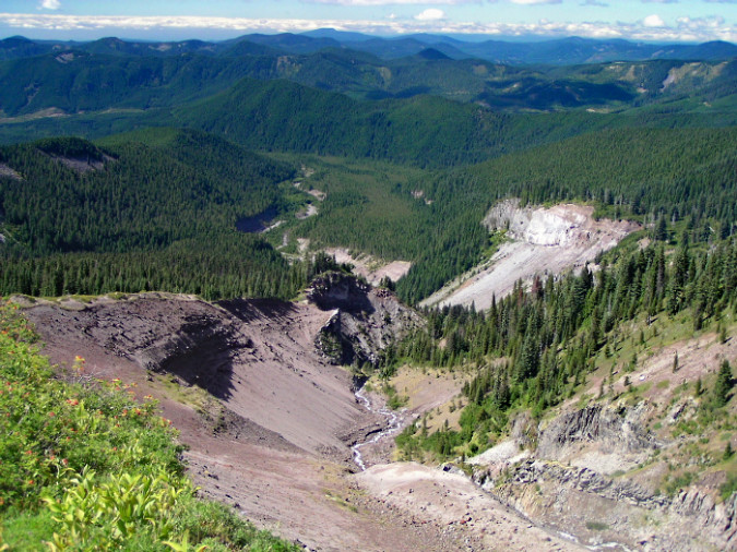
Looking down the Sandy River canyon from Paradise Park toward the Timberline Trail crossing and Ramona Falls area, far below, on August 28, 2004

Though I was likely thinking of Sarah on this second trip — as I had archived the news coverage account the day before — rediscovering these photos and meeting her father after 22 years made Sarah’s story all the more real and impactful. The real gift in writing this article has been getting to know Bruce. Through his eyes and memories, I can begin to appreciate the amazing, inspired person behind that familiar face on the trailhead signs, and why she lives on so vividly in the hearts of so many.
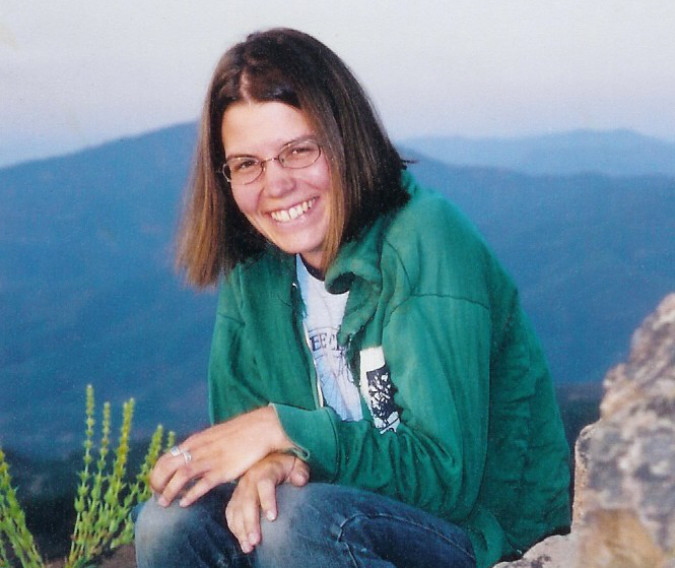
Sarah Bishop hiking at Pilot Rock, Oregon in August 2004, just a few days before her tragic death on Mount Hood

Sarah’s tragedy raises the larger question about the many other dangerous glacial outflow crossings on the mountain today. While her death might not have been preventable, the lack of safe crossings on the Timberline Trail today remains unacceptable. Watch for a follow-up article with a modest proposal to finally move forward on this front.
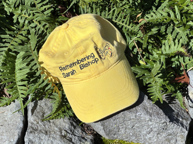
Remembering Sarah…

In the meantime, we can all take lessons to live by from Sarah Bishop: connect with the world around us, take the time to care and make the time to act on our convictions. Be brave and step up to uncomfortable challenges. Reach out and help. Make a difference where we can.

Sarah continues to inspire those who knew and loved her because of that undefeatable spirit. We should thank her for that – and remember her.

(updated June 28 to expand details of the search for Sarah in August 2004)

_________________

Tom Kloster | June 2026

A Tale of Two Ranger Stations: Part Two

Forest Service guard on duty at the Upper Sandy station in the 1930s

Forest Service guard on duty at the Upper Sandy station in the 1930s

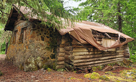
Mount Hood National Forest (MHNF) recently completed a $1.7 million overhaul of its Zigzag Ranger Station, the de-facto visitor gateway to Mount Hood. Yet the historic Upper Sandy Guard Station, a National Historic Landmark located just a few miles away, near popular Ramona Falls, has fallen into a serious state of disrepair.

Basic repairs needed to save the historic guard station would cost a fraction of what the Zigzag project cost, so why has the Upper Sandy structure been so badly neglected? Part two of this article looks at some of the reasons behind this frustrating paradox, and some possible solutions.

1930s: Guarding Portland’s Watershed

The Upper Sandy Guard Station was built along the newly constructed Timberline Trail in the 1930s. Its purpose was to house a Forest Service guard, stationed there to patrol the Bull Run Reserve — Portland’s water supply — where it abutted the new around-the-mountain recreation trail. At the time, the Bull Run boundary was much more expansive, touching the northwest corner of Mount Hood.

Guard stations were important landmarks for early forest travelers

Guard stations were important landmarks for early forest travelers

The Upper Sandy Guard Station was one of dozens dotting the Mount Hood National Forest in the 1930s, all built to protect forest resources from timber poaching and other illegal activities. Several of the old guard stations could only be reached by trail, and the roads that did reach them were primitive.

The guard stations also served as a supply and communications base for the scores of fire lookouts built throughout the forest, often connected by phone lines that can still be found along less-traveled trails today. As recreation use along forest trails grew in the 1920s and 30s, guard stations also provided a comforting presence for hikers exploring the largely undeveloped national forests of the time.

Today the Upper Sandy Guard Station is slowly fading away (Cheryl Hill © 2013)

Today the Upper Sandy Guard Station is slowly fading away (Cheryl Hill © 2013)

View of the handsome stonework that makes the guard station unique  (Cheryl Hill © 2013)

View of the handsome stonework that makes the guard station unique (Cheryl Hill © 2013)

The industrial logging era that began in the national forests by the late 1940s soon made guard stations obsolete: as thousands of miles of logging roads were bulldozed into remote areas once only accessible by trail, forest administrative operations were consolidated into a few ranger district office, and most of the old guard stations were shuttered.

The unused buildings soon fell into disrepair, and most of these structures were dismantled or burned by the Forest Service in the late 1950s and 1960s (along with most fire lookouts, also deemed obsolete as aerial fire surveillance began).

When the Bull Run Division boundary was changed in 1977, the Upper Sandy Guard Station was left miles away from the resource it was built to defend. One year later, the Mount Hood Wilderness was expanded to encompass the building, sealing its fate as a relic in the eyes of the Forest Service.

In recent years the roof on the Upper Sandy Guard Station has partially collapsed, despite crude repairs by volunteers  (Cheryl Hill © 2013)

In recent years the roof on the Upper Sandy Guard Station has partially collapsed, despite crude repairs by volunteers (Cheryl Hill © 2013)

The few guard stations that did survive decades of neglect intact now represent a precious glimpse into an earlier, idyllic time in the national forests. They now stand as historical gems, worthy of special protection.

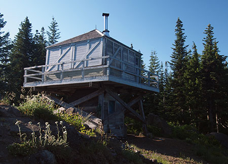
Some of these structures have already been preserved, like the Clackamas Lake Guard Station near Timothy Lake, while others have been allowed to fade away nearly to oblivion, like the Upper Sandy Guard Station. A few that survived intentional destruction by the Forest Service have nonetheless been lost to neglect, like the former High Prairie Guard Station on Lookout Mountain, a building that was partially standing as recently as the early 1980s.

Ruins of the High Prairie Guard Station in 1983 before it faded into the meadow

Ruins of the High Prairie Guard Station in 1983 before it faded into the meadow

In September 2009, the National Park Service finally added the Upper Sandy Guard Station to the U.S. National Register of Historic Places, a move that many considered to be the building’s salvation. After all, the Forest Service had actively sought the historic designation and local Forest Service historians had strongly advocated for preservation of the building. Thus, the disappointment in the years since, as even the most rudimentary Forest Service efforts to stabilize the building failed to materialize.

Instead, the Forest Service posted the following notice on the building, “warning” hikers that entering the structure presented a dire hantavirus risk from resident deer mice. The notice actually admits that only one (!) documented hantavirus case has ever been documented in Oregon, and that “there is no evidence that the disease is carried by rodents who call this building home.”

Of course, deer mice surely inhabit every other historic wilderness structure in the wilderness areas around Mount Hood, yet no health warnings are posted on the shelters at McNeil Point, Cairn Basin, Cooper Spur and Elk Meadows or the lookout at Devils Peak, where hikers routinely camp inside (and maintain) the structures. So, the point of this notice on the Upper Sandy structure seems to be to frighten visitors from entering — or perhaps maintaining — the structure.

The Forest Service has posted this "health warning" on the structure to discourage visitors  (Cheryl Hill © 2013)

The Forest Service has posted this “health warning” on the structure to discourage visitors (Cheryl Hill © 2013)

The Upper Sandy Guard Station was added to the elite National Register partly because of its historic role as a base for patrolling the Bull Run Reserve, but mostly as the only surviving design of its kind in the Pacific Northwest. The building has a unique, rustic architecture that embodies the New Deal programs that put skilled craftsmen and laborers to work on our public lands as part of the 1930s economic recovery.

Most notable is the massive stone masonry end wall that has probably helped stabilize the structure as the log walls continue to deteriorate. Its unique design combining rubble stone and wood walls make it one of a kind among the more than 700 forest administrative buildings constructed during the New Deal era.

The building was constructed by a seven-man crew in the summer of 1935 with a budget of $958.88, including materials: two carpenters worked at the rate of $7/day and two laborers assisted at the more modest rate of $4/day. The guard station was completed on September 28, 1935.

Today the building suffers serious holes roof and will almost certainly be lost in a few years without an immediate effort to stabilize the structure, or better yet, all of the work needed to fully restore this building. So, why is the Forest Service allowing this to happen? Blame it on the Wilderness..?

Does the Upper Sandy Guard Station have a future? (Cheryl Hill © 2013)

Does the Upper Sandy Guard Station have a future? (Cheryl Hill © 2013)

For a time following the 2009 National Historic Register listing, the old guard station had an advocate in the Northwest Forest Conservancy (NFC), a local non-profit focused on preserving several historic forest structures in the Mount Hood National Forest. Today, the NFC appears to be inactive, and there are no advocates pressing for the building to be rescued.

Prior to the 2009 Historic Register listing, the NFC formally proposed managing a restored building. Today, several historic structures in the Tilly Jane area (on the northeast side of Mount Hood) are managed in this way by the Oregon Nordic Club under an agreement with the Forest Service.

Under such an arrangement, the Upper Sandy Guard Station could have been put it to year-round use as part of its restoration. The NFC envisioned volunteers to staff the guard station during the summer, as the proximity to both the trailhead and nearby Ramona Falls makes the guard station a natural base for both volunteers and visitors. Sadly, this plan never moved forward.

The Upper Sandy Guard Station was prominent on this 1939 map of the Timberline Trail, along with the log shelter that once stood at Ramona Falls

The Upper Sandy Guard Station was prominent on this 1939 map of the Timberline Trail

Despite the agency effort to list the building on the National Register, friends of the old guard station within the Forest Service are surprisingly scarce, and mostly limited to historic resource specialists whose workloads spans multiple forests.

Unfortunately, the Upper Sandy Guard Station carries a still heavier burden than simply a lack of interest from the Forest Service: since a 1978 expansion, the guard station has located within the Mount Hood Wilderness, which by some interpretations means it should be allowed to fade into the oblivion in deference to protecting the untrammeled nature of wilderness.

Is it really that simple? Not at all, but internal Forest Service e-mails on the fate of the historic structure show Mount Hood National Forest recreation planners quickly turning to this argument in defending the decision to let the Upper Sandy Guard Station fall further into disrepair. The same e-mail exchanges also reveal internal rivalries between recreation and historic resource staff that have more to do with protecting recreation budgets than adhering to strict interpretations of the Wilderness Act.

Letting this historic building deteriorate is also at odds with the 1999 Mount Hood National Forest facilities master plan, a forest-wide effort to address surplus Forest Service building. The facilities master plan identified the Upper Sandy Guard Station as surplus building, but set no policy for decommissioning or disposing of the structure — one of the core purposes of the facilities plan.

The Devils Peak lookout has apparently found favor with the Forest Service, despite its location inside the Salmon-Huckleberry Wilderness

The Devils Peak lookout has apparently found favor with the Forest Service, despite its location inside the Salmon-Huckleberry Wilderness

The 1999 facilities plan includes other historic structures located inside wilderness area, notably the lookouts at Bull of the Woods and nearby Devils Peak. Both lookouts are included in the National Historic Lookout Register, which is often a first step toward listing in the more rigorous National Historic Landmark Register.

While the Forest Service is silent on Bull of the Woods lookout (and the structure is now showing signs of serious disrepair) the Devils Peak Lookout is described on the Mount Hood National Forest website “open to the public” and maintained as a Forest Service facility.

Why the disparity, especially given that the Devils Peak lookout lacks National Historic Register status? For now, that remains a mystery, as the Forest Service does not seem to have a comprehensive plan for their historic wilderness structures, nor a consistent policy on which structures will be allowed to deteriorate beyond the point of repair — including the remaining Timberline Trail shelters and other facilities across the forest that have gradually been incorporated into new wilderness areas over the years.

This massive new bridge over modest Ramona Creek was built in 2012 inside the Mount Hood Wilderness, less than a mile from the Upper Sandy Guard Station.

This massive new bridge over modest Ramona Creek was built in 2012 inside the Mount Hood Wilderness, less than a mile from the Upper Sandy Guard Station.

Still more confounding is the fact that the Forest Service constructed an elaborate new bridge over Ramona Creek in 2012, just a mile from the Upper Sandy Guard Station and well within the Mount Hood Wilderness. Ramona Creek is a modest stream that can be easily crossed without a bridge, so how was this structure justified?

In a reportedly confrontational exchange in 2007 over the Upper Sandy Guard Station several years ago, a recreation planner from the Zigzag Ranger District responded to questions about the structure with “Have you READ the Wilderness Act? Man-made structures are NOT allowed!” Yet, the same planner was apparently responsible for construction of the elaborate new wilderness bridge over Ramona Creek in 2012.

Clearly, the Mount Hood National Forest has no consistent policy on structures in wilderness areas, historic or otherwise, and thus the highly selective, subjective decisions by district-level staff to build new structures while allowing historic structures to deteriorate.

So, what to do? Fortunately, the answer seems to be coming from the federal land agencies, themselves.

Rethinking the Wilderness Act

Core to the Mount Hood National Forest rationale for letting the Upper Sandy Guard Station fade into oblivion is the opinion — albeit, selectively applied — that “man made structures are not allowed” in wilderness areas. This opinion stems from a series of three recent court decisions and is now widely shared as gospel among the federal land rank-and-file staff.

The stone Cooper Spur shelter along the Timberline Trail is among the historic gems that depend on a better interpretation of the Wilderness Act to survive for future generations

The stone Cooper Spur shelter along the Timberline Trail is among the historic gems that depend on a better interpretation of the Wilderness Act to survive for future generations

However, there is an emerging opinion among wilderness experts within the federal agencies that maintaining and restoring historic wilderness structures is consistent with the 1964 Wilderness Act, and that recent court decisions are more a reflection of flawed arguments made by the federal government in defending its actions to protect historic (and other) structures in wilderness areas. This new argument starts with a key passage in the Wilderness Act, which is the basis for the recent court decisions:

Except in certain specific instances, “there shall be no…structure or installation within any [wilderness] area.” (Wilderness Act, Section 4(c))

In their defense, the federal government has pointed to another passage in the Wilderness Act, arguing that the maintenance or restoration of historic structures qualifies as “use” and is clearly called out among the public purposes of the act:

“Except as otherwise provided in this Act, wilderness areas shall be devoted to the public purposes of recreational, scenic, scientific, educational, conservation, and historical use.” (Wilderness Act, Section 4(b))

Yet, in recent decisions the courts have focused upon the “except as otherwise provided” preface to this clause, and in three key decisions have interpreted historic structures to be at odds with the Wilderness Act. The new thinking emerging among federal wilderness experts focuses on a different defense that would build on this passage in the Wilderness Act:

“A wilderness…may also contain ecological, geological, or other features of scientific, educational, scenic, or historical value.” (Wilderness Act, Section 2(c))

Under this argument, a new approach to defending protection of historic resources in wilderness areas would focus on the “value” of the resource, not “use”, and therefore the mere existence of a demonstrably historic resource like the Upper Sandy Guard Station would be enough to justify maintenance (and even restoration) over time. Finally, another section of the Wilderness Act fills out this new approach, where the act states that structures are generally prohibited except:

“…as necessary to meet minimum requirements for the administration of the area for the purpose of this Act.” (Wilderness Act, Section 4(c))

Therefore, if historic structures represent a “feature of value”, then preserving the structure would be the “minimum requirement” for administering the resource. That’s a lot of legal wrangling, but it could just be what saves our historic wilderness structures.

The Upper Sandy Guard Station sits on a flat bench above the Sandy River, just off the modern alignment of the Pacific Crest Trail.

The Upper Sandy Guard Station sits on a flat bench above the Sandy River, just off the modern alignment of the Pacific Crest Trail.

Taking this interpretation a step further, the fact that “scientific, educational (and) scenic” values are also listed suggests that preserving the Upper Sandy Guard Station by virtue of using it as an overnight rental facility or even staffing it to provide an administrative presence along the overwhelmingly popular Ramona Falls Trail would also be “values” that pass muster under the Wilderness Act. So far, this new approach has not been tested in the courts, but it does offer a hopeful alternative to the troubling direction of recent decisions.

The historic Green Mountain Lookout near Glacier Peak, saved from the federal courts in 2014 by an Act of Congress

The historic Green Mountain Lookout near Glacier Peak, saved from the federal courts in 2014 by an Act of Congress

In the meantime, historic resource advocates in the State of Washington recently short-circuited these recent court decisions in a successful effort to save the Green Mountain Lookout, located inside the Glacier Peak Wilderness.

The Forest Service was taken to court in 2010 over a major restoration of the historic lookout needed to save the structure after years of neglect, including the use of helicopters to carry materials to the remote lookout site. In 2012, the case resulted in one of the three court rulings that have since become the mantra against protecting wilderness structures, and the Forest Service began preparing to remove the building under court order.

Historic resource advocates in Washington State were stunned, and took the case to their congressional delegation. Under the leadership of Senators Patty Murray and Maria Cantwell, Congress acted to permanently protect the structure in April of this year, paving the way for the Forest Service to continue to maintain the Green Mountain lookout for the enjoyment of the public indefinitely.

Saving it by using it?

Ramona Falls is among the most visited wilderness destinations in the country and could use a better ranger presence - why not use the Upper Sandy Guard Station as a base?

Ramona Falls is among the most visited wilderness destinations in the country and could use a better ranger presence – why not use the Upper Sandy Guard Station as a base?

So, how can the Upper Sandy Guard Station be saved? Above all, the building needs an energetic advocate in the form of a non-profit dedicated to historic preservation our public lands – or perhaps even a “Friends of the Upper Sandy Guard Station” non-profit.

The fact that the Mount Hood National Forest has been so arbitrary in its decisions to maintain or build some wilderness structures while allowing others to fall into disrepair is an opportunity: consistent, persistent pressure should be enough to get the Forest Service to do the right thing, and save this priceless old building.

Another possibility is an act of Congress, mirroring the Green Mountain precedent. Given the dire state of the building, perhaps Oregon Senators Ron Wyden and Jeff Merkley could follow in the footsteps of Washington Senator Murray and Cantwell, and simply direct the Forest Service (and the courts) to preserve and restore the building?

These original windows on the guard station were intact as recently as 2008

These original windows on the guard station were intact as recently as 2008

But even with needed repairs, the Upper Sandy Guard Station still lacks a sustaining purpose beyond its intrinsic value as a historic structure. Clearly, the Forest Service sees little value in the building, but to hikers, the structure could be invaluable if managed as a recreation resource.

Here’s how: in summer the guard station could operate in its intended function, with volunteer rangers living in the building during the period when the Sandy River trail bridge is installed (late May through September).

This would put a needed presence on a trail that is heavily traveled, and unfortunately has problems with car break-ins and rowdy visitors at Ramona Falls. The building has the potential to be quite comfortable, as it was originally served with a piped water supply (since removed), and had a sink, small kitchen and even a shower stall that still survives.

Original brass window hardware was still present in 2008, but has since been stripped from by building by vandals

Original brass window hardware was still present in 2008, but has since been stripped from by building by vandals

Volunteer seasonal rangers could also serve as interpreters, giving tours of the old structure and answering questions at Ramona Falls, where the overwhelming share of visitors are casual hikers and young families new to the forest.

Once the seasonal trail bridges have been removed in fall, the guard station could transition to a winter rental, much as several lookouts in the area and the historic guard station at Tilly Jane are operated today. The Old Maid Flat area is a popular snowshoeing and Nordic skiing area, and a restored guard station would be an idyllic overnight destination in high demand. Revenue from rentals could also help pay for needed maintenance and repairs to the structure.

This magnificent fireplace stands at the center of the guard station; the room in the background is a built-in shower, lined with galvanized steel.

This magnificent fireplace stands at the center of the guard station; the room in the background is a built-in shower, lined with galvanized steel.

Could this really work? There are some logistical consideration that would have to be bridged by the Forest Service to actually bring the building back into public use, but they are not insurmountable. First, regular use of the structure would require an outhouse to be restored to the site. Hopefully the original location could be determined from old photos or building plans.

Second, the building would need to be supplied with firewood for winter use, which in turn, would require a woodshed. The National Historic Register evaluation of the building describes a shed that was apparently dismantled many years ago, but could be faithfully restored as part of reconstructing the guard station as it was originally built.

Today, the main structural risk to the building is where several holes have formed in the roof around the chimney. The tarps visible in this photo were placed by the National Historic Register survey crew in 2008 to help stabilize the building.

Today, the main structural risk to the building is where several holes have formed in the roof around the chimney. The tarps visible in this photo were placed by the National Historic Register survey crew in 2008 to help stabilize the building.

Supplying the Guard Station with firewood would be another matter, as any firewood would need to be collected without the use of power tools — a routine task for the hardy individuals who built these structures, but more daunting to us in the modern era. This could be one of the activities of the summer resident rangers. Bundles firewood could also be dropped at the site when a helicopter is already being used to pull out the Sandy River hiking bridge at the end of the summer season.

What next?

Hopefully, this beautiful old structure will find a champion soon, as time is running out for the Upper Sandy Guard Station. While the building condition was described as “excellent” as recently as the 1980s, it has begun to experience major problems from neglect. Worse, vandals have since stripped the building of furnishings and even burned the original wood shutters. The Upper Sandy Guard Station deserves better!

If you would like to help out, consider sending a message to the Forest Service or even your congressional representatives expressing your support for saving this one-of-a-kind window into the past before it’s too late:

Contact Mount Hood National Forest Contact Senator Ron Wyden Contact Senator Jeff Merkley Contact Rep. Earl Blumenauer

If you would like to see the building for yourself, it’s easy to find. The building is on a bench above the Sandy River floodplain, just a few hundred feet off the trail where the Ramona Falls loop intersects the Pacific Crest Trail, near Ramona Falls. The best time to visit is during the summer, when the Sandy River hikers bridge has been installed for the season.