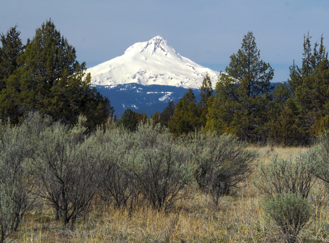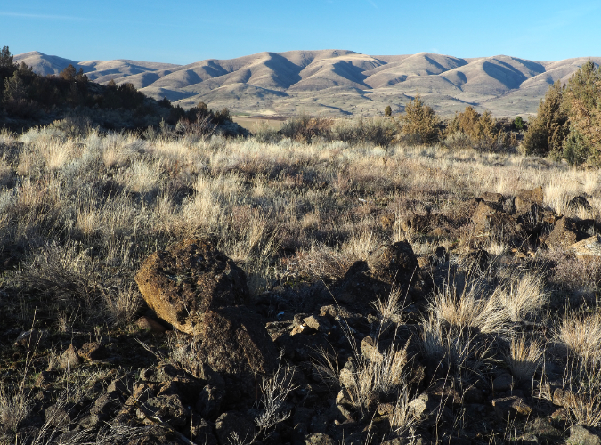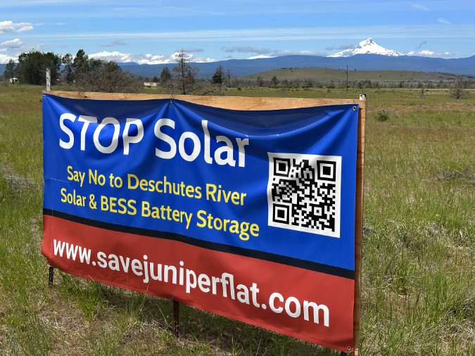
A battle is brewing over large-scale solar, commercial development on protected farmland at Juniper Flat, located in the southeast shadow of Mount Hood
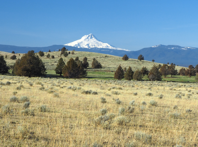
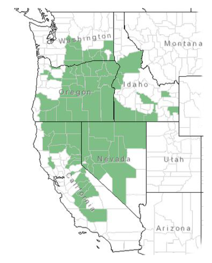
Juniper Flat is a lesser-known corner of WyEast country. It’s a basalt plateau bordered by the White River canyon and Tygh Valley to the north, the deep canyon of the Deschutes River to the east, the Confederated Tribes of Warm Springs Reservation to the south and the forested lands of Mount Hood National Forest rising to the west.
Things haven’t changed much here since white migration began along the Oregon Trail in the 1840s. It’s one of the earliest white settlements in Oregon, as it lies along the historic Barlow Road where the infamous route began its climb over the Cascades. Before native peoples here were displaced by settlers, villages and seasonal hunting and gathering encampments thrived for millennia.
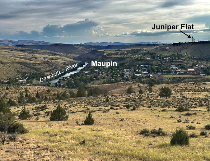
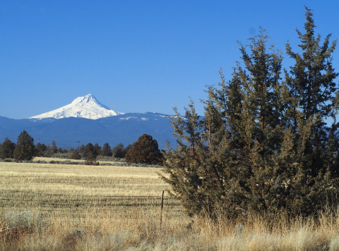
Where is Juniper Flat? If you have traveled to Maupin via Mount Hood, then you have passed through the rural community of Juniper Flat just west of town
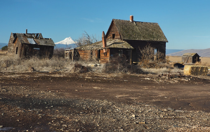
If you recognize this iconic old farmstead along US 197 (just north of Maupin), then you’ve also passed through Juniper Flat
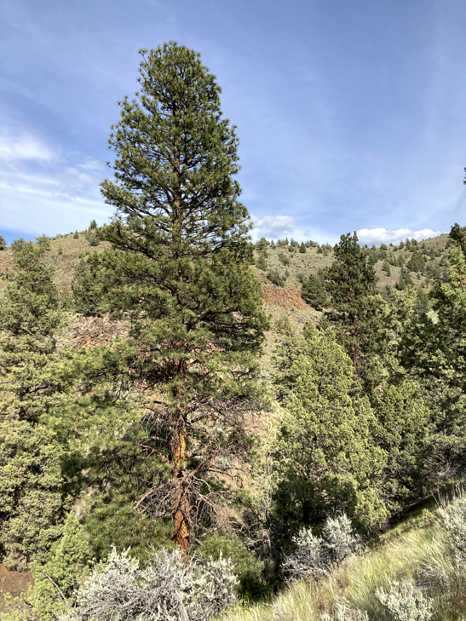
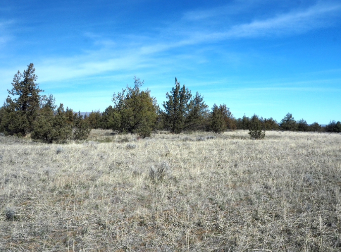
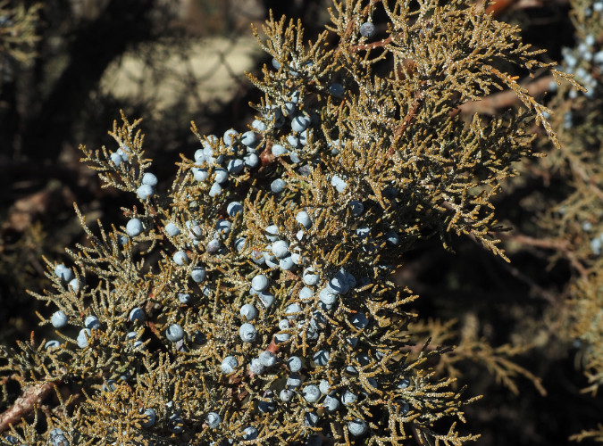
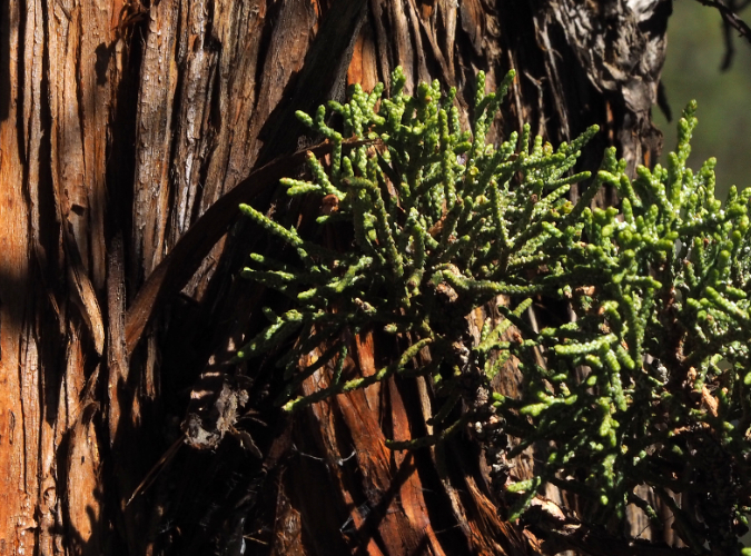
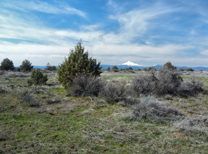
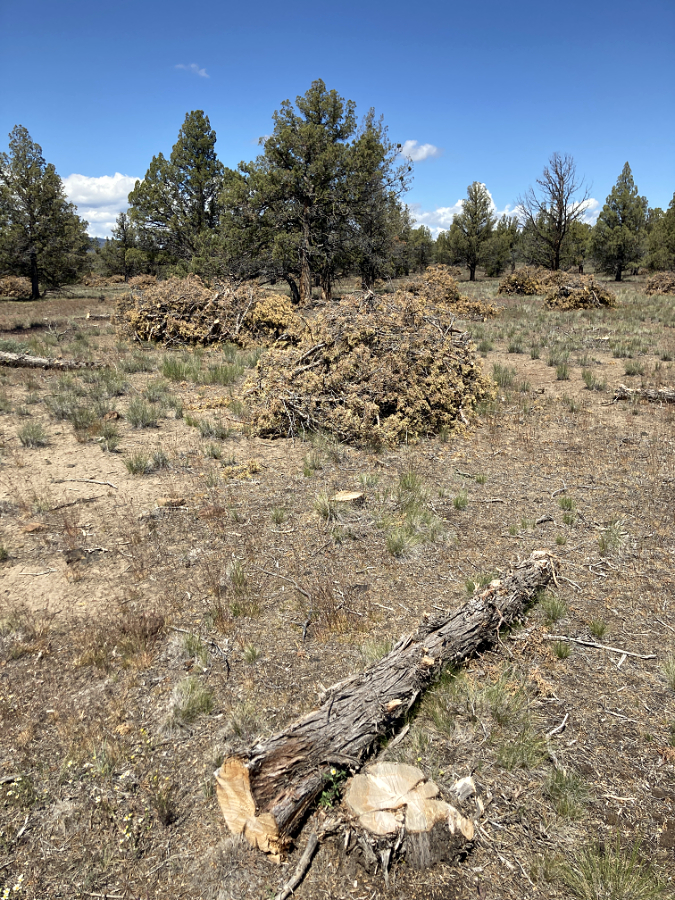
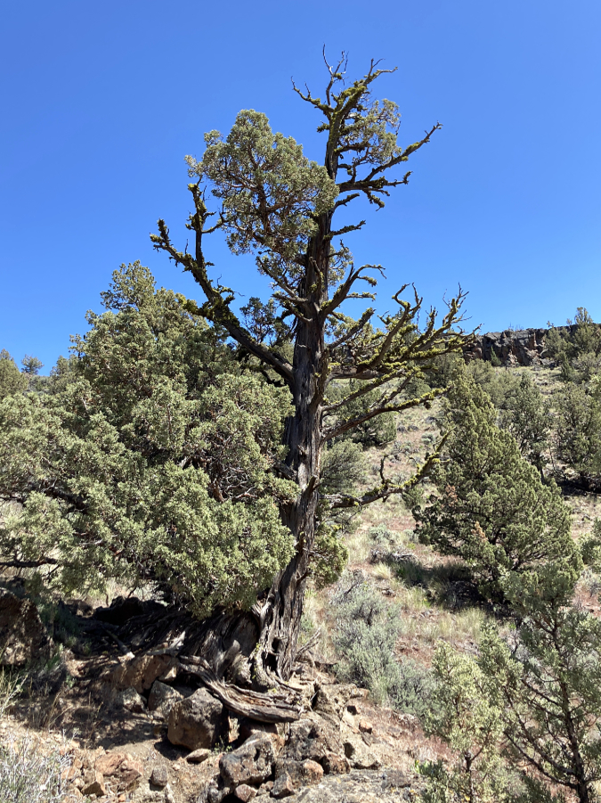
Today, you will find Century Farms and working ranches here, along with the extensive stands of Western juniper that give the flat its name. The juniper forest here is unique, as these are the lowest elevation groves of the species in Oregon, growing at just 1,600 feet. Western juniper typically is found at elevations of 3,000 feet or more in the true high desert ecosystem.
These are also the nearest juniper groves to the rainy Portland metro region, and part of the most compact ecological transect from west side rainforests to east side sagebrush in the entire Cascade Range. Just 40 miles as the crow flies separate the moss-draped canyons of the Salmon River on the west side of the Cascade crest, where rainfall approaches 100 inches per year, to arid Juniper Flat on the east side, which averages barely ten inches annually. So, while Western juniper is common across the dry side of Oregon, these groves are uniquely special.
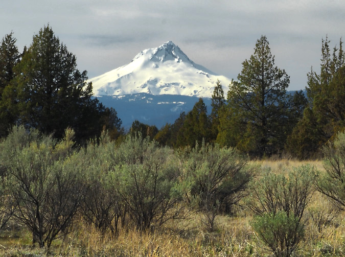
Hundreds of acres of thriving Western juniper groves Juniper Flat its name. Thanks to the rain shadow created by Mount Hood, they provide complete high-desert ecosystem at an unusually low elevation for the species
The thriving juniper forest also reflects the unusual soils of the flat. Before farming arrived, most of Juniper Flat was covered with “biscuit scablands”, the mysterious, still-debated desert phenomena of fertile soil mounds, or “biscuits” (see the blog article on Desert Mounds), ringed by a low, narrow beds of gravel and basalt bedrock “scabland”.
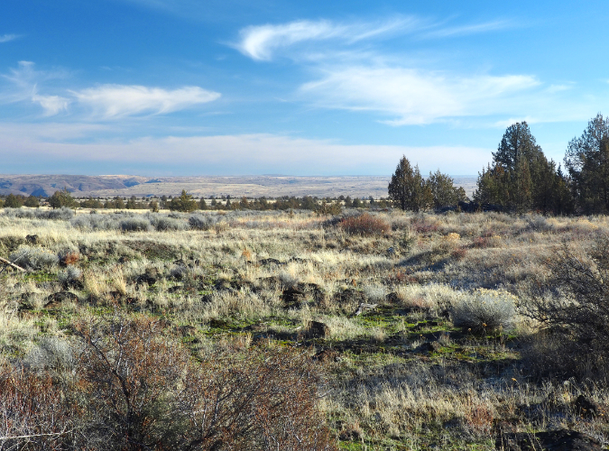
Where these desert mounds were large and deep enough, farmers plowed them flat to create a thin soil layer deep enough grow winter wheat, or alfalfa and other feed grains with the help of summer irrigation. However, much of the Juniper Flat biscuit scabland is still intact, with desert mounds and scattered juniper groves that are used mostly for grazing cattle. Almost all of the land here is private.
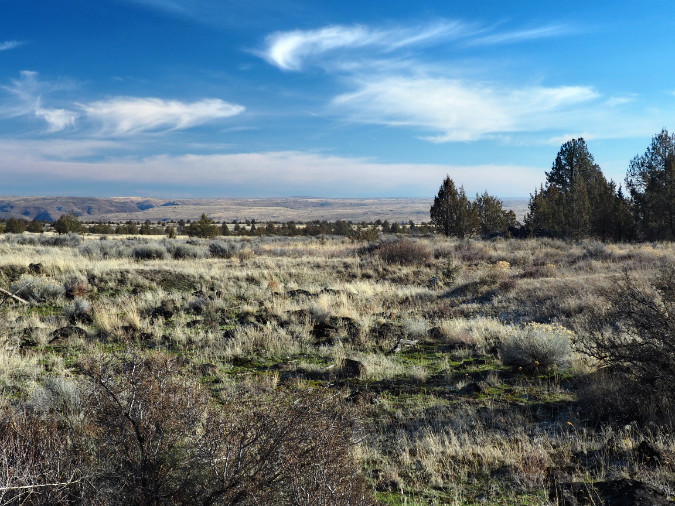
Large tracts of rugged, never-plowed “biscuit scabland” habitat survive among the plowed century-old farms at Juniper Flat. This view looking east includes the nearby Deschutes River Canyon in the distance that forms the east edge of the flat
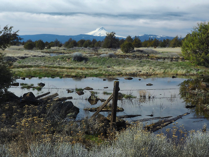
In winter the rocky “scabland” hollows that surround the mounded “biscuits” of fertile soil often fill with rainwater and snowmelt to form ponds, enhancing habitat for elk, geese, ducks and other wildlife that winter here. These winter ponds are located on the state-owned White River Wildlife Area is located along the northwest edge of Juniper Flat
This the was peaceful state of affairs at Juniper Flat until recently, when banners reading “Stop Solar” suddenly began appearing on fences, gates and barns throughout the community. Nearly two centuries after white settlers claimed this area for farming, very big changes seem to be on the horizon.
A national solar developer based in West Palm Beach, Florida called BrightNight has proposed a massive commercial solar array that would straddle the main road that passes through Juniper flat, sending “clean energy” into the nearby interstate transmission lines that stream south to California. The proximity of these transmission lines – an ironic legacy of The Dalles Dam that destroyed Celilo Falls, to the north – is what has put this quiet community in the crosshairs for large scale, corporate energy development.
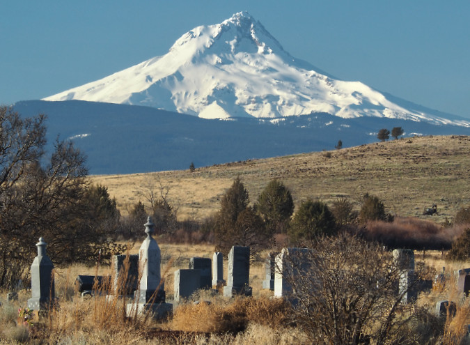
Grave markers at the historic Kelly Pioneer Cemetery in the heart of Juniper Flat record the struggles of white settlers who endured this often-harsh desert environment when farming came to the area in the mid-1800s. Many lives were shortened by the hardships of building a life here. This starkly beautiful area has changed little since those early days – until now
If you have followed the clean energy boom in Oregon over the past few decades, the proposal at Juniper Flat bears strong echoes of the battles over wind energy in the eastern Columbia River Gorge that erupted in the 1990s: farmers and ranchers choosing to sell or lease their land to the power industry were pitted against both neighbors and outside interests who opposed it. Like the earlier wind turbine battles, there is big private utility money involved here, too.
In the East Gorge, the power companies won the battle, with a big assist from the Oregon and Washington legislatures, who handed out large subsidies for clean energy projects like the wind turbine complexes we see there today.
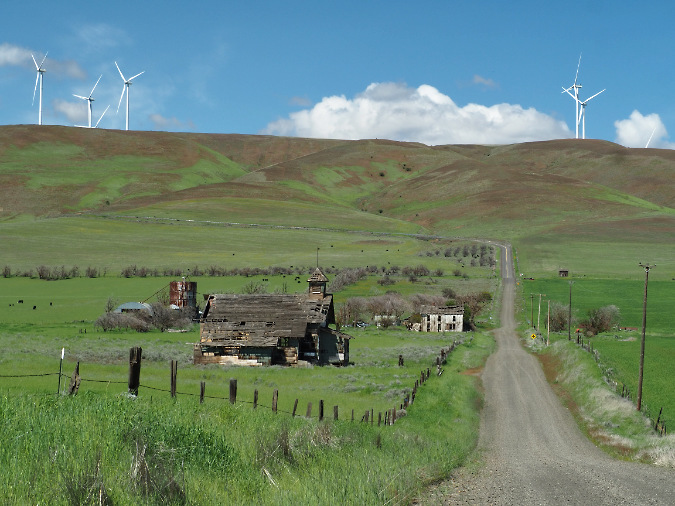
The commercial wind turbine boom in the East Columbia Gorge over the past 20 years has changed rural landscapes in places like Goodnoe Hills for the foreseeable future. Little consideration was given to their visual and cultural impact in the rush to develop the new energy capacity
Like the wind turbine complexes before them, the arrival of commercial solar installations in Oregon’s eastside desert country continues efforts by private utilities to control and centralize electricity production. Just as vast wind turbine arrays were marketed as some sort of modern version of the idyllic family farm windmill from a century ago, industrial-scale solar energy is marketed as something akin to a rooftop panel on suburban home, providing a benign and clean alternative to polluting sources of energy.
It’s an appealing image in an era when we desperately need to expand clean energy production to meet growing power demands and state and global climate targets. Yet, what the commercial wind and solar industries most have in common are massive, industrial-scale operations that span thousands of acres, while providing few jobs in the local economy.
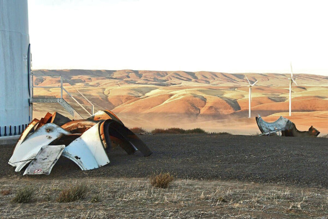
Fallen PGE wind turbine debris at Biglow Canyon has made the news recently, as the wind farm begins to show its age after just two decades (Kathy McCullough/The Times Journal)
A selling point for wind turbines during they 1990s and 2000s heyday was the ability to allow farming, ranching and wildlife passage to continue beneath their turbines, while also providing supplemental income to ranchers who leased their land to the industry. Solar farms make no such promise. Instead, they convert ranch lands with simple, wildlife-friendly barbed-wire fences to fully enclosed industrial complexes, barricaded behind cyclone fences that are topped with razor wire. The desert landscape is erased, completely.
Over the past year, the increasingly dilapidated state of the Portland General Electric (PGE) Biglow Canyon windmills (located about 35 miles northeast of Juniper Flat, in the East Gorge) has been making the news. If past is prologue, the eventual tab for years of deferred maintenance and ongoing mechanical problems of this taxpayer-subsidized development will also be charged to customers of the utilities, not their shareholders.
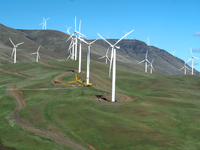
Not so green? Travelers rushing far below on Interstate-84 see the “green” energy that our private utilities market and sell at a premium when they look up at the forest of white wind turbines in the East Gorge. What they cannot see from below is the maze of access roads permanently carved into fragile desert soils that are required for each tower to be constructed and maintained
Fortunately, PGE is an outlier among the utilities, as most of the first-wave wind farm developers who came to Oregon are upgrading to more efficient turbines and blades as their turbines reach the end of their original design life – which is reportedly about 30 years.
However, even if every one of the wind tubines were phased out and the end of their 30-year life, they would still leave a tangle of unsustainable access roads built to install and service every tower. It’s one of the less-talked about legacies of wind developments, as they are mostly out of sight to the traveling public, and not featured in glossy renewable energy brochures provided by the utilities. In the East Gorge, the many impacts of the service roads also include harm to sites held sacred by area tribes, as described in this article.
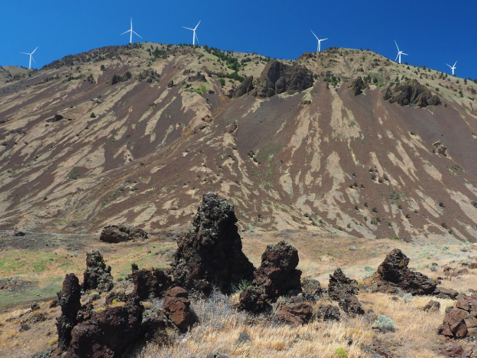
Private utilities built these wind turbines on a bluff in the East Gorge that is sacred to local tribes. The utilities are now are engaged in legal battles over plans to further impact this culturally significant area with still more “green” energy development
While the PGE example at Biglow Canyon is a cautionary tale for all mass wind energy projects built by private interests, the move toward commercial, mass solar energy is even more concerning. Installing modern wind turbine isn’t a practical option for home owners, but adding solar panels and battery storage to homes and businesses is rapidly emerging as the better choice. This hasn’t gone unnoticed by the utilities.
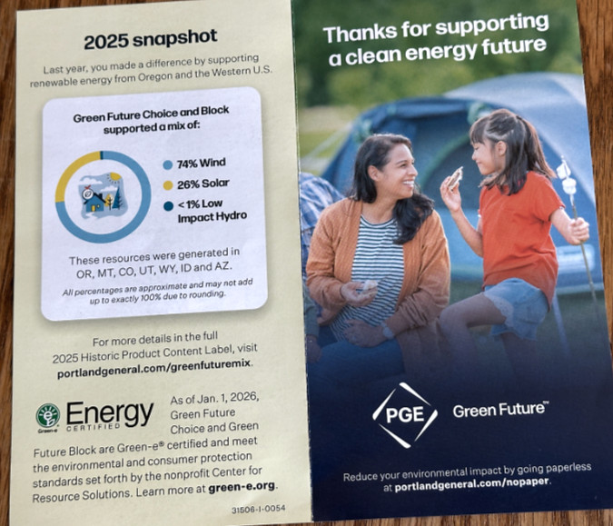
Long caption (and an aside) on my complicated relationship with PGE: yes, I’m a longtime subscriber to their Green Future program, which means I opt to pay premium rates to support PGE purchasing power from renewable energy sources (note the fine print below the chart on the left – PGE buys its renewable energy from power companies across the west). Why do I subscribe to the program? Because PGE is the only game in town and this program is one tangible way to move them toward renewables. However, I’d much prefer to flip the script and apply the surcharge to users who choose NOT to make this shift in the form of a carbon tax, but that policy change has had a fraught history in utility-dominated Oregon politics. Meanwhile, PGE’s residential rates have jumped by more than 50% in the past five years, like most regulated electric utilities in Oregon, and there’s no real way to know how much of that jump has gone toward transitioning to green power. Also buried somewhere in that increase is a significant profit margin for their private shareholders, of course… so, I have a complicated relationship with PGE
Not surprisingly, PGE recently applied for state permits to develop industrial-scale solar arrays at their troubled Biglow wind installation. It’s a move that would permanently destroy the prime farmland their wind turbine installations were purported to protect. While their plans for the aging wind turbines remain unclear, PGE’s interest in moving to massive solar arrays is very clear The utility has proposed converting 3 square miles of farmland adjacent to their Biglow Canyon wind energy complex to industrial solar arrays.
Also not surprising: the solar developer for PGE at the Biglow site is BrightNight, the same Florida developer seeking to bring industrial solar to Juniper Flat. Their company profile describes them as “the first AI-native cognitive enterprise in energy, built around its industry-leading artificial intelligence platform”. Not exactly comforting, if you’ve followed recent news about AI agents “escaping” to roam the internet on their own volition. From the BrightNight website:
____________
“Leasing your land for the development of a renewable power project is a great way to generate an income, invest in your future, and maintain ownership of your property for future use. BrightNight is working with hundreds of landowners across the U.S. Generate income for the life of the lease and when the project’s operation is complete (average 30-50 years), then the project is removed, components recycled, and the land is restored to the condition in which it was found – ready for you to use again!”
____________
Make of this corporate-speak what you will, but this pitch to landowners helps explain the appeal to dryland farmers at a time when they are under multiple stresses, ranging from the escalating effects of climate change to international tariff wars and growing regional labor shortages due to immigration policies.
Trapped in the Grid?
Electricity generating projects are almost always described by the number of “households” they can support, ostensibly because it’s a relatable concept to their residential consumers. And yet, “households” only account for about one-third of the electricity demand in Oregon. Roughly one-quarter of our electrical power goes to industry while a whopping 40 percent is consumed by the commercial sector – which includes data centers.
Electric utility customers often have the option to pay extra for “green” electricity (see my very long caption, above) to help transition the power industry away from fossil fuels. Unfortunately, efforts by the Oregon Legislature to put the premium price burden on non-renewable sources in the form of a carbon failed a few years ago, and so the state is mostly regulating its way to renewable energy through existing laws that have much less impact – and counting on consumers to subsidize green energy on our own.
There’s another way to move more quickly to renewable, clean energy: move the residential sector off the centralized grid. That would not only protect households from having to bear the burden of the explosive growth in commercial energy consumption with double-digit rate increases, it would also make the system more resilient and diversified. In a region where wildfire risk is increasingly forcing private utilities to shut down their distribution lines to avoid catastrophe, being on the grid will become increasingly reliable – especially in rural areas.
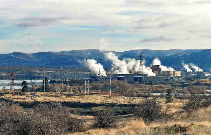
The Google data center in The Dalles is among several of these new, power-hungry developments east of the Cascades that have spiked demand for electricity and water, while providing comparatively few jobs (OPB)
Oregon’s centralized grid model of investor-owned renewable energy stands in sharp contrast to emerging trends around the world, where cheap Chinese solar panels are being installed on dwellings from shantytowns to elite gated communities. While we do enjoy more dependable electricity from our our expansive grid – for now — we also pay a steep premium for the luxury in our utility bills.
However, much of our electric grid is getting old and nearing (or beyond) its design life, increasing vulnerability for future mass outages and wildfire risks. The disastrous Labor Day fires ignited by powerlines in 2020 that destroyed several communities around Oregon were not an anomaly, but rather, a glimpse into this growing reality.
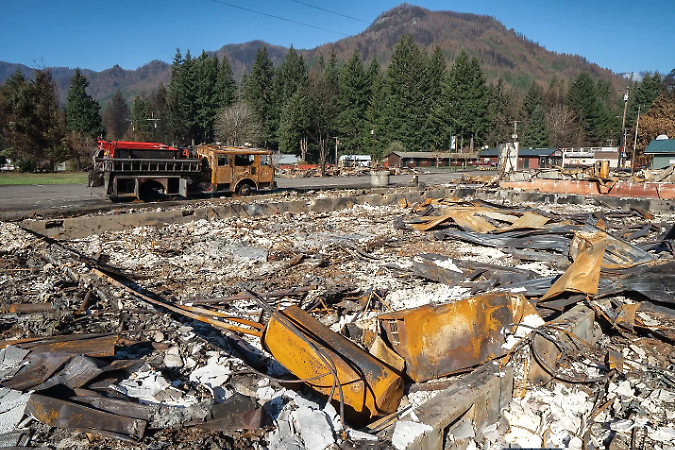
Most of the town of Detroit, Oregon was leveled by the 2020 Beachie Fire (even the fire engine in this view was abandoned and burned as the fire advanced). A wave of lawsuits for negligence followed against PacifiCorp for leaving its powerlines energized during the widely predicted, unusually dangerous windstorm that fanned the fire in September that year. As of late 2025, the utility has paid out $1.6 billion in settlements toward nearly 4,200 wildfire claims in Oregon and California, yet is reported to remain liable for tens of billions in outstanding lawsuits. Though PacifiCorp is locally based in Portland, it is owned by billionaire Warren Buffet, founder and CEO of the Berkshire Hathaway investment firm (World Atlas)
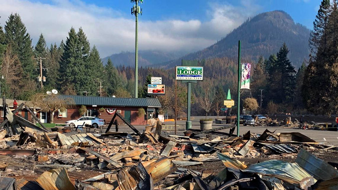
The Lodge at Detroit Lake was among the few properties left standing after the 2020 fire, and was the first to open. Today, the community is struggling to rebuild five years after the disaster. A similar story is playing out in the other rural communities in Oregon burned in the 2020 wildfires (KGW)
The explosive growth in solar installations in developing parts of the world is often in direct response to the inadequacy or absence of local electrical grids, and thus most of this new solar it is not connected to a grid. Instead, the panels are owned and maintained by the households and businesses who install them, though some are eventually connected to the grid.
This revolution of micro-scale solar is finally bringing a sustainable, reliable and affordable electricity to poorly served communities in places like Mexico, Brazil, Turkey and China. Consumers there pay half — or even a third — of what most Americans spend per kilowatt hour for electricity, thanks to the emergence of cheap solar panels that can be installed directly by homes and businesses.
In India, the explosion of cheap, plug-and-play solar has revolutionized access to renewable energy in urban areas, as well. Places like Lucknow, a regional hub of just over 4 million people in northern India, have emerged as world leaders in this trend. Lucknow now leads the rest of India with more than 300 new solar installations every day. Well over a million households and businesses there now using the cheap, privately installed solar panels. Their panels are sold more like Americans sell cars, through vendors and dealerships, direct to the consumer for installation.
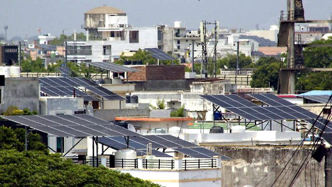
Privately-installed, rooftop solar energy has revolutionized access to reliable power in India. These rooftop installations are in Lucknow, now the leader in solar among major cities in India (Source: ThePrint)
The new technology is also surging in Europe, where more than 4 million plug-in rooftop units have been installed in Germany. In the U.S., seven states (Utah, Colorado, Connecticut, Maine, Maryland, New Hampshire and Virginia) have passed legislation allowing these units to be installed, and 34 other states have legislation proposed. In Oregon, lawmakers introduced House Bill 4080 this year to allow portable, plug-in solar devices, but the bill failed due to push-back from utilities and local fire officials. So, for the moment, we are not leading this charge.
There are still plenty of technological hurdles for the micro-solar revolution to navigate, especially the ability to store power at the household level for nighttime or low-light use. Though batteries for household storage to date have relied upon expensive, potentially dangerous lithium-based technology, emerging sodium-ion systems promise much more affordable, environmentally sustainable and safe technology that uses cheap, common minerals.
Once again, China is far ahead of the U.S. in developing this clean energy storage solution, and is expected to dominate the market over the next few years as these batteries become the global standard for small-scale energy storage. For those old enough to remember the 1970s, it feels like a déjà vu of the U.S. ceding the auto manufacturing market to Japan for lack of a forward-facing economic vision.
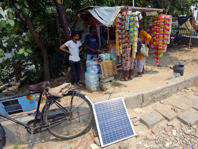
Small solar panels are also changing the landscape for street venders in India, too, providing enough portable energy generation to power foot carts and bread stands (Source: ThePrint)
So, why do these global trends matter for Juniper Flat? Because the local battle over solar arrays here is largely a product of our private utilities working to ensure that electricity continues to be distributed from commercial providers, not produced (or distributed) by consumers. The public financial incentives for renewable energy projects are further reinforcing this commitment to utility-owned power generation, yet another reflection of the power of the industry in Salem.
This results in the entire burden of bringing a needed transition to sustainable, renewable energy to population centers like Portland – or California – on rural communities like Juniper Flat, where utilities can count on support from local governments and limited opposition from local communities. Don’t believe it? Imagine for a moment if a solar or wind energy developments covering thousands of acres were proposed in the heart of the Willamette Valley, or just outside Portland’s urban growth boundary. The outcry would send lawmakers straight to Salem to stop to it in its tracks.
This is inherent and unfair vulnerability that rural communities east of the mountains are shouldering. More frustrating is the fact that it’s almost entirely out of sight and mind to the very people who will actually consume the energy produced here.
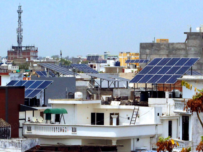
The view from the main rail station in Lucknow, India tells the story of their rapid transition to solar (Source: ThePrint)
Why is the Juniper Flat development moving forward at the same time the current U.S. administration has turned back the clock on renewable energy? The truth is, clean, renewable energy development today makes very good economic sense, even without public subsidies. Private utilities can see past this political moment and they continue to diversify their energy sources across the country with investments in solar and wind to meet rapidly growing demand – and maintain profits.
For example, battery storage installations by utilities for wind and solar have doubled during the two years since the current administration returned to office promising to shift our national energy focus back to fossil fuels. Even more surprising: two thirds of those newly installed batteries have been installed in conservative “red” states like Texas, along with states like California and Colorado where the politics favor renewable energy. This trend is accelerating against the backdrop of federal backsliding, not slowing.
Thus, despite the federal U-turn on renewable energy, the Juniper Flat project continues to move forward with plenty of inertia, in part because the State of Oregon remains committed to renewable energy, but mostly because of simple growth in demand. This transition to renewable energy is a very good thing, but relying solely on private utilities as middleman to deliver it to consumers only hampers the transition – as the rest of the world is showing us.
Why bother opposing the Juniper Flat project?
If the political and economic deck in Oregon is stacked in favor of private utilities, is it even worth it for locals to oppose the Juniper Flat project? And is it elitist for those of us who support transition to sustainable energy to oppose a solar project simply because it’s unwelcome in our backyard?
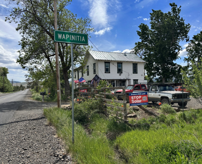
At first glance, the combination of MAGA banners and opposition to solar might make you think the fight in Juniper is an ideological war on renewable energy, but it’s really about protecting the beauty, tradition and sustainability of a farming community
Many in the Juniper Flat community have resoundingly answered the first question. Yes, it’s worth it! The “Stop Solar” banners and signs are everywhere. I spoke with a few folks while in Juniper Flat a few weeks ago, and while you might assume a conversation between a progressive Portlander and conservative local residents would be fraught in these times, there was important common ground to be had.
Most basic is that Juniper Flat is simply the wrong place – for its beauty, for its functioning farm and ranch economy, and for the serious fire risks that industrial solar collection brings. This also answers the second question, as the local opposition is not reflexive “not in my backyard” reaction, but rather, a thoughtful challenge to a massive project that will permanently change the face of this community.
Simply put, the most compelling argument against the project is that its obvious risks outweigh any benefits to the community. It’s the wrong place, even if you subscribe to commercial solar installations as a preferred solution to providing renewable energy.
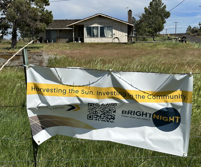
BrightNight has provided a few yard banners to their supporters to counter the opposition in Juniper Flat, though these are greatly outnumbered by the Stop Solar campaign signs
Of their many concerns, the risk of fire is near the top of the list. As if to prove the point, the Grasshopper Fire that erupted just a few weeks ago on a forested ridge rising above Juniper Flat is still burning and pouring smoke into the community. Juniper Flat was among several communities in the area that endured rolling Level 3 “Go Now!” evacuation orders beginning in late July as the fire expanded to nearly 100,000 acres by mid-August. Fire is a very real – and growing — threat in this tinder-dry desert climate.
Another point of common ground between our urban and rural perspectives was simple distrust of private utilities to responsibly build and manage something of this scale over time. Local residents I spoke with pointed to a massive new solar installation at nearby Bakeoven, located just east of Juniper Flat. The last time I had visited the area was during the pandemic, when Bakeoven consisted of a couple ranches and a few abandoned homesteads. It was lonely, beautiful desert country.
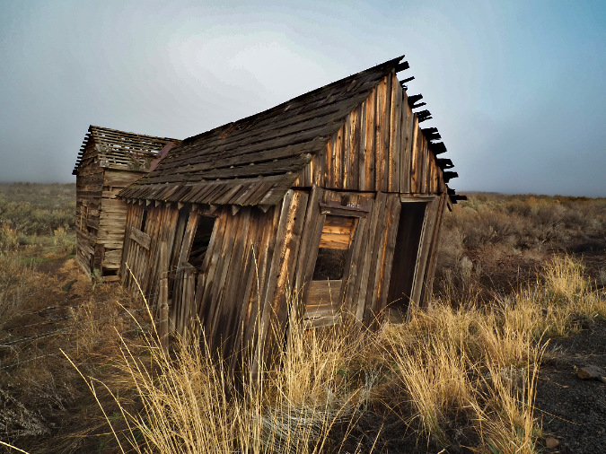
Not too long ago, Bakeoven was still a lonely spot in the sagebrush sea, marked by the bones of old homesteads and a few scattered ranches. I took this photo about a year before BrightNight brought their solar complex to the area – and perhaps as a metaphor, this old building has now collapsed
Following the advice of folks in Juniper Flat, I made a return to Bakeoven to get a preview of what was being proposed. And after just three years since my last visit there, I was shocked at the scale of the changes. As much as private utilities market themselves as a good neighbor to local residents, the new Bakeoven installation looked more like a vast, high-security prison than a “farm”.
That’s what prompted me to write this article, as a good look at the Bakeoven development is all you need to know about the threat to Juniper Flat. The following photos are from my recent visit to the newly developed site, and they illustrate why the solar opponents in Juniper Flat fear what may be coming to their community.
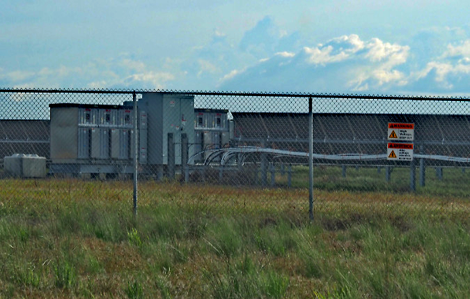
The new Bakeoven solar development provides a fairly stark visual contrast to the “harvesting the sun, investing in communities” tagline on the BrightNight “pro-solar” banners in Juniper Flat. Mostly, it looks like a sprawling prison complex
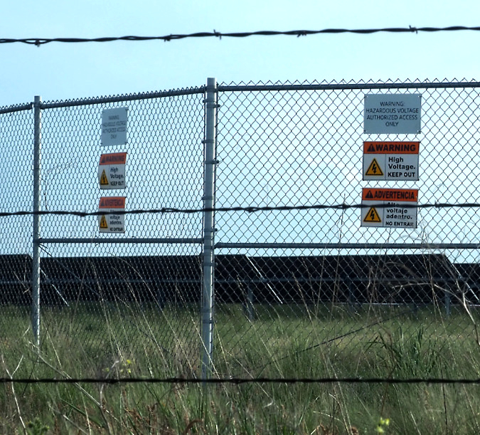
These foreboding signs dot the 3-mile fence that now fronts Bakeoven Road along the solar development. The stern messages seem at odds with industry assurances that these plants are benign, and present little fire risk to the surrounding communities
Digging a bit deeper, I also found that the solar development at Bakeoven has just begun. If the recently built 1,270 acre first phase isn’t jarring isn’t enough, consider that another 8,075 acres of open rangeland directly across the road from Bakeoven installation are also proposed for solar development. This would result in a combined area of nearly 15 square miles of former sagebrush desert and ranch land covered with solar arrays, industrial batteries and powerlines connecting them to the transmission grid.
Sagebrush country is vast, so for perspective and proximity, here are a couple views of the recently completed Bakeoven development – and note that the site boundaries are approximate based on land that was cleared for the solar arrays when this imagery was captured:
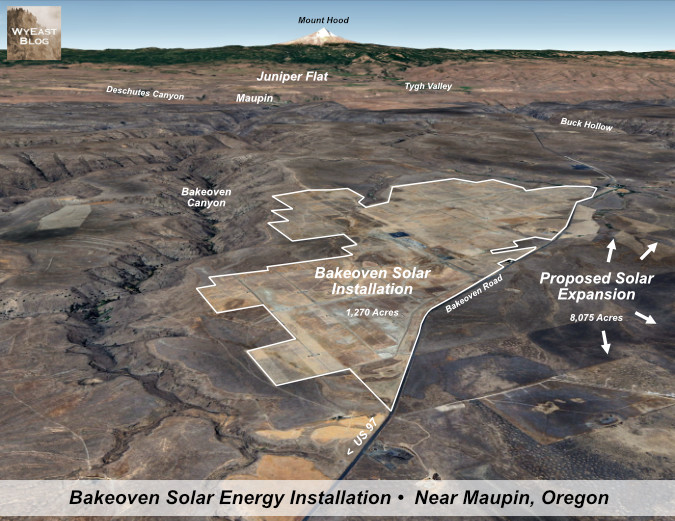
Perspective view of the new Bakeoven solar energy site in context to Juniper Flat and Maupin. At 7,500 acres, the Juniper Flat development would be six times this area. At Bakeven, developers have proposed expanding solar development by more than 8,000 acres, covering an area more than seven times the current site.
[click here for a large view of this map in a new window or tab]
So, how big is this? For Portlanders, just the first, newly completed phase at Bakeoven would encompass most of Portland’s central sity (see below). The proposed next phase will at Bakeoven would cover an area nearly seven times the existing development – and so would the proposed Juniper Flat solar development.
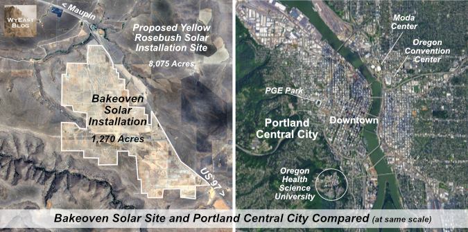
It’s hard to appreciate scale in sagebrush country, but 1,200 acres is large – and the new 7,000+ acre expansion proposals at both Bakeoven and Juniper Flat are really large
[click here for a large view of this comparison in a new window or tab]
Some landowners have signed on to the Juniper Flat proposal for a financial stake, and that’s understandable. Farming here has always been a struggle. This isn’t the Willamette Valley with a mild, moist climate and 15-foot-deep topsoil, after all. And yet, in just a few years Juniper Flat will celebrate two centuries of farming and ranching here. And as with all farm land in Oregon, once it’s paved and developed, there is no going back. Promises from energy developers sound good, but Juniper Flat would be changed forever.
That’s why the Juniper Flat proposal was originally denied by local planning officials concerned about the loss of farmland and impact on the local farm economy under Oregon’s land use laws. Ironically, the State of Oregon vetoed that local government decision to deny the project, citing the state’s renewable energy goals as the reason to override a local decision. Now, development continues to move forward against both the concerns of many local residents and local officials.
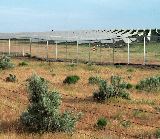
From sagebrush to solar in just a couple years – and mostly out of sight for Oregonians. Hopefully, the local organizing in Juniper Flat will change that
It’s also true that some local elected officials have signed on to these industrial solar developments on the promise of new jobs and economic windfalls, and this is also understandable in a rural setting.
However, if the Bakeoven installation is any indication, this is likely a mirage for folks hoping developments likes these will be transformational to the local economy. On my weekday visit there was no sign of anyone working at the vast site – not even a single maintenance truck. Just locked gates, the hum of electricity and dozens of ominous warning signs posted along the entirety of its 3-mile long Bakeoven Road frontage.
Perhaps the best argument against the Juniper Flat development is also the toughest to make at a community scale: that private energy utilities in Oregon should not be allowed to monopolize the solar market. If the past few years have taught us anything about above-ground transmission lines, we would be pivoting away from them as an unsustainable, unsafe way to provide electrical power to households – and especially to import power from distant sources to our major urban areas.
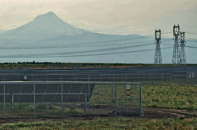
The Bakeoven development rose from the sagebrush sea in the shadow of Mount Hood, but it was proximity to the steel towers rising above the maze of solar panels that were the real draw. The modern curse of the lower Deschutes corridor are the transmission lines linking the lower Columbia River hydro project to 40 million electricity consumers in California. Access to these transmission lines has drawn industrial solar and wind solar production to the corridor – along with several power-hungry data centers
At a time of climate change and growing droughts, the risk of continued human-caused wildfires to rural communities should be raising all manner of red flags for our state regulators and legislators who hold the power to regulate the power industry and to open the solar market for individuals. Hopefully, growing community opposition for large-scale industrial solar developments in places like Juniper Flat will someday be heard by the powers that be in Salem.
Meanwhile, the arrival of affordable, micro-scale solar energy capture does seem inevitable, even in our system where corporate utilities wield enormous political sway. It’s a timely opportunity to give people an affordable, renewable option to the increasingly expensive monopolies of private utilities focused on their shareholders over consumers.
And yes, we still have to catch up with the rest of the globe. Household solar may not be a viable option for everyone in Oregon just yet, but the pace of technology seems to be quickly taking us in that very direction. Why not get onboard now?
Finding unexpected common ground… in Juniper Flat
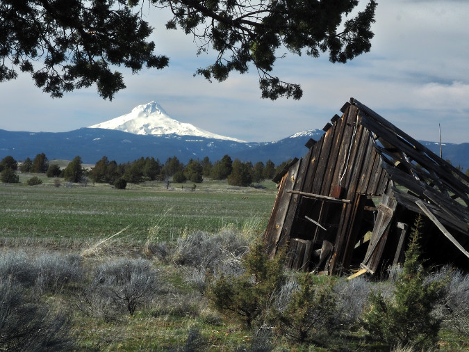
The picturesque, fading bones of homestead structures are not just part of what makes Juniper Flat beautiful and timeless, they also tell the story of generations of farmers who continue to work the land here. This place is special, and it’s a way of life and community that deserves to be spared the impact of industrial solar development
As I waved goodbye to a local couple I’d visited with in Juniper Flat, I was taken by an unexpected, pleasant surprise. After a tense first few moments – big dogs barking the alarm in their yard as I took roadside photos, and the homeowners emerging from their farmhouse with a decidedly wary stride – things cooled down when I simply asked about their yard sign and opposition to the solar project.
As the conversation unfolded, I made no secret of being a Portlander – but I also told them of my love and appreciation for the area, and my many visits over the decades to capture the beauty of Juniper Flat with images.
Not surprisingly, this is exactly why they live here – and their love of the area is more than I can imagine. It is their home, after all. As our conversation grew more open, friendly and thoughtful, it transformed from obvious points of disagreement (and there were surely many) to points where we did agree. As Oregonians. That felt good.
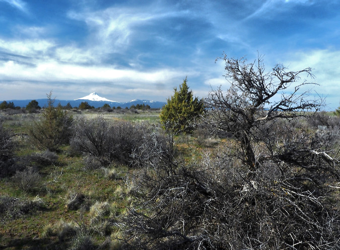
Mixed among the cultivated fields that are proposed to be part of the 7,500-acre Juniper Flat solar development are stretches of intact desert ecosystem mostly used for grazing, but that also support native species and contain pristine landscapes unique to this area
It was such a refreshing conversation between supposed “enemies”, and a reminder that in this political era, divisiveness and rancor are tools employed by the powerful to maintain their power, not to make our lives better. On that point, we strongly agreed.
We parted with big smiles, with me wishing them well in their fight. It felt really normal, healthy and encouraging in these otherwise harsh, angry times.
Make no mistake, the fight against the solar project in Juniper Flat is a fledgling effort and it’s an uphill battle for the opponents, but they do have a website for folks interested in learning more or even helping out. You can find it here at Save Juniper Flat, or simply use the QR code shown in the opening image to this article. I do wish them well. They have so much at stake.
In the meantime, it’s not too soon for any of us to begin thinking about how we might be part of a household solar revolution in Oregon as part of moving toward sustainable energy sources – and perhaps become the catalysts for it?
Thanks for stopping by and for reading another long piece if you made it this far! I hope to see you on the trail sometime – or even in Juniper Flat!
______________
Tom Kloster | September 2026
Technical note: this article dove into the weeds a bit, so feel free to send me corrections if I’ve missed or mischaracterized any major points, and as always… a postscript: have you visited the new companion WyEast Images Blog? Be sure to subscribe while you’re there!