The Waterfalls of “Heaven and Hell”

Mist Falls from Benson State Park

Hidden in plain sight near the west entrance to the Columbia River Gorge are a string of waterfalls that flow from the slopes of Devils Rest and Angels Rest, yet are virtually unknown. At least one of them, Dalton Falls, is named. But nobody seems to agree which waterfall is the real “Dalton”.

A closer look at a 1916 touring map (below) published when the original scenic highway opened in the Gorge shows this area in detail, including a few name changes: “Fort Rock” is now Angels Rest and the domed butte at the top center-right edge is Devils Rest, which forms the headwaters of well-known Wahkeena Falls — then known as “Gordon Falls”.

Multnomah, Mist Falls and Coopey Falls are also shown, and still carry their original names (Mist Falls is one of the few landmarks in the Gorge that still carries a name given by the Lewis and Clark expedition). But tucked between Coopey Falls and Mist Falls on this old map is “Dalton Falls”, shown to be flowing from a prominent canyon on the east flank of Angels Rest (then “Fort Rock”). 

This is where the confusion begins, as the stream in this canyon does have several small cascades, but nothing that could have been easily seen from below, along the old Columbia River Highway, which seems to argue against this falls being the real “Dalton Falls” Meanwhile, one of the lesser-known waterfalls in what I am calling the “Heaven and Hell” section of the Gorge is quite prominent, and to many waterfall admirers is the rightful “Dalton Falls”. 

The photo below is from state aerial surveys taken after the Eagle Creek Fire in 2018, and shows both the familiar Mist Falls and nearby “Dalton Falls”, just to the west. 

Like Mist Falls, Dalton Falls is a two-tiered waterfall with a total height of 350 feet — not as tall as nearby Mist Falls at 520 feet, but quite tall compared to other waterfalls in the Gorge. In most years, Dalton Falls is seasonal, going dry in late summer. This is has been the main argument against this waterfall being the “real” Dalton Falls in the many debates that have unfolded over the years.

A Closer Look at Heaven and Hell

The Eagle Creek Fire and the State of Oregon’s aerial surveys that followed have pulled back the curtain on this area. With much of the once-dense forest canopy burned away, waterfall lovers can finally see just how many waterfalls have been hiding here. The following panorama is stitched together from several of these aerial photos and reveals a labyrinth of deep canyons and cliffs that make up the “Heaven and Hell” Gorge face, between Devils Rest and Angels Rest:

[click here for a very large version of the panorama]

Mist Falls is just beyond the left edge of the panorama and Coopey Falls just beyond the right side of this view. But beginning with Dalton Falls on the east, the composite photo reveals a total of seven unnamed waterfalls that can now be clearly seen in aerial images. For the sake of describing them, I’ve attached informal names to the most notable cascades (which I will explain, for better or worse).

This topographic map shows the same “Heaven and Hell” section of the Gorge face with the location of each of these waterfalls identified. Some are on seasonal streams while some some flow year-round, though even the perennial streams are not mapped in most cases. So, I’ve added them to this map, as well, for clarity:

[click here for a large version of the map]

Given the general location of these waterfalls, here’s a closer look at each one, as  captured in the State of Oregon surveys, starting from the west. The first is Foxglove Falls, located near Angels Rest (below).

“Foxglove Falls” is a working name I attached to this falls several years ago after first hearing it from Angels Rest, then getting a few glimpses of falling water through the trees. The name comes from a trail by the same name, and crossing this stream just upstream from the falls. Waterfall explorers have since scrambled down to Foxglove Falls and found a modest 50-foot cascade among a string of smaller drops as Foxglove Creek bounds down the very steep ravine below Angels Rest. 

The old Gorge touring map suggests that Foxglove Falls might be the illusive “Dalton Falls”, but it’s clearly too small and out of view to have been given this name. 

Moving east along the Gorge face, another very small, unnamed falls forms a seasonal cascade just beyond Foxglove Creek. I’ve simply labeled this as a “falls” on the panorama, as it’s one of dozens (perhaps hundreds) of seasonal falls of this scale that appear throughout the Gorge. 

Moving just a bit further east in the panoramic view, a more impressive falls emerges, with an upper tier of perhaps 80 to 100 feet in height and a lower tier of 150-200 feet. I’ve given this one the working name of “Chalice Falls” (below) for the distinct shape of the bowl carved into the basalt cliffs by the falls, which, combined with the basalt layer below, looks like a chalice to my eye. 

This is a chalice… can you see it in the carved basalt?

The lower tier of “Chalice Falls” is quite prominent, leaping out into space in a cascade that can easily be seen from below. For this reason, this is probably the best alternate candidate as the “real” Dalton Falls. However, this stream appears to be seasonal in most years, and has a smaller drainage than the suspected Dalton Falls to the east, so I’m still convinced that the presumed Dalton Falls is the real thing.

Heading east from Chalice Falls, another small waterfall appears that I’ve simply called “falls” on the panoramic view, before a much more pronounced canyon appears below the northwest slopes of Devils Rest. Most of the forest canopy survived here, so the secrets of this remote canyon aren’t revealed as readily as the rest of the “Heaven and Hell” section, but two large waterfalls are easily seen. I’ve given these the working name of “Lucifer” (with a nod to Devils Rest, upstream), with distinct upper and lower waterfalls (below).

Of the two Lucifers, the upper falls is the most interesting. Though it is partly hidden in the mist in this photo, the main Lucifer Falls (below) has a beautiful, spreading upper tier and horsetail-shaped lower tier that combine for a height of perhaps 150-200 feet.

Lower Lucifer Falls (below) is more of a long cascade, but has a tall upper tier of perhaps 70-100 feet that kicks off as much as 300 feet of continuous cascades. 

The two Lucifer waterfalls are quite hidden from view from below in a deep, forested canyon, so while this appears to be a year-round stream, it doesn’t seem like a likely candidate for as the “real” Dalton Falls, either.

Moving east from Lucifer Falls, the next prominent waterfall in the “Heaven and Hell” section leaps off a very tall basalt cliff in several twisting tiers that could easily combine for a height of 250-300 feet. I’ve given this falls the working name “Cordial Falls” for tall alcove the stream has carved here, resembling a glass cordial to my eye (below). Cordial Falls is quite graceful, fanning out along the basalt layers as it cascades down the Gorge cliffs.

This is a cordial… okay, maybe a bit of a stretch on this one..!

Look closely to the right of Cordial Falls and you can see a sizable landslide, with whole trees scattered in its wake. This event made it all the way down to the Historic Columbia River Highway, temporary blocking the road in the months after the Gorge fire.

Cordial Falls occurs on a stream that might flow year-round, so it’s possible that this stream could be the “real” Dalton Falls. But like the Lucifer waterfalls, it’s also somewhat hidden in its alcove, surrounded by big conifers. It therefore seems like another unlikely candidate for being named in those early days in the Gorge.

Which leaves the next falls to the east as the “real” Dalton Falls (below), and the State of Oregon aerial photos provide terrific detail of this very tall, two-tiered waterfall. The falls can also been seen prominently from below, along the Historic Columbia River Highway and modern I-84.

Just off to the left of the panoramic view is another falls on Dalton Creek. Lower Dalton Falls (below) is easily seen from the Historic Columbia River Highway, dropping from a cliff just west of Mist Creek, near a wide pullout on the highway.

So, there you have it — the “Heaven and Hell” waterfalls of the Columbia River Gorge. You might be able to glimpse them during the winter months from I-84 (so long as you’re not doing the driving!), but for the most part these are “hidden” gems… in plain sight!

What’s in a Name?

So, why map obscure waterfalls in the Columbia River Gorge? Party, because it’s fun and interesting to make new discoveries in places we think we know so well. But it’s also true that knowing (and naming) these places can help us better care for them and protect our public lands. 

In recent years, a new generation of waterfall enthusiasts has uncovered hundreds of “new” waterfalls in the Gorge and throughout Mount Hood country. Part of this new era of discovery comes from new tools, like detailed satellite images and LIDAR mapping now freely available online. But finding these hidden gems still requires old-fashion exploring on the ground, ensuring that most of these off-trail waterfalls will continue to be known first-hand to just a few.

Off-trail waterfalls like these are being discovered throughout Mount Hood country by a new generation of waterfall explorers, helping us better understand what is at stake for our unprotected public lands

Scores of these “new” waterfalls are in places like the Clackamas River basin, where the forest is still recovering from brutal logging and road construction that swept through Mount Hood country from the 1950s through the early 1990s. Had we known these waterfalls (and so many other magical places) existed when industrial logging was underway on our public lands, would we have tolerated the massive clear cuts and logging roads that marred these beautiful places? Perhaps. 

But it’s also possible that better public understanding of what was at stake might have slowed the bulldozers and chainsaws long enough to spare just a few of these places. These threats still exist for much of Mount Hood country, so long live the modern era of exploration and true appreciation for what is at stake!

___________________________

The author practicing responsible social distancing in the Gorge on March 15, before our State and Federal lands were closed to recreation by the COVID-19 pandemic

Postscript on COVID-19 from the author: we’ve all heard the words “unprecedented” and “challenging” too many times over the past few weeks, though both words do aptly describe our lives under a global pandemic. And with our public lands closed and Oregonians ordered to stay at home, you’ll be seeing few more articles on this blog. 

However, I don’t plan to tie blog themes to the global health crisis in any way, as I’m quietly honestly enjoying the opportunity to focus on something other than the crisis. Hopefully that won’t seem disrespectful or insensitive to readers. That is certainly not my intent. Instead, I hope the blog can provide a temporary distraction from the truly “unprecedented and challenging” situation that we’re all struggling through, something I think we can all use.

As always, thanks for taking the time to stop by, and of course, stay safe!

Tom Kloster | March 2020

After the Fire: A Closer Look (Part 1 of 2)

00aAinsworthTrail

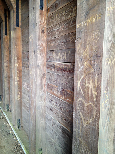
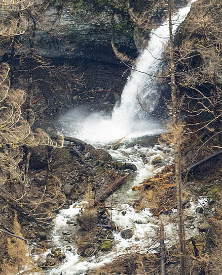
Burned sign along Gorge Trail 400 in January (Tom Kloster)

 State Park and Forest Service rangers and local trail volunteers have been busy this winter assessing the impact of the Eagle Creek Fire. A few photos have been released from their trips into the still-closed burn zone, showing extensive damage to many of our favorite Gorge trails. The early glimpses are sobering and much work clearly will be needed to begin reopening trails to the public. More importantly, they gave us the first sense of just how long it will take for the Gorge to recover — and it’s going to take awhile.

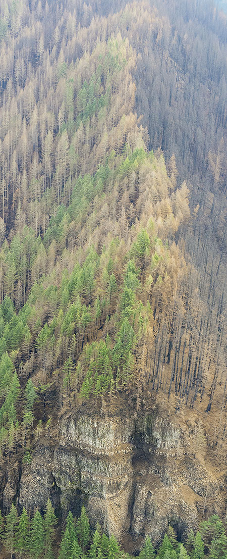
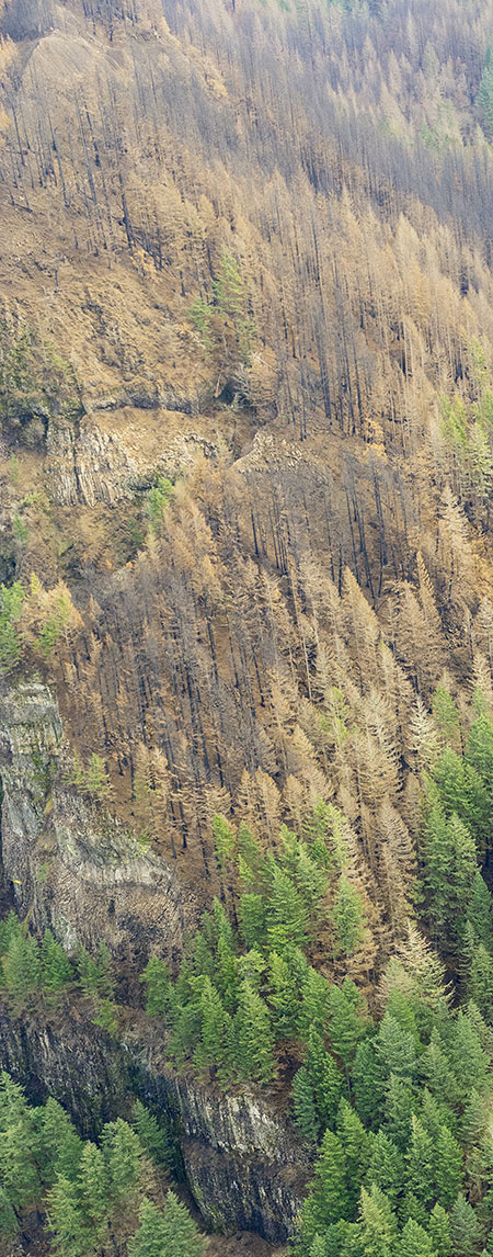
In early December, a far more comprehensive set of oblique aerial photos was captured by the State of Oregon as part of assessing the risks for landslides and flooding from the bare Gorge slopes. These amazing photos provide the first detailed look at how our most treasured places in the Gorge fared after the fire. This article features some of the most stunning of these startling images.

00bMultnomahCreek

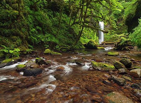
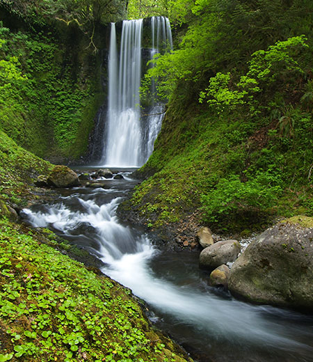
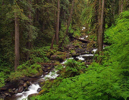
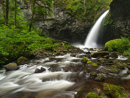
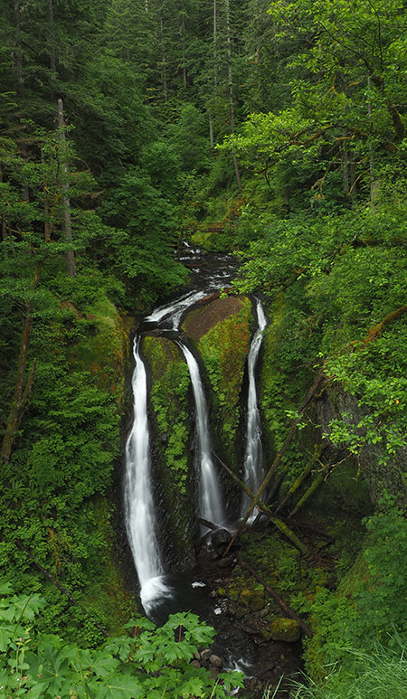
Weisendanger Falls and Multnomah Creek in better days (Tom Kloster)

My first reaction while first poring over the photos was shock and sadness. Like many of you, the Gorge was (and is) my second home, and it’s still hard to accept that the magnificent green Eden I grew up exploring has been destroyed. I’ll always long for the Gorge as it existing before the fire, even as I watch and learn from the miracle of forest recovery that will unfold in coming years. This is a paradox that we’ll all need to accept.

But moving forward, we also need to refocus our love for the Gorge of memories on the urgent work that lies ahead, not only to restore what was lost, but also set a new direction for how this amazing place can be sustainably managed in perpetuity. We owe it to future generations who will only know the old Gorge from our photos to never allow a man-made catastrophe like the Eagle Creek Fire of 2017 be repeated. The lesson from the fire is not just that it was human-caused, but that the fire and its severity resulted from our own unwillingness to set limits on how we manage and use the Gorge. This is our challenge moving forward.

____________________

This article is the first of a two-part series that features the best of the amazing new aerial photos. You can explore a large version of each photo in great detail by clicking on the “large view” link, which will open a 2000×1300 pixel version in a new window or tab. I’ve also enlarged some of the most fascinating highlights from these photos for the article.

Shepperd’s Dell to Multnomah Creek

The first half of the tour covers the west portion of the Eagle Creek Burn, beginning at Shepperd’s Dell, and moving east to the Ainsworth State Park area.

This photo is a birds-eye view looking down at the tiered waterfalls of Young Creek, in Shepperds Dell, and the iconic Historic Columbia River Highway bridge that spans the dell:

01aShepperdsDellThumb

Aerial view of Shepperd’s Dell (State of Oregon)

[click here for a large photo]

Like so many areas within the burn, it sometimes seems like the fire sought out our most treasured places. In this case, the fire wrapped around Shepperd’s Dell, proper, killing trees on top of the domed rock formation at the east (left) end known as Bishop’s Cap and on the cliffs directly above Shepperd’s Dell.

In contrast, the area to the west of Young Creek and Shepperd’s Dell experienced a beneficial burn, with the understory cleared but many of the large conifers surviving:

01bShepperdsDell

Shepperd’s Dell, including the upper tier of the falls (State of Oregon)

This view also reveals the top tier of the four-step waterfall that cascades through the Dell. Though part if the second tier can be seen from the wayside, the tall upper tier is completely hidden by walls of basalt from below.

The historic bridge at Shepperd’s Dell was unharmed by the fire, but some of the stone walls along the west approach were damaged by falling trees, as shown in this view:

02aShepperdsDellThumb

Aerial view of Shepperd’s Dell (State of Oregon)

[click here for a large photo]

The historic footpath that descends to the lower tier of waterfalls in Shepperd’s Dill is not significantly damaged, though it is vulnerable to falling rock and debris from the burned cliffs, above. Rangers have therefore closed this trail for safety reasons, for now.

This close-up view (below) shows the picturesque stand of Oregon white oak growing on a prominent basalt outcrop next to Shepperd’s Dell bridge. These trees were scorched by the fire, but still hold their browned foliage, so it’s unclear if these will survive. We’ll know if they leaf out this spring.

02bShepperdsDell

Historic Shepperd’s Dell bridge (State of Oregon)

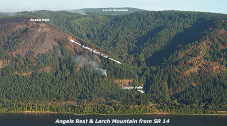
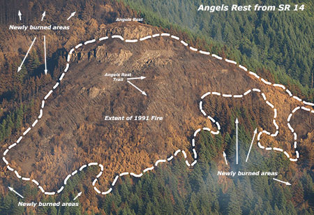
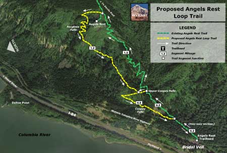
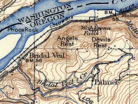
Next up, a photo that provides a close look at the popular Angels Rest trail. This view shows the north side, where the switchbacks along the upper section of the trail are clearly visible:

03aAngelsRestThumb

Aerial view of Angels Rest (State of Oregon)

[click here for a large photo]

This part of Angels Rest burned in the 1991 Multnomah Falls Fire, and was still recovering last year when the Eagle Creek Fire swept through. A comparison of how these burns overlapped on Angels Rest is included in this earlier article on the fire.

One interesting lesson from the fire is how living trees don’t really “burn” thanks to their water content, even if a tree is killed by the heat. Instead, the wood in killed trees usually survives fully intact, becoming bleached snags as burned park peels off in the year or two following the fire. Because the unburned wood is so sound, snags from fires as far back as the early 1900s are still standing in many places around the Cascades.

Yet, many of the dried-out, bleached snags from the 1991 Gorge fire were burned to nothing but stumps of charcoal. This was true throughout the burn, where dead trees and old snags from previous fires were reduced to ashes in places while nearby living trees often survived the fire with only a blackened trunk.

03bAngelsRest

Detailed view of the Angels Rest Trail (State of Oregon)

This photo shows Angels Rest from the west, also with the upper switchbacks along the trail leading to the summit:

04aAngelsRestThumb

Aerial view of Angels Rest (State of Oregon)

[click here for a large photo]

While the north side of Angels Rest burned hot enough to char the landscape down to blackened soil, the west side fire seems to have been less intense, with much of the understory appearing to survive, and many of the old snags from the 1991 burned black, but still standing along the lower edge of this close-up view (below).

04bAngelsRest

Detailed view of Angels Rest Trail (State of Oregon)

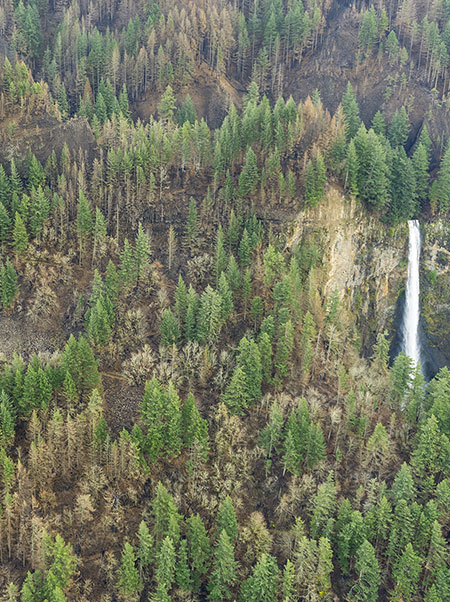
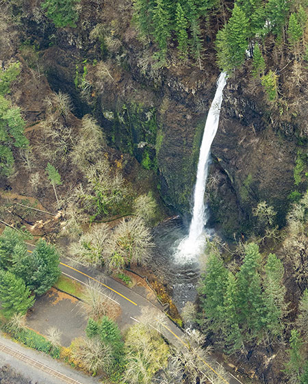
Moving east, the next photo shows the fire’s impact on Wahkeena Falls, among the more hallowed spots in the Gorge. While the burn affected slopes on both sides of the falls, much of the forest here survived the flames.

05aWahkeenaFallsThumb

Aerial view of Wahkeena Falls (State of Oregon)

[click here for a large photo]

A closer look shows Lemmon’s Point (the overlook east of the falls) to have burned, along with the steep cliffs to the west of the falls. Other photos in the set show the Wahkeena Trail above the falls to be heavily affected by the fire, with a lot of debris and fallen trees covering this iconic trail.

05bWahkeenaFalls

Detailed view of Wahkeena Falls (State of Oregon)

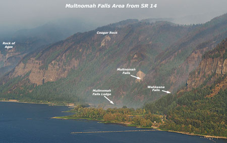
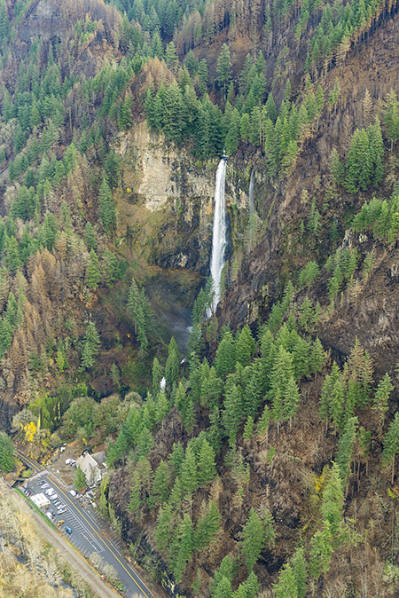
News coverage has provided many views of Multnomah Falls since the fire began, but the new set of aerial views gives a much better look at the impact of the fire on the area. Like Wahkeena Falls, the fire here raged around the falls but left many of the big trees scorched, but alive.

As shown in this photo, the most heavily impacted area near the falls is along the cliffs east of Multnomah Creek, where the Larch Mountain Trail begins its many switchbacks to the top of the falls, and on the steep slopes directly above the falls:

06aMultnomahFallsThumb

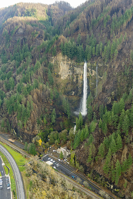
Aerial view of Multnomah Falls (State of Oregon)

[click here for a large photo]

This close-up view shows the low bluff to left of the falls to have been more significantly impacted. The Larch Mountain trail passes through this section of burned forest:

06bMultnomahFalls

Close-up view of fire damage below Multnomah Falls (State of Oregon)

This photo shows a bit more of the west side of the falls and a peek into the Multnomah Creek canyon, above Multnomah Falls:

07aMultnomahFalls

Aerial view of Multnomah Falls and lodge (State of Oregon)

[click here for a large photo]

A closer look at this photo (below) shows burned trees along Multnomah Creek, just above the falls, and along the ridge to the east of the falls that marks the high point for hikers following the Larch Mountain Trail to the viewpoint at the top of the falls. The Forest Service reports that the viewing platform there was undamaged by the fire, though the spur trail to the viewpoint has been impacted by falling debris.

07bMultnomahFalls

Close-up view of the canyon just above Multnomah Falls (State of Oregon)

This photo from just east of Multnomah Falls (below) provides a better look at the slopes where the Larch Mountain Trail scales the Gorge wall. Here, a mosaic burn has left many trees standing, which bodes well for this steep slope holding together as the recovery begins, but will also mean years of falling debris from killed trees and loose slopes for trail crews to clear.

08aMultnomahFallsTrailThumb

Aerial view of the east side of Multnomah Falls (State of Oregon)

[click here for a large photo]

This close-up look at the photo reveals the upper switchbacks of the Larch Mountain Trail as it approaches the ridge crest:

08bMultnomahFallsTrail

Close-up view of the Larch Mountain Trail where it climbs to the top of the falls (State of Oregon)

One of the challenges here will be keeping hikers on the trail, as switchback cutting has been a perennial problem in the Gorge, and especially along this very popular route. The fire provides an opportunity to better educate visitors about the damage that cutting trails can cause, but will require close coordination among state and federal land managers, and help from trail advocates.

This photo (below) provides a view down Multnomah Creek canyon from (roughly) above the Wahkeena Trail junction, and gives a good sense of how the forests here fared. Though heavily burned, much of the burn pattern is still a mosaic pattern. If the living trees in this photo survive their first summer of drought stress after the fire, they should recover quickly and help the surrounding forest regenerate.

09aMiddleMultnomahCreekLarchMtnTrailThumb

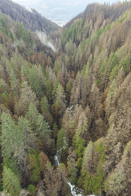
Aerial view of Multnomah Creek canyon (State of Oregon)

[click here for a large photo]

This closer look at the photo (below) gives an excellent sense of how fire affects forests in a mosaic burn. While some trees were killed outright by the heat of the fire, others survived with some or all of their living canopy intact.

09bMiddleMultnomahCreekLarchMtnTrail

Close-up view of the burn along Multnomah Creek (State of Oregon)

When fires are hot enough to explode into tree canopies, fire fighters call this “crowning”, and it almost always means the tree will die. Less heat means that the cambium layer can survive under thick-barked older trees, and fires that don’t rage into the crowns of trees allow foliage to survive, as well.

If the fire burns low to the ground and with less heat, trees like Douglas fir have evolved to have thick, fire-resistant bark that can survive this stress. Even in a relatively small area, as shown in the above photo, all of these fire behaviors can play out leaving a mosaic of living and killed trees. The mosaic effect, in turn, not only allows for a faster rebound of the burned forest and less erosion, but also provides a more diverse ecosystem that benefits the most plant and animal species. Before our intervention over the past century of fire suppression, mosaics from fire were the normal state of our forests.

This is the crux of why prescribed burning — the practice of purposely setting forest fires in a controlled manner to reduce fuels and rejuvenate the understory — is the most ecologically sound path forward for the Gorge. Prescribed fires are usually set in late fall, when the approaching rainy guarantees a short burn and cooler weather encourages fires that are less hot and burn closer to the ground.

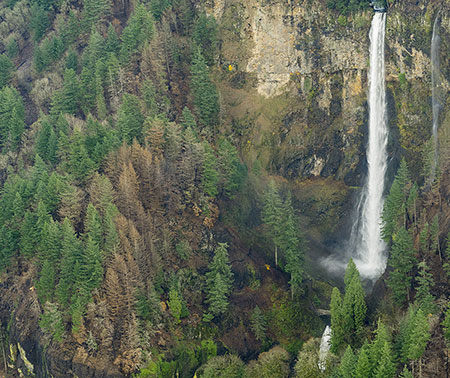
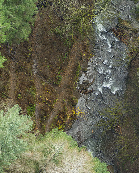
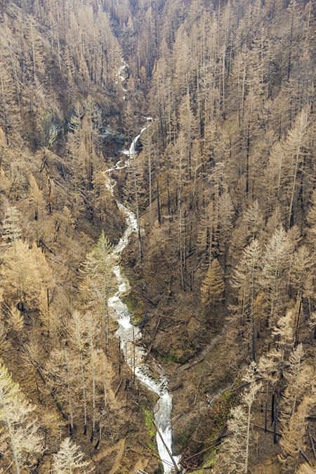
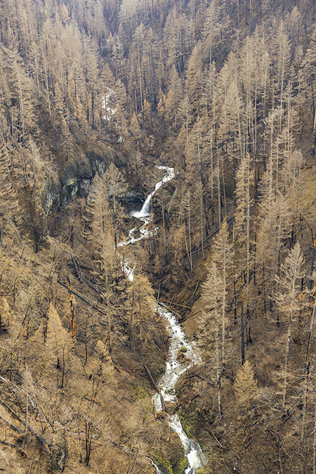
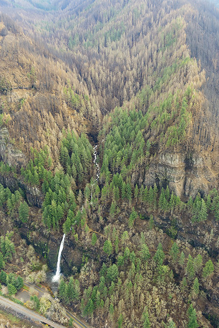
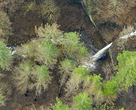
For the next photo (below), you’ll need to adopt the perspective of a dive-bombing bird, as this is a near-vertical view of Weisendanger Falls (the splash pool is at the bottom of the photo) on Multnomah Creek (which flows up in this view). This is the first big waterfall above Multnomah Falls, and though a few trees around the falls were scorched, the forest canopy here mostly survived.

10aMultnomahCreekWeisendangerFallsThumb

Aerial view of Weisendanger Falls on Multnomah Creek (State of Oregon)

[click here for a large photo]

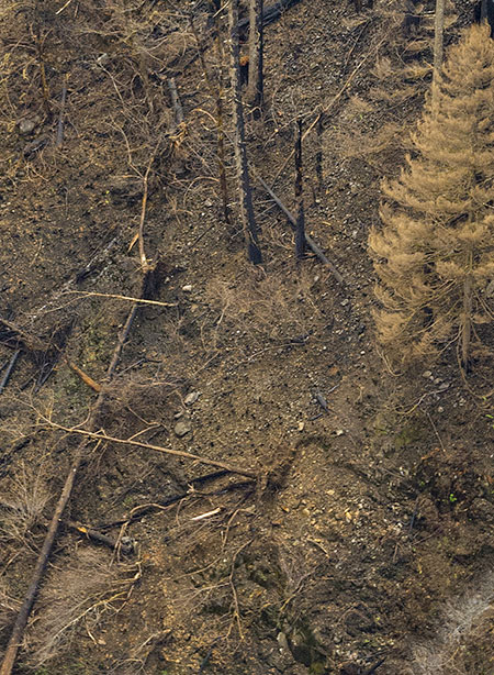
A closer look at this photo (below) shows the Larch Mountain Trail switchbacks that climb above the creek at Weisendanger Falls. Like the switchbacks on lower parts of the trail, this area will require some diligence to keep hikers cutting the switchbacks in the absence of an understory that was burned off in the fire.

Education will be key, as there are simply too many burned switchbacks throughout the Eagle Creek Burn to protect with barriers or other physical means, and these fragile slopes will only recover if they’re left undisturbed.

10bMultnomahCreekWeisendangerFalls

Close-up view of the trail below Weisendanger Falls (State of Oregon)

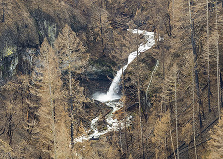
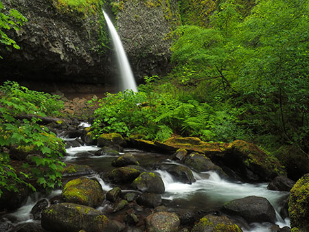
To give a sense of what happened here, this is what Weisendanger Falls looked like from the first switchback along this section of trail a few years ago, before the fire. The good news is that many of the tall conifers here survived the fire, though the lush understory in this old view will take many years to recover.

10cWeisendangerPortrait2008

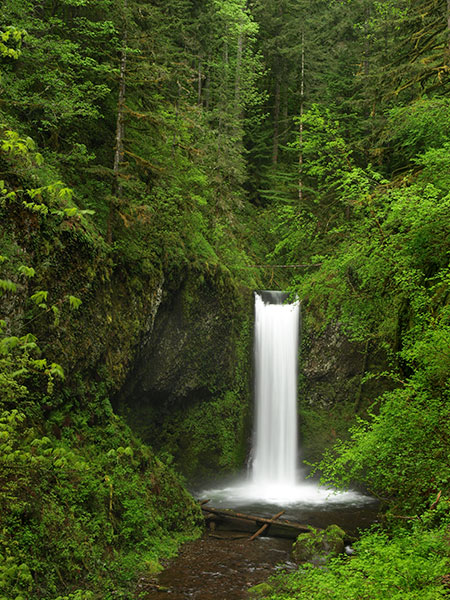
Stately Weisdanger Falls before the fire (Tom Kloster)

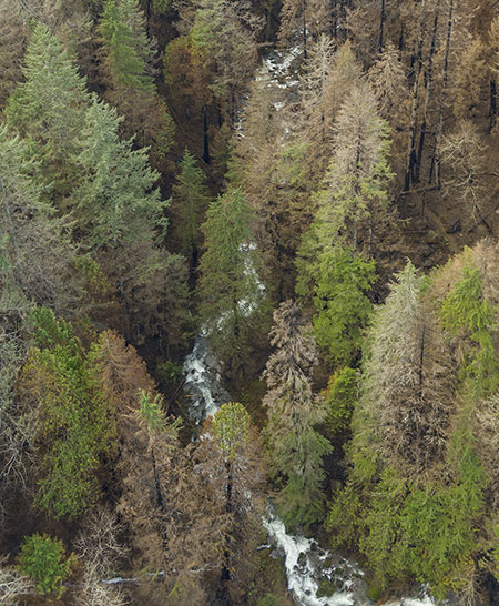
Here’s another birds-eye photo of Multnomah Creek, just upstream from the previous image. This view shows Ecola Falls at the center, the third and final large waterfall on Multnomah Creek, with the creek flowing to the left in this view:

11aMultnomahCreekEcolaFallsThumb

Aerial View of Ecola Falls on Multnomah Creek (State of Oregon)

[click here for a large photo]

A closer look at the photo (below) shows the brink of Ecola Falls more clearly (on the left side of the image), as well as the burned-off cliffs at the top of the photo, above the falls. What shows up here as a brown slope is actually a basalt wall that was once covered in green moss and ferns — you can see a surviving sliver of moss clinging to a vertical section of the cliff in the upper left corner of the photo.

11bMultnomahCreekEcolaFalls

Close-up of the top of Ecola Falls (State of Oregon)

While it won’t happen overnight, the “re-mossing” of burned cliffs and talus slopes in the Gorge will occur in the relative near term of the next decade or so. How do we know this? From recent rock falls and slides in the Gorge, where raw surfaces have been “re-greened” after just a few years of exposure to the cool, wet rainforest environment.

What did Ecola Falls look like before the fire? Most never saw the falls from stream level, as the Larch Mountain Trail passed above the brink of the falls atop a high cliff. But a steep descent into the canyon provided this stunning view for waterfall chasers:

11cMultnomahEcolaFalls2012

Beautiful Ecola Falls before the fire (Tom Kloster)

The understory burned away here, too, though many of the large conifers around Ecola Falls survived. Trees killed by the Eagle Creek fire will eventually drop into Multnomah Creek and in the future, and for many decades to come, we will see log piles accumulate below the major waterfalls.

While this may take some getting used to, log piles were a normal part of stream ecology before fire suppression and logging. This scene along a wild section of Mount Hood’s Salmon River is typical of what our waterfalls once looked like:

11dFrustrationFalls

Log-filled Frustration Falls on the Salmon River in the early 1960s (USFS)

Beyond aesthetics, in recent years stream ecologists have learned that logs and woody debris in streams are an essential ingredient to healthy fish habitat. So in this way, we’re simply returning to the way things have always been in the Gorge, and the coming wave of logs is only new to our eyes.

This photo is from below Larch Mountain, looking down Multnomah Creek toward Multnomah Basin, in the distance. Large stands of old-growth forest dodged the fire here:

12aUpperMultnomahCreekLarchMtnTrailThumb

Aerial view of upper Multnomah Basin (State of Oregon)

[click here for a large photo]

A closer look at this photo (below) shows the Larch Mountain Trail where it traverses a large talus slope along Multnomah Creek:

12bUpperMultnomahCreekLarchMtnTrail

Close-up of the Larch Mountain Trail and Multnomah Basin

In many areas, the fire seems to have skipped over talus slopes like this, hopefully allowing the unique, low elevation population of Pikas that live in these areas of the Columbia Gorge to survive the burn. We’ll know soon enough, as the Gorge Pikas are active year-round, and their distinctive “beep” is unmistakable for passing hikers.

What did upper Multnomah Creek look like before the fire? Here’s a view of the big conifers that lined much of the creek before the burn:

12cUpperMultnomahCreek2011

Upper Multnomah Creek before the fire (Tom Kloster)

In many areas, these trees seem to have survived, though many were lost to the fire. We’ll know the full impact of the fire in the next year or two, after trees that survived the burn have faced their first summer drought and subsequent winter season.

Oneonta Creek to Ainsworth State Park

The following series of images are especially tough to look at. For many, Oneonta Creek is (or was) second only to Eagle Creek for its spectacular waterfalls, famous slot gorge and — until now — magnificent forests. All of this has changed.

As the following photos show in jarring detail, the forests of the lower Oneonta Creek canyon were almost completely destroyed by the fire, with only a few scattered trees surviving. Worse, many of these surviving trees are still fire damaged and likely to die under the added stress of drought next summer.

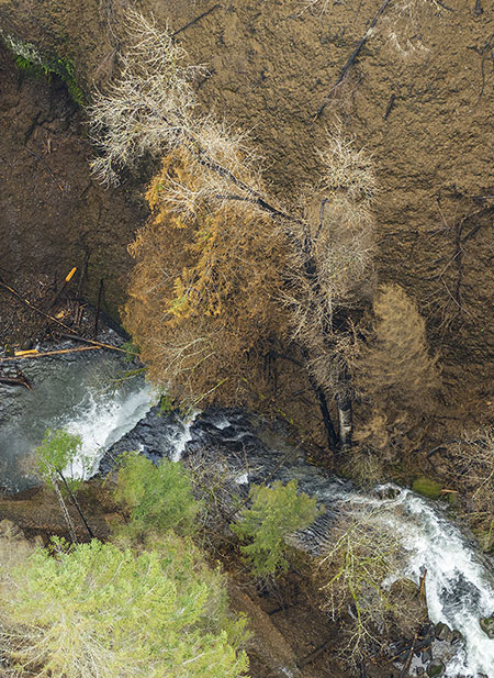
This photo (below) looks up the canyon from the mouth of Oneonta Gorge, and tells the hard story: a few trees on the west slope of the gorge survived, but the canyon beyond is completely burned. Scorched Oneonta Falls can be seen at the head of mile-long Oneonta Gorge in this view:

13aOneontaGorgeThumb

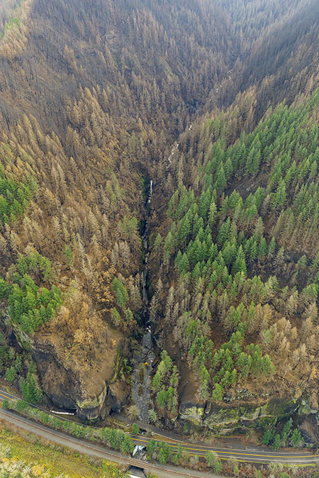
Aerial view of the devastation at Oneonta Gorge (State of Oregon)

[click here for a large photo]

A closer look at Oneonta Gorge (below) shows the devastation more clearly. One of the obvious impacts of the fire is that the infamous logjam at the lower entrance to the gorge is about to get a LOT bigger, as burned logs begin to roll into Oneonta Creek by the hundreds over coming decades.

While the logs will benefit the ecological health of the creek, the logjam in Oneonta Gorge could prove catastrophic to the historic highway bridges downstream, as described in this earlier article on the blog. The fire may finally spur some sort of intervention by ODOT and the Forest Service to remove the logjam.

13bOneontaGorge

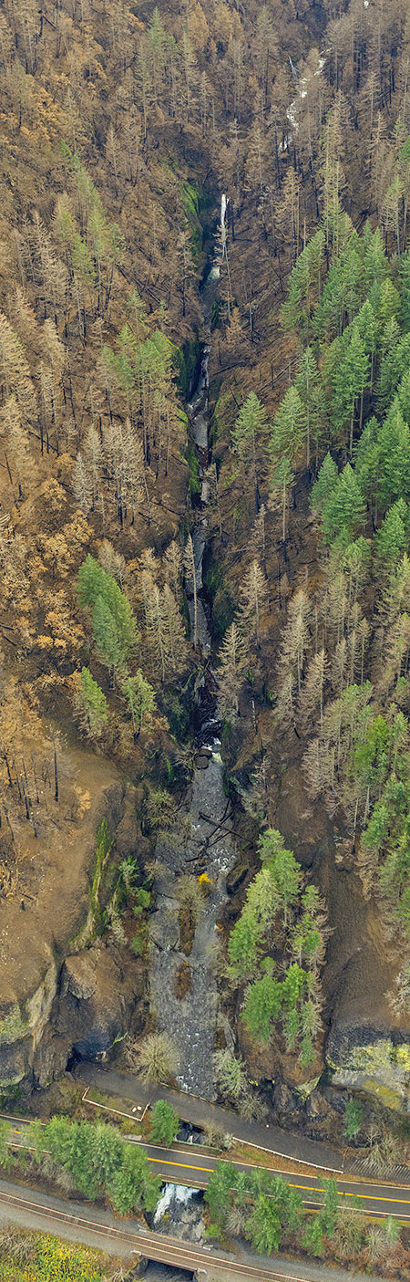
Close-up of Oneonta Gorge (State of Oregon)

The aftermath of the fire also provides the Forest Service with an opportunity to finally close Oneonta Gorge to swarms of teenage waders who overwhelm this place each summer. It’s time give this precious place a much needed rest from the crush of people who have “discovered” it in recent years, and in the long-term, severely restrict access with an enforced permit system.

13cOneontaGorge

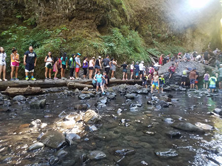
The summer conga line of kids waiting to cross the logjam at Oneonta Gorge (photo: John Speth)

The fire also burned away the wood lining of the recently restored Historic Highway tunnel at Oneonta Bluff, on the left in the above photo, and shown in the photo below. This is another opportunity for a reboot of this historic feature.

13dOneontaTunnel

Oneonta waders had already destroyed the historic tunnel before it burned in last year’s fire (Tom Kloster)

ODOT should absolutely rebuild the historic wood lining, but as thousands of young people proved by thoughtlessly carving their names and messages into the soft cedar surface, the public can’t be trusted with uncontrolled access to this restored treasure.

If it is rebuilt, the tunnel must be securely gated, and only opened on weekends when visitors can be monitored by agency staff or volunteer. This is one of many examples where we have a unique opportunity to set limits on how we use the Gorge, and ensure we pass it along to future generations in better shape than what we inherited.

This photo of Oneonta Bluff, taken above the tunnel and east of Oneonta Gorge, shows a few interesting details on the behavior of the fire:

14aOneontaBluffThumb

Aerial view of Oneonta Bluff (State of Oregon)

[click here for a large photo]

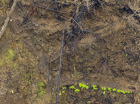
This close-up view (below) from the left side of the photo shows how the fire burned away a segment of the cliff face, while leaving ferns, moss and a few trees clinging to an untouched section of cliff, just feet away. The understory at the top of the cliff was completely burned, but a stand of Douglas fir survived to help begin the recovery here. The Horsetail Creek trail passes through this stand of trees on Oneonta Bluff.

14bOneontaBluff

Close-up of burn patterns on Oneonta Bluff (State of Oregon)

A closer look at the burned crest of the bluff (below) shows trees cut several feet above the ground. These trees were removed after the fire because of their falling hazard to the highway below, not as part of the fire fighting effort:

14cOneontaBluff

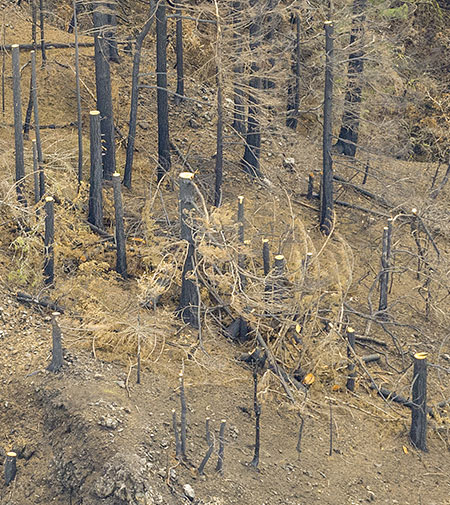
Logged trees above the historic highway on Oneonta Bluff (State of Oregon)

This photo of the entrance to Oneonta Gorge (below) shows the cliff walls inside the gorge green and intact — an encouraging sign that the rare plant and animal species that live here may have survived the burn.

15aOneontaGorgeLogjamThumb

Aerial view of the logjam in Oneonta Gorge (State of Oregon)

[click here for a large photo]

A closer look at this photo (below) shows the logjam at the entrance to Oenonta Gorge already growing with new logs released by the fire:

15bOneontaGorgeLogjam

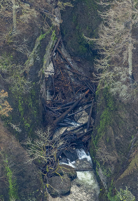
Close-up view of the logjam in Oneonta Gorge (State of Oregon)

This close-up view (below) shows good detail of trees that survived the fire on the cliffs above Oneonta Gorge, despite having their lower trunks burned black in the blaze:

15cOneontaGorgeLogjam

Trees that survived the flames on the cliffs above Oneonta Gorge (State of Oregon)

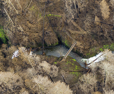
Moving upstream, this photo (below) provides startling detail of the Oneonta Trail, much of it heavily impacted by the fire. This photo also shows the lower Oneonta footbridge, located just above Oneonta Falls where it drops into the narrow slot of Oneonta Gorge:

16aOneontaLowerBridgeOneontaGorgeThumb

Aerial view of the devastation above Oneonta Gorge (State of Oregon)

[click here for a large photo]

Sadly, the forest was completely killed in this idyllic spot. In this close-up view of the photo (below), Oneonta Bridge Falls, the small cascade above the bridge, can be seen with the first of what will be many more logs filling this stream in decades to come. And while the lower Oneonta footbridge seems to have survived the fire intact, the steep, terraced switchbacks climbing the canyon east of the bridge appear to be heavily impacted by erosion that followed the fire.

16bOneontaLowerBridgeOneontaGorge

Close-up of the fire damage above Oneonta Gorge (State of Oregon)

What did this spot look like before? This is the verdant scene that existed here until last September, as viewed from the footbridge looking downstream at the brink of Oneonta Falls where drops into the narrow gorge, beyond:

16eOneontaLowerBridgeView2008

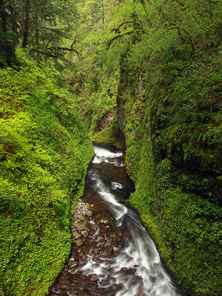
Looking over the top of Oneonta Falls and into Oneonta Gorge before the fire (Tom Kloster)

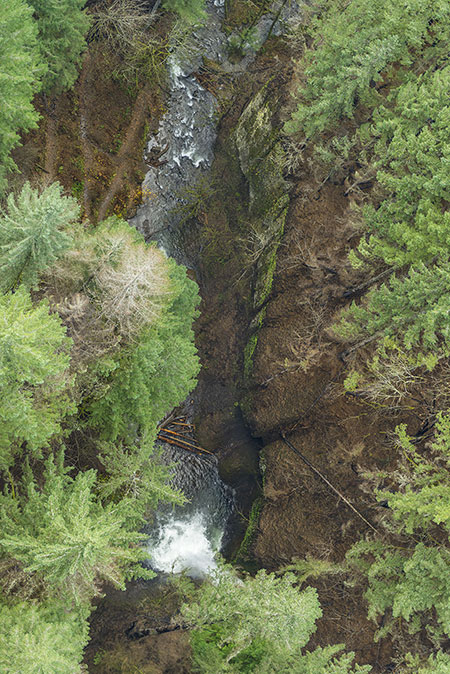
How soon will this area recover? The forests will take decades to return to Oneonta canyon, but the understory will bounce back much more quickly. In this close-up view from the aerial photos, ferns and moss on the steepest walls of the canyon near the lower Oneonta Bridge survived the fire, and will help fuel the recovery here:

16cOneontaLowerBridgeOneontaGorge

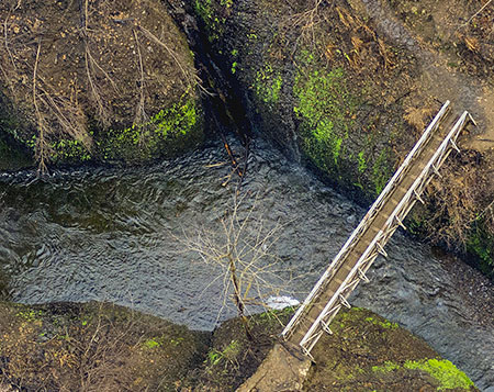
Close-up of the lower Oneonta footbridge (State of Oregon)

This close-up view (below) of the terraced switchbacks to the east of the lower Oneonta footbridge shows Licorice ferns surviving along the vertical stone walls, marking the otherwise buried trail:

16dOneontaLowerBridgeOneontaGorge

Close-up of the steep switchbacks on the east side of the bridge (State of Oregon)

Another surprising lesson from the fire is the important role of the ubiquitous Licorice fern and the moss carpets they inhabit in holding loose rock and talus slopes together in the Gorge. These tiny plants are the living glue that keep the Gorge slopes intact. Fortunately, these will also be among the first plants to return to burned areas.

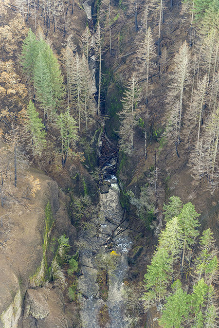
This photo (below) captures Oneonta canyon from Oneonta Bridge Falls (at the bottom, marked by a log lying across the falls) to little-known Middle Oneonta Falls, in the huge basalt cavern at the top of the photo. The terraced switchbacks above the lower Oneonta footbridge can also be seen in the lower left corner of this view:

17aMiddleOneontaFallsOneontaBridgeFallsThumb

Aerial view of devastated Oneonta Creek canyon (State of Oregon)

[click here for a large photo]

This closer view (below) gives a good sense of what we can expect to see over the next few years throughout the burn zone: deep erosion where burned trees and an absence of understory vegetation leaves steep slopes exposed. This view shows a small landslide that has already toppled several burned trees into the canyon:

17bMiddleOneontaFallsOneontaBridgeFalls

Close-up view of a landslides triggered by the fire (State of Oregon)

Waterfall explorers have long visited beautiful Middle Oneonta Falls and its deep cave by following a steep, sketchy boot path on the west side of the canyon. In recent years, a major landslide not only took out the Oneonta Trail, proper, but also this little-known boot path, completely blocking the descent to the middle falls.

This photo of Oneonta canyon (below) shows what waterfall lovers have dreamed of for years: a clear route for a future trail along the east bank of the creek to Middle Oneonta Falls. While the fire has impacted the forest here for generations to come, it also brings an opportunity to enhance the trail network as part of the restoration with a once-in-a-century view of the landscape laid bare.

18aMiddleOneontaFallsThumb

Aerial view of little-known Middle Oneonta Falls (State of Oregon)

[click here for a large photo]

These close-up views (below) from the previous photo show Middle Oneonta Falls in fine detail. The forest and understory here were completely destroyed by the fire:

18bMiddleOneontaFalls

Middle Oneonta Falls (State of Oregon)

18cMiddleOneontaFalls

Middle Oneonta Falls and its huge cave (State of Oregon)

What did Middle Oneonta Falls look like before the fire? It was among the most idyllic spots in the Gorge, though rarely seen. Here’s a photo from better days, when it was a sylvan paradise:

18dMiddleOneontaFalls2006

Beautiful Middle Oneonta Falls before the fire (Tom Kloster)

The grove of Douglas fir on the left side of this image were 50-70 years old before the fire destroyed them, so while I won’t live to see this scene restored, many in today’s Millennial generation will. It’s difficult to confront the loss, but these images from before the fire will be important for younger generations as a visual reminder of what coming the Gorge restoration is working toward.

The following is perhaps the most difficult to view of the new aerial photos of Oneonta canyon. This view shows Triple Falls, the best-known scenic highlight of the Oneonta Trail and one of the most photographed, picturesque scenes anywhere. The fire killed the entire forest and completely erased the understory here:

19aOneontaCreekTripleFallsThumb

Aerial view of the devastation at Triple Falls (State of Oregon)

[click here for a large photo]

This closer look at the photo (below) shows the braided spur trails leading to the exposed viewpoint opposite the falls. The fire burned hot here, rolling into the crowns of many trees, as indicated by blackened bark extending to the tops of tree trunks:

19bOneontaCreekTripleFalls

Close-up view of Triple Falls and the viewpoint trail (State of Oregon)

What did Triple Falls look like before the fire? It was one of the most visited and iconic scenes in the Gorge. Only today’s younger Millennials will see anything like this again in their lifetimes:

19eOneontaCreekTripleFalls2015

The iconic scene at Triple Falls before the fire (Tom Kloster)

The upper Oneonta footbridge at Triple Falls was also heavily damaged by the fire, and may be completely compromised. As this close-up view (below) shows, the decking and railings are completely burned away, and the log span may also be burned beyond repair:

19cOneontaCreekTripleFalls

Burned-out upper footbridge above Triple Falls (State of Oregon)

The burned-away understory (below) also reveals lost trail segments at the Triple Falls viewpoint. A close look at this image shows an upper, abandoned trail alignment (complete with stone wall) that likely dates back to the Civilian Conservation Corps, but had been lost in the undergrowth. The modern route is the most prominent trail in the center of this trail maze:

19dOneontaCreekTripleFalls

Network of new and old trails at the viewpoint revealed by the fire (State of Oregon)

The burn gives the Forest Service an opportunity to rethink and redesign the trails at this overlook, where heavy foot traffic was already causing serious erosion and loss of vegetation, even before the fire swept through last fall.

This photo (below) of the upper Oneonta Canyon shows that it fared better than the steep lower canyon in the fire, as revealed in this view from above the confluence of Oneonta and Bell creeks:

20aUpperOneontaCanyonBellCreekThumb

Aerial view of upper Oneonta canyon at Bell Creek (State of Oregon)

[click here for a large photo]

A closer look at this photo (below) shows a mosaic burn, with large stands of ancient conifers surviving the blaze, while others were less fortunate:

20bUpperOneontaCanyonBellCreek

Close-up of ancient forests in the upper Oneonta canyon (State of Oregon)

Another close look at this photo (below) shows that the fire often killed young, recovering forests (from past fires) while older, nearby stands survived:

20cUpperOneontaCanyonBellCreek

Burn pattern detail in the upper Oneonta Canyon (State of Oregon)

While counter-intuitive at first glance, this is another important lesson from the Eagle Creek fire: part of the natural selection process in our forests is the ability for trees to grow fast, large and tall enough to survive periodic fires, thus surviving to generate the seedlings that will begin the recovery of the surrounding burn.

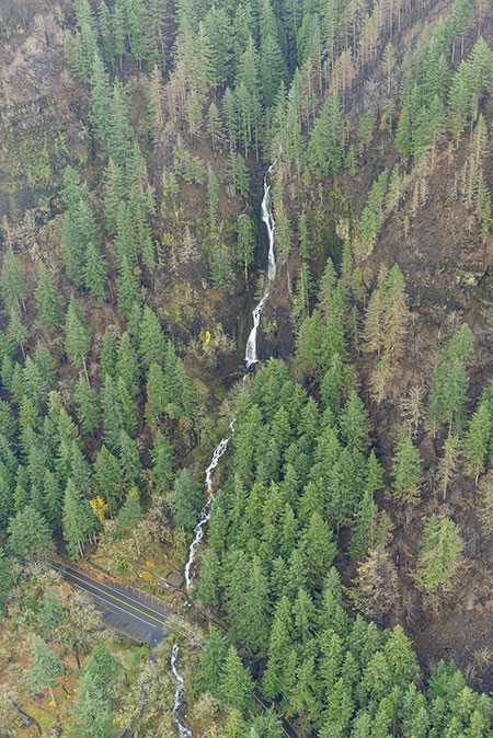
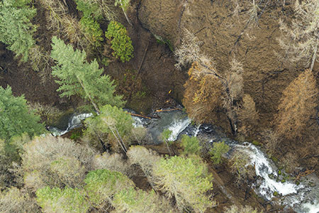
Moving east from the tragically scorched Oneonta canyon, the scene along nearby Horsetail Creek is somewhat less devastating, as this photo from above Horsetail Falls shows:

21aHorsetailFallsCanyonThumb

Aerial view of Horsetail Falls and canyon (State of Oregon)

[click here for a large photo]

A closer look (below) at familiar Horsetail Falls shows many of the big conifers around the falls surviving, even though the fire swept down to the edge of the Historic Columbia River Highway. The Horsetail Creek Trail can be seen climbing the slope to the left of the falls in this view, and appears to be somewhat impacted by falling trees and debris.

21bHorsetailFallsCanyon

Close-up of the fire impact on Horsetail Falls (State of Oregon)

This close-up view of the photo (below) shows the sharp contrast in the severity of the burn in the Oneonta canyon (blackened area to the right) and the Horsetail canyon (mosaic burn to the left). This detail shows how topography and wind patterns work together to determine the path and severity of forest fires:

21cHorsetailFallsCanyon

Contrasting burn patterns along the divide between Horsetail and Oneonta canyons (State of Oregon)

Fans of the informal Rock of Ages trail will find rough going in the future along this informal route that climbs above Horsetail Falls. In this close-up view (below), the entire ridge appears to be burned over. Because the trail is not officially recognized or maintained, falling debris and erosion will take a toll on this route, even if hikers work to keep the unofficial route open.

21dHorsetailFallsCanyon

Fire impact on Rock of Ages ridge (State of Oregon)

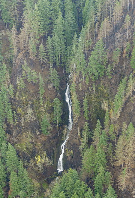
This vertical photo (below) of Horsetail Falls and Ponytail Falls from directly above shows that much of the forest canopy along the lower section of Horsetail Creek survived the fire:

22aHorsetailFallsPonytailFallsThumb

Birds-eye aerial view of Horsetail Falls and Ponytail Falls (State of Oregon)

[click here for a large photo]

A closer look (below) at this photo shows a few killed trees near Ponytail Falls, but mostly a green canopy sufficient to carry most of these trees through next summer’s drought and to long lives ahead:

22bHorsetailFallsPonytailFalls

Close-up of Ponytail Falls showing the scope of the burn (State of Oregon)

22cHorsetailFallsPonytailFalls

What did Ponytail Falls look like before the fire? It was yet another green grotto in the Gorge, framed by graceful stands of Vine Maple. It’s unknown if these small understory trees survived the fire:

22dPonytailFalls2015

Graceful Ponytail Falls on Horsetail Creek in better days (Tom Kloster)

Like the upper Oneonta canyon, the upper Horsetail Creek drainage is largely a mosaic burn. This photo (below) shows large sections of surviving trees that will greatly benefit forest recovery here:

23aHorsetailCreekCanyonThumb

Aerial view of Horsetail canyon, above the waterfalls (State of Oregon)

[click here for a large photo]

A close look at this photo (below) shows Archer Mountain on the Washington side of the Gorge. This view gives a good sense of just how massive the Eagle Creek fire really was, as embers from the fire were carried more than a mile across the Columbia River where they ignited a small fire on the slopes of Archer Mountain.

23bHorsetailCreekCanyon

Closer view of Horsetail Canyon and Archer Mountain, across the Columbia River (State of Oregon)

Firefighters were briefly concerned with the possibility of the fire spreading broadly across the Washington side of the Gorge, but managed to contain the fire to a few acres on Archer Mountain.

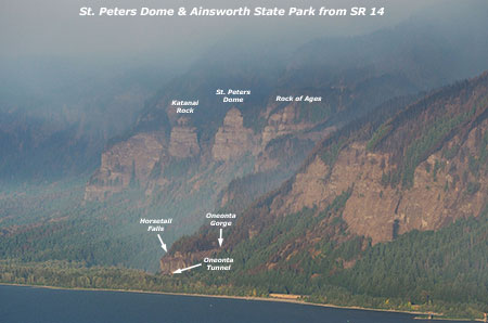
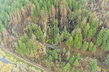
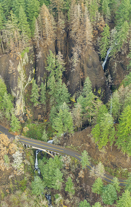
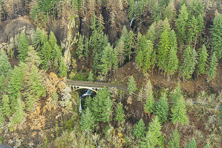
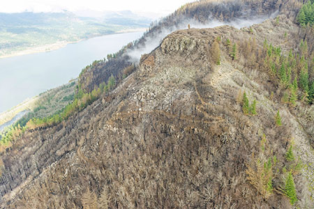
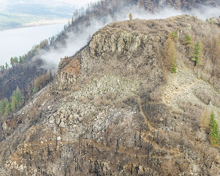
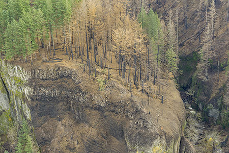
The final photo (below) in the first part of this series shows Yeon Mountain and Katanai Rock in the Ainsworth State Park area. The small community of Dodson spreads out at the base of the 3000-foot high Gorge wall in this area:

24aDodsonKatanaiRockYeonMountainThumb

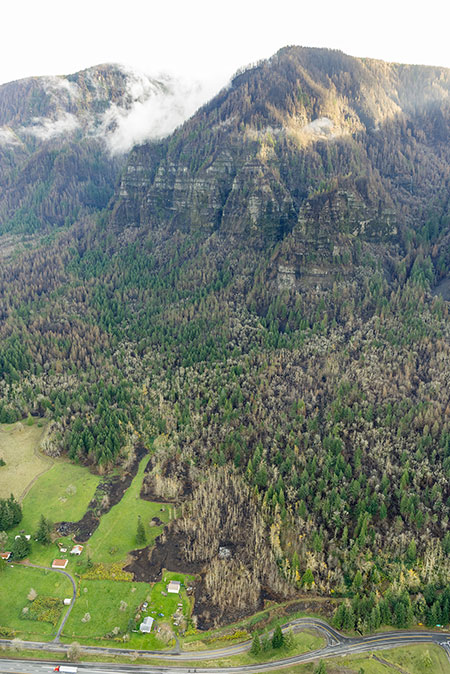
Aerial view of Yeon Mountain and Katanai Rock (State of Oregon)

[click here for a large photo]

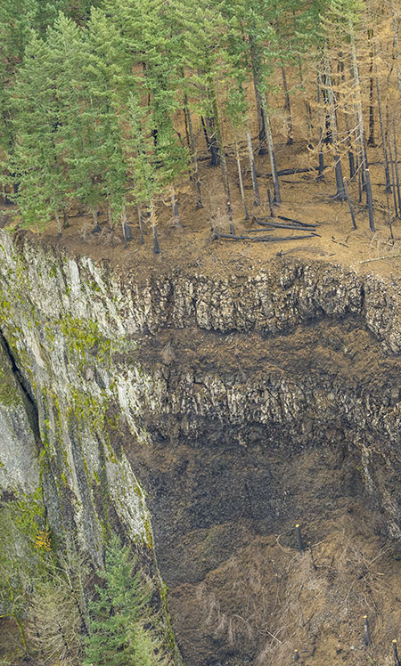
The fire was surprisingly agile here, burning ancient trees perched on remote ledges across the 3-mile long cliff face here (below). The vertical topography protected many old trees, too, where many isolated giants remained out of reach from the flames. The geology of this area is notoriously unstable, with frequent rock falls and mudflows. The loss of forests to fire here is expected to accelerate erosion for decades to come.

24bDodsonKatanaiRockYeonMountain

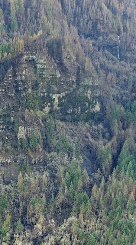
Close-up view of burn pattern on Katanai Rock (State of Oregon)

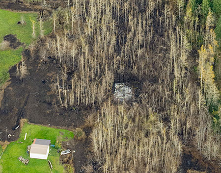
One such mudflow spilled down these slopes in the 1990s, burying a farmhouse to the second story and spreading across Interstate-84, closing the freeway for days. This mudflow had since grown a dense stand of Cottonwood and Red Alder trees (below), obscuring the abandoned, buried farmhouse over the past quarter century.

24cDodsonKatanaiRockYeonMountain

Detailed view of the 1990s landslide near Dodson, now burned over by the Eagle Creek Fire (State of Oregon)

Surprisingly, the Eagle Creek Fire seemed to seek out this young stand of trees, burning it entirely, and finally destroying what was left of the old farmhouse, which can be seen as a rectangle of white ashes in the close-up view, above. Older conifer forests (on the right) bordering the mudflow survived the flames, as did irrigated fields where fence lines served as firebreaks. Scenes like this help us better understand how fires shape the evolution of our forests over time.

Looking ahead…

These photos are hard to look at. For so many of us, the Gorge is a sacred place where we go to escape the stress of urban life and ground ourselves in the perfection and serenity of nature at its most sublime. Seeing the once lush, green landscape reduced to blackened tree skeletons and ashes is shocking, to say the least.

But moving forward, every year will mark what is expected to be a rapid recovery. It also offers us a chance to be part of the recovery. If the 1991 Multnomah Falls Fire is our guide, we’ll see young trees established within a decade and new forests well on their way to maturity by the time today’s Millennials begin receiving their Social Security checks.

That’s reassuring, as learning to understand our place in the natural landscape begins with accepting that we are just passing through ecosystems that existed long before us, and will thrive long after we are gone. Our role is to ensure that future generations inherit healthy, thriving ecosystems that are enhanced by our actions, not harmed by them.

25SwordFernSprouting

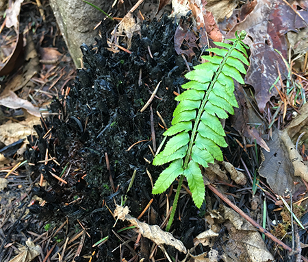
Sword fern front sprouting from its roots after being scorched by the fire (Tom Kloster)

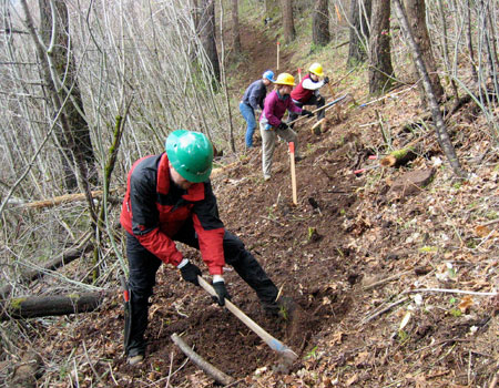
In the meantime, you can do something about the Gorge recovery right now! How? Sign up for a Trailkeepers of Oregon (TKO) trail project. TKO already has several events lined up beginning in February, and there will be many more events to coming for years to come.

This is a great way to give back and be part of restoring our Gorge trails, and no experience is required — just an able body and passion for the Gorge! If you can dig in your garden or rake leaves, you can be a volunteer on a trail crew. You can also support TKO with a donation through their website.

Next up in Part 2 of this article: McCord Creek, Moffett Creek, Tanner Creek, Eagle Creek and Shellrock Mountain.

________________

Author’s note about the photos: a friend of the blog pointed me to the amazing cache of photos featured in this article, and while you could probably acquire them from the State of Oregon, I would encourage you to let our public agency staff focus their time on the Gorge recovery, not chasing down photo requests.  

With this in mind, I’ve posting the very best of the photos here, and have included very large images for those looking to use or share them. These photos should be credited to “State of Oregon” where noted in this article, not this blog. They are in the public domain.

________________


First Look at the Gorge Fire

GorgeFire01

Eagle Creek Fire during the initial, explosive phase (US Forest Service)

Officially the Eagle Creek Fire in the Columbia River Gorge is still fully involved, now at 35,000 acres and just 10 percent contained by firefighters. Rain in the forecast for the coming week suggests that the fire will continue to slow as October approaches, and our attention will turn toward the changes that fire has once again brought to the Gorge.

The Gorge is a second home for many of us, and in some ways the fire was akin to watching our “home” burn. But that’s a human perspective that we should resist over the long term if we care about the ecological health of the Gorge. Fire is as natural and necessary as the rain in this amazing place, though that’s a truth that we have been conditioned to resist. I’ll post more on that subject in a subsequent article.

GorgeFire02

Surreal Gorge landscape under smoky skies from the Eagle Creek Fire (US Forest Service)

For now, we’re just beginning to learn about the impact of the fire, even as it continues to burn. Thankfully, no lives have been lost, no serious injuries reported and very few structures have been lost. That’s a testament to our brave emergency responders (many of them volunteers) and the willingness of most Gorge residents to abide by evacuation orders. It has surely been a frightening and stressful time for those who call the Gorge home.

The impact on public lands is still largely unknown, but the Oregon side of the Columbia River Gorge has one of the most concentrated, most heavily used trail systems in the world, and the damage to trails is likely to be significant. The Forest Service is likely to close affected trails for months or even years in order to assess the damage and determine how best to restore them.

GorgeFire03

1930s hiker at a viewpoint along the Perdition Trail (with Multnomah Falls beyond)

If you’ve lived here for awhile, you’ll also recall that we lost the Perdition Trail, an iconic, prized connection between Wahkeena Falls and Multnomah Falls, to the 1991 Multnomah Falls Fire. The reasons were complex, and it will tempting for the Forest Service to let some trails go, given their shrinking trail crews. We should not allow this to happen again.

Every trail should be restored or re-routed, and new trails are also needed to spread out the intense recreation in the Gorge. Trails advocates will need to work together to ensure this. Trailkeepers of Oregon (TKO) has set up a mailing list dedicated to Gorge trail restoration, if you’re interested in working on future volunteer projects. You can sign up for periodic updates and events here.

______________________

On September 10, I drove SR 14 on the Washington side of the Gorge for my first look at the fire, starting in Hood River. Below each of the following annotated photos, I’ve linked to much larger versions that I encourage you to view if you’re reading this on a large monitor, as they provide a better sense of the fire’s impact.

As hoped, much of the burn is in a patchy “mosaic” pattern, a healthy and desirable outcome for the ecosystem. This is how fires used to occur in our forests, before a century of suppression began in the early 1900s. Mosaic burns allow for mixed forest stands and exceptional wildlife habitat to evolve, even as we might mourn the loss of familiar green forests.

The wind pattern on Sunday had shifted from westerly to a northwesterly direction, producing a bizarre effect: smoke from the fire hugged the vertical wall that is the Oregon side of the Gorge, while the Washington side was cleared of smoke and under a bright blue sky. The view, below, shows this split-screen effect from near Wind Mountain.

GorgeFire04

(Click here for a large view)

Moving west, the combination of ongoing wildfire and back-burning by firefighters was producing a continuous plume along the base of the Oregon cliffs, from Herman Creek east to Shellrock Mountain, as seen below. The Pacific Crest Trail traverses this section, and is undoubtedly affected by the fire.

GorgeFire05

(Click here for a large view)

From the Bridge of the Gods wayside, opposite Cascade Locks, the impact of the fire on the canyons that fan out from Benson Plateau is visible. Some areas (below) show a healthy mosaic burn, while some of the upper slopes show wider swaths of forest impacted. The alarming proximity of the fire to the town of Cascade Locks is also evident in the scorched trees visible just above the bridge in this view. This was a close call for those who live here.

GorgeFire06

(Click here for a large view)

Turning further to the east from the Bridge of the Gods wayside (below), the ongoing wildfire and back-burning shown in the previous photos can be seen in the distance, beyond the town of Cascade Locks.

GorgeFire07

(Click here for a large view)

The scene at the Bridge of the Gods bridgehead (below) is an ongoing reminder that we’re a long way from life returning to normal for Cascade Locks residents. For now, I-84 remains closed and this is the only route into town, and only open to those with proof of residency.

GorgeFire08

(Click here for a large view)

Moving further west, the 2000-foot wall of cliffs in the St. Peters Dome area that stretches from McCord Creek to Horsetail Creek (below) come into view.

Here, the fire has also burned in mosaic pattern, with many patches of green forest surviving. But the frightening effects of the firestorm that occurred in the first days of the fire is also evident, with isolated trees on cliffs hundreds of feet above the valley floor ignited by the rolling waves of burning debris that were carried airborne in the strong winds that initially swept the fire through the Gorge.

GorgeFire09

(Click here for a large view)

A second view (below) of the St. Peters Dome area shows the burn extending toward Nesmith Point, nearly 4,000 vertical feet above the Gorge floor.

GorgeFire10

(Click here for a large view)

Moving west along SR 14 to the viewpoint at Cape Horn, the impact of the fire on areas west of Horsetail Falls comes into view (below), along with a better sense of the mosaic pattern of the burn. This view shows the Horsetail Creek trail to be affected by the first, as well as the slopes on both sides of Oneonta Gorge.

In this earlier piece on Oneonta Gorge, I described the dangerous combination of completely unmanaged visitor access and an increasingly dangerous logjam at the mouth of the Gorge. The fire will almost certainly trigger a steady stream of new logs rolling into Oneonta Gorge and adding to the massive logjam in coming years.

GorgeFire11

(Click here for a large view)

Moving further west, the area surrounding iconic Multnomah Falls and Wahkeena Falls comes into view (below). As with other areas, the fire burned in vertical swaths along the Gorge face, leaving more mosaic patterns in the burned forest. From this view, trees along the popular 1-mile trail from Multnomah Falls Lodge to the top of the falls looks to be affected by the fire, as are forests above Wahkeena Falls.

GorgeFire12

(Click here for a large view)

This wide view looking east from above Cape Horn (below) shows most of the western extent of the fire, with the north-facing slopes of Angels Rest heavily burned, while the west and south-facing slopes were less affected.

GorgeFire13

(Click here for a large view)

A closer look at Angels Rest shows that the burned area in the current fire closely matches the area that burned in the 1991 (below), along with slopes on the opposite side of Coopey Falls. The Angels Rest Trail was heavily impacted by the 1991 fire, and will clearly need to be restored after this fire, as well.

GorgeFire14

(Click here for a large view)

I’ve marked an approximation of the 1991 fire extent at Angels Rest in this closer look (below) at the summit of Angels Rest, based on tree size. Tall conifers burned in today’s Eagle Creek fire survived the 1991 fire, and mark the general margins of that earlier fire.

Areas within the 1991 burn were still recovering and consisted largely of broadleaf trees, like Bigleaf and Vine maple. Depending on the heat of the fire and whether their roots survived, these broadleaf trees may be quick to recover, sprouting from the base of their killed tops as early as next spring.

The recurring fires at Angels Rest offer an excellent case study for researchers working to understand how natural wildfires behave in successive waves over time. This, in turn, could help Gorge land managers and those living in the Gorge better plan for future fires.

GorgeFire15

(Click here for a large view)

Finally, a look (below) at the western extent of the fire shows a few scorched areas in Bridal Veil State Park, including the forest around the Pillars of Hercules. Bridal Veil Canyon appears to have escaped the burn, though some trees near Bridal Veil Falls may have burned.

GorgeFire16

(Click here for a large view)

I’ve titled this article as my “first look” because the story of the Eagle Creek fire is still being written. Only after the fall rains arrive in earnest will we have a full sense of the scale of the fire.

As new chapters in the Eagle Creek saga unfold, I’ll continue to post updates and share perspectives on this fire and our broader relationship with fire as part of the natural systems that govern our public lands. With each new fire in close proximity to Portland, we have the opportunity to expand and evolve how we think about fire, and hopefully how we manage our public lands in the future.

More to come…

Angels Rest Loop: One Way Trip to Heaven?

Looking across the Columbia River in winter to the Silver Star Range from Angels Rest

Looking across the Columbia River in winter to the Silver Star Range from Angels Rest

The popular hike to Angel’s Rest in the Columbia River Gorge is a rite of passage for long-time Oregonians and newcomers alike, because for many of us, this beautiful trail was our first hiking experience. I first hiked the trail sometime in the 1970s, and have returned many times over the years — most memorably, on the inaugural Trailkeepers of Oregon stewardship project in April 2008.

The (formerly skinny and shaggy) author on top of Angels Rest in 1981 and an older, wiser and (and much balder) version in 2013!

The (formerly skinny and shaggy) author on top of Angels Rest in 1981 and an older, wiser and (and much balder) version in 2013!

The trail has a lot to offer, with sweeping views of the Columbia River Gorge and a brief streamside section along Coopey Creek (which cascades over a pair of waterfalls below the trail). Since the Multnomah Falls Fire of 1991, the hike has offered a close-up look at a recovering forest along the upper reaches of the trail. The 1,600 elevation gain over 2.4 miles to the top of Angels Rest is within reach for most hikers, yet challenging enough to give any hiker a thrill when reaching the rocky, often blustery summit.

The Angels Rest trail also has the distinction of being among the most accessible to Portland, with a trailhead located at a freeway interchange 30 minutes from downtown, and with enough parking to supply a small army. Add the emergence of year-round hiking on our low-elevation trails in recent years, and the unfortunate result is one of the most rapidly deteriorating trails in our region.

The Angels Rest trailhead was expanded and improved in 2000 to include stone walls and trailhead signage in the style found elsewhere along the Historic Columbia River Highway

The Angels Rest trailhead was expanded and improved in 2000 to include stone walls and trailhead signage in the style found elsewhere along the Historic Columbia River Highway

The gradual deterioration of this old trail takes many forms. Along the lower section, the once-narrow traverse across moss and fern-covered talus slopes has broken down, with the path now straddling trees (the original trail is the upper third of the tread):

AngelsRestLoop04

Over time, this could damage the roots of the tree in the above photo to a point where it cannot survive. This threatens not only the tree but also the trail, as tree roots are critical in holding steep, loose Gorge slopes together in a climate where annual rainfall exceeds 100 inches per year.

This badly eroded spot is the overlook above Coopey Falls, along the lower trail:

AngelsRestLoop05

The damage here is fairly obvious: the original trail hugged the vegetation line along the right, but the crush of hikers attempting to view the falls has stripped away both vegetation and soil on the left. Over time, this has left roots of trees clinging to edge of the cliffs below exposed and unlikely to survive, making the trees themselves less likely to survive.

Beyond the Coopey Falls viewpoint, the trail reaches the first of many sections showing the impact of year-round hiking on the trail. Here, winter hikers have worn the new path to the left of the main trail tread in an effort to avoid standing water and mud in the main trail, which has become trenched from overuse:

AngelsRestLoop06

Further up the trail, the path has become so wide that the edges are almost hard to determine:

AngelsRestLoop07

The hikers in the distance in the view above offer a clue as to how this happens: as trails widen from overuse, hikers start waking side-by-side. It’s a natural instinct, but one that the trails were never designed to accommodate.

The scene below shows another example of winter hikers wearing down the edges of the formal trail in an effort to stay out of the mud:

AngelsRestLoop08

While walking adjacent to the trail might work for the first few hikers along one of these sections, in the end, it just creates more mud during the wet season — and an even wider trail as hikers continue to push the edges of the trail outward.

Until a few years ago, the effects of hiking were on display to epic proportions along an upper section of trail, where an enormous mud pit formed as hikers continued to walk ever higher on the shoulders of the widening trail:

AngelsRestLoop09

The section shown above devolved so badly that in 2008, the [url]Trailkeepers of Oregon (TKO)[/url] worked with the U.S. Forest Service to simply bypass that segment with a new trail alignment. The following photo shows TKO volunteers constructing this new section in April 2008:

AngelsRestLoop10

While the new trail was built to a conventional width, the continued heavy, year-round crush of hikers has since “widened” this section to nearly double its original width in just five years:

AngelsRestLoop11

The upper trail includes several switchbacks, and these are traditionally the Achilles heel of any Gorge trail. Newbie hikers and kids can’t seem to resist cutting switchbacks.

Normally, this is manageable by simply blocking shortcuts to discourage the relatively small number of rogue hikers. But with the heavy foot traffic on the Angels Rest Trail, the sheer volume of switchback cutting overwhelms the trail, turning well-designed turns into a muddy, sloping mess:

AngelsRestLoop12

The above switchback was also built with the trail relocation project in 2008, and has barely survived five years of heavy travel from Angels Rest hikers.

The long-term answer to overuse at Angels Rest is to provide new, badly needed hiking alternatives in the Columbia Gorge, such as the Bridal Veil Canyon Trail proposed on this blog.

But Angel’s Rest needs help, too. One way to help this old trail survive for future generations to enjoy is to simply cut the traffic in half — not through restrictions or trail fees, but by creating a one-way hiking loop. The rest of this article outlines a proposal for making this happen.

Creating an Angels Rest Loop Trail

Winter view into the Gorge from Angels Rest

Winter view into the Gorge from Angels Rest

The concept of a one-way Angels Rest loop is simple: construct a separate, new route to Angels Rest that would form the return leg of the loop. The result would instantly cut the number of boots on the Angels Rest Trail by half, allowing the existing sections to be rehabilitated so that this old trail can last indefinitely.

AngelsRestLoop14

[click here for a large map]

The proposed loop trail would split from the existing route about 0.2 miles from the trailhead, just before the current route heads across the lower talus slopes (see map, above). The existing trail would continue to be 2-way for the first 0.2 miles, where the gentle terrain allows for a wider trail.

The new route would function as the downhill portion of the loop so that it could be designed with downhill travel in mind. This would include a gentle incline and minimizing the number of switchbacks compared to the current route. This could have tremendous benefits for the existing route, as a disproportionate share of trail damage to the existing route is from hikers speeding downhill.

Upper Coopey Falls would be a highlight of a connector between the new and existing trails

Upper Coopey Falls would be a highlight of a connector between the new and existing trails

The new return trail would also be designed to have a mid-point connection to the existing trail via a new bridge across Coopey Creek at Upper Coopey Falls (pictured above). The purpose of this connection is to bring hikers to the upper falls on a formal trail where several muddy boot paths have already been worn into the canyon walls by hikers seeking a view.

The mid-point connection would also allow less hardy hikers or families with small children to simply complete a lower loop of just over a mile in length, while still respecting the one-way trail system. The mid-way connector would also lead lower-loop hikers past beautiful Coopey Falls, one of the highlights of the proposed return trail.

The new trail would take hikers past the base of beautiful Coopey Falls, located on public land, but currently only reachable by crossing private property

The new trail would take hikers past the base of beautiful Coopey Falls, located on public land, but currently only reachable by crossing private property

From the summit of Angels Rest, the proposed return route would descend through the hanging valley immediately east of summit. This new route would skirt little-known Foxglove Falls, a wispy 120-foot seasonal cascade hidden in the forest, then switchback down to a basalt bench that wraps around the base of Angel’s Rest. Here, the trail passes through the fire zone, and would have broad views of the Gorge before descending in a gentle curve to the new junction at the Upper Coopey Falls connector trail.

The proposed loop trail would traverse below these cliffs on the north side of Angels Rest

The proposed loop trail would traverse below these cliffs on the north side of Angels Rest

From the Upper Coopey Falls connector, the new route would continue to descend, passing the base of Coopey Falls on a new footbridge, then traversing west, where it would reconnect with the main trail near the trailhead, completing the loop.

The new trail would have views like this of the Columbia River Gorge

The new trail would have views like this of the Columbia River Gorge

The new return trail would travel 1.7 miles in its descent, exactly the same length as the climb along the existing trail. Thus, the hike to Angel’s Rest along the new loop would retain the same mileage and elevation gain as it does today.

The Gorge viewpoints along the proposed new trail, along with stops at Foxglove Falls, Upper Coopey Falls and Coopey Falls, would be significant enhancements to the hike, making a classic trail even better. So, what would it take to realize this proposal?

An Idea within Reach…

This 1911 map shows an upper trail to Angels Rest from the long-vanished mill town of Palmer, long before the Depression-era trail we know today was constructed

This 1911 map shows an upper trail to Angels Rest from the long-vanished mill town of Palmer, long before the Depression-era trail we know today was constructed

The proposed loop trail would be built entirely on public lands, and much of the work could be done by volunteers working in partnership with the Forest Service. Beyond the actual trail, here are some of the other elements of the project, and more opportunities to involve volunteers in the work:

Footbridges: the proposed new loop trail would require two new footbridges: at Coopey Falls and Upper Coopey Falls. These could be excellent volunteer opportunities, as volunteers have helped construct other trail bridges in the Gorge in recent years

Invasive Species: like many spots in the western Gorge, the slopes of Angel’s Rest host invasive species – in particular, English ivy, Himalayan blackberry and Shiny Geranium. The new loop trail segment would actually improve the ability to control these species by providing new access to affected areas. Native plant advocates could become partners in the project in order to remove invasive plants as part of trail construction.

Even on the grayest of winter weekends, cars spill far beyond the overflow parking area at Angels Rest, lining the shoulders of the Historic Highway

Even on the grayest of winter weekends, cars spill far beyond the overflow parking area at Angels Rest, lining the shoulders of the Historic Highway

Trailhead Facilities: the existing parking area, including the large overflow area and shoulder parking along the Historic Columbia River Highway, is more than adequate to serve the proposed loop. In fact, the loop is in response to a trail that is inadequate for the parking! But the trail does not have restroom facilities, a serious deficiency with unpleasant repercussions for a site that can have as many as 100 cars on a busy weekend. The Forest Service and Oregon State Parks and Recreation could partner to address this need as part of creating the loop trail.

Ongoing Stewardship: ongoing maintenance of the trail is also well suited for volunteers, and could be a blueprint for a new, more intensive effort to keep trails in top condition, addressing trail damage before it spirals. The trailhead is close to Portland and easy to find, and the proposed loop route would be short enough for most volunteers to navigate with equipment, or when carrying out debris. The low elevation of the trail means more opportunities for volunteer work, and the beauty and close proximity to Portland would make it an attractive volunteer option.

What can you do?

Angels Rest was one of the scenic highlights along this 1938 Auto Club guide to the Historic Columbia River Highway.

Angels Rest was one of the scenic highlights along this 1938 Auto Club guide to the Historic Columbia River Highway.

If you like this proposal, there area couple of opportunities to weigh in right now and make your voice heard:

1. Send off an e-mail to the staff at the Columbia River Gorge National Scenic Area: here’s the link (you can use the feedback form at the bottom of their web page). This is the federal agency responsible for most of the trails in the gorge, and would be the lead agency in making this loop happen.

2. Weigh in with Oregon Parks & Recreation Division (OPRD), the state agency that operates the series of state parks along the Historic Columbia River Highway. While much of the proposed Angels Rest loop trail travels on U.S. Forest Service lands, the loop also crossed state parks lands. Over the next year the state is conducting a long-range planning effort to scope future recreation needs in the Gorge. You can weigh in over here, using their blog comment format to make your voice heard.

The State Parks and Forest Service national scenic area staff work together to plan and maintain trails in the Columbia River Gorge, so weighing in with the state planning effort is an opportunity to make any of your ideas on recreation needs known to both agencies. So far, the State Parks have had fairly light participation in their public outreach, so it’s important to make your views known!

Don’t be shy about including links to the Bridal Veil Canyon and Angels Rest Loop proposals in this blog, either — here are the quick links to paste into your message:

https://wyeastblog.org/2012/01/15/proposal-bridal-veil-canyon-trail/

https://wyeastblog.org/2013/08/31/angels-rest-loop-one-way-trip-to-heaven/

Finally, consider supporting Trailkeepers of Oregon (TKO), a local non-profit, grass-roots organization that offers meet-up trail stewardship projects in the Gorge and around the region (full disclosure: the author is a founding and current board member of TKO and number one fan of the organization!)