Most of us grew up using the word “squaw” as the counterpoint to “brave” in our one-dimensional, Hollywood version of Indian culture. But historians and Native Americans always knew this word to be derogatory and offensive in its original use, so the current national efforts to remove “squaw” from maps and places is long overdue.
In Oregon, the list of places using this name numbers 172, but nowhere was there such a concentration as in the Roaring River high country, where no less than four features — plus a road — were named “squaw”.
Acting on a legislative directive, the Clackamas County Commission began the work of changing the names of “Squaw” mountain, meadows, lakes and creek to “Tumala” in 2007, and the Oregon Geographic Names Board completed the work in early 2008. Tumala is a Chinook word meaning tomorrow, or afterlife, and is as good a name as you might wish for in this lovely mountain blend of craggy peaks, big trees and sunny meadows.

Beautiful Tumala Lakes and Meadows in the Roaring River backcountry
But the work here has only begun. Tumala Mountain and the surrounding country are rich with Native American and early pioneer history, yet little has been done to simply preserve the legacy, much less celebrate it.
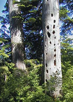
Native Americans hunted and foraged along the high ridges of Tumala Mountain area for centuries, and likely set fires to keep the huckleberry slopes productive.
In the autumn of 1855, a 22-year old U.S. Army lieutenant named Henry Abbot and his 18-year old Indian guide, Sam-ax-shat, led a survey party across the Cascades. They followed the high divide between the Salmon and Roaring rivers, and passed through the Tumala Lakes basin, a protected refuge with water and grazing along the high ridge top.
Abbot’s journey lent his name to the early Forest Service road that would later be built along this route, in the 1920s. A string of fire lookouts, guard stations and a network of trails soon followed in this corridor. The lookout on Tumala Mountain was rebuilt at least twice, before it was finally removed in the 1960s, when the Forest Service burned hundreds of old lookout structures that were no longer in use.

Stairway to the past, these steps once led to the lookout atop Tumala Mountain
Today, the old road to the Tumala Mountain lookout site still exists, but serves mainly to deliver motorcycles and OHVs to the fragile mountain summit. The Abbot Road, itself, has become a sad, dangerous shooting gallery overrun by OHVs and target hunters. Tumala Meadows and Lakes are also within reach of the OHVs, despite efforts to keep them out of this remarkable basin.

The original lookout on Tumala Mountain, pictured in 1916 (USFS photo)
So the name change is a starting point, but the work here is unfinished. At Tumala Mountain, the solution is simple: the area must be managed for activities that build on the natural and cultural legacy, and help preserve the traces that still remain.
The first step in making this transition is to remove the shooters and OHVers from the area. Until they are gone, hikers, picnickers, cyclists and equestrians are unlikely to feel safe visiting the area, and the area will continue to suffer the abuse that is so evident today.

A message from the builders of the old lookout awaits hikers who discover the stairsteps that still remain
Unfortunately, the Forest Service is on the path to do just the opposite: the so-called “Mount Hood Travel Plan” currently underway has proposed that this area simply be written off as an OHV playground. This is unacceptable, and another reminder that the USFS agency mission simply does not allow it to behave as a responsible steward for the land.
But beyond the OHV problem, the second part of the puzzle is how to make the area more inviting for quiet recreation? There is no lack of scenery or interesting destination, after all. Indeed, this would most involve simple measures like better road and trail signs and improving lost campgrounds like those at Lookout Springs and Twin Springs — both would be excellent base camps for equestrians or cyclists. With a few improvements and the promise of finally solving the OHV and shooting problems, the area would become a prime outdoor destination.
This unfinished work can start now, by simply weighing in against the foolish, shortsighted OHV plan with the Forest Service. This would at least stop the bleeding.
But in the longer term, the unfinished work at Tamala — “tomorrow” — Mountain would be better managed by the National Park Service. Tumala is yet another reminder that the Forest Service cannot be trusted to protect and celebrate the natural and cultural legacy of Mount Hood.