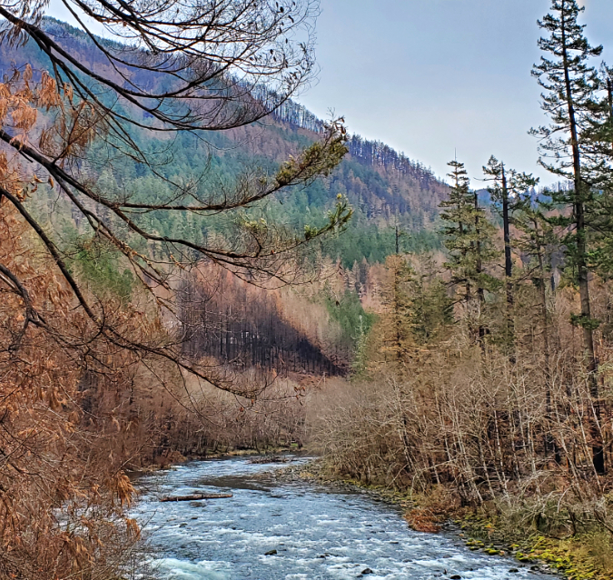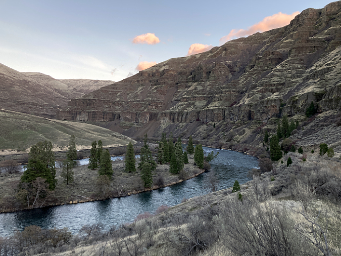
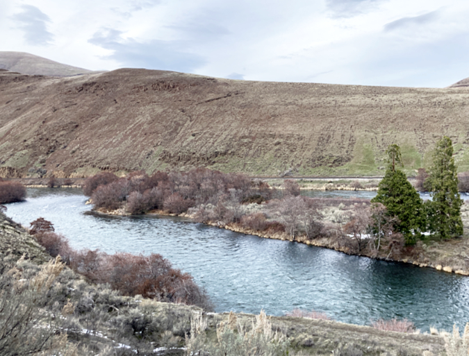
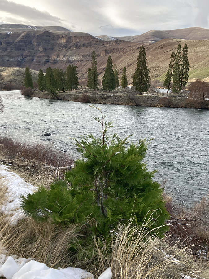
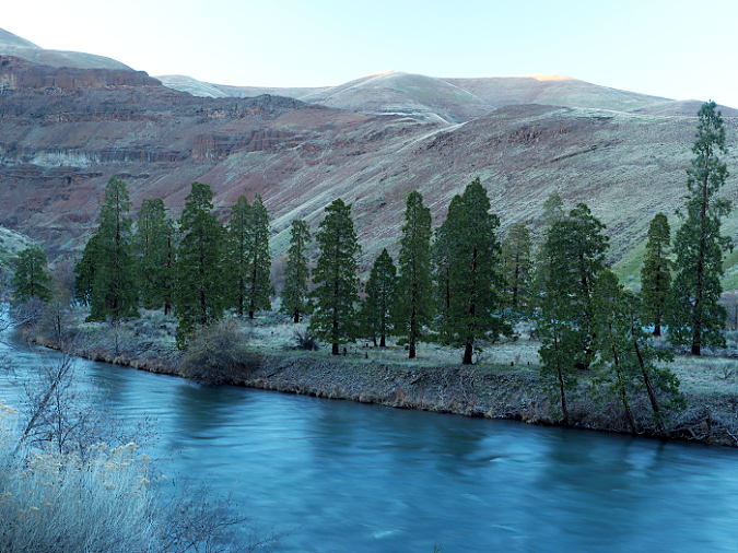
The lost forest on Cedar Island in the Deschutes River canyon
Head north from the tiny town of Maupin into the arid desert canyon of the Deschutes River and you will eventually reach a wide gooseneck in the river, where a low ridge that forms the bend is known as the “Beavertail”. As the gravel access road crests the Beavertail, a river island dotted with trees suddenly comes into view. The scene is startling in an environment where even Western juniper struggle to survive, and the few trees that exist are mostly thickets of White alder hugging the river’s edge.
At first glance, these seem to be Ponderosa pine, a reasonable guess, given that Ponderosa are the most drought tolerant of the big confers in Oregon. But as you approach a few of these trees that have jumped the island and flank the access road, it becomes clear that these aren’t pines at all.
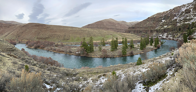
Panoramic view of Cedar Island
[click here for a large panorama]
In fact, this is a lost stand of about sixty Incense cedar (Calocedrus decurrens) trees forming a completely isolated colony in the middle of the desert. They have found a way to thrive more than 20 miles east of the nearest stand, in the Cascade Mountain, where these trees grow along the forested southeast slopes of Mount Hood. Here, they survive with just 10-15” of rain per year, compared to the 40-50” their mountain cousins receive.
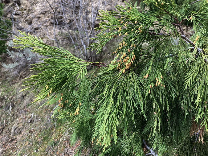
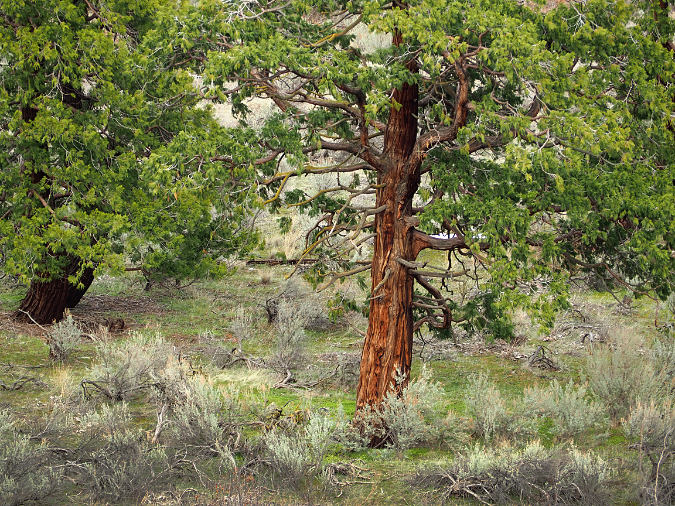
Incense Cedar (Calocedrus decurrens) foliage – a close cousin to our familiar Western red cedar
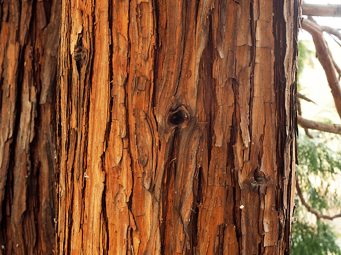
The thick, distinctively reddish bark on Incense Cedar gives the tree some insulation from range fires
A closer look at the bright green foliage of these trees shows Incense cedar to be a cousin to Oregon’s Western red cedar, Alaska cedar and Port Orford cedar. None of these are true cedars, but all are related members in the cypress family, and all but the Port Orford cedar grow on the slopes of Mount Hood.
Of these, the Incense cedar is the most drought-tolerant and thrives on the dry side of the Cascades, among other big conifers like Douglas fir and Ponderosa Pine. Incense Cedar tend to grow interspersed among these other trees, and seldom form pure stands. That’s part of what makes the lost grove on Cedar Island unique, though that’s also a reflection of the extreme environment they have pioneered here – one that other big conifers are not able to survive.
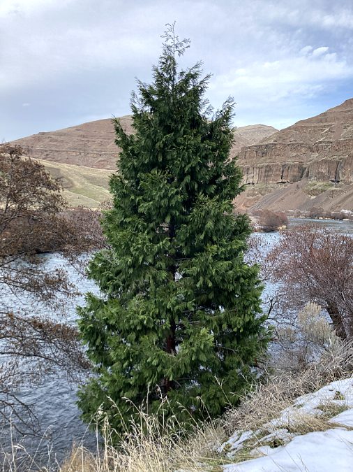
Young Incense cedar have a beautiful conical form that makes them popular trees in urban landscapes
Young Incense cedar are prized as cultivated trees for their brilliant foliage and symmetrical, conical shape (above). As they age, Incense cedar begin to look more like a distant cousin to Giant sequoia, with deeply furrowed red bark and tortured, often multiple-trunked forms.
Incense cedar can live for centuries and reach as much as 150 feet in height at maturity. The champion in Oregon grows in the Siskiyou Mountains, and is 150 feet tall with a circumference of nearly 40 feet. Another dual-trunked Incense cedar in Southern Oregon is known as the Tanner Lake Giant (below), measured at 137 feet tall and more than 40 feet in circumference.
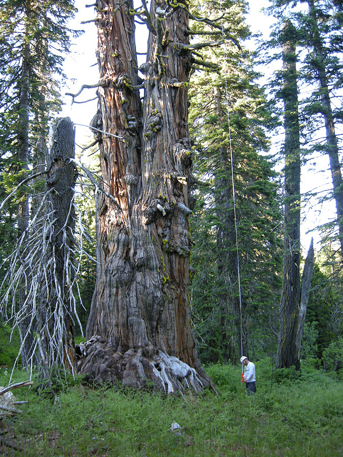
The mighty, two-trunked Tanner Lake Giant in Southern Oregon is more 40 feet in diameter (Wikipedia)
Mount Hood’s Incense cedar stands mark the very northern extreme of the range of these trees, which extends as far south as a few isolated stands in Baja. In California, they grow throughout the Sierras, with big Incense Cedar sprinkled among the Giant sequoia in Yosemite Valley. The trees also grow in isolated groves throughout California’s coastal mountains. In Oregon, scattered stands grow in the Ochoco Mountains and along some of the western ridges of the Great Basin.
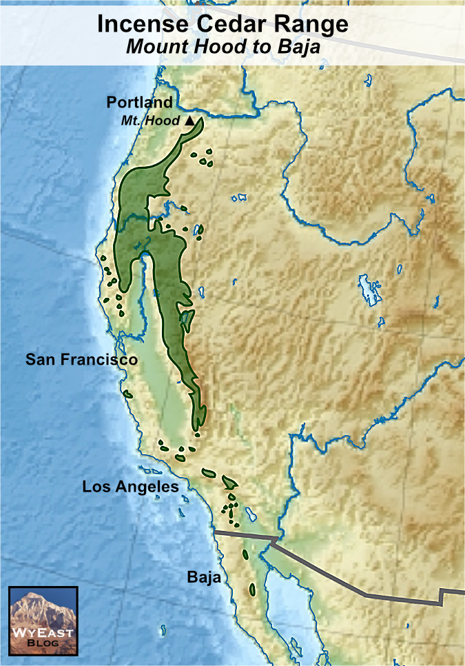
Incense Cedar grow from Mount Hood south to the Baja Peninsula, following the east flank of the Cascades to the Siskiyous and along the Sierras
Most of the isolated stands of Incense cedar in dry places like the California coast ranges or Oregon Ochoco Mountains mark places where mountains rise up enough to produce an island of rainfall in an otherwise dry region. The trees of Cedar Island are just the opposite. Their habitat is at the bottom of a rocky desert canyon makes their ability to thrive here all the more remarkable.
Why here?
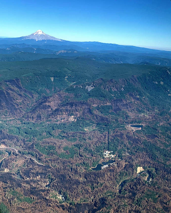
The Cedar Island lost forest of Incense cedar is truly remote. The following perspective view (below) shows just how far Cedar Island is from the green forests of the Cascades, nearly 20 miles to the west. Why did this grove of just 60 trees make its home here?

[click here for a large map]
Part of the answer is the island, itself. While Incense cedar are most often found on dry sites in their typical mountain habitat, the Cedar Island grove lives on a gravel bar in the middle of the Deschutes River, where trees can touch the water table year-round with their roots. While the winters are plenty cold along the Deschutes – similar to the mountain habitat these trees prefer – the summers are intensely hot and arid. The basalt walls of the Deschutes Canyon also act to contain summer heat, creating a true oven during summer heat waves. The ability of the Cedar Island grove to maintain constant access to groundwater undoubtedly helps counter the lack of rainfall and summer heat they endure.
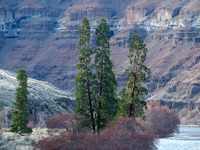
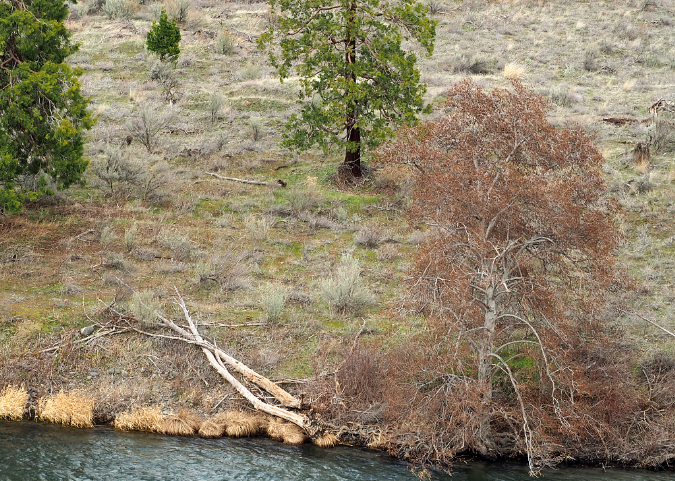
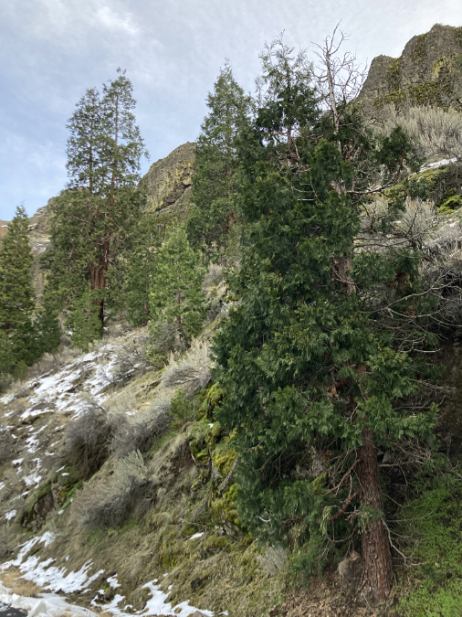
The Incense Cedars of Cedar Island rise above thickets of Red alder beneath the protective west wall of the Deschutes River canyon
Still, there are plenty of other gravel bars along the Deschutes, and only Cedar Island supports a grove of big conifers. What makes this gravel bar different?
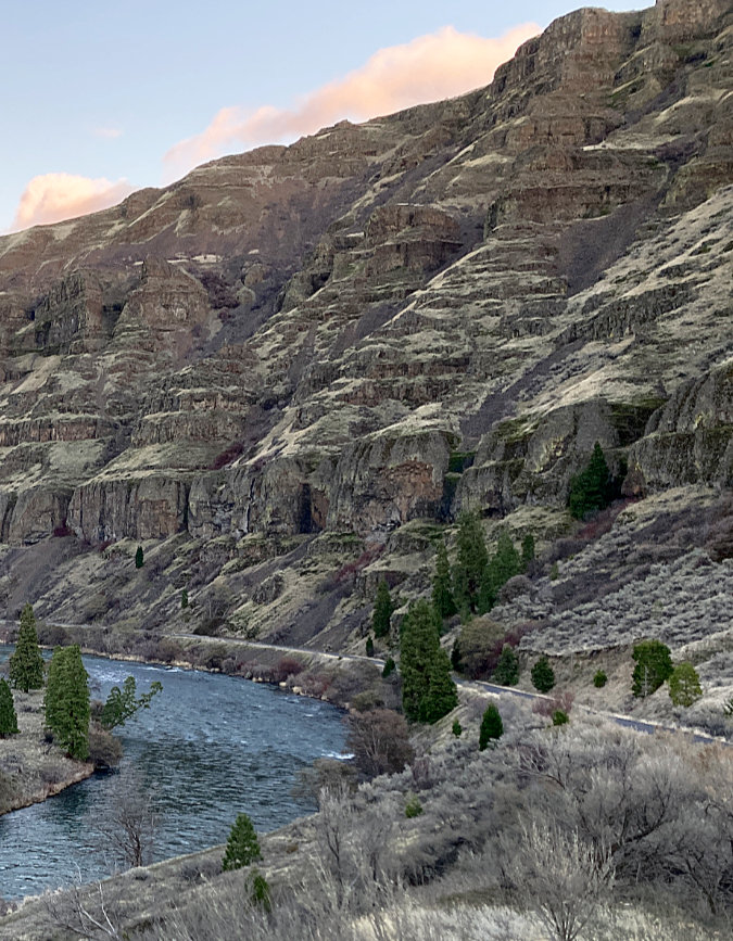
Part of the puzzle is shape of the canyon walls that surround Cedar Island. At the Beavertail Bend, the Deschutes River swings sharply west, then reverses to head directly east, in each case carving near-vertical, 2,000 foot walls of basalt over the millennia. The aspect of these walls helps shade Cedar island by shortening exposure to hot summer sun by several hours per day compared to less protected parts of the canyon.

Cedar Island is protected from mid-day summer sun by towering, 2,000-foot canyon walls to the south and east
The west (upstream) end of Cedar Island seems to confirm the role of the canyon walls in allowing the Incense Cedar groves to survive. This part of the island (below) extends beyond the protective shade of the steep south wall of the canyon, and into the wide section of canyon where it is more exposed to the intense morning and midday sun during the hot summer months.
The west end of Cedar Island seems to be too exposed to summer sun for the Incense Cedars to survive there
Another piece of the puzzle is the gravel that makes up island, itself. While it allows the Cedar Island colony to reach the shallow water table with their root systems, it’s also very well-drained above the water table – something that Incense cedars prefer. At 10-12 feet above the average river level, the gravel bar is also tall enough to avoid being inundated or eroded by all but the worst flood events.
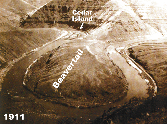
When did the Cedar Island colony become established? That’s unknown, but an image (below) taken from the east canyon rim in 1905 shows the island to be virtually cleared. There are a couple of explanations. First, the photo shows both rail lines that were under construction at the time, a race between two railroad barons that became known as “The Deschutes Railroad War”. It’s quite possible that Incense Cedar on the island were cut by the railroad crews for construction material or simply firewood. It’s also possible that the trees were actually introduced here at the time when the canyon was being intensely developed by the railroads. But the fact that the island was named for its cedars suggests the colony was here when railroad surveyors arrived.

1905 view of Cedar Island from the east canyon rim shows few trees compared to today… why?
Another explanation for the relatively bare island in 1905 could be flooding. Though the Deschutes is not prone to catastrophic floods like rivers west of the Cascades, the upstream dams didn’t exist when the first Incense Cedars pioneered the island. therefore, it’s likely that periodic floods swept across this flat sandbar – which was, itself, created by floods. The colony must have found a way to rebound from these events, assuming the Incense cedar grove has been here for centuries.
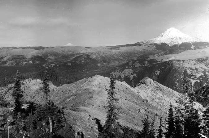
The following images (below) from 1911 were taken from the west side of the canyon and confirm that the Incense cedar grove on the island was much smaller at the turn of the century. These later images marked the end of construction of the railroad on the east side of the river. Today, a smaller colony of Incense cedar grows along the old railroad grade (now the access road) in the shade of the eastern canyon wall.
1911 view of Beavertail Bend from the west canyon rim, looking toward Cedar Island
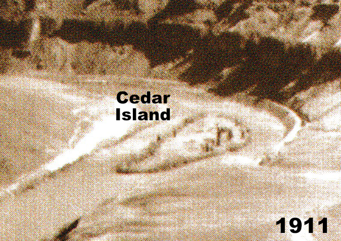
Closer look at Cedar Island in the 1911 view showing just a few Incense cedars growing along the south margin of the island
Yet another explanation for the smaller grove in the early 1900s might be range fires. The sagebrush country of Oregon’s east side burns periodically, and fire is a natural, essential part of the ecosystem. For their part, Incense cedar have fire resistant bark that allows the trees to survive low-intensity fires (similar to Ponderosa pine and Sequoia), but when their crowns burn in more intensive fires, they have evolved to reseed and re-establish themselves quickly on burned ground. It could even be the case that railroad construction triggered a fire that cleared Cedar Island sometime before this photo was taken.
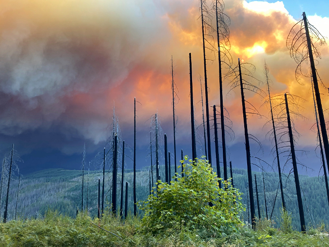
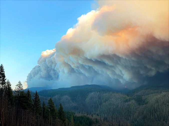
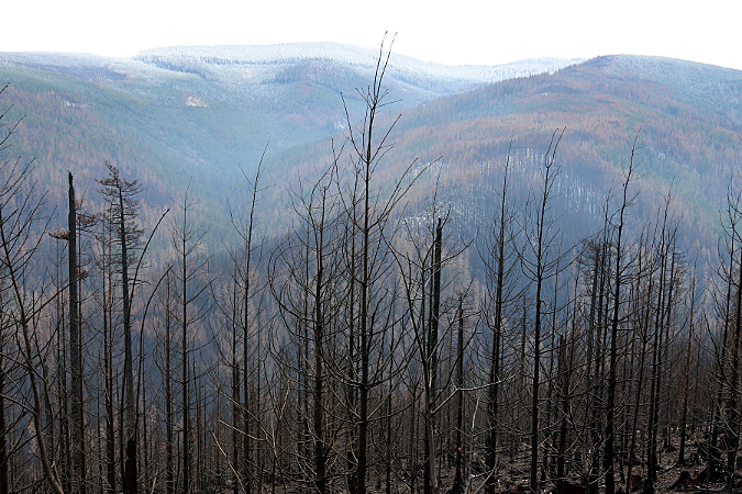
In 2018 a trio of range fires (below) swept through Wasco County, burning much of the lower Deschutes River canyon. The fires destroyed dozens of farm dwellings and outbuildings, too, a painful reminder that fires will always be part of the desert ecosystem here, even with much of the landscape converted to wheatfields. The Longhollow Fire was the middle of the three fires, and burned to the northwest bank of the Deschutes, but apparently did not jump the river to Cedar Island.
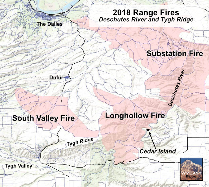
[click here for a large map]
Had the fire reached the island, it could easily have crowned some of the Incense cedar trees. The open, park-like forest here has allowed the trees to keep their limbs almost to the ground, where trees in mixed forests typically lose their lower limbs.
A high crown helps protect a mature tree from low-to moderate intensity fires at its base climbing lower limbs like a ladder and potentially engulfing its crown. But unlike the forest fires that occur in the typical Incense Cedar range, range fires in open sagebrush country are generally low-intensity, fast-moving burns due to the lack of available fuels compared to forest fires, so even trees with low limbs can often survive range fires.
A closer look at the island suggests the fire did not cross the river in 2018, nor have fires burned the island in some time. First, none of the trees on Cedar Island shows burn marks on their lower trunks, a telltale sign of range fires that lasts for decades on trees that survive. Second, the presence of downed wood and a few Incense Cedar seedlings (below) confirms that no recent fires have swept the island, as young trees would almost certainly have been killed and dead forest debris completely burned.
The trunks of the Cedar Island grove don’t show burn marks, suggesting that range fires haven’t swept the island in decades
The downed alder logs in this view would almost certainly have burned in 2018, had the Longhollow Fire jumped the river. The small Incense cedar seedling toward the top of this photo would almost certainly have been killed by fire, as well.
Whatever the cause of Cedar Island being cleared at the turn of the 1900s, the grove of Incense cedars is well-established today, with large trees that could have started life soon after these early photos were taken. Yet, the lack of young trees on the island today is also noticeable, with just a few younger trees sprinkled among the mature stand. This could be due to competition, with the spacing of the trees defined by their root systems, and little moisture left for young trees to get established.

Most of the Incense Cedars on the island are mature, with few small seedlings present
Some of the younger trees that do exist are crowded along the river’s edge, suggesting that other young trees farther from the edge of the island simply couldn’t compete with the larger trees for available groundwater with their smaller, shallow root systems.
In their normal habitat, it would be rare for Incense cedars to hug a stream, but on Cedar Island it may be the only way young trees can become established
One of the secrets of the survival of the Cedar Island grove could be the small group of younger trees growing at the shaded foot of the southeast canyon wall. These are the only Incense cedars from the colony that extend beyond the island, and a number of very young trees are getting established here now. It could be that this part of the grove has helped reseed the island after flood events over the centuries.
It’s hard to see if this group of trees existed in the 1905 and 1911 photos, and it’s likely that railroad construction would have erased any trees in this area, anyway. But without any better evidence, it’s also possible that this branch of the colony is relatively new, seeded here by mature trees on the island after the railroad construction ended. If so, why did the colony move there, to steep rocky slopes far above the river and readily available water table?
This view shows a branch of the Cedar Island colony growing along the base of the eastern canyon wall. These trees are younger and seem to be expanding their presence, despite growing on rocky slopes far above the water table created by the river
The best explanation for this branch colony is probably the sun protection provided by the canyon walls, as these trees are growing in an “elbow” where the north and west facing walls meet, creating a relatively cool setting for much of the day during the hot summer season. But another part of the story is likely groundwater seeping through a steep ravine that cuts through the layers of basalt where the branch colony is centered.
The branch colony of the Cedar Island lost forest is thriving on the south wall of the Deschutes River canyon, with many young trees becoming established in this unexpected habitat
Whatever their origin, the younger grove along the canyon wall is a helpful insurance policy for the survival of the Cedar Island colony over the long haul. These are young trees, yet clearly well-established, so in the event the island trees are destroyed by fire or flood, these trees could be a source for re-seeding the island. Likewise, the island might well survive range fires that could destroy the canyon wall grove and help reseed that part of the colony.
This young Incense cedar in the branch colony may someday play a part in reseeding Cedar Island and helping the lost forest here continue to survive
The mystery of the lost forest on Cedar Island brings more questions than answers, and it deserves more study to better understand the phenomenon and help preserve the colony. I’m hoping this article might inspire a local researcher or graduate student (with a passion for rafting or kayaking!) to step up to the challenge. The island is on public land managed by the Bureau of Land Management, and seems reasonably protected from development, though it doesn’t seem to have any sort of special protection for its unique ecological value.
The lost Incense cedar forest on Cedar Island in the Deschutes River canyon
In the meantime, the island makes for an interesting stop on a tour of the lower Deschutes River canyon, whether by car, bicycle or on the river. The island is located immediately downstream from the Beavertail campground. There are pullouts along the access road with good views of the island, and if you’re up for a walk, you can simply park at a pullout and walk the exceptionally scenic road for a stretch.
Along the way, you’ll pass another coniferous anomaly — the “Big Pine” located just north of the twin railroad bridges at Horseshoe Bend. This old Ponderosa pine grows on a gravel fan at the base of seep that gives it enough year-round water to become quite established here. The BLM has placed a picnic table under the tree and there is a toilet nearby, too.

The “Big Pine” just north of the twin railroad bridges along the Deschutes River access road
From the beginning of the well-marked access road near Sherars Bridge, it’s 17 miles to the end of the well-graded gravel road, so this makes a good adventure if you’re looking for something off the beaten path. Map 6 on the following BLM webpage covers the route from Sherars bridge to Cedar Island and Map 7 covers the remainder of the access road to Macks Canyon:
BLM Maps of the Deschutes River Canyon
Curious about the Deschutes Railroad War? Here’s a short overview that gives some insight into the dramatic rail alignment in the Deschutes canyon:
Deschutes Railroad War (C-SPAN)
For a deeper dive into the Deschutes Railroad War, you can find out-of-print copies of Leon Speroff’s excellent book on the subject, with dozens of historic photos presented in large, coffee-table format.

Leon Speroff’s excellent book covers the surprising railroad history of the Deschutes in detail — plus some of the natural history of the canyon
The Deschutes River access road can be reached by following the Sherars Bridge Highway (OR 216) from where it joins Highway 197 in Tygh Valley. Follow signs to Grass Valley, then turn onto the well-marked access road about a mile after crossing Sherars Bridge. You’ll pass White River Falls State Park along the way, another worthy stop if you’re in the area.
One of the best times to visit the lower Deschutes is in winter and early spring, when campers and rafters are scarce and you will have the place pretty much to yourself. As with all trips to the dry east side of the mountains, ticks, poison oak and even the occasional rattlesnake are residents here, so watch your step and do a tick check when you get home.
Enjoy!