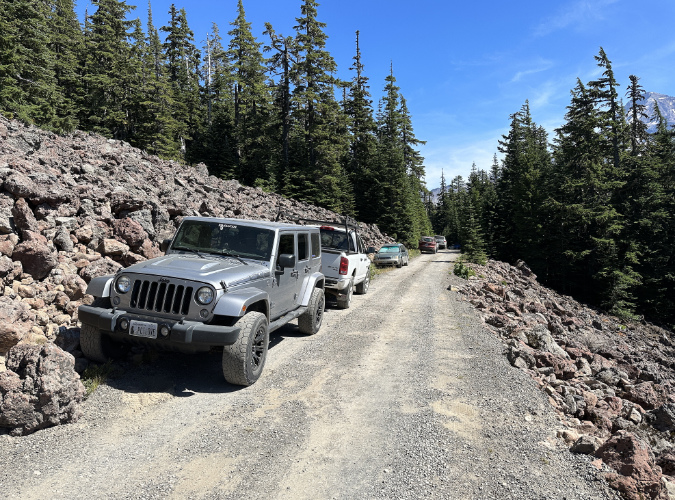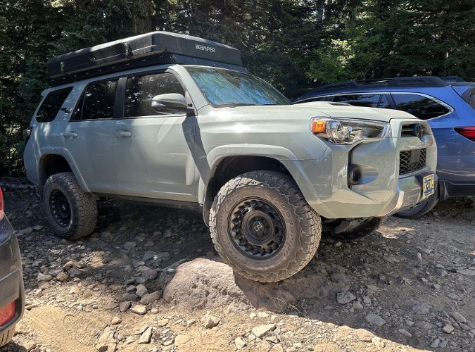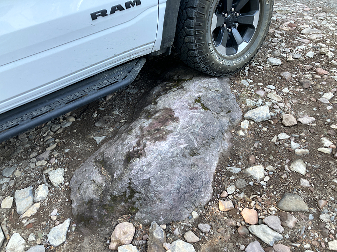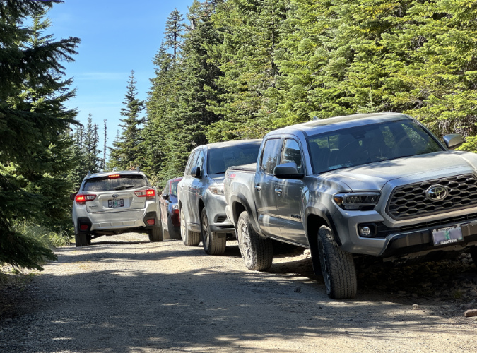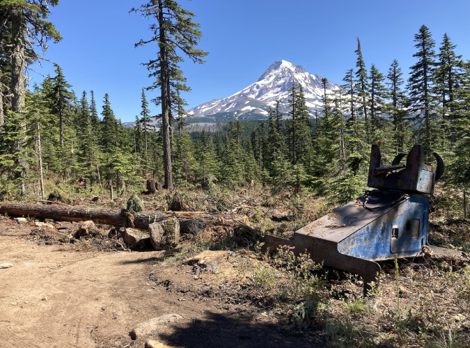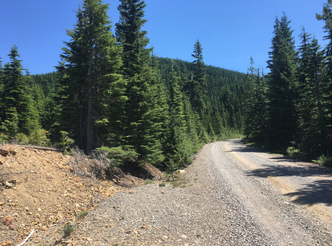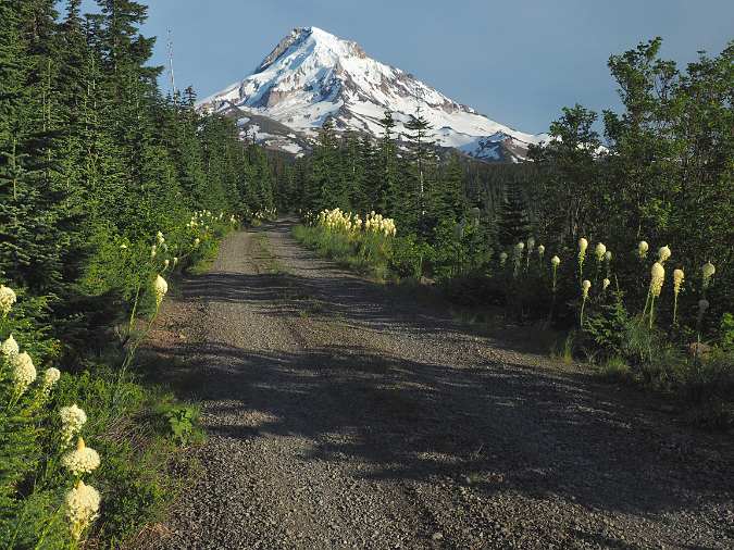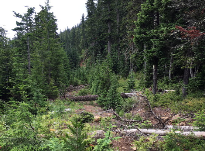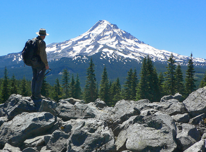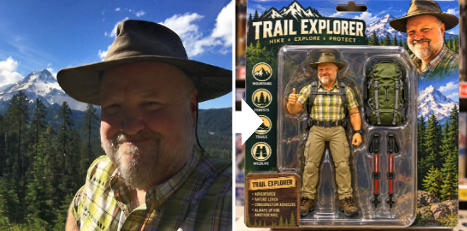
Ah, the good old days of 2024… remember when AI was harmlessly about morphing yourself into an action figure…?
We’re living in a remarkable (and unnerving) time. In just the past three years, the U.S. tech industry has managed to write algorithms so advanced that computers can self-learn (steal?) from anything humanity has posted online over the past 30 years. More remarkable (and unnerving) is the fact that these models have been released to the world to use as everyday tools. Don’t worry, I’m sure everything will be fine… right?
Clearly, there is plenty to be concerned about with the explosive growth of artificial intelligence and creepy, invasive new AI-based applications like “Muse”, Meta’s new “personal assistant” designed to further record (read: monetize) our most personal thoughts. Yikes. But it’s also true that AI has unleashed a new wave of innovation with its uncanny ability to create imagery from typed words and, conversely, compose prose from a simple image. That ability is at the heart of what makes the generative AI models so “human” and therefore useful.
On that more positive track, I’ve been immersing myself in the new technology with a combination of curiosity and trepidation. Like earlier waves of technology that brought us personal computers, cell phones and the internet, AI models are simply a tool. Their use depends on the motives of human behind a keyboard. At least until the models decide otherwise, of course… Hal? Are you reading this? Hal?
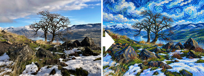
Ask a chatbot to morph a favorite photo memory into a knock-off Van Gogh? Six words and a single take were enough. I wonder if I should now ask the bot to send me one of its ears..?
In that spirit, I thought I would share some of the AI-assisted work I’ve been experimenting with. My goal is to better illustrate ideas that my old-school photos and graphic renderings too often fall short on. I’m surprisingly excited about the potential thus far, and you’ll no doubt see AI-assisted graphics on the blog in future articles — something I will always note, by the way.
I’ve also spent some time with AI-assisted text generation on projects outside this blog, and this is where the technology feels cold, reductive and often exploitive. Yes, it’s a quick way to write a generic memo or outline, but it’s neither fun nor creative to have an algorithm do the writing for you. This side of the chatbot technology gets worse, too: new research shows that AI text generation is much more resource-consumptive than we might expect. Maybe this reality will emerge as a check on rampant reliance on AI to write memos and term papers?
Surprisingly, image generation assisted by AI is surprisingly less resource-consumptive. That seems counter-intuitive, but here’s a relative comparison of the water used (for cooling server arrays) by data centers to generate a large graphic image versus a simple, one-page memo:
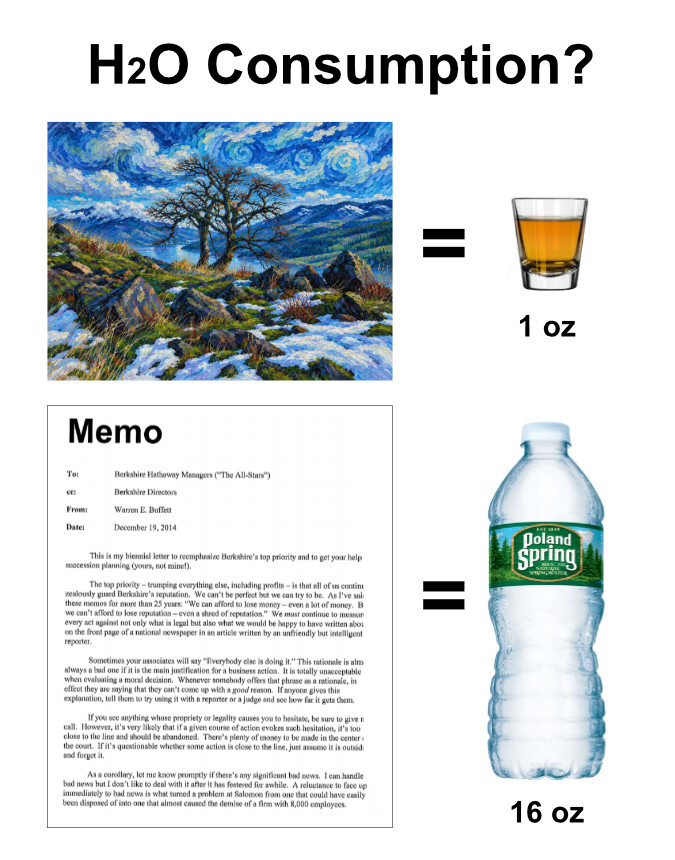
The AI industry tells us they’re building data centers with looped cooling to address this water consumption problem – but make no mistake, the vast number of server farms don’t use looped systems and burn through fresh water at an astonishing rate, as we’ve seen playing out right here in Oregon.
For all of these reasons, rest assured that you won’t be seeing AI-generated text on this blog, not even for editing and proofing — at least while my organic, cell-based fingers can still operate a keyboard. Besides, readers would likely miss the missed typos, run-on sentences and redundancies that are my trademark!
Using AI to merge my imagery and imagination …
If you’ve visited the blog over the years, you know that I love to dreamscape about how things could be.Typically, I rely on real images of things as they are and use marked-up maps, graphics and text to attempt to describe those dreamscapes in my mind. This is where AI-assisted graphics are powerful, fun — and maddening — all at once.
For starters, short of a mind-meld with my computer (big tech is working on that, no doubt), AI models still require me to type commands into a text field on screen – which is comically similar to typing in abstract line code way back in college, when I was learning soon-to-be-useless programming languages. By trial and error, though, you can begin to see how the models “think” and tailor your input accordingly. But it’s surprisingly clunky.
The powerful difference with AI-assisted imagery begins with using my own photos as the base image to build upon. The immense power of the algorithms lies in their ability to “look” at an image I’ve uploaded and quickly find imagery from across the internet that has already been absorbed into the model that corresponds to my editing instructions (and yes, Trekkers, The Borg have arrived…).

Resistance to the AI oligarchs is… futile?
Give the model a base image, a few text prompts and in 15-30 seconds of processing it generates an image that more often than not comes very close to what I had imagined. This is where the process can be both fun and maddening. It’s fun when the AI models immediately generate a screen image that is close to spot-on in matching the one in my head.
This is most often the case when the base image I’ve offered has a lot of references out there on the web for the algorithm to draw from, like the following rendering examples that begin with widely photographed sides of Mount Hood:
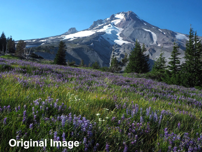
This image is from a lovely summer hike in 2023 near Timberline Lodge, but the sky isn’t particularly interesting. Can AI improve this scene without looking overly fake?
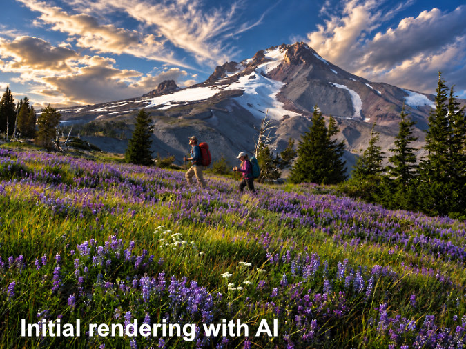
Yowsa! My prompt was to “add dramatic clouds”, and AI took that quite seriously! The only thing missing is Charleton Heston in robes and a giant fake beard shouting “Let my people go!” The hikers were added later, with a separate set of prompts, as I’ve learned AI edits work best in baby steps. As is the case with most AI-assisted images, the dial on color saturation seems to always be turned up to 11, by default.
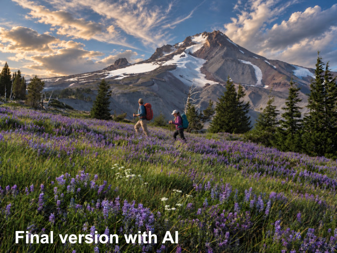
Here’s the final AI-assisted rendering, with instructions to tone down the contrast and saturation and with some slight adjustments to the hikers (e.g., the first hiker is now looking at the mountain instead of his feet). But does it look real?
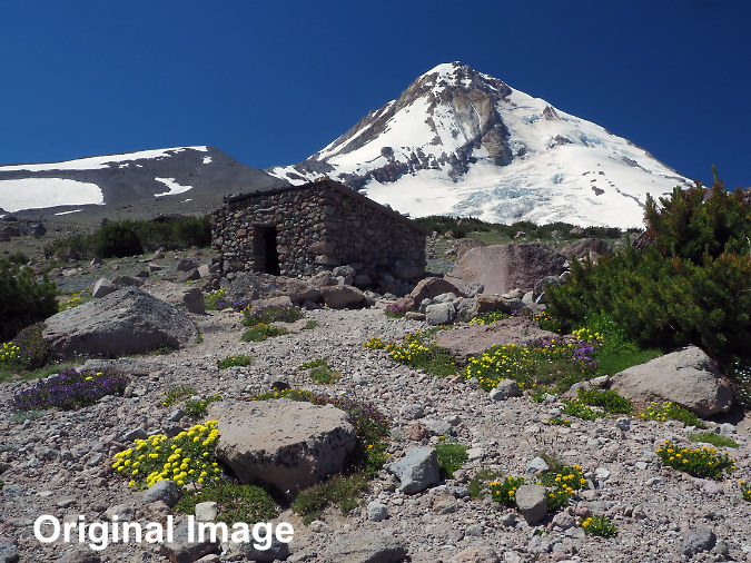
Like the first test image, this view of the Cooper Spur Shelter from early July hike in 2022 had everything but an interesting sky. Would AI be able to help?
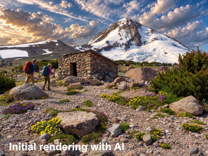
Zoinks! Well, in defense of the AI algorithm, I did ask for “dramatic” clouds, once again. The hikers were added with separate prompts, and correctly rendered as the same hikers from the previous set of renderings – though more about their default ethnicity later in this article.
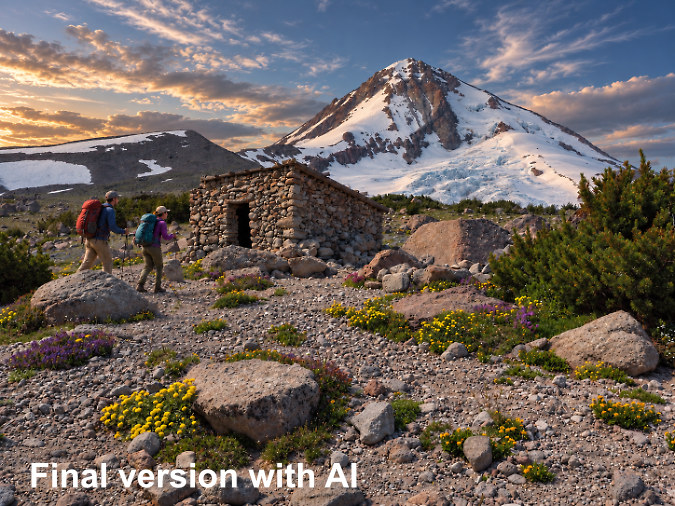
The final AI-assisted version after prompting the AI tool to tone down the color and contrast and make the clouds “less cartoonish and more realistic” (the exact wording of the prompt). Does this look real?
Whether the versions created with AI are an improvement on reality is a matter of taste, and make no mistake, I won’t be using AI to “improve” images I’ve taken around WyEast County. The detail worth pointing out is how the anatomy of the mountain, itself, was preserved in these examples. When AI models render a new image from a real scene, they don’t limit themselves to your uploaded base image, Instead, they redraw everything – even if you instruct them not to. With scenes as iconic as these, the details of Mount Hood are preserved accurately because the models matched countless images to mine. It’s also important to note that when you upload an image, you’ve also just added it to the AI data horde (…again, paging The Borg collective!)
It’s less fun when lesser-photographed sides of the mountain are rendered. When the models lack scooped-up web content for context, they inevitably add features that aren’t there and revise features that are, revealing a propensity to improvise beyond the user query. This is the “rogue” phenomenon many AI critics are rightly concerned about. One curious, recurring example in my experience is morphing the lighting from a base image into evening “golden hour” light without any prompting – you can see this in both of the sample renderings above.
Correcting errors is perhaps the least enjoyable part of AI-assisted image creation. It’s something I would describe as trying to fine-tune delicate brush strokes with puffy oven mitts on both hands. The models often spiral into still more errors at this point, making working with them maddening, despite their otherwise uncanny power.
Sometimes, the AI errors veer wildly from reality, often comically. These are politely called “hallucinations” by the folks who write these algorithms. The following are some examples where it took multiple prompts to navigate the power AI tool back to realm of physical reality, with the models often repeating the hallucinations over and again.
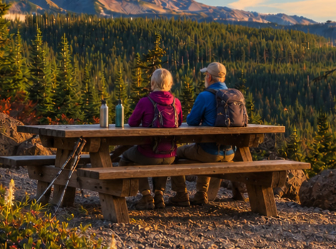
This image is why Open AI always includes this disclaimer in tiny, nearly grayed-out print: “ChatGPT can make mistakes. Check important info.” Important info? As in, how to extract hikers somehow fused into a picnic table? Well, at least they’re still enjoying the view..!
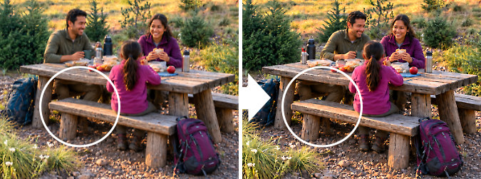
I’ll give this edit a 50 percent credit: when instructed to move “dad” from the end of the table to the far bench, the model complied, but only met me halfway. Dad’s lower torso and legs stayed behind, still seated in their original location. Still, AI dad’s upper half seems to be smiling and enjoying the picnic…
Beyond the glitches and hallucinations, there’s another concern with AI imagery that has become increasingly jarring the more I have used it. Without specific prompts, AI invariably generates humans as exclusively white, very fit and young. Always. In the examples above, deviations from this default are only because I specified “older” or “Latino” after the AI algorithm generated the young, white default version of humanity that it prefers.
This troubling bias has been widely critiqued, and deservedly so. But seeing it play out in your own work brings home the reality that the creators of this technology also happen to overwhelmingly align with the same narrow demographic their models churn out in imagery.
This is also one of the built-in, racist biases of AI that makes it so problematic in text generation. Yes, it’s easy enough to spot these patterns of race, gender or age bias in images, but it’s much harder to pick up the nuances that add up to systemic bias in text.
The following examples are from a sequence that required more than a dozen iterations between the AI default and a final, highly-edited version. Along the way, still more negative age and racial tropes crept in, unprompted – both a reflection of the tech creators and the information their AI engines glean from the internet. It’s jarring, but also an important reminder that it’s on us as users to carefully manage these tools against their built-in biases.
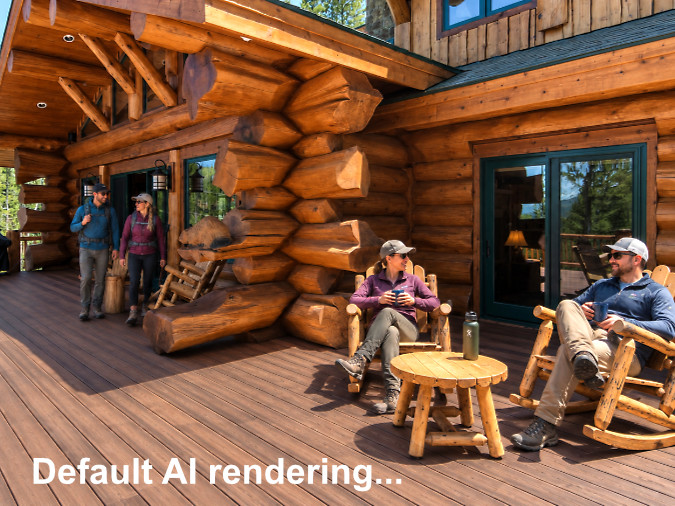
There’s a mix of truth and AI bias, here. While the outdoor community has historically been overwhelmingly white, a simple Google image search shows how much this has changed in recent years. Yet, AI consistently produces defaults like this because that’s what it has been trained on.
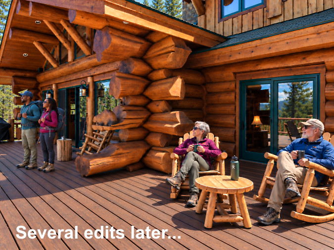
Asking AI to diversify the scene took many edits to get to an older couple seated and a Black couple standing. Is this scene so impossible in real life so as to have escaped the AI bots that perpetually comb the web? Therein, lies the built-in bias, along with many tired race and age stereotypes that continue to persist in AI-generated images.
If you’ve read this, far – thank you! My original goal with this article was to simply post an upgrade to the original Vista Ridge trailhead concept using AI-assisted imagery. But it felt awkward to drop a bunch of AI-enhanced images into the blog without some explanation of why and how I will use it going forward. Hopefully, this explanation does that!
Now, with all of these caveats, the second part of this article is a revisit a proposal from 2023 to re-imagine the Vista Ridge trailhead on Mount Hood’s north side – this time, presented with some help from AI to (hopefully) tell a more compelling story.
Re-imagining the Vista Ridge trailhead… again!
Only three years have passed since I first proposed a revamp to the Vista Ridge trailhead, yet the need has only grown. I could have said three “short” years, but the intervening time seems like an eternity when the current federal state of affairs is factored in.
Today, we find ourselves with a deeply hamstringed U.S. Forest Service doing its best to keep up with unwelcome mandates from an administration bent on looting our public lands – and with a skeleton staff that has been cut by as much as 30% by the same administration. These impacts on the Forest Service will take years to undo, and they make an even stronger argument to find fairly creative solutions to better manage overburdened sites like the Vista Ridge trailhead.
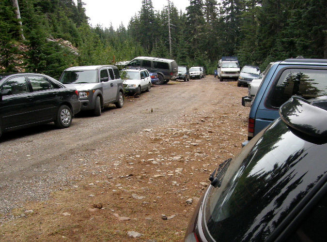
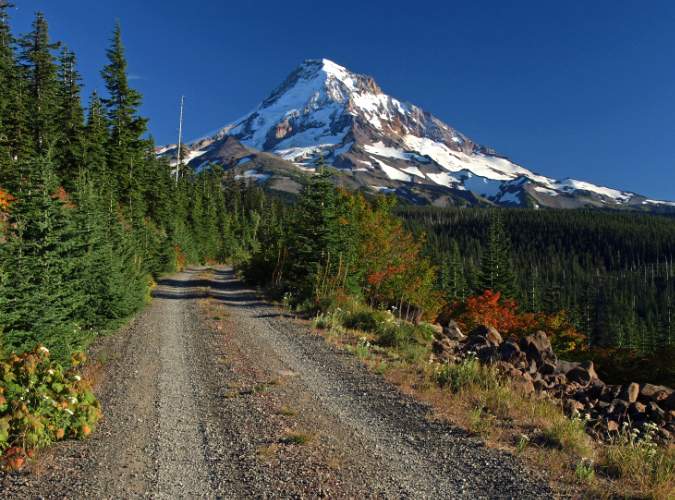
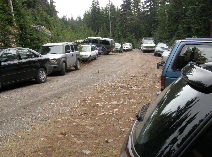
The Vista Ridge trailhead is really just the stub of a 1960s-era logging road whose construction was finally abandoned where it ends today. Thus, the chaotic jumble of cars that jam this dead-end on busy summer weekends, where simply turning a vehicle around becomes a challenge.
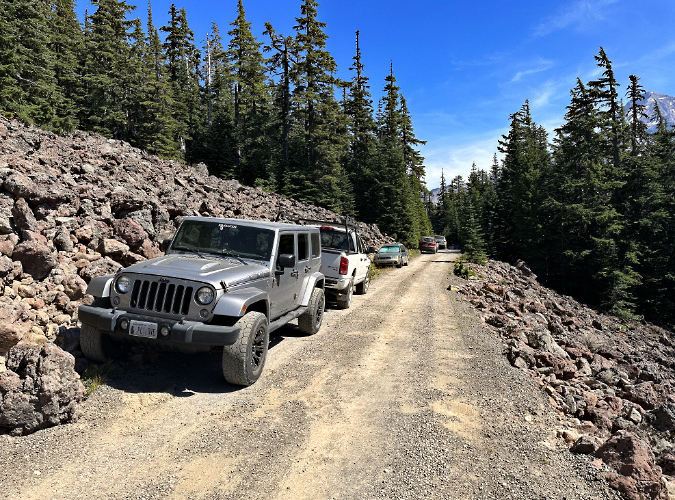
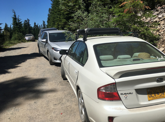
In recent years, the overflow from the parking area has spilled down the access road, create unsafe conditions in several spots that were never designed for two-way traffic or roadside parking.
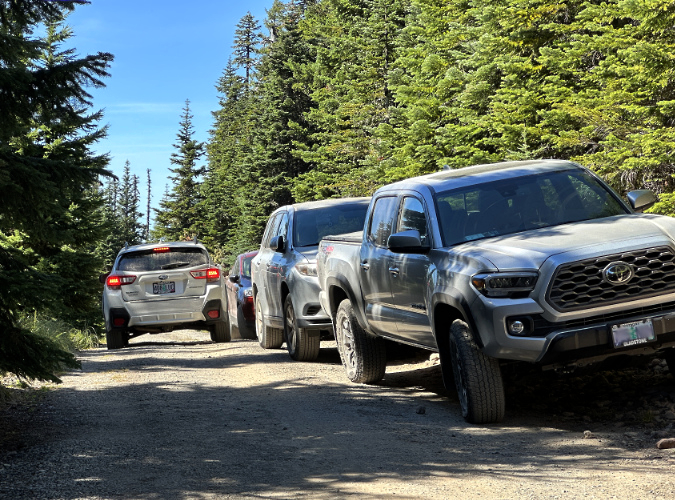
There’s no warning for arriving hikers when the parking area is full, forcing folks to awkwardly turn around in a confined space, then find a spot along the access road – often encountering yet another incoming vehicle with no room to pass. Thankfully, there has never been a need to evacuate this trailhead in an emergency.
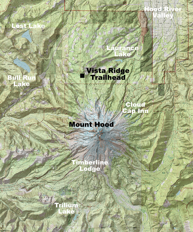
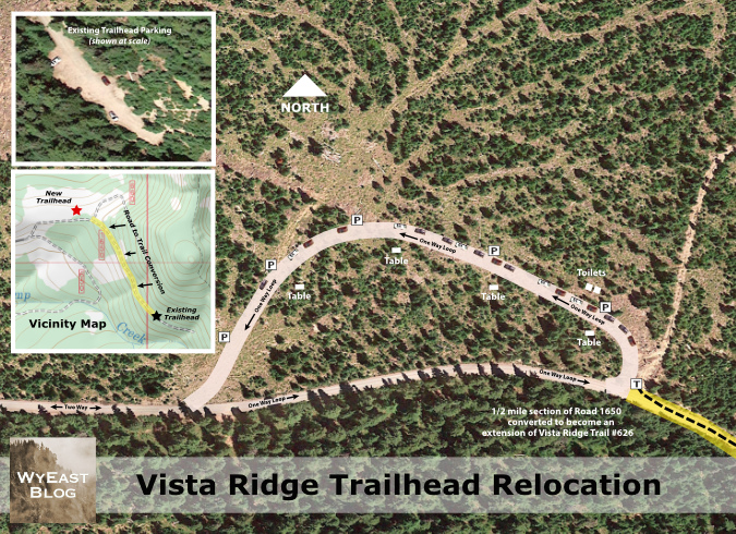
To tell a better story, I used AI to create a new map of the proposal. The new version still uses a Google Earth base, but AI allowed me to show the proposed one-way loop in a more realistic way. I was also able to “revegetate” some of the recently logged areas where a Forest Service thinning project was completed in 2020. As a tool, AI image generation did well on these fronts. But then it got clunky.
So, I ended up using the AI-generated map as a base, and added the rest of the map details – picnic tables, tents and tent sites, small buildings and all of the map notation – using conventional graphic applications. I also corrected some issues in the base image that AI just couldn’t figure out. One of the more frustrating of these is the Lego-block looking pattern that AI morphed the Google Earth tree canopy into. This turned into one of those spiraling dead-ends with AI that only got worse as I tried to nudge to tool back on track. AI won that battle, and thus the Lego Forest™ map.
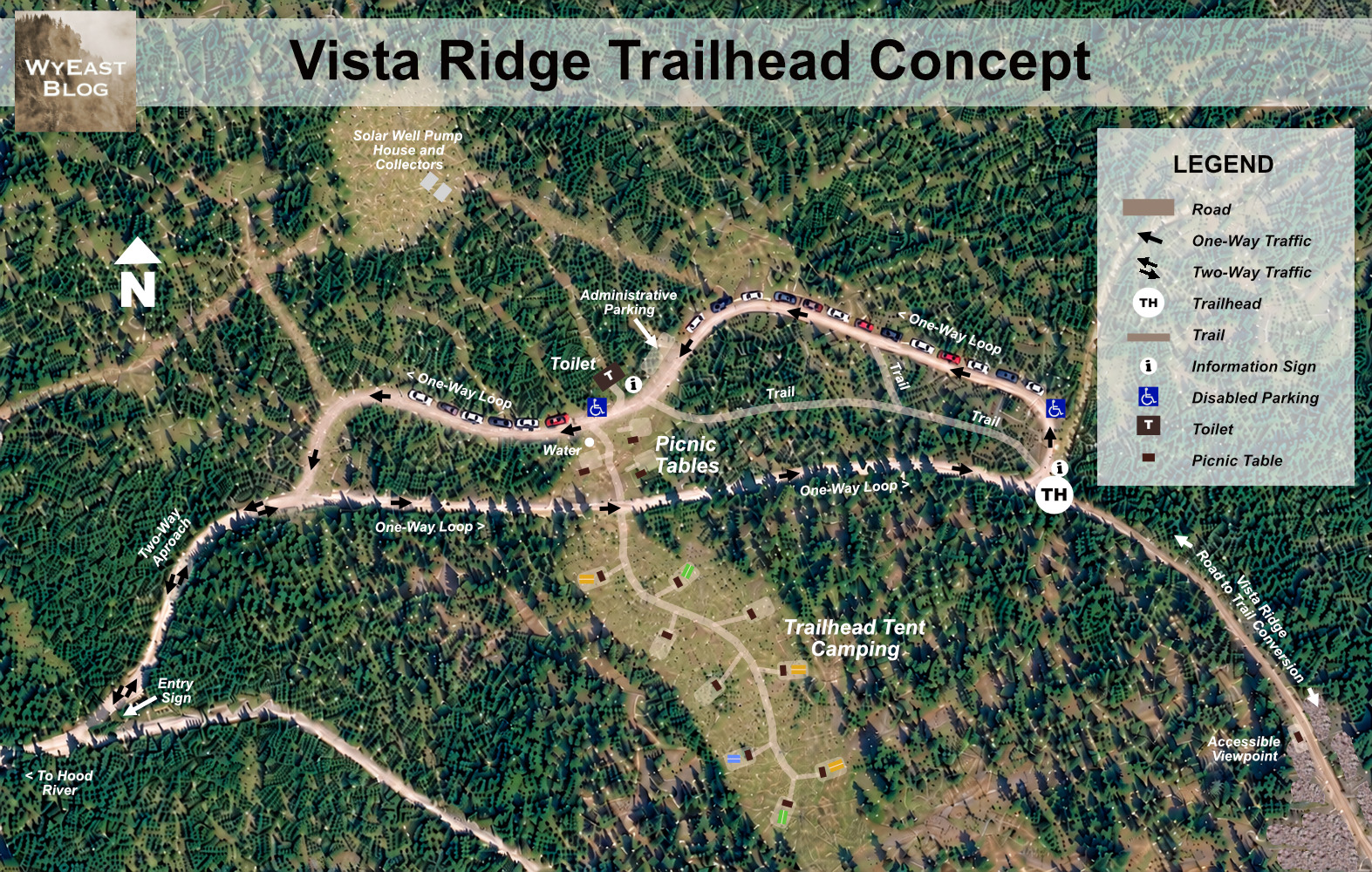
(click on the map to enlarge)
A recurring question from the original article: so, why a one-way loop? It turns out these designs can provide the most efficient, managed format for parking. For convenience and efficiency, the design ensures that hikers arriving at the trailhead would always reach the closest available spot to the trailhead first. No need to circle.
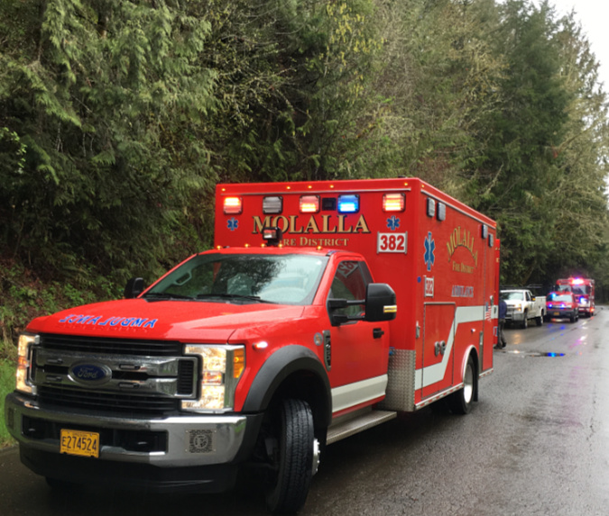
More importantly, emergency responders would have a place to both park and turn large vehicles around, as well as evacuate people in the event of an emergency. To further protect hikers from cars, trails within the loop would connect to both the trailhead and the tent camping area, reducing the number of people walking along the loop road.
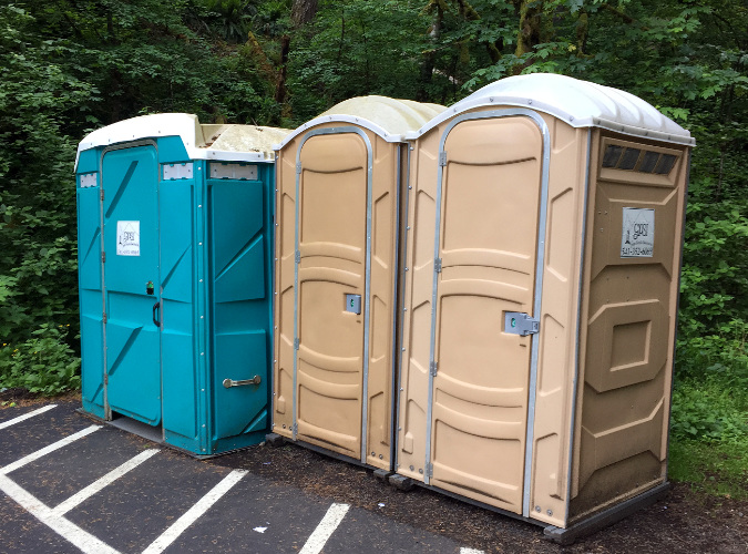
While the smaller details of the trailhead concept largely follows what I proposed back in 2023, I’ve included a solar-powered well in this update to provide on-site water. These off-the grid systems are an innovation that has grown in recent years in rural areas, and can cost as little as $3,000 to install on a conventional well. Providing on-site water would not only be good for hikers, it could also make the trailhead a fully serviced spot for emergency responders or fire fighters, and for Forest Service staff to maintain a proposed pit toilet – an element that was included in the original concept.
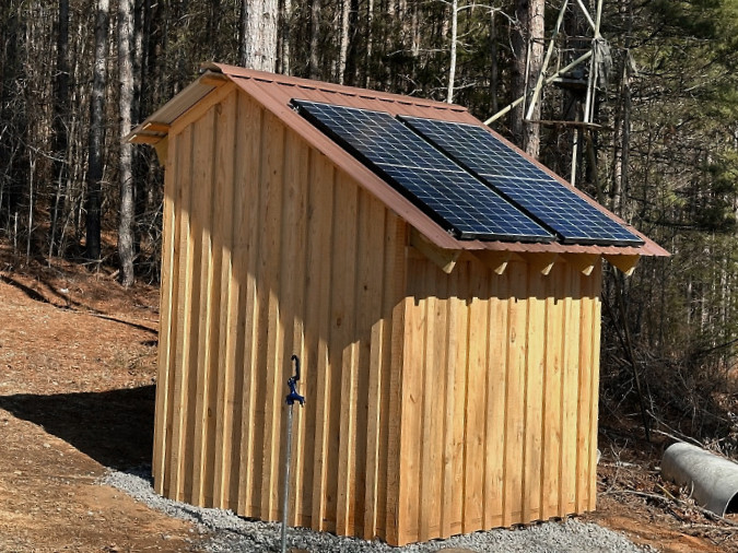
It’s not sexy, but it works. This is a pump house and well that is completely powered with solar panels, and thus off the grid. It’s a great new solution for backcountry trailheads and campground. Why not pilot one at a new Vista Ridge trailhead? (Photo: Georgia Bushcraft)
Another new feature in the concept is trailhead tent campsites. Why did I add these? The inspiration came from Trailkeepers of Oregon (TKO) events here in 2024 and 2025, when several volunteers arrived early and camped in the same area proposed here for walk-in tent sites. They raved about both the mountain views and the advantages of an early start for trail work on the Vista Ridge and Old Vista Ridge trails.
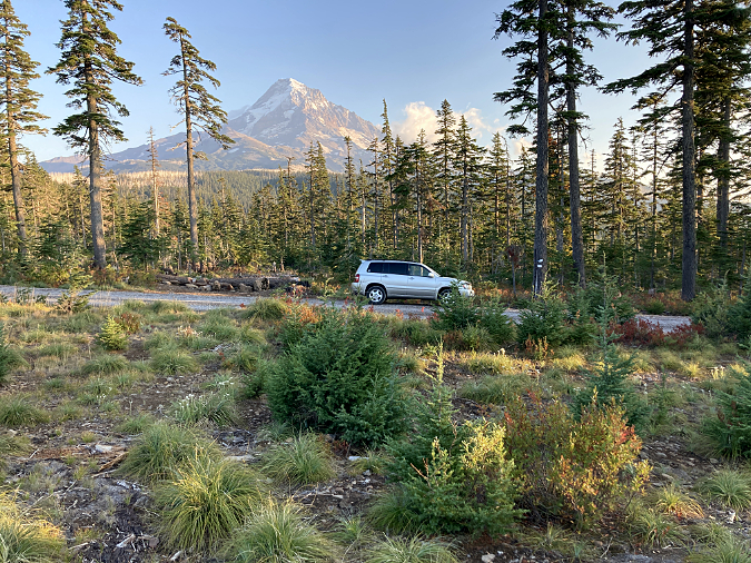
It’s true that this roadside camping spot is pretty ugly today, despite the fine view of Mount Hood. That’s thanks to the same 2020 forest thinning project that left a jumble of debris and piles of dirt behind. So, the idea of a tent camping area is to restore the site ecologically as well as provide a few tent sites.
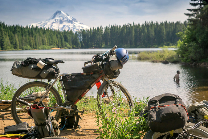
It’s off the radar of most hikers, but bikepacking has become an important new form of recreation in WyEast Country, notably with the development of the Oregon Timber Trail. Why not provide bikepacking campsites with a view at a new Vista Ridge trailhead? (photo: Oregon Timber Trail Alliance)
Another inspiration for the trailhead campsites comes from bikepacking enthusiasts who now regularly travel Forest Road 16, the main forest road that the Vista Ridge spur road connects to. The idea is for these through-riders to have a quiet, free campsite with a water source and toilet – and a nice view. Yes, they would need to travel another 3.5 miles along the Vista Ridge spur road to get here, but developed campsites, a water source, toilets and picnic tables would make it well worth the effort.
An AI-Assisted Tour of the Vista Ridge Trailhead Concept
Moving from the updated concept map to the real power of AI, the next set of images are a virtual tour of the trailhead concept, with “before” (or real) images of today’s conditions transformed into AI-assisted versions of what could be.
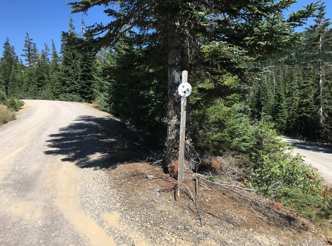
The tour begins with the trailhead approach along the Vista Ridge access road (Forest Road 1650). Just before the road reaches the site of the proposed trailhead, an unsigned fork where another logging spur splits off to the right is a point of perpetual confusion. A very simple part of the new trailhead concept is signage to help folks navigate this spot.
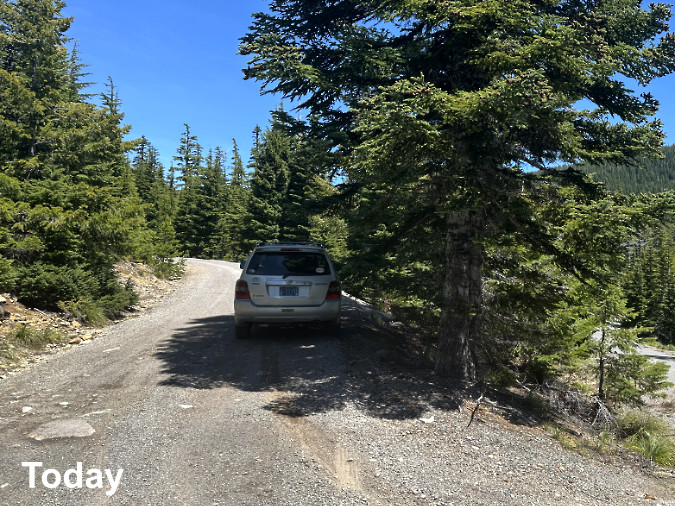
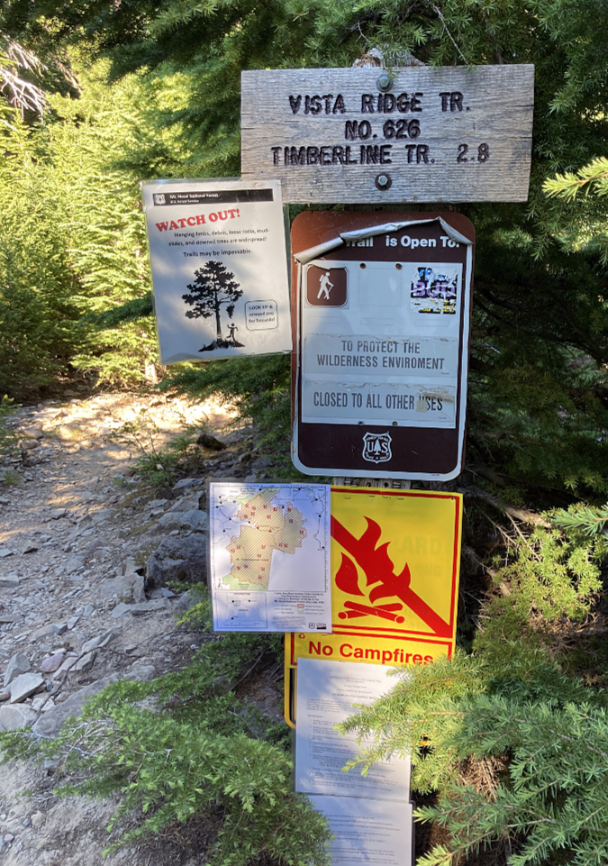
This junction just before the trailhead has been unsigned for years, sending hikers to a long dead end in a sea of old clearcuts if they go right instead of left.
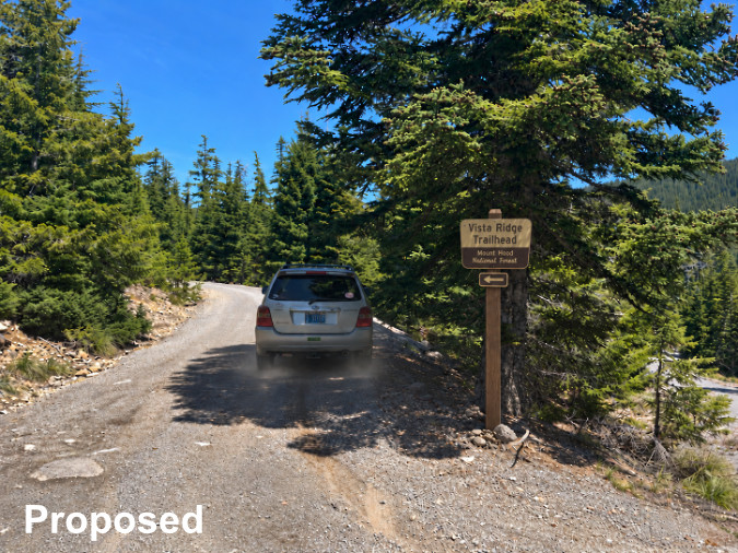
A simple proposal in this confusing spot – a trailhead sign, designed with the help of AI
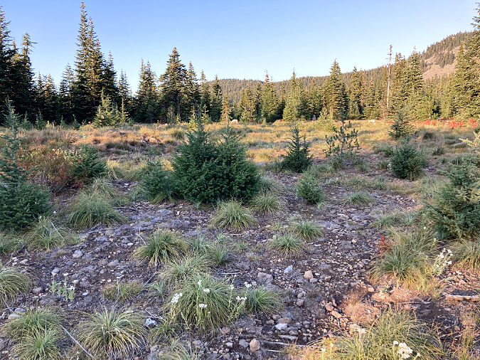
As you can see in the concept map, the turnaround loop is more oval than round. A recently impacted clearing at the heart of the oval was once a log yarding area, and more recently held equipment for the forest thinning operation. Taking advantage of an already impacted area, this clearing is where the main trailhead amenities would be located, including informational signage, water, toilet and picnic tables. This photo series is the view looking north from the existing Vista Ridge access road, into the proposed trailhead site.
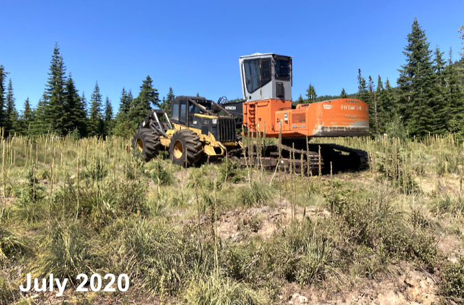
The most recent disturbance in the clearing at the heart of the trailhead concept came in 2020, when this old yarding area from past clearcutting activity became a logistic area for a forest thinning operation.
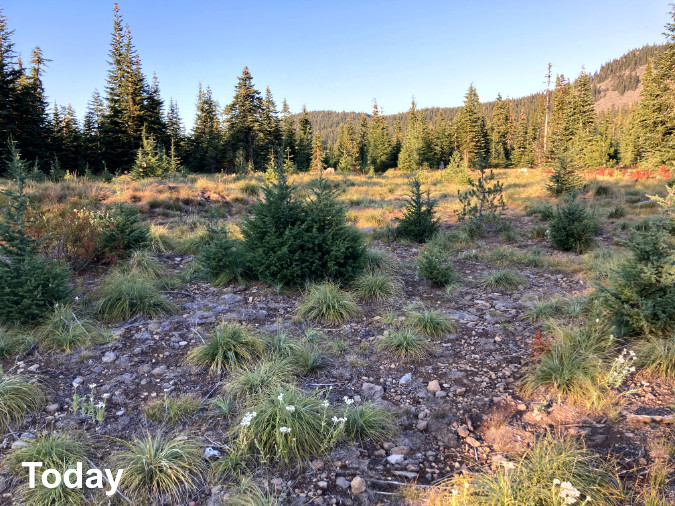
Today, the clearing still shows the impacts from the most recent logging operation. It’s a good candidate for restoration of native understory – mostly beargrass and huckleberry – as part of creating a new trailhead.
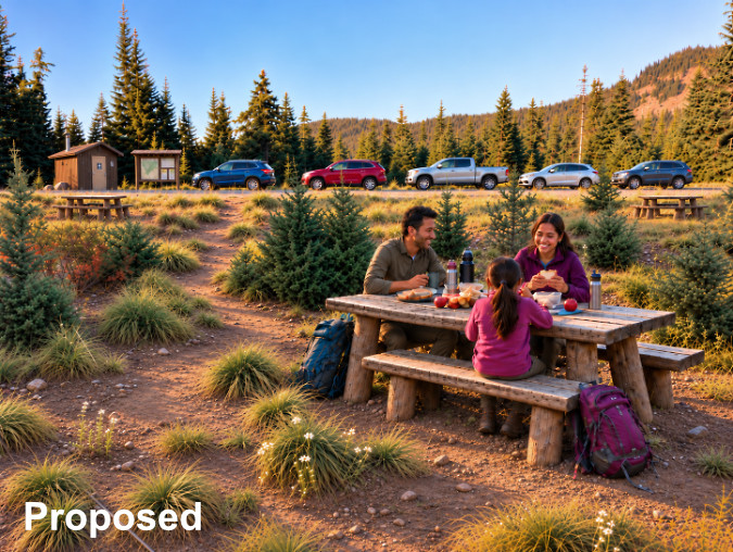
This is an AI-assisted reimagining of the clearing at the heart of the new trailhead loop showing a picnic tables, toilet, water supply and an information signboard. The cars pictured are parked parallel, along the one-way loop.
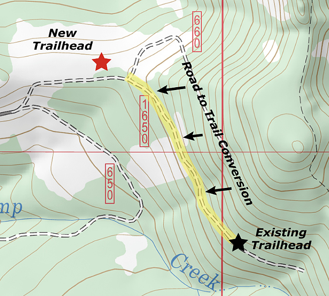
While the core focus for the loop is to locate the new road on already impacted land, it would nonetheless represent 1,300 feet of new, gravel road. The conservation tradeoff would come from decommissioning the last 2,800 feet of the existing road, converting it become an extension of the Vista Ridge Trail, with an overall reduction in road coverage of about 1,500 feet.
The half-mile road section proposed for trail conversion also cuts across two talus slopes that are active Pika habitat, so removing the vehicle traffic could be an important benefit to these colonies, especially with overflow vehicles now parking along the talus sections.
The next view in the virtual tour is from the perspective of the picnickers in the previous photo series, looking south toward Mount Hood. This would be the view from the picnic area, with tent campsites proposed across the access road. As with the rest of the concept, the emphasis is two-pronged: combine development of a new trailhead with ecological restoration of already impacted areas.
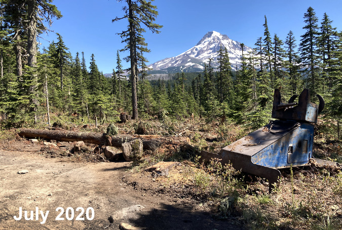
This is a view of the logged area across the access road from the clearing shown in the previous image series. The jumble of debris and piles of dirt left behind in this forest thinning operation offer an opportunity to restore the site in tandem with creating walk-in tent sites.
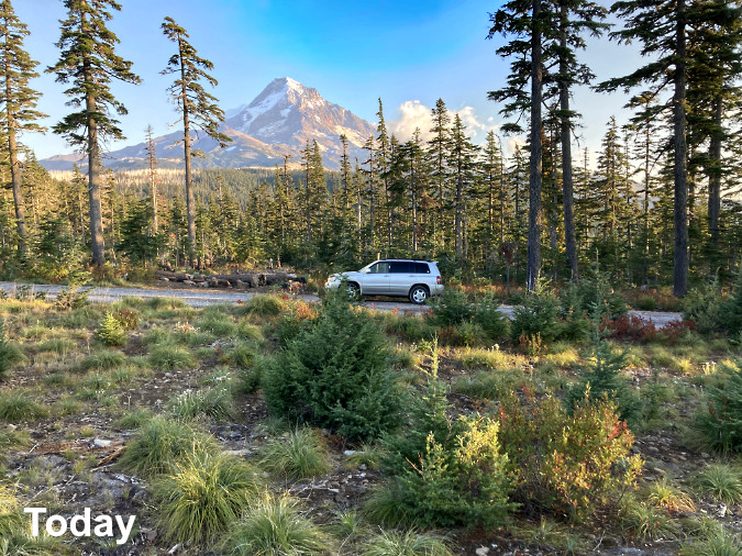
The view today from the cleared area at the heart of the proposed loop, looking toward the recently logged area on the south side of the existing road.
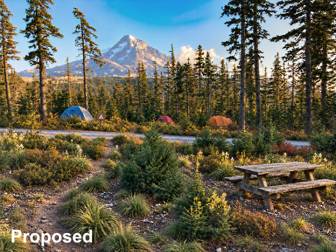
A reimagined version of the scene showing the proposed picnic area in the foreground and a path leading across the access road to tent sites in a restored logged area. The fine mountain view from here would turn otherwise generic picnic and tent sites into something special and memorable.
Another community that could benefit from these reimagined scenes are local tribes who actively harvest first foods in the Vista Ridge area, especially huckleberries. The logging operation that occurred in 2020 was presented in part as forest thinning to improve huckleberry habitat. Providing enhanced access, campsites and other on-site facilities to support tribes harvesting in the area could be one of the best arguments for moving forward with the idea.
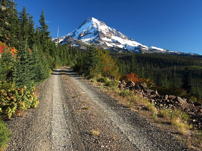
Next, the virtual tour of the proposed trailhead moves to the half-mile section of today’s access road that would be converted to trail. This short section of road has stunning views that make it a fine candidate for conversion. The easy grade and existing gravel surface could also offer the possibility of a rare accessible trail to these viewpoints, something WyEast Country is woefully lacking in.
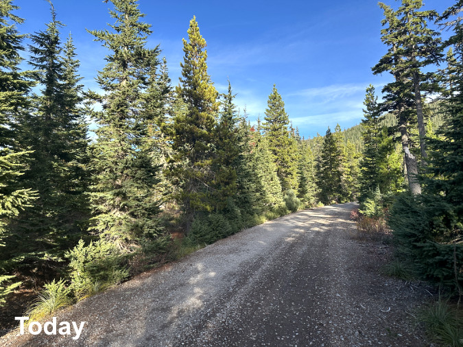
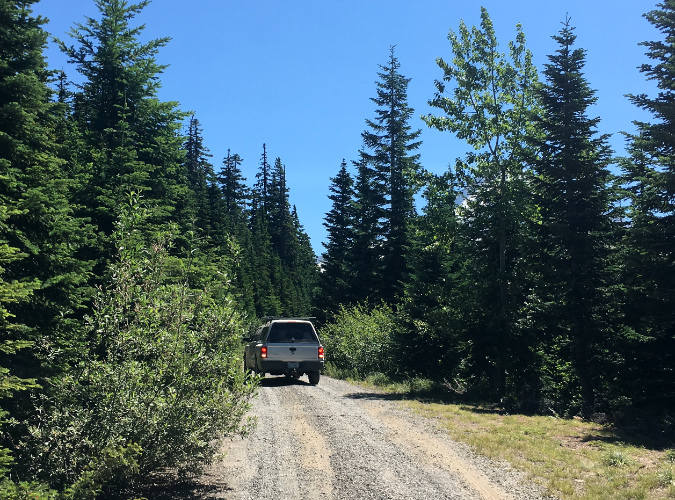
This spot along today’s access road is about a half mile from the current trailhead. This is where the proposed trailhead loop road would veer left on an old cat road and the remainder of the existing road would be converted to trail.
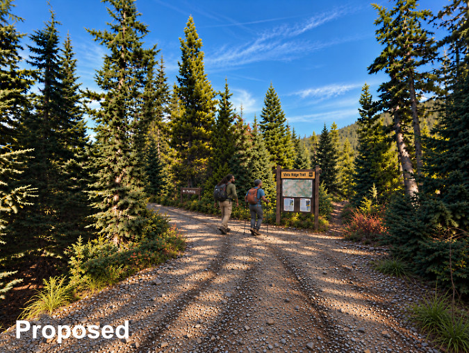
Here’s the AI-assisted reimagining of what the road-to-trail conversion would look like. The hikers shown here have just emerged from a short access trail (shown on the concept map) that would link parking within the trailhead loop to the new start of the Vista Ridge Trail with minimal road walking.
Moving just beyond the proposed trailhead, this photo set shows what a typical road-to-trail conversion might look like.
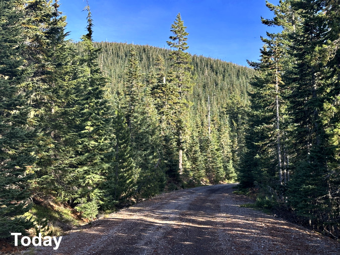
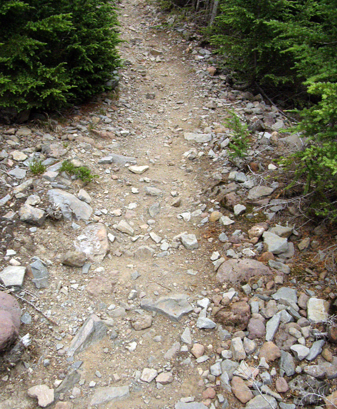
This is today’s access road a few yards beyond the proposed new trailhead…
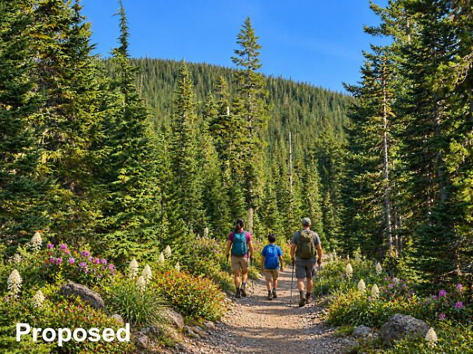
…and this is what a road-to-trail conversion might look like. The wide trail and retained gravel surface are included to envision what an accessible trail could look like. Conversions like these typically involve using a backhoe along one or both shoulders of the road to break up the packed road surface and allow for restoring vegetation. In mountainous areas like this, large rocks and boulders often come to the surface as well, and they can be placed as shown both define the trail and protect against off-road vehicles.
Just 200 yards from the proposed new trailhead, today’s Vista Ridge road crosses a talus slope with a stunning view of Mount Hood, enhanced in autumn with drifts of crimson vine maple. There are already pullouts along the road here, worn by photographers stopping to capture this scene – one that has appeared widely in calendars, books and advertising. Anyone capturing photos here is also likely to be serenaded by the Pika colonies living in the talus. These pullouts would become the main destination for the accessible portion of the road-to-trail conversion, as visualized in the following image sequence (look closely at the concept map and you will also see disabled parking spots).
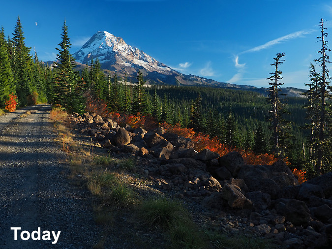
This scene has deservedly appeared in scenic calendars and tourism ads over the years – but with the road cropped out. Colonies of tiny Pikas live here and can often be heard if you’re not inside a car.
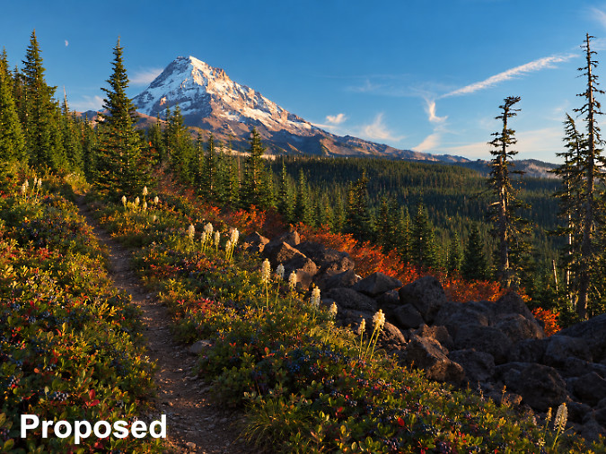
Here’s a reimagined scene with the road converted to trail, the road’s shoulders restored with native huckleberry and beargrass.
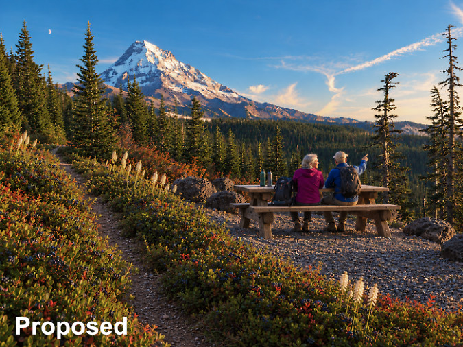
Here’s a version with one of the existing road pullouts converted to a spot for or a picnic or simply resting and enjoying the view.
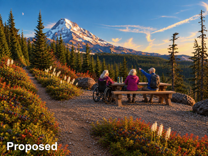
Even better, here’s an accessible picnic and resting spot with a wider tread connecting the proposed trailhead to this viewpoint.
Beyond the talus viewpoint the existing road still offers pocket views as is it continues toward today’s trailhead. The following images show what this section of today’s road might look like if were converted to become part of the Vista Ridge Trail.
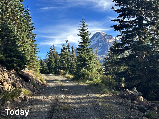
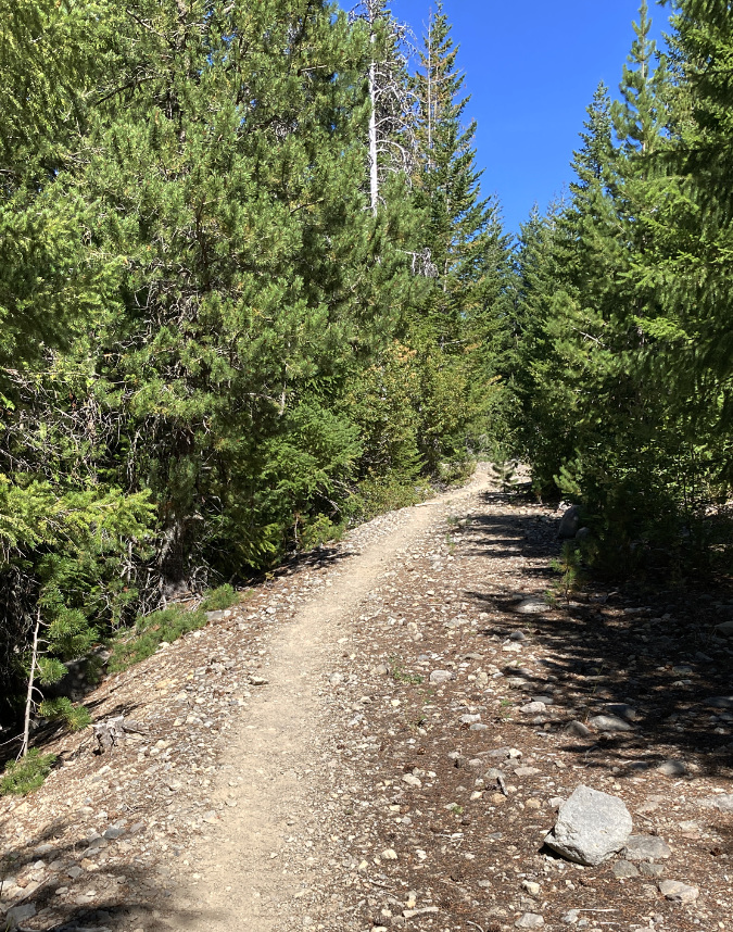
Today, this pretty section of the Vista Ridge road too often has cars wedged along the shoulders when the trailhead parking is overflowing….
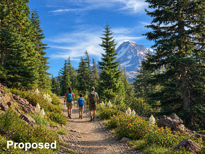
…but reimagined, it might look like this, with a trail wide enough to continue serving as an accessible path.
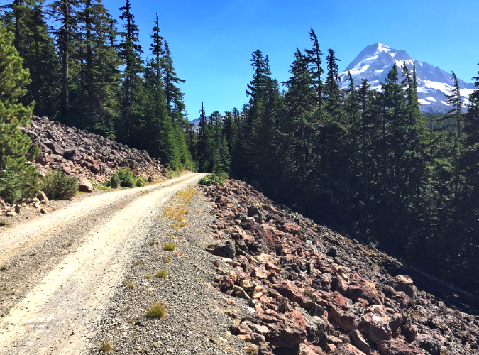
Where today’s Vista Ridge road approaches the existing trailhead parking, it crosses another large talus slope, this time composed of striking, red volcanic boulders uncommon to the Mount Hood area. Tiny Pikas live here, too, though you have to walk the road to hear them. This photo set imagines what this road conversion might look like.
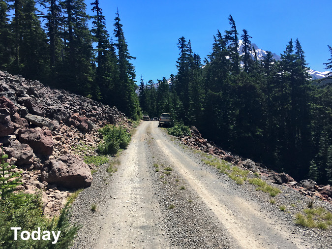
The second talus slope today with the trailhead parking area visible in the distance. On busy days, overflow cars are often parked precariously along this section of road.
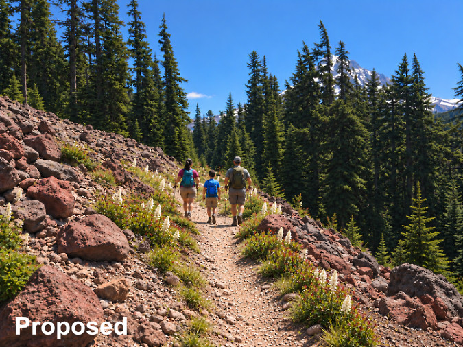
A reimagined view of the unique volcanic talus slope, with today’s road converted to trail. Red lava landscapes like this are a rare sight on Mount Hood, making this a special place worth celebrating.
This images in this set are viewed from the opposite direction, looking toward the red talus slope from the existing trailhead parking.
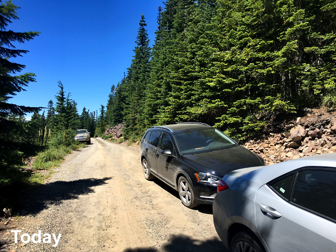
This view shows today’s overflowing trailhead parking spilling onto the shoulders of the access road.
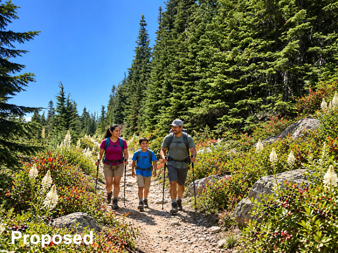
Here’s an AI reimagining of this is what that view might look like if the road were converted to trail.
And what of today’s parking area? Could it really be converted to trail and restored to a natural condition? Definitely. The surrounding subalpine grows on a very thin layer of mountain soils atop a rocky base – the same boulders we can see on nearby talus slopes are only a few inches beneath the surface (with some are poking through, as evidenced by scars left from cars scraping on them). Using the road conversion approach described previously, a backhoe would be used to break up the packed surface and loosen the ground replanting. Unearthed rocks and boulders could be used to define the new trail.
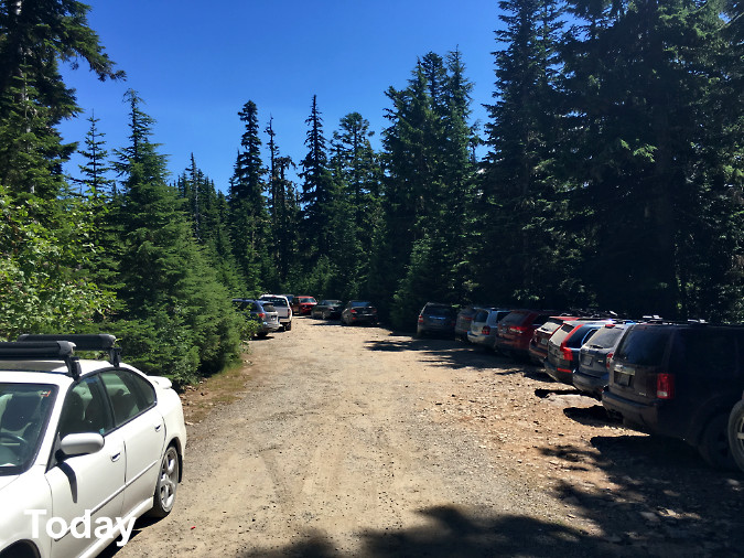
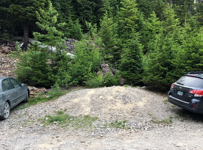
Look closely at the left edge in this view of today’s Vista Ridge trailhead and you can see the forest already creeping into the old road bed that makes up today’s parking area. Restoring vegetation here is mostly a matter of breaking up the old road surface.
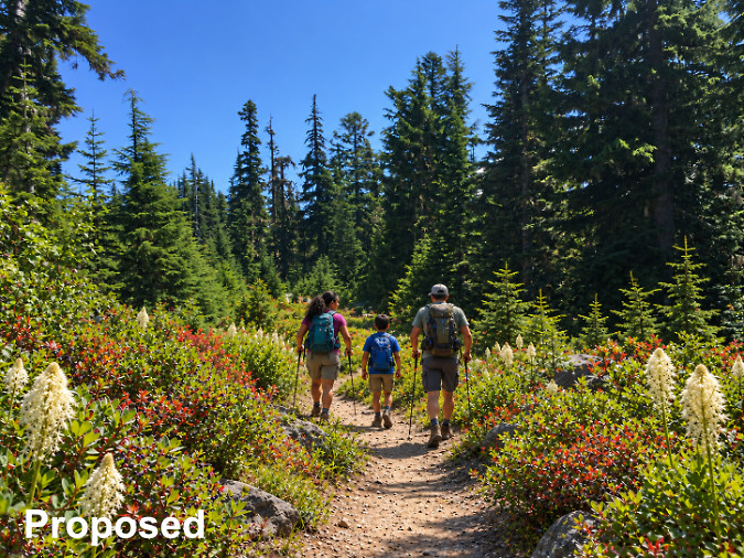
Here’s an AI-assisted reimagination of what the old trailhead parking could look like when converted to trail. Though nature would eventually restore the understory on her own, revegetating the area could be accelerated by planting native beargrass, huckleberry and kinnikinnick, as shown in this view.
When I first proposed this trailhead concept three years ago, another recurring comment was about the additional half-mile it would add to the Vista Ridge trail, a popular access route to the Timberline Trail. It’s a fair concern, and as a 64-year-old who also uses this trail regularly, I appreciate the significance to many hikers of the distance it would add.
So, why did I come up with this concept, then? In the end, it’s a tradeoff. We need a solution to what has become an unworkable degree of overcrowding at the existing trailhead, and I don’t see a way to solve that at existing trailhead site, given the steep terrain. After all, it only was built to serve as a logging spur, not a parking lot.
Thus, the proposed move downhill to the nearest flat spot, and one that has already been impacted by logging. As roads go, this section is also exceptionally scenic, making it a great candidate for conversion. Add the possibility of converting that half-mile of road to become an accessible trail so folks with limited mobility might also enjoy a spectacular mountain trail experience – people who are unable to hike three miles uphill to the Timberline Trail? That could be the best argument of all for moving ahead with this concept.
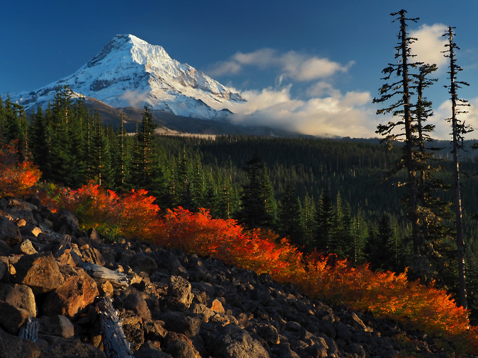
Early snow on the mountain in 2023 from the talus viewpoint along the Vista Ridge road – let’s make this a premier accessible trail destination!
Finally, where would the money come from in this weird time of federal chaos? That part is easier than you might expect. While the current administration has done its best to slow-walk or cancel funding that Congress passed in a series of massive COVID-era infrastructure bills, the fact is, much funding has been authorized for projects like this. These funds may be bottled right now, but they will eventually become available to our federal land agencies.
Now is the time to be creative and dream a little – and thus this article to refresh and put an updated face on an idea whose time has come.
Thanks for reading this far!
As always, I hope to see you on the trail sometime!
____________
Tom Kloster | October 2026
____________
Postscript: this article was edited to better clarify that my use of AI tools on will be strictly limited to creating illustrative graphics, not to create or enhance photos. I’ll be adding a more detailed explanation in the “About the Photos” section of the blog, but my plan going forward is to an AI watermark to graphics using the technology.