Proposal: Vista Meadows Trail

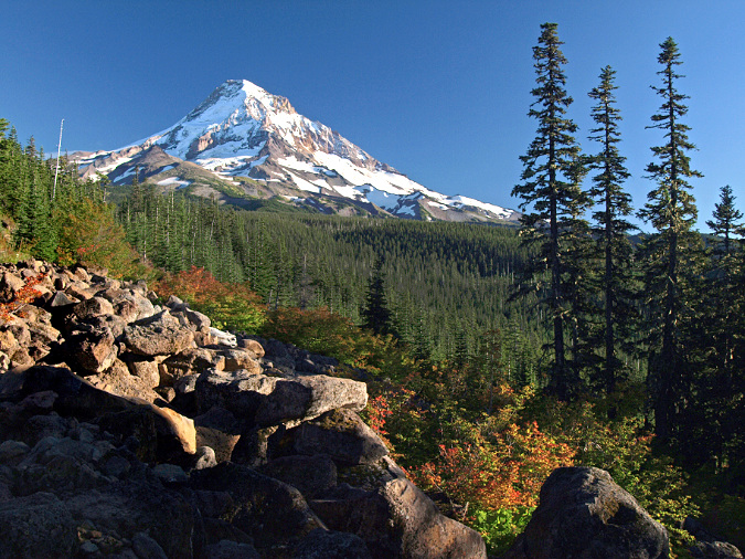
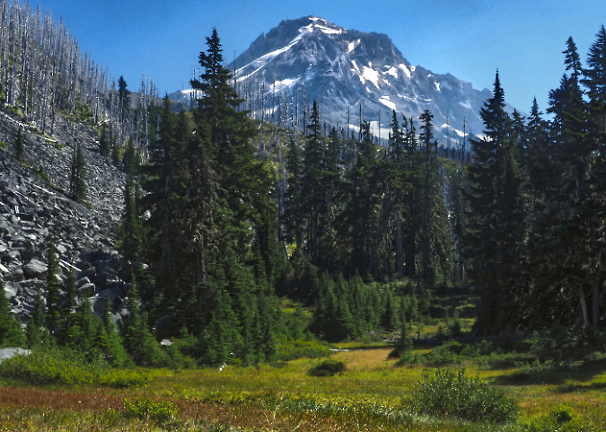
Mount Hood from Lower Vista Meadow in late August of this year

It seems impossible that time can passed this quickly, but August marked 18 years since two trail friends joined me for a memorable off-trail trip into one of the least-known areas in the Mount Hood Wilderness. It’s a place I call “Boundary Point”. What began as sunny, hot summer day soon turned into a brooding, blustery thunderstorm, making Boundary Point seem all the more remote and wild. That 2008 visit was my only time there, but it has lived in the back of my mind as a place that really ought to have a trail. 

More recently, I’ve made similar off-trail trips to another lesser-known, equally stunning spot within the wilderness that is not far from Boundary Point. I call this place “Vista Meadows”, and this article describes a trail concept that would connect both places in a much-needed expansion of our very busy trail system on the mountain.
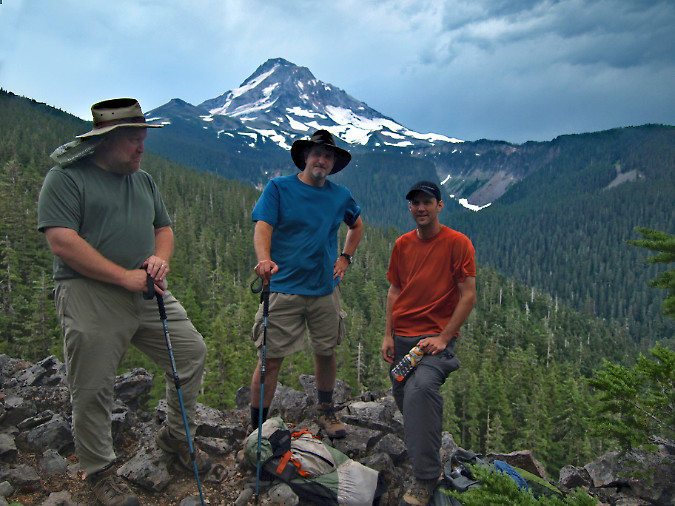
The (much younger author) at Boundary Point in 2008 with longtime trail friends Jeff (center) and Jamie (right). Just three years later the Dollar Fire would sweep across this area in its final flare-up, burning across roughly half the forests visible in this view, including Boundary Point

The spot I call Boundary Point is exactly that: a rugged clifftop viewpoint located just inside the wilderness boundary, and therefore just beyond reach of the notorious Boundary Clearcut described in a pair of 2008 blog articles. If the view from Boundary Point seems familiar, that’s because it’s the same iconic perspective of the mountain as viewed from Lost Lake – except much closer. 

The view from Boundary Point is truly impressive. Mount Hood towers above, of course, but the view also features a look at jagged Cathedral Ridge rising steeply across Ladd Creek canyon, eventually reaching to the summit of the mountain. The Coe, Ladd, Glisan and Sandy glaciers can also be seen from here, along with a rare glimpse into the very rugged and rarely seen Glisan Creek canyon.

In 2011 the Dollar Lake Fire burned through the upper part of Ladd Creek canyon in its final days, including a good portion of both Vista Ridge and Cathedral Ridge that, together, frame the canyon. Today, the bleached skeletons of ghost trees killed in the fire rise above the slowly recovering forest, gradually regenerating fifteen years after the fire. Forests recover slowly in this unforgiving subalpine environment, whether from wildfires or logging.
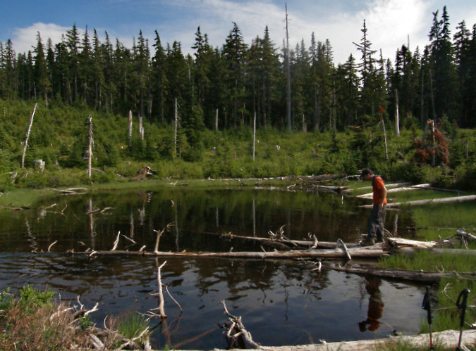
Middle Boundary Lake in 2008 (with Jamie), then still barely recovering decades after the massive 1980s clearcut that destroyed a centuries-old subalpine forest along a 2-mile stretch of the Mount Hood Wilderness. The intact forest in the background marks the edge of the clearcut and the wilderness boundary. This protected forest also survived the 2011 wildfire

Lakes are somewhat scarce in the Mount Hood Wilderness. The mountain rises in a narrow spot in the Cascades. Thus, the terrain around the mountain is dominated by steep canyons that drain quickly to the big rivers that flow nearby, so there are few high lake basins like those found around other big Cascade volcanoes. Tiny lakes like Dollar Lake and Perry Lake were therefore given full-blown “lake” status when they were named by early forest rangers, though they would likely go unnoticed elsewhere in the Cascades. 

That’s why the group of four small lakes on the northwest shoulder of Boundary Point is notable. Three of these remain as picturesque, untouched lakes, still tucked in among towering, ancient Mountain hemlock and Noble fir stands. The fourth, middle lake was cruelly cut over as part of the Boundary Clearcut – an environmental crime if it were allowed to happen today. But it was business as usual in the 1980s when our forests were sold off in a frenzy to the highest bidders. It was an era when timber sales were auctioned for clearcutting in giant squares or rectangles that had little relationship to the actual land or ecosystem, but were efficient to log and simple to describe in timber sale contracts. 
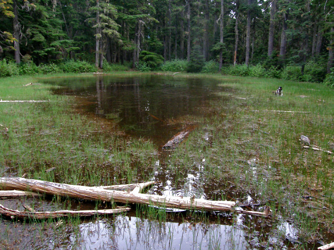
Upper Boundary Lake was spared from the chainsaws because it falls just inside the Mount Hood Wilderness boundary. This shallow tarn remains a peaceful, sylvan place today, as the subalpine forests surrounding the lake were spared from the 2011 Dollar Lake Fire

All four lakes are glacial features, created during the last ice age when the Ladd Glacier filled today’s canyon to the rim and extended nearly ten miles down what is today the West Fork Hood River valley. Along with Boundary Point and Vista Meadows, this group of lakes are among the very scenic features that would be connected for hikers to enjoy along this proposed trail.

Further upstream, Ladd Creek canyon hides the main surprise: Vista Meadows, the scenic gem the proposed trail would be named for. Vista Meadows consists of a string of alpine meadows hidden in plain sight, just across Ladd Creek from iconic Eden Park. Because Ladd Creek is an often-volatile glacial outflow, it has gouged a deep, boulder-filled channel separating Eden Park from Vista Meadows over the millennia. This physical barrier likely explains why Vista Meadows has gone so unnoticed.
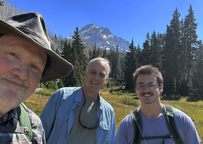
The (now much older!) author at Vista Meadows in August this year with off-trail companions Ted and Logan

At one time, when the once-mighty Ladd Glacier had just retreated from this spot, it left behind a broad, gentle valley floor, with Ladd Creek meandering through newly formed meadows. But like the other glacial streams on the mountain, the creek has since carved a deep channel through that old glacial valley, leaving Vista Meadows and Eden Park perched on either side of today’s canyon as remnants of an ancient valley scene that once was.

Where would the new trail start?

The new Vista Meadows trail would begin at the today’s Mazama Trailhead, located just off the Lolo Pass Road on the northwest side of the mountain. Like most of Mount Hood’s access points, it was never built to handle the demand that today’s summer weekends bring. In fact, this was never designed to be a trailhead, at all. Instead, it was constructed as a landing yard for logs pulled in from clearcuts extending in all directions during the heyday of logging, from the 1950s through the early 1990s. 

As recently as the 1950s, the road to the current Mazama trailhead didn’t even exist – nor did Lolo Pass Road! Instead, a trail network connected dozens of long-gone Forest Service guard stations and lookouts located around the mountain. Today’s Mazama Trail is just the surviving stub of one of these original trails, and once connected Mount Hood to Lost Lake. Most of that historic trail network was lost to roads and clearcuts during the logging era, with trailheads incrementally moved up the mountain as the logging operations expanded.
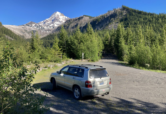
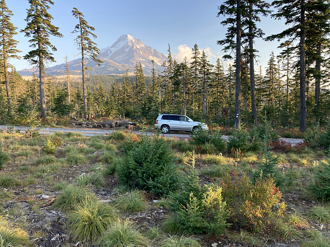
The Mazama Trailhead provides a preview of most of the route for the proposed Vista Meadows Trail, along the ridge to the left of the mountain in this view. The Mazama Trail follows Cathedral Ridge, the main ridge to the right of the mountain. The two trails would connect via the Timberline Trail, forming a long loop from this trailhead

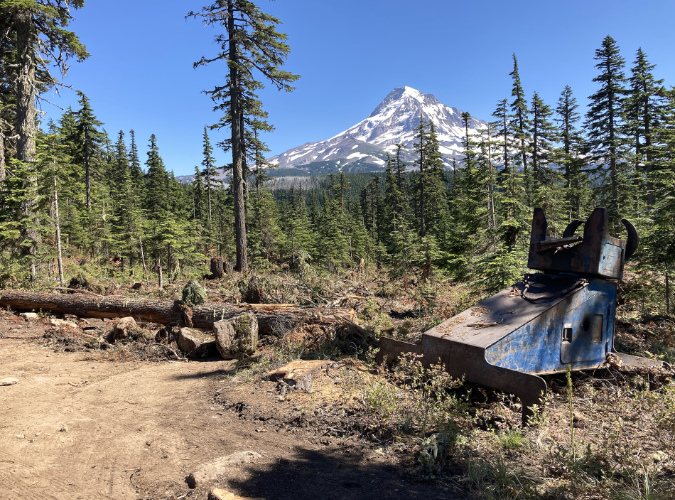
While it’s jarring today to think the Forest Service was logging so high on the mountain, the logging roads and clearcuts continued still further up the slopes from today’s Mazama trailhead. In the photo above, the entire slope on the right is just one of the many recovering clearcuts that fanned out from this spot. Many of the logging spurs in this area have since been closed, but the yarding area here and its access road were repurposed to become today’s trailhead. 

For many years the Mazamas mountaineering organization has maintained this trail, and thus the renaming from the “Cathedral Ridge Trail” to the “Mazama Trail.” This trail is just one of the many spokes connecting to the Timberline Trail, with this route connecting just west of Cairn Basin. The proposed Vista Meadows trail would add another spoke to the wheel.

A virtual trip along the proposed route…

The maps below give more detail on how this concept would work, and how the new trail would complement existing trails and trailheads in this corner of the Mount Hood Wilderness. The first map is a birds-eye view to place the trail in context to the mountain. The second map is a topographic version that includes the surrounding network of trails the new route is intended to enhance.
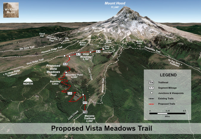
A birds-eye view of the proposed Vista Meadows Trail connecting the Mazama Trailhead to the Vista Ridge and Eden Park trails, creating both a new trail experience and loop hike opportunities from these adjoining trails and trailheads

[Click here for a large version of this map in a new tab or window]
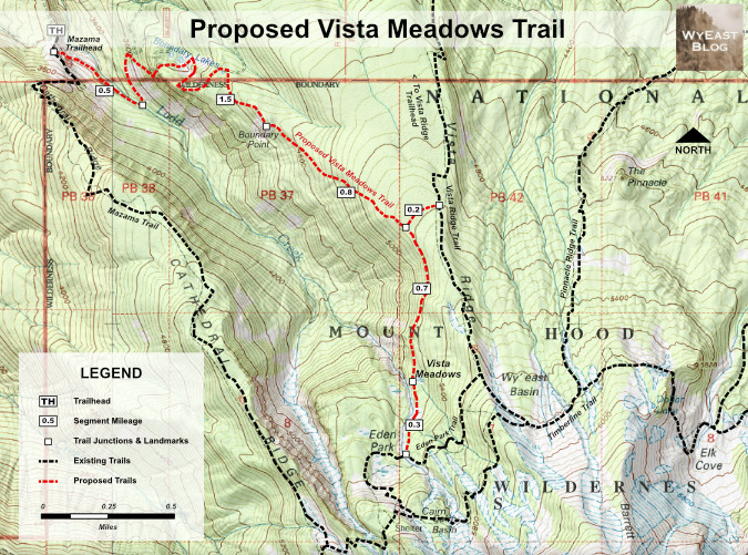
Topographic view of the proposed Vista Meadows Trail showing the surrounding trail network it would connect to and enhance

[Click here for a large version of this map in a new tab or window]

Beginning at the Mazama Trailhead, the new Vista Meadows Trail would traverse below the Mazama Trail into Ladd Canyon, arriving at a crossing of Ladd Creek about a half mile from the trailhead. This would be a permanent footbridge to ensure safe crossings and to make the trail accessible to less experienced or able-bodied visitors. Would a bridge last here? While Ladd Creek can be unruly, it’s not as volatile as some of its glacial siblings, as evidenced by the Lolo Pass Road bridge a couple miles downstream. That modest structure was built just a few feet above the stream and has survived many high-water events over the years.
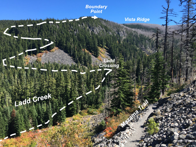
Route of the lower half of the proposed Vista Meadows Trail to Boundary Point, as viewed from the Mazama Trail

From the new footbridge over Ladd Creek, the proposed trail would climb the north wall of the canyon in a series of long switchbacks, passing broad talus slopes with mountain views before reaching the Lower Boundary Lakes. From the lower lakes, the trail would then traverse a steep cirque wall that protected these lakes from logging, then arrive at Middle Boundary Lake – ravaged by logging, and still recovering from the huge clearcut that engulfed it some 40 years ago. 

Beyond the middle lake, the new trail would leave the recovering clearcut and re-enter deep forests of the Mount Hood Wilderness, soon arriving at serene Upper Boundary Lake. From here, the final stretch to Boundary Point would begin a traverse above wide talus slopes (below) with fine views of the mountain and into Ladd Creek canyon, now far below. The trail would leave dense forest here and enters part of the Dollar Lake burn that encompassed Boundary Point.
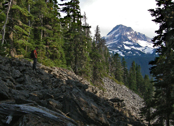
Jamie ascending the final pitch on our 2008 trip to Boundary Point, where Mount Hood comes into view across steep talus slopes. Much of the forest shown here burned in the 2011 Dollar Lake Fire and has since begun a slow recovery

Beyond the talus slopes, the new trail would soon reach the cliff-top views of Boundary Point, described previously. At two miles from the trailhead, Boundary Point would mark the mid-point of the new trail. The impressive views and many picnic-friendly boulders and rock outcrops from which to enjoy the scenery would likely make this the main destination for many hikers. 

With a round-trip of 4 miles to Boundary Point and elevation gain of just under 1,200 feet, this segment of the proposed trail would also fill an important need to provide more medium-length hikes on the mountain for casual hikers. Hiking to Boundary Point on the proposed trail would be comparable in length and difficulty to the popular Angel’s Rest hike in the Gorge, for example. 
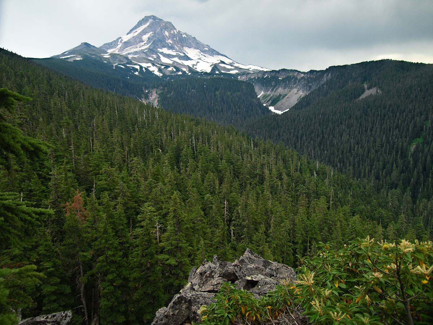
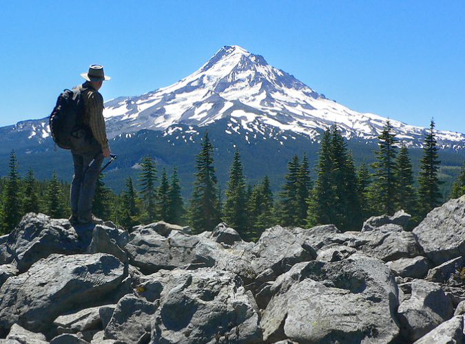
2008 view of Mount Hood rising above Ladd Canyon. Though Boundary Point itself burned in the 2011 fire, much of the forested slope seen in the foreground survived

Though Boundary Point burned in the 2011 fire, a large section of forest just beyond survived (shown in the foreground of the 2008 image, above). From Boundary Point, the trail would first travel through this intact forest of Mountain hemlock and Noble fir as it gradually ascends Vista Ridge, before re-entering another burn area near the ridge crest.

At the 2.8-mile mark, the new route would connect to a proposed quarter-mile tie to the Vista Ridge Trail. This connector would allow for a number of possible loops for hikers approaching from both the Mazama and Vista Ridge trailheads. Loop hikes are the holy grail for many hikers, as they offer maximum scenery and variety. Yet, they also serve a very practical purpose by simply spreading people out. This is a growing need on our very busy mountain.

From its high point at the proposed Vista Ridge connector, the new trail would next begin a gradual 0.7-mile descent to Vista Meadows. This part of the route also burned in the 2011 fire, and is now a striking ghost forest with non-stop views of the mountain looming along the descent. 
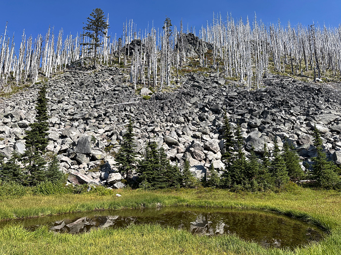
Ghost forests, talus slopes and rocky outcrops newly revealed on Vista Ridge by the 2011 fire, as viewed from Lower Vista Meadow

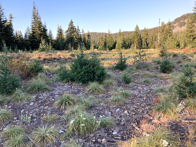
The new trail would soon arrive at Lower Vista Meadow, where it would re-enter surviving forests of ancient Mountain hemlock for the rest of the route. The lower meadow is especially idyllic, with views of the mountain, an impressive talus wall to the east and small alpine tarns sprinkled across the meadow. Year-round streams meander through the meadow, making backcountry campsites within the adjacent forest a possible addition to this trail concept.
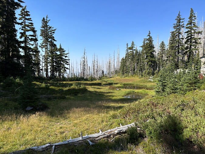
Lower Vista Meadow is dotted with several alpine tarns alive with tadpoles and frogs in summer

The proposed trail would next travel along the forested edge of Lower Vista Meadow, with Ladd Creek rushing loudly in the canyon below, just to the west. Soon, views into the middle and upper Vista Meadows would unfold along this exceptionally scenic, final 0.3-miles of the proposed trail before reaching its junction with the Eden Park Trail.  

The total length of the new trail would be just short of 4 miles from the Mazama Trailhead. The elevation gain would be about 1,800 feet, similar to other trail “spokes” that connect to the hub formed by the Timberline Trail. 
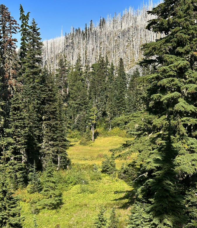
Middle Vista Meadow is tucked among towering, old-growth Mountain hemlock with the ghost forests of Vista Ridge rising above
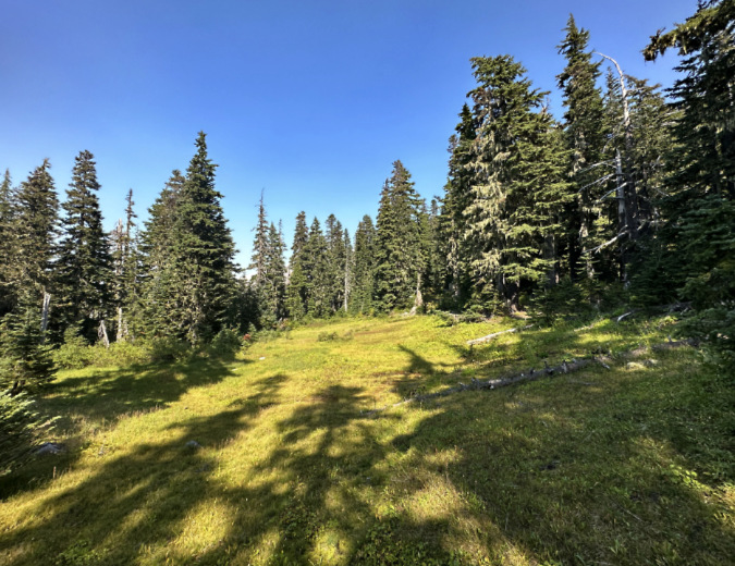
Upper Vista Meadow sprawls across a gentle slope, just below the Eden Park Trail


From the upper end of the proposed trail, hikers could make loops through Eden Park, Cairn Basin and WyEast Basin, before returning on the new trail – or Vista Meadows, itself, could be the destination. As a main destination, Eden Park offers has some of the finest campsites on the mountain for people looking to spend a night in the wilderness. More ambitious hikers could also head west from Cairn Basin toward McNeil Point, returning on the Mazama Trail, or turn in the opposite direction to make the steep ascent of Barrett Spur.  

The following map provides a closer look at the trail network in the Eden Park vicinity, and how the proposed Vista Meadows Trail would connect to this system. 
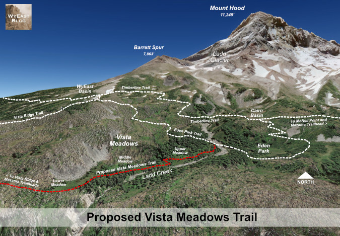
Detailed view of the proposed Vista Meadows Trail and nearby destinations of Eden Park, Cairn Basin, WyEast Basin and Barrett Spur

[Click here for a large version of this map in a new tab or window]

Building a better Mazama Trailhead?

With today’s Mazama Trailhead awkwardly located on a ridgetop better suited to yarding logs than parking cars, the following concept shows one way to improve the trailhead to meet demand for more parking and creating a safer trailhead design for backcountry emergencies.

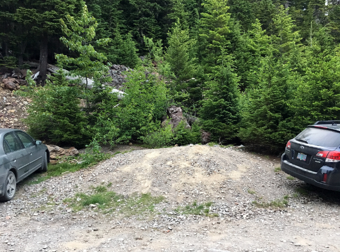
The image below shows the existing trailhead in the summer of 2021, when the COVID pandemic had triggered a surge in trail use that continues today. It was not quite overflowing on that July weekend five years ago. Without an intentional design and some sort of parking management, unimproved trailheads like these have become a growing headache and safety hazard for both visitors and emergency responders when they do overflow with demand.
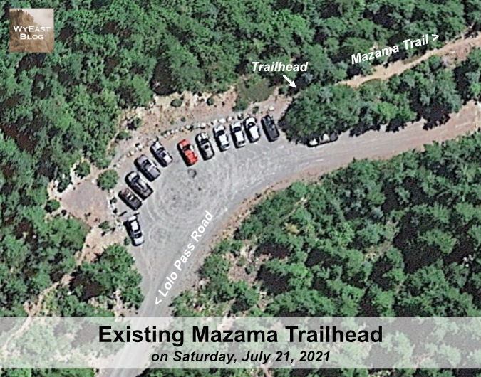
The Mazama Trailhead as it exists today – simply an old log yarding area that served clearcuts fanning in all directions in decades past

[Click here for a large version of this image in a new tab or window]

The reimagined trailhead (below) shows how a reconfigured, more organized design within the same footprint as the existing trailhead could create a safer, more efficient access point into the wilderness, while also adding a few parking spaces.

The one-way loop design in this concept mirrors a similar layout proposed in this article for a relocated the Vista Ridge Trailhead. One-way trailhead loops provide safety benefits for emergency vehicles by providing turnaround space and keeping travel lanes defined and less likely to be blocked by parked cars. They also create a more efficient design for visitors by ensuring that the first open space is also be the closest to the trailhead by design, thus discouraging circling for a space. 

Unlike the Vista Ridge proposal, this design attempts to make the existing trailhead location work better, but with inherent constraints that limit adding much additional space for parking here.
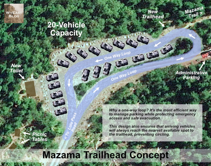
This re-imagined trailhead would add more parking spaces, an administrative space and turnaround for Forest Service or emergency responders, pit toilet and picnic tables

[Click here for a large version of this schematic in a new tab or window]

This conceptual design would accommodate up to 20 vehicles, roughly five more spaces than the current trailhead allows today. Importantly, the design would set aside administrative parking and logistics space for Forest Service workers or emergency responders in an area that is now used for visitor parking.

While this concept is simple and would exist within the bounds of the current trailhead, it would require the Forest Service to do some limited clearing, grading, gravel resurfacing and place a few boulders to better define the space. The proposed toilet and picnic tables would be new to the trailhead, but they are needed and overdue. These additions also represent the threshold for this to become a managed Northwest Forest Pass site, along with an ongoing maintenance responsibility under the forest pass system.

This work could likely be completed without a complex environmental analysis through a process called a “categorical exception” that is used to streamline improvements to existing sites where minimal environmental disruption is expected. 

What would it take… and why bother?

Today, the Forest Service is reeling from staffing and budget cuts, whipsawed by a belligerent, often lawless administration bent logging, mining or simply selling off our public lands. Meanwhile, public input on these decisions (or even knowledge of them) has been aggressively curtailed, if it exists at all. So, why even bother thinking about new trails in this oppressive era? 
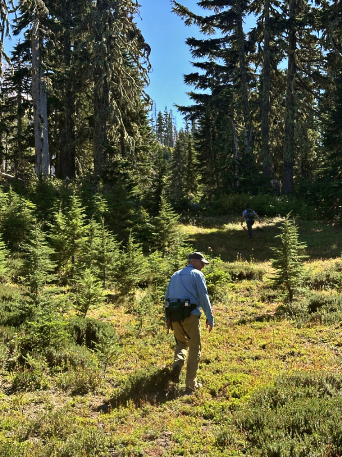
Exploring Vista Meadows with Ted and Logan in late August of this year

One reason is that public fatigue and discouragement are the very point with repressive regimes, especially when their agenda and actions are deeply unpopular with the public. That is overwhelmingly the case right now. Therefore, the importance of thinking – and dreaming – is essential to both challenging the regime and preparing to shape what will come next.

It’s a cycle as old as our democracy. The Civil Rights Movement of the 1950s and 60s lived by a credo that “during good times, plan for the bad, and during bad times, plan for the good.” That makes right now the perfect time to plan for the good – for our trails and the public lands they connect us to. There is enormous power here, as one of the most important takeaways from this grim era is how deeply Americans value our public lands. It’s an overwhelming majority that spans traditional party lines and ideologies, a rarity in these polarized times.
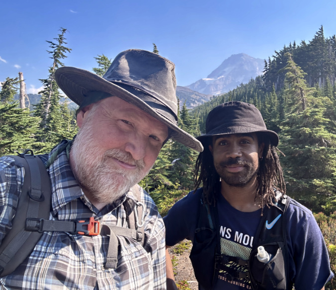
The author with off-trail companion André in July 2023 on our first exploration of Vista Meadows

The origin of our trail system is also worth remembering: nearly all of our trails were built between 1910 and 1940 by people using simple hand tools. In fact, the trail system we cherish today is significantly smallerthan what was originally built with saws, shovels, axes and picks during that brief period. Much of the original system was lost during the first big selloff of our public lands during the industrial logging era of the 1950s through early 90s. 

So, today we are simply working to rebuild part of a system and vision that once was. It’s not a moon shot to imagine a new era of investment in our trails and our public lands. It’s just a matter of restoring widely popular priorities when the reset comes. And it is coming.
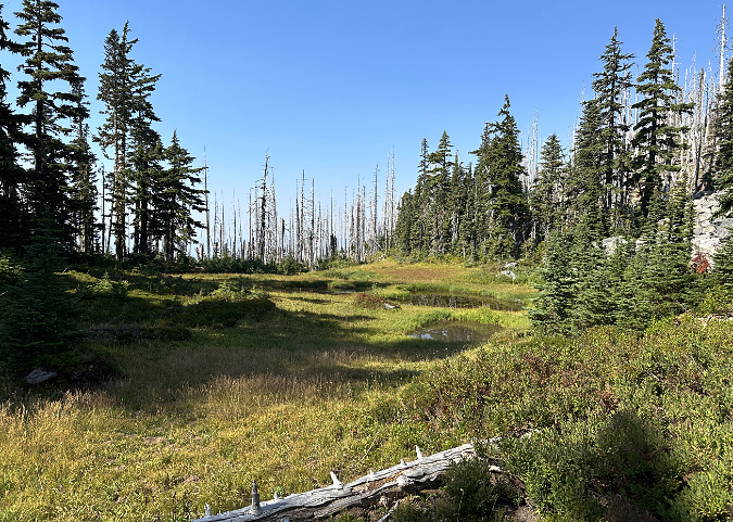
Lower Vista Meadow in July 2023

On a more pragmatic level, it’s also true that it will take some time to undo the harm that has been done to our federal agencies and public lands. To begin building trails again, we will need to ensure that we make the most of our existing system as we work our way out of the hole that has been dug. 

Therein lies the challenge for continued creativity and determination, not despair. Those of us who show up and engage will be helping to draft the next chapter… and that usually begins with a little dreaming.

Thanks for stopping by – I hope to see you on a (new) trail sometime! 

_____________

Tom Kloster | September 2026
Rx for the Vista Ridge Trailhead!

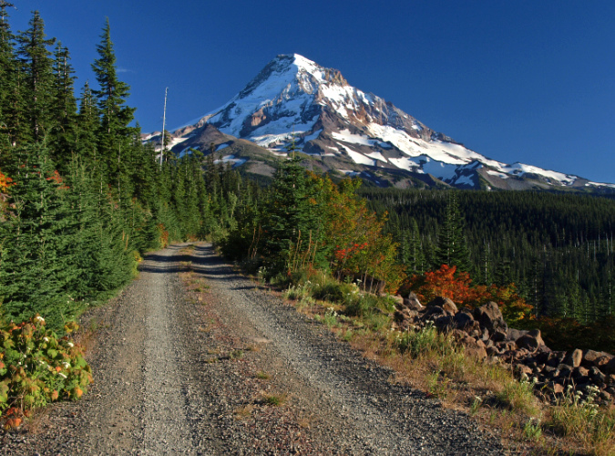
Mount Hood’s scenic wonders beckon on the final approach to the Vista Ridge trailhead on Forest Road 1650

Public lands across the nation experienced a big spike in visitors during the recent pandemic, continuing a growth trend that has been in motion for decades. In WyEast Country, this has placed an unprecedented burden on some of Mount Hood’s under-developed trailheads, like the one at Vista Ridge, on the mountain’s north side. 

The scenic gems within a few miles of this trailhead are among the mountain’s most iconic: Cairn Basin, Eden Park, Elk Cove, WyEast Basin and Owl Point draw hikers here, despite the washboards along the dusty final gravel road stretch – and the completely inadequate trailhead. 

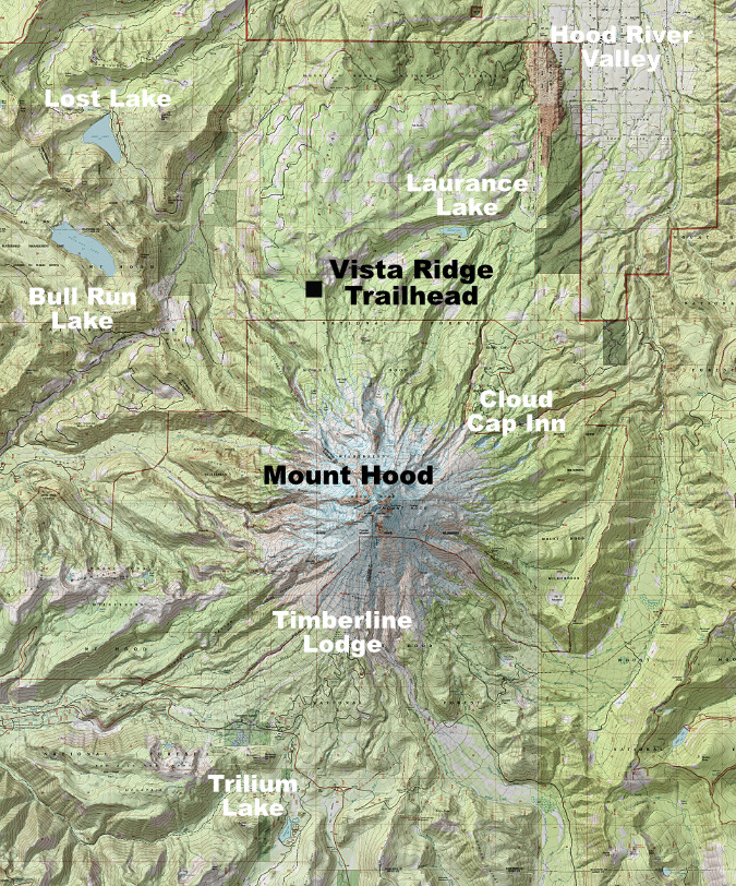
The Vista Ridge is located on Mount Hood’s rugged north side and reached from Lolo Pass Road

The pandemic isn’t the only driver in the growing popularity of Vista Ridge. The 2011 Dollar Lake Fire torched Vista Ridge, leaving a vast ghost forest behind. In the years since, the forest recovery has featured a carpet of Avalanche Lilies in early summer that draws still more visitors to this trailhead. And since 2007, volunteers have restored the Old Vista Ridge trail to Owl Point, adding yet another popular hiking destination here.

It is abundantly apparent to anyone using the existing Vista Ridge trailhead that it was never designed or developed to be one. Instead, it was the result of a plan during the logging heyday of the 1960s to extend Forest Road 1650 over the crest of Vista Ridge and connect to the growing maze of logging roads to the east, in the Clear Branch valley. 

For reasons unknown, that never happened, and by the late 1960s the road stub defaulted into an unimproved trailhead for the Vista Ridge Trail when a short trail connection from the road stub to the saddle was built, instead. This new trail connection short-circuited the northern two miles of the Vista Ridge trail, but has since been restored reopened as the Old Vista Ridge trail. This is how today’s Vista Ridge trailhead came to be on a steep hillside at the abrupt end of a defunct logging spur.

The existing Vista Ridge trailhead is simply a logging spur that was abandoned mid-construction in the 1960s, and thus lacks even a simple turnaround

While it was still lightly used as recently as the early 2000s, the popularity of the Vista Ridge trailhead has grown dramatically over the past 15 years. Today, dozens of cars are shoehorned into this dead-end spur during the busy summer hiking season.

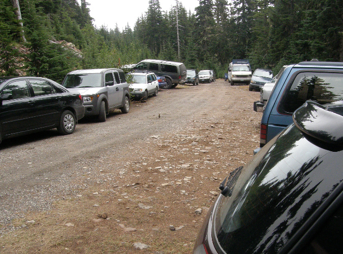
Parking at the trailhead is a haphazard affair, at best. There is room for about 6 cars along the south edge of the stub, though it was never graded for this purpose, and thus even these “spaces” are a minefield of sneaky, axel-cracking pits and oil-pan ripping boulders. These semi-organized spaces fill immediately on summer days, so most who come here end up parking at the stubbed-out end of the spur or spill out along the narrow final approach of Road 1650. 
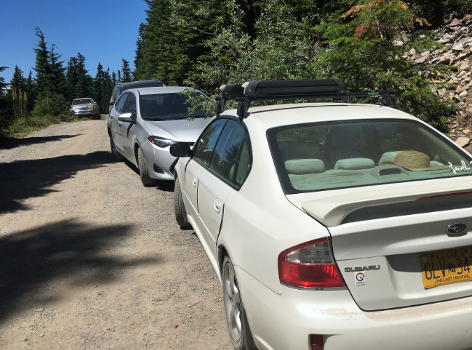
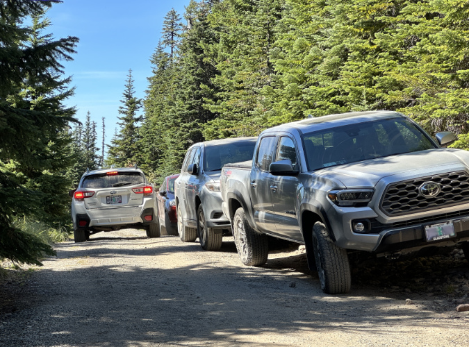
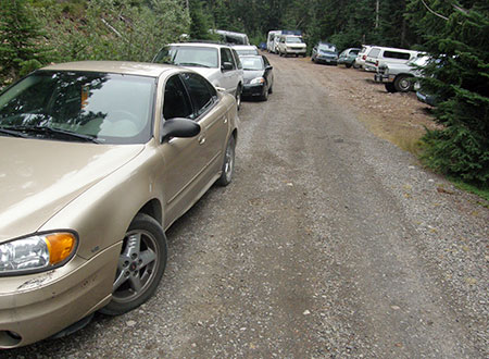
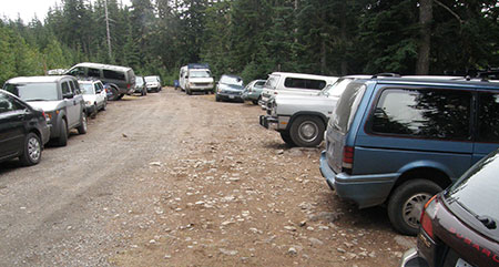
Overflow from the cramped existing trailhead routinely spills over to the narrow Road 1650 approach during the summer hiking season

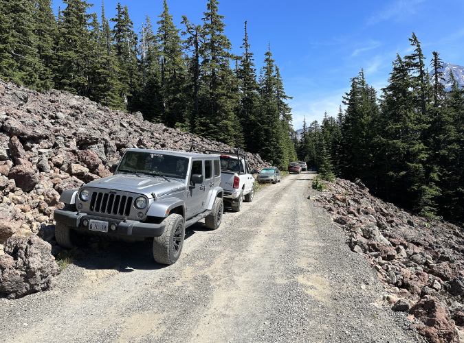
Spillover parking on this section of Road 1650 is only unsafe for passing vehicles, it also impacts a resident Pika population living in these talus slopes

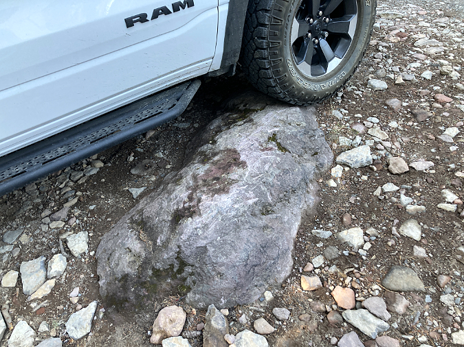
Because the existing trailhead was never designed or graded as a parking area, visitors must navigate large boulders and deep pits to find parking

The scars on this boulder are testimony to the real damage caused by the lack of an improved parking surface at the existing Vista Ridge trailhead

The constrained, chaotic parking at the Vista Ridge Trailhead and resulting overflow on busy weekends is frustrating enough for visitors, but it also creates a safety problem for emergency response. This trailhead provides the best access to the northern part of the Mount Hood Wilderness, yet there is often no way to turn a vehicle around in summer, much less park a fire truck or ambulance here.

The overflow parking on the narrow access road is not only stressful an potentially dangerous for visitors to navigate, it also creates an access problem for larger emergency vehicles attempting to reach the trailhead

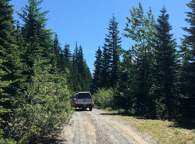
This visitor was forced to back nearly 1/4 mile down the access road after reaching the full parking lot and overflow shoulder parking that left no room to turn around

The origins of the short trail connector from today’s trailhead to the historic Vista Ridge Trail has unclear origins, it appears to have been built between 1963 and 1967, and it was clearly intended to replace the northern portion of the Vista Ridge Trail – the section that has since been restored as the Old Vista Ridge Trail.  

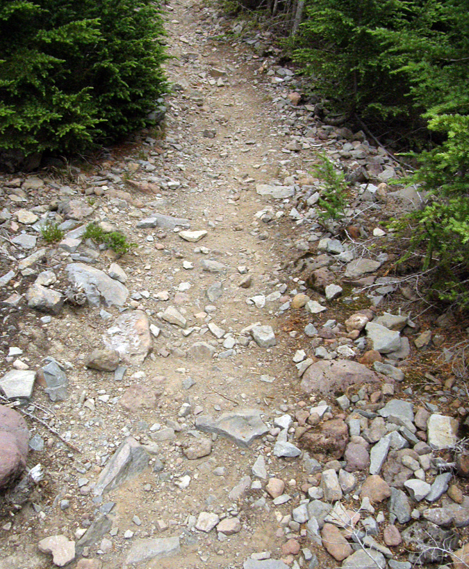
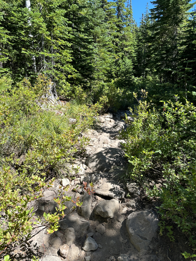
While most of the short connector trail is a well-constructed and graded route through dense forest, the first 200 yards are a miserable, rocky mess where the “trail” is really just a rough track that was bulldozed for a planned extension of the logging spur, but never fully graded. This sad introduction to the wonders that lie ahead is a frustrating chore to hike – and an ankle-twisting nightmare to re-negotiate at the end of your hike. 

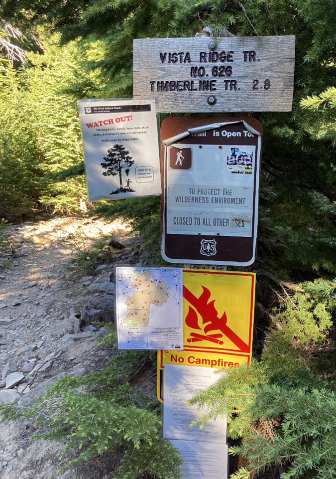
This signpost is the sole “improvement” at the Vista Ridge trailhead, leaving much room for improvement at what has become one of Mount Hood’s most popular trailheads

The first 1/3 mile of the Vista Ridge trail follows an abandoned, partially constructed section of logging spur that has significant surface and drainage problems that also leave much room for improvement as the gateway to this popular area

Add to these trailhead and trail condition woes an ongoing lack of proper signage to help people actually find Vista Ridge, and you have a discouraging start to what should be stellar wilderness experience for visitors – many from around the country and even the world. Thus, the following: a proposal to finally fix these issues at Vista Ridge and give this sub-par portal into the Mount Hood Wilderness the attention it has long deserved.

The Proposal…

The problems that plague the existing Vista Ridge Trailhead all stem from its accidental location on the steep mountainside. As a result, there is no way to safely accommodate needed parking, a turnaround or other trailhead amenities in the current location. The good news is that flat ground lies about 1/2 mile away, where Road 1650 passes an already disturbed site that was part of a recent logging operation.

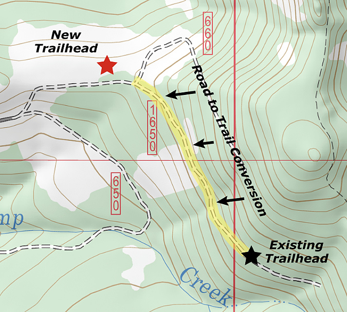
This map shows the proposed new trailhead site – roughly 1/2 mile northwest of the existing trailhead – and the section of existing road (highlighted in yellow) that would be converted to trail

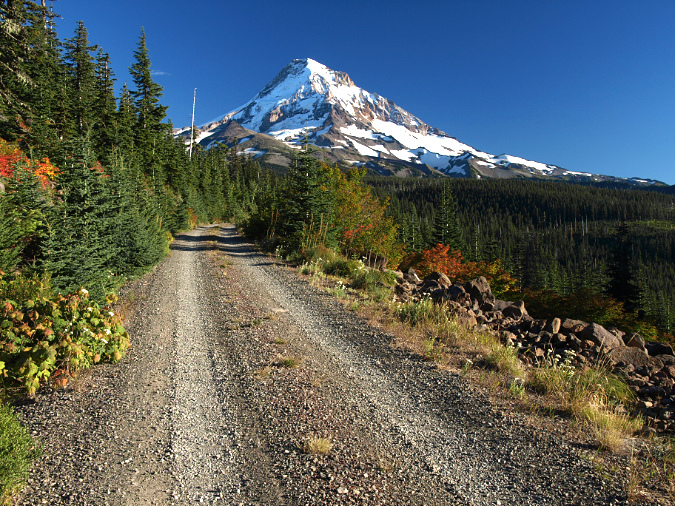
To make this new location work, the section of Road 1650 from the proposed new trailhead to the old (highlighted above in yellow) would be converted to trail. Normally, adding a half-mile of converted road to a hike would be a minus, but this segment of Road 1650 is stunning (see below), with spectacular views of Mount Hood. The talus slopes that provide these views are also home to colonies of Pika that provide their distinctive “meep!” as you pass through – something that can’t be appreciated from a car.

Converted roads don’t always make for great trails, but the approach to the existing Vista Ridge trailhead is exceptionally scenic and would make for a fine gateway trail to the Mount Hood Wilderness

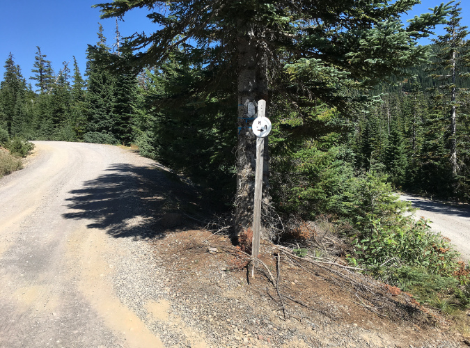
The first step in creating the new trailhead (and even without the new trailhead) would be restored signage to help visitors find their way from Lolo Pass Road to Vista Ridge, especially at the confusing fork (below) located just short of the proposed trailhead.

Finding the Vista Ridge trailhead is a challenge. The signpost at this crucial fork just below the trailhead had lost its sign in this view from two years ago, but the entire post has since disappeared. A new trailhead would include restoring directional signage to help visitors navigate the route

Next up, the obvious spot for the new trailhead (below) is a yarding area from a logging operation that was impacted more recently with a nearby thinning project. Dirt logging spurs radiate in all directions from this cleared area, allowing for new trailhead parking to incorporate these already impacted areas to minimize environmental impacts.

The proposed new trailhead site was previously disturbed with a logging operations

Until recently, the proposed new parking area faced a wall of trees to the south, but a tree thinning project on the opposite side of Road 1650 has suddenly provided a Mount Hood view (below). The purpose of the thinning was to enhance forest health by removing smaller, crowded plantation trees to promote huckleberries in the understory – an important first food harvested by area tribes. 

Should the huckleberries thrive as planned and bring berry harvesters to the area, this could be another benefit of providing trailhead parking here. For now, the thinning just provide a sneak-peak at the mountain that lie ahead for hikers or a backdrop for people using picnic tables at the trailhead (more about that in a moment).

The proposed new trailhead is directly across Road 1650 from a recently thinned area

It looks pretty grim now, but the tree thinning project across from the proposed is intended to spur the huckleberry understory to allow for berry harvesting… eventually

The concept for the new trailhead parking is to use an old dirt logging spur that splits off the Vista Ridge Road as the entrance to the parking loop. The existing Road 1650 would be closed and converted to trail from this point forward. The logging spur is shown on the left in the photo below, along with the portion of Road 1650 where the trail conversion would begin. The existing trailhead lies about 1/2 mile from this point.

The existing road conversion to trail would begin here, with the new parking access following the logging spur on the left

Roughly 200 yards beyond the proposed trailhead, the views open up along existing Road 1650 where it crosses the first of two talus slopes (below). This is one of those “wow!” spots that comes as a surprise to hikers as they drive to the existing trailhead. The right half (downhill) in this converted section of the existing road would be retained as trail, the left (uphill) side would be decommissioned.

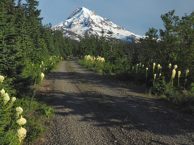
The final 1/2 mile of Road 1950 is scenic in all seasons, with Beargrass blooms in early summer and brilliant fall colors emerging by late summer

How does this work? The decommissioning of the uphill half of the existing road could be accomplished by upturning the surface with a backhoe – a process used to decommission miles of logging roads in recent years around Mount Hood country. The scene below is a typical example from a decommissioned road near Black Lake, located a few miles north of Mount Hood, on Waucoma Ridge. In this example, the goal was to completely retire the road, though the same method can be used to convert a road to single-track trail.

This road near Black Lake was decommissioned in the early 2000s and is gradually revegetating

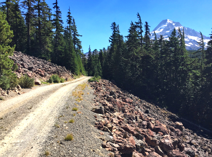
Just beyond the first “wow!” talus viewpoint, the mountain comes into view once again along the existing Road 1650 as it crosses the second talus slope, just before reaching the existing trailhead. This slope here is unique in that it consists of red lava (below), a somewhat uncommon sight around Mount Hood that adds to the scenic beauty. Like the first talus section, this slope is also home to Pika colonies, adding to the trail experience. The right half of the converted road would be retained as trail here, and the left (uphill) side decommissioned.

Without overflow parking blocking the view, the final stretch of the access road passes this scenic and somewhat unusual talus slope composed of red lava rocks

Beyond the practical benefits of moving the Vista Ridge trailhead to make it safer and more functional, there are also compelling conservation arguments for the move. First, it would allow the Forest Service to retire another segment of old logging road – and though only 1/2 mile in length, in its current state it nonetheless contributes to the massive backlog of failing roads built during the logging heyday that the agency can no longer afford to maintain.

There are also noisy (meep!) wildlife benefits, as the Pika colonies living in both talus slopes are likely impacted by the noise, vibration and pollution that the steady stream of hikers bring as they drive – and increasingly park – along this scenic section of road.

Because most road-to-trail conversions around Mount Hood have been driven by wilderness boundary expansions, washouts or other abrupt events, there aren’t many examples of intentional conversions to point to. Instead, most conversions are simply abandoned roadbeds that nature is gradually reclaiming, like the section of the Elk Cove trail shown below.

The lower section of the Elk Cove Trail follows an old logging road that was simply closed, but not formally converted to trail

Beyond often being a hot, dusty trudge for hikers looking for a true trail experience, old roads that aren’t intentionally converted also lack proper trail design features for stormwater runoff and drainage, as seen on the opening section of the existing Vista Ridge trail. Abandoned roads also lead to thickets of brush and young trees as the forest moves in, making maintenance of trails that follow these routes a constant chore. It simply makes more sense to undertake true conversions from road to trail on these routes in the long run.

Recently converted road-to-trail at Salmon Butte (Oregon Hikers)

There are very good examples of intentional conversions, and among the best is the Salmon Butte Trail, where the Forest Service decommissioned a section of road in 2010 and intestinally created meandering trail through mounds of earth along the old roadbed to further conceal evidence of the road from hikers. Just a few years after the conversion (above) the signs of the old road were already fading fast, creating a more authentic trail experience. Self-sustaining drainage features were also incorporated into the design. The same approach could be applied to decommission both the final road section and the current trailhead parking area at Vista Ridge.

Finally, improvements to the opening stretch of the existing Vista Ridge trail that also follows old roadbed is in order. This short section (below) is typical of a road that wasn’t property converted to trail, and as a result suffers from serious runoff erosion during the winter and spring. The result is a cobbled mess that is hard on ankles and morale as hikers set off for their hike. 

If this looks like a dry streambed, that’s because it is! It’s also the opening 1/3 mile section of the Vista Ridge Trail where it follows an abandoned, partly constructed road bed that becomes a running stream in the winter months

There are some basic trail drainage features that could keep this section from becoming a river during the wet months. Next, some of the most miserably rocky sections could be covered with gravel – but from where? It turns out the Forest Service left a couple of large piles (below) where today’s trailhead is located when work on extending this road was abandoned more than 50 years ago. 

Northwest Youth Corps crew did just this about a decade ago, but because the drainage problem wasn’t addressed, most of that first layer of gravel has been washed away and their efforts long since erased.There are some basic trail drainage features that could keep this section from becoming a river during the wet months. Next, some of the most miserably rocky sections could be covered with gravel – but from where? It turns out the Forest Service left a couple of large piles (below) where today’s trailhead is located when work on extending this road was abandoned more than 50 years ago. 

Let’s put this leftover pile of gravel from the logging days to work!

How a parking loop would work…

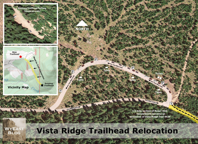
Putting it all together, this proposal (below) shows how the new trailhead parking could be accomplished as a parking loop, as opposed to a parking lot. The inset images include an aerial image of the current, dead-end trailhead parking at the same scale as the proposed loop map for direct comparison. The topographic inset map shows the proposed trailhead and parking loop, along with the proposed road conversion in relation to the existing trailhead (be sure to click on “large version” link below for a closer look!) 

[click here for a large version]

Why a loop? First, it’s the least impactful on the environment. Instead of clearing a wide area to provide room for cars to back in and out, the parking is simply provided along the right shoulder of the loop – like parallel parking in the city – but with nature left intact inside the “donut hole” of the loop.  

In this case, the loop would follow a series of old logging skid roads, further minimizing the impact on the forest. But perhaps most importantly from an environmental impact perspective, adding a couple hundred yards of new loop road here would allow a half-mile section of existing road to be retired and converted to trail, a clear net gain, overall.

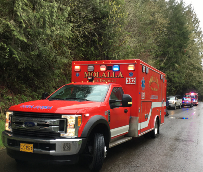
Busy trailheads call for amenities like improved signage and toilets – and space for emergency vehicles to have access. These vehicles were called to the trailhead where a hiker was injured in the Clackamas River area – fortunately, the trailhead was located along a paved forest road with ready access and space to turn around

Another important benefit of a loop is to provide a much-needed turnaround at the end of a dead-end road for forest rangers and emergency responders. This might be the most compelling reason to fix the Vista Ridge trailhead sooner than later, as today’s overflowing dead-end parking area is a disaster waiting to happen should fire trucks or other emergency vehicles need to access the Vista Ridge trail on a busy weekend.  

Designing the parking loop…

From a user perspective, a parking loop is efficient and easy to navigate. The one-way design ensures that people arriving here would always reach the closest available parking spot to the trailhead first. This is the opposite of the current dead-end trailhead, where hikers arriving later in the day often park in less-than-safe spots along the access road when they see overflow shoulder parking occurring, for fear of not being able to turn around in the cramped trailhead lot – often after spaces have opened up in the main parking area.

As shown in the parking schematic (above), the relocated trailhead would accommodate up to 30 vehicles along a 1,100-foot-long loop – or about three times what the current dead-end parking area allows. The loop would be gravel-surfaced, 16-feet wide and designed to flow one-way in a counter-clock-wise direction, with shoulder parking allowed on the right side.

The new trailhead could also be a Northwest Forest Pass site with the required toilets, picnic tables and welcoming signage for visitors, something that the space constraints at the current lot would not allow. These could be located in the “donut hole” center of the loop. Making this a forest pass site would also address one of the more dire needs at Vista Ridge – a toilet! The heavy use at the trailhead and steep terrain has turned a couple of more accessible trees adjacent to the parking area into de-facto toilets, with unpleasant results. 

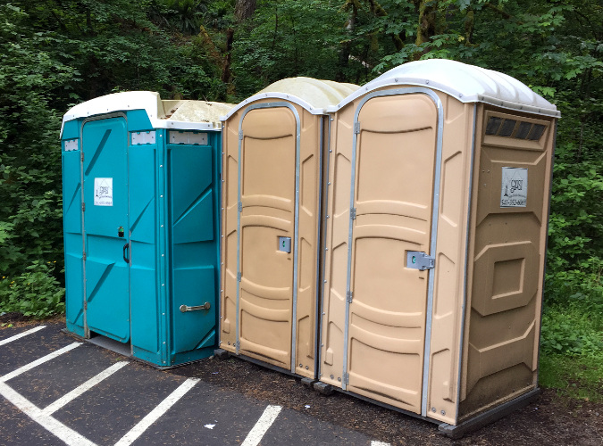
Industrial toilets at a busy trailhead in the Columbia Gorge – functional, but not exactly a complement to the outdoor experience!

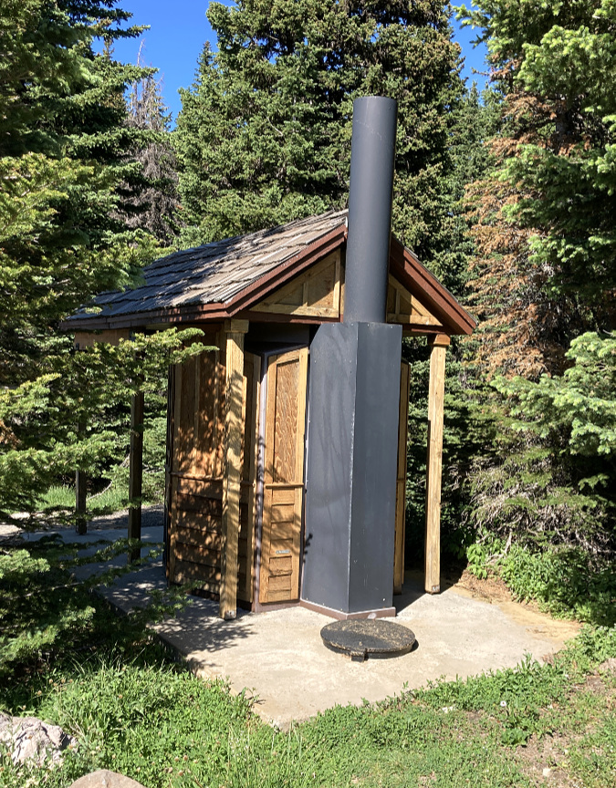
The Forest Service has upped its game with pit toilets in recent year at some Northwest Forest Pass sites, replacing industrial porta-potties (above) that are the last thing you want to see as you set off for a wilderness experience with more aesthetic toilets, like the one at the High Prairie trailhead (below), just east of Mount Hood. This would be a great choice for a new trailhead at Vista Ridge.

Rustic toilet design at the High Prairie trailhead, gateway to the Badger Creek Wilderness

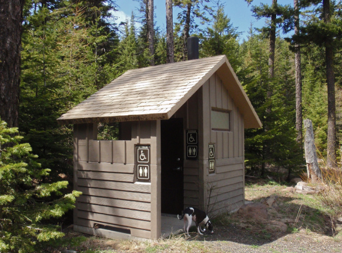
The are also more substantial examples around Mount Hood that are wheelchair accessible, like this one at the Billy Bob snow park near Lookout Mountain (below).

Accessible, rustic toilet design at the Billy Bob snow park near Lookout Mountain

Why an accessible toilet? Because there’s also an opportunity for the converted road section in this proposal to incorporate an accessible trail surface to at least one of the talus viewpoints along the way – like this well-photographed spot along the existing road (below), located just a few hundred yards from the proposed trailhead. 

This view is from the shoulder of the current access road, just a few hundred yards from the proposed new Vista Ridge trailhead. Converting the road to an accessible trail design and providing some simple amenities (e.g., a picnic table) would make this a welcome new destination for people with limited mobility or who use mobility devices

Accessible trail opportunities are in woefully short supply around Mount Hood, an unacceptable reality. There’s room at this viewpoint for an accessible picnic table, benches and perhaps interpretive signage — allowing for the extended Vista Ridge trail to serve a wider spectrum of visitors and abilities, not just able-bodied hikers heading into the wilderness.

What would it take?

There are two main parts to this proposal: (1) building the new parking loop and (2) converting the final half-mile section of Road 1650 to become a trail. The first part – the parking loop, pit toilets, picnic tables, signage and other trailhead amenities — would have to be built by the Forest Service. However, this work could likely be fast-tracked as an exemption under the environmental review process, since it involves relocating an existing parking area and would result in much less roadway than the current trailhead. That environmental analysis would also have to be completed by the Forest Service.

The second part of this proposal — the road-to-trail conversion — could be completed as a partnership between the Forest Service and volunteers, like Trailkeepers of Oregon (TKO), who already maintain the Old Vista Ridge and Vista Ridge trails. The Forest Service could complete the rough backhoe work to reduce the converted road to single track, and volunteer crews could finalize the tread and drainage on the converted trail. 

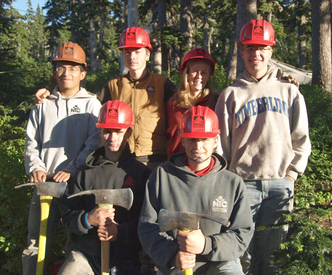
Volunteers could also install viewpoint benches and picnic tables for an accessible trail and trailhead signage at the new parking area. Some of the heavier work could be contracted to organizations like the Northwest Youth Corps, which has a long history of trail work around Mount Hood.

Northwest Youth Corp crew working on the Vista Ridge Trail

How could this concept move forward? Funding is always a concern for the Forest Service, but there’s also unprecedented funding coming online right now for the federal agencies from the 2022 Inflation Reduction Act. This project could compete for these funds, many of which are competitive, especially if it includes an accessible trail. Creating a new Northwest Forest Pass site would also generate revenue (in theory) to help maintain the new trailhead. 

Volunteer crews from TKO are already working from this trailhead every summer to maintain the Vista Ridge and Old Vista Ridge trails. The over-crowding at the existing trailhead has already made their work more difficult, so contributing to the trail conversion effort would be a natural fit for TKO volunteers to be part of.

The author on the Old Vista Ridge trail

In the meantime, if you want to experience the wonders of Vista Ridge and Old Vista Ridge, the best plan is to avoid this trailhead on Fridays, Saturdays and Sundays from July through mid-September. If you must go on those days, then it’s not a bad idea to simply park on the shoulder of Road 1650 where this new trailhead is proposed, and simply walk the scenic final half mile to the current trailhead. You’ll get mountain views, hear the local pikas calling out, avoid the stressful chaos of the existing trailhead – and with any luck, you’ll be getting a preview of things to come!

__________________

Tom Kloster | August 2023

The High Cost of Free Parking (part 2 of 2)

ParkingCostPartTwo01

Cars now overflow the remote Vista Ridge trailhead routinely

This is the second in a two-part series that takes its name from Donald Shoup’s ground-breaking book “The High Cost of Free Parking”, first published in 2005. Shoup documents the many unintended effects of free parking in cities, and many of his proven principles could apply to trailheads in our public lands, as well.

The second part in this series explores some possible solutions for the parking crisis facing the trailheads of the Columbia River Gorge and Mount Hood, and the value of confronting the true costs of free parking to our most treasured public lands.
__________________

No more free parking!

Does anyone really expect free parking at a Timbers or Blazers game, or drop in for dinner without a reservation at one of Portland’s finest restaurants to find a table waiting? Or be exempted from tolls when crossing the Columbia at Hood River and the Bridge of the Gods in Cascade Locks? Of course not, but that doesn’t mean we don’t reserve the right to complain about it! That’s human nature.

ParkingCostPartTwo02

Bumper-to-bumper at Vista Ridge on a Friday

Such is the dilemma for public land managers face as they attempt to impose limits on access to our trails on Mount Hood and in the Gorge. While we can all probably agree that the impacts we now see from overuse require limits on access, we’d probably like someone else to suffer the inconvenience.

The good news is that our most overused trails are relatively few in number. Any seasoned hiker can rattle them off, as many already avoid these trails on popular weekends and seasons: Angels Rest, McCord Creek, Wahclella Falls and Eagle Creek in the Gorge are now infamous for their crowds, while Ramona Falls, Mirror Lake, Salmon River, Elk Meadows and (most recently) Tamanawas Falls on Mount Hood see overflowing weekend crowds.

ParkingCostPartTwo03

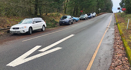
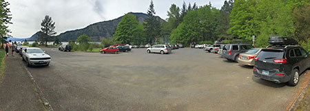
Frustrated hikers pushed out of the Wahclella Falls trailhead have resorted to parking on the I-84 off-ramp

Experienced hikers already know where the lesser-visited trails are and make a point of steering toward these places for a quieter, better outdoor experience. However, as the Portland region continues its rapid growth, even some of these “secret” trails are starting to show some strain: Herman Creek, Starvation Ridge and Gorton Creek in the Gorge and Vista Ridge, Bald Mountain and Cooper Spur have all seen spikes in use over the past decade or so as hikers seek less crowded trails.

We have met the enemy and he is… us!

The first step in adopting a trailhead parking policy to address overcrowding is to recognize the problem: when trailheads routinely overflow, it’s a problem! You can see this on weekends on every one of the overcrowded trails mentioned above. The crowding is now year-round in the Gorge and whenever the ground is snow-free up on Mount Hood.

For some trails, like Mirror Lake and Eagle Creek, the crowds extend beyond the weekends, especially on Fridays and Mondays. But even on these most heavily used trails, weekdays usually mean plenty of parking to spare, with no overflow.

This variation in day-to-day use at the most crowded trailheads is a case study for variable parking fee, with fees set higher on weekends and holidays, and lower (or not at all) on weekdays. As Donald Shoup demonstrates in “The High Cost of Free Parking”, adopting such a strategy can shift weekend and holiday use to less popular trailheads with free parking, or to non-peak days at more popular trailheads.

ParkingCostPartTwo04

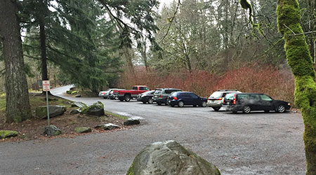
The popular Wahclella Falls trailhead still has open spaces on most weekdays

If we adopted a variable pricing policy tomorrow for overused trailheads in the Gorge, we could cut weekend crowding on trails now being harmed by overuse in half, overnight. Sounds easy, right? Well, one complication comes from the public blowback that would almost certainly occur. Remember, we all reserve the right to complain when things aren’t free!

Another complication comes from the fact that several of the most popular trailheads also have heavy tourist use. Places like Horsetail Falls, Wahkeena Falls and Multnomah Falls in “waterfall alley” are good examples where the majority of peak period visitors aren’t hikers, just people touring the Historic Columbia River Highway and walking the paved paths to the most famous roadside views.

Shared tourism and hiking trailheads should be priced, too, as they fit the same definition for overcrowding with parking spilling far beyond established parking areas. Crowding is crowding.

ParkingCostPartTwo05

The impacts of overuse in the Gorge are real and jarring. This boot path cutting a switchback on the Oneonta Creek trail formed in just the past two years.

At Multnomah Falls, a new hazard has emerged from the overflow on weekends, with visitors now parking beyond the narrow historic highway viaducts that flank the falls and lodge. Signs on the viaducts sternly warn against pedestrians walking along them, but whole families are now a common sight in the narrow viaduct vehicle lanes on busy spring and summer weekends at Multnomah Falls.

At Oneonta Gorge, the huge overflow of visitors has created a hazard for hikers attempting to scale the log jam at the mouth of the gorge, and ruined the outdoor experience for those who make it beyond the log pile with a noisy, carnival atmosphere.

ParkingCostPartTwo06

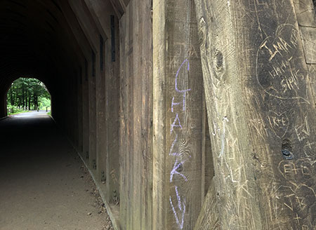
Vandals have almost completely carved up the walls of the restored Oneonta Tunnel since it opened six years ago…

ParkingCostPartTwo07

…a testament to the destructive behavior that allowing large crowds to from on our public lands can foster?

Worse, the overcrowding at Oneonta has led to a shameful degree of vandalism in the recently restored highway tunnel. Would vandals pay to park here? Perhaps, but at least the crowds that lead to that sort of destructive behavior could be prevented with managed parking. Otherwise, this precious gem will likely have to be closed to the public, once again.

At Mount Hood, overcrowding at places like the Salmon River Trail and Ramona Falls has also led to vandalism and car break-ins, in addition to heavy impacts on trails. Managed parking could greatly improve the situation here, while allowing hikers to discover the many lesser-used trails on Mount Hood that could benefit from more boot traffic while providing a far better hiking experience.

ParkingCostPartTwo08

A relatively quiet weekday at the massive (and overflowing on weekends) Ramona Falls trailhead

In many of these examples, a parking pass is already required today, but this has little effect on managing peak use. The key difference is variable pricing for parking that provides an incentive for visitors to avoid peak periods at the busiest trailheads, but gives options of other trails or off-peak days when little or no parking fee is charged. It’s a proven approach whose time as come in our most visited public lands.

…and now transit!

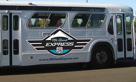
Since proposing a “Boot Loop” transit service on this blog four years ago, we’ve seen significant steps forward in providing transit service to Mount Hood and the Gorge. The Mount Hood Express now provides daily service from the Portland area and on the Washington side of the Gorge, transit service now connects to Stevenson, with a new shuttle to Dog Mountain.

ParkingCostPartTwo09

The new Mount Hood Express bus provides daily service to the mountain.

On the Oregon side of the Gorge, the Oregon Department of Transportation (ODOT) is partway through a pilot project to bring transit service to the most heavily visited spots in the Gorge. ODOT plans to provide service from a park-and-ride location inside the Portland area to the most popular trailheads in the Gorge.

Transit service provides a needed option to driving, especially for those who do not have access to a private vehicle, but also to those who simply want to avoid the hassle of driving (and parking).

Transit is also a good counterpoint to adopting a parking strategy for the Gorge and Mount Hood, as parking fees provide an incentive to use transit during peak periods, which in turn, helps provide the critical mass to keep the service going. This is a tried and proven relationship between parking policy and transit in cities, and overdue as a strategy in our most heavily used recreation sites.

ParkingCostPartTwo10

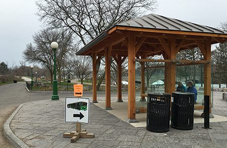
Park transit station at Niagara Falls State Park, New York

That said, transit is mostly a way to provide another option for visitors. It simply won’t have the capacity to have much impact on overall visitation during peak periods, when parking areas at our most popular trailheads is already overflowing to two or three times the planned capacity for the trail.

How could this work?

Applying Donald Shoup’s parking management practices to recreation areas is less complicated than in an urban setting for the simple fact that there are so few places to manage, most have a single entrance point and they are all in public ownership.

ParkingCostPartTwo11

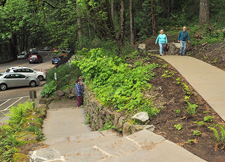
The Forest Service recently completed a major remodel of the Wahkeena Falls wayside to better manage crowds, but without managing parking, this new landscaping doesn’t stand a chance of surviving the overload.

The public reaction to actually putting a price on parking at our busiest trailheads, even during peak periods, is the driver for why we aren’t already attempting this – not the complexity of actually making it work. After all, cities around the world are already doing it, and against much more complex obstacles.

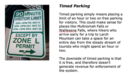
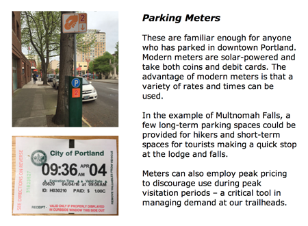
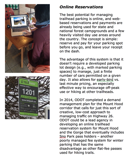
So, what are the parking management tools that could be borrowed from cities? Here are some that could work in the Gorge and on Mount Hood:

ParkingCostPartTwo12a

ParkingCostPartTwo12e

ParkingCostPartTwo12d

ParkingCostPartTwo12c

ParkingCostPartTwo12b

These systems are all being used in cities today, and some combination of these practices could be applied to parking on our public lands. One challenge for public lands would be on-site enforcement, however, as this is an essential ingredient for urban parking policies.

On this point, I propose that a portion of the trailhead parking revenue could be steered toward dedicated county law enforcement to patrol parking areas. Not only would this provide an essential incentive for visitors to pay their fee, but it would also bring a much-needed security presence for busy trailheads that are increasingly targeted for car break-ins.

ParkingCostPartTwo13

The Starvation Creek wayside does triple duty as a popular trailhead, wayside for tourists and freeway rest stop. This site is a candidate for a combination of short-term timed parking and long-term fee parking.

So, how much revenue does a parking strategy generate? Well, consider that the City of Portland collects some $35 million annually in parking fees from its downtown meters, which in turn contributes to the city’s transportation budget for street maintenance. The city also collects another $7 million annually in fines for parking violators, more than enough to cover its enforcement costs.

While a parking strategy for the Gorge or Mount Hood would be unlikely to bring that much parking revenue, the Portland model does show that fee parking at the most popular trailheads in the Gorge and on Mount Hood could not only cover operational costs, but also bring new revenue for woefully underfunded trail maintenance and construction. That could be a valuable selling point to regular hikers and visitors.

Those pesky agency permits…

One of the institutional obstacles to adopting a coordinated parking strategy for the Gorge, in particular, is the mix of land management agencies involved: the U.S. Forest Service, Oregon Parks and Recreation Department (OPRD) and Washington Department of Natural Resources (DNR) all have some sort of parking permit that applies to some of their respective recreation sites.

ParkingCostPartTwo14

Welcome to Wahclella Falls! Forest Pass or $5 fee required… here.

The Forest Service and OPRD both have a mix of free and fee sites, with the Forest Service requiring a $30 annual Northwest Forest Pass or $5 day-use fee at places like Eagle Creek or Wahclella Falls, but no charge at its busiest locations like Multnomah Falls, Horsetail Falls and Wahkeena Falls, where tourists outnumber hikers. OPRD charges $5 day-use fees at places like Rooster Rock and Benson Lake, but not at busy trailheads like McCord Creek and Latourell Falls.

Meanwhile, on the Washington side of the Columbia, DNR charges a $30 annual fee or $10 daily fee for its Discover Pass to park at places like Beacon Rock, Hamilton Mountain and all other Washington State recreation areas.

All of these are flat-fee permits, so they do nothing to help discourage overcrowding on busy weekends and arguably encourage more use, since an annual fee provides a flat rate for unlimited visits. In fact, the annual passes do just the opposite, encouraging multiple visits for a flat rate. There’s nothing wrong with hikers spending a lot of time in the Gorge, of course, but we all share the burden when it comes to managing the impacts through trailhead parking fees.

ParkingCostPartTwo15

It’s unclear how much revenue is left for trails once administration costs for the Northwest Forest Pass are covered.

Today, trailhead permits are pitched for their ability to generate funds to build and maintain trails, but hikers are rightly skeptical about how much funding actually goes to trails. In the end, it’s not a problem of the trail passes, but rather, by the low fees relative to the trail impacts the most popular trails are experiencing.

For example, a hiker purchasing an annual permit for $30 and spending a dozen days in the Gorge or on Mount Hood each year pays just $2.50 per visit to cover their trail impacts, or less than many hikers will spend on coffee en route to the trailhead.

ParkingCostPartTwo16

Lots of passes and hassle, not much revenue for trails… and no impact on crowding.

There is little chance the states of Oregon and Washington and the U.S. Forest Service will ever join forces and create a unified trail pass, and besides, their pass systems aren’t effective at managing peak use, anyway. Instead, they should cooperate to adopt a pricing strategy for our most overused trails that is an add-on to (or replacement for) the existing pass system at these locations.

The ethics of putting a price on parking?

At this point, you might be thinking (as I generally do) that we should all enjoy free access to our public lands. Of course we should! We pay for tem every April 15, after all. Thus, adding parking fees at our overused trails will most certainly bring howls from avid hikers who spend a lot of time on the trail, and who dutifully purchase their $30 annual trail passes now.

ParkingCostPartTwo17

Would revenue from a parking policy bring more of this to the Gorge and Mount Hood? Almost certainly, if managed properly.

Yet, when overuse starts to bring the “tragedy of the commons” to our most cherished places, it’s time for all of us to step up and find a solution. Putting a price on parking is a proven and effective way to get there. More importantly, pricing is really only needed on our most heavily traveled trails. Most trails will continue to be “free”… of a parking fee, anyway.

Putting a price on parking arguably discriminates against people with limited incomes or who are unable to visit in off-peak periods when little or no fee is required. Land managers will therefore need to consider ways to ensure that everyone can visit our public lands, no matter their ability to pay. But such programs are already in place in several state and National Parks, and could be easily included in a Gorge or Mount Hood parking strategy.

ParkingCostPartTwo18

That’s no road – it’s what the Angels Rest trail has become in recent years, thanks to massive overuse from a complete lack of parking management at the trailhead.

Today, land managers are already beginning to put restrictions on overflow parking in the Gorge and on Mount Hood. It’s a good first step, but not enough to address peak demand on weekends and holidays, and in the end will mostly frustrate visitors who have arrived expecting place to park.

The next step for our public agencies is to start managing parking, itself. It’s long past time to try it in the Gorge and on Mount Hood, for the sake of our trails and most treasured places.