It’s Time for Safe Stream Crossings on the Timberline Trail

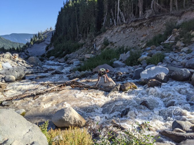
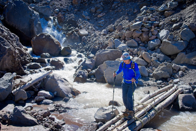
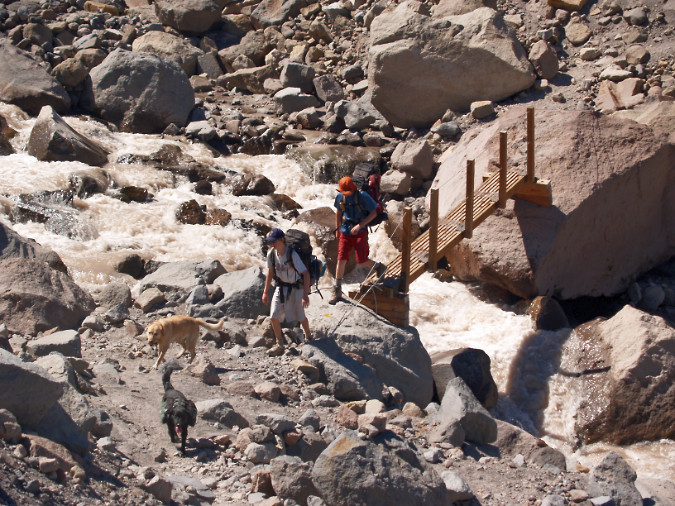
Hiker making a scary bridgeless crossing of raging Newton Creek along the Timberline Trail during summer runoff in 2022 (Craig Gwydir)

In this previous article, the story of Sarah Bishop included a call for restoring a footbridge over the Sandy River along the popular Ramona Falls loop trail. After her tragic death, Sarah’s family led a successful campaign to install signs at several wilderness entry points around the mountain warning hikers of the risks in crossing glacial streams and how to navigate them safely.

That was 20 years ago, and the situation has since grown urgent. The time has now come to simply provide bridges at the fourteen glacial stream crossings within the Mount Hood Wilderness. Why are the crossings so much worse? Here are the driving forces making the current situation unacceptable and now the moment to do something about it:

1. Sheer numbers of hikers: in one of their classic 1970s field guides, iconic authors Harvey Manning and Ira Spring once described the Mount Hood Wilderness as “mobbed year-round”. Both passed away in the early 2000s, and they probably couldn’t have imagined what “mobbed” really looks like, as what they saw as mobs the 1970s would be dwarfed by today’s crowds. The explosive growth in public demand for wilderness trails around Mount Hood translates not only to overflowing trailhead parking, but also traffic jams at the mountain’s most notorious glacial stream crossings, where hikers often wait in line to navigate sketchy logs or user-rigged “bridges” to cross.

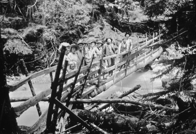
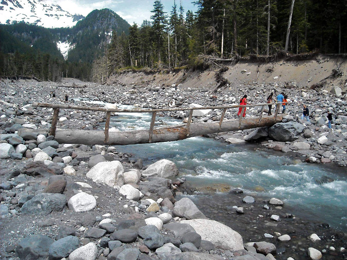
Crossing Mount Hood’s glacial streams has always been a challenge for hikers. Rails were added to a fallen log to create this bridge over the Zigzag River in the 1920s (Gary Randall)

Hikers are also less prepared for these obstacles today, thanks to social media driving the demand. Where hikers of the 1970s might have read one of the Spring & Manning or Don and Roberta Lowe guides to plan their trip, and thus become aware of these obstacles, today’s hikers are far more likely to have planned their trips based on a random Instagram image or Tik Tok videos that rarely bother to include meaningful trail information.

2. The glacial streams are a ‘changin: If you’re an old-timer, you probably remember when footbridges crossed several of the big streams on Mount Hood. That was a time when global warming was still a theory and glacial retreat was barely perceptible (though it was already underway), allowing for permanent structures at several crossings. Today, we can see the glaciers changing every year, and their retreat has wreaked havoc at downstream crossings. 

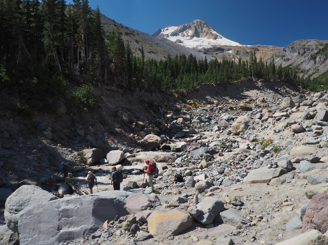
The Newton Creek crossing on the Timberline Trail is nearly 30 feet lower than it was just two decades ago, thanks to a series of floods and intense stream erosion resulting from climate change

As the ice melts away, U-shaped glacial valleys are rapidly eroding and deepening to become V-shaped river canyons. New channels are continually forming downstream from the glaciers as heavy loads of debris from upstream erosion are released into glacial streams. Winter debris flows and summer flash floods have also become a routine event on the mountain, presenting a volatile, continually changing landscape.

3. Hiker safety: Mount Hood is increasingly an urban wilderness dominated by day-hikers, less experienced hikers, families with young kids and some people with disabilities. This is to be expected — the mountain is just an hour away for some 2 million people – more than four times the population living in greater Portland in the 1930s, when the Timberline Trail was originally constructed. 

Like it or not, these numbers will only continue to grow, in part because our unique quality of life – including a mountain in our collective backyard — continues to bring people to our region. So, given this reality, will our mountain be a wilderness for everyone, or just those who are physically able to wade a torrent of thigh-deep glacial runoff or inch across a wobbly log six feet above the water?

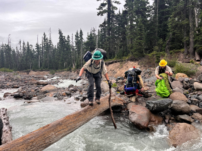
Volunteers from Trailkeepers of Oregon (TKO) making a sketchy crossing of Newton Creek enroute to a multi-day wilderness stewardship event within the Mount Hood Wilderness. Among their gear are 7-foot manual crosscut saws – the only saws allowed for clearing trails within the wilderness.

The hazards presented by the glacial crossing affect more than just hikers. Trail crews, backcountry rangers and emergency responders carrying heavy gear are also forced to navigate these obstacles – sometimes to rescue folks injured while making the same dangerous crossings.

4. Quality of the (urban) wilderness experience: People go to the Mount Hood Wilderness for the exceptional alpine scenery and a reasonably rugged experience. For most, this simply means an unpaved mountain trail, not confronting scary obstacles that leave them shaken and reluctant to return. 

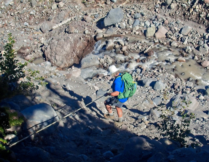
Timberline Trail hiker crossing a user-rigged log crossing on the notorious Eliot Branch in 2023, the volatile outflow from Mount Hood’s largest glacier (Guy Meacham)

There are wilderness purists who argue that it should be this way, and those unable to handle the risks should simply stay away. It’s an elitist argument that – unfortunately – is also made by some of our land managers as an excuse to do nothing. Fact is, Mount Hood is an urban wilderness (see No. 1, above), not the Alaskan frontier. For elite hikers seeking physical danger and hardship in their outdoor experience, there are dozens of wilderness areas beyond the day-trip range of major urban areas like Portland to choose from. Mount Hood just isn’t one of those places, and it never really was.

5. It’s good for business: Just as many people from our area think Mount Hood is already a national park (really!), so do visitors from around the country — and the world. The Timberline Trail brings untold numbers of long-distance travelers to the area every year, most thinking they will enjoy a national park-like quality experience on their 40-mile circuit. Over the years, I’ve encountered many of these folks on the trail and have been saddened to hear of their disappointment – not with the spectacular scenery, which they marvel at – but of the deteriorating trail conditions and especially the stream crossings. 

Hikers from around the world come to Mount Hood to experience the Timberline Trail, only to find themselves descending on random ropes left by previous hikers to navigate scary, bridgeless stream crossings (Chiyoko Meacham)

Why does this matter? Because visitors from out of state or other countries are the folks most supporting the tourism economy in the communities surrounding the mountain, from lodging and restaurants to local guide services, museums, galleries and farm stands. Yet, the quality of the Timberline Trail experience is rarely appreciated for its benefit to the local economy. Visitors from elsewhere are essential to any local tourism strategy, but with the current state of the trail, we are doing our very best to discourage positive experiences and repeat visits from beyond Oregon and Southwest Washington.

6. Real funding options: Did you know the Forest Service issues special use permits to private, for-profit businesses to maintain many of our campgrounds and trailheads, and even to conduct private trail events on Mount Hood each year? More significantly, this includes the large ski resorts who operate on our public lands under special permit, and who are increasingly marketing themselves as hiking destinations. Should these commercial interests be part of funding needed trail improvements on the Timberline Trail – including stream crossings? Absolutely. More about that toward the end of this article.


7. No more legal excuses: On December 27, 2021, the U.S. Court of Appeals ruled in the Ludwig vs. the United States case that the U.S. Forest Service was immune from wrongful death liability after a hiker drowned while attempting to cross a footbridge over the Sandy River near Ramona Falls during an extreme storm event. 

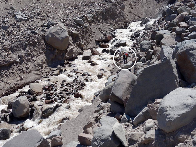
Can you see the hikers (circled) contemplating a ford of the Eliot Branch – and perhaps giant boulders teetering above the stream? Nobody should face this degree of physical risk when hiking the Timberline Trail (Robin Barklis/Portland Hikers)

The Ludwig case has long been pointed to as the reason for not providing safe crossings there, or anywhere within the Mount Hood Wilderness, but the case has since been decided. Now, it’s simply an excuse for doing nothing – though, ironically, it’s conceivable that not doing anything could open the agency to some future liability claim for exactly that reason. 

It’s time to move beyond legal liability excuses and simply make public safety the priority, once again. It’s time to finally make the Timberline Trail a safe, world-class experience for everyone.

Fifteen Crossings?

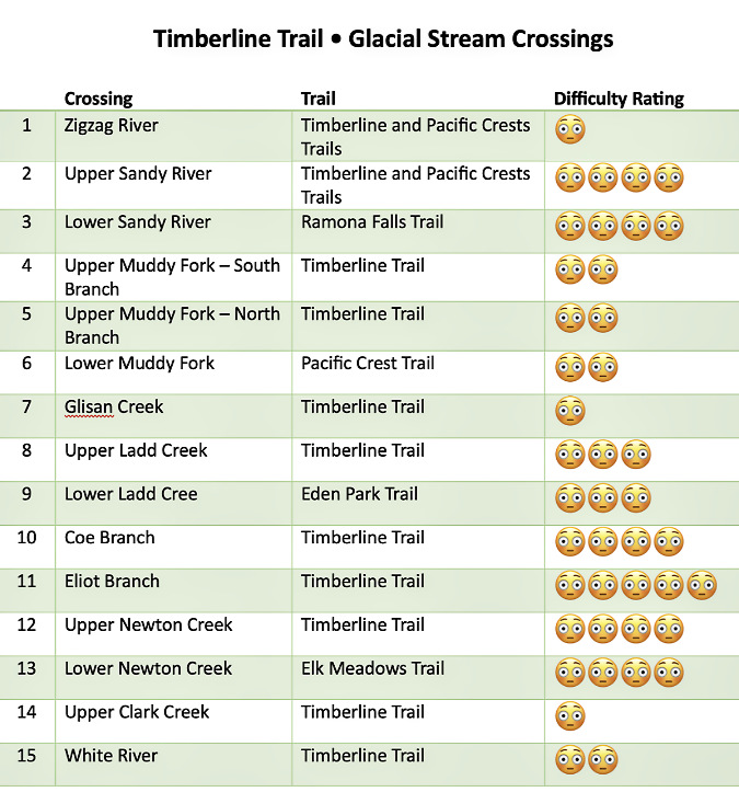
So, where are the footbridges needed? At all fifteen glacial stream crossings within the Mount Hood Wilderness. All of them – though more on how to tackle that in a bit. Here they are in the traditional clockwise order that hikers experience, beginning at Timberline Lodge, each scored according to their relative fear-inducing capacity:

[click here for a large version of the table in a new window]

Here’s a map of the proposed glacial stream footbridges. Most are located along the Timberline Trail (and the Pacific Crest Trail where the two overlap), along with two popular alternate routes to the Timberline Trail at Eden Park and Elk Meadows and the major access point to the loop at Ramona Falls:

[click here for a large version of the map in a new window]

What do the worried emoji ratings mean? They are subjective based on my own hiking experiences over the years, along with those of many others in my hiking circles. They range from a ranking of one emoji (rock hop, usually with dry feet) to four or five emojis for scary crossings in fast, icy, thigh-deep water that even the most experienced hikers struggle to cross during the summer peak glacial melt. 

It’s no surprise that the Eliot Branch should rise to the top of the list, as it is fed by Mount Hood’s largest glacier and has experienced some of the most dramatic erosion and canyon deepening on the mountain in recent years. In contrast, the Zigzag River, Glisan Creek and Upper Clark Creek crossings are not major obstacles for most hikers. However, any of these have the potential to be dangerous during summer glacial outbursts and thunderstorms, as was the case for Sarah Bishop. 

Going by the book..?

What is the official line from the Forest Service on providing stream crossing structures? It’s fairly specific. Here’s what the Forest Service trail handbook has to say:

______________ 

“Stream and river crossings present a challenge to trail managers who need to balance difficulty levels, safety, convenience, cost, environmental consequences, and esthetics. At one end of the use spectrum, a bridge can allow people with disabilities, toddlers, and users who are new to the outdoors to experience the trail with little risk.

“But bridges are expensive. Wilderness visitors who expect a challenge may prefer a shallow stream ford. During high water, these folks may opt for a tightrope walk across a fallen log. Each kind of water crossing has consequences for the recreation experience and the lands being accessed. Choose wisely from the spectrum of options before committing present and future resources to any given crossing.”

______________ 

The key in this guidance is the focus on the spectrum of user abilities. “Wilderness visitors” are implied to be at the most experienced end of the spectrum, and assumes these hikers are both aware of the meaning of designated wilderness and are either seeking — or at least expecting – to ford streams on their own. 

The sturdy Clark Creek Bridge is a bit of a relic from days when the Forest Service actively provided bridges around Mount Hood. It’s a permanent bridge that has survived for years, thanks to Clark Creek being the less rambunctious outflow from the Newton Clark Glacier to its rowdy twin Newton Creek. Today, it is the only bridged glacial stream crossing on the mountain. Clark Creek forms the Mount Hood Wilderness boundary, here – the wilderness entry sign is on the opposite end of this bridge.

This is almost never the case on Mount Hood. How to know that? Just look at the footwear (sneakers and flip-flops) and lack of trail safety basics on many of the folks heading into the wilderness, often without even a pack or bottle of water, much less a map or knowledge of the trail. All too often, ill-equipped hikers also have young kids and pets in tow.

The key wording from the Forest Service guidance on this less experienced end of the user spectrum should apply to all of Mount Hood’s glacial stream crossings: “a bridge can allow people with disabilities, toddlers, and users who are new to the outdoors to experience the trail with little risk” (author’s underscored emphasis added).

What is the Minimum Tool Philosophy?

There’s more guidance from the Forest Service best practices on footbridges that comes from the “minimum tool philosophy”, which seeks to “get the job done with the least long-term impact while still meeting management objectives”.  That’s a mouthful, but here are the considerations included in this part of the agency technical guidance:

  1. Do we really need a bridge here? Do we really need to cross here early in the spring? 
  2. Will someone be killed or injured if we don’t provide an easier crossing?
  3. Is this really the best place to cross this stream?
  4. What alternatives do we have to cross this stream, including not crossing it at all? Can we afford this crossing?
  5. What are the environmental and social consequences of a given type of crossing here? Can we commit to long-term inspections and maintenance?
  6. Who will really care if we don’t build (or replace) a bridge?

A telling footnote in this section of the Forest Service guidance adds that “it’s a wonderful thing to keep one’s feet dry, but keeping those feet dry in the backcountry is expensive.” For me, this comes across as surprisingly dismissive and elitist, but the list of “minimum tool” considerations are nonetheless easy enough to address in the example of the Timberline Trail.

The first two questions answer themselves – we already know many of the crossings on Mount Hood are dangerous, but also that travel is highly seasonal. The third, fourth and fifth questions also answer themselves: the Timberline Trail is an iconic feature that can’t simply be closed for lack of a desire or funding by the agency to make it safe to travel. It’s the Timberline Trail, after all! People come from around the world to experience this historic trail. Enough said.

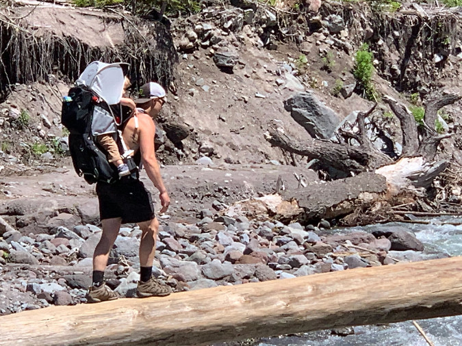
Yikes! Hiker forced to carry a toddler over a very high log crossing over the Lower Sandy River in 2022 (TKO)


The final question seems obvious, but it does go to the larger problem that the Timberline Trail isn’t actively championed by anyone beyond the hiking community. But would anyone other than hikers “really care” if the bridge problem remains unresolved? No doubt, though the economic value of trails is almost never featured in local tourism programs, and thus not really understood by the broader community. 

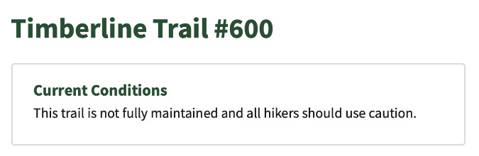
The two counties that encompass most of Mount Hood – Clackamas and Hood River – market themselves heavily at tourism destinations, yet have minimal content on their tourism websites for Timberline Trail visitors beyond a link to the Forest Service web page for the trail, which currently opens with this grim warning:

Makes you proud to be an Oregonian, right?

Be they local day hikers or international travelers coming to experience the Timberline Trail, all visitors to the mountain should obviously be part of the local tourism strategy. That’s a bigger nut to crack, but a good start would be making the trail safe so that disclaimers like this aren’t the first thing a prospective visitor sees when planning a trip to our mountain.

What are some working examples?

When it comes to suffering the effects of rapid climate change on its streams, Mount Hood has plenty of company from glacial peaks around the world. The best peers to learn from are right here in the Pacific Northwest, where trails on the other big Cascade volcanoes are also being impacted by the same forces we’re seeing on Mount Hood. There are also great regional examples of bridge structures provided within designated wilderness — including within the Mount Hood National Forest!

As around-the-mountain trails go, Mount Rainier’s Wonderland Trail is the Timberline Trail writ large. The trail covers 93 miles compared to Mount Hood’s 40-mile loop, and Mount Rainier has 28 glaciers compared to Mount Hood’s 12, several of them dwarfing the size of Mount Hood’s largest glaciers – and similarly outsized glacial streams, as well.

Carbon River Bridge, Mount Rainier National Park. This simple design is the most common in the park. It can be repositioned when needed, and easily replaced if lost to a major flood event (NPS)

Mount Rainer is protected as a national park, of course, and the Park Service strictly manages the Wonderland Trail as a pristine wilderness experience. Though it’s an ongoing struggle, park rangers work to provide seasonal crossings on the major glacial streams throughout the hiking season, though they do wash out frequently, leaving hikers to navigate on their own until the bridges can be re-installed.

Nisqually River Bridge, Mount Rainier National Park (NPS)

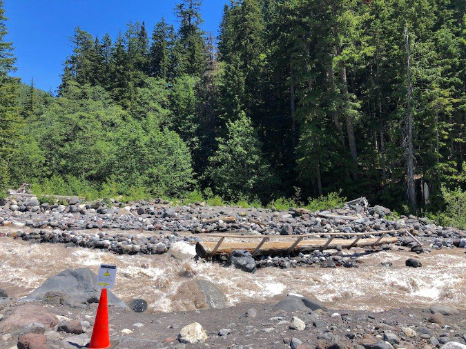
Nisqually River Bridge temporarily out of service due to shifting river channels. The sign on the cone in the foreground cautions hikers on the best way to navigate the crossing in the meantime (NPS)

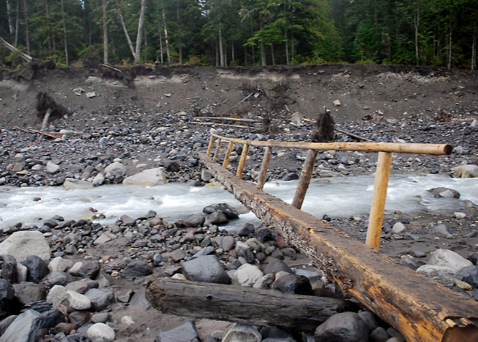
The Park Service at Mount Rainier has coped with this challenge with much less formal crossings, often simply a long, locally-sourced log with a single handrail that can be sacrificed should (or rather, when) the next flood sweeps down from the glaciers above. Hikers are cautioned to prepare for occasional washouts and difficult crossings each year, though the management goal is to make this classic trail as safe and enjoyable as possible. The park web page for the trail also includes extensive detail on current conditions, backcountry regulations and tips for planning a trip that would be a great template for expanding web content for the Timberline Trail.

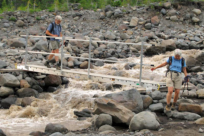
Heading north to Mount Baker, the Forest Service has provided a decidedly industrial, aluminum seasonal bridge in the past at Rocky Creek (below), a glacial outflow within the Mount Baker National Recreation Area. Though the design would not be appropriate for a wilderness setting, the seasonal placement is a helpful guide, as this stream is much like Mount Hood’s larger glacial outflows.

Rocky Creek Bridge, Mount Baker National Recreation Area (Adam Schneider)

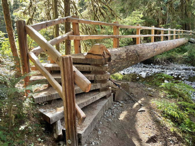
At Olympic National Park the newly built, permanent crossing of the Soleduck River (below) is a handsome solution that could work at downstream locations like the lower Muddy Fork on Mount Hood, where the river channel is less volatile and a large bridge could connect relatively stable, forested banks like these. While the Olympic peaks along the High Divide that feed into the Soleduck no longer have active glaciers, they do have an impressive snowpack each winter and famously heavy precipitation that required this bridge to be built for regular stream flooding.

The beautifully constructed Soleduck River Bridge in Olympic National Park (Tom Lovett)

Turning south and back to Oregon, the Fall Creek Bridge (below) in the Three Sisters Wilderness is another fairly new example of a permanent bridge on a heavily traveled wilderness trail. Though it does span a glacial outflow from the South Sister’s Lewis Glacier, the volatility of the meltwater is greatly reduced by the Green Lakes, which act as a jumbo settling pond for the silty glacial runoff. This is why Fall Creek is both crystal clear and fairly stable within its banks downstream from the lakes, and why a permanent bridge design could be constructed here. Like the Soleduck River example, this structure could be a model for the lower Muddy Fork, where a permanent bridge seems feasible. 

Fall Creek bridge near one of the main gateways into the Three Sisters Wilderness

Contrary to what you may have heard, the Mount Hood National Forest has recently built (or rebuilt) several footbridges within its designated wilderness areas. One example described in [the previous article on the subject] is the lower Ramona Creek footbridge, built within the wilderness just a few years ago, and just a short distance from the Lower Sandy River crossing. The justification here (and for the upper Ramona Creek bridge at the base of the falls) is simply the number of hikers on this very popular trail – a decision completely consistent with the Forest Service best practices.

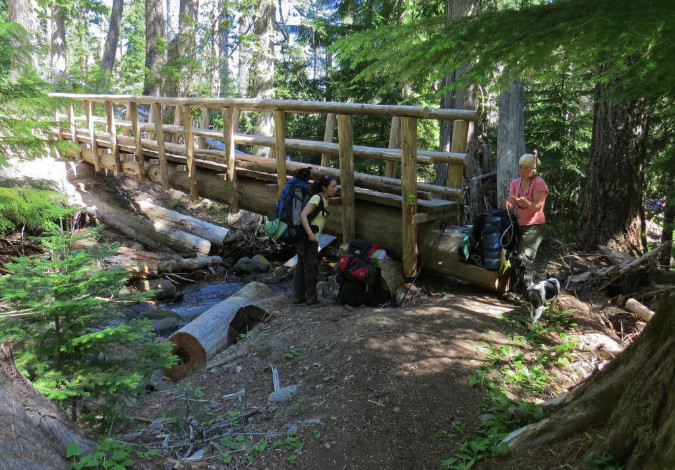
A lesser-known example is this footbridge built over Gumjuwac Creek (below), in the heart of the Badger Creek Wilderness, just east of Mount Hood. Where Ramona Creek is relatively small, Gumjuwac Creek can be a seasonal challenge during spring runoff, and thus the decision to build this new structure a few years ago. Much of the Badger Creek Wilderness has burned in recent days as part of the ongoing Grasshopper Fire, so we don’t know the fate of this bridge at this time.

Gumjuwac Creek Bridge in the Badger Creek Wilderness (TKO)

Meanwhile, in the Mark O. Hatfield Wilderness in the Columbia River Gorge National Scenic Area, volunteers recently rebuilt this bridge along the Wahclella Falls trail, along with other structures affected by the 2017 Eagle Creek Fire. Like the examples from Ramona Falls and Falls Creek in the Three Sisters Wilderness, the decision to build permanent structures here is in recognition of the heavy trail use, again, consistent with Forest Service guidelines. 

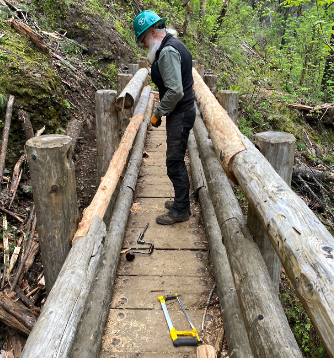
Trailkeepers of Oregon (TKO) volunteer repairing a winter-damaged bridge within the Mark O. Hatfield Wilderness (TKO)

These permanent bridge examples are included to debunk the idea that bridges along the Timberline Trail are somehow precluded by the Mount Hood Wilderness designation. It’s simply not the case, though it is true that permanent bridges on several of Mount Hood’s glacial streams would soon be washed away. So, what would a simple, straightforward and affordable solution for these crossings look like?

Read on…

A simple proposal for Mount Hood… hiding in plain sight?

It was plain sight — but a while ago. In their response to the 2008 Bluegrass Fire on the east edge of the Mount Hood Wilderness, fire crews were dispatched from the Elk Meadows trailhead. Crossing Clark Creek was simple, as the permanent bridge shown above was there and ready to serve the hundreds of firefighters who eventually descended on the blaze. 

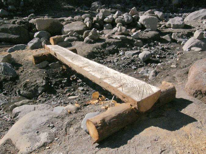
Crossing Newton Creek was another matter. There was no bridge and the stream is well known for its year-round volatility. In the urgency of the moment, necessity made for the simplest, most elegant and affordable solution possible. Using logs washed left along the floodway by the stream, firefighters simply cut them into manageable sections, then halved them down the center to make simple bridge spans. Smaller logs were cut and shaped with hand tools to form simple abutments. The designs were straight out of 1930s era Civilian Conservation Corps handbooks for backcountry engineering. 

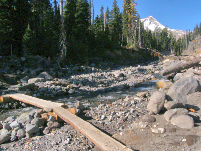
Seasonal crossing at lower Newton Creek built by firefighters to provide access to the 2008 Bluegrass Fire

The simple design at Newton Creek allowed the crossings to be moved or adjusted with the ever-changing channels of Newton Creek as the fire operation progressed over several weeks

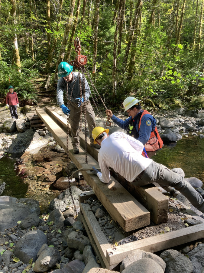
These designs were also the most compatible with their wilderness setting. There were no nails, no rock baskets and no concrete footings, just wood. They were also highly adaptive, with crews able to quickly move sections around to keep up with the ever-changing channels formed by Newton Creek during the summer runoff season. They could also be easily set back in place if the high water in the stream dislodged them. These simple crossings lasted through the fire, the following winter and into the next summer season, serving hikers long after the Bluegrass Fire had burned out. 

Within a couple years, the logs crossing Newton Creek were eventually swept away and added to the many logjams downstream on this very rowdy glacial stream. Therein lies the beauty of this solution: it doesn’t matter. The logs were untreated and used no hardware in their installation, making them nearly indistinguishable from other logs piled along the stream. Yet, they still provided safe crossings for hikers who otherwise would have been wading the stream, or scrambling over loose logs, unsafe logs.

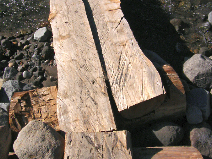
Detailed view of logs halved with chainsaws and cupped footings created with chainsaws and hatchets

These simple structures could be used on any of the fifteen glacial stream crossings in the Mount Hood Wilderness, including every one of the crossings on the Timberline Trail. The design is simple, adaptive, cheap and renewable. 

The main constraint in the design for a wilderness setting is halving the logs, as this work was done with chainsaws during the Bluegrass Fire operation. Could logs simply be halved with crosscut saws? It’s possible, but time-consuming and impractical. Besides, volunteer organizations like Trailkeepers of Oregon (TKO) and others are already very busy just clearing fallen logs from our trails inside the wilderness that cross recent burns.

Logs stacked near Indian Henry Campground on the Clackamas River after the 2020 Riverside Fire

So, why were power saws allowed inside the Mount Hood Wilderness area in 2008? Because wilderness limitations on machinery are typically lifted during firefighting efforts, and it turns out these exceptions fall under the same provisions that allow the Forest Service to construct wilderness footbridges where needed to “protect the health and safety of persons within the area”.

Does that mean an exception could be made now for the purpose of constructing wilderness trail bridges? Unlikely. Short of a forest fire, lifting limits on the use of chainsaws in wilderness for any purpose remains controversial, even when a good case could be made for protecting the health and safety of the public. Therefore, this proposal calls for mass production of the half-log spans off-site, then transporting and caching stockpiles of 3-4 logs at each of the crossings, ready to install as needed.

How would this work for all of the glacial stream crossings in the Mount Hood Wilderness (except for the lower Muddy Fork crossing on the Pacific Crest Trail – more on that in a moment):

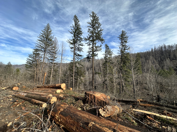
1) Prepare standardized materials offsite: Halved logs would be prepared offsite in stockpiled in standard 8-foot and 12-foot lengths. The Forest Service has a bounty of fire-killed logs at the moment in the Clackamas District, thanks to the 2020 Riverside Fire and subsequent blowdown events. These could provide decades of material for this purpose, and it’s work that could be done by contractors or volunteers as part of chainsaw certification programs that already take place there.

Logs stacked along the Clackamas River Highway after the December 2025 storms

2) Drop log caches: Caches of logs would be placed near 14 seasonal crossings – enough for three replacements and close enough to the crossing site to be moved into place by Forest Service or volunteer crews. The main lift (pun not intended!) in this step would be moving the log caches to the various sites, as it would require the Forest Service to make an exception to the Wilderness Act to bring helicopters in. This sounds harder than it is. Going back to the Wilderness Act, there are two important exceptions for using motorized equipment in wilderness for administrative purposes: 

1) In emergencies involving the health and safety of persons within the area.

This is the provision that allowed for construction of the Newton Creek bridges during the Bluegrass Fire.

2) When a motorized or mechanized action is necessary as the minimum requirement for proper protection and administration of the area as wilderness.

This second exception clearly seems to apply, since trails themselves are core the Wilderness Act which states that “…wilderness areas shall be devoted to the public purposes of recreational, scenic, scientific, educational, conservation, and historical use”, and thus the administrative purpose. Helicopters would likely be less controversial than chainsaws, as the work could be done in as little as a single day and would not involve power equipment on the ground.

Helicopters used for logging can carry multiple, full-length logs per load (US Forest Service)

How would this work? Having photographed helicopter logging (from a safe distance) in the past, I’ve watched hundreds of logs moved in bundles of 2-6 raw logs measuring 30-50 feet in length over the course of a couple days. Dropping the caches of half-logs would only have to be done every few years, thus further minimizing impact on the wilderness. If the drops were timed for late fall, there would be minimal conflict with hikers, while still allowing ground crews to access the different stockpiling sites.

But does the Forest Service even own helicopters? Only a few, though the agency contracts or charters with dozens of private providers to carry out a host of forest management activities, so this work is easily within their wheelhouse of know-how and funding arrangements.

3) Seasonal bridge placement: while there’s no harm to the environment if a half-log bridge is swept downstream, the idea is to minimize that risk and reduce the need to replenish the cache at a particular site by placing them as seasonal crossings. A reasonable window could be from July 1 through October 31, the mostly snow-free season when the vast majority of hikers are entering the wilderness. Hikers attempting to cross the streams before or after that time would at least be aware of the lack of structured crossings. 

Trailkeepers of Oregon (TKO) volunteers work with the Oregon Department of Forestry to annually install and remove this seasonal bridge at Elk Creek on the popular Kings Mountain Trail

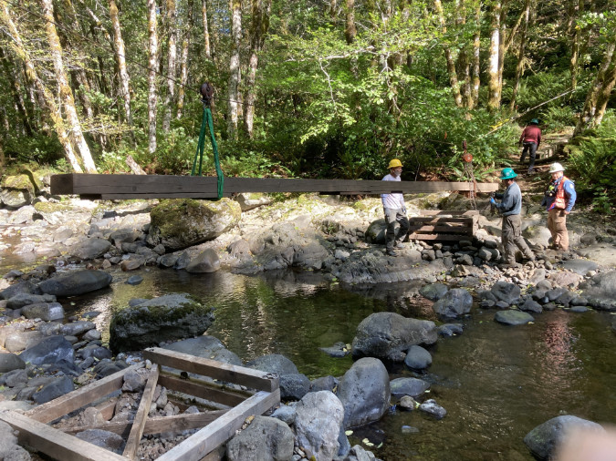
While the placement could be done by Forest Service crews, there are also at least two trail stewardship non-profits – Trailkeepers of Oregon (TKO) and the Pacific Crest Trail Association (PCTA) — that have the volunteer capacity, expertise and working relationship with the Forest Service to be part of placing these structures.

The Forest Service would need to periodically replenish the log caches at each site as logs are lost or damaged, though the idea of a cache is to minimize this need by providing enough material onsite to last for years. The abutment sections would be completely constructed onsite using manual tools, so only the half-log spans would be cached. The simplicity of the design would also allow backcountry Forest Service or volunteer crews to quickly reinstall or replace crossings that are impacted by flooding or channel changes during the summer hiking season.

Where to start?

Yes, this is a big proposal, given the status quo of doing nothing. Where to start? Following the informal “fear emoji” rating in the prior table, the three most problematic among the 15 glacial stream crossings are the upper and lower Sandy River crossings and the Eliot Branch. 

The Forest Service built this wilderness bridge on the Ramona Falls Trail – but how were materials delivered to the site?

All three of these sites could provide excellent pilot projects, not just because safe crossings are badly needed here, but also because they are close to trailheads. This could allow materials to be transported to the site without machinery, thus avoiding the complexity of helicopter drops in a pilot phase (pun also unintended!). They would also be easily accessible for volunteers to monitor and maintain. If these pilot projects are successful, then the program could gradually be expanding to the rest of the wilderness.

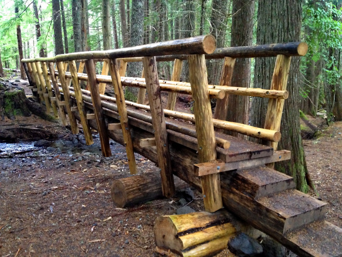
So, how did the Forest Service bring materials to the new Ramona Falls trail bridge that was constructed in 2012? Unclear, as the structure includes both logs that might have been sourced locally, but also dimensional lumber that must have been carried in. This somewhat recent project could provide guidance for a new seasonal bridge pilot project on the nearby Sandy River crossings. 

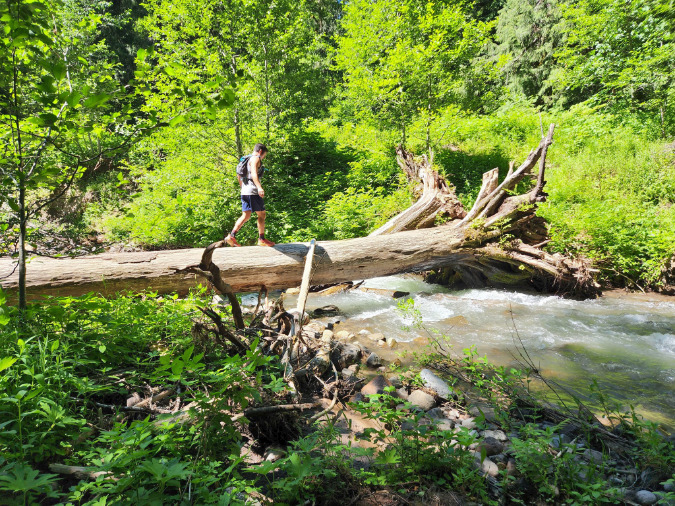
There’s a notable exception in the list of 15 crossings, and it was mentioned in the permanent bridge examples from Olympic National Park and the Three Sisters Wilderness: the lower Muddy Fork crossing. For years, a very large log (shown above) has been in place at the crossing, serving as a “permanent” bridge of sorts for hikers. There spot is also a ford for horses, as this is a Pacific Crest Trail crossing. 

This log has survived several winters at the lower Muddy Fork Crossing, thanks to more stable banks and less channel shifting in this part of the Sandy River valley. A permanent bridge is a good option for this spot (Lily Peterson/Portland Hikers).

The lower Muddy Fork site is more like the lower Clark Creek crossing in that the stream is less volatile and the stream channel likely stable enough to support a year-round crossing structure. The site also lies in close proximity to the Ramona Falls trailhead, providing the same good access that allowed for the new wilderness bridges on Ramona Creek in recent years. This permanent crossing should also move forward now in tandem with the pilot project for seasonal crossings.

_______________

Fifteen new crossings are a lot to ask of an agency whose posture at Mount Hood has been to provide no safe crossings at all, so it would take some trail champions both within and outside the agency to take a first step. That could take the form of just a single pilot project right now, perhaps beginning on the upper Sandy River crossing that took Sarah Bishop’s life – or the lower Sandy River crossing that Sarah’s family has been advocating for? 

There are non-profit trail partners ready to help. The Forest Service already has agreements with volunteer trail organizations to maintain trails within the Mount Hood Wilderness, notably Trailkeepers of Oregon (TKO) and the Pacific Crest Trail Association (PCTA). Other organizations like the Mazamas have provided trail maintenance on select trails within the wilderness over the years, as well. Compared to the ongoing need to trim brush and clear logs, placing seasonal bridges could also be a coup for drawing new volunteers to this needed work. 

Trailkeepers of Oregon (TKO) volunteers removing the seasonal Elk Creek Bridge in the Tillamook State Forest at the close of the summer hiking season (TKO)

But there’s an outside-the-box option that the Forest Service has not considered in the past – and should. The agency grants special permits to several commercial operations to do business on our public lands, some to carry out work for the agency, like running campgrounds and maintaining trailheads. These contractors could be part of the solution, since they are already actively doing basic work for the agency.

But there’s a better opportunity worth exploring in providing these crossings: the major ski resorts on Mount Hood’s south side. In an era of climate change, the combination of shrinking, unpredictable winter snowpacks and soaring gear and ticket prices have resulted in an aging demographic of alpine ski enthusiasts in recent years. This is happening across the industry. Resorts have responded with summer activities designed to bring riders to their ski lifts in the summer months, notably mountain bike and hiking trails.

On Mount Hood, the Timberline and Ski Bowl resorts have leaned hard into mountain biking to keep their lifts busy in summer, but Mount Hood Meadows has opted for a bold focus on hiking, including construction of a dense network of trails that radiate from the day lodge and ski lift terminals. Ski Bowl advertises lift-based hiking as well, though most of the “trails” simply follow ski lift service roads, where the Meadows network offers real hiking trails built for people, not maintenance trucks. That’s a good thing!

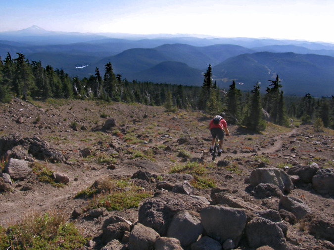
Mountain biker straying from Timberline resort private bike trails onto the public, hiker-only Mountaineer Trail, one of many public trails the resort includes in its advertised summer hiking trail network

For its part, Timberline maintains a tiny nature trail network adjacent to the historic (and publicly owned) Timberline Lodge, but the rest of the trails in its promoted network are all built and maintained by the public – including the Pacific Crest and Timberline Trail segments that pass through their permit area (though there are tremendous opportunities for the resort to help expand the system). Meadows also includes public trails in its hybrid network, including a section of the Timberline Trail, and all of its trails are open to the public. 

Therefore, why not ask the two larger resorts to participate in maintaining wilderness bridges? The Timberline resort includes both the Zigzag and White River crossings in their advertised trail system. The Meadows resort includes the upper Clark Creek crossing on the Timberline Trail and both the upper and lower Newton Creek crossings are just outside their advertised network. 

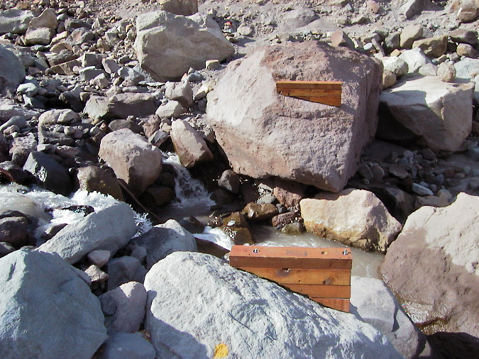
The Forest Service has some experience with seasonable bridges on the Timberline Trail. This seasonable crossing on the Eliot Branch was in place for several years in the 2000s

The design of the seasonal Eliot Branch crossing involved two footings bolted to boulders along the stream. This design was used within the designed Mount Hood Wilderness

It’s an idea worth exploring, as both resorts periodically renew their long-term permits to operate on public land with the Forest Service, and that’s a time when the public’s interest in their use of our lands is incorporated into a binding agreement. It’s encouraging the resorts are thinking beyond ski tickets, but it also a good time to acknowledge the commercial benefit they are receiving from public trails and ask them to step up and become a partner in making it a safe experience for everyone.

So, there are some ideas that could help us get unstuck from what is an intolerable situation on Mount Hood’s glacial stream crossings. Let’s not wait for another tragedy to point out the obvious: the glacial crossings are becoming increasingly dangerous and must be addressed, sooner or later.

Thanks for following the blog ! I hope to see you on the trail sometime! 

_____________

Tom Kloster | August 2026
Postscript: have you visited the new companion WyEast Images Blog? Be sure to subscribe while you’re there!

Fire-free Mount Hood Wilderness?

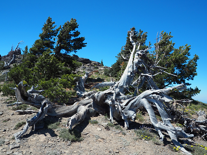
The ancient Whitebark pines on Gnarl Ridge have managed to dodge wildfires for centuries through their rugged isolation, but can they survive our wilderness campfires?

Fire season was off to an ominous start this year with the Rowena and Burdoin fires sweeping across hundreds of acres of oak and pine savannah in the Gorge, destroying several homes. Yet, these early fires were a bit of an anomaly. Thus far, at least.  We enjoyed a healthy, lingering snowpack in the Cascades this summer, and despite a late-August heat wave and the fires currently burning in sagebrush country east of the mountains, we’ve had a mostly cooler summer that seems more like 1980s than our overheated summers of today. 

I’ve pointed this out to a fair number of younger hikers on the trail this summer while crossing rejuvenated snowfields on the Timberline Trail in early August. Until sometime around 2000, when the effects of climate change seemed to be visibly escalating, this is what summers were like here: a three-month drought with a couple heat waves, to be sure, but mostly moderate temperatures and even a few wet summer storms to break up the dry spell. 

Our unexpected respite from extreme heat this year could also blunt the severity of our annual wildfire season, though it bears remembering that some of our most destructive firestorms have happened in September.

Not out of the woods with our fire season, just yet. The human-caused Riverside Fire started on September 8, 2020 and eventually burned 138,000 acres of the Clackamas River basin over the following weeks, much of the burn hot enough to create ghost forests where nothing survived. This scene looking into the Whale Creek basin is one of those places.

If we do make it past this Labor Day weekend without catastrophic fires in the Cascades – the five-year anniversary of the catastrophic fires that swept through in 2020 — odds are good that we will have enjoyed an unearned break this year in an otherwise non-stop era of major wildland fires. The emphasis should be on unearned, however, as we’re not making nearly enough progress in achieving a sustainable balance of healthy, beneficial fires in our forests. 

Instead, we’ve catapulted from a century of unhealthy fire suppression and unsustainable forestry into the unhappy payback: a modern era of destructive, catastrophic fires fueled by the combined effects of fire suppression and overcrowded clearcut plantations in a rapidly warming climate. Add in a climate-denying administration in Washington DC that seems bent on somehow turning our collective clock back to 1955, and we’re losing ground fast on what otherwise could be a manageable crisis.

So, yes. There’s plenty of room for frustration and discouragement with the current state of affairs. But there are also encouraging signs that a return to more enlightened times has already begun, and the pendulum is beginning to swing toward science sustainability, once again. With that in mind, and in the spirit of “planning for good times during the bad”, this piece focuses on simple actions that we could take locally to help slow some of the momentum of a wildland fire cycle that is burning our forests faster than they can recover. 

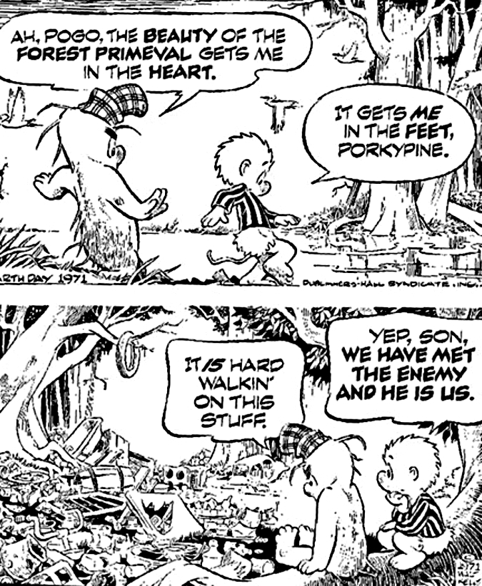
“We have met the enemy….”

You would be hard-pressed to find anyone under the age of 40 who knows what the “Sunday funnies” is (or was), much less Walt Kelly’s wise possum named Pogo. On the first Earth Day in 1970, Kelly produced a poster with the now-famous “we have met the enemy and he is us” strip, a play on a lesser-known military quote dating back to the War of 1812. Pogo’s version resonated, and Walt Kelly repeated it in this strip published on the second Earth Day, in 1971:

Pogo was right…

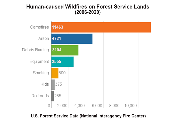
We’ve made real progress on environmental pollution since then, but Pogo’s observation could easily apply to our current wildfire crisis. Here’s a stunning statistic: research from the U.S. Forest Service in 2020 estimated that nearly 85 percent of wildland fires are caused by humans! That’s obviously an unacceptable number. The list of human causes? Campfires and debris burning are at the top of the list, followed by sparks from heavy equipment, fireworks and discarded cigarettes (arson is surprisingly high on the list – something to research for a future article?)

Campfires are the overwhelming human cause of wildfires

On our public lands, debris burning (as in logging slash) and sparks from heavy equipment mostly fall into the realm of logging and road construction, off-road vehicles and gas chainsaws used for firewood gathering.  If you narrow the focus to human-caused fires that begin in our protected wilderness and backcountry areas, the list becomes much shorter: campfires, discarded cigarettes and (rarely) fireworks.

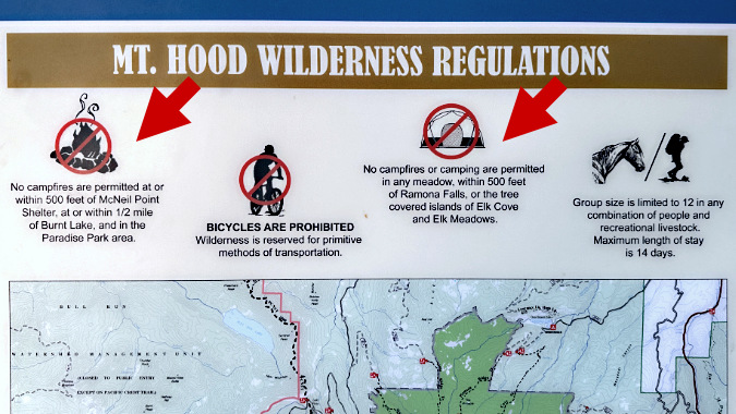
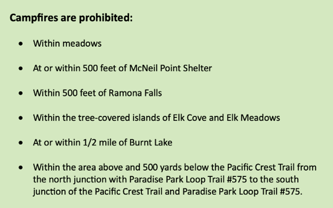
Narrowing a bit further to something we can tackle right here in WyEast Country, this article will focus on campfires within the protected Mount Hood Wilderness, and the surprising lack of restrictions on them. Few even know there are restrictions, but if someone were inclined to look it up, the list of places where campfires are prohibited on Mount Hood is puzzling, at best. Here’s the complete regulation:

Mount Hood Wilderness regulations on campfires (USFS)

First, some context: TKO’s Wilderness Ambassadors are counting in excess of 300 people heading to Paradise Park on the Timberline Trail each day on summer weekends this year – and that’s just one of the gateway points into the wilderness. Even if you assume that some meaningful share of the tens of thousands who enter the Mount Hood Wilderness are aware of campfire restrictions, these rules still seem random and confusing. 

How would the average person know how far “500 feet from the McNeil Point Shelter”, or a “half-mile from Burnt Lake” is? What’s a “tree-covered island” versus a grove of trees at Elk Cove and Elk Meadows? The last rule is especially puzzling, though it seems to describe a near-total ban at Paradise Park. Add in the ever-shrinking number of Forest Service rangers available to patrol the Mount Hood Wilderness, and it’s hard to believe these restrictions are having any real impact as written, however well-intended. 

Making the case: Protecting the wilderness experience

Though seemingly random, the places on Mount Hood called out in the campfire ban is instructive. These are all heavily-visited places where the increased wildlife risk of campfires is compounded by a degraded wilderness experience. It’s a compelling argument that anyone who has visited these places over time can testify to, as the human impacts are all-too apparent in each of the spots listed – and getting worse.

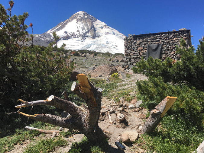
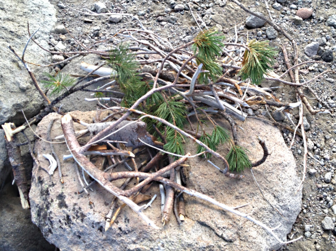
Once the cutting starts, it’s hard to stop. This butchered Whitebark pine had the misfortune of taking root near the Cooper Spur Shelter, perhaps before shelter and Timberline Trail even existed. It was still living as recently as 2020 (when these fresh cuts had been made), even as novice hikers continued hacking it apart for firewood too green to even burn

That’s why impacts on the human experience are a great starting point in making the case for a more effective, comprehensive campfire ban within the Mount Hood Wilderness. After all, much of the wilderness is very heavily visited, and many other popular spots face the same pressures as those few included in the current campfire ban. If visible impact from heavy use is the criterion, the Forest Service has simply lagged behind in adding to this list.

So, where to start in expanding the list? How about the entirety of Elk Cove and Elk Meadows, not simply the “tree islands”? And what about Cairn Basin, Eden Park and WyEast Basin? Or the rest of the Timberline Trail corridor for that matter? If you were to add every spot along the trail where campsites overflow with backpackers each summer, the dots on the map would quickly merge, making the case for a total ban. It’s simply too complex to describe or enforce a nuanced campfire ban with today’s widespread visitor pressure across so much of the Mount Hood Wilderness. Everything inside the wilderness boundary deserves this protection.

Making the case: A rogue’s gallery of wilderness campfires

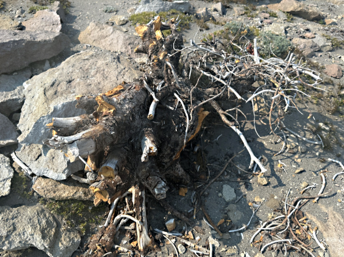
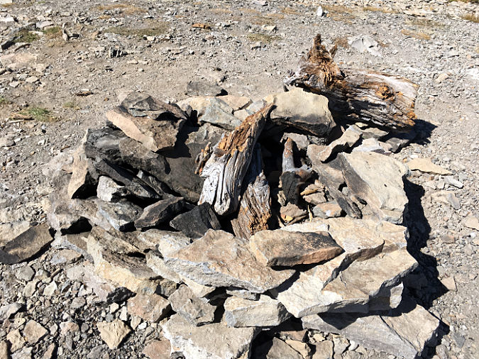
I’ve lost track of how many ill-conceived campfire rings that I’ve decommissioned within the Mount Hood Wilderness over the years, but it is an ongoing and increasingly frustrating task. Most of these were not strictly banned under the Forest Service restrictions described above, but they very clearly violated basic “leave no trace” ethics. Worse, they were typically left smoldering, almost always because they had been built in a place too far from a water source to be safely extinguished. So, the campers simply walked away, leaving the seeds for a human-caused wilderness fire to chance. This rogue’s gallery is a sampler of what we are up against:

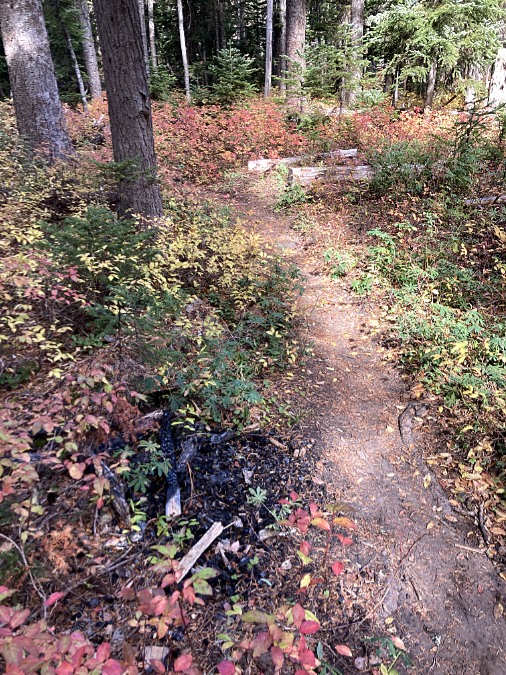
Not even a fire ring here, just a campfire built on top of the underbrush and forest duff layer along the Newton Creek Trail. It’s dumb luck this fire didn’t spread – likely due to fortuitous wet weather arriving that fall. Note the half-burned limbs left in the pit – how long did they smolder before the rains put this fire out?

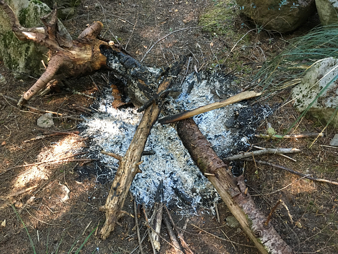
This fire had been built on top of Bald Mountain, more than a mile from the nearest water source. It is typical of new campfires in the Mount Hood Wilderness. Lacking a saw, campers simply burned the ends of uncut logs and limbs, often several feet in length. With no fire ring, even the small limbs are spilling out of the campfire, in effect creating lit fuses for this fire to spread to the dry forest duff in all directions – as it already had when I took to photo. The half-burned stump adds to the risk, as it could smolder for days without being properly extinguished. 

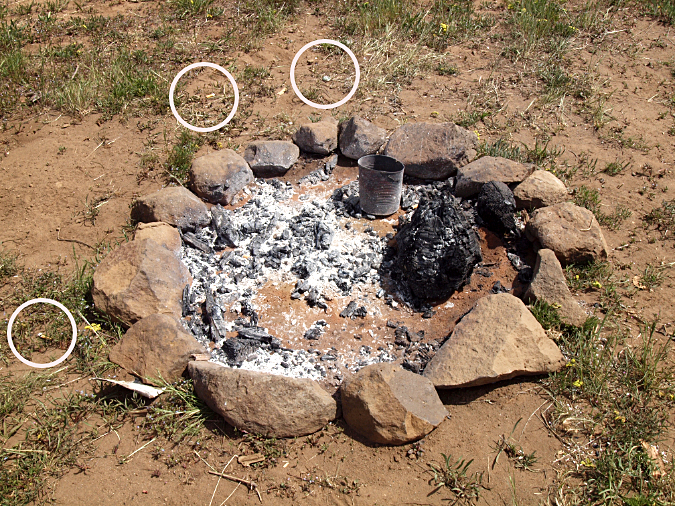
Another new firepit that had been recently built on a dry ridge top on the east side of the mountain, more than a mile from any water source. It was left smoldering, along with burned trash and (circled) cigarette butts that weren’t even dropped into the fire pit – checking two boxes for this fire on the list of most common causes

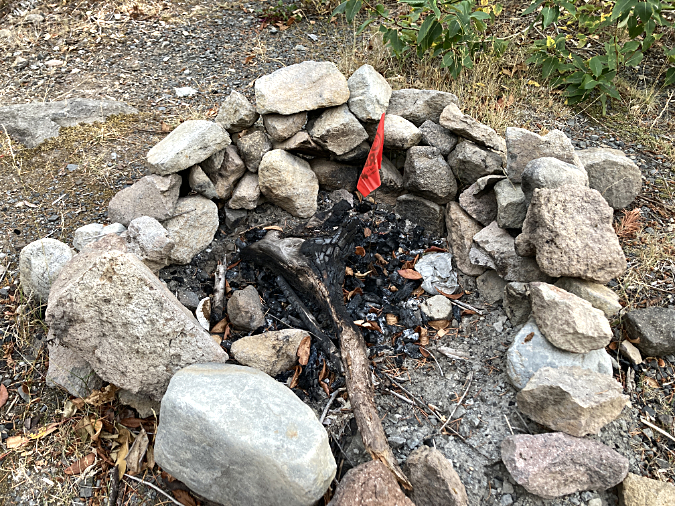
Amid the half-burned wood and charred foil, fire has a small orange flag you might have seen in heavily used fire pits during fire season…

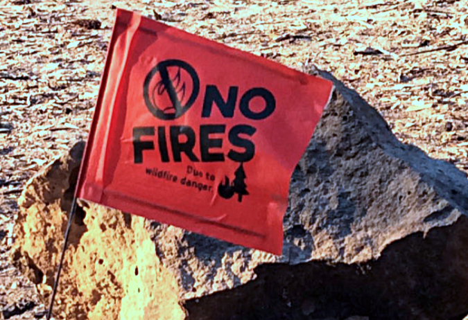
…upon closer inspection, they turn out to be temporary bans put in effect during extreme fire risk. Placing these requires intensive wilderness staff capacity, though, and with no clear penalty identified for violators, are they even be heeded?

As some of these detailed captions show, new fire rings usually betray their builders. Almost aways, they contain burned foil, cans and melted plastic that a seasoned, knowledgeable backcountry visitor would never leave behind. Half-burned (and often green) firewood is the other giveaway, usually chopped with a hatchet that few experienced hikers would carry. They are also typically built on top of the flammable forest duff layer, instead of an area cleared to bare, mineral soil.

Smoldering, abandoned campfires don’t always put out a lot of smoke, even when they’re still very hot. This video is from a fire left burning in the Badger Creek Wilderness in the middle of August, far from any water source. Doubly frustrating was using much of my water supply on that hot day to put out a careless campfire…

The next photo set in this rogue’s gallery is a case study of the historic Cooper Spur stone shelter on the Timberline Trail, where misguided campfires are a recurring problem. The shelter draws regular overnight campers who, in turn, have built several rock wall windbreaks around tent sites. Not exactly “no trace”, but also not unusual on the mountain. In this case, they must also be viewed in the context of being next to a man-made stone shelter. The hand of man prominent here, however rustic.

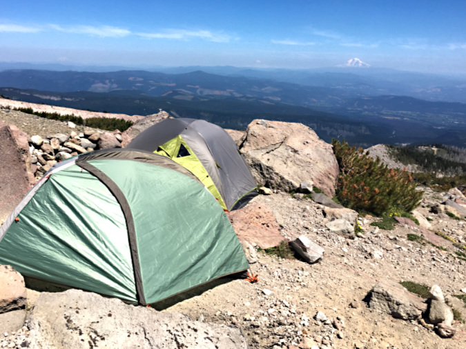
Camping among the rocks at the Cooper Spur shelter has become increasingly common in recent years, thanks in large part to social media, and helping to drive the increase in campfires here

However, there is no water source anywhere near the shelter, so it’s not an ideal camping spot. It’s an even worse place to build campfires. Most campers at the shelter do abide by this obvious ethic, but the few who don’t leave a permanent record of their visit for all who follow in this very popular place. That’s because, beyond the lack of water to reasonably extinguish a fire, there’s also a lack of firewood… except for the federally-listed, threatened Whitebark pines that cling to life here, at nearly 7,000 feet elevation.

I’ve decommissioned many campfires here since unofficially adopting some trails in the area nearly 25 years ago. All of these campfires were perfectly legal under the current Forest Service rules, but also completelyunethical from a “leave no trace” perspective. They also fail simple common sense, given the obvious lack of a nearby water source to put them out. 

To put a face on this ongoing struggle, here are some of the rogue campfires that I’ve decommissioned at the Cooper Spur shelter in recent years:

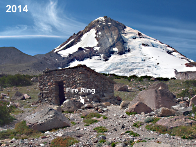
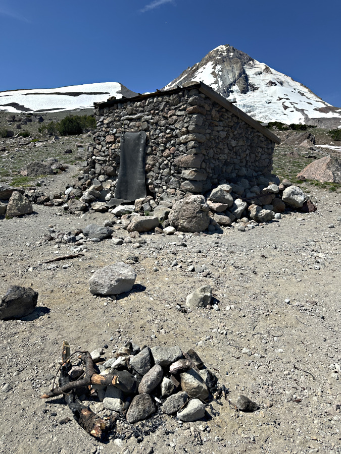
This fire ring has been rebuilt against a boulder, directly in front of the shelter – a favorite location for the campfire builders

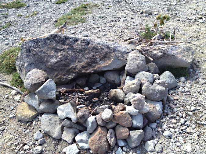
A closer look at the 2014 fire ring. The boulder is charred from many fires built here, but the rest of this ring was new, as you can see by the mostly uncharred, smaller rocks

Fuel piled next to the 2014 fire ring includes green limbs pulled from a nearby Whitebark pine, typical signs of a novice

In the intervening years since these photos were taken in 2014, I’ve disassembled and decommissioned this fire ring repeatedly, as the charred boulder seems to attract ever more campfire building at this spot. However, this year things seemed to escalate sharply. This was the scene in late July:

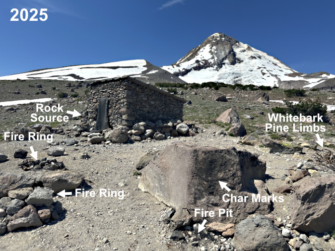
Three campfires – within a few feet of one another? The fire ring on the far left was built in the middle of the trail, the one below on the left was built (once again) against the same boulder shown in the 2014 photos and the fire pit in the lower right was also new – the first in this spot. A large stack of Whitebark Pine limbs, both dead and living, are piled over on the right

A closer look at the new ring built in the middle of the trail shows half-burned Whitebark pine limbs and an attempt to extinguish the fire by piling rocks on top.

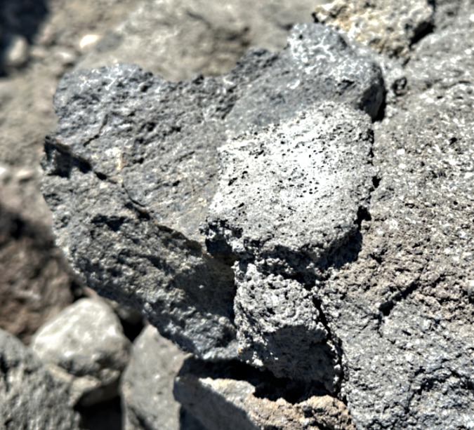
A closer look at the new ring shows the rock source to be the recently collapsed corner of the Cooper Spur Shelter – those are mortar traces attached to the rock in this photo. Pure vandalism to use these rocks before they could be to repair the shelter, of course

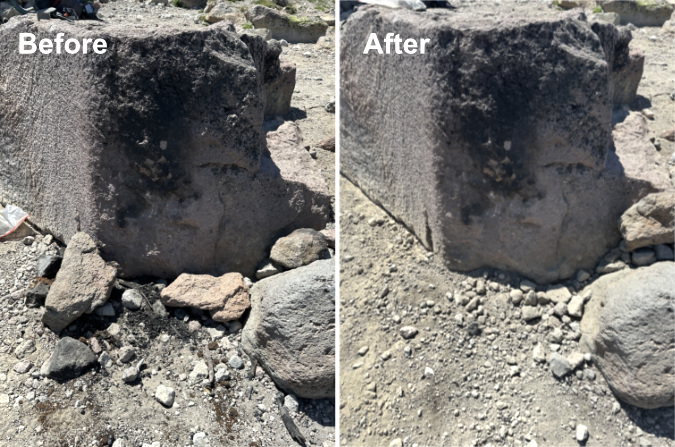
Decommissioning all three of these fire rings at the Cooper Spur shelter meant carrying at least a dozen gallon-size ziplock bags of (cold) ashes to dump in a discrete spot, moving all of the visibly charred rocks from the area and covering up what was left with a light dusting of loose gravel. However, the char marks left on the large boulder in this newest fire location will be there for many years to come, likely encouraging more fires here so long as they are legal.

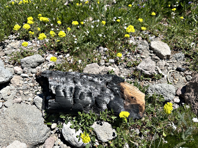
This was among the charred Whitebark pine logs scattered from the three fires, apparently in an attempt to put the fire out? This log was cut with a hatchet, another telltale sign of a novice camper

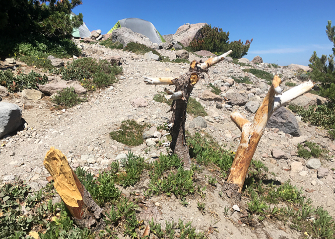
What’s left of this Whitebark pine near the three new fire pits at the shelter shows signs of limbs being sawed, chopped or simply broken off. The stumps still have their bark, so it’s unclear if this was a living tree when it was targeted for firewood

While it has been a frustrating rinse-and-repeat cycle to continually undo these fire rings, it’s also informative. They point to wilderness visitors who require very simple, understandable and enforceable regulations. Even if the area around the shelter were added to the current list of banned places on the Forest Service list, the campfires would almost certainly continue, given the lack of awareness of where fires are prohibited in the wilderness.

Making the case: Current rules aren’t working

In researching this article, I spoke to several seasoned hikers who have been visiting the Mount Hood Wilderness for many years. Even among this veteran cohort there was tremendous confusion and misinformation about the restrictions that do exist, or even where to find them. Some were adamant that campfires were already banned “above the Timberline Trail”, while others believed the ban was “above the timberline”. None could name all of the place-specific bans described in the actual policy, and most could only name one or two. This level of misinformation among the most experienced hikers bodes poorly for the thousands of less-savvy visitors to the wilderness each year might know.

Today’s wilderness hikers on Mount Hood rely more on social media and third-party phone apps for their trail information than on official web content from public agencies, making it increasingly challenging to communicate rules and restrictions

The lack of awareness and understanding of the existing campfire ban is easy to diagnose. First, the official Mount Hood National Forest website is labyrinth, and it’s especially tough to navigate if you’re looking for recreation information. When I Googled “Mount Hood Wilderness”, only the unhelpful Mount Hood National Forest home page and generic “recreation” page showed up in the top 20 search results. Both are dead-ends.

The crucial link for wilderness information (including campfire regulations) is found elsewhere on the website, on a page describing all of the wilderness areas within the national forest – a page Google did not find with a search for “Mount Hood Wilderness.” From this page, the link to information on regulations for the Mount Hood Wilderness is buried in a text blurb that contains a link to this external website describing the campfire policy. 

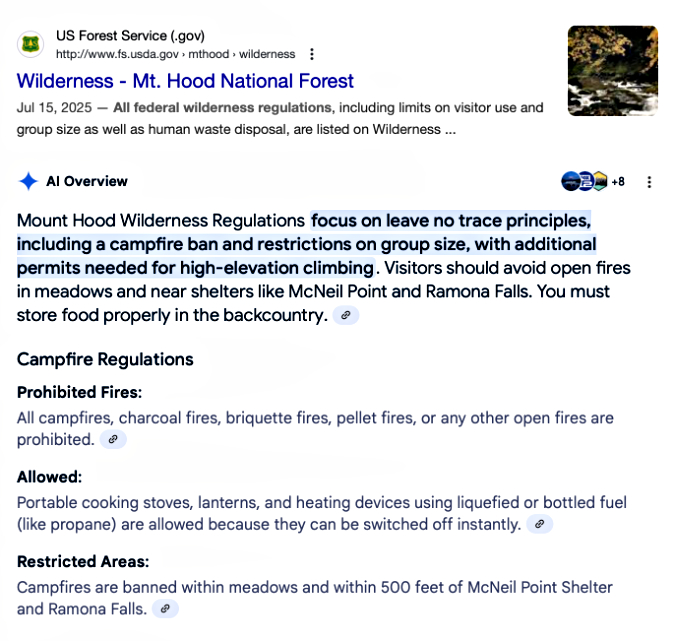
Even a specific Google search for “Mount Hood Wilderness Regulations” takes you to the generic wilderness page for all wilderness areas, where you would still need to track down the buried link to the external page that actually lists the regulations. Few will ever find this information, unfortunately – including Google’s search engine. Google’s AI-powered search provided an even more confusing result, reporting a complete ban on wilderness campfires (!) followed by a partial mention of the actual policy (only for McNeil Point and Ramona Falls):

Google AI not so intelligent when it comes to finding USFS regulations…

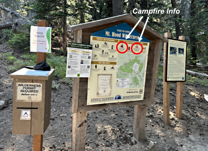
So, the internet isn’t much help in tracking down the existing campfire regulations. However, the current ban is clearly described at wilderness trailheads around Mount Hood – if you look closely – along with general guidelines on wilderness ethics, including no-trace ethics campfires.

These are the trailhead signs at the Cloud Cap trailhead, the entry point for the Cooper Spur Shelter, and the standard signboard format for most wilderness trailheads on Mount Hood:

There’s a lot of information at Mount Hood’s wilderness access points. Look closely at this sign at the Cloud Cap trailhead and you might find the limited restrictions on campfires (circled)…

…and a closer view of the campfire restrictions from the above wilderness trailhead sign. The wording here is simplified from the official regulations, yet still quite nuanced for visitors unfamiliar with the wilderness

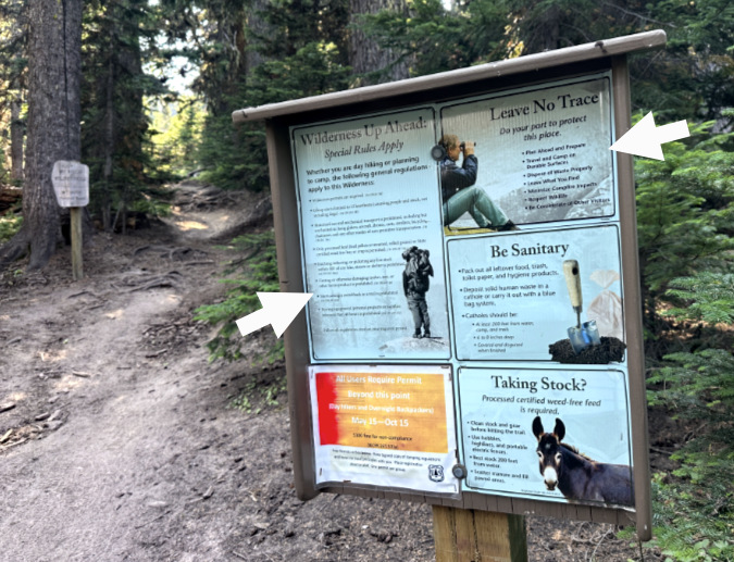
A second sign at the Cloud Cap wilderness trailhead provides still more information for visitors. The two arrows point to additional info on campfires…

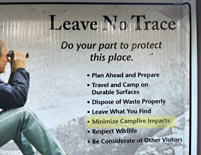
…this enlarged view of the inset on the upper right calls for “minimizing” (highlight added) campfire impacts under the Leave No Trace (LNT) principles…

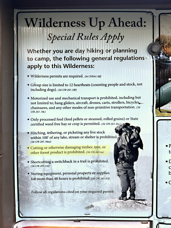
…and the inset on the left side of the second trailhead sign lists special rules for wilderness, including “cutting or otherwise damaging timber, tree or other forest product” (highlight added)

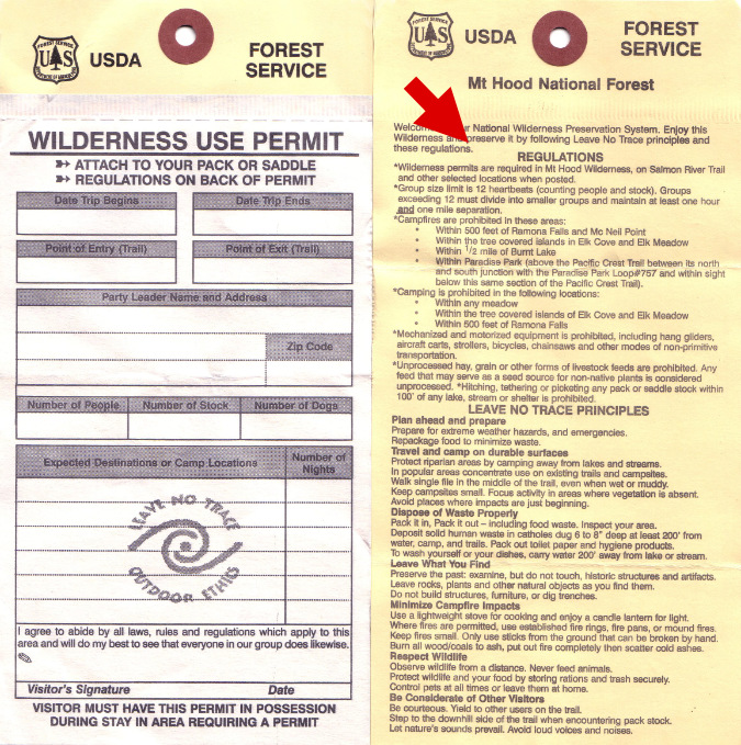
The current, limited campfire ban is also posted on the back of required wilderness permits, which are required at the Mount Hood Wilderness entry points (except this year, unfortunately, due to Forest Service staff cuts):

There it is! The red arrow points to the Mount Hood Wilderness regulations printed in full on the back of the permit

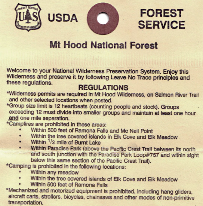
A closer look at the permit shows a nearly complete version of the existing, limited campfire ban within the Mount Hood Wilderness, albeit slightly simplified from the online, official version

So, the regulations are certainly available enough where it matters – at the trailhead. But the fact that so few know or understand them suggests they aren’t really being read by wilderness visitors – whether on the entry signboards or on the back of permits. That’s likely a case of information overload (there is a lot to read on these signs) and human nature (does anyone really read instructions before assembly..?)  Add the complexity of the regulation, and it translates into a policy that is not only too limited in its geographic scope, but also in its effective communication to wilderness visitors.

Making the case: Protecting human life and property

Do the risks and impacts that campfires present at the Cooper Spur Shelter and elsewhere in the Mount Hood Wilderness warrant a total ban on campfires? Thirty or forty years ago, my answer would have been “no”. But the current state of our forests and changing climate doesn’t leave us the luxury to be romantic or sentimental about campfires.

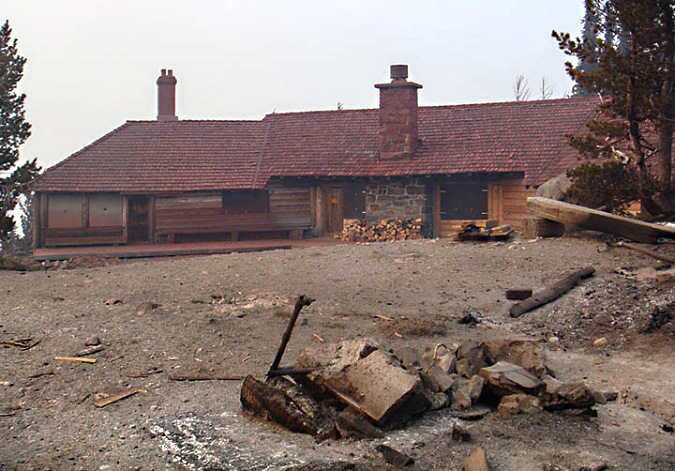
Cloud Cap Inn covered in red fire retardant during the Gnarl Fire in 2008. This historic, priceless 1889 gem narrowly survived the event (USFS)

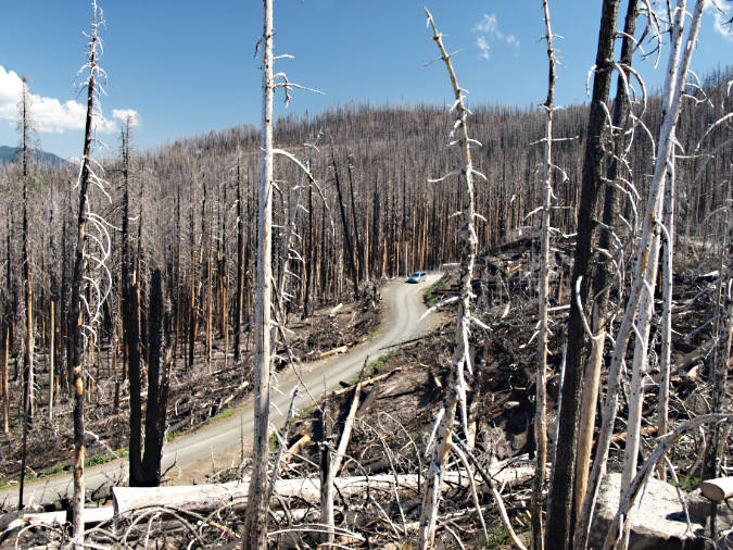
Cloud Cap area transforming into a massive ghost forest of bleached snags in 2010, two years after the Gnarl Fire

We’ve seen a string of three major fires in the Mount Hood Wilderness in recent years that have completely altered the forests on the north and east slopes of the mountain: the Bluegrass Fire (2006), Gnarl Fire (2008) the Dollar Lake Fire (2011) all burned hot across thousands of acres of subalpine Noble fir, Mountain hemlock and Western larch at an unsustainable pace, leaving large expanses of ghost forest that are only beginning to regenerate today. 

None of these fires were human-caused, surprisingly. But there’s little comfort to be found there, given the number of people who visit the wilderness each year – and the number unattended, smoldering campfires they leave behind.  

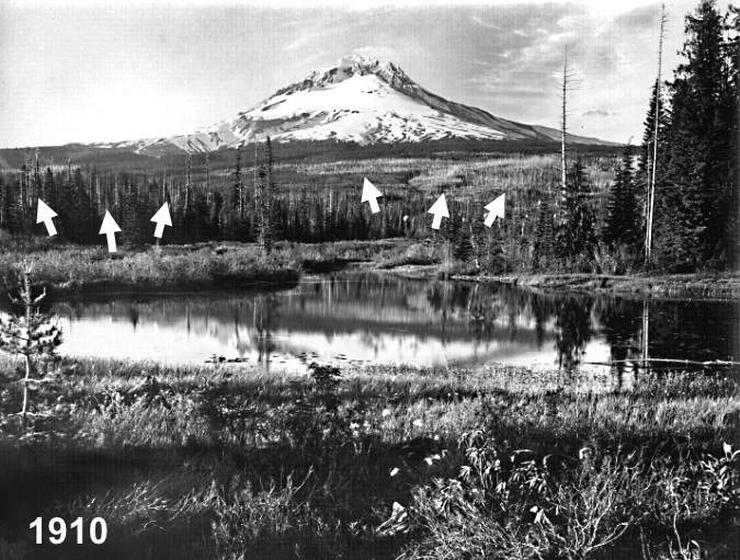
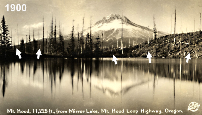
It’s also only a matter of time before similar wildfires return to the south and west sides of the mountain, where a century of fire suppression has left these forests primed for a major fire. And the risk to property and human life on the south side of the mountain is far more significant.  Early photos like those below show the extent of the most recent fires to rage through today’s Government Camp area in the decades before the completion of the Mount Hood Loop Highway in the 1920s, and the subsequent flood of ski resorts, Forest Service cabin leases and homes on private land that followed.

This view of the Government Camp area from Multorpor Fen before much development had occurred on the mountain. The arrows point to the ghost forests that marked widespread burns across what are now heavily developed ski resorts and private homes on Mount Hood’s south flank. After more than a century since these fires burned through, the south side of the mountain is primed for a major wildfire

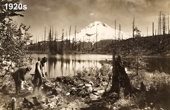
While the surge in recent wildfires on Mount Hood has focused on the east and north sides of the mountain, the west and south sides were the main focus of wildfires in the early 1900s. This view is of Mirror Lake in about 1900, when much of the area south of today’s US 26 had burned in the Kinzel fire
This later view of Mirror Lake from the 1920s shows little forest recovery – and the beginning of what is now more than a century of camping — and campfires

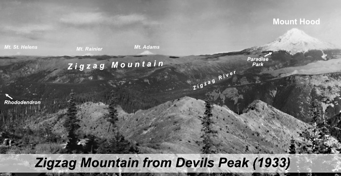
The risk to human life and property only grows as you move to the Zigzag Mountain arm of the wilderness. Zigzag Mountain comprises a complex of forested ridges and peaks that extends ten miles west from Paradise Park on Mount Hood to the community of Zigzag, where the Zigzag and Sandy River valleys converge. Zigzag Mountain and much of the surrounding area burned repeatedly in the early 1900s, long before there were thousands of people living in forest homes along both rivers and scores of businesses had located along this section of the Mount Hood Loop Highway.

The view from Devils Peaks in the 1930s looked much different than today. The peak, itself, had recently been burned over in the Kinzel and Sherar fires, while the area north along Zigzag Mountain was also burned in a series of very large fires in 1904 and 1910 – including the Burnt Lake Fire

[click here for a large version of the Zigzag Mountain infographic]

While it is inevitable that wildfires will someday sweep through these areas again, igniting one with an unattended, smoldering wilderness campfire doesn’t have to be the cause. And while the Zigzag Mountain portion of the Mount Hood Wilderness is less busy with visitors, the human and property risks from wilderness campfires here are far greater because of the proximity to developed areas immediately adjacent to the wilderness. 

Making the case: Protecting the Whitebarks

Protecting human life and property is deservedly the driver in wildfire management, but on Mount Hood, the impact of wilderness campfires extends to our threatened Whitebark pines. I described both their significance as a keystone species and plight in this article several years ago. These are trees worth protecting. 

Their ability to thrive in extreme, high elevation environments is part of their secret to dodging forest fires. The ancient groves of Whitebark on the mountain are often so isolated and scattered in their alpine setting that fires racing through the more continuous subalpine forests far below have repeatedly missed them simply because they were out of reach from the flames.

This advantage was borne out again with the recent fires on the east and north sides of the mountain, where the flames seemed to die out as they reached the tree line, well short of many of the ancient Whitebark groves. Their remote habitat is not out of our reach, however — or the impact of our campfires. 

This unlucky Whitebark pine has been harvested down to a stump for firewood at the Cooper Spur Shelter

The campfire threat to Whitebarks comes from being hacked apart for scarce firewood this far above the tree line. However, Mountain hemlock and other subalpine species are continuing to spread upward in elevation in our warming climate, infiltrating the once isolated Whitebark Pine groves, and thus increasing their exposure to wildfire.

Mature limbs from Whitebark pine in a large fire pit on the summit of Lookout Mountain, in the Badger Creek Wilderness

There is also an important aesthetic argument for caring about our Whitebarks. While you can’t place a dollar value on the visual and emotional impact of seeing a massive, ancient Whitebark pine in the wild, for most of us it is an awe-inspiring sight. Their contorted shape and especially their bleached bones tell a story of remarkable survival – but they can also provide senseless firewood to a few campers who don’t know any better. 

These ancient Whitebark pine skeletons are as beautiful and dramatic as they are vulnerable: the fire pit in the previous image is just a few yards beyond this grove

Beyond our human impact on these trees, Whitebark pine are experiencing a massive die-off across the West from a invasive diseases, insect infestations and worsening drought episodes driven by climate change. This has led them to be federally listed as a threatened species. Given their plight and importance, Whitebark pine may be the best reason for a total campfire ban in the Mount Hood Wilderness.

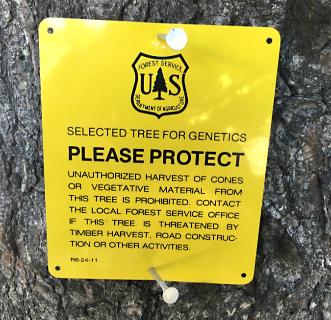
Whitebark pine along the Timberline Trail selected for seed harvesting in a Forest Service project to help save the species

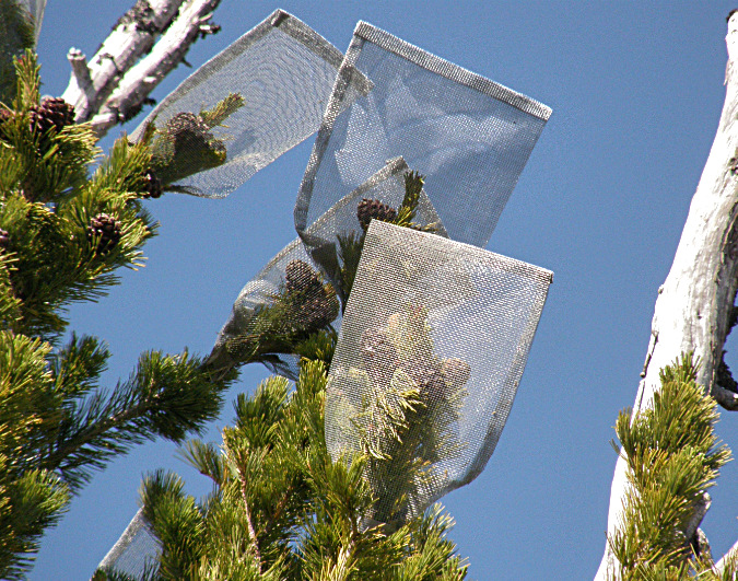
Seed collection bags on one of Mount Hood’s selected Whitebark pines for genetic research

Since the 1990s, scientists at Mount Hood National Forest have been part of the national recovery effort for Whitebarks, where seeds are being collected from disease resistant trees for propagation to help replace groves where widespread die-offs have occurred in recent years. For more information on this effort, check out the Whitebark Pine Ecosystem Foundation, a leader in the effort to rescue this unique species.

All of these arguments – the threats to our remaining forests, to human life and property and to the Whitebarks — bring me to the conclusion that now is the time for a complete ban on campfires within the Mount Hood Wilderness. No exceptions. Just a simple, understandable and permanent ban.

Making the case: How it’s done elsewhere

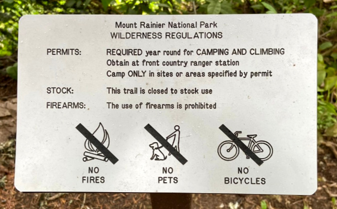
The Park Service bans all wilderness fires within Mount Rainier National Park, a model for Mount Hood (NPS)

No doubt the Forest Service would be wary of doing this, but there is already precedent within our national parks. Mount Rainier National Park bans campfires in all backcountry areas, the equivalent of wilderness there. Many western national parks have complete bans seasonally every summer – including in their campgrounds – often beginning as early as late May or early June. These include North Cascades, Olympic, Crater Lake and Mount Rainier national parks in the Northwest, and several other national parks across the country.

Wilderness campfires are completely banned at Rocky Mountain National Park (NPS)

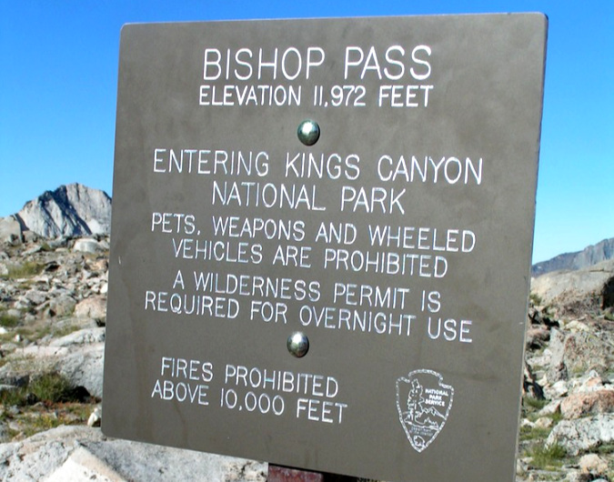
Kings Canyon National Park has a limited prohibition, banning campfires only in alpine areas above 10,000 feet – an abstract metric that would be unlikely to register with newbie hikers most prone to building campfires in these areas (NPS)

Beyond the goal of simply reducing the risk of human-caused fires, the simplicity of complete campfire bans helps compensate for the inevitable lack of enforcement capacity in wilderness areas, whether in national parks or forests. Unattended or dangerously built campfires aren’t there because people want to start a wildland fire, they’re simple a result of ignorance of the risks they present. 

The Park Service approach is a simple, direct, teachable way to serve both outcomes – to prevent the risk of human caused fire, and to educate the public on the reality of the risk. A total ban is at least something that can be understood and thus has a chance of being reasonably self-enforced.

Making the case: Taming our inner caveman…

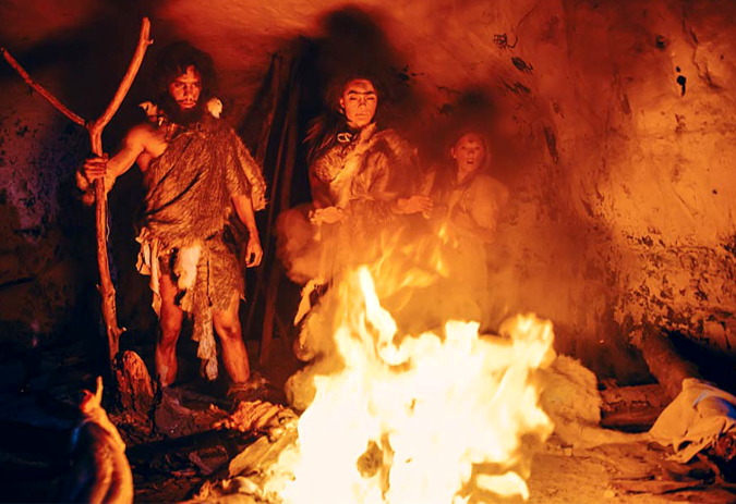
Heat, light and cooking, all in one. We do seem to retain a primal connection to fire (…that looks to be one of my ancestors on the left, by the way – holding a very large marshmallow stick…)

There’s an undeniable romance with campfires that gives pause to land managers like the Forest Service when it comes to pre-emptively regulating them. Yet, human-caused catastrophic wildfires in WyEast Country in recent years in places like the Columbia River Gorge in 2017 (infamously caused by teenagers with fireworks) and the massive Clackamas Riverside Fire in 2020 (apparently caused by a campfire) have begun to change that posture, albeit very gradually.

For the past few decades, the focus of culture change with wildfire has been on a better public understanding of the benefits and necessity of fire in our forest. It’s an essential piece of changing our attitudes, especially since prescribed burns continue to be controversial — despite their proven value. However, letting go of campfires as a ritualistic part of the outdoor experience has not been directly confronted by the Forest Service – yet. 

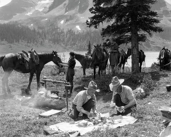
The mythology of the American West in the 1800s continues to be another part of our romance with campfires. These cowboys are preparing their morning Double Caramel Frappuccino with freshly baked Petite Vanilla Bean scones…

The utilitarian purpose of campfires for cooking is long gone. For wilderness backpackers, alternatives to a wood fire for cooking came in the early 1950s, when compact gas and alcohol stoves were first developed, based on portable military stoves. Today, the advantage of stoves for their simplicity, ease of use and certainty for cooking has made them standard practice for backpackers. And while it’s true that you can’t roast marshmallows or hot dogs over a portable gas stove, that’s what our developed campgrounds offer.

It is true that a fire can be a life-saving source of heat in a wilderness emergency, but so can proper clothing and shelter that are among the 10 essentials that every hiker should carry. And a rare emergency survival fire that might be warranted still represents a fraction of the impact and risk that not having any limit on campfires represents. 

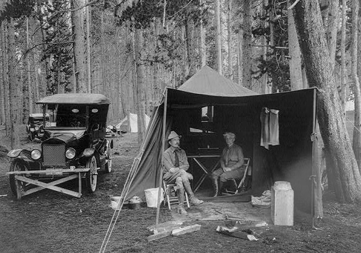
Our modern-day connection of campfires to the camping tradition began with the arrival of the automobile and developed roads into our public lands in the 1920s. Though early adopters hauled everything for their campsite in their Model T, developed public campgrounds with picnic tables and formal campfire pits soon followed. Campfires in developed campgrounds today are rarely the source of wildfires today, so they continue to provide a safe solution for campers looking for that S’mores experience

In the end, the most personally compelling case for a ban in our time may be the environmental impacts and risk of wildfires that campfires bring. People head for the wilderness to get away from the human-impacted world, and the despair and sense of loss that so many have shared from our recent, catastrophic fires in the Gorge and on Mount Hood underscore just how personal the connection to wilderness is. That’s a winning argument for a ban that most would understand. 

Wilderness is special, and this is where a broader understanding of the ethics of wilderness campfires could begin. What not begin growing that awareness here on Mount Hood? 

Making it Happen…

The good news is that a national forest supervisor can make this happen with the stroke of a pen, as these policies are made at the local level. The most direct approach would begin with signage at Mount Hood’s wilderness trailheads, with both regulatory and interpretive messages. For those who take the time to read the signboards (and we salute you!), the messages already posted could be adapted to make the interpretive case for a campfire ban. 

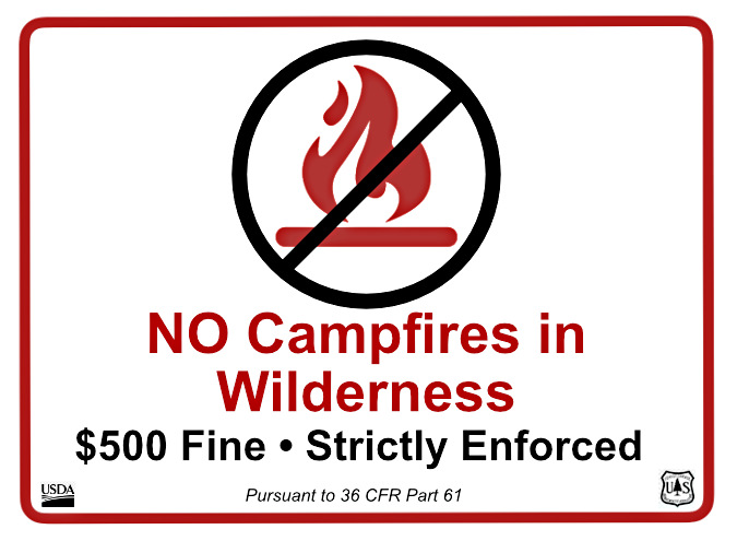
However, if the goal is to get the message across to the majority of visitors, a blunt, direct and unavoidable approach is warranted. Like this sign – which, for the record, is not a real Forest Service sign (yet):

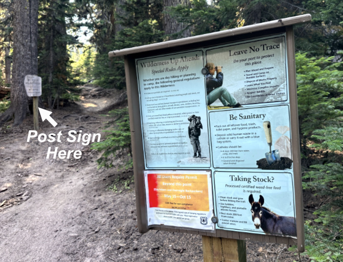
Keep it simple and direct. To ensure visibility, a sign like this should be posted away from the information overload of the main signboards and directly below the wilderness boundary markers that that are typically the last sign a hiker passes when entering the wilderness. Again, this example is from Cloud Cap, where you can see the wilderness marker in the distance, just up the trail:

Make the campfire ban (and associated fine) the last thing hikers see as they enter the wilderness, where it might just catch their attention…

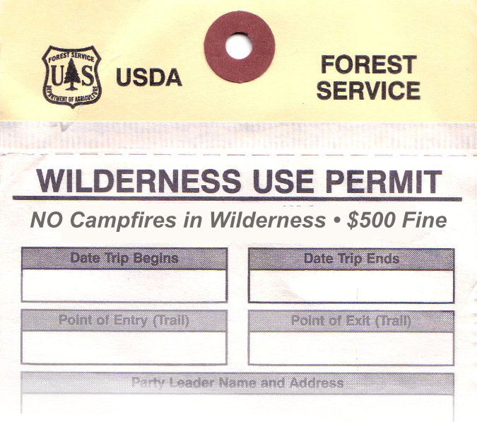
To reinforce this very direct approach, the same message could be added to the front of the wilderness permits to better catch the eye of those of us (ahem) who are clearly not reading the back of the form:

…and make it the first thing they see when they complete their wilderness permit

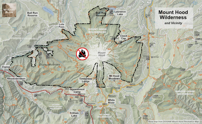
Where would this ban apply? Everywhere inside the Mount Hood Wilderness boundary shown below. The wilderness has been expanded several times since the “Mount Hood Primitive Area” was first designated as wilderness in 1964. This is the current boundary where the campfire ban would apply – and including a ban icon on maps like this could be still another helpful reminder for visitors:

The boundary of the Mount Hood Wilderness where the campfire ban should be enacted

[click here for larger view of the map]

While I’ve highlighted what most consider to be the Mount Hood Wilderness on this map, several nearby wilderness areas have been created or expanded since the 1980s, including the Salmon-Huckleberry Wilderness and Badger Creek Wilderness, as well as smaller pocket-wilderness additions at places like Twin Lakes and Tom Dick and Harry Mountain. Should these areas be included in the campfire ban, too? 

My answer is no, at least for now. That’s because these areas are mostly less visited and – with the exception of the summit of Lookout Mountain in the Badger Creek Wilderness — don’t have a Whitebark pine population that could be impacted by wilderness campfires. Over the longer term? Yes, these areas should also be included, as we continue to grapple with the wildfire crisis that is unfolding in our forests.

Why it matters…

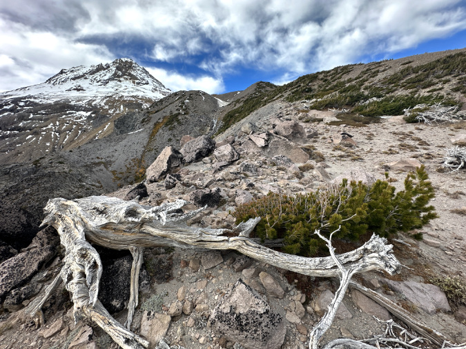
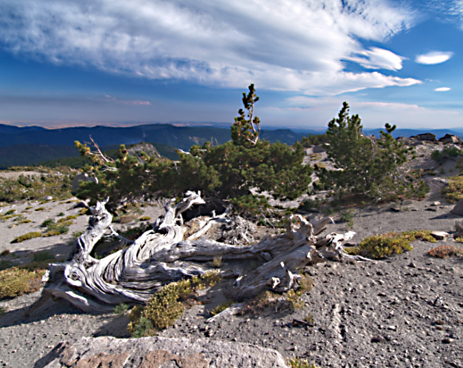
Ancient Whitebark pine just off the Timberline Trail on Gnarl Ridge

I’ll close with a photo of one of my favorite Whitebark pine ancients (above). It has likely been growing in this sandy flat near the crest of Gnarl Ridge for at least a couple centuries. And it therefore likely witnessed multiple eruptions of smoke and ash from Mount Hood in the late 1700s as a young tree, the last major eruptive period on the mountain.

This old survivor was just getting established here when Lewis and Clark opened the floodgates to white settlement, and thus far it has survived our arrival in the intervening 200 years. Because of its remote home on the mountain, it also survived the Gnarl Fire in 2008, and very likely other wildfires on Mount Hood’s east slope over the centuries. So far, it has also survived the bug and disease infestations attacking our Whitebark pine forests.

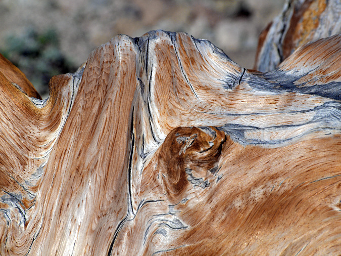
Constant sculpting of this ancient Whitebark pine on Gnarl Ridge from blowing sand and ice crystals prevents the it from oxidizing to grey before it is sanded away, continually revealing the underlying color of the wood

This old tree is also about 200 feet from a group of tent sites along the Timberline Trail. What it may not escape is some camper snapping off its ancient, gnarled limbs for firewood — or worse, a spot wildfire caused by an unattended campfire left burning here for lack of a nearby water source on this windy, exposed alpine ridge.

For me, helping these threatened survivors live another century so that future generations might see and be inspired by them is perhaps the reason of all for finally putting an end to our wilderness campfires.

_____________ 

Tom Kloster • August 2025

_____________

Postscript: I’ve noted this in recent articles, but it bears repeating: this piece is written at a time when the Forest Service, National Park Service and Bureau of Land Management are under siege from a hostile administration in an unprecedented, orchestrated and blatantly corrupt attack on our public lands. My intent is certainly not to pile on at a time when our public workers at these agencies need our support and respect. 

However, I also accept the unfortunate reality that it will take many years to restore these organizations. In the meantime, we will need new approaches to protecting our public lands until we eventually rebuild the agencies charged with their management.  This article is written in that spirit and in deep support for our public lands agencies.

Proposal: Cooper Springs Trail

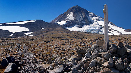
Cairns with cedar posts mark the way on the slopes below Cooper Spur.

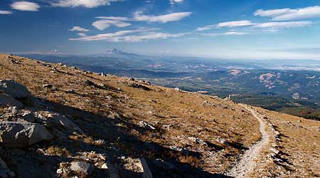
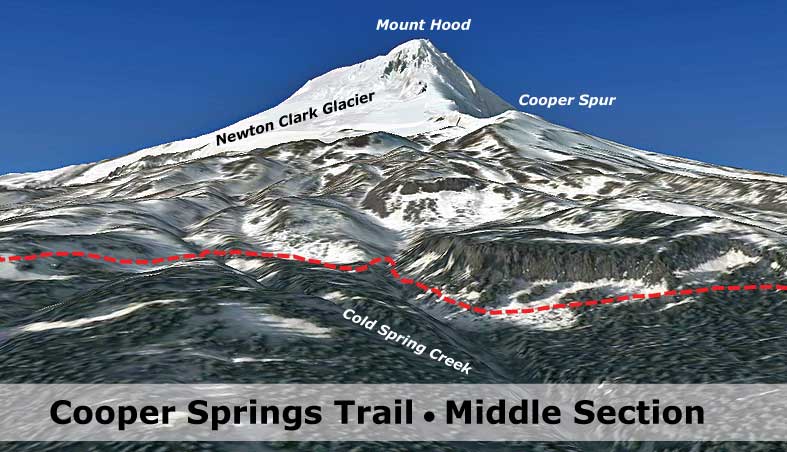
One of the memorable highlights along the Timberline Trail is the starkly beautiful section between Gnarl Ridge and Cloud Cap, high on the broad east shoulder of the mountain. Here, the trail crests its highest point, at 7,335 feet, as it traverses the tundra slopes of Cooper Spur more than a thousand feet above the tree line.

However, the spectacular elevation of the Cooper Spur section is also its Achilles heel, since hikers attempting the Timberline Trail must cross a series of steep snowfields here. In most years this entire section is snowed in through late July, and some sections of trail appear to be permanently snow-covered.

Looking north along the Timberline Trail along the slopes of Cooper Spur

The trail builders constructed a series of huge cairns to mark the way through this rugged landscape, yet the snowfield crossings continue to present both a risk and route-finding obstacle to most hikers, especially in early summer. The Timberline Trail continues to draw hikers from around the world in ever-growing numbers, so an alternative route seems in order to ensure that the around-the-mountain experience continues to be world class for all visitors.

The Proposal

To provide a more reliable alternative for this segment, a new, parallel trail is proposed as part of the Mount Hood National Park Campaign. The new route would be about a mile to the east, at roughly the 6,200’ level, just below the tree line. For early season hikers, or simply those not up to the rugged combination of elevation, rock and snow on the existing trail, this new route would provide a more manageable alternative.

This new 3.5-mile route would still connect Cloud Cap to Lamberson Butte, but at a lower elevation. As shown on the map below, the proposed Cooper Springs Trail (in red) would depart from the current Timberline Trail (in green) at the current Cooper Spur junction on the north, and rejoin the Timberline Trail just below Lamberson Butte, to the south.

Click here for a large map

This option would add about a half-mile to the around-the-mountain trip, but would also save about 800’ of elevation gain, as measured in the traditional clockwise direction on the Timberline Trail. In fact, the new Cooper Springs Trail would actually drop 200’ in elevation from Cooper Spur Junction to Lamberson Spur.

This new trail wouldn’t be a formal segment of the Timberline Trail, but simply a hiking option, just as other parallel routes to the Timberline Trail already allow at Umbrella Falls, Paradise Park, Muddy Fork and Eden Park.

Today, these complementary routes along other sections of the Timberline Trail not only allow for interesting loops and less crowded conditions for hikers, they also provide detour options when trail closures occur — as happened recently along the Muddy Fork, where hikers were able to use a parallel route to avoid washouts on the main trail.

What Hikers Would See

The northern segment of the new Cooper Springs Trail would make a gradual descent from the existing 4-way junction of the Cooper Spur, Tilly Jane and Timberline trails to the tree line, curving through a series of small headwater canyons that eventually feed into Polallie Canyon. This section would cross the first of several small streams along the new route.

The northern section of the new trail from above the Timberline Trail, as viewed from the slopes of Cooper Spur.

Click here for a large map

Soon the new route would cross a sharp ridge, where under this proposal it would intersect with an extension of the Lamberson Spur Trail. This trail is an odd anomaly: the route is marked and maintained where it leaves the Cold Spring Creek Trail, but mysteriously dies out on a ridge about a mile below the tree line. A few adventurous hikers continue cross-country from this abrupt terminus to the Timberline Trail each year, but under this proposal, the Lamberson Spur Trail would be formally connected to the new Cooper Springs Trail. This new segment is shown in yellow on photo schematic, above.

Extending the Lamberson Spur route to the new Cooper Springs Trail would entail about a mile of new trail, but would be an important piece in linking the new Cooper Springs route to the existing network of trails along Cold Spring Creek and Bluegrass Ridge, to the east. Together, this network of trails could provide an important, less crowded overnight or backpacking experience than is possible on the more heavily visited sides of the mountain.

Beyond the proposed Lamberson Spur junction, the middle section of the new Cooper Springs Trail would pass through an especially interesting landscape. Here, a series of dramatic cliff-edged bluffs and talus slopes frame the view of Mount Hood and Cooper Spur, looming above, while the trail would cross through groves of ancient mountain hemlock.

The middle section of the new trail would traverse a series of little known canyons and cliff-topped bluffs below Cooper Spur.

Click here for a large map

This section of the new trail would also provide a close-up look at the aftermath of the Gnarl Fire, which burned a large swath of forest along the eastern base of the mountain in the summer of 2008.

At one point, the fire made headlines when it threatened to destroy historic structures in the area, narrowly missing the venerable Cloud Cap Inn. Though the trail would traverse above the burn, it would allow hikers to watch the recovery phase of the fire cycle unfold on the slopes, below.

Finally, in the southern section the proposed Cooper Springs Trail would traverse through dozens of rolling lupine meadows, gnarled stands of whitebark pine and mountain hemlock and unique views of the massive east face of Mount Hood and the surrounding wilderness.

The southern section of the new trail would weave through a series of little-known alpine meadows, near Lamberson Butte.

Click here for a large map

In this section, the proposed trail would traverse the slopes of Cooper Spur at the point where a series of tributaries to Cold Spring Creek emerge and flow eastward through a maze of steep canyons. The springs are continuously fed by several permanent ice fields on Cooper Spur, and thus would be a reliable water source for hikers — and are also the namesake for the proposed trail.

The new route would then rejoin the Timberline Trail just below Lamberson Butte.

What it Would Take

The proposed Cooper Springs Trail (and Lamberson Spur extension) would be entirely within the Mount Hood Wilderness, and thus must be built without the add of motorized equipment.

Normally, this presents a major obstacle to trail construction, since a typical trail requires the removal of trees and vegetation down to mineral soil — a formidable task in the rainforests of the western Cascades, even with the aid of chainsaws and power tools. However, the slopes of Cooper Spur consist mostly of soft, sandy soils, loose rock, scattered trees and open meadows, so construction of the 3.5 mile trail would be much less cumbersome with hand tools here than in other parts of the forest.

One of the Northwest Youth Corps crews that worked the Timberline Trail in 2009.

There are a number of organizations that might be interested in helping build the trail, but perhaps the most promising would be the Northwest Youth Corps, an organization that has sent crews of young people to restore wilderness trails around Mount Hood for many years.

Finally, it would take a renewed commitment from the Forest Service to expand the trail network around the mountain, and this is the largest obstacle. The agency has been doing just the opposite for many years, allowing trails to fade into oblivion for lack of basic maintenance.

But this is also where you can help: the Forest Service has the funding to provide more trails, yet needs strong public support to make trails a priority in agency budgets. Buying a forest pass simply isn’t enough, unfortunately.

Make your opinion known, and don’t accept the “lack of funding” explanation. Instead, take a look at this comparison of funding for Mount Hood and a couple of well-known national parks, and simply ask that YOUR forest to be managed with trail recreation at the top of the priority list.

How can you contact them? Just click here to send them an e-mail!