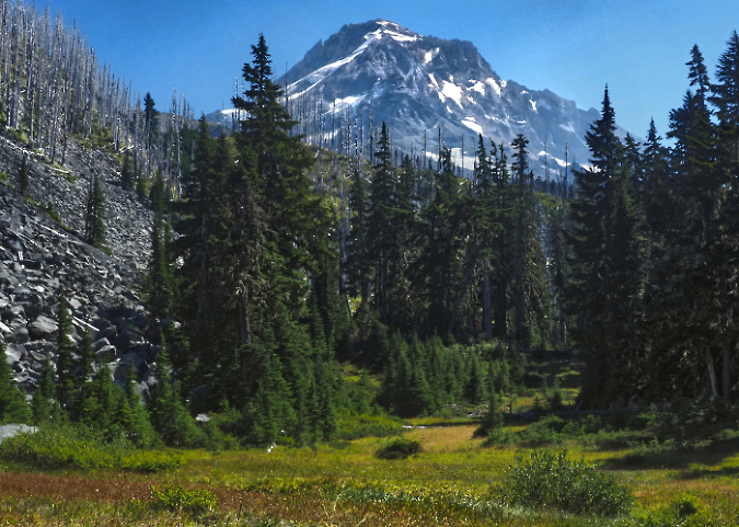
Mount Hood from Lower Vista Meadow in late August of this year
It seems impossible that time can passed this quickly, but August marked 18 years since two trail friends joined me for a memorable off-trail trip into one of the least-known areas in the Mount Hood Wilderness. It’s a place I call “Boundary Point”. What began as sunny, hot summer day soon turned into a brooding, blustery thunderstorm, making Boundary Point seem all the more remote and wild. That 2008 visit was my only time there, but it has lived in the back of my mind as a place that really ought to have a trail.
More recently, I’ve made similar off-trail trips to another lesser-known, equally stunning spot within the wilderness that is not far from Boundary Point. I call this place “Vista Meadows”, and this article describes a trail concept that would connect both places in a much-needed expansion of our very busy trail system on the mountain.
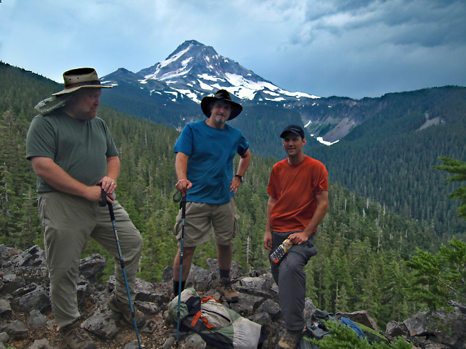
The (much younger author) at Boundary Point in 2008 with longtime trail friends Jeff (center) and Jamie (right). Just three years later the Dollar Fire would sweep across this area in its final flare-up, burning across roughly half the forests visible in this view, including Boundary Point
The spot I call Boundary Point is exactly that: a rugged clifftop viewpoint located just inside the wilderness boundary, and therefore just beyond reach of the notorious Boundary Clearcut described in a pair of 2008 blog articles. If the view from Boundary Point seems familiar, that’s because it’s the same iconic perspective of the mountain as viewed from Lost Lake – except much closer.
The view from Boundary Point is truly impressive. Mount Hood towers above, of course, but the view also features a look at jagged Cathedral Ridge rising steeply across Ladd Creek canyon, eventually reaching to the summit of the mountain. The Coe, Ladd, Glisan and Sandy glaciers can also be seen from here, along with a rare glimpse into the very rugged and rarely seen Glisan Creek canyon.
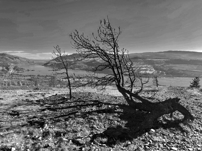
In 2011 the Dollar Lake Fire burned through the upper part of Ladd Creek canyon in its final days, including a good portion of both Vista Ridge and Cathedral Ridge that, together, frame the canyon. Today, the bleached skeletons of ghost trees killed in the fire rise above the slowly recovering forest, gradually regenerating fifteen years after the fire. Forests recover slowly in this unforgiving subalpine environment, whether from wildfires or logging.
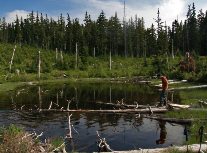
Middle Boundary Lake in 2008 (with Jamie), then still barely recovering decades after the massive 1980s clearcut that destroyed a centuries-old subalpine forest along a 2-mile stretch of the Mount Hood Wilderness. The intact forest in the background marks the edge of the clearcut and the wilderness boundary. This protected forest also survived the 2011 wildfire
Lakes are somewhat scarce in the Mount Hood Wilderness. The mountain rises in a narrow spot in the Cascades. Thus, the terrain around the mountain is dominated by steep canyons that drain quickly to the big rivers that flow nearby, so there are few high lake basins like those found around other big Cascade volcanoes. Tiny lakes like Dollar Lake and Perry Lake were therefore given full-blown “lake” status when they were named by early forest rangers, though they would likely go unnoticed elsewhere in the Cascades.
That’s why the group of four small lakes on the northwest shoulder of Boundary Point is notable. Three of these remain as picturesque, untouched lakes, still tucked in among towering, ancient Mountain hemlock and Noble fir stands. The fourth, middle lake was cruelly cut over as part of the Boundary Clearcut – an environmental crime if it were allowed to happen today. But it was business as usual in the 1980s when our forests were sold off in a frenzy to the highest bidders. It was an era when timber sales were auctioned for clearcutting in giant squares or rectangles that had little relationship to the actual land or ecosystem, but were efficient to log and simple to describe in timber sale contracts.
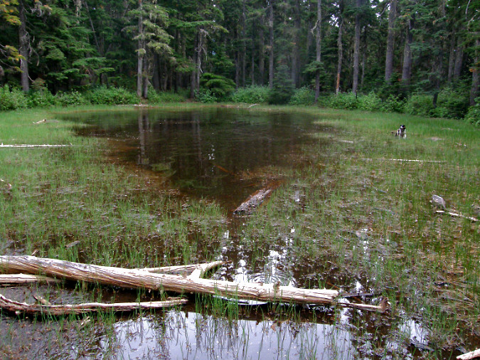
Upper Boundary Lake was spared from the chainsaws because it falls just inside the Mount Hood Wilderness boundary. This shallow tarn remains a peaceful, sylvan place today, as the subalpine forests surrounding the lake were spared from the 2011 Dollar Lake Fire
All four lakes are glacial features, created during the last ice age when the Ladd Glacier filled today’s canyon to the rim and extended nearly ten miles down what is today the West Fork Hood River valley. Along with Boundary Point and Vista Meadows, this group of lakes are among the very scenic features that would be connected for hikers to enjoy along this proposed trail.
Further upstream, Ladd Creek canyon hides the main surprise: Vista Meadows, the scenic gem the proposed trail would be named for. Vista Meadows consists of a string of alpine meadows hidden in plain sight, just across Ladd Creek from iconic Eden Park. Because Ladd Creek is an often-volatile glacial outflow, it has gouged a deep, boulder-filled channel separating Eden Park from Vista Meadows over the millennia. This physical barrier likely explains why Vista Meadows has gone so unnoticed.
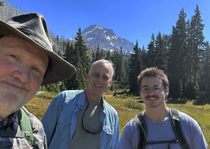
The (now much older!) author at Vista Meadows in August this year with off-trail companions Ted and Logan
At one time, when the once-mighty Ladd Glacier had just retreated from this spot, it left behind a broad, gentle valley floor, with Ladd Creek meandering through newly formed meadows. But like the other glacial streams on the mountain, the creek has since carved a deep channel through that old glacial valley, leaving Vista Meadows and Eden Park perched on either side of today’s canyon as remnants of an ancient valley scene that once was.
Where would the new trail start?
The new Vista Meadows trail would begin at the today’s Mazama Trailhead, located just off the Lolo Pass Road on the northwest side of the mountain. Like most of Mount Hood’s access points, it was never built to handle the demand that today’s summer weekends bring. In fact, this was never designed to be a trailhead, at all. Instead, it was constructed as a landing yard for logs pulled in from clearcuts extending in all directions during the heyday of logging, from the 1950s through the early 1990s.
As recently as the 1950s, the road to the current Mazama trailhead didn’t even exist – nor did Lolo Pass Road! Instead, a trail network connected dozens of long-gone Forest Service guard stations and lookouts located around the mountain. Today’s Mazama Trail is just the surviving stub of one of these original trails, and once connected Mount Hood to Lost Lake. Most of that historic trail network was lost to roads and clearcuts during the logging era, with trailheads incrementally moved up the mountain as the logging operations expanded.
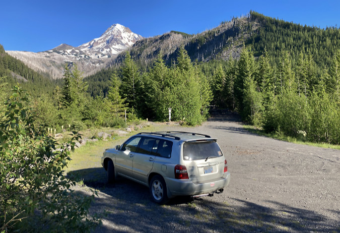
The Mazama Trailhead provides a preview of most of the route for the proposed Vista Meadows Trail, along the ridge to the left of the mountain in this view. The Mazama Trail follows Cathedral Ridge, the main ridge to the right of the mountain. The two trails would connect via the Timberline Trail, forming a long loop from this trailhead
While it’s jarring today to think the Forest Service was logging so high on the mountain, the logging roads and clearcuts continued still further up the slopes from today’s Mazama trailhead. In the photo above, the entire slope on the right is just one of the many recovering clearcuts that fanned out from this spot. Many of the logging spurs in this area have since been closed, but the yarding area here and its access road were repurposed to become today’s trailhead.
For many years the Mazamas mountaineering organization has maintained this trail, and thus the renaming from the “Cathedral Ridge Trail” to the “Mazama Trail.” This trail is just one of the many spokes connecting to the Timberline Trail, with this route connecting just west of Cairn Basin. The proposed Vista Meadows trail would add another spoke to the wheel.
A virtual trip along the proposed route…
The maps below give more detail on how this concept would work, and how the new trail would complement existing trails and trailheads in this corner of the Mount Hood Wilderness. The first map is a birds-eye view to place the trail in context to the mountain. The second map is a topographic version that includes the surrounding network of trails the new route is intended to enhance.
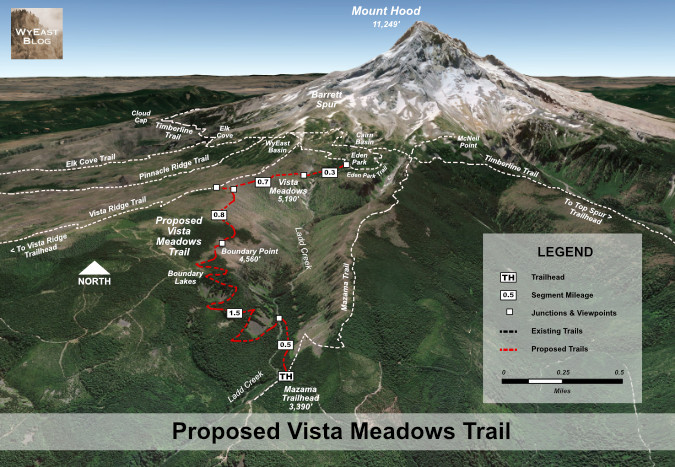
A birds-eye view of the proposed Vista Meadows Trail connecting the Mazama Trailhead to the Vista Ridge and Eden Park trails, creating both a new trail experience and loop hike opportunities from these adjoining trails and trailheads
[Click here for a large version of this map in a new tab or window]
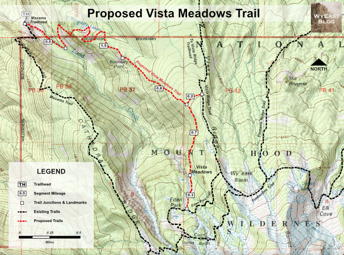
Topographic view of the proposed Vista Meadows Trail showing the surrounding trail network it would connect to and enhance
[Click here for a large version of this map in a new tab or window]
Beginning at the Mazama Trailhead, the new Vista Meadows Trail would traverse below the Mazama Trail into Ladd Canyon, arriving at a crossing of Ladd Creek about a half mile from the trailhead. This would be a permanent footbridge to ensure safe crossings and to make the trail accessible to less experienced or able-bodied visitors. Would a bridge last here? While Ladd Creek can be unruly, it’s not as volatile as some of its glacial siblings, as evidenced by the Lolo Pass Road bridge a couple miles downstream. That modest structure was built just a few feet above the stream and has survived many high-water events over the years.
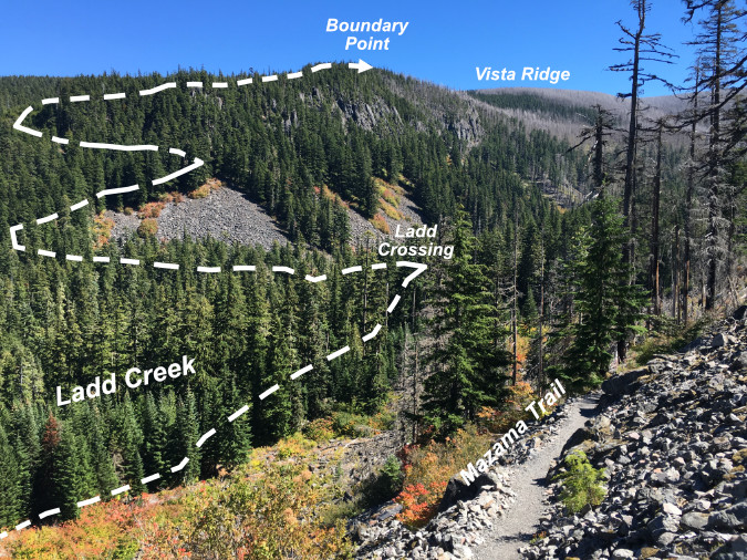
Route of the lower half of the proposed Vista Meadows Trail to Boundary Point, as viewed from the Mazama Trail
From the new footbridge over Ladd Creek, the proposed trail would climb the north wall of the canyon in a series of long switchbacks, passing broad talus slopes with mountain views before reaching the Lower Boundary Lakes. From the lower lakes, the trail would then traverse a steep cirque wall that protected these lakes from logging, then arrive at Middle Boundary Lake – ravaged by logging, and still recovering from the huge clearcut that engulfed it some 40 years ago.
Beyond the middle lake, the new trail would leave the recovering clearcut and re-enter deep forests of the Mount Hood Wilderness, soon arriving at serene Upper Boundary Lake. From here, the final stretch to Boundary Point would begin a traverse above wide talus slopes (below) with fine views of the mountain and into Ladd Creek canyon, now far below. The trail would leave dense forest here and enters part of the Dollar Lake burn that encompassed Boundary Point.
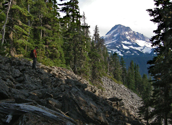
Jamie ascending the final pitch on our 2008 trip to Boundary Point, where Mount Hood comes into view across steep talus slopes. Much of the forest shown here burned in the 2011 Dollar Lake Fire and has since begun a slow recovery
Beyond the talus slopes, the new trail would soon reach the cliff-top views of Boundary Point, described previously. At two miles from the trailhead, Boundary Point would mark the mid-point of the new trail. The impressive views and many picnic-friendly boulders and rock outcrops from which to enjoy the scenery would likely make this the main destination for many hikers.
With a round-trip of 4 miles to Boundary Point and elevation gain of just under 1,200 feet, this segment of the proposed trail would also fill an important need to provide more medium-length hikes on the mountain for casual hikers. Hiking to Boundary Point on the proposed trail would be comparable in length and difficulty to the popular Angel’s Rest hike in the Gorge, for example.
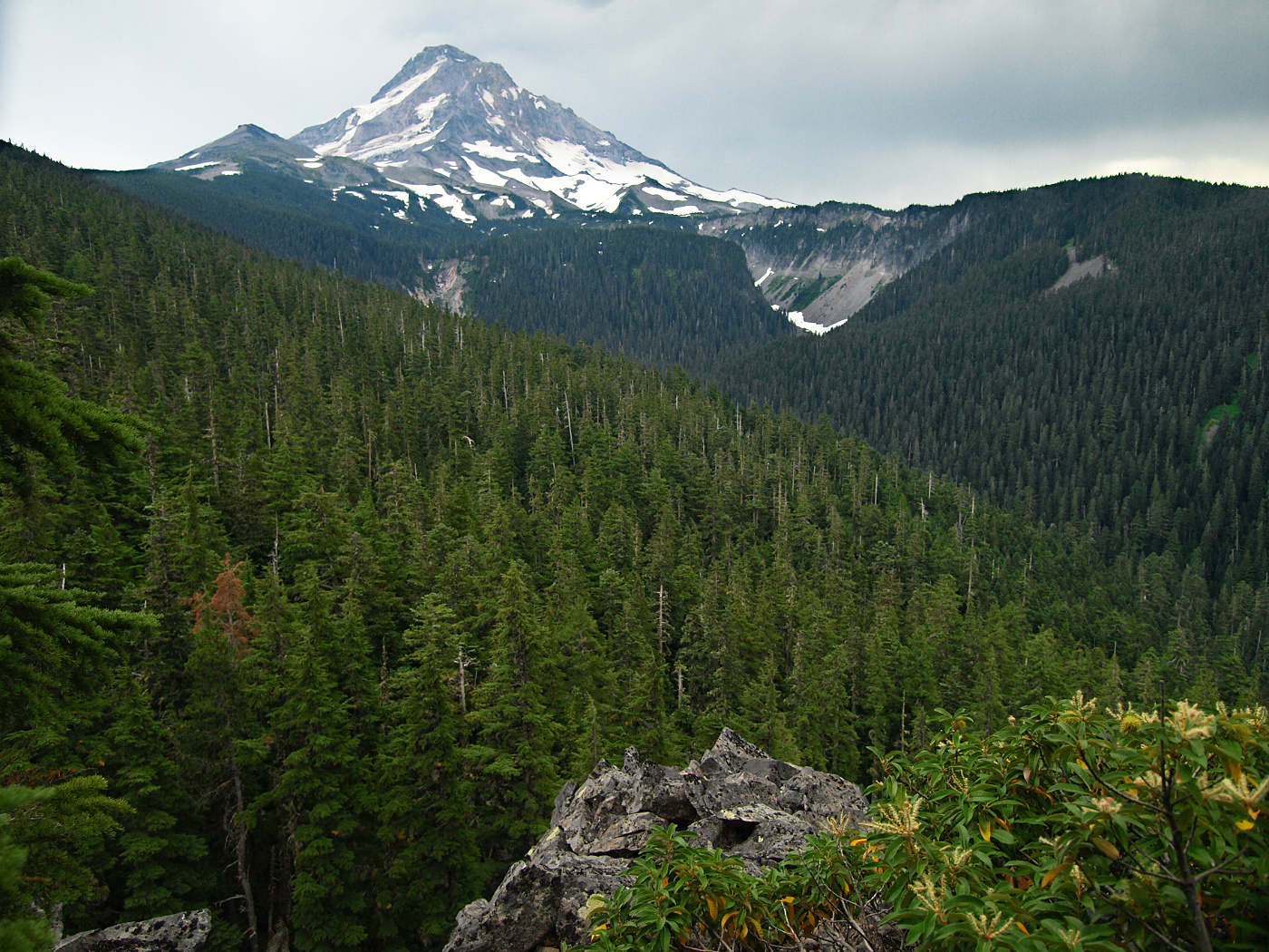
2008 view of Mount Hood rising above Ladd Canyon. Though Boundary Point itself burned in the 2011 fire, much of the forested slope seen in the foreground survived
Though Boundary Point burned in the 2011 fire, a large section of forest just beyond survived (shown in the foreground of the 2008 image, above). From Boundary Point, the trail would first travel through this intact forest of Mountain hemlock and Noble fir as it gradually ascends Vista Ridge, before re-entering another burn area near the ridge crest.
At the 2.8-mile mark, the new route would connect to a proposed quarter-mile tie to the Vista Ridge Trail. This connector would allow for a number of possible loops for hikers approaching from both the Mazama and Vista Ridge trailheads. Loop hikes are the holy grail for many hikers, as they offer maximum scenery and variety. Yet, they also serve a very practical purpose by simply spreading people out. This is a growing need on our very busy mountain.
From its high point at the proposed Vista Ridge connector, the new trail would next begin a gradual 0.7-mile descent to Vista Meadows. This part of the route also burned in the 2011 fire, and is now a striking ghost forest with non-stop views of the mountain looming along the descent.
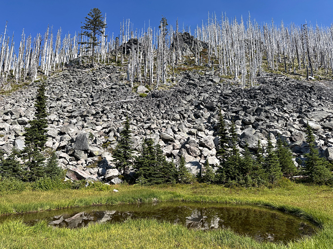
Ghost forests, talus slopes and rocky outcrops newly revealed on Vista Ridge by the 2011 fire, as viewed from Lower Vista Meadow
The new trail would soon arrive at Lower Vista Meadow, where it would re-enter surviving forests of ancient Mountain hemlock for the rest of the route. The lower meadow is especially idyllic, with views of the mountain, an impressive talus wall to the east and small alpine tarns sprinkled across the meadow. Year-round streams meander through the meadow, making backcountry campsites within the adjacent forest a possible addition to this trail concept.
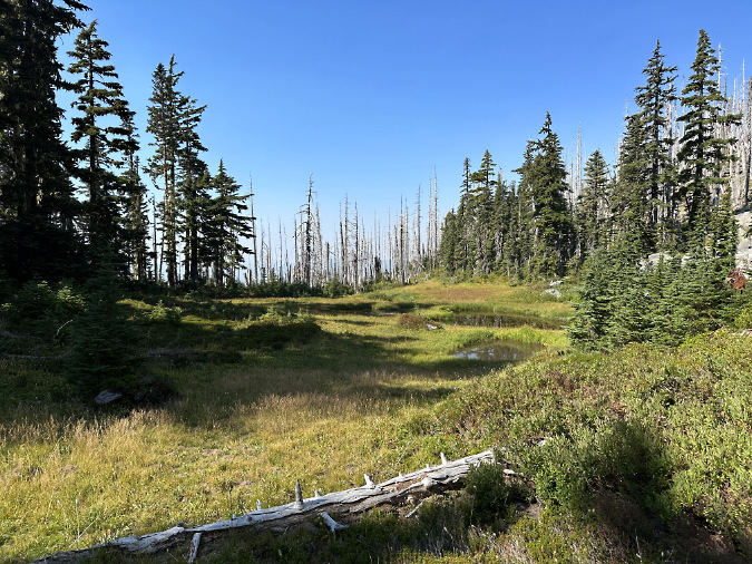
Lower Vista Meadow is dotted with several alpine tarns alive with tadpoles and frogs in summer
The proposed trail would next travel along the forested edge of Lower Vista Meadow, with Ladd Creek rushing loudly in the canyon below, just to the west. Soon, views into the middle and upper Vista Meadows would unfold along this exceptionally scenic, final 0.3-miles of the proposed trail before reaching its junction with the Eden Park Trail.
The total length of the new trail would be just short of 4 miles from the Mazama Trailhead. The elevation gain would be about 1,800 feet, similar to other trail “spokes” that connect to the hub formed by the Timberline Trail.
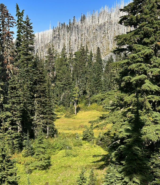
Middle Vista Meadow is tucked among towering, old-growth Mountain hemlock with the ghost forests of Vista Ridge rising above
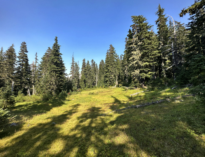
Upper Vista Meadow sprawls across a gentle slope, just below the Eden Park Trail
From the upper end of the proposed trail, hikers could make loops through Eden Park, Cairn Basin and WyEast Basin, before returning on the new trail – or Vista Meadows, itself, could be the destination. As a main destination, Eden Park offers has some of the finest campsites on the mountain for people looking to spend a night in the wilderness. More ambitious hikers could also head west from Cairn Basin toward McNeil Point, returning on the Mazama Trail, or turn in the opposite direction to make the steep ascent of Barrett Spur.
The following map provides a closer look at the trail network in the Eden Park vicinity, and how the proposed Vista Meadows Trail would connect to this system.
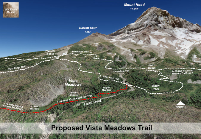
Detailed view of the proposed Vista Meadows Trail and nearby destinations of Eden Park, Cairn Basin, WyEast Basin and Barrett Spur
[Click here for a large version of this map in a new tab or window]
Building a better Mazama Trailhead?
With today’s Mazama Trailhead awkwardly located on a ridgetop better suited to yarding logs than parking cars, the following concept shows one way to improve the trailhead to meet demand for more parking and creating a safer trailhead design for backcountry emergencies.
The image below shows the existing trailhead in the summer of 2021, when the COVID pandemic had triggered a surge in trail use that continues today. It was not quite overflowing on that July weekend five years ago. Without an intentional design and some sort of parking management, unimproved trailheads like these have become a growing headache and safety hazard for both visitors and emergency responders when they do overflow with demand.
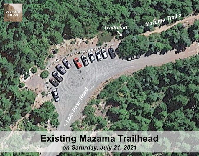
The Mazama Trailhead as it exists today – simply an old log yarding area that served clearcuts fanning in all directions in decades past
[Click here for a large version of this image in a new tab or window]
The reimagined trailhead (below) shows how a reconfigured, more organized design within the same footprint as the existing trailhead could create a safer, more efficient access point into the wilderness, while also adding a few parking spaces.
The one-way loop design in this concept mirrors a similar layout proposed in this article for a relocated the Vista Ridge Trailhead. One-way trailhead loops provide safety benefits for emergency vehicles by providing turnaround space and keeping travel lanes defined and less likely to be blocked by parked cars. They also create a more efficient design for visitors by ensuring that the first open space is also be the closest to the trailhead by design, thus discouraging circling for a space.
Unlike the Vista Ridge proposal, this design attempts to make the existing trailhead location work better, but with inherent constraints that limit adding much additional space for parking here.
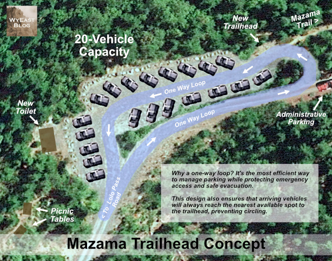
This re-imagined trailhead would add more parking spaces, an administrative space and turnaround for Forest Service or emergency responders, pit toilet and picnic tables
[Click here for a large version of this schematic in a new tab or window]
This conceptual design would accommodate up to 20 vehicles, roughly five more spaces than the current trailhead allows today. Importantly, the design would set aside administrative parking and logistics space for Forest Service workers or emergency responders in an area that is now used for visitor parking.
While this concept is simple and would exist within the bounds of the current trailhead, it would require the Forest Service to do some limited clearing, grading, gravel resurfacing and place a few boulders to better define the space. The proposed toilet and picnic tables would be new to the trailhead, but they are needed and overdue. These additions also represent the threshold for this to become a managed Northwest Forest Pass site, along with an ongoing maintenance responsibility under the forest pass system.
This work could likely be completed without a complex environmental analysis through a process called a “categorical exception” that is used to streamline improvements to existing sites where minimal environmental disruption is expected.
What would it take… and why bother?
Today, the Forest Service is reeling from staffing and budget cuts, whipsawed by a belligerent, often lawless administration bent logging, mining or simply selling off our public lands. Meanwhile, public input on these decisions (or even knowledge of them) has been aggressively curtailed, if it exists at all. So, why even bother thinking about new trails in this oppressive era?
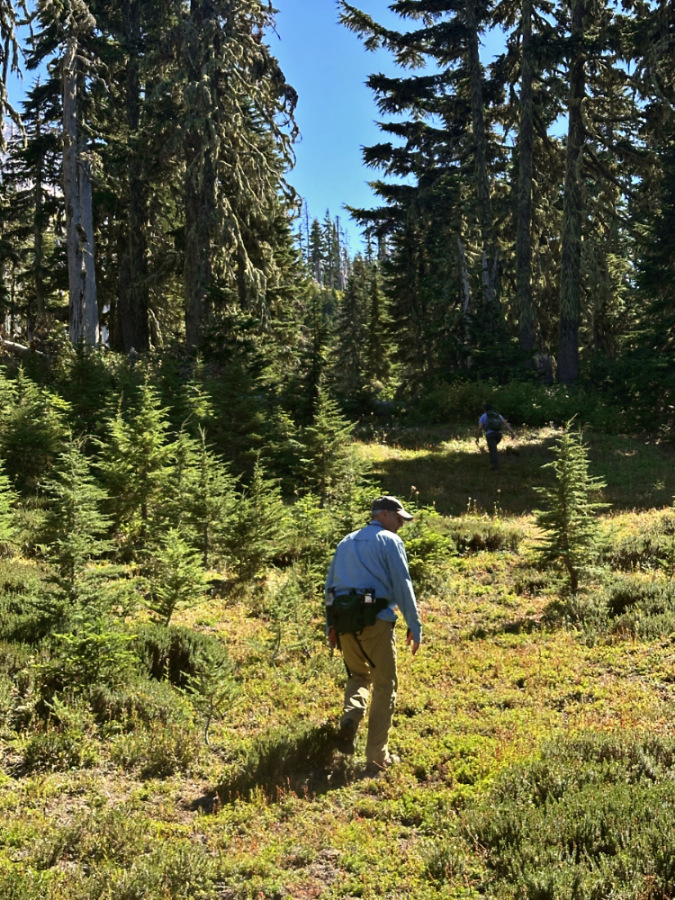
Exploring Vista Meadows with Ted and Logan in late August of this year
One reason is that public fatigue and discouragement are the very point with repressive regimes, especially when their agenda and actions are deeply unpopular with the public. That is overwhelmingly the case right now. Therefore, the importance of thinking – and dreaming – is essential to both challenging the regime and preparing to shape what will come next.
It’s a cycle as old as our democracy. The Civil Rights Movement of the 1950s and 60s lived by a credo that “during good times, plan for the bad, and during bad times, plan for the good.” That makes right now the perfect time to plan for the good – for our trails and the public lands they connect us to. There is enormous power here, as one of the most important takeaways from this grim era is how deeply Americans value our public lands. It’s an overwhelming majority that spans traditional party lines and ideologies, a rarity in these polarized times.
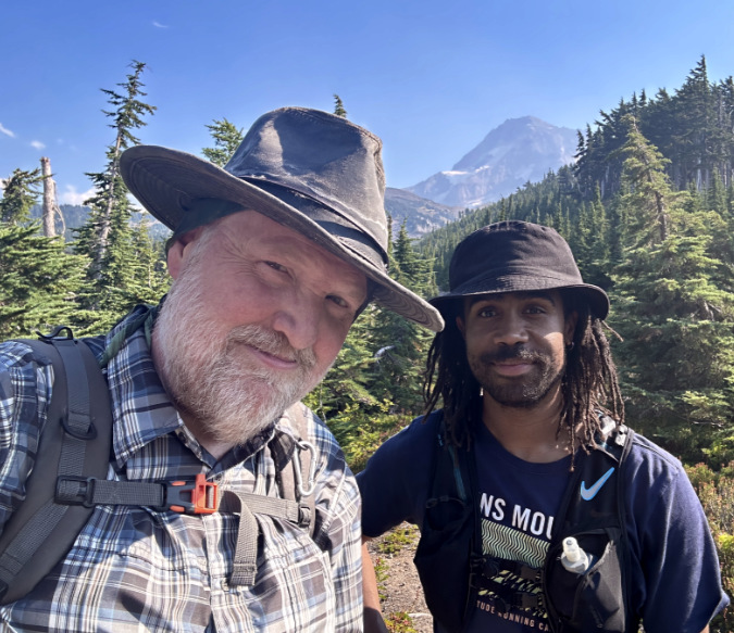
The author with off-trail companion André in July 2023 on our first exploration of Vista Meadows
The origin of our trail system is also worth remembering: nearly all of our trails were built between 1910 and 1940 by people using simple hand tools. In fact, the trail system we cherish today is significantly smallerthan what was originally built with saws, shovels, axes and picks during that brief period. Much of the original system was lost during the first big selloff of our public lands during the industrial logging era of the 1950s through early 90s.
So, today we are simply working to rebuild part of a system and vision that once was. It’s not a moon shot to imagine a new era of investment in our trails and our public lands. It’s just a matter of restoring widely popular priorities when the reset comes. And it is coming.
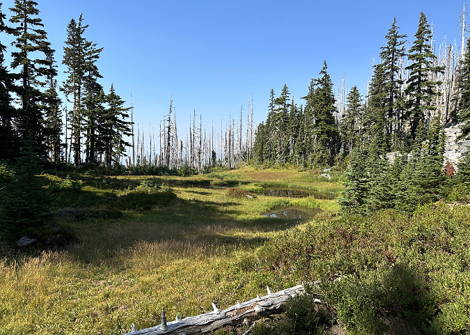
Lower Vista Meadow in July 2023
On a more pragmatic level, it’s also true that it will take some time to undo the harm that has been done to our federal agencies and public lands. To begin building trails again, we will need to ensure that we make the most of our existing system as we work our way out of the hole that has been dug.
Therein lies the challenge for continued creativity and determination, not despair. Those of us who show up and engage will be helping to draft the next chapter… and that usually begins with a little dreaming.
Thanks for stopping by – I hope to see you on a (new) trail sometime!
_____________
Tom Kloster | September 2026